Spiers Road, Davies, McGouns Creek Extension

Click Ben Rudd Article for background information.
Click Pineapple and Flagstaff walk for background information.
Antony Hamel in his Dunedin Tracks and Trails book has interesting information on the “Snowy Mountain Track” under his Spiers Road entry.

4. Eastern Flagstaff. Trampers. Grade 4.5. $5. 15km. Leaders Ross Davies and Gwenda Farquharson
(Redwoods bike tracks – Old Pineapple Track – No track – Davies Track – Flagstaff Walkway – Spiers Road Track – street walk)
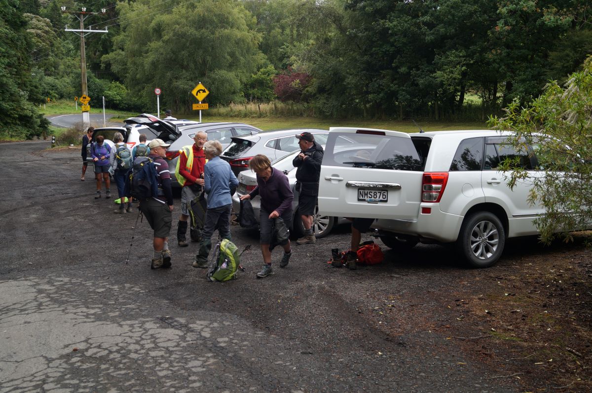
Keen to start the tramp - John
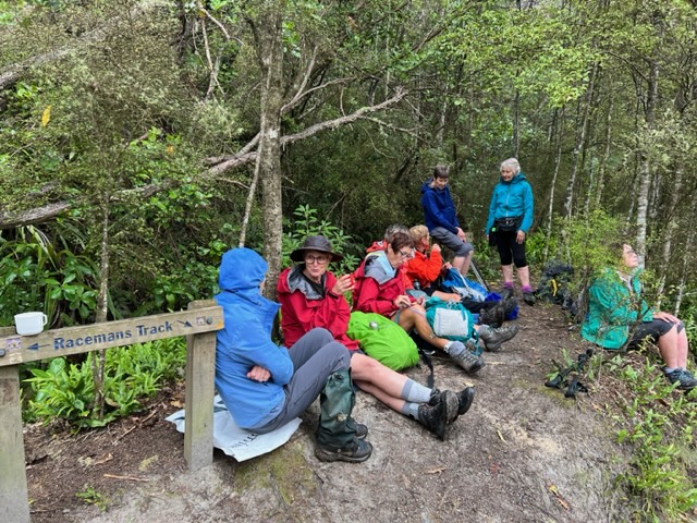
Keen to start the tramp (photo & caption John)

17 of us met up in Wakari Road at the carpark for the Redwoods bike tracks on a cloudy morning and headed off into the maze at 9.20am. It’s a lovely meander through the very tall trees. We emerged at the Booth Road end of the Pineapple track and took the track up to the water treatment plant.
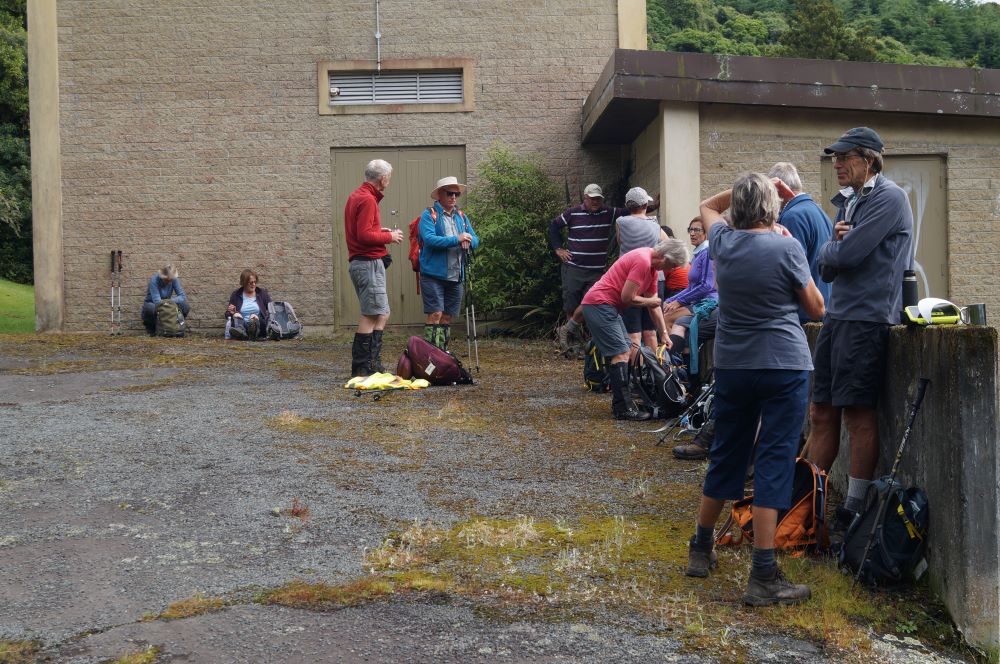
Morning Tea at the pumping station - John
Morning Tea at the pumping station (photo & caption John)

We had morning tea there a little after 10am on the uphill side before heading into the bush behind the plant. This was the entrance to the original Pineapple Track which was replaced by the current one in the late 1970s. Within a few minutes on a faint unmarked trail we crossed the McGouns Track  and kept on straight up. The track is reasonably obvious. It was a bit greasy in places but is a nice contrast with the new track.
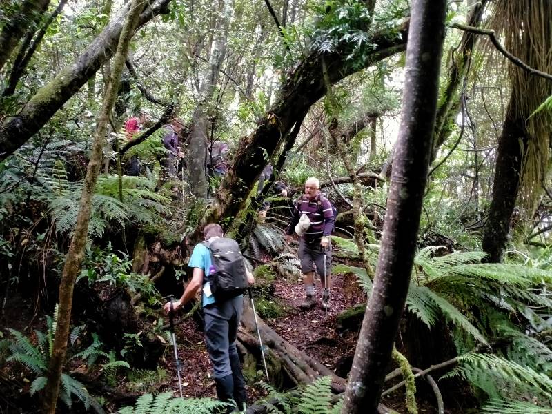
Mind your step - Phil
Mind your step (photo & caption Phil)

We emerged into the open area beside the new Pineapple Track but didn’t head over to Pineapple Point viewpoint as we’d been enveloped in cloud by then.

Regroup in the bush - John
Regroup in the bush (photo & caption John)

Instead we retreated a little way back down the way we’d come before heading south through the bush, contouring around to the middle part of the Davies Track. There’s a slight ground trail, and some markers, probably noting trapping lines. Plus lovely big Totara trees and impressive cabbage trees. Towards the Davies Track there are blue triangle markers for another trap line and this leads on to the Davies Track about halfway up. We had a look at the alligator swamp but they were all hiding.
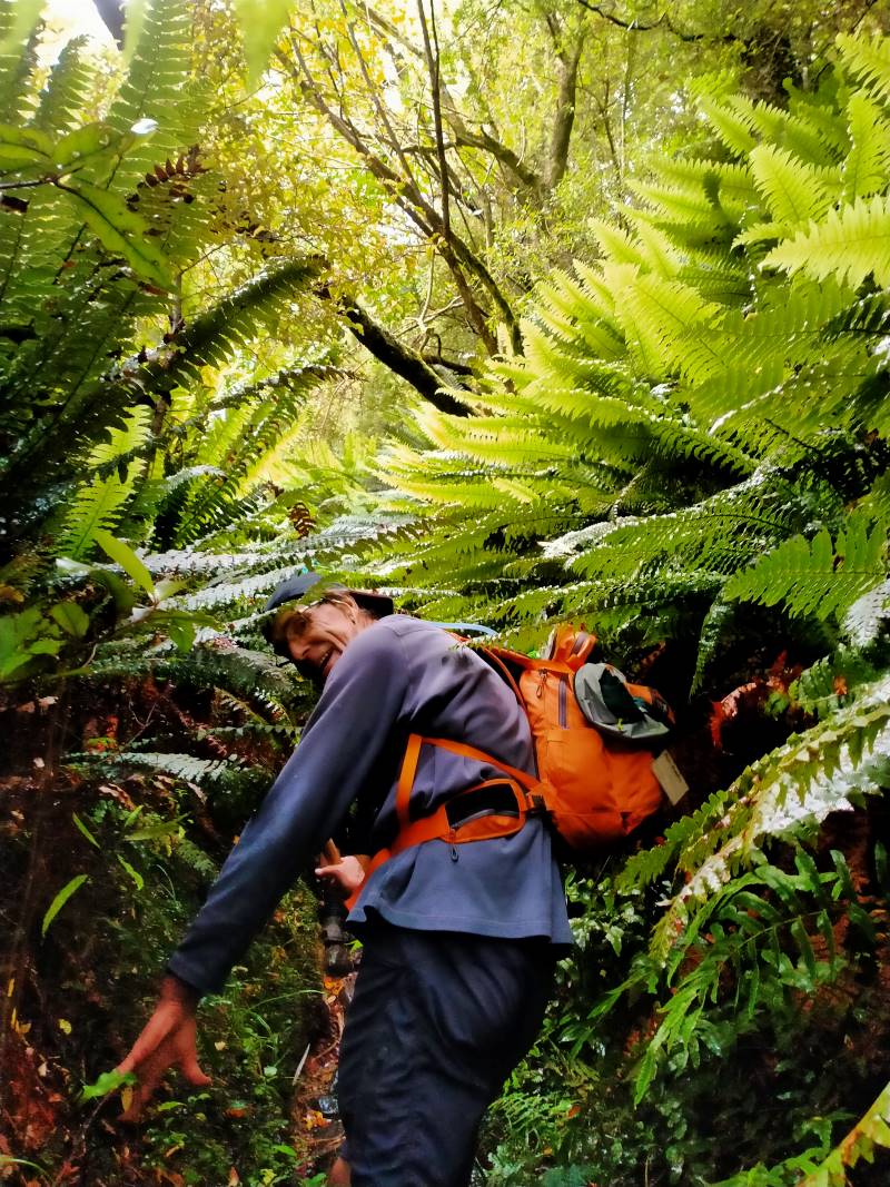
Feels like the jungle in Borneo - Phil
Feels like the jungle in Borneo (photo & caption Phil)

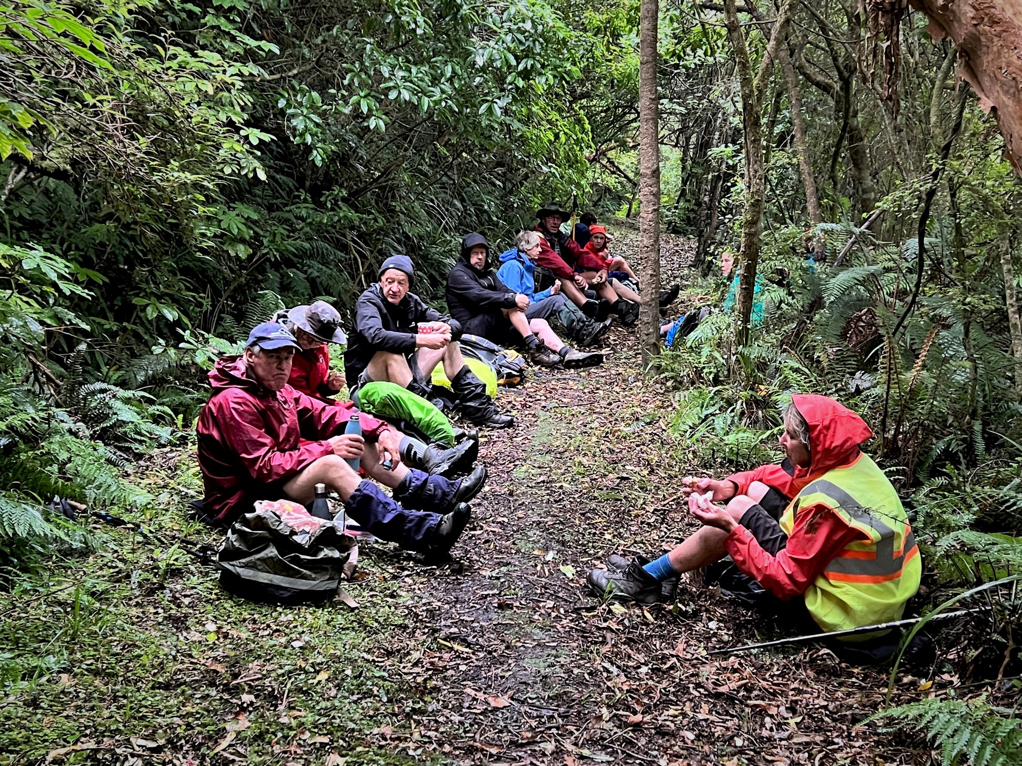
The upper part of the track was fairly muddy and slippery. Eventually we emerged from the bush, just below the cloud. After the fire a few years ago, the flax and gorse and grass are growing back, and it was saturated. With nowhere dry to stop, we carried on up to the Flagstaff Walkway and then a few more minutes towards the top where we found a sheltered dry spot beside the track for lunch, at about 12.45pm.
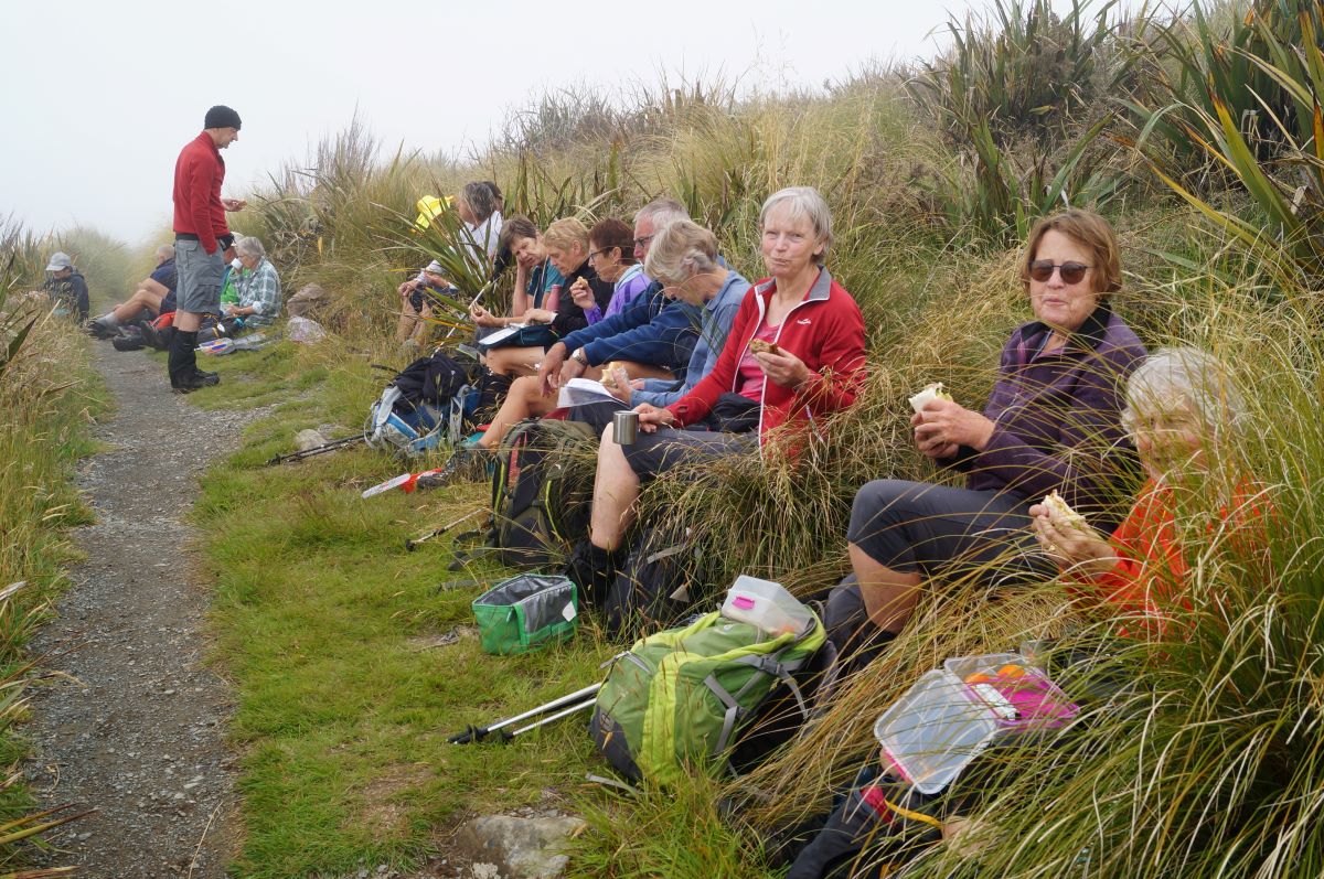
Lunch on a handy bank - John
Lunch on a handy bank (photo & caption John)

After lunch we zoomed across the summit, then down a little way towards the Bullring. You have to keep your eyes out for the Spiers Road track branching off to the left, over the ridge and then plunging down towards Halfway Bush.
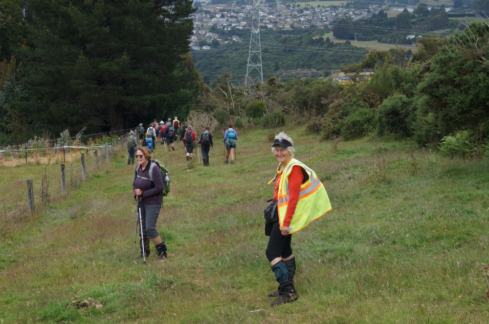
Within sight of civilization - John
Within sight of civilization (photo & caption John)

After the light rain of the night before the track needing a bit of care.
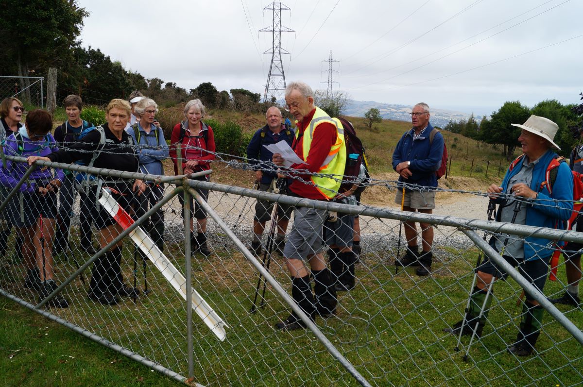
Ross explains the site of the original road out of Dunedin - John
Ross explains the site of the original road out of Dunedin (photo & caption John)

This was the route of the Snowy Mountain Road, the first overland route out of the new Dunedin to the north, over Flagstaff, over Swampy, over Hightop, and on north to Johnny Jones’ Cherry Farm at Waikouaiti via what is now the Mountain Road forestry road.
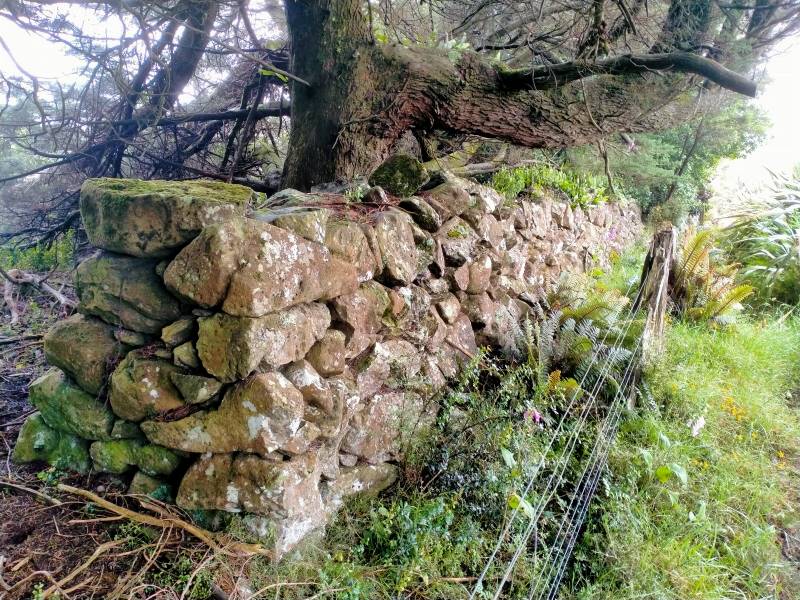
Ben Rudd's stonewall - Phil
Ben Rudd’s stonewal (photo & caption Phil)

Further down we passed Ben Rudd’s stone wall, and then the site of a plane crash in 1943 which everyone survived, including the plane! From the bottom of Spiers Road it was a 30-minute street walk back to the cars, checking out the houses and gardens along the way. Most repaired to Coffee Culture in the olde Roslyn fire station for the de-brief.

Thanks Gwenda for helping out, and to everyone for sharing in another happy adventure.

Ross

Tramp details: Distance – 13 kms; height gain – 730 m; moving time – 3.75-4 hrs; elapsed time – 6.25 hrs.
Discussion afterwards agreed 4 or 4.5 for grade and I’m comfortable with 4.5 because of the extra height gain and the proportion of rough track involved.

Continue reading “Spiers Road, Davies, McGouns Creek Extension”
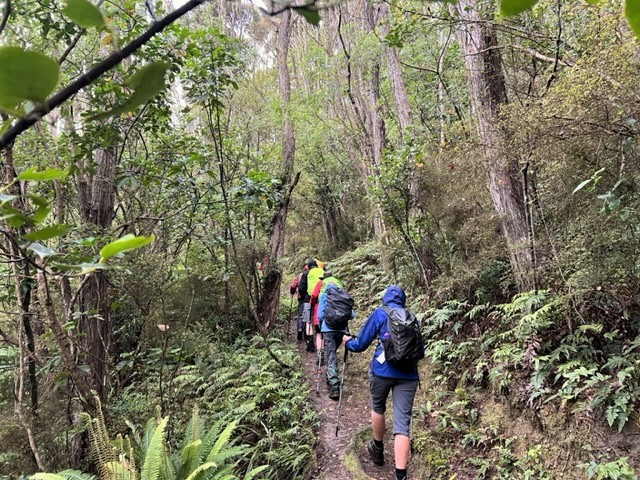
Silverstream Water-Race, Racemans, Top Weir

No. 40 on old hardcopy list of 113 club tramps. “Silverstream Weir. Racemans. Winefields. Year Round”
No. 107 on old hardcopy list of 113 club tramps. “Whare Flat – Silverstream Weir Year Round “

20. 11/01/2023. Racemans Circuit, Trampers. Grade 4 (regraded 3 – see below). Leaders: Neil Hodgkin, Julie MacKenzie.

Trampers: 10 women, 4 men
Weather: Low cloud, drizzly, calm, 16 degrees
Track: 14 kms, 3.5 hours walking and 170 m height gain.
A good, mainly flat walking surface, the odd muddy patch, and sometimes short, sharp, steep, descents/ascents in and out of side creeks.

IMG_4714 Pam Res 640
Striding out at the start of Raceman’s (photo and caption Pam)

Several crossings of the Silverstream and even though the flow was low, care was needed and poles were helpful with slippery and unstable rocks.
As a first up tramp for 2023 it was great and a very suitable tramp for the weather conditions. In the bush there was no precipitation and no wind. We had the usual stop for smoke-o …

IMG_4716 Pam Res 640
Morning tea at the junction with Tunnels track (photo and caption Pam)
IMG_4720 Pam Res 640
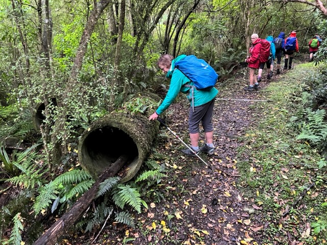
Abandoned water pipe on track (photo and caption Pam)
IMG_20230111_111601362~2 Ross Res 800
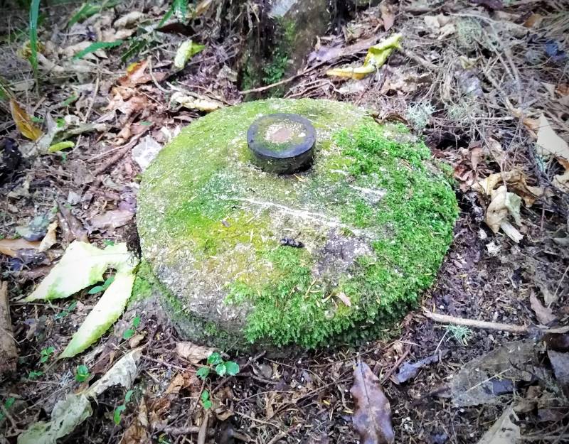
Strange objects in several places along the track. Much speculation about what they are/were. No conclusions. Any ideas? Feel free to use the Comments section at the bottom of the page. (photo and caption Ross)

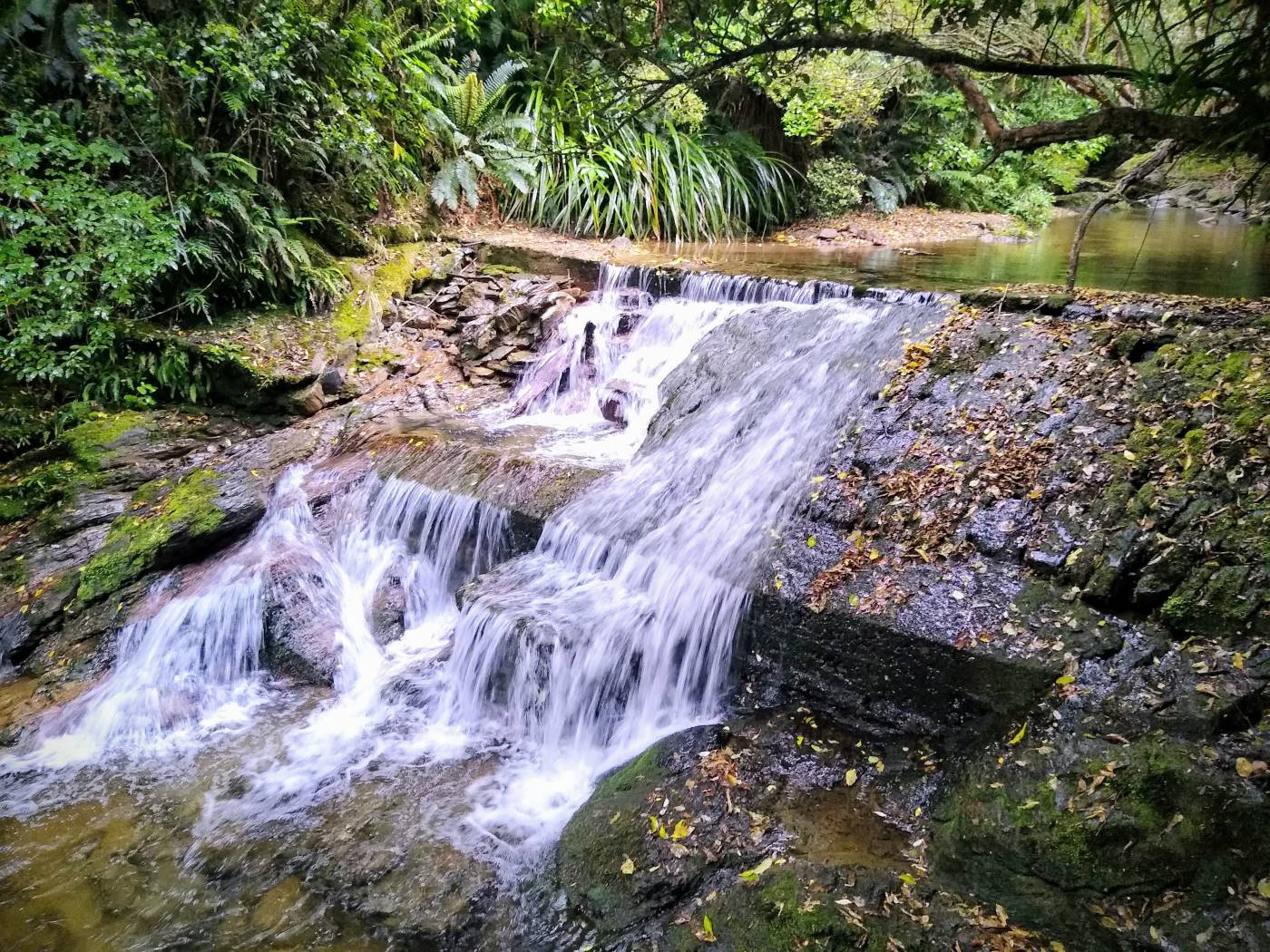
…and got to the weir about midday…

IMG_20230111_114053094~2 Ross Res 1400
Silverstream top weir (photo and caption Ross)

…but decided to move on down the track for lunch where it was less noisy.

IMG_4725 Pam Res 640
Lunch taken between intermittent light drizzle (photo and caption Pam)

On our return I as leader came face to face with six barking and not so friendly dogs who were eventually followed by a female runner who didn’t seem to worry. She said that the dogs were barking because we had sticks, but I didn’t believe her. What goes up must come down so we were expecting their return and when we heard them approaching we all stood off the track, sticks by our sides and gave them a TRTC guard of honour!

Grading: The grade of this tramp is solely dependent on the flow and depth of the Silverstream. The way it was on Wednesday, I’d put it at 2.5 – 3, but with more water it would certainly be a 3 -3.5 I think.

Neil.
Continue reading “Silverstream Water-Race, Racemans, Top Weir”

Whare Flat – Information and Trips Library

Scope:

This page of club tramps and hikes in the area of Whare Flat and groups together trips associated  with the Whare Flat Schoolhouse, and includes Tunnels, Racemans, Steve Aimes tracks.

Background Information: 

Road distances from Mosgiel carpark.

TRTC Grading Information – trips incorporating these tracks are generally given a TRTC grading of about 3. This is indicative only, as trips can be allocated a higher or lesser grading depending on the route taken. For more detailed analysis refer to Grading Information.

Whare Flat School (history)

How To Get There:

Upon leaving Peter Johnston Park, turn left onto Factory Road and follow this until it merges into Dukes Road North. Continue towards Three Mile Hill and  turn left onto Silverstream Valley Road. Continue on this road to the carpark just past Flagstaff Whare Flat Road.

Links to tramps and hikes to the same area:

26/06/2024. Whare Flat. Hikers. Grade 2.5. 11km. Leaders: Bruce Spittle,  Adrienne Ensor.

Tramps Associated with the Whare Flat Schoolhouse. (1995 – 2017, 4 trips, only 2 reports).
Waiora Scout Camp (2007 – 2020, 3 trips all with reports).
Whare Flat (2000 – 2008, 5 trips, no reports).
School House, Tunnels, McRaes, Steve Amies Whare Flat Road return. (2007, 1 trip with report).
Whare Flat: Chalkies – Hamilton (Invermay) Round trip. (1993 – 2001, 2 trips with no reports).

Government Track, Kowhai Spur, Mill Creek – Information and Trips Library

Scope:

This page of club tramps and hikes in the area West via SH87 (inland on the south side of SH87) groups together trips to  the Government Track, including Kowhai Spur and Mill Creek.

Background Information:

Road distances from Mosgiel carpark.
2.5+ hours from road to Pole-line and Styx Road.
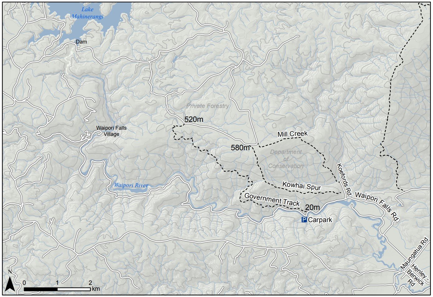
DCC – Government Track map – see image below.
DCC: Mountain biking on Government Track
[DCC brochure extract: Government Track. 4 hr 30 min, 17 km (return).

The track entrance is Government Track / Kowhai Spur 5 km down Waipori Falls Rd on the right; parking is 100 m further on the left.
Traversing the slopes of the beech-and mānuka-forested Waipori Valley south of Dunedin, the Government Track was built in the 1860s to provide access to the central goldfields. For mountain bikers there is an option of riding up and returning the same way. Alternatively, once at the top follow the pylon track left and steeply down into Waipori township, then follow the road back to the start.

TRTC Grading Information – trips incorporating these tracks are generally given a TRTC grading of  4. This is indicative only, as trips can be allocated a higher or lesser grading depending on the route taken. For more detailed analysis refer to Grading Information.

How To Get There:

Option 1 – drive to Outram from PJP and turn left onto Formby Street , then right onto Huntly Road. Continue on this road onto Maungatua Road and turn right onto Waipoai Falls Road and follow road to reserve carpark located in the gorge.

Option 2  – drive south on SH1 to the Berwick turnoff and follow Henley Berwick Road to Berwick, turn right then left onto Waipori Falls Road and follow road to the reserve carpark located in the gorge.

Links to tramps and hikes in the same area:

19/08/2026. Government Track to Pylons and Return. Grade 4. Trampers.  Leaders: John Barratt and Graeme Souter.
29/07/2027. Government Track. Grade 2.5. Hikers . Leaders: Katrina McKenzie and Julie MacKenzie
24/09/2025. Government Track Circuit. Grade 4.5. Trampers.  Leaders: John Gardiner and Carolyn Pridham
10/07/2024. Government Track, Kowhai Spur. Grade 4. Trampers. Leaders: Lyn Keene, Jenny Wilton.

Government Track and Beyond (1991 – 2023. 34 trips)
Post Office Creek – Government Track (1996 – no report – downhill all the way.)
Mill Creek Track and Kowhai Spur  (1993 – 2010, 13 trips – only 1 report).
Tramps Incorporating Three Kings (1989 – 2021, 26 trips including 4 to Mill Creek, Kowhai Spur, or both (no reports)).

DCC – Government Track map:
Gvt Track Kowhai Spur Map Dcc Screenshot 2024 07 08 221526


McNally’s Walkway, Milton – Information and Trips Library

Scope:

This page covers the Club tramps and hikes to the McNally’s Walkway located in Milton. (map)

Background Information:

Road distances from Mosgiel carpark.

The McNally Track was developed by the Milton Rotary in 1980 and is still maintained by them today. The track is clearly marked with marker poles  and is suitable for a Combined trip.

TRTC Grading Information – trips incorporating these tracks are generally given a TRTC grading of about 3. This is indicative only, as trips can be allocated a higher or lesser grading depending on the route taken. For more detailed analysis refer to Grading Information.

How To Get There:

(1) Milton township turn left opposite Presbyterian Church, turn left at Ossian Street and follow on down Moore and Tokoiti Streets to Cemetery near which is the entrance to the McNally Walkway. Park cars by the side of the road.
(2) Turn left off SH1 at the kink in the road onto Springfield Road. Follow Springfield Road to the sawmill and turn right onto Cemetery Road. Turn right onto Cemetery Road and continue to the Cemetery which is the entrance to the McNally walkway

Links to tramps and hikes in this area:

11/09/2024. McNally Walkway. Grade 3. Trampers. Leaders: Graeme Souter & Theresa White.

McNally Walkway. 2023 – 1992, 20 trips with 10 reports.

Millennium Track from Taieri Ferry Rd, Finlayson Rd, Galloway Rd, Bells Farm, Kennedys Farm, Wenita (Morrisons Block) – Information and Trips Library

Scope:

This page covers the Club tramps and hikes in the area South via SH1 and groups together trips to the Millennium Track  (Henley end) located on Lower Taieri River commencing on Taieri Ferry Road. (map)

Background Information:

Road distances from Mosgiel carpark.
Taieri River Geology for some background information.
Legends of the Lower Taieri includes a section about John Bull if you persist in reading down far enough.
High tides flood the access road and this has happened to us more than once. N.B. Programme Committee! Avoid high tides forecast near the the hours of 9.00 a.m. or 2.00-3.00 p.m.”

TRTC Grading Information – trips incorporating these tracks are generally given a TRTC grading of 3. This is indicative only, as trips can be allocated a higher or lesser grading depending on the route taken. For more detailed analysis refer to Grading Information.

How To Get There:

Drive south on SH1 to the Berwick turn off (approx half way along the flood free) and turn left to Henley. Take a right at the next intersection and continue over the Taieri River one lane bridge, then turn left onto the gravel road which will take you to the carparking at the start of the track.

Links to tramps and hikes in the same area:

24/06/2026. Taieri Ferry to John Bull Gully and return. Grade 2. Hikers. Leaders: Janette Abbot & Jill Thomas.
18/06/2025. Millennium Track return from Henley. Grade 3.5. Trampers. Leaders: Sarah McCormack and Heather Kirk
14/08/2024. Taieri Mouth Excursion. Grade 3. Hikers.  Leaders: Bill Cubitt & Alex Griffin.
24/07/2024.Millennium Track return, Henley StartGrade 4. Trampers.  Leaders: Gwenda Farqharson. &  Alison K.


Taieri Ferry and Finlayson Roads, Bells Farm, Kennedys, Millenium (1994 – 2023, 18 trips)
Millennium Track (2002 – 2017, 17 trips with 3 reports)
John Bull Gully Track and Millennium – from Henley and Taieri Mouth (1993 – 2016, 17 trips with 6 reports).

2018 Trampers – Millennium Track, Taieri Ferry Rd. to Taieri Mouth and return – “We walked 18.6 km’s.  Similar times of 2 1/4 hours each way. ”
Bell Farm.  (2002) Seek access permission. Lambing Aug to Oct. Cars park halfway down Taieri Ferry Road, end of forest. Up hill till lunch time. Wenita permit. Wenita Map.
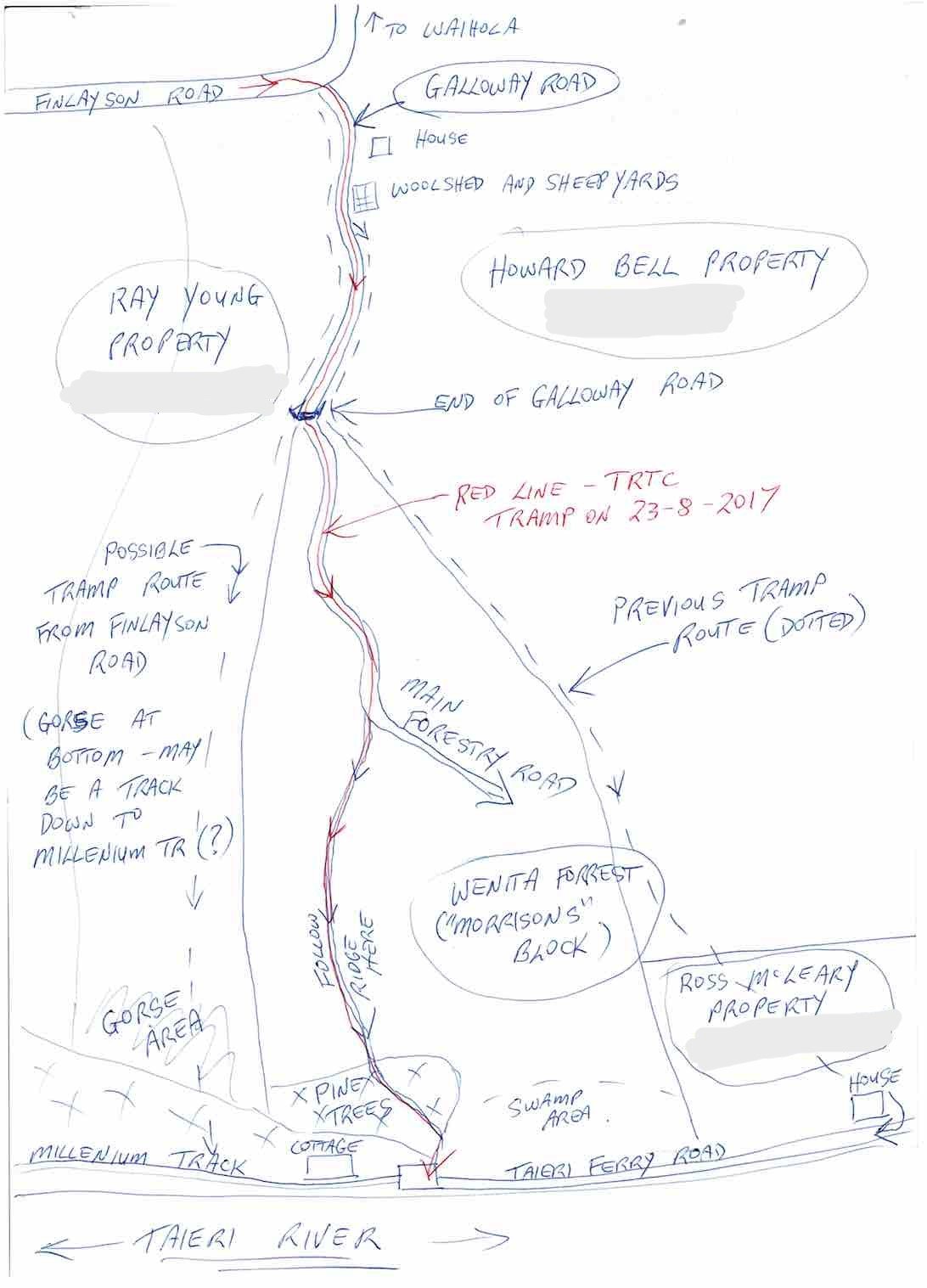
Galloway Rd – Taieri Ferry Rd tracks, see map below. Seek access permission.


Galloway Copy
Galloway Road tracks map. (Map courtesy Arthur.)


Grahams Bush, Organ Pipes, Buttars Peak, Mt Cargill – Information and Trips Library

Scope:

This page of club tramps and hikes in the West Harbour area groups together trips to Grahams Bush,(map) the Organ Pipes, Buttars Peak and Mt Cargill.

Background Information:

Road distances from Mosgiel carpark.

TRTC Grading Information – trips incorporating these tracks are generally given a TRTC grading of 4. This is indicative only, as trips can be allocated a higher or lesser grading depending on the route taken. For more detailed analysis refer to Grading Information.

Restrictions: if visiting Mt Cutten Quarry site – contact Blackhead Quarries (refer Permissions) to ensure no heavy machinery is operating when visiting.

Grahams Bush Botanical Information (1988) (from DoC information sheet).
Mt Cargill – Information (from DoC information sheet).

How To Get There:

Take SH88 to Port Chalmers. At Sawyers Bay turn left onto Station Road and continue on this road through the roundabout and onto Hall Road. At the end of Hall Road there is a sign indicating the track  and an area for limited  parking.

Links to tramps and hikes in the same area:

24/06/2026. Graham’s Bush/Mt Cargill Rd Quarry Track. Grade 4. Trampers.  Leaders: John Gardiner & Alison Evans.
27/05/2026. Grahams Bush and Organ Pipes. Grade 3.5. Hikers.  Leaders: Mike Webb and Bruce Spittle.
25/06/2025. Grahams Bush, Organ Pipes, Buttars Peak. Grade 4. Trampers.  Leaders: Phil Morris, Rod Ward.
09/10/2024. Graham’s Bush to Mt Cargill.  Grade 4. Trampers.  Leaders: Karen McInnes and Gail Williams

Grahams Bush, Old Main Rd, Organ Pipes, Buttars Peak, Mt Cargill, Mt Cutten, Bethunes Gully, Upper Junction  (2024 – 1989, 18 trips with 11 reports).
Grahams Bush, Upper Junction, Brickhill Rd (2014 – 1993, 15 trips with 4 reports).
Grahams Bush, Careys Bay (2004, 1 trip, no report).
From Old Mount Cargill Road Lookout (1992, 1 trip, no report)

Concord – Information and Trips Library

Scope:

This page of club tramps and hikes in the Dunedin Central City area groups together trips within the suburb of Concord and environs.

Background Information:

Road distances from Mosgiel carpark.

TRTC Grading Information – trips incorporating these tracks are generally given a TRTC grading of about 2. This is indicative only, as trips can be allocated a higher or lesser grading depending on the route taken. For more detailed analysis refer to Grading Information.

See also Tunnel Beach – Information and Trips Archive for Tunnel Beach trips starting at Concord.

Links to tramps and hikes in the same area:

17/07/2024. Concord Creations. Grade 2. Hikers.  Leaders: Jan Butcher.  &  Jenny Finnerty.

Concord Blackhead (1989 – 2015 (4 trips with only 1 report)).

Tunnels, McRaes, Racemans, Top Weir, Powder Creek, Chalkies – Information and Trips Library

Scope:

This page of club tramps and hikes in the Whare Flat area groups together trips within the Silverstream catchment and includes Racemans, Tunnel Gully, Powder Creek and Chalkies. (map)

Background Information:

Road distances from Mosgiel carpark.

TRTC Grading Information – trips incorporating these tracks are generally given a TRTC grading of 3. This is indicative only, as trips can be allocated a higher or lesser grading depending on the route taken. For more detailed analysis refer to Grading Information.

Racemans Track, Weir, Origins.
Whare Flat School and Surrounds History.

Links to tramps and hikes in this area:

08/10/2025. Raceman’s Track. Grade 2.5. Hikers.  Leaders: Sandra Lawn & Bruce Spittle.
14/05/2025.  Racemans. Grade 3. Hikers.  Leaders: Wendy Langley, Eleanore Ryan.
14/08/2024. Tunnel Gully, McRaes, Racemans, Powder Creek Detour. Grade 3. Trampers.  Leaders: Phil Keene & Gary Mort.
26/06/2024. Whare Flat, Waiora, Schoolhouse, Tunnels Track, McRaes Weir, Racemans. Grade 2.5. Hikers. Leaders: Bruce Spittle,  Adrienne Ensor.

Pump House, Tunnels, McRaes Weir, Racemans, Return (2004 – 2020, 10 trips with 6 reports).
Schoolhouse, Tunnels, McRaes Circuit (1989 – 2019, 9 trips with 6 reports).
Silverstream Water-Race, Racemans, Weir (1992 – 2023, 21 trips with 6 reports).
Tramps Associated with the Whare Flat Schoolhouse (1995 – 2017, 5 trips with 3 reports).
School House, Tunnels, McRaes, Steve Amies, Whare Flat Road Return. 2007 (1 trip with report – no photos)

Rain Days – Information and Trips Library

Background Information:

Road distances from Mosgiel carpark.
Rain Days trips are the ones that are diverted because of bad weather; either  before the day or at the carpark gathering on the day.

Links to rainy days tramps and hikes:

16/09/2026. Ross Creek – Redwoods Circuit (alternative trip due to rain forecast). Trampers.  Leaders: Sandy Webb and Alison Evans.
16/09/2026. Fairfield Circuit (alternative Hike due to rain forecast). Hikers.  Leaders: Raewyn Keene and Cathy Ferguson.
05/08/2026. Memorial Park to Confluence of the Silverstream and Taieri River. Grade 2. Combined.  Leaders: Barbara Shackell and Sandy Lawn.
03/12/2025. Trip Cancelled (Brighton Cafe). Hikers.  Leaders: Neville Griffith and Rhonda Wilson.
31/07/2024.  Mosgiel Ramble. Hikers.  Leaders: Ady Whiston, Jenny Finnerty

Ross Creek and Environs (1990-2024 with 34 reports – see 6/10/2021 for rainy day trip))
A cancelled Tramp Day (2018 – 2023 with 2 reports)
Topiary Trek (2015 with 1 report)

Tramps Associated with Whare Flat School House (1995- 2017 with 30 reports – see 15/06/2011 for rainy day trip)

St Clair, St Kilda, Caversham, Kew, Corstorphine, Ocean Grove, Tomahawk – Information and Trips Library

Scope:

This page of club tramps and hikes in the Dunedin Central City area groups together trips incorporating suburbs Caversham, Kew, Corstorphine and Dunedin beaches at St Clair, St Kilda, Tomahawk / Ocean Grove.

Background Information:

Road distances from Mosgiel carpark.

TRTC Grading Information – trips incorporating these tracks are generally given a TRTC grading of about 1.This is indicative only, as trips can be allocated a higher or lesser grading depending on the route taken. For more detailed analysis refer to Grading Information.

Ocean Grove, also known as Tomahawk, is a suburb in the southeast of the city of Dunedin. … The suburb was known as Tomahawk until the 1930s, the name not being a reference to the weapon, but rather possibly an anglicised form of the Māori words tomo haka, meaning “dance by a gravesite”.

Links to tramps and hikes in the same area:

19/11/2025. Out & About in Caversham and Kew. Hikers. Grade 2  $5  14km. Leaders: Jenny Finnerty, Jay Devlin, Jan Butcher, Pam Clough.
12/11/2025. Second Beach to Ocean Grove. Grade 3. Hikers.  Leaders: Sandra Lawn and Bruce Spittle.
26/03/2025. St Kilda / Tomahawk Beach. Grade 1.5 Hikers.  Leaders: Wendy Langley  and Val Cayford.
07/08/2024. City to Surf. Grade2 . Combined. Leaders: Gail Williams, Karen McInnes, Jenni and Bruce Wright.
24/07/2024. Delights of St Clair.  Grade 1.5. Hikers.  Leaders: Neville Griffiths, Wyn Davies.

Caversham – Street Walk. 2023-1999 (5 trips, 3 with reports and photos, 2 with no report or photos)
St Clair Beach Walks (1995 – 2023, 17 trips).
Street Walk: St Clair – Kew (2000 – 2022, 2 trips – 1 report).
Tomahawk Lagoon and Nearby Tracks and Areas (1989 – 2023, 43 trips, 19 reports; see 40, 38, 36, 35, 33, 29 and 26.)

Macandrew Bay, Company Bay, MacTaggart St, Camp Road, Boulder Beach, Pukehiki, Greenacres St – Information and Trips Library

Scope:

This page of club tramps and hikes on the Otago Peninsula groups together trips incorporating Macandrew Bay, Company Bay, Camp Road, Greenacres St, McTaggart St, and Pukehiki. (map)

Background Information:

Road distances from Mosgiel carpark.
MacTaggart St track closed for lambing September and October.

TRTC Grading Information – trips incorporating these tracks are generally given a TRTC grading of about 3. This is indicative only, as trips can be allocated a higher or lesser grading depending on the route taken. For more detailed analysis refer to Grading Information.

Restrictions: Lambing Sept – Nov.

How To Get There:

(1) Macandrew Bay – Greenacres Track – drive along Portsmouth Drive and turn left over the causeway and follow Portobello Road to Macandrew Bay township – ample parking available in front of playground. Take Greenacres Street to the start / ascent of Greenacres Track.

(2) Company Bay – McTaggart St. – as per above. Park at Macandrew Bay playground and take the cycleway walk to McTaggart St on the right approx 10 minutes from carpark towards Portobello.

(3) Boulder Beach – located off Highcliff Road and can be accessed via Buskins Road track or Paradise Track. Further go to Seal Point Road (right turn) past Pukehiki and right again onto Braidwood Road where a carpark is available before the decent to Boulder Beach.

Links to tramps and hikes in the same area:

29/07/2026. Camp Road and Greenacres. Grade 3. Trampers.  Leaders: Gail Williams and Yan Campbell.
29/04/2026. Macandrew Bay, Company Bay, Camp Road, Pukehiki, Greenacres Track. Grade 3.5. Hikers.  Leaders: Jenni Wright & Jill Dodd.
24/07/2024. Macandrew Bay, Company Bay, McTaggart St, Camp Road, Pukehiki, Greenacres Street. Grade 3. Trampers, Leaders: Yan Campbell, Jenny Flack.

Macandrew Bay, Greenacre Street (1989-2024, 12 trips with 6 reports). Hikers.
Macandrew Bay, Company Bay, McTaggart St, Camp Rd, Pukehiki, Greenacres St (1997 – 2022, 5 trips with 4 reports). Trampers, Hikers, Combined.

City to Surf – Information and Trips Library

Scope:

This page of club tramps and hikes in the Dunedin Central City area groups together trips commencing in the City and culminating at St Clair, St Kilda beaches. It also incorporates trips along from Andersons Bay to the Otago Yacht Club marina.

Background Information:

Road distances from Mosgiel carpark.

TRTC Grading Information – trips incorporating these tracks are generally given a TRTC grading of about 2. This is indicative only, as trips can be allocated a higher or lesser grading depending on the route taken. For more detailed analysis refer to Grading Information.

Links to earlier tramps and hikes in the same area:

07/08/2024. City to Surf. Grade 2. Combined. Leaders: Gail Williams, Karen McInnes, Jenni and Bruce Wright.

Stadium to the Sea  2022 (1 trip with report and photos)
Gardens to Surf 2015-2017 (2 trips with reports, 1 with photos)
Portsmouth Drive to Marina 2013-2017 (3 trips with reports)


Nicols Creek – Information and Trips Library

Scope:

This page of club tramps and hikes to the Leith Valley area and groups together trips to Nicols Creek (map) incorporating the Pineapple Track, Nicols Falls, Moon Track and other tracks on Swampy.

Background and History

Road distances from Mosgiel carpark.

TRTC Grading Information – trips incorporating these tracks are generally given a TRTC grading of 4. This is indicative only, as trips can be allocated a higher or lesser grading depending on the route taken. For more detailed analysis refer to Grading Information.

DCC land. Nicols Creek circuit maintained by Green Hut Track Group.
David Nicol was an early settler and dairy farmer. He reputedly bought land here in the hope that the railway line would be routed north through Leith Valley.
Antony Hamel’s YouTube video showing his exploration of the 5 falls of Nicols Creek.
Neighbours at War Background and photos to the Finnerty Family and their house site on the Moon Track by Nicols Creek.
Swampy ridge track background information.
Pineapple Track for background information.
Pineapple and Flagstaff walk for background information.
Nicols Creek Glow-worms

How To Get There:

Take SH1 north and turn left onto Duke St. Continue on Duke St into Malvern St and onto Leith Valley Road. Continue to the sign indicating the Nicol’s Creek Track and mountain bike track. There is limited parking the track entrance. Parking therefore is often best in Booth Road (left off Malvern St) and then take Islay St (off Booth Road) back to Malvern and Leith Valley Roads to the track.

Links to tramps and hikes to the same area:

27/05/2026. Pineapple Track / Nicols Creek. Grade 4. Trampers.  Leaders: Karen McInnnes and Sarah McCormack
10/09/2025. Nicols Creek, Moon Track, Swampy Ridge, Pineapple and Shortcut Tracks. Grade 4. Trampers.  Leaders: Gwenda Farqharson, Lyn Keene.
26/06/2024. Nicols Creek, Pineapple Track. Grade 4. Trampers. Leaders: Wyn and Ross Davies.

Nicols Creek, Swampy, Pineapple Track, Moon Track, Booth Road 2023 – 1989 (27 trips, 9 with reports and photos, 1 with report only, 17  with no reports or photos)
Bull Ring, Swampy, Nicols, Pineapple Point, Davies, return 2020 – 1989 (4 trips, 2 with reports and photos,
Nicols Creek Bridge, Morrisons Burn, Poleline Road, Swampy, Nicols or Pineapple  2016 – 2006 (6 trips, 2 with reports and photos, 1 with photos only, 3 with no reports or photos)
Nicols Creek, Swampy Saddle, Davies Track  2011 – 2001 (3 trips, 1 with report and photos, 2 with reports only)
Moon, McQuilkan, Possum Hunters, Jim Freeman, Pineapple, Nicols  2008  (1 trip with report and photos)
Nicols Creek, McQuilkans (no reports).
Booth Rd, Nicols Creek, McQuilkan, Jim Freeman, Pineapple. Either direction (no reports)
Leith Valley, Nicols Waterfall, Sullivans Dam (no report)

Big Easy, Signal Hill, Ravensbourne, Opoho, Northern Cemetery – Information and Trips Library

Scope:

This grouping of Club tramps and hikes covers trips involving the Big Easy to Signal Hill Memorial, Ravensbourne, Opoho (incorporating Willowbank), the Northern Cemetery. (map)

Background Information:

Road distances from Mosgiel carpark.

TRTC Grading Information – trips incorporating these tracks are generally given a TRTC grading of 3. This is indicative only, as trips can be allocated a higher or lesser grading depending on the route taken. For more detailed analysis refer to Grading Information.

Town Belt Article – good links to Signal Hill and Green Belt.
Opoho Historical Background Notes

How To Get There:

The Big Easy is one of the cycle tracks that ascends to the Signal Hill lookout. To access this track take SH88 to the Dunedin Stadium. Turn left at the roundabout then right onto Butts Road (by Palmers Quarry). Follow this road to Logan Park High School and turn right on the road just past the school. This road to the carpark and toilets located behind the school.

Links to tramps and hikes in this area:

29/04/2026. Signal Hill from Ravenbourne. Grade 4. Trampers.  Leaders: Sandy Webb & Gail Williams.
26/11/2025. Bid Easy Track. Grade 2.5. Hikers.  Leaders: Barbara Shackell and Avis Williamson
16/10/2024. Ravensbourne, Signal Hill, Big Easy. Grade 3. Trampers.  Leader: John Gardiner.
21/08/2024. Big Easy. Grade 2.5. Hikers. Leaders: Pam Clough, Jay Devlin.

Signal Hill Centennial Memorial, Ravensbourne, Big Easy (2023 – 1998, 24 trips with 9 reports).
Botanic Garden, Logan Park, Northern Cemetery, Chingford, Big Easy (2021 – 1996, 25 trips with 16 reports inc. 19/05/2021 and 30/09/2015 for Big Easy).
Signal Hill Tramps (2023 – 1992, 19 trips  with 8 reports inc. 22/08/2018 for Big Easy).
Street Walk – Willowbank-Opoho area. (2022 – 2017, 2 trips with reports)