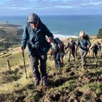
 10/06/2026. Boulder Beach. Grade 3. Trampers. . Leaders: Pam Cocks and Gail Williams.
Twenty trampers met at the top of McMeeking road on a stunning Dunedin day, sunny with little wind. Continue reading “Boulder Beach”
Taieri Recreational Tramping Club
Mid-week recreational and social walking group based in Mosgiel NZ

The post that links all the known previous trips and information.
10/06/2026. Boulder Beach. Grade 3. Trampers. . Leaders: Pam Cocks and Gail Williams.
Twenty trampers met at the top of McMeeking road on a stunning Dunedin day, sunny with little wind. Continue reading “Boulder Beach”
 10/06/2026. Flagstaff. Grade 3. Hikers. Leaders: Phil Keene and Barbara Shackell.
Such a lovely morning. We were all away from the meet n greet sharpish and organised at the Bullring where 16 hikers were away up the Pineapple/Flagstaff track at 9.45am on the dot.
 08/04/2026. Purakaunui Curcuit. Grade 2. Hikers. Leaders: Katrina Mc Kenzie and Cathy Ferguson.
On a pleasant morning 15 hikers meet up with 6 others at Port Chalmers turn off and drove to Purakaunui Domain, where we had our morning tea stop.
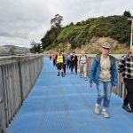 18/02/2026. Maia to Port Chalmers. Grade 1.5. Hikers. Leaders: Mike Webb & Dave Roberts.
The Mosgiel contingent, townies and a solitary bus passenger from Port met at Maia for a leisurely walk to Port Chalmers on the shared cycle/walkway.
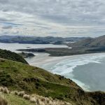 18/02/2026. Sandymount. Grade 3. Trampers. Leaders: John Gardiner & Graeme Souter.
With 93.6mm of rain on Tuesday, the prospects for Wednesday’s tramp weren’t great. However, after a cool and overcast start, the weather improved to comfortable, if at times slightly windy, conditions.
 21/01/2026. Leith Saddle/Swampy/Burns Track. Grade 4. Trampers. Leaders: Pam Cocks and Neil Hodgkin.
Another enjoyable tramp in the Silver Peaks
This page groups together the Christmas dinners / lunches hosted by the club. These events are often preceded by a walk and as such are included in the reports / photos relating to the walk that is submitted for publication.
10/12/2025. Lee Stream Area – hike before Christmas Lunch. Grade 2. Combined. Leaders: Lyn Keene, Anne Ward, Janette Abbott, Shirley McRandle.
11/12/2024. Takitakitoa, Wetland, Waihola Hall. Grade 2. Combined hike and Christmas Lunch. Leaders: Jan Butcher, Wendy Langley, John Gardiner, Graeme Souter.
13/12/2023. All North Taieri Church Hall. Leaders: Barbara Shackell/Jenni Wright/Raewyn Keene.
This page of club tramps and hikes in the Dunedin Central City area groups together trips from to the Eastern side of Otago Harbour incorporating the cycle / walkway on Portobello Road, Glenfalloch, Waverley, Andersons Bay, Musselburgh, Highcliff, Rotary Park. (map)
Road distances from Mosgiel carpark.
TRTC Grading Information – trips incorporating these tracks are generally given a TRTC grading of about 2. This is indicative only, as trips can be allocated a higher or lesser grading depending on the route taken. For more detailed analysis refer to Grading Information.
(1) Bayfield Park – drive along Portsmouth Drive and turn right into Shore Street. Bayfield Park is located about 100 meters from the intersection with Portobello Road on the left. Toilets are available at the pavilion located on the sports fields.
(2) Vauxhall Yacht Club– drive along Portsmouth Drive and turn left over the causeway and follow Portobello Road to the Vauxhall Yacht club carpark located on the left about 5 minutes from the end of the causeway. Toilets are available at the carpark.
Links to tramps and hikes in this area:
01/07/2026. Wander Windy Waverley. Grade 2. Combined. Leaders: Bruce & Jenni Wright, Pam Cocks, Graeme Souter
22/04/2026. Bayfield Park/Around Eastern side of Harbour. Grade 2. Hikers. Leaders: Jenny Finnerty,
Bayfield carpark to Glenfalloch. 2023 (1 trip with report and photos)
Waverley, Andersons Bay, Musselburgh. Street Walks 2022 – 2000 (7 trips, 3 with reports and photos, 1 with photos only, 3 with no reports or photos)
This page of club tramps and hikes in the area West via SH87 (inland on the south side of SH87) groups together trips to Deep Stream pipeline. (map).
Road distances from Mosgiel carpark.
TRTC Grading Information – trips incorporating these tracks are generally given a TRTC grading of about 3. This is indicative only, as trips can be allocated a higher or lesser grading depending on the route taken. For more detailed analysis refer to Grading Information.
Access Permissions are required as trips following the Deep Stream pipe line venture over a working farms – refer guidelines.
General Information – Deep Stream Water Supply
How To Get There:
Follow State Highway 87 from Outram past the Clarks Junction turn off at the bridge that traverses Deep Stream. Permission to park on farmland will be required.
03/06/2026. Deep Stream Pipeline. Grade 3. Combined. Leaders: Sylvie Watt and Wendy Langley
Deep Stream-Hindon Pipe Line from Highway 87. 2019 – 1989 (13 trips, 4 with reports and photos, 1 with report only – photo lost, 8 with no reports or photos)
Deep Stream, Rocklands Station. Welshs Road. Lawlors Old Farm. 2018 – 1989 (14 trips, 5 with reports and photos, 1 with photos only, 8 with no reports or photos)
Deep Stream Pipeline by Highway 87 (upstream) 2017 – 2007 (4 trips, 4 with reports and photos)
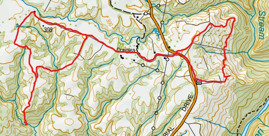
Click on map to enlarge:
This page of club tramps and hikes in the South Coast area groups together trips to the Catlin’s Area including Owaka environs. (map)
Road distances from Mosgiel carpark.
TRTC Grading Information – trips incorporating these tracks are generally given a TRTC grading of about 2. This is indicative only, as trips can be allocated a higher or lesser grading depending on the route taken. For more detailed analysis refer to Grading Information.
To Owaka Township – proceed south on SH1 to Balclutha and turn left onto the Southern Scenic Route. Continue on the Owaka Highway to reach Owaka township. A detour is available via Kaka Point Road which loops back to the Owaka Highway.
21/01/2026. Owaka / Catlins Environ. Grade 2.5. Hikers. Leaders: Bill Cubitt and Peter Beal
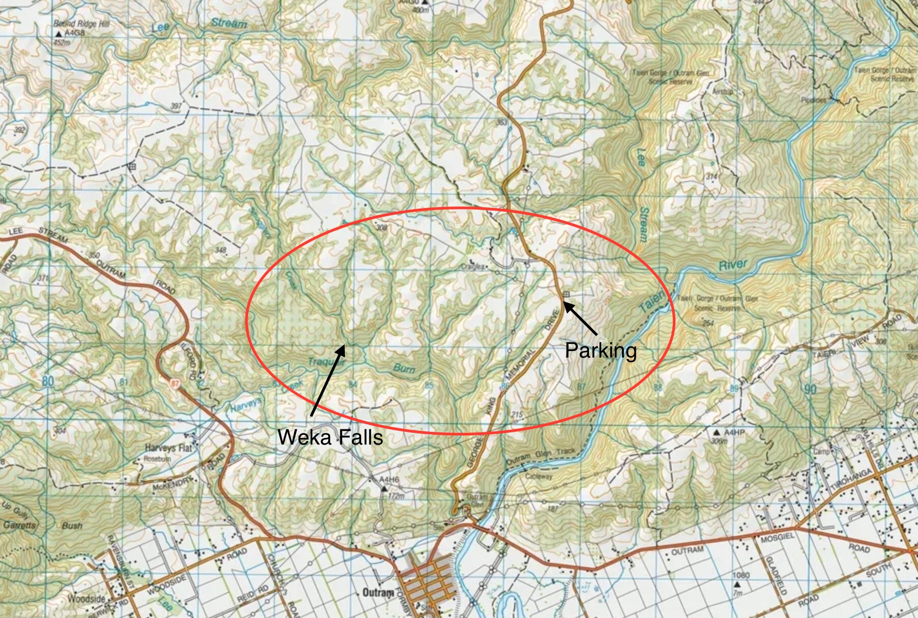
This page of club tramps and hikes covers trips West of SH87 which includes trips to Roulston Farm and Weka Falls (map)
Road distances from Mosgiel carpark.
TRTC Grading Information – trips incorporating these tracks are generally given a TRTC grading of about 4. This is indicative only, as trips can be allocated a higher or lesser grading depending on the route taken. For more detailed analysis refer to Grading Information.
Access Permissions are required as this trip ventures over a working farm – refer guidelines
Restrictions: lambing September-November
Travel towards Outram township and turn hard right after bridge over the Taieri River (before Outram). Proceed onto George King Memorail Drive and continue approx 4 km for parking (in paddock on right)
28/01/2026. Roulston Farm. Grade 4. Leaders: Jill Reid, Lenore Armstrong.
Weka Falls / Roulston Farm. 2021 – 1991 (9 trips, 3 with reports and photos, 6 with no reports or photos)
This page of club tramps and hikes in the South Coast via SH1 area groups together trips to the Clarendon area (Milburn) incorporating the Lime Works, Stone Stables, Fort Hill, Whale Fossil Museum / Lookout. (map)
Road distances from Mosgiel carpark.
TRTC Grading Information – trips incorporating these tracks are generally given a TRTC grading of about 2. This is indicative only, as trips can be allocated a higher or lesser grading depending on the route taken. For more detailed analysis refer to Grading Information.
Background History of Stable and Cemetery
Whale Fossil Lookout, Clarendon Cemetery/Lime Springs – General Information
(1) Proceed south on SH1 past Lake Waihola and turn right onto Phosphate Road. Continue on this road to the intersection of Berwick Road and Driver Road. Turn left and continue to the end for parking.
(2) Proceed south on SH1 past Lake Waihola to Milburn (before Milton) and turn right onto Limeworks Road. Continue over the rail lines and take the first right to the lime works. Can continue to McNeil Road intersection, turn right and proceed to Fort Hill Road (next left) and quarry.
28/01/2026. Whale Fossil Lookout, Clarendon Cemetery/Lime Springs . Grade 3. Hikers. Leaders: Bruce Spittle, Eleanore Ryan.
Clarendon Area, Stone Stables, Lime Works, Whale Museum and Lookout. 2017 – 1991 (16 trips – 3 with reports and photos, 2 with report only, 2 with photos only, 9 with no report or photos)
This page of club tramps and hikes on the Otago Peninsula groups together trips incorporating the Rutherford, Hereweka, Nyhon tracks and the Lime Kilns. (map).
Road distances from Mosgiel carpark.
TRTC Grading Information – trips incorporating these tracks are generally given a TRTC grading of about 3. This is indicative only, as trips can be allocated a higher or lesser grading depending on the route taken. For more detailed analysis refer to Grading Information.
Access Permissions – generally not required if using the marked tracks. Any deviation from the recognised tracks a courtesy call to the farmer (see Access Permissions page – Peggy’s Hill) would be in order.
Nyhon Track is closed for lambing Set – Oct.
(1) Proceed along Portobello Road to Portobello to Portobello township itself – turn right onto Hoopers Inlet Road and continue to the intersection and turn right. Follow this road around the inlet to the start of the Nyhon Track (approx 2 kms)
(2) Proceed along Highcliff Road and continue through Pukehiki to Sandymount Road. Turn right and continue to Hoopers Inlet Road and turn left. Follow this road to Hoopers Inlet and turn left to the start of the Nyhon Track.
20/05/2026. Nyhon and Hereweka Tracks. Grade 3.5. Trampers. Leaders: Esther Willis & Lyn Keene.
14/01/2026. Hoopers Inlet, Rutherfords – Stewarts, Lime Kilns, Nyhon Track. Grade 3. Trampers. Leaders: Spen Walker, Jane Bruce, Sandy Webb
This page of club tramps and hikes in the Fairfield, Green Island and Mosgiel surrounds area and groups together trips incorporating Wairongoa Springs and the North Taieri area
Road distances from Mosgiel carpark.
TRTC Grading Information – trips incorporating these tracks are generally given a TRTC grading of about 2. This is indicative only, as trips can be allocated a higher or lesser grading depending on the route taken. For more detailed analysis refer to Grading Information.
Wairongoa Springs and North Taieri Church. 2023 – 1990 (11 trips, 4 with reports and photos, 7 with no reports or photos), see All North Taieri Church Hall for 2023 Christmas dinner report.