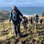
 10/06/2026. Boulder Beach. Grade 3. Trampers. . Leaders: Pam Cocks and Gail Williams.
Twenty trampers met at the top of McMeeking road on a stunning Dunedin day, sunny with little wind. Continue reading “Boulder Beach”
Taieri Recreational Tramping Club
Mid-week recreational and social walking group based in Mosgiel NZ

10/06/2026. Boulder Beach. Grade 3. Trampers. . Leaders: Pam Cocks and Gail Williams.
Twenty trampers met at the top of McMeeking road on a stunning Dunedin day, sunny with little wind. Continue reading “Boulder Beach”
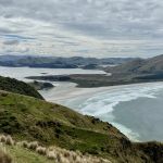 18/02/2026. Sandymount. Grade 3. Trampers. Leaders: John Gardiner & Graeme Souter.
With 93.6mm of rain on Tuesday, the prospects for Wednesday’s tramp weren’t great. However, after a cool and overcast start, the weather improved to comfortable, if at times slightly windy, conditions.
This page of club tramps and hikes on the Otago Peninsula groups together trips incorporating the Rutherford, Hereweka, Nyhon tracks and the Lime Kilns. (map).
Road distances from Mosgiel carpark.
TRTC Grading Information – trips incorporating these tracks are generally given a TRTC grading of about 3. This is indicative only, as trips can be allocated a higher or lesser grading depending on the route taken. For more detailed analysis refer to Grading Information.
Access Permissions – generally not required if using the marked tracks. Any deviation from the recognised tracks a courtesy call to the farmer (see Access Permissions page – Peggy’s Hill) would be in order.
Nyhon Track is closed for lambing Set – Oct.
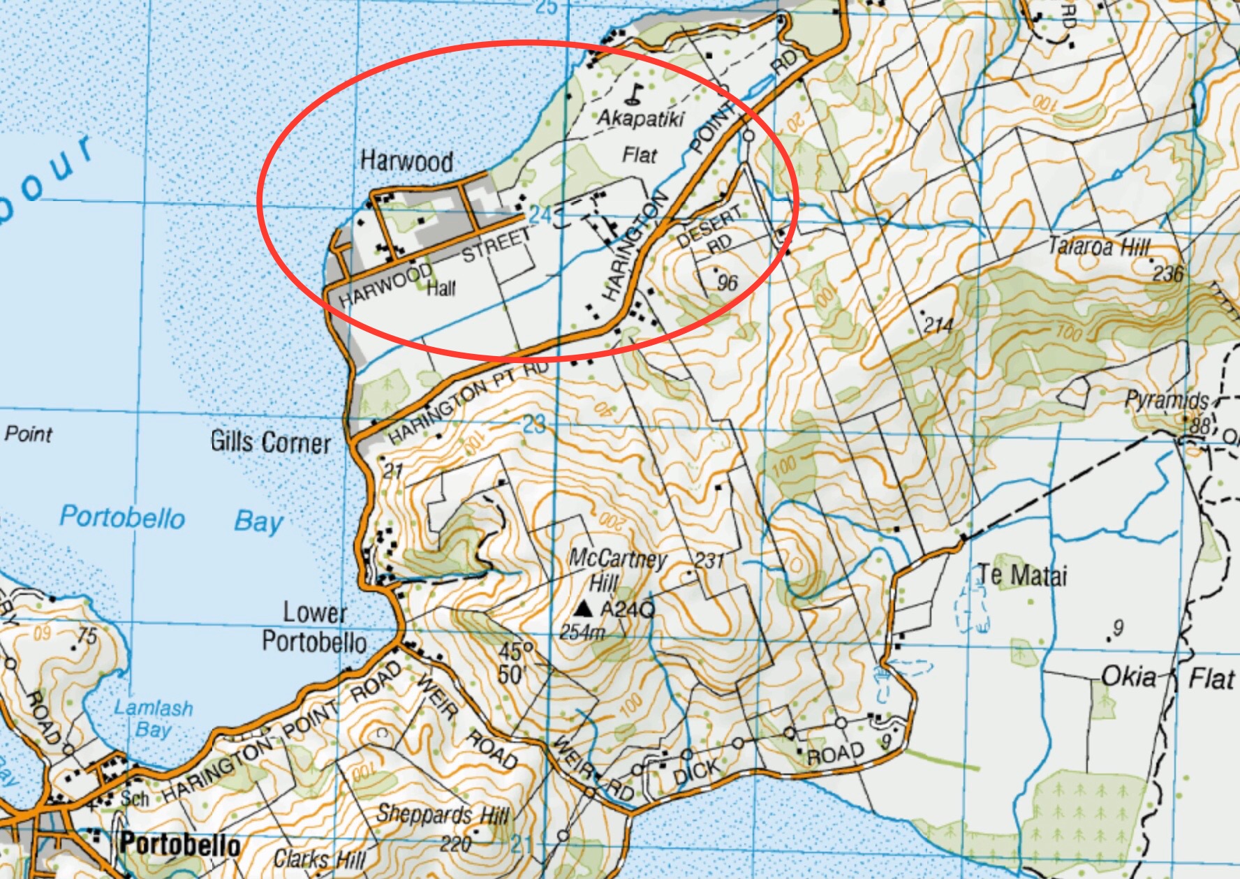
(1) Proceed along Portobello Road to Portobello to Portobello township itself – turn right onto Hoopers Inlet Road and continue to the intersection and turn right. Follow this road around the inlet to the start of the Nyhon Track (approx 2 kms)
(2) Proceed along Highcliff Road and continue through Pukehiki to Sandymount Road. Turn right and continue to Hoopers Inlet Road and turn left. Follow this road to Hoopers Inlet and turn left to the start of the Nyhon Track.
20/05/2026. Nyhon and Hereweka Tracks. Grade 3.5. Trampers. Leaders: Esther Willis & Lyn Keene.
14/01/2026. Hoopers Inlet, Rutherfords – Stewarts, Lime Kilns, Nyhon Track. Grade 3. Trampers. Leaders: Spen Walker, Jane Bruce, Sandy Webb
Click on Map to Enlarge
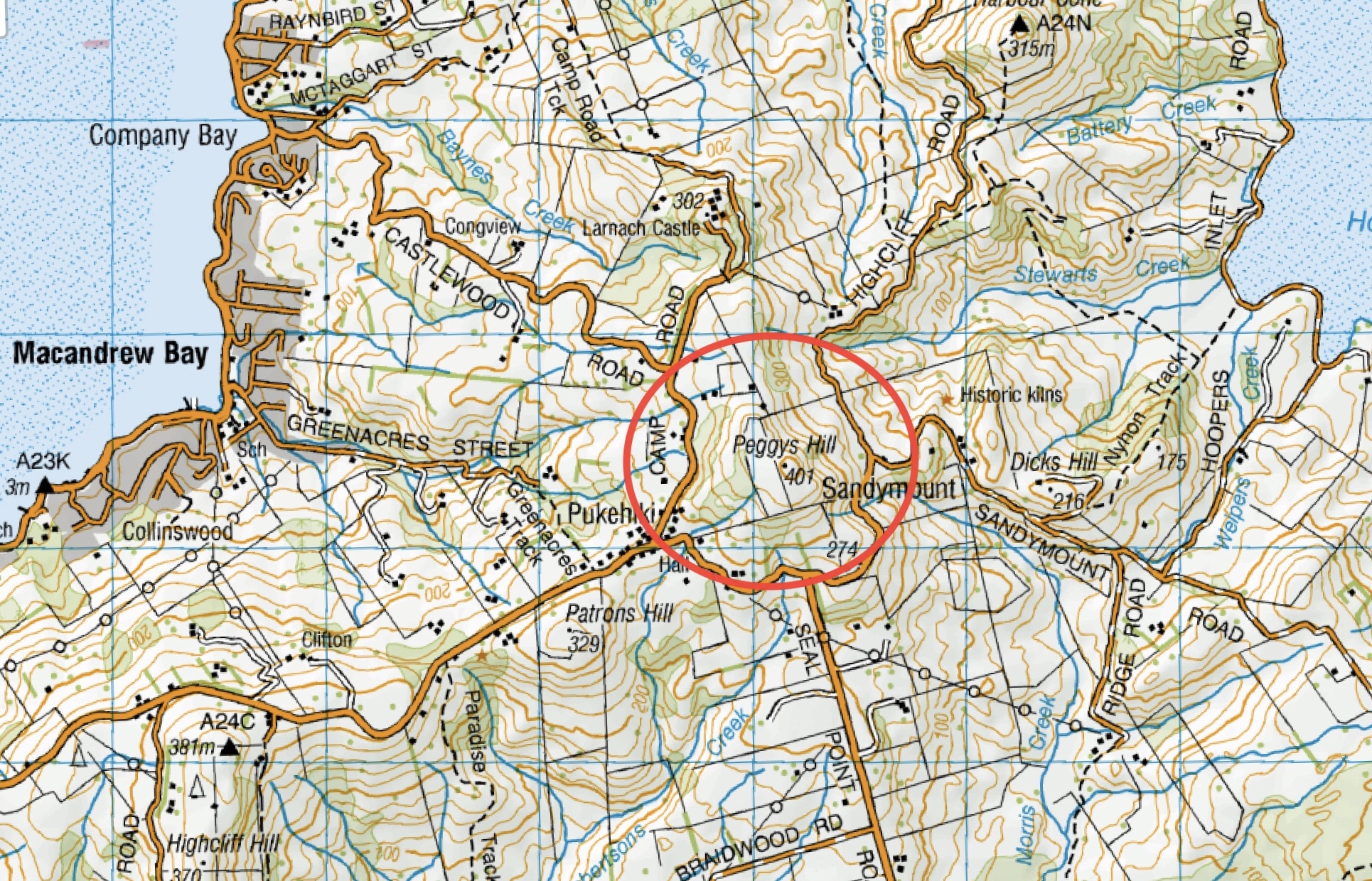
This page of club tramps and hikes on the Otago Peninsula groups together trips to Peggy’s Hill (map).
Background Information:
Road distances from Mosgiel carpark.
TRTC Grading Information – trips to Peggy’s Hill are generally given a TRTC grading of 4. This is indicative only, as depending on the route taken, allocation of gradings can differ from this. For more detailed analysis refer to Grading Information.
Access Permissions are required as this trip ventures over a working farm – refer guidelines
Restrictions: Lambing season August – October.
Hereweka / Harbour Cone Background Information
Hereweka Trust website
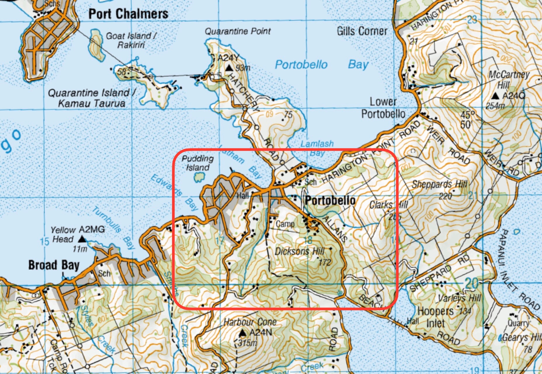
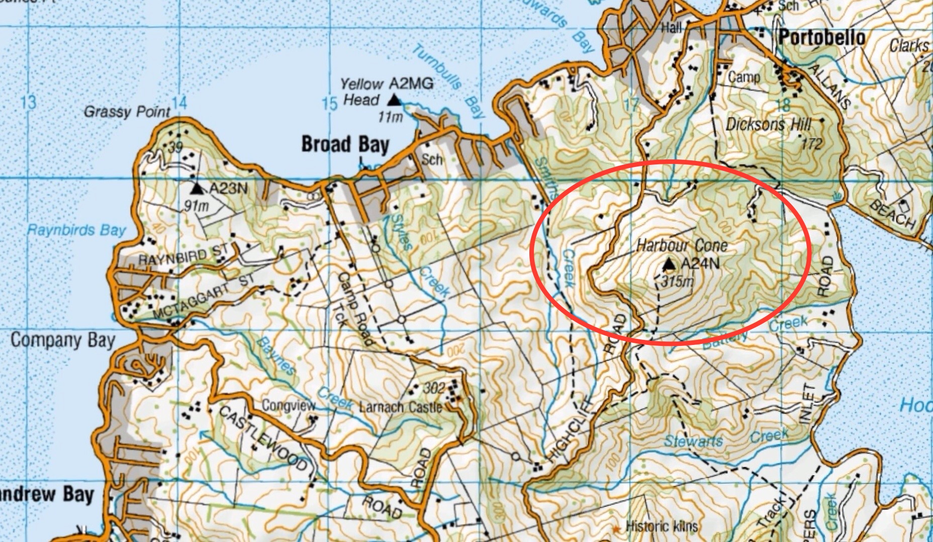
Peggy’s Hill is situated behind Larnach Castle off Camp Road. Access options v ary but the simplest access point is over a fence just before you reach the Larnach Castle entrance. This will take you directly over farm land behind the Larnach Castle Estate which is on the right just past Castlewood Road that comes from Company Bay.
27/08/2025. Peggy’s Hill from Macandrew Bay. Grade 4. Trampers. Leaders: Graeme Souter and Gwenda Farqharson.
Click on map to enlarge
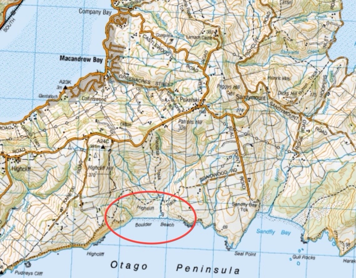
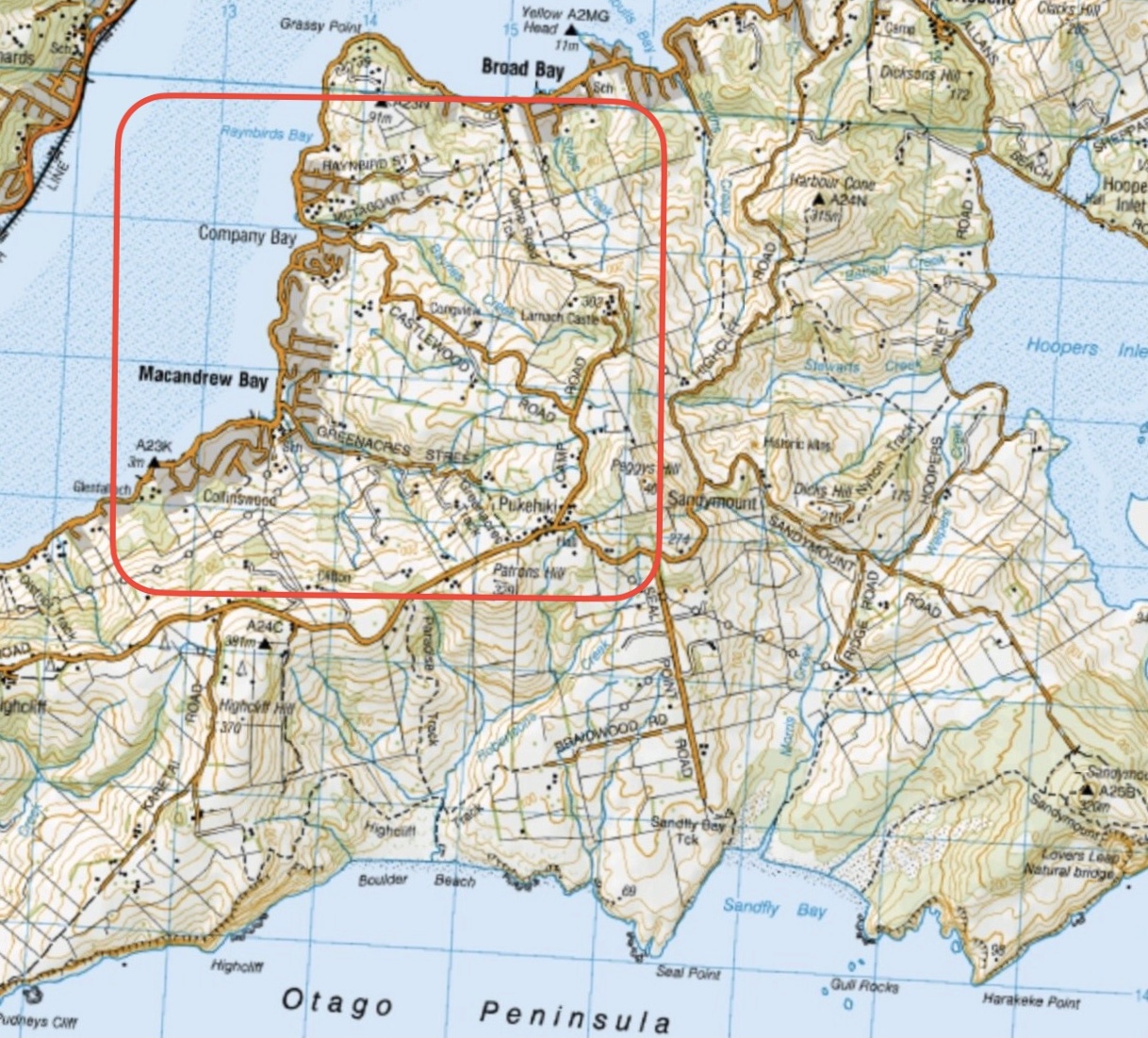
This page of club tramps and hikes on the Otago Peninsula groups together trips to Boulder Beach from Macandrew Bay (Greenacres St), Braidwood Road. These trips will often include the Paradise, Buskins, Highcliff Tracks.
Background Information:
Road distances from Mosgiel carpark.
TRTC Grading Information – trips incorporating these tracks are generally given a TRTC grading of about 3. This is indicative only, as trips can be allocated a higher or lesser grading depending on the route taken. For more detailed analysis refer to Grading Information.
Access to Boulder Beach is closed to the public for penguins breeding (November – February). Other tracks remain open year round.
(1) From Macandrew Bay proceed up Greenacres St / Track which exits onto Highcliff Road. Turn right onto Highcliff Road and proceed to the start of Paradise Track. This track will take you to Boulder Beach.
(2) Proceed along Highcliff Road and turn left (past Pukehiki) onto Seal Point Road. Follow this road and turn right onto Braidwood Road. At the end of this road is Highcliff Track. Follow this track through the dunes to the junction with Paradise Track then right to Boulder Beach.
10/06/2026. Boulder Beach. Grade 3. Trampers. . Leaders: Pam Cocks and Gail Williams.
Boulder Beach (2024 – 1991) 18 trips – 6 with reports and photos, 2 with photos only, 11 with no reports or photos.
Click on map to enlarge
Click to enlarge map
Click on Map to Enlarge
Click on Map to Enlarge
Click on Map to Enlarge
Click on Map to Enlarge

Click on Map to Enlarge

Click on Map to Enlarge
