
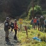
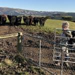
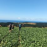
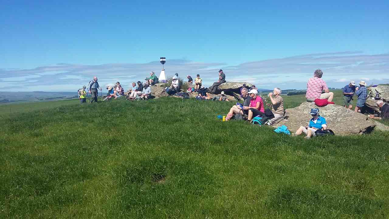
 13/05/2026. Mt Allan area/Mullocky Stream to Parera. Grade 3. Combined. Leaders: Sylvie Watts and Carolyn Pridham.
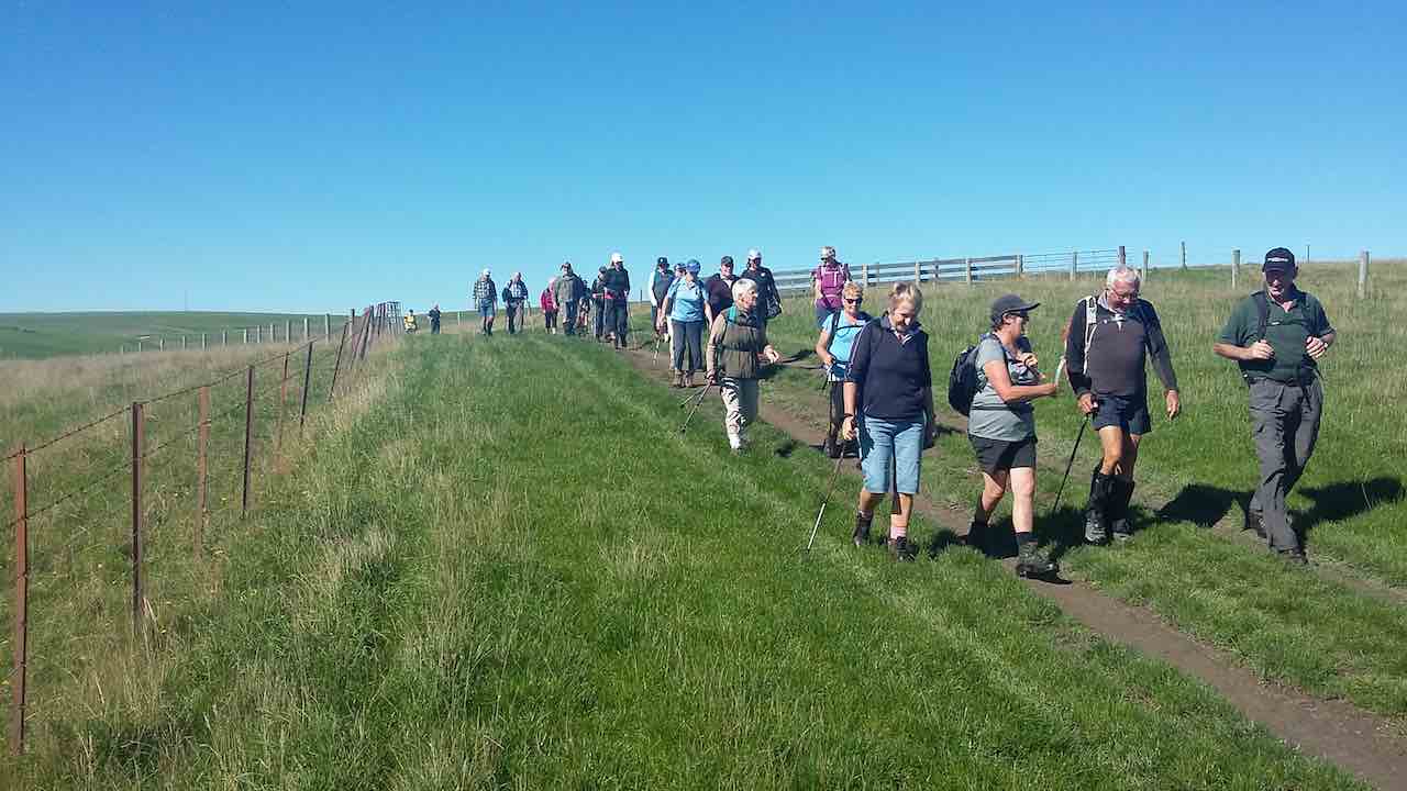
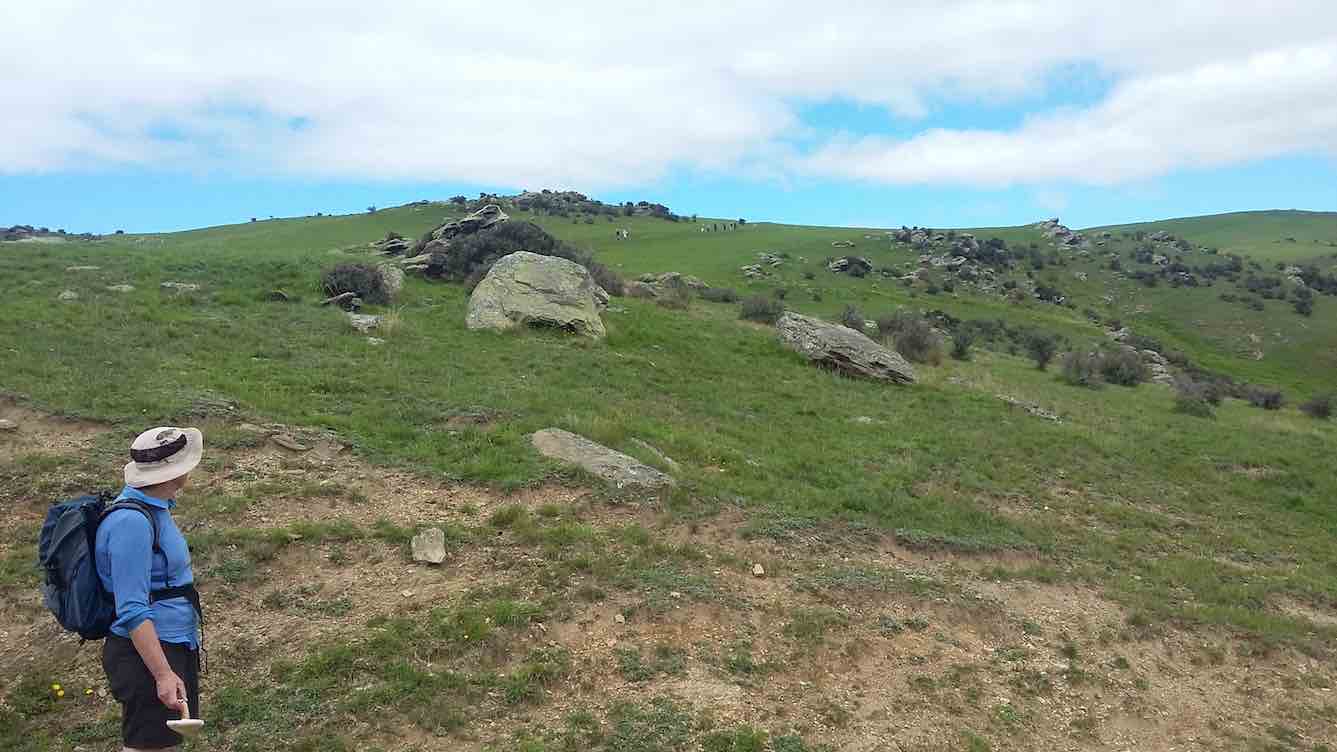
On a beautiful day 43 persons, being the Trampers and the Hikers, headed into the Mt Allan Taioma area.
Category: Permission Required
Indicates possibility of permission being needed for access.
Fairfield via Abbotts Creek Track to Wingatui and Mosgiel
 03/09/2025. Fairfield via Abbotts Creek Track to Wingatui and Mosgiel. Grade 2.5. Combined. Leaders: Barbara Shackell, Jenni Wright, Sandy Webb and Esther Willis.
Barbara Shackell has certainly set the bar high for both effort and organisation for this combined tramp.
Continue reading “Fairfield via Abbotts Creek Track to Wingatui and Mosgiel”
Peggy’s Hill from Macandrew Bay
 27/08/2025. Peggy’s Hill from Macandrew Bay. Grade 4. Trampers. Leaders: Graeme Souter and Gwenda Farqharson.
Peggy – who on earth was Peggy? Read on ….
Continue reading “Peggy’s Hill from Macandrew Bay”
Nichol’s Farm (Michelle’s Farm)
 20/08/2025. Nichol’s Farm (Michelle’s Farm) . Grade 4. Trampers. Leaders: Gail Williams, Lynley McArley.
After parking under the Outram Bridge, nineteen trampers made their way alongside the Northern aspect of the Taieri river on the flat and then began an ascent up into the hills along a farm track. Continue reading “Nichol’s Farm (Michelle’s Farm)”
Nichols Farm
 23/7/2025. Nichols Farm. Grade 3.5. Hikers. Leaders: Wendy Langley and Carol-Anne Buchanan.
19 hikers set off on a chilly, crisp morning which provided us with a perfect blue sky and no breeze.
Heyward Point from Aramoana
 16/07/2025. Heyward Point from Aramoana. Grade 3.5. Trampers . Leaders: Karen McInnes, Gail Williams.
Twenty-three well rugged up trampers left cars at the bottom of the start of the Heyward Track and began the steep ascent to the top.
Coutts Farm
 09/07/2025. Coutts Farm. Grade 3. Hikers. Leaders: Bruce Wright and Peter Beal.
Left Memorial Park carpark at 9.30am and travelled to Taieri Mouth, meeting up with Brighton hikers at Coutts Gully Road carpark.
Akatore Narrowdale Forest
 25/06/2025. Akatore Narrowdale Forest. Grade 3. Hikers. Leaders: Neville Griffiths, Cathy Ferguson.
On a mild winter morning 13 hikers set of on SH1 to Milburn. At intersection with Narrowdale Road we met up with Neville and 4 others who had come over the hill from Brighton. Continue reading “Akatore Narrowdale Forest”
Hope Hill
 29/01/2025. Hope Hill. Grade 4. Trampers. Leaders: John Gardiner and Martin Hickley.
The last club tramp here was almost exactly two years ago and Diane and Marijke’s description is quite excellent, so I’ll not repeat that. Undertaken in ever warming conditions and rising afternoon winds, over exposed farmland, twelve trampers were very glad to get down to the cars some five hours after leaving.
Mt Royal/Bobby’s Head (Tavora Reserve)
 22/01/2025. Mt Royal/Bobby’s Head (Tavora Reserve). Grade 3.5. Trampers. Leaders: Graham Thurlow, Graeme Souter.
Parking at Tavora Reserve in the long grass on a warm summer’s day with a slight breeze we, 15 trampers, made our way up the gravel on Bobby’s Head Rd turning left onto the Goodwood Rd passing a familiar sign, “Adam Sutherland Road”. Continue reading “Mt Royal/Bobby’s Head (Tavora Reserve)”
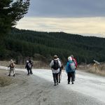
Three Mile Hill Forest
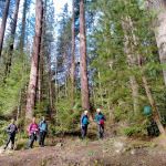 18/09/2024. Three Mile Hill Forest. Grade 3. Hikers. Leaders: Bruce Spittle & Bill Cubitt.
Thirty-two outdoor enthusiasts, including Dave and Peter coming for their first hikes, assembled on the Taieri Lookout carpark a day or so after snow had covered nearby hills. Continue reading “Three Mile Hill Forest”
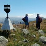
Mt Charles, Cape Saunders, Puddingstone Rock, Allans Beach
No. 99 on old hardcopy list of 113 club tramps. “Mt Charles Mr Neil Farm”.
27 km from car-park.
Click here to read about Cape Saunders Lighthouse and the two graves
Mt Charles, Cape Saunders – Information and Trips Library
 12. 10/4/2024 Mt Charles Grade 4 Leaders: Graham and Carol Thurlow
28 trampers gathered at Allan’s Beach. Continue reading “Mt Charles, Cape Saunders, Puddingstone Rock, Allans Beach”
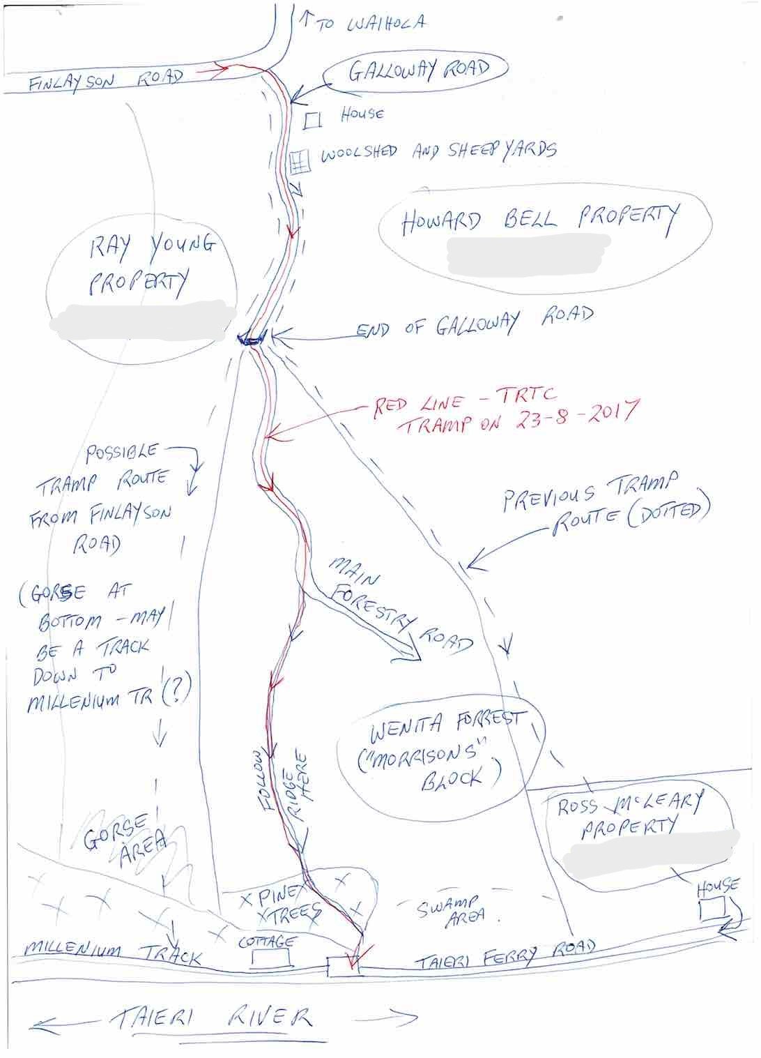
Millennium Track from Taieri Ferry Rd, Finlayson Rd, Galloway Rd, Bells Farm, Kennedys Farm, Wenita (Morrisons Block) – Information and Trips Library
Scope:
This page covers the Club tramps and hikes in the area South via SH1 and groups together trips to the Millennium Track (Henley end) located on Lower Taieri River commencing on Taieri Ferry Road. (map)
Background Information:
Road distances from Mosgiel carpark.
Taieri River Geology for some background information.
Legends of the Lower Taieri includes a section about John Bull if you persist in reading down far enough.
“High tides flood the access road and this has happened to us more than once. N.B. Programme Committee! Avoid high tides forecast near the the hours of 9.00 a.m. or 2.00-3.00 p.m.”
TRTC Grading Information – trips incorporating these tracks are generally given a TRTC grading of 3. This is indicative only, as trips can be allocated a higher or lesser grading depending on the route taken. For more detailed analysis refer to Grading Information.
How To Get There:
Drive south on SH1 to the Berwick turn off (approx half way along the flood free) and turn left to Henley. Take a right at the next intersection and continue over the Taieri River one lane bridge, then turn left onto the gravel road which will take you to the carparking at the start of the track.
Links to tramps and hikes in the same area:
24/06/2026. Taieri Ferry to John Bull Gully and return. Grade 2. Hikers. Leaders: Janette Abbot & Jill Thomas.
18/06/2025. Millennium Track return from Henley. Grade 3.5. Trampers. Leaders: Sarah McCormack and Heather Kirk
14/08/2024. Taieri Mouth Excursion. Grade 3. Hikers. Leaders: Bill Cubitt & Alex Griffin.
24/07/2024.Millennium Track return, Henley Start. Grade 4. Trampers. Leaders: Gwenda Farqharson. & Alison K.
Taieri Ferry and Finlayson Roads, Bells Farm, Kennedys, Millenium (1994 – 2023, 18 trips)
Millennium Track (2002 – 2017, 17 trips with 3 reports)
John Bull Gully Track and Millennium – from Henley and Taieri Mouth (1993 – 2016, 17 trips with 6 reports).
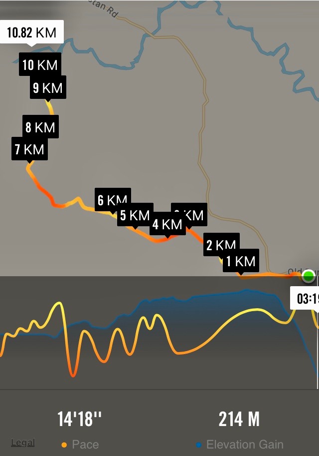
2018 Trampers – Millennium Track, Taieri Ferry Rd. to Taieri Mouth and return – “We walked 18.6 km’s. Similar times of 2 1/4 hours each way. ”
Bell Farm. (2002) Seek access permission. Lambing Aug to Oct. Cars park halfway down Taieri Ferry Road, end of forest. Up hill till lunch time. Wenita permit. Wenita Map.
Galloway Rd – Taieri Ferry Rd tracks, see map below. Seek access permission.
Clarksbrae, Clarks Junction
35 km
2. 7 Mar 2918. Both. Clarksbrae, Clarks Junction. Leaders: Jay and Jan.
On Wednesday 7th March 40 trampers and hikers completed a walk on “Clarksbrae” farm, Clarks Junction. After a 30 minute car ride we arrived on a lovely summer’s day at “Clarksbrae” Farm and parked close to the woolshed. I must say the tidiest and cleanest woolshed I have ever seen.
From there we had to take 6 cars to the end of the walk to shuttle people on completion of the walk.
It was 10.30 when we started
and the walk was on a designated stock laneway. It was a steady but gentle climb through beautiful farmland
and wonderful views of the Maungatua, The Lammermoor Range, the Rock and Pillar Range through to Middlemarch. At the end of the laneway we turned left and walked up to the trig station where we had our lunch at 12.30.
After lunch we followed a track that in places was marked out with painted arrows and warratahs with plastic bags on put in place by the farmer so as we knew which direction to take to get back to the cars. This part of the walk was generally down hill.
Many of our walkers filled plastic bags with beautiful fresh mushrooms.
The distance travelled was 11.5ks. Coffee was at the ” Wobbly Goat” in Outram. – Jay and Jan B
30 August, 2017. Hikers. Clarksbrae, Clarks Junction. Leaders: Jay and Jan.
Tramp Report from the hikers group. Our walk today comprising of 21 enthusiastic folk started at “Clarksbrae” Farm, Clarks Junction. Farm owner, Richard Nichol gave permission to us to walk along the stock lane way which was very comfortable under foot. The walk was a gentle climb with three steep short gullies to get the heart rate up a bit. Very doable for all concerned. The scenery encompassed The Maungatua, the Lammermoors, the Rock and Pillar Range and the Kakanui Range. We had lunch at the trig station which gave us 360 degrees views. The walk back was all down hill. All up we walked 10.3ks. – Jay and Jan.