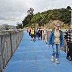
 18/02/2026. Maia to Port Chalmers. Grade 1.5. Hikers. Leaders: Mike Webb & Dave Roberts.
The Mosgiel contingent, townies and a solitary bus passenger from Port met at Maia for a leisurely walk to Port Chalmers on the shared cycle/walkway.
Taieri Recreational Tramping Club
Mid-week recreational and social walking group based in Mosgiel NZ

18/02/2026. Maia to Port Chalmers. Grade 1.5. Hikers. Leaders: Mike Webb & Dave Roberts.
The Mosgiel contingent, townies and a solitary bus passenger from Port met at Maia for a leisurely walk to Port Chalmers on the shared cycle/walkway.
Click on Map to Enlarge
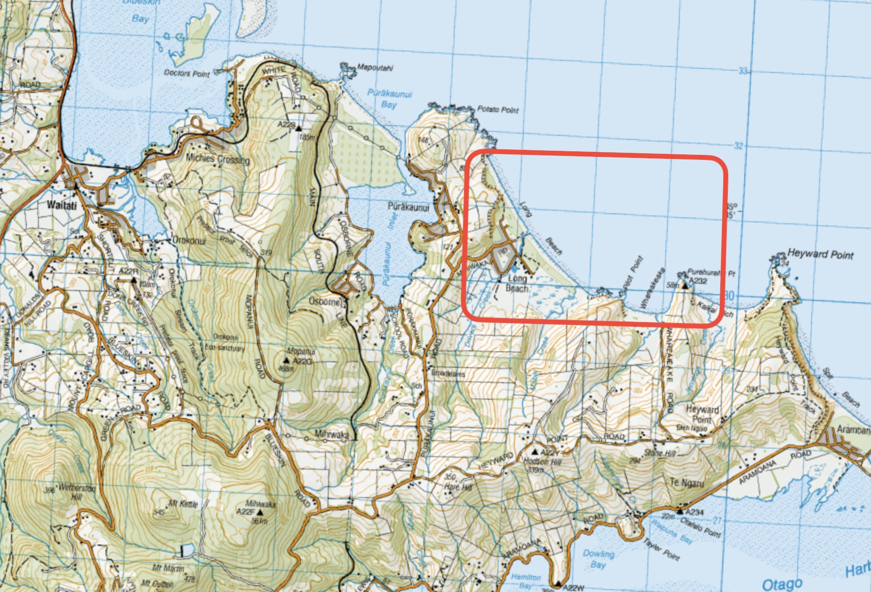
This page of club tramps and hikes in the West Harbour area groups together trips to Long Beach. (map)
Road distances from Mosgiel carpark.
TRTC Grading Information – trips incorporating these tracks are generally given a TRTC grading of around 3. This is indicative only, as trips can be allocated a higher or lesser grading depending on the route taken. For more detailed analysis refer to Grading Information.
Take SH88 to Port Chalmers. Turn sharp left onto Borlases Road then right onto Blueskin Road. Follow this road past the Scott Memorial to the intersection with Purakauni Road. Turn right and continue on this road to Mihiwaka Road which veers right and descends down to Long Beach and parking on the domain.
Long Beach. 2019 – 2004 (5 trips, 3 with reports and photos, 2 with no report or photos)
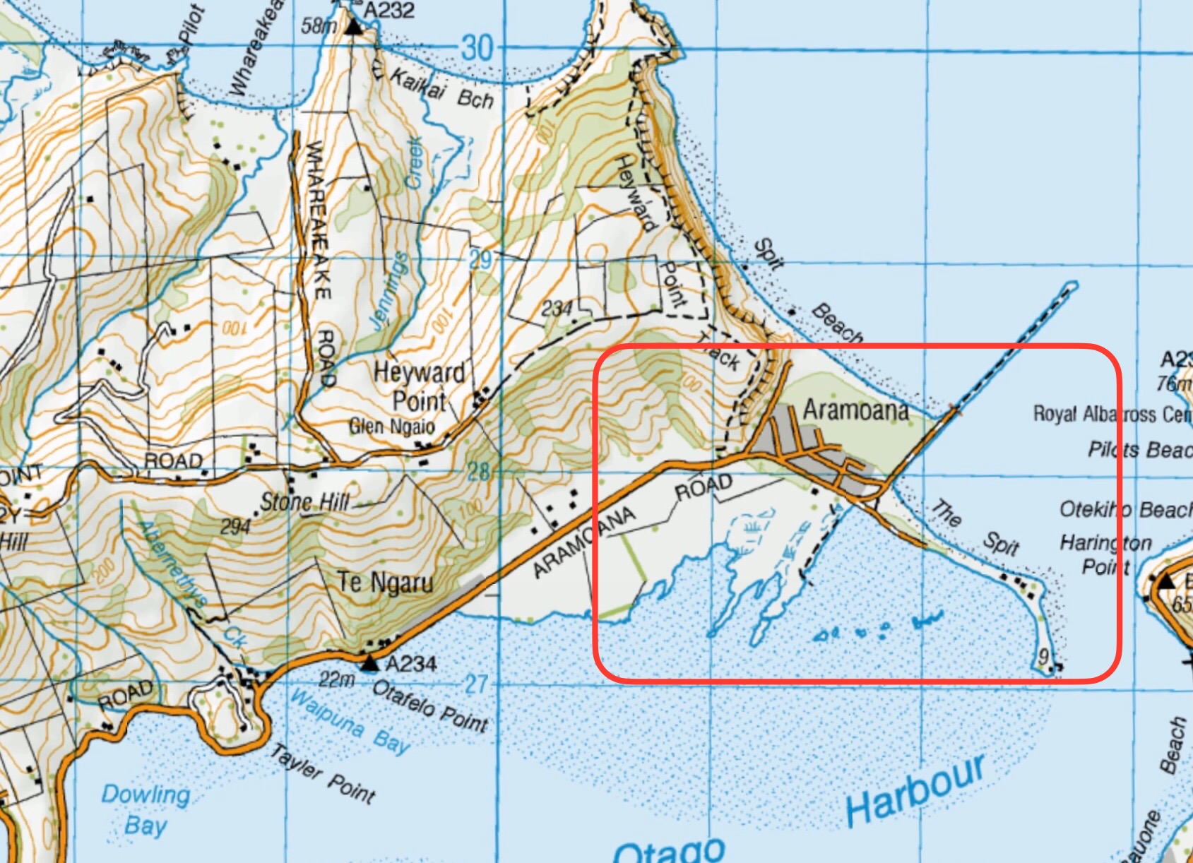
This page of club tramps and hikes to the West Harbour area groups together trips incorporating the Otago Harbour cycle/ walk way via Ravensbourne, Mia, Burkes, St Leonards to Port Chalmers.
Road distances from Mosgiel carpark.
TRTC Grading Information – trips incorporating these trips are generally given a TRTC grading of about 2. This is indicative only, as trips can be allocated a higher or lesser grading depending on the route taken. For more detailed analysis refer to Grading Information.
The Harbour walk / cycle follows the Otago Harbour from Portobello to Port Chalmers. The trips on this post however will follow SH88 and start at Ravensbourne or from the Otago Yacht Club found in Magnet Street (behind Forsyth Barr Stadium).
West Harbour Recreation Trail. 2022 – 2009 (8 trips, 6 with reports and photos, 1 with no report, 1 with report and no photos)
Click on map to enlarge
Click on map to enlarge
Click on map to enlarge
Click on map to enlarge
Click on Map to Enlarge
Click on Map to Enlarge
Click on Map to Enlarge

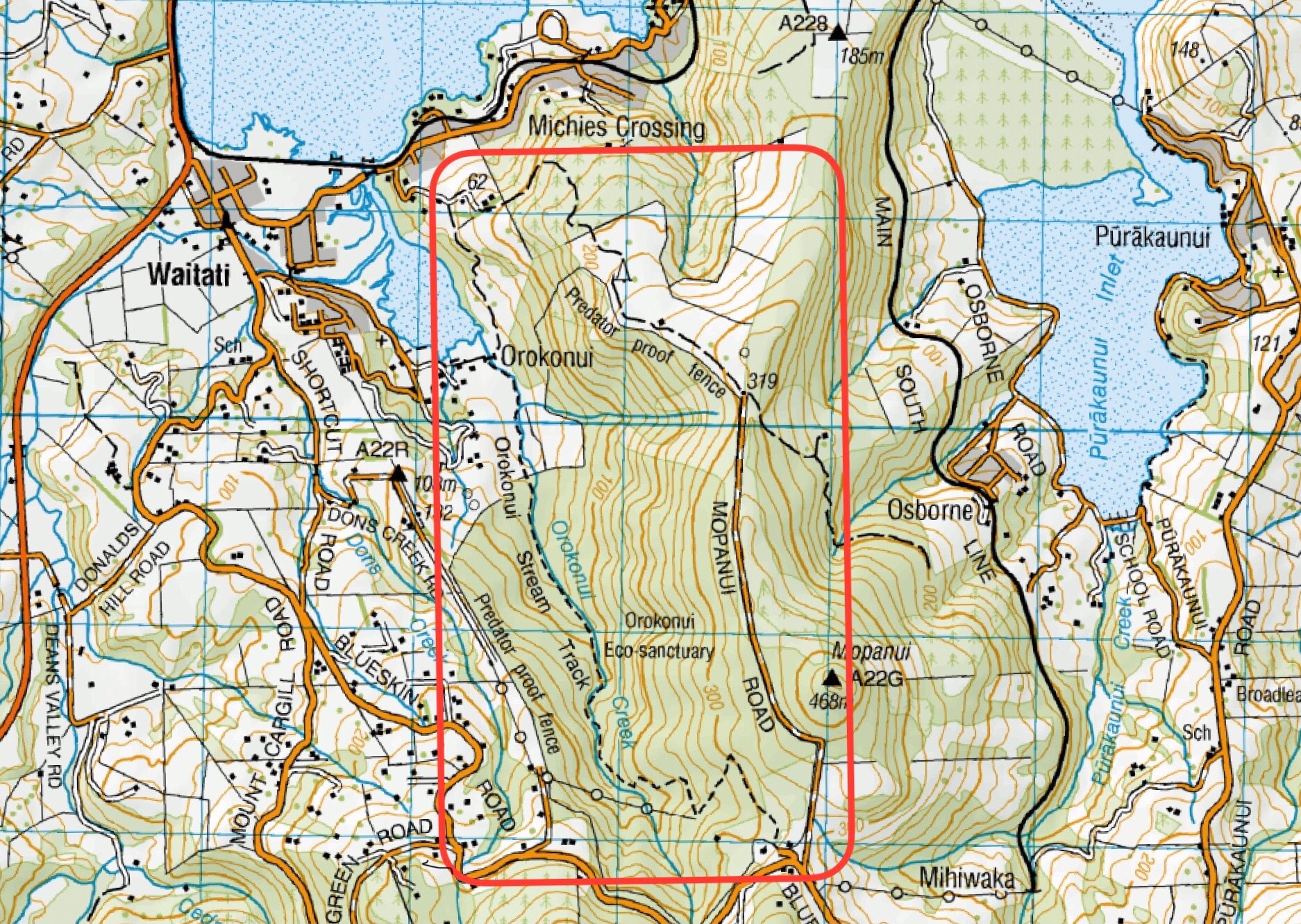
This page of club tramps and hikes to the West Harbour area groups together trips to the Orokanui Lagoon, Waititi area and the Ecosanctuary. (map)
Road distances from Mosgiel carpark.
TRTC Grading Information – trips incorporating these tracks are generally given a TRTC grading of about 3. This is indicative only, as trips can be allocated a higher or lesser grading depending on the route taken. For more detailed analysis refer to Grading Information.
How To Get There:
(1) via Waitati – take the Northern Motorway to Waitati and turn right onto Harvey Street into the township. Drive through the township to Orokonui Road and continue to the sanctuary and carparks.
(2) via Port Chalmers – take SH88 to Port Chalmers and turn left onto Borlases Road just before entering Port Chalmers. Continue up this road and take a sharp left onto Blueskin Road which will take you to the sanctuary.
Links to tramps and hikes in this area:
01/04/2026. Coastal Connection/ Orokanui Lagoon Walk. Grade 3. Combined. Leaders: Pam Cocks; Tail-end Charlies: Val Cayford, Julie McKenzie, Adrienne Ensor
22/10/2025. Orokonui Lagoon/Waitati Grade 2. Hikers. Leaders: Phil and Raewyn Keene.
20/11/2024. Orokonui / Wrights Road. Grade 3. Hikers. Leaders: Jay Devlin and Pam Clough.
Orokonui Ecosanctuary. 2012 – 1996 (9 trips, 1 with reports and photos, 1 with photos only, 7 with no reports or photos)
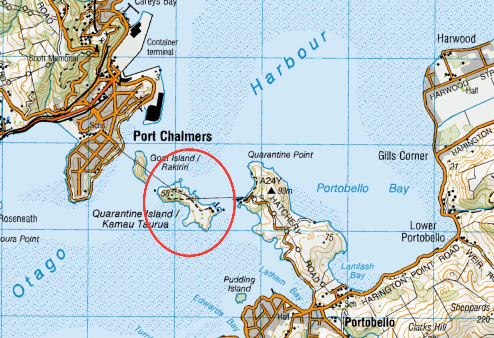
This page of club tramps and hikes to the West Harbour area groups together trips to Quarantine Island. (map)
Road distances from Mosgiel carpark.
TRTC Grading Information – trips incorporating these trips are generally given a TRTC grading of about 2. This is indicative only, as trips can be allocated a higher or lesser grading depending on the route taken. For more detailed analysis refer to Grading Information.
General Information:
Wikipedia entry on Quarantine Island
And here is the St Martin Island Community web page. Click the photo at the bottom to see original buildings!
Quarantine Island: Botanical Report
(1) Back Beach Port Chalmers – take SH88 to Port Chalmers. Continue through the township and turn right at the end of George St. Follow this road past the ports logging terminal to Back Beach.
(2) Portobello – take Portsmouth Drive, turn left to cross the causeway and onto Portobello Road. Continue on this road to Portobello township.
Quarantine/St Martins Island. 2023 – 1997 (5 trips with 3 reports)
This page of club tramps and hikes in the West Harbour area groups together trips for Port Chalmers, St Leonards, Mia, Deborah Bay and Rangi Park walkway.
Road distances from Mosgiel carpark.
TRTC Grading Information – trips to Port Chalmers and surrounds are generally given a TRTC grading of 2. This is indicative only, as depending on the route taken, allocation of gradings can differ from this. For more detailed analysis refer to Grading Information.
Click Dunedin’s Hills’ History for background Information.
Drive to Forsyth Barr Stadium and take SH88 through Ravensbourne, Mia, St Leonards and Sawyers Bay to reach Port Chalmers.
18/02/2026. Maia to Port Chalmers. Grade 1.5. Hikers. Leaders: Mike Webb & Dave Roberts.
16/04/2025. Historic Port Chalmers. Grade 2.5. Hikers. Leaders: Mike Webb. Jenni Wright.
Maia to Port Chalmers. 2024 – 2023 (2 trips with 2 reports)
Port Chalmers and environs. 2022 – 1995 (24 trips with 10 reports)
Port Chalmers, Deborah Bay. 2001 – 1995 (3 trips, no reports or photos)
Port Chalmers Rangi Park. 1997 – 1996 (2 trips, no reports or photos)
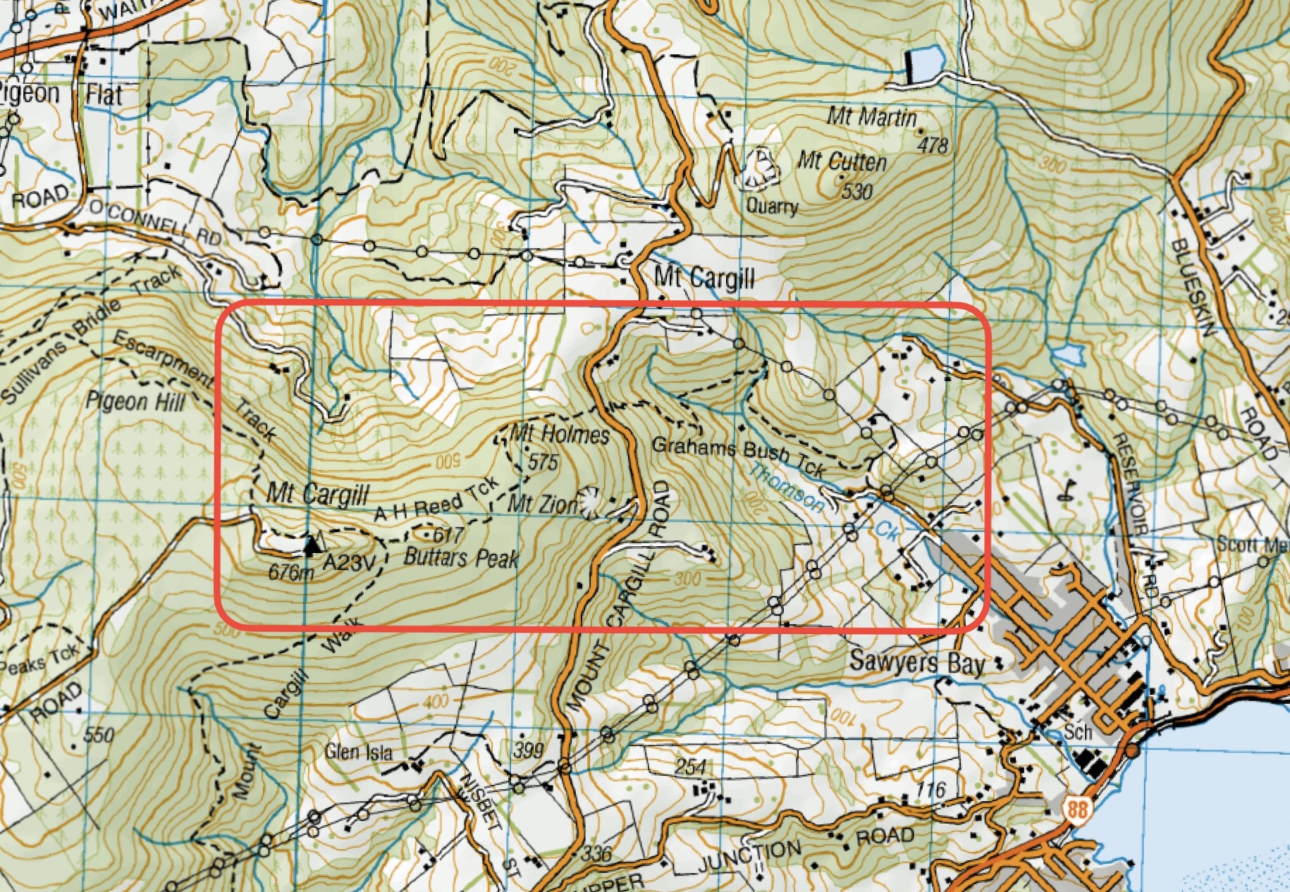
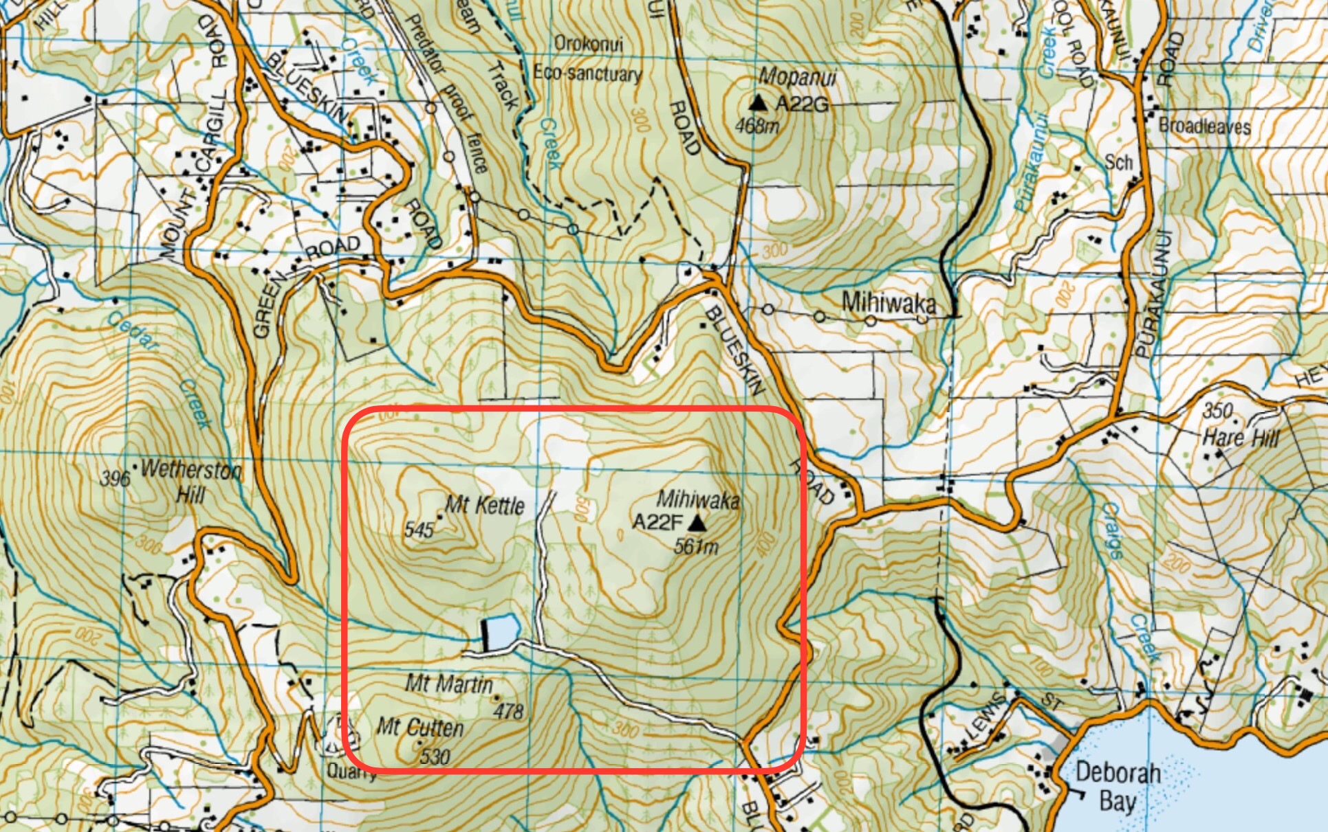
This page of club tramps and hikes in the West Harbour area groups together trips to Mihiwaka, Mt Kettle, Mt Cutten and Cedar Farm. (map)
Road distances from Mosgiel carpark.
No permission needed to reservoir.
Cedar Farm: Seek Access Permission DCC Forestry.
TRTC Grading Information – trips incorporating these tracks are generally given a TRTC grading of 3. This is indicative only, as trips can be allocated a higher or lesser grading depending on the route taken. For more detailed analysis refer to Grading Information.
(1) Cedar Farm – take SH88 to Port Chalmers and at the south end of George Street turn sharp left onto Borlases Road then right onto Blueskin Road. Continue on this road past Scott Memorial to Cedar farm Road on the left (about 10 – 15 minutes further on). Limited parking is available.
(2) Mihiwaka – proceed past Cedar Farm Road (about 5 minutes) past the “S” bend in the road to the start of the track. Limited parking is available.
15/04/2026. Cedar Farm to Mount Cutten. Grade 3.5. Hikers. Leaders: Wendy Langley and Jill Thomas.
09/07/2025. Peak Bagging from Cedar Farm. Grade 4. Trampers. Leaders: Sarah McCormack and Ross Davies.
22/01/2025. Cedar Farm to Mt Cutten. Grade 3. Hikers. Leaders: Heather Reid, Val Cayford.
Mihiwaka, Mount Kettle, and Cedar Farm. 2024 – 1998 (10 trips with 6 reports, 1 with photos only)