
 14/01/2026. Hoopers Inlet, Rutherfords – Stewarts, Lime Kilns, Nyhon Track. Grade 3. Trampers. Leaders: Spen Walker, Jane Bruce, Sandy Webb
The Mosgiel contingent had an 8.30 am start and arrived at Shore St before 9 am, ably coordinated by Neil Hodgkin.
Graeme Souter phoned from Pukehiki to warn us that Highcliff Rd was closed at that point*, so we drove to Hoopers Inlet via Portobello. There was safe parking at the roadside for our six cars.
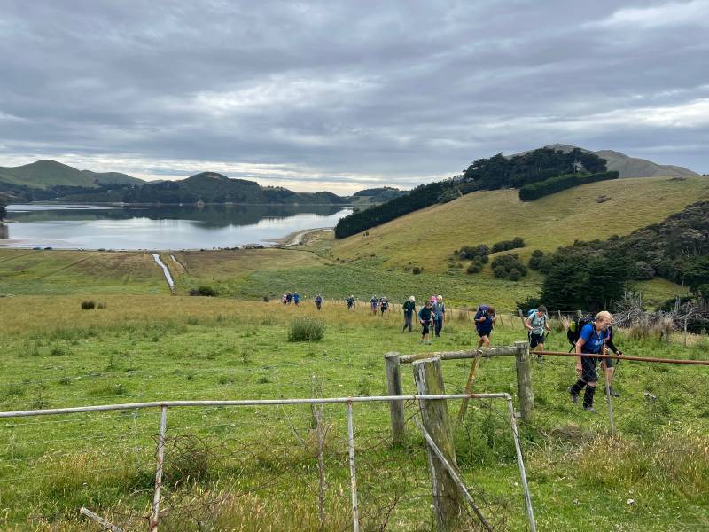
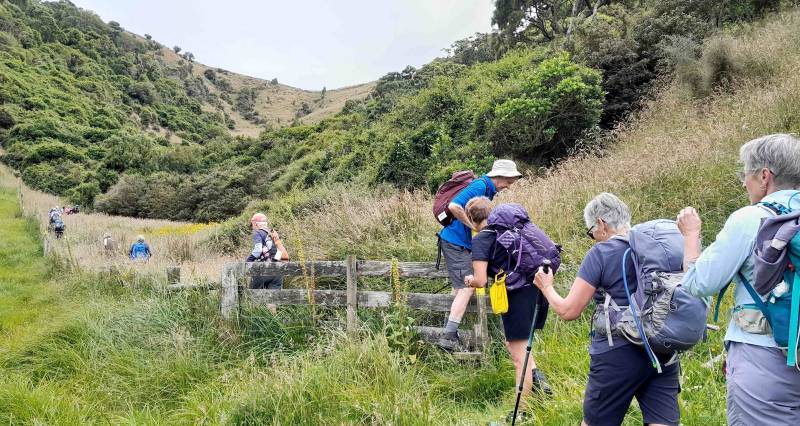
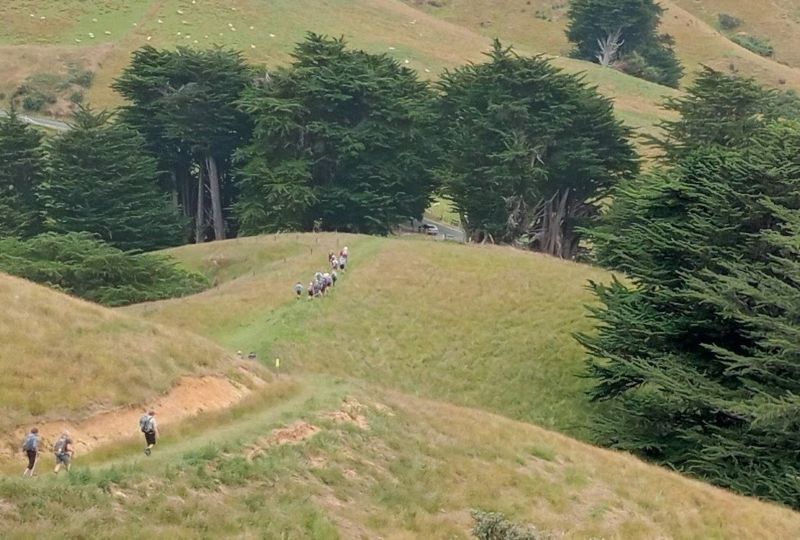
As we crossed the Nyhon Track stile and set off through the sedges, a pied stilt flew around to lead us away from its territory. Up a short hill, then a 90 ° right turn to follow the yellow marker posts on another paper road, along fencelines and over stiles, to the DCC’s Hereweka Block.
We stepped over Stewarts Creek, commented on the Canadian geese poo, then crossed another stile into Rutherfords Bush.
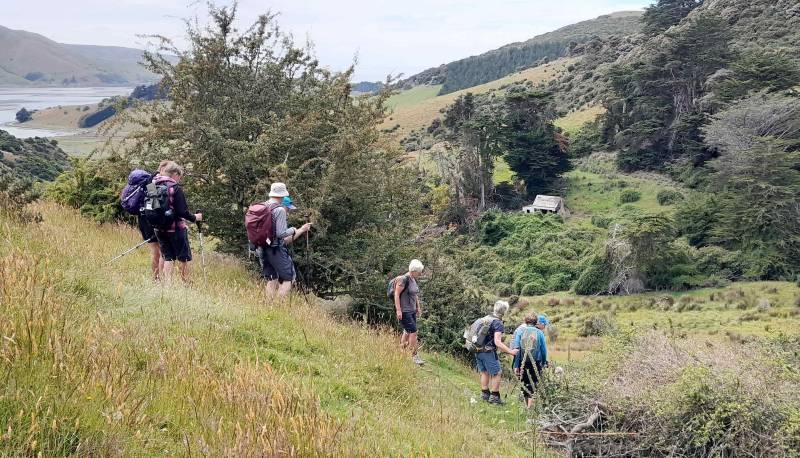
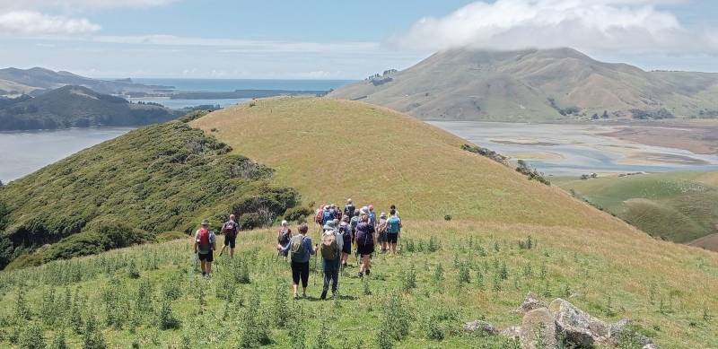
This 5.7 ha bush remnant was protected by fencing in 2023. Everyone managed the steep uphill, helped by knotted ropes on the worst bits. Out onto the paddocks again, and across to Rutherfords homestead for morning tea with a panoramic view across Hoopers Inlet.
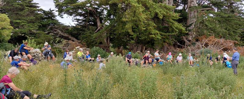
James Rutherford and Stephen Ellis probably became partners on the Otago goldfields. They bought this farm in 1863 as tenants-in-common, until 1869 when the Ellises bought the neighbouring property. We know the two families remained close friends, as they each named some children after each other. The Rutherford homestead “Lilybank” and cowbyre were built about 1867 from stone quarried 100m away. After the house was abandoned in 1919 it was dismantled and the stones used to built the drystone boundary wall we sat beside.
A scenic stroll up to Coffee Rock, where we met Duncan from the Hereweka Trust. He was about to fly a drone across Rutherfords Bush to locate where Chilean flame creeper was growing, and then do a search and destroy on the pest plant.
A brief walk along Highcliff Road to the Ellis farm, where there is no trace of the wooden homestead. However we do know that they milked 12 first-class cows, that Catherine Ellis and her unmarried daughters Charlotte and Janet signed the 1893 Suffrage Petition, and that when the Ellis’ retired in 1903 their friends and nieghbours presented them with handsome easy chairs.
We could see the Stewart homestead below us in the valley.
It didn’t take long to zigzag down the paddock and step across Stewarts Creek. The macrocarpas here were mangled by the 2025 gales so we went up the paddock, avoiding fallen trees, and around to the foundations of the cow byre behind the house. After we took a look at the house it was almost noon, so this was our lunch spot.
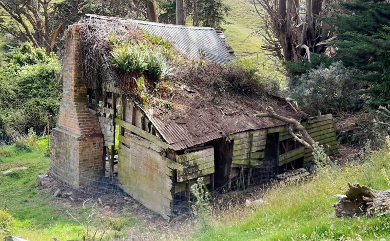
Robert Stewart bought this farm “Glenmore” in 1866 and built his house shortly after, from timber milled and pit-sawn on the property. Looking up we could see the original hand-split wooden shingles underneath the later corrugated iron roof. Robert and Marion raised thirteen children, followed by their son William and wife Jessie who milked 27 cows in that cowshed and lived here until 1950. After that their son Ron, a sheepfarmer, used the old house as a hayshed. It’s good to see the Hereweka Trust have started restoration work on this historic cottage!
Our next stop was the 1865 limekiln a bit further up the valley. This was built by stonemason James McDonald, who recognised Dunedin’s demand for burnt lime to make building mortar. The Hereweka Trust has recently cleared the trees that were overgrowing the kiln, so we could see the three parts of the kiln – the charging bowl at the top where layers of limestone and firing material were stacked, the firebox with air holes in the middle, and the drawing eye at the base where the burnt lime was extracted. This kiln could turn out 150 bags of lime a day.
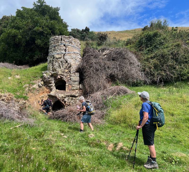
McDonald’s Peninsula Lime was very successful, and in 1872 McDonald built a larger kiln halfway up the hill. The Robertson brothers, who farmed nearby, took over this 1865 kiln and ran it as Glenmore Lime Kilns for a few years more.
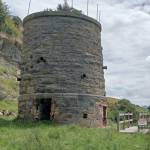
We explored the 1865 kiln and quarry for a while, and some people discovered that by peering through a crack in the kiln stonework they could see the firebrick lining. Then we climbed halfway up the hill to admired McDonald’s impressive 1872 lime kiln. This was restored by the Otago Peninsula Trust in 1976 as a tourist attraction.
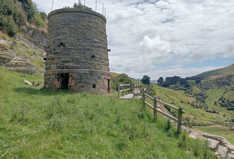
However it seems this kiln gave a lot of trouble and McDonald immediately built a replacement kiln on Walter Riddell’s property at the top of the hill. After McDonald’s bankruptcy the Milburn Lime and Cement company took over this 1872 kiln and ran it until 1909.
Once we reached Sandymount Road we paused to look at the remains of the 1874 kiln above the road. Most of it has been dismantled, leaving only the drawing eye at the base. In 1875 McDonald expanded his business and built kilns at Milburn, so from 1878 the Riddell family took over. Riddell’s Hydraulic Lime Company continued to run this top kiln, selling burnt lime and also crushed limestone as roading metal, up until 1939. The huge quarry behind the kiln shows how much stone was used – people who were pupils at Sandymount School remember blasting at the quarry and stones falling on the school roof!
We hadn’t organised a gin tasting at Sandymount Distillery (maybe next time?), so we ambled off down Sandymount Road. We weren’t exactly keeping to the side of the road, but fortunately there wasn’t any traffic…
Our leader took us up the steep Nyhon Track steps because that is the official public road route (instead of the easier driveway). It was a pleasant wander down the hill,
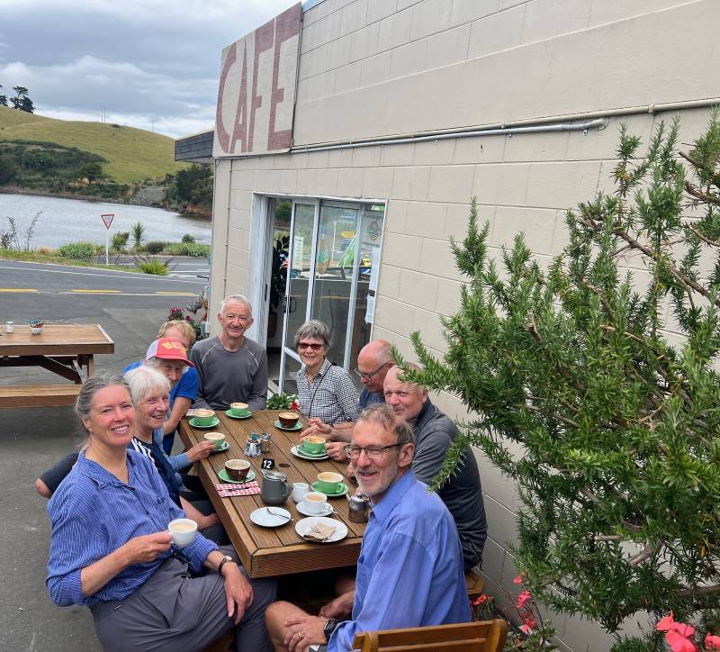
on a farm track and through a patch of manuka. We got back to the cars at Hoopers Inlet at 2.10pm, welcomed by the same pied stilt. Two carloads stopped for a coffee in the sun at the Cove café at Portobello.
Trip stats: 8 km, 437m total ascent, 4h 38m total time, 2h 50m moving time. Fine weather and 27 people.
* Turns out the “Road Closed” signs at Pukehiki and Portobello are misleading…! Highcliff Road is only formally closed between Sandymount Rd and Seaton Road.
Link to background information and earlier tramps and hikes in the same area.