Mount Hyde Station

No. 5 on old hardcopy list of 113 club tramps. “Mt Hyde to Taieri River. Aqueduct. D Moir. Farm. Lambing.”
Location: 23.5 km. Lambing September-November.

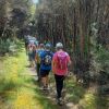
Dsc07061 Square 100x10016. 8/11/2023. Trampers. Mt Hyde. Grade 3.5. $7. 24km. Leaders: Anne Ward, Di Bezett, Lyn Keene
We started our tramp with an enthusiastic group of 23.

Continue reading “Mount Hyde Station”

President’s Update – November 2023

November 2023 Update: Taieri Recreational Tramping Club 

Hi everyone, 

Running a bit late with this, but following our birthday party and AGM, a bit has been happening so  here goes. Firstly …. 

Welcome 

Who needs marketing teams to drum up business when our reputation for visiting interesting places  and walking, talking, drinking coffee and eating ice-cream is out there. So welcome to Carolyn  Pridham, Heather Reid, Chris Bezett, Val Cayford, Katrina McKenzie, Lenore Armstrong, Wendy  Langley, Sylvie Watt, Adrienne Ensor, Vivienne Manning, Karon Read and Jenny Wilton. We are  enjoying your company. 

Photo Show for 35th Birthday Celebrations 

After a bit of experimentation and playing around with options Ross has placed these photos on his YouTube site and these can be accessed at https://youtube/004hkDp4xt4. On your smart device/TV  they can happily be displayed to add background to a romantic dinner or showing others that we  have not aged down through the years or….. 

Summer Trip Programme 

Thanks to everyone for your suggestions and for the teams putting the programme together. The programme is presented in two ways on the website.  

  1. listed under “Recent Posts” – “Upcoming Trips”  
  2. can be printed direct from the link “copy of trip programme for printing”. Due to the dynamics  around trip organisation please note the “Upcoming Trips” is the most timely information. 

Fuel costs have been adjusted for the summer programme and a reminder that the club will  reimburse a driver for doing a recce where the fare is $10.00 and over per person times 3 = $30.00.  An email to the Secretary ([email protected]) confirming the recce was done and the date will be  sufficient for the reimbursement to be arranged. 

There are some trips where a grading is not shown, this can be due to a variety of reasons, maybe a  first time, or the exact details are not finalised until the recce is complete and the leader provides a  confirmed grade for the weekly email. 

One of the actions being undertaken by the Webteam is to build a master spreadsheet of all the  tracks that we use/ have used. We intend to add to this list the grading of the track as well as when  the walk was last undertaken. This spreadsheet will have multiple benefits, not the least being having  one master rather than multiple lists to comb through when compiling upcoming trip programmes. 

We have also made some small changes to the Grading document to emphasise that we are grading  the track, not fitness. The grading of a track is the same regardless of which group is undertaking it.  To assist in getting track profiles completed, feedback on gradings is always welcome and could be  included in the feedback when write ups are completed etc. 

With the ongoing changes to the contact list of members the Committee has agreed that a hard copy  will not be kept with the locator beacon bag; members (and Committee) can download a copy onto  their phones.

Webteam 

The team met recently to review how they are operating and to discuss detail, which happily most of  us don’t see, but which is critical to the functioning of the team and maintenance of the website. The  eagle eyed amongst you may notice some subtle changes. Subsequently myself, Jenni Wright and  John Gardiner joined the team. 

It was agreed that 

  • a session will be run for those interested in sending in photos to the Webteam  from time to time, the master photo (Saddle Hill) on the home page be refreshed  we assess options for refreshing the website 
  • we assess back up options for maintenance of the more IT aspects of the website; this is  quite critical as what may appear as quite easy requests or functions actually require  multiple pages of instruction! 
  • we evaluate what information sets require passwords/be restricted or unrestricted 

It was also agreed that a fourth web team member be added to the team to give more flexibility and  that also we identify a back up for the Communications Officer especially in the more detailed areas  of the website administration. If anyone is interested in assisting in these roles, please contact/  discuss with Ross Davies. 

Kelvin Heights 

Arrive Sunday 25 February 2024 – depart Friday 1 March 2024 

Just a reminder to pencil this in and detail will follow in due course. This will focus on walks with no biking organised this time. Contact Anne at [email protected] if you require more  information at this time. 

Xmas Lunch and Walks 13th December 

Pencil this one in, to be held at the North Taieri Church Hall. More information shortly. Note the first walk in 2024 is on the 17th January 2024. 

Track Clearing 

A separate note will follow very shortly but as mentioned the aim is to continue the work of Neil  Morrison and Arthur Heenan by taking a working bee approach under the umbrella of the Green Hut  Group. I have met with Arthur, Neil and Graeme Elliott from the Green Hut Group to confirm how we  could assist and under what terms and conditions, as the Green Hut Group has formal arrangements  with DCC and DOC. All we need now is volunteers! 

Thanks everyone and looking forward to a warm dryish summer of walking. 

Phil Keene 5 November


Link to President’s Update information Library  for previous updates

Green Hut, Pulpit Rock

Location: 43 km from car park. Click Silver Peaks Forest for background information. No. 21 on old hardcopy list of 113 club tramps. “Green Hut & Pulpit Rock return or via Possum Hut. Year Round. Long.”

23. 1/10/2023. Combined. Green Hut Site and Pulpit Rock. Tramp Grade 4, Hike Grade 2. 43km. Leaders: Neil Hodgkin/Chris Bezett, Dave Roberts/Jay Devlin.

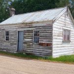
image (2) Helen square RES100x100Hike to Green Hut (which is now two seats as the hut was deconstructed in 1988 because of ongoing vandalism).
On a foggy morning 18 keen hikers regathered at the On the Spot garage at Waitati where we turned left up a dusty road to the beginning Continue reading “Green Hut, Pulpit Rock”

Bull Ring, Flagstaff Walkway, Ben Rudd, Pineapple Track – Information and Trips Library

Scope:

This page of club tramps and hikes in the Dunedin Central City area groups together trips from the Bull Ring (Flagstaff / Whare Flat Road) and incorporates the Flagstaff Walkway, Pineapple Track and Ben Rudd shelter. (map)

Background Information:

Road distances from Mosgiel carpark.
Location: 13.3 km from car-park.

TRTC Grading Information – trips incorporating these tracks are generally given a TRTC grading of about 3. This is indicative only, as trips can be allocated a higher or lesser grading depending on the route taken. For more detailed analysis refer to Grading Information.

Dunedin’s Hills’ History for background information.
Pineapple Track for background information.
Pineapple and Flagstaff walk for background information.
Flagstaff Name for its origin.
Ben Rudd Article for background information.

How To Get There:

Access to the Bull Ring (and the Pineapple Track) on Flagstaff is off the Flagstaff-Whare Flat Road. This can be accessed off Three Mile Hill Road by turning left at the top of Three Mile Hill and continuing approx. 5 minutes to the Bull Ring carpark.

Links to tramps and hikes in this area:

10/06/2026. Flagstaff. Grade 3. Hikers.  Leaders: Phil Keene and Barbara Shackell.
23/10/2024. Flagstaff, Bull Ring.  Grade 2.5. Hikers.  Leaders: Theresa White, Julie MacKenzie.

Bull Ring, Flagstaff Walkway/ Pineapple Track. 2018 – 2008 (8 trips, 3 with reports and photos, 2 with photos only, 3 with no reports or photos)
Bull Ring, Ben Rudd. 2024 – 1995 (13 trips, 3 with reports and photos, 10 with no reports)


Sullivans Dam, Cloud Forest, 3 Peaks – Information and Trips Library

Scope:

This page of club tramps and hikes in the Dunedin Central City area groups together trips  to Mt Cargill via Cowan Road, Sullivans Dam, Cloud Forest Track, 3 Peaks Track, Escarpment Track. (map)

Background Information:

Road distances from Mosgiel carpark.

Map: Sullivans Dam, Cloud Forest, Telegraph (Old Bridal) track to Pigeon Flat, Escarpment Track, Cowan Rd, Short Cut to Fox Rd, down to Sullivans Dam – drawn 2002. – click on Sullivans Dam, Cloud Forests, Escarpment, Cowan round trip link below.

TRTC Grading Information – trips incorporating these tracks are generally given a TRTC grading of about 3. This is indicative only, as trips can be allocated a higher or lesser grading depending on the route taken. For more detailed analysis refer to Grading Information.

How To Get There:

(1) Sullivans Dam – drive north along the one way street system to David Street and turn right. Follow the road through the traffic lights to Malvern Street (past Woodhaugh Garden). Continue up Malvern St to Morrisons Road (where the seal ends) and cross the overbridge (over SH1) to Sullivans Dam.

(2) 3 Peaks Track – this is accessed off Cowan Road. Take the one way street system north and turn right just before the motorway onto Pine Hill Road. Continue on this road to the very end and turn right onto Cowan Road.

Links to tramps and hikes in this area:

12/11/2025. Three Peaks, Escarpment, Cloud Forest Loop. Grade 3.5. Trampers.  Leaders: Sarah McCormack and Karen McInnis.

Pine Hill, Mount Cargill round trip. 2023 -1991 (4 trips, 1 with report and photos – 23/9/2023)
Sullivans Dam, Cloud Forests, Escarpment, Cowan round trip. 2022-2005 (10 trips, 5 with reports and photos, 2 with photos only, 5 with no report or photos)
Sullivans Dam. 2009 – 1998 (7 trips – no reports or photos)
Leith Saddle, Sullivans Dam, Bridle Track, Pigeon Flat. 2006 – 1999 (4 trips – no reports or photos)


Shannons Farm Walk

Distance from PJP car park 48km.

Middlemarch Area – Information and Trips Library


3. 25/10/2023. Trampers.  Cairn Valley/Shannon, Grade 3, 48km. Leaders: Heather Kirk, Diane Paterson.

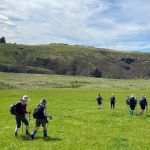
Walking through lush grassLovely sunshine greeted 30 keen trampers for a good day’s walk on Cairnvalley Farm Shannon. Strath Taieri offers something different in scenery with tussock hills, huge rock formations and at this time of the year fresh green vistas of paddocks and Continue reading “Shannons Farm Walk”

Outram – Allanton Flood Bank

Outram 10 km /  Henley 21 km – from car park.

Outram, Allanton, Floodbanks, Lee Stream, Traquair, Whare Creek – Information and Trips Library


4. 25/10/2023. Hikers. Outram Loop. Grade 1.5, 11km, Leaders: Sue Nichol, Kathryn Fagg.

image (1) Square RES150x150Outram turned on another scorcher for 16 hikers. We started at the West Taieri Rugby Club and walked around Kings Court and Anzac Court subdivisions where the gardens were in full bloom. Continue reading “Outram – Allanton Flood Bank”

Greengage Track – Information and Trips Library

Scope:

This page of club tramps and hikes in the Silver Peaks area groups together those trips to the Greengage Track  (map) which incorporates Raingauge Spur, Swampy Ridge, Rollinsons and Green Ridge Tracks.

Background Information:

Road distances from Mosgiel carpark.

TRTC Grading Information – trips incorporating these tracks are generally given a TRTC grading of 5. This is indicative only, as trips can be allocated a higher or lesser grading depending on the route taken. For more detailed analysis refer to Grading Information.

The Greengage Track runs between Raingauge Spur and the Green Ridge Track. There is a number of ways to access this track – the following provides 3 options.

How To Get There:

Option 1 – via Raingauge Spur which is via Rollinsons Road and  will require a key to the gate approx. 2 km’s from the “Elbow” where the Raingauge track starts. A key is currently held by the club President.

Option 2 – via the Swampy Ridge Track. Access to the summit of Swampy is via Rollisons Road (option 1) with the track commencing from the Swampy Summit. This route joins the Green Ridge which forks with Greengage.

Option 3 – via Waitati. Turn left onto Double Hill Road which joins Semple Road to the starting point of he Green Ridge Track.

Links to tramps and hikes in this area:

30/10/2024. Greengage Track. Trampers.  Leaders: Graeme Souter and Graham Thurlow.

Greengage Track. 2019-2014 (3 trips with reports and photos)


St Clair Beach Walks

17. 11/10/2023. Hikers. St Clair, St Kilda, Ocean Grove. Grade 2, $5, 17km, Leaders: Bruce Spittle/Alex Griffin
IMG20231011111808 RES100x100Nineteen hikers left Marlow Park in sunny conditions at about 0930 after singing happy birthday to Liz Griffin and walked over the Kettle Park Sports field and up a track to the Barnes Lookout.

Continue reading “St Clair Beach Walks”

Trotters Gorge – Information and Trips Library

Scope:

This page of club tramps and hikes covers trips on the North Coast north of Dunedin City, Waitati involving club trips to Trotter Gorge. (map)

Background Information:

Road distances from Mosgiel carpark.

TRTC Grading Information – trips incorporating these tracks are generally given a TRTC grading of about 3. This is indicative only, as trips can be allocated a higher or lesser grading depending on the route taken. For more detailed analysis refer to Grading Information.

How To Get There:

Take SH1 North and at the end of the Katiki Straight (before Moeraki) turn left onto Horse Range Road. Follow this road to Trotters Gorge Road and turn right onto Trotters Gorge Road continue on to the DOC Scenic Reserve for parking and toilets.

Links to tramps and hikes in this area:

09/04/2025. Trotters Gorge. Grade 3. Trampers.  Leaders: Neil Hodgkin and Sarah McCormack.

Bus Trip: Trotters Gorge. 2022 – 2003 (4 trips, 2 with reports and photos, 1 with phots only, 1 with no report or photos)
Horse Range, Trotters Gorge. 2004 (1 trip, photos only)


Harwood – Information and Trips Library

Scope:

This page of club tramps and hikes covers trips to the Otago Peninsula and involves trips to Harwood. (map)

Background Information:

Road distances from Mosgiel carpark.

TRTC Grading Information – trips incorporating these tracks are generally given a TRTC grading of about 2. This is indicative only, as trips can be allocated a higher or lesser grading depending on the route taken. For more detailed analysis refer to Grading Information.

How To Get There:

Drive along Portsmouth Drive and turn left over the causeway and follow Portobello Road through Portobello township (approx. 19 kms.)  and onto Harington Point Road. Take a left onto Tidewater Drive (where Harington Point Road takes a sharp right) to Harwood township

Links to tramps and hikes in this area:

29/01/2025. Harwood Area. Grade 2. Hikers.  Leaders: Raewyn Keene and Helen Morris.

Harwood – End of year picnic. 2017 – 1998 (6 trips, 1 with reports and photos, 3 with photos only, 2 with no report or photos)


Chrystalls Beach, Toko Mouth

No. 47 on old hardcopy list of 113 club tramps. “Toko Beach. M Young”; also No. 65 on old hardcopy list of 113 club tramps. “Chrystalls Beach Farm”. Location: 59 km from the car park. Best in Summer. The stock winter over.
Directions: On SH1, before Milton, at Helensbrook intersection, left onto Forsyth Road, right onto Back Road, left onto Glenledi Road.

Chrystalls Beach, Toko Mouth, Cooks Head – Information and Trips Library


22. 11/10/2023. Trampers. Crystalls Beach. Grade 2.5, $15, 59km, Leaders: Dave Roberts, Jill Reid
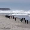
IMG_7384 100x100A fine overcast morning greeted us at Peter Johnstone Park with 19 trampers in 5 cars beginning our tramp at 10am. Continue reading “Chrystalls Beach, Toko Mouth”

Akatore Area (inc. Coutts Farm / Gully, Taieri Mouth) – Information and Trips Library

Scope:

This page of club tramps and hikes in the South Coast area groups together trips to the Akatore Area including Coutts Farm / Gully, Sawmill Road and Taieri Mouth. (map)

Background Information:

Road distances from Mosgiel carpark.

Access Permissions are required for trips to Akatore and Coutts Farms – refer guidelines

TRTC Grading Information – trips incorporating these tracks are generally given a TRTC grading of 3. This is indicative only, as trips can be allocated a higher or lesser grading depending on the route taken. For more detailed analysis refer to Grading Information.

How To Get There:

To reach Akatore Creek take the Taieri Mouth Road from Brighton, across the bridge at Taieri Mouth. Continue on Moturata Road and onto Akatore Road to Akatore Creek carpark on the left, just before crossing Akatore Creek bridge.

Links to tramps and hikes in this area:

16 /7/2025. Taieri Mouth. Grade 2.5. Hikers.  Leaders: Alex Griffin, Adrienne Ensor.
09/07/2025. Coutts Farm. Grade 3. Hikers.  Leaders: Bruce Wright and Peter Beal.
15/01/2025. Akatore Creek to Taieri Mouth. Grade 3. Trampers.  Leaders: Spen Walker and Jane Bruce.

Coutts Gully / Farm, Sawmill Road. 2024 – 1988 (23 trips, 10 with reports and photos, 1 with photos only, 1 with report only, 11 with not report or photos).
Akatore Farm Walk or Beach Walk. 2019 – 1991 (15 trips, 8 with reports and photos, 2 with photos only, 5 with no report or photos)
Akatore Forest. 2016 – 1991 (8 trips, 4 with reports and photos, 4 with no reports or photos)


Takitakitoa Wetlands – Information and Trips Library

Scope:

This page of club tramps and hikes in the South Coast area groups together trips to the Takitakitoa Wetlands Reserve. (map)

Background Information:

Road distances from Mosgiel carpark.

TRTC Grading Information – trips incorporating these tracks are generally given a TRTC grading of  2. This is indicative only, as trips can be allocated a higher or lesser grading depending on the route taken. For more detailed analysis refer to Grading Information.

https://www.fishandgame.org.nz/game-bird-hunting-in-new-zealand/where-to-hunt/regional-info/otago/takitakitoa-wetland/

https://www.southroads.co.nz/projects/takitakitoa-wetland-restoration-project

How To Get There:

The Takitakitoa Wetlands is located about 40 minutes drive south of Dunedin and is at the end of Takitakitoa Road off Otokia-Kuri Bush Road. Take SH1 south and turn off at the Henley turn off just before the bridge that crosses the Taieri River. Turn right onto Otokia-Kuri Bush Road West which will intersect with Otakia-Kuri Bush Raod.

Links to tramps and hikes in this area:

11/12/2024. Takitakitoa, Wetland, Waihola Hall. Grade 2. Combined hike and Christmas Lunch.  Leaders: Jan Butcher, Wendy Langley, John Gardiner, Graeme Souter.

7/4/2021. Takitakitoa Wetland/Lester Harveys 90th Birthday. All. Leaders. Raewyn, Phil and Jill D


Powder Ridge – Information and Trips Library

Scope:

This page of club tramps and hikes in the Whare Flat area  groups together trips to Powder Ridge (map)

Background Information:

Road distances from Mosgiel carpark.

TRTC Grading Information – trips incorporating these tracks are generally given a TRTC grading of 5. This is indicative only, as trips can be allocated a higher or lesser grading depending on the route taken. For more detailed analysis refer to Grading Information.

Silver Peaks Forest for background information on the nearby area. DCC land.
Powder Ridge Maintained by Green Hut Track Group.

How To Get There:

Powder Ridge track runs between Racemans and Long Ridge Tracks. It is best accessed from Racemans Track approximately 30 -40 minutes from the Whare Flat carpark along the Silverstream Valley Road off Dukes Road North (just before Three Mile Hill)

Links to tramps and hikes in this area:

12/02/2025. Powder Ridge to Long Ridge (return). Grade 5. Leaders: Pam Cocks, Esther Willis.

Powder Ridge tramps. 2021 – 1991 (13 trips, 6 with reports and photos, 1 with photos only, 6 with no reports or photos)