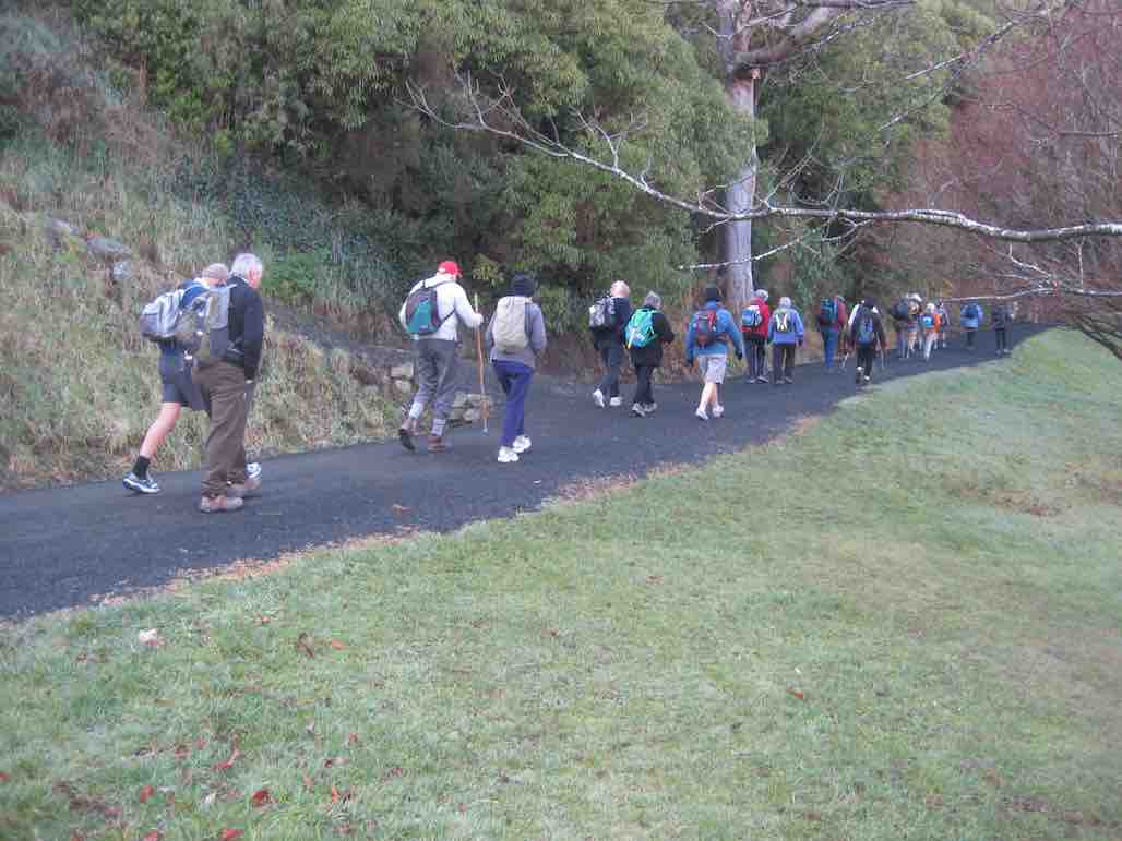
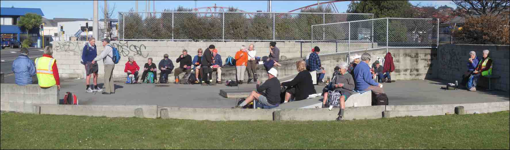
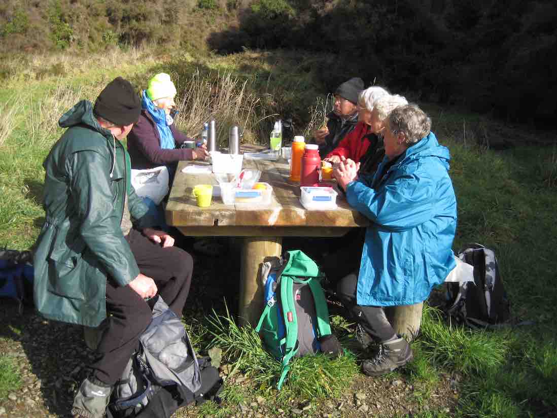
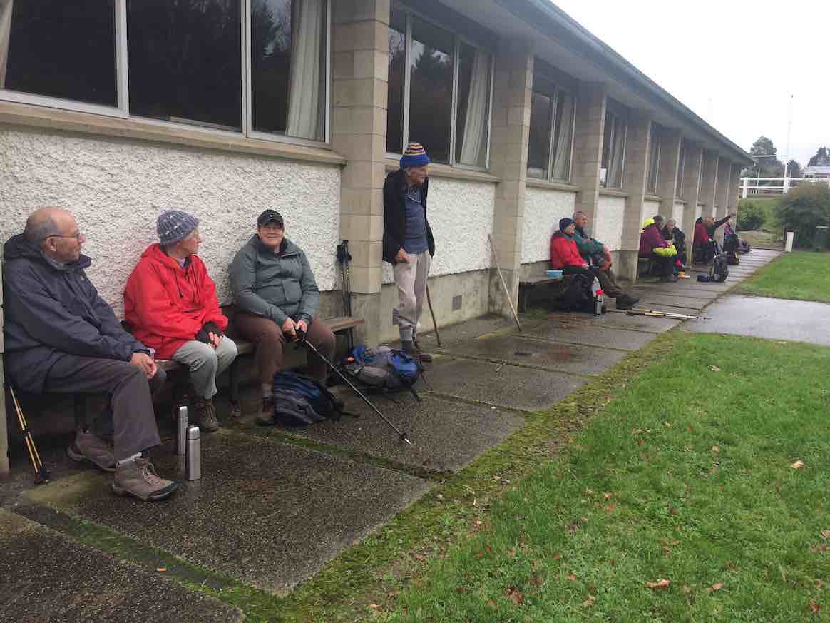
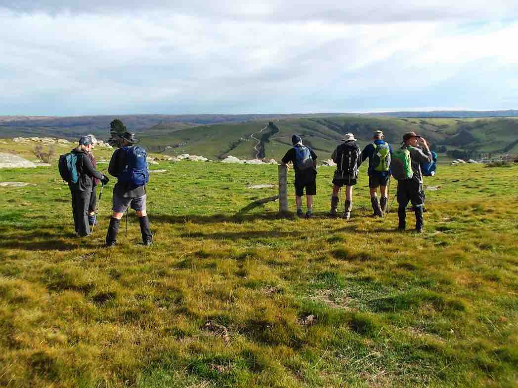
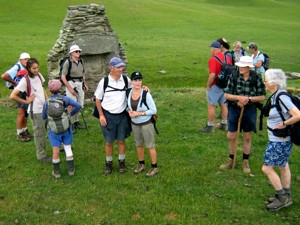
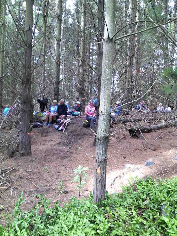
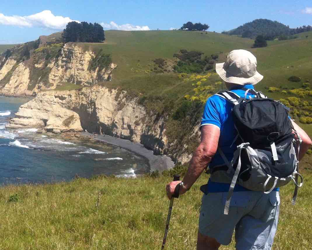
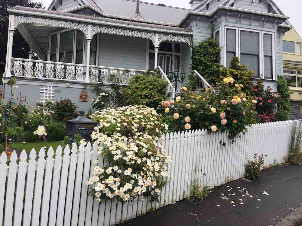
2. 23/8/2017. Hikers. Gardens to Surf. E. Leaders: Pam and Dawn.
We Parked our cars in Duke Street, near the Woodhaugh gardens. 22 members started off. We walked through the Varsity and had morning tea at the Polytech outdoor area. Walked along Portsmouth Drive to Queens Drive down to St Kilda beach. Walked along playing fields and some track to picnic area above beach, where we had our lunch. We then continued on to St Clair, via street and caught the bus back to the Botanical gardens where we enjoyed a hot drink. Back to our cars and home to Mosgiel by 3.45pm. A very enjoyable day was had by all. – Dawn.
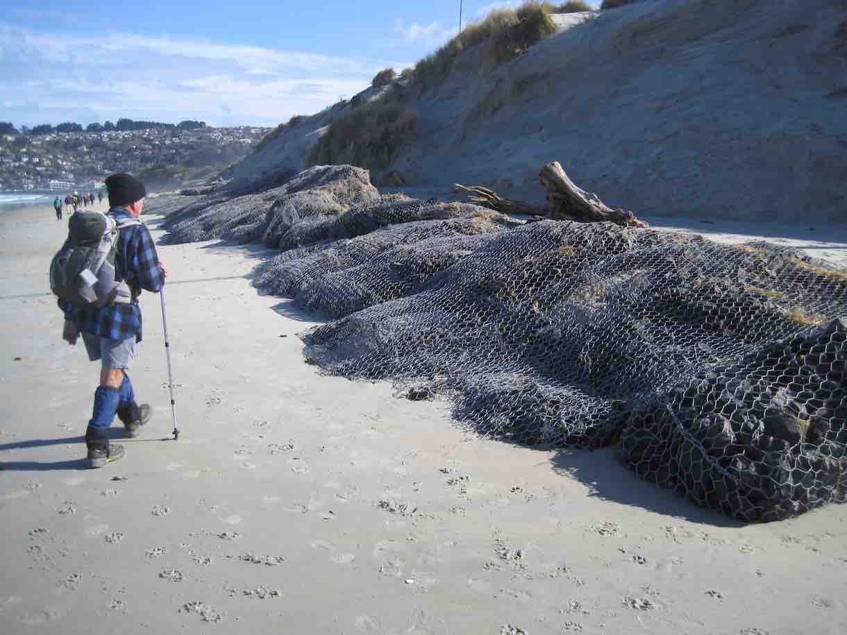
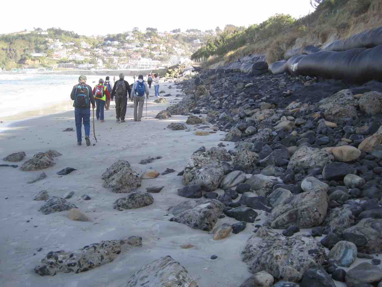
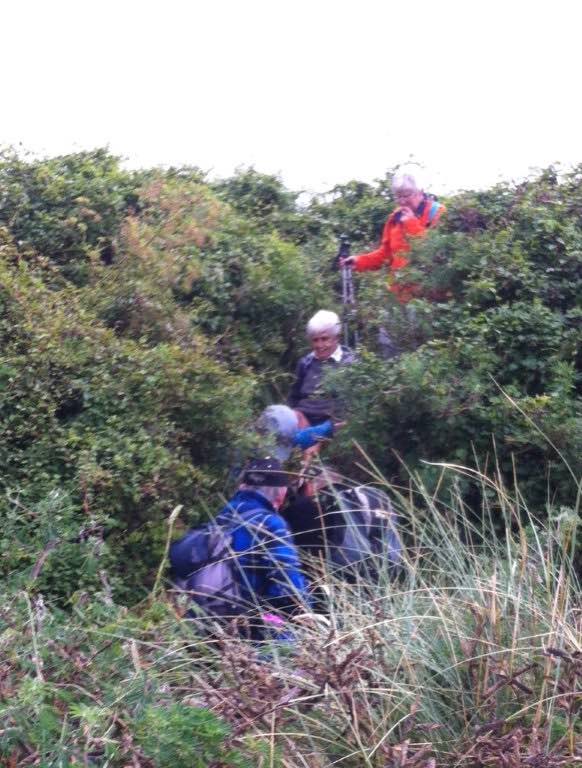
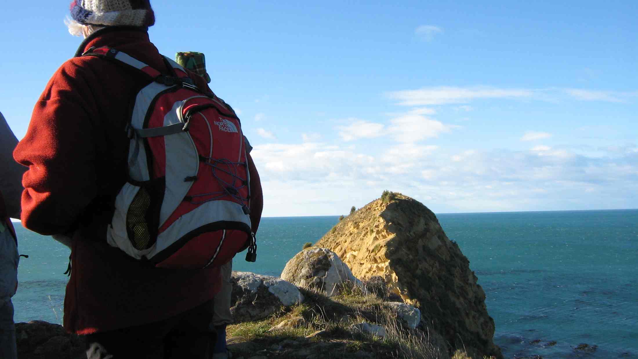
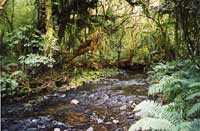
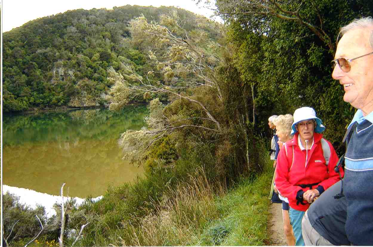
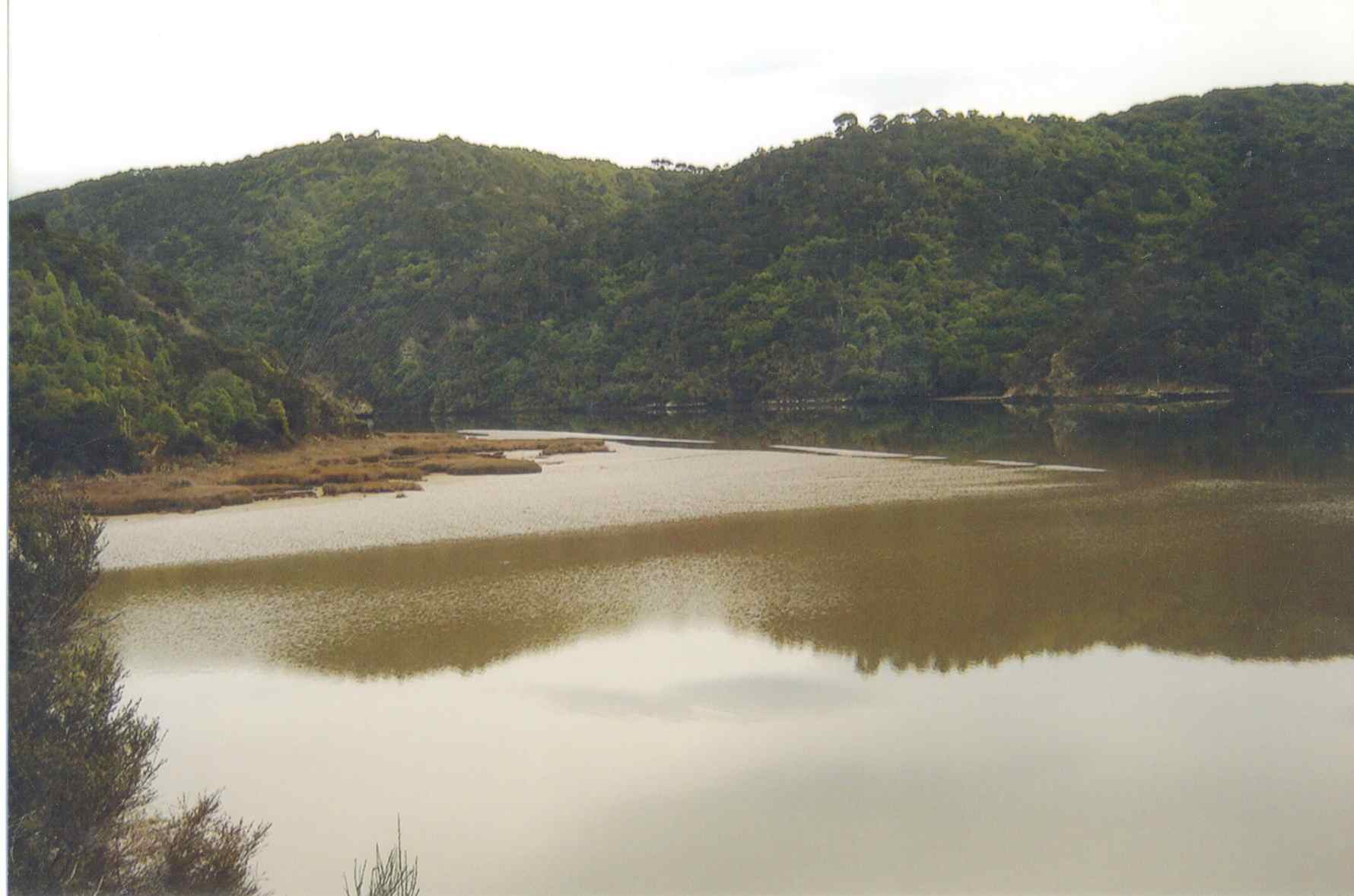
1. 19/8/2015. Hikers. Gardens to Surf.
We had a good day walking from the Botanic Gardens…
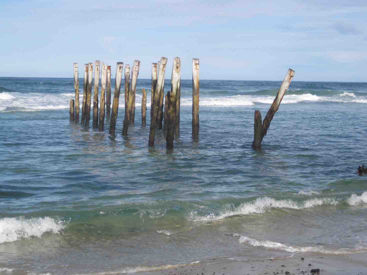
…and along the beach to St Clair. I had not been on the beach since the June storms and was blown away by the damage to the beach.
Rocks (John pic)
The piles…
Piles (John pic)
…are nearly all bent over by St Clair. Thank goodness I have done 3 paintings of the piles. Judy Knox was on TV Wed. night and did a very good interview on the local TV channel.
We all went back on the bus to the Gardens and all (I think) 27 of us didn’t pay. I think the bus driver got a bit of a surprise. – Elaine. [An unintended report, purloined from an email. – Ed]
Wardells’ Cottage abt 25 km from car park.
High tides flood the access road and this has happened to us more than once. N.B. Programme Committee! Avoid high tides forecast near the the hours of 9.00 a.m. or 2.00-3.00 p.m.
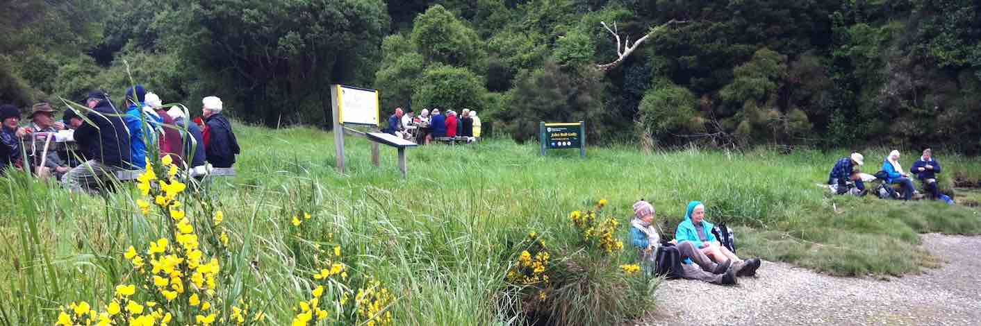
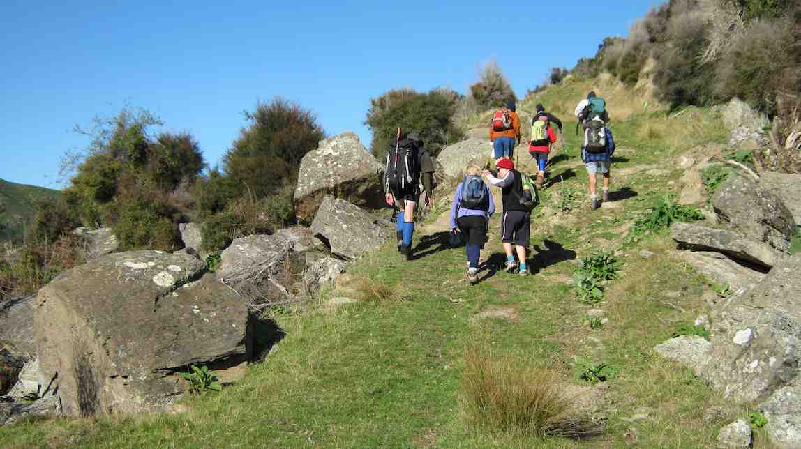
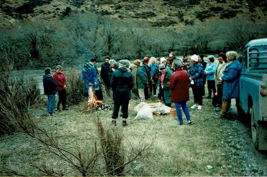
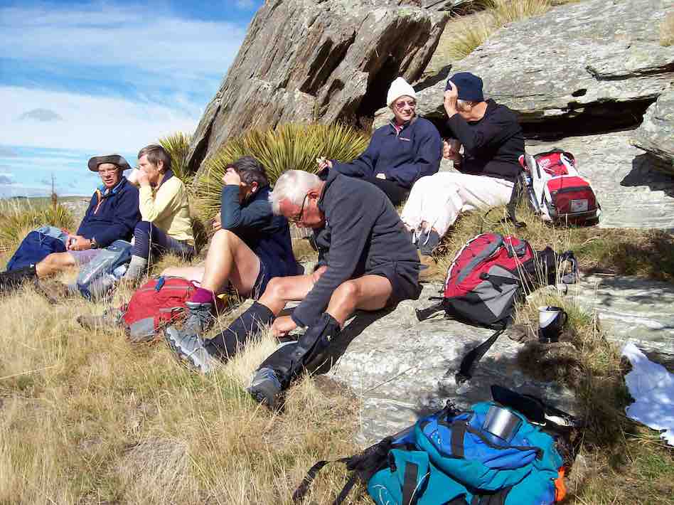
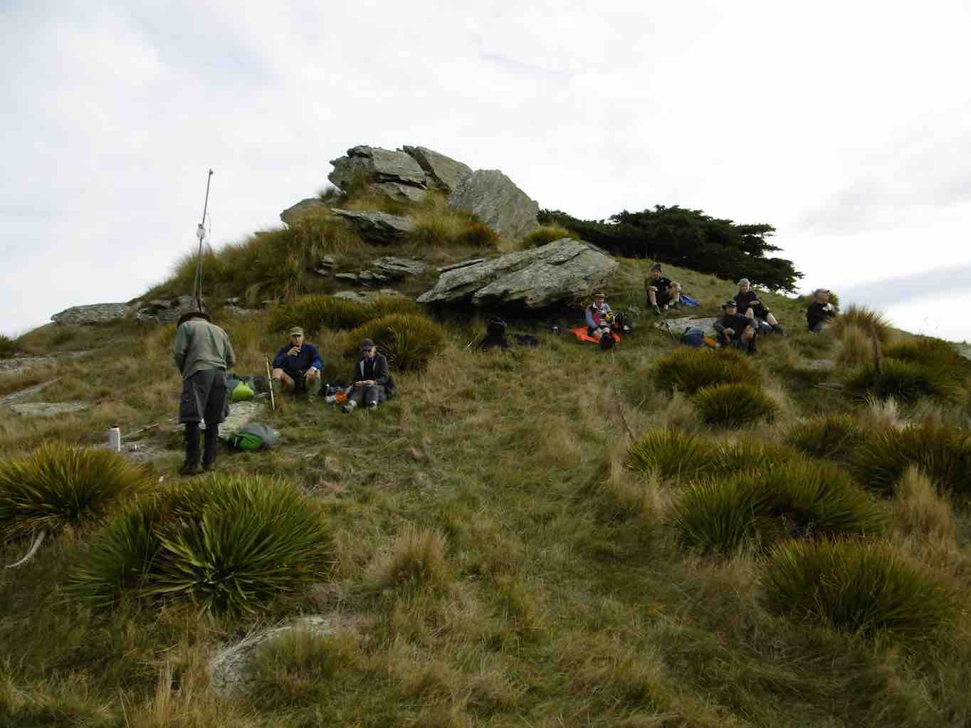
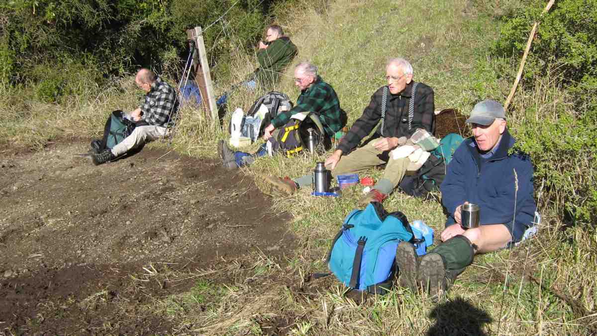
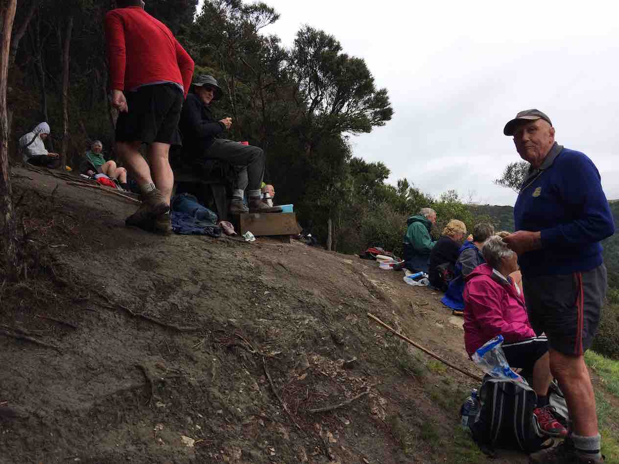
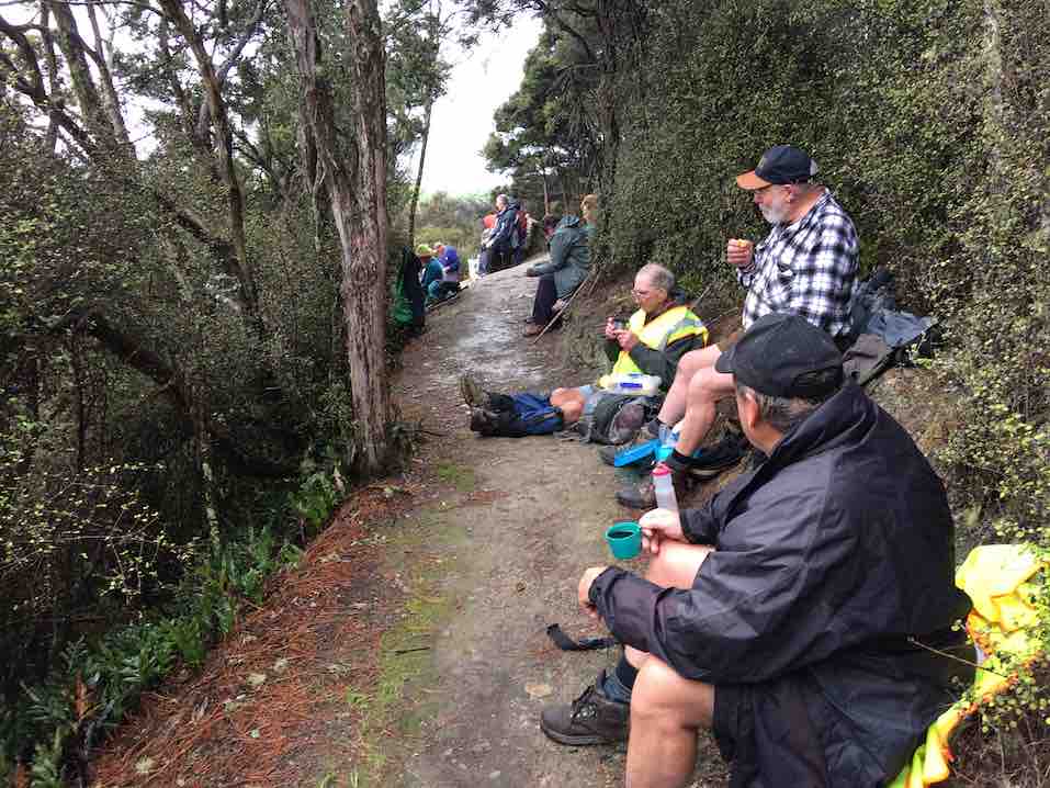
17. 9/8/2017. Hikers. Millennium Track. Leaders: Bob and Lesley.
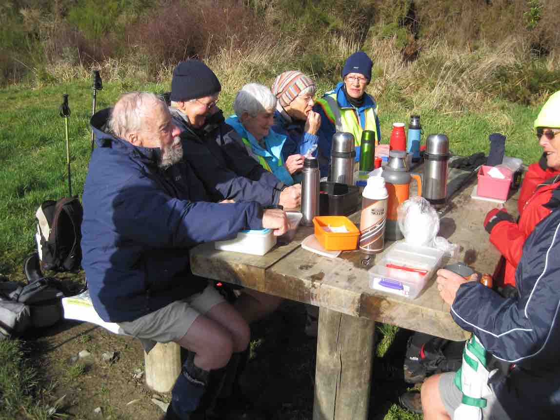
20 Hikers set out on this bush walk along the Taieri River. The usual wet portions were muddy following all the rain. There were a few small slips onto the track and a few bites out of the lower side, but all negotiable. The track was carpeted with leaves and twigs. Morning tea was at the usual spot down beside the river…
(Wyn pic.)
…and lunch at John Bull Gully.
(Wyn pic.)
This track with many silver ferns and birds is a favourite for many members. We ALL adjourned to The Black Swan for refreshments. – Lesley.
By then the rain had stopped so had a lovely walk led by Helen at front and Bev at the back. Lunch in the ordered sunshine at the tables at John Bull’s gully.
Lunch (1) (John pic)Lunch (2) (John pic)
Slight rain as we started back then the sun again.Nice to see the river through the trees with the leaf drop. Back to cars and through some water on the road. High tide.
Coffee at Wal’s ended our enjoyable day. – Helen
15. 5/10/2014. Both. Millennium Track. Leaders: Les and Margaret.
Tea breakLunch at John Bull Gully
14. 24/7/2013. Hikers. Millennium Track. Leaders: Les and Margaret.
Being the first tramp of the month, trampers and hikers combined to walk a good old standby, the Millennium Track down the Taieri River from the old Wardells house. It was a substitute for Berwick Forest which is presently difficult to gain access to. Although only 16 turned out, with many trampers noticeably absent, it was still a good day out, starting cold but improving. In spite of being a frequently used tramp, it’s a lovely piece of bush to take your time in and enjoy and the bird life is a joy to hear. A feature of the walk for the trampers was that 11 walked on beyond John Bull Gully to sample the recently broadened track as far as the seat at the high point of the track. The gradient had been realigned with all steps eliminated, sometimes however making for steep slopes. With the pine plantation gone, we were surprised to see that bullibulli
Bullibulli colonising the slope
has largely colonised the area. A delightful surprise on the return walk was a juvenile harrier hawk (?)
Juvenile Harrier Hawk? (But see comments below post.)
perched on a broken trunk which quite calmly allowed us to photo it. The 5 of us who chose to go just to the picnic spot by the river really had a very happy time, taking in the scenery, having our lunch and walking back to cars in a leisurely way. – Bev and Ian
8. 5/12/2007. Both. Millennium Track. Easy. Leaders: Lex, Dot T
Wood Pigeon nr track start (5/12/2007)
Tea stop. Doug M, Neil, Bob H (5/12/2007)
Track through newly-cleared plantation. Doug M, Bill (5/12/2007)
Today 7 hardy (maybe silly) trampers drove to Phosphate corner at Clarendon, then along Berwick road, parked up and walked up the hill to the Cemetery (my Great Great and Great Grandparents, some Siblings and Children from Sinclair family are buried there.
We then drove further along Berwick road, parked and proceeded up the track to the hay barn for smoko.
Shed for morning tea out of the freezing wind. (Helen pic and caption.)Mud to get to the shed. (Helen pic and caption.)
We all decided it would be no fun climbing round and up Mary Hill with frequent showers and a bitterly cold wind.
On the way back we briefly stopped at Sinclair Wetlands then drove into Berwick Camp, a year 8 class was there on camp, talked with the Activity Coordinator and strolled up to the dam.
On a bridge at the Berwick camp. (Helen pic and caption.)
It was plain to see what fun the young students were having, particularly when having a turn driving round with a leader in an old converted type of Land Rover in the mud.
So after all this strenuous activity we journeyed on to eat lunch (and cake) at a little hilltop cafe in Clyde street. – Eleanore.
Lunch at Eleanore’s with a lovely warm fire and cakes which were enjoyed by us all. (Helen pic and caption.)
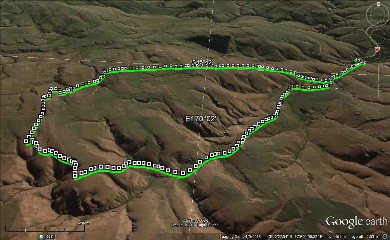
24/4/2013. Hikers – and a few trampers. Limesprings Farm, McNeil Rd, Whale Museum, and return back through Farm by a different route. Leaders: Jim and Betty.
Route, unfortuately stopped at Whale Museum, for some inadvertant technical reason! Cattle track up middle, McNeil Rd and extension at top.
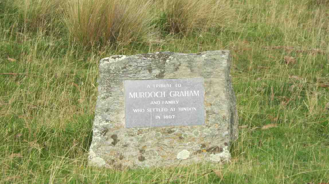
No. 4 on old hardcopy list of 113 club tramps. “Blacksmiths Flat. Hindon Stn. Bob Heenan. Farm. Lambing.”
No. 14 on old hardcopy list of 113 club tramps. “Hindon. Ardachy to River. D Graham. Haggie. Farm.”
Distance from carpark: 33 km.
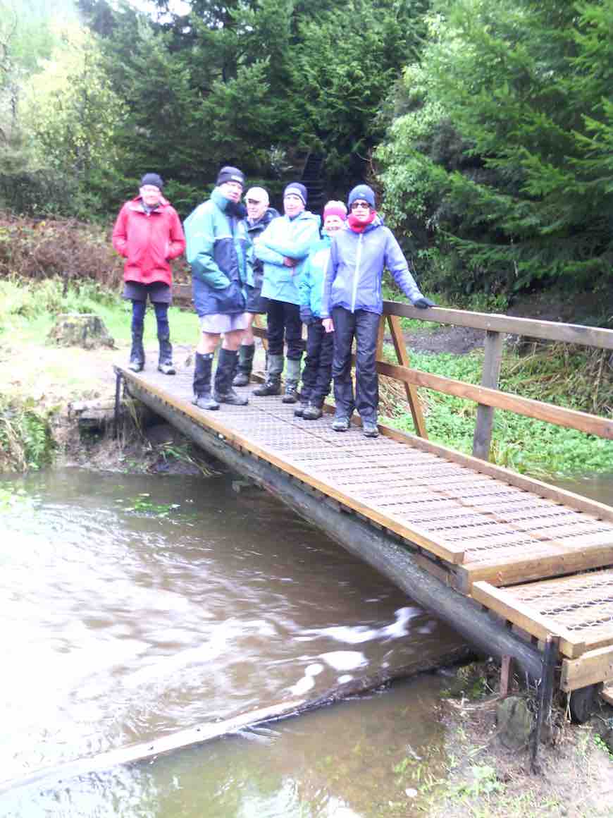
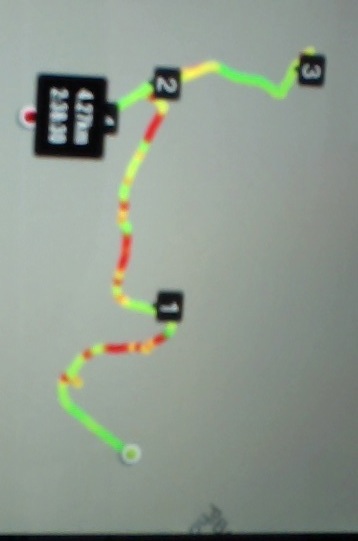
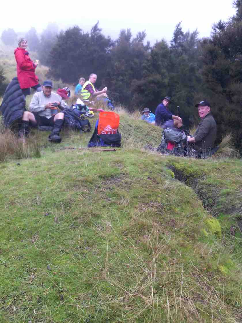
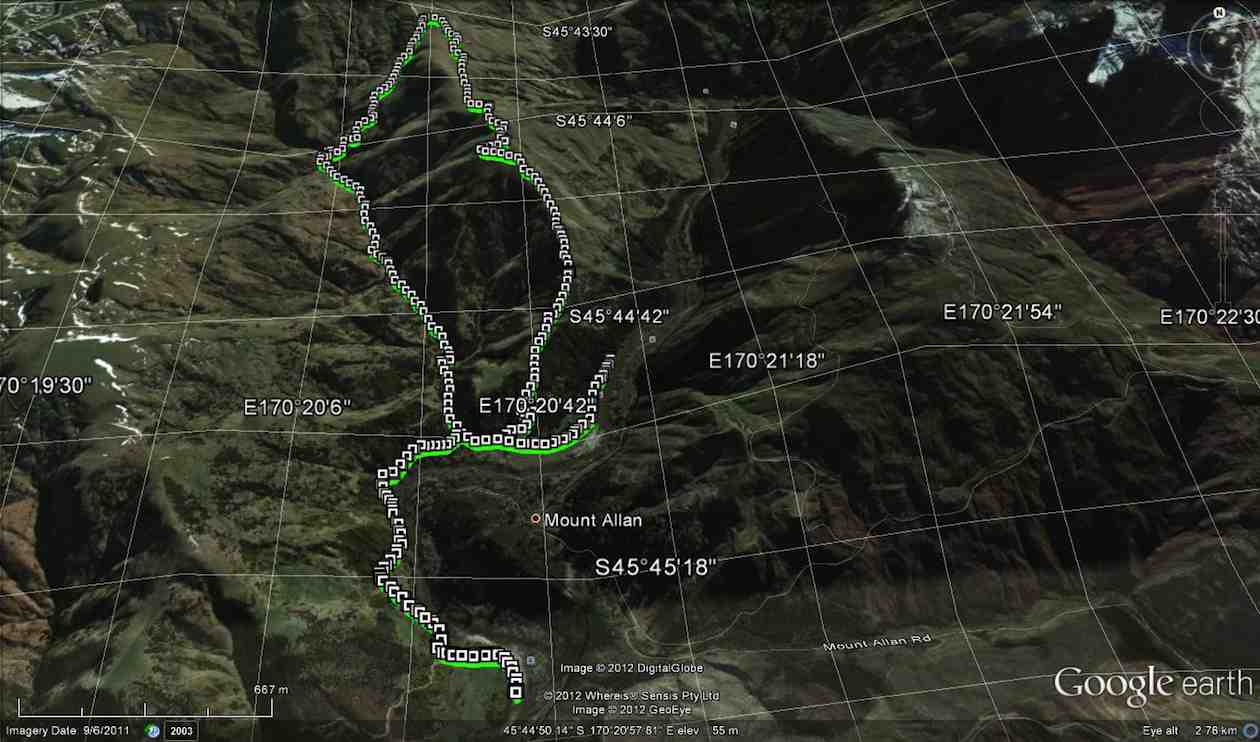
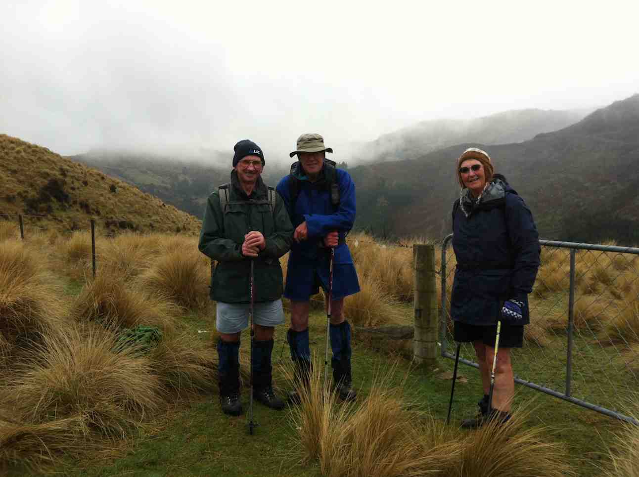
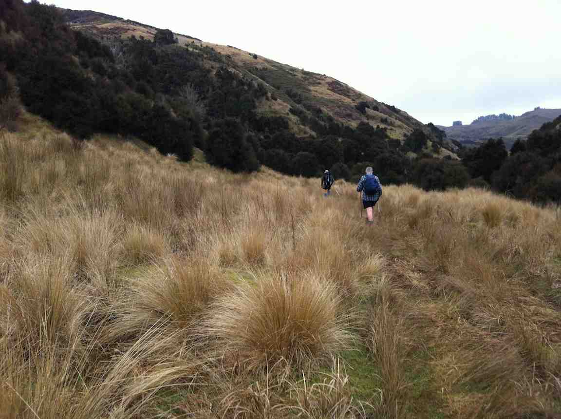
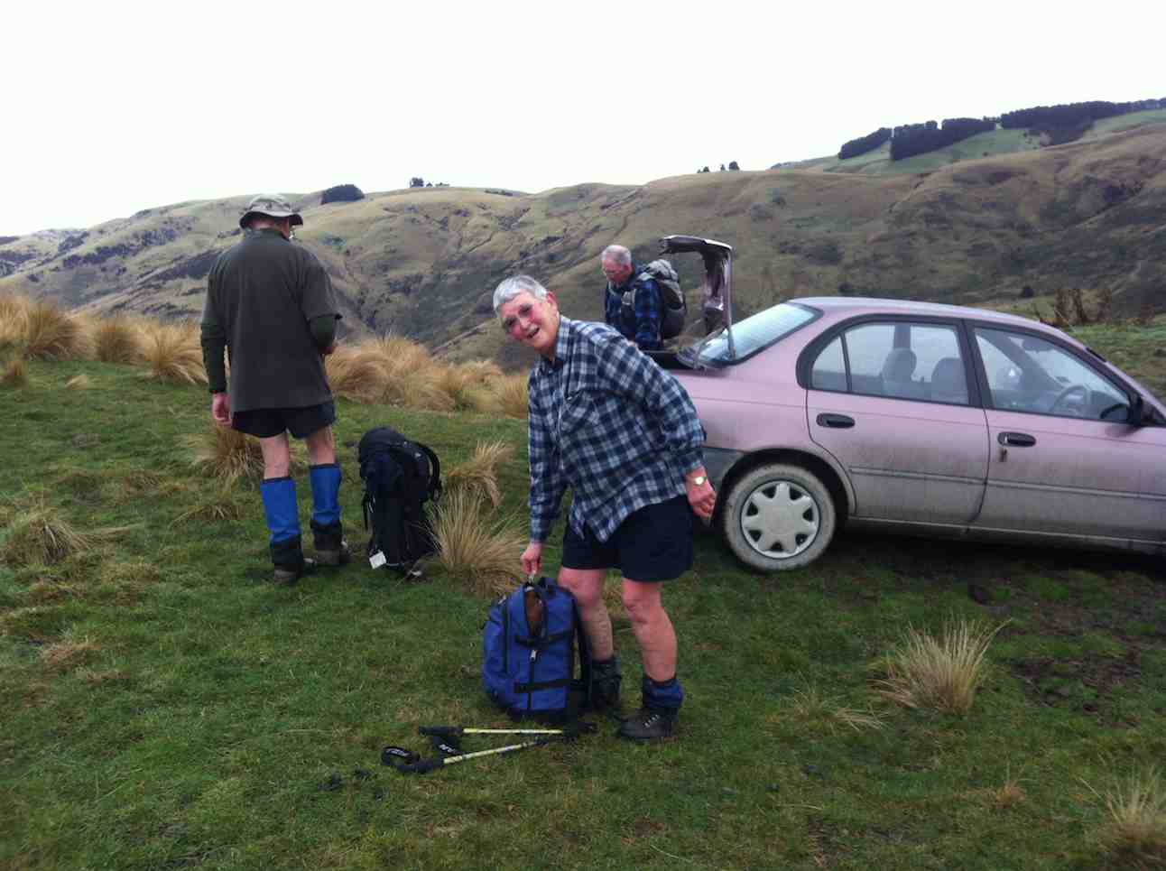
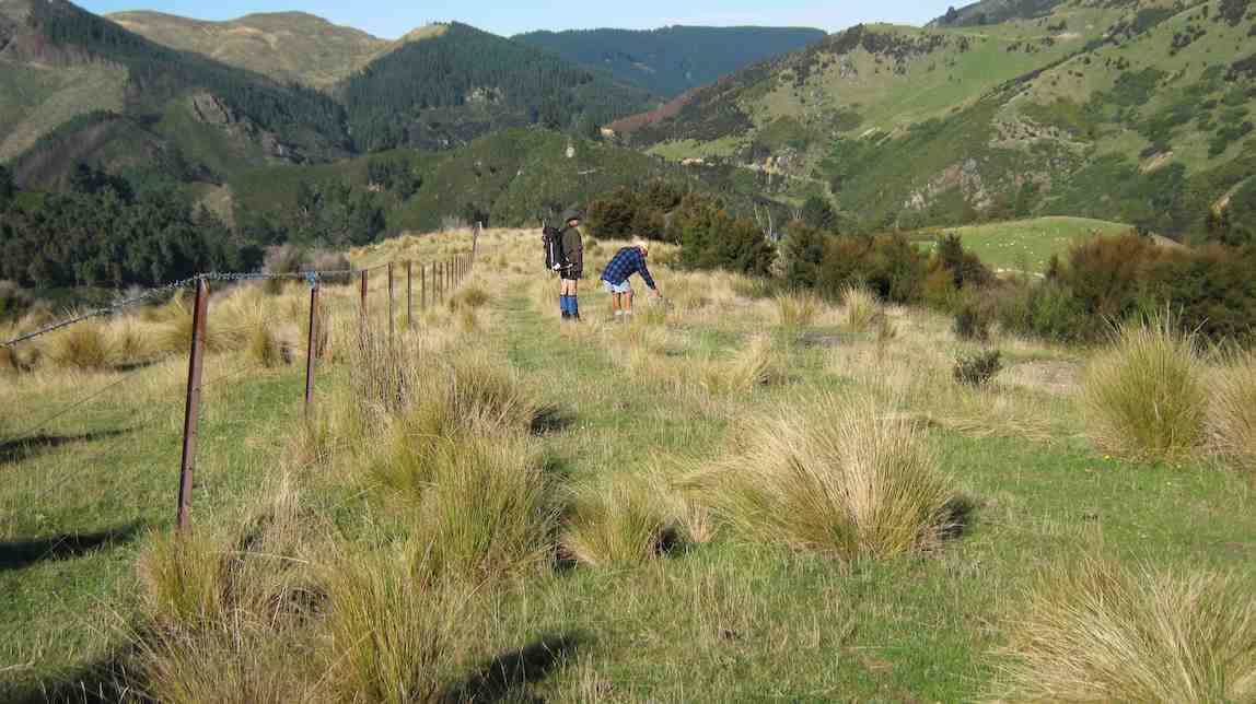
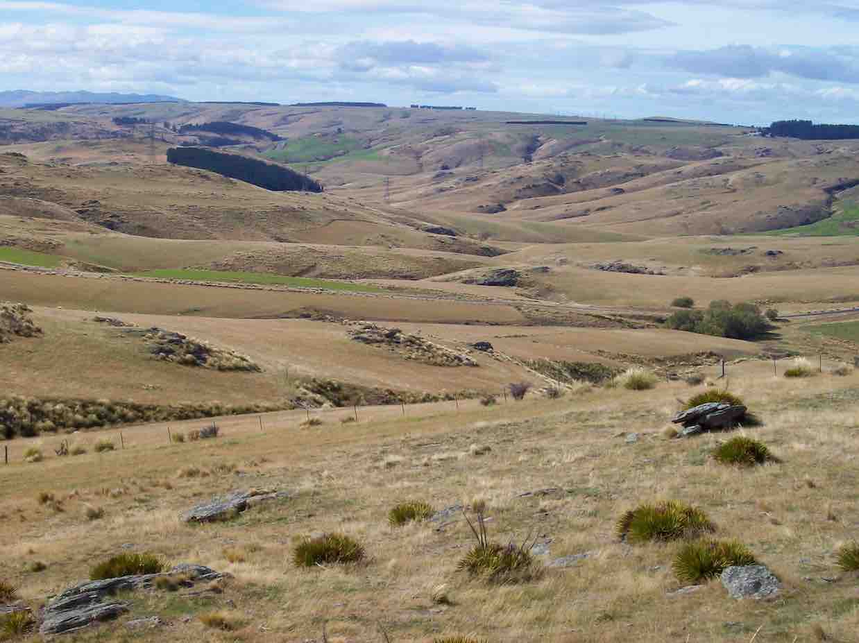
13. 31/5/2017. Trampers. Ardachys – Blacksmith Flat. M. Leader: Arthur.
The weather wasn’t great, but good enough. 8 trampers out today, including one new member – welcome Phil. We travelled in low cloud all the way from Outram to our parking spot at Ardachy, but from there on we could clearly see down into the Taieri gorge. An improvement was expected though.
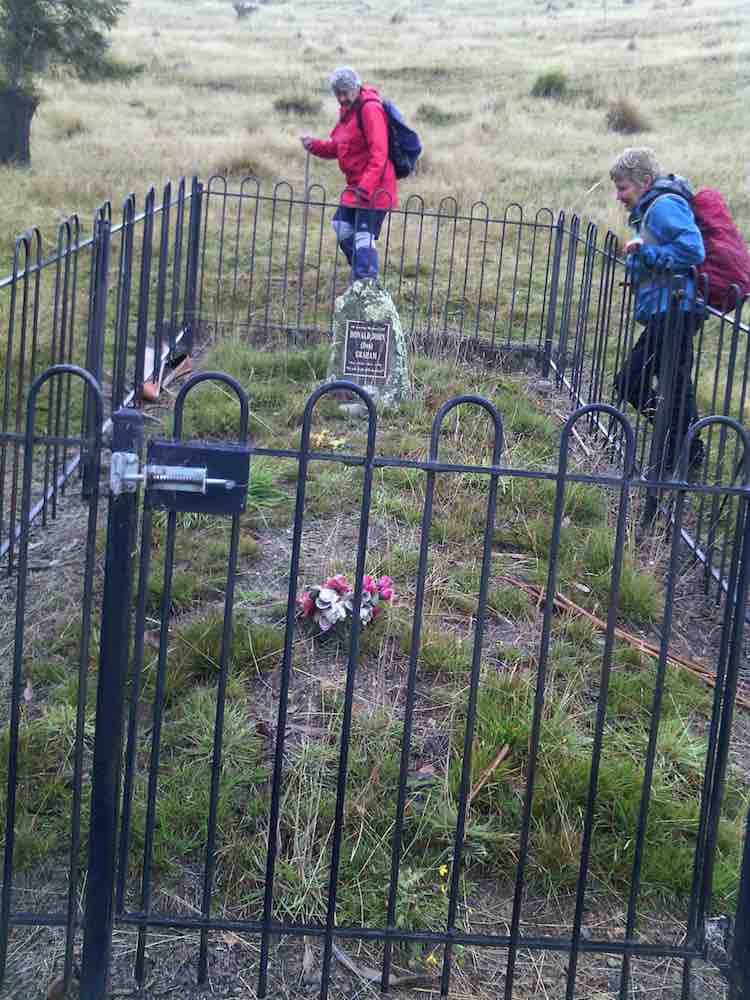
We first went to inspect the nearby “Lonely Grave” of Mr Don Graham.
Family grave in Ardachy Station. (Helen pic and caption.)
The Graham family have been on Ardachy for 120 years – check our club website for more details about the “Lonely Grave”. [Scroll further down this post for this. – Ed.]
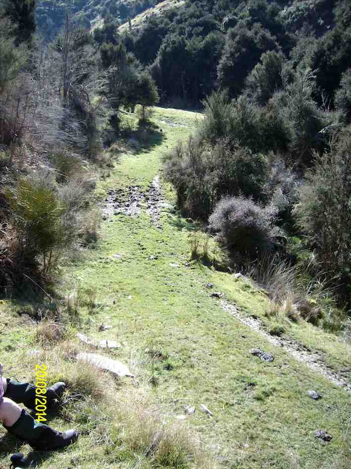
A short stop was made in the tussock for morning tea, before continuing on down hill. 4 friendly horses greeted us when we reached “Blacksmith Flat”, beside the Taieri river.
Four friendly hores came to visit. (Helen pic and caption.)
We followed the “Flat” upstream for some distance, before turning and retracing our steps.
Mount Allan railway station was directly across the river from us, but no train today. It was a lovely and peaceful spot there, the river making the only noise, except for 6-8 fantails flitting around.
The return journey was up “Blacksmith Gully”, and we travelled some distance before stopping for lunch.
Lunch. Second photo I missed was a lovely view while no fog. (Helen pic and caption.)
The cloud had come down now, with no more than a couple of hundred metres visibility, and remained so until we returned to Outram.
Incidentally, the names “Blacksmith Flat” and “Blacksmith Gully” go back to the gold mining era around 1863. Gold was found in some quantity in the area, but after 2 0r 3 years the “rush” was over.
The leader decided that, as it was a relatively short tramp today, we would return by a slightly more strenuous route than had been planned originally, to give everyone a bit of a workout. All thought this a great idea, and enjoyed the extra bit. There were no complaints anyway!
We arrived back at the cars before 1.30 pm, having walked 8.8 km. The vertical difference in altitude between the river and the cars was approx. 250 metres.
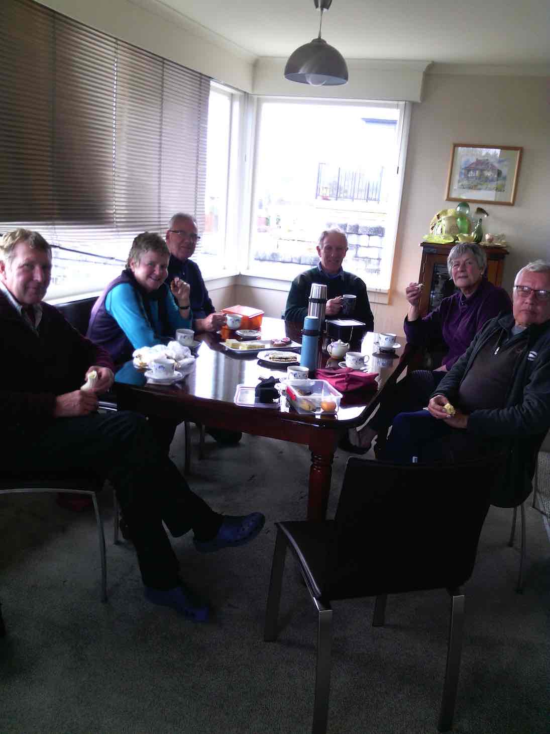
On returning to Mosgiel we stopped in at Wals for hot drinks, sitting in front of the fire to enjoy them. It made a very good end to the day. – Art.
12. 20/8/2014. Trampers. Ardachy Station. Blacksmith Flat and Gully. Medium.
The tramp on Ardachy Station to Blacksmiths gully was not a very long walk, but the climb out at the end of the day means that it is not all easy going. 4 trampers turned up on the day, & we set off to where we park the cars, just around the corner from the lonely grave site above Hindon. As it was 10 AM when we arrived there, morning tea was taken before we set off on the tramp along the top of the ridge. The weather was fine, with a very slight, cool breeze, & some frost & frozen puddles underfoot. We spent some time down by the river looking at the destruction among the willows, caused by flood waters, & we were also amazed by how high up in the trees the flood debris was deposited. [probably about 6-7 mtrs. above the river level]
As it was only around 11:20 by this time, we set off along the picturesque valley floor, until we came upon a good sheltered, sunny spot for a lunch break, …
Lunch spot (Ken pic and caption)View from lunch site (Ken pic and caption)
… not far from where we had to cross the stream, & start the climb back to the car. After a leisurely lunch, we moved on until we came to the old mine shaft, which we climbed up the bank to inspect. the fence around it is slowly getting wrecked as time goes on, but the bush growing around the hole is still protecting it well. After this, it was just a matter of climbing back to the car, which seems like a daunting task when looking up from the valley floor, but it only takes around 1/2 an hour to climb out.
We all agreed it was a good walk, with the area being new to two members of the party.Walked 6.44km
moving time 1hr 45min.
ave 3.7km/hr
climbed 326mtrs. -Ken
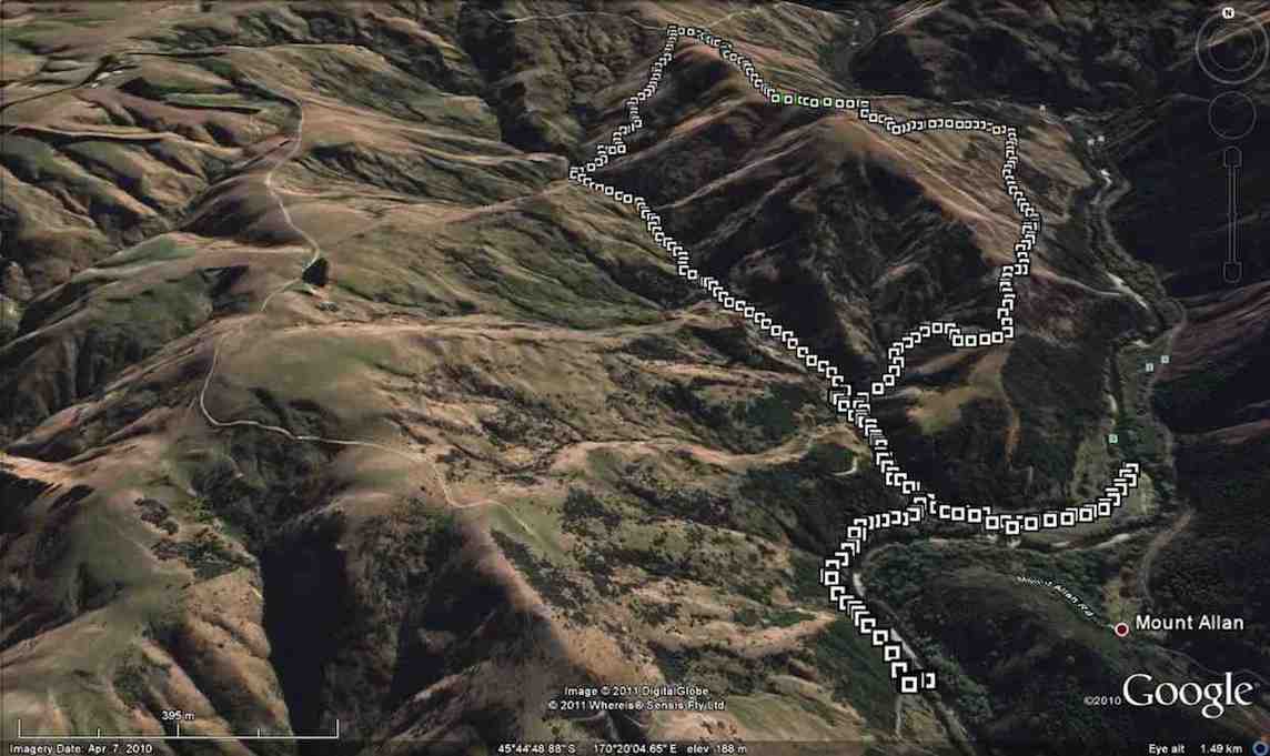
11. 8/8/2012. Trampers. Ardachy Station. Blacksmith Flat and Gully. Medium.
The pic below shows 3/4 of the party at the point on the ridge where on previous tramps we had crossed from the river side of the ridge to the other. We arrived at this point by keeping to the ridge and avoiding the river-side track. Here we stopped for morning tea.
There had been a little drizzle to this point, but from here on, the weather and the views cleared to give us a good day out. To those who remained at home, we proved that you make your own luck. Bravo.
The cross-over point on the ridge taken on previous tramps.
And from this point we still kept to the ridge and found a clear crack down the nose of the ridge to the river flats. Club pioneers! I think we’ll always wish to do the descent this way, now. We explored Blacksmith flat, noting a new electric fence put in no doubt to keep stock away from the river.
We then took the track down-river that leads to the further flat reached from the Mains Road tramp, and lunched, seated at the lovely BBQ area. Then it was back to take the Blacksmith Gully route up to the car.
The writer had forgotten just how far we have to ascend the gully floor before locating the FWD track that takes us back up to the car.
Ascending Blacksmith Gully
Then it was just a 25-minute hard-breathing one-foot-in-front-of-the-other climb, after first subjecting Judy to the obligatory mine shaft sighting.
Back at the car at top of ridge
And so back into the car and out along a road, good and smooth, but a bit sloppy from the earlier drizzle. A good try-out for Ian’s little new/old Corolla. – Ian.
We passed by the gravesite dedicated to Murdoch Graham and went onto the FWD track ahead.
Memorial Site
This gradually descended before eventually climbing again to cross the steadily descending ridge on our right.
Climb
At this point, through a gate in the fence on the ridge crest, we took a track descending on the ridge’s right, although the Google Earth map does show a track going on down the ridge to the bottom.
Ridge
The track to the right led us down into Blacksmith Gully which we pursued down to its end on the Taieri River.
After a wander round, we took the track going on down the river to lunch in warm sun by the water on a grassy flat.
Lunch by Taieri River (Ken pic)
Retracing our steps,
Walking back after lunch (Ken pic)
this time we went further up Blacksmith Gully till we took a track that at its first zigzag encompassed the fenced off mine shaft and threw down stones to gauge its depth.
Then it was steadily on up up up to regain the cars at the track’s top. – Ian.
Postscript: (A bit of Club history, recollected by George and confirmed by Bob Heenan.)
Daphne, then President and founding member of the Club, was also a member of the Dunedin Photographic Club. She met Don Graham, Ardachy Station owner there and got talking. An upshot was that he invited the Club to do a tramp on his land. This the Club did in 1989. They parked where we still park today, and followed the ridge from there down to the Flats. An arduous effort, following the ridges ups and downs. (We follow an easier 4WD track today.) On their return, club members were surprised to find Don by the cars, with a billy boiling over a fire.
“22/8/90. Members of Taieri Recreational Tramping Group waiting for billy to boil after tramp. Ardachy Station, Hindon, Taieri Gorge.” (Ian pic, scanned from Peg Chisholm photo collection.)
He invited them to get their mugs out and filled them with tea. A very happy introduction to what has been a satisfying series of tramps there over the years.
Post-post-script: – from NZ Herald Sunday April 3 2011.
It took a long battle with bureaucracy, but an Otago farmer has been returned to the soil he worked on all his life.
Don Graham, 72, was buried on his Ardachy Station property at Hindon this week in a ceremony attended by more than 120 family members and friends.
A bagpiper played as Mr Graham was interred in the place he had chosen on the property, among rolling hills and wind-swept tussock.
A piper plays as Don Graham’s casket is carried to his plot beside the Hindon station road overlooking his farm, Ardachy station, and the Taieri River. Picture / Otago Daily Times
Obtaining permission for the burial was a long legal process, including gathering affidavits and securing consents.
Funeral director Robert Campbell said it was the first time in 40 years he had been involved in a home burial.
“It’s very uncommon, because you have to get permission through the Burial in a Special Place Act,” he said.
The law stipulates that people must be buried communally if they lived within 32km of a cemetery.
But it allows for home burial “if there are exceptional circumstances making the burial of that body in that place particularly appropriate”
Mr Campbell said: “He was granted permission by the Ministry of Health four years ago, because he and his forebears had farmed the land for 105 years and had a close association with the property.”
The grave site looks over Ardachy Station towards the Taieri River.
“It’s a lovely spot in the hills overlooking the valley,” said Robin Gamble, who delivered the eulogy at the funeral.
Mr Gamble said Mr Graham was passionate about the area in which he lived, and always wanted to be buried there.
“But it was very difficult and involved. He had to get 10 affidavits from people to support his request, as well as regional council consents.”
Mr Graham lived all his life in the area, taking over Ardachy Station from his father-in-law in 1956.
Mr Graham’s widow, Leila, said it was an emotional day for her and her two sons.
“He spent very little time away from the farm, and he would have been so proud. We can look out the back window of the house and see him down there now,” she said.
Mr Graham enjoyed a laugh. On April 1, 1991, he appeared on the front page of the Otago Daily Times with a “shabbit”, a creature he claimed to have bred from a merino sheep and a rabbit.
The April Fool’s Day trick was so successful people were still ringing him up months later to ask about breeding stock.
– OTAGO DAILY TIMES
9. 1/3/2007. Ardachy Station, Blacksmith Gully and Flat. Medium+ Leaders: George, Doug M
Very good but long drive in.. Several fences and gates to negotiate.
Took Hindon turn-off from George King Memorial Drive.
Just before road dipped down to the Taieri Park, parked at corner on grassy surface off road.
Followed 4WD down to river. Proceeded down-stream for some distance and stopped for lunch. Returned clockwise up valley. At stone fireplace, turned steeply up right bank, viewed vertical mine shaft, and met 4WD track back up to cars.
8. 18/4/2001. Hindon, Ardachy Station, Blacksmith Gully. Leaders: Bob H, Colleen, Doug M.
7. 18/4/2002
6. 27/11/1996. Blacksmiths Gully Hindon. Leaders: Eric and Dot, Joan H.
5. 1996 Bob H
4. 25/10/1995. Hindon, Blacksmith Gully, (Old Battery). Medium+. Leaders: George, Ria L, Bob Q, Jack R.
3. 3/11/1993. Blacksmith Gully. Hindon. Medium. Leaders: Bob, Daphne, Margaret D, Bob Q.
Easier alternative:: Leaders: Les and Mavis.
2. 19/6/1991. Blacksmith’s Gully. Lovely views – a good climb home. Average+. Leaders: Mervyn, Wendy, Ted, Daphne.
1. 22/3/1989. Blacksmith’s Gully from Ardachy Station. Lovely walk to Taieri River. Steep return. Leaders: Kath, Jack and Joan.
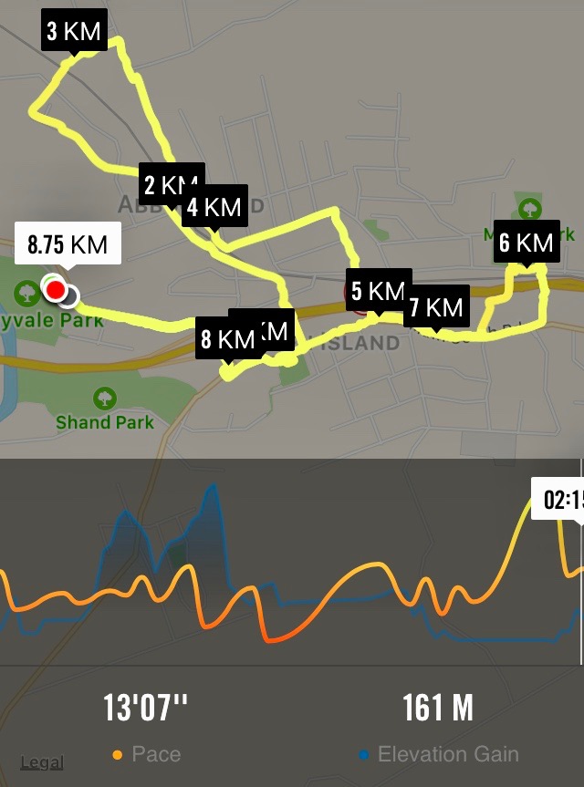
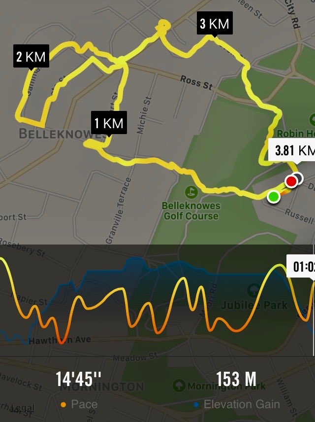
4. 31/5/2017. Hikers. Green Island street walk. E. Leaders: Elaine and Chris.
Nike app map of route, courtesy Ian.
The above route map gives some indication of the intricacies of Elaine’s planned route, designed to cross and recross, by way of tunnels and bridges galore, the barriers of railway line, stream and motorway dividing Green Island from Abbotsford. It was a street-walk, most suitable on the day for an off-and-on light morning drizzle. We were treated to a whole gamut of lower Abbotsford house designs, most instructive of fashions favoured in different decades, complete with one or two older ones looking very old and very neglected. At the latter part of the hike, we also got to peek into some of the large industrial goings-on at the north end of the town, not least Harraways. All most impressive.
At one point where a railway line once crossed the old main road (remember it?), Elaine stopped us to point out how it once served a coal-mine of her grandfather. She has a photo of a small steam engine about to head north across the road.
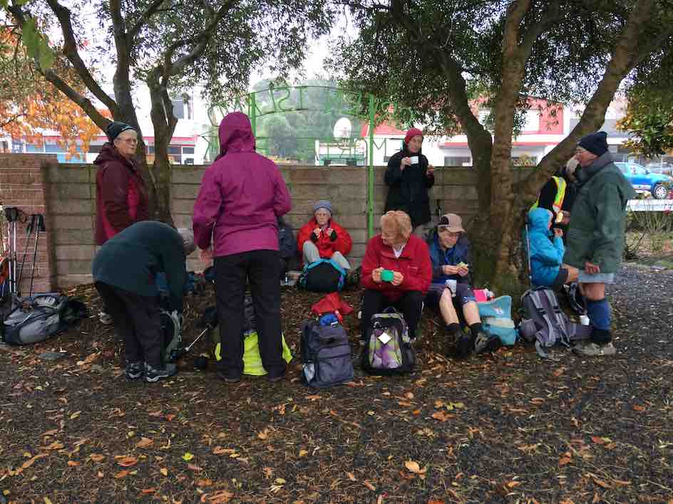
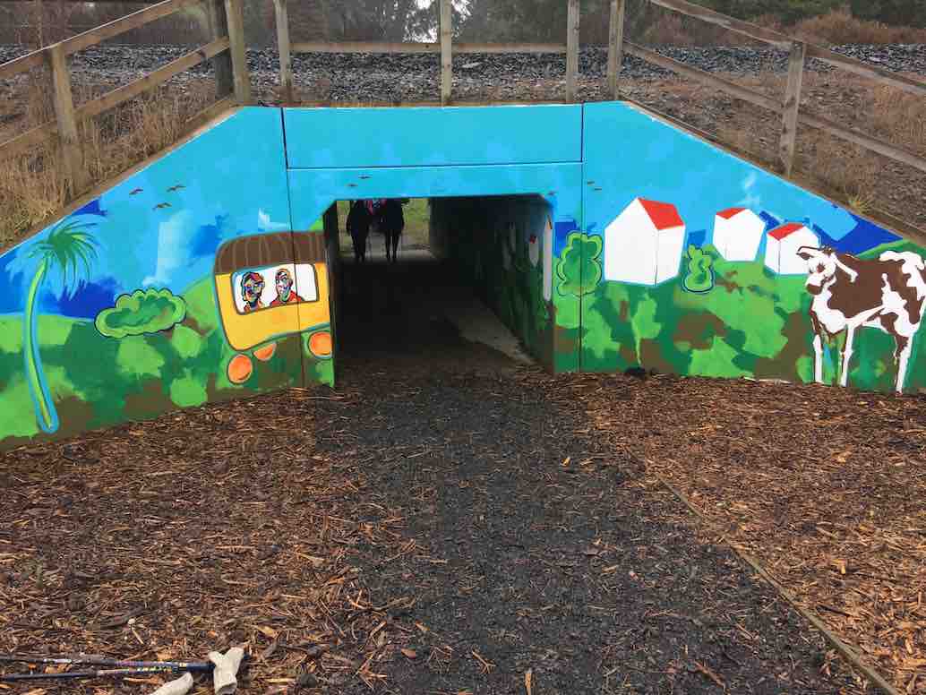
Drizzly morning tea at the gardens. Most of the 22 who came out. (Ian pic and caption.)Newly decorated railway underpass (newly decorated since Elaine’s recce), essential for linking homes and school. It was deemed safer for children than a bridge. (Ian pic and caption.)a dry-seated lunch at the Green Island Rugby Football Club pavilion in Miller Park. (Ian pic and caption.)18 of us at Coffee at Agnes’, where we got to enjoy a separate room all to ourselve, complete with en suite. (Ian pic and caption.)
Many were the remarks appreciative of the cleverness of the route. A big thank you to Elaine and Chris for a great day out. – Ian, (for Elaine [without her knowledge – yet!] whose recent rapidly failing eyesight prevented her from tackling a report.)
3. 25/2/2009 Hikers. Green Island. Farm Walk. Leaders: George, Dot B
2. 10/5/2006. Hikers. Green Island street and farm walk. Leaders: Chris, Dot B.
1. 8/2/2006. Hikers. Street Walk: Green Island Street and Farm Walk. Leaders: Dot B, Chris.
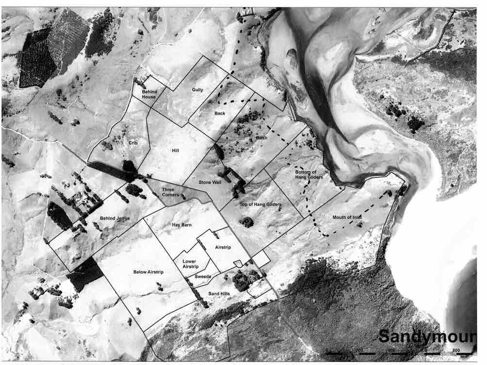
No. 93 on old hardcopy list of 113 club tramps. “Murrays Farm – Sandymount (Chris Hughes) Farm”
Distance for carpark: 31.5 km.
Map supplied by the owner. (Keith pic.)
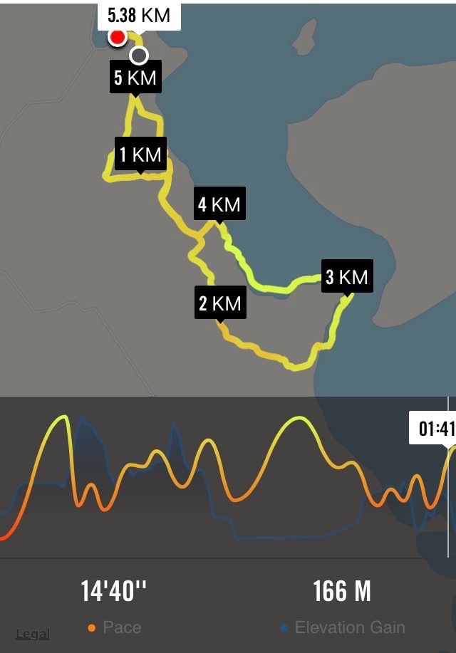
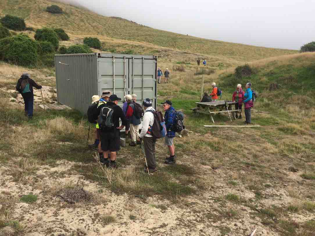
11. 29/3/2017. Hikers. Murrays Farm. M. Leaders: Keith and Shona.
Route map, courtesy Ian.
It was a foggy, misty morning when 19 Hikers met at the gateway bel0w Murrays Farm before ambling up the road to having morning tea in the implement shed.
We then followed the fenceline up and across the paddocks before descending to explore around a container being used as a crib.
George investigates shower workings on new crib. (Ian pic and caption.)
We exited onto the coast …
We discover a new route from paddock to beach. (Eleanor W. pic.)
… where we had lunch …
Papanui Inlet mouth beach for lunch. (Ian pic and caption.)
… out of the northerly wind.
We followed the water’s edge around past the old boat shed, climbing up the hill and visiting an old dwelling also being used as a crib and back along the farm tracks to the hole in the hedge and down the hill to the cars.
Coffee was at Macandrew Bay cafe. – Shona and Keith.
10. 20/2/2013. Hikers. Murrays Farm. Medium. Leaders: Peter and Wendy.
Morning Tea at old homesteadParadise Ducks in formationWaiting for others in shelter from the hot sun
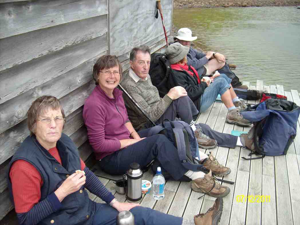
9. 7/12/2011. Both. Murrays Farm. Medium.
GPS courtesy Ken. Track from distant spot anti-clockwise.
Comfort plus for morning tea. (Ken pic and caption)
Five trampers scaled the almost vertical ascent to the Sandymount road before descending further by the bush.
An eye- and nose-watering wind greeted us when we stepped out of our cars at Hoopers Inlet. It was not a time for hanging around so our group of 13 set off at a brisk trot and soon reached the shelter of a shed which provided a good spot for morning tea.
Fuelled by hot drinks we ventured on and found that the hills and gullies gave good protection and we could enjoy this stroll through beautiful, peaceful countryside with the only other signs of life nearby the large number of paradise ducks. Perhaps they had discovered this place to be a refuge from duck shooters. In the distance sheep grazed and black cattle eyed us with interest.
Sheltered lunch spot
We found our way down to the beach and a sheltered corner at the far end provided a comfortable lunch spot.
Seal among the lupins
Margaret’s sortie into the sand dunes also brought to our notice a young seal hidden away under the lupins. We retraced our steps admiring the expansive views of the inlet and the winter colours on the hills.
It had been a short walk but a very pleasant country ramble.
Chris, who knows the area well, ably led us and, before returning home, some of us were lucky enough to stop off with her at a relative’s house on the hill and walk around the interesting garden, admiring both the plants and the panoramic views. – Marjorie.
6. 27/6/2007 Leaders:
Group. Ian, Leonie, George, Tash, Pat, Hazel, Ria.
5. 1/2/2006. All. Murrays Farm, Hoopers Inlet. Leader: Chris.
4. 5/3/2003. All. Murray Farm. Leaders: Chris, Les and Margaret, Bev McI.
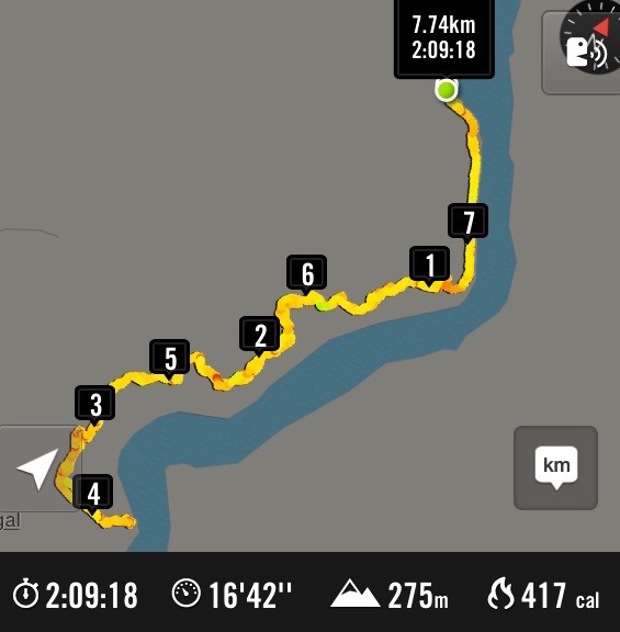
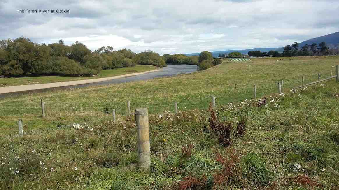
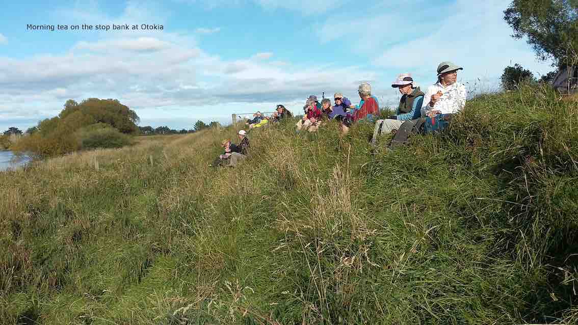
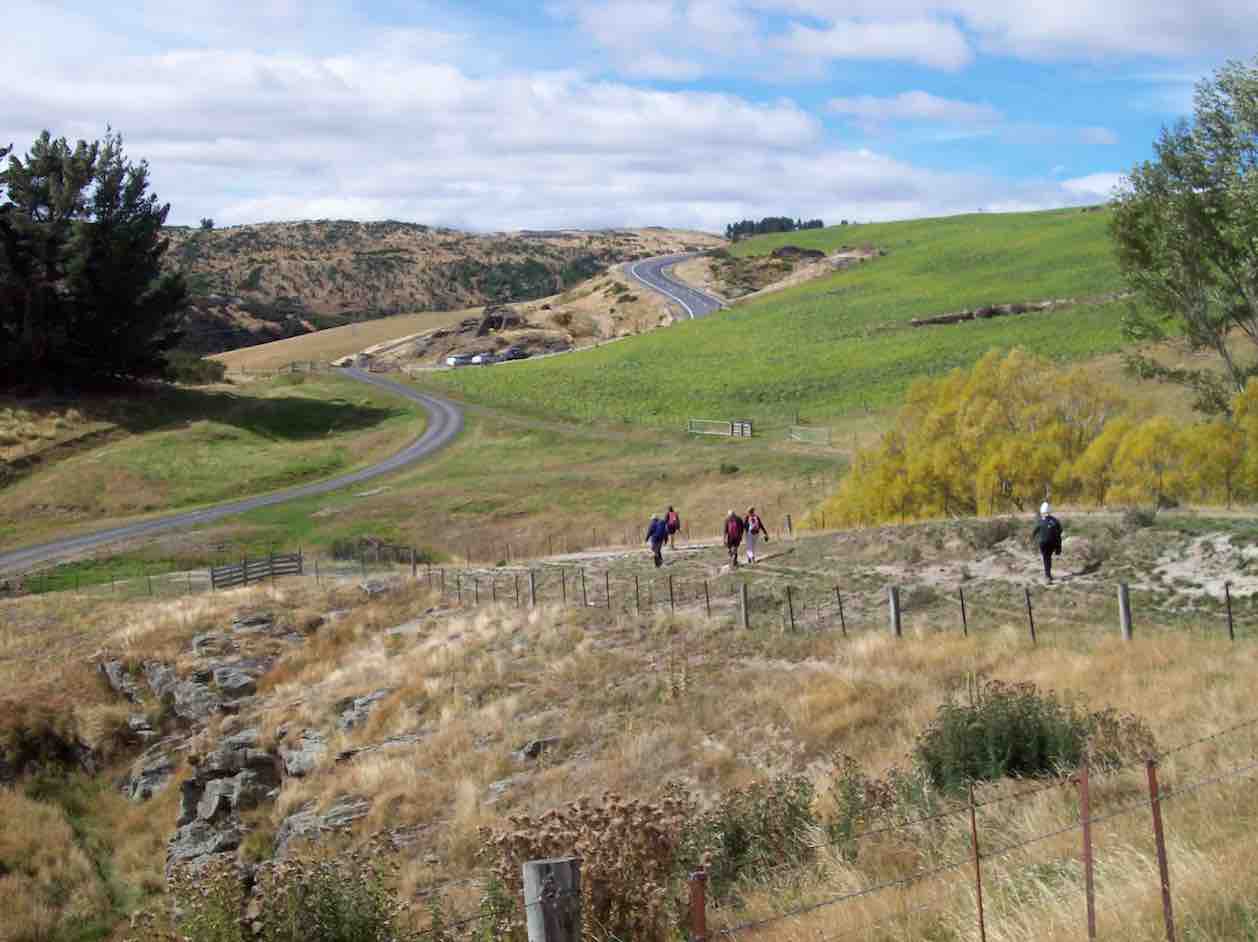
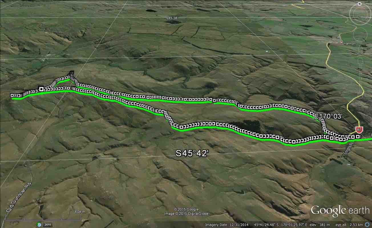
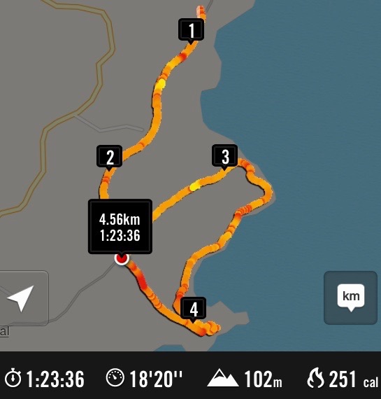
1. 22/3/2017. Flood bank walk from Otokia to Allanton. E. Leaders: Lester and Ian.
Route Map, Flood Bank Otokia to Allanton, courtesy Clive.
This flood bank walk from Otokia to Allanton was a first for the Club. It was Lester’s idea, with his knowledge of the Taieri River plain, to vary from the programmed regular one from Allanton to Outram.We had to car-shuttle. We parked our cars on a property at the end of Otokia East Road, by kind permission of a grandson of Dr Alex Luke. The weather was mild. We climbed onto the flood bank. 25 of us were away.
The Taieri River at Otokia. (Clive pic and caption.)
Lester had arranged for us to have morning tea in Mrs Mason’s attractive woodland property, which although alongside Centre Road was still a paddock or two distant from the flood bank on the day. How to get there? The leaders hadn’t worked that out. Barb wire fences in way as we moved on, looking for a way through. None. But who’s this? Mrs Mason hurrying across the paddocks to us, wondering why we hadn’t turned up. Lester went back to talk to her while we waited, but this writer is ignorant of what transpired. Oh dear!
Too late now. So a stop on the flood bank instead.
Morning tea on the stop bank at Otokia. (Clive pic and caption.)
Many gates on the way made for frequent stopping, opening and closing. Along with the level terrain. these rest opportunities enabled everyone to complete the distance.
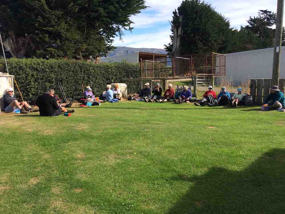
The lunch stop at Lenny Miller’s worked out more happily. On a lawn! A close-knit hedge sheltered us from a cool wind that had come up from behind us.
Lunch on lawn, courtesy Lenny Miller. (Ian pic and caption.)
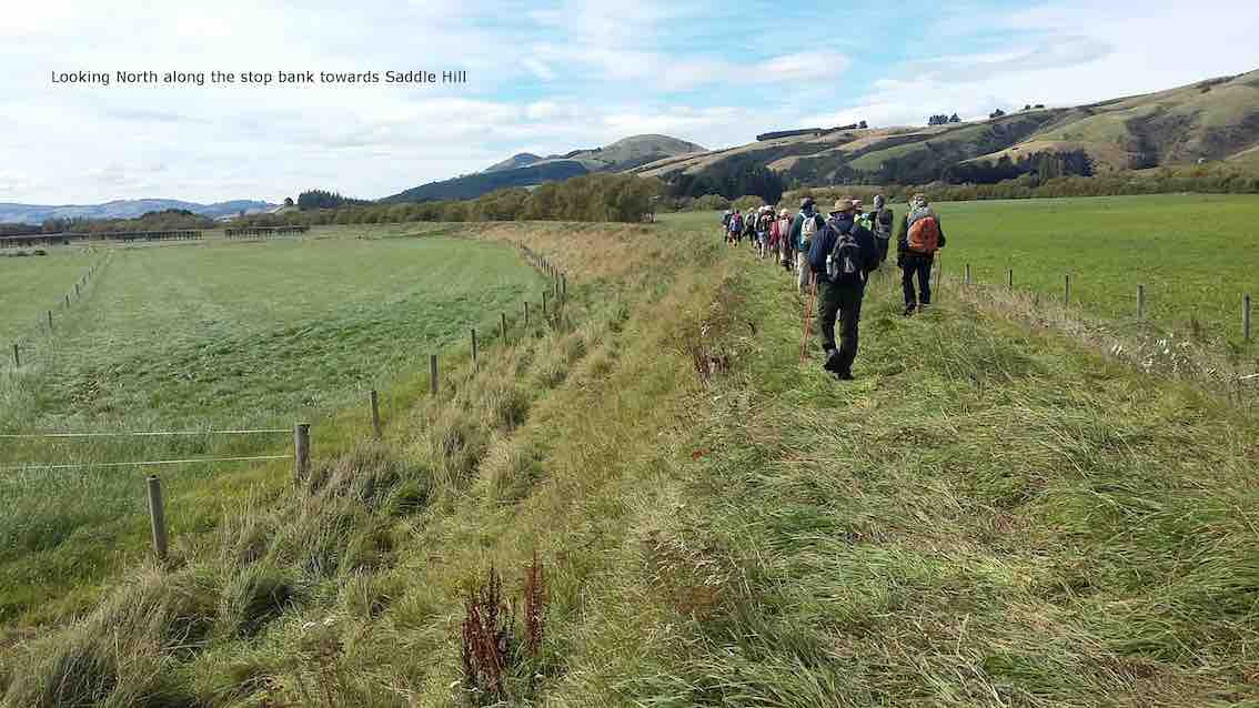
Then it was on to Allanton. The leaders had warned about long grass to wade through, but as it turned out a top-dresser truck had just preceded us on that morning, and flattened an easy route for us instead.
Looking North along the stop bank towards Saddle Hill. (Clive pic and caption.)
So we reached the Allanton Bridge. Distance being 7.75 km by Nike app or 8.9 km by a steps app. But here, a second reece neglect. The leaders had not checked whether there was a gate available across the road to enable continuing along the flood to the sale yards. Discussion. Eventually it was decided to walk down, under the bridge back up on the other side. Apparently there was some electric fencing to encounter. This writer, being a driver, was driven back to collect his car and meet up with his passengers at the sale yards. From there, we went on to ‘coffee’ at the Topiary Cafe. – Ian.
Wednesday 22nd dawned clear and fine for our usual walk. Nine keen trampers departed for Hindon and the pipeline up-stream. After a bit of misunderstanding by the leader, we departed the cars at 9.45am. The first 1/2km of this walk is uphill on the farm track which tests everyone’s lungs, legs etc then over the top and down towards the cattle yards in the distance.
Walking uphill. (Arthur pic and caption.)
We had morning break at 10.15am on the grass above the creek.
Morning tea stop. (Arthur pic and caption.)
After that, it was onwards and upwards till we crossed over the road to Rocklands and on up to the high knob with the tree on it where we stopped at midday for lunch.
There was quite a strong, cool wind blowing up there …
Lunch in the shelter. (Arthur pic and caption.)
… but a good view all round.
Lunch view. (Arthur pic and caption.)
We returned parallel to the uphill climb but on reaching the road walked about 1/2km before going through a gate to continue our paddock walk back to the cars which we reached about 2.0pm.
End in sight. (Arthur pic and caption.)
One car load chose to go straight home and the others stopped at Outram for the usual coffee break and chat.
An enjoyable day was had by all. -Neil.
3. 20/5/2015. Trampers. Hindon Pipeline upstream.
Deepstream pipeline – South. GPS of route, courtesy Ken. Waked 12.6km; Ave 4.1km/h; 2hrs 53min; climbed 406mtrs; max height 562mtrs.
This week, we had a good turn out of 9 trampers, who returned to the same parking spot as last week, but this time we went off to the LH side of the road. from the bridge over Deep Stream in the big dip on highway 87. This was a new tramp for all, as we had not been this way before.
The first 10 mins. of this walk up a steep gravel road, really got the blood flowing, & warmed us up, as there were signs of a frost in this valley.
On the way along here, we met up with the landowner, & had a chat to him for a few minutes. He suggested a walking route for us, which we did some of on the way back out, but we went a long way further than he suggested.
We had morning tea, at a spot where there was some dry ground,
1 Morning tea spot. (Ken pic and caption)
& then carried on towards Rocklands Station. When we arrived at the edge of the ridge looking down on Rocklands,
2 Looking down on Rocklands Station. Old Dunstan Rd. in distance. (Ken pic and caption)
we thought that the fence we were leaning on was a boundary fence, so didn’t cross that to go down to the Deep Stream. Instead, we headed off in a SW direction, which took us across the Old Dunstan Rd. & into the paddocks on the other side, where we spied a suitable high spot with shelter to have lunch.
3 lunch. (Ken pic and caption)
This proved to be a good choice, as there was a very light breeze blowing, & the sun had not quite made it’s presence felt yet.
4 View from lunch spot. (Ken pic and caption)
While having lunch, I made some mental notes of the route we could take on the way back, as I could see a large amount of the country we would have to walk across. So after lunch, we retraced our steps for a few hundred mtrs. to a gate in a fence we needed to cross, & then made our way back in the direction of the cars.
This tramp was throughly enjoyed by all, as the weather was fine, the views were great, & the country side was nice to walk through. – Ken.
Hindon pipeline to left of highway 87. We walked about 7.6 km; moving time 1h 55m; 3.8k/h ave; climbed 319mtrs. GPS courtesy Ken.
Not one of the 6 trampers who ventured out on this walk had been to this area before, so it became like doing a recce !! We started by examining the map on the GPS & deciding to walk towards the Old Dunstan Rd. which was about 4km from where we parked the cars. After climbing a couple of small hills, & a stop for morning tea, we got to within about 4 -500mtrs of the Old dunstan Rd. where we watched some farm hands feeding out to some cattle. then we turned right & went inland further to overlook the valley into Rocklands station. The lunch stop was on the tops with a view over to the Lammerlaw/ Lammermore ranges which were snow capped, & a rain shower passing along them. then it was back along the tops to join up with the road leading in, & back to the cars. A short walk, but enjoyable to be out on the open tops, & not in bush. the day was cool, but mostly calm, which made for pleasant progress. – Ken.
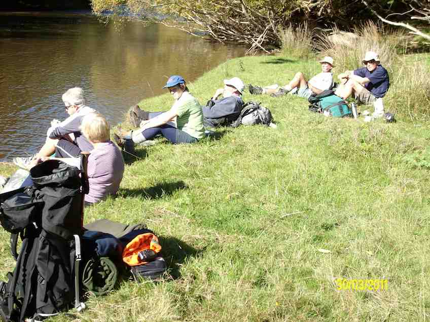
1. 12/12/2007. Trampers. Deep stream Bridge, Middlemarch Road, Hindon Pipeline. (upstream). Medium. Leaders: Arthur & Barbara
Lunch. Ria and Hazel by stream
13 of us parked the cars to the left of the Highway 87 bridge over the Deep Stream gully and Arthur and Barbara took us on the upstream farmland of the Deep Stream Pipeline route. Some confusion arose from an enforced wait for the late arrival of the station owner who had wished to point out aspects of the area and from an imperfect memory of a recce of a trip cancelled due to bad weather six months earlier. We stopped for morning tea on a steep slope providing an excellent view of the willow-clad stream below, later lunching…
…chimney of a former stone house also provided interest. We caught only a few indications of the pipeline, largely buried under paddocks. Hot sunny weather gave way to threatening black clouds but we experienced only light rain on an early return to the cars. – Ian
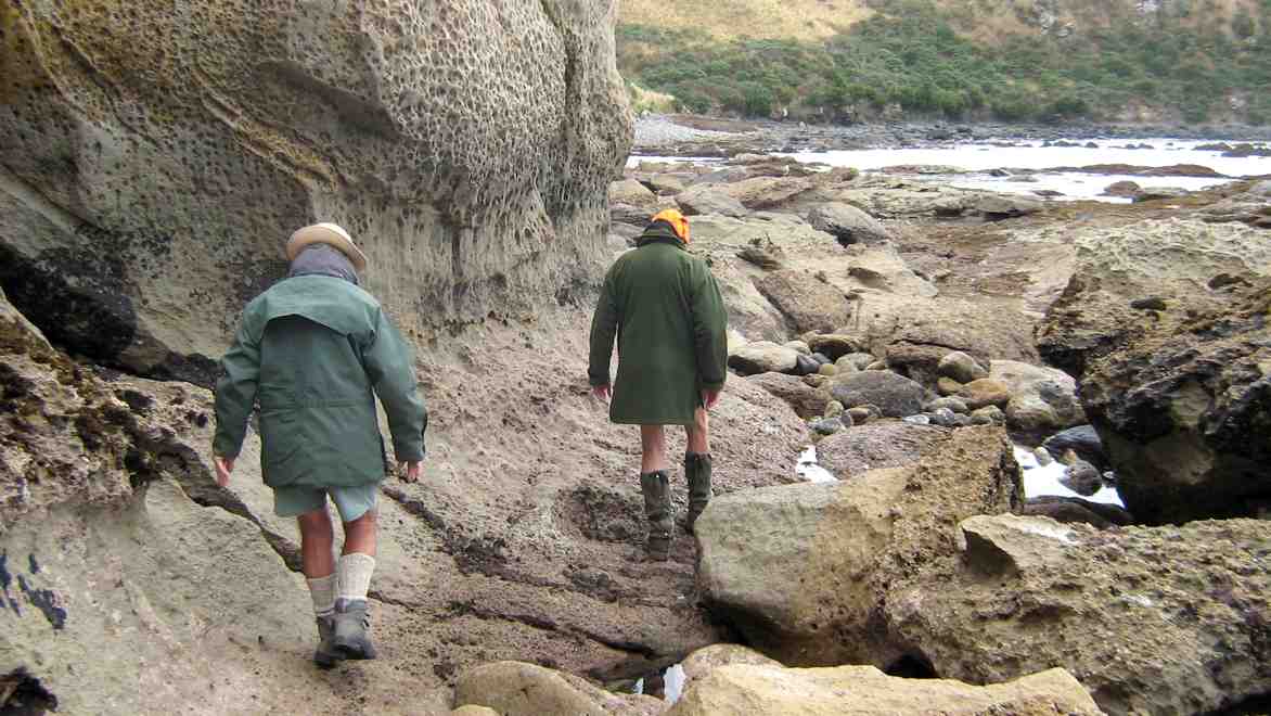
Notes: Whole cliff moving. Caversham Sandstone. Burnside Mudstone. 3 or 4 mudstones – like Abbotsford.
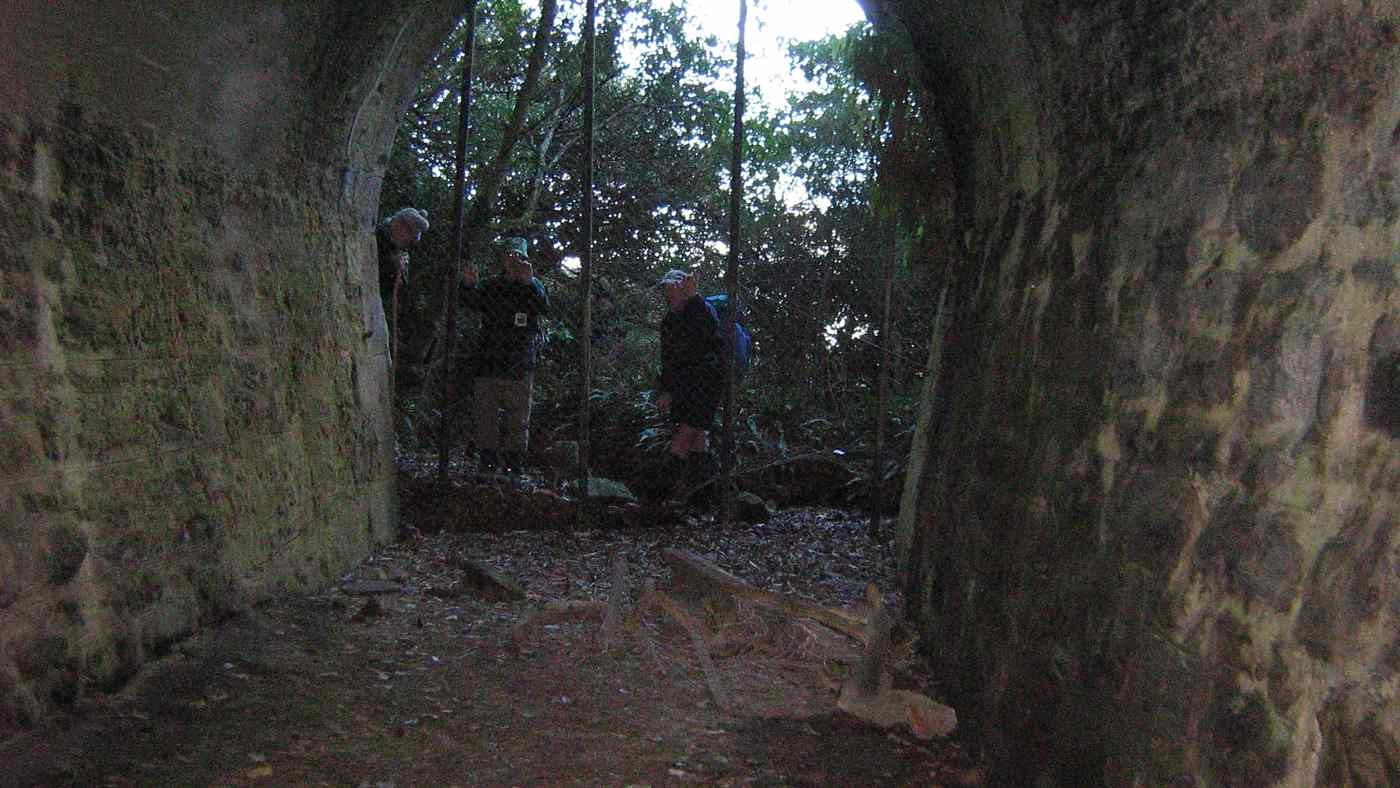
Cracks in hill above coastline. Tunnel – brick-built. Rock cracked – eroding. Middle of tunnel caved in as bricks fell. Middle 30m. Tunnel closed. Cutting through hillside. Railways sank a shaft, covered with sleepers &c. Cut access-steps down to check line on brink of cliff.
During WW2 Karitane men working at Seacliff. Cycle track formed alongside railway line Warrington to Puketeraki. – Written notes by Stewart McKay. Retired school teacher.
Seek permission.
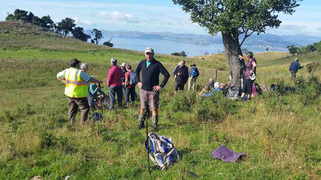
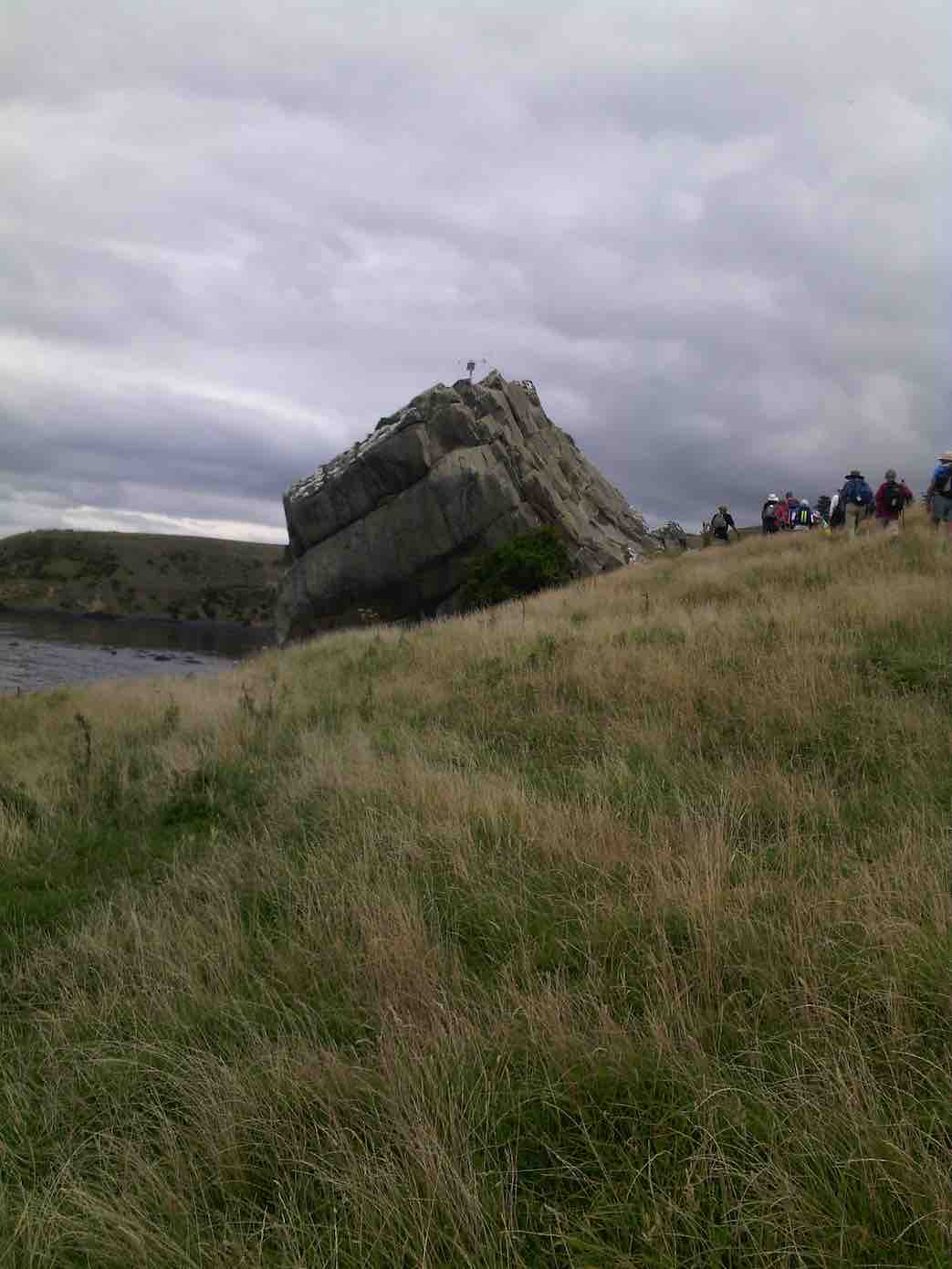
8. 1/3/2017. Both. Seacliff/Brinns Point. M. Leaders: Shona and Keith.
For the combined walk 28 people started at the lay by 2kms north of Seacliff township. We crossed the road and wandered uphill for morning tea before most ventured not/into/around the rock or did combinations of these.
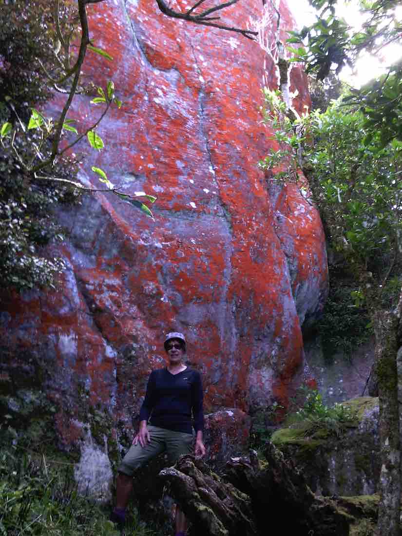
(Margreet pic.)(Keith pic.)Split Rock with amazing colours. (Helen pic and caption.)
We came back down to the cars where several opted to stay. Twenty-one continued downhill to cross the railway line and follow it north for 200 metres where we entered a rugged track formed and marked by the very obliging farmer, which we followed downhill and out to the coast. We had lunched in a clearing out of the sun in among the pines.
Lunch under the pine trees. (Helen pic and caption.)
At the coast we climbed through the fence and followed single file on sheep tracks in the paddock from Green Point
Green Point. (Helen pic and caption.)
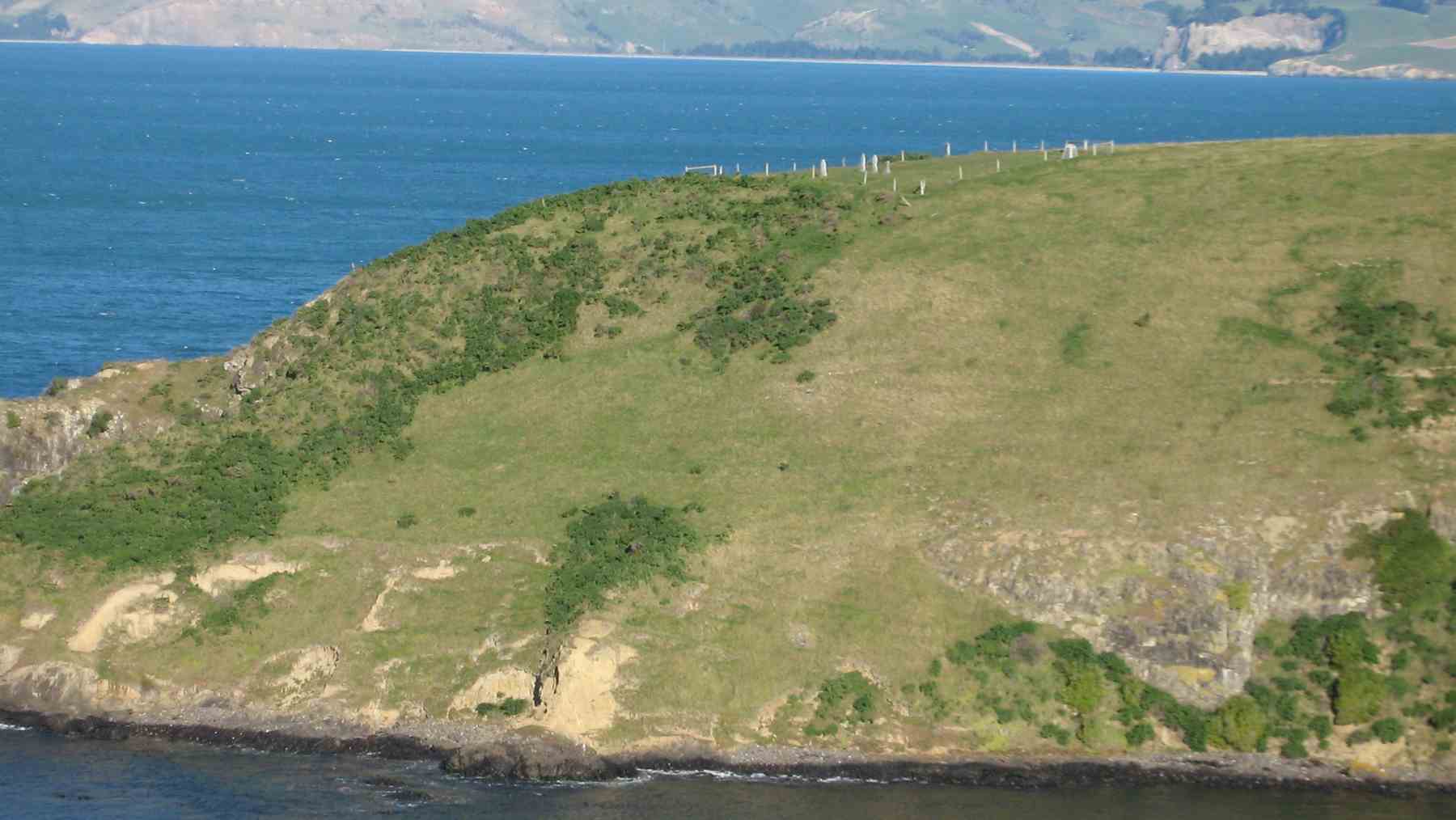
to the historic Urupa (Maori Cemetery) at Brinns Point, seeing a couple of seals on the rocks below as we were passing.
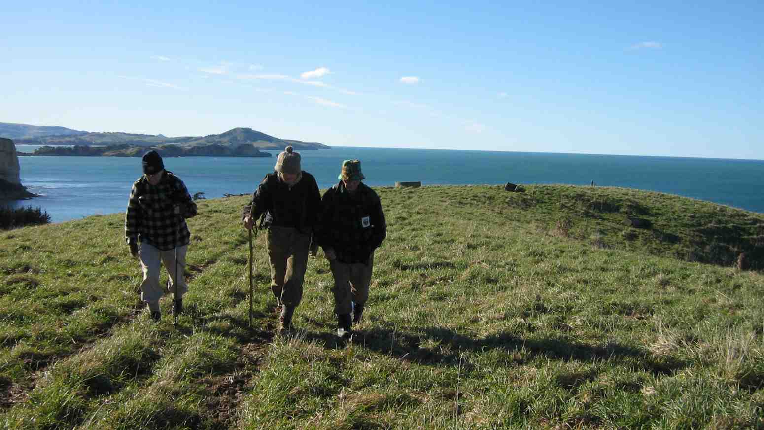
The oldest. An inspiration. Mollie, George, Doug and Lester. All completed the tramp. (Helen pic and caption.)
After climbing uphill we arrived back at the cars. Distance walked 6.5kms. Coffee followed at Blueskin Cafe. – Shona and Keith.
7. 2/12/2015. Both. Green Point and Brinns Point. Leaders: Doug, Arthur H, Ian F.
GPS map of Hikers’ route.
Trampers’ report. Being the first Wednesday of the month, this was a combined tramp to Green Point and Brinns Point in the Seacliff Area.
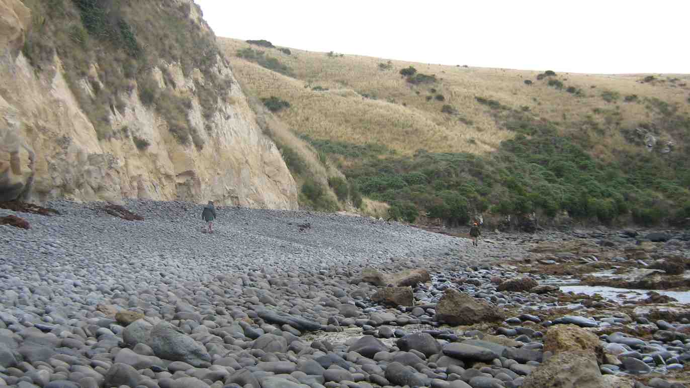
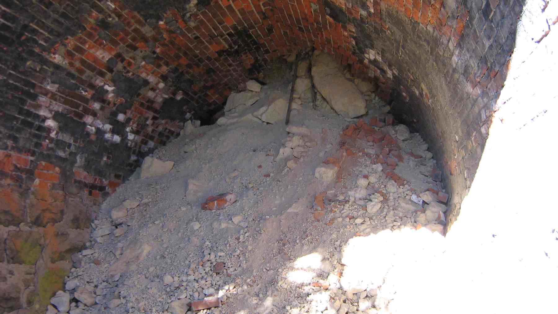
It was 10am when the cars arrived, so morning tea was taken then. 10 trampers left first, following the railway line north about 1.5km to inspect the disused rail tunnel .
After looking at the south end, we negotiated along the top of the cutting, and down the steep clay bank onto the rail line, and to the northern tunnel entrance. This was blocked completely by a fall a few metres in. The brick roof immediately inside the entrance looked dangerous. The trampers then returned to the cars by the same route as the outward journey, down the paddocks then to Green Point, before following the coastline south to Brinns Point.
The trampers ran out of energy just before reaching the top of Brinns Point, and stopped for lunch, a very picturesque scenery to look at while dining but very hot with no cooling breeze.
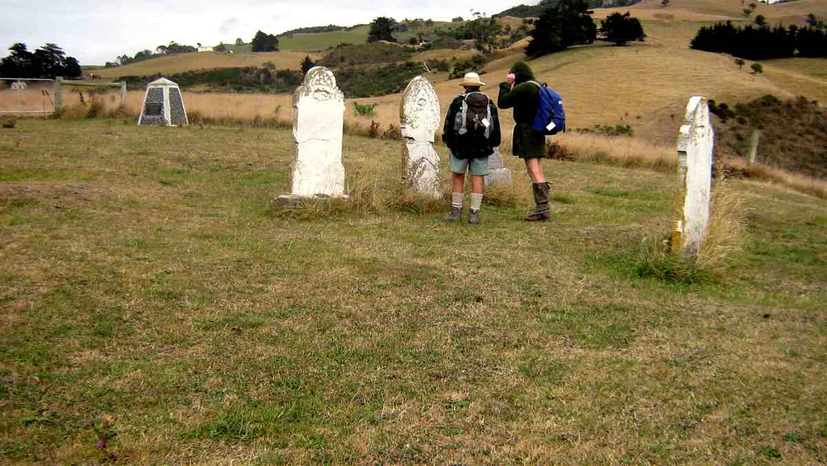
A 5 minute climb took us up to the interesting little Cemetery on Brinns Point where all took time to inspect the few headstones and plaques.
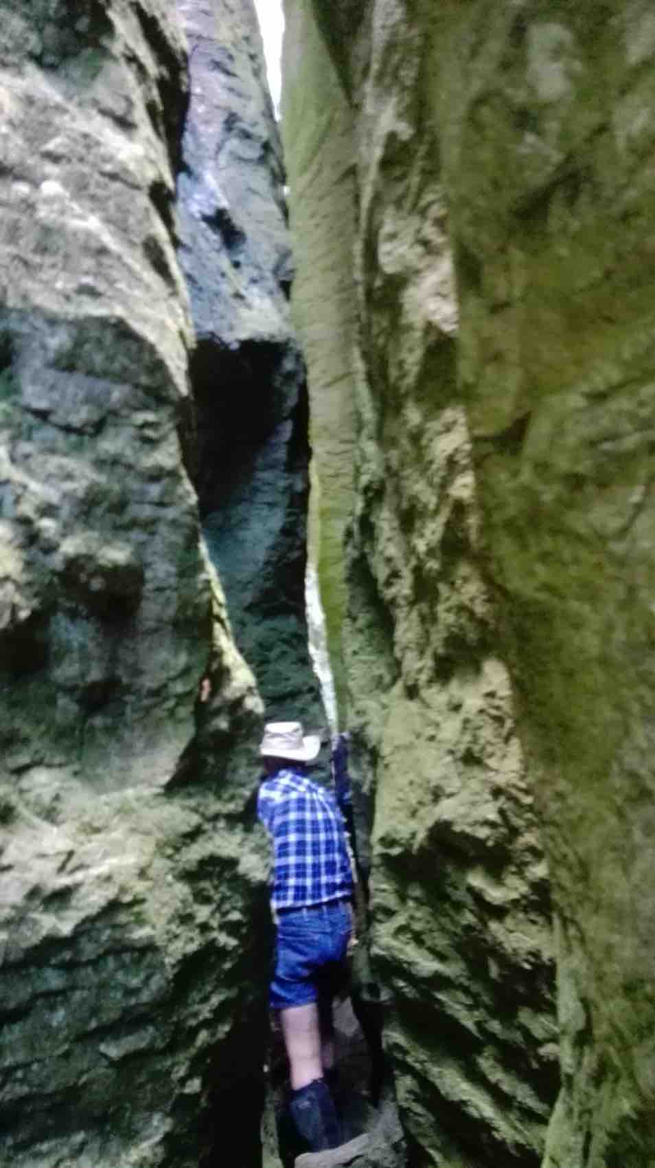
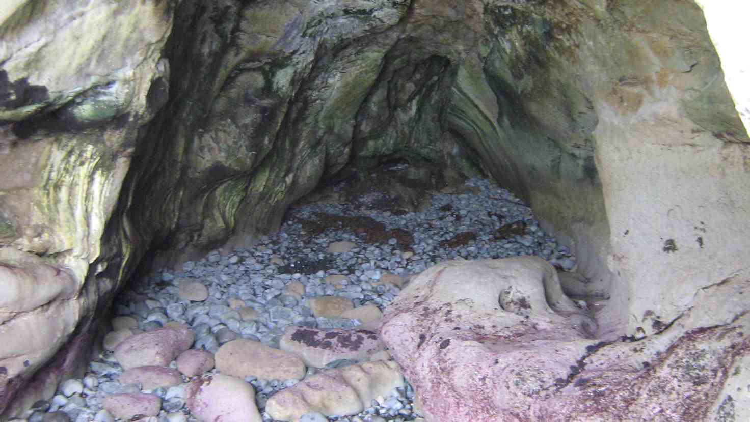
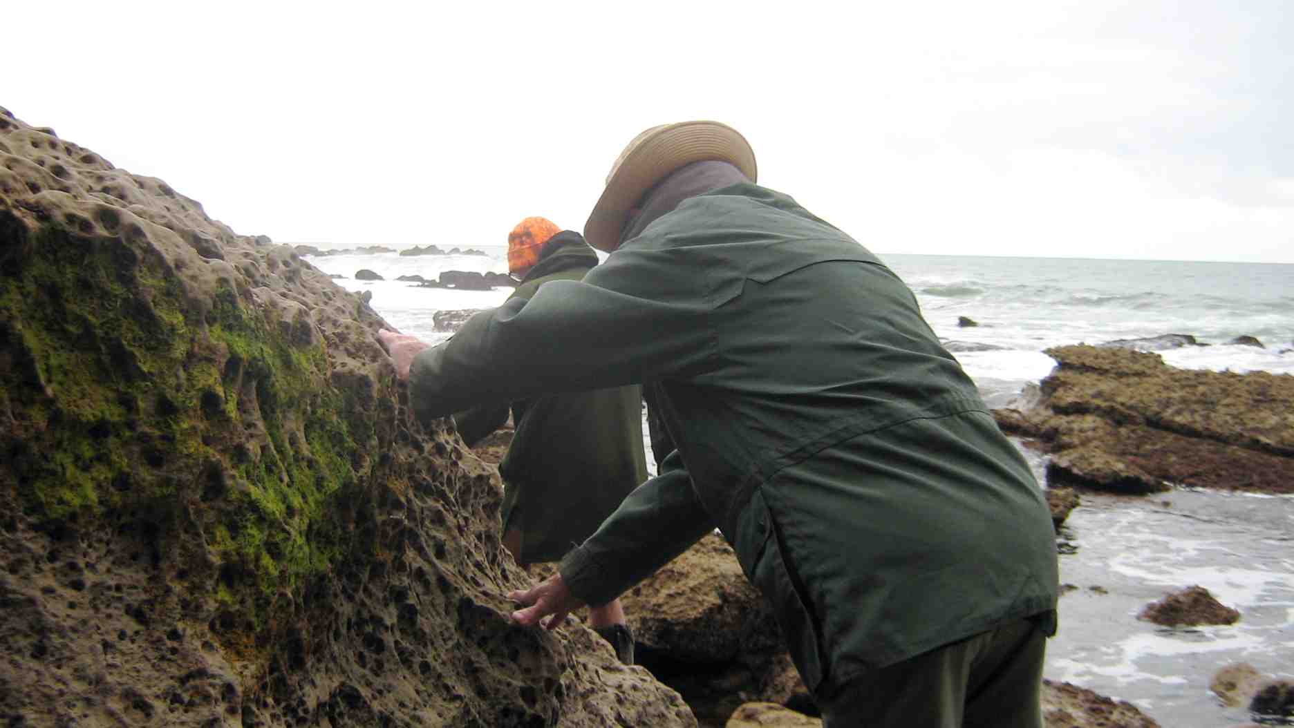
Down hill then, to the south, and out onto the bouldery beach. At the south end is an interesting cave. Ian H. did a cliff-side recce first using his crampons, but we then found that the tide was just far enough out, that all 10 were able to scramble around the rocks to view the cave.
It was then back along the beach to the entry point, and uphill to look at the old house ( which is to be restored ) and back to the cars. Some of the trampers also walked around to the Truby King Memorial Gardens, at Seacliff, on the way home. A hot, but very interesting day’s tramp. Arthur H.
Hikers’ report. Very few of the club had been in this area before, and even fewer of those who had, had any memory of it. It was a substitute on the day for the programmed “Mahinerangi Area” tramp for which the leaders could not think of a suitable venue. The Hikers followed the Trampers to the tunnel, but only the southern end. Back at the cars the Hikers leisurely explored the Green Point coast line cliffs and the bouldery beach, being caught up at the latter by Trampers who pushed ahead to stop off just short of the short steep climb to the Urupa which the leaders had planned for the lunch stop. In the confusion, some of the Hikers stopped off with them, although most persisted with the short stiff climb and to take in the wider view at the Brinns Point cliff edge and relax in the shade of the lupins.
Rock formations at Brinns Point.
After lunch thee two groups split again, with the Trampers going on to explore the cave to the south of Brinns Point.
Shot taken from Brinns Point of Trampers heading for the cave. President in foreground.
The hikers meantime made a leisurely climb up from the Urupa, across and back to the cars. In the event, from this point on, cars left on the return trip in their own time, disrupting any organised resorting to the Truby King Reserve. However a few car-loads made it, visiting the highlight of the visit, the famed Magnolia Tree referred to by Janet Frame with the metal plaque below it inscribed with Janet Frame’s poem. – Ian.
6. 17/3/2010. Trampers. Seacliff, Brinns Point, Truby King Recreation Reserve. Leaders: Ian, Ken.
(Suggested alternative for a future tramp: Split Rock, Green Point, Brinns Point to give a fuller day.)
Only Doug turned up for the leaders to take on a tramp. We first made our way down to Brinns Point and the graveyard.
Doug and Ken in Brinns Point Cemetery
Then it was down via a steep descent ending in a gully on the south side of the point and onto the beach. It was then time for a cuppa stop before picking our way over the boulders to the cave near the point at the end of the bay.
Approaching cave
The cave is satisfyingly deep. We disturbed birds nesting at its head and with noisy flapping wings they made their way out to sea.
The cave’s interior
The cave is approachable only at low tide. And we had to be careful to place our boots on safe surfaces.
Taking care on return from cave
A safer area on return from cave
Long return along bouldery beach
We climbed the ridge above the bay up past an old house, back along the road beside the railway and over to the Truby King reserve.
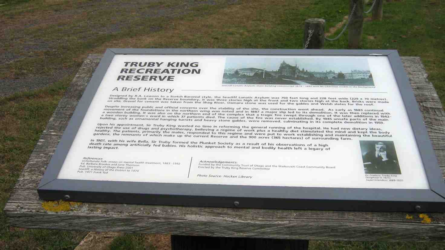
The Truby King Recreation Reserve Plaque
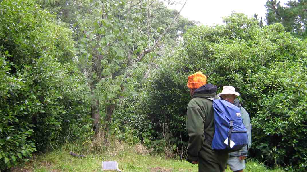
We rambled over as much of the reserve as we could discover but still failed to identify the old tennis court. We stopped to show Doug the famed Janet Frame’s magnolia tree.
Janet Frame’s magnolia tree. Ken and Doug.
The plaque enlarged
Because it was a shorter day’s tramp we thought a future one would be better taking in split rock, Green Point and Brinns Point, plus or minus the Reserve. – Ian.
5. 22/7/2009. Karitane, Puketeraki, Green Point. Leader: Ian and Peter F.
click to enlarge
4. 15/1/2003. All. Karitane, Ellison Farm, Green Point. Medium. Leaders: Ria L, Catherine.
3. 15/11/1995. Karitane: Ellison Farm, Green Point. Leaders: Ria L, Catherine, Nel K, Ria H.
2. 9/9/1998. Seacliff, Brinns Point, Enchanted Forest. Leaders: Doug and Myrie.
1. 28/10/1992. Seacliff, Brinns Point, Enchanted Forest. Round trip. Average. Park cars at Seacliff Hospital entrance. Leaders: Marie F, Maire, Hugh, Margaret D
30. 22/2/2017. Hikers. Whare Flat. Leaders: Peter D, Janice.
Whare Flat/McRaes Weir (not quite) Wednesday 22nd Feb
26 happy hikers on a lovely sunny morning – what could go wrong?
Seven opted to drive up to the locked gate on Rollinson Rd and walk on to the start of the Steve Amies Track, where they enjoyed a pleasant amble to the picnic area and a leisurely lunch in the sun, before returning to the cars and off to Topiary for the usual coffee stop.
Little did they know of the drama that was developing below….
The other 19 left the cars at the park near the pump house, and set off up the track on the steep grunt that takes longer but avoids the water crossing and the possibility of wet feet.
However, Ian opted to do the shorter, easier version, risking wet boots, and meeting us in the clearing just past the swing bridge.
Ian reached the clearing safely and with plenty of time. In his own words –
’Ho hum. Oh! Time to get out the puffer and see how it might get me up the next climb and manage to avoid that first 5 min. heavy breathing before the blood vessels adjust and let me get away. Bummer.
(I had not used it for ever so long as usually I remember when it’s too late to use. It’s worked well on earlier occasions, but not in this case, standing, waiting, for such a long time before climbing.)
Started to feel faint. Got worse. Lay down, ended looking like a wee gnome in the grass, as one of you said. The rest you know better than I do!!!’
So, here was Ian, looking worse by the minute. While he was attended to by those with medical experience, we debated the options.
Cell phone call for help. No signal.
Use the locator beacon. Was there enough room for a chopper to land? Debatable.
Go back to the cars and phone for an ambulance.
It seemed at this point that Ian was recovering – his colour was better and he was lucid. Two people set off for the cars. Over the swing bridge and just past the gate to the road they realised the house on the right was occupied. But no landline and still no cell phone coverage. The wonderful lady (who had a key to the gate!) drove them out to the cars. One went on to get coverage and call for help. The other returned, to find that Ian’s condition had worsened, necessitating CPR. Gulp. Back down the road – kind lady again drove. The police car was met at the (un)locked gate and immediately radioed URGENT to the ambulance.
Things happened fast. In just over an hour from Ian’s collapse the ambulance was at the swing bridge and Ian was stabilised and stretchered across the bridge, and off to A & E.
It was now 11.30 and we were all rather shell-shocked. Five decided to call it a day. Two went to break the news to Shirley, and the other three heading home.
The remaining 13 headed up the track to the next clearing where a very sober lunch was had. Then up the track we climbed to McRaes Weir Track. It was decided that the weir could wait for another day, and we headed back along the race track to the road and down to the cars, with rain starting to fall and the track becoming muddy and slippery.
Coffee at Topiary was welcome!
Thanks to everyone for the able assistance that was provided in so many ways. Ian is fine – he had a reaction to the ‘puffer’ and after tests and checks, was allowed home that evening.
LESSONS LEARNED:
IF for any reason the group SPLITS, there must be at least TWO PEOPLE and preferably FOUR so that in the event of an emergency, one can stay with the ‘victim’, and two go for help. The same should apply to anyone deciding to turn back and in future this needs to be enforced by the leader.
In a later debrief with Police, we were praised for the efficient handling of the situation. However, they said that we should never hesitate to use the beacon because a few precious minutes could be saved. On the beacon signal, our precise position is shown and authorities can then make the decision as to which services to use. So in future, no hesitation! Better a false alarm than a death.
29. 1/5/2013 Both. Steve Amies. Leaders: Ian and George.
This time we left from the schoolhouse, making it more of a road walk. We had morning tea on the lower Rollinson Rd and lunch in the track clearers’ picnic area, after inspecting the helicopter landing pad a little beyond.
As we returned down the road, we were surprised to see the helicopter, and shortly after the tank truck making their way towards where we had been. Apparently this was the day to carry out the weed spraying we had been notified about – and we were now making a timely exit. A tramp for 25 of us and of 10.5 km according to Peter’s pedometer and 25. – Ian.
Plan 1: Swampy to Green Hill via Sleepy Hollow. Cold winds too fierce on tops.
Plan 2. Schoolhouse, Little Coal Creek, Steve Amies. But wet weather meant steep tracks would be too slippery and dangerous.
Plan 3. The actual tramp (see above). – Racemans level and safer, (except for the gradual Tunnels ascent/descents). However wet tree roots still had to be carefully negotiated.
Although rain for a start, but it soon went off and only drippy bush had to be endured. Track still muddy in places, but in many places a grand avenue and well cleared. Seven of us ventured out and enjoyed what looked at first to have been an unpromising day. – Ian.
GPS of route. Courtesy, Ken. (Route double-tracked for some inexplicable reason.)
12.33 p.m. Ready to return from lunch spot on Racemans.
2.23 p.m. Top of Tunnels track. Rest stop on pine-needles on return.
6. 23/10/1996. Trig Q. Average. Leaders: Margaret and Les, Doug J.
5. 7/6/1995Trig Q from Whare Flat School. Medium+. Shorter trip available. Leaders: Bob H, George, Jack R, Nancy
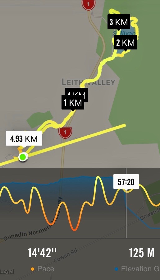
5. 18/1/2017. Hikers. Moores Bush – Sullivan’s Dam. E. Leaders: Bev and Lesley.
Route map, Courtesy Ian. (Ignore straight line.) Moore’s Bush on Thomson Rd, Loop Track, Leith Valley Rd, Sullivans Dam circuit, lunch, return by Leith Valley Rd.Morning tea at entrance to Moore’s Bush. (Ian pic and caption.)DoC sign. (Ian pic and caption.)
4. 19/9/2012. Hikers. Moores Bush, Sullivans Dam. Leaders: Bruce and Marjorie
3. 17/2/2010 Hikers. Thompson Rd, Moores Bush, Leith Valley Rd, Sullivan’s Dam, Leith Valley Rd. Leaders: Bev, Leslie.
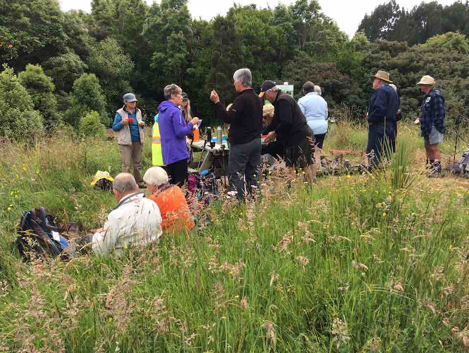
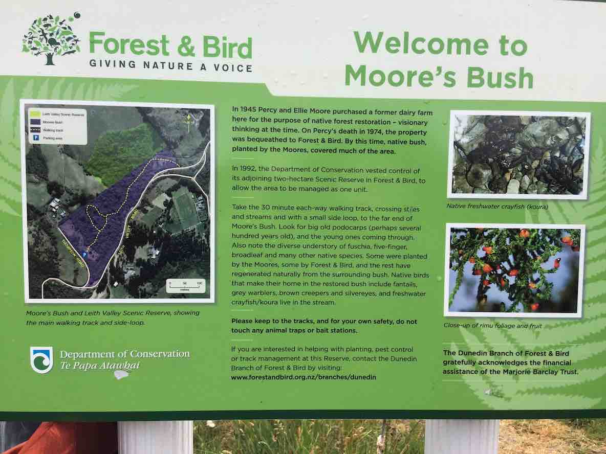
Good day to start with but got rather cold by lunch time. However, 12 keen hikers enjoyed a very pleasant, but shortish, day out. What a wonderful little forest Moore’s Bush is. Where is Moore’s Bush, you ask? Ascend the Leith Valley road out of Dunedin and take a left turn into Thompsons Road, and not far along is the entrance, signposted but fenced, to this Forest and Bird Society property.
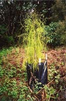
Just a short walk to the entrance of Moores Bush for our morning tea and then off we went through the bush. Track rather overgrown and we had to wade through Leith Stream to get to the exit but everyone was interested to see Moores bush and check out what work had been done by the Forest and Bird Soc., over the years. We didn’t see much “bird”, but we loved the “forest”, with some grand Rimu trees, lots of mature Fuchsia, a Big Red Beech, many mature Lancewoods, heavy undergrowth, and more recent plantings of Totara, Rimu
Young Rimu planted at Moore’s Bush.
and smaller trees and shrubs. Little streams wound through it and also the Leith, which we crossed, most getting wet feet etc, except for Bob who found a fallen branch bridge, and stayed dry, much to the disgust of the others.
Leith Stream running through Moore’s Bush.
Leslie, who led, with Bev, had an old information leaflet about the reserve which spoke of the area as being perhaps the best piece of bush in the greater Dunedin area. It is certainly not large, but it is a gem. There is even a long-drop-lodge near the start if you need it!!
We exited again onto the Leith Valley Road. From there it was up the road to Sullivans Dam with a very pleasant walk round the dam to find a sheltered spot on the motorway side for our lunch as it had turned quite cold. We admired the birdlife on the ‘lake’ and the unusual North Island Cabbage Tree planting. Then it was back down the Leith Valley Rd to the cars. While it was not a long walk, it was varied and satisfying for the 12 people most of whom were discovering new territory. – Bev and Bob. (Amalgamation of two reports. Thank you, Bev and Bob. – Editor)
2. 5/6/2002. Combined. Patmos Avenue, Pigeon Flat, Moore’s Bush. Medium. Leaders: Nancy, Barbara and Arthur, Barbara McC
1. 3/5/2000. Patmos Avenue, Leith Saddle, Moore’s Bush. This incorporates and longer and shorter walk. Starting together. Leaders: Nancy, Pat and Bill.
7/12/2016. Belleknowes. E. Leaders: Lester and Peter B.
Route Map, Belleknowes, courtesy Ian. 15 Hikers. York Pl, Town Belt, Alison Cr, Michie St, Bellevue St, Hart St, Highgate, Cuppa, Delta St, Beta St, Epsilon St, Gamma St, Beta St, Accessway, Belgrave Cr,Highgate, Falcon St. lunch in playground park, Highgate, Kilgour St, Leven St, Braid St,York St. Coffee at Green Island.
The walk was short but far from lacking in interest. First surprise was at the bend at the extreme top corner of York Place where it turns sharply down into Russell Street. Behold, a path through the Town Belt, leading across Queens Drive into Alison Crescent. Here on our right was a gully of seriously shaded houses each reachable only by a wooden bridge across the ditch.
Further on. Houses in the Greek-letter-named streets of Delta, Beta, Epsilon and Gamma (where was Alpha?) were notable for well-maintained three and four groupings of identical designs, (one group even with finials), and strikingly, as the street curved around, so did the house alignments, parlours strictly front-facing, regardless of where the sun struck them. Of course nothing new, but made obvious by the similar wooden buildings.
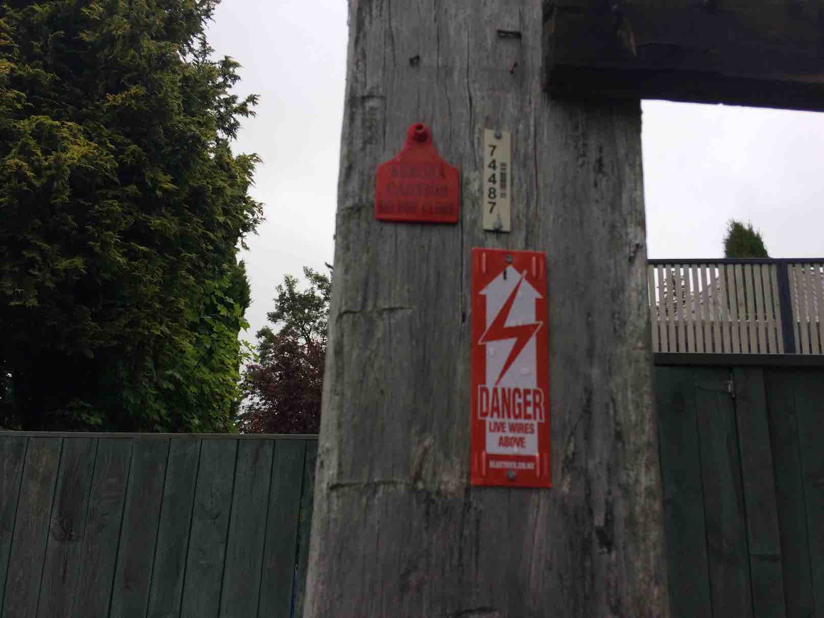
An interesting Accessway between Delta Street and Belleview Crescent was new to us. Knowledgeable ones among us said this was part of an old cable car route.
Red ticketed power pole. (One of two supporting large transformer.) Corner of the Accessway. (Ian pic and caption.)
We lunched early (11.20 a.m!) in a light drizzle in a hidden playground reserve off Falcon Street. It had the longest stainless steel slide down a steep slope the writer has seen. How on earth was present day Health and Safety permission for it obtained, one wonders. Sadly it was far too wet on this occasion for any of us to give it a go.
We were struck by some grand house and gardens along Highgate. Lester pointed out where the original owners had built houses for their servants down a side street. In one case, (Kilgour St?), built as they were on a steep falling away slope, they required small bridges from street path to front door. Goodness only knows what Health and Safety requirements (as too in the Alison Street bridges) they would be obliged to meet today. One couldn’t help reflecting today on the contrast between our own land-owning gentry class, of which we are part, and that of the thousands of New Zealanders unable to access even basic decent accommodation, with winter on the horizon.
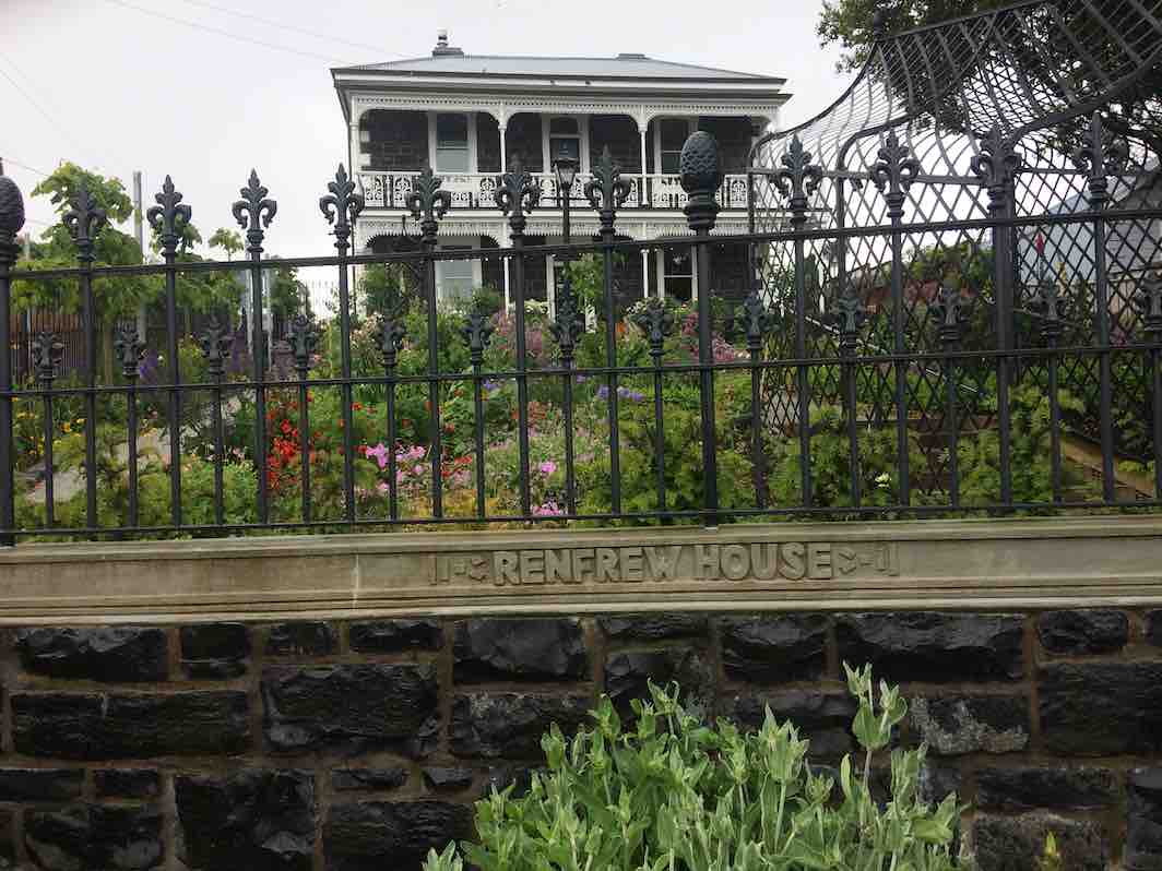
Renfrew House, Highgate. (Ian pic and caption.)Lovely house and garden. Leven St. (Ian pic and caption.)
Anyway, enough of that. An interesting return trip down Braid Street through an extensive bit of the Town Belt soon got us back to the cars.
As noted at the beginning of the report, the ‘tramp’ was short but full of previously unexplored interesting gems. Our thanks to Lester and Peter for searching it out. – Ian.
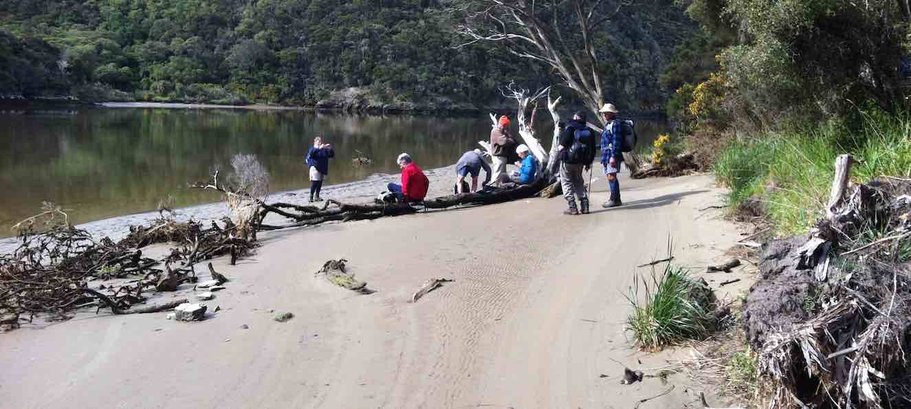
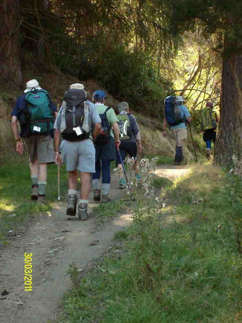
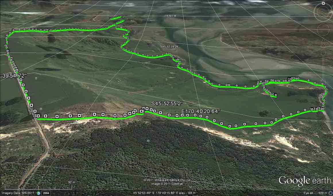
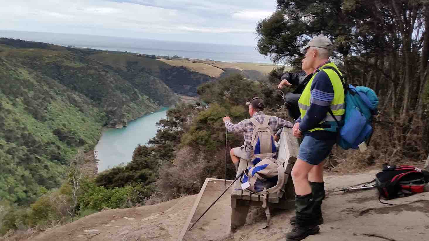
17. 5/10/2016. Hikers. Millennium-John Bull; Taieri Ferry to Taieri Mouth. Bus at both ends. M. Leaders: Bob and Doug.
Map of route. 3.3km ferry bridge to Wardell cottage; about 5km to seat; about 3km to track end; about half km to bus at T.M. bridge.
Millennium Track – combined trip Wednesday 5th October 2016-10-05
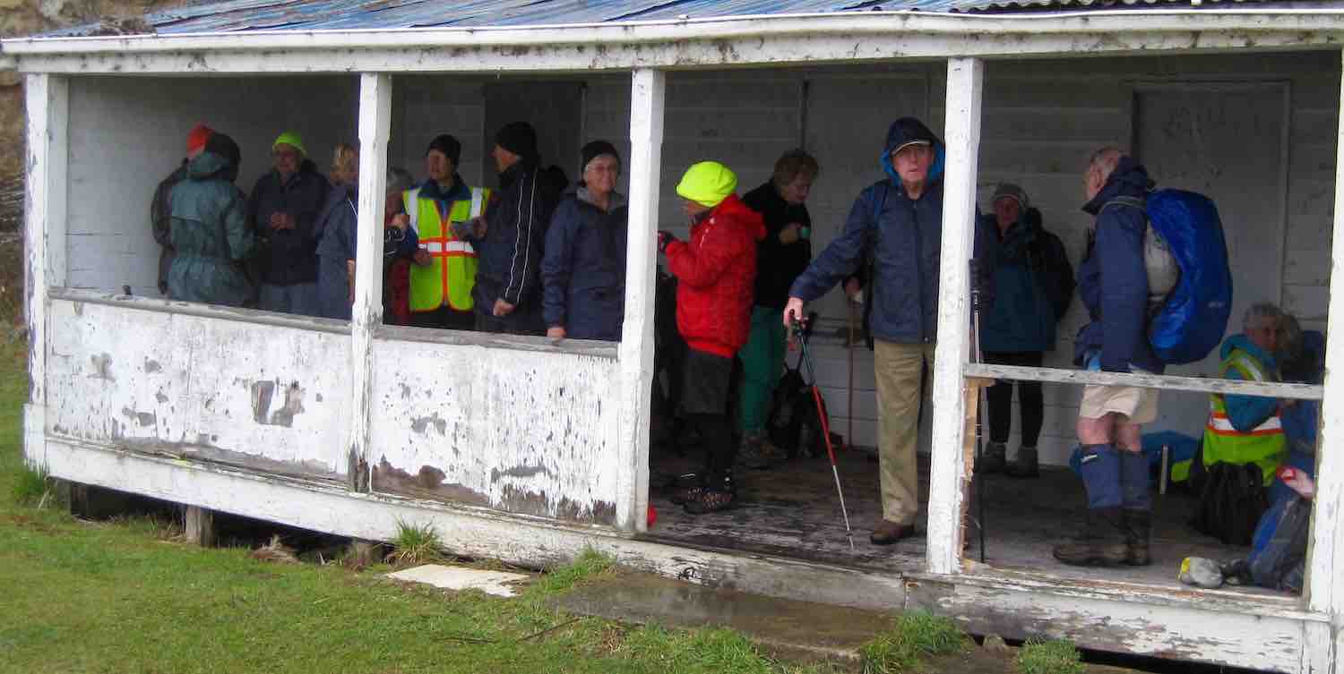
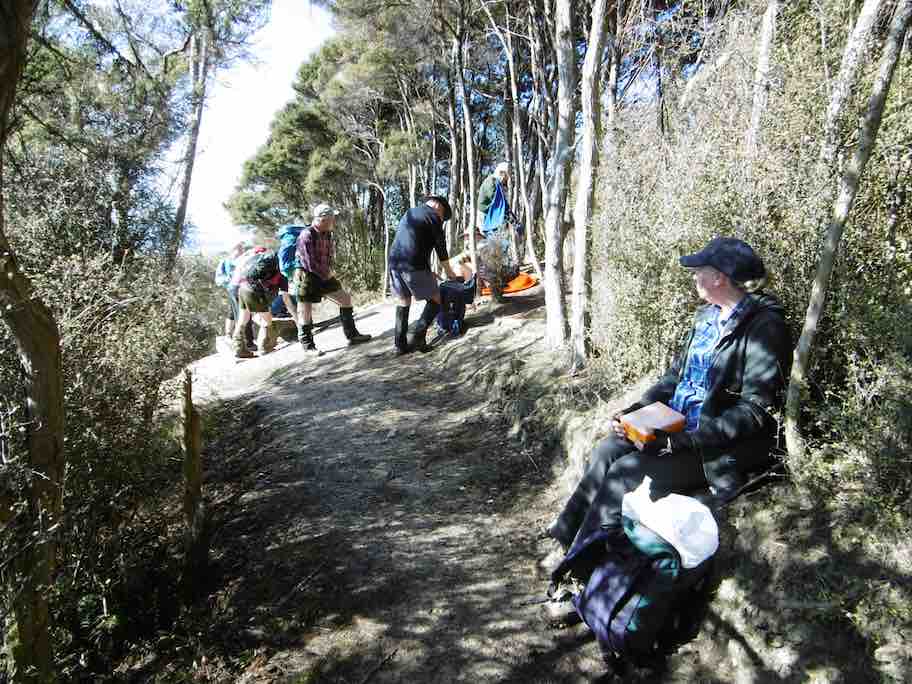
A dampish morning did not deter 40 intrepid club members who boarded the bus at the Bush Rd car park promptly at 9am. Packs were stowed in the luggage compartment and our driver Richard transported the happy crew out to Highway 1 and along to Henley and the start of the track – well, almost the start. 24 hikers disembarked in persistent light rain and trudged along the road for 45 minutes to a morning tea stop on the veranda of the white house just over the style, at the true beginning of the track.
The remaining 16 bods (and the bus) departed for Taieri Mouth.
Sheltering from the rain for morning tea in the old Wardell’s crib verandah.
The upward plod soon began and we were glad it wasn’t too hot. The light rain continued but there was no wind and it was pleasant for tramping. It was lovely in the bush with plenty of bird song and glimpses of the river below as we climbed.
A couple of solid hours saw us at the junction down to John Bull Creek, where it was unanimously decided not to descend, but to press on to the top for lunch. Which we did, collapsing gratefully for welcome food and drink. The rain had stopped and a pleasant break was had, with chocs to celebrate Alec’s recent birthday.
Lunch at the seat. Rain stopped at last.Lunch stop viewed from another angle.
Then down, and down, with a few inadvertent sit-downs, and the loss of a couple of impatient members who tried to take the direct route….it was quite slippery. No harm done, and we were soon back by the river for the last plod out to the road. The bus parked by the bridge was a welcome sight.
Nine cheerful souls on the bus had had a pleasant few hours meandering round Taieri Mouth and catching up on gossip, and there was no sign of the hardy seven trampers.
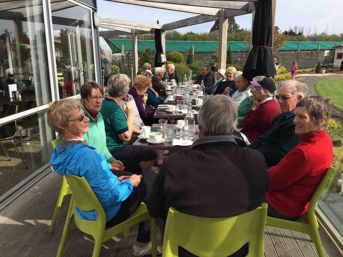
Thanks to hiking leaders Bob and Doug and tramping leader Arthur. It was a great day out, well-supported and enjoyed by all, and rounded off with a riotous session for coffee for 23 at Topiary. – Judy.
Coffee at Topiary. 23 in the sun.
16. 13/7/2016. Trampers. Millennium and John Bull from Henley. M. Leader: Arthur.
Two cars transported 9 trampers to begin the day’s adventure. The mild temperature was welcome, the sky overcast with northerly breezes.
We left the car-park at 10.00 a.m. and waked for about 10 minutes, to have morning tea at the picnic spot on the riverbank.
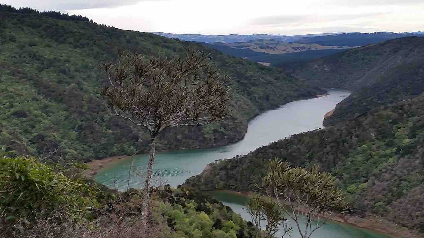
Continuing on it was up and down, as the track flows, and then up to the high up seat where we stopped for a little while. This spot overlooks the river to advantage
Another river view. (Margreet pic and caption.)
and also views away to the north too.
View from the top. (Margreet pic and caption.)
For example, Mount Cargill stood out in all its glory, with its mast on top.
The track was now downhill, the trampers intelligently noting that it would be the opposite on the returning journey. We came to a small wind-blown tree across the track, but Neil M. wrestled mightily with it and it was a problem no more.
An hour after leaving the high up seat we reached the track’s end. We were invited to have our lunch outside at Jay’s nearby house (she didn’t have the key with her), which we found a most pleasant and suitable place. – Thanks, Jay.
Lunch on the verandah of Jay’s Bach at Taieri Mouth. (Margreet pic and caption.)
A half-hour’s lunch and rest stop, and the party was on the track again. Grim determination was noted now, and with little talking, a fast pace was set, and we were back at the high up seat in an hour uphill – the same time as it had taken going down.
It had just come on to rain, so a brief regroup was taken under the trees, coats on, etc. The view being ignored now, downhill, and we were back at John Bull gully – just as the rain stopped and the sun came out.
Up the zigzag, and along, and down, etc., saw us back a the car park at 3.35 p.m.
The DoC sign at the car park stated that it was 9.3 km to Taieri Mouth but Margreet’s electronic gizmo said that we had done 16.2 kms.
Whatever distance we walked, we can say very definitely that “we went there and back”. A satisfying day’s tramp.
Blustery wind and rain welcomed us back to Mosgiel. No time for coffee today! – Arthur (substitute leader for Helen – off sick.)
15. 9/9/2015. Trampers. John Bull and Millennium from Taieri Mouth.
This tramp was done in place of the one scheduled, as I could not get permission from the farmer to do the tramp that was on the program.
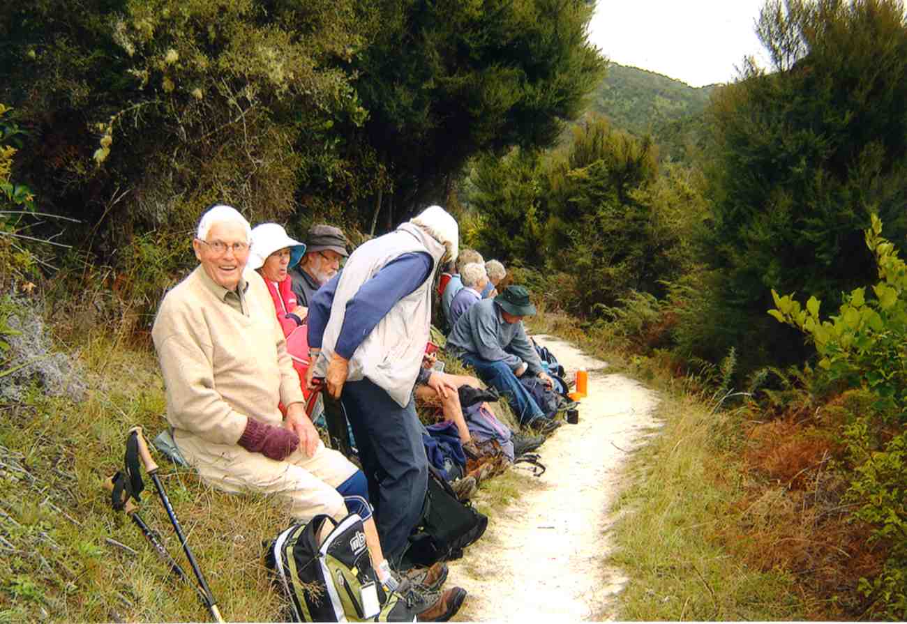
Ten of us arrived at the Taieri Mouth car park, & set off along the riverside track. We had quite a late morning tea stop at the wooden seat at the top,…
Cuppa (Ken pic)
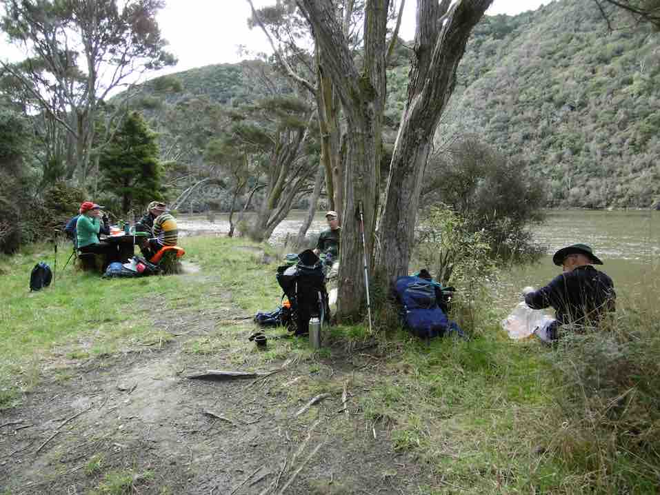
…before going down to John Bull Gully, where we had a short break. Then it was on along the Millennium track towards the Henley end. We arrived at the picnic spot down by the river, & had lunch there…
Lunch1 (Ken pic)Lunch2 (Ken pic)
…before setting off to do the remainder of the track, though to Wardells Cottage, & the car park beyond. [just to do the full track distance]
After a short break here, it was back the way we had come. We stopped at the seat at the highest point again for a rest & refreshments, after climbing the quite steep track up from John Bull Gully. We then made our way back to the cars at Taieri Mouth.
The weather was fine all day, but the track was quite muddy in places, & care is needed on the downhill muddy slopes.
It was good to hear the comments from some, that they had enjoyed the walk.
Although many in the group had walked both tracks in the past, it was the first time that quite a few of us had walked the full distance, there & back.
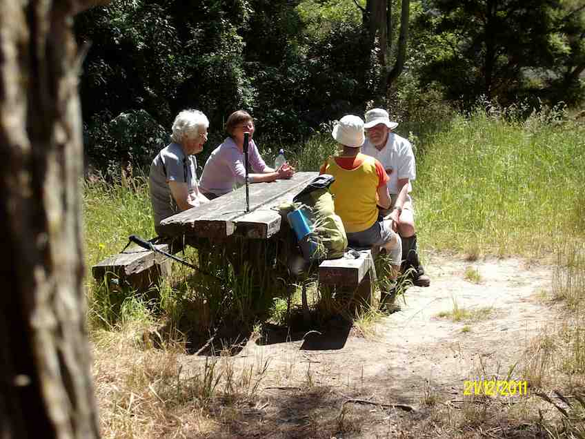
14. 21/12/2011. Trampers. John Bull and Millennium from Taieri Mouth.
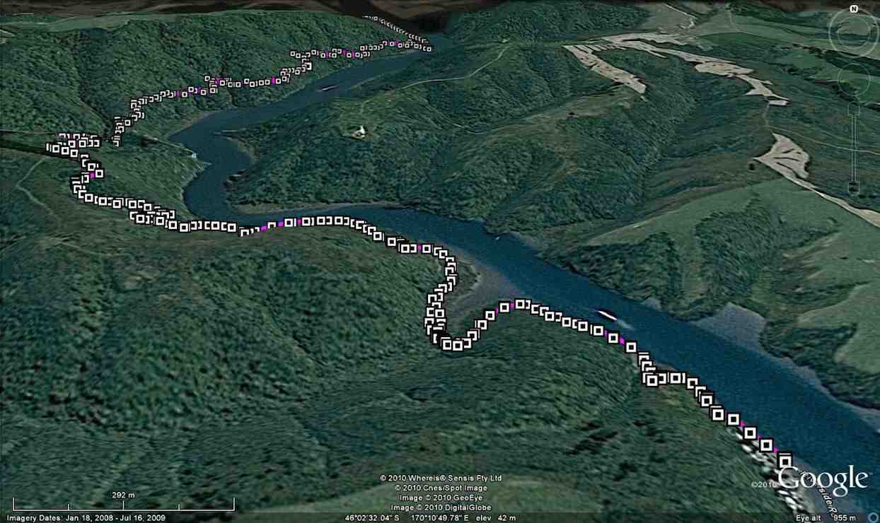
GPS. Taieri Mouth John Bull Gully Millennium Track. Courtesy Ken.
Lunch. (Ken pic and caption)
Lunch2. (Ken pic and caption)
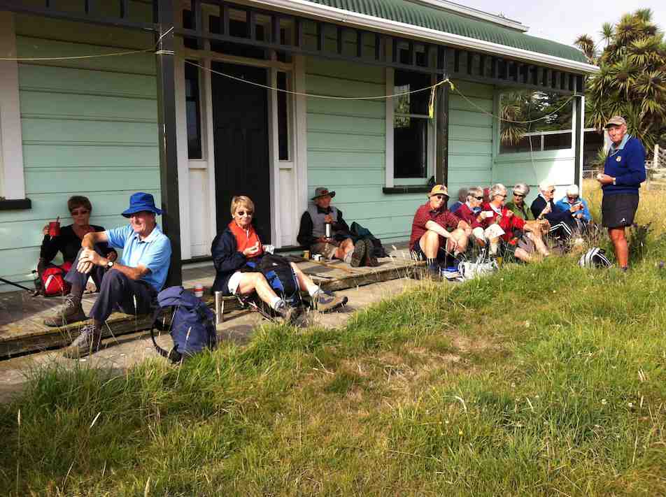
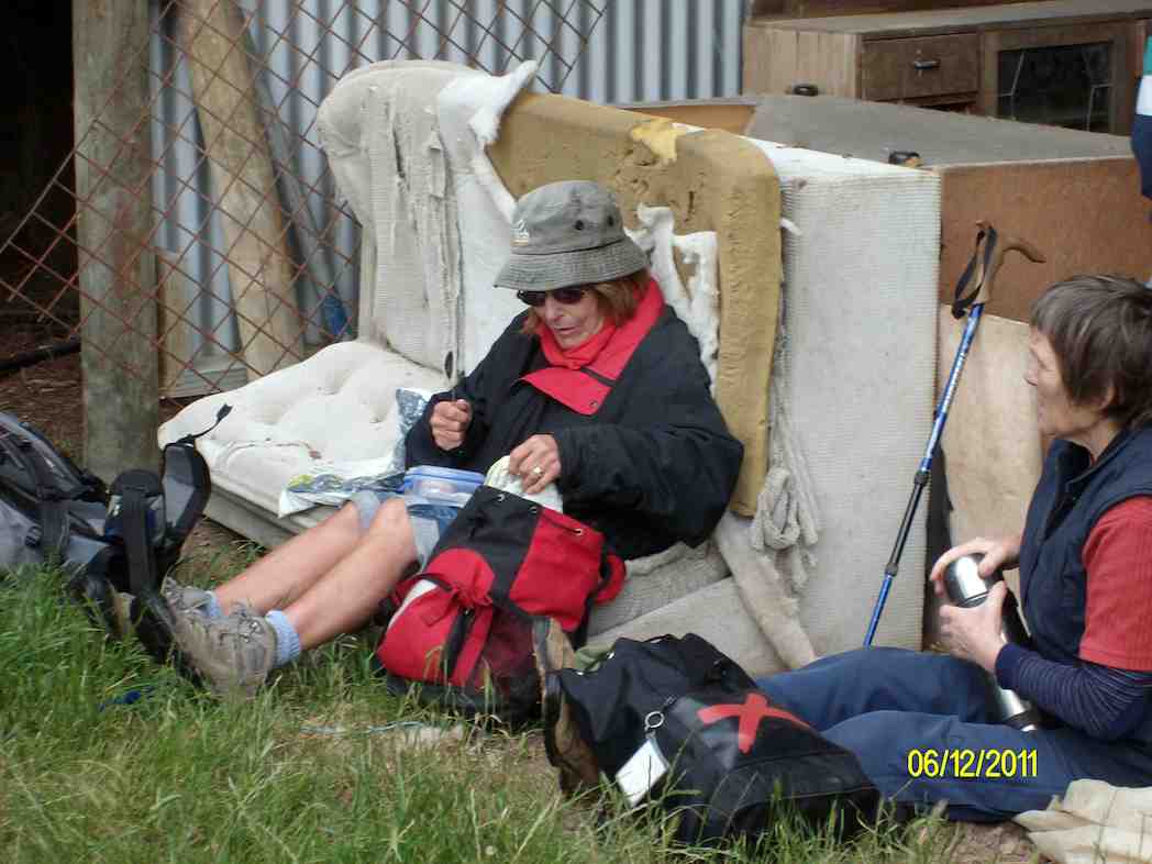
13. 8/12/2010. Trampers. Taieri Mouth to Wardells’ Cottage, return. H.
GPS of route, courtesy Ken.
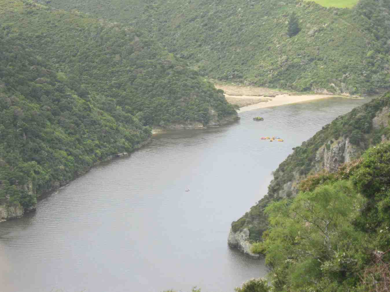
The day was a bit cold and windy with some promised rain. A vote taken at the Taieri River mouth bridge was two to one (the writer was the ‘one’) with two abstentions to do the more sheltered John Bull Gully track instead of the scheduled Akatore beach walk. Aerobically it was certainly more beneficial with its plentiful provision of ups and downs. Continuing on to the Millennium Track to Wardells Cottage as well provided us with an all-up 18 km work-out which we all enjoyed. There was some spring grass overgrowth in places and the odd fallen tree. Some scrub cutting had been started There was some school group or other on inflatables out on the Taieri.
Distant shot of inflatables on river
12. 15/4/2009 Hikers. John Bull Track. Leaders: Lesley S, Bill H, Fred.
The hikers’ walk from Taieri Mouth on the John Bull track took a turn for the worse when 2hrs into the walk Elaine had to stop because of chest pains etc.
Leaving Elaine in the professional care of Bev, Lesley G and Neil, the remaining 10 carried on to higher ground to try and get cell phone coverage. This proved more difficult than anticipated and it took Lesley S to search for higher open area off the main track before finally making contact with the emergency service.
After the helicopter landed a paramedic ran down the track to where Elaine was lying. After her condition was checked and she was stabilized, she was attached to the paramedic and winched through a small gap in the bush canopy into the helicopter. – Fred
I have been overwhelmed with kindness from the tramp club since the event on the John Bull track.
Would you be able to convey my thanks to the members of the club who helped as a great team in my dramatic exit from the track which I don’t really remember.
The quick action of Bev, Lesley and so. I have found out the support of Neil in keeping me warm. And Lesley S who found cell phone coverage.
Chris who rang her husband in Brighton who linked it all together and the tramper who had the white shirts on that lay in the open area for the chopper.
ED at the hospital told me later that I was very lucky that I had had such great care.
They did a battery of tests – CT Scans but the last test I had was the Head Scan. (That was purely because I was a member of the TRTC – “Just joking” they said.) I had previously told them about the mad wet day that we did to Dr Point in the rain.
It has turned out great in the end. They said I can carry on tramping as usual next week If you will have me back?
Kind regards to every one – Elaine.
11. 16/5/2007. Hikers. John Bull from Taieri Mouth. Medium. Leaders: Dot B, Lesley G.
10. 15/10/2003. Medium. John Bull Gully from Taieri Mouth. Medium. Leaders: Jack and Rosemary.
9. 5/9/2001. Combined. John Bull Track. Leaders: Frank and Lesley, Pam.
8. 1/11/2000. John Bull Track. Leaders: Doug M, Hazel, Jean.
7. 16/6/1999. John Bull Track. Leaders: Lance and Lois, Judy C.
6. 18/11/1998. John Bull Track to river. Leaders: Dot B, Doug and Ngaire.
5. 8/7/1998. John Bull Gully and return. Leaders: Bev H, Bev McI.
4. 4/6/1997. John Bully Gully. Leaders: Joyce, Nancy, Eleanor.
3. 14/2/1996. John Bull Gully. Leaders: Dot and Eric.
2. 6/4/1994. John Bull Track, then over paddock to Waihola Road, back on John Bull Track. Medium. Les S, Bill H, Doug and Ngaire
1. 17/2/1993. Taieri Mouth Bridge to John Bull Flat. Average. Leaders: Eric and Dorothy, Joan H, Chris.