
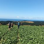
 29/01/2025. Hope Hill. Grade 4. Trampers. Leaders: John Gardiner and Martin Hickley.
The last club tramp here was almost exactly two years ago and Diane and Marijke’s description is quite excellent, so I’ll not repeat that. Undertaken in ever warming conditions and rising afternoon winds, over exposed farmland, twelve trampers were very glad to get down to the cars some five hours after leaving.
Tag: Allanton
Big Stone Road
 11/09/2024. Big Stone Road. Grade 3. Hikers. Leaders: Bill Cubitt & Adrienne Ensor.
On a beautiful spring morning 20 keen walkers started out from the lay-bay opposite the entrance to Daphne Road to commence their adventure through, what is known as the Allanton Block of Wenita Forest.
Outram – Allanton Flood Bank
Outram 10 km / Henley 21 km – from car park.
Outram, Allanton, Floodbanks, Lee Stream, Traquair, Whare Creek – Information and Trips Library
4. 25/10/2023. Hikers. Outram Loop. Grade 1.5, 11km, Leaders: Sue Nichol, Kathryn Fagg.
 Outram turned on another scorcher for 16 hikers. We started at the West Taieri Rugby Club and walked around Kings Court and Anzac Court subdivisions where the gardens were in full bloom. Continue reading “Outram – Allanton Flood Bank”
Outram, Allanton, Floodbanks, Lee Stream, Scrogies Farm,Traquair, Whare Creek – Information and Trips Library
Scope:
This page of club tramps and hikes covers trips West of SH87 which includes trips to the Outram area, Lee Stream, Scroggs Farm, Traquair / Whare Creek (maps)
Background Information:
Road distances from Mosgiel carpark.
TRTC Grading Information – trips incorporating these tracks are generally given a TRTC grading of about 2. This is indicative only, as trips can be allocated a higher or lesser grading depending on the route taken. For more detailed analysis refer to Grading Information.
Restrictions: Scrogies Farm – Lambing Aug – Oct.
How To Get There:
Take Gordon Road from Mosgiel onto SH87 (Outram Mosgiel Road) and continue to Outram township. For trips to Lee Stream via the Outram Glen track turn right immediately after the bridge over the Taieri River for parking and toilets at the Outram Glen site.
Parking is also available at the Outram Rugby Club field. Continue through Outram township and turn left onto Formby Road. The club is situated on this road just before the intersection with Huntly Road.
To Scorgies Farm: Take Lee Steam / Outram Road (SH87) to the 1st Mahinerangi Raod and turn down left onto this road. Continue to the bridge crossing Lee Stream and park cars on the right by the farm gate.
Links to tramps and hikes in this area:
25/02/2026. Outram Glen to Lee Stream. Grade 2.5. Hikers. Leaders: Maria MacNee, Avis Williamson.
04/02/2026. Lee Stream/Scorgies Farm. Grade 2.5 (hikers), 3.5 (Trampers). Combined. Leaders: Sylvia Watts, Lynley McArley, Phil & Raewyn Keene.
10/12/2025. Lee Stream Area – hike before Christmas Lunch. Grade 2. Combined. Leaders: Lyn Keene, Anne Ward, Janette Abbott, Shirley McRandle.
22/10/2025. Outram Glen and Beyond. Grade 2. Trampers. Leaders: Jill Reid and Heather Kirk.
13/11/2024 Outram Glen to Lee Stream. Grade 2. Hikers. Leaders: Julie McKenzie & Katrina McKenzie.
04/09/2024. Outram Heritage Trail and Floodbank. Grade 2. Combined. Leaders: Anette MacRae, Katrina McKenzie, Cathy Ferguson, Janette Abbot.
Lee Stream Road Ramble, Scorgies Farm 2023 – 2006 (7 trips with 3 reports and photos, 3 with reports only, 1 with no report or photos)
Outram – Allanton Flood Bank. 2023 – 2011 (4 trips with 3 reports).
Outram Glen Track to Lee Stream. 2023 – 1992 (15 trips with 10 reports)
Outram Museum. 2020 (1 trip with report)
Outram Glen and Traquair/Whare Creek. Cartwright Track. 2014 – 2008 (6 trips with 5 reports)
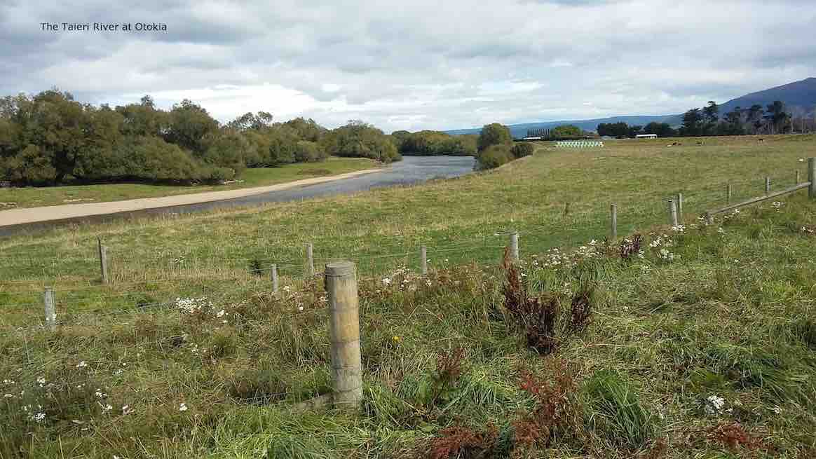
Flood Bank Otokia to Allanton
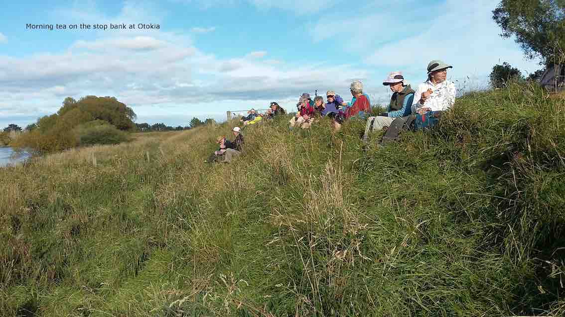
1. 22/3/2017. Flood bank walk from Otokia to Allanton. E. Leaders: Lester and Ian.

This flood bank walk from Otokia to Allanton was a first for the Club. It was Lester’s idea, with his knowledge of the Taieri River plain, to vary from the programmed regular one from Allanton to Outram.We had to car-shuttle. We parked our cars on a property at the end of Otokia East Road, by kind permission of a grandson of Dr Alex Luke. The weather was mild. We climbed onto the flood bank. 25 of us were away.
Lester had arranged for us to have morning tea in Mrs Mason’s attractive woodland property, which although alongside Centre Road was still a paddock or two distant from the flood bank on the day. How to get there? The leaders hadn’t worked that out. Barb wire fences in way as we moved on, looking for a way through. None. But who’s this? Mrs Mason hurrying across the paddocks to us, wondering why we hadn’t turned up. Lester went back to talk to her while we waited, but this writer is ignorant of what transpired. Oh dear!
Too late now. So a stop on the flood bank instead.
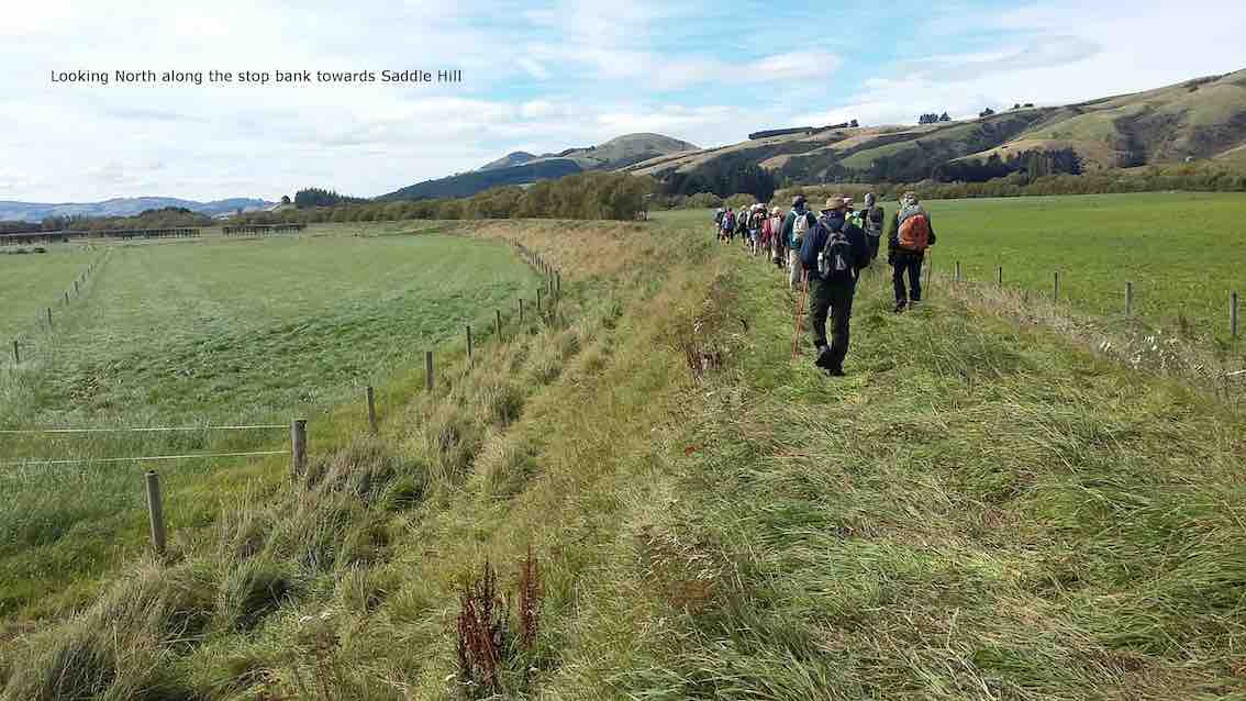
Many gates on the way made for frequent stopping, opening and closing. Along with the level terrain. these rest opportunities enabled everyone to complete the distance.
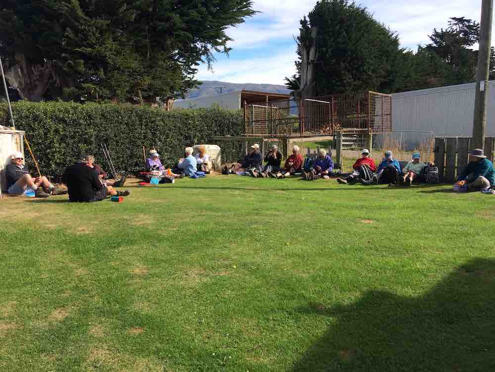
The lunch stop at Lenny Miller’s worked out more happily. On a lawn! A close-knit hedge sheltered us from a cool wind that had come up from behind us.
Then it was on to Allanton. The leaders had warned about long grass to wade through, but as it turned out a top-dresser truck had just preceded us on that morning, and flattened an easy route for us instead.
So we reached the Allanton Bridge. Distance being 7.75 km by Nike app or 8.9 km by a steps app. But here, a second reece neglect. The leaders had not checked whether there was a gate available across the road to enable continuing along the flood to the sale yards. Discussion. Eventually it was decided to walk down, under the bridge back up on the other side. Apparently there was some electric fencing to encounter. This writer, being a driver, was driven back to collect his car and meet up with his passengers at the sale yards. From there, we went on to ‘coffee’ at the Topiary Cafe. – Ian.