
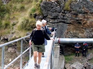
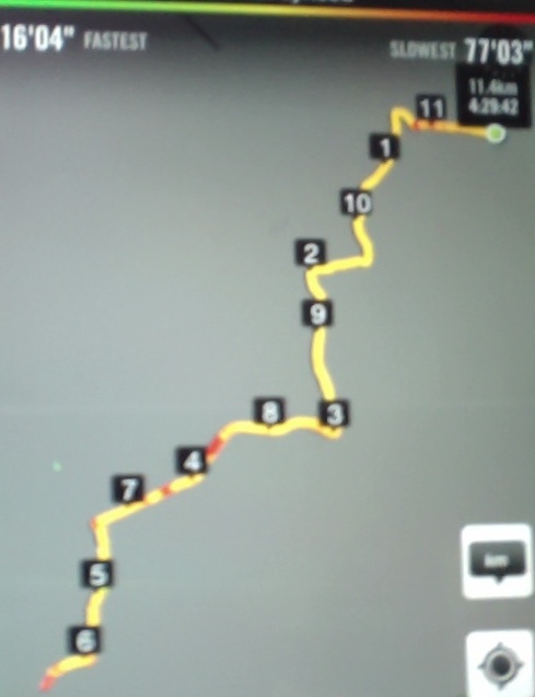
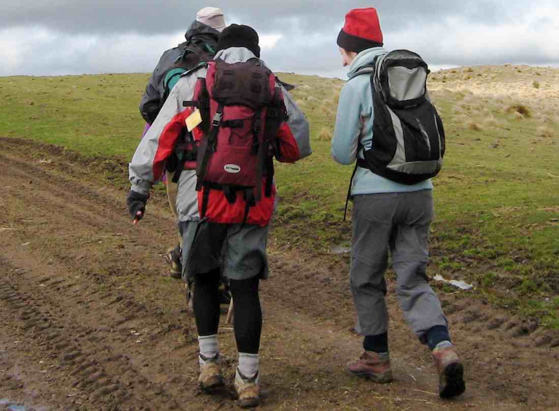
 16/07/2025. Heyward Point from Aramoana. Grade 3.5. Trampers . Leaders: Karen McInnes, Gail Williams.
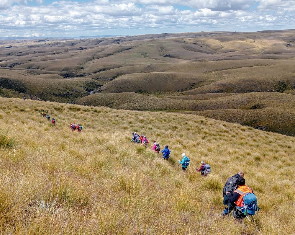
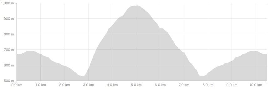
Twenty-three well rugged up trampers left cars at the bottom of the start of the Heyward Track and began the steep ascent to the top.
Category: Lambing Sep-Nov
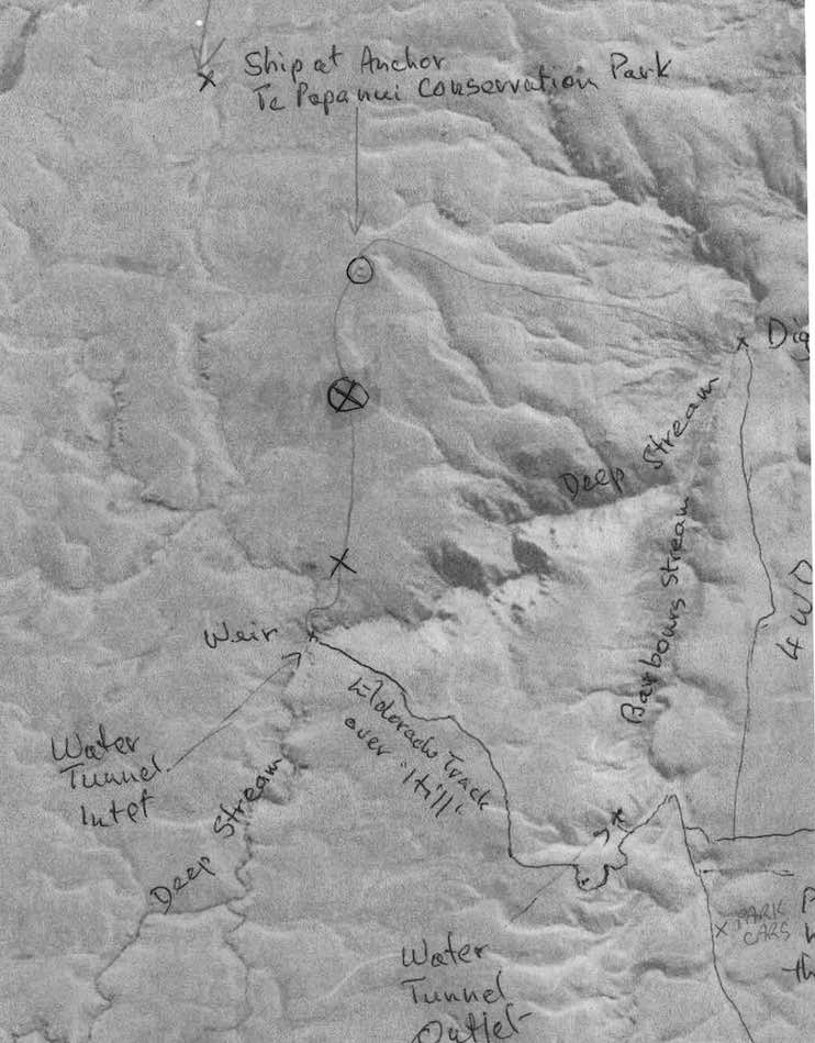
Ship at Anchor, Lammermoors, Deep Stream, Gold tailings, Mahinerangi
Lake Mahinerangi. From Eldorado Track, Cox’s Reef, Cosmopolitan battery, Timber Gully Waterfalls, old gold workings. (data lacking)
No. 8 on old hardcopy list of 113 club tramps. “Ship & Anchor. Lake Mahinerangi. George. Year round.”
No. 3 on old hardcopy list of 113 club tramps. “Eldorado Track. (Waipori.) Year Round.”
50 km from car-park. ( 54 km with Eldorado Track. Locked gates. Key from DCC Water Dept.)
Long tramp. Tussock now heavy. Summer too hot? Autumn may be preferable.
 14. 24/01/2024. Trampers. Ship at Anchor. Grade 4.5. $14. Leaders: Phil Keene/
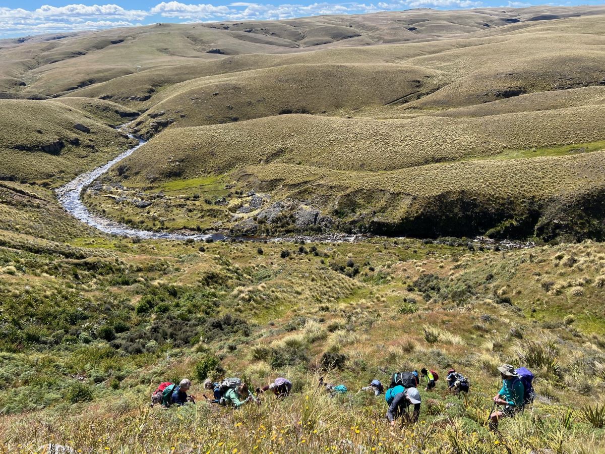
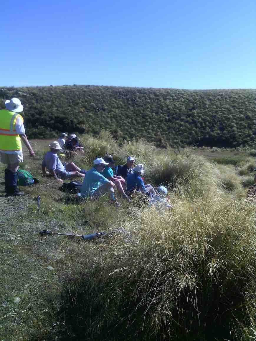
18 keen trampers turned up and left right on time at 8.30am in 4 vehicles, stopping briefly in Outram for tramper No 19, then travelled through the rolling uplands to above Lake Mahinerangi, before turning right up the El Dorado track, right to the end, through mobs of daggy sheep, the windfarm, the Blackrock Scientific Reserve and finally through the locked gates of DCC 3 Waters with the cameras keeping an eye. Ross was in charge of the key and maybe had a pinch of hypothermia by the time he was back in the car. Brrr would we find our riches at El Dorado?

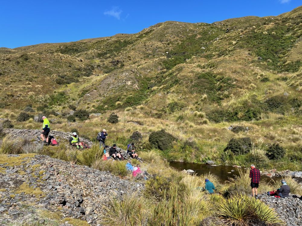
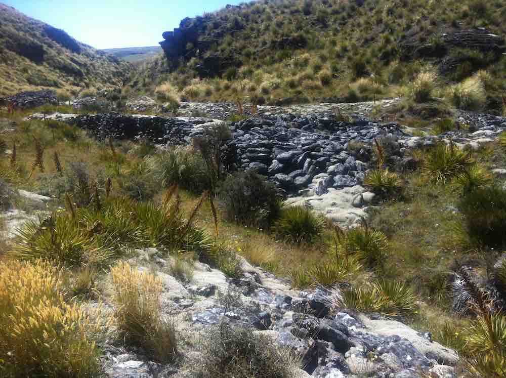
It was 10am before we set off walking, the group happily forgoing morning tea until we arrived 45 minutes later at the Chinese Diggings situated on the east bank of Deep Stream which was up a little following rain the prior day.
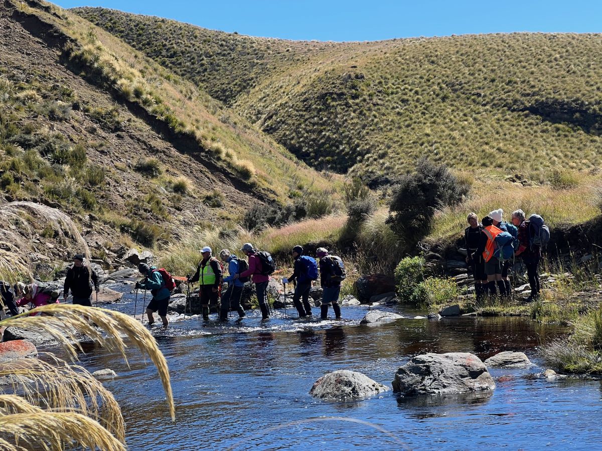
Mmm NZ Topo 50 is telling us we have to go west and will have to cross. The thought of this seemed to necessitate a continuous stream of walkers, single file, into the bushes. Thankfully they all came back and with a little help from our friends we all crossed, with wet feet and knees to the other side.
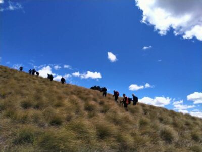
Thus began a steep ascent with a new pathway selected every few steps, not to mention the need for a breather at fairly short intervals!
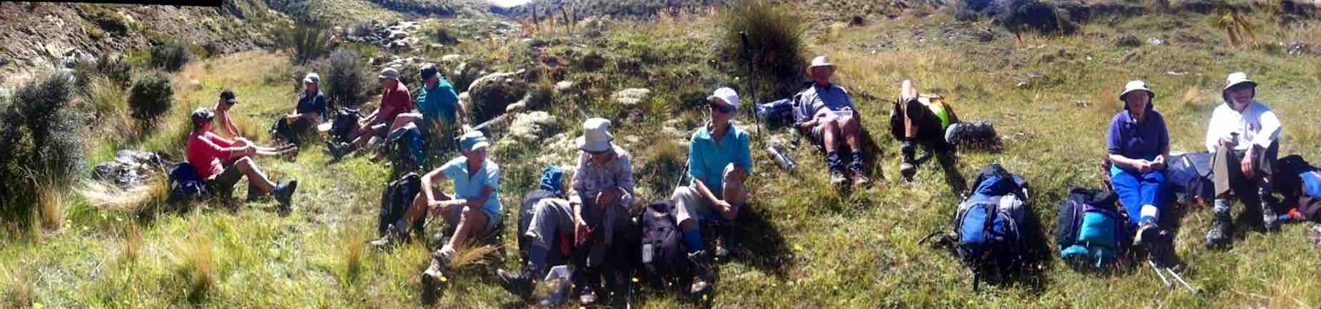
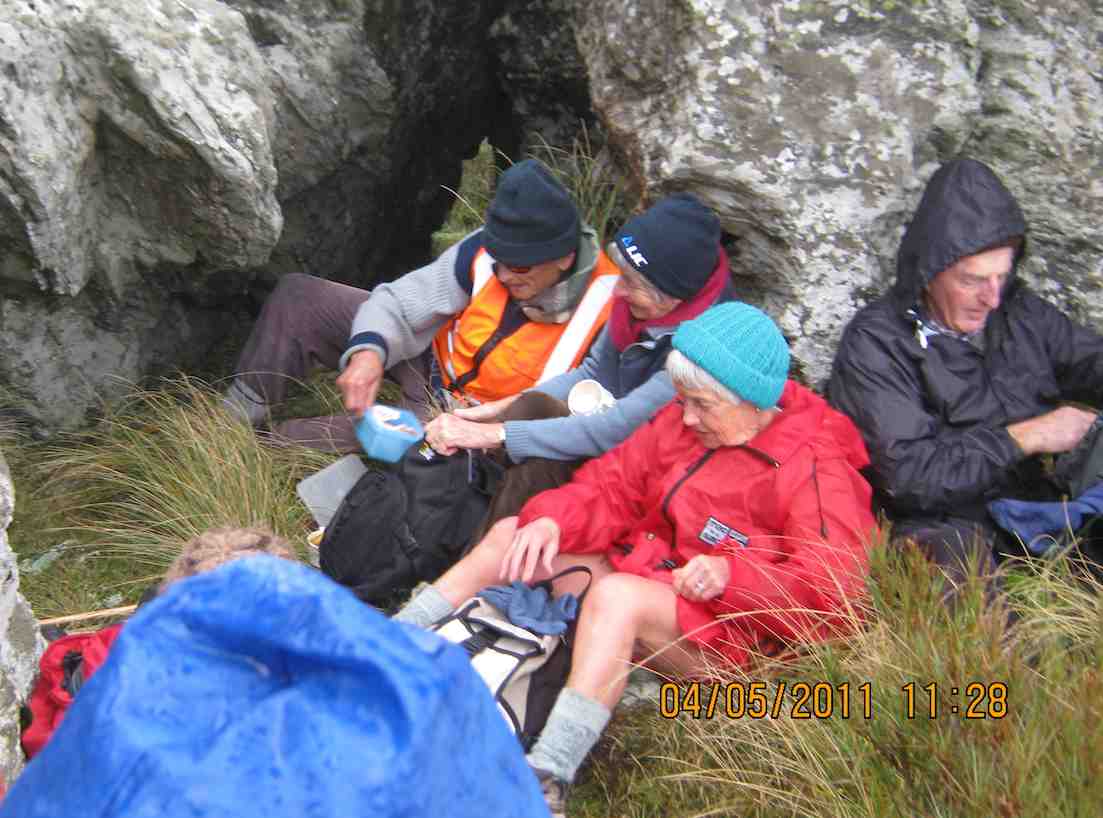
The ascent was followed by steady to steep ridge-line walk keeping to the true left of a stream, before crossing over nearly at the head, and finally over the last brow of a hill to arrive after 2 hours from morning tea, of fairly serious tramping, at the Ship at Anchor;
thankfully we had not missed the boat and it provided good shelter along with the snow tussock from the fresh westerly that had been present all morning.
Our departure was not too long with those who had not previously been here circumnavigating the Ship and we all followed a course on the true right of the stream down another ridge-line, initially made ‘easy’ by a water course shaped I think by ancient shovels?
With the possibility of a precipice emerging in front our leader tacked left just in time onto another ridge that steeply descended towards a man made watercourse, scout Graham finding the appropriate gang plank onto the other side. It would be fair to say knees were now creaking as we traversed parallel with the contours dropping every now and then towards the crossing of Deep Stream. According to the leaders timepiece we took longer down than up, just like the Grand Olde Duke of York……oh dear!
If feet and knees were by now warm and dry they were wetted again and with all crossing safely we re-grouped and took off up the prairie back to the cars, this being quite a steady upland walk!

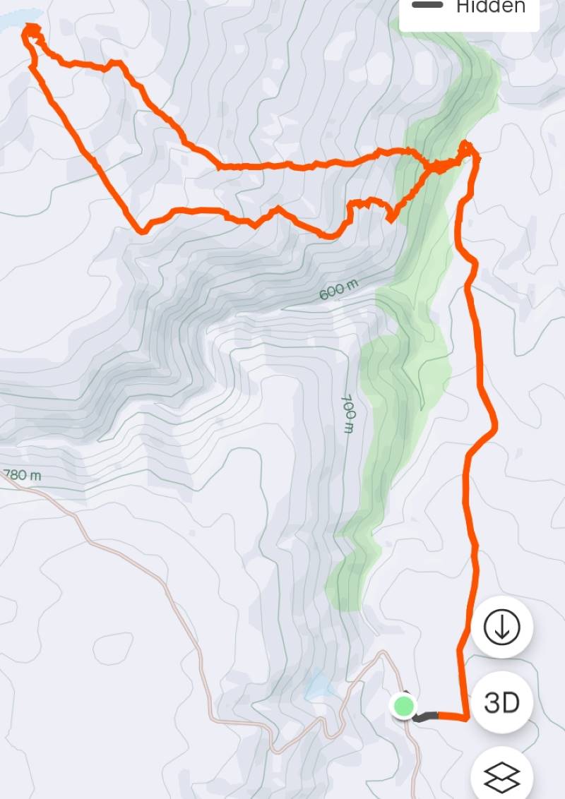
We departed paradise at 4.30pm arriving back in Mosgiel at 5.30pm. Rumour has it that the hydrotherapy pool has been busy since the trip, no wonder. The expansive and varied landscapes are so much more rewarding when set in such a remote and wild environment. Because of the access restrictions at the Weir this was the first time travel to the Ship at Anchor had been done this way. Distance 10.47km, elevation gain 661m, moving time 3:25;59, calories 1,016. And I’m sticking with grade 4.5.
Thanks to everyone for supporting each other so well.
Phil K
13. 17/2/2021. Trampers. Ship at Anchor. Leaders : Arthur Heenan and Gordon Grant.
A great day was had by 10 trampers who did the Ship at Anchor loop tramp in glorious sunny weather with a slight breeze to cool fevered brows. After dropping off a car at the bottom of the hill we all drove up in the other 2 cars to above the weir on Deep Stream and had a quick cuppa. From there to the weir, then crossing the creek on the walk way and starting the trek up the fairly steep other side.

Taking it slow & easy saw us up on a more gentle slope and reaching the Rock about 12.00am for lunch.
We were soon up and on our way back down which was good, until the very steep and rough bottom 200 hundred meters to the creek and Chinese Diggings.
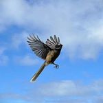
On this stretch we saw two disturbed falcons soaring above, letting everybody know they were not happy and with this, to everyone’s excitement a stag took off across the gully and walked to the top of the hill and disappeared. We assumed the falcon’s squawking warned him. From the creek we walked back on a gentle sloped 4 wheel drive track to the car and the drivers went up and brought the other two cars back, then down to Outram for an icecream which everyone thought we deserved.
12. 30/11/2016. Trampers. Ship at Anchor. H. Leader: Arthur.
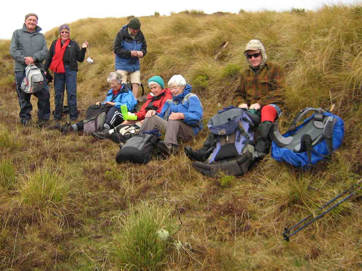
At the 3rd attempt, we finally did it! Today 7 trampers climbed up to the “Ship”, and then completed the circuit we had planned.
Southwest winds were forecast, so were expected, but it was a COLD WIND – there was obviously quite a wind chill factor in force!
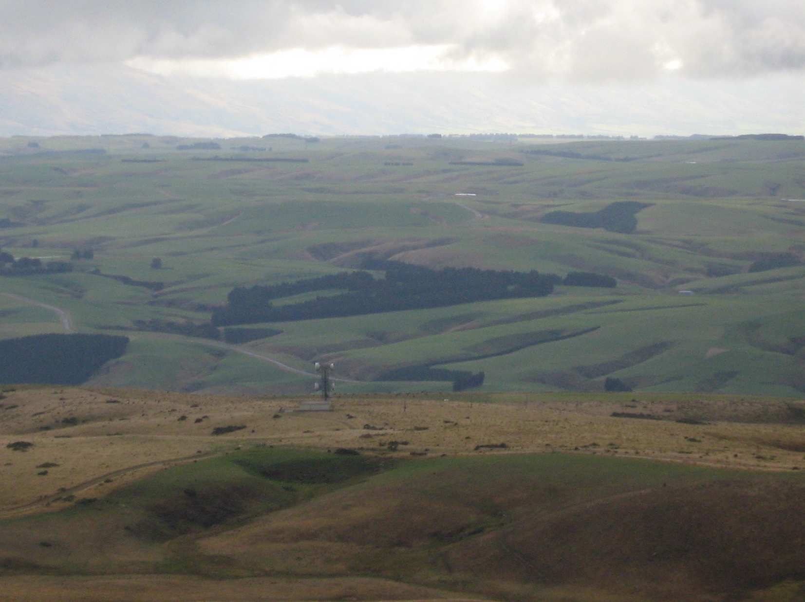
Over an hour’s journey took us up past the Mahingerangi wind farm and into the “Black Rock Scientific Reserve”. We followed the “Eldorado Track” until we were on the hilltop just above the weir on Deep Stream. This was our day’s starting point, one car being taken back downhill for the end of day car shuttle.
It was a 10 minute walk down to the weir and tunnel inlet, but there was no shelter there from the cold wind, making morning tea a very brief affair.
But we had the privilege of watching two N.Z. falcons chasing away a pair of Harrier Hawks. They must have had a nest to protect. Their flight manoeuvres were superb.
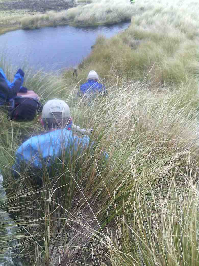
The next stage of our tramp was the most difficult – up, along, down to cross a rather difficult side stream, then up and up. After three quarters of an hour we were up on the open slope, much easier apart from the trackless tussock. We travelled in single file.
Further up, the leader came on our track made last February, following it for quite a distance. We passed the locality of our helicopter visitation of last time; and continuing on up slope a further 1 km we came to the “Ship at Anchor”.
All of us climbed up on top, well 6 did anyway, for a photo opportunity.
The wind was strong and cold on top. We didn’t linger.
Down in the shelter of the “Ship” we had our lunch.
We noticed a large, dirty rain shower over towards Mauntagua, missing us. But the weather had changed, with a light shower of tiny hail (about 1 mm in diameter) for us. Even a few snowflakes were seen! What a contrast to the terrific heat we had to contend with there last summer.
Weighing anchor(?), we turned downhill for the next 3 km. The going was far easier now, the tussock quite small here, and out of the worst of the wind. Only the last few hundred metres down to the Chinese Gold Diggings were difficult, becoming steep and rough going. We took our time but a few knees were complaining.
We crossed Deep Stream safely, although it took time, with most keeping dry feet.

After a brief spell at the Gold Diggings, we were onto the last leg of the tramp – uphill on the 4WD track. Light skiffy rain showers had appeared by now, remaining till we had finished.
The two car drivers forged ahead now, and once back, collected the far away car to meet the group at the road.
One or two thoughts to finish with:-
- The car shuttle worked very well.
- In the cold conditions experienced, the tramp didn’t need to be any longer.
- Coats (and more) had to be worn all day in the cold, but we were warm while moving.
- Distance for the can can only be estimated at 12 km (no modern wonder to tell us).
Back to Outram for the day’s finale, as Judy D (not out today) had invited us in for a warm up at her log fire, and a hot drink. And choccy bikkies as a real treat, too.
Thanks, Judy – you are a real GEM. It had been a satisfying day’s tramp. – Art.
11. 3/2/2016. Both. Ship at Anchor attempt and Gold Tailings. Leaders: Arthur, Ian and Bob.
Trampers’ Report. Leader: Arthur.
Ship at Anchor Tramp – 3/2/16.
8 trampers (including 2 guests) travelled in convoy with the hiking group who were going to the Chinese diggings.
The cars’ access was up Eldorado road/track, and passing the Maninerangi Wind Farm, in to the Black Rock Scientific Reserve.
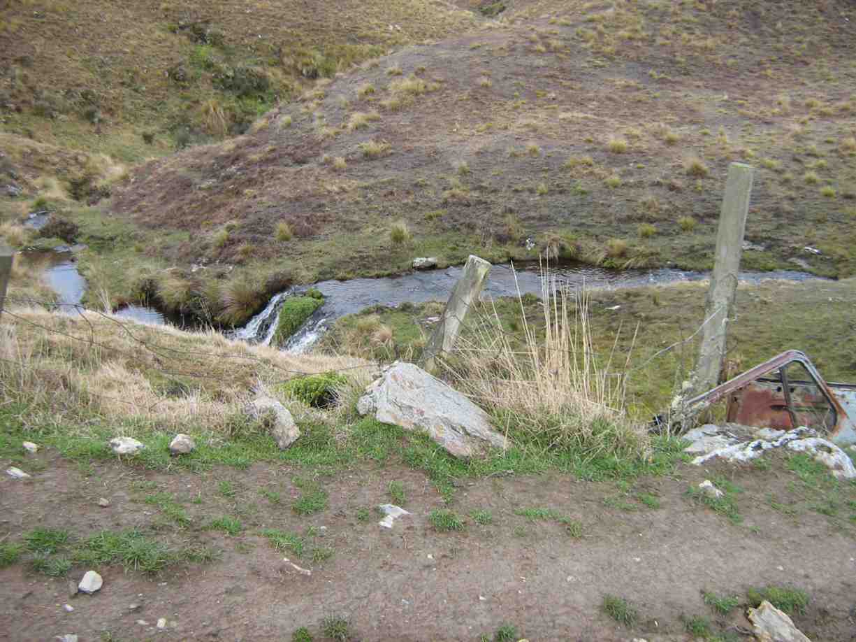
We walked for 10 minutes before stopping for morning tea by the water tunnel outlet.
As part o the Mahinerangi Hydro Complex, a tunnel was built through the hill to divert some water from Deep Stream to end up in Lake Mahinerangi. This was completed in 1984.
We then followed the road (Eldorado Track?) up over the hill and down to where it ends at the weir and tunnel inlet end, on Deep Stream.
After a brief stop we then crossed the bridge and tackled the difficult hillside leading up onto the open tussock slope which leads up to the Ship at Anchor.
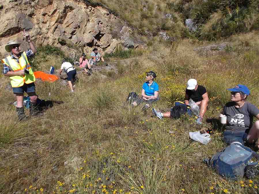
We stopped for lunch at 12.45 before continuing up the trackless tussock slope. One of our lady guests was feeling the heat (it was hot out in the sun by then) and at 2pm was in severe distress.
An immediate 111 call was made, and once the police had pinpointed our exact position, the rescue helicoper soon arrived …
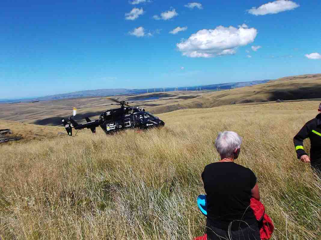
…and transported her to hospital. Happily she soon recovered and went home that night.
The 7 remaining trampers then returned down hill back to the weir – too far behind time to continue.
After a 15 minute rest at the weir, the car drivers took a pleasant little stroll over the hill to bring the cars over to collect the rest of the group who had remained at the weir. All then returned safely to Mosgiel.
Thank you to our 2 nurses, Jill and Margreet, who rendered first aid, and thanks also to the whole group for the care and understanding shown by all.
And finally a very big thank you to the N.Z. Police. Also to the Otago Regional Rescue Helicopter and its Crew.
A final reflection. A motto for our club to adopt?:
****** SAFE TRAMPING IS NO ACCIDENT *****
– Arthur.
Hikers’ Report. Leaders: Ian and Bob.
We hikers were 13 in three vehicles and were parked beside the trampers’ other two. The trampers set off immediately but our much shorter prospective journey allowed us a leisurely morning tea on a bank overlooking the cars.
Then it was down the “Track” only a short way, then a sharp right turn up a steep rise to an T-junction where we regrouped. From there we set off in a strung-out line along the 4-5 km 4WD track through the tussock down to the diggings down the Deep Stream. We arrived there early, but what the heck. It’s hot. Sit down and enjoy a rest and an early lunch.
This reporter was surprised few took the opportunity to do much exploration of the diggings.
We had arrived. It was hot. Trek accomplished. Eventually some started going back. Groups of 2 and 3 left to return up along the track we had earlier come down. No trouble about this. The 4WD track was clear. The route would be uphill this time. The heat was increasing. There need be no rush. So we strung out and Bob made his way to the front with Ian grateful to be at the back with the the last two slow ones. In fact so slow were we, that after Bob and the others had got back to the cars Bob still had time to return in his big 4WD before we had even reached the T-junction, and made light work of transporting us the rest of the way. Although all the others had of course accomplished the full distance, it must be said that there were not a few cases of light-headedness. Frequent drinks of water and good sun protection were certainly essential. There was no shade.
We were back at the cars – when? – about 2 p.m. Now for the area’s other highlights. But by car this time! We took the route the trampers had taken earlier, steeply up over the hill, visiting in turn the Water Tunnel Outlet …
… and its inlet over the hill at the Weir. (We didn’t know it at the time, but had we looked back as were were driving back up the hill from the weir we might have caught sight of the trampers coming back from their aborted expedition. They saw our cars! And we hadn’t even noticed that big black helicopter! So close were our two groups! So distant! And of course the area is not cellphone territory.)
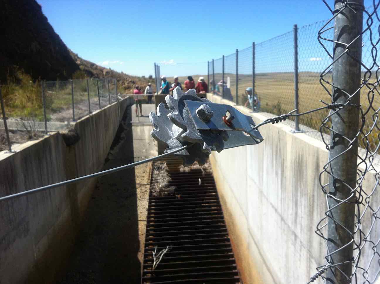
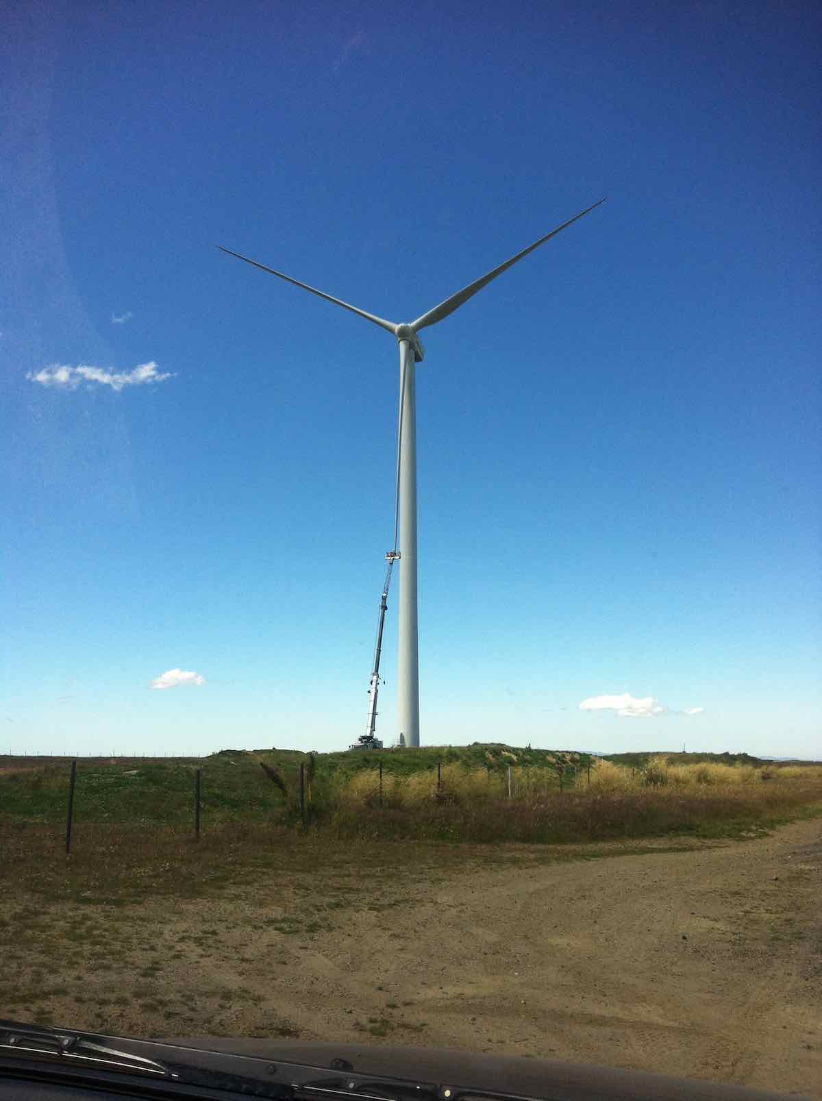
For us, it was simply back over the hill, blissfully unaware (and unable to know) of the critical state the trampers were in. Out through the Black Rock Scientific Reserve, through the two locked gates, and translocating from the 4WD Eldorado Track to the upgraded Trust-Power Mahinerangi Wind Farm’s Eldorado Road. (How ‘tracks’ can change over the Club’s history!) A wind turbine blade repair job alongside the ‘road’ dwarfed the technicians in their tiny cage. (Click a second time to enlarge the photo.)
We returned this time via the Lee Flat Road for a change. We were now on tar seal, and arriving at Outram made us feel we had returned to civilisation.

What a day to mark in the Club’s history! Well, all’s well that ends well. Sooner for us, and – well – eventually for the trampers. (There’s too many ‘wells’ in there somewhere) – Ian.
10. 25/2/2015. Trampers. Gold Tailings attempt.
The 4 of us set off to do the Ship at Anchor. When we got to the outlet tunnel at Barbours Creek with the rain and cold wind we decided to go back to the sign to the mining village. We set off up the track to the second sign, the same as down at the road. No clear indication on which way to go. We went down a FWD track, thinking this was the way but after a while I stopped and said this was not heading the right way, so we returned to the car with the wind and rain in our faces. The four of us decided to have lunch at Waipori Falls picnic area. Within five minutes it started to rain again so we headed into the car heading for home. We ended up eating our lunch when we got home. – Heb.
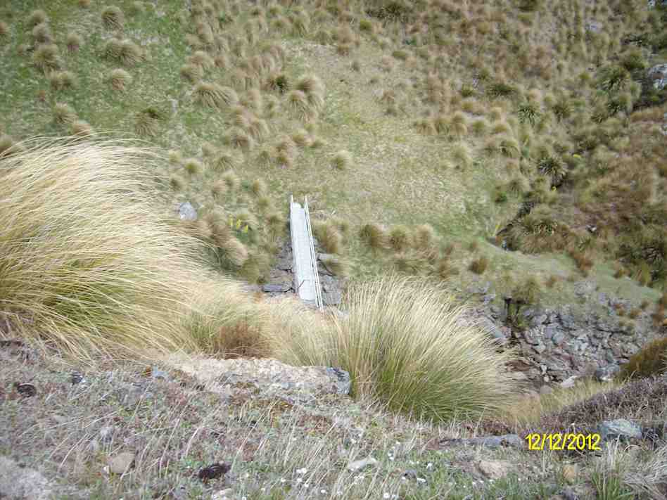
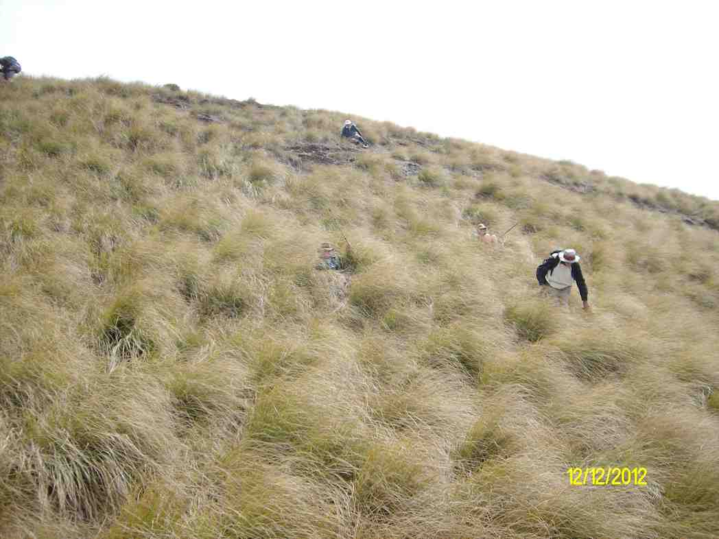
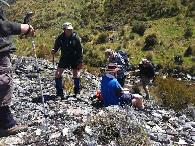
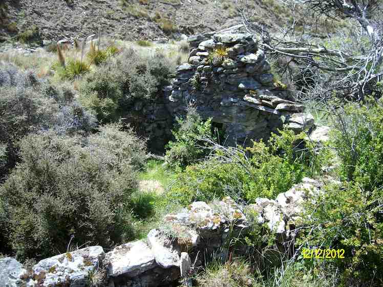
9. 12/12/2012. Trampers. Ship at Anchor. Deep Creek. Gold Tailings.

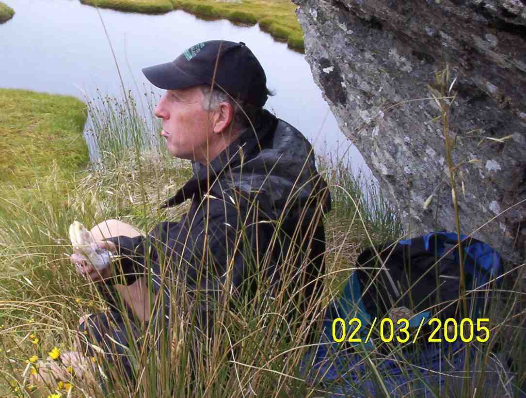
8. 2/3/2005. Trampers. Ship at Anchor. Lammermoors, Deep Creek, Gold Tailings. Leaders: George, Arthur H

7. 12/11/2003. Trampers. Ship at Anchor, Lammermoors, Deep Creek. Medium+. Leaders: George, Arthur H
6. 31/3/1999 Ship at Anchor – Mahinerangi. Leaders: George, Lex, Graham
5. 2/1995 Leaders: Eric, George, Doug M
4. 23/2/94. Ship at Anchor. Medium+. Leaders: Ria L, Eric B, George, Doug M. Easier alternative: Leaders: Ria H, Jean A.
3. 13/11/91. Ship and Anchor on the Lammermoors. Harder. There will be an alternative route if you run out of ‘puff’. Leaders: George, Bob & Audrey, Dave & Jean
2. 27/9/89 Ship at Anchor, Lake Mahinerangi. Harder grade tramp. Leaders: Hugh & Judith, Dave & Jean, Ria L
1. 1/3/1989 Eldorado Track. Interesting country – old Waipori cemetery. Leaders: Ria L, Bob H, Molly
Mount Hyde Station
No. 5 on old hardcopy list of 113 club tramps. “Mt Hyde to Taieri River. Aqueduct. D Moir. Farm. Lambing.”
Location: 23.5 km. Lambing September-November.
 16. 8/11/2023. Trampers. Mt Hyde. Grade 3.5. $7. 24km. Leaders: Anne Ward, Di Bezett, Lyn Keene
We started our tramp with an enthusiastic group of 23.
Horsehoof Station Tramps
No. 1 on old hardcopy list of 113 club tramps. “Maugatua Microwave. J Roy. Year Round.” Permissions from Horsehoof.
Distance from car-park: 24 km.
22. 29/5/2019. Horsehoof, – Maungatua. M. Arthur.
18 of us set off from Mosgiel and travelled through Outram and turning left off on a road into Horsehoof Station. Clear looking sky and the anticipation of a great day.
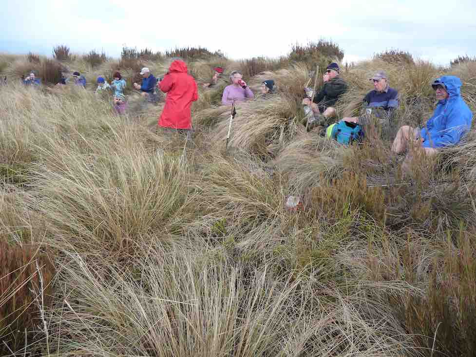
Parked up in the paddock, we set off up the first hill. The wind was very cold and strong up there, brass monkeys were the call, and numerous layers the call, jackets and hats also.
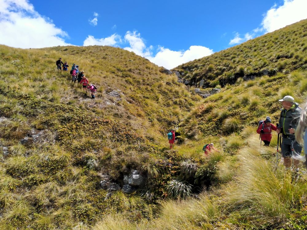
We stopped in a sheltered spot for our morning tea. Farm trackended and then it was onto DOC land and tussock.Not much track at all and quite hard going. The odd slip on the terrain.
Making it to the top

where photo shoots were taken.
Great views but soooo cold and windy. Decided to go back to some shelter in the tussocks for lunch.
Back up to the corner of Horsehoof,

and with three going back down the start track to look for poor old Dave’s iphone lost on way up, while the rest of us went the longer way.
Two things sprung to mind on this tramp. If you go a different direction you need to let the leader know for safety reasons.
Lunch needs to be finished by everyone before some start on their way.
All in all a great tramp in some windy conditions, travelling 14kms. Refreshments well received
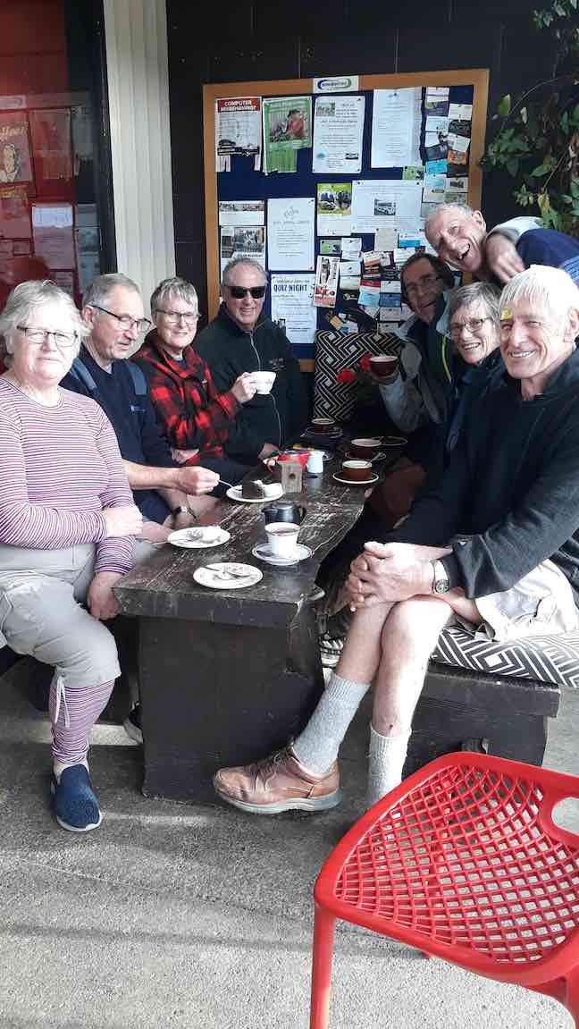
with great service at the Wobbly Goat in Outram Helen.😉
MAUNGATUA DEBRIEF
It saddens the leader to have to write these notes, due to the fact that a few of the group completely ignored the club’s Safety Rules up on Maungatua.
The club formulate these safety rules many years ago, which were updated 2-3 years back. All new members are given a copy when they join, and they are on the club’s website. (v. Page 7a.) Everyone should be familiar with them.
There is nothing difficult about these rules, just simple common sense things (but of course, as they say, common sense isn’t common any more. (A detailed email is going out to all members about this) – Art.
21. 27/2/2019. Maungatua. M. Leader: Gordon.
A Fairy Tale.
Once upon a time 12 happy trampers set out to climb the big mountain of Maungatua. They wanted to get to the top, and were very determined.
But the nasty rain came just as they set out, and the cold wind joined in to make things unpleasant for the 12 happy trampers.
The cloud came down too, to hide the top of the mountain, but that was no deterrent either. Jackets and gloves kept them warm.
Uphill they went, on the good 4WD track, into the cloud and with the wind and rain attacking them.
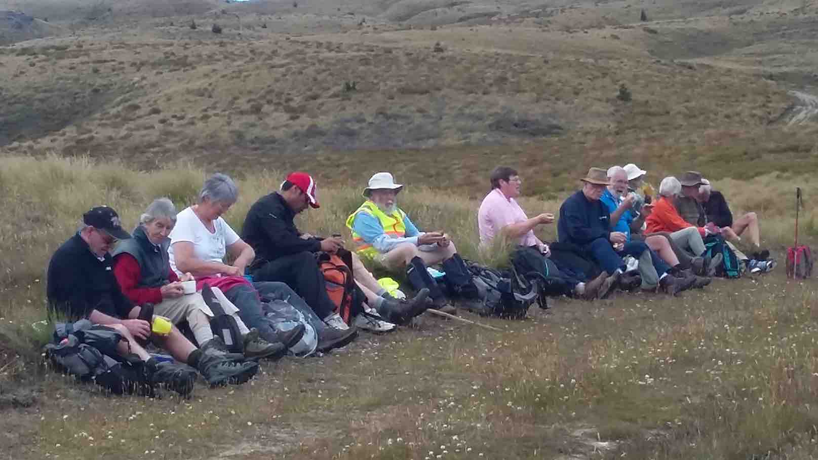
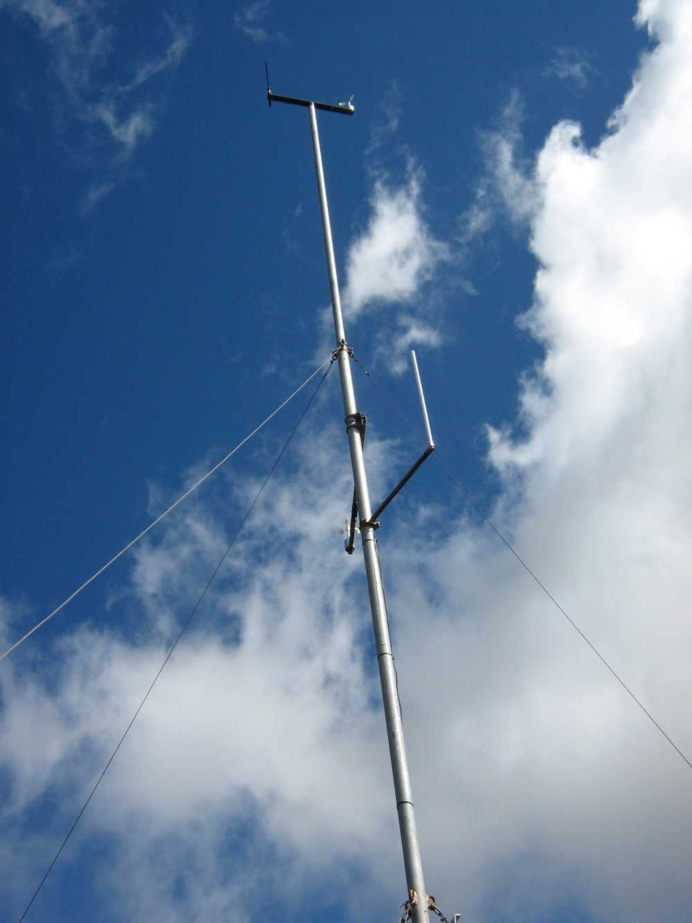
In time they were high up on the mountain, and stopped to have their morning tea in the slight shelter of a little hut, beside some aerials.
After a brief stop to enjoy their hot cups, discretion was decided upon, and the 12 happy (still) trampers returned back down the mountain to their cars.
But the 12 happy trampers had had a good morning’s exercise, covering more than 6 km and the rain and wind had given a good test to the weatherproofness of their clothing.
Feeling a bit wet and cold, the 12 happy trampers drove back to Mosgiel, returning safely to their homes.
And they all lived happily ever after! – Art.
20. 10/5/2017. Trampers. Maungatua trig via Horsehoof. M. Leader: Arthur.
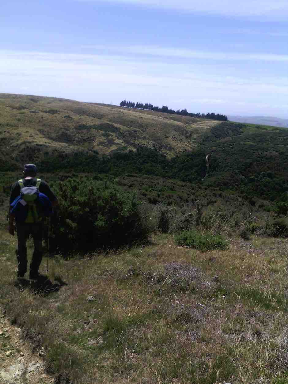
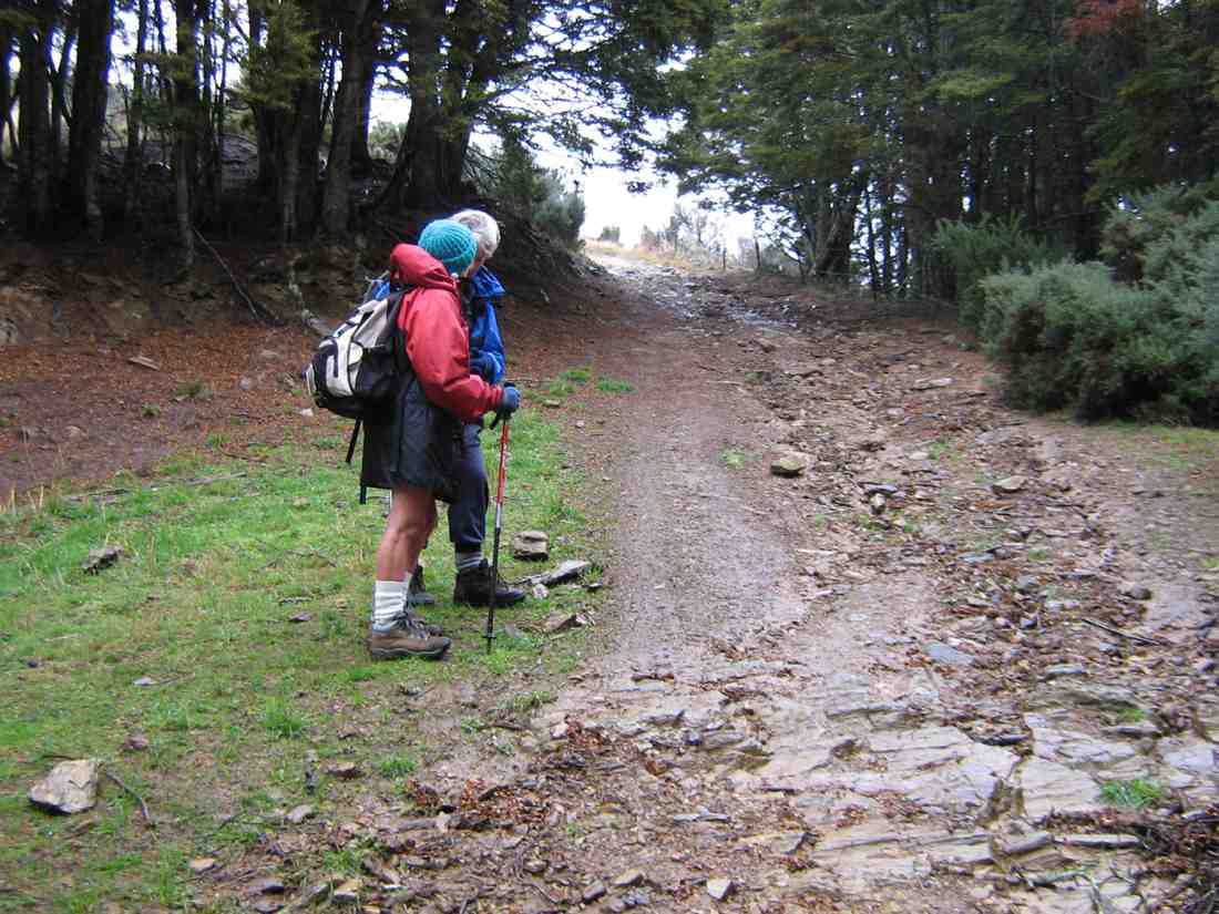
Clear skies, a light breeze, and lots of sunshine gave perfect conditions for our tramp up onto Maungatua. The cars were left high up beside the farm road on Horsehoof, a group of 13 happy trampers setting out from here on the uphill dozed farm track.
About halfway up morning tea was taken, with stunning views to enjoy at the same time, in the clear air.
Onward and upward, we reached the top boundary of Horsehoof Station, and climbing through the fence were in the DOC reserve which encompasses all of the top of Maungatua. It was then single file through the tussock and turpentine shrubs on the faint track.
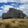
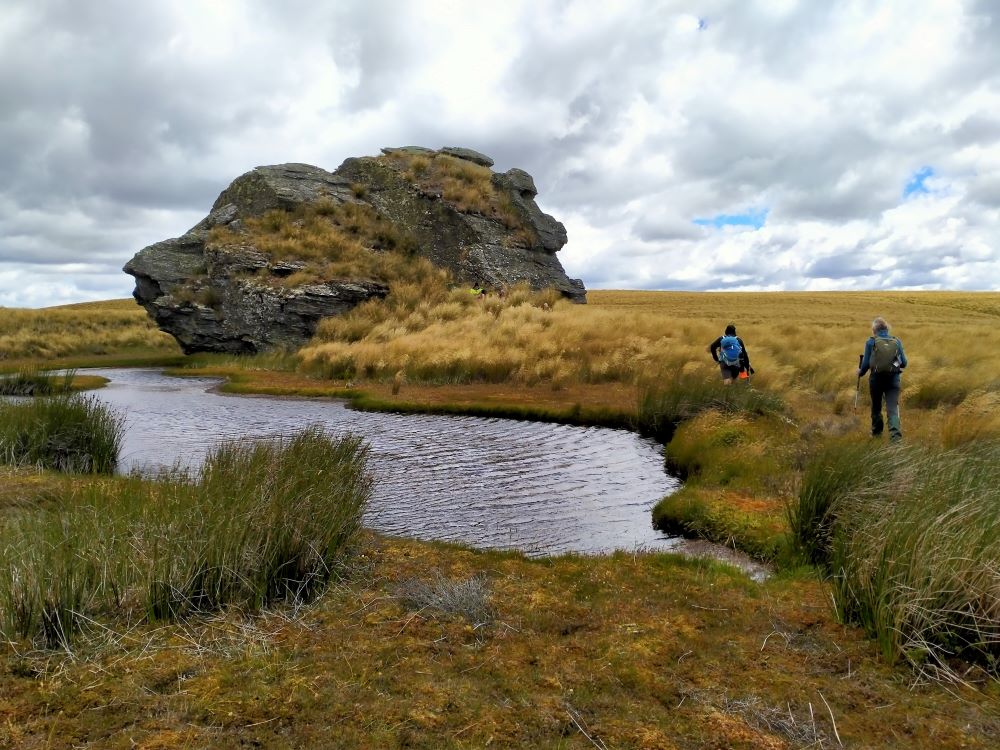
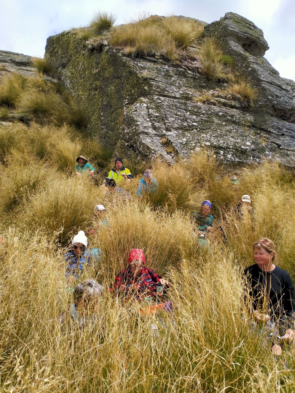
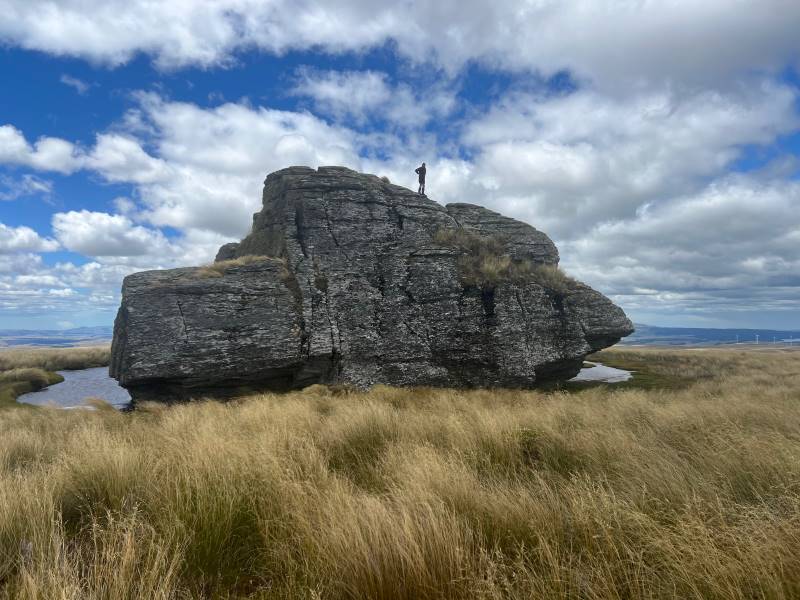
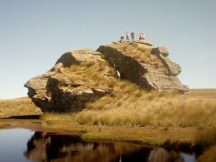
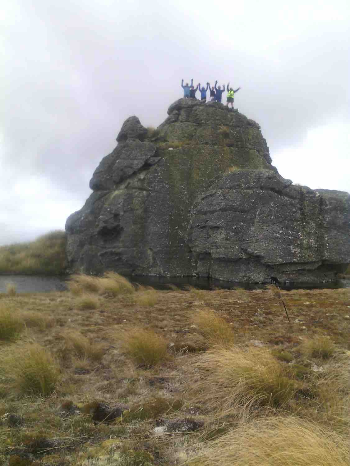
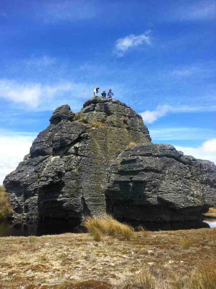
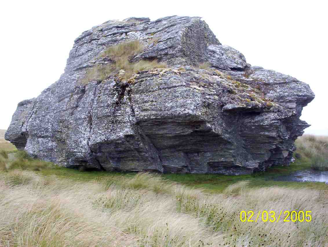
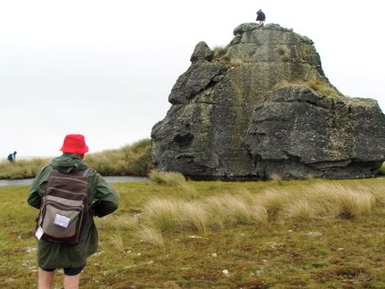
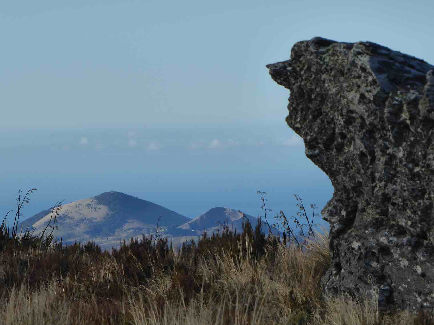
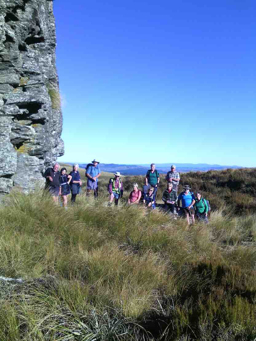
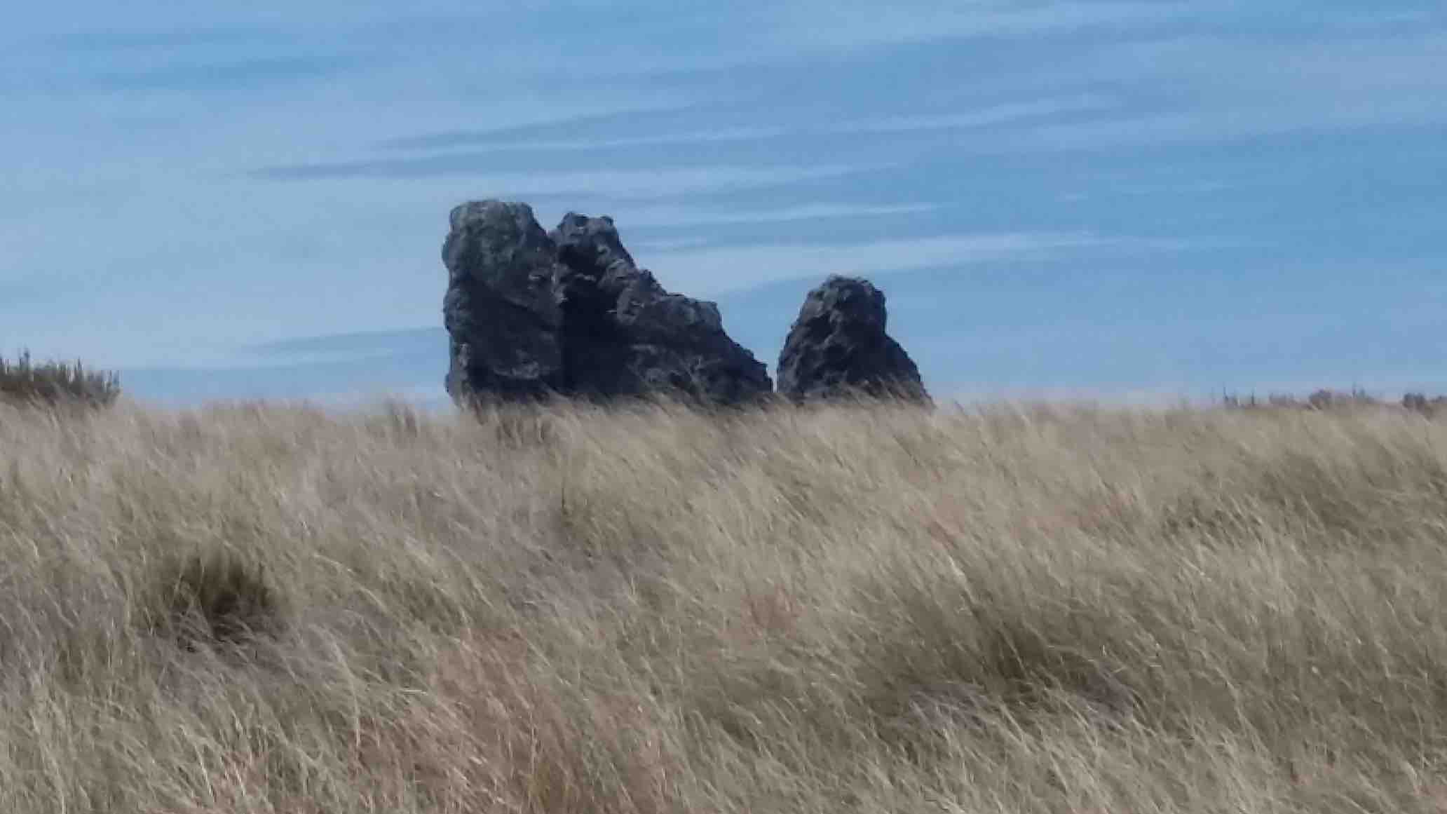
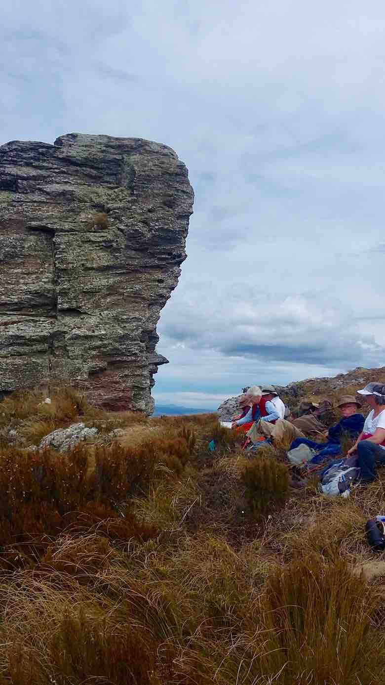
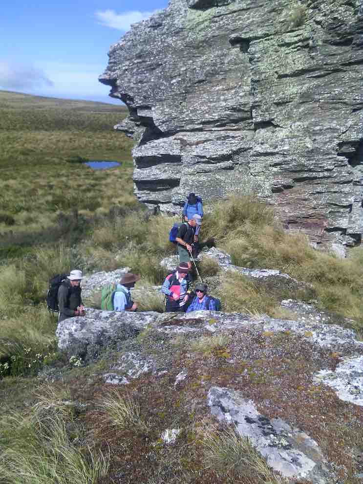
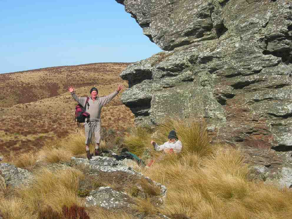
We stopped to admire the Big Rock,
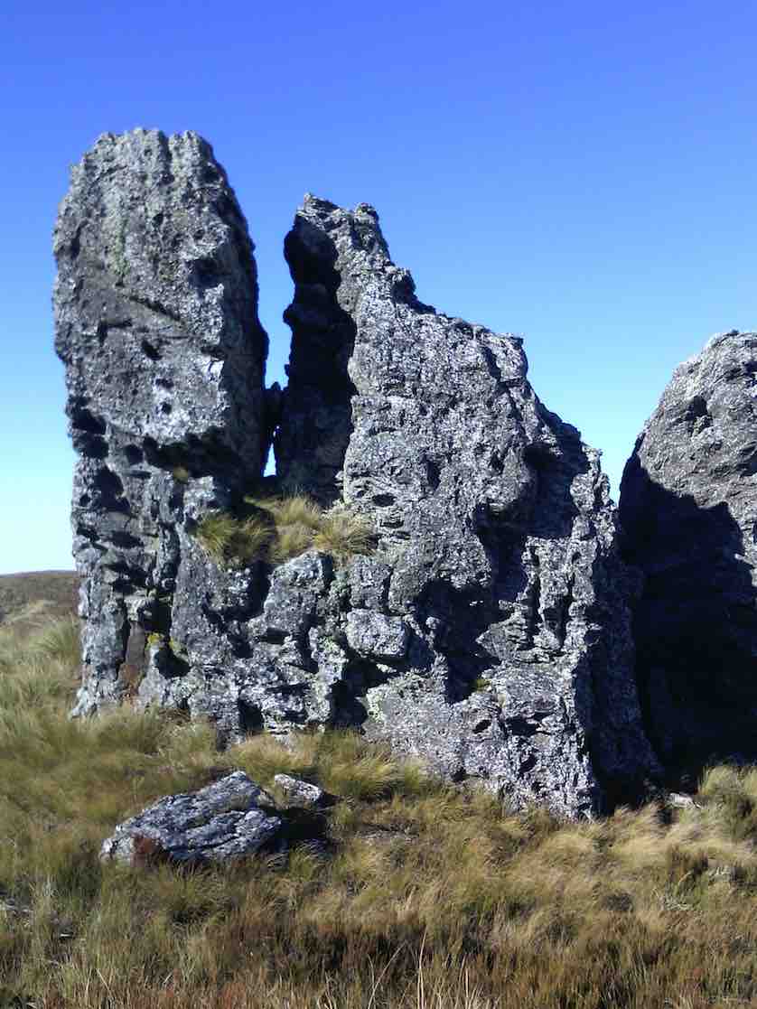
photos being taken of the group.
Just as we were preparing to move on a pair of N.Z. falcons flew in and landed on top of Big Rock just above us. They weren’t at all worried by us humans, and it was marvellous to see them there.
In single file we moved on, and eventually came to the summit post at 12 noon – perfect timing for lunch.
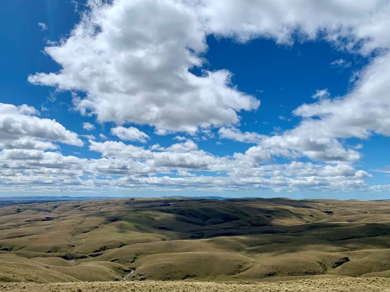
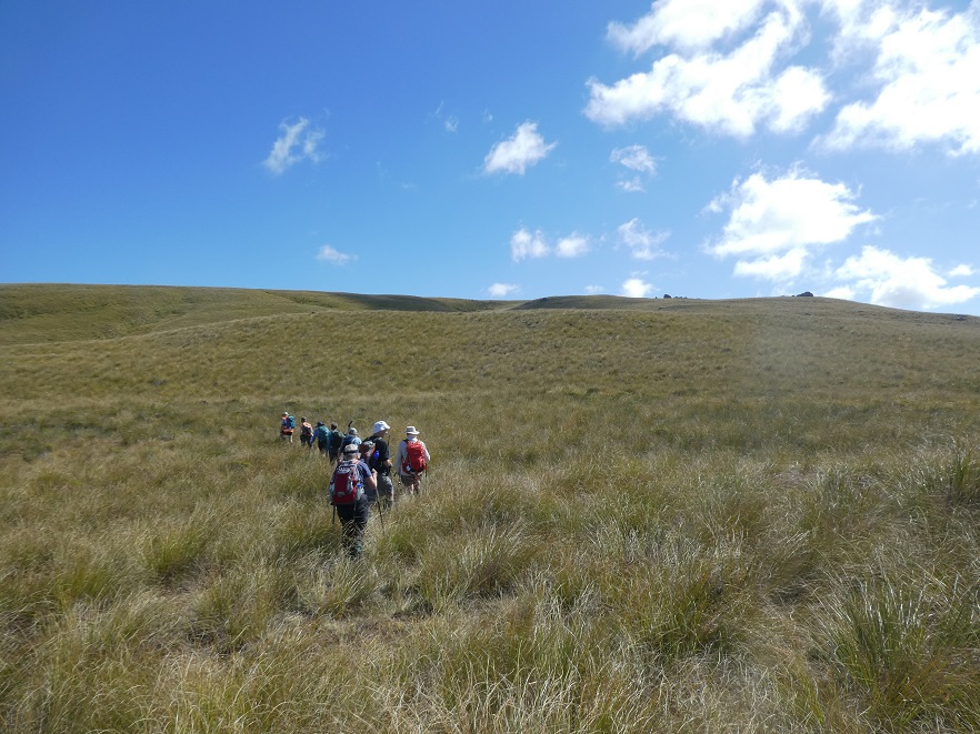
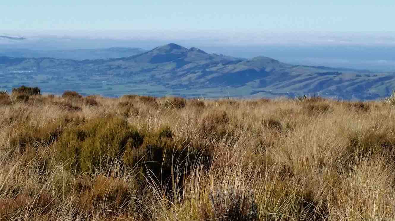
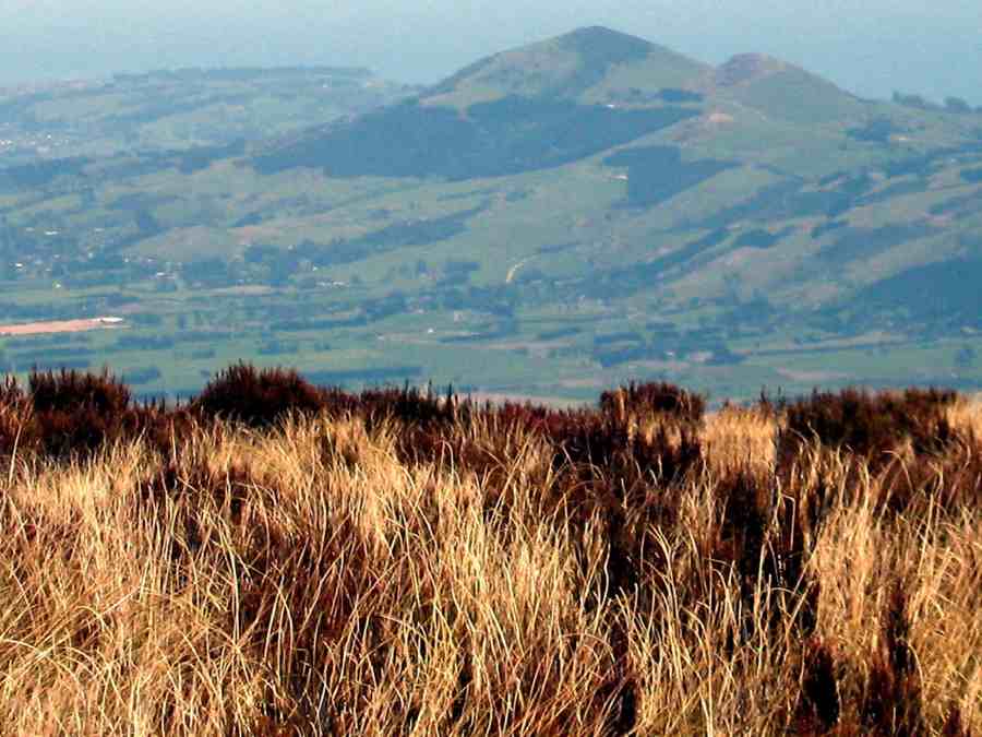
From here, on the highest point (895 metres) we could see in all directions – 360 degrees. A huge fog bank right down the coast totally hid the sea and the Otago Peninsula, but the land was in clear view as far as the eye could see. What terrific scenery.
Lunch over we began the return journey, which meant retracing our steps. With an occasional brief rest/regroup stop, we were back past Big Rock, through the fence onto Horsehoof again, and down hill with a brief uphill bit to reach the cars.
A group of 13 happy trampers had had a great day, walking a total of 12 km. The perfect weather certainly added to the enjoyment of the day.
But, the tramp finished too soon (obviously too short), as it was necessary to stop in Outram for a while on the way home so that discussion that hadn’t had time to be had during the tramp could be concluded.
The leader was particularly pleased to have such a good turn out of trampers today – thank you to all. – Arthur.
19. 11/1/2017. Hikers. Maungatua Big Rock and Trig via Horsehoof. M. Leaders: George and Ian.
It wasn’t the best tramp to ease into after the relaxing holidays. However the easier programmed Kuri Bush beach walk had not taken the tide times into account. What to do? Something inland. George scouted Saddle Hill (summit not tackled by the Hikers since 2010) and Horsehoof (last done by the Hikers 2011). Relevant property owners for Saddle Hill could not be reached, so Horsehoof and Big Rock then.
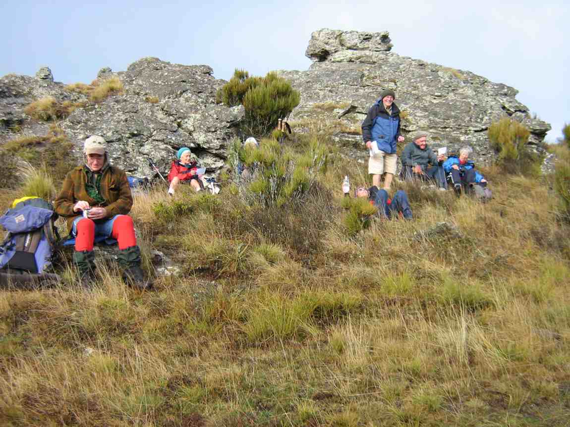
Seventeen turned out on the day. A respectable number, given that some members were still on holiday. Admittedly the road entrance to Horsehoof is easily missed, as happened to some on the day, but eventually all the cars arrived and drove on up to park in the high paddock where the FWD track to the top corner of the station starts. At about 690m here, we had already made good inroads on Maungatua’s Big Rock elevation of 880m.
It was still a bit early so we trudged through that first unavoidable gully to merelyregain the cars’ height a kilometre or two further on, finding a bank to sit on for morning tea.
No more gullies now but it was up, steadily up, with frequent regrouping stops to eventually reach the Horsehoof Station’s top corner. At 865m effectively all climbing was behind us. We had gained 225m since leaving the cars. One of us elected to stop here and await the return of the others, and Mollie, who hadn’t wanted to miss the chance of revisiting Horsehoof, was happy to keep her company.
Now it was 15 who scrambled through the fence onto the Maungatua reserve to push on through the tussock and dracophillum (turpentine bush) till we reached a point opposite to the Big Rock.
Here, along with George, ten were happy to make this their destination stop,
while a remaining group of five carried on with an assurance it was only another half hour to the trig. W-e-l-l not exactly. More likely three quarters, as one found the going harder than others. But we got there! Or rather two did.
Too bad,the other three had stopped off short of the last rise and lunched. However with the encouragement of the trig returnees (or is it returners?) they were encouraged to push on so that they could say they had made it too. And they did!
On the return we discovered the hypotenuse short-cut that avoids a right angle in the fence and which we had missed on the way in due to overgrowth disguising it at its other end. A shame. It needs a fence indicator.
When we arrived at Big Rock, we discovered the ten others had long since given up waiting for us, and were back waiting for us when we straggled up the last weary slope up to the cars – at least weary for this writer.
So there it is. A good traditional tramp perforce resurrected for the hikers by an unfortunate tidal assesssment. And an enjoyable stop and chat at the Wobbly Goat to finish it off. And roll on the better weather. – Ian.
18. 10/2/2016. Maungatua Summit. Leader: Arthur H.

Nine trampers set out in ideal conditions to conquer Maungatua. The day was sunny with some high cloud. The breeze was light all day – westerly, then changing to southerly for a while, and then died away altogether.
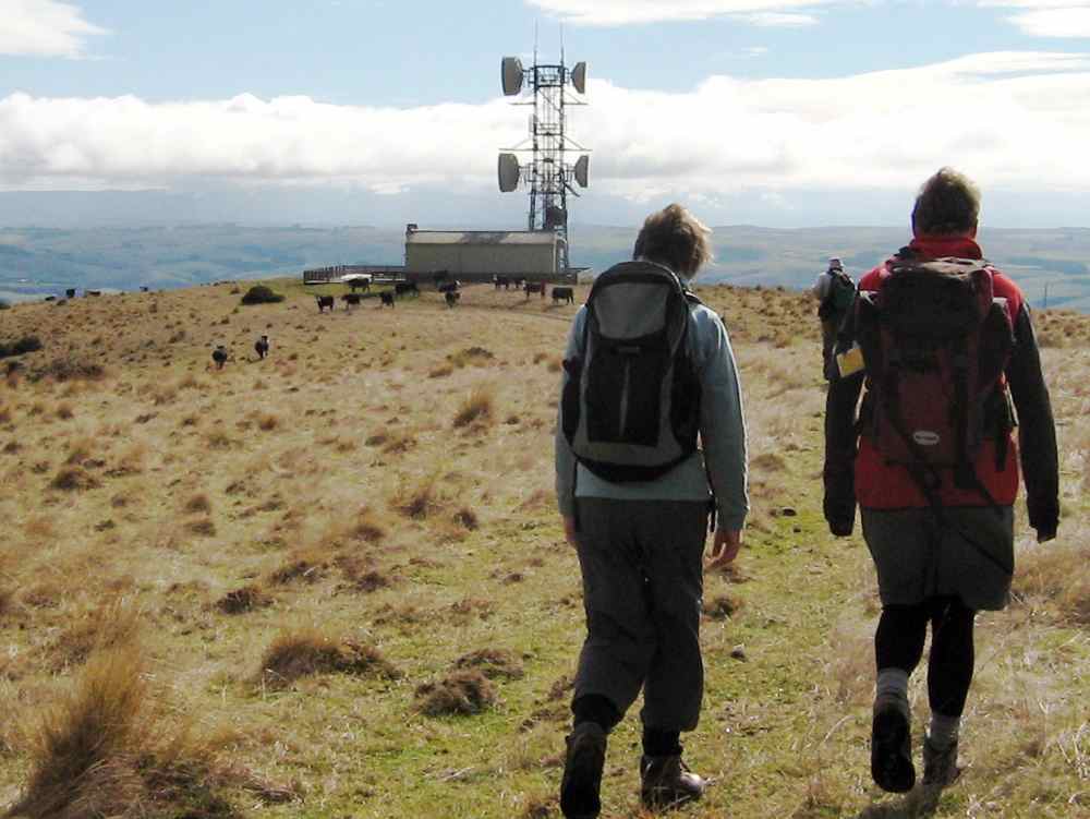
We drove in through Horsehoof Station, up the road towards the microwave. A car shuttle was set up by taking one car back 2-3 km, leaving it at the top of the hill above the woolshed.
We took the dozed farm track that winds its way up to the top of Maungatua, stopping for morning tea at a suitable spot.
We reached the top of the track, where the small shed and various aerials are situated, at 10.50 a.m. Climbing over the fence we were then in the DOC Reserve, which covers a large part of Maungatua.
From here there is a faint track heading to the summit, which is some 2.5 km away. This is undulating country.
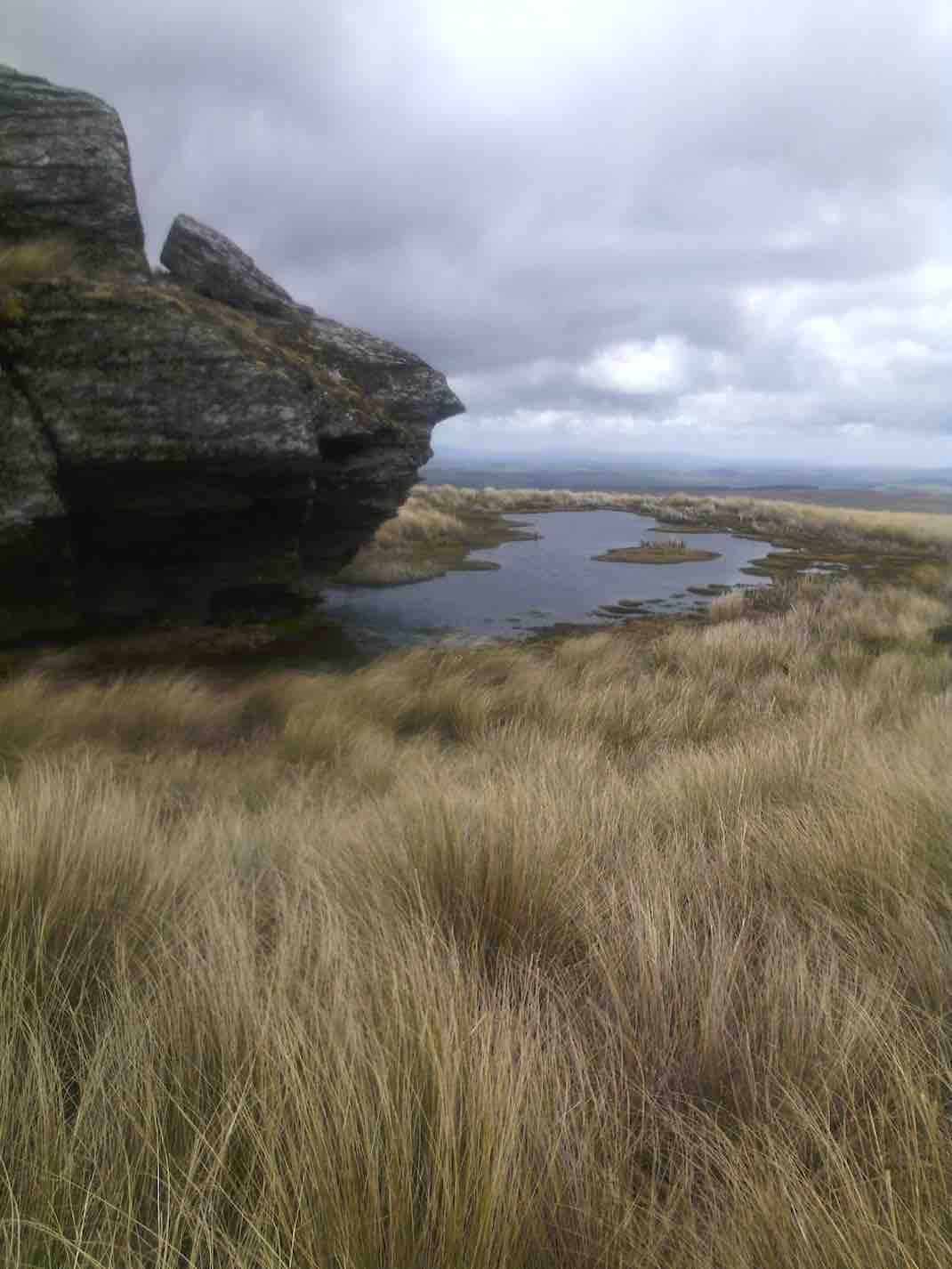
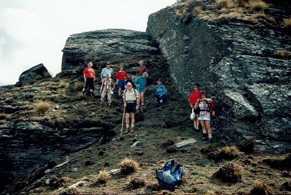
We soon came to the large tor, and stopped for several minutes to inspect and photograph it.
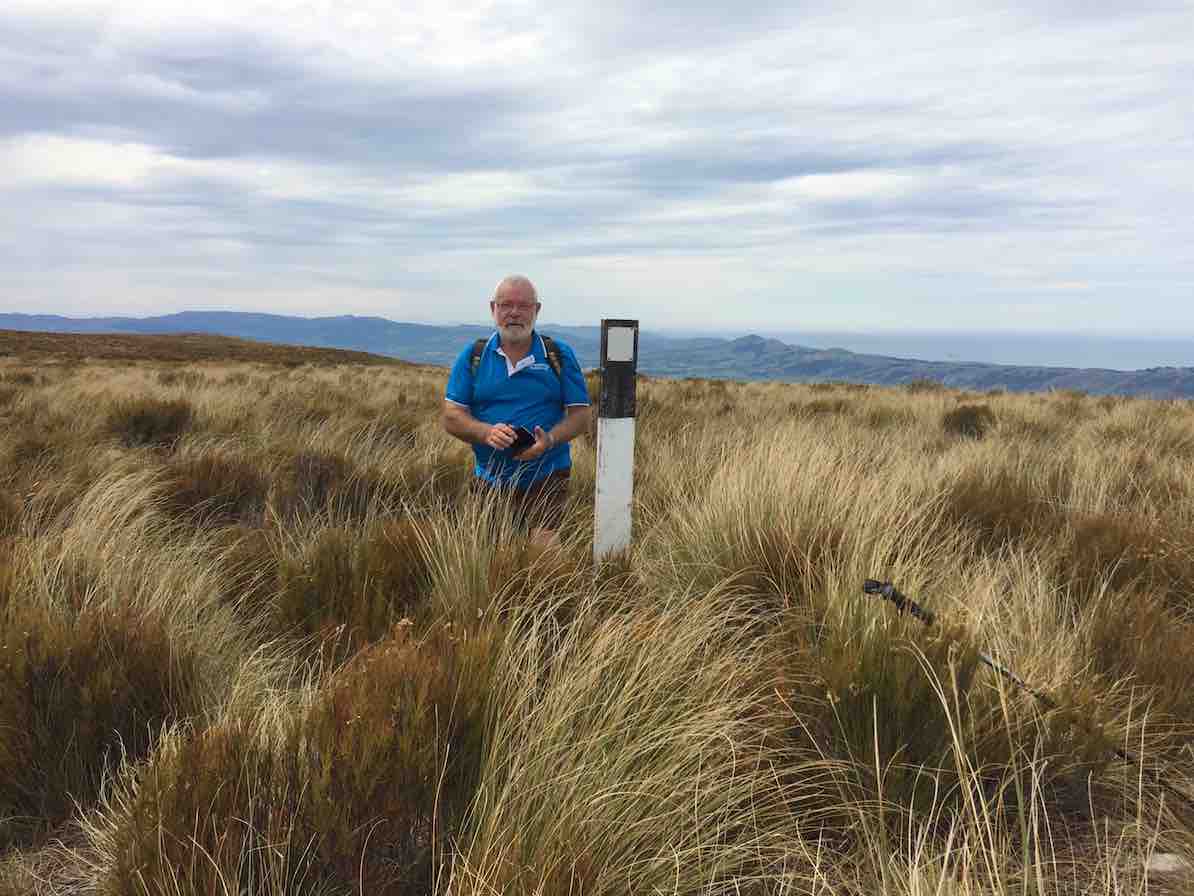
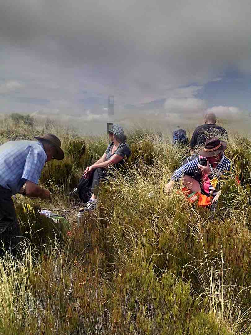
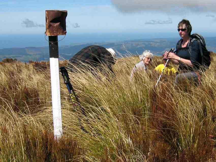
Continuing on along the track, which follows the fence line, we gained the summit a few minutes before 12.00 noon. A black and white painted post now marks the spot, …
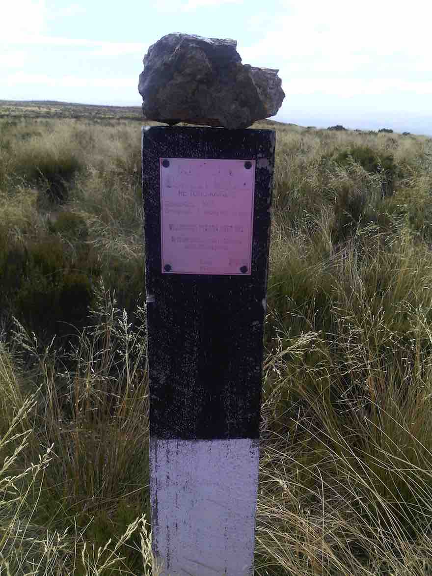
… and is visible from a short distance. Sitting down in the tussock, we had a relaxed lunch on the spot. The slight breeze was just a tad cool, we noted.
From the summit there is a great 360 degree view, but unfortunately haze in all directions spoiled this somewhat.
Half of the group had a look over the brow, down in the direction of the 3 Kings -which isn’t visible. All of us then picked our way through the rough vegetation, in an easterly direction, to get a better view down on the Taieri Plain and Airport.
Making our way back up to the track, we returned along it to the shed and aerials, and over the fence. A brief stop here, where it was noted the altitude was 865m, compared to the 895m at the summit.
We now walked down a 4WD track through the tussock, following the western spur.
A restful stop was made at the bottom, in the shade of the beech trees at the north branch of Lee Creek. A short uphill grunt gave a “tang” to the end of our tramp, and we were soon back at the “shuttle” car.
All agreed that it had been a good tramp and an enjoyable day. This had been a first time for most.
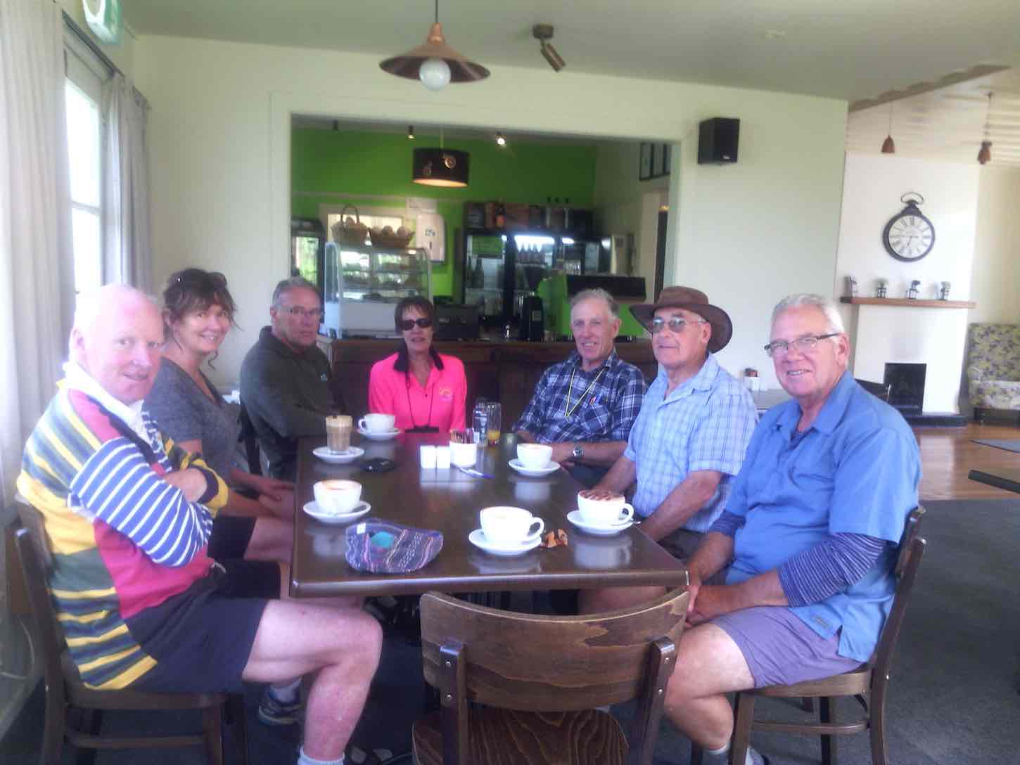
Seven held a debrief at Outram on the way back home.
The tramp distance was 13.2 km. – Arthur H.
29/3/2010. Private. Horsehoof, Maungatua Trig.
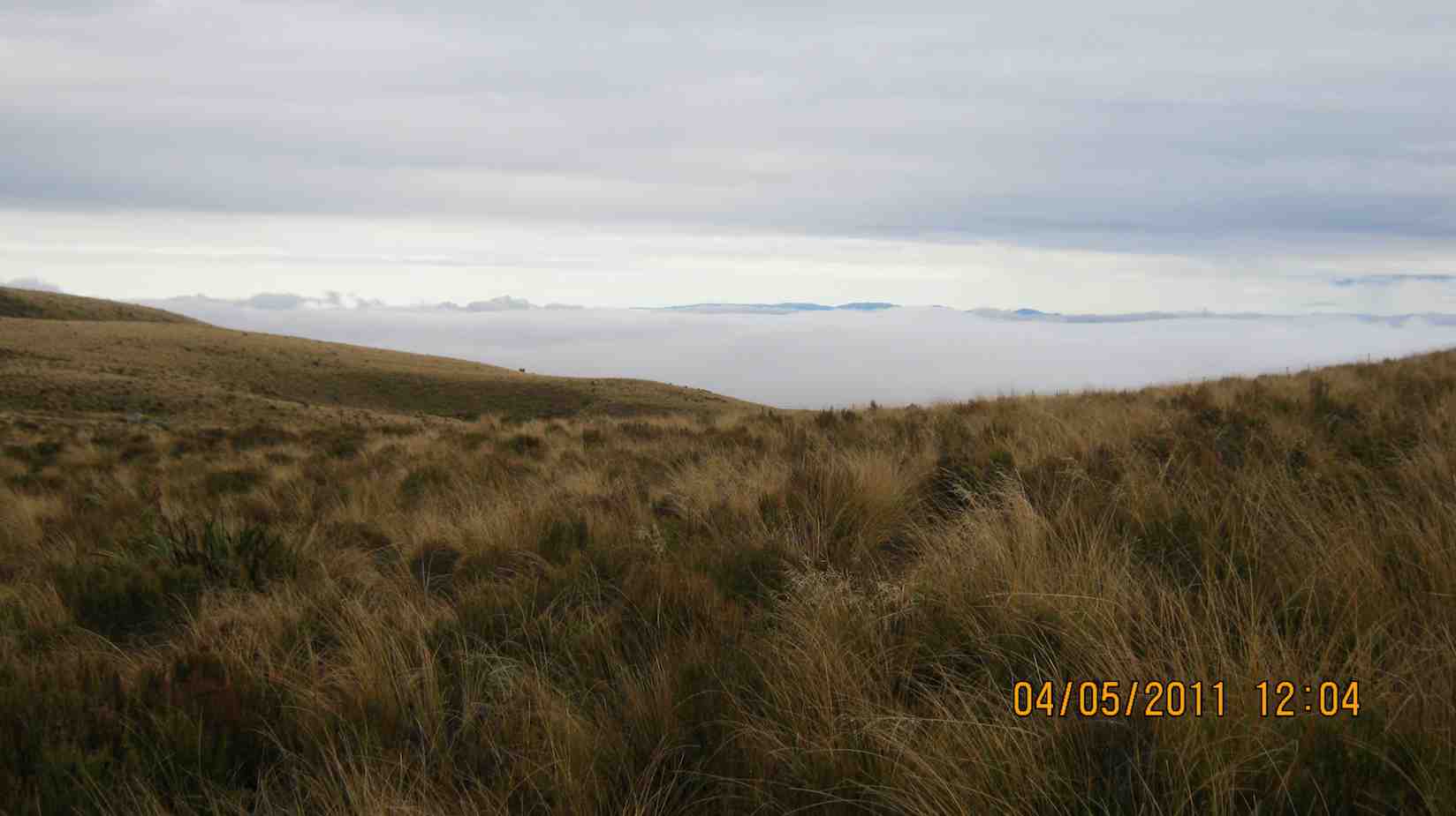
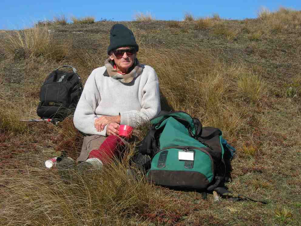
17. 4/5/2011. Both. Horsehoof upper paddock to Big Rock. Medium. Leader: George.
George had recceed the programmed McKendry Road tramp and found the mud too squishy and the undergrowth too thick so elected to fall back to Horsehoof Station again.
We took the cars on through several gates to the paddock that gave us a shorter walk up to the paddock corner at the top.
It was a misty day, but at our tea-break the weather cleared to reveal the wind turbines beyond Lake Mahinerangi.
Beyond the fence at the top corner, we went on to negotiate the turpentine shrub (dracophyllum longifolium), tussock and alpine moss to reach the large rock for an early lunch.
A cool westerly wind drove us to shelter in a cleft in the rock’s SW side.
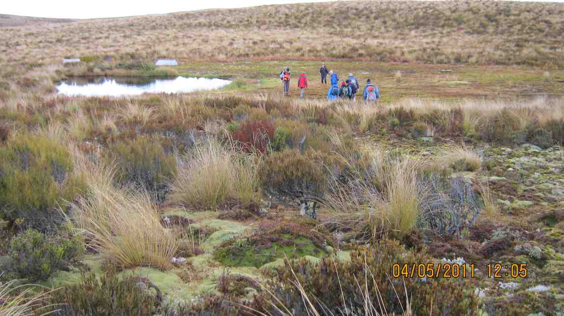
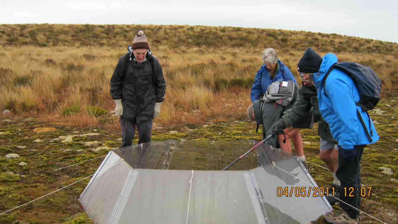
After all that, we returned the way we had come back to the cars. A good outing. – Ian.
16. 15/9/2010. Trampers. Horsehoof to Big Rock. Medium. Leader: George.
Walked up the 4WD track that went by the Microwave.
Lunched at the Big Rock.
Returned back down through the Woodside Creek gully.
15. 6/5/2009 Both. Horsehoof Station. Bridge over Woodside Creek, top corner, back down the more regular farm road. Medium. Leaders: Bruce, Wendy.
Many were discouraged by the wet morning start, but 8 of us enjoyed a farm walk on what turned out to be an cold overcast day (which we were well wrapped up against) interspersed by sun at morning tea and lunch. From the regular parking spot, for a change we turned down steeply
click to enlarge
to cross the Woodside Creek upper tributary nearby

and to then climb steeply
to enjoy a cuppa at the set of rocks a little way up.
Then to carry on up to the top corner of the station. This was a route the club hasn’t taken for five years and more. We forewent going on to the big rock and tarn through the rather heavy wet dracophyllum we would have had to struggle through, so lunched at the top under the shelter of a bank
and returned by the more regular farm track.
We all enjoyed a good tramping day but regretted there were not more to share the walk with. Bruce stood in for Marjorie who was indisposed on the day. Our thanks to Wendy and Bruce for their leadership. – Ian.
14. 12/11/2008 Trampers. Horsehoof Station, Maungatua Trig. Leaders: George, Ria.
This turned out to be a tramp from Horsehoof Station rather than from the advertised Allendale Farm. So it was simply up by the regular farm road to the Maungatua Trig and back.
click to enlarge
What was different was the wind measuring masts
and various markers presumably installed by Trustpower. A breeze pleasantly tempered the heat of the sun and 8 of us enjoyed a tramp in the tussocks and Maungatua top with the George making it easier and shorter by having the two cars parked further up the hill than on previous tramps. – Ian
13. 27/8/2008 Trampers. Horsehoof Station Upland road-walk Leaders: Ian, Ken
Winter conditions decreed a firmer road walk in place of the anticipated soggy ground we would have encountered at the Flagstaff big rock. So it was Horsehoof Station for a look at the fast disappearing snow conditions.
click to enlarge
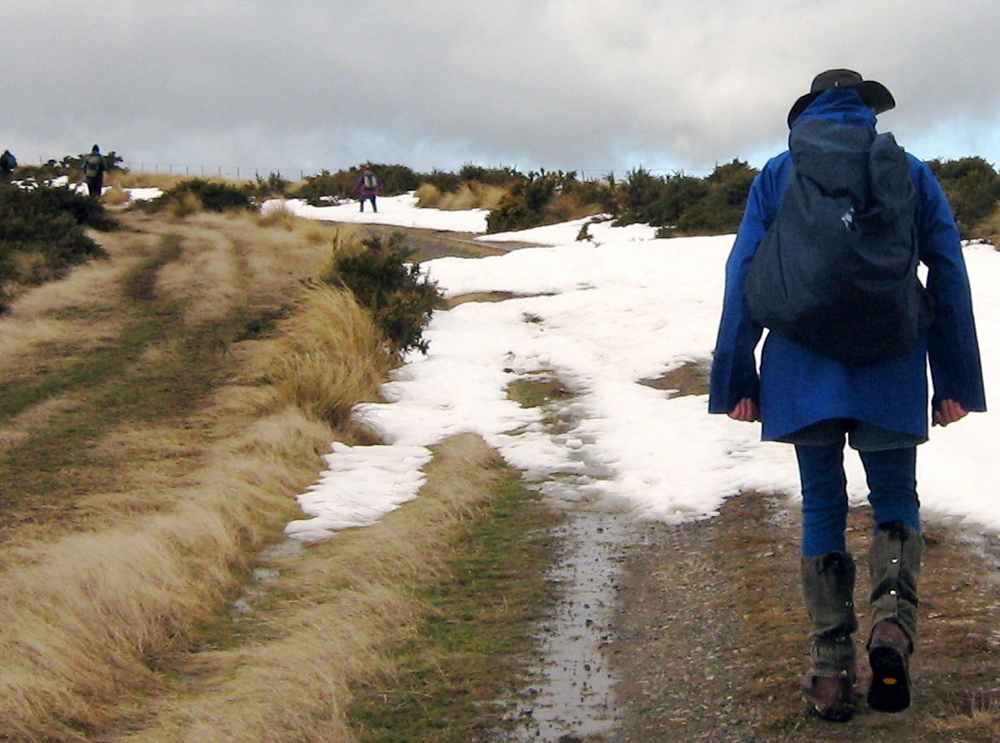
Seven of us set off from our cars parked down at the shearing shed and walked steeply up in the general Maungatua direction. It was a good walk in the fresh air with general sunny conditions turning to threatening clouds later. The breeze was fresh but sheltering in the lee of a gully made for a comfortable morning tea.
Lunch was on the sheltered side of the repeater station,
reached by cutting across a couple of wet gullies swollen with fresh snow runoff.
The return. Bill, Pat, Emma
A shorter day but the sun was out most of the time and the views and company were good. – Ian
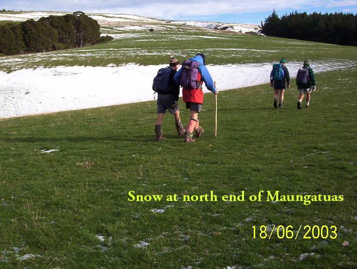
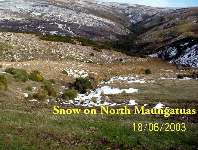
12. 18/6/2003 Horsehoof Station walk. Leaders: Shirley M, Bill & Pat.
11. 16/2/2005. Both. Maungatua with Summit option. Leaders: Val and Brian, Arthur and Barbara.
10. 18/9/2002. Microwave – Maungatua Summit. Medium. Leaders: Ria L, Barbara and Arthur.
9. 21/11/2001. Maungatuas Summit from Microwave. Medium. Leaders: Les W, Mary M, Shirley R.
8. 27/6/2001 Leaders: Claude, Bill, Pat
7. 8/12/1999. Maungatua, Microwave. Leaders: George, Hazel, Graham.
6. 18/8/1999. Microwave to Maungatuas. Leaders: George, Doug M, Hazel.
5. 3/12/1997. Microwave to Maungatua Summit. Leaders: Bob H, Judy C, Sabina.
4. 18/9/1996. Maungatua Trip, Micro Stn, Loop and return. Average+. Leaders: George, Ian, Nelson.
3. 6/12/1995. Microwave to Maungatua Summit. Medium. Leaders: Bob H, Jean, Ria H, Jack R
2. 26/8/1992 Leaders: George, Les W, Peggy A, Peggy M
1. 10/2/1989 Leaders: Graham, Shirley, Wendy