November 2023 Update: Taieri Recreational Tramping Club
Hi everyone,
Running a bit late with this, but following our birthday party and AGM, a bit has been happening so here goes. Firstly ….
Welcome
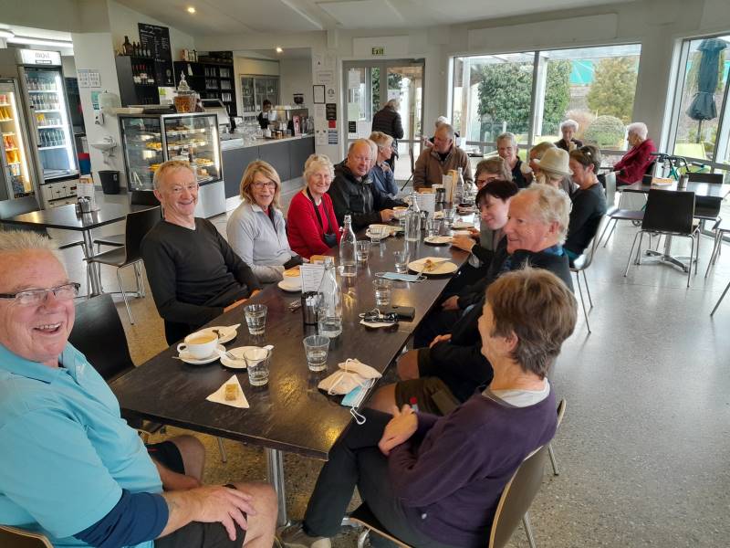
Who needs marketing teams to drum up business when our reputation for visiting interesting places and walking, talking, drinking coffee and eating ice-cream is out there. So welcome to Carolyn Pridham, Heather Reid, Chris Bezett, Val Cayford, Katrina McKenzie, Lenore Armstrong, Wendy Langley, Sylvie Watt, Adrienne Ensor, Vivienne Manning, Karon Read and Jenny Wilton. We are enjoying your company.
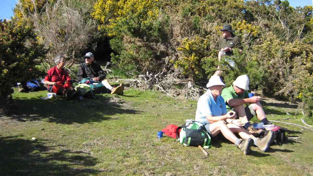
Photo Show for 35th Birthday Celebrations
After a bit of experimentation and playing around with options Ross has placed these photos on his YouTube site and these can be accessed at https://youtube/004hkDp4xt4. On your smart device/TV they can happily be displayed to add background to a romantic dinner or showing others that we have not aged down through the years or…..
Summer Trip Programme
Thanks to everyone for your suggestions and for the teams putting the programme together. The programme is presented in two ways on the website.
listed under “Recent Posts” – “Upcoming Trips”
can be printed direct from the link “copy of trip programme for printing”. Due to the dynamics around trip organisation please note the “Upcoming Trips” is the most timely information.
Fuel costs have been adjusted for the summer programme and a reminder that the club will reimburse a driver for doing a recce where the fare is $10.00 and over per person times 3 = $30.00. An email to the Secretary ([email protected]) confirming the recce was done and the date will be sufficient for the reimbursement to be arranged.
There are some trips where a grading is not shown, this can be due to a variety of reasons, maybe a first time, or the exact details are not finalised until the recce is complete and the leader provides a confirmed grade for the weekly email.
One of the actions being undertaken by the Webteam is to build a master spreadsheet of all the tracks that we use/ have used. We intend to add to this list the grading of the track as well as when the walk was last undertaken. This spreadsheet will have multiple benefits, not the least being having one master rather than multiple lists to comb through when compiling upcoming trip programmes.
We have also made some small changes to the Grading document to emphasise that we are grading the track, not fitness. The grading of a track is the same regardless of which group is undertaking it. To assist in getting track profiles completed, feedback on gradings is always welcome and could be included in the feedback when write ups are completed etc.
With the ongoing changes to the contact list of members the Committee has agreed that a hard copy will not be kept with the locator beacon bag; members (and Committee) can download a copy onto their phones.
Webteam
The team met recently to review how they are operating and to discuss detail, which happily most of us don’t see, but which is critical to the functioning of the team and maintenance of the website. The eagle eyed amongst you may notice some subtle changes. Subsequently myself, Jenni Wright and John Gardiner joined the team.
It was agreed that
a session will be run for those interested in sending in photos to the Webteam • from time to time, the master photo (Saddle Hill) on the home page be refreshed • we assess options for refreshing the website
we assess back up options for maintenance of the more IT aspects of the website; this is quite critical as what may appear as quite easy requests or functions actually require multiple pages of instruction!
we evaluate what information sets require passwords/be restricted or unrestricted
It was also agreed that a fourth web team member be added to the team to give more flexibility and that also we identify a back up for the Communications Officer especially in the more detailed areas of the website administration. If anyone is interested in assisting in these roles, please contact/ discuss with Ross Davies.
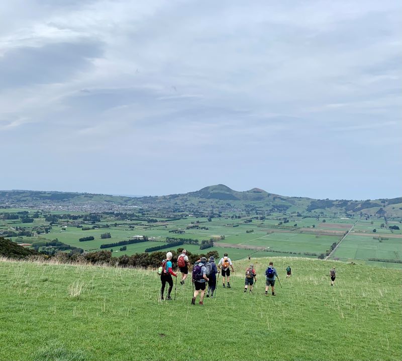
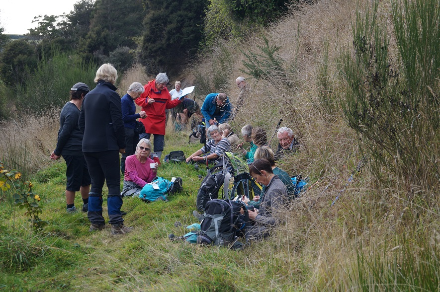
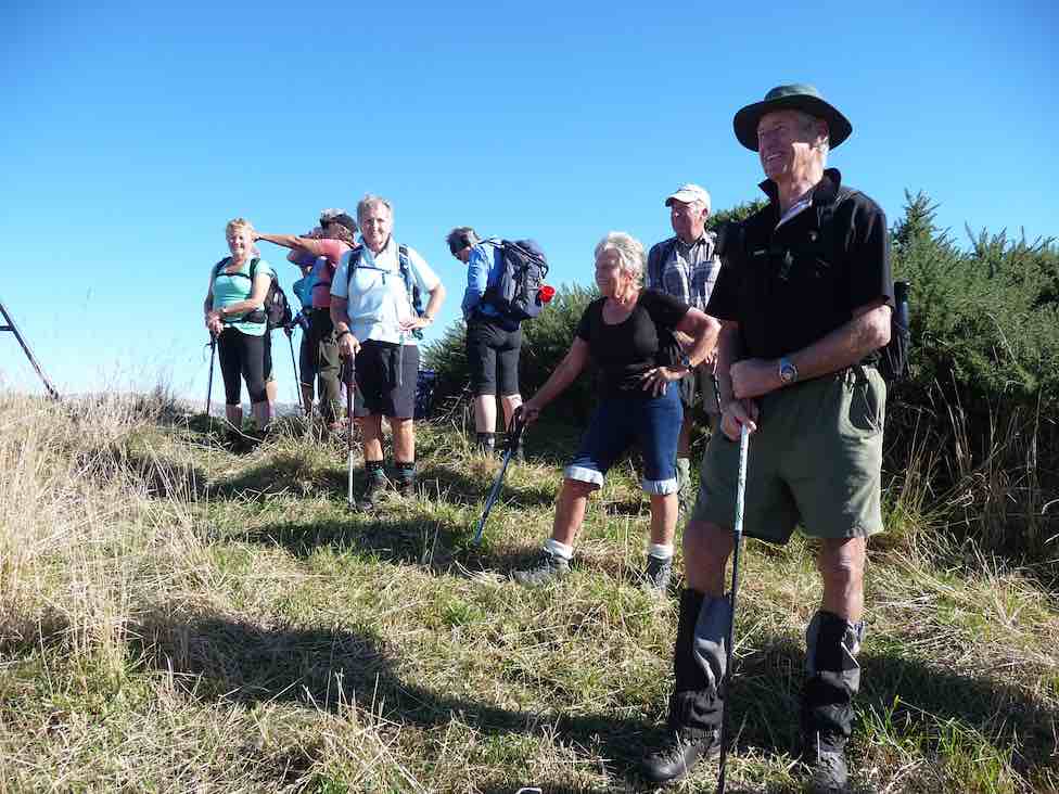
Kelvin Heights
Arrive Sunday 25 February 2024 – depart Friday 1 March 2024
Just a reminder to pencil this in and detail will follow in due course. This will focus on walks with no biking organised this time. Contact Anne at [email protected] if you require more information at this time.
Xmas Lunch and Walks 13th December
Pencil this one in, to be held at the North Taieri Church Hall. More information shortly. Note the first walk in 2024 is on the 17th January 2024.
Track Clearing
A separate note will follow very shortly but as mentioned the aim is to continue the work of Neil Morrison and Arthur Heenan by taking a working bee approach under the umbrella of the Green Hut Group. I have met with Arthur, Neil and Graeme Elliott from the Green Hut Group to confirm how we could assist and under what terms and conditions, as the Green Hut Group has formal arrangements with DCC and DOC. All we need now is volunteers!
Thanks everyone and looking forward to a warm dryish summer of walking.
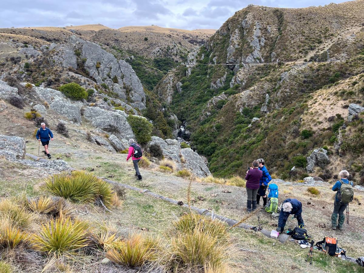
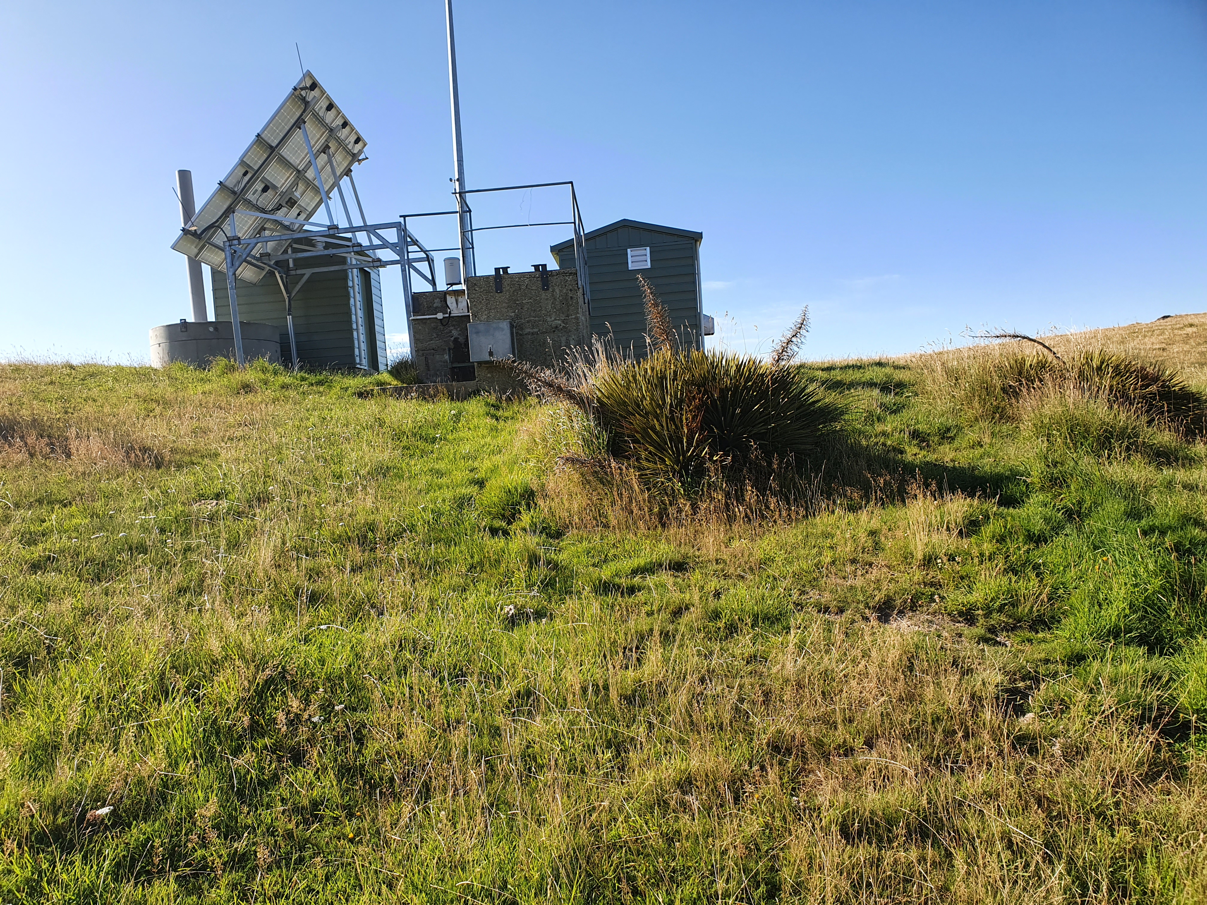
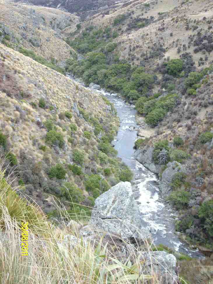
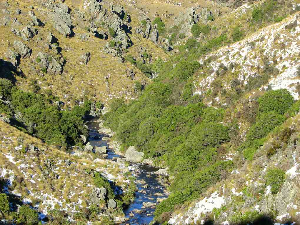
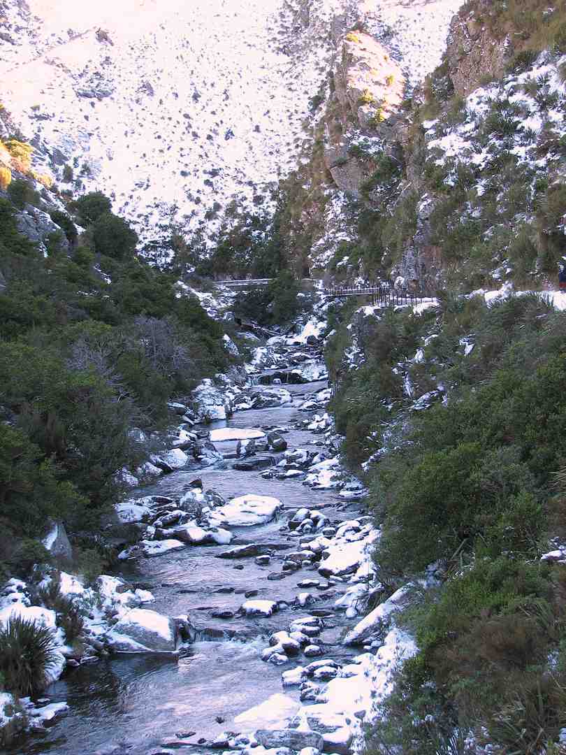
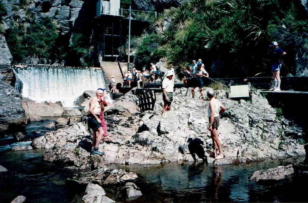
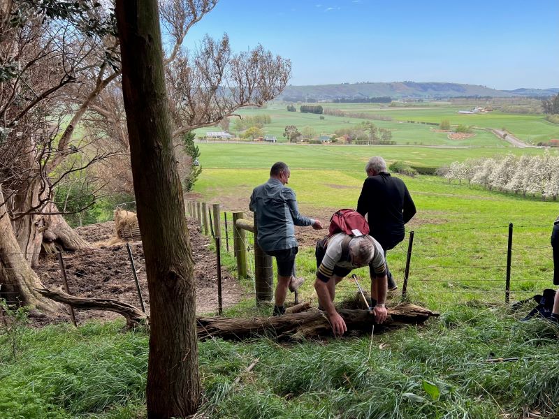
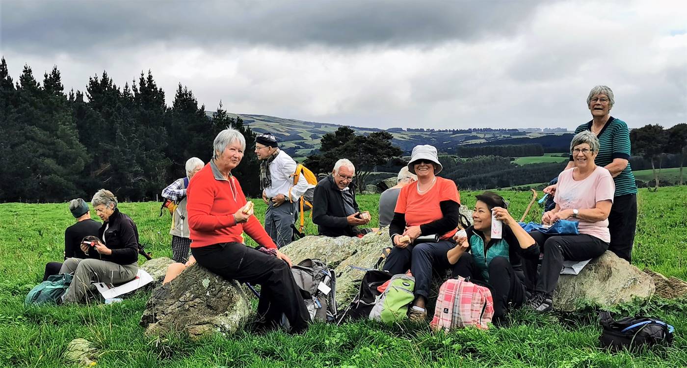
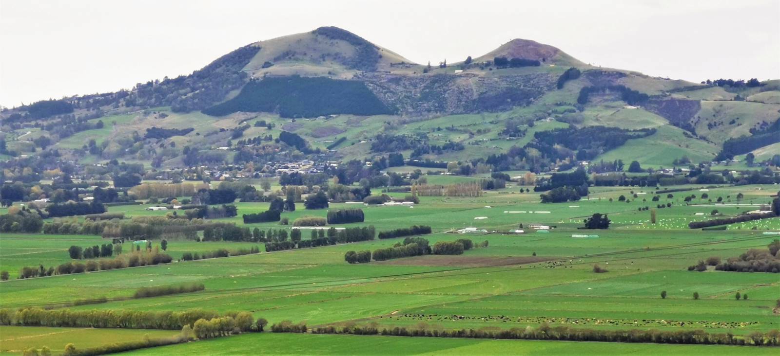
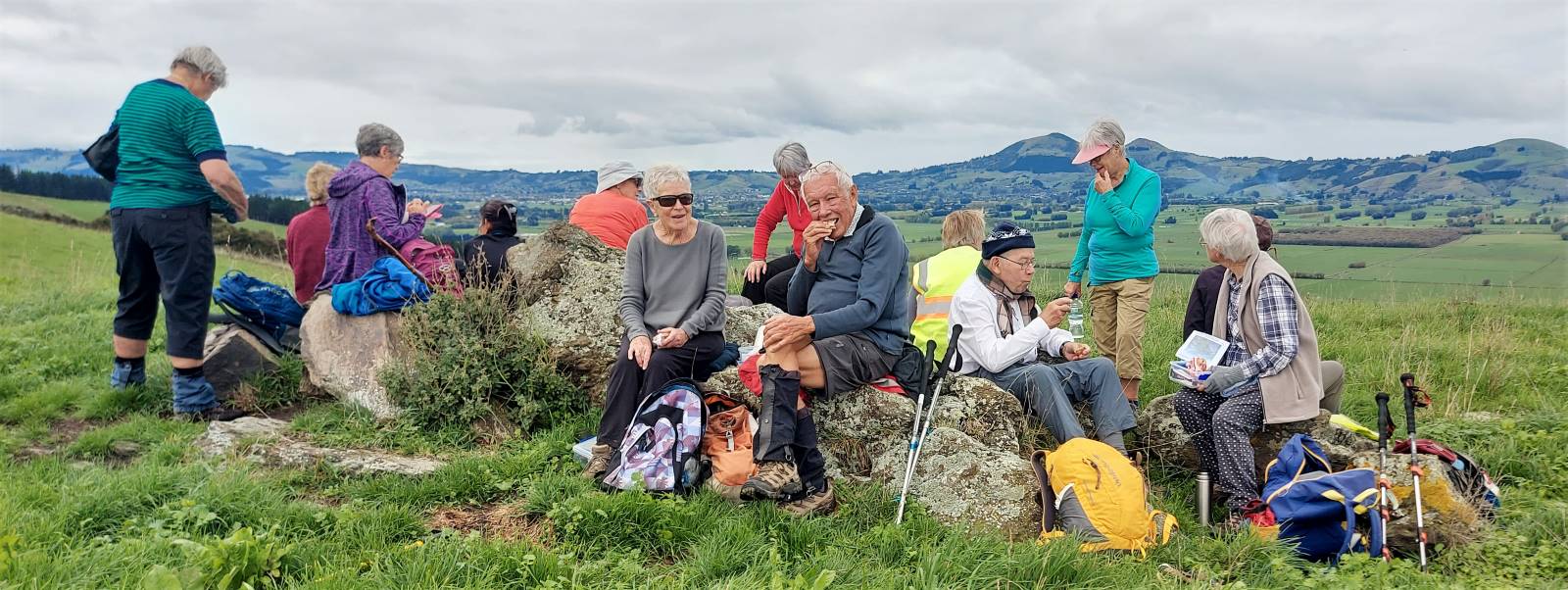
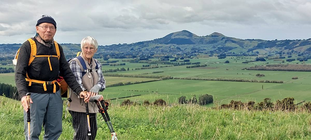
Location: 43 km from car park. Click Silver Peaks Forest for background information. No. 21 on old hardcopy list of 113 club tramps. “Green Hut & Pulpit Rock return or via Possum Hut. Year Round. Long.”
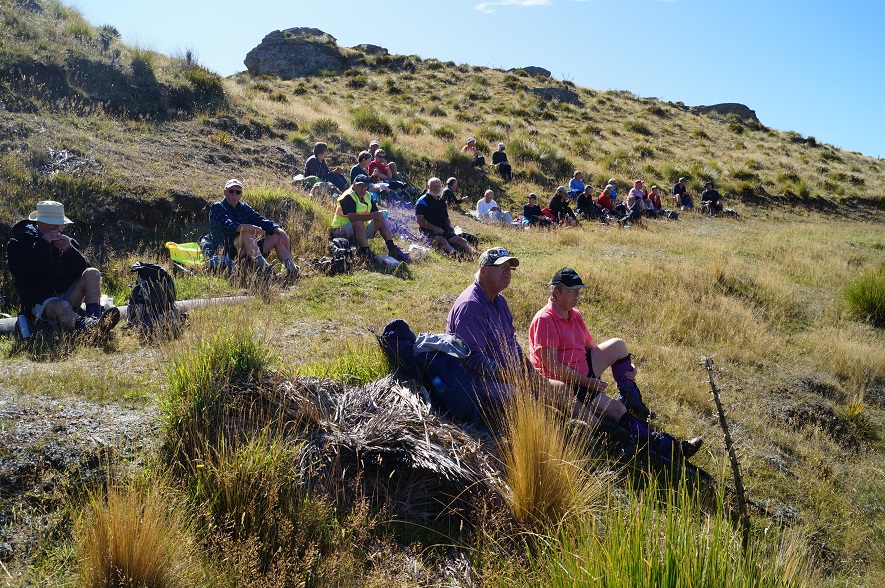
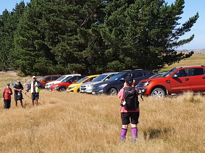
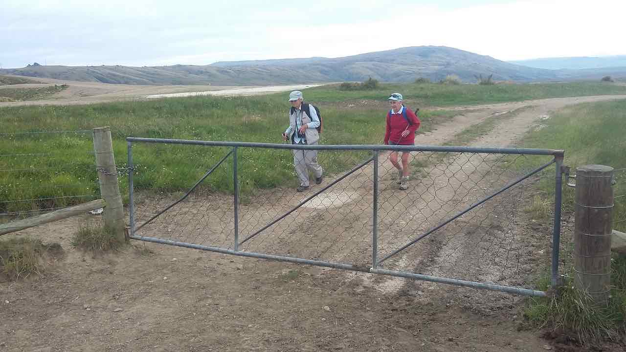
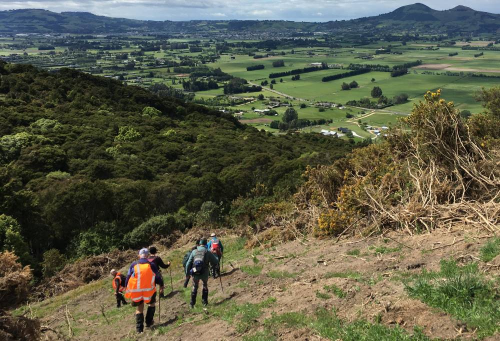
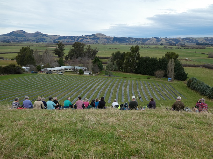
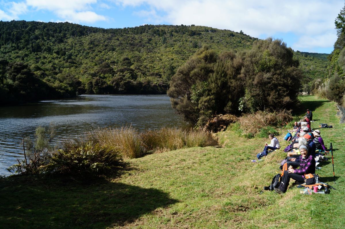
23. 1/10/2023. Combined. Green Hut Site and Pulpit Rock. Tramp Grade 4, Hike Grade 2. 43km. Leaders: Neil Hodgkin/Chris Bezett, Dave Roberts/Jay Devlin.
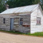
Hike to Green Hut (which is now two seats as the hut was deconstructed in 1988 because of ongoing vandalism).
On a foggy morning 18 keen hikers regathered at the On the Spot garage at Waitati where we turned left up a dusty road to the beginning Continue reading “Green Hut, Pulpit Rock”
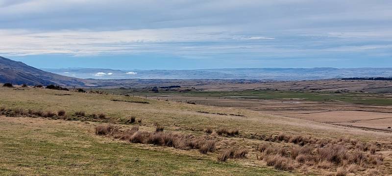
Lovely sunshine greeted 30 keen trampers for a good day’s walk on Cairnvalley Farm Shannon. Strath Taieri offers something different in scenery with tussock hills, huge rock formations and at this time of the year fresh green vistas of paddocks and Continue reading “Shannons Farm Walk”
Outram turned on another scorcher for 16 hikers. We started at the West Taieri Rugby Club and walked around Kings Court and Anzac Court subdivisions where the gardens were in full bloom. Continue reading “Outram – Allanton Flood Bank”
17. 11/10/2023. Hikers. St Clair, St Kilda, Ocean Grove. Grade 2, $5, 17km, Leaders: Bruce Spittle/Alex Griffin
Nineteen hikers left Marlow Park in sunny conditions at about 0930 after singing happy birthday to Liz Griffin and walked over the Kettle Park Sports field and up a track to the Barnes Lookout.
No. 47 on old hardcopy list of 113 club tramps. “Toko Beach. M Young”; also No. 65 on old hardcopy list of 113 club tramps. “Chrystalls Beach Farm”. Location: 59 km from the car park. Best in Summer. The stock winter over.
Directions: On SH1, before Milton, at Helensbrook intersection, left onto Forsyth Road, right onto Back Road, left onto Glenledi Road.
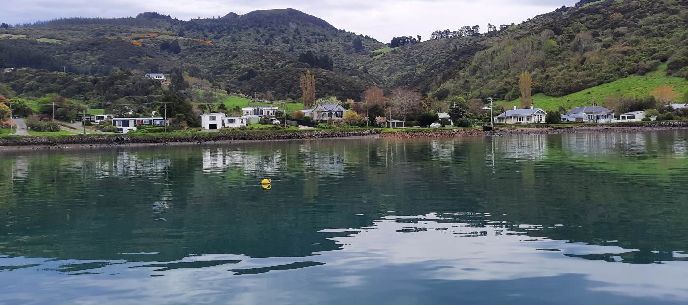
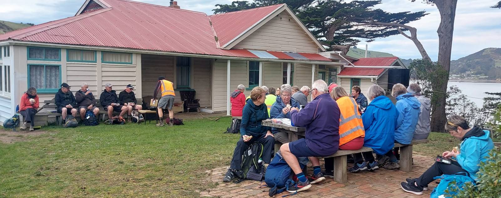
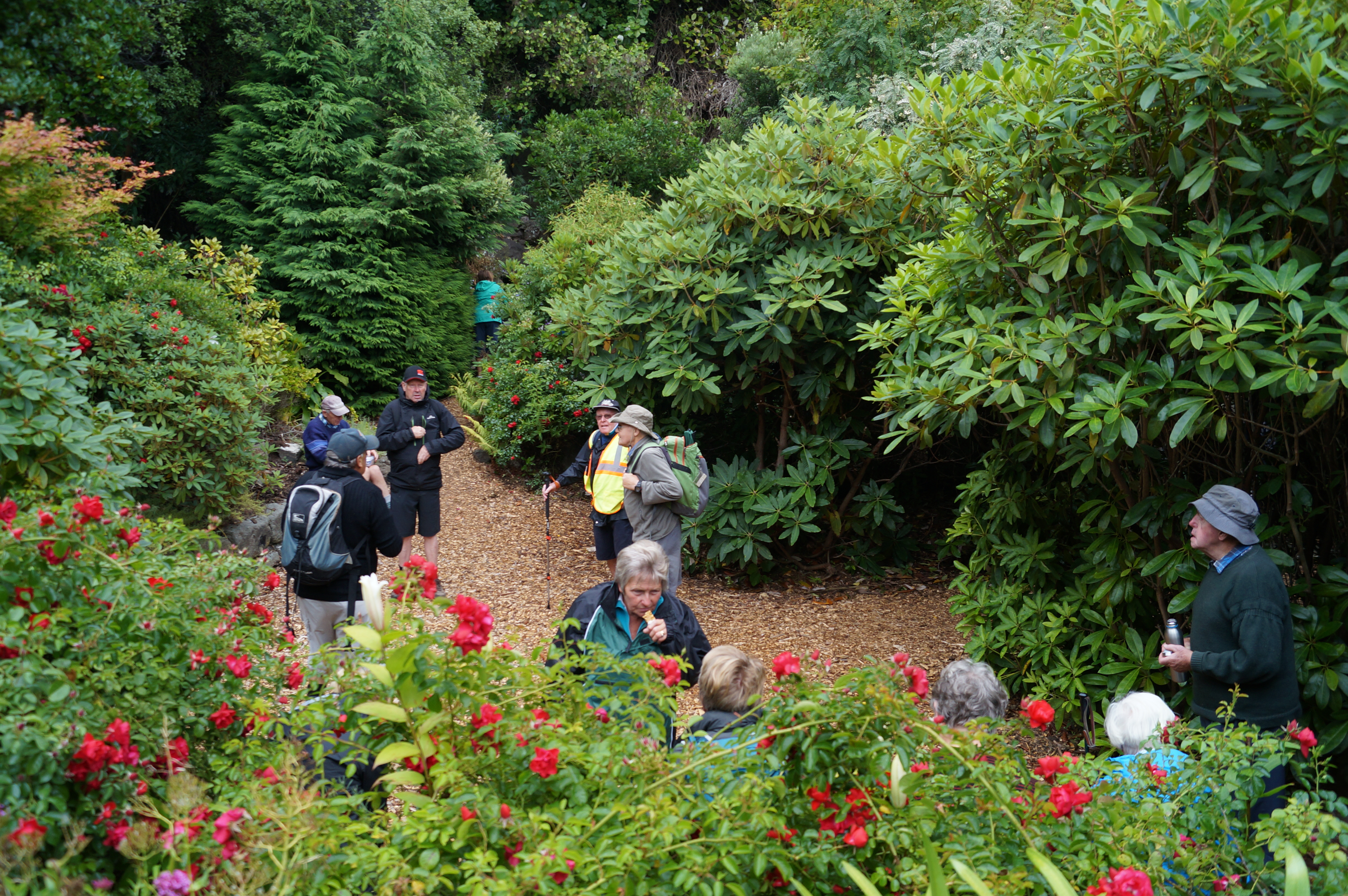
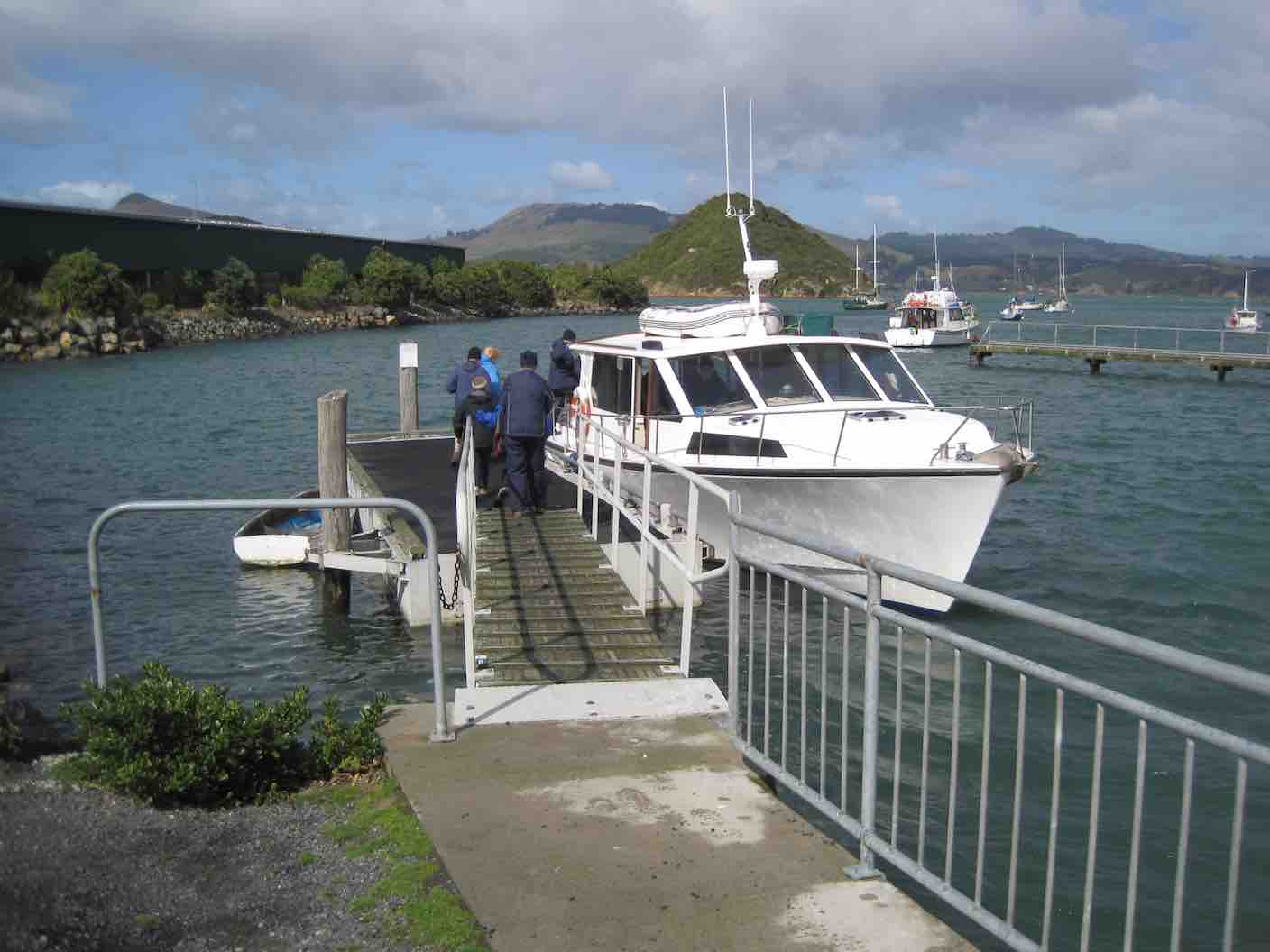
5. 4/10/2023. Combined. Quarantine Island. Grade 2, Leaders: Ross and Wyn Davies, Maria MacNee, Jenny Finnerty.
Twenty-eight trampers and hikers enjoyed a great day out with calm and temperate weather, a little cloudy, not the blue skies and sun the forecast promised. Perfect weather though for the crossing to Quarantine Island. Our day had started with a little confusion regarding numbers and meeting places but we all managed to get ourselves to Back Beach carpark safely (Julie and Viv might tell a few tales about their driver though, lol).
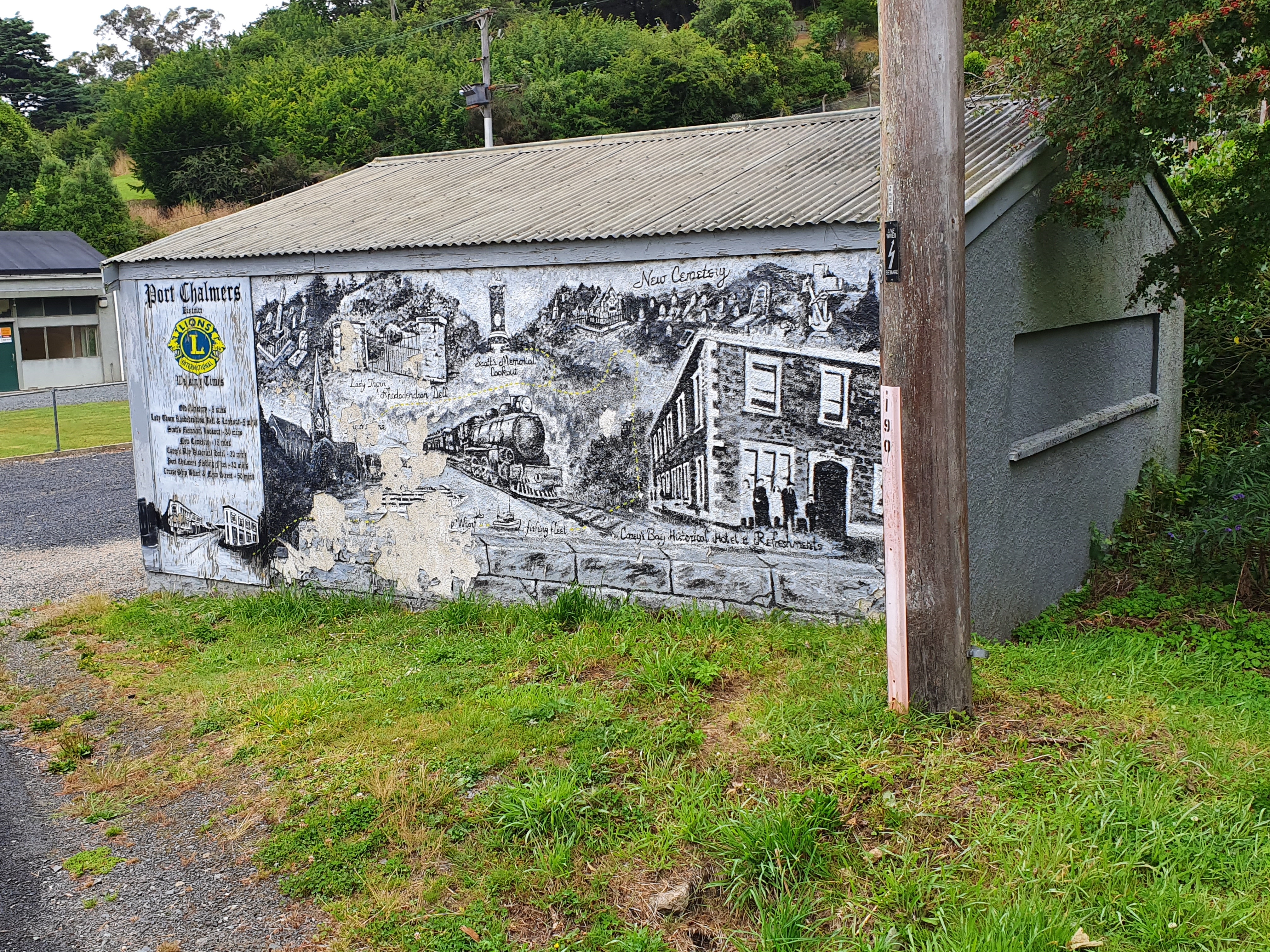
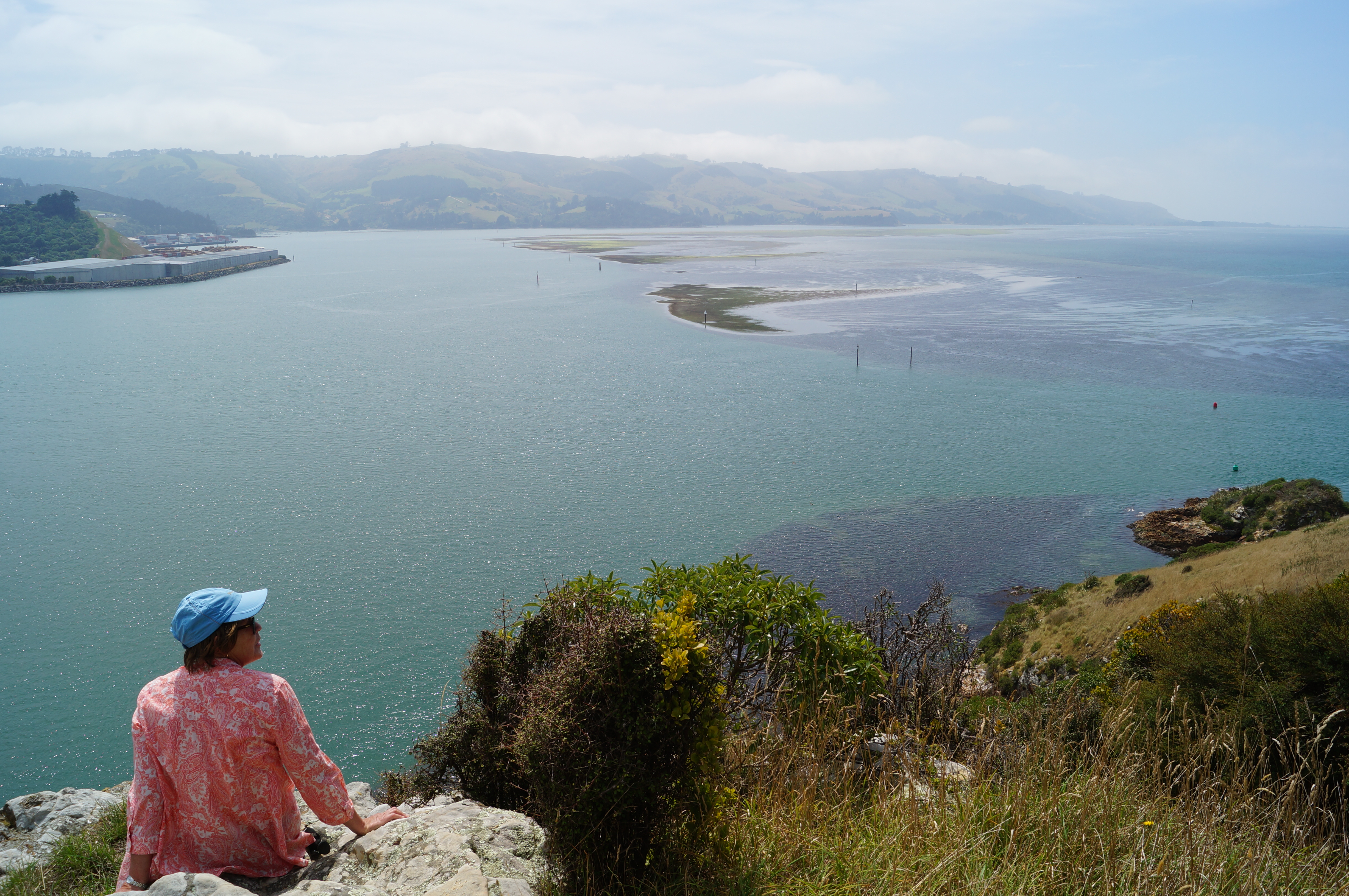
We walked off for morning tea in Lady Thorn Dell…
Morning Tea at Lady Thorn Rhododendron Dell. (photo and caption John)
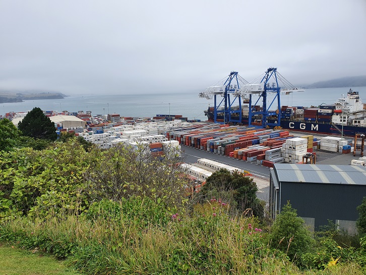
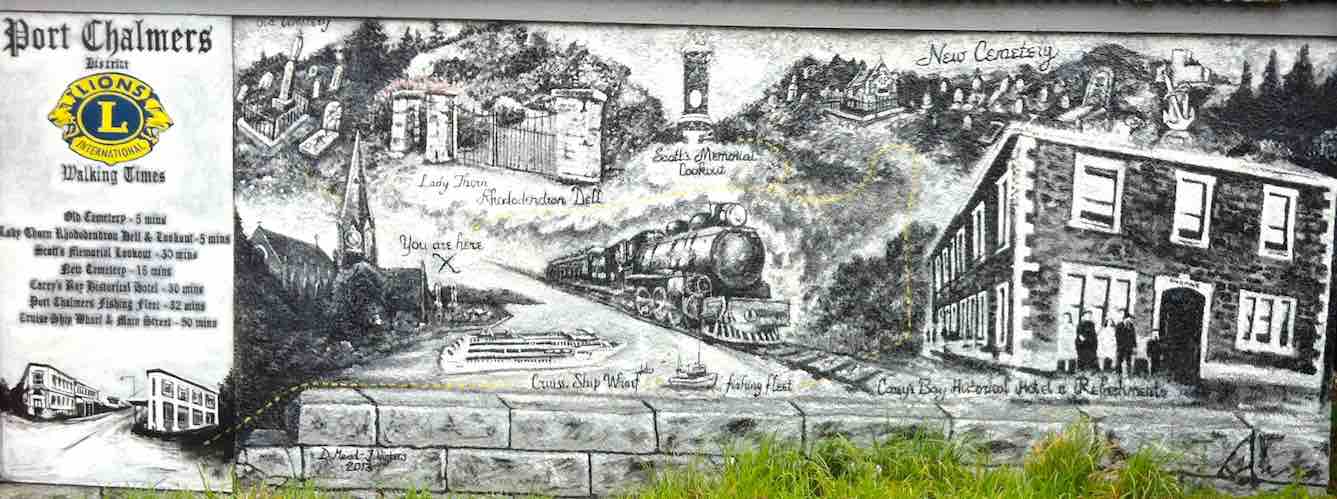
… where we enjoyed fabulous views of the busy Port Chalmers.
Panorama – Port Chalmers on a quiet day. (photo and caption John)
Great photos and history on display at the lookout platform. Little remains of the dry dock and ship building industry that once provided for a vibrant community in the 19th and 20th centuries.
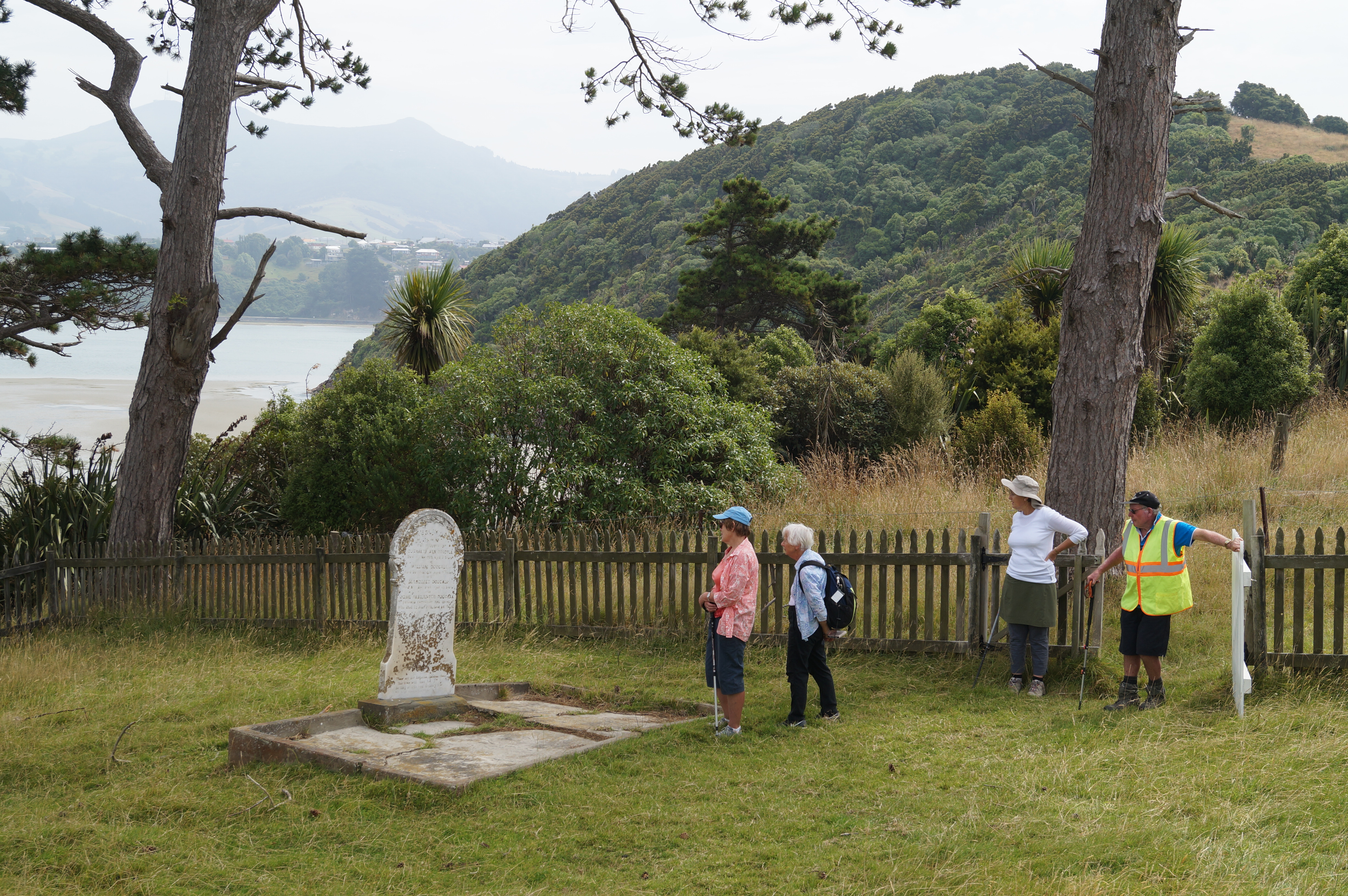
From Lady Thorn Dell we enjoy a leisurely meander through the town cemetery which it has to be said seems to hold an unhealthy interest for those of us still in the land of the living? Indicative of the average age of our enclave perhaps…? Nonetheless, interesting history to be gleaned from those old stones and bones.
Touring the Port Chalmers Cemetery. (photo and caption John)Lovely view from Port Chalmers Cemetery (photo and caption Marijke)
Coming back down to the Port we get a stunning glimpse of Carey’s Bay…
First glimpse of Careys Bay. (photo and caption John)
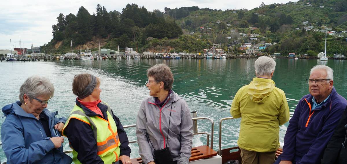
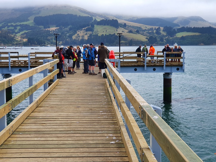
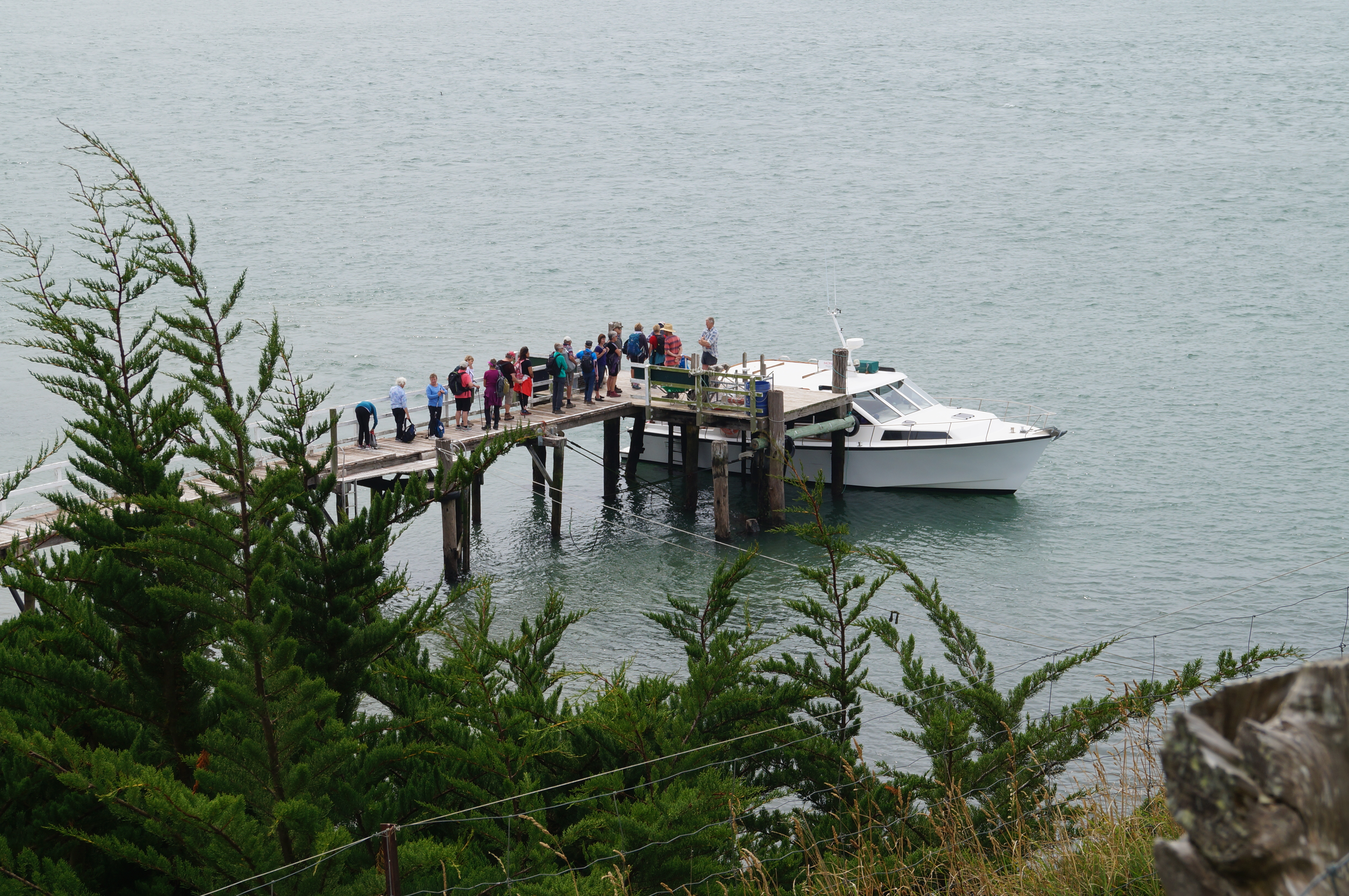
… before heading back to the wharf and Boiler Point where Captain John welcomes us aboard the island ferry the “Vivienne J”. After John treats us to a grand jaunt around the harbour basin (greatly appreciated by all on board)…
Beautiful Deborah Bay (photo and caption Ady)“Touring” Carey’s Bay. (photo and caption John)
…we “set sail” for the island, not bad value at $20 return! One wag commented that “It was very nice of Bruce to organise a cruise for Jenny on her birthday….”
Birthday Girl and her “guests” arrive at Quarantine Island (photo and caption Marijke)
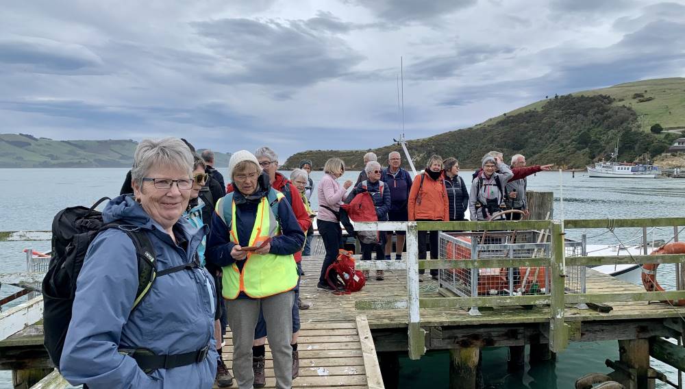
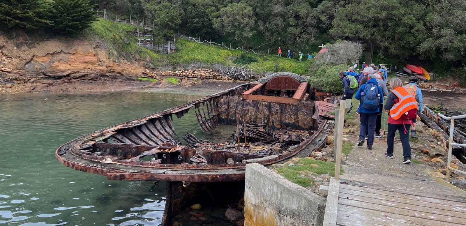
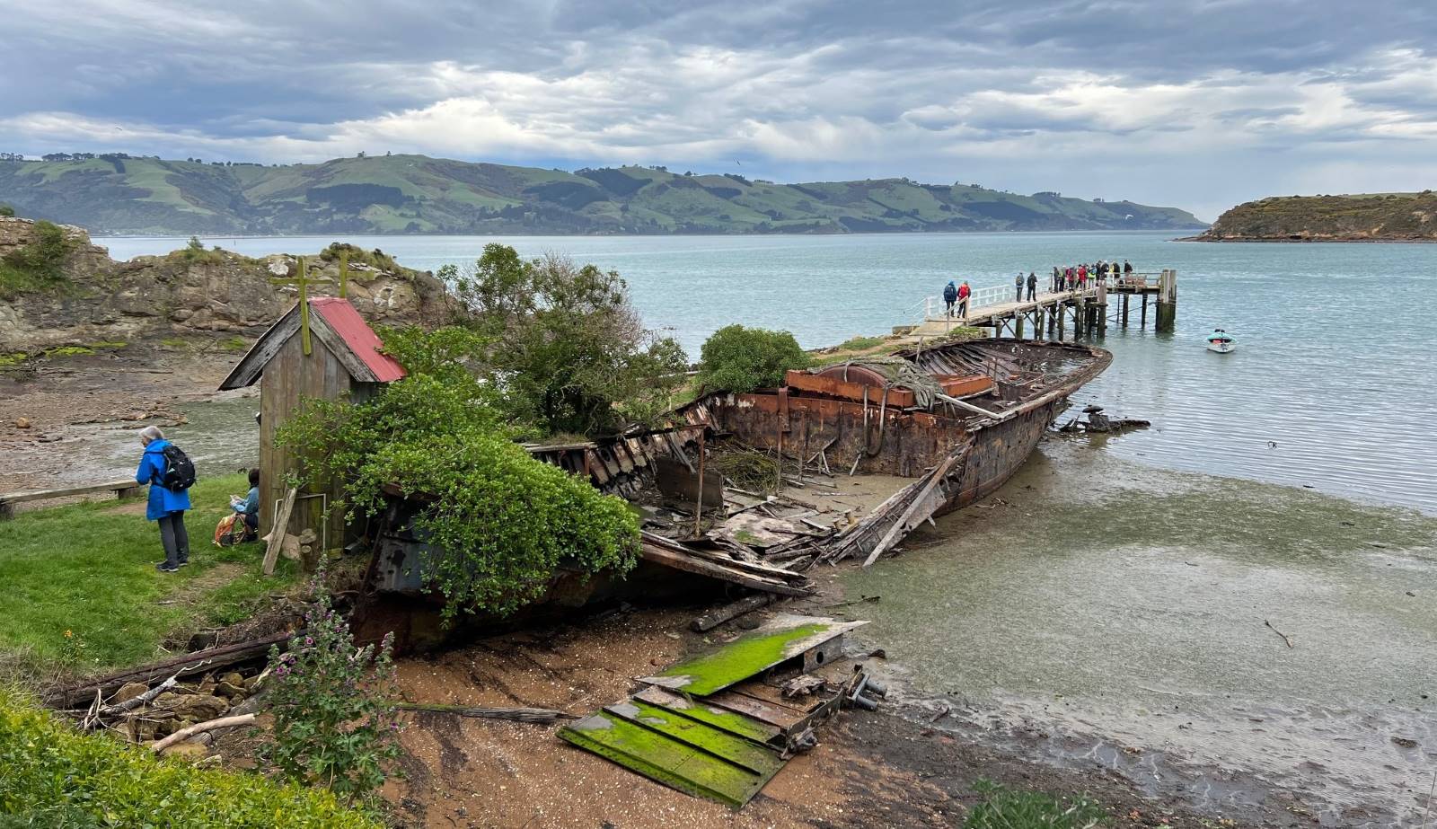
Arriving at the jetty on the island, the skeletons of the Waikana…
“Touring” Carey’s Bay. (photo and caption Pam)
… and the Oreti form a kind of decaying guard of honour as we head up to the Lodge for lunch.
Lunch (photo and caption Helen)
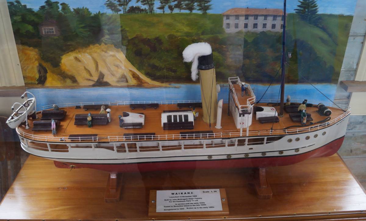
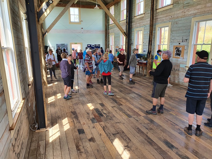
After lunch we explore the island starting with the restored Married Quarters building in which is housed a beautifully modelled miniature of the Waikana as she was when in service as a harbour ferry.
Harbour Ferry “Waikana” as she once was. (photo and caption John)
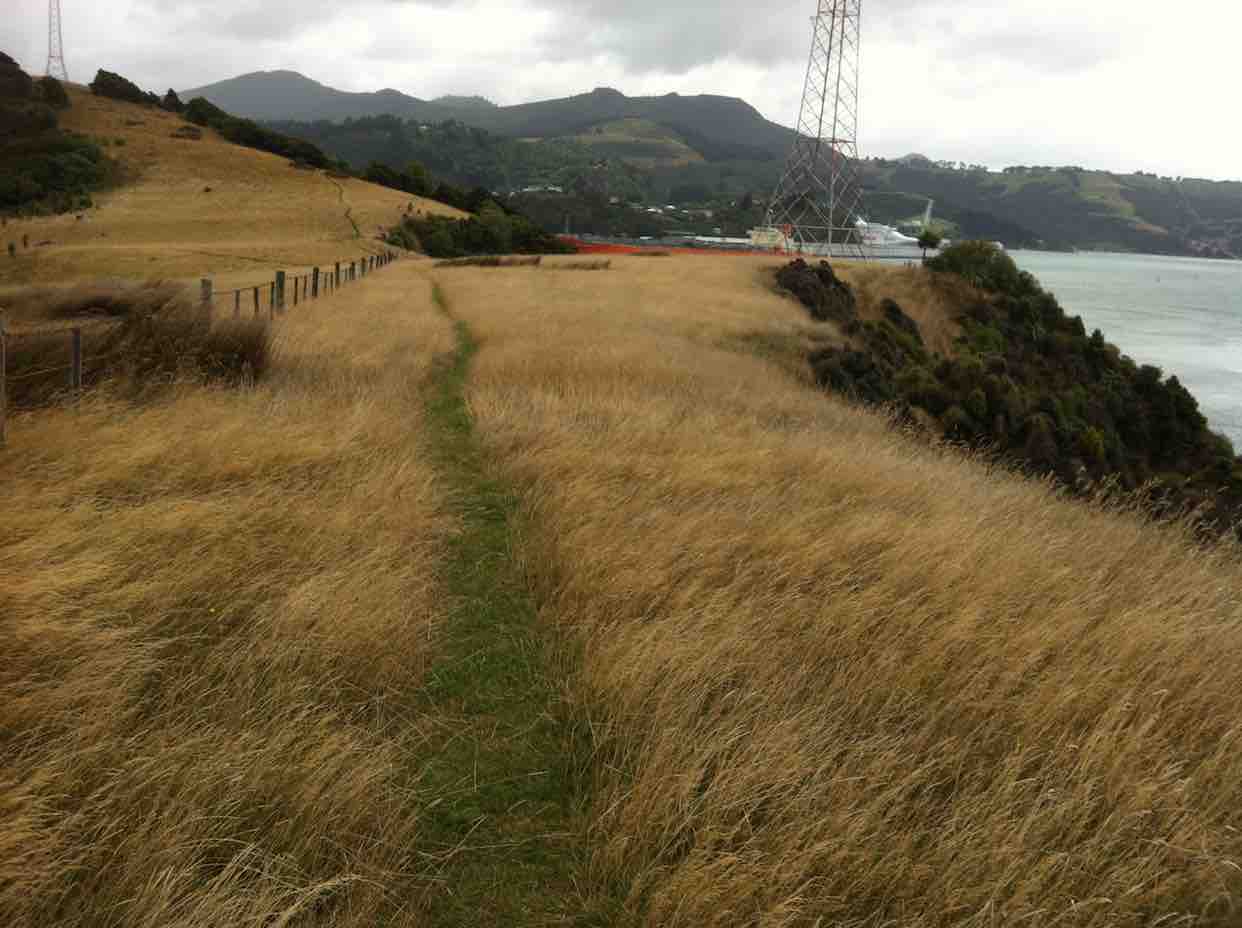
Regenerating native bush rang with the sound of native bird life as we enjoyed an easy 30-minute walk around the island.
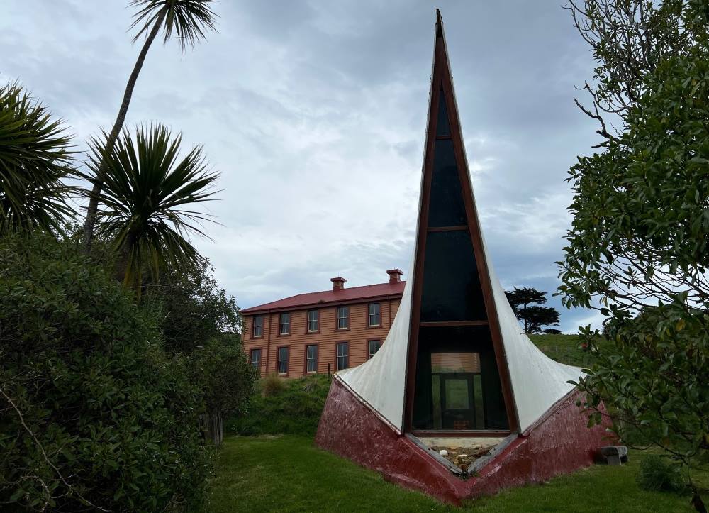
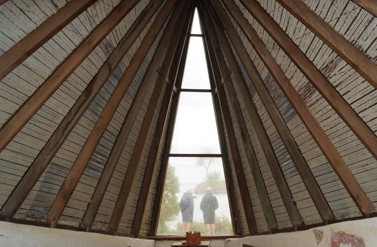
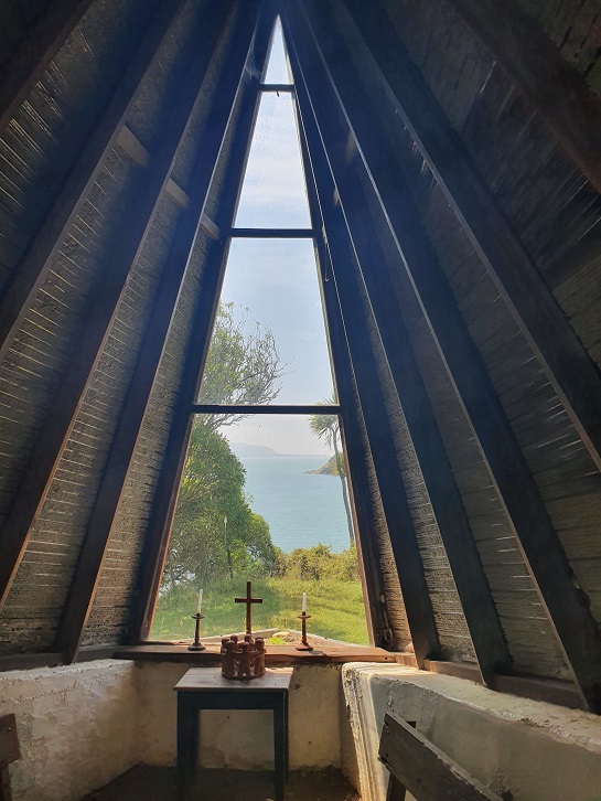
The “Sail” Shaped Chapel. (photo and caption by Pam)Inside the Chapel. (photo and caption John)Just the same as it was during a previous visit when I did a quick sketch (photo and caption Marijke)This drawing was from the same viewpoint (drawing and caption Marijke)Remnants from the old Hospital (photo and caption Marijke)Panorama – Looking back to Goat Island and Port Chalmers. (photo and caption John)
Our walks included visiting the sad sight of the island’s cemetery where the remains of 72 immigrants lay, half of them children, in unmarked graves. The small mounds are especially evocative. A sobering reminder of the fate of many immigrants who survived the arduous journey from the other side of the world in search of a better future, only to perish of scarletina and other deadly diseases in quarantine before they even set foot on the mainland.
Waiting on the jetty. (photo and caption Pam)
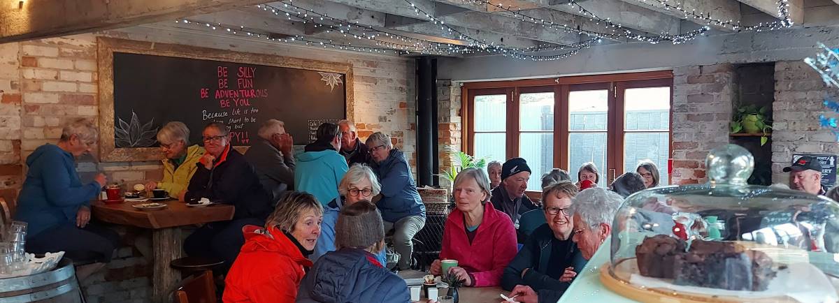
Heading back across the harbour our day is nicely rounded off by afternoon tea at the Santosha Cafe in the Port.
Coffee (photo and caption Helen)
A wonderful day out enjoyed by all.
Maria
4. 12/2/2020. Quarantine Island. Leaders Janice and Peter
43 hikers and trampers parked at Back Beach, Port Chalmers and walked along the wharf
edge past the stacks of logs. No cruise ship in port this time. Headed up the hill to our
morning tea spot at the beautifully maintained Lady Thorn Dell.
Photo and Caption John – “Morning tea at Lady Thorn Dell”
The lookout gave us good views of the container wharf which was busy with a container ship in.
Photo and Caption Clive _ “Port Chalmers from above.”
Meandered along the road , through the cemetery, and down to the main Aramoana road.
Photo and Caption John – “Visiting the Cemetary.”
A small detour took us down to the new extended fishing wharf at Boiler Point.
Photo and Caption Clive – “New wharf boiler point”Photo and Caption Clive – “What to see in Port Chalmers”
Carried on to the main street of Port Chalmers and up the hill to the lookout and Ralph Houtere Sculpture Park.
Photo and Caption Clive – “Ralph Houtere sculptures.”
Back down a bush track to Back Beach. With half an hour to go before the boat was due to arrive
most of us lunched in the car park. Were entertained by a heap of shags and gulls feasting
on some small silver fish. By this time the weather had cleared from a slightly drizzly misty
start to a very pleasant sunny calm day. Perfect for a boat trip.
Photo and Caption John – “On our way.”
Another two hikers arrived, which brought our numbers up to 45. Because of the numbers, the boat did two trips to the island. We were met by a very enthusiastic knowledgeable volunteer who took us to the old married quarters and gave us a very detailed overview of the history of the island.
Photo and Caption Clive – “Renovation inside married quarters.”Photo and Caption John – “Time for a break.”
Photo and Caption Clive -“Quarantine Island chapel”The renovations to this building have now been completed. Following this the majority of the
group did the half hour walk round the point, through the old cemetery, returning to the
wharf to be transported back to the car park.
Photo and Caption John – “Harbour view”Photo and Caption John – “All aboard”
Refreshments (including a yummy Devonshire tea for some of us) were at the historic Careys Bay Hotel – a pleasant end to the day sitting in front of the hotel overlooking the boat harbour.
Photo and Caption Janice – “the Quarantine Island visitors.”
Jan and Peter
3. 18/3/2015. Quarantine/St Martin Island from Port Chalmers. Leaders: Jan and Peter.
The weather was atrocious. Twenty-four Hikers and Ramblers arrived at the Back Beach car park. The rain fell. The wind blew. Leaders had told us our ferry to the island wasn’t to leave till 12.30 p.m. The sensible ones of us I believe waited out the morning in the shelter of their vehicles. The sillier ones were immediately into Parkas and gloves. Storm gear.
And off we set. Back the way we had come. Past the never-ending stretch of stacked logs, past the cruise ship, through the main intersection, up and along the road behind the church, across the railway line and on to Lady Thorn Dell. Here we gathered in the most sheltered (??) spot for morning tea. Few sat and even fewer partook. It was wet and cold.
Cuppa
Then surprise, upon the scene came up the two Lions Club members we had met as we entered the Dell, engaged in tidying the place up in preparation of a forthcoming important visit. They welcomed us and told us everything we could wish to know about the Dell’s history, from early quarrying of the rock, which initially was a hill stretching out to the water’s edge and whose stone now graces many of Dunedin’s buildings, notably the Railway Station, on through its life as a rubbish dump and subsequent clearing, to enable the further rhododendron planting and the present day. Wonderful.
Whereas we had earlier briefly entertained the idea of taking hot coffee in the warm embrace of Careys Bay Hotel, more time had now elapsed, so it was back down to the town,…
Local graffiti. On a shed wall a little way down from the Dell.
…in search of coffee that was more local. But the town was asleep, despite the cruise ship’s presence. No tourists. No cafes.
So we wandered around a bit, eventually sloping off in twos and fours back to the cars. We lunched separately, some in cars, some in other shelter, some exploring, until ferry-time arrived. Jan collected our ten dollar notes for paying the fare, and we boarded.
The VIvienne I
A lovely boat. Powerful too. The channel was a bit rough but in the lee of the island, all was smooth. And the sun had appeared and the rain had gone. A brightening-up afternoon. Hurrah.
It was no trouble alighting at the new wharf. The new island warden filled us in on local history, a salient point being that the St Martins Island Group name had very recently given way to the Quarantine Island Group name. Two other groups were there on the day, one of them being a two-day Tokomairio School Group. Our stay was a two-hour one, set to return at 3.00 p.m.
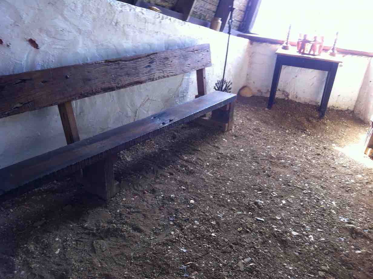
Rammed earth floor. A feature of the Island’s Chapel.
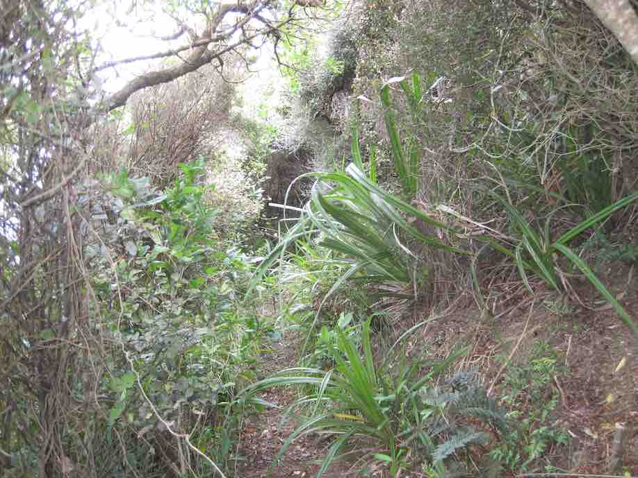
The walk round the top of the island was only half an hour. Lovely bush. The wind was strong on the sou-west side, the one exposed towards Dunedin, but the bush part of the track provided good shelter.
Having walked the main track,…
Track leading to loop trackOn the loop track
…some wandered off towards the old graveyard and the Portobello end of the island.
The Cemetery
The few sheep on the island were sheltered under a small plantation of pines. A brick chimney was all that remained of the old hospital.
Back towards the main buildings, the married quarters, once two-storied but now just a large hall, had been straightened up from an earlier lean, looking good in its fresh coat of paint.
Restored outside of Married Quarters BuildingInside old Married Quarters Building
The ‘wanderers’ joined the others waiting in the sun till ferry-time arrived.
Waiting in sun for ferry’s arrival.
All went smoothly as we reboarded and ‘sailed’ (?) back to the car park. A significant point, picked up from the crew, was that among them was the boat’s present owner, and the new owner , the one of the Monarch. This boat had apparently had a capacity for 33 passengers.
All agreed it had been a good day, all round. A day with a difference. A day to re-establish connections between Ramblers and old and newer Hikers.
We have had a full on year, of major and minor events, contained within a varied trip programme which in turn has been affected by a few wet Wednesdays! The latter being most unusual but hopefully not setting a long term precedent; one benefit being to remind us that there is no substitute for wearing and carrying the right gear for the weather on the day.
Majors being a very enjoyable Xmas function at Taieri Mouth with standout entertainment, as well as discovering the efficient taxi service that exists down there….This was followed by a successful week at Bannockburn that comprised a varied walking programme, some walks being a first for many of us, as well as undertaking a Tour de Dunstan and environs on Les bicyclettes. . The travel agents we used
for this event were most efficient and we look forward to their offering planned for Kelvin Heights and the Queenstown area in the coming Autumn, but of course we do need to get through spring and summer first!
Our recent 35th birthday and mid winter celebrations were outstanding and subsequent discussions thought provoking. The photo show displaying a trip down memory lane is currently to hand and we are hopeful it can be made available shortly.
We have had a range of new walks and variations on previous walks and have tried to pick up on those not done for some time. The big turnout to support the Halo Project at Long Beach was wonderful and a more than useful adjunct to the flax clearing undertakings we do. As discussed with a range of folk we are assessing with the Green Hut Group how we can take a ‘working bee’ approach to the track clearing work and continue the club’s contribution to track maintenance on our side of Flagstaff/ Swampy. More on this shortly.
The Committee and sub committees/ web team continue to fine tune processes and communications such as the ability to print the trip programme from the website, as well as the ongoing reassessment of fuel costs The latter has been recently looked at again for when we do the summer trip programme. We have looked at why disclaimers of liability are not required as well as settled a process for walks to accommodate folk who may wish not to complete the full walk on the day.
Our membership has blossomed through the last few months and stands at 109, with some pending! Our life members are Bev Harvey, George Haggie, Margaret Smith and Molly Vaughan.
For your information the current office holders and Committee members offer themselves for re election and Graeme Souter has been nominated for the sole vacant standard position on the committee.
Thanks to everyone who has contributed in so many ways outlined above to make a successful year, supporting each other is a hallmark of the club.
This year will be the last for Jill Dodd on the committee as she has decided ‘to retire’. Jill has had a lengthy stint since 2015 as vice president/president/past president and of course acting president during Covid. In addition, Jill has initiated a range of trips, first aid training as well and events such as the recent Halo project contribution and more. We look forward to walking and talking with you Jill for many years to come!
Minutes of the 35th Annual General Meeting of Taieri Recreational Tramping Club held at the Taieri Presbyterian Church Hall, on Thursday 24 August 2023 at 1.30 p.m.
Present: Phil Keene (Chair), Anne Ward, Barbara Shackell, Betty Finnie, Bev Harvey, Bill Cubitt, Bruce Wright, Carole Morrison, Clive Crossman, Dave Roberts, Diane Paterson, Dorothy Bennett, Elaine Day, Eleanore Ryan, Gail Williams, Grant Shackell, Gwenda Farqharson, Heather Kirk, Helen Morris, Jan Butcher, Janette Abbott, Janice Yardley, Jay Devlin, Jenni Wright, Jill Dodd, Jim Finnie, John Gardiner, Judy Dennison, Karen McInnes, Lester Harvey, Margreet Simpson, Marijke Schofield, Neil Hodgkin, Neil Simpson, Pam Cocks, Phil Morris, Raewyn Keene, Ross Davies, Sarah McCormack, Shona Munro, Theresa White and Wyn Davies.
Apologies: Alex Griffin, Avis Williamson, Chris Wither, Dave Mellish, Di Bezett, Esther Willis, Graeme Souter, Heather Reid, Jenny Finnerty, Jenny Flack, Jill Reid, Kathryn Fagg, Katrina McKenzie, Lenore Armstrong, Liz Griffin, Lyn Keene, Neville Griffiths, Pam Clough, Peter Davie, Shona Carruthers, Wendy Begley and Yan Campbell.
Minutes of Previous Meeting
The minutes of the 34th AGM were taken as read, having previously been circulated. Moved Jan Butcher, seconded Margreet Simpson that they be confirmed as a true and accurate record. Carried.
Matters Arising
None.
Correspondence
None.
President’s Report
Phil presented his report for the year, and this is attached to these minutes. Attached.
Phil Keene moved that his report be adopted, seconded by Sarah McCormack. Carried.
Financial Report
The financial statement, previously circulated to members, was summarised by Jenni Wright.
Income for the year was $2,575.03, expenses $1,610.41, resulting in a surplus of $964.62. The current state of finances was $1,245.12 with $4.60 petty cash, totalling $1,249.72.
There was a timing issue in income and expenditure.
As at year end, we had not yet received the invoice from the Taieri Bowling Club for the catering for the 35th birthday celebratory lunch. Income for the 35th lunch is $885.00 which means that our surplus to 30 June 2023 in real terms is $79.62.
The Committee at its meeting on 27 June 2023, recommended that the annual subscription and joining fee remain at $10 each.
Jenni Wright moved the adoption of the Treasurer’s Report, seconded John Gardiner. Carried.
Appointment of Reviewer for the Forthcoming Year
Keith Mackenzie has agreed to be TRTC’s reviewer for the 2023-24 financial year. Jenni Wright moved that Keith Mackenzie be reappointed as reviewer, seconded Barbara Shackell. Carried.
Election of Officers
Position
Name
Moved
Seconded
President
Phil Keene
Jenni Wright
Jill Dodd
Vice President
John Gardiner
Helen Morris
Dave Roberts
Secretary/
Treasurer
Jenni Wright
Jay Devlin
Barbara Shackell
Existing Committee
Jay Devlin
Jan Butcher
Karen McInnes
Pam Cocks
John Gardiner
Theresa White
Sarah McCormack
Committee (New)
Graeme Souter
Neil Hodgkin
Heather Kirk
Communications
Ross Davies
Pam Cocks
Jill Dodd
The Committee as outlined above was appointed unanimously.
Jill Dodd has resigned from the Committee as Past President and her considerable service to the Club was acknowledged with a rousing applause.
Life Membership
The President outlined the approach taken by the Committee to confer life memberships on four members. The process outlined in the paragraph 4 (e) of the constitution was read and then citations and presentations were read and made for Betty and Jim Finnie, Lester Harvey and Neil Morrison.
General Business
Webteam: Ross Davies, in response to Phil Keene’s appreciation of the Webteam, thanked the willingness of Chris Wither, Diane Paterson and latterly Marijke Schofield to step up as necessary to cover for each other. This is a great resource for the Club and the efforts of the Webteam are very much appreciated by all members.
The meeting closed at 1.45 p.m.
Guest Speaker: Jonah Kitto-Verhoef, Halo Project.
Jonah as Operations Pest Manager provided an overview of the organisational structure that focuses on working with communities across four areas, predator free zones, forest habitat restoration, from source to sea and seabird habitat restoration. It soon was very clear that extensive skill sets and passion for the job was required. Jonah demonstrated the extensive concentration of trapping systems and methodologies with predator free zones surrounded by large buffer zones. Jonah demonstrated different trap types and when and how they are used to
the best outcomes; he acknowledged there is a ‘dark side’ to the work. Much of what Jonah demonstrated is on the Halo Project website https://www.haloproject.org.nz/predator-free and this includes resource info sheets for groups and individuals. Clive Crossman thanked Jonah for his talk and presented a donation from the club for the Halo Project’s work
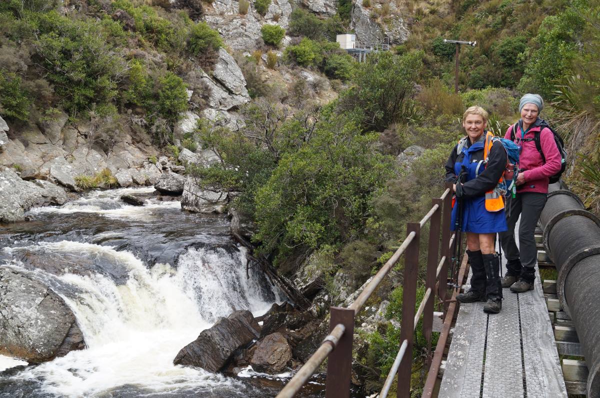
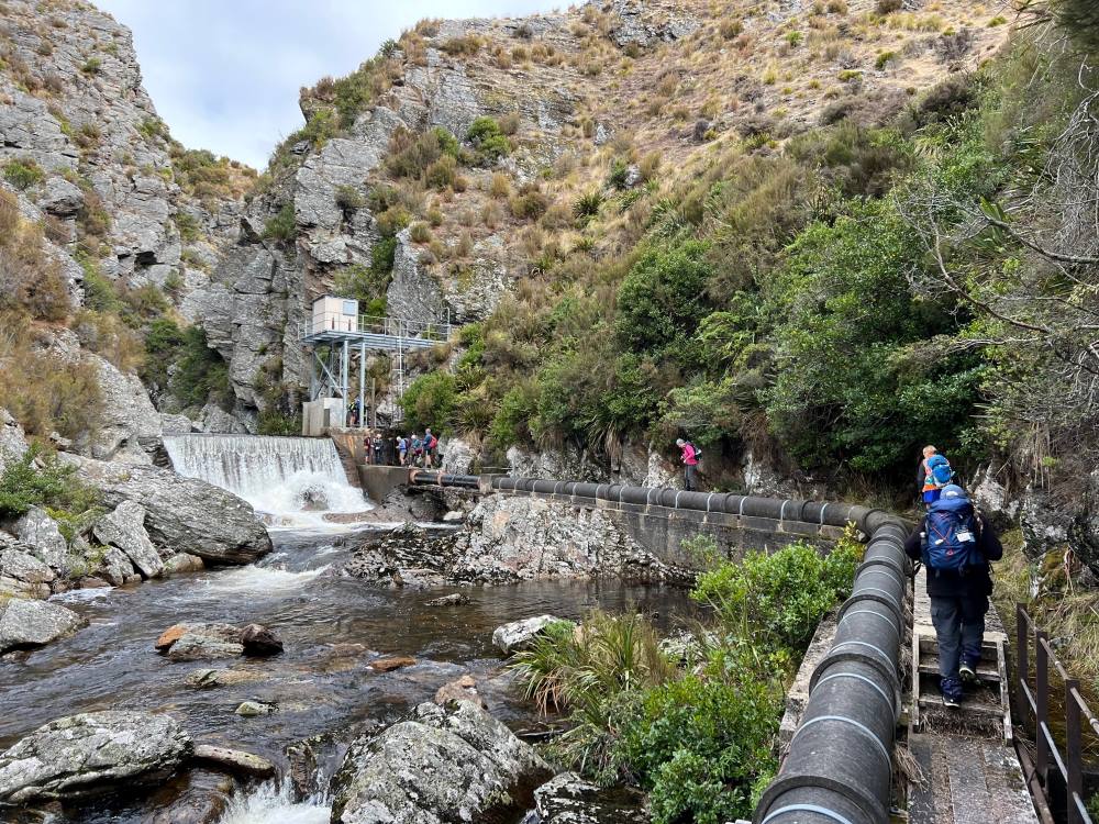
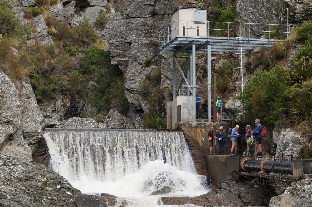
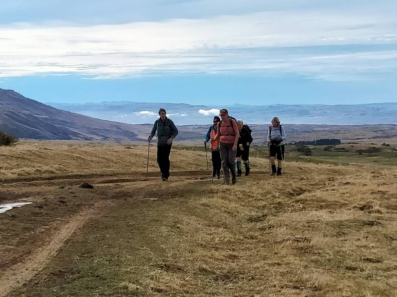
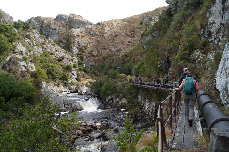
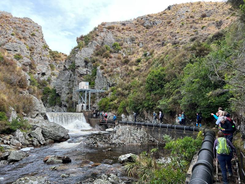
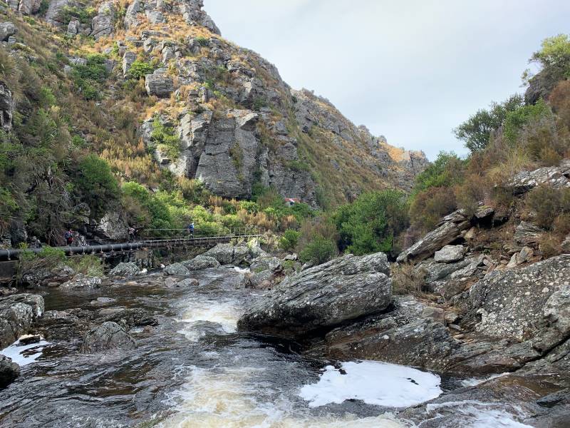
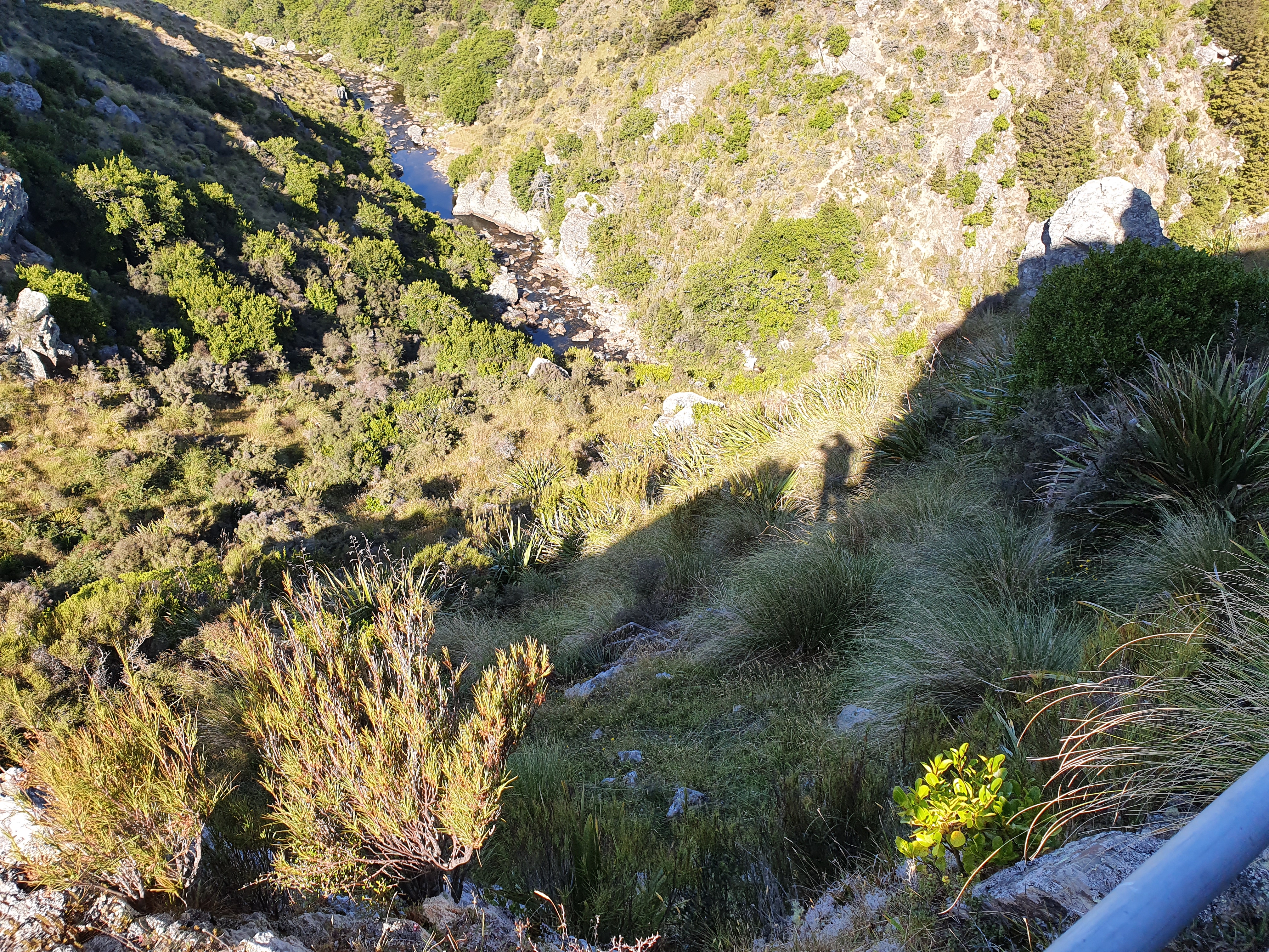
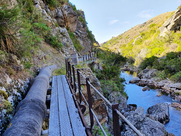
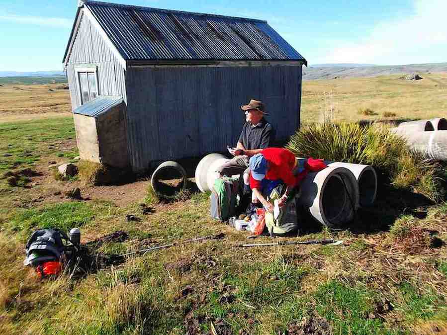
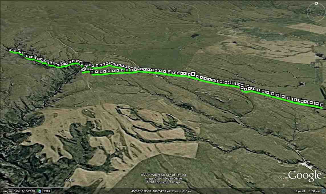
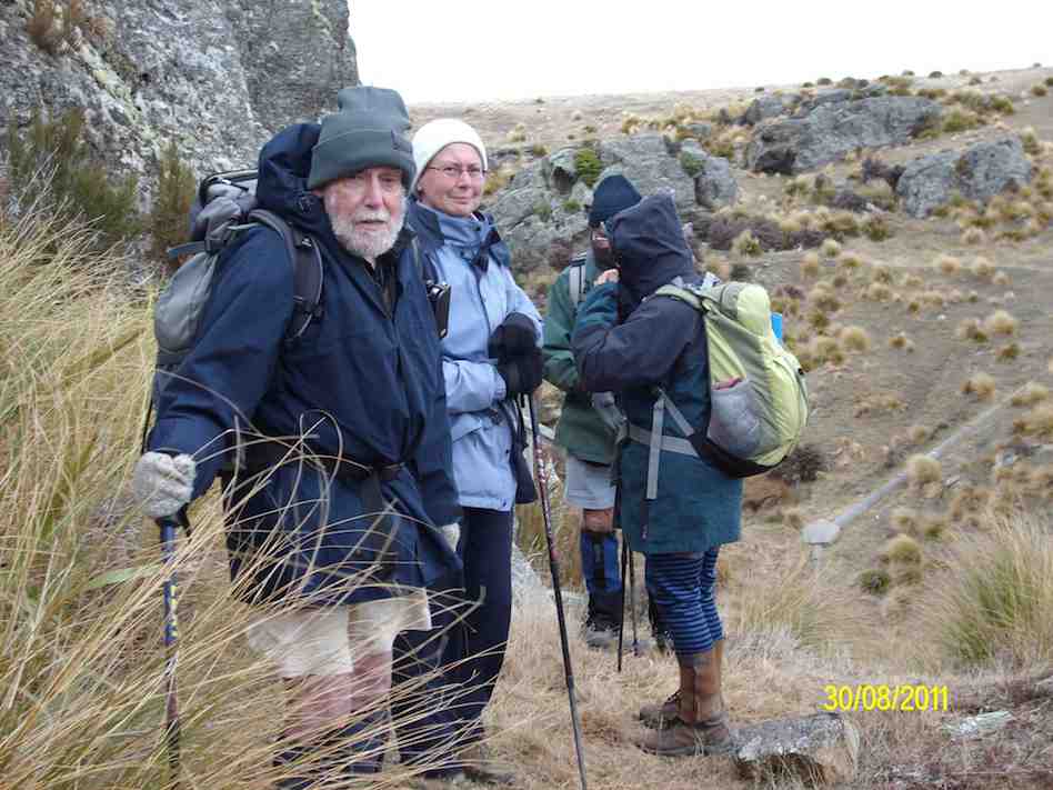
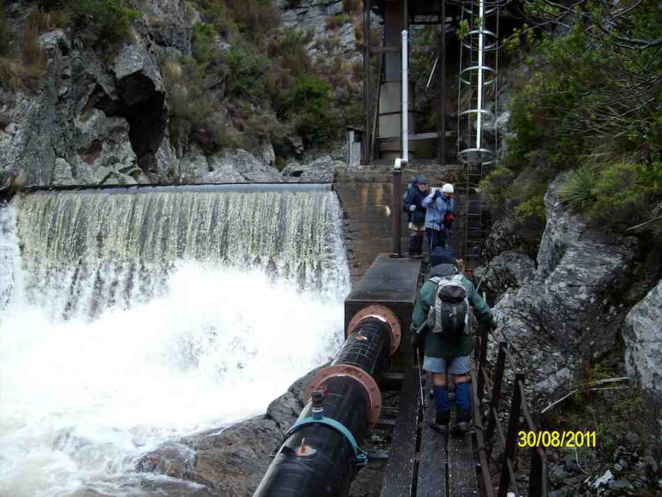
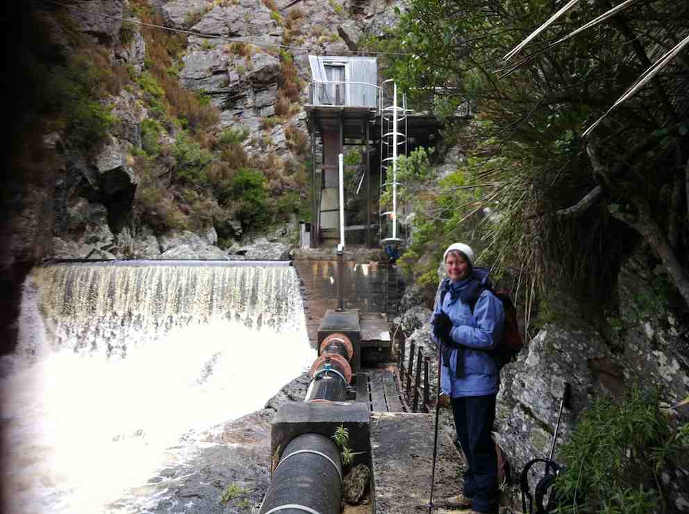
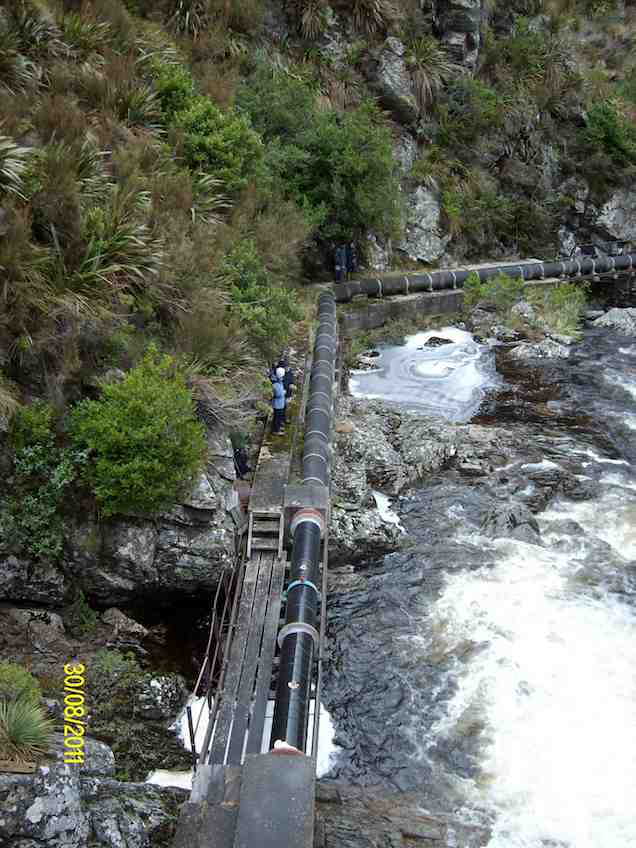
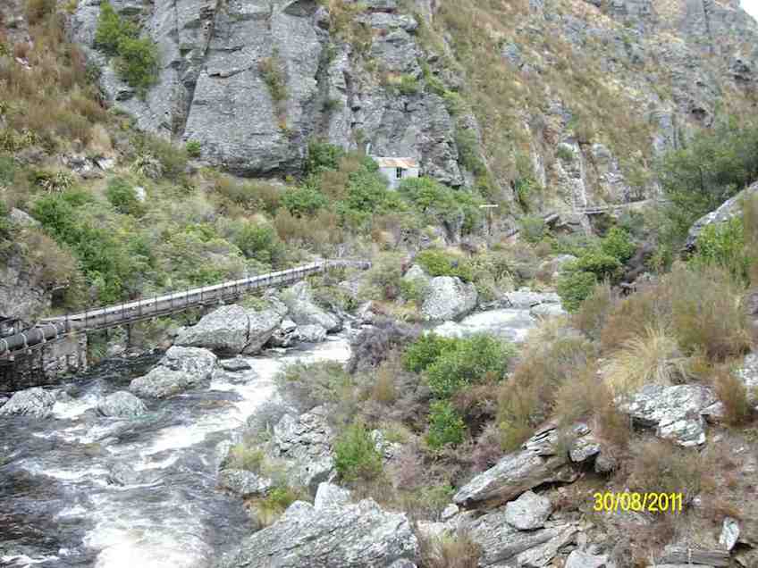
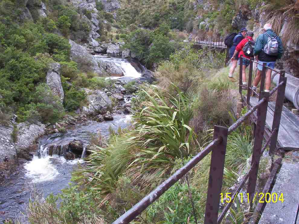
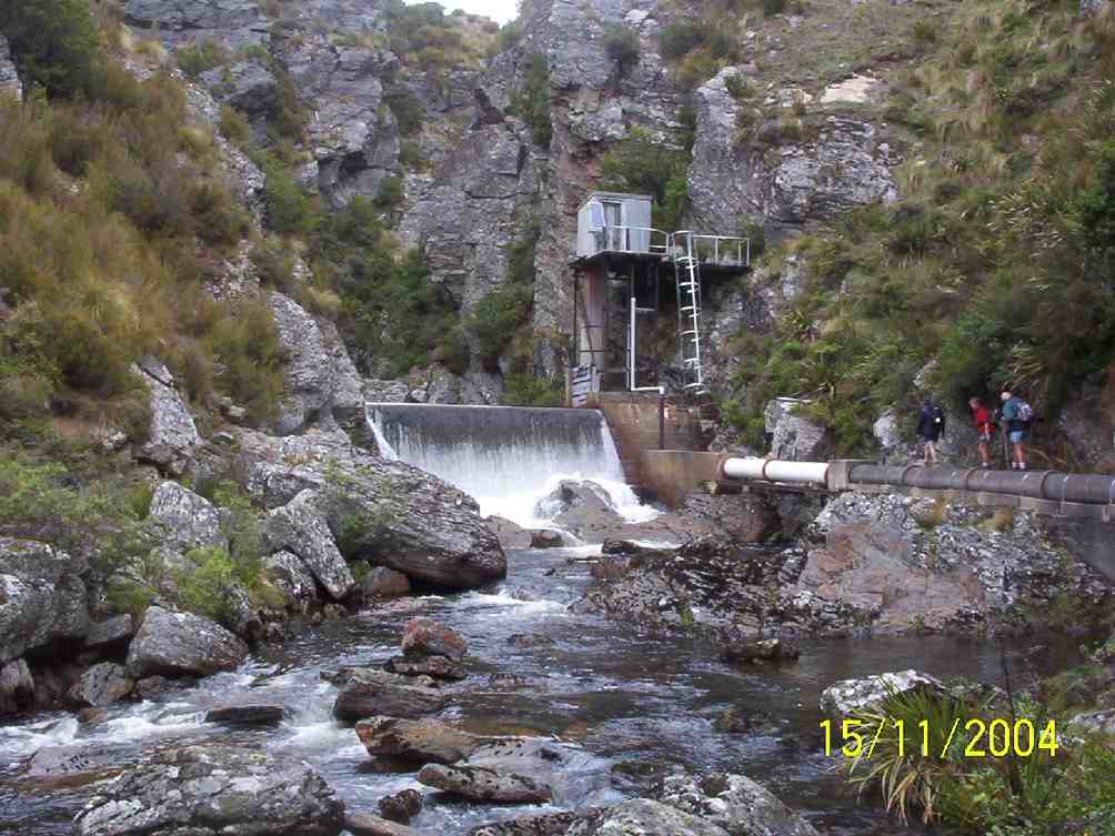
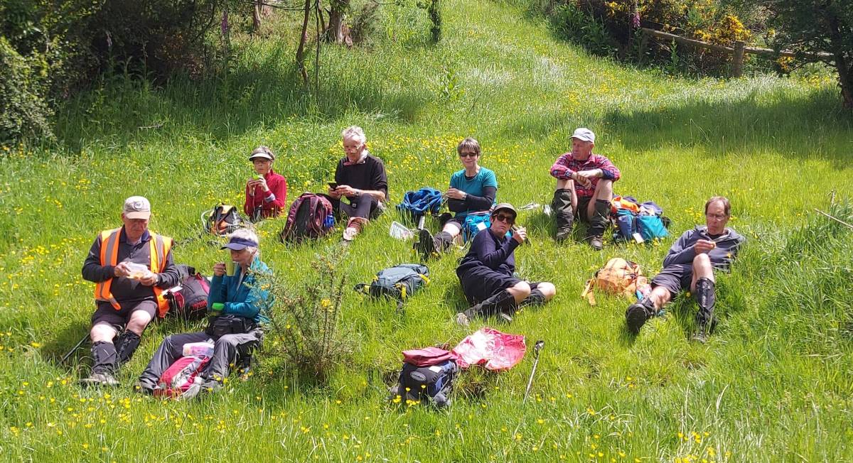
19. Welsh’s Road, Old Farm, Deep Stream Weir. Grade 3 Leaders: Lyn and Di
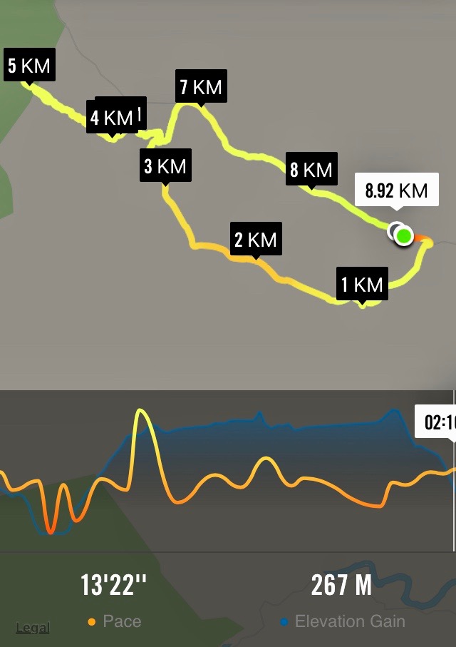
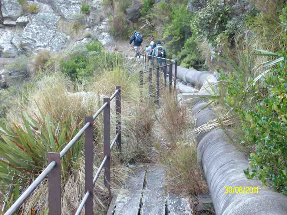
13 of us set off for the Pipeline, which is just off the old Dunstan trail on Rocklands Station.
We had morning tea under the pine trees where we parked the vehicles. It was a tad cold but we soon warmed up with the walk over the farmland to the pipeline.
Up and up over farmland. Caption and photo PamThe countryside is getting more rugged Caption and photo MarijkeTramping nirvana, easy level dry track, marvellous views Caption and photo John
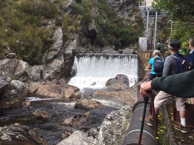
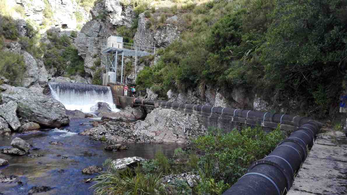
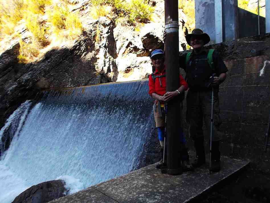
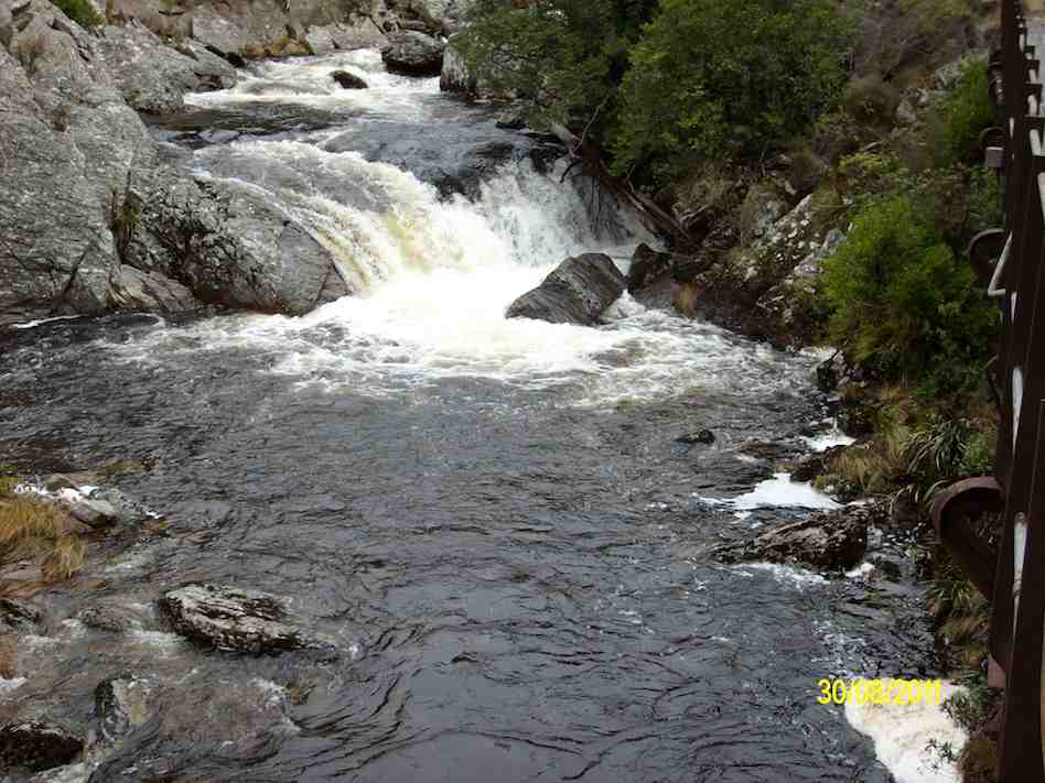
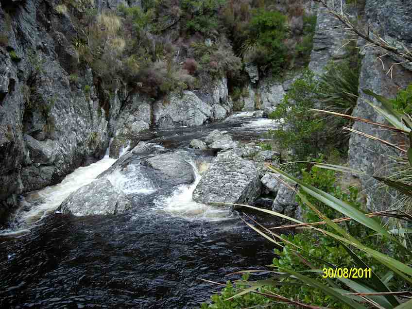
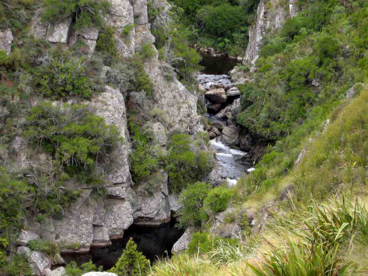
It was stunning scenery walking to the Weir and back.
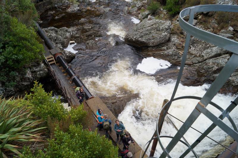
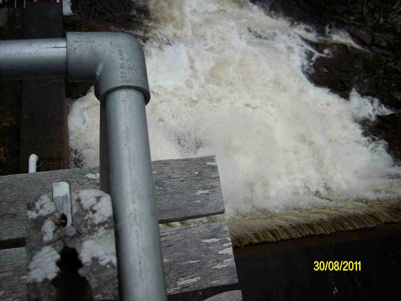
Happy Trampers. Caption and photo JohnPump house and Weir. Caption and photo PamExploring the engineering feat, the Deep Stream Weir. Caption and photo JohnCan you spot the hut? Caption and photo Marijke
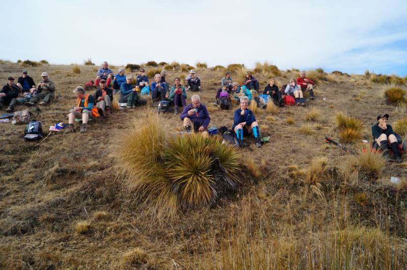
We had lunch in the sun out of the gorge with more room to spread out.
Refuelling. (Pipeline track to the weir in the background). Caption and photo Pam
Then took the road back to the cars. It was 8.84ks according to my phone.
Some finished the day with a cuppa at the Wobbly Goat. Another great day out.
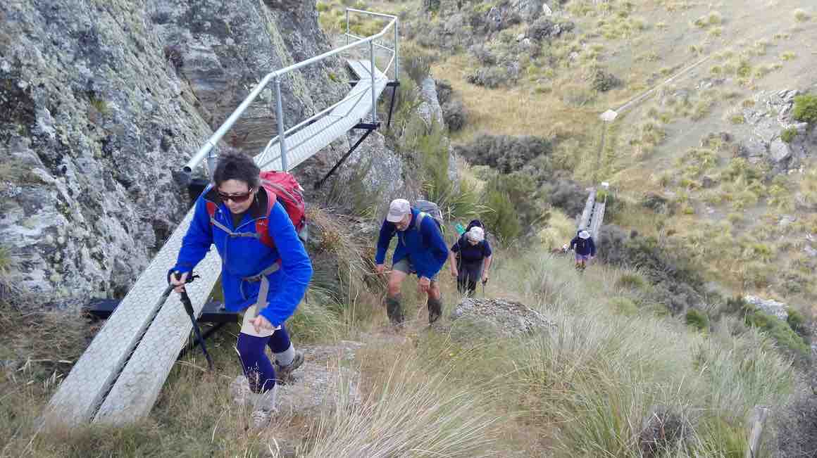
18. 17/08/2022 Trampers. Deep Creek Pipeline. 3.5 $10. Barbara Shackell & Judy Dennison
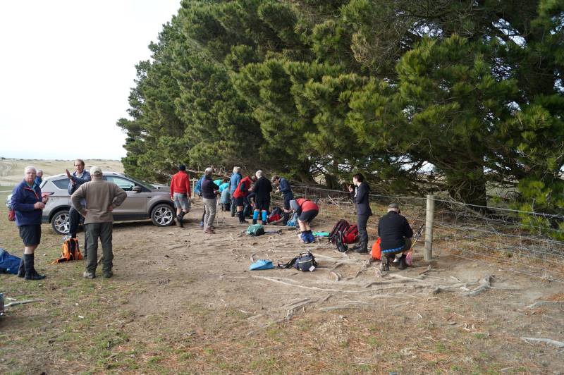
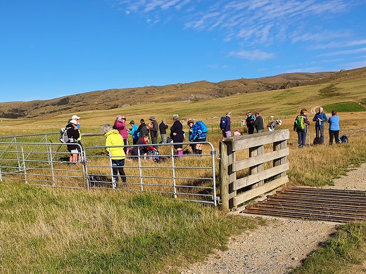
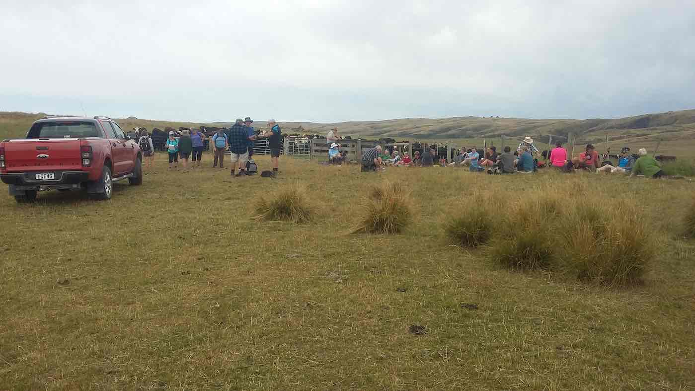
On a foggy old Wednesday morning, with the leader’s phone app threatening rain, 26 trampers met at the rugby grounds, sorted themselves into what appropriate vehicles were available and headed off at 9.30am sharp. A rearrangement of seating occurred when a couple of vehicles joined us at Outram, then again at Clark’s Junction with the addition of Heather’s vehicle, waiting for us at the turn off to Old Dunstan Road (ODR). We regrouped at Rocklands Station gateway, at which point the ODR was locked, and travelled in convoy through the farmyard, between buildings, up the hill and back onto ODR. Some 5km further along, two cars were left at the gateway to the Te Papanui Conservation Park, passengers rearranged again, with a couple of them heading off on foot to our final parking destination two kms further on. Morning tea was had in the shelter of a line of pines (although there was nothing to shelter from!) while a vehicle returned to collect the two pedestrians.
About to leave the cars (photo & caption John)
After morning tea the group set off for a couple of km on a comfortable uphill farm road, without stringing out too much at all. Good work Judy (tail-end Charlie!).
Nearly at the top (photo & caption Phil)
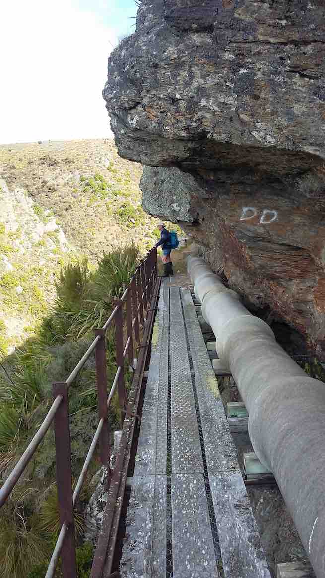
Entering the gate to the paddock containing the Deep Creek Gorge we followed a 4WD track to arrive at the pump station a little before noon. From there we picked up the pipeline track and followed it a few hundred metres around to a sunny spot which us allowed a view down into the gorge for a leisurely lunch.
Lunch in the sun (photo & caption John)
After lunch we crossed the first of a handful of boggy patches and continued along the pipeline track to the weir.
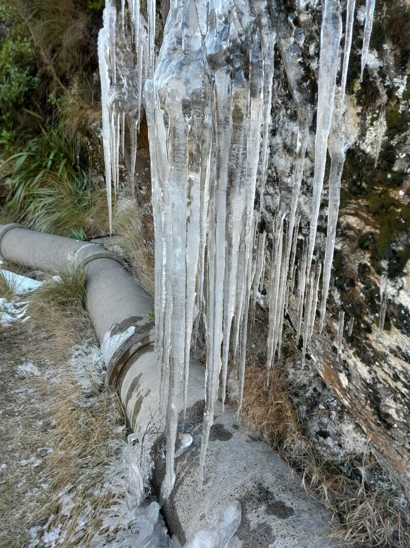
What a difference a week makes – the recce had us walking along snow covered tracks, observing animal tracks in the pristine snow, dodging icicles clinging to overhanging rock, frozen bogs, while the club tramp had virtually no snow visible, the bogs were boggy, but plants – some showing colour – were visible through the rocky cracks and crevices. The weir had a considerably greater flow of water than earlier in the week, presumably from the snow melt.
Pump house and weir (photo & caption Pam)
Some took advantage of the ladders to gain an elevated view of the weir.
Looking down from the top Weir platform (photo & caption John)
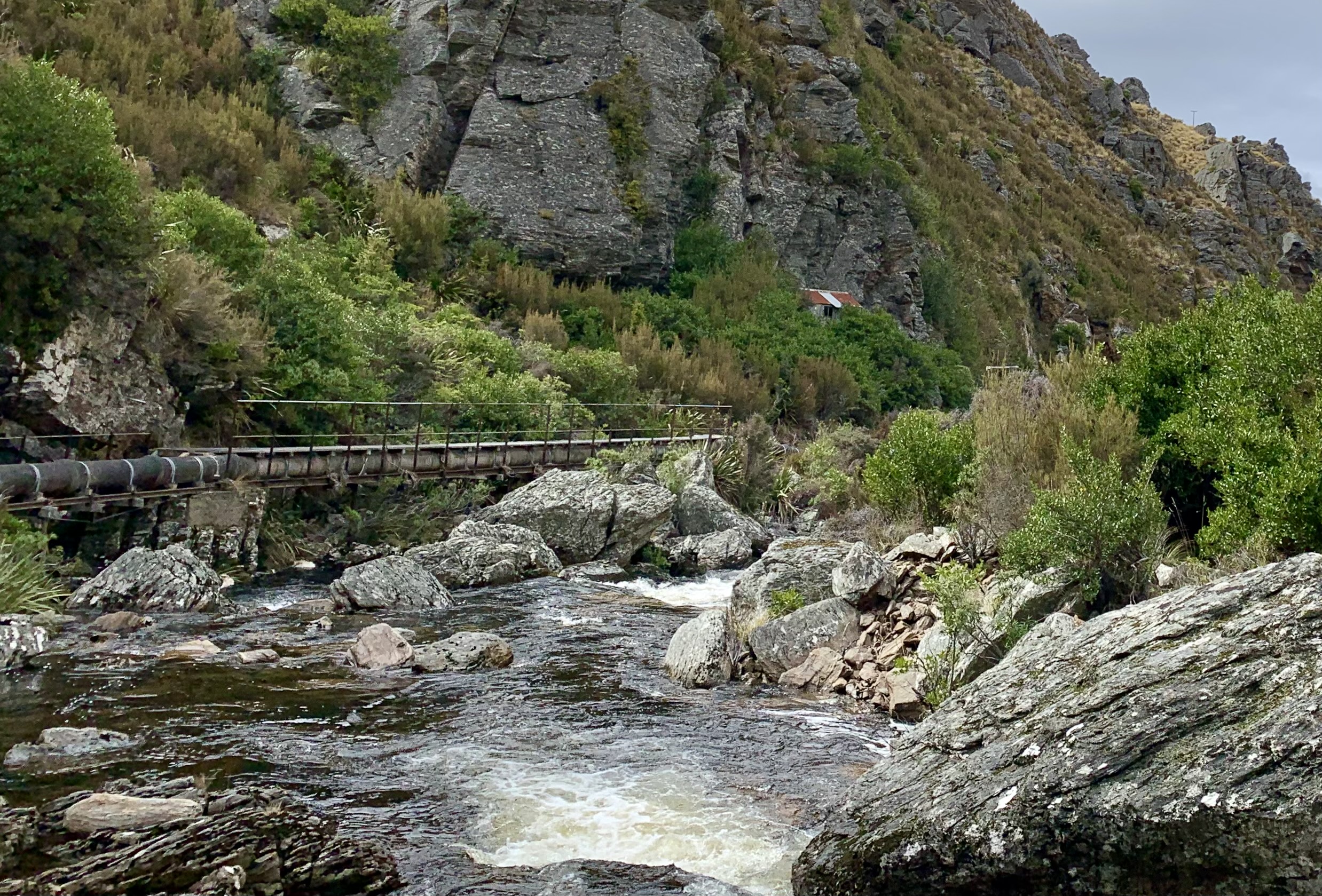
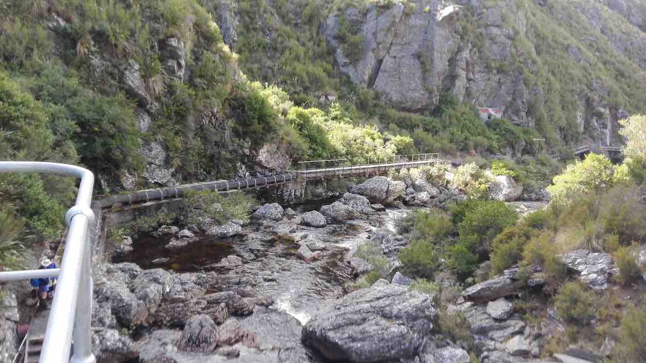
From that vantage point the pipe lineman’s hut was also visible and some members on the return walk, climbed up for a looksee at a very dilapidated “shelter”. While the hut is invisible from the track, its position is fortuitously marked by a final telegraph pole.
Spot the Hidden Lineman’s Hut from the Weir (photo & caption Marijke)
The return along the pipeline track provided a different perspective of the gorge and it didn’t take long to reach the place we’d had lunch and rather than follow the track the last couple of hundred metres around to the pump house, we took a shortcut, heading uphill, following no track, just the knowledge that we would reach the 4WD track over the brow, where we paused briefly.
Deep Creek View (photo & caption Helen)
A show of hands as we rested indicated that exactly half our number had never been into the gorge previously.
The farm road downhill to the vehicles was covered quickly. We agreed to meet at the Wobbly Goat for coffee, but in the event it was closing as we arrived, and we continued onto Wal’s.
Coffee at Wal’s (photo & caption Barbara)
My fears regarding the weather we would strike were unwarranted. Through the fog we were teased with a brief sighting of blue sky nearing Outram in the morning, but then re-entered the ground fog as we climbed up SH87. This cleared completely before Lee Stream and we had perfect weather for the rest of the day – intermittent sun, no wind or rain! A quick read of previous reports on this particular track leads the writer to believe we might have been lucky not to have suffered a debilitatingly cold wind!
How it was on the Recce (photo & caption Barbara)
Thanks to Rocklands station for permissions; to the drivers of vehicles able to manage the farm tracks, to those who met us away from the Rugby carpark for their punctuality, and everyone for the positive feedback on the day. I think it may be repeated!
Barbara
17. 18/03/2020 Hikers. Deep Creek Pipeline. M. Bob Mitchell and Mike Webb
28 Hikers set off in 8 cars from the car park in Mosgiel to rendezvous at the Clarks Junction pub before driving to the start of the walk. More than a few of the ladies eyes lit up when Bob announced that we would be having refreshments at the pub at the conclusion of the hike. It was good to see that it is not only us blokes that take drinking seriously.
After meeting in the pub car park we proceeded in convoy up the Old Dunstan Rd and found a suitable spot to park the cars away from any cattle that wanted to use them as back scratchers.
Photo and Caption Clive – “Te Papanui”
We started the walk at about 1000 and had morning smoko at the one of the gates/cattle stops.
Photo and Caption Clive – “Morning tea.”
Photo and Caption Clive – “Pump house at Deep Creek.”
From there it was a steady climb to some maintenance huts at the top of the gorge. The distance from the cars to the huts was 3km
Photo and Caption John – “Vast open country.”
.The weather was fine with great visibility and from the huts we could see the pipeline snaking its way around the gorge.
Photo and Caption Clive – “Into the gorge”
Photo and Caption Clive – “Deep Stream a long way down”
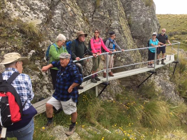
From the huts it was a steady climb down to find the track that leads to the pipeline. The track is approximately 2kms in length, and quite narrow in some places with railed walkways over some of the more challenging parts of the track. The views were quite spectacular and we were soon strung out in single file looking like porters on the Ho Chi Minh trail. Frequent photo stops were the order of the day.
We could hear a bit of bird song and one falcon and one hawk were observed flapping/souring overhead during the walk. One point of interest was on old hut set in the bush about 10m above and to the side of the pipeline not far from the tracks end. Probably accommodation for the guys laying the pipeline all those years ago.
Photo and Caption Clive – “Walking to dam along the river.”
After a brief halt and photo stop at the dam/weir at the end of the track we did an about turn, retraced our steps and eventually stopped for lunch in a nice sunny spot overlooking the gorge.
Photo and Caption Clive – “Pump house and dam”
Photo and Caption Clive _ “Back down the gorge.”Photo and Caption John – “Lunchtime always with a view.”
From there it was a short walk up to the huts and back down to the cars.
Photo and Caption Clive – “Back at the cars.”
We walked a total of 10km.
Bob had organised the publican at the Clarks Junction pub to lay on coffee, cakes and scones and also to open the bar early for those that wanted to support Speights. Glad to report that at least two unnamed ladies were seen with pints in their hands. Legends!
The rest obviously enjoyed the coffee and food as the shark like feeding frenzy at the counter was a sight to behold.
A good day was had by all and I can vouch that the Speights was up to its usual standard.
Mike
16. 9/1/2019. Deep Creek Gorge Pipeline. Leaders: Theresa and Clive.
Route map, Deep Creek railed walkway and weir, courtesy Ian.
31 Trampers, Hikers and Ramblers set out across the tussock of Te Papanui Conservation Park. It was an ideal day for a walk on the tops as there was high cloud keeping what can be a scorching sun off our backs. The 16 degree temperature was just right to get things started after the Christmas/New Year break. 13 of the participants had not been on the walk before and were looking forward to the gorge.
Morning tea
(Clive pic.)
found us being observed by a large herd of cows who seemed very interested in what we were all doing there.
After a twenty minute break we headed on up hill
(Clive pic.)
to the hut at the mouth of the gorge. Having made sure everyone was accounted for it was across the 40 ? or 41 ? bridges and board walks to the weir at the top of Deep Creek.
(Kevin pic.)(Clive pic.)(Kevin pic.)
This gorge is a feature that makes this walk so interesting. As an aside, the DoC blurb advises that there are over 500 species of native insects; plus a wide variety of plants and animals (including pigs and red deer), in the Te Papanui park.
Lunch was taken back at the mouth of the gorge, sheltering from the cool breeze that had sprung up. After lunch the Trampers headed off in a more Easterly directing to add a bit more distance to the completed walk. The hikers and ramblers headed back the way we had come in the morning. The hikers covered about 9.5 kms by the end of the day and were happy to sit down for afternoon tea at the Wobbly Goat about half an hour ahead of the more exercised Trampers group. The consensus was a ‘gorge’-ous days outing! – Clive
15. 26/4/2017. Deep Creek Gorge Pipeline . Leaders: Theresa and Arthur.
Nike app route map, courtesy Ian.
Leave the car park and go up SHWY 87 until Clarks Junction. Turn left onto Rocklands Road. Travel on excellent tar seal until you pass the Rocklands Station complex. Now you will be on gravel and at the beginning of the Old Dunstan Trail. Turn left off the Old Dunstan Trail and proceed on farm track for 2 kms. Park cars at the trees. Cross over farm land for a period of time — only down and up one gully,
Morning tea in gully, sheltered from a breeze. (Clive pic.)
going in a west / north direction towards the gorge. A gate in the middle of a paddock with a faint track going in the right direction. Two small newish huts with a solar powered panel on roof mark the beginning of the Gorge track. This is part of the Te Papanui Reserve. Traverse pipe line for approx 1/12- 2 kms.
New section at start, replacing broken single wooden planking. (Keith pic.)
The pipe line is suspended off the cliff high above the Gorge .The track is narrow on the pipe line …
(Clive pic.)
… but is easy and in the main flat. There are many foot bridges to cross. (An in-house challenge to count the number, caused differing results/) One dedicated tramper even ticked them off on a piece of paper .WHO are we to disagree!! A small dam was at the head of a very picturesque Deep Creek Gorge.
(Keith pic.)(Keith pic.)
Repeat the trip back to the road just beyond the huts. From then it is an easy road tramp back to the cars. 12 very happy trampers enjoyed a WOW 😳 kind of a day out. Approx 10 kms in length. Debrief and coffee at Outram. -Theresa.
14. 9/4/2014. Trampers. Deep Creek. (A replacekment for ‘The Gap’, programmed for the day, which would have turned out extremely muddle.)
The first thing we struck was hundreds of sheep by the trees where the cars normally park.
so we parked just before that spot and skirted the trees on the other side so as not to disturb the sheep. We left morning tea till we got to the old hut …
Morning tea in the sun (Heb pic and caption)
… sitting on some concrete pipes there. From there we followed the track taking us onto the pipeline …
Looking upstream toward the weir (Heb pic and caption)
… right up to the weir.
Ria and Eric at the Deep Stream Weir (Heb pic and caption)
About halfway back we enjoyed lunch in the sun sheltered in a gully with no wind. It was great. From the hut on the way out, we followed white pegs indicating the pipeline which helped us avoid getting our feet wet in a muddy creek. Then it was back to the cars. A great day for tramping. – Heb.
13. 31/8/2011. Trampers. Deep Creek.
GPS
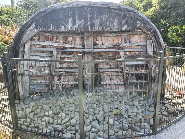
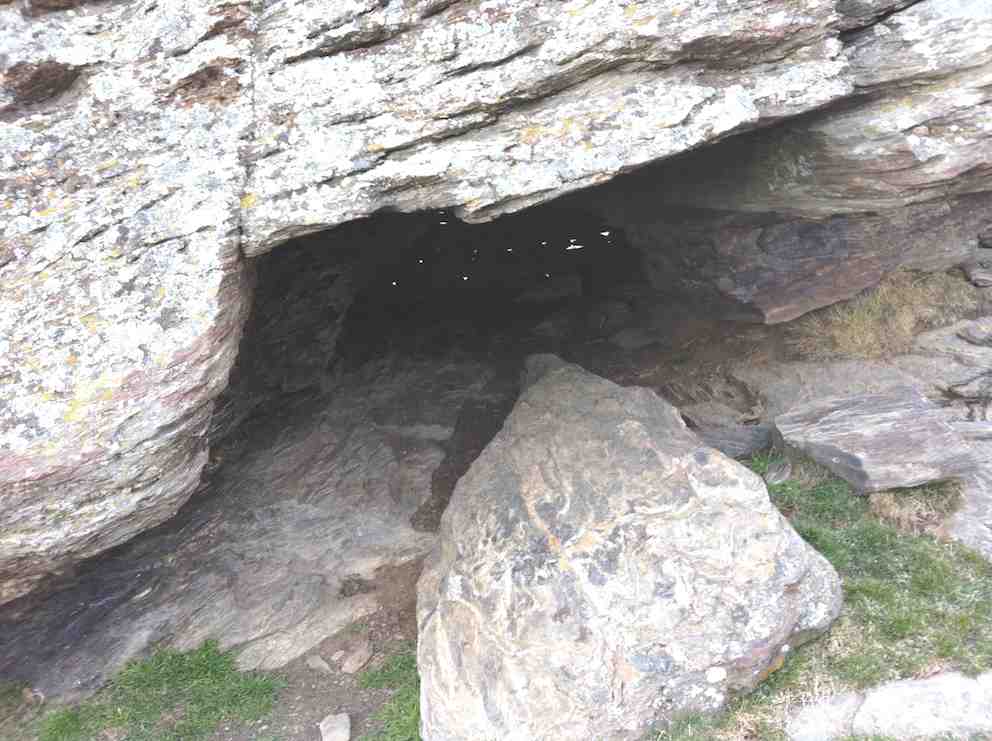
Five of us battled a strong wind on the tops, really icy and straight from the antarctic, to a late cuppa at the cave part way up the road from where we park the car. However the cave faced straight into the wind so we nestled behind it in the shelter of its lee.
The cave, with light chinks in the ‘bricked up’ rear.
Wrapped up in wind-breakers, gloves and woollen hats we struggled onward and upward to at last the crest of the slope and escape down into the shelter of Deep Creek’s gully and onto the walkway.
Looking downstream at start. (Ken pic and caption)
Ian, Linzi, Ria and Doug at start of creek track. (Ken pic and caption)
There was quite a lot of water in the creek. (Ken pic and caption)
Part of the track. (Ken pic and caption)
Doug, Ria, Linzi and Ian at the weir. (Ken pic and caption)
A large flow of water over the weir. (Ken in the background disappearing up the ladder.)
Creek above the weir. (Ken pic and caption)
Looking down on the weir from the control hut. (Ken pic and caption)
Looking back along the track from the control hut. (Ken pic and caption)
View of further downstream from the control hut. (Ken pic and caption)
On the way back out, we remained to lunch in the shelter of the gully before getting back out to expose ourselves to the wind again. We examined the old hut, little changed from last time, before making the return back to the car, this time thankfully with the wind behind us. – Ian.
12. 10/11/2010. Hikers. Deep Creek. Medium. Leaders: Evelyn C, Graham.
11. 12/3/2008 Hikers. Deep Creek. Medium. Leaders: Joyce S, Lesley G
The adventure for the 14 Hikers this week was a drive via Rocklands Station and the Dunstan Old Road, turning off to the Te Papanui Reserve. There was a cold S.W. wind that kept us in woolly hats for the day, even although we had sunshine as well. A walk up the hillside to a cave amongst the rocks was earmarked for coffee by Joyce S, our leader.
Then on to the gorge of Deep Creek, a tributary of Deep Stream, and the path following the pipe line to the weir.
Gorge in Deep Creek. Looking upstream at beginning of walkway.
Bob H told us about the water race used in the gold mining days and the pipeline to supplement the Dunedin City’s water supply, built in the 1930s. The farmland had been former tussock country but the gorge was not modified and still supported many alpine plants, including gentians in flower. We had several sightings of NZ Falcons, which are now considered to be diminishing in numbers. It was an exciting area to be hiking in,
as the river was a long way below us and the sides of the gorge very steep. Ian F was making mental notes for the retrieval of anyone who miscalculated their step, but fortunately the plan wasn’t needed. We were back at the cars by 2pm and home to Mosgiel 3pm. An exhilarating day. – Lesley G
10. 13/6/2007 Leaders: George, Abe
Snow at topDeep Creek in lower reaches.On pipeline. George, Leonie, Tash, Ria, Pat, Ian, Glenice, Arthur.Upper Deep Creek showing railed walkways.
9. 23/8/2006. Hikers. Deep Creek, Old Dunstan Road. Medium. Leaders: Val, Arthur & Barbara
8. 24/11/2004. Both. Deep Creek, Lammermoors. Leaders: Evelyn C, Ian, Peter and Wendy
Deep Creek Pipeline Track. Evelyn, Wendy, Peter.
Deep Creek Weir. Evelyn, Wendy, Peter
7. 17/4/2002. Alt. Rockland and Deep Creek. Medium. Leaders: Bob H, Bev H, Bev McI.
6. 21/10/1998. Deep Creek from Old Dunstan Trail. Leaders: George, Les S.
5. 24/3/1998. Deep Creek, Rocklands. Leaders: Shirley McN, Ria L, Bev H.
4. 15/10/1997.
3. 8/2/1995. Deep Creek from Old Dunstan Road. Easy. Leaders: Jack R, Bob H, Ted, Dot T.
2. 20/3/1991. Deep Creek Dam and Pipeline. Great viewing and interesting country. Easy+. Leaders: Dave and Jean, Margaret D, Janice.
1. 1/2/89. Deep Creek.
1/2/1989. “Pumping Station.” Deep Creek. (Ian pic, scanned from Peg Chisholm photo collection.)
Background.
The Deep Creek Water Scheme was built during the depression of the 30s.
The Pipeline is 58 years old and 64 km long.
The intake is 675m above sea level.
The catchment is 5420 hectares; mainly tussock with some grassland.
The steel pipeline, lined with bitumen, was in a bad state of repair by the 80s and the leaks were constantly plugged with tapered wooden plugs until it resembled a porcupine.
The authorities were eventually persuaded to renew the worst section, this being done with the aid of a helicopter in 1992. It is a useful supplement to Dunedin’s water supply.
The Pipeline is made of bitumen-lined steel excepting the first 1.4 km which was replaced in 1992 with concrete pipes.
Water quality is variable and often discoloured.
Over the 58 years the yield has dropped from 11,000 cubic metres to 6,800 cubic metres a day.
The water goes to Booth Road Treatment Station and Sullivans Dam.
Replacing the rest of the pipeline is estimated at $20,000,000 and would increase the flow to 17,000 cubic metres a day.
– From a hand-written record in the President’s file and supplemented with other data.
No. 87 on old hardcopy list of 113 club tramps. “Michelle’s Farm Outram Farm”.
11 km from car park.
Park under Outram Bridge. Contacts: Seek 3 permissions.
Proceed east side of Taieri River along gravel road to gravel pit. Bear right uphill to power lines. Follow generally along grass farm tracks to top of hill.
Landmarks: Trig marker on right; also obvious paper road between two fence lines; Long barn on right (good for lunch stop); large wool shed on top of hill straight ahead (this is still on Hyslop’s property).
Straight on access is to Taioma Road but we don’t usually go that far!
Plenty of mushrooms in April – take a bag!
15 intrepid trampers parked under the Outram bridge. As we walked along the Taieri river wind in the willows gave us warning of a breath-taking day!
On the track above the Taieri River. Photo & caption Pam
Morning tea with the pretty yellow flowers. Photo & caption John
After ascending a narrow track through scrub we made our way along a ridge on Craig Nichol’s property. Any conversation was ‘gone with the wind’. To quote Evel Knievel “ I love the feeling of fresh air on my face and wind blowing through my hair” – certainly true today!
Those windblown skies were impressive. Photo & caption Marijke
We decided not to go to the trig – the howling wind spoke to us and we found our way down to a pocket of native bush. The relative calm here was a welcome respite from the punishing wind on the hill top.
Lovely view of Mosgiel’s iconic Saddle. Photo & caption MarijkeComing down off the windy hilltop to the sheltered gully. Photo & caption PamLunch spot. Photo Jill
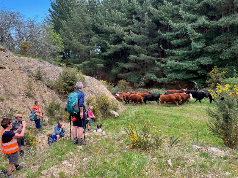
Walking roughly parallel to SHW 87 we headed back towards Outram. Thank you farmer Neil for herding a mob of cattle out of our path.
Keeping our distance for the herd. Photo & caption Pam
Throwing caution to the wind we walked through a Douglas fir plantation, then a large stand of eucalyptus – fortunately there were few recently dropped branches! The only reportable incident was Diane being blown backwards whilst pivoting on a gate – luckily she was caught by the two behind her ( I rue a missed photo opportunity!)
Beautiful spring scenery with cattle sheltering in the trees (very wise). Photo & caption Marijke Lower Neil. Photo & caption Pam Happiness is tramping with friends. Photo & caption Pam
A nice hill climb took us to wide track Craig recently had dug out back down to the Taieri river, and we were at the cars by 3.00 pm.
A great day out and many thanks to Julie McKenzie and Pam Cox for your assistance.
Distance walked – 13.5 km
Jill Reid
17 hikers left the West Taieri Rugby Club on another lovely Outram day. Had an enjoyable walk through Eleanore’s Willowfield Village then headed through Outram and over the Outram bridge.
Outram Bridge. Photo and caption Helen.
We walked beside the river to the start of Craig’s property where we stopped for morning tea.
We walked up the farm track which was a reasonably steep climb…
Group gathering. Photo and caption Helen
…and along the tops through a couple of paddocks where we sat on rocks overlooking the Taieri picking out many of the landmarks.
Lunchtine photo. Photo and caption Margreet
View over to Saddle Hill. Photo and caption Margreet.
Lunch at the top. Photo and caption Helen.
86 years old and up the top of the hill which they had never done before. Photo and caption Helen.
Then back down the hill overlooking Outram township and onto the Wobbly Goat for refreshments before heading back to cars.
It was a good 12k walk and well done to everyone.
Kathryn.
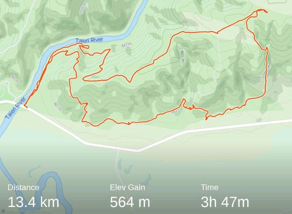
13. 17 November 2021. Trampers. Nichols Farm. M-H. Leaders: Peter Gillespie & Arthur Heenan
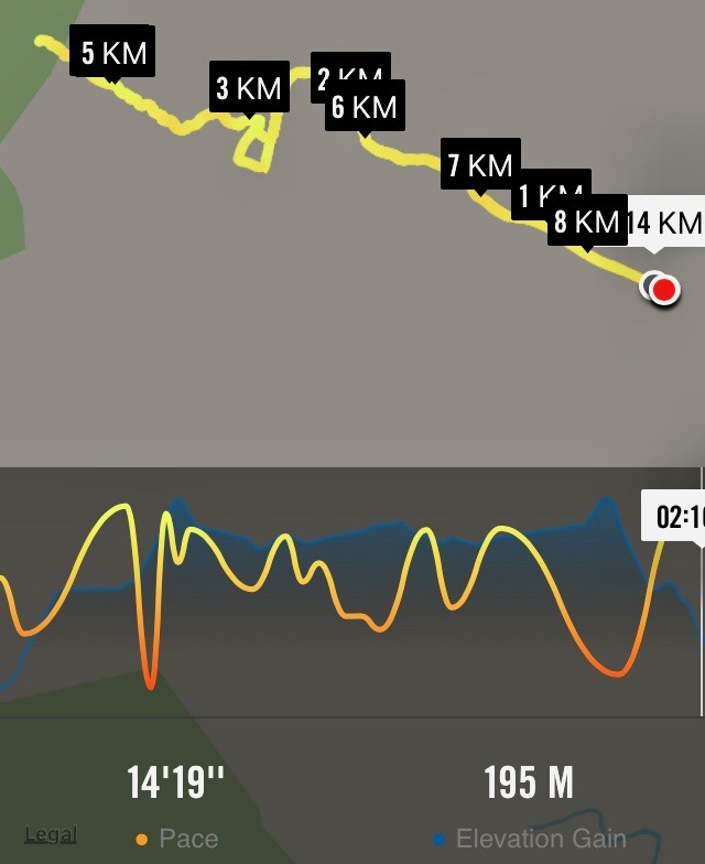
With a medium to hard tramp with a windy day prescribed it didn’t sound inviting, WRONG on nearly all counts. It was a medium hard tramp 13.42km elevation 564m, actual tramping time 3hrs 47min, (4hrs 45 min time lapse).
Strava screenshot by Phil
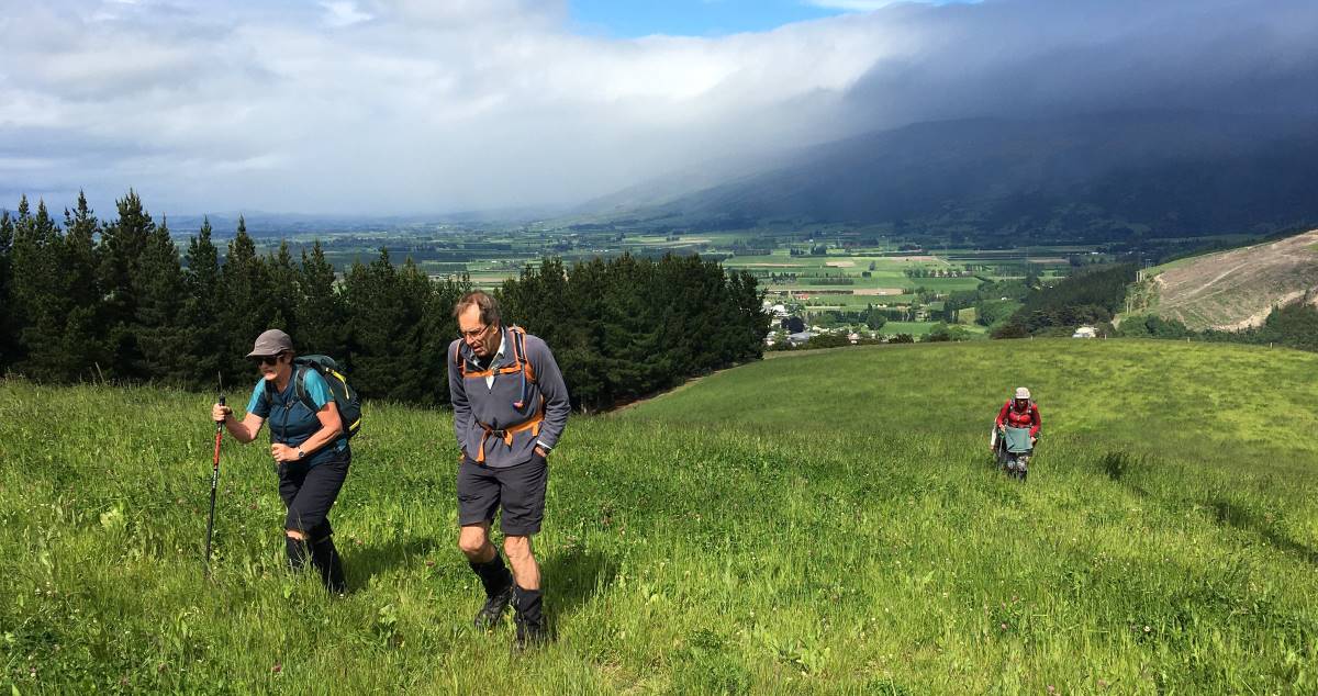
The group of nine was led by Peter Gillespie and Arthur Heenan. With a wind on our backs we enjoyed tramping in nice sunshine on the north side of the Taieri river. We started on a climb, up to an electricity pylon, where morning tea was enjoyed looking out on the northern view upstream. Many removing layers due to the heat of the sun.
Morning tea (caption & photo Helen)
After the break we continued up a 7deg track sheltered from wind we came to a great view south of the rain on the Maungatuas.
Uphill through lush grass – Outram in the background (caption & photo Helen)
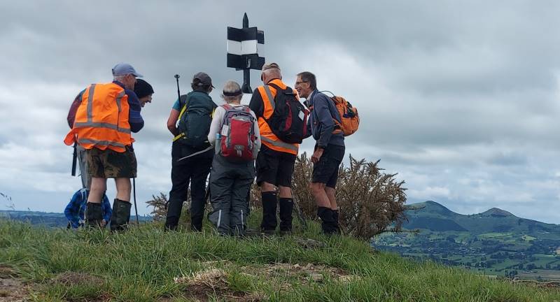
Onward, upward we continued toward the top where we came to a trig station, which Peter swore that the height was on, but no. There was some Maori “eh mutu tewanga” which we decided meant “564 metres high”.
Trig at the top (caption & photo Helen)
The view was sublime, of Saddle Hill, Mosgiel, lush farmlands, and hills of Flagstaff, Swampy, “magic”. We returned down the hill and found a track working through a forest and downhill…
Where’s the track Peter? (caption and photo Phil)
Beautiful forest (caption and photo Helen)
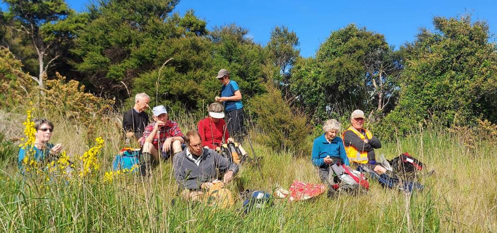
…then a gorse paddock where we found a nice sunny spot at the bottom, ideal for lunch.
Lunch (caption and photo Helen)
Jill required a ten minute kip, before we continued on through a 2nd forest track, past the lavender farm and some fertile farmland, before we hit the final hill. It was a decent climb, but the group got up it in good time.
Rain that didn’t get near us (caption and photo Helen)
We then returned, on a second track back down to river, watching for the odd sink holes. We had some windy spots, but the day was remembered for the views tramped, mostly in sun.
The group (caption & photo Helen)
A very enjoyable tramp, thanks leaders Peter & Arthur.
Then it was back to the Wooden Table for coffee & cake. Then it rained!
Cheers Phil Morris
12. 17/6/2020. Trampers. Nichols Farm. M. Leader: Gordon
From the carpark under the Outram Bridge 24 members started the walk beside the Taieri River in nice weather but with forecast for rain at 1.00pm. At the end of this track we turned off and headed up hill. Parts of this were quite steep but finally reached a nice flat spot for morning tea.
Photo and Caption Gordon – “Still slogging up hill”.
Photo and Caption Gordon – “Morning tea stop”Photo and Caption Gordon – “Hurrah finally levelling out.”
Heading uphill again after smoko we soon came out on to grass paddocks and continued on a gentle gradient to the cattle-yards at the top. from there walked a short distance before heading downhill on a steep ridge to the start of a small pine forest at the bottom, about ½ km from main road.
Photo and Caption Wendy – “Haven’t seen those people for a while!”
From there we walked a short distance before heading downhill on a steep ridge to the start of a small pine forest at the bottom, about ½ km from main road.
Photo and caption – “Wandering thru the trees”.
A pleasant walk through the trees to a farm track which we followed uphill to a stile where we crossed into Walmsley’s property. Followed cattle track down to gully then along foothills to lovely lunch spot with terrific views.
Photo and Caption John – “Comfortable lunch spot”.
Photo and Caption Gordon – “What a view”.
After lunch carried on along foothills before returning into forestry for assent to top after climbing through neighbours.
Photo and Caption John – “Panorama from the top”
Photo and Caption Helen – “Who’s watching who?”
After a “Pow Wow” at top, decision was made to head back on shorter route to cars which also allowed time for refreshments and catch up at Wobbly Goat. A good day to start off the tramping calendar after all the lock downs I really enjoyed it. Gordon.
11. 7/4/2019. Trampers. Nicols Farm. M. Leader: Gordon.
It was a cool start at the car park as we foregathered, but a typical beautiful autumnal day with lots of sunshine followed. Perfect for 15 Trampers to go and enjoy the outdoors.
Parking under the Outram Bridge wa a surprise for some, although a spot well known to our Outram members – from their younger days apparently.
Walking upstream beside the Taieri River through the willows we were welcomed by a great chorus of Bellbirds – wonderful. They were enjoying the day too.
It was an easy grade as we climbed various bulldozed tracks through the Manuka.
Long slog to top. (Gordon pic and caption.)
Morning tea was taken before we emerged onto a turnip paddock.
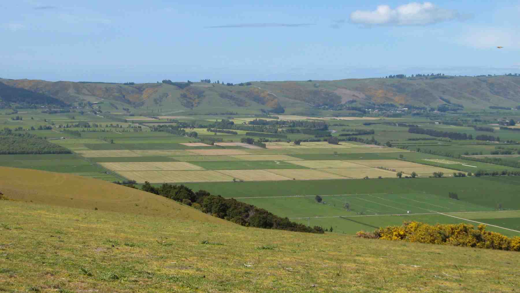
Still climbing gently on paddock and road we reached Trig I (360 metres). From this vantage point we had a superb view out over the Taieri Plain to enjoy.
Pointing out points of interest. (Gordon pic and caption.)
A short back track and then it was downhill on a farm road in the direction of S.H.87. Nearing the bottom we turned aside, and climbing a barbwire fence (the leader having thoughtfully fitted a pipe safety guard) …
The first fence obstacle. (Gordon pic and caption.)
Heading down into Walmsley’s farm gully. (Gordon pic and caption.)… found ourselves in a rough gorsey block.
Emerging once more onto open farmland it was time for a leisurely lunch in the sun, and still with a view to enjoy.
Afterwards we negotiated a paddock or two before entering an exotic forest to climb back up somewhat. In time we retained the turnip field to eventually finish the last leg back on our outward track.
Back to the cars at 2pm after walking over 13 km was good going.
To Outram where some visited the ice cream shop, others to the Hairy Goat – where all eventually congregated. And no one was in a hurry to go home. A day that was thoroughly enjoyed by all.
This report comes to you on behalf of Gordon (leader). – Art.
What fantastic days we have been having – the grass and weeds keep growing but time ‘in the hills ‘has been magic – things look a bit different either side of King’s Birthday!
Welcome: A warm welcome to Maryam Purvis, Carol-Anne Buchanan, Jan Palmer and Katherine Martin. It’s great to see you all enjoying your time with us.
At the last Committee meeting the winter trip programme was finalised and is well underway, remember 9.15am meet for 9.30am start after Kings Birthday. Fuel costs were assessed and held at the current level.
It’s always hard to get trip planning perfect but we need to stay focussed on what’s approved and not try and make too many changes. We have adapted the application for membership form for new members to stress the expectation that assistance to lead or be tail end charlie with trips is critical to the growth of the club and that these responsibilities are not limited to a few. We appreciate that organising trips (and recces) comes easier to some but assistance is always at hand! And yes we acknowledge that others have done their share!
We again discussed the formalisation of the ramblers group but decided to leave things as they are – we stay open to feedback on this. From time to time some members informally organise a walk through phone calls the night before or on the day; if they wish you could make use of the web team to send a note out the night before to let others know the where and when.
Speaking of the growth of the Club there will be changes at this years AGM. As most know John Gardiner and I are both standing down (I will become Immediate Past President and stay on the Committee) and Jenni Wright also wishes to step down. Please give your consideration to assisting the club and consider nominations for when we send out AGM papers in July. (Diary the AGM for Thursday 14 August).
Whilst we have a very good framework in the Club, but also keeping it informal, things can always be improved etc and not always done as they always have been! New blood brings new ideas.
Barbara will be organising a night for showing photos from trips members have undertaken – – around the world in an hour or two! If you would like to show some photos please let Barbara know so we can structure the night; each may have to have their top 20 photos or so……
as well Ross will take a short time to demonstrate techniques for photos that we send in to the web team following the weekly walks.
Also as seen a note from Jenni has highlighted the Mid Year lunch at Waihola Tavern on 2 July.
I know politics should not be discussed but the Committee agreed I should do a submission on a community trust proposal for Puketapu – the Palmerston Hill – to cease grazing and implement a restoration plan with clear access to the monument. To hand is a decision from the hearings committee of the Waitaki Council supporting and recommending to the full Council the restoration plan and reducing the grazing area. Also at very short notice I submitted to the DCC on the Tunnels Trust and the link between Wingatui and Abbotsford. Hopefully we’ll get the same posituve result! Happy to provide copies of the submissions on request.
We have had 4 track clearing days this past summer, a little down on the usual but a range of factors have limited our efforts – I’m catching up with the Green Hut Group shortly. Thanks to everyone who volunteered.
If you get the time have a quick refresh of the Track Grading document on the website. The gradings allocated are based on a range of factors as well as a recce could result in slightly different route – and grade from the last walk write up.
Note that track grades do not change because of the weather. The grade is the grade is the grade – regardless of hot and dry or wet and muddy.
There is a footnote in the document ‘Cautions
Although tracks are graded, any track may be more difficult on the day due to conditions like recent rain, deteriorating weather, or fallen trees.’
Lastly a wee reminder if a club plb (locator beacon) is used for a recce – (use of the 3rd plb held by Phil and Raewyn is preferred) then Clive Crossman should be emailed or txt’d ([email protected]/021866410) with the details of the recce. When a plb is activated the authorities contact Clive as our nominee to check the signal is in all probability genuine and real.
4. 13/09/2023. Trampers. Pine Hill, Mt Cargill. Grade 3.5, $5, 20km, Leaders: John Gardiner, Dave Roberts
Having already somewhat created a “rod for my own back”, in starting the Wizard of Oz theme in my tramp preamble last week, after some prompting, I’ll try to intertwine the “Wizard” theme into this report. Inevitably particularly pertinent to trampers, some yellow brick road references.
Getting ready to leave the cars (Photo & Caption John)
On an overcast morning with a chilly wind, 21 trampers, who arrived in 6 cars, set out at 10.00am, on the start of our tramp in Cowan Road. Like Dorothy at the beginning of her yellow brick road journey, most trampers had no idea where they would venture during the day.
– One interpretation of the “Wizard Fable” is that on life’s journey, tenacity, and perseverance in striving for a goal is a core value.
Following Dorothy to see what lies ahead (Photo & Caption Pam)
Following the previously described, muddy, gorse lined portal to what lay beneath, morning tea was enjoyed at 10.40am on the lower, wider, gravel road, at a sheltered spot.
About to have morning tea (Photo & Caption John)
– Some believe the gold colour of the yellow brick road and the green “Emerald City” represent the currency arguments the US experienced in the 1900’s.
Soon we were on the track leading down through the forest, with a pine needle carpet underfoot, and after following a fence line, we were soon on the gravel road to Sullivans Dam, arriving at 11.20am.
Tramping through the pines (Photo & Caption Pam)
-During the making of the “Wizard” movie, the snow scene contained fake asbestos based snow that left many on set chronically ill!
Lunch in the sun (Photo & Caption John)
Lunch was enjoyed at the beautiful Sullivans Dam, beginning a little early, at 11.50am, in a sheltered spot. We had reached our destination.
The shaft of light from above made the trout rise to Graeme’s delight (Photo & Caption Phil)
-In the Wizard story the Emerald City is a place to which Dorothy, the tin man, the lion, and the scarecrow journey in order to achieve their various dreams.
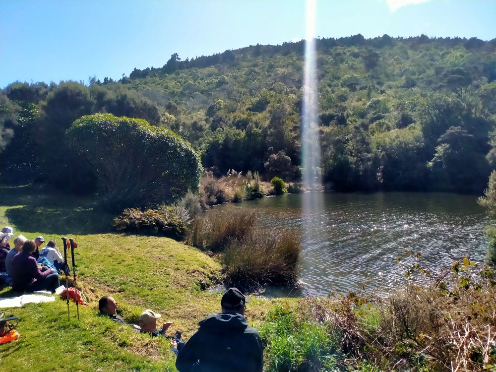
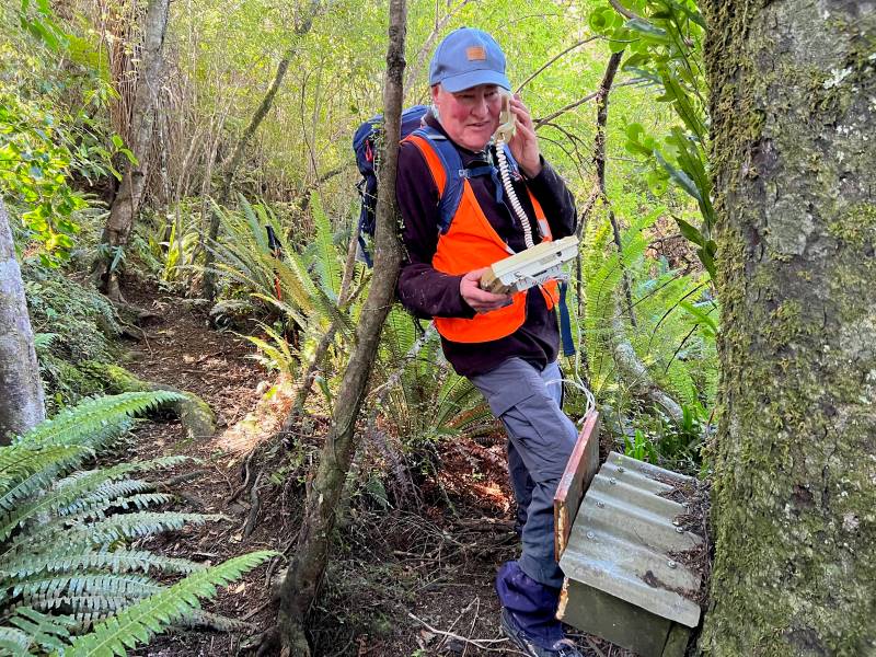
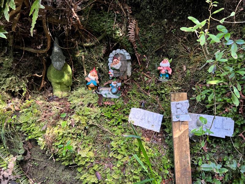
By 12.15pm we were on our way again, walking around the side of Sullivans Dam to the start of the “Cloud Forests of the Leith” track. This track, with it’s many boardwalk sections and beautiful bush (even a ‘bush telegraph’ and Gnome Grotto) adding yet more variety to our tramp.
No, I’m not having problems with my internet banking (Photo & Caption Pam)Creatures of the forest (Photo & Caption Pam)
-In the Wizard story the yellow brick road was at times very rough. The scarecrow often stumbled over the yellow bricks, which were very uneven, sometimes even broken, or missing altogether, leaving holes that dog Toto (a West Highland Terrier) and Dorothy jumped across or walked around.
Board walking (Photo & Caption Pam)
Arriving at the top of the Cloud Forests track by 1.20pm, we regrouped with a magnificent view north to Blueskin Bay and beyond, before following the gravel road to the base of the “portal” gorse lined track.
Regrouping (Photo & Caption Pam)Panorama – Blueskin Bay in the distance (Photo & Caption John)
On this section a navigational error by your’s truly resulted in everyone walking a bit further than necessary to a dead end part of the road. The greatest consequence of this being my embarrassment!
Are you sure we are going the right way (Photo & Caption Pam)
– In the Wizard story, Dorothy follows the yellow brick road, intending to find the Wizard, who would bestow on her the knowledge to achieve her goal, only to find that she had the answer within her all along.
Heading up the gorse lined final section of our tramp took us back to the cars by 2.30pm, having covered approx 8 km. A Grade 3 tramp.
Happy trampers (Photo & Caption Pam)
-So where was the yellow brick road? Some believe it is a brick road in Peekshill, New York, where author L.Frank Baum attended Peekshill Military Academy. Others believe it was inspired by a road paved in yellow bricks near Holland, Michigan where Baum spent many summers.
Afternoon tea was enjoyed at the Crocodile Cafe, Dunedin Botanic Garden, on what had developed into a mild , sunny day. As a footnote – I did apply and receive a permit to walk on the City Forests section of this tramp, only to receive a later email, stating that it wasn’t necessary if we stayed on the Escarpment or 3 Peaks tracks.
Special thanks to Dave Roberts for acting as tail end Charlie and Graeme Souter for his help with the rece.
Drive along Portsmouth Drive and turn left over the causeway and follow Portobello Road to Portobello township – approx. 19 kms. At Portobello township turn right onto Allans Beach Road to park at the Portobello Reserve..
The original plan was for 2 moles – one from Taiora Head and one at Aramoana but due to budget restraints only the one at Aramoana was constructed. The aim of the mole was to protect the harbour entrance from silting by directing the tidal flow to keep a channel open for ships.
Construction started in 1884. Wooden piles were driven into the seabed with a railway line being built on the top to cart rorck from a local quarry. This rock was continually dumped along the mole for 4 years. Convict labourers were originally used, changing to unemployed men in 1886.
The mole was not built to its full specified height. Due to this and other factors it was decided to rebuild the mole with more piles driven, more rock added and with it being heighten and extended in the 1920s. Between 1926 and 1945 steamer ships were scuttled to protect it from erosion. Some streets in the township are named after these ships.
Near the end of the 1950s concrete structures called tetrapods were placed at the end of the pole to protect it. These had to be reinforced with more rocks and asphalt to stop them being move around by the sea.
As we saw on our trip (10/9/2025) the mole requires ongoing upkeep to keep it being effective against the ravages of the sea.