20. 7 February 2024. Combined hikers and trampers. Aramoana – Heyward Point.
Hikers: Leaders Heather and Val Cayford
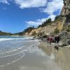
‘Pathway to the Sea” – 7th February 2024 at 8.45am on a grey overcast morning with slight drizzle 15 hikers left Peter Johnstone Park and arrived at the small coastal settlement of Aramoana at approx. 9.45am – a peaceful place with 260 permanent residences as of 27th January 2024. Continue reading “Heyward Point, Kaikai Beach, Whareakeake Road”
10. 31/01/2024 Mihiwaka/ Mount Kettle. Trampers Grade 4 Leaders: Pam and Diane
11 trampers left PJ Park at 8.45 and meet up with 5 Dunedin trampers on Borlases’s Road, Port Chalmers. We continued onto Blueskin road in misty weather which got thicker as we drove up to park 1km north from Cedar Farm Forest carpark (CFF) A car was left at CFF carpark to ferry drivers back to their cars at the end of tramp. Continue reading “Mihiwaka, Mount Kettle, and Cedar Farm”
No. 76 on old hardcopy list of 113 club tramps. “Coutts Gully Return Sawmill Rd Farm”. Livingstonia Park distance from car-park: 32 km.
23. 31/01/2024. Hikers Coutts Gully Road. Grade 3. Leaders: Bruce and Alex
After welcoming a new hiker, Peter Dodds, twenty-four hikers left Livingstonia Park, about 9.30 am, heading to the left (east) to the sand dune track that led out to the road by the bridge and then headed up Sawmill Road to have morning tea beside the implement shed on Alan Gorton’s farm.
14. 24/01/2024. Trampers. Ship at Anchor. Grade 4.5. $14. Leaders: Phil Keene/Gary Mort Lyn Keene.
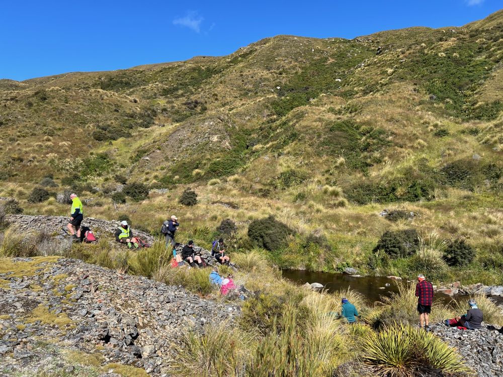
18 keen trampers turned up and left right on time at 8.30am in 4 vehicles, stopping briefly in Outram for tramper No 19, then travelled through the rolling uplands to above Lake Mahinerangi, before turning right up the El Dorado track, right to the end, through mobs of daggy sheep, the windfarm, the Blackrock Scientific Reserve and finally through the locked gates of DCC 3 Waters with the cameras keeping an eye. Ross was in charge of the key and maybe had a pinch of hypothermia by the time he was back in the car. Brrr would we find our riches at El Dorado?
Some Words From The Wise, Before We Set Off (Photo & Caption Ross)
It was 10am before we set off walking, the group happily forgoing morning tea until we arrived 45 minutes later at the Chinese Diggings situated on the east bank of Deep Stream which was up a little following rain the prior day.
Fuelling Up At Deep Stream Before Ascending The Hill Behind (Photo & Caption Pam)
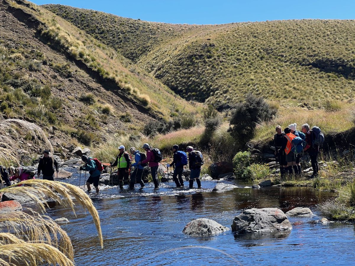
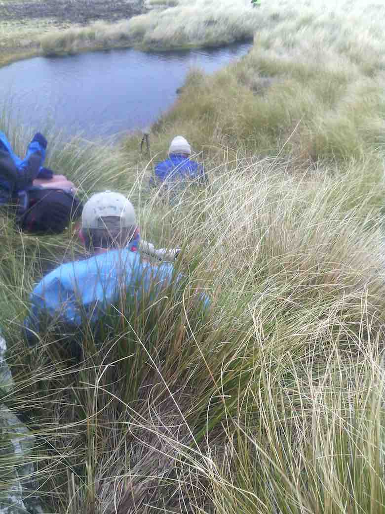
Mmm NZ Topo 50 is telling us we have to go west and will have to cross. The thought of this seemed to necessitate a continuous stream of walkers, single file, into the bushes. Thankfully they all came back and with a little help from our friends we all crossed, with wet feet and knees to the other side.
“ Follow The Leader” Across Deep Stream (Photo & Caption Pam)
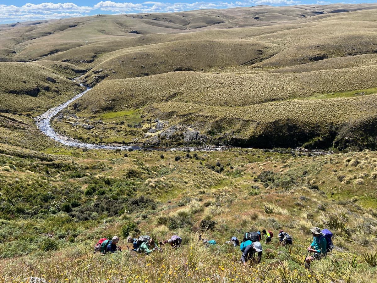
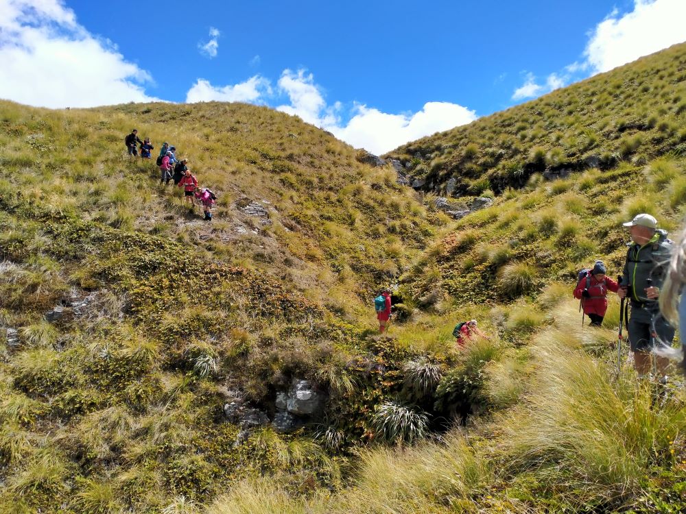
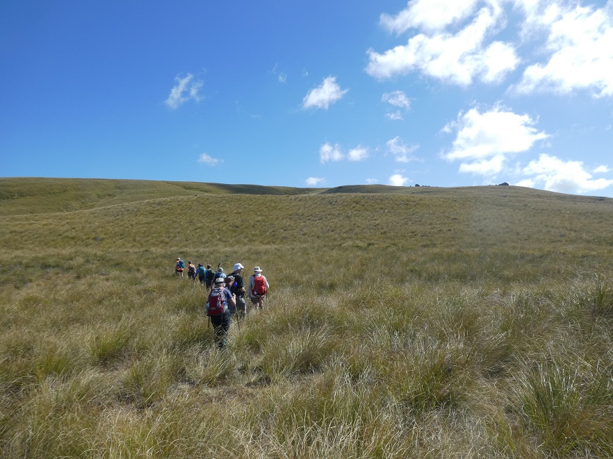
Thus began a steep ascent with a new pathway selected every few steps, not to mention the need for a breather at fairly short intervals!
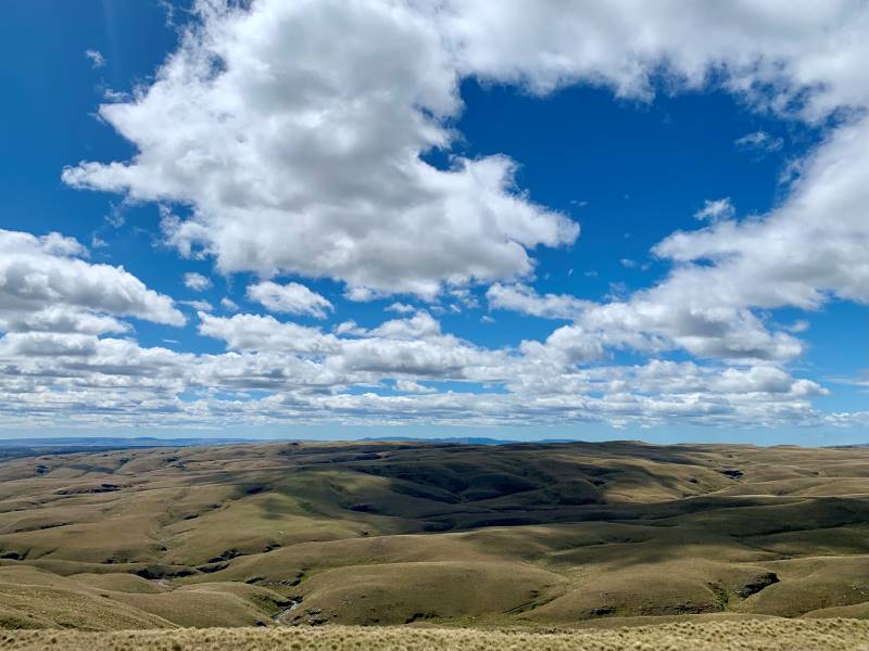
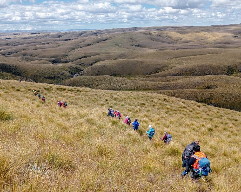
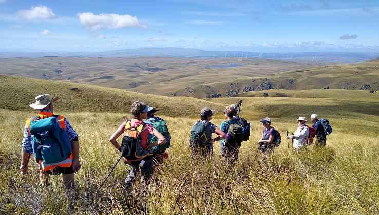
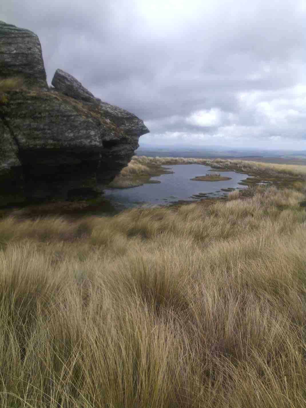
Scrambling Up The Lammermoore’s To Admire The Expansive Landscape (Photo & Caption Pam)A Big Sky With Cloud Shadows On The Land (Photo & Caption Marijke)Climbing Every Mountain (Photo & Caption Phil)
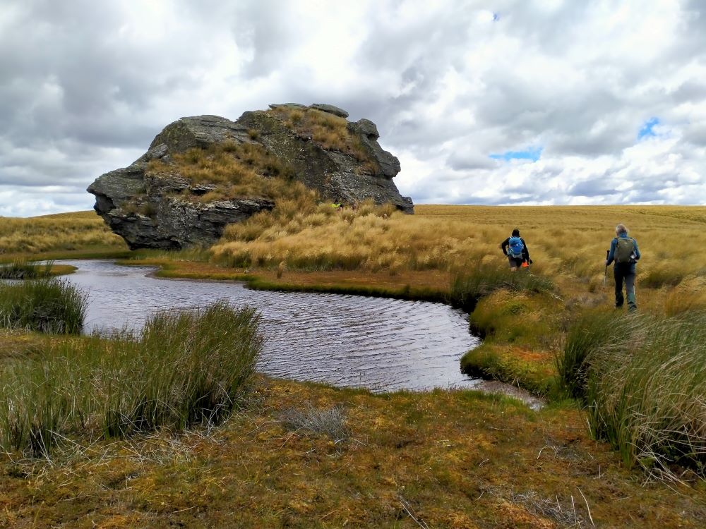
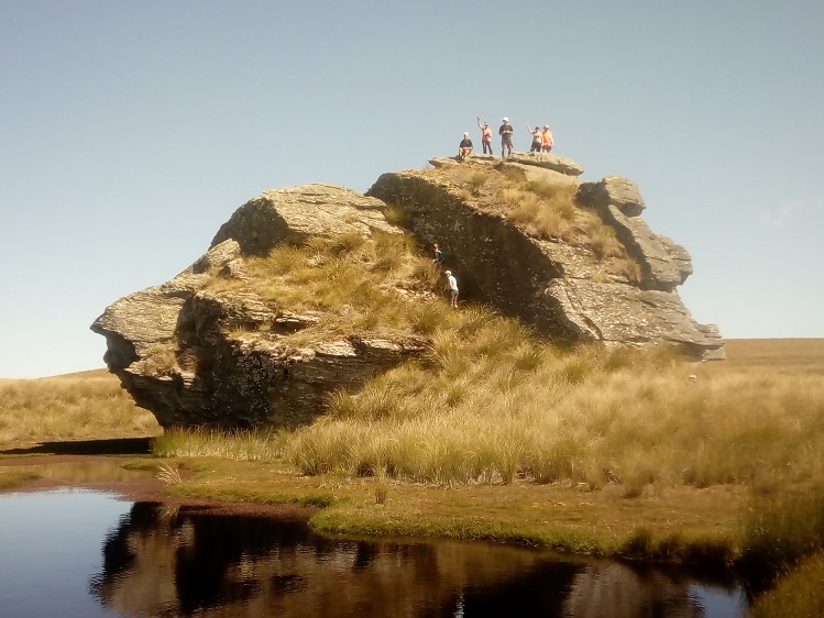
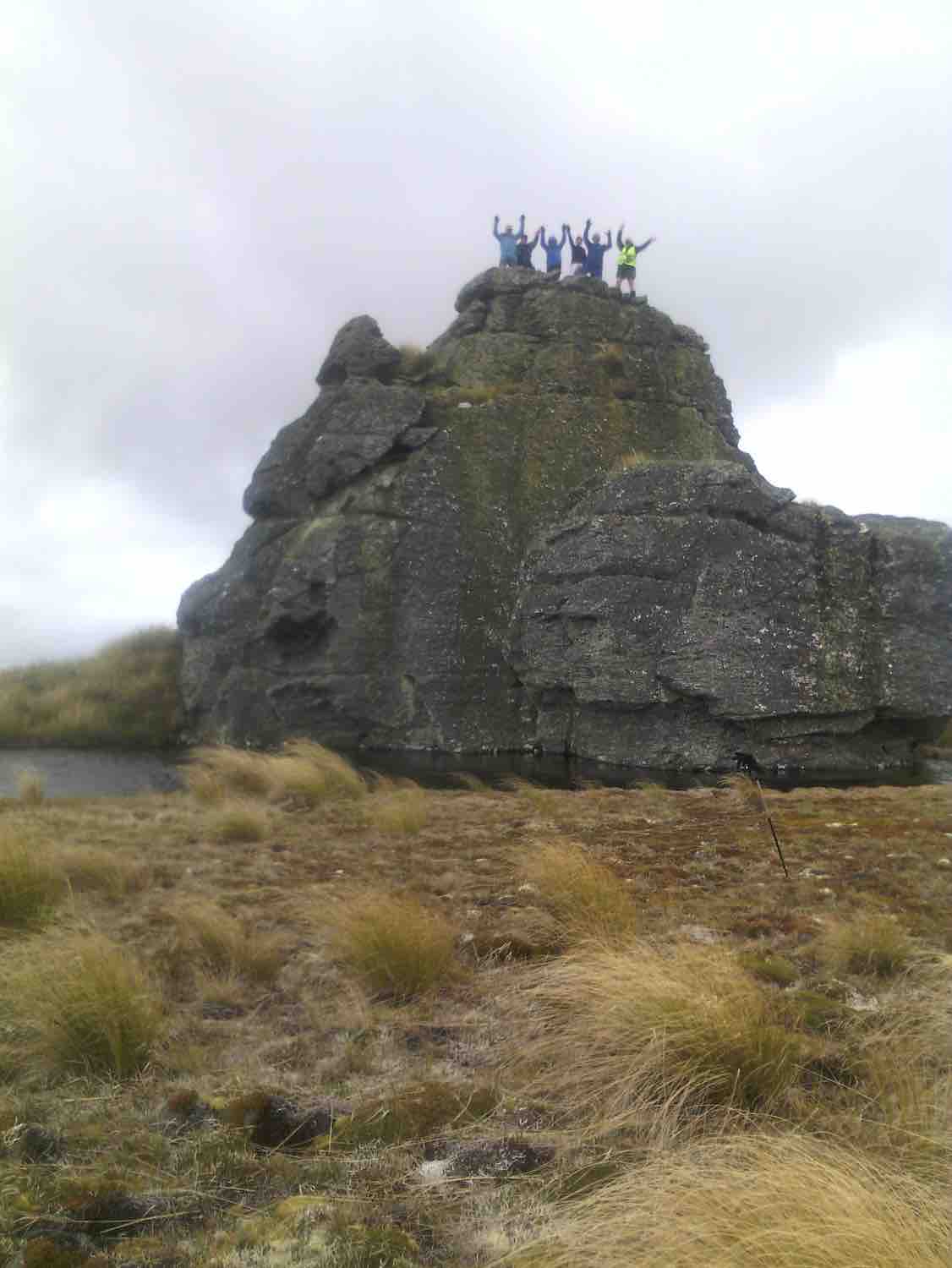
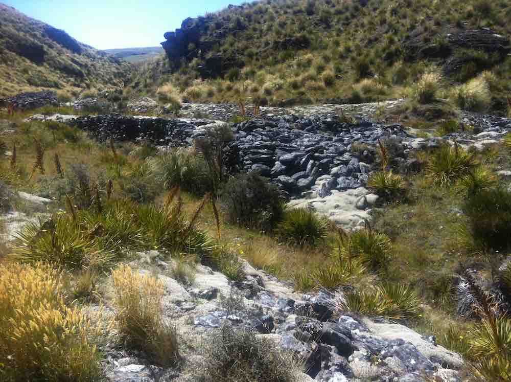
The ascent was followed by steady to steep ridge-line walk keeping to the true left of a stream, before crossing over nearly at the head, and finally over the last brow of a hill to arrive after 2 hours from morning tea, of fairly serious tramping, at the Ship at Anchor;
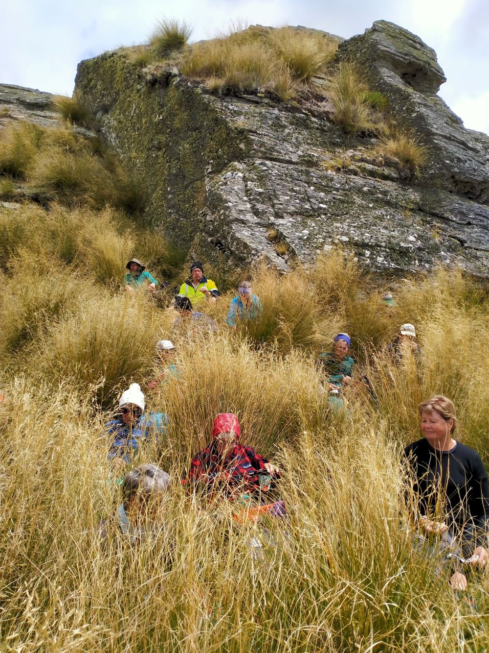
At Last The Ship At Anchor (Photo & Caption Phil)Lunch In The Lee, Sheltered By Tussock (Photo & Caption Phil)
thankfully we had not missed the boat and it provided good shelter along with the snow tussock from the fresh westerly that had been present all morning.
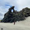
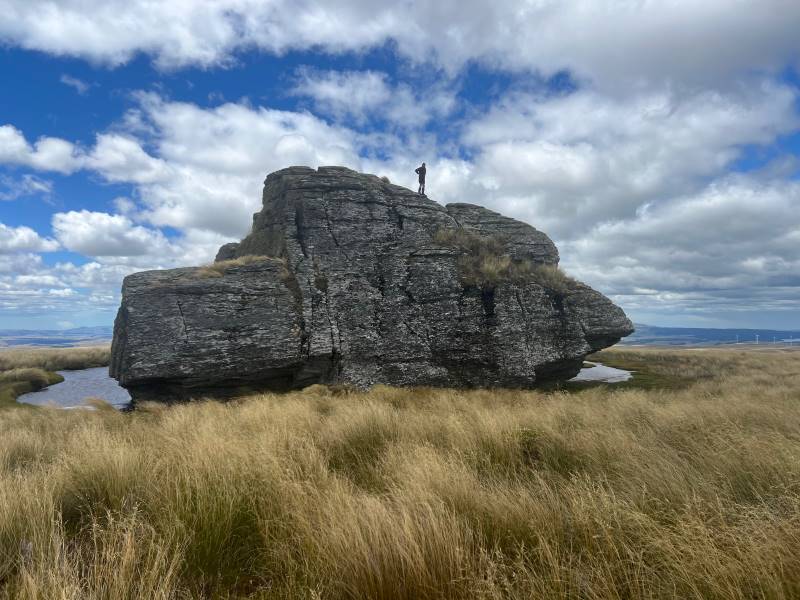
Appropriately Named “ Ship At Anchor “ (Photo & Caption Pam)
Our departure was not too long with those who had not previously been here circumnavigating the Ship and we all followed a course on the true right of the stream down another ridge-line, initially made ‘easy’ by a water course shaped I think by ancient shovels?
Heading Down The Highway (Photo & Caption Ross)
With the possibility of a precipice emerging in front our leader tacked left just in time onto another ridge that steeply descended towards a man made watercourse, scout Graham finding the appropriate gang plank onto the other side. It would be fair to say knees were now creaking as we traversed parallel with the contours dropping every now and then towards the crossing of Deep Stream. According to the leaders timepiece we took longer down than up, just like the Grand Olde Duke of York……oh dear!
Mmm Did It Take Longer To Go Down Than Up (Phot & Caption Phil)
If feet and knees were by now warm and dry they were wetted again and with all crossing safely we re-grouped and took off up the prairie back to the cars, this being quite a steady upland walk!
If You Start With Wet Feet You Might As Well Clean The Boots Again When You Finish, Gentlemen Abound (Photo & Caption Phil)
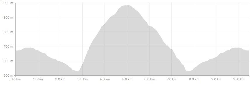
We departed paradise at 4.30pm arriving back in Mosgiel at 5.30pm. Rumour has it that the hydrotherapy pool has been busy since the trip, no wonder. The expansive and varied landscapes are so much more rewarding when set in such a remote and wild environment. Because of the access restrictions at the Weir this was the first time travel to the Ship at Anchor had been done this way. Distance 10.47km, elevation gain 661m, moving time 3:25;59, calories 1,016. And I’m sticking with grade 4.5.
Thanks to everyone for supporting each other so well.
Phil K
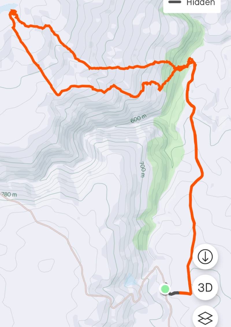
Ship at Anchor route (Screenshot Ross)
Ship At Anchor Profile (Screenshot Ross)
13. 17/2/2021. Trampers. Ship at Anchor. Leaders : Arthur Heenan and Gordon Grant.
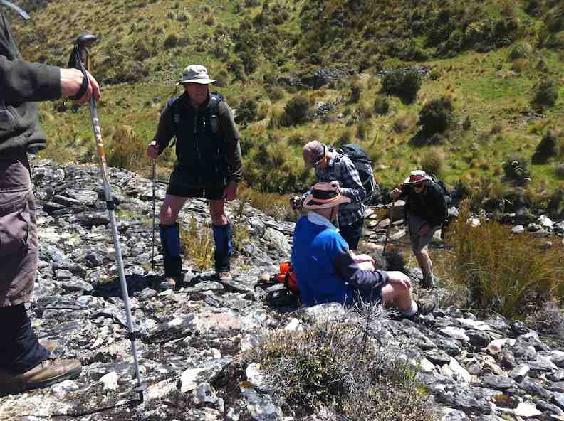
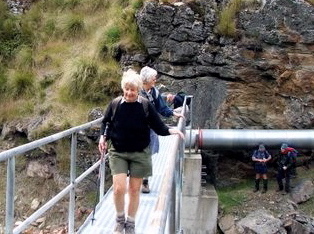
A great day was had by 10 trampers who did the Ship at Anchor loop tramp in glorious sunny weather with a slight breeze to cool fevered brows. After dropping off a car at the bottom of the hill we all drove up in the other 2 cars to above the weir on Deep Stream and had a quick cuppa. From there to the weir, then crossing the creek on the walk way and starting the trek up the fairly steep other side.
“Checking out the water intakes at Deep Stream.” – Photo and Caption Ross“The more gentle slopes.” – Photo and Caption Gordon.
Taking it slow & easy saw us up on a more gentle slope and reaching the Rock about 12.00am for lunch.
“Heading on to the tops.” – Photo and Caption Gordon“All Aboard!” – Photo and Caption Phil.
We were soon up and on our way back down which was good, until the very steep and rough bottom 200 hundred meters to the creek and Chinese Diggings.
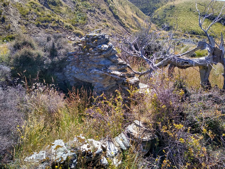
“Remains of a stone hut at Chinese gold workings.” – Photo and Caption Ross
On this stretch we saw two disturbed falcons soaring above, letting everybody know they were not happy and with this, to everyone’s excitement a stag took off across the gully and walked to the top of the hill and disappeared. We assumed the falcon’s squawking warned him. From the creek we walked back on a gentle sloped 4 wheel drive track to the car and the drivers went up and brought the other two cars back, then down to Outram for an icecream which everyone thought we deserved.
12. 30/11/2016. Trampers. Ship at Anchor. H. Leader: Arthur.
At the 3rd attempt, we finally did it! Today 7 trampers climbed up to the “Ship”, and then completed the circuit we had planned.
Southwest winds were forecast, so were expected, but it was a COLD WIND – there was obviously quite a wind chill factor in force!
Over an hour’s journey took us up past the Mahingerangi wind farm and into the “Black Rock Scientific Reserve”. We followed the “Eldorado Track” until we were on the hilltop just above the weir on Deep Stream. This was our day’s starting point, one car being taken back downhill for the end of day car shuttle.
It was a 10 minute walk down to the weir and tunnel inlet, but there was no shelter there from the cold wind, making morning tea a very brief affair.
But we had the privilege of watching two N.Z. falcons chasing away a pair of Harrier Hawks. They must have had a nest to protect. Their flight manoeuvres were superb.
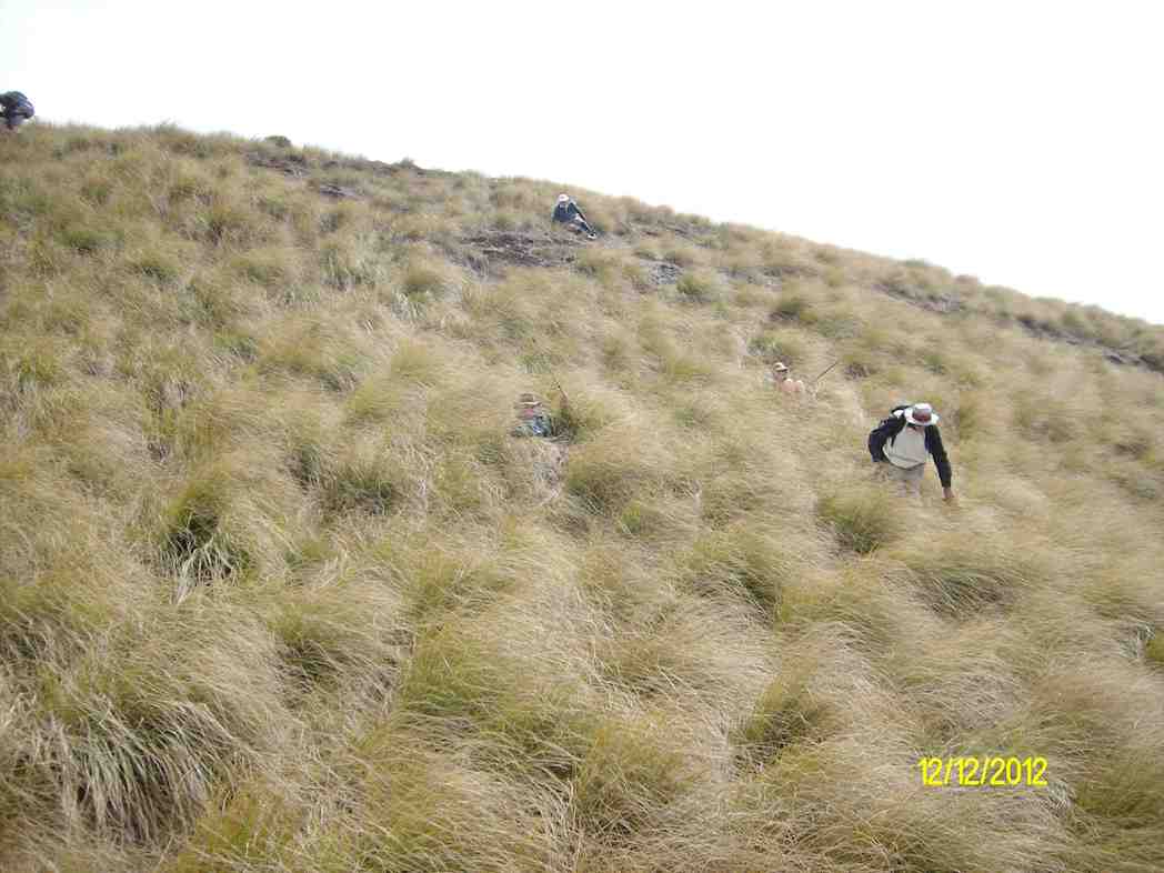
The next stage of our tramp was the most difficult – up, along, down to cross a rather difficult side stream, then up and up. After three quarters of an hour we were up on the open slope, much easier apart from the trackless tussock. We travelled in single file.
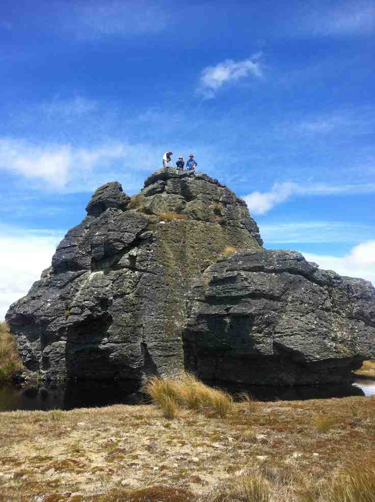
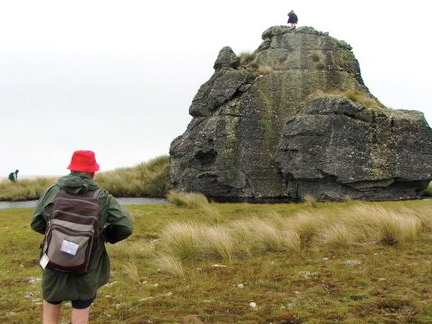
Further up, the leader came on our track made last February, following it for quite a distance. We passed the locality of our helicopter visitation of last time; and continuing on up slope a further 1 km we came to the “Ship at Anchor”.
Water around Ship at Anchor. (Helen pic and caption.)
All of us climbed up on top, well 6 did anyway, for a photo opportunity.
Group getting blown around on the top of Ship at Anchor Arthur Bruce Neil M Neil S Theresa and Jennifer. (Helen pic and caption.)
The wind was strong and cold on top. We didn’t linger.
Down in the shelter of the “Ship” we had our lunch.
Hunkering down for lunch. (Helen pic and caption.)
We noticed a large, dirty rain shower over towards Mauntagua, missing us. But the weather had changed, with a light shower of tiny hail (about 1 mm in diameter) for us. Even a few snowflakes were seen! What a contrast to the terrific heat we had to contend with there last summer.
Weighing anchor(?), we turned downhill for the next 3 km. The going was far easier now, the tussock quite small here, and out of the worst of the wind. Only the last few hundred metres down to the Chinese Gold Diggings were difficult, becoming steep and rough going. We took our time but a few knees were complaining.
We crossed Deep Stream safely, although it took time, with most keeping dry feet.
Crossing last lot of water. (Helen pic and caption.)
After a brief spell at the Gold Diggings, we were onto the last leg of the tramp – uphill on the 4WD track. Light skiffy rain showers had appeared by now, remaining till we had finished.
The two car drivers forged ahead now, and once back, collected the far away car to meet the group at the road.
One or two thoughts to finish with:-
The car shuttle worked very well.
In the cold conditions experienced, the tramp didn’t need to be any longer.
Coats (and more) had to be worn all day in the cold, but we were warm while moving.
Distance for the can can only be estimated at 12 km (no modern wonder to tell us).
Back to Outram for the day’s finale, as Judy D (not out today) had invited us in for a warm up at her log fire, and a hot drink. And choccy bikkies as a real treat, too.
Thanks, Judy – you are a real GEM. It had been a satisfying day’s tramp. – Art.
11. 3/2/2016. Both. Ship at Anchor attempt and Gold Tailings. Leaders: Arthur, Ian and Bob.
Trampers’ Report. Leader: Arthur.
Ship at Anchor Tramp – 3/2/16.
8 trampers (including 2 guests) travelled in convoy with the hiking group who were going to the Chinese diggings.
The cars’ access was up Eldorado road/track, and passing the Maninerangi Wind Farm, in to the Black Rock Scientific Reserve.
We walked for 10 minutes before stopping for morning tea by the water tunnel outlet.
10.30 a.m. Trampers Morning Tea. (Heb pic)
As part o the Mahinerangi Hydro Complex, a tunnel was built through the hill to divert some water from Deep Stream to end up in Lake Mahinerangi. This was completed in 1984.
We then followed the road (Eldorado Track?) up over the hill and down to where it ends at the weir and tunnel inlet end, on Deep Stream.
After a brief stop we then crossed the bridge and tackled the difficult hillside leading up onto the open tussock slope which leads up to the Ship at Anchor.
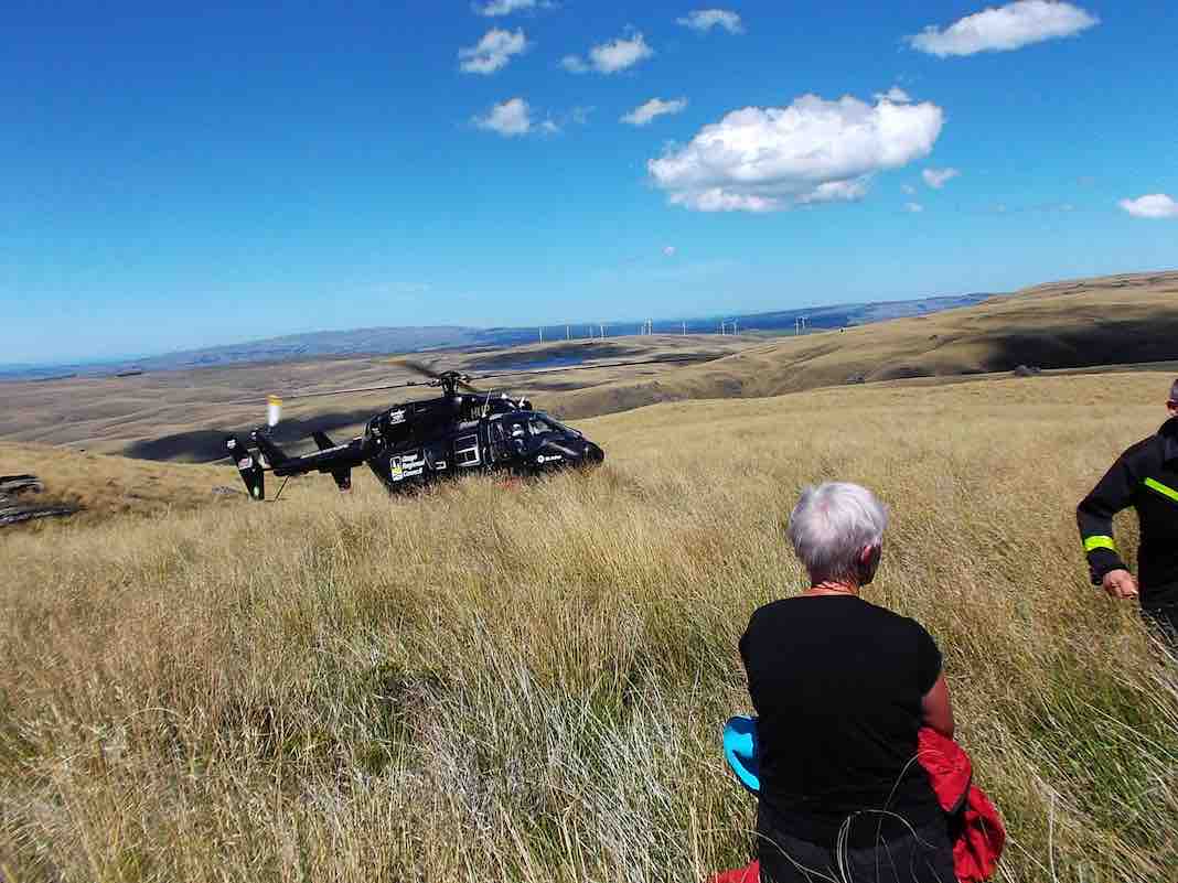
We stopped for lunch at 12.45 before continuing up the trackless tussock slope. One of our lady guests was feeling the heat (it was hot out in the sun by then) and at 2pm was in severe distress.
An immediate 111 call was made, and once the police had pinpointed our exact position, the rescue helicoper soon arrived …
About 2.50 p.m.Trampers’ helicopter rescue. (Heb pic)
…and transported her to hospital. Happily she soon recovered and went home that night.
The 7 remaining trampers then returned down hill back to the weir – too far behind time to continue.
After a 15 minute rest at the weir, the car drivers took a pleasant little stroll over the hill to bring the cars over to collect the rest of the group who had remained at the weir. All then returned safely to Mosgiel.
Thank you to our 2 nurses, Jill and Margreet, who rendered first aid, and thanks also to the whole group for the care and understanding shown by all.
And finally a very big thank you to the N.Z. Police. Also to the Otago Regional Rescue Helicopter and its Crew.
A final reflection. A motto for our club to adopt?:
****** SAFE TRAMPING IS NO ACCIDENT *****
– Arthur.
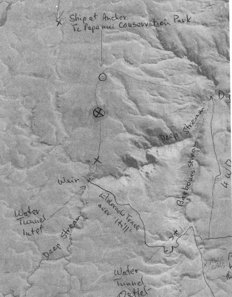
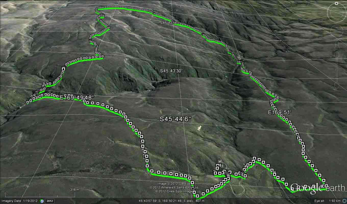
Map of the 2 treks, including the Trampers’ ‘happening’. Circled X marks helicopter pickup. The ‘x’ below it marks the lunch-stop, showing how slow progress had been.
Hikers’ Report. Leaders: Ian and Bob.
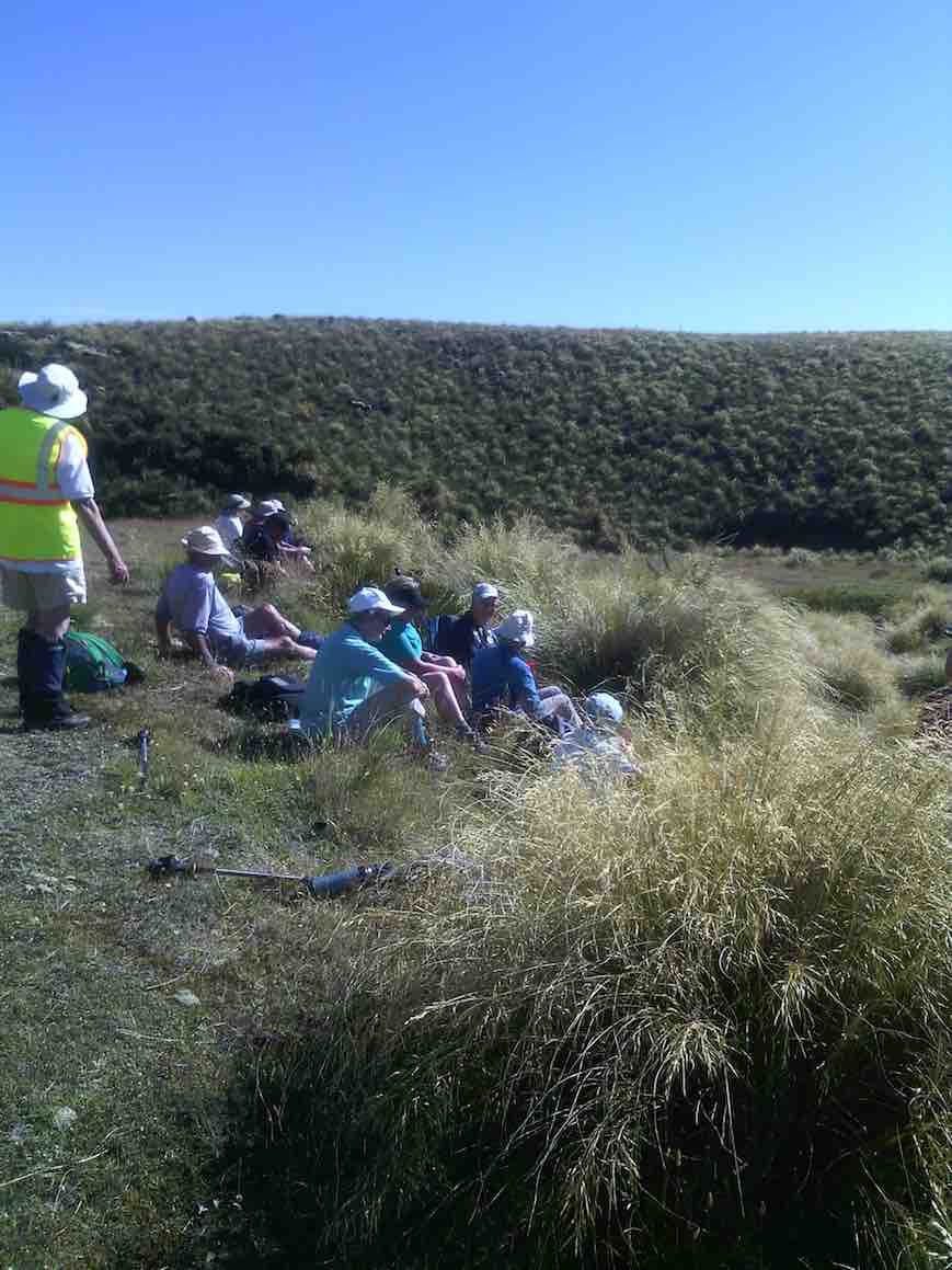
We hikers were 13 in three vehicles and were parked beside the trampers’ other two. The trampers set off immediately but our much shorter prospective journey allowed us a leisurely morning tea on a bank overlooking the cars.
Hikers Morning Tea. (Helen pic)
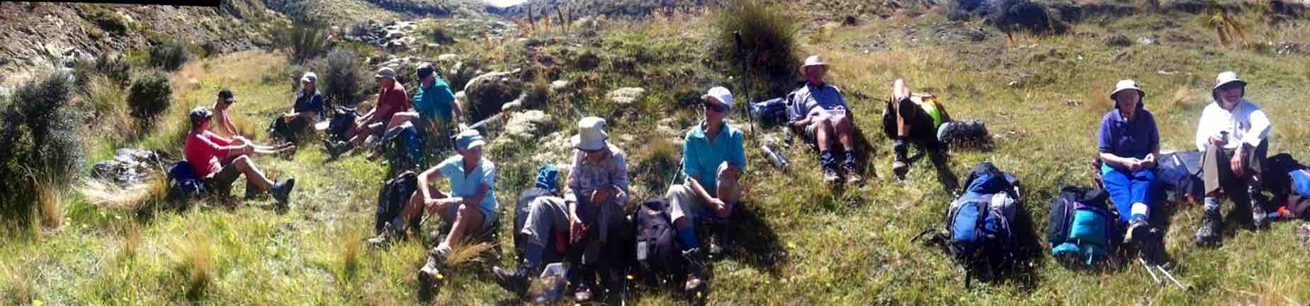
Then it was down the “Track” only a short way, then a sharp right turn up a steep rise to an T-junction where we regrouped. From there we set off in a strung-out line along the 4-5 km 4WD track through the tussock down to the diggings down the Deep Stream. We arrived there early, but what the heck. It’s hot. Sit down and enjoy a rest and an early lunch.
11.30 a.m. Hikers, Lunch, Diggings, Panorama.
This reporter was surprised few took the opportunity to do much exploration of the diggings.
Drainage channels at north end of diggings
We had arrived. It was hot. Trek accomplished. Eventually some started going back. Groups of 2 and 3 left to return up along the track we had earlier come down. No trouble about this. The 4WD track was clear. The route would be uphill this time. The heat was increasing. There need be no rush. So we strung out and Bob made his way to the front with Ian grateful to be at the back with the the last two slow ones. In fact so slow were we, that after Bob and the others had got back to the cars Bob still had time to return in his big 4WD before we had even reached the T-junction, and made light work of transporting us the rest of the way. Although all the others had of course accomplished the full distance, it must be said that there were not a few cases of light-headedness. Frequent drinks of water and good sun protection were certainly essential. There was no shade.
We were back at the cars – when? – about 2 p.m. Now for the area’s other highlights. But by car this time! We took the route the trampers had taken earlier, steeply up over the hill, visiting in turn the Water Tunnel Outlet …
Hikers at the far end of the Water tunnel exit. (Photo taken from beside the T.K.S. Sidey bronze plaque affixed above the tunnel’s exit.)
… and its inlet over the hill at the Weir. (We didn’t know it at the time, but had we looked back as were were driving back up the hill from the weir we might have caught sight of the trampers coming back from their aborted expedition. They saw our cars! And we hadn’t even noticed that big black helicopter! So close were our two groups! So distant! And of course the area is not cellphone territory.)
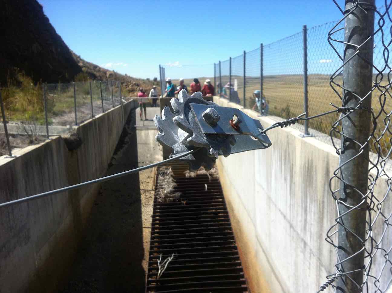
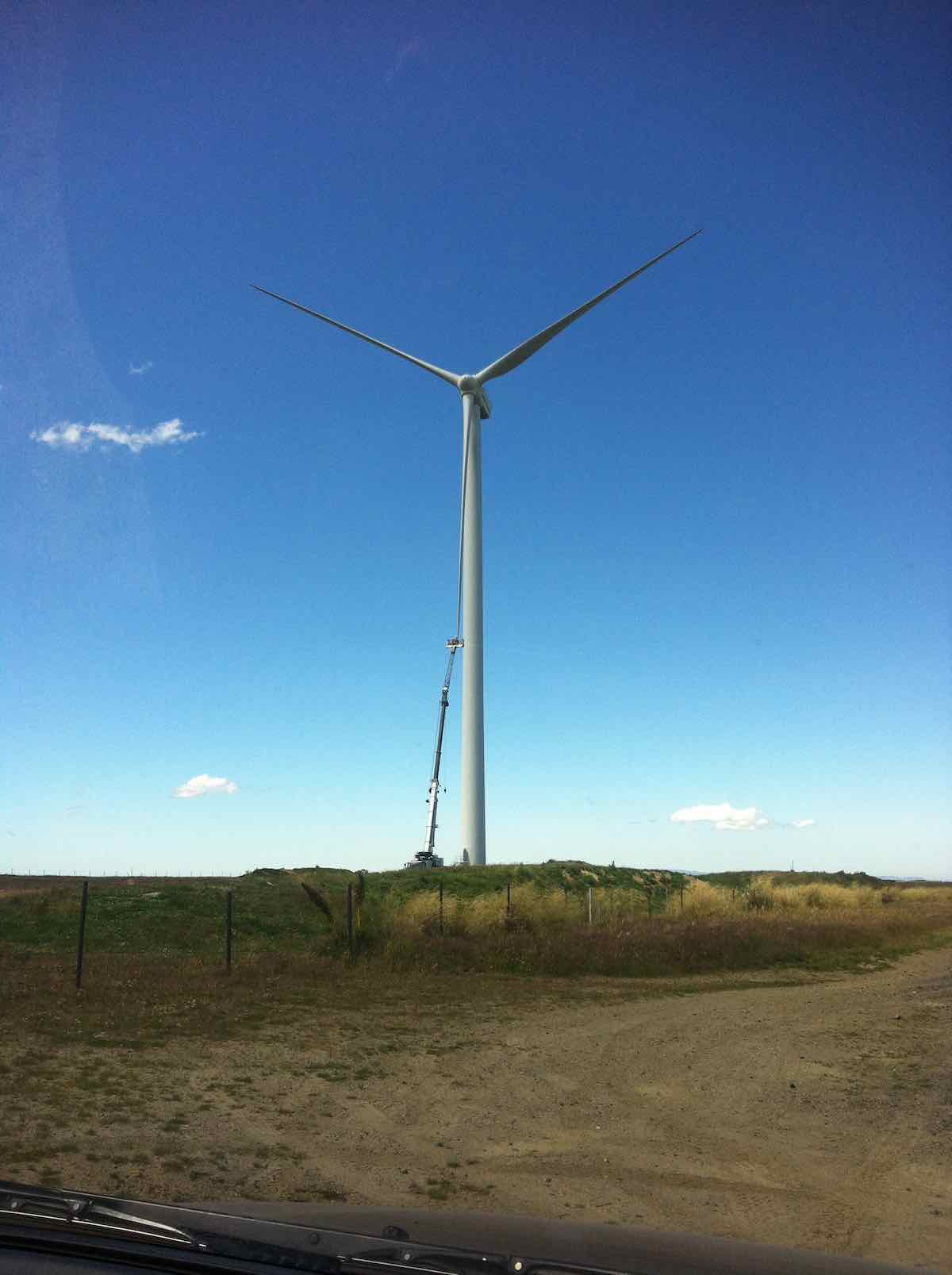
For us, it was simply back over the hill, blissfully unaware (and unable to know) of the critical state the trampers were in. Out through the Black Rock Scientific Reserve, through the two locked gates, and translocating from the 4WD Eldorado Track to the upgraded Trust-Power Mahinerangi Wind Farm’s Eldorado Road. (How ‘tracks’ can change over the Club’s history!) A wind turbine blade repair job alongside the ‘road’ dwarfed the technicians in their tiny cage. (Click a second time to enlarge the photo.)
Wind turbine blade getting attention.
We returned this time via the Lee Flat Road for a change. We were now on tar seal, and arriving at Outram made us feel we had returned to civilisation.
Hikers. Coffee at Outram. (Helen pic)
What a day to mark in the Club’s history! Well, all’s well that ends well. Sooner for us, and – well – eventually for the trampers. (There’s too many ‘wells’ in there somewhere) – Ian.
10. 25/2/2015. Trampers. Gold Tailings attempt.
The 4 of us set off to do the Ship at Anchor. When we got to the outlet tunnel at Barbours Creek with the rain and cold wind we decided to go back to the sign to the mining village. We set off up the track to the second sign, the same as down at the road. No clear indication on which way to go. We went down a FWD track, thinking this was the way but after a while I stopped and said this was not heading the right way, so we returned to the car with the wind and rain in our faces. The four of us decided to have lunch at Waipori Falls picnic area. Within five minutes it started to rain again so we headed into the car heading for home. We ended up eating our lunch when we got home. – Heb.
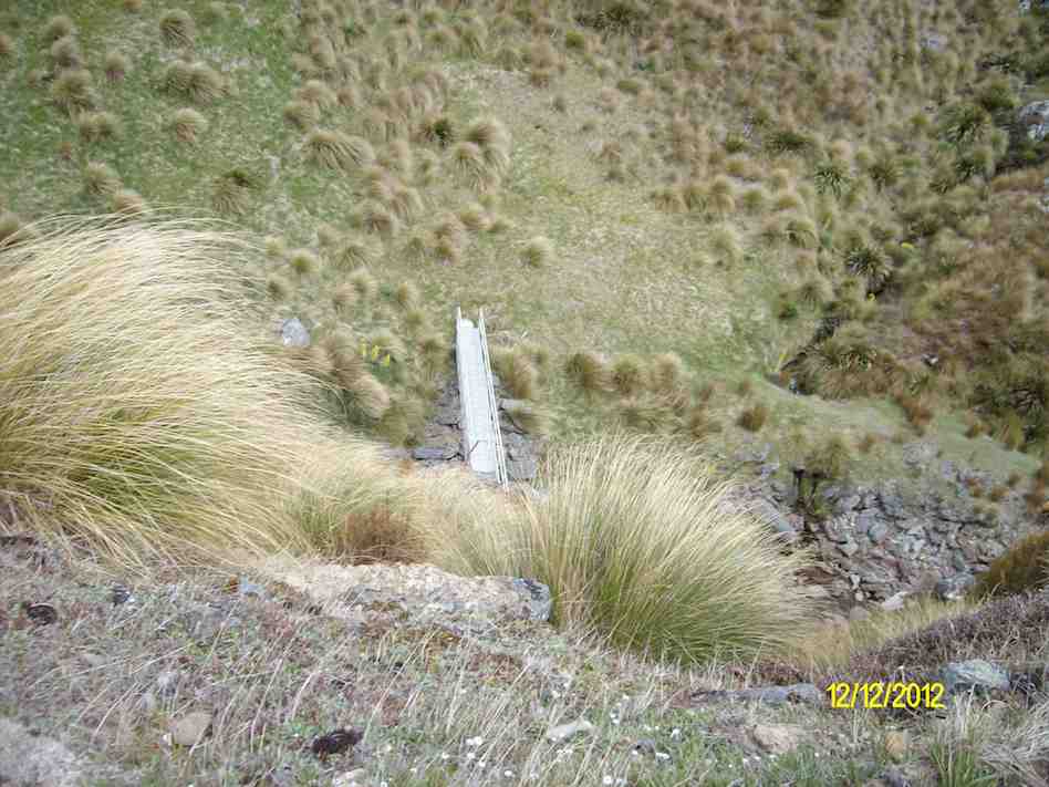
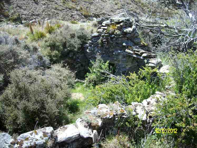
9. 12/12/2012. Trampers. Ship at Anchor. Deep Creek. Gold Tailings.
Tea break before climbing road to top of rise.View from top of rise down to foot bridge across stream.George, Eric and Heb on top of Ship at anchor.Enforced slide down steep slope. George has made it, Judy at foot of slide, Ian making a cautious start. NB: tussock thick now.Down at diggings.Stone ruins. (Ken pic)
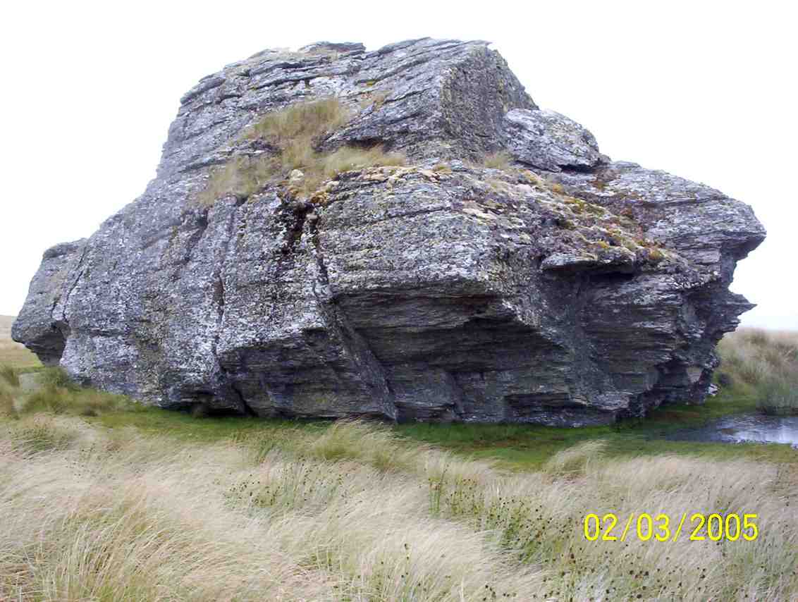
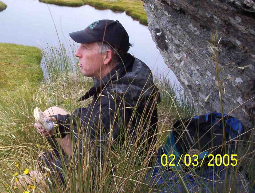
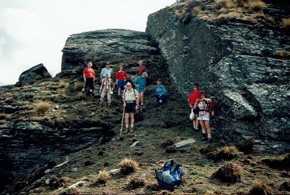
8. 2/3/2005. Trampers. Ship at Anchor. Lammermoors, Deep Creek, Gold Tailings. Leaders: George, Arthur H
Ship at Anchor. Sth Face.
DCC Works. Bridge. Pat, Hazel, Arthur, George
Ship at Anchor. Bob H. Who?
Lunch. Arthur
Stream crossing by old diggings. Dorothy? George, Doug J? Bill, Arthur, Pat
7. 12/11/2003. Trampers. Ship at Anchor, Lammermoors, Deep Creek. Medium+. Leaders: George, Arthur H
6. 31/3/1999 Ship at Anchor – Mahinerangi. Leaders: George, Lex, Graham
5. 2/1995 Leaders: Eric, George, Doug M
4. 23/2/94. Ship at Anchor. Medium+. Leaders: Ria L, Eric B, George, Doug M. Easier alternative: Leaders: Ria H, Jean A.
3. 13/11/91. Ship and Anchor on the Lammermoors. Harder. There will be an alternative route if you run out of ‘puff’. Leaders: George, Bob & Audrey, Dave & Jean
2. 27/9/89 Ship at Anchor, Lake Mahinerangi. Harder grade tramp. Leaders: Hugh & Judith, Dave & Jean, Ria L
“On “The Ship at Anchor”, Lammermoors. Taieri Tramping Clubb. Barbara McCabe, Bob Heenan, Peg Chisholm, Ria & Keis de Jong, Eric & Dorothy Bennett, Mary Jerry, Marie French, Ria Lippers.” (Ian pic, scanned from Peg Chisholm photo collection.)
1. 1/3/1989 Eldorado Track. Interesting country – old Waipori cemetery. Leaders: Ria L, Bob H, Molly
Ocean Grove, also known as Tomahawk, is a suburb in the southeast of the New Zealand city of Dunedin. … The suburb was known as Tomahawk until the 1930s, the name not being a reference to the weapon, but rather possibly an anglicised form of the Māori words tomo haka, meaning “dance by a gravesite”.
No. 23 on old hardcopy list of 113 club tramps. “Karetai Rd via Monument from Lagoon. Year round.”
DCC List: 41 Peg Track. Otago Peninsula
Accessed from Oregon St. 3.5 hrs ret. Tramping track – unbenched. Managed: DCC CAM, private land. Description – This track provides a link between Ocean Grove and Highcliff Road. Access to the track in Ocean Grove is off Oregon Street. An attractive walk around Tomahawk Lagoon then climbs through gorse and native bush. Turn right towards Soldiers Memorial through paddocks with gorse sometimes obscuring the rock walls.
Information Rock and Pillar via Six Mile Creek This climbs 1,005 m. (3300 feet) up the eastern face from Glencreag Station up a leading ridge south of Six Mile Creek. This is the most direct approach. Rock and Pillar via spur south of Lug Creek. Information: Climbs 910 m. (3000 feet) up the eastern face of a well-graded vehicle track up a leading spur south of Lug Creek. Average time to Leaning Lodge is 3 hours on foot. DoC access. 9.5km north of the Middlemarch store on SH87, just before Lug Creek, is a farm entrance (RAPID 7219 – no DoC sign). A short way up the driveway is a DoC car park. There is public access up the vehicle track to the conservation area boundary. The track is now a recreation reserve administered by DoC.
Easiest route to Big Hut from Leaning Lodge (foot only – unmarked – good visibility essential) is another 45+ minutes climbing gently southwards to cross a steep gully and then climb a gentle shelf to above the eastern basins. Sidle several hundred metres past the lower prominent rock tors before gently descending to Big Hut once it becomes visible. Route very wind and cloud-prone. Ice axe and crampons may be necessary to traverse steep snow slopes near Leaning Lodge.
64 km to Middlemarch. 66 km to Stonehurst Track.
Redan Crater- contact for access Ken Rennick.
No. 96 on old hardcopy list of 113 club tramps. “Parera Taioma Transrail & Wenita Year Round”. 10km from PJP. Wenita permit. Require 6 weeks notice, but less from us. Taieri Gorge Railway. Phone 477 4449 for details.
18. 29 November 2023. Trampers. Mullocky Stream, Mt Allan Grade 3.5 Leaders: Sylvie/ Lyn/ Lynley
Cars park off motorway at Leith Saddle yard (alternatively down side road at bridge (restricted space). 25 km from car park.
Walk across side road to track.
Gravelled track 1.5 km. (morning tea on lookout seats a little further on)
Transmitter Tower 2 hours.
Going further: along road past doppler radar to DoC sign.
Right along Rustlers Ridge track to junction with Burns Track.
Through junction and up and round hill on Rustlers Ridge Track. (Lunch on hill)
Down ridge to pipeline. (Alternatively turn right at junction for Burns and down to pipeline)
Turn right along pipeline.
5.5 hours in all.
Burns – Rustlers circuit Maintained by Green Hut Track Group. DCC land.
19. 15/11/2023. Hikers. Cleghorn Street to Signal Hill. Leaders Pam Clough and Jay Devlin
23 keen hikers gathered on a beautiful day at the Bottom of Cleghorn St where we made our way up the gravel road to the beginning of our walk which was firstly over farmland. Continue reading “Signal Hill Tramps”
The day dawned fined and following some creative maths (11 doesn’t as it turns out does not fit nicely into 2) – 3 cars left Dunedin to meet up with the Mosgiel trampers at Waitati. After numerous toilet visits, we all finally continued to our starting point at Doctors Point Reserve.

 Hikers: Leaders Heather and Val Cayford
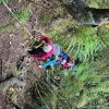 11 trampers left PJ Park at 8.45 and meet up with 5 Dunedin trampers on Borlases’s Road, Port Chalmers. We continued onto Blueskin road in misty weather which got thicker as we drove up to park 1km north from Cedar Farm Forest carpark (CFF) A car was left at CFF carpark to ferry drivers back to their cars at the end of tramp.
 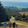 After welcoming a new hiker, Peter Dodds, twenty-four hikers left Livingstonia Park, about 9.30 am, heading to the left (east) to the sand dune track that led out to the road by the bridge and then headed up Sawmill Road to have morning tea beside the implement shed on Alan Gorton’s farm.
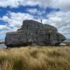


 11. 17/01/2024. Hikers. Warrington. Leaders Jenny Finnerty and Jay Devlin
 43. 06/12/2023. Trampers. North of Tomahawk. Grade 3. $7. 22km. Leaders: Esther Willis and Julie McKenzie
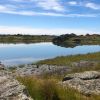 16. 06/12/2023. Hikers. Sutton Salt Lake – Glencreag Track. Grade 2.5. $16. 60km. Leaders: Wendy Langley/Katrina McKenzie
 2. 29/11/2023. Hikers Waters of the Leith. Grade 2. Leaders: Jan/ Pam
 18. 22/11/2023.Hikers. Millennium Track from Henley Ferry Bridge. Grade 3. 27km. Leaders: Ady Whitson/Bruce Wright.
 35. 22/11/2023. Trampers. Burns/Rustlers Ridge. Grade 4. 25km. Leaders: Phil Morris/Carolyn Pridham.
 19. 15/11/2023. Hikers. Cleghorn Street to Signal Hill. Leaders Pam Clough and Jay Devlin