Click on Map to Enlarge
Mid-week recreational and social walking group based in Mosgiel NZ

Click on Map to Enlarge
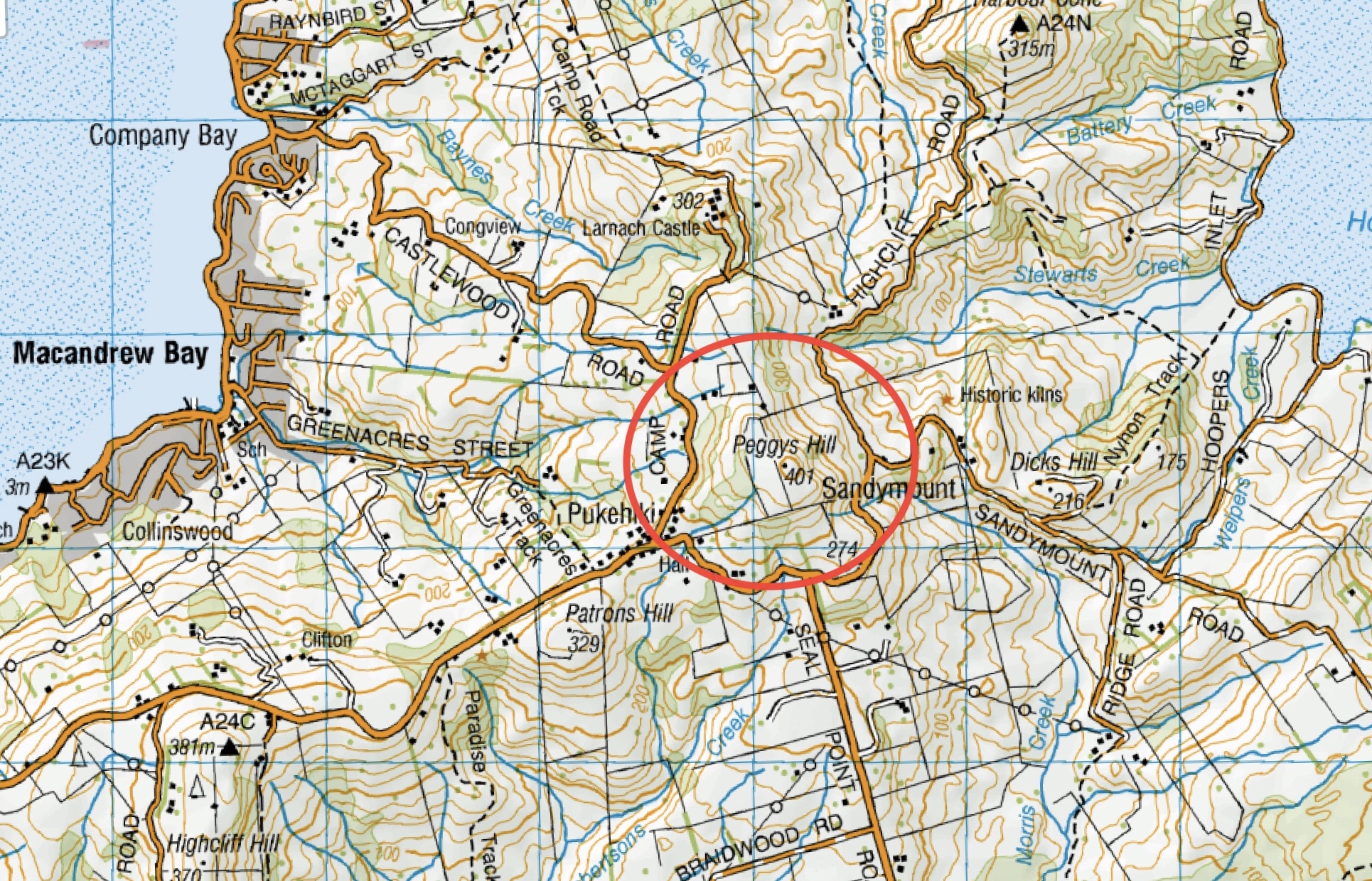
This page of club tramps and hikes on the Otago Peninsula groups together trips to Peggy’s Hill (map) commencing from Macandrew Bay (Greenacres St).
Background Information:
Road distances from Mosgiel carpark.
TRTC Grading Information – trips to Peggy’s Hill are generally given a TRTC grading of 3. This is indicative only, as depending on the route taken, allocation of gradings can differ from this. For more detailed analysis refer to Grading Information.
Access Permissions are required as this trip ventures over a working farm – refer guidelines
List new posts (as per format on each post ie: dd/mm/yyyy, name of trip, grade and leaders)
List and link previous trips relating to this page here (delete when complete)
Click on Map to Enlarge
Click on Map to Enlarge
Click on Map to Enlarge
Click on Map to Enlarge
Click on Map to Enlarge
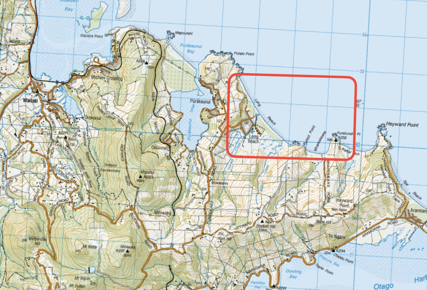
This page of club tramps and hikes in the West Harbour area groups together trips to Long Beach. (map)
Road distances from Mosgiel carpark.
TRTC Grading Information – trips incorporating these tracks are generally given a TRTC grading of around 3. This is indicative only, as trips can be allocated a higher or lesser grading depending on the route taken. For more detailed analysis refer to Grading Information.
Take SH88 to Port Chalmers. Turn sharp left onto Borlases Road then right onto Blueskin Road. Follow this road past the Scott Memorial to the intersection with Purakauni Road. Turn right and continue on this road to Mihiwaka Road which veers right and descends down to Long Beach and parking on the domain.
Long Beach. 2019 – 2004 (5 trips, 3 with reports and photos, 2 with no report or photos)
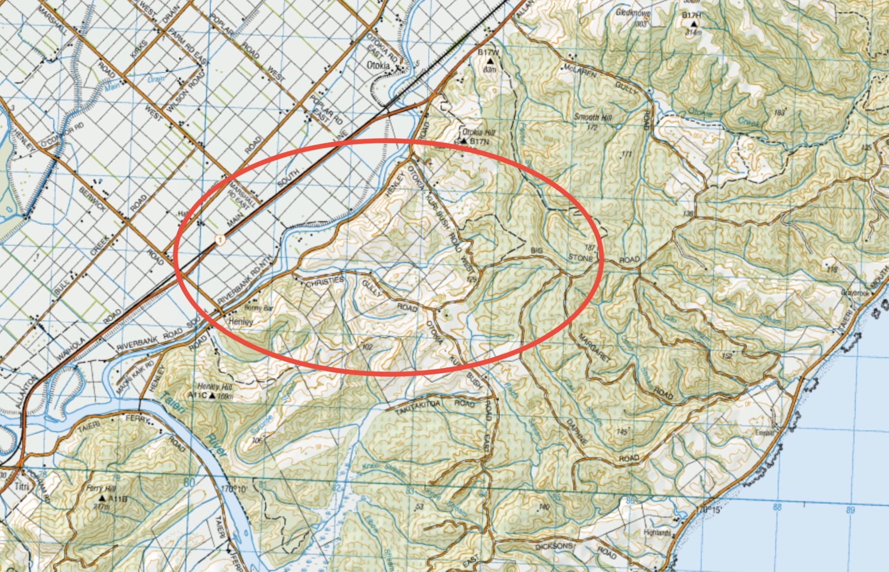
This page of club tramps and hikes in the South Coast via SH1 area groups together trips incorporating Henley Road, Big Stone Road, Otokia Road and Christies Gully. (map)
Road distances from Mosgiel carpark.
TRTC Grading Information – trips incorporating these tracks are generally given a TRTC grading of about 3. This is indicative only, as trips can be allocated a higher or lesser grading depending on the route taken. For more detailed analysis refer to Grading Information.
28/05/2025. Henley Loop. Grade 2.5. Hikers. Leaders: Rhonda Wilson and Jill Dodd.
Christie Gully, Big Stone Road, Otokia, McLaren Gully Rds. 2014 – 1991. (17 trips, 1 with report and photos, 2 with photos only, 14 with no reports or photos)
Palmers Creek Otokia Cemetery Henley. 2002 – 1994. (3 trips, no reports or photos)
Distance from car-park: 24 km.
12. 08/05/2024 Hikers. Macandrew Bay, Greenacres. Grade 2
 23 hikers set out from MacAndrew Bay heading to Company Bay stopping at the Yellow Eyed Penguin plant nursery. Continue reading “Macandrew Bay, Greenacre Street”
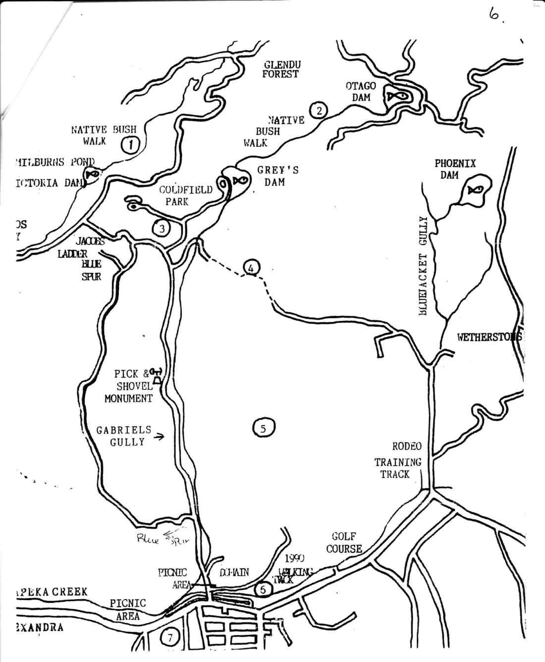
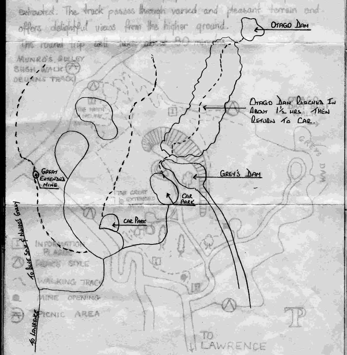
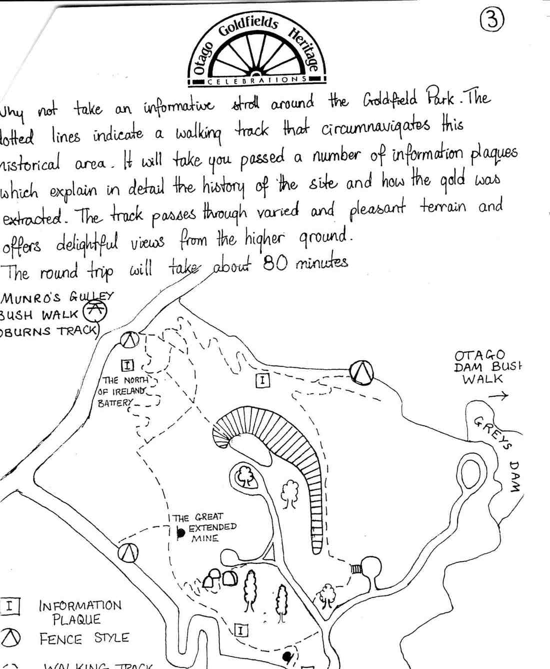
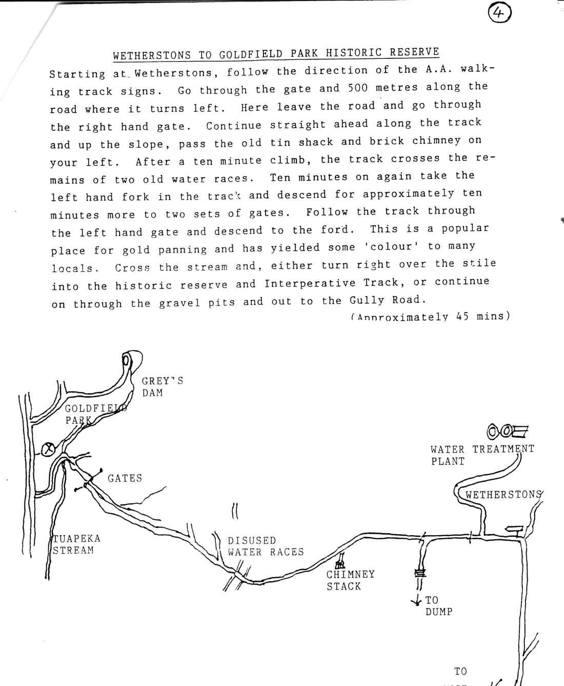
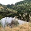 8. 8 May 2024. Trampers. Gabriel’s Gully , Lawrence. Grade 4
Wednesday 8th May saw 18 hardy trampers start at Gabriels Gully Lawrence to complete our walk on Otago Dam Track. Continue reading “Gabriels Gully, Lawrence. Bus Trip”
This page of club tramps and hikes covers trips on the North Coast north of Dunedin City, Waitati involving club trips to Dunback incorporating the Shag / Waihemo River
Road distances from Mosgiel carpark.
TRTC Grading Information – trips to the Dunback township are generally given a TRTC grading of 2. This is indicative only, as depending on the route taken, allocation of gradings can differ from this. For more detailed analysis refer to Grading Information.
30/04/2025. Dunback Shag/Waihemo River Walk. Grade 2. Hikers. Leaders: Neville Griffiths, Dave Roberts. (see notes relating to the history of area linked this post)
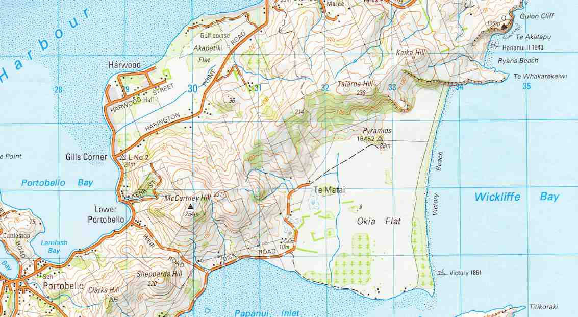
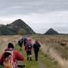 30. 1/05/2024. Combined. Pyramids/Victory Beach. Grade 2.5. Leaders Jenny, Alison, Wendy and Alex
A great turn out for my first time as a co leader with Alison, Wendy, Alex and John. We had a combined group of 30 trampers and hikers. Continue reading “Pyramids, Victory Beach”
 27. 2/05/2024. Track clearing. Leader Phil Keene
Autumn is moving along, colours are fading, the tracks were wet and muddy, aided by some impressive pig work but the team were not defeated and completed a full day’s work on McQuilkans. Continue reading “Track Clearing”
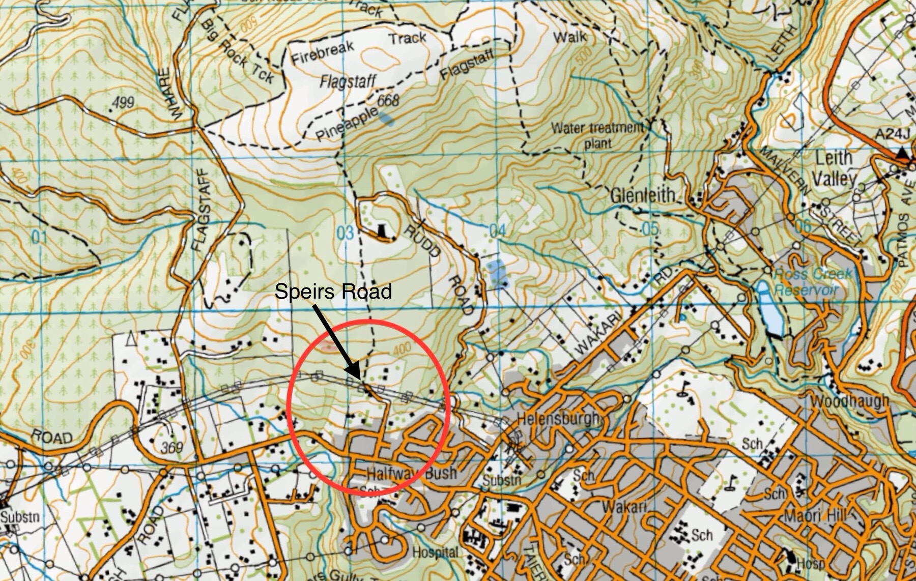
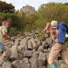 18. 24/04/2024. Hikers. Graham’s Bush/Organ Pipes. Grade 3. 27 km. Leaders: Maria MacNee/Theresa White
A twenty-one strong group of hikers met at the rendezvous in Sawyer’s Bay at the Emmanuel Church Car Park. Continue reading “Grahams Bush, Old Main Rd, Organ Pipes, Buttars Peak, Mt Cargill, Mt Cutten”