This page groups together the Christmas dinners / lunches hosted by the club. These events are often preceded by a walk and as such are included in the reports / photos relating to the walk that is submitted for publication.
Claredon Cemetery: The Claredon cemetery was previously called the Waihola Gorge cemetery and the hill it is on top of has been called the “mound”. There are several unmarked graves but the names of several well known families from the area can be read on the remaining tombstones including Yorston, Young, Bell, Fryer, Sinclair, Sutherland, Craigie, Donald McMaster, Rev John McNicol and HB Flett.
Historic stable: The stable was completed in 1884 with stone from the hill behind it, took two years to build and has 12 stalls. It was built for Henry Driver, 1831-1893, who was born in the USA, and came to Otago in 1861 from the Australian gold diggings as a youth after gold was found at Gabriels Gully. In 1881 Driver purchased the 2,000 acre homestead block of what was originally the 50.000 acre Run 52. He was a merchant and stock agent in Dunedin, was on the first City Council and the Provincial Council and was an MP for Roslyn. He was a prominent member of the Dunedin Jockey Club and responsible for laying out the race track at Forbury in 1877. Driver lived in an elegant house with a turret in Drivers Road, Dunedin. His farm was then called Horseshoe Bush and was run by a manager. The first horses stabled included thoroughbred hacks, cobs and carriage horses.
Limestone quarry: Henry Driver opened a lime quarry on his property and in 1876 James McDonald purchased a part of Horseshoe Bush Estate for a lime works which in 1889 was taken over by the Milburn Lime and Cement Company. The company produced up to 80,000 tons of stone for cement and lime for agriculture. Milburn is locally known for its lime works with the Milburn Lime and Cement Works having been founded in 1888. The company ceased operations in 1967, The quarry is now operated by Milburn Lime.
Phosphate quarry: In 1902 Ralph Ewing formed a company to quarry, burn and market as a fertiliser the phosphate rock on the hill behind the stable. By 1904 The Ewing Phosphate Company was regarded as one of the leading industries in NZ. A railway track about a mile long took the rock to the burning ground and then to the siding at Claredon where the brick building was built is 1918. At its peak, fifty tons a day of phosphate rock were railed to Dunedin. The mines were worked from 1902–1924 and from 1943–1955. About 200,000 tons were extracted. At 50 tons a day 200,000 tons would take 4,000 days to mine, about 11 years. However, the rock was actually mined for 36 years so production must have been lower at some stages. The business ended after competition occurred with cheaper phosphate from Nauru. There was a short revival in 2009 when Milton dairy farmers Tony and Sue McDonnell interested Ravensdown in mining the phosphate deposits at Clarendon and phosphate rock from the area was mixed with imported rock to make a product called Clarendon Gold. Ravensdown has also imported rock from Morocco, Vietnam, and Christmas Island. It recently announced plans to stop manufacturing superphosphate fertiliser at Ravensbourne and limit manufacture to Christchurch and Napier. Ravensbourne will remain a distribution centre. The 450 ha South Otago phosphate deposit is one of only two in NZ with the other being on the sea floor in the Chatham Rise. Mr McDonnell was reported in the Dairy Exporter Magazine as saying that apparently he and his neighbours had the only phosphate deposit in Australasia.
Fort Hill: The Taieri River and its surrounding areas hold significant cultural and historical importance for the Māori people. The river was a crucial food-gathering area for coastal iwi, who would make seasonal trips inland to harvest wild foods such as birds, fish, and kouka (cabbage trees). The Taieri Plains, located in the upper reaches of the river, are known for their fertile farmland and have been a vital part of Māori farming practices for generations. The river’s unique land-forms and biodiversity make it a unique and important natural resource for the Māori community. Possibly Fort Hill was named because it had some significance to Maori. Murray Cullen, over whose land option 1 tramp, mentioned there was a rock cave nearby. On the recce the two aerials on the top of the hill were surrounded by pine trees and long grass with no obvious roads or caves being seen.
Dunback is a Scottish term meaning “hill and stream” – The Shag/Waihemo River runs through the Dunback area between the Macraes Hills on one side and the Grange Hills on the other. • Settled in the 1850s originally because of farming but also played an important role servicing and supplying the Central Otago Goldfields.
The current population is about 200 with most living in the rural areas surrounding town. Shag/Waihemo River
Early whalers named the river after the shag sea bird.
Maori named the river Waihemo which means “river that has gone away” or “dewinded”. • In 2021 the name was officially changed to the Waihemo/Shag River.
The river flows 75kms from the Kakanui Ranges to the Pacific Ocean at Shag Point. Early Maori Life
Evidence was found by archaeologists that a settlement of 100-200 inhabitants was established at the mouth of the Shag during the 14th century. Maori hunted extensively in the Shag River area. • Archaeologists found ovens & middens stuffed full of the remains of 6000 moas & countless sea mammals, sea birds, fish & eels. (Moa remains recovered or on display at the Otago Museum}
The settlement was abandoned 50 years later & the inhabitants moved on probably after they had hunted all the Moa in the area to extinction. The area of their settlement is now a historic reserve. • Puketapu Hill at Palmerston {345m} was named by the Maori & the name means “Sacred Hill},
Railway
The railway to Dunback opened 1 October 1885. 4 stations ex Palmerston Meadowpark, Glenpark, Inch Valley & Dunback. The Dunback station had 4 staff & included a lady’s rest room. the local Post & Telegraph offices. a goods shed, an engine shed & a turntable.
Trains carried passengers and farm produce and brought supplies to Dunback to the Central Otago Goldfields. The last train to Dunback was on15 December 1968 however the branch line which operated to the lime works operated 1885 to 1989.
An extension to Ranfurly was proposed but the government chose the Middlemarch extension. Pigroot
This was the main route to the Central Otago Goldfields. In the1860s there was no road as such and was an unmetalled mud track.
The Pigroot name was debated by the gold miners as a “pig of a route” to travel while others said it was a result of the ground being churned up by the bullock drawn supply wagons made it look like wild pigs had been rooting the ground around.
McCormicks Creek Bridge
Built in1869 is last example of the old coach bridge and was used as part of SH87 up until 1962.
Waggoners were rough. tough men & worked in all conditions often without dry clothes for weeks. • They covered 20 miles per day on rough & muddy tussock tracks normally travelling in groups. • Waggoners operated from1850s to 1919. After 1892 the terminus was moved from Dunback to the rail head at Middlemarch.
Cobb and Co Coaches
Cobb and Co served the district and beyond from 1860 to 1892. Coaches travelled an average 7 miles per hour.
Waggoners
The Otago goldfields were serviced by Waggoners from the railhead at Palmerston but with the advent of the railway to Dunback a depot was set up there.
The wagons were originally pulled by teams of bullocks but latterly by teams of 6,8 or 10 horses. •
Coaches carried passengers and gold from the Nasby goldfields escorted by armed troopers. • After 1892 the terminus was moved to Middlemarch.
Hotels
The Hotels provided an impotant service to the gold miners & waggoners on the Central Otago Goldfields trail.
Alexander Hotel (Glenpark) closed 1908 & now converted to a home, Carriers Arm Hotel (Inch Valley). Gilmores Rotel (Dunback) closed 1906, the New River Hotel, the Waihemo Hotel, the Pigroot Hotel (originally named the Halfway House), the Junction Hotel built 1864 from local schist and limestone – closed 1908 and reopened 2010 as the Dunback Hotel,
Dunback School
Establish 1877 and closed 2001.
The original schoolhouse was located near the turnoff to the lime works before being shifted to the present site in 1900. Around about this time the roll stood at 63 pupils in a 5-room building. • In the 1900s there were also schools at Nenthorn, Green Valley, Stoneburn, MaCreas and Inch Valley (Inch Valley became Camp Armstrong on closure now the Flaxes).
Dunback Swing Bridge
The Swing Bridge was built in early 1900s to allow Dunback school pupils to cross the river. Creamery
The creamery operated from 1910 to 1915. Farmers brought their milk, & the separated cream was then sent by rail to the Taieri & Peninsular butter factories. With the advent of home separators, the supply of milk dwindled, & the factory closed in 1915.
Rabbit Canning Factory
This was situated 200m downstream from the swing bridge.
In 1885 rabbits were a major problem – at Shag Valley Station 85,000 were caught in 3 months. • The factory opened in 1891 and employed 60 men – 30 in the factory & 30 trappers who worked 16 hour per week & they were paid 4 pounds per week.
The factory processed 5,000 rabbits per day (1.5m per year) & also processed mutton & beef. Lime works (Makareao)
First mined in1860 and still operates today.
Lime was burnt in large coal fired kilns (coal brought from the Shag Point Coal Mine) to break the lime down in a pliable form to use for agriculture.
The lime was 98% pure & was moved by train to the Milburn works at Burnside to make cement • The Lime works branch line opened in 1900 and operated 89 years until 1989 when it closed after the closure of the Milburn Cement works (1929-1988).
Lime today is used at the Macrae’s Mine for concrete lining in the mine pits & processing gold ore. Gold
There is a rich history of gold recovery in area both alluvial and quartz.
Numerous quartz crushing batteries operated near Dunback in the 1870s.
During 1898 4 small dredges operated on the Shag River with 2 continuing to 1904. In 1899 the Inch Valley Dredging Co reported a yield 638oz of gold.
Macrae’s Mine 15kms from Dunback is the largest gold mine in NZ and has operated from 1990 to the present day employing 600 people. To date it has recovered over 5 million ozs of gold.
Hereweka Block map showing the marked tracks as of 2024. NB Approximate routes only for the new Around Harbour Cone track, the “Leslie loop” (Steve Cutler & KCM Rimu Ridge tracks), the Future Forest track, and the Elizabeth Regina track.
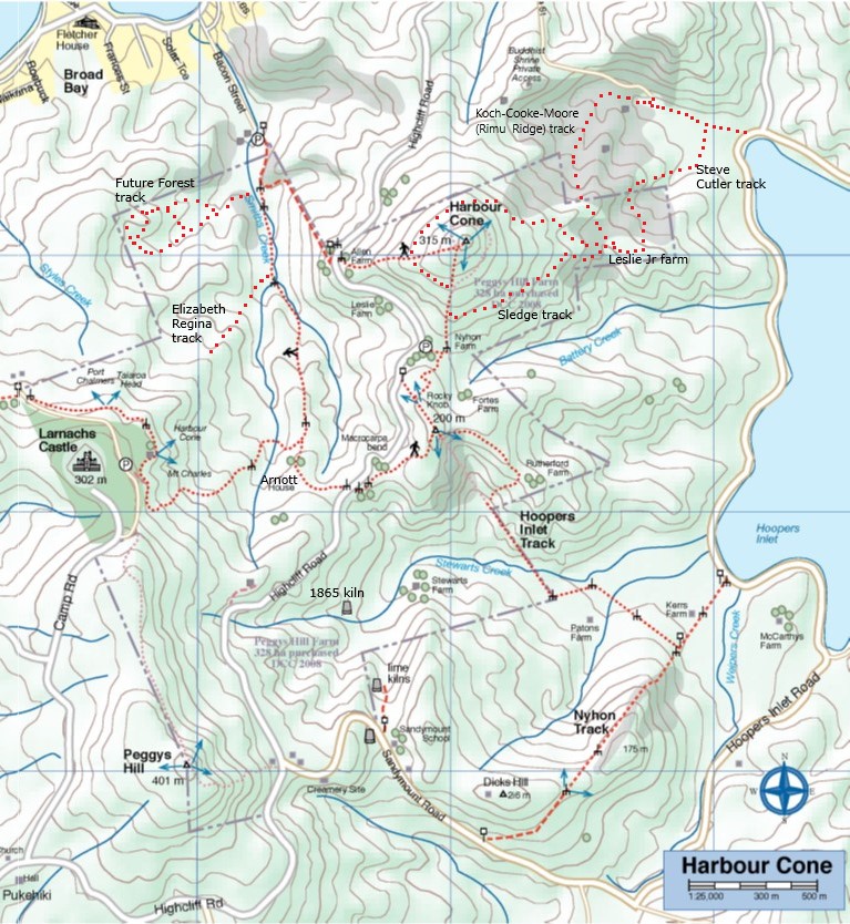
Most of the Peninsula was in the Otago Block purchased from Kai Tahu in 1844. This isolated, steep, and heavily bushed land around Harbour Cone was subdivided in 1863. Highcliff Road was developed between Pukehiki and Portobello from about 1867 to 1869, providing access across the block. Settlers, mainly Scottish, gradually bought sections and cleared the thick bush for their small dairy farms. Cattle could feed themselves by browsing the native bush, unlike sheep which needed short pasture. The farmers planted macrocarpas for shelter around their homesteads – each clump of trees still marks an old house site – and built impressive drystone boundary walls.
Cows were kept under cover in byres overnight, as they had been in Britain. Herds averaged around 20 cows, because you could only keep as many cows as the family could hand milk. Cream was hand-churned into butter, sold in Dunedin to provide the family’s income. Skim milk was fed to pigs, and hens provided eggs.
James McDonald opened three lime kilns at Sandymount from 1865 onwards. Apparently the burnt lime produced was unsuitable for agriculture and was used for making cement. By 1882 the kilns were uneconomic, although they were occasionally reopened until 1939.
From 1872 businessman and later MP William Larnach developed a house and model farm at “The Camp”, employing a number of local tradesmen and farm workers. His importation of stud Ayreshire and Alderney cows was instrumental in improving the Peninsula dairy industry.
In 1877 a dozen farmers formed a cooperative cheese factory, based at Capt William Leslie Sr’s property. This was successful but the venture ceased after the factory was destroyed in a major bush fire on 14 October 1881.
Home dairies were less important after 1893 when the Taieri & Peninsula Milk Supply Company, managed by local settler Walter Riddell, opened Sandymount Creamery. Farmers carried their milk to the Creamery in the morning, exchanged news with their neighbours, and returned home with the skim milk. This Creamery was supplied by up to 30 farmers and processed as much as 9000 litres of milk daily. Frozen butter was exported to Britain. The steady income kept these small dairy farms viable for another generation.
Portobello was the main settlement, served by ferries to Port Chalmer and Dunedin, but Sandymount also became a local centre. Sandymount School opened in 1870, with classes held for the first two years in rooms at Walter Riddell’s house, and closed in 1949. A Post Office was situated at Sandymount or Pukehiki from 1876 until 1952.
During the first half of the 1900s, dairy farming became uneconomic. The dozen or so small dairy farms were gradually bought up by two local families, the Stewarts and the Nyhons, and converted to sheep farming. In 1980 the Maori corporation Akapatiki A Block amalgamated both properties and ran the farm from Roger’s homestead.
The DCC bought the Hereweka Block in 2008 for public use and recreation. It is managed by the Hereweka Harbour Cone Management Trust, leased out to farmer Brendon Cross who runs sheep and some cattle.
Thanks first to Ross who provided books and information for our hike today (20/8/2025). He was a wealth of information and was able to tell me a little about his job as Railway Inspector. In the days when there was very little health and safety, Ross and his team had the task of checking for faults and problems every 6 months all the way along the line to Alexandra and inspecting every nut bolt and joint on the Otago Central Railway line every 5 years. This included walking a narrow plank underneath structures like the Viaduct we are looking at today, with nothing to hold on to but a thin wire. This could take up to two weeks on a structure as big as this one.
The bridge towers sit on rollers to allow for the expansion and contraction of the metal structure. At one point the abutment on the Parera end moved inwards through natural land movement which left no room for expansion so it became necessary to cut and shorten one of the spans. Roman numerals would be stamped on the piles of the smaller bridges to indicate the depth of the piles.
There are 21 bridges between Wingatui and Pukerangi and 86 between Wingatui and Clyde not counting the smaller bridges of which there are at least another 20. All bridges and tunnels have a number.
In 1878 a survey for the proposed railway construction was completed the goal being to serve the gold mining industry initially but it was 5 years later with the gold rush waning a second commission came to the conclusion that the agricultural and pastoral needs of the province plus other mining potential (18 collieries and possible zinc, copper, silver, mercury mining) would justify a rail link
Construction began and by the early 1880s there were as many as 700 men working on the Hindon section from Mullocky Gully to Deep Stream. By 1884 – 5 yrs after the first sod was turned the 12.5km of formation comprising the Wingatui and Mullocky sections were completed.
Accidents were common, the nearest doctor, Dr McCaw, lived at Mosgiel and a call meant a trip on horseback over rough tracks and through fords in the Taieri River. As the quantities of drugs and dressings that could be carried were limited, caches of medical supplies were provided in government huts along the construction route.
In 1880, a one-roomed school 6.8 x7.3 metre, was built beside the line midway between Mullocky Gully and Parera. It catered for 30-40 pupils for 5 yrs but had neither blackboard nor fireplace.
Mullocky Gully was thought to be named after one Donald Malloch who with his brother John delivered mail fortnightly from Waikouiti to the Manuherakia on horseback. Early in his career he got hopelessly lost between Shag Point and Strath Taieri and nearly died before finding shelter in a shepherd’s hut. Thereafter, the gully concerned became known as ‘the place where Malloch got lost’ subsequently mutating to “Mullocky Gully” (Hocken Library) Other references refer to a James Malloch who was working in the area from as early as 1861 – same man? However “mullocky” is also the waste material left after ground had been worked over.
PARERA Refers to the rare and endangered native Grey Duck which resembles the introduced common female Mallard and is often confused with it. Pure Grey Ducks are rare as many have become hybridised with the Mallard. Pure Grey Ducks have grey feet, the Mallard and hybrid Grey have orange and plumage differs. Male Grey Ducks are simply larger than the female whereas the male Mallard has much more flamboyant plumage.
Be on the lookout. We are assuming Parera and Duck Tunnel are named after the Grey Duck.
References: Over The Garden Wall; Otago Central Railway 1879-1990; From Sea to Silver Peaks; Hocken Library
Information Rock and Pillar via Six Mile Creek This climbs 1,005 m. (3300 feet) up the eastern face from Glencreag Station up a leading ridge south of Six Mile Creek. This is the most direct approach. Rock and Pillar via spur south of Lug Creek. Information: Climbs 910 m. (3000 feet) up the eastern face of a well-graded vehicle track up a leading spur south of Lug Creek. Average time to Leaning Lodge is 3 hours on foot. DoC access. 9.5km north of the Middlemarch store on SH87, just before Lug Creek, is a farm entrance (RAPID 7219 – no DoC sign). A short way up the driveway is a DoC car park. There is public access up the vehicle track to the conservation area boundary. The track is now a recreation reserve administered by DoC.
Easiest route to Big Hut from Leaning Lodge (foot only – unmarked – good visibility essential) is another 45+ minutes climbing gently southwards to cross a steep gully and then climb a gentle shelf to above the eastern basins. Sidle several hundred metres past the lower prominent rock tors before gently descending to Big Hut once it becomes visible. Route very wind and cloud-prone. Ice axe and crampons may be necessary to traverse steep snow slopes near Leaning Lodge.
64 km to Middlemarch. 66 km to Stonehurst Track.
Redan Crater- contact for access Ken Rennick.
The original plan was for 2 moles – one from Taiora Head and one at Aramoana but due to budget restraints only the one at Aramoana was constructed. The aim of the mole was to protect the harbour entrance from silting by directing the tidal flow to keep a channel open for ships.
Construction started in 1884. Wooden piles were driven into the seabed with a railway line being built on the top to cart rorck from a local quarry. This rock was continually dumped along the mole for 4 years. Convict labourers were originally used, changing to unemployed men in 1886.
The mole was not built to its full specified height. Due to this and other factors it was decided to rebuild the mole with more piles driven, more rock added and with it being heighten and extended in the 1920s. Between 1926 and 1945 steamer ships were scuttled to protect it from erosion. Some streets in the township are named after these ships.
Near the end of the 1950s concrete structures called tetrapods were placed at the end of the pole to protect it. These had to be reinforced with more rocks and asphalt to stop them being move around by the sea.
As we saw on our trip (10/9/2025) the mole requires ongoing upkeep to keep it being effective against the ravages of the sea.
This page groups together the midwinter dinners / lunches hosted by the club. These events are often preceded by a walk and as such are included in the reports / photos relating to the walk that is submitted for publication.
Links to midwinter dinners:
02/07/2025. Mid Winter Lunch at Waihola. Grade 2. Combined. Leaders: Noel McRandle, Dave Roberts, Gwenda Farqharson, Karon Reid.
Opoho – ‘Here my head is level with hills and sky’ – (Janet Frame)
[These historical notes were prepared by Ross for our wanderings around Opoho on 1 June 2022 on a tour led by Neil and Margreet Simpson and Wyn and Ross Davies. Only parts of it were recounted as we zoomed around, and some asked for a chance to read a bit more about what was talked about. What follows is the whole lot.] Name of Opoho
Maori have been present in the area for 800-900 years. Two groups of Maori ovens have been found on the contours of the hill, said to have been used by people of the Ngatiwairua.
Poho is said to have been a Ngatiwairua chief in the 1700s, head of a family occupying a small kaika (village) by the outlet of the stream which flows down the hill into what was once Pelichet Bay (now Logan Park). O-poho simply means ‘Poho’s place’ and it came to be applied to the neighbouring stream – Opoho Creek.
Later it was adopted by one of the early English landowners for a subdivision on the middle slopes beside where the stream flowed (the Logan Park side), and gradually the name became applied to the whole suburb (on both sides of the ridge). Opoho Odyssey Part 1 – Botanic Gardens Top Car Park to Knox College Lovelock Avenue
Formerly Cemetery Road because of the Northern Cemetery halfway down. Renamed Lovelock Avenue in 1968, after Jack Lovelock who lived in Opoho while studying medicine at Otago University. It was the street he ran down every day going to university. Jack Lovelock kept running, and broke the world record for the mile in 1933. He went on to win the gold medal in the 1500 metres at the Berlin Olympics in 1936 (the first Kiwi to win an Olympic track event). Signal Hill Road
The most enduring street name in Opoho is Signal Hill Road. It appears on all the maps. The top of Signal Hill provides a good view of the harbour and may have given the Maori a place to watch for hostile war canoes and signal from. With European settlement, the same hill was used to signal immigrant ships and perhaps to announce their approach to Dunedin residents. It remains one of the best-known landmarks in Dunedin. Opoho Road and Trams
The original Opoho subdivision, called Estate of Opoho, to form Opoho Township was created by Captain Boyd in 1873. We’re going to wander some of the streets of this Opoho Township this morning, making our way down to Knox College for a tour at 11am. Opoho Road was the southern boundary of the Opoho Township, originally called District Road. It was the first access to the suburb from the Gardens although there was also a road to Dundas Street down Lovelock Avenue. Opoho Road was too steep where it meets Signal Hill Road for the trams, so a new loop was created through part of the Upper Gardens where the road now goes. It was the steepest line attempted by electric trams. The terminus was at the corner of Signal Hill Road and Blacks Road, and that was steep too. At least two trams ran away from the terminus when the brakes failed – with serious consequences. The tramline opened in 1924. Continue reading “Opoho – Historical Background Notes”
Fire broke out at Seacliff Mental Hospital on 9 December, 1942. Ward 5, which housed 39 women patients, was quickly reduced to ashes. The fire killed all but 2 of the 39 women and was the worst fire in New Zealand until Ballantyne’s fire, five years later.
In 1884 the Seacliff Lunatic Asylum was opened at Seacliff, 28 kilometres up the coast from Dunedin. It provided housing for 500 patients and 50 staff, and at the time was the largest public building in New Zealand. At about 9:45pm on 8 December, 1942, fire broke out in Ward 5. This ward was a two-storeyed wooden building which had been added on to the original stone building when the hospital was expanded at the end of the nineteenth century. In Ward 5 were 39 women patients who had mental health problems. They were all locked into either single rooms or in the 20-bed dormitory. Most windows were locked, and could only be opened by a key from inside. It was during the Second World War, and there was a shortage of nursing staff. There was no nurse on duty in the ward at night, although checks were made by staff from other wards every hour. The fire was first noticed by a male attendant who raised the alarm and ran to bring the fire hoses and reels from the small hospital fire station to a fire hydrant near Ward 5. He was able to save one patient by pulling off the grating over her window and dragging her out. Another patient was rescued from the first floor. Both survivors were in rooms which did not have locked shutters on the windows. They were the only patients out of the 39 in Ward 5 to survive the fire. The hospital’s fire fighters tried to put out the fire, but it was too fierce, and within an hour only ashes remained of Ward 5. However they were able to stop the flames from spreading to other wooden buildings. 37 people died. A commission of inquiry found that the wooden building of Ward 5 was dangerous, and that, once the fire had started, it spread through the building very quickly. There were no automatic fire alarms in Ward 5, unlike in other newer parts of the hospital. Any alarm in the building had to be raised by unlocking a cabinet and pushing a button to start the fire alarm. The commission of inquiry criticised the design of the building and the way in which the windows were shuttered and locked from the inside at night. It recommended the installation of sprinkler systems in all psychiatric institutions. The commission also felt that there was not enough staff on duty to supervise the patients at night. The hospital fire brigade were praised for their action on the night, which prevented the loss of other lives. The cause of the fire was not discovered. A new mental hospital was opened at nearby Cherry Farm in 1954.The Seacliff Mental Hospital fire was the worst in New Zealand until Ballantyne’s fire, five years later.
With regard to the lives lost in the Seacliff fire, there was in fact a Memorial Plaque set up in the Andersons Bay Cemetery in December 2017, 75 years after the fire, with all the names of the victims on it. And a small plaque also at Seacliff. You can Google the articles and pictures of this from the ODT. (Additional note from comment on ‘Warrington – Seacliff’ post for hike 16/10/2024.)
Background.
The Deep Creek Water Scheme was built during the depression of the 30s.
The Pipeline is 58 years old and 64 km long.
The intake is 675m above sea level.
The catchment is 5420 hectares; mainly tussock with some grassland.
The steel pipeline, lined with bitumen, was in a bad state of repair by the 80s and the leaks were constantly plugged with tapered wooden plugs until it resembled a porcupine.
The authorities were eventually persuaded to renew the worst section, this being done with the aid of a helicopter in 1992. It is a useful supplement to Dunedin’s water supply.
The Pipeline is made of bitumen-lined steel excepting the first 1.4 km which was replaced in 1992 with concrete pipes.
Water quality is variable and often discoloured.
Over the 58 years the yield has dropped from 11,000 cubic metres to 6,800 cubic metres a day.
The water goes to Booth Road Treatment Station and Sullivans Dam.
Replacing the rest of the pipeline is estimated at $20,000,000 and would increase the flow to 17,000 cubic metres a day.
– From a hand-written record in the President’s file and supplemented with other data.
The stone-walled house was burnt out by a bushfire in 1914 after the McKessar family had left the district and the farm had been taken over by a neighbour.
George and Emma (Driver) McKessar had lived and farmed there. George was born in 1836 and Emma in 1853 and they had six children. Emma was a child of Richard and Elizabeth (Robertson) Driver. Richard was the first official pilot for Otago Harbour, and she had been born at the pilot house at Taiaroa Head. She died at Purakanui at 47 in 1900 and George at 75 in 1912. – edited from research by Clive Crossman on various websites.
… The final example of an engineering achievement worthy of the title ‘built to last’ comes from the 1970s, the Deep Stream Water Supply. Water supply has been a major problem to successive City Corporations and Councils for most of the city’s life. We have a modest rainfall with lengthy dry periods every few years, and very limited space to store water to cover such dry periods. Run-of-river sources are a long way from the city so are very expensive to use. The City lived a hand-to-mouth existence for its water until well after the Second World War. In 1956 the City tapped the river gravels beside the Taieri River at Outram, and this gave us adequate water for the next twenty years. However by the late 1960s it was clear that another major supply would be needed to cope with the ever increasing demand for water. The search was on again for more water.
In the early 1970s the options had been narrowed to two. More pumped water from the Taeri River, or a gravity supply from Deep Stream in the Lammermoor Range. The Deep Stream scheme had been proposed by City Engineer J G Alexander in 1930, but it was rejected by the Corporation at that time as too costly. The more modest 1936 Deep Creek scheme was built instead. However, detailed survey plans of the 1930 Deep Stream scheme were held in the City’s records, and an Act of Parliament in 1930 authorised the taking of water from the Deep Stream. It comprised some 58 km of pipeline falling from an intake at 425m above sea level to Mt Grand at 300m above sea level. A treatment plant at Mt Grand would be able to supply water to almost the entire city.
The choice between the two options was made on the economics. Deep Stream was very high capital cost but low operating cost (no pumping needed). Taieri was relatively low capital cost but high operating cost (requiring electricity for pumping). In the event the Deep Stream option was approved by the Council in 1972 and it was completed in 1977. Just after the decision was made, the first oil shock in 1973 occurred and huge increases in energy costs resulted. This markedly increased the advantage of the low-energy Deep Stream option, and is reflected today in our relatively cheap water charges.
The Deep Stream Scheme was forecast to meet the City’s water needs till the early 1990s. In the event the Burnside Freezing Works, a heavy consumer of water, closed and population did not increase as much as expected so the water supply system, including the Deep Stream Supply, is still meeting the demand, indeed is supplying areas of the post-1989 amalgamated city not envisaged over 40 years ago in 1968 when the demand forecast was made. Deep Stream was certainly built to last! It cost some $6.2 million (($55.1 million today).
Extracted from: Otago Settlers News, March 2010, Issue 104, In the Pipeline. Engineering Feats Beneath Our Feet. Trevor J Williams, BE FIPENZ MICE MNZIS NZIM, former Dunedin City and Drainage Engineer.
The North Otago coast is lined with old Maori settlements, and Brinns Point is no exception. The bay south of the historic urupa (cemetery) on the headland was occupied by Moa-hunters, and much later was an out-post whaling station. A channel has been cleared through the boulder beach to enable boats to reach the shore especially at high tides. This is thought to be the work of the whalers but the channel clearance may date from much earlier, for all we know. This bay was investigated in the 1950s by the Blake-Palmers of Seacliff. This was published in the Journal Polynesian Society by Blake-Palmer senior who was superintendent of Seacliff Mental Hospital at the time. This was the first ‘proven’ association of man with the largest species of moa: DinornisMaximus, thought by some scientists to be extinct before arrival of man. Later studies showed Dinornis had been found on archaeological sites beforehand however. There was an old Maori settlement on the flat at Ross’ Rocks. The next known settlement south is at Omimi, where moa bones have been excavated on what was largely a fishing site.
The cliffs after which Seacliff township gets its name are lined intermittently with Maori umu, most being umu ti. Parts of the coast road from Warrington to Karitane followed original Maori tracks according to early survey plans in LINZ archives. The hills along this coast were heavily forested and only cleared when the land was subdivided for framing. The original route of Coast Road has been modified in places since the 1960s but many portions of the old routed can be seen with associated stonework on both sides of the present road. Coast Road remains an active connection with the distant past.
– Taken from Karitane … Split Rock … Seacliff Coastal Walk. Notes by Brian Allingham, Archaeologist, January 2010.


 16. 06/12/2023. Hikers. Sutton Salt Lake – Glencreag Track. Grade 2.5. $16. 60km. Leaders: Wendy Langley/Katrina McKenzie