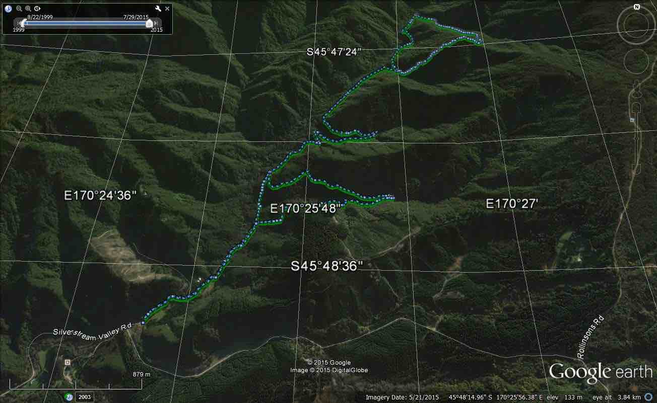
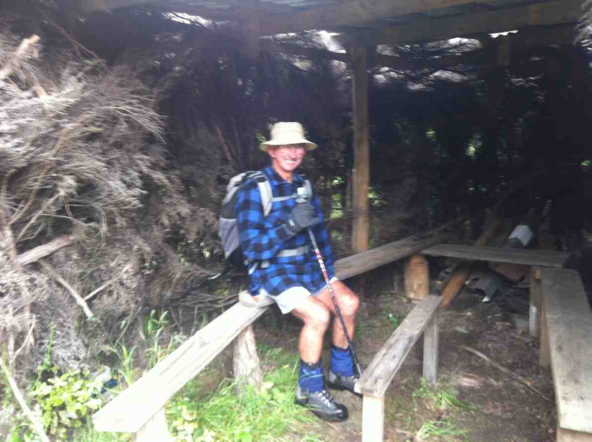
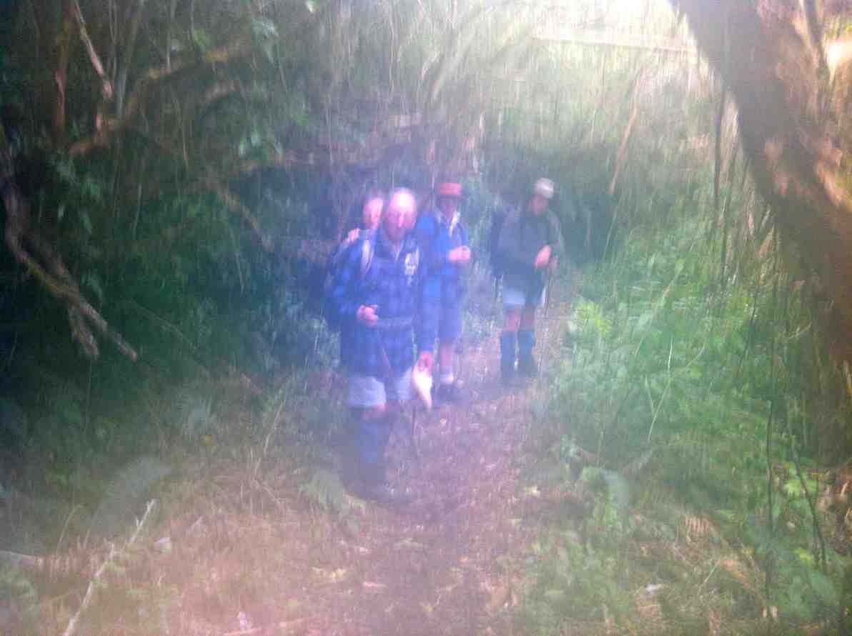
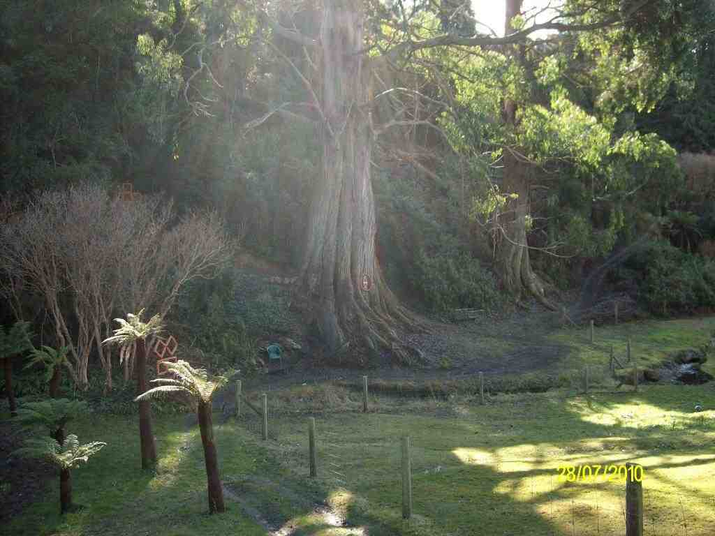
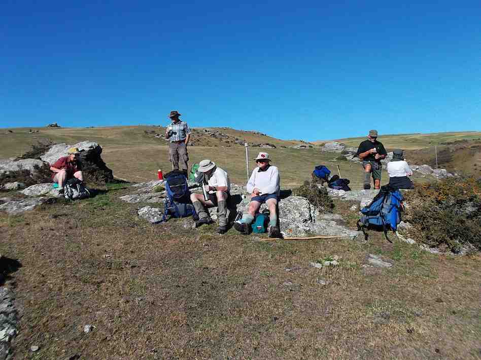
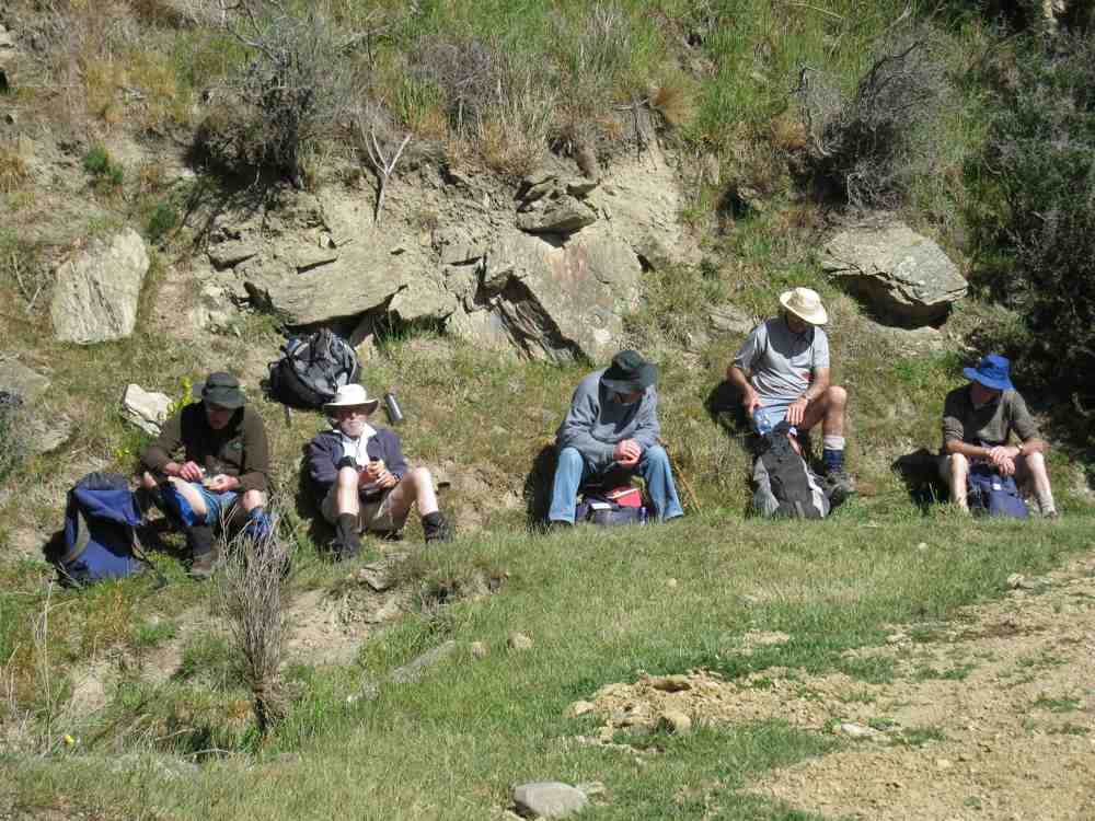
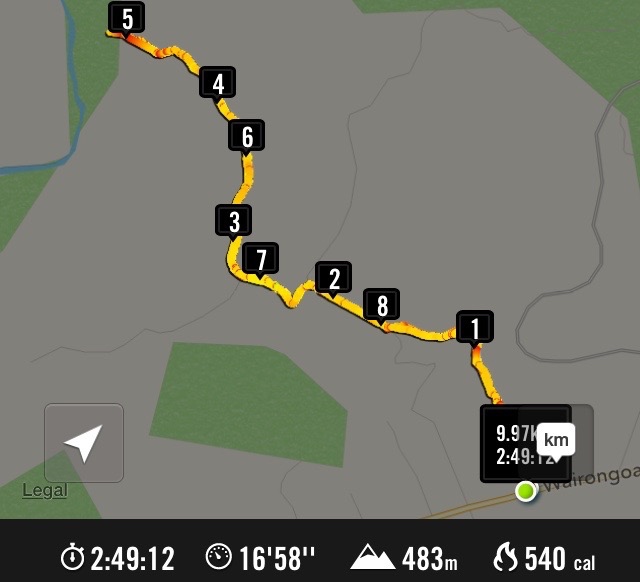
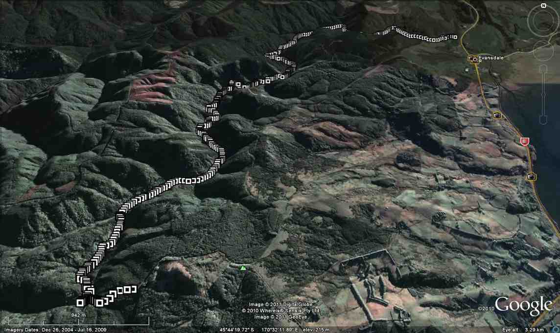
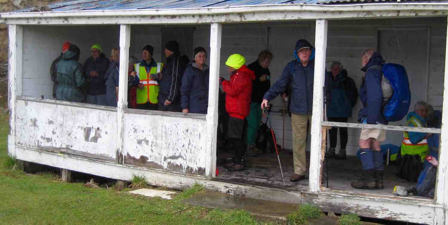
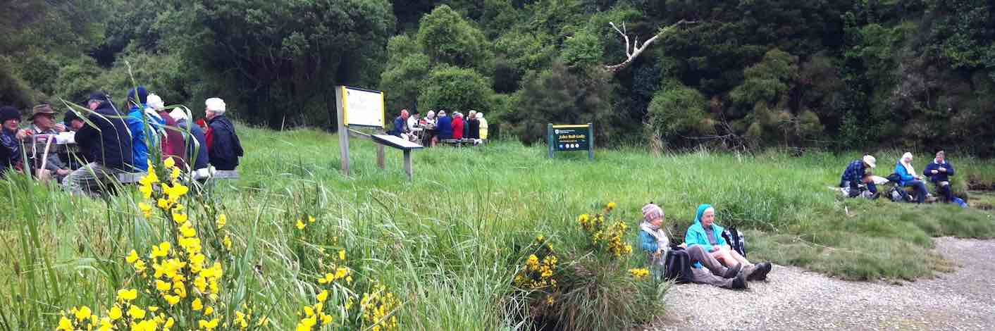
9. 17/10/2018. Trampers. Steve Amies – Craig Lowan Falls. M. Dave.
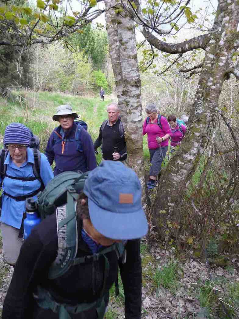
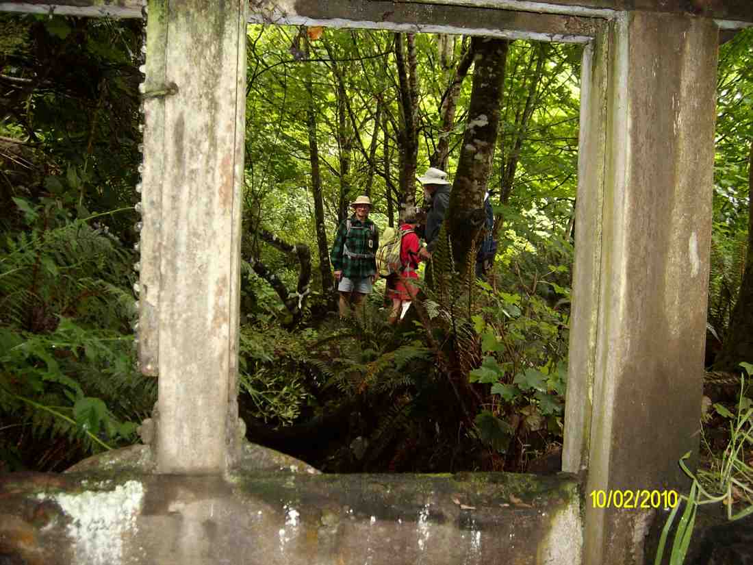
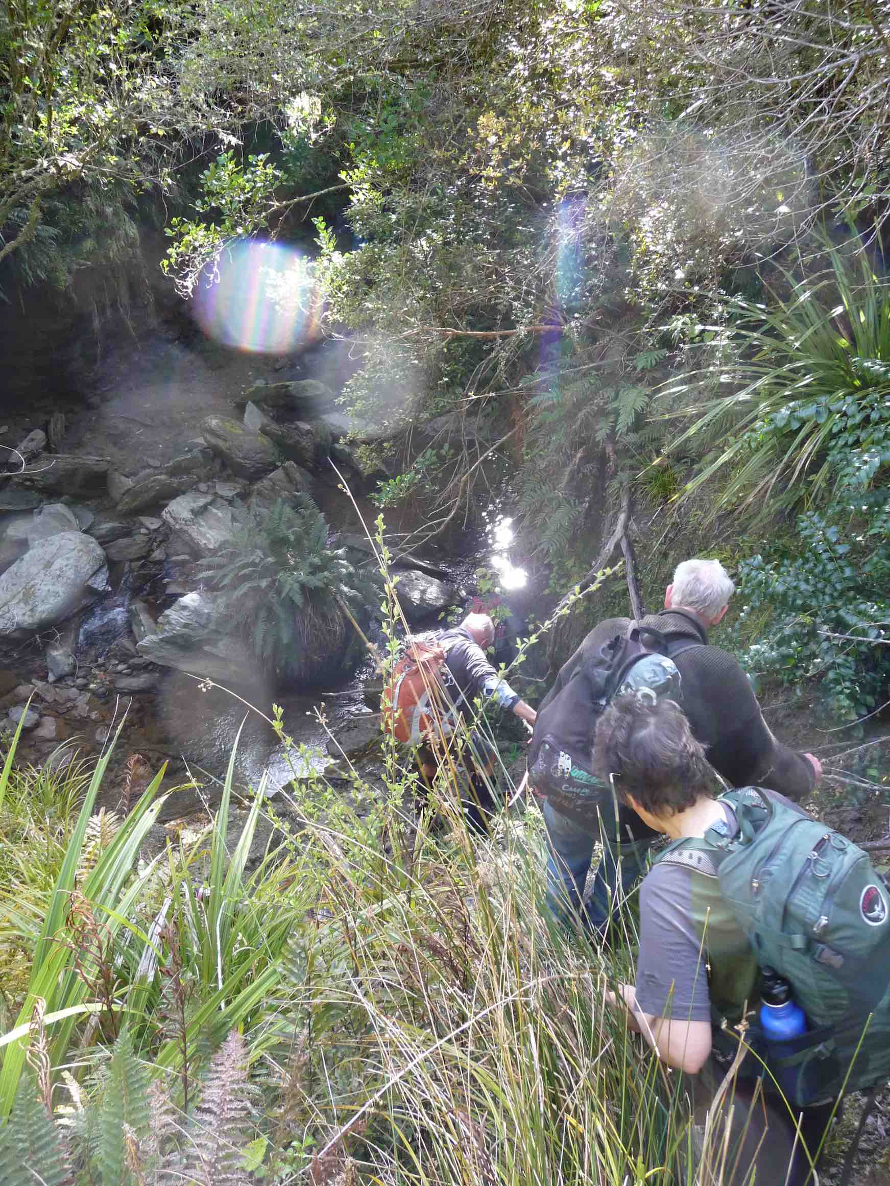
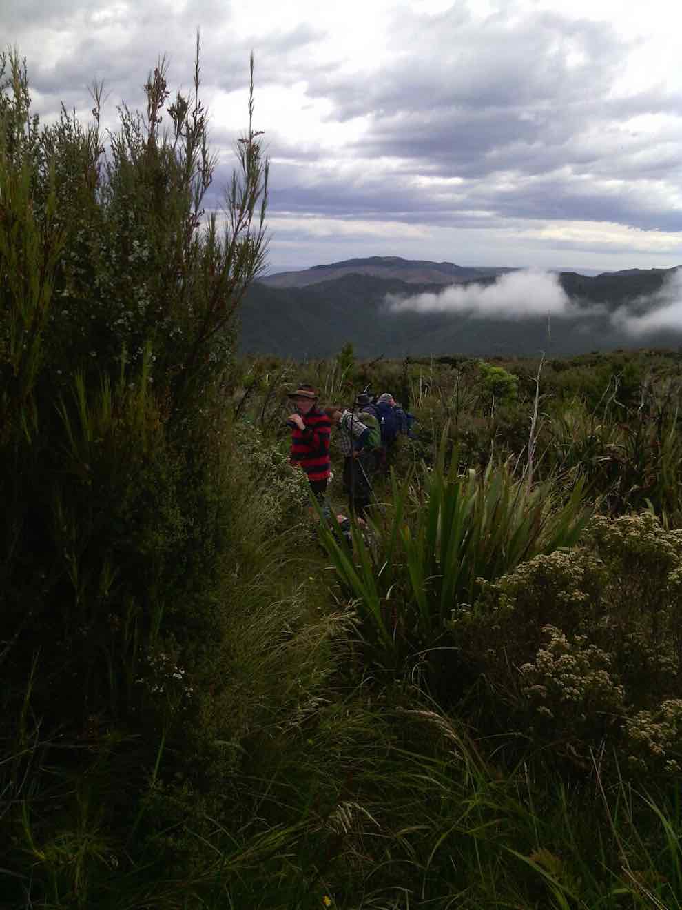
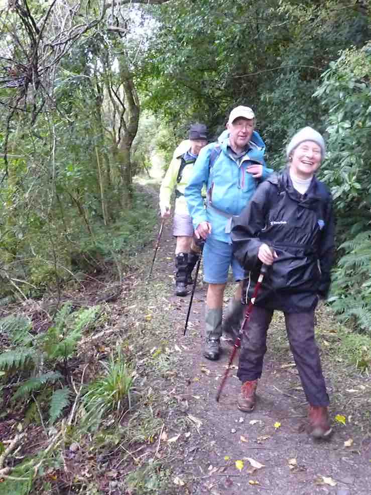
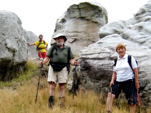
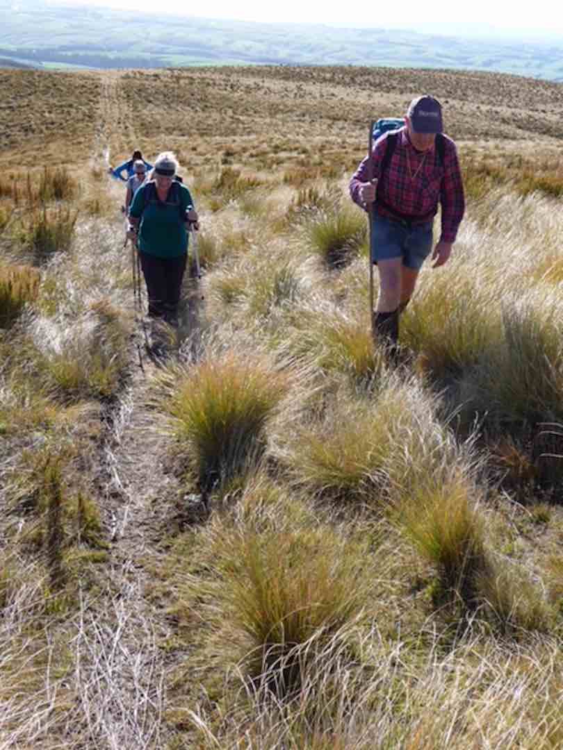
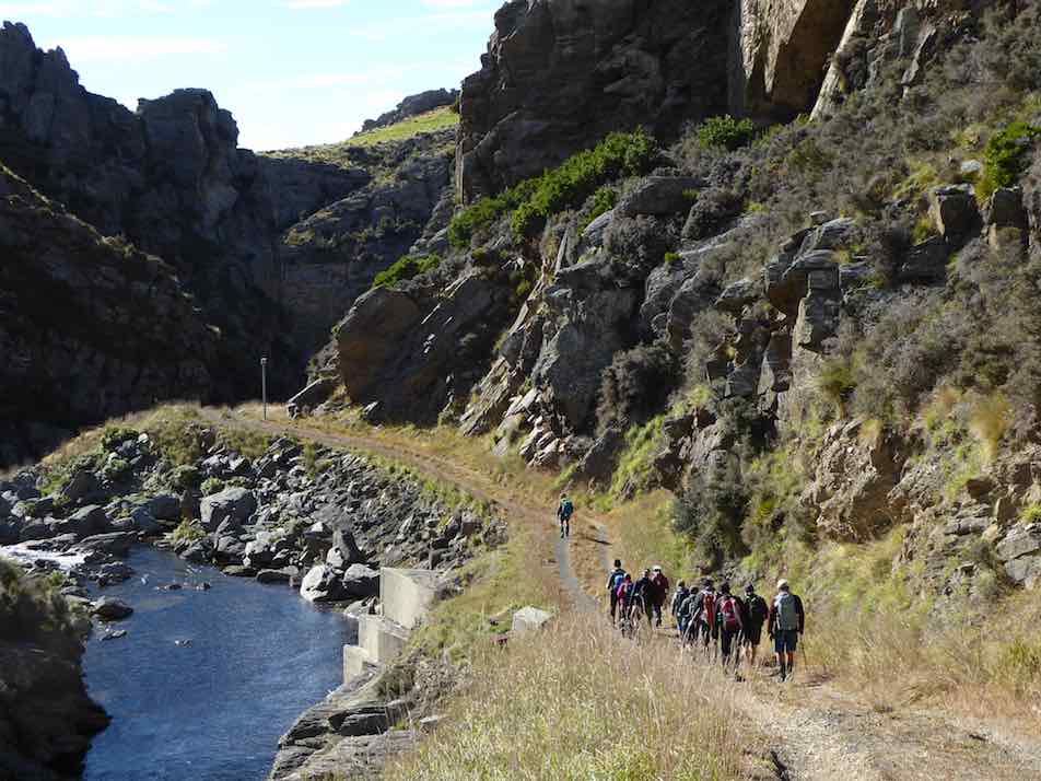
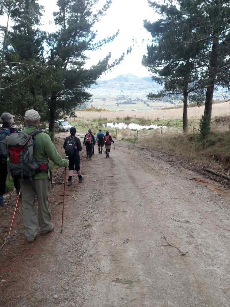
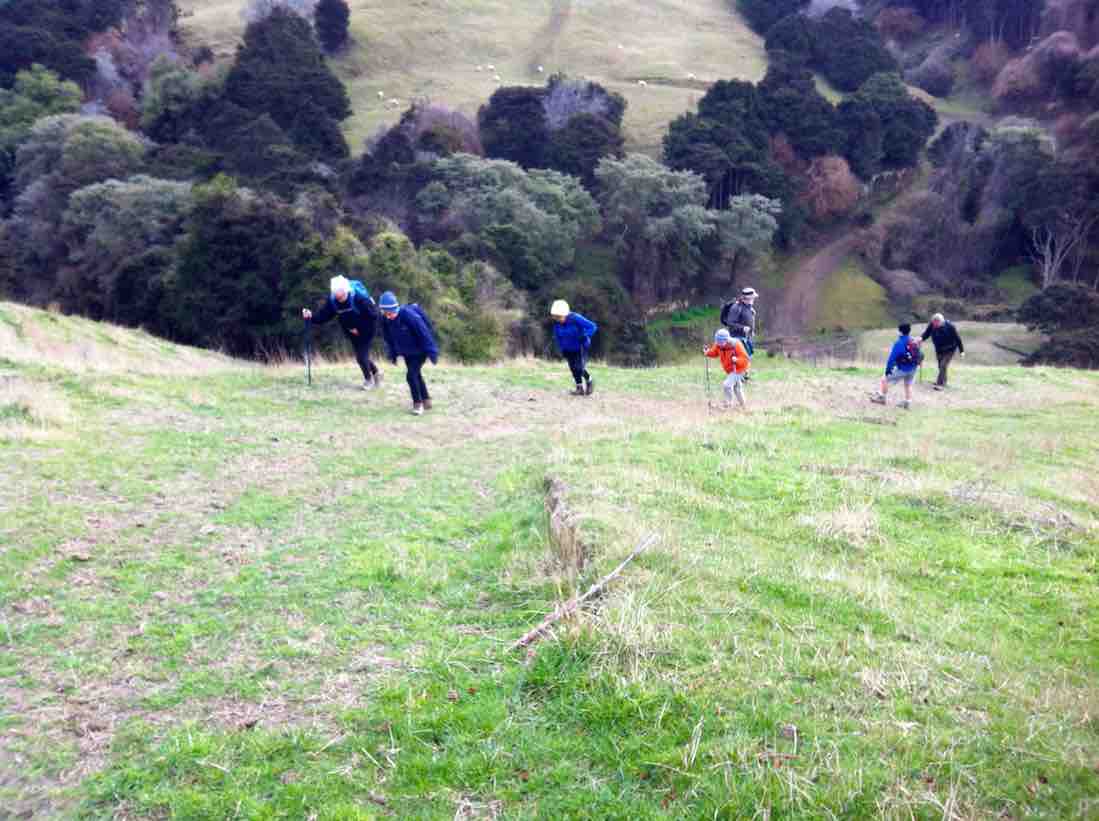
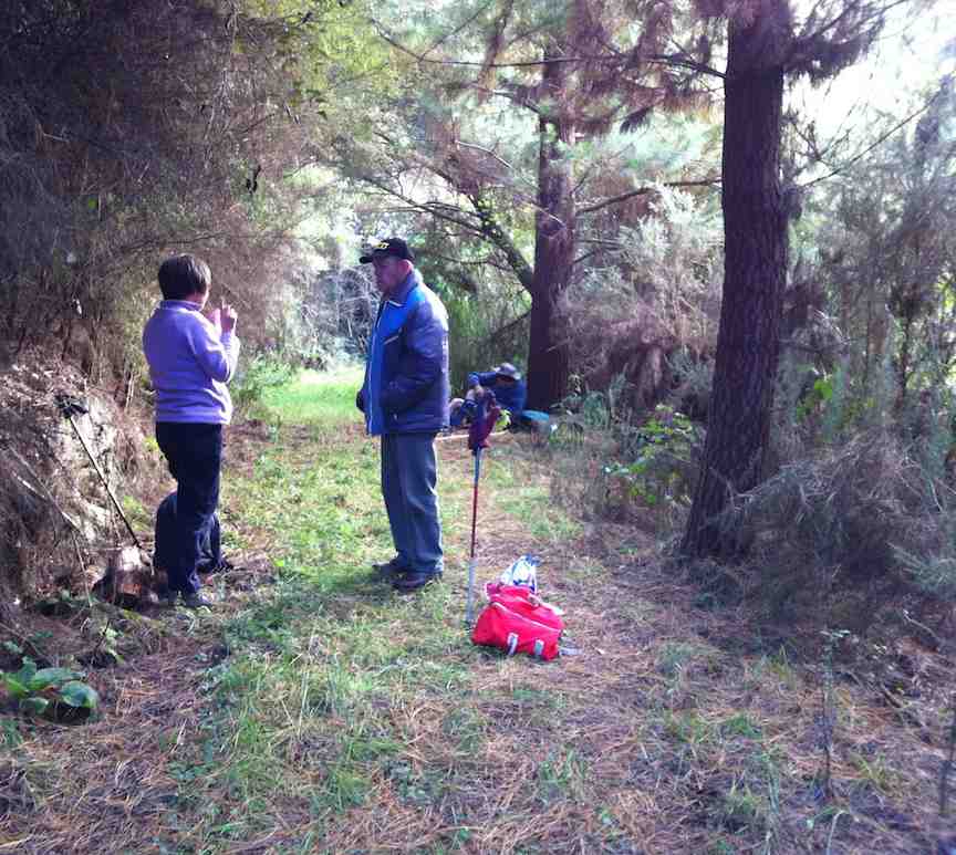
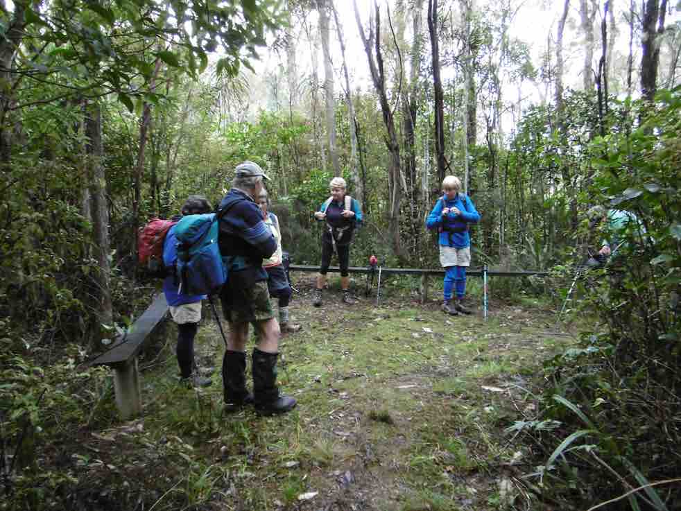
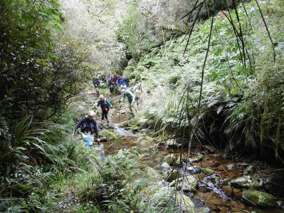
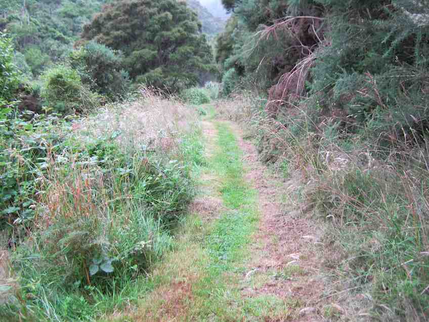
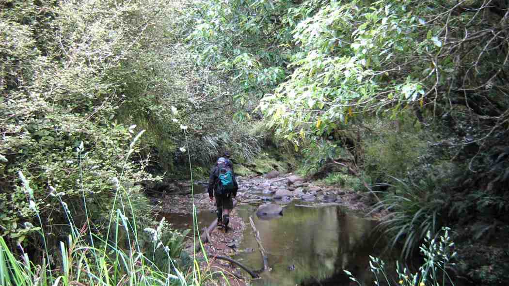
13 keen trampers left their cars not far from the Whare flat school house and started on the Tunnel track.
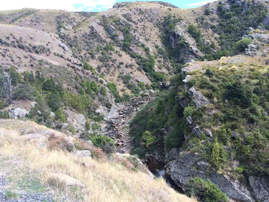
Starting out on Tunnel track. (Gordon pic and caption.)
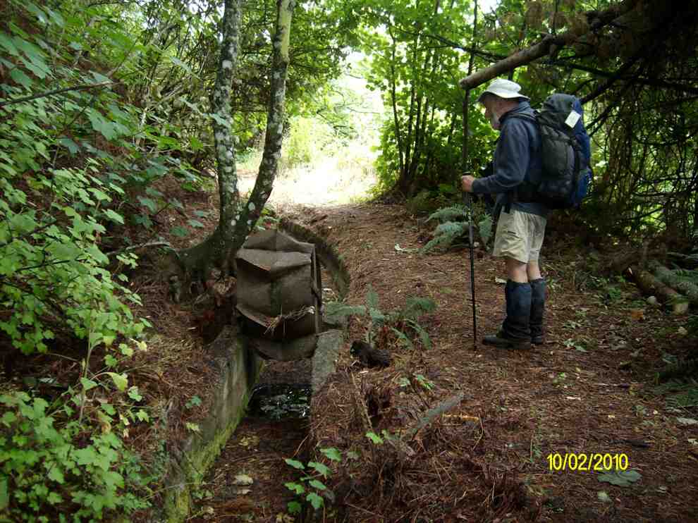
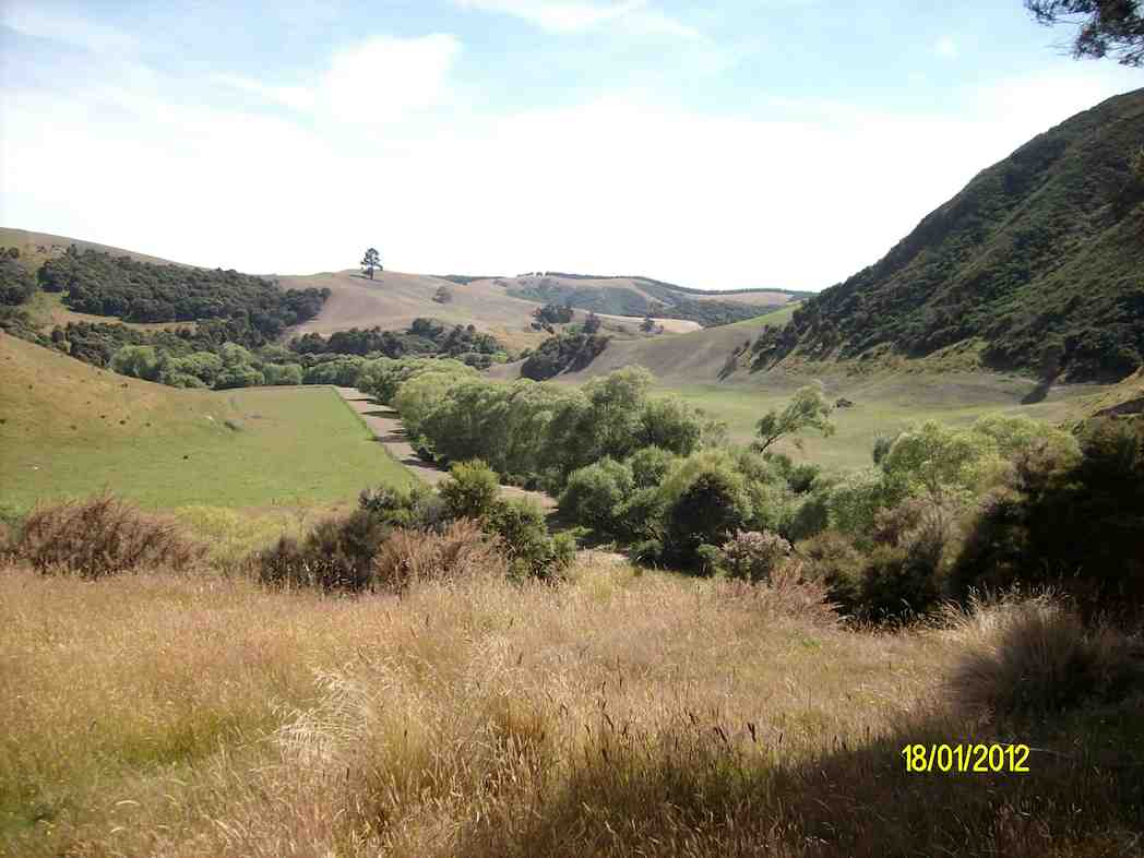
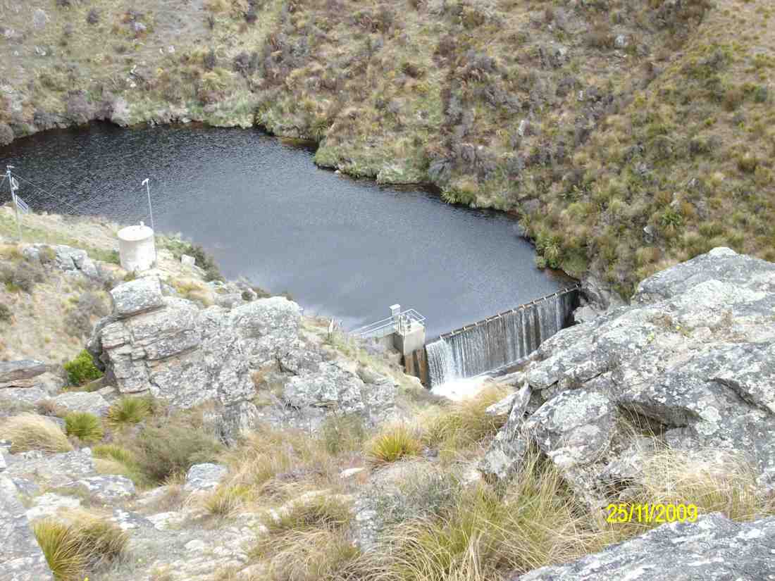
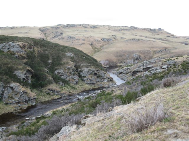
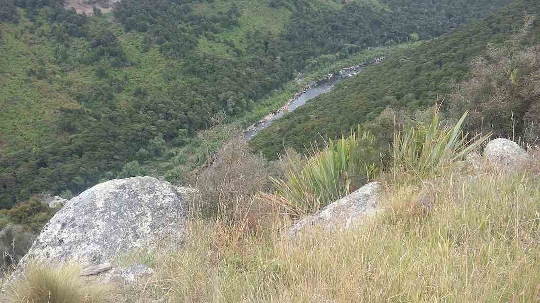
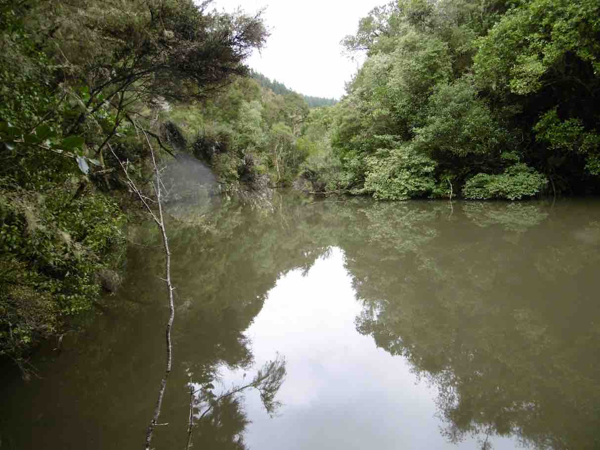
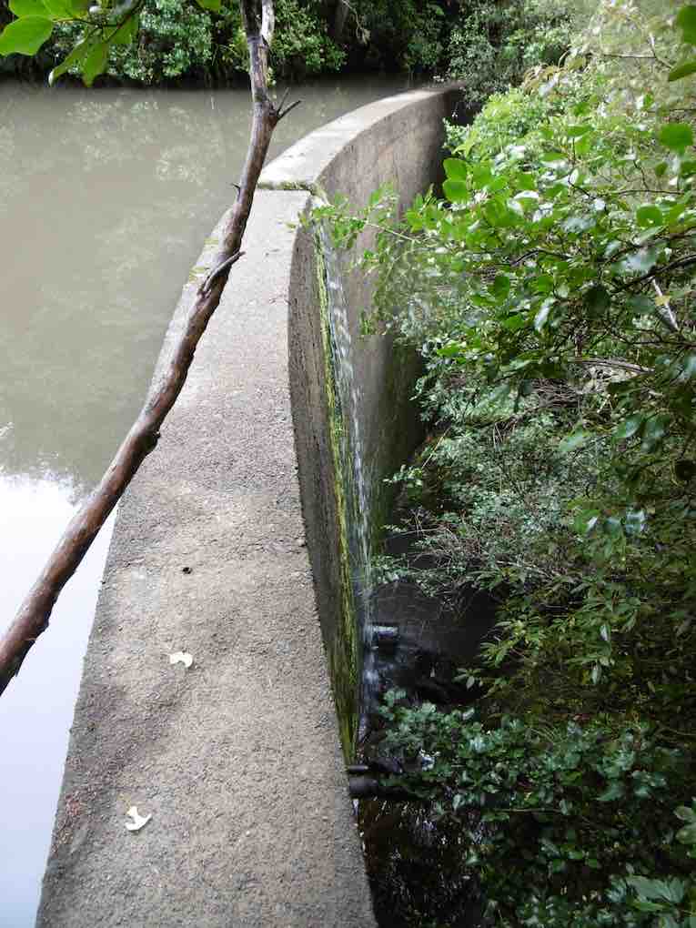
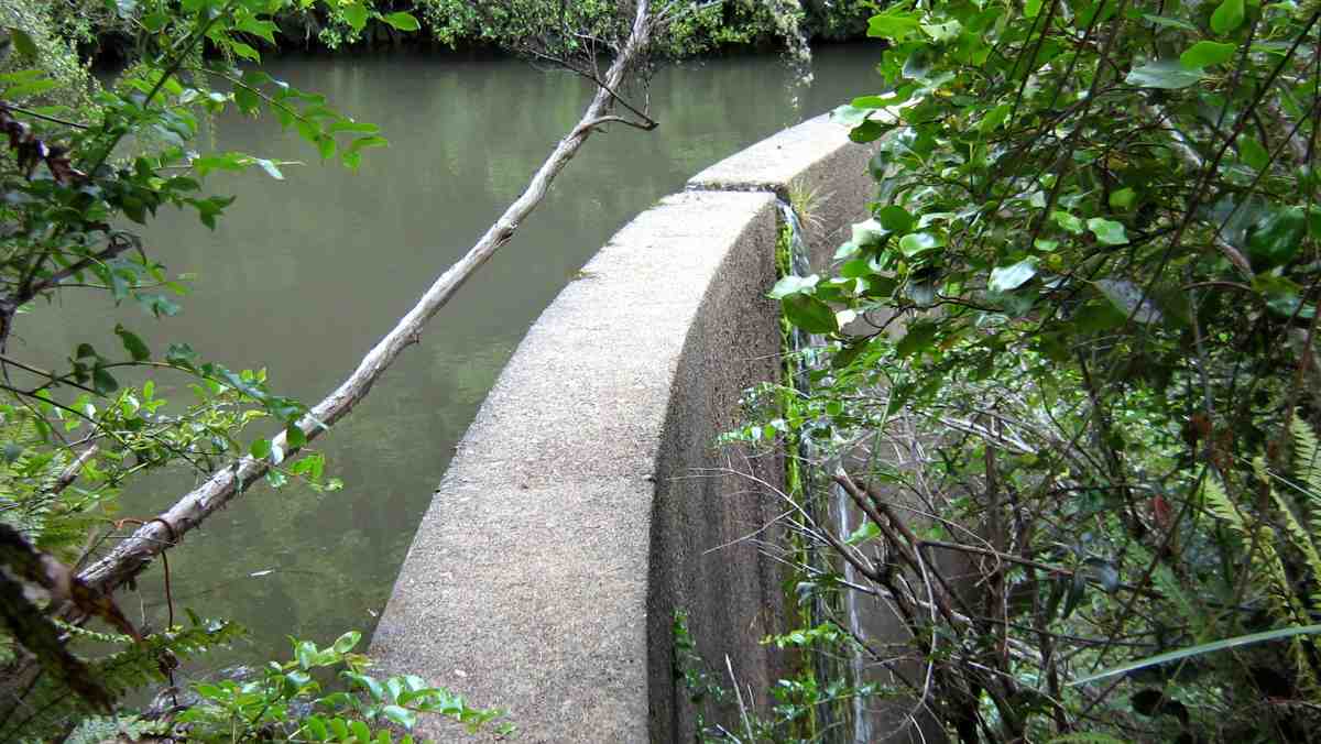
This track was fairly flat and one couldn’t help but marvel at the amount of work done by the early water race workers. After reaching McRaes Weir we turned up a somewhat steep track
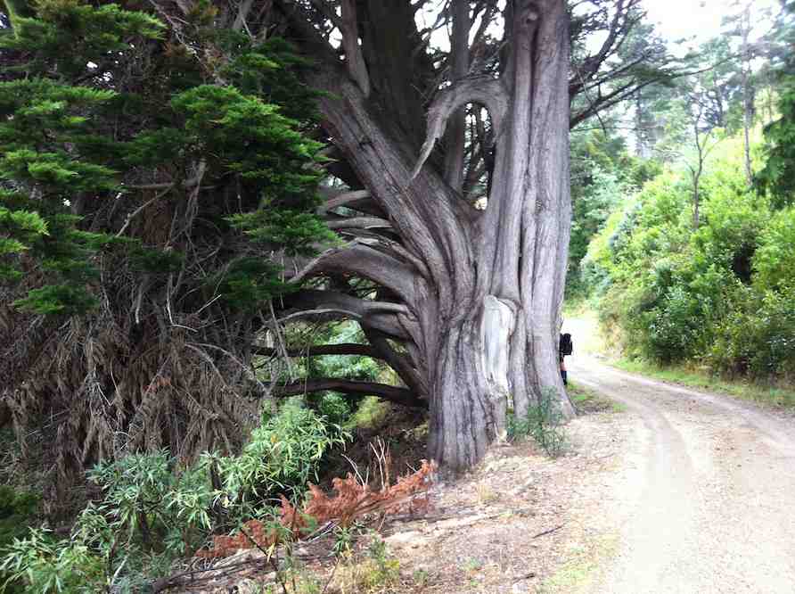
Heading up to Steve Amies track. (Gordon pic and caption.)
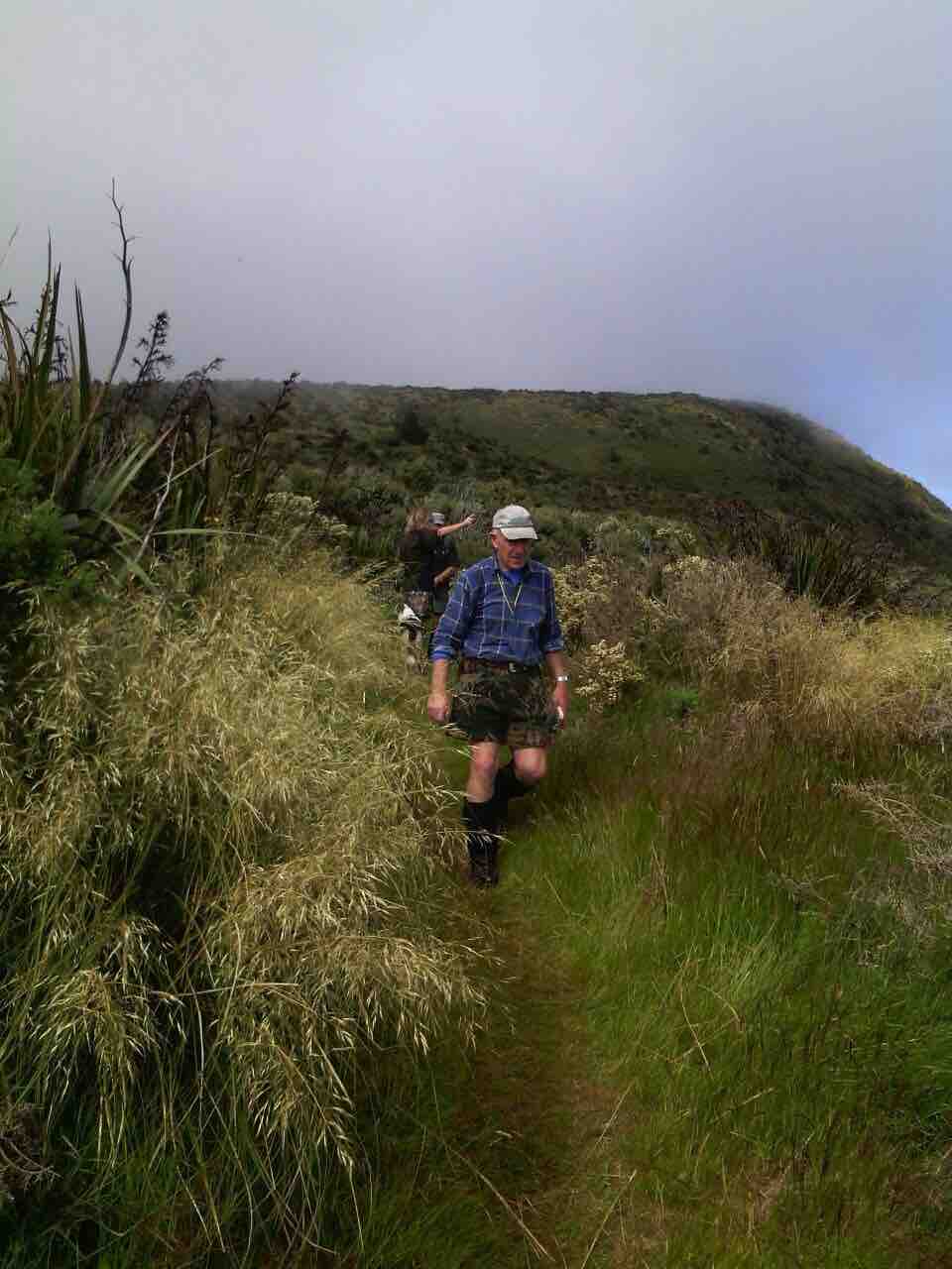
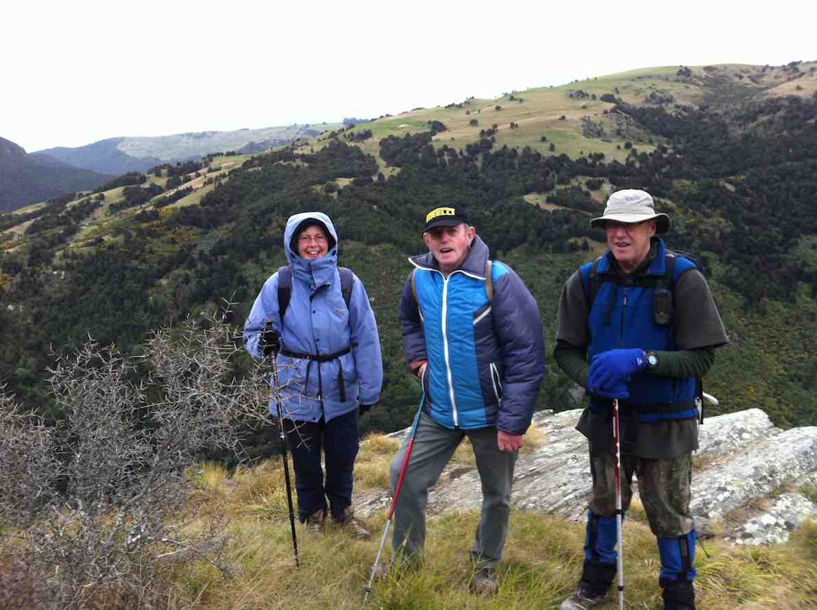
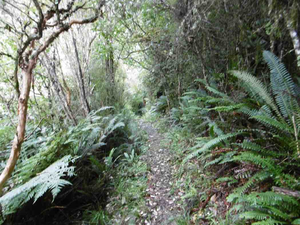
to reach the Steve Amies ridge.The climb along the ridge was very pleasant, with manukas/kanukas dominant, with lush green undergrowth.
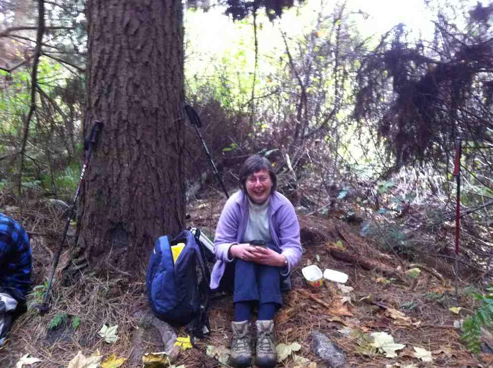
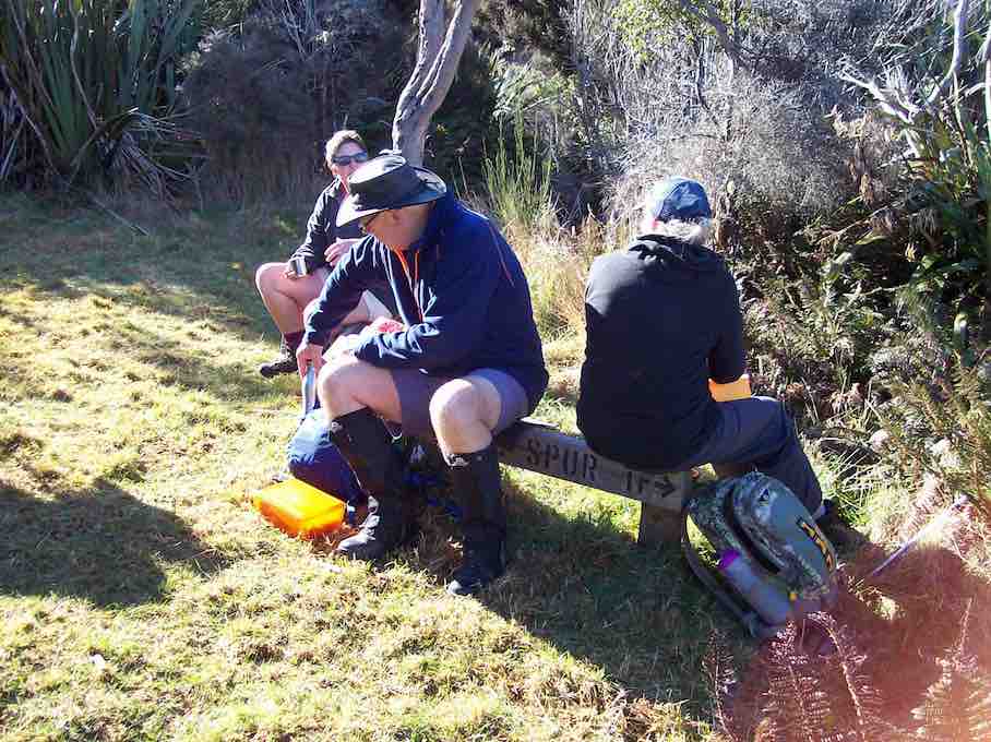
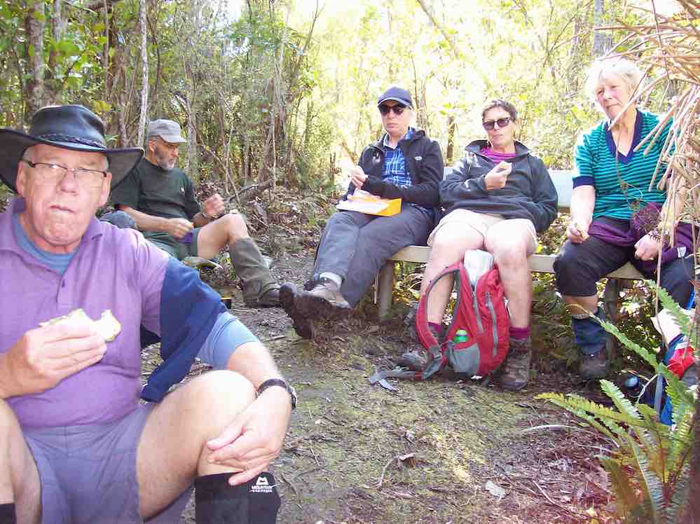
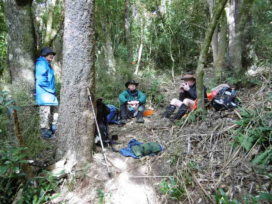
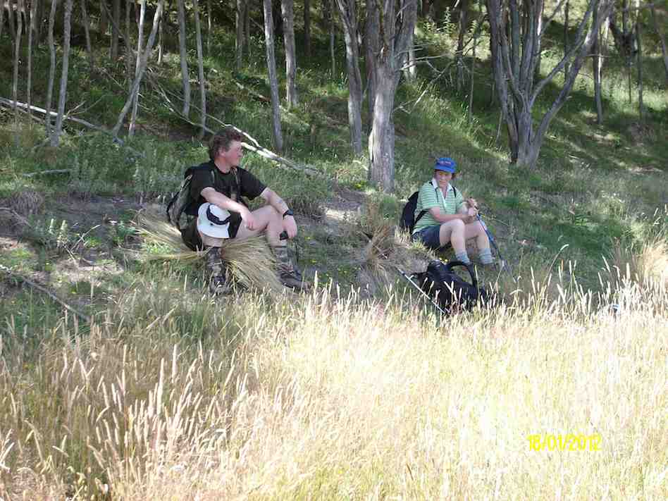
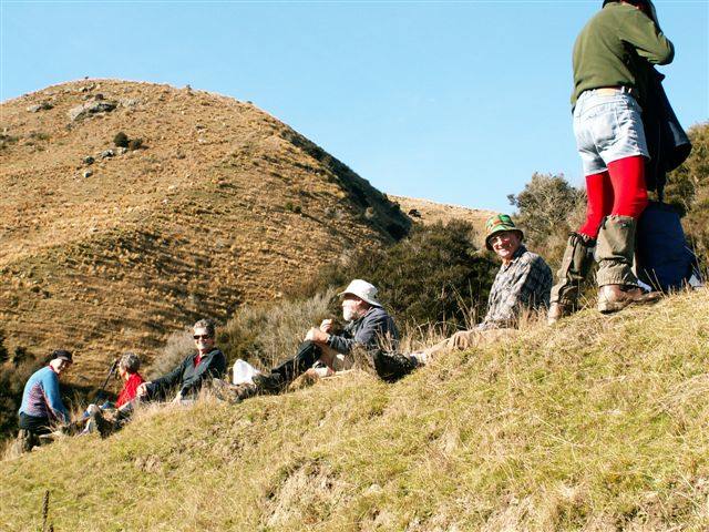
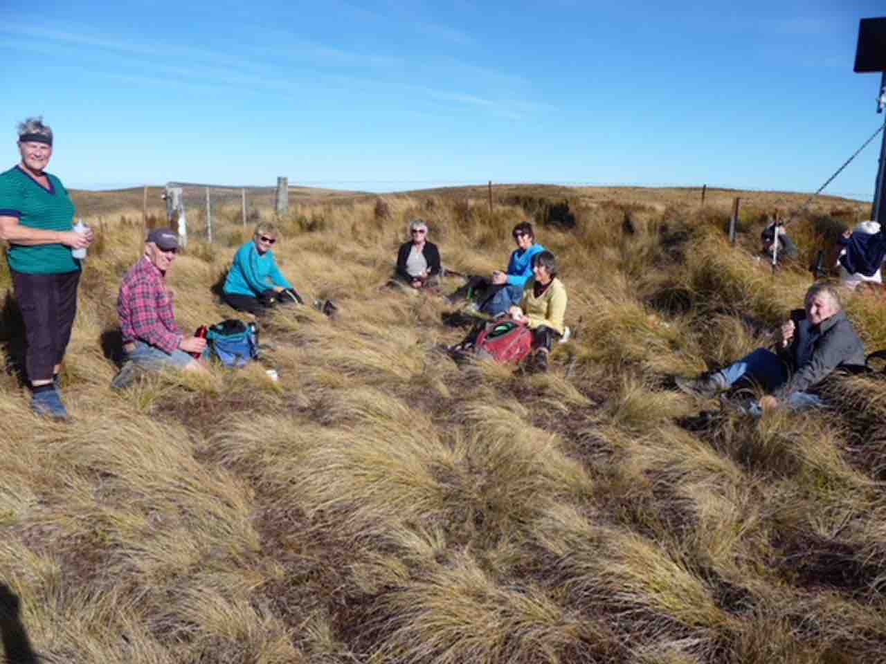
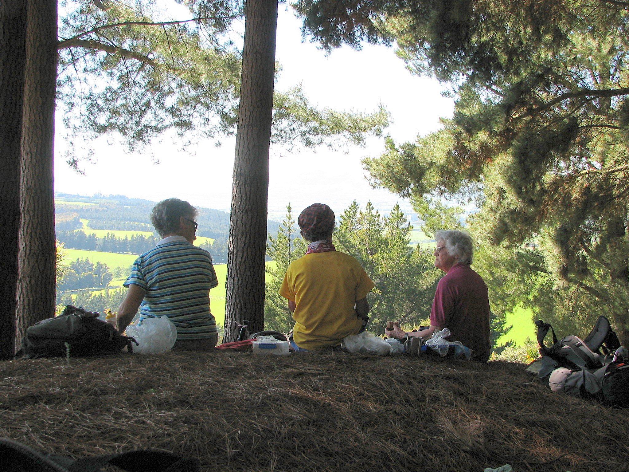
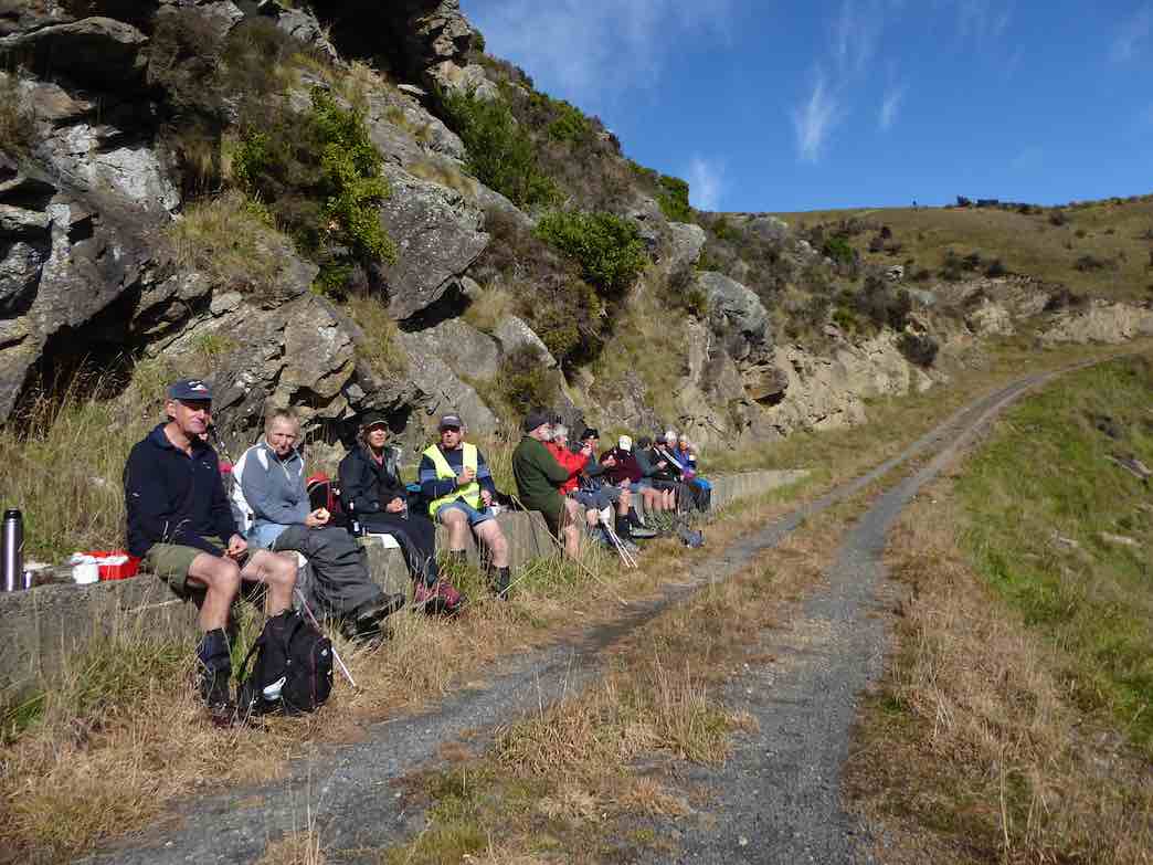
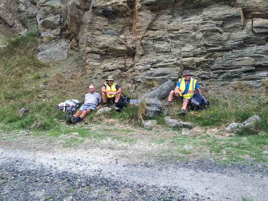
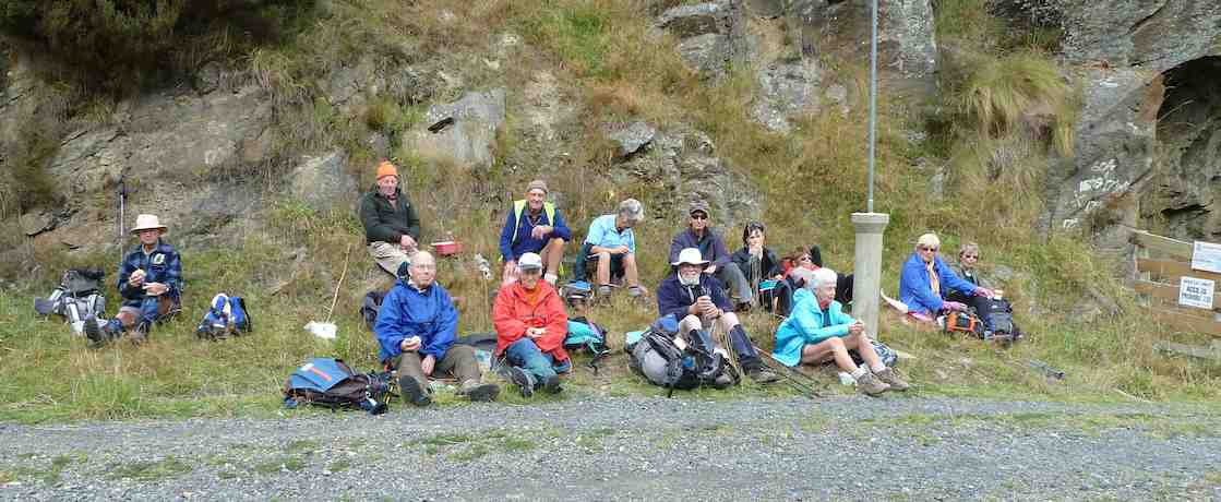
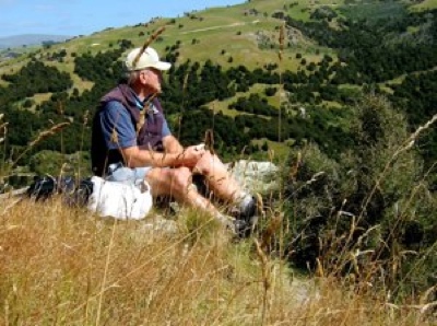
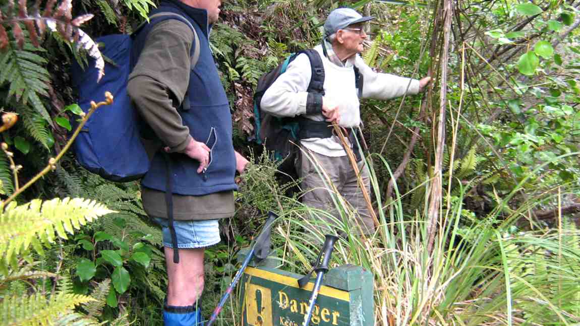
We stopped at the memorial Bryan Freeman seat – he used to be a good friend of Eleanor and her late husband.
The Bryan Freeman memorial seat- a good place for a break. (Dave pic and caption.)
Near the top of the track it was obvious the amount of tree planting and track maintenance that Steve Amies and his mates did many years ago.
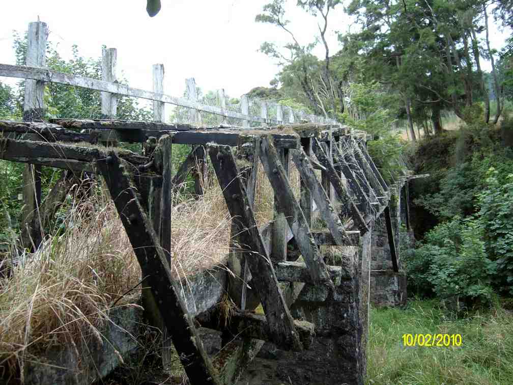
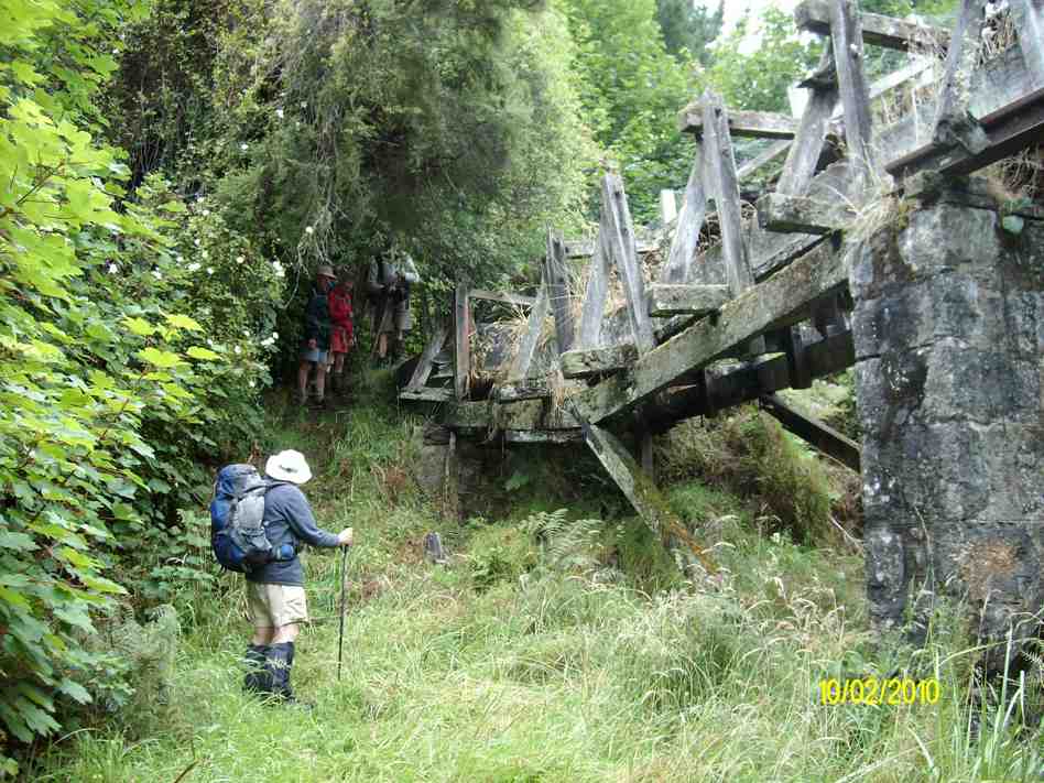
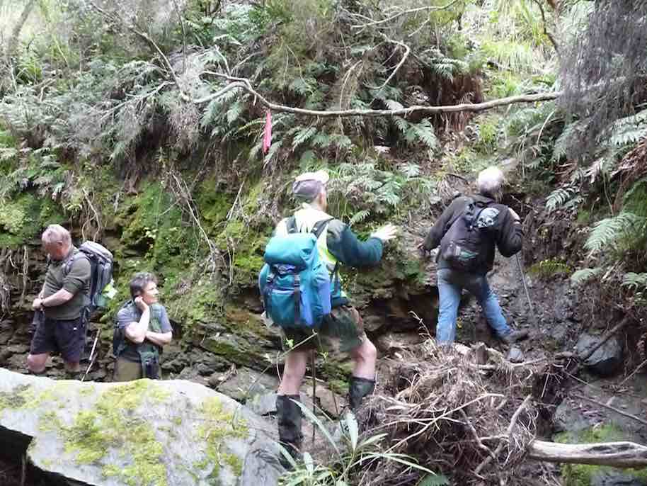
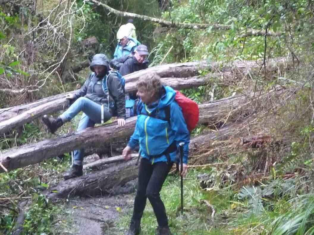
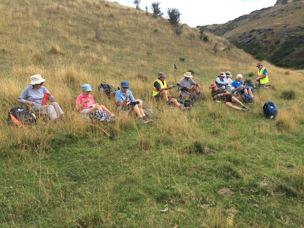
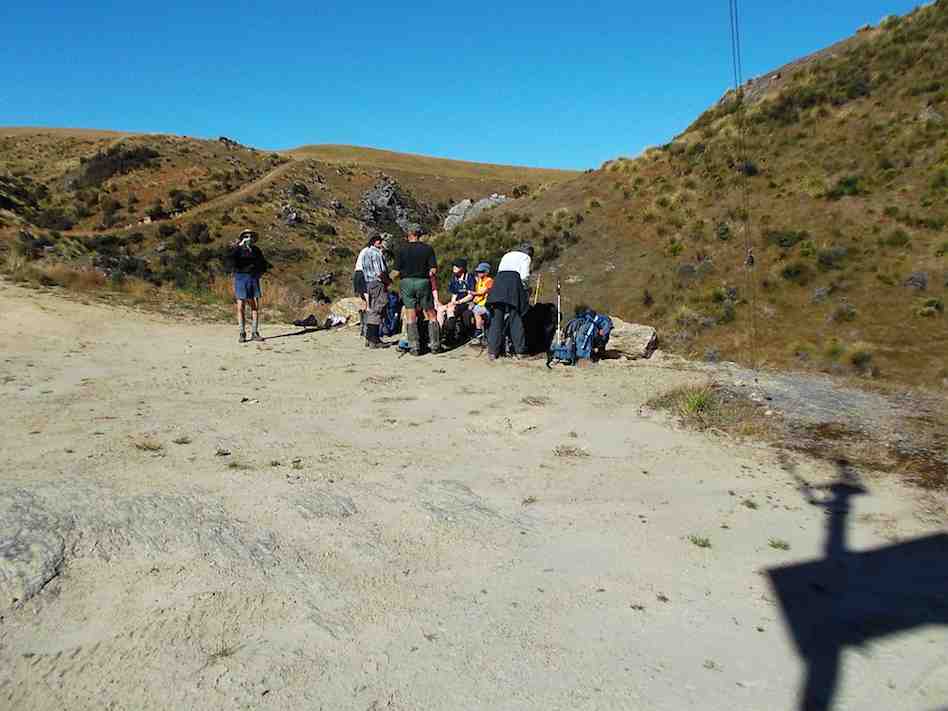
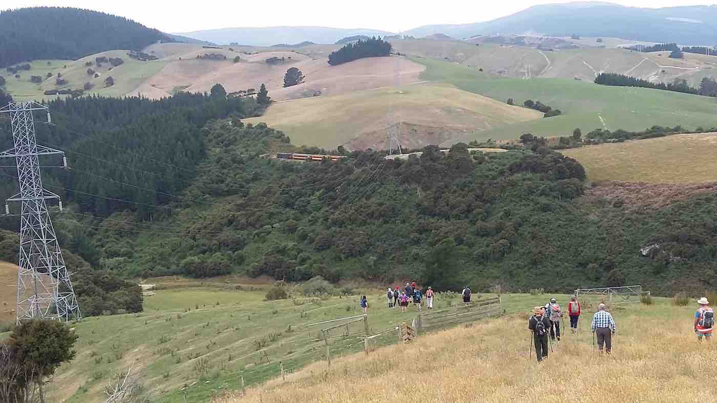
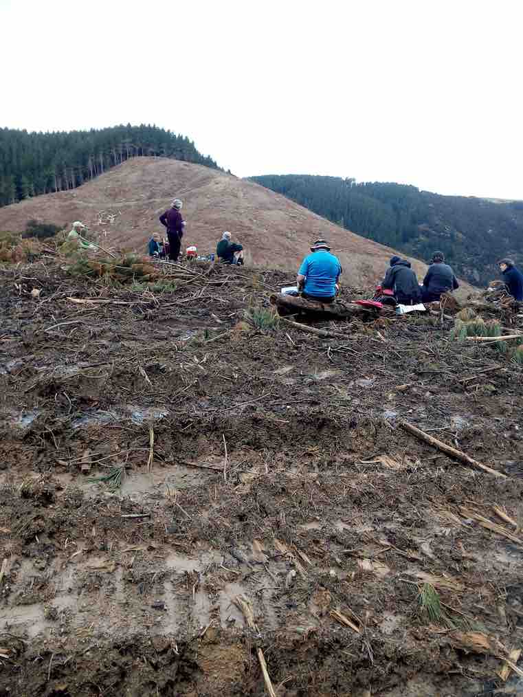
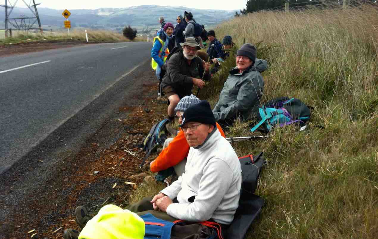
We then walked down Rollinsons Road and entered the bush that leads to the Whare lake loop track. It was in this area that a vote of thanks was passed to Arthur and Neil for the obvious work on track maintenance that they continually do (you no longer get your boots wet)!!!
Neil & Arthur’s Bridge. (Gordon pic and caption.)
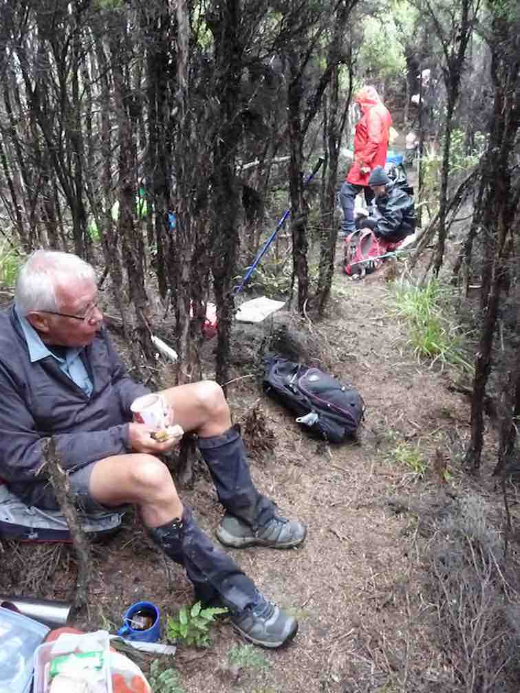
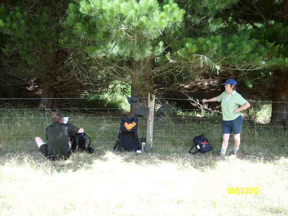
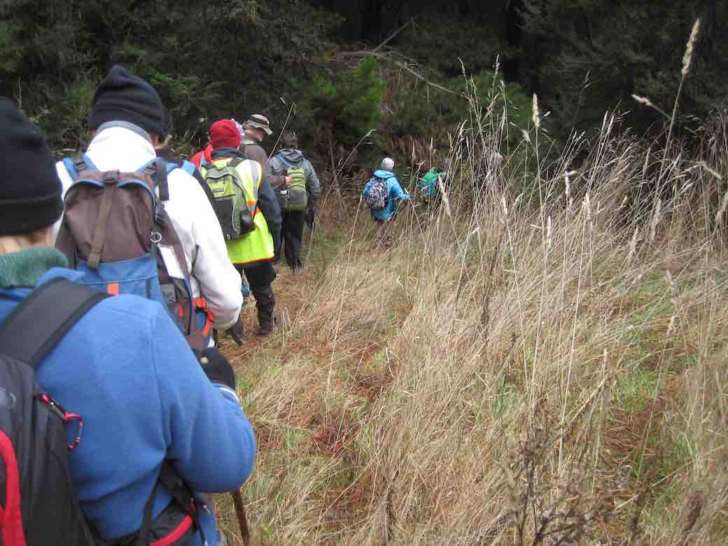
After having lunch on Smithys’ track it was then down through the bush and back onto Rollinsons road. Round the corner and off the flagstaff – whare flat road we followed an un-named track
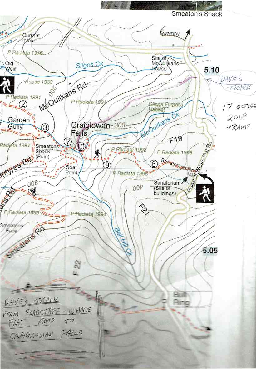
Dave’s Track to Craiglowan Falls.
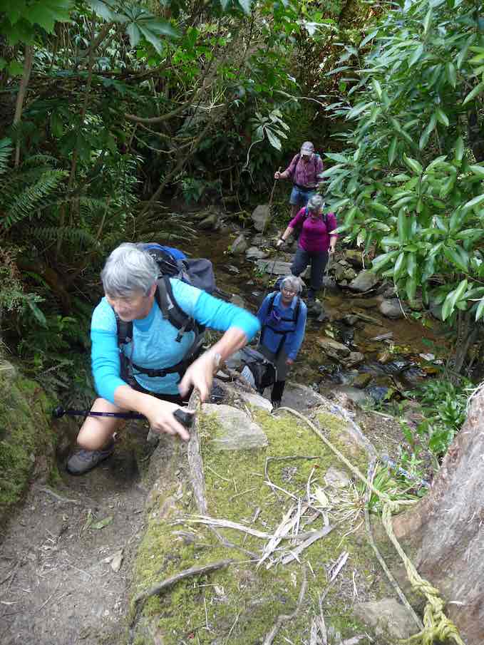
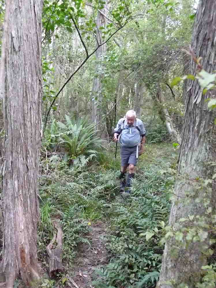
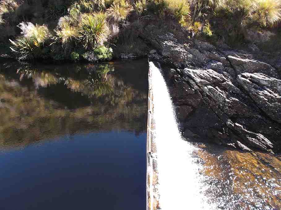
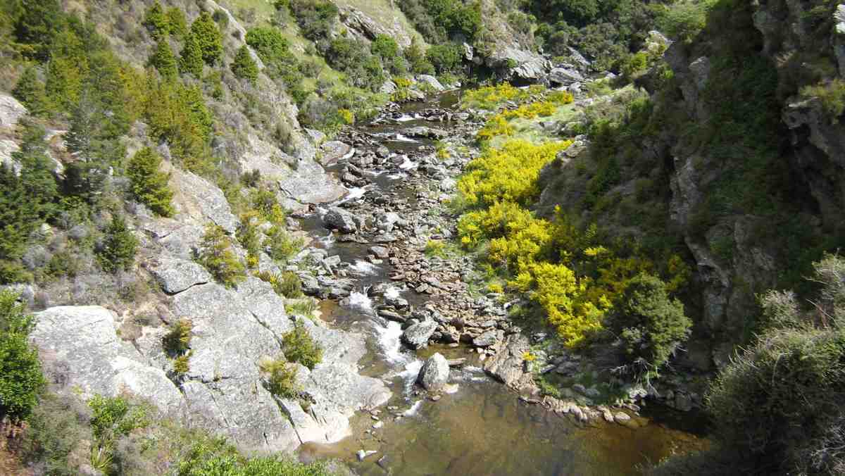
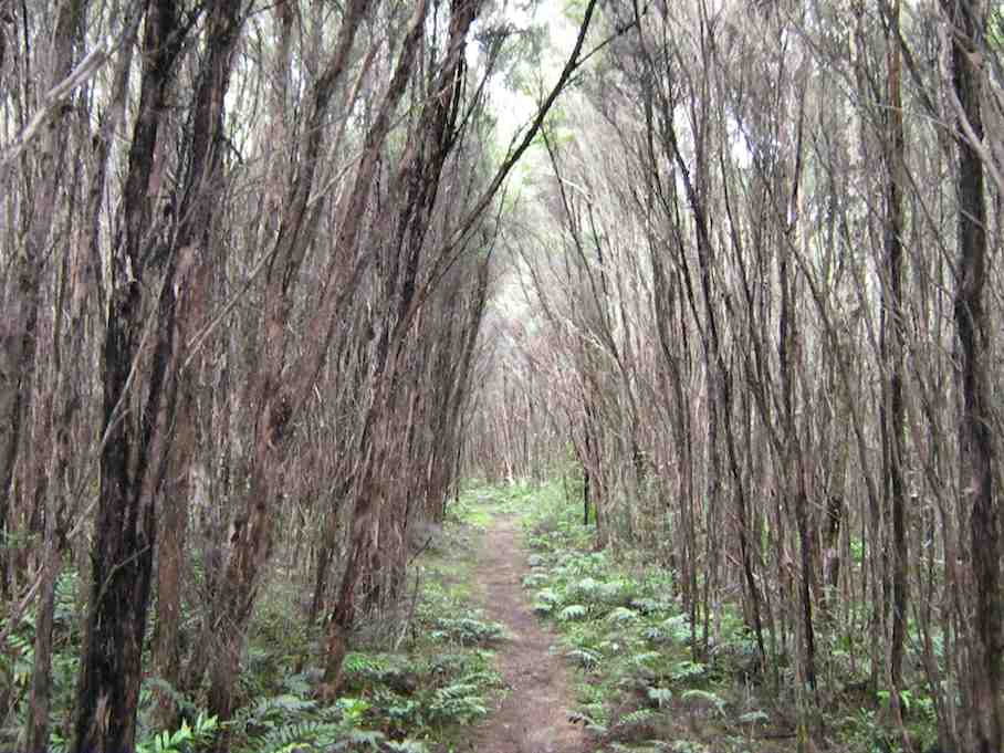
through scrub up to a pine plantation on a ridge.On the sides of the ridge were sycamore trees – a pest – but a pretty sight as the trees were coming into leaf. This improved track lead along the ridge finally ending high above McQuilkan’s creek.Everyone took care descending steeply down to the creek.
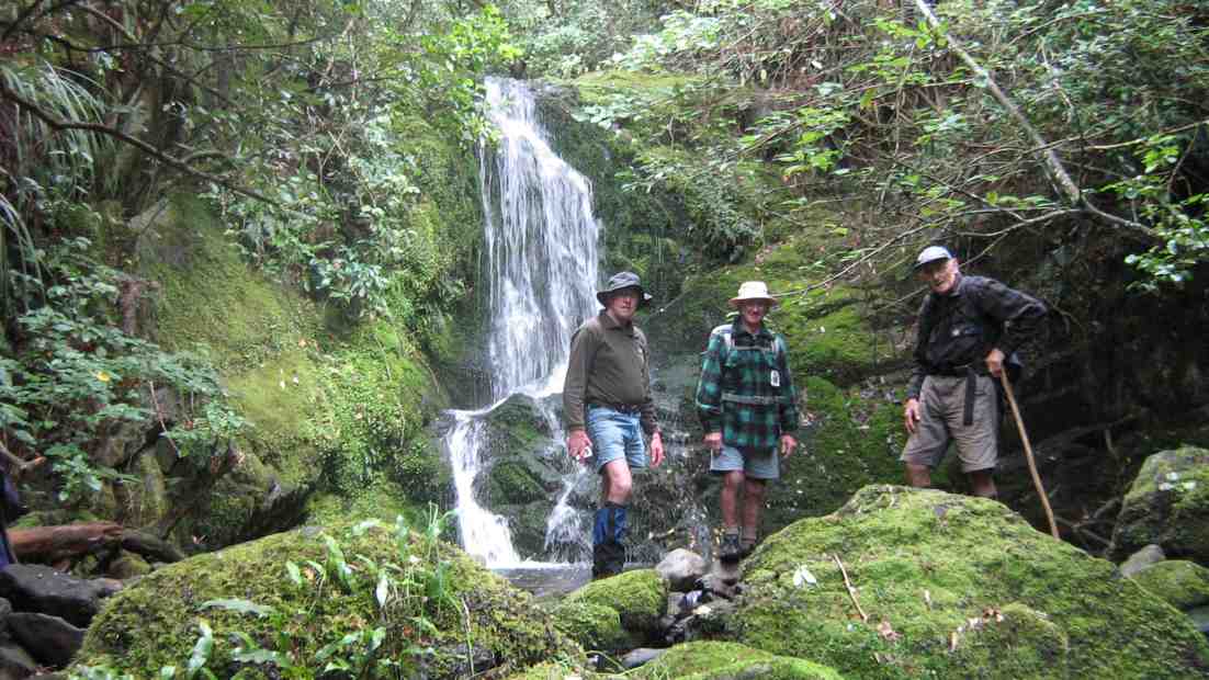
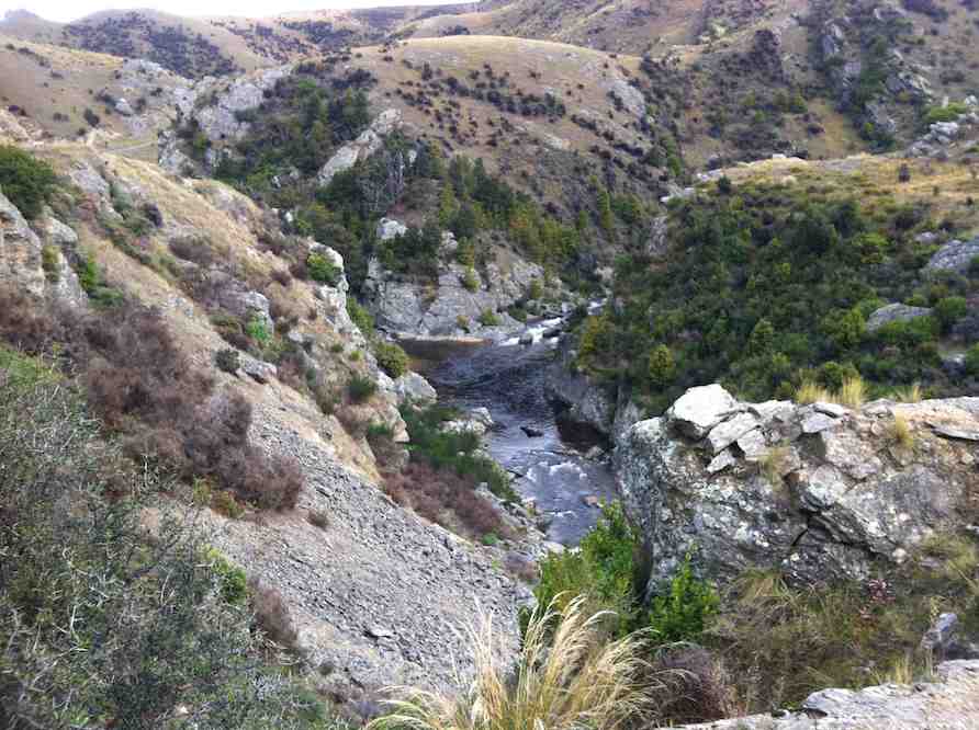
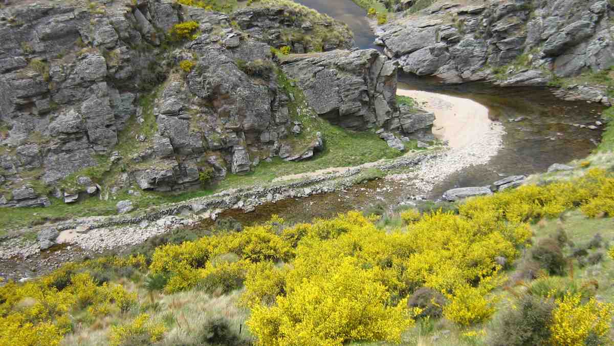
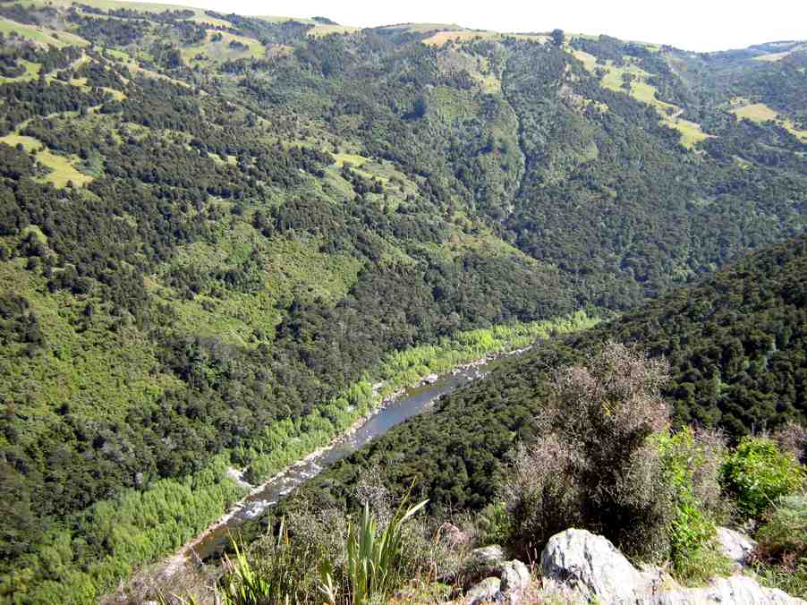
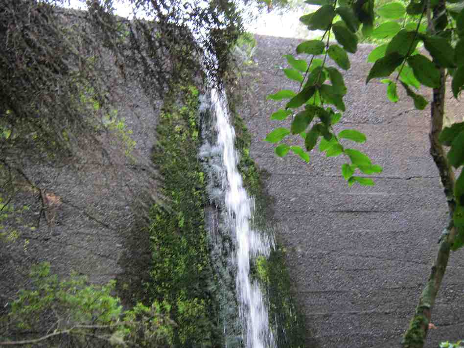
5 minutes up the creek we were at the Craig – Lowen falls – quite a sight!
Craig Lowen Falls. (Gordon pic and caption.)
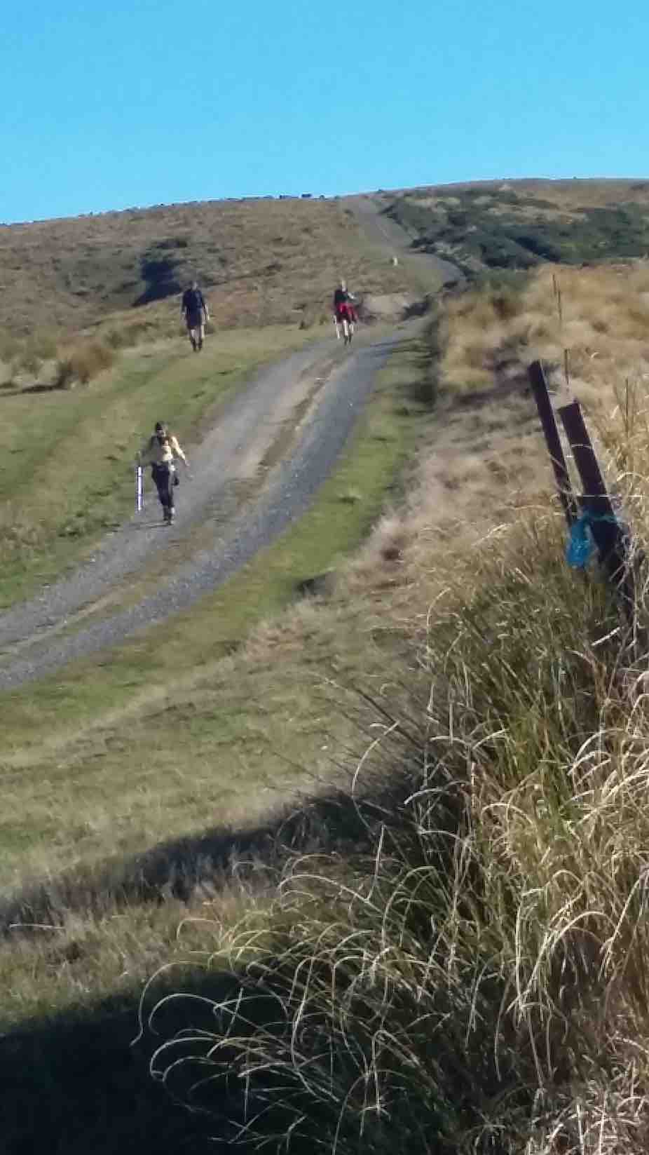
Another half an hour down the streamwe were out in the open and back to the cars.
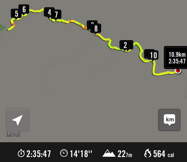
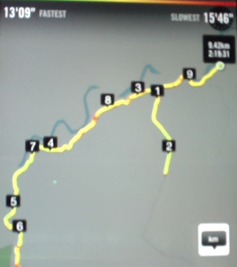
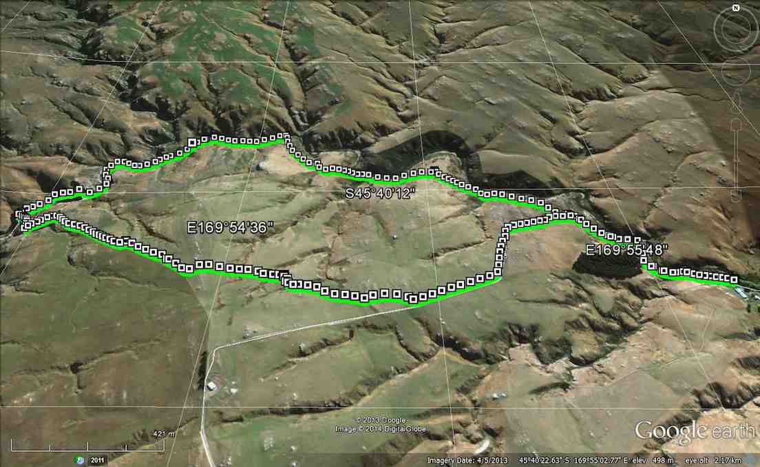
We covered 21,319 steps, 15.9km in 5.5hrs and gained a net height of 349 metres.
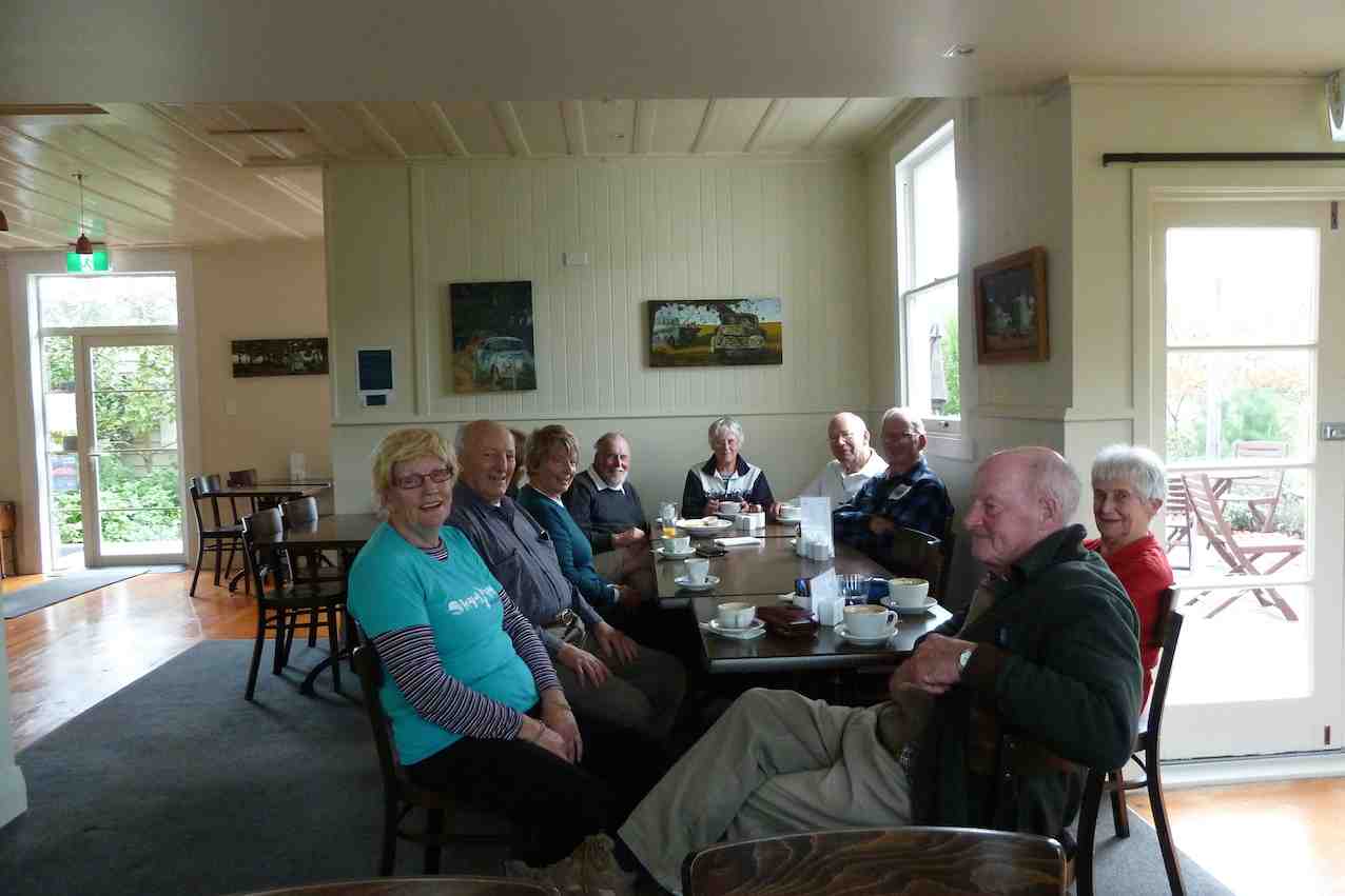
A good round trip!Dave
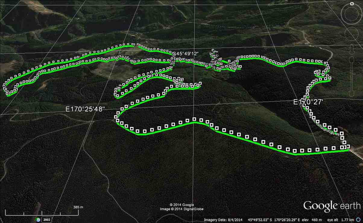
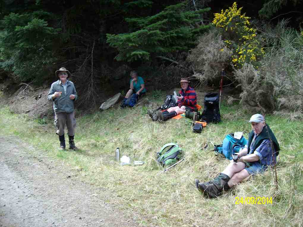
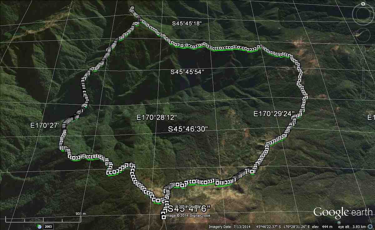
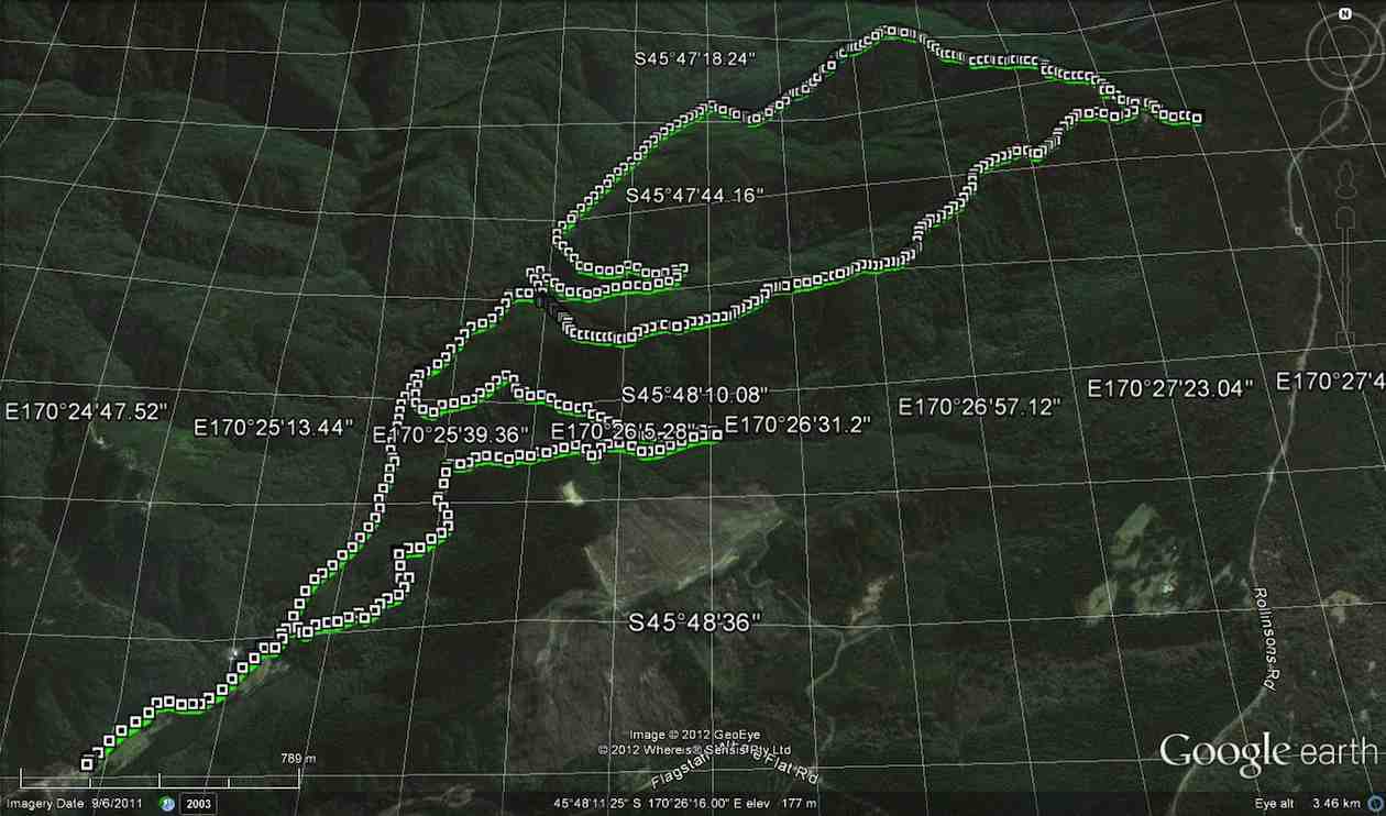
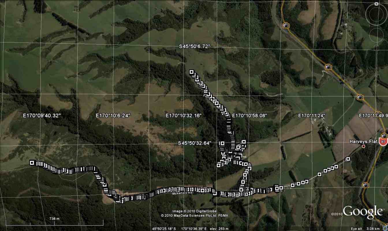
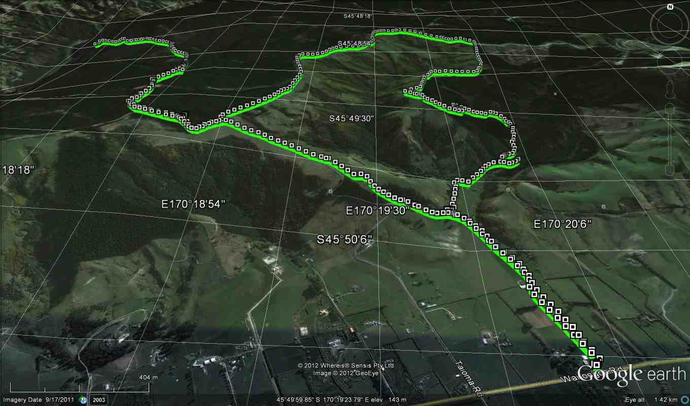
8. 24/9/2014. Trampers. Craiglowan Falls. M.
Enter via MacQuilkin Road up from Whare Flat Schoolhouse.
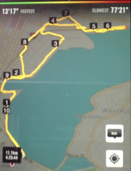
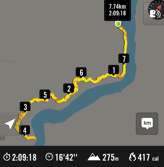
GPS of route, courtesy Ken. Craiglowan-Bullring-Aquaduct. We walked 15km; ave 4.3km/h; moving time 3 h 30m; climbed 531m.
This week’s tramp was to Craiglowan Falls. We started off at the locked gate on McQuilkans Rd & followed the marked track across numerous creek crossings [where one member got her feet wet at the first crossing] & up over the large rocks just before reaching the falls. We had morning tea break in the bush above the falls, & then retraced our steps for a short distance back to where a side track led off up the LH side of the stream. (Ed note: This was our original, and only, route down to the falls.) We were not sure where this went, but decided to investigate it anyway, as it looked like it had just had some work done on it. I climbed steeply up until we came to some pine forest, & at this stage I was quite sure that it would come out on the Whare Flat-Flagstaff Rd via Sanitarium Rd, which proved to be correct.
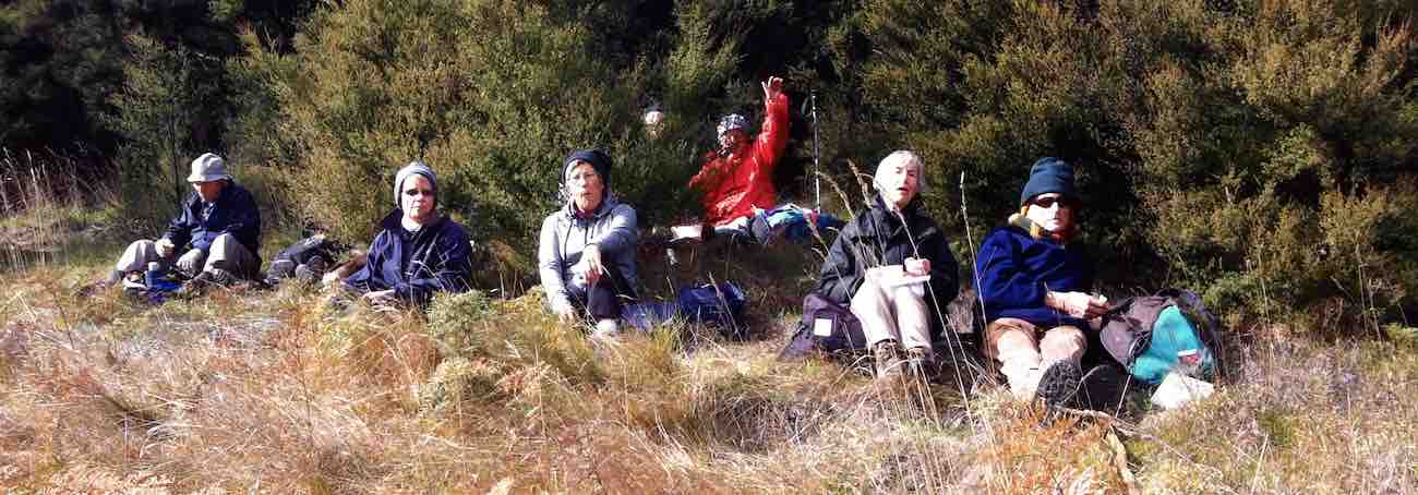
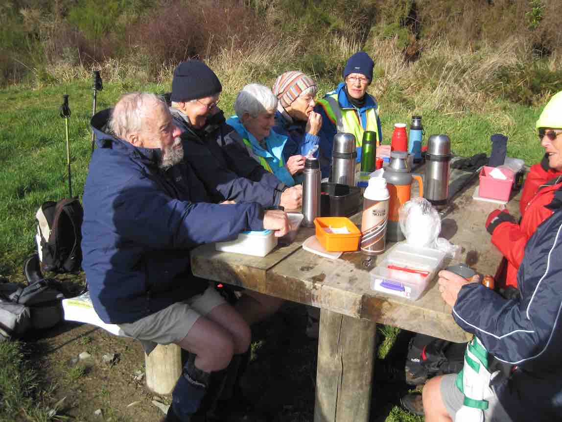
At this time it was only about 11:30, so we decided to walk up to the Bull Ring, & go down Longridge Rd to join up with Smeatons Rd,[where stopped for lunch] …
Lunch on Smeatons Rd – Ken pic and caption.
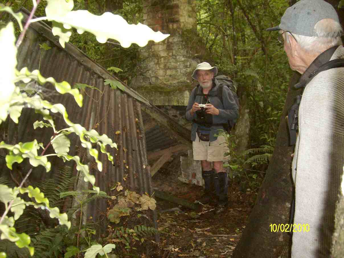
… – McIntyres Rd, [so we could view the remains of Smeatons shack] then down to the Aquaduct. This proved to be more difficult then would seem, as there were a lot of big trees down over the track in places, which made it necessary to detour around them. From the Aquaduct, we walked around to join up with McIntyres Rd. again, & then crossing straight over here onto the next part of the track leading to Longridge Rd. then back to the car.
Some of the tracks were quite muddy & slippery, but all made it safely back, & enjoyed the day. it was new territory for some in the group, & for others it had been a long time since they were there.
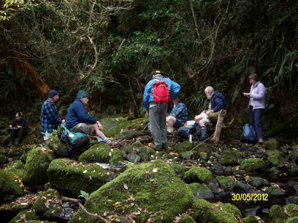
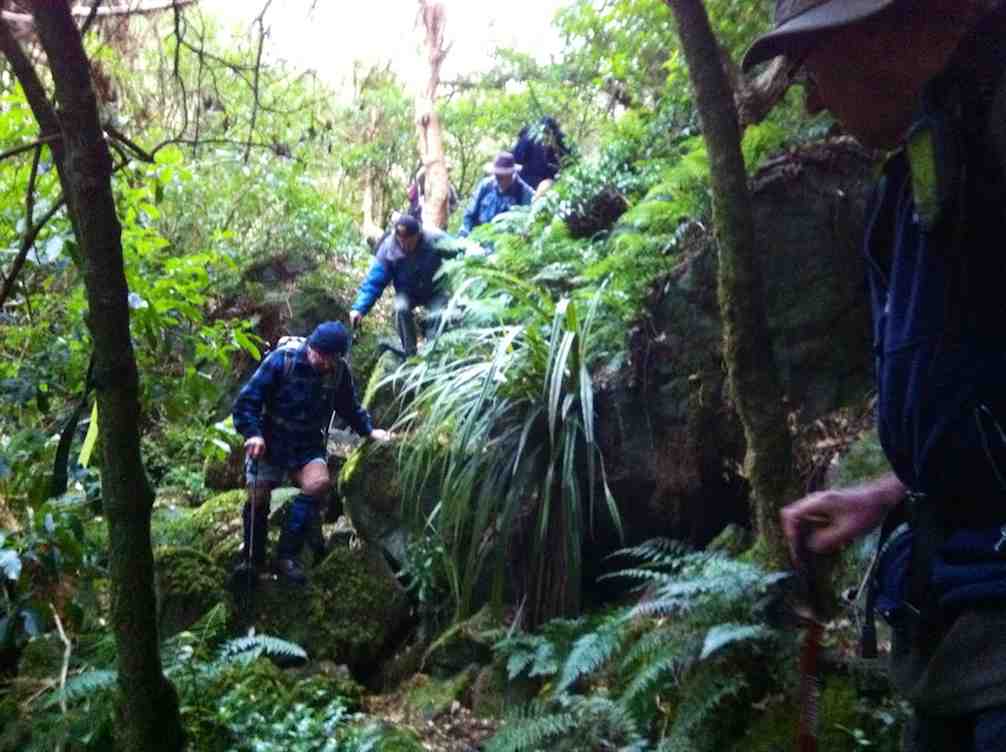
7. 30/5/2012. Trampers. Falls, Goat Point, Smeatons Shack, Aqueduct, Longridge Road.
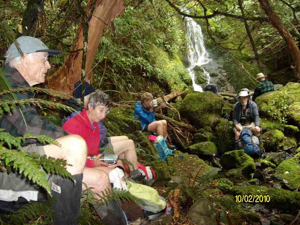
We reached the Falls OK, but stream crossing on wet rocks and climbing over mossy rocks proved rather dicey. (Note: This tramp best done in summer.)
Craiglowan Falls. (Ken pic and caption)
Morning Tea at Craiglowan Falls (Ken pic and caption)
A cautious descent on way back down over large mossy rocks.
Well, to this point, so far, so good. Back at the stream crossing down below the confluence, we failed to locate the track up to Goat Point, despite knowing its general area. So we climbed in faith and hope. Finally we came across track markers, leading left and right. After exploring left, we went right, until they led relentlessly down. So we retraced back up because Ian had it fixed in his mind that we had to go up to reach the pine plantation. Mistake one.
Encouragingly however, Ken found a track indication on his GPS, and it did promise to reach a forest road. So we kept to this, despite no track appearing, only plenty of scratchy blackberry brambles. But we did reach the road, finally.
This we walked down until we reached a junction, with signs indicating that we were on Smeatons Road, crossed by McIntyre road. Hooray. McIntyre was what we had originally wanted. Ian felt we still had to go down so we turned left and down McIntyre road. Mistake two. We should have taken McIntyre road to the right. More of that later.
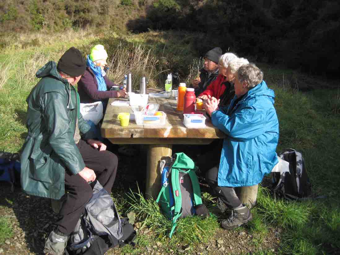
Anyway we made the long walk down McIntyre Road, left, to where the race crosses it, and turned right, along the race to lunch, as planned, at the Aqueduct.
Linzi at lunch.
Now, have a look at Ken’s GPS of our route. Click to enlarge. Start at the top, and follow to the right to reach Craiglowan Falls at the extreme right.
GPS of route, courtesy Ken.
Start returning to the left a bit. The zigzag you see is where we starting climbing away from the stream. A further zigzag a little further along is where we started following the track markers. The little tail to the left there, is where we turned back, before going back up again. CRITICAL MISTAKE. Notice, however, the short gap beyond to a tail coming up from below. This is the gap we should have traversed.
Now turn to page 8.07 of Antony Hamel’s Tracks and Trails, and find on the map of Flagstaff Forest at the top right, the circled number “seven”. See how it ascends first before turning right along a contour, below Goat Point and then DOWN to meet McIntyre road at its other end next to Smeatons Shack.
That tail from below is where Ken and Ian climbed up at lunch time to check where we should have come down. And lo and behold, we found not only Smeatons Shack but also the marked track next to it where we should have exited from. An aha moment. And it all became clear, as the GPS map confirms.
Ken and I returned back down the end of McIntyre Road to find the others had left, leaving Doug waiting for us. Of course we should have consulted with everyone to get mutual agreement with what we proposed to do and to arrange a meeting place should the others proposed not to wait. But in our excitement at solving the mystery, we had neglected to do so.
Anyway, going on out to the bottom of McIntyre Road at its other end, we didn’t know whether the others had simply turned down there and back along Long Ridge Road to the cars, or carried on along the race. In the absence of any indication, we set off along the race, as that had been the original intention of the tramp. We were relieved to catch up on them enough to see them further beyond us, but stopping to don parkas as the drizzling rain got heavier, lost sight of them again.
Emerging from the race end further up Long Ridge Road, we saw them again rounding a corner further down and caught up on them at the gate at the end. So all was well that ended well.
Quite an adventure and some interesting unplanned bush-bashing. A lesson in how bush conditions can change over two years and a reminder that our smaller numbers means that all our tramps now amount to a recce, – unlike the hikers, whose “reconnoiterers” go through our experience and sort things out first. – Ian
6. 10/2/2010. Trampers. Falls, Goat Point, Smeaton Shack, Aquaduct, Longridge Road. Leaders: Ian, Sabina.
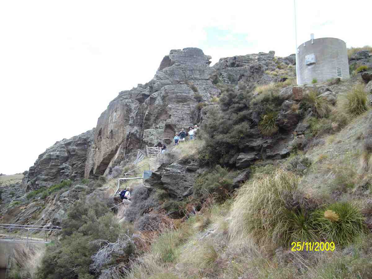
Down Whare Flat Road 1.5 km. Sanatorium Road second on left after Bullring. – Track no longer locatable from top by us.
It all got a bit complicated. First the leaders failed to find the track down from the Sanatorium Road extension track. Many, many fallen trees had obliterated all trace of the track where it first descends steeply down. Well, the leaders couldn’t find it anyway.
However the start of a new track closer in from the gate had been pointed out by a local landowner so that was followed on the day.
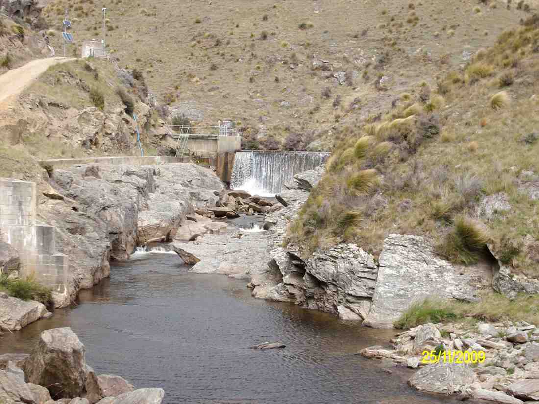
It was fairly well cleared but markers petered out down the middle of a steep bouldery stream (the McQuilkin way upstream from the falls?) so after a morning tea rest, we prudently retreated back up and began all over again, this time back at the old school-house. Up McQuilkin Road. Right-fork into bush and across the McQuilkin on a wire hand-hold. On up and eventually back across to the true right and to the stream junction. Interesting notice points to “Watar fall”. Up over the large rocks and now it was lunch-time at the falls.
Then following out along the race to the other end of McIntyre Road, and across it to the far end of the race where the track comes out on Longridge Road. Down the road and back to the cars. What could have been a very short day comfortably filled out to be more satisfyingly longer. Must ask those landowners how that other track gets you to the falls. And must check out whether the old track is still navigable. – Ian
5. 3/8/2005. Both. School House, Craiglowan Falls, – Whare Flat. Leaders: Judy, Jacqui, Hazel
4. 6/8/2003. Both. Craiglowan Falls. Medium. Leaders: Doug M, Hazel, Barbara L, Mary M.
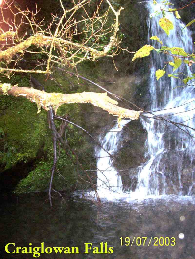
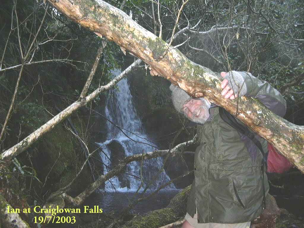
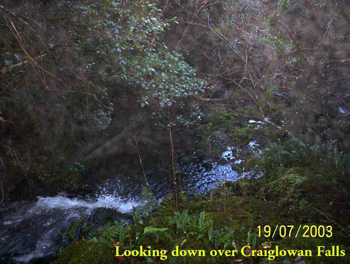
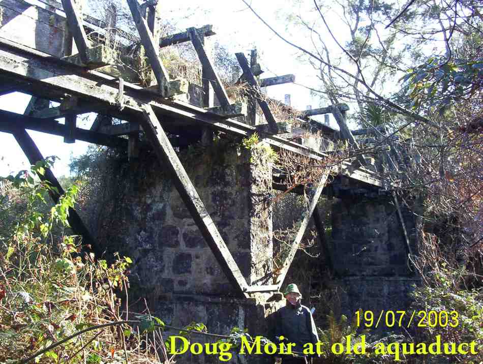
3. 19/7/2003. Craiglowan Falls.
Craiglowan Falls
Craiglowan Falls. Ian
Upstream from top of Craiglowan Falls.
Overlooking top of Craiglowan Falls.
Old Aqueduct. Doug.
Top of old aqueduct.
2. 30/8/2000 Craiglowan Falls, Whare Flat. Leaders: Mavis, Winifred, Val
1. 16/4/1997. Craig Lowan Falls from Bull Ring. Leaders:Hugh, Val, Judy C
3. 10/10/2018. Trampers. Greengage Circuit. Leaders: Arthur and Gordon.
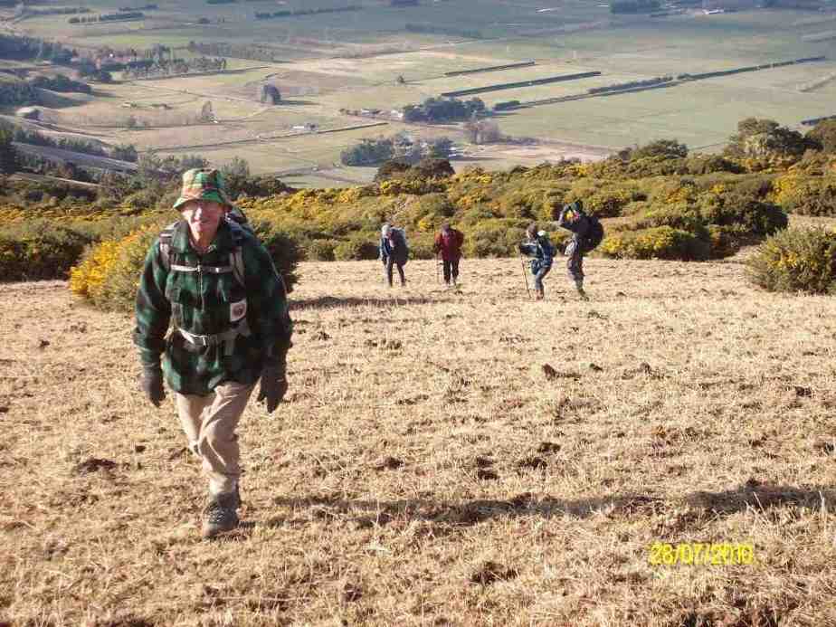
Daylight arrived with a warm norwest breeze and a bright sky – but the forecast was not good.
Nine energetic trampers ceparted the car park at 8.30 a.m. for an early start. Passing through the locked gate on Rollinsons Road, we parked at the ‘elbow’ and began our tramp from there.
Going down the Rainguage Track for half an hour took us to the start of the Greengage Track, which we followed. Getting ever steeper took us to the stream …
Hiking down into Silverstream. (Gordon pic and caption.)
… at the bottom, which we crossed – this being part of the Silverstream.
Now for the best part of the day. We had a 30 metre rope
Waiting to climb out of S:stream. (Gordon pic and caption.)
to assist our climb out of the stream bed. The reward at the top was the smoko stop.
Waiting their turn on the rope. (Gordon pic and caption.)
From here it was the long climb up onto, …
Nearly there. (Gordon pic and caption.)
… and to the top of Green Ridge. It was rather tough going at first but the grade eased as we progress upward.
Heading up to Silver Peaks Track. (Gordon pic and caption.)
Around 11.30 a.m. low cloud descended, with dampness in the air. Near the top of Green Ridge, a lunch halt was called in a cosy sheltered place.
A much needed lunch break. (Gordon pic and caption.)
After the welcome food and rest, it was only a few more minutes to the main Sliver Peaks Track. After the track we had been on, it was like a highway!
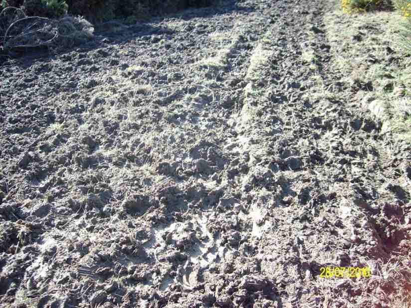
Turning right, (we turned right at every junction we came to today, except the first and the last ones), we followed it to “Sleepy Hollow“. After a brief rest stop, we were now on the Swampy Ridge Track, which had about 1 km of very muddy track to contend with.
By the time we reached Rollinsons Track, the rain was falling.
A little over half an hour would have us back at the cars, bu we were exposed, and out in the open now. It got colder too, and flurries of snowflakes were observed.
All arrived back at the cars in good condition and in a happy frame of mind. Warm but damp to some degree thoughts turned to home and hot showers, etc.
We had tramped about 15 km, in mostly good conditions, and with a very worthwhile tramp to our credit. Thanks to all. – Art.
2. 20/1/2016. Trampers. Greengage Track, anti-clockwise.
Ten hardy souls set off from sunny Mosgiel for a hard tramp. Travelled up past the scout camp and up to Rollinsons road where we parked our cars.
Within the first 10 mins on the Rollinsons track, some of us had wet feet. One can see why they call this area swampy. Lovely views as we went along our way.
Lovely views. (Helen pic)
Alas the fog came in and we could not see much. It was nice and warm though. Walked over swampy summit tramp.
Swampy Track. (Helen pic)Across to Green Hut? (Helen pic)
Morning tea stop was about 5 mins from the Green hut.
Morning Tea Stop (Helen pic)
Went onto the Green Hut track then Greengage track. This track not used a lot.
Track not used a lot. (Helen pic)
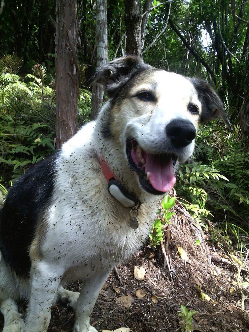
Lunch on this track. Carried along then onto Raingage track and back up to the cars. Lots of quite hard walking up and down slippery hills. A few of us did some bum sliding in patches. Abseiling down about 20 meters and crossing a creek were part of our day. A few stiff bodies as we finished the walk. Lovely to have our search and rescue team Dermot and Fin the dog with us.
Fin, the dog. (Helen pic)
A hard tramp but was very enjoyable. – Helen
1. 27/8/2014. Greengage Track.
Greengage Tramp. GPS of route, courtesy Ken. We walked 12.5 km; moving time 3 hrs 45 mins; Ave 3.3 km/hr; Climbed 780 mtrs. [That’s getting close to 1 km straight up !!]On what turned out to be a very nice day for tramping, 4 of us set out to do a tramp on a newly opened track, namely Greengage track. This runs from Rain Gauge Spur track, over to Green Ridge track.
Having cajoled a key from the DCC for the locked gate on Rollinsons Rd. we parked up at the elbow, & made our way over to Raingauge Spur track. Then it was quite a lengthy walk down here, for about 3/4 hr [ including a morning tea stop] from the car before we got to the turn off onto Greengage track. As nobody had done this tramp before, we were all looking forward to it, but didn’t realise just how hard it would be. The track is quite steep, & drops all the way down into the valley, where you cross a stream [ part of the Silverstream headwaters] & clamber out the other side with the help of a rope, which has been thoughtfully put there. From here it is a steep climb nearly all the way up to Green Ridge track, where we arrived about 12:30, & then we walked along the short distance to the Green Hut site, where we had lunch, & a well deserved break.
Lunch stop at Green Hut site. (Ken pic and caption)
The return journey was supposed to retrace our steps, but I couldn’t face the prospect of climbing all the way back down into the valley, & then climbing all the way back up to the car, I put it to the others that we could take an easier way out via Green Ridge track, & then onto the Swampy Ridge track, then along Rollinsons Track back to the car, this was accepted without protest.
So after lunch we set off again, & turning onto the Swampy Ridge track, we soon discovered why it is called “Swampy” , as there were lots & lots of very wet muddy stretches, which were ankle deep in places. We eventually found the entrance to Rollinsons Track, & made our way cautiously along the first part of this, as markers were conspicuous by their absence. The last half was well marked, & the climb out to the car, up the very wet track [running water] was useful for cleaning our boots !!
This tramp is not recommended for unfit persons !! I was suitably shattered when we arrived back at the car. – Ken.
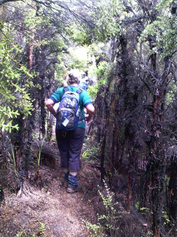
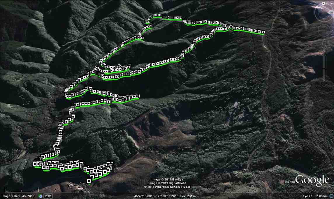
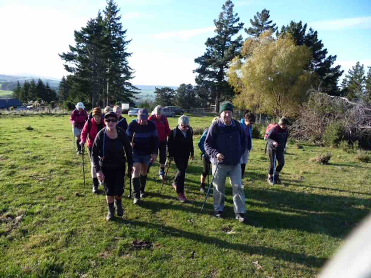
19. 29/8/2018. Trampers. Steve Amies / Little Coal Tracks. M. Leader: Arthur.
7 very keen Trampers did a bush circuit in the Silverstream Valley. Parking at the Pump-house we followed the track past the swing bridge, then up to Tunnel Track to take us to McRaes Weir and the shortcut up to Steve Amies, down Little Coal Creek Track, and returned on Racemans.
Morning tea was taken a partway along Tunnel Track, above a large slip, where there is a good view across to The Chalkies. The shortcut track up to Steve Amies is a bit of a grunt, but taking our time we easily overcame it.
The day had shown promise before we started, but the cloud was low down on all the surrounding hills and high up on the Steve Amies Track the rain started. On reaching the top, at Trig Q, we immediately started down the Little Coal Creek Track.
We stopped to have our lunch in the first relatively sheltered place in the bush. It was colder, so we didn’t stop long before following the track on down.
The lower half, especially, of the Little Coal Creek Track is steep in places and was slippery and rather treacherous from the rain that had just fallen.
A variety of techniques were tried for descending the trickier patches – stepping, slipping, sliding, …
Very slippery track back down. (Gordon pic and caption.)
… falling, …
Still very slippery ? (Gordon pic and caption.)
… tree hugging, and even the rolly-polly method. Afterwards I was assured that all had thoroughly enjoyed (?) the experience – which seemed strange to me.
The last leg of our trip was simple in comparison, along the Racemans Track.
Everybody happy to be on level ground. (Gordon pic and caption.)One final obstacle. (Gordon pic and caption.)
We were back in the cars around 3.15 pm, and I have it on good authority that we had walked 15 km.
The rain had eased off later, and conditions were pleasant other than being cold at lunch time. The leader awards a Gold Star to each of the party for their contribution to a great day’s tramping.
Upon returning to Mosgiel it was decided it would be inappropriate to visit any coffee shop, due to travel stain. – Art.
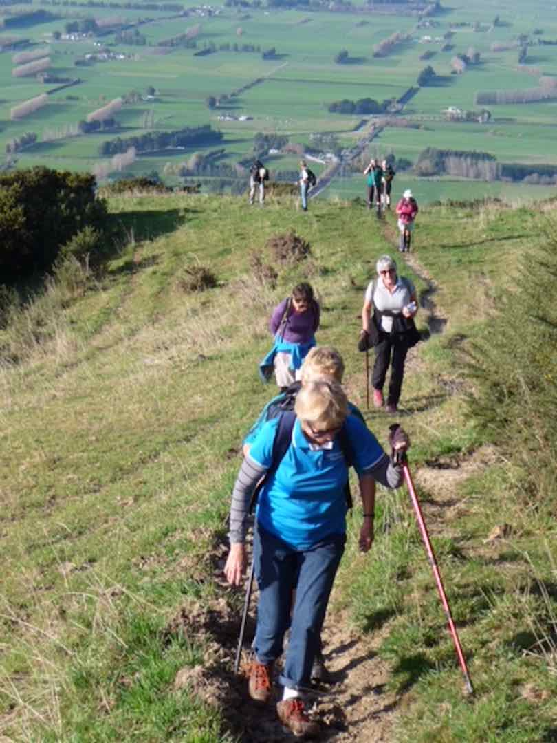
18. 14/9/2016. Swine Spur – Rollinsons Road – Steve Amies – Tunnels Track. M. Car Shuttle. Leader: Arthur H.
A clear sky, brilliant sunshine, and only a light breeze – perfect.
After setting up a car shuttle for later, 6 enthusiastic trampers began the day’s operations from Rollinsons Road, to walk up the full length of the Swine Spur track.
We reached the junction with Possum Busters at 9.55 a.m. and made this our morning tea stop. There was some dissension about stopping early, but hey, the leader is the boss. (He has to have the occasional privilege.)
Morning tea spot. (Arthur pic and caption.)
Further up we met 4 trampers and a dog coming down – and soon found that it was the same group that had had morning tea with us a week ago on the Tunnel Track. Pleasantries were exchanged.
Our group powered up the steep upper part of Swine Spur, …
High up on Swine Spur. (Arthur pic and caption.)
… the talking hardly lessening, …
Near top of Swine Spur. (Arthur pic and caption.)
… and we topped out at 10.45 a.m.
At top of Swine Spur. (Arthur pic and caption.)
After a brief pause to enjoy the view, we walked the road, passing the VOR aviation beacon on the highest point of Swampy, going down now.
After 50 minutes on the road we were on the track, heading in to Trig Q. On the way past, we stopped to check out the picnic area before heading down the Steve Amies Track.
With perfect timing we stopped at Bryan Freeman’s Memorial Seat to enjoy our lunch. A very pleasant spot with the sun filtering through onto us.
Lunch on Steve Amies. (Arthur pic and caption.)
Note – Bryan Freeman was a keen tramper who died here on the Steve Amies Track in 2011. He was the son of Jim Freeman, who is remembered by the track named after him.
We continued down the Steve Amies Track until turning off to the left onto the short steep track that took us down to McRaes Weir and “the rope”.
From there we followed the Tunnel Track, which in turn follows the contour. Easy track but very enjoyable. No-one showed any enthusiasm to enter the tunnels, but we did admire them in passing.
We reached our tramps’ end at the road at 2.15 p.m. My car was nearby and it soon re-united Neil M. with his one at our starting point.
And so, back to Mosgiel. The good weather, together with the variety encountered during the tramp had made for an enjoyable day.
The distance tramped was around 11 km (at a very rough guesstimate). – Arthur.
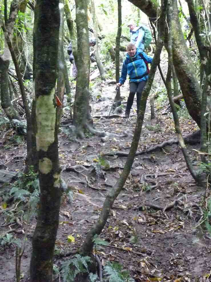
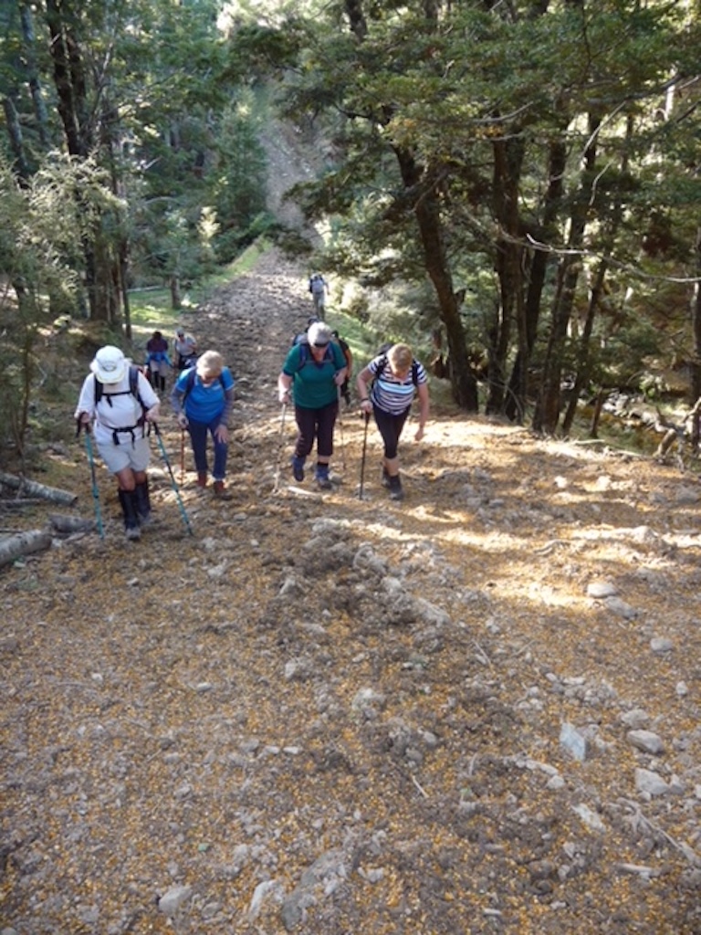
17. 14/10/2015. Trampers. Little Coal and Steve Amies.
The tramp today was into the Silverstream Tunnels track, up Steve Amies track, & down Little Coal Creek track, with lunch at the picnic area near trig Q at the top,
Lunch at trig Q at top (Ken pic and caption)
& back along Racemans
Return on Racemans (Ken pic and caption)
to the cars.
This was an uneventful trip, with no problems encounted. The weather was great, cloudy conditions with very little breeze.
Eight trampers took part in the days activities, including a stop at a viewing spot …
Enjoying the view (Ken pic and caption)
16. 15/10/2014. Trampers. Little Coal Creek, Steve Amies. H.
Little Coal Creek, steep in places, can be slippery.
4 of us set off from the Pump House up Silverstream Valley, onto the Racemans Track. Calm weather. Had morning tea at a sunny spot at the junction of Little Coal Creek track. Took off one layer of clothing. On the ascent, stopped a few times to take in the views. Had lunch at Trig Q. The weather was so calm the bushes were not moving at all at 505m.
After lunch, we went down Steve Amies track, stopping to take in the views north, south and west and listening to the birds, – the noises of them!
Back along Racemans Track to the car. Tramp enjoyed. The biggest comment on the trip was ‘How calm’. – Heb.
15. 29/7/2015 Trampers. Little Coal, North Coal.
GPS map of route, courtesy Ken. Racemans Little Coal North Coal McRaes Weir Tracks. Walked 14.5 km; 4.3 km/h ave; 3h 23m moving; climbed 460mtrs.
Today was a hurried change of tramp, as when I got up to the Bullring for the start of our tramp, it was foggy, blowing, & VERY cold, so I made the decision to cancel this, & meet at the start of Silverstream Rd. Where we decided what we would do for the day.
We then made our way to the pump house car park at Whare Flat, & set off along Racemans track. When we reached Little Coal Creek track we decided to go up there, & come back down North Coal Creek, if the tracks were suitable. The ground was surprisingly dry, so we had no hesitation about carrying on. After struggling up Little Coal, with numerous stops to regain our composure, we arrived at the junction with North Coal track, so we went down there a short distance out of the breeze to have lunch.
Three of the group at lunch. (Ken pic and caption)
We were all looking forward to descending North Coal, as last time we did it, Finn, Dermot’s dog was the one who led us in the correct direction, as the track was in very bad condition due to storm damage, & was non existent in parts. However, the Green Hut Track group have been through there & reopened it, & put in some more markers, so it is very easy to follow, but quite difficult travelling.
On the way back we went around the McRaes Weir track to lengthen our journey a bit, & walked down the unmarked track that comes out beside the picnic table down near the Silverstream. We stopped here for another cuppa before we walked out to the cars.
There were no incidents today , apart from me slipping off the edge of Little Coal track at one point, & managing to arrest my slid with the aid of a handy tree. No damage apart from pride !!
The day had a few light showers, but didn’t require wet weather gear, however it paid to keep moving, as the temperature was quite cool with the small amount of breeze.
14. 1/2/2012 Both. Steve Amies from Access Road. Leaders: Arthur and Barbara.
Sixteen of us left our cars at the locked gate on Rollinson access Rd and made our way up to the Track Clearers’ Picnic area. The leaders took us round many of the little nooks and crannies (they just seem to multiply of their own accord), stopping to inspect the labels fronting each bush planting. Of poignant note in front of one bush was a label printed with the name of Les Murcott, whose funeral a number of us had attended only a fortnight earlier.
We stopped off for our tea break.
Arthur led us down and across to Trig Q, and then on down Little Coal Creek until we got to the look-out. We careful negotiated some quite steep parts of the track and avoided any casualties. Then came the more arduous climb back up to the trig and across to the Steve Amies.
This latter track had a much more moderate decline (we stuck to only its upper reaches!), past another look-out, before making another turn around further down, to wander back up to the trig and on to the picnic area for lunch.
On the way across the wee saddle, we stopped to investigate the meaning of a sign indicating a sheltered area, whose side track opened out to a large open area in the bush, marked with a large white wooden equal-armed cross, laid flat on the grass. After some discussion, we decided the area was also to serve as a helicopter emergency landing spot. (There was even a ‘waiting room’ bench for passengers.)
Back up at the picnic area, our leaders discovered for us yet another alcove with ample tables and seats for a comfortable lunch.
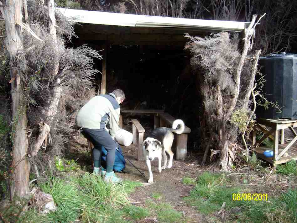
Our leaders took us out to the road by a route different from the one we had entered by, and lo and behold, a salubrious shelter, doubtless erected by the track clearers for their comfort. Bravo.
Then we had only a stroll back down Rollinson Road to the cars. A leisurely 5.5 km walk, (as measured by two with their measuring devices.) Thank you, Barbara and Arthur for your careful leadership. – Ian.
13. 17/10/2012. Trampers. Pumphouse, Racemans, Steve Amies, Little Coal Creek, Racemans, McRaes, Pumphouse.
GPS of route, courtesy Ken.We walked approx 14kmMoving time 3h 50minave 3.6km/hrTotal ascent 559m – Ken
Five of us had a great day doing the two ridges. The Steve Amies was as steep a struggle as ever at its foot. The easier bit at the top seemed much longer than the writer’s memory had shortened it. We had a leisurely lunch at the set of seats and tables a little beyond trig Q. Sunny and no wind. Great.
Then back again and down to where Little Coal Creek branches off from North Coal. Again the first bit of climbing on Little Coal had escaped the writer’s memory. The steep ridge descent needed careful negotiating. One of the party was heard vowing it was a track they would never wish to ascend. Then it was off the ridge and down the side. The ground is so heavily littered with twigs and leaves that it is almost impossible to keep one’s feet on the steep bits.
Forgot to take photos! And the one below, taken back on the Racemans turned out mysteriously bad.
Taken on the Racemans on the return journey.
We elected to take the McRaes track back. The GPS of the route brings out the depththat the gully takes the track into before emerging back out again. We stopped en route for a drink break as it had been a longer day. We made our way around until turning off at the junction with the Tunnels Track onto the connecting track that took us down to emerge by the swing bridge.
A longer day – we got back out about 4 o’clock. Considerable height climbed and descended. A good work-out. And it was our good luck that the promised rain held off until we were back in the cars again. – Ian.
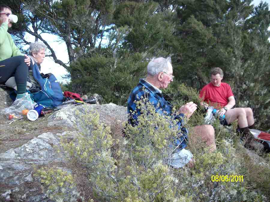
12. 8/6/2011. Trampers. Tunnels, North Coal, Steve Amies, ret. Medium.
We decided to do today’s tramp from the school house at Whare Flat. We parked in the normal position by the house, & joined the tunnels track at the normal place [wire across stream]. We walked along the Tunnels track/Racemans track [had morning tea in the pine trees again] until we came to Little Coal Creek track, where we had a meeting on whether we go up that one or carry on to the North Coal Creek track. Nth Coal won out, so we went there, & up Nth. Coal Creek. We had lunch overlooking Longridge, from that nice lookout point.It was quite a late lunch, as we decided to get to the top [almost] before having lunch. [It was 12:15 when we got to the bottom of the Nth. Coal Creek track.]
After this we went up to the picnic area, …
… & road, where we had another meeting about how we go back again. It was decided that we go down Steve Amies track, so off we went, with everybody starting to get a bit tired. We arrived back at the cars at 5:00pm, having started at just before 10:00am.
We walked [according to the GPS] 20.2 km, & did a total ascent of 578mtrs. Total moving time 5hrs 2min. moving ave. 4km/hr. overall ave 2.8km/hr. Stopped time 2hr 11min. So it was a big day for the 6 of us, but all enjoyed the walk. I think they will sleep well tonight !!!
The girls enjoyed the picnic area etc at the top by the road, along with the view from the lunch spot, so quite a bit of time was spent around there, as they had not been there before.
We started our descent at 2:30, so it took 2 1/2 hrs to walk back. Maybe better to do this tramp when we have a 9:00am start, as it was starting to get a bit dark by the time we got back. Also, we were not wasting any time while walking along the Racemans etc, much faster than we would normally be going. The trip could be shortened a bit by going in at the pumphouse, but how much that would cut off I don’t know.The day was fine & sunny, but cool & calm. The tracks were mainly dry, & only muddy in the normal Racemans track positions. The hill climbs/descents were quite good. Some parts of the tracks need a bit of clearing, but not too bad in general. – Ken.
11. 18/3/2009. Hikers. Steve Amies from Access Rd Hikers E+ Bev H, Joyce S
10. 25/7/2007. Hikers. Access Road, Steve Amies. Leaders: Bob H, Graham.
9. 19/5/2007 Trig Q from Silverstream via Steve Amies track. Steve Amies Track Circuit Leaders: Ria L, Hazel
8. 13/9/2006 Tunnels – Steve Amies – Little Coal Creek – Racemans. Medium+. Leaders: Bob H, Arthur H
7. 27/7/2005. Hikers. Steve Amies, Trig Q. Bob H, Les W, Mary M.
6. 27/7/2005 Tunnel, McRaes Weir, Steve Amies, Trig Q, Picnic Area; Little Coal Creek, Racemans. Bob H, Les W, Mary M
5. 21/7/2004 Trampers. Lake Whare, Steve Amies, Trig Q. Medium. Leaders: Ian, Bob H
Frost on Possum Busters. Bill
Frost on Possum Busters. Bruce
New Bridge by Track-clearers. Ian
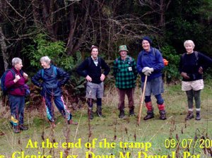
4. 9/7/2003. Trampers. Tunnels, McRaes, Steve Amies, North Coal Creek, Racemans.Medium. Leaders: Irene, Doug J.
Bill at rocky point in Racemans
Rocky patch on North Coal track. Glenice, Lex, Doug
Trig Q. Doug M, Doug J, Lex, Pat
Tramp end. Irene, Glenice, Lex, Doug M, Doug J, Pat
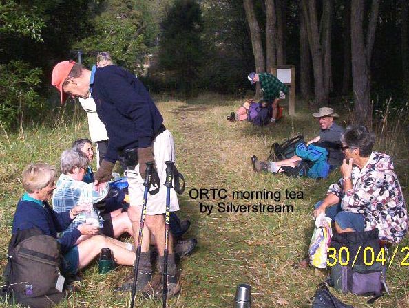
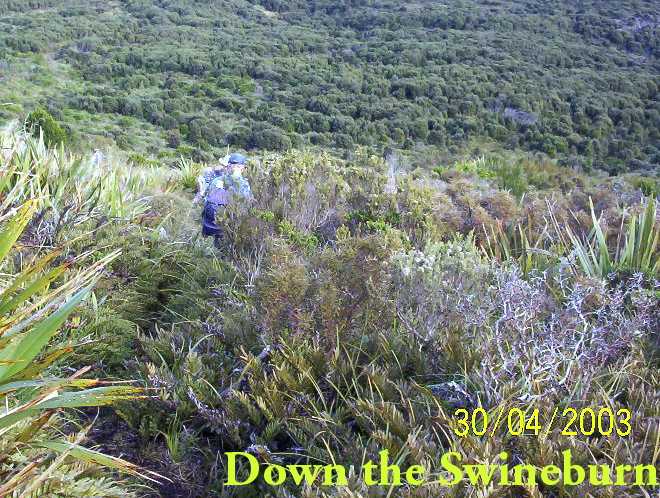
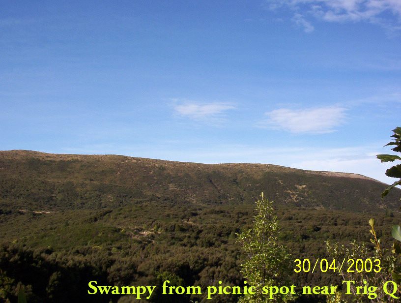
3. 30/4/2003. Steve Amies, Trig Q, Swineburn Photos
2. 23/10/2002. Tunnels – Steve Amies – Little Coal Creek – Racemans. Medium+. Leaders: Lex, Bob H, Wendy B.
1. 2/2/2000. Trig Q from Silverstream via Steve Amies track. Steve Amies Track Circuit Leaders: Peter B, Lex
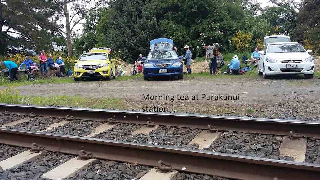
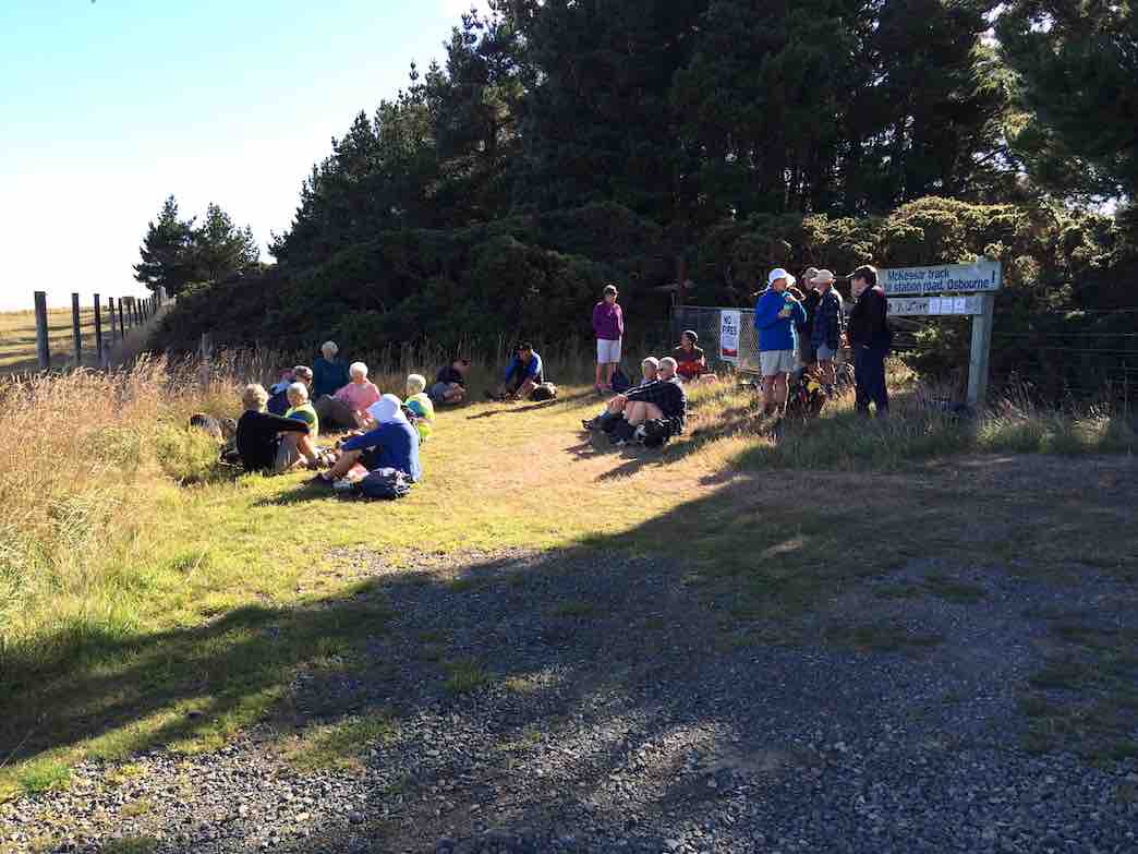
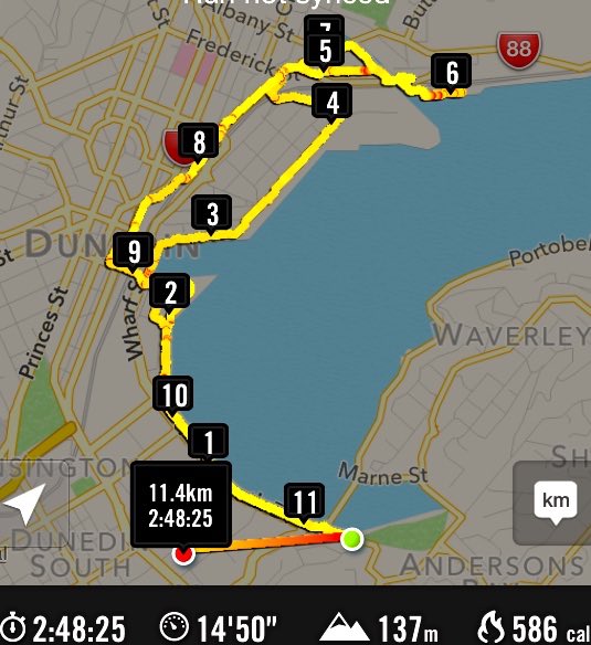
3. 29/8/2018. Hikers. McKessar Track from Foot. E. Leaders: Jim and Betty.
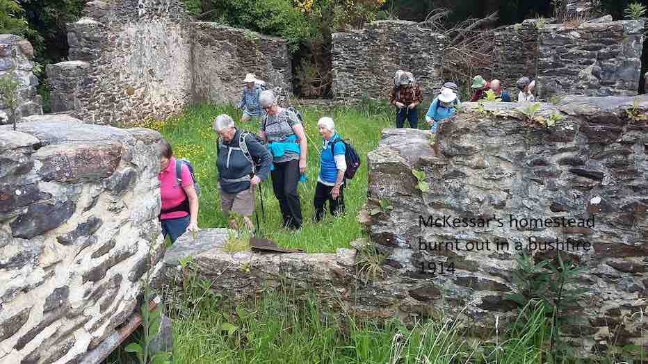
The sun was not shining when we left the car park and as we approached Port Chalmers it looked like it would be a day destined for coffee only. As we continued our journey, there was a marked improvement in the weather as we reached the Purakaunui Railway Park. From the car park the walk was down hill to Sea level then back up the road to the cars for the morning tea break. All the Twenty Two then walked up to our lunch stop at Mopanui Road where we sat with our heads in the cloud. The up hill climb included a breather to marvel at in the relics of the McKessar Homestead. We descended back down the track & into the cars for our refreshment stop at the Plazza Café. Conditions could be described as a little moist. – Betty & Jim Finnie
2. 15/11/2017. Hikers. Purakaunui Station. McKessar Track, Mopanui Road. E. Leaders: Jim and Betty.
Route map, courtesy Ian.
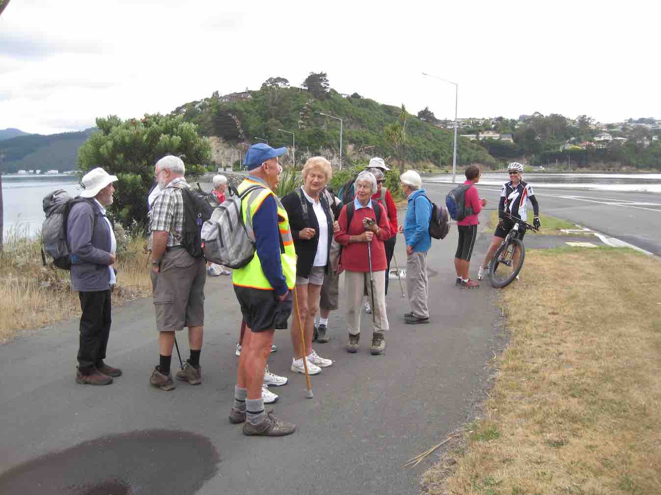
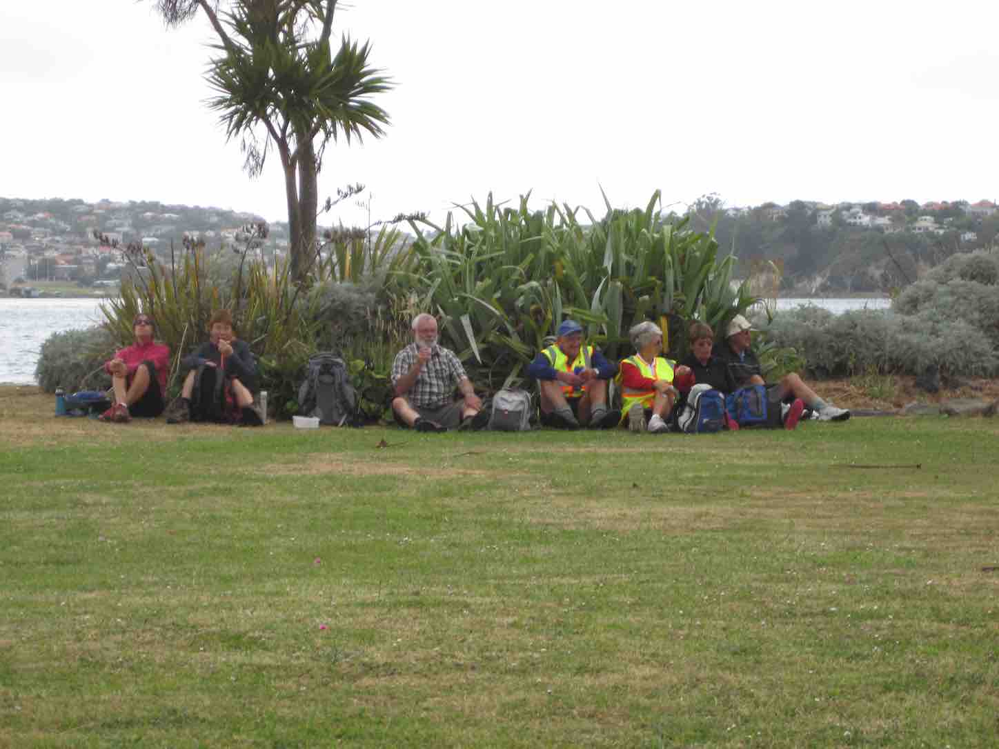
Starting off from the site of the old Purakanui railway station, a party of twenty hikers made the short road walk down hill to the Purakaunui inlet for an then returned, for the morning tea stop at the cars.
(Clive pic.) [Cars at the station a first for the Club. – Ed.]This was followed by the hike up the McKessar Track in very pleasant conditions to our lunch stop at the end of Mopanui Road. We had a breather on the uphill climb where Ian showed us the relics of the old McKessar homestead.
(Clive pic.)
An after-lunch
(Clive pic.)
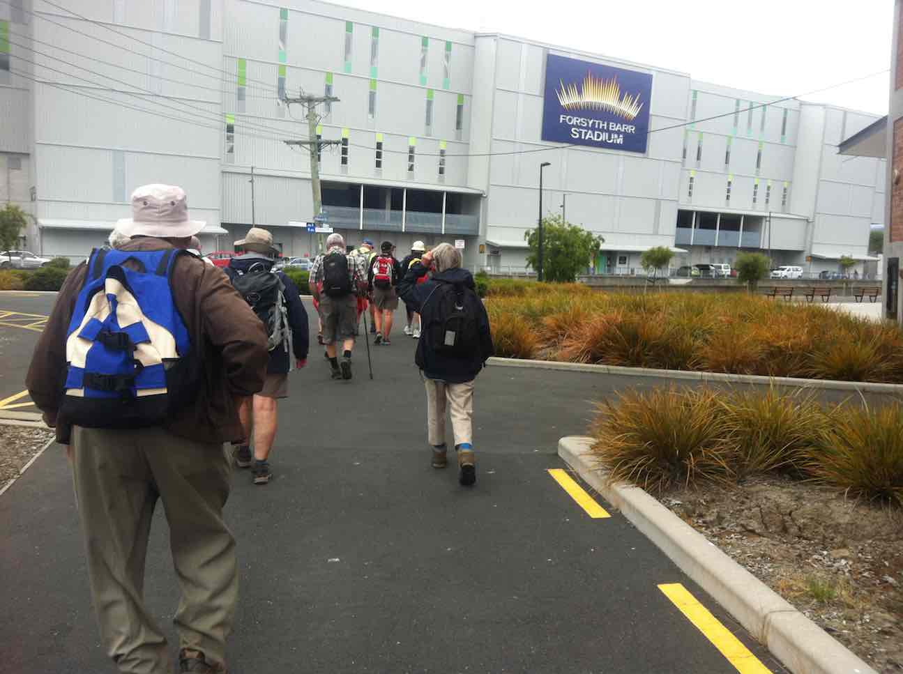
stroll beyond the road end, took us to a point which gave us an excellent view to the north. Little time was required for the pleasant stroll down hill back to the cars, which took us to our refreshment stop at the stadium Plaza cafe. – Betty and Jim
1. 9/3/2016. Hikers. Mopanui Road, McKessar Track, Albert Road. E. Leaders: Bev, Lesley.
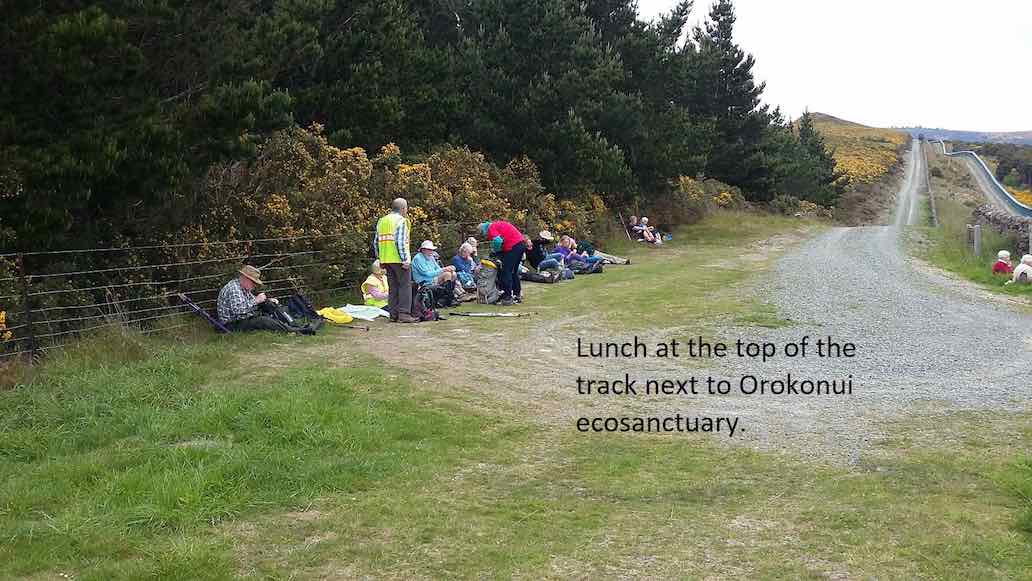
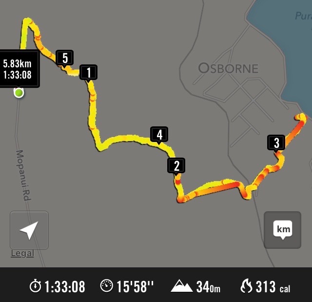
GPS of McKessar trekHorse Drinking Trough on Mount Cargill Road.Orokonui VillageHikers’ cuppa at top of McKessar Track
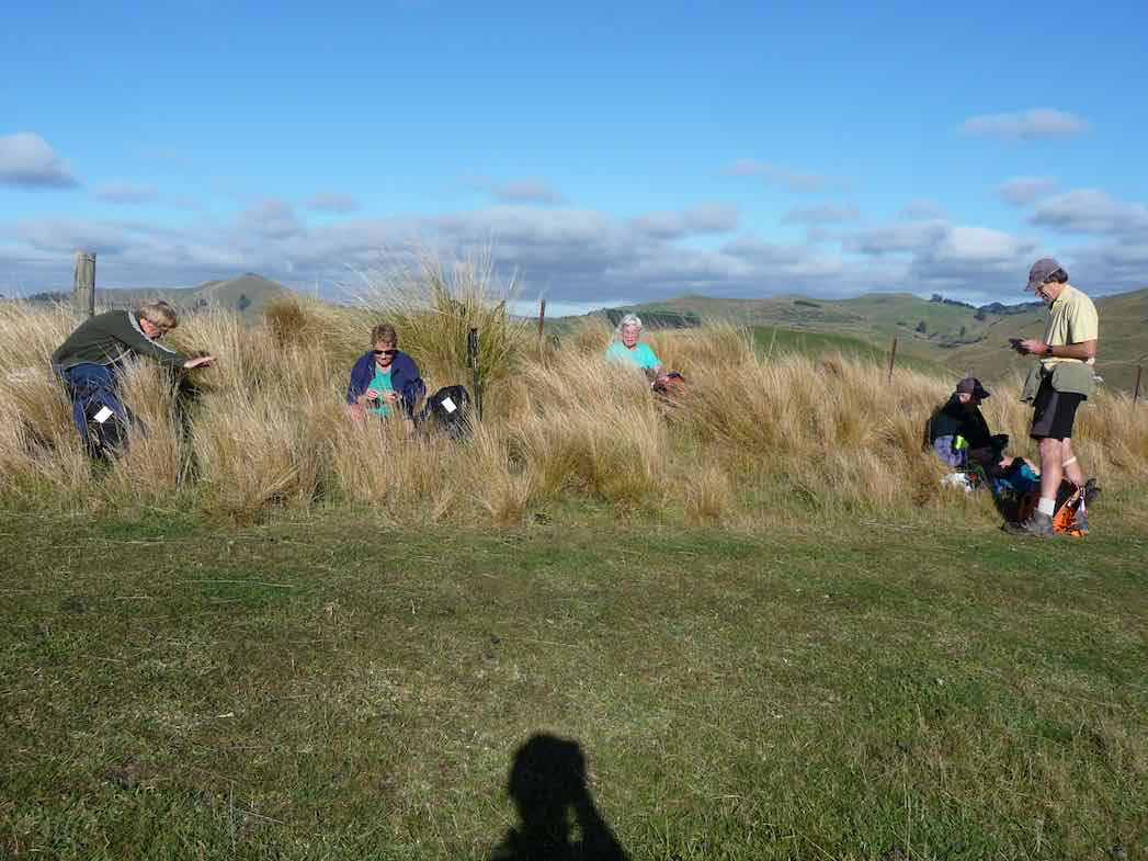
Frost to begin with, but a sunny day followed for 11 Trampers to enjoy their exercise in.
We drove up Mountain Road from the north end and parked up.
The air was cold, but a brisk downhill walk in the sunshine took us to the bank of the Waikouaiti River where we had our smoko stop.
All important smoko. (Gordon pic and caption.)
Following the river bank upstream we soon encountered a pine plantation where the track was becoming overgrown with blackberry and gorse. You would have expected that a consciention leader would have done some track clearing!
This was the only bad patch for the day, as we were were out on grazed paddocks from then on.
Passing the junction of the two branches of the Waikouaiti River, we continued up the south branch and soon came out on a lovely river flat. On leaving the river we had a long climb, with a reasonable gradient,
Onwards and upwards. (Phil pic and caption.)
to eventually find our lunch spot on the ridge top.
Lunch among the tussocks. (Gordon pic and caption.)
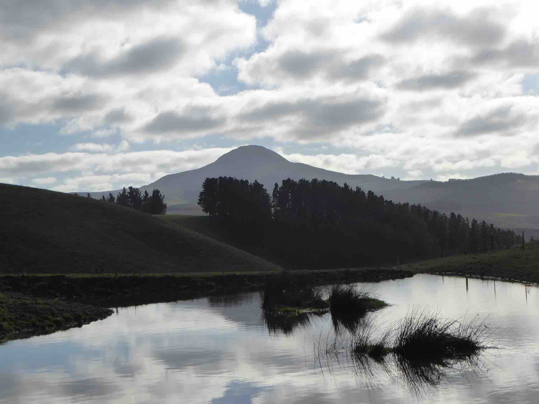
Lunch with a view – a little snow was on top of Lamb Hill, Mount Misery, (Bendoran Huts had been visible a few metres back). We were looking at Mount Watkins
Reflecting on Mt Watkins (Phil pic and caption.)
as we ate, and Maori Peak, Karitane, etc, further round.
A very slight south-east, but very chilly breeze was present, and we faced into it for the return journey. Following the ridge down, and then on a slippery (newly graded) track requiring care.
Heading back to cars. (Gordon pic and caption.)
In time we came to Mountain Road, which is the old wagon road from the early days of Otago, and eventually arrived back at our cars.
We had covered a distance of about 10.5 km. Our club had last tramped here in 2012, but none of our group had been here before.
A new tramp is always welcomed, and we had a great day in the sunshine, enjoyed by all.
Blueskin Nurseries enjoyed our patronage on the way home. The Hikers arrived in too. – Art.
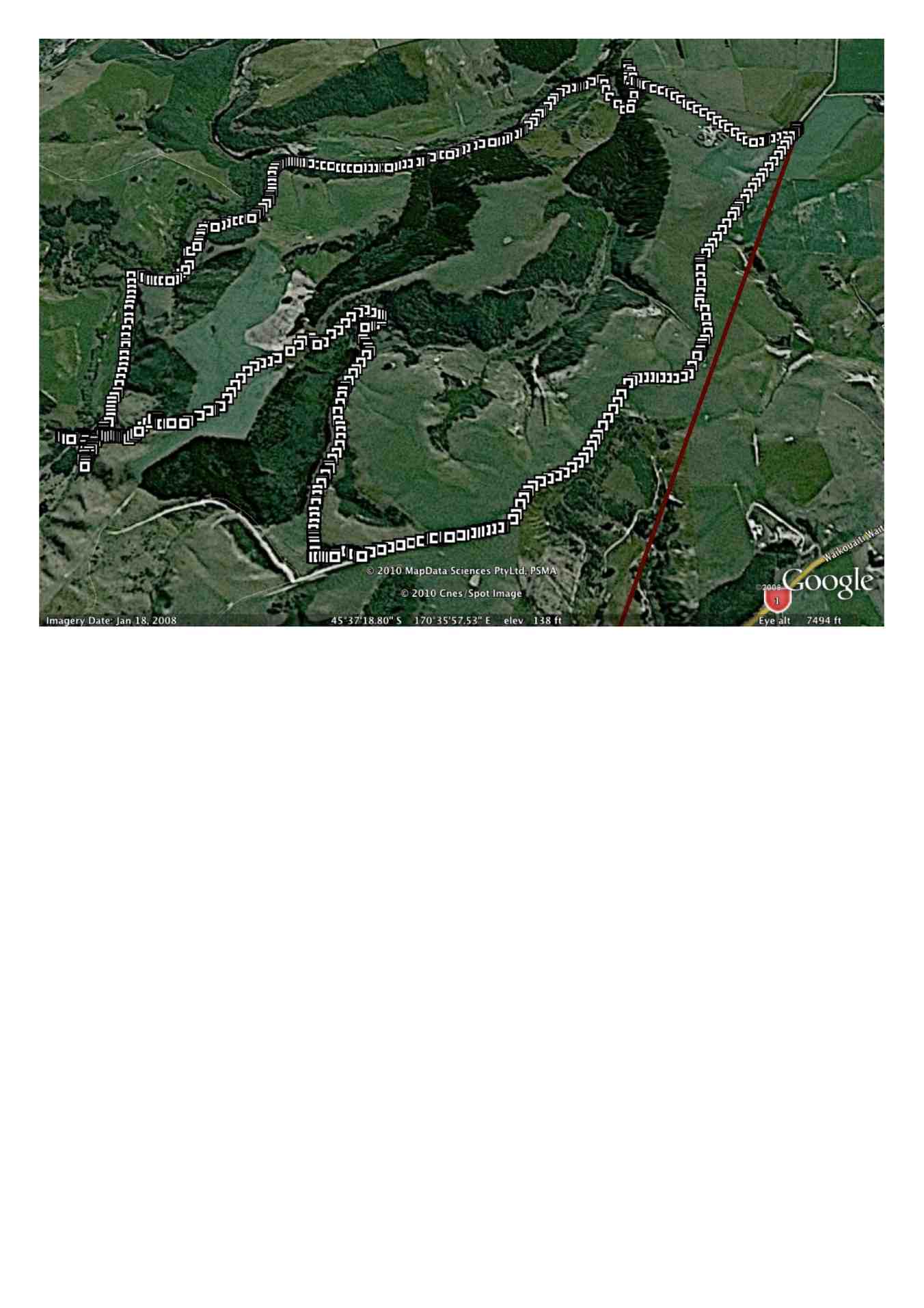
Three of us, & Fin the dog went on the tramp to Lawson’s Farm at the North end of the Silverpeaks, in the Waikouaiti River valley.
Morning Tea break. (Ken pic and caption)
It was a very warm day, so we took advantage of the shade where we could. As I was the only one who had been there before, I put the previous tramp from there onto my GPS, & we followed that route up to where we had previously had lunch, but as it was only 11:00am at this time, we just rested in the shade for 10 mins or so, …
Resting out of the hot sun. (Ken pic and caption)
View from our resting place. (Ken pic and caption)
… before climbing the steep face up to the top paddock. Our lunch stop was by the Limestone rock formation, but this time, we sat down by the fence below them to keep out of the sun.
Lunch in the shade of the trees. (Ken pic and caption)
The after lunch climb up the vehicle track to the Old Mountain Track was next, & then just a leisurely walk along this back to the vehicle. – Ken.
Ken’s GPS tracking of the tramp goes anti-clockwise from top right where we parked the cars, across left alongside two large water tanks and a new building, then a zig-zag down to the river where we stopped for morning tea. Here we were amazed by evidence of a large flood that had tangled debris in bare willow-branches (not evident in the pic) well above our heads.
Morning Tea. (Keith pic)
Following Ken’s GPS tracking up the true right side of the river, and you come to the extreme left of the map where a mixture of tracking signals indicates our lunch-stop. As you can determine -click to enlarge the pic – from whether the tracking signals are behind or in front of each other, you will see that the track took us up and down several slopes. Lunch was on a ledge well above the river. A great view. The steep ridge showing in the pic’s background is what we c-l-i-m-b-e-d after lunch.
Lunch on ledge above Waikouaiti River. (Keith pic)
View looking back down the willow-lined river. (Keith pic)
A gentle descent across a newly-grassed field took us to a track down to a gully between two ridges, then up the gully to the remarkable set of unusual rocks. Beyond these, we climbed the steep slope up to the left to emerge eventually on the Mountain Road track. It was then only the case of following this back down to the the cars. Thanks to Ria and Hazel for a well-led tramp, enjoyed on a grand winter’s sunny day following a good frost. – Ian
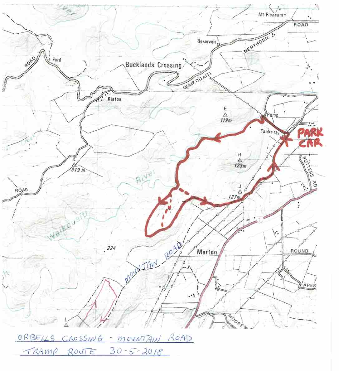
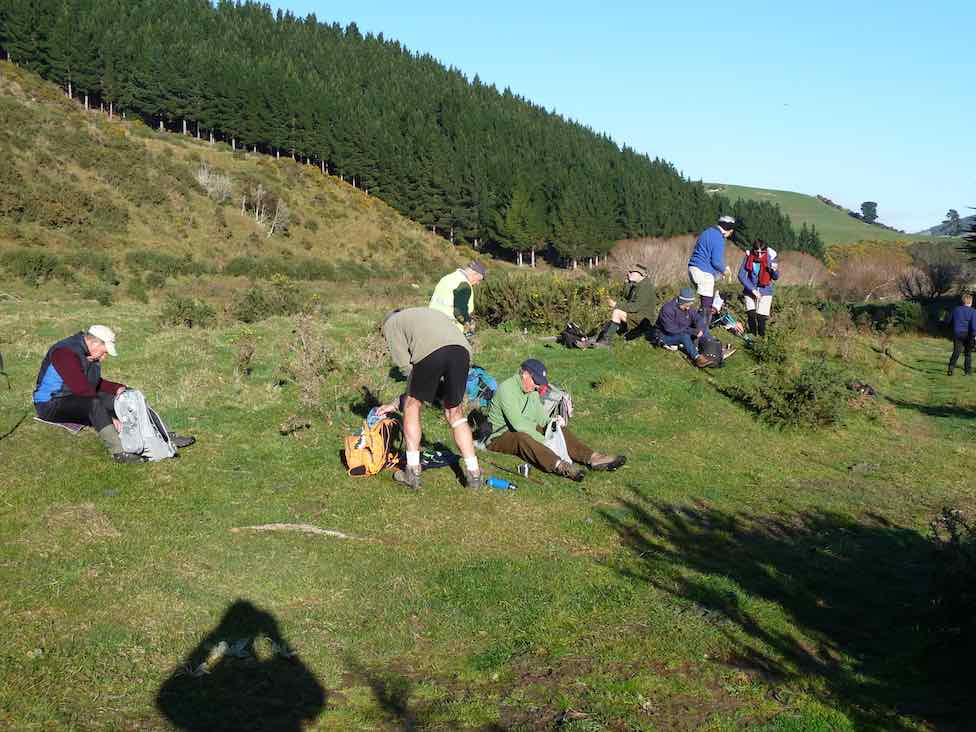
A small but select group met at the turning to Buckland’s crossing on an overcast but warm day under the leadership of Ria and Hazel. The location of the tramp was down as Orbells crossing but there was some debate as to where this actually was. We parked in the middle of nowhere but Ria and Hazel soon had us over a couple of fences and striking across the countryside to a nice morning tea stop on the banks of the South branch of the Waikouaiti River where it was mentioned that a fishing rod would have been useful. The tramp continued along a very pleasant country track wending our way along hillsides and gullies until we stopped for lunch, looking back over to where we had walked earlier. To those with no sense of direction this was quite confusing as we seemed to do a very big figure of eight. After lunch the mystery trip continued, with Ria venturing into some uncharted territory along a gully. When the gully ran out it was a steep climb up to the top where we could easily see where we were again. One of the highlights of the day was seeing the unusual rocks just above the track,
Ria, HazelRia, Ian, Tash
weathered into all sorts of interesting shapes, colour and textures. All information about these rocks would be gratefully received. A very enjoyable day’s tramping. Many thanks to our adventurous leaders. – Tash
5. 9/5/2007. Lawson Farm from McGrath/Gilchrist Roads near Old Cherry Farm. Figure of Eight. No river. Leaders: George, Evelyn C.
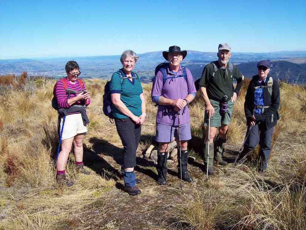
12. 9/5/2018. Trampers. McKendry Road to Maungatuas tramp. Leader: Jill.
On a glorious May morning 13 trampers parked in Horsehoof Station’s paddock at the top of McKendry Road – and immediately began our ascent of “the Hill”.
Start. (Gordon pic.)
Gaining height quickly we were afforded great views over the Taieri.
Smoko break next. (Gordon pic.)
Morning tea was a welcome break from the climb – and time to take in the vista to Saddle Hill and the sea beyond.
Our climb continued before we turned left on to a track that took us down through a lovely beech filled gully and over a pretty stream.
Native bush. (Gordon pic.)
(Don’t think we need to include the photo of Margreet & the gorse bush!)
Then it was onward and upward and upward through native tussock country.
Long slog to lunch stop. (Gordon pic.)
We had lunch at the top corner of Horsehoof – on the boundary with the Maungatua conservation area.
Finally, LUNCH Break. (Gordon pic.)
We headed back down along farm tracks,
All downhill from Woolshed Road back to the cars. (Clive pic.)
We parked the cars under some Gum trees, & walked the short distance to the start of the climb up the “Old Coach Rd” to the top of the Maungatuas.
Climbing ‘The Old Coach Rd’. (Ken pic and caption)
This track was very hard going due to the damage done to it by cattle.
Muddy condition of ‘Old Coach Road’. (Ken pic and caption)
We stopped for morning tea part way up, then continued on for some distance, until deciding to go back down, as it was getting quite windy, & cold, with frequent light showers. We went back down to the Roseburn house, found a spot to have lunch,
Lunch. (Ken pic and caption)
View from lunch spot. (Ken pic and caption)
View from lunch spot (2). (Ken pic and caption)
View from lunch spot by house. (Ken pic and caption)
& then went exploring, to find a better way to the top. After exploring a number of tracks, & even although the farmer had told Doug & Sabina that there was no way up now because of overgrown tracks, we found a way up through an old logging site which would take us right to the top.
Close-up of correct track. (Ken pic and caption)
Correct track to top. (Ken pic and caption)
From there, it was back to the cars, & home again. – Ken.
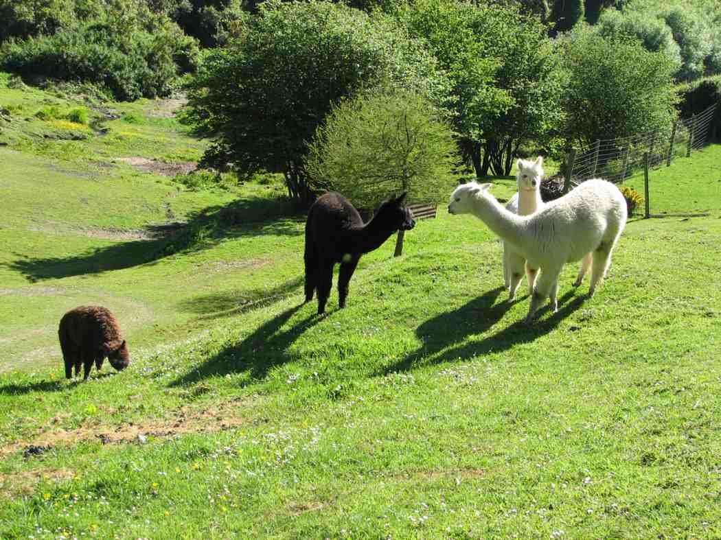
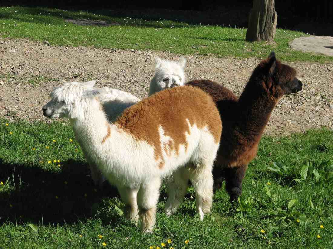
A hot day with some early steep climbing, but not before George and Glenis led 10 of us down through Roseburn farm homestead to see a dozen or so alpacas. Great.
Alpacas on RoseburnAlpacas up close
Climbing out, we stopped for morning tea with a grand view from the shelter of pines
Cuppa time. Wendy, Ria, Hazel.
before emerging into paddocks exposed to a hot sun. It was then just continual climbing until we emerged at last onto Woolshed Road, a 4WD track along the top joining McKendry Road along the back with Horsehoof Station. It was still a bit early for lunch, so George led us down a 4WD track turn-off that headed towards Maungatua, to lunch under silver beech trees hugging a Woodside-bound stream. The trees provided a leisurely lunch- time shelter and rest.
Lunch. George, Lex, Pat, Wendy.Lunch snooze. Bill.
Climbing back out, we followed the Woolshed- McKendry road down, down, down, enjoying great views of Outram and the Taieri Plain on the way, to reach the cars again near Roseburn Farm. An enjoyable first real sunny day in a long time. – Ian
8. 28/6/2006. Trampers. Horsehoof to Maungatuas from McKendry Road. Medium+.
7. 18/6/2003. Trampers. McKendry Road to Maungatuas, returning by farm. Medium. Leaders Shirley McN, Bill and Pat.
6. 27/6/2001. Horsehoof Station from McKendry Road. Medium+. Leaders: Claude, Bill and Pat.
No. 60 on old hardcopy list of 113 club tramps. “Lawlor Farm”
Gate, Old Lawlors Farm, 2019.
Closed for lambing Sept-Nov.
50 km from car park.
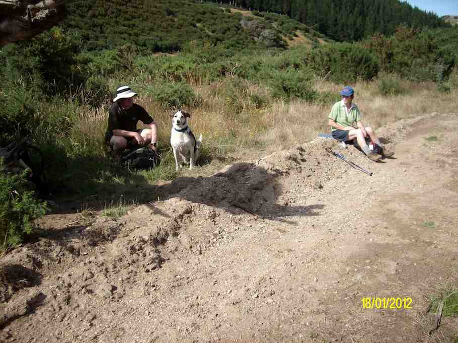
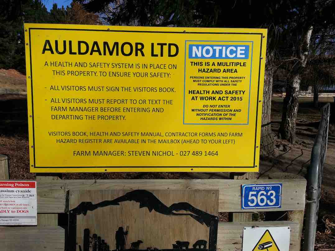
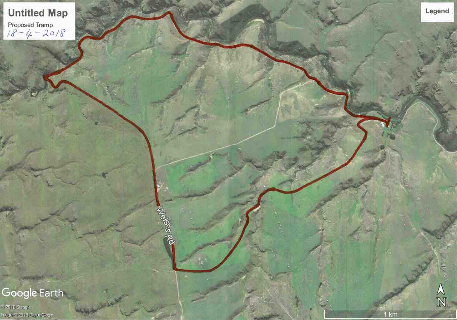
14. 18/4/2018. Trampers. Welshs Road, Old Farm, Deep Stream, Weir. M. Leader: Keith and Arthur.
Route map, courtesy Keith.
It was a beautiful autumn day as 14 trampers travelled for about 40 minutes, out past Clarks Junction to Welshs Road.
The cars were parked by the woolshed near Deep Stream on Steve Nichol’s farm. We all had to sign the visitors book on arrival, for “elf and safety” reasons.
The sun was lovely, but the breeze was decidedly cool, as we made our start.
To be different, the leaders had planned on a clockwise circuit, and also climbing uphill through the paddocks to extend the distance.
The steeper beginning warmed all the participants nicely, before having morning tea in the head of a gully – somewhat sheltered from the breeze.
Morning tea towards Deep Stream. (Phil pic and caption.)
Continuing up through the paddocks the scenery was magnificent wherever we looked. At the highest point of our day we came back to Welshs Road. The wind was keen here, but there was a good view over to the Lammermoors – the “ship at anchor” was visible.
Now it was downhill all the way to Deep Stream, road at first and then following the farm’s boundary fence.
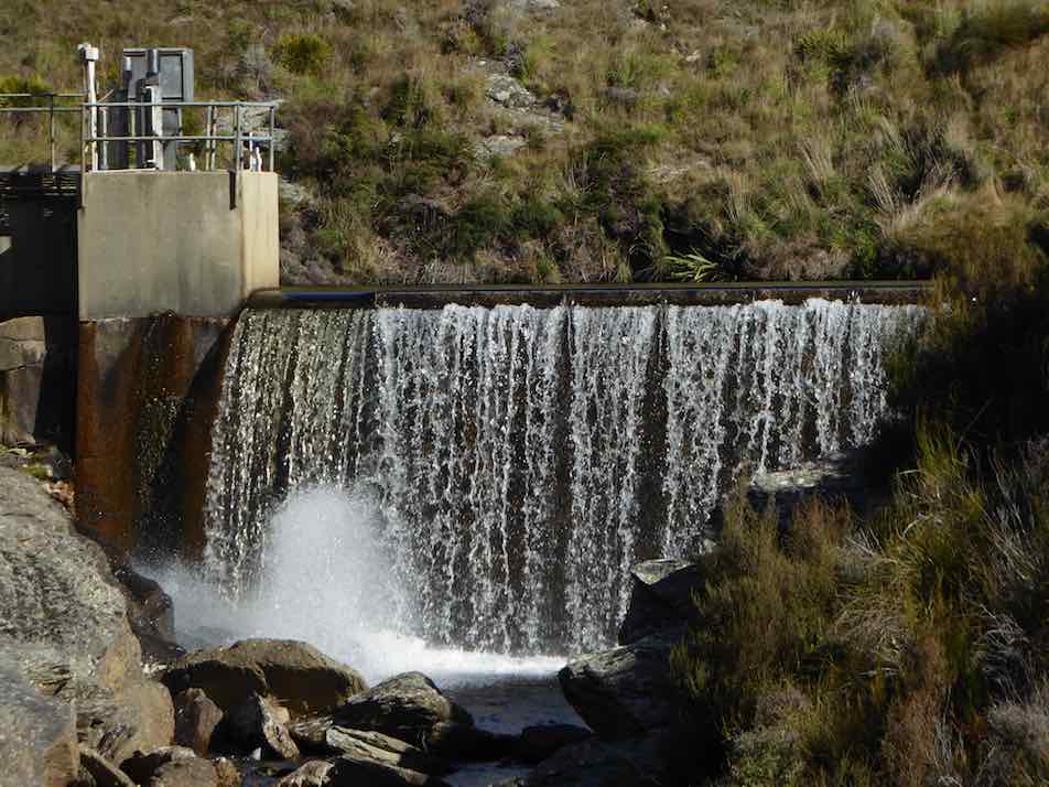
The “Te Papanui Conservation Park” was just over the fence which we had to climb through at the last. The views looking down in to Deep Stream were great as we descended to the weir.
Time for some photographs …
The weir! (Phil pic and caption.)
… before walking the 4W.D. road above the stream.
Follow the leader. (Phil pic and caption.)
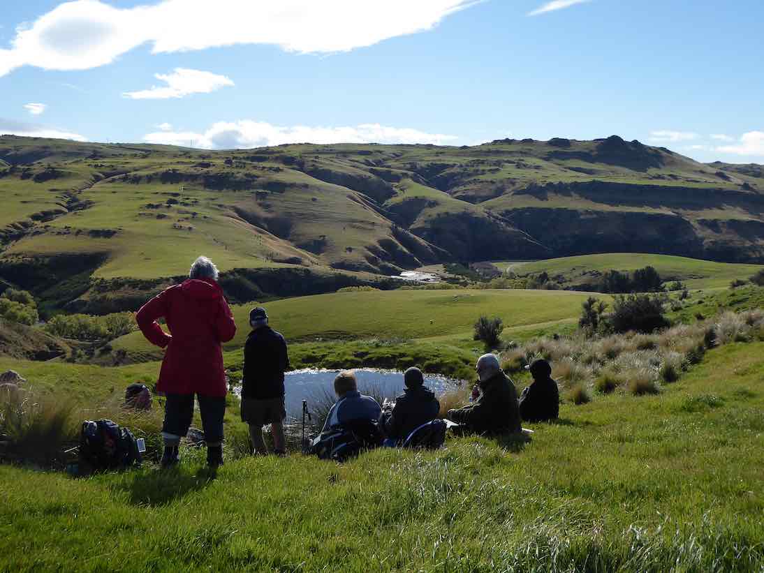
Near the mouth of Deep Creek we stopped for an early lunch on a long table thoughtfully provided. A nice spot in the sunshine, and ideal for the occasion.
….and if one should accidentally fall there would be…….sitting on the wall! (Phil pic and caption.)
The 4W.D. road was up and down a bit, but took us back to the cars, after having walked 9.8 km.
All agreed that the walk down through the Deep Stream gorge, below the weir, was the highlight of the day. It had been another very successful and happy day’s tramp for our group.
And so back to Outram, to stop at a the ‘Goat’ for water, food, tea, coffee, hot chocolate, cold beverage, etc (tick the boxes applicable please). – Art.
13. 17/2/2016. Hikers. Welshs Rd, Old Farm, Deep Stream, Weir. M. Leaders: Bob and Peter.
GPS of route alongside Deep Stream.
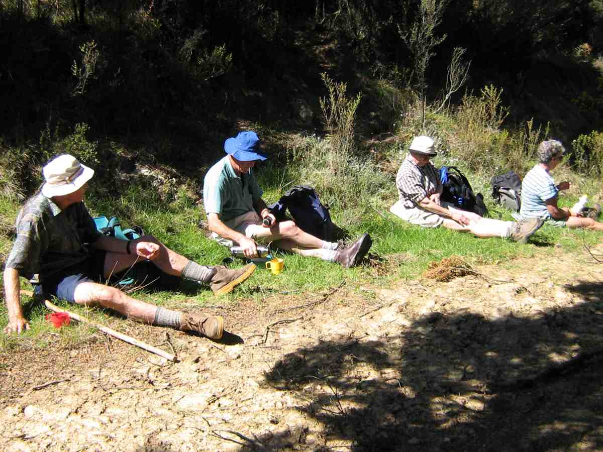
The leaders considerately stopped the cars about 3k short of the old farm house to give some level walking to those who didn’t wish to tackle, beyond there, the climbs over the three steep ridges on the way into the weir. (As matters turned out, they did tackle a further climb or two after all.) We all stopped first, a kilometer or so along the road, for a cuppa.
Hikers. Cuppa. A km or two from the cars.
Eight of us went on to reach reached the barb-wired locked gate, (some getting further)!
En route, a nostalgic shot (yet once again, couldn’t resist it) of the ‘confluential’ point where the Deep Creek tributary enters Deep Stream.
En route, (whoops, too many ‘en routes’), we passed a couple of bee hive sets of frames, with Betty getting stung several times from one of them. Happily Lester was there to help remove the bees and their stings.
On our return, we stopped in the a patch of shade for lunch.
The leaders (& Doug) lunching in the shade.
The day grew warmer but fortunately not nearly as exceptionally hot as it was a fortnight ago. We enjoyed a brief cooling passing shower when getting close to the cars on our return.
The ridges are getting higher and steeper than ever to climb over and the tramp extension by the extra three or so kilometres gap between cars and house wearied this reporter a bit but for the others it was a breeze. A good day out. A good reminder of a tramp the club has enjoyed many times before. – Ian.
12. 23/4/2014. Hikers. Welshs Rd, Old Farm, Deep Stream, Weir. M. Leaders: Peter and Wendy.
GPS of route. The tail with “2” in it was a false uphill recce with none of the necessary downhill bits one or two of us had remembered.
A good memory is an attribute we came to wish we collectively had more of. Driving down Welshs Road, we made two false stops before plucking up enough courage to take our cars yet further on to the actual Holiday Camp yards. (However, from recollection (what’s that again??) the “Both” 8/2009 group [indicated below] walked virtually the length of Welshs Rd just to reach the HP, well-notified on its gate).
Neat Caption editing, John! (John pic)
Well, we eventually made it there by car and walked on and up a bit to stop for our morning cuppa.
After that stop, taken briefly because of a strong cold wind at the time, memory let us down again. A few recalled the road had several ups and downs in it, but the road that we then took led us only up and up and up. After some confused conferring, with nervous hope of finding the right way, we retraced our steps back down the way we had come, to a gate just adjacent to our morning tea stop. Soon the reassuring ups and downs emerged, and a morning tea spot taken on an earlier tramp confirmed we we on track. (See Trampers 11/2009 for the morning tea break pics)
However the earlier uphill foray had served to discourage four of our 22-strong group from further uphill struggles and they returned to the cars. That was too bad. But eighteen still persisted.
The stream views were most rewarding. The view of the Deep Creek (exit/entrance?? – well, confluence, then) into Deep Stream looked better from an angle different from that of a pic below taken on an earlier trip.
A more picturesque view of Deep Creek debouching into Deep Stream. (See “Deep Creek Tributary” below for the other one)
A locked gate (part of which can be seen at the right in the pic below) just prior to the weir proved a further deterrent, and only five persisted beyond it. On rejoining the other twelve they found them already getting into their lunch. It was the right time too.
Lunch by the locked gate. (John pic)
We straggled back to the cars in a long drawn out string of ones and twos, but all eventually made it, to unsurprisingly find the earlier four long gone.
Then it was only for a dwindling ten (did Elaine deliberately hide herself behind Pat?) of us to reunite at the No 8 w Herbs cafe for a drink of …
After tramp coffee at Outram.
… – you’ve guessed it – coffee, not to mention a tasty treat of chips and dips, courtesy Elaine. – Ian
11. 26/2/2014. Trampers. Welshs Rd, Old Farm, Deep Stream, Weir.
GPS of route, courtesy Ken. We only walked 7.6 km; 1 hr 57 mins moving time, 3.9 km/hr; climbed 318 mtrs; max elevation 544 mtrs.
This was a tramp that most of the 9 that turned up had never done before.
We walked up the gorge all the while looking down to Deep Stream to see if we could find a more interesting walk than on the road with it’s quite steep climbs. Once again most of the ones who are going on the Motatapu trip next week were carrying their big packs with some weight in them.
We found some nice rocks to sit on for morning tea …
Morning tea break. (Heb pic and caption)
… at the top of one of the hills we had to climb, so we got a good view of the countryside. Then it was further into the gorge, until we arrived at the weir.
The weir. (Heb pic and caption)
After a look around there, & a drink to freshen up …
Topping up the fluids at the weir. (Heb pic and caption)
… it was decided that we would go up the steep road opposite to where we were sitting, & walk back through the paddocks. George & Rea both remembered doing this in earlier times, so we set off, & headed away from the gorge up into the paddocks where we split up a bit & had lunch in two groups. Then it was down a gravel road that George assured us we would find, & back a short distance to the cars. The stream looked inviting, as it was a reasonably hot day, without a cloud in the sky, but nobody was game to get wet !!
After examining some peoples’ packs, & the way they were wearing them, we had an adjustment session to see if we could improve the fit for one member of the group, & I’ll also be looking at mine before next week, as it seems to be sitting too low on my hips.
We are becoming the Coffee Club No. 2 as we once again called into Outram for a chat over a cuppa on the way home, although Rea, & Hazel walked all the way around to the Berry Farm shop for a Yoghurt Ice Cream !!
Everyone agreed that it was a good walk with interesting scenery along the way. – Ken.
10. 25/11/2009. Trampers, with a lot of Hikers! Deep Stream Holidays. Pipeline Road. Deep Stream Weir. Easy+. Leaders: Bill and Pat.
It was 10.00 a.m. before our cars reached the Deep Stream Holidays Park. So we walked on along the pipeline road before stopping for a delayed morning tea in a sheltered corner of the road.
We stopped for a late cuppa.
Other group at tea break. (Bill pic)
The road wound on up and down as the pipeline followed up beside the stream.
The road stretched on.
A point of interest was to see the Deep Creek confluence point with Deep Stream.
Deep Creek tributary.
Eventually we arrived at the weir.
Weir. (Ken pic).
We climbed the steps from the weir to the road above. Some of us found a way up to the rock looming behind.
Steps up from the weir. (Ken pic).
From the rock buttress, we had a grand view of weir and dam.
View of dam from the rock buttress. (Ken pic)
On the way back, Bill pointed out a rock wall built by Chinese goldminers to divert the stream.
Old diverting wall from Chinese goldmining days.
9. 5/8/2009 Both. Welshs Road, Deep Stream, Lawlors Old Farm now Deep Stream Holidays. Easy+. Leaders: George, Bev.
click to enlarge
Romdales. Where there’s a wool…. (Bruce pic and caption)….there’s away (Bruce pic and caption!)Climbing Welsh Road by Deep Stream. (Bill pic). MollyAnother view of Deep Stream. (Bill pic)Deep Stream above the weir. (Bruce pic and caption)In holiday mood. (Bruce pic and caption). Evelyn, Pat, Bev, Molly, Fred, Bill, GeorgeIf we just keep straight ahead we should hit a pot of gold (Bruce pic and caption)
8. 14/4/2004 Hikers. Deep Stream. Lawlors Old Farm. Easy+. Leaders: Joyce , Jim & Thelma
7. 15/5/2002 Alt. Deep Stream, Lawlors Old Farm. Easy. Leader: Mary L, Margaret and Les.
6. 23/9/1998. Lawlor Farm, Deep Stream. Leaders: Mary L, Sabina.
5. 25/9/1996. Deep Stream from Rocklands Station to Dam. Leaders: Jack M, Diana and Ray
4. 10/5/1995 Lawlor Farm. Medium. Leaders: Peg C, Mary L, Sabina, Diana W
3. 2/12/1992 Welsh Road, Deep Stream, Lawlors Farm. Average. Leaders: Daphne, Peg A, Peg C, Peg M
2. 25/4/1990 Welsh Road, Deep Stream. Great tramping area. Easy+. Only one small hill. Leaders: Mary Y, Diana B, Hugh D, Betty B
1. 1/2/1989 Deep Stream. Rocklands Station. A long but not difficult walk. Follow pipeline to dam. Leaders: Daphne, Denise, Mary
10. 10/1/2018 Hikers. Taieri River view lookout. E. Leaders: Doug and Ian.
Twenty-one Hikers turned out for the first tramp of the new year, parking the cars at the lay-by on Taioma Road beside the entrance to the Taieri View Road. This tramp was to differ markedly from the last one we had done back in 1915.
First, a couple of the private forests along the forest road on the left had been ‘harvested’, as they say, the first one now replaced with paddocks.
Second, the former FWD track was now a road, much more heavily metalled and heavily dented by the double wheels of forest trucks carrying heavy loads.
And third, road’s end was now in the middle of the branch-and-trunk-strewn cleared second forestry. No longer a gentle grass-covered FWD track ending in a rough honeysuckle and gorse encroached track. A shock. A big shock.
Yes, the shocking new way of getting to the lookout was to have to pick our way through a debris of tangled branches down along a left-leaning bench-sort-of-slope that was marginalised by a messed-up fence line on the right and a steep fall-off on the left.
The goal ahead of us was to be a line of small Manuka and gorse bush, a middle part of it dead. Just where the dead changed on its right to the dark green, the leaders knew to be the sturdy post at the end of a fence, alongside which was the track down through to the lookout. This they had found only after well over half an hour’s reconnoitring the previous week.
Seventeen of us reached the lookout unscathed by the sharp-ended broken branches we had to negotiate, with four electing, a short distance in, to prudently head back and wait for us near the safety of the road.
At the lookout, despite some reluctance to leave the wonder of the view,
Taieri Lookout. (Clive pic and caption.)
but it being still only eleven o’clock, we eventually turned back to retackle the cleared (??) forestry slope.
The hills denuded of pines made for heavy going in places (Clive pic and caption.)
This time, with leadership guidance no longer needed to find a way, a wonderful variety of routes back up to the road were found.
Back right up near road’s entrance, we stopped for lunch under power lines with the cleared area affording us a pleasant view.
Along the short distance of Taieri View Road, and out onto Taioma Road, and leaving our parked cars on our left, we headed down the road to a gate onto Salisbury property. We headed down through a couple of paddocks,
A walk down the hill with the Taieri Gorge railway in the background. (Clive pic and caption.)
the route getting steadily steeper until its very steepest part got us down to the relief of the flat. Many elderly knees didn’t enjoy that last part one bit.
A nice flat lane led us to the wonderful restored stone cottage where we stopped to again admire the beautiful work done to it both inside …
Glen Lyon Cottage established 1862. (Clive pic and caption)
Then out to Wairongoa Road where two shuttle cars ferried drivers back to their cars in the lay-by to allow everyone to return home, some by a coffee break en route.
The day was cloudy and not too hot. Just right.
The normal route would have both started and ended on Wairongoa Road, the tramp beginning with the steep climb through Salisbury paddocks to Taioma Road, morning tea half way up, and lunch at the lookout. All agreed however that through a car shuttle saving the Salisbury paddocks for just a return downhill journey and for a shorter first tramp of the year was the way to do it. – Doug and Ian.
Walked all but 17km and averaged 4.8km an hour.
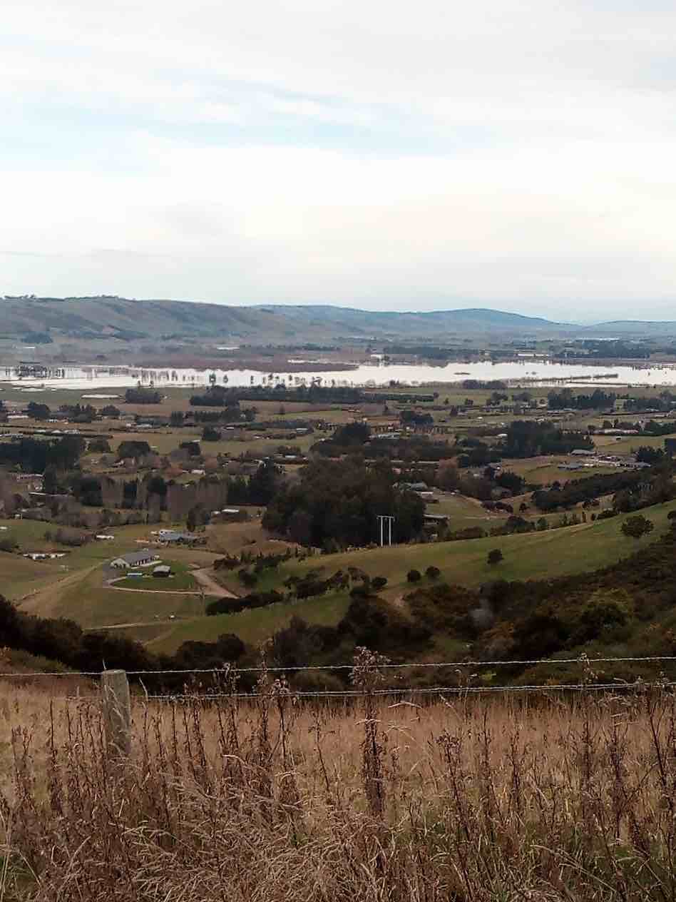
We drove and parked at the Showgrounds. Ten of us were eager to get out for a walk without rain. We headed up Taioma road and had smoko at the bottom of the hill. Then a steady uphill climb took us to the Taieri View sign, a few stops along the way were had to look at the flooding of the lower Taieri (which occurred after heavy rain on Friday and Saturday). Also, picking out landmarks and where some of us live on the Taieri.
Nice view over mosgiel. (Helen pic and caption.)
We turned left at the Taieri View sign, then veered left again onto a Forestry road that took us to where trees had recently been milled. Looking across farmland, down to the Taieri river, cleared forest and 4 goats grazing in the distance we enjoyed the vista while eating lunch.
Lunch. (Helen pic and caption.)
After lunch we walked back to the junction and decided to carry on down the road that we veered off, where we were looking further down the Taieri towards Henley at the floods.
Water on the plains. (Helen pic and caption.)
Once we headed for home, it was down hill all the way to the cars. We parked back at the car park and strolled round to Blackstone where we enjoyed coffee and cake.
The weather was calm and mild, which made our outing most enjoyable. – Eleanore.
8. 2015 Aug 26. Hikers. North Taieri Church, Salisbury and Taieri Lookout. Leaders: Pam, Dawn.
GPS of route
Where to start with all the happenings in this report? Well, first, when the cars arrived at North Taieri Church some of the Brighton people failed to turn up. It transpired, as was later report, their car load turned back to just walk around Mosgiel on seeing the “Road Closed” Taioma Road notice. Twenty of us set of along and up…
The paddocks were as steep as ever.
…the Salisbury farm paddocks to emerge onto Taioma Road just above the zig-zag and stop for morning tea on the road edge,
Morning tea cuppa on Taioma Road in the ditch, sheltered from the wind.
nicely sheltered from the cold southerly.
Incident two. After we had trudged up the road to the Taieri View side road, we looked back to see a small group stopped back down the road. The leaders went back down to find that Peter B. was experiencing one of his very occasional breathless spells (his last one, this report recalls, was on Traquair, but that time he recovered to continue afresh again.) Cell phone arrangements were made for a one of the leaders’ spouse to drive up and take Wendy and Peter back down. This was satisfactorily achieved.
Incident three. John had driven up to meet us at the side road turn-off. But under the unwise earlier advice of this reporter, had parked just beyond the turn-off at the edge of a logginh-truck lay-by area, but had been reprehended by a logging driver for possibly impeding their movements, so got his car neatly parked in the side road.
Incident four. Keith espied a cast sheep in the paddock over the road. Mastered the barbwire fence and righted the sheep which staggered, trotted, ran off. Bravo.
On up the road, into the forestry road
The track is wide and open for much of its way. (John pic)
and down,
The 2013 snow dump’s legacy of fallen trees on the track forced us to to divert through the forestry occasionally. (John pic)
steadily down
From the road end, taking the track down to the lookout rock. (John pic)
to the river look-out rock. The bold (reckless?) stepped out onto the large rock to admire the view, the timid (prudent?) stopped well back from the intimidating drop.
Lunch,
A candid lunch pic a little bit up from the rock.
snugly tucked in among grass and gorse against the wind. The leaders shortened the lunch-stop for fear of approaching rain but it failed to eventuate. In fact, sunshine and the climb back out proved a even a bit over-warming.
Incident five. Back at Taioma Road, Mollie and George graciously accepted the invitation of a ride back in John’s car.
Incident six.. Trudging back down the Salisbury paddocks, someone remarked that Dot (of the returning car, alas) had intended sharing her big-birthday chocs with us. Sigh.
Next a stop at Mr McElwee’s beautifully restored cottage, an eye-opener for some of our newer members. Then out to the cars where we were found a cheerful Peter waiting to greet us, none the worse for his setback earlier. Relief all round! Then off to Topiary for some for their accustomed coffee fix.
A great day out, with Salisbury’s steep paddocks testing breathing on the way up and knees on the way down. A day full of interesting incidents. A tramp very well led by Pam and Dawn. A good day. – Ian.
7. 2013 Apr 3. Both. North Taieri Church, Salisbury and Taieri Lookout. Leaders: Fred, Ian.
We started out from beside the North Taieri Church, numbering 20. We admired some black sheep along the way. Mollie pointed out that the hill ahead was Vaughan Hill, once owned by her late husband’s parents. We admired the restored stone cottage, of course. Mr McElwee had determined on everything being authentic to its old age, including …… donated from the Vaughan farm. We then set about climbing the hill ahead, this time via a gentler track (only slightly) from around its back. At a water trough, well up the hill, we stopped for morning tea and to admire the view, and to increase our number by Lex arriving down from his car parked in Taioma Road. Light rain came on, and so did our parkas. By the time we arrived at the “No Exit” entrance to Taieri View Road we found our numbers had dropped to sixteen, five opting to seek car and home rather than carry on in the rain. On taking the forestry road turn-off, some found water off the wet grass soon got into wet boots making for a gentle sloshing sound as they moved. But we carried on to successfully reach the Taieri River lookout, and return up that steep part o the track at its end to lunch under the shelter?? of some forestry pines. It was at this point that we had reached the dispiriting point for many. We found we had only exchanged the fine rain outside for large forestry drops that soon soaked any part of us that was not already wet. And here any respect for the leadership vanished. It wasn’t too long before the leaders discovered numbers had now dropped to four, the rest having returned up the track to shorten what had turned into a miserable experience as quickly as possible. The leaders caught up briefly at Taioma Road, only to see the majority head off down to make a road-walk, regardless of traffic, back to the cars. This left the leaders now with a group of only six, who returned back down through the Salisbury farm the way we had ascended, for a grand meet-up with those under their care back at the cars. So all’s well that ends well, perhaps. – Ian.
6. 2012 Jun 13. Trampers. North Taieri Church, Salisbury and Taieri Lookout.
GPS of route, courtesy Ken. We did the loop anti-clockwise. We did 16 km in all. A good day’s walk. Total altitude climbed: 500m.
Relying on Ria’s memory to guide us, 7 of us did the more extensive Salisbury walk,
which took us climbing, climbing to join the Taioma road at the very top.
Morning tea stop, halfway up the loop, on the right.
Then we had to make our way back around Taioma road to get back down to Taieri View Road. We tried to avoid the road, busy with fast, heavy rumbling logging trucks, but paddocks proved eventually too boggy.
Shortly into Taieri View Road, we stopped for a late lunch. At this point George didn’t want to go any further, so he and his car-load took the short way back to his car. The remaining trampers made their way on down the forestry track turn-off from Taieri View Road to the Lookout. The track was much more overgrown and forestry-shaded than when the writer remembered it. However this gave us good shelter from the blustery cold wind that made itself felt when we emerged out onto the Lookout.
Lester views the Taieri from the Lookout.
Smile please
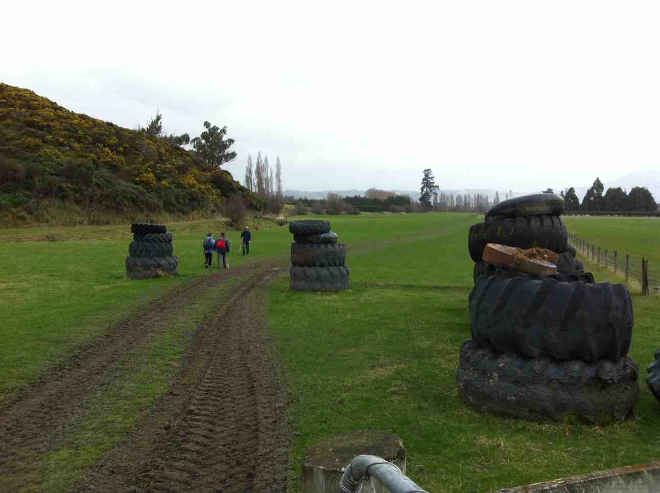
An imaginative use of old tractor tyres on Salisbury near the end of our return
We were lucky with the weather, which held off till we reached the car. A good tramp for a cold-weather day. The tramp also had a sentimental side, as it was the last day Linzi was to be with us, before departing back home to Cornwall three days later, after tramping with us for a whole year. Farewell, Linzi. – Ian.
5. 2009 Apr 8. Hikers. Taieri View, Mount Allan Road. Medium. Leaders: Chris, Dot B.
Taieri View Rock
4. 2008 Feb 27. Leaders: Bev.
A bit cloudy but still 15 hikers parked their cars in Taieri View Rd. and set off on a very pleasant hike along forestry roads and through the forest to another Taieri Lookout. We had our morning tea sitting on a grassy bank before we headed into the forest itself. Very enjoyable walking and only some fairly easy down and up grades to keep us from having it too easy. Got to the lookout area which was a big rock jutting out over the Taieri river. Great view of river and surrounding areas. By now the sun had come out so made it more pleasant for our lunch break which we enjoyed relaxing and taking in the view. Then the sun disappeared and it turned a bit cool and looked very much like it would rain in the very near future. So we set off back to the cars. We found a few interesting things
George by wrecked car
to look at and photograph for fun on the way. A goats skull and horns which made an appropriate photo for an ‘old nanny goat’! A rusty old car body which had to be sat in, also for the obligatory photo. A really lovely big bush of ripe blackberries, much enjoyed by those who took the time to pick and feast on them. A lonely little pansy, (not a petunia!), in the middle of some blackberries and long grass. George managed to knock over the post of the electric fence after holding it down for us to step across. Luckily he didn’t short circuit himself or anyone else! Back to the cars before the rain came after another happy and enjoyable day out. Bev.
3. 2007 Feb 28. Trampers. North Taieri Church, Salisbury, Lookout. Medium. Leaders: Ria, Glenice.
The View from the Taieri Lookout.
Abe at Taieri Lookout.
2. 2005 Nov 2. All. Farm Walk from North Taieri Church. Easy. Leaders: Ria, Jacqui, Graham, Eleanor W.
1. 1992 Aug 12. Taioma Road. Turn off just before Salisbury L.H. side. A hill walk, good views. Average.
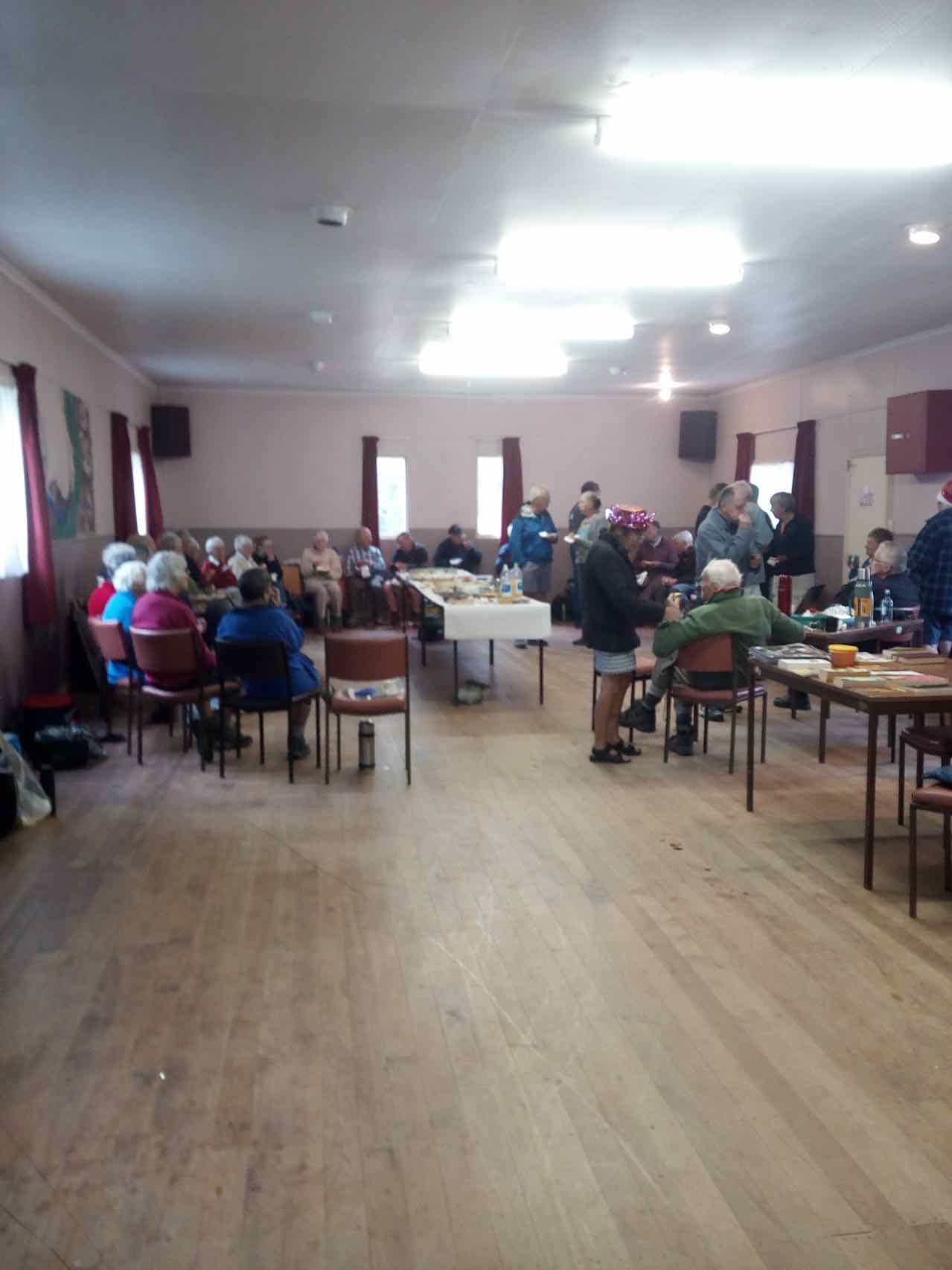
6. 13/12/2017. All. Picnic lunch. E. Leaders: Alex and Liz
Route map, courtesy Ian. (Ian pic and caption.)
Having just emerged from ‘gorse forest’ track onto golf course. (Ian pic and caption.)The leaders for the day. (Judy pic.)Pot luck Christmas lunch.(Helen pic and caption.)
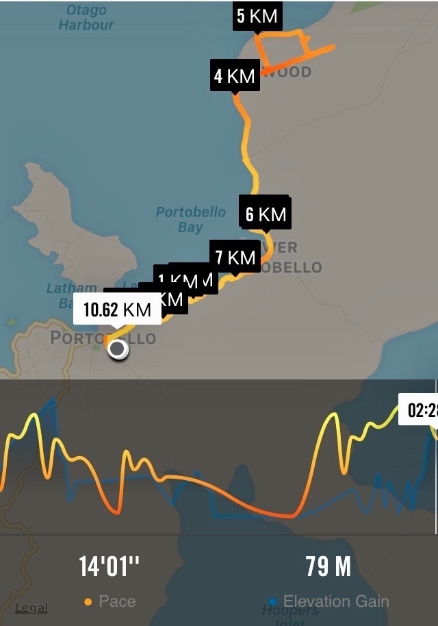
5. 27/9/2017. Hikers. Portobello to Harwood. E. Leaders: Chris and Dot.
Map of route, courtesy Ian.
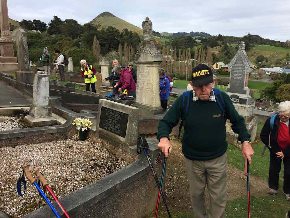
The track from Portobello to the aquarium being made difficult with slips and mud, the leaders decided on a new hike for the day. 20 keen members left the cars at the Portobello show-grounds and headed the short distance up the hill to the cemetery for morning tea.
Coming away from morning tea.(Ian pic and caption.)
It was a glorious morning, calm and mild, and there were many comments on the fact that cemetery sites always seem to have the best views…. this one right across Portobello and the tranquil, beautiful harbour.
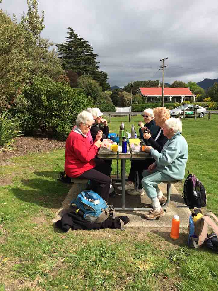
The thought of walking all the way to Harwood seemed a bit daunting to some, but in fact was very pleasant, following the cycle track all the way so that traffic was never a problem. The predicted north-east breeze never arrived and jackets were gradually shed along the way. Round Lower Portobello Bay several slips were commented upon, and we reached the picnic grounds for a leisurely lunch by mid-day.
Lunch at the Harwood Picnic Grounds. (Ian pic and caption.)
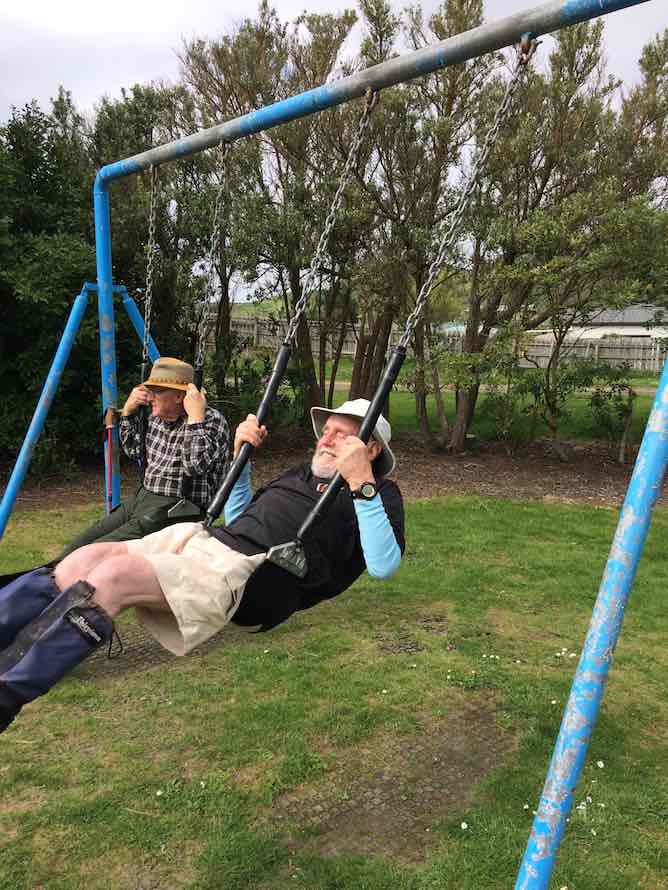
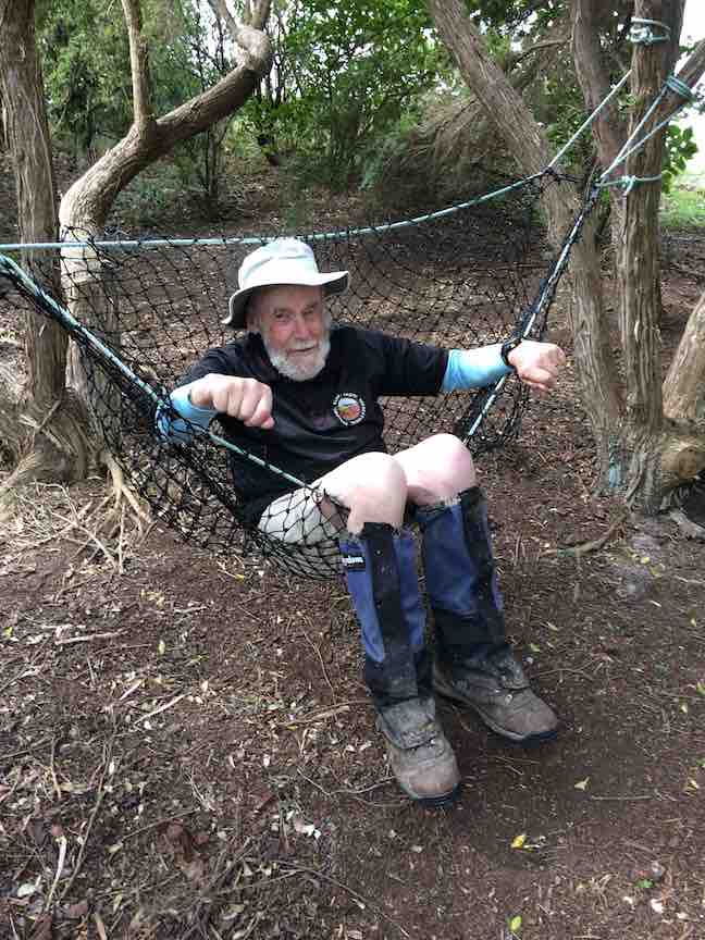
After the young-at-heart had a play on the swings…
Stop gazing round. Swing!.(Ian pic and caption.)
…and slides not to mention the hammock,
Help! Someone get me out. (Ian pic and caption.)
we made our way back to the cars by the same route, and so to Macandrew Bay for coffee etc.
A hike not done before, so thanks to Chris and Dot for some thick quinking (thanks Jay!) in finding a great alternative for the day. – Judy.
4. 17/12/2012. All. Harwood. End of year picnic. Leaders: Chris and Dorothy.
3. 15/12/2004. All. Christmas finger food lunch at Harwood. Leader: Chris.
Pause at sign.
Lunch in Harwood Hall. Dorothy, Wendy, Carmel.
Lunch in the Harwood Hall. Wendy, Carmel.
2. 17/12/2003. All. End of year Tramp. Share finger food. Leaders: Jean, Chris.
The stone-walled house was burnt out by a bushfire in 1914 after the McKessar family had left the district and the farm had been taken over by a neighbour.
George and Emma (Driver) McKessar had lived and farmed there. George was born in 1836 and Emma in 1853 and they had six children. Emma was a child of Richard and Elizabeth (Robertson) Driver. Richard was the first official pilot for Otago Harbour, and she had been born at the pilot house at Taiaroa Head. She died at Purakanui at 47 in 1900 and George at 75 in 1912. – edited from research by Clive Crossman on various websites.
Nine trampers left the car park and after delivering one vehicle to the tramp end,we left the car park at Semple road at 9.50am.
We made good progress on an times slippery and steepish track and stopped for smoko at 10:15.
As we followed the old pipe line down, the creek crossings became more frequent…
River crossing. (Helen pic and caption.)
…and the track more muddy.
Lunch was had at 12:15…
Lunch. (Helen pic and caption.)
…and soon after the rain began, so it was on with the coats.
The hairy goat and his kids. (Helen pic and caption.)
Every one was quite wet by the time we got to Evansdale Glen but it was a good tramp and a great coffee at Blueskin cafe.
Distance Semple Rd car park to Evansdale walk bridge 11.6 km – Keith
7. 16/3/2016. Trampers. Black Gully Dam, Careys Creek, Evansdale. Leader: ?
On a day that didn’t promise much weather wise, we had 9 trampers on the Careys Creek tramp. For a change, the women outnumbered the men as well !!!
After doing the car shuttle thing, & having morning tea,
1 Packing up after morning tea (Ken pic and caption)
we all met up not far down valley from the Black Gully Dam,
2 Black Gully dam (Ken pic and caption)3 Black Gully dam (Ken pic and caption)
& continued on at a leisurely pace,
4 track (Ken pic and caption)
being careful of the quite slippery conditions.
The many creek crossings …
5 Crossing the creek (Ken pic and caption)6 An easy crossing (Ken pic and caption)
… were also treated with great care, as the boulders were mostly treacherous to stand on. It was pleasing to see the new much larger orange triangle track signs that have been installed along the places where it is necessary to walk the riverbed.
We had lunch alongside the creek at a suitable place, & then continued on downstream, where we met up with a quite a large group of Kings High School boys with two supervisors. They were making a lot of noise, & could be heard from some distance away. We spent the rest of the trip mixing with these boys, as they would race ahead, then stop to pick Blackberries, which they were going to make into a Blackberry Pie later that night.
We had some of our group who had not done this tramp before, & all agreed that it was a good day, which most of us finished off with a coffee & chat at Waitati.Walked 11.7km
3.6km/h
3h 13mins
climbed 173m – Ken.
6. 1/10/2014. Trampers. Black Gully Dam, Careys Creek, Evansdale.
Careys Creek track was the destination for this tramp, & 6 trampers turned up for the day out. We drove to Evansdale, & left one car there, & then drove up to the top of the track at Black Gully Dam track. Morning tea was taken at the wooden seat part way down this track just before the steep steps leading down to the creek. The dam was inspected, along with the old hut that is situated there, & then we made our way downstream over the many slippery creek crossings to a late lunch spot, not far from the signposted junction of Rongomai track. We then made our way back out to Evansdale Glen via the ‘new’ track, where two of us left the others to have a spell, & a look around the area, while we went & retrieved the two cars, so we could ferry everybody back to town. Once again, this tramp had not been done by some, & for others it had been a long time [many years] since they had been there, so even although most got wet, or damp feet, it was enjoyed by all, & the weather was brilliant !
We walked 10.8km
2h 45m moving time
ave 3.9km/h
climbed 163m – Ken.
5. 18/9/2013. Trampers. Black Gully Dam, Careys Creek, Evansdale.
Seven trampers gathered at the top of the Careys Creek track after leaving a vehicle at the Evansdale end. The descent through the bush was pleasant easy going, with a stop to view the Black Gully dam and then another in a patch of sunlight for morning tea, where George shared his birthday goodies.
The creek was low so the numerous crossings were made with dry feet, except for one member who measured her length over slippery rocks and now sports a bruised cheek and knee, not to mention scratched specs.
The party then split, with three opting for an early lunch and the rest pressing on to the Rongomai junction. Here the others caught up again, for an easy ramble out to the road. – Judy
4. 26/1/2011. Trampers. Black Gully Dam, Careys Creek, Evansdale. Ken, Ian, Sabina.
GPS of Careys Creek track route, Semple Road to Evansdale, courtesy Ken.
With two cars between only three of us we nevertheless decided to do a car shuttle between Semple Road and Evansdale and to do the entire Careys Creek track. Ground conditions were wet and slippery, which would have ruled out the steep Honeycomb track anyway.
We were reminded again of just how many and how steep the steps down to the dam were. But they are well benched-in, so not too bad.
One of the more level parts of the track down to the Dam.
We took Sabina up to see the Dam and the slightly greater overflow didn’t auger well for the many creek-crossings and creek-wadings ahead, where the track is just the actual creek-bed. But again, things weren’t too bad.
The Dam waterfall was slightly heavier than usual.
Along the way we met up with several small groups of the Green Hut Track Group. They have almost completed clearing the entire track. Bravo! We were delighted to find several areas modified. These were where difficult parts of the track had, where occasion warranted, been either better benched, stepped or even completely re-routed. Again, bravo!
And then, just past the foot of the Rongomai, behold, a track now mown where at all possible, all the way down to Evansdale Glen.
An example of the mown track nearer Evansdale.
This had been the first time the club has done the entire 10 km of creek in a long time. And it felt good. – Ian
3. 31/12/2009. Holiday tramp. Black Gully Dam, down Careys Creek some distance and back. 4 hours. Ian, Ken, George.
The weather forecast had promised a fine day but it turned out overcast. Rain on the previous wet day had left the track muddy and slippery necessitating great care not to slip. Exposed parts of the track produced lush rank grass and buttercups, and rain during the day left steep grassy slopes extremely slippery. The track is well-cleared for a considerable distance but from near its highest point and onwards, it was much more heavily overgrown than when we did the recce. First of all, of course, we climbed the track to the old Seacliff dam.
Looking across dam. Ken, George.
Dam and overflow.
Peering through foliage to determine extent of dam pond.
Then it was down the Careys Creek old pipe-maintenance track. As mentioned above, this part was well cleared.
Track down Careys Creek. George, Ken.
Of course there were very many stream crossings, some entailing a walk quite a distance down the creek before entering the track again. These were well-marked with indicators suspended from branches overhanging the stream-bed.
One of many stream crossings. George, Ken
There was a restriction on time as George had belatedly discovered he had to be back home mid-afternoon, so although we managed a short-notice early 8.15 a.m. setting out, we were unable to make the full distance down to the Honeycomb Track turn-off before having to turn back. A memorable part of the tramp was a (unnoticed at the time but decidedly stinging later on and into the night) brush with some concealed onga-onga, Ken on his left wrist, George on a finger and Ian on his right knee. But all in all, a very enjoyable way to finish the old year off. – Ian
2. 5/12/2009. Recce of Black Gully Dam, Careys Creek, Honeycomb, returned Mountain Road, Semple Road. 5.5 hours. Ian, Keith, Glenis.
Track is well-cleared for most of its length.
The road-walk back is about 8 km.
1. 19/10/1994 Evansdale, Black Gully Dam/Seacliff Dam, Double Hill. Medium. Leaders: Ria L, Marie F, Jack R, Bob H
3. 20/9/2017. Hikers. Portsmouth Drive to Marina. E. Leaders: Judy and Dorothy.
Twelve harbour strollers, went to Andy Bay.
We parked beside the inlet – it was a windy day.
Along the Portsmouth Drive we went, trudging in a row.
We passed the harbour molars, and onward we did go.
A sunny sheltered spot was found, and morning tea was had,
Relaxing in the sunshine, it wasn’t half too bad.
Then on we went, around the wharves, and round the harbour basin –
We found that walking in the wind, was really somewhat bracin’.
We viewed the plaque in memory of “Neptune”, sunk in war.
She hit a minefield in the Med, and then she was no more.
We passed the Neptune memorial at the wharf and some members were able to point to the names of loved ones who were involved in this tragedy. (Clive pic and caption.)
On we went and onwards, across the Leith we strode,
Then Clive led us along the groyne, to where the water flowed.
We took a walk out on the groyne at the boat harbour and nearly got blown away in the 20 knot winds. (Clive pic and caption.)
Back around the boat harbour, some picnic tables found,
For lunch and chatter in the sun, then homeward we were bound.
Lunch outside the Yachting Club. (Raewyn pic and caption.)
A cracking pace was soon set up, the wind was at our backs.
Perhaps the increase in our pace, was due to lighter packs?
We viewed a lot of logging trucks, a queue a mile long –
Sending all those logs away, we feel it is quite wrong.
A photo stop was taken, beside the harbour molars –
And so we coined the title, “The Mosgiel Harbour Strollers.”
The Molar strollers. (Clive pic and caption.)
The cars in view, we stepped it out and headed fast for home.
A coffee stop at Blackstone – and then I wrote this “pome”….
(Well, try to find a better rhyme!) – Judy.
Stats for the day: 11.7 kms; 3 hours and 4 minutes walking time; 480 calories. – Clive.
2. 14/1/2015. Hikers. Portsmouth Drive to Marina. E. Leaders: Peter and Wendy.
GPS of route
We parked in the carpark by the Bayfield High School. And 21 of us set out.
The bulk of us waiting for others investigate the doings of a suspect prowler back a the carpark and to call the police to investigate. Helen found a passing cyclist friend to chat to.
We walked along Portsmouth Drive past the molars, turned down Kitchener St, huggiing the harbour edge and stopped off for morning tea.
Sheltering from a cold wind for morning tea.
Carrying on, we turned round into Birch St, across the top of the harbour basin then down along Fryatt St almost to its end. Then it was up Wickliffe St, across the railway overbridge, briefly on Anzac Avenue, down Parry …
Skirting the Stadium.
…and Minerva Streets to cross the Leith on SH88 bridge, and on the north side to turn under the bridge and out along Magnet St to get to our lunch stop at the Marina.
Again sheltering from a cool wind, this time for lunch.
On our return, we walked the length of Anzac avenue. Then onto the railway station platform, where Dorothy performed a most believable but all too brief strut down the catwalk. Out at the other side, on past Toitu Settlers Museum and along the grassy verge ahead where we stopped, briefly thwarted by the railway bridge overpass pathless on-ramp ahead. So it was across all four laned SH1 Cumberland St, with the assistance of the lights further back. This safely accomplished, it was Les and Peter led us up Water St, along Vogel St, back down Jetty St and onto the pedestrial spiral ramp to get us onto the bridge. Then via Birch St, Buller St and French St we rejoined Kitchener St which took us back out onto Portsmouth Dr and back to the cars. From talking to one or two others, I must say coming to the end of eleven kilometres on hard pavement had taken its toll of leg muscles, on this the first tramp after the holidays. A good walk, not too hot or windy. Thanks to Peter and Wendy for a good start to the year. – Ian.
1. 20/11/2013. Hikers. Midland St, Portsmouth Drive to Marina. Leaders: Bev and Chris.
Route
The walk was most inventive and interesting, leading us along back streets few of us had ventured on before. We parked at the bottom of Midland Street where we could cross onto Portsmouth Drive with the safety assistance of traffic lights. The laying of cable along the walkway forced us onto a less inviting traffic-coned path along the road till we returned to the walkway at the molars.
Molars. The 20 of us are almost all in the pic.
A little further on we turned down to the length of Kitchener St turning left up at its end into Birch St to join Wharf St esplanade and have morning tea on the seats, to admire the inner harbour view as well as a gentleman, lent back on a camp seat, fishing, hat over face, asleep.
A happy surprise was Lex sharing round chocolate marshmellows in anticipation of his 85th birthday the following day.
Then it was up and on again, down virtually the entire length of Fryatt St to turn left up Wickliffe Street and over the elderly railway overhead bridge, down the other side to the right, and to stop and admire (?) the special road-coned entrance/egress of Hall’s work-yard and the still-hooded traffic lights. We gingerly made it across Anzac Ave, across Frederick St, back again across Anzac Ave to join Parry St, make way across the SH88 Leith Bridge very wide pedestrian walkway, down, back, under the bridge and along Magnet St. (4 km)
and the Harbour Walkway (5 and 6 kms) to lunch at the northern end of the map in what shelter we could find from the nor-easterly wind.
We retraced our steps to the SH88 Bridge underpass, this time following the Leith bank up to Anzac Ave (7 and 8 kms)
which we followed right to the St Andrew St lights where we turned down along it to the roundabout, followed Mason St, then into Tewsley St and into Fryatt St to retrace our route alongside Wharf St (9 km), Birch St, Kitchener St and Portsmouth Drive back to the cars. 11 km in all. The harbour wind-blast along Portsmouth Drive almost blew us off our feet. Many thanks to Bev and Chris for a varied and interesting streets exploration around a corner of the harbour. – Ian.
MINUTES OF 29th ANNUAL GENERAL MEETING OF THE TAIERI RECREATIONAL TRAMPING CLUB HELD AT THE MCKERROW LOUNGE, MOSGIEL PRESBYTERIAN CHURCH ON THURSDAY, 24 AUGUST 2017 AT 1.30 PM
Prior to meeting, Scott Weatherall from Helicopter Rescue Trust gave a most interesting presentation on the scope and work of the rescue helicopters, and their liaison with Helicopters Otago. Thanked by Peter Bathgate, and presented with a donation to the trust.
PRESENT: J Knox (Chair), J Dodd, L & M Smith, L Harvey, P & W Bathgate, J Butcher, P Clough, C Crossman, P Davie, E Day, F Deans, J Dennison, J Devlin, B & J Finnie, I Fleming, L Gowans, L & A Griffin, G Haggie, B Harvey, A Heenan, C Hughes, B & P McLean, D Moir, N Morrison, K & S Munro, M Spittle, M Vaughan, E Watt, T White, T & D Stratton, N Buckley, H Morris, J Yardley (40 members)
APOLOGIES: E Cooper, D Bennett, B Mitchell, C Morrison, D Poole, J Rennell, L Donaldson, N & M Simpson, B Wright, J Hearn, S Nichol, R Keen, A Miller
Moved L Harvey, seconded J Dodd that these be accepted. Carried
MINUTES OF PREVIOUS MEETINGS
Minutes of 29th AGM dated 25/8/16 were taken as read having been previously circulated. Moved I Fleming, seconded M Vaughan that they be confirmed as a true and accurate record.
Matters arising:
Nil
CORRESPONDENCE:
Inward: Nil Outward: Nil
PRESIDENTS REPORT
President, J Knox, presented her report for the year. The club had had a good year in general, with 6 new members, and the numbers going out with the trampers had increased. The trampers are now more structured, with allocated leaders each week. The track clearing group will now operate under the umbrella of the Green Hut Track Clearing Group, who are funded.
Moved J Knox, seconded P Bathgate that the report be adopted. Carried
FINANCIAL REPORT
Financial statement for the year ended 30/6/17 was presented by the treasurer. Bank balance stands at $417.88, petty cash $4.60.
Moved J Yardley, seconded C Hughes that it be received. CarriedAuditor: Moved J Yardley, seconded J Butcher, that Keith Mackenzie continue as auditor,
provided he is available next year.
Subscriptions: Moved J Yardley, seconded B Harvey that subs remain at $5, plus $10 joining fee for new members.
ELECTION OF OFFICE BEARERS President: Jill Dodd
Vice-President: Arthur HeenanSecretary/Treasurer: Jan YardleyPast President: Judy Knox Webmaster: Ian Fleming
(Moved J Knox, seconded L Smith) (Moved B Harvey, seconded M Spittle) (Moved J Knox, seconded M Smith)
Carried.Carried Carried
Carried
Committee:
Existing committee: Liz Griffin )
Arthur Heenan ) (Moved L Smith, seconded J Devlin) Carried
Lester Harvey ) Neil Morrison )
Moved A Heenan, seconded G Haggie that Keith Munro be appointed to the committee. Carried
GENERAL:
Shirts – with the number of new members joining, incoming committee to look into ordering these Resuscitation – suggestion that a ‘do not resuscitate’ be added to pack tags. Felt this would not beadhered to, as attempts would still be made to resuscitate under emergency conditions.
Pack tags – these are still being handed out to new members
Attendance records – Pat McLean not continuing with weekly attendance register. Leave to incoming committee to sort.
2017/18 Subs – after some discussion moved A Griffin, seconded N Morrison, that these be left at $5, with $10 joining fee for new members.
There was no other business, and the meeting closed at 3 pm.
Confirmed ………………………………………..(President) Date ………………….
2. 23/8/2017. Hikers. Gardens to Surf. E. Leaders: Pam and Dawn.
We Parked our cars in Duke Street, near the Woodhaugh gardens. 22 members started off. We walked through the Varsity and had morning tea at the Polytech outdoor area. Walked along Portsmouth Drive to Queens Drive down to St Kilda beach. Walked along playing fields and some track to picnic area above beach, where we had our lunch. We then continued on to St Clair, via street and caught the bus back to the Botanical gardens where we enjoyed a hot drink. Back to our cars and home to Mosgiel by 3.45pm. A very enjoyable day was had by all. – Dawn.
1. 19/8/2015. Hikers. Gardens to Surf.
We had a good day walking from the Botanic Gardens…
…and along the beach to St Clair. I had not been on the beach since the June storms and was blown away by the damage to the beach.
Rocks (John pic)
The piles…
Piles (John pic)
…are nearly all bent over by St Clair. Thank goodness I have done 3 paintings of the piles. Judy Knox was on TV Wed. night and did a very good interview on the local TV channel.
We all went back on the bus to the Gardens and all (I think) 27 of us didn’t pay. I think the bus driver got a bit of a surprise. – Elaine. [An unintended report, purloined from an email. – Ed]
Wardells’ Cottage abt 25 km from car park.
High tides flood the access road and this has happened to us more than once. N.B. Programme Committee! Avoid high tides forecast near the the hours of 9.00 a.m. or 2.00-3.00 p.m.
17. 9/8/2017. Hikers. Millennium Track. Leaders: Bob and Lesley.
20 Hikers set out on this bush walk along the Taieri River. The usual wet portions were muddy following all the rain. There were a few small slips onto the track and a few bites out of the lower side, but all negotiable. The track was carpeted with leaves and twigs. Morning tea was at the usual spot down beside the river…
(Wyn pic.)
…and lunch at John Bull Gully.
(Wyn pic.)
This track with many silver ferns and birds is a favourite for many members. We ALL adjourned to The Black Swan for refreshments. – Lesley.
By then the rain had stopped so had a lovely walk led by Helen at front and Bev at the back. Lunch in the ordered sunshine at the tables at John Bull’s gully.
Lunch (1) (John pic)Lunch (2) (John pic)
Slight rain as we started back then the sun again.Nice to see the river through the trees with the leaf drop. Back to cars and through some water on the road. High tide.
Coffee at Wal’s ended our enjoyable day. – Helen
15. 5/10/2014. Both. Millennium Track. Leaders: Les and Margaret.
Tea breakLunch at John Bull Gully
14. 24/7/2013. Hikers. Millennium Track. Leaders: Les and Margaret.
Being the first tramp of the month, trampers and hikers combined to walk a good old standby, the Millennium Track down the Taieri River from the old Wardells house. It was a substitute for Berwick Forest which is presently difficult to gain access to. Although only 16 turned out, with many trampers noticeably absent, it was still a good day out, starting cold but improving. In spite of being a frequently used tramp, it’s a lovely piece of bush to take your time in and enjoy and the bird life is a joy to hear. A feature of the walk for the trampers was that 11 walked on beyond John Bull Gully to sample the recently broadened track as far as the seat at the high point of the track. The gradient had been realigned with all steps eliminated, sometimes however making for steep slopes. With the pine plantation gone, we were surprised to see that bullibulli
Bullibulli colonising the slope
has largely colonised the area. A delightful surprise on the return walk was a juvenile harrier hawk (?)
Juvenile Harrier Hawk? (But see comments below post.)
perched on a broken trunk which quite calmly allowed us to photo it. The 5 of us who chose to go just to the picnic spot by the river really had a very happy time, taking in the scenery, having our lunch and walking back to cars in a leisurely way. – Bev and Ian
8. 5/12/2007. Both. Millennium Track. Easy. Leaders: Lex, Dot T
Wood Pigeon nr track start (5/12/2007)
Tea stop. Doug M, Neil, Bob H (5/12/2007)
Track through newly-cleared plantation. Doug M, Bill (5/12/2007)