
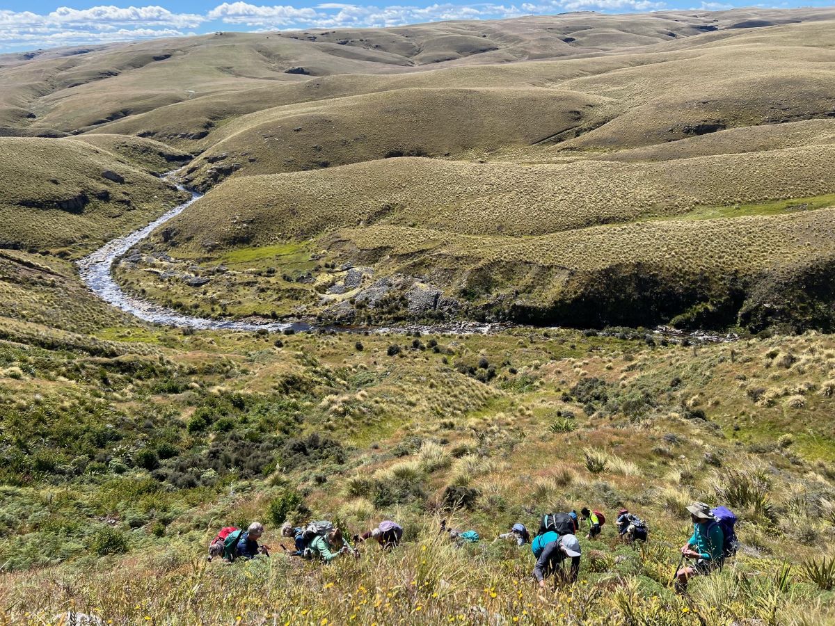
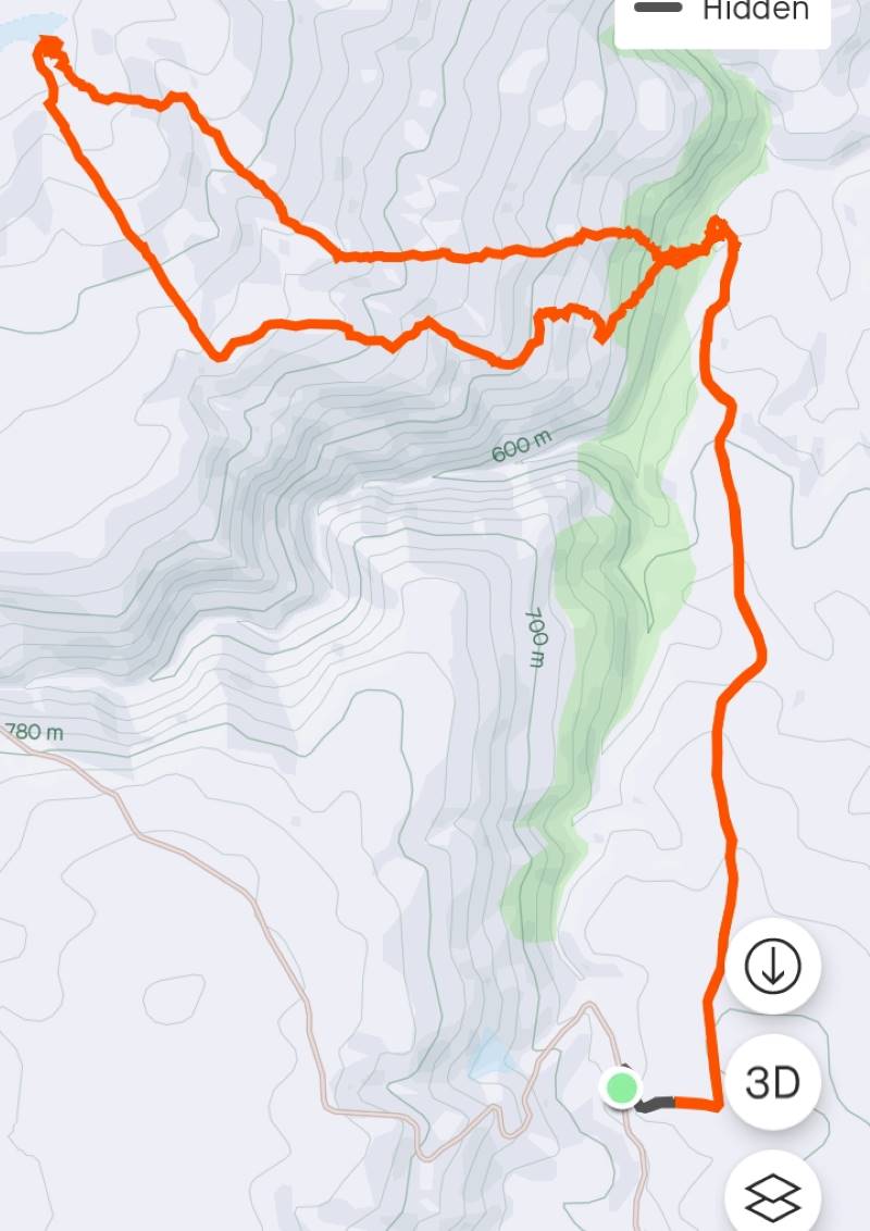
 26/02/2025 Stonehurst Track. Grade 4. Trampers. Leaders: Jill Reid, Sylvie Watt.
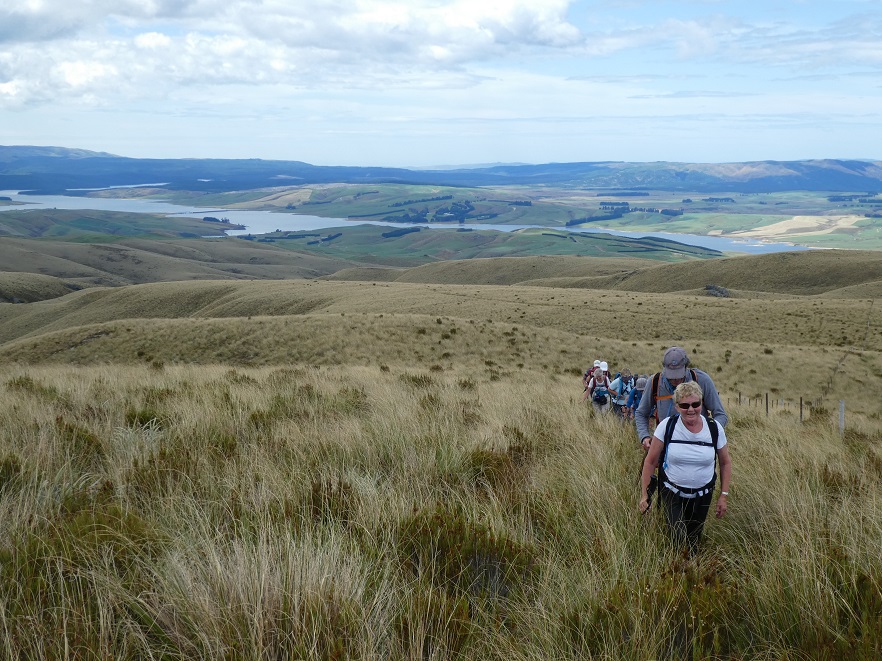
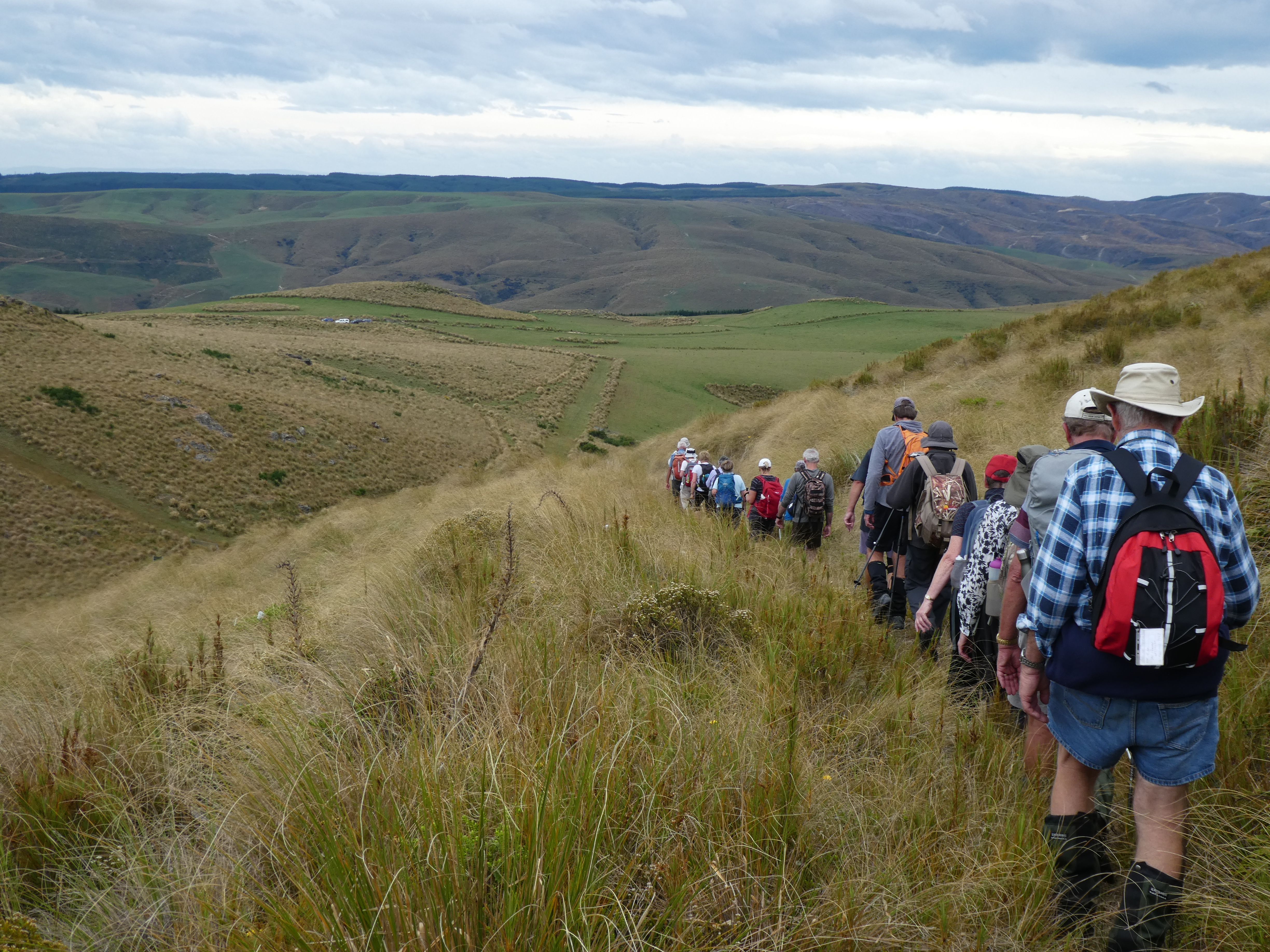
19 keen trampers left Mosgiel at 8.30am on a lovely Wednesday morning. It did not take long to reach McHardy Gladbrook Rd near Middlemarch then a short drive to the DOC track.
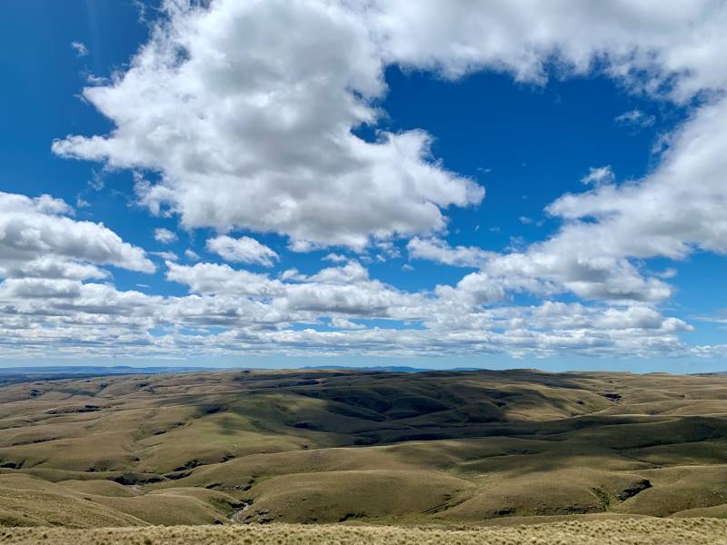
Category: Tussock
Predominantly walking through tussock country
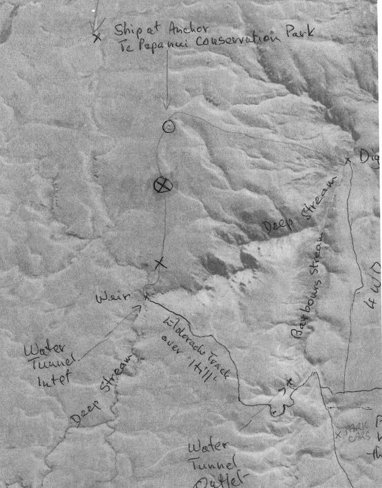
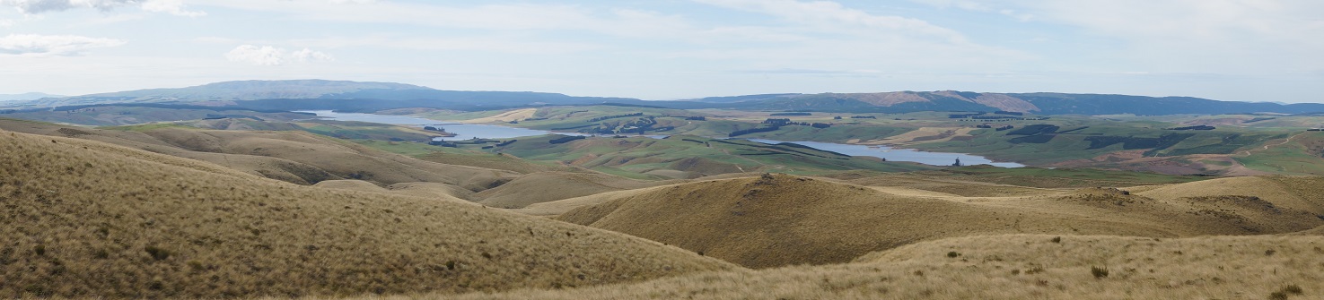
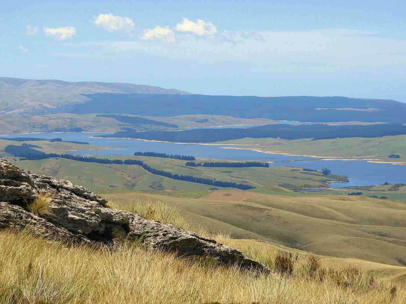
Ship at Anchor, Lammermoors, Deep Stream, Gold tailings, Mahinerangi
Lake Mahinerangi. From Eldorado Track, Cox’s Reef, Cosmopolitan battery, Timber Gully Waterfalls, old gold workings. (data lacking)
No. 8 on old hardcopy list of 113 club tramps. “Ship & Anchor. Lake Mahinerangi. George. Year round.”
No. 3 on old hardcopy list of 113 club tramps. “Eldorado Track. (Waipori.) Year Round.”
50 km from car-park. ( 54 km with Eldorado Track. Locked gates. Key from DCC Water Dept.)
Long tramp. Tussock now heavy. Summer too hot? Autumn may be preferable.
 14. 24/01/2024. Trampers. Ship at Anchor. Grade 4.5. $14. Leaders: Phil Keene/
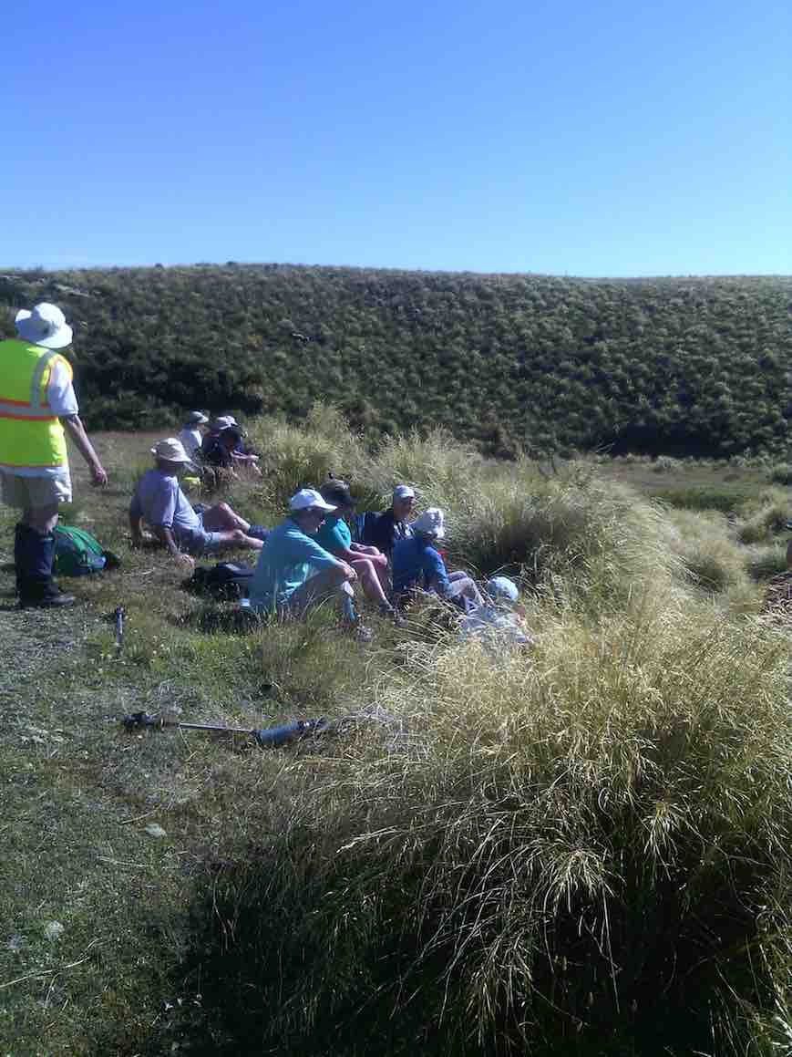
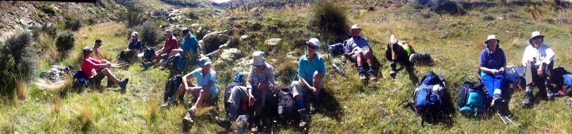
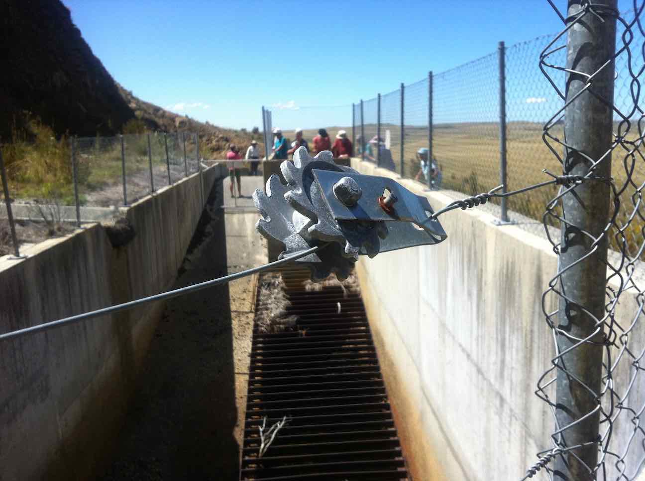
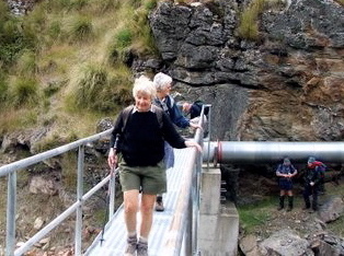
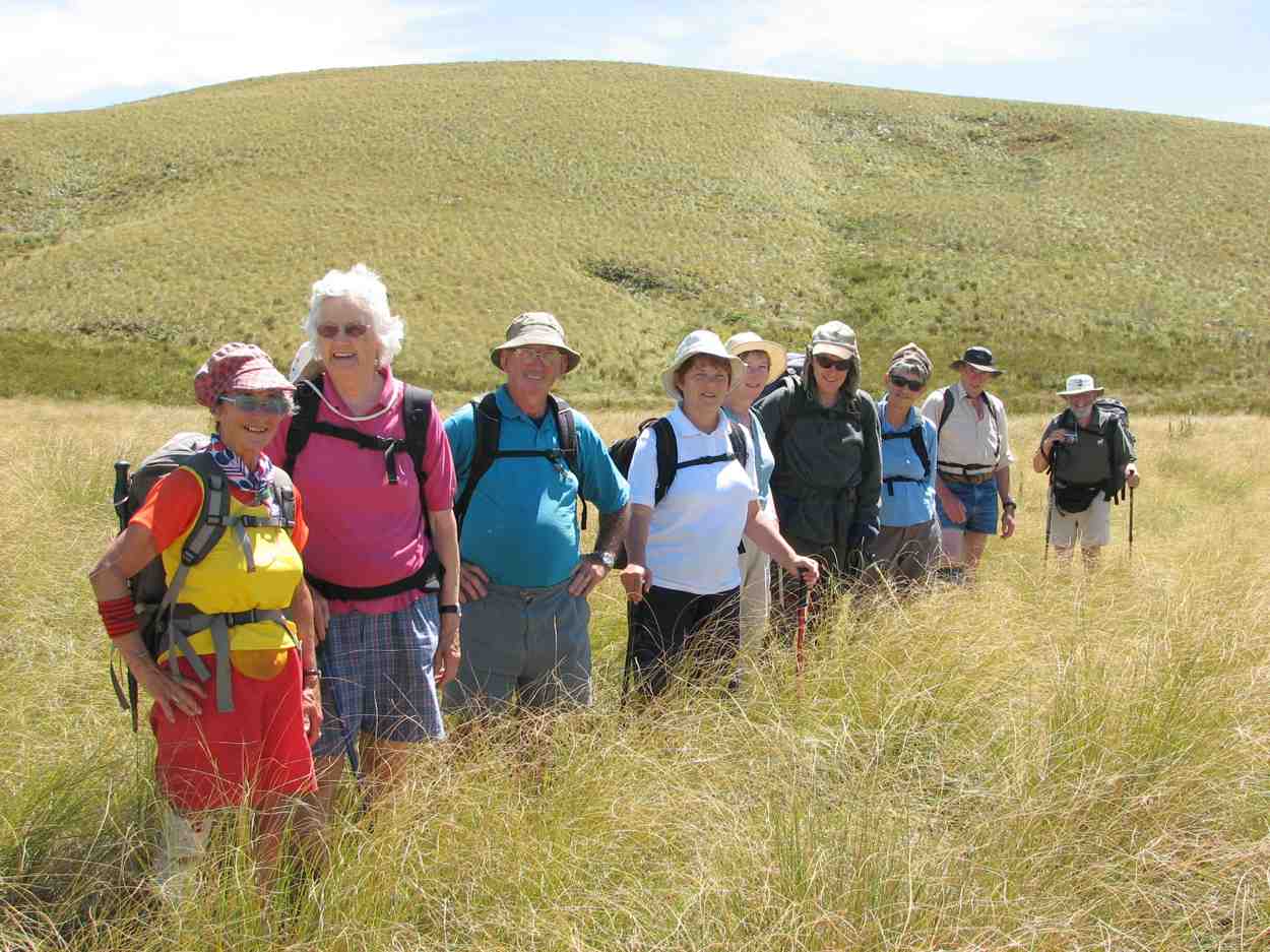
18 keen trampers turned up and left right on time at 8.30am in 4 vehicles, stopping briefly in Outram for tramper No 19, then travelled through the rolling uplands to above Lake Mahinerangi, before turning right up the El Dorado track, right to the end, through mobs of daggy sheep, the windfarm, the Blackrock Scientific Reserve and finally through the locked gates of DCC 3 Waters with the cameras keeping an eye. Ross was in charge of the key and maybe had a pinch of hypothermia by the time he was back in the car. Brrr would we find our riches at El Dorado?

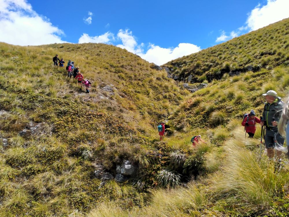
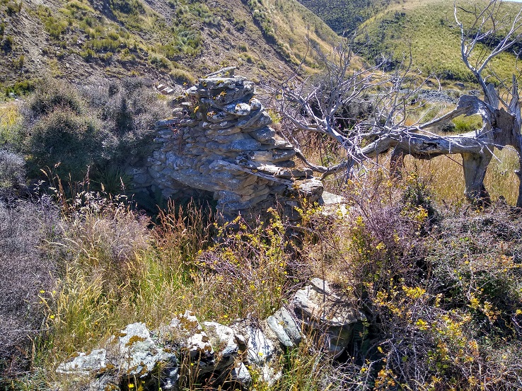
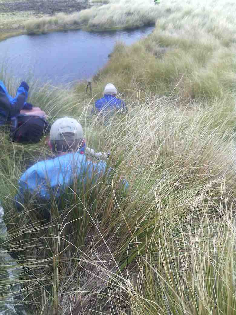
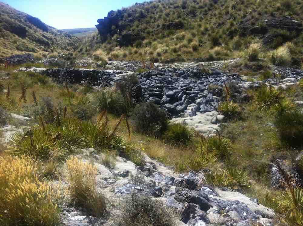
It was 10am before we set off walking, the group happily forgoing morning tea until we arrived 45 minutes later at the Chinese Diggings situated on the east bank of Deep Stream which was up a little following rain the prior day.
Mmm NZ Topo 50 is telling us we have to go west and will have to cross. The thought of this seemed to necessitate a continuous stream of walkers, single file, into the bushes. Thankfully they all came back and with a little help from our friends we all crossed, with wet feet and knees to the other side.
Thus began a steep ascent with a new pathway selected every few steps, not to mention the need for a breather at fairly short intervals!
The ascent was followed by steady to steep ridge-line walk keeping to the true left of a stream, before crossing over nearly at the head, and finally over the last brow of a hill to arrive after 2 hours from morning tea, of fairly serious tramping, at the Ship at Anchor;
thankfully we had not missed the boat and it provided good shelter along with the snow tussock from the fresh westerly that had been present all morning.
Our departure was not too long with those who had not previously been here circumnavigating the Ship and we all followed a course on the true right of the stream down another ridge-line, initially made ‘easy’ by a water course shaped I think by ancient shovels?
With the possibility of a precipice emerging in front our leader tacked left just in time onto another ridge that steeply descended towards a man made watercourse, scout Graham finding the appropriate gang plank onto the other side. It would be fair to say knees were now creaking as we traversed parallel with the contours dropping every now and then towards the crossing of Deep Stream. According to the leaders timepiece we took longer down than up, just like the Grand Olde Duke of York……oh dear!
If feet and knees were by now warm and dry they were wetted again and with all crossing safely we re-grouped and took off up the prairie back to the cars, this being quite a steady upland walk!

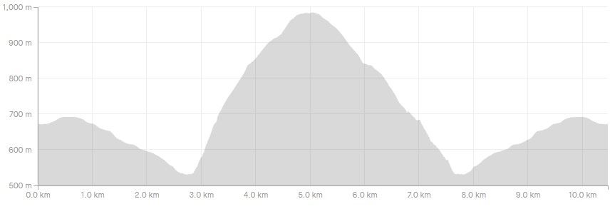
We departed paradise at 4.30pm arriving back in Mosgiel at 5.30pm. Rumour has it that the hydrotherapy pool has been busy since the trip, no wonder. The expansive and varied landscapes are so much more rewarding when set in such a remote and wild environment. Because of the access restrictions at the Weir this was the first time travel to the Ship at Anchor had been done this way. Distance 10.47km, elevation gain 661m, moving time 3:25;59, calories 1,016. And I’m sticking with grade 4.5.
Thanks to everyone for supporting each other so well.
Phil K
13. 17/2/2021. Trampers. Ship at Anchor. Leaders : Arthur Heenan and Gordon Grant.
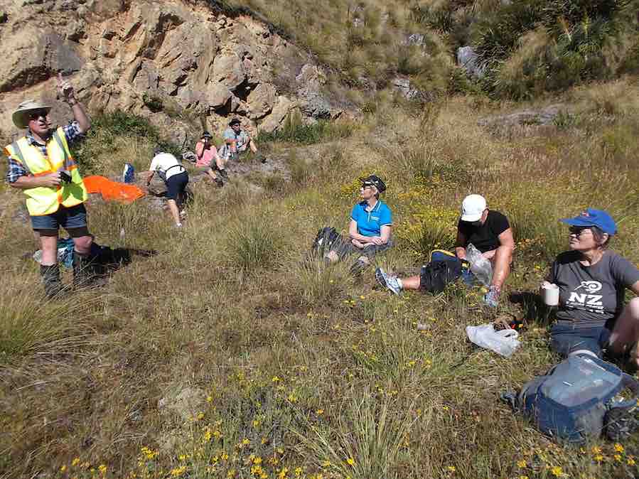
A great day was had by 10 trampers who did the Ship at Anchor loop tramp in glorious sunny weather with a slight breeze to cool fevered brows. After dropping off a car at the bottom of the hill we all drove up in the other 2 cars to above the weir on Deep Stream and had a quick cuppa. From there to the weir, then crossing the creek on the walk way and starting the trek up the fairly steep other side.

Taking it slow & easy saw us up on a more gentle slope and reaching the Rock about 12.00am for lunch.
We were soon up and on our way back down which was good, until the very steep and rough bottom 200 hundred meters to the creek and Chinese Diggings.
On this stretch we saw two disturbed falcons soaring above, letting everybody know they were not happy and with this, to everyone’s excitement a stag took off across the gully and walked to the top of the hill and disappeared. We assumed the falcon’s squawking warned him. From the creek we walked back on a gentle sloped 4 wheel drive track to the car and the drivers went up and brought the other two cars back, then down to Outram for an icecream which everyone thought we deserved.
12. 30/11/2016. Trampers. Ship at Anchor. H. Leader: Arthur.
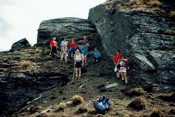
At the 3rd attempt, we finally did it! Today 7 trampers climbed up to the “Ship”, and then completed the circuit we had planned.
Southwest winds were forecast, so were expected, but it was a COLD WIND – there was obviously quite a wind chill factor in force!
Over an hour’s journey took us up past the Mahingerangi wind farm and into the “Black Rock Scientific Reserve”. We followed the “Eldorado Track” until we were on the hilltop just above the weir on Deep Stream. This was our day’s starting point, one car being taken back downhill for the end of day car shuttle.
It was a 10 minute walk down to the weir and tunnel inlet, but there was no shelter there from the cold wind, making morning tea a very brief affair.
But we had the privilege of watching two N.Z. falcons chasing away a pair of Harrier Hawks. They must have had a nest to protect. Their flight manoeuvres were superb.
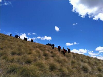
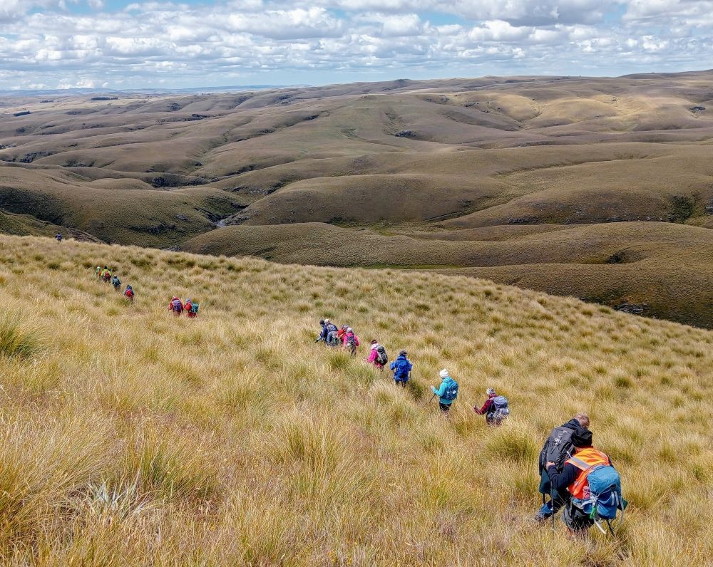
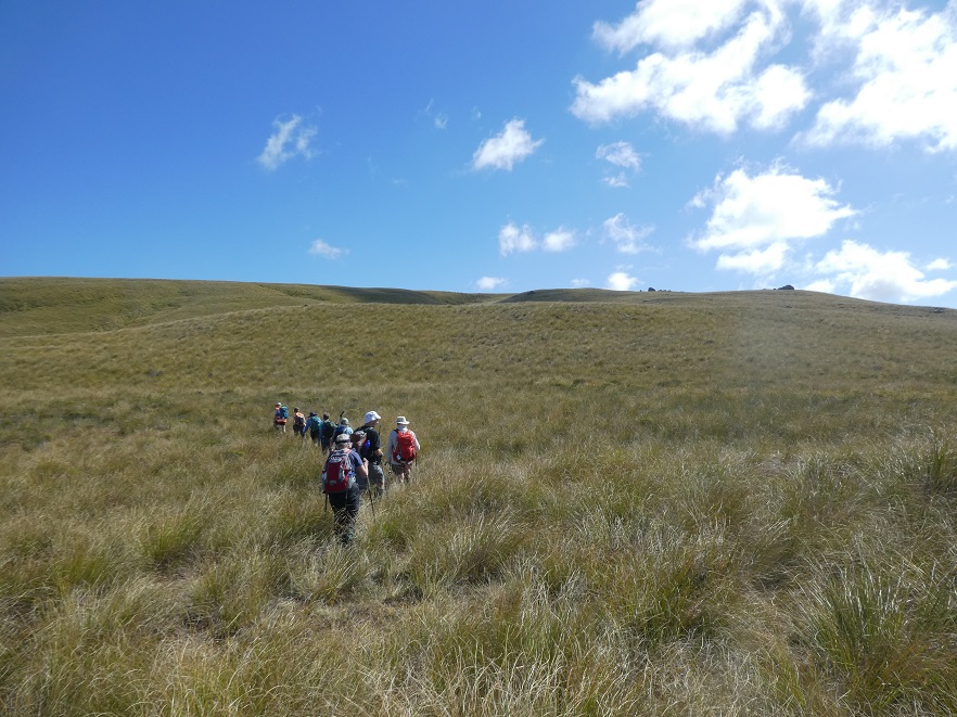
The next stage of our tramp was the most difficult – up, along, down to cross a rather difficult side stream, then up and up. After three quarters of an hour we were up on the open slope, much easier apart from the trackless tussock. We travelled in single file.
Further up, the leader came on our track made last February, following it for quite a distance. We passed the locality of our helicopter visitation of last time; and continuing on up slope a further 1 km we came to the “Ship at Anchor”.
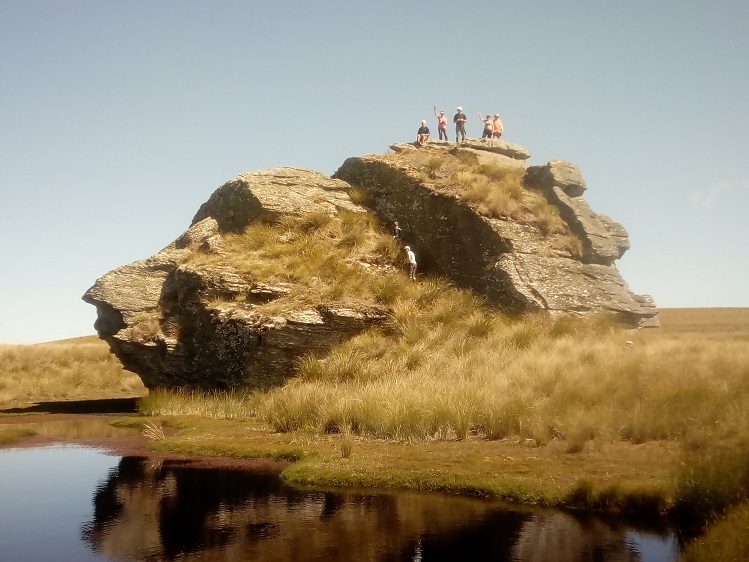
All of us climbed up on top, well 6 did anyway, for a photo opportunity.
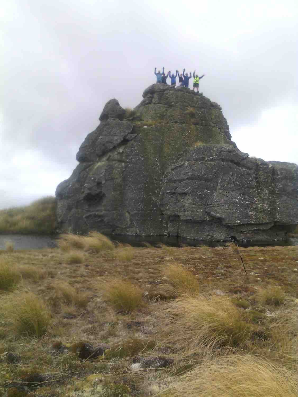
The wind was strong and cold on top. We didn’t linger.
Down in the shelter of the “Ship” we had our lunch.
We noticed a large, dirty rain shower over towards Mauntagua, missing us. But the weather had changed, with a light shower of tiny hail (about 1 mm in diameter) for us. Even a few snowflakes were seen! What a contrast to the terrific heat we had to contend with there last summer.
Weighing anchor(?), we turned downhill for the next 3 km. The going was far easier now, the tussock quite small here, and out of the worst of the wind. Only the last few hundred metres down to the Chinese Gold Diggings were difficult, becoming steep and rough going. We took our time but a few knees were complaining.
We crossed Deep Stream safely, although it took time, with most keeping dry feet.

After a brief spell at the Gold Diggings, we were onto the last leg of the tramp – uphill on the 4WD track. Light skiffy rain showers had appeared by now, remaining till we had finished.
The two car drivers forged ahead now, and once back, collected the far away car to meet the group at the road.
One or two thoughts to finish with:-
- The car shuttle worked very well.
- In the cold conditions experienced, the tramp didn’t need to be any longer.
- Coats (and more) had to be worn all day in the cold, but we were warm while moving.
- Distance for the can can only be estimated at 12 km (no modern wonder to tell us).
Back to Outram for the day’s finale, as Judy D (not out today) had invited us in for a warm up at her log fire, and a hot drink. And choccy bikkies as a real treat, too.
Thanks, Judy – you are a real GEM. It had been a satisfying day’s tramp. – Art.
11. 3/2/2016. Both. Ship at Anchor attempt and Gold Tailings. Leaders: Arthur, Ian and Bob.
Trampers’ Report. Leader: Arthur.
Ship at Anchor Tramp – 3/2/16.
8 trampers (including 2 guests) travelled in convoy with the hiking group who were going to the Chinese diggings.
The cars’ access was up Eldorado road/track, and passing the Maninerangi Wind Farm, in to the Black Rock Scientific Reserve.
We walked for 10 minutes before stopping for morning tea by the water tunnel outlet.
As part o the Mahinerangi Hydro Complex, a tunnel was built through the hill to divert some water from Deep Stream to end up in Lake Mahinerangi. This was completed in 1984.
We then followed the road (Eldorado Track?) up over the hill and down to where it ends at the weir and tunnel inlet end, on Deep Stream.
After a brief stop we then crossed the bridge and tackled the difficult hillside leading up onto the open tussock slope which leads up to the Ship at Anchor.
We stopped for lunch at 12.45 before continuing up the trackless tussock slope. One of our lady guests was feeling the heat (it was hot out in the sun by then) and at 2pm was in severe distress.
An immediate 111 call was made, and once the police had pinpointed our exact position, the rescue helicoper soon arrived …
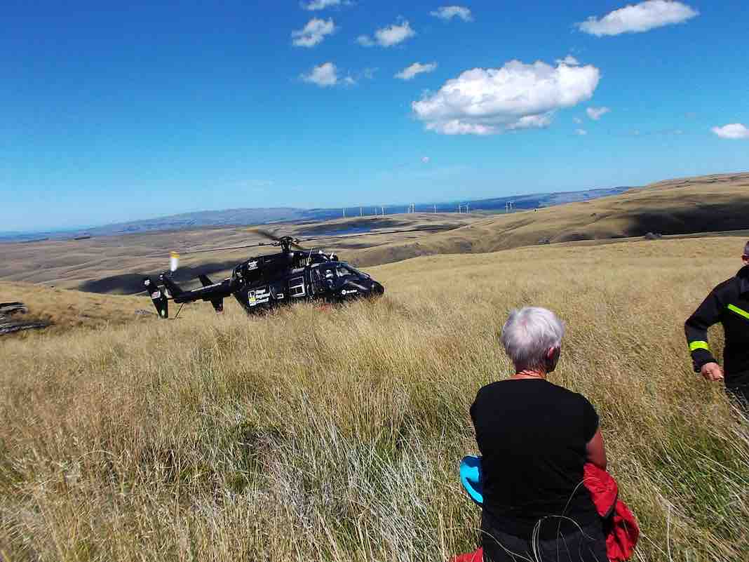
…and transported her to hospital. Happily she soon recovered and went home that night.
The 7 remaining trampers then returned down hill back to the weir – too far behind time to continue.
After a 15 minute rest at the weir, the car drivers took a pleasant little stroll over the hill to bring the cars over to collect the rest of the group who had remained at the weir. All then returned safely to Mosgiel.
Thank you to our 2 nurses, Jill and Margreet, who rendered first aid, and thanks also to the whole group for the care and understanding shown by all.
And finally a very big thank you to the N.Z. Police. Also to the Otago Regional Rescue Helicopter and its Crew.
A final reflection. A motto for our club to adopt?:
****** SAFE TRAMPING IS NO ACCIDENT *****
– Arthur.
Hikers’ Report. Leaders: Ian and Bob.
We hikers were 13 in three vehicles and were parked beside the trampers’ other two. The trampers set off immediately but our much shorter prospective journey allowed us a leisurely morning tea on a bank overlooking the cars.
Then it was down the “Track” only a short way, then a sharp right turn up a steep rise to an T-junction where we regrouped. From there we set off in a strung-out line along the 4-5 km 4WD track through the tussock down to the diggings down the Deep Stream. We arrived there early, but what the heck. It’s hot. Sit down and enjoy a rest and an early lunch.
This reporter was surprised few took the opportunity to do much exploration of the diggings.
We had arrived. It was hot. Trek accomplished. Eventually some started going back. Groups of 2 and 3 left to return up along the track we had earlier come down. No trouble about this. The 4WD track was clear. The route would be uphill this time. The heat was increasing. There need be no rush. So we strung out and Bob made his way to the front with Ian grateful to be at the back with the the last two slow ones. In fact so slow were we, that after Bob and the others had got back to the cars Bob still had time to return in his big 4WD before we had even reached the T-junction, and made light work of transporting us the rest of the way. Although all the others had of course accomplished the full distance, it must be said that there were not a few cases of light-headedness. Frequent drinks of water and good sun protection were certainly essential. There was no shade.
We were back at the cars – when? – about 2 p.m. Now for the area’s other highlights. But by car this time! We took the route the trampers had taken earlier, steeply up over the hill, visiting in turn the Water Tunnel Outlet …
… and its inlet over the hill at the Weir. (We didn’t know it at the time, but had we looked back as were were driving back up the hill from the weir we might have caught sight of the trampers coming back from their aborted expedition. They saw our cars! And we hadn’t even noticed that big black helicopter! So close were our two groups! So distant! And of course the area is not cellphone territory.)
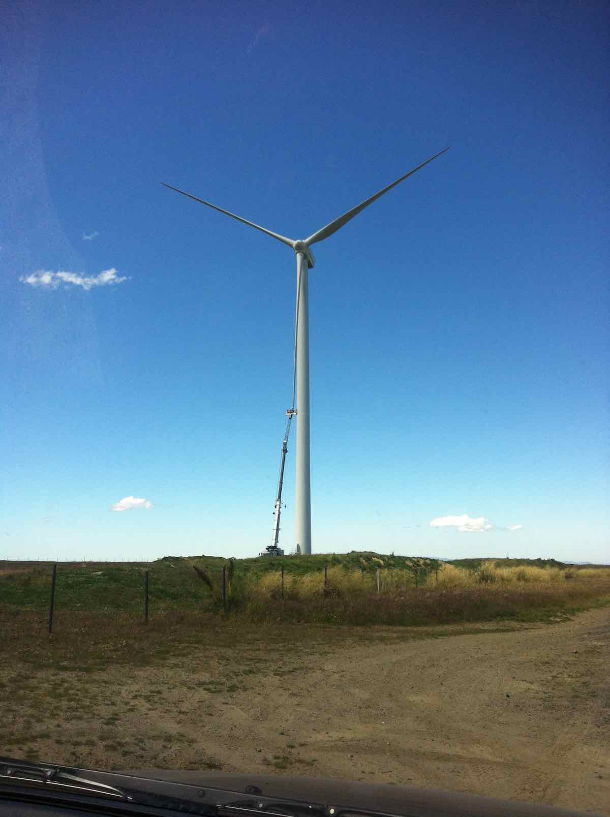
For us, it was simply back over the hill, blissfully unaware (and unable to know) of the critical state the trampers were in. Out through the Black Rock Scientific Reserve, through the two locked gates, and translocating from the 4WD Eldorado Track to the upgraded Trust-Power Mahinerangi Wind Farm’s Eldorado Road. (How ‘tracks’ can change over the Club’s history!) A wind turbine blade repair job alongside the ‘road’ dwarfed the technicians in their tiny cage. (Click a second time to enlarge the photo.)
We returned this time via the Lee Flat Road for a change. We were now on tar seal, and arriving at Outram made us feel we had returned to civilisation.

What a day to mark in the Club’s history! Well, all’s well that ends well. Sooner for us, and – well – eventually for the trampers. (There’s too many ‘wells’ in there somewhere) – Ian.
10. 25/2/2015. Trampers. Gold Tailings attempt.
The 4 of us set off to do the Ship at Anchor. When we got to the outlet tunnel at Barbours Creek with the rain and cold wind we decided to go back to the sign to the mining village. We set off up the track to the second sign, the same as down at the road. No clear indication on which way to go. We went down a FWD track, thinking this was the way but after a while I stopped and said this was not heading the right way, so we returned to the car with the wind and rain in our faces. The four of us decided to have lunch at Waipori Falls picnic area. Within five minutes it started to rain again so we headed into the car heading for home. We ended up eating our lunch when we got home. – Heb.
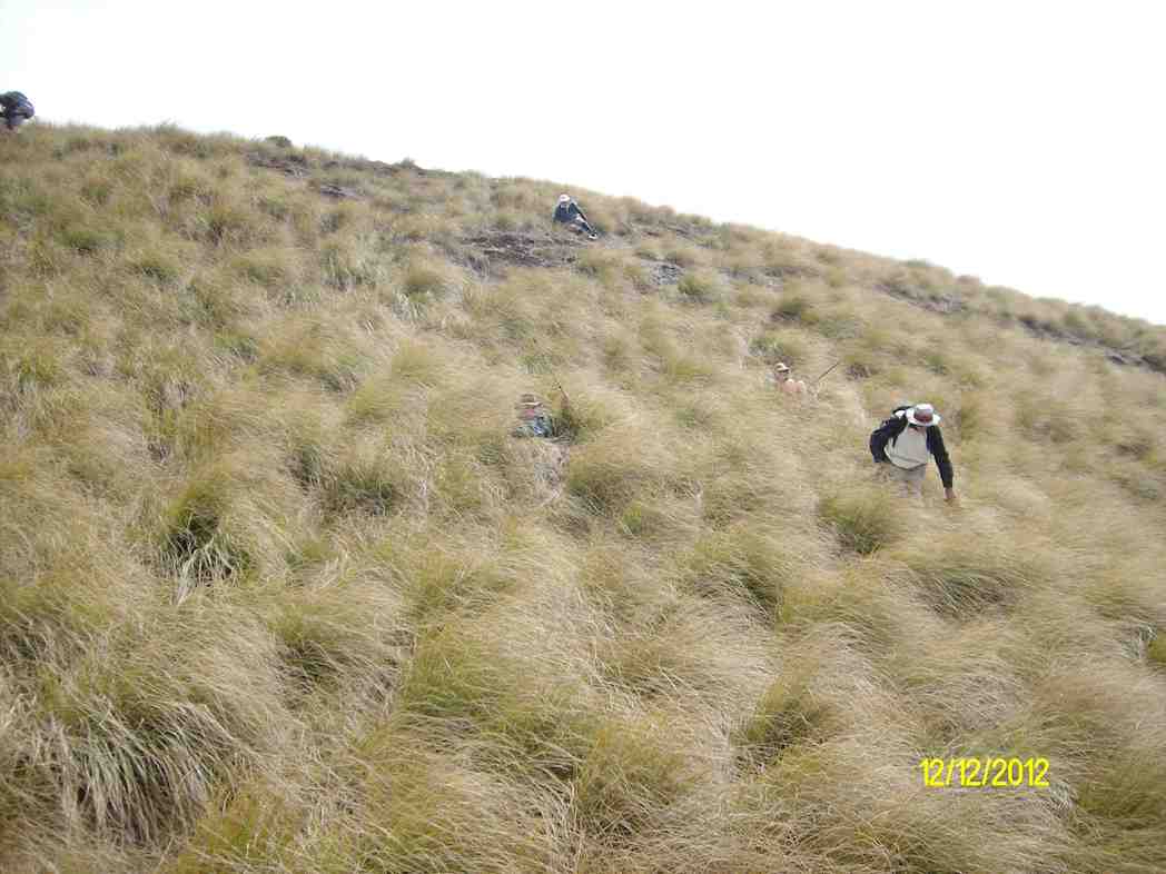
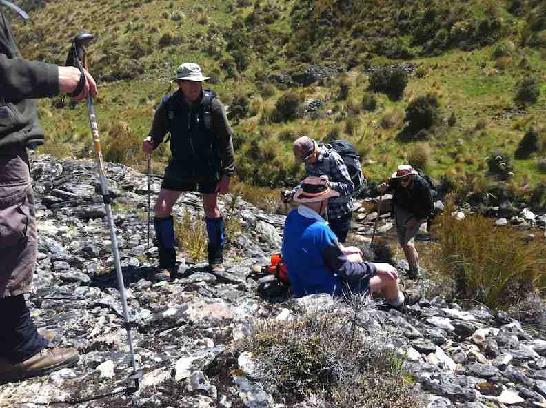
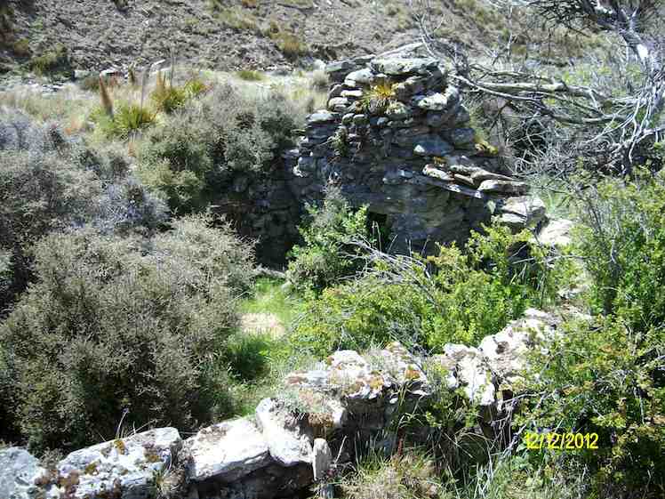
9. 12/12/2012. Trampers. Ship at Anchor. Deep Creek. Gold Tailings.

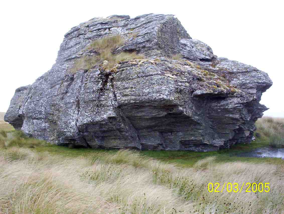
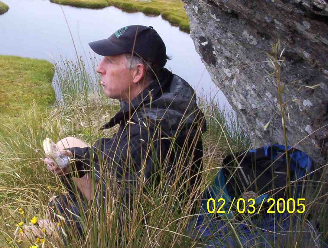
8. 2/3/2005. Trampers. Ship at Anchor. Lammermoors, Deep Creek, Gold Tailings. Leaders: George, Arthur H

7. 12/11/2003. Trampers. Ship at Anchor, Lammermoors, Deep Creek. Medium+. Leaders: George, Arthur H
6. 31/3/1999 Ship at Anchor – Mahinerangi. Leaders: George, Lex, Graham
5. 2/1995 Leaders: Eric, George, Doug M
4. 23/2/94. Ship at Anchor. Medium+. Leaders: Ria L, Eric B, George, Doug M. Easier alternative: Leaders: Ria H, Jean A.
3. 13/11/91. Ship and Anchor on the Lammermoors. Harder. There will be an alternative route if you run out of ‘puff’. Leaders: George, Bob & Audrey, Dave & Jean
2. 27/9/89 Ship at Anchor, Lake Mahinerangi. Harder grade tramp. Leaders: Hugh & Judith, Dave & Jean, Ria L
1. 1/3/1989 Eldorado Track. Interesting country – old Waipori cemetery. Leaders: Ria L, Bob H, Molly
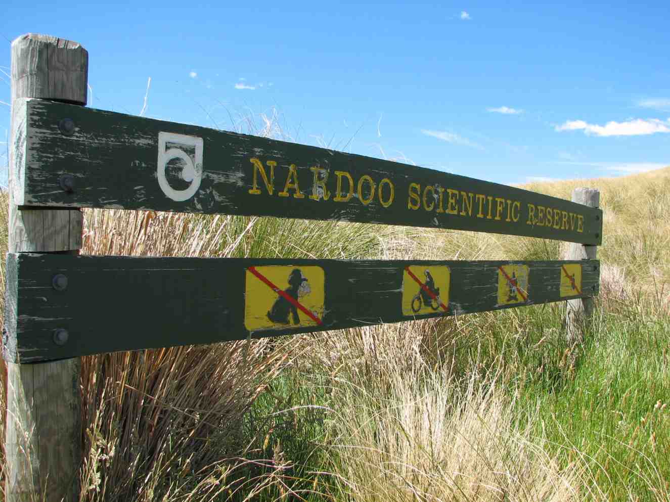
Walrus Bridge. Nardoo Scientific Reserve. Little Peak.
Distance from Bush Road Car-park: 50 Km.

Suggest leave Mosgiel 8.30am to get to ‘Little Peak about 1km above ‘Walrus rock’.
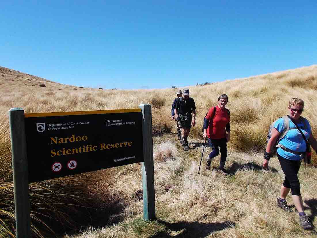
Nardoo Scientific Reserve – Information and Trips Library
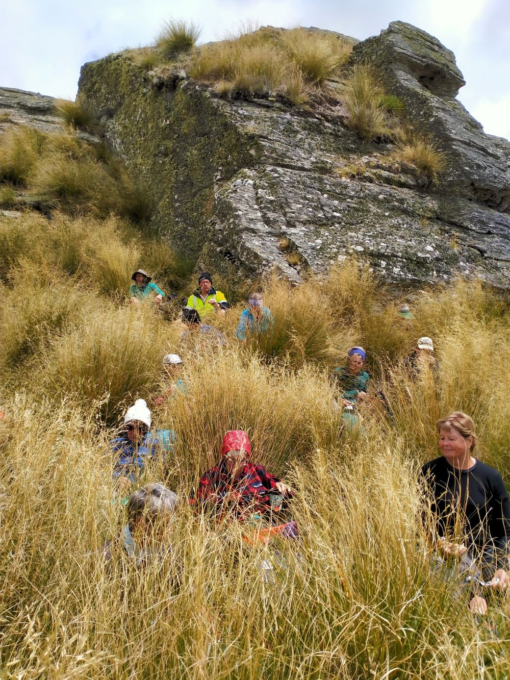
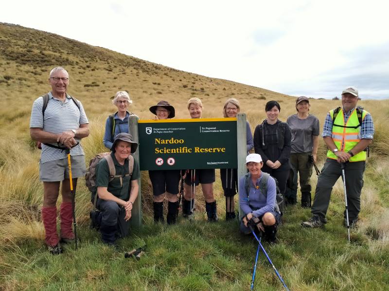
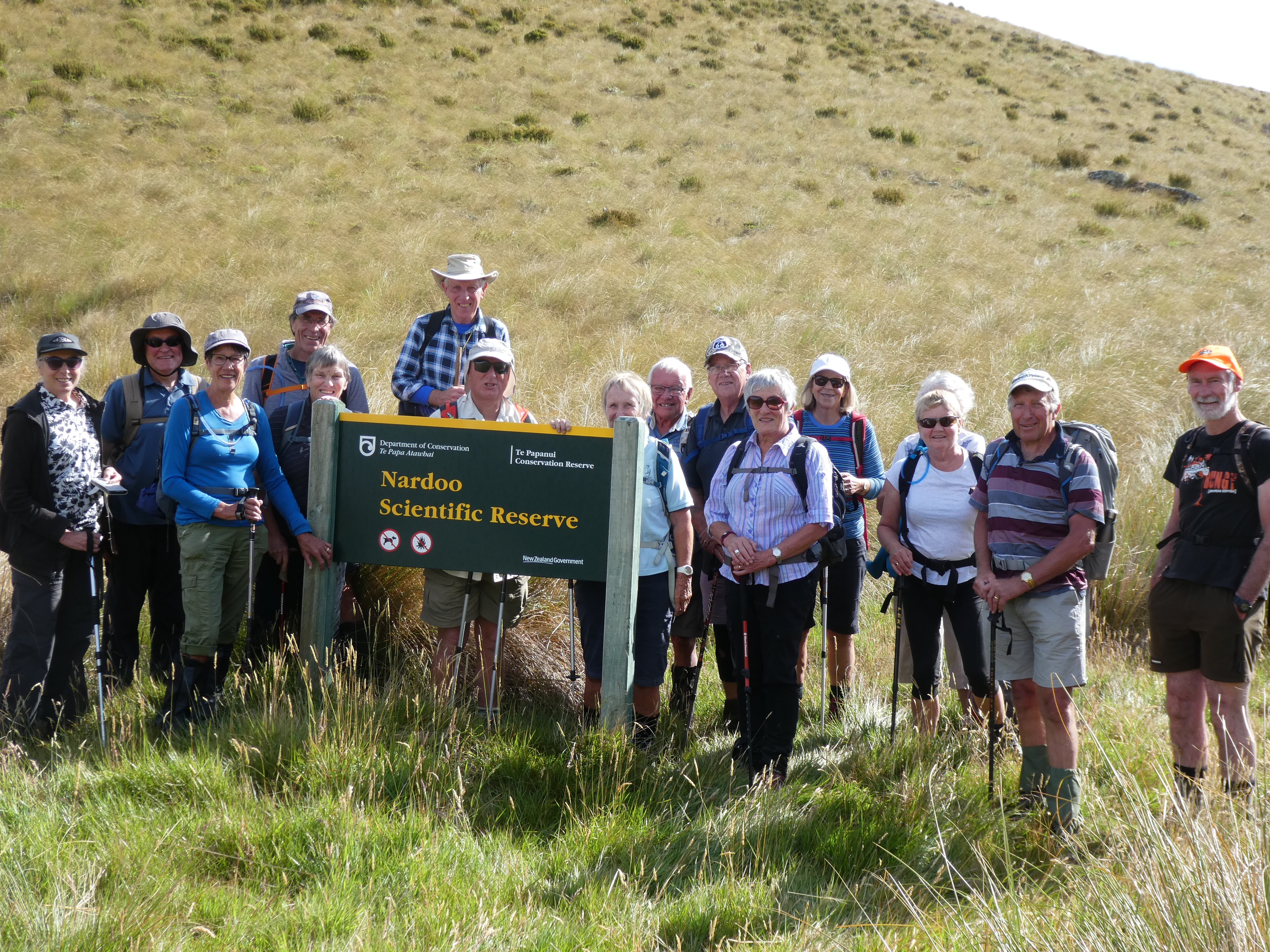
10. 16/11/2022. Trampers. Nardoo Reserve: Walrus Bridge Rock. Grade 3.5 Leaders: Phil Keene and Graeme Souter
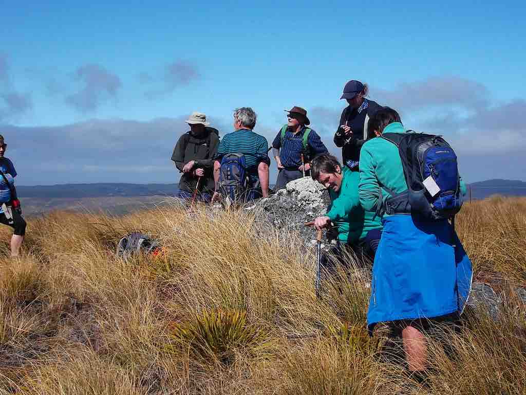
Was this going to be one of those on again off again days? Well no as eleven enthusiastic trampers turned up ready to go at 8.30am… although we were starting to think of a plan B as we travelled through rain to the Strath Taieri… however lo and behold the weather cleared, Lake Mahinerangi was calm, yay no wind on the tops, and the clay extension of Lammerlaw Rd through Waipori Station was dry.
Tailing was underway and the lambs were not gambolling, they were bolting and calling to mum. The Hereford calves had nice clean socks on and were top of the fashion parade.
We set off at 9.45am and shortly practised our fence and gate hopping and climbing to enter the reserve, where a ‘before’ photo was taken.
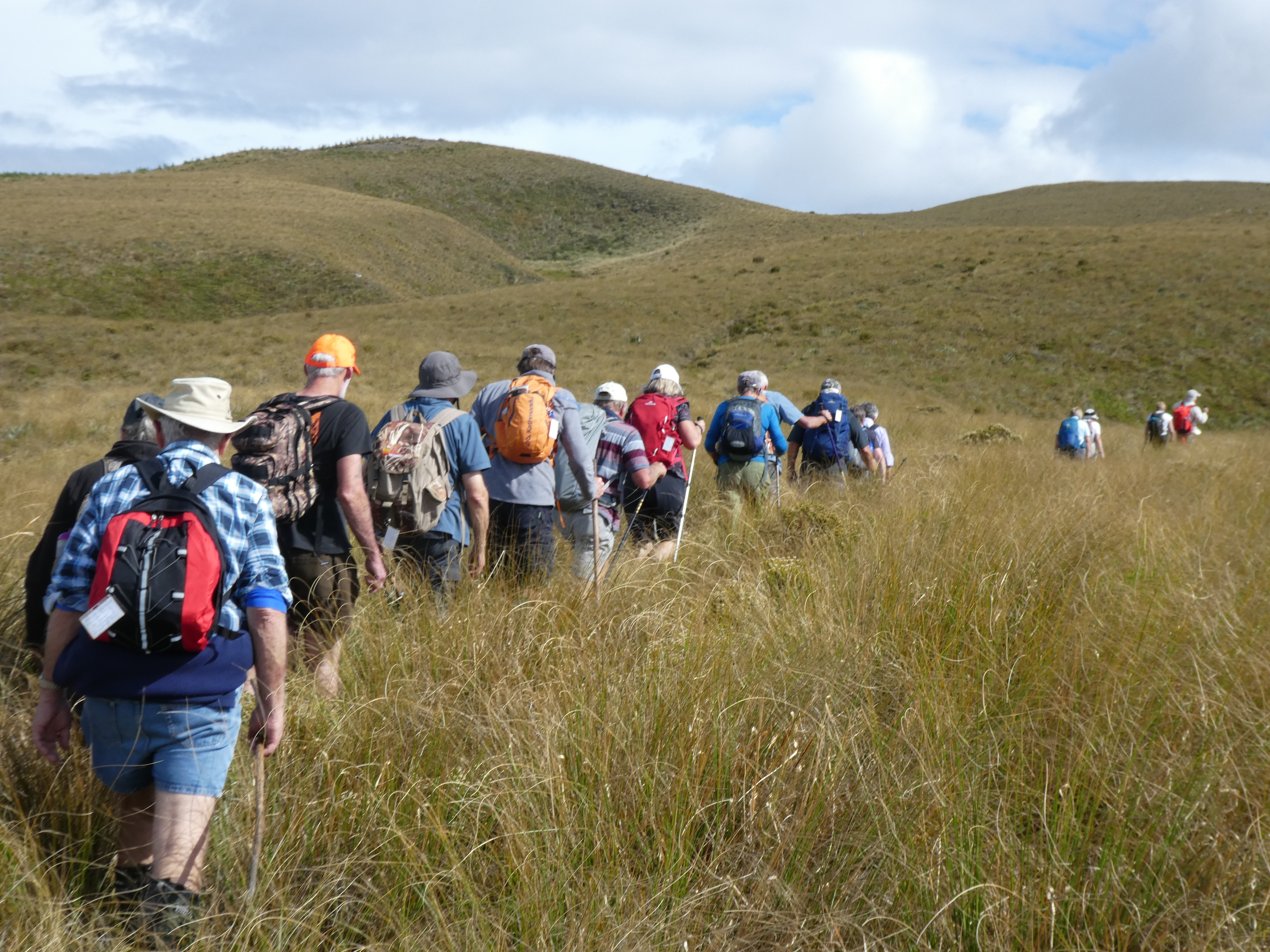
We followed the remnants of a graded track that all too soon was lost
in snow tussock country.
A short sharp start to the day, before settling in to a steady upward ascent,
closely following each other to eliminate miss-steps and help form a clear ‘track’ to assist the return
journey – would it work?

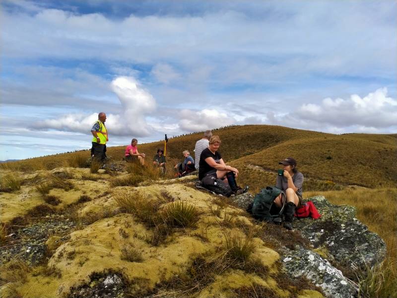
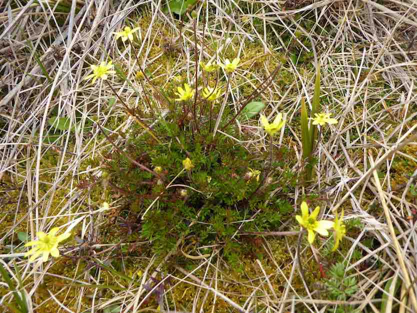
We had morning tea on a rock outcrop festooned with lichen and a soft ‘magic’ yellow carpet of vegetable
sheep…were we already visioning?
For the balance of the morning we crossed low saddles and followed
a line of drachophyllum that had colonised the initial track and we stayed up on the ‘faces’ zig zagging to
and fro as we got close to the boundary fences. Keep out of the gullies being the mantra of the day.
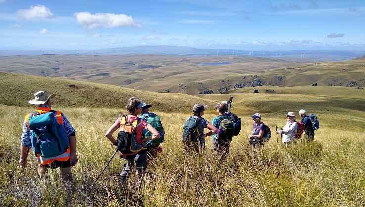
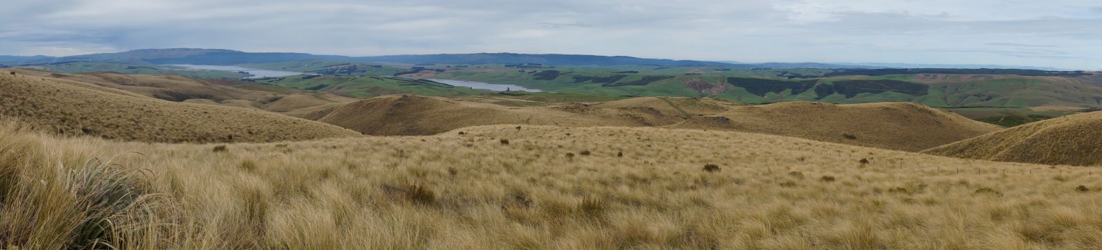
Initially the Blue Mountains dominated the views to the west, then Mt Wendon and higher still the Old
Man Range. Still no wind going by the blades of the wind farm… the tussock was dry to touch.

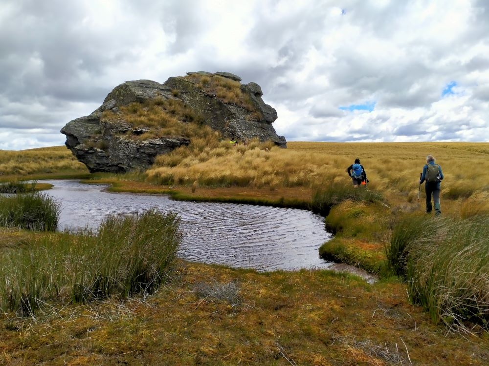
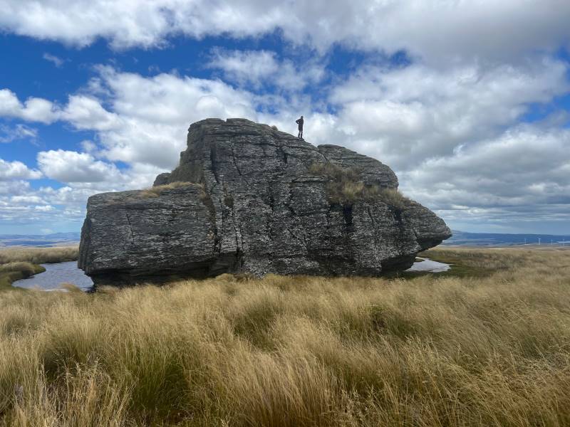
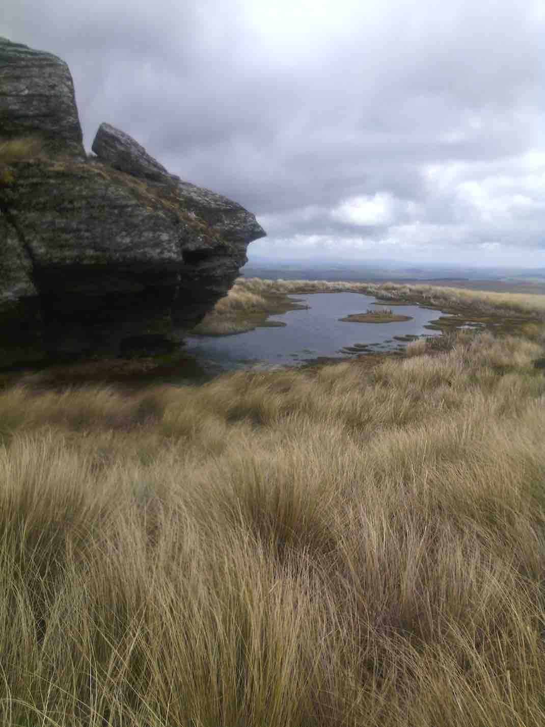
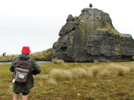
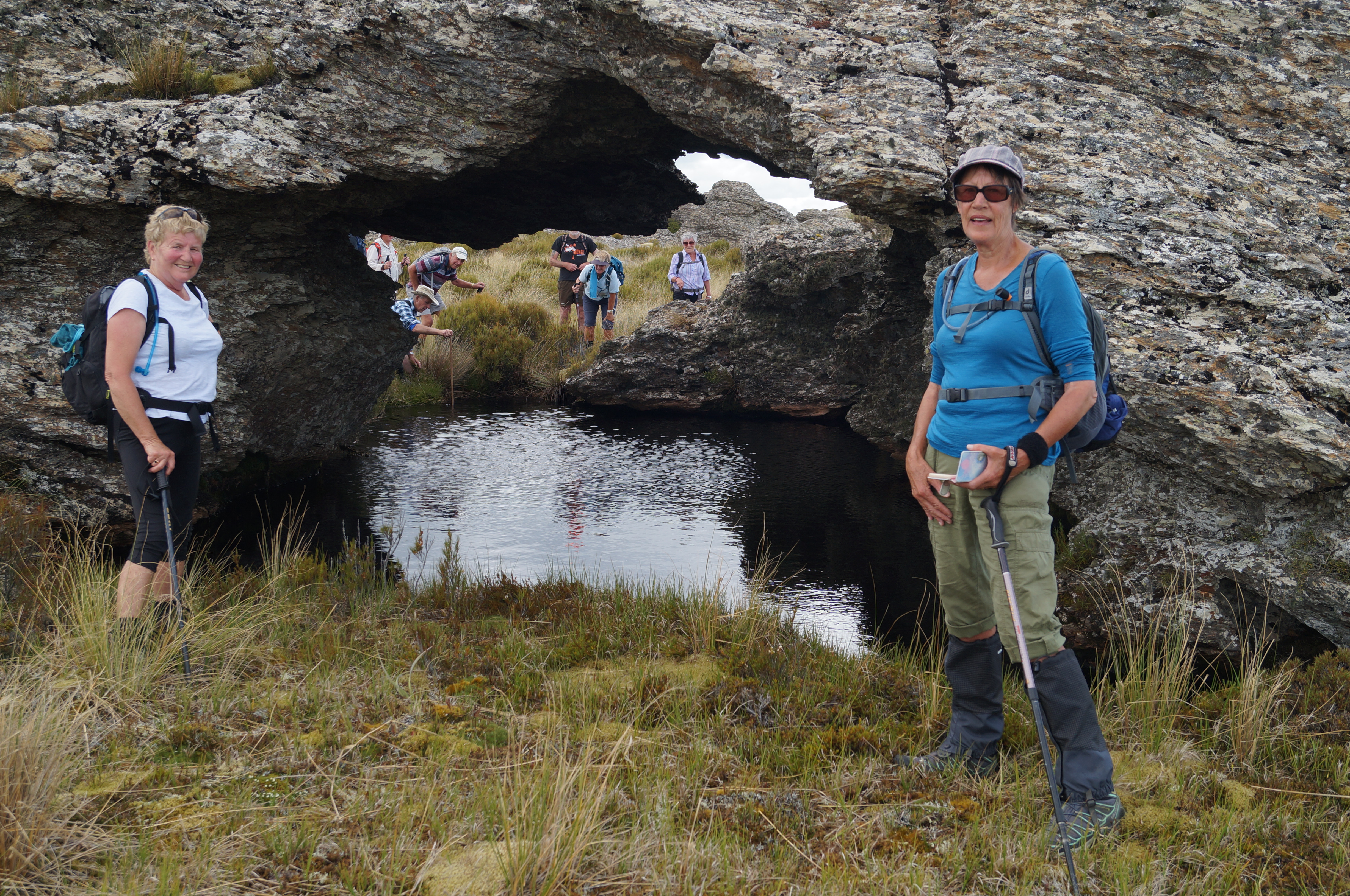
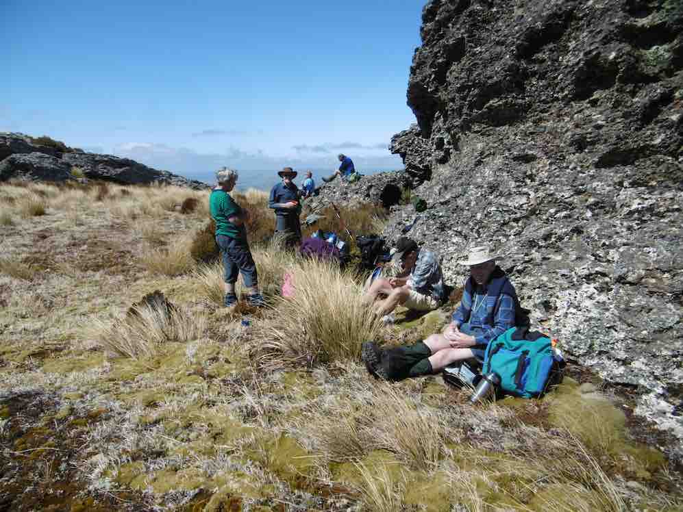
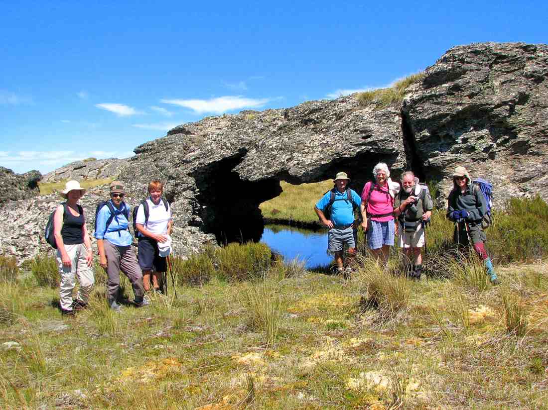
We veered to the right near the top and made our way to the Walrus Bridge rock, where with dark clouds
building we decided to forgo Little Rock, and had our lunch right on high noon.

No sooner had we sat
down than a few spots of rain became steady rain and rather soggy sandwiches were dealt to. Coats and
covers came out, some of the fit and experienced trampers discovering for the first time that their packs
had built in rain covers…..gee no rain on a Wednesday for 3 years according to Charlie!
Clearly this was now going to be a game of two halves and a determined team set off, the descent much
quicker than that done on the recce, but maybe that was enhanced by the much clearer track created on the
way up – yeah right!
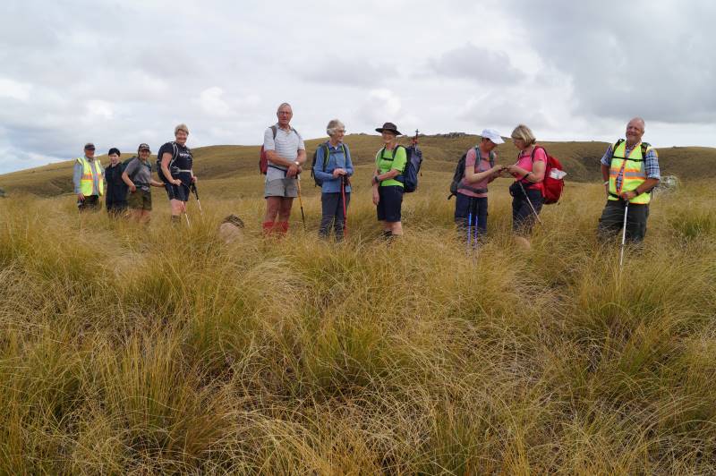
We were back at the cars about 1.30pm having stopped at the Reserve sign for the ‘after’ photo, was this
the same group of happy trampers? Yes they are all smiling!

Wet gear was quickly placed into the car boots and the cars were soon steaming up….everyone agreed to
forgo coffee as hot showers and dry clothes seemed the more important…
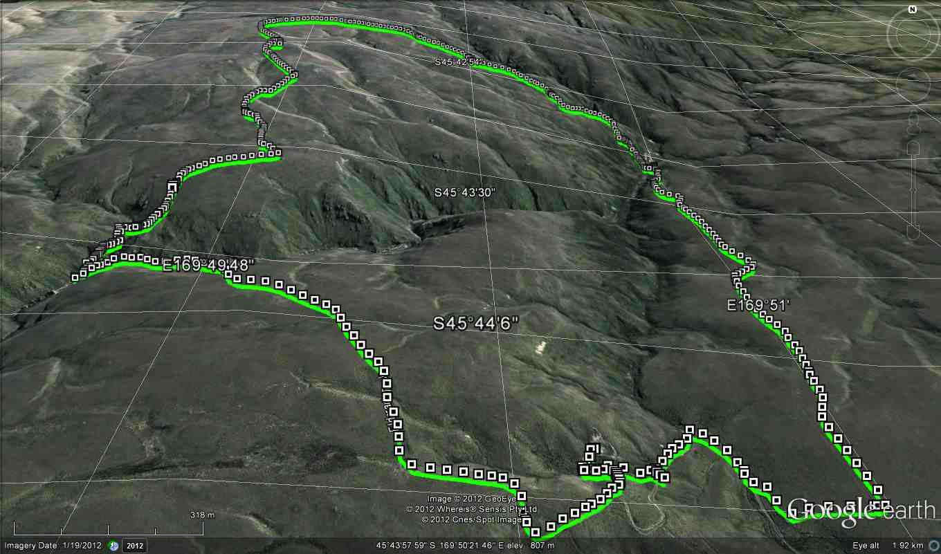
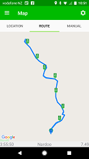
It was heartening to hear the comment that the GPS map showed that we managed to follow the same
‘path’ both up and down… a testament to the leaders! Thanks to Esther and Neil also for taking their
vehicles that got suitably muddied on the way out…..and to Waipori Station for access.
Phil K
9. 29/1/2020. Trampers. Nardoo Reserve. Leader Phil
17 trampers headed off in to the wild blue yonder in vehicles suited to the terrain; picking up Chris at Lee Stream and then on to and up past Lake Mahinerangi ( according to one translation – ‘ moon glow of the heavens’; the lake being named after the Dunedin Mayor Burnett’s daughter, Neil S commenting he did not know marijuana was smoked back in those days).
We ventured past the windfarm and on down and up past the ‘old’ Waipori Cemetery ( prompting the question from John – where is the ‘new’ Cemetery?), the Lammerlaw bridge crossing and through Waipori Station, following large tractors doing silage on the lower slopes, till we came to the road end – where we startled 3 fine red deer spikers that easily hurdled the fences and raced off down the valley. Gary needed to be restrained and was seen to be frothing at the mouth and muttering under his breath….
Having saddled up we traced around an old water race, one of 16km of races that served the Waipori goldfields, and entered the Nardoo Scientific Reserve ( the sign not being visible from the road end) where a group photo was requested, it being decided we may not look so good if the photo was taken at the end! (this proved to be so true).
A bit of useless info was provided on the meaning of Nardoo, thanks to Dr Google….a name given in India to a plant powder used in cooking and also called ‘aboriginal flour’ in the West Island, having been extracted from a type of fern……not sure who has the naming rights.
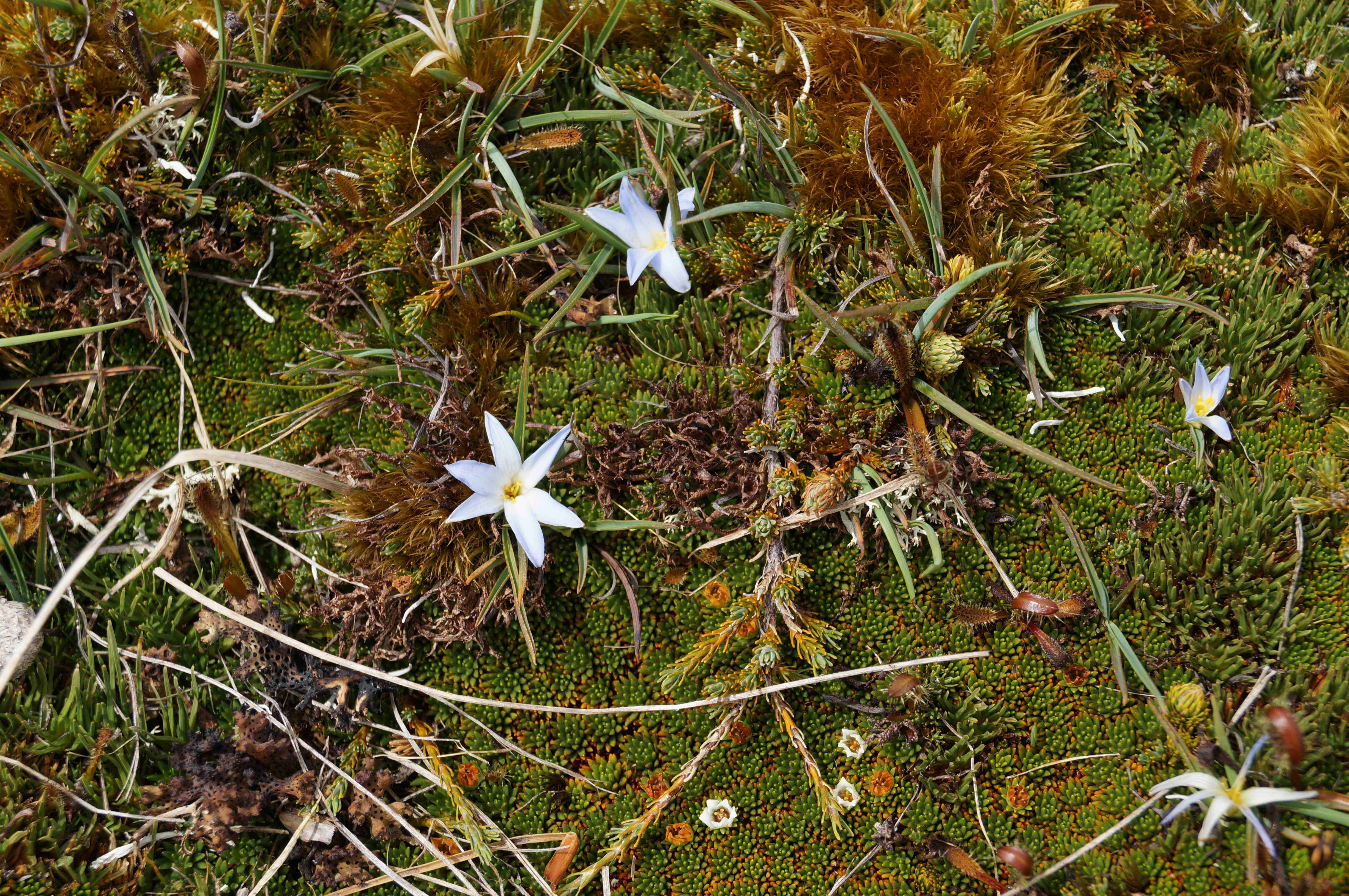
It was then onwards and upwards through a ‘garden’ where over 500 different plants exist, competing with and strangling each other in the process and yes well almost the trampers themselves, as we picked up our feet to negotiate silver tussock and spaniards and ground coprosmas and celmisias, these all punctuated by windflowers and the higher we went the purple orchid, Thelymitra.
Morning tea was provided on the first main rock outcrop where views to the Blue Mountains, the windfarm approaching Lawrence and on around to the Waipori catchment , the Maungatua and to Swampy and Flagstaff and the Silverpeaks were evident. The main route for goldminers in 1861 from Outram, the upper Maungatua and across the upper Waipori River and leading ridge to Gabriel’s Gully was outlined as well as where 2000 folk lived and mined in the 1860’s at Waipori Township.
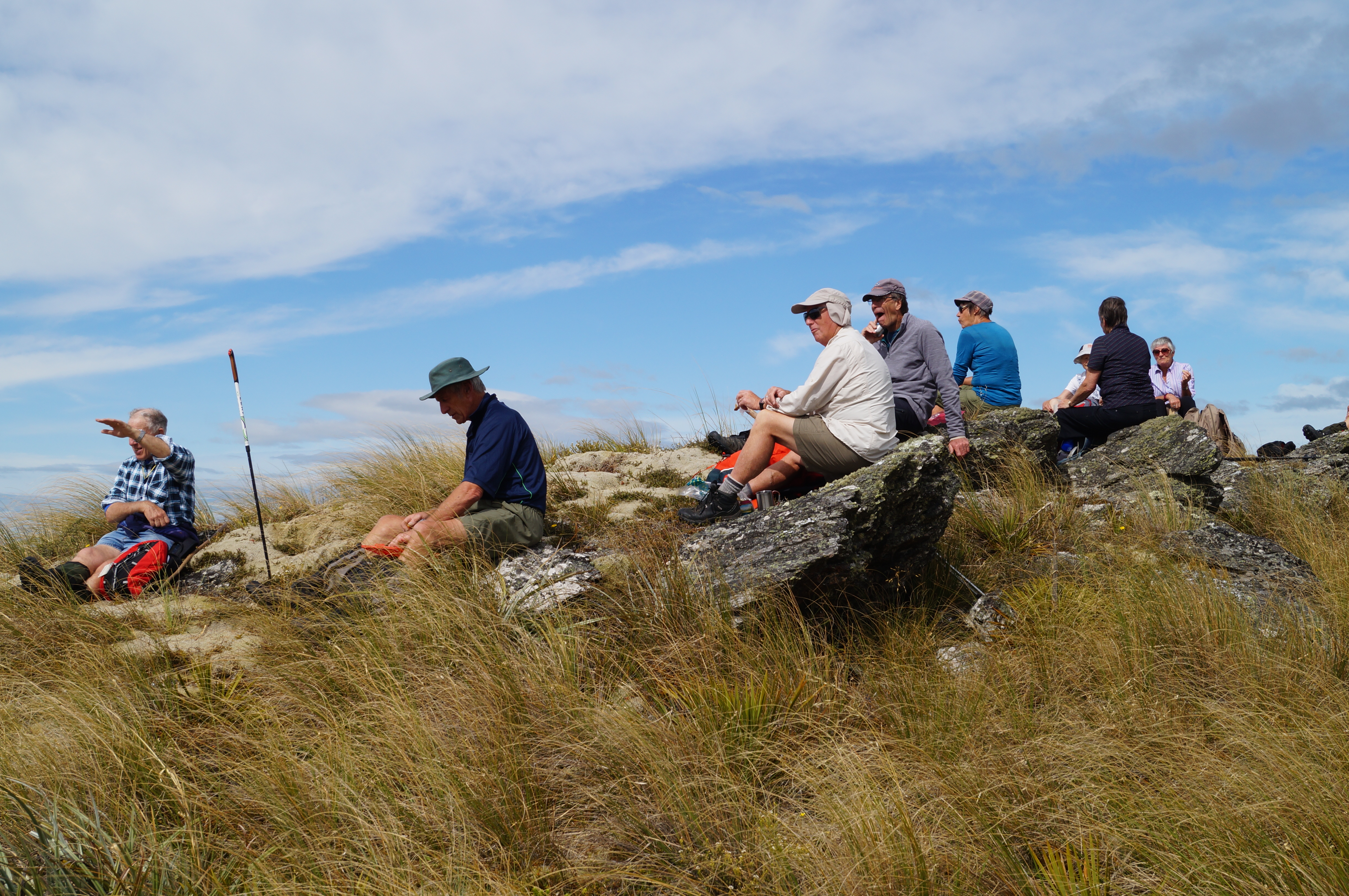
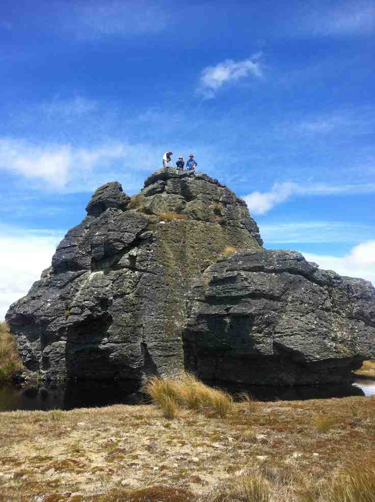
From then it was a steady ‘zig zag’ pattern across low saddles and up ridges till we made lunch at the base of the Walrus Bridge rock outcrops; the herb fields were parched (as were the trampers), dry and crisp and the models in the group posed for photos in the reflective waters of the tarn under the rock.

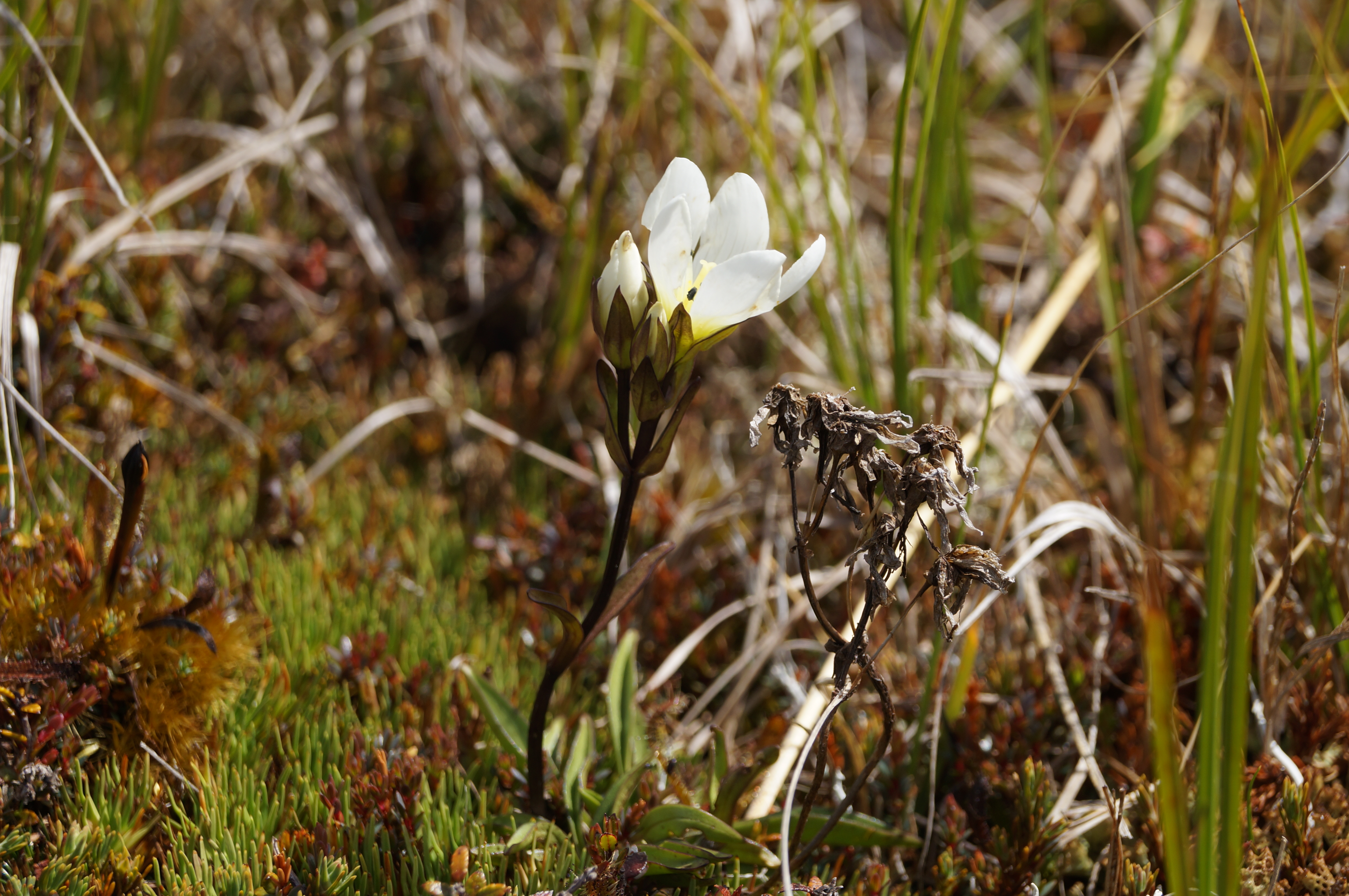
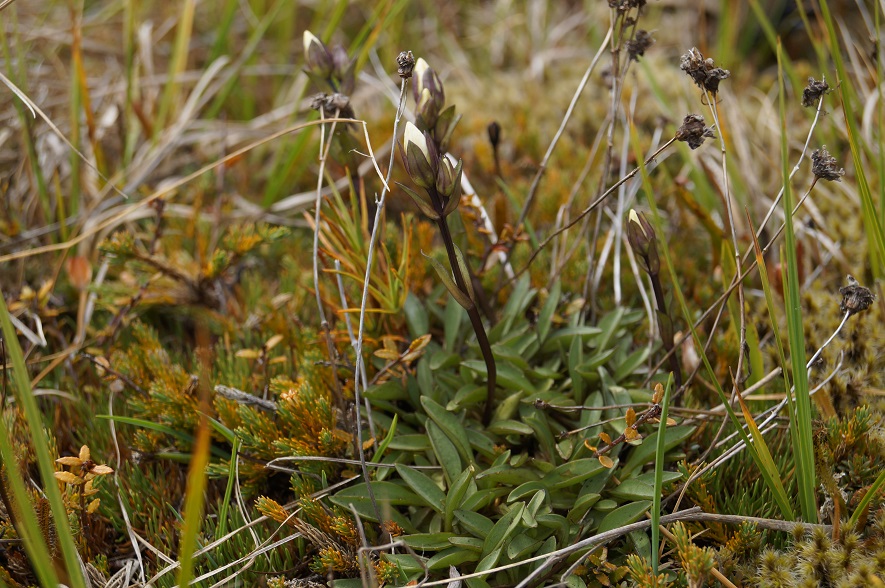
It proved quite easy to ‘rest a while’ in the wonderful environment with the extensive views and silence and to spend time to find the first flowering gentian for the summer.

A little thought had been given to moving on to Little Peak but it was unanimously agreed that time to return to good coffee and ice cream in Outram was the more important so downward we went trying hard to re trace our upward steps to save energy….which amazingly we managed to do, with only one or two ‘off track’ moments. A benefit of leading was seeing numerous skinks playing chicken……
Not too far from the vehicles we were strafed by a low flying Cessna type plane flown by ‘Snoopy’ Morrison who gave us and received the appropriate salutes. Why he did not land on the airstrip to offer some a ride back? We managed to make it back to Outram in time to catch up with Hikers and Ramblers to finish off a great club day out.
For future Nardoo walks a suggestion is to start this walk at 8.30am to give time to get to Little Peak and a return to Outram for coffee and craic. And why not – a quote from our recent European escapade ‘ coffee does not ask difficult questions, coffee understands’!
Phil
8. 15/11/2017. Trampers. Nardoo Reserve Walrus Bridge. Leader: Art.
3 vehicles conveyed 9 Trampers out past Lake Mahinerangi to the Nardoo Reserve, for a day in the tussock. It was an hour’s journey.
On the last few kilometres up the farm road on Waipori Station we were able to admire all the ewes with their lambs. They obviously wanted to keep up their fitness, as instead of moving off sideways, they preferred to run uphill on the road in front of us!
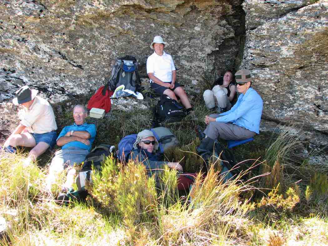
From our car park we walked for 10 minutes to have smoko by the D.O.C. sign, as we entered the Reserve.
Up the zig zag and into the tussock. There was a faint trail to follow all the way, but concentration was needed at times so as not to lose it.
We stopped a few times to regroup and have a rest, uphill all the way. But our precautions taken to guard against sunburn were wasted as we remained under low cloud all day.
At one of the rest stops it was noticed the cloud was flowing up the gullies on either side of us, converging, and then going upslope in front of us. The cloud was close above us further up, but we had good visibility of several hundred meres on the group in all directions.

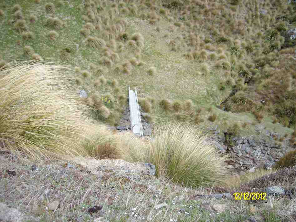
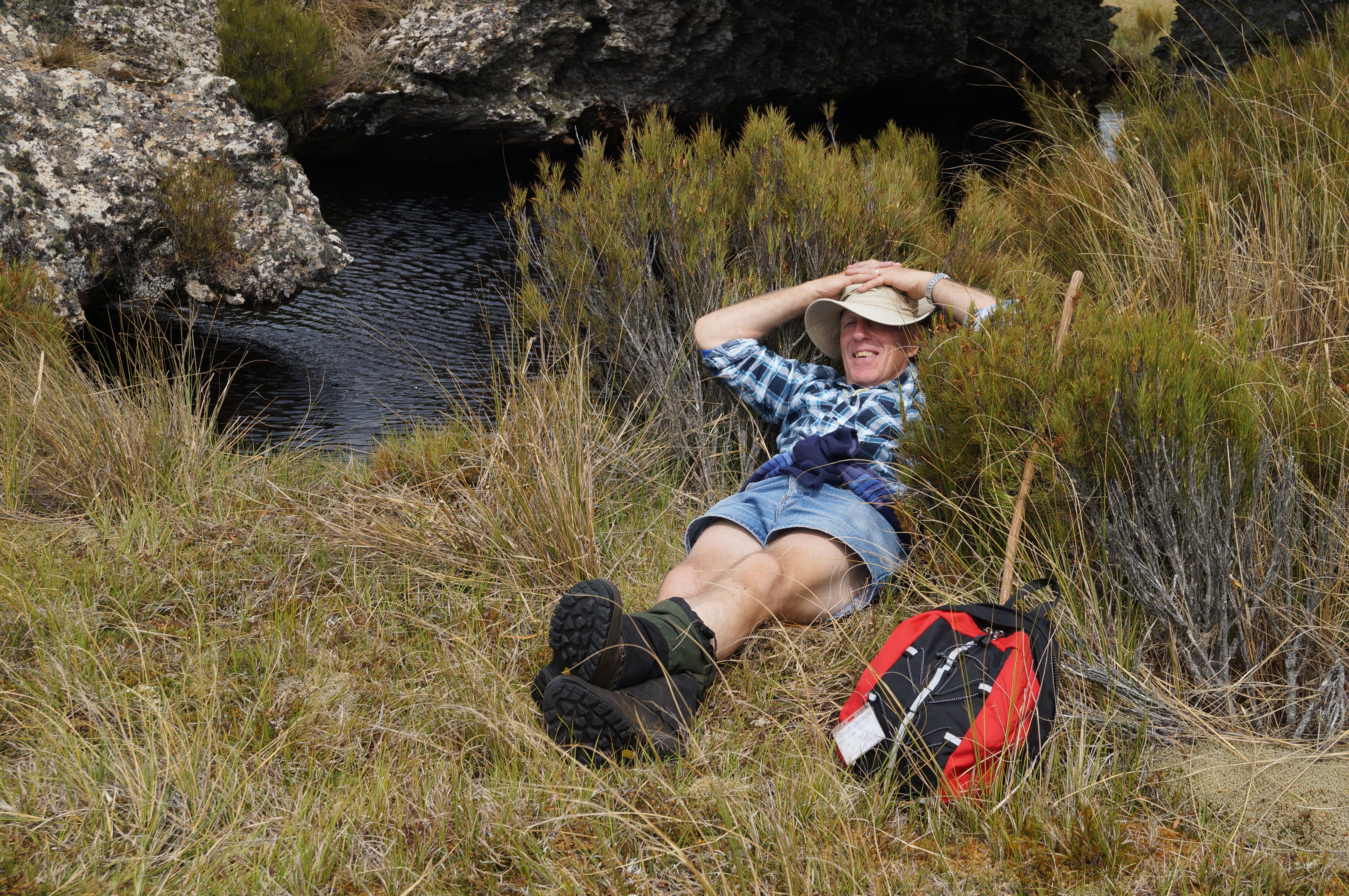
And so we came to Walrus Bridge, some time being spent on admiring and photographing it, before drawing up to the festal board (we ate our lunch).

A swallow arrived, and to our pleasure began flying backwards and forwards over the water and under Walrus Bridge, no doubt looking for a snack.
Before turning for home, some time was spent by the botanists among us, in studying the large area of mosses, etc, just beyond Walrus Bridge.
We retraced our path in the beautiful tussock, downhill now of course, and eventually arrived back at the D.O.C. sign for a photo opportunity.

And so it came to pass the 9 very happy trampers returned to the cars after a very enjoyable day in the tussock.
A brief stop was made at the Waipori Cemetery on the way back. A tranquil place. And Lake Mahinerangi was very low, we could see.
Back at Outram refreshments were obtained at the “Gobbly Woat”.
A few figures now – our day’s tramp distance was 8.7 km. We parked the cars at an altitude of 624 metre, and Walrus Bridge was at 934 metres.
My thanks to all my fellow “tussock jumpers” for such a good day out. – Art.
7. 28/10/2015 Trampers. Nardoo Reserve.
On a cool morning, 11 trampers, 9 who had not been there before, set off to visit Nardoo Reserve,
After a tentative drive along the road from Lake Mahinarangi, past the old Waipori cemetery, desperately looking for any sign that I remembered where we were, we finally arrived at the parking spot where we would start walking from.
As it was already just after 10am, we decided to have morning tea before setting off on our walk. Then it was off along the old 4WD track around to the boundary fence of Nardoo Reserve, where we were puzzled by the fact that the gate was open into the reserve. This was later explained to me by the owner of the surrounding land, who had a legit reason for it being open.
On the way up…

… the long climb to Walrus Bridge, I let some of the group take turns with the GPS so they could follow the track on the GPS display of our previous trips here.
I also did this on the way home again, as I think it wise to let others see how the GPS can guide you in this type of featureless country, which is all tussock, with no track showing in most places, as it’s many years since anybody has had a vehicle up there. Most agreed that they had no idea how to return to the cars, & I think there would’ve been a lot of head scratching going on if they had to find there own way back.
After having lunch at Walrus Bridge,
After having lunch at Walrus Bridge,
where everybody was suitably impressed by the sight of the pool under it, we decided to go on a little further as it was still quite early. Se we trudged across to another rocky point where we had a rest & a good look around, trying to decide in which direction Lawrence, & some other towns were. Then we made our way all the way back to the cars,
where some expressed amazement that the walk was quite short, but felt as though they had walked much further.
There were some appreciative comments made about the trip, so I think everybody enjoyed the day out on the open tops. And I for one have some sunburn on the back of the hand I use with my Trekking Pole.Walked 9km
3.1km/h
2h 54mins moving
climbed 382mtrs
max height 972mtrs.
There were some appreciative comments made about the trip, so I think everybody enjoyed the day out on the open tops. And I for one have some sunburn on the back of the hand I use with my Trekking Pole.Walked 9km
3.1km/h
2h 54mins moving
climbed 382mtrs
max height 972mtrs.
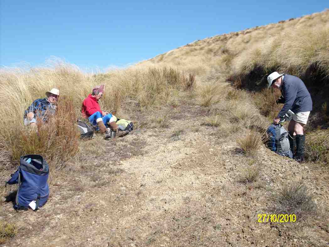
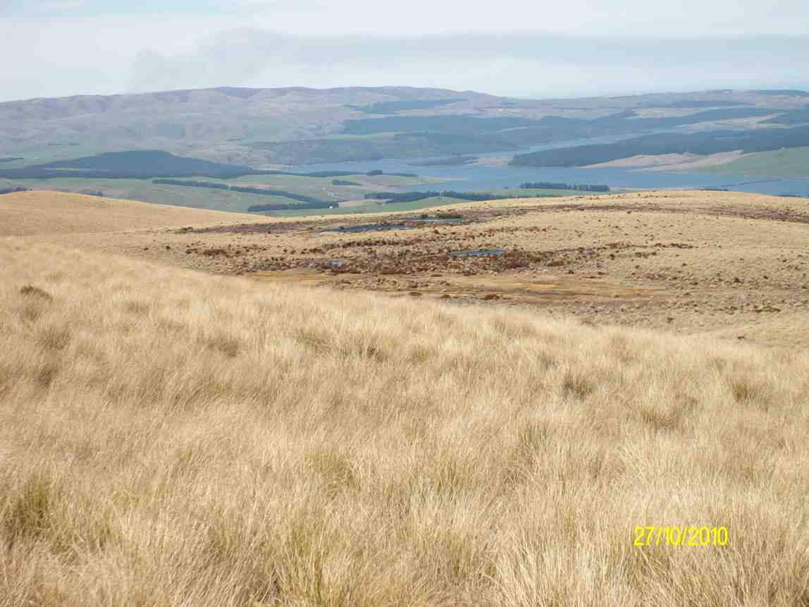
6. 27/10/2010. Trampers. Nardoo Scientific Reserve. Little Peak. Medium. Leader: Ian.

The day was hot. Tempered by a strong but pleasant cool wind. Five of us enjoyed a return to Little Peak. To access Nardoo Reserve we had to drive through part of Waipori Station, whose permission was kindly given. The protected tussock of the Reserve was as long as ever but the 4WD track was still detectable. We stopped early at the customary zig-zag for the tea break.
Then it was on up, across to the left, then right, along a bit of a gully before climbing to top the wee hill to our left, (see the first left point of the two major zigs on the GPS map.

Then the swing down to our right, across a wet mossy decline, and up again, angling on a long reach to our left to reach Little Peak, (see the second major left point on the GPS route). Here we rested beside Walrus Bridge rock.
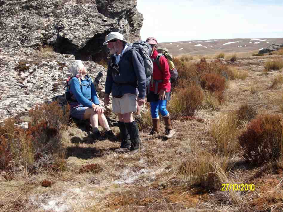
We had made good time and it was too early for lunch. We decided to head in the direction of Peak No. 2. The tussock on the top here shares pride of place with a large variety of mosses, and a profusion of celmisias. We made our way across these to a solitary rock on a bit of a rise and decided to lunch there.
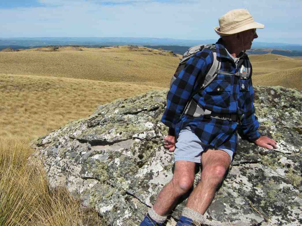
We were struck by the deep blue of a group of able 5 tarns in a dip, looking towards the Lake.
Then it was back down and across to Little Peak and to retrace our steps back to the car. Ken let us take turns with holding his GPS navigator to note just how accurately we were keeping to the track it had marked out on the ascent. (A good tool were we ever to get lost.) Only five of us, but good company. Wish there were more to share our enjoyment of yet another brilliant Wednesday. – Ian
5. 16/1/2008 Trampers. Walrus Bridge, Red Rock, Nardoo Scientific Reserve. Medium. Leaders: Ian, Bill M
Today, which saw the mercury rise uncomfortably high , 10 of us travelled in 3 very different cars to the start of the tramp, well past the turnoff to the Waipori cemetery beside Lake Mahinerangi.
This was going to be the day we all needed a large supply of water. Luckily it was only a slow leak from the water bladder and Ian did not run out of water. Ria, who is very fit, found the slow pace hard to take , although the rest of us appreciated the regular breathers Bill allowed us on the rather hot, tussocky ascent. Wonderful views surrounded us over the nearby slopes of the Lammermoors, and back over lake Mahingerangi. The area we were in was a scenic reserve called Nardoo and had been fenced off from the stock which roamed over the rest of Waipori Station.
This had allowed regeneration of the native plants and tussocks and on the summit of Little Peak 1 the Celmisias were everywhere and a real treat to see their lovely silver foliage and white, daisy like flowers. Walrus bridge is a large rock spanning a deep dark tarn and it was here we sought shelter from the midday sun and had our lunch.
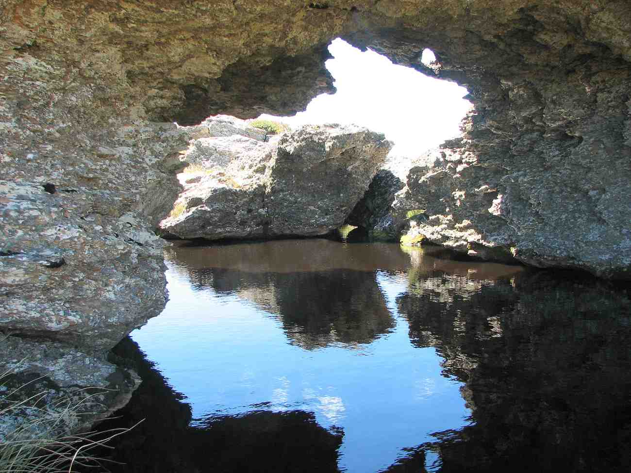
Bruce suggested it was called Walrus because a walrus moustache is shaped like a bridge over the mouth and droops down the sides rather like a walrus’ long incisor teeth. Hazel needed a good wake up call

as we headed back down after lunch and Ian managed to end up fighting to get up from the tussocks after falling dramatically into them. And so back the way we came, but this time all down hill.
A great day out in beautiful, wild country with blue skies, and white shaped clouds.
A quick visit to Waipori Cemetery and memorial on the way out, and we still hadn’t seen a living soul.- Tash
4. 15/2/2006. Trampers. Red Rock, Nardoo, Walrus Bridge. Leaders: Ian, Bob H, Judy G.

3. 20/4/2005. Both. Nardoo, Walrus Bridge. Leaders: Helen S, Ria, Lance and Lois.
2. 19/3/2003. Both. Lake Mahinerangi, Red Rock, Walrus Bridge, Nardoo. Medium. Leaders: Ria, Evelyn, Molly, Mary M.
1. 14/4/1993. Lake Mahinerangi, Red Rock, Walrus Bridge, Nardoo. Medium+. Leaders: Ria L, Ria H, Jean, Lesley S.