The process of issuing regular President’s Updates is a worthwhile exercise, in that it serves to both inform and acknowledge. It gives one the opportunity to reflect on what’s been done, to thank individual efforts, and remind of upcoming events.
In this report the focus is on:-
– The first Committee Meeting of our new Committee, and it’s outcomes.
– Membership Welcomes.
– Website News.
– New Trip Programme.
First new Committee Meeting.
The new committee met for the first time on 18 September at Esther Willis’s home. The allocation of committee tasks being decided as follows:-
Hiking Co-ordinator – Katrina McKenzie.
Tramping Co-ordinators – Esther Willis with assistance from Pam Cocks.
Social Organisers – Barbara Shackell and Jenni Wright.
P.L.B. Emergency Contacts – Hikers – Dave Mellish.
– Trampers – Annette McRae.
N.B. Phil Keene will continue to hold the P.L.B. used for recces, and track clearing, and remain the contact person for this P.L.B.
Christmas Social – Planning is ongoing for this. Pencil in the 10 December. Intentions are to centre the day’s activities around the Hyde/Middlemarch area, with a combined walk; Hyde to Daisy Bank.
Hand Held Radios – The merits of these were discussed, and they are hoped to be trialled soon on a tramp.
Membership Welcomes.
A warm welcome to new members, Alison Evans, John Barratt, and Tony Martin.
Website News.
Two new posts have recently been added to our website by Graeme Souter:-
– President’s Updates – Graeme has been searching for, and collating older President’s Updates, to put them in date order, under one title “President’s Updates” on our website.
– A.G.M. Minutes – Similarly these are being posted on our website together, going back as far as year 2000, with a few gaps still being investigated.
Both the above being found under; Menu-Members – AGM/President Updates.
– New Member’s Application Form – This too is a new addition to our website, accessible under – Menu – Members – Member Application Form.
N.B. This is available for download only, as all completed forms should be returned to the Club Secretary, or handed to a current committee member.
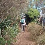
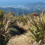
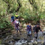
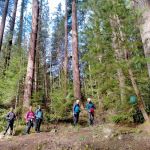
New Trip Programme.
About the time of this President’s Update, the new Tramp/Hike Programme will be sent to members. A huge team effort, from member’s suggestions and contributions, the Committee’s compilation, through to it’s final completion. Three individual efforts are worthy of special mention:-
– Phil Keene. A special thank you to Phil, who has graded all of the programme’s hikes and tramps. A task that requires an intimate knowledge of each hike and tramp that can only be gained by vast experience, (and a great memory).
– Ross Davies. Also worthy of an accolade, it is Ross who allocates passenger reimbursement $ figures to drivers for each hike or tramp. These being calculated based on the distance in Kilometres from Memorial Park car park to the hike or tramp’s starting point. A time consuming and skilled task, complicated by some hikes or tramps having multiple starting points.
– Wendy Langley. Our Club Secretary, Wendy’s role in the Trip Programme’s compilation is an involved, and time consuming one. Best appreciated by analysing the steps involving Wendy’s input from inception through to completion:-
1) Update and circulate Trip Suggestion forms, with a closing date to members.
2) Analyse suggestions received, separate onto a spreadsheet for Combined/Hikes /Tramp suggestions, including details of who suggested, if happy to lead, restrictions (e.g. Lambing time), etc.
3) Receive separate results from the programme planning meeting (hiking, tramping, combined), and collate onto one “draft” programme in date order.
4) Distribute this “draft’ programme to Phil for gradings and Ross for vehicle distance from car park $ driver reimbursement values.
5) Compile and send completed programme to Webteam for distribution.
Thank you and well done Wendy. Need I say more? The above list speaks for itself.
Member’s Responsibility- Trip Programme.
It’s been said at meet n greets, it’s on the new programme’s header, but it can’t be stressed enough:-
Please check to see if your name appears on the programme, and be aware that your resulting commitment will also involve allowing time (2 to 3 weeks) before the hike or tramp date to undertake a recce. If you are scheduled as a leader, and it doesn’t suit, it is your responsibility to find your replacement, (swap with someone). In the event that this option is exhausted, please advise as soon as possible, either:-
Hike Co-ordinator – Katrina McKenzie or;-
Tramp Co-ordinator – Esther Willis.
Till next time:-
“May your dreams be larger than mountains, and may you have the courage to scale their summits”
Harley King.
John
4 October 2025
Link to President’s Update information Library for previous updates