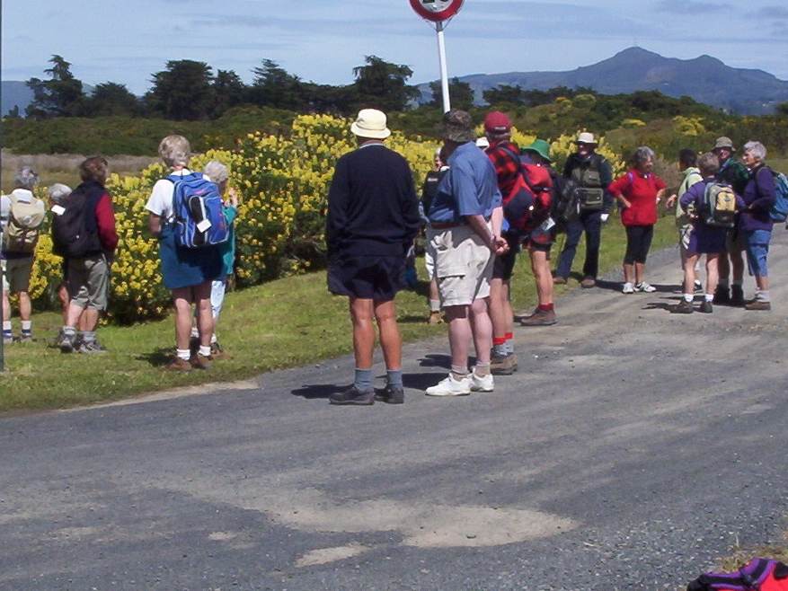
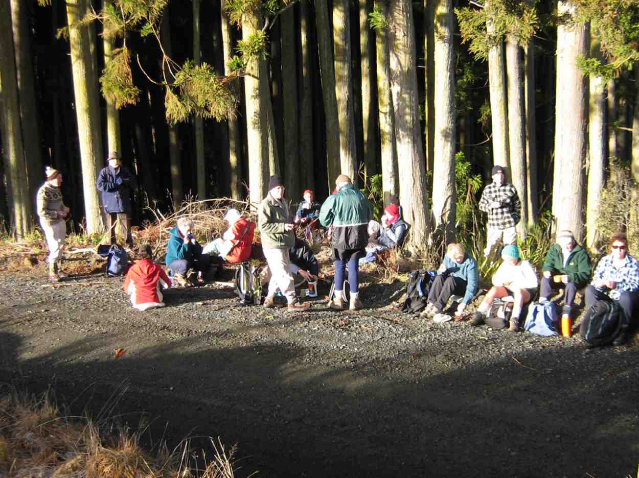
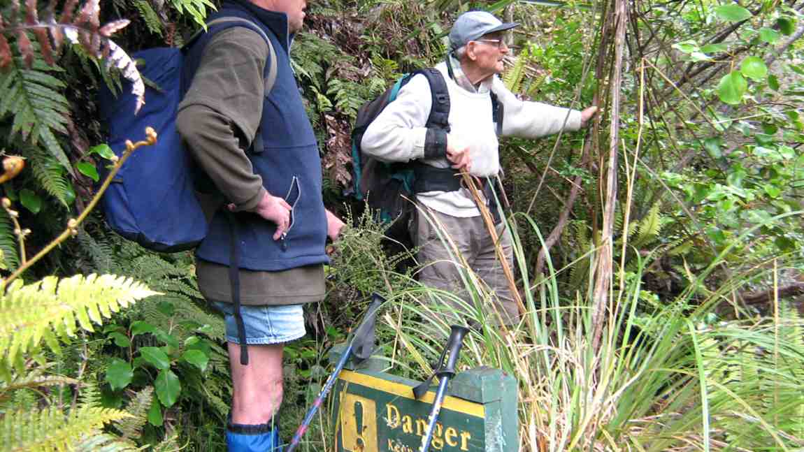
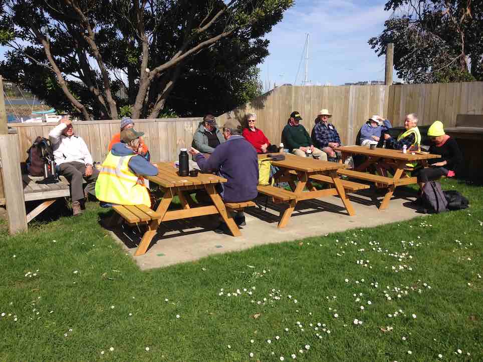
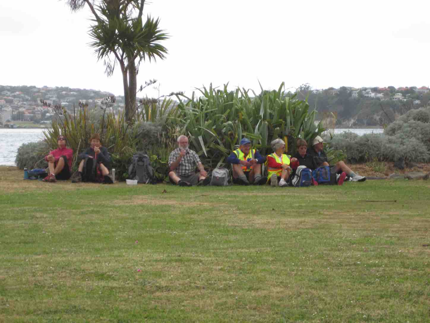
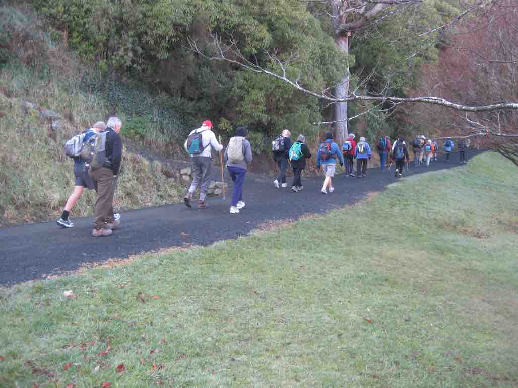
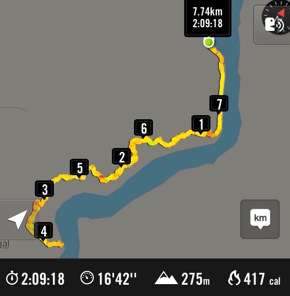
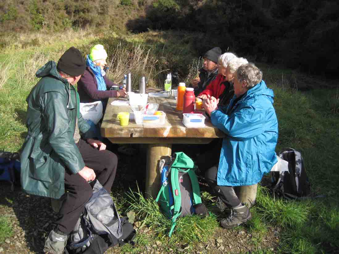
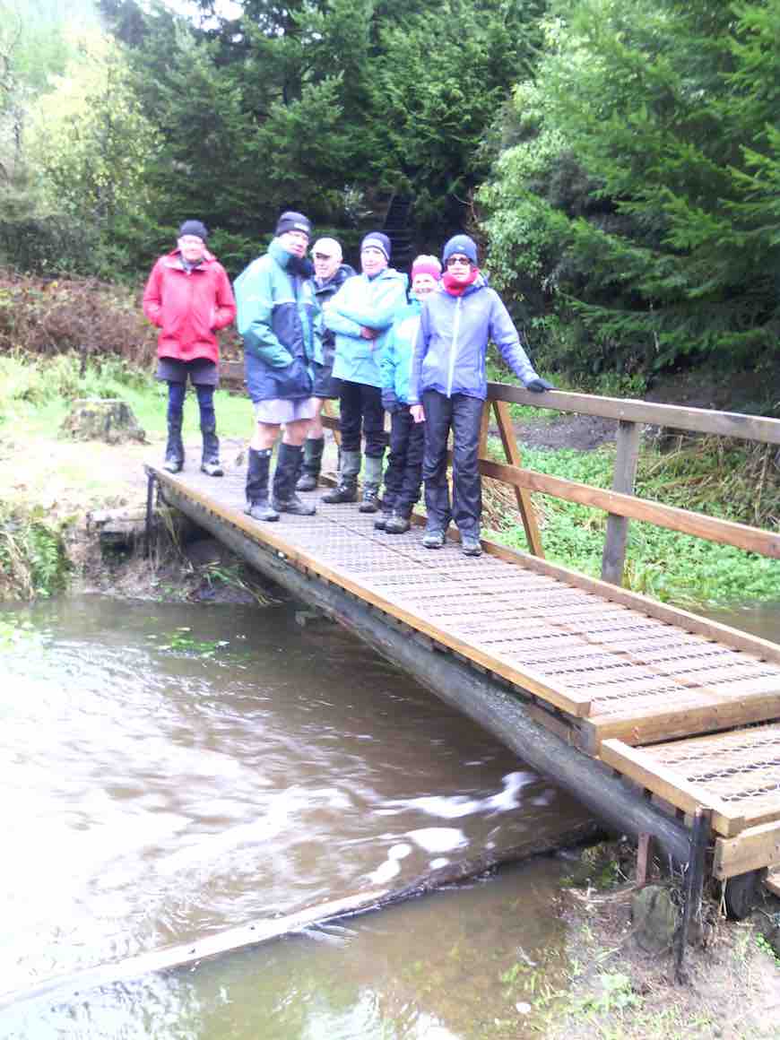
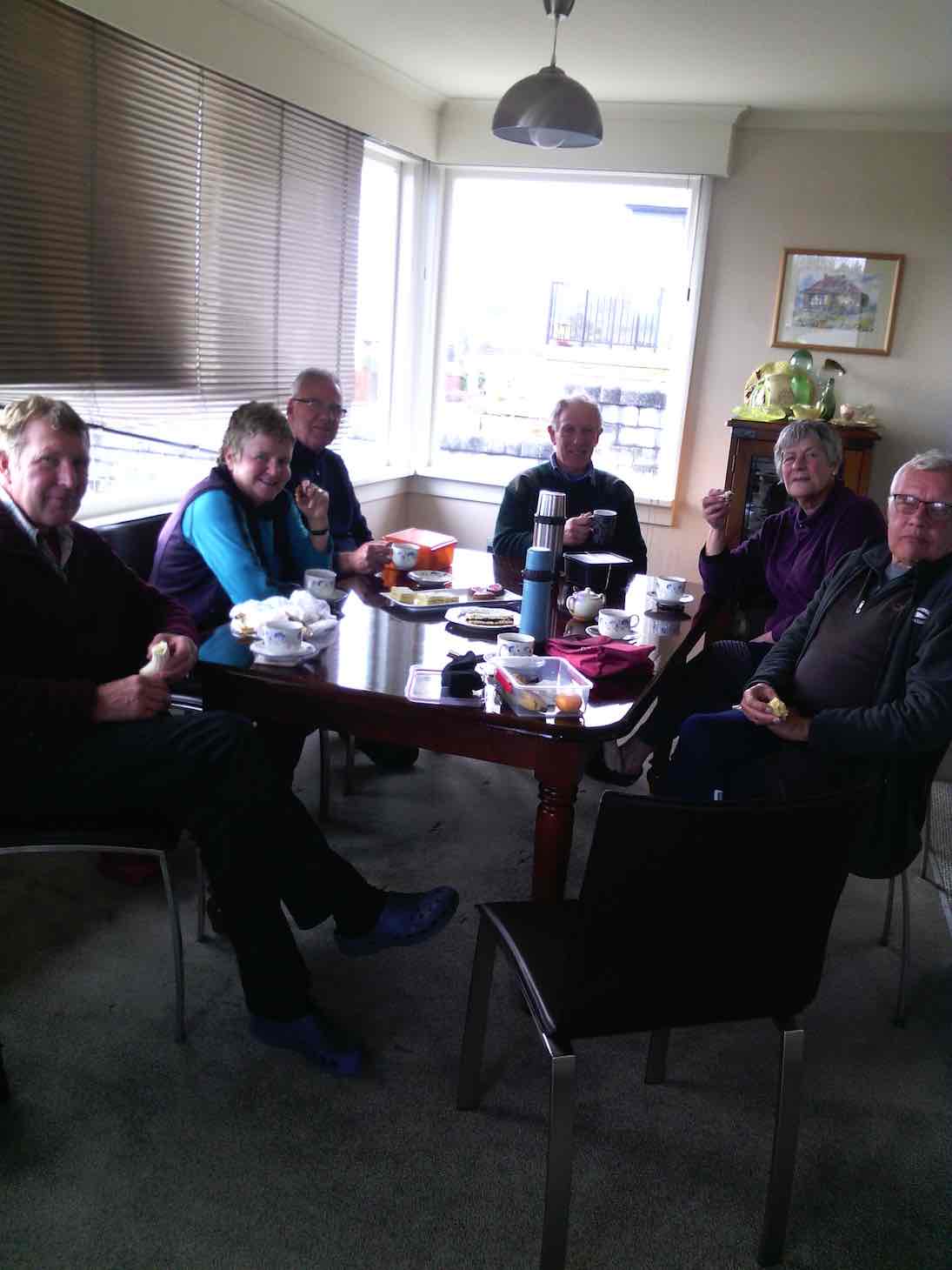
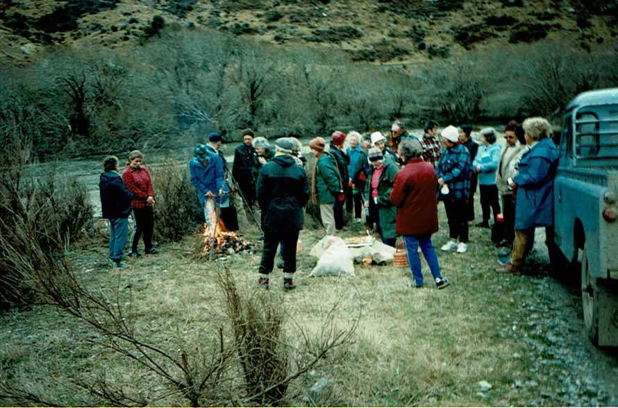
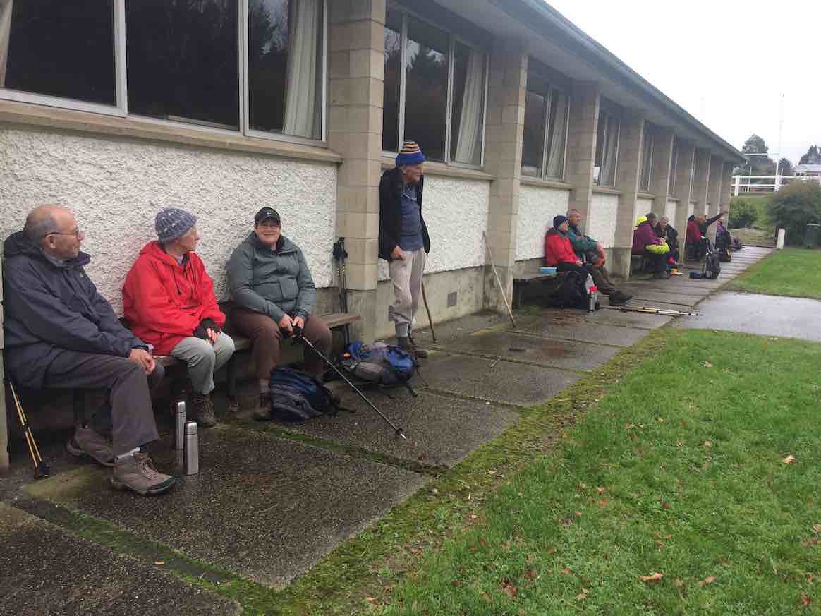
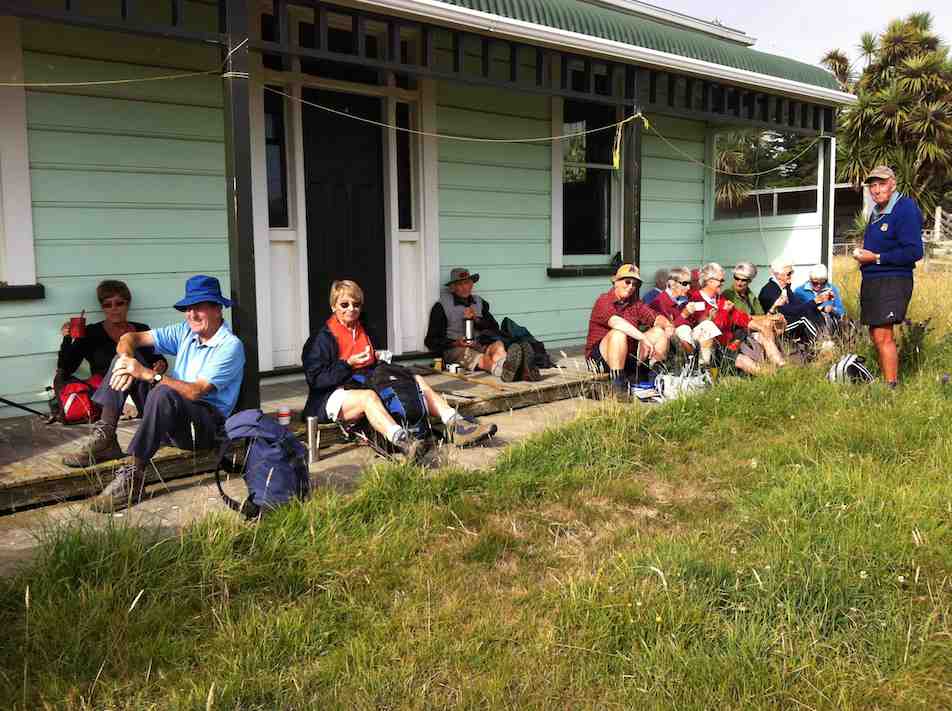
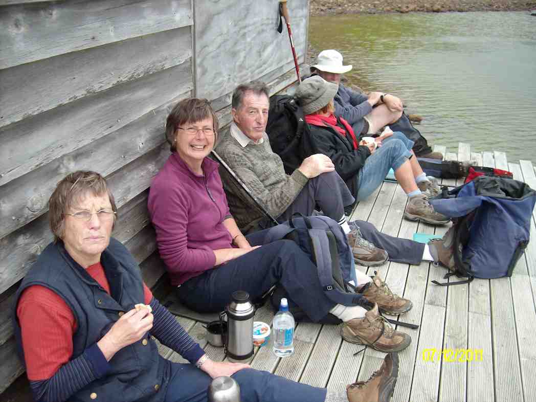
6. 13/12/2017. All. Picnic lunch. E. Leaders: Alex and Liz
Route map, courtesy Ian. (Ian pic and caption.)
Having just emerged from ‘gorse forest’ track onto golf course. (Ian pic and caption.)The leaders for the day. (Judy pic.)Pot luck Christmas lunch.(Helen pic and caption.)
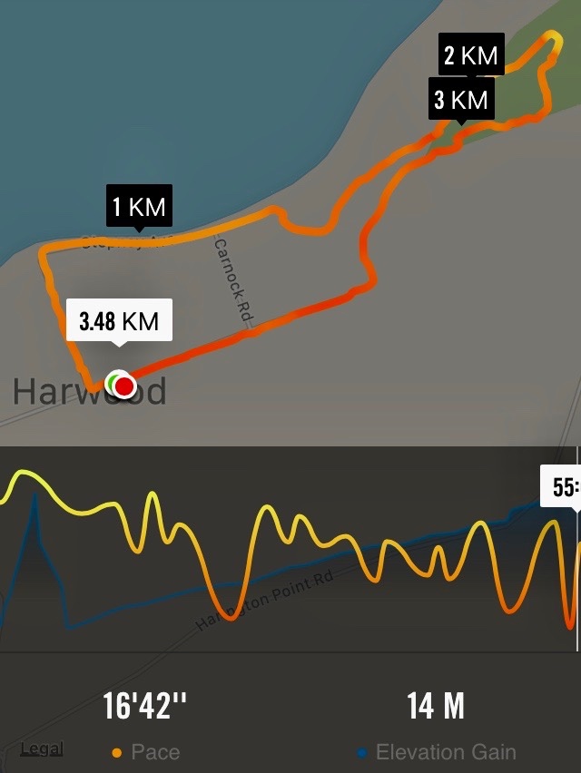
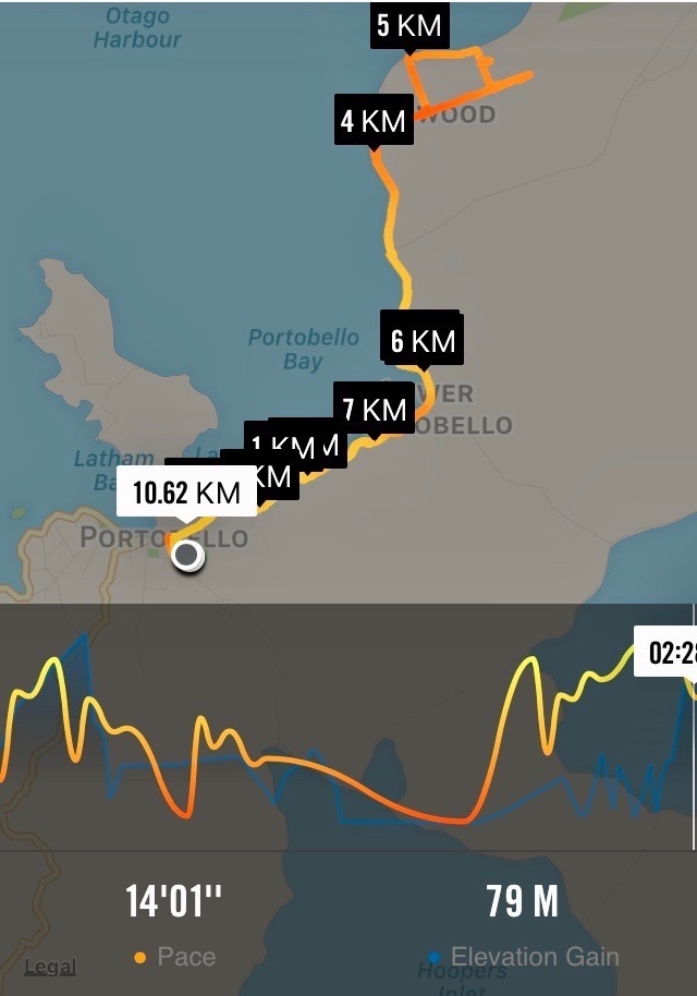
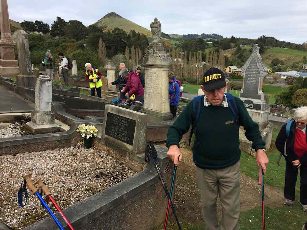
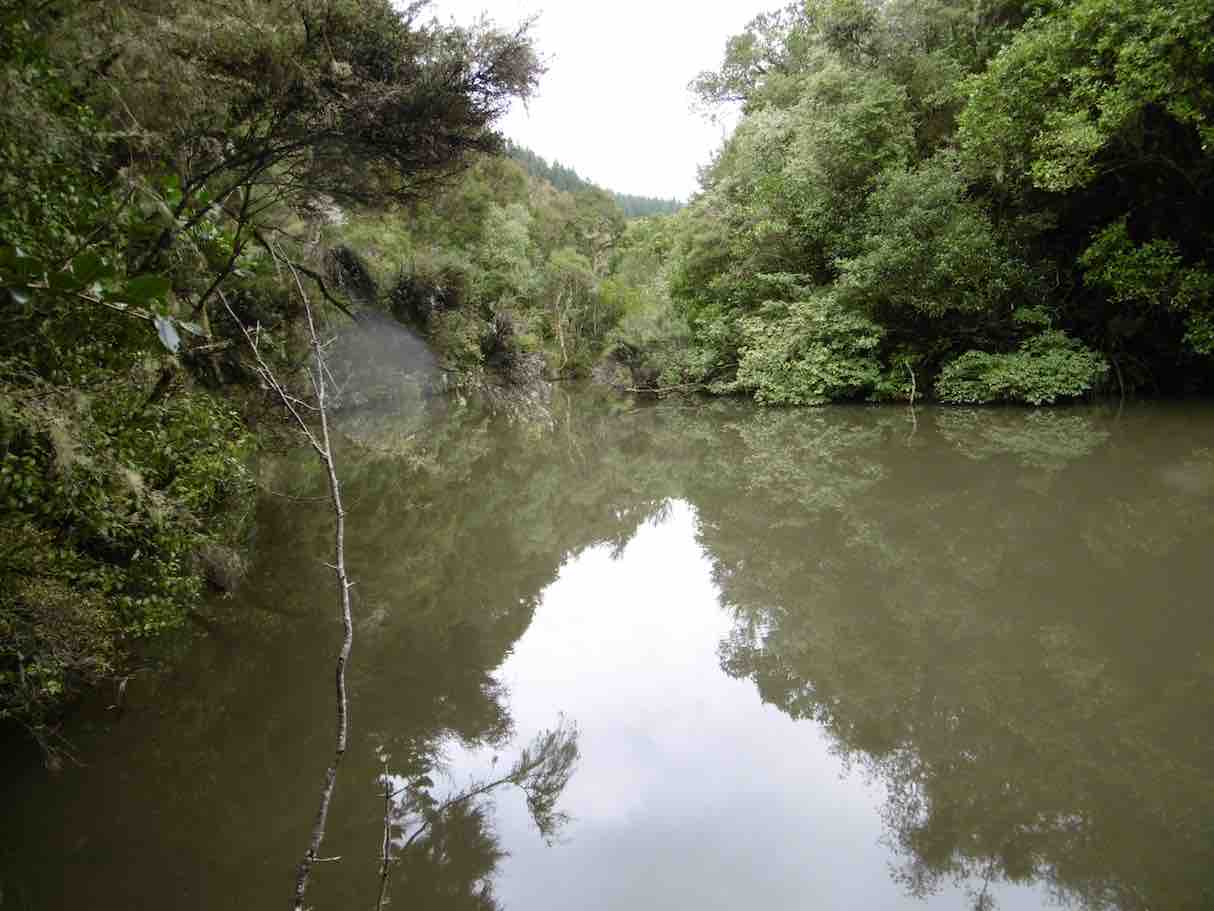
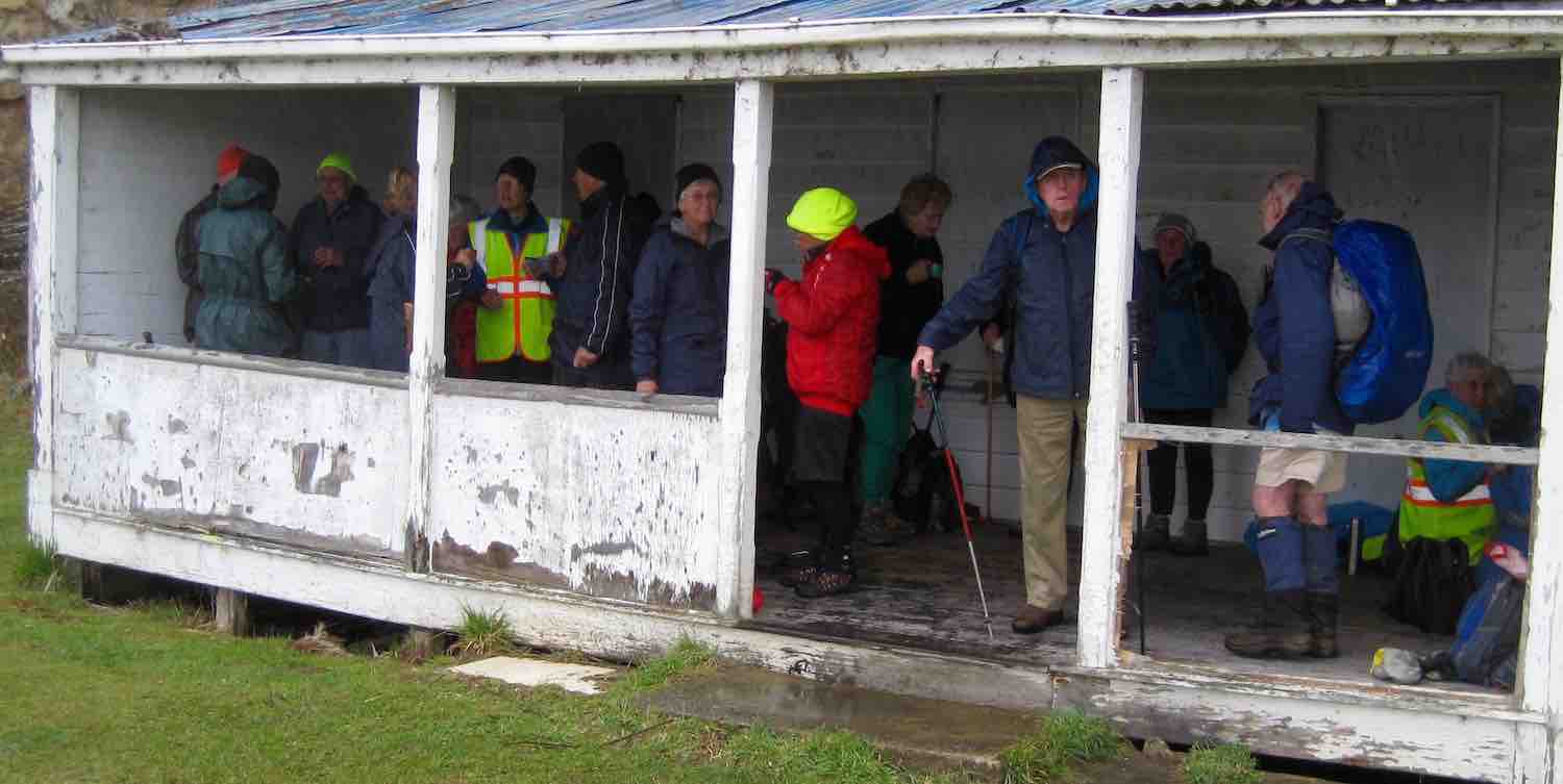
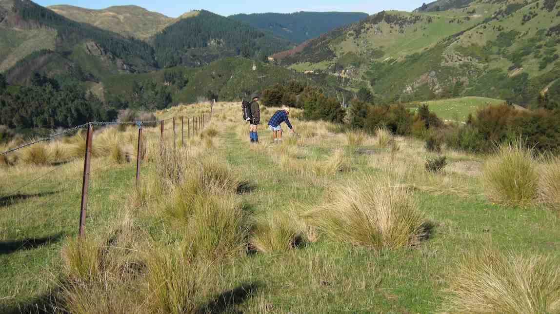
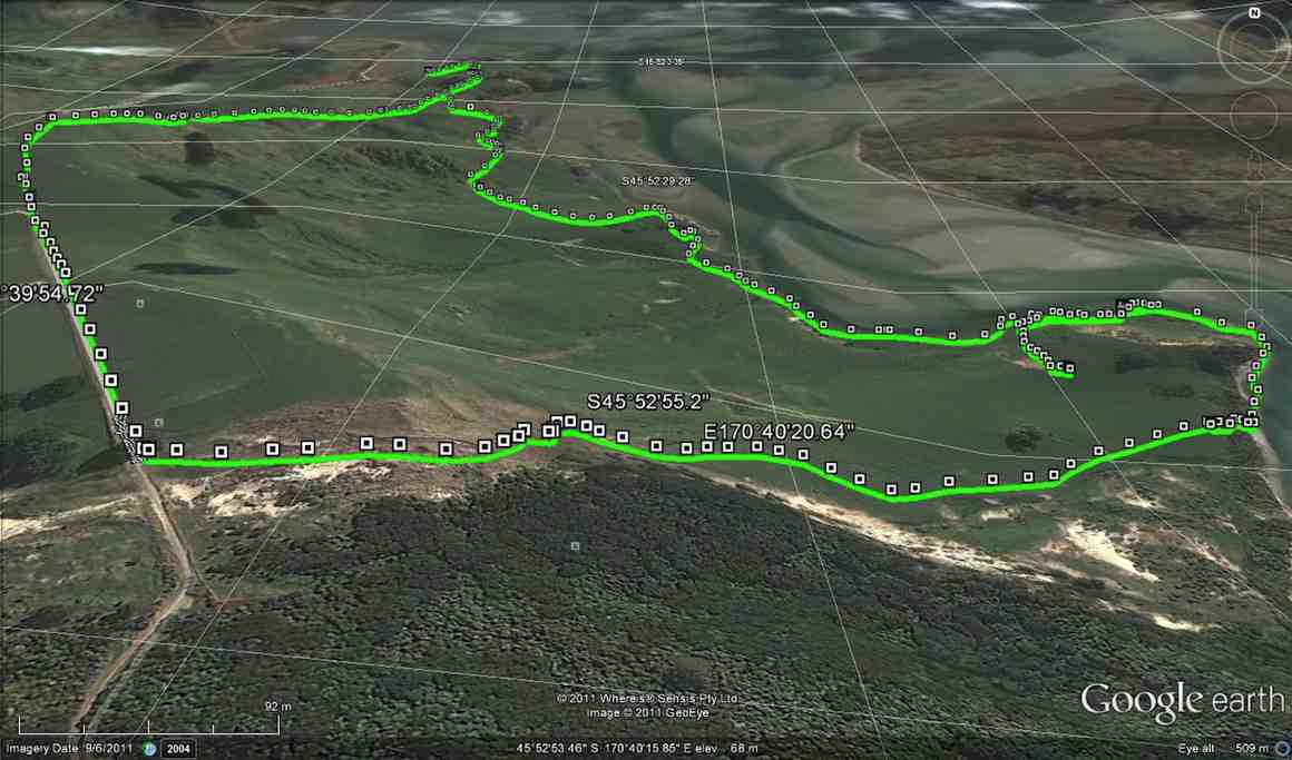
5. 27/9/2017. Hikers. Portobello to Harwood. E. Leaders: Chris and Dot.
Map of route, courtesy Ian.
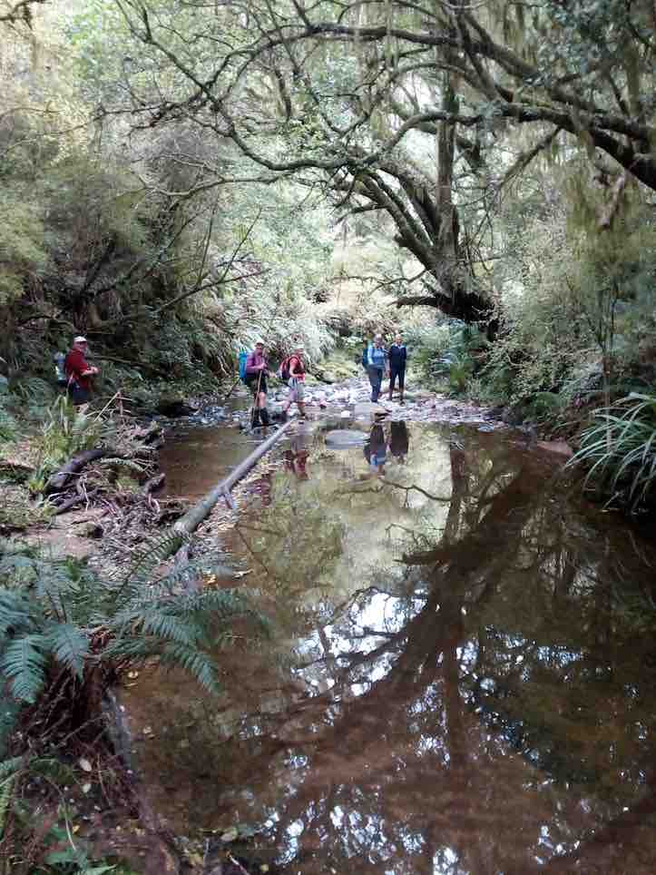
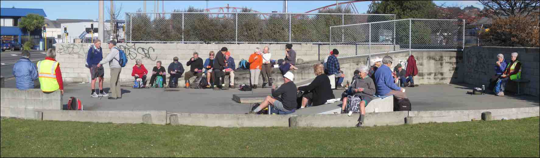
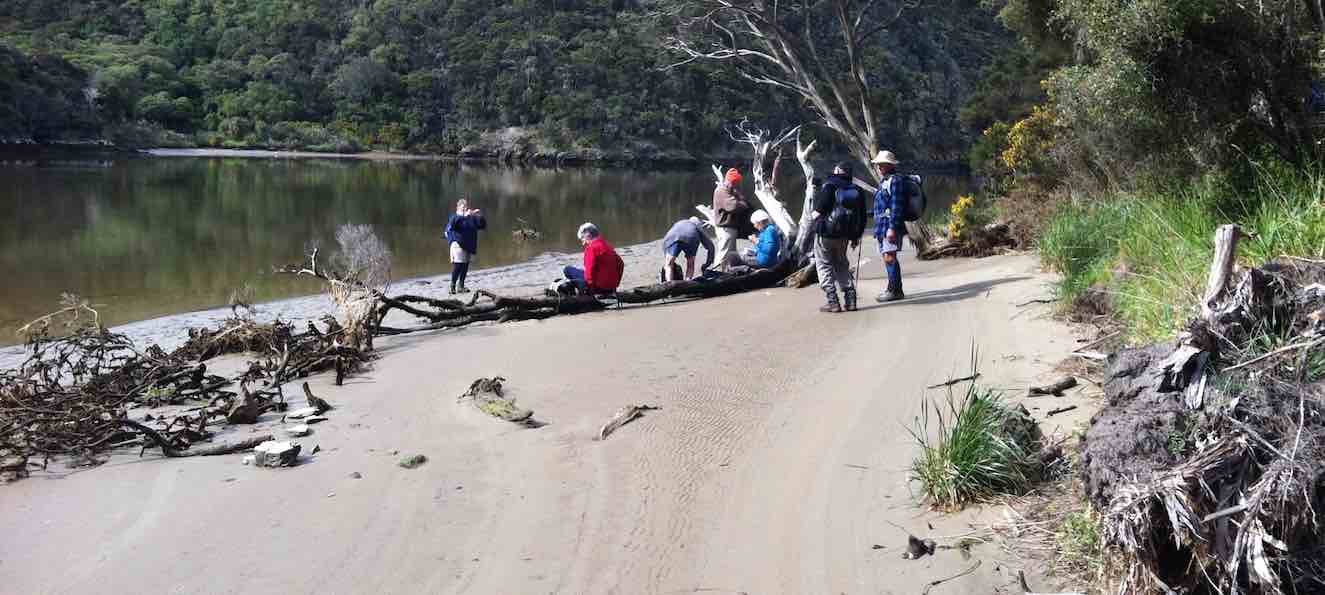
The track from Portobello to the aquarium being made difficult with slips and mud, the leaders decided on a new hike for the day. 20 keen members left the cars at the Portobello show-grounds and headed the short distance up the hill to the cemetery for morning tea.
Coming away from morning tea.(Ian pic and caption.)
It was a glorious morning, calm and mild, and there were many comments on the fact that cemetery sites always seem to have the best views…. this one right across Portobello and the tranquil, beautiful harbour.
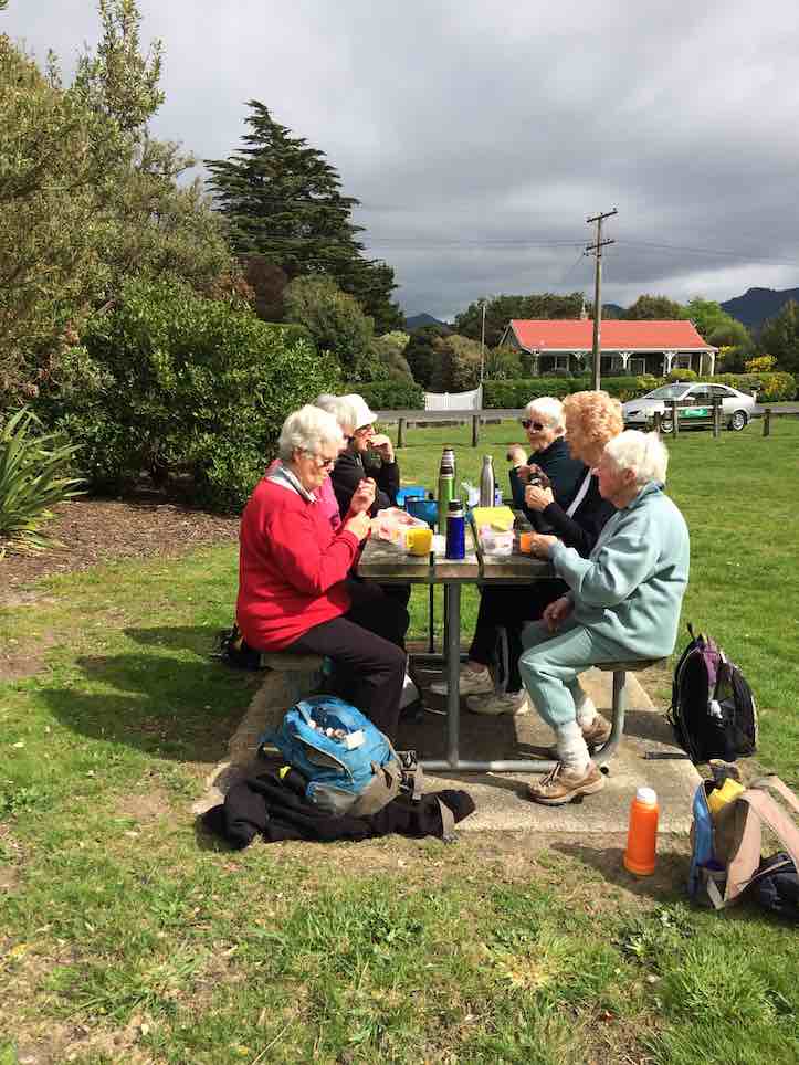
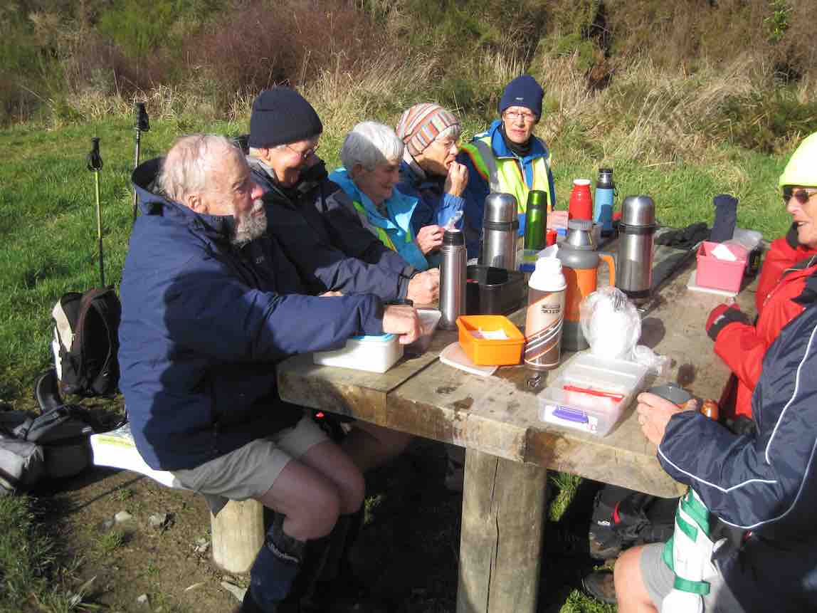
The thought of walking all the way to Harwood seemed a bit daunting to some, but in fact was very pleasant, following the cycle track all the way so that traffic was never a problem. The predicted north-east breeze never arrived and jackets were gradually shed along the way. Round Lower Portobello Bay several slips were commented upon, and we reached the picnic grounds for a leisurely lunch by mid-day.
Lunch at the Harwood Picnic Grounds. (Ian pic and caption.)
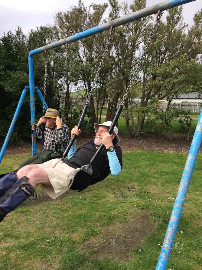
After the young-at-heart had a play on the swings…
Stop gazing round. Swing!.(Ian pic and caption.)
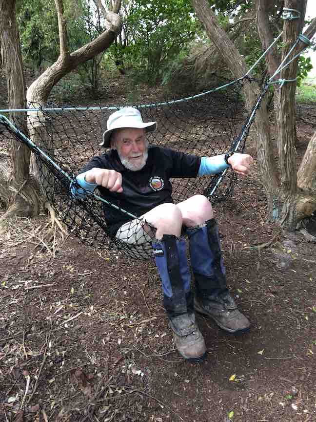
…and slides not to mention the hammock,
Help! Someone get me out. (Ian pic and caption.)
we made our way back to the cars by the same route, and so to Macandrew Bay for coffee etc.
A hike not done before, so thanks to Chris and Dot for some thick quinking (thanks Jay!) in finding a great alternative for the day. – Judy.
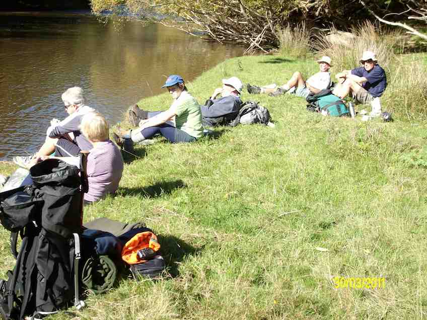
4. 17/12/2012. All. Harwood. End of year picnic. Leaders: Chris and Dorothy.
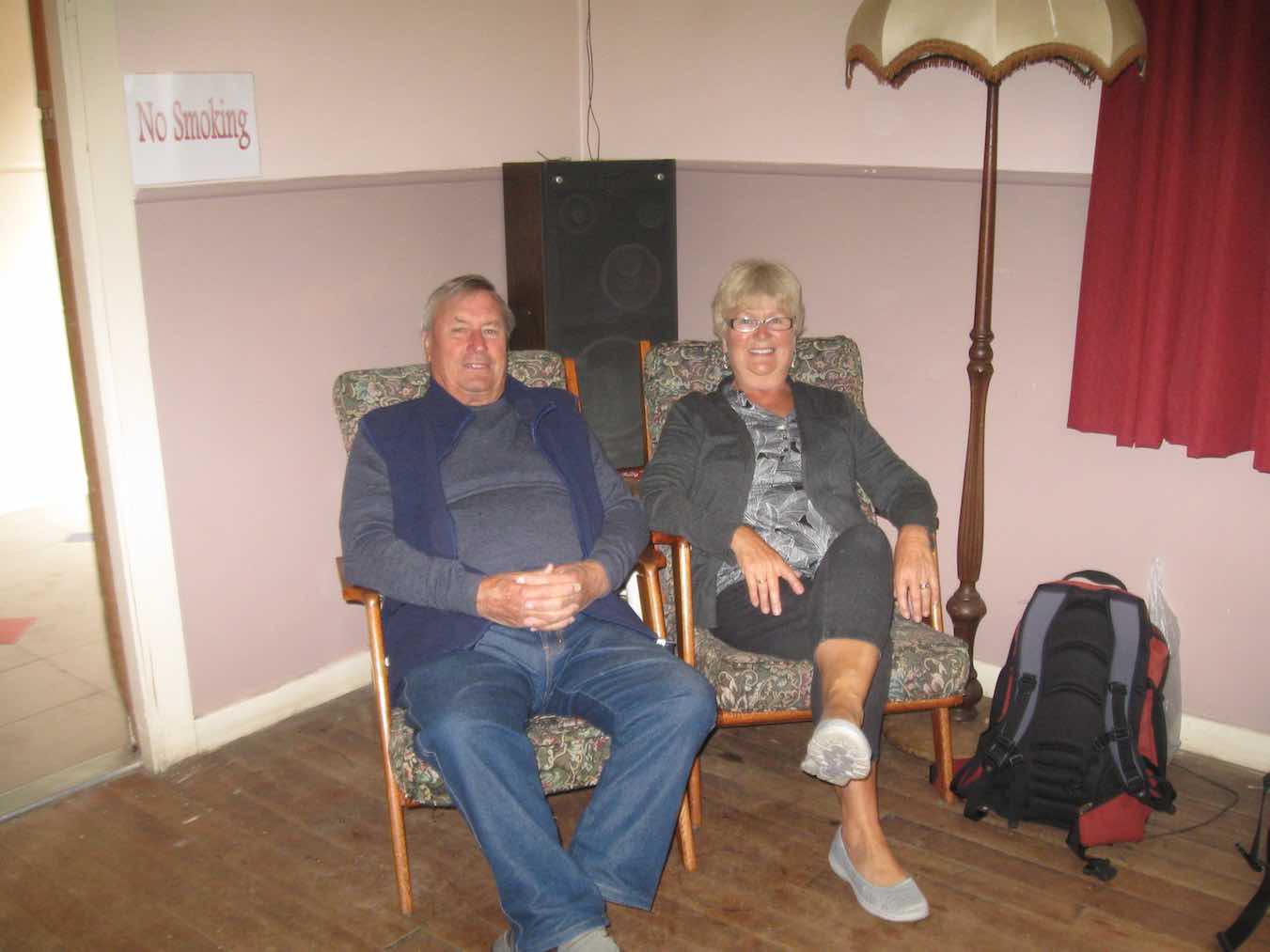
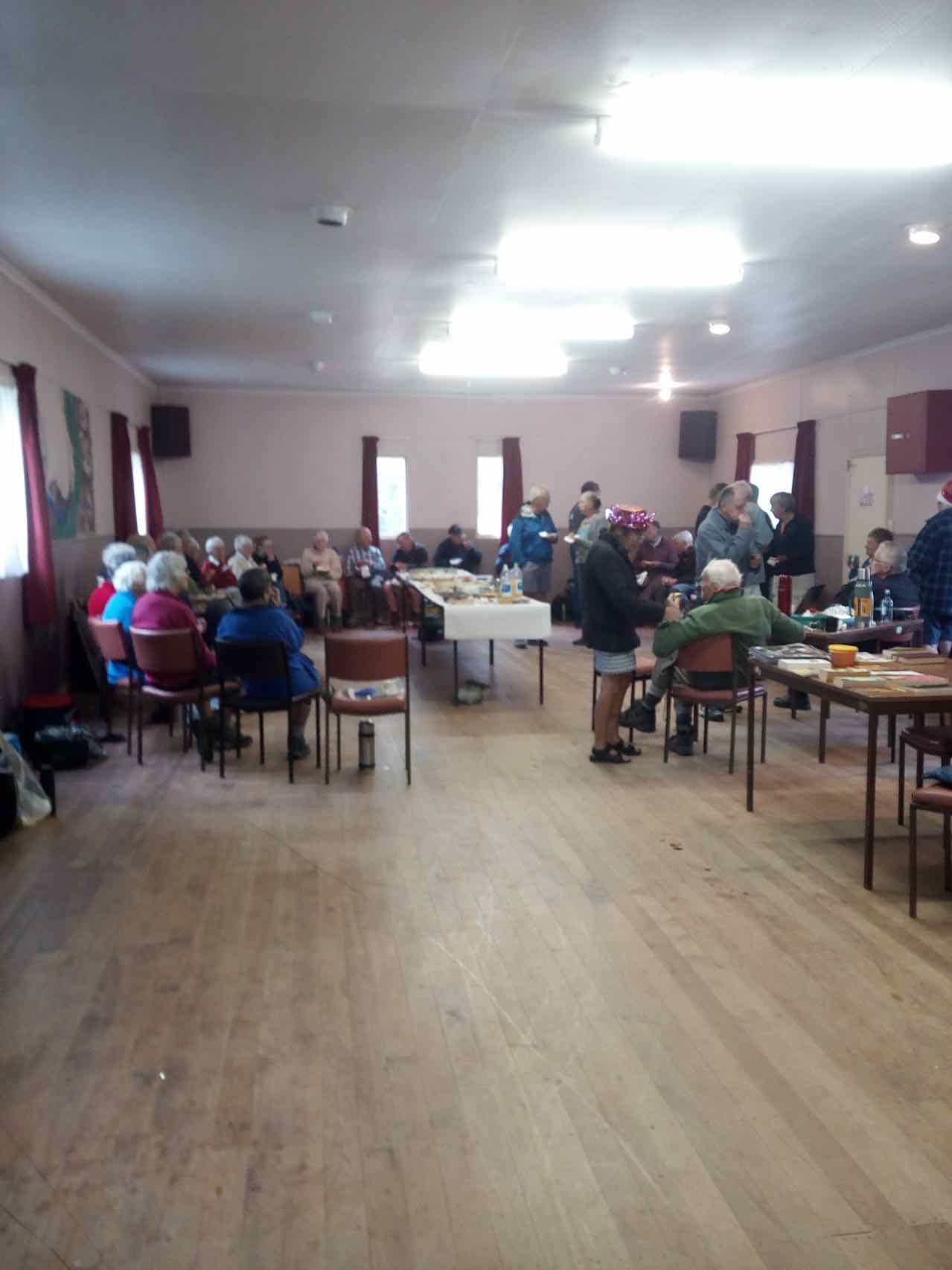
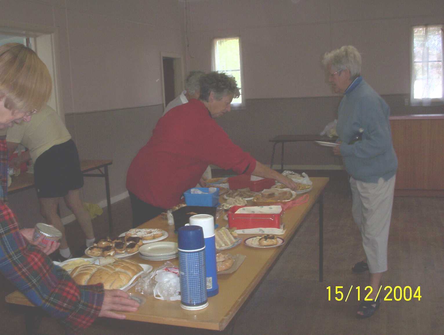
3. 15/12/2004. All. Christmas finger food lunch at Harwood. Leader: Chris.
Pause at sign.
Lunch in Harwood Hall. Dorothy, Wendy, Carmel.
Lunch in the Harwood Hall. Wendy, Carmel.
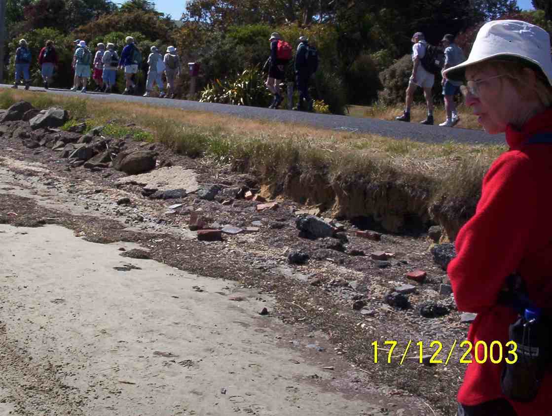
2. 17/12/2003. All. End of year Tramp. Share finger food. Leaders: Jean, Chris.
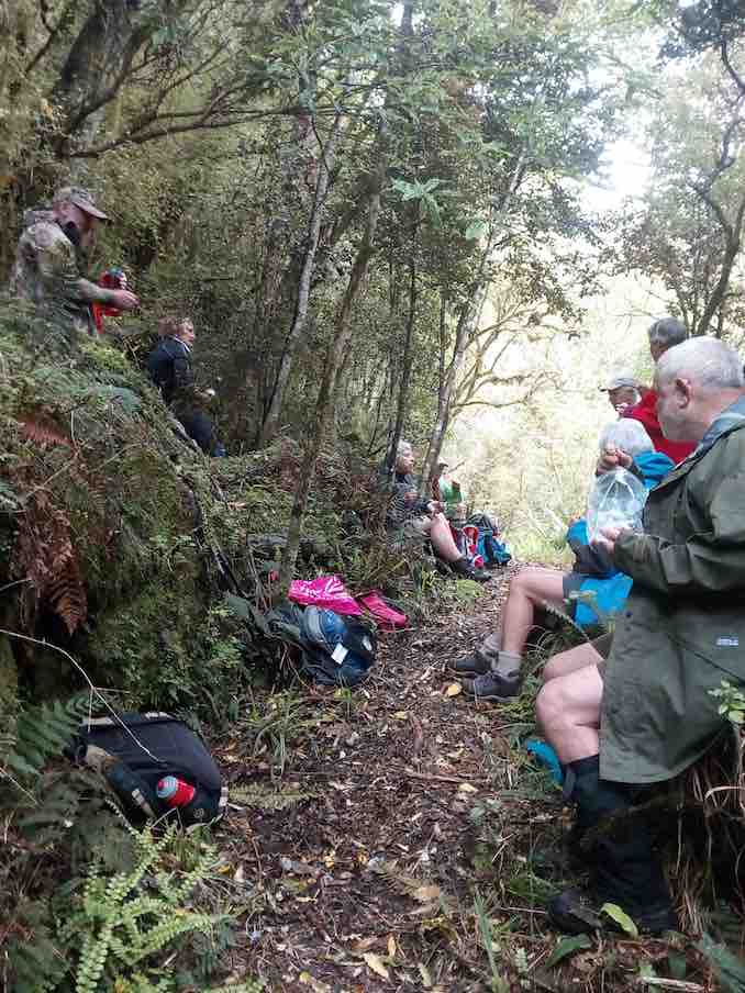
Two cars(six trampers) left Mosgiel at 8.00 a.m. rendezvousing at Cherry Farm before travelling together to reach the Bendoran Huts at 9.30. Morning tea was taken, and five eager trampers set out just after 10 am on the day’s adventure. One stayed in camp to heat water for showers later.
The day was sunny and warm enough. High cloud drifted across after an hour, but it remained hot. We stopped several times to take on water – and we were going downhill!
We descended down to Orbells Creek, and followed it for some distance, being on a grassy 4WD track all day. Tussocky hills surrounded us, with many interesting rocks, such beautiful country.
A mob of grand Hereford cows with calves (beef) moved in front of us for a time, before going up a side gully.
Eventually we came to the first ascent of the day, leaving Orbells Creek for a time, the 4WD track going up and over a saddle. At the top we had a short descent and then a climb up to a second saddle.
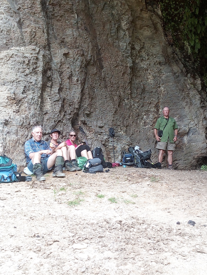
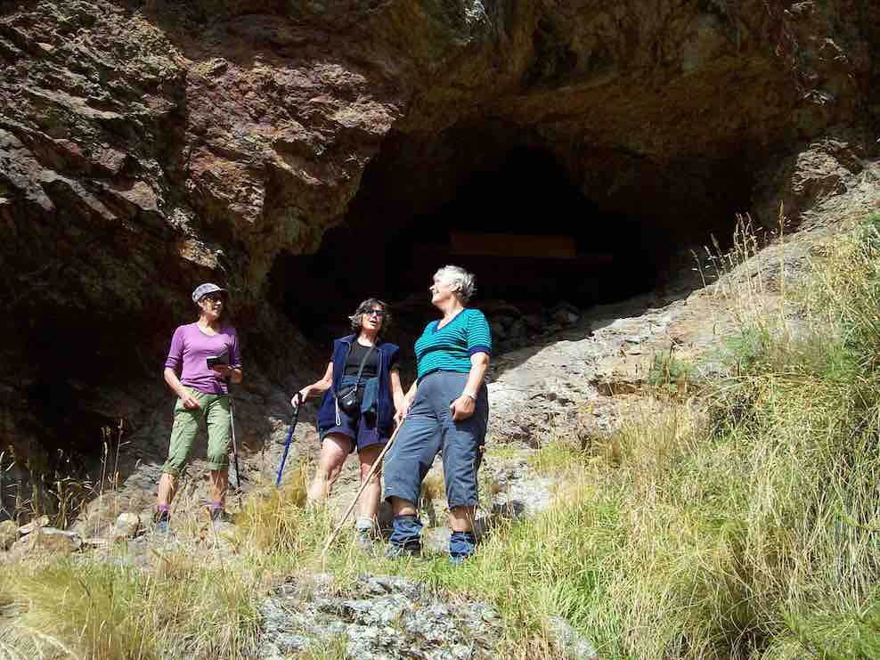
But from here it was downhill all the way to the cave. We met Barney, the Bendoran Farm Manager, out with his dogs shifting a mob of cows and calves – black with white faces this time (Angus Hereford Cross).
We came back to Orbells Creek by the cattleyards, crossed over, and in a few minutes were at Orbells Cave (with Orbells Garden flourishing in profusion in front (foxgloves). It had been hot work, but to our great relief found that it was very pleasantly cool in the cave. The time was 12.20 pm. We sat and rested for half an hour here, while eating our lunch.
In the cave for a cool place to have lunch. (Helen pic and caption.)
Fiddlers Hut was our next objective, about 2 km further on. Was we left, bird calls from high above the cave alerted us to the presence of a N.Z. falcon circling there. We saw it – or another one – later in the day, too. Crossing 3 O’Clock Stream, we arrived at Fiddlers Hut at 1.3. We admired the stone walls, very neatly constructed, and with a vey sound modern corrugated iron roof.
Fiddler’s hut. (Helen pic and caption.)
But sadly the interior had been badly neglected, birds obviously had been the only tenants for some years past.
As we began the homeward journey, a light and very pleasantly cool north-east breeze arrived to provide some relief, especially helpful on the uphill bits. Five tiny little Paradise duckings were on the water when we crossed back over 3 O’Clock Stream. All water bottles were refilled.
The same route was followed going back as we had travelled out earlier. It was a long climb back up to the two saddles. At the top of the first one, 10 minutes was well spent in resting, while taking on water, eating fruit, etc.
In time we came back down to Orbells Creek, and walked, the kilometres behind us, with an occasional brief stop (water).
One long hill awaited us – the climb out from Orbells Creek. The hill seemed to go on forever, but by putting one foot in front of the other, we found the top. But our legs were mighty tired now, and there was only a few hundred metres left to go. And so we arrived back at the Bendoran Hilton …
View of Bendoran huts. (Helen pic and caption.)
… just before 5 p.m. A good list down and rest seemed to be the logical thing to do now, so that’s what we did!
All five had thoroughly enjoyed the day. An energetic tramp to equal any other that our club has done. VERY SATISFYING.
Total distance was 20 km. Orbells Cave was approx. 8 km from Bendoran, and Fiddlers Hut a further 2 km beyond. Bendoral Huts are at an altitude of 500 metres, Fiddlers Hut about 200 metres. – Art.
On completing the tramp we had a lovely muffin and cup of tea before showers and liquid refreshments. Fire lovingly looked after by camp mum Jennifer. Eleanor our great organiser had Also arrived by this time.
Tea was prepared consisting of silverside, stuffed chicken, new potatoes, carrots and two salads. Dessert: chocolate brownie berries and yogert. All had bought some part of it.
Jill Arthur Phil Wyn and Helen the walkers.
It helped revive us. – Helen
75 km from car-park.
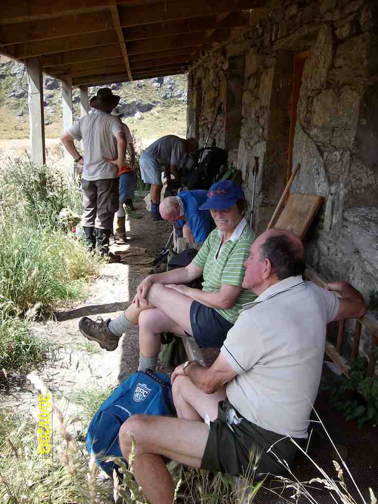
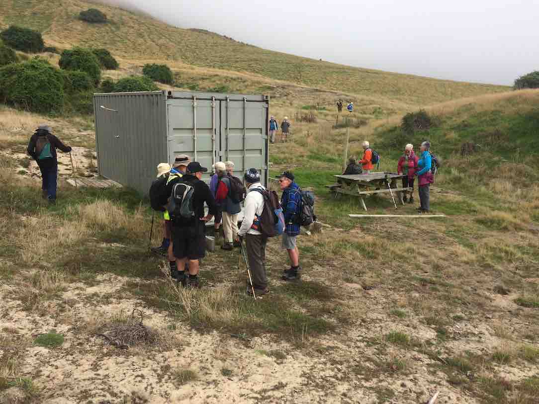
11. 8/3/2017. Trampers. The Gap, and ABC Caves. M. Leaders: Arthur and Eleanor.
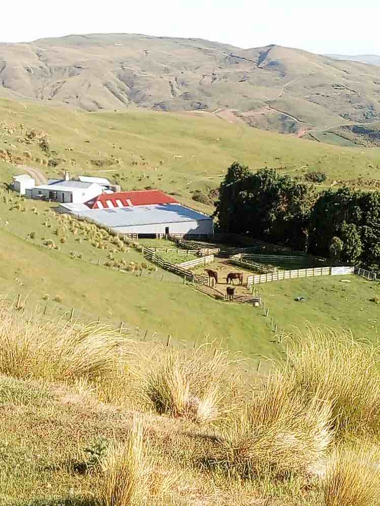
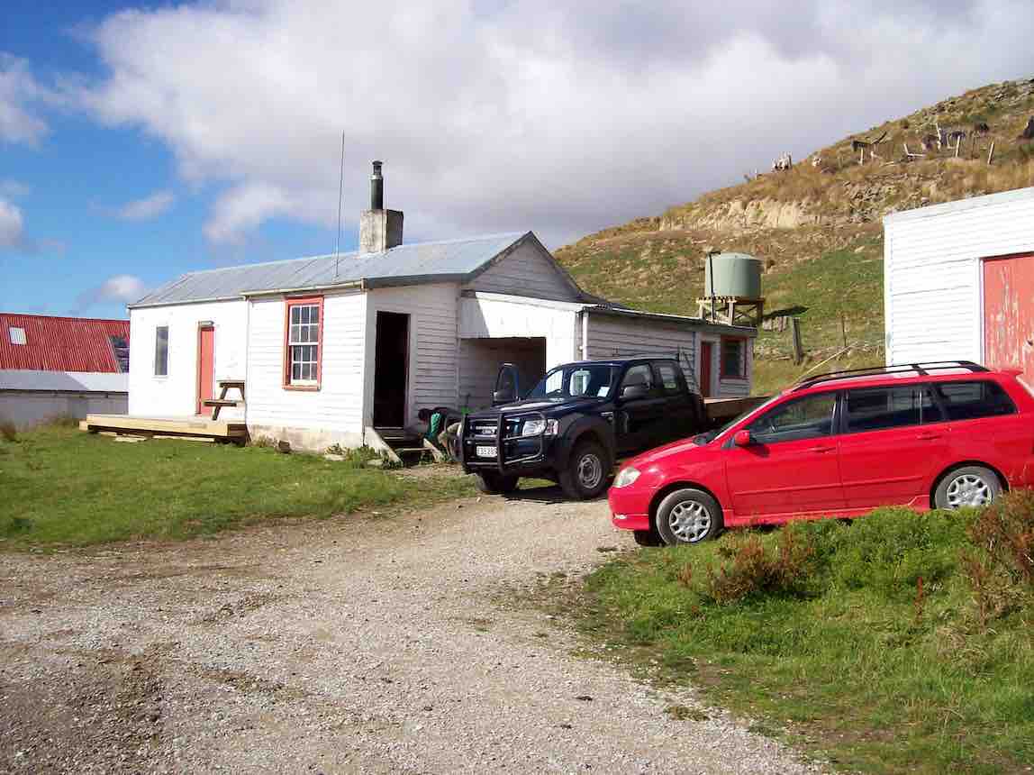
After a one and a half hour drive from Mosgiel, we arrived at Bendoran Huts. David Malloch the station owner arrived to welcome us and give us a brief history of the 5000 acre property.
Us with David Malloch. (Helen pic and caption.)
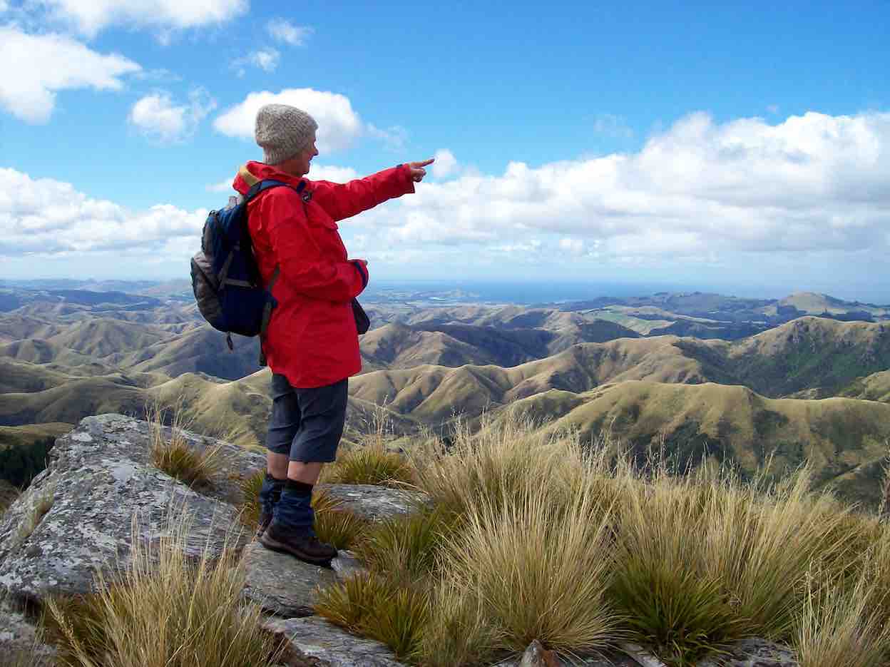
After unpacking and eating lunch, we walked in a cool s.w. wind, overcast with a few skiffs of showers to Mount Misery @ 714 metres.
Eleanor on Mt Misery. (Arthur pic and caption.)
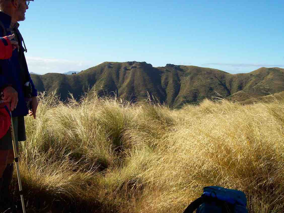
A great view for those brave enough to tackle the wind on such a rocky peak. From there we ventured onto “Terry’s Knob” (refer Hamel’s book page 7:13), …
Terrys Knob. (Arthur pic and caption.)
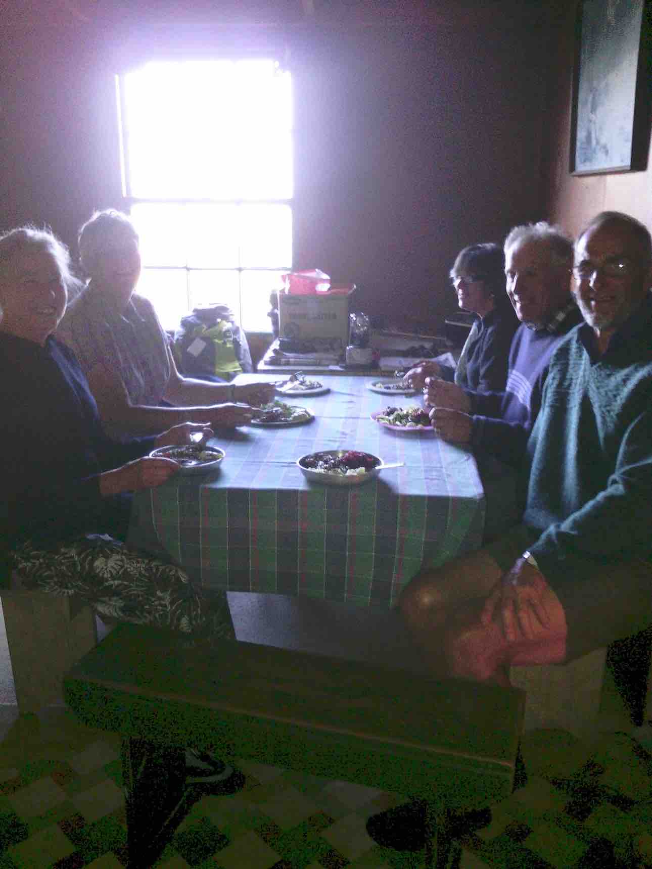
… before returning to Bendoran for drinks and muffins. After lighting up the coal range to heat the water and apple crumble, we then enjoyed home baked Chicken, vege’s and salad. Next job was firing up the open fire, sitting round chatting for the evening.
Before 8.30am next morning we were up and away tramping in ideal conditions for 3 hours to the “Gap” @ 670 metres.
The Gap from morning tea stop. (Arthur pic and caption.)
After numerous photo shots of surrounding valleys, peaks, ranges and the trig, we then headed down onto a new track, where after a lunch stop, we approached the A.B.C. Caves.
Helen Janine & Eleanor at abc caves. (Arthur pic and caption.)
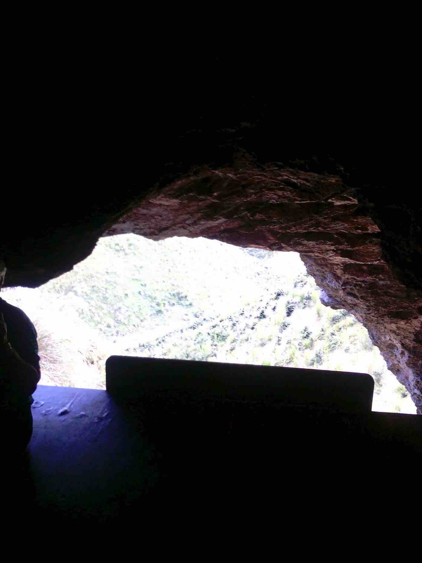
After a challenging tramp, we were impressed by the cave interior, …
From in ABC cave. (Helen pic and caption.)
… but were disappointed the “visitors book” left no room for our claims to reaching this monumental milestone! We then had to return steeply uphill a little before bush-bashing a track across a gully to join back onto our original track, leading us back to our cosy “Bendoran home”.
Bendoran where we stayed. (Arthur pic and caption.)
Arriving back @ 4.15pm, we found 2 members (who returned without going to A.B.C. Cave) had the coal range going with the kettle boiling for drinks and a HOT shower!! All fresh and clean again, we dined …
Dinner. (Helen pic and caption.)
… in front of the open fire on beef casserole, new potatoes, peas and salad, followed by brownie and peaches—-not your average tramping food, and certainly above standard accomodation.
It was an exceptional tramping trip for Arthur, Neil, Carol, Helen, Janine and Eleanore, with new tracks and experiences for some of the party. – Janine and Eleanor.
10. 25/3/2015. Trampers. ABC Cave from Bendoran Huts.
On a day when the weather was a bit suspect, we arrived at the Bendoran Huts to see fog in the valleys, but clear around the tops. Because of the distance travelled to get there, we decided to have a late morning tea break,…
Late morning tea stop. (Ken pic and caption)
…at one of the high points on the track. After this, we walked around the road [farm track] to a point at the head of the valley leading to ABC cave, where we arrived for a late lunch in sunshine.
After lunch we more or less retraced our steps back to the cars, with a couple of refreshment stops on the way.
The day turned out ideal for tramping, with just a trace of breeze at times, a little bit of sunshine for lunch, & the temperature just right, & the fog actually lifted during the day.
Next time we do this, it would be a good idea to start early, as it’s a long way to drive, & the road in is all narrow gravel. – Ken.
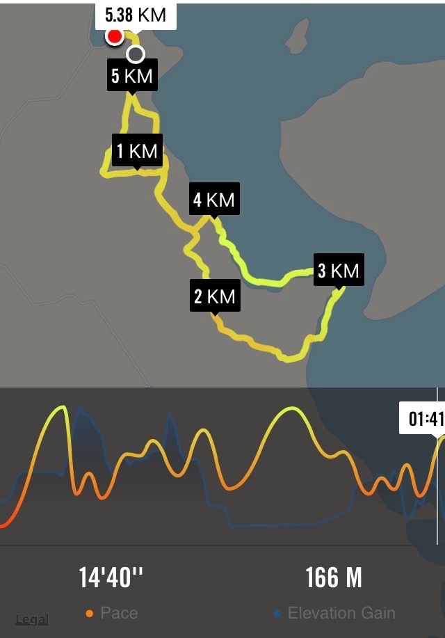
9. 8/5/2013 Trampers. ABC Cave from Bendoran Huts.
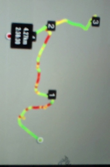
GPS of route, courtesy Ken. We walked 13.6km, 4hrs moving, 2hrs stopped, total ascent 839mtrs, max elevation 701mtrs.
There have been MANY new tracks bulldozed in around the area, making it very difficult to know which track to take. The original idea was to go to the Gap, & then down to the ABC cave, but we were running out of time, due to the distance travelling there, getting held up for about 1/4 hr by a very large mob of sheep with no sign of humans or dogs anywhere. Plus as we didn’t know where to go, we ended up bush-bashing our way down a ridge on the top side of the bush, as you can see by the Google pic. We eventually got down to the DOC track leading between the GAP & ABC, so just carried on to ABC, had a quick drink/snack, & left there at just on 2pm. Then we struggled up another ridge that was a lot clearer than the one we had came down, but it was steep, & it took us an hour to reach the top. From there, it was a relatively easy walk back to the 4wd track that we had left to go down past the bush. One or two of the climbs on the track back to the car were certainly a bit ‘trying’, but we all made it back to the cars OK, & after the drive back to town, got home at just after 6pm.
George didn’t go down the ridge to the cave, so he sheltered for a while, then wandered back to the cars, leaving suitable signs that he had passed that way. There were 7 of us in the group, one of whom was heard to say on the way in, “you think this group is a serious walking group?” so by the end of the day when I asked if they still didn’t think we were a serious walking group, the answer was ” that was a serious walk”. – Ken.
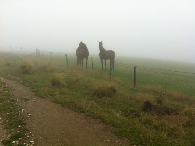
8. 22/2/2010. Trampers. ABC Cave from Bendoran Huts.
GPS of route, courtesy Ken.
It had been many years since any of us had done this tramp, and memories were hazy. So much so, that we parked the cars at the end of Blucher Road, mistaking the shearing shed location there for the actual Bendoran Huts site about six kms further on. So we walked the farm 4WD route to the huts, instead of driving it!
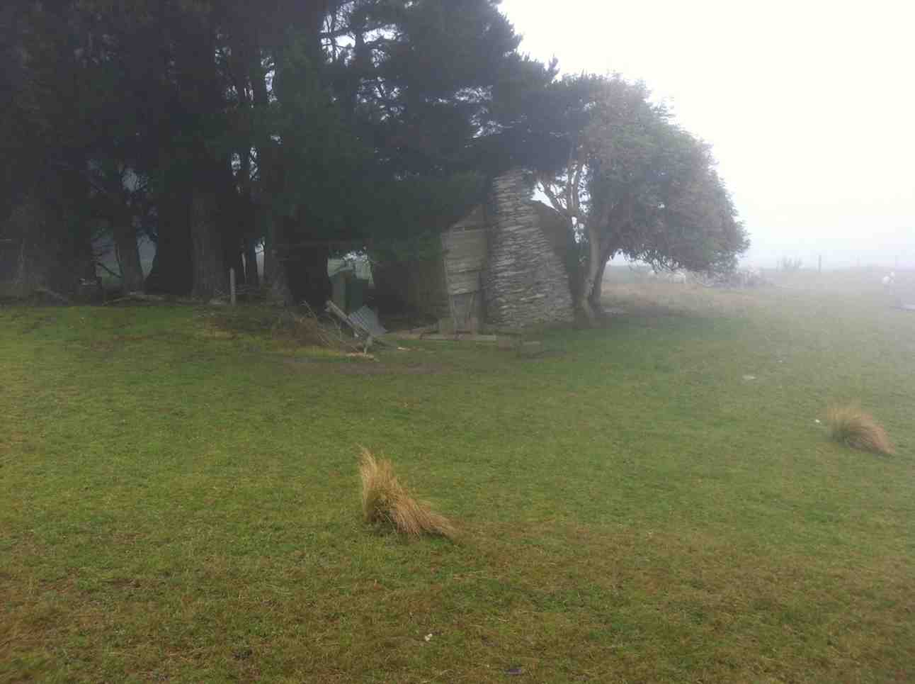
A hut ruin on the route. The fog was round us all the way. But it was dry! A fog, not a mist, as one of us distinguished.
An pic of interest on the way.
Lunch across from one of the Bendoran huts. (Ken pic)
Lunch in lee of the hut. (Ken pic)
We walked on beyond the huts on the track we should have originally started on, for a further km, but there was nothing to be seen through the fog which accompanied us all the way, except for only one brief respite. We then retraced our steps to the cars. About 14 km walked that day. – Ian
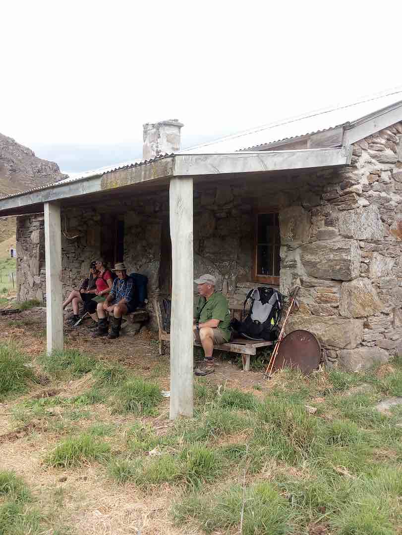
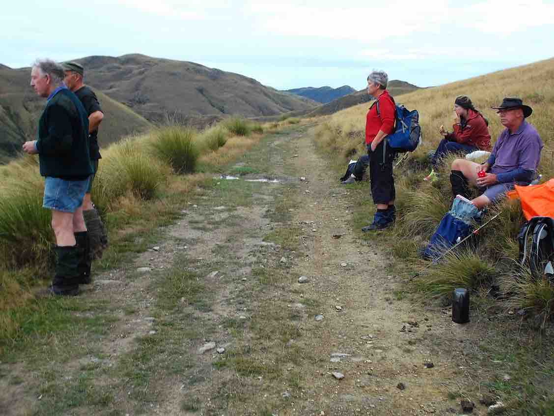
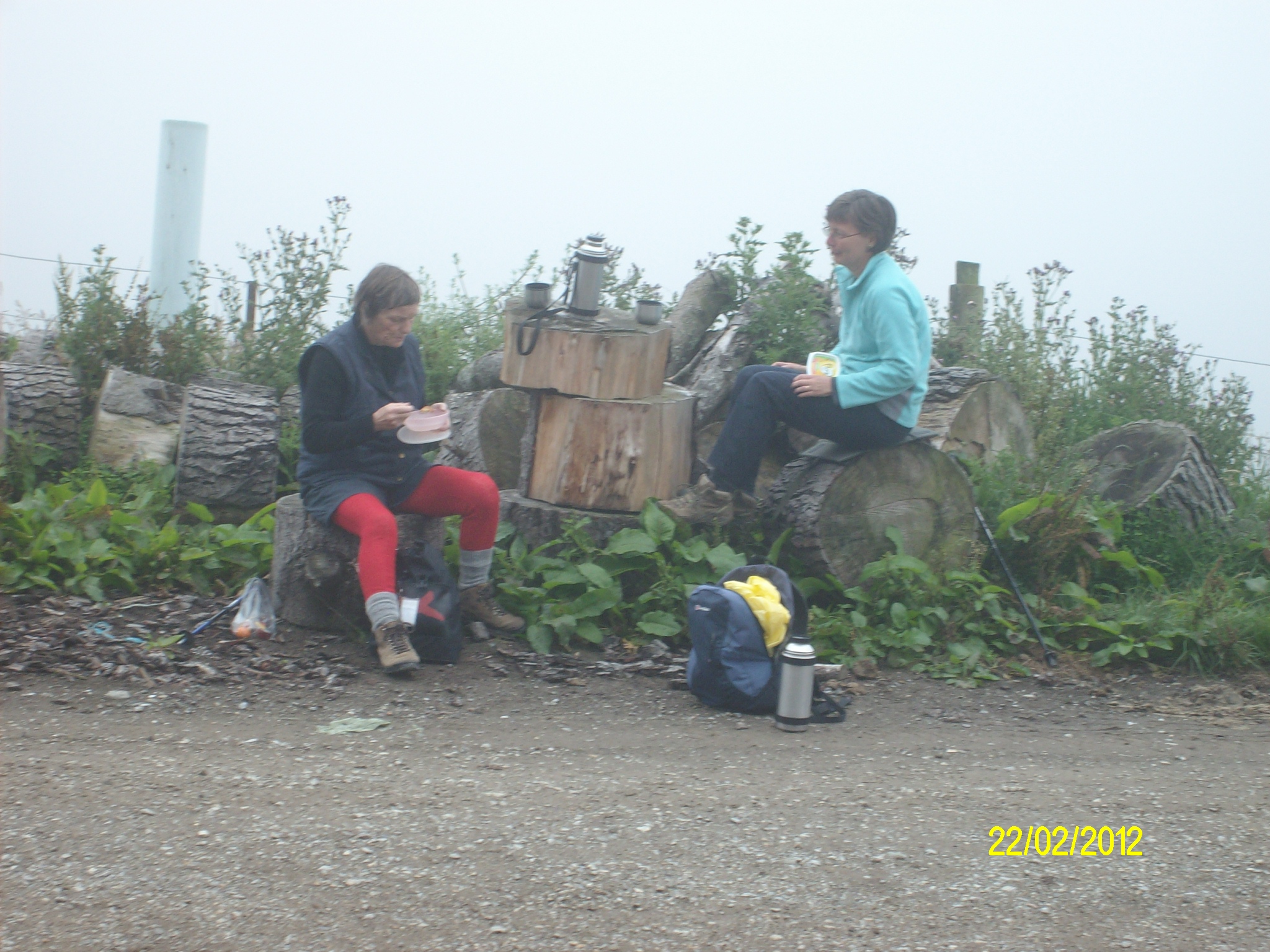
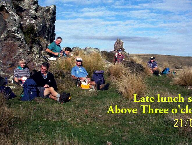
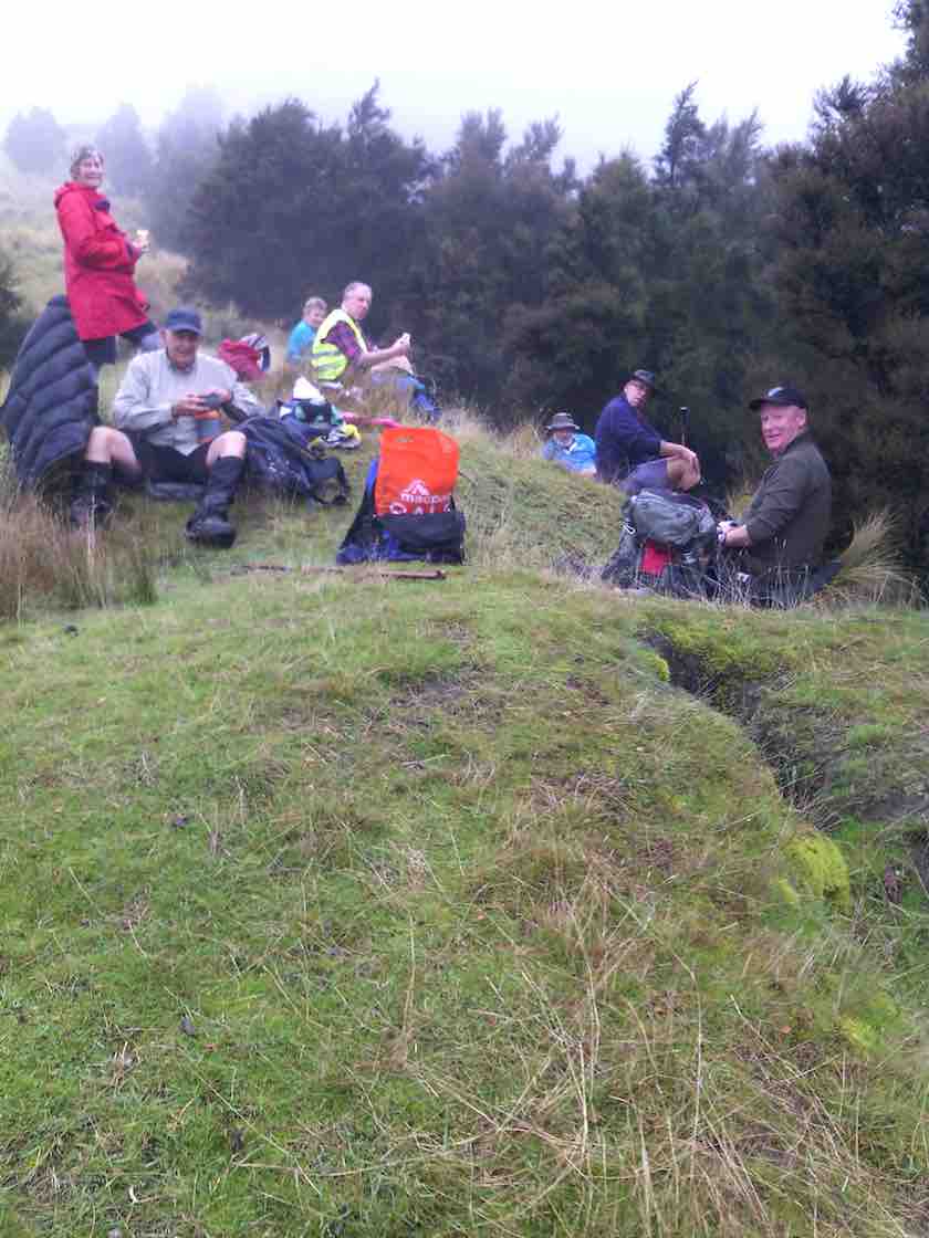
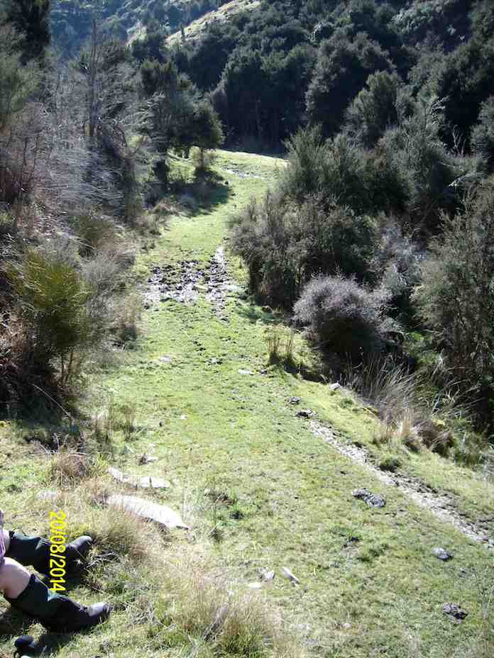
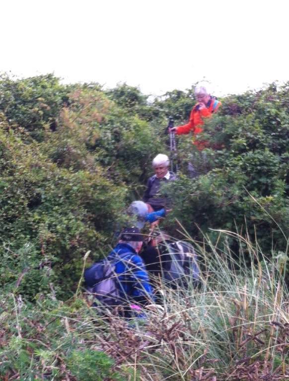
7. 30/1/2013 Trampers. Lamb Hill to three o’clock creek. Old Stone Hut. Orbells Cave. Medium+.
Lunch at the old hut.Orbells Cave from the track.Running repairs before we start the real climb back out
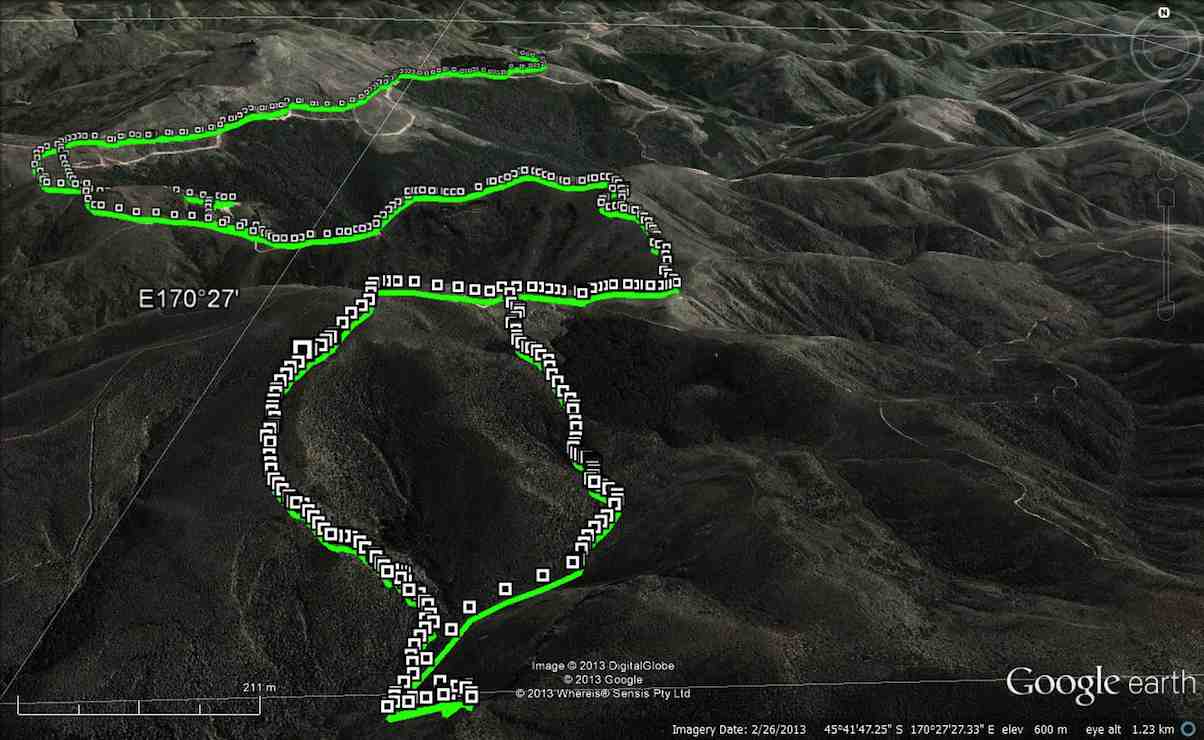
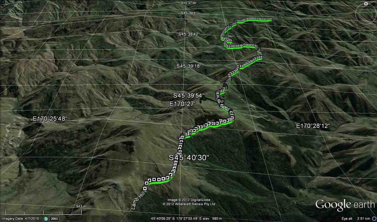
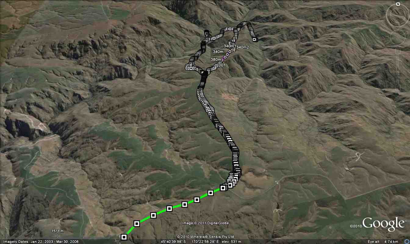
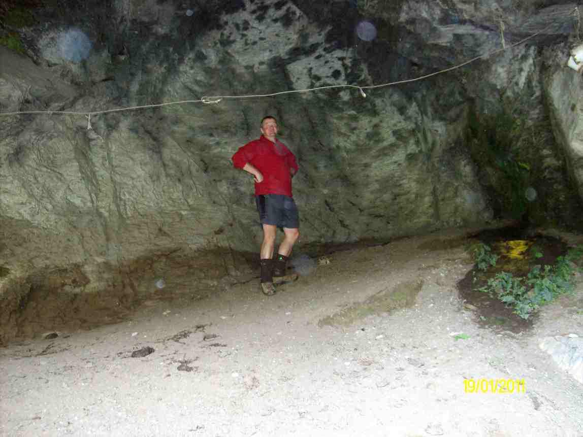
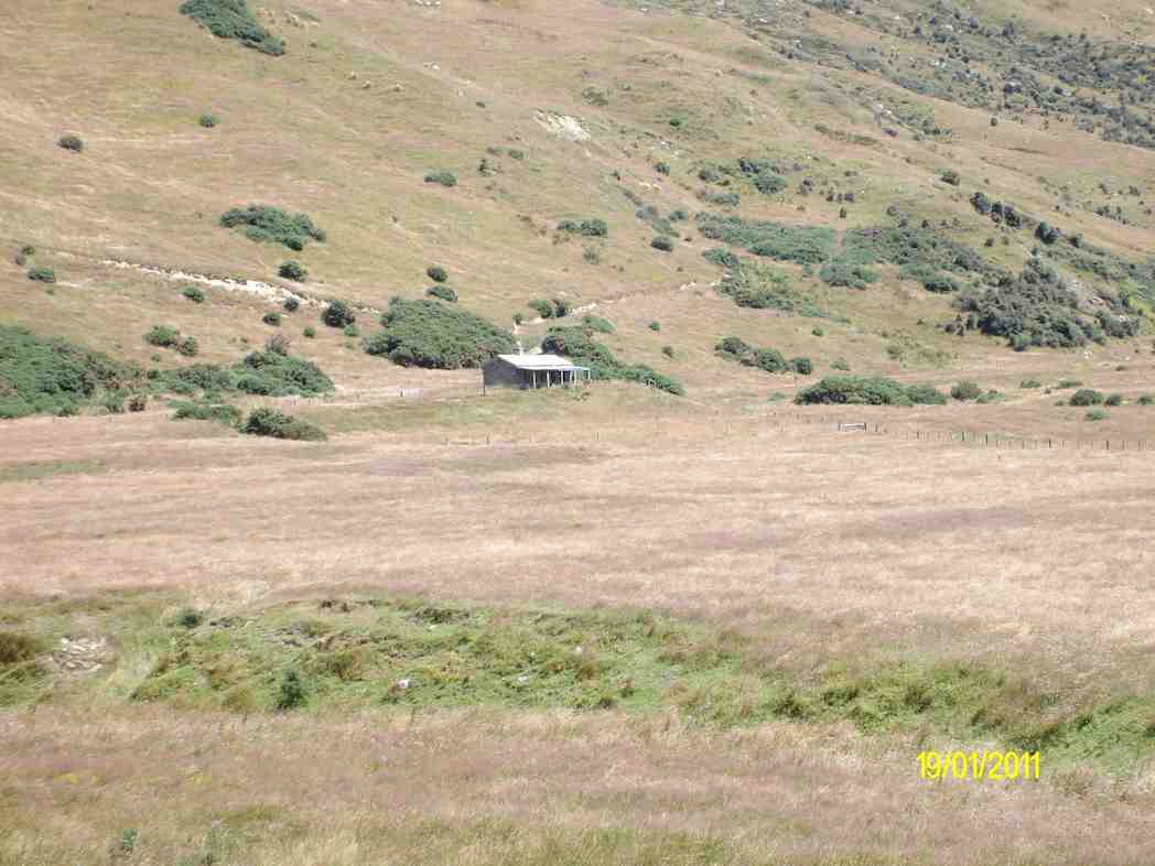
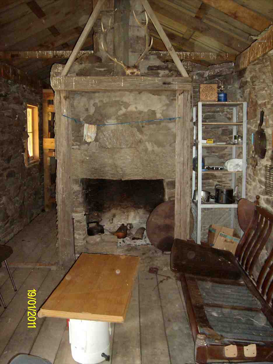
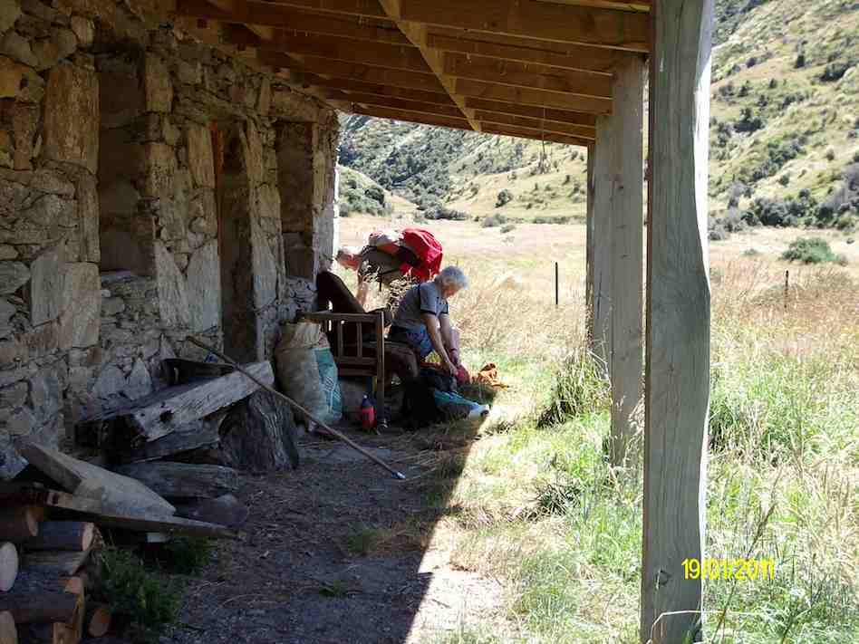
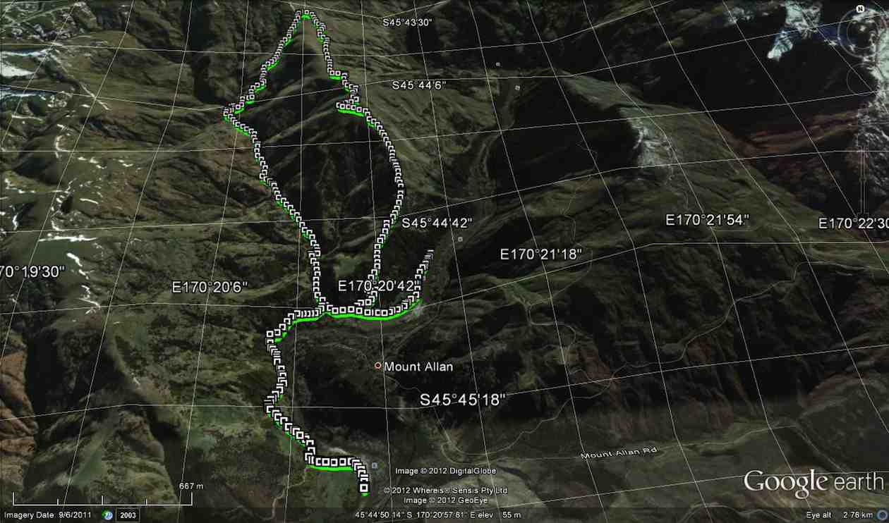
6. 19/1/2011. Trampers. Lamb Hill to three o’clock creek. Old Stone Hut. Orbells Cave. Medium+.
Small scale GPS of route, courtesy Ken.
If you look closly at the small scale pic, you can see the shed at the Nth. end of the airstrip, right at the bottom of the pic where the track starts. As you can see from the spacing of the GPS squares, we were still driving for a while till the squares become very close together. this is where we started to walk from. You can also see the track going off to the left of the airstrip at it’s south end, going down to the ford where the track peters out, & then starts again on the other side. That is where the 2003 tramp went (see below).
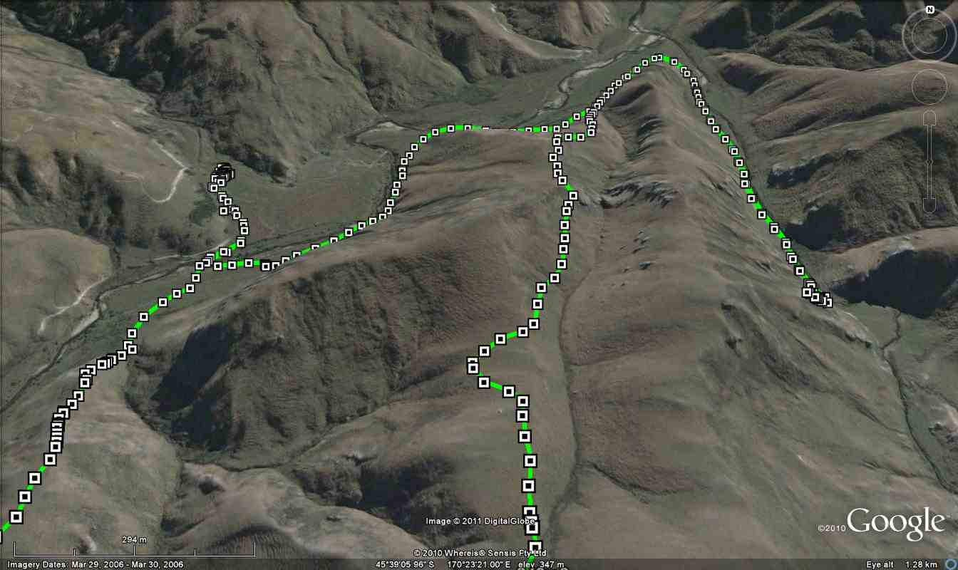
Large scale GPS map of route, courtesy Ken.
The large scale pic shows the decent via the wrong ridge, we should’ve been one over to the right. Anyway, we ended up just a short distance from Orbells creek, so walked into that valley, & up to Orbells caves which is the track on the RH side of the pic.
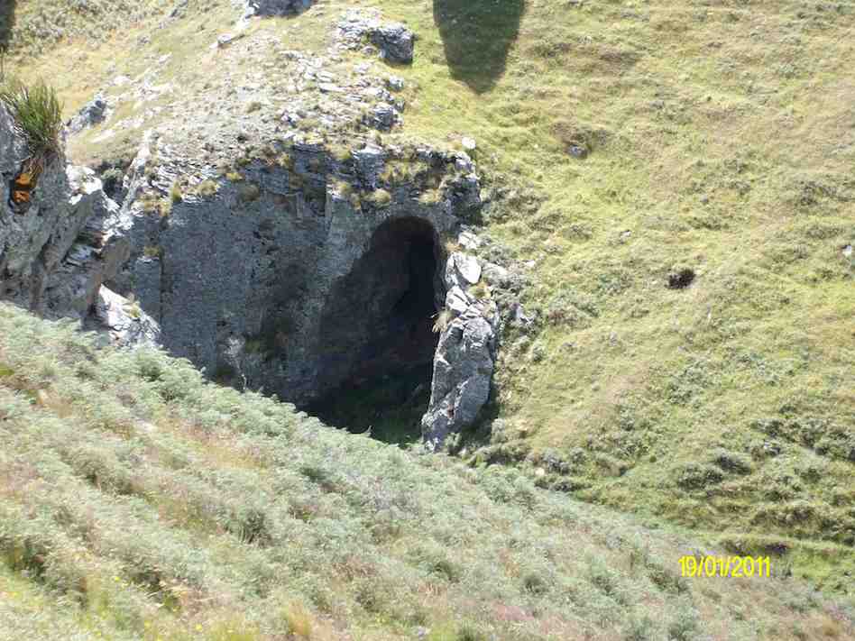
Cute cave we found on the way down to Three O’clock Stream. (Ken pic)
Orbells Caves. (Ken pic)
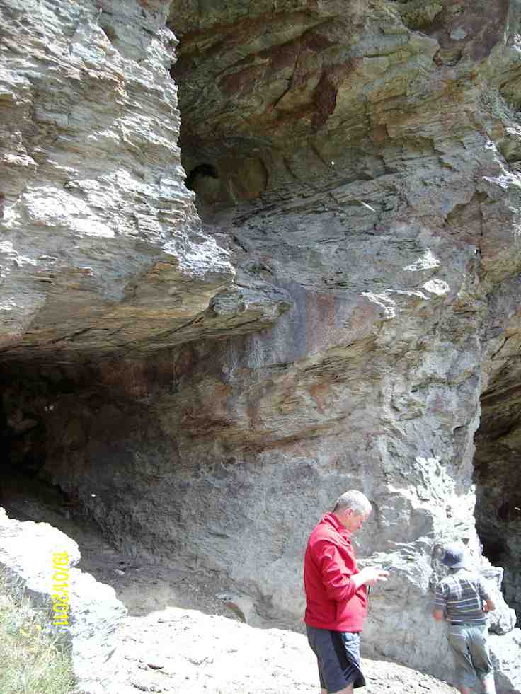
Dermot in the obviously lived-in cave. (Ken pic)
We then retraced our steps back to Three O’clock Stream, and went downstream to a crossing, where Dermot and I went to the old hut to have lunch (which is the track on the left side of the stream in the GPS pic).
Hut on the other side of Three O’clock Stream. (Ken pic)
Relaxation area of the hut. (Ken pic)
Then after walking across the river flats, we struggled up the very steep hills back to the cars.
The weather was fine, but VERY windy, and I nearly lost my footing a couple of times coming back up the steepest parts. BTW, the hut is not on Lambhill Station, it’s on the neighbours property.
Everybody did very well, including George, who didn’t go to the caves, along with Hazel. They just went over to the hut to have lunch there.
Hazel packing prior to leaving. (Ken pic)
George got a dose of cramp on the way back up the hills, but managed to overcome it ok, and carry on. – Ken.
5. 21/5/2006 Lamb Hill to three o’clock creek. Old Stone Hut. Orbells Cave. Medium+.Leaders: George, Keith, Glenice, Hazel
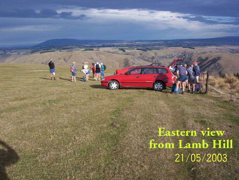
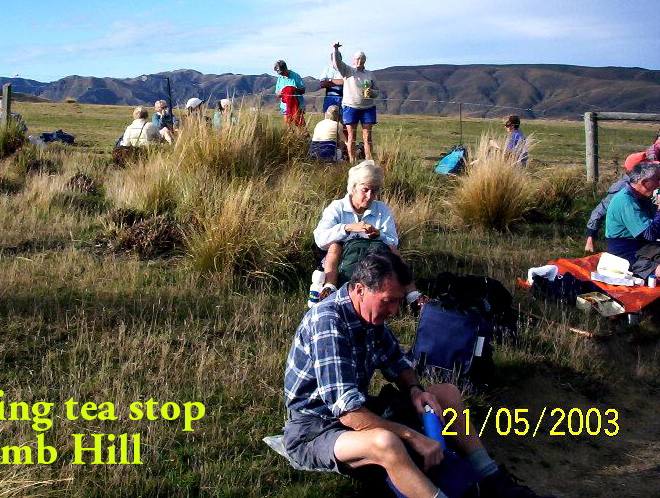
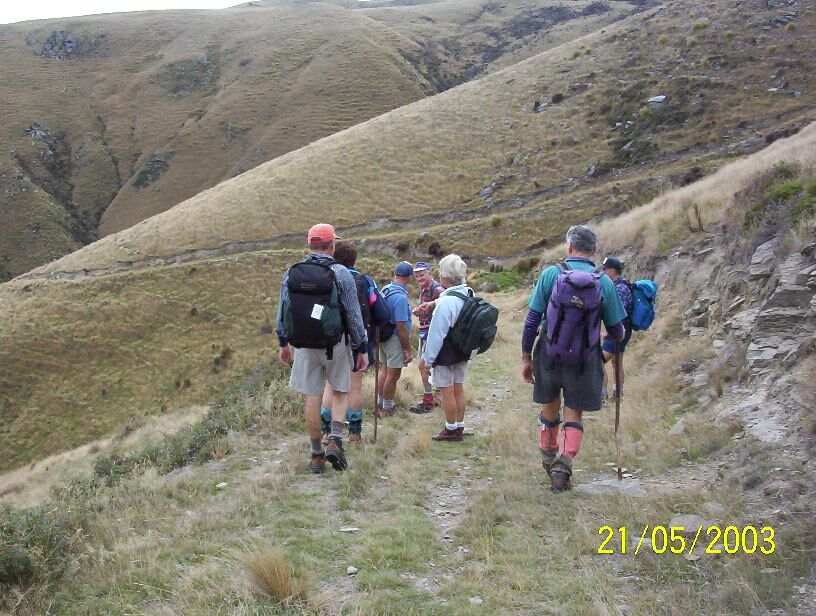
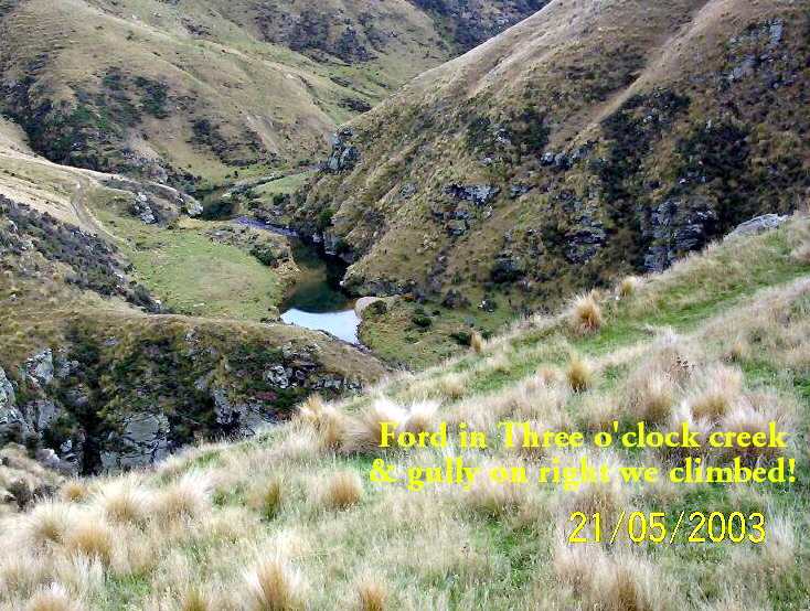
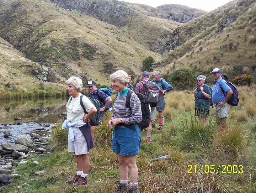
4. 21/5/2003. Both. Lamb Hill to Three O.clock Creek. Medium. Leaders: Wendy B, Bob H, Nancy & Molly
View when we first arrived.
Morning tea break.
Descent to creek
Three O’clock Creek
At creek ford.
Lunch at top of climb. Pat, Lex, Doug J, Evelyn, Doug M, Bob, Arthur.
3. 17/5/2000 Lamb Hill, Three O’Clock Creek. Leaders: Wendy, Colleen, George
2. 15/4/1998. 3 O’Clock Creek, Lamb Hill. Leaders: Nancy, Wendy B
1. 8/11/1989 Lamb Hill to Three O’Clock Creek and old stone hut. Harder grade. George, Mary M, Molly, Catherine
The stone-walled house was burnt out by a bushfire in 1914 after the McKessar family had left the district and the farm had been taken over by a neighbour.
George and Emma (Driver) McKessar had lived and farmed there. George was born in 1836 and Emma in 1853 and they had six children. Emma was a child of Richard and Elizabeth (Robertson) Driver. Richard was the first official pilot for Otago Harbour, and she had been born at the pilot house at Taiaroa Head. She died at Purakanui at 47 in 1900 and George at 75 in 1912. – edited from research by Clive Crossman on various websites.
Park at Three Mile Hill lookout, or Bullring or Pottery, Whare Flat. Permit from City Forest, Dunedin 455 5512.
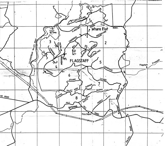
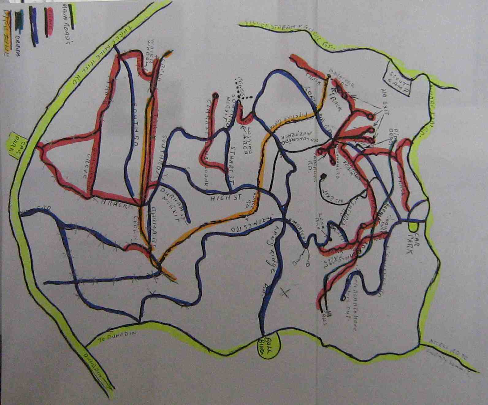
Map of all Roads
click to enlarge
Map of lower tracks/roads
Jack Roy’s Map of Flagstaff Forest roads/tracks
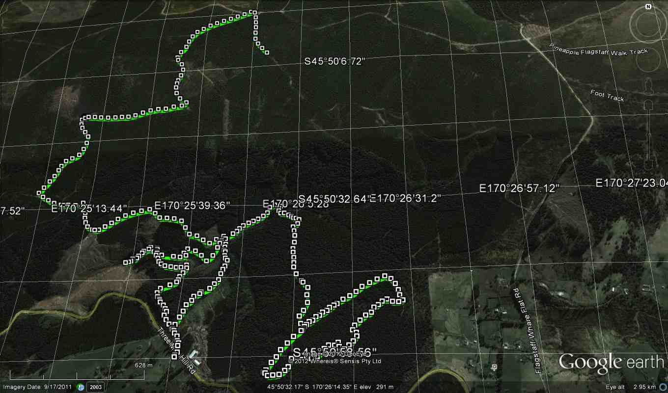
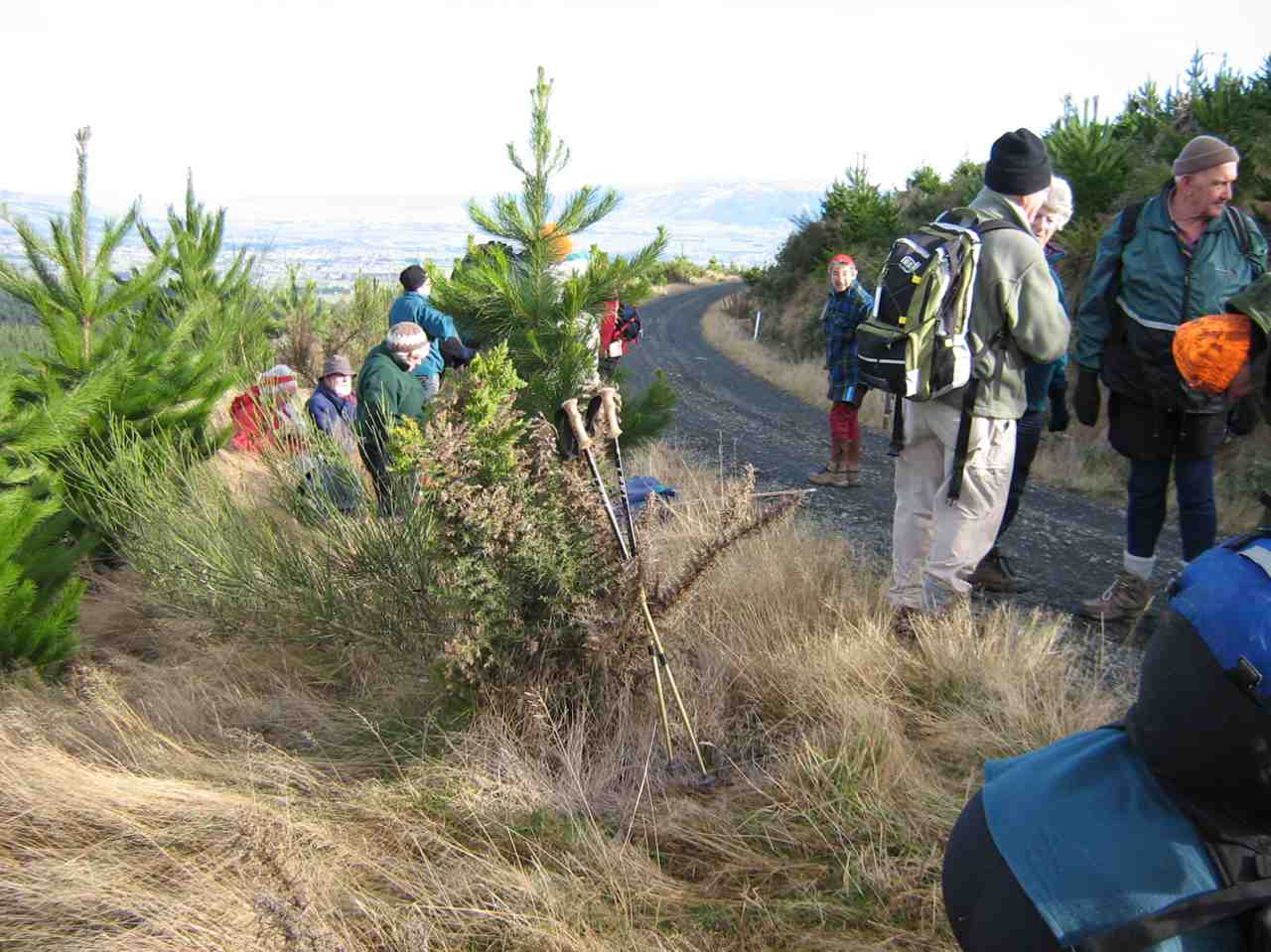
21. 8/11/2017. Hikers. Flagstaff Forest. Stuart and High Streets. M. Leader: Adrienne.
Route map, courtesy Ian.
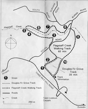
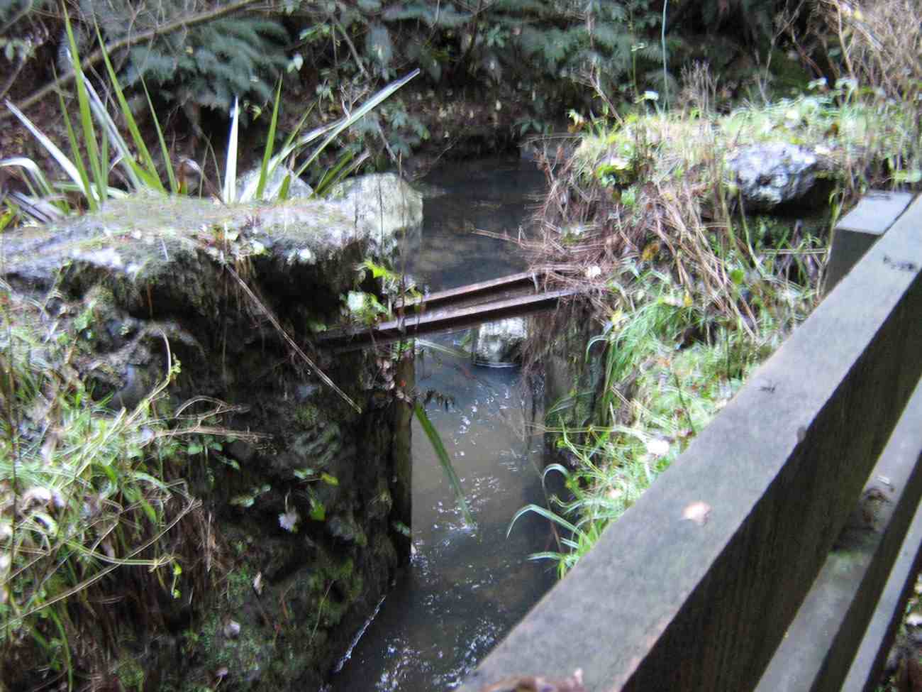
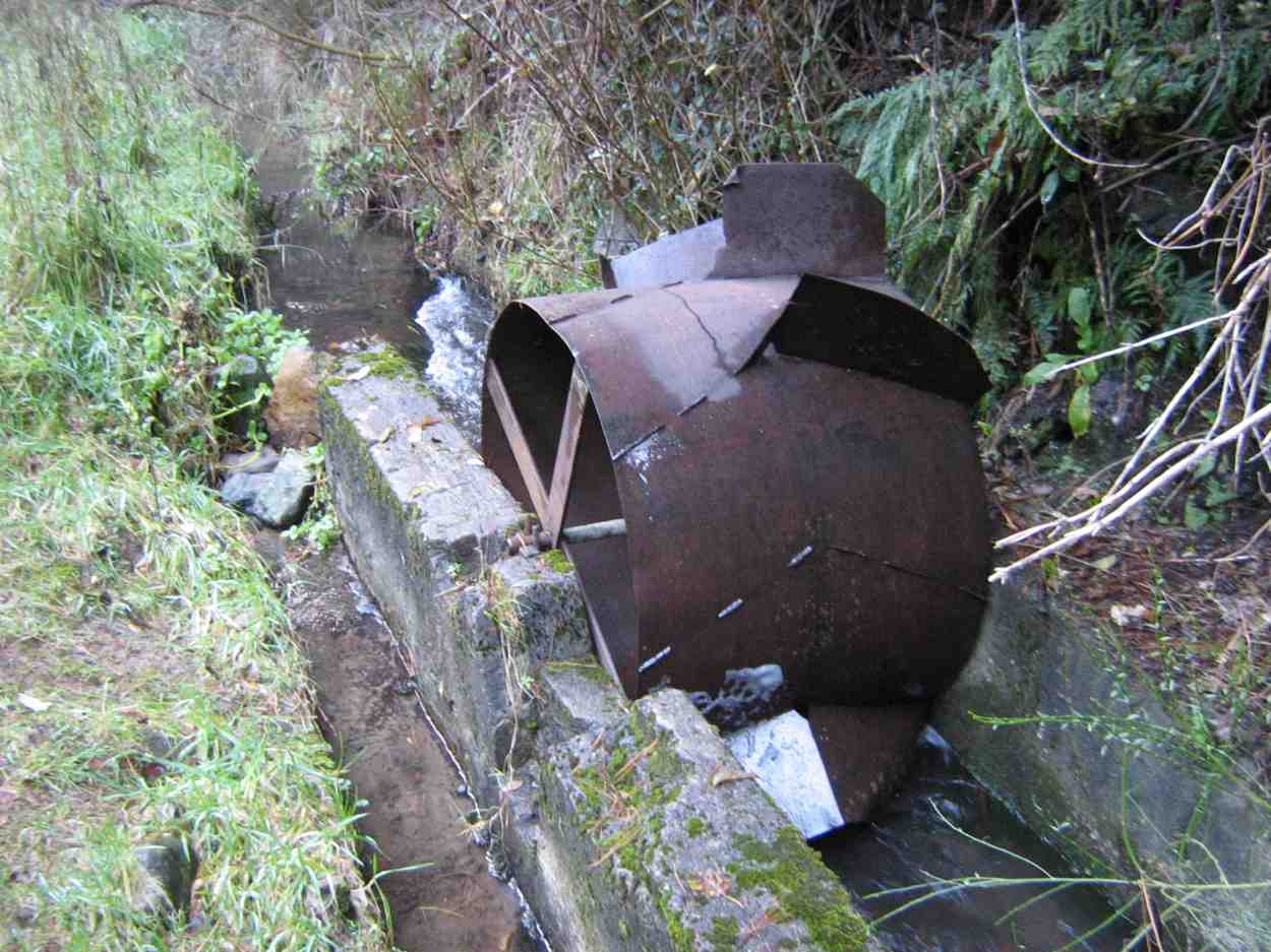
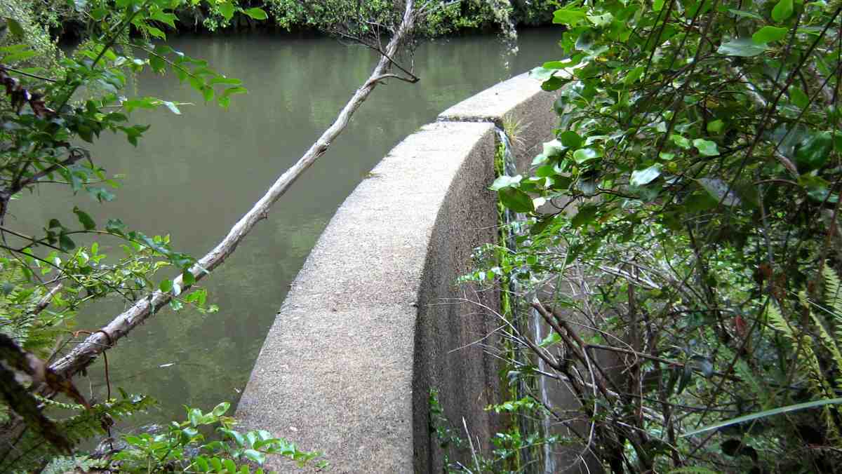
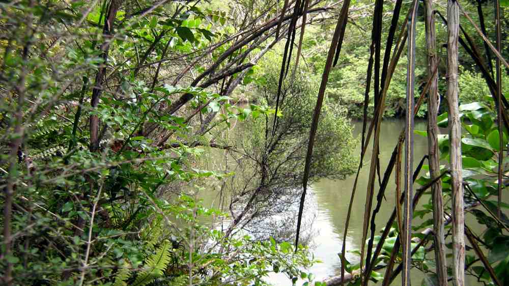
A dozen Hikers set out from the Taieri Lookout Car Park, crossed the Three Mile Hill Road and turned down the Flagstaff Creek walking track, crossed south road and descended the occasionally steep recently well-stepped track to the weir and the old, well-rusted flow wheel,
Can you detect it? Try enlarging.
now almost completely obscured by undergrowth where we had morning tea. The closed wooden bridge across Flagstaff Creek being now blocked off with its access track fully obscured by undergrowth, we had to climb back up to South Road the way we had come down, and follow the road around, past Durham and High Streets to climb the unsigned (where’s it got to?) Stuart Street to where it joined up with High Street. Sheltered hitherto for most of the tramp from a strong cold wind, we found ourselves now well exposed to it. We went up High Street a little way and turned up a track labelled Tank Surge Road <?> to the partial shelter of its narrow tank for lunch. Then, it was back down High Street and along South road to where it crosses Flagstaff creek by the piped concrete bridge, and up the Douglas Fir Grove track leading across to the car park again.
Although the cold wind back at the Bush Road car park had been a bit discouraging, we all agreed at the end it had been a most enjoyable energetic day out, pleasantly completed with companionable coffee at the Aurora. With co-leader Bev laid aside through illness, (and the locator beacon still in her car boot!) Adrienne did a text-book perfect leadership job, faultlessly grouping us at each fork in the route. Thanks, Adrienne. – Ian.
20. 14/10/2015. Hikers. Flagstaff Forest. Stuart and High Streets. Leaders: Lesley and Bev.
GPS of the route
Nineteen hikers parked at the Lookout. Lesley led us in at the upper entrance and down the track to South Rd. Then along South Rd …
A study in ‘verticality’What appears to be a chipper – (saw-duster?) for transforming forestry rubbish into pellet fire product, perhaps.
… to the foot of Stuart St whose road sign at its foot is now unhelpfully missing. Up Stuart St which gets only steeper each time we tackle it, but now cleared of all trees on either side. Where Stuart St ends at High St, the leaders took eight of the party down High St, entrusting the balance of eleven to the leadership of Keith to take them up High St to lunch at its end at Longridge. The two parties met again on South Road where it crosses Flagstaff Stream and returned to the cars via the large steep steps taking them up along the Douglas Fir Grove track. – Ian.
19. 17/7/2013. Hikers. Flagstaff Forest. Leaders: Les and Margaret.
Wed. saw us park up at the lookout at three mile hill road.
We walked into the forest and around a few of the roads like High St, Stuart St, etc.
It turned out a great day with lots of sun between the trees.
the douglas firs are so TALL in the forest I wonder if they will mill them.
It was very sunny at the lunch stop. Fred supplied the usual chocs so all was well for us all.
We made our way back up some huge steps {made by a Big Man?}
There are a lot of felled trees in there and I wonder what they are going to do with it all.
With so many families crying out for wood and the price it is… and here is all this wood just rotting away. – Elaine.
GPS of route, courtesy Ken. Unaccountable lapse in record. Deduce omitted route yourself!
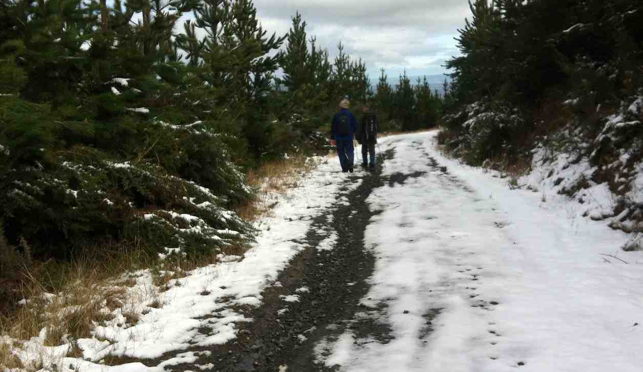
A pic from earlier in the tramp before we got to the top.
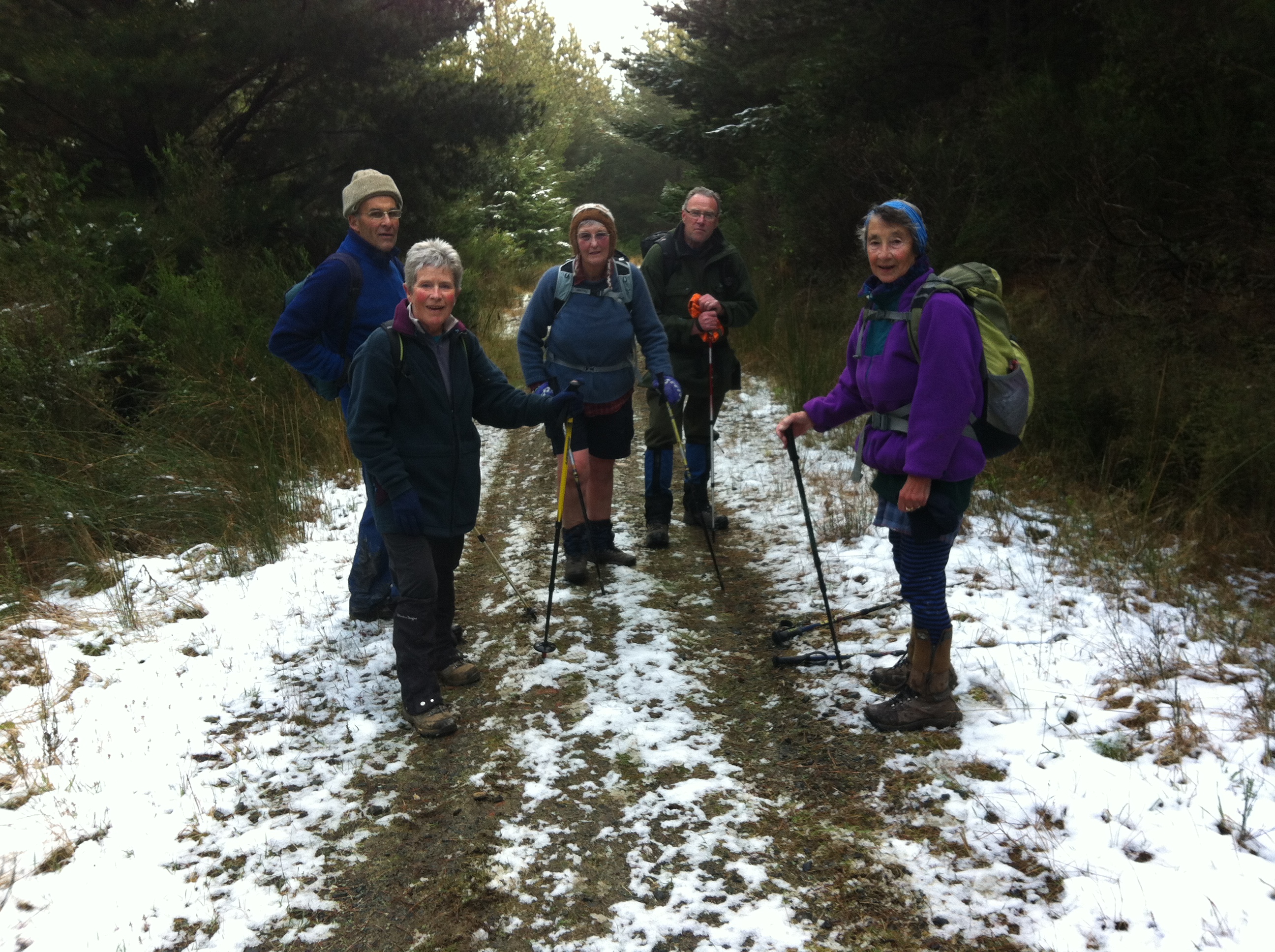
Fast melting snow on route back down from top.
17. 28/4/2010. Hikers. Flagstaff Forest walk. Leaders: Bruce and Marjorie.
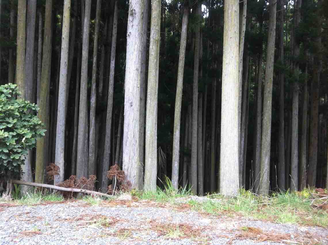
Thirteen hikers parked at the Taieri lookout and set off on the bush track opposite which was a very pleasant walk. Although it had rained, pine needles made a soft dry carpet. The variety of trees and bird calls, including rosellas, provided interest and we admired the tall straight trunks of the giant trees.
We had morning tea and lunch at the same spot by the Flagstaff stream but between we did a circular walk around forestry roads. These provided us with good walking underfoot and although it was quite a grind up Stuart Street we all managed it with ease by taking our time and stopping to admire the view of the Taieri Plains and Saddle Hill. After lunch we completed the bush walk back to the cars.
It was quite a short walk, although no-one took up the offer to go round again. Another time a further circle could be added on at the top of Stuart Street. The weather was ideal with not a breath of wind and mild temperatures. – Marjorie
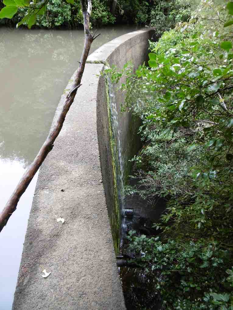
16. 1/7/2009 Both Hikers and Trampers. Flagstaff Forest. South Rd, High St, Laings, High St, Stuart St, South Rd. Leaders: Neil, Ria
It was a good day for 20 members of the club from both groups. We entered the forest from opposite the Taieri Lookout car-park and made our way down to where the track comes out at South Road. We followed this around to turn up High Street, but before doing this we stopped for
our morning tea break in a rare sunny spot. click to enlarge
Morning Tea on South Road. Lex, Bob, Who? Wendy, Who? Neil, Ria, Peter, Mollie, Pat, Bill, Bev, Evelyn, Angela.
We made our slow way up, up, up High Street, stopping for frequent rests to eventually reach Long Ridge Road only to immediately turn back off it to travel along Laing Road until Ria judged it time to stop for lunch.
Returning back we enjoyed great views of the Taieri Plain,
Taieri Plain
turned back down High Street and then off to the right and down Stuart Street. When it reached South Road, we turned left, passing the foot of High Street to reach the bridge/culvert over Flagstaff Creek. Here we turned down the Flagstaff Creek Walking Track to at last cross the Creek on a fine wooden bridge to reach a water race
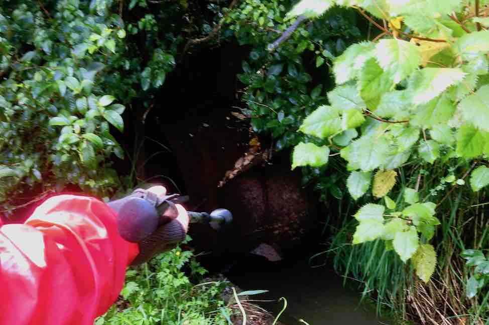
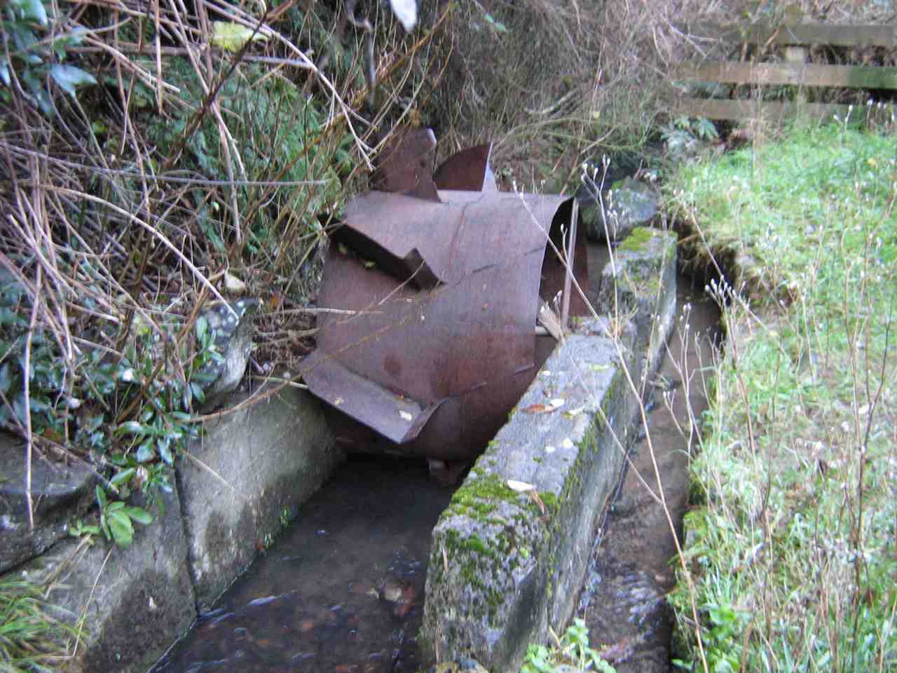
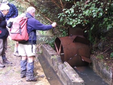
Race EntranceWeir, water-race entrance and Overflow
containing an old water meter wheel stiffened up with age and rust.
‘Up-race’ of Water Meter‘Down-race’ of Water Meter
Back up the track a bit we turned up to the right to climb a many-stepped track up to cross South Road and back up the initial track to the car park again. Thanks, Ria and Neil for a most enjoyable, if wrapped-up, winter’s day out. – Ian
15. 25/2/2009 Trampers. Three Mile Hill Lookout. Flagstaff forest walk, Three Mile Hill. Round trip. Lookout, South Rd, High St, Longridge Rd, Whare Flat Rd, Laings Rd, High St, South Rd. Leaders: Ria, Hazel.
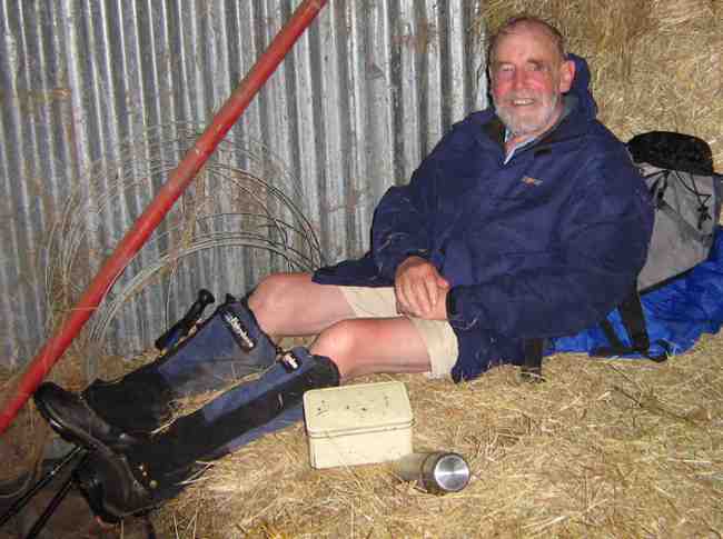
The misty overcast day left ground wet and muddy underfoot and ruled out the planned tramp on Swampy. So Ria had sought permission for the six of us to walk the Flagstaff Forestry roads. It was a good work-out, extended by a climb from the Bullring to near Flagstaff summit to fill in time before lunching in the welcome shelter of Ria’s daughter Ingrid’s property’s haybarn down Whare Flat Road.
Lunch in Ingrid’s haybarn. IanLunch in daughter Ingrid’s haybarn. RiaLunch in Ingrid’s haybarn. Hazel, GleniceLunch in Ingrid’s haybarn. Bill, Pat
Then it was back up Whare Flat Road to Laings Road and so back to the Lookout where we had parked the cars. Thanks to Ria and Hazel for a good alternative tramp.
14. 20/9/2006. Hikers. Three Mile Hill area. Easy. Leaders: Jean, Anne R, Eleanor B.
13. 30/3/2005.DCC Forestry Walk.
Water wheel
12. 11/9/2002. Alt. Three Mile Hill. Leaders: Les W, Mary M, Peg C
11. 27/6/2001 Three Mile Hill. Leaders: Daphne, Eleanor, Mavis
10. 25/4/2001. Three Mile Hill. Leaders: Daphne, Peg C, Mary M.
9. 19/7/2000. D.C.C. Forestry Circuit. Leaders: Shirley R, Arthur and Barbara.
8. 18/8/1999. DCC Forestry Walk. 3 Mile Hill. Leaders: Margaret D, Winifred, Joan H.
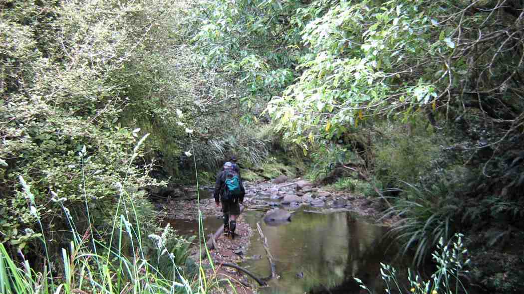
Nine trampers left the car park and after delivering one vehicle to the tramp end,we left the car park at Semple road at 9.50am.
We made good progress on an times slippery and steepish track and stopped for smoko at 10:15.
As we followed the old pipe line down, the creek crossings became more frequent…
River crossing. (Helen pic and caption.)
…and the track more muddy.
Lunch was had at 12:15…
Lunch. (Helen pic and caption.)
…and soon after the rain began, so it was on with the coats.
The hairy goat and his kids. (Helen pic and caption.)
Every one was quite wet by the time we got to Evansdale Glen but it was a good tramp and a great coffee at Blueskin cafe.
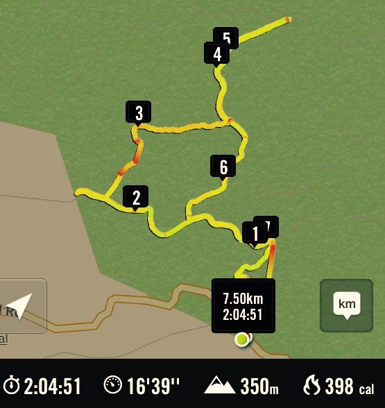
Distance Semple Rd car park to Evansdale walk bridge 11.6 km – Keith
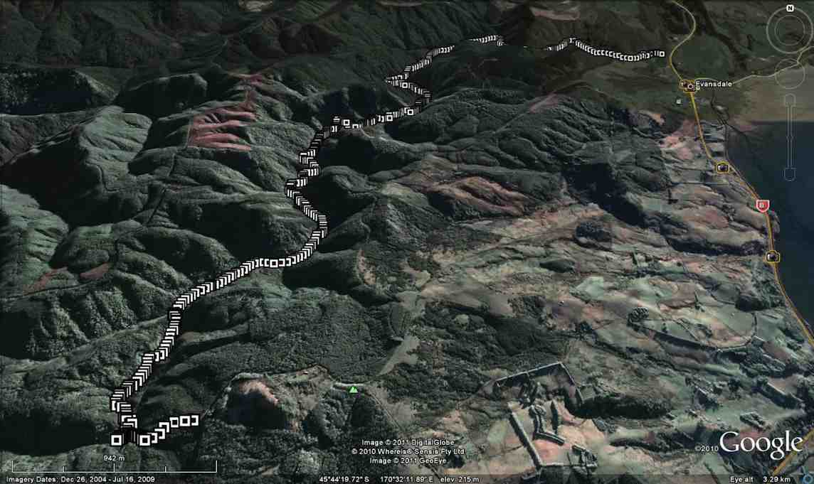
7. 16/3/2016. Trampers. Black Gully Dam, Careys Creek, Evansdale. Leader: ?
On a day that didn’t promise much weather wise, we had 9 trampers on the Careys Creek tramp. For a change, the women outnumbered the men as well !!!
After doing the car shuttle thing, & having morning tea,
1 Packing up after morning tea (Ken pic and caption)
we all met up not far down valley from the Black Gully Dam,
2 Black Gully dam (Ken pic and caption)3 Black Gully dam (Ken pic and caption)
& continued on at a leisurely pace,
4 track (Ken pic and caption)
being careful of the quite slippery conditions.
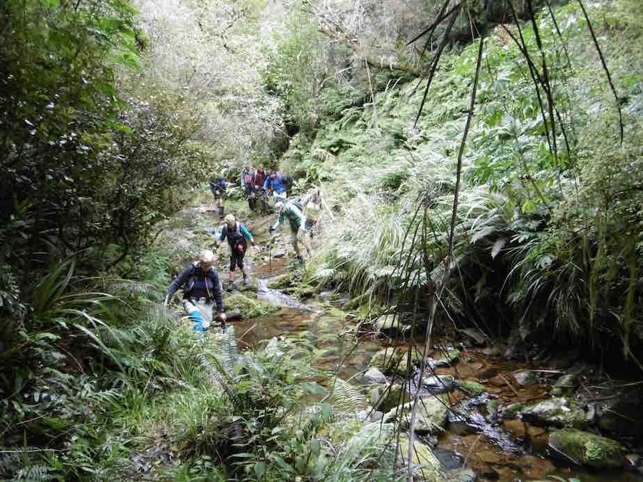
The many creek crossings …
5 Crossing the creek (Ken pic and caption)6 An easy crossing (Ken pic and caption)
… were also treated with great care, as the boulders were mostly treacherous to stand on. It was pleasing to see the new much larger orange triangle track signs that have been installed along the places where it is necessary to walk the riverbed.
We had lunch alongside the creek at a suitable place, & then continued on downstream, where we met up with a quite a large group of Kings High School boys with two supervisors. They were making a lot of noise, & could be heard from some distance away. We spent the rest of the trip mixing with these boys, as they would race ahead, then stop to pick Blackberries, which they were going to make into a Blackberry Pie later that night.
We had some of our group who had not done this tramp before, & all agreed that it was a good day, which most of us finished off with a coffee & chat at Waitati.Walked 11.7km
3.6km/h
3h 13mins
climbed 173m – Ken.
6. 1/10/2014. Trampers. Black Gully Dam, Careys Creek, Evansdale.
Careys Creek track was the destination for this tramp, & 6 trampers turned up for the day out. We drove to Evansdale, & left one car there, & then drove up to the top of the track at Black Gully Dam track. Morning tea was taken at the wooden seat part way down this track just before the steep steps leading down to the creek. The dam was inspected, along with the old hut that is situated there, & then we made our way downstream over the many slippery creek crossings to a late lunch spot, not far from the signposted junction of Rongomai track. We then made our way back out to Evansdale Glen via the ‘new’ track, where two of us left the others to have a spell, & a look around the area, while we went & retrieved the two cars, so we could ferry everybody back to town. Once again, this tramp had not been done by some, & for others it had been a long time [many years] since they had been there, so even although most got wet, or damp feet, it was enjoyed by all, & the weather was brilliant !
We walked 10.8km
2h 45m moving time
ave 3.9km/h
climbed 163m – Ken.
5. 18/9/2013. Trampers. Black Gully Dam, Careys Creek, Evansdale.
Seven trampers gathered at the top of the Careys Creek track after leaving a vehicle at the Evansdale end. The descent through the bush was pleasant easy going, with a stop to view the Black Gully dam and then another in a patch of sunlight for morning tea, where George shared his birthday goodies.
The creek was low so the numerous crossings were made with dry feet, except for one member who measured her length over slippery rocks and now sports a bruised cheek and knee, not to mention scratched specs.
The party then split, with three opting for an early lunch and the rest pressing on to the Rongomai junction. Here the others caught up again, for an easy ramble out to the road. – Judy
4. 26/1/2011. Trampers. Black Gully Dam, Careys Creek, Evansdale. Ken, Ian, Sabina.
GPS of Careys Creek track route, Semple Road to Evansdale, courtesy Ken.
With two cars between only three of us we nevertheless decided to do a car shuttle between Semple Road and Evansdale and to do the entire Careys Creek track. Ground conditions were wet and slippery, which would have ruled out the steep Honeycomb track anyway.
We were reminded again of just how many and how steep the steps down to the dam were. But they are well benched-in, so not too bad.
One of the more level parts of the track down to the Dam.
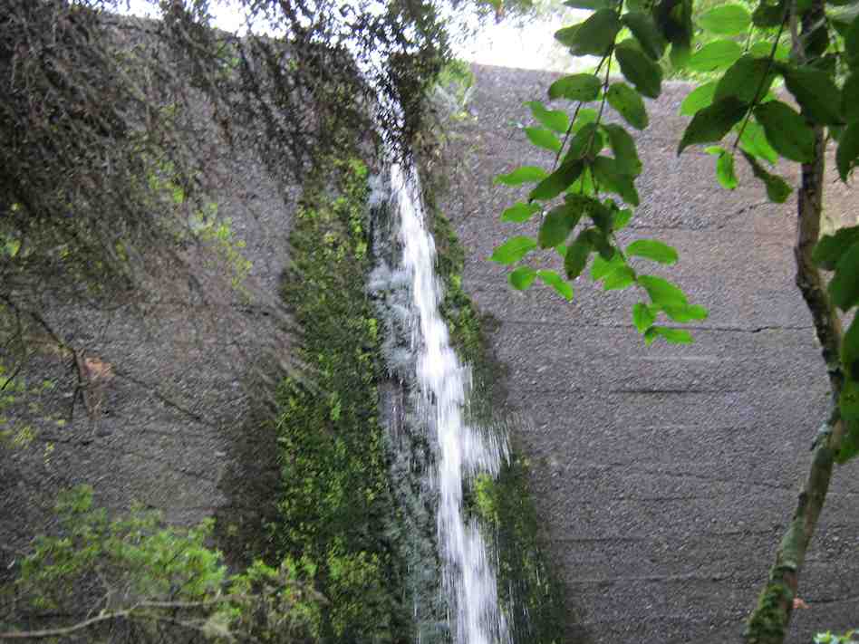
We took Sabina up to see the Dam and the slightly greater overflow didn’t auger well for the many creek-crossings and creek-wadings ahead, where the track is just the actual creek-bed. But again, things weren’t too bad.
The Dam waterfall was slightly heavier than usual.
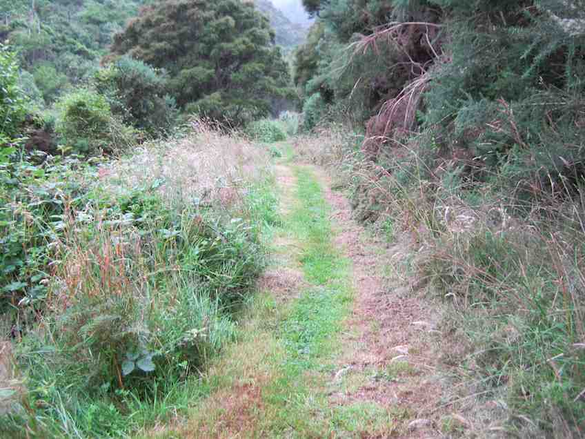
Along the way we met up with several small groups of the Green Hut Track Group. They have almost completed clearing the entire track. Bravo! We were delighted to find several areas modified. These were where difficult parts of the track had, where occasion warranted, been either better benched, stepped or even completely re-routed. Again, bravo!
And then, just past the foot of the Rongomai, behold, a track now mown where at all possible, all the way down to Evansdale Glen.
An example of the mown track nearer Evansdale.
This had been the first time the club has done the entire 10 km of creek in a long time. And it felt good. – Ian
3. 31/12/2009. Holiday tramp. Black Gully Dam, down Careys Creek some distance and back. 4 hours. Ian, Ken, George.
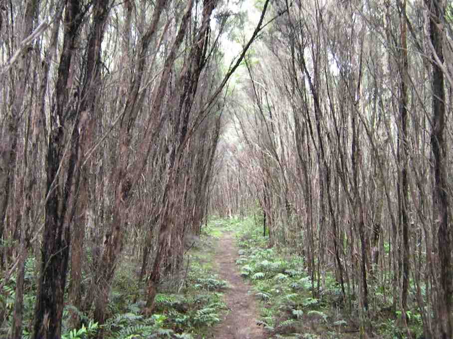
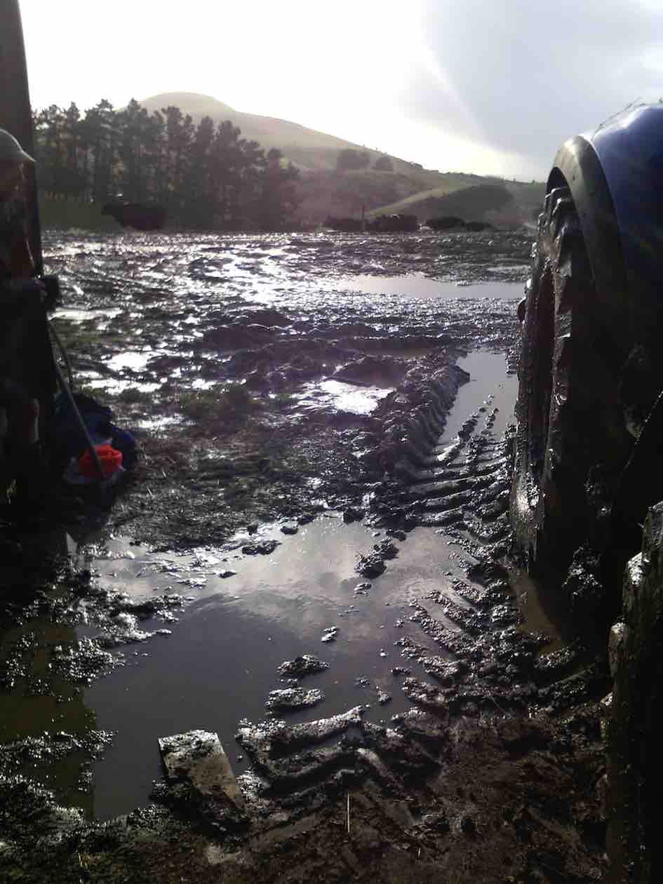
The weather forecast had promised a fine day but it turned out overcast. Rain on the previous wet day had left the track muddy and slippery necessitating great care not to slip. Exposed parts of the track produced lush rank grass and buttercups, and rain during the day left steep grassy slopes extremely slippery. The track is well-cleared for a considerable distance but from near its highest point and onwards, it was much more heavily overgrown than when we did the recce. First of all, of course, we climbed the track to the old Seacliff dam.
Looking across dam. Ken, George.
Dam and overflow.
Peering through foliage to determine extent of dam pond.
Then it was down the Careys Creek old pipe-maintenance track. As mentioned above, this part was well cleared.
Track down Careys Creek. George, Ken.
Of course there were very many stream crossings, some entailing a walk quite a distance down the creek before entering the track again. These were well-marked with indicators suspended from branches overhanging the stream-bed.
One of many stream crossings. George, Ken
There was a restriction on time as George had belatedly discovered he had to be back home mid-afternoon, so although we managed a short-notice early 8.15 a.m. setting out, we were unable to make the full distance down to the Honeycomb Track turn-off before having to turn back. A memorable part of the tramp was a (unnoticed at the time but decidedly stinging later on and into the night) brush with some concealed onga-onga, Ken on his left wrist, George on a finger and Ian on his right knee. But all in all, a very enjoyable way to finish the old year off. – Ian
2. 5/12/2009. Recce of Black Gully Dam, Careys Creek, Honeycomb, returned Mountain Road, Semple Road. 5.5 hours. Ian, Keith, Glenis.
Track is well-cleared for most of its length.
The road-walk back is about 8 km.
1. 19/10/1994 Evansdale, Black Gully Dam/Seacliff Dam, Double Hill. Medium. Leaders: Ria L, Marie F, Jack R, Bob H
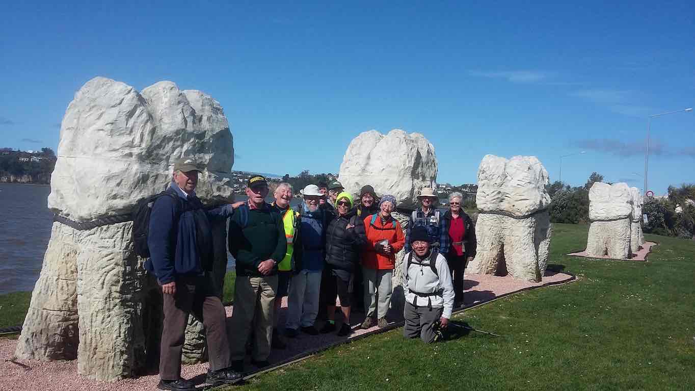
3. 20/9/2017. Hikers. Portsmouth Drive to Marina. E. Leaders: Judy and Dorothy.
Twelve harbour strollers, went to Andy Bay.
We parked beside the inlet – it was a windy day.
Along the Portsmouth Drive we went, trudging in a row.
We passed the harbour molars, and onward we did go.
A sunny sheltered spot was found, and morning tea was had,
Relaxing in the sunshine, it wasn’t half too bad.
Then on we went, around the wharves, and round the harbour basin –
We found that walking in the wind, was really somewhat bracin’.
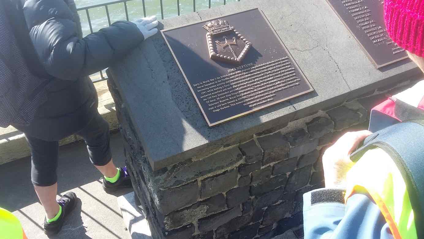
We viewed the plaque in memory of “Neptune”, sunk in war.
She hit a minefield in the Med, and then she was no more.
We passed the Neptune memorial at the wharf and some members were able to point to the names of loved ones who were involved in this tragedy. (Clive pic and caption.)
On we went and onwards, across the Leith we strode,
Then Clive led us along the groyne, to where the water flowed.
We took a walk out on the groyne at the boat harbour and nearly got blown away in the 20 knot winds. (Clive pic and caption.)
Back around the boat harbour, some picnic tables found,
For lunch and chatter in the sun, then homeward we were bound.
Lunch outside the Yachting Club. (Raewyn pic and caption.)
A cracking pace was soon set up, the wind was at our backs.
Perhaps the increase in our pace, was due to lighter packs?
We viewed a lot of logging trucks, a queue a mile long –
Sending all those logs away, we feel it is quite wrong.
A photo stop was taken, beside the harbour molars –
And so we coined the title, “The Mosgiel Harbour Strollers.”
The Molar strollers. (Clive pic and caption.)
The cars in view, we stepped it out and headed fast for home.
A coffee stop at Blackstone – and then I wrote this “pome”….
(Well, try to find a better rhyme!) – Judy.
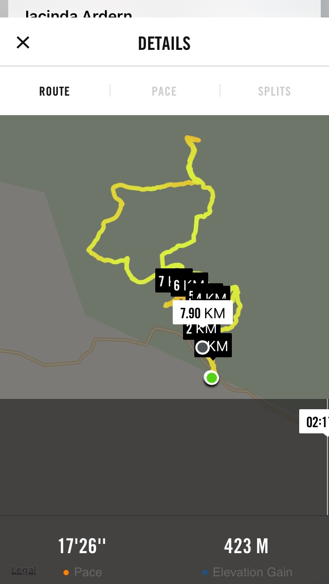
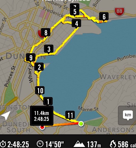
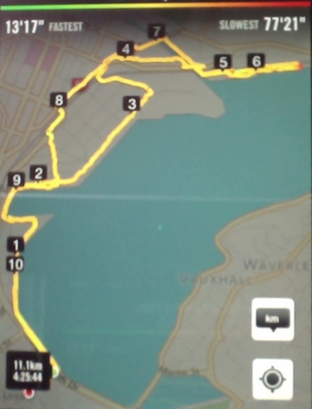
Stats for the day: 11.7 kms; 3 hours and 4 minutes walking time; 480 calories. – Clive.
2. 14/1/2015. Hikers. Portsmouth Drive to Marina. E. Leaders: Peter and Wendy.
GPS of route
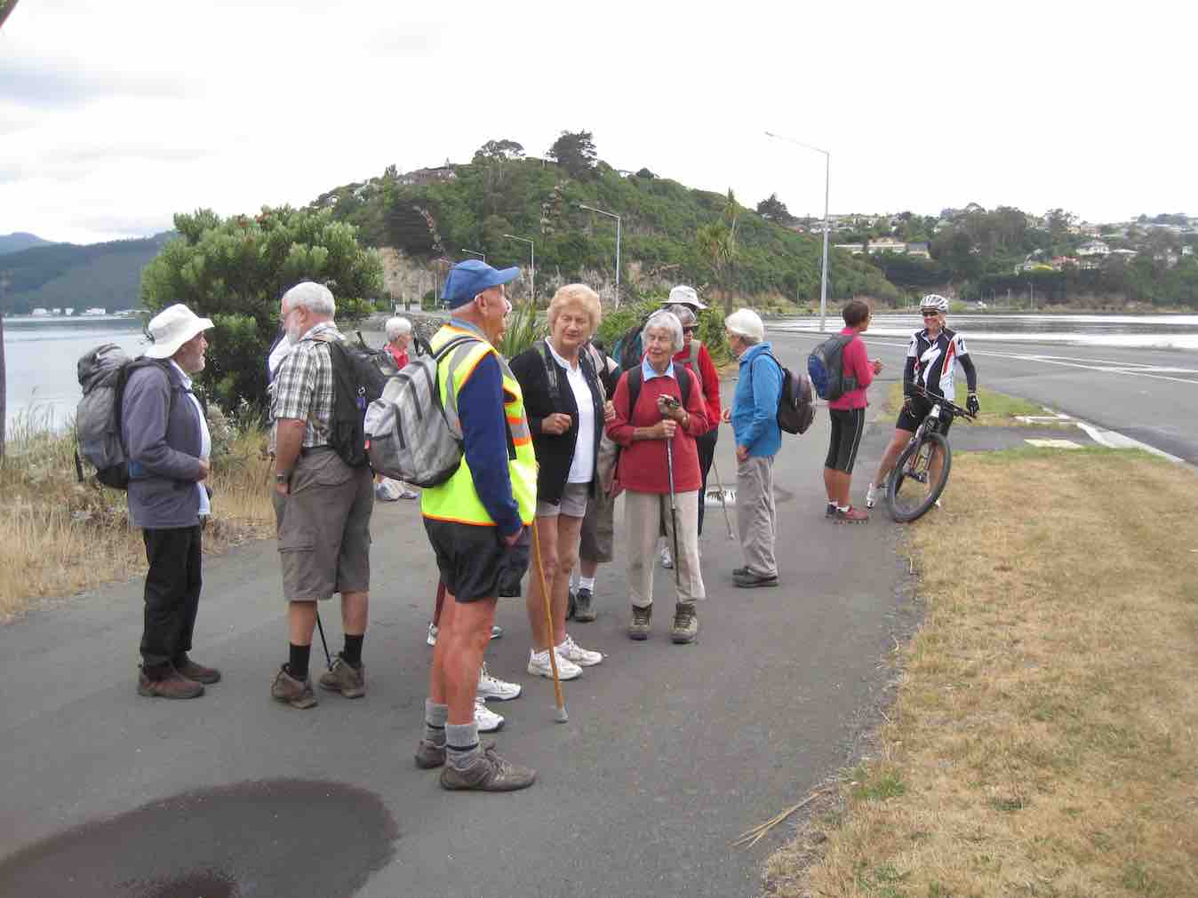
We parked in the carpark by the Bayfield High School. And 21 of us set out.
The bulk of us waiting for others investigate the doings of a suspect prowler back a the carpark and to call the police to investigate. Helen found a passing cyclist friend to chat to.
We walked along Portsmouth Drive past the molars, turned down Kitchener St, huggiing the harbour edge and stopped off for morning tea.
Sheltering from a cold wind for morning tea.
Carrying on, we turned round into Birch St, across the top of the harbour basin then down along Fryatt St almost to its end. Then it was up Wickliffe St, across the railway overbridge, briefly on Anzac Avenue, down Parry …
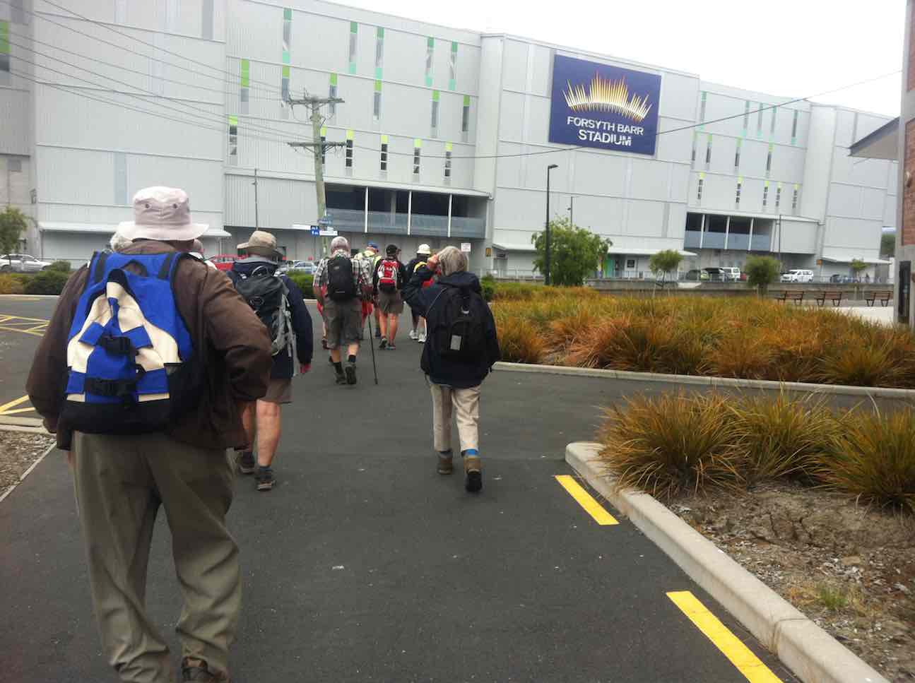
Skirting the Stadium.
…and Minerva Streets to cross the Leith on SH88 bridge, and on the north side to turn under the bridge and out along Magnet St to get to our lunch stop at the Marina.
Again sheltering from a cool wind, this time for lunch.
On our return, we walked the length of Anzac avenue. Then onto the railway station platform, where Dorothy performed a most believable but all too brief strut down the catwalk. Out at the other side, on past Toitu Settlers Museum and along the grassy verge ahead where we stopped, briefly thwarted by the railway bridge overpass pathless on-ramp ahead. So it was across all four laned SH1 Cumberland St, with the assistance of the lights further back. This safely accomplished, it was Les and Peter led us up Water St, along Vogel St, back down Jetty St and onto the pedestrial spiral ramp to get us onto the bridge. Then via Birch St, Buller St and French St we rejoined Kitchener St which took us back out onto Portsmouth Dr and back to the cars. From talking to one or two others, I must say coming to the end of eleven kilometres on hard pavement had taken its toll of leg muscles, on this the first tramp after the holidays. A good walk, not too hot or windy. Thanks to Peter and Wendy for a good start to the year. – Ian.
1. 20/11/2013. Hikers. Midland St, Portsmouth Drive to Marina. Leaders: Bev and Chris.
Route
The walk was most inventive and interesting, leading us along back streets few of us had ventured on before. We parked at the bottom of Midland Street where we could cross onto Portsmouth Drive with the safety assistance of traffic lights. The laying of cable along the walkway forced us onto a less inviting traffic-coned path along the road till we returned to the walkway at the molars.
Molars. The 20 of us are almost all in the pic.
A little further on we turned down to the length of Kitchener St turning left up at its end into Birch St to join Wharf St esplanade and have morning tea on the seats, to admire the inner harbour view as well as a gentleman, lent back on a camp seat, fishing, hat over face, asleep.
A happy surprise was Lex sharing round chocolate marshmellows in anticipation of his 85th birthday the following day.
Then it was up and on again, down virtually the entire length of Fryatt St to turn left up Wickliffe Street and over the elderly railway overhead bridge, down the other side to the right, and to stop and admire (?) the special road-coned entrance/egress of Hall’s work-yard and the still-hooded traffic lights. We gingerly made it across Anzac Ave, across Frederick St, back again across Anzac Ave to join Parry St, make way across the SH88 Leith Bridge very wide pedestrian walkway, down, back, under the bridge and along Magnet St. (4 km)
and the Harbour Walkway (5 and 6 kms) to lunch at the northern end of the map in what shelter we could find from the nor-easterly wind.
We retraced our steps to the SH88 Bridge underpass, this time following the Leith bank up to Anzac Ave (7 and 8 kms)
which we followed right to the St Andrew St lights where we turned down along it to the roundabout, followed Mason St, then into Tewsley St and into Fryatt St to retrace our route alongside Wharf St (9 km), Birch St, Kitchener St and Portsmouth Drive back to the cars. 11 km in all. The harbour wind-blast along Portsmouth Drive almost blew us off our feet. Many thanks to Bev and Chris for a varied and interesting streets exploration around a corner of the harbour. – Ian.
2. 23/8/2017. Hikers. Gardens to Surf. E. Leaders: Pam and Dawn.
We Parked our cars in Duke Street, near the Woodhaugh gardens. 22 members started off. We walked through the Varsity and had morning tea at the Polytech outdoor area. Walked along Portsmouth Drive to Queens Drive down to St Kilda beach. Walked along playing fields and some track to picnic area above beach, where we had our lunch. We then continued on to St Clair, via street and caught the bus back to the Botanical gardens where we enjoyed a hot drink. Back to our cars and home to Mosgiel by 3.45pm. A very enjoyable day was had by all. – Dawn.
1. 19/8/2015. Hikers. Gardens to Surf.
We had a good day walking from the Botanic Gardens…
…and along the beach to St Clair. I had not been on the beach since the June storms and was blown away by the damage to the beach.
Rocks (John pic)
The piles…
Piles (John pic)
…are nearly all bent over by St Clair. Thank goodness I have done 3 paintings of the piles. Judy Knox was on TV Wed. night and did a very good interview on the local TV channel.
We all went back on the bus to the Gardens and all (I think) 27 of us didn’t pay. I think the bus driver got a bit of a surprise. – Elaine. [An unintended report, purloined from an email. – Ed]
Wardells’ Cottage abt 25 km from car park.
High tides flood the access road and this has happened to us more than once. N.B. Programme Committee! Avoid high tides forecast near the the hours of 9.00 a.m. or 2.00-3.00 p.m.
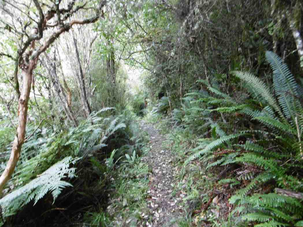
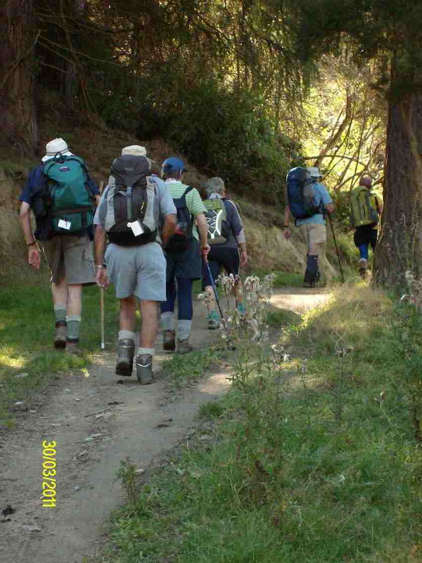
17. 9/8/2017. Hikers. Millennium Track. Leaders: Bob and Lesley.
20 Hikers set out on this bush walk along the Taieri River. The usual wet portions were muddy following all the rain. There were a few small slips onto the track and a few bites out of the lower side, but all negotiable. The track was carpeted with leaves and twigs. Morning tea was at the usual spot down beside the river…
(Wyn pic.)
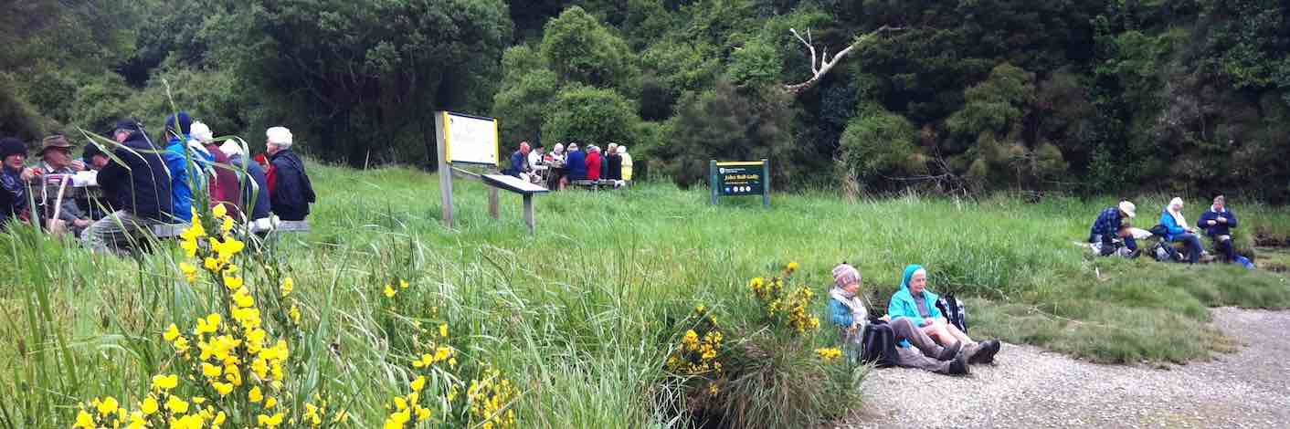
…and lunch at John Bull Gully.
(Wyn pic.)
This track with many silver ferns and birds is a favourite for many members. We ALL adjourned to The Black Swan for refreshments. – Lesley.
By then the rain had stopped so had a lovely walk led by Helen at front and Bev at the back. Lunch in the ordered sunshine at the tables at John Bull’s gully.
Lunch (1) (John pic)Lunch (2) (John pic)
Slight rain as we started back then the sun again.Nice to see the river through the trees with the leaf drop. Back to cars and through some water on the road. High tide.
Coffee at Wal’s ended our enjoyable day. – Helen
15. 5/10/2014. Both. Millennium Track. Leaders: Les and Margaret.
Tea breakLunch at John Bull Gully
14. 24/7/2013. Hikers. Millennium Track. Leaders: Les and Margaret.
Being the first tramp of the month, trampers and hikers combined to walk a good old standby, the Millennium Track down the Taieri River from the old Wardells house. It was a substitute for Berwick Forest which is presently difficult to gain access to. Although only 16 turned out, with many trampers noticeably absent, it was still a good day out, starting cold but improving. In spite of being a frequently used tramp, it’s a lovely piece of bush to take your time in and enjoy and the bird life is a joy to hear. A feature of the walk for the trampers was that 11 walked on beyond John Bull Gully to sample the recently broadened track as far as the seat at the high point of the track. The gradient had been realigned with all steps eliminated, sometimes however making for steep slopes. With the pine plantation gone, we were surprised to see that bullibulli
Bullibulli colonising the slope
has largely colonised the area. A delightful surprise on the return walk was a juvenile harrier hawk (?)
Juvenile Harrier Hawk? (But see comments below post.)
perched on a broken trunk which quite calmly allowed us to photo it. The 5 of us who chose to go just to the picnic spot by the river really had a very happy time, taking in the scenery, having our lunch and walking back to cars in a leisurely way. – Bev and Ian
8. 5/12/2007. Both. Millennium Track. Easy. Leaders: Lex, Dot T
Wood Pigeon nr track start (5/12/2007)
Tea stop. Doug M, Neil, Bob H (5/12/2007)
Track through newly-cleared plantation. Doug M, Bill (5/12/2007)
Today 7 hardy (maybe silly) trampers drove to Phosphate corner at Clarendon, then along Berwick road, parked up and walked up the hill to the Cemetery (my Great Great and Great Grandparents, some Siblings and Children from Sinclair family are buried there.
We then drove further along Berwick road, parked and proceeded up the track to the hay barn for smoko.
Shed for morning tea out of the freezing wind. (Helen pic and caption.)Mud to get to the shed. (Helen pic and caption.)
We all decided it would be no fun climbing round and up Mary Hill with frequent showers and a bitterly cold wind.
On the way back we briefly stopped at Sinclair Wetlands then drove into Berwick Camp, a year 8 class was there on camp, talked with the Activity Coordinator and strolled up to the dam.
On a bridge at the Berwick camp. (Helen pic and caption.)
It was plain to see what fun the young students were having, particularly when having a turn driving round with a leader in an old converted type of Land Rover in the mud.
So after all this strenuous activity we journeyed on to eat lunch (and cake) at a little hilltop cafe in Clyde street. – Eleanore.
Lunch at Eleanore’s with a lovely warm fire and cakes which were enjoyed by us all. (Helen pic and caption.)
24/4/2013. Hikers – and a few trampers. Limesprings Farm, McNeil Rd, Whale Museum, and return back through Farm by a different route. Leaders: Jim and Betty.
Route, unfortuately stopped at Whale Museum, for some inadvertant technical reason! Cattle track up middle, McNeil Rd and extension at top.
No. 4 on old hardcopy list of 113 club tramps. “Blacksmiths Flat. Hindon Stn. Bob Heenan. Farm. Lambing.”
No. 14 on old hardcopy list of 113 club tramps. “Hindon. Ardachy to River. D Graham. Haggie. Farm.”
Distance from carpark: 33 km.
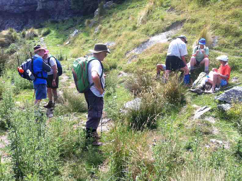
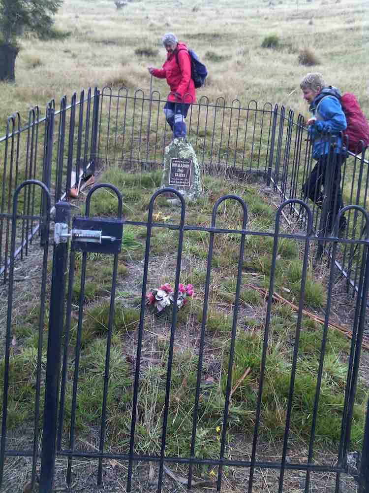
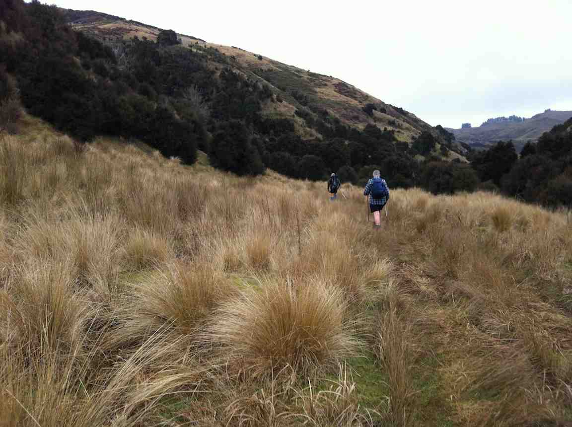
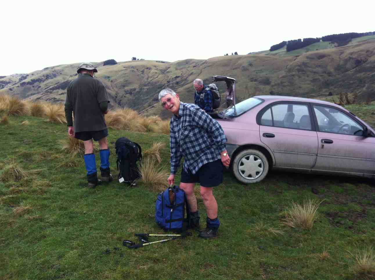
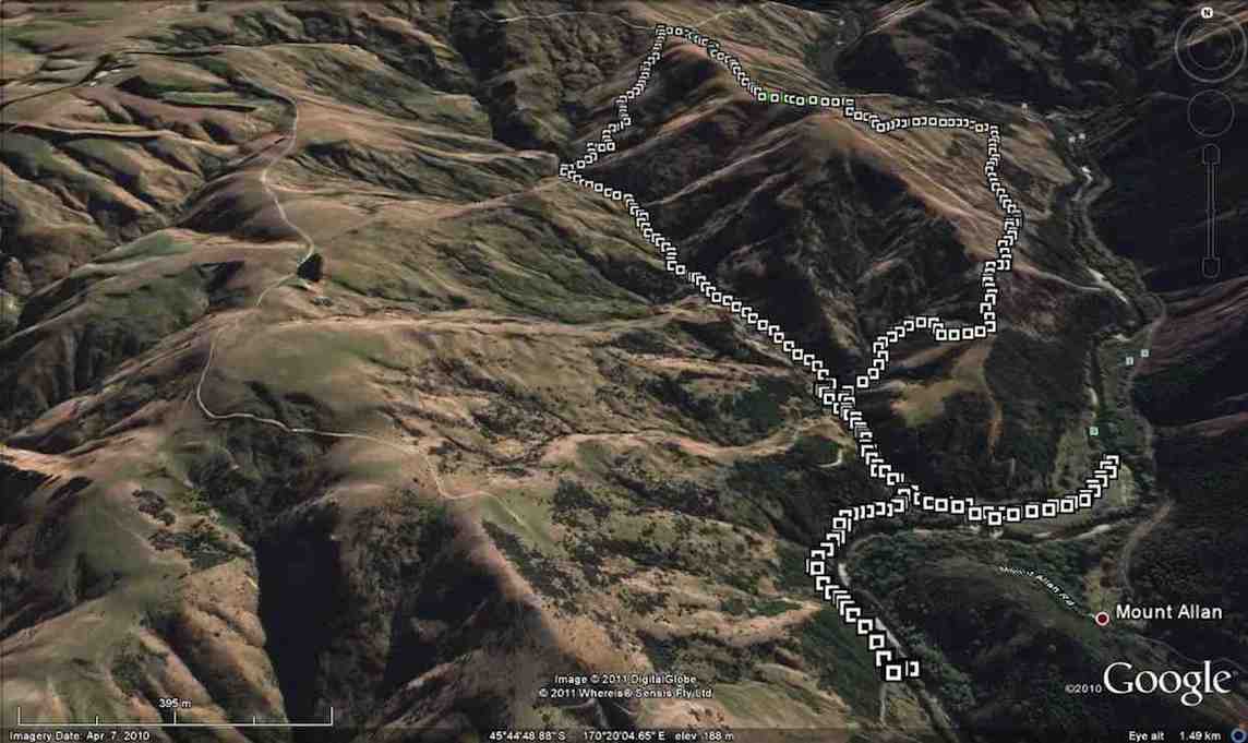
13. 31/5/2017. Trampers. Ardachys – Blacksmith Flat. M. Leader: Arthur.
The weather wasn’t great, but good enough. 8 trampers out today, including one new member – welcome Phil. We travelled in low cloud all the way from Outram to our parking spot at Ardachy, but from there on we could clearly see down into the Taieri gorge. An improvement was expected though.
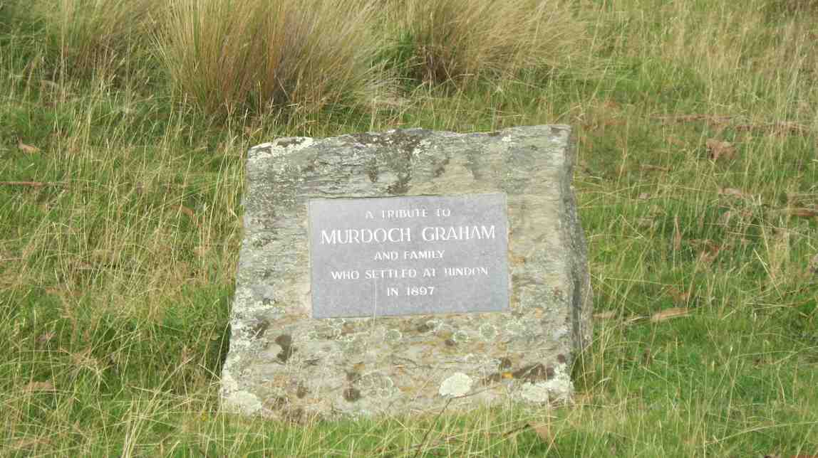
We first went to inspect the nearby “Lonely Grave” of Mr Don Graham.
Family grave in Ardachy Station. (Helen pic and caption.)
The Graham family have been on Ardachy for 120 years – check our club website for more details about the “Lonely Grave”. [Scroll further down this post for this. – Ed.]
A short stop was made in the tussock for morning tea, before continuing on down hill. 4 friendly horses greeted us when we reached “Blacksmith Flat”, beside the Taieri river.
Four friendly hores came to visit. (Helen pic and caption.)
We followed the “Flat” upstream for some distance, before turning and retracing our steps.
Mount Allan railway station was directly across the river from us, but no train today. It was a lovely and peaceful spot there, the river making the only noise, except for 6-8 fantails flitting around.
The return journey was up “Blacksmith Gully”, and we travelled some distance before stopping for lunch.
Lunch. Second photo I missed was a lovely view while no fog. (Helen pic and caption.)
The cloud had come down now, with no more than a couple of hundred metres visibility, and remained so until we returned to Outram.
Incidentally, the names “Blacksmith Flat” and “Blacksmith Gully” go back to the gold mining era around 1863. Gold was found in some quantity in the area, but after 2 0r 3 years the “rush” was over.
The leader decided that, as it was a relatively short tramp today, we would return by a slightly more strenuous route than had been planned originally, to give everyone a bit of a workout. All thought this a great idea, and enjoyed the extra bit. There were no complaints anyway!
We arrived back at the cars before 1.30 pm, having walked 8.8 km. The vertical difference in altitude between the river and the cars was approx. 250 metres.
On returning to Mosgiel we stopped in at Wals for hot drinks, sitting in front of the fire to enjoy them. It made a very good end to the day. – Art.
12. 20/8/2014. Trampers. Ardachy Station. Blacksmith Flat and Gully. Medium.
The tramp on Ardachy Station to Blacksmiths gully was not a very long walk, but the climb out at the end of the day means that it is not all easy going. 4 trampers turned up on the day, & we set off to where we park the cars, just around the corner from the lonely grave site above Hindon. As it was 10 AM when we arrived there, morning tea was taken before we set off on the tramp along the top of the ridge. The weather was fine, with a very slight, cool breeze, & some frost & frozen puddles underfoot. We spent some time down by the river looking at the destruction among the willows, caused by flood waters, & we were also amazed by how high up in the trees the flood debris was deposited. [probably about 6-7 mtrs. above the river level]
As it was only around 11:20 by this time, we set off along the picturesque valley floor, until we came upon a good sheltered, sunny spot for a lunch break, …
Lunch spot (Ken pic and caption)View from lunch site (Ken pic and caption)
… not far from where we had to cross the stream, & start the climb back to the car. After a leisurely lunch, we moved on until we came to the old mine shaft, which we climbed up the bank to inspect. the fence around it is slowly getting wrecked as time goes on, but the bush growing around the hole is still protecting it well. After this, it was just a matter of climbing back to the car, which seems like a daunting task when looking up from the valley floor, but it only takes around 1/2 an hour to climb out.
We all agreed it was a good walk, with the area being new to two members of the party.Walked 6.44km
moving time 1hr 45min.
ave 3.7km/hr
climbed 326mtrs. -Ken
11. 8/8/2012. Trampers. Ardachy Station. Blacksmith Flat and Gully. Medium.
The pic below shows 3/4 of the party at the point on the ridge where on previous tramps we had crossed from the river side of the ridge to the other. We arrived at this point by keeping to the ridge and avoiding the river-side track. Here we stopped for morning tea.
There had been a little drizzle to this point, but from here on, the weather and the views cleared to give us a good day out. To those who remained at home, we proved that you make your own luck. Bravo.
The cross-over point on the ridge taken on previous tramps.
And from this point we still kept to the ridge and found a clear crack down the nose of the ridge to the river flats. Club pioneers! I think we’ll always wish to do the descent this way, now. We explored Blacksmith flat, noting a new electric fence put in no doubt to keep stock away from the river.
We then took the track down-river that leads to the further flat reached from the Mains Road tramp, and lunched, seated at the lovely BBQ area. Then it was back to take the Blacksmith Gully route up to the car.
The writer had forgotten just how far we have to ascend the gully floor before locating the FWD track that takes us back up to the car.
Ascending Blacksmith Gully
Then it was just a 25-minute hard-breathing one-foot-in-front-of-the-other climb, after first subjecting Judy to the obligatory mine shaft sighting.
Back at the car at top of ridge
And so back into the car and out along a road, good and smooth, but a bit sloppy from the earlier drizzle. A good try-out for Ian’s little new/old Corolla. – Ian.
We passed by the gravesite dedicated to Murdoch Graham and went onto the FWD track ahead.
Memorial Site
This gradually descended before eventually climbing again to cross the steadily descending ridge on our right.
Climb
At this point, through a gate in the fence on the ridge crest, we took a track descending on the ridge’s right, although the Google Earth map does show a track going on down the ridge to the bottom.
Ridge
The track to the right led us down into Blacksmith Gully which we pursued down to its end on the Taieri River.
After a wander round, we took the track going on down the river to lunch in warm sun by the water on a grassy flat.
Lunch by Taieri River (Ken pic)
Retracing our steps,
Walking back after lunch (Ken pic)
this time we went further up Blacksmith Gully till we took a track that at its first zigzag encompassed the fenced off mine shaft and threw down stones to gauge its depth.
Then it was steadily on up up up to regain the cars at the track’s top. – Ian.
Postscript: (A bit of Club history, recollected by George and confirmed by Bob Heenan.)
Daphne, then President and founding member of the Club, was also a member of the Dunedin Photographic Club. She met Don Graham, Ardachy Station owner there and got talking. An upshot was that he invited the Club to do a tramp on his land. This the Club did in 1989. They parked where we still park today, and followed the ridge from there down to the Flats. An arduous effort, following the ridges ups and downs. (We follow an easier 4WD track today.) On their return, club members were surprised to find Don by the cars, with a billy boiling over a fire.
“22/8/90. Members of Taieri Recreational Tramping Group waiting for billy to boil after tramp. Ardachy Station, Hindon, Taieri Gorge.” (Ian pic, scanned from Peg Chisholm photo collection.)
He invited them to get their mugs out and filled them with tea. A very happy introduction to what has been a satisfying series of tramps there over the years.
Post-post-script: – from NZ Herald Sunday April 3 2011.
It took a long battle with bureaucracy, but an Otago farmer has been returned to the soil he worked on all his life.
Don Graham, 72, was buried on his Ardachy Station property at Hindon this week in a ceremony attended by more than 120 family members and friends.
A bagpiper played as Mr Graham was interred in the place he had chosen on the property, among rolling hills and wind-swept tussock.
A piper plays as Don Graham’s casket is carried to his plot beside the Hindon station road overlooking his farm, Ardachy station, and the Taieri River. Picture / Otago Daily Times
Obtaining permission for the burial was a long legal process, including gathering affidavits and securing consents.
Funeral director Robert Campbell said it was the first time in 40 years he had been involved in a home burial.
“It’s very uncommon, because you have to get permission through the Burial in a Special Place Act,” he said.
The law stipulates that people must be buried communally if they lived within 32km of a cemetery.
But it allows for home burial “if there are exceptional circumstances making the burial of that body in that place particularly appropriate”
Mr Campbell said: “He was granted permission by the Ministry of Health four years ago, because he and his forebears had farmed the land for 105 years and had a close association with the property.”
The grave site looks over Ardachy Station towards the Taieri River.
“It’s a lovely spot in the hills overlooking the valley,” said Robin Gamble, who delivered the eulogy at the funeral.
Mr Gamble said Mr Graham was passionate about the area in which he lived, and always wanted to be buried there.
“But it was very difficult and involved. He had to get 10 affidavits from people to support his request, as well as regional council consents.”
Mr Graham lived all his life in the area, taking over Ardachy Station from his father-in-law in 1956.
Mr Graham’s widow, Leila, said it was an emotional day for her and her two sons.
“He spent very little time away from the farm, and he would have been so proud. We can look out the back window of the house and see him down there now,” she said.
Mr Graham enjoyed a laugh. On April 1, 1991, he appeared on the front page of the Otago Daily Times with a “shabbit”, a creature he claimed to have bred from a merino sheep and a rabbit.
The April Fool’s Day trick was so successful people were still ringing him up months later to ask about breeding stock.
– OTAGO DAILY TIMES
9. 1/3/2007. Ardachy Station, Blacksmith Gully and Flat. Medium+ Leaders: George, Doug M
Very good but long drive in.. Several fences and gates to negotiate.
Took Hindon turn-off from George King Memorial Drive.
Just before road dipped down to the Taieri Park, parked at corner on grassy surface off road.
Followed 4WD down to river. Proceeded down-stream for some distance and stopped for lunch. Returned clockwise up valley. At stone fireplace, turned steeply up right bank, viewed vertical mine shaft, and met 4WD track back up to cars.
8. 18/4/2001. Hindon, Ardachy Station, Blacksmith Gully. Leaders: Bob H, Colleen, Doug M.
7. 18/4/2002
6. 27/11/1996. Blacksmiths Gully Hindon. Leaders: Eric and Dot, Joan H.
5. 1996 Bob H
4. 25/10/1995. Hindon, Blacksmith Gully, (Old Battery). Medium+. Leaders: George, Ria L, Bob Q, Jack R.
3. 3/11/1993. Blacksmith Gully. Hindon. Medium. Leaders: Bob, Daphne, Margaret D, Bob Q.
Easier alternative:: Leaders: Les and Mavis.
2. 19/6/1991. Blacksmith’s Gully. Lovely views – a good climb home. Average+. Leaders: Mervyn, Wendy, Ted, Daphne.
1. 22/3/1989. Blacksmith’s Gully from Ardachy Station. Lovely walk to Taieri River. Steep return. Leaders: Kath, Jack and Joan.
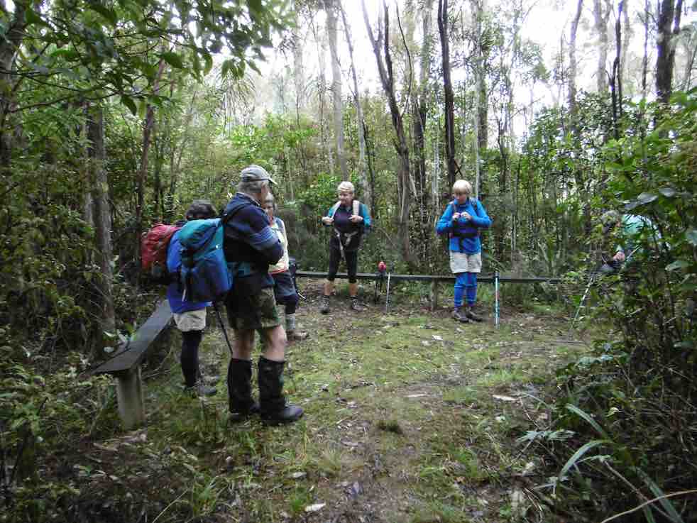
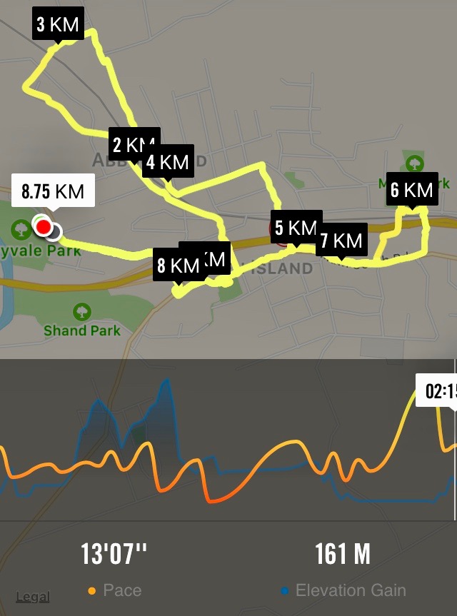
4. 31/5/2017. Hikers. Green Island street walk. E. Leaders: Elaine and Chris.
Nike app map of route, courtesy Ian.
The above route map gives some indication of the intricacies of Elaine’s planned route, designed to cross and recross, by way of tunnels and bridges galore, the barriers of railway line, stream and motorway dividing Green Island from Abbotsford. It was a street-walk, most suitable on the day for an off-and-on light morning drizzle. We were treated to a whole gamut of lower Abbotsford house designs, most instructive of fashions favoured in different decades, complete with one or two older ones looking very old and very neglected. At the latter part of the hike, we also got to peek into some of the large industrial goings-on at the north end of the town, not least Harraways. All most impressive.
At one point where a railway line once crossed the old main road (remember it?), Elaine stopped us to point out how it once served a coal-mine of her grandfather. She has a photo of a small steam engine about to head north across the road.
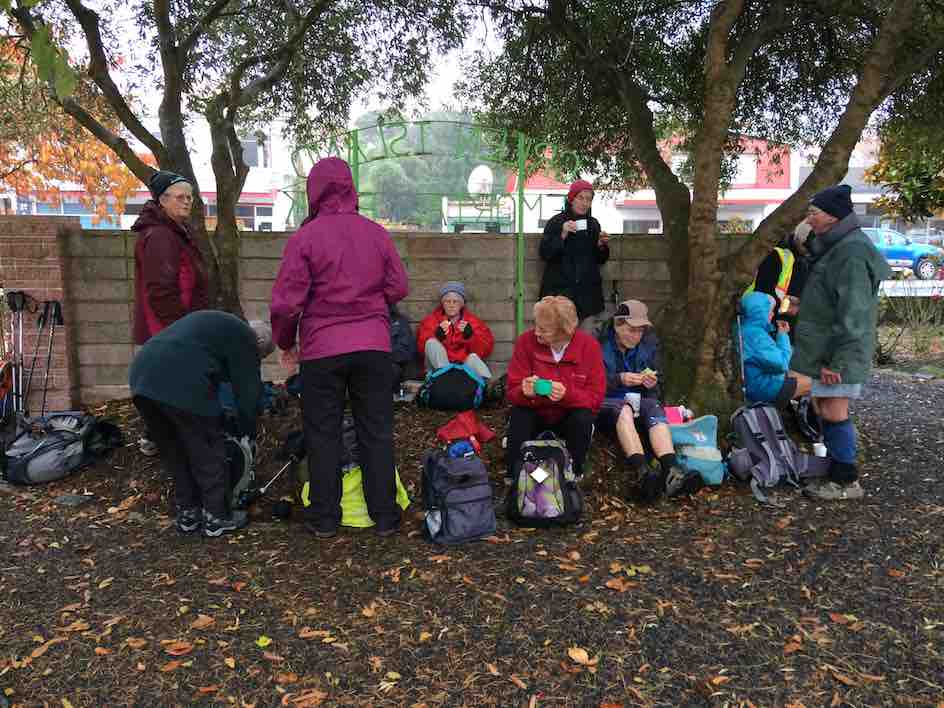
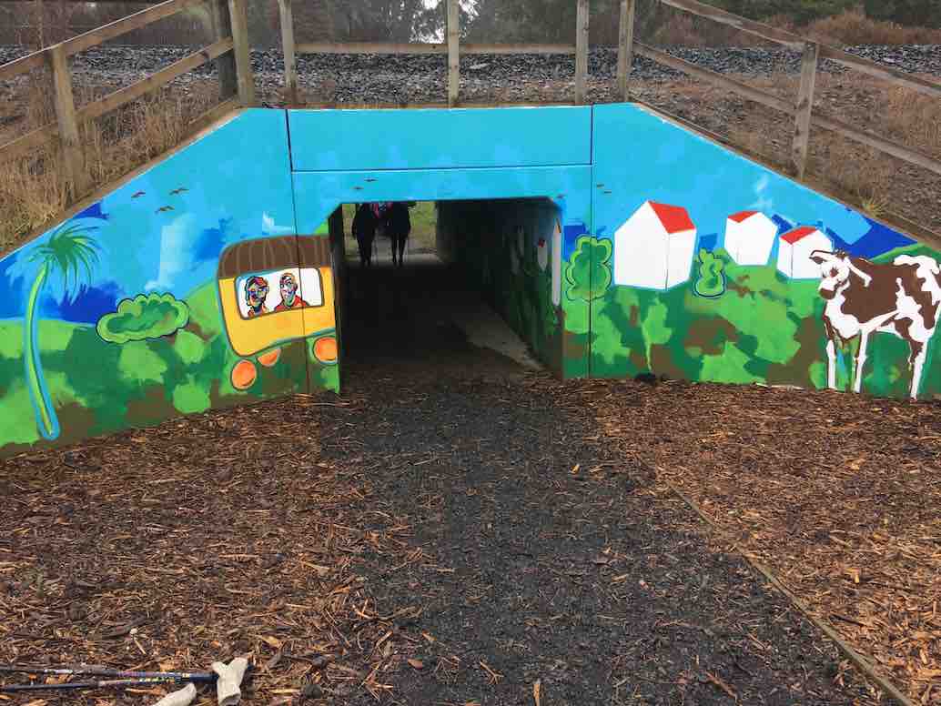
Drizzly morning tea at the gardens. Most of the 22 who came out. (Ian pic and caption.)Newly decorated railway underpass (newly decorated since Elaine’s recce), essential for linking homes and school. It was deemed safer for children than a bridge. (Ian pic and caption.)a dry-seated lunch at the Green Island Rugby Football Club pavilion in Miller Park. (Ian pic and caption.)18 of us at Coffee at Agnes’, where we got to enjoy a separate room all to ourselve, complete with en suite. (Ian pic and caption.)
Many were the remarks appreciative of the cleverness of the route. A big thank you to Elaine and Chris for a great day out. – Ian, (for Elaine [without her knowledge – yet!] whose recent rapidly failing eyesight prevented her from tackling a report.)
3. 25/2/2009 Hikers. Green Island. Farm Walk. Leaders: George, Dot B
2. 10/5/2006. Hikers. Green Island street and farm walk. Leaders: Chris, Dot B.
1. 8/2/2006. Hikers. Street Walk: Green Island Street and Farm Walk. Leaders: Dot B, Chris.
No. 93 on old hardcopy list of 113 club tramps. “Murrays Farm – Sandymount (Chris Hughes) Farm”
Distance for carpark: 31.5 km.
Map supplied by the owner. (Keith pic.)
11. 29/3/2017. Hikers. Murrays Farm. M. Leaders: Keith and Shona.
Route map, courtesy Ian.
It was a foggy, misty morning when 19 Hikers met at the gateway bel0w Murrays Farm before ambling up the road to having morning tea in the implement shed.
We then followed the fenceline up and across the paddocks before descending to explore around a container being used as a crib.
George investigates shower workings on new crib. (Ian pic and caption.)
We exited onto the coast …
We discover a new route from paddock to beach. (Eleanor W. pic.)
… where we had lunch …
Papanui Inlet mouth beach for lunch. (Ian pic and caption.)
… out of the northerly wind.
We followed the water’s edge around past the old boat shed, climbing up the hill and visiting an old dwelling also being used as a crib and back along the farm tracks to the hole in the hedge and down the hill to the cars.
Coffee was at Macandrew Bay cafe. – Shona and Keith.
10. 20/2/2013. Hikers. Murrays Farm. Medium. Leaders: Peter and Wendy.
Morning Tea at old homesteadParadise Ducks in formationWaiting for others in shelter from the hot sun
9. 7/12/2011. Both. Murrays Farm. Medium.
GPS courtesy Ken. Track from distant spot anti-clockwise.
Comfort plus for morning tea. (Ken pic and caption)
Five trampers scaled the almost vertical ascent to the Sandymount road before descending further by the bush.
An eye- and nose-watering wind greeted us when we stepped out of our cars at Hoopers Inlet. It was not a time for hanging around so our group of 13 set off at a brisk trot and soon reached the shelter of a shed which provided a good spot for morning tea.
Fuelled by hot drinks we ventured on and found that the hills and gullies gave good protection and we could enjoy this stroll through beautiful, peaceful countryside with the only other signs of life nearby the large number of paradise ducks. Perhaps they had discovered this place to be a refuge from duck shooters. In the distance sheep grazed and black cattle eyed us with interest.
Sheltered lunch spot
We found our way down to the beach and a sheltered corner at the far end provided a comfortable lunch spot.
Seal among the lupins
Margaret’s sortie into the sand dunes also brought to our notice a young seal hidden away under the lupins. We retraced our steps admiring the expansive views of the inlet and the winter colours on the hills.
It had been a short walk but a very pleasant country ramble.
Chris, who knows the area well, ably led us and, before returning home, some of us were lucky enough to stop off with her at a relative’s house on the hill and walk around the interesting garden, admiring both the plants and the panoramic views. – Marjorie.
6. 27/6/2007 Leaders:
Group. Ian, Leonie, George, Tash, Pat, Hazel, Ria.
5. 1/2/2006. All. Murrays Farm, Hoopers Inlet. Leader: Chris.
4. 5/3/2003. All. Murray Farm. Leaders: Chris, Les and Margaret, Bev McI.