Click on map to enlarge

Mid-week recreational and social walking group based in Mosgiel NZ

Click on map to enlarge
Click on map to enlarge

Click on map to enlarge
No. 86 on old hardcopy list of 113 club tramps. “Heyward Point – Melville’s Farm Farm”. 40 km from car park.
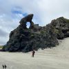 Hikers: Leaders Heather and Val Cayford
‘Pathway to the Sea” – 7th February 2024 at 8.45am on a grey overcast morning with slight drizzle 15 hikers left Peter Johnstone Park and arrived at the small coastal settlement of Aramoana at approx. 9.45am – a peaceful place with 260 permanent residences as of 27th January 2024. Continue reading “Heyward Point, Kaikai Beach, Whareakeake Road”
Click on map to enlarge
Click on map to enlarge
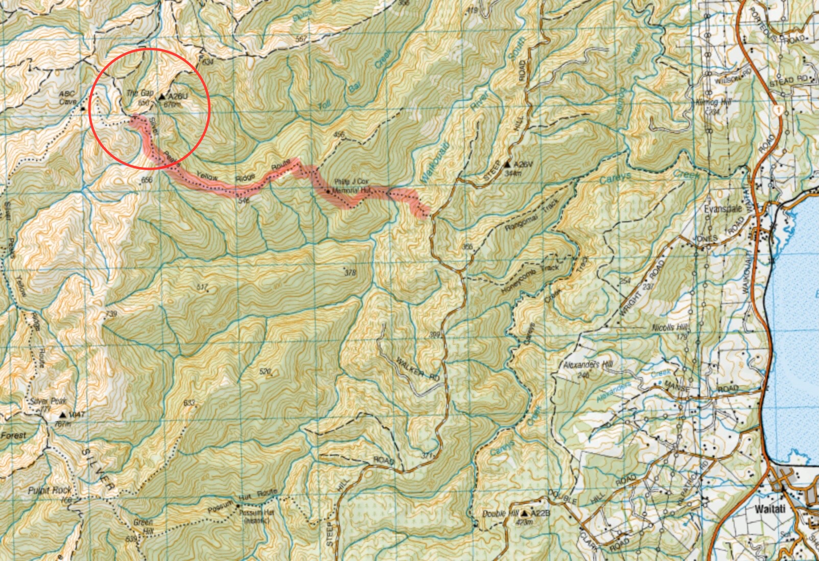
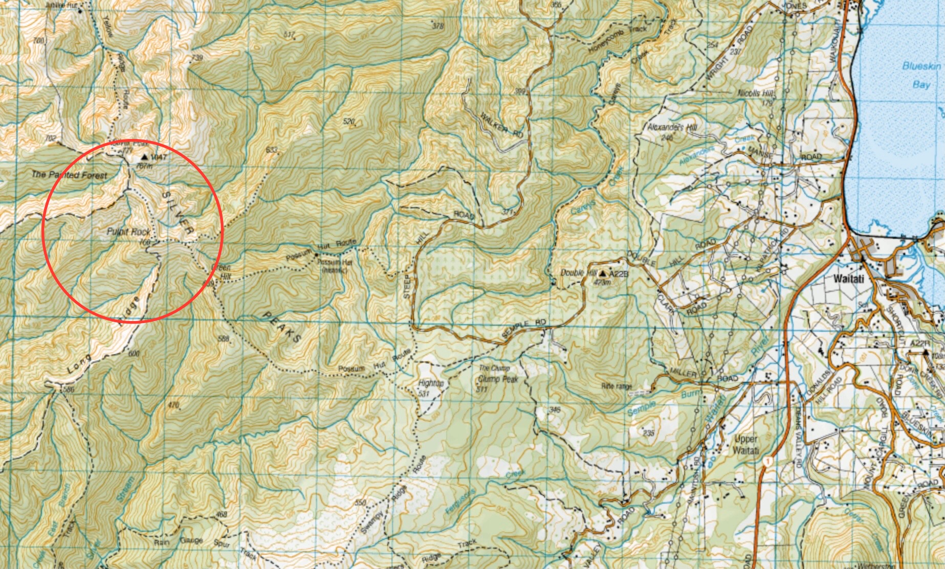
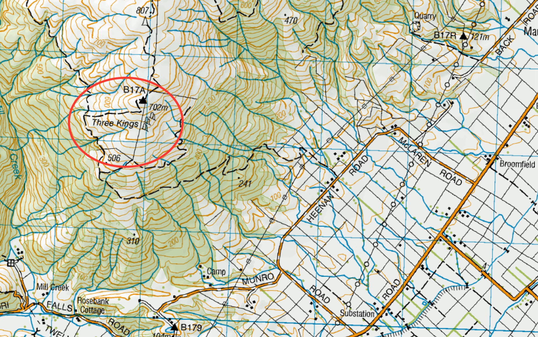
See also TRTC LINKS PAGE – Silverpeaks Tracks
Greengage track is not shown on any NZ Topo maps. This image gives an approximation of the track route.
Click on map to enlarge
Click on map to enlarge
30 km from car-park. No permission needed to reservoir. Cedar Farm: Seek Permission DCC Forestry.
Mihiwaka, Mount Kettle, Cedar Farm – Information and Trips Library
 11 trampers left PJ Park at 8.45 and meet up with 5 Dunedin trampers on Borlases’s Road, Port Chalmers. We continued onto Blueskin road in misty weather which got thicker as we drove up to park 1km north from Cedar Farm Forest carpark (CFF) A car was left at CFF carpark to ferry drivers back to their cars at the end of tramp. Continue reading “Mihiwaka, Mount Kettle, and Cedar Farm”
No. 76 on old hardcopy list of 113 club tramps. “Coutts Gully Return Sawmill Rd Farm”. Livingstonia Park distance from car-park: 32 km.
 After welcoming a new hiker, Peter Dodds, twenty-four hikers left Livingstonia Park, about 9.30 am, heading to the left (east) to the sand dune track that led out to the road by the bridge and then headed up Sawmill Road to have morning tea beside the implement shed on Alan Gorton’s farm.
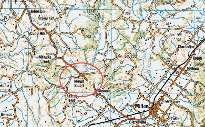
This page of club tramps and hikes in the area South via SH1 and groups together trips to the Mt Stuart Reserve (map) incorporating the Clutha Gold cycle track.
Proceed south on SH1 to the turn off onto SH8 to Central Otago just south of Milton. Mt Stuart Reserve is located on the right just before the Manuka Gorge about 10 -15 minutes drive from SH1 turn off. Parking is plentiful at the Reserve.
Road distances from Mosgiel carpark.
05/02/2025. Mt Stuart Reserve to Mt Stuart Tunnel (Clutha Gold cycle track). Grade 2.5 and 3 Combined. Leaders: Clare Banks, Barbara Shackell, Sue Beal.
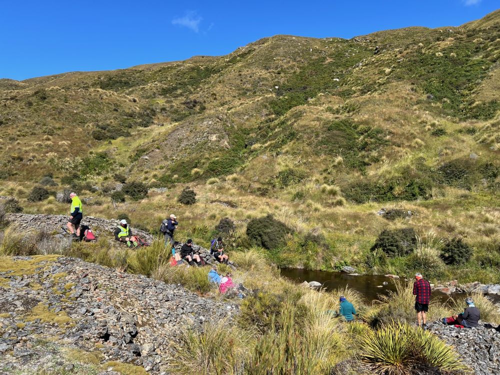
 14. 24/01/2024. Trampers. Ship at Anchor. Grade 4.5. $14. Leaders: Phil Keene/
It was 10am before we set off walking, the group happily forgoing morning tea until we arrived 45 minutes later at the Chinese Diggings situated on the east bank of Deep Stream which was up a little following rain the prior day.
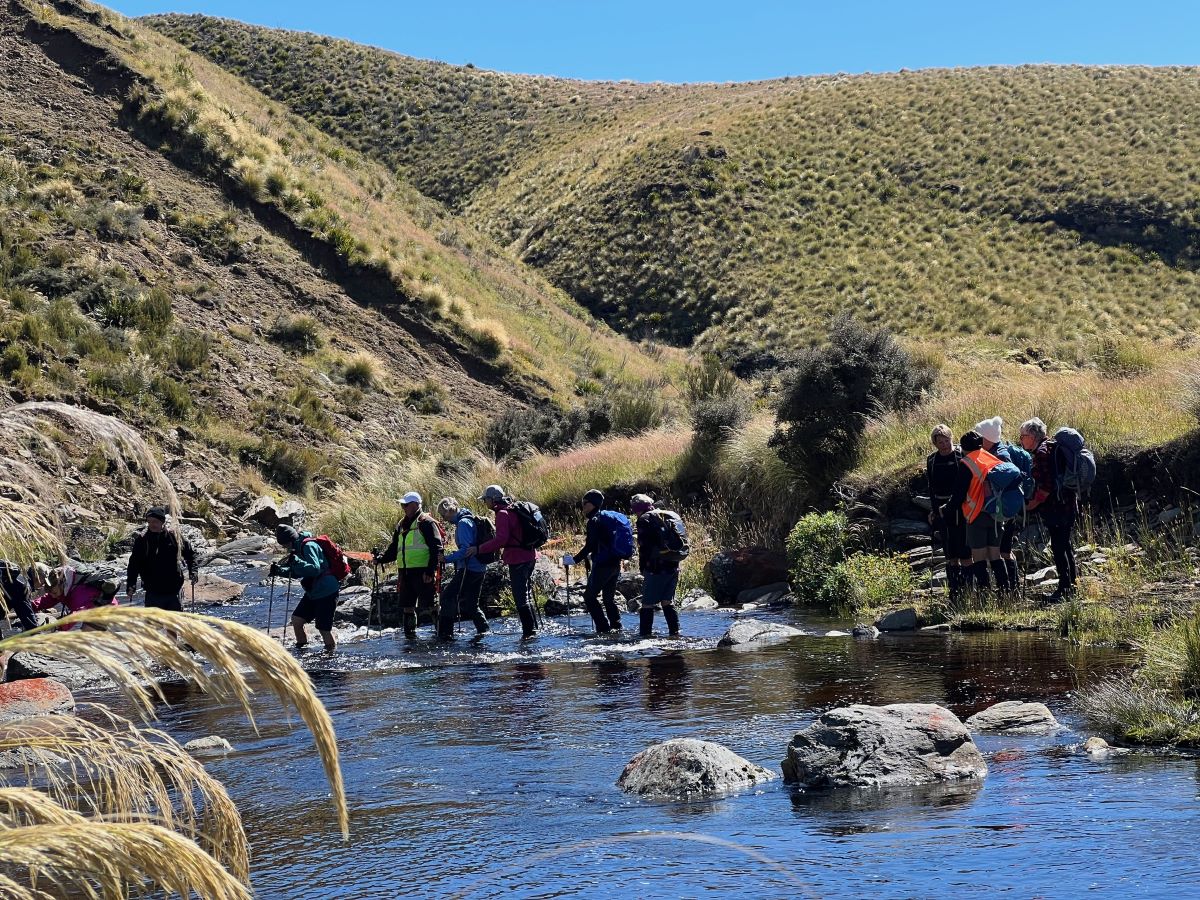
Mmm NZ Topo 50 is telling us we have to go west and will have to cross. The thought of this seemed to necessitate a continuous stream of walkers, single file, into the bushes. Thankfully they all came back and with a little help from our friends we all crossed, with wet feet and knees to the other side.
Thus began a steep ascent with a new pathway selected every few steps, not to mention the need for a breather at fairly short intervals!
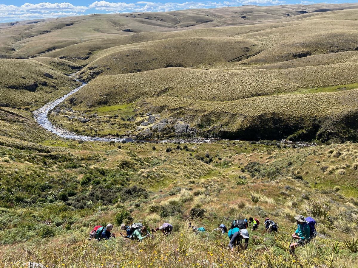
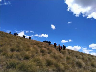
The ascent was followed by steady to steep ridge-line walk keeping to the true left of a stream, before crossing over nearly at the head, and finally over the last brow of a hill to arrive after 2 hours from morning tea, of fairly serious tramping, at the Ship at Anchor;
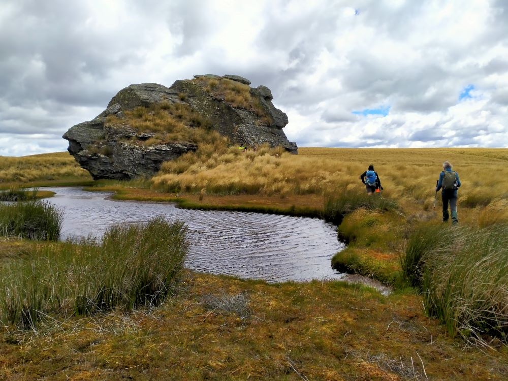
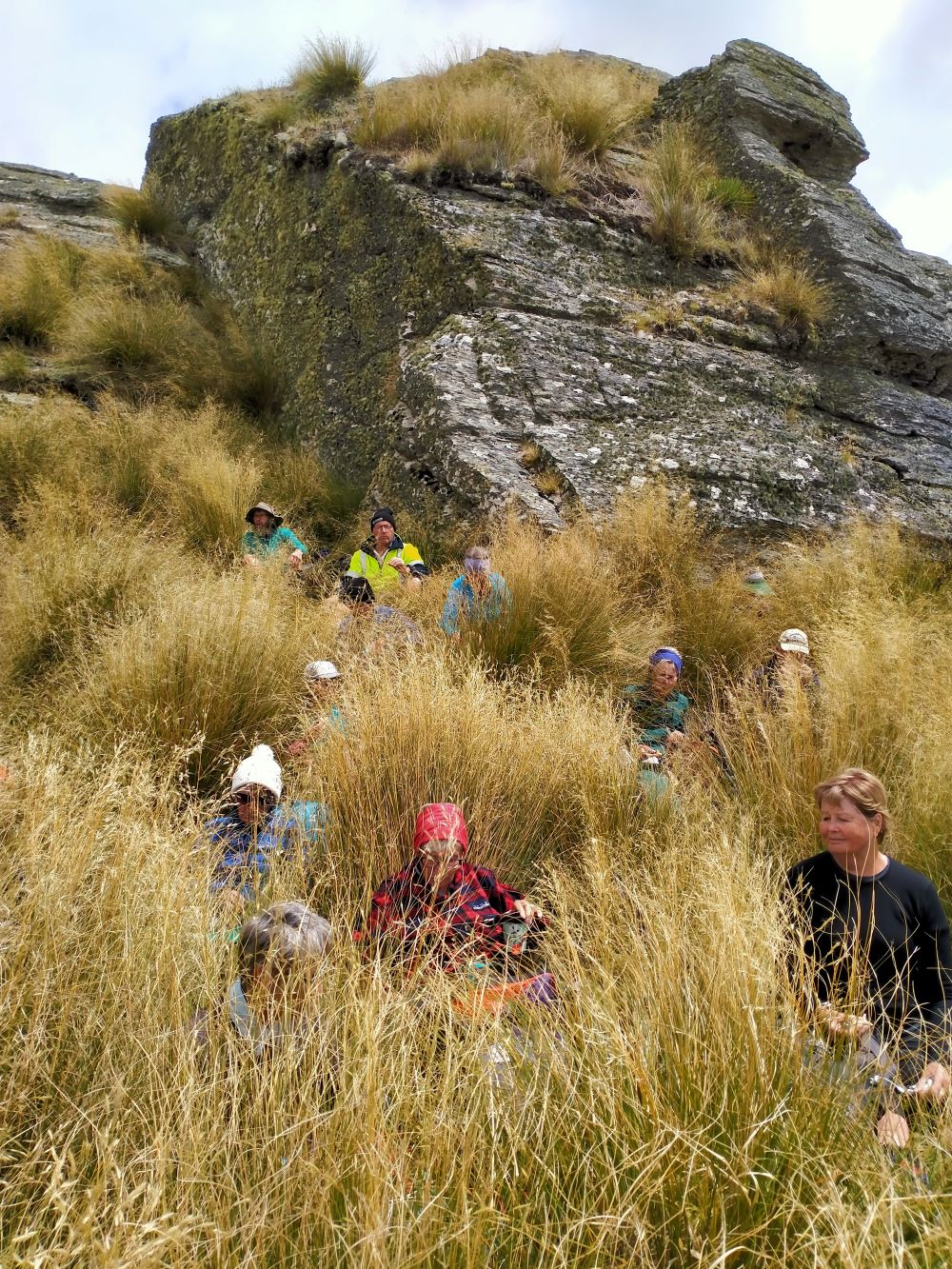
thankfully we had not missed the boat and it provided good shelter along with the snow tussock from the fresh westerly that had been present all morning.
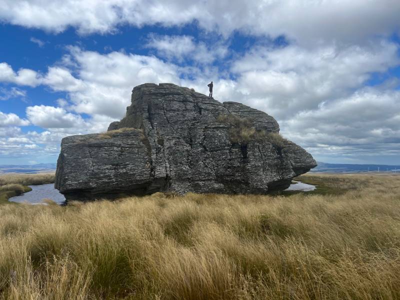
Our departure was not too long with those who had not previously been here circumnavigating the Ship and we all followed a course on the true right of the stream down another ridge-line, initially made ‘easy’ by a water course shaped I think by ancient shovels?
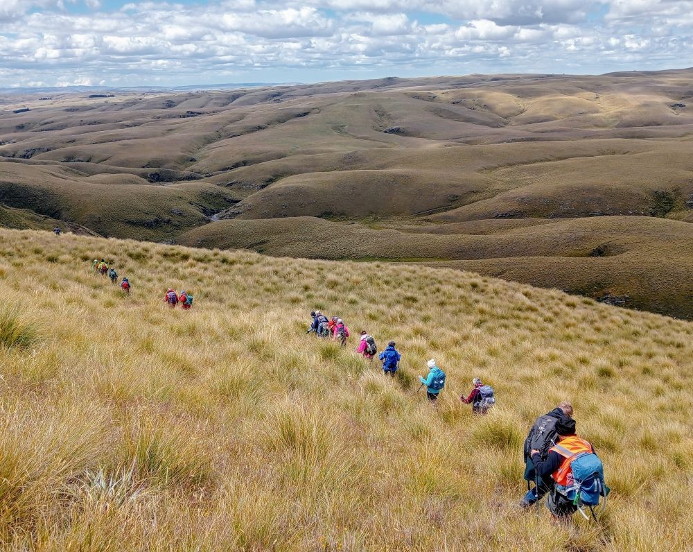
With the possibility of a precipice emerging in front our leader tacked left just in time onto another ridge that steeply descended towards a man made watercourse, scout Graham finding the appropriate gang plank onto the other side. It would be fair to say knees were now creaking as we traversed parallel with the contours dropping every now and then towards the crossing of Deep Stream. According to the leaders timepiece we took longer down than up, just like the Grand Olde Duke of York……oh dear!
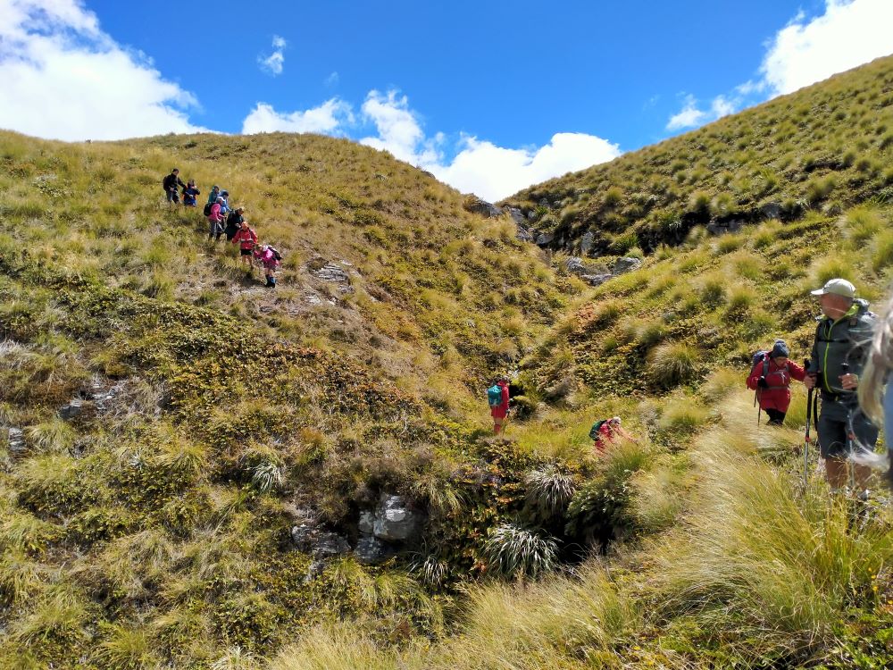
If feet and knees were by now warm and dry they were wetted again and with all crossing safely we re-grouped and took off up the prairie back to the cars, this being quite a steady upland walk!

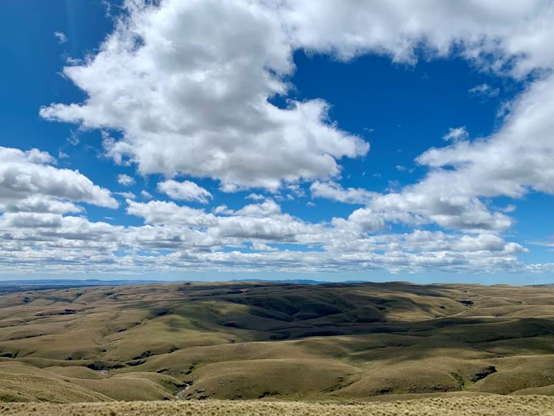
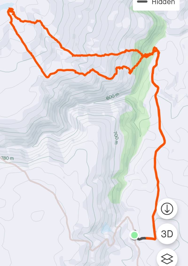
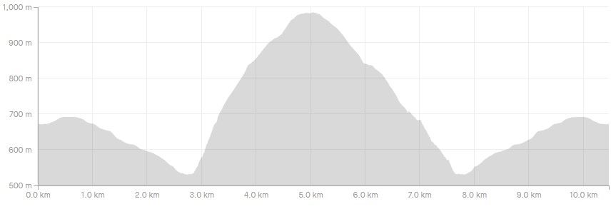
We departed paradise at 4.30pm arriving back in Mosgiel at 5.30pm. Rumour has it that the hydrotherapy pool has been busy since the trip, no wonder. The expansive and varied landscapes are so much more rewarding when set in such a remote and wild environment. Because of the access restrictions at the Weir this was the first time travel to the Ship at Anchor had been done this way. Distance 10.47km, elevation gain 661m, moving time 3:25;59, calories 1,016. And I’m sticking with grade 4.5.
Thanks to everyone for supporting each other so well.
Phil K
Continue reading “Ship at Anchor, Lammermoors, Deep Stream, Gold tailings, Mahinerangi”