Scope:
This page of club tramps and hikes in the area West via SH87 (inland on the south side of SH87) groups together trips to Deep Stream pipeline. (map).
Background Information:
Road distances from Mosgiel carpark.
TRTC Grading Information – trips incorporating these tracks are generally given a TRTC grading of about 3. This is indicative only, as trips can be allocated a higher or lesser grading depending on the route taken. For more detailed analysis refer to Grading Information.
Access Permissions are required as trips following the Deep Stream pipe line venture over a working farms – refer guidelines.
General Information – Deep Stream Water Supply
How To Get There:
Follow State Highway 87 from Outram past the Clarks Junction turn off at the bridge that traverses Deep Stream. Permission to park on farmland will be required.
Links to tramps and hikes in this area:
03/06/2026. Deep Stream Pipeline. Grade 3. Combined. Leaders: Sylvie Watt and Wendy Langley
Deep Stream-Hindon Pipe Line from Highway 87. 2019 – 1989 (13 trips, 4 with reports and photos, 1 with report only – photo lost, 8 with no reports or photos)
Deep Stream, Rocklands Station. Welshs Road. Lawlors Old Farm. 2018 – 1989 (14 trips, 5 with reports and photos, 1 with photos only, 8 with no reports or photos)
Deep Stream Pipeline by Highway 87 (upstream) 2017 – 2007 (4 trips, 4 with reports and photos)
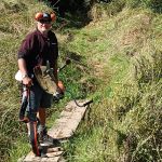
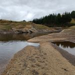
 19/03/2025. Yellow Ridge via Walkers Road, River Track/out via Tunnel Track. Grade 5. Trampers. Leader: Ross Davies.