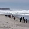
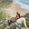
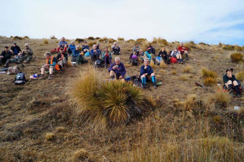
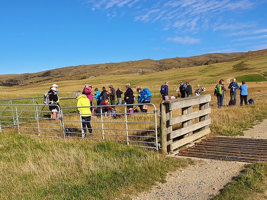
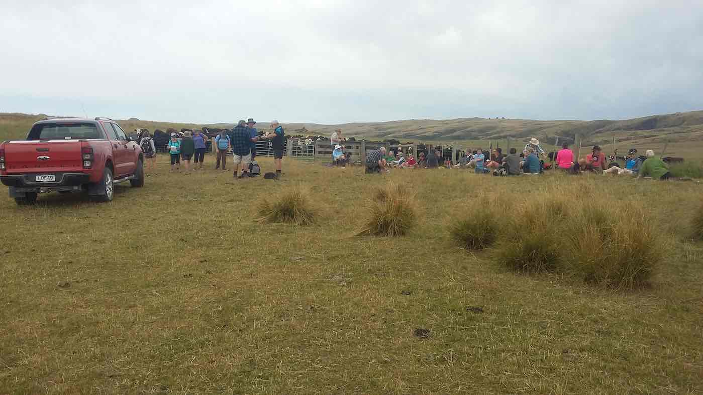
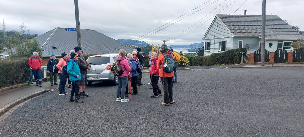
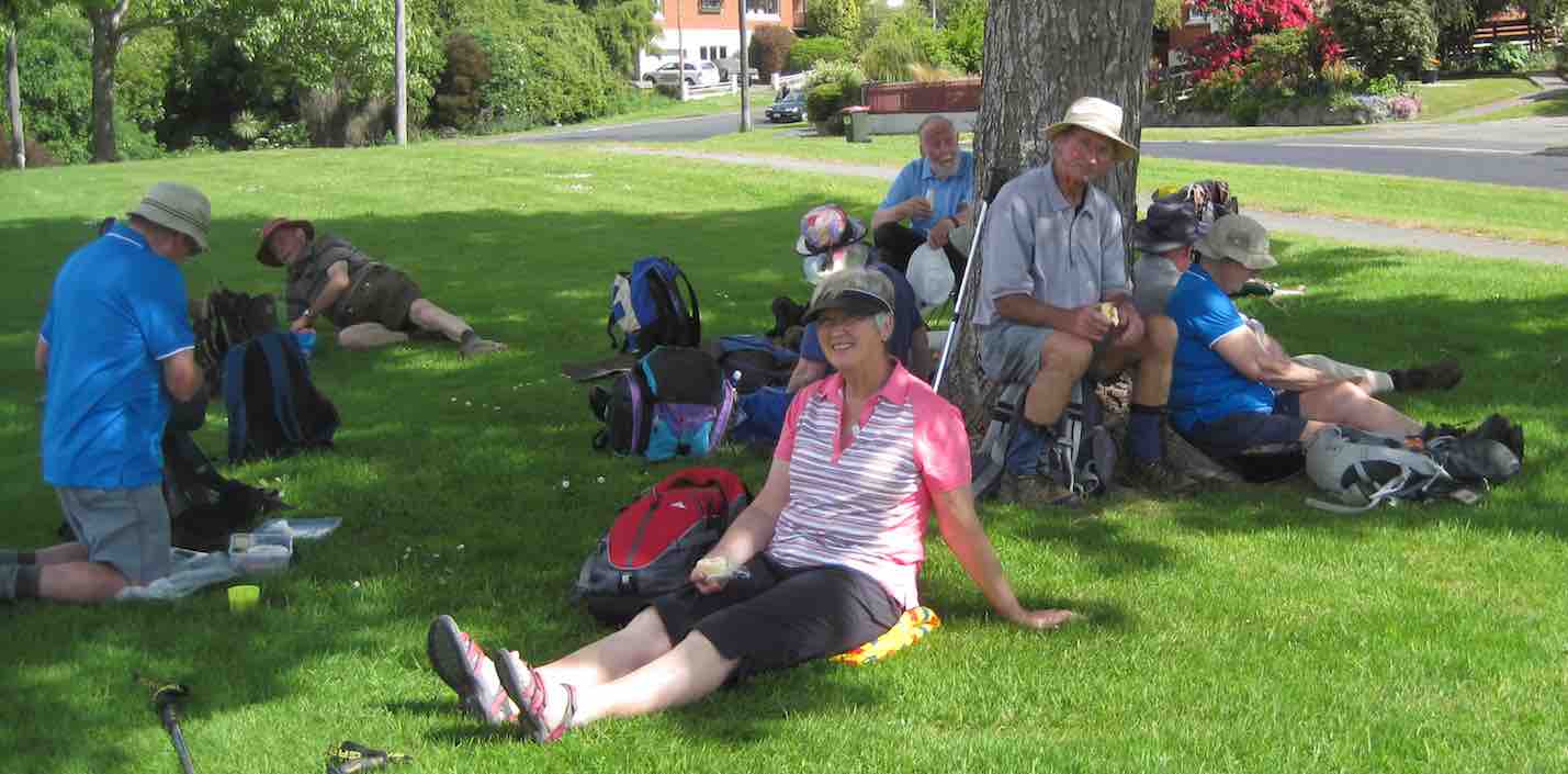
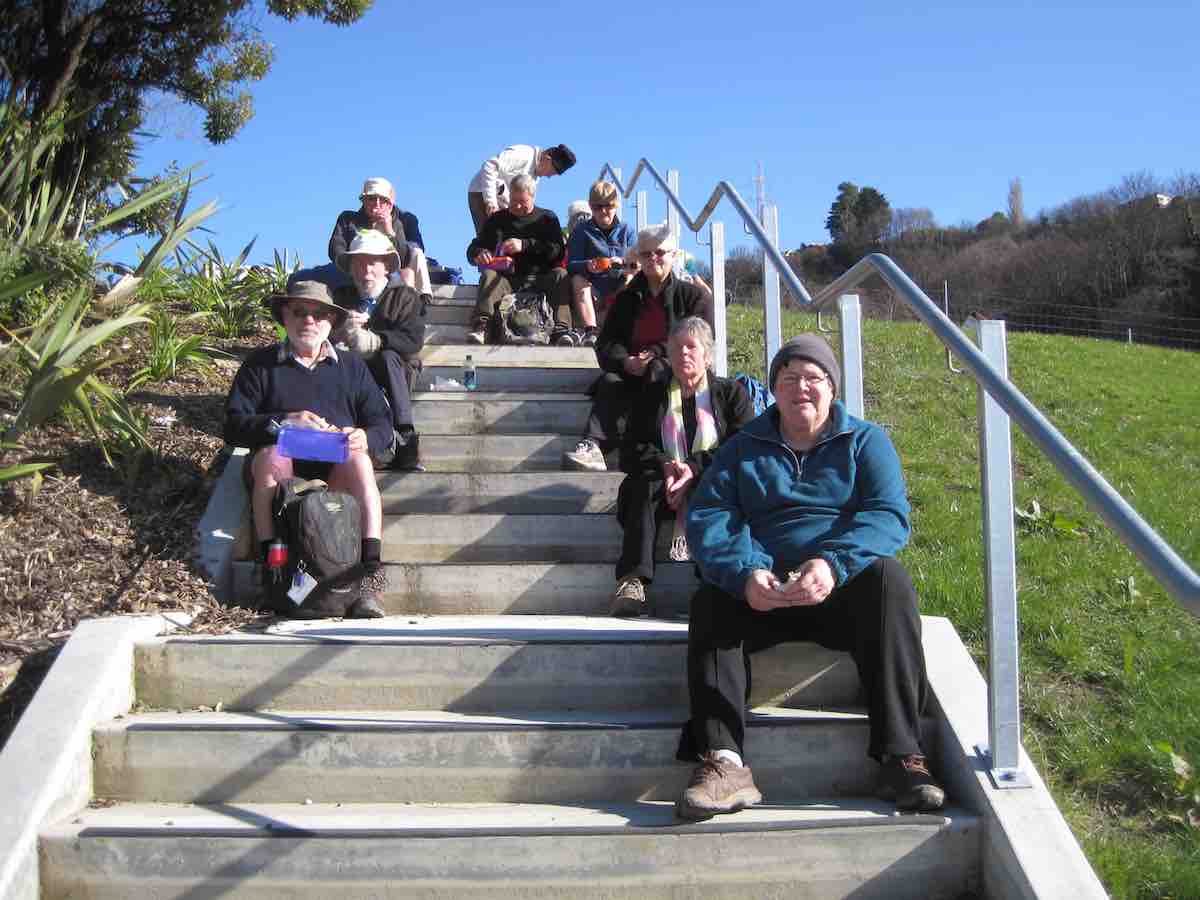
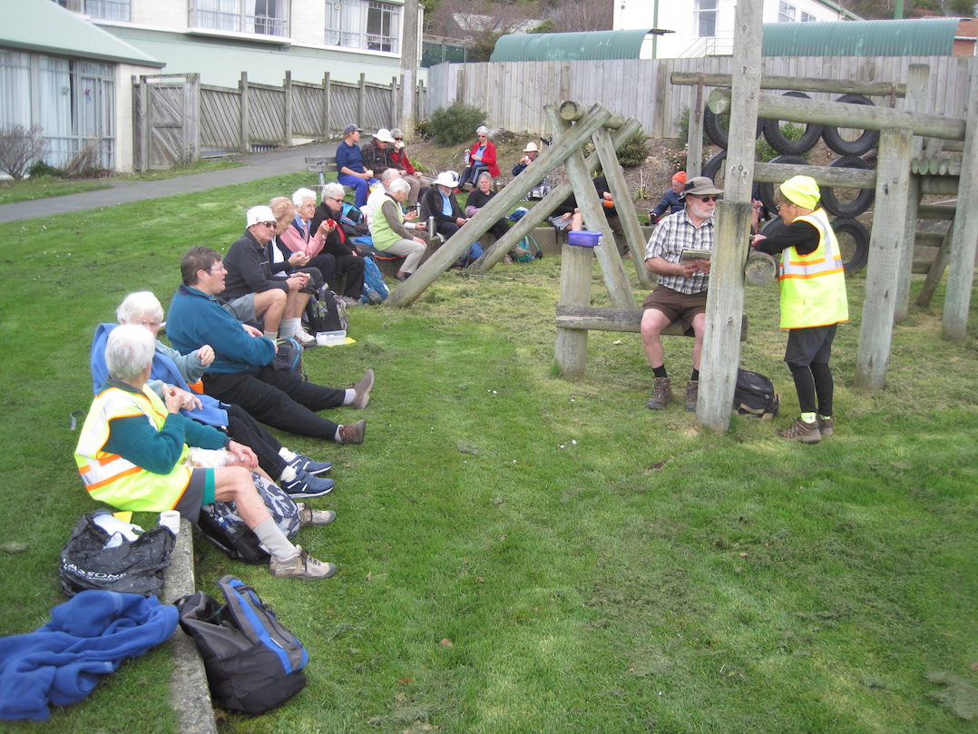
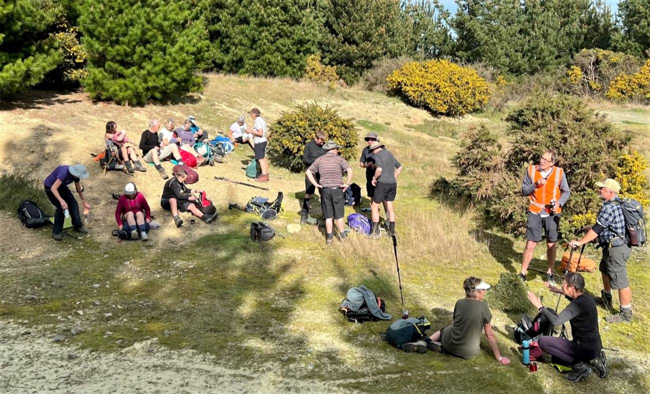
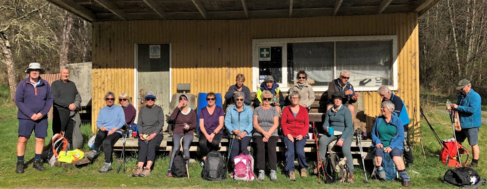
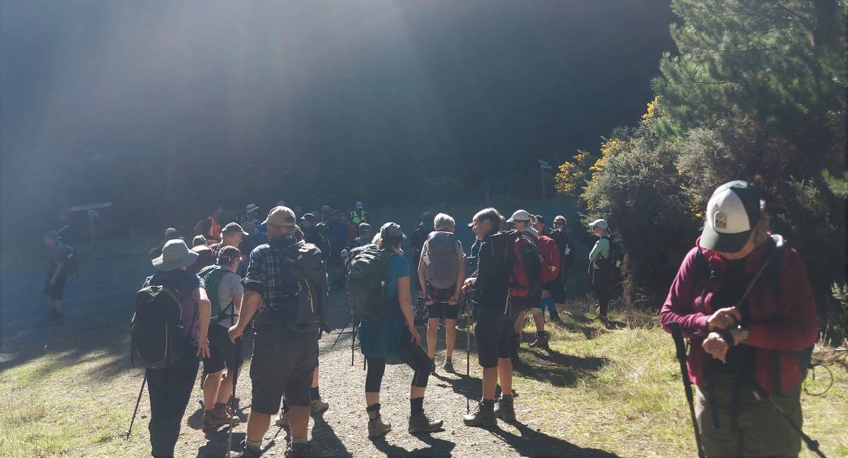
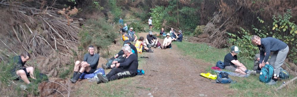
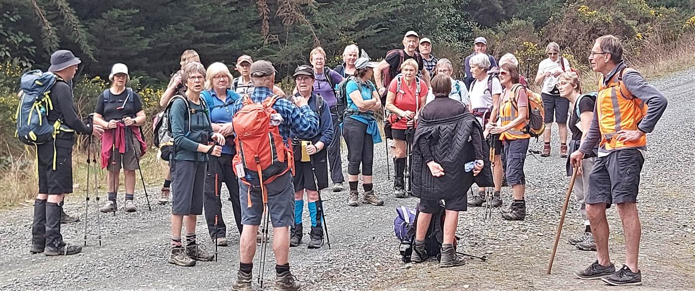
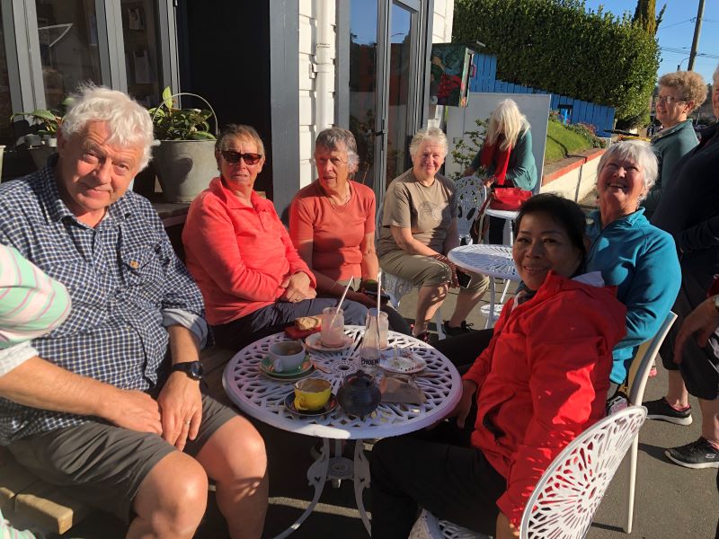
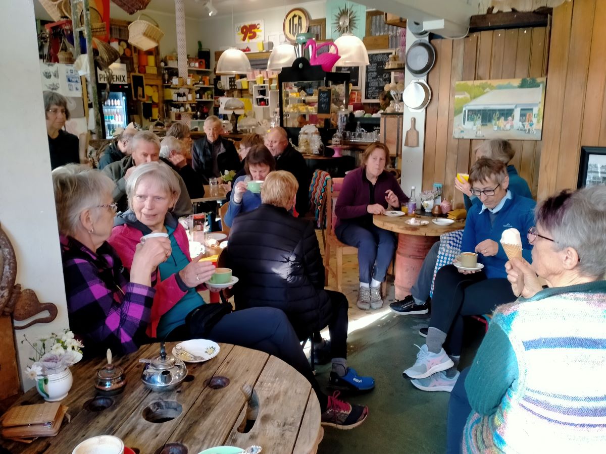
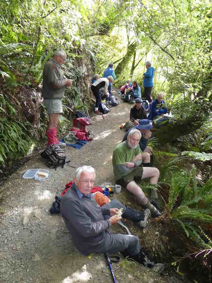
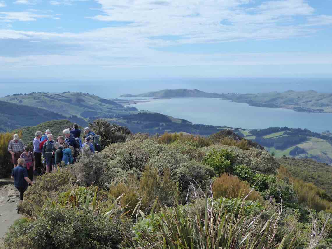
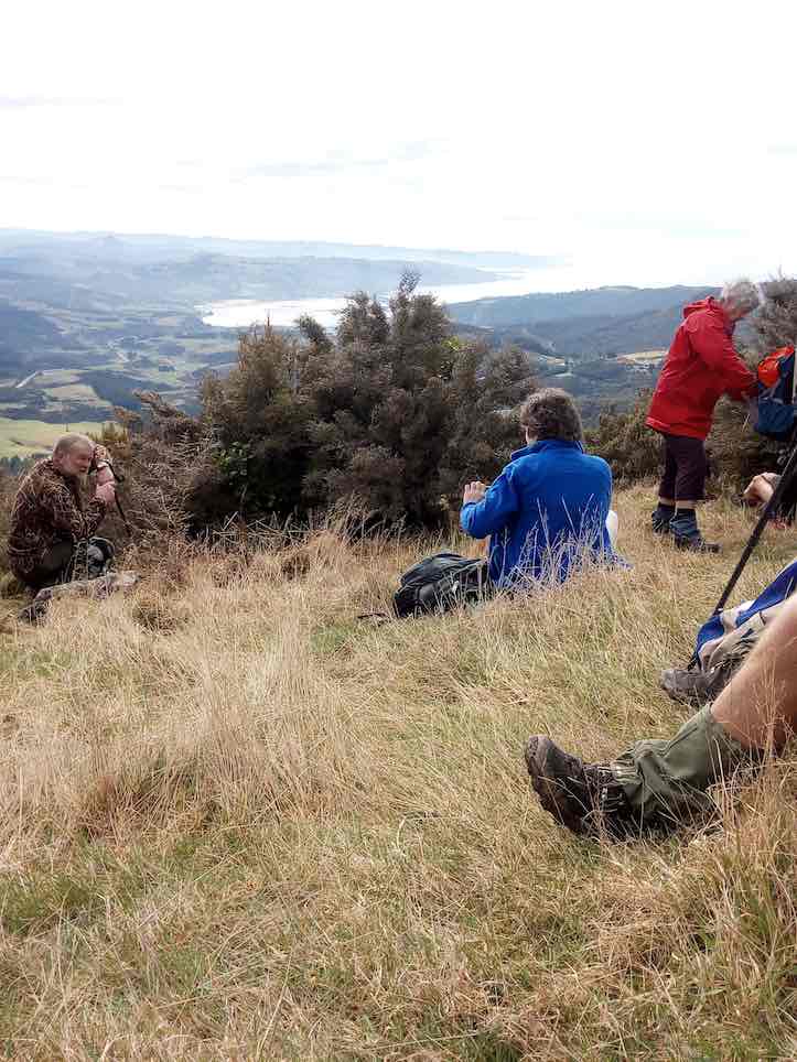
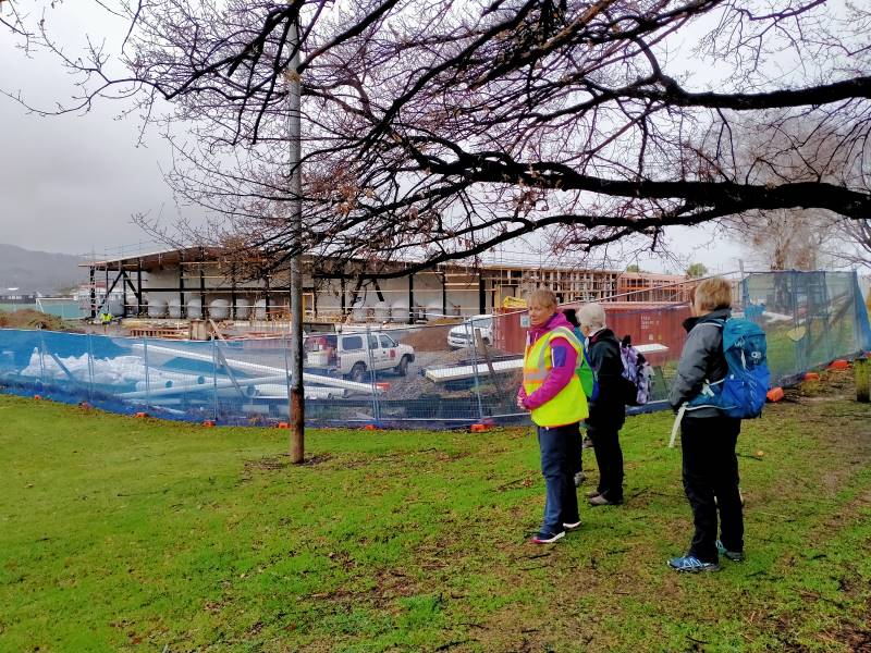
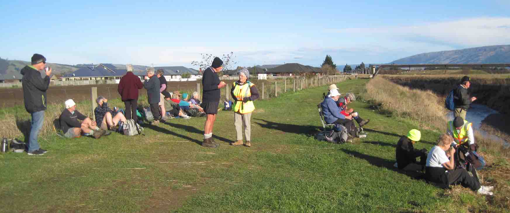
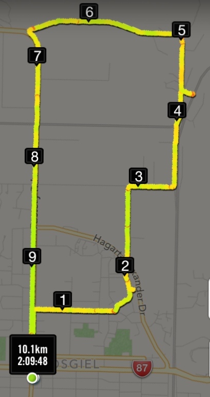
30. 1/05/2024. Combined. Pyramids/Victory Beach. Grade 2.5. Leaders Jenny, Alison, Wendy and Alex
A great turn out for my first time as a co leader with Alison, Wendy, Alex and John. We had a combined group of 30 trampers and hikers. Continue reading “Pyramids, Victory Beach”
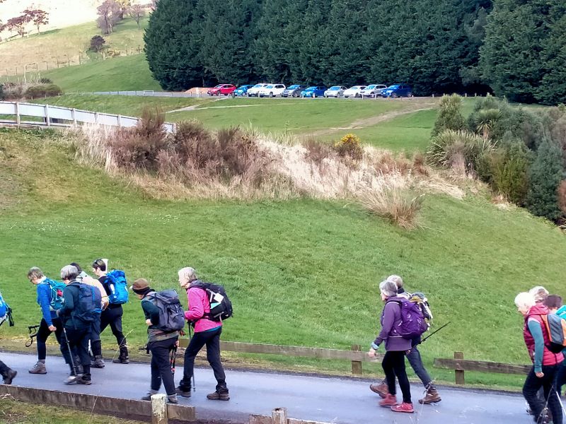
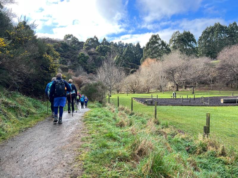
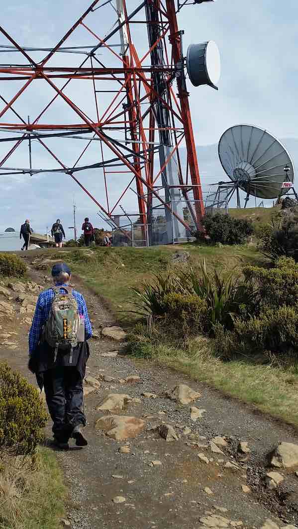
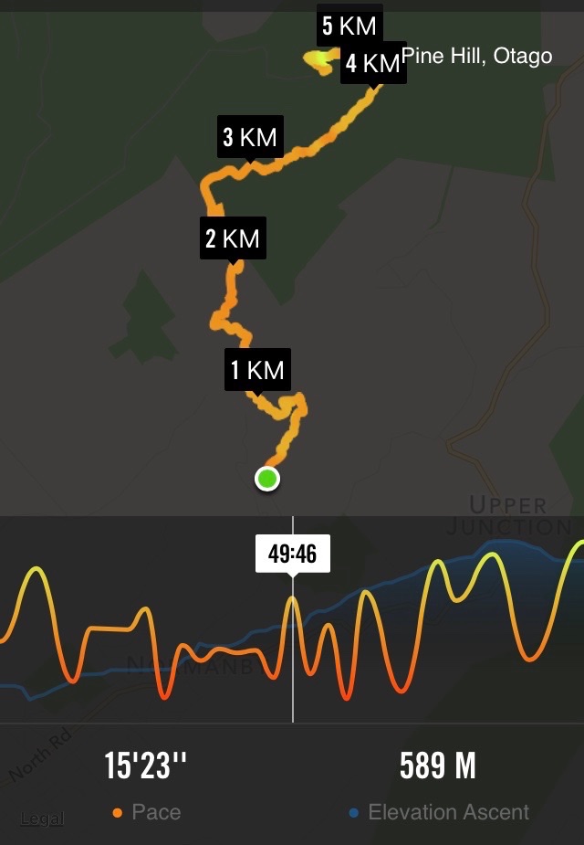
10. 31/01/2024 Mihiwaka/ Mount Kettle. Trampers Grade 4 Leaders: Pam and Diane
11 trampers left PJ Park at 8.45 and meet up with 5 Dunedin trampers on Borlases’s Road, Port Chalmers. We continued onto Blueskin road in misty weather which got thicker as we drove up to park 1km north from Cedar Farm Forest carpark (CFF) A car was left at CFF carpark to ferry drivers back to their cars at the end of tramp. Continue reading “Mihiwaka, Mount Kettle, and Cedar Farm”
No. 96 on old hardcopy list of 113 club tramps. “Parera Taioma Transrail & Wenita Year Round”. 10km from PJP. Wenita permit. Require 6 weeks notice, but less from us. Taieri Gorge Railway. Phone 477 4449 for details.
18. 29 November 2023. Trampers. Mullocky Stream, Mt Allan Grade 3.5 Leaders: Sylvie/ Lyn/ Lynley
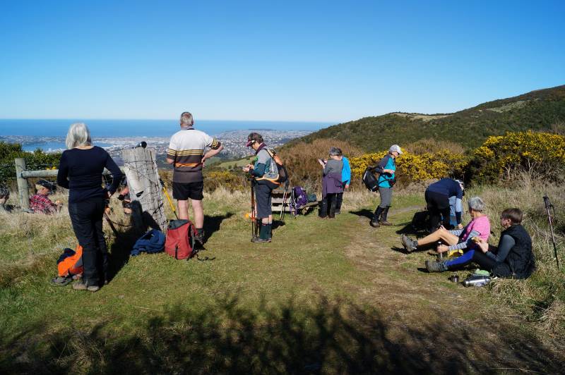
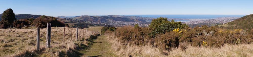
19. 15/11/2023. Hikers. Cleghorn Street to Signal Hill. Leaders Pam Clough and Jay Devlin
23 keen hikers gathered on a beautiful day at the Bottom of Cleghorn St where we made our way up the gravel road to the beginning of our walk which was firstly over farmland. Continue reading “Signal Hill Tramps”
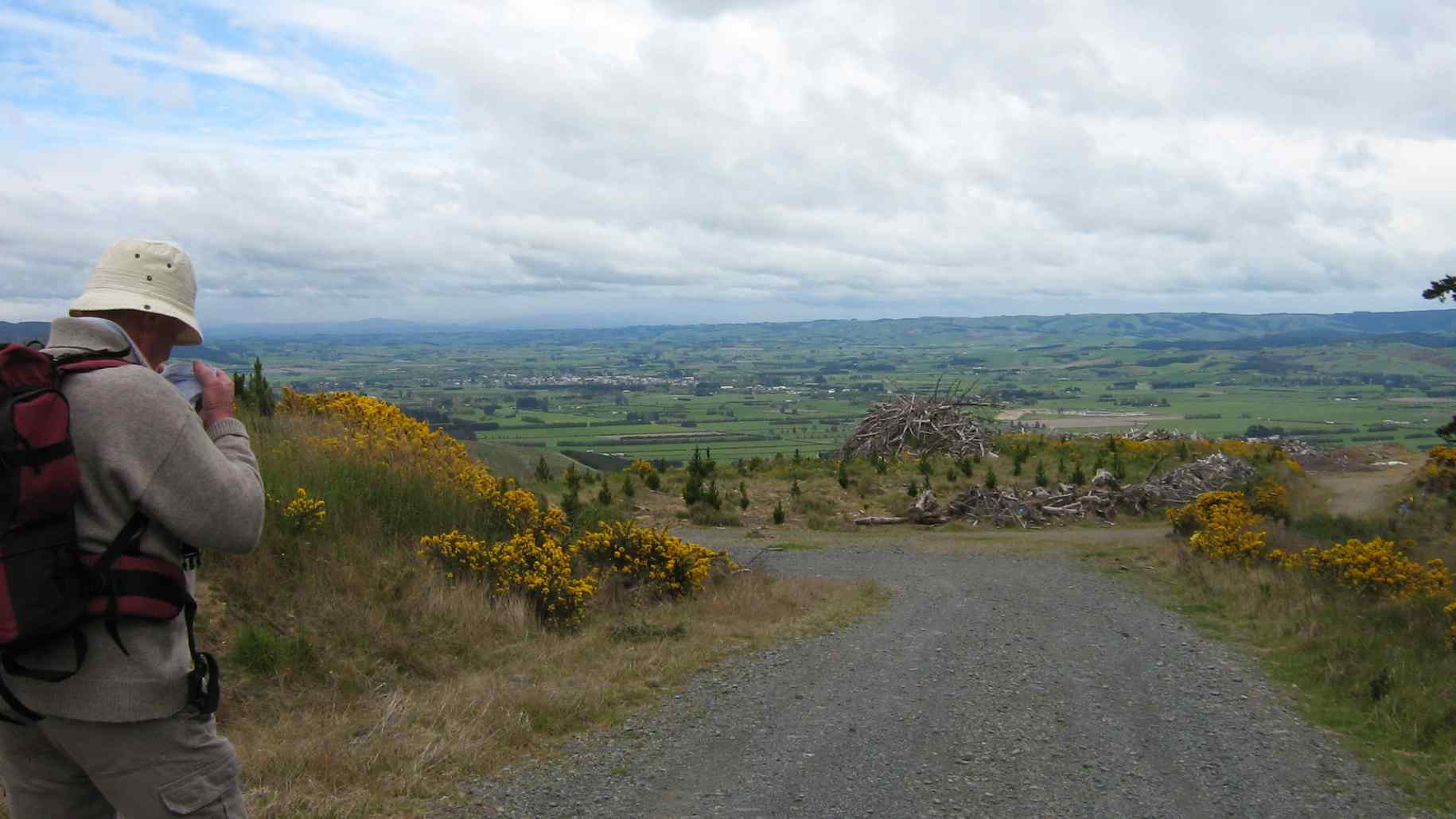
17. 11/10/2023. Hikers. St Clair, St Kilda, Ocean Grove. Grade 2, $5, 17km, Leaders: Bruce Spittle/Alex Griffin
Nineteen hikers left Marlow Park in sunny conditions at about 0930 after singing happy birthday to Liz Griffin and walked over the Kettle Park Sports field and up a track to the Barnes Lookout.
No. 47 on old hardcopy list of 113 club tramps. “Toko Beach. M Young”; also No. 65 on old hardcopy list of 113 club tramps. “Chrystalls Beach Farm”. Location: 59 km from the car park. Best in Summer. The stock winter over.
Directions: On SH1, before Milton, at Helensbrook intersection, left onto Forsyth Road, right onto Back Road, left onto Glenledi Road.
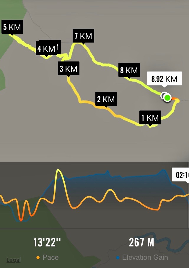
19. Welsh’s Road, Old Farm, Deep Stream Weir. Grade 3 Leaders: Lyn and Di
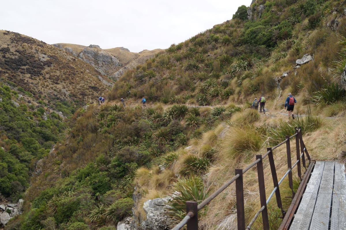
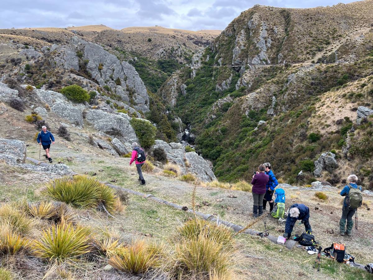
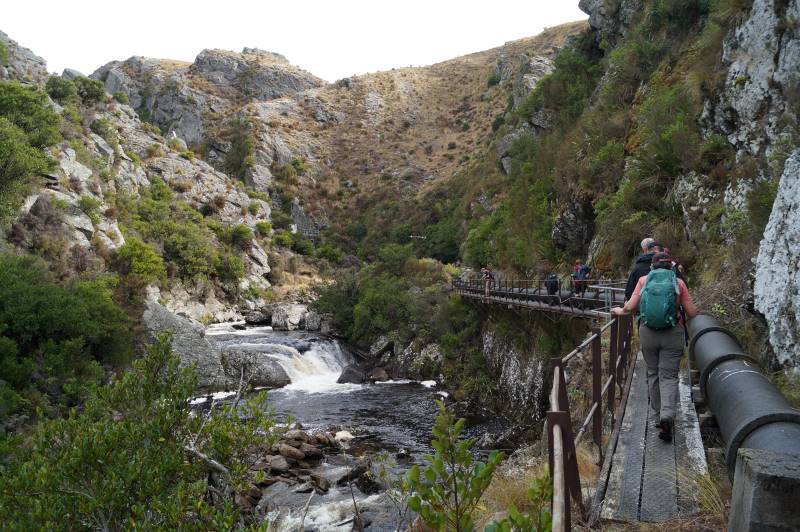
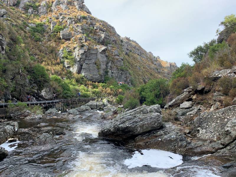
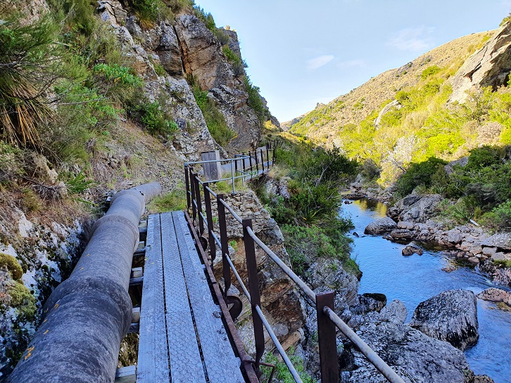
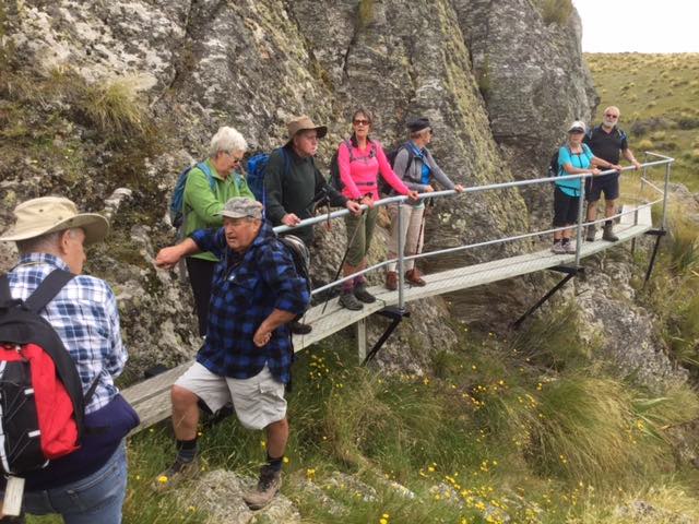
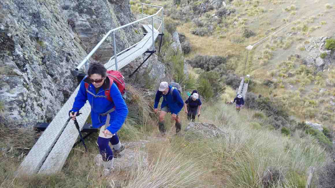
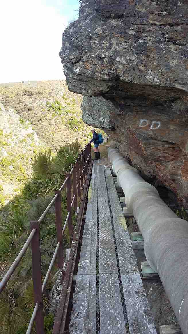
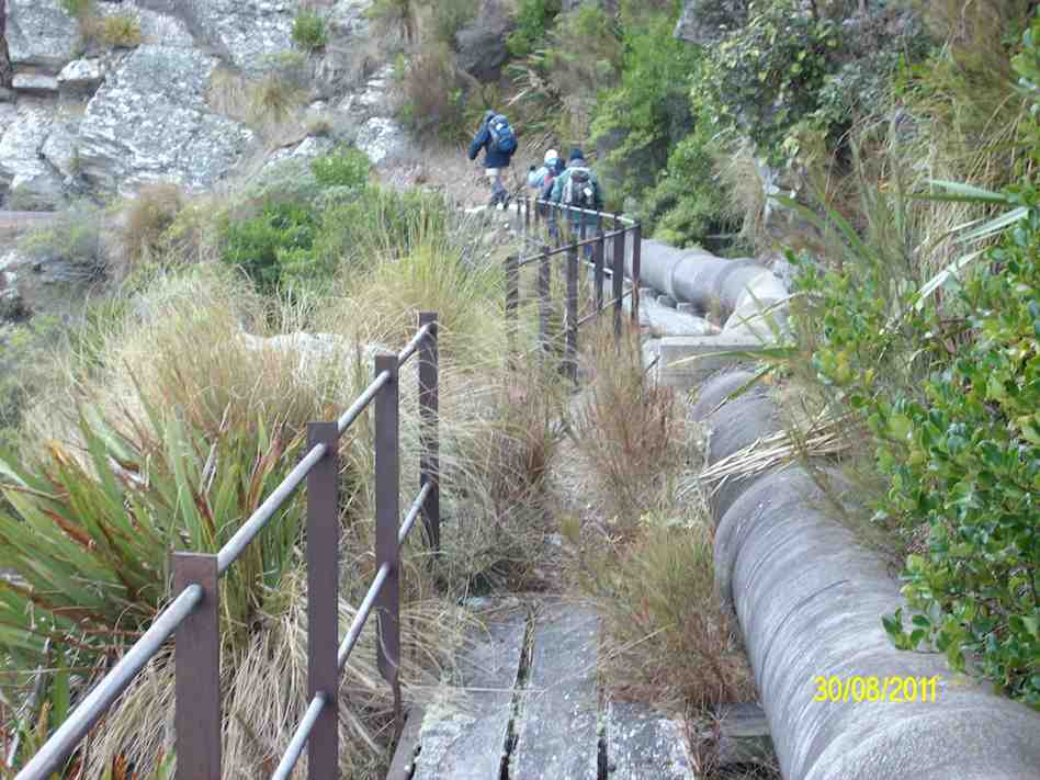
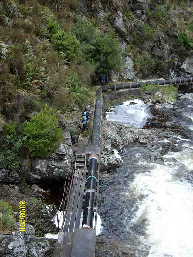
13 of us set off for the Pipeline, which is just off the old Dunstan trail on Rocklands Station.
We had morning tea under the pine trees where we parked the vehicles. It was a tad cold but we soon warmed up with the walk over the farmland to the pipeline.
Up and up over farmland. Caption and photo PamThe countryside is getting more rugged Caption and photo MarijkeTramping nirvana, easy level dry track, marvellous views Caption and photo John
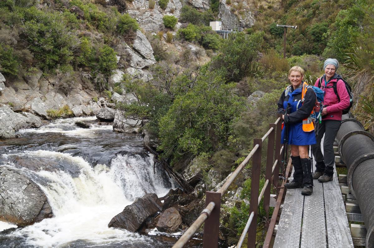
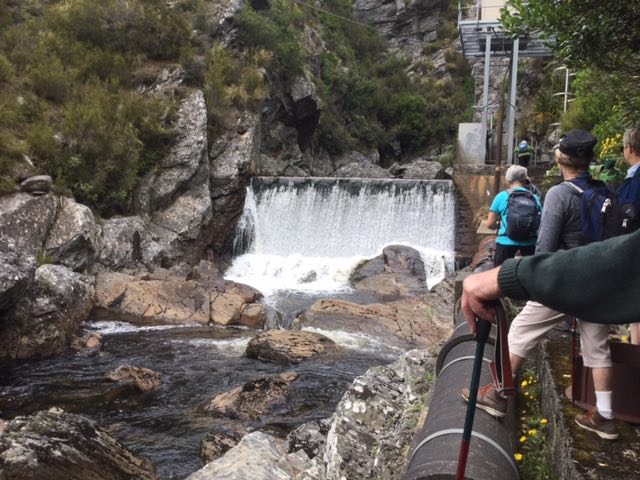
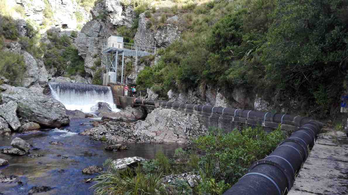
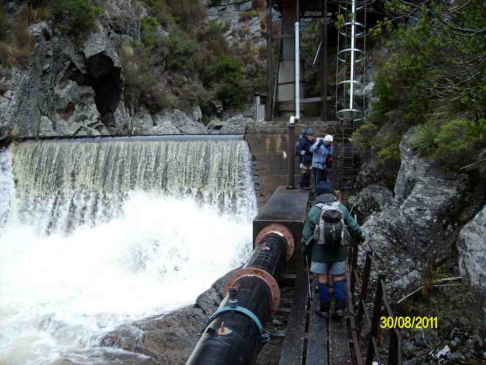
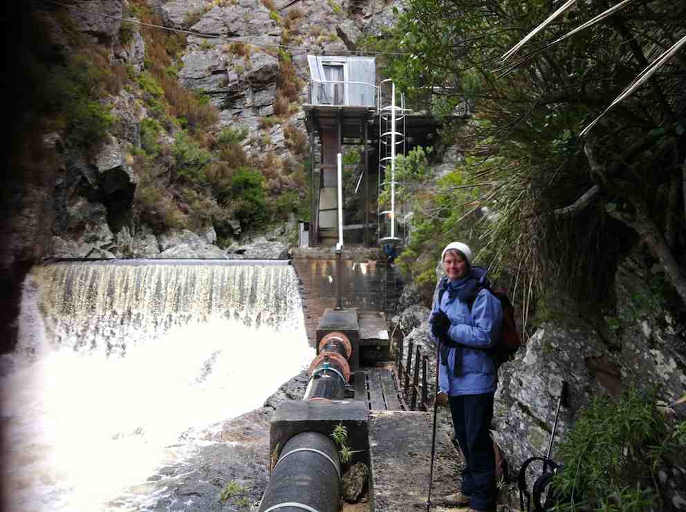
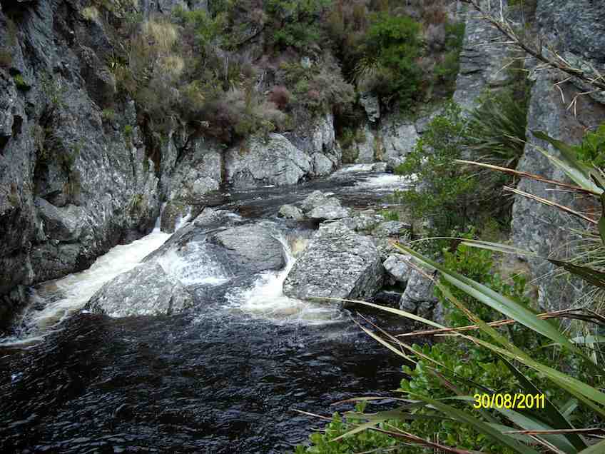
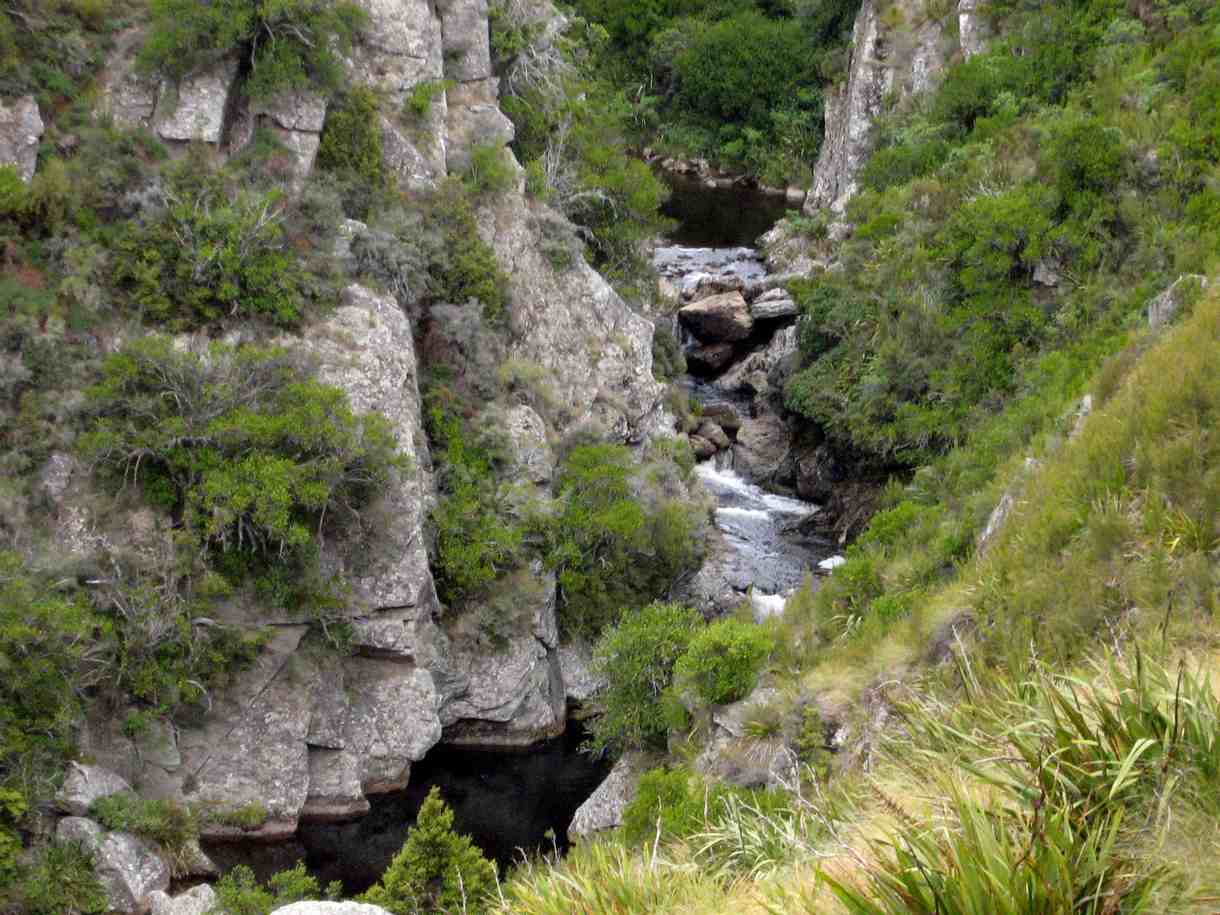
It was stunning scenery walking to the Weir and back.
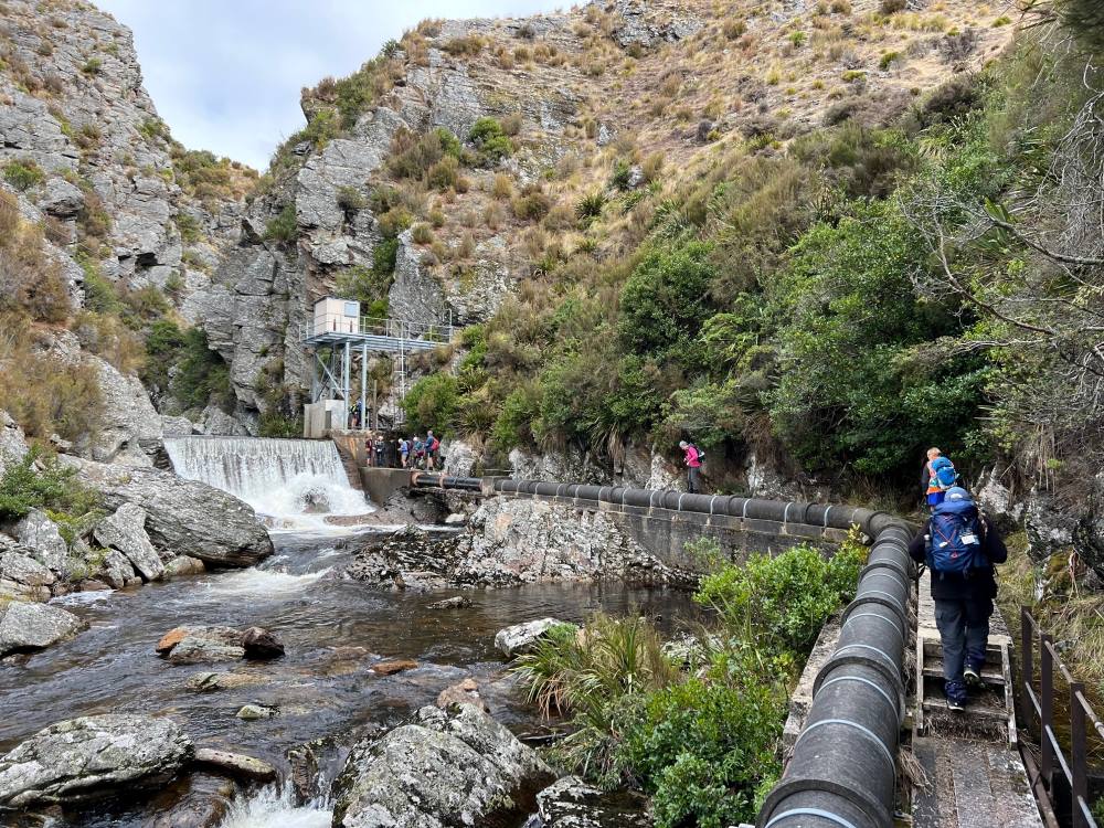
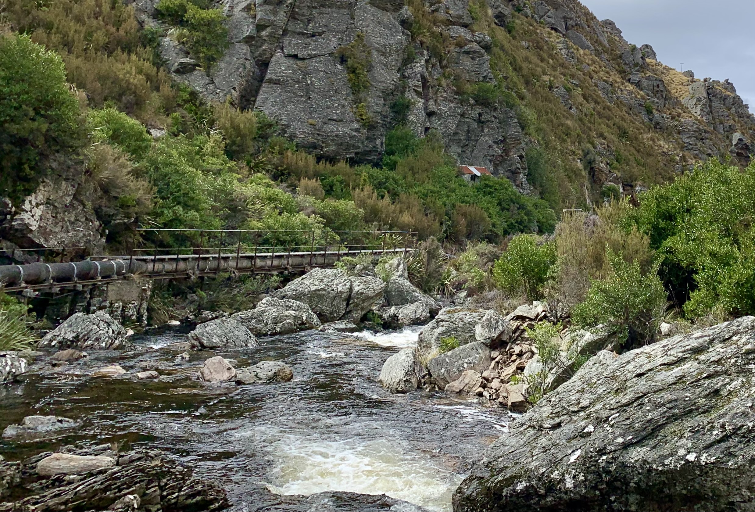
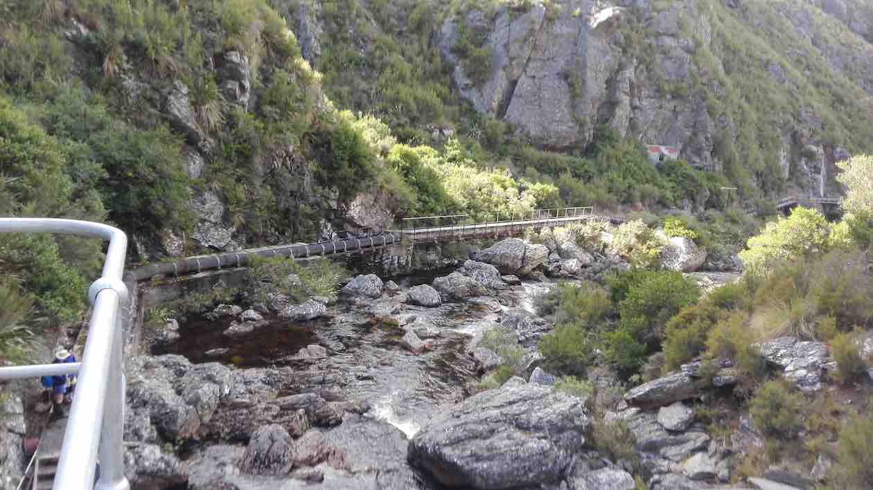
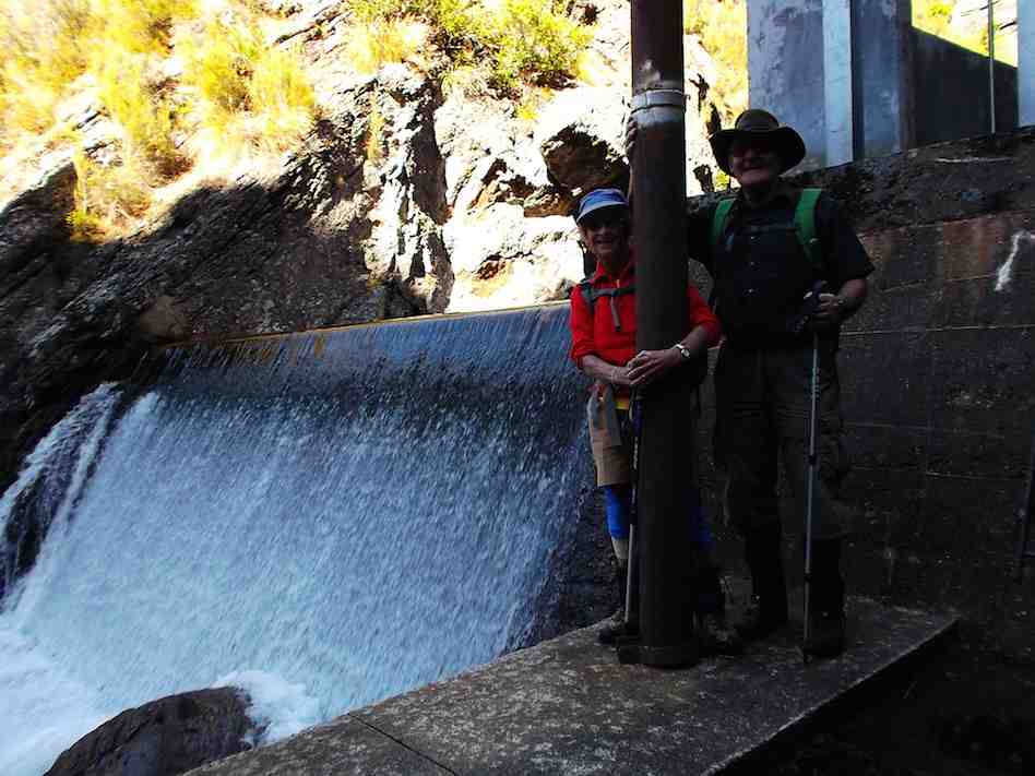
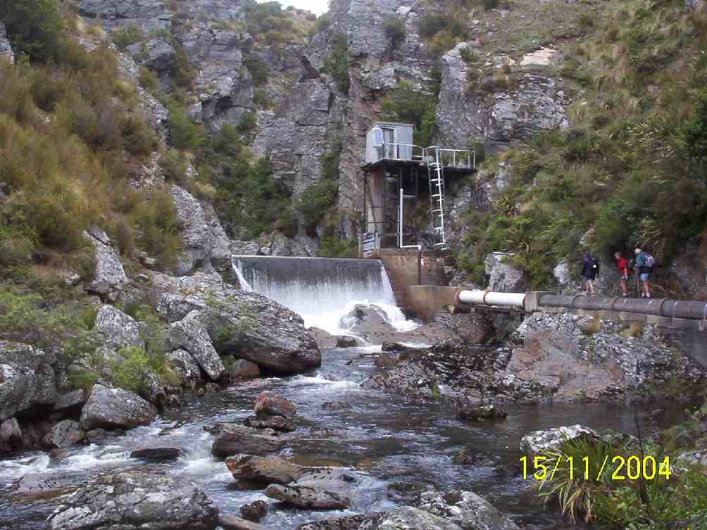
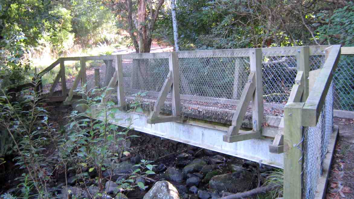
Happy Trampers. Caption and photo JohnPump house and Weir. Caption and photo PamExploring the engineering feat, the Deep Stream Weir. Caption and photo JohnCan you spot the hut? Caption and photo Marijke
We had lunch in the sun out of the gorge with more room to spread out.
Refuelling. (Pipeline track to the weir in the background). Caption and photo Pam
Then took the road back to the cars. It was 8.84ks according to my phone.
Some finished the day with a cuppa at the Wobbly Goat. Another great day out.
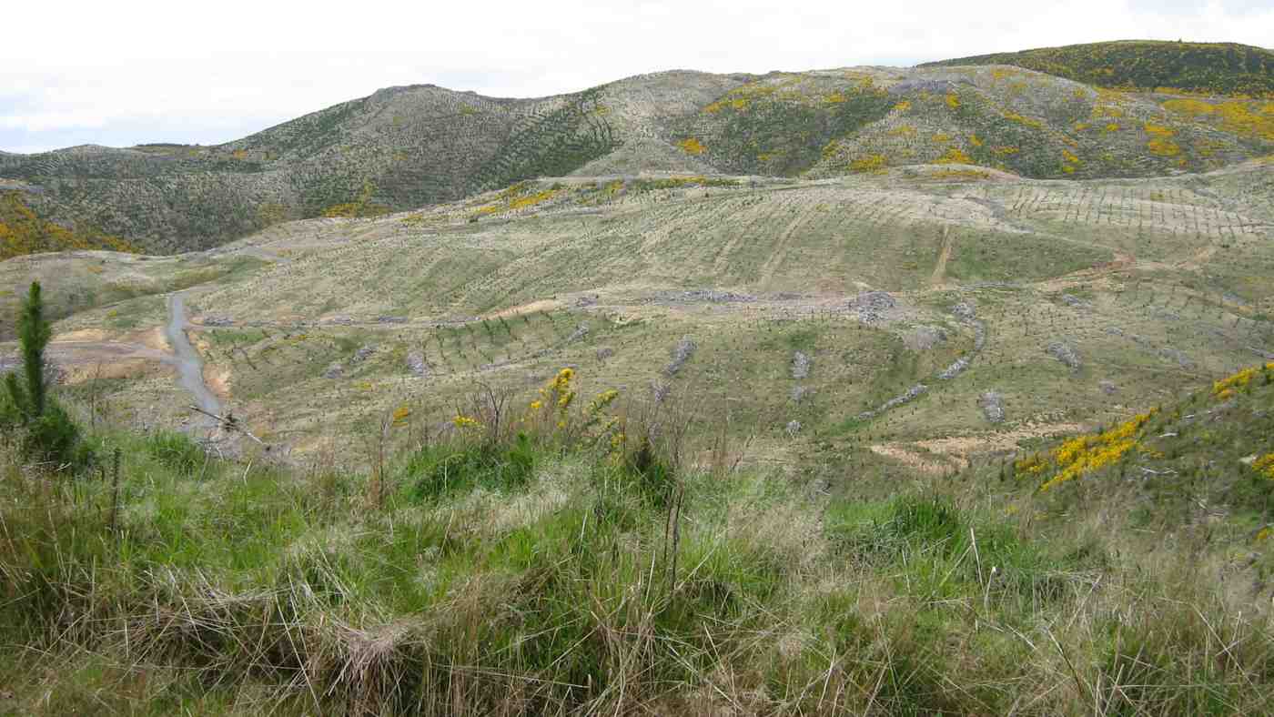
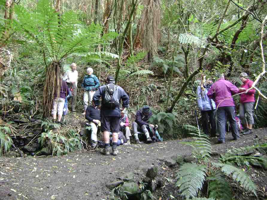
18. 17/08/2022 Trampers. Deep Creek Pipeline. 3.5 $10. Barbara Shackell & Judy Dennison
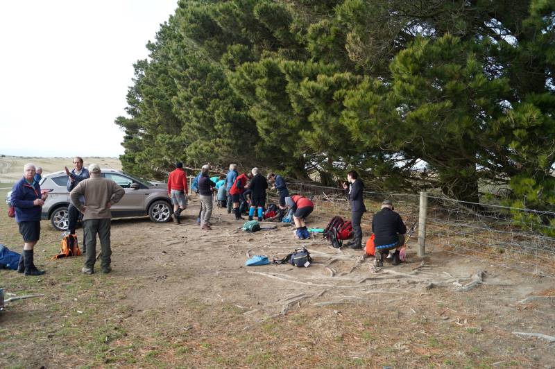
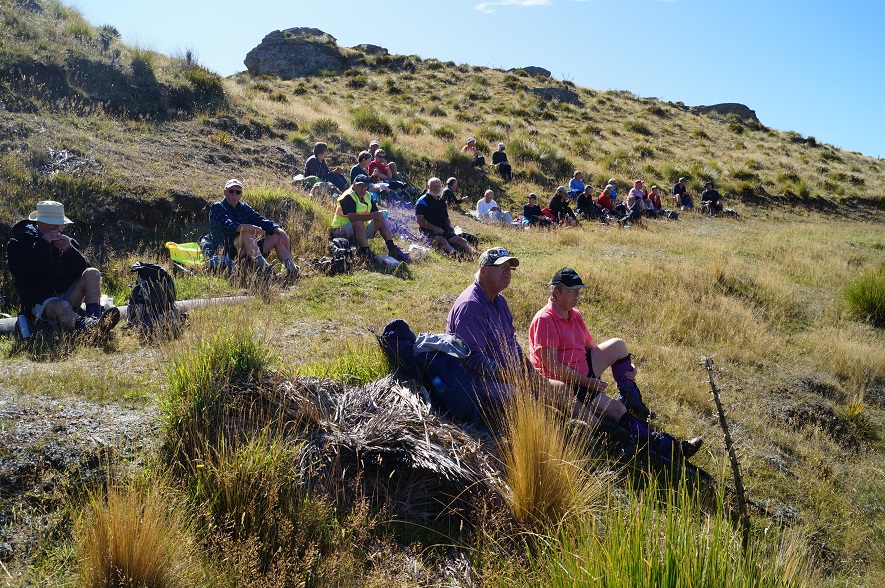
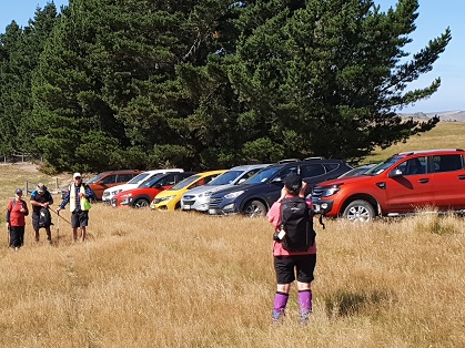
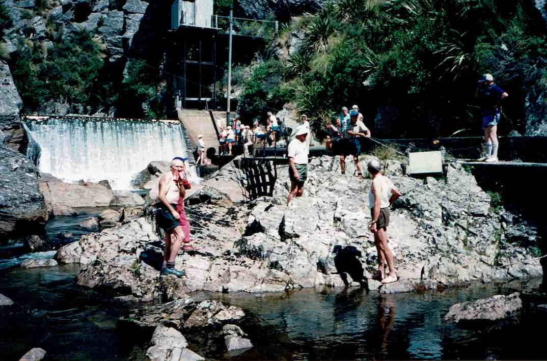
On a foggy old Wednesday morning, with the leader’s phone app threatening rain, 26 trampers met at the rugby grounds, sorted themselves into what appropriate vehicles were available and headed off at 9.30am sharp. A rearrangement of seating occurred when a couple of vehicles joined us at Outram, then again at Clark’s Junction with the addition of Heather’s vehicle, waiting for us at the turn off to Old Dunstan Road (ODR). We regrouped at Rocklands Station gateway, at which point the ODR was locked, and travelled in convoy through the farmyard, between buildings, up the hill and back onto ODR. Some 5km further along, two cars were left at the gateway to the Te Papanui Conservation Park, passengers rearranged again, with a couple of them heading off on foot to our final parking destination two kms further on. Morning tea was had in the shelter of a line of pines (although there was nothing to shelter from!) while a vehicle returned to collect the two pedestrians.
About to leave the cars (photo & caption John)
After morning tea the group set off for a couple of km on a comfortable uphill farm road, without stringing out too much at all. Good work Judy (tail-end Charlie!).
Nearly at the top (photo & caption Phil)
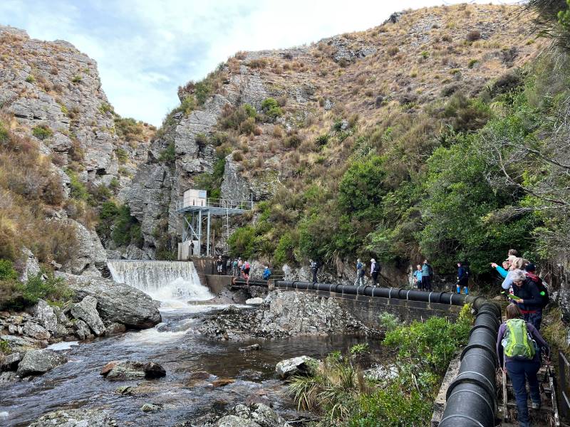
Entering the gate to the paddock containing the Deep Creek Gorge we followed a 4WD track to arrive at the pump station a little before noon. From there we picked up the pipeline track and followed it a few hundred metres around to a sunny spot which us allowed a view down into the gorge for a leisurely lunch.
Lunch in the sun (photo & caption John)
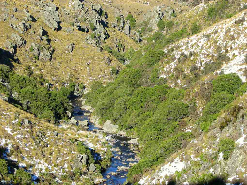
After lunch we crossed the first of a handful of boggy patches and continued along the pipeline track to the weir.
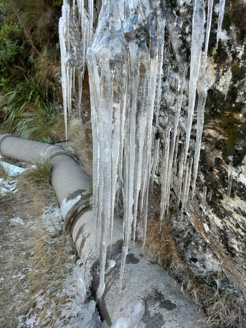
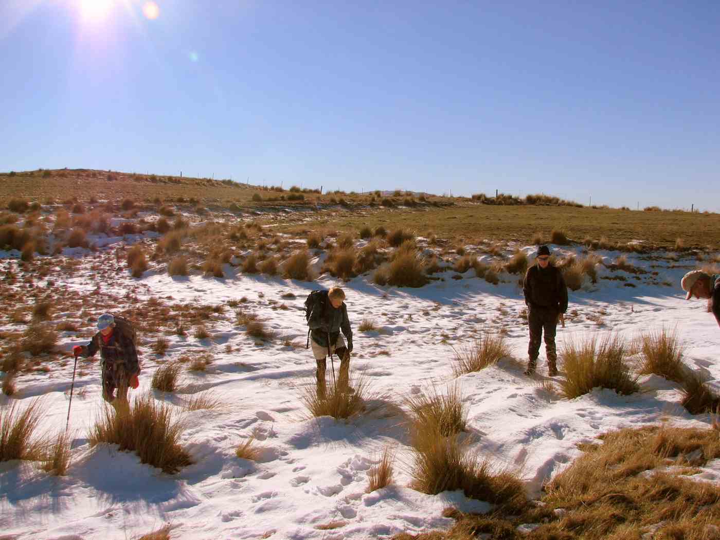
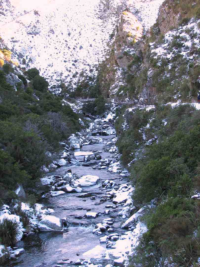
What a difference a week makes – the recce had us walking along snow covered tracks, observing animal tracks in the pristine snow, dodging icicles clinging to overhanging rock, frozen bogs, while the club tramp had virtually no snow visible, the bogs were boggy, but plants – some showing colour – were visible through the rocky cracks and crevices. The weir had a considerably greater flow of water than earlier in the week, presumably from the snow melt.
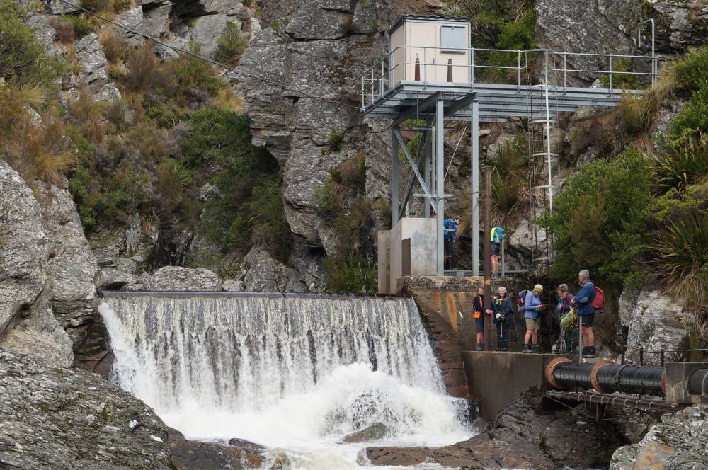
Pump house and weir (photo & caption Pam)
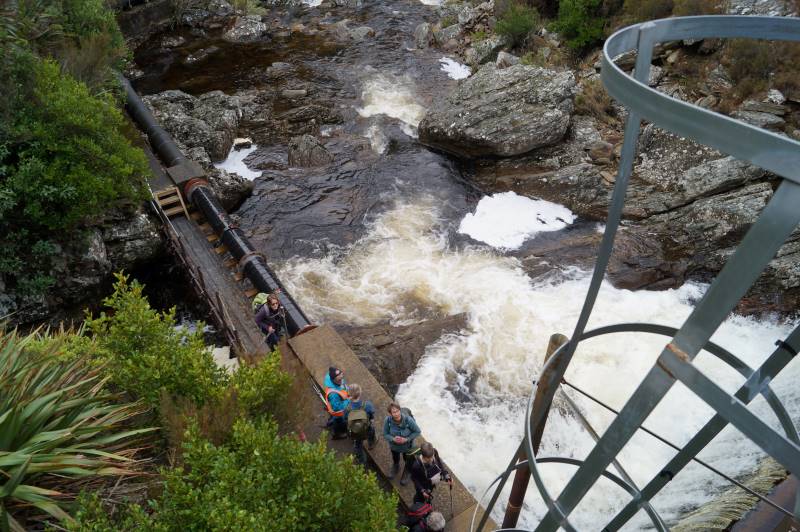
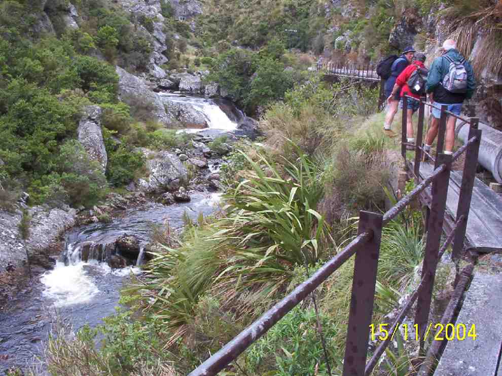
Some took advantage of the ladders to gain an elevated view of the weir.
Looking down from the top Weir platform (photo & caption John)
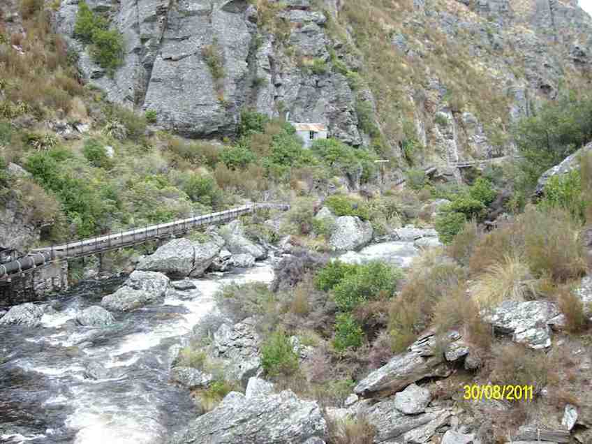
From that vantage point the pipe lineman’s hut was also visible and some members on the return walk, climbed up for a looksee at a very dilapidated “shelter”. While the hut is invisible from the track, its position is fortuitously marked by a final telegraph pole.
Spot the Hidden Lineman’s Hut from the Weir (photo & caption Marijke)
The return along the pipeline track provided a different perspective of the gorge and it didn’t take long to reach the place we’d had lunch and rather than follow the track the last couple of hundred metres around to the pump house, we took a shortcut, heading uphill, following no track, just the knowledge that we would reach the 4WD track over the brow, where we paused briefly.
Deep Creek View (photo & caption Helen)
A show of hands as we rested indicated that exactly half our number had never been into the gorge previously.
The farm road downhill to the vehicles was covered quickly. We agreed to meet at the Wobbly Goat for coffee, but in the event it was closing as we arrived, and we continued onto Wal’s.
Coffee at Wal’s (photo & caption Barbara)
My fears regarding the weather we would strike were unwarranted. Through the fog we were teased with a brief sighting of blue sky nearing Outram in the morning, but then re-entered the ground fog as we climbed up SH87. This cleared completely before Lee Stream and we had perfect weather for the rest of the day – intermittent sun, no wind or rain! A quick read of previous reports on this particular track leads the writer to believe we might have been lucky not to have suffered a debilitatingly cold wind!
How it was on the Recce (photo & caption Barbara)
Thanks to Rocklands station for permissions; to the drivers of vehicles able to manage the farm tracks, to those who met us away from the Rugby carpark for their punctuality, and everyone for the positive feedback on the day. I think it may be repeated!
Barbara
17. 18/03/2020 Hikers. Deep Creek Pipeline. M. Bob Mitchell and Mike Webb
28 Hikers set off in 8 cars from the car park in Mosgiel to rendezvous at the Clarks Junction pub before driving to the start of the walk. More than a few of the ladies eyes lit up when Bob announced that we would be having refreshments at the pub at the conclusion of the hike. It was good to see that it is not only us blokes that take drinking seriously.
After meeting in the pub car park we proceeded in convoy up the Old Dunstan Rd and found a suitable spot to park the cars away from any cattle that wanted to use them as back scratchers.
Photo and Caption Clive – “Te Papanui”
We started the walk at about 1000 and had morning smoko at the one of the gates/cattle stops.
Photo and Caption Clive – “Morning tea.”
Photo and Caption Clive – “Pump house at Deep Creek.”
From there it was a steady climb to some maintenance huts at the top of the gorge. The distance from the cars to the huts was 3km
Photo and Caption John – “Vast open country.”
.The weather was fine with great visibility and from the huts we could see the pipeline snaking its way around the gorge.
Photo and Caption Clive – “Into the gorge”
Photo and Caption Clive – “Deep Stream a long way down”
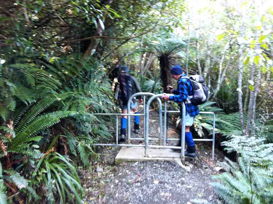
From the huts it was a steady climb down to find the track that leads to the pipeline. The track is approximately 2kms in length, and quite narrow in some places with railed walkways over some of the more challenging parts of the track. The views were quite spectacular and we were soon strung out in single file looking like porters on the Ho Chi Minh trail. Frequent photo stops were the order of the day.
We could hear a bit of bird song and one falcon and one hawk were observed flapping/souring overhead during the walk. One point of interest was on old hut set in the bush about 10m above and to the side of the pipeline not far from the tracks end. Probably accommodation for the guys laying the pipeline all those years ago.
Photo and Caption Clive – “Walking to dam along the river.”
After a brief halt and photo stop at the dam/weir at the end of the track we did an about turn, retraced our steps and eventually stopped for lunch in a nice sunny spot overlooking the gorge.
Photo and Caption Clive – “Pump house and dam”
Photo and Caption Clive _ “Back down the gorge.”Photo and Caption John – “Lunchtime always with a view.”
From there it was a short walk up to the huts and back down to the cars.
Photo and Caption Clive – “Back at the cars.”
We walked a total of 10km.
Bob had organised the publican at the Clarks Junction pub to lay on coffee, cakes and scones and also to open the bar early for those that wanted to support Speights. Glad to report that at least two unnamed ladies were seen with pints in their hands. Legends!
The rest obviously enjoyed the coffee and food as the shark like feeding frenzy at the counter was a sight to behold.
A good day was had by all and I can vouch that the Speights was up to its usual standard.
Mike
16. 9/1/2019. Deep Creek Gorge Pipeline. Leaders: Theresa and Clive.
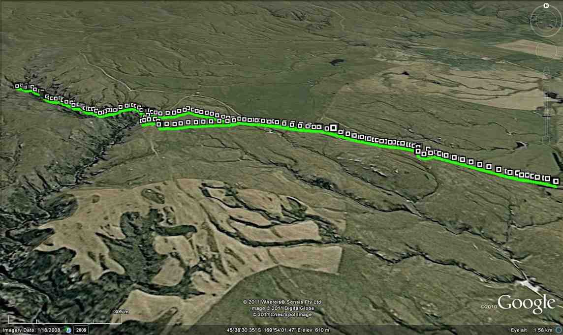
Route map, Deep Creek railed walkway and weir, courtesy Ian.
31 Trampers, Hikers and Ramblers set out across the tussock of Te Papanui Conservation Park. It was an ideal day for a walk on the tops as there was high cloud keeping what can be a scorching sun off our backs. The 16 degree temperature was just right to get things started after the Christmas/New Year break. 13 of the participants had not been on the walk before and were looking forward to the gorge.
Morning tea
(Clive pic.)
found us being observed by a large herd of cows who seemed very interested in what we were all doing there.
After a twenty minute break we headed on up hill
(Clive pic.)
to the hut at the mouth of the gorge. Having made sure everyone was accounted for it was across the 40 ? or 41 ? bridges and board walks to the weir at the top of Deep Creek.
(Kevin pic.)(Clive pic.)(Kevin pic.)
This gorge is a feature that makes this walk so interesting. As an aside, the DoC blurb advises that there are over 500 species of native insects; plus a wide variety of plants and animals (including pigs and red deer), in the Te Papanui park.
Lunch was taken back at the mouth of the gorge, sheltering from the cool breeze that had sprung up. After lunch the Trampers headed off in a more Easterly directing to add a bit more distance to the completed walk. The hikers and ramblers headed back the way we had come in the morning. The hikers covered about 9.5 kms by the end of the day and were happy to sit down for afternoon tea at the Wobbly Goat about half an hour ahead of the more exercised Trampers group. The consensus was a ‘gorge’-ous days outing! – Clive
15. 26/4/2017. Deep Creek Gorge Pipeline . Leaders: Theresa and Arthur.
Nike app route map, courtesy Ian.
Leave the car park and go up SHWY 87 until Clarks Junction. Turn left onto Rocklands Road. Travel on excellent tar seal until you pass the Rocklands Station complex. Now you will be on gravel and at the beginning of the Old Dunstan Trail. Turn left off the Old Dunstan Trail and proceed on farm track for 2 kms. Park cars at the trees. Cross over farm land for a period of time — only down and up one gully,
Morning tea in gully, sheltered from a breeze. (Clive pic.)
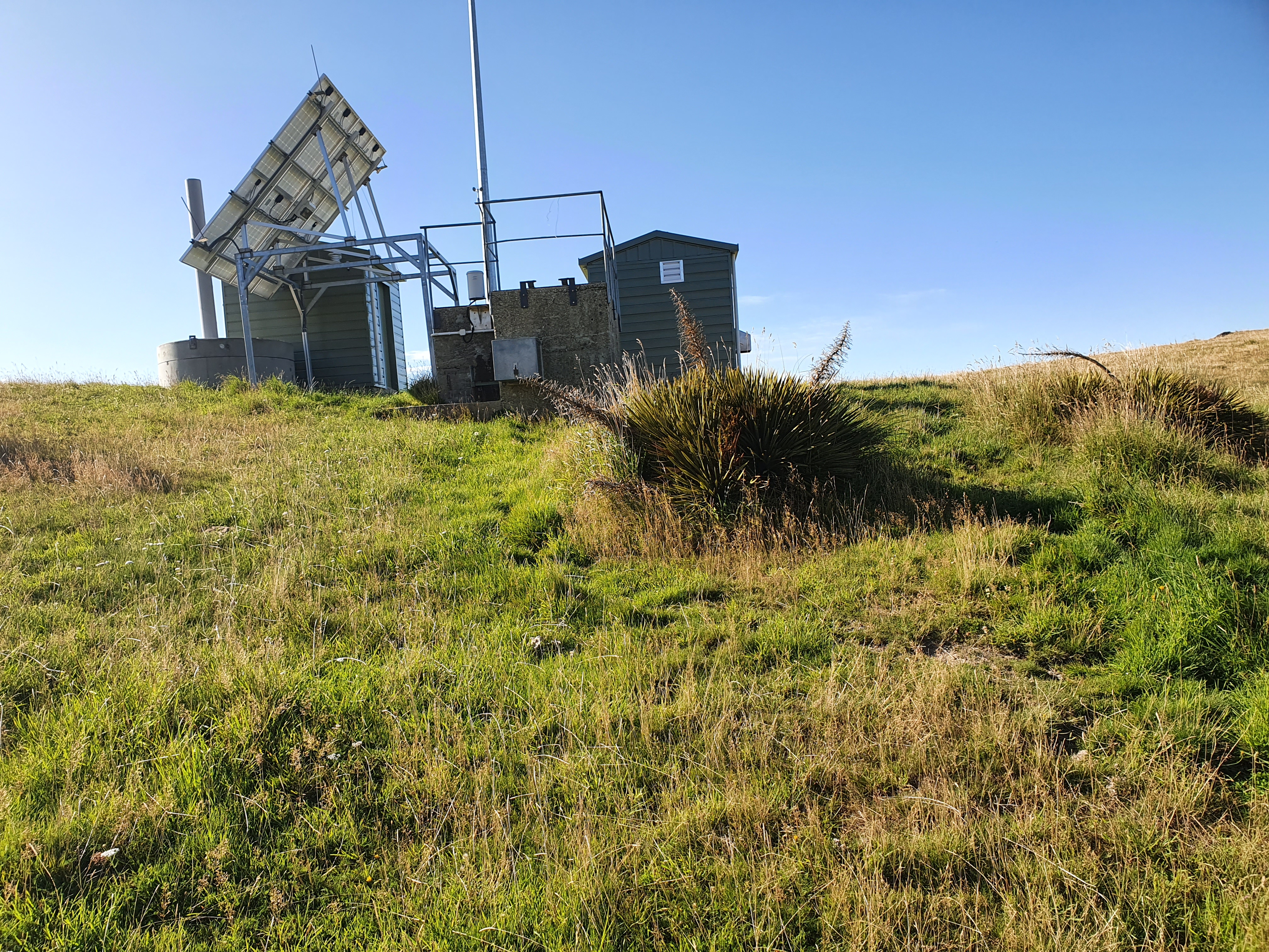
going in a west / north direction towards the gorge. A gate in the middle of a paddock with a faint track going in the right direction. Two small newish huts with a solar powered panel on roof mark the beginning of the Gorge track. This is part of the Te Papanui Reserve. Traverse pipe line for approx 1/12- 2 kms.
New section at start, replacing broken single wooden planking. (Keith pic.)
The pipe line is suspended off the cliff high above the Gorge .The track is narrow on the pipe line …
(Clive pic.)
… but is easy and in the main flat. There are many foot bridges to cross. (An in-house challenge to count the number, caused differing results/) One dedicated tramper even ticked them off on a piece of paper .WHO are we to disagree!! A small dam was at the head of a very picturesque Deep Creek Gorge.
(Keith pic.)(Keith pic.)
Repeat the trip back to the road just beyond the huts. From then it is an easy road tramp back to the cars. 12 very happy trampers enjoyed a WOW 😳 kind of a day out. Approx 10 kms in length. Debrief and coffee at Outram. -Theresa.
14. 9/4/2014. Trampers. Deep Creek. (A replacekment for ‘The Gap’, programmed for the day, which would have turned out extremely muddle.)
The first thing we struck was hundreds of sheep by the trees where the cars normally park.
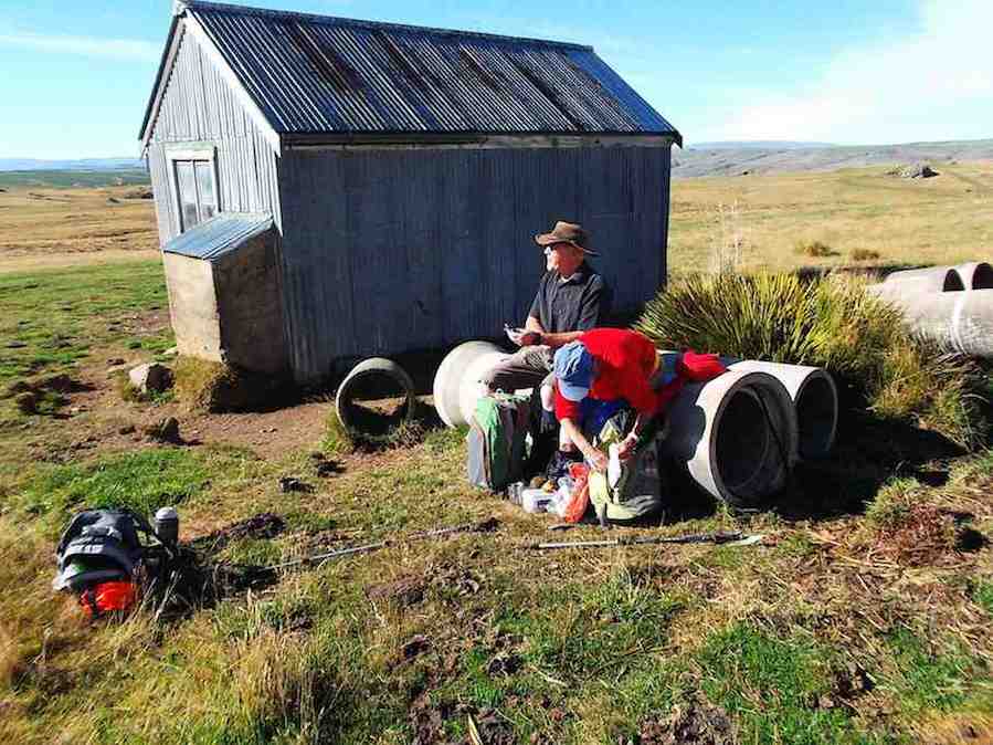
so we parked just before that spot and skirted the trees on the other side so as not to disturb the sheep. We left morning tea till we got to the old hut …
Morning tea in the sun (Heb pic and caption)
… sitting on some concrete pipes there. From there we followed the track taking us onto the pipeline …
Looking upstream toward the weir (Heb pic and caption)
… right up to the weir.
Ria and Eric at the Deep Stream Weir (Heb pic and caption)
About halfway back we enjoyed lunch in the sun sheltered in a gully with no wind. It was great. From the hut on the way out, we followed white pegs indicating the pipeline which helped us avoid getting our feet wet in a muddy creek. Then it was back to the cars. A great day for tramping. – Heb.
13. 31/8/2011. Trampers. Deep Creek.
GPS
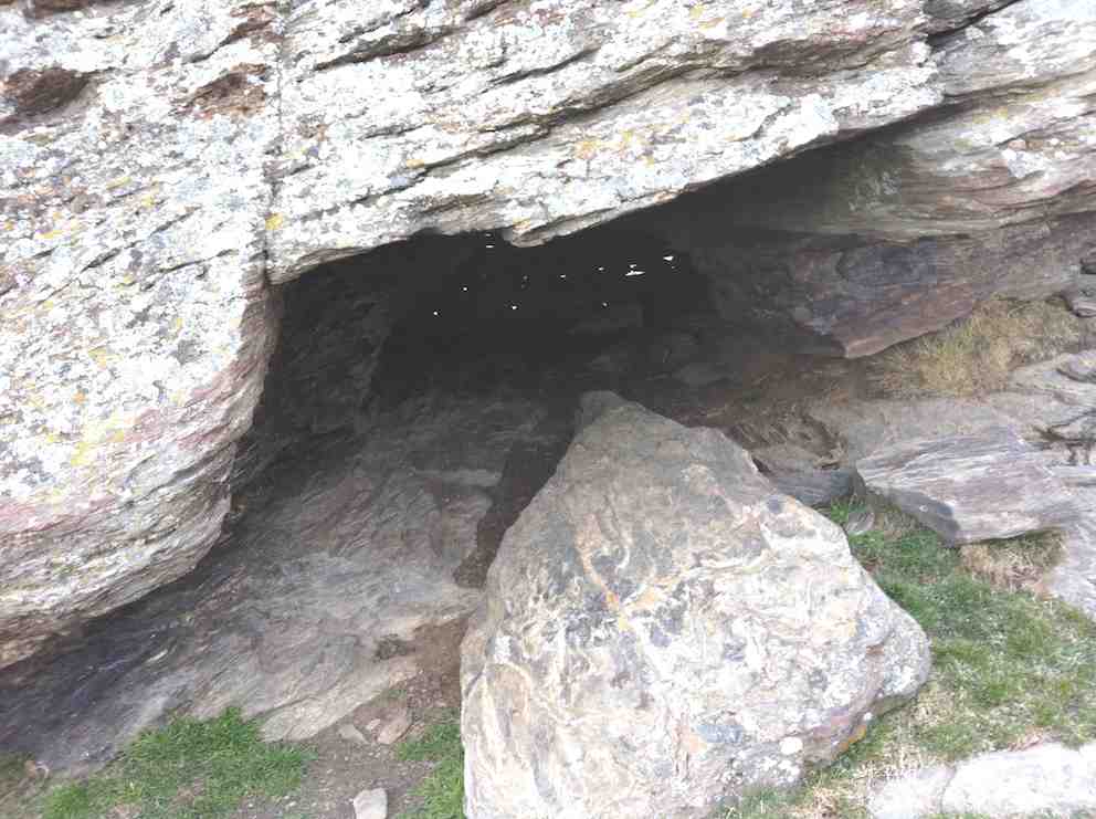
Five of us battled a strong wind on the tops, really icy and straight from the antarctic, to a late cuppa at the cave part way up the road from where we park the car. However the cave faced straight into the wind so we nestled behind it in the shelter of its lee.
The cave, with light chinks in the ‘bricked up’ rear.
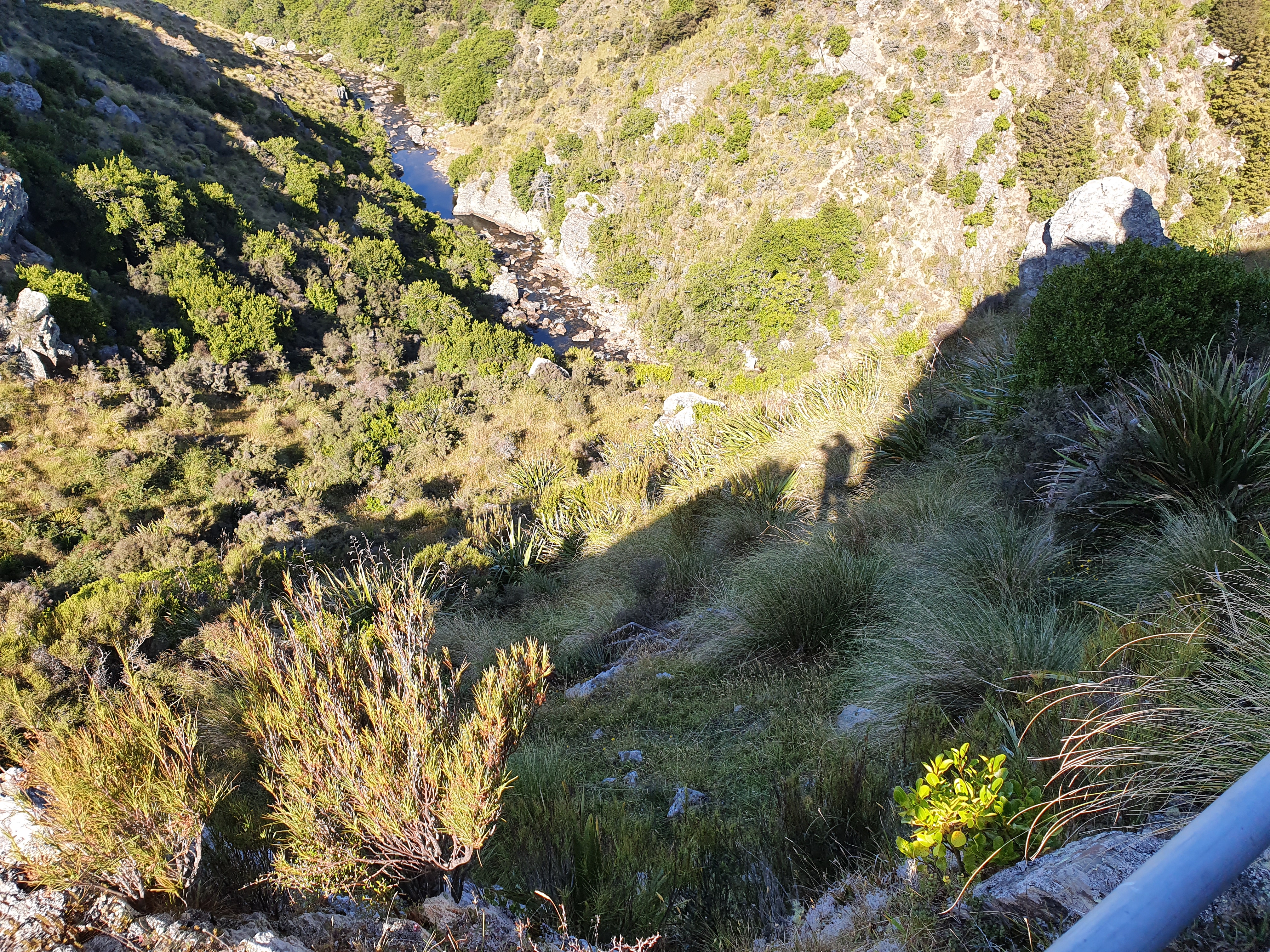
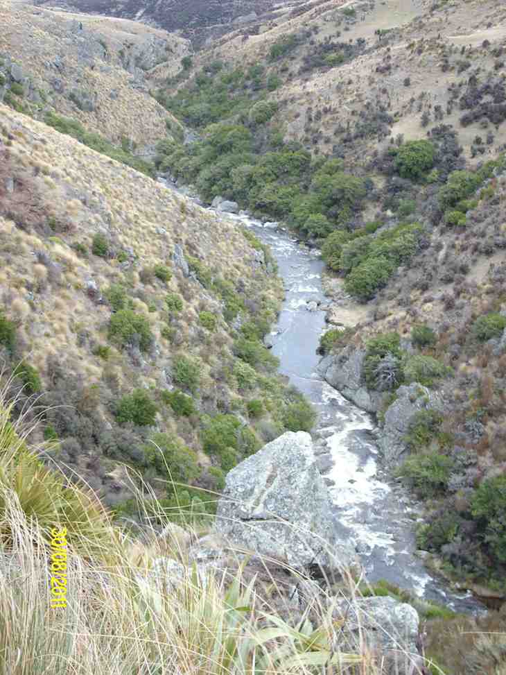
Wrapped up in wind-breakers, gloves and woollen hats we struggled onward and upward to at last the crest of the slope and escape down into the shelter of Deep Creek’s gully and onto the walkway.
Looking downstream at start. (Ken pic and caption)
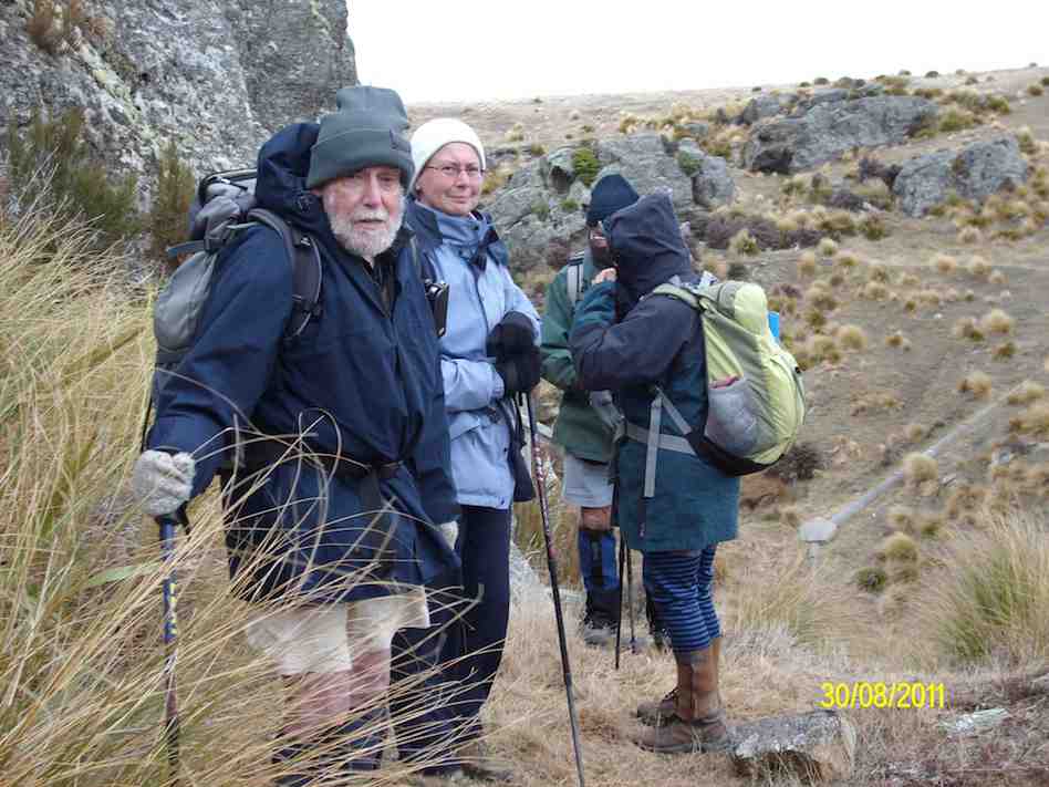
Ian, Linzi, Ria and Doug at start of creek track. (Ken pic and caption)
There was quite a lot of water in the creek. (Ken pic and caption)
Part of the track. (Ken pic and caption)
Doug, Ria, Linzi and Ian at the weir. (Ken pic and caption)
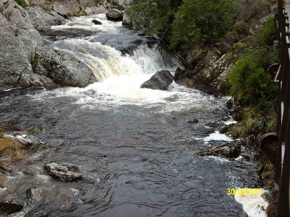
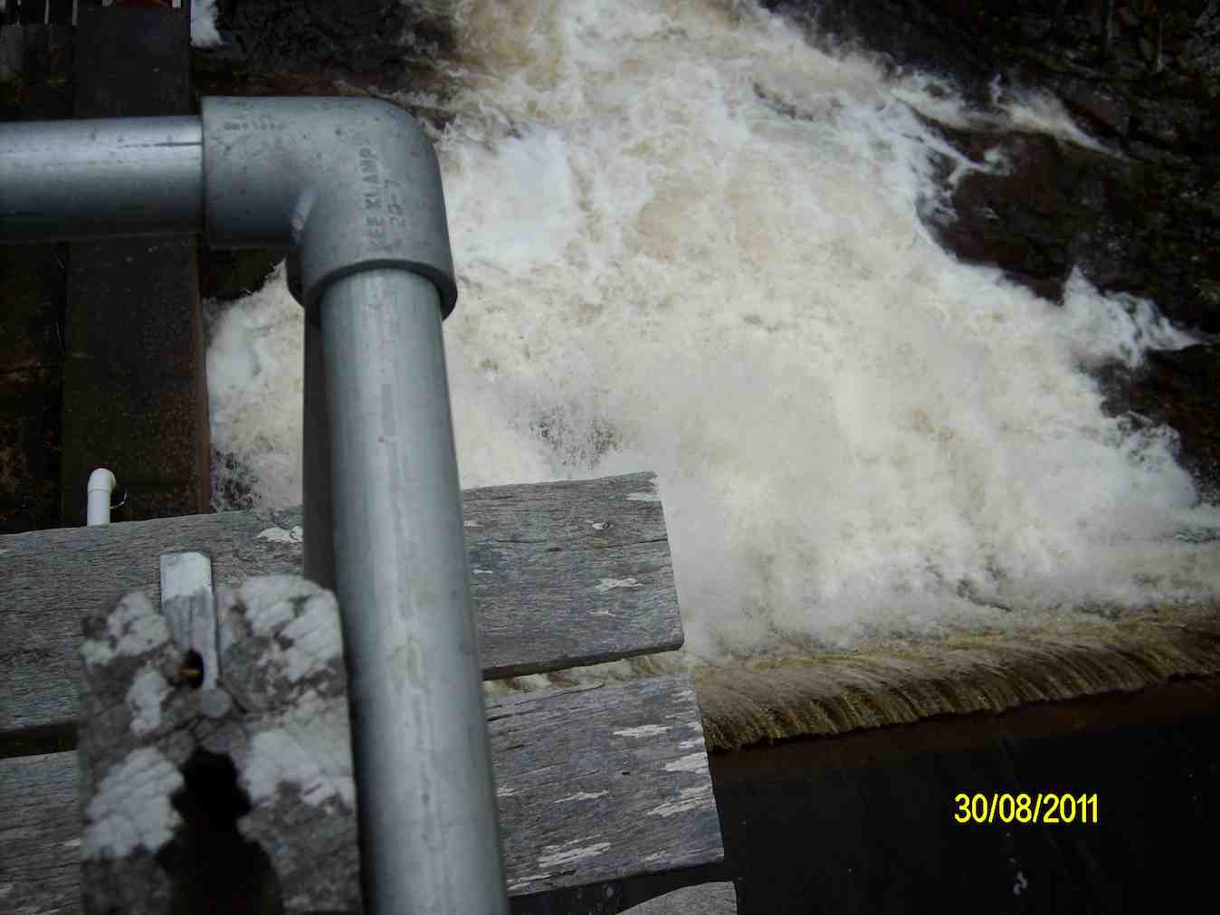
A large flow of water over the weir. (Ken in the background disappearing up the ladder.)
Creek above the weir. (Ken pic and caption)
Looking down on the weir from the control hut. (Ken pic and caption)
Looking back along the track from the control hut. (Ken pic and caption)
View of further downstream from the control hut. (Ken pic and caption)
On the way back out, we remained to lunch in the shelter of the gully before getting back out to expose ourselves to the wind again. We examined the old hut, little changed from last time, before making the return back to the car, this time thankfully with the wind behind us. – Ian.
12. 10/11/2010. Hikers. Deep Creek. Medium. Leaders: Evelyn C, Graham.
11. 12/3/2008 Hikers. Deep Creek. Medium. Leaders: Joyce S, Lesley G
The adventure for the 14 Hikers this week was a drive via Rocklands Station and the Dunstan Old Road, turning off to the Te Papanui Reserve. There was a cold S.W. wind that kept us in woolly hats for the day, even although we had sunshine as well. A walk up the hillside to a cave amongst the rocks was earmarked for coffee by Joyce S, our leader.
Then on to the gorge of Deep Creek, a tributary of Deep Stream, and the path following the pipe line to the weir.
Gorge in Deep Creek. Looking upstream at beginning of walkway.
Bob H told us about the water race used in the gold mining days and the pipeline to supplement the Dunedin City’s water supply, built in the 1930s. The farmland had been former tussock country but the gorge was not modified and still supported many alpine plants, including gentians in flower. We had several sightings of NZ Falcons, which are now considered to be diminishing in numbers. It was an exciting area to be hiking in,
as the river was a long way below us and the sides of the gorge very steep. Ian F was making mental notes for the retrieval of anyone who miscalculated their step, but fortunately the plan wasn’t needed. We were back at the cars by 2pm and home to Mosgiel 3pm. An exhilarating day. – Lesley G
10. 13/6/2007 Leaders: George, Abe
Snow at topDeep Creek in lower reaches.On pipeline. George, Leonie, Tash, Ria, Pat, Ian, Glenice, Arthur.Upper Deep Creek showing railed walkways.
9. 23/8/2006. Hikers. Deep Creek, Old Dunstan Road. Medium. Leaders: Val, Arthur & Barbara
8. 24/11/2004. Both. Deep Creek, Lammermoors. Leaders: Evelyn C, Ian, Peter and Wendy
Deep Creek Pipeline Track. Evelyn, Wendy, Peter.
Deep Creek Weir. Evelyn, Wendy, Peter
7. 17/4/2002. Alt. Rockland and Deep Creek. Medium. Leaders: Bob H, Bev H, Bev McI.
6. 21/10/1998. Deep Creek from Old Dunstan Trail. Leaders: George, Les S.
5. 24/3/1998. Deep Creek, Rocklands. Leaders: Shirley McN, Ria L, Bev H.
4. 15/10/1997.
3. 8/2/1995. Deep Creek from Old Dunstan Road. Easy. Leaders: Jack R, Bob H, Ted, Dot T.
2. 20/3/1991. Deep Creek Dam and Pipeline. Great viewing and interesting country. Easy+. Leaders: Dave and Jean, Margaret D, Janice.
1. 1/2/89. Deep Creek.
1/2/1989. “Pumping Station.” Deep Creek. (Ian pic, scanned from Peg Chisholm photo collection.)
Background.
The Deep Creek Water Scheme was built during the depression of the 30s.
The Pipeline is 58 years old and 64 km long.
The intake is 675m above sea level.
The catchment is 5420 hectares; mainly tussock with some grassland.
The steel pipeline, lined with bitumen, was in a bad state of repair by the 80s and the leaks were constantly plugged with tapered wooden plugs until it resembled a porcupine.
The authorities were eventually persuaded to renew the worst section, this being done with the aid of a helicopter in 1992. It is a useful supplement to Dunedin’s water supply.
The Pipeline is made of bitumen-lined steel excepting the first 1.4 km which was replaced in 1992 with concrete pipes.
Water quality is variable and often discoloured.
Over the 58 years the yield has dropped from 11,000 cubic metres to 6,800 cubic metres a day.
The water goes to Booth Road Treatment Station and Sullivans Dam.
Replacing the rest of the pipeline is estimated at $20,000,000 and would increase the flow to 17,000 cubic metres a day.
– From a hand-written record in the President’s file and supplemented with other data.
5. 27/09/2023 Hikers. Grade 2 Leaders: Jan and Jan
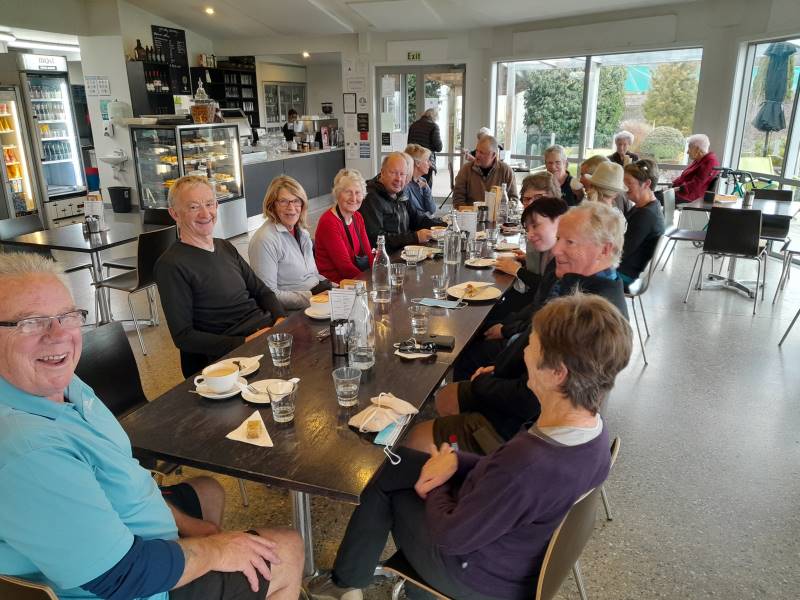
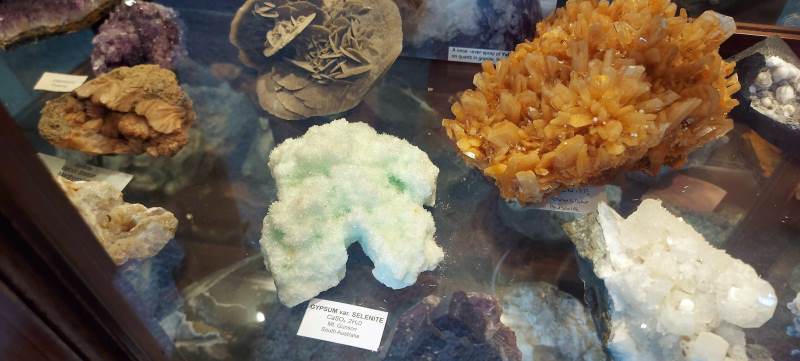
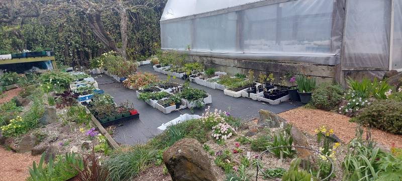
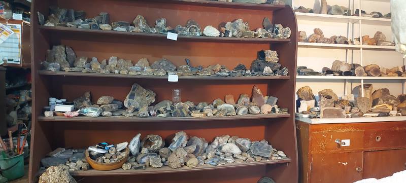
20 hikers set off from the old Carisbrook Hotel through the very run-down Caversham shopping area. We had a couple of stops to look at a bit of the history of the area. There were other points of interest, but with so much chatter going on, decided to give it a miss! We headed up South Road for a morning tea stop at a house belonging to Jan Y’s brother. It is a large property extending right down to just above the main trunk railway line. He has a stall at the Farmers Market every Saturday and has grown and propagated an extensive number of plants. Also has numerous tunnel houses, a couple of fruiting tamarillo trees and an avocado tree. He is a rockhound and there was a very large collection of rocks, crystals etc. on display.
Rocks and propagating Caption and photo HelenPhoto HelenPhoto Helen
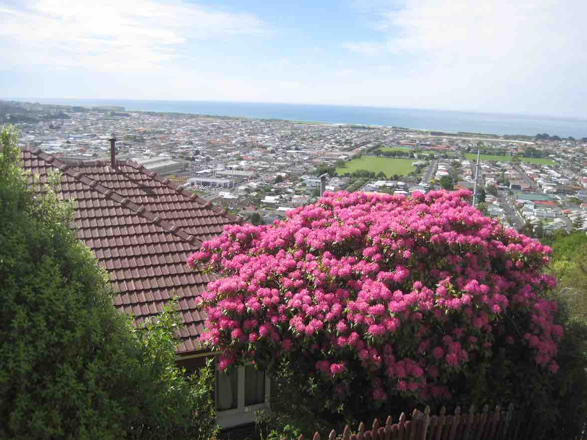
Because there was so much to look at, the morning tea break was a bit longer than normal. We carried on up South Road to the Carlton Hill area, then cut across a couple of streets and back down to Sidey Street where you got a good view of Corstorphine House. From there we headed up a track which took us into the Kew area, with great views of Dunedin.
Top of steps gathering up Caption and photo Helen
Down through a steep set of steps (Killikrankie Pass – a cool name) and we ended up in a park at Forbury Corner for lunch.
Lunch. We were all scattered. Caption and photo Helen
Returned to the cars by crossing over the motorway on an overhead bridge, then walked down a path on the north side back to the cars.
On the overbridge Caption and photo Helen
It was a pleasant day with no wind, and we covered approx 8 kms, at quite a leisurely pace. Several members of the group had lived in the vicinity of area covered so it was a bit of a trip down memory lane for them. Thanks to Jan and Pam who did a very enjoyable recce with me. The Two Jans.
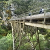
4. 15/11/2015. Hikers. Leaders’ Choice. Lance and Joshiah. Street Walk: Mornington.
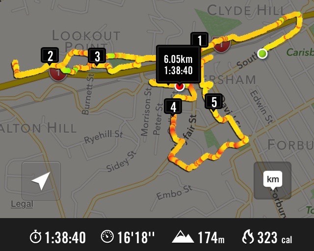
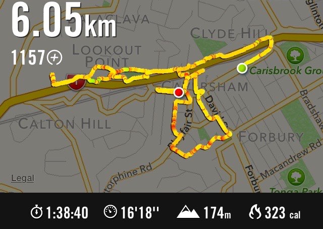
GPS of route. (Forgot to switch on until abt 1 km after start from Unity Park.)
Seventeen of us met at Unity Park, wondering where Lance was going to lead us this time. He took us down High St just a little, across to the Old High St School property, then up through a corner of Mornington Park to the Mornington township. Back down the hill a little, Macnee St took us off into a suburb of Mornington few of us had seen before. Glenpark Avenue took us a long way steeply down and up, surprising us on the way with a bit of handsome Street Art – in the middle of suburbia. We eventually reached the Forfar St corner and down that a bit we stopped off under the shade of a tree in a recreation area for a morning tea break.
Shade on a hot day. (John pic)
Forfar Street led us round to what this reporter reckons has to be the best city view in town.
Best view in town. John pic)
There were views stretching out on our left to the head of the harbour and on the centre and right displaying St Kilda and South Dunedin beautifully stretched out. We stopped and drank in the scene. Some got into chatting with an unusually large well-dressed group of Jehovah’s Witnesses we passed on the street.
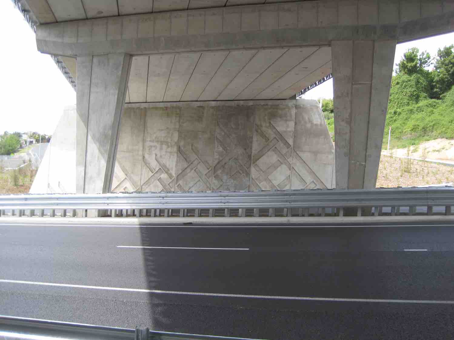
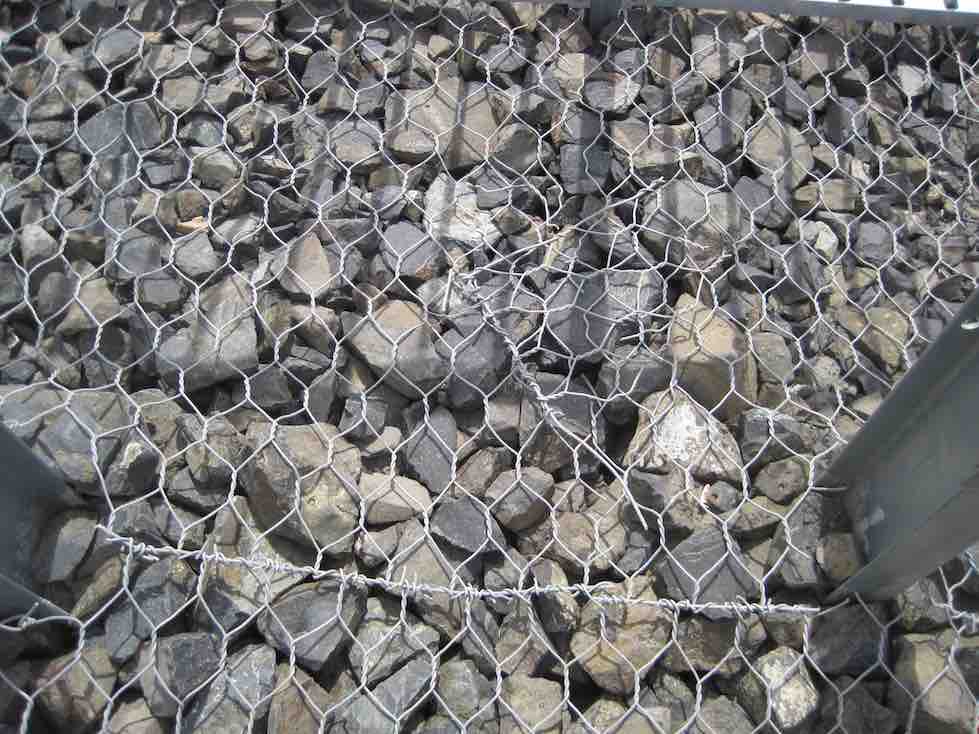
We followed Forfar Street winding on down and down and eventually entered a delightful rough track through an unnamed bush area near the bottom that led us through to the end of Barnes Drive. Now we were into the paths alongside the State Highway before having to confront a long climb up to the Lookout Point bridge at the top.
Close-up of bridge facing. (John pic)Close-up of bridge stone work and netting (John pic)
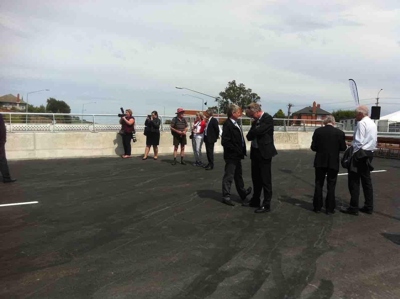
(Lance had earlier found out that this was to be the morning of the actual bridge opening.) Bad/good? timing saw us arrive just at the point where the official ceremony had concluded.
We had just missed the ceremony (John pic)
All the corporate suits and general onlooking public were still there enjoying the “seeing and being seen” of the occasion.
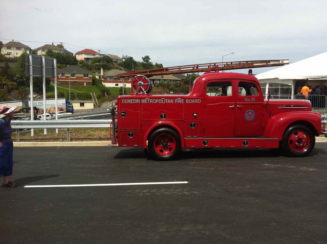
Seen and being seen.The first vehicle to cross the bridge.
We wandered about for quite a while before one or two of us (was Fred the first?) found we humble tramping riff-raff were welcome to join the large crowd in a marquee for nibbles (nibbbles? – sandwiches and savouries galore) and drinks, and passed on the word. Yum. Eventually regrouped, Lance led us back down the way we had come up to stop off at the bottom in a grassy sloping section of Sidey Park for lunch.
Lunch on Sidey Park (John pic)
The day had been hot. We were glad of the break. We were nearing the end of the outing, but not of any struggle. We exited further along by South Road and climbed the Caversham Rise to the foot of Eglington Road. Why did they put Unity Park at its top? It was a long weary climb for the end of a day, but all made it to finish off a day with a difference, capped, of course, by the Lookout Point Bridge opening. Thanks, Lance – and Josiah, for yet another creative Dunedin walk, opening up byways of interest we would never have otherwise known had existed. A hot day. Some steep struggles on hard pavements at times. A rewarding day. Well done. Finished off with a goodly social crowd at The Topiary Cafe. We DID miss you, Elaine! – Ian.
3. 9/9/2015 Street Walks: Caversham. Leaders: Elaine, Bev.
Route map in kmRoute map un-cluttered with km indicators.
On the 9th Sept 24+ Hikers had a enjoyable day around Caversham.
We met at the corner of South Road and Eastbourne Street, walking down south road north to get on to Bridge Street and strolled along a path that was beside the motorway north-going traffic.
Morning tea was at the Barnes Drive traffic lights on a sloping bank and steps.
Morning Tea on convenient set of steps. (John pic)
We walked up the back of the Caversham Valley Road to Aberfeldy Street, where a small car track went up to Baxter House…
Baxter House. (John pic)
…built in 1895 for a David Baxter whose daughter married T K S Sidey, the Mayor of Dunedin.
We also went to Rockyside Road where in 1855 Mr John Thomson the Surveyor for Dunedin built his house. Most of the hikers were unaware about the Baxter House still being there.
We travelled down lots of different streets in ‘Cavy’ and lunch was at the Kew Reserve.
Lunch at Kew Reserve. (John pic)
After lunch, we passed the old Wax Match Factory and up to look at a very well done art work on a two-story building.
Street Art work on wall of former hotel. (John pic)
Then it was back down South Road and along to our cars. Those who wanted a coffee chat stopped off at Flax Cafe first. – Elaine.
2. 9/6/2000. Hikers. Caversham: street walk. Leaders: Bev H, Peggy M, Peter R.
1. 9/6/1999. Hikers. A wee slice of Caversham. Leaders: Bev H, Peggy M, Shirley R.
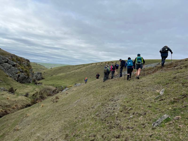
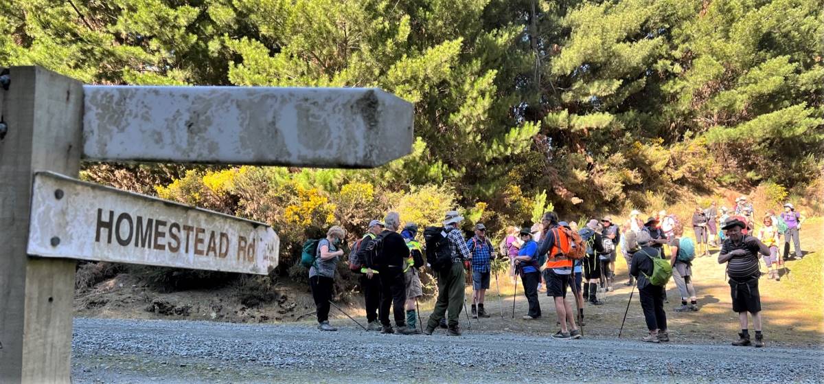
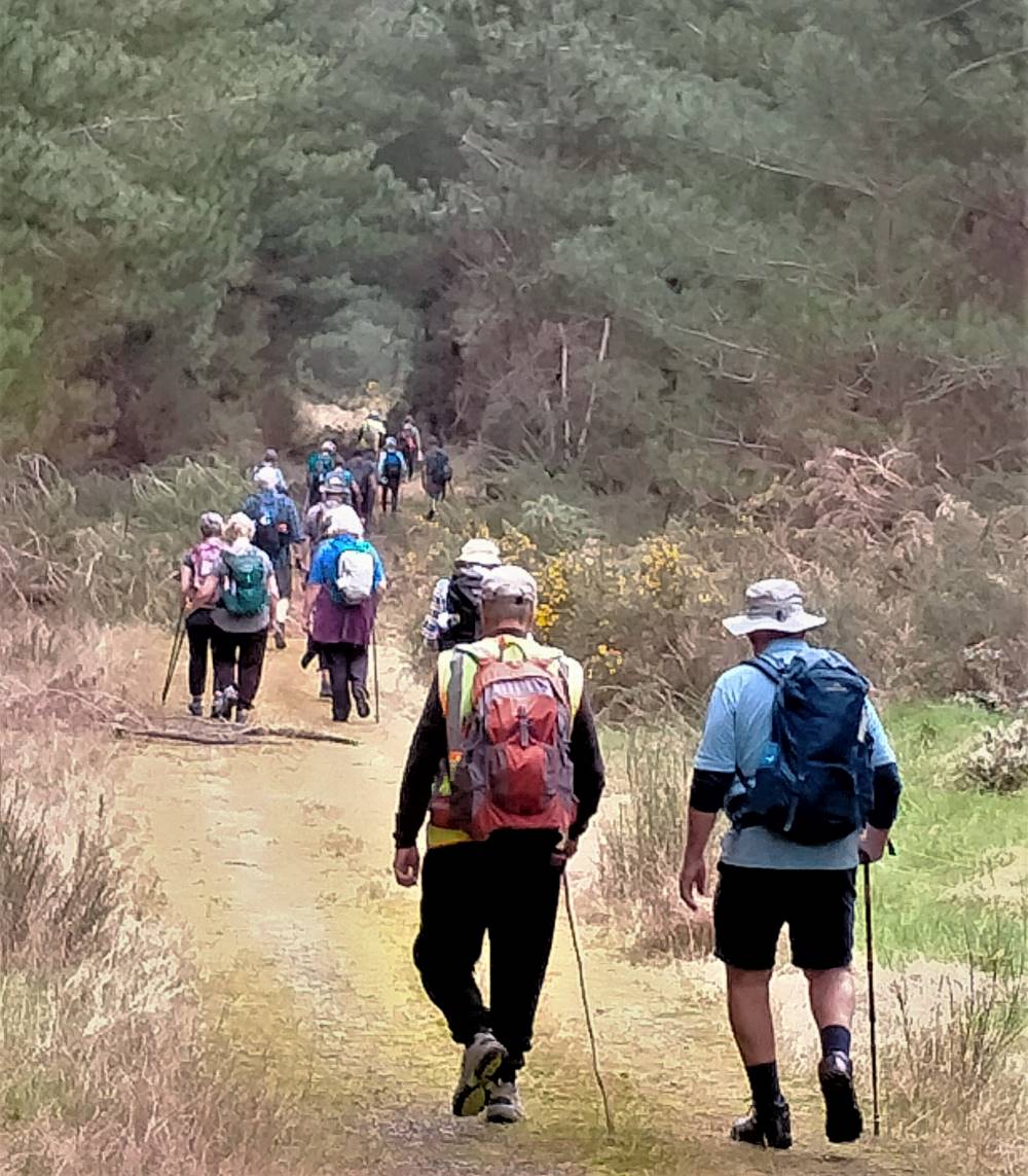
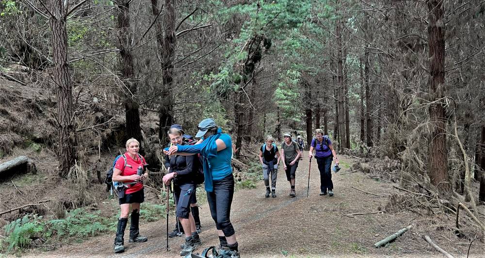
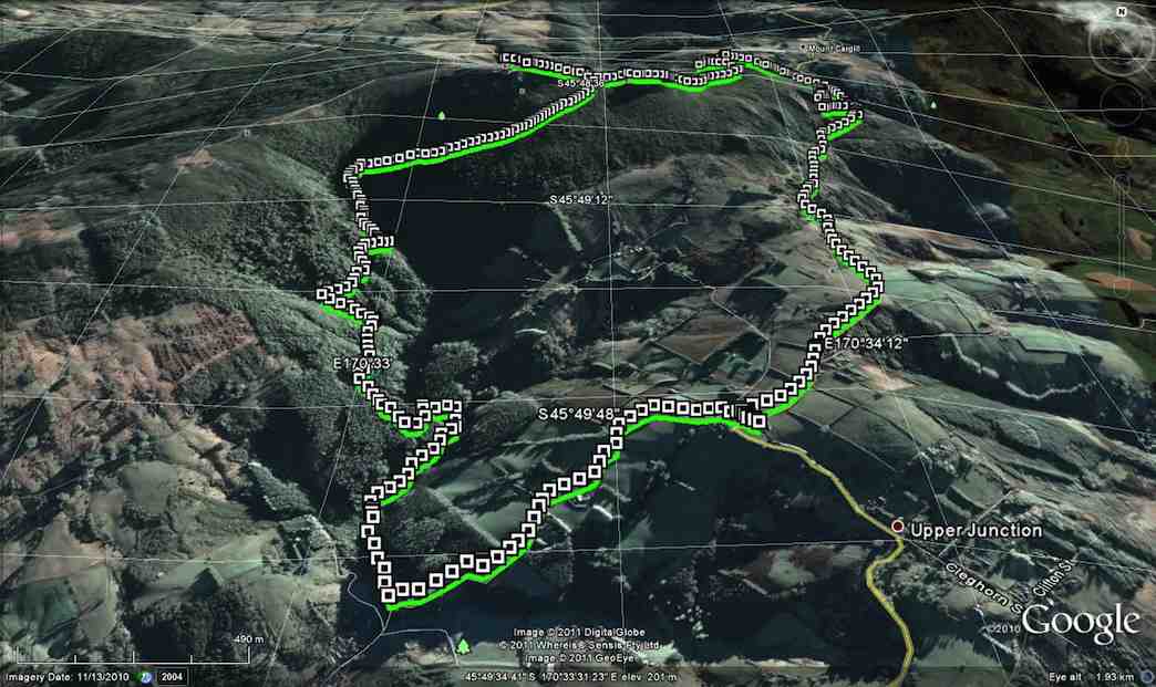
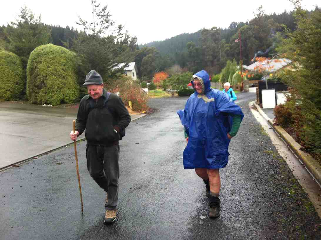
11. 6/09/2023. Combined. Akatore Forest – Narrowdale Rd. Grade 3, 41km, Leaders: Bruce Spittle, Alex Griffin, Sarah McCormack, Phil Morris.
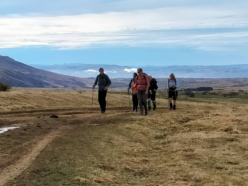
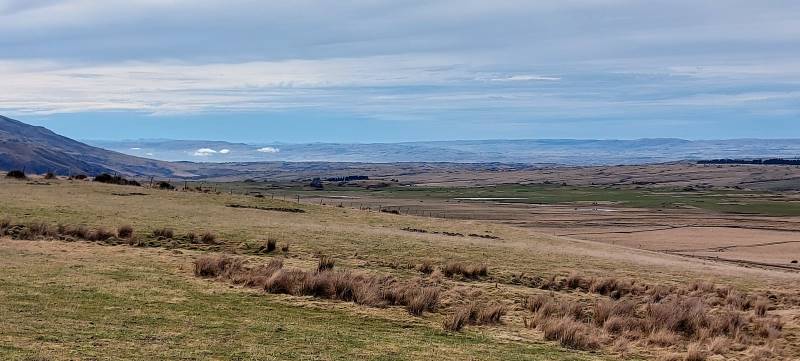
On a goodly spring morning, we headed from Peter Johnstone Park with a good number of trampers and hikers. At Milburn we turned left into Narrowdale Road (of note turning right at same point was Lime works and Whale Fossil Lookout). With Wenita permit conditions, group was split with trampers lead by Phil M and Sarah tramping up old golf course road while hikers lead by Bruce and Alec tramped up Narrowdale Road.
Trampers setting off (photo and caption Jenni)
And the hikers also ready to go (photo and caption Jenni)
The trampers headed past 2 small farms up into pine trees which obscured views but with warm conditions. We continued the climb with a stop for morning tea.
Morning tea in the clearing (photo and caption Pam)
Then along Stoop Road onto Homestead Road. Track conditions were perfect and chatter was aplenty. Time to junction Narrowdale and Homestead was 1.20min, 270 elevation.
Hikers travelling along Narrowdale Road past some belted Galloway cattle then up to the Rifle Range to the left. It was a good spot for morning tea.
Looks like a class photo (photo and caption Jenni)
Llivestock are well trained down here (photo and caption Phil K.
Then on to junction listed above (Narrowdale and Homestead). Time 1 hr, 185 elevation.
Trampers and Hikers rendezvous (photo and caption Pam)
Rays of sun through the trees (photo and caption Helen)
The group continued left along Dale Road, down onto Siberia Road at the junction. We met at Lower Narrowdale Road where hikers and a few trampers travelled on a grassy track for 2km before they stopped for lunch at 12.45pm.
Down lower Narrowdale rd (Hikers – pre lunch)(photo and caption Phil K.)
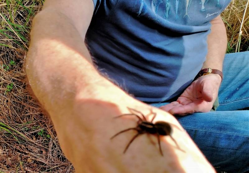
Incy wincy spider on Bill’s arm (hikers lunch) (photo and caption Phil K.)
The trampers continued up Siberia Road…
Yes, it’s uphill, another layer off! (photo and caption Pam)
…with full elevation of 405m, where we turned left along newly-named Scooter Road, with a stop for lunch in the sun at 12.30pm.
Trampers lunch (photo and caption Helen)
After lunch we continued along Scooter Road in search of a view (but none could be found) of prison compounds, Calder Stewart Ltd or Milton township. A decision to return back to meet hikers was made. With the good track conditions, the birds in forest were unable to get a word in, for the continual chatter of the trampers about many scenarios.
A gathering to decide hard or easy back to cars (photo and caption Helen)
The trampers for the 2nd time were a few minutes late so most of the hikers took the Homestead track option, while the trampers headed down Narrowdale Road and back to cars by 15.05pm. The Hikers arrived back about 15.35-15.45. Pollen during the tramp could be seen blowing in the open, hence most had a lime greenish tinge on clothes, shoes. and on cars.
They just won’t go home (photo and caption Phil K.)
It was an interesting part of the Akatore Block, thanks Bruce S for sourcing.
Phil M.
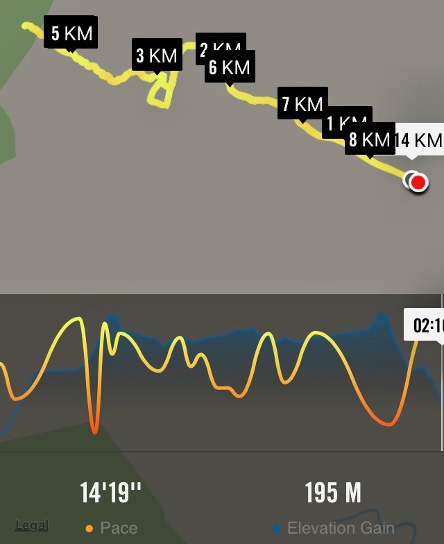
Stats: Hikers 13.5km (phone) 16km (Garmin), elevation gain 324m, travel 4hrs, grade 3
Trampers 15.2km, elevation 405m actual travel 3hs 30min, grade 3.5
Partly because Leone wasn’t available as a leader (swapped with Sabina earlier), George had not done a recce. Although he had a different route in mind, Ian persuaded him to take the gate just down from the Golf Course corner and up the (very) steep track to eventually arrive at the trig.
Glenice and George climbing last stretch to trig.
Gorge Hill Trig.
As there was general feeling that we should return by the usual road route, we went on down through the forestry and farm to Wilkinson Road in the valley, being early enough to climb up it and lunch at the top.
View of forestry plantings taken from Wilkinson Road.
After lunch just below the crest to shelter from the cool wind, we emerged onto Windy Ridge and all its views.
Toko plain with Correction Facility centre right. Keith. What is he looking at?!
A couple more upward slopes across the ridge, and it was down, down and on on along Narrowdale Road and back to the cars safely home before the promised cold hailstone front due in from the south slammed in at afternoon tea time when we were refreshingly showered, sheltered, nourished and warm.
9. 12/7/2006. Trampers. Stewarts Forestry, Gorge Hill, Windy Ridge, Narrowdale Road. Leaders: Graham, Ian
8. 24/3/2004 Trampers. Gorge Hill. Medium. Leaders: Doug M, Bob H
6. 28/6/2000 Gorge Hill – Narrowdale Road. Leaders: Ian, Dot T
5. 21/4/1999. Gorge Hill – via Wilkinson Road. Leaders: Ria L, Joyce, Molly.
4. 10/6/1998. Gorge Hill via Wilkinson Road, round trip. Leaders: George, Hazel.
3. 15/10/1997. Gorge Hill round trip from Wilkinson Road. Leaders: Hugh, Jack M, Ivan.
2. 23/5/1990. Gorge Hill – round trip via Wilkinson Road. Great views of Lake Waihola and Milton. Average. One hill to start. Leaders: Peggy M, Nel v Elizabeth Peg C
(David Nicol was an early settler and dairy farmer. He reputedly bought land here in the hope that the railway line would be routed north through Leith Valley.)
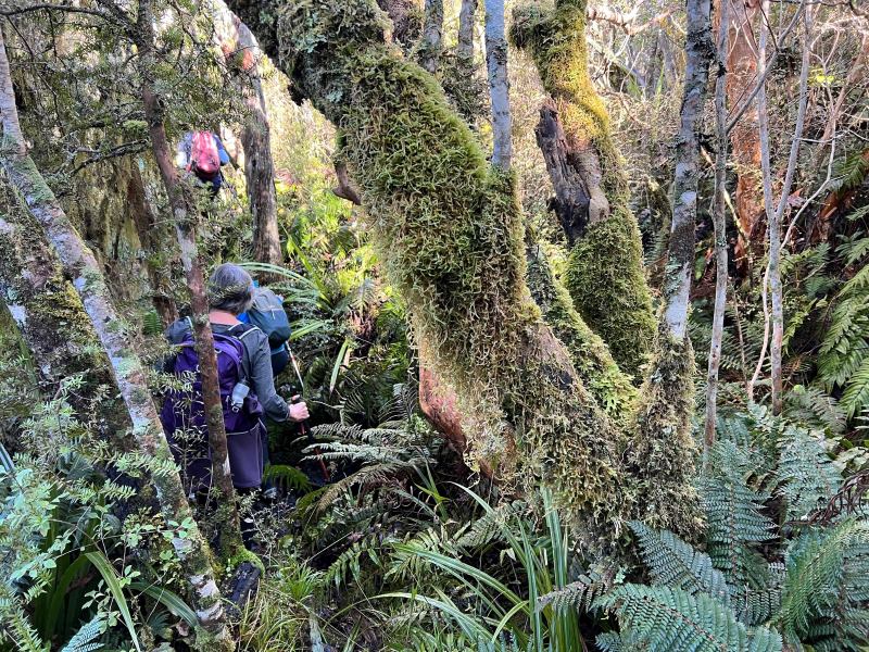
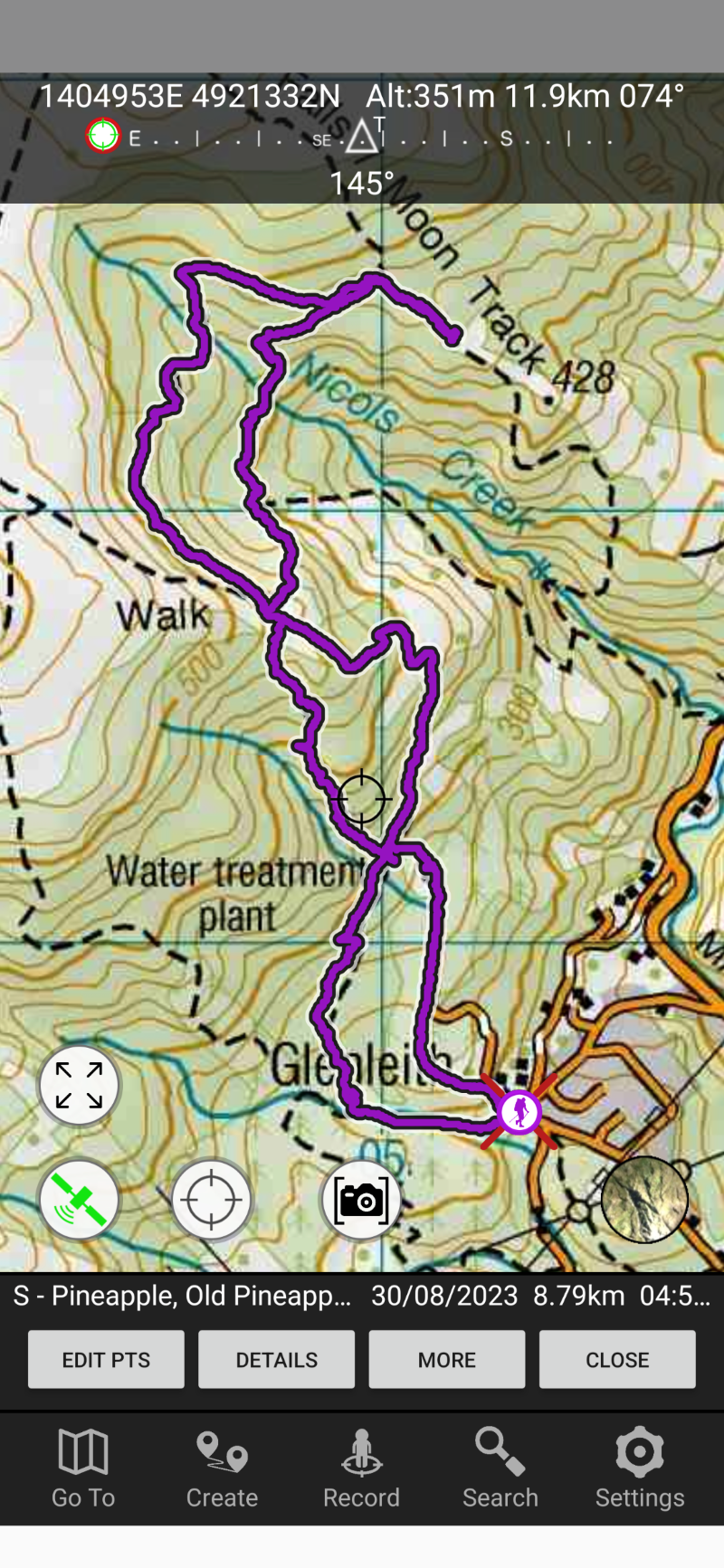
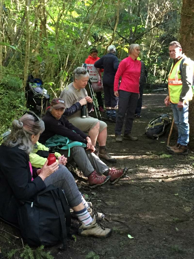
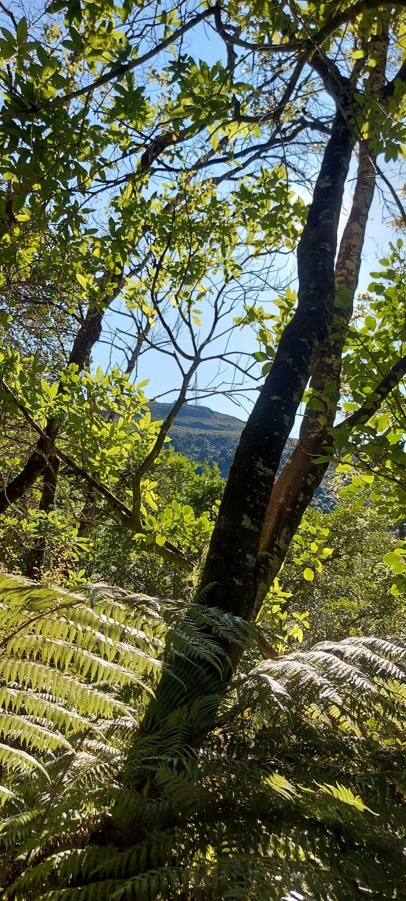
27. 30/08/2023. Trampers. Pineapple Track-Nicols Creek Grade 3.5-4 Leaders: Sarah and John
An Interview with Pineapple Track/Nicols Creek Tramp Leader Sarah by Tail End Charlie, John
Hi Sarah. You were a late incumbent to the leadership of this tramp?
– Yes, Ross was originally down to lead it, but back problems meant he asked me to lead it instead. (Best wishes for a speedy recovery Ross.)
Did you do a recce the Saturday prior?
– That’s right, Craig went mountain biking, and I went exploring on foot, in the area, to finalize the tramp format.
Were the group lucky with the weather on the day?
-The weather was brilliant. Sunshine, little or no wind and temperatures towards the mid-teens. The tracks were reasonably dry.
And did we have a good attendance?
– There were 18 of us – arriving at Tanner Rd/Fulton Rd corner in 7 cars.
What was the tramp route?
-We started on the Pineapple Track, walking up to the Pump House for morning tea.
Getting ready for morning tea in the sun Caption and photo John
Then we carried on up the Pineapple Track, turning off at McGouns Track onto the Old Pineapple Track. This led us to the “new” Pineapple Track by Pineapple Point.
crossing Nicol’s stream Caption and photo Pam
From here we followed the lower track, traversing Nicols Creek before arriving at the Mountain Bike picnic table at 11.55am for lunch.
Lunch with a view worth taking in Caption and photo JohnPanorama – View from lunch spot. Caption and photo John
After lunch it was onto the upper track, traversing Nicols Creek.
somewhere in the bush! Caption and photo Pam
Then onto the “new” Pineapple Track, and back to the cars via McGouns Track.
Heading down the pineapple track Caption and photo Pam
Wahl!! I think you lost me somewhere there! Did the tramp take long Sarah?
– The recce only took me 3 hours. On the day the tramp took us much longer at 5 hours. Some technical terrain reduced the tramp down to a crawl pace in parts.
Did you manage to squeeze in coffee afterwards?
– Only just. We were back at the cars by 3.00pm, then headed straight to the Fire Station Cafe’ in Roslyn.
How would you describe the shape of the tramp?
– Roughly a double figure 8.
Sounds lucky, I think? Thanks for the interview, Sarah.
23 km from carpark. Cars meet at Bethunes Gully.
Click Mount Cargill history for background information. No. 11 on old hardcopy list of 113 club tramps. “Bethunes Gully to T.V. Mast Organ Pipes. Wiggins. Year Round.” No. 100 on old hardcopy list of 113 club tramps. “Bethunes Gully – Brown House – Signal Hill – Chingford Park Year Round”. A broad gravelled track from picnic ground. NB. Opposite Brown House corner is an RSA Memorial to First World War servicemen and the old Junction School.
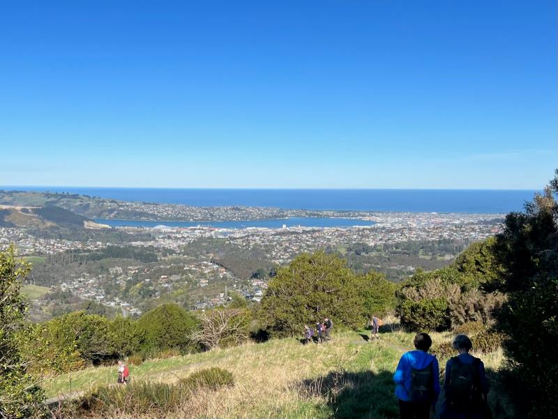
27. 30/08/2023. Hikers. Bethunes Gully to Mt Cargill. Grade 2 Leaders: Bill and Bruce
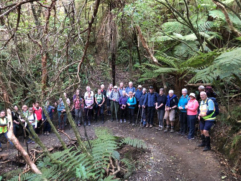
32 hikers assembled at Bethunes Gully carpark on a beautiful if slightly brisk morning. We set off just after 10.00am and after negotiating our way over and around a fallen Pine tree stopped in a semi-sunny glade for morning tea amongst the Pines – these trees must be amongst some of the tallest and straightest in the country.
The track was in pretty good order for winter – minimal mud but slippery rocks and bridges further up the track required extra care – apart from a couple of minor slips we managed to complete the day intact.
Photo Alex
Not long after morning tree it was decided to split into two groups with Jill Dodd volunteering to lead the second pack – there was still only a 10 minute gap between arrival times at the top of the mountain.
A little look at the top Caption and photo HelenBethunes Gully Caption Ady
The birdlife along the way was in great voice and Katrina even identified a Kingfisher welcoming us onto the track. The native bush section of the walk is quite beautiful complete with an abundance of ferns, some majestic old Rimus, clear streams and even the odd waterfall.
Almost there Caption and photo Helen
The steps at the top of the walk are real thigh killers and we were all very relieved to finally arrive at the summit and a well-earned lunch. The 360-degree panorama of Dunedin, the peninsula and surrounding districts is stunning and well worth the effort! The temperature was up around 15 degrees and led to many layers of clothing getting tucked away into packs.
Photo BarbaraPhoto Barbara
There was a discussion during lunch re the grading of the walk and while officially it is a 2 the majority agreed that it was more like a 3 – Ady told me during coffee that it felt more like a 6!
Group trip heading down. Caption and photo Jenni
After a fairly uneventful trip back down we adjourned to the Blacks Road Grocery cafe – this slightly quirky cafe was a lovely place to conclude a very enjoyable day – coffee and treats well deserved!
Blacks Road Cafe – very cool afternoon tea venue Caption and photo Jenni
There was a lot of learning in my first hike as the group leader, particularly around identifying the appropriate pace to set and the timing of breaks. I couldn’t have asked for better support from the more experienced members of the group as I negotiated my way through the various stages and protocols on the day. Special thanks to Bruce, Jill and Jenni but many others chipped in to keep me on the straight and narrow.
All in all a lovely day and living proof that age is no barrier to serious physical achievement.
Cheers Bill
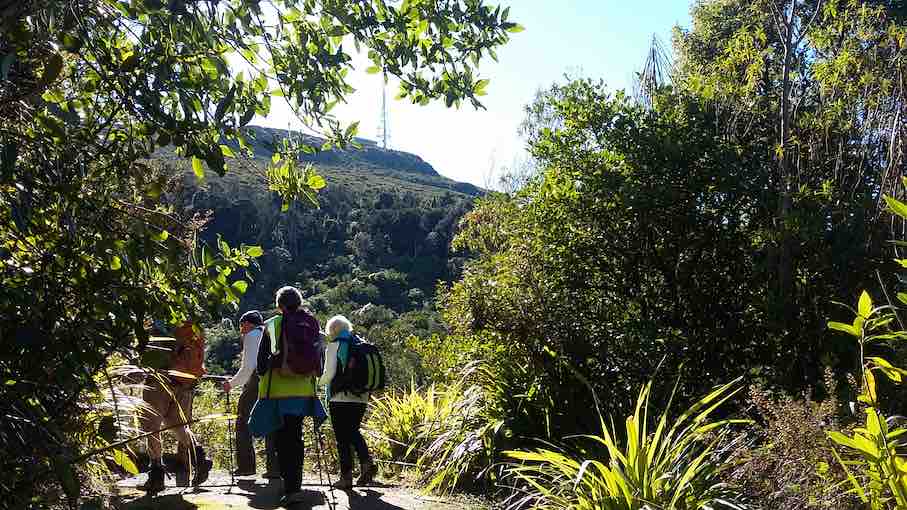
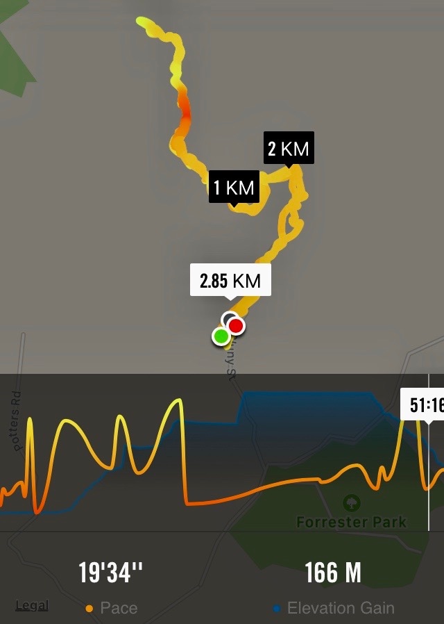
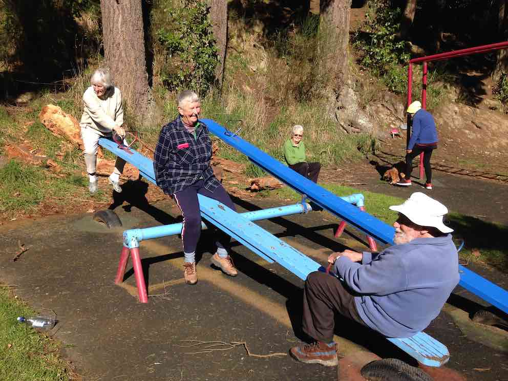
26. 16/08/2023. Trampers. Forrester Park and environs. Grade 3, $6, 23km, Leaders: John Gardiner, Dave Roberts
After the cancellation of the previous two week’s tramps due to the weather, 27 eager trampers were “chaffing at the bit” when they arrived at Forrester Park.
Getting ready to leave the cars (Photo & Caption John)
Weather conditions weren’t quite ideal, but were pretty good, for a chance to finally get out and enjoy each other’s company, and get some exercise.
Not a bad line up (Photo & Caption Phil)
The Forrester Park area was known to most, but some weren’t very familiar with it, or hadn’t been there for some time. With some new members and regular hikers, we initially did a circuit around the perimeter of the park, on cycle trails. For Alex Griffin , it must have been satisfying to experience these trails again, having supervised their construction by Task Force Green members, many years earlier.
The pristine boots of hikers Bill and Alex (Photo & Caption John)
We stopped at the public toilets at about 10.50am, and again for a regroup at the park’s “Gate to Nowhere.” A novelty, the gate sits at right angles to the end of an existing fence, left presumably after an earlier fence was removed. The gate is, of course, padlocked shut! Anyway this initial stroll gave everyone a chance to see the park’s amenities; the football fields, dog-park, Dog Club building, and BMX Track.
Starting off passing the Forrester Park Dog Exercise Area )Photo & Caption Pam)Morning tea in the sun (Photo & Caption John)
Morning Tea was enjoyed in the sun, overlooking the, “Events Car park”, with it’s established and recently developed native plantings, complete with two resident Pukeko.
Kereru resting up••• (Photo & Caption Pam)
From here we walked across the road to Bethunes Gully, arriving at a cycle trail above the vehicle entrance at 11.45am. A myriad of cycle trails lie on this side of the forested hill, north of the main vehicle driveway. Having explored some of these, including some “make shift” accommodation found in the forest, we descended to the main gully track, went up the hill a little, then off to our left onto a cycle trail.
Plenty of matchsticks to build survival cover (Photo & Caption Phil)••• and over bridges (Photo & Caption Pam)
This trail, complete with boardwalks, took us uphill through forest and bush areas, before we again came out onto the main track. A steeper uphill climb saw us rewarded when we arrived at the waterfalls, before we back tracked to a suitable bank to sit on and have lunch.
Don’t go chasing waterfalls. On the Bethunes Gully Track (Photo & Caption John)Lunch spot (Photo Alex)
This 30 minute break ended at 1.00pm, when we were on our way downhill again. Those who thought their efforts for the day were winding down had one last surprise in store! By 1.15pm we were back into the bush again, climbing to the highest point of the cycle trails, we had initially explored upon entering Bethunes gully. An advanced cycle trail, complete with jumps, then one with the endearing name of “Dead Cow Gully” taking us back to the Bethunes Gully entrance. The twists and turns of these mountain bike trails provide an adrenalin rush, a physical and mental challenge, to master on a bike. When walking these twists and turns, they provide a less frenetic, but almost as emersive experience.
Beautiful straight trunks of the “ Red Woods” (Photo & Caption Pam)
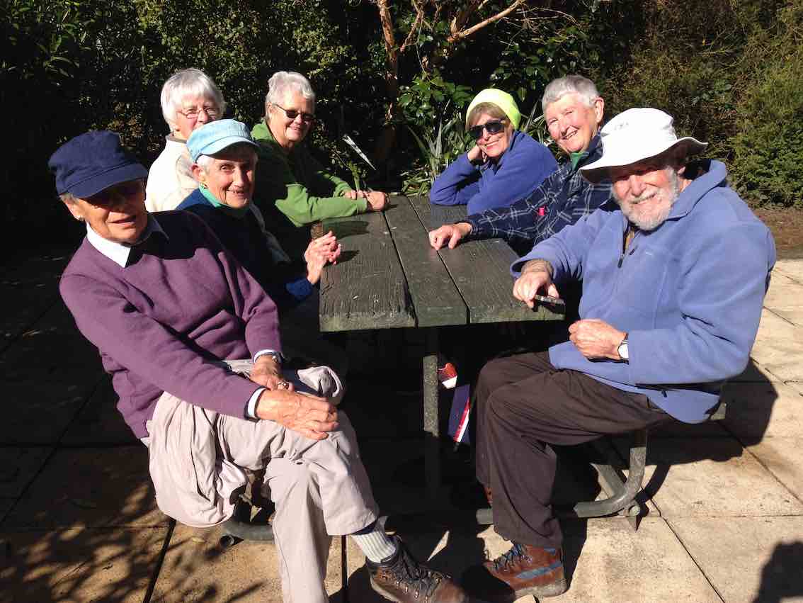
By 2.05pm we were back at the cars, with four cellphones giving four different figures regarding how far we’d walked. Somewhere between 7.84 and 10km was the range, with two phones reading just on 9km, so we’ll go with 9km! Afternoon tea was enjoyed at Blacks Road Grocer, which we filled to capacity.
Enjoying the quirky Cafe at Black’s Road (Photo & Caption Chris)Very yummy (Photo & Caption Phil)
A thank-you to Christopher and his staff, for his hospitality, and speedy delivery of hot drinks to our band of 27. In summary, an enjoyable day. The Forrester Park and Bethunes Gully area is a versatile one for tramping or hiking, providing lots of options, it lends itself to a future combined Wednesday outing. Thanks to Dave Roberts for accompanying me on the main rece and acting as tail end charlie on the day.
Regards,
John
25. 15/7/2020. Hikers. Bethunes Gully, Mount Cargill. Leaders : Mike and Jim
With scenes reminiscent of recent National Party musical chairs, the leadership of the outing changed a few times prior to the hike due to unforeseen circumstances. A cabinet meeting in the Bethune’s Gully car park settled on the hike being led by Mike Webb with Jim Finnie acting as Tail End Charlie.
It was a mild drizzly day when nine of us headed out of the car park to start walking the track up to Mt Cargill. We soon found a large tree to shelter under while we had morning tea. This was after passing Andy Cunningham and his famous dog Meg coming towards us. Many will remember Meg as the dog who was missing in the bush near Purakaunui for weeks last year. She still has health problems from her ordeal but has a loving owner to help her along.
Photo and Caption Adi – “Morning tea stop, 5 minutes from the carpark, protected from the light drizzle.”
After a short break we started the long slow steady climb with a few stops along the way to catch our breaths and regroup. The views from the lookout points on the track were not as scenic as usual due to the low cloud and drizzle.
Photo and Caption Adi – “A pause giving a photo opportunity.”
Photo and Caption Mike – “Happy Hikers.”
After a couple of kilometres on the track three members of the team decided to call it a day and head back. That left six of us to carry on for a bit longer before a decision was made for the hike to be cut short and for us to return to the car park.
Even though we didn’t make it to the top, it was a pleasant outing with good conversation. The main group hiked a distance of 6kms.
Mike
It was a cool day, which was fortunate given the up-hill nature of this track. A small number turned back after 1.5 hours, and the remaining intrepid folk turned back about 1.5 km from the top. All met up at the Gardens cafe for an enjoyable coffee (actually it was better than enjoyable, it was down right delicious), the early birds having eaten their lunch before arriving at the cafe, and the later folk waited until they got home. Thanks to the planners and those who finally lead the party.
Adi
24. 25/9/2019. Trampers. Bethunes Gully, Mount Cargill. Jill D.
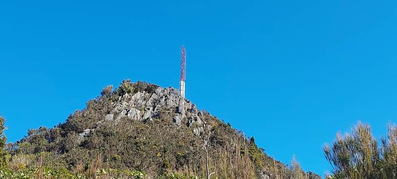
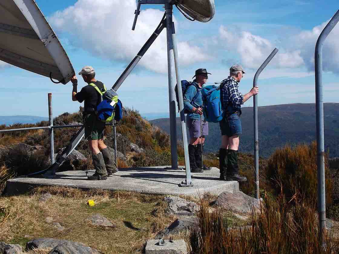
With a very threatening weather forecast 16 intrepid trampers parked at Bethunes Gully ,before traversing the track towards the television tower at the summit of Mt Cargill 600 meters above .We were greeted with birdsong along the way .The vegetation changed as we followed the track through pine plantation then opening to more scrubby vegetation but it did provide shelter from a southerly wind.
A welcome morn. Tea. (Gordon pic and caption.)
Along the way we had views over to the peninsula and harbour areas and also to the famous Brown House location -this providing some interesting reflections of party times of our younger days !!
There were clear views of the summit ,tower and nearby Buttars Peak .We knew we were getting closer to the top with the noise of the wind whistling through the tower .
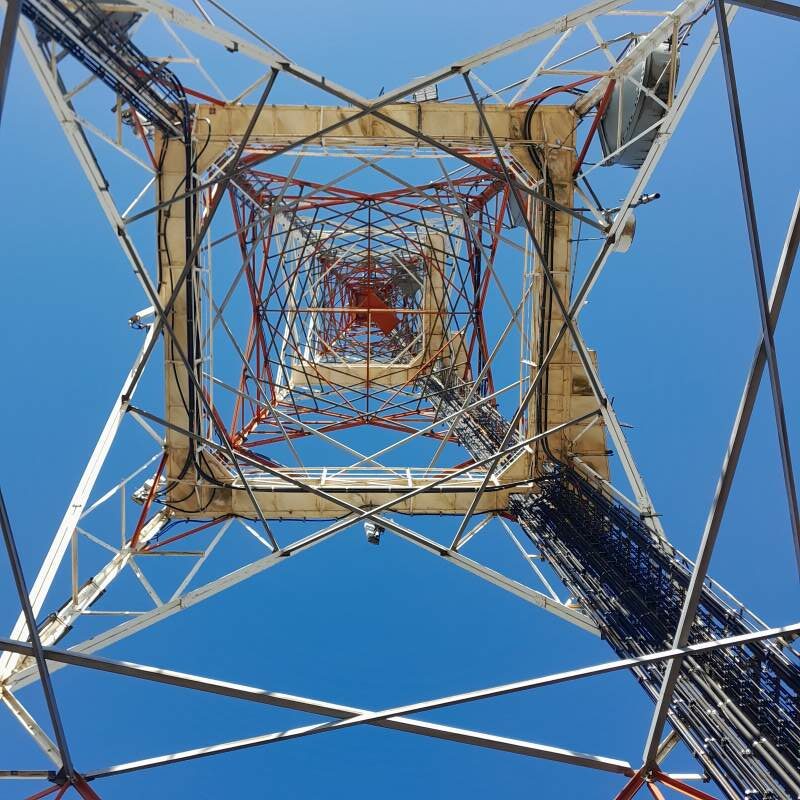
The cell Tower. (Gordon pic and caption.)
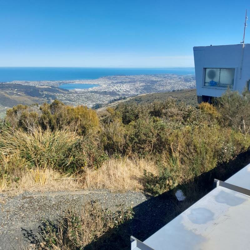
The views from the top were amazing almost 360 degrees north up the coast east and west and to the south over Dunedin however we didn’t stay long up there.
Heading down. (Gordon pic and caption.)
Lunch was at the the junction to the Organ Pipes and Buttars Peak
Lunch at intersection of Buttars Peak @ Organ Pipes. (Gordon pic and caption.)
where a smaller group checked the peak out
Checking the photos. (Gordon pic and caption.)Caught!! Gordon putting his camera away!. (Dave M. pic and caption.)View of Dunedin from Buttars Peak. (Gordon pic and caption.)
before rejoining the rest of the group on the descent.
This was a shorter walk over a well formed gravel track even the steps on the final ascent to the top appear to be newer and easier to negotiate
Some of the steps to the summit. (Gordon pic and caption.)
– all in all 10.4 kms and clean boots !
The coffee stop was at the Crocodile cafe at the Gardens ,where we rearranged the seating and general chit chat creating a relaxed end to the day .We were very lucky the weather held out till back in Mosgiel. – Jill D.
23. 28/8/2019. Hikers. Bethunes Gully. M. Leaders: Jay and Jan B.
On Wednesday 28th August 2019 24 Hikers/Ramblers met at Bethunes Gully to walk up to Mt Cargill. The day was suitably warm and made for pleasant walking conditions.
Muster of hikers and ramblers at Bethune’s gully. (Clive pic and caption.)
7 Ramblers organised themselves to walk up as far as they wanted and they were joined by another member who decided to go back with the Ramblers and the remaining 17 took off at a steady pace up the gradual climb to near the top where there were 127 steep steps to negotiate to bring us to the communications tower at the top of Mt Cargill.
A view of the top. (Clive pic and caption.)
There we sat in the sunshine having lunch and admiring the 360 degree view of Dunedin and up the coastline to Karitane. After a good rest we started our downward hike.
On the way down. (Clive pic and caption.)
We all took our time getting down the steps as most people find going down is harder than going up. On the way back one of our long standing members [It was our 90-year-old Doug! – Ed.] was having trouble with his legs as they had lost strength and were feeling jellylike. But hardy fellows in the group stood on each side of him and helped him back to the carpark. Well done men!!
Clive and Lindsay took him to A & E where he spent the night. All was well.
Coffee was at the Gardens Crocodile Cafe. Leaders for the day were Jan and Jay.
Ramblers: Out talking and watching the birds on the Bethunes Gully track.
Route map, courtesy Ian. We went “about as fur as they (we) can (could or wanted to) go.” (From everything’s up to date in Kansas City).
A record crowd of 8 of us climbed the track out of the Gully as far as we felt like it. Lunched at an early 11.30 a.m. beside the track, and sauntered back down to enjoy a leisurely sit in the sun back in the domain, to wait out the delayed return of the Hikers.
Ramblers enjoying the sun. (Raewyn pic and caption.)Ramblers – kids at heart. (Raewyn pic and caption.)
Birds, their song and tiny fresh spring fuchsia leaves containing bellbird-nectar-sipped flowers where highlights.
P.S. Doug at home the next afternoon, was ruefully nursing his shattered pride, as he came to terms with what had happened the day before. – Ian.
22. 13/9/2017. Trampers. Bethunes Gully. M. Leader: Eleanore.
A record number (9 female and 8 male) trampers drove to car park at Bethunes Gully and started the steady climb up, up and up some more on a well maintained track.
Firstly, alongside Lindsay Creek. The track climbs steadily up the flank of Mt. Cargill, first through pine forest and then regenerating native forest. We found a cosy spot and enjoyed a smoko break. Once again we climbed steadily to the top of the ridge between Mt. Cargill and Buttars Peak. The intersection to the Organ Pipes Track was reached, by now we knew the mast was getting closer. Only to find we had to climb steps to reach the top!
(Margreet pic and caption.)
The weather was calm and the views fantastic.
On top of Mt Cargill looking towards Taiaroa Heads. (Phil pic and caption.)
For quite a few members it was a first time visit to this track. Also, the company of the intrepid adventurer Judy Knox was enjoyed. We continued onto the A.H. Reed track where lunch was had.
Lunch view. (Helen pic and caption.)
The beauty of this track is the downhill—all the way to the car park!
We chose the little coffee shop near Baldwin Street for coffee, cake and a chat.
Coffee. (Helen pic and caption.)
We travelled 10.9km and climbed 676 metres to the mast on top of Mt. Cargill
Another great outing had by all. – Eleanore Ryan.
21. 28/9/2016. Hikers. Bethunes Gully. H. Leaders: Adrienne and Judy K.
Route map of trek only to the top. (Sorry, jammed up the app.)
21 hikers with an age range of 12 to 89 (is that a record?) gathered at the car park at the start of the Bethunes Gully track. It was fine (well, not raining anyway) when we left Mosgiel, and dry at the start of the track, but a nasty creepy little drizzle hung round us the higher we went. Loud bird calls accompanied us for the steady climb up the gully on a well-formed track, slightly muddy in places, across several bridges where the creeks were running a bit higher than usual, to a welcome morning tea break on the side of the track.
Morning Tea stop. (Adrienne pic and caption.)
Slow and steady was the order of the day, with plenty of stops to get breath back. Up – and up – and up. Several fell by the wayside – first two, then two more. When at last the junction for the Organ Pipes and the Mt Cargill summit was reached, 10 more subsided and declared “Lunch!”
An intrepid 7 continued another half hour to the summit (a first for some), up the steps in annoying drizzle. No views available from the top.
The misty summit. (Adrienne pic and caption.)
so it was down to the junction again for lunch.
Lunch in the cloud, back down from the summit and at the junction. Where had the others gone? (Ian pic and caption.)
By which time the other 10 had departed, it being a bit cold and damp to hang around.
Down – and down – and down – collecting strays as we went. Fred wasn’t present but his chocolates were, and much appreciated, thanks Fred. It was warm and sunny back …
Our welcoming crowd at the end. (Adrienne pic and caption.)
… at the cars so parkas were discarded for the ride to the Botanic gardens and a well-earned (we think) coffee stop. – Adrienne and Judy K.
20. 30/9/2015 Trampers. Bethunes Gully, Mt Cargill, Organ Pipes return.
Bethunes Gully track was the destination for the day, & 9 keen trampers arrived at the car park in Bethunes Gully, ready to tackle the continuous climb up to the transmitter mast at Mt. Cargill.
We arrived at the picnic spot about 3/4 of an hour up the track, but the leaders misread the sign, & decided that it wasn’t the correct place, but they were called back, & we all had a relaxing morning tea break in the sun. Then it was up the track some more, with a few rest breaks till we reached the junction with the Organ Pipes track, where we had another short break before heading off up the terrible track with the very large steps to arrive at the transmitter mast on top. This section is getting worse as time goes on, or is it just the mind thinking that way ??
After a good look around…
Top photo One (Ken pic)Top photo Two (Ken pic)
… & a chat with a guy from the university language department who had a group of very well dressed [all in black suits] Chinese visitors to the city, we made our way back to the Organ Pipes track. After a regroup here, we walked down to the Organ Pipes …
Eric (Ken pic)
… where I could see how my handiwork on the boardwalks was standing up from nearly 20 years beforehand. We had lunch at the Organ Pipes, then retraced our steps back down to the cars at Bethunes Gully. It was a very nice day for a tramp, with only the slightest breeze at the top, & some weak sunshine all day. I think everybody enjoyed the day, despite the grumbles about the steep climb, & those terrible steps !! We stopped off at the new cafe in the shop at the bottom of Baldwin Street for a coffee, just to keep up the tradition of the Trampers Coffee Club. This cafe is owned by the former owner of the ‘Flax’ cafe in Caversham.
Walked 10.9km
2h 53m moving
3.7km/h
climbed 679m
max height 672m – Ken.
19. 21/9/2011. Bethunes Gully, Mt Cargill, Buttars Peak, Organ Pipes, Old Main North Road, Brown House corner, Norwood Street, Bethunes Gully.
GPS of tramp, clockwise, courtesy, Ken
Nine of us did this tramp, the most we have had out for a while, and one that the club had not done since 2006!
We were surprised with the new (?) bike barriers, although we still met a biker further on up the track.
Cycle barrier
Doug (nice knees?) and this reporter (the eldest two in the group) elected to remain at the track junction, letting the others (one or two who had never done it before) go on up to the top.
Relaxing in sheltered comfort
Their only reward was to reach the summit. Mt Cargill was entirely cloud-capped. Too bad! Doug and I rested in complete shelter from the cold Norwester. Even down where we were, we could see the mist still briskly blowing across the saddle below us. See Moving Mist
It was a surprise later on, on the former main road and nearing the old Brown House site to see the lovely-but-misleading external sight of the cloud cover we had bracingly experienced from the inside.
Cloud over Mt Cargill. Mast just peeking above cloud, barely discernible to the left of the cloud’s apex..
Another good tramp. Bethunes Gully track is still no less steep at the beginning before easing off further up. – Ian
17. 5/5/2010. Both. Bethunes Gully, Bike Tracks. M-. Leaders: Bob and Evelyn.
We parked cars at by the toilets at the end of Cluny Street (that’s what the Map said. Didn’t know that before.) in Bethunes Gully. Bob and Evelyn were to turn on a delightful surprise for us all. They led us back down the road to the gate to discover for us on the left a bike track leading up through the trees. We admired the loving attention lavished on the system of tracks by bike devotees as we climbed up through the un-pruned Oregon plantation. After a morning tea stop we ascended yet further to reach the plantation’s NE corner. Then it was down to our left back into the gully.
The tops of the tall Oregons.
Looking up at the tall Oregons. Wendy, Sabina, Peter, George, Lex, Ken.
We emerged at the head of the grassed part of the gully at the bridge across the Lindsay Stream.
Sturdy bridge
From here it was up the Mount Cargill walking track, stopping for frequent rests, one of which was by a small track on our left promising to lead eventually to Campbells Road in Pine Hill. (Bob and Evelyn had recced it, but it ends in dense gorse.) Eventually we reached the Lookout down on the right of the track where we stopped for an early lunch.
Bush view from the lookout.
After the leaders had ascertained all seventeen of us were back up onto the walkway from the Lookout, (with Ken obtaining dispensation to carry on on his own to Mount Cargill, as he had come in his own car), they took us part way back down the walkway before striking off on the right up a rutted vehicle track through the bush,
How did they lift the smaller on top of the larger? Leader Bob strikes a pose on the vehicle track
… from which eventually a track led off to the left and down to parallel the walkway back down the bridge and then it was just a short walk to the cars.
Thanks to Evelyn and Bob for finding us a new set of tracks in a Bethunes Gully we had thought we knew all about already. – Ian
16. 24/5/2006 Bethunes Gully, Mt Cargill, Buttars Peak, Organ Pipes,Old Main North Road, Brown House corner, Norwood Street, Bethunes Gully. Leaders: Judy, Tash 15. 15/6/2005. Trampers. Bethunes Gully, Mount Cargill. Leaders: Hazel, Ria. 14. 23/5/2007. Hikers. Bethunes Gully, Mount Cargill. Medium. Leaders: Betty, Dot T. 13. 5/11/2003. Trampers. Bethunes Gully, Buttars Peak, round trip. Medium. Leaders: D Jenkins, B McCabe 11. 28/8/2002 Bethunes Gully to Mount Cargill, Organ Pipes return. Leaders: Ray & Diana, Val 10. 16/5/2001. Bethunes Gully. Leaders: Nancy, Dot and Nelson. 9. 19/4/2000. Bethunes Gully, Mount Cargill. Leaders: Judy C, Mary M, Bev McI. 8. 27/5/1998. Bethunes Gully, Organ Pipes, North Road. Leaders: Hugh and Judith. 7. 25/3/1998. Bethunes Gully, Organ Pipes return. Leaders: Betty, Denise. 6. 25/3/1998 Bethunes Gully to Mount Cargill, Organ Pipes return. Leaders: B Bryce, D Pearce 5. 30/7/1997. Bethunes Gully, Mount Cargill. Leaders: Diana and Ray, Catherine. 4. 9/7/1997. Norwood Street, Bethunes Gully, Opoho. Leaders: Shirley McN, Pat, Wendy. 3. 27/9/1995. Pine Hill, Mount Cargill Track, Waitati Road, Bethunes Gully, North East Valley. Medium+. Leaders: Ria L, Catherine, Ria H, Shirley R 2. 12/5/1993 Pine Hill Road, Cowans Road, Mt Cargill, Old Mt Cargill Main North Road, Return Bethunes Gully, North East Valley. Back to Pine Hill Road. Leaders: Ria L, Catherine T, Penny & Peter 1. 11/4/1990 Bethunes Gully, Mt Cargill, Buttars Peak, Organ Pipes,Old Main North Road, Brown House corner, Norwood Street, Bethunes Gully. Leaders: Margaret S, Hartmann, Bev H, Peter R
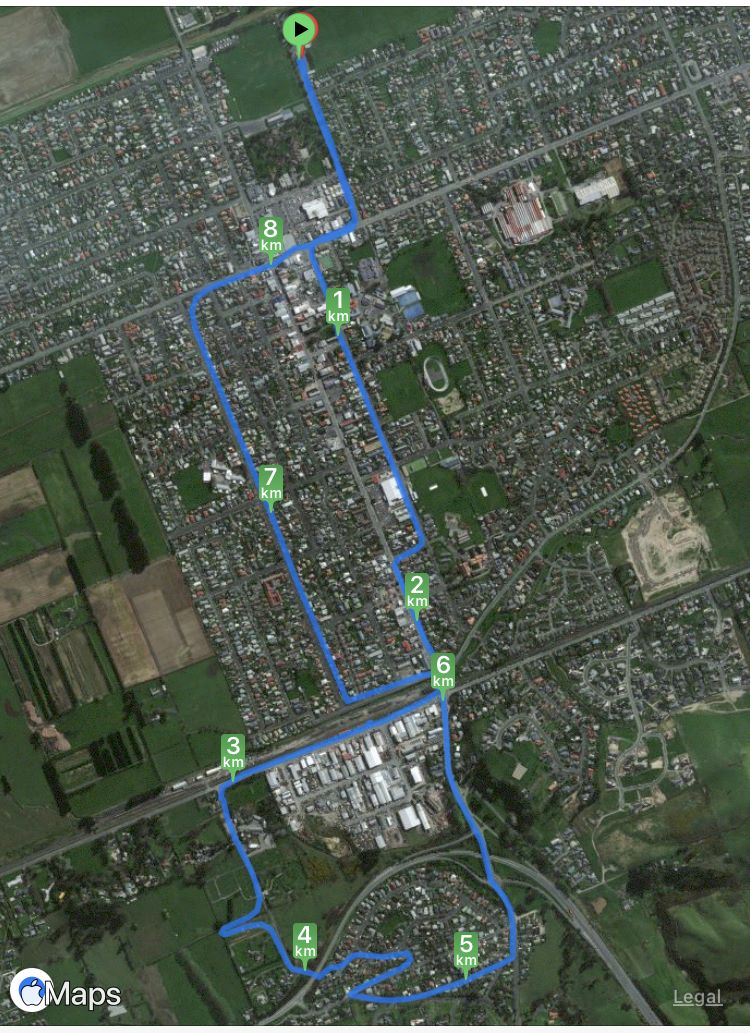
10. 16/08/2023. Hikers. Mosgiel Street Walk. Grade 1, $0, 9km, Leaders: Raewyn Keene, Helen Morris
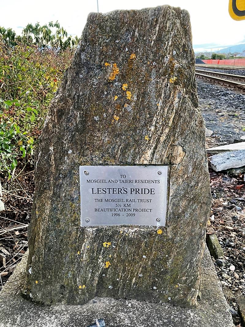
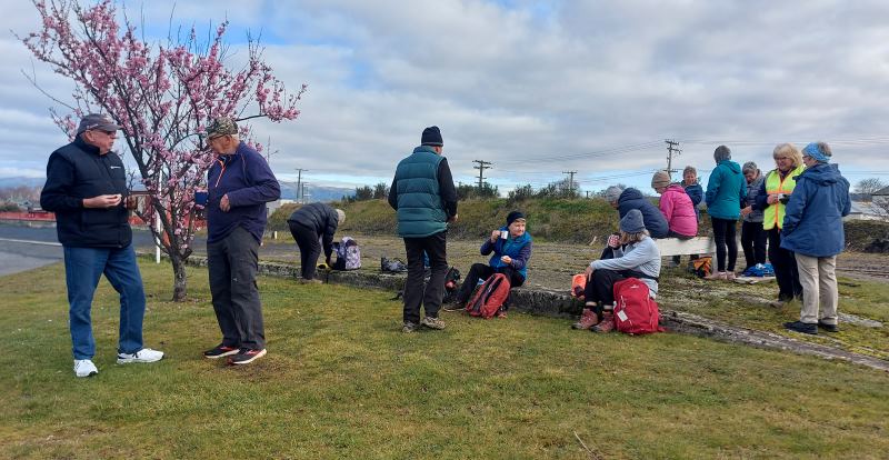
It was a little frosty as 14 hikers set out from Peter Johnson Park for a street walk till lunchtime. Along Reid Street to Factory Road, Church Street to Gordon Road, the pace was steady. As we approached the railway crossing (and unknown to some of us), was the plaque about our own Lester and his beautification efforts.
Lester’s Pride (Photo & Caption Helen)
As we continued on to the old Mosgiel Railway Station for morning tea, it was great to see the daffodils & blossoms beginning to bloom, indicating Spring is not far away.
Spring has sprung early (Photo & Caption HelenMorning tea (Photo & Caption Helen)
Refreshed and with the sun trying to shine, we headed off to Cemetery Road, ventured into the new Grange Lifestyle village as far as we could go, and back out to the underpass into Kinmont.
On Kinmont (Photo & Caption Helen)
Some hill climbing was considered necessary to get our hearts pumping, so up Leith, Clyde & Braeside Streets we went. Back down to Quarry Road and left at Nellies, we looped back to our cars via Argyle Street & Bush Road.
Ross C joined us today and was apparently looking forward to a ‘flat’ walk (as advised by his lovely wife) – oops! Hopefully the friendly chatter along the way helped.
All in all, a pleasant morning’s walk, good company and 9kms achieved.
Map (Photo Helen)
The Harwood hike will be rescheduled into the summer programme.
Helen & Raewyn
9. 20/07/2022. Hikers. Mosgiel Silverstream/Wingatui. Leaders: Jan & Jenny.
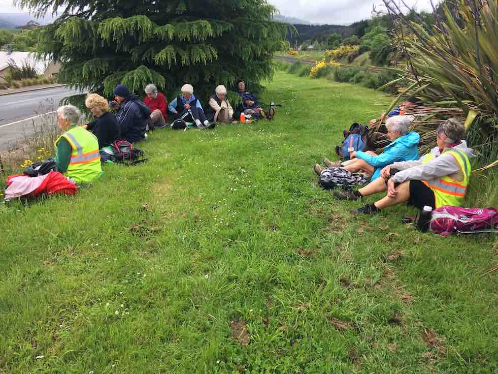
On a dismal Wednesday morning, 13 of us set out on our walk around Mosgiel. We walked down the Silverstream which was running higher than normal, lifting our feet over the pesky tree roots, and had morning tea down the end of the track to fortify us for the walk ahead.
Baker’s Dozen minus one, post morning tea (Photo and caption Phil)
We walked down Silver Springs Boulevard which brought us out to Centre Road. Crossing over to Hagart Alexander Drive we took the first left onto Ben Lomond Drive in the Highland Park subdivision and came out onto Wingatui Road. Further up the road we spoke with Ady outside her house, chastising her for not being out walking with us.
Why hello – we thought this was a respectable neighbourhood (Photo & caption Phil)
We then carried on up to Gladstone Road and at the junction with McFadden Drive we climbed the steps up onto Joe Brown Drive, taking the 2 to a 2.5, took a left and back down McFadden Drive onto Gladstone Road again. At the lights we crossed over to Gladstone Road South.
We did have a bit of a workout – 88 steps (Photo & caption Phil)
Someone was heard to say they were buying a pie for lunch, and next minute a few more were buying pies for lunch at the Z garage! Further down the road we discovered a cafe and then a few more were disappearing to buy more goodies for lunch. Doesn’t say much for our home made lunches does it!! A little further down Gladstone Road we turned into Cemetery Road and stopped at The Hub for lunch where we found shelter and a seat to rest our weary legs. The pies went down a treat along with a liquid refreshment.
Lunch at the E Taieri hub, just past the Thai Pie Shop! (Photo & caption Phil)
We commenced the rest of our journey heading back down Gladstone Road, turning into Burns Street, right into McDonald Street then into Ayr Street & Argyle Street where we stopped to suss out the honey stall & onward up Bush Road, Forfar Street into Eden Street where we crossed the road and continued down the Silverstream, taking in the progress of the swimming pool and across Memorial Park back to our cars.
We’ll bring our togs next time (Photo & caption Phil)
Comparing notes we agreed on 12ks for the walk and managed to keep dry for the entirety of the walk. Some wanted to get on home and put their feet up and a few of us adjourned to the Wooden Table for a hot drink and something sweet to go with it.
Jenny and Jan
8. 16/11/2016. Hikers. An East Mosgiel Trek. E. Leaders: Jay, Judy K.
Route map, courtesy Ian. Really 10.75 km. Forgot to start it until on the Silverstream!
Our scheduled hike for today to Hawkesbury Lagoon was put off until later in the month because of the inclement weather forecast, so an impromptu hike was the order of the day. The hikers left the carpark at 9.00 a.m. and we walked up the Silverstream from Peter Johnstone Park and stopped for morning tea …
Morning tea stop. (Ian pic and caption.)
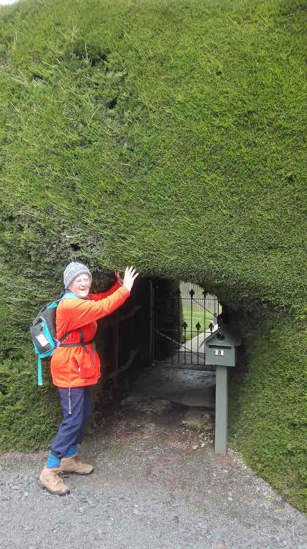
… near the Wingatui Road end. From there we checked out the new houses in the Springfield sub-division and took a wander down Rutherford Road which many people had never been down before. We then walked down Factory Road to Haggart- Alexander Drive and through the cutting and up Wingatui Road …
Hobbit gateway – in giant’s hedge. (Liz pic.)
… to Gladstone Road when we decided to have lunch on the bank …
Lunch. (Ian pic and caption.)
… by the railway line. No trains came!!! After a leisurely lunch we took as many shortcuts as possible to get back to the carpark before the rain came. A welcome coffee break was at Wals. – Jay.
7. 10/6/2015. Hikers. Mosgiel Trek. E. Leaders: Jim and Betty.
GPS of route, courtesy Bruce. 14.7 km. Ascent 81 m.
Jim and Betty led twenty-two Hikers on a most illuminating illustrated tour of Mosgiel, with historical anecdotes echoed and amplified by several other old identities in the group. At one house, and the next,
One of Jim’s sites. (John pic)
Jim would tell us who had originally lived there and what they did. And where this street and that street had originally terminated. And where which dairy and which mill had once been located. And what rubbish dump now boasted as foundation for which set of houses.
As is evident from the route map, the walk was extensive – 14.7 km – a good stretch for the Hikers, necessitating one or two drop-out groups en route, and ending with only the famous six completing a last street-block encirclement on the day. Suspiciously this might have just been a prank, added at the last minute from a wicked sense of humour on the part of the leader, and strongly confirmed by the Back Marker rebelling and leading the remainder by a more merciful direct route back to the cars.
We morning-teaed by the Silverstream,
MT (John pic)
up near Wingatui Road, and lunched behind the Joe Browns settlement, on the back bank of Reservoir Hill…
Lunch Panorama (John pic)
…looking down on the small Woodlands settlement,
Woodlands Settlement (John pic)
and speculating on what drainage problems the properties might have experienced in the recent rain storm.
Our route was obviously the result of much imaginative planning. Highlights for this reporter were the new houses alongside Wingatui Road near the Silverstream (how similar many of them were!), the walk across Brooklands Park…
Brooklands Park (John pic)
…and the surprising route through from McFadden Drive to Woodland Avenue.
From the end of Woodland Drive, there was the fraught quick-or-the-dead negotiating of the lanes in the Quarry Road roundabout to land us eventually in Kinmont Crescent. Thence through the SH1 underpass (surprisingly short) into Cemetery Road and back across the railway crossing and into Gordon Road’s SW section of houses.
Here, at the lower end of King Street, Jim pointed out the distinctive turreted house there,
Original Maternity Home (John pic)
the original Maternity Home where he first entered the world. Further up in Argyle Street was Mossbrae, the onetime Maternity Hospital. When we reached the end of Argyle Street, instead of releasing us back up Bush Road to the cars, Jim took us away down Perth Street and across and back up Tay Street, to go (at last with only the famous six) via the Street lights intersection finally back to the car park.
Nearly 15 km, much on pavement, but a lot on grass too, was a good stretch for the legs, usefully developing fitness for next Wednesday’s climb up the forestry’s Margaret Road, linking Taieri Mouth and Big Stone Roads.
Betty and Jim capped off a wonderful day out by turning on a piping hot pottle of chips to accompany coffee chatter back at Topiary Cafe. Thank you so much, dear leaders, for a wonderful day out. – Ian.
6. 17/9/2014 Wingatui Block. Hikers. E. Leaders: Les and Margaret.
Route. Car Park, Bush Rd, Factory Rd, High St, Elmwood Dr, Cedar Cr, Track, Wingatui Rd, Gladstone Rd N, Crossan Tce, Station, Gladstone Rd N, Puddle Alley, Factory Rd, Bush Rd, Car Park.
Heavy overnight rain determined cancellation of the Millennium Track. Leaders Les and Margaret instead led us on the street walk recorded on the above map, stopping for morning tea in the shelter of the Wingatui Railway Station. On/off drizzle accompanied the whole walk but we were secure in our parkas. Thirteen of us enjoyed each others’ company and the varied views the route provided. Thank you Les and Margaret for your wisdom in making the tramp change and providing us with a good morning’s ten kilometre workout. Sorry, forgot about taking pics. – Ian.
5. 7/9/2013. Both. Birchleigh Village/Haggart Alexander housing development. Leaders: Bruce and Marjorie.
Thanks to two reports received, from Elaine and Bruce, each with a distinctive style, I have inter- leafed them for a wonderful account of the day.
ELAINE: Approx ten hardy people turned up at the car park at 9.00 a.m. The planned walk to Flagstaff was flagged.
BRUCE: With snow forecast to 100 m the planned hike on Three Mile Hill was postponed and an alternative street walk undertaken from 0900 to 1100.
ELAINE: George’s birthday bash was canned also. Was really looking forward to the wine. Never mind. Next week its all on if George is well.
BRUCE: Seven of us proceeded from the car-park via the Gordon Street verandahs during a nasty shower of hail to the RSA garden and memorial to Church Street and then into Wickliffe Street. (Ed. note: Three had returned back home.)
ELAINE: Bruce and Marjorie decided since the weather said showers … sleet … hillside snow …, that we would walk around the new housing estate at the northern end of Mosgiel. We also checked out Chatsford and Birchleigh for the future!
BRUCE: We turned off Wickcliffe Street into the Brooklands Estate past the BMX track to Doon Street and then via the new subdivision at Birchleigh Village.
We took the path on the left immediately past the main office to have morning tea, in the company of Ria who joined us in Wickliffe Street, in the rotunda assembly point beside the bowling green.
After a circuitous route through Chatsford we left the village and meandered through the new Highland Park subdivision. Although the slogan “My heart’s in the highlands” was repeated, the ground seemed pretty level.
After inspecting a show home from the outside we returned via Factory Road to our cars in the car-park with some comments from a pedestrian about our mental state for hiking on a wintery day. – Bruce
ELAINE: Only seven people came on this walk. The day didn’t get any better weather-wise and I think some of drivers passing us thought we were mad. The trampers cancelled their day altogether. We did laugh a lot and talk a lot. Let’s have a great turnout next week for George’s birthday shout, weather permitting. There could be a change to next week’s programme, so watch out for details. – Elaine.
4. 22/4/2013. Both. Car park, King St, Gladstone Rd Nth, Wingatui Rd, Shortcut to Haggart Alexander Drive, Factory Rd, return.
The Trampers’ trip was cancelled due to illness. In addition, both tramps came to nothing due to recent rain muddying up tracks. So a remnant seven of us did the above (tarseal) route, remarking on various properties passed and exploring a number of new housing developments on the way. A lot of changes! Rain everywhere else came to nothing in Mosgiel. We enjoyed the views and good company, especially Judy’s new South American poncho, lasting the distance only because of some emergency repairs.
Fred and Judy emerging from one of the new housing areas.
– Ian.
3. 25/4/2012. Hikers. Wingatui Block. Leaders: Arthur and Barbara. 2. 9/8/1989. Wingatui Racecourse. Over the Hill. Easy+ Leaders: Betty, Molly, Ria. 1. 14/12/2005 Wingatui Hall, Silverstream End of Year lunch. Leader: Lesley S

 30. 1/05/2024. Combined. Pyramids/Victory Beach. Grade 2.5. Leaders Jenny, Alison, Wendy and Alex
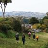 32. 24/04/2024. Trampers. Frasers Road/Southern Resevoir. Grade 2.5. 16 km. Leaders: Gwenda Farqharson/Graeme Souter
 11 trampers left PJ Park at 8.45 and meet up with 5 Dunedin trampers on Borlases’s Road, Port Chalmers. We continued onto Blueskin road in misty weather which got thicker as we drove up to park 1km north from Cedar Farm Forest carpark (CFF) A car was left at CFF carpark to ferry drivers back to their cars at the end of tramp.
 18. 22/11/2023.Hikers. Millennium Track from Henley Ferry Bridge. Grade 3. 27km. Leaders: Ady Whitson/Bruce Wright.
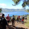 19. 15/11/2023. Hikers. Cleghorn Street to Signal Hill. Leaders Pam Clough and Jay Devlin