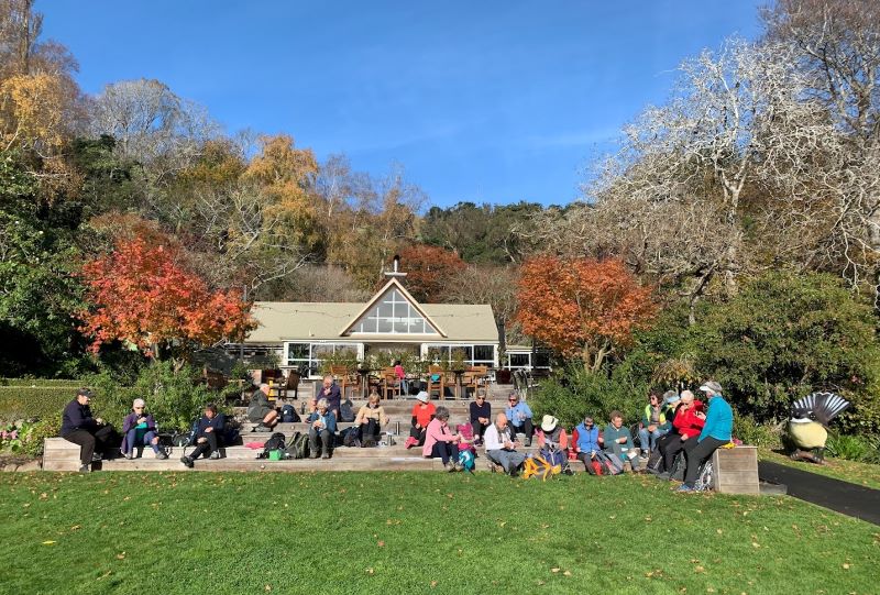
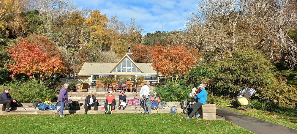
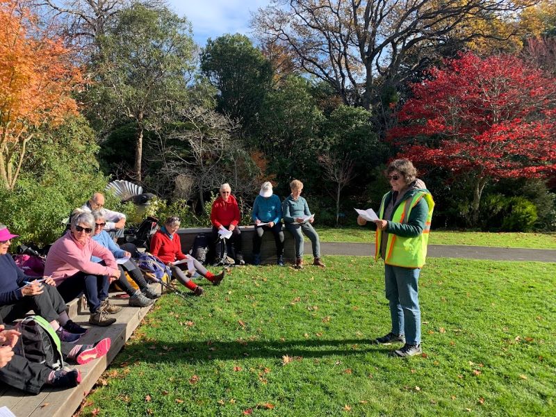
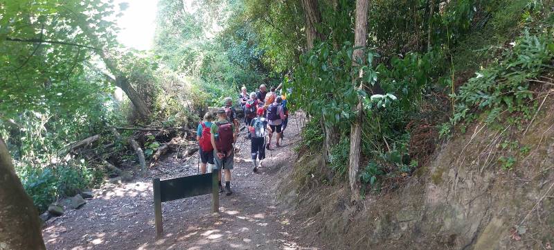
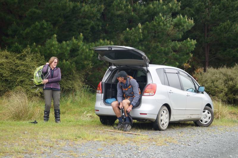
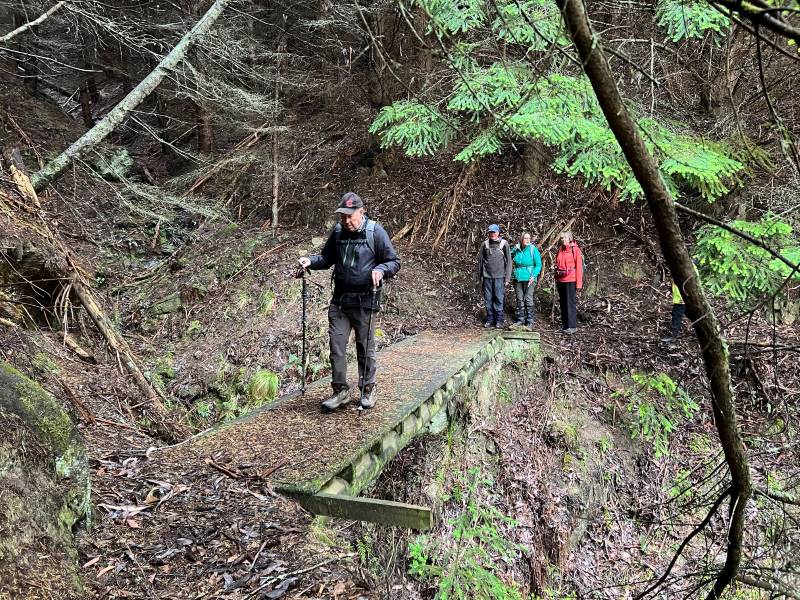
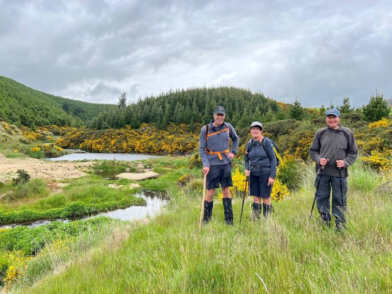
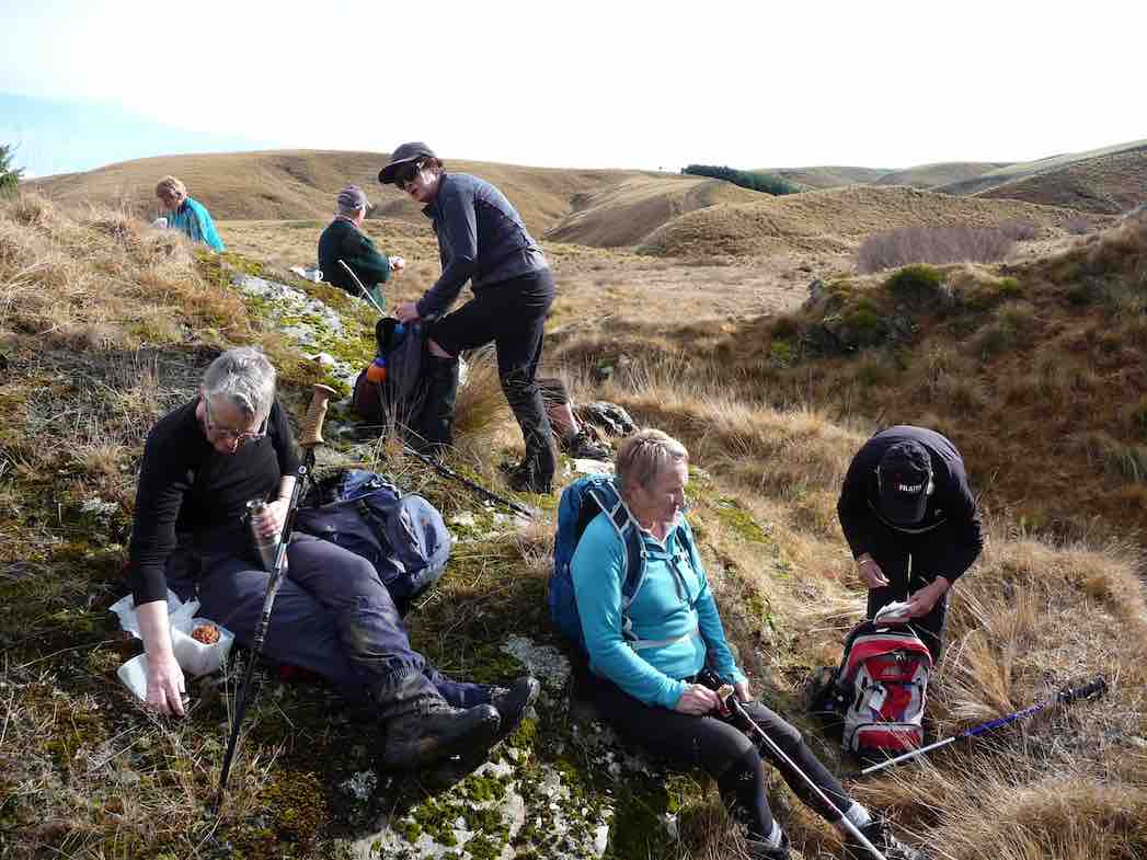
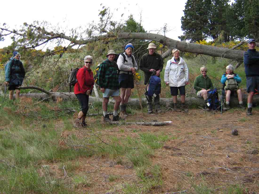
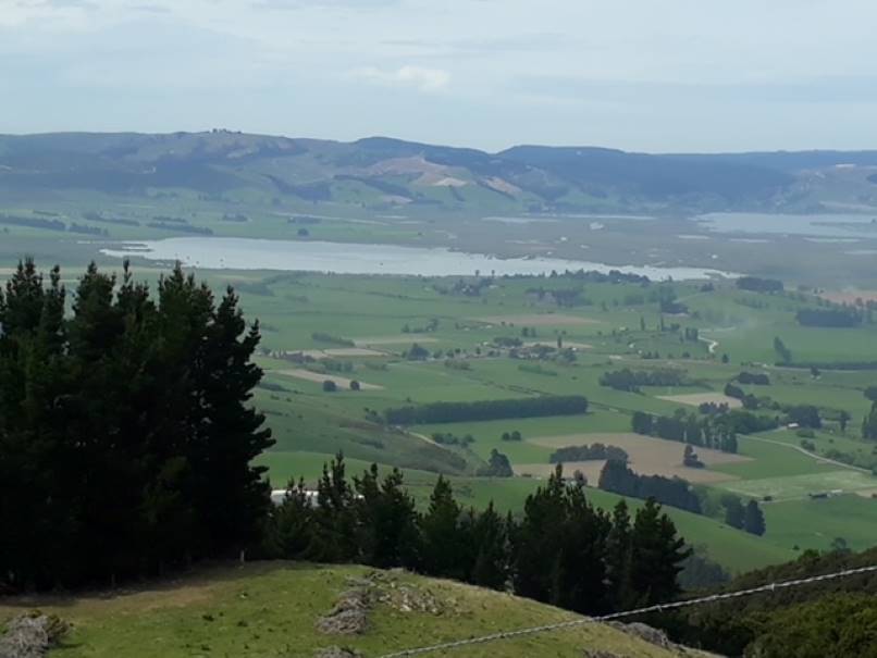
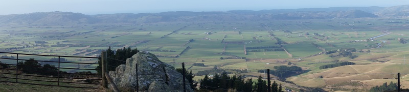
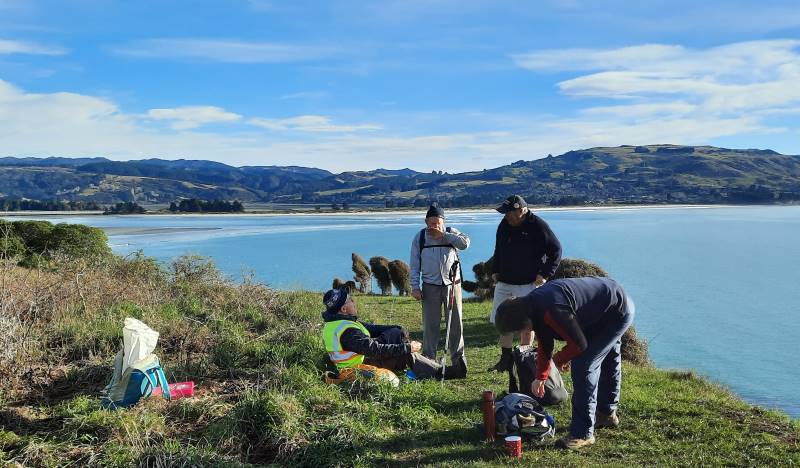
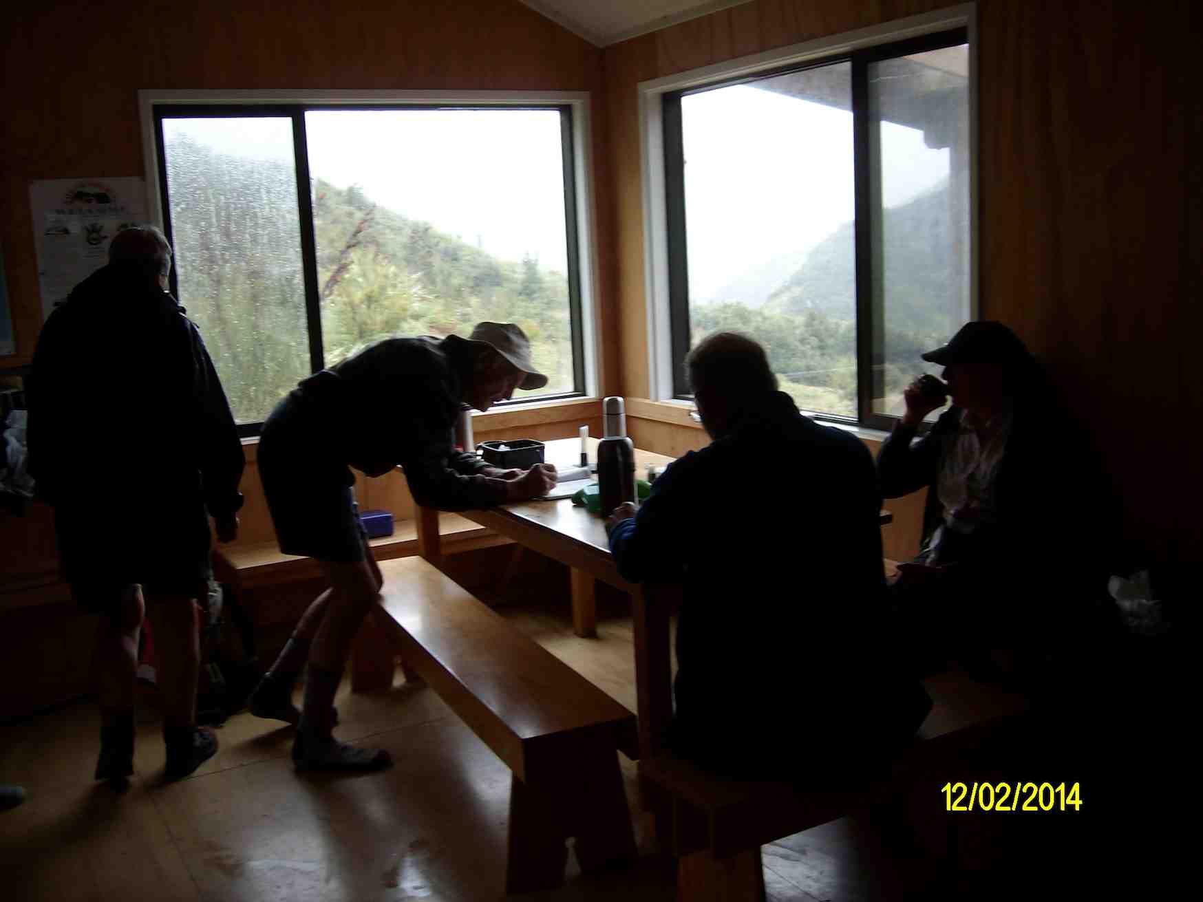
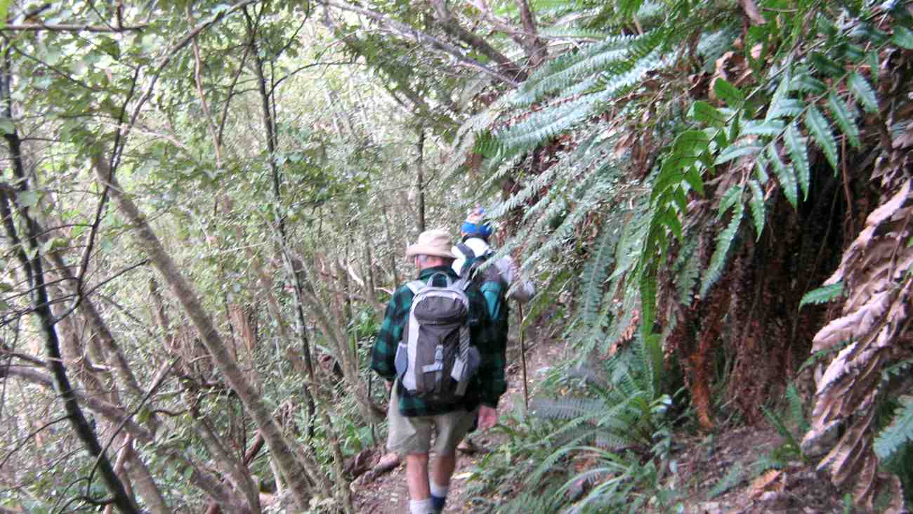
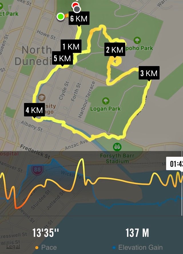
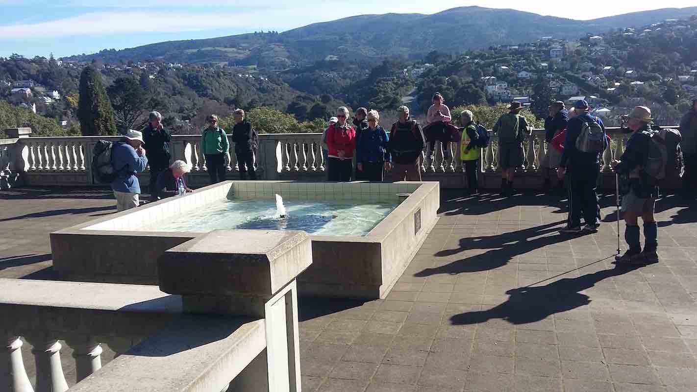
1. 24 May 2023. Bayfield carpark to Glenfalloch. Grade 1. Hikers. Leaders: Linda Partridge and Helen Ingram.
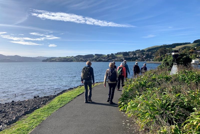
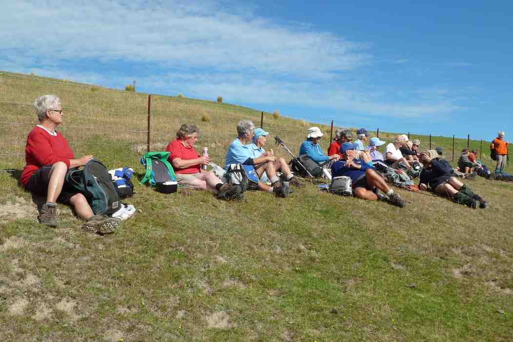
A convoy of cars from Mosgiel parked in the Bayfield carpark at 9.45 joining Brighton and Dunedin people. Twenty-five hikers in total readied themselves for a walk along the cycle track along Portobello Road to Glenfalloch. It was a still bright morning, the harbour sparkling in the sunlight. We walked along the side of the inlet and stopped at Vauxhall Yacht Club for morning tea.
Morning tea stop. Photo & caption Ady
Then on to Glenfalloch which we reached just before noon.
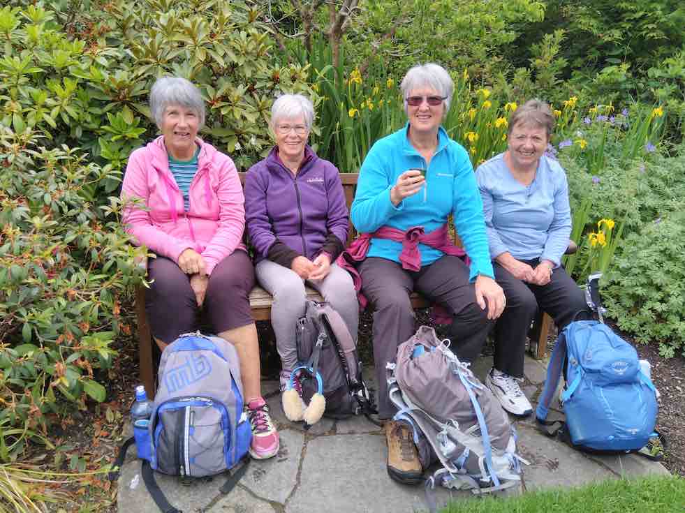
An amazing lunch spot, thanks to Glenfalloch for allowing us to use their steps. Caption & photo MarijkeEnjoying the last of the stunning autumn colours on this beautiful sunny day. Caption & photo Marijke
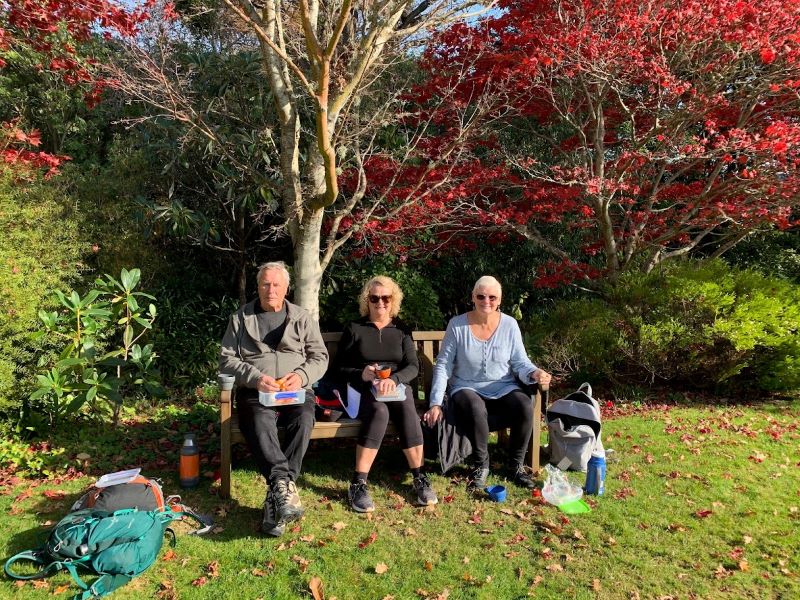
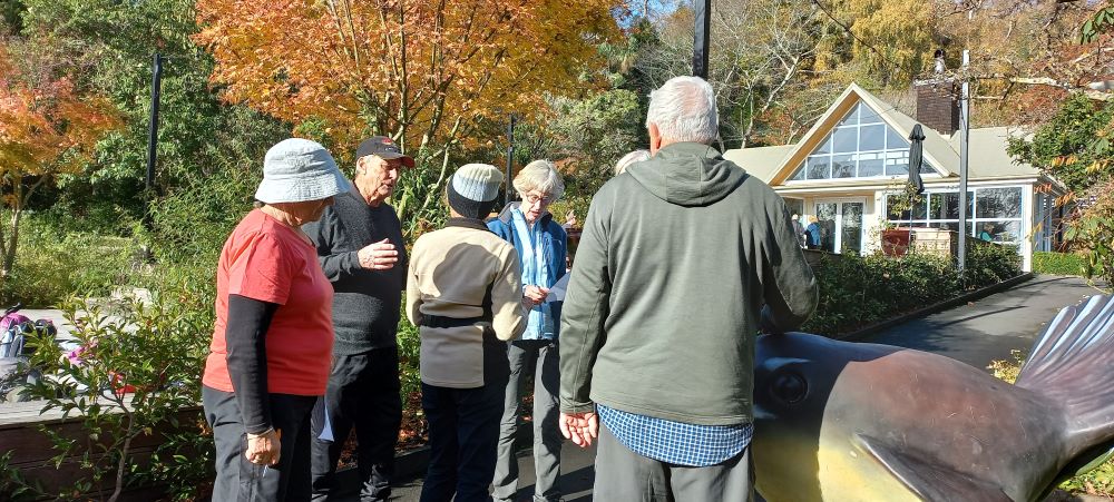
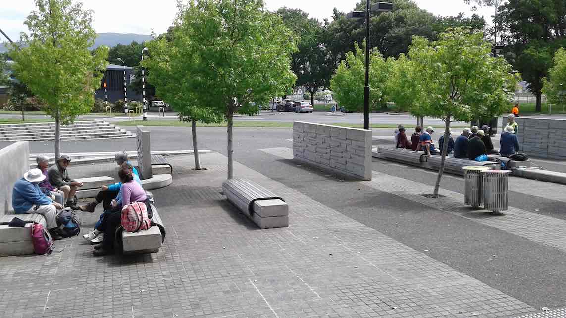
The gardens look beautiful every season, and that day in autumn the maples were flaming red, and a long bank of fuchsias in purple and shocking pink terraced one of the hillsides. We had a leisurely lunch and Linda had prepared a questionnaire for us to take round the gardens to help us explore the grounds.
Some googling (cheating) required to get the right answer. Photo LindaTime for some chat before we hear the results of the survey. Photo LindaHelen announced the outcome of our “Treasure Hunt”. We saw things that we never noticed before, and we all got a chocolate prize! Thanks to Linda and Helen, it was a lot of fun. Caption & photo Marijke
How many spoons in the sculpture near the restaurant? Where will you find the sundial? It really brought out the competitive nature in us! But everyone’s a winner, and a bag of Cadbury Favourites was handed round.
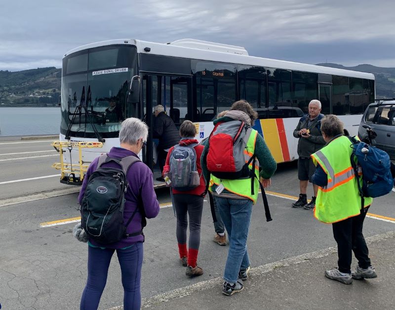
The Portobello bus was due at 2.15pm, and most of the hikers decided to walk on to Macandrew Bay to catch the bus there.
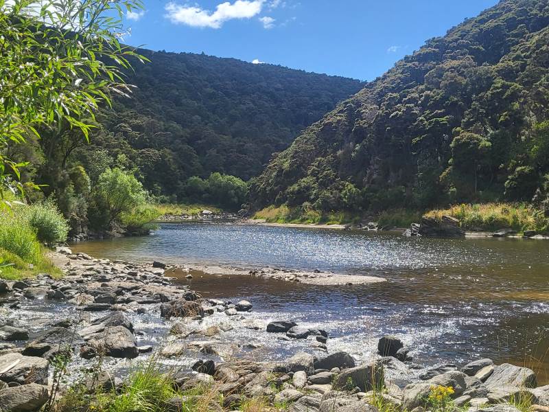
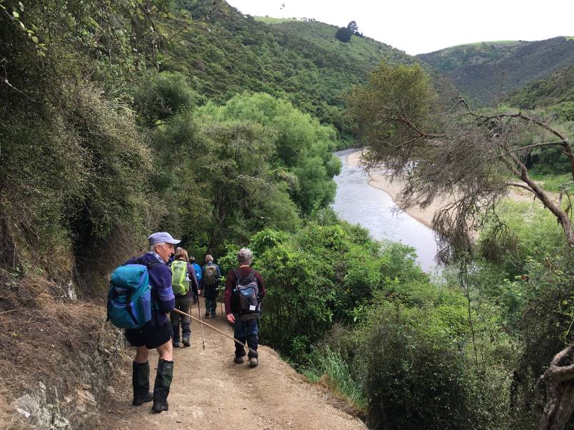
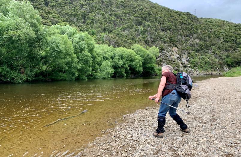
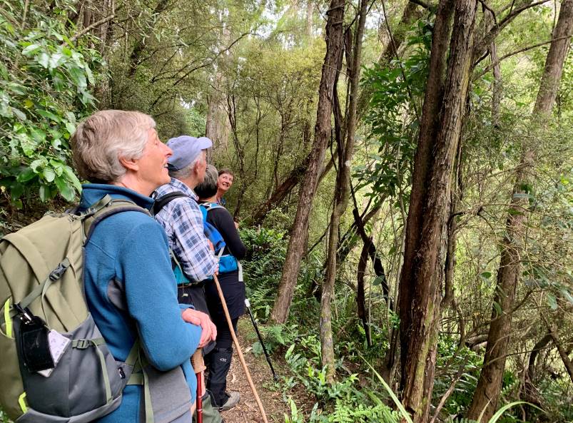
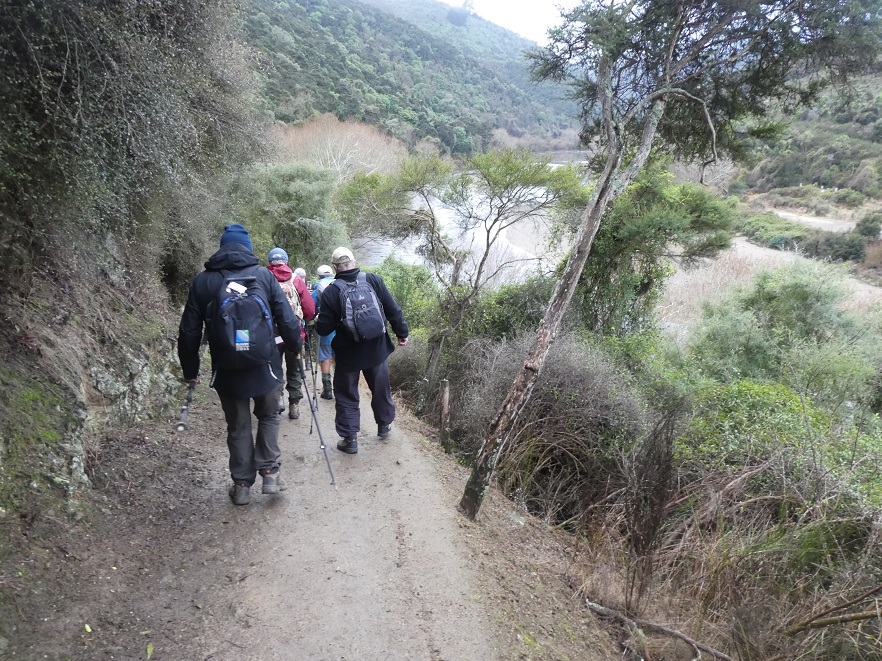
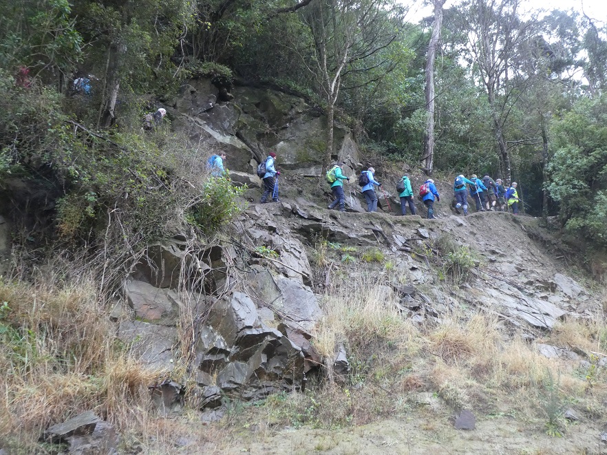
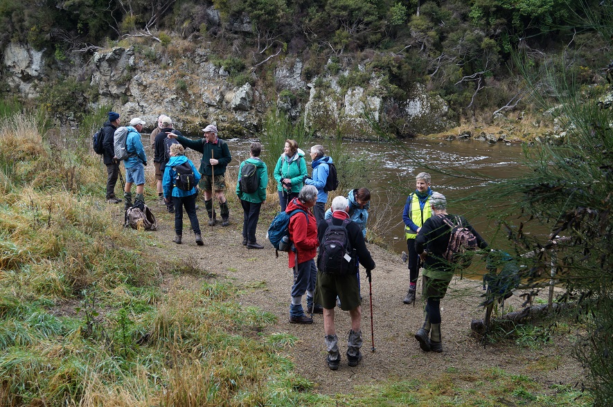
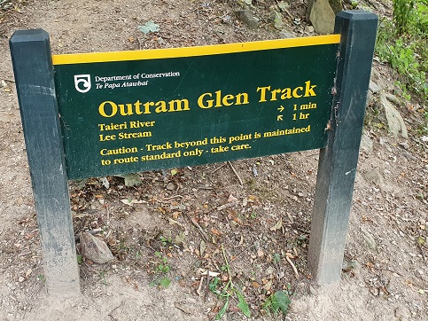
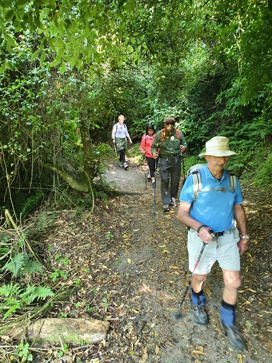
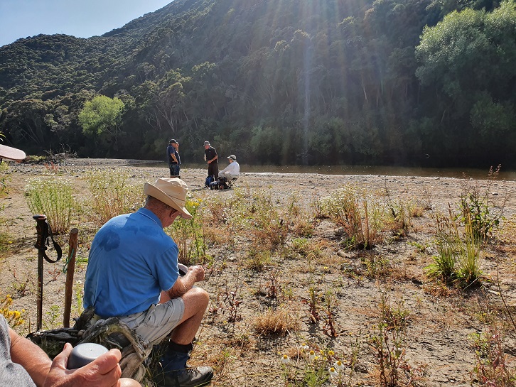
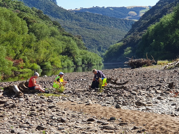
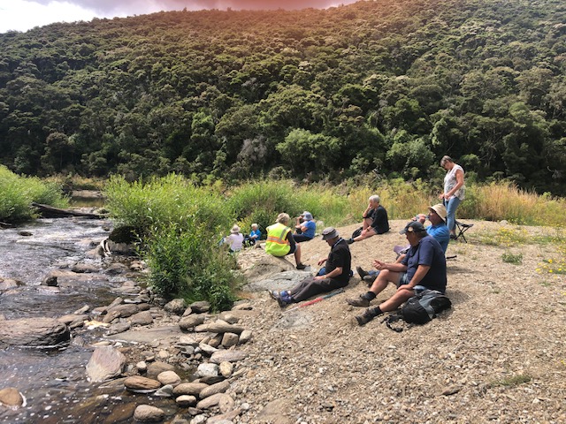
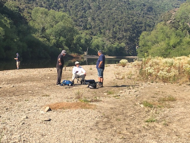
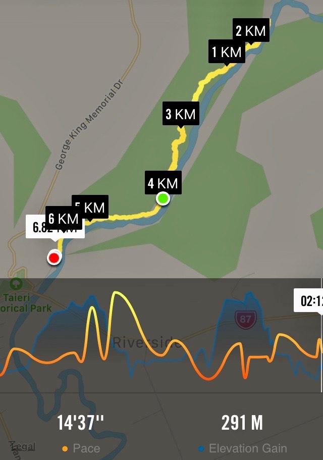
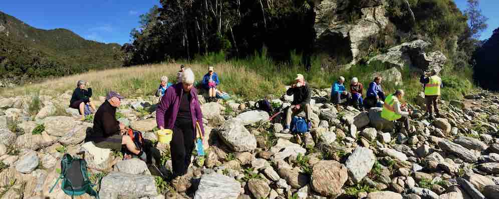
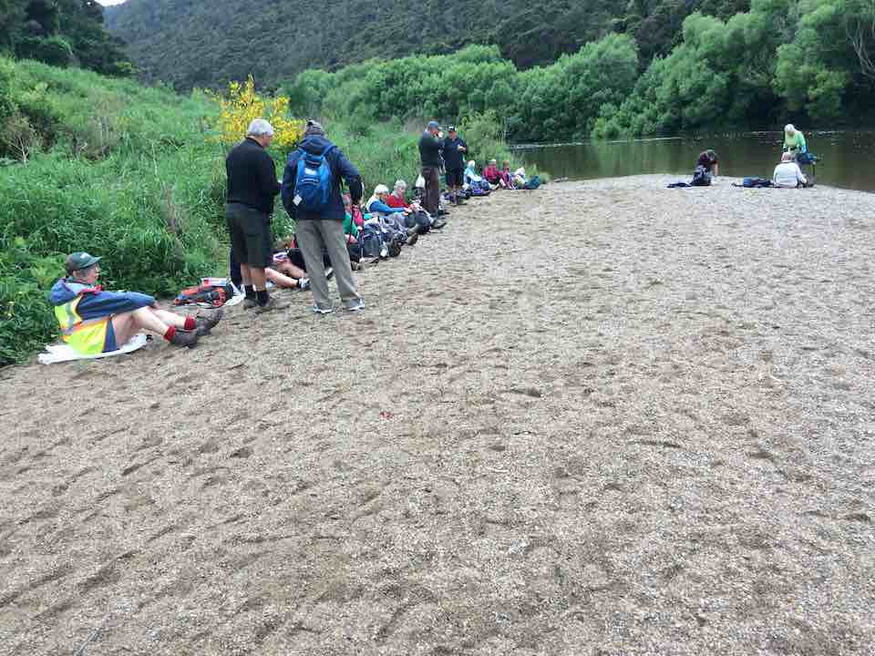
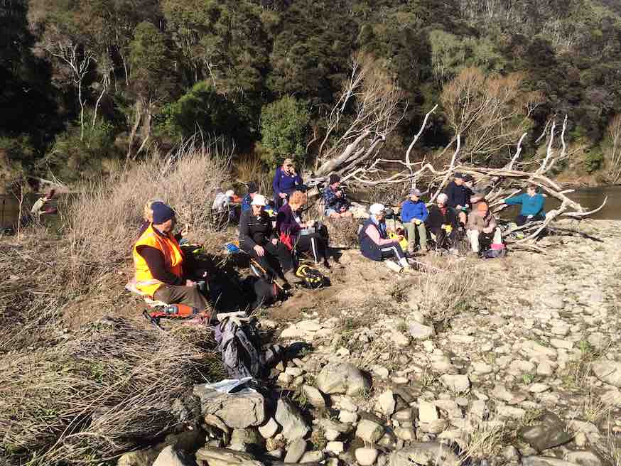
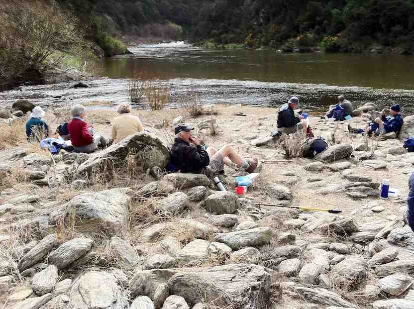
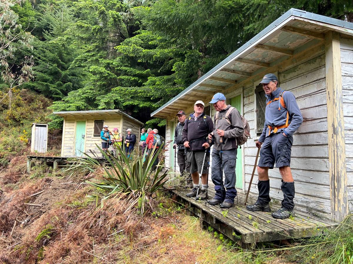
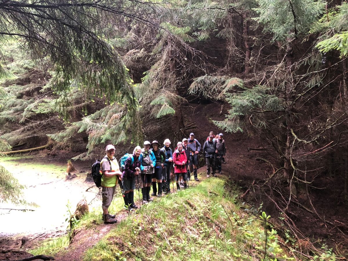
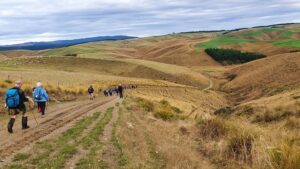
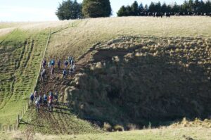
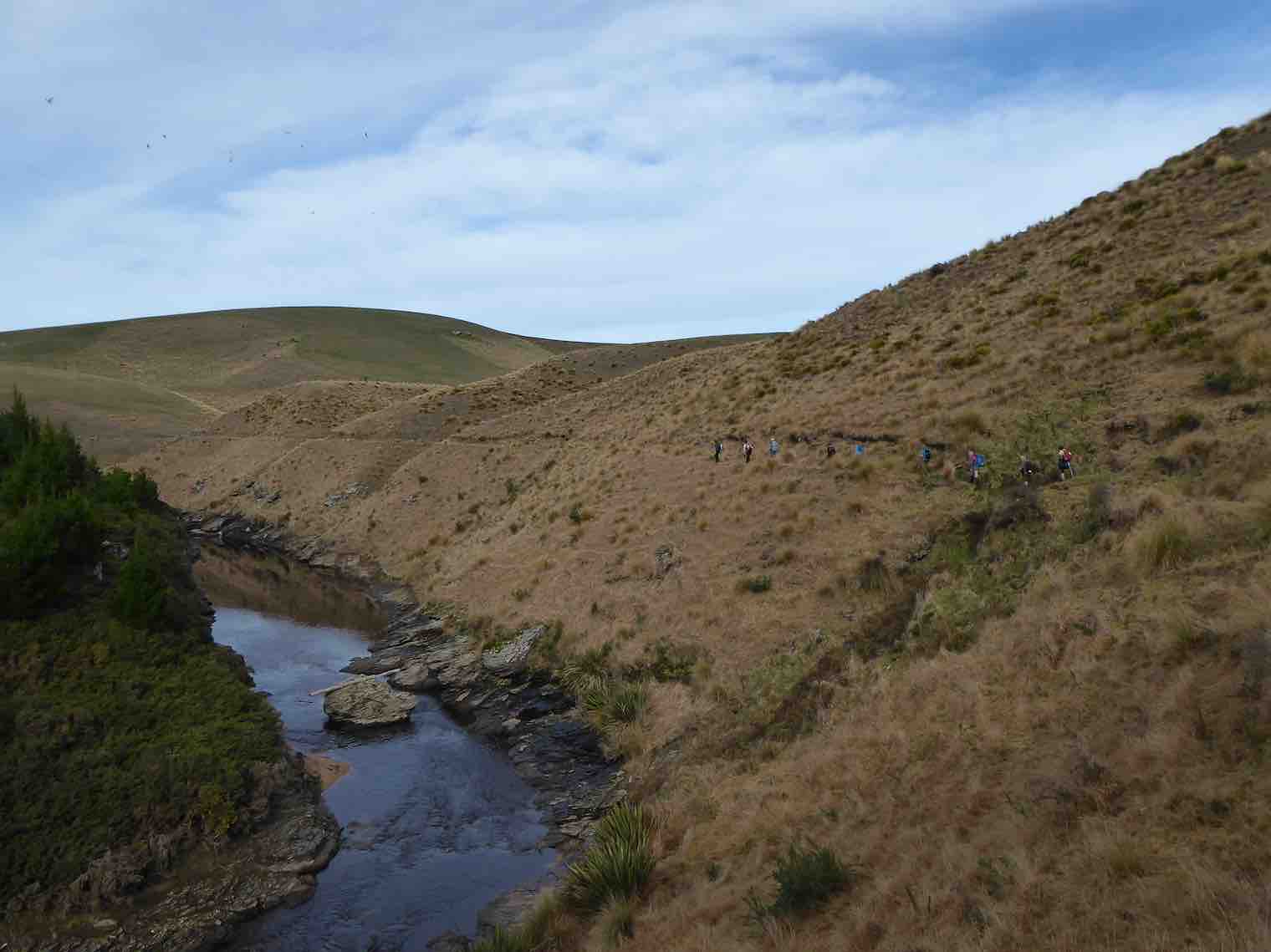
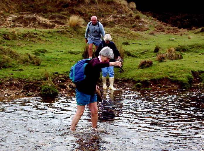
15. 25/01/23 Hikers Outram Glen to Confluence. Grade 2 Leaders: Eleanore and Judy
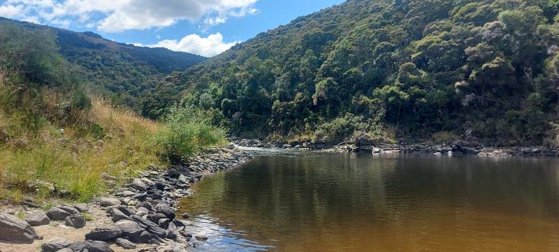
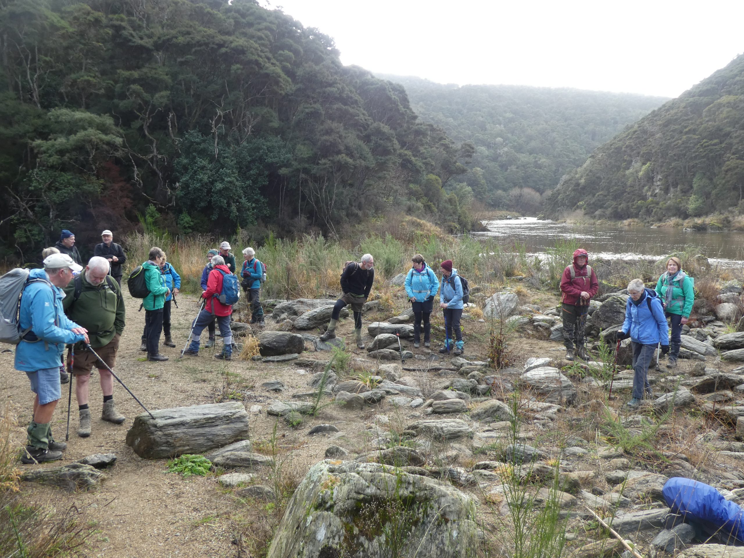
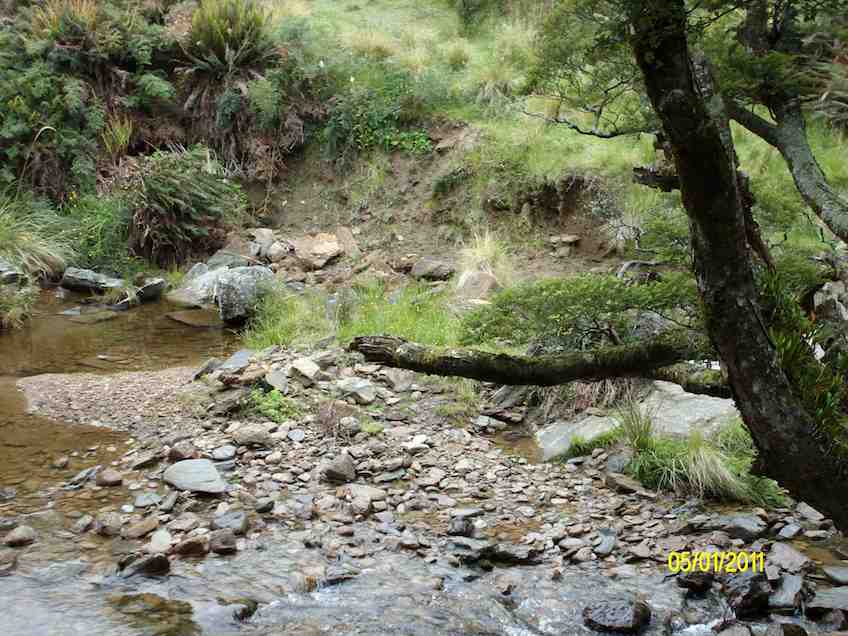
On a clear still day at 9:15am, 23 of us met at the start of track carpark ready to hike the river track to the meeting of the waters where Lee Stream flows into the Taieri.
For some this was a new hike and a revisit for others.
We live in an amazing part of the country Caption and photo Mike
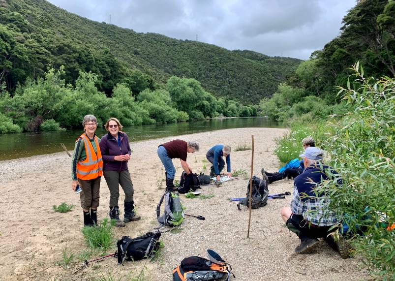
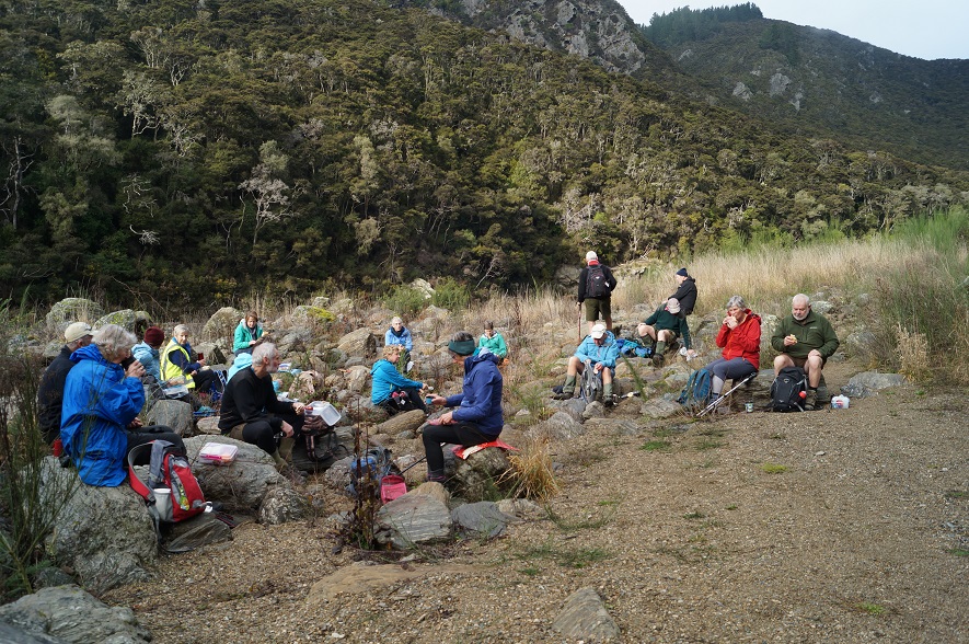
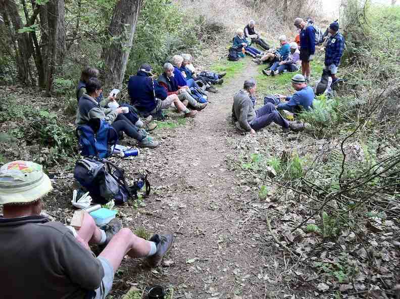
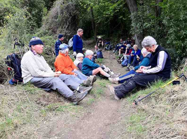
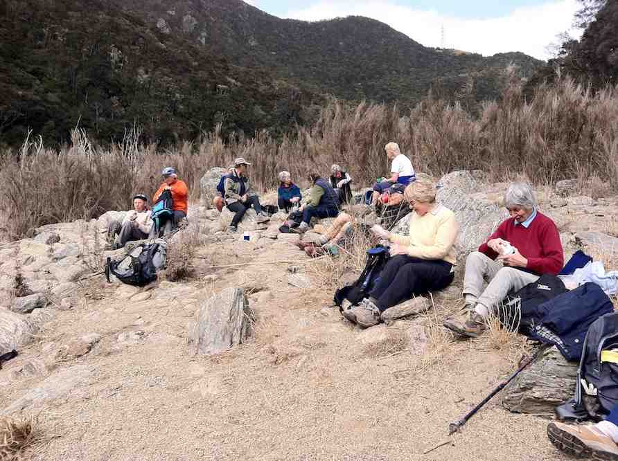
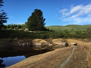
After a pleasant half hour walk we arrived at the river beach for smoko, knowing we had a solid climb up through the well placed rock steps for quarter of an hour.
Some flat Caption and photo Helen
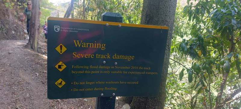
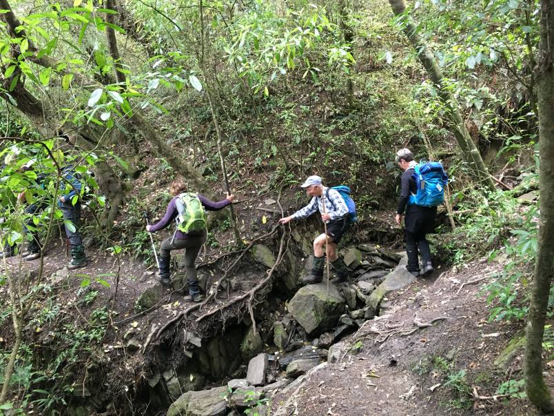
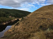
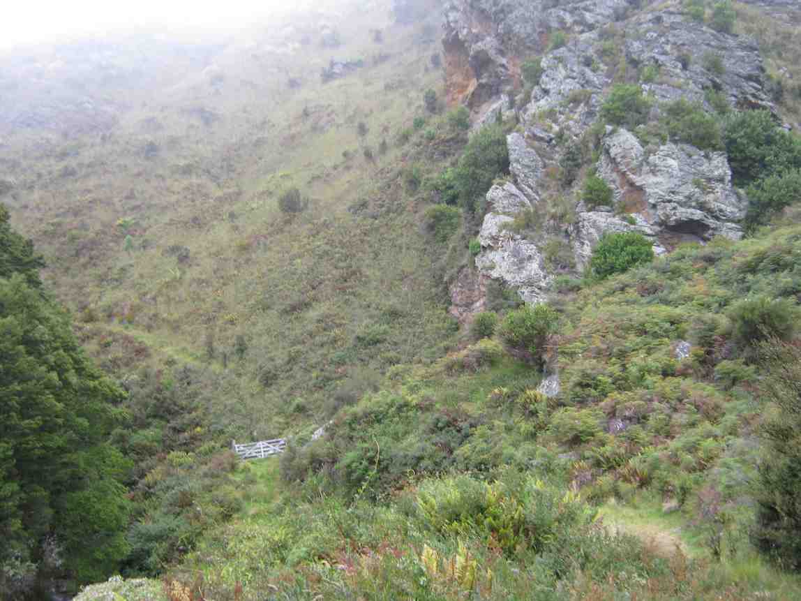
Some parts of track were damaged a few years ago by washout flood damage therefore, maintained as a route standard only with care required. After we climbed the well-placed rock/wood steps, it was then a long traverse above the Taieri River for just over an hour and a half—often stopping for a breather. It was good to see the unusual crop of potatoes amongst the grass knowing we had arrived at the Confluence.
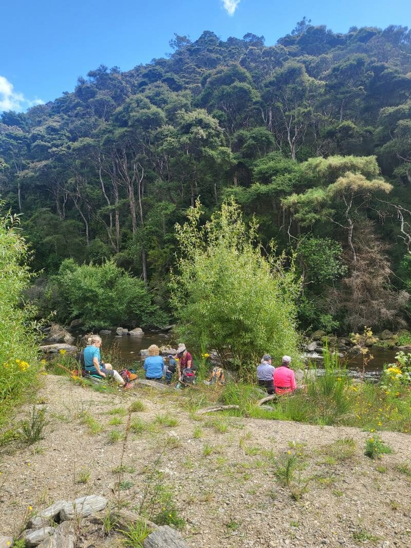
At the confluence Caption and photo HelenLunch at the Lee Stream Caption and photo MikeLunch in the long grass for some Caption and photo Chris
After a leisurely 40-minute lunch and toilet stop, we returned down the track, also stopping often to walk as a group. Trip back was 15 minutes quicker than trip up. We walked 9km altogether.
On the way down Caption and photo Helen
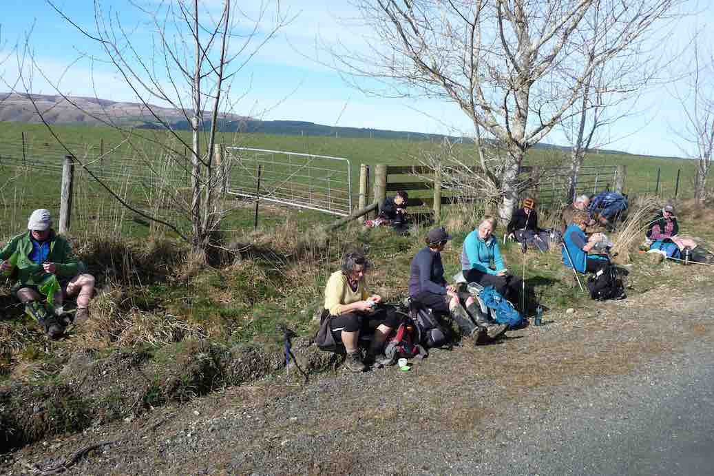
Coffee and cake were shared at Topiary (Wal’s) Cafe by most of us, Trampers arriving back to join in after their Hope Hill outing.
Outram Glen is a great bush walk, close to home. Care needed after rain. Today track very dry with blue sky and about 23 degrees. Thanks to Judy D. for her caring role as my Tail Ender. Hopefully, you all enjoyed the day as much as I did.
Eleanore
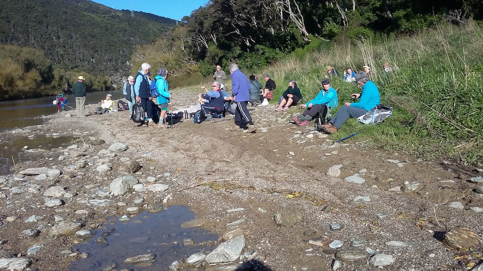
14. 01/12/21 Trampers. Outram Glen to Lee Stream. Leaders: Sarah McCormack and Pam Cocks
After a change of tramp due to drizzly conditions forecast for the day at Swampy, 8 trampers set out from Outram Glen Scenic Reserve following the Taieri River to the Lee Stream convergence.
Arthur keeping the girls in line Photo and caption Pam
We stopped for morning tea beside the river just before the climb up the hill.
Morning tea time along the Taieri River Photo and caption Marijke
The day was starting to warm up a bit with a few of us over dressed as we were expecting it to be cold. Barbara showed off her stone skipping skills that she learnt at a young age and obviously still practices to maintain a high skill level The track was dry and would have been slippery if there had been any rain.
Rocky crossing Photo and caption Pam
We made good time after morning tea and arrived at the Lee Stream convergence by 11:15 so a bit early for lunch.
End point of the walk at the confluence of the Taieri River and Lee Stream Photo and caption Marijke
While checking out the scenery and having a natter the wind decided it was going to come up. The wind was coming straight out of the Lee Stream valley and had a definite chill to it, so we decided to make our way back and find a lunch spot along the way.
Lunch spot was found with convenient stone seats and some also had tables. After a leisurely lunch we meandered back to the cars stopping to check out the plentiful fantails and another show of stone skipping.
Playtime before going home. Barbara was the absolute star at throwing skipping stones Photo and caption MarijkeSpotting lots of fantails in the trees Photo and caption Marijke
We finished the day with coffee at the Wobbly Goat after covering just under 10km.
13. 15/7/2020. Trampers. Outram Glen. Leaders : Joy and Kathryn
18 keen trampers arrived fully kitted out for an easy but in some places slippery tramp up to the Lee Stream.
Photo and Caption Gordon – “Off we go.”
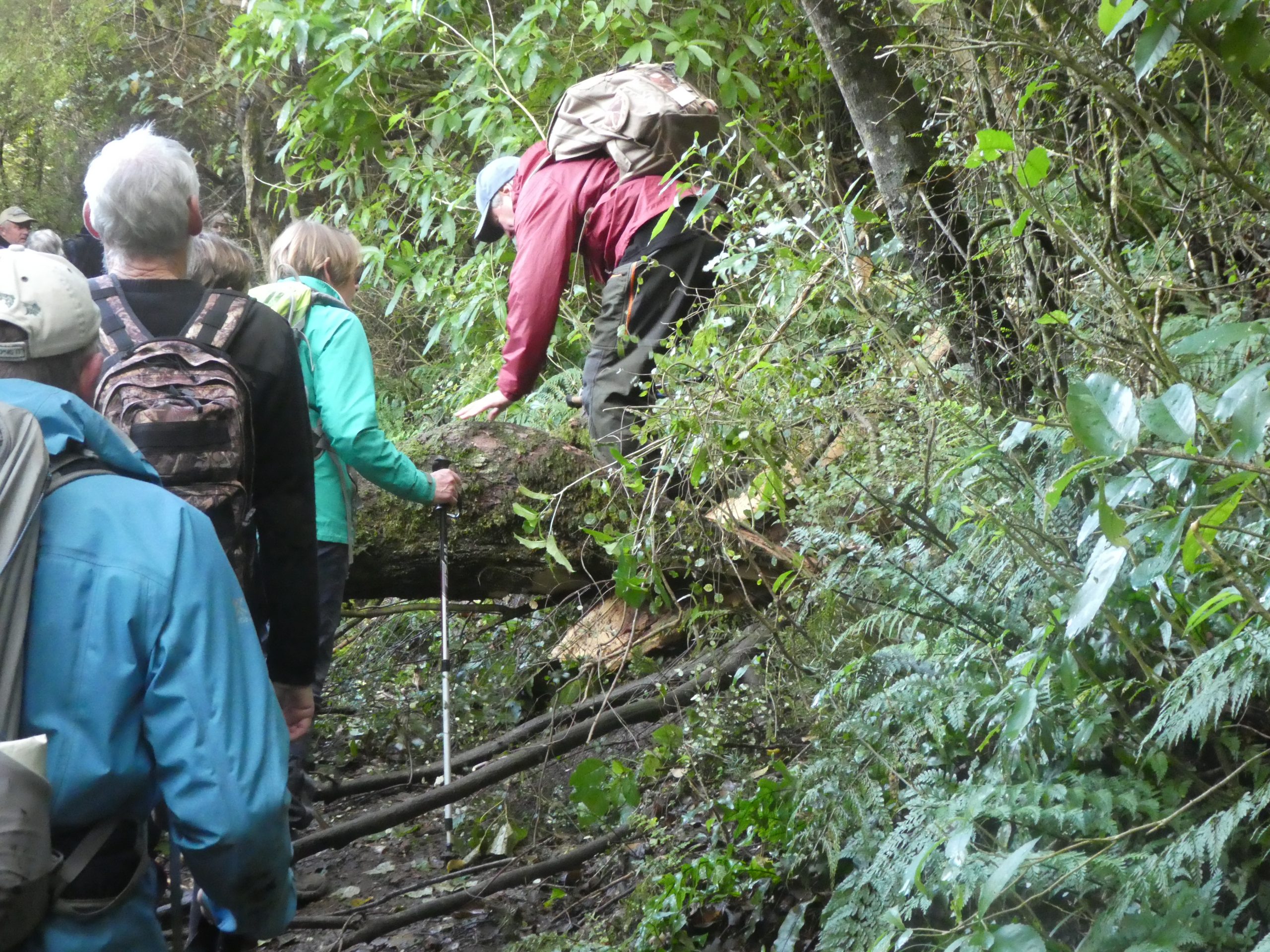
This is a favourite hike with the odd little challenge of fallen trees or wash outs adding some variety.
Photo and Caption Gordon – “Negotiating the washout”
After several days of damp weather the river was running higher than normal and the rapids could be heard above the chatter of the group.
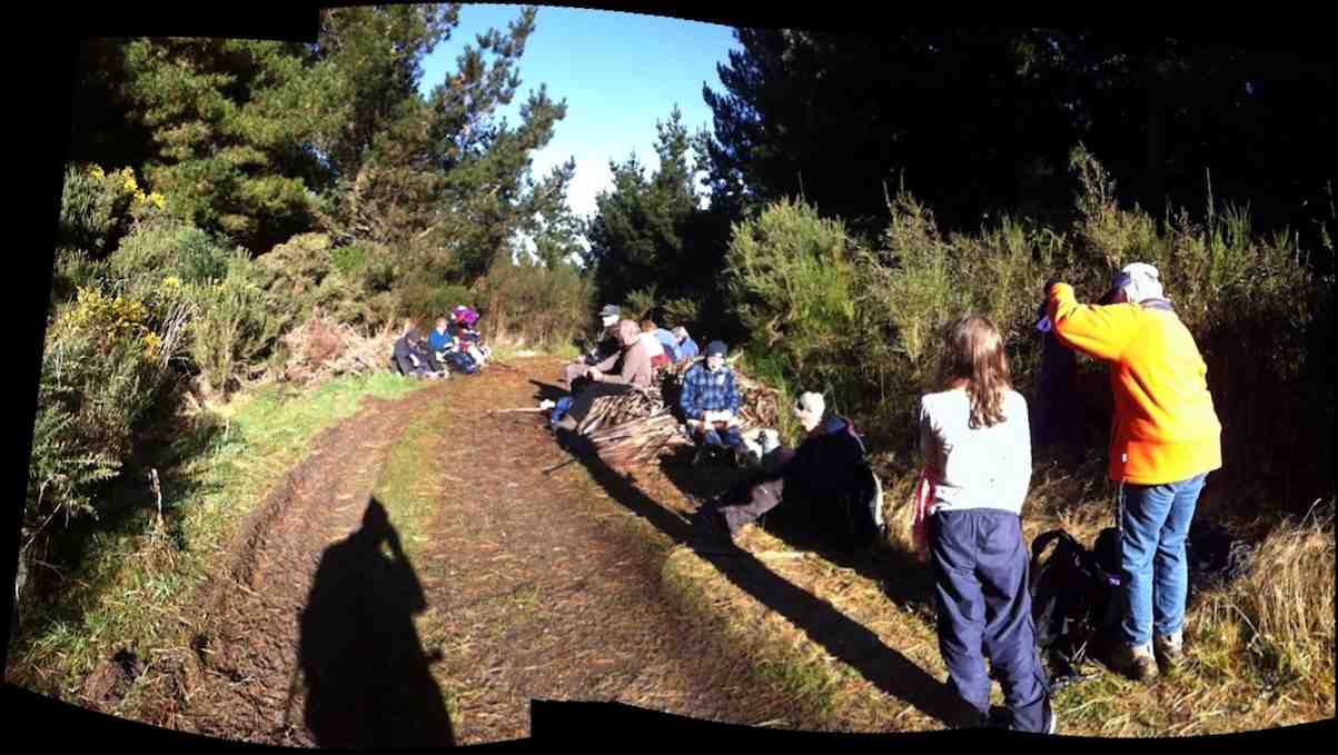
Photo and Caption Gordon – “Smoko break.”Photo and Caption Gordon – “Tackling the steps.”
Photo and Caption John – “Which way?”Photo and Caption John – “Lunch”Photo and Caption Gordon – “Ready to head home.”
Gordon challenged us all to count the number of drainage pipes on the return trip. Seven, I believe was the winning number.
Photo and Caption Gordon – “Final Obstacle.”
Another perfect Wednesday outing with a great group of people finished perfectly with a cuppa at the Wobbly Goat.
12. 29/1/2020. Hikers. Outram Glen M. Leaders Kathryn and Nikki
16 hikers and 5 Ramblers met at Outram Glen with the ramblers going off on their own walk.
Photo and Caption Clive -“As the sign says trail not maintained so hard going in places”
Hikers had an enjoyable walk around the track stopping for morning tea down at the river before climbing the stairs to take u5s to the Lee.
Photo and Caption Clive – “Under the trees the going was cooler.”
We were thankful of the overhead cover as it was another hot day.
Photo and Caption Clive – “The sun shining on the righteous.”
Photo and Caption Clive – “Great spot for morning tea
Photo and Caption Nikki – “Morning stop at the river.””
The track was challenging in parts for some. Everyone handled it considering overnight rain had made some of the rocks quite slippery and with heavy rain last year washing out a piece of the track and branch of a tree over another part.
We all were ready to stop for our lunch at the Lee which was lovely, before making our way back down to the Glen.
Photo and Caption Nikki – “Lunch at the mouth of the Lee”
We walked 10k and I think everyone was ready for a drink at the Wobbly Goat.
Kathryn and Nikki.
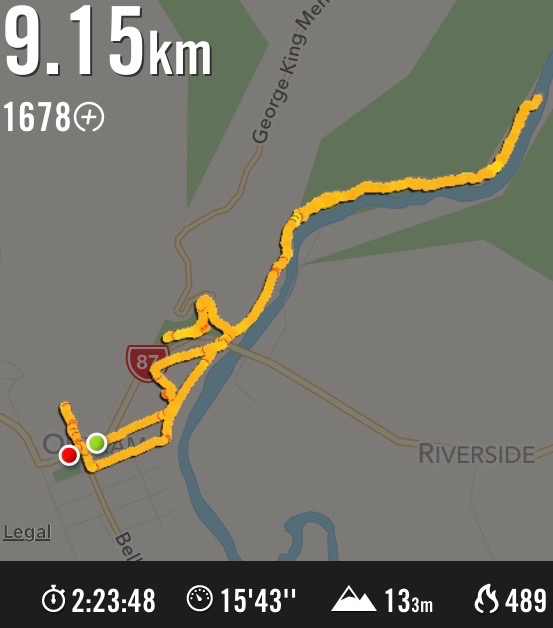
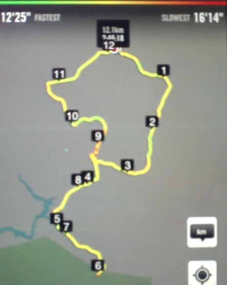
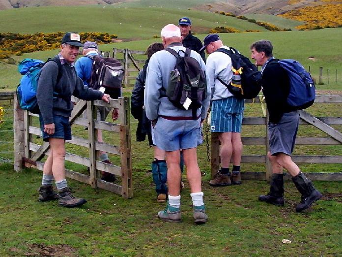
11. 18/4/2018. Hikers. Outram Glen to Lee Stream. H. Leaders: Clive and Jim.
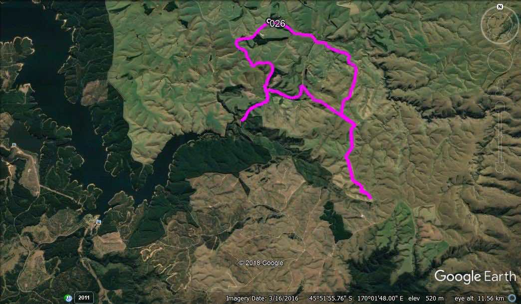
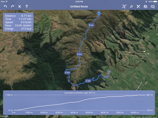
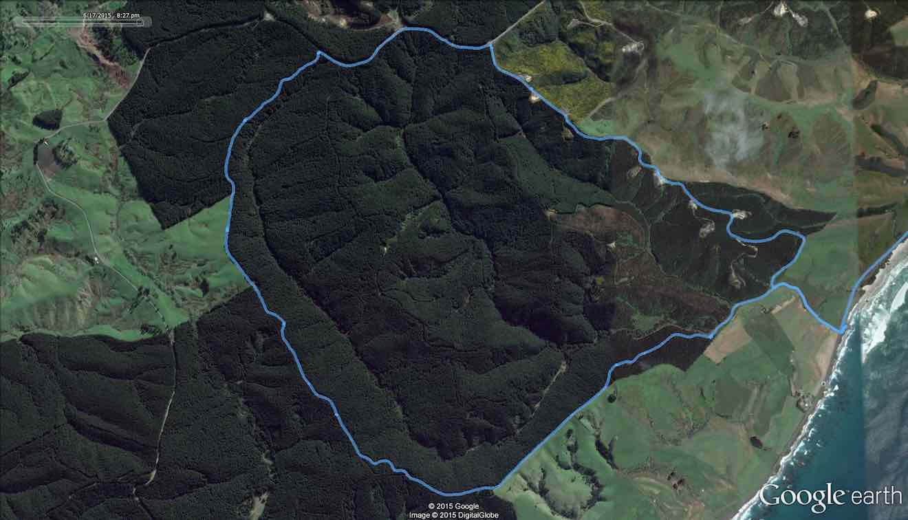
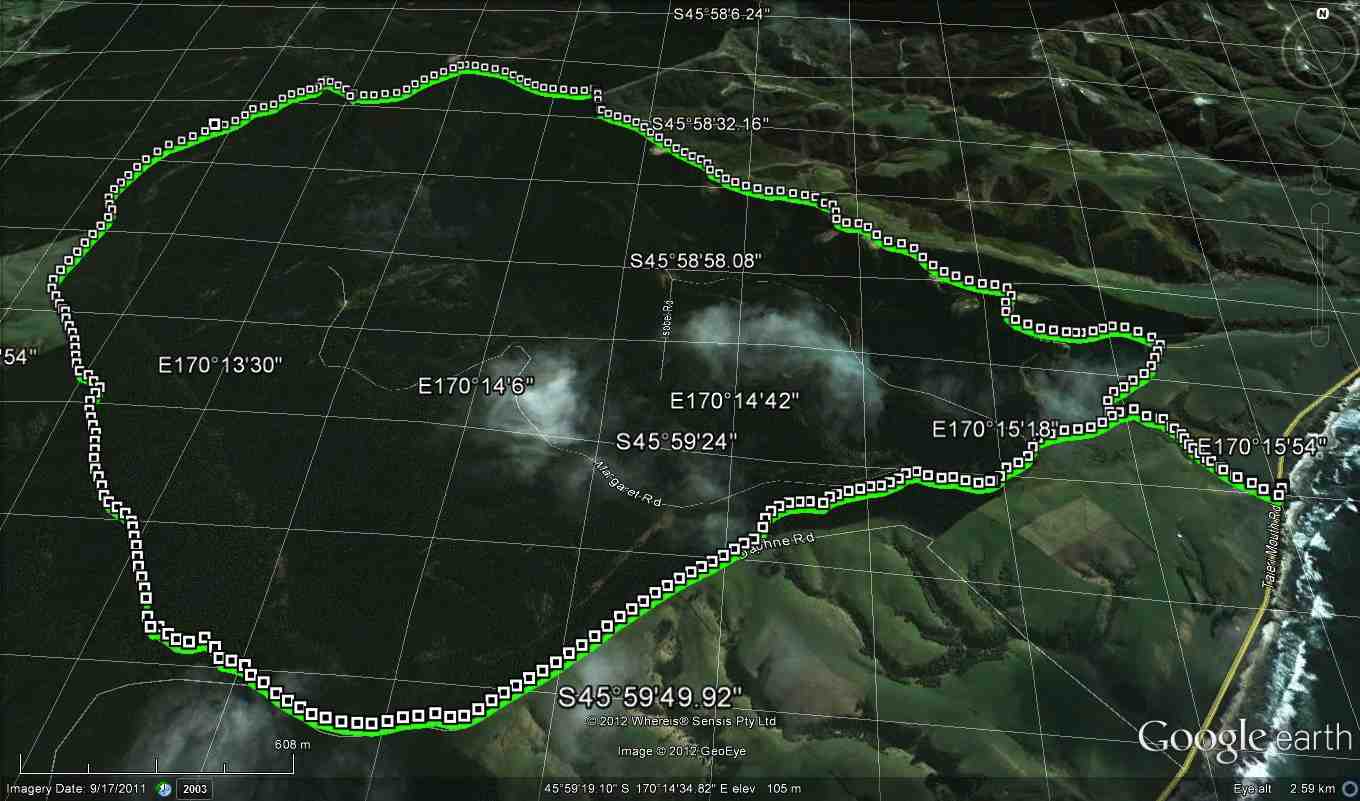
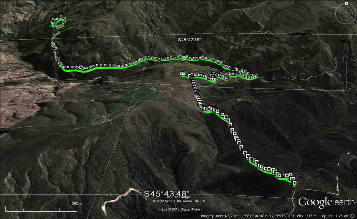
Route map, courtesy Ian. Remembered to switch app on only at morning tea stop, so total distance more like 9 km.
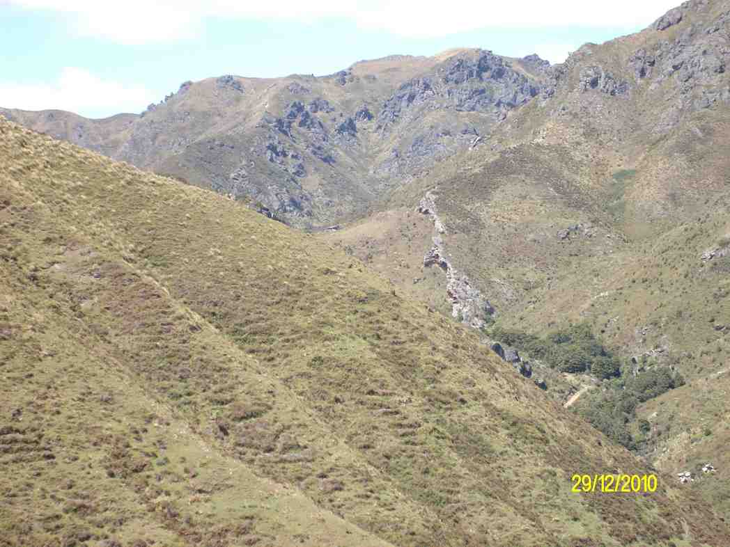
26 Hikers and Ramblers set out from Outram Glen scenic reserve alongside the Taieri River to Lee Stream. This was our first visit since the storm last year caused a lot of damage to the track and trail. Repairs are on going, apparent from the pile of gravel on the track and washouts still to be repaired on the trail. Several trees still block the trail.
We arrived at the end of the track about 10.15am and had morning tea on the rock strewn beach beside the river.
Morning tea at the end of the track. (Clive pic and caption.)
Several ramblers and a couple of the hikers then turned back to the start. An intrepid 19 hikers continued over the trail, followed by fantails and tom tits to Lee Stream. There seemed to be more hills to climb and they seemed steeper. Maybe that’s an age thing!
Arriving at Lee Stream around lunch time we picked spots out of the wind to have lunch.
Lunch at Lee Stream – not quite there. (Clive pic and caption.)
It was pointed out by a senior hiker that we hadn’t actually reached Lee Stream and should continue to the stream. Walking a further 100 meters got us there. (see photo)
Lee Stream. (Clive pic and caption.Lunch of others at Lee Stream. (Ian panorama pic and caption.)
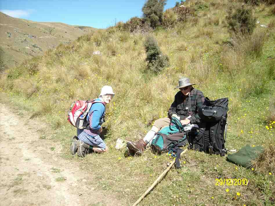
The return journey took longer than normal and unfortunately one member suffered a wound to her calf muscle on a broken bush stump whilst trying to cross a washout.
A tired crew arrived back at the carpark after 3.30pm. It was intended to visit a local coffee shop, but when we got there it was closing,.so 2 cups of coffee next time! Happy Tramping. – Clive
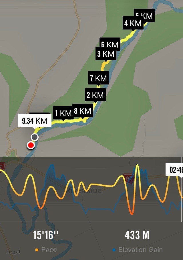
10. 9/11/2006. Hikers. Outram Glen to Lee Stream. Leaders: Jennifer and Dorothy S.
Route map, courtesy Ian. Total elevation of 433m the product of ALL the UPS on the track, – the by-product of all the downs!Morning tea by the Taieri. Threatening rain cautioned some to don parkas but there were hot sunny periods in the day as well. (Ian pic and caption.)Lunch at Lee Stream “beach” at the confluence of the stream with the Taieri River. (Ian pic and caption.)
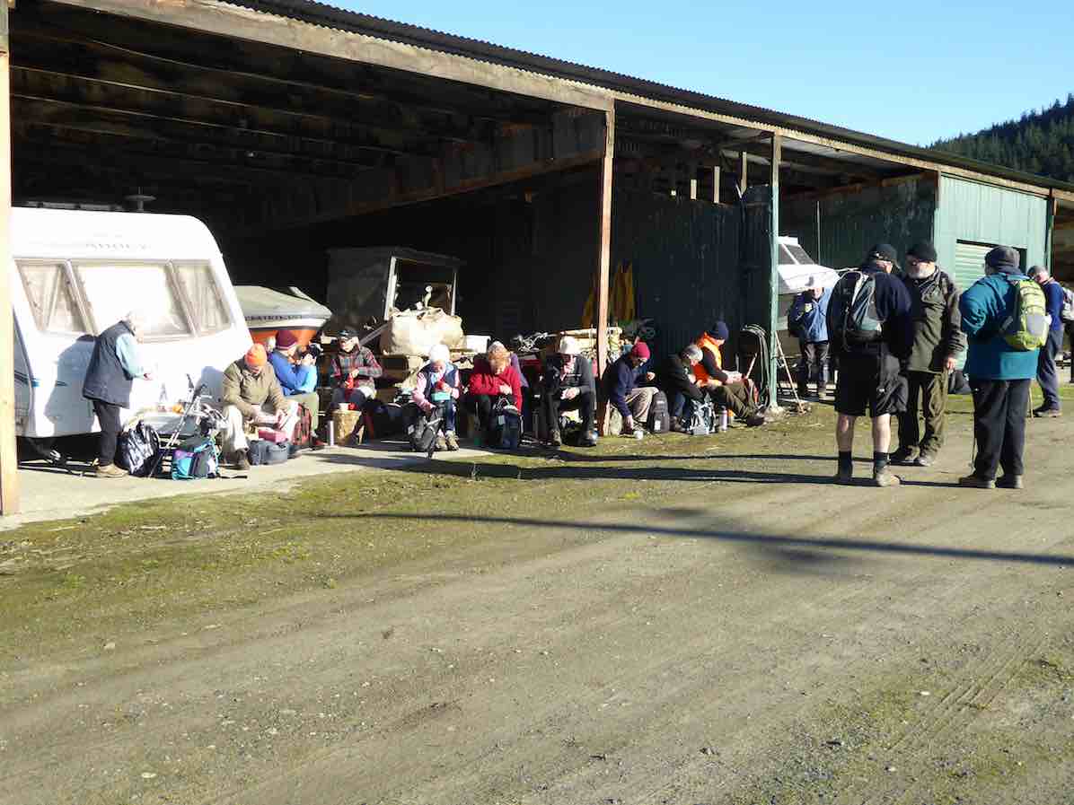
9. 10/8/2016. Hikers. Outram, Historical Park and Museum, Outram Glen. E. Leaders: Alex and Liz.
Nike GPS Route Map
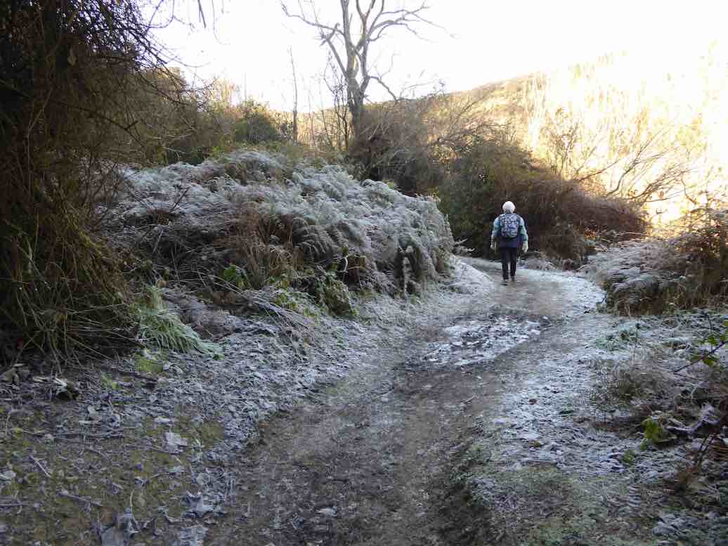
A good frost today but lovely and sunny for our hike around Outram
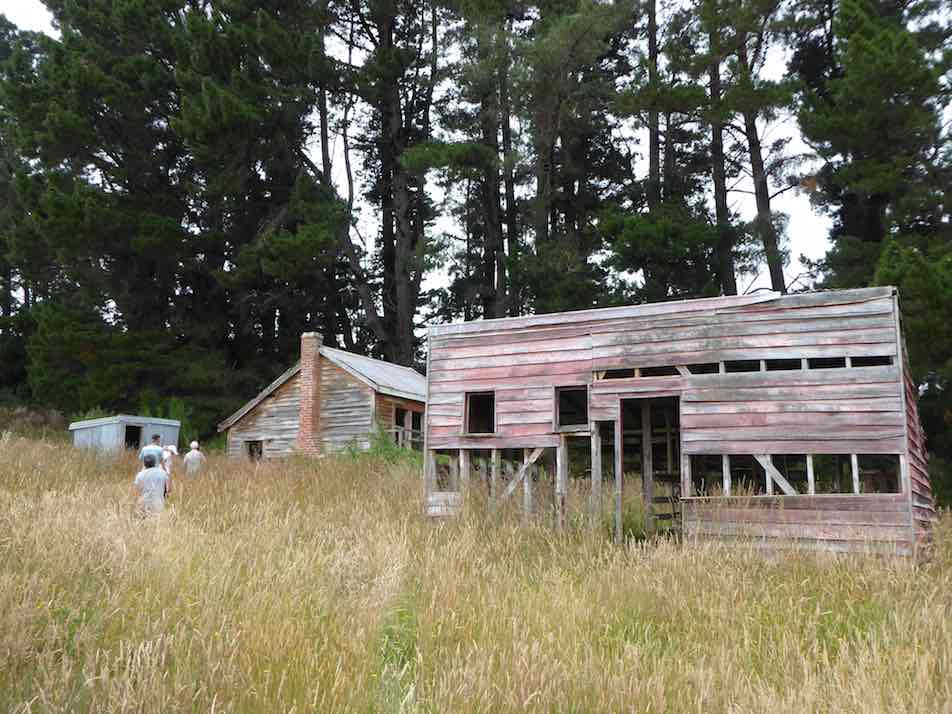
Morning tea at storage sheds at Balmoral.
which was varied with a visit to the Museum,
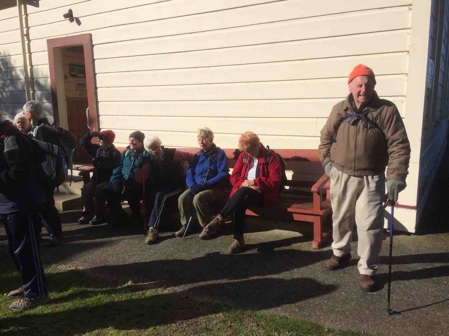
Waiting in the sun outside the Museum to regroup.
Vintage Park and then onto the Glen track.
Standing aside to allow a motorised tracked wheelbarrow returning empty from delivering gravel to resurface the track. A sunny spot. (Liz pic.)And a shaded spot. Frost. (Liz pic.)Lunch in the sun beside the river by the track/route boundary point of the Outram Glen – Lee Stream Track.
We numbered 25 and finished off with the Local Coffee Shop.
It was a wee bit different owing to the unknown conditions from the nasty weather three days earlier but as usual the company was good and we achieved our goals thanks to everybody. – Liz and Alex.
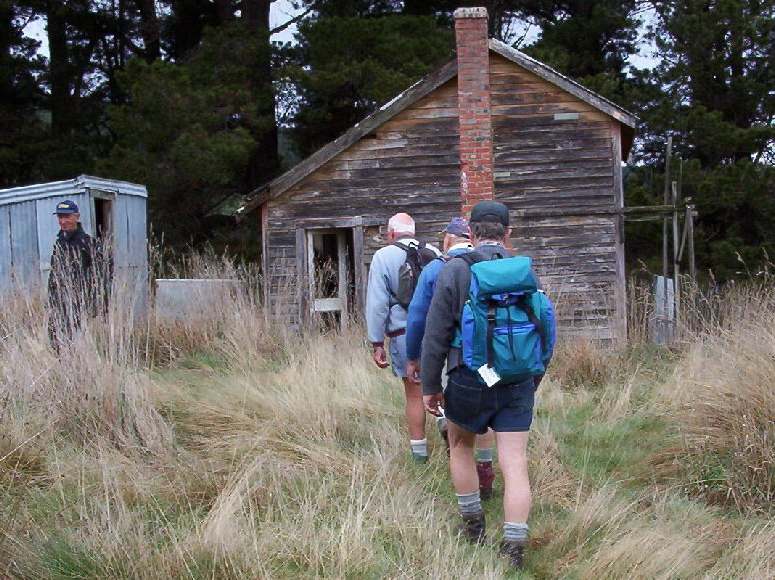
8. 26/3/2014. Hikers. Taieri Musem, Outram Glen Track to Lee Stream. Leaders: Jim and Betty.
GPS of track to Lee Stream
We were met with a surprise variation to simply walking the Outram Glen track. The leaders took us first up to the Taieri Historical Museum via an interesting side track shortly up the George King Memorial Drive by the bridge over Traquair/Whare Creek. We were seduced by the machinery museum building at the top of the property with its wonderful variety of early Taieri farming implements. They found it hard to drag us away.
We made our way down the driveway this time, and past a surprising number of cars to the track beginning. Time had passed so the leaders made our cuppa stop at the crest of the track’s large rise just past the entrance and in a nice sunny spot.
Then on we went till we reached the great set of steps that took us up from the river side to the high undulating bush track, or more officially, ‘route’. From the top of the steps on to the end of the route was a long series of regrouping pauses, where the more able waited for the less able to catch up. But get to the end we did.
A note to the side: On our way to the start of the track, we noticed Bob’s ute had joined our parked cars while we were up at the Museum. Some knew that he did have a prior commitment and must have presumed he would have caught up with us somewhere on the track but knew nothing of the leaders’ plan to visit the museum first. Eventually we did meet him, towards the end of the track, returning. It was all just too sad a misunderstanding.
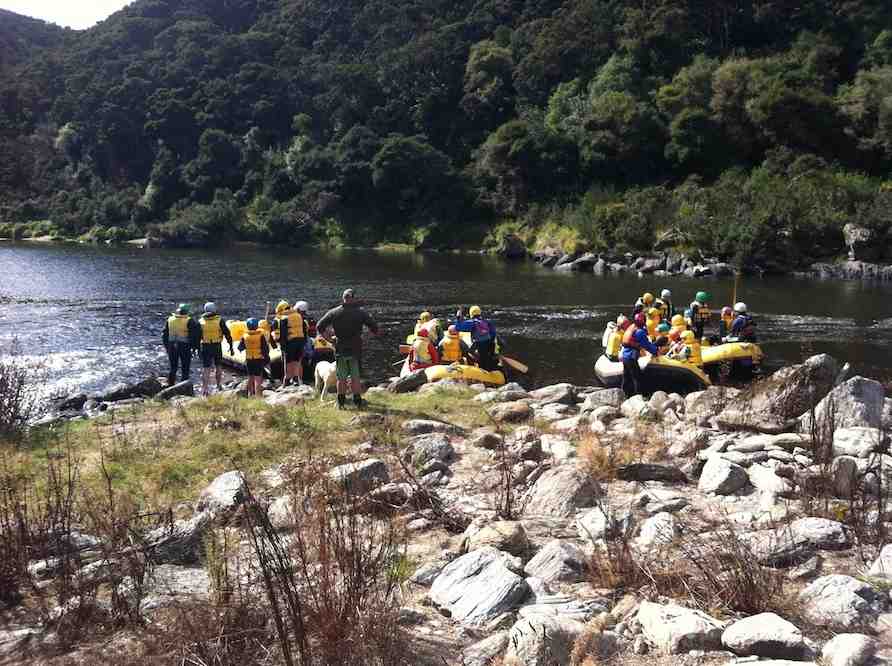
We discovered the reason for the group of cars at the start when we reached the end. By the Lee Stream mouth was a large group of young St Mary’s School pupils being instructed on safety measures pertaining to launching inflatable rafts drawn up nearby.
Launching the rafts
There were eight rafts in all, four setting out at a time to practise the art of paddling in the stiller waters upstream before heading off down over the first set of rapids below.
The paddling rehearsal before negotiating the first rapids
By this time we had finished our lunch and just prior to entering the bush track again, were surprised again to see the rafts anchored against a cliff on the opposite side of the river, and each pupil being required to leap off a ledge in the cliff into the water, resurface, and to drift with their life jackets down to and be helped back into their rafts immediately downstream. They did this wonderfully, some choosing a yet higher ledge to leap from. Bravo.
We seemed to make much faster return time down the track than when earlier coming up, and were regaled from time to time by excited shouts and screams below us as the rafters made their way downriver.
As we neared the end, it was just a case of now of negotiating the rise at whose summit we had earlier in the day had our cuppa, (it’s steeper and more laborious on the up-track side of the rise and this reporter, at the tired end of the tramp, hates it) and we were back at the cars and en route to home.
Thanks to Betty and Jim for their imaginative planning of the day and careful looking after us. – Ian.
7. 5/10/2011. Both. Outram Glen, Lee Stream. Leader: George.
Lambing got in the way of the programmed Lee Stream ramble. The Outram Glen walk was a most successful replacement. 20 of us went. The first bit’s nice and flat in general. We stopped early for morning tea by the river. A cold wind drove us back up to shelter in the approach track.
Down-track view.
Up-track view.
Beyond the sign indicating the more difficult part of the track was the (never less) challenging (never-ending as well) set of steps. They are now well-worn but still very serviceable. We all made the ascent at our individual rates of speed. Beyond that, the various ups and downs are still well serviced by the sets of stone steps. They have stood the test of time and are firmly embedded. Well made. We all made our way to the Lee Stream confluence with the Taieri, some arriving earlier, others later. Again an early lunch enjoyed with the warmth of sun and calm, and cooler bits of breeze. But still comfortable enough.
Some of us at lunch.
The confluence of the two streams at lunchtime.
Again, we wandered back each at our own pace. A pleasant day, sheltered by bush from the coolish wind. – Ian.
6. 3/9/2008. Both. Outram Glen, Lee Stream. Easy. Leaders: Evelyn and Bob.
Nineteen of us walked the riverwalk from Outram Glen to Lee Stream. The weather was threatening but we had just a little rain, and with no wind and a mild temperature it was an enjoyable 12 kilometre expedition. Many of us had not seen the Taieri River so brown and surging for a long time.
The track in the upper reaches was quite slippery so we needed to watch our feet. Some birdsong from bellbird and fantail was appreciated as was the presence of wood pigeons. We had lunch at Lee Stream where a number could remember past picnics beneath willow trees.
Congratulations to Evelyn and Bob for leading the group. Evelyn did a stalwart job in trying to keep the group together, trying to both race ahead to hold back the fast movers and take care to see the rear guard were still with us. She even managed to end up with one more tramper at the finish than she had at the start. Well done Evelyn!
Bob provided us with some drama by taking a tumble. However he bounced back and even did it again to keep the medics on their toes. He finished the tramp in fine fettle and good humour, leading the bulk of the group on the homeward stretch. We hope the scratches and bruises do not cause too much discomfort.
George celebrated his 80th birthday and first great grandchild by handing out beautiful chocolates to all.
Altogether it was a satisfying day with a return to home base before the southerly caught up with us. – Marjorie.
5. 6/6/2007 Ian, Doug M, Eleanor B, Joyce S
4. 3/5/2006. Both. Outram Glen. Leaders: Ian, Doug, Les & Margaret S, Bev H
3. 9/2/2005. Both. Outram Glen. Leader: Nancy
2. 19/8/1998. Outram Bridge, Taieri Gorge. Leaders: Nelson and Dot.
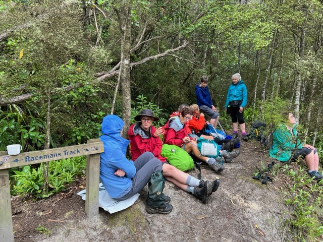
No. 40 on old hardcopy list of 113 club tramps. “Silverstream Weir. Racemans. Winefields. Year Round”
No. 107 on old hardcopy list of 113 club tramps. “Whare Flat – Silverstream Weir Year Round “
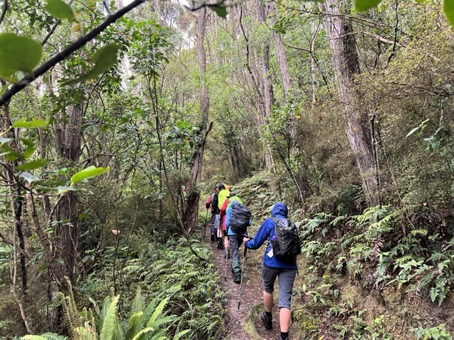
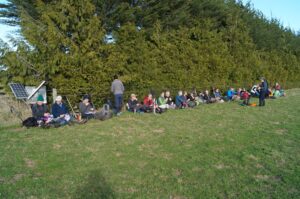
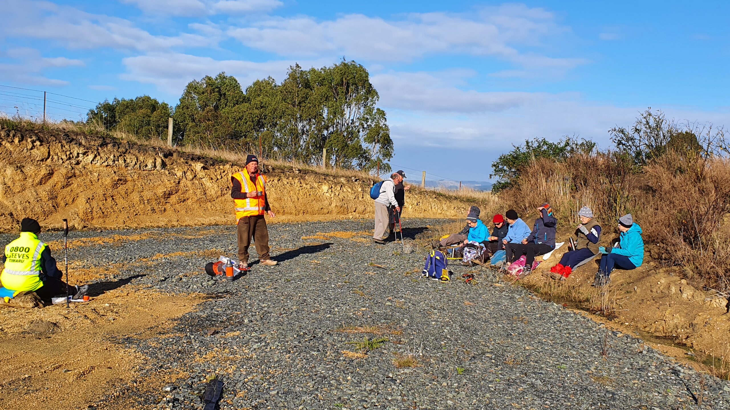
20. 11/01/2023. Racemans Circuit, Trampers. Grade 4 (regraded 3 – see below). Leaders: Neil Hodgkin, Julie MacKenzie.
Trampers: 10 women, 4 men
Weather: Low cloud, drizzly, calm, 16 degrees
Track: 14 kms, 3.5 hours walking and 170 m height gain.
A good, mainly flat walking surface, the odd muddy patch, and sometimes short, sharp, steep, descents/ascents in and out of side creeks.
Striding out at the start of Raceman’s (photo and caption Pam)
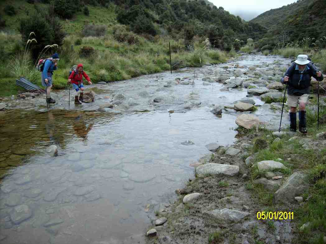
Several crossings of the Silverstream and even though the flow was low, care was needed and poles were helpful with slippery and unstable rocks.
As a first up tramp for 2023 it was great and a very suitable tramp for the weather conditions. In the bush there was no precipitation and no wind. We had the usual stop for smoke-o …
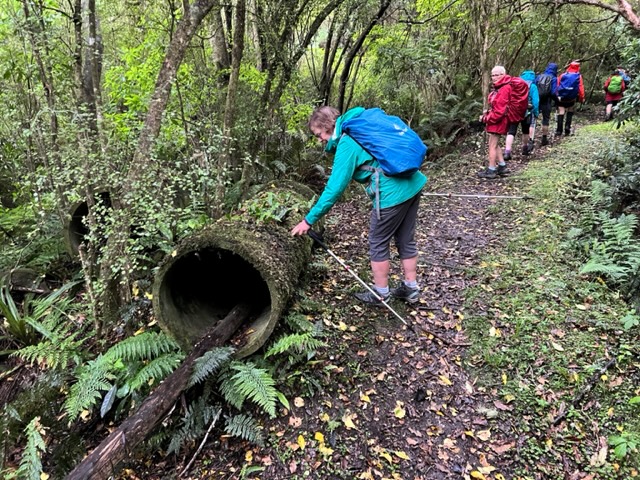
Morning tea at the junction with Tunnels track (photo and caption Pam)Abandoned water pipe on track (photo and caption Pam)Strange objects in several places along the track. Much speculation about what they are/were. No conclusions. Any ideas? Feel free to use the Comments section at the bottom of the page. (photo and caption Ross)
…and got to the weir about midday…
Silverstream top weir (photo and caption Ross)
…but decided to move on down the track for lunch where it was less noisy.
Lunch taken between intermittent light drizzle (photo and caption Pam)
On our return I as leader came face to face with six barking and not so friendly dogs who were eventually followed by a female runner who didn’t seem to worry. She said that the dogs were barking because we had sticks, but I didn’t believe her. What goes up must come down so we were expecting their return and when we heard them approaching we all stood off the track, sticks by our sides and gave them a TRTC guard of honour!
Grading: The grade of this tramp is solely dependent on the flow and depth of the Silverstream. The way it was on Wednesday, I’d put it at 2.5 – 3, but with more water it would certainly be a 3 -3.5 I think.
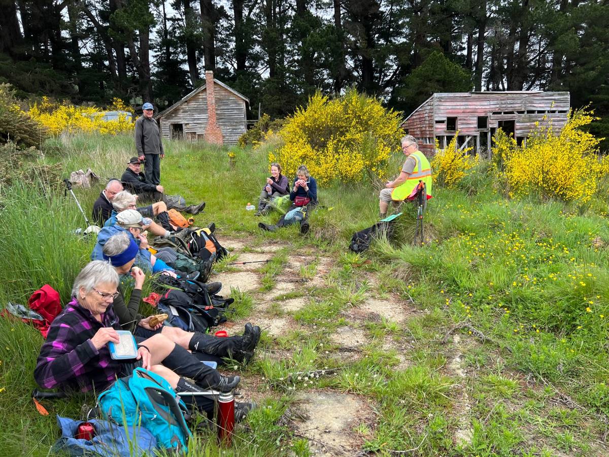
18. 30/11/2022. Trampers. Post Office Creek track from the Waipori Village side. Grade 3. $14. 60km. Leaders: Barbara and Leah.
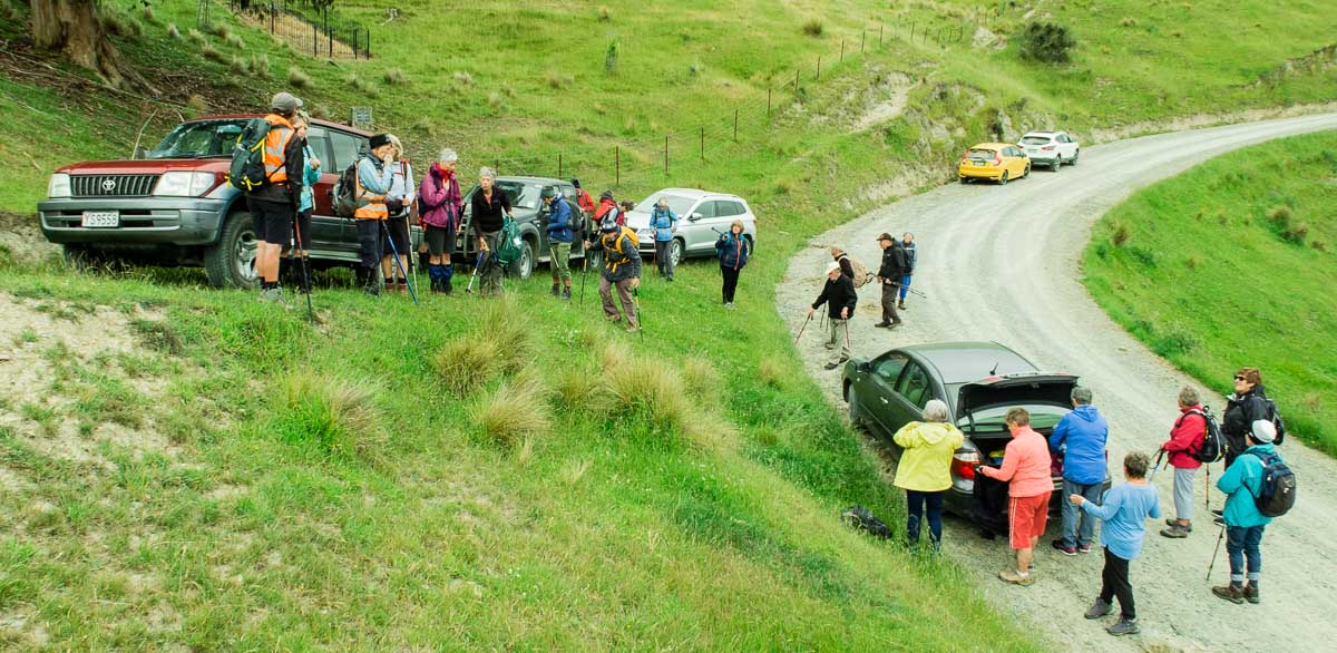
Despite ominous weather predictions for several days prior to the 30th, and heavy rain early that morning, the visual was more promising.Three vehicles and 14 trampers left the Peter Johnstone carpark heading towards Berwick and up the Waipori Falls Road, through the Village and continuing towards Lawrence. The big, locked orange gate, although on a side road, can’t be missed! Through the locked gate, past the new picnic area, following the road below the Mahinerangi Dam to cross the bridge and climb up into the Wenita section of Dunstan Road. The potholes aren’t for the fainthearted.
About to leave the cars (photo & caption John)
The walking track is off Patearoa Road which itself is off Moonlight Road and we parked at the junction of the two. The permit was left visible through the windscreen.
Excited to be ready to go (photo & caption John)
A quick morning tea, and the party set off on the 1km down-hill (remember what goes down at the beginning of the day must go up at the end!!) to the rustic signpost indicating Post Office Creek track. There was a brief delay while one driver (nameless) went back and spent a frenetic 5 minutes searching for car keys in order to lock the vehicle. Having found the keys in the backpack, they were left on the ground while the pack was rezipped. The person (also nameless) who had ferreted them away while the rezipping was underway should be afraid; very afraid! A brief detour a few minutes down the track proper took us to the now dilapidated fishing huts.
Fishermen’s Hut hidden in the trees above lake Mahinerangi (photo & caption Pam)“Watch your head John” as the track winds under the overhanging rock (photo & caption Pam)
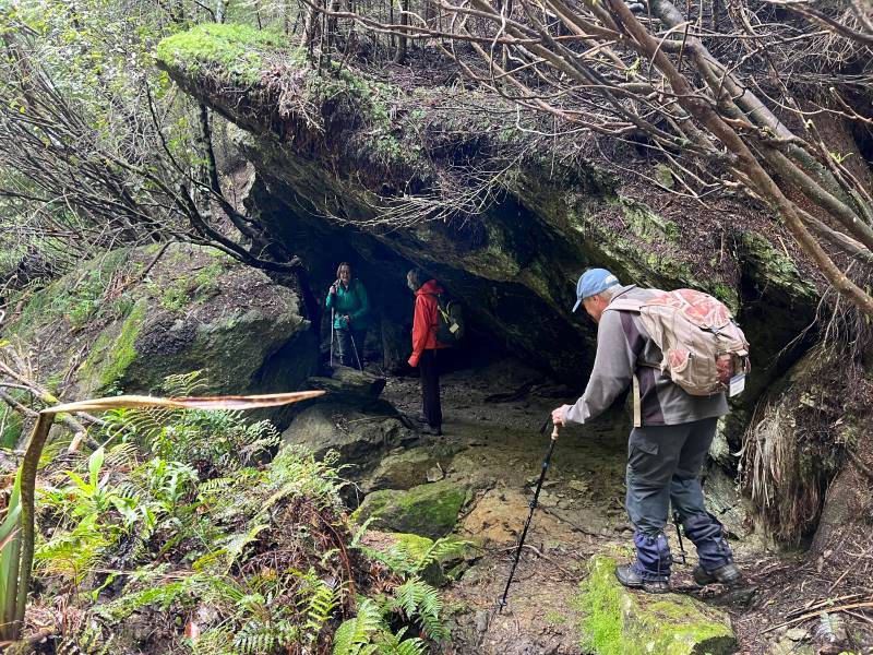
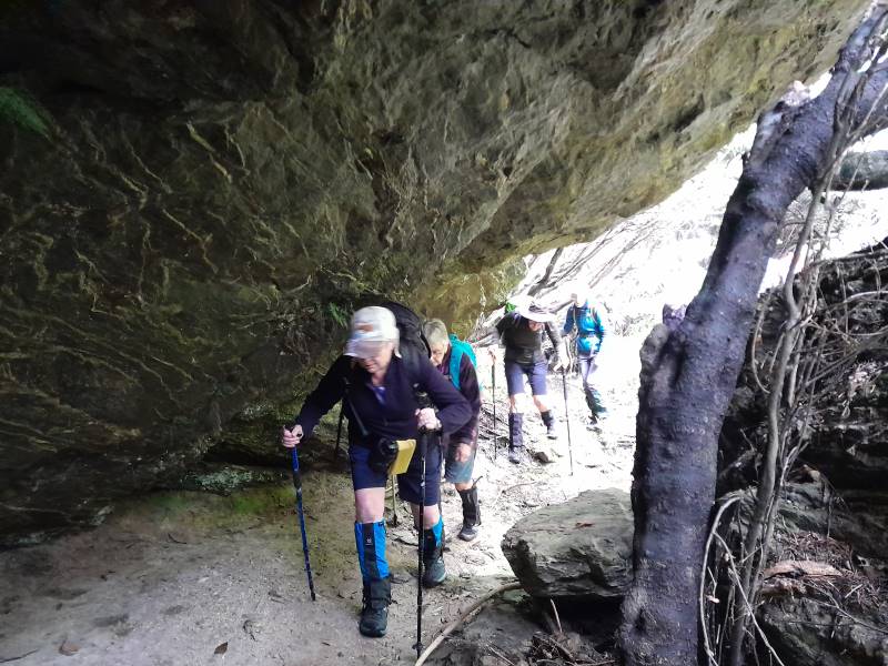
A scramble back up the track and we were crossing the first of the creeks and negotiating the rock bivvy.
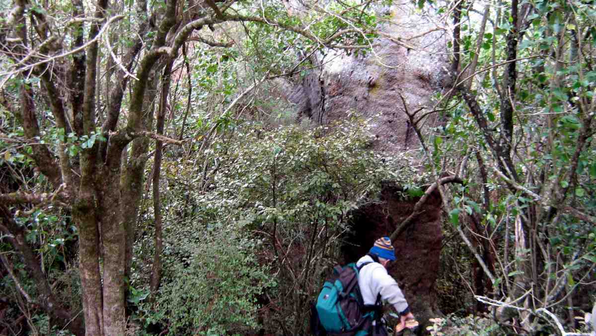
Post Office Creek rock bivvy (photo & caption Barbara)
The entire track follows the contour of the slope with very little up or down. Many of the guts had bridges in varying degrees of disrepair but which, it’s understood, are likely to be removed entirely in the near future, after the maintenance work in the forestry has been completed. The tracks will be realigned to navigate the guts minus bridges.
One at a time crossing the old wooden bridge (photo & caption Pam)
Pigs had been digging up the track which left it nice and soft underfoot and there were a few fallen branches we cleared as we went.
Escaped from the forest (photo & caption Jenni)
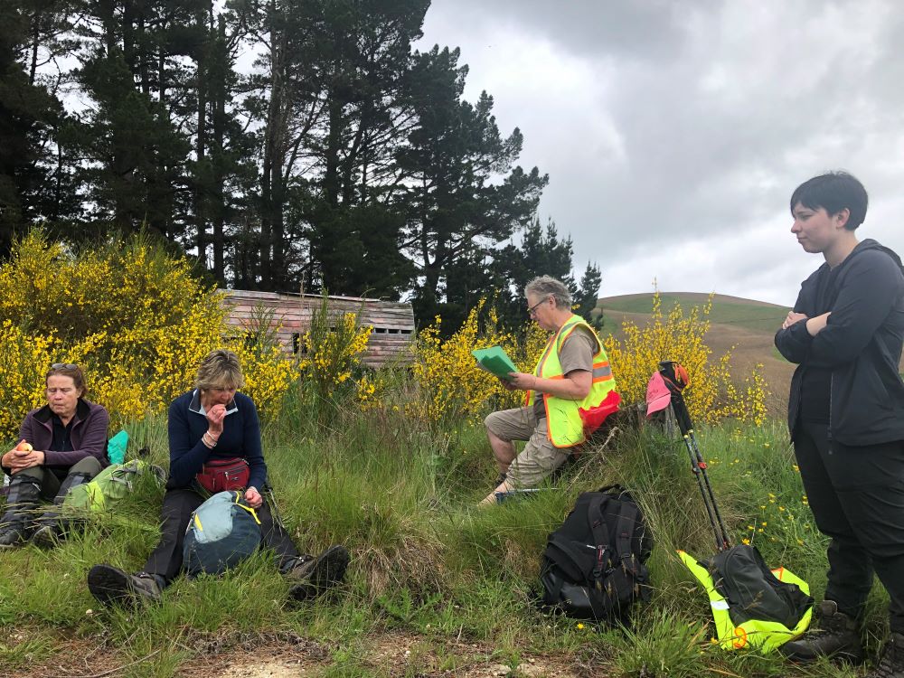
We left the canopy cover of the trees as we neared the re-sited Waipori School buildings where we sat and had our lunch. Half the group elected to follow Jill to the actual Post Office Creek while the remainder sat and chatted, walked down to the lake edge and poked around the buildings.
Disappointingly there was no fishing or poetry recitation.
Lunch beside the relocated school house once used by musterers (photo & caption Pam)Our industrious leader with historical info (photo & caption Jenni)
On the return of the wanderers, we set out again, retracing our steps, looking out for litter to take back to our vehicles. The last uphill kilometer was unwelcome but all 14 made it. A change of footwear, a little shenanigans with someone’s pack and sticks, and we headed back to the locked gate, this time heading to the right, over the Lake Mahinerangi causeway, through the fishing village and back to the Middlemarch Road at Lee Stream, enjoying a commentary from Jill who, for several decades, had farmed the property on both sides of the road.
End of track at Post Office Creek (photo & caption Pam)
One carload stopped for an icecream at Outram ($2 for 2 scoops being excellent value!), but weren’t joined by the other two, who must have thought 4.30pm too late for such extravagance!
An enjoyable day on an easy track which could well be considered for a combined day.
It would be possible to leave a 4WD vehicle at the bottom of the hill, at the signpost for the track, as we did on the recce, shortening the distance by 2 km.
Barbara
17. 2/6/2021. Combined trampers and hikers. Leader: Jill
A combined group of 42 people met at Andrew Reid’s hay barn on Mahinerangi Road and soon set off down the steep hill past the cattle yards. It was nice to have several visitors out today, as the weather gods were truly kind, and the ground underfoot was firm.
Down the hill Photo: Clive
We all enjoyed walking through the rolling country and down to Lake Mahinerangi, initially opposite the old Waipori school building.
Opposite Old Waipori School Photo: Pam
The lake was very low but still picturesque. We followed a gold miners water race to a now empty dam. One can only marvel at how adaptable and hardy those early gold miners were to seek their fortunes in this remote area!
Following the gold miners’ water race Photo: Pam
The trampers then went up through the farm, intending to walk several kilometres more than the hikers, but I am not sure there was much between us in the end!
On top of the world Caption and Photo: John
Another steep pinch Caption and photo: John
Trampers had lunch beside a tree lane with good expansive views and the Mahinerangi wind turbines were turning in the distance.
Trampers lunch break Caption and photo: John
Back down to the farm lane that we followed to THAT hill and our cars.
Distance covered was about 12.5 km. Jill
Screenshot: Colleen
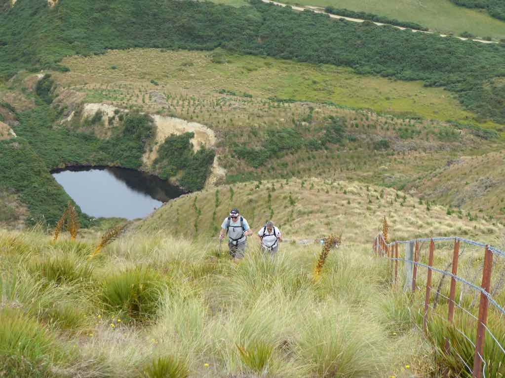
After parting ways with trampers 14 hikers led by Chrissy (thank goodness) climbed up a fairly steep hill where we had a short lunch with the promise of another break at the top of the next paddock! Well, we somehow went through a wrong gate so instead of doing a loop we did a loop and a half to get back on track. We were all in good spirits until we saw the road we had to go back up to get to the cars.
Hikers view of the track back to the cars Photo: Clive
But it was onwards and upwards at our own paces and, getting overtaken by the trampers, we made it back. This was a hard walk for us, but our senior members were so impressive. Well done team. PS. we never did get that promised break?
All up it was a solid 12 kilometres. Thanks Chrissy. Jenny & Jan Y.
11 trampers enjoyed a beautiful day on Andrew Reid’s property. We parked at the woolshed and headed downhill before walking along a water race created by gold miners, to a now empty dam.
10409112nd—Quick stop morning tea. (Gordon pic and caption.)On old water race above Post Office Creek. (Phil pic and caption.)
We marvelled at how this race had been dug into the hillsides – and can barely imagine the living conditions of the early miners, one must certainly hope their toiling brought rewards!! There were a few fences to climb
Another Bloody fence. (Gordon pic and caption.)
but we were rewarded with nice views over Post Office Creek and then Lake Mahinerangi.
Surveying the Post Office Creek arm of Lake Mahinerangi. (Phil pic and caption.)
We then walked away from the lake, across a dam, and through paddocks up to the farm boundary with DCC forestry. Lunch was eaten in the shelter of the trees.
A very welcome lunch break. (Gordon pic and caption.)
Then a few more ups and downs but we basically walked through the paddocks beside Mahinerangi Road back to our cars.
A most enjoyable day.
Distance walked 15.5 km. – Jill.
15. 17/1/2018. Trampers. Post Office Creek. Leader: Jill.
Route map, courtesy Keith.
13 trampers met at Reid’s woolshed on Mahinerangi Road. We walked down the hill to Post Office creek, and had morning tea at the “camp” before taking the track through gold mine sluicings to the top end of Lake Mahinerangi – a very low lake today! After viewing the old Waipori school (which had been moved to this site to use as a musterer’s hut before Waipori village was drowned) …
School inspection. The “old” Waipori School moved to Post Office Creek before the raising of Mahinerangi. (Phil pic and caption.)
… we backtracked about 1 km and shortly after went up a very steep stock lane …
Onwards and upwards to the trig. (Phil pic and caption.)
… and lunched by the trig there, enjoying expansive views of the area.
Trig A4GT -618 m altitude. (Phil pic and caption.)
We continued up the farm track towards the back of the Maungatuas – the intention had been to look over to Waihola, but it was decided that was a bit far on this occasion! It was an easy return down hill to the bridge over Post Office creek – and to our cars.
Jill proudly displaying the new charging station for e bike travellers. (Phil pic and caption.)
An 18.5 km tramp enjoyed by all. – Jill.
14. 7/5/2014. Both. Reid homestead, Verter Burn to Post Office Creek and old school buildings. Leaders: Ken and Peter.
iPhone GPS distance: 12.1 km. Garmin stats: We walked 12.9km; Moving ave 4.3km/hr; Moving time 2h 58mins; Climbed 342mtrs; Max elevation 572mtrs. Allow a further km or two for the pedometer distance recorders, and then pick the figure that suits you!
21 of us parked in the Reid’s homestead backyard and made our way through one or two fences down to a bridge over the Verter Burn (near ‘1’ on the map) for morning tea.
Morning tea at Verter Burn crossing. (Heb pic, Ken caption)
We followed a road on the stream’s true left, which begs the question as to where originated the pond with its beautiful reflection on our left. (About ‘2’ on map.)
Reflection
Between 3 and 4 on the map, is where we approached the Verter Burn ford, into which we were to plunge later, but at this stage we swung off to our left to make our way through early gold-sluiced cliffs (8/4 on map) to finally cross the Post Office Creek and arrive at (5) the former Waipori School building (as reported to the writer) of the one-time but now submerged Waipori Township.
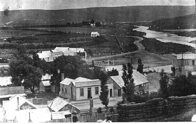
The Township of Waipori. The valley is now flooded and the town site is inundated. Photograph taken in 1890 by Charles Kerr.
We climbed the steep hill alongside the Post Office Creek’s true left to skirt on our right a forestry of densely branched trees (larches? [and unpruned!] with a scattering of eucalypt among them) for a lunch where the forestry road levelled out at the top (6).
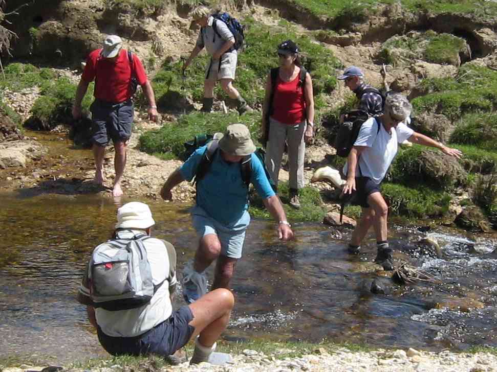
Then it was back down to the school building and out to the aforementioned ford, which this time we crossed with variously successful attempts in keeping feet dry, (but mostly wet).
Beyond that, was the further challenge of the BIG CLIMB, of un-fond older members’ memory. A taranaki gate at its top was new to us, but Neil successfully unscrambled its complexity. Three more paddocks and gates took us out to the Mahinerangi Road ( 11) and along it to the homestead (12.1) again.
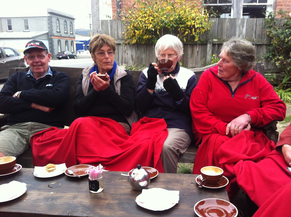
At Outram, the majority of the (now well-established) coffee club socialised at the Wobbly Goat, …
Apres-tramp coffee at Outram
although some betook themselves to the No 8 w Herbs cafe across the road. And that’s it. – Ian.
13. 28/11/2007. Trampers. Post Office Creek, fishermen huts return. Skyline track was closed on the day. Working on roads, trees. Easy. Leaders: Bill & Pat.
The day was fine and not too hot for
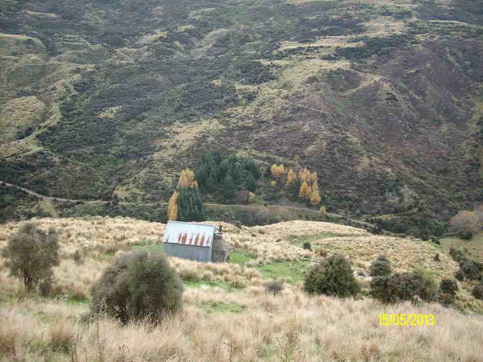
13 of us to tramp the Lake Mahinerangi water-race track to the fishermen huts. We had morning tea at the Post Office Creek Old School.
Tea Break. Hazel, Wendy, Doug, George, Ken, Shirley, Pat, Joyce, Arthur L
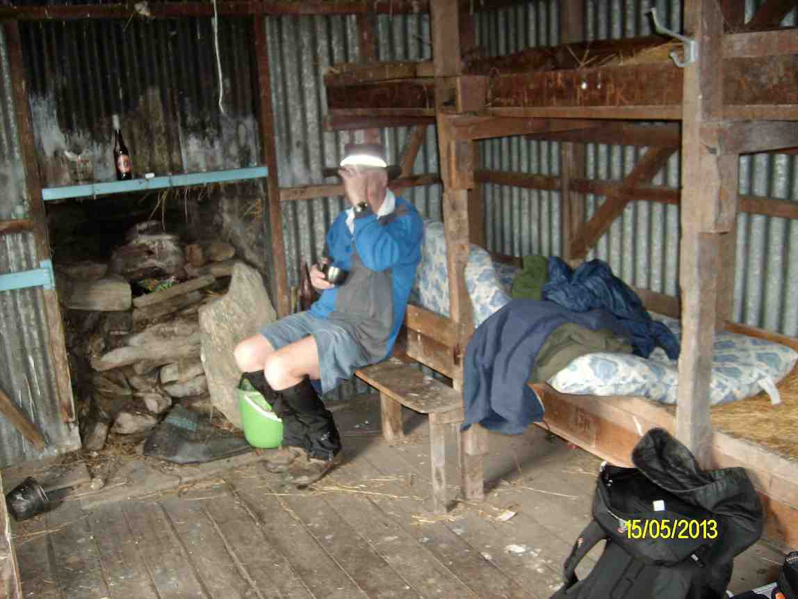
Immediately beyond that, the leaders had found for us the clearest approach to the larch forest that borders the lake, the tussock and bog being now badly infested with gorse. A leisurely lunch in the sun at the fishing huts and the return back. The Verter Burn barring the way in and out, as always, inspired a variety of creative crossing techniques, from direct plunging through the water boots and all, to bare feet, to plastic bags over boots and even to gumboots carried in.
Crossing techniques. Abe (bare feet), Peter, Pat (getting plastic bags), Doug (bags), Barbara and Wendy (boots on rocks), Arthur (gumboots)
The long hill climb back out of the Verter Burn gets no easier with age, but all agreed it was another good day out. – Ian
Back at cars. Pat, Barbara, Abe, Peter, Ken, Wendy
12. 8/11/2006. Trampers. Post Office Creek. Medium. Leaders: Ian, Doug M
11. 18/5/2005. Both. Post Office Creek. Leaders: Doug J, Bill M, Joyce S, Lesley G
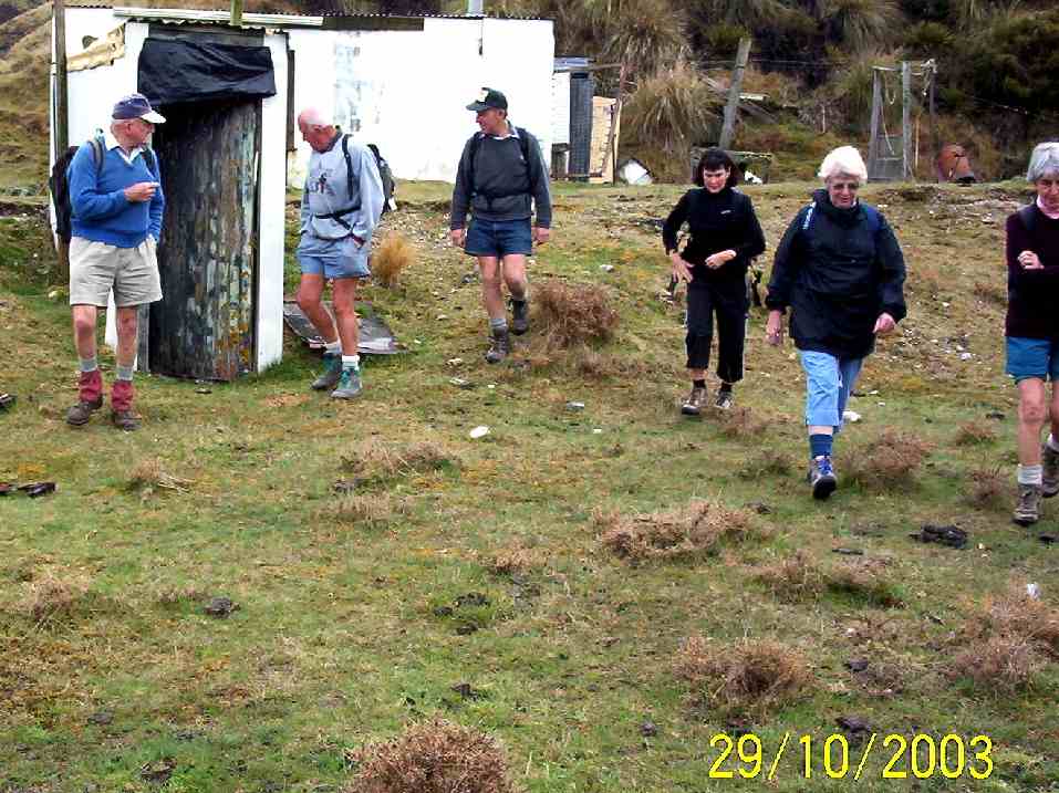
10. 29/10/2003 Forestry roads return. Leaders:
Crib by the ford. Bob Peter Arthur Barbara Who? Molly
Crossing Verter Burn. Peter Who? Molly
The gate beyond Verter Burn.
School. Arthur H Bob Peter Arthur L
Lunch stop. Arthur & Barbara on a tea break on forestry road back out.
9. 25/4/2002 Leaders: Joyce S Shirley, Wendy B
8. 30/1/2002. Post Office Creek. Medium. Leaders: Joyce, Bob H, Donny.
7. 25/4/2001. Post Office Creek. Leaders: Joyce, Shirley McN, Wendy.
6. 5/4/2000. Post Office Creek. Leaders: Joyce, Bill McL, Nancy.
5. 26/5/1999. Post Office Creek. Leaders: Joyce, Nancy, Patricia.
4. 26/8/1998. Post Office Creek. Leaders: Joyce, Pat.
3. 4/2/1998. Post Office Creek to Huts and return from Robert Reids. Leaders: Denise, Ria L, Nel K.
2. 30/4/1997. Post Office Breek (sic) to huts round trip. (Robert Reids). Leaders: Eric and Dot, Joan H.
1. 8/4/1992. Post Office Creek – off Mahinerangi Road. Average. Leaders: Hartmann, Ted, Barbara M, Mary M
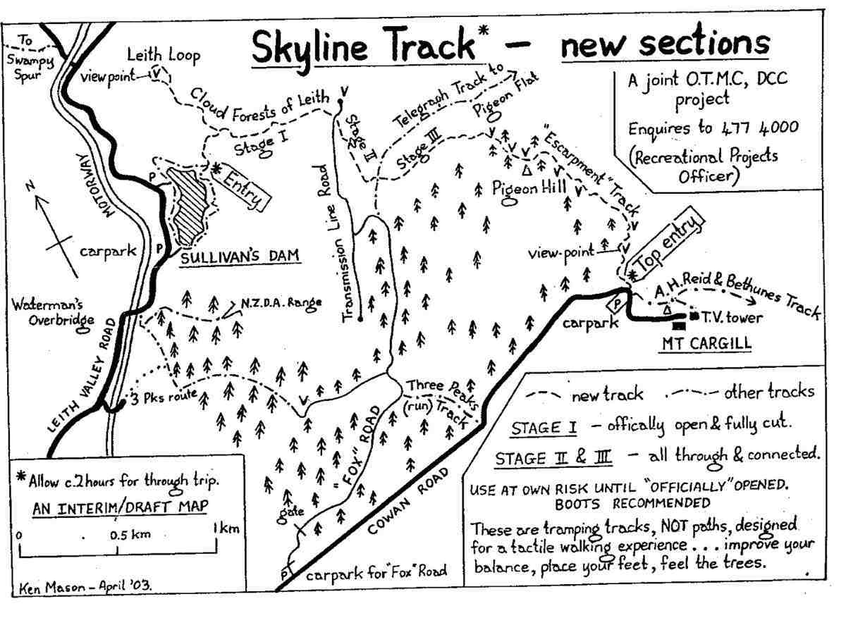
Map: Sullivans Dam, Cloud Forest, Telegraph (Old Bridal) track to Pigeon Flat, Escarpment Track, Cowan Rd, Short Cut to Fox Rd, down to Sullivans Dam – drawn 2002. (Click to enlarge)
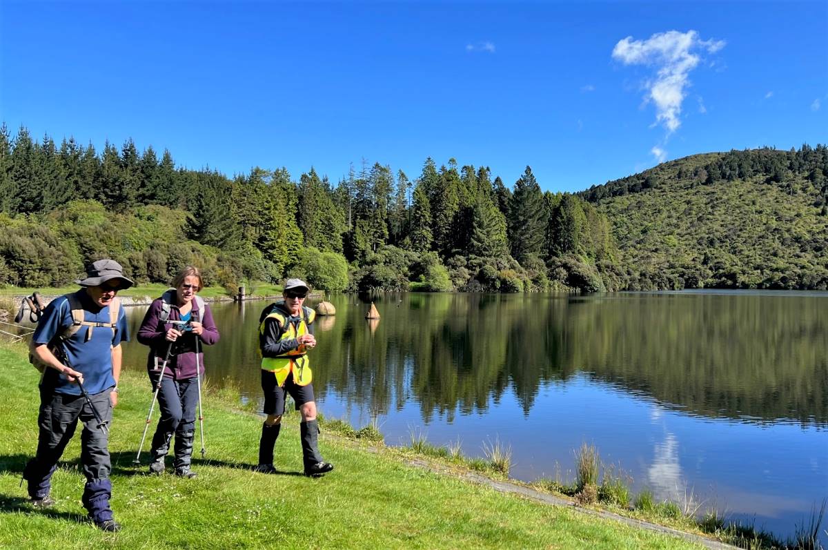
Sunshine start at Sullivans Dam (photo and caption Pam)
15 trampers set out around the lovely track around Sullivan’s Dam but we soon had to turn right up the hill that stated ‘for experienced trampers only’!
One of many old signs on our route (photo and caption John)
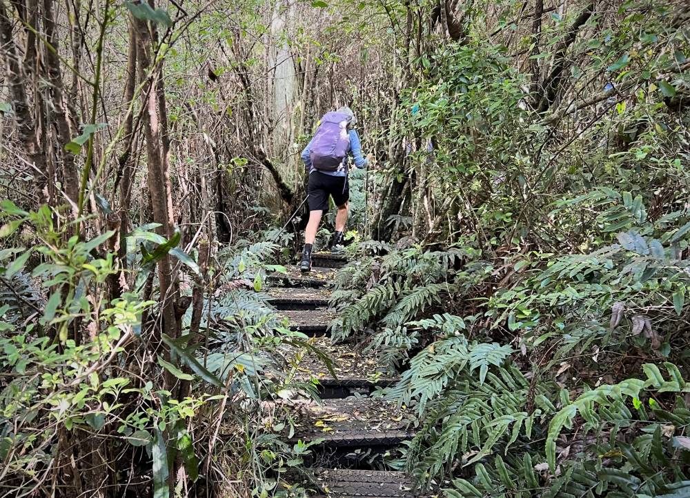
This track is an overgrown mostly-boardwalk that goes up and up through a patch of majestic Rimu, Totara and Miro to the Pylon Road. On the way we passed a bush telephone and a fairy grotto!
Boardwalks (photo and caption Pam)Telephone box, just in case you need it (photo and caption Marijke)
Morning tea was had under the pylons watching 2 helicopters below us loading up to do some spraying.
Morning Tea in a clearing (photo and caption John)
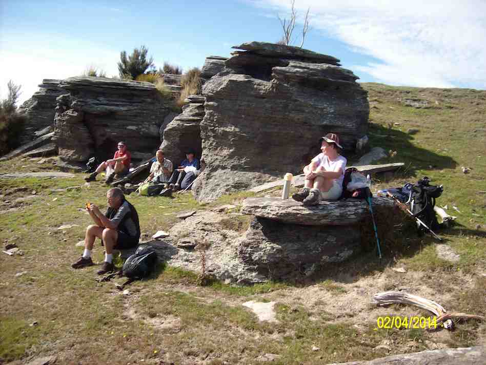
After refueling we set off on the escarpment track, firstly through gorse then mud, fallen trees and a rock climb up to the magnificent view from Pigeon Rock.
Some misjudged their footing! (photo and caption Pam)
Just when we thought the worst was over we came upon 2 huge pine trees crossing the track. However everyone made it safely over, then it was a short scramble up Pigeon Hill to lunch.
Lunch time hilarity over Neil’s boiled egg (photo and caption John)View from Pigeon Hill – I just love those big skies! (photo and caption Marijke)
The challenge after lunch was to follow the blue ribbons to Mt Cargill, this proved little trouble thanks to some tall scouts who could spot them among the growing pines.
Down hill from here (Cowan Road) (photo and caption Pam)
Once out on the road with the sky growing darker it was a fast trip down the 3 Peaks track back to the cars where the heavens opened! Good timing team! This is a lovely, varied track with lots to keep you interested. All seemed to enjoy it even the harder parts. Thanks for a great day out – Clare. Continue reading “Sullivans Dam, Cloud Forests, Escarpment, Cowan round trip”
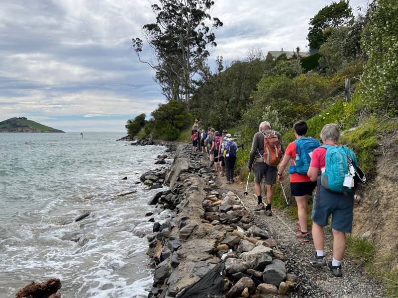
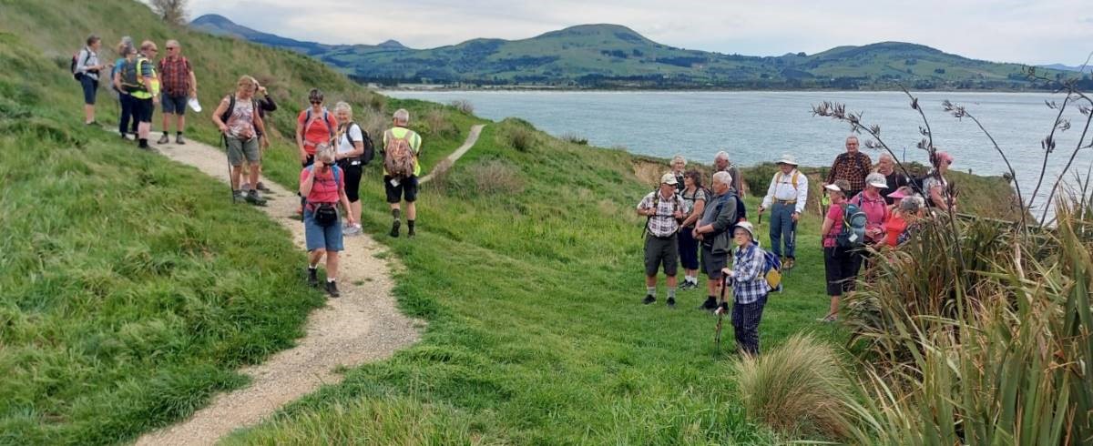
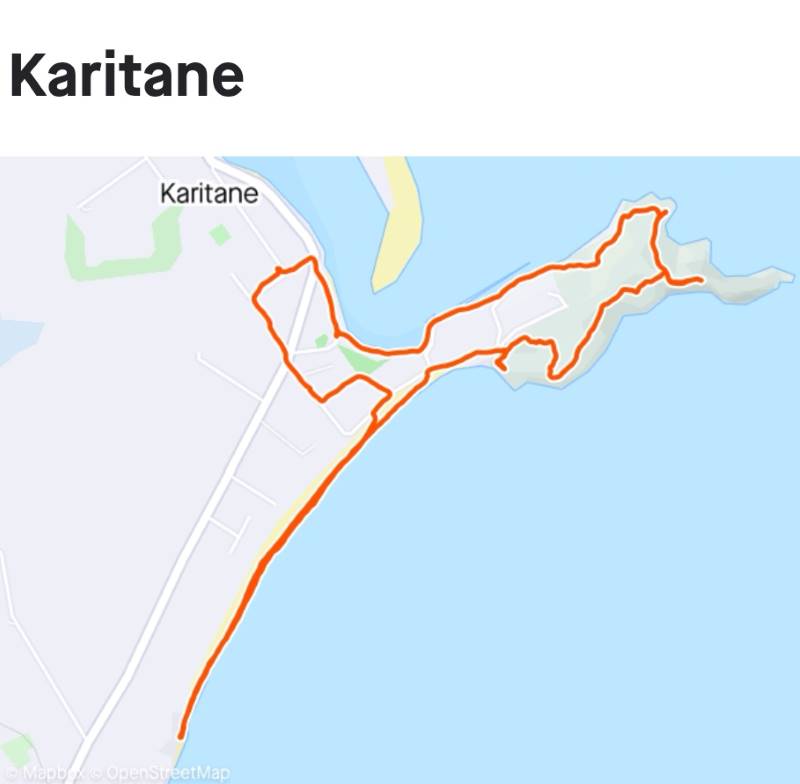
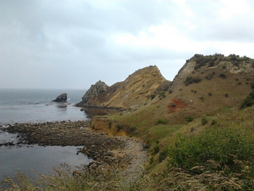
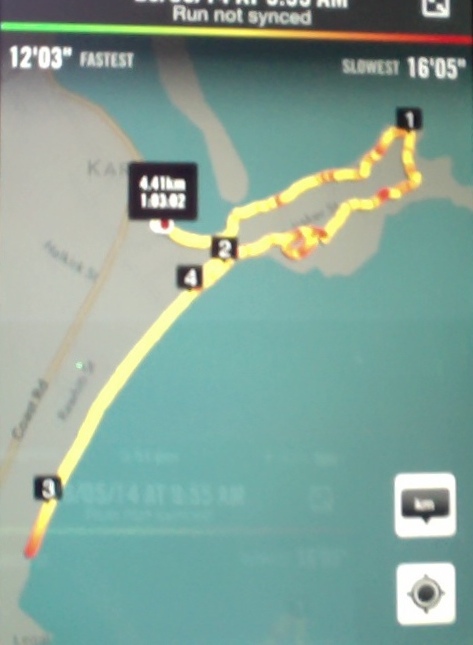
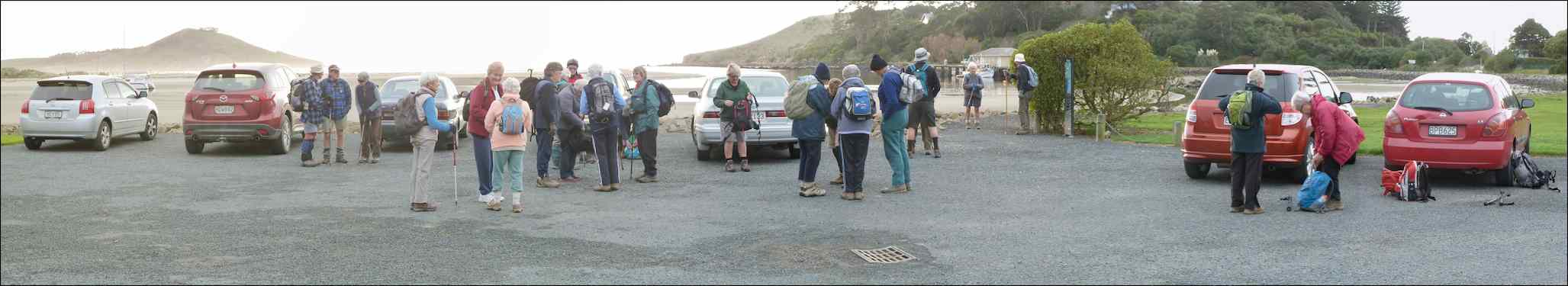
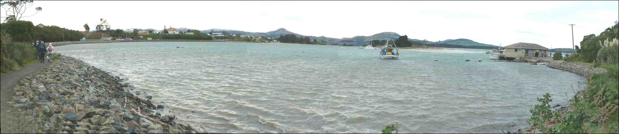
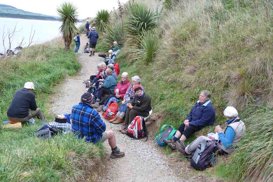
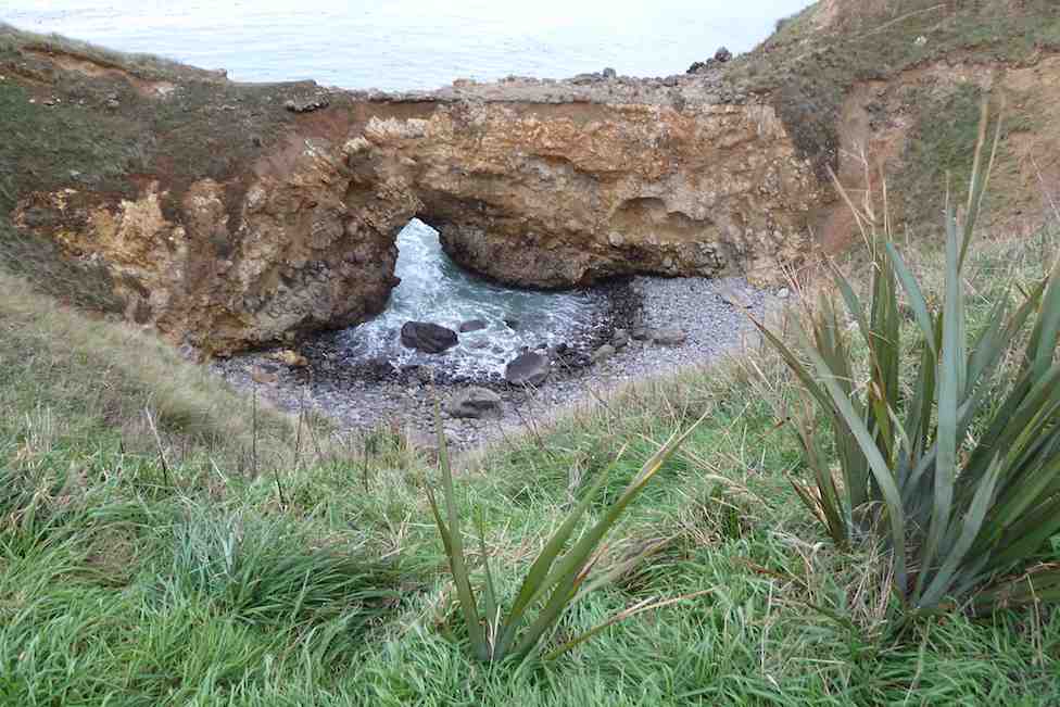
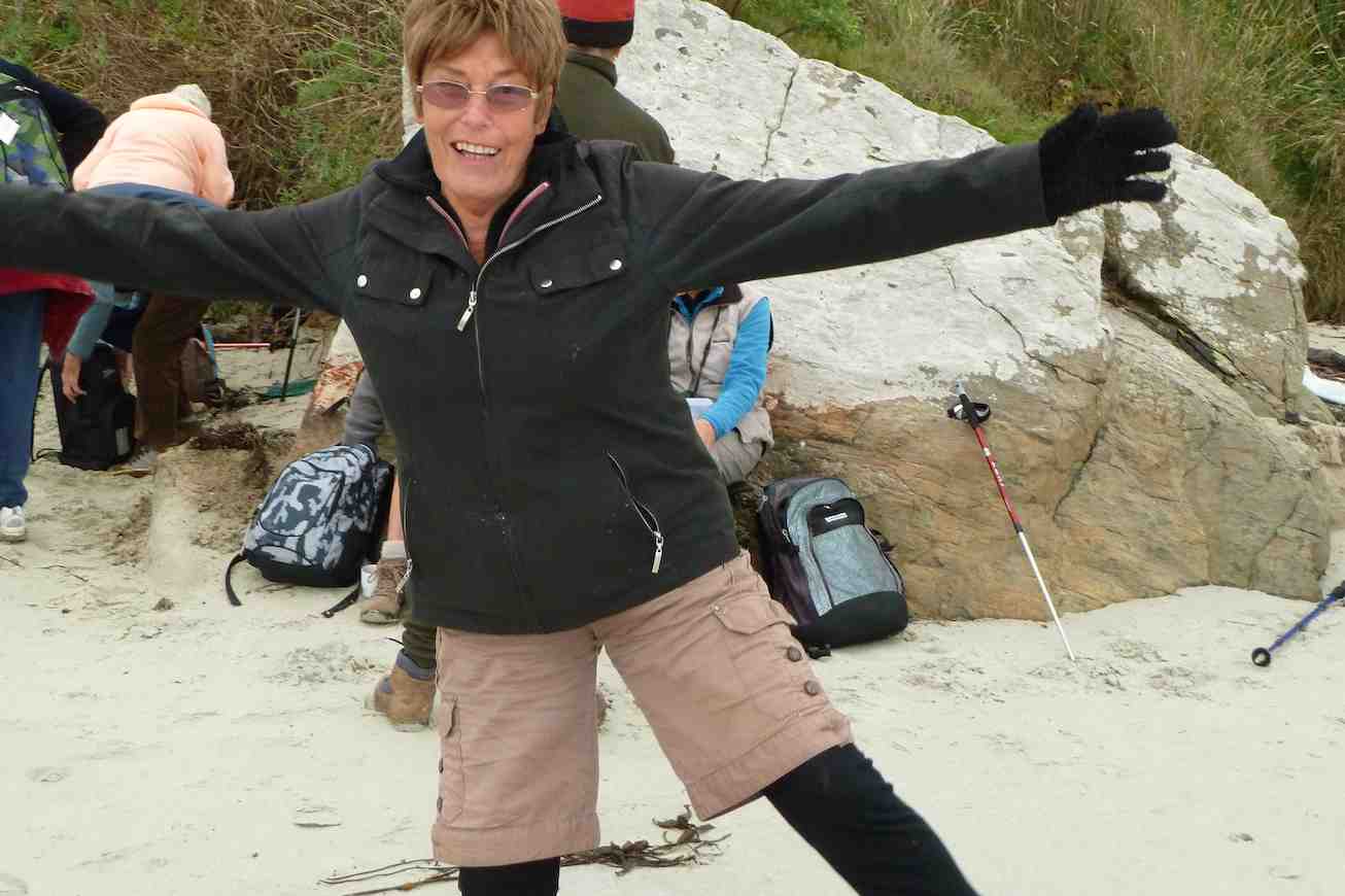
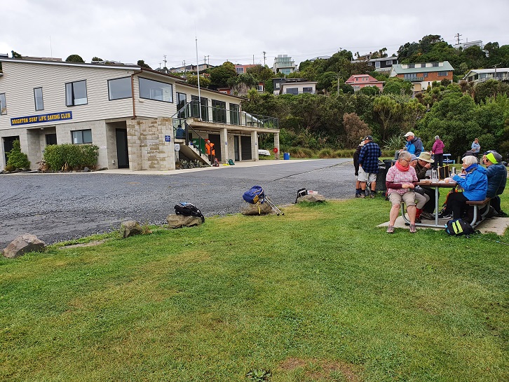
24. 02/11/2022. Combined. Karitane. Grade 2. $13. 56km. Leaders: John and Dave R
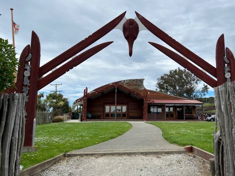
In our tramping and hiking endeavours, many factors are beyond our control. The weather is our greatest variable, but not the only one. This time it was Covid that scuttled our planned visit to the Puketeraki Marae.
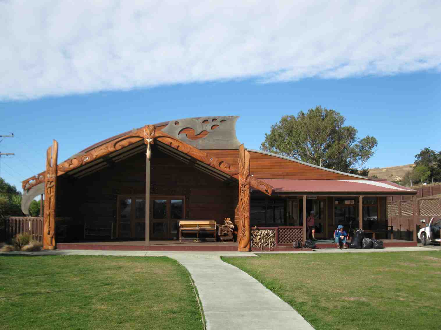
Puketeraki Matarae (photo & caption Pam)
Many thanks to Mauraka for agreeing to host us when I phoned to arrange the visit. Get well Mauraka. A key part of the Puketeraki Marae visit was the Powhiri (welcome). Googling this, did cause some consternation, appearing to be more involved and complex than expected. Thanks to Barbara and Grant, for putting my anxiety to rest, by offering to manage this part of the visit for me. Yet another example of the depth of expertise within our membership. Sometimes things just don’t go to plan.
Morning Tea above the Puketeraki Marae (photo & caption John)
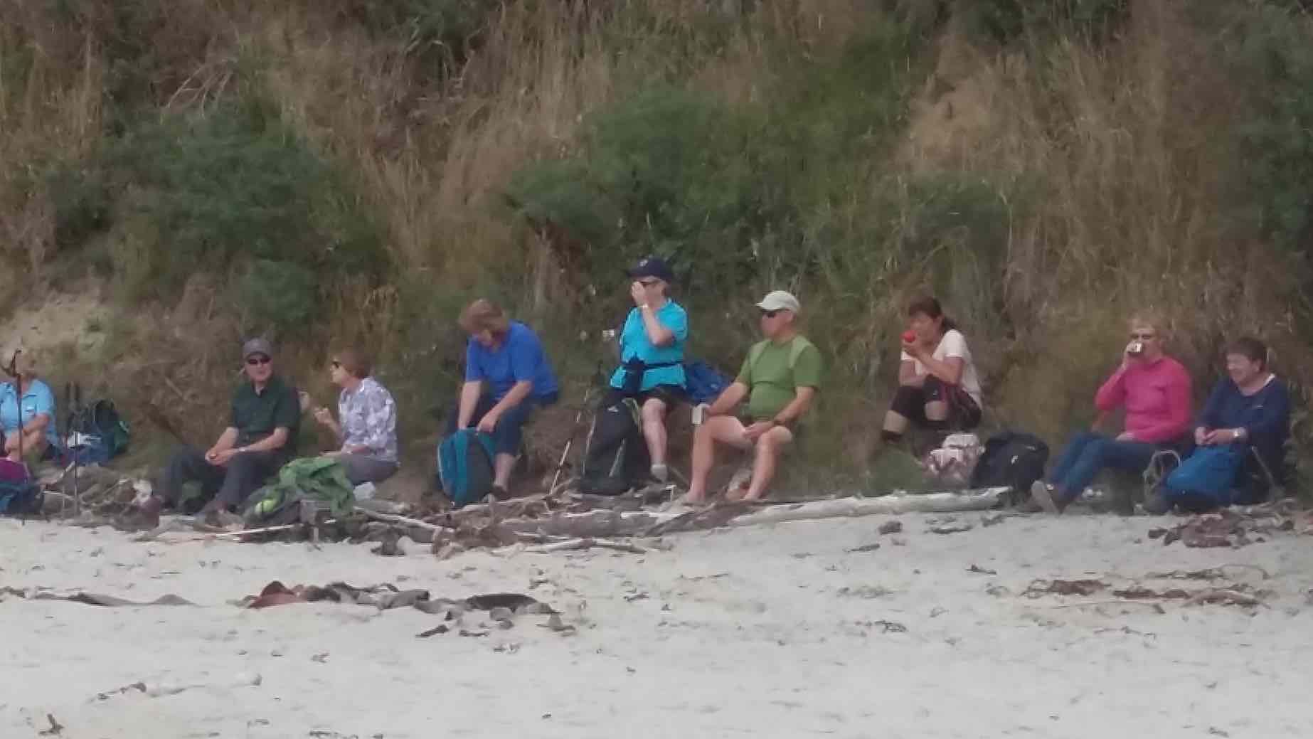
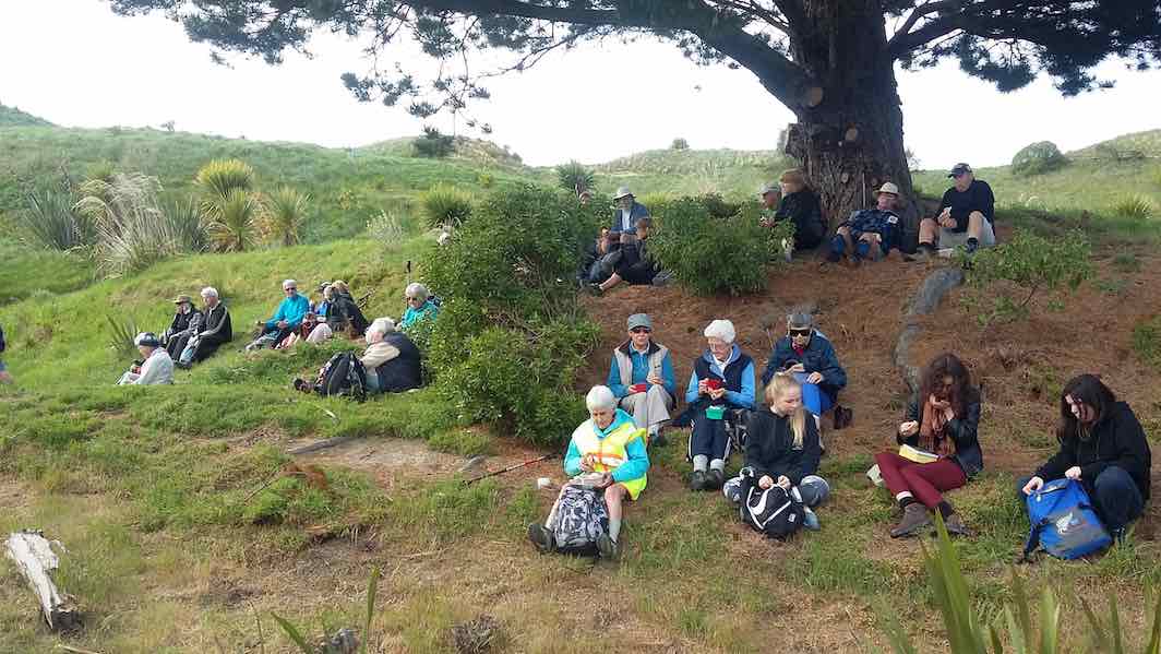
Subsequently, with a “glass half full” philosophy 27 keen hikers and trampers began their combined adventure at the Marae. Spending morning tea overlooking the beautiful settlement, the bay, peninsula, and beach that is Karitane.
On the Huriawa Pa track (photo & caption Pam)
Under blue skies we drove back to the reserve, where we regrouped at 11.00am, and began our walk. With a slightly chilly wind and choppy high tide waters in the bay, it was a relief to get out of the wind, on the more sheltered track around the Te Awa Peninsula.
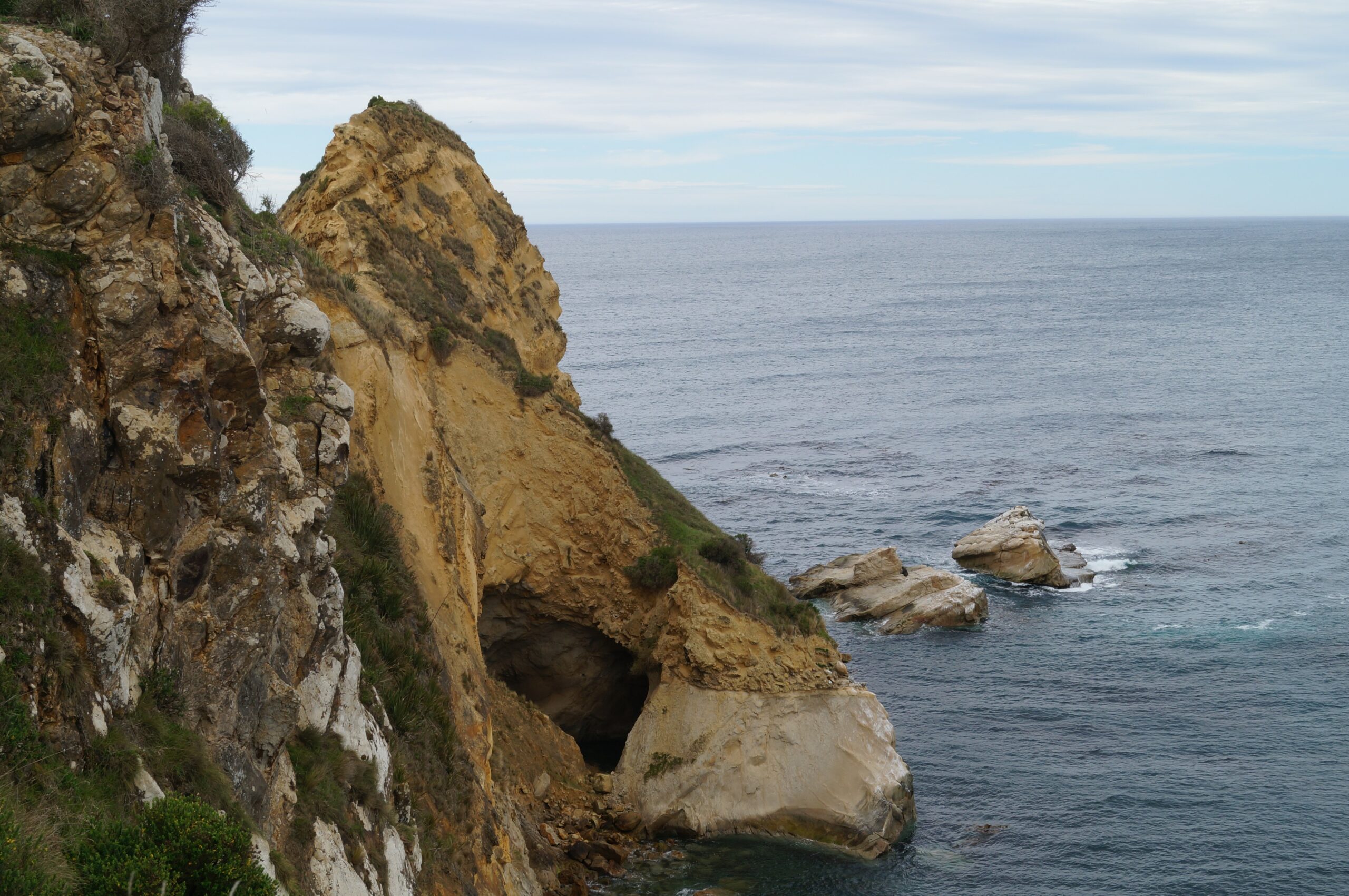
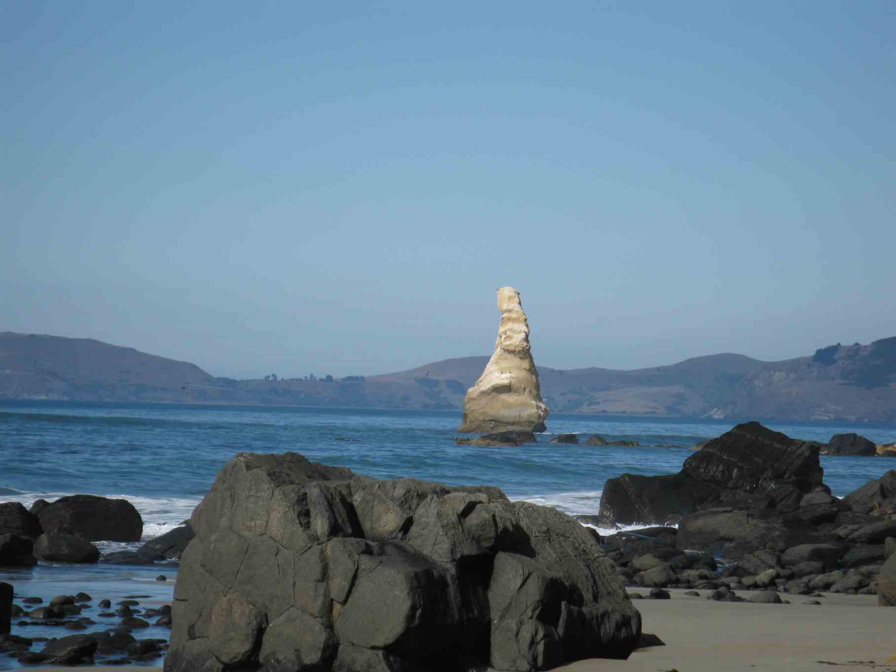
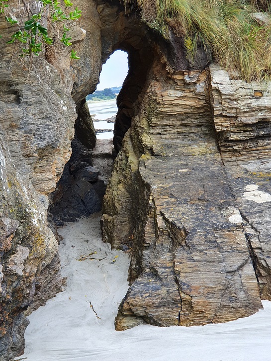
Dramatic hole in rock (photo & caption John)
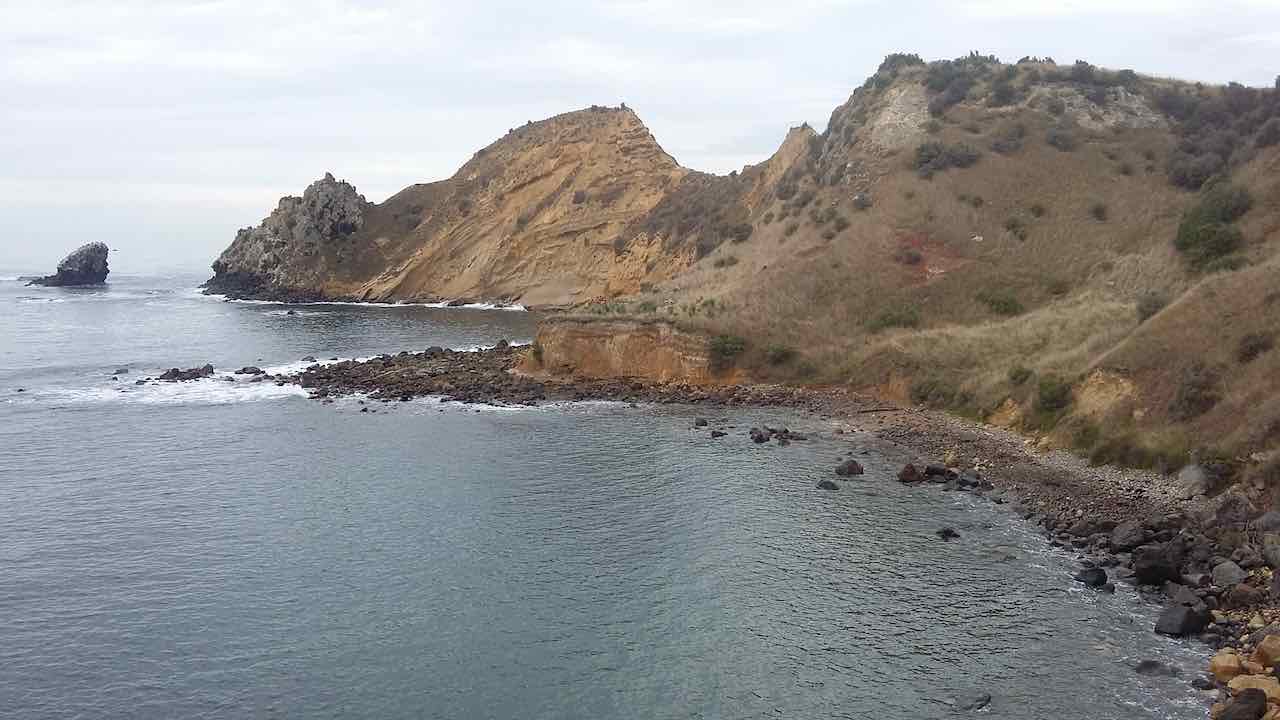
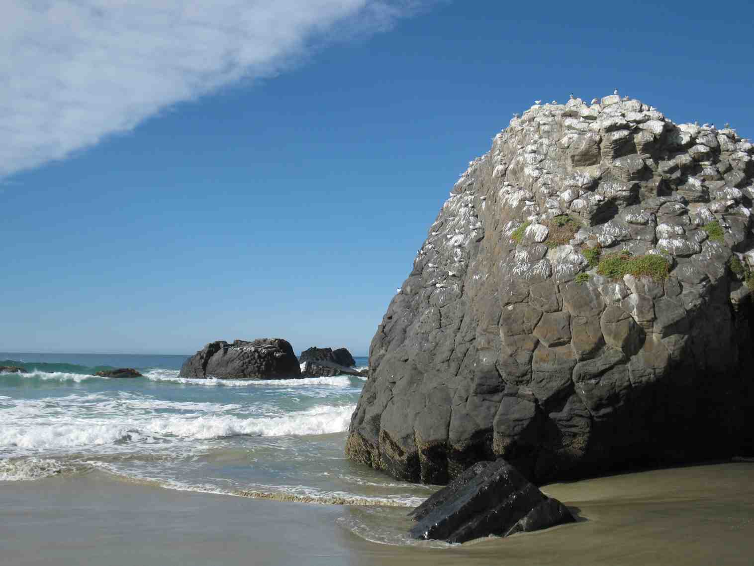
Here we followed the well-formed track, passing the spectacular Te Awa Mokihi (Butterfly Bay), the imposing Pa-katata Cliffs, and the unique Ke Pehu’ Blow-holes, before passing The Pinnacles, (a group of offshore rocks).
Gathering up for the views (photo & caption Helen)
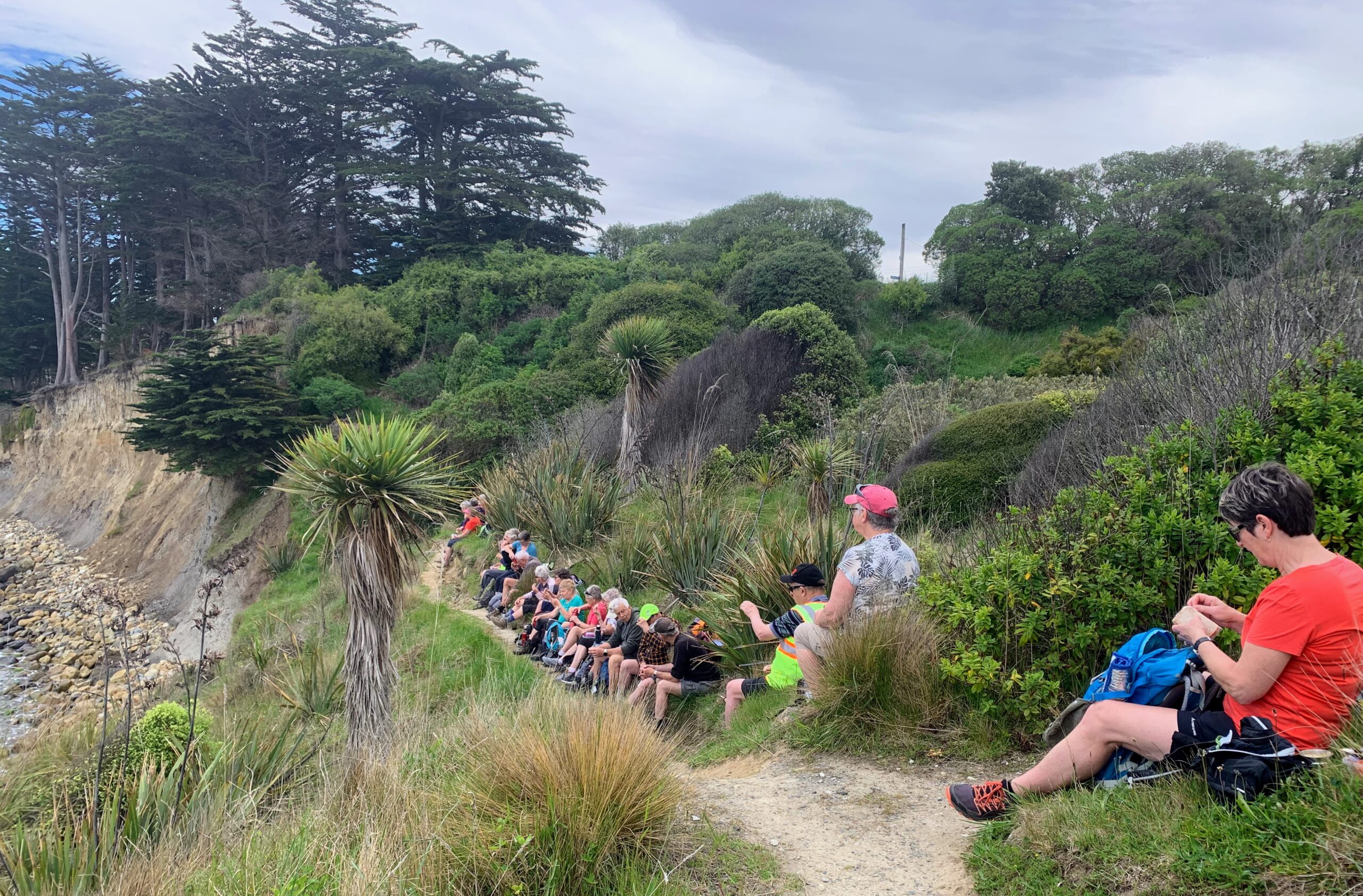
With lunch beginning at 12.15pm overlooking Karitane Beach the day was right back on track, and spirits were high.
Lunch stop (photo & caption Marijke)
Heading back (photo & caption Marijke)
Interesting Stone sculptures (photo & caption Pam)
After lunch we walked down to the beach, joined by an unusual looking, resident old dog, who stayed behind to devour a dead seagull he found on the beach!
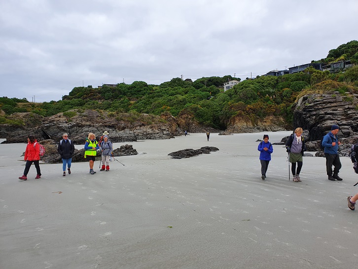
The beach was like a magnet (photo & caption John)
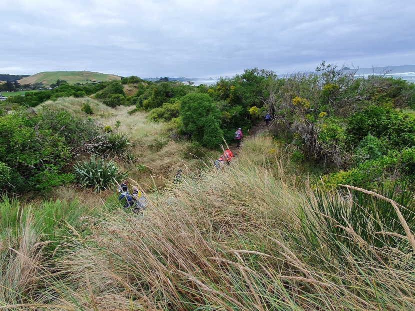
Our group got well and truly spread out on the beach, that we had pretty much to ourselves, with people walking at their own pace, enjoying the pristine surroundings, clear sands, and gentle sea breeze.
Special thanks to Dave, for his efforts as tail end Charlie in these conditions, (I know it’s just against your nature to be behind, or to go slow Dave!) By about 1.30pm we had all regrouped at our starting point on the beach, and following a short street-walk were at the Karitane Store for an ice cream at 1.45pm.
Ice creams. Very hot so needed (photo & caption Helen)
Blueskin Cafe’ was reached, dead on time, at 2.15pm for alfresco Coffee.
Looking back onto the Huriawa Peninsula and Pa (photo & caption Pam)
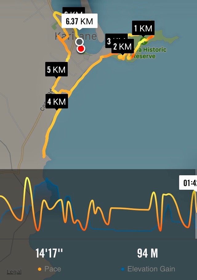
In summary, Karitane is such a beautiful spot, one the club has visited many times, but one that never fails to delight. Ideal for our diverse group with varying abilities, it allowed flexibility for people to safely go at their own pace, yet permitted lots of interaction between hikers and trampers. The Grade 2 classification seems appropriate, with just over 7 Km walked.
Map (screenshot by Margreet)
23. 19/01/2022. Hikers. Karitane. Leaders: Liz Griffin and Faye Lamb
Karitane is one of the most popular walks the club has done with more than 18 walks over the years.
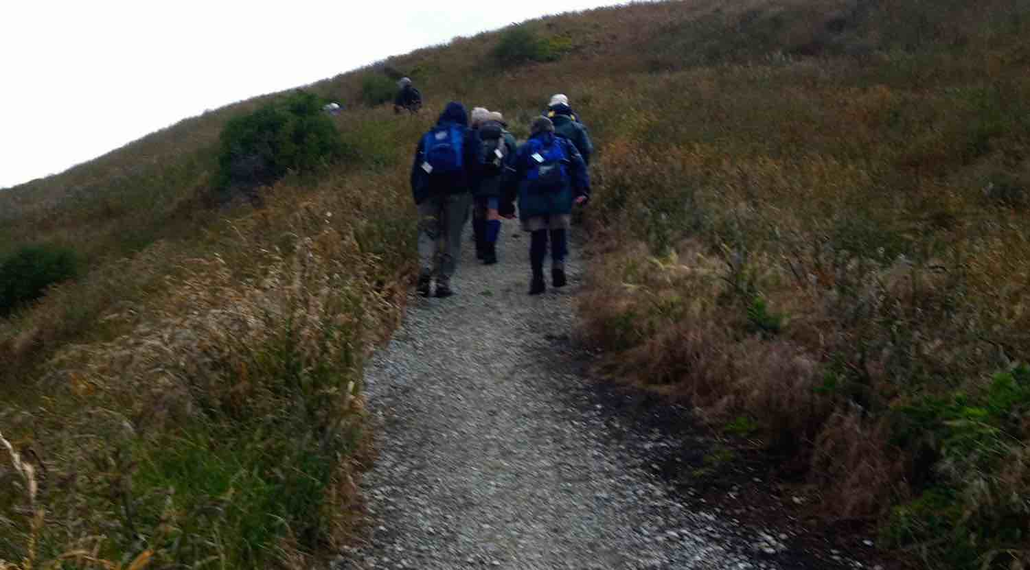
We started out with 14 hikers from near the Karitane fishing club. There is so much history, scenery and things to see and do in Karitane. We were not sure what the weather had in store for us so we kept an eye on the clouds. We set off up the Huriwae Pa peninsular with stories posted at regular intervals and the easy walking tracks and paths well maintained. As usual within the hikers ranks we had few ‘intrepid’ hikers (read trampers) who decided to scale the headland above the blow hole for even more spectacular views.
Once we completed the circuit of the peninsular we headed inland and followed the coast road parallel to the beach. We went to the church above the Puketeraki Marae for lunch. The views from up there reached away to the North beyond Shag River and to the South to the entrance of Otago harbour. A leisurely walk back along Coast Road got us back to the cars about 1.30pm with no sign of rain.
We had plenty of time for a coffee and biscuit at the ‘Salt & Sugar’ general store. We were wished ‘Happy New Year’ in English, German and Russian on the sign above the coffee tables. A good walk was enjoyed as the first walk of 2022. Thanks to Liz & Faye our leaders.
Report and photos courtesy of Clive
22. 20/1/2021. Hikers. Karitane. Leaders: Linda and Heather
The weather forecast wasn’t looking too promising but it did not deter 20 eager hikers travelling to Karitane for our first hike of 2021.
Fortunately wewererewarded with reasonably fine weather at Karitane.
Getting ready to get underway. (John pic and caption.)
Bob and Lester keen to get started. (John pic and caption.)
We started the day with morning tea,
Civilised morning tea. (John pic and caption.)
before proceeding along the peninsulatrack.
We walked past the totem pole and blow hole, taking in the magnificent ocean views, gazing at the distant coastline and a ship waiting to go into the harbour. Some of the more energetichikers walked up the steep track to take photos and admire the view from the highest part of the headland.
This view makes the climb worthwhile. (Joh pic and caption.)
Coastline looking south. (John pic and caption.)
Alex has walked over this in the past! (John pic and caption.)
Not much sign of wildlife today, only a few lone seals were spotted dozing on the rocks blending in as always with the sleek black rocks. Further on we took the track down to the waters edgeanother time for photos,with some amazing rock formations eroded by time and the tides.
Sure these rocks have names? (John pic and caption.)
We proceeded back up the track, which led us up on to the road. From here we walked along thebeach, admiring the lovely new beach houses.We stopped for a lunch break near the end of the beach, a time for a rest andfor everyone to catch up on what they had been doing over the holidays.After lunch we posed for a group photo in front of one of the stunning large rocks.
Happy Hikers after lunch. (John pic and caption.)
We thenheaded back along the beach and out on to the road for a short street walk, checking out the local cribs , gardens and back to our cars.We enjoyed finishing the day with afternoon tea at Salt and Sugar General store in Karitane, certainly a unique coffee stop, and I’m told the cake was very good! – Linda and Heather.
21. 27/3/2019. Hikers. Huriawa Pa Peninsula, beach walk. E. Leaders: Clive and Alex.
The week leading up to this walk at Karitane had threatened all kinds of extreme weather. So it was surprising to muster at least 26 Hikers and Ramblers at the start of the walk outside the local fishing club. First things first it was nearly 10 o’clock so fortification of morning tea was taken before setting off. We headed to the prominent headland , whose history has been recounted in earlier visits and reports. Alec who had spent many a happy hour in Karitane had extensive local knowledge and immediately tried to put it to good use by taking a little known short cut … over a cliff …. So not that way. The views from the headland are spectacular and a couple of more intrepid hikers made it further out on to the headland. See photos attached.
(Clive pic.)(Clive pic)
After the headland we made our way down through the bush to connect up with the road. Although it was high tide there was enough beach to walk on and we made our way to the basalt rocks at the far end of the beach in time for lunch.
(Clive pic)(Clive pic)
A number of the hikers were able to recall holidays spent at Karitane over lunch.
Just as we finished lunch a cool wind came up heralding rain. It was behind us so we made a faster return down the beach and up onto the main road. By the time we reached the local dairy the rain had set in in earnest so we didn’t hang about but made it back to the cars just as the heavens opened.
We followed the scenic route over the hill past Seacliff to Warrington. We had a short stop at St Barnabas’ church, which had been built in 1872 and is a tribute to the caring local community who keep it in such a fine state.
(Clive pic)
To end the day, with the rain lashing down,we made it to the Blueskin Nurseries cafe at Waitati for afternoon tea. – Clive.
Five Ramblers did a leisurely stop and start 2 km circuit of the Peninsula, rewarded with seeing a White Heron on a small outcrop while lunching. Avoided the worst of the rain while awaiting the Hikers’ return from the beach. – Ian.
20. 4/10/2017. Both. Huriawa Pa Peninsula, beach walk. E. Leaders: Jan and Bev.
Route map, courtesy Ian. Started recording late, so true distance 7 km. Trampers did 8 km.
A large contingent of trampers and hikers (40 in total) set off from the rivermouth area along the edge of the estuary to the Huriawa Pa peninsula. Track then headed upwards, and we had morning tea on a bank under a large marcrocarpa tree.
Morning tea on the start of the walk up the Huriawa peninsula. (Clive pic and caption.)
Track climbed steadily tho not steeply up to a totem pole, then along the edge of the cliffs to the blowhole. A group of trampers went up a steep little track to the highest point on the headland with great views. Past the blowhole we detoured off the main track along a mown pathway which looped round a newish planting of natives. Then took another detour down to the water’s edge and back up to the main track which led on to the beach. The weather had turned warm and sunny with no wind, so perfect beach conditions.
There’s a hole in my tooth. (Raewyn pic and caption.)
Came across a sea lion sunbathing on the beach, but he eventually trundled his way back to the water.
Basking sealion. (Margreet pic and caption.)
Walked to the end of the beach, and came back a little way to a lunch spot.
Cape Karitane launching pad. (Raewyn pic and caption.)
There were lots of large slips along the bank which runs along the edge of the beach and one of these slips provided good seating on the various tree trunks, rocks etc.
Lunch. (Ian pic and caption.)
Some of the hikers carried on back down the beach to the cars, whilst the rest took a track off the beach and meandered round the streets of the Karitane township before returning to the car park via the main road. The tide was well in by then, so quite a different look to the estuary. The majority stopped off for coffee at the Blueskin Nursery Cafe on the way home, but the staff coped well with the rather large crowd. – Jan.
19. 10/12/2014 All. End of year Christmas shared lunch. Karitane Fishing and Boating Club Hall. Tramp: Huriawa Pa, beach walk. Leaders: Elaine and Eric
Route
Elaine’s planning for the day did not disappoint us. Eric, obviously under precise instructions, ably led those who came for the tramp around the peninsula…
The peninsula. (Helen pic)
Last climb as we approach saddle near seaward end of peninsula track.
…and along the beach and return to get us back to the hall right on the dot of the appointed time of 11.30 a.m.to meet up with those who were able to come only for the occasion. Well done Eric, for someone who had never done the route before! So thanks, Eric – and Elaine, who stayed behind. And what was that for?
Surprise! Yes, meantime Elaine had been busy secretly putting up countless photos with questions attached, pens and slips of paper to write the answers down on, not forgetting bags to put them into. What preparation! What inventiveness! What tramper was the child in the photo? In what year was the camp in the photo held? Identify the car. How many pages in the day’s ODT? The puzzles went on and on, around the walls of the small hall, inside and out.
Of course there was wonderful food in all its variety…
The spread. (Helen pic)
After we were all satiated, came the declaration of the winners. from the bags accompanying their respective photos, Elaine drew answers, correct, facetious and otherwise. Each winner was awarded a Christmasy-wrapped present fetched and delivered by Eric from a large bag of presents donated by – who knows who? Where does Elaine get her sponsors from? Present after present. And we mustn’t forget the lucky numbers handed out when we first went in. It seems every number holder was awarded a present also.
After this was all over, Elaine got the Four Jolly Tramping Mates to perform their song, a song which has now come to be sung on one or two previous occasions. Well, it’s really Peter’s song as he has written the lyrics and chosen the tune. Over the years, the membership has perforce had to slightly change, with Heb now replacing Ray who has retired from the Club. And that’s not the only change either. Peter had added two further brillian verses to include Fred’s chocolates and Margaret’s red brolly. The lyric’s subjects are so pertinent, cheeky and entertaining, it has stood up well to repetition over the years. Thanks, Elaine, for arranging this part too.
The Four Jolly Tramping Mates. (Helen pic)
Well, that was it, unless you include the coffee stop (another of Elaine’s innovations) at Blueskin Cafe on the way home for some.
Well, Elaine. You have certainly put your stamp on the social side of our Club’s activities. Thank you, and Eric, for providing a most enjoyable finish to the year’s activities. – Ian.
Here we were at Karitane, all ready to set out, with Leader Bev out there on the right waiting for us to follow.
At cars before tramp. (John, Panorama)
And as you can see from John’s second panorama below,
Tramp ending (John panorama, showing both ending and starting points)
at either end of the pic you can see both the the tramp’s end on the left and its entrance point onto the peninsula. We made our way along right on the harbour inlet’s edge to a lovely spot for the morning tea cuppa. We we surprised by the occasion whiff of warm air which accompanied us for the day, until a norwester blast hit us just as we were returning to the cars, a trace of which can be seen on the above panorama.
Cuppa alongside inlet’s entrance (John pic)
Following the leisurely sit down, was a bit of moderately steep climbing to reach the top of the track where it returned back on the peninsula’s southern side. We admired the following blowhole.
Blown out blowhole. (John pic)
Les recalled how once he and Ivan McIntosh had braved the ledge along the top. Not now!
By various stops and starts (part of a track we found too flooded to negotiate so had to find another way) we made it back to the peninsula’s beginning, and onto and along the long firm beach, to lunch at its southern end. Here John and Elaine combined to make this stunning photo.
Elaine
After another leisurely break, we made our way back along the beach, across the peninsula’s neck and back to the cars.
A great day out for some 30 hikers, well led by Bev and Lesley, to whom much thanks. – Ian.
16. 30/11/2011. Hikers. Karitane from railway line. Easy.
Rock on beach showing columnar basaltic structure. (Bill pic)
End of Huriawa Peninsula. (Bill pic)
14. 30/7/2008. Hikers. Karitane from railway. Easy. Leaders: Bob H, Evelyn C.
In spite of the weather being less than conducive for a tramping day, 4 trampers & 5 hikers decided to be positive and go to Karitane which was the destinationfor the hikers that day. So off we went, hoping that the rain we drove through most of the way there would not continue for the day! From getting out of our cars,we seemed to be ‘blessed’! No rain till we stopped at the Marae for lunch where we were able to sit on the porch and enjoy our meal, out of the shower that came on at that time. Then, lo and behold, the rain stopped and we got back to the cars without getting wet all day. We all agreed we had had a very pleasant and happy day, having got some fresh air and had a good walk. Bev
13. 8/8/2007. Hikers. Karitane from railway line. Easy. Leaders: Evelyn C, Bill H.
12. 22/3/2006. Hikers. Karitane, Maori Pa. Leaders: Graham, Arthur & Barbara
11. /9/2002 Mary Y, Jean A, Chris
10. 25/9/2002. Alt. Karitane – Maori Pa. Leaders: Mary Y, Jean, Chris.
9. 10/11/1999. Karitane, over Railroad Bridge. Leaders: Catherine, Mavis, Shirley R.
8. 14/4/1999. Karitane – Maori Pa – Beach Walk. Leaders: Catherine, nancy, Lesley S.
7. 20/8/1997. Karitane Maori Pa and Church. Leaders: Catherine, Nel K, Denise.
6. 15/2/1995. Karitane. Medium. Leaders: Ria L, Catherine, Mary Y, Denise P.
5. 1/6/1994. Karitane. Medium. Leaders: Catherine, Ria L, Nel K, Mary Y.
4. 3/3/1993. Karitane. Medium. Leaders: Catherine, Ria L, Nel, Mary Y.
2. 24/08/2022. Hikers. St Clair/Kew Street Walk. Grade 2.5. $5. Leaders: Shona & Maria
24 hikers met at the Forbury Trotting Club where Maria distributed a handout giving information on points of local interest (thanks Maria).
We walked together to Second Beach (a hidden Dunedin gem), for morning tea and took time to look at some stone installations there.
Morning Tea (photo & caption Shona)
We proceeded to Jacob’s Ladder where most climbed the 287 steps to Seaview Terrace and the remainder studied some of the more impressive homes on the flat.
This was found whilst climbing up Jacobs ladder a fruiting Tamarillo bush . A little micro climate (photo & caption Jill).
Both groups re-joined at the bottom of Allandale Rd before dividing up again, one group taking themselves up the walkway beside Frances Hodgkins Retirement village to Easther Cres and meeting the rest for lunch at the recreational area between St Andrews home and Sarah Cohen school. We walked back to Forbury via Surrey St.
Coffee at The Good Oil at Nichols.
Distance approx. 8.4kms
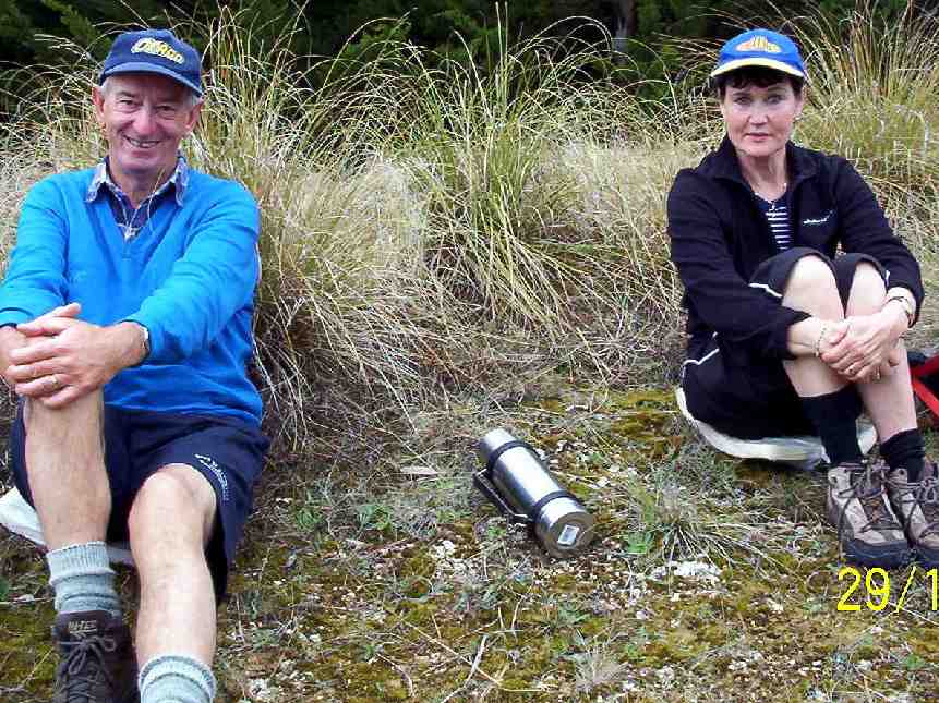
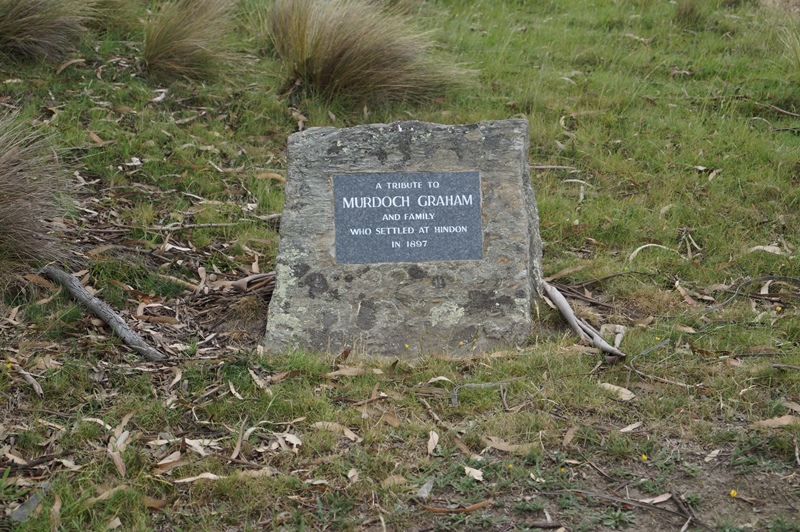
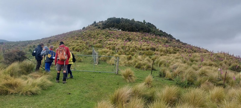
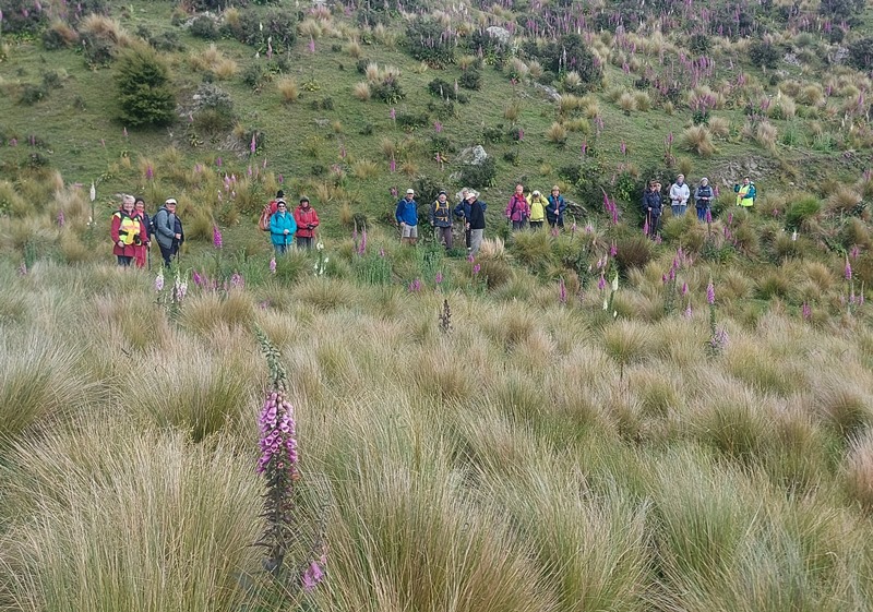
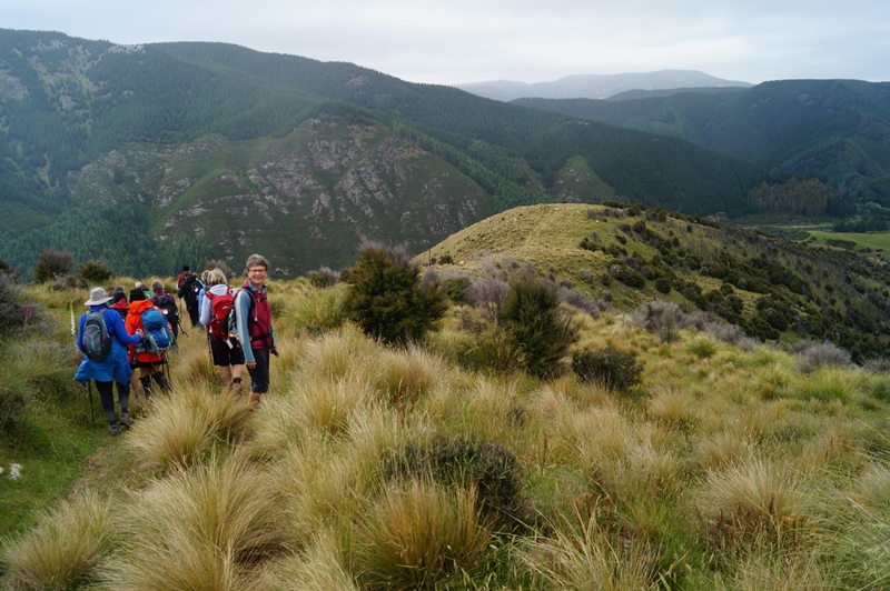
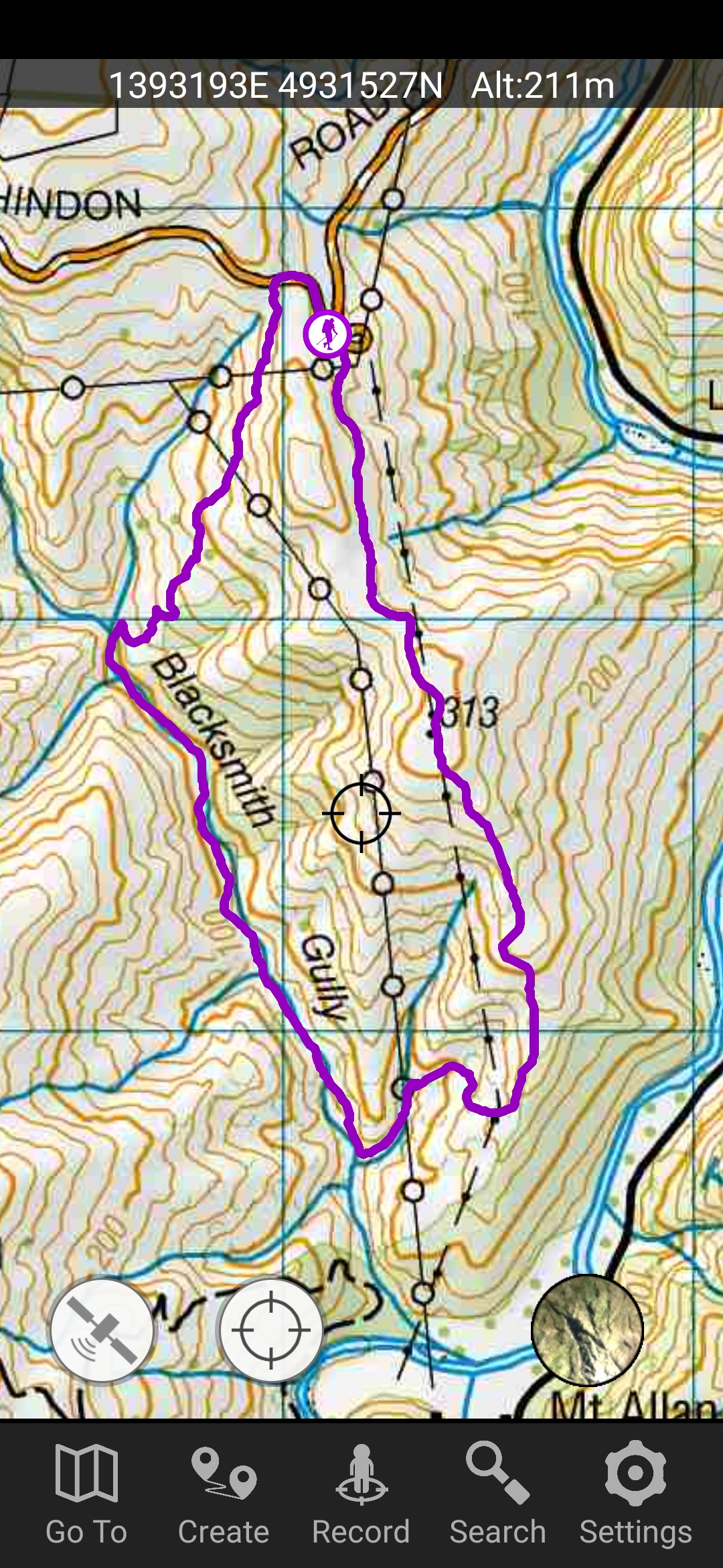
4. 15/12/2021. Hindon. Blacksmiths Gully. Leaders Jill Reid, Sarah McCormack, Linda Partridge, Jan Butcher.
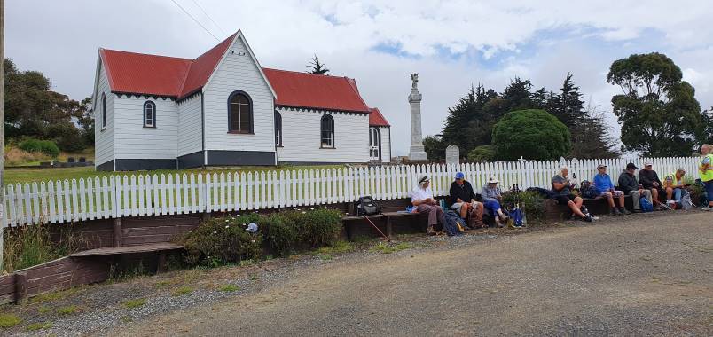
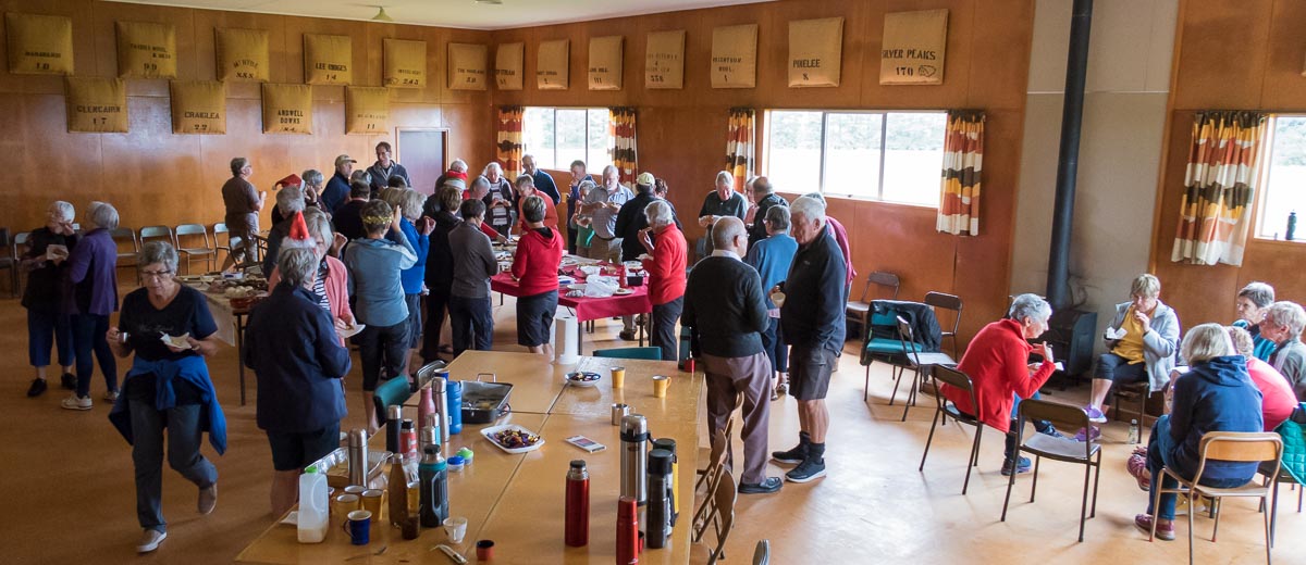
A reasonable day dawned for our combined Christmas visit to Hindon, and about 40 people headed up George King Memorial Drive to the hall. We deposited our “plates”, wrapped up warmly, and drove to Don Graham’s gravesite on Ardachy Station.
Getting sorted (caption and photo Ross)
Don loved this challenging country & he overlooks the hills and Taieri River.
Lovely spot for a tribute stone (caption and photo John)
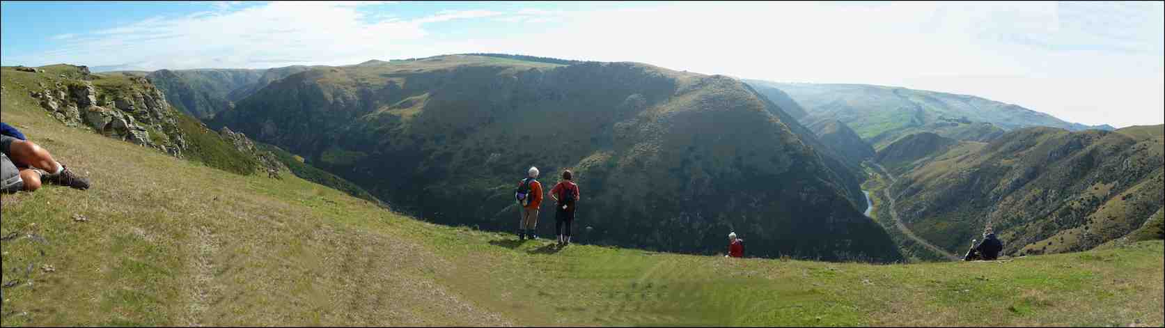
The hikers walked a gentle track & enjoyed the spectacular scenery.
Nice view of the hill (caption and photo Helen)The group of 19 hikers (caption and photo Helen)
The trampers headed down the hill to Blacksmiths Gully, then looped back up to the cars – about 6 km.
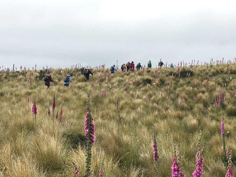
First impression of the vastness of the countryside (caption and photo John)Panaroma – open country dwarfs everyone (caption and photo John)Phil and Peter in their happy place (caption and photo John)Are we going the right way Jill? (caption and photo John)Trampers among the Foxgloves (caption and photo Pam)
Kevin Burke said Ian Fleming’s grace and we then enjoyed the generous pot luck lunch.
Chris Wither told us some Hindon Hall history & her various associations with it during her 38 years living at Hindon. She mentioned how mice often visited during yoga classes……and yes, one brave mouse came under the door soon after!
Lunch in the Hindon Hall (caption and photo Ross)
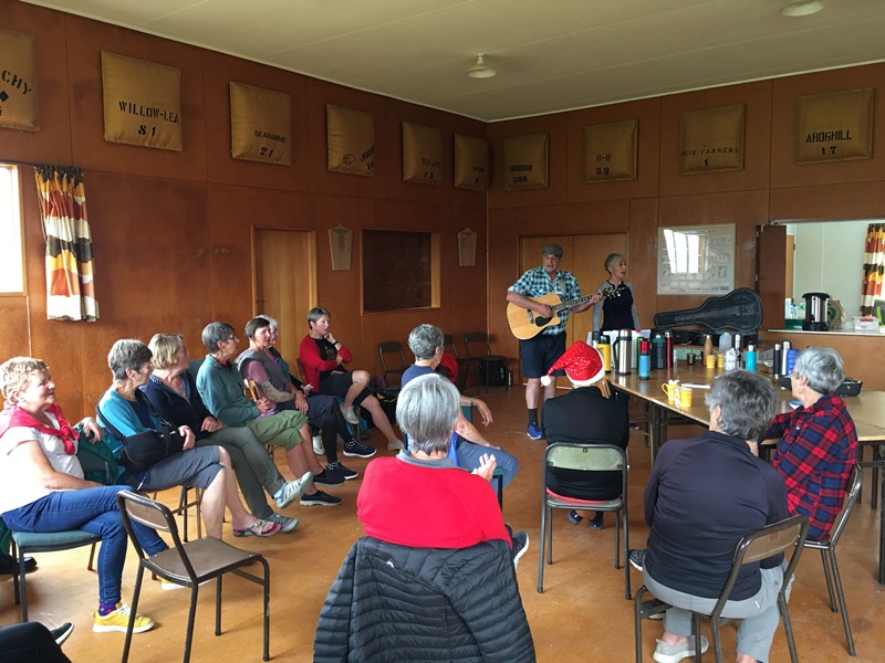
We greatly enjoyed Grant Shackell playing his guitar and singing along with his “blind date” Claire Currie.
The entertainers – Grant and ClaireEntertainment from Grant and Claire. Interesting woolsacks on the wall from past and present farms in the district (caption and photo Pam)
Thank you both for the wonderful entertainment, and to Jill Dodds and her helpers for organising the food etc. A very pleasant way to wrap up our tramping year!
Jill Reid
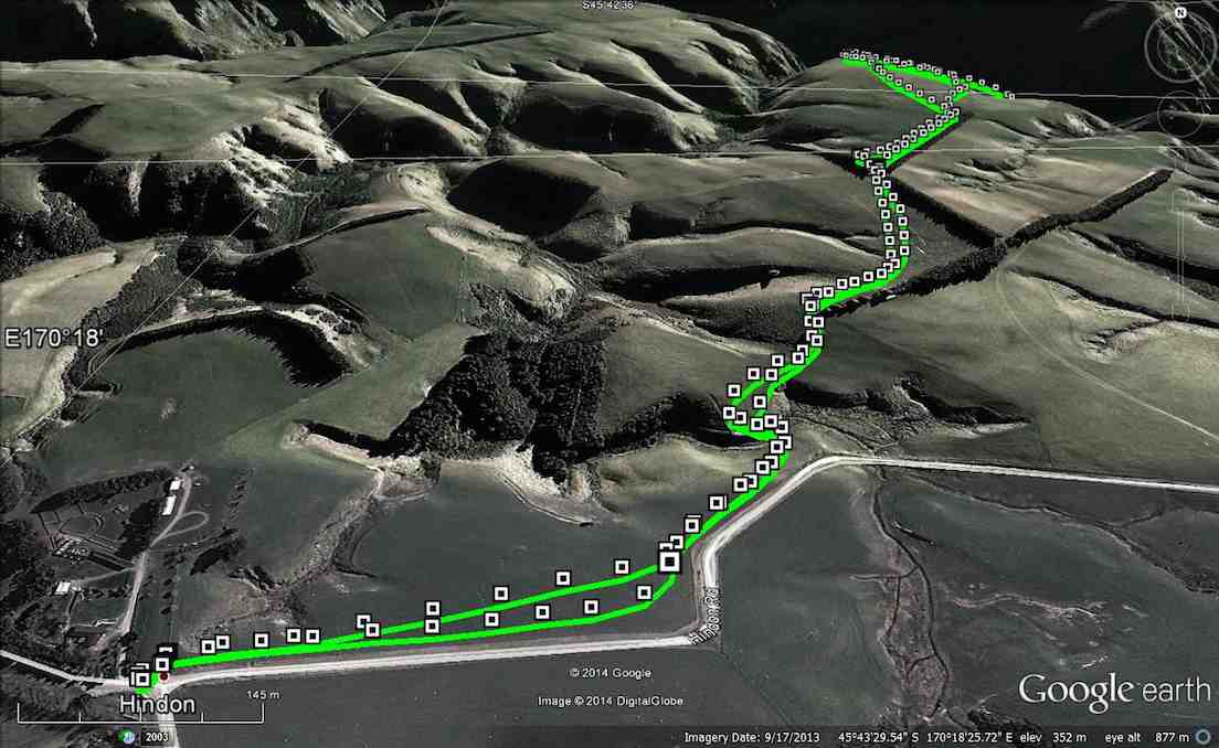
Tramper’s route
3. 2/4/2014 Both. Hindon. Machine Creek. Recently Bathgate, now Cowley Farm. Easy+ Leaders: Ian, Ken
GPS of route per Garmin, courtesy Ken.
GPS of route per iPhone app.
30 turned out for an earlier foggy, but later sunny, shorter trek over gloriously stock-free paddocks …
M/Tea in the dry away from the heavy dew on the grass. (John panorama pic)
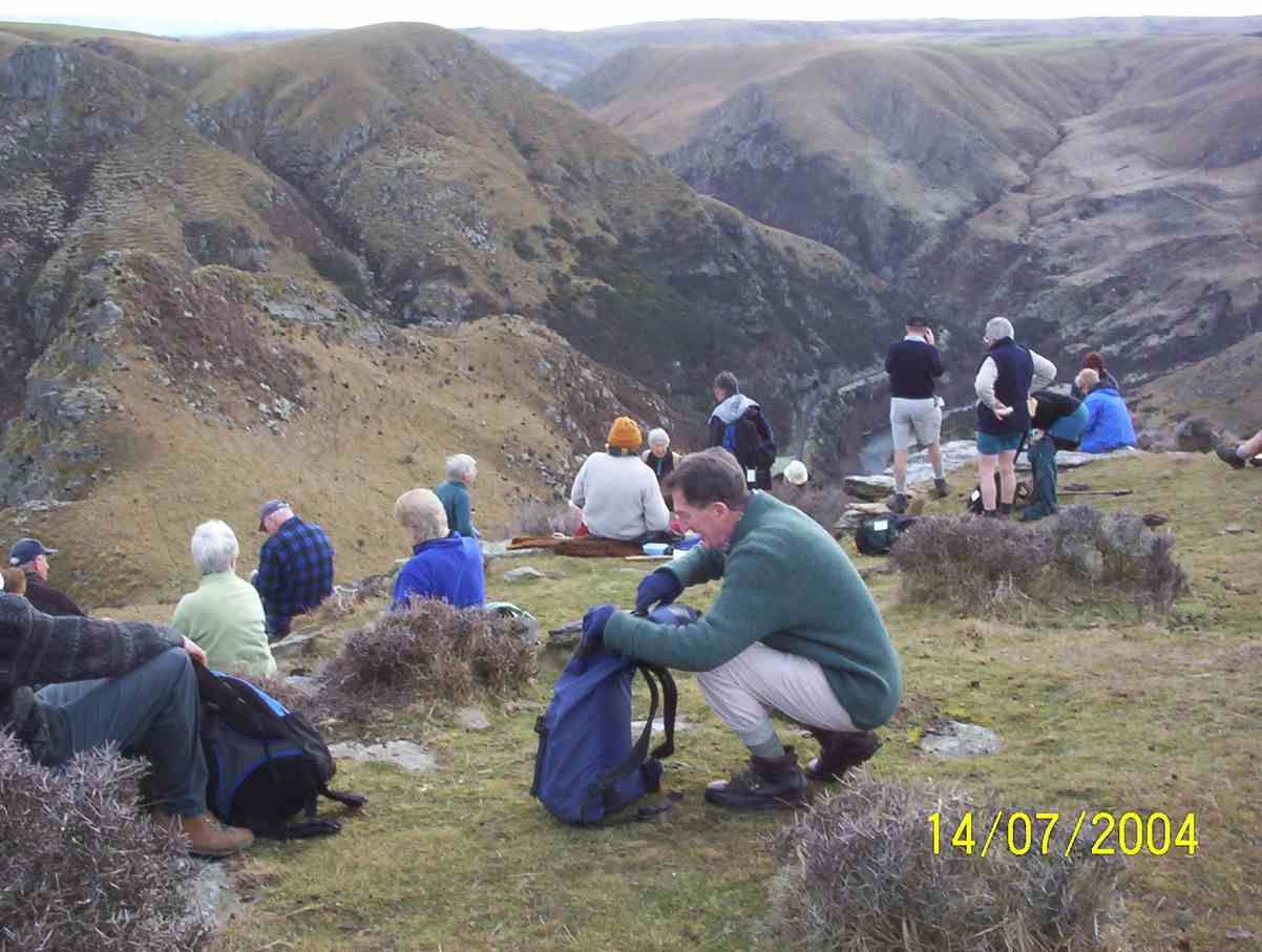
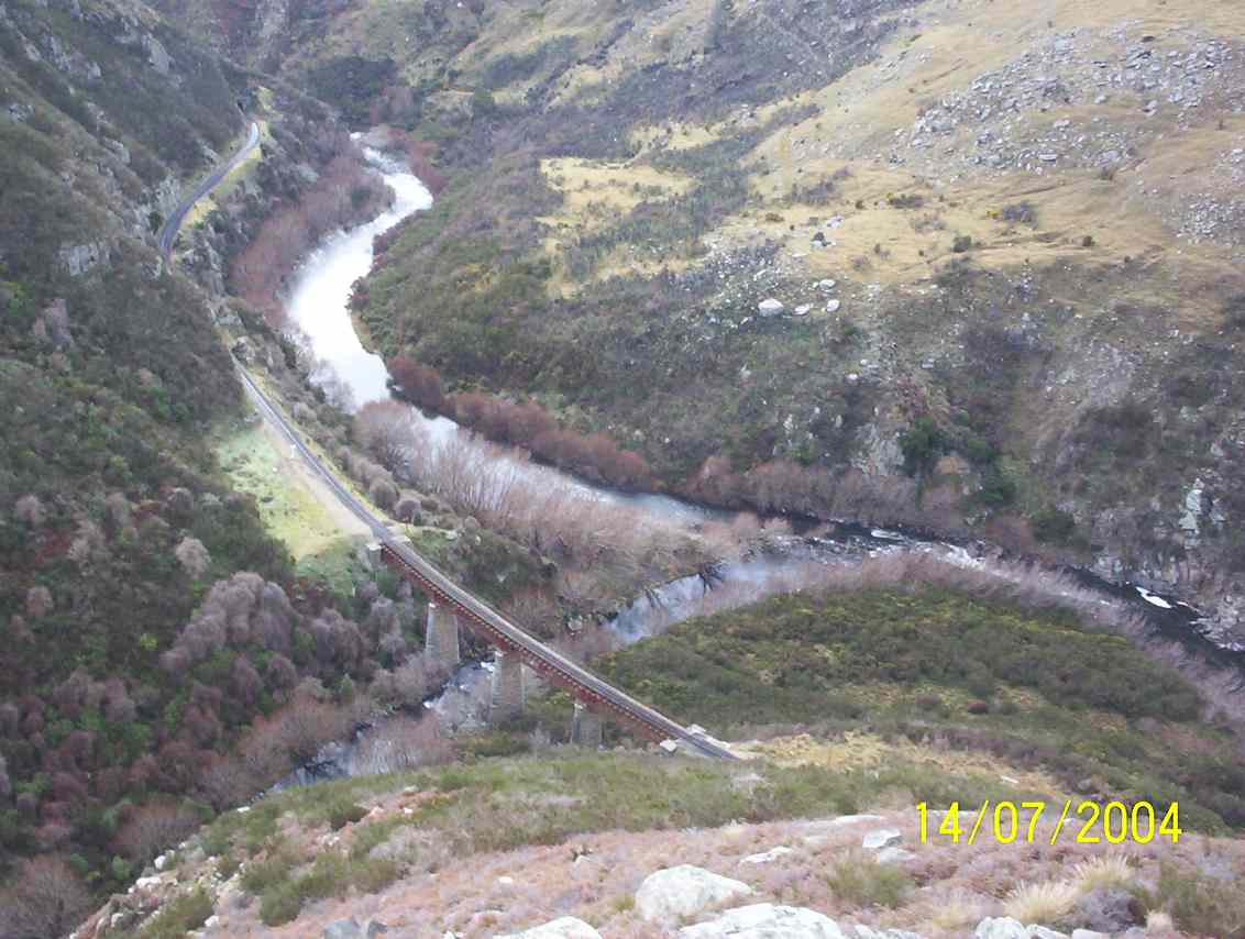
to reach a ridge overlooking the Taieri River gorge. Wonderful views rewarded us on an autumnal day quite free of the slightest disturbing breeze. So we could just take our time and drink the prospect in.
A few of us ventured via cattle tracks down the steep slope below the ledge to the plateau below (as can be discerned from the iPhone app map) with the majority remaining quite content to laze in the sun. With plenty of time to spare, we eventually settled down for lunch, the majority again staying on the main ledge …
Lunching along the fence (John pic)
with a few taking advantage of the slope …
Lunch on slope overlooking Machine Creek. (Ken pic)
overlooking the dramatic Machine Creek gorge. All in all, an interesting resurrection of a tramp many of us had forgotten. – Ian.
2. 14/7/2004 Hindon, Machine Creek Penno farm Leaders: George, Molly
M/Tea Machine Creek
Machine Creek railway bridge, looking upstream
Machine Creek Lunch. George, Arthur, Pat, Molly, Margaret
1. 5/5/2004. Both. Hindon, Machine Creek, Deep Stream. Easy. George, Molly, Glenys P.
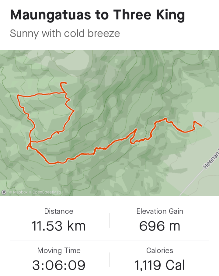
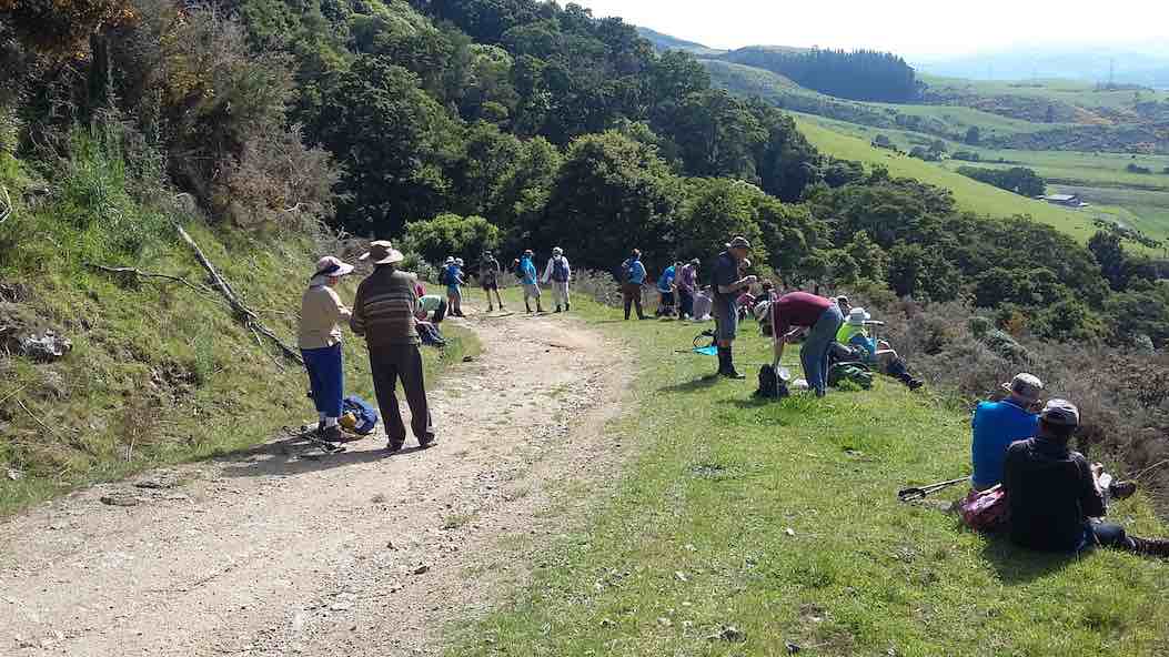
26. 10/11/2021. Three Kings – Heenan Road. M. Leaders: Cathy Ferguson and Sue Nichol
18 Hikers set off from double gates where we parked our cars about 9.15 on a very warm humid day.
Photo Cathy Ferguson
On a well formed farm track it is a steady climb through bush and morning tea was a stop, with views over the Taieri Plain.
Photo Cathy FergusonPhoto Cathy Ferguson
As we climbed higher there was several stops to enjoy the views of Lake Waipori, Lake Waihola and the wider Taieri.
Photo Cathy Ferguson
At the cattle yards where there was a small calf and 3 large cattle we turned right and walked up a rougher steep track until we reached the 3 Kings. Lunch stop was had at this point for a relax and a little banter.
We then headed back down the track to the vehicles. Amazing how going down always goes so much quicker.
A hot but warm day was finished with a drink at the Wobbly Goat.
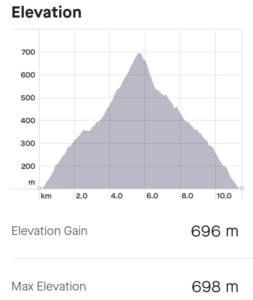
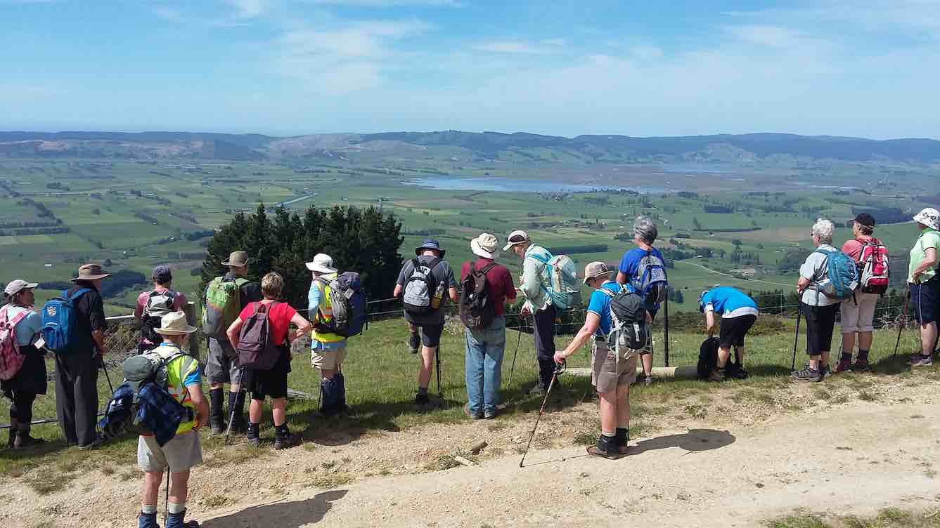
25. 23/06/2021. Three Kings Trig F. M. Leaders: Eleanore and Peter
On a chilly calm morning, 23 rugged up trampers met at Heenan Road at 10:10am and headed through the gate, where we were greeted by a few cattle, who had made the track quite mucky. It is a steady climb up the farm track, enjoying views of lower Taieri at regroup stops.
By 11am we came across a sunny spot to enjoy smoko, probably halfway to 3 Kings.
Early view of the Taieri [Photo and caption John]Keeping to the farm track we continued climbing to the wooden cattle yards, then headed right up a lesser defined track, arriving at the first big rock, glistening in the sun and surrounded by smaller ones. Even though the air was very chilly, it was a good spot for photos and views.
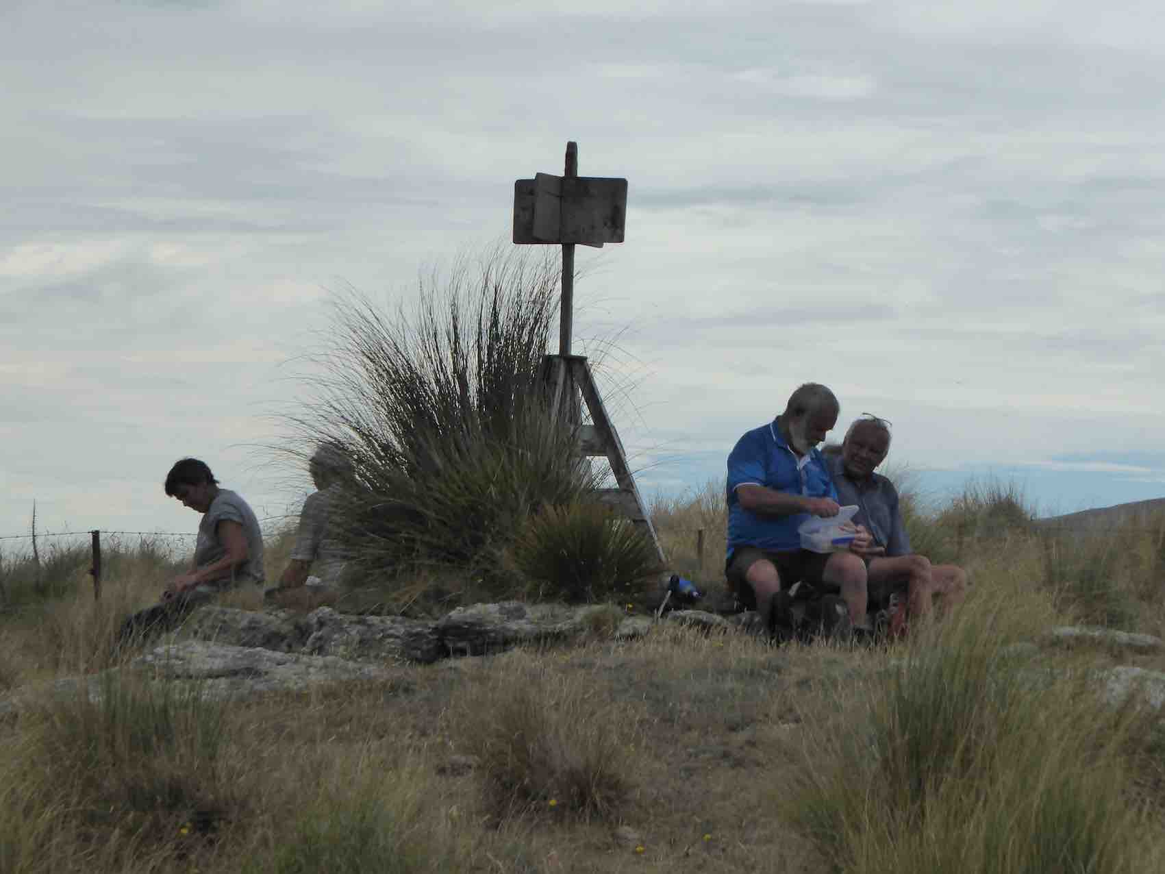
Apparently Not the Three Kings [Photo and caption Pam Cocks]Next, keeping right, we followed the track up and around to 3 Kings, arriving around 12ish. They are 3 rocks, rather spread out, sort of in a row. There was plenty of that nasty Spaniard grass amongst Dracophyllum — common on the tops of Maungatua. Once again, we climbed on them, to take photos. Thin air up here at 647 metres!!
By now we were thinking about coffee and lunch, so we left on our way back down.
Soon after Trig F was spotted up a muddy cattle track so 16 of the group made the climb to say they had been to this trig which is slightly higher than 3 Kings at 703 metres.
Trig F has seen better days [Photo and caption Pam Cocks]Soon after, round 12:30ish, all met up on the track for lunch in the sun.
We had been given permission from land owners to visit their little hut in the bush near the cattle yards. It is really well set up, with a couple of beds, I would think many good times have been enjoyed in that hut.
Landowners Hut [Photo and caption Pam Cocks[We left the hut at 1:30pm for our downhill walk to the cars enjoying beaut views, particularly the intricate set of channels, swamps and lakes between Waipori and Waihola and also the Taieri river at the start of Taieri Gorge.
The descent [Photo and caption John]It is a nice way to end the day walking amongst the very old Beech trees amongst the native bush.
View over the Taieri Plains from below The Three Kings [Photo and caption Pam Cocks]On returning to the cars at 2:30pm, it was good to remove the muddy boots before going to Willowfield for coffee and cake. Another great outing, thanks Peter Gillespie and Arthur Heenan for great navigational skills leading us. This was the first visit to 3 Kings for some members. Good company, good friends, good fun makes us all happy.
I contacted Michelle & Steve and sent a couple of pics. thanking them for going through their property.
Eleanore Ryan & Peter Gillespie
From Strava courtesy Ross Davies
24. 14/11/2018. Hikers. Three Kings from Heenan Road. M. Leaders: Ian and Doug.
Thirty of those who weren’t away at the Hollyford Camp turned out to tackle the 4WD track up to Three Kings. Three Ramblers, who have chosen for themselves the name “The Eighties Plus” dropped back to continue at their own pace, getting ultimately as far up as the last gate on the track. The rest, with occasional rest stops and regroupings,
Morning tea with views of the Taieri. (Clive pic and caption.)
Ian explaining part of the history of the Taieri. (Clive pic and caption.) [Pointing out the original route up from Wesleydale Camp. – Ed]made it up the steadily graded track, overcoming the last very steep bits to reach the rocks high up on the Maungatua Range at its southern end by lunch time.
The day was fine and calm with only a little sharp wind up here persuading us to find our own sheltered but sunny spot for lunch. Quite a number of us were newer members and for many this was their first visit to these prominent rocks. Well done.
Lunch at Three Kings. (Ian pic and caption.)Our leaders Ian and Doug. (Clive pic and caption.)
After a leisurely lunch, it was back down the track again, this time each at their own pace now that it was a known route, and into the cars, to regather for coffee at Outram. A successful outing. – Ian and Doug.
23. 17/5/2017. Hikers. Three Kings from Heenan Road. M. Leaders: Ian and Doug.
Route map courtesy Ian. Nike pp not turned until 1km into trip so add 1km to all distances. (Ian pic and caption.)
We navigated our cars to what for the Hikers was a new entry spot. Back in 2006 the Todd Group had denied us access through the paddock next to the old Wesleydale Camp which gave us access to a lovely track through the bush above it opening to gorse leading to the FWD track above. Now, back at the bottom of a big dip in Heenan Road, there was an entry point to a parking spot up at the very bottom of that track, thanks to a hospitable owner’s permission.
Only 13 were able to turn out for the day. A first long-grassed paddock was the only steep effort, the track thereafter proving a delightfully modest steady gradient elevating us soon to impressive views over the Taieri plain. We stopped for morning tea at one such view,
Viewing the plain. (Ian pic and caption.)
but low cloud below us was beginning to condense obscuring the former clear air.
Later, where we at last emerged from the bush part of the route, we stopped to point out to newer members the old way by which we used to reach this point. Beyond here, the track now steadily steepened the nearer we got to the Three Kings. We took it slowly, with frequent rests and regroupings. Until behold, there was a new track cut right across an extensive cleared area, changing the whole aspect of what we used to experience eleven and more years ago. The new track was even steeper, but at last all got there.
We hunkered down for lunch beneath the principle rock, sheltering from a brief but wetting rain shower.
Shelter for some. (Ian pic and caption.)A clever perch. (Ian pic and caption.)
But that was it. The day remained calm, if cool. We returned back down the way we had come, all very pleased at having achieved our object. One older member expressed their delighted at achieving a return to the rocks after such a long absence, having given up all hope of ever making it again.
We stopped for coffee at George’s ‘hairy’ goat cafe, delighted to meet up there with the Trampers’ other half of the club, returned just before us.
A satisfying day. Roll on the wintry weekend ahead. – Ian.
22. 8/2/2017. Trampers. Maungatua Summit from Heenan Road. M. Arthur.
I believe this tramp was a “first’ for the club. We have been up to the “3 Kings” area many times in the past, but today we continued on to the summit.
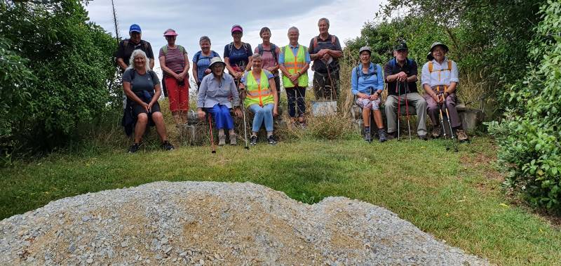
A small group out today, only 4 of our regulars, 1 potential member and 1 guest: 6 in total.
We left the cars parked up a farm drive off Heenan Road. Our tramp began at 9.00 a.m. on the uphill farm road which goes around the south end of Maungatua, and out towards Mahinerangi.
It was a fine day, sunny but with many clouds. A cool S.W. breeze kept the temperature down.
Morning tea was taken in the last available sheltered spot, the leader being rubbished for stopping 5 minutes early though!
Up a farm track and then in to the tussock taking us up more steeply to trig “F” at 702 metres, from where we could look down onto the “3 Kings“.
Onward on a farm track, before turning off into the tussock for the last 3.25 km, single file following the fence line.
Beautiful moss. (Helen pic and caption.)
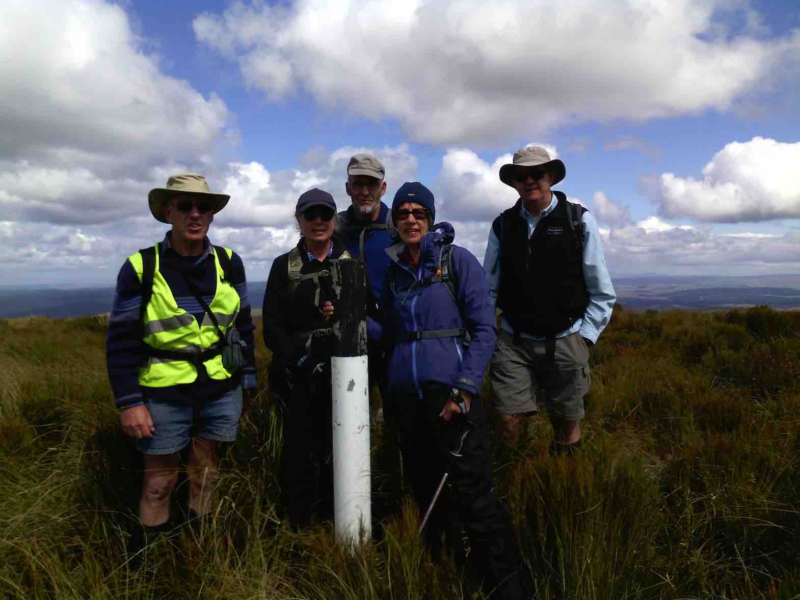
The summit was reached at 12.05 p.m. for our lunch stop. Sitting down in the shelter of the vegetation was necessary to get out of the wind. The sunny periods were very welcome as we ate and rested.
Before taking our leave, the obligatory photo of the group at the summit marker post was taken.
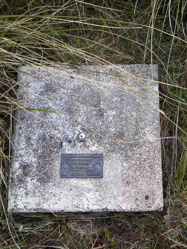
Arthur Carol Neil Helen and Neil. (Helen pic and caption.)Plaque on top. (Helen pic and caption.)
Just at this time the red helicopter flew over us at low altitude, our waves being returned.
Red helicopter giving us a wave. (Helen pic and caption.)
No rescue needed today, though, thankfully.
After about 2 km on the return journey we took to the farm track for the remainder. It was somewhat easier going, and also gave a little variation from the inward track.
The wind had eased early afternoon, and then changed to a southerly breeze. Showers were visible in the Balclutha-Milton direction, but were then going out to sea and not towards us.
Lower down we stopped briefly to admire the view out over the lower Taieri Plain. The whole area was bathed in sunshine, and was a real picture. The views from the top of Maungatua had been spoiled a little by all the cloud shadows on the landscape.
Back at the cars at 3.00 p.m. it had been a neat 6 hours from go to whoa. A very satisfactory day’s tramp in the leader’s opinion. Total distance was 17 km, and an altitude climb of 800 metres.
The timing was absolutely perfect!
As we sat down after ordering our drinks at “The Hairy Goat” the rain arrived!
Thanks to all who participated in the day’s very successful tramp. – Art.
21. 22/10/2014. Trampers. Three Kings. M.
This weeks tramp was to the “Three Kings” at the south end of the Maungatua’s. Six trampers travelled to McLaren Rd, drove around past the Lavender farm to our parking place just inside the farm yard gate. Jill went & got the key for us, & then drove back home again, leaving us to find our way up to the tops. The walk was on farm 4WD tracks all the way up, with just a short walk through tussock to the Three Kings where we had lunch in the shelter from a strong cold wind. Then it was a quick retreat back down again out of the wind, & back to the cars. Walked 12km; 4.1 km/h ave; 3hrs moving; climbed 690m.
The view from the top was very good, but the cold wind didn’t make for pleasant viewing. We practised our Coffee Club by calling into the Outram coffee shop on the way home where a good chat session was had. – Ken
18/10/2006 Jeff Todd of Todd Group 477 8902 (10/06). Todd Group had bought Wesleydale and paddock and allowed it to be used for army live firing! Access through all this area denied.
20. 26/4/2006. Trampers. Three Kings and Trig. Leaders: Evelyn C, Sabina.
19. 24/8/2005. Both. Wesleydale, Three Kings and option of Trig. Leaders: Ria, Irene, Val and Brian, Eleanor B.
18. 19/11/2003. Both. Three Kings from Farm sheds. Medium. Leaders: Trampers: Bill and Pat; Hikers: Les and Margaret, Carmel.
Down through Gorse. Wendy? Pat
George on rise, below Trig above Three Kings (19/11/2003)
17. 17/7/2002 Three Kings, Mill Creek, Kowhai. Spur Leaders: Bob H, Doug M, Wendy B
Long. Hard. Water. Steep down Kowhai Spur.
16. 10/7/2002. Wesleydale Methodist Youth Camp to 3 Kings. Leaders: Arthur and Barbara, Frank.
15. 22/11/2000 Leaders: Lex, Ian
14. 22/9/1999. Three Kings and Trig. Leaders: Lex, Bill H, Lesley S.
13. 12/8/1998. 3 Kings, Maungatua. Leaders: Irene, Shirley R.
12. 19/11/1997. Wesleydale to 3 Kings and Trig. Leaders Judith and Hugh, Ian.
11. 12/3/1997. Three Kings – Mill Creek Reserve – Kowhai Spur. Leaders: Bill H, Graham, Barbara McC.
10. 1/5/1996. Duncan’s Farm Road and return Kowhai Spur. Leaders: Bill H, Les S, Graham S, Doug M
9. 3/4/1996 Three Kings from Heenan Road to McLaren Road Start past Little Creek. Medium.
Seek permissions Leaders: Jack and Rosemary, Nelson and Dot.
8. 20/4/1994. Three Kings. Medium. Leaders: Margaret and Les, Ivan, Les W.
7. 6/10/1993. Mill Creek (back of the Maungatuas.) Medium. Leaders: Shirley McN, Ria L, Nel, Betty H.
6. 26/5/1993. Wesleydale Camp – uphill following 4WD track to Maungatuas. Great views. Medium. Leaders: Mary Y, Denise, Nola, Judith.
5. 9/9/1992. Wesleydale Camp to the Maungatuas. Follow 4WD Track. Average. Leaders: Joan, Betty, Jean, Diana.
4. 29/7/1992. Wesleydale Camp, up the hill following 4WD track to the Maungatuas. Lovely views. Average. Leaders: Daphne, Betty, Dave and Jean.
3. 23/10/1991. Maungatuas – Wesleydale to ‘3 Kings Rocks’. Steady up hill grade, but not a long tramp. Average+. Leaders: Nancy, Ray, Ted, Jack R.
2. 27/6/1990 Wesleydale to Three Kings. Average, if taken in easy stages. Don’t rush hill please. Leaders: George, Margaret D, Margaret B, Ria.
1. 8/3/1989. Three Kings. Good tramp up the Maungatuas. Great views of Lower Taieri. Leaders: Denise, George, Peggy.
No. 97 on old hardcopy list of 113 club tramps. “Purekanui & Canoe Beach Year Round”
39 km
At LOW TIDE it is possible to walk along the shore to Doctor’s Point.
Also pleasant stroll 1 km down southeastern end to mouth of inlet with scattered cribs.
16. 14 July 2021. Hikers. Purakaunui/Canoe Beach. Medium. Leaders: Betty & Jim
After regrouping at Waitati 4 Vehicles travelled with 16 hikers to park at the end of the Doctors Point Road. The tide afforded us plenty of clear beach for the Canoe Beach walk to Mapoutahi for our tea stop. Of significance were two new barriers recently erected by DOC, warning of the dangerous cliffs.
Looking across Canoe Beach (photo & caption Ady)Looking towards headland of Purakaunui Beach (photo & caption Ady)
From our morning tea stop the southern portal to the rail tunnel could be seen, high on the cliff showing the extreme difficulty that this section that must have been experienced in the construction of this main trunk line.
Weather conditions were pleasant for the Purakaunui Beach walk on firm sand to the Purakaunui inlet.
Purakaunui Inlet (photo Alex)
Entering the inlet, we were faced with soft sand conditions for a short distance to the pine plantation, then it was less than 400 meters through pines to the cemetery. We retraced our steps in comfortable time for the tide past Canoe Beach to the cars.
The coffee stop was at Blueskin before our return to Mosgiel.
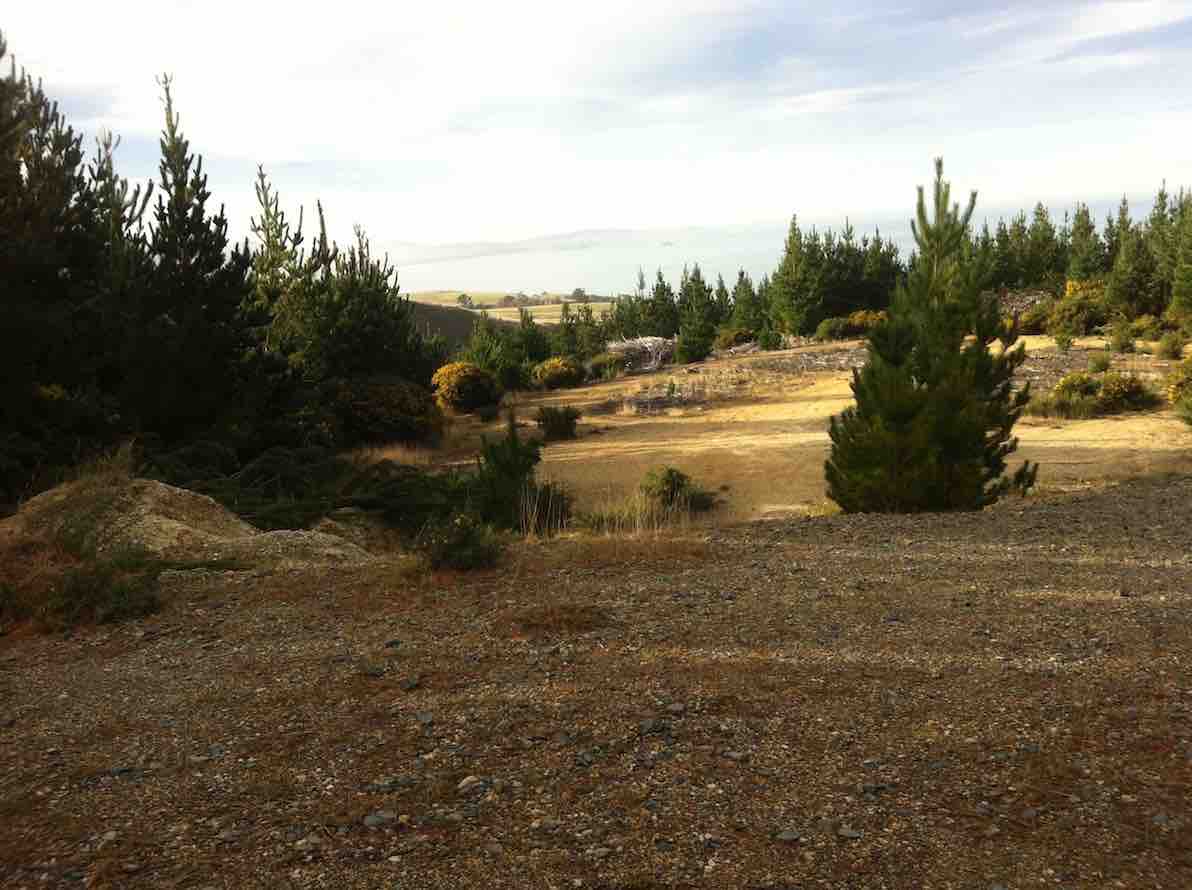
Meeting at a suitable parking spot on the Taieri Mouth road at the start of Mount Allan forestry hike 12 brave members set off for a pleasant walk in bright sunshine. As Pine trees had been removed it gave a different feeling from our previous hikes. Great views and an understanding of how rough the hills really are for planting. First stop after a good climb was morning tea break.
“.Morning tea in the sun.” – Photo and Caption Clive
Everybody relaxed. Onward up and down until we reached Big Stone Road .
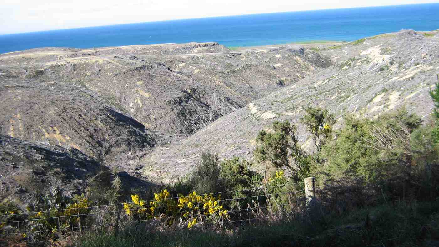
Before- Aug. 2019 photo.” – Photo and Caption Clive“After – now – trees felled.” – Photo and Caption Clive
Lunch time.
“Lunch at Big stone/Daphne Road.” – Photo and Caption Clive
Down the road until we met the next track and into the forest again. From here it is mostly down hill with more great views until we arrive back at car park.
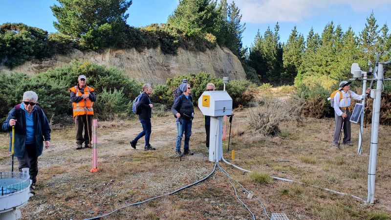
“A weather station on the way down.” – Photo and Caption Clive
Coffee at Brighton Beach shop with relaxed chatter including meeting Dot and Chris who had just completed there own walk. 12 kilometers in total .New member was welcomed and had a good day. Good company and enjoyable.
Liz and Alex.
18. 22/5/2019. Hikers. Forestry walk Kuri Bush. Dave and Liz.
A little bit nippy for a start
Start of the day. Liz pic and caption.)
but 2o hikers and 3 Ramblers set off what was to be a pleasant gradual climb amongst pine trees and bush.
(Kevin pic.)
A 9.50am morning tea was taken with sun shining brightly which warmed all and accepted. From here the Hikers took the Daphne Road
On pine needle carpet. Easy on the feet. (Kevin pic.)
and Ramblers the Isobel Road. The Hikers continued until reaching Big Stone Road
Lunch. (Liz pic and caption.)
and then onto the downward trip via Katherine Road. The Ramblers did very well reaching the top of Isobel Road and then down Katherine Road. Total distance for Hikers was about 12 Kilometres. Off to Brighton Beach Cafe went very weary but happy Hikers and Ramblers. Thanks to all Liz and Alex.
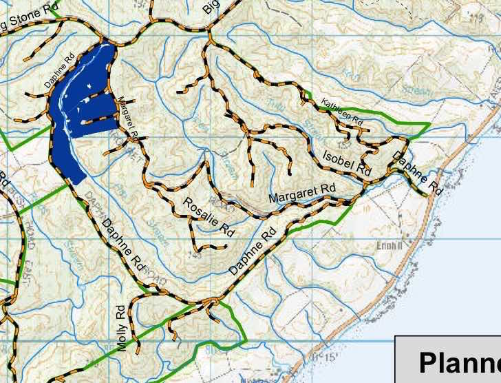
17. 16/5/2018. Hikers. Daphne, Big Stone and Kathleen Roads. M. Leaders: Alex, Jim and Betty.
pine needle carpeted walk into the forest. (Clive pic and caption.)On the way to the top. (Phil pic and caption.)Lunch on Big Stone Rd. (Phil pic and caption.)Homeward bound along Big Stone Road. (Clive pic and caption.)
Conditions were a pleasant cool day for the hike in the Allanton Block of Wenita Forrest south of Brighton. The majority of 22 hikers stopped off at the Brighton Cafe for refreshments on the return trip to Mosgiel.
It was a successful late change to the planned hike.
Betty & Jim
16. 17/6/2015. Hikers. Daphne, Big Stone and Kathleen Roads. M. Leaders: Alex, Liz and Dot.
GPS of route, courtesy Bruce. 12.2 km. [N.B. Bruce has commented on the interesting difference between the 2012 (q.v. below) and 2015 Google maps. – Ed.]The Google map for yesterday was taken in 2015 and was a little different from that from Ken’s report in 2012 with imagery taken on 17 Sept 2011.
June 17 Map with named roads. (Bruce pic and caption)iPhone GPS of route showing kilometers, courtesy Ian.
About twenty Hikers did the now more customary route of climbing the Daphne Road’s gentler but longer route and descending by Kathleen Roads shorter but steeper. We morning-teaed in the sunny spot at the foot of Daphne Road where the Club has always stopped, and lunched
Lunch on a sunny level. (Looking back along the road).(Ian pic and caption.)
on a level stretch of the road, but still some distance from the top. Older members, presumably familiar with the route found they had failed to recollect the many gully dips on the road. They also appreciatively noticed the rubbish collection by the top gate had been cleared. …W-e-l-l perhaps not all!
Made for each other. (Ian pic and caption.)
Reaching the top of Kathleen Road, a substantial number struggled around and under the closed and apparently locked gate before Les noticed that it was not locked at all. … Sigh.
It was yet another good-weather Wednesday, tempting some to to wonder whether a Higher Power must look after the Club. (Well, it was colder on Tuesday and Thursday promised snow.) Admittedly a cold breeze had driven us into woollen hat and gloves when we emerged from our cars, but this eased in the shelter of the forest and in the patches of sun the trees permitted us from time to time. It was a great Winter’s day tramp and a great location – a metalled road rather than a sloshy paddock or slippery track. (Pity the poor trampers! – see their report.)
Mention must be made of the occasional great views of the coast and down gullies that we stopped to enjoy from time to time.
A misty vista in the ‘dista’, looking up the coast from Kathleen Road. (Ian pic and caption.)
It was further remarked that tramps like this get us to see the other sides of properties that mere car travellers never get to appreciate.
So, thank you leaders, for a well-reconnoitered and led tramp. We were well looked after, with thoughtful stops for regrouping. – Ian.
15. 13/2/2013. Hikers. McLeods Farm. Leaders: Wendy and Peter.
14. 22/8/2012. Trampers. Daphne Road, Big Stone Road, Kathleen Road. Medium. 12 km.
GPS of route, courtesy Ken. We did 11.7 km at 4.7 km/h.
13 . 4/7/2012. Both. Daphne Road, Big Stone Road, Kathleen Road. Medium. 12 km. Leaders: George, Lex.
Morning Tea at bottom of Daphne climb. (Ian pic and caption.)
12. 27/8/2009. Trampers. Queen Street, Highland Street, Big Stone Road, Kathleen Road, Isobel Road, beach return. Medium Leaders: George, Hazel.
Starting at the home of George and Elizabeth, George and Hazel led us along to the corner of Queen Street and up across several paddocks to reach Highland Street where we sheltered from the wind for morning tea. Once we reached Big Stone Road, we paralleled it on a forest track just across the fence, which was much more interesting, if slower, than walking the road. We were amazed to see the extent of forest harvesting on the other side of the road, cleared, replanted and now for sale as lifestyle blocks.
Maori forestry recently harvested.
Later we came across a couple of pig skins on a fence.
George inspecting a pig skin.
Shortly after passing the McLaren Gully Road turnoff on our right we turned off onto Kathleen Road on the left and then again on the right into Isobel Road where we stopped for lunch.
Lunch sheltered from the wind. Doug, George, Ria.
Isobel Road provided a pine-needle-strewn softer surface for walking down to the coast. There we joined the beach, nice and firm on an ebbing tide, but oh so loooong to get back to Brighton and the cars again. 18 km in all, and were we glad to reach the cars again!
There were only six of us, three of whom from Mosgiel who, vehicle-less as it turned out on this occasion (Doug would have gone back for his car had he been required to), depended on first-time visitor Susan who was surprised into having to provide the transport to Brighton, but who most graciously provided it. – Ian
11. 6/8/2008. Both. Margaret Road, Katherine Road. Medium. Leaders: Dot M, Chris.
10. 15/3/2006. Hikers. Margaret Road, McLeods Farm. Easy+. Leaders: Bill & Pat, Dot T
9. 29/6/2005. Hikers. Margaret Road, Katherine Road. (Brighton). Leaders: Chris, Dot B.
8. 18/6/2003 Hikers. Kathleen Road, off Taieri Mouth Road. Easy Leaders: Joan and Dot
7. 25/7/2001. Alt. Margaret Road, Katherine Road, Kuri Bush. Leaders: Dot B, Joan H, Chris H
6. 18/2/1998. Big Stone Road from Margaret Road to McLeods. Leaders: Ray and Diana.
5. 14/5/1997. Big Stone Road from Margaret Road via McLeods to Coast Road. Leaders: Dot B, Joan H, George.
4. 10/7/1996. Margaret Road, Big Stone Road, McLeods. Average. Leaders: Graham, Eric and Dot.
3. 30/11/1994 Margaret Road, Wenita Forestry, Big Stone Road. Medium. Leaders: Eric & Dot, Joan H, George
2. 4/8/1993 Big Stone Road to Smooth Hill to Kathleen Road – return beach. Leaders: Eric & Dot, George, Chris
1. 8/6/1988 Kathleen Road from Big Stone Road. Lots of pines and the ocean. Leaders:
7. 25/3/2020. Trampers. Jubilee Hut from Silver Peaks Station.
A large group left carpark at 8:30 am to drive an hour up George King Memorial Drive, onto Hindon Road—-drove through early fog, and down past Ardachy (where we were spotted half a dozen peacocks), over the Taieri river rail/road bridge, then up past Lamb Hill on Silverpeak road to end of road at Silverpeak Station. Mike and Ginny Cowie own the large 2,500 hectare Station, home to 7,000 stock units (sheep and Beef cattle).
23 eager trampers(including Gordon’s daughter) headed off on a very calm, sunny morning at 9:30am
The start of a big day!I (Pam pic and caption.)
and stopped for smoko at 10:10am.
Morning Tea stop (Always with a view.)9John caption and pic)
Gordon and daughter Kim ,enjoying the sunshine. (John pic and caption.)
We followed the rough vehicle track up the left fork of Christmas creek continuing up the north side of the Valley.
Those views again. (John pic and caption.)Happy Tramper lineup. (John pic and caption.)
This is steep tussock country which has been oversown and grazed to create productive pasture. Mount John hut(an unused Musters hut owned by Silverpeak station) sits on the right hand side of the track).
The undulating walk continued until 11:50am to the junction of Cave creek, at this point the majority walked on another ten minutes to have a look at Homestead (or Christmas creek hut), also owned by Silverpeak station.
The strange patina on Orange Hut. (John pic and caption.)The Team’ at Sarah.The Team’ at Orange hut. (Sarah pic and caption.)
Meanwhile, the smaller group headed off towards the 1.5km walk up along Cave creek to Jubilee hut, waiting half way to regroup. Arthur had carried Loppers expecting to have to use them, however, Green Hut volunteers had the track clear. The original Jubilee hut was opened in 1951 on the left hand side of the creek, it was built in a cold spot. Signpost indicating Jubilee hut 100 metres on——that person had a long stride—— a very long 100 metres!
We had to cross Cave creek a couple of times—cooling on the feet.
Nearing Jubilee hut. (Gordon pic and caption.)
We arrived at Jubilee hut at 12:50pm. This 10 bed hut was built in 2007, some 300 meters up in a sunny spot with great views,
Panoramic view to admire. (John pic and caption.)
at about 600 metres. Staff and materials were flown in by helicopter (over 30 trips). Cost $70,000+. It is well used and just recently a booking system has been introduced.
All enjoyed a leisurely lunch in the sun and hut
Lunch at Jubilee Hut. (John pic and captionSorry Heather ,I can’t find the delete button! (John. pic and caption.)
before heading back along the undulating track,
Heading to the finish. (Gordon pic and caption.)
having rest/water stops along the way. The A team arrived back at 3:35pm, followed by B team at 4:00pm. Followed by an hour’s drive home.
This tramp was a new one for 18 members (1 driver wondered where he was going to end up). It was 2015 when 7 from the club were last there. So——-the 2 Leaders made mental note to self———Been there—Done that!!
Was a great way to spend the day In those very vast hills of Silverpeak Station, good company, good weather—-good life. – Eleanore and Arthur.
6. 11/3/2015. Trampers. Jubilee Hut from Silver Peaks Station.
After a doubtful start to the day with quite heavy rain during the night, [I was worried about high creek levels] 7 hardy trampers turned up for the trip to Jubilee Hut via Silverpeaks Station. We arrived there just before morning tea time so set off along the track to find a spot to stop for morning tea. Then it was on to visit Orange Hut [Homestead Hut, Christmas Creek Hut, whatever you want to call it] having missed the turn off to go down to Cave creek, which has lost it’s large white plastic container that acted as a marker for the start of the track. We then backtracked a bit to the track leading down to Cave Creek valley, & made our way over a few more creek crossings & up to Jubilee Hut for lunch.
Two of the party had their lunch on the track about 10 mins from the hut, & one of them decided to walk back out again on their own, thinking we would catch up with them later. After lunch, we went down to the creek from the hut, & Ian [being the fittest] was voted by me, to go & photograph the sign at the old Jubilee Hut site,…
Sign at site of old Jubilee Hut (Ian pic, Ken caption)
…so we would know what it said. Then it was back along the track retracing our morning steps. When we got to the top track again, I decided that I needed to attend to a sore patch developing on my left foot, so Ian & I stopped while I attended to that. Just as I was finishing, we heard somebody calling out from nearby, & the next thing the person who had set off on their own appeared looking rather worried [lost !!] they had not noticed the sharp LH turn onto the track leading back to Silverpeaks Station homestead, & had instead gone straight ahead along the track towards Orange Hut. We pointed them in the correct direction, & they set off with what I would imagine was some relief. Shortly after this we all met up again into one group, & set off to our next adventure !
One party member while crossing the Christmas Creek where it doubles back on itself, slipped on a rock, & very slowly, & not so gracefully, first put a hand down to steady themselves, but that didn’t work, so they ended up sitting in the creek. [Oh I wish I had my camera handy !!] So this guaranteed a wet walk back to the cars for this person, but they did dry out rather quickly I think.
The rest of the walk out was very uneventful, compared to earlier happenings, & we all arrived back at the cars safe & well. We arrived back at Mosgiel about 5pm from memory.
Something we learnt today was :
1: We MUST stay together better as a group, or one day somebody will get properly lost.
2: Walking poles are handy for crossing creeks, even if you don’t think you need them!!
We walked 16km
3.8km/hr ave.
Climbed 876mtrs.
Max elev. 426mtrs.
– Ken.
5. 12/2/2014. Trampers. Three Huts.
Distance to Jubilee Hut without going to Christmas Creek Hut =15.75km
Add on another 1 1/2 – 2 km for the extra distance to Christmas Creek Hut.
Walking time = 4hrs 25min; Moving Ave = 3.6km/hr; Total ascent = 919 mtrs.
7 hardy souls turned up at 8:30 on a wet misty day at the Mosgiel car-park to go to Silverpeaks Station for our tramp to Mt. John Hut/Christmas Creek Hut/Jubilee Hut.
It was good to see that the ones going on the Motatapu trip were carrying their large tramping packs filled with a bit more weight than they would normally carry.
It took an hour to drive to the starting point, & as it was not looking brilliant weather wise, we decided against going up to Mt. John Hut, & proceeded along the track a bit further for morning tea break. The double crossing of Christmas creek was done without mishap, & we continued on to the turn-off to Cave creek valley.
Most of us dropped our packs here & carried on to Christmas Creek Hut, [which is also know as Homestead Hut, & Orange Hut.] …
Some of the party at Orange Hut, also known as Homestead Hut, and Christmas Creek Hut. (Ken pic and caption)
… before returning & heading down to Cave Creek & the walk up the valley to Jubilee Hut.
The track above the boundary gate is getting badly overgrown with bracken fern, but it is still relatively easy going, but we got rather wet from the knees down as the scrub was holding water from the rain showers.
Up to this point we had only worn our rain jackets for a short time, during a light shower, but as we approached Jubilee Hut the rain drops started appearing again, so we managed to get to the hut before the weather let loose with a heavy shower which continued right through our lunch break, & beyond.
George writing in the Jubilee Hut visitors book. Note the inclement weather through the window. (Ken pic and caption)
After finishing lunch, we were all sitting around wondering how much longer the heavy rain was going to last, when it started to ease, & the visibility improved enough so we could look back down valley & see Christmas Creek Hut, so we decided to put on wet weather gear again, & start heading back to the cars.
By the time we got to the end of the Cave Creek valley, the rain had ceased, so it was off with the wet weather gear again. The only problems with the Cave Creek crossings were some wet feet, & Ken landing on his butt after stepping on a slippery rock. Just as well he had on his waterproof leggings, or he would’ve got a wet butt, as well as one boot full of water.
We made it back to the cars before the approaching rain, which we had seen coming some time before, & had a wet ride all the way back home.
There were some very tired trampers at the end of the day, they were not used to carrying the bigger packs with more weight in them, however, it was a good opportunity to ‘shake-down’ the equipment. – Ken
4. 15/5/2013. Trampers. Mount John Hut and Beyond.
Route of tramp, courtesy Ken. We walked 13.5km, 4km/hr ave. 3h 22m moving. Climbed 814m !!! Max elev. 652m
The day started at 8:30 from Mosgiel carpark, with a very misty/foggy outlook on the Taieri, but we were hopeful that it would be clearer inland. When we were about 3/4 of the way to Hindon, the fog/mist just disappeared, & we were looking at quite a nice day.
We arrived at Silverpeaks station at 9:30. & set off towards Mt. John Hut where we had morning tea, & examined the log entries carved into the woodwork of the hut. [There is no log book in the hut.]
Morning tea at Mt John Hut. (Ken pic and caption)Looking back down at Mt John Hut and Christmas Creek (Ken pic and caption)
After leaving the hut we made our way up the track towards the top of Mt. John, but we took a wrong turn, which led us off to the NE side of Mt. John. However as it was already 12:30 when we reached the top, we decided to have lunch in the sun, & admire the views in all directions.
Wenita wasteland from our lunch stop. (Ken pic and caption)
We then retraced our steps back to the car, & arrived back in Mosgiel at 4:00pm.
Climbing Mt. John was a bit of a grunt at times, & only suitable for the fitter members. If we had gone to our original destination of Popular Hut, that would’ve been another 3hrs or more walking. [Estimate], & it’s a long climb back up again!!! – Ken
3. 5/1/2011. Trampers. Orange and Jubilee Huts from Silver Peaks Station.
16 -17km, including side trip to Christmas Creek Hut. Numerous creek crossings. If the creeks are high, you will get wet feet.
A reasonably hard 8-9 hr. day if you include travelling and break stops. Fortunately, 4WD road along Christmas Creek true right largely follows contour line with relatively short ups and downs.
GPS of routes Homestead/Christmas Creek/Orange Hut (left fork) and Jubilee Hut. (Courtesy Ken)
Double ford on Christmas Creek. 2nd out of sight. Dry detour to left if water high. (Ken pic)
Track beside Cave Creek.
Track washout. Cave Creek. (Ken pic)
Gate on track up Cave Creek. Heavy bracken overgrowth in places.
Sign indicating ABC Cave to right, Mountain Rd car park to left, and 100m (seemed much longer!) up to Jubilee Hut,
Jubilee Hut. (Ken pic)
Bunks inside Jubilee Hut. (Ken pic)
Plaque
Steep Climb out of Cave Creek crossing. (Ken pic)
Crossing Christmas Creek on emerging from Cave Creek gully (Ken pic)
2. 29/12/2010. Orange/Homestead/Christmas Creek Hut from Silver Peaks Station. -‘ recce’.
Morning Tea stop on ‘recce’. (Ken pic)
Jubilee Hut from Homestead Hut. (Ken pic)
Mount John Private Hut, Silver Peaks Station. (Ken pic)
Homestead/Christmas Creek/Orange Hut. (Ken pic)
Plastic jerry can marker at top of track forking right to Jubilee Hut. (Ken pic)
Track to Jubilee Hut. Devil’s Staircase in background upper left. (Ken pic)
1. 24/3/1999. Jubilee Hut and return. Leaders: Les & Margaret, Bev H
Nicols Creek circuit Maintained by Green Hut Track Group. DCC land.
Pineapple Track—the curious name of this track originates from a tradition involving a local grocer in the 1920’s. He guided parties up a track in this area and would provide tinned pineapple as a refreshment at the top. The empty cans were left as litter.
4. 24/6/2020 FLAGSTAFF WALKWAY ONTO SWAMPY RIDGE TRACK and RETURN. Leader Eleanore
After a couple of head counts our group of 24 (including 3 new faces) arrived at the Bull Ring at 10am to a very foggy morning. As well as us, staff were parked up waiting to spread gravel on Pineapple and Firebreak tracks, that was to be dropped by helicopter. We commented that it would be something new to look at as we were walking.
After a short sharp climb we arrived at the Plane Table marked by a drainpipe at a height of round 660 metres for smoko, still in fog and no views we headed off again down and around to the Pineapple junction, passing by damage caused by a fire last year.
Photo and Caption John – “Morning tea – not to be MIST!”
This section of the Pineapple track was wet and slippery along with the odd patch of icy puddles, we had to make sure we kept our feet firmly on the ground!!
Photo and Caption Gordon – “You couln’t have MIST this group of trampers.”
Photo and Caption Gordon – “Still slogging up hill!”
We arrived at the junction of Swampy and Firebreak tracks at 11am, then continued through more mud, noticing quite a lot of broom had been recently cut down—-thanks to those concerned.
After some climbing along the way, passing Moon, Powerline, and Telecom Microwave Station tracks, we arrived at the Aircraft Navigation Station at the Swine Spur junction at 12:15pm. Up till now, the only sight to be seen was the person in front of you!! Occasionally, one hoped for the fog to lift, so the amazing views could be enjoyed—so far, not happening.
Photo and Caption John – “Lunch at Swampy summit.”Photo and Caption John – “Gotcha Dave!”
At 12:40pm, after a shortened lunch it was time to head for home, negotiating the slippery, slidey slopes along the way reaching the Firebreak junction in 1 hour, we took the shortcut back onto Flagstaff track, and enjoyed the mostly downhill walk to the cars, arriving at 2:30pm.
Photo and Caption Gordon – “Homeward bound.”
The boots covered a good 13kms.
This was the first tramp with the Club I have been on that the fog never lifted the entire day. We were ready for coffee, cake and a yarn to celebrate our achievement at Blackstone Cafe.
As always, I hope you all enjoyed the day as much as I did.
Eleanore
3. 16/9/2009. Bullring, Flagstaff Walkway, Swampy Ridge, Moon, Nicols Creek Track, New Track across to Pineapple, Pineapple, McGouns, Davies , Flagstaff Walkway Firebreak/Bullock, Bullring. Leaders: Ria, Hazel.
We walked from the Bullring across Flagstaff and Swampy Ridge until sheltering for morning tea stop some way down the upper Moon Track,
Morning tea on upper Moon. (Ken pic). Ian and Doug. Ria and Hazel partially hidden.
then crossing to the other side of the valley.
Walking across headwaters from Moon on one side to Nicols Track on the other. Doug, George.
Perhaps it was the thinner foliage of early spring, but none of us had remembered noticing before the huge old tree trunk just below Nicols Creek track, with growth still struggling for its old branches far above us if we craned our necks.
George making a close examination of extraordinarily large trunk which he identified as a Kahikatea.
View across to the motorway from one of the few open patches on Nicols Track. Doug, George.
Ria and Hazel surprised us with a track leading off to the right just a little further on.
Surprising track off to the right. Doug, George.
It took us through brief bush out into heavy grass and scrub and led almost vertically uphill diagonally back from the way we had come, and eventually, after a few hundred metres of stiff climbing, coming out onto overgrown pasture and across to join the Pineapple Track just above the point where it enters the bush.
By taking us on this novel route, our leaders avoided any road work, as we were able to descend the Pineapple track and join the McGouns track to come out at the partially vandalised stone cairn and plaque marking City Forests 100 years of forestry planting by the Dunedin City Council begun in 1906. Its surrounding seating made a good place for lunch.
Lunch at plaque. (Ken pic). Ian, George, Doug, Ria, Hazel.
The plaque. (Ken pic).
From there, a short walk along Drummonds Street connected us with Davies Track, which zigzagged up through regenerating natives to eventually continue climbing through mature bush.
Rest stop in Bush on Davies Track. Ria, Ken, Doug.
Dunedin from Davies Track above bushline.
Above the bush line, it was then through tussock and flax till we reached the Flagstaff Walkway. We decided to take the Firebreak/Old Bullock Track back to the cars. – Ian.
10. 17/6/2020. Hikers. Woodhaugh gardens and the University area. Dawn Pool and Pam Clough.
20 people from the Hiking Group had a very pleasant 7k walk from the yacht club car park up 260 steps to the botanical gardens, where we enjoyed a beautiful view and morning tea.
We then wound our way down through the grounds, enjoying lots of things on the way, arriving at the duck pond, where we stopped for lunch.
An interesting walk through the University and back to the cars.
Just as the weather changed we reached the cafe by the stadium and all enjoyed a hot drink before heading back home.
Hope the trampers enjoyed their day.
Regards
Dawn Pool
9. 31/7/2019. Hikers. Treasures around the Leith. Jenni and Judy D.
Despite a rather iffy forecast, 18 hikers met to explore “Treasures around the Leith”. We met our Brighton contingent at the Malvern Street Bridge and proceeded to an early morning tea at the Woodhaugh Gardens. So off we set though the Botanic Gardens admiring the recent rose pruning, through the Clive Lister Garden, along and up through the terraced gardens and finally up a gentle track which lead us to Lovelock Avenue.
The weather held as we investigated the historic bell in the University’s quadrangle. This bell was part of the New Zealand Exhibition in 1865, before being moved to the stock exchange building in 1868. The full story was captured by the ODT on 3 February 2019.
(Jenni pic.)
From there, we ventured to the Otago Business School to view the outstanding architecture and the very cool photographic exhibition “Cuba through Kiwi eyes”. There was a great variety of excellent photographs, and we were fortunate to be able to see this. The exhibition closes on 2 August.
(Jenni pic.)(Jenni pic.)
We meandered along the side of the Leith, noting the exciting new $26m Music, Theatre and Performing Arts Development and checked out the new Leith bridge which links Dunedin with Port Chalmers for both walkers and cyclists.
(Jenni pic.)
We returned to the seating area outside the Stadium for lunch, which turned out to be an excellent shelter from the nippy Southerly.
(Jenni pic.)
Back along Union Street, as we passed the Multi Disciplinary Unit we talked about the world famous “Dunedin Study” and the amazing facilities they are housed in. Time was on our side so we entered the Student Union building and the Information Services building which has been cleverly joined by “The Link”. We marvelled at the space that the students enjoy today and the architectural features including a circular internal Oamaru stone wall. A highlight of the tramp was seeing the developments to alleviate flooding in the area and preservation of the St David bridge.
(Jenni pic.)
How fortunate we are to have so many treasures around the Leith.
Distance travelled around 9kms. Coffee and cake at Village Green. Special thanks to Judy Dennison for being “Tail End Charlie”. Today’s leader: Jenni Wright.
8. 28/11/2018. Hikers. Gardens / Leith Street. E. Leaders: Judy and Elaine.
Nike map of route, courtesy Ian.
After an overdose of rain, 23 hikers and four ramblers abandoned the planned Flagstaff/Swampy hike in favour of the Botanic Gardens area.
We parked in the gardens car park and wandered by various paths to the Rhododendron dell for a leisurely morning tea. The sun shone and the birds sang.
(Judy K. pic.)
Eventually we headed off over the road, into the northern cemetery where a successful search was made for Elaine’s ancestors.
(Judy K. pic.)
Leaving them undisturbed we headed off down the hill, and the steps, to Logan Park and around to the stadium for lunch. (Quite a relief to have toilets available at both morning tea and lunch!)
Lunch time. (Adrienne M pic and caption.)
The sun shone and a one-legged seagull enjoyed lots of titbits.From here it was a stroll across the road into Anzac Ave, then across to follow the Leith up through the University
(Judy K. pic.) [Inserted only at Judy’s request. Ed.](Judy K. pic.)
and so back to the Gardens, coffee, and the cars.
Judy and Elaine
7. 15/8/2018. Hikers. Gardens / Leith Street. E. Leaders: Dawn and Pam.
Edinburgh stone memorial. (Clive pic and caption.)Calm day on the harbour. (Clive pic and caption.)Après déjeuner scene, Upper Garden. (Ian pic and caption.)Nancy Syme fountain, Botanic Garden. (Lester told of Nancy Syme long time Mosgiel resident who dontated the fountain. (Clive pic and caption.)
6. 28/6/2017. Hikers. Leith walk Mouth to Woodhaugh. E. Leaders: Jan Y and Jan B.
Calm yachts where parked cars. (Ian pic and caption.Albatross wing bridge. Wired head and body difficult to discern. (Ian pic and caption.)Woodhaugh lunch. (Ian pic and caption.)Grafitti on lower Leith concrete way. (Ian pic and caption.)
11/03/2020 Hikers and Ramblers Brighton Beach E Leaders Liz and Alex
Brighton Beach is always a beautiful spot to visit, and today was no exception.
Over 25 Hikers and Ramblers set out from the Brighton Bowling Club. The wind was cool so a vigorous walk along the beach towards Taieri Mouth got us warmed up before turning around and heading back to the surf club at Brighton for morning tea.
Photo and Caption Clive – “Brighton beach car park.”
Photo and Caption Clive – “Brighton Beach Surf Club”
We then headed off towards Ocean Beach, a tunnel and sand dunes. The blackberries were ripening nicely and provided a sweet treat. We were able to point out past and present Homes of ex all blacks, Community leaders and some colourful characters from Brighton’s history.
Photo and Caption Clive – “Ocean Beach tunnel.”Photo and Caption Clive – “Ocean Beach”
Photo and Caption Clive – “In the sand dunes”
By lunchtime we reached the old creamery coal mine. There were several tales to be told about the coal mining days and of tragedy in the deaths of two of the coal miners. We sat amongst the gum trees for lunch and listened to stories.
Photo and Caption Clive – “Lunch amongst the gum trees”
Photo and Caption Clive – “The old coal mine was over there.”
After lunch we walked up the hill and met Warren Harris who owns the site of the old coal mine. We were treated to a visit to his ‘Man Cave’ with some historic treasures and memorabilia.
Photo and Caption Clive – “Warren explains his collection.”
Photo and Caption Clive – “Tragic stories of coal mining days.”
Photo and Caption Clive – “Historical photos from Brighton.”Photo and Caption Clive – “The creamery.”
We then headed back into Brighton past some million dollar homes with fantastic sea views, followed by coffee and a natter at the Brighton Café.