Archive for the 'Both Hikers & Trampers' Category

Nov 18 2015

Waipori Road to Shaw Road

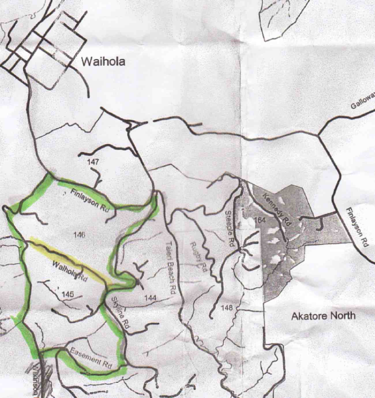
No. 110 on old hardcopy list of 113 club tramps. “Waipori Rd to Shaws Rd (See Bill Hunt) Year Round”

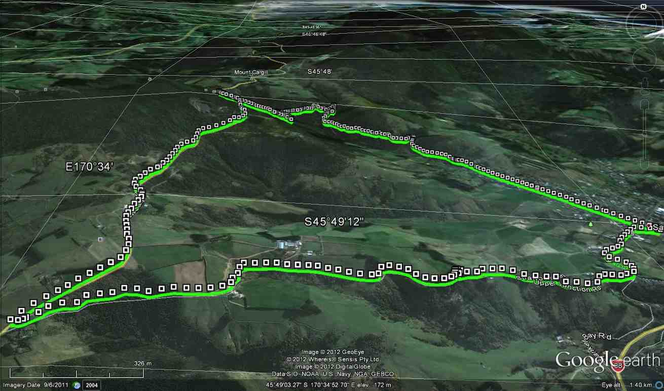
32 km from car park.

10. 18/11/2015 Trampers. Rannock Track from Waipori Picnic Area to Shaw Road.
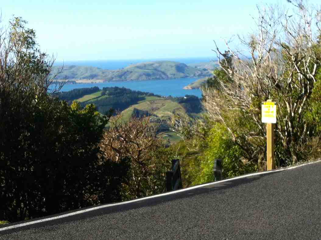
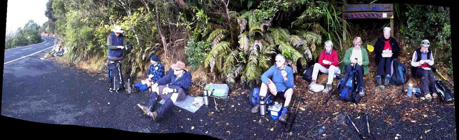
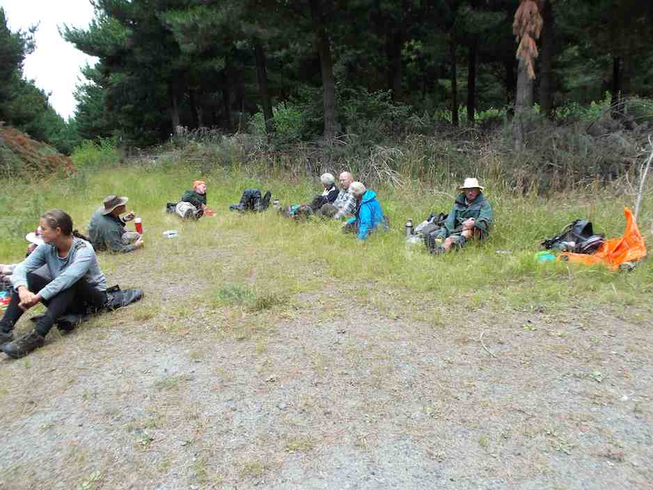
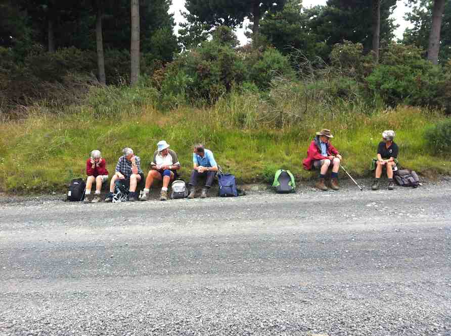
On a day with dodgy looking weather, 7 of us set off for the picnic area at Waipori Dam at Lake Mahinerangi, to do a walk through the forest roads to the old fishermans huts that are on the lake edge. These are the huts that we normally walk to from Post Office Creek end, but that track is no longer negotiable, so we decided to go from the other end.
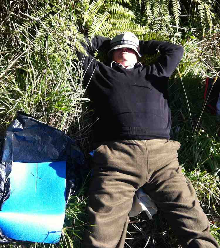
However, when we arrived at the picnic area we discovered that the dam has been closed off with a tall gate, & there is no access allowed into the forest. This came as a bit of a blow to our plans for the day, so having to improvise, we drove back along the road till we found a sheltered place to have morning tea,
1 Morning tea spot (Ken pic and caption)

1 Morning tea spot (Ken caption)

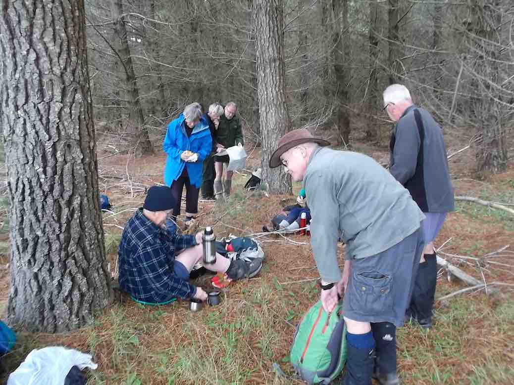
while we mulled over what the next step would be. We eventually decided to go back down the Waipori Rd. with the view to walk a bit of the Government Track.
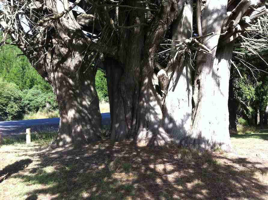
We stopped off at the Waipori township to have a look at the Crystal Falls, which a few of us had never seen before. Impressive sight, although being blocked from a really good view by trees etc.
2. At the Crystal Falls viewing platform

2. At the Crystal Falls viewing platform. (Ken caption)

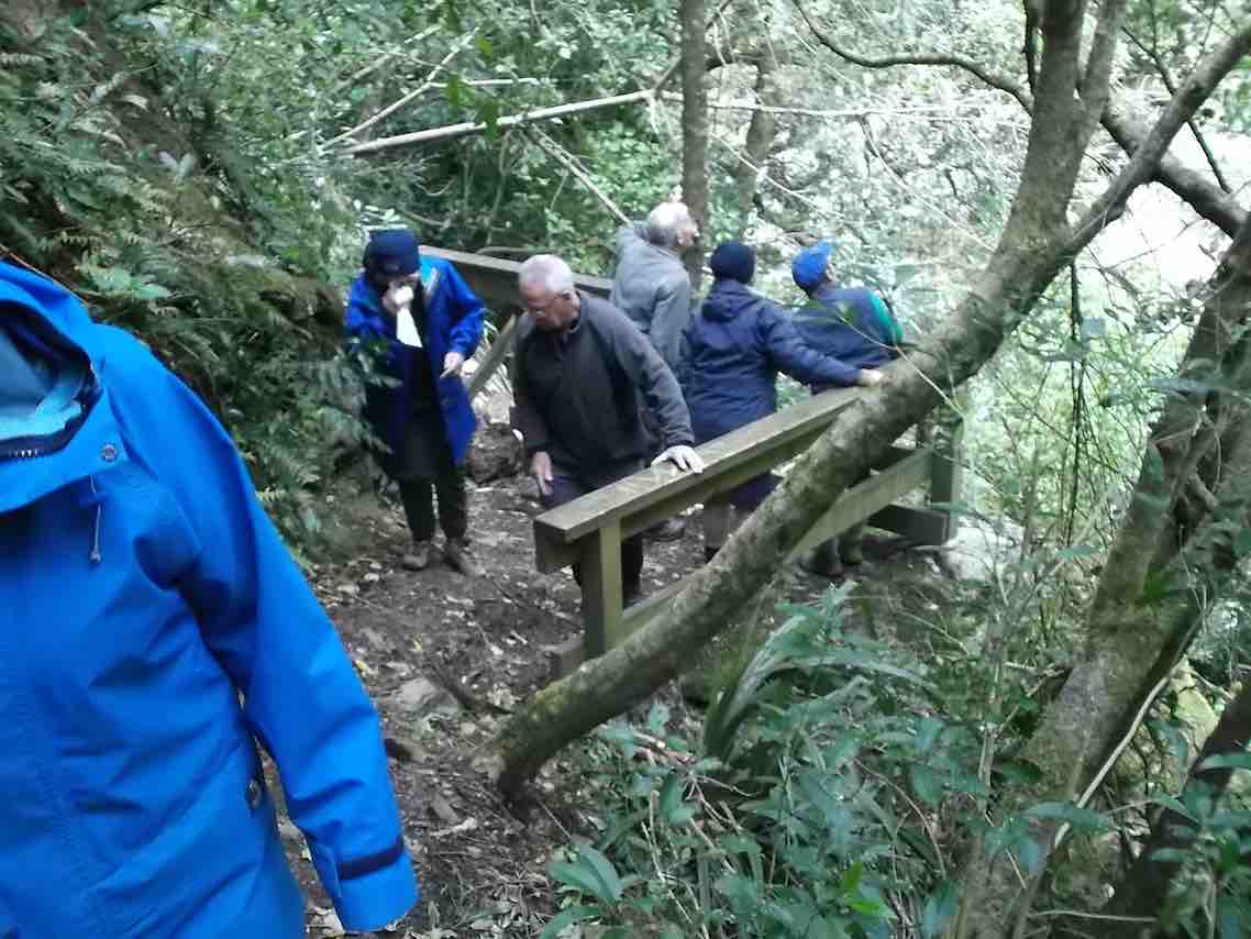
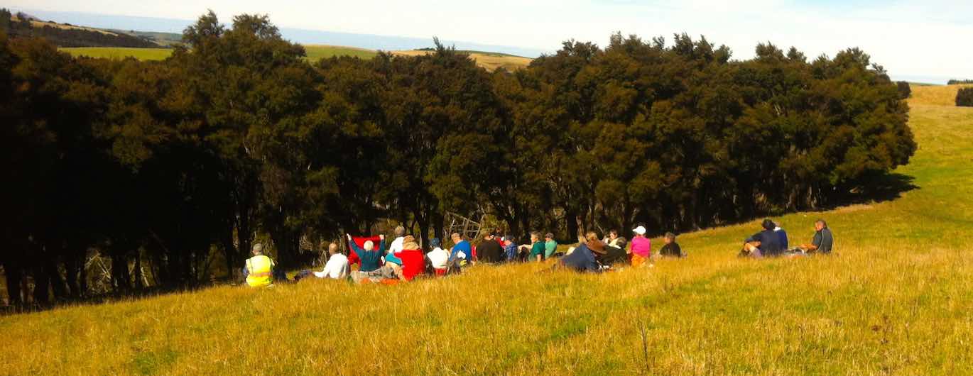
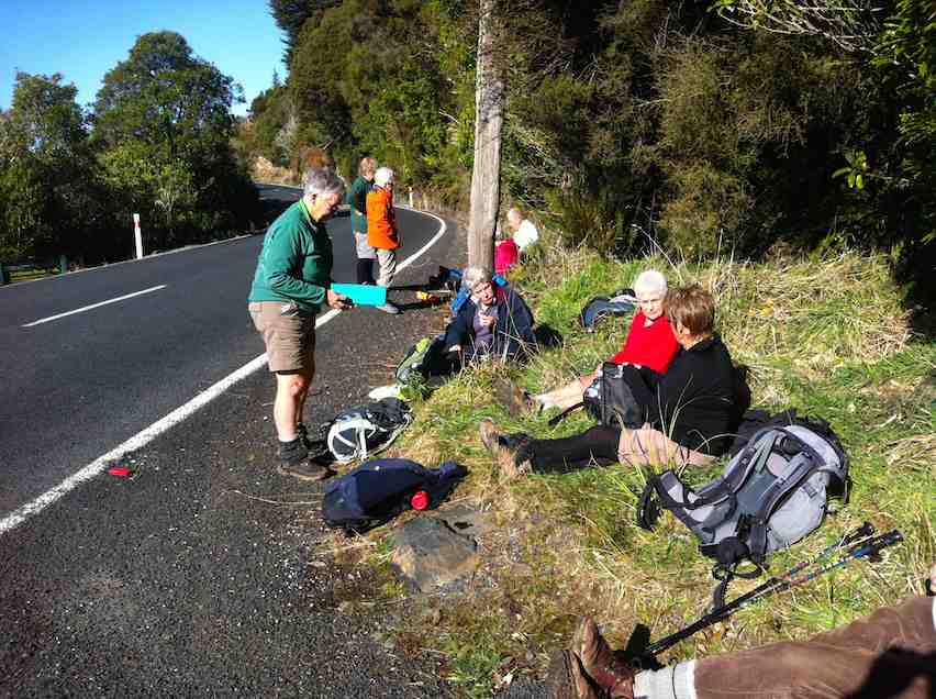
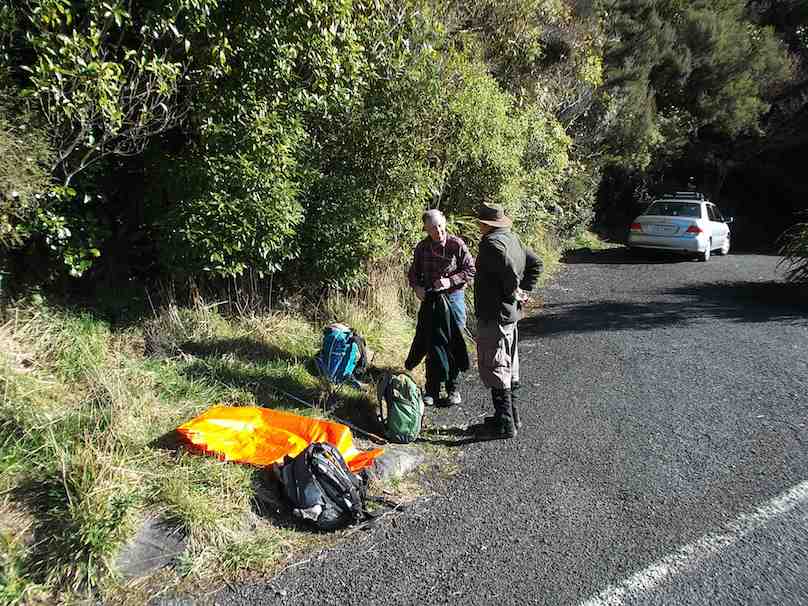
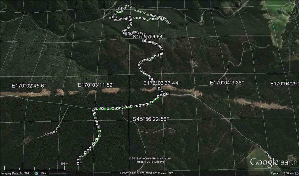
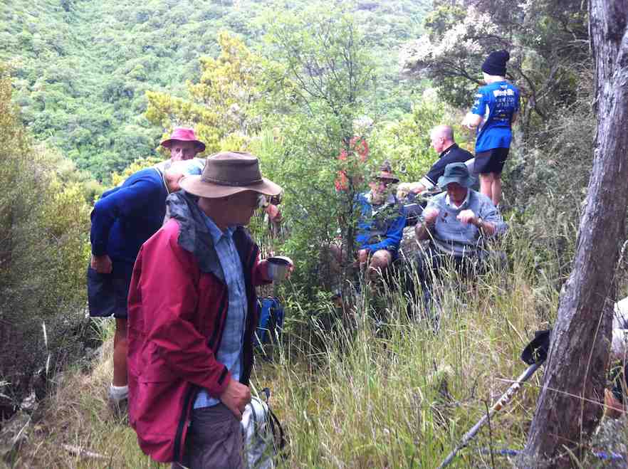
When we got to the bridge over the river just before the Govt. track, we decided to go into the picnic area there, instead of going to the Govt. track, & have a look at the track from there up to Shaw Hill Rd.
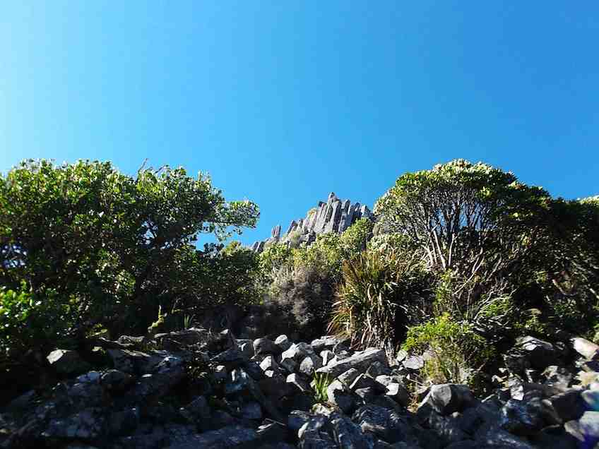
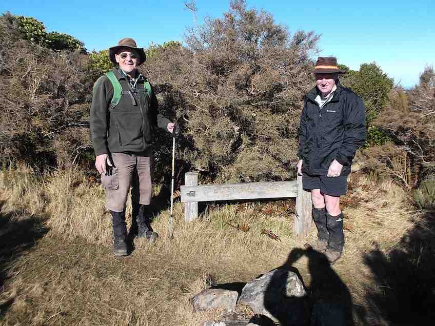
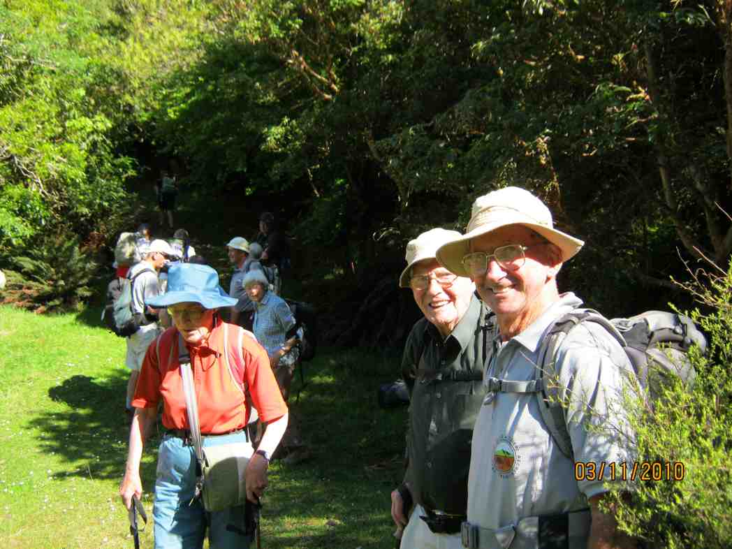
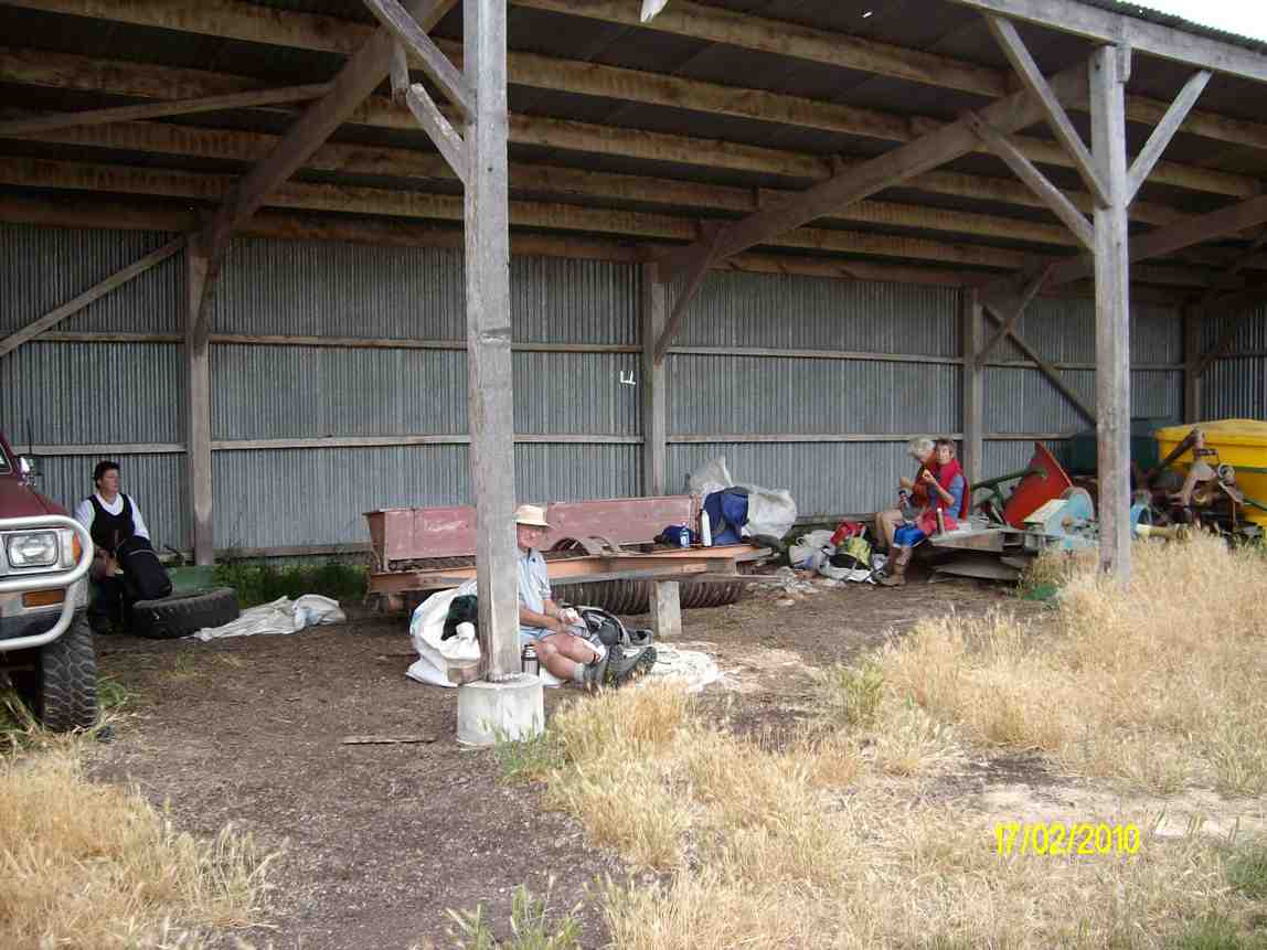
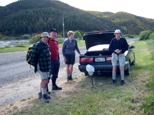
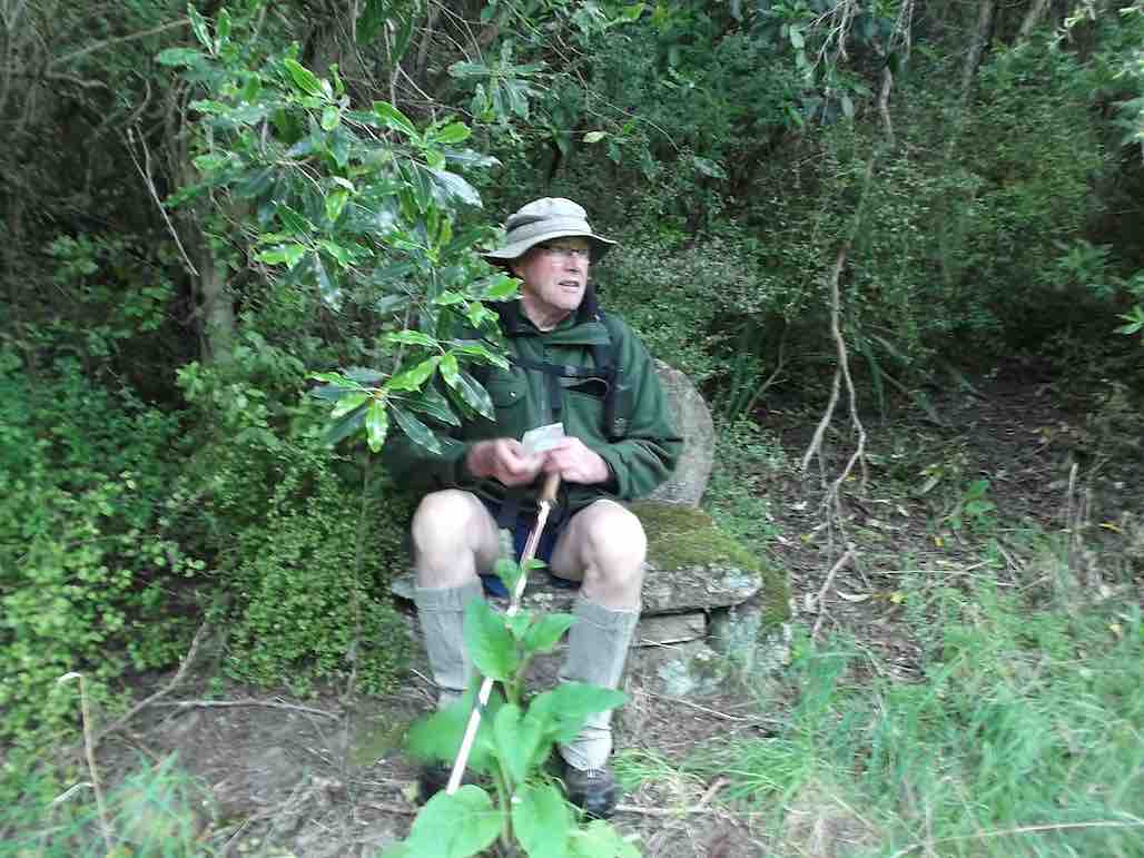
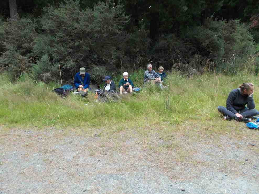
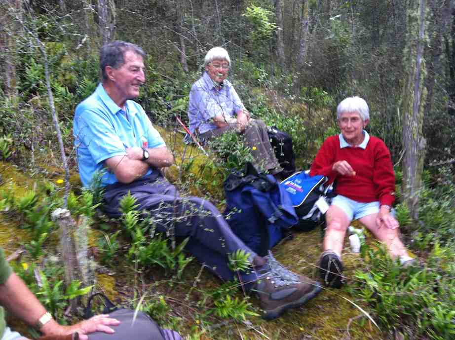
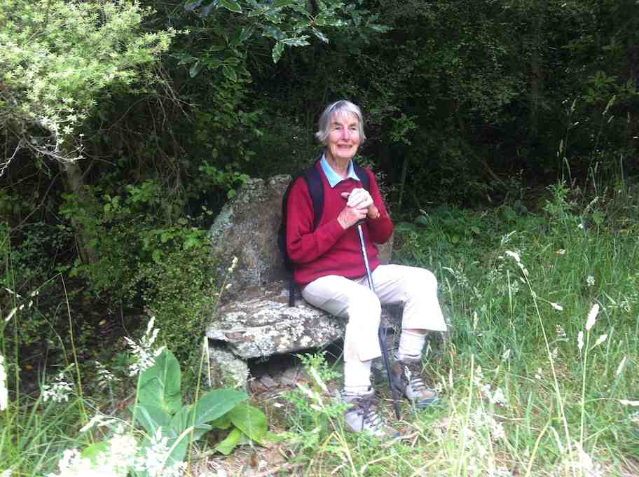
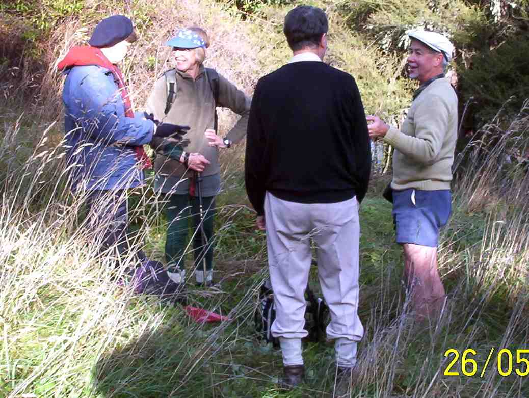
We parked up on the entrance road, as there is also a gate across there now as well, & walked up the track to the old shed, where we poked around a bit before moving on further up past the stone seat, & up to where the 4WD track starts. This lead us up to Shaw Hill Rd. where we had a bit of a look around before settling down for lunch under some pines, just by the bee hives. After lunch, we retraced our steps, but this time we took the loop track which joins up with the other one down near the bottom.
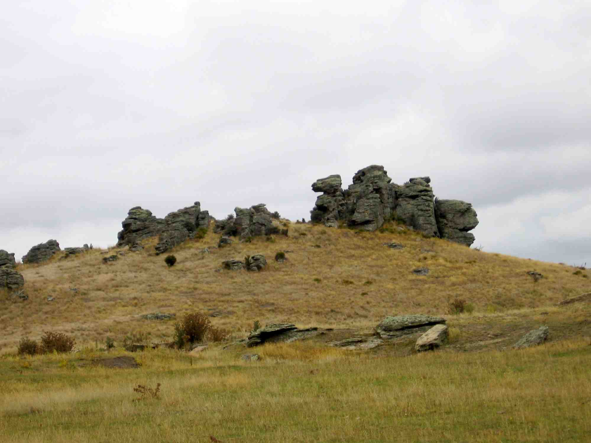
Ian H. did some research on the old shed & the stone seat, & came up with the info that the shed, along with it’s adjacent toilet, was built for the forestry workers, & the stone seat was constructed by the workers for their own amusement.
3. Ken taking advantage of the stone seat (Ken caption)

3. Ken taking advantage of the stone seat (Ken caption)

So our day was not entirely wasted, & we all enjoyed the different things that we saw during the day.
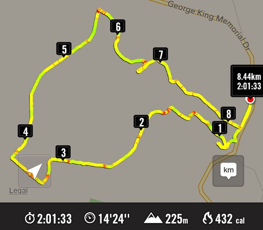
Walked 6.5km
3.7km/h
climbed 290m
max height 474m – Ken.
9. 5/2/2014 Both. Waipori DOC picnic area over bridge. Track up to Shaw Road.
Lunch stop (Ken pic and caption)

Lunch stop1 (Ian H pic and caption)

Lunch stop2 (Ken pic and caption)

Lunch stop2 (Ian H pic and caption)


8. 9/1/2013. All. Waipori DOC picnic area over bridge. Track up to Shaw Road. Leaders: Bev, Ian.
Eighteen climbed the track and four ramblers walked up the Waipori Road.
GPS

GPS of route courtesy Ken. We climbed via the shelter and the steep true left track of loop up to Shaw Road – and beyond – and descended via the loop’s longer gentler sloping true right side.

Cuppa at Lookout outcrop on steep track.

Cuppa at Lookout outcrop on steep track.

Another cuppa pic.

Another cuppa pic.

Lunch on Shaw Road

Lunch on Shaw Road

Stone seat

Stone seat at grassy part of track.

One hiker spoke for many when he thought the climb seemed much longer and steeper than when he had last done it (about a decade earlier!).

7. 20/10/2010. Hikers. Waipori Area. McLaren Rd, Wesleydale Rd, Farmland to Mill Creek. Poleline to Wesleydale Rd. Leaders: Bill and Lesley.

Following is a brief report on Wednesday 20/10/2010 Hikers tramp.
In all there were 12 people who enjoyed the day mainly because it was a new tramp, a lovely day, and no rain.
We parked the cars in McLaren road and ambled on up McLaren turning into Wesleydale Road, stopping for morning tea out of the cool breeze. Then continued on over farm land to Mill Creek. Found a lovely spot for lunch in the sun along the Waipori river bank.
After lunch we walked up the pole line to  Wesleydale Road and back to the cars. Approx 12 km all up.
The morning was cool until about 10am after which the sun shone from then on. – Lesley.

6. 17/9/2008. Hikers. Waipori Walk. Medium. Leaders: Bill H, Peter.

5. 21/9/2005. Both. Waipori area. Leaders: Arthur and Barbara, Bill H, Lance and Lois.

4. 26/5/2004 Both. Waipori Gorge. Climb from the DOC picnic area. Medium. Leaders: Bill H, Lesley, Irene, Les W, Ray, Mary M
Pause on track. Nadia, Dorothy, Lex, Bob

Pause on track. Nadia, Dorothy, Lex, Bob

3. 13/9/2000. Waipori Gorge area. Leaders: Bill H, Pat and Bill.
2. 10/9/1997. Waipori Gorge. Leaders: Lesley S, Bill H, Bev H.
1. 4/10/1995. Waipori Gorge. Medium. Leaders: Bill and Lesley, Graham and Doreen.

One response so far

Apr 01 2015

Neehoff Farm, Hindon.

23 km from car park.
1/4/2015. Both. Neehoff Farm, Hindon. M. Leaders: Ian F and Arthur H.
GPS of route

GPS of route

A goodly number of thirty Trampers and Hikers, as you can see from the GPS map, set off back alongside the road we had arrived in, the Leaders searching for one of several elusive ridges, each separated by bushed gullies and leading down to a main gully at their foot. However, due to their number (six in total!) and too tentatively choosing one ridge too soon but finding it too stunted to be the one, we ended up turning back (about 0.7 kms on GPS map) instead of going on, and descending the ridge futher back only to be forced to have to climb out of the gully beyond its foot (red spot about 1.4 kms on GPS map) and up onto the one originally planned on.  By now it was time for morning tea. (Sorry about the lack of photos – we didn’t have John and his camera with us this time.)

On down the right gully now this time and into the main one across its foot, left skirting its side and crossing at a bridge and struggling up the slope directly ahead. (Red spots about 1.6 kms on GPS map.) Then it was on, up to our left, climbing gradually for the most part, through a number of paddocks and gates, until by various turns we reached what appeared a paper road. (About 3.7 kms on GPS map.) This formed a long ascending route to the point where we turned into a paddock again. (About 5.8 kms on the GPS map.) En route, we met up with the Neeehoff farm’s neighbouring owner. He reassured us he had been consulted, but it now became apparent that we had spent more time on his farm than the other! Ah well, another permission to prudently seek next time. It was in the new paddock that the mushroom pickers got really busy. There had been some mushrooms in the first paddocks, but here their number appeared endless. This led to a prolonged hunt by the aficionados while most went on to stop for lunch not too distant from one particular loiterer who shall remain unnamed. (6.1 kms on the GPS map.) Some great mushroom fry-ups would be on the menu that evening!

Lunch

Lunch stop, waiting for the mushroom pickers to catch up.

Around the head of the gully facing the luncheon eaters, we descended to the big gully again, but here bridgeless, with its water-way just a step (or more in some places) too wide. Many just plunged through, but the tail on the GPS map indicates a walk upstream for the few patient enough to wait to be led to the only dry one-step crossing. (About 6.7 kms on the GPS map.) From there we had to walk back along to our left and the corner of a paddock ahead, and wait for leader Arthur to switch off the hot wire of what we now knew to be the Neehoff boundary fence. (About 6.9 kms on the GPS map.) Once through the fence, ahead lay the long steep slog up the longest and principle of all those six ridges leading back up again, – also the nearest to the homestead. (Kms 7 and 8 on the GPS map.) Now we were back up onto the original paddock and soon back to the cars.

Well, this was one of the now controversial “both” walks, set down for Trampers to join with Hikers the first Wednesdays of the months. It was moderately hard only in respect to the steep climbs out of the gullies. But not particularly long or challenging. There were happily more Trampers than there had been recently, generously tolerating the slower pace of the Hikers for the  sake of “Recreational” togetherness and getting to know fellow-club members better. Perhaps the emerging arrangement of this along with a track-clearing option on the same day, is becoming a way through of providing a flexibility of choice for Trampers to exercise in accordance with their own preference. – Ian

20/2/2013. Trampers. Neehoff Farm, Hindon.

22/2/1995. Neehoff Farm, Hindon. Medium. Leaders: Molly, Jack and Rosemary, Eleanor.

No responses yet

Aug 06 2014

Grahams Bush, Upper Junction, Brickhill Rd

Published by under Both Hikers & Trampers

Grahams Bush botanical information.
Grahams Bush reserve was originally the site of sawmills and brick kilns operated by David Bethune in the 1880s, and became city council property in 1955.
Parking: Church Grounds. Distance from car-park: 27 km.

6/8/2014. Both. Hall Rd, Grahams Bush, Mt Cargill Rd, Upper Junction Rd, Brickhill Rd, Stevenson Ave. Leaders: Lester, Ian. (As it turned out, there was no appointed tramper leader there on the day.)
A perforce Hikers’ report.
This was one of those first of the month tramps for both trampers and hikers to get together. However at the car park on the church grounds, there was no sign of the trampers. We waited and questioned whether they had got lost. They had left the Bush Road car park before us. Where had they gone?  We eventually set off without them on the long walk up Hall Road and on along the initial farm 4WD route to stop for a cuppa at the track turn-off.
For quite a few of us this was their first time on this route and they spoke appreciatively about the lovely bush. Rain the night before had made the track muddy in places. We were pleasantly surprised by beautiful bird calls, more than experienced on previous occasions.
The steep grade gets no easier, but eventually we emerged onto the Mt Cargill road be be greeted by the small group of three trampers. They had left the car park early before the rest of us, had apparently driven right past the church car park in Station Rd and (cunningly? shorter distance!) parked further up Hall Road,  and carried on ahead. So it was not to be a together day after all,  even up to a morning tea stop!
Anyway, after our brief meeting at the Mt Cargill Road car park, (so we were together briefly after all) they were off to further ascend Mt Cargill while the we stopped off for a leisurely lunch. Some of the hikers ventured a short distance up the track after lunch and returned back down again.
View from the top of the steps

View from the top of the steps

Hikers' lunch at the car park on Mt Cargill Road

Hikers’ lunch at the car park on Mt Cargill Road

Recovery position

Recovery position

We set off along the old Mt Cargill Rd in a very orderly single file, quite a number of us wearing high-viz jackets. Perhaps it was these that encouraged passing drivers to noticeably slow down as they passed. We turned down Upper Junction Road and were interested to see how the slip at the bottom had been repaired. After the last grouping at Brickhill Rd, we straggled on to our cars back at the church park grounds. At 16, there was only half the usual number of hikers, and we suspected some had wisely decided their fitness was no longer up to the steep climb of the day. Another fine day, bracketed by bad weather on either side. We were so lucky. – Ian.
A Trampers’ report.
3  trampers left Sawyers Bay before the hikers arrived, as they got tired of waiting around ! The walk up through Grahams Bush was a little damp after rain on the previous night, but the bird life made the walk more pleasant.
After morning tea, with still no sign of the hikers, we walked to the top road,
At the top road

At the top road (Heb pic and caption?)

where we waited for approx 40mins. for them to arrive. After this, we walked up the Organ Pipes track, stopping to view the tumbled down remains of the pipes,
Organ Pipes

Organ Pipes (Heb pic and caption?)

then went on to Butters Peak junction,
Buttars Peak Junction

Buttars Peak Junction (Heb pic and caption?)

where lunch was had in the sunshine.
The return trip was uneventful, & the birds once again kept us company. – Ian Hebberd? – per Ken.


1/8/2012. Both. Grahams Bush, Mt Cargill Rd, Upper Junction Rd, Brickhill Rd, Hall Rd. Leaders: Pat, Ken.

GPS of route, courtesy Ken.
10.5 km distance.
3.7km/h moving ave.
2hr 48min moving time.
379mtrs. total ascent.
394 max elevation.

Lunch

3/11/2010. Both. Grahams Bush, Mt Cargill Rd, Upper Junction Rd, Brickhill Rd, Hall Rd. Leaders: Fred, Elaine.
A goodly number of 21 of us set off for the round trip. We stopped at the turn-off into the bush for morning tea. Evelyn has apparently suffered an early bad fall but soldiered on.

Finished morning tea.

Continue Reading »

No responses yet

Oct 02 2013

Bus Trip: Roxburgh and Bullock Track

Published by under Both Hikers & Trampers,Bus Trips

2/10/2013. Bus Trip. Roxburgh. River Walk, bridge to Pinders Pond. Leaders: Chris and Dot.

The first thing to say is Bravo to Chris and Dot for their planning a most interesting tramp; and providing Continue Reading »

No responses yet

Jan 18 2012

Finlayson, Wilkinson, Waihola, Skyline Roads

Published by under Both Hikers & Trampers,Hikers

No. 63 on old hardcopy list of 113 club tramps. “Waihola – Wilkinson Rd. Easement Rd. Skyline Rd. Wenita. Farm”
Waihola tramps

Waihola tramps


Distance from car-park: 27 km.
Year round. Winter option. Contacts:
Parking: Contact Manager, Christian Youth Camp, Mr Kinnon 03 417 7120 for permission to park on the old wooden two-storey house property.
Carpark to Wilkinson Road 45 minutes.
15 minutes
Wilkinson to top of Easement 1 hour.
Easement to Bluff 30 minutes.
Bluff to Waihola top 1 hour.
Down Finlayson Road to car park. 30 minutes.
Wenita permit. Require 6 weeks notice, but less from us.
18/1/2012. Hikers. Finlayson Road picnic area. Wilkinson, Easement, Skyline and Waihola Roads, round trip. Leaders: Marjorie and Bruce.
We parked our cars at a rest stop on Finlayson Rd, near Wilkinson Rd turn-off. Bruce led us round the area, planted with a variety of interesting trees, not the least being this large macrocarpa.

One tree – or many? Impressively large, anyway.

Continue Reading »

No responses yet

Feb 17 2010

Suddaby Farm.

Contacts: Seek permissions.
17/2/2010. Suddaby Farm, from Wallace Ford Road. (At the end of Mount Gowrie Road). Leaders: Ria, Hazel.

Well, although the tramp was called ‘Deep Stream Pipeline from George King Memorial Drive’, we never went near the George King Drive at all, except to pass by both ends of it on the way to our destination.

We [all 5 of us] parked the car on Wallace Ford Rd. outside Carters farmhouse, & made our way across some very dry & parched land to Withers farm, after having morning tea in a large farm shed.

Morning tea. Angela, Doug, Hazel, Ria. (Ken pic).

Continue Reading »

No responses yet

May 29 2009

Beach Walk, Blackhead, Kaikorai Estuary, Ocean View, Brighton Tramps

29/5/2009 Hikers. Waldronville, Blackhead. Easy. Leaders: Bob M, Peter.
Cars parked at Kaikorai Estuary by gun club. Beach walk to Blackhead. Beach back. Golf Course. Waldronville, return.
14/1/2009 Ocean View, Kaikorai Estuary, Big Rock. Leaders: George, Ria.
First tramp for 2009 was a combined one and 17 members, keen to get out tramping/hiking again after Christmas/NewYear break, met at Ocean Beach Church for what proved to be a very pleasant, easy beach walk. Day was warm and sunny, with no wind. We wandered along to Ocean Beach to the Estuary, stopping for morning tea on the way. An added bonus was seeing several horses, either being ridden or with sulkies, training along the edge of the water. They certainly make a great sight.
Horses being exercised on Ocean View beach

Horses being exercised on Ocean View beach

Continue Reading »

No responses yet

May 03 2009

Taieri Gorge Railway Tramp

Published by under Both Hikers & Trampers

At least a dozen club members took advantage of the opportunity provided by the Lions Club to walk the rail track between Flat Creek and Deep Stream. We walked single-file with 360 others through two tunnels and over several viaduct/bridges. The sky was blue and the air was still. Perfect conditions.
OSH requirements had seen to a nightmare of safety warnings and precautions having to be taken by the small army of Lions Club controllers. It went well. – Ian
click to enlarge

About to set off. Chris, Neil

About to set off. Chris, Neil


Through first tunnel. Bill (partially).

Through first tunnel. Bill (partially).

Continue Reading »

No responses yet

Nov 19 2008

Taieri River track (true left,) downstream from Taieri Ferry Bridge

Published by under Both Hikers & Trampers

Click Taieri River Geology for background information.
29/11/2008. Taieri River track, (true left,) downstream from Taieri Ferry Bridge


Ian's Hat

Ian's hat. Doug Abe Sabina Bill

We parked Bill’s car on the south side of the Ferry bridge, walking back over it to begin the track. Continue Reading »

No responses yet

Mar 19 2008

Knobby Range from Roxburgh to Alexandra Bus Trip

Published by under Both Hikers & Trampers

19/3/2008 Knobby Range from Roxburgh to Alexandra Bus Trip Leaders: George

At 7.15 a.m. on a very warm morning, 25 of us met at the car park ready to board Bob Mitchell’s comfortable bus to go on our much awaited trip for the tramp across the Knobby Range. From a hiker’s point of view, along with the challenge of a somewhat longer tramp, was the slight trepidation of being up to the test. However, due to George’s enthusiasm and encouragement we had decided to give it a go as the opportunity and ability might never come again. So we boarded the bus and were away just after 7.30 a.m. Bob dropped us off at the top of the Knobby Range at 10.00 a.m. ready and eager to get going.

Rock formation (Pat pic).

Rock formation (Pat pic).

Continue Reading »

No responses yet

Nov 07 2005

Camp: Glenburn

Published by under Both Hikers & Trampers,Camps

7-11/11/2005. Glenburn Camp.
Day one.
Stream alongside track.

Stream alongside track.

Continue Reading »

No responses yet

Sep 28 2005

Area Tramps: Big Stream, Long Ridge, Zig-zag, Camelback

Published by under Both Hikers & Trampers

Location: 17 km.
Big stream to bottom Zigzag 45 min. Morning tea.
Zigzag 45 min.
Turn right Long Ridge, 30 min. Sign Water Point.
Take left track to bottom, keep right, cross stream, keep on track back to car.

28/9/2005. Trampers. Big Stream, Zig-zag. Leaders: Lex, Arthur H
28/11/2001 Alt. Big Stream, Zig Zag, Long Ridge, return Camelback Track. Nelson & Dot
13/10/1999. Big Stream, Long Ridge, Zigzag. Leaders: George, Claude, Colleen.
24/4/1996. Big Stream – Zig Zag Longridge. Fence line down. Medium. Leaders: Rob Q, Ria L, George, Colleen.
14/2/1996. Big Stream Forest Track – Mount Allan. Medium. Jack R, Ria L, Rob Q, Bob H.
1/9/1993 Big Stream, Long Ridge. Round trip. Easier alternative. Medium. Catherine, Ria L, Colleen, Molly
31/5/1989 Long Ridge to Big Creek (sic). Great tramping country. Round trip or optional shorter walk. Leaders: Daphne, Bob H, Mary Y, Bev M
15/2/1989. Big Stream from Mount Allan Road. Excellent Tramp – steep return. Leaders: Dapne, Peg A, Helen W.

No responses yet

May 04 2005

Chalkies Loop, Dodds Gully

[chat] with the owner of one of the houses up the Chalkies track road. He tells us that the grumpy one has now gone, & the new owners are quite ok with groups like ours going down [or up] the track through their properties, then down [or up] their driveway. I think permission should still be sought first though, especially for the first time at least. – Ken, date 10/9/2014.
Loop blocked by owner of one of two houses in Dodds Gully. (4/5/2005)

4/5/2005. Hikers. Chalkies area. Leaders: Colleen, Betty B, Nancy

17/9/2003. Trampers. Chalkies. Medium. Leaders: Wendy, Molly.
1/9/1999. Chalkies Loop Track. Leaders: Claude, Myrie, Ian
11/11/1998. Chalkies – round trip. Leaders: Doug J, Irene, Molly
27/8/1997. Chalkies Track. Leaders: Jack R, Claude, Irene.
13/12/1995. Chalkies. Park cars at Judy C’s – bring a plate – lunch on lawn at Judy’s.
26/7/1995. Chalkies. Medium. Leaders: Ted, Les W, Rob C, Eleanor B

One response so far

Aug 11 2004

Strauss (Nth Taieri) (Waironga Springs) to Boulder Hill

Seek permission
Wenita permit. Require 6 weeks notice, but less from us.
City Forests. 455 5512.


11/8/2004. Both. North Taieri, Boulder Hill, Strauss Property. Easy+. Leaders:  Ria L, Irene, Joyce, Eleanor.
25/10/2000 Leaders: Les W, Ray, Mary M

No responses yet

Apr 21 2004

Grahams Bush, Careys Bay

Published by under Both Hikers & Trampers

21/4/2004. Both. Grahams Bush, Sawyers Bay, Careys Bay. Easy. Leaders: Barbara McC, Evelyn C. Les W, Mary M.

No responses yet

« Prev - Next »