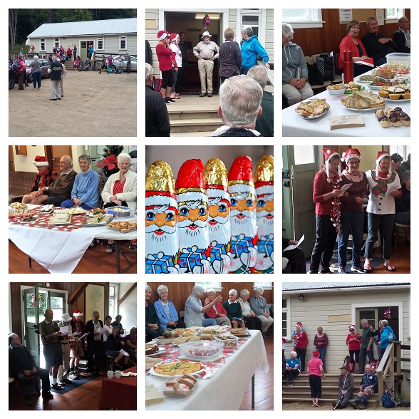
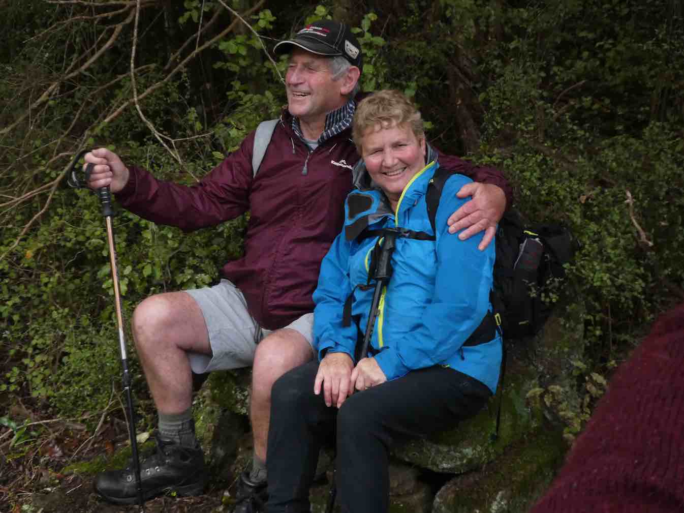
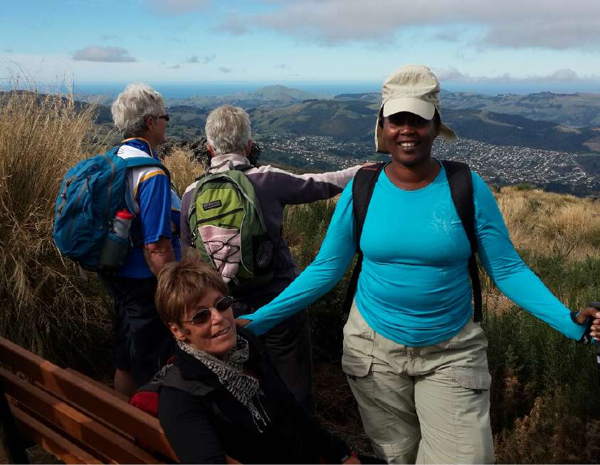
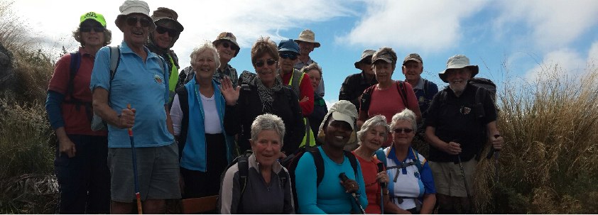
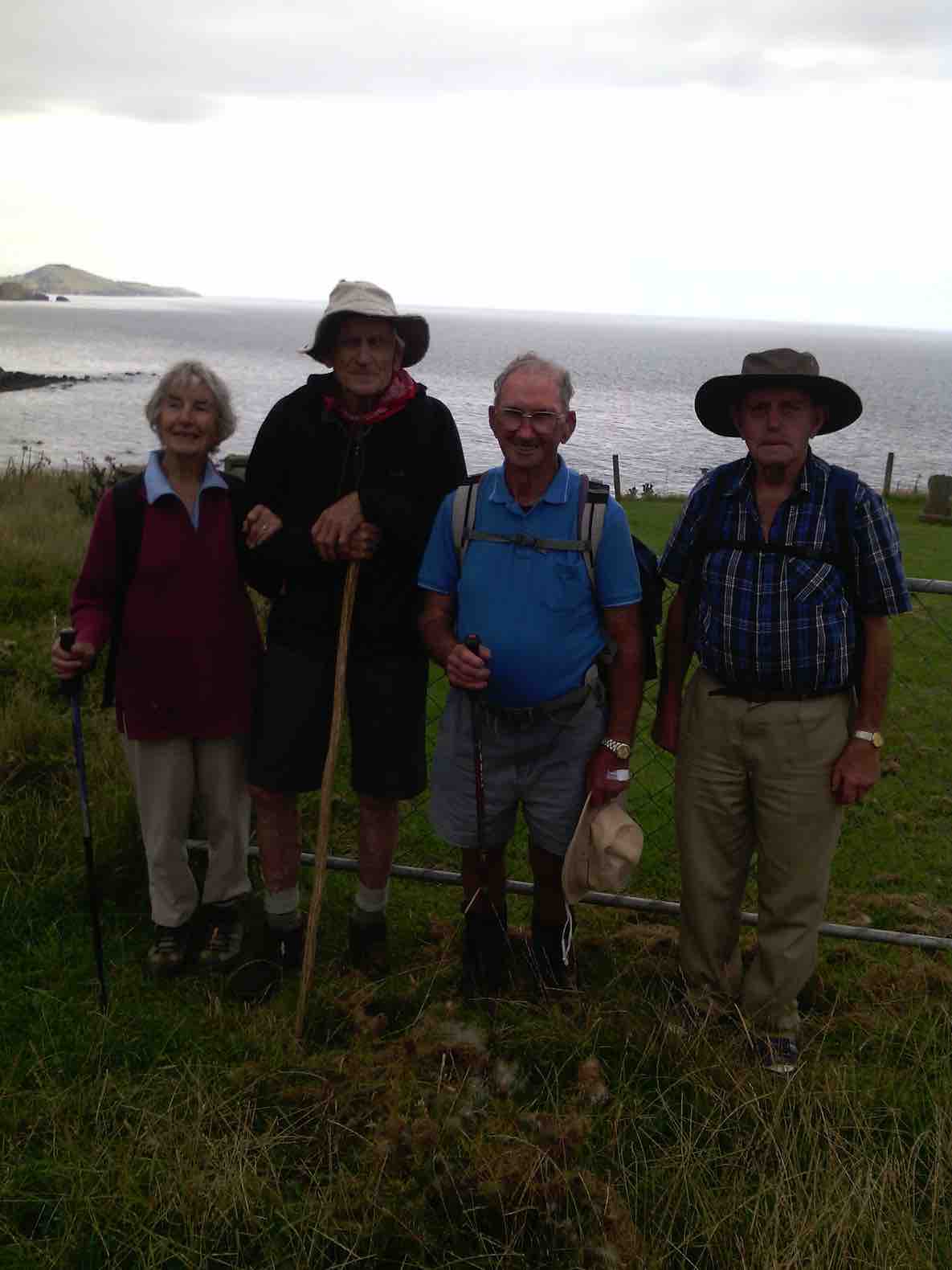
18. 11/12/2020 Christmas Breakup. All. Waiora Scout Camp. * E. Leaders. Eleanore and Jill D., Noi and Adi.
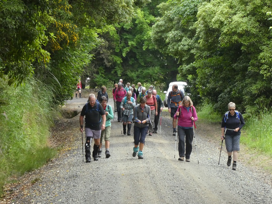
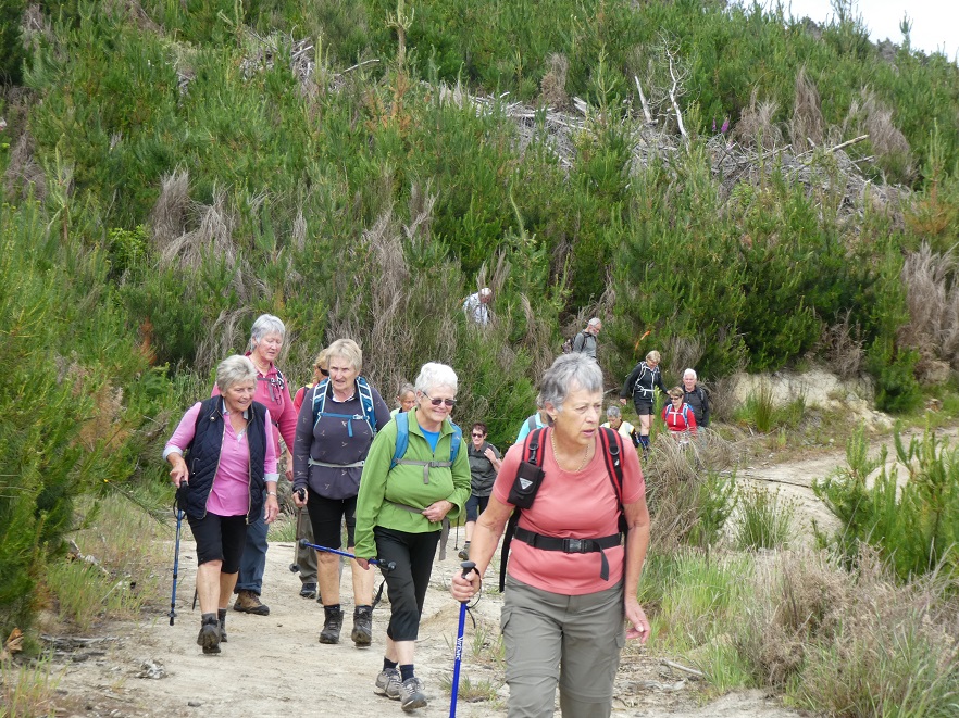
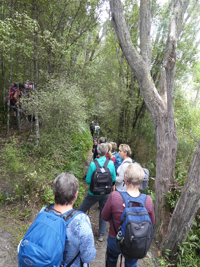
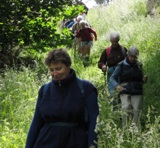
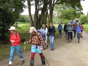
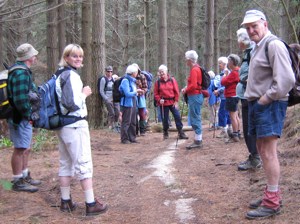
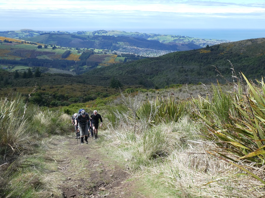
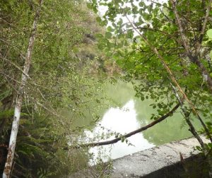
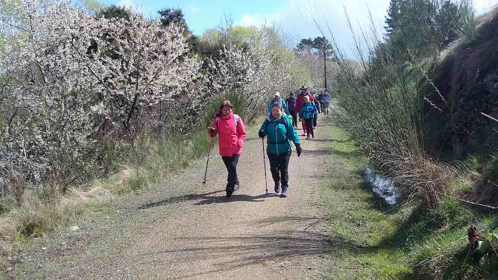
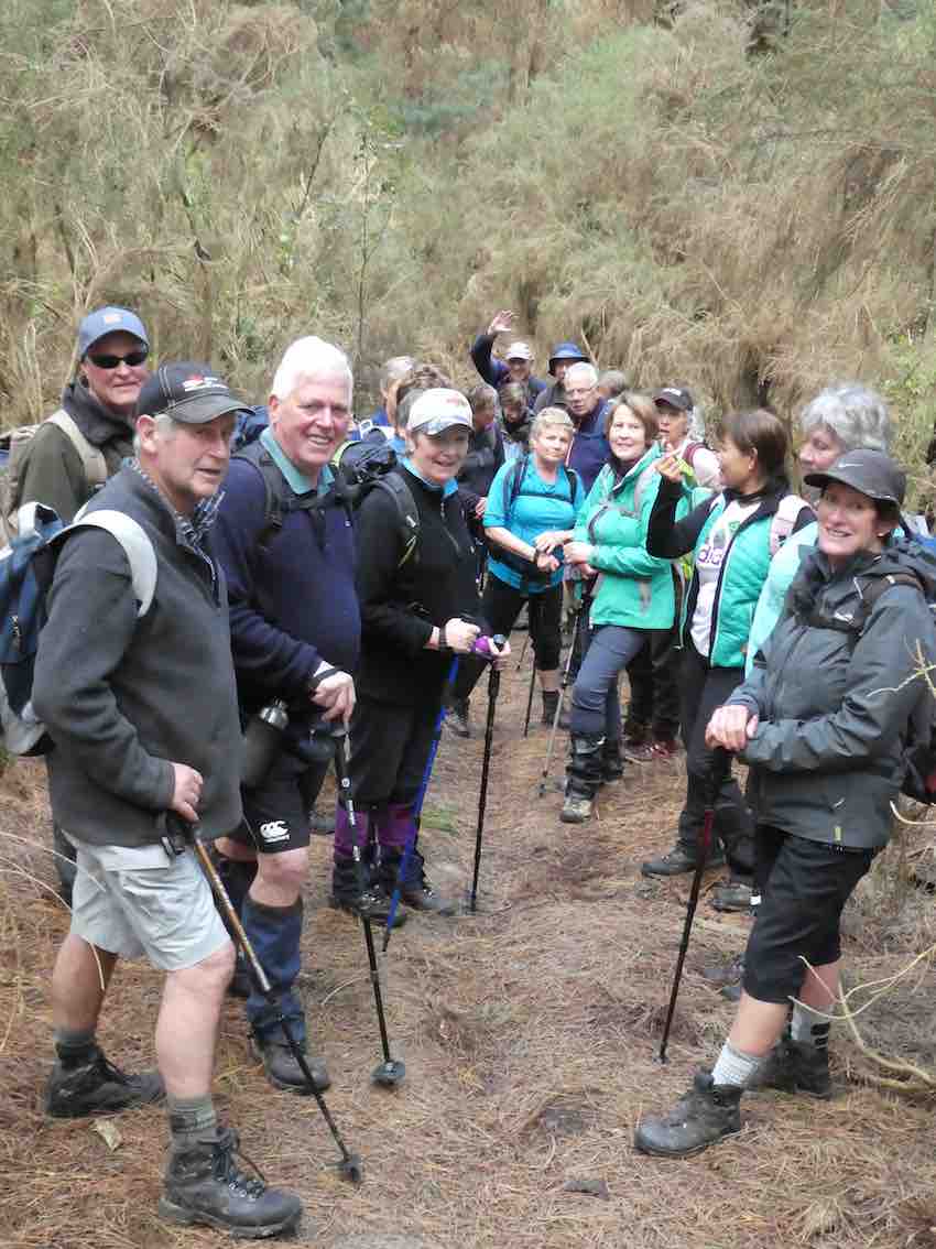
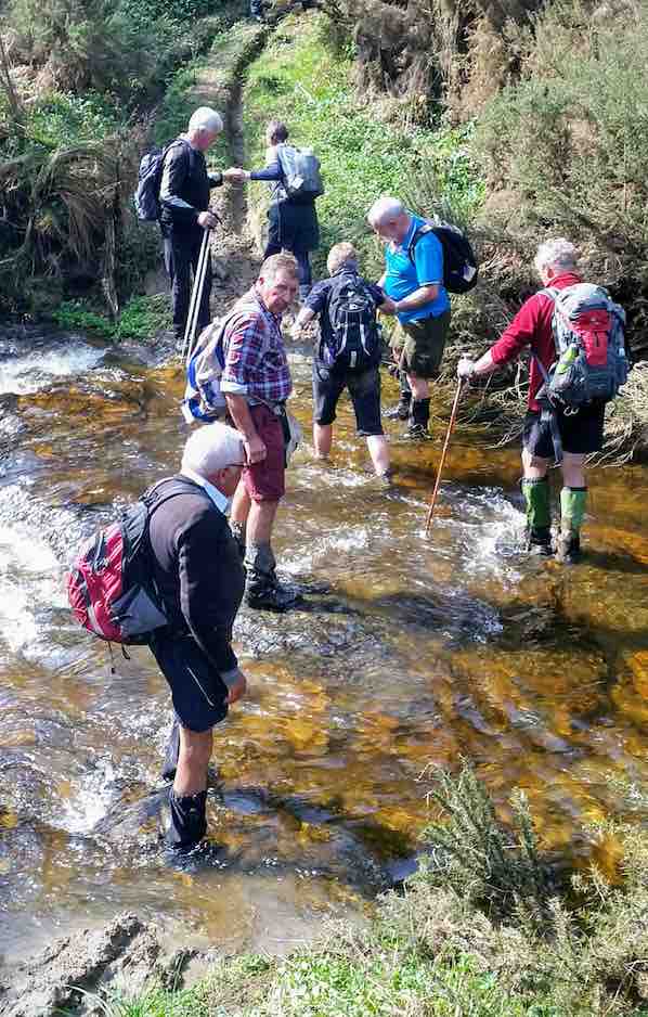
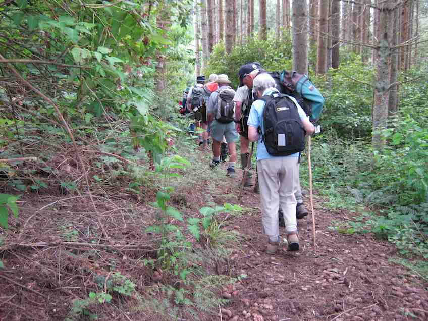
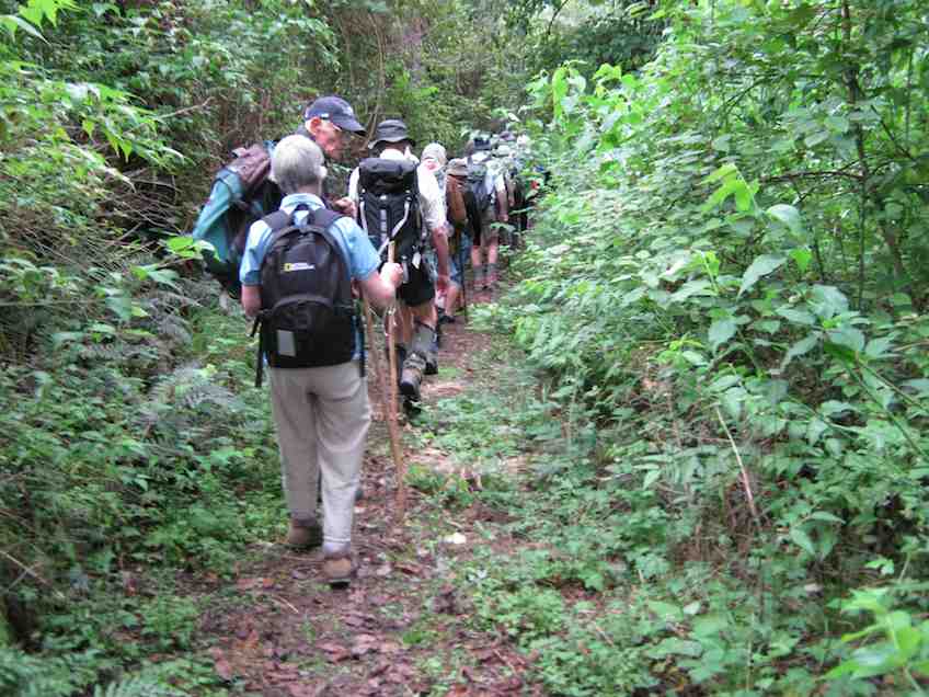
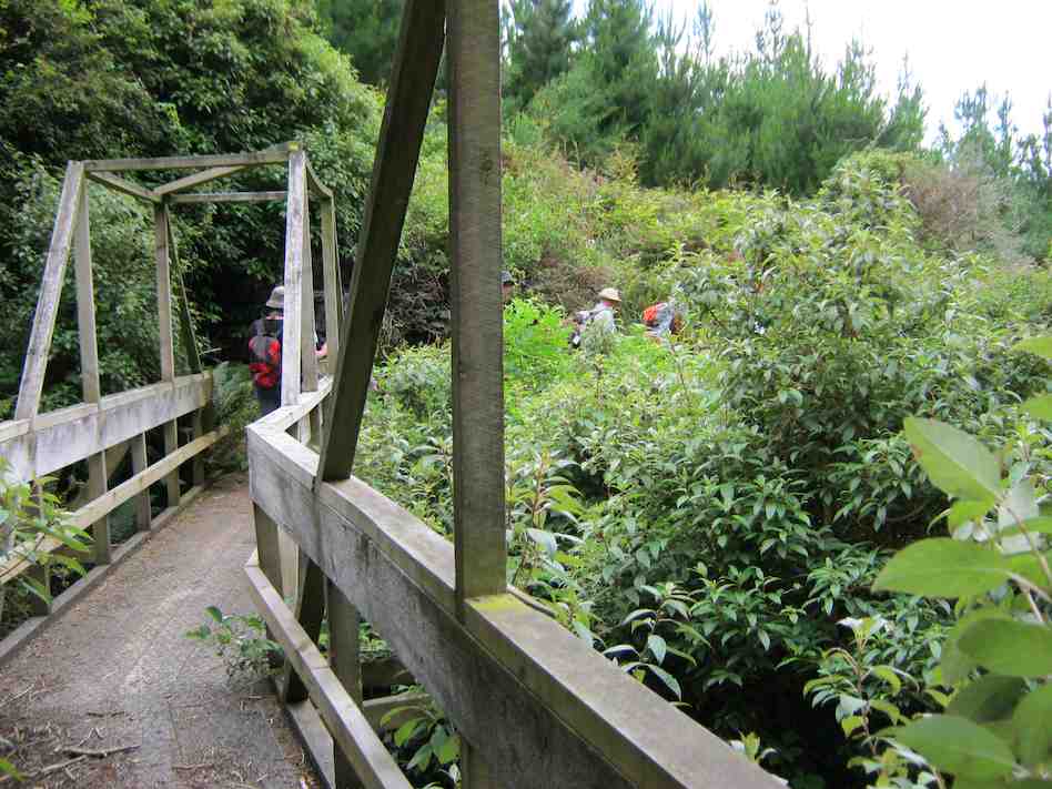
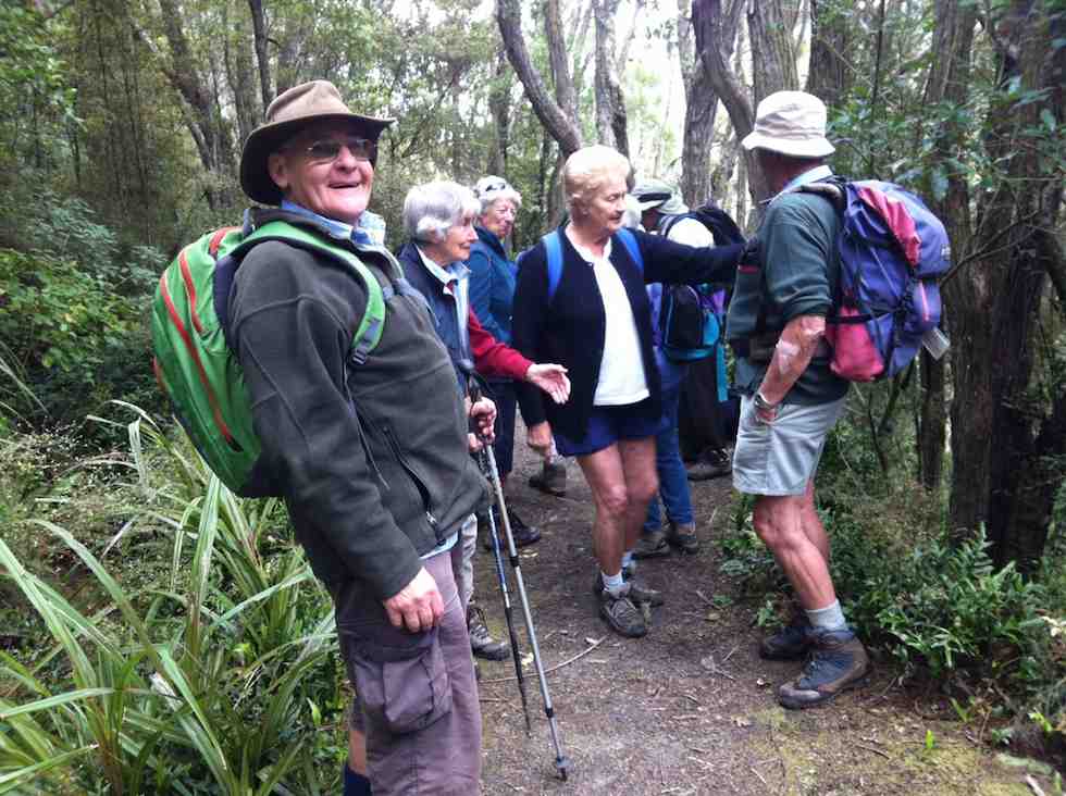
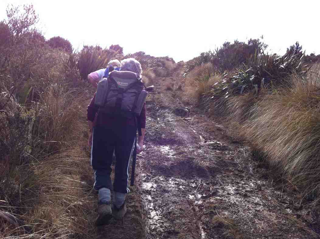
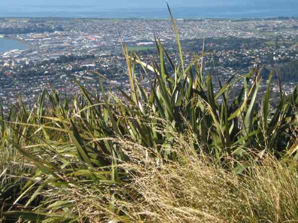
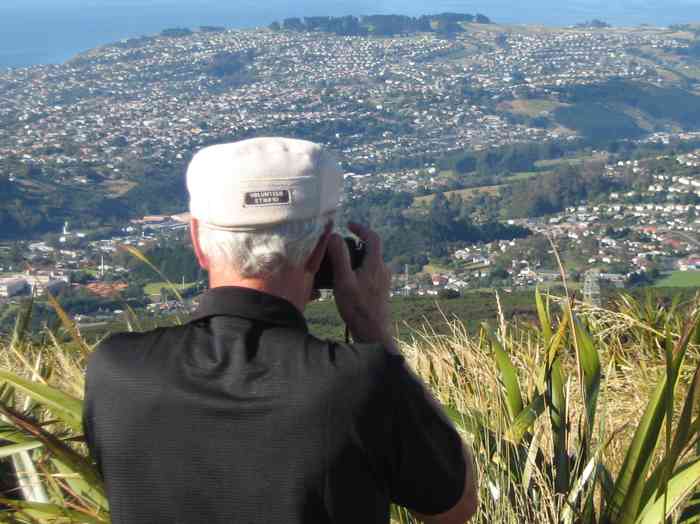
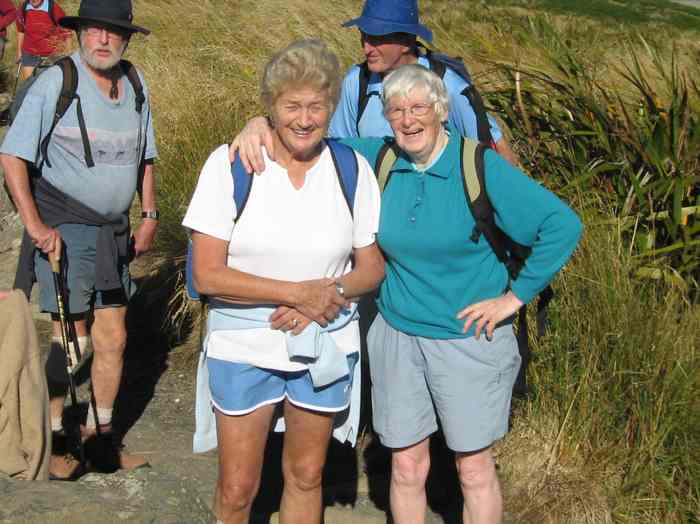
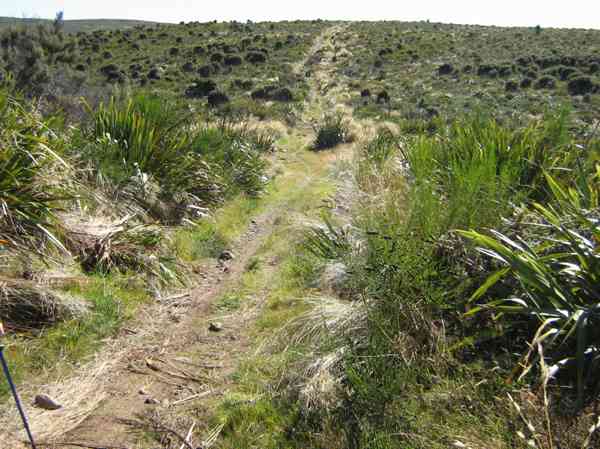
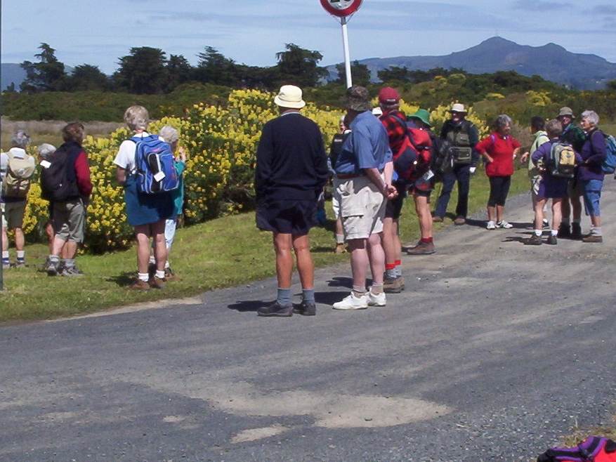
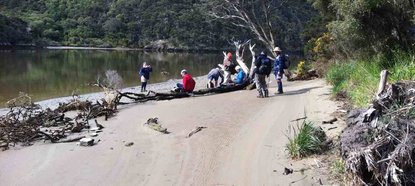
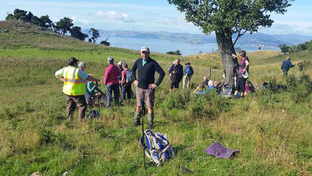
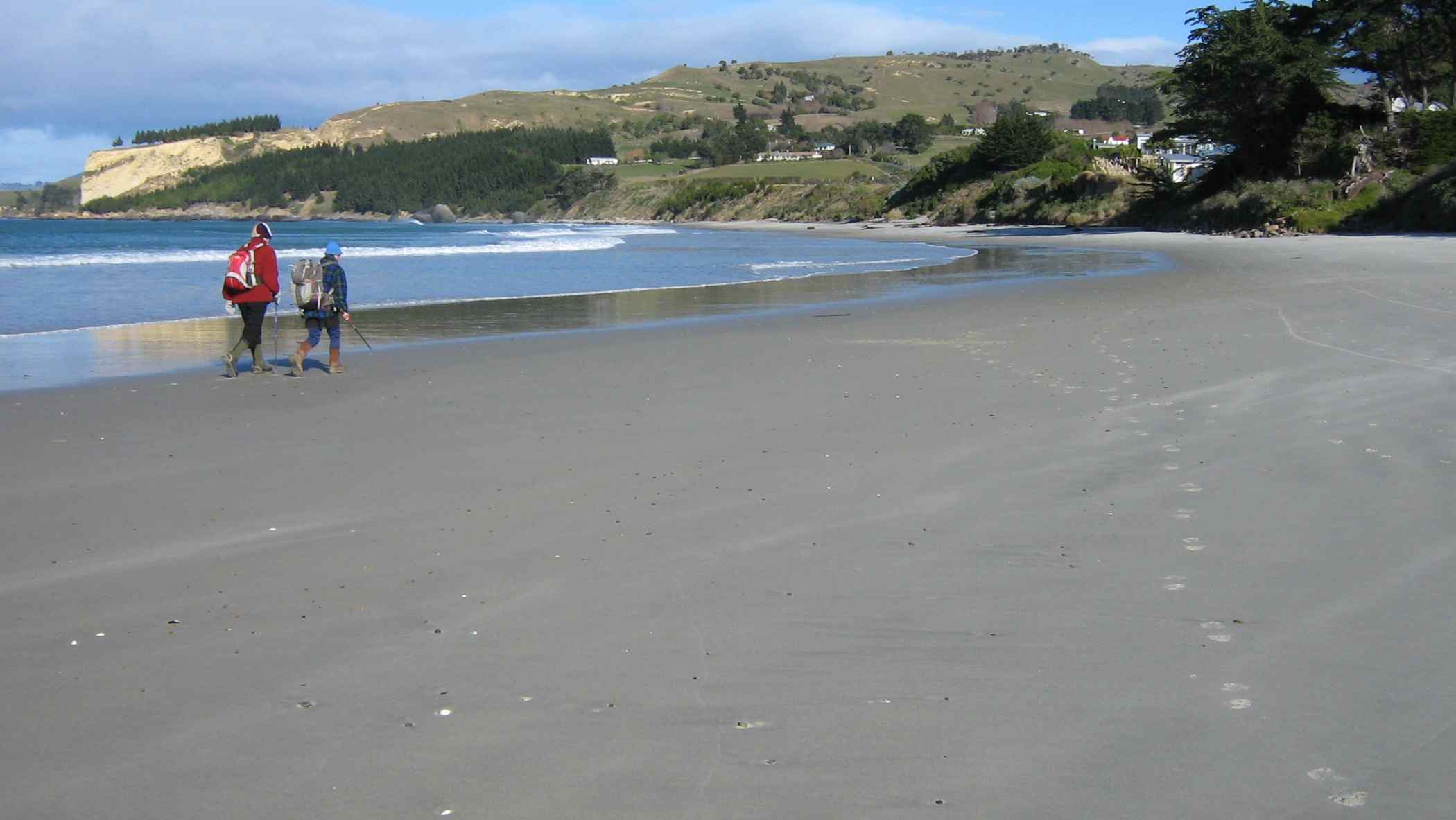
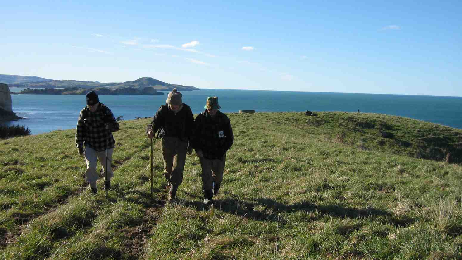
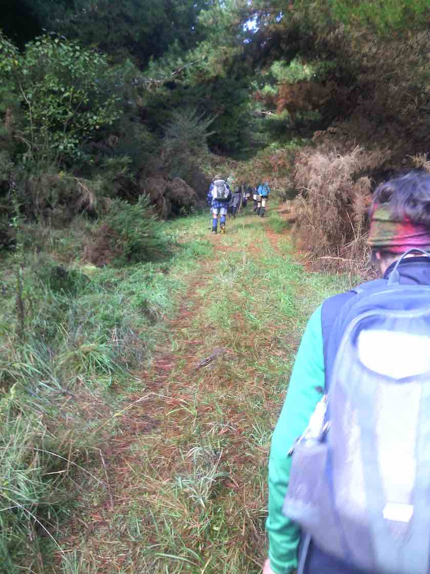
Forty two Trampers/hikers set out from the old Whare Flat School along the Tunnel Track and The McRaes Weir Track and back down to the Waiora Scout Camp. Obviously there was a lot of manual work done by hand many years ago to help supply water to Dunedin.
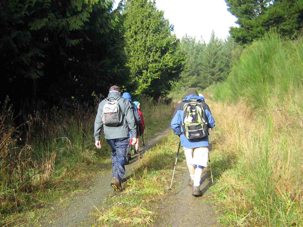
Photo and Caption Gordon – “Some of us are off!”
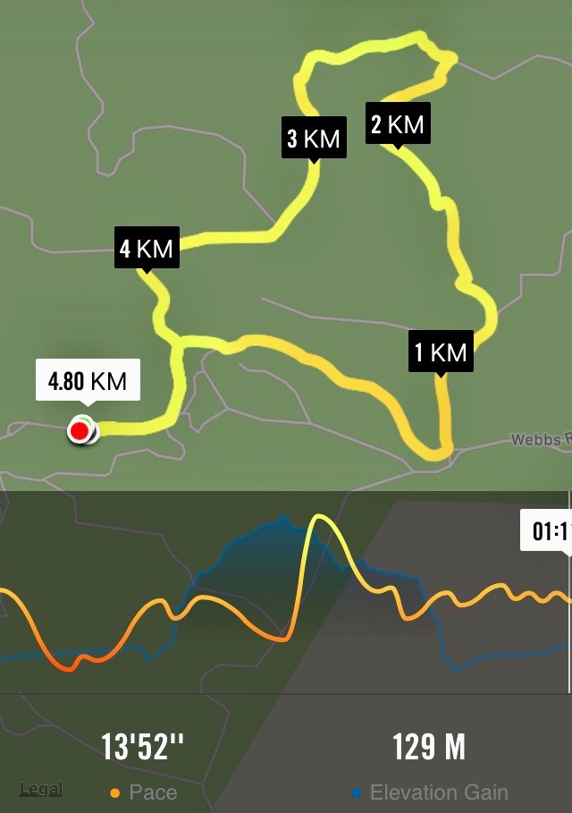
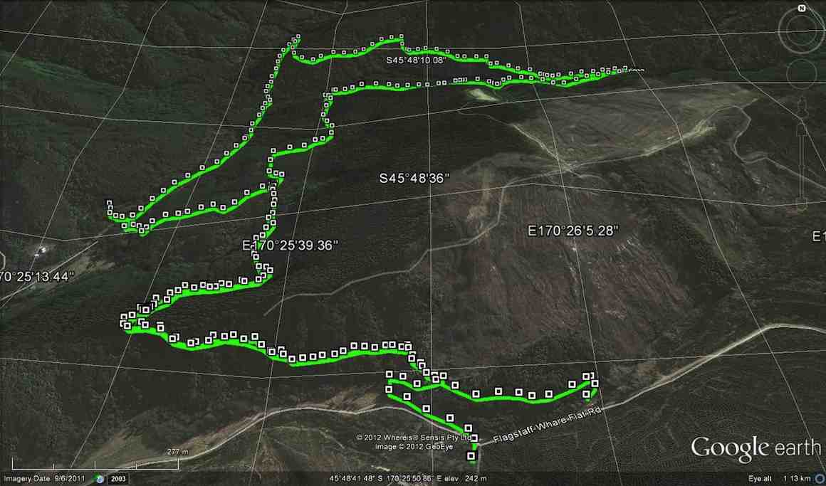
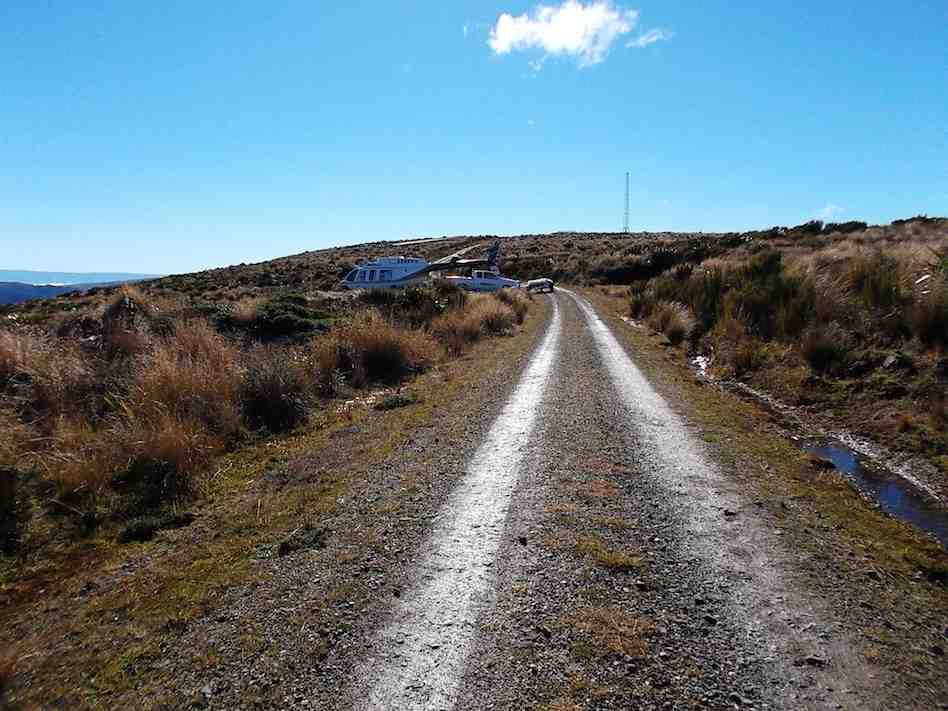
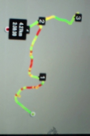
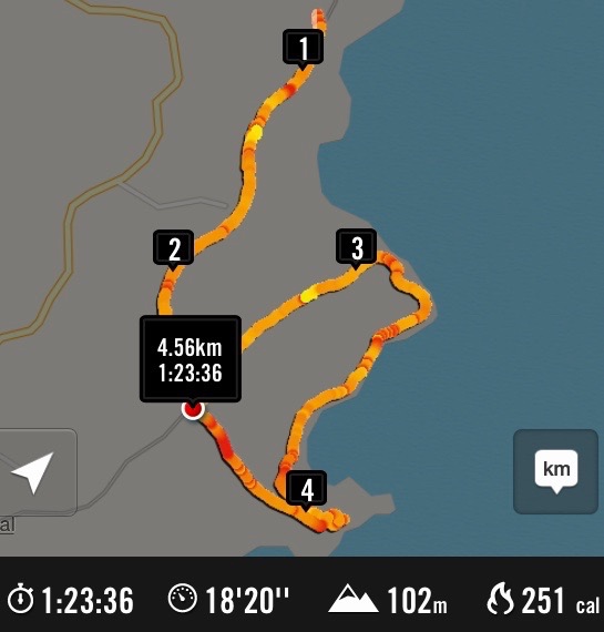
The walk took approximately 2.5 hours and was 7km in length.
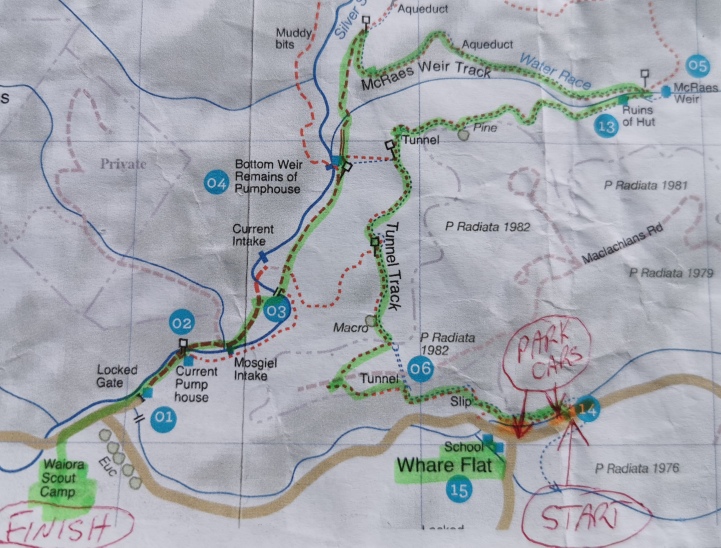
Photo and Caption Kerry – “Where we walked!”
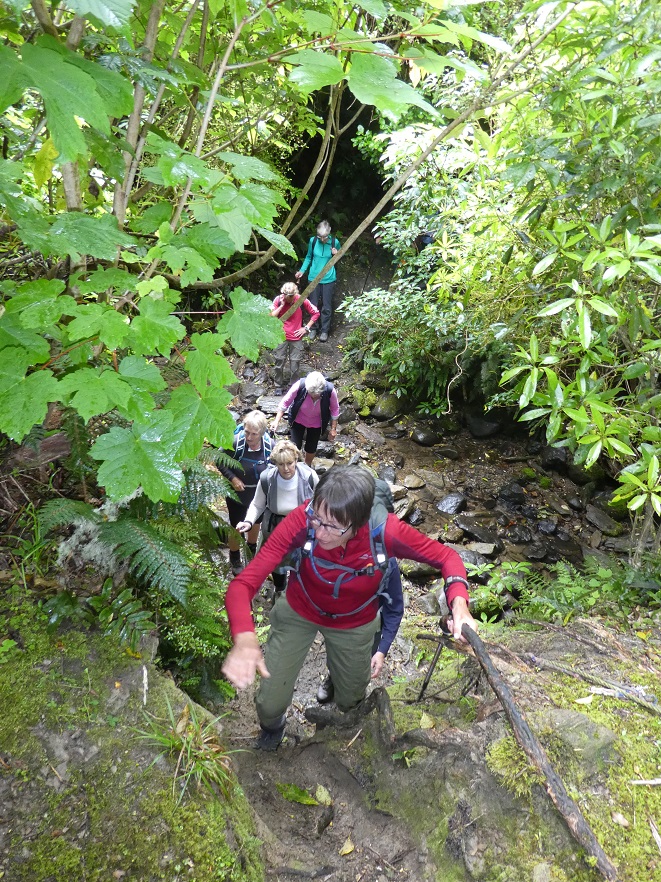
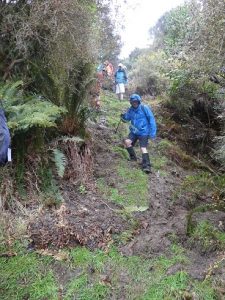
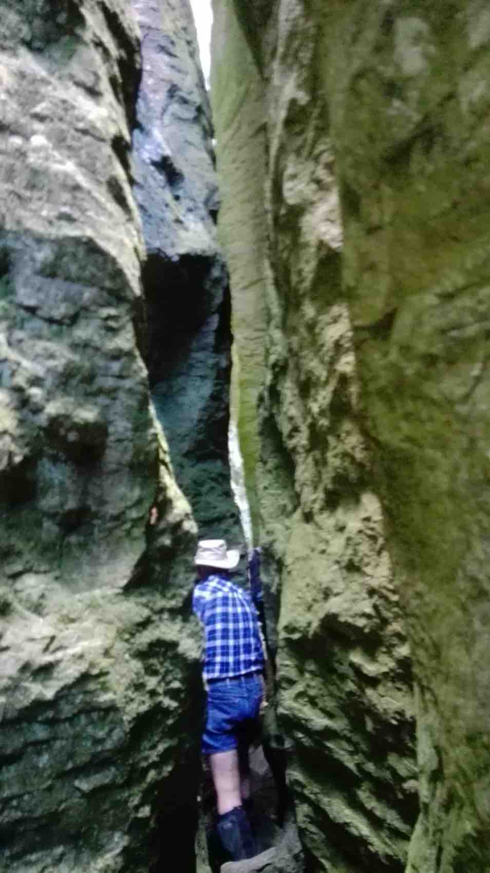
Terrain was gradual and quite easy! With occasional rope climbing.
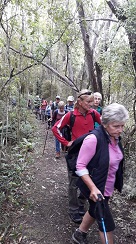
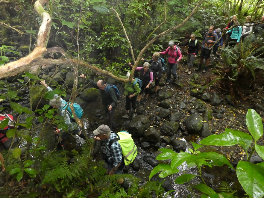
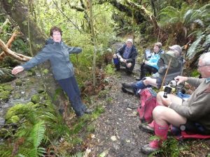
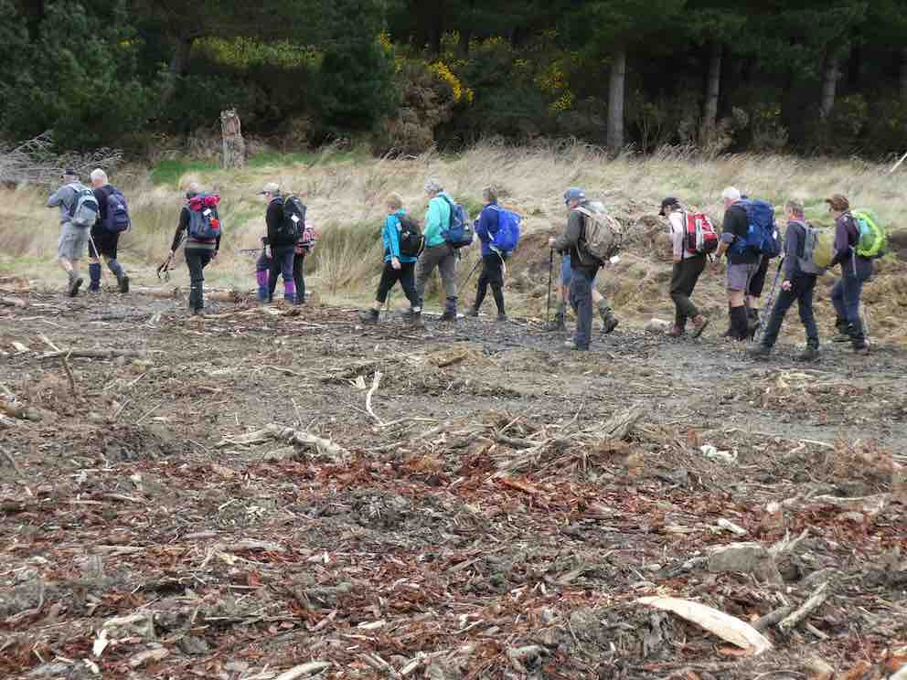
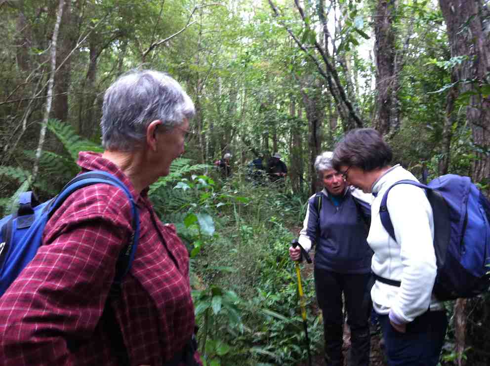
Photo and Caption Helen – “Its good being in one group”Photo and Caption Gordon – “Creek crossing”Photo and Caption Gordon – “Nearing the first pit stop”
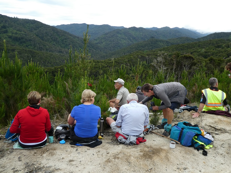
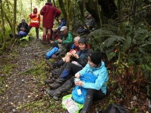
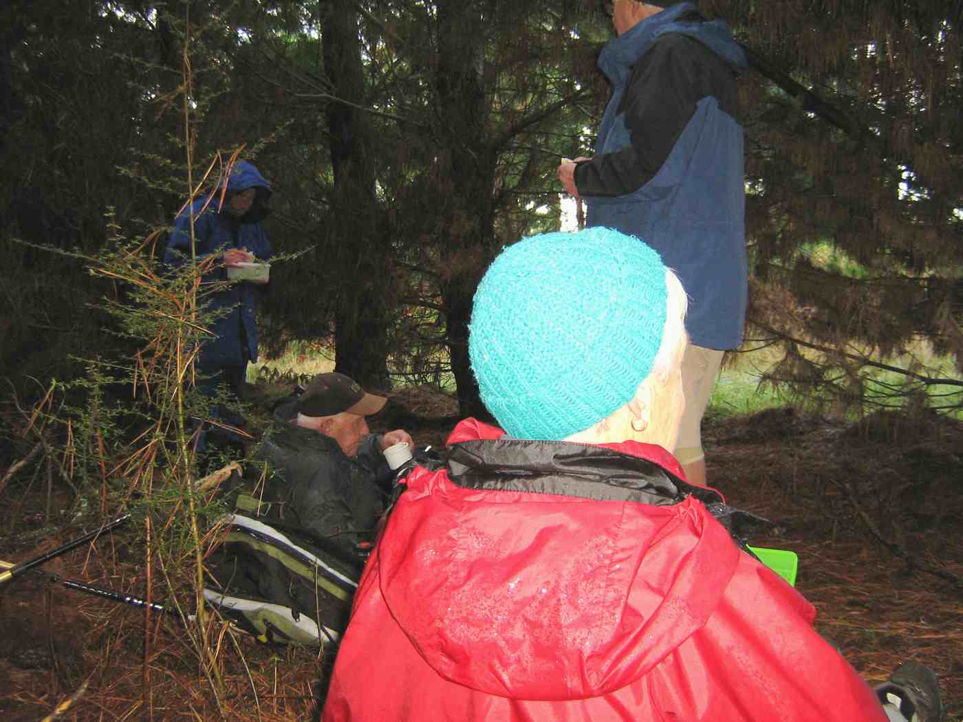
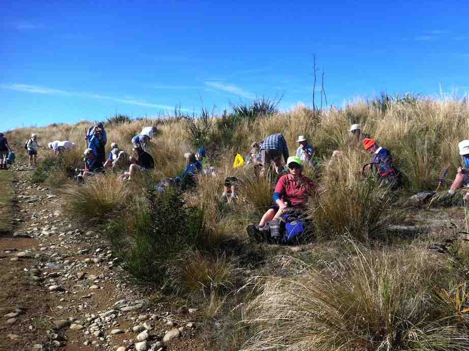
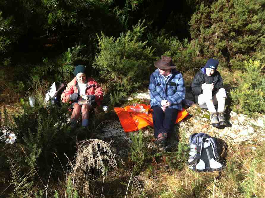
Photo and Caption John – “Morning tea with a view”
Photo and Caption Gordon -“Climbing out of the second crossing with a rope.”
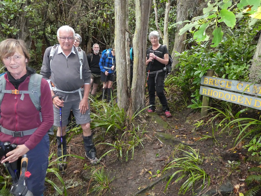
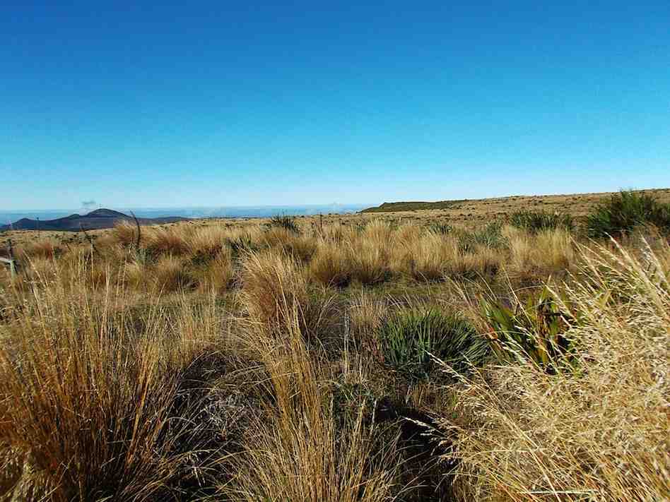
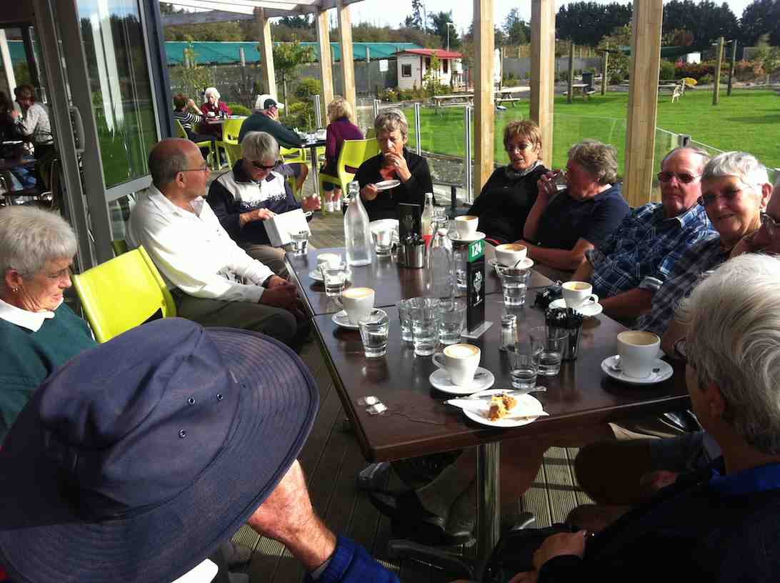
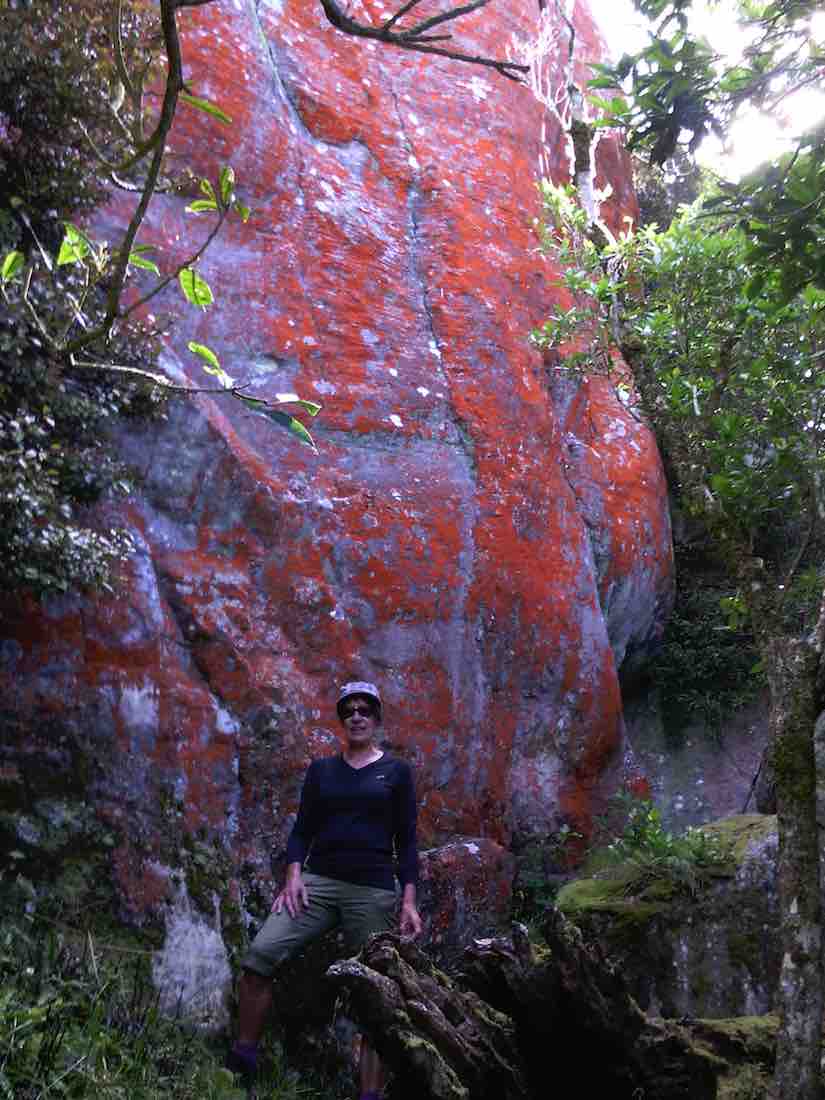
Really enjoyed the cool, sheltered natural bush. Very calming!
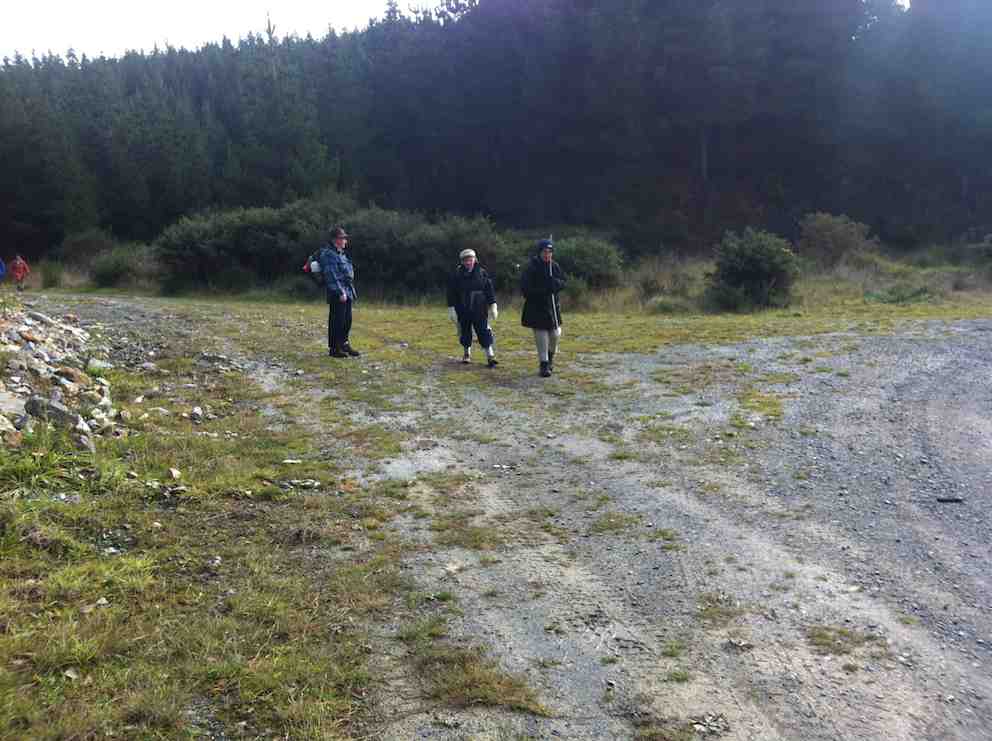
Photo and Caption Gordon – “Heading back to Christmas Dinner”Photo and Caption John – “Waiting for all to arrive before starting”
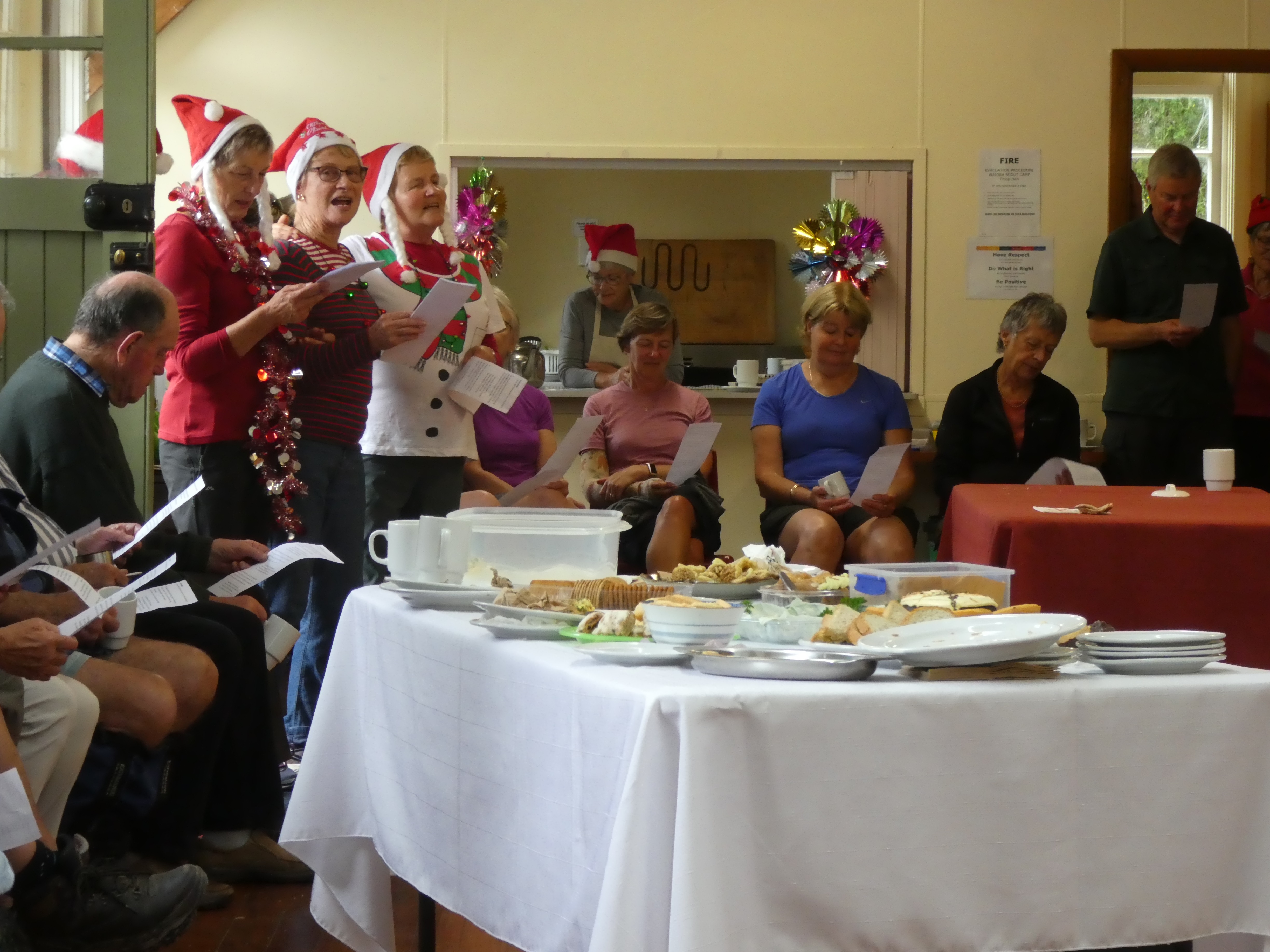
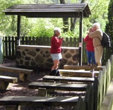
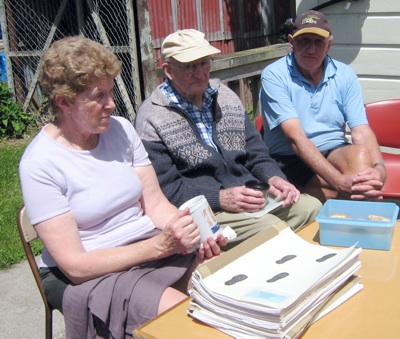
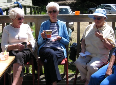
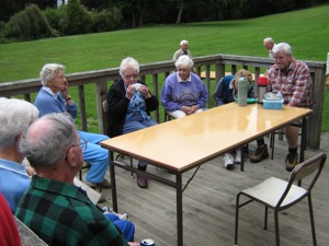
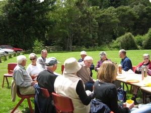
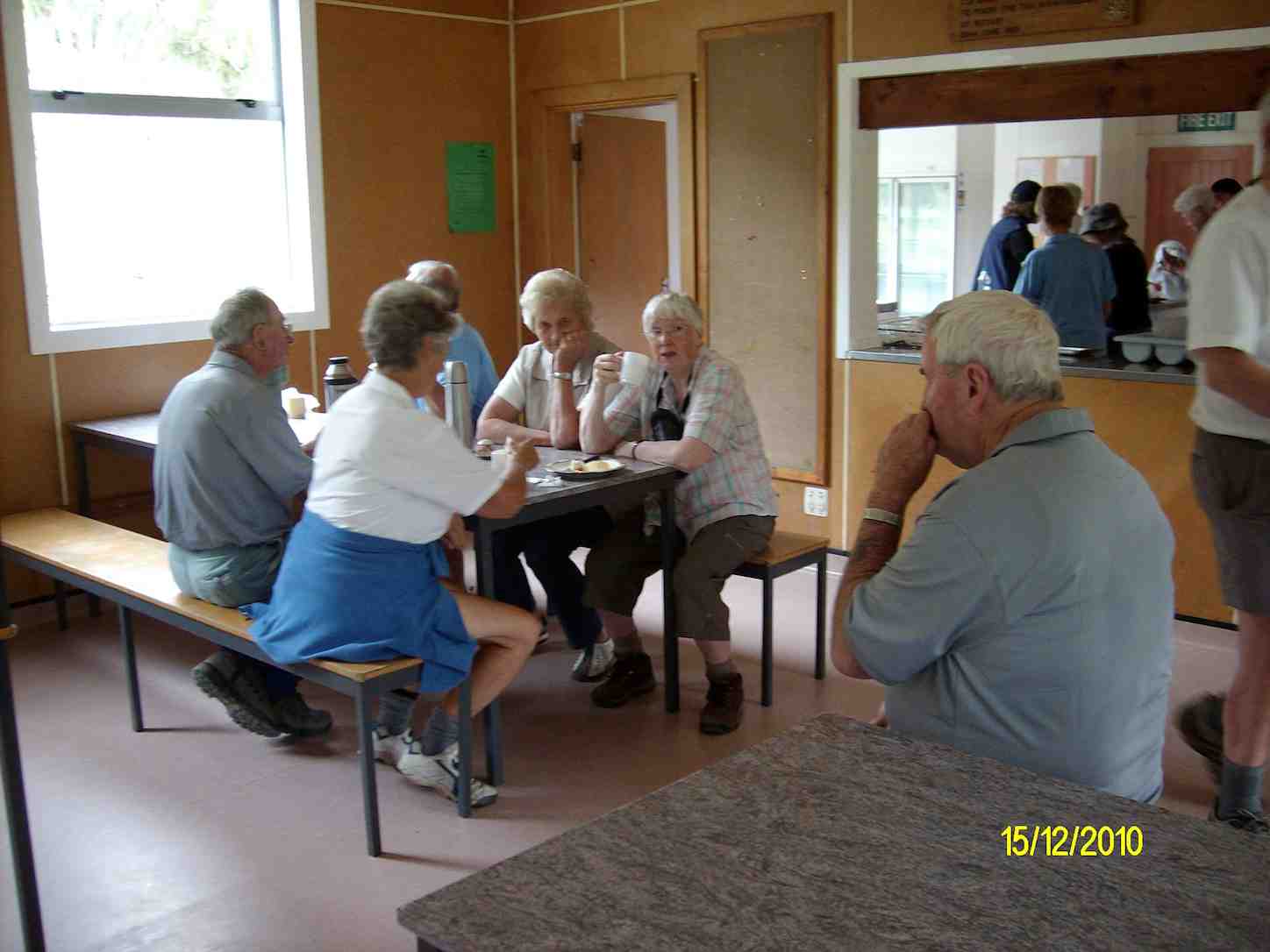
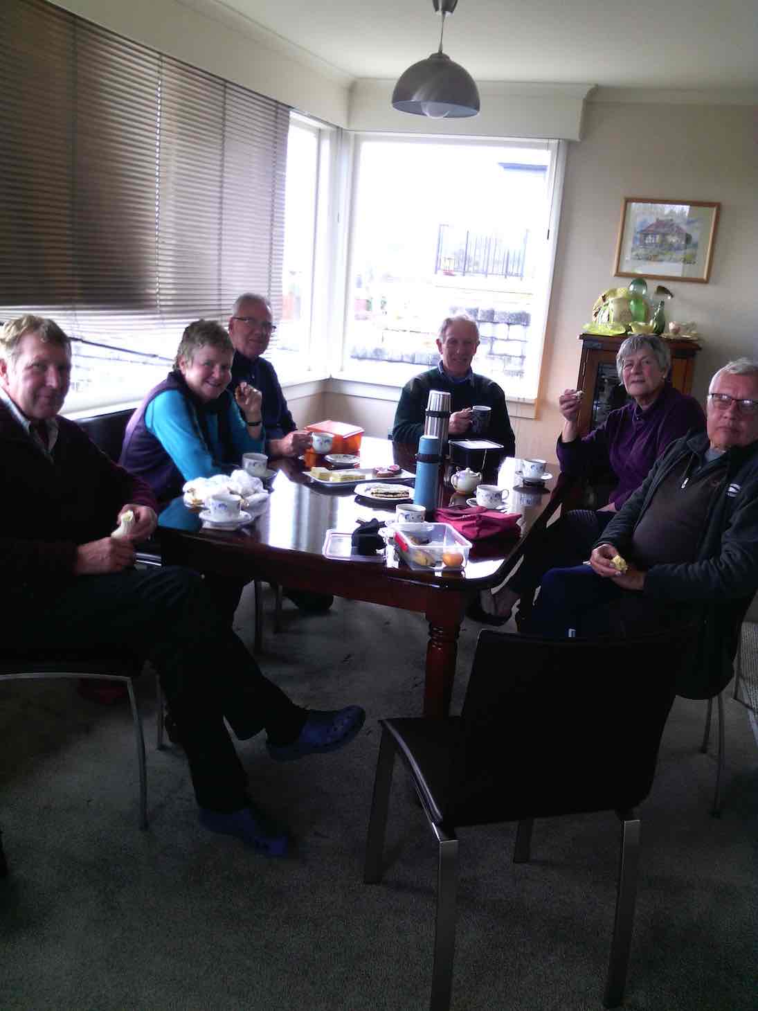
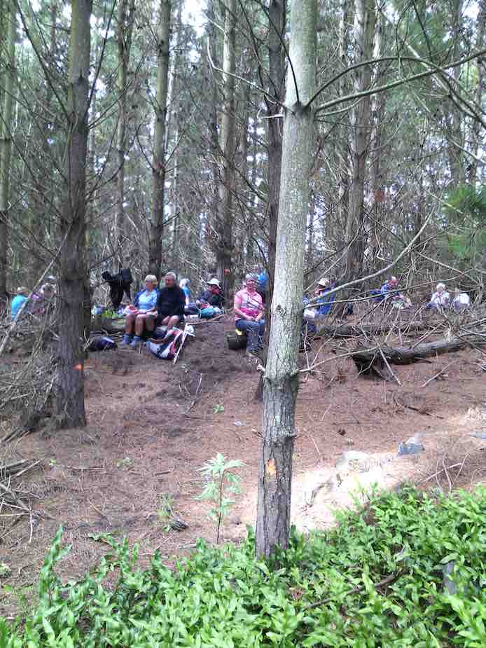
Arriving back at The Scout Camp where camp mums’ Jill and Adi had kindly set up tables with members’ Christmas food contributions. Joined by 10 other members, there was a great spread of food.
Photo and Caption Helen – “A happy gathering”
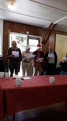
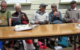
As well as excellent entertainment which included singing and travel experiences.
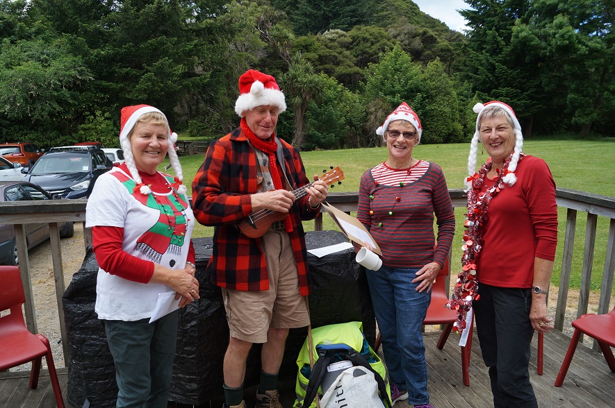
Photo and Caption John – “Practise makes perfect!”
Photo and Caption Helen – “What was my name again!”
I need to take the opportunity to say thank you to everybody for making this day successful and memorable.
Merry Xmas fellow club members
Collage Clive
Regards Kerry Popham
17/12/2008 Waiora Scout Camp. Leaders: Bruce and Marjorie.
Marjorie and Bruce led us on a well-thought-out trip around the Waiora property into corners we had never suspected existed. There were paths/routes to follow everywhere.
Waiora Swimming Hole. Bruce Evelyn Elaine
The swimming hole was large for such a small stream.
We crossed and recrossed the Silver Stream on new concrete bridges.
Morning tea was at the camp fire and chapel area.
After that we went on a more extended walk. Bruce pointed out the mysteries of orienteering on one of the o/posts, indicating the braille-like raised dots on which participants would press their paper to show they had passed that point.
Steep descent. Angela
We passed through grass, some mown short, some longer, some unmown, fresh and soft to walk through.
Then it was back to the cars for lunch.
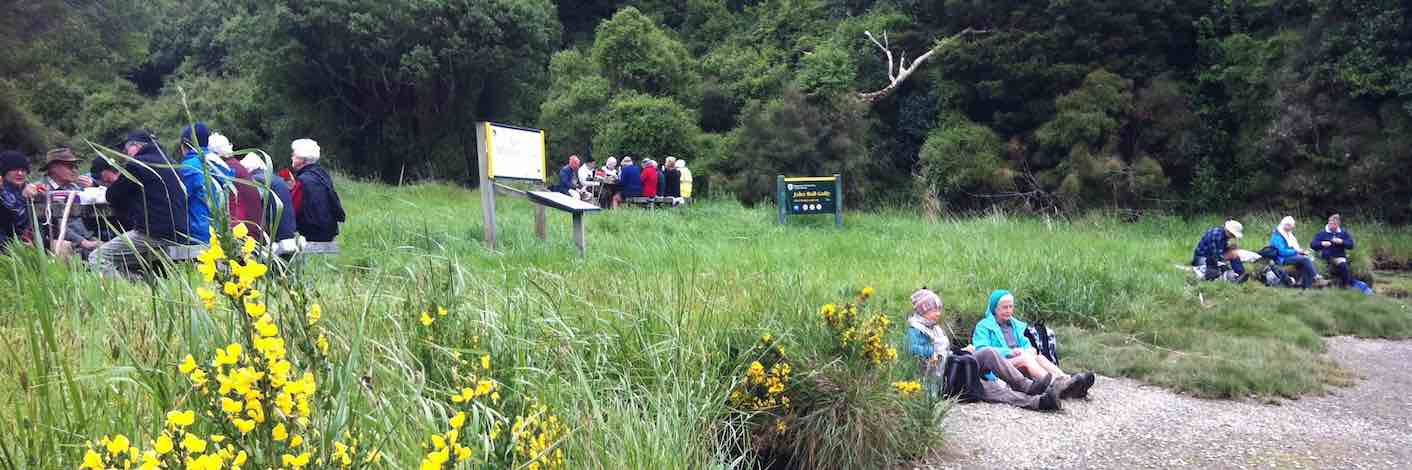
19/12/2007.All. Christmas Potluck Lunch. Waiora Scout Camp and Tunnels. Finger food, cup and plate. Thermos. Leaders: Peter B, Neil, Bob H
We held our end of year pot-luck lunch get-together at the Waiora Scout Camp at Whare Flat.
Peter and Bob H led both groups on a delightful unhurried morning’s walk via the Silverstream Pump House, Tunnels Track
Top over Tunnels. Doug M, Leonie, Marjorie, Lesley, Bruce, Carmel, Evelyn, Who?. Dot B, Ria, Hazel, Bob H
and the old Schoolhouse circuit and back down to the camp. 23 of us did the walk and the noon lunch saw 36 in all turning up for a pleasant sociable occasion.
Awaiting lunch. Doug M, Dot B, Denise, Ngaire, Chris, Who?, Bill. Neil and Bob H behind.
Enjoying lunch. Neil, Wendy, Ken, Ray, Diana, Peter, Bob H, Colleen, Visitor, Nelson, Dot T
Thanks are due to Neil and assistants who remained back and attended to all the preparations at the Troop Den which proved an admirable building for the occasion. Great day, great company, great setting, great finish to the year. – Ian.
Previous days there had been some heavy rain and Arthur took on the task of planning a good tramp, even with a bad weather report for the day. He decided to take us on reasonably dry tracks. The Jim Freeman track was the choice. We wandered along a pleasant track finally reaching Ben Rudd’s shelter for morning tea.
Photo and Caption Gordon – “Smoko in Ben Rudd’s shelter”
The track then headed up to the ridge to meet the Flagstaff Swampy track. The sun was shining with a steady breeze.
Photo and Caption Gordon – “Heading up the firebreak”Photo and Caption Gordon – “Steep bit before lunch”
We walked until we came to the Porky track junction where we had lunch.
Photo and Caption Gordon – “Lunch among the flax and tussocks
We followed Porky’s track down to Possum busters track
and finally back onto the Jim Freeman track – there were a few damp spots! And back to where we started.
Photo and Caption Gordon – “Bruce Campbells Rhododendron dell”
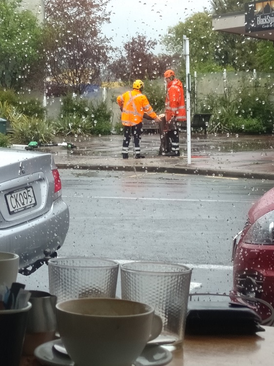
Coffee was planned for Blend. We were all having our coffee and snacks when an enormous gust of wind came with heavy sleety rain which blew a tree over next to Blackstone coffee bar. This provided the icing on the cake!! Plenty to look at and plenty of advice while it got cleaned up.
Photo and Caption Dave – ” Fallen tree in wind gust provides entertainment”
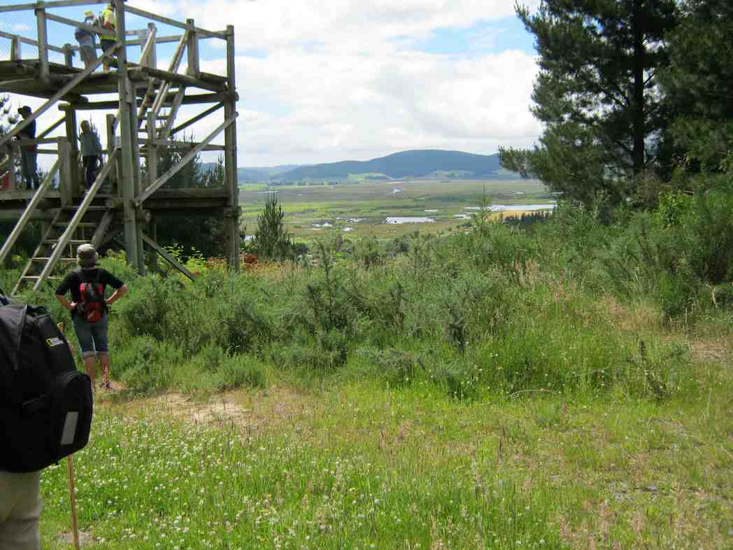
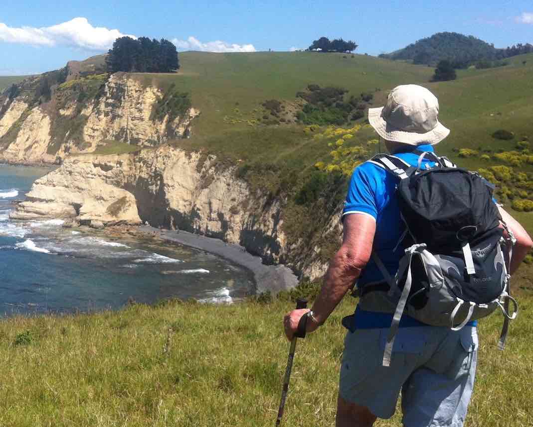
Twenty three hikers took welcomed refuge at the Blue Skin Cafe from the forecast down pour that struck our party a short distance from the cars. The hike was commenced in pleasant hiking conditions on the board walk to the west of Orokonui Lagoon from the Doctors Point Road.
Photo and Caption John – “I’ve seen friendlier skies”
Photo and Caption John – “I think I’ll have a muffin with my coffee today”Photo and Caption John – “Good to be back!”
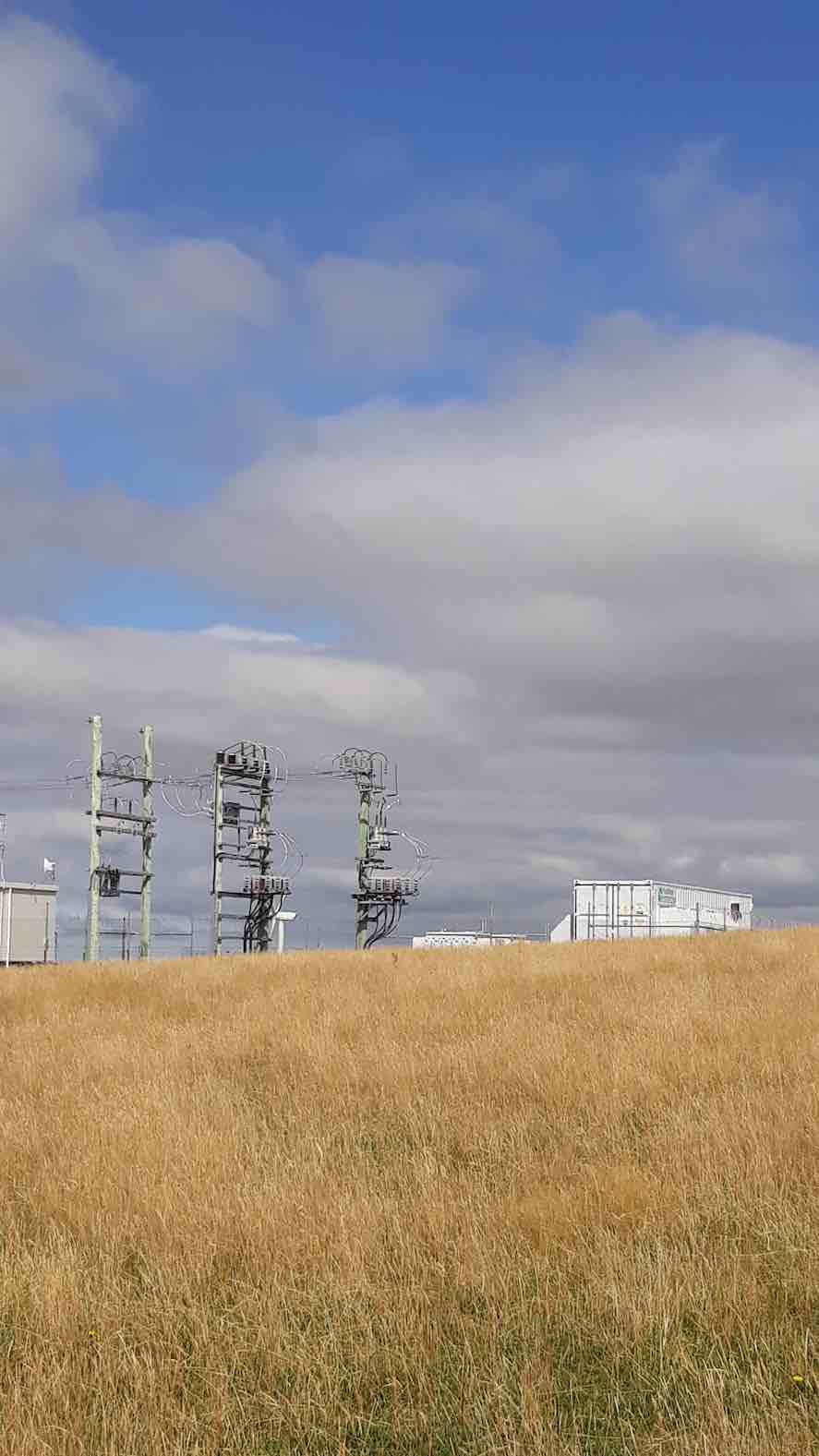
From there it was a morning tea stop by the substation. From there we had foot paths to the Waitati school where it was hoped that a person from the Blueskin Resilient Communities Trust
would provide information on the schools addition of their solar panels, the BEL solar power buy back scheme & their involvement with the Eco House Build that is to be displayed at the Home &
Living show on the 2nd & 3rd of November at Forsyth Barr stadium. This house was constructed by women. It was due to attending to the final details of the Eco house that the BRCT were unable to oblige.
Photo and Caption John – “Enjoying the Opeke track”
The next point of interest was half way up View St we came upon a couple attending to fitting new number plates to a car. The woman who was obviously very proud of this just completed conversion of this vehicle to pure electric. (EV) The bonnet was lifted to show the very neat functional set up which had a range of 140 kilometres. She just had to have a photo of the car & amp;
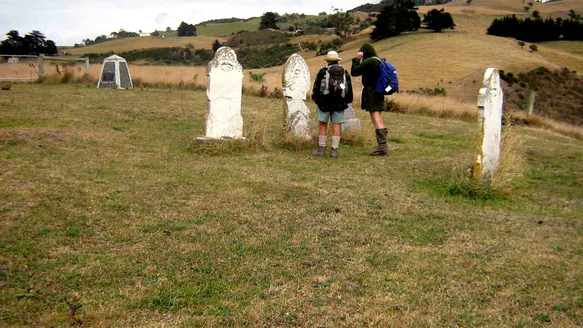
group. At the top of View St we crossed a sheep paddock to the top of the Waitati cemetery.
Photo and Caption John – “So much History”
Photo and Caption John – “Old meets new”
Apart from the final downpour it was a pleasant stroll completing the eastern Orokonui Lagoon walkway to Doctors Point Road up to Opeke for lunch & return to the cars.
Photo and Caption John – “These are the good old days!!”
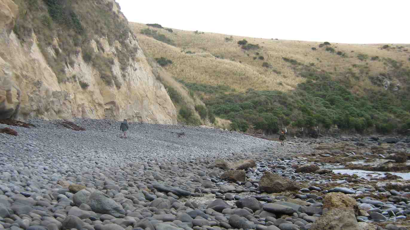
12 clean and dry trampers arrived with poles and putties at Double Hill carpark(after leaving a car at Evansdale) at 10am ready for this downhill track to Evansdale Glen. Due to a shower we swapped a layer for a jacket.
We headed off descending through the manuka with views over the gully down to the dam. (This dark dam along with remaining pipeline was the water supply to the Seacliff Mental Hospital).
Black Gully Dam – Photo Gordon
After the visit to the dam, creek crossings started along this rather rugged, muddy slippery track to a sheltered spot for smoko at 10:30am.
Jill doing balancing act at morning tea – Photo – Gordon
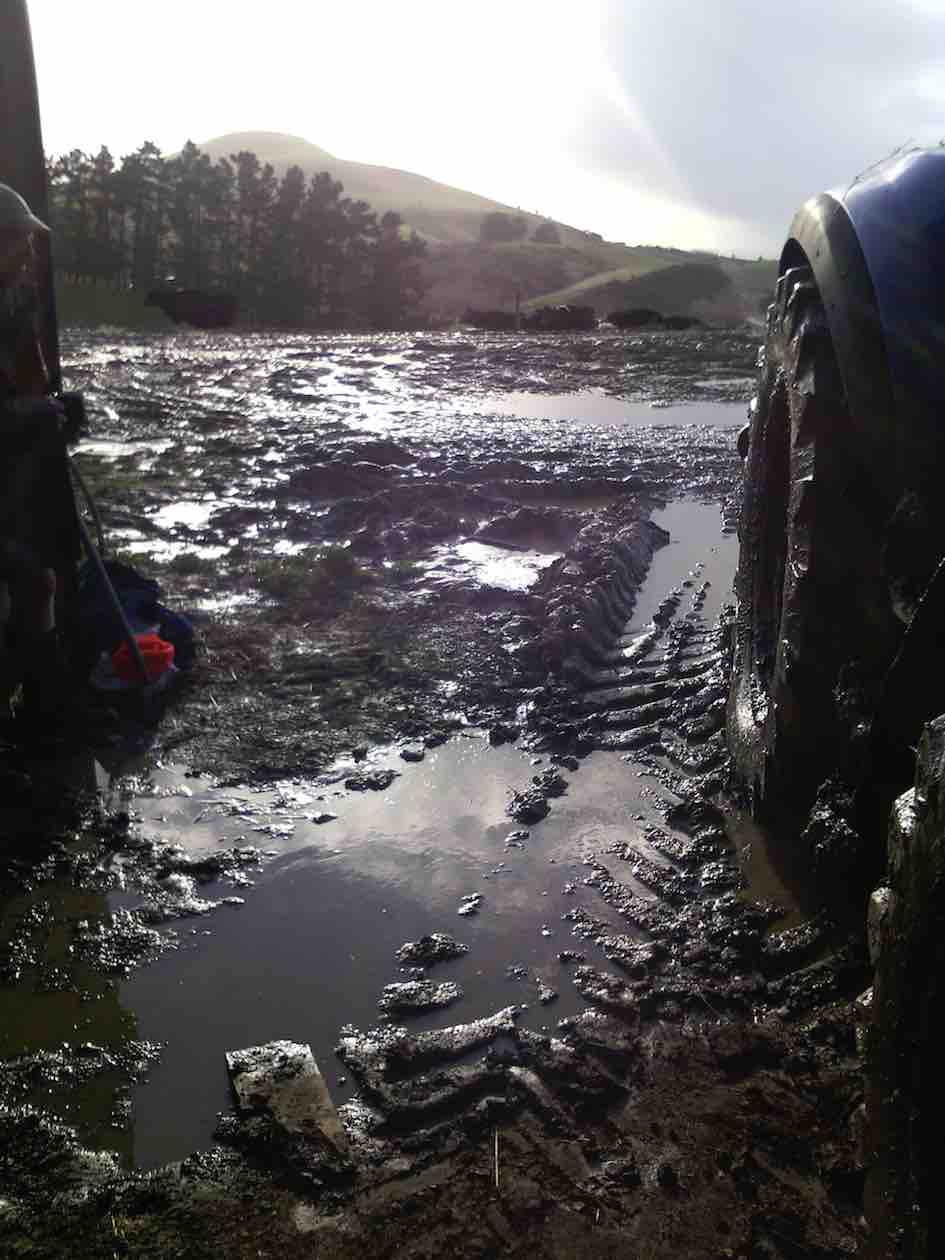
By memory the muddy patches were worse than previous trips, which caused the odd member to slip and have a closer look at the mud!
However, it was great to be amongst such lovely healthy native bush, particularly the fushia and ferns.
We continued crossing Carey’s creek and walking up the creek bed a couple of times for about 50 metres, often negotiating slippery rocks and mud glorious mud! Our leader managed to find an umbrella of branches at 12:30 for a half hour lunch break.
With the majority of crossings over, the track levelled out and soon we were walking through a grass verged track admiring the lime green willow leaves to the glen. Careys Creek crossings were counted by 2 members, both arriving at 22.
Could have been 23, but we walked over the foot bridge at the end.
After arriving at the glen, drivers raced off ahead to pick up cars and drive us to Blue Skin Nursery cafe for our coffee and cake fix.
As always, we all enjoyed the day. For 8 of the group it was their 1st time on this track with our club. We needed jackets on, lucky though, no wind and little rain, mainly drips from the trees. Must admit the putties, pack and jacket were very muddy and took some scrubbing. However, the boots were clean.
In Anthony Hamel’s book, he quoted—“This is a rugged and remote area and the track can fall into disrepair. In 2006 The Green Hut Track Group did many hours of work on this track”. Once again it is very pleasing to see they have been back on the job and apart from muddy patches today, the track is in very good condition(with new steps dug in a couple of places). Thanks for your great effort.
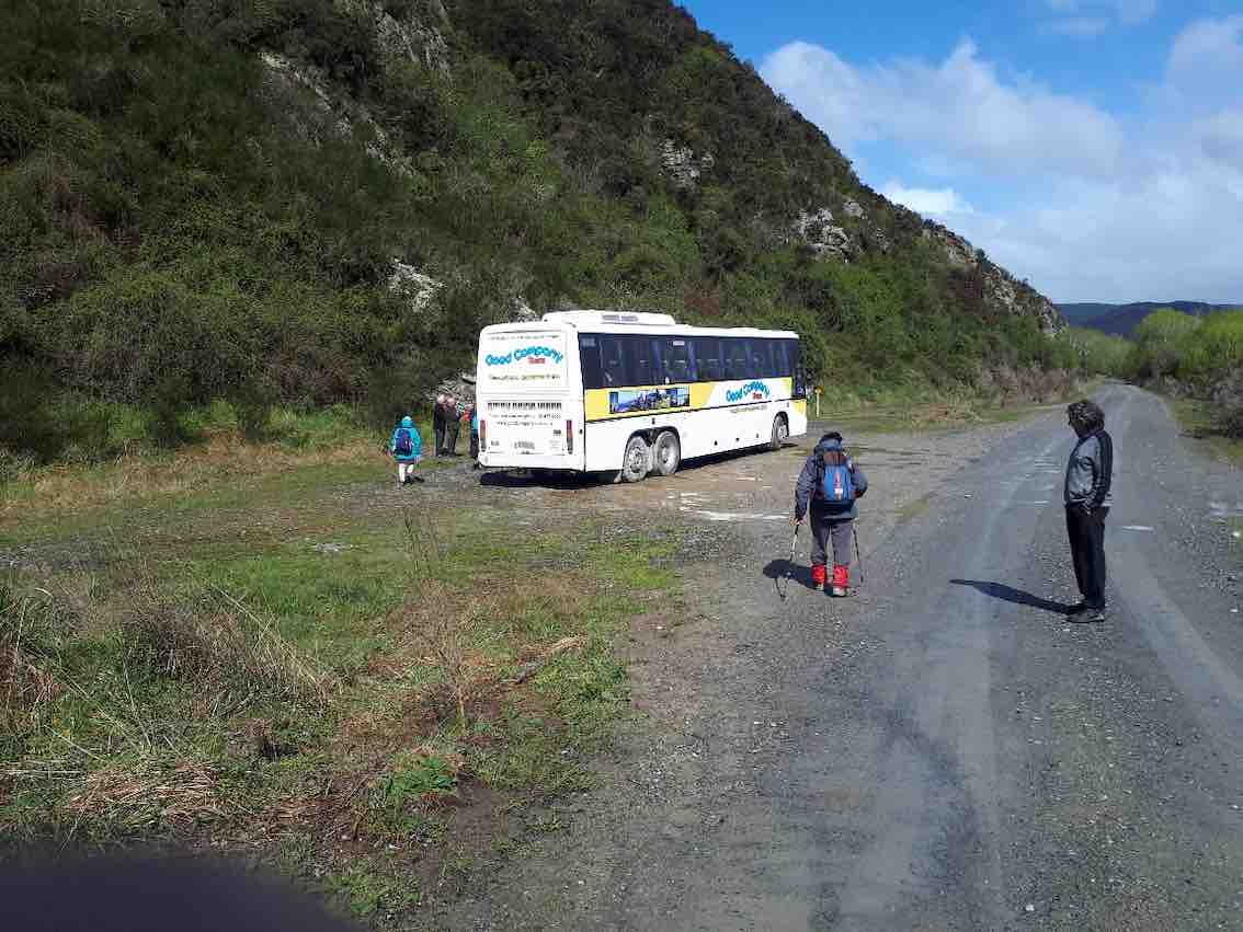
No. 111 on old hardcopy list of 113 club tramps. “Bus Trip. Walk Millers Flat to Beaumont”
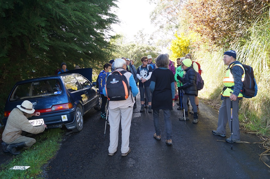
5. 2/10/2019. Both. Bus Trip. Millers Flat/Horseshoe Bend – Beaumont. Rail Trail-Road/ORC Millennium Track-Road. M. Eleanore and Bob.
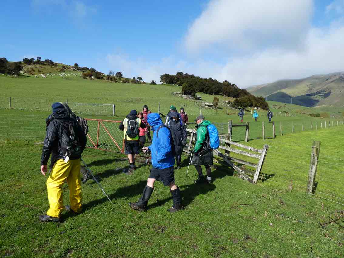
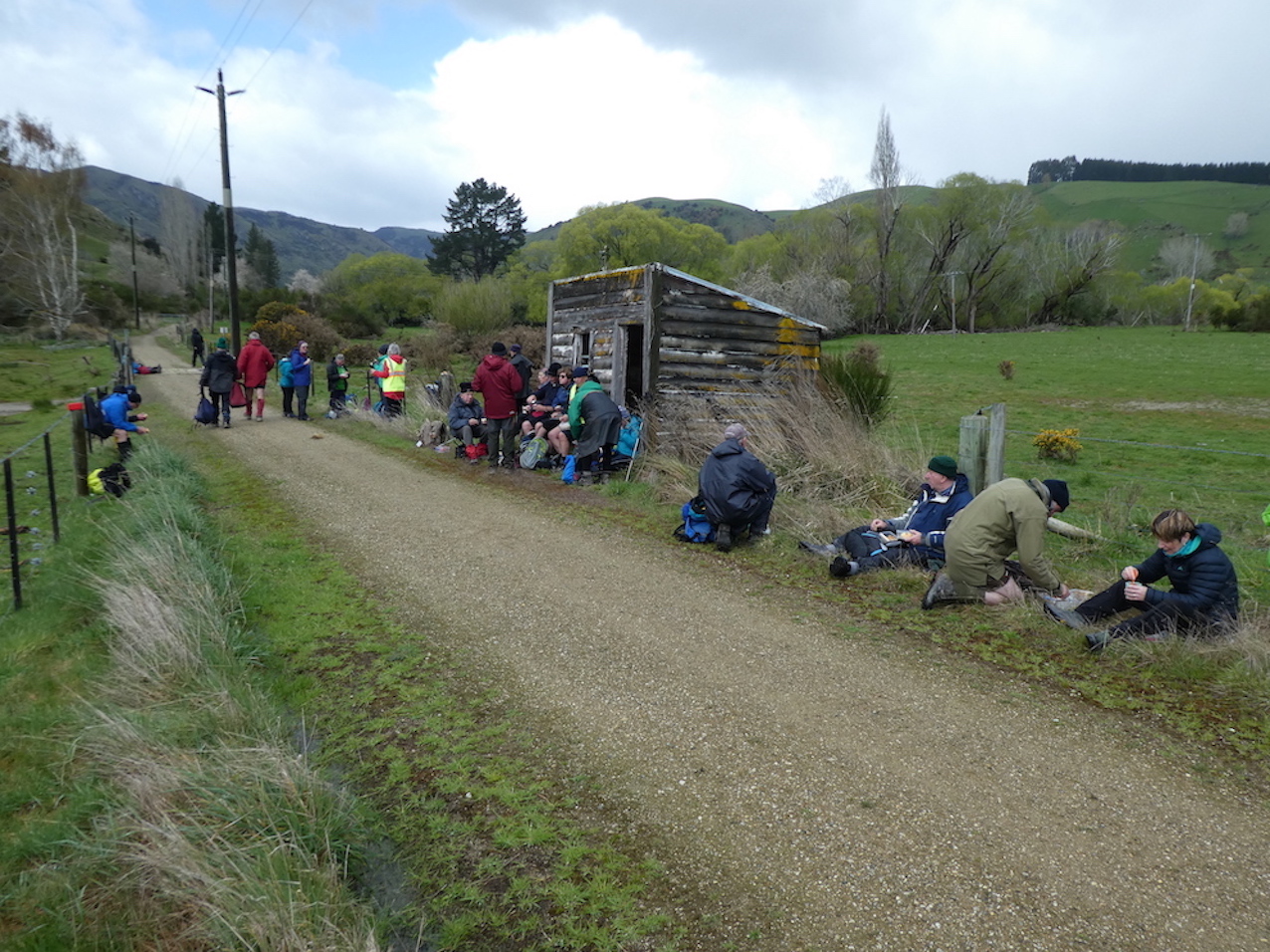
On a chilly spring morning, 45 members assembled at 8:15 a.m. eager to board bus and head Central for a walk along the Clutha Gold Trail.
We arrived at the Island Block entry at 10:10 a.m., luckily to a convenient hay barn where we had smoko.
Is this a farm machinery sale? (morning tea out of the hail). (Phi K. pic and caption.)
This was followed by a show of hands to see who was keen to layer up and head off in a shower of rain—17 accepted the offer to hike 3km round the hill track …
Starting off in a downpour. (Clive pic and caption.)10 minutes later sunshine. (Clive pic and caption.)
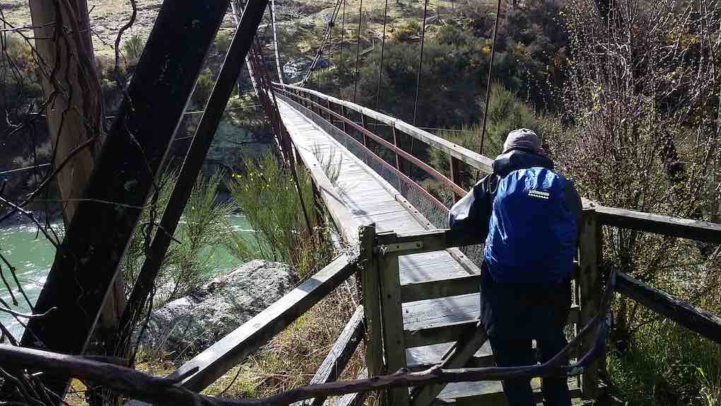
… to the Horseshoe bend swing bridge crossing the Clutha …
Horseshoe bend bridge. (Clive pic and caption.)
… to meet up with the rest of the group.
Meanwhile, we travelled to Millers Flat, crossing the Clutha and turned right heading back down the rather narrow gravel road (managed to meet a twin cab and trailer coming our way, he backed off and let us through). We passed the Lonely Grave site, then soon after arrived at Horseshoe Bend. Car Park was probably not designed as a bus turn, however, Wayne successfully manoeuvred his bus turn.
The majority got off in sunshine
Some of the hardy lot heading to the swing bridge. (Gordon pic and caption.)
to head along the trail. Looking back we spotted the first group hot on our heels.
(John G pic.)
The Ramblers were happy to enjoy the bus trip back to Beaumont where some intended to hike along from the bridge and back. I also heard a whisper on the bus, some were happy to try out lunch at the hotel.
We stopped for lunch
Where/when are we stopping for lunch? (Gordon pic and caption.)
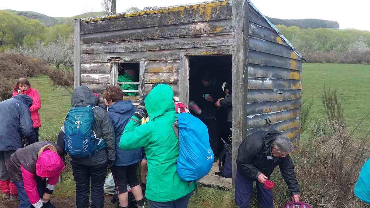
by a little old shed and cattle stop at 12:15 p.m. for half an hour firstly in sunshine,
Very handy lunch stop. (Gordon pic and caption.)
followed by another shower (Lots sheltered in the shed).
Lunch – no one wanted to eat inside this hut until the hail started. (Clive pic and caption.)
We all set off
Preparing to move out. (Gordon pic and caption.)
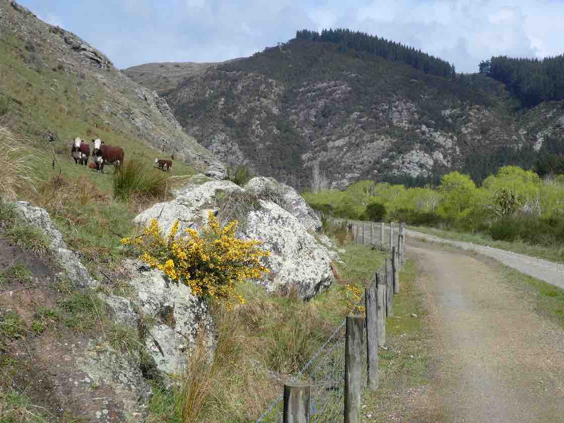
enjoying looking at fresh bright willow leaves, healthy Hereford cows,
Some interested spectators. (Gordon pic and caption.)
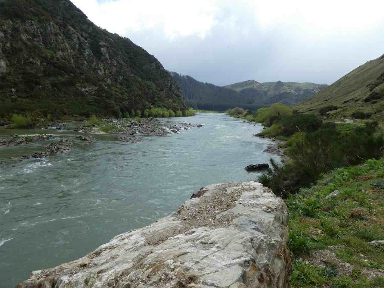
the mighty Clutha,
A very full river not far from journeys end. (Gordon pic and caption.)
blossom
Cherry blossom hike. (Clive pic and caption.)
and particularly the easy grade of the track.
We arrived back to the bus …
We made it. (Eneanore pic and caption.)
… at 3.00 p.m. after a 14km (17km) trot along the trail.
Afternoon tea was pre arranged at the hotel for $10. We were greeted with very friendly staff and a great spread, including scones with jam and cream! YUM. We thanked them and they thanked us for the business. Was great to observe how happy everyone was enjoying catching up with each other. Particularly, with Judy Knox, who was on her last outing before moving to Townsville. I am sure you will come back and visit us Judy. We sure will miss you!!
We arrived home about 5:15 p.m. after a great day out. Thanks to the Club for subsidising the bus.
Eleanore and Bob.
No. 35 on old hardcopy list of 113 club tramps. “Berwick Forest. G Such. Wenita. Nov-April. Year round”
Location: Old Wool Shed: 30 km.
Location: Lodge: 33 km.
click to enlarge
40. 11/9/2019. Trampers, Waipori Forest, Meggetburn. Leaders: Alan and Kerry
22 Trampers set off down to Berwick and left a car at the Government Track car park.5 cars then carried on to the start of the track, by the road, into the Berwick Forest Lodge.
A steady walk up through native bush and forest
1st obstacle. (Gordon pic and caption.)Heading to Morning tea break. (Gordon pic and caption.)
to a welcome morning tea stop.
Morning tea. (Gordon pic and caption.)
Then down hill to the Meggatburn Stream which had quite a waterflow, so it was difficult to cross without getting wet feet.
2nd obstacle– Some wet feet. (Gordon pic and caption.)
Then up we climbed to Shaws Road. The track had been clipped back to allow for easier access. Therefore the track was easy to follow.
Regroup on way to top. (Gordon pic and caption.)
The day started well weather wise but with showers pending,
Heading down to Waipori Gorge for lunch. (Gordon pic and caption.)
we quickly carried on
A couple of budding models on the stone seat. (Gordon pic and caption.)
to a hut for our lunch, near the old Waipori picnic ground which is no more.
Walking out after lunch, we crossed the bridge on the Waipori River
Next stop Wobbly Goat. (Gordon pic and caption.)
and walked down to where the car was parked.Then 5 drivers returned to the rest of the group to collect trampers. Followed by a coffee session at the Wobbly Goat. – Kerry.
39. 12/12/2018. All. End of year. Pot luck meal at Berwick Lodge. Leaders: Peter, Wendy and Dave.
Route map, courtesy Ian. Trampers and most Hikers were led from the Lodge by Dave and Keith along Hook Road, up, up, up Farm Road, left along Old Boundary Road and down, up and back down again along a track through broom, gorse and trees to the Old Wool Shed site on Hook road, and back along it to the Lodge again. Peter led the Ramblers on a shorter walk.Young at Heart – Judy!!! (Dave pic and caption.)
A number of former club members turned up to a well-provisioned finger food meal at mid-day, and bowser a well covered trestle table of books, sale proceeds to go to the new Mosgiel swimming pool. Over 40 of us leisurely ate and talked till President Jill took over. She introduced Bruce who had composed a 4-stanza song to the tune of “The Old Grey Mare, and after lyric sheets were handed out, led hearty singing of it.
Thanks to excellent preparation, Jill had a briefed a number of us to give 2-minute accounts of private trips, local and overseas. These were many and varied. A good ending to the year, at a venue many of us hadn’t visited before. – Ian.
There were 14 keen Trampers out today for a walk in the forest – one member of the group used the word “intrepid” in describing us.
It must be a few years since our Club has tramped this track? Anyway, the cars parked at the usual spot by the old woolshed on the road into the “Berwick Forest Lodge”.
It was noticed that the toilet facilities by the carpark were absent, as about a month ago some “empty head” had burned it down!
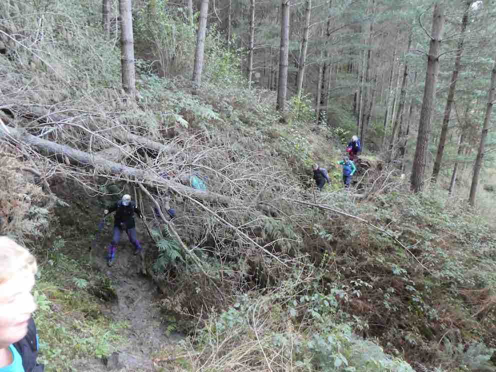
There was a brief paddock walk in the sunshine (sunny all day) before crossing the footbridge over Boundary Creek, to the beginning of the track up into the pine trees. After about 150 yards we came to 6 large trees down over the track, which were successful negotiated by going under, over, or around.
Smoko was taken in a sunny trackside spot, at the appropriate time.
Gathering on way up. (Helen pic and caption.)
Continuing uphill we soon came to and crossed a Forestry Road (Prentice Road). Now descending slowly we eventually came to the Meggat Burn, which was crossed without mishap using a variety of techniques. Electing to just plough through, not worrying about wet feet, and some crossed on the shallowest part of the rock ledge where it was maybe only 3 inches deep. The burn was only slightly up after all of the rain a few days ago.
(Margreet pic.)
While the track was muddy in many places, it was surprisingly good after the quantity of rain that had fallen. Further up there was vegetation, especially gorse, beginning to encroach but not impeding our progress.
The track came out onto a forestry road, Tobermory Road; and in 10 minutes more we reached Shaw Road before 12 noon. Down Shaw Road for a few minutes took us to our lunch spot in a sunny area under the Pole Line that parallels Shaw Road. There was a limited view down on to the Taieri from here, with Hope Hill in the background. We could even see the sea.
Lunch spot. (Helen pic and caption.)
The sunshine was most enjoyable, ideal for lying back forma little nap after eating – one tramper having to be roused to begin the return journey!
Our return followed the same route, some care being necessary descending a slippery clay section before arriving back at the Meggat Burn. All crossed in safety again although a piece of equipment may have been lost?
It was uphill for a little while, and then it was down all the way. It was very noticeable that the leaders were in a hurry to get home (I was at the back of the group here), and not wasting any time – probably they could detect the aroma coming from the coffee shop? But it was just their imagination!
We were back in the lovely sunshine at the cars by 2.30 pm, having tramped 13.5 km for the day’s effort.
The Leader was most gratified to hear that all of the party had thoroughly enjoyed the day’s walk (and talk). Considerable birtdsong was heard in the forest.
As per the usual custom, a stop was made in Outram for refreshments and discussion. And then back to Mosgiel, and then home for boot cleaning duty. – Art.
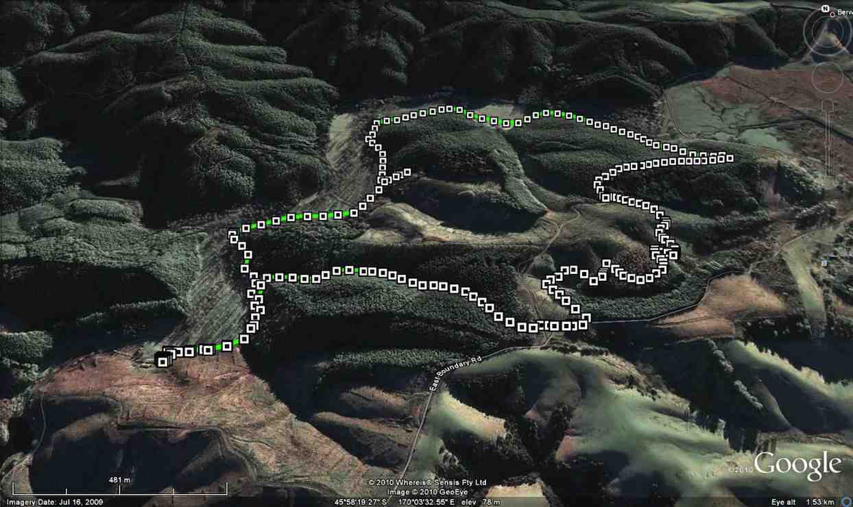
37. 15/12/2010. All. End of year. Lodge, Farm Rd, East Boundary, Old Wool Shed, Lodge. Pot luck meal at Berwick Lodge. Leaders: Peter and Wendy.
For some of us, accustomed to entering Berwick Forest along Terrace Range Rd by the Old Woolshed at the old HQ site, it was a new experience to travel further along the Berwick Road to enter the forest by the sign-posted Webbs Rd and then down Farm Rd, turning left onto Boundary Creek Road to arrive at the Lodge.
The walk took us back up Farm Road.We stopped for tea break at its crest where it crossed East Boundary Rd and continues to Webbs Road.
GPS of route courtesy Ken
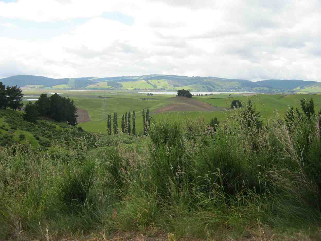
From here we had a good view across to Waipori Lake.
View of Lake Waipori
Almost immediately off Webbs Rd, Peter and Wendy led us along a forestry track paralleling the E Boundary Rd (which you can see on the left of our GPSed route) through Douglas Firs…
Through Douglas Firs
…and blackberry brambles in the more open areas.
Brambles
Interesting foot bridge
The track ended where at a log-loading site we joined up with the East Boundary Road. Turning right, were almost immediately at the two-storey lookout, with its lovely view of the Sinclair Wetlands.
The Lookout on E. Boundary Road.
Boundary Road eventually wound its way around to Terrace Range Rd near the old HQ site by the Old Woolshed.
Further on it was left off Terrace Range Rd onto Boundary Creek Rd, (passing Farm Rd on our left, thereby completing the loop,) and so back to the Lodge for lunch. Good planned timing, Peter and Wendy!
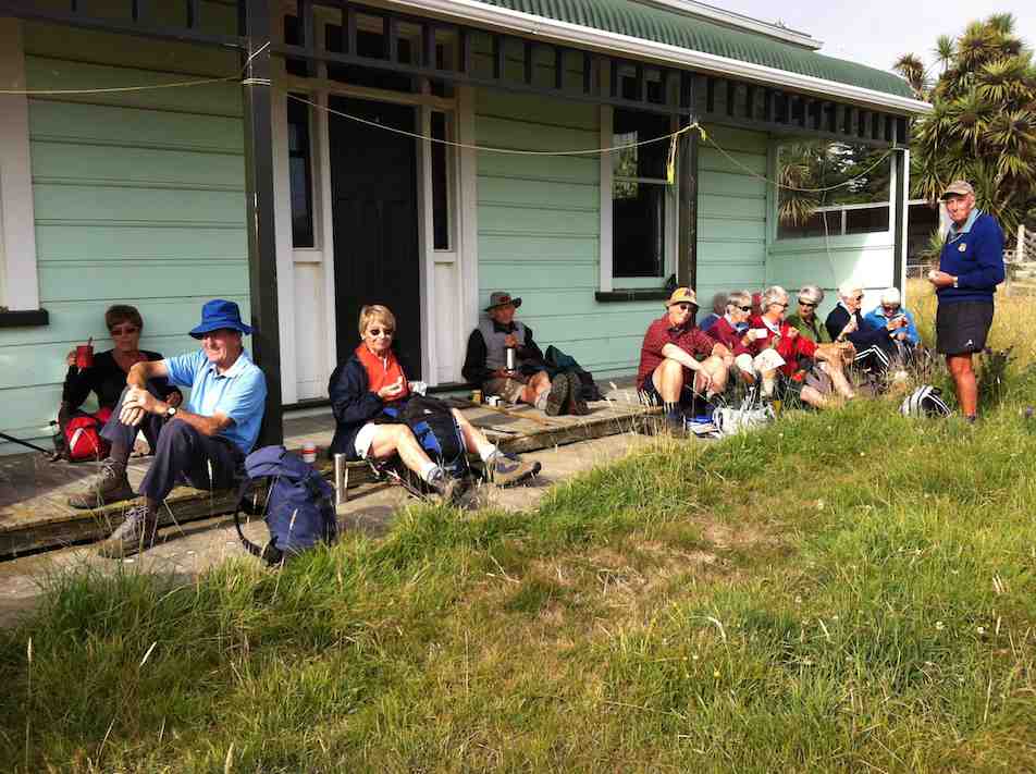
Lunch inside
Peter reported that the tramp was 6kms long and 19 happy trampers took part, with one or two others joining us for lunch and a singsong with Bruce and his guitar.
Bruce leading the singing.
Peter, as Past President, gave a speech on behalf of President Bill who unfortunately could not attend due to ill health, and wished us well for the Christmas season. – Ian
36. 8/9/2010. Hikers. Berwick Forest from Old Woolshed. Leaders: Bob and Evelyn.
35. 13/5/2009 Both. Berwick Forest from old Woolshed. Pink Route. Terrace Range, Shetland Saddle Ridge, Market, East Boundary Medium. Leaders: Ian, Ken.
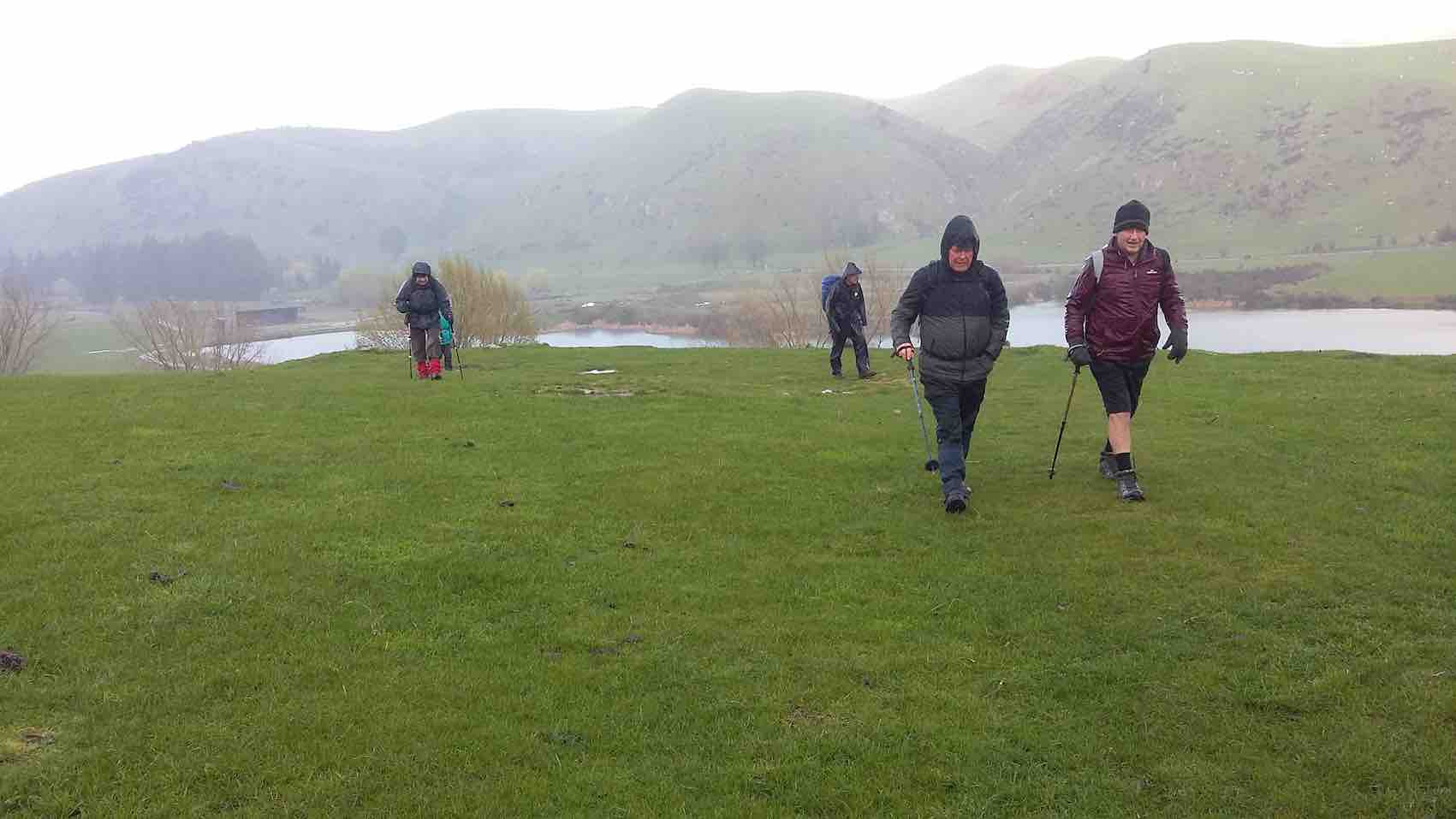
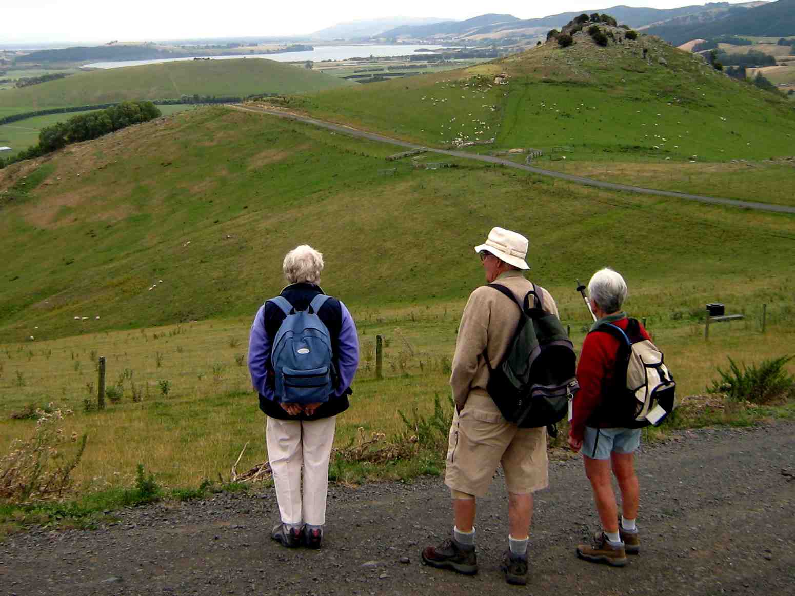
Well, an unusual start to the day. For a wet morning, but promising to clear up later in the day, 10, mostly Hikers, turned up at the carpark and after much discussion forewent the programmed Cleghorn Street-Signal Hill walk, and settled on a Berwick Forest road-walk, because ground everywhere was SO WET. And again, despite a longer walk than usual, it proved that Hikers can do anything, given time-out on the hills.
click to enlarge
Lunch. Ken & Neil stading. Peter & Bev sitting.
We endured one or two showers initially, giving way to cloud and latterly even to sunshine.
Down Shetland-Saddle Ridge. Peter & Neil at back. Bev at front.
It was instructive to witness extensive flooding everywhere and how waterways cope; also the transformations brought about by forest harvesting and re-growth that had taken place over the 10 years since the club last visited the area. Views of the Sinclair Wetlands rewarded the last stages of the day and we got back to the cars just after 3.00 p.m., tired, a bit sore, but triumphant. – Ian.
34. 31/10/2007 Shaw Road?
Although once again, weather report not so good and some cloud hanging around, we left the car park at 9am as usual for our hike in Waipori – Berwick Forest area with high hopes of a good day out. We parked by the side of the road and set off walking along the road then across farm land and up a fairly steep hill.
Morning Tea
Took our time and stopped frequently to admire the view which got more interesting and expansive the higher we got.
Certainly well worth the effort. Had views over Taieri, down to Waihola and over the Wetlands, as well as the hills and valleys round that area. We really enjoyed our morning tea break after our hard slog up the hill. From then on it was fairly easy, pleasant going along forestry roads and through the trees. Found a nice sheltered spot in the sun for our lunch and sat and made the most of the break and rest before returning to the cars the same way we had come. Day turned out to be a good one for hiking. Not too hot at first but warmed up considerably by the time we were on our way back. Another happy day for hikers. Bev.
32. 12/9/2007. Trampers. Berwick Forest from Old Woolshed. Medium. Leaders: Doug J, Tom
31. 7/6/2006. Old Woolshed to Shaw Road, return. Leaders: Bob H and Arthur H.
30. 7/6/2006. Both. Berwick Forest Lodge. Leaders (Medium): Bob H, Arthur H, (Easy): Margaret D, Val.
29. 14/12/2005. End of Year. All. Berwick Hall. Bring a plate. Leaders: Lance and Lois, Lesley S.
28. 26/5/2004. Old woolshed at Berwick to Waipori Return. H.Started from the old woolshed, through the forest, Meggat Burn to Shaw Road, and down the track to the picnic ground near the Waipori River Bridge to have lunch there. Returned the same way. It must have been a long, tough tramp to do that. (Recalled by Art.)
27. 18/12/2002. End of Year. All. Berwick Forest Pre-Christmas Tramp. Finger food lunch and flasks, wet or fine. Leaders: Bill H, Lesley S, Wendy J.
26. 19/12/2001. End of Year. Combined. Berwick Forest. Pre Xmas Tramp. Finger food lunch and flasks. Leaders: Graham, Bill H, Wendy J.
25. 13/12/2000. Berwick Forest – Pre-Xmas Tramp. Finger food lunch and flasks. Leaders: Margaret and Les, Bev H.
23. 16/2/2000. Berwick Forest Circuit. Leaders: Barbara McC, Mary L, Sabina.
22. 15/12/1999. Pre-Christmas tramp and lunch. Berwick Forest. Wet or Fine. Finger Food and Flasks. Leaers: Margaret and Les, Colleen.
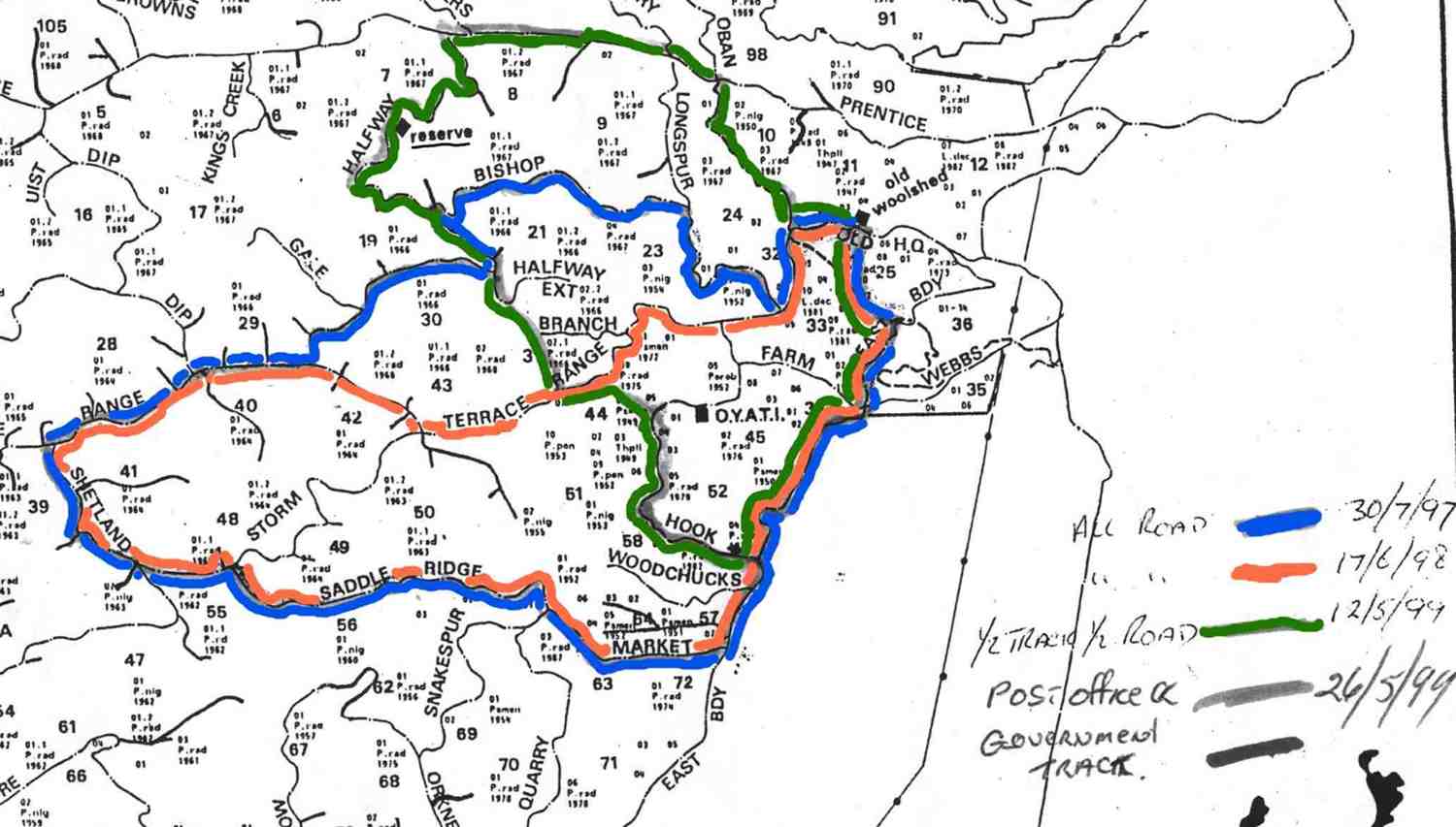
21. 12/5/1999 Old Wool Shed. Green Route. Half track, half road. East Boundary, Hook, Halfway, Prentice, Oban, Ret. Leaders: Claude, Lex, Molly.
20. 3/2/1999. The Circle at Berwick Forest. Leaders: Jack R, Pat, Hazel.
19. 19/8/1998. Berwick Forest Tramp. Leaders: Les W, Eleanor.
18. 13/5/1998. Berwick, Shaws Hill, Hayes Woolshed. Leaders: Bill H, Lesley S.
17. 17/6/1998. Old Wool Shed. Pink Route. East Boundary, Market, Shetland Saddle Ridge, Terrace Range, Ret. Leaders: Graham, Claude.
16. 30/7/1997. Old Wool Shed. Pink Route. East Boundary, Market, Shetland Saddle Ridge, Terrace Range (Part), Halfway (part), Bishop, Longspur, Terrace Range (part), ret. Leaders: Graham, Claude, Les W.
15. 19/3/1997 Waipori Gorge to the Megget Burn stream, Berwick. Leaders: Molly, Diana and Ray
14. 12/2/1997. Woolshed Shaws Hill and return. Leaders: Colleen, Ted, Sabina.
13. 13/7/1994Berwick Forest Woolshed to Waipori and return.Leaders: Molly, Dot T, Graham, Frank
12. 31/3/1993. Berwick Forest. Medium. Leaders: Jack R, Barbara McC, Mervyn, Doreen.
11. 17/6/1992. Berwick Forest walk. Average. Leaders: Mary Y, Nola, Doreen, Mary McG
10. 25/9/1991 Berwick Forest and Native Reserve. Average. Leaders: Dot B, Jean Y, Denise
9. 10/7/1991 Berwick Forest Woolshed to Waipori. A good winter tramp. Average. Leaders: Eric & Dot, Ray, Joyce I, Catherine T
8. 11/10/1989. Berwick – Shaw’s Hill Road. Easy. Leaders: Joyce I, Joan A, Norman.
7. 6/9/1989 Berwick Forest. Average. Youth Camp to Native Reserve. Leaders: Ria L, Peg C, Peggy A
6. 7/6/1989. Berwick Forest from Forest Headquarters. Sheltered pine walk. Leaders: June W, Ria, Peggy, Peg
5. 14/5/1989 Waipori Gorge to Meggetburn stream, Berwick. Bush and Pine walk. Leaders: Daphne, Helen W, Mavis
4. 3/2/1989. Berwick Forest – The Upper Circle. Incorporates the Otago Youth Adventure Trust training track. Leaders: Jack, Pat, Hazel.
3. 21/9/1988 Berwick Forest from Old Woolshed to Boundary Creek and O.Y.A.T.I. camp. Leaders; Kees and Ria, Doreen.
2. 22/6/1988 Berwick Forest from the Woolshed. Back early for barbecue. Leaders: Dave and Jean
1. 13/4/1988. Berwick Forest from Shaw Hill Road. Leaders: Hugh, Jean Y.
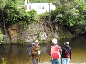
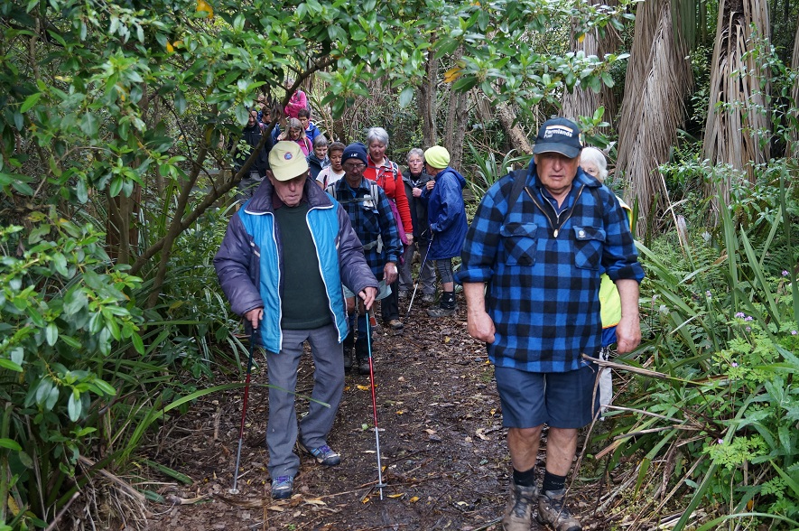
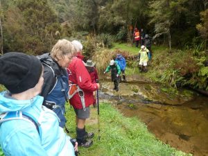
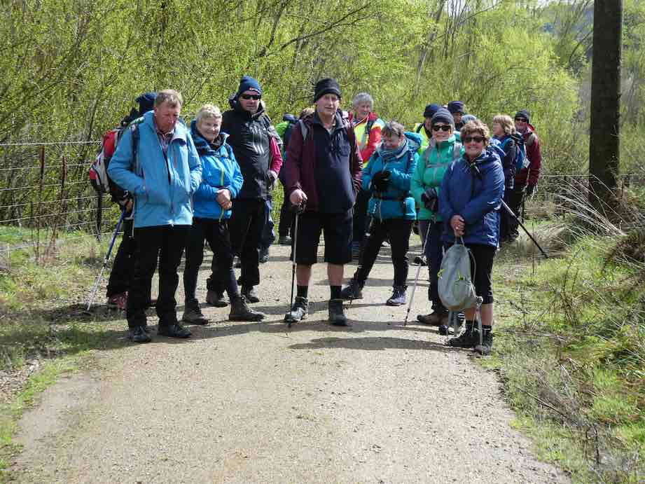
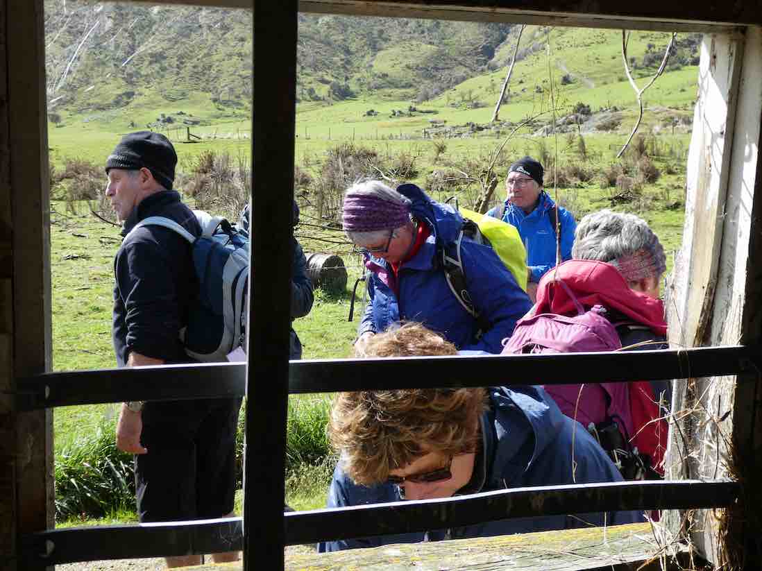
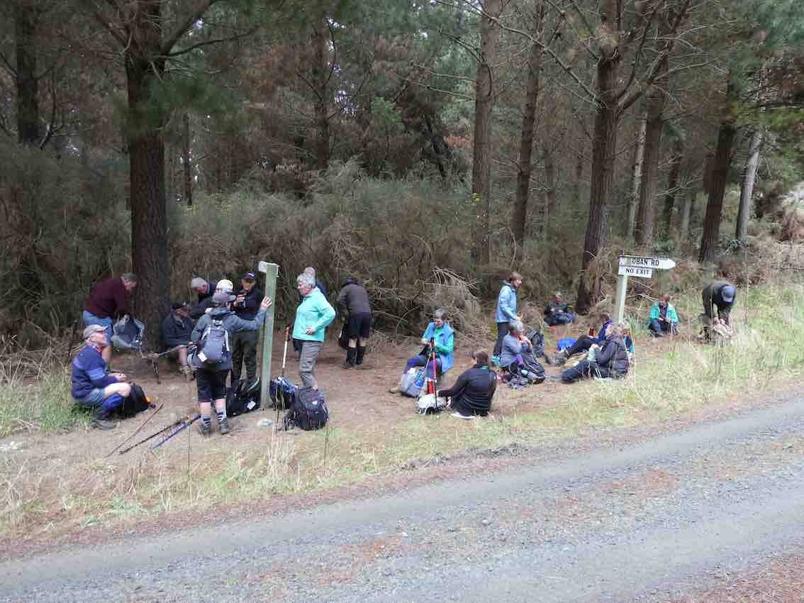
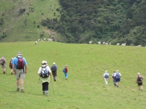
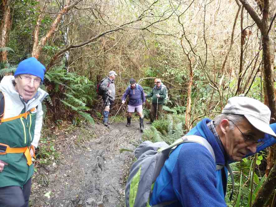
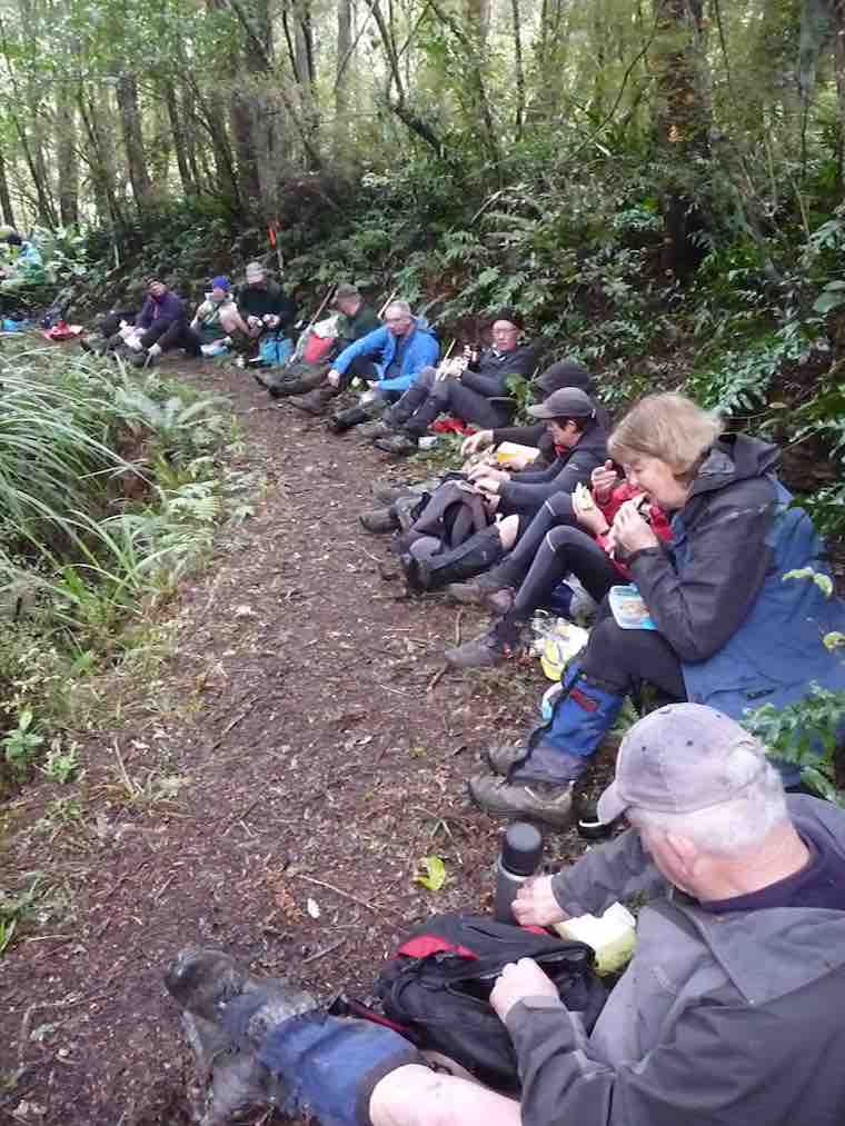
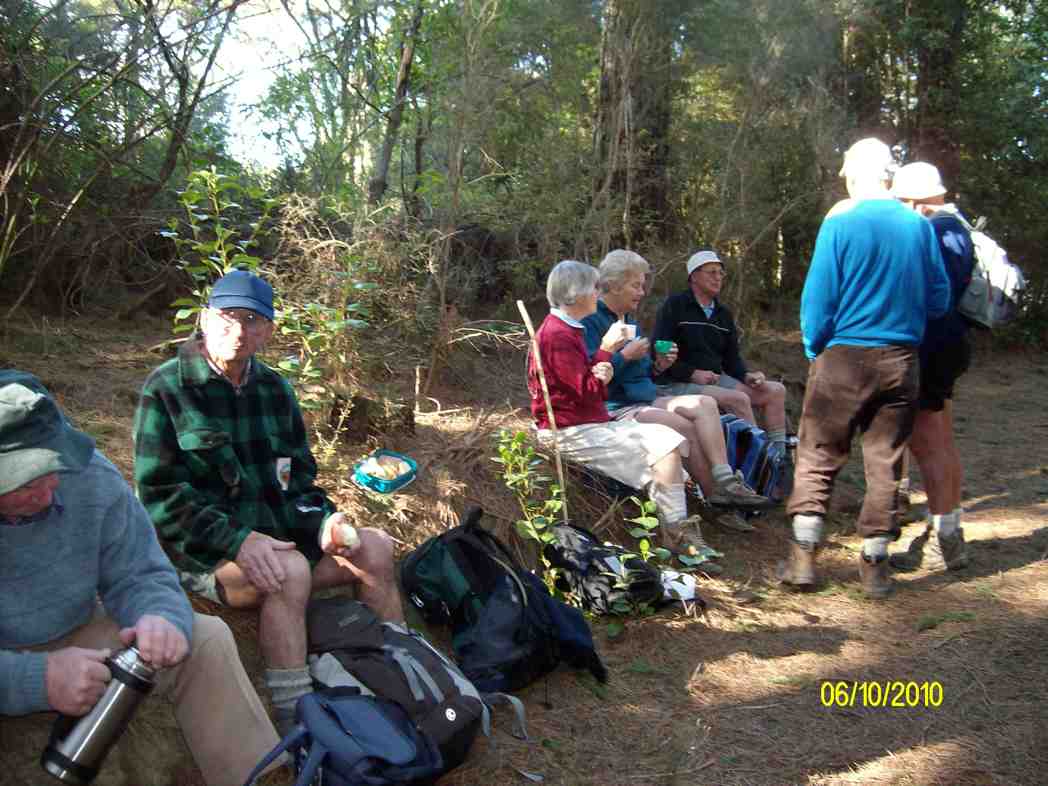
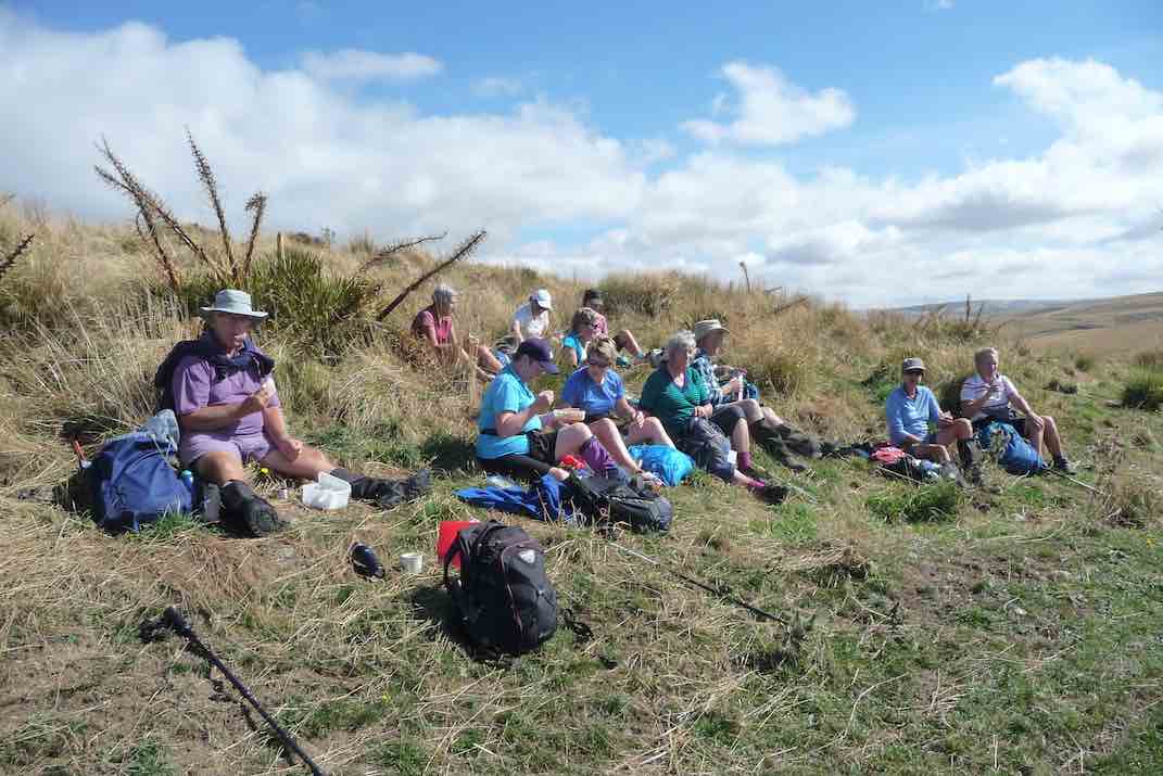
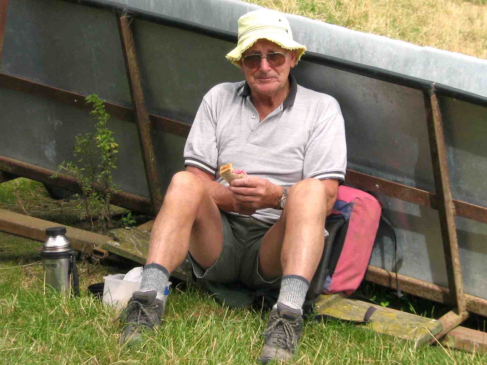
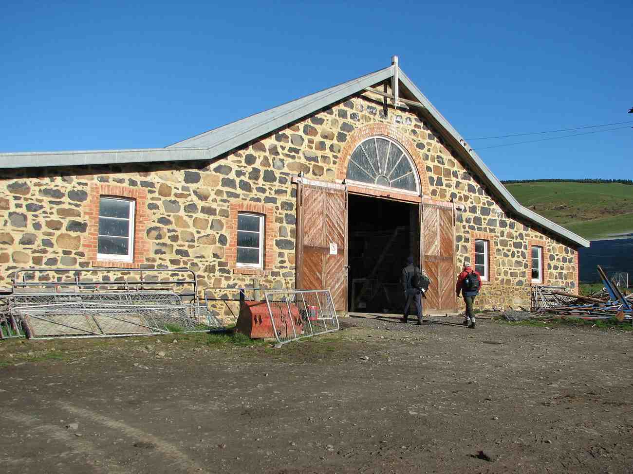
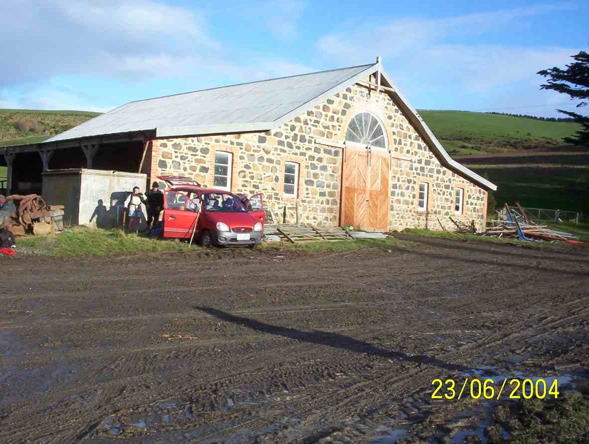
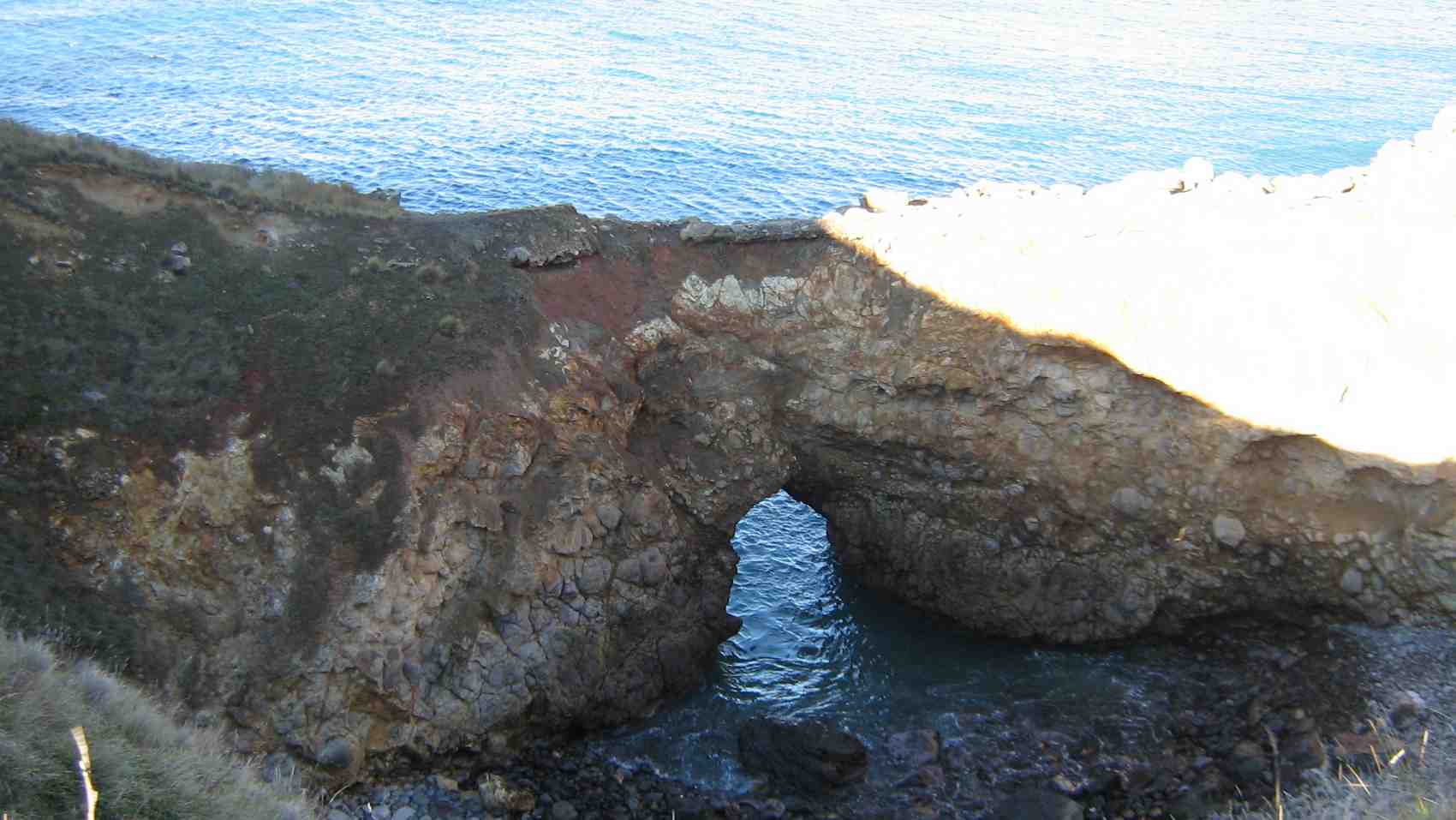
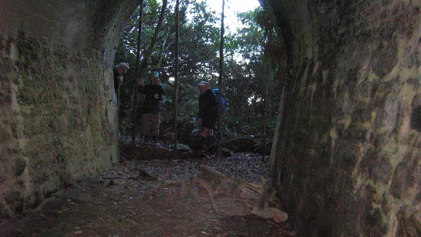
The threatening weather report did not deter 16 keen trampers’ from turning up ready for a walk. The trip to Mt Watkins was postponed because of some of the track’s lack of shelter to the elements. It was decided to walk the tunnel and raceman’s tracks becausethey are in the shelter of native bush.
We parked and left from the school house area on Whare flat road. The tracks were in very good condition but a bit wet and muddyin places.
That was a tricky bit. (Gordon pic and caption.)Careful Don’t slip. (Gordon pic and caption.)
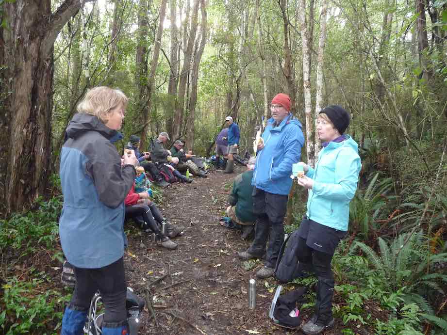
It was pleasant walking along the track adjacent to theold water race. Morning tea was appropriately had along from one of the tunnels.
Putting the world right over morn. Tea. (Gordon pic and caption.)
The Silverstream water race was built between1877 and 1881 and consisted of nearly 30km of open races, sluices, tunnels and weirs. In 1920 a pump was installed. Later pipes were partially in stalled with little success. It was abandoned in the 1960s.
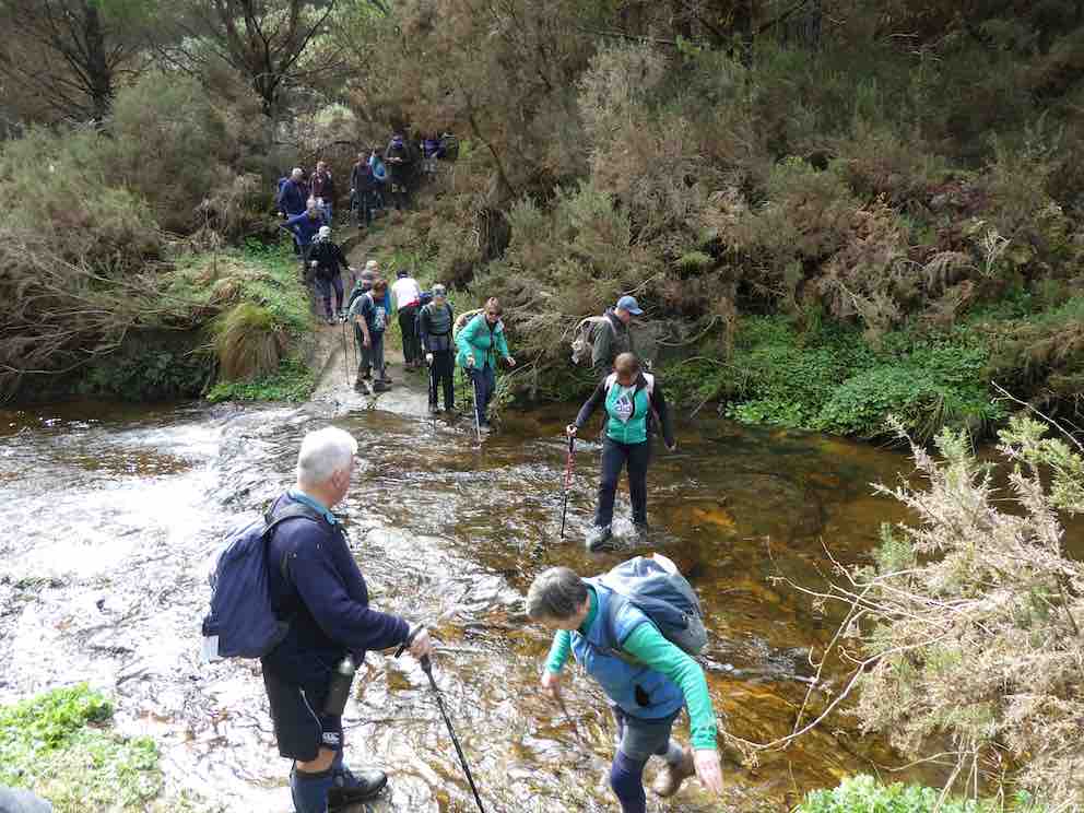
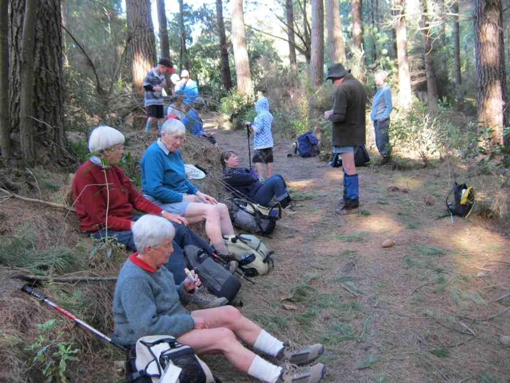
We continued on walking briskly to ensure that we all kept warm. The native bush with all its array of greens was a pleasant sight. Lunch was had just before a creek crossing that could have been more challenging to cross!
A perfect lunch spot. (Gordon pic and caption.)
We headed back using a detour to avoid a loop on racemans. The bird song was pleasant on some parts of the tracks. The sun even briefly shone through the trees at times.
Still smilling. Heading to coffee stop. (Gordon pic and caption.)
On reaching our cars, after a few creek crossings,
1st & last obstacle. (Gordon pic and caption.)
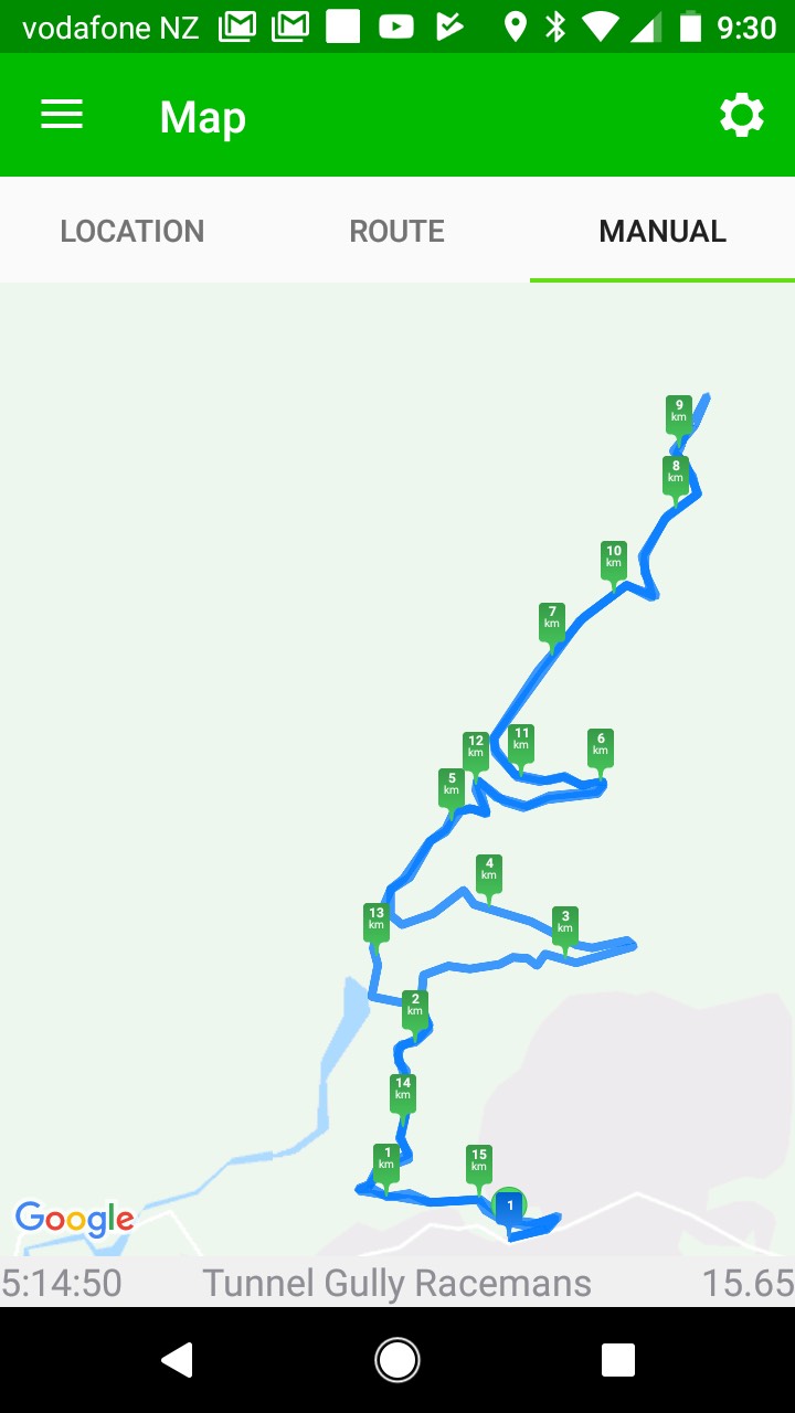
we had completed 15.8 km. A good walk with plenty of cool fresh air! The temperature was 5 degrees when we returned to Mosgiel.
Coffee at Blend. (Helen pic and caption.)
It was a pleasure to share Helen’s birthday with coffee and cakes at Blend. – Dave
As the destination for the designated tramp [Swampy via Morrisons & poleline track] was covered in wet cloud, we decided at the carpark to just walk the Tunnels/Racemans tracks instead. This turned out to be a good choice, as the weather was fine all day in the valley.
Of the eight trampers that came along, two had never been in this area before, so it was a good opportunity for them to see the work that was done on this impressive old water race.
We had morning tea at the top in the pines, & then walked along to almost the junction with Little Coal track, where we stopped for an early lunch.
The pic is of our lunch stop (Ken pic and caption)
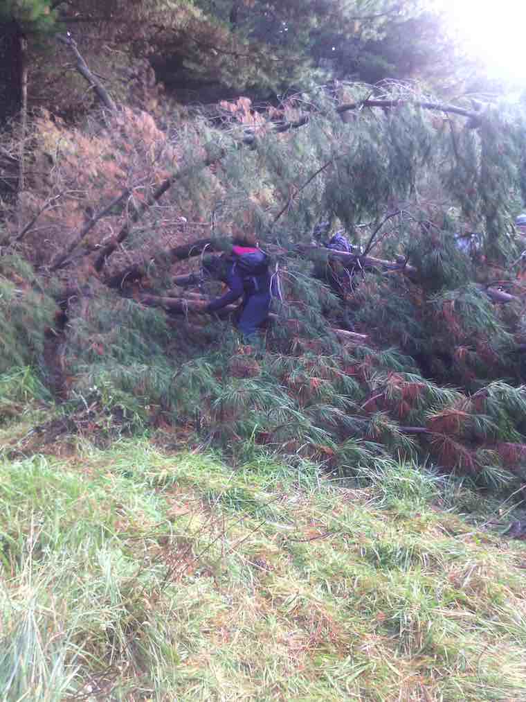
As I was recovering from two weeks off with a very sore back, [damaged while gardening — be aware, it’s not good for your health !!] I decided that I was going to turn back here, so I informed the others of my intentions, & they all said they would be happy to go back with me. [7km at this point]. So we retraced our steps back to the cars at the old school house, clearing some storm damaged vegetation as we went along.
The track was in mostly dry condition with only the odd muddy patch to contend with, & the creek crossings were very shallow.
walked 14km
4.3km/h
3h 15mins moving.
climbed 147m. – Ken.
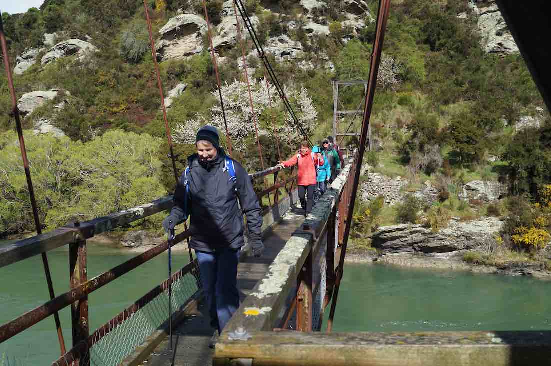
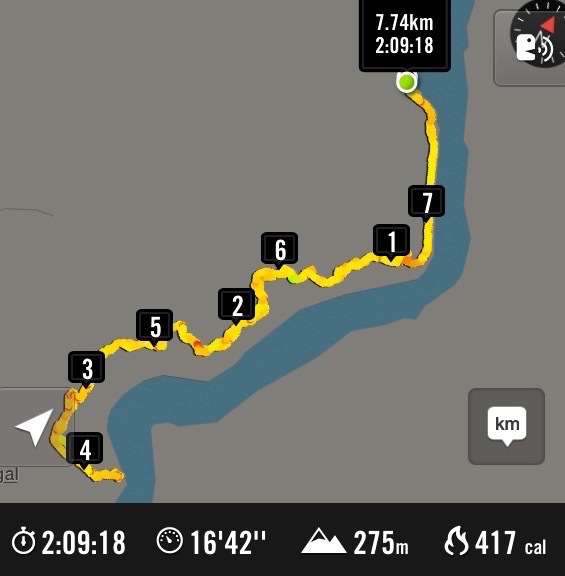
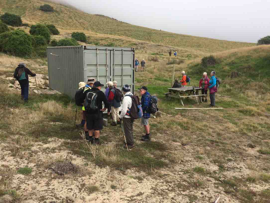
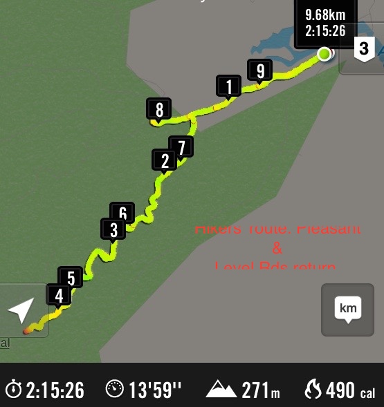
15/4/2015. Trampers. Pumphouse, Tunnels, McRaes
Walked 9.6km
3.9km/h
2 1/2hrs moving time
climbed 275m
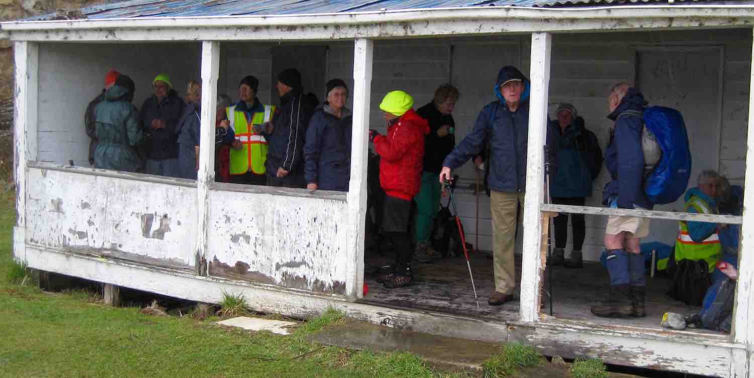
6 hardy trampers turned up to do the walk into the Tunnels & Silverstream tracks, which was, due to the weather conditions, chosen as an alternative to the Leith Saddle tramp scheduled for today.
We parked by the school house, & made our way up to the start of the Tunnels Track, but on arriving at the creek crossing, we found it to be far too deep & swift to attempt a crossing without getting wet feet. So we made the decision to go in from the pump house at the Whare Flat car park. We drove back down the road & restarted the tramp along the fence beside the Silverstream, & up & over the short but quite steep climb, to the grass are at the upstream end of the swing bridge. We turned up the first track just past here, & made our way up onto the Tunnels Track, then back towards the school house, to the start where we couldn’t cross the stream earlier. Then we retraced our steps, & walked all the way along to the creek crossing just past the Racemans Hut that has the tree down across it. This is the creek crossing with the ropes on the other side to help with the climb up the bank. here the water was also too deep, & swift to attempt a crossing, so we had a look at the Tunnels weir, then walked back out, & down an unmarked track leading down to the picnic table on the grass area beside the Silverstream. We had lunch here, then walked back out to the cars.
Conditions in the bush were sheltered, not very wet under foot, & very few muddy patches, so everybody enjoyed the walk. – Ken
On a cool but what turned out to be a very nice winters day, 5 trampers took to the Tunnels /Racemans Tracks. However, we didn’t get very far before we struck the first of many snow damaged trees across the track. This made for very slow going, & we didn’t even manage to get to the favourite morning tea spot in the pines before it was time to stop for a cuppa. We met up with some guys who were supposed to be track clearing, from the DCC, but from what we could see, they weren’t doing much good. There are some VERY LARGE trees down across the track, which require some careful negotiation to get past.
Some of the fallen trees across the track. There is a large Rimu in there somewhere. (Ken pic and caption)
Also, looking very sad is the old Racemans shed.
Racemans Shed (Ken pic and caption)
It has a tree which has fallen right across the top of it, & the roof has completely gone.
Roof gone. (Ken pic)
We only got as far as the creek crossing with the rope on it, when we gave up the struggle, as the creek was choked with fallen trees, & we could hardly see the other side where you climb out of the creek with the help of the rope. We backtracked to an unmarked side track down to the Silverstream, where we found a picnic table to have lunch at.
Lunch at the picnic table.
It was then a short walk out to the pumphouse at Whare Flat, & then back up the road to the cars at the old School house. Distance 8.2km, ave 4km/hr. – Ken.
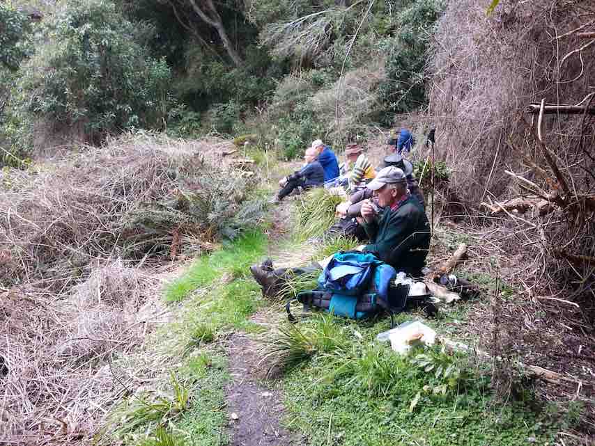
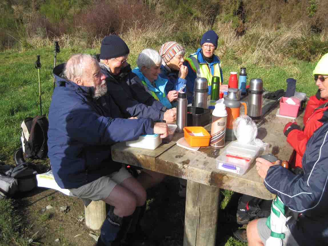
22 of us made a large group. Great. We had our morning cuppa at the top of the Tunnels track.
Morning Tea in the pines at the top of the Tunnels Track.
We made our way back on down to join with the McRaes Track and along to the weir. At this point, Dorothy, recovering from a hip injury wisely declined the steep rope-assisted climb up the further back of the stream and accompanied by three others, returned back the way we had come and down from there by a link track to meet us later at the Pumphouse.
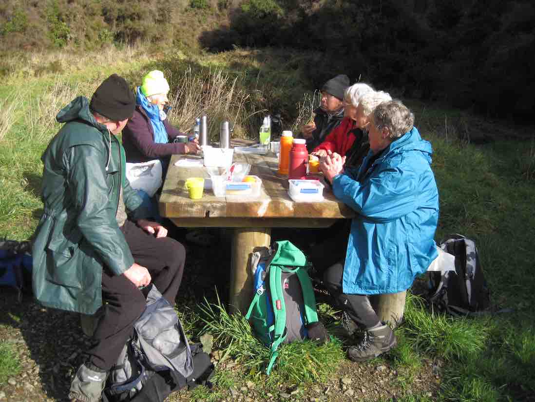
The rest of us carried on around the McRaes track to lunch at the point where it links with the Racemans.
About to set off after lunch.
Down the Racemans and on to the swing bridge. Some elected to cross it and risk the depth of the water at the Pumphouse ford but most went by more hilly track along the Silverstream true left.
Up to that point, we were well led by Fred and Elaine, but from here on it was ‘Brown’s Cows’ back up the r0ad to the cars. We were all back home in time for afternoon tea.
Taieri Scenic reserve was unavailable, due to bulldozers working on a road. We chose a short Tunnels tramp instead, as heavy rain was forecast for the afternoon.
We stopped along Racemans for the morning tea break.
We continued on. At the short water-race pipe point, we dared some of the newer members to crouch their way through it. Amazingly, three took up the dare. Bravo. Then it was on past McRaes weir. The vertical climb out from the stream bed gets no easier for the writer, feeling his arthritic age.
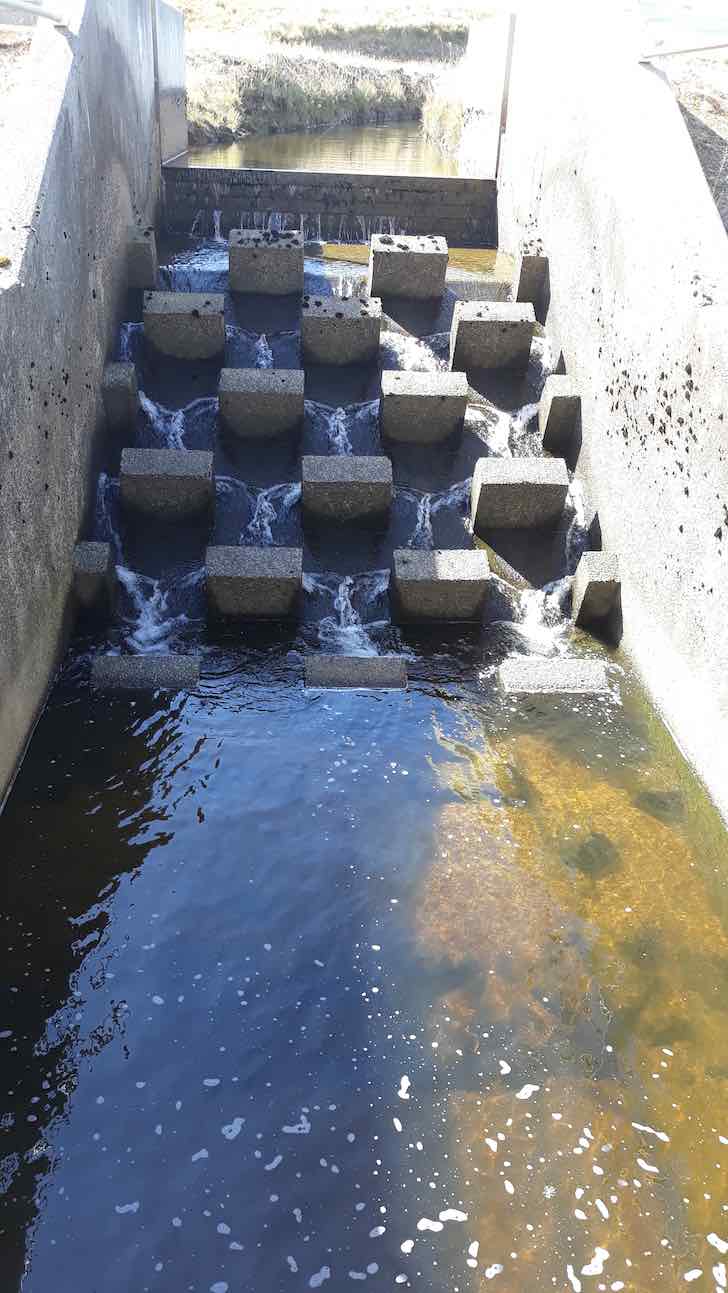
Reaching the end of the McRaes side gully (to the Silverstream proper), we turned back down onto the first part of the Raceman’s track where it climbs up to reach the water-race. Had a look at the Pump-house’s intake weir. Climbed back up to the Raceman’s by the track near the swing-bridge, turning right at the top to climb back up the Tunnels’ hill.
Lunch back at the top of Tunnels track.
Lunch was slightly early, as we remained conscious of the forecast rain. We felt its first drops as we finished lunch. We heard the patter of rain on the leaves above us as we made our way back down the hill. We emerged onto the road by the alternative exit and walked back up to the cars with only the lightest of rain sprinkling us. A nice dry morning out, on a nice dry track in nice bush. – Ian.
4. 28/9/2011. Hikers. Pumphouse, road, Schoolhouse, Tunnels, McRaes Weir, Racemans, Pumphouse . Leaders: Peter and Wendy.
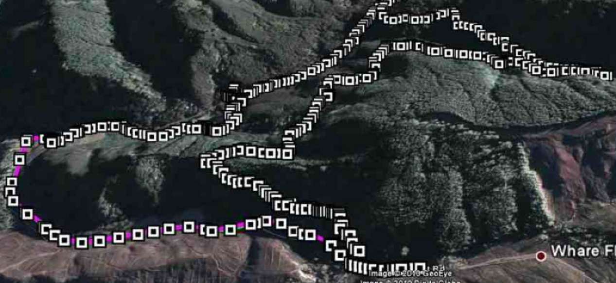
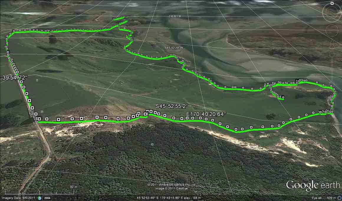
GPS of trip route, courtesy Ken. (Click to see full pic)
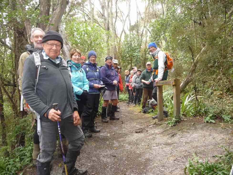
21 of us started the Tunnels track just up from the old Schoolhouse and down the track a little were soon admiring a railed bridge over a ditch and a new track complete with steps around the top of a large slip, put in by Neil and his group of track repairers. The track gently climbed to its top point over the race tunnel where we stopped for an early morning tea under pines, resting on their bed of thick pine needles.
Tea break, top of tunnels hill. (Ken pic)
Tea break 2
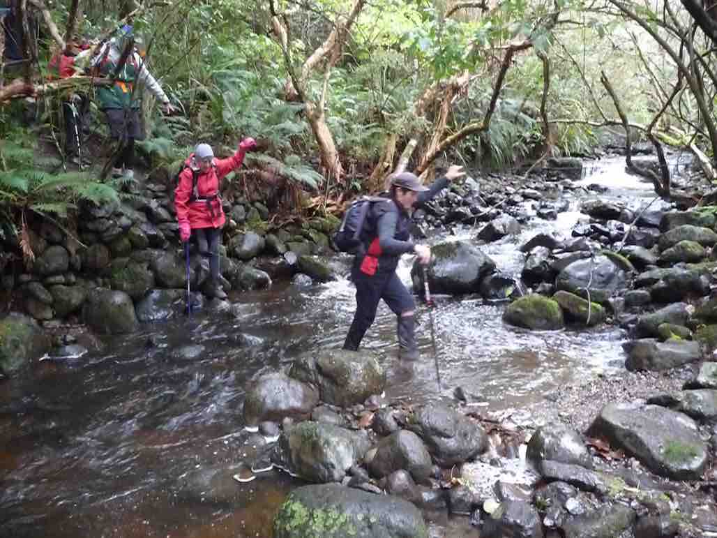
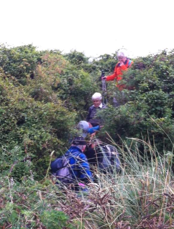
The track had been beautifully cleared of trunks and debris brought down by a recent storm and we quietly ambled along the long stretch that eventually took us past the old Racemans Hut to the broken-down McRaes Weir. Across the stream we were confronted with a washed out vertical bank with only a knotted rope and some steep cut-out steps, but with the bottom one now missing. There ensued much pushing and pulling, and slipping and collapsing as we made our various ways up to the top of the bank.
Steep climb out of McRaes Stream
Then it was plain sailing (apt metaphor?) again out of the large McRae’s gully till we reached the junction with the Racemans where we stopped for an early lunch.
Lunch at junction McRaes and Racemans. (Ken pic)
From there we descended the Racemans to pass the old Silverstream weir and inspected the weir from which water is now piped to the pumphouse. We elected to return via the swing-bridge because there had been a tree-fall over the true-left track. Crossing the ford at the other end was not the happiest part of the walk for some. Then it was just 2 km back up the road to the cars parked at the old Schoolhouse. The day was perfectly calm with much of it sunny, if not hot. It had been a good day. – Ian
2. 20/3/2019. Trampers. Thornicroft Station. Leader: Jill R and Sue.
Starting steep climb to Wind Turbines. (Gordon pic and caption.)Heading to num.2 for lunch. (Gordon pic and caption.)Lunch. (Gordon pic and caption.)Sub station. (Helen pic and caption.)Weir. (Helen pic and caption.)
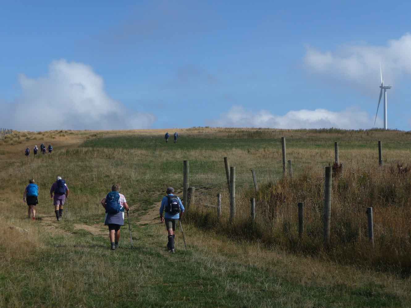
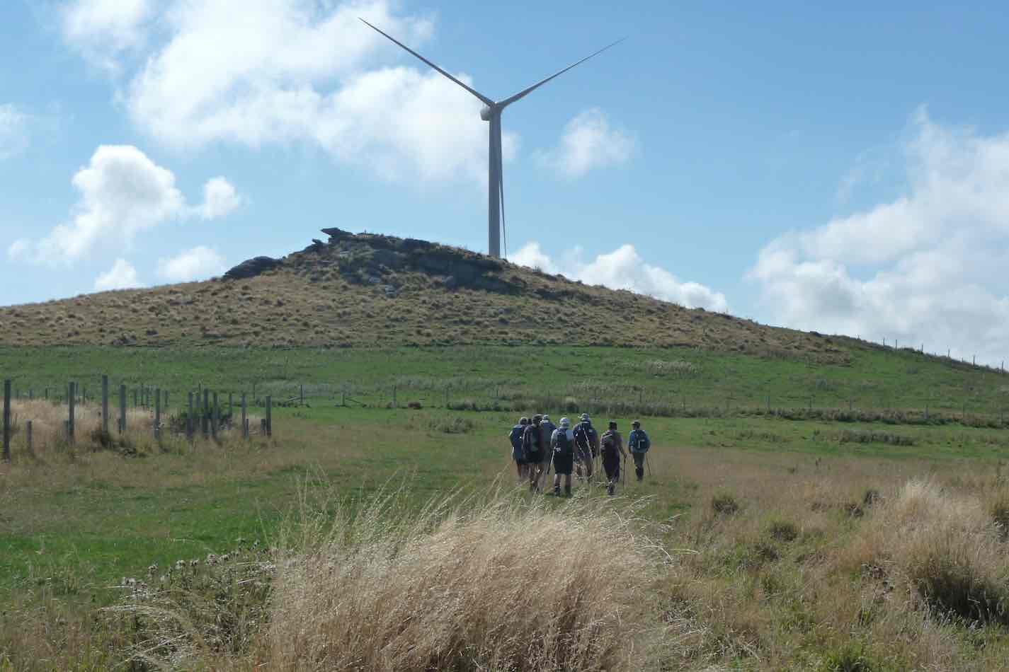
1. 12/10/2011. Both. Mahinerangi Wind Farm. Leaders L Smith, N Buckley
The main tramping group was away this week in camp at Aspiring Hut, but 6 of those left at home felt the need for their usual Wednesday tramp, so decided to go and do something about it.
An early shower at 8.30 am, and low cloud in Mosgiel didn’t look very promising but as we drove up the gravel road to the Bull Ring our cars were raising dust.
The day was overcast and very pleasant, with a very slight breeeze increasing only a little in the afternoon. No cloud to bother us.
The summit of Flagstaff was our first objective and from where we viewed a helicopter operating from beside the Firebreak Track. It was transiting close to us, and spraying somewhere low down in the Nichols Creek area apparently – out of our view.
Morning tea was taken at the junction of the first cross track to the Firebreak. During our stop, 2 hidden birds, only metres away, were calling – a single “click” sound. After a time one flew a few metres and was briefly visible before going back into cover. My guess was that it was maybe a Fern Bird? Are there any ornithologists out there who can confirm if there are any Fern Birds up on Flagstaff?
We continued along the Pineapple Track to the next junction, and turning left crossed to the Swamp Ridge Track, to follow it to Swampy Summit.
We travelled at an easy pace, stopping for a rest at times at the top of the steeper bits. Eventually we came to the top of the Swine Spur Track, and followed it down about 50 metres to admire the recently erected track sign – well done Ian H.
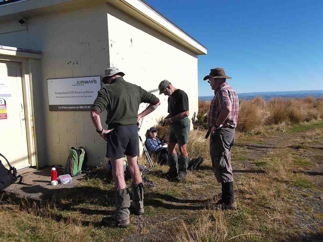
It was 12 noon now and it was decided democratically by one person (not me) that we would stop here and have our lunch in the shelter of the Airways building.
Afterwards we retraced our steps back along Swampy Ridge and then the Firebreak Track …
Margreet pic.
… to finish at the Bull Ring. Again our pace was easy and pleasurable allowing plenty of time for taking (by some anyway).
On returning to Mosgiel we all adjourned to the Blackstone Cafe for after tramp relaxation.
In summary it had been a very enjoyable day out for the six of us, and we had some good exercise in travelling the 13.5 km. – Art.
As it was such a nice looking day after all the wet weather we have had, it was decided to stay in the sun for the day. So we went to the bull ring with the intention of going to Hightop. We took the long way around by going up the Skyline track, & along the tops to the junction with the track up to Swampy summit, & down to Booth Rd. The track up to Swampy summit was in quite good condition, but it doesn’t get any less steep as time goes on !!! On the way up the Skyline track we stopped at the NEW seat overlooking the city [which was covered in fog on this occasion] for morning tea. Lunch was held at the last Airways building …
Lunch time. (Heb pic, Ken caption)
… just at the start of the Swampy Ridge track leading over to the Green Hut track. A few of us walked down to the University research building during our lunch break, just to be able to say “I’ve been there”. After lunch it was decided that we would return to the cars by the same route, so we set off to the accompanying display from a helicopter …
Chopper topping up with spray for gorse. (Heb pic, Ken caption)
… that was spraying gorse & broom at quite low levels. it was a brilliant day out, …
What a great looking day !!
… with no wind, & glorious sunshine all day, which had us discarding clothing to keep cool.
Looking forward to many more days like this.
Walked 16.6km; moving time 4hrs; ave speed 4.1km/hr; climbed 658mtrs; Max height 749mtrs. – Ken
6. 9/4/2014. Hikers. Bullring, Flagstaff Forest, Firebreak, Flagstaff walkway. E. Leaders: Bruce and Marjorie.
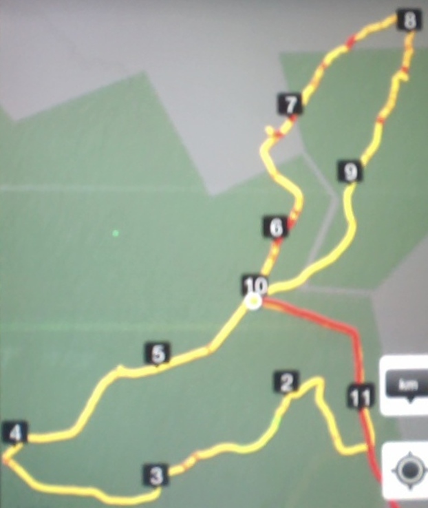
GPS of route. Decipherment!: ’10’ denotes start/finish. Disregard the red overlay and read ’11’ as ‘1’ Otherwise fairly readable.
Cars met at the Bullring.
Of special interest was the presence with us of the Reverend Maggie Wanjiku Muhia, co-minister with her husband of a church in Nairobi, Kenya comprising 3,000 members and 50 staff, visiting for a fortnight with St Lukes congregation.
As a variation, the leaders took us back down the Whare Flat road we had driven up, to enter Flagstaff Forest at Laings Road. We followed its various up and down meanderings till a sunny spot, relatively free of the heavily-dewed Yorkshire Fog grass alongside the road could be found. A leisurely cuppa and then onwards to soon join with Longridge Road whose steeper incline returned us to the Bullring. Circuit one done.
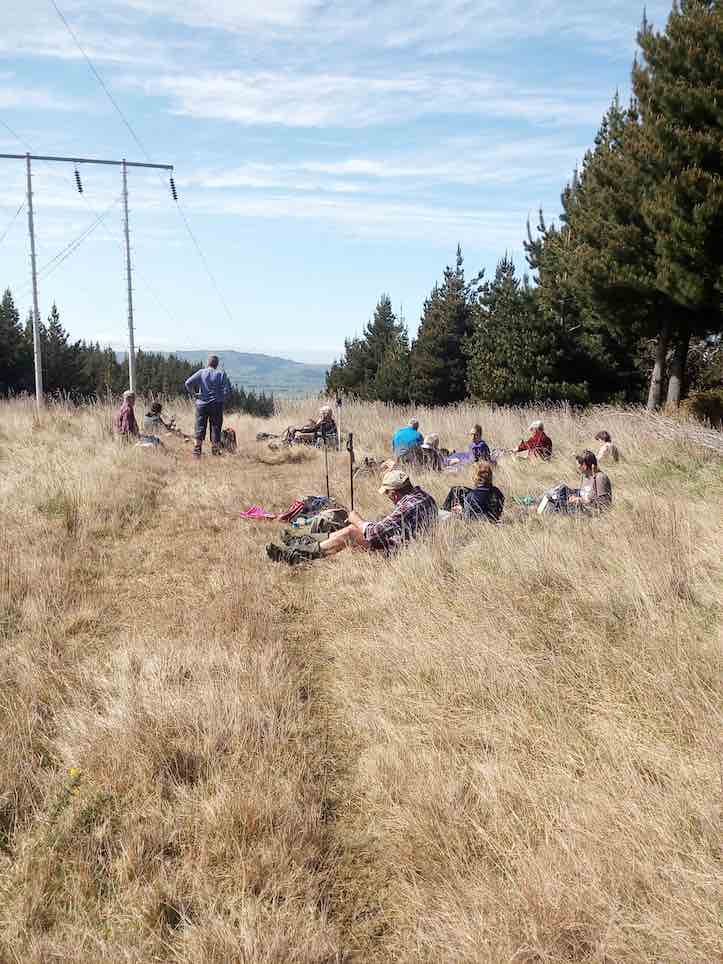
Then we followed the variously named Firebreak/Bullock Track route which we found surprisingly wet, prompting us to step carefully as it grew steadily steeper. Near its crest, we stopped for lunch. As can be seen, the day was sunny, warm and quite still.
Lunch near top of Firebreak.
Pressing on, we passed the Ben Rudd turnoff, with many performing the ceremony of adding stones to the cairn there. Across and onto the Flagstaff walkway and the climb to the trig. En route, George was keen to show us the new side track leading to a seat with a commanding view under a large rock outcrop.
The seat and the view (Maggie pic)Posing at the seat, looking at the view. (Maggie pic)
We reached the trig and then it was all downhill back to the cars. Forgetting the leaders, we strung ourselves out down the track in our own groups and at our own pace. – Ian.
6. 13/12/2017. All. Picnic lunch. E. Leaders: Alex and Liz
Route map, courtesy Ian. (Ian pic and caption.)
Having just emerged from ‘gorse forest’ track onto golf course. (Ian pic and caption.)The leaders for the day. (Judy pic.)Pot luck Christmas lunch.(Helen pic and caption.)
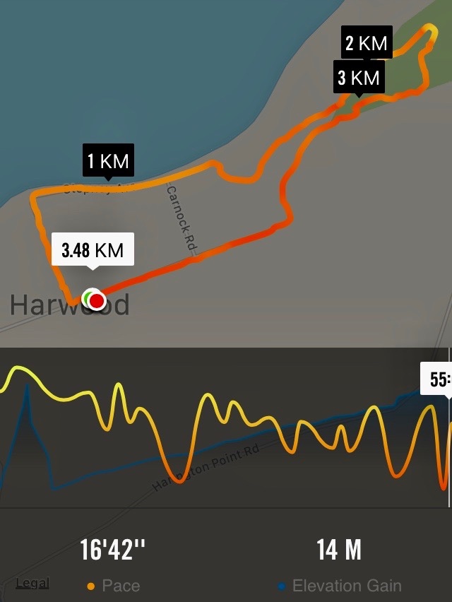
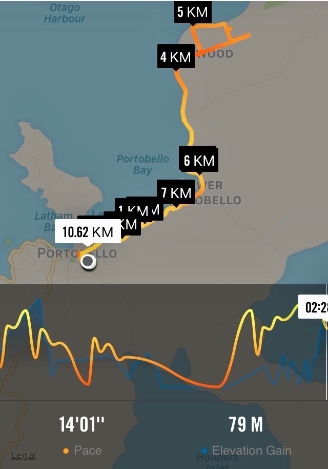
5. 27/9/2017. Hikers. Portobello to Harwood. E. Leaders: Chris and Dot.
Map of route, courtesy Ian.
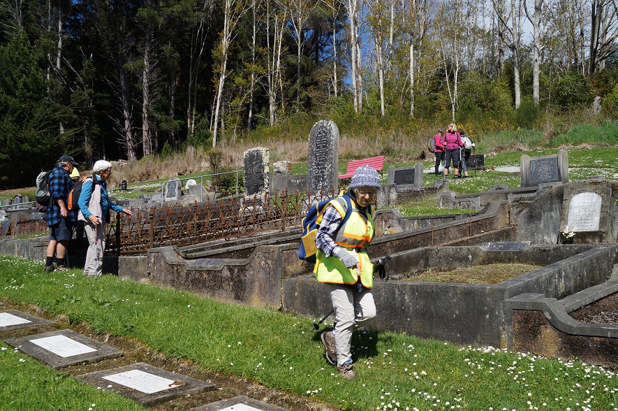
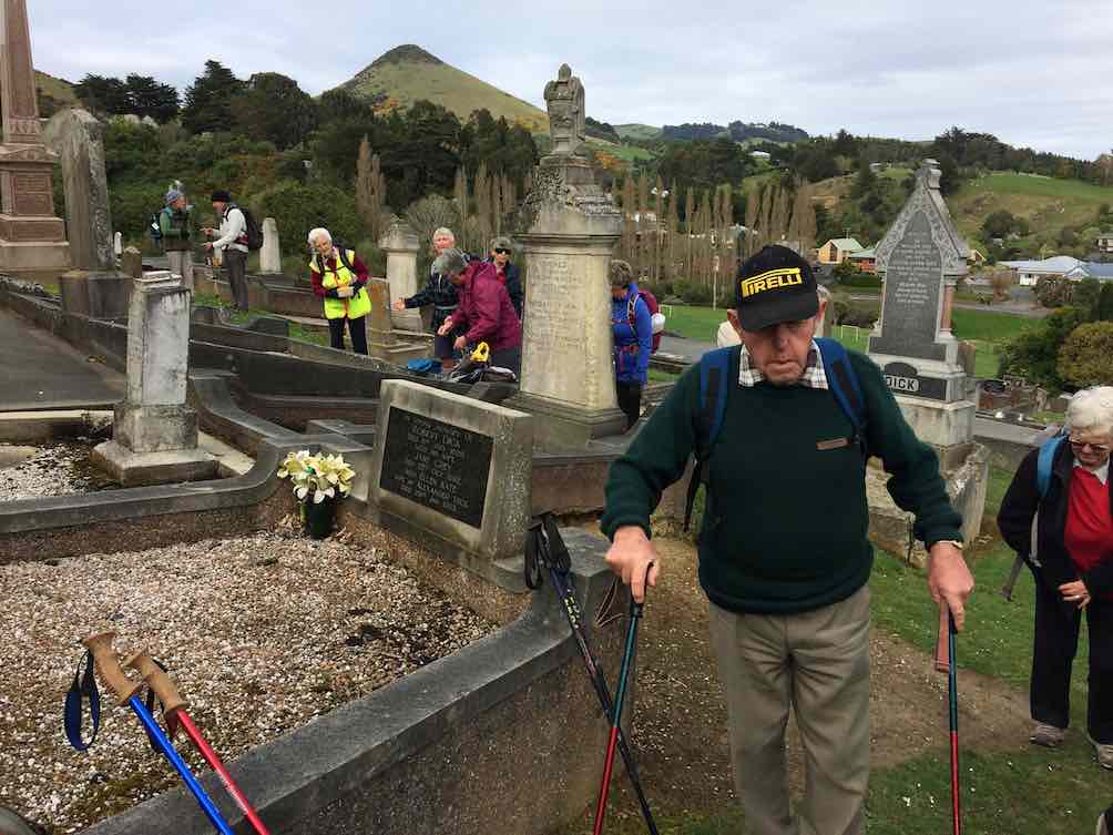
The track from Portobello to the aquarium being made difficult with slips and mud, the leaders decided on a new hike for the day. 20 keen members left the cars at the Portobello show-grounds and headed the short distance up the hill to the cemetery for morning tea.
Coming away from morning tea.(Ian pic and caption.)
It was a glorious morning, calm and mild, and there were many comments on the fact that cemetery sites always seem to have the best views…. this one right across Portobello and the tranquil, beautiful harbour.
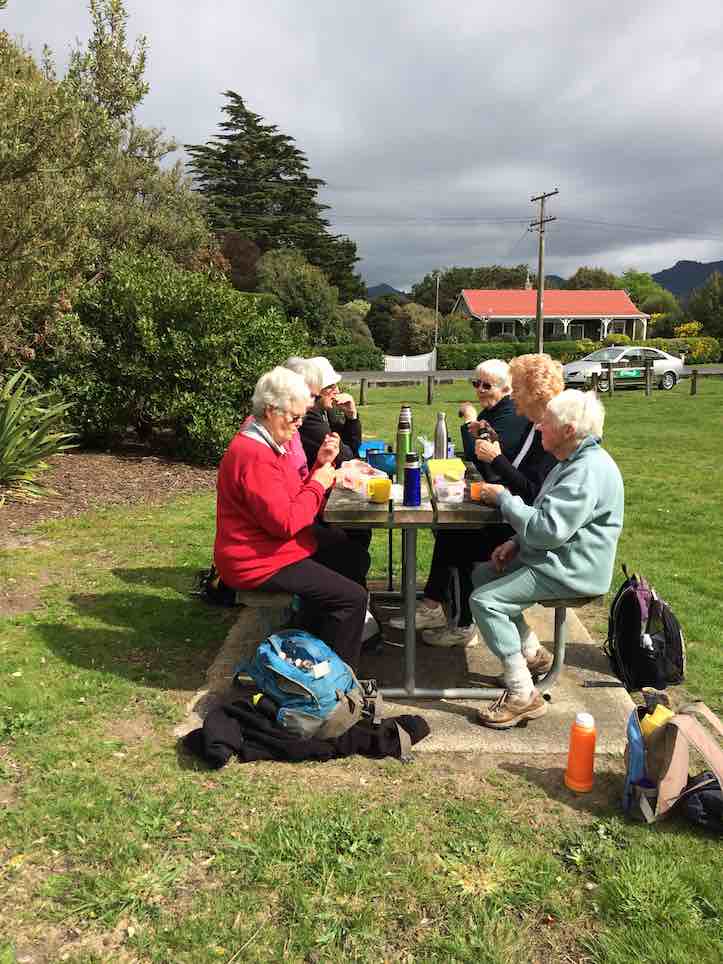
The thought of walking all the way to Harwood seemed a bit daunting to some, but in fact was very pleasant, following the cycle track all the way so that traffic was never a problem. The predicted north-east breeze never arrived and jackets were gradually shed along the way. Round Lower Portobello Bay several slips were commented upon, and we reached the picnic grounds for a leisurely lunch by mid-day.
Lunch at the Harwood Picnic Grounds. (Ian pic and caption.)
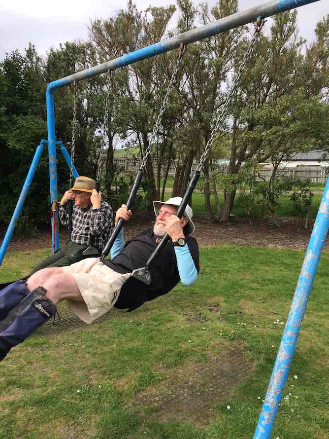
After the young-at-heart had a play on the swings…
Stop gazing round. Swing!.(Ian pic and caption.)
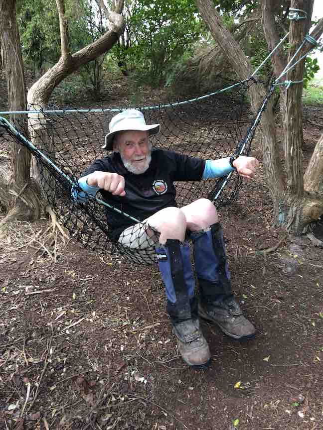
…and slides not to mention the hammock,
Help! Someone get me out. (Ian pic and caption.)
we made our way back to the cars by the same route, and so to Macandrew Bay for coffee etc.
A hike not done before, so thanks to Chris and Dot for some thick quinking (thanks Jay!) in finding a great alternative for the day. – Judy.
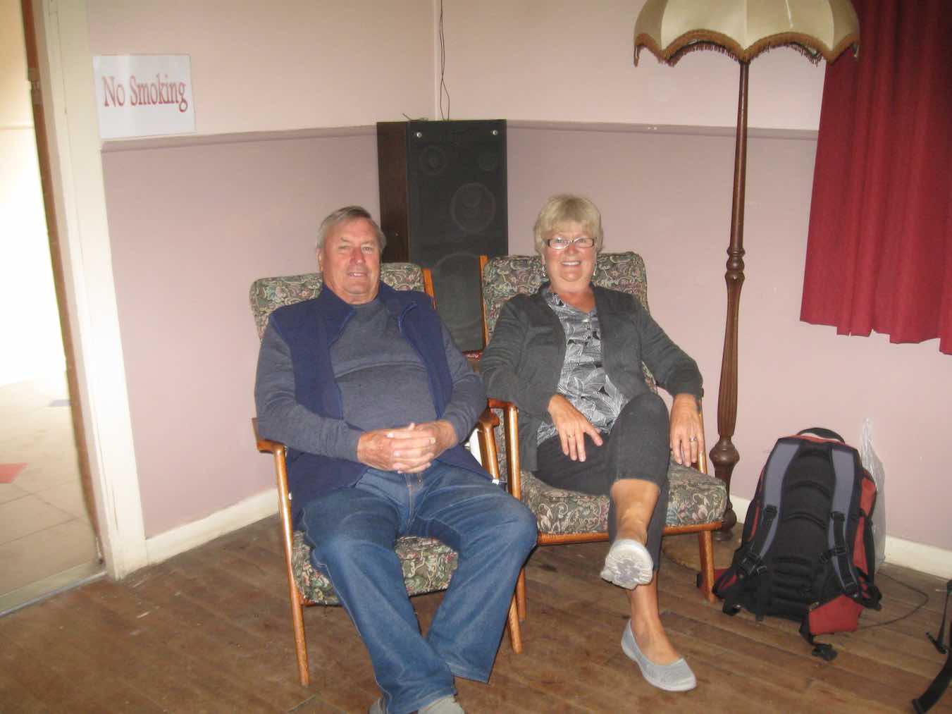
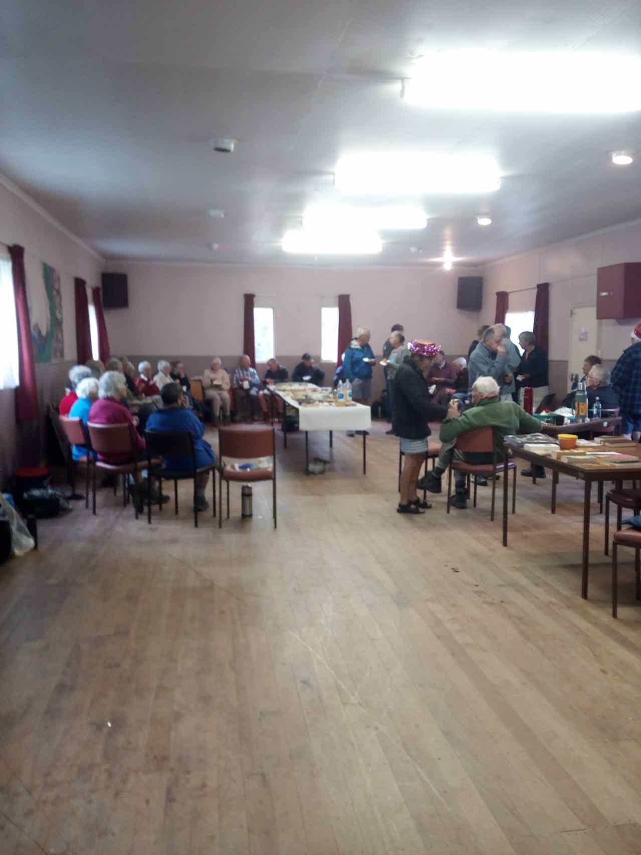
4. 17/12/2012. All. Harwood. End of year picnic. Leaders: Chris and Dorothy.
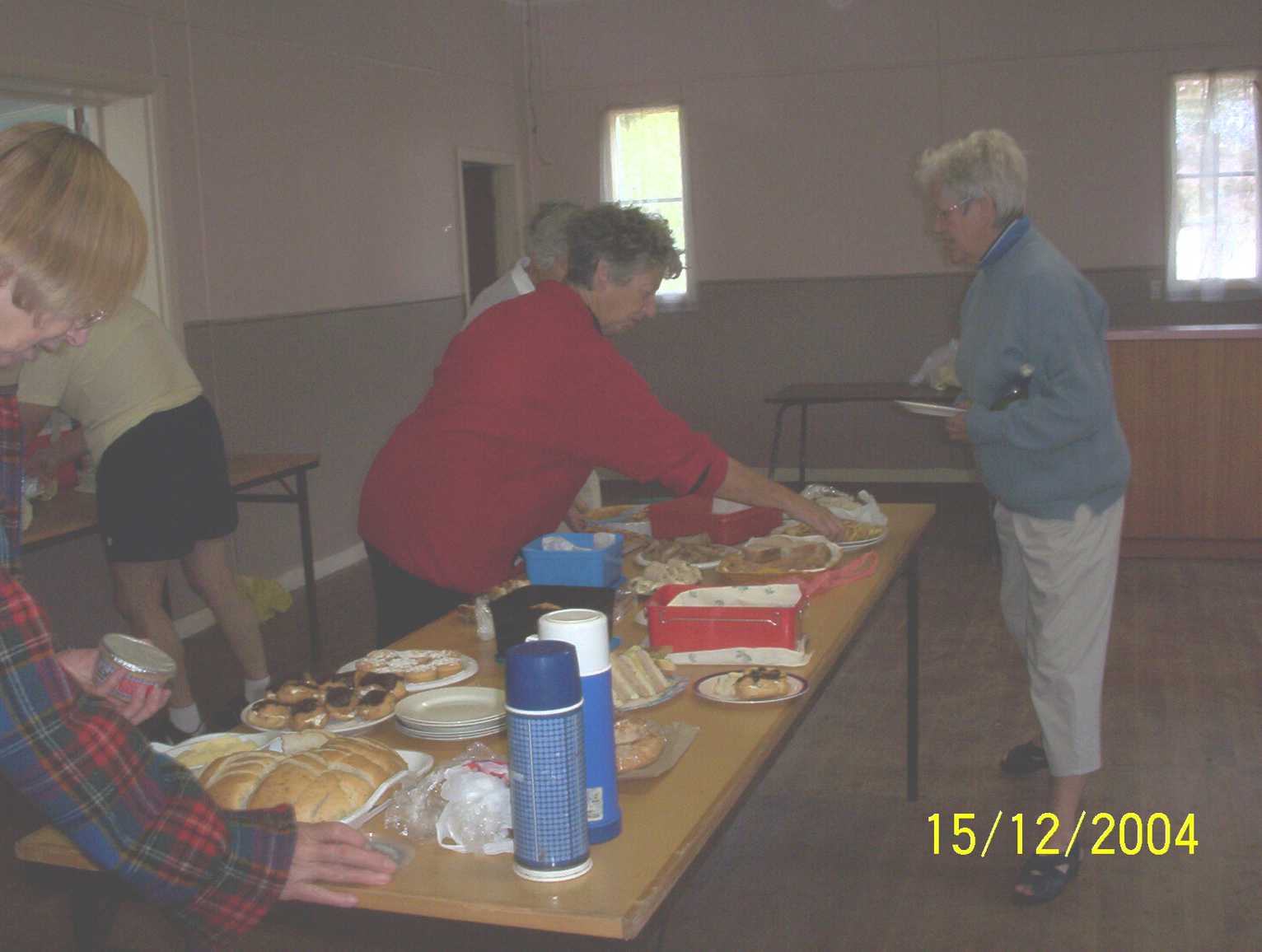
3. 15/12/2004. All. Christmas finger food lunch at Harwood. Leader: Chris.
Pause at sign.
Lunch in Harwood Hall. Dorothy, Wendy, Carmel.
Lunch in the Harwood Hall. Wendy, Carmel.
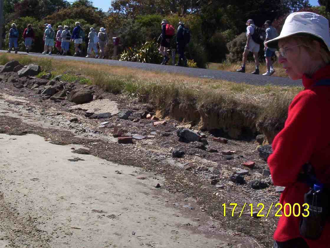
2. 17/12/2003. All. End of year Tramp. Share finger food. Leaders: Jean, Chris.
Wardells’ Cottage abt 25 km from car park.
High tides flood the access road and this has happened to us more than once. N.B. Programme Committee! Avoid high tides forecast near the the hours of 9.00 a.m. or 2.00-3.00 p.m.
17. 9/8/2017. Hikers. Millennium Track. Leaders: Bob and Lesley.
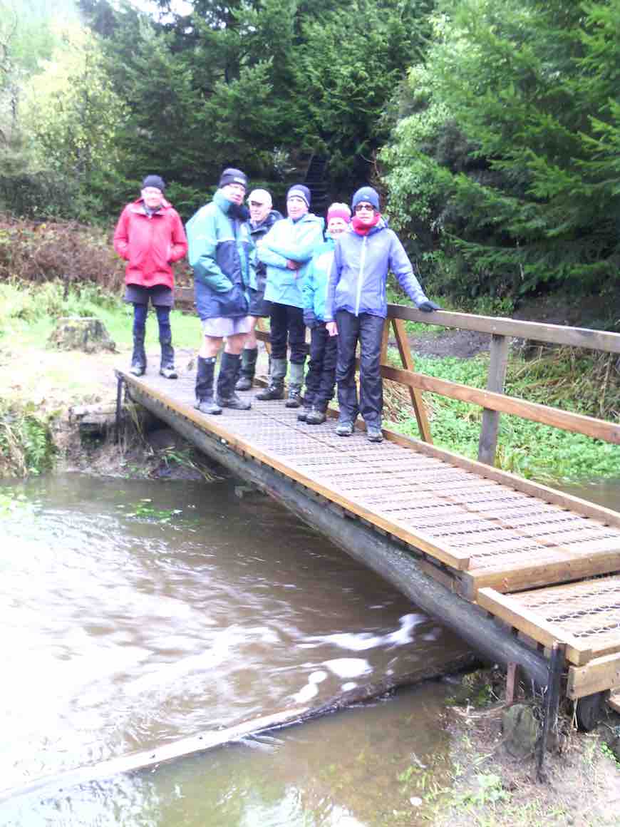
20 Hikers set out on this bush walk along the Taieri River. The usual wet portions were muddy following all the rain. There were a few small slips onto the track and a few bites out of the lower side, but all negotiable. The track was carpeted with leaves and twigs. Morning tea was at the usual spot down beside the river…
(Wyn pic.)
…and lunch at John Bull Gully.
(Wyn pic.)
This track with many silver ferns and birds is a favourite for many members. We ALL adjourned to The Black Swan for refreshments. – Lesley.
By then the rain had stopped so had a lovely walk led by Helen at front and Bev at the back. Lunch in the ordered sunshine at the tables at John Bull’s gully.
Lunch (1) (John pic)Lunch (2) (John pic)
Slight rain as we started back then the sun again.Nice to see the river through the trees with the leaf drop. Back to cars and through some water on the road. High tide.
Coffee at Wal’s ended our enjoyable day. – Helen
15. 5/10/2014. Both. Millennium Track. Leaders: Les and Margaret.
Tea breakLunch at John Bull Gully
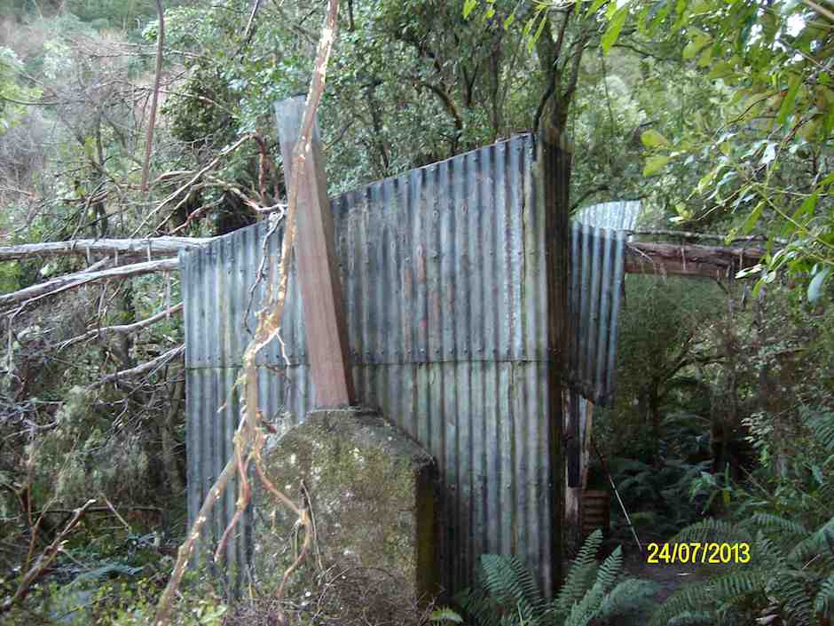
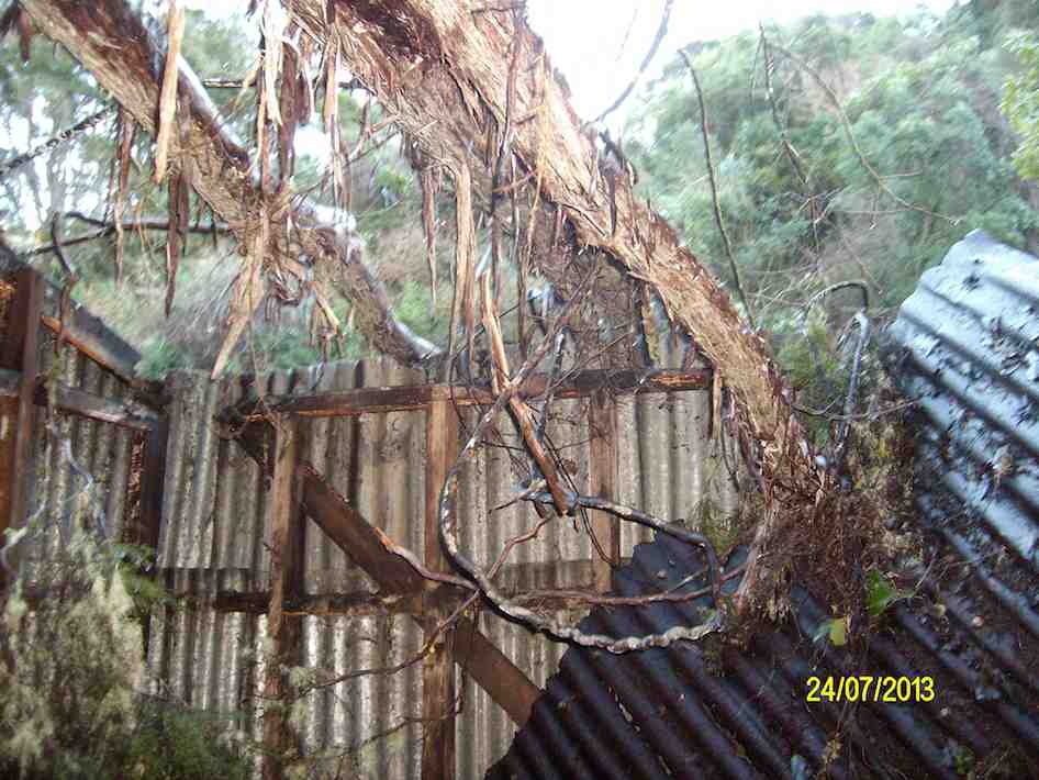
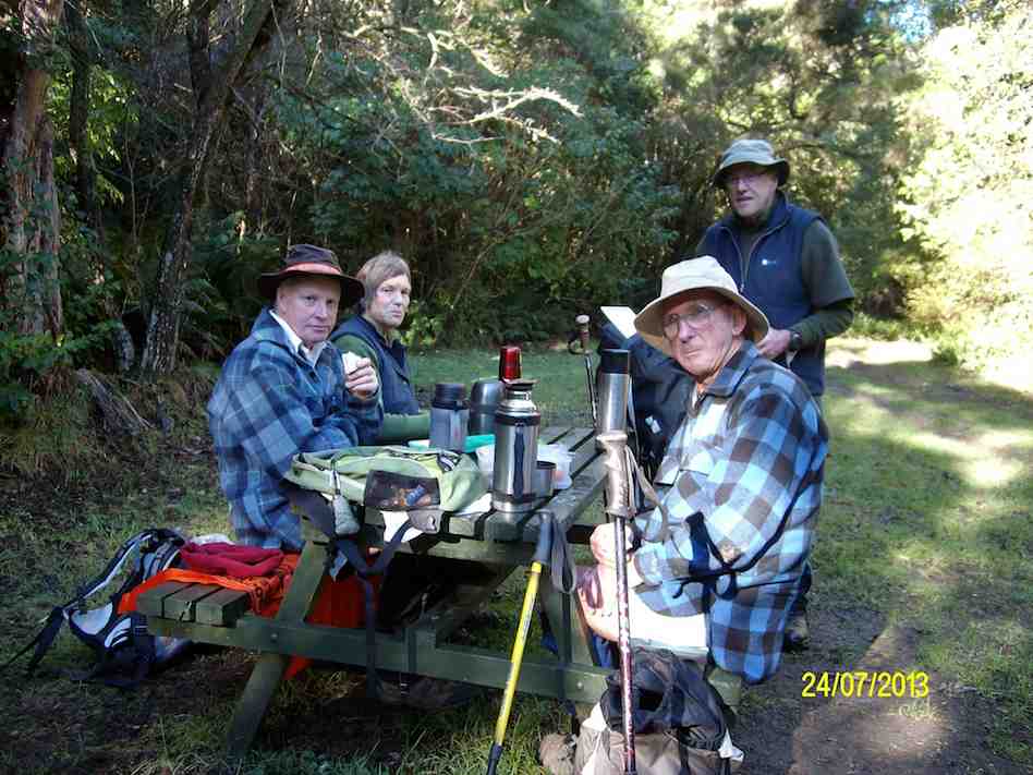
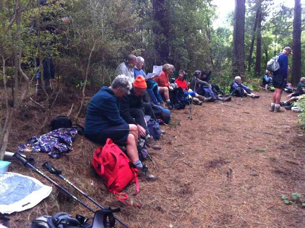
14. 24/7/2013. Hikers. Millennium Track. Leaders: Les and Margaret.
Being the first tramp of the month, trampers and hikers combined to walk a good old standby, the Millennium Track down the Taieri River from the old Wardells house. It was a substitute for Berwick Forest which is presently difficult to gain access to. Although only 16 turned out, with many trampers noticeably absent, it was still a good day out, starting cold but improving. In spite of being a frequently used tramp, it’s a lovely piece of bush to take your time in and enjoy and the bird life is a joy to hear. A feature of the walk for the trampers was that 11 walked on beyond John Bull Gully to sample the recently broadened track as far as the seat at the high point of the track. The gradient had been realigned with all steps eliminated, sometimes however making for steep slopes. With the pine plantation gone, we were surprised to see that bullibulli
Bullibulli colonising the slope
has largely colonised the area. A delightful surprise on the return walk was a juvenile harrier hawk (?)
Juvenile Harrier Hawk? (But see comments below post.)
perched on a broken trunk which quite calmly allowed us to photo it. The 5 of us who chose to go just to the picnic spot by the river really had a very happy time, taking in the scenery, having our lunch and walking back to cars in a leisurely way. – Bev and Ian
8. 5/12/2007. Both. Millennium Track. Easy. Leaders: Lex, Dot T
Wood Pigeon nr track start (5/12/2007)
Tea stop. Doug M, Neil, Bob H (5/12/2007)
Track through newly-cleared plantation. Doug M, Bill (5/12/2007)
Today 7 hardy (maybe silly) trampers drove to Phosphate corner at Clarendon, then along Berwick road, parked up and walked up the hill to the Cemetery (my Great Great and Great Grandparents, some Siblings and Children from Sinclair family are buried there.
We then drove further along Berwick road, parked and proceeded up the track to the hay barn for smoko.
Shed for morning tea out of the freezing wind. (Helen pic and caption.)Mud to get to the shed. (Helen pic and caption.)
We all decided it would be no fun climbing round and up Mary Hill with frequent showers and a bitterly cold wind.
On the way back we briefly stopped at Sinclair Wetlands then drove into Berwick Camp, a year 8 class was there on camp, talked with the Activity Coordinator and strolled up to the dam.
On a bridge at the Berwick camp. (Helen pic and caption.)
It was plain to see what fun the young students were having, particularly when having a turn driving round with a leader in an old converted type of Land Rover in the mud.
So after all this strenuous activity we journeyed on to eat lunch (and cake) at a little hilltop cafe in Clyde street. – Eleanore.
Lunch at Eleanore’s with a lovely warm fire and cakes which were enjoyed by us all. (Helen pic and caption.)
15. 24/4/2013. Hikers – and a few trampers. Limesprings Farm, McNeil Rd, Whale Museum, and return back through Farm by a different route. Leaders: Jim and Betty.
Route, unfortuately stopped at Whale Museum, for some inadvertant technical reason! Cattle track up middle, McNeil Rd and extension at top.
The overcast day succeeded a wet 24 hours, and several trampers joined us after cancelling their bush walk up Raingauge Spur for safety’s sake. We parked the cars halfway along Driver Road and walked on to enter Limespring Farm.
We stopped to admire the old Horseshoe Stable. What was most noticeable was that the owner has made the switch for sheep to dairy farming. With the transforming magic of electric fencing a wonderful new cattle route steeply ascends the hill, connecting to a myriad of rotational paddocks. No stock were visible, presumably away in some distant meadow. We stopped for morning tea beside an old stone cottage before attempting the climb. Our leaders fittingly anticipated ANZAC Day tomorrow by disporting a hat poppy and distributing ANZAC biscuits to accompany our meal.
Next, the climb. Talk about slippery! A patina of thin wet mud over the track foundation made it impossible for mud-caked boots to find any sort of a grip, so it was a struggle up what remained of the grass verge and gripping the electric fence, which was fortunately turned OFF. The climb emerged finally onto the top of McNeil Road. The more energetic climbed a track leading a little further to reach what looked like the excavation of a dam into the hillside. We climbed above that a little further to the top of the hill, before coming back down to McNeil Road to join the others who had preceded us to the Whale Museum to lunch there in welcome shelter from the wind.
After a leisurely lunch, it was only a little further down McNeil Road before we re-entered the farm and via a arcing 4WD track, this one safely firm underfoot, to get back to the Horseshoe Stable and back along to the cars. Thanks to Jim and Betty for the planning they put into the route, despite the completely unforeseen atrociously slippery climb! – Ian.
14. 31/8/2011. Hikers. Clarendon, Cemetery Hill, Limesprings Farm,
After leaving a sunny Bush Road car park, seventeen hikers parked in coolish still conditions at the junction of Cullen Road and the Berwick Road after traveling down Phosphate Road and turning right at the road end.
The red brick Ewing Phosphate Company building on the right at the turn off from State Highway One is now a calf shed for Milton dairy farmers Tony and Sue McDonnell.
Tony interested Ravensdown in mining the phosphate deposits at Clarendon in 2009 and phosphate rock from the area is now mixed with imported rock to make a product called Clarendon Gold. Ravensdown imports rock from Morocca, Vietnam, and Christmas Island.
The 450 ha South Otago phosphate deposit is one of only two in NZ with the other being on the sea floor in the Chatham Rise. The Ewing Phosphate Company was established in 1902 and by 1904 it was regarded as one of the leading industries in NZ. Fifty tons a day of phosphate rock was railed to Dunedin. The mines were worked from 1902–1924 and from 1943–1955. About 200,000 tons were extracted. The business ended after competition with cheaper phosphate from Nauru.
Mr McDonnell was reported in the Dairy Exporter Magazine as saying that apparently he and his neighbours had the only phosphate deposit in Australasia. To warm up, the group ascended approximately to the top of cemetery hill starting at the gate at the Cullen Road turnoff. About 30 graves were present in the cemetery at the top of the hill including several to Sinclairs. We had a view of Lake Waihola and the Sinclair wetlands.
After starting down the hill we had morning tea near a shelter belt and then proceeded along Berwick Road and Driver Road to Limesprings Farm. We were able to inspect the vintage stone stables together with some tractors awaiting restoration.
We then proceeded up the farm road to lunch at the Whale Fossil lookout and returned by the same route after lunch to the cars which we reached at 1345.
We noted that Angela Wanhalla referred to the allocation of land at Clarendon to the mixed-descent families of Southern NZ in her book In/visible Sight (Wellington: Bridget Williams Books; 2009). – Bruce
13. 5/2/2009. Both. Horseshoe Bush Stone Stables, McNeil Road, Whale Museum Tea break, Lime Works, Fort Hill Road, Hay Barn lunch, Trig Q and back. Medium. Leaders: Bob M, Ian.
Clarendon route map
18 of us enjoyed the tramp from Lime Springs Farm. From the Ewing Phosphate works building by Highway 1, we drove down Phosphate Road, to the left of Cemetery Hill. We turned into Driver Road and parked opposite the Horseshoe Bush Stables on what is now called Lime Springs Farm. We climbed first up the farm track
View from farm track. Chris?, Neil, Bev.
to McNeil Road where we turned right to the the Whale fossil Museum at the top of the road for the tea break. Here are housed whale fossil bones extracted from the Milburn Lime Quarry. Then it was back down to turn right up Fort Hill Road and climb again to eventually crest a saddle and head on down to our lunch stop by a farm sheep yards and sheds.
Les lunching
Sheep yards at lunch stop
After lunch, we climbed by farm track and paddocks to reach Trig Q and pose for a group photo.
Then back down a bit where Bob found inspiration in a rock formation.
Sacrificial Bob?
Fortunately for us, on the recce, Bob (and Doug who couldn’t be with us on the day) had discovered the usual paddock down was this year in turnips and too rough by the fence to negotiate easily, so led us down the true right of the nearby bushed gully and back to the starting point. Fortunately due to the dry weather, Lime Springs farm did not live up to its name and what is usually slushy going at this point was bone dry.
12. 10/9/2008 Trampers. Clarendon, and Cullen, Fort Hill and Circle Hill Rd. Medium-. Leaders: Ken, Ian.
Only three of us, namely Ken, George and self attempted the road walk from Clarendon up Cullen Rd, Fort Hill Rd, and then the circuit round Barnes Rd and Circle Hill Road and back down again. The weather came in wet and dry periods, windy and calm. We were treated to brilliant green meadows, sheep lambing, cattle foraging on winter turnips and choumollier, and extremely muddy paddocks left behind by them. We enjoyed the variety of hills we walked amongst, sheltering behind a hedge for morning tea and in a shearing shed for lunch. We reached close to 280m and walked about 18Km in a surprisingly short time, getting home as early as 2.30 p.m. A good stretch of the legs and and interesting rural area, enlivened by a chat with an ATV driver and a farmer leading a couple of horses. – Ian
11. 8/8/2007. Both. Clarendon, Stone Barn, Lime Works, Whale Museum, Lookout. Leaders: D Moir, Graham, Bob M.
9. 16/6/2004. Trampers. Milburn, Fort Hill, Limeworks Road. Medium. Leaders: Doug M, Arthur H. 8. 8/5/2002. Clarendon, Fort Hill. Medium. Leaders: Doug M, Irene, Bob H 7. 21/11/2001. Clarendon – Milburn. Medium. Leaders: Shirley McN, Irene, Ian. 6. 22/3/2000. Clarendon, Old Stone Barn. Leaders: Doug M, Ann, Lex. 5. 21/1/1998. Clarendon, Old Stone Barn, Limeworks. Leaders: Doug and Ngaire, Irene. 4. 24/7/1996. Milburn Ramble from Stone Stable. Average. Leaders: Ngaire and Doug, Nelson. 3. 12/4/1995 Milburn, Clarendon, Circle Hill, Fort Hill. Medium.Leaders: Doug and Ngaire, Shirley R, Ted. 2. 14/7/1993. Milburn Lime Works. Interesting history. Medium.Leaders: Peg C, Diana, Joan A, Doug M 1. 24/7/1991. Milburn Lime Works. Average. Leaders: Peg C, Mary Y, Jack R, Les W.
Physical Geography.—To the south of Dunedin there is a line of coast-hills, varying in height from 500 ft. to 1,400 ft. Shut off by these hills from the sea are two long, somewhat narrow plains—the Taieri and the Tokomairiro—along the length of which run the main road and the Main Trunk Railway. The drainage of these plains finds an outlet to the sea through narrow gorges in the coast-hills. On the western side of the plains the hills rise abruptly, but between Clarendon and Millburn they jut far out towards the east, separating the two plains from each other, and forming the Waihola Gorge—the former name for Millburn. It is at the base of the protruding part of these western hills that the rock-phosphate mostly occurs. On the southern (Millburn) side of the gorge the hills rise sharply at first till the crown of the spur is reached, and then the spur runs in a north-west direction, attaining its greatest height at the Trig. Q. From the trig. another long spur runs down in an easterly direction on the north boundary of the district, reaching the plain opposite Cemetery Hill. Between this spur and the former one the hills descend somewhat more abruptly to the plain. In the neighbourhood of the gorge a small cross-spur runs northward parallel to the road; the western flank of this spur was the site of the original discovery of rock-phosphate, and is now the scene of the greatest activity in the quarrying of the rock.
– Excerpt from: Transactions and Proceedings of the Royal Society of New Zealand 1868-1961. Volume 38, 1905 Art. LII.—On the Geology of the Clarendon Phosphate-deposits, Otago, New Zealand. By Arthur R. Andrew B.Sc., A.O.S.M., Laboratory, Otago University School of Mines.
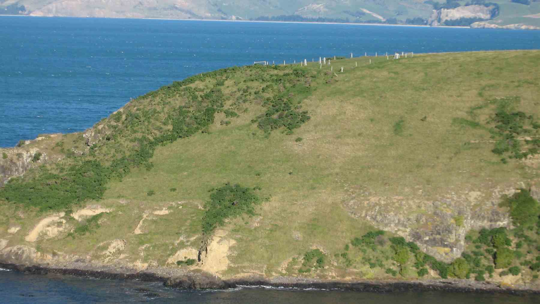
No. 93 on old hardcopy list of 113 club tramps. “Murrays Farm – Sandymount (Chris Hughes) Farm”
Distance for carpark: 31.5 km.
Map supplied by the owner. (Keith pic.)
11. 29/3/2017. Hikers. Murrays Farm. M. Leaders: Keith and Shona.
Route map, courtesy Ian.
It was a foggy, misty morning when 19 Hikers met at the gateway bel0w Murrays Farm before ambling up the road to having morning tea in the implement shed.
We then followed the fenceline up and across the paddocks before descending to explore around a container being used as a crib.
George investigates shower workings on new crib. (Ian pic and caption.)
We exited onto the coast …
We discover a new route from paddock to beach. (Eleanor W. pic.)
… where we had lunch …
Papanui Inlet mouth beach for lunch. (Ian pic and caption.)
… out of the northerly wind.
We followed the water’s edge around past the old boat shed, climbing up the hill and visiting an old dwelling also being used as a crib and back along the farm tracks to the hole in the hedge and down the hill to the cars.
Coffee was at Macandrew Bay cafe. – Shona and Keith.
10. 20/2/2013. Hikers. Murrays Farm. Medium. Leaders: Peter and Wendy.
Morning Tea at old homesteadParadise Ducks in formationWaiting for others in shelter from the hot sun
9. 7/12/2011. Both. Murrays Farm. Medium.
GPS courtesy Ken. Track from distant spot anti-clockwise.
Comfort plus for morning tea. (Ken pic and caption)
Five trampers scaled the almost vertical ascent to the Sandymount road before descending further by the bush.
An eye- and nose-watering wind greeted us when we stepped out of our cars at Hoopers Inlet. It was not a time for hanging around so our group of 13 set off at a brisk trot and soon reached the shelter of a shed which provided a good spot for morning tea.
Fuelled by hot drinks we ventured on and found that the hills and gullies gave good protection and we could enjoy this stroll through beautiful, peaceful countryside with the only other signs of life nearby the large number of paradise ducks. Perhaps they had discovered this place to be a refuge from duck shooters. In the distance sheep grazed and black cattle eyed us with interest.
Sheltered lunch spot
We found our way down to the beach and a sheltered corner at the far end provided a comfortable lunch spot.
Seal among the lupins
Margaret’s sortie into the sand dunes also brought to our notice a young seal hidden away under the lupins. We retraced our steps admiring the expansive views of the inlet and the winter colours on the hills.
It had been a short walk but a very pleasant country ramble.
Chris, who knows the area well, ably led us and, before returning home, some of us were lucky enough to stop off with her at a relative’s house on the hill and walk around the interesting garden, admiring both the plants and the panoramic views. – Marjorie.
6. 27/6/2007 Leaders:
Group. Ian, Leonie, George, Tash, Pat, Hazel, Ria.
5. 1/2/2006. All. Murrays Farm, Hoopers Inlet. Leader: Chris.
4. 5/3/2003. All. Murray Farm. Leaders: Chris, Les and Margaret, Bev McI.
Notes: Whole cliff moving. Caversham Sandstone. Burnside Mudstone. 3 or 4 mudstones – like Abbotsford.
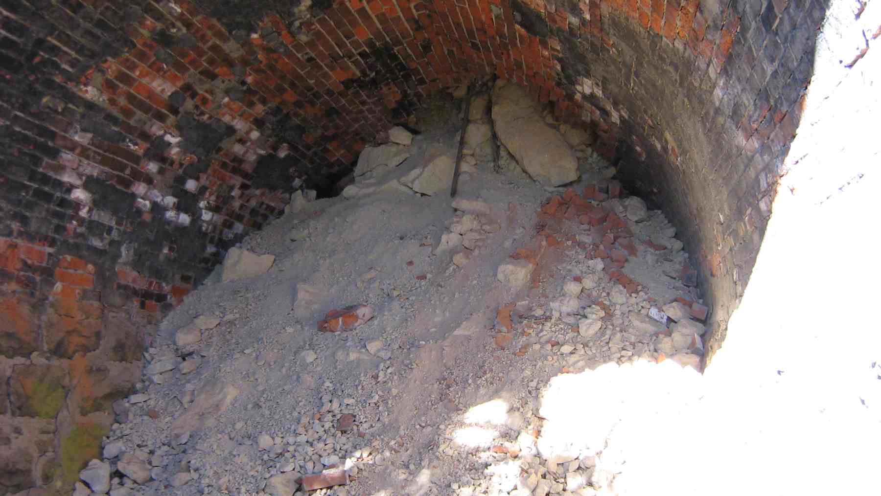
Cracks in hill above coastline. Tunnel – brick-built. Rock cracked – eroding. Middle of tunnel caved in as bricks fell. Middle 30m. Tunnel closed. Cutting through hillside. Railways sank a shaft, covered with sleepers &c. Cut access-steps down to check line on brink of cliff.
During WW2 Karitane men working at Seacliff. Cycle track formed alongside railway line Warrington to Puketeraki. – Written notes by Stewart McKay. Retired school teacher.
Seek permission.
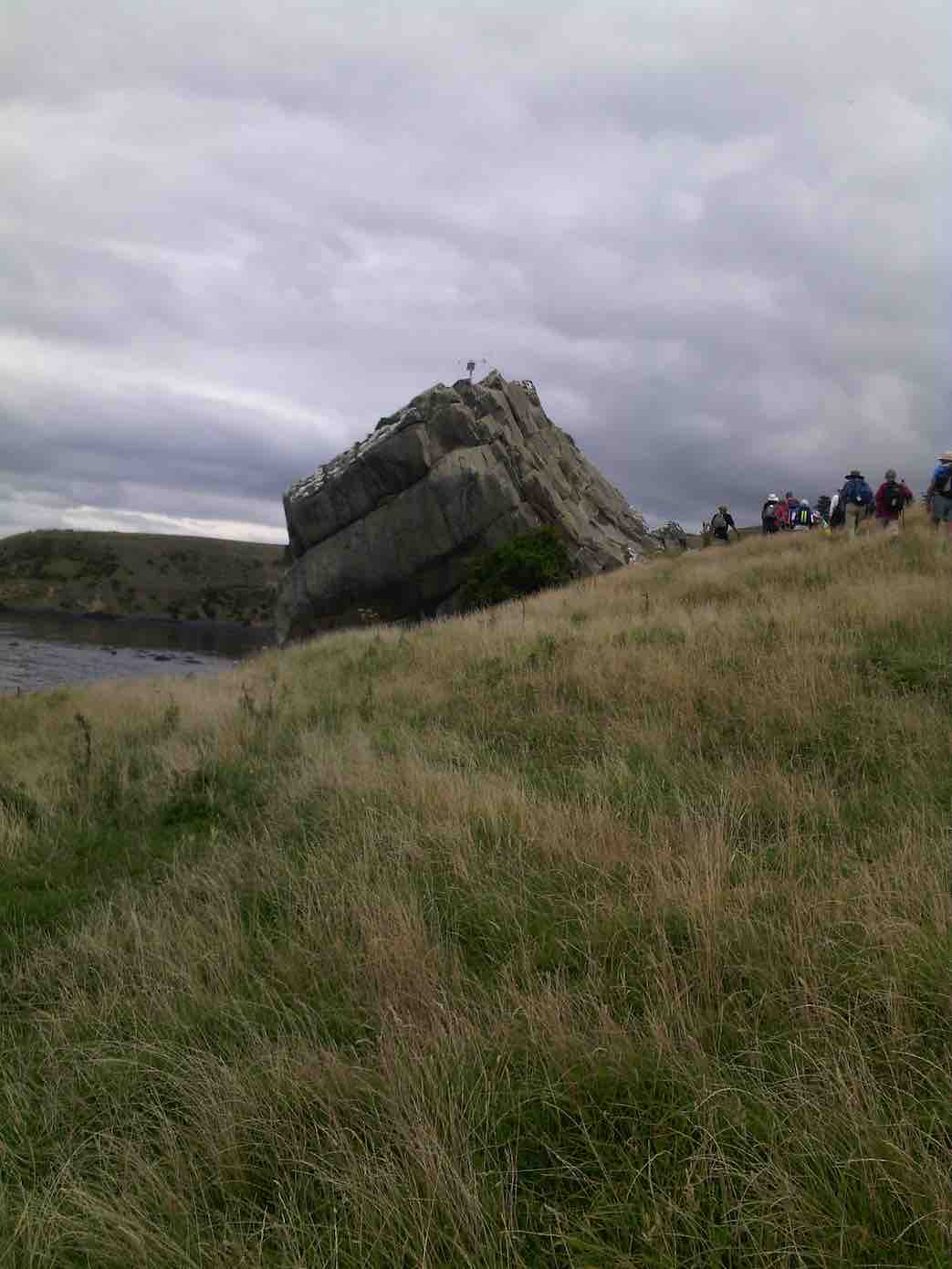
8. 1/3/2017. Both. Seacliff/Brinns Point. M. Leaders: Shona and Keith.
For the combined walk 28 people started at the lay by 2kms north of Seacliff township. We crossed the road and wandered uphill for morning tea before most ventured not/into/around the rock or did combinations of these.
(Margreet pic.)(Keith pic.)Split Rock with amazing colours. (Helen pic and caption.)
We came back down to the cars where several opted to stay. Twenty-one continued downhill to cross the railway line and follow it north for 200 metres where we entered a rugged track formed and marked by the very obliging farmer, which we followed downhill and out to the coast. We had lunched in a clearing out of the sun in among the pines.
Lunch under the pine trees. (Helen pic and caption.)
At the coast we climbed through the fence and followed single file on sheep tracks in the paddock from Green Point
Green Point. (Helen pic and caption.)
to the historic Urupa (Maori Cemetery) at Brinns Point, seeing a couple of seals on the rocks below as we were passing.
The oldest. An inspiration. Mollie, George, Doug and Lester. All completed the tramp. (Helen pic and caption.)
After climbing uphill we arrived back at the cars. Distance walked 6.5kms. Coffee followed at Blueskin Cafe. – Shona and Keith.
7. 2/12/2015. Both. Green Point and Brinns Point. Leaders: Doug, Arthur H, Ian F.
GPS map of Hikers’ route.
Trampers’ report. Being the first Wednesday of the month, this was a combined tramp to Green Point and Brinns Point in the Seacliff Area.
It was 10am when the cars arrived, so morning tea was taken then. 10 trampers left first, following the railway line north about 1.5km to inspect the disused rail tunnel .
After looking at the south end, we negotiated along the top of the cutting, and down the steep clay bank onto the rail line, and to the northern tunnel entrance. This was blocked completely by a fall a few metres in. The brick roof immediately inside the entrance looked dangerous. The trampers then returned to the cars by the same route as the outward journey, down the paddocks then to Green Point, before following the coastline south to Brinns Point.
The trampers ran out of energy just before reaching the top of Brinns Point, and stopped for lunch, a very picturesque scenery to look at while dining but very hot with no cooling breeze.
A 5 minute climb took us up to the interesting little Cemetery on Brinns Point where all took time to inspect the few headstones and plaques.
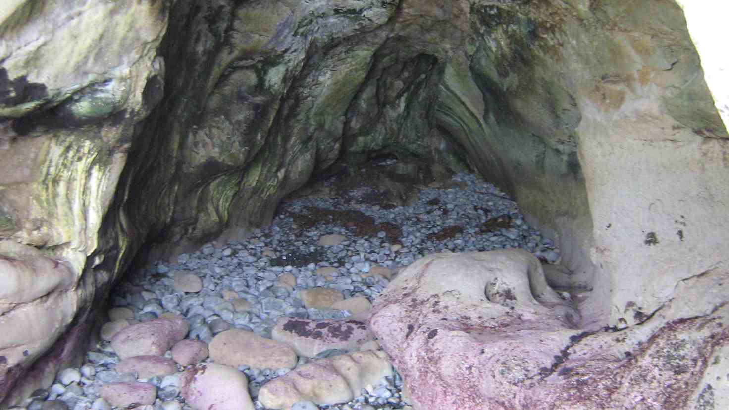
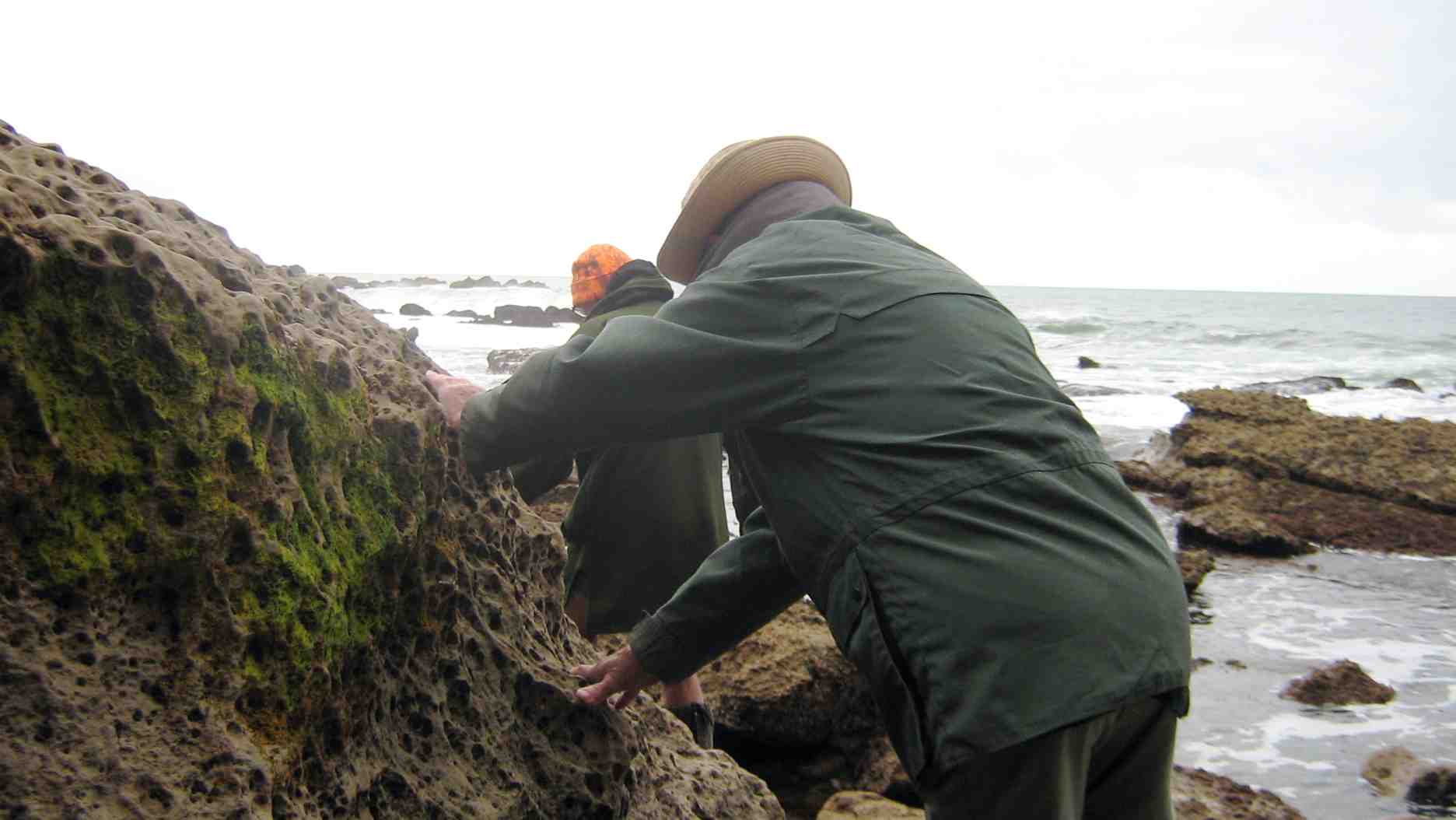
Down hill then, to the south, and out onto the bouldery beach. At the south end is an interesting cave. Ian H. did a cliff-side recce first using his crampons, but we then found that the tide was just far enough out, that all 10 were able to scramble around the rocks to view the cave.
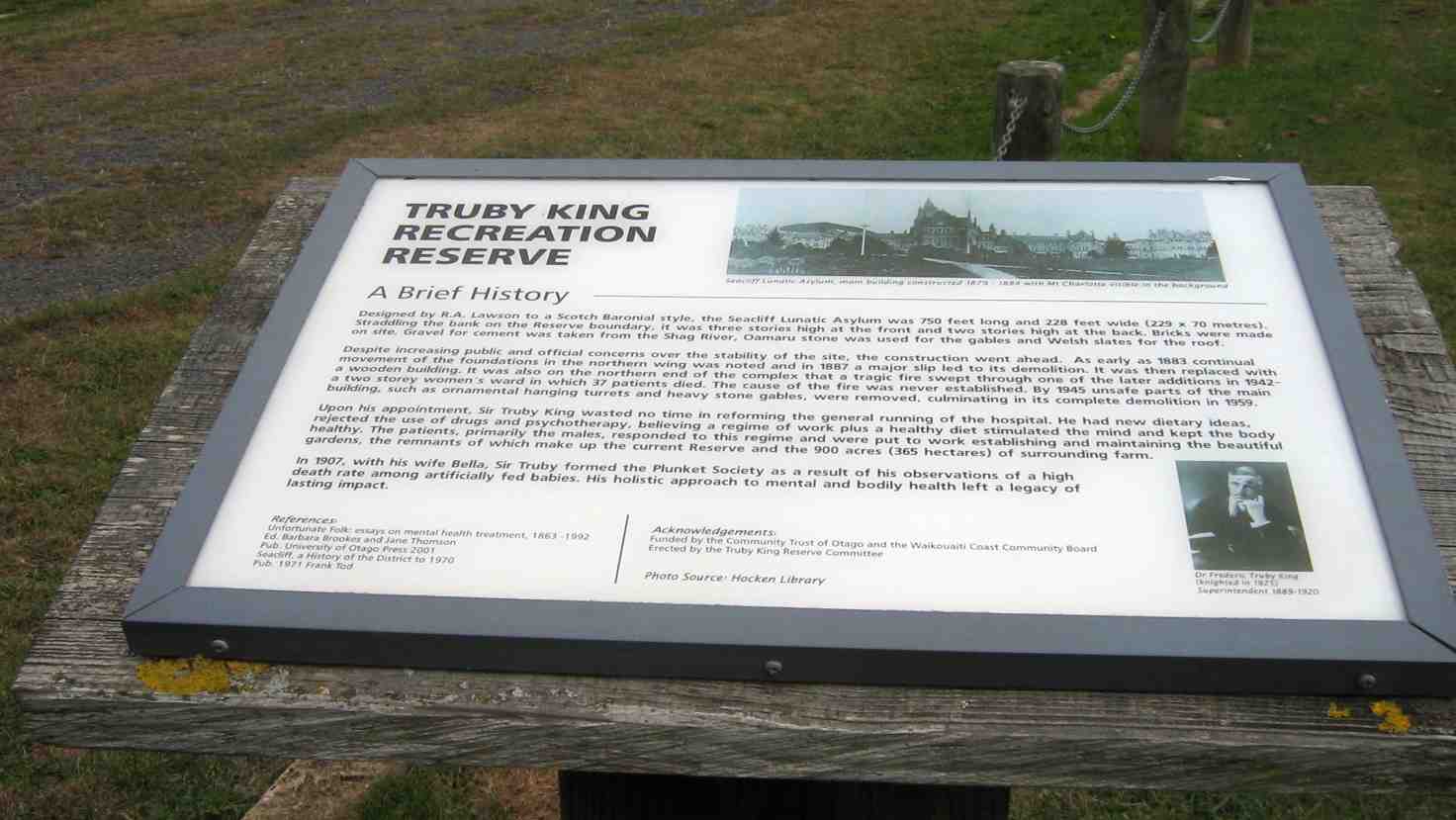
It was then back along the beach to the entry point, and uphill to look at the old house ( which is to be restored ) and back to the cars. Some of the trampers also walked around to the Truby King Memorial Gardens, at Seacliff, on the way home. A hot, but very interesting day’s tramp. Arthur H.
Hikers’ report. Very few of the club had been in this area before, and even fewer of those who had, had any memory of it. It was a substitute on the day for the programmed “Mahinerangi Area” tramp for which the leaders could not think of a suitable venue. The Hikers followed the Trampers to the tunnel, but only the southern end. Back at the cars the Hikers leisurely explored the Green Point coast line cliffs and the bouldery beach, being caught up at the latter by Trampers who pushed ahead to stop off just short of the short steep climb to the Urupa which the leaders had planned for the lunch stop. In the confusion, some of the Hikers stopped off with them, although most persisted with the short stiff climb and to take in the wider view at the Brinns Point cliff edge and relax in the shade of the lupins.
Rock formations at Brinns Point.
After lunch thee two groups split again, with the Trampers going on to explore the cave to the south of Brinns Point.
Shot taken from Brinns Point of Trampers heading for the cave. President in foreground.
The hikers meantime made a leisurely climb up from the Urupa, across and back to the cars. In the event, from this point on, cars left on the return trip in their own time, disrupting any organised resorting to the Truby King Reserve. However a few car-loads made it, visiting the highlight of the visit, the famed Magnolia Tree referred to by Janet Frame with the metal plaque below it inscribed with Janet Frame’s poem. – Ian.
6. 17/3/2010. Trampers. Seacliff, Brinns Point, Truby King Recreation Reserve. Leaders: Ian, Ken.
(Suggested alternative for a future tramp: Split Rock, Green Point, Brinns Point to give a fuller day.)
Only Doug turned up for the leaders to take on a tramp. We first made our way down to Brinns Point and the graveyard.
Doug and Ken in Brinns Point Cemetery
Then it was down via a steep descent ending in a gully on the south side of the point and onto the beach. It was then time for a cuppa stop before picking our way over the boulders to the cave near the point at the end of the bay.
Approaching cave
The cave is satisfyingly deep. We disturbed birds nesting at its head and with noisy flapping wings they made their way out to sea.
The cave’s interior
The cave is approachable only at low tide. And we had to be careful to place our boots on safe surfaces.
Taking care on return from cave
A safer area on return from cave
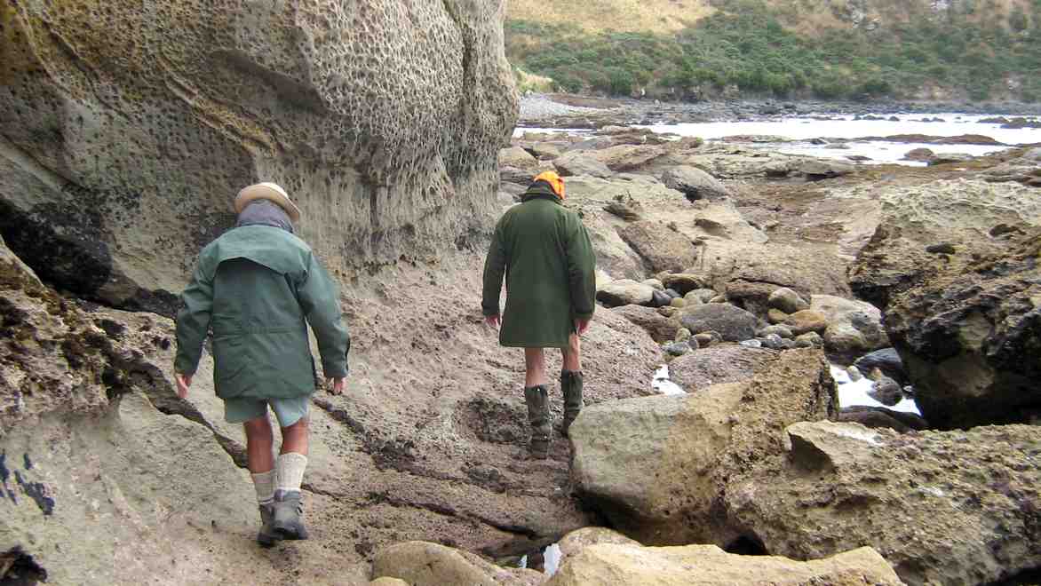
Long return along bouldery beach
We climbed the ridge above the bay up past an old house, back along the road beside the railway and over to the Truby King reserve.
The Truby King Recreation Reserve Plaque
We rambled over as much of the reserve as we could discover but still failed to identify the old tennis court. We stopped to show Doug the famed Janet Frame’s magnolia tree.
Janet Frame’s magnolia tree. Ken and Doug.
The plaque enlarged
Because it was a shorter day’s tramp we thought a future one would be better taking in split rock, Green Point and Brinns Point, plus or minus the Reserve. – Ian.
5. 22/7/2009. Karitane, Puketeraki, Green Point. Leader: Ian and Peter F.
click to enlarge
4. 15/1/2003. All. Karitane, Ellison Farm, Green Point. Medium. Leaders: Ria L, Catherine.
3. 15/11/1995. Karitane: Ellison Farm, Green Point. Leaders: Ria L, Catherine, Nel K, Ria H.
2. 9/9/1998. Seacliff, Brinns Point, Enchanted Forest. Leaders: Doug and Myrie.
1. 28/10/1992. Seacliff, Brinns Point, Enchanted Forest. Round trip. Average. Park cars at Seacliff Hospital entrance. Leaders: Marie F, Maire, Hugh, Margaret D
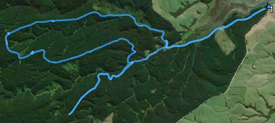
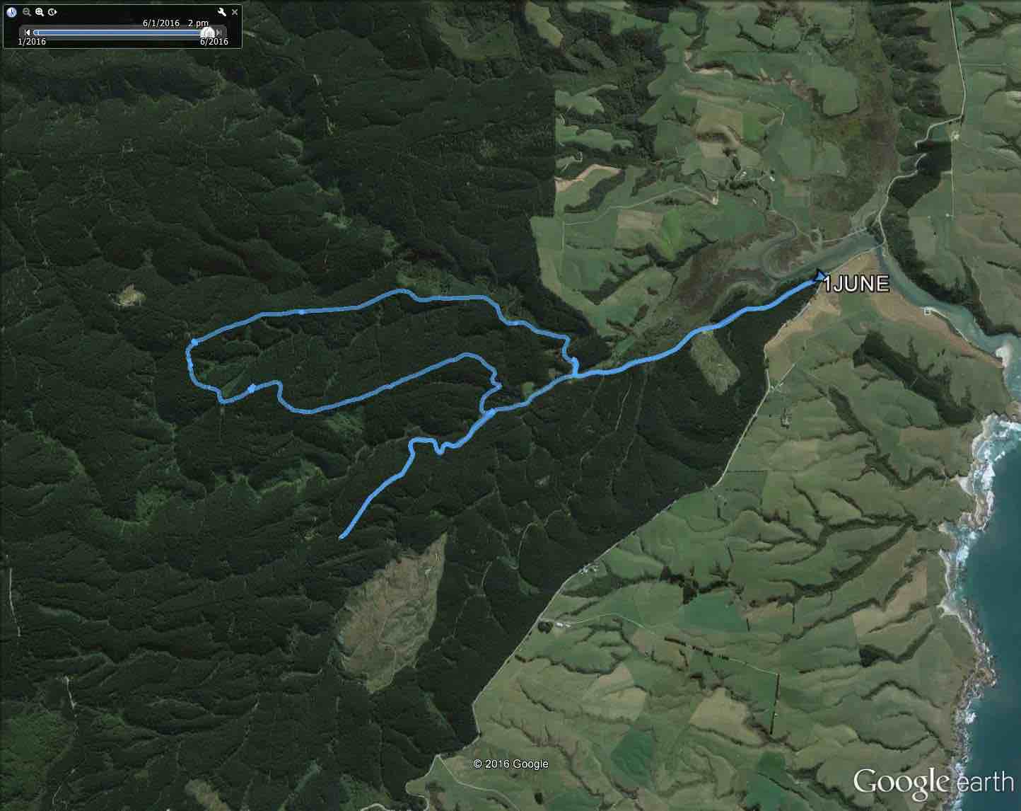
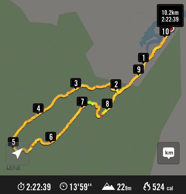
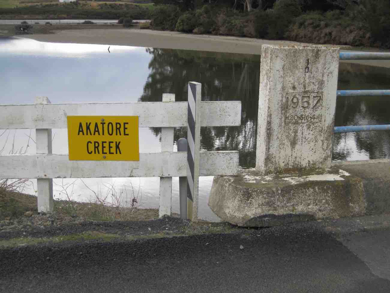
Akatore tramp 1 June 2016.
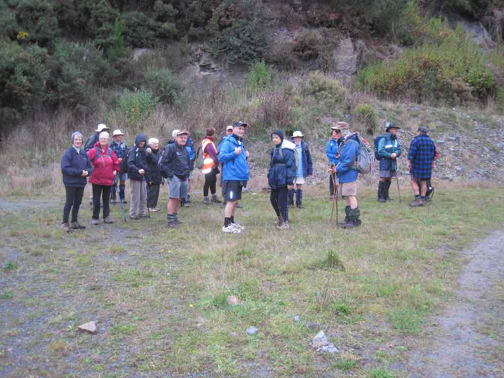
We obtained the access permit for the recce, on Saturday 21 May 2016, from the Wenita website at http://www.wenita.co.nz/use-the-forest/. The only limitation on numbers mentioned on the access permit was 4 hunters per permit. We obtained the permit for the tramp on Wednesday 1 June from Ian at the Wenita office, 11 Hartstonge Ave, Mosgiel, on Tuesday 31 May. Permits for entering the forests at the weekends can be obtained online. Wenita like to issue weekday entry permits at their office in the preceding week so they know what forestry operations will be taking place. No number limitations were mentioned on the tramp permit for 1 June in contrast to the limit of 15 that has been on some permits in the past.
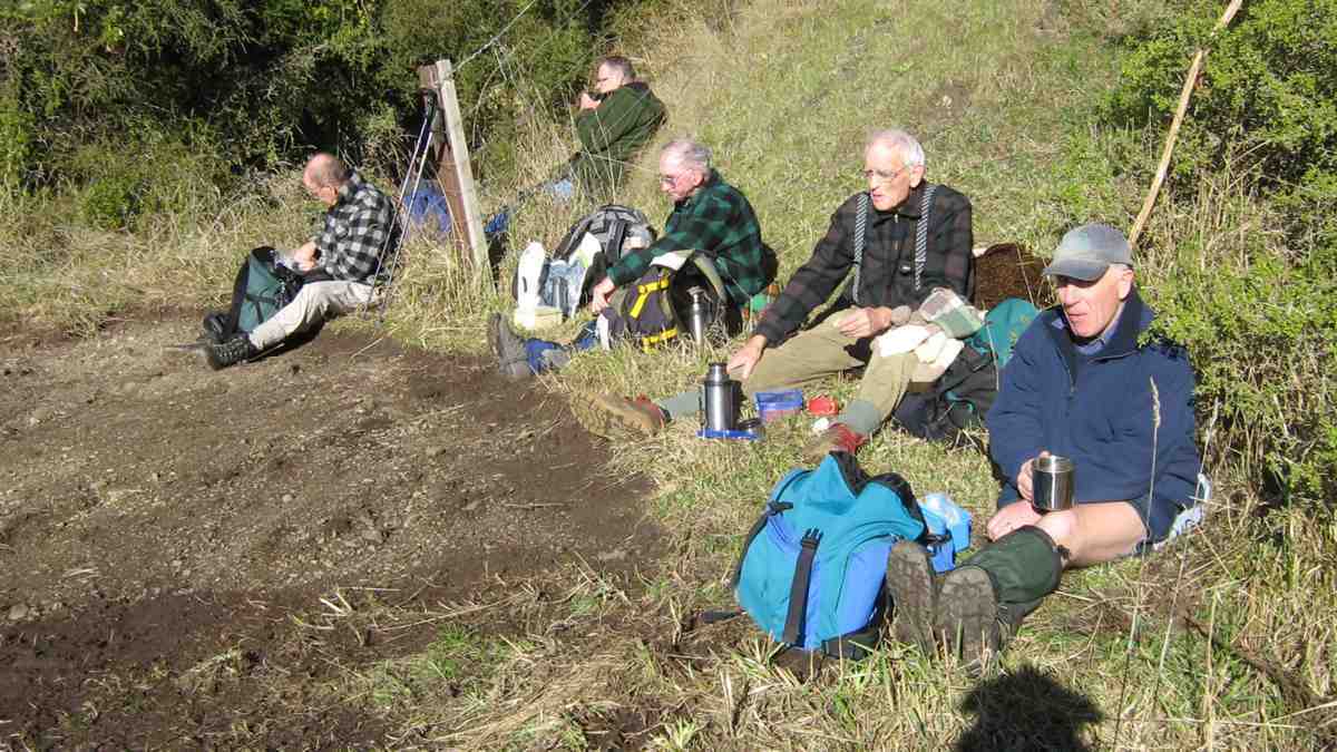
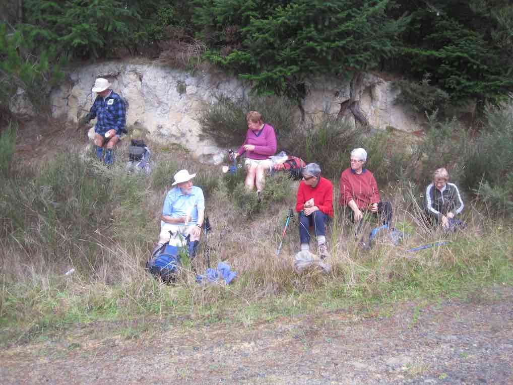
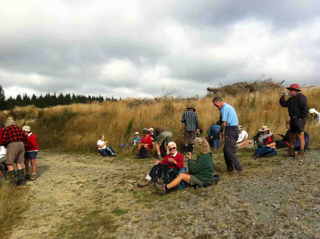
35 trampers set off along Pleasant Road from the gate approximately 400 m south of the Akatore Creek bridge, approximately 6 km south of the Taieri Mouth Bridge at Taieri Mouth. We had morning tea, after approximately 2.25 km, near the bridge at the junction of Pleasant and Boundary Roads.
Sunny spot for some having morning tea (Helen pic and caption)
After morning tea we climbed the gradual ascent on Centre Road for approximately 3.75 km to the turnoff to the left onto Staircase Road.
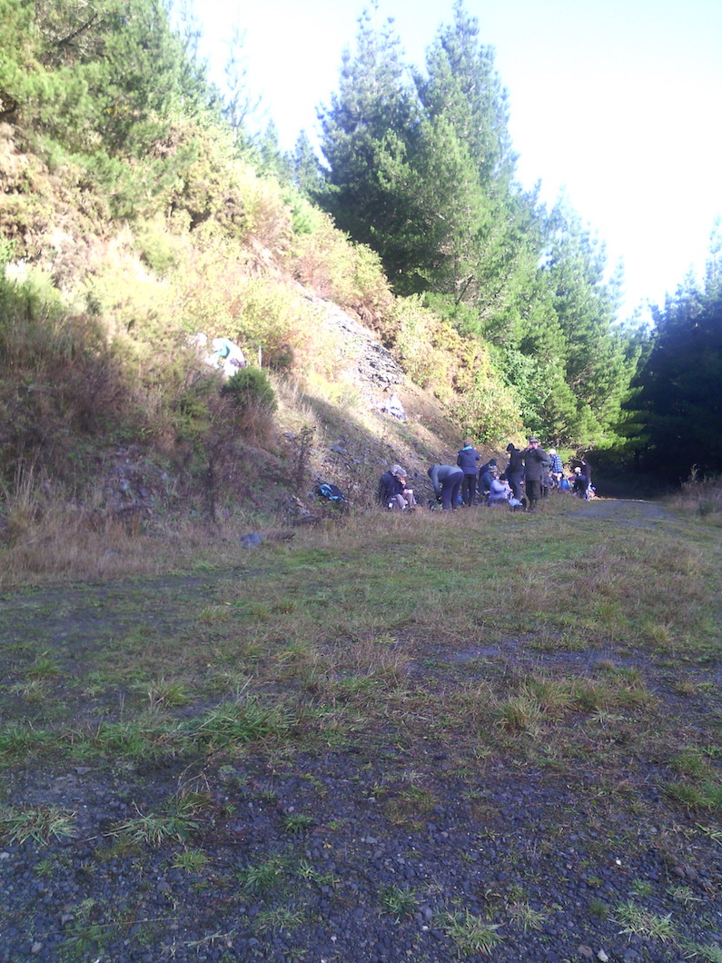
We lunched at 12.30 pm on Staircase Road in a rather chilly situation after negotiating the major obstacle of the day, a large wind-fallen tree.
Lots of fallen trees on track. (Helen pic and caption)
After lunch we proceeded for the remainder of Staircase Road …
Muddy underfoot in parts. (Helen pic and caption)
… (total approximately 3.75 km) to the junction with Pleasant Road.
The main group proceeded with Marjorie back to the cars by the gate while a smaller group followed Bruce up Pleasant Road for approximately 1.5 km to the junction of Pleasant Road and Kamahi Road before getting back to the cars at approximately 2.45 pm.
The day was generally quite cold and keeping moving helped for staying warm. No rain fell but the tracks were mostly in the shade and there was some wind at times.
Coffee followed at Wals. Distances: approximately 12 km without the Pleasant Road dogleg; 15 km with the dogleg.
– Bruce and Marjorie.
7. 6/5/2015. Akatore Forest Both Groups. M. Leaders: Bruce and Marjorie.
The 10k Group
The 10k group’s route map
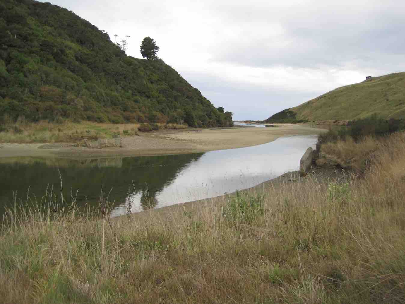
The 10k group of 10 parked on the right approximately 200 m past the Akatore Creek bridge…
Confirmation of the calm day. Akatore Creek Bridge (John pic, taken after tramp)Further calm. Looking out to sea, from the Akatore Creek Bridge. (John pic, taken after tramp)
…on the Akatore road, went around the locked gate and walked 1.41 km along Pleasant road to the junction with Level road where the party stopped for morning tea.
Some of the “Ten”. (John pic)
They then turned left into Level road and proceeded 3.07 km up the road to where a road comes off on the right to a hill top (about 150 m before the junction of Level road and Mailbox road. Some went up this road to look at the view. They then returned down Level road and turned left into Pleasant road and proceeded 0.41 km along this road to the bridge area for lunch. They were surprised to meet the 10 in the 14k group standing on Pleasant road beside the turnoff on the right to the concrete bridge.
Meeting (John pic)
Both groups had lunch together 150 m up Boundary road. Some sheltered under pine trees to shelter from a few spots of rain which did not persist. After lunch the 10k group returned along Pleasant road for 1.82 km to the cars. The weather was pretty good overall with only a little very light rain and generally warm temperatures. A few fantails were seen. Total distance approximately 10 km, climb approximately 120 m.
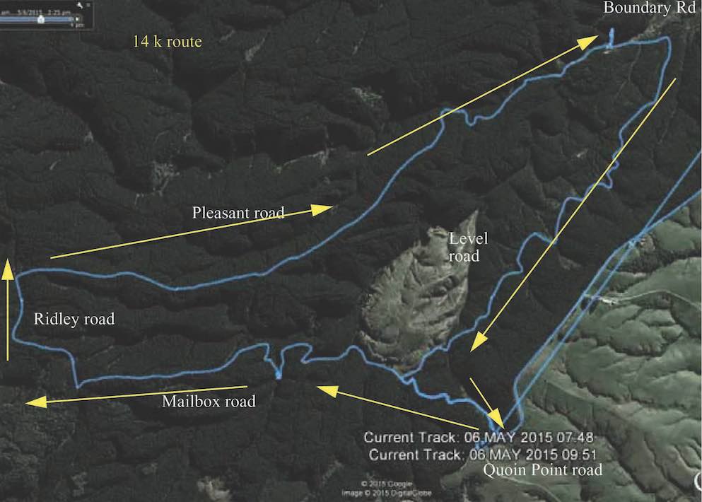
The 14 km Group
The 14k group’s route map, courtesy Bruce.
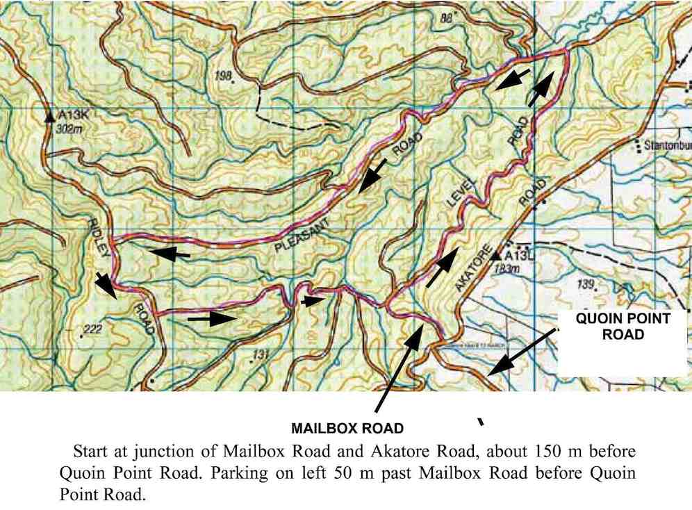
The 14k group of 10 parked on Quoin Point road, 3 km south of the Akatore Creek bridge. (It is easiest to turn at the widest part of Quoin Point Road at the junction with Akatore road and back up Quoin Point road and then parking on the left facing Akatore road. )
We walked 200 m down Akatore road, heading north towards the Akatore Creek bridge, and then turned down Mailbox road, on the left, past the locked gate for 1.07 km to the junction with Level Road. We turned left to remain on Mailbox road and, after 1.21 km, passed Serpentine Road branching off on the left. We stopped at the junction with House 21 road, 780 m past the Serpentine road junction, for morning tea. After morning tea we continued on Mailbox road for 1.48 km to the junction with Ridley road where we turned right and proceeded for 940 m before turning right into Pleasant road. We went down Pleasant road through the forest for 4.67 km arriving at the bridge area about 12.20 p.m., a minute or so before we met the group of 10k trampers. We had lunch with them. After lunch we waited for them to depart before proceeding along Pleasant road again for 410 m, turning right into Level road for 3.07 km, and then turning left into Mailbox road again and walking uphill for 1.07 km back to Akatore road, and then 250 m to the cars in Quoin Point road. We saw a tomtit and some fantails. Total distance approximately 15 km, climb approximately 400 m. – Bruce.
6. 13/3/2013. Akatore Forest Walk via Mailbox Road entrance. Leaders: Bruce and Marjorie.
On a calm mild day after crossing the Taieri River at Taieri Mouth and then Akatore Creek we proceeded south for about 3 km on Akatore Road and parked on the left hand side of the road about 70 metres past Mailbox Road on the right just before Quoin Point Road on the left.
GPS of Route on Topo map courtesy Bruce
We went down Mailbox Road for about 400 m to the junction with Level Road and had morning tea about 150 m along Level Road at the junction with a logging road on the left.
Morning Tea
We then continued on Level Road (on the right) for about 2.2 km to the junction with Pleasant Road. We turned left into Pleasant Road…
Along Pleasant Road
…and had lunch in the trees about 2 km further along. After lunch we continued another 2 km along Pleasant Road and turned left at the end into Ridley Road. We proceeded about 600 m down Ridley Road passing some bee hives on the right and took the first road on the left, Mail Box Road.
The sign for this was obscured by gorse. We continued along Mail Box Road until the junction with Level Road where we started the circuit (it was the third road on the right) and returned up hill to the cars. The weather remained calm and mild. We saw some fan tails and a tom tit. We heard brown creepers in the canopy and a grey warbler. Leslie heard a falcon. We obtained a permit from Wenita prior to the tramp and estimated that not more than 15 were likely to attend. Having more than 15 makes an event and different rules apply. Distance travelled 12.4 km. – Bruce.
5. 16/5/2012. Both. Akatore Forest Walk via Pleasant Road entrance just beyond the Akatore Creek Bridge. Leaders: Chris, Bev.
In the light of questionable weather, and uncertain weather reports, few ventured out to the car park. The Hindon area trampers’ tramp promised high exposure to cold winds so was really out of the question. But the Hikers’ Akatore Forest promised a more sheltered tramp. As it turned out. With plenty of sunny spots on the roads. The route turned off Pleasant Road to anti-clockwise climb the hill and later descend via Staircase Road to Pleasant Road and out again. Bravo. Congratulations to the leaders and their determination to give it a go for six of us. – Ian.
Along the road
Lunch
Where the clockwise loop ended. (One of the more clouded moments.)
4. 26/2/1997 Akatore South Side. Leaders: Jack M, Hugh, Mary L.3. 3. 7/8/1996 Akatore Farm Walk. Average. Leaders: Jack M, Jean A, Ria H 2. 9/2/1994. Akatore. Medium. Leaders: Jack M, Eleanor, Judy & Rob 1. 30/1/1991 Akatore Forest Walks. Leaders: