21 kms PJP to Pine Hill School (via 3 Mile Hill Rd).
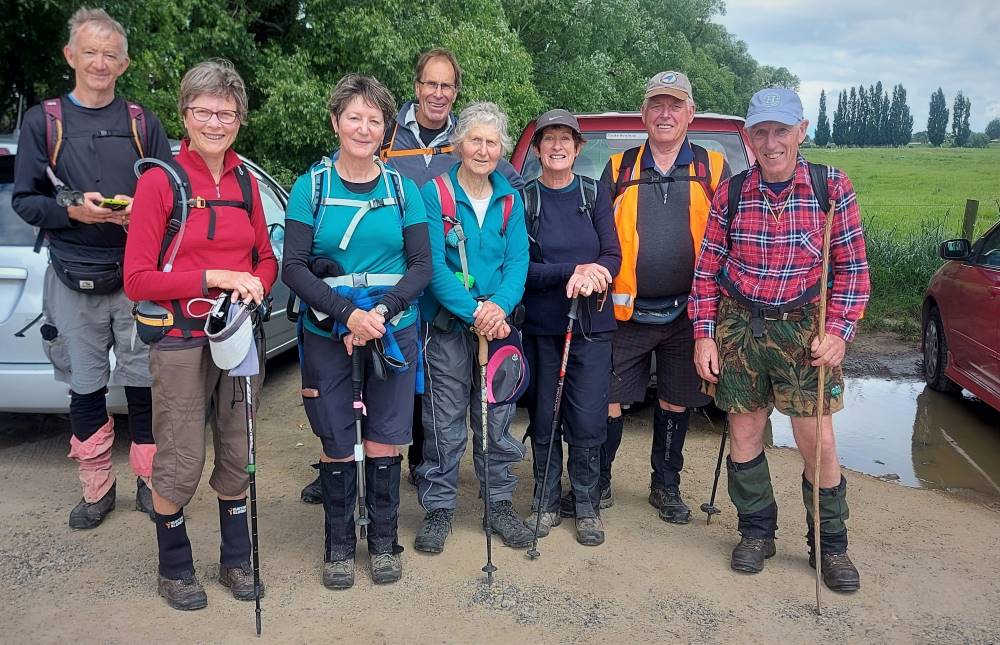
4. 20/09/2023. Hikers. Pine Hill. Grade 2. $5. 21km. Leaders: Jan Butcher/Jenny Finnerty.
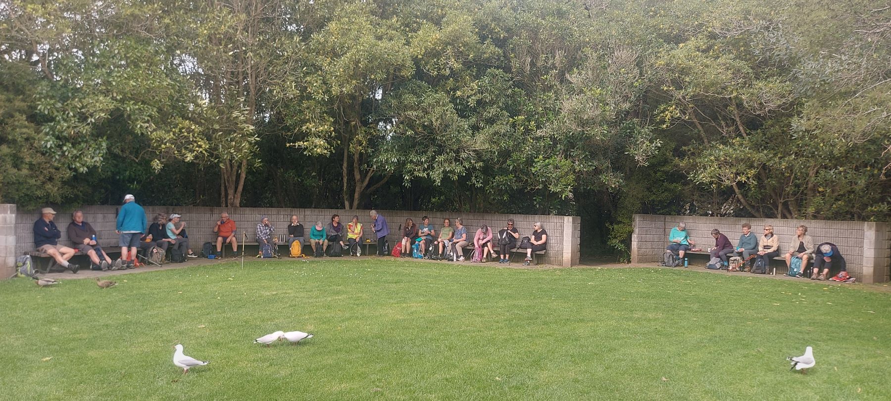
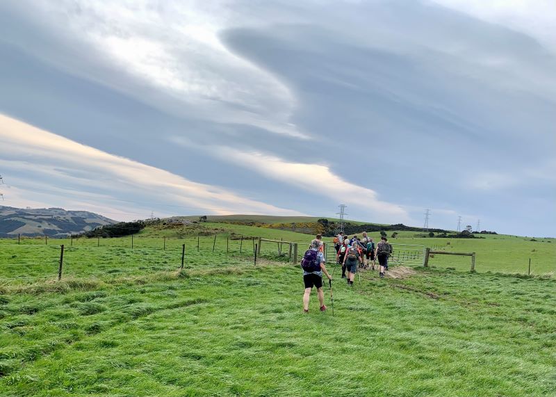
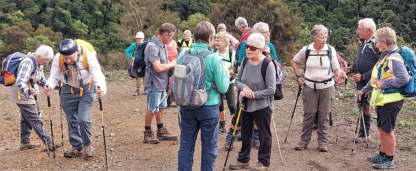
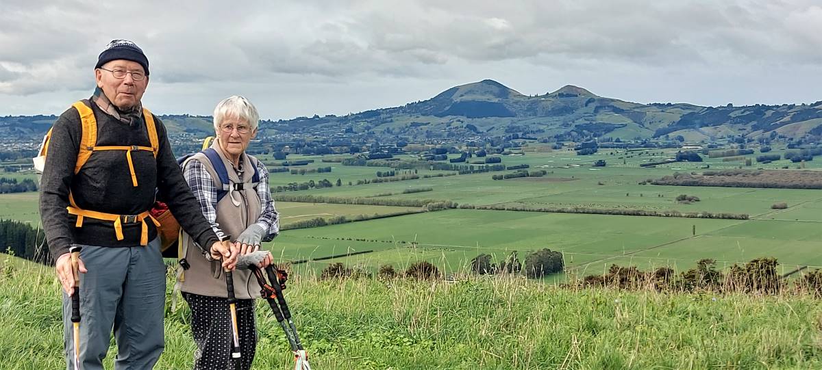
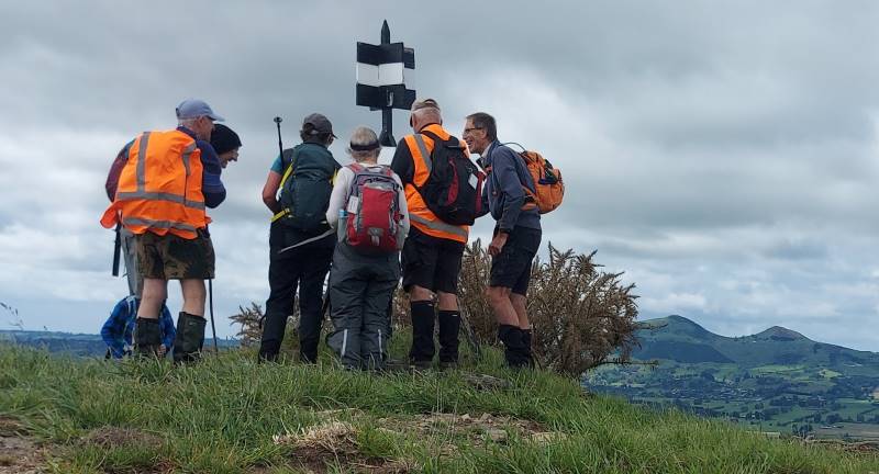
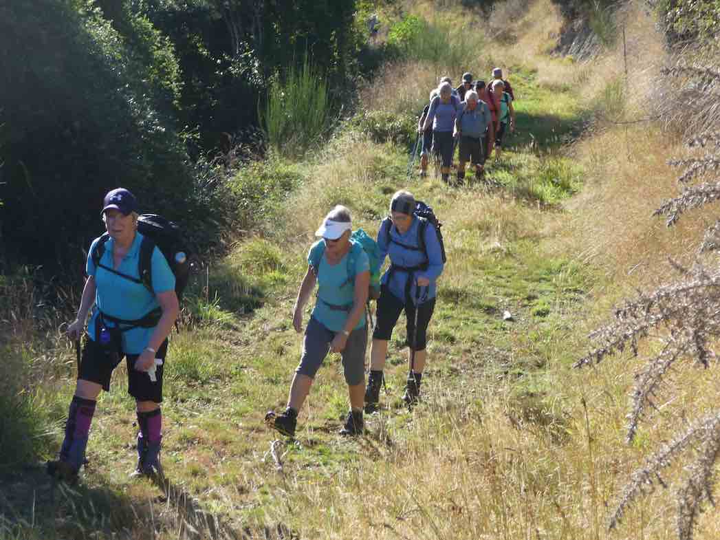
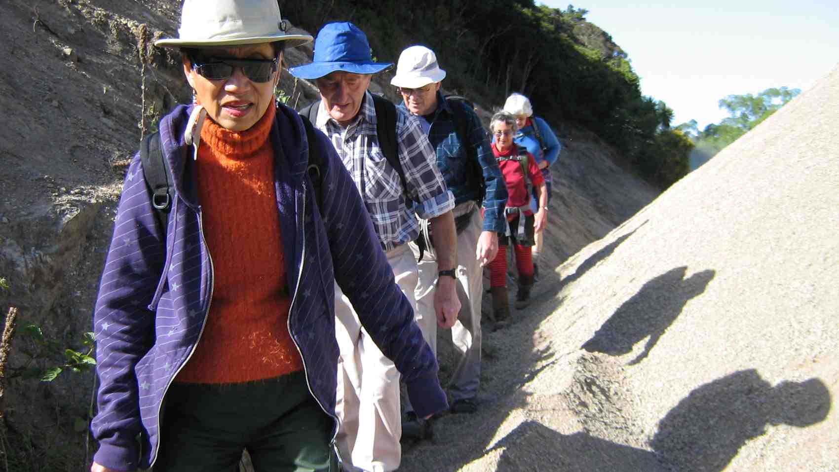
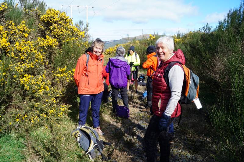
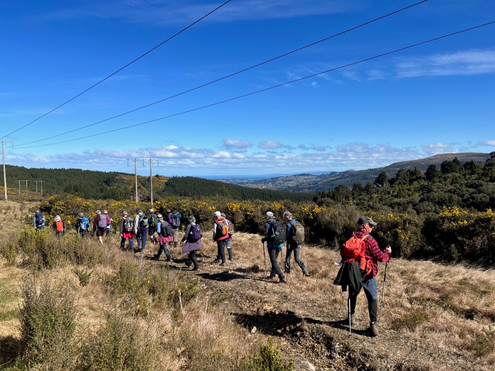
30 hikers turned up on a warm slightly windy day for our Pine Hill trek.
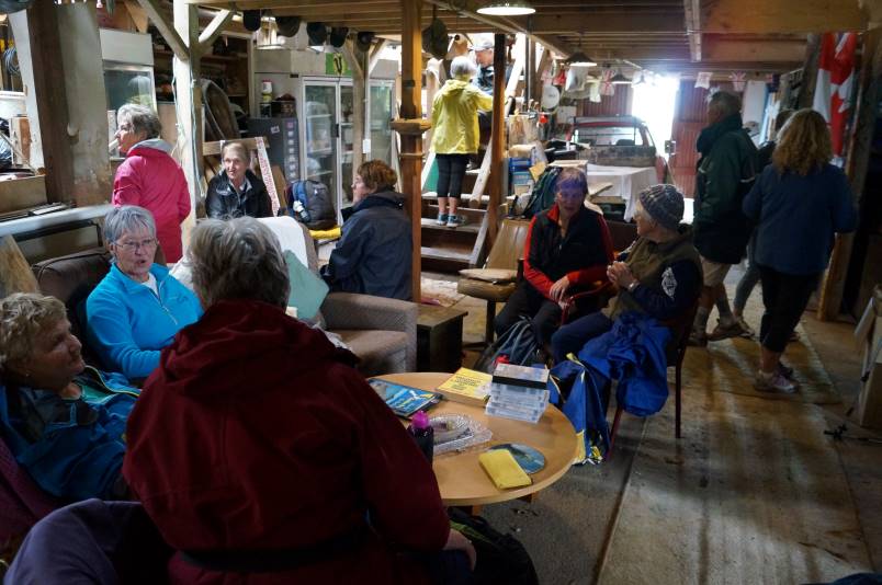
The start of the day – Photo & Caption Helen
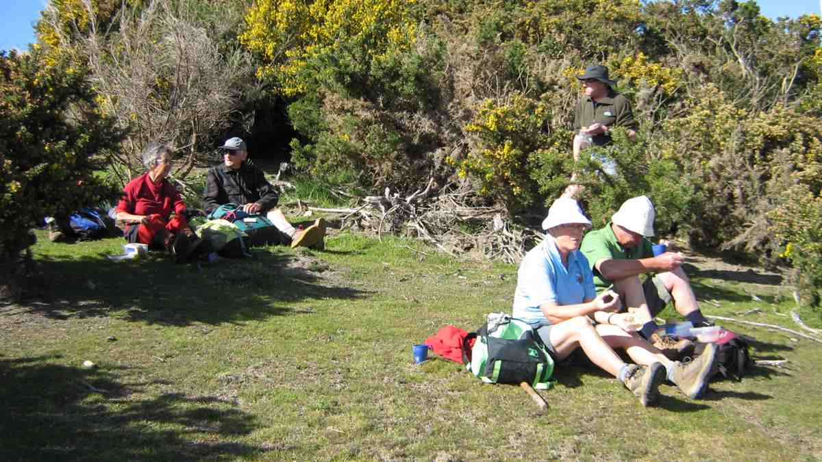
We met up with a couple of town folk at Malvern Street & walked through Woodhaugh gardens where we stopped for morning tea to fortify us for the trip up the hill.
Morning tea at Woodhaugh Gardens – Photo & Caption Helen
Beautiful clematis – Photo & Caption Helen
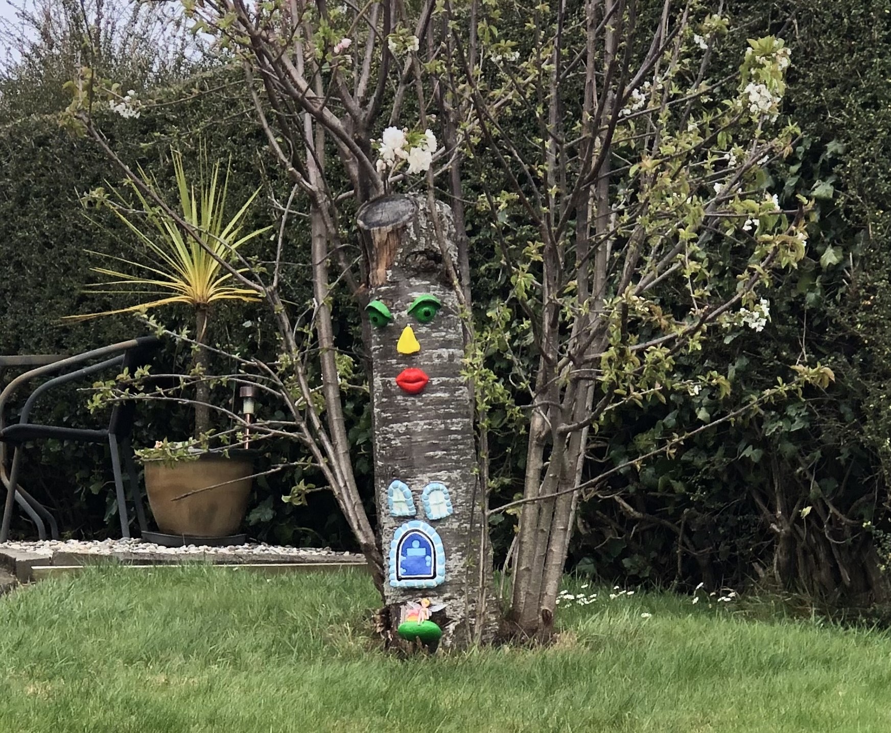
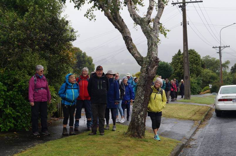
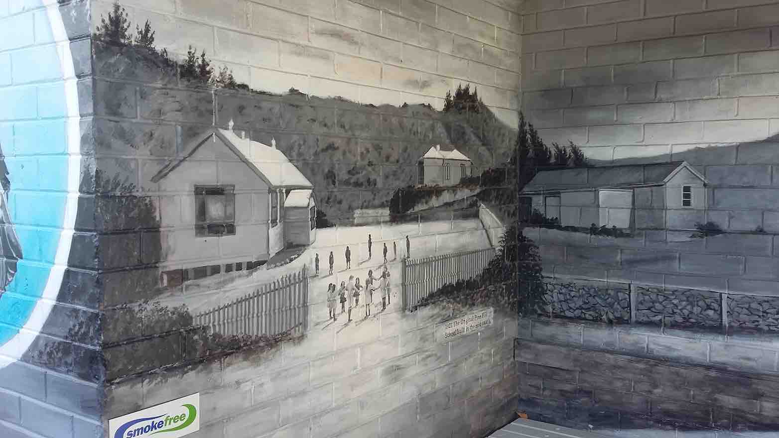
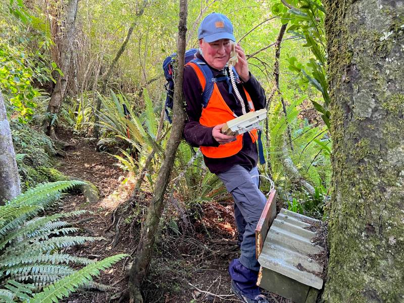
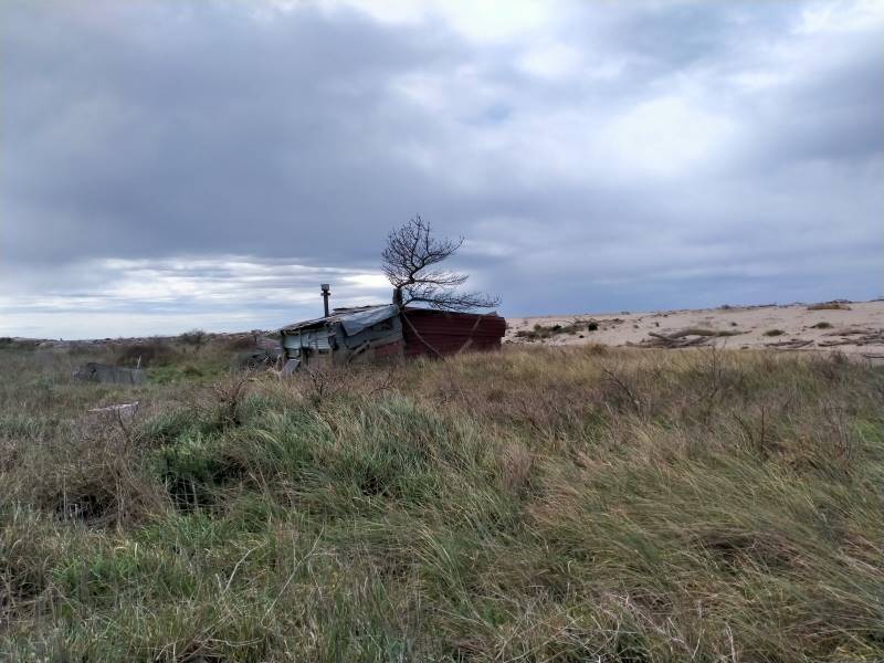
Unusual piece in Pine Hill neighbourhood – Photo & Caption Jenni
We did it a little differently from last time & walked up the motorway for a bit before turning right onto Fea Street and on upwards to meet with Pine Hill Road.
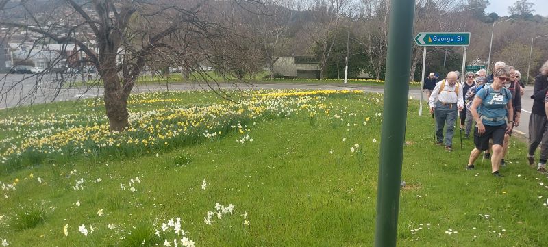
A field of daffodils – Photo & Caption Helen
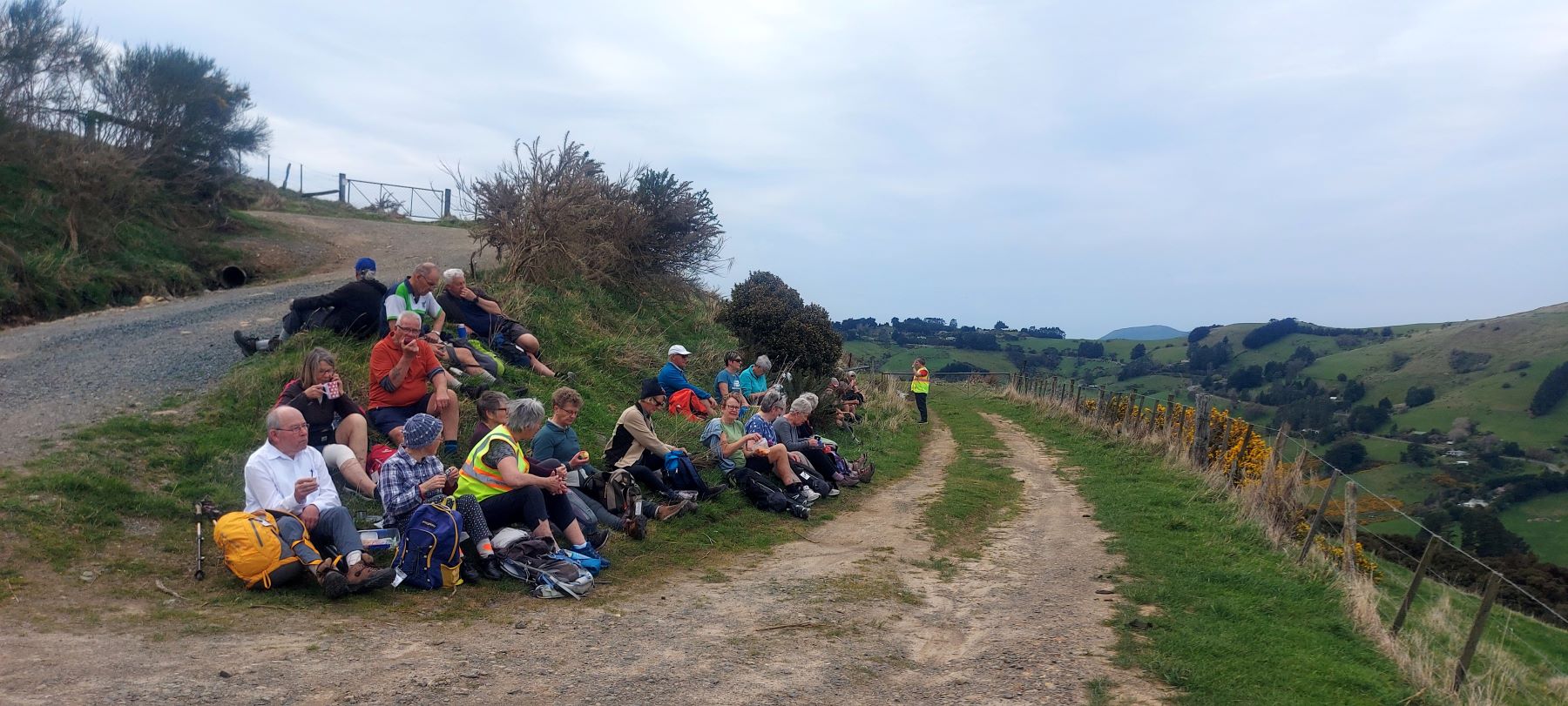
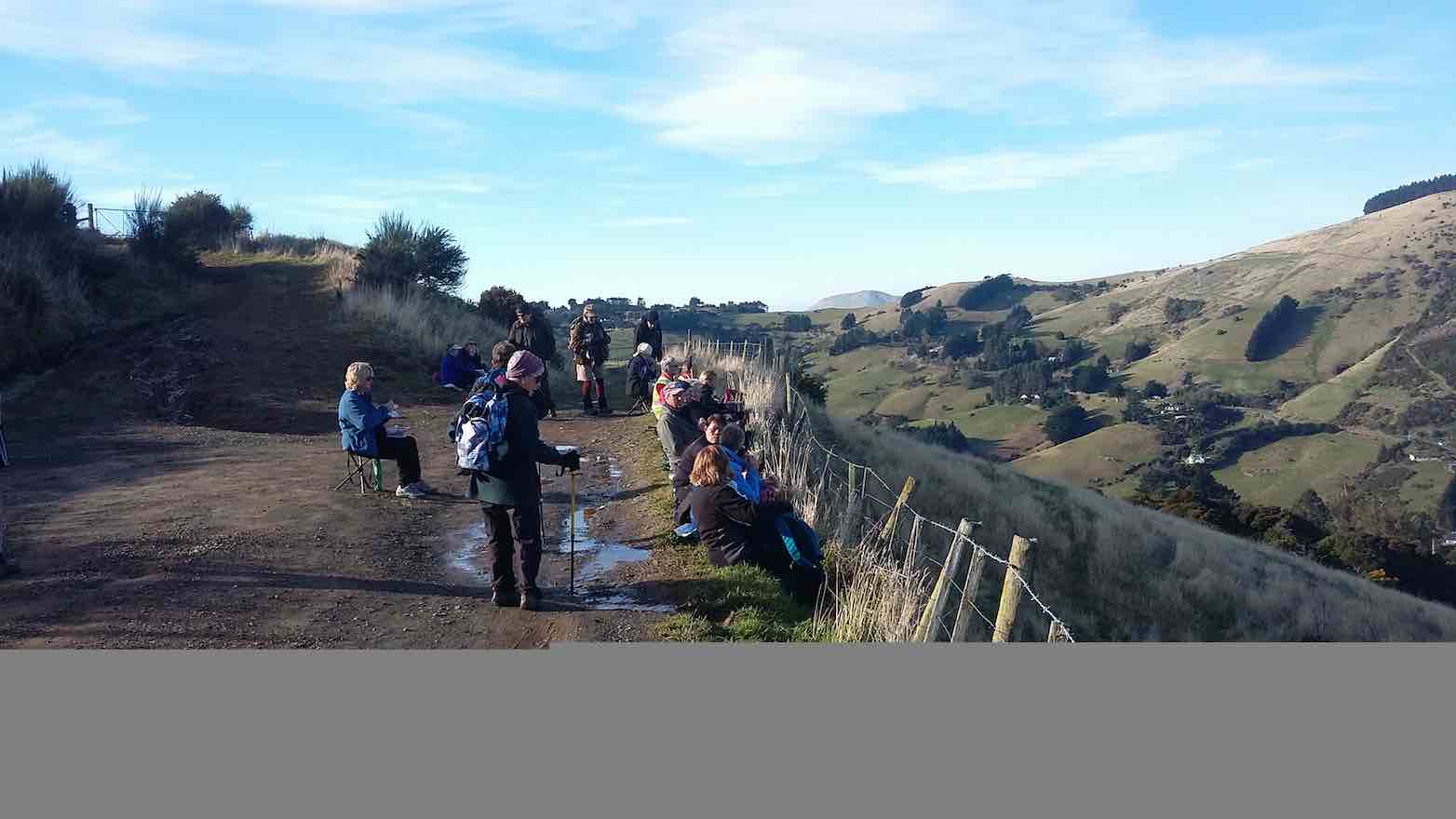
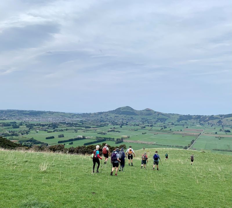
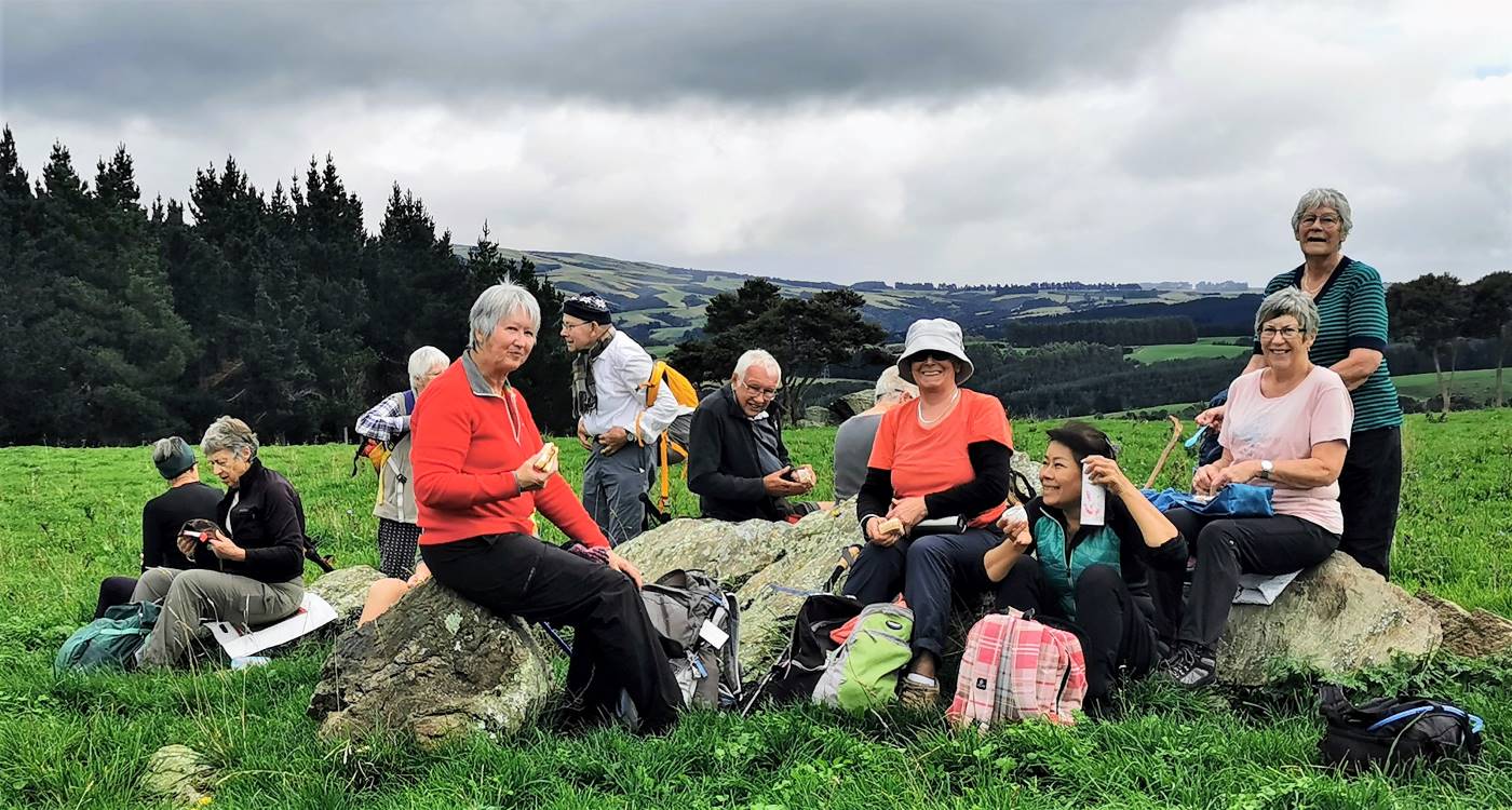
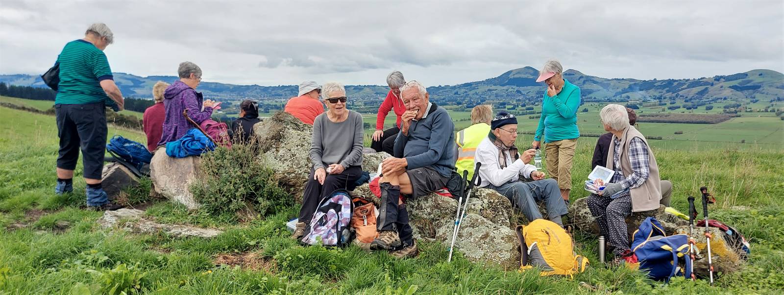
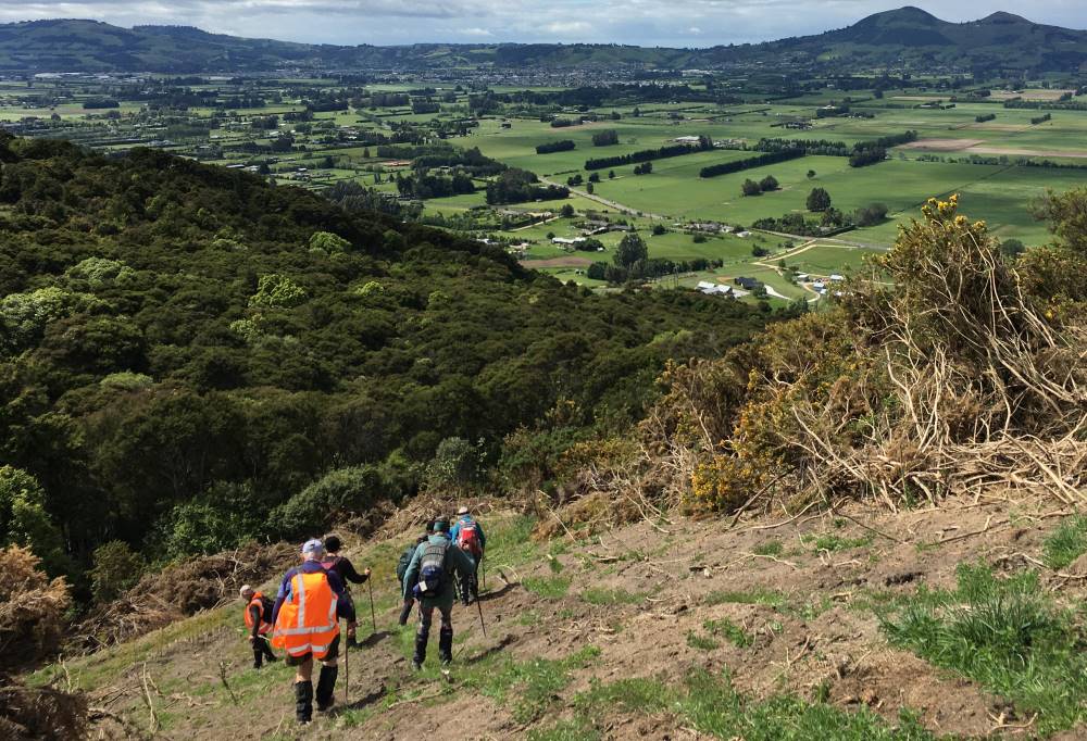
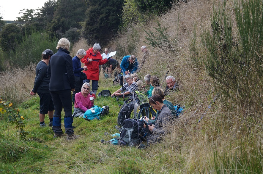
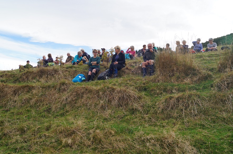
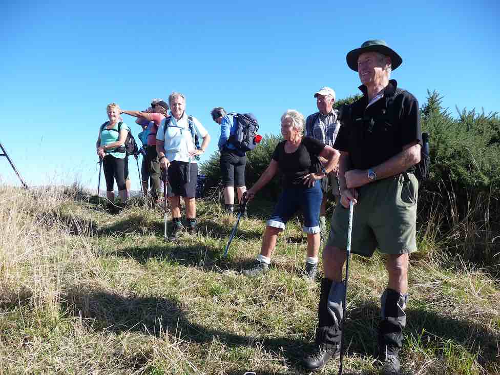
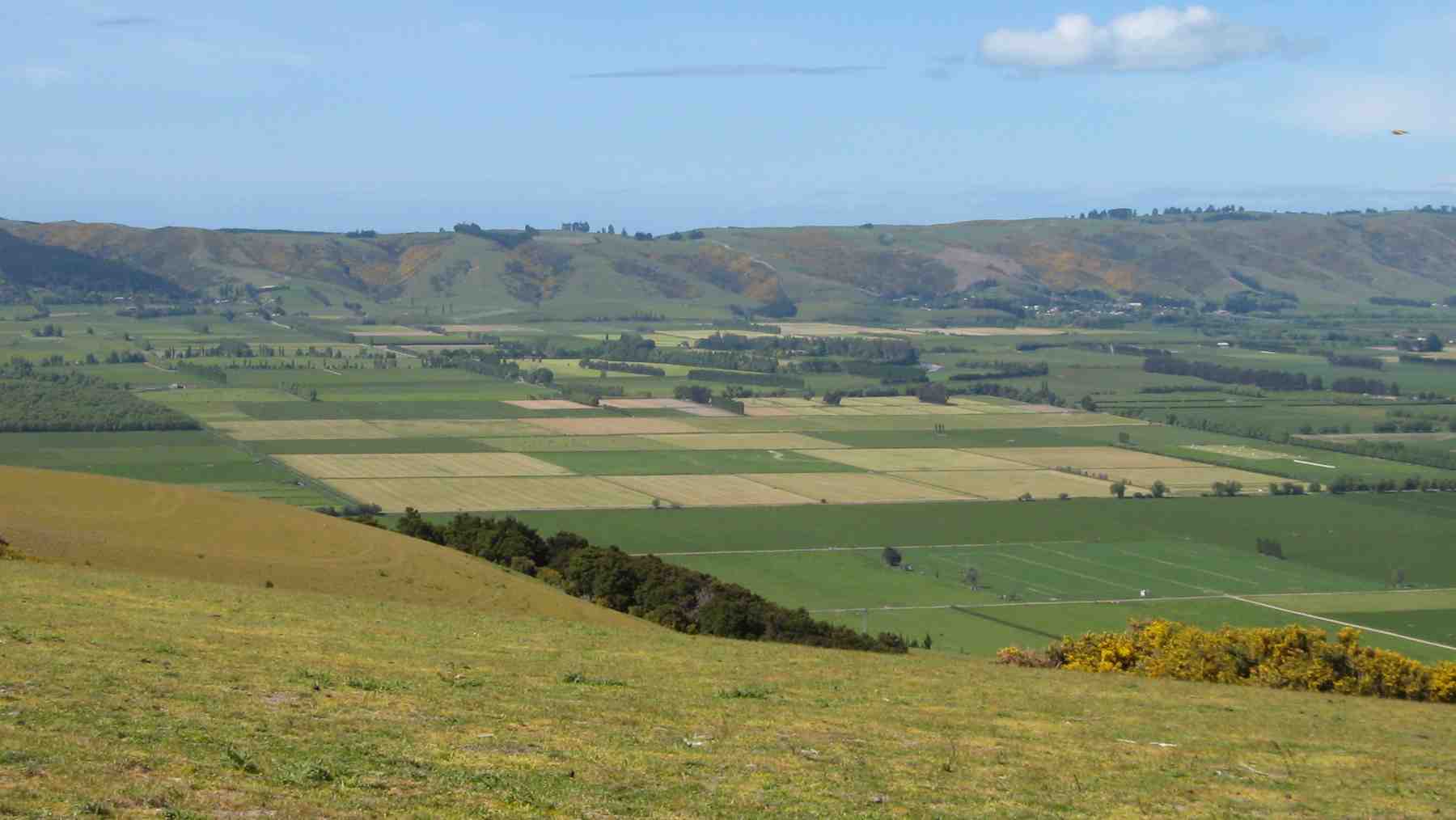
At the end of this road we turned right onto Campbell Road and walked to the end of the housing. This then becomes a wide dirt track which we followed to the end. It was about noon so everyone was happy to find a comfy spot on the embankment and enjoy the vista before them.
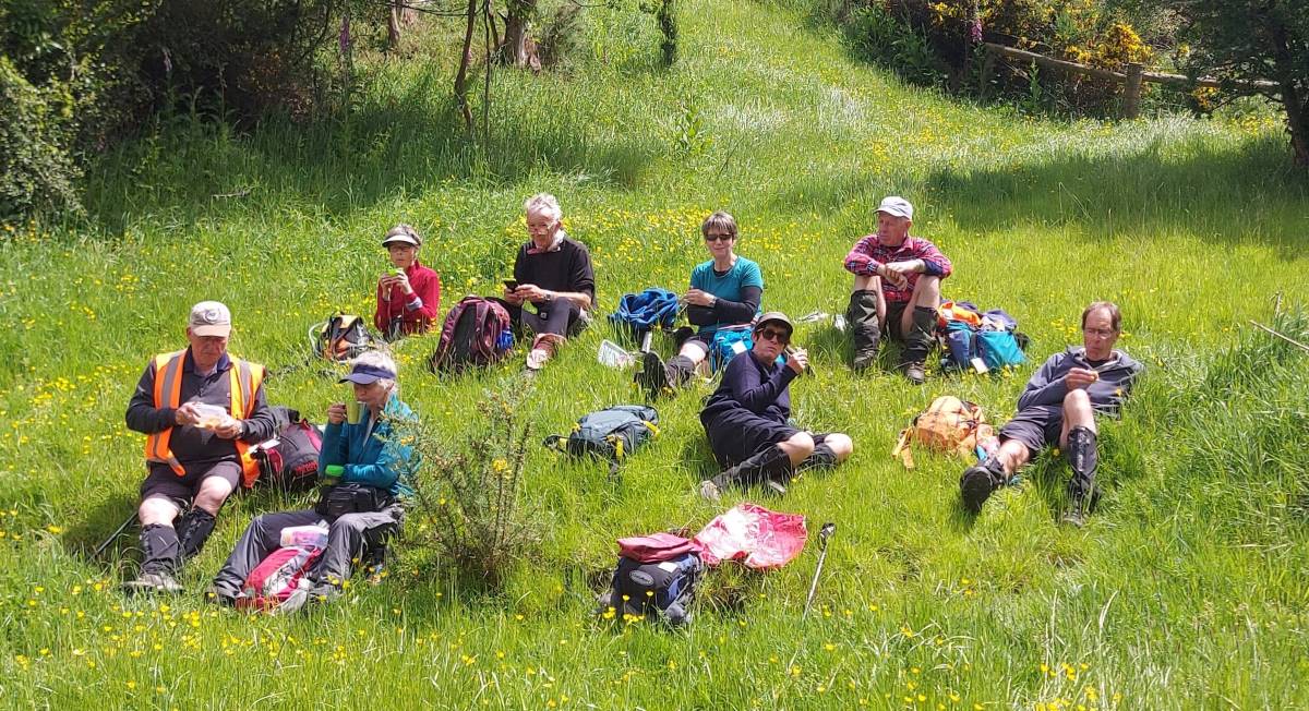
Lunch out of the wind – Photo & Caption Helen
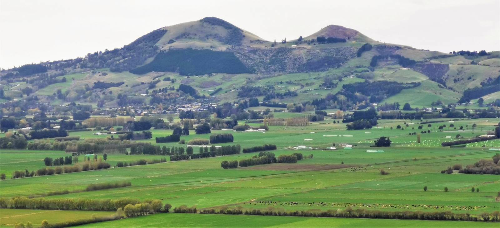
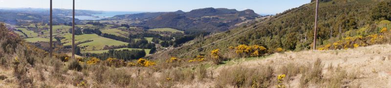
A lot of people told me they had never been up Pine Hill let alone this track with its best kept secret. And unbelievably there was no wind to speak of so we enjoyed the next half hour eating and talking about the view and trying to spot places of interest on the opposite side of the hill & beyond.
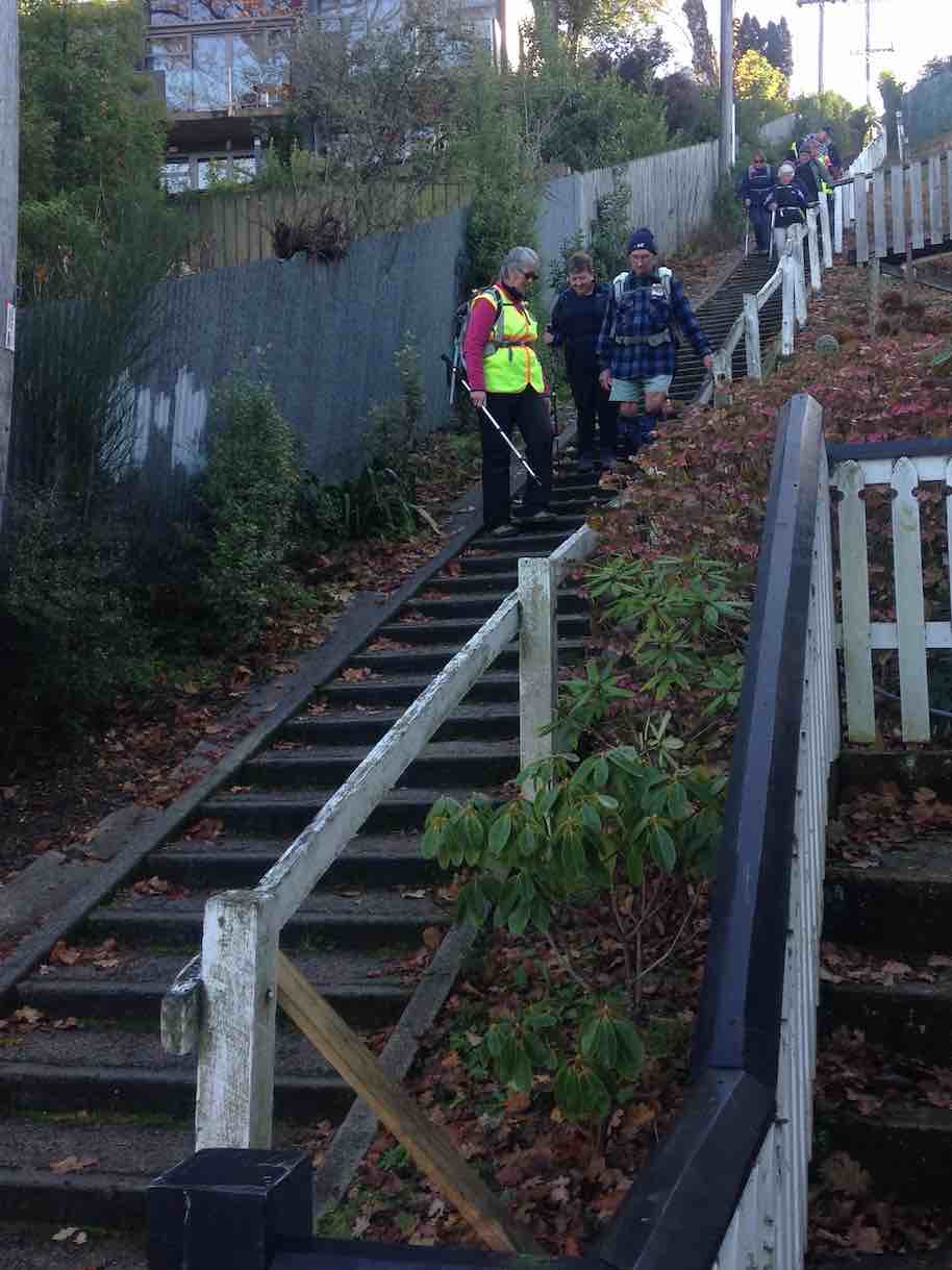
Reluctantly we had to “shift our bottoms” and start the walk back down the hill, this time turning at Pine Hill School and down onto Buccleugh Street which wound its way down and down to meet up with the 219 Duddingstone steps. We decided to head on over to the Botanic Gardens for a well earned treat. I had prewarned the cafe that there could be 30 takers for afternoon tea. He sounded a little shocked but managed us all no bother.
Amazing service at Crocodile Cafe – Photo & Caption Jenni
Some of the drivers were kind enough to go back to their cars and bring them to the carpark for their passengers. Thank you Pam. After refreshments some of us picked up some bargains at the plant shop adjacent to the cafe. We then walked back to the cars, admiring the beautiful camellias etc along the way. A good 10k walk on a nice day.
Jenny F and Jan B
3. 01/12/2021. Hikers. Hidden Gems of Pine Hill. Shone Munro and John Gardiner
On a misty drizzly day, 24 hikers met in Pine Hill Rd near the school.
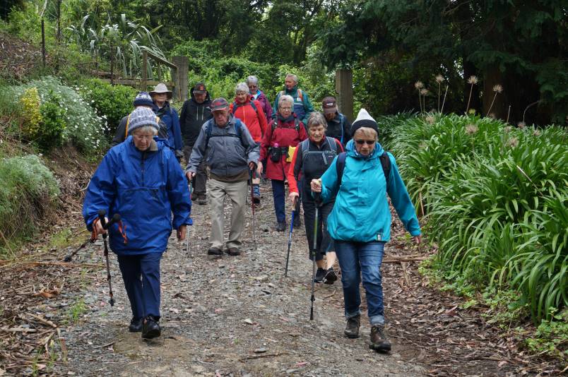
The walk up Pine Hill’s back streets Photo and caption John
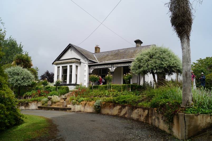
We commenced walking down Pine Hill Rd to a walkway leading to the town end of Hillary St which we followed to the distant end before having morning tea at “The Fern house”, an iconic house built in 1882 where we experienced great hospitality from the owner, Dr Brian Cox, who had made toilets and his sunroom open for us.
Driveway down to Ferndale Photo and caption JohnFerndale Homestead Photo and caption John
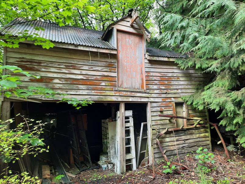
Most hikers then followed him to explore some of his property while some reneged at the muddy walkway near an old barn and tricky bridge where we waited for the intrepid to return.
Sample of some of the old buildings Photo and caption Ady
It was obvious that the hikers were enjoying themselves by the happy chattering we heard and gales of laughter from Fay. We were still unsure if this was because Fay’s new shoes got so muddy or something else.
Oh no! Why did I wear my brand new shoes? Photo and caption Jenni
Reassembling we walked to Campbell Rd where John educated us on the history of the little dog painted into the Power box mural, walked up Campbell’s Rd , through a walkway back onto Pine Hill Rd and upwards to “The Pines”.
This owner, Lindsay Moir, also extended great hospitality, allowing us use of his barn (adequate seating for all) and toilet.
Inside The Pines barn for lunch Photo and caption John
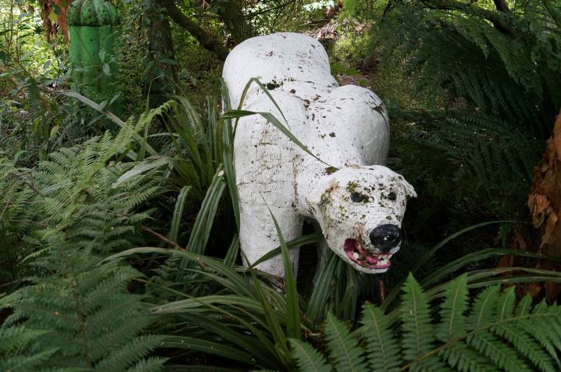
After lunch, a number of hikers went to explore his farm and the creek with him. Highlights included the monster (wooden polar bear), frog pond, converted container for honeymooners and a Nissan hut where some of our male hikers discussed politics.
The legendary Pine Hill monster lurking in the bushes Photo and caption John
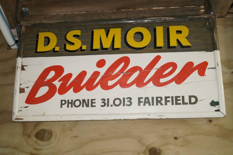
There was an old sign hanging in the barn, advertising the business of our late Life member, Doug Moir and as there were only 5 telephone numbers on this, not the 7 on today’s listings, it must have been very old indeed.
D S Moir Photo and caption John
A brisk downhill walk to the cars preceded a visit to CrocQueODile Café.
Thanks must go to these generous property owners for their hospitality.
Distance walked approx 9km.
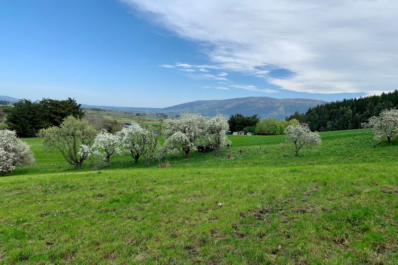
2. 20/6/2019. Hikers. North East Valley, Pinehill. Jan and Jenny
On a cold and frosty morning, 27 hikers set off for Malvern Street where we parked up and commenced our hike to Pinehill.We walked through Woodhaugh park where we located some seating and had our morning tea before setting off along Banks Street and turning left up Dolphin Street which in turn lead onto Gladstone Road. This being the home of Aquinas College.If you thought we had a good frost in Mosgiel – well it was matched hereand we very cautiously negotiated the footpath, sometimes having to cross the road which was like a skating rink in places.However we all climbed the hill without mishap and into the sunshine which was a relief! Walking up Pinehill Road we stopped to admire the Church where Shona and Keith were married some 44 years ago on the 28th of this month.
We carried on, coming to John’s house where he picked up his dog for a walk up to the end of Pinehill Road & onto the end of a gravel road where we stopped for lunch overlooking a wonderful view of Dunedin and surrounds.
We were all suitably impressed with the view,
Great view at the top of Pine hill. (Clive pic and caption.)
none of us having been up to that spot before – not even Shona!Sitting there with our backs to the sun,
Lunch at the top. (Clive pic and caption.)
it was hard to leave, but it was time to head back down the hill again, spotting some wonderful street art in a bus shelter.
Decorated Pine Hill bus stop. (Clive pic and caption.)
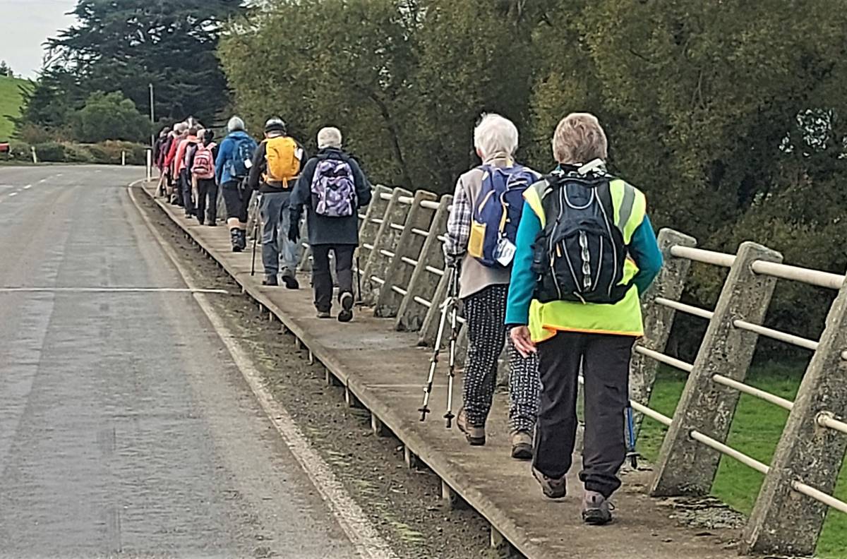
We turned left at Pinehill School and on down the hill coming to a winding Bucclough Street which eventually lead us down to the 219 Duddington steps
Duddingstone Steps. (Raewyn pic and caption.)
and on down to NEV where it was a short walk to the intersection with Banks Street and through Woodhaugh again and back to the cars.A good 10k was the agreed distance and so called into the Village Green for a well deserved coffee & cake!
This page of club tramps and hikes in the Dunedin Central City area groups together trips incorporating Roslyn, Mornington, Wakari, Highgate, Kaikorai and surrounds.
No. 87 on old hardcopy list of 113 club tramps. “Michelle’s Farm Outram Farm”.
11 km from car park.
Park under Outram Bridge. Contacts: Seek 3 permissions.
Proceed east side of Taieri River along gravel road to gravel pit. Bear right uphill to power lines. Follow generally along grass farm tracks to top of hill.
Landmarks: Trig marker on right; also obvious paper road between two fence lines; Long barn on right (good for lunch stop); large wool shed on top of hill straight ahead (this is still on Hyslop’s property).
Straight on access is to Taioma Road but we don’t usually go that far!
Plenty of mushrooms in April – take a bag!
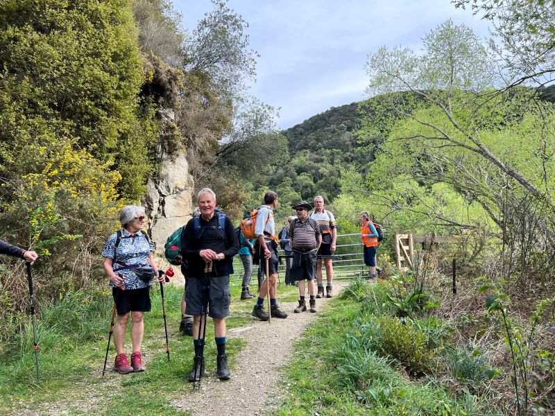
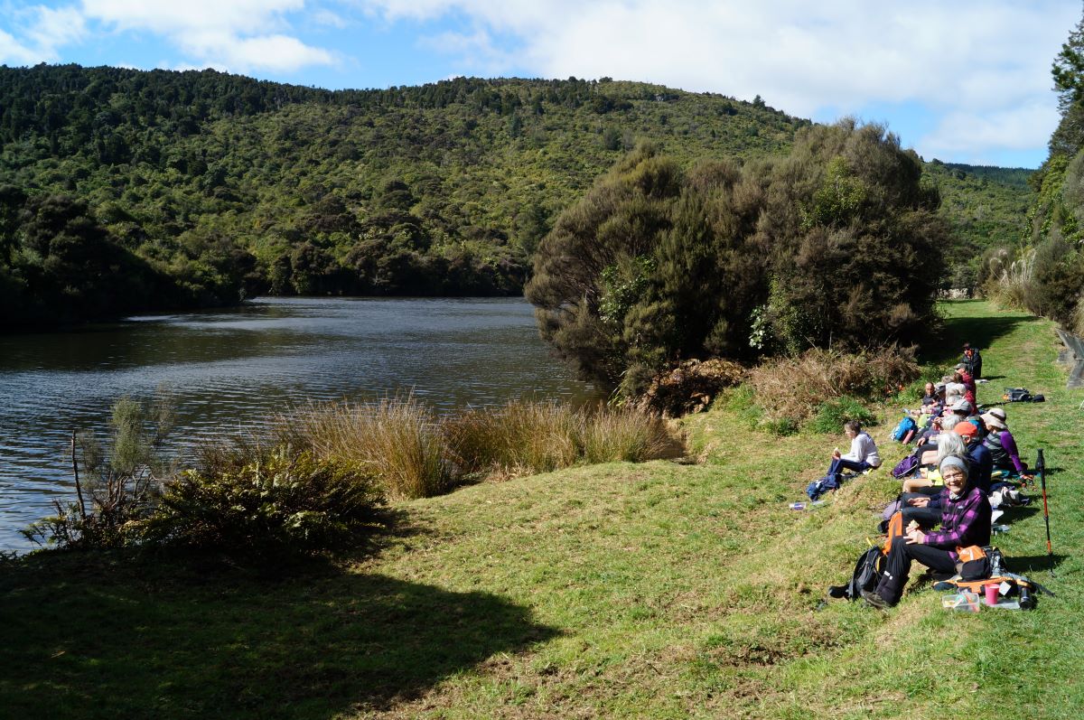
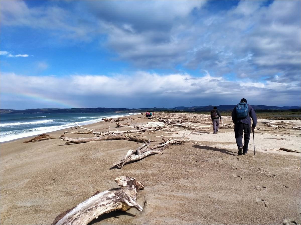
15 intrepid trampers parked under the Outram bridge. As we walked along the Taieri river wind in the willows gave us warning of a breath-taking day!
On the track above the Taieri River. Photo & caption Pam
Morning tea with the pretty yellow flowers. Photo & caption John
After ascending a narrow track through scrub we made our way along a ridge on Craig Nichol’s property. Any conversation was ‘gone with the wind’. To quote Evel Knievel “ I love the feeling of fresh air on my face and wind blowing through my hair” – certainly true today!
Those windblown skies were impressive. Photo & caption Marijke
We decided not to go to the trig – the howling wind spoke to us and we found our way down to a pocket of native bush. The relative calm here was a welcome respite from the punishing wind on the hill top.
Lovely view of Mosgiel’s iconic Saddle. Photo & caption MarijkeComing down off the windy hilltop to the sheltered gully. Photo & caption PamLunch spot. Photo Jill
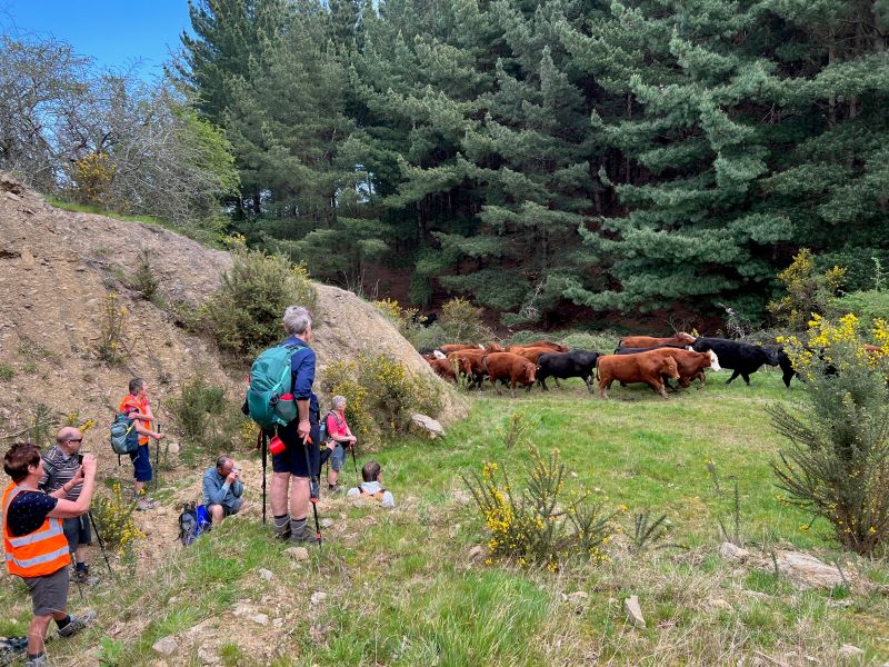
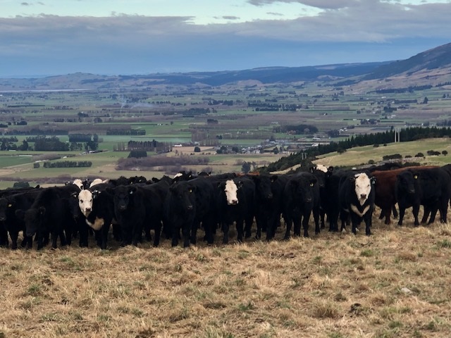
Walking roughly parallel to SHW 87 we headed back towards Outram. Thank you farmer Neil for herding a mob of cattle out of our path.
Keeping our distance for the herd. Photo & caption Pam
Throwing caution to the wind we walked through a Douglas fir plantation, then a large stand of eucalyptus – fortunately there were few recently dropped branches! The only reportable incident was Diane being blown backwards whilst pivoting on a gate – luckily she was caught by the two behind her ( I rue a missed photo opportunity!)
Beautiful spring scenery with cattle sheltering in the trees (very wise). Photo & caption Marijke Lower Neil. Photo & caption Pam Happiness is tramping with friends. Photo & caption Pam
A nice hill climb took us to wide track Craig recently had dug out back down to the Taieri river, and we were at the cars by 3.00 pm.
A great day out and many thanks to Julie McKenzie and Pam Cox for your assistance.
Distance walked – 13.5 km
Jill Reid
17 hikers left the West Taieri Rugby Club on another lovely Outram day. Had an enjoyable walk through Eleanore’s Willowfield Village then headed through Outram and over the Outram bridge.
Outram Bridge. Photo and caption Helen.
We walked beside the river to the start of Craig’s property where we stopped for morning tea.
We walked up the farm track which was a reasonably steep climb…
Group gathering. Photo and caption Helen
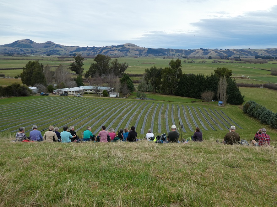
…and along the tops through a couple of paddocks where we sat on rocks overlooking the Taieri picking out many of the landmarks.
Lunchtine photo. Photo and caption Margreet
View over to Saddle Hill. Photo and caption Margreet.
Lunch at the top. Photo and caption Helen.
86 years old and up the top of the hill which they had never done before. Photo and caption Helen.
Then back down the hill overlooking Outram township and onto the Wobbly Goat for refreshments before heading back to cars.
It was a good 12k walk and well done to everyone.
Kathryn.
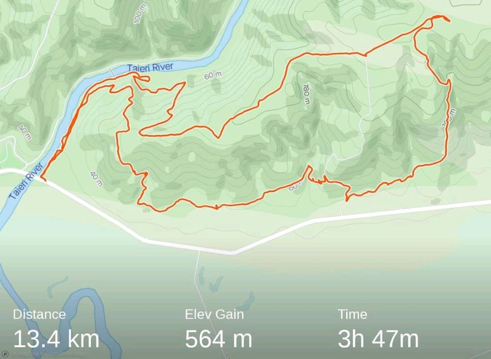
13. 17 November 2021. Trampers. Nichols Farm. M-H. Leaders: Peter Gillespie & Arthur Heenan
With a medium to hard tramp with a windy day prescribed it didn’t sound inviting, WRONG on nearly all counts. It was a medium hard tramp 13.42km elevation 564m, actual tramping time 3hrs 47min, (4hrs 45 min time lapse).
Strava screenshot by Phil
The group of nine was led by Peter Gillespie and Arthur Heenan. With a wind on our backs we enjoyed tramping in nice sunshine on the north side of the Taieri river. We started on a climb, up to an electricity pylon, where morning tea was enjoyed looking out on the northern view upstream. Many removing layers due to the heat of the sun.
Morning tea (caption & photo Helen)
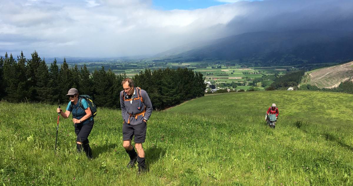
After the break we continued up a 7deg track sheltered from wind we came to a great view south of the rain on the Maungatuas.
Uphill through lush grass – Outram in the background (caption & photo Helen)
Onward, upward we continued toward the top where we came to a trig station, which Peter swore that the height was on, but no. There was some Maori “eh mutu tewanga” which we decided meant “564 metres high”.
Trig at the top (caption & photo Helen)
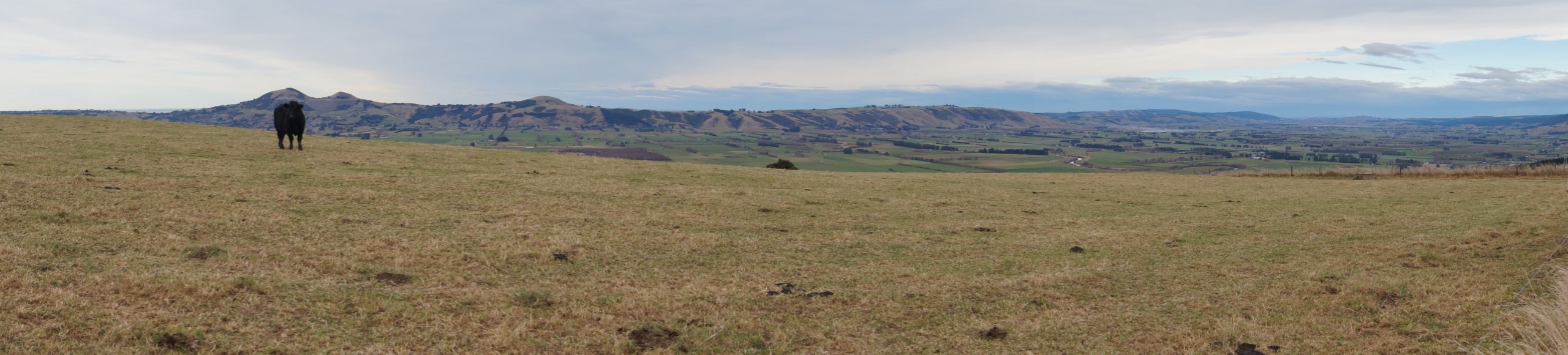
The view was sublime, of Saddle Hill, Mosgiel, lush farmlands, and hills of Flagstaff, Swampy, “magic”. We returned down the hill and found a track working through a forest and downhill…
Where’s the track Peter? (caption and photo Phil)
Beautiful forest (caption and photo Helen)
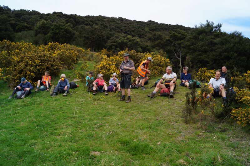
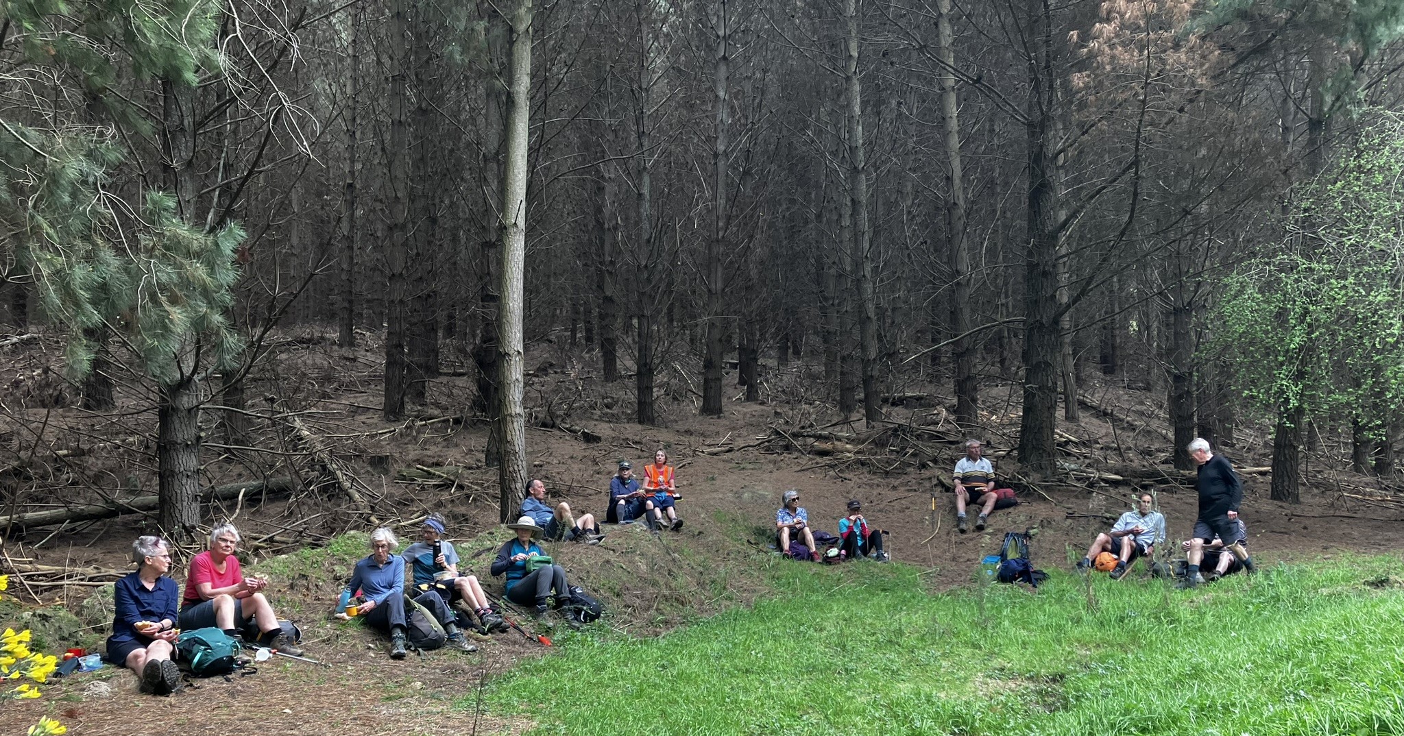
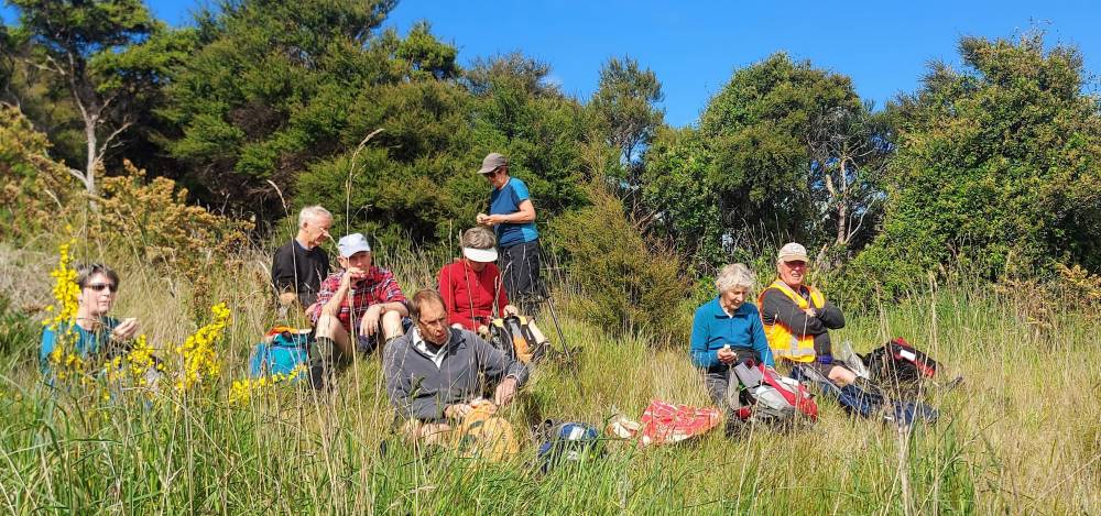
…then a gorse paddock where we found a nice sunny spot at the bottom, ideal for lunch.
Lunch (caption and photo Helen)
Jill required a ten minute kip, before we continued on through a 2nd forest track, past the lavender farm and some fertile farmland, before we hit the final hill. It was a decent climb, but the group got up it in good time.
Rain that didn’t get near us (caption and photo Helen)
We then returned, on a second track back down to river, watching for the odd sink holes. We had some windy spots, but the day was remembered for the views tramped, mostly in sun.
The group (caption & photo Helen)
A very enjoyable tramp, thanks leaders Peter & Arthur.
Then it was back to the Wooden Table for coffee & cake. Then it rained!
Cheers Phil Morris
12. 17/6/2020. Trampers. Nichols Farm. M. Leader: Gordon
From the carpark under the Outram Bridge 24 members started the walk beside the Taieri River in nice weather but with forecast for rain at 1.00pm. At the end of this track we turned off and headed up hill. Parts of this were quite steep but finally reached a nice flat spot for morning tea.
Photo and Caption Gordon – “Still slogging up hill”.
Photo and Caption Gordon – “Morning tea stop”Photo and Caption Gordon – “Hurrah finally levelling out.”
Heading uphill again after smoko we soon came out on to grass paddocks and continued on a gentle gradient to the cattle-yards at the top. from there walked a short distance before heading downhill on a steep ridge to the start of a small pine forest at the bottom, about ½ km from main road.
Photo and Caption Wendy – “Haven’t seen those people for a while!”
From there we walked a short distance before heading downhill on a steep ridge to the start of a small pine forest at the bottom, about ½ km from main road.
Photo and caption – “Wandering thru the trees”.
A pleasant walk through the trees to a farm track which we followed uphill to a stile where we crossed into Walmsley’s property. Followed cattle track down to gully then along foothills to lovely lunch spot with terrific views.
Photo and Caption John – “Comfortable lunch spot”.
Photo and Caption Gordon – “What a view”.
After lunch carried on along foothills before returning into forestry for assent to top after climbing through neighbours.
Photo and Caption John – “Panorama from the top”
Photo and Caption Helen – “Who’s watching who?”
After a “Pow Wow” at top, decision was made to head back on shorter route to cars which also allowed time for refreshments and catch up at Wobbly Goat. A good day to start off the tramping calendar after all the lock downs I really enjoyed it. Gordon.
11. 7/4/2019. Trampers. Nicols Farm. M. Leader: Gordon.
It was a cool start at the car park as we foregathered, but a typical beautiful autumnal day with lots of sunshine followed. Perfect for 15 Trampers to go and enjoy the outdoors.
Parking under the Outram Bridge wa a surprise for some, although a spot well known to our Outram members – from their younger days apparently.
Walking upstream beside the Taieri River through the willows we were welcomed by a great chorus of Bellbirds – wonderful. They were enjoying the day too.
It was an easy grade as we climbed various bulldozed tracks through the Manuka.
Long slog to top. (Gordon pic and caption.)
Morning tea was taken before we emerged onto a turnip paddock.
Still climbing gently on paddock and road we reached Trig I (360 metres). From this vantage point we had a superb view out over the Taieri Plain to enjoy.
Pointing out points of interest. (Gordon pic and caption.)
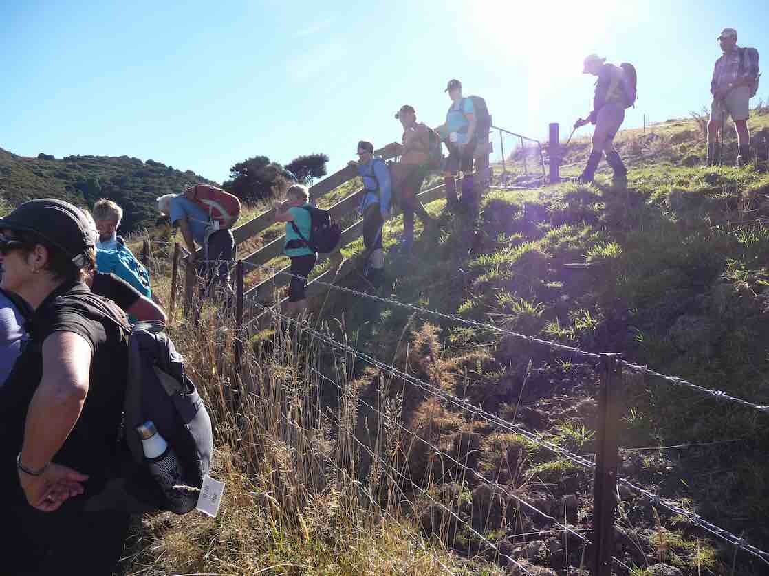
A short back track and then it was downhill on a farm road in the direction of S.H.87. Nearing the bottom we turned aside, and climbing a barbwire fence (the leader having thoughtfully fitted a pipe safety guard) …
The first fence obstacle. (Gordon pic and caption.)
Heading down into Walmsley’s farm gully. (Gordon pic and caption.)… found ourselves in a rough gorsey block.
Emerging once more onto open farmland it was time for a leisurely lunch in the sun, and still with a view to enjoy.
Afterwards we negotiated a paddock or two before entering an exotic forest to climb back up somewhat. In time we retained the turnip field to eventually finish the last leg back on our outward track.
Back to the cars at 2pm after walking over 13 km was good going.
To Outram where some visited the ice cream shop, others to the Hairy Goat – where all eventually congregated. And no one was in a hurry to go home. A day that was thoroughly enjoyed by all.
This report comes to you on behalf of Gordon (leader). – Art.
Access to the Raingauge Spur can be made via Rollinsons Road which will require a key to the gate approx. 2 km’s from the “Elbow” where the track starts. A key is currently held by the clubs President.
There are any number of tracks within the Silver Peaks that will reach Pulpit Rock. Arguably the most common way is via the Possum Hut track.
Proceed via the Northern motorway to Waitati and turn left onto Double Hill Road (just past the store on the left at the end of the motorway), which joins Semple Road where there is several access points to the Possum Hut track.
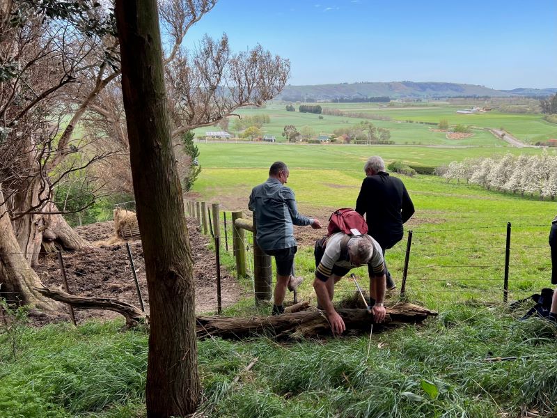
4. 13/09/2023. Trampers. Pine Hill, Mt Cargill. Grade 3.5, $5, 20km, Leaders: John Gardiner, Dave Roberts
Having already somewhat created a “rod for my own back”, in starting the Wizard of Oz theme in my tramp preamble last week, after some prompting, I’ll try to intertwine the “Wizard” theme into this report. Inevitably particularly pertinent to trampers, some yellow brick road references.
Getting ready to leave the cars (Photo & Caption John)
On an overcast morning with a chilly wind, 21 trampers, who arrived in 6 cars, set out at 10.00am, on the start of our tramp in Cowan Road. Like Dorothy at the beginning of her yellow brick road journey, most trampers had no idea where they would venture during the day.
– One interpretation of the “Wizard Fable” is that on life’s journey, tenacity, and perseverance in striving for a goal is a core value.
Following Dorothy to see what lies ahead (Photo & Caption Pam)
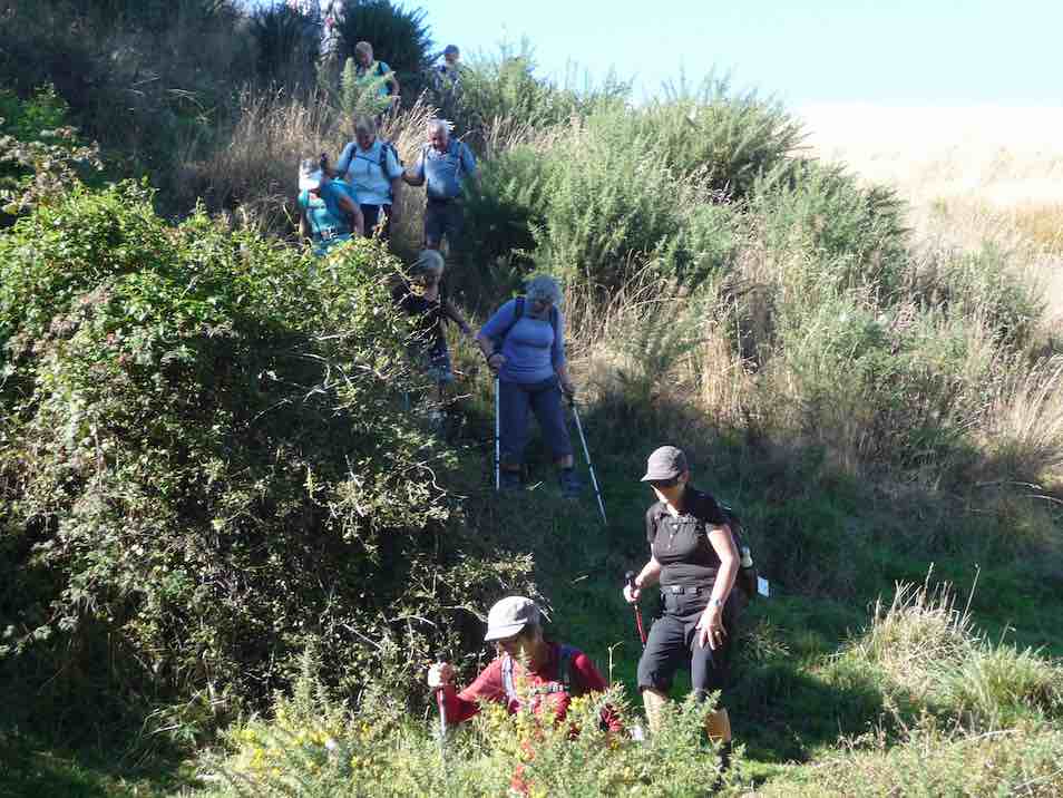
Following the previously described, muddy, gorse lined portal to what lay beneath, morning tea was enjoyed at 10.40am on the lower, wider, gravel road, at a sheltered spot.
About to have morning tea (Photo & Caption John)
– Some believe the gold colour of the yellow brick road and the green “Emerald City” represent the currency arguments the US experienced in the 1900’s.
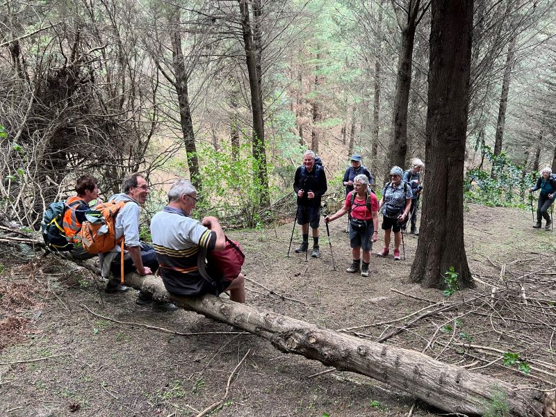
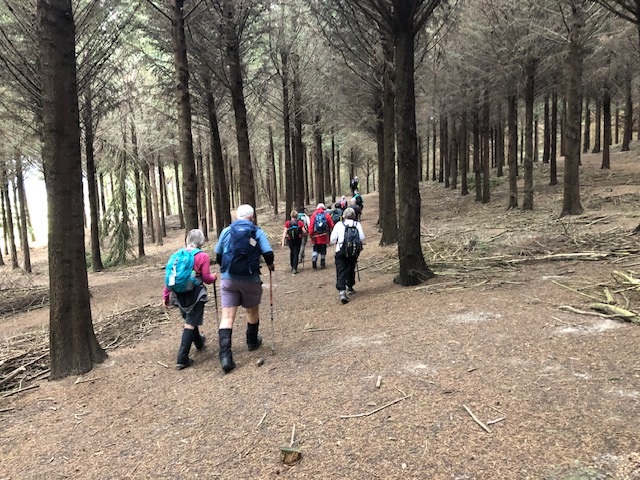
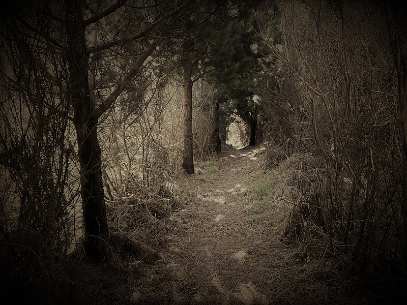
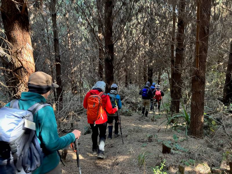
Soon we were on the track leading down through the forest, with a pine needle carpet underfoot, and after following a fence line, we were soon on the gravel road to Sullivans Dam, arriving at 11.20am.
Tramping through the pines (Photo & Caption Pam)
-During the making of the “Wizard” movie, the snow scene contained fake asbestos based snow that left many on set chronically ill!
Lunch in the sun (Photo & Caption John)
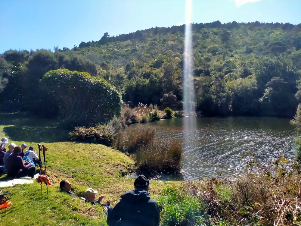
Lunch was enjoyed at the beautiful Sullivans Dam, beginning a little early, at 11.50am, in a sheltered spot. We had reached our destination.
The shaft of light from above made the trout rise to Graeme’s delight (Photo & Caption Phil)
-In the Wizard story the Emerald City is a place to which Dorothy, the tin man, the lion, and the scarecrow journey in order to achieve their various dreams.
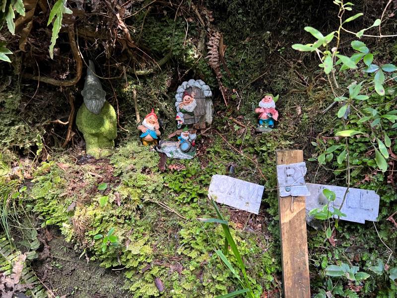
By 12.15pm we were on our way again, walking around the side of Sullivans Dam to the start of the “Cloud Forests of the Leith” track. This track, with it’s many boardwalk sections and beautiful bush (even a ‘bush telegraph’ and Gnome Grotto) adding yet more variety to our tramp.
No, I’m not having problems with my internet banking (Photo & Caption Pam)Creatures of the forest (Photo & Caption Pam)
-In the Wizard story the yellow brick road was at times very rough. The scarecrow often stumbled over the yellow bricks, which were very uneven, sometimes even broken, or missing altogether, leaving holes that dog Toto (a West Highland Terrier) and Dorothy jumped across or walked around.
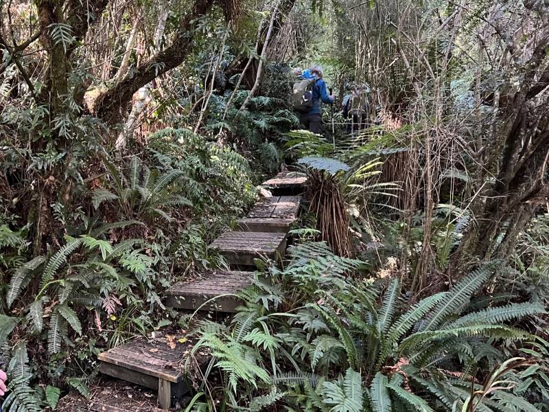
Board walking (Photo & Caption Pam)
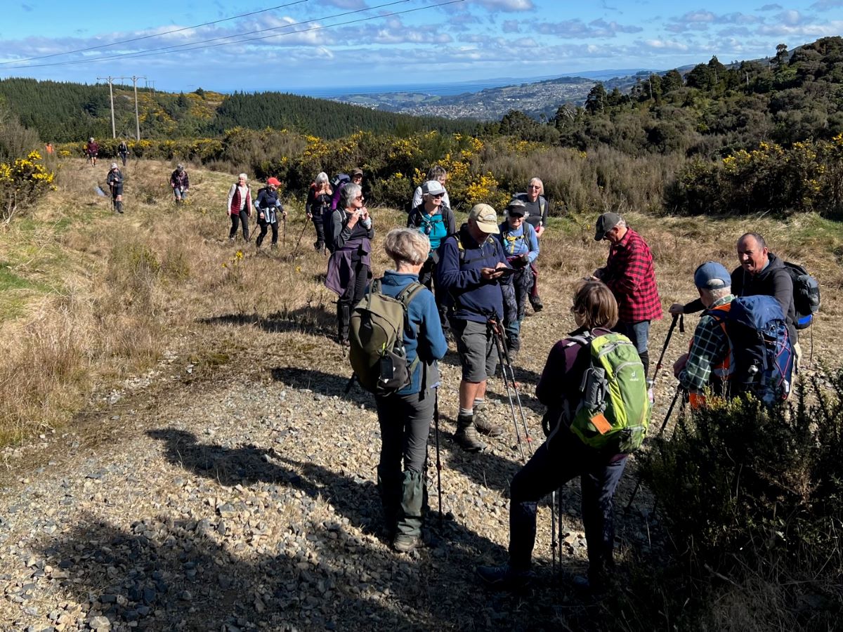
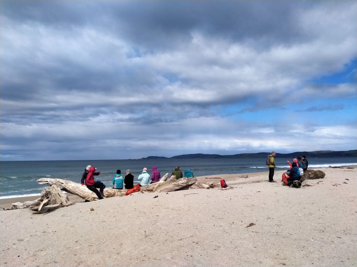
Arriving at the top of the Cloud Forests track by 1.20pm, we regrouped with a magnificent view north to Blueskin Bay and beyond, before following the gravel road to the base of the “portal” gorse lined track.
Regrouping (Photo & Caption Pam)Panorama – Blueskin Bay in the distance (Photo & Caption John)
On this section a navigational error by your’s truly resulted in everyone walking a bit further than necessary to a dead end part of the road. The greatest consequence of this being my embarrassment!
Are you sure we are going the right way (Photo & Caption Pam)
– In the Wizard story, Dorothy follows the yellow brick road, intending to find the Wizard, who would bestow on her the knowledge to achieve her goal, only to find that she had the answer within her all along.
Heading up the gorse lined final section of our tramp took us back to the cars by 2.30pm, having covered approx 8 km. A Grade 3 tramp.
Happy trampers (Photo & Caption Pam)
-So where was the yellow brick road? Some believe it is a brick road in Peekshill, New York, where author L.Frank Baum attended Peekshill Military Academy. Others believe it was inspired by a road paved in yellow bricks near Holland, Michigan where Baum spent many summers.
Afternoon tea was enjoyed at the Crocodile Cafe, Dunedin Botanic Garden, on what had developed into a mild , sunny day. As a footnote – I did apply and receive a permit to walk on the City Forests section of this tramp, only to receive a later email, stating that it wasn’t necessary if we stayed on the Escarpment or 3 Peaks tracks.
Special thanks to Dave Roberts for acting as tail end Charlie and Graeme Souter for his help with the rece.
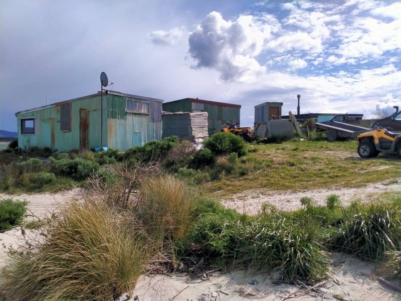
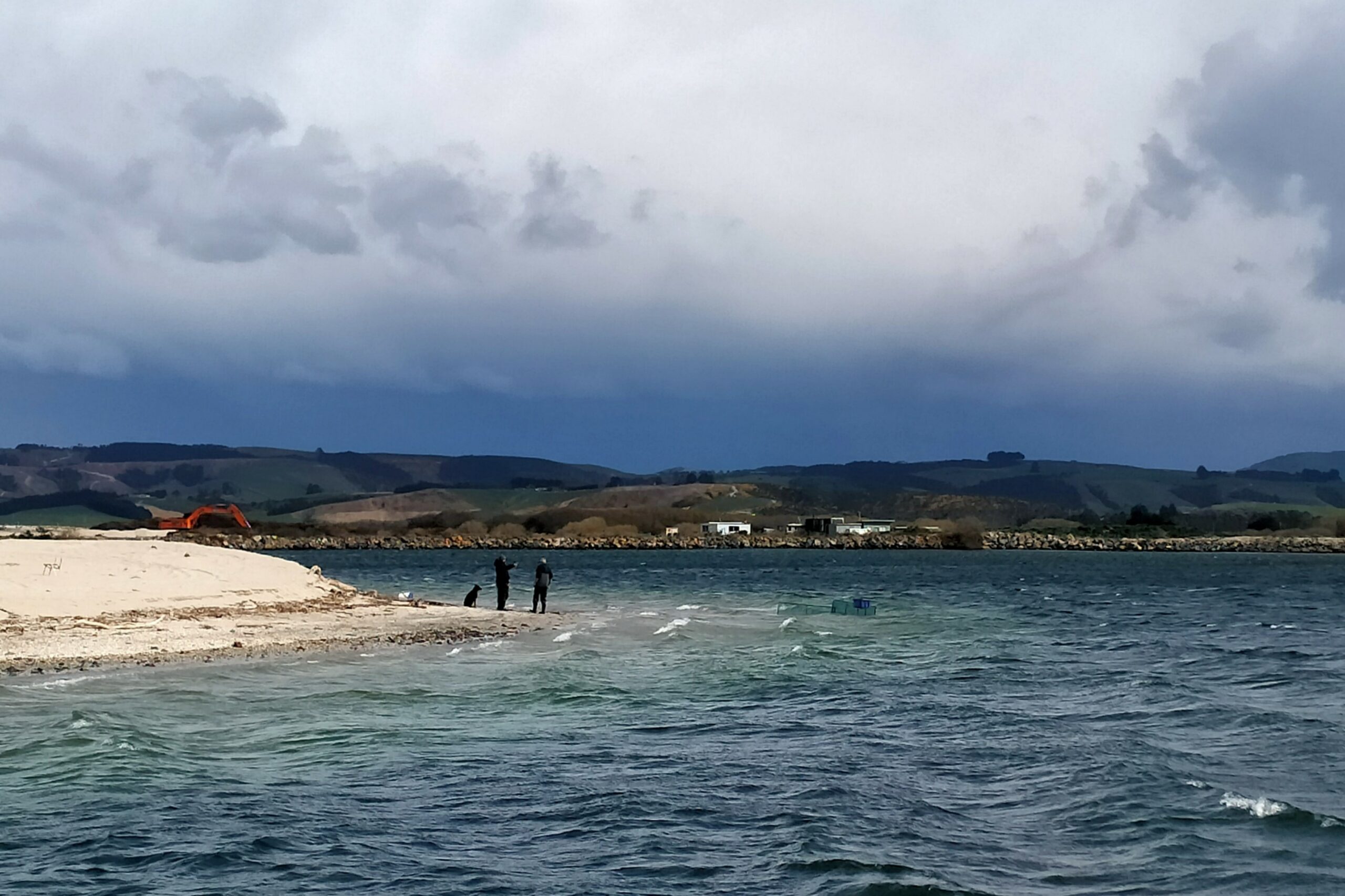
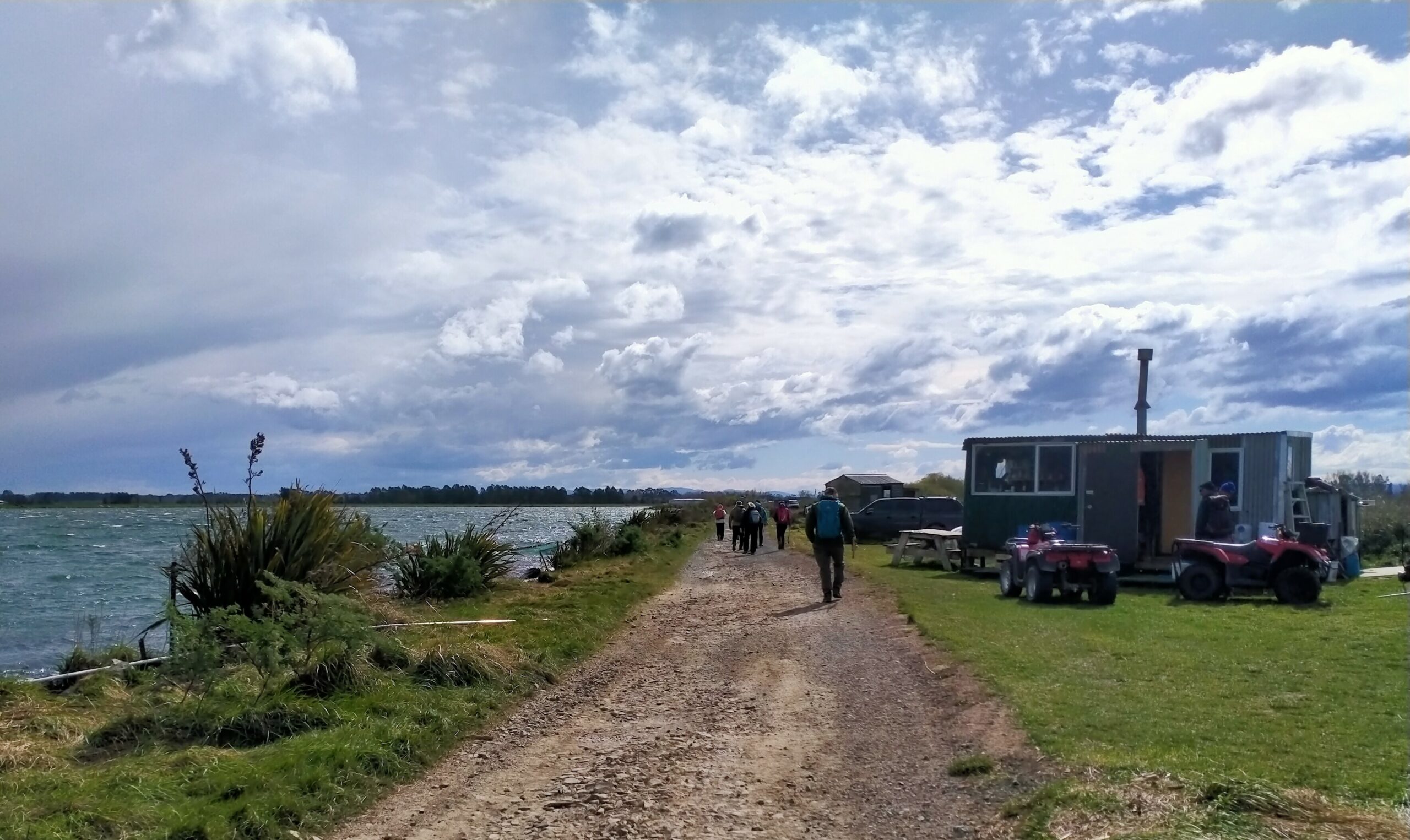
3. 14/09/2023. Kaitangata – Inch Clutha. Phil and Raewyn Keene as guests of the Trixie Trampers (Balclutha).
This trip was undertaken by the Trixie Trampers (Balclutha), with Phil and Raewyn Keene going along as invited guests. Anybody else from the TRTC was invited to go along. I (Phil) have recommended to the trip committees we do it in Autumn 2024 as a combined walk (Photos were supplied by Phil).
The Whitebait Trail
At the invitation of the Trixie Trampers, we travelled down and through Kaitangata and crossed the wonderful high bridge over the Matau branch onto Inch Clutha Island and around to the start point near the pumping station/bridge where whitebaiters and hut owners launch their boats.
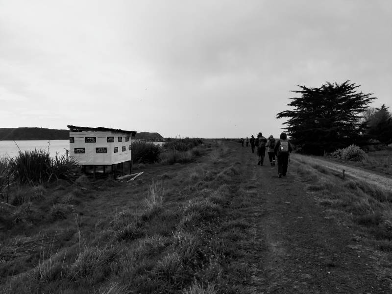
We parked up and once organised crossed the style onto the well formed pathway atop the flood bank and began meandering and skirting the river taking in quite expansive views, as well as the eclectic huts, great Kiwiana!
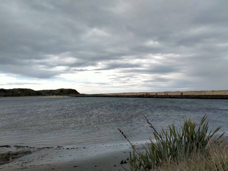
The pathway has the river on one side and dairy farms the other. The local share milker was most informative on the technology being used, all emanating from the collars around the cows necks. The pathway leads to the beach, not before crossing a causeway where large pipes permit the tidal inflows and outflows to move under the causeway into a large backwater that stretches to the Koau branch, this area probably a natural river course before the development of the farms.
Once at the beach we turned left and headed to the North end where the Matau branch flows into the Pacific. A strong westerly wind made its presence felt and the mare’s tails on the surf were impressive. Also impressive was the large amount of drift wood and tree stumps, some large, that demonstrate the power of floods and tides in this area. Plenty of seats to sit and enjoy the views down to Kaka and Nugget points, whilst having morning tea and then lunch near the South end where the Koau branch enters the sea.
This river mouth seemed to be the most active for the whitebaiters with numerous quad bikes, nets, huts, caravans and campers and yes we spoke to a man who was counting out his catch! The westerly was right in our faces and white tops whipped up the estuary as well as taking away our breath as we walked out onto the road that would take us back to the cars. An alternative would be to take the top of the adjoining flood bank for a while before walking the road.
This walk is flat, a little undulating on the beach whilst the sand is gritty and a tad soft, an option would be to take the grassed top of the beach where old wire fence lines are also present. A circular walk of approx 9kms is possible or maybe return along the inland watercourse. An alternative also being to take a couple of cars to one end for drivers to return to their cars and assist walkers back to the initial start point.
This is a wonderful area reminiscent of the Wild West Coast, great views, invigorating in all weathers but with flexible options for a combined walk. Approx 70kms from Mosgiel to a start point.
Phil and Raewyn Keene
2. 4/9/1996. Kaitangata Combined walk. Leaders: Kai leaders.
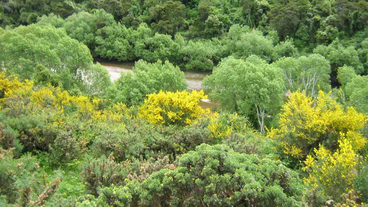
We explored the coast and an obvious coal seam running out into the sea.
This page of club tramps and hikes in the Central City area groups together trips from Frasers Gully Reserve, incorporating Friends Hill to Wingatui Racecourse including the Wingatui Tunnel. (map)
This pages of club tramps and hikes in the Opoho, North East Vally, North Road area groups together trips to Bethunes Gully and Forrester Park. (map)
Background Information:
Road distances from Mosgiel carpark. Mount Cargill history
Opposite Brown House corner is an RSA Memorial to First World War servicemen and the old Junction School. (General Information)
This page of club tramps and hikes in the South Coast area groups together trips to Waldronville and incorporates Blackhead, Kaikorai Estuary, Ocean View and Brighton. (map)
This page of club tramps and hikes in the Opoho, North East Valley, North Road area (Dunedin City) groups together tramps to Cleghorn Street, Signal Hill area.(map)
Signal Hill Tramps. 2023 – 1992 (19 trips with 5 reports, 4 with photos only, 10 with no reports or photos) Signal Hill Centennial Memorial, Ravensbourne, Big Easy. 2023 – 1998 (24 trips with 7 reports, 2 with photos only and 15 with no report or photos). See reports dated 18/5/2022 and 24/11/2021 for reference to Cleghorn Street.