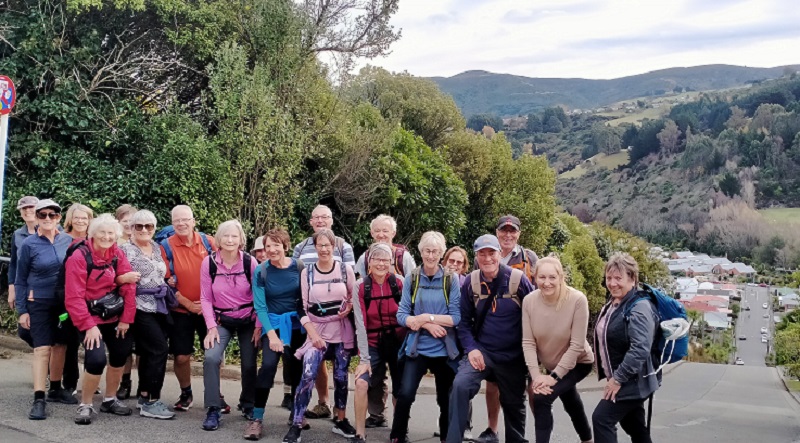
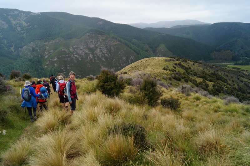
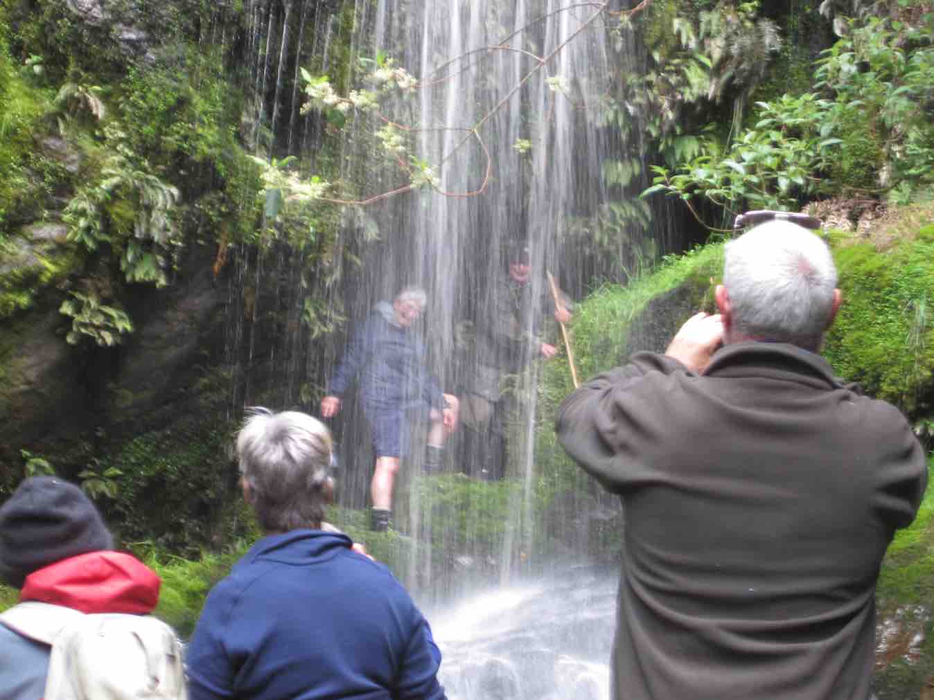
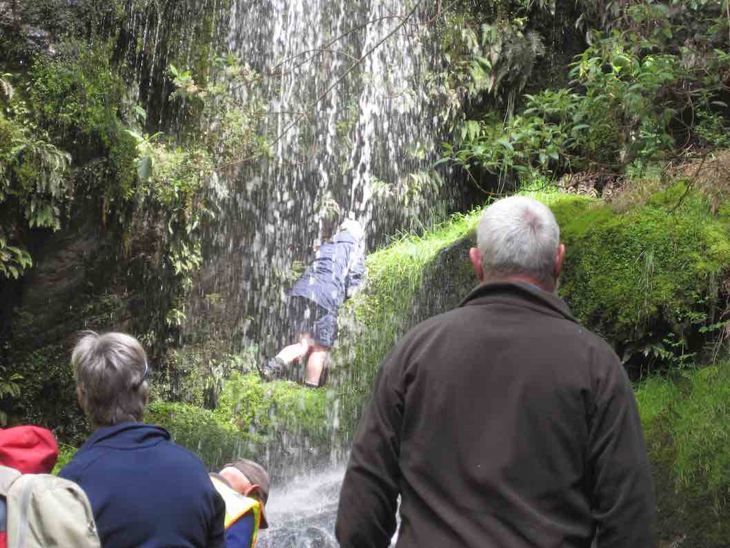
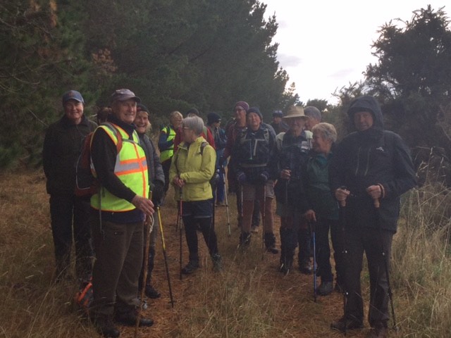
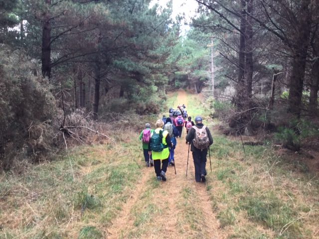
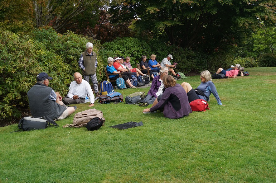
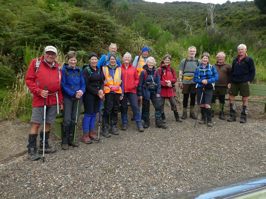
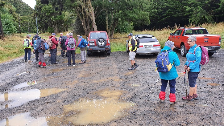
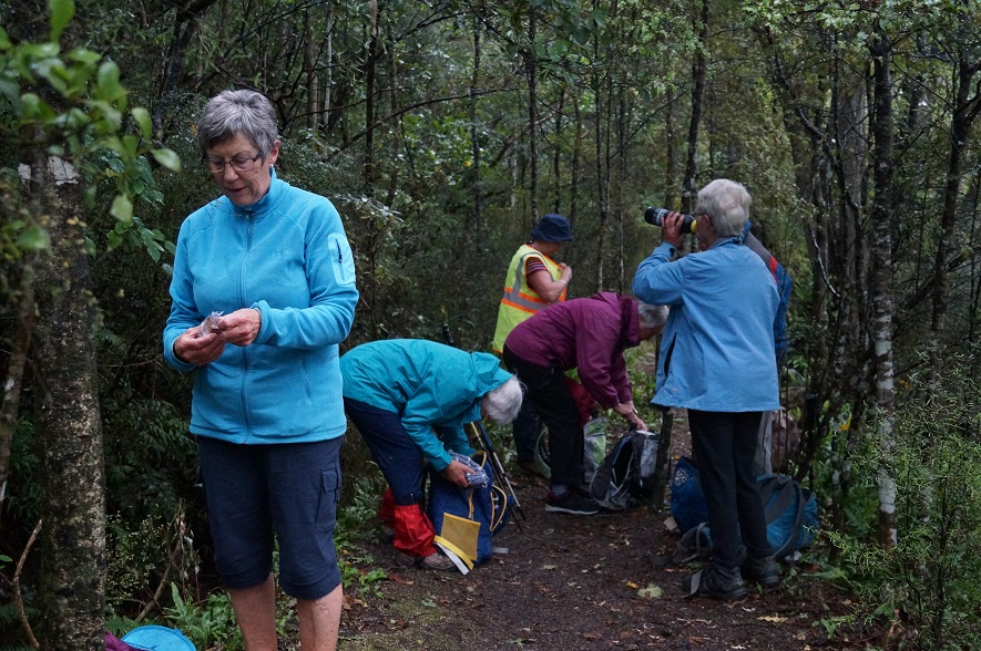
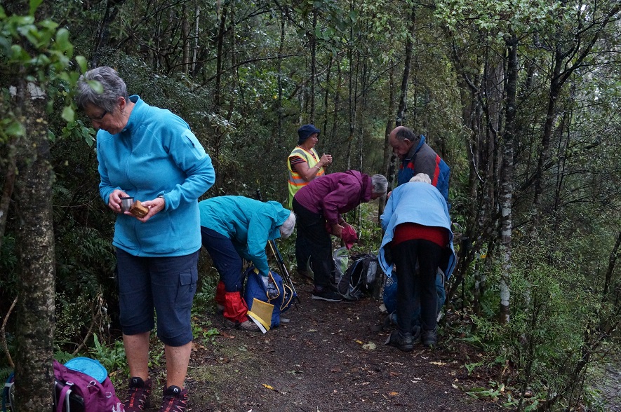
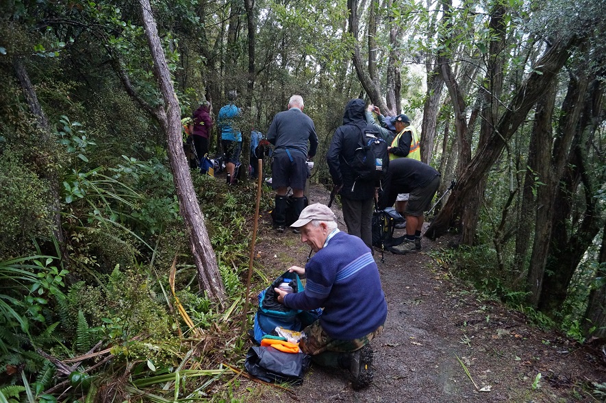
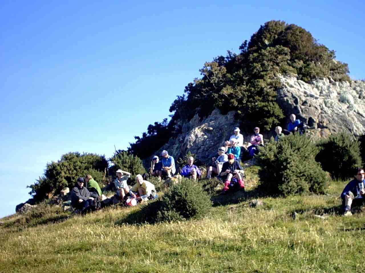
On a very pleasant and warm Brighton morning 22 hikers set off towards McIntosh Road led by Faye (with an E).
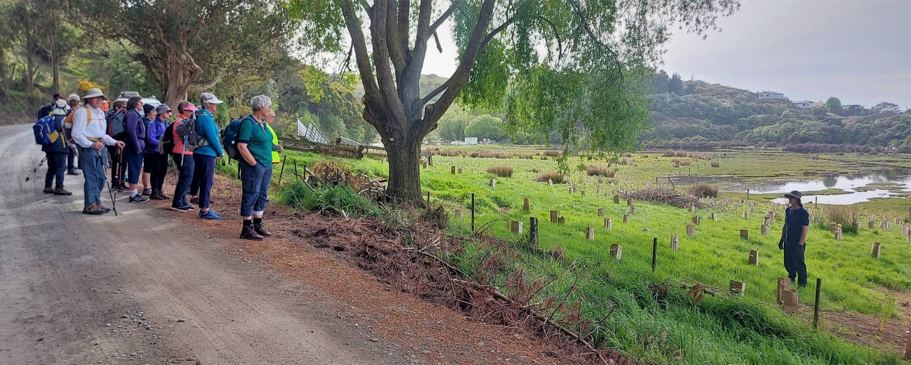
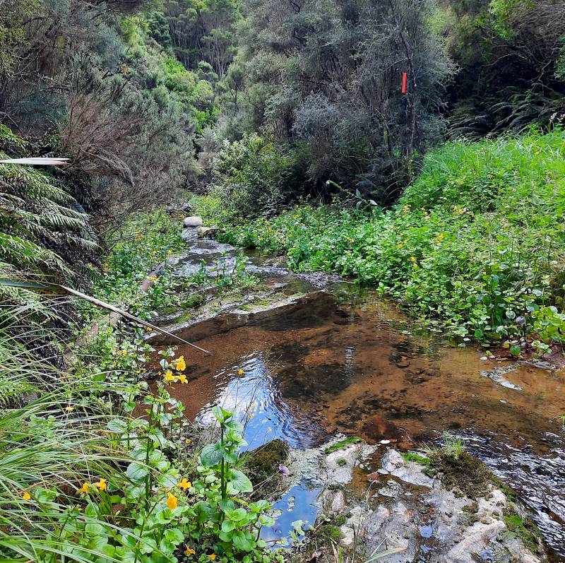
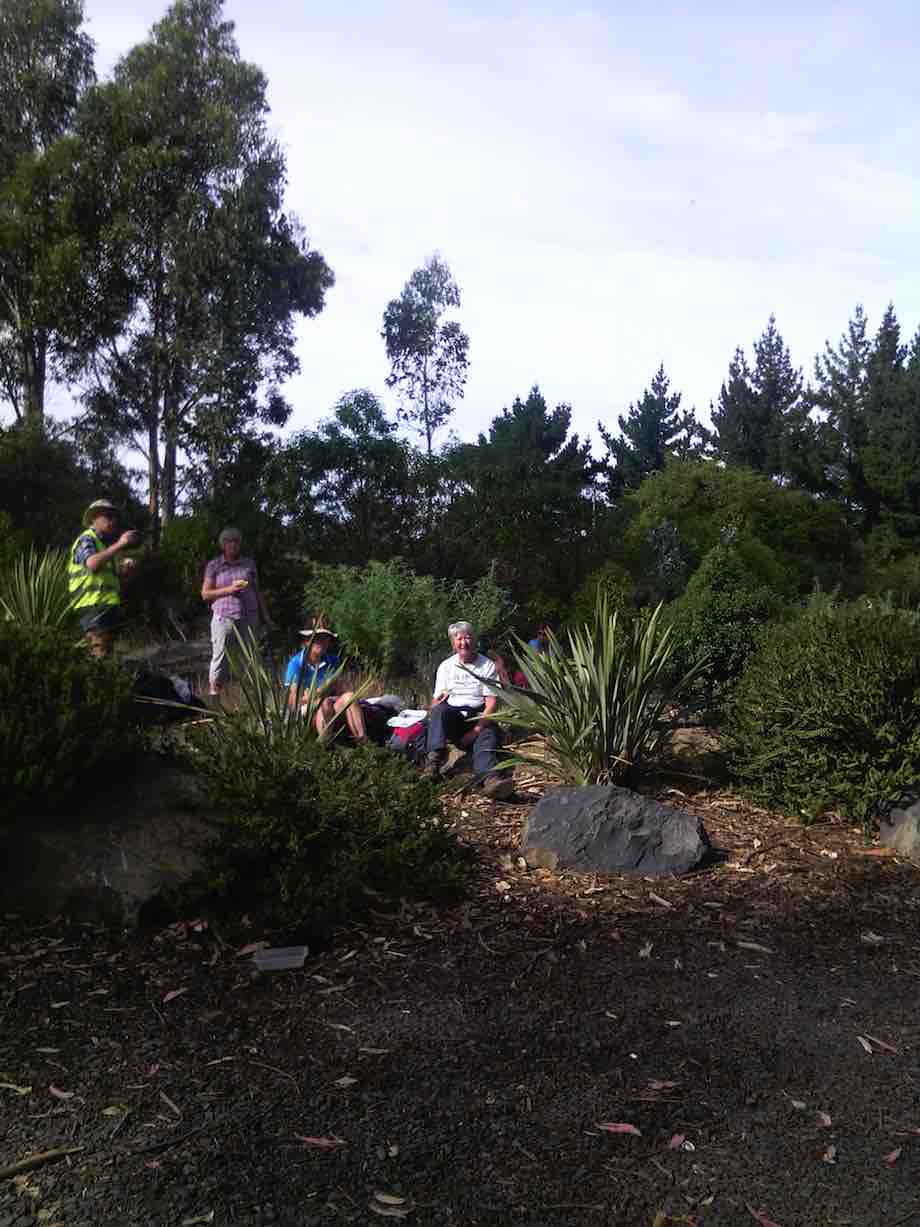
The wet land area planting and a talk about it. (Photo and caption Helen)
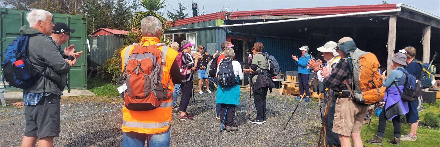
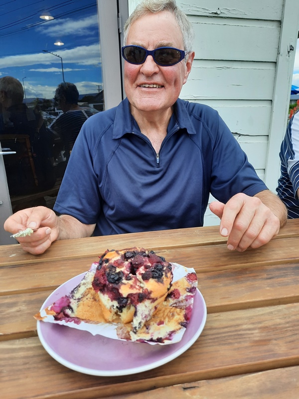
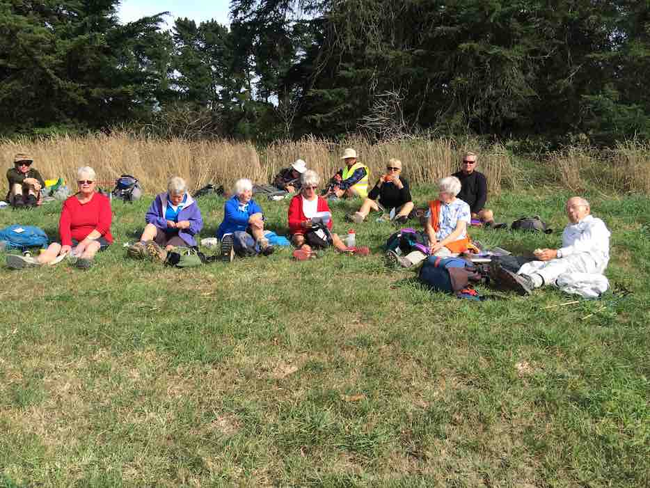
We visited Star Fish Gallery for morning tea and a friendly inspection of premises hosted by owner.
Morning tea at Starfish Gallery. (photo and caption Helen)
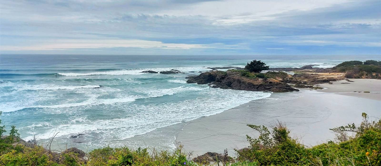
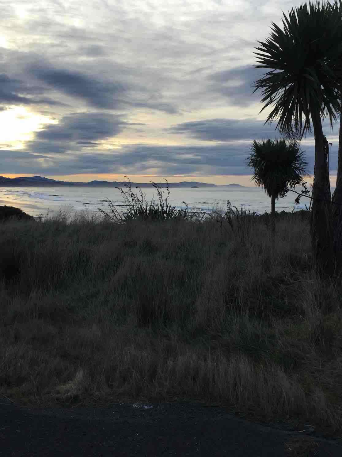
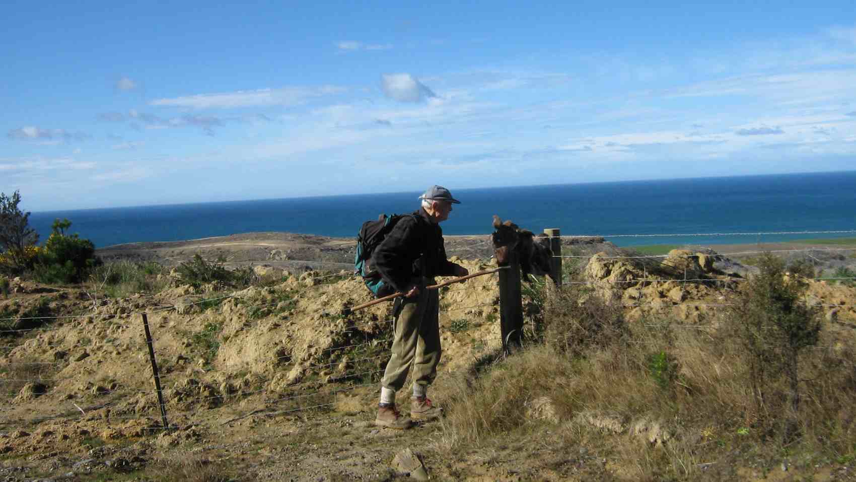
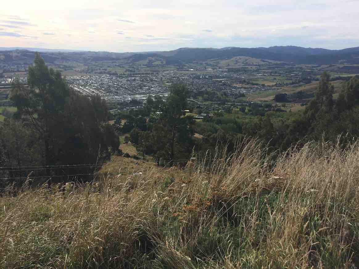
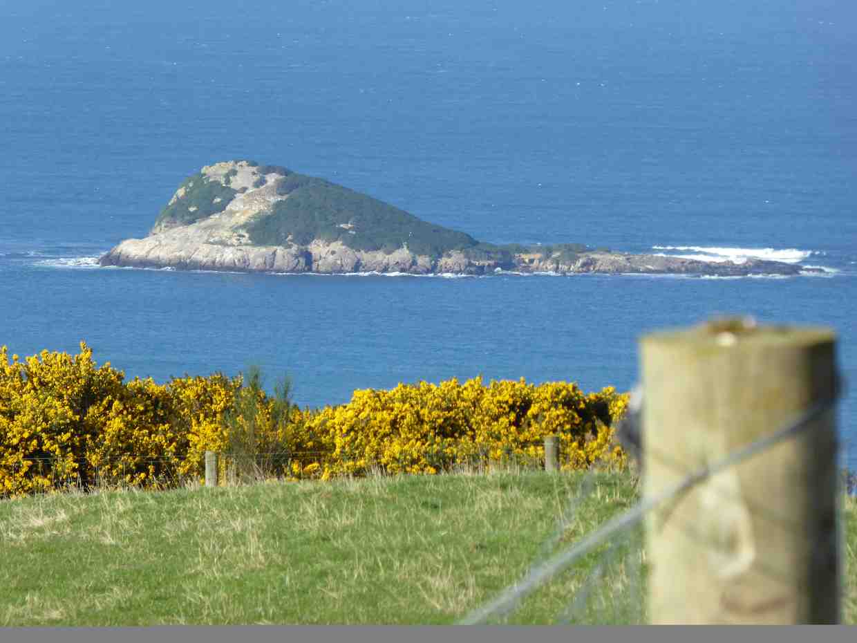
From here we headed back down the hill to explore different parts of Brighton and Ocean View led by Alex as Liz was off the scene with slight injury caused earlier in the week. With such a pleasant day it was good to enjoy sea views and other interesting sites before a stop for lunch at Ocean View.
Sea view (photo and caption Helen)
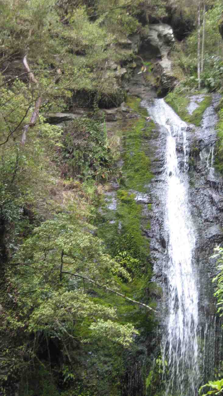
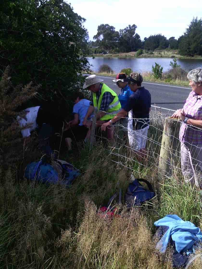
Up the Bennett Road to inspect the Mosaic Wall …
The mosaic wall. Beautiful. (photo and caption Helen)
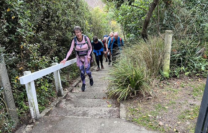
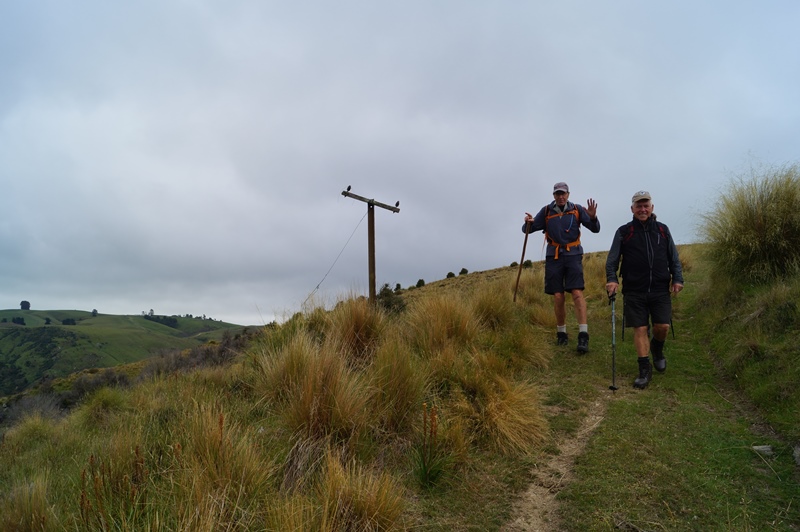
… which leads us down the steep track back to Brighton and local Coffee shop for more relaxation and welcome visit by Bev Harvey and Dot Bennett.
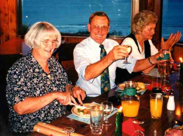
Alex And Faye.
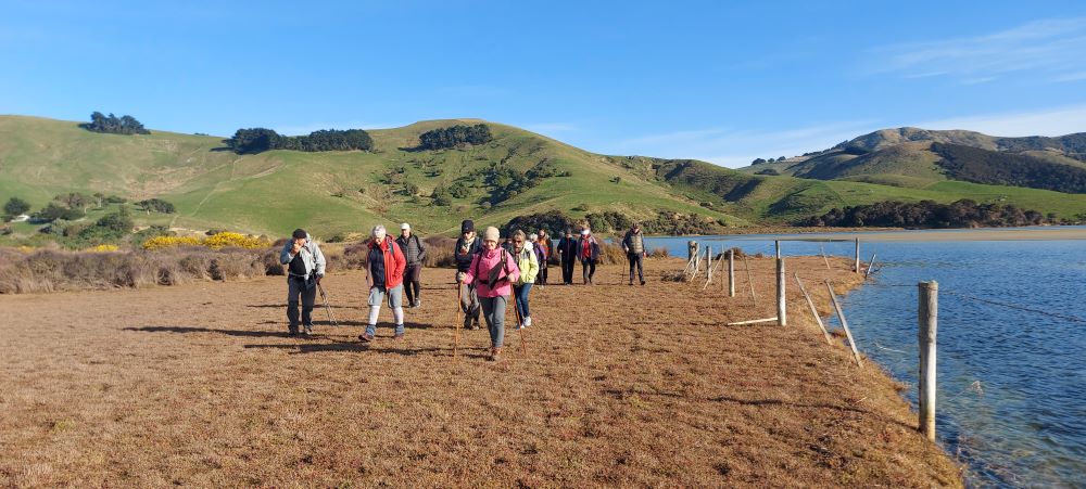
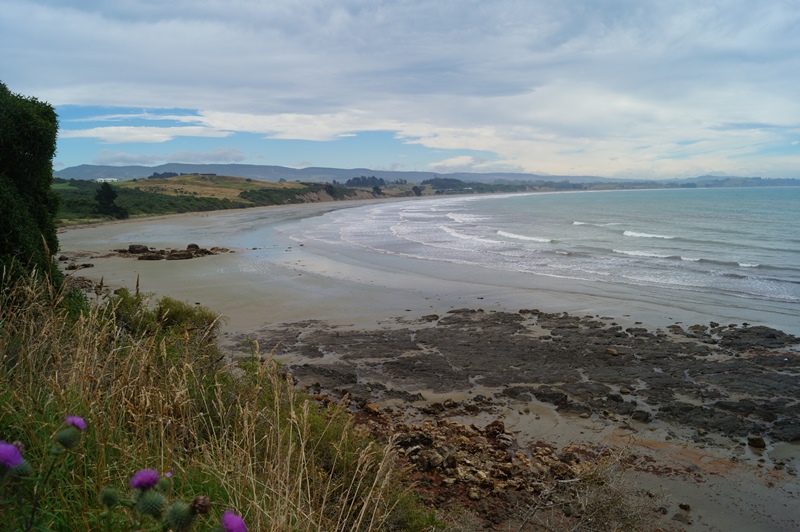
Allans Beach on Hoopers Inlet, Otago Peninsula, NZ.
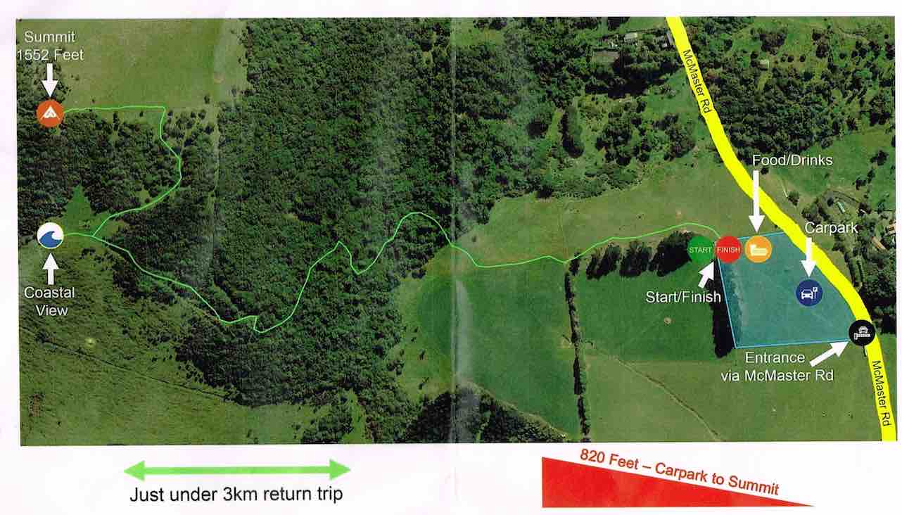
27 km from car-park.
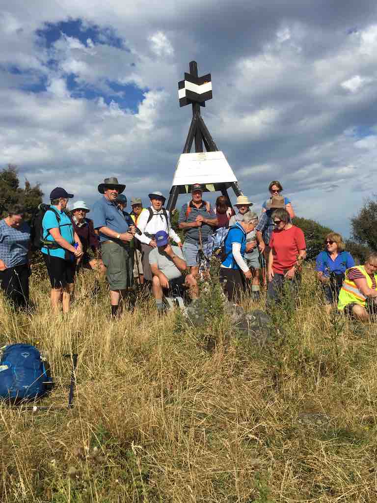
7. 14 June 2023. Hikers. Allans Beach. Grade 2, $9, 39km, Leaders: Bruce Spittle, Alex Griffin
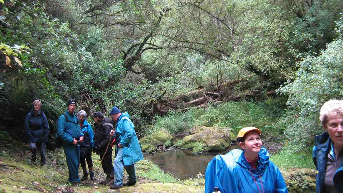
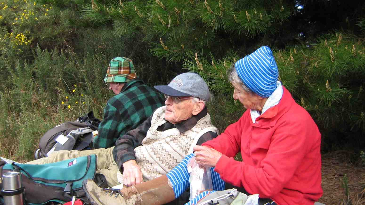
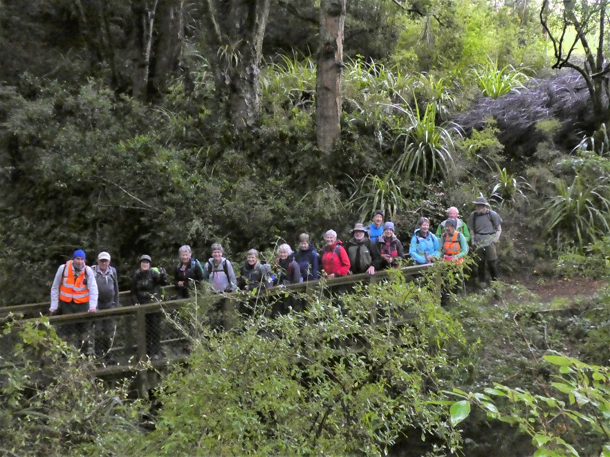
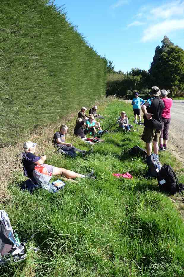
Fifteen hikers, including new hikers Heather and Val, set off from the car park at the end of Allans Beach road with clear skies but a chilly breeze. We briefly explored the east end of the beach as far as the waves allowed and then had morning tea in the shelter of the sand hills where there was some sun.
Morning tea in a cool wind (Photo & Caption Helen)
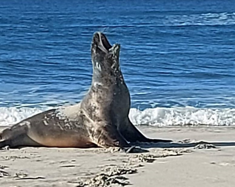
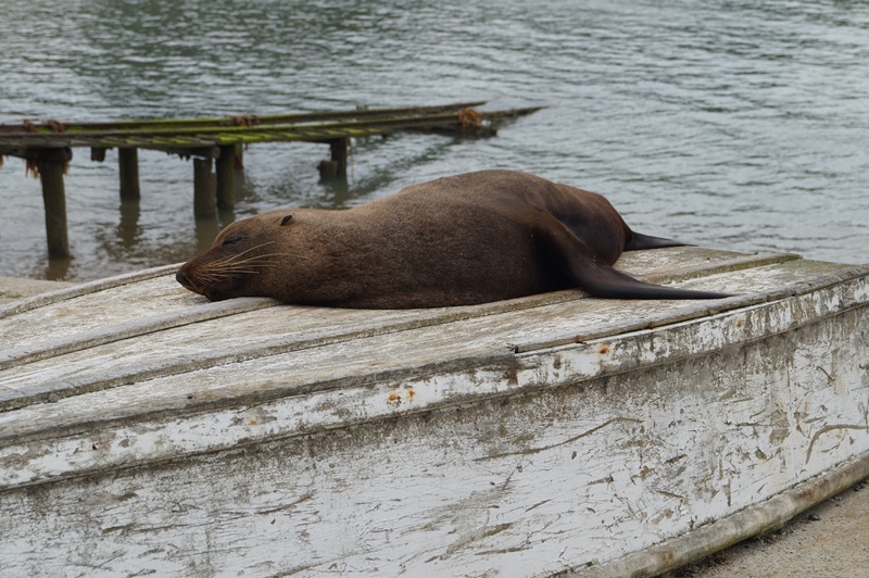
We walked the length of the beach to the outlet of Hoopers Inlet where the tide was coming in noticing two sea lions on the way.
Mr Sea Lion (Photo & Caption Helen)
Morning tea view (Photo & Caption Helen)
We then followed the sand on the edge of the inlet to near the fence at the end where the inlet turns to the right and had lunch, at about 12, in a relatively sunny sheltered spot.
After lunch we explored the salt marsh area as far as the tide allowed and some more sea lions were spotted.
Along the marshlands (Photo & Caption Helen)
We retraced our steps to the west end of the beach and ascended into the sand hills about 100 m from the end of the sand hills near the inlet and after finding our way through some vegetation found the track through the farm leading back to Allans Beach road.
View of Harbour Cone (Photo & Caption Helen)
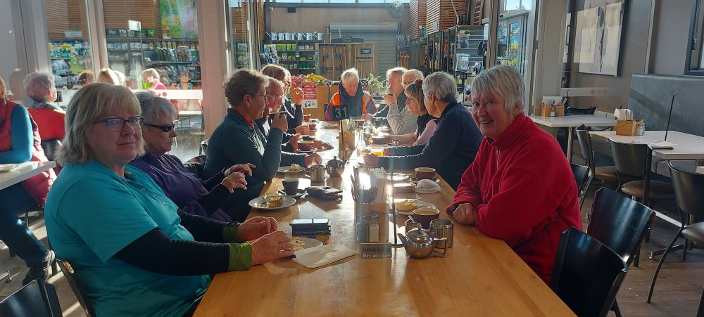
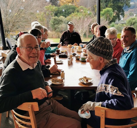
We arrived at the cars about 1405. Distance travelled approximately 9.5 km. The weather was reasonable for winter with sunshine and little wind most of the way. The views of the inlet and hills were tranquil. Coffee was had at Nichols.
Coffee at Nichols (Photo & Caption Helen)
Thanks to Co-leader, Alex Griffin and to Liz Griffin for liaising with Nichols.
Opoho Odyssey 1 June 2022
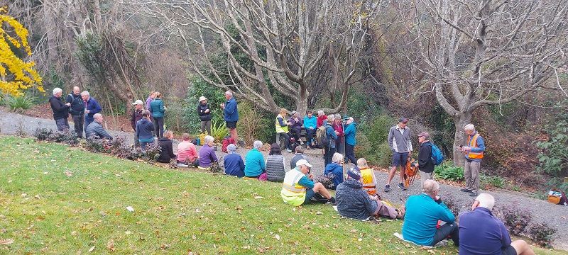
In pleasant temperatures 35 Trampers set out from the Botanical Gardens carpark to enjoy our Opoho odyssey. Our first stop was for morning tea at Tannock Glen which is an established rhododendron dell off Warden St.
Morning tea at Tannock glen (photo & caption Helen)
Then we meandered through various streets and Ross’s well researched commentary about various points of interest was much appreciated. (This history will be available for anyone to review on a separate link). Neil added a few memories of his misspent youth in this suburb and talked about his family links to the area.
Jack Lovelock’s home (photo & caption Phil Keene)
Then it was off down the zigzag to Knox College which while not strictly in Opoho has strong links to the suburb because countless staff and students lived in Opoho and worshipped and preached at the local Church in Farquharson St. Knox College actually opened in 1876 to train and house students wanting to become Presbyterian Ministers. It is now a hall of residence open to all Otago University students.
Knox College (photo and caption Pam)
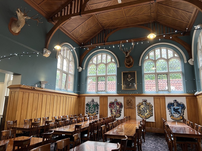
It remains a very well maintained beautiful historic building. Our guide Alec gave us an extensive tour through the various wings and a detailed commentary about the history. In the exquisite dining room which looks straight out of Harry Potter, Phil gave us a tune on the magnificent concert grand piano.
Dining room, Knox College. Beautiful oak roof, dining chairs and tables (Photo & caption Pam)
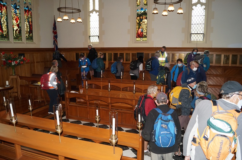
Beautiful Knox College Chapel (photo and caption John)
We all really enjoyed this tour as many had never been in this building.
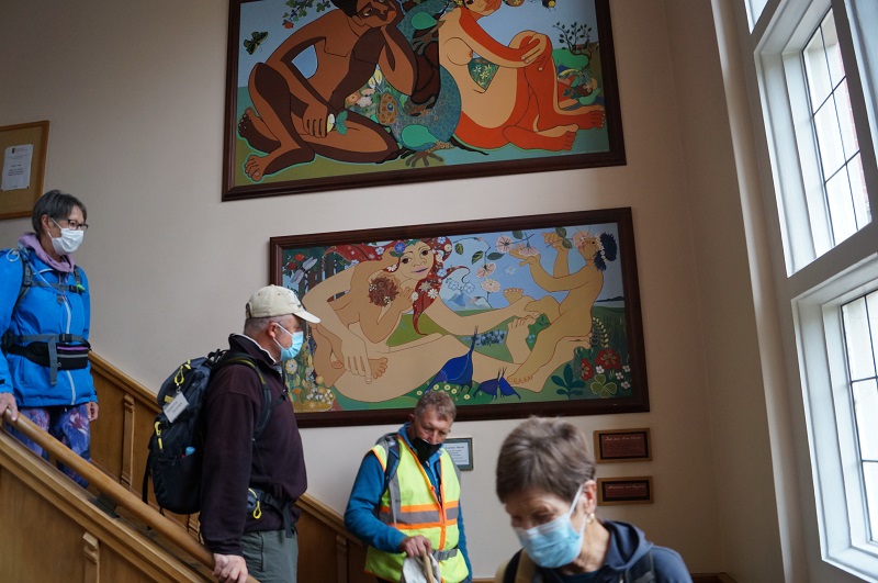
Admiring the stairway artwork (photo & caption John)
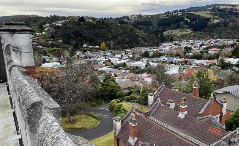
It was also great to climb via steep steps onto the ramparts where we got extensive views over Dunedin.
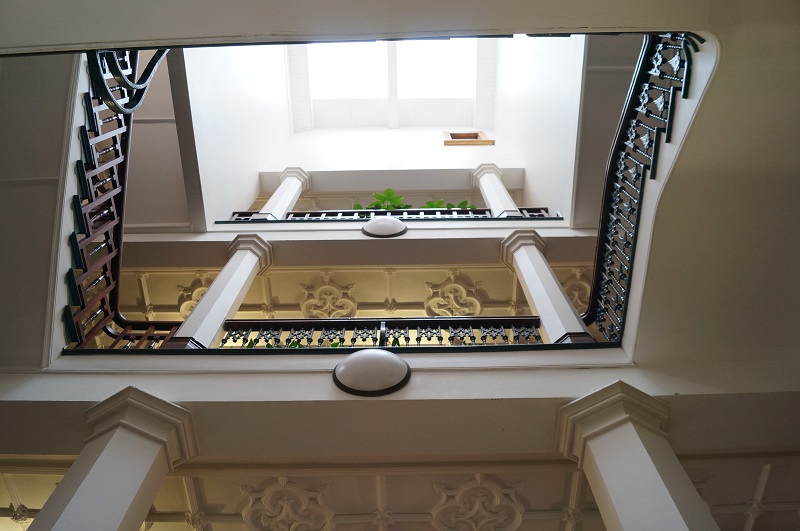
Parallax – Looking up the Knox Stairway (photo and caption John)View North from Knox Tower (photo and caption Pam)Jim and Lester at bottom of Knox stairs, greeting us on our return (photo and caption John)
We were invited to have our lunch in the quadrangle outside the building and could wander through the well-maintained gardens which was a pleasant interlude.
Lunch in Knox College quad (photo Helen)
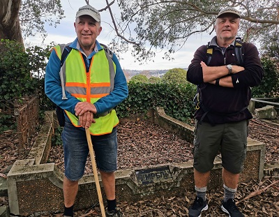
After lunch we divided into two groups and the 13 hikers set off for the top gardens and visited the aviaries. Then it was an interesting walk through the Northern Cemetery. This is a major historic landmark in Dunedin and we saw notable graves and tombs. Neil was also able to point out graves belonging to his (and Graeme Souters) great grandparents.
Neil and Graeme Souter in front of their Great grandfathers grave in the Northern Cemetery (photo & caption Margreet)
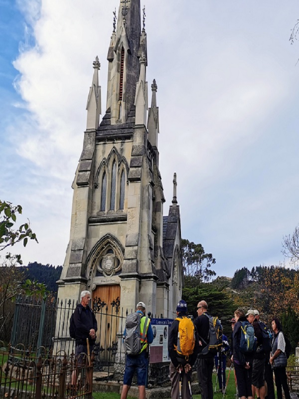
Most prominent in the cemetery is William Larnach’s tomb which was designed by R.A.Lawson and is a miniature replica of First Church.
The Mausoleum of William Larnach (photo & caption Margreet)
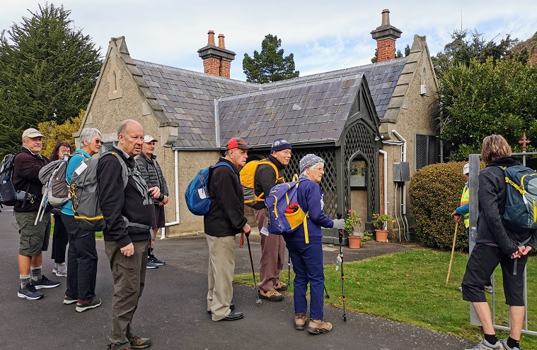
The Sexton’s cottage which is maintained by the Southern Heritage Trust is also very historic.
In front of the Sextons Cottage (photo & caption Margreet)
Of interest as well are the more than 1000 heritage roses; about 500 of which were poisoned with herbicide in 2016. Heritage Roses Otago have worked tirelessly to replace the damaged plants with cuttings and many of the graves now sport new plantings. We also stopped for a few minutes to visit the memorial to Thomas Bracken who wrote the National Anthem of New Zealand.
To finish it was a walk through more tracks in the top gardens and back to the cars.
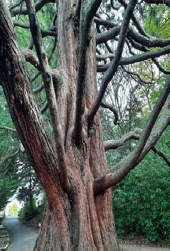
Massive tree between northern cemetery & gardens (photo & caption Ady)
We enjoyed coffee in the café in the lower gardens.
Afternoon coffee (photo & caption Margreet)
Distance covered was about 8km. We will now hand over to Ross and Wyn to give a short account of their afternoon hike which was no doubt more strenuous!!
Neil and Margreet Simpson
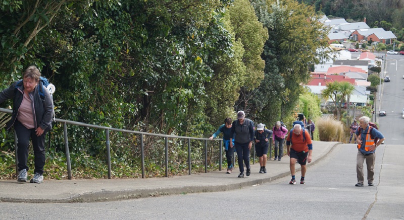
We were the other group, 22 in total, that set off on the more strenuous hike. The 58 steps to the higher part of Arden Street immediately after lunch was a cruel start. We contoured around to Chambers Street which we descended a short way to find the 41 steps up to Taine Street. And then it wasn’t far to the 52 steps to Montrose Street which turned the corner into Maybank Street. Once we reached Blacks Road, it was down a short way to Grey Street and then down, down James Street to North Road.
We enjoyed the flat walking up North Road but all too soon came to Baldwin Street and another 273 steps.
Baldwin Street poem There’s a pigeon … (photo & caption Phil Keene)
Who doesn’t love Baldwin Street? (photo & caption John)
We knocked the B…. off (photo & caption Phil Keene)
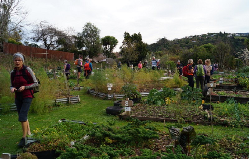
Photos at the top gave plenty of time for getting our breath back before we followed the footpath to the 85 steps down Calder Street to Primrose Bank which led us to the North-East Valley Community Garden. It was a lovely place to chat with the locals and enjoy the afternoon.
Impressive N.E.V. Community Garden (photo & caption John)
From here, it was all up; first up Dalmeny Street, where some tried to figure out if it was better to zig and zag, or to just take it straight. Eventually another 58 steps brought us to Evans Street, and a little further up Evans Street 137 steps took us to Signal Hill Road, just above the bus terminus. By this stage we were starting to feel the effects of altitude; breathing was becoming harder.
Quote from Ross- only one more “bunch” of steps (photo & caption Pam)
We turned into Northfield Avenue to admire the house that Neil grew up in, before descending another lane to Signal Hill Road. Not far down the road we came to the house that Margreet lived in briefly in her younger days, next door to the house that we now live in. It’s a small world.
We detoured from there around Grandview Crescent which does have a very grand view, down one last lane to Warden Street (10 more steps), identified where the track down the hill to the Big Easy goes off the top end of Blacks Road, and zoomed on back to the cars and then the café at the lower Gardens. Some of the other group were still lingering and luckily they hadn’t eaten all the cakes.
It was a pleasure planning and leading the trip with Neil and Margreet and a constant surprise learning about the parts Neil’s family have played in the history of the suburb we call home.
We learned a lot about the Opoho history preparing for the trip, and shared bits of it as we went along. Some have asked for a copy of our notes, and these are available via this link here Opoho Historical Background Notes
Not all these places were pointed out as we went around, but I’ve left them all in for anyone interested.
On the more strenuous hike, we covered about 10 kms including the morning, with about 345 metres of climbing, and a moving time of 2 ½ hours. And did we mention the steps? 628 steps up (not including climbing the Knox tower).
Ross and Wyn
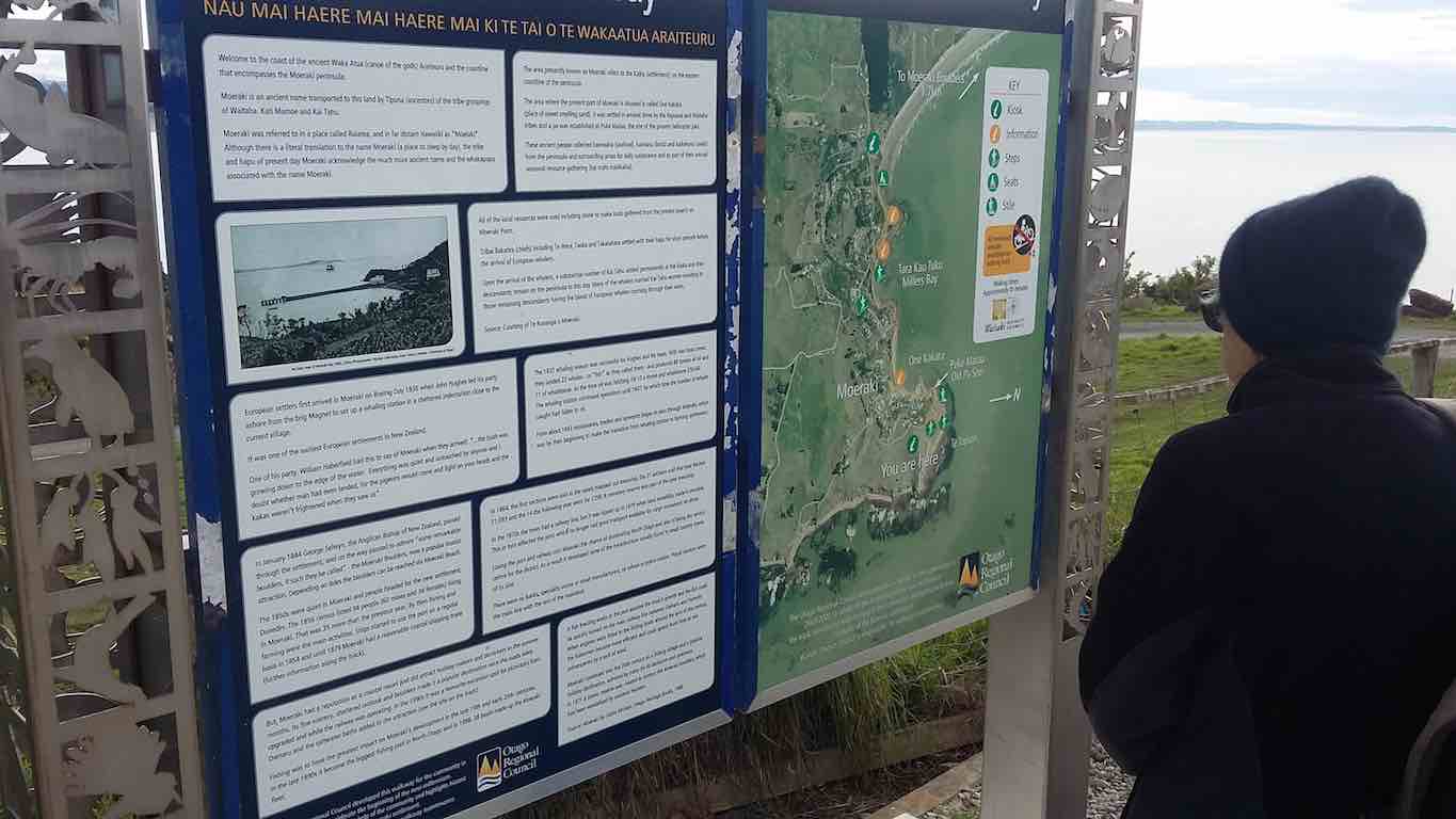
5. 2 February 2022. Combined trampers and hikers. Moeraki. Leaders Valerie Bell & Barbara Shackell, Jay Devlin & Bob Mitchell.
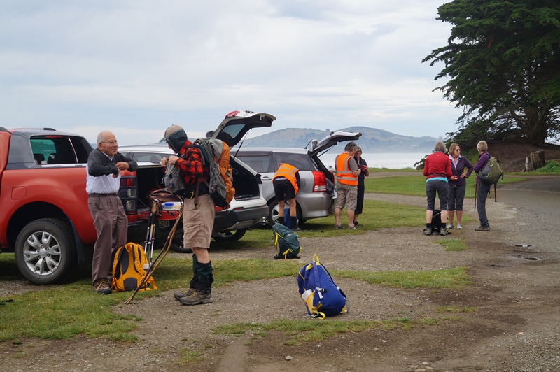
Twenty-eight intrepid beachcombers met together at an overcast Hampden Beach having carpooled up that morning – or camped overnight – and immediately had morning tea.
Getting ready to start out (photo & caption John)
Low tide was 10.54am which permitted walking along the shore including around the rocky headlands for those who preferred, or joining the Millennium Track before the headlands and enjoying the bush area through into Moeraki Village.
A third option was for those who might have wanted a shorter walk to just go as far as they felt comfortable with, and to meet back at the carpark in time to join everyone for afternoon tea at Vanessa’s on SHI in Hampden village.
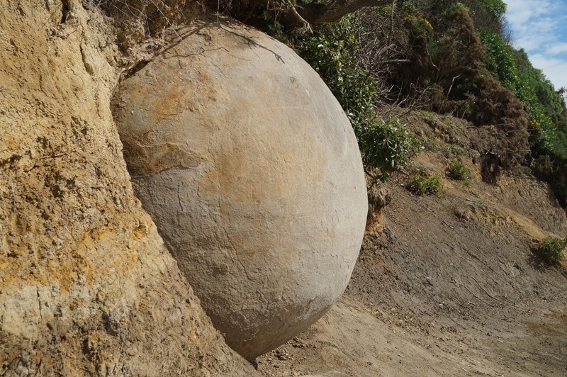
Some interesting rock formations were seen along the way and not all of them boulder formation.
New boulder emerging (photo & caption John)
It was a beautiful day for the walk, not being too sunny and therefore hot, and not being so cool as to be unpleasant to sit in the playground area for lunch.
Lunch stop at the Moeraki Village playground (photo & caption Barbara)View from lunch stop across Moeraki Harbour (photo & caption Barbara)Lunch spot at Fleurs on the grass for 7 of us (photo & caption Helen)So many trampers! I’ve become ambivalent to them (photo & caption John)
At least one leader had assumed that the leading bunch of four women – who took to the headlands as though they were born to it – would continue past the two open eating establishments, past the now closed Fleurs, and up the Millennium Track to the lookout on the Hill above the bay. That leader was mistaken, as she discovered, with the miscreants arriving back at the playground having eaten their Tavern bought Fish & Chips without taking the trek to the lookout!
Beautiful beach (photo & caption John)
After lunch, we straggled out along the beach to return to the cars and enjoy an efficiently produced afternoon tea at Vanessa’s. Thanks to Dave R for the suggestion.
John’s afternoon tea (photo & caption Ady)
Depending on the fitbit or app relied on, we walked between 12-14 km.
Leaders: Jay, Bob, Valerie & Barbara
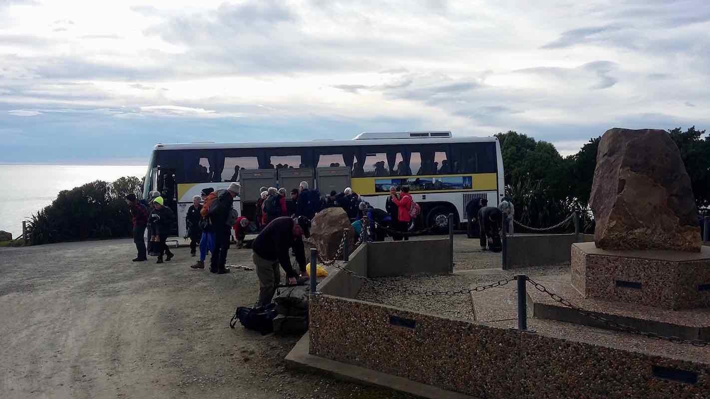
4. 2018-08-01. All. Bus trip. Moeraki. Leaders: Adrienne and Bev.
Report Combined Bus Trip – Moeraki 1/8/18
45 outdoor seekers got on the bus at Mosgiel to head to Moeraki for the club’s annual combined bus trip.
We started at the lookout at Moeraki …
Debussing at Moeraki. (Clive pic and caption.)Where we are going… (Clive pic and caption.)
… and wandered down the Millennium track with great views of the sea and Moeraki Bay.The first seal sighting included a baby seal which was eagerly photographed.A Crested shag was also seen. It was a short wander down to the surrounds of the famous Fleur’s Restaurant.Here morning tea was partaken …
Morning tea at Fleur’s Restaurant. (Clive pic and caption.)
… with lovely views of the fishing boats (known for catching blue cod) in the bay. It was a cool start but gradually the cloud cleared and the sun warmed us up.
The track followed the shoreline through trees and shrubs. On one part of the track the big slump in Moeraki was very evident which has affected some roads and properties.
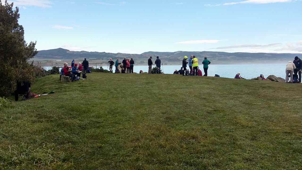
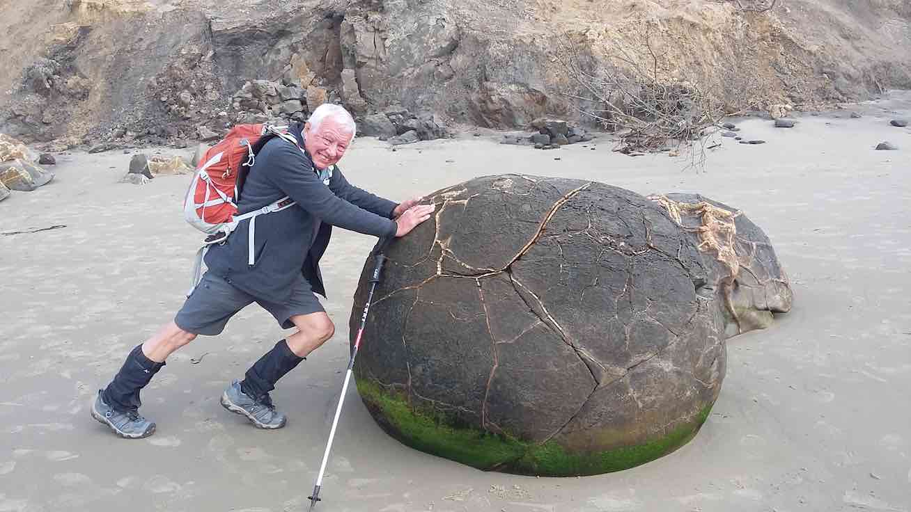
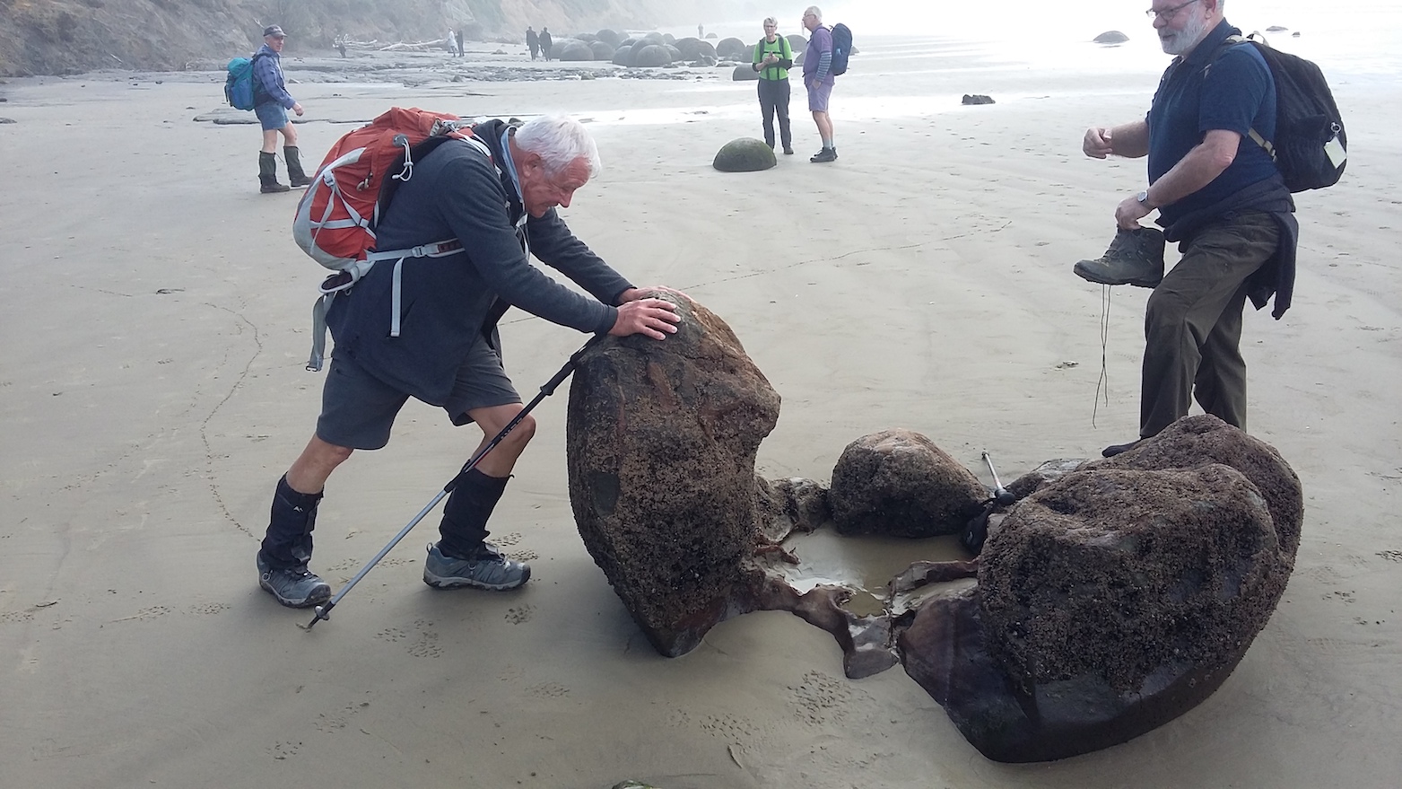
We then walked down onto the beach, the tide being low, and some walkers seeing what seemed like a leopard seal. It was a pleasant walk 2km up the beach to the Moeraki Boulders.According to Maori legend the boulders represent eel baskets and food that was spilled from the loss of Arai-te-uru, one of the large canoes that came from distant Hawaiki. The Boulders are concretions consisting of mud , fine silt and clay , cemented by calcite.
After a number of photographs …
Dave I’ll just move this boulder, (Clive pic and caption.)Oops…… (Clive pic and caption.)
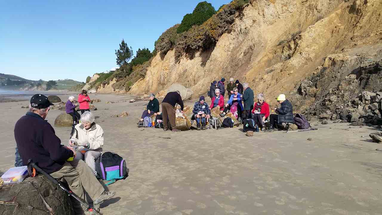
… some of the group headed up to Hampden beach. Erosion by the sea was very evident along the low cliffs.
Lunch was had along the beach some near the boulders …
Adi pic.
…and others at the picnic tables at Hampden Beach.
The trampers lunch at Hampden. (Clive pic and caption.)
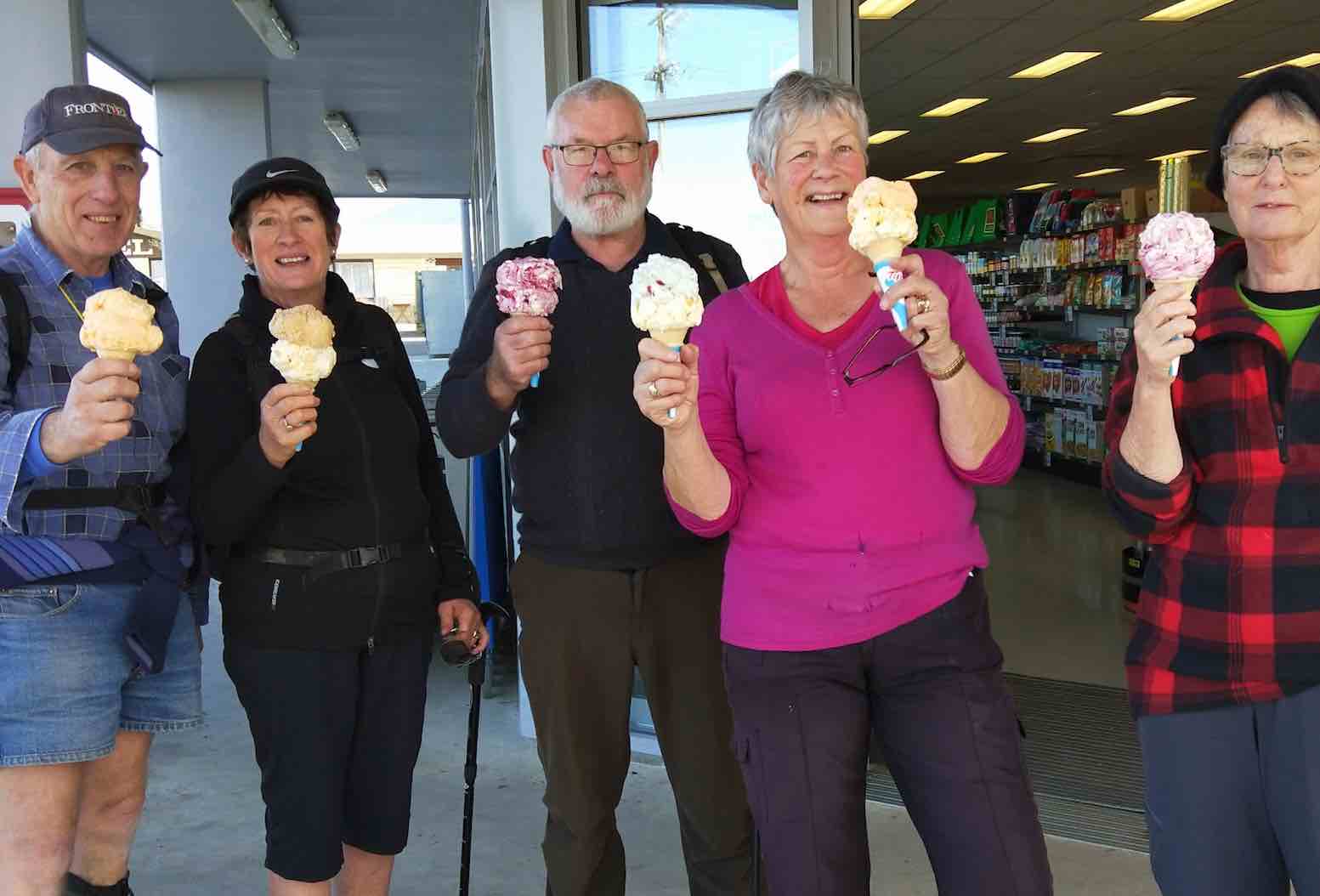
The lure of big double icecreams at the store was too much for some.
Well deserved treat!!! (Dave pic and caption.)
They were sampled with smiles as we walked back.
We all met up at the Boulders’ carpark around 2pm and then headed down to Shag point.The drive in was past icon kiwi cribs, some originally belonging to coal miners of the past, to the boat ramp.We had a wander around the area seeing more lazing seals. There was an old coal mine that used to operate in the cliffs. This was where, years ago, Mollie went to the local school at the age of 5. At that time when the mine was operating the school had a roll of 80.10 years later when she left the school, it only had 18 students.The mine closed in the early 70’s and had shafts running underground beneath the sea as well as inland.
It was then back on the bus, with a group of great people for the trip home. Some feeling very relaxed after some good sea air!!
Thanks to President Jill for her superb organisation.
Dave M
3. 15/12/1997. Tenth Anniversary Dinner, Moeraki. People pics.
(Click to enlarge)
Sylvia Williams, Win Gibson, Audrey Heenan, Les Smith, Nancy Strang, Margaret Deuchrass, Margaret Smith, Who? Mary Maxwell, Les Wiffin, Peg Chisholm, Les Winefield, Mavis Winefield, Bev McIntosh, Barbara McCCabe, Don McCabe?
Eric Bennett, Bev Harvey, Joan Hobbs, Elizabeth Haggie, Dot Bennett, George Haggie
Murray and Eleanor Watt, Ngaire and Doug Moir
Sylvia William, Nancy Strang, Margaret Deuchrass, Peg Chisholm, Frank Weedon, Win Gibson, Shirley, Ngaire MoirMargaret Smith, Bev McIntosh, Bev Harvey
Les and Margaret Smith, Wendy Bathgate
Eleanor Watt, Les and Margaret Smith, Bev Harvey
George Haggie, Mavis Winefield, Les Winefield, Eric Bennett.
Dot Bennett, Joan Hobbs, Colleen Gamble
Barbara McCabe, Cath and Lex Donaldson
Nelson and Dot Taiaroa
Murray and Eleanor Watt
Les Wiffin, Mary Maxwell
Bob and Audrey Heenan
Bev and Ray Harvey
Bev and Ivan McIntosh
Peter Bathgate
2. Friday 22/9/1992 – Sunday 23/9/1992. Moeraki Motor Camp. 23 attended. Leaders: Bob & Audrey
1. 22-23/9/1989. Moeraki Motor Camp. Leaders: Bob & Audrey. 24 attended this weekend camp. Everyone had a great time and Audrey and Bob were thanked for a job well done.
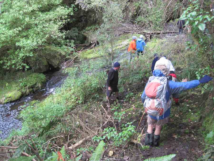
13. 26 January 2022. Hikers. Evansdale Glen. M. Leaders: Jim and Betty Finnie
It was a pleasant sunny morning that 16 hikers assembled at the Evansdale Glen car park. The morning tea stop was in pleasant sunshine at the end of the short bush circuit that returned us to the grassy domain.
Morning tea (caption and photo Clive)
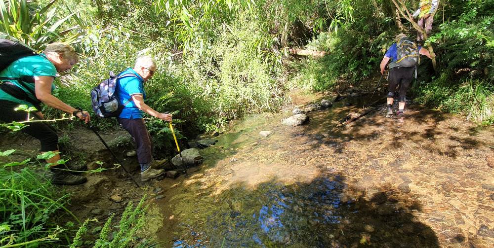
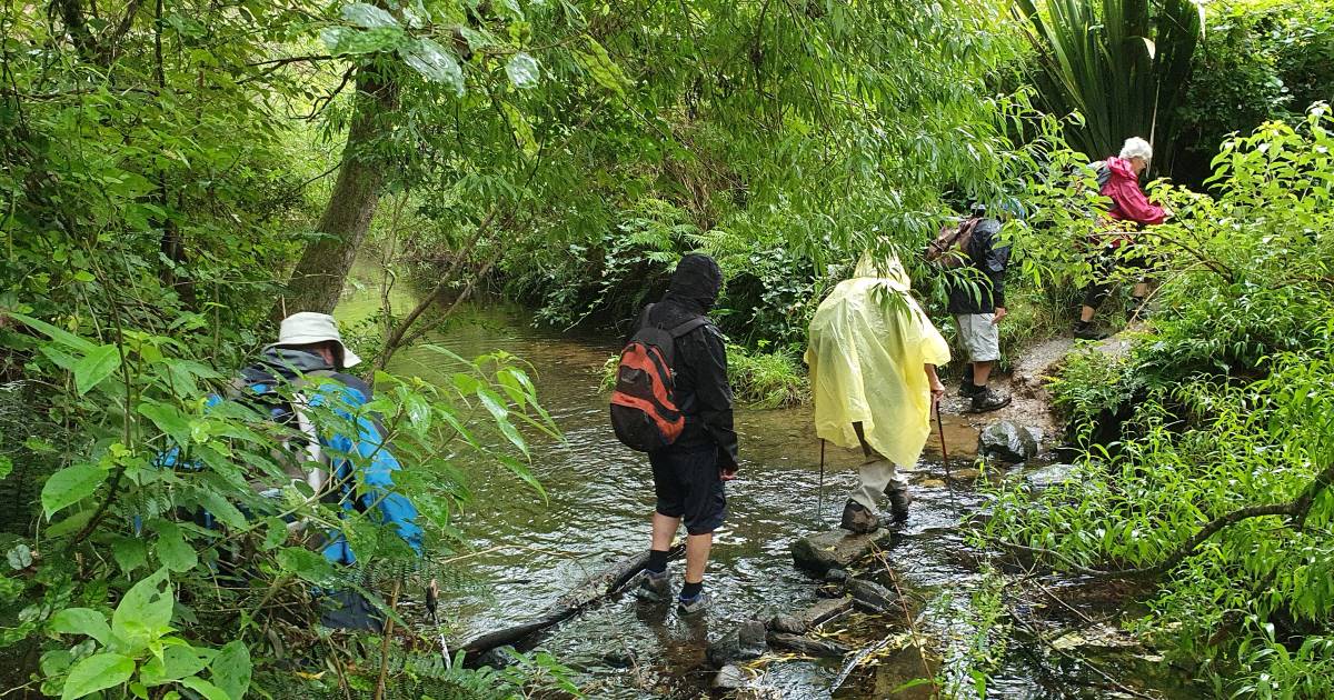
From the domain the main track took us up valley in pleasant conditions, crossing the stream 3 times…
The 1st stream crossing (caption and photo Clive)How to tackle the 2nd stream (caption and photo Clive)The 3rd stream crossed with dry feet (caption and photo Clive)
… to where a pleasant lunch break was had.
Lunch by a babbling brook (caption and photo Clive)Looking downstream at lunchtime (caption and photo Adie)The water race for the old Seacliff asylum (caption and photo Clive)Lunch stop Evansdale Glen (caption and photo Adie)
On the way back down valley conditions deteriorated and required wet gear to be donned. My wet gear consisted of a 35 gram $1.99 plastic poncho that had remained unused for six months. The donning of this unused item for the first time presented challenges that were resolved with the assistance of fellow hikers to remove my head from an arm hole and get my head installed in its correct position.
Wet from above and below (caption and photo Clive)
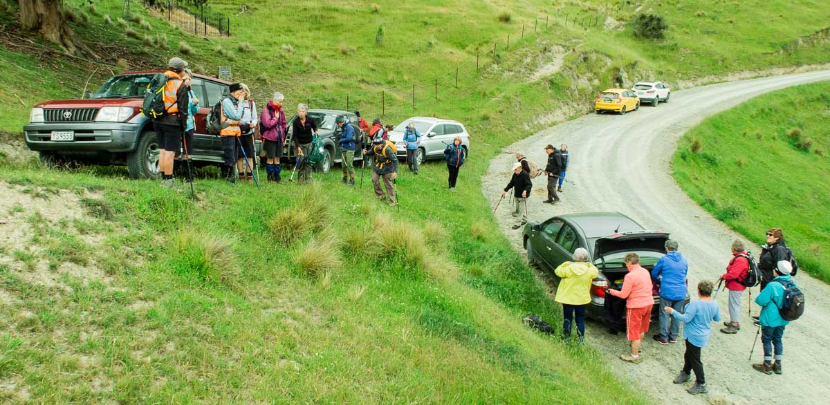
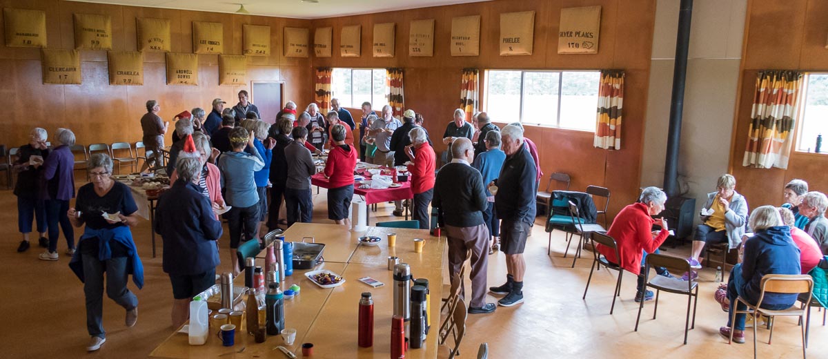
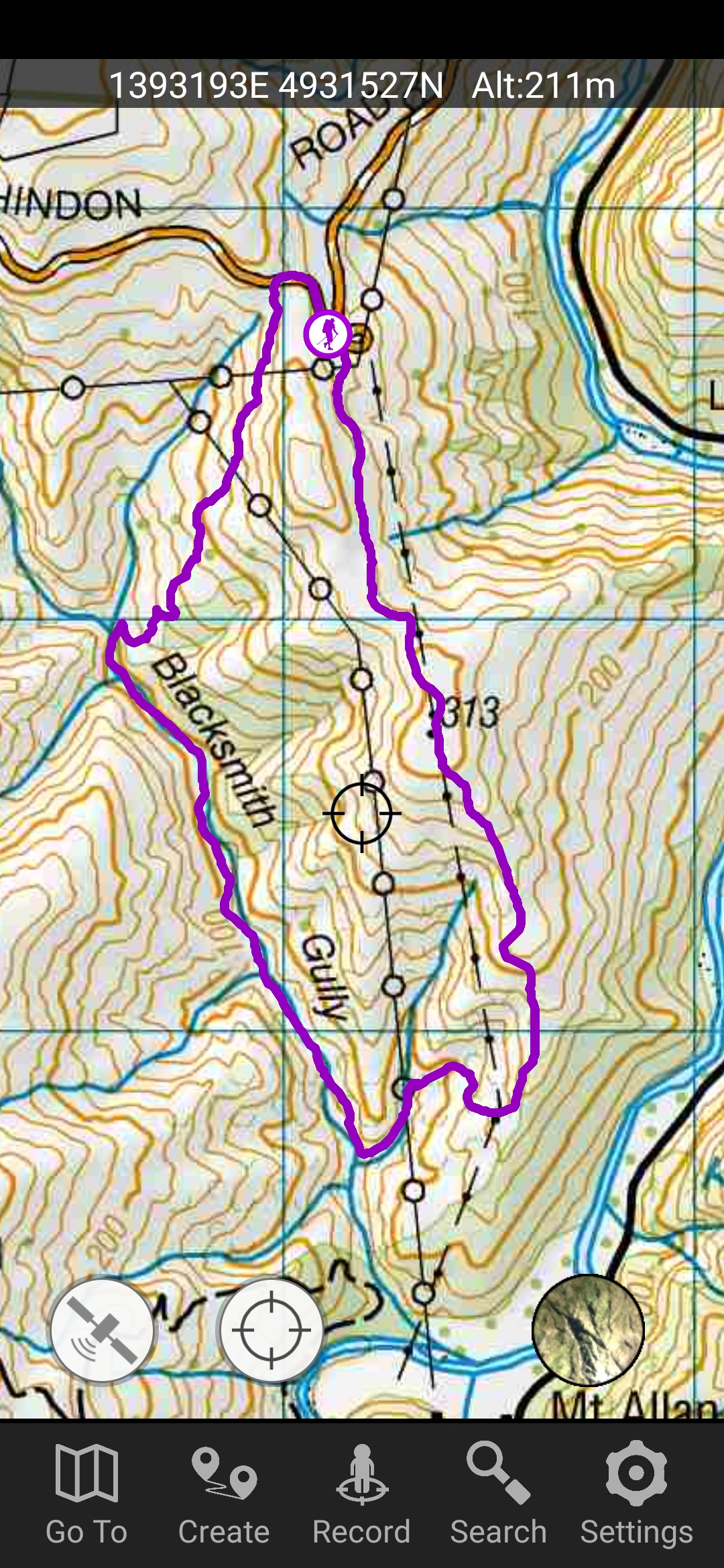
4. 15/12/2021. Hindon. Blacksmiths Gully. Leaders Jill Reid, Sarah McCormack, Linda Partridge, Jan Butcher.
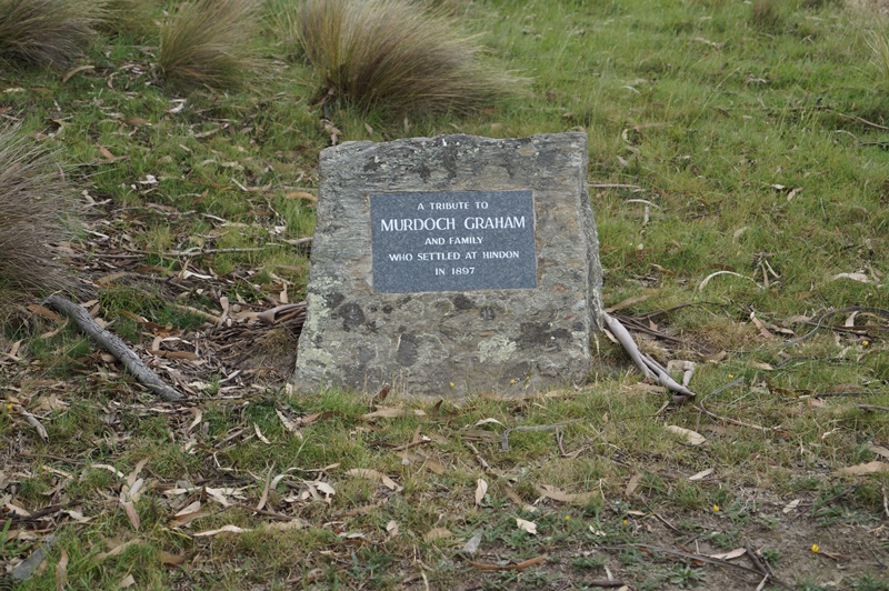
A reasonable day dawned for our combined Christmas visit to Hindon, and about 40 people headed up George King Memorial Drive to the hall. We deposited our “plates”, wrapped up warmly, and drove to Don Graham’s gravesite on Ardachy Station.
Getting sorted (caption and photo Ross)
Don loved this challenging country & he overlooks the hills and Taieri River.
Lovely spot for a tribute stone (caption and photo John)
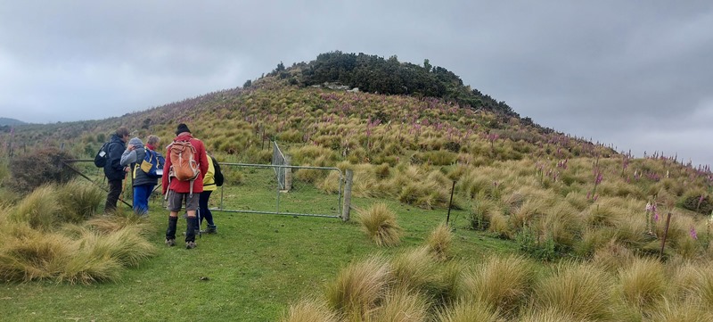
The hikers walked a gentle track & enjoyed the spectacular scenery.
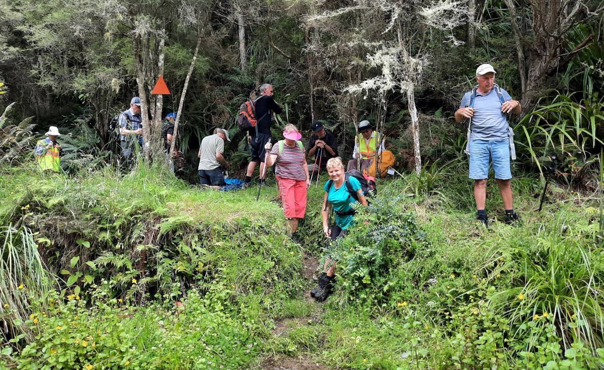
Nice view of the hill (caption and photo Helen)The group of 19 hikers (caption and photo Helen)
The trampers headed down the hill to Blacksmiths Gully, then looped back up to the cars – about 6 km.
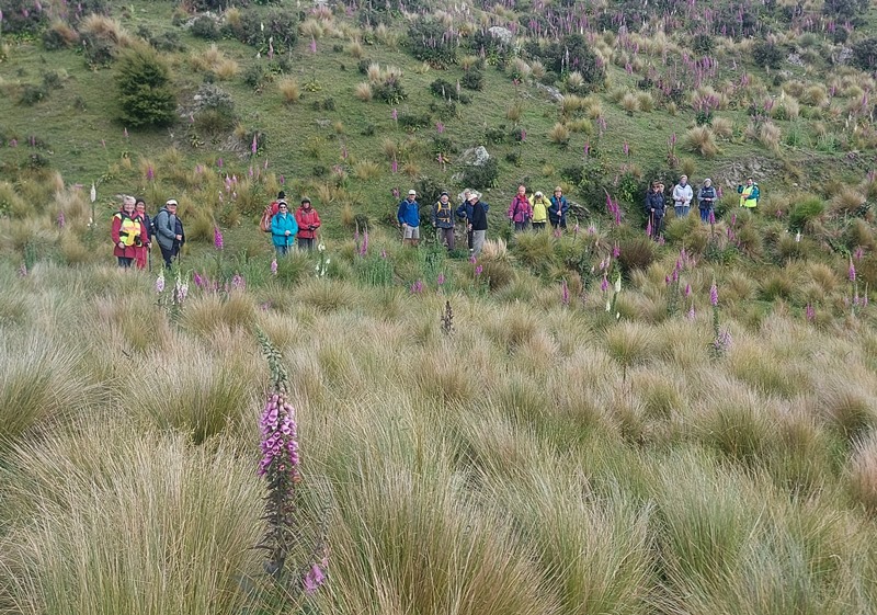
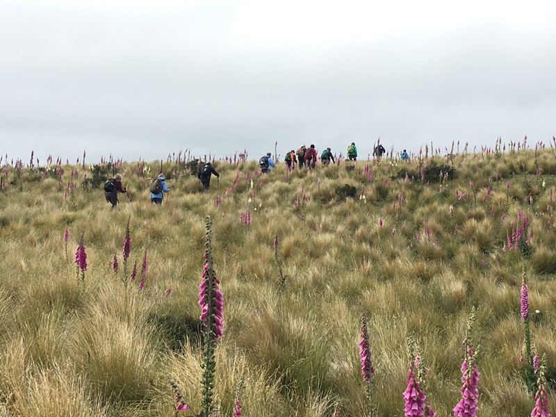
First impression of the vastness of the countryside (caption and photo John)Panaroma – open country dwarfs everyone (caption and photo John)Phil and Peter in their happy place (caption and photo John)Are we going the right way Jill? (caption and photo John)Trampers among the Foxgloves (caption and photo Pam)
Kevin Burke said Ian Fleming’s grace and we then enjoyed the generous pot luck lunch.
Chris Wither told us some Hindon Hall history & her various associations with it during her 38 years living at Hindon. She mentioned how mice often visited during yoga classes……and yes, one brave mouse came under the door soon after!
Lunch in the Hindon Hall (caption and photo Ross)
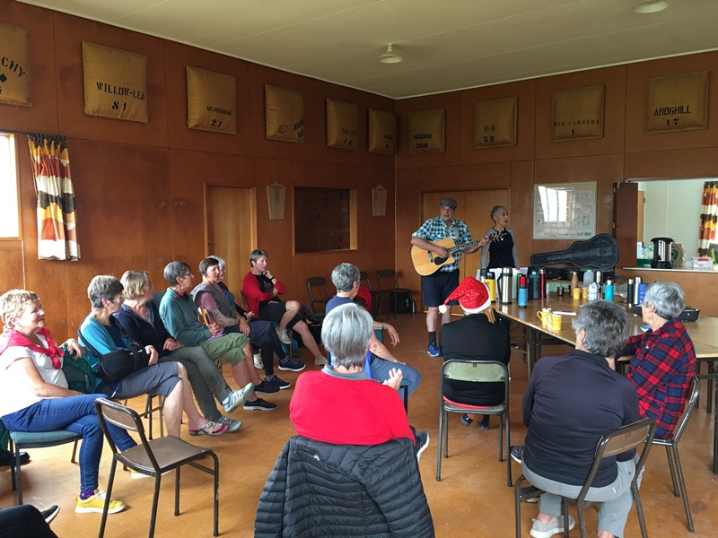
We greatly enjoyed Grant Shackell playing his guitar and singing along with his “blind date” Claire Currie.
The entertainers – Grant and ClaireEntertainment from Grant and Claire. Interesting woolsacks on the wall from past and present farms in the district (caption and photo Pam)
Thank you both for the wonderful entertainment, and to Jill Dodds and her helpers for organising the food etc. A very pleasant way to wrap up our tramping year!
Jill Reid
Tramper’s route
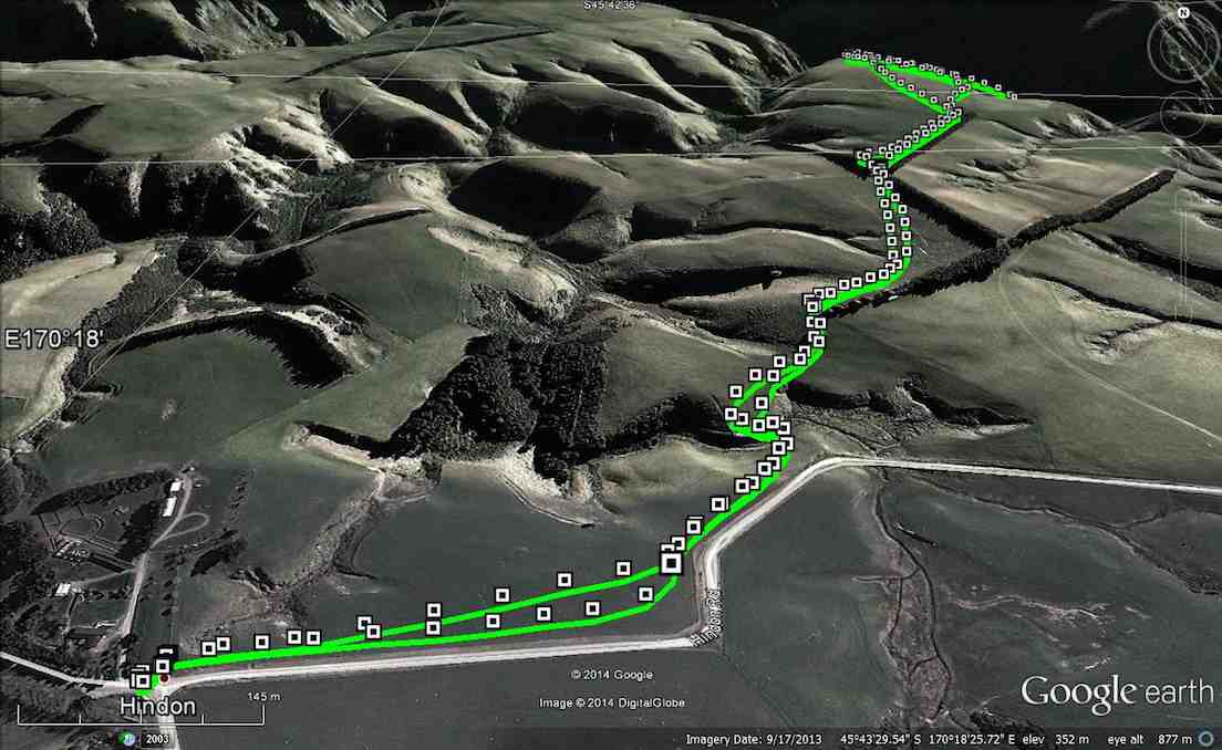
3. 2/4/2014 Both. Hindon. Machine Creek. Recently Bathgate, now Cowley Farm. Easy+ Leaders: Ian, Ken
GPS of route per Garmin, courtesy Ken.
GPS of route per iPhone app.
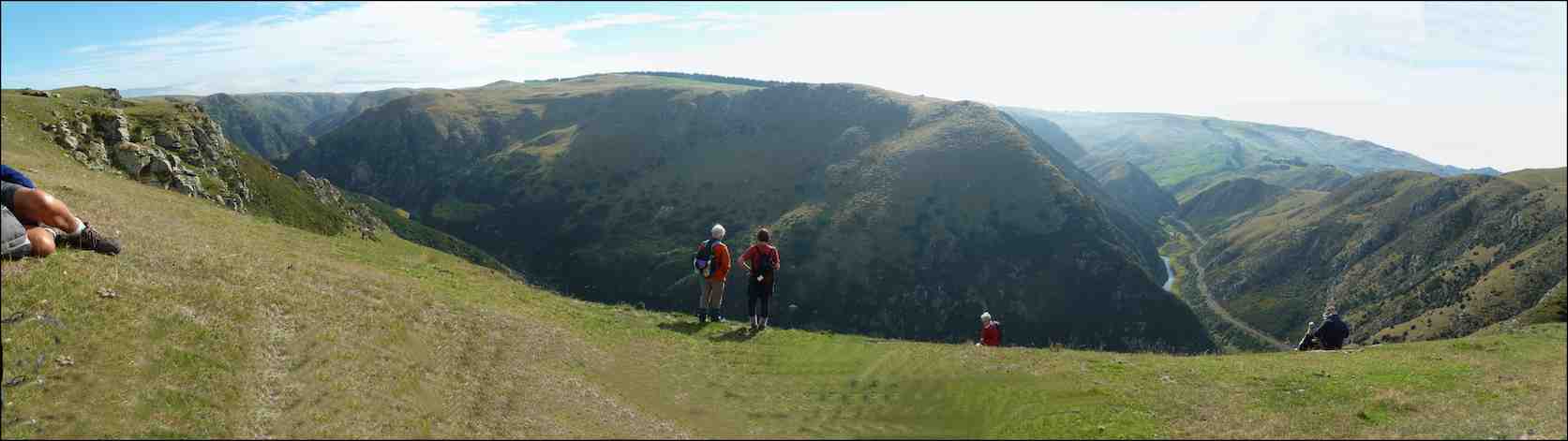
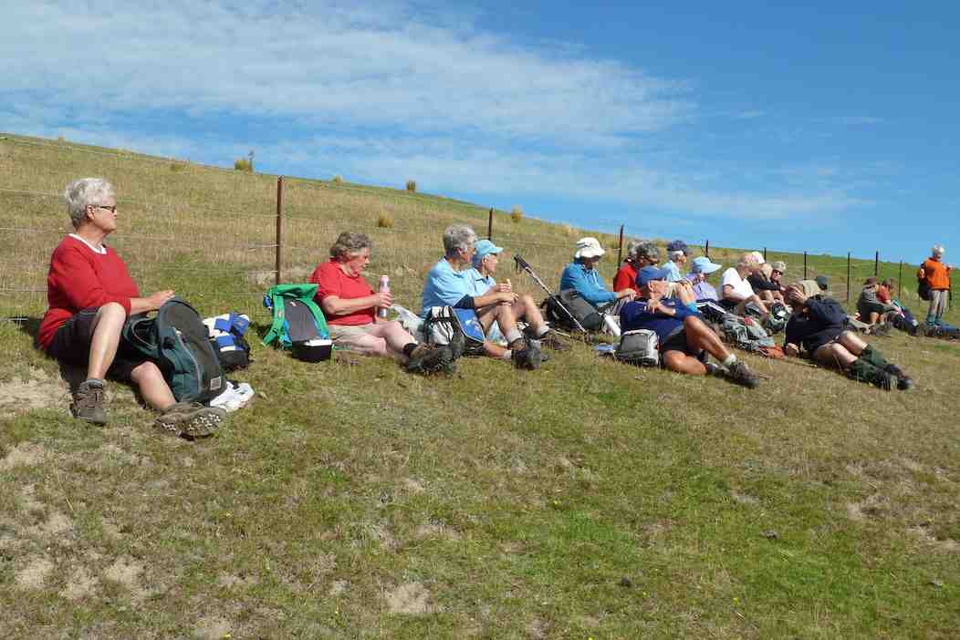
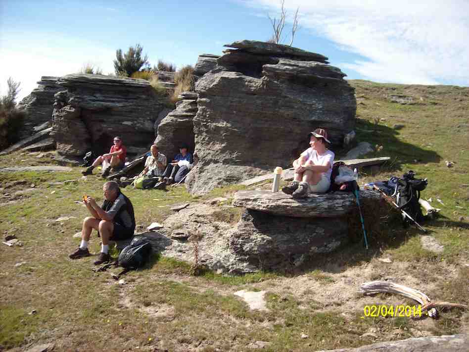
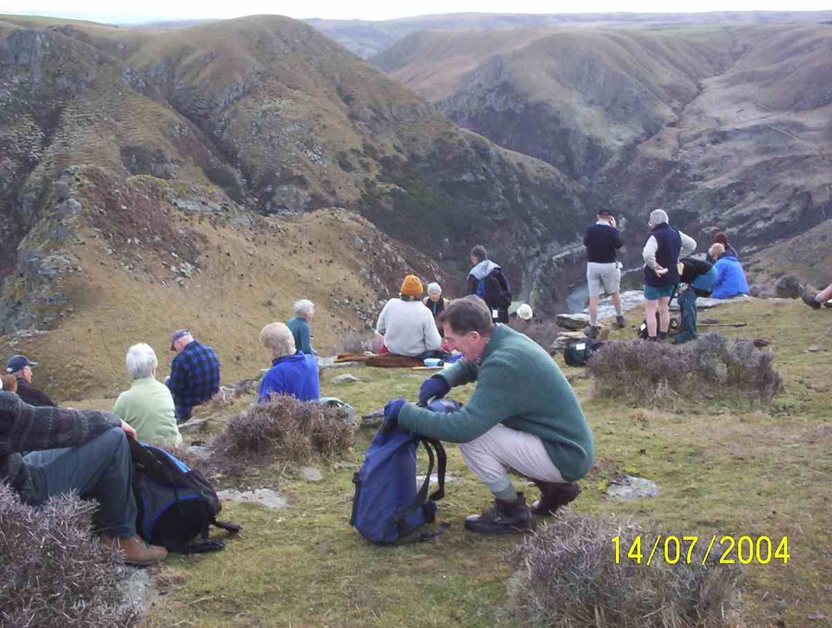
30 turned out for an earlier foggy, but later sunny, shorter trek over gloriously stock-free paddocks …
M/Tea in the dry away from the heavy dew on the grass. (John panorama pic)
to reach a ridge overlooking the Taieri River gorge. Wonderful views rewarded us on an autumnal day quite free of the slightest disturbing breeze. So we could just take our time and drink the prospect in.
A few of us ventured via cattle tracks down the steep slope below the ledge to the plateau below (as can be discerned from the iPhone app map) with the majority remaining quite content to laze in the sun. With plenty of time to spare, we eventually settled down for lunch, the majority again staying on the main ledge …
Lunching along the fence (John pic)
with a few taking advantage of the slope …
Lunch on slope overlooking Machine Creek. (Ken pic)
overlooking the dramatic Machine Creek gorge. All in all, an interesting resurrection of a tramp many of us had forgotten. – Ian.
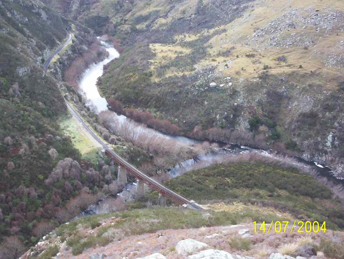
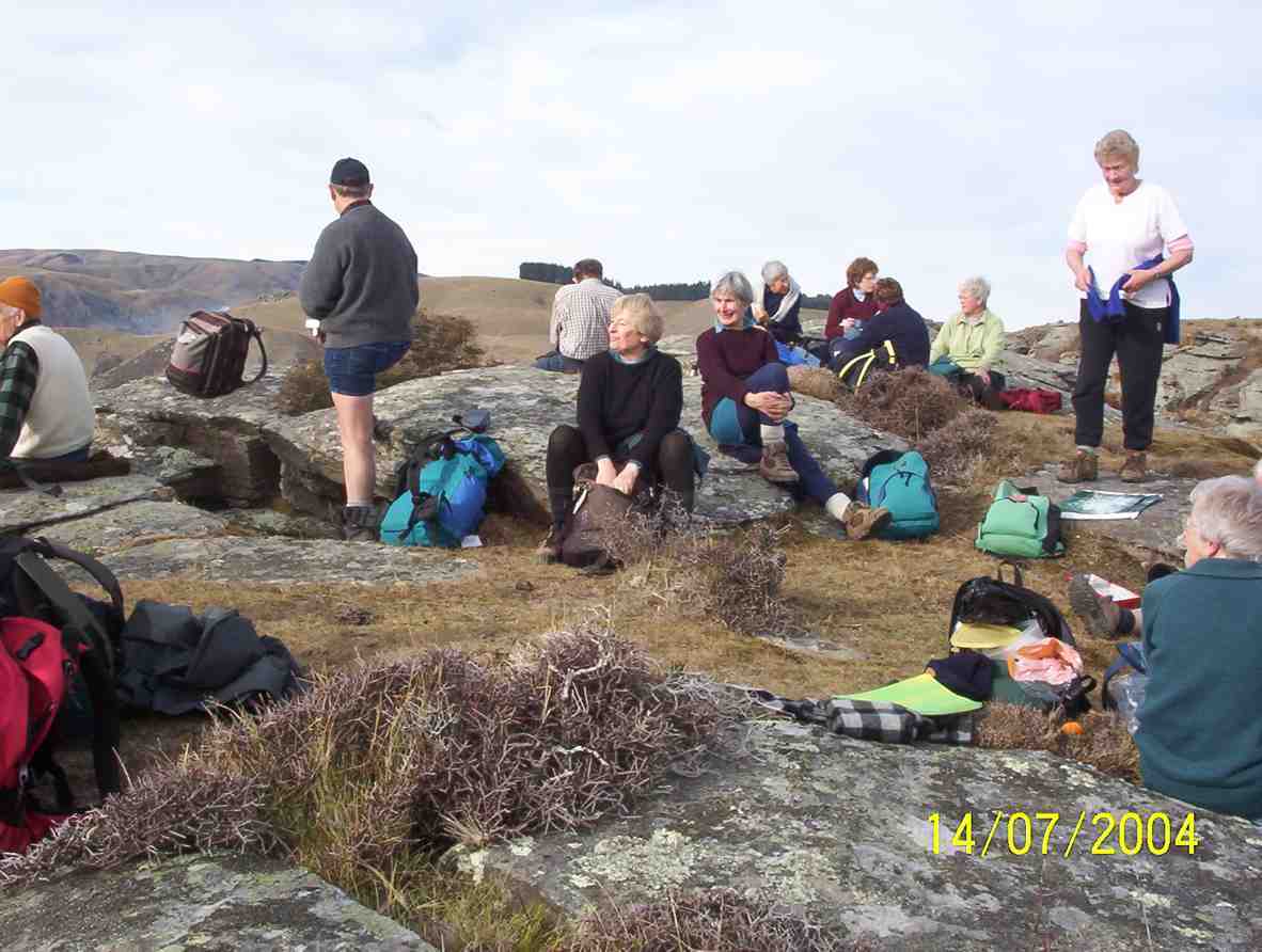
2. 14/7/2004 Hindon, Machine Creek Penno farm Leaders: George, Molly
M/Tea Machine Creek
Machine Creek railway bridge, looking upstream
Machine Creek Lunch. George, Arthur, Pat, Molly, Margaret
1. 5/5/2004. Both. Hindon, Machine Creek, Deep Stream. Easy. George, Molly, Glenys P.
1. 27 October 2021. Trampers. Kaka Point Ramble. E. Leaders: Karen & Gary McInnes
12 trampers travelled the 100km to Kaka Pt to arrive at the perfect time for a cuppa on the beachfront.
Morning tea at the park by the surf club (photo and caption Helen)
The weather had gotten steadily better since we had left Mosgiel so apart from a wee sea breeze, the morning stop was beautiful. We left the cars parked at the beachfront and walked up to the end of Rata street to where the nature walk began. A very good gravel track lead us on a lovely walk through various native trees.
Kaka Point (photo and caption Marijke)
We emerged at the tennis courts and walked down past the motor camp to a very new short bush track then back to the cars. Next stop was Nugget Point.
Looking at the lighthouse (photo and caption Helen)
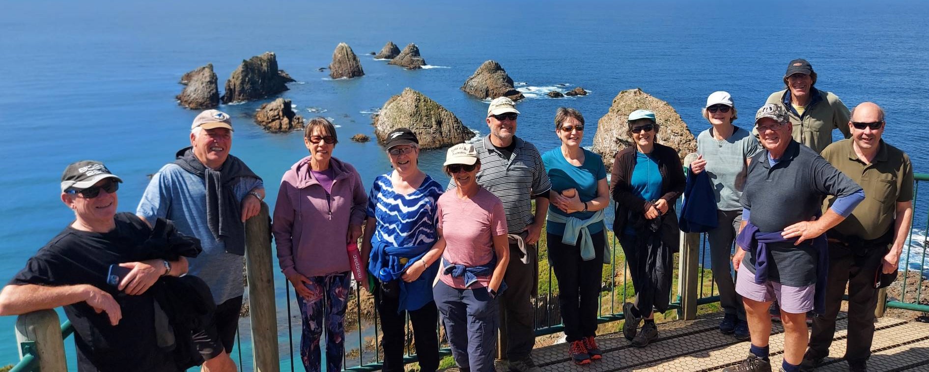
We walked out to the lighthouse and were rewarded with vistas of calm sea and the magnificent rocks that give the Nuggets their name.
New Zealand’s rocks (caption and photo Helen)Our group at the lighthouse (photo and caption Helen)
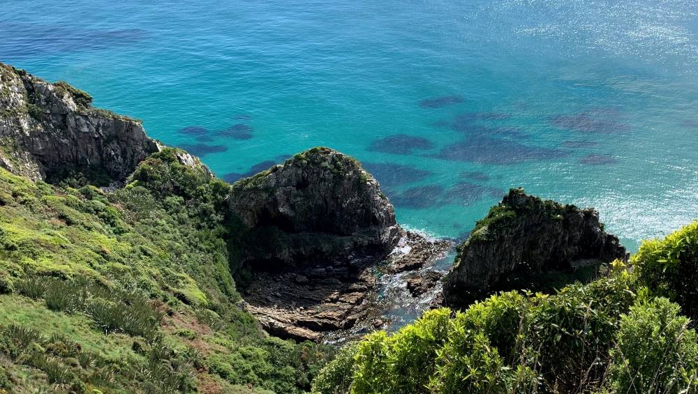
There were lots of comments about how crystal clear and tropical the water looked.
Startling blue sea colours off the track at the lighthouse (we could be in the Mediterranean (photo and caption Marijke)
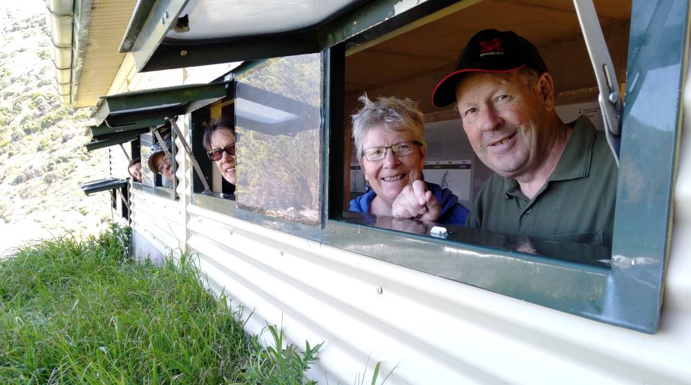
There is a small breeding colony of Royal spoonbills on one of the rocks on the walk out to the lighthouse. Lunch was a sunny spot with a fabulous view all the way up the coast. We drove back down the hill to Roaring Bay where it was a short walk down to the penguin hide.
Hidee hi trampers (caption and photo Karen)
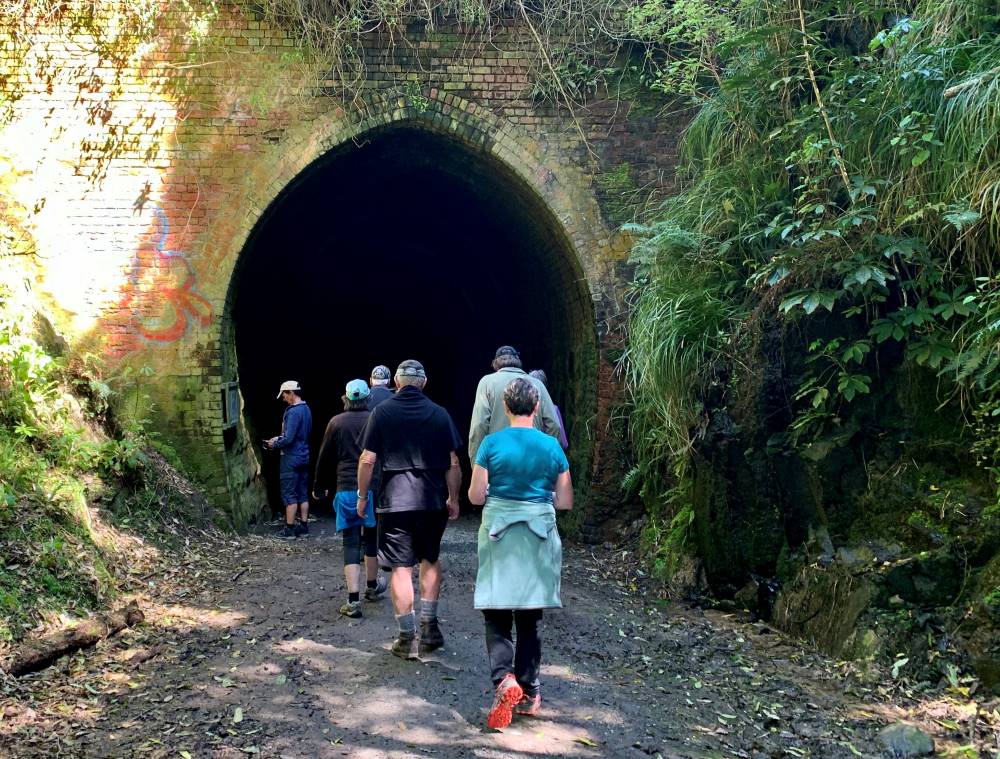
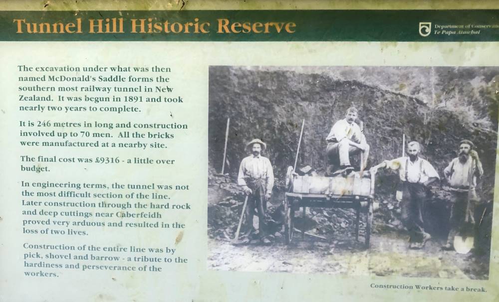
Unfortunately not the right time to see penguins but the bay was beautiful just the same. We decided that we would add on a visit to the train tunnel at Tunnel Hill on the southern scenic route. Certainly an amazing tunnel, being the southern most tunnel in the world.
Tunnel Hill (caption and photo Marijke)Tunnel Hill info (caption and photo Jenni)
End of the trip refreshments were had at Cafe 55 in Balclutha. We had fantastic weather all day until south of Allanton where we ran into rain. Thanks to the drivers who got us there and back safely.
9. 11/08/2021. Trampers. Roulston Farms and Weka Falls. M-H Leaders: Jill and Karen
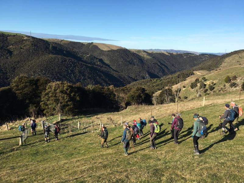
On a clear morning with the promise of a sunny day 25 keen trampers made their way 4km up the George King Memorial Drive to assemble on Glencairn, the Roulston farm. After a brief background regarding the farm, we made our way down the paddocks to a barrier of electric fence tape from where we could look across to Mt Hyde on the other side of the Lee stream. The Taieri River was to our right.
Lee Stream below (Photo and caption Pam)
From here we could also look down on some of the track we were to follow for our first loop. We proceeded down a steep track then levelled out to make our way around the face with a mixture of up and down till we got to a good sunny spot for morning tea.
Morning tea (Photo and caption John)
After our break we headed off following a farm track which took us through some boggy patches and a bit of manuka. A decision was made to keep going on this course instead of making our way up through the paddock. A good addition to get the heart rate going and the legs pumping. We then made our way across the road to the Sime’s farm (leased by Roulstons) where there are spectacular views all the way down to Lake Waihola.
Saddle Hill is in sight (Photo and caption John)
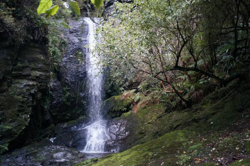
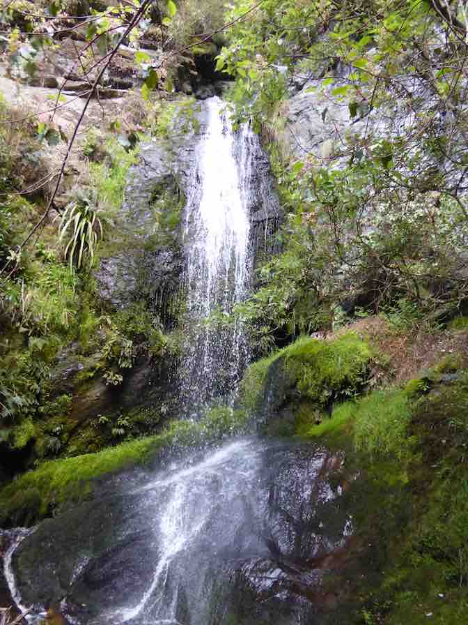
It was a flat walk on the paddocks to our lunch spot at the implement shed. After lunch we walked over a couple more flattish paddocks and well chewed swede paddock then proceeded down the paddocks where Nick joined us to help us find the elusive Weka falls. It was a steady descent to the entry point of the track to the falls. We followed stock trails in the gully through bush consisting of manuka and totara but were unable to find the falls despite being able to hear them. Nick led us further upstream through the bush and scrub and the track was eventually found. Following the track down we came to Smugglers Stream and the Weka Falls.
Quest complete – first view of the Weka Falls (Photo and caption John)Meeting up at the waterfall (Photo and caption John)
The falls were definitely worth the effort to locate them as they are very picturesque. Nick was able to go in behind the falls and not get too wet.
Weka Falls on the Sime property (Photo and caption Pam) Nick Roulston is behind the falls
After making our way back up the track and regrouping, a piece of orange tape was left to mark the correct entrance to the track. We made our way back up the lower paddock then headed down into a wee manuka gulley then up just below a pine block across the paddock to the lane where we had walked before lunch. From here it was a flat walk back to the road then along to the area where our cars were. The tramp was approximately 15km long and had a good variety of grades and scenery.
A big thank you to Nick Roulston for being so generous with his time both with the recce and helping us find the falls on the day. Thanks also to Jill for the baking she gave to the Roulston family. Karen McInnes
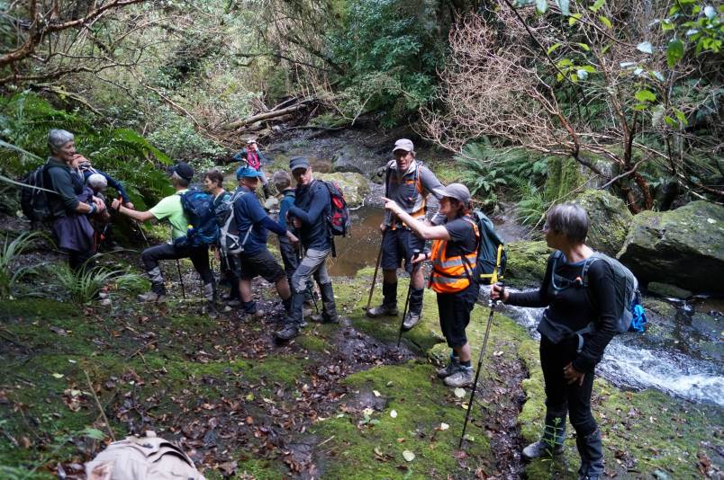
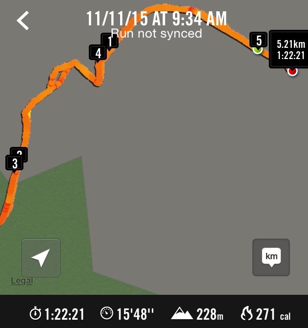
8. 11/11/2015. Hikers. Weka Falls on Smugglers Stream. Leaders: Peter and Wendy.
Route. Weka Falls on Smugglers Stream. (NB: Began tracking half a paddock too late!)
About 25 of us parked at the wool-shed. After Jim Sime had welcomed us, he invited us to share a moment’s silence as it was Armistice Day and a suitable occasion was unlikely to occur later at 11.00 a.m. Due to some hip trouble Jim led us off in his Kobotu four wheeler. We took the customary route first through the tree-lined paddock, through the gate, turning off to the left along the ridge of the next paddock and down it to the gate at the bottom. Here we took the sharp turn to the right down the steep slope (acute turn right below 4 km indicator on map of route) into the dip,
Down the steep slope. (John pic)
then up again to the left at its farther end and up up up a long slope to the eventually ease-off at its top. Then slightly diagonally to the left, now sloping down to stop at a part-wired fence for the morning cuppa.
Morning cuppa at the top. (John pic)
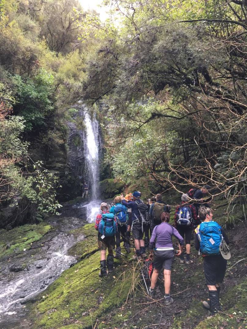
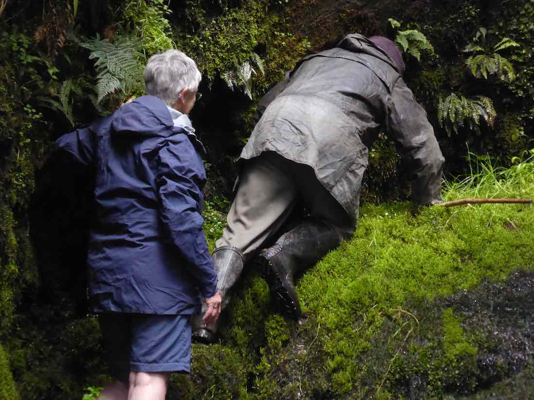
Beyond the fence, it was a long gradual descent to a bush-lined gully in the distance. Jim had opened the track down through the bush, adding many well-dug-out steps on the steeper parts. Half an hour went by before we reached Smugglers Stream at last.
Down at the stream, everything was covered in slippery moss and great care was necessary to avoid slipping over. Alex nobly stood by slippery rock face on the track and was not one to shirk the the task of having to rescue three fair maidens in his arms as their feet slid away beneath them..
Alex ready to catch people sliding on slippery rock face. (John pic)
We crowded where we could find a safe footing and gazed in wonder at the Weka Falls of Smugglers Stream. Jim had said as it was likely to be his last visit to the Falls that he intended repeating earlier ventures under the falls for the last time. Judy, our President, freshly return from an extended North Island break, elected to go with him lest any mishap to befall the venturer.
The rocks were heavy with moss and the two had to take great care in negotiating the route.
Going under Falls. 1. The scene. (Liz pic)
It obviously wasn’t easy.
Going under Falls. 2. The scramble begins. (Liz pic)
Careful does it.
Going under Falls. 3. Entering Falls. 3. (Liz pic)
Made it!
A pair of immodest show-offs! (John pic)
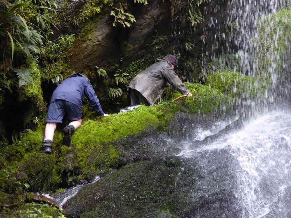
The way out was a surprise. Jim suddenly disappeared down behind the next mossy rock ahead of him with Judy waiting to make the plunge down too.
Exiting Falls. On and out! – or down! (John pic)
Beyond here was impossible to photo. The route was out of sight. It lead up and into the bush and via a contoured route reached reach the track we had come down at a point about half-way up it. Bravo!
We climbed our way back out again. Jim offered the chance to harvest young lancewoods or totara and a few accepted his offer. He also provided a few freshly cut manuka sticks as trekking poles for any who wanted them.
We lunched at the bush side.
Lunch at the top of the bush. (John pic)
Sheltered from the wind, we dozed in the sunshine until at last it was time to begin the trudge back up the slope above us. It’s never easy to have to climb immediately after a lazy lunch break, but climb we all did – with one exception. John took advantage of the opportunity of accompanying Jim in the Kobotu.
The Weka Falls day is not a long one, but makes up for it with many many energy-sapping ups and downs. We arrived back at the cars it was not the end. Jim expressed his pleasure being able to share his property with us. And to finish the day off, he was prevailed upon to sing us his famous song about the egg (well, the slightly-off egg), consisting of a medley of some six or more tunes cleverly matching the words. This was met with much applause.
Twenty-one or so of the Hikers resorted to the Topiary Cafe for a convivial coffee stop. Thanks to Peter and Wendy for an enjoyable day. Weka Falls had been a surprise of a delight to all the ‘newies’ in the club. – Ian.
We parked our five cars at the wool-shed where we were met by Jim, our guide. He first led us along a tree-line to a double set of gates.
Tree line at start.
Through the left gate and down left along the paddock ridge. At its foot, we turned right and carefully descended a very steep slope down into a gully. From there it was steeply up to the left onto a top. They it was continue diagonally left with a shed in the distance as a guide point, we took the ridge to left of a gully featuring two broadleaf trees.
Following the ridge, we eventually reached large gorsebush clump adjacent to the bush. Here we stopped for our morning tea break.
Immediately behind the bush was the entrance to a steep but well-cleared track which took us down to the amazing hidden gem of the Weka Falls.
Gut at top of Weka Waterfall
Weka Waterfall.
Pool at foot of Weka Waterfall.
Down-stream pool. Lesley, Arthur, Wendy, Barbara, Fred, Susan, Sabina.
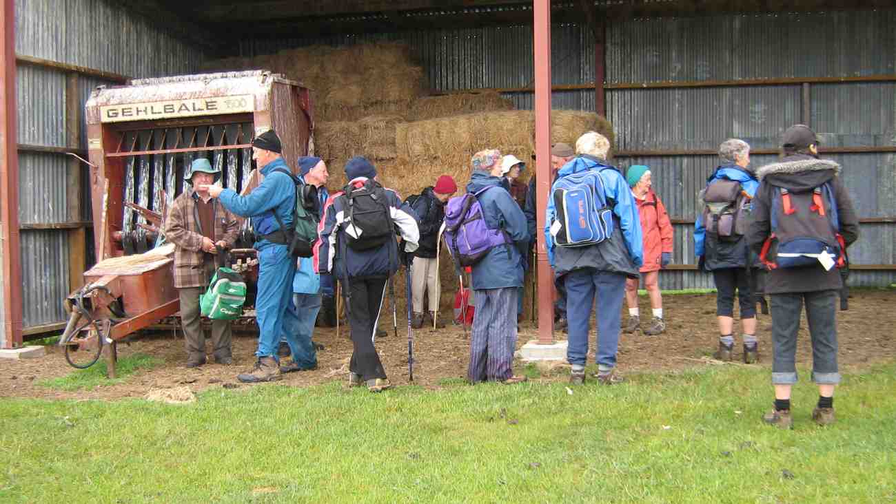
We accomplished the steep climb back up the track in a shorter time than we thought it would take. Then it was back out to the paddock ridge, but this time diagonally across to our left, and back around through another paddock or two to lunch in the shelter of an implement and hay barn.
After lunch in the barn. Jim, Arthur, Fred, Who?, Molly, Lesley, Evelyn, Who?, Peter, Margaret, Bev, Wendy, Barbara.
An easy downhill walk completed the circuit back to the cars. An enjoyable if drizzly and cold (at times) day. – Ian
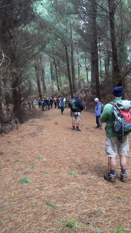
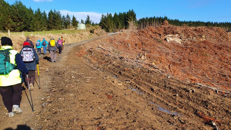
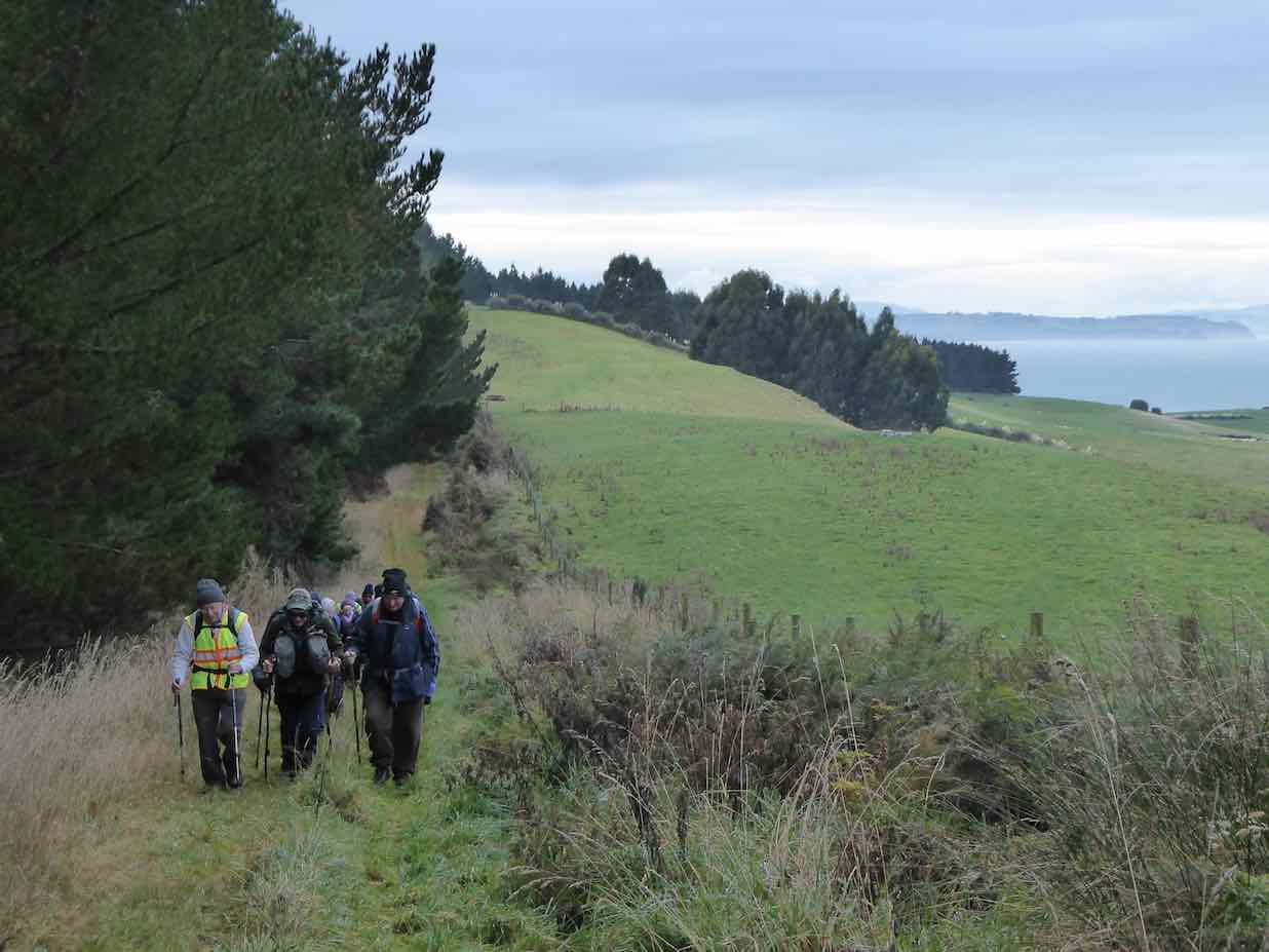
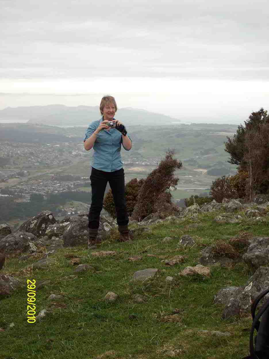
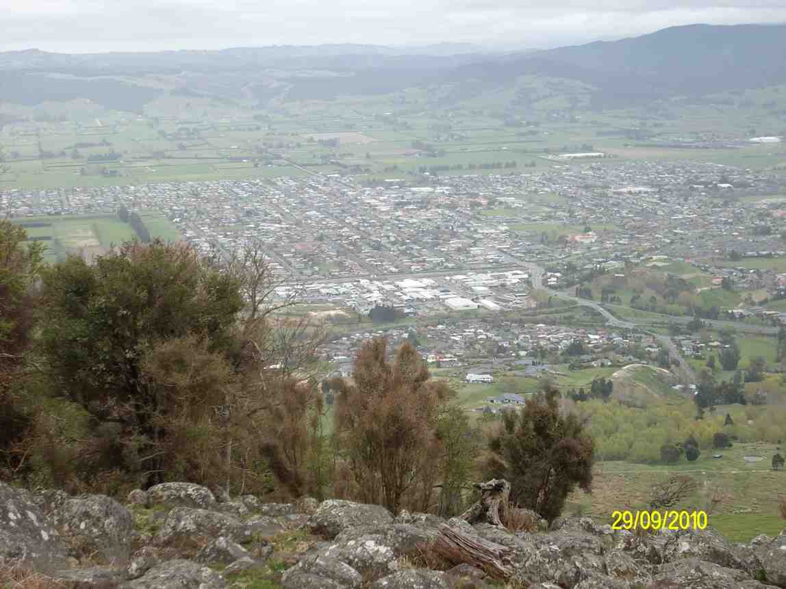
Meeting at a suitable parking spot on the Taieri Mouth road at the start of Mount Allan forestry hike 12 brave members set off for a pleasant walk in bright sunshine. As Pine trees had been removed it gave a different feeling from our previous hikes. Great views and an understanding of how rough the hills really are for planting. First stop after a good climb was morning tea break.
“.Morning tea in the sun.” – Photo and Caption Clive
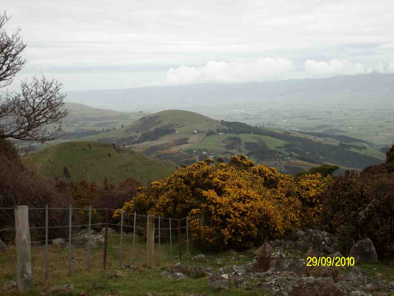
Everybody relaxed. Onward up and down until we reached Big Stone Road .
Before- Aug. 2019 photo.” – Photo and Caption Clive“After – now – trees felled.” – Photo and Caption Clive
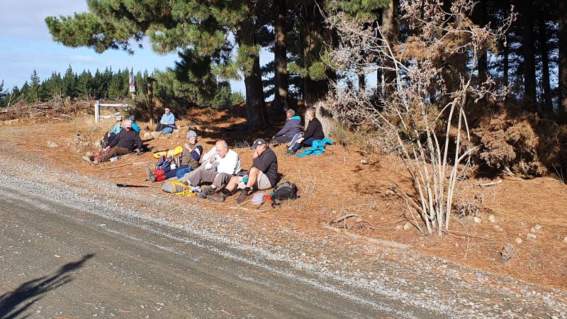
Lunch time.
“Lunch at Big stone/Daphne Road.” – Photo and Caption Clive
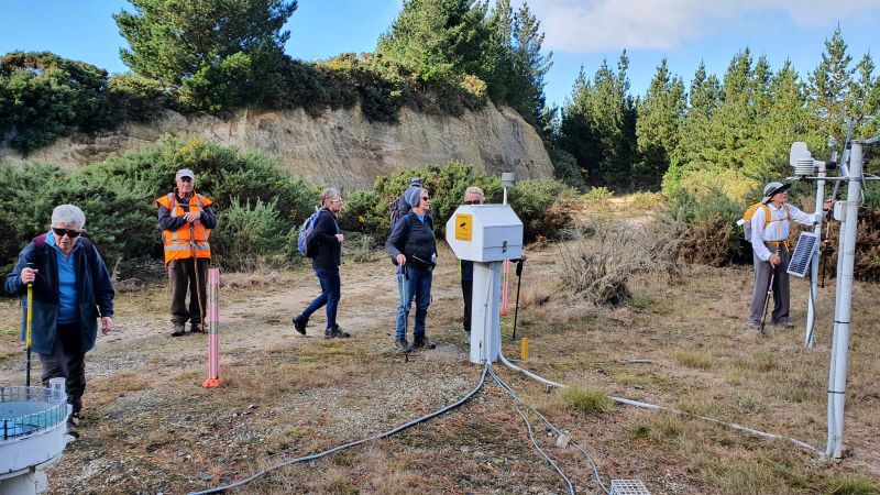
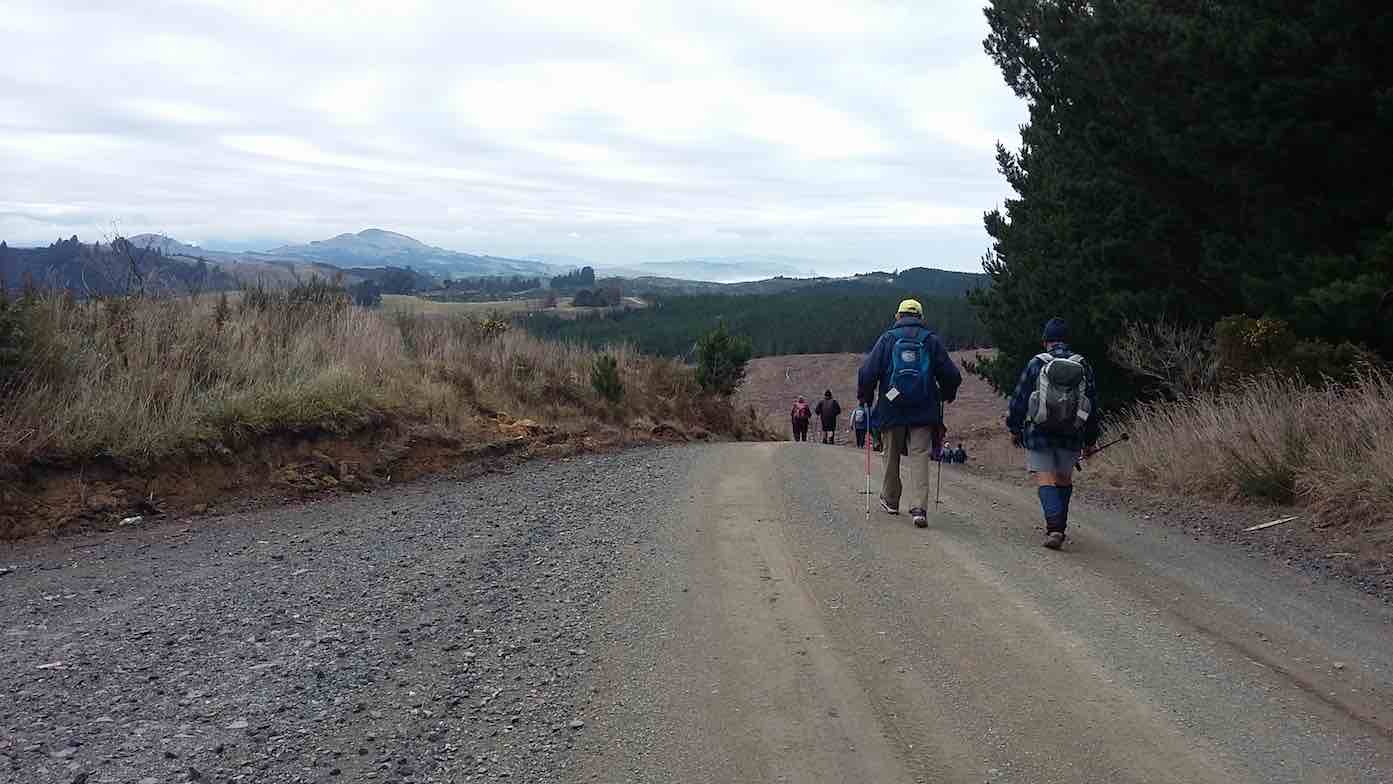
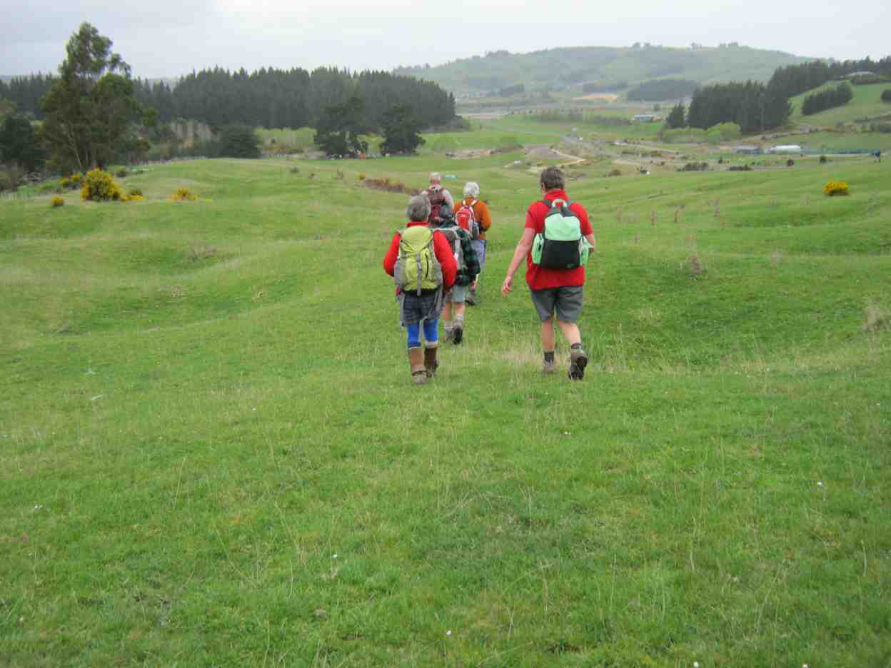
Down the road until we met the next track and into the forest again. From here it is mostly down hill with more great views until we arrive back at car park.
“A weather station on the way down.” – Photo and Caption Clive
Coffee at Brighton Beach shop with relaxed chatter including meeting Dot and Chris who had just completed there own walk. 12 kilometers in total .New member was welcomed and had a good day. Good company and enjoyable.
Liz and Alex.
18. 22/5/2019. Hikers. Forestry walk Kuri Bush. Dave and Liz.
A little bit nippy for a start
Start of the day. Liz pic and caption.)
but 2o hikers and 3 Ramblers set off what was to be a pleasant gradual climb amongst pine trees and bush.
(Kevin pic.)
A 9.50am morning tea was taken with sun shining brightly which warmed all and accepted. From here the Hikers took the Daphne Road
On pine needle carpet. Easy on the feet. (Kevin pic.)
and Ramblers the Isobel Road. The Hikers continued until reaching Big Stone Road
Lunch. (Liz pic and caption.)
and then onto the downward trip via Katherine Road. The Ramblers did very well reaching the top of Isobel Road and then down Katherine Road. Total distance for Hikers was about 12 Kilometres. Off to Brighton Beach Cafe went very weary but happy Hikers and Ramblers. Thanks to all Liz and Alex.
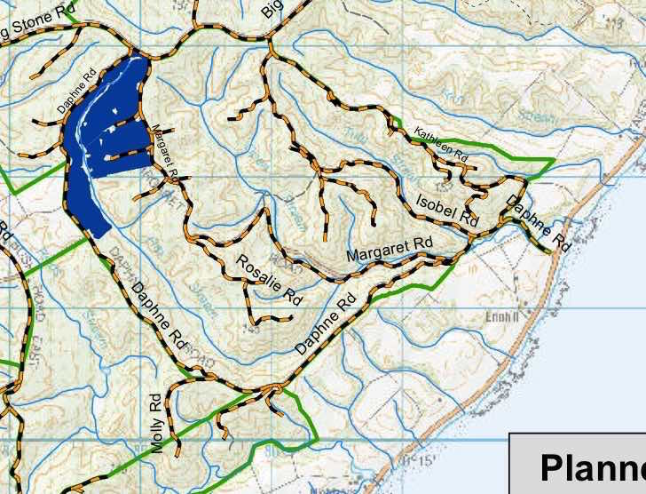
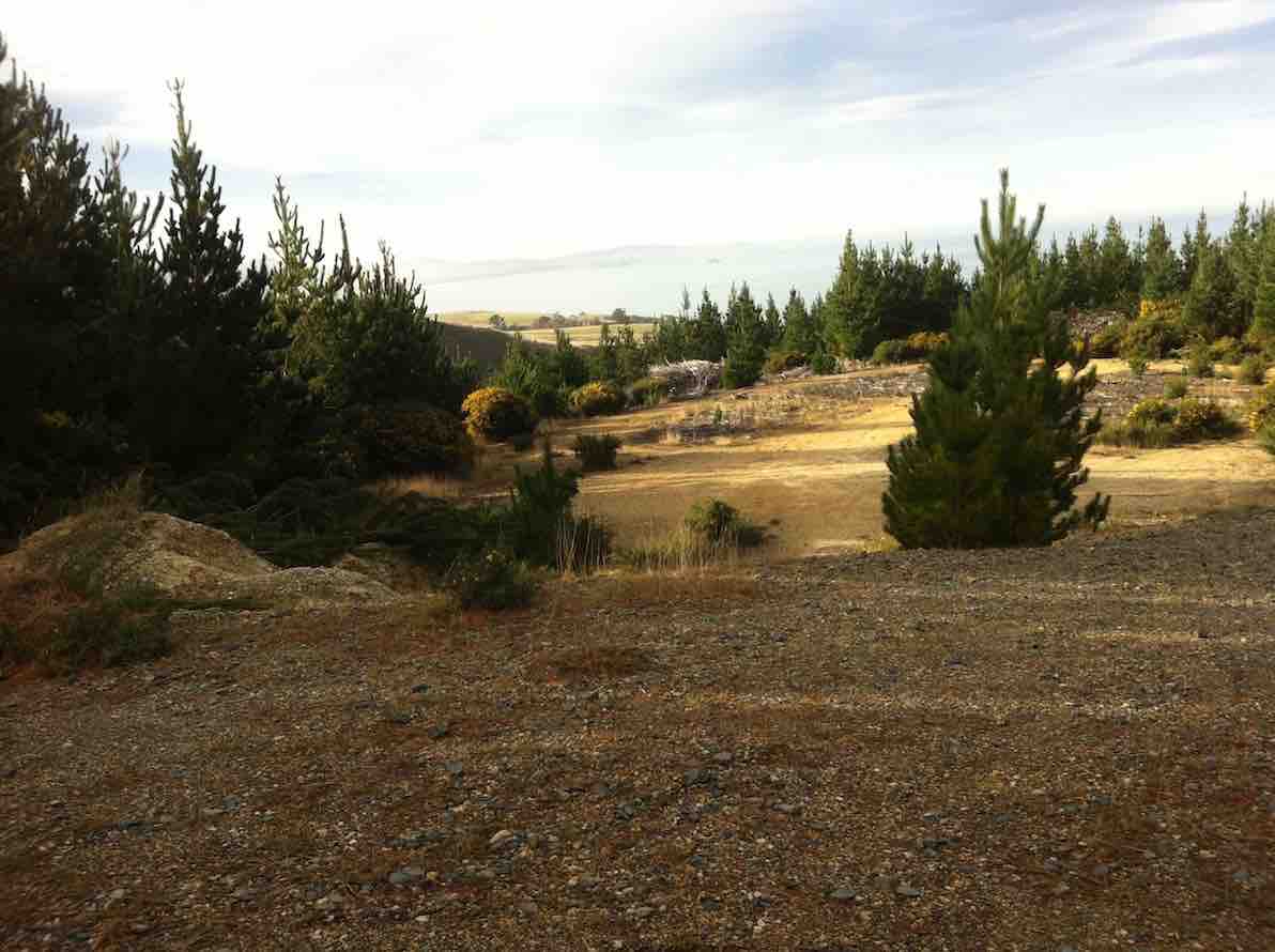
17. 16/5/2018. Hikers. Daphne, Big Stone and Kathleen Roads. M. Leaders: Alex, Jim and Betty.
pine needle carpeted walk into the forest. (Clive pic and caption.)On the way to the top. (Phil pic and caption.)Lunch on Big Stone Rd. (Phil pic and caption.)Homeward bound along Big Stone Road. (Clive pic and caption.)
Conditions were a pleasant cool day for the hike in the Allanton Block of Wenita Forrest south of Brighton. The majority of 22 hikers stopped off at the Brighton Cafe for refreshments on the return trip to Mosgiel.
It was a successful late change to the planned hike.
Betty & Jim
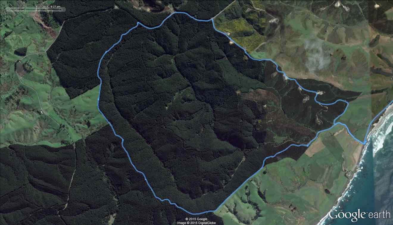
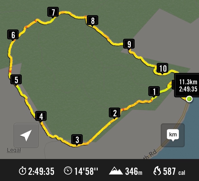
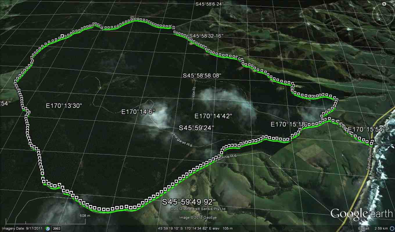
16. 17/6/2015. Hikers. Daphne, Big Stone and Kathleen Roads. M. Leaders: Alex, Liz and Dot.
GPS of route, courtesy Bruce. 12.2 km. [N.B. Bruce has commented on the interesting difference between the 2012 (q.v. below) and 2015 Google maps. – Ed.]The Google map for yesterday was taken in 2015 and was a little different from that from Ken’s report in 2012 with imagery taken on 17 Sept 2011.
June 17 Map with named roads. (Bruce pic and caption)iPhone GPS of route showing kilometers, courtesy Ian.
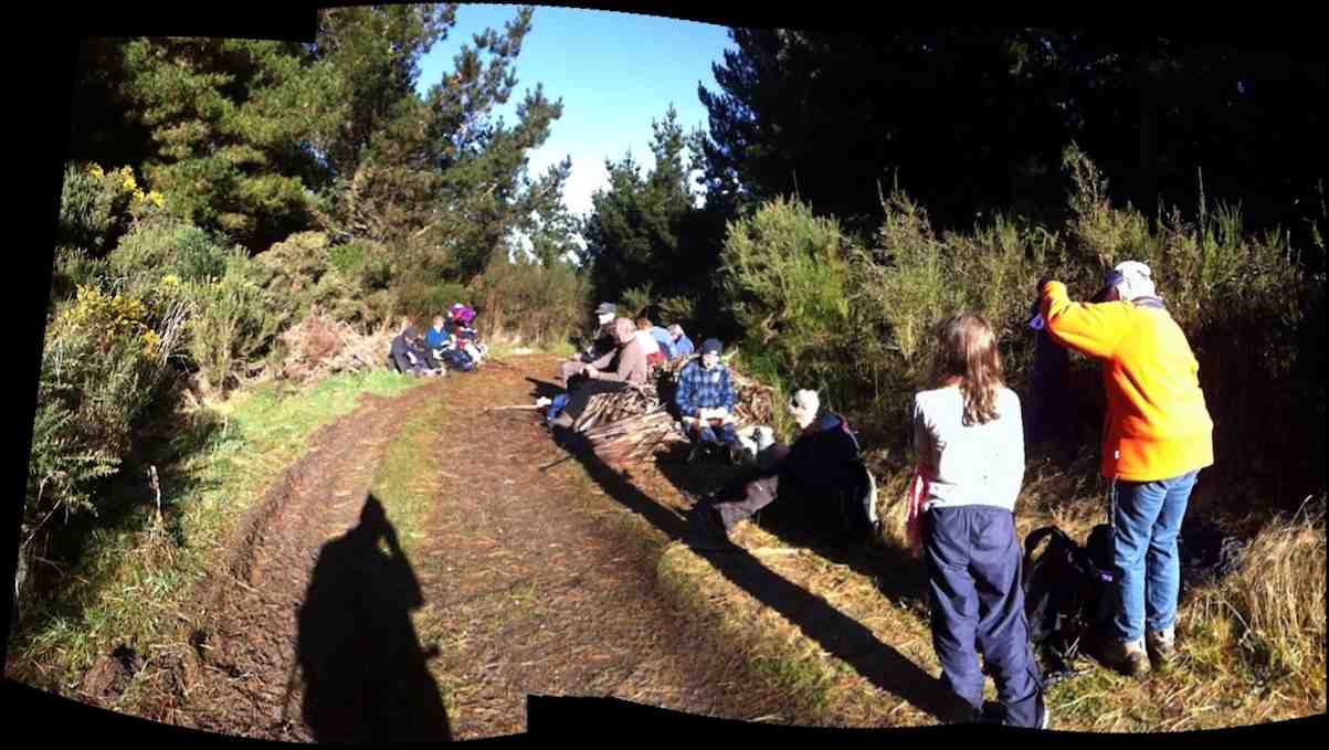
About twenty Hikers did the now more customary route of climbing the Daphne Road’s gentler but longer route and descending by Kathleen Roads shorter but steeper. We morning-teaed in the sunny spot at the foot of Daphne Road where the Club has always stopped, and lunched
Lunch on a sunny level. (Looking back along the road).(Ian pic and caption.)
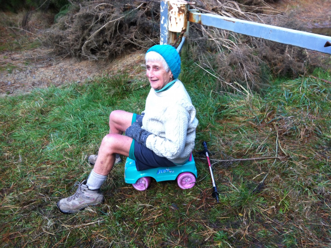
on a level stretch of the road, but still some distance from the top. Older members, presumably familiar with the route found they had failed to recollect the many gully dips on the road. They also appreciatively noticed the rubbish collection by the top gate had been cleared. …W-e-l-l perhaps not all!
Made for each other. (Ian pic and caption.)
Reaching the top of Kathleen Road, a substantial number struggled around and under the closed and apparently locked gate before Les noticed that it was not locked at all. … Sigh.
It was yet another good-weather Wednesday, tempting some to to wonder whether a Higher Power must look after the Club. (Well, it was colder on Tuesday and Thursday promised snow.) Admittedly a cold breeze had driven us into woollen hat and gloves when we emerged from our cars, but this eased in the shelter of the forest and in the patches of sun the trees permitted us from time to time. It was a great Winter’s day tramp and a great location – a metalled road rather than a sloshy paddock or slippery track. (Pity the poor trampers! – see their report.)
Mention must be made of the occasional great views of the coast and down gullies that we stopped to enjoy from time to time.
A misty vista in the ‘dista’, looking up the coast from Kathleen Road. (Ian pic and caption.)
It was further remarked that tramps like this get us to see the other sides of properties that mere car travellers never get to appreciate.
So, thank you leaders, for a well-reconnoitered and led tramp. We were well looked after, with thoughtful stops for regrouping. – Ian.
15. 13/2/2013. Hikers. McLeods Farm. Leaders: Wendy and Peter.
14. 22/8/2012. Trampers. Daphne Road, Big Stone Road, Kathleen Road. Medium. 12 km.
GPS of route, courtesy Ken. We did 11.7 km at 4.7 km/h.
13 . 4/7/2012. Both. Daphne Road, Big Stone Road, Kathleen Road. Medium. 12 km. Leaders: George, Lex.
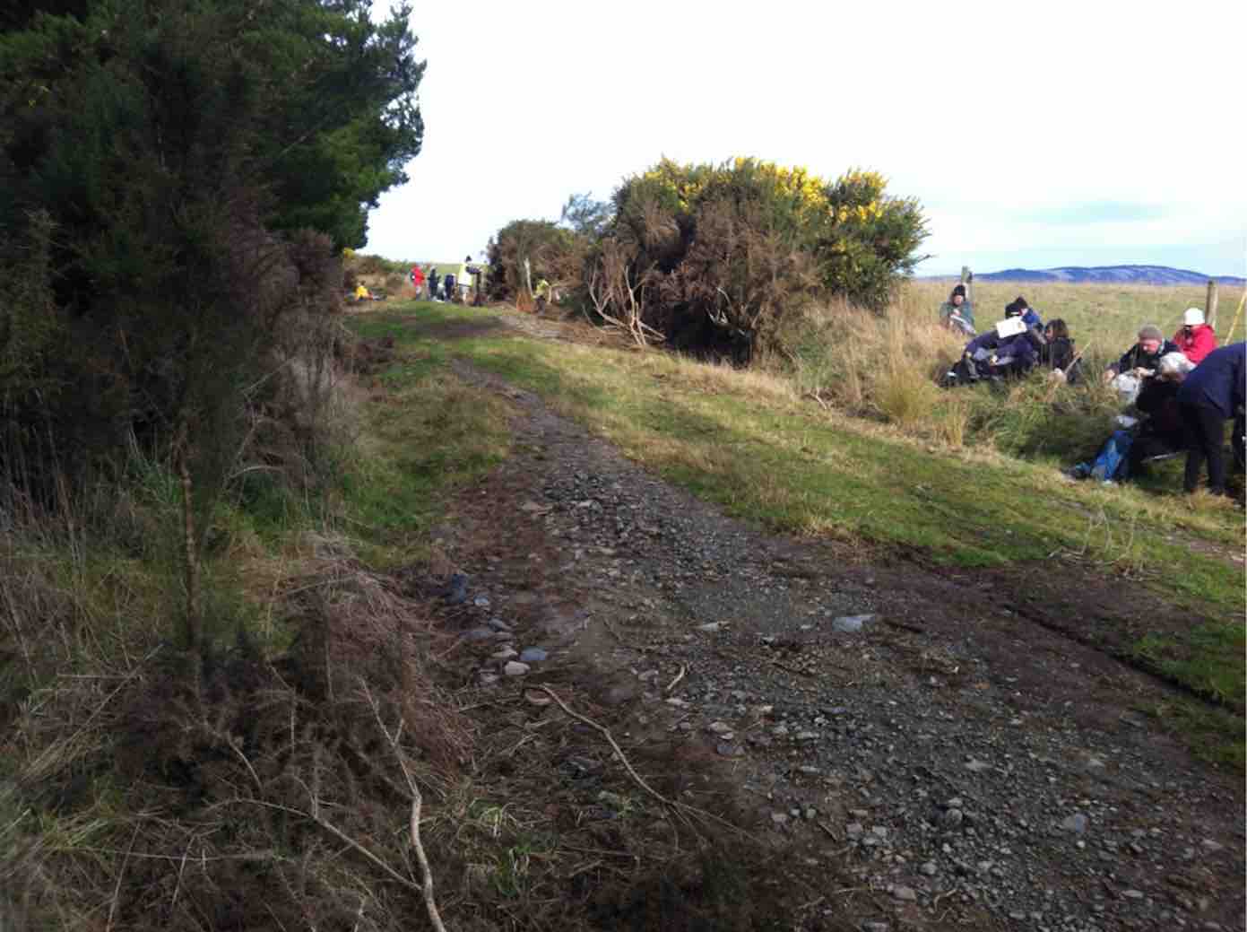
Morning Tea at bottom of Daphne climb. (Ian pic and caption.)
12. 27/8/2009. Trampers. Queen Street, Highland Street, Big Stone Road, Kathleen Road, Isobel Road, beach return. Medium Leaders: George, Hazel.
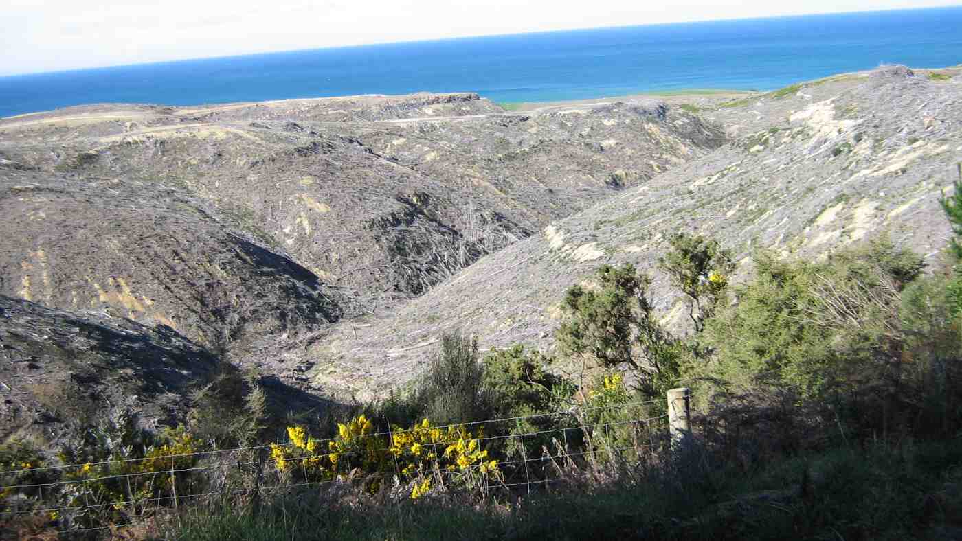
Starting at the home of George and Elizabeth, George and Hazel led us along to the corner of Queen Street and up across several paddocks to reach Highland Street where we sheltered from the wind for morning tea. Once we reached Big Stone Road, we paralleled it on a forest track just across the fence, which was much more interesting, if slower, than walking the road. We were amazed to see the extent of forest harvesting on the other side of the road, cleared, replanted and now for sale as lifestyle blocks.
Maori forestry recently harvested.
Later we came across a couple of pig skins on a fence.
George inspecting a pig skin.
Shortly after passing the McLaren Gully Road turnoff on our right we turned off onto Kathleen Road on the left and then again on the right into Isobel Road where we stopped for lunch.
Lunch sheltered from the wind. Doug, George, Ria.
Isobel Road provided a pine-needle-strewn softer surface for walking down to the coast. There we joined the beach, nice and firm on an ebbing tide, but oh so loooong to get back to Brighton and the cars again. 18 km in all, and were we glad to reach the cars again!
There were only six of us, three of whom from Mosgiel who, vehicle-less as it turned out on this occasion (Doug would have gone back for his car had he been required to), depended on first-time visitor Susan who was surprised into having to provide the transport to Brighton, but who most graciously provided it. – Ian
11. 6/8/2008. Both. Margaret Road, Katherine Road. Medium. Leaders: Dot M, Chris.
10. 15/3/2006. Hikers. Margaret Road, McLeods Farm. Easy+. Leaders: Bill & Pat, Dot T
9. 29/6/2005. Hikers. Margaret Road, Katherine Road. (Brighton). Leaders: Chris, Dot B.
8. 18/6/2003 Hikers. Kathleen Road, off Taieri Mouth Road. Easy Leaders: Joan and Dot
7. 25/7/2001. Alt. Margaret Road, Katherine Road, Kuri Bush. Leaders: Dot B, Joan H, Chris H
6. 18/2/1998. Big Stone Road from Margaret Road to McLeods. Leaders: Ray and Diana.
5. 14/5/1997. Big Stone Road from Margaret Road via McLeods to Coast Road. Leaders: Dot B, Joan H, George.
4. 10/7/1996. Margaret Road, Big Stone Road, McLeods. Average. Leaders: Graham, Eric and Dot.
3. 30/11/1994 Margaret Road, Wenita Forestry, Big Stone Road. Medium. Leaders: Eric & Dot, Joan H, George
2. 4/8/1993 Big Stone Road to Smooth Hill to Kathleen Road – return beach. Leaders: Eric & Dot, George, Chris
1. 8/6/1988 Kathleen Road from Big Stone Road. Lots of pines and the ocean. Leaders:
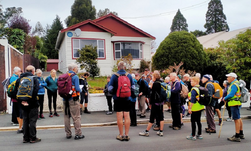
7. 24/2/2021. Hikers. Chingford Park. Leaders John and Dave Roberts
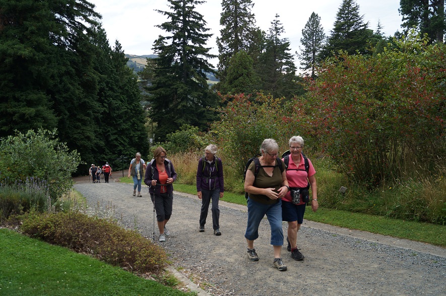
On a balmy overcast Dunedin morning, 23 hikers met at the Dunedin Botanic Garden top car park.
From here we walked across Lovelock Ave onto the serene Lovelock Bush Track (where wild deer used to graze 130 years ago.
“Larnach’s tomb visit.” – Photo and Caption John
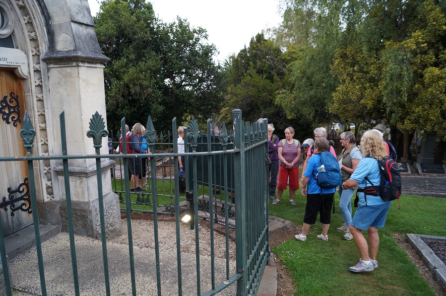
The track took us through to a sealed downhill footpath alongside the old Northern Cemetery. After a brief stop to admire Larnach’s Tomb (a small scale reproduction of First Church architecture), we meandered downhill to have morning tea at the Thomas Bracken (writer of our National Anthem) lookout.
“Inspecting Larnach’s tomb.” – Photo and Caption Jenni
“Morning tea with a view.” – Photo and Caption John
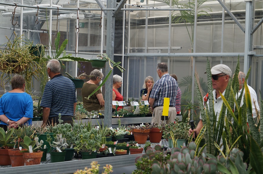
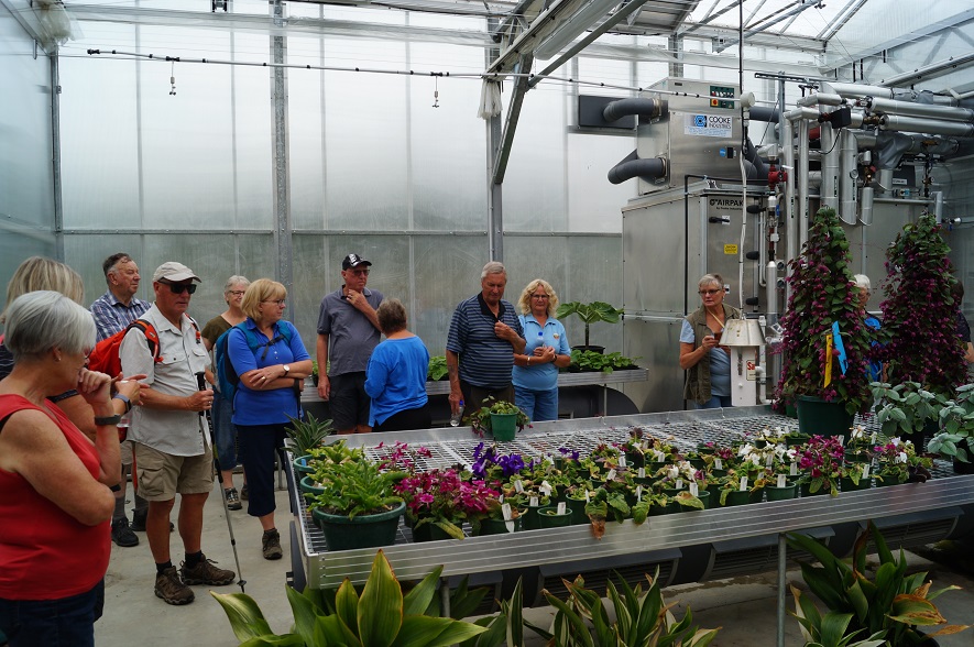
Next it was back up the hill to the cars, then a brief walk down to the Mediterranean Garden, before our 11 am visit to the, 6.2 million dollar, Dunedin Botanic Garden Propagation Building, opened in 2015.
“Some uphill around the botanic gardens.” – Photo and Caption John
“Inside the propagation complex.” – Photo and Caption John
Here we were met by Alice Lloyd-Fitt who capably explained the history of the building’s development and it’s functions, both for the Botanic Garden, and the preservation of many endangered plant species. We were then led on a tour of the premises .We visited separate greenhouses, each maintaining specific microclimates, to suit plants
adapted for arid desert, tropical forest, through to sub Antarctic Island climates. The variety of plant life, and complexities of their maintenance requirements, was mind blowing!
“Which one would suit my garden?” – Photo and Caption John
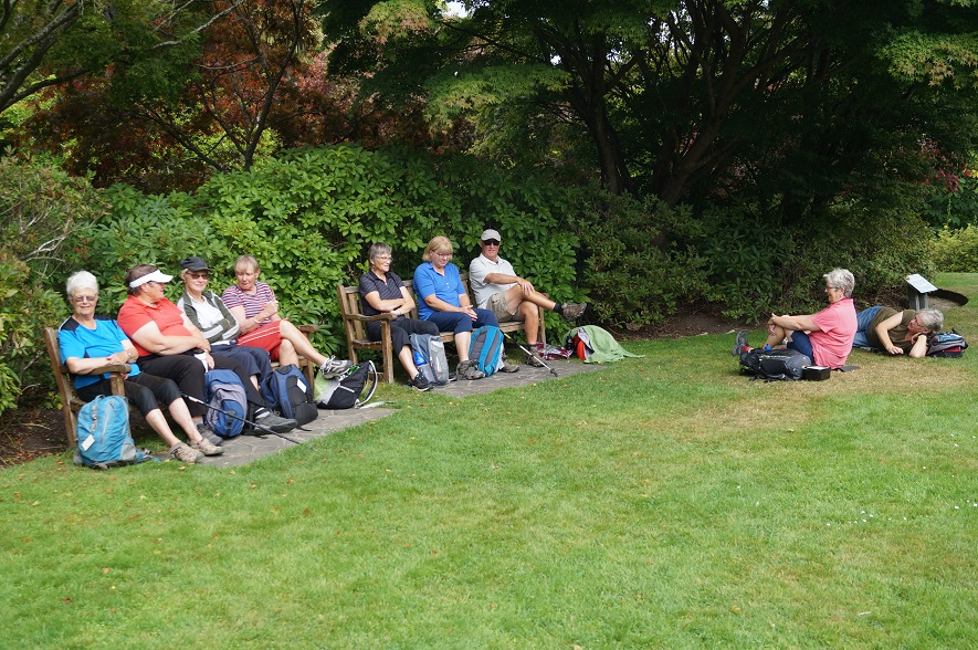
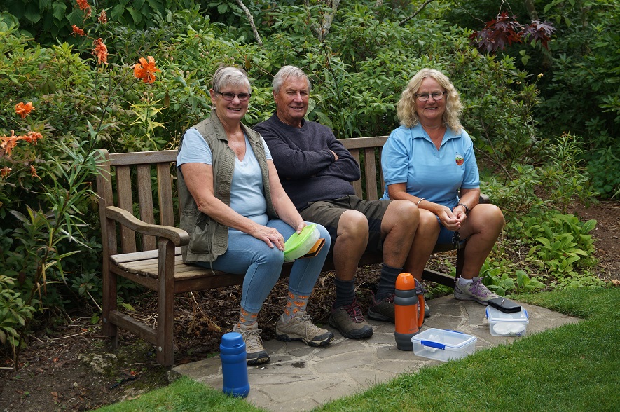
Following this visit lunch was enjoyed at the Azalea Garden.
“Lunch on the green.” – Photo and Caption John
Then it was into the cars for a quick trip down North East Valley to Carr St, and from here, a walk along the side of Lindsey Creek on the Hospice Track.
“Three happy hikers.” – Photo and Caption John
This took us to the old Palmer’s Quarry site where Alex told us an interesting tale of , a”Ghost watcher”, who still does maintenance in the area, and has the keys to the old brick building at the quarry entrance . (Complete with horseshoes in the windows.)
“More talking than eating.” – Photo and Caption John
“Enjoying the Chingford top track.” – Photo and Caption John
“Tale end Charlie at the back.” – Photo and Caption John
From here a quick walk through some more back streets led us to Chingford Park, where we ventured round the top loop track, before a hasty return to the cars, to be at the Oaken Cafe’ by just after 2.00 pm.
An enjoyable day had by all. Dave and I would like to thank all who attended for contributing to such a great way to spend a “balmy” Wednesday.
Bus to Beaumont. Drive up Manuka Ridge to locked gate.
Short climb to top. Road along top. Locked gate to Microwave 1.5K;M/W to trig 3K.
Track down ridge.
NB. AT TRIG ON SMALL HILL, TURN SHARP LEFT AND STEEP CLIMB TO AND PAST TRIG.
then farm land to Crookston. Track to bus pick-up at Crookston 6K Total 16K. Seek permissions.
2. 10/2/2021. Trampers. Blue Mountain trip. Leaders Helen and Phil Morris
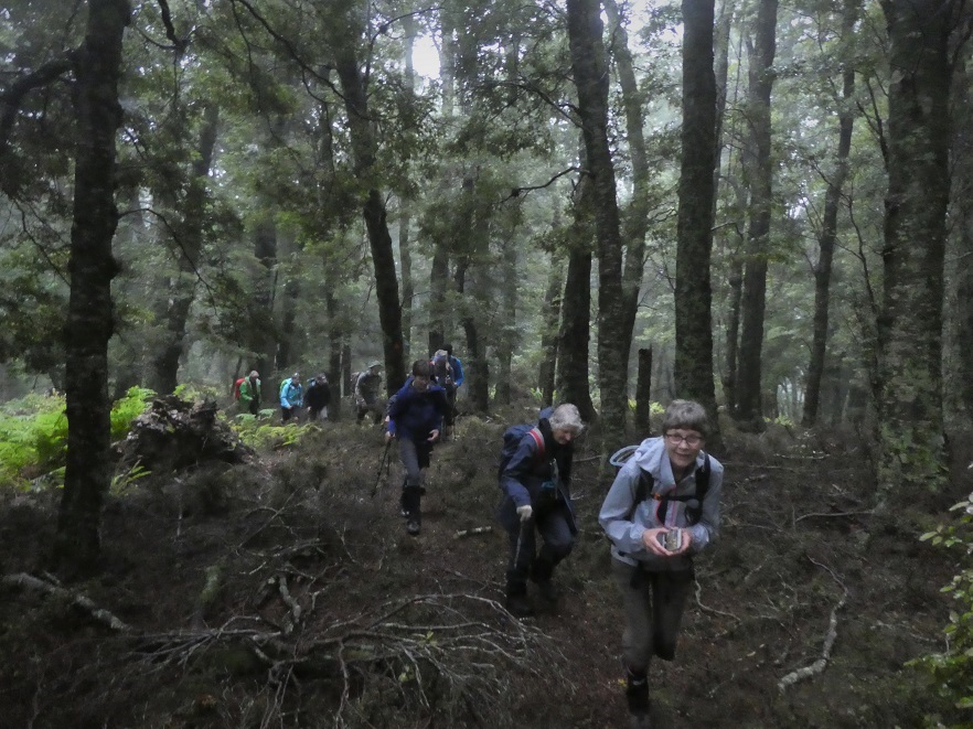
We knocked it off!! 17 Taieri Recreational trampers bounded up the Gully, leaving the car park in damp, windy, but improving weather conditions.
“The group of us ready to go.” – Photo and Caption Gordon
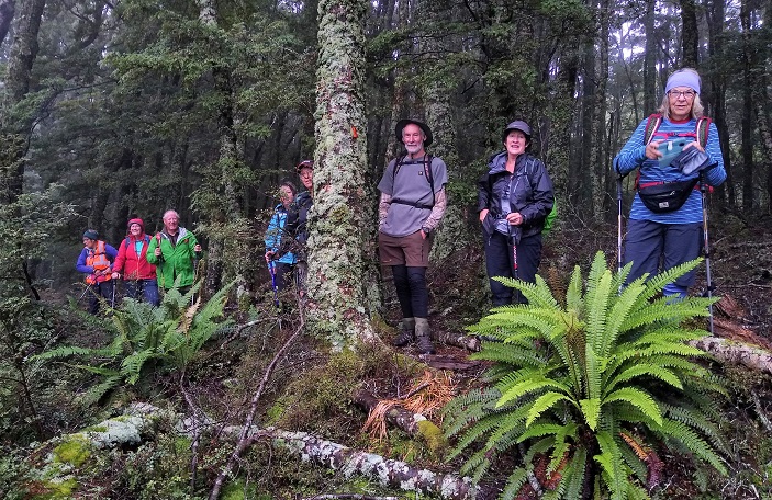
Not knowing what we were in for, we started up the track, the ferns and other coverage had grown since Dave had tramped it a few months ago, and going in early part was slow going, with some parts on hand and knees, but mood was chirpy, as the track improved, but the climb was upwards continually.
“Onwards and upwards through towering beech trees.” – Photo and Caption Gordon
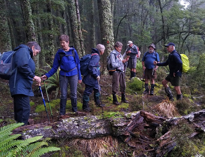
We came to a stream crossing which required good concentration, with a good climb 30 minutes through magnificent beech forest and very little birdlife sadly.
“Are we on the track???” – Photo and Caption Ross
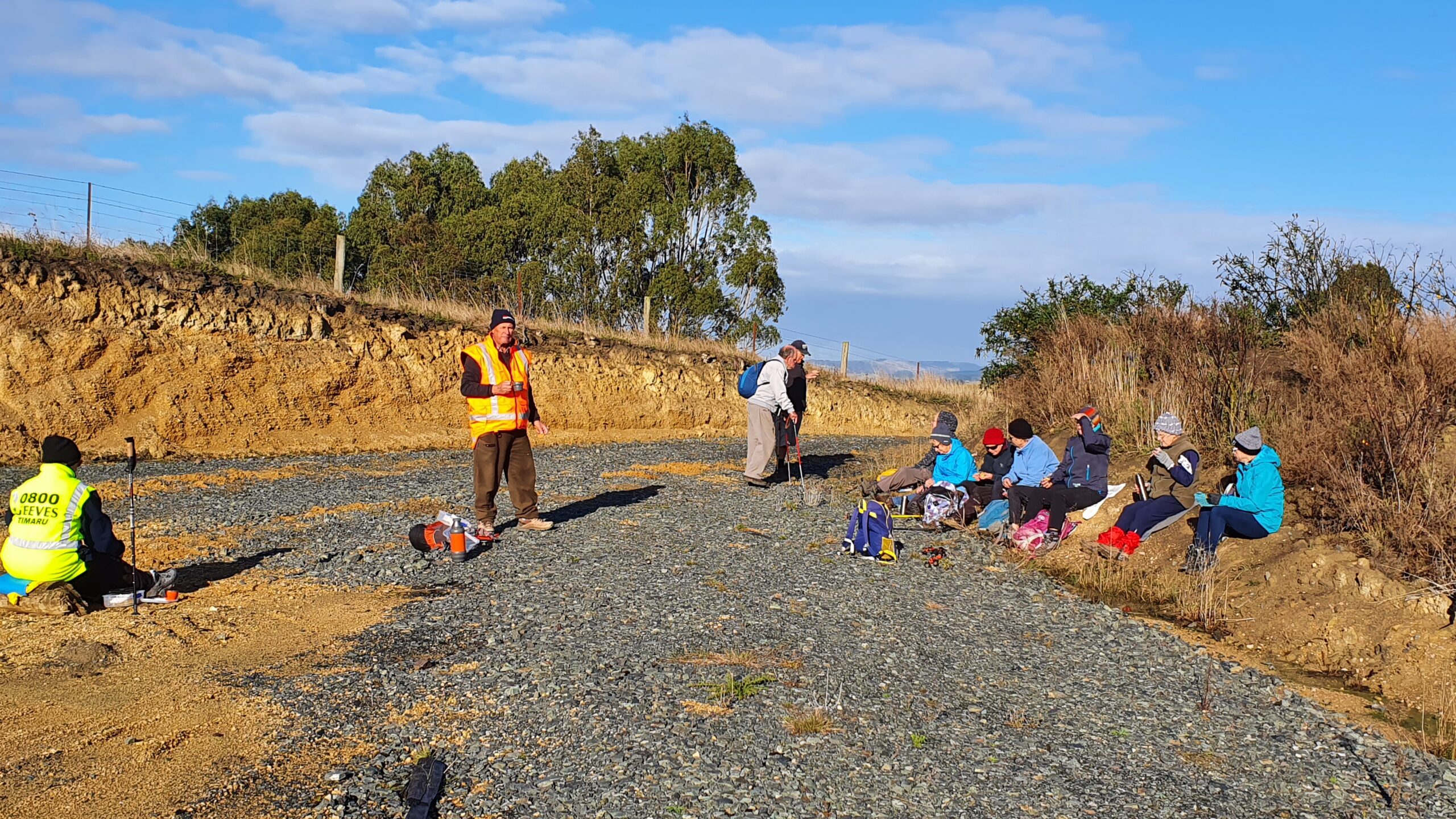
With a good 75 minutes walking it was time for morning tea to recharge energy levels and the odd question of how far to top. The reply was sorry a good
hour and a quarter. After 30 minutes of chatter, it was packs on and off we clambered through
some nice ground cover for 20 minutes, then some real grunty climbs , stopped the talking,
everyone showed encouragement to those needing it. Remember a lot of society, half the groups age, would have turned back long ago. We continued, a long time had passed, before the light at end of the tunnel through mist in the
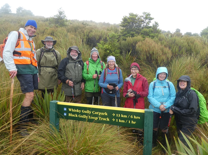
bus , YES!! flax and grasses with a waratah with a white plastic cover in the rock. Sadly a strong wind blowing mist over the sign telling us it was 14km and 5 hr trek to the bottom of whiskey gully or option b, 1hr down a gully back
joining the track we came up.
“We made it to the top.” – Photo and Caption Gordon.
After clambering up to this sign it only took about 4 minutes to decide that these were bad options, due to hands freezing from the cold wind whipping through us, we took pictures of the first 7 at top and then the next hardy ladies who made up the next group, well done crew, 17 hardy trampers all made the top of Black Gully, fantastic job!! With decision made, we descended back down for 15 minutes to a lunch spot, Well Earned. After a food recharge we returned down the nice forest, mainly beech below manuka.
“Happy trampers!” – Photo and Caption Ross.
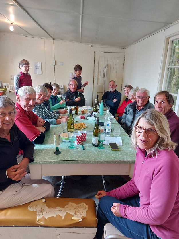
This was when it hit us, how steep the climb to the top was, it became quite a hard drop for 45 minutes but the group chattered and took in the magic bush and forest, most take for granted. With stream crossing done we showed the spirit that bonded the group back through the overgrowth at the early part of trek, completing tramp bang on 5 hours, being approx. 8.9kms of hard out tramping, well done all. Back to base where we could clean up and begin nibbles and well earned drinks before we would enjoy the company of Helen’s younger brother Jeff at the family farm, Crookstown originally named by her parents.
Pre pre dinner drinks!” – Photo and Caption Helen.“Friendly chat with drinks and nibbles.” – Photo and Caption Gordon“BBQ amazing meal.” – “Photo and Caption Helen.”
We had meat, potatoes, salads and pudding prepared ready for all. We arrived at the farm, no brother there, but we bowled on in, sorted salads , potatoes and started up barbeque to cook meat, ten minutes on Jeff (brother) and his son James arrived back from milking cows, happy to see group and knowing his food for tea was being cooked. As all was ready, Jeff’s wife Margie arrived home , she was welcomed as the feast began, then believe it or not the sun shone and completed a great day. It was a great feed, followed by a tasty pudding. It was a great night, nearly completed, but young Jill Reid was not going to let the night stop there, with a cheeky grin she asked Jeff one last request , would you sing a song or two before we going, Jeff did not need too much persuasion, the entray from his latest CD was a song about his youngest son Ben called “That’s Ben”. He told us in his earlier singing years how the names in America, such as Arizona, Alabama, made well known songs this is where the idea came to sing a song he wrote also from CD, Down over Crookston, their family farm, with a round of applause the lucky audience asked for one more request, which he was happy to sing, and told us how Garry Morris American Country and Western star, had made famous, the song, “Take Him Home” from the famous show Les Misirables, and he if he could remember all the words, sang it to perfection, what a fantastic surprise to a special day, whoohoo what an end to a special day!!
“Jeff singing.” – Photo and Caption Helen
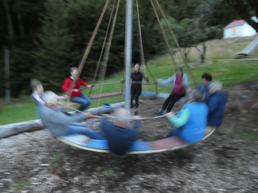
(Anyone wanting the CD can be purchased for $15 Helen can organise purchase). On return to camp the kids of the group played on the camps swings slides, roundabouts, a nightcap then zzzzz.
“Big kids playing up before it gets dark!!!”- Photo and Caption Gordon.
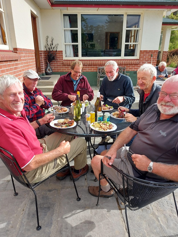
The final day on Thursday, saw a few sore bodies, Camp at Black Gully tidy, we left, morning coffee at Top Nosh, with no lack of get up and go, we got to car park, then set off tramping through fabulous bush to the flowing waterfall at whiskey gully.
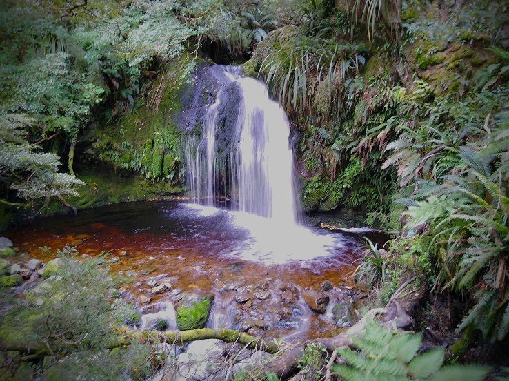
“Relaxing at ‘Nosh” in Tapanui.” – Photo and Caption Helen.“Whisky gully falls in all their splendor.” – Photo and Caption Ross
Some of the men took a drink from mug left on the pole, the water was pure, gold coloured being leached from lichen and leaves and chilled to perfection. After lunch we returned, to carpark, then walked up to lookout, no mist, the view of hills and Tapanui.
“A very happy bunch at Whisky Gully lookout.” – Photo and Caption Gordon
The three days had ended, some took off home others called in at Whitechapel Church to view antiques etc, note the owner had won a stage of tour de France in the 1960s.
Well done Taieri Recreational Tramping Group, special people, special times!!
2. 7/02/21. Racemans.Hikers Leaders Jenny Finnerty and Bob Heenan
I went to pickup my friend (who will remain nameless)and she was still in her night attire and quite obviously not coming! My thoughts went to a plan B hike because of the inclement weather but by the time I arrived at the car park everyone one was keen to carry on and do Racemans/Tunnel track.
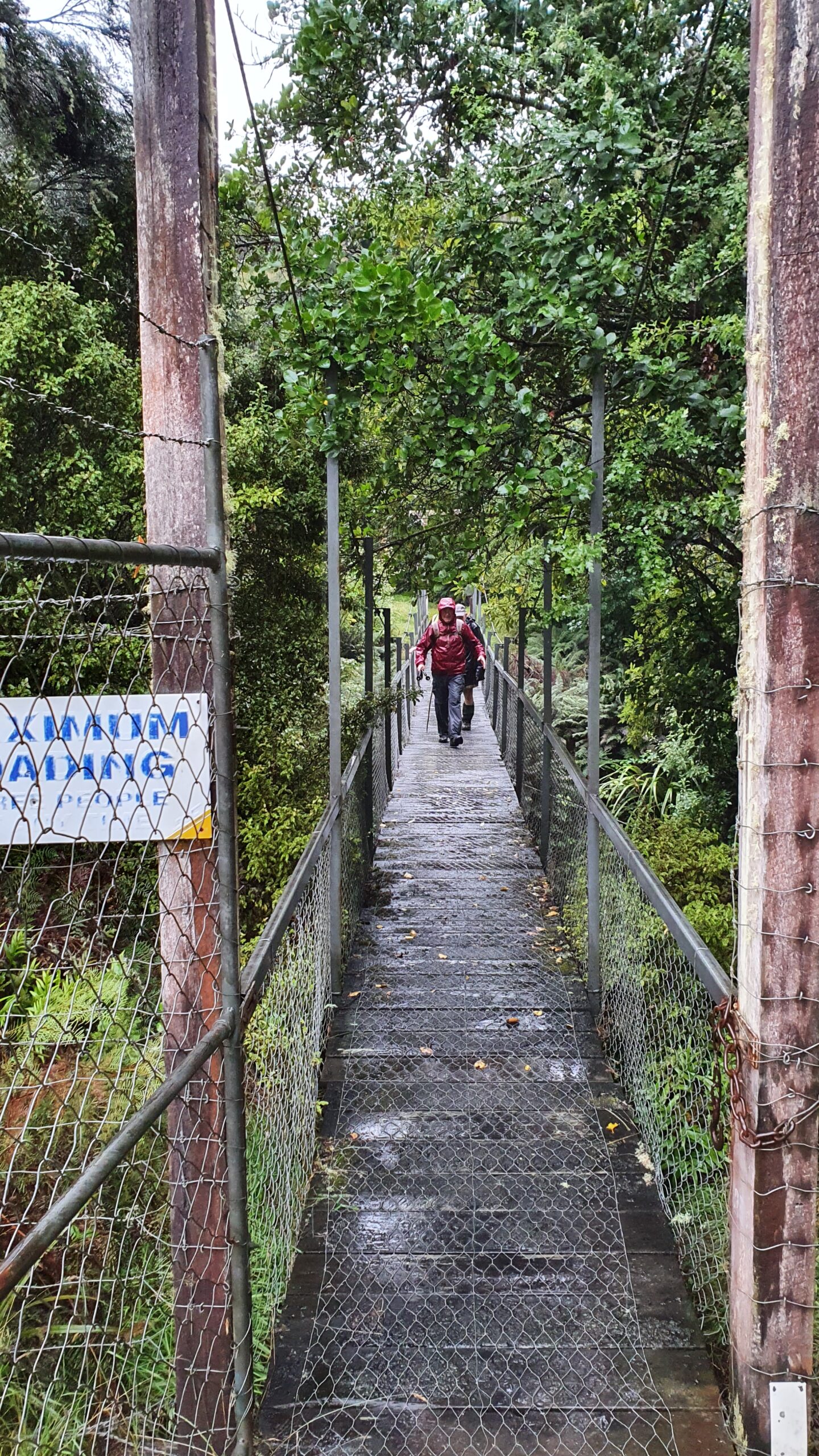
Bugga!!! The said friend was coerced in to coming so was picked up (dressed) and off we went to Whare Flat. All 13 eager souls and 1 friend set off through the ford and over the swing bridge and onto the track with a few with squelching feet.
“Setting off in the rain.” – Photo and Caption Clive.
“Wet feet to start.” – Photo and Caption Clive.
Track was really good with some clearing been done.
There were only a few mucky bits due to the rain which was getting harder by the minute.
“Morning tea in the rain.” – Photo and Caption Clive
It was good having some strong trampers to help us ladies through a couple of tricky bits. Thanks guys.
“Ground too wet to sit.” – Photo and Caption John.
“Why is there a puddle in the bottom of my pack.” – Photo and Caption John“No wonder my pack’s name is Tardus.” – Photo and Caption John
After about an hour or so it was decided to shorten the hike and for go lunch because it was fair persisting down.
“Down the slippery slope.” – Photo and Caption Clive
It didn’t seem to dampen any spirits because we all enjoyed it, even the friend(I think).
“The wobbly bridge to finish.” – Photo and Caption Clive.
It was definitely one walk to remember!
Jenny and Bob
PS. Thanks Jan for your track knowledge and a great reccy.
[No. 7 on old hardcopy list of 113 club tramps. “Creamery Rd. Ocean View. C Hughes. Farm. Lambing.”
Not during lambing September to October.
USE STILE AT END OF CREAMERY ROAD.
No. 84 on old hardcopy list of 113 club tramps. “Taieri View (Blairs) (East Taieri) Farm”
No. 104 on old hardcopy list of 113 club tramps. “Old Brighton Rd – Clevelands – Saddle Hill (See George Haggie) Farm”]
42. 14/10/2020. Trampers. Leaders: Jill Dodd and Peter Gillespie
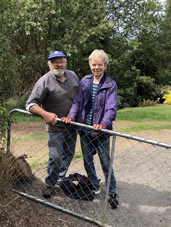
If we were to believe the weather forecast for Wednesday, some people would have been deterred by the gale force winds, rain and snow down to about 400m but no, 15 hardy trampers set off from the carpark by the bridge on Stage Coach Rd. We walked up to Saddle Hill Rd in the full force of a very strong south west wind. Even though we had amazing views over the Taieri plains and beyond it was hard to find a slightly sheltered spot at the lookout for morning tea . Carrying on past Jaffreys hill to Scurr road where we descended to Ronganui (place of the soul) the property of Colin Mackintosh and Marjorie Orr, who escorted us through their property .
Photo and Caption Wendy – “Colin McIntosh and Marjorie Orr”
This is a little hidden treasure. A QE11 Covenent area on the east side of Saddle Hill. There is 20 hectares of regenerating native coastal forest Totara, Rimu, Kahikatea, Miro, Matau and Kanuka.
Photo and Caption Wendy – “Natives everywhere”.
Another 20 hectares of liquorice all sorts – a collection of exotic trees – Eucalyptus species, Macrocarpa, Californian Redwood, Tasmanian Blackwood and Pinus Radiata.
Bird song was all around us as we traversed the tracks and bridges meandering the property. This is all maintained by the owners who are the guardians of the land.
Photo and Caption Sarah – “The walk through the bush was special.”
The previous owner had done the planting of the exotics and the little stream the Murray River named after him.(His wife was a member of our tramping club -Eleanor Watt)
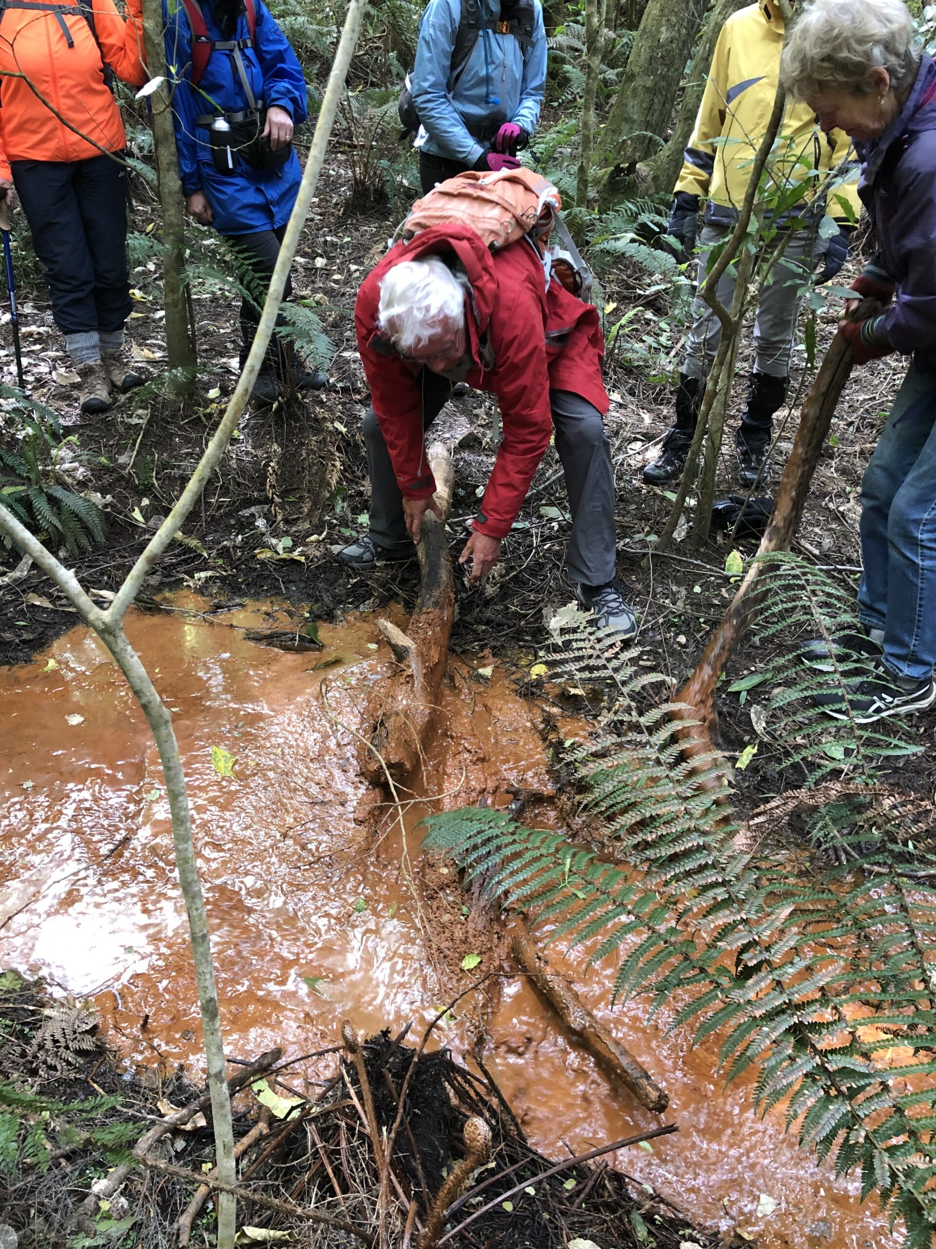
The stream was a very vivid orange colour and when Dave broke the dam! (of a couple of sturdy branches) the water movement was quite sluggish and gel like.
Photo and Caption Wendy – “Dave removing the dam.”
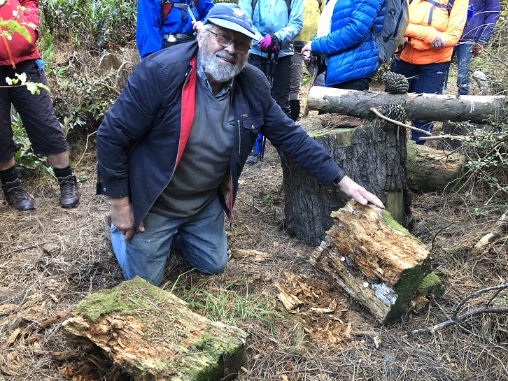
It is an iron ore residue from the now disused coal mines that are on the hillside .
A real surprise for us all was when Colin dug into an old rotten log where he finally found a Peripatus a living ancient velvet worm like creature. These worms have been around for 500 million years and found throughout NZ.
Photo and Caption Wendy – “Finding peripatus in old logs.”
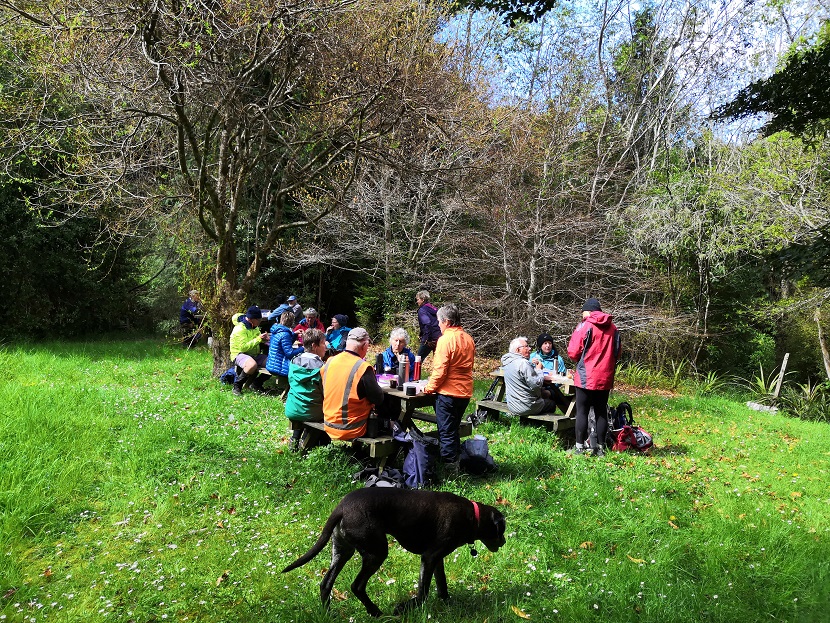
These slightly blueish insignificant small creatures with 15 pairs of legs and 2 front antennae exist in this undisturbed environment but had created much excitement with the researchers at the museum when 1st found here. Lunch in the forest at a designated picnic area so very sheltered we were oblivious to the outside world.
Photo and Caption Sarah – “Lunch in a designated spot”.
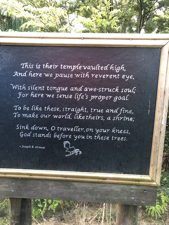
The walk concluded by reading a poem, dedicated to the greatness of trees, and looking at the 30year old kauri tree.
Photo and Caption Wendy – “The poem”.
Photo and Caption Jill – “The 30 year old kauri tree.”
Photo and Caption Wendy – “Outstanding views!”
There was a car shuttle back to the bridge but we probably tramped about 14 kms and the rain (apart from a quick shower) stayed away till after we had our coffee and debrief at Blend. Only a week late from the expected visit of Judith Collins and her team and they still had cheese rolls in the cabinet!
An interesting day shared by some very passionate landowners so close to home.
41. 16/3/2019. Hikers. Saddle Hill. Leaders: Bob and Jenny.
Today was my 1st official time at being “the Tail end Charlie” with fluro jacket.
I’m often at the back but not with a fluro.. there were 21 hikers and our 3 lovely ramblers. I think I got the numbers right???
We met in a paddock in McMasters Road. I presume Bob had permission?
The hike up the Saddle was the one that the Rotary had done as a fundraiser for the Mosgiel Pool. We had morning tea at the entrance to the scrub area,after which we climbed up a stoney track.It was good workout for us all. We came out to a clearing with fabulous views of wonderful coast line. Quite a few minutes were taken to enjoy and then we carried on up to the top for a photo shoot.
(Alex photo.)
More panoramic views were taken in before we went down the hill,out of the cool breeze, and had a leisurely lunch looking out over the Taieri. We then wandered down the hill and out onto Saddlehill Road and back to the cars. Coffee was at the Village Green. Thanks Bob. – Jenny.
40. 19/9/2018. Trampers. Saddle Hill circuit. Leader: Eleanor.
On a very warm spring morning 14 trampers set off from Quarry road and walked up Coal Stage and Saddle Hill roads then down McMaster road. Enjoying a great display of Kowhai in full bloom, also a mix of blossom and animals along the way. One member recalls riding horses as a girl on a property we passed.
Just the best Kowhai forest around. (Phil pic and caption.)
We enjoyed smoko break overlooking the ocean. At this point with the sun shining brightly upon us, we decided to do an add on.
Welcome morning tea break after earlier start. (Gordon pic and caption.)
Turning onto Old Brighton road we headed to Fairfield, then crossed over to Flower street walked up the couple of hills crossing a stile into the water tank paddock. Once again (on both sides of the rather steep stile) with more great views, lunch and chatting was enjoyed.
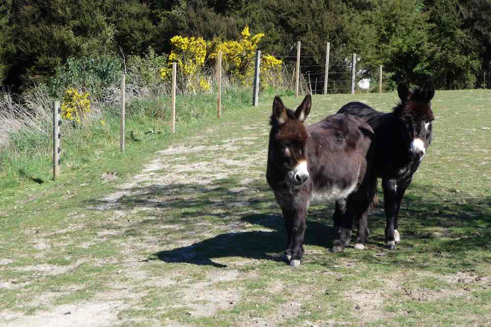
View of Kaikorai Valley from lunch. (Gordon pic and caption.)Donkeys on Chain Hill road. (Gordon pic and caption.)
We then walked along Chain Hill road and back down Quarry road to our cars.
View of Mosgiel from overbridge. (Gordon pic and caption.)
Blend was the chosen coffee shop, we enjoyed catching up with 2 members unable to tramp on the day.
We reckon we walked 15 km, give or take a little.
Great to be back out with such an enthusiastic group of friends.
– Cheers Eleanore
(12/2/2017.)
Route map
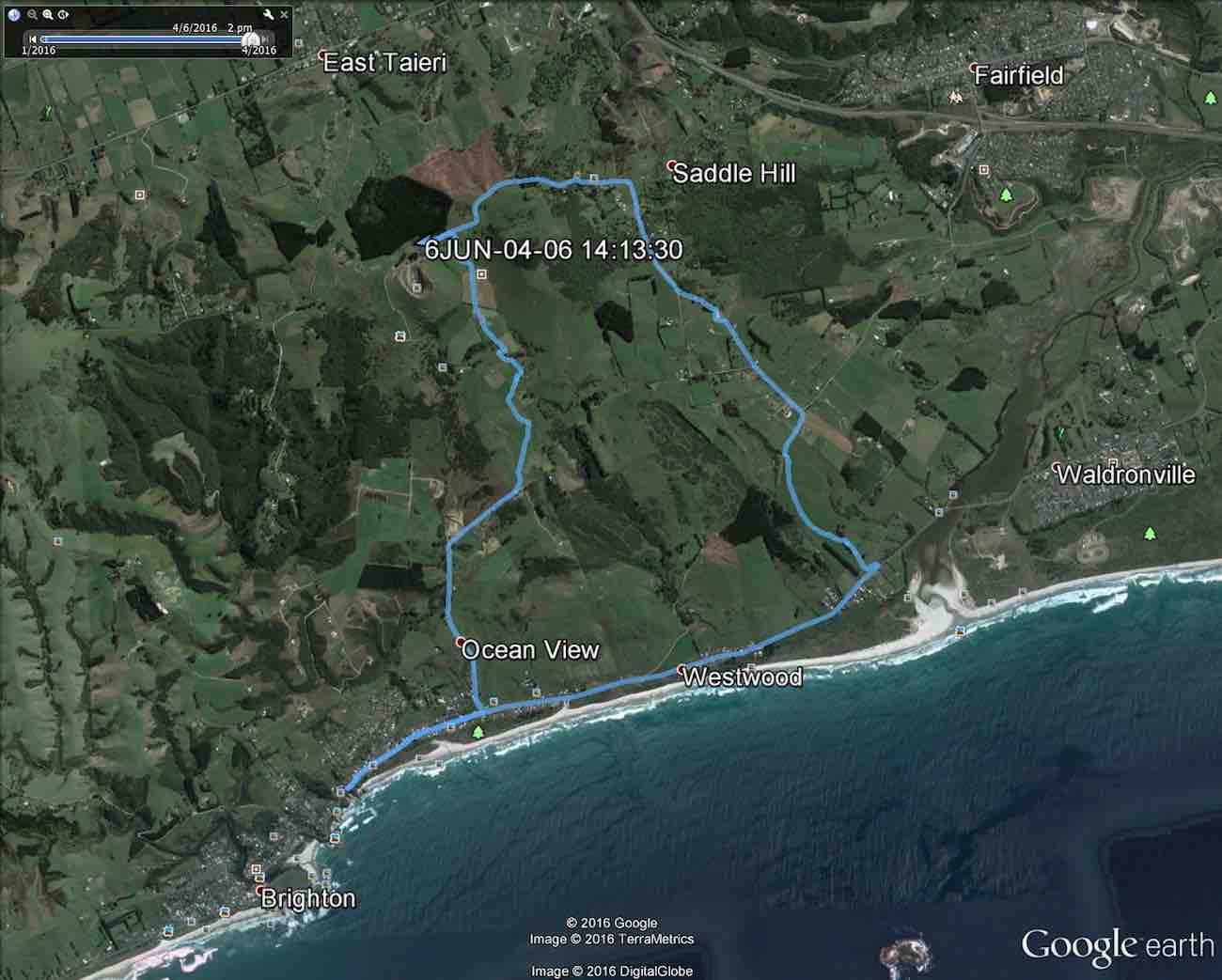
39. 6/4/2016. Both. A Circumnavigation of Saddle Hill, majoring on the seaward slopes. Leaders: Bob, Doug and Arthur.
The Hikers took the bus, the Trampers, the beach.Apr 6 Tramp Saddle Hill 2016. … Distance not counting the bus travel 10.2 km. (Bruce pic and caption)
Trampers’ Report. Saddle Hill to the Sea. – Arthur.
Being the first Wednesday of the month, this was a combined operation. Together with the Hikers, our group parked beside the wool-shed on Saddle Hill Road, before walking through the “Saddle” and down through farmland on the other side. Special thanks to the landowners for giving us permission to do so. A suitable spot was found at 10 o’clock for morning tea.
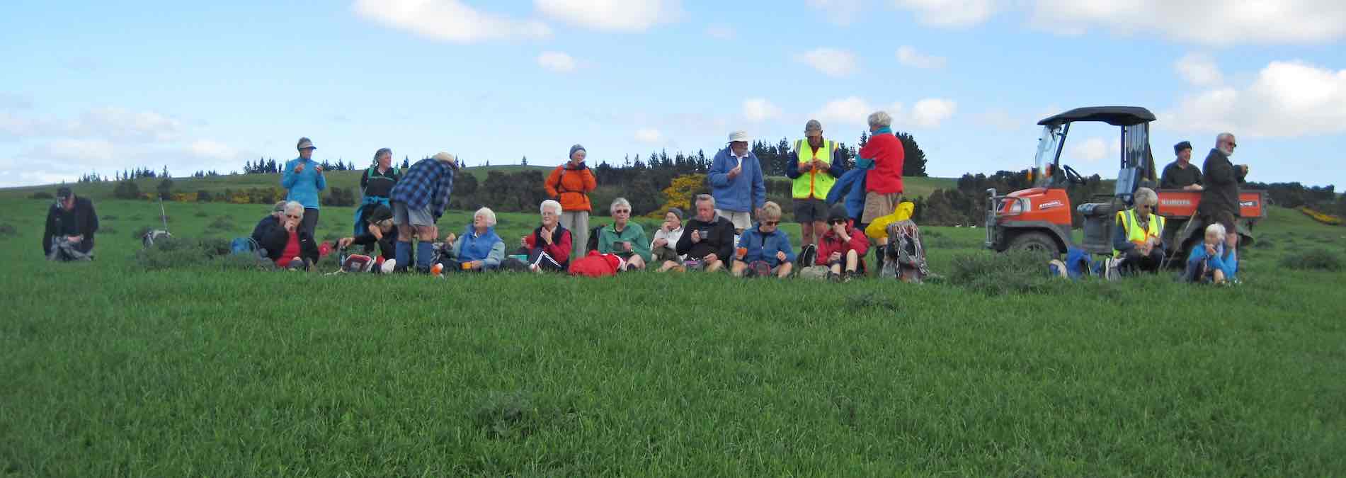
All twenty-seven of us at morning tea, part-way down the slope.The view from our morning tea spot.
The two groups then split, with the Trampers forging ahead, as they had further to walk. We had 8 trampers now, and it was noticed that the 2 men were outnumbered by the ladies.
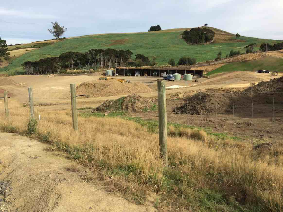
Continuing down through the sheep farm we climbed a style out on to Creamery Road. Going down the road now, we could view several lifestyle blocks with new houses on them. At the bottom of the hill a large contractor’s yard had obviously had much money spent on it.
Contractor’s Yard
We arrived down at the main road to Brighton at Ocean View. After a short walk along the road we were able to gain access to the beach at the car-park (Freedom Campers spot). Good use of the facilities here was made for a comfort stop.
The tide was well out, just beginning to come back in, allowing us to walk on good firm sand for several kilometres. Other people were making use of the beach too – walking, exercising dogs and especially horses.
The Kaikorai Stream was closed to the sea, allowing us to return to the road on the Waldronville side, past the Pistol Shooting Club. The walk along the beach took a neat hour. We found a suitable lunch stop beside the car park at the road.
The Trampers’ lunch spot. (Helen pic)
From there we had to walk across the bridge and along the road a short distance. It was a little difficult climbing through a fence back onto farmland – several comments were made at this time about some not being as young as they used to be!
Trampers. A fence scramble. (Helen pic)
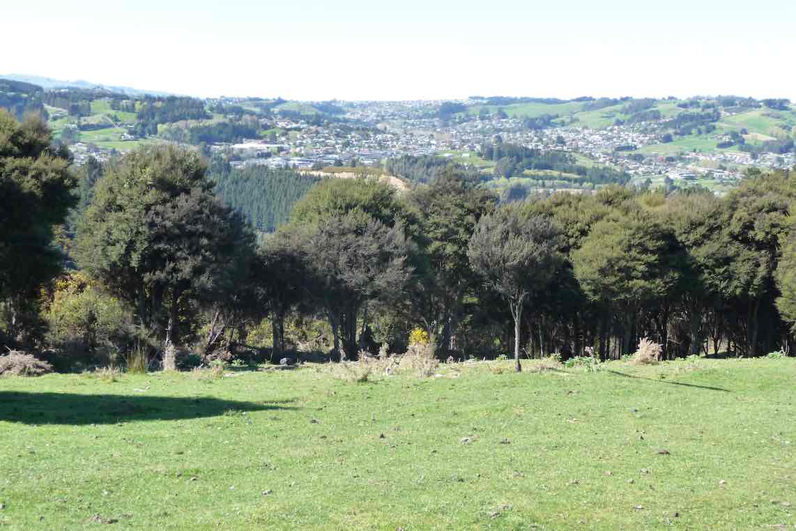
With the Green Park Cemetery on our left we had a very pleasant uphill walk through the large field, but with one especially steep pinch, before squeezing around the end of a gate and out onto the Old Brighton Road – closed long ago by a large slip.
Along the Old Road and then up McMaster Road a short distance, before taking a short-cut through private property. A donkey brayed a welcome as we passed, and then the lady was gardening at the house.
Coming back onto McMaster Road, we found three of the Hikers talking to the man of the house at his mailbox. The road levelled off, and soon we were back to Saddle Hill Road where we caught up with the Hikers with about a kilometre to go.
There were good views from here of Mosgiel, …
Mosgiel from lookout.
… the Taieri and beyond. In fact we had great views all day on this tramp, and good weather to go with them.
Our combined tramp could not have been more successful, as both groups began and finished the day together.
A big thank-you to Bob for this. Everyone was back to the cars by 2.15 p.m. The Trampers covered a distance of about 14 km (estimated).
***** SAFE TRAMPING IS NO ACCIDENT *****
– Arthur.
Hikers’ Report.
As Arthur has covered most of the day’s main points, this need be only a supplementary one.
Where Creamery Road joins Brighton Road, various options emerged. Some drifted off: one had a car waiting for her, another walked to her home nearby, others shortened their walk by walking on the seaward side of the road to earlier catch the bus to Brighton and back. The remainder walked towards Brighton and waited at a convenient bus stop to catch the returning bus. The driver put on a mock-stern display, questioning our age entitlement and closely examining our Gold Cards. We had made his day, as we disported ourselves around his empty bus. From the Green Park Cemetery gates we made our way uphill behind the cemetery and were surprised (well, this reporter was) to see the beginnings of an eco-burial site of about twelve plots, aligned alongside a clump of bush, each plot planted with a native plant.
We lunched in a sheltered spot a little further on up the hill.
Hikers at lunch part way up hill.
…. Much further on, as we turned from McMaster Road into Saddle Hill Road, we were surprised and delighted to find ourselves caught up by the Trampers . The timing couldn’t have been better. Excellent planning, Bob. This has to have turned out the most rewarding “together-Tramp” yet! – Ian.
Cars parked at the southern entrance to the Green Park Cemetery. The leaders took us directly up through paddock from behind the cemetery, to swing right …
GPS of round route from Greenpark Cemetery south gate.
… and continue on
View en route. Blackhead (Liz pic)
Green Island
Another view en route. Green Island (Liz pic, using zoom lens, no doubt.)
to eventually reach the style at the top of Creamery Road. Down the road to the Brighton Road, north along here to drop of Bruce and Marjorie at the home and on to the Ocean View domain for lunch.
Out onto the beach and a long walk to arrive near the Kaikorai Estaury. Through sand hills, skirt estaury, through horse yards, out onto the Brighton Road, and back along to the cars.
37. 29/9/2010. Trampers. Saddle Hill from Old Brighton Road. Leaders: Keith and Glenis.
GPS Route Map, courtesy Ken.
Eight of us set off over a paddock much hollowed with slumps betraying old coal mine workings, caused probably by wooden props long since rotted, up towards Saddle Hill. (See last pic below.) As we approached the bush ahead of us, we were glad to be able to follow a cleared track that wound up to our left, foregoing the former track we used to take to the right, now heavily infested with gorse. The track further up was well grassed, but just SO boggy and wet, although drier in places. One such place was ideal for an early morning tea.
Morning Tea on log. (Ken pic)
On up through a second property and we crossed McMasters Road into a third property taking us up to the bush around Saddle Hill.
Bush track entrance.
The track through the bush took us round to the seaward side grassy slope and then it was up to another bush entrance for the last push to the top (473m, according to Ken), where there were views galore for our cameras. 11.00 a.m. and far too early for lunch.
Emma (Ken pic)
Saddle Hill trig. (Emma pic)
Mosgiel from Saddle Hill (Ken pic)
View south from Saddle Hill
We made our way down over a very bouldery grass paddock to Saddle Hill road, round into McMasters Road again to reach the place we had ascended, and then it was back down again. We found a most pleasant lunch spot softened by thick pine needles and sheltered in by pines. Then it was down and through the much-slumped paddock back to the cars.
Coal Mine slumps.
36. 27/2/2008. Hikers, Saddle Hill, Taieri Lookout, Medium. Leaders Dot Bennett, Chris
35. 25/1/2006. Trampers. Saddle Hill from Stevensons Farm. Medium. Leaders: George, Hazel.
34. 27/4/2005. Both. Creamery Road, Saddle Hill, Watts BushLeaders: Joyce, Hazel, Eleanor W, Eleanor B
33. 14/4/2004. Trampers. Saddle Hill via Creamery Road. Medium. Leaders: Doug J, Molly
28. 11/6/2003. Both. Saddle Hill through Pearsons.
Year round. Park overhead bridge. Contacts: Seek permissions. The Grange. Phone for appointment for permission to tramp on this property. “We like to see you face to face.” (Paddock with coal mine entrance and tram line track)
Park cars at motorway overhead bridge. Leaders: George, Hazel, Jack & Rosemary.
23. 9/8/2000.Saddle Hill and Jaffray Hill from the overhead bridge. Average. Leaders: George, Hazel, Molly
22. 9/8/2000. Saddle Hill – Walnut Grove. Park Overhead Bridge.Leaders: George, Hazel, Molly.
21. 31/5/2000 Saddle Hill, Law Road, from carpark. Long Tramp. Leaders: Lance & Lois, Betty B 20. 7/2/2000 Creamery Road Finnies, McIntosh (frmly Watts) Bush, return Scroggs Hill, Brighton Road, Beach. Nelson & Dot, Winnifred 19. 8/12/1999. Creamery Road, Watts Bush, Scroggs Hill. Leaders: Dot B, Joan H, Bob H. 18. 25/8/1999. Car Park, Saddle Hill, Law Road. Long tramp. Leaders: Frank and Lesley, Arthur and Barbara. Return Silverstream to car park. Long tramp. Leaders: Wendy, Evelyn M, Eleanor B, Hartmann 17. 24/3/1999. Creamery Road – Ocean View. Leaders: Doug and Ngaire, W W. 16. 20/5/1998. Creamery Road, Saddle Hill. Leaders: Daphne, Margaret D. 15. 1997 Saddle Hill, Jaffrays Farm, East Taieri Scouts Hall. Leaders: George, Betty B, Wendy 14. 26/11/1997. Saddle Hill, Fulton Hogans, Hills Clevelands etc. 5 hour tramp. Leaders: George, Betty B, Wendy. 13. 13/8/1997. Saddle Hill, Scroggs Hill, Walnut Grove. Leaders: Les W, Frank, Jack M. 12. 2/10/1996. McLeods – Saddle Hill. Average. Meet Ocean View carpark. Leaders: Eric & Dot, Pat 11. 6/9/1995. Creamery Road, Watts Bush, Scroggs Hill. Medium.Leaders: Eric and Dot, Joan H, Chris 10. 16/8/1995. Saddle Hill, Old Brighton Road, Taieri Lookout, Chain Hill, Fairfield. Medium. Meet at Fulton Hogan Yard, Old Brighton Road. Leaders: Rob Q, Nelson & Dot, Molly 9. 24/7/1996. Jaffrays and Saddle Hill from East Taieri Scout Hall. Average. Leaders: Dot T, Les and Mavis. 8. 15/6/1994. Creamery Road, Saddle Hill, Watts Walk (now Finnies, McIntosh), Scroggs Hill. Leaders: Eric & Dot, Chris, Joan H. 7. 28/7/1993. Start from car park, Saddle Hill to Law Road. Long Tramp. Leaders: Wendy, Evelyn M, Eleanor B, Hartmann 6. 23/6/1993 Creamery Road Finnies, Watts Bush (now McIntosh), return Scroggs Hill. Medium but long. Cars at Ocean View Picnic Ground. Leaders: Eric & Dot, Jack M, Joyce S 5. 20/11/1989. Saddle Hill and Jaffray Hill from the overhead bridge. Average. Leaders: Mavis, Peg A, Margaret S, Daphne 4. 30/3/1988 Saddle Hill and Jaffray Hill. A little bit of history. Meet at Saddle Hill Lookout. Leaders: Daphne, Peg A 3. 18/9/1991 Green Park – Saddle Hill, returning via Hare Street and beach. Splendid coastal views. Cars meet at Green Park Cemetery. Average. George, Eric & Dot, Les W 2. 20/9/1989 Creamery Road, Ocean View. Average. Meet Ocean View carpark. Leaders: Mary Y, Daphne, Betty B, Margaret D 1. 24/3/1989 Creamery Road, Ocean View. Leaders: Doug M, Eleanor W
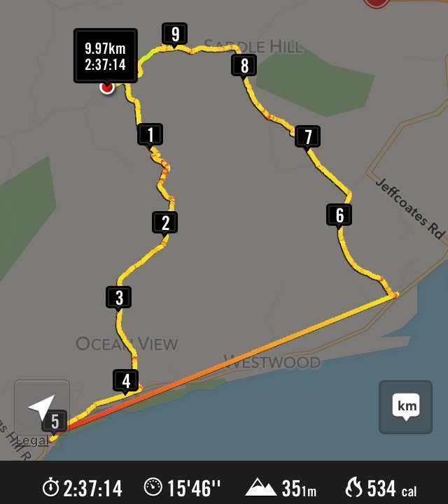
10. 30/9/2020. Trampers. Tunnel track/ Racemans return. Leaders Gordon Grant and Arthur Heenan
Because of snow on the Maungatua the days tramp was diverted to Whare Flat where 9 hardy trampers set off up Tunnel track to Mcraes Weir then turned left until arriving at Racemans track.
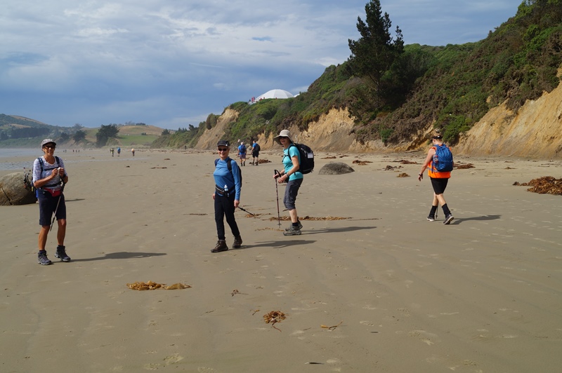
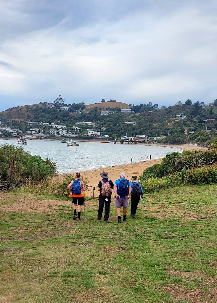
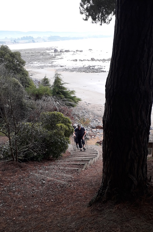
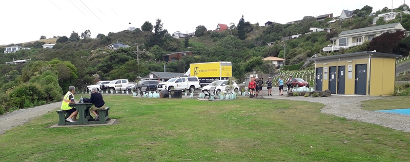
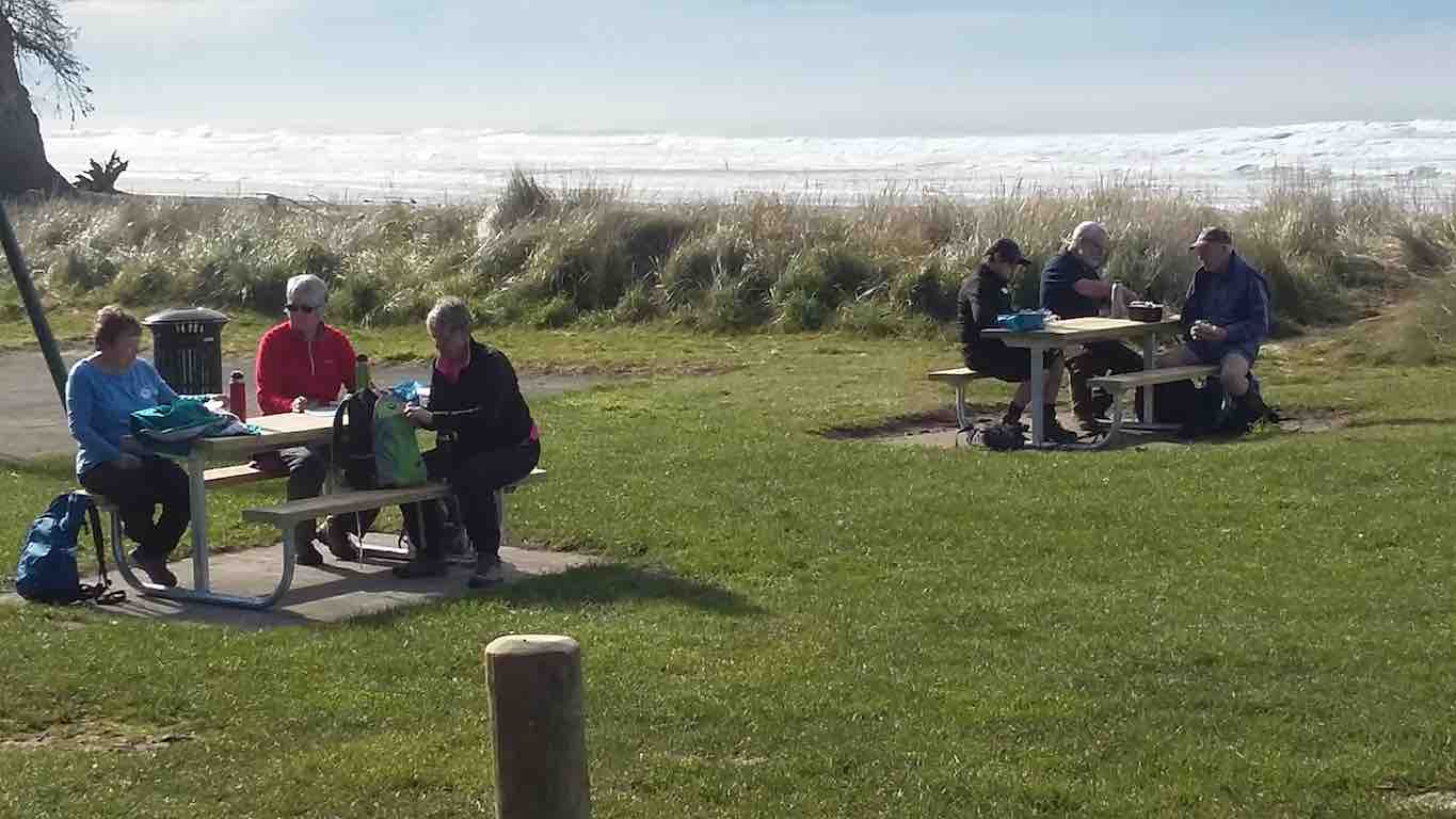
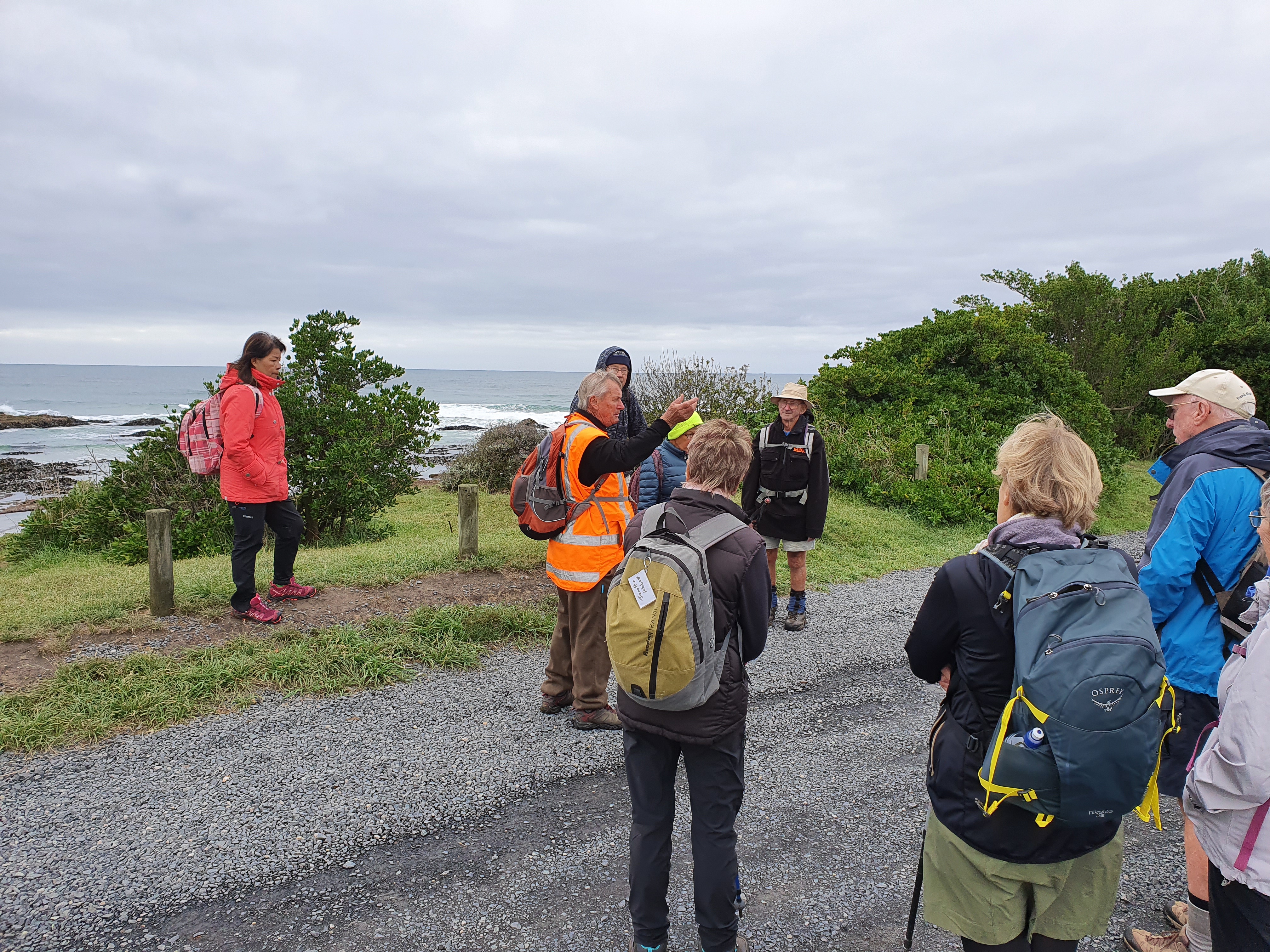
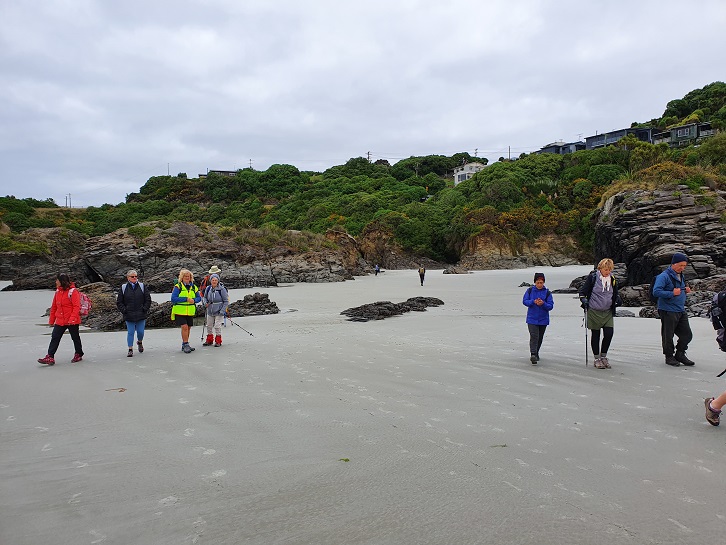
11/03/2020 Hikers and Ramblers Brighton Beach E Leaders Liz and Alex
Brighton Beach is always a beautiful spot to visit, and today was no exception.
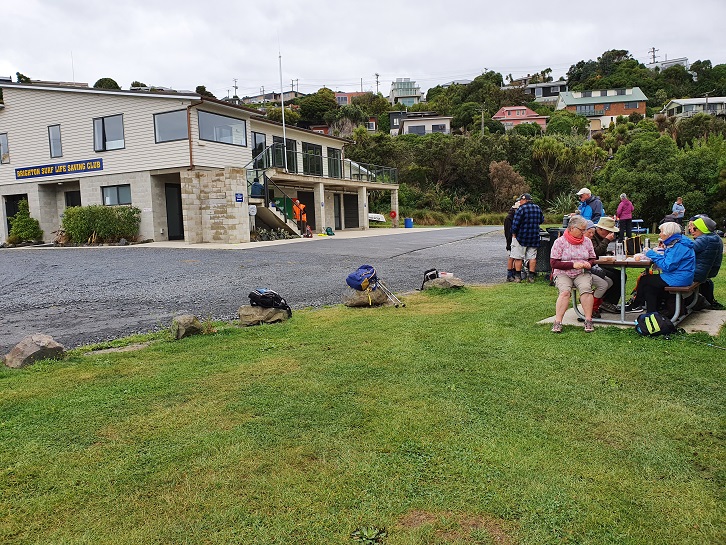
Over 25 Hikers and Ramblers set out from the Brighton Bowling Club. The wind was cool so a vigorous walk along the beach towards Taieri Mouth got us warmed up before turning around and heading back to the surf club at Brighton for morning tea.
Photo and Caption Clive – “Brighton beach car park.”
Photo and Caption Clive – “Brighton Beach Surf Club”
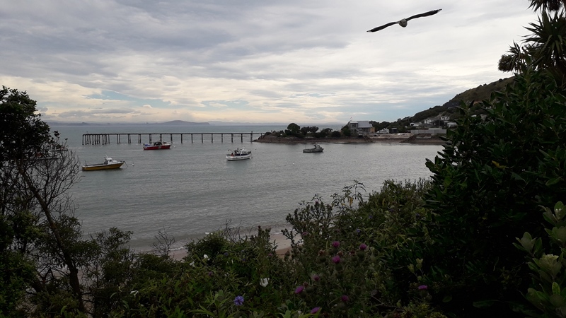
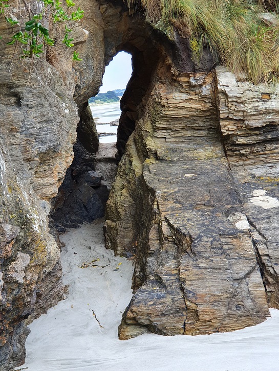
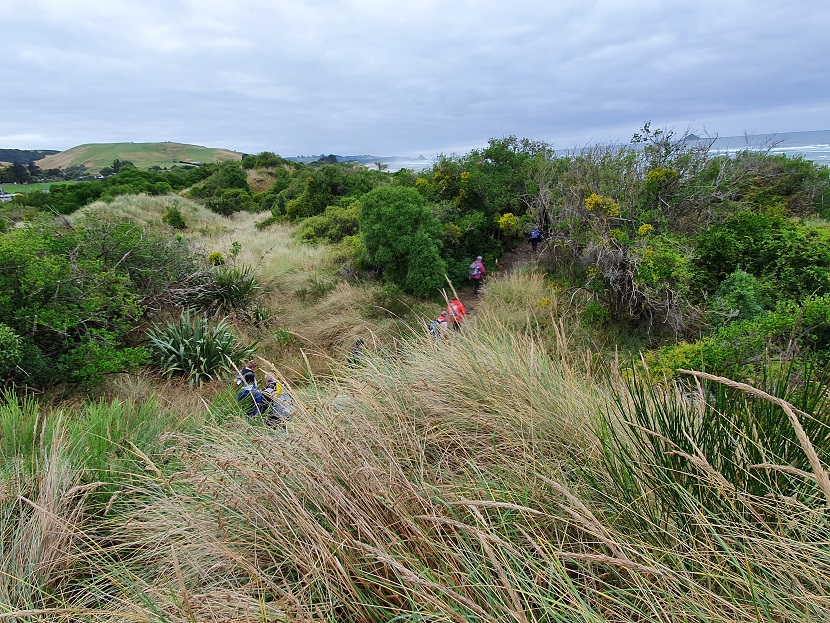
We then headed off towards Ocean Beach, a tunnel and sand dunes. The blackberries were ripening nicely and provided a sweet treat. We were able to point out past and present Homes of ex all blacks, Community leaders and some colourful characters from Brighton’s history.
Photo and Caption Clive – “Ocean Beach tunnel.”Photo and Caption Clive – “Ocean Beach”
Photo and Caption Clive – “In the sand dunes”
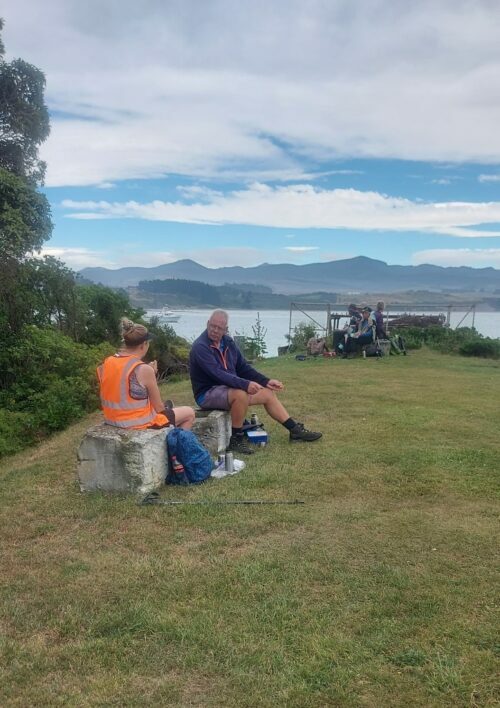
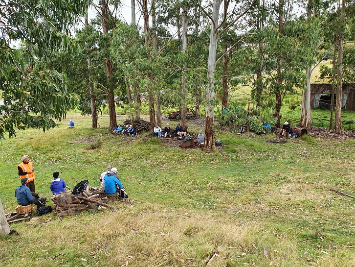
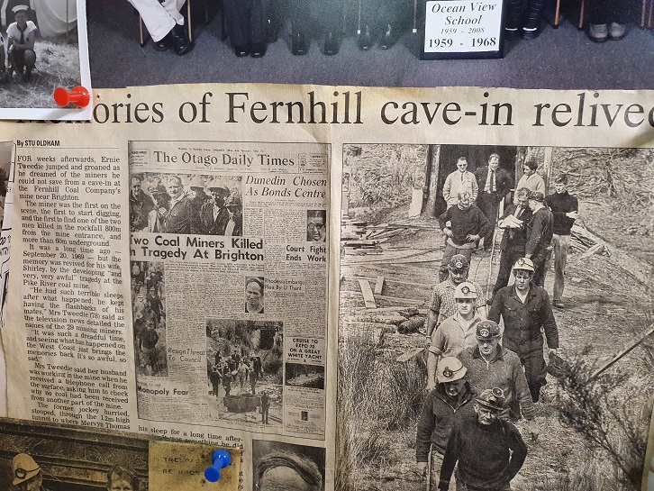
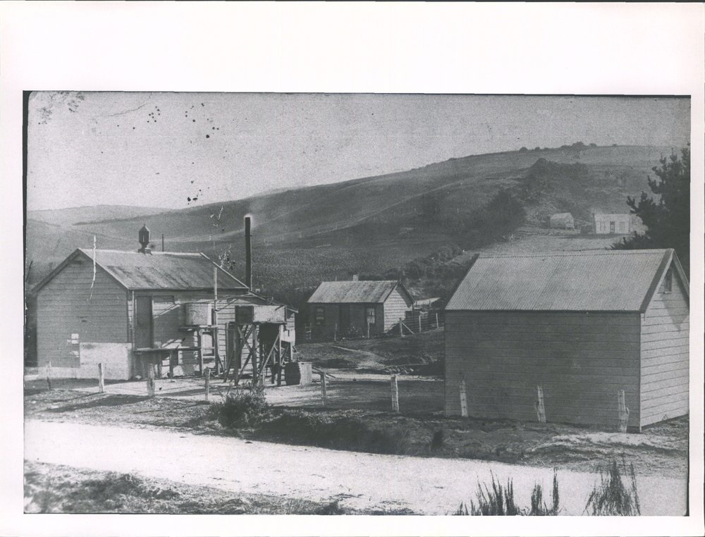
By lunchtime we reached the old creamery coal mine. There were several tales to be told about the coal mining days and of tragedy in the deaths of two of the coal miners. We sat amongst the gum trees for lunch and listened to stories.
Photo and Caption Clive – “Lunch amongst the gum trees”
Photo and Caption Clive – “The old coal mine was over there.”
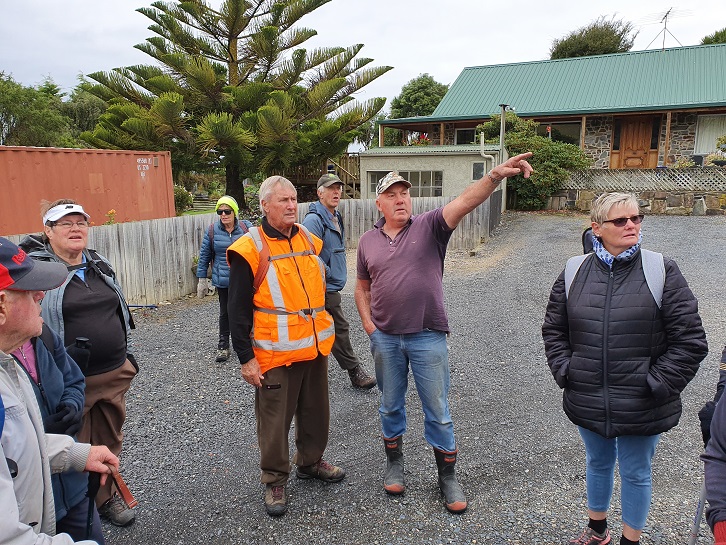
After lunch we walked up the hill and met Warren Harris who owns the site of the old coal mine. We were treated to a visit to his ‘Man Cave’ with some historic treasures and memorabilia.
Photo and Caption Clive – “Warren explains his collection.”
Photo and Caption Clive – “Tragic stories of coal mining days.”
Photo and Caption Clive – “Historical photos from Brighton.”Photo and Caption Clive – “The creamery.”
We then headed back into Brighton past some million dollar homes with fantastic sea views, followed by coffee and a natter at the Brighton Café.