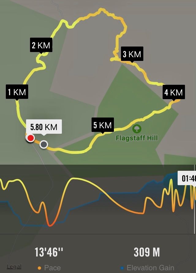
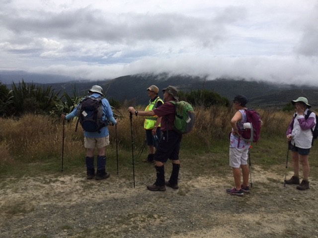
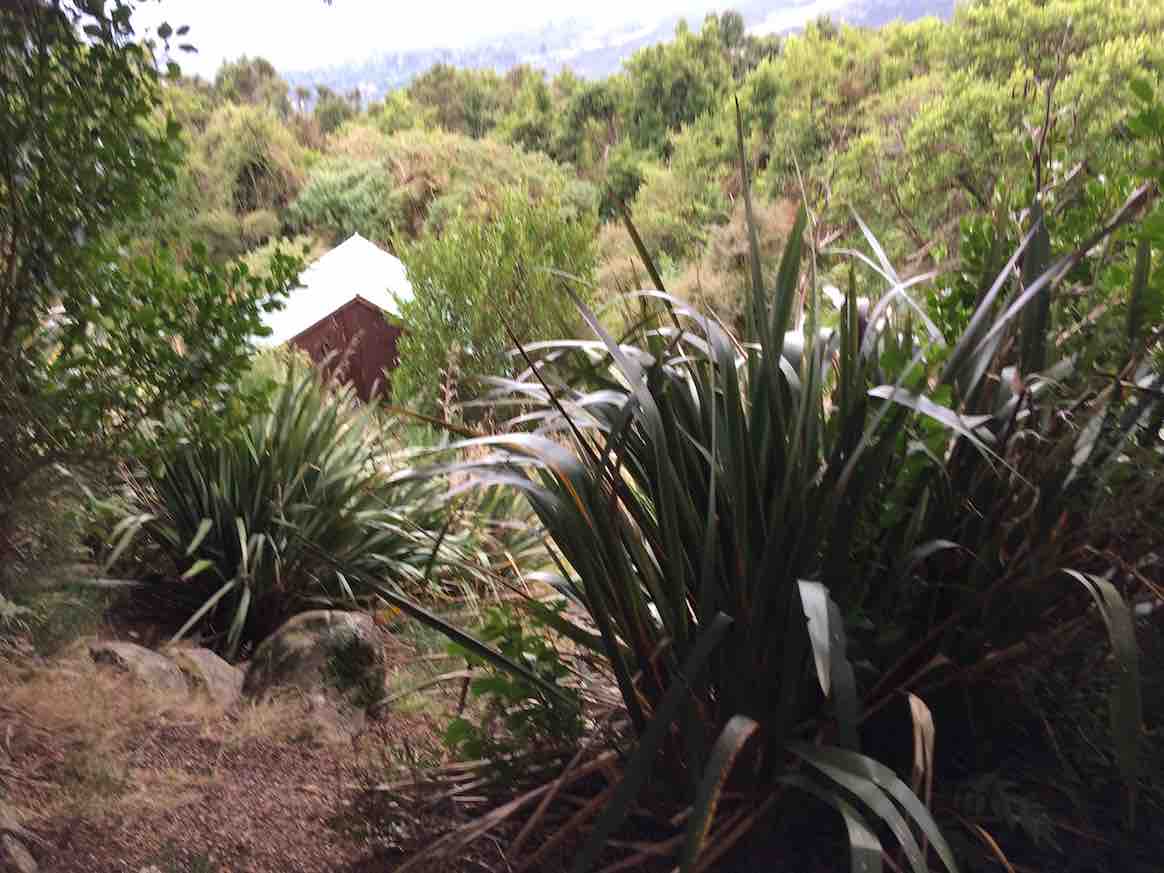
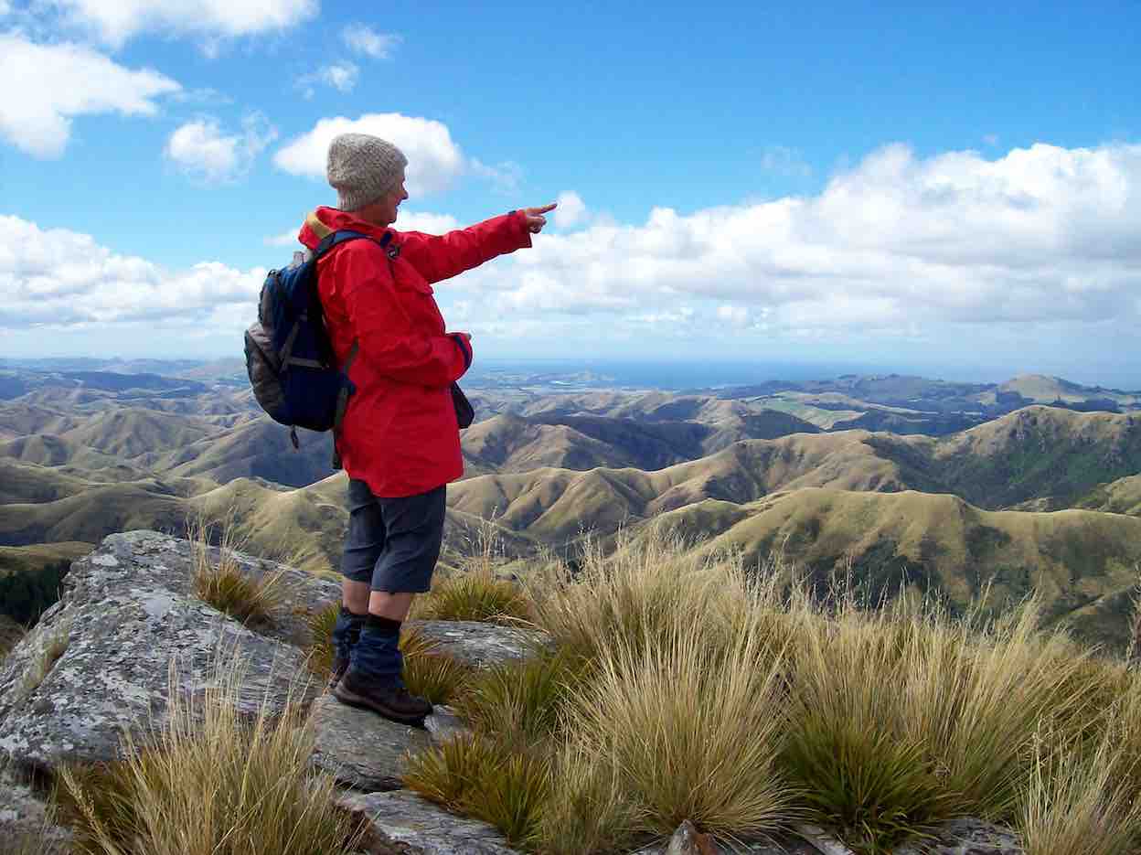
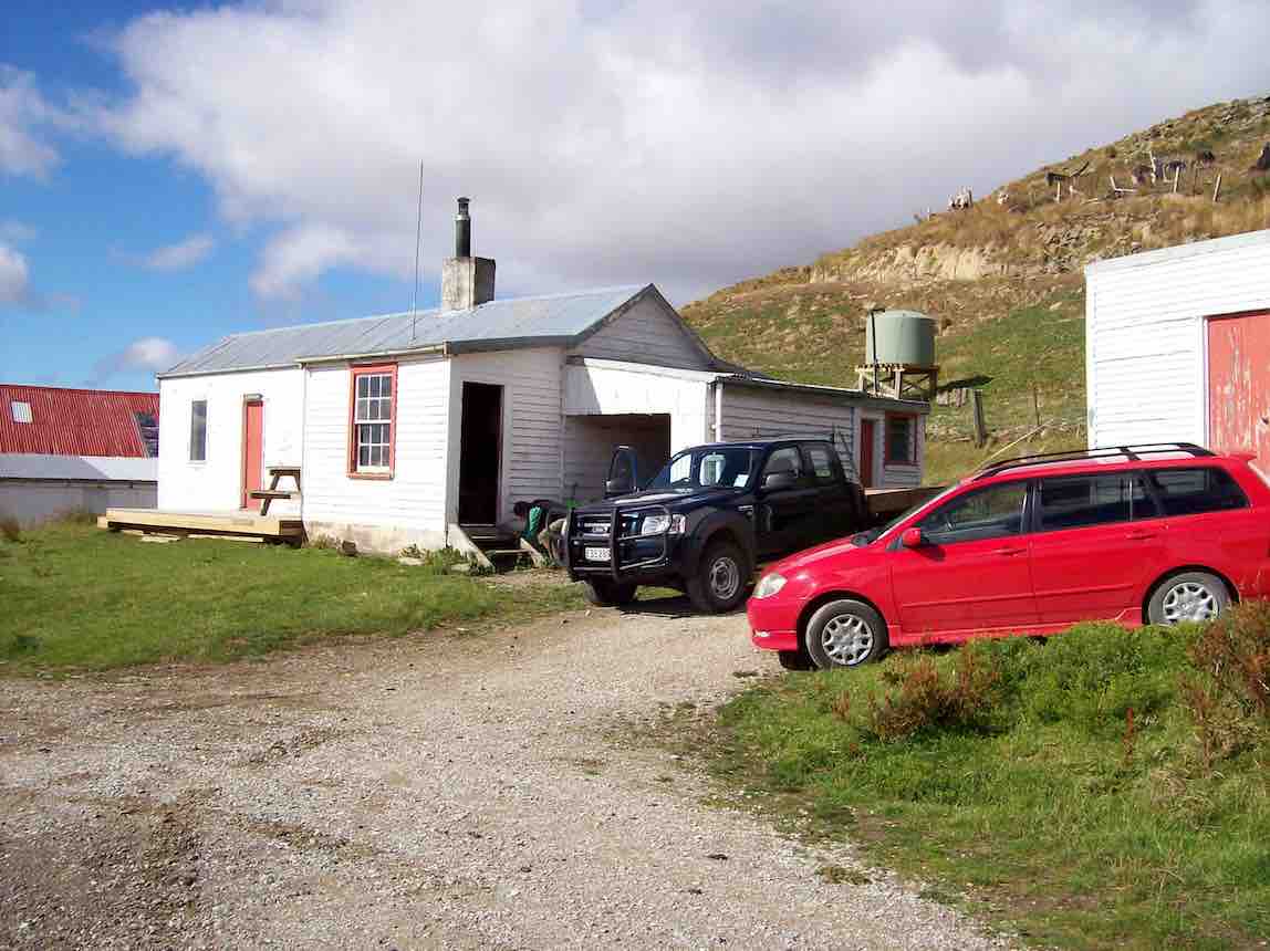
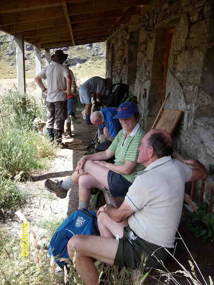
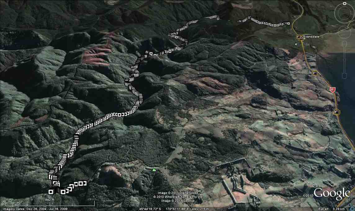
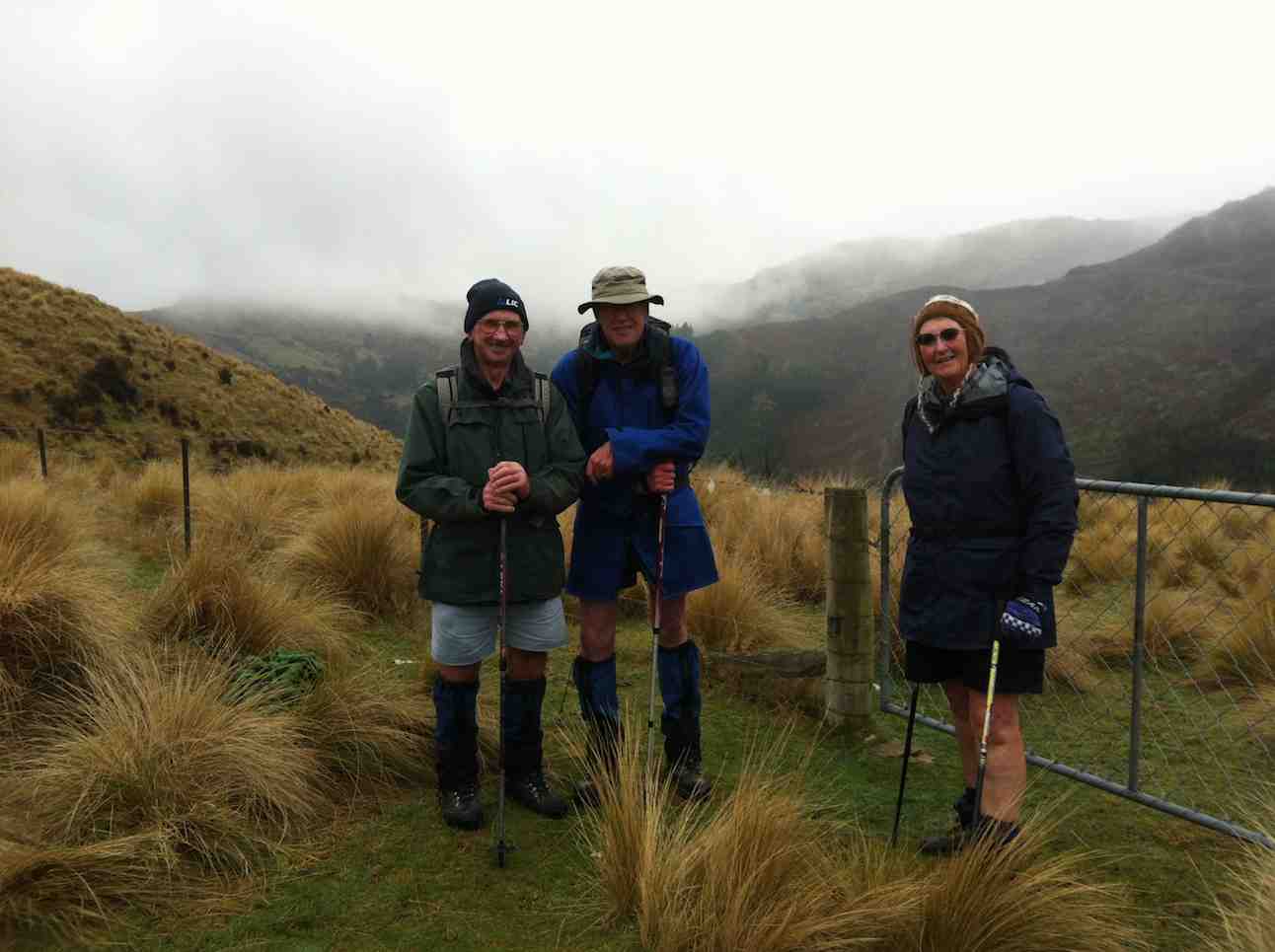
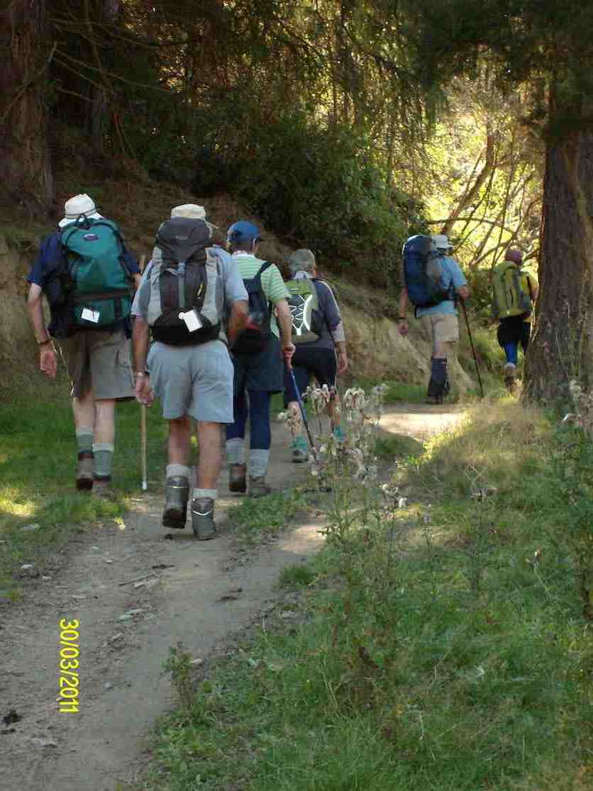
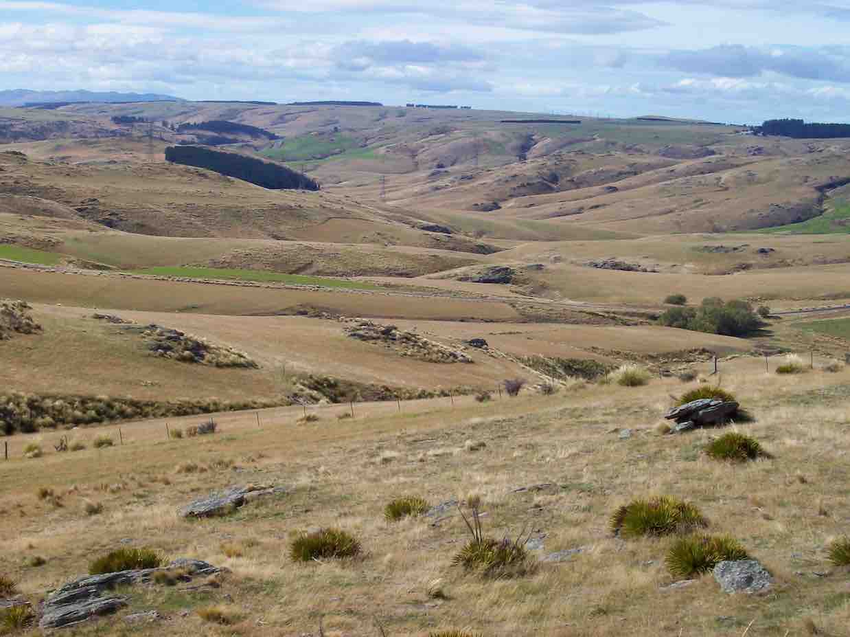
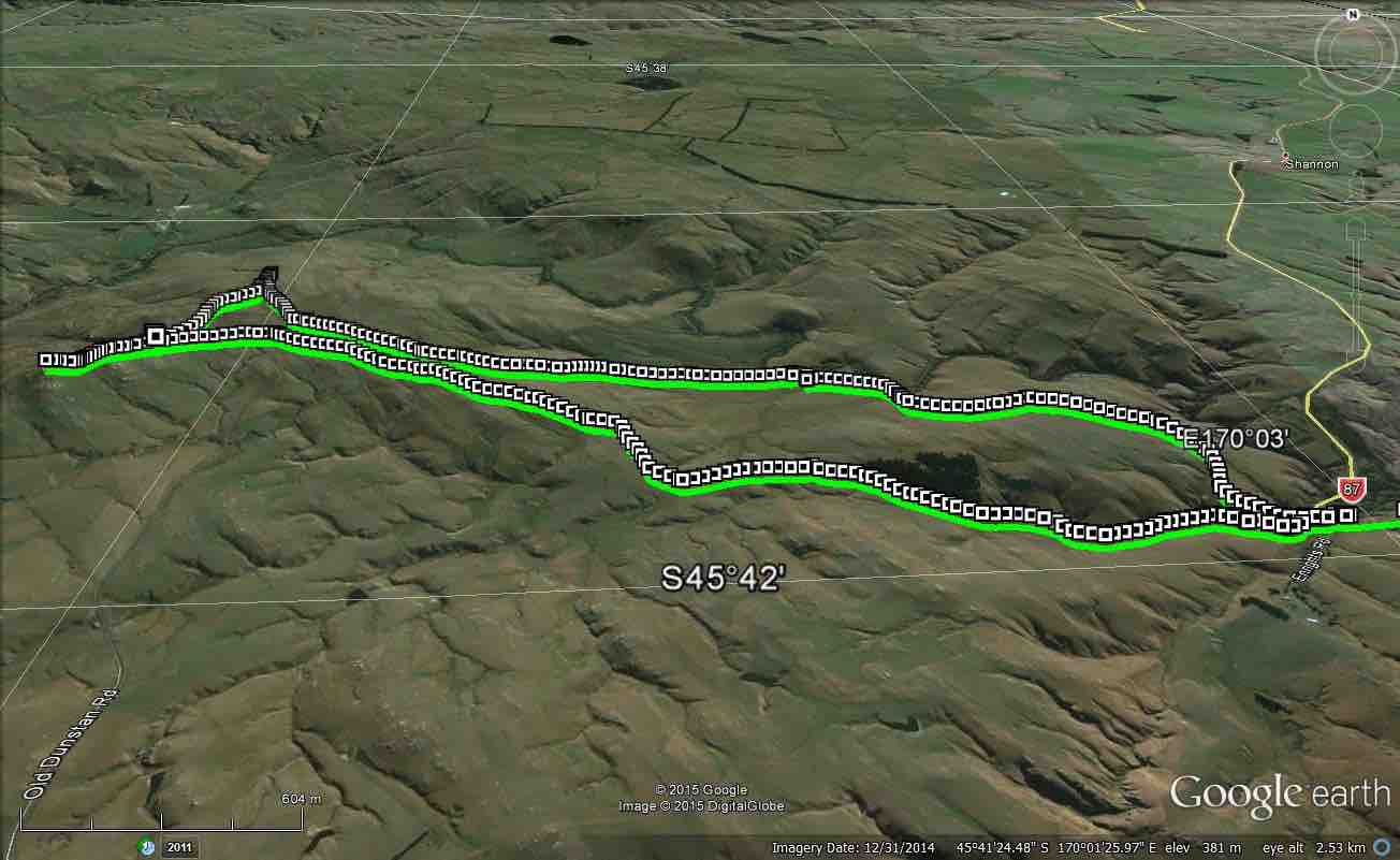
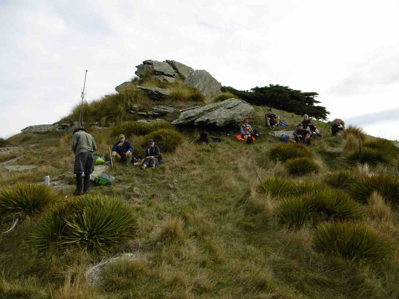
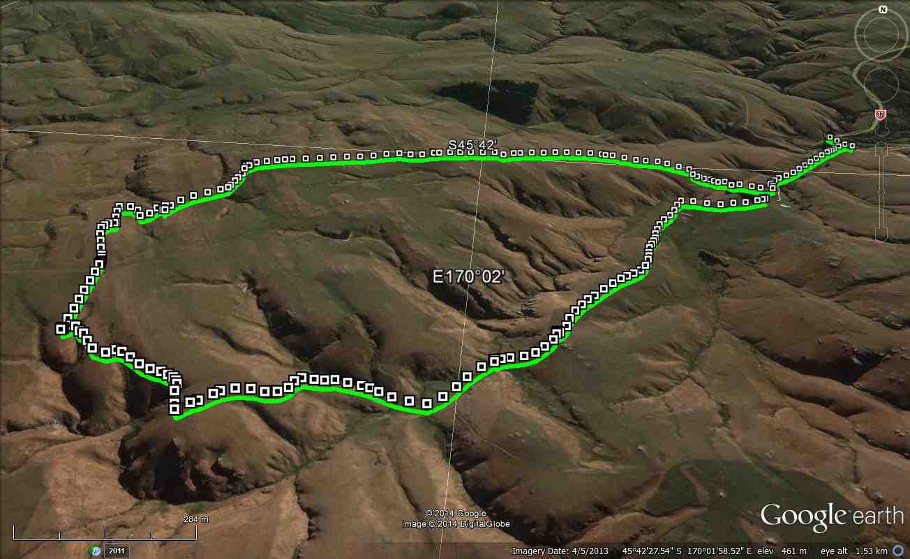
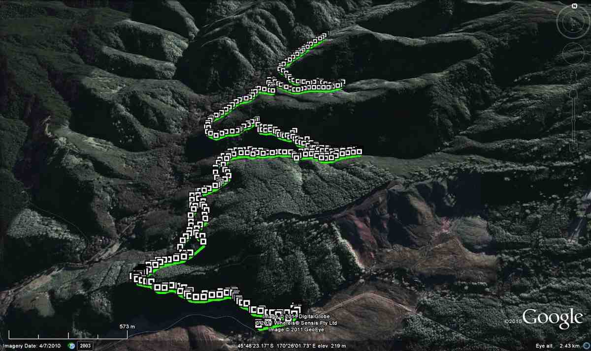
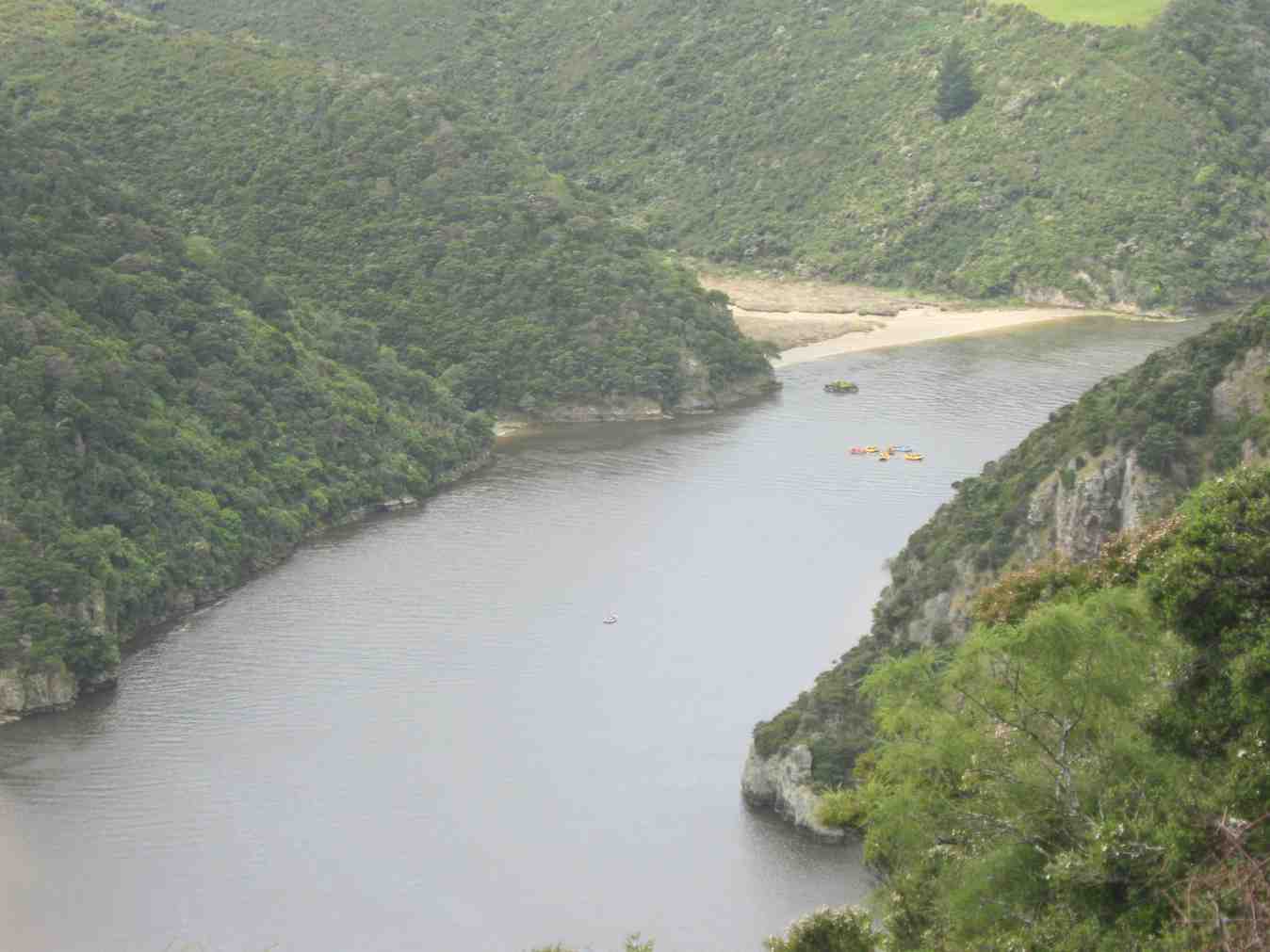
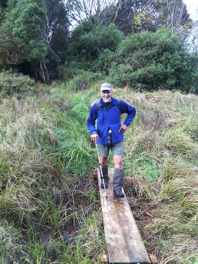
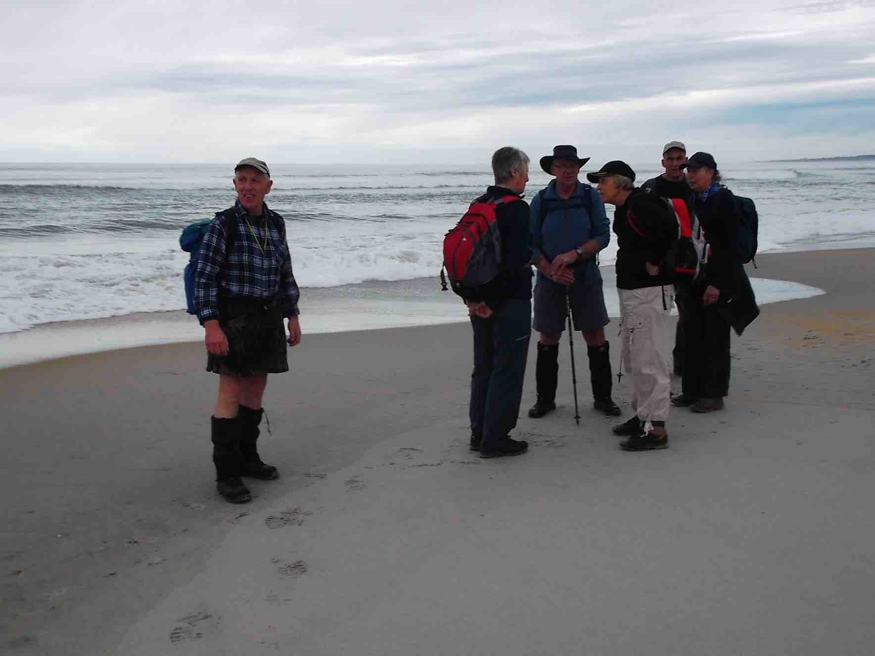
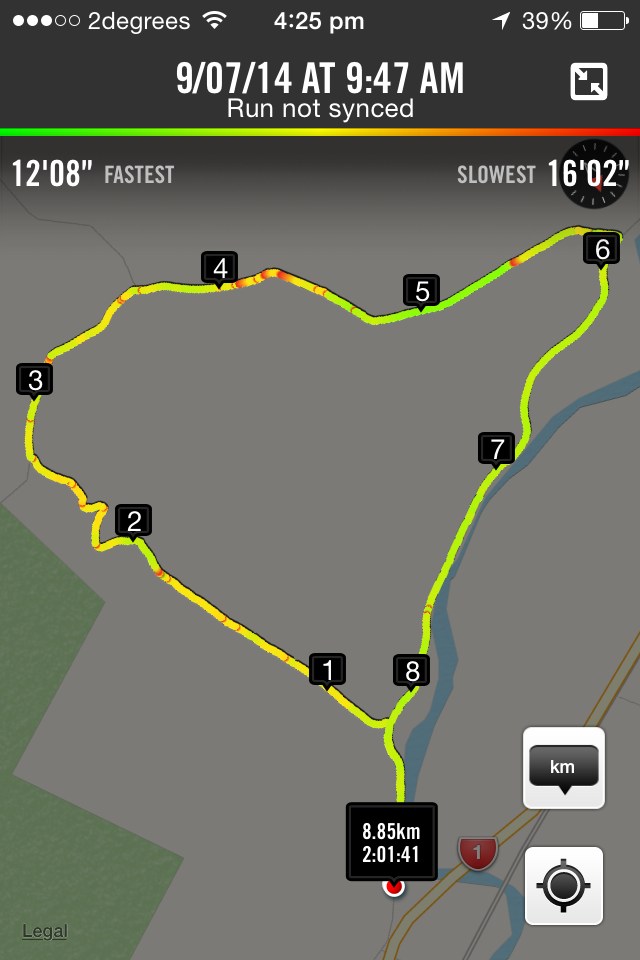
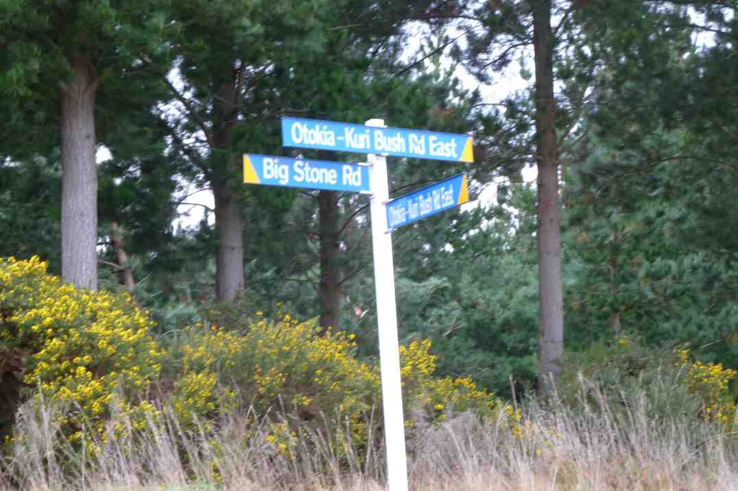
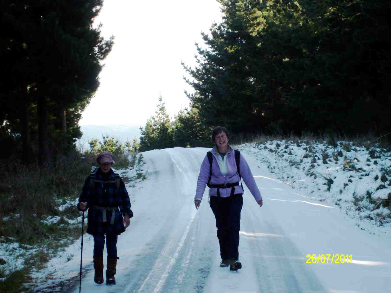
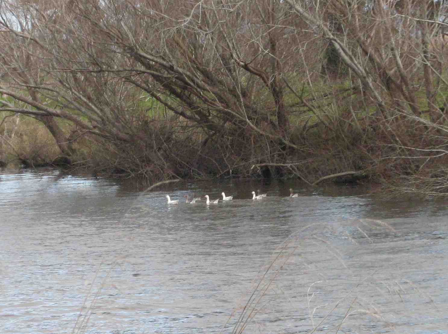
3. 24/1/2018. Hikers. Bull Ring, Where Flat Road, Jim Freeeman,Ben Rudd, Flag Staff, Bull Ring. M. Leaders: Judy, Dawn.
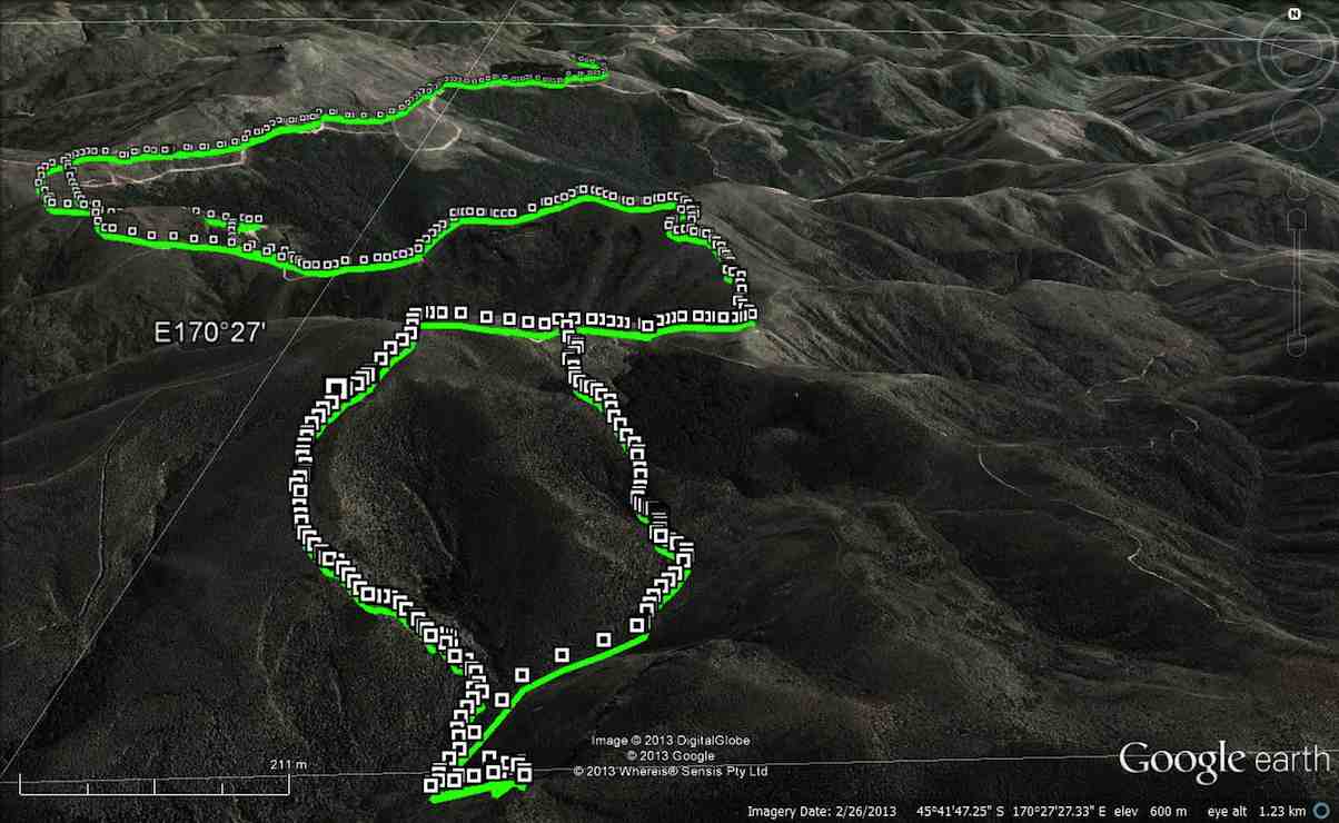
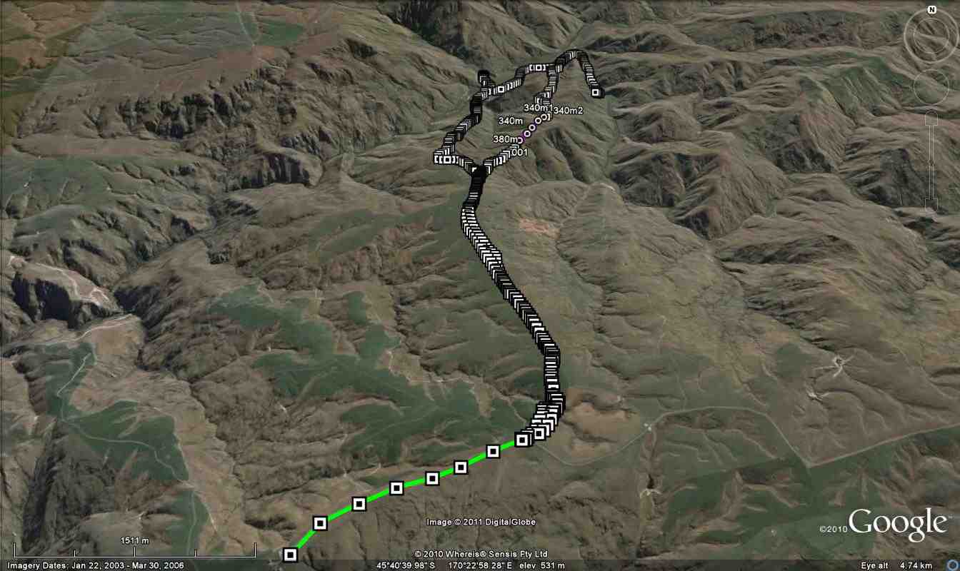
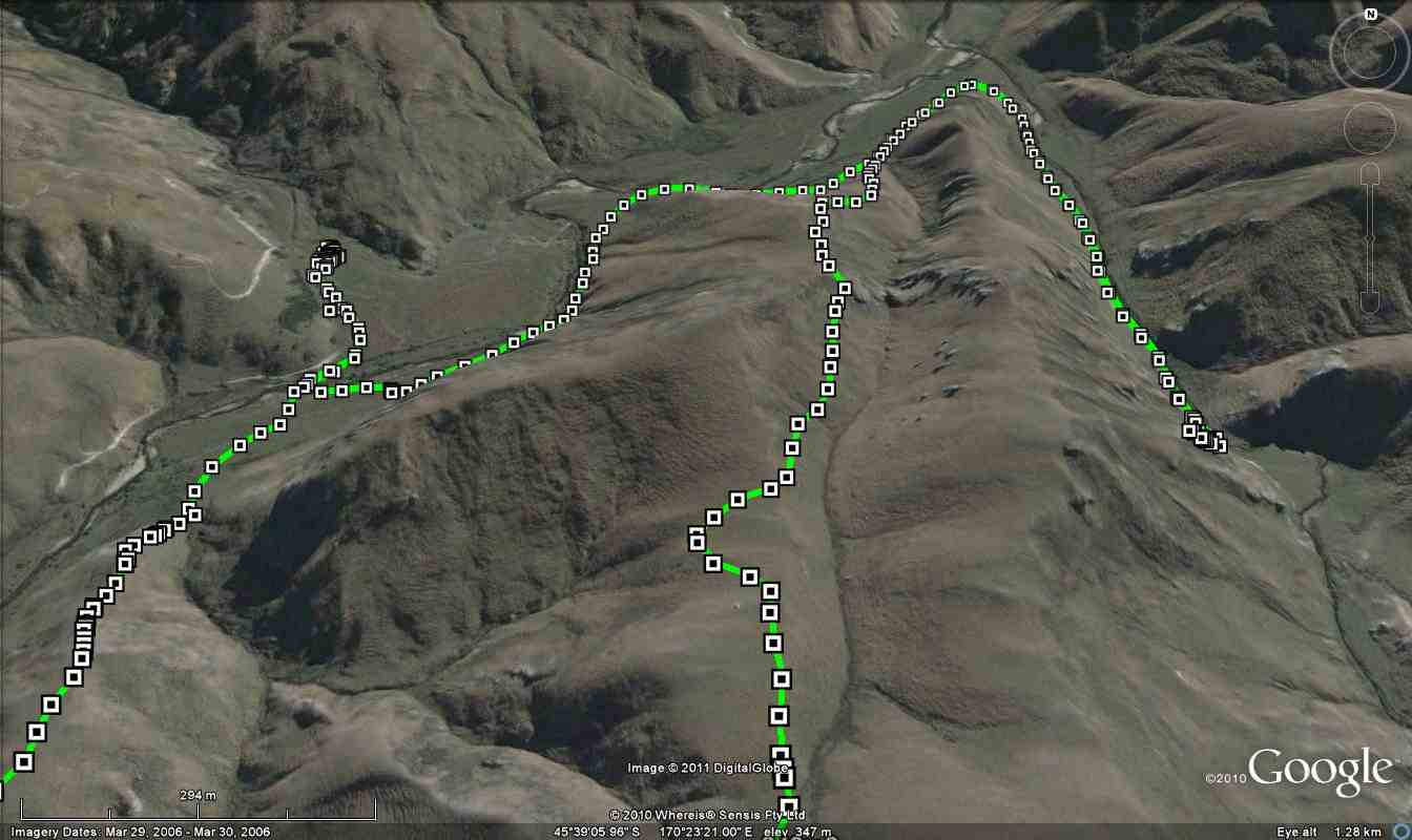
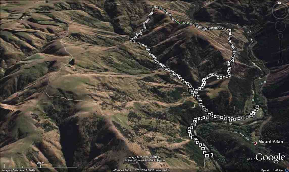
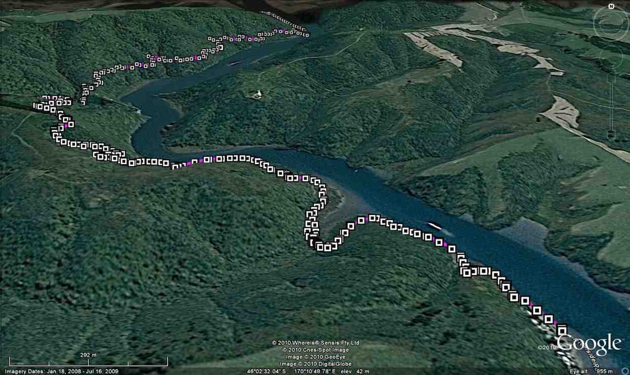
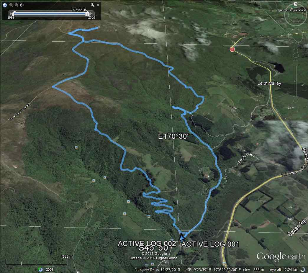
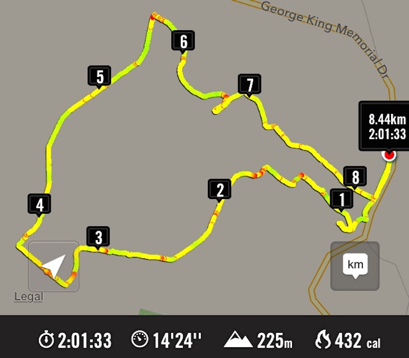
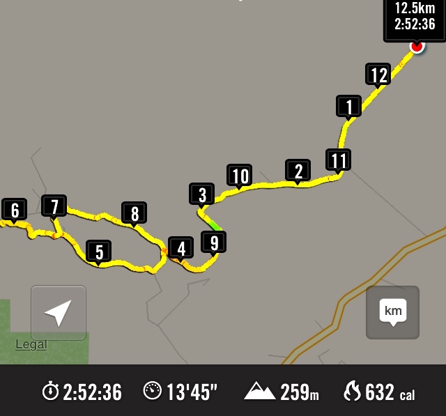
Route map, courtesy Ian.
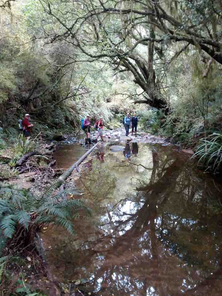
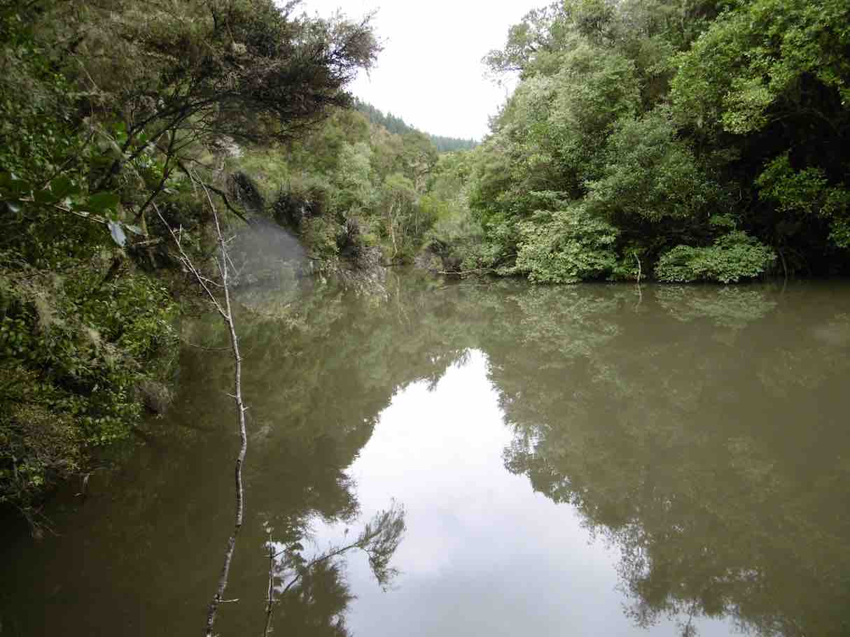
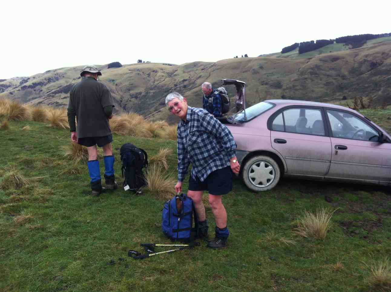
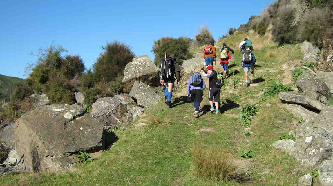
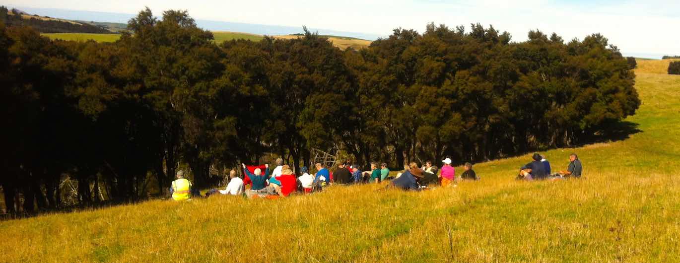
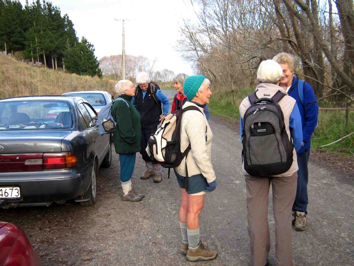
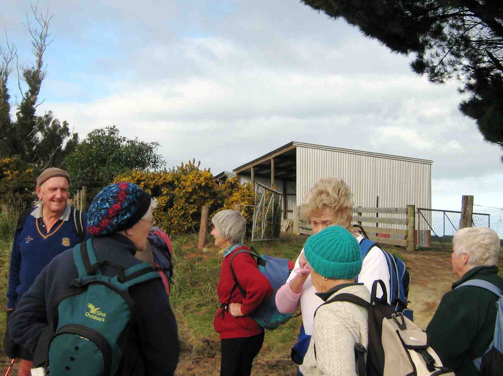
27 hikers gathered at the car park, but this number soon diminished to 26 as one member collapsed before we even started. (He is okay). Two others waited to provide assistance, leaving 24 of us to head for the Bull Ring.
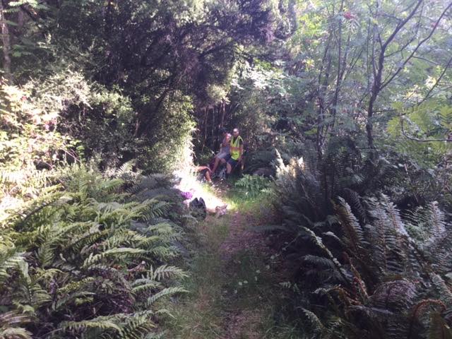
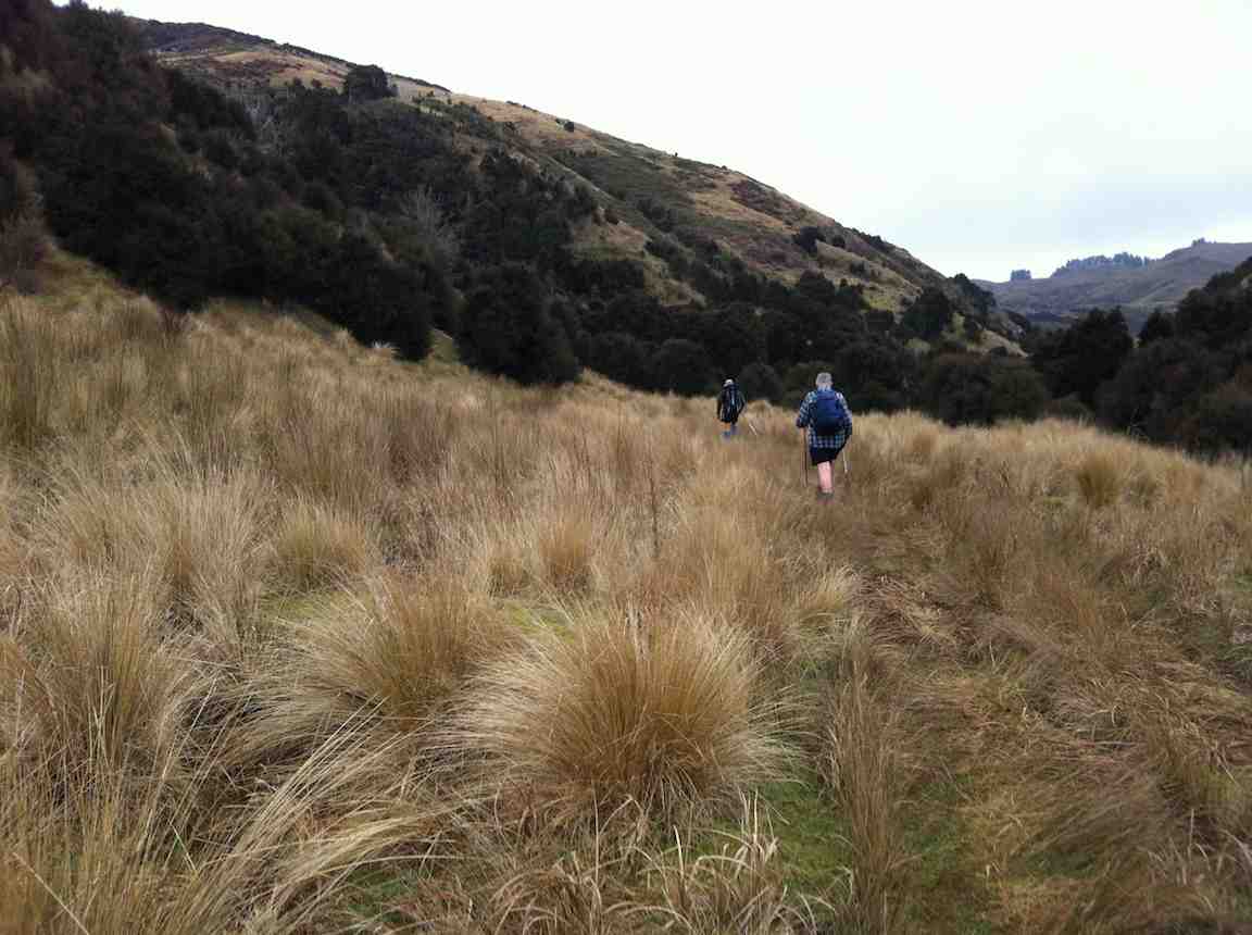
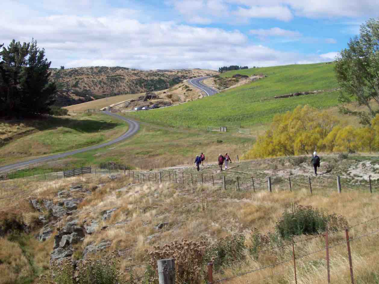
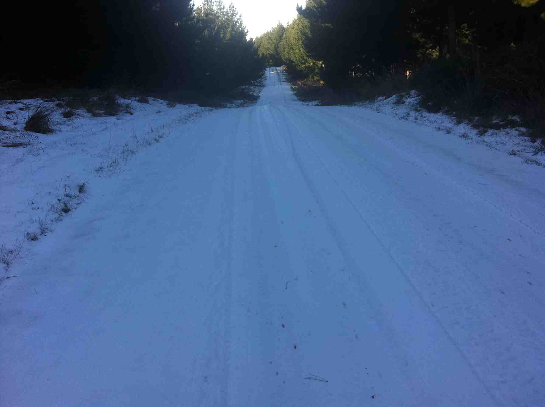
Here five opted to do a shorter trip to the summit and back, while the remaining 19 set off down the road to the Possum Busters turn-off. This was an easy, half-hour, down-hill stroll, mostly in the shade of the trees.
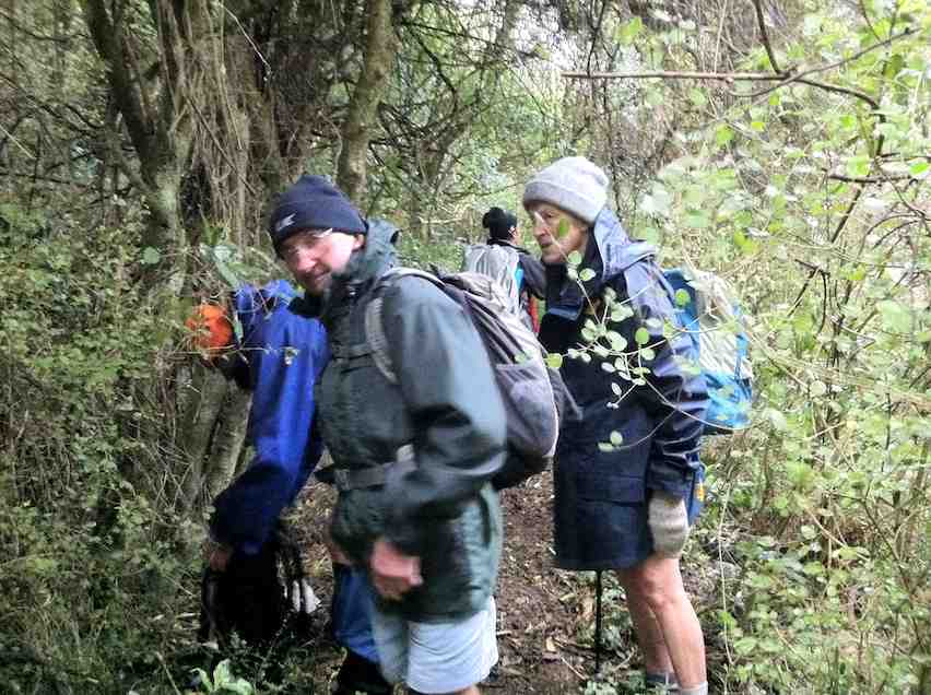
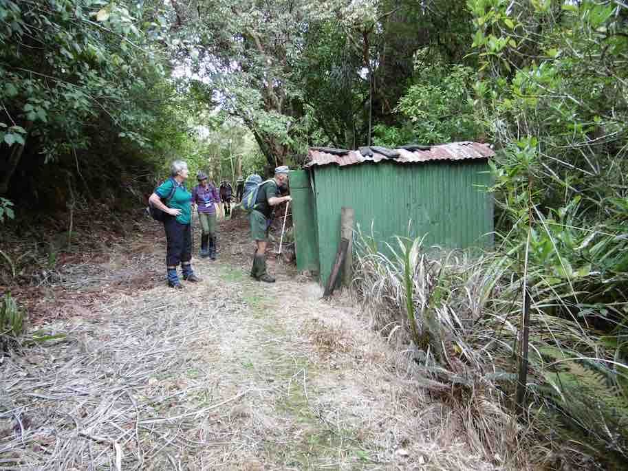
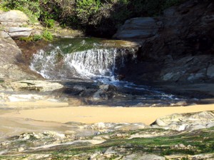
Morning tea was had just inside the track, …
Morning tea break at start of Possum Busters. (Kevin pic.)
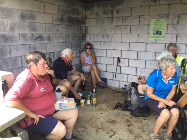
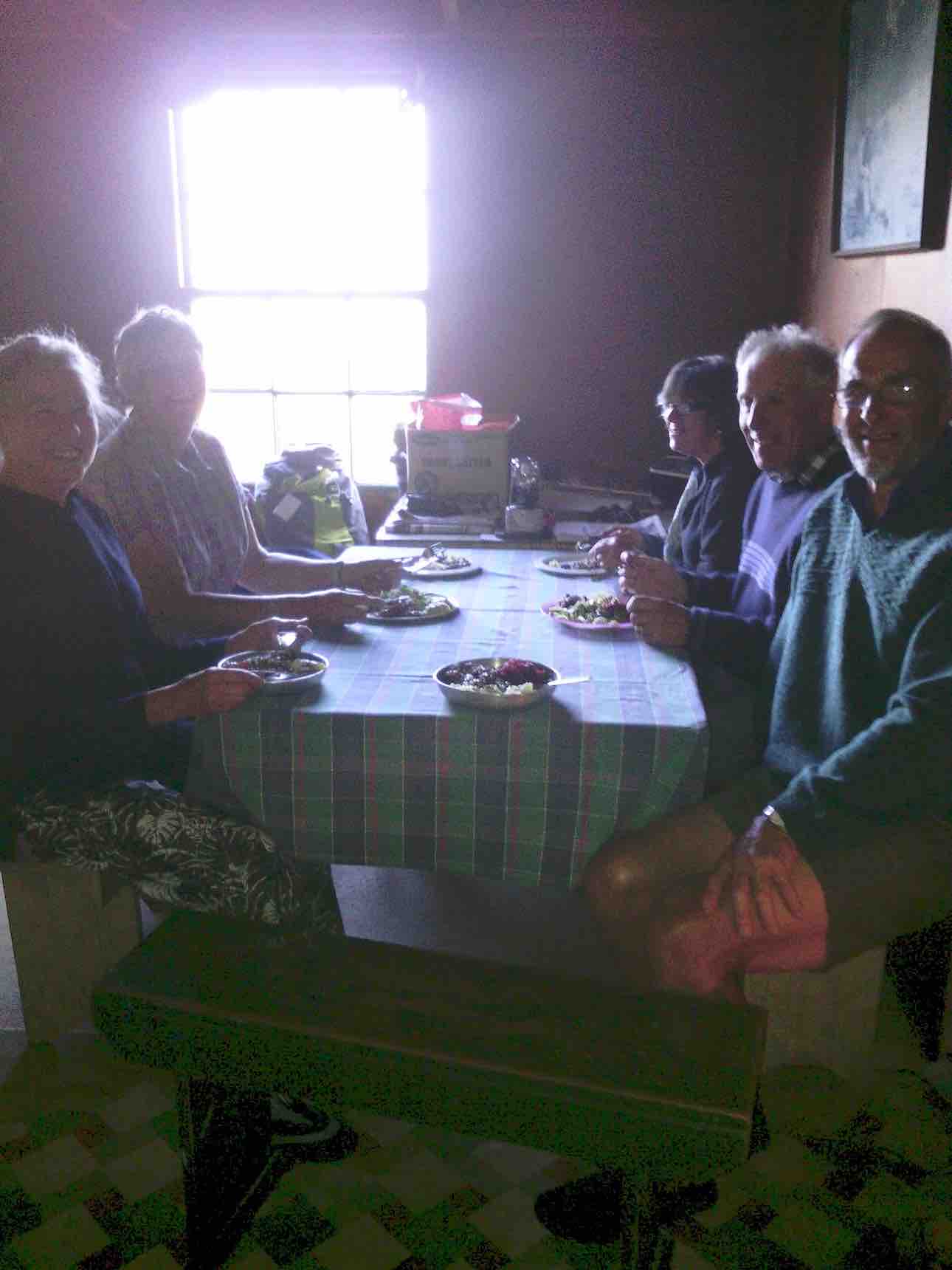
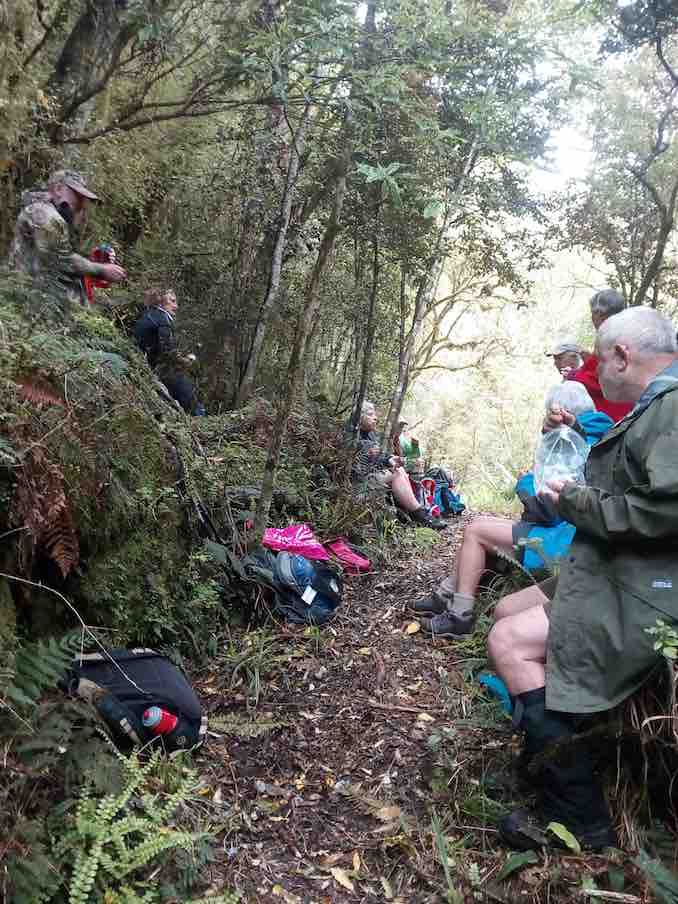
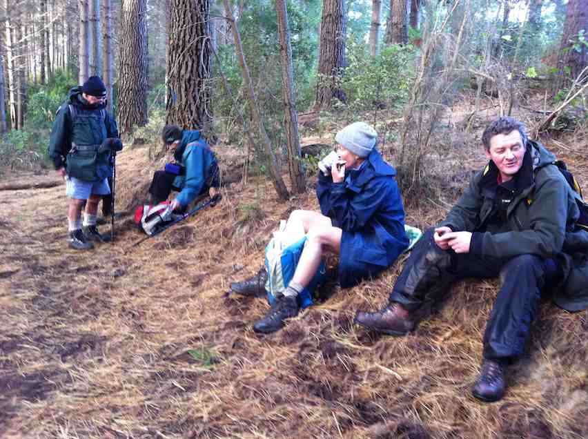
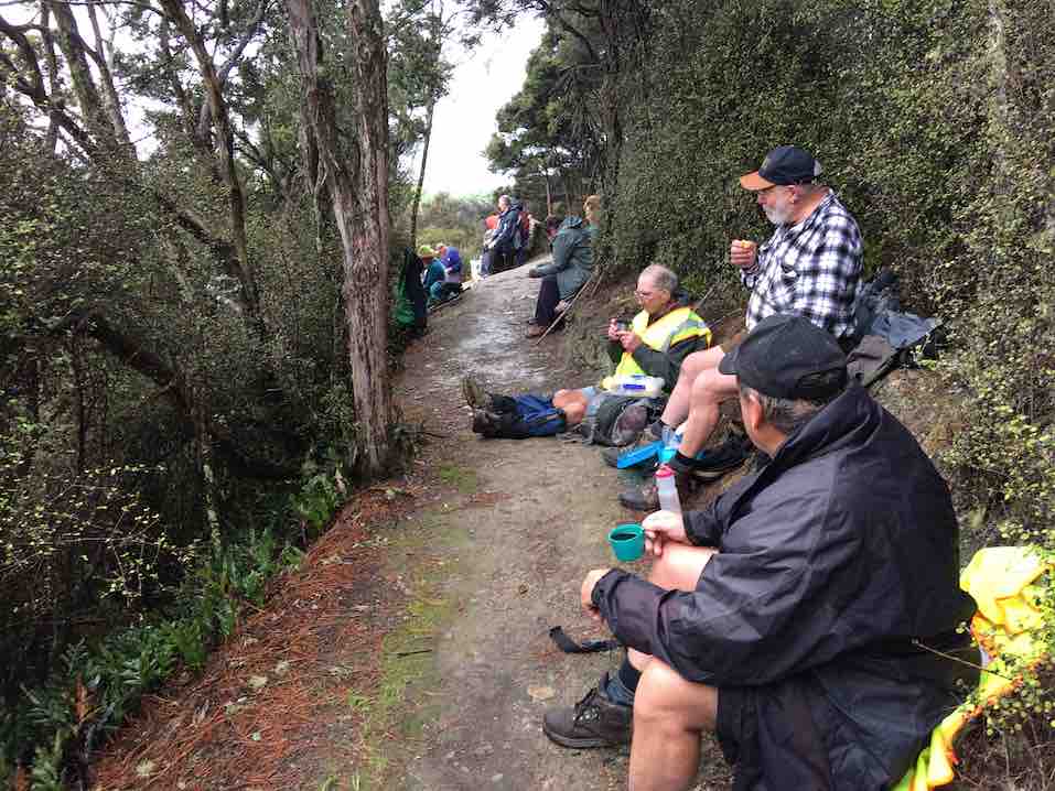
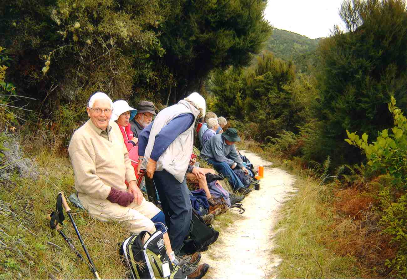
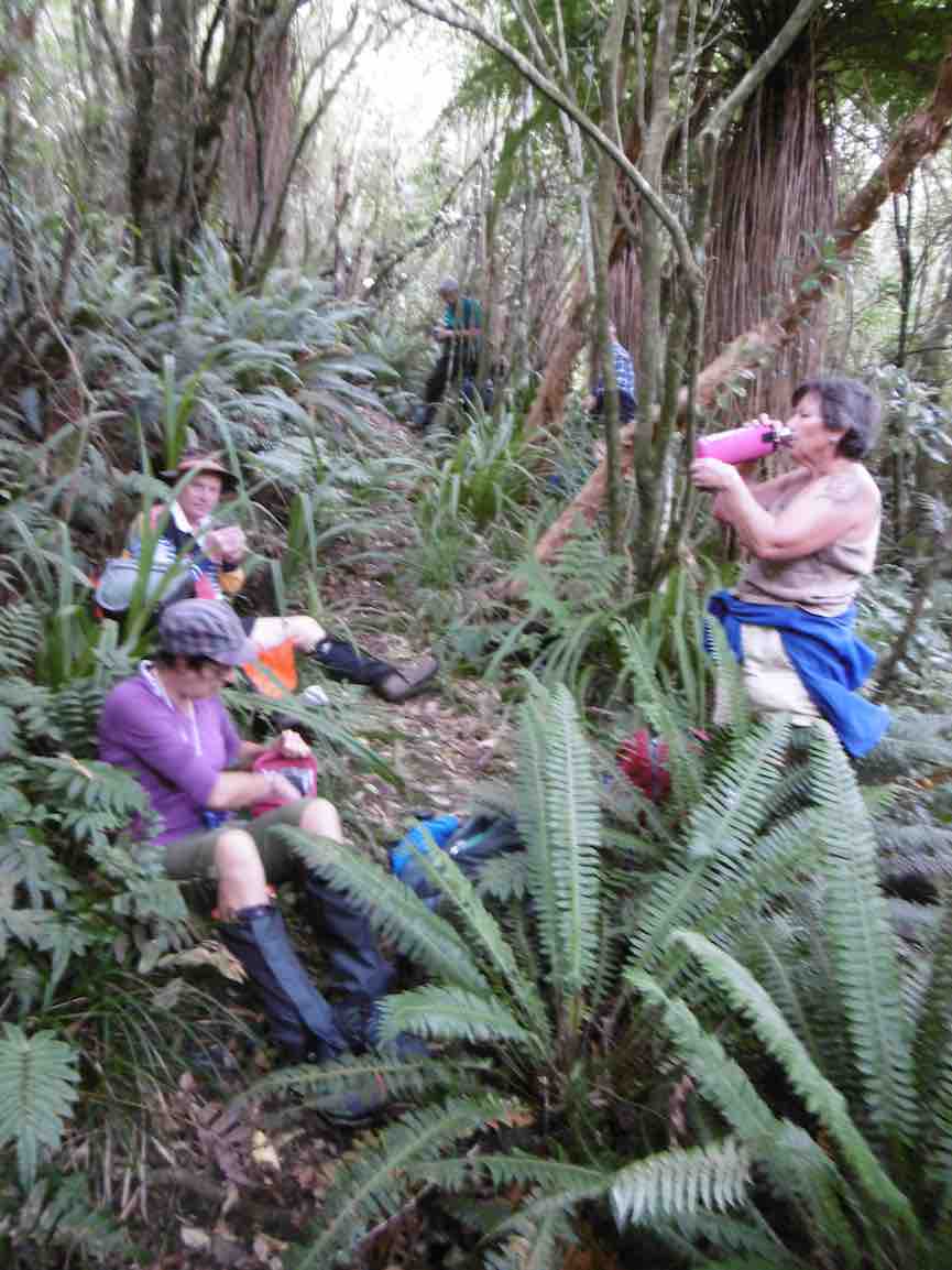
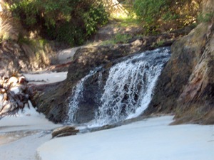
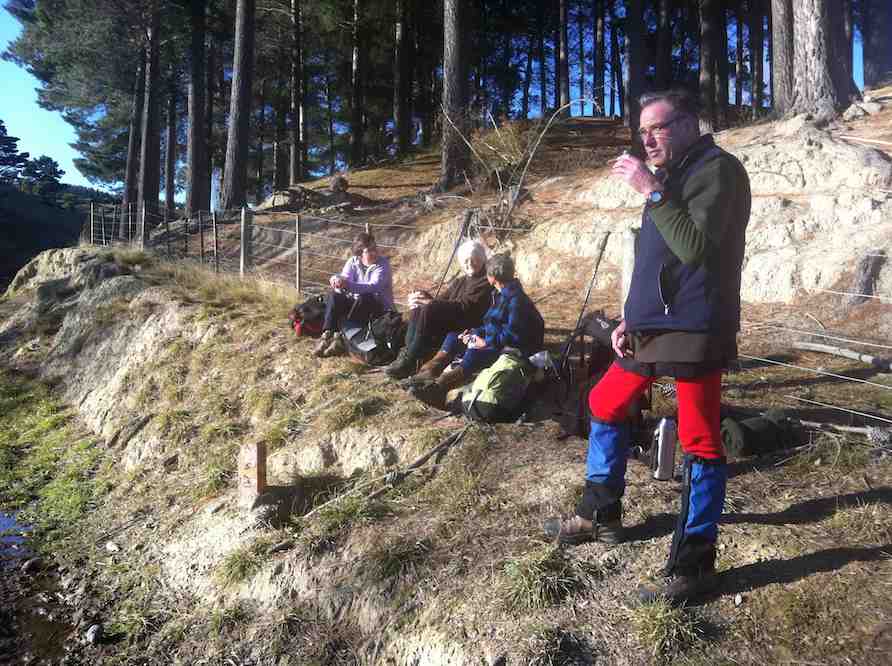
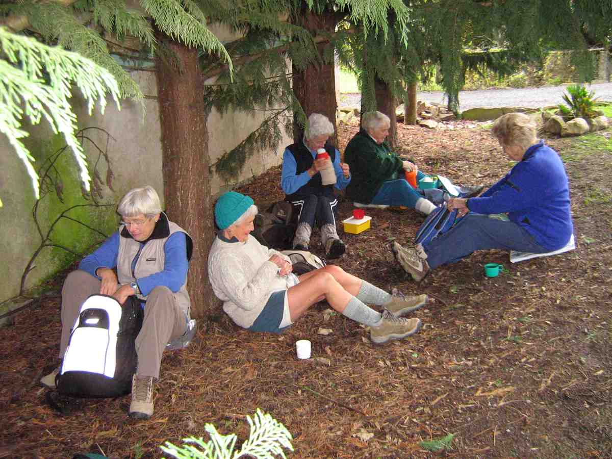
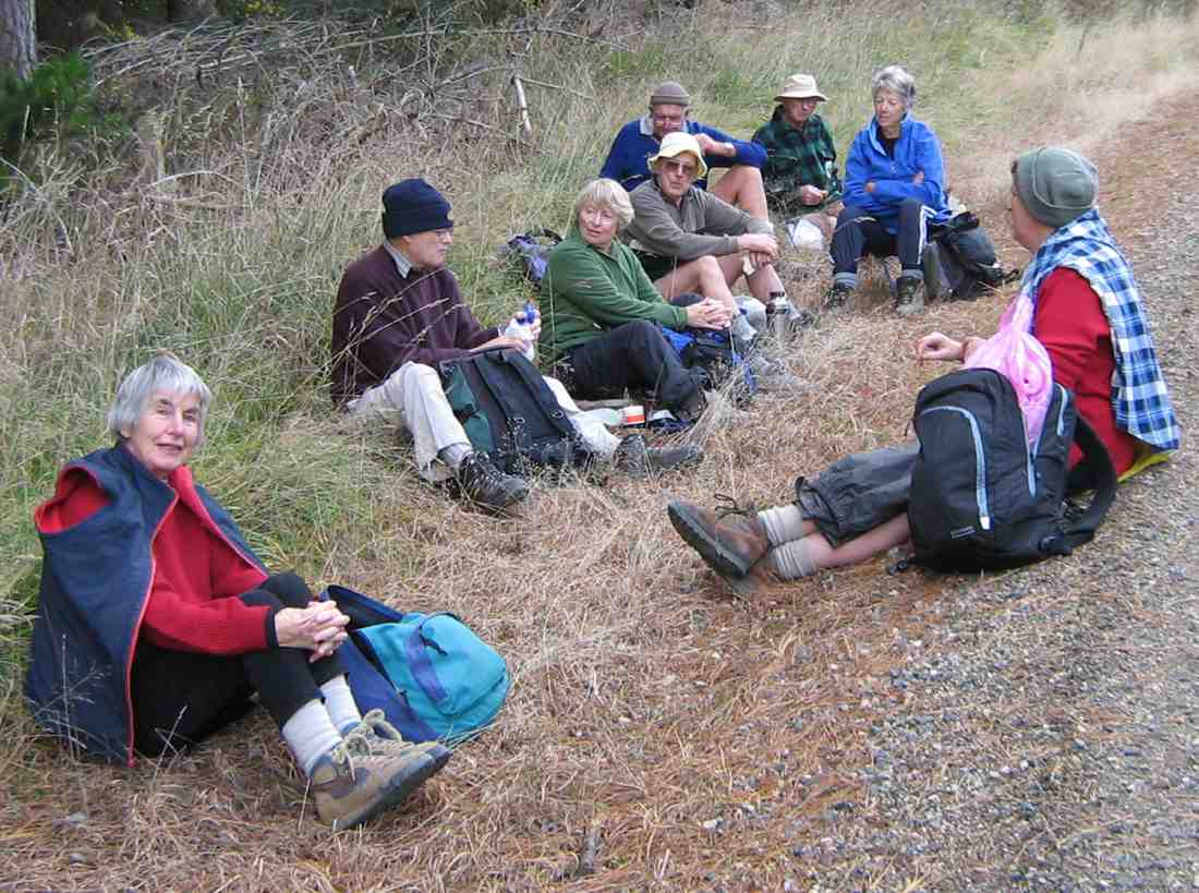
… and then we headed for the Jim Freeman turn-off and the long, slow, hot climb up to the Ben Rudd shelter. With frequent stops for water and breath, this took just over an hour. Not bad under the conditions experienced! We were all glad to be in the shelter of the bush and even gladder to emerge and collapse at the shelter for a long leisurely lunch break.
Lunch at Ben Rudd. (Kevin pic.)
The two good Samaritans met us here, having come up the fire-break track and down to the shelter. They informed us that the patient was okay and that the other five were on their way to the summit and would head straight back down.
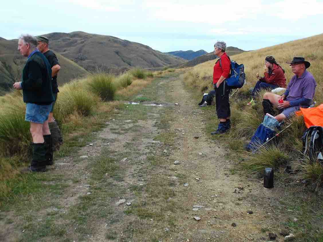
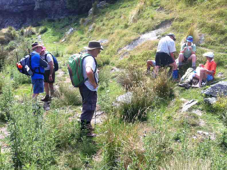
After lunch it was up to the fire-break, …
Coming out onto fire-break. (Kevin pic.)Junction of Fire Break and Ben Rudd tracks. (Kevin pic.)
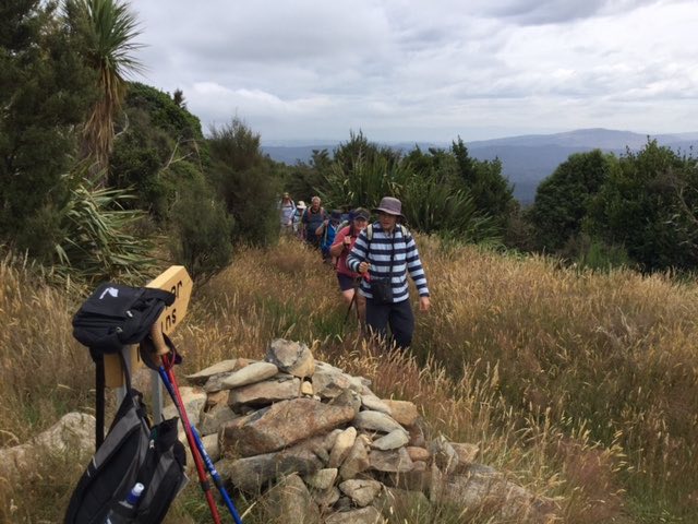
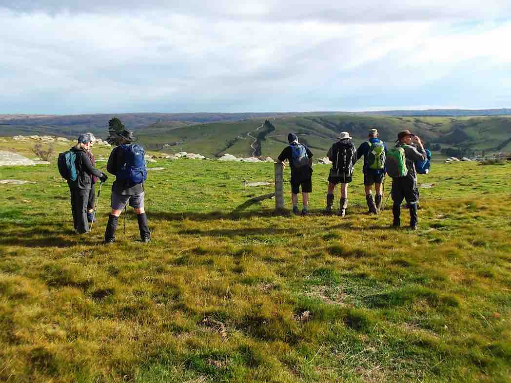
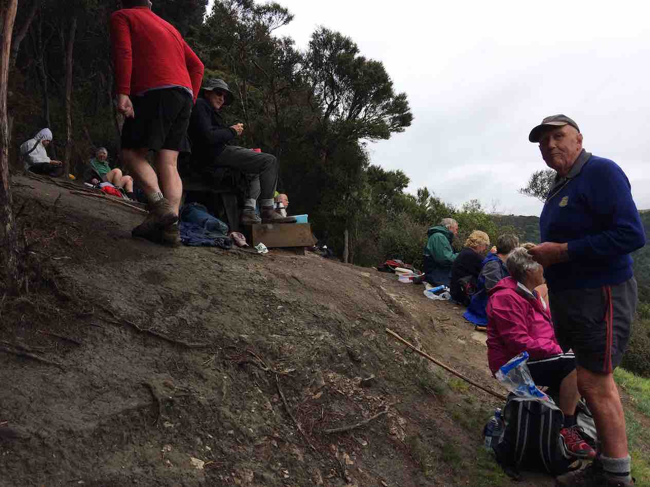
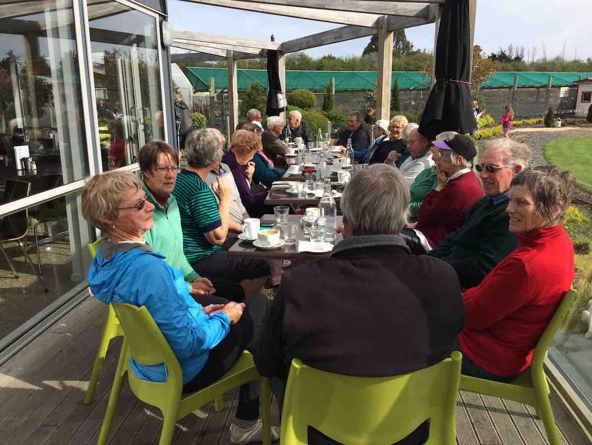
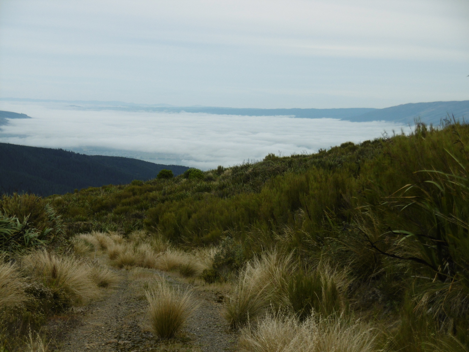
… and another split, with nine heading straight down to the cars, and the rest taking the track towards Swampy and then around and up (again!) to the Flagstaff summit. It was slightly misty with a welcome cooling breeze, but the views were great, and we enjoyed the leisurely descent to the cars. A good number then enjoyed a social hour at Topiary.
The decision to do this trip in reverse made sense, as it avoided the long hot climb up the road at the end, and also meant that most of the climbing was in the bush. – Judy
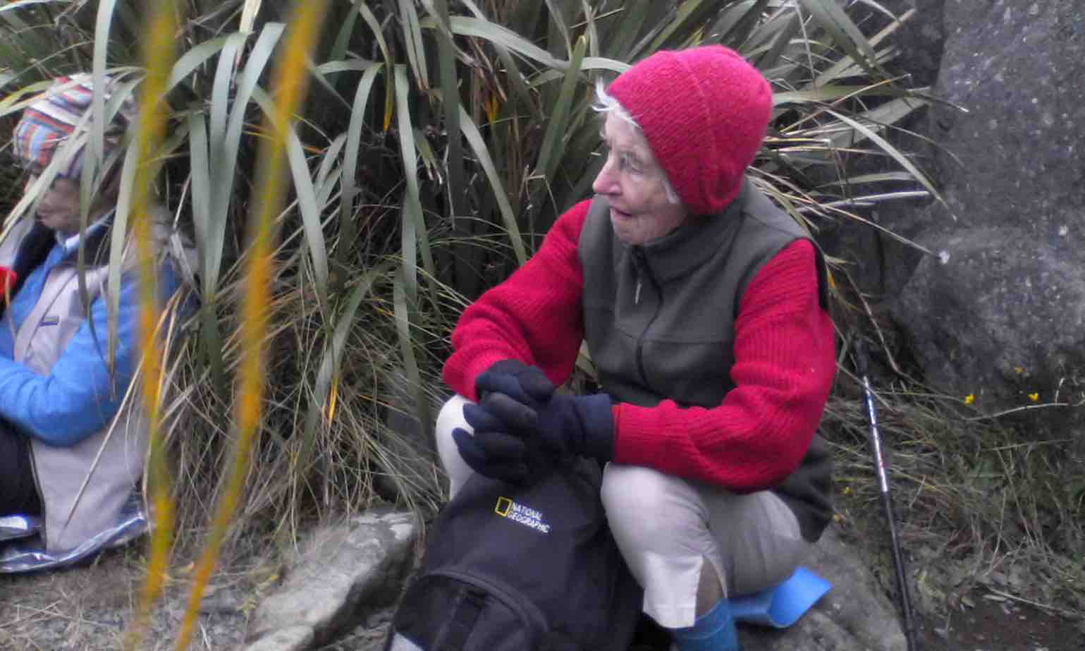
2. 19/4/2017. Hikers. Bull Ring, Ben Rudd, Jim Freeman, Whare Flat Road return. M. Jennifer and Adrienne.
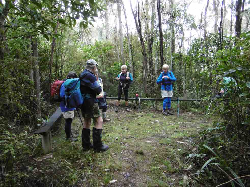
Seven ‘not-so-young-and-not-feeling-fit’ members decided on a shorter(?) version of the day’s trip. While the others went up the fire-break track, we opted for the track to Flagstaff summit,with great views across the Taieri and then the city before the cloud came down. Morning tea was had sheltering in the rocks just past the summit,
(Judy pic.)
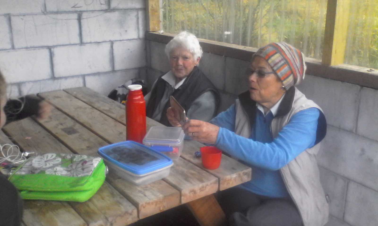
before following the track down over rocks and through mud to the junction with the fire-break. It was cold pushing into the wind and we were glad to reach the Ben Rudd turn-off and head down into the bush where it was more sheltered. (We could hear the main party somewhere down the Jim Freeman track below). The picnic shelter was much appreciated for a longish lunch as it was a bit wet outside.
(Judy pic)Glimpse of end of six seater above Ben Rudd Shelter. (Ian pic and caption.)View from the six-seater. Ben Rudd shelter roof top. (Ian pic and caption.)
The climb back to the firebreak was quickly dealt with and the descent to the Bull Ring was uneventful – almost. (Chris explored a ditch quite closely at one point). It seems we walked as far if not further than the main group – not sure how! – Judy.
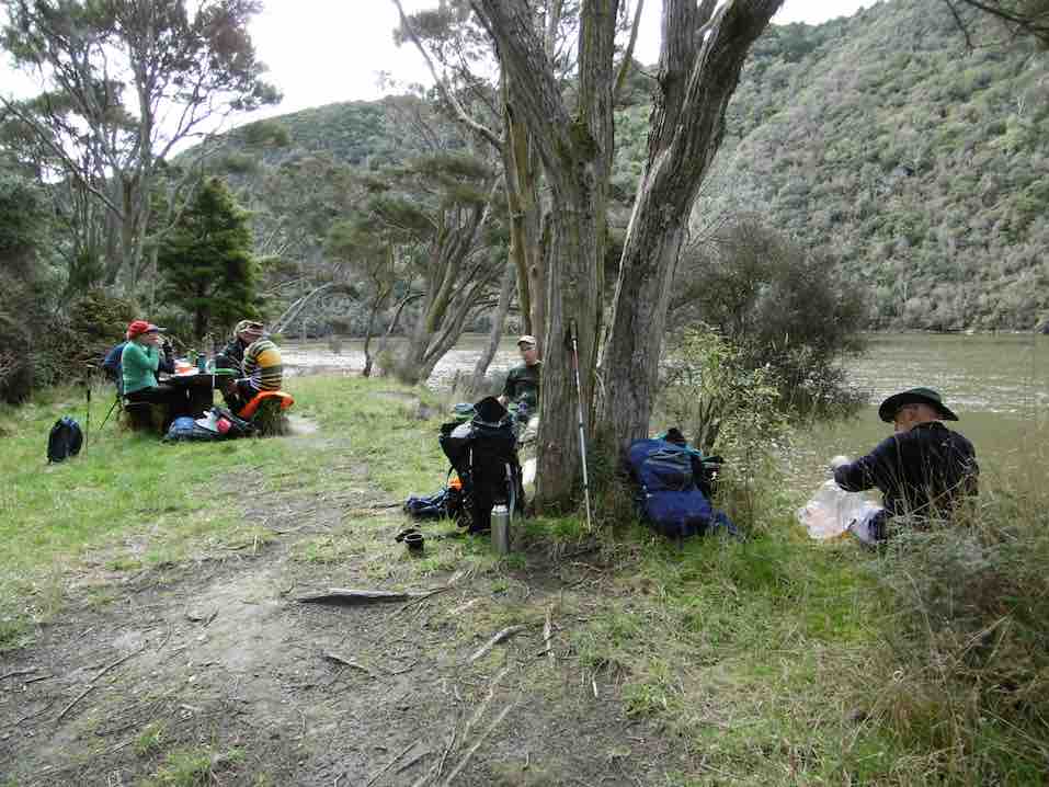
Two cars(six trampers) left Mosgiel at 8.00 a.m. rendezvousing at Cherry Farm before travelling together to reach the Bendoran Huts at 9.30. Morning tea was taken, and five eager trampers set out just after 10 am on the day’s adventure. One stayed in camp to heat water for showers later.
The day was sunny and warm enough. High cloud drifted across after an hour, but it remained hot. We stopped several times to take on water – and we were going downhill!
We descended down to Orbells Creek, and followed it for some distance, being on a grassy 4WD track all day. Tussocky hills surrounded us, with many interesting rocks, such beautiful country.
A mob of grand Hereford cows with calves (beef) moved in front of us for a time, before going up a side gully.
Eventually we came to the first ascent of the day, leaving Orbells Creek for a time, the 4WD track going up and over a saddle. At the top we had a short descent and then a climb up to a second saddle.
But from here it was downhill all the way to the cave. We met Barney, the Bendoran Farm Manager, out with his dogs shifting a mob of cows and calves – black with white faces this time (Angus Hereford Cross).
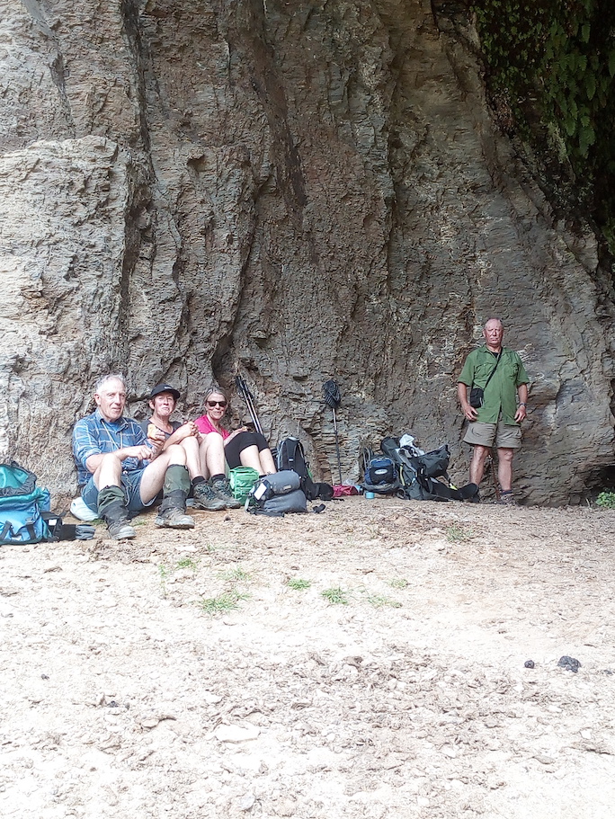
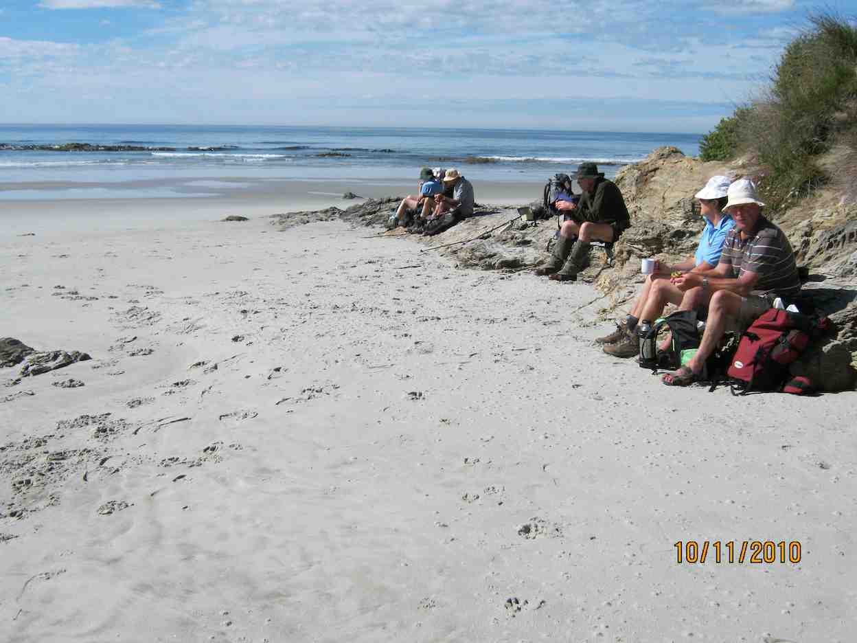
We came back to Orbells Creek by the cattleyards, crossed over, and in a few minutes were at Orbells Cave (with Orbells Garden flourishing in profusion in front (foxgloves). It had been hot work, but to our great relief found that it was very pleasantly cool in the cave. The time was 12.20 pm. We sat and rested for half an hour here, while eating our lunch.
In the cave for a cool place to have lunch. (Helen pic and caption.)
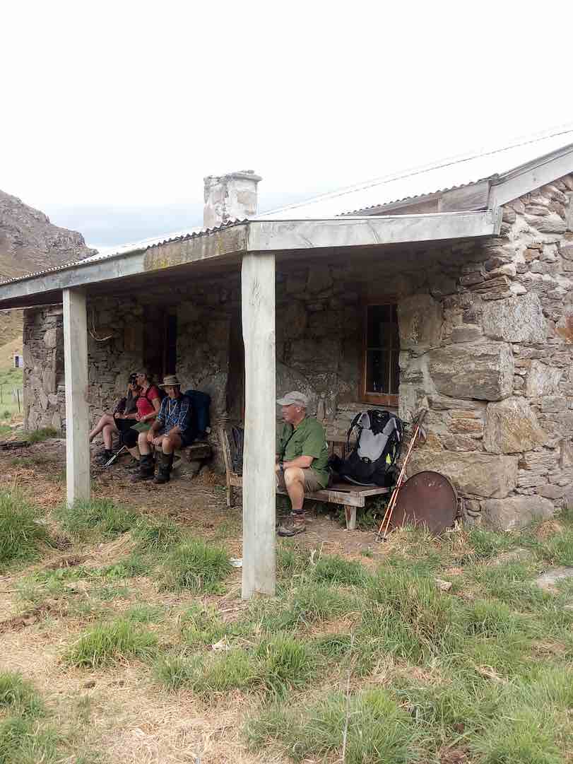
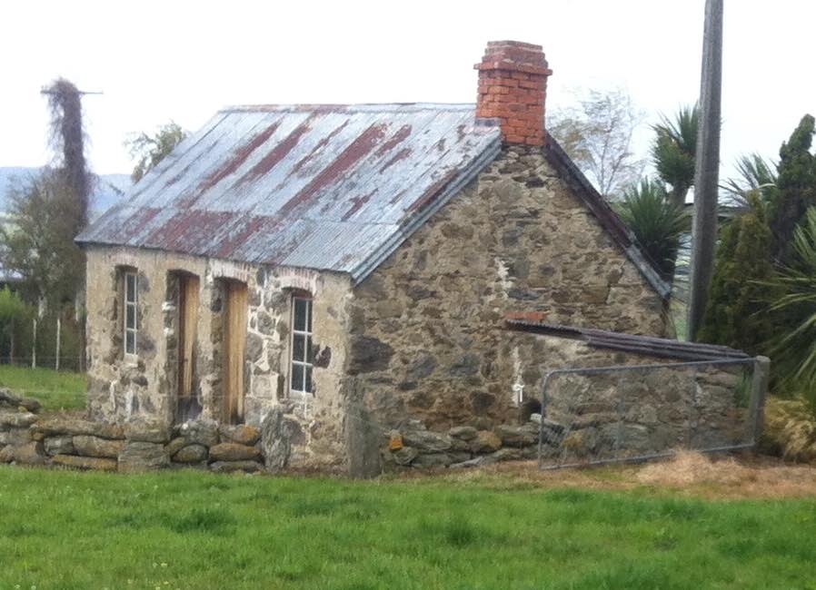
Fiddlers Hut was our next objective, about 2 km further on. Was we left, bird calls from high above the cave alerted us to the presence of a N.Z. falcon circling there. We saw it – or another one – later in the day, too. Crossing 3 O’Clock Stream, we arrived at Fiddlers Hut at 1.3. We admired the stone walls, very neatly constructed, and with a vey sound modern corrugated iron roof.
Fiddler’s hut. (Helen pic and caption.)
But sadly the interior had been badly neglected, birds obviously had been the only tenants for some years past.
As we began the homeward journey, a light and very pleasantly cool north-east breeze arrived to provide some relief, especially helpful on the uphill bits. Five tiny little Paradise duckings were on the water when we crossed back over 3 O’Clock Stream. All water bottles were refilled.
The same route was followed going back as we had travelled out earlier. It was a long climb back up to the two saddles. At the top of the first one, 10 minutes was well spent in resting, while taking on water, eating fruit, etc.
In time we came back down to Orbells Creek, and walked, the kilometres behind us, with an occasional brief stop (water).
One long hill awaited us – the climb out from Orbells Creek. The hill seemed to go on forever, but by putting one foot in front of the other, we found the top. But our legs were mighty tired now, and there was only a few hundred metres left to go. And so we arrived back at the Bendoran Hilton …
View of Bendoran huts. (Helen pic and caption.)
… just before 5 p.m. A good list down and rest seemed to be the logical thing to do now, so that’s what we did!
All five had thoroughly enjoyed the day. An energetic tramp to equal any other that our club has done. VERY SATISFYING.
Total distance was 20 km. Orbells Cave was approx. 8 km from Bendoran, and Fiddlers Hut a further 2 km beyond. Bendoral Huts are at an altitude of 500 metres, Fiddlers Hut about 200 metres. – Art.
On completing the tramp we had a lovely muffin and cup of tea before showers and liquid refreshments. Fire lovingly looked after by camp mum Jennifer. Eleanor our great organiser had Also arrived by this time.
Tea was prepared consisting of silverside, stuffed chicken, new potatoes, carrots and two salads. Dessert: chocolate brownie berries and yogert. All had bought some part of it.
Jill Arthur Phil Wyn and Helen the walkers.
It helped revive us. – Helen
75 km from car-park.
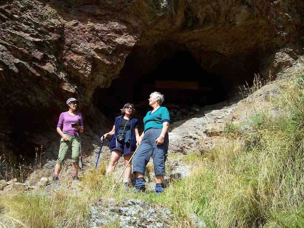
11. 8/3/2017. Trampers. The Gap, and ABC Caves. M. Leaders: Arthur and Eleanor.
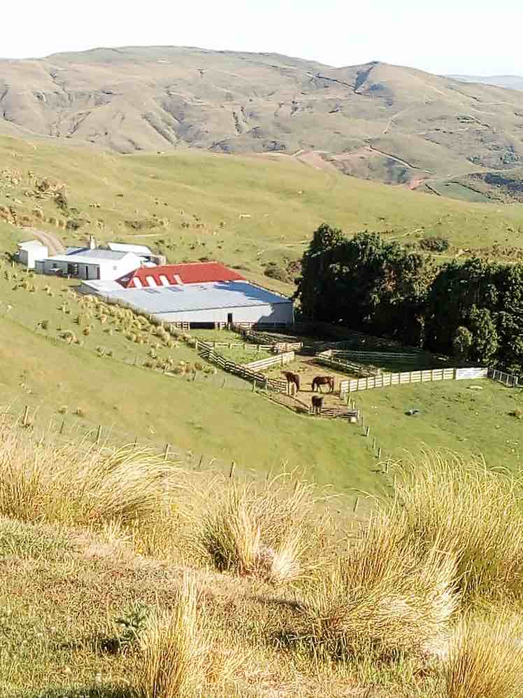
After a one and a half hour drive from Mosgiel, we arrived at Bendoran Huts. David Malloch the station owner arrived to welcome us and give us a brief history of the 5000 acre property.
Us with David Malloch. (Helen pic and caption.)
After unpacking and eating lunch, we walked in a cool s.w. wind, overcast with a few skiffs of showers to Mount Misery @ 714 metres.
Eleanor on Mt Misery. (Arthur pic and caption.)
A great view for those brave enough to tackle the wind on such a rocky peak. From there we ventured onto “Terry’s Knob” (refer Hamel’s book page 7:13), …
Terrys Knob. (Arthur pic and caption.)
… before returning to Bendoran for drinks and muffins. After lighting up the coal range to heat the water and apple crumble, we then enjoyed home baked Chicken, vege’s and salad. Next job was firing up the open fire, sitting round chatting for the evening.
Before 8.30am next morning we were up and away tramping in ideal conditions for 3 hours to the “Gap” @ 670 metres.
The Gap from morning tea stop. (Arthur pic and caption.)
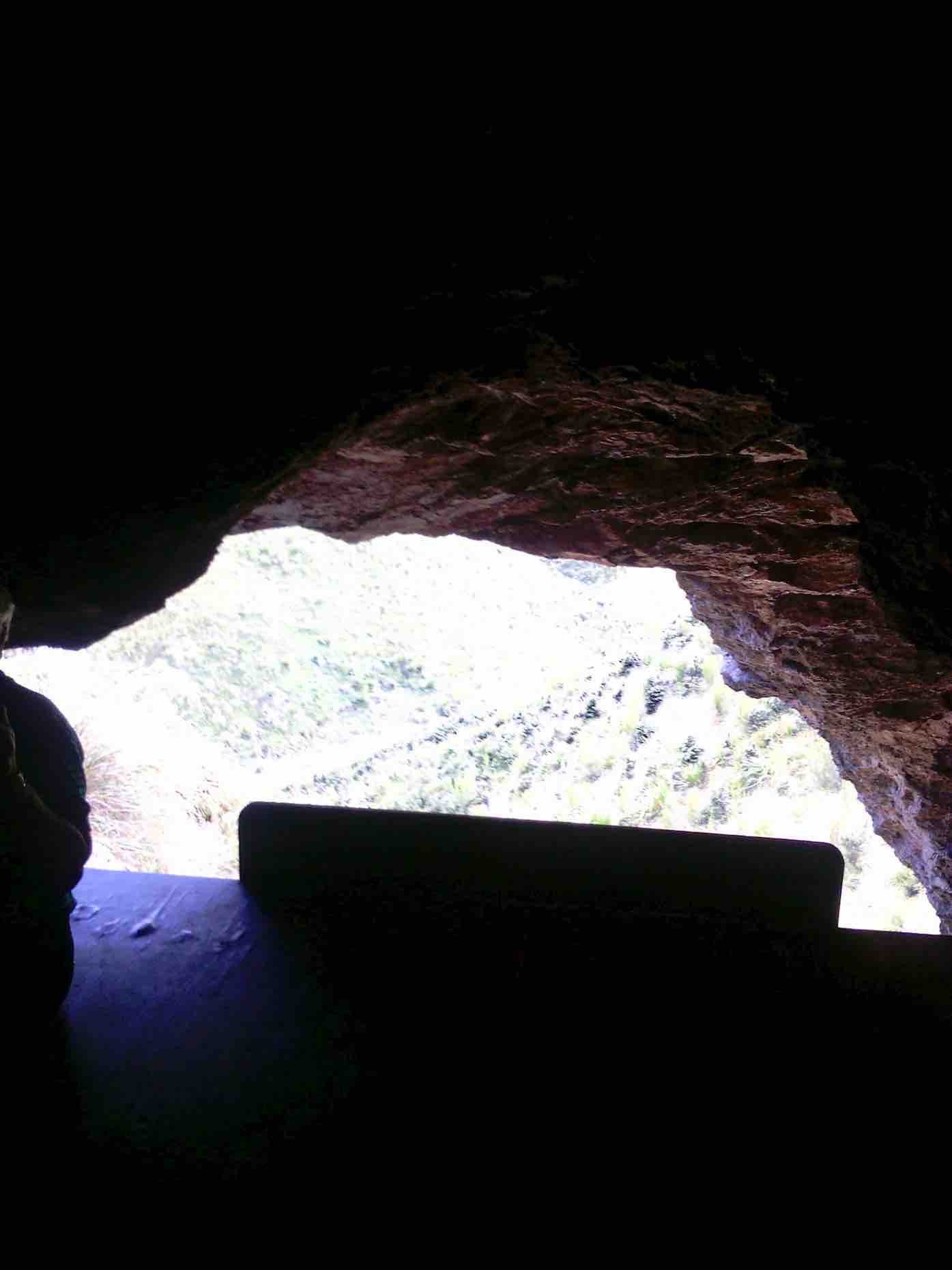
After numerous photo shots of surrounding valleys, peaks, ranges and the trig, we then headed down onto a new track, where after a lunch stop, we approached the A.B.C. Caves.
Helen Janine & Eleanor at abc caves. (Arthur pic and caption.)
After a challenging tramp, we were impressed by the cave interior, …
From in ABC cave. (Helen pic and caption.)
… but were disappointed the “visitors book” left no room for our claims to reaching this monumental milestone! We then had to return steeply uphill a little before bush-bashing a track across a gully to join back onto our original track, leading us back to our cosy “Bendoran home”.
Bendoran where we stayed. (Arthur pic and caption.)
Arriving back @ 4.15pm, we found 2 members (who returned without going to A.B.C. Cave) had the coal range going with the kettle boiling for drinks and a HOT shower!! All fresh and clean again, we dined …
Dinner. (Helen pic and caption.)
… in front of the open fire on beef casserole, new potatoes, peas and salad, followed by brownie and peaches—-not your average tramping food, and certainly above standard accomodation.
It was an exceptional tramping trip for Arthur, Neil, Carol, Helen, Janine and Eleanore, with new tracks and experiences for some of the party. – Janine and Eleanor.
10. 25/3/2015. Trampers. ABC Cave from Bendoran Huts.
On a day when the weather was a bit suspect, we arrived at the Bendoran Huts to see fog in the valleys, but clear around the tops. Because of the distance travelled to get there, we decided to have a late morning tea break,…
Late morning tea stop. (Ken pic and caption)
…at one of the high points on the track. After this, we walked around the road [farm track] to a point at the head of the valley leading to ABC cave, where we arrived for a late lunch in sunshine.
After lunch we more or less retraced our steps back to the cars, with a couple of refreshment stops on the way.
The day turned out ideal for tramping, with just a trace of breeze at times, a little bit of sunshine for lunch, & the temperature just right, & the fog actually lifted during the day.
Next time we do this, it would be a good idea to start early, as it’s a long way to drive, & the road in is all narrow gravel. – Ken.
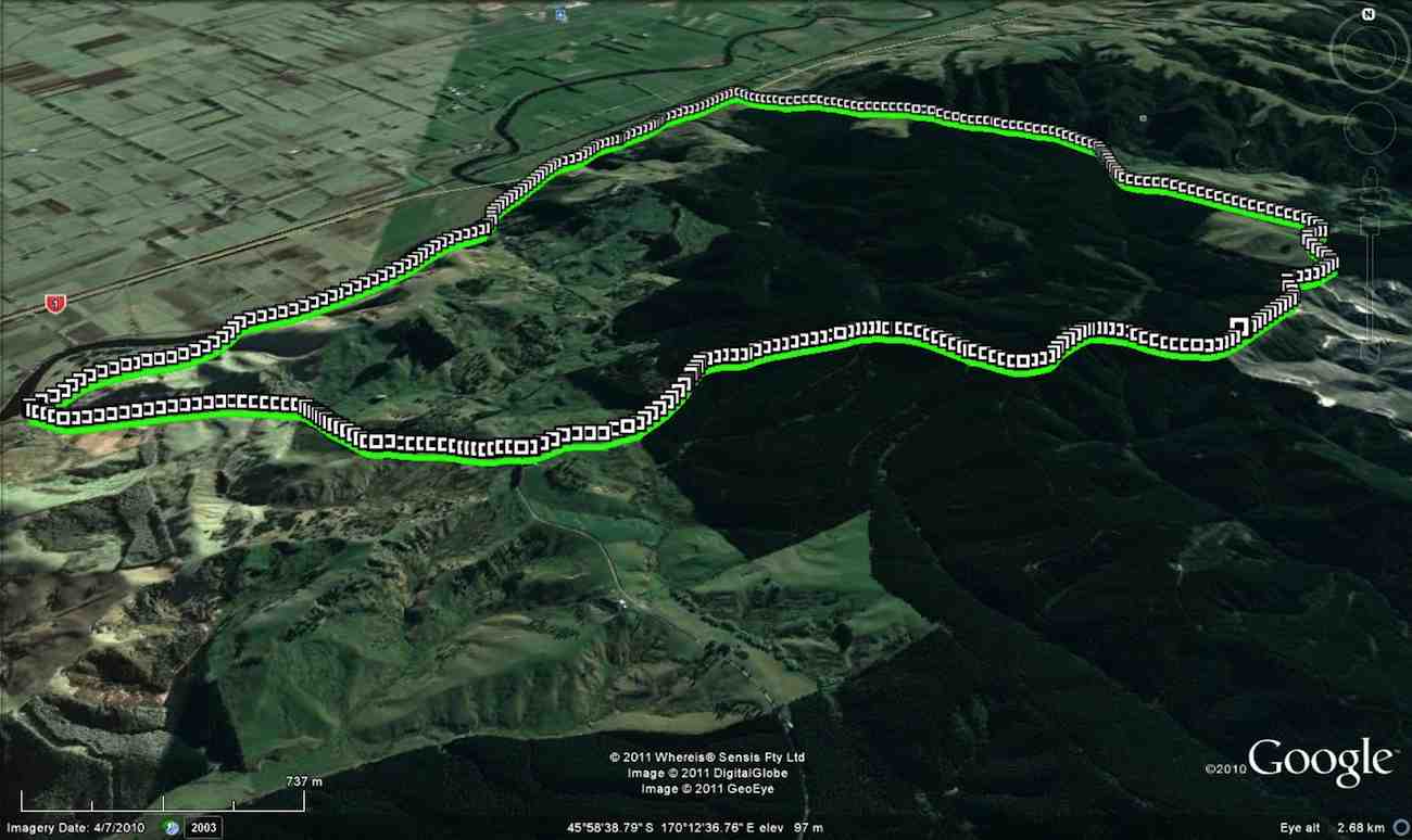
9. 8/5/2013 Trampers. ABC Cave from Bendoran Huts.
GPS of route, courtesy Ken. We walked 13.6km, 4hrs moving, 2hrs stopped, total ascent 839mtrs, max elevation 701mtrs.
There have been MANY new tracks bulldozed in around the area, making it very difficult to know which track to take. The original idea was to go to the Gap, & then down to the ABC cave, but we were running out of time, due to the distance travelling there, getting held up for about 1/4 hr by a very large mob of sheep with no sign of humans or dogs anywhere. Plus as we didn’t know where to go, we ended up bush-bashing our way down a ridge on the top side of the bush, as you can see by the Google pic. We eventually got down to the DOC track leading between the GAP & ABC, so just carried on to ABC, had a quick drink/snack, & left there at just on 2pm. Then we struggled up another ridge that was a lot clearer than the one we had came down, but it was steep, & it took us an hour to reach the top. From there, it was a relatively easy walk back to the 4wd track that we had left to go down past the bush. One or two of the climbs on the track back to the car were certainly a bit ‘trying’, but we all made it back to the cars OK, & after the drive back to town, got home at just after 6pm.
George didn’t go down the ridge to the cave, so he sheltered for a while, then wandered back to the cars, leaving suitable signs that he had passed that way. There were 7 of us in the group, one of whom was heard to say on the way in, “you think this group is a serious walking group?” so by the end of the day when I asked if they still didn’t think we were a serious walking group, the answer was ” that was a serious walk”. – Ken.
8. 22/2/2010. Trampers. ABC Cave from Bendoran Huts.
GPS of route, courtesy Ken.
It had been many years since any of us had done this tramp, and memories were hazy. So much so, that we parked the cars at the end of Blucher Road, mistaking the shearing shed location there for the actual Bendoran Huts site about six kms further on. So we walked the farm 4WD route to the huts, instead of driving it!
A hut ruin on the route. The fog was round us all the way. But it was dry! A fog, not a mist, as one of us distinguished.
An pic of interest on the way.
Lunch across from one of the Bendoran huts. (Ken pic)
Lunch in lee of the hut. (Ken pic)
We walked on beyond the huts on the track we should have originally started on, for a further km, but there was nothing to be seen through the fog which accompanied us all the way, except for only one brief respite. We then retraced our steps to the cars. About 14 km walked that day. – Ian
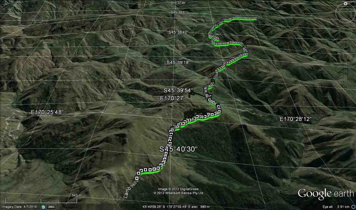
7. 30/1/2013 Trampers. Lamb Hill to three o’clock creek. Old Stone Hut. Orbells Cave. Medium+.
Lunch at the old hut.Orbells Cave from the track.Running repairs before we start the real climb back out
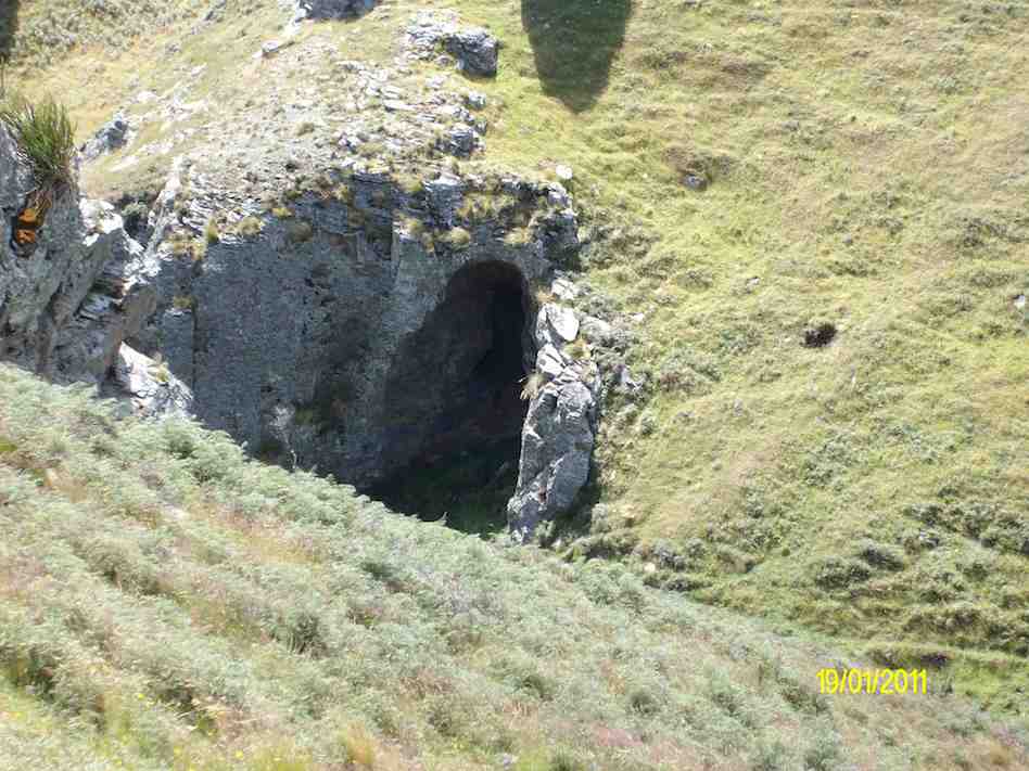
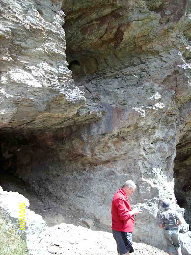
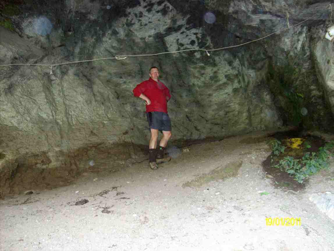
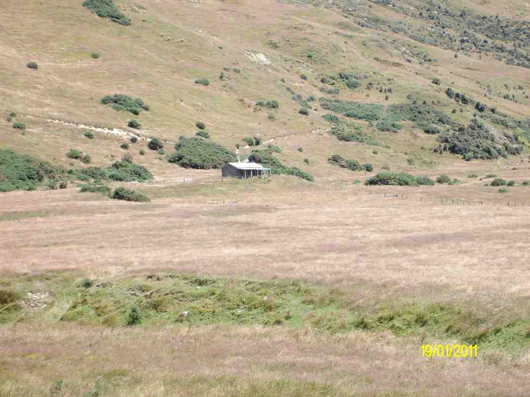
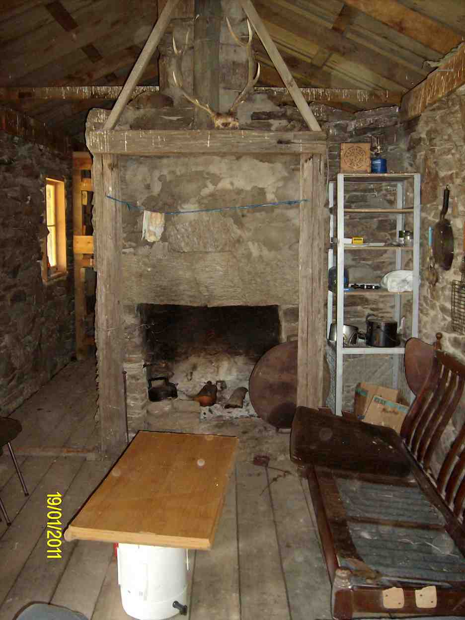
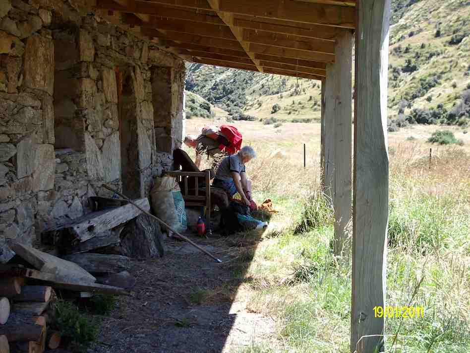
6. 19/1/2011. Trampers. Lamb Hill to three o’clock creek. Old Stone Hut. Orbells Cave. Medium+.
Small scale GPS of route, courtesy Ken.
If you look closly at the small scale pic, you can see the shed at the Nth. end of the airstrip, right at the bottom of the pic where the track starts. As you can see from the spacing of the GPS squares, we were still driving for a while till the squares become very close together. this is where we started to walk from. You can also see the track going off to the left of the airstrip at it’s south end, going down to the ford where the track peters out, & then starts again on the other side. That is where the 2003 tramp went (see below).
Large scale GPS map of route, courtesy Ken.
The large scale pic shows the decent via the wrong ridge, we should’ve been one over to the right. Anyway, we ended up just a short distance from Orbells creek, so walked into that valley, & up to Orbells caves which is the track on the RH side of the pic.
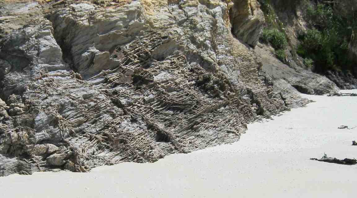
Cute cave we found on the way down to Three O’clock Stream. (Ken pic)
Orbells Caves. (Ken pic)
Dermot in the obviously lived-in cave. (Ken pic)
We then retraced our steps back to Three O’clock Stream, and went downstream to a crossing, where Dermot and I went to the old hut to have lunch (which is the track on the left side of the stream in the GPS pic).
Hut on the other side of Three O’clock Stream. (Ken pic)
Relaxation area of the hut. (Ken pic)
Then after walking across the river flats, we struggled up the very steep hills back to the cars.
The weather was fine, but VERY windy, and I nearly lost my footing a couple of times coming back up the steepest parts. BTW, the hut is not on Lambhill Station, it’s on the neighbours property.
Everybody did very well, including George, who didn’t go to the caves, along with Hazel. They just went over to the hut to have lunch there.
Hazel packing prior to leaving. (Ken pic)
George got a dose of cramp on the way back up the hills, but managed to overcome it ok, and carry on. – Ken.
5. 21/5/2006 Lamb Hill to three o’clock creek. Old Stone Hut. Orbells Cave. Medium+.Leaders: George, Keith, Glenice, Hazel
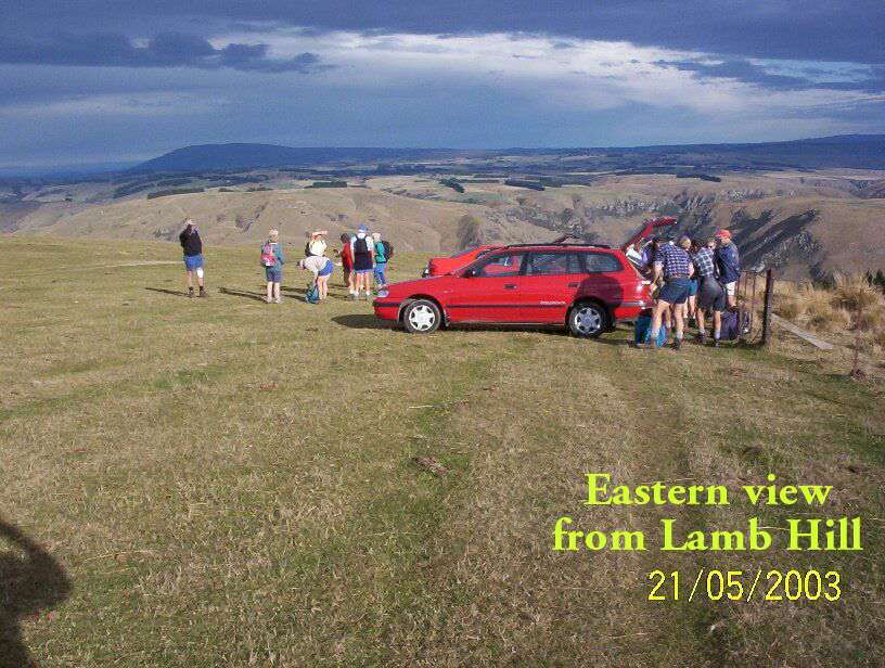
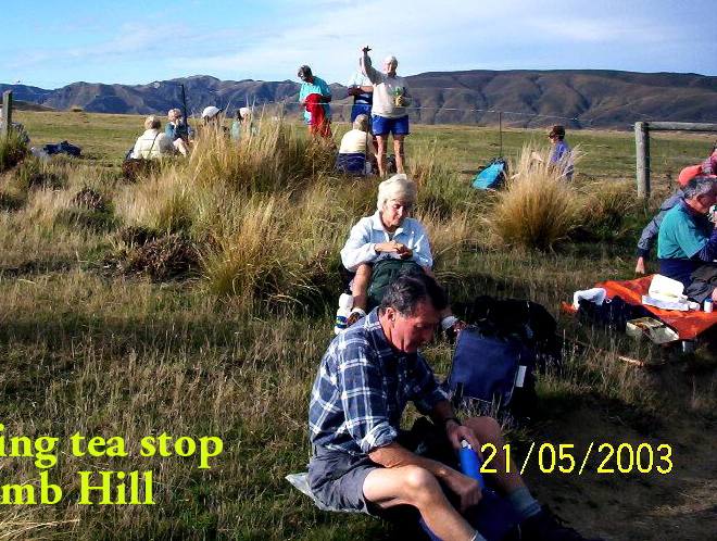
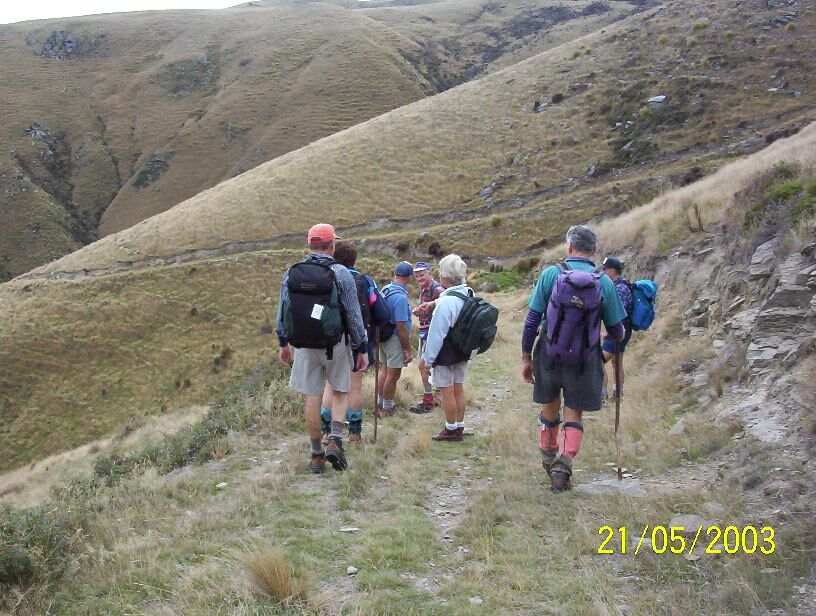
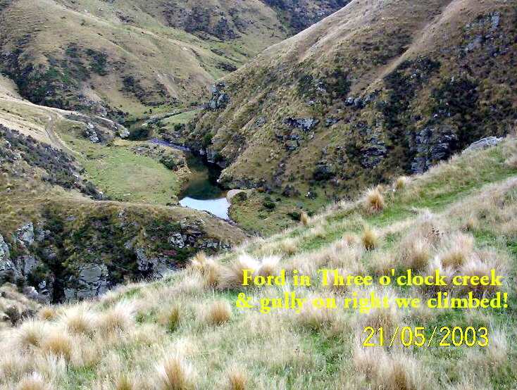
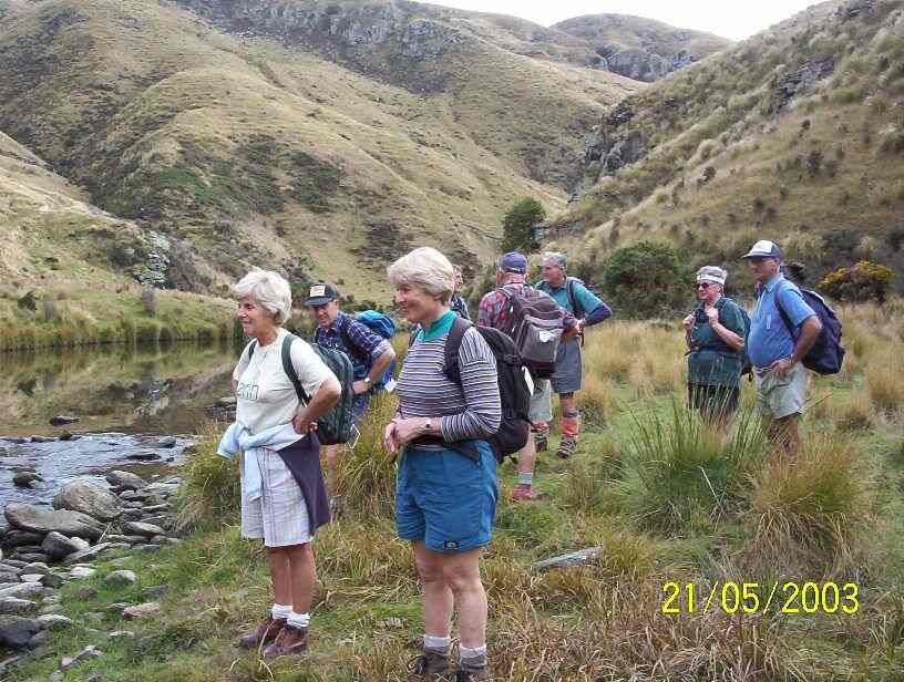
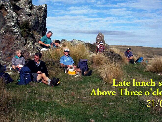
4. 21/5/2003. Both. Lamb Hill to Three O.clock Creek. Medium. Leaders: Wendy B, Bob H, Nancy & Molly
View when we first arrived.
Morning tea break.
Descent to creek
Three O’clock Creek
At creek ford.
Lunch at top of climb. Pat, Lex, Doug J, Evelyn, Doug M, Bob, Arthur.
3. 17/5/2000 Lamb Hill, Three O’Clock Creek. Leaders: Wendy, Colleen, George
2. 15/4/1998. 3 O’Clock Creek, Lamb Hill. Leaders: Nancy, Wendy B
1. 8/11/1989 Lamb Hill to Three O’Clock Creek and old stone hut. Harder grade. George, Mary M, Molly, Catherine
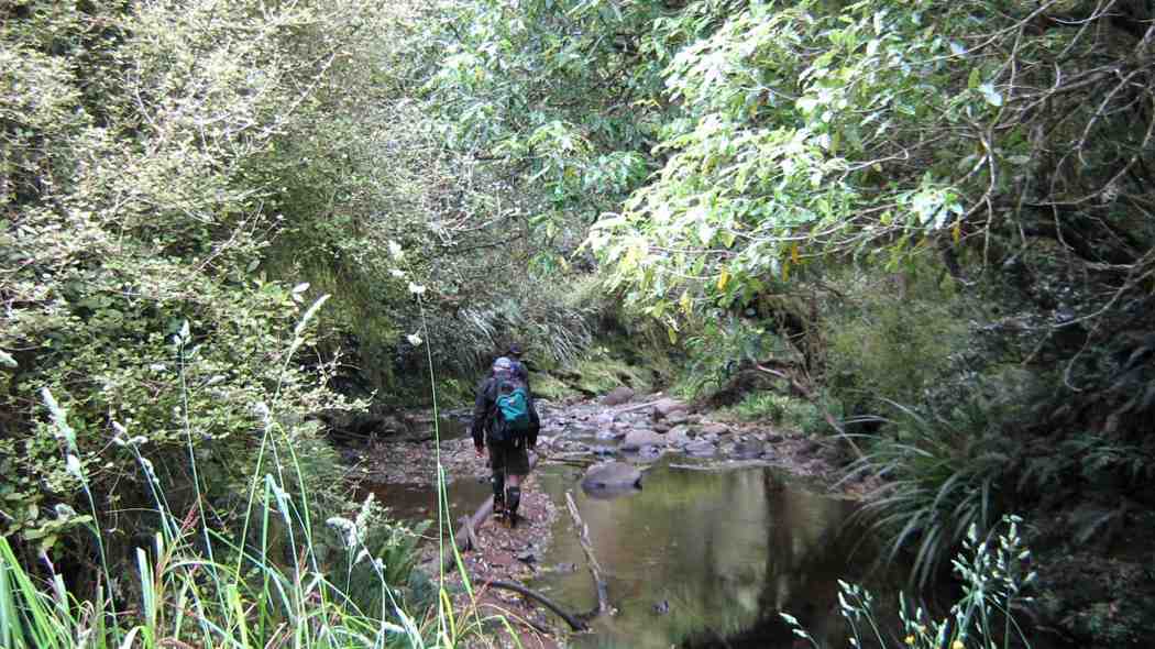
Nine trampers left the car park and after delivering one vehicle to the tramp end,we left the car park at Semple road at 9.50am.
We made good progress on an times slippery and steepish track and stopped for smoko at 10:15.
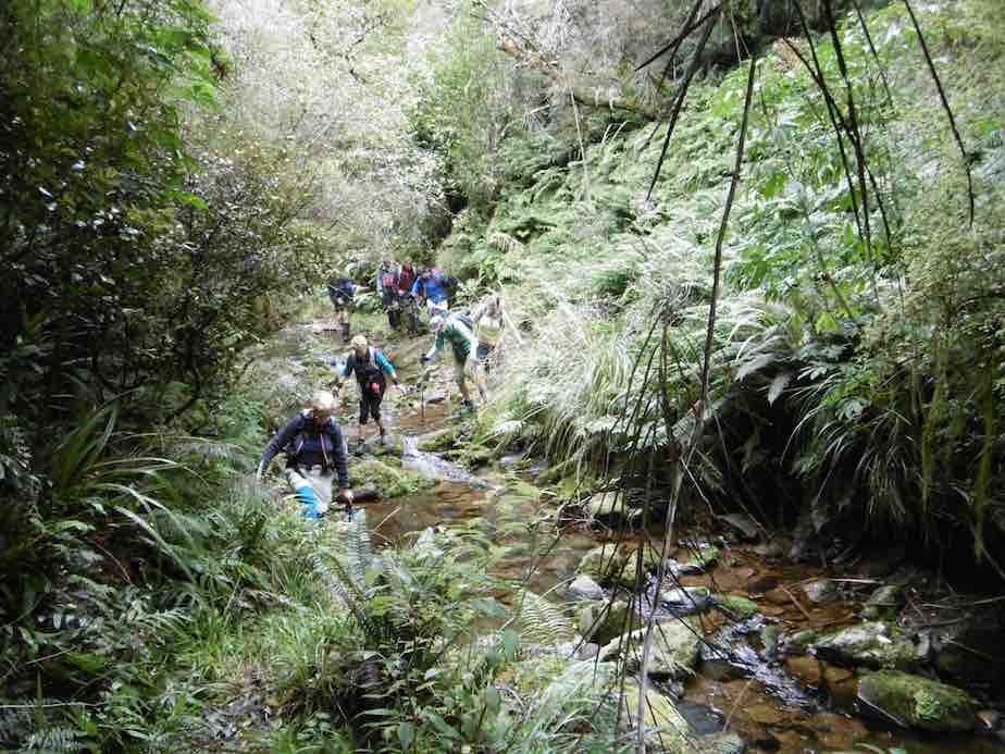
As we followed the old pipe line down, the creek crossings became more frequent…
River crossing. (Helen pic and caption.)
…and the track more muddy.
Lunch was had at 12:15…
Lunch. (Helen pic and caption.)
…and soon after the rain began, so it was on with the coats.
The hairy goat and his kids. (Helen pic and caption.)
Every one was quite wet by the time we got to Evansdale Glen but it was a good tramp and a great coffee at Blueskin cafe.
Distance Semple Rd car park to Evansdale walk bridge 11.6 km – Keith
7. 16/3/2016. Trampers. Black Gully Dam, Careys Creek, Evansdale. Leader: ?
On a day that didn’t promise much weather wise, we had 9 trampers on the Careys Creek tramp. For a change, the women outnumbered the men as well !!!
After doing the car shuttle thing, & having morning tea,
1 Packing up after morning tea (Ken pic and caption)
we all met up not far down valley from the Black Gully Dam,
2 Black Gully dam (Ken pic and caption)3 Black Gully dam (Ken pic and caption)
& continued on at a leisurely pace,
4 track (Ken pic and caption)
being careful of the quite slippery conditions.
The many creek crossings …
5 Crossing the creek (Ken pic and caption)6 An easy crossing (Ken pic and caption)
… were also treated with great care, as the boulders were mostly treacherous to stand on. It was pleasing to see the new much larger orange triangle track signs that have been installed along the places where it is necessary to walk the riverbed.
We had lunch alongside the creek at a suitable place, & then continued on downstream, where we met up with a quite a large group of Kings High School boys with two supervisors. They were making a lot of noise, & could be heard from some distance away. We spent the rest of the trip mixing with these boys, as they would race ahead, then stop to pick Blackberries, which they were going to make into a Blackberry Pie later that night.
We had some of our group who had not done this tramp before, & all agreed that it was a good day, which most of us finished off with a coffee & chat at Waitati.Walked 11.7km
3.6km/h
3h 13mins
climbed 173m – Ken.
6. 1/10/2014. Trampers. Black Gully Dam, Careys Creek, Evansdale.
Careys Creek track was the destination for this tramp, & 6 trampers turned up for the day out. We drove to Evansdale, & left one car there, & then drove up to the top of the track at Black Gully Dam track. Morning tea was taken at the wooden seat part way down this track just before the steep steps leading down to the creek. The dam was inspected, along with the old hut that is situated there, & then we made our way downstream over the many slippery creek crossings to a late lunch spot, not far from the signposted junction of Rongomai track. We then made our way back out to Evansdale Glen via the ‘new’ track, where two of us left the others to have a spell, & a look around the area, while we went & retrieved the two cars, so we could ferry everybody back to town. Once again, this tramp had not been done by some, & for others it had been a long time [many years] since they had been there, so even although most got wet, or damp feet, it was enjoyed by all, & the weather was brilliant !
We walked 10.8km
2h 45m moving time
ave 3.9km/h
climbed 163m – Ken.
5. 18/9/2013. Trampers. Black Gully Dam, Careys Creek, Evansdale.
Seven trampers gathered at the top of the Careys Creek track after leaving a vehicle at the Evansdale end. The descent through the bush was pleasant easy going, with a stop to view the Black Gully dam and then another in a patch of sunlight for morning tea, where George shared his birthday goodies.
The creek was low so the numerous crossings were made with dry feet, except for one member who measured her length over slippery rocks and now sports a bruised cheek and knee, not to mention scratched specs.
The party then split, with three opting for an early lunch and the rest pressing on to the Rongomai junction. Here the others caught up again, for an easy ramble out to the road. – Judy
4. 26/1/2011. Trampers. Black Gully Dam, Careys Creek, Evansdale. Ken, Ian, Sabina.
GPS of Careys Creek track route, Semple Road to Evansdale, courtesy Ken.
With two cars between only three of us we nevertheless decided to do a car shuttle between Semple Road and Evansdale and to do the entire Careys Creek track. Ground conditions were wet and slippery, which would have ruled out the steep Honeycomb track anyway.
We were reminded again of just how many and how steep the steps down to the dam were. But they are well benched-in, so not too bad.
One of the more level parts of the track down to the Dam.
We took Sabina up to see the Dam and the slightly greater overflow didn’t auger well for the many creek-crossings and creek-wadings ahead, where the track is just the actual creek-bed. But again, things weren’t too bad.
The Dam waterfall was slightly heavier than usual.
Along the way we met up with several small groups of the Green Hut Track Group. They have almost completed clearing the entire track. Bravo! We were delighted to find several areas modified. These were where difficult parts of the track had, where occasion warranted, been either better benched, stepped or even completely re-routed. Again, bravo!
And then, just past the foot of the Rongomai, behold, a track now mown where at all possible, all the way down to Evansdale Glen.
An example of the mown track nearer Evansdale.
This had been the first time the club has done the entire 10 km of creek in a long time. And it felt good. – Ian
3. 31/12/2009. Holiday tramp. Black Gully Dam, down Careys Creek some distance and back. 4 hours. Ian, Ken, George.
The weather forecast had promised a fine day but it turned out overcast. Rain on the previous wet day had left the track muddy and slippery necessitating great care not to slip. Exposed parts of the track produced lush rank grass and buttercups, and rain during the day left steep grassy slopes extremely slippery. The track is well-cleared for a considerable distance but from near its highest point and onwards, it was much more heavily overgrown than when we did the recce. First of all, of course, we climbed the track to the old Seacliff dam.
Looking across dam. Ken, George.
Dam and overflow.
Peering through foliage to determine extent of dam pond.
Then it was down the Careys Creek old pipe-maintenance track. As mentioned above, this part was well cleared.
Track down Careys Creek. George, Ken.
Of course there were very many stream crossings, some entailing a walk quite a distance down the creek before entering the track again. These were well-marked with indicators suspended from branches overhanging the stream-bed.
One of many stream crossings. George, Ken
There was a restriction on time as George had belatedly discovered he had to be back home mid-afternoon, so although we managed a short-notice early 8.15 a.m. setting out, we were unable to make the full distance down to the Honeycomb Track turn-off before having to turn back. A memorable part of the tramp was a (unnoticed at the time but decidedly stinging later on and into the night) brush with some concealed onga-onga, Ken on his left wrist, George on a finger and Ian on his right knee. But all in all, a very enjoyable way to finish the old year off. – Ian
2. 5/12/2009. Recce of Black Gully Dam, Careys Creek, Honeycomb, returned Mountain Road, Semple Road. 5.5 hours. Ian, Keith, Glenis.
Track is well-cleared for most of its length.
The road-walk back is about 8 km.
1. 19/10/1994 Evansdale, Black Gully Dam/Seacliff Dam, Double Hill. Medium. Leaders: Ria L, Marie F, Jack R, Bob H
No. 4 on old hardcopy list of 113 club tramps. “Blacksmiths Flat. Hindon Stn. Bob Heenan. Farm. Lambing.”
No. 14 on old hardcopy list of 113 club tramps. “Hindon. Ardachy to River. D Graham. Haggie. Farm.”
Distance from carpark: 33 km.
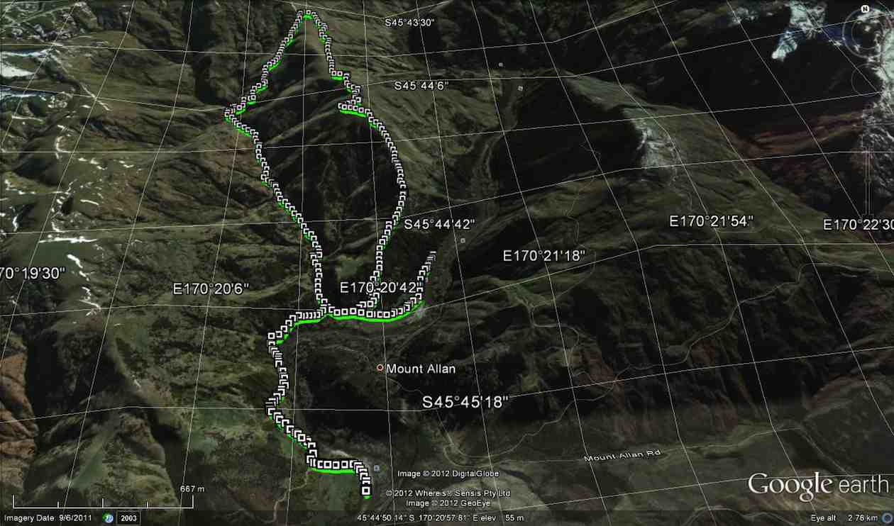
13. 31/5/2017. Trampers. Ardachys – Blacksmith Flat. M. Leader: Arthur.
The weather wasn’t great, but good enough. 8 trampers out today, including one new member – welcome Phil. We travelled in low cloud all the way from Outram to our parking spot at Ardachy, but from there on we could clearly see down into the Taieri gorge. An improvement was expected though.
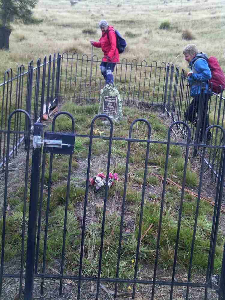
We first went to inspect the nearby “Lonely Grave” of Mr Don Graham.
Family grave in Ardachy Station. (Helen pic and caption.)
The Graham family have been on Ardachy for 120 years – check our club website for more details about the “Lonely Grave”. [Scroll further down this post for this. – Ed.]
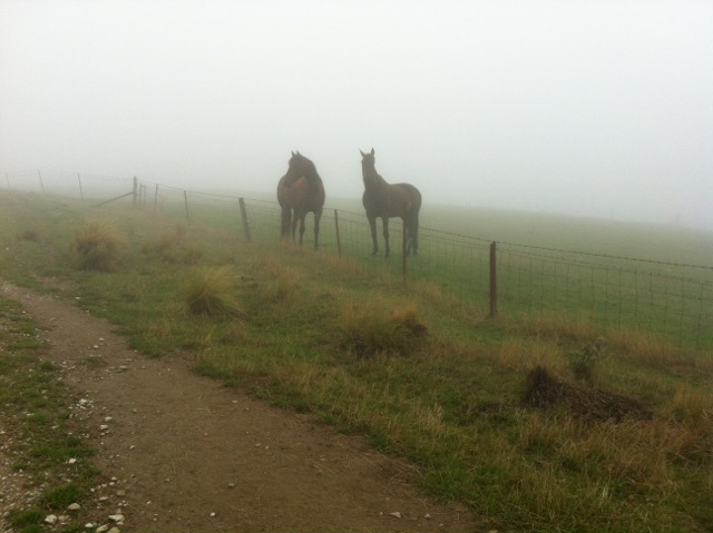
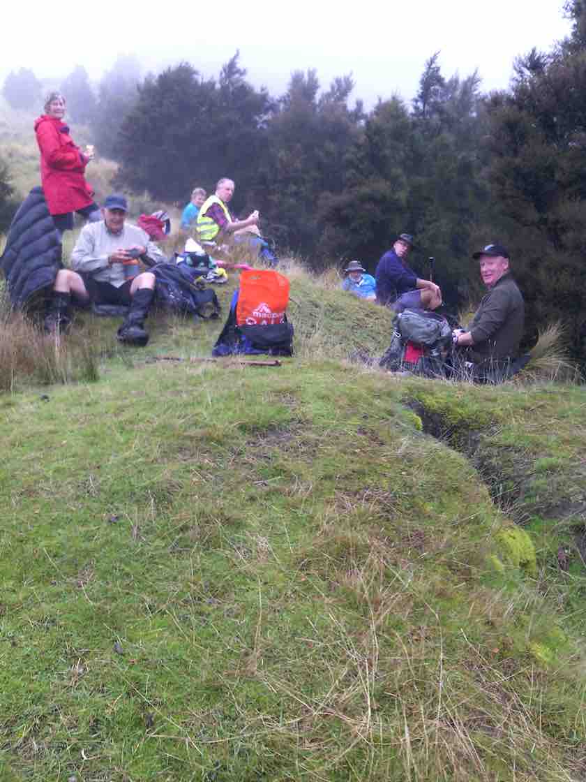
A short stop was made in the tussock for morning tea, before continuing on down hill. 4 friendly horses greeted us when we reached “Blacksmith Flat”, beside the Taieri river.
Four friendly hores came to visit. (Helen pic and caption.)
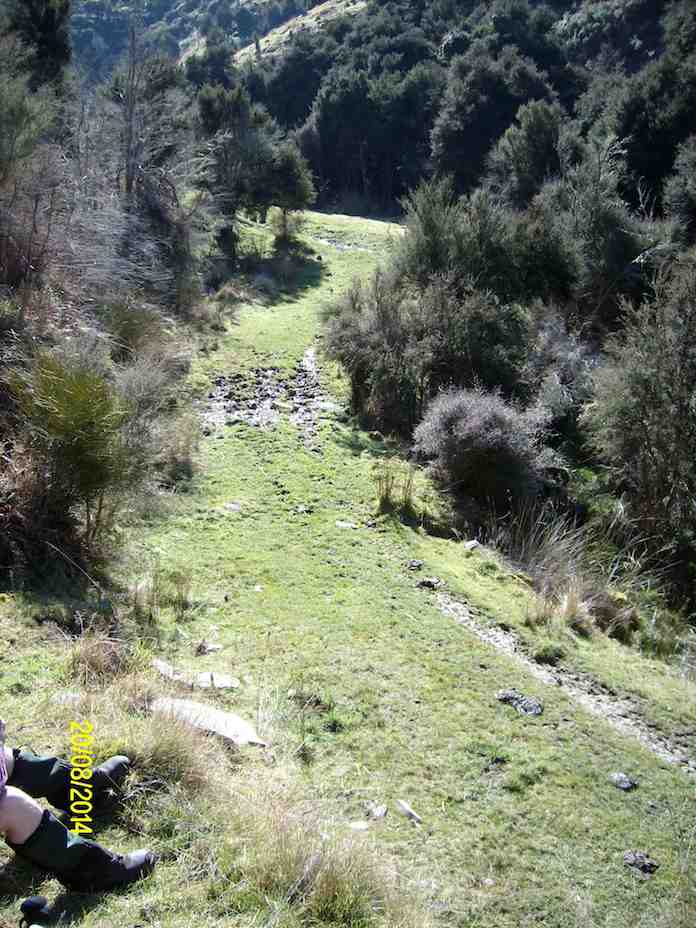
We followed the “Flat” upstream for some distance, before turning and retracing our steps.
Mount Allan railway station was directly across the river from us, but no train today. It was a lovely and peaceful spot there, the river making the only noise, except for 6-8 fantails flitting around.
The return journey was up “Blacksmith Gully”, and we travelled some distance before stopping for lunch.
Lunch. Second photo I missed was a lovely view while no fog. (Helen pic and caption.)
The cloud had come down now, with no more than a couple of hundred metres visibility, and remained so until we returned to Outram.
Incidentally, the names “Blacksmith Flat” and “Blacksmith Gully” go back to the gold mining era around 1863. Gold was found in some quantity in the area, but after 2 0r 3 years the “rush” was over.
The leader decided that, as it was a relatively short tramp today, we would return by a slightly more strenuous route than had been planned originally, to give everyone a bit of a workout. All thought this a great idea, and enjoyed the extra bit. There were no complaints anyway!
We arrived back at the cars before 1.30 pm, having walked 8.8 km. The vertical difference in altitude between the river and the cars was approx. 250 metres.
On returning to Mosgiel we stopped in at Wals for hot drinks, sitting in front of the fire to enjoy them. It made a very good end to the day. – Art.
12. 20/8/2014. Trampers. Ardachy Station. Blacksmith Flat and Gully. Medium.
The tramp on Ardachy Station to Blacksmiths gully was not a very long walk, but the climb out at the end of the day means that it is not all easy going. 4 trampers turned up on the day, & we set off to where we park the cars, just around the corner from the lonely grave site above Hindon. As it was 10 AM when we arrived there, morning tea was taken before we set off on the tramp along the top of the ridge. The weather was fine, with a very slight, cool breeze, & some frost & frozen puddles underfoot. We spent some time down by the river looking at the destruction among the willows, caused by flood waters, & we were also amazed by how high up in the trees the flood debris was deposited. [probably about 6-7 mtrs. above the river level]
As it was only around 11:20 by this time, we set off along the picturesque valley floor, until we came upon a good sheltered, sunny spot for a lunch break, …
Lunch spot (Ken pic and caption)View from lunch site (Ken pic and caption)
… not far from where we had to cross the stream, & start the climb back to the car. After a leisurely lunch, we moved on until we came to the old mine shaft, which we climbed up the bank to inspect. the fence around it is slowly getting wrecked as time goes on, but the bush growing around the hole is still protecting it well. After this, it was just a matter of climbing back to the car, which seems like a daunting task when looking up from the valley floor, but it only takes around 1/2 an hour to climb out.
We all agreed it was a good walk, with the area being new to two members of the party.Walked 6.44km
moving time 1hr 45min.
ave 3.7km/hr
climbed 326mtrs. -Ken
11. 8/8/2012. Trampers. Ardachy Station. Blacksmith Flat and Gully. Medium.
The pic below shows 3/4 of the party at the point on the ridge where on previous tramps we had crossed from the river side of the ridge to the other. We arrived at this point by keeping to the ridge and avoiding the river-side track. Here we stopped for morning tea.
There had been a little drizzle to this point, but from here on, the weather and the views cleared to give us a good day out. To those who remained at home, we proved that you make your own luck. Bravo.
The cross-over point on the ridge taken on previous tramps.
And from this point we still kept to the ridge and found a clear crack down the nose of the ridge to the river flats. Club pioneers! I think we’ll always wish to do the descent this way, now. We explored Blacksmith flat, noting a new electric fence put in no doubt to keep stock away from the river.
We then took the track down-river that leads to the further flat reached from the Mains Road tramp, and lunched, seated at the lovely BBQ area. Then it was back to take the Blacksmith Gully route up to the car.
The writer had forgotten just how far we have to ascend the gully floor before locating the FWD track that takes us back up to the car.
Ascending Blacksmith Gully
Then it was just a 25-minute hard-breathing one-foot-in-front-of-the-other climb, after first subjecting Judy to the obligatory mine shaft sighting.
Back at the car at top of ridge
And so back into the car and out along a road, good and smooth, but a bit sloppy from the earlier drizzle. A good try-out for Ian’s little new/old Corolla. – Ian.
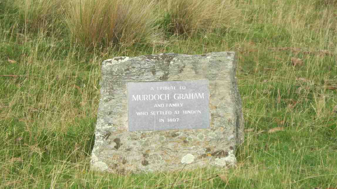
We passed by the gravesite dedicated to Murdoch Graham and went onto the FWD track ahead.
Memorial Site
This gradually descended before eventually climbing again to cross the steadily descending ridge on our right.
Climb
At this point, through a gate in the fence on the ridge crest, we took a track descending on the ridge’s right, although the Google Earth map does show a track going on down the ridge to the bottom.
Ridge
The track to the right led us down into Blacksmith Gully which we pursued down to its end on the Taieri River.
After a wander round, we took the track going on down the river to lunch in warm sun by the water on a grassy flat.
Lunch by Taieri River (Ken pic)
Retracing our steps,
Walking back after lunch (Ken pic)
this time we went further up Blacksmith Gully till we took a track that at its first zigzag encompassed the fenced off mine shaft and threw down stones to gauge its depth.
Then it was steadily on up up up to regain the cars at the track’s top. – Ian.
Postscript: (A bit of Club history, recollected by George and confirmed by Bob Heenan.)
Daphne, then President and founding member of the Club, was also a member of the Dunedin Photographic Club. She met Don Graham, Ardachy Station owner there and got talking. An upshot was that he invited the Club to do a tramp on his land. This the Club did in 1989. They parked where we still park today, and followed the ridge from there down to the Flats. An arduous effort, following the ridges ups and downs. (We follow an easier 4WD track today.) On their return, club members were surprised to find Don by the cars, with a billy boiling over a fire.
“22/8/90. Members of Taieri Recreational Tramping Group waiting for billy to boil after tramp. Ardachy Station, Hindon, Taieri Gorge.” (Ian pic, scanned from Peg Chisholm photo collection.)
He invited them to get their mugs out and filled them with tea. A very happy introduction to what has been a satisfying series of tramps there over the years.
Post-post-script: – from NZ Herald Sunday April 3 2011.
It took a long battle with bureaucracy, but an Otago farmer has been returned to the soil he worked on all his life.
Don Graham, 72, was buried on his Ardachy Station property at Hindon this week in a ceremony attended by more than 120 family members and friends.
A bagpiper played as Mr Graham was interred in the place he had chosen on the property, among rolling hills and wind-swept tussock.
A piper plays as Don Graham’s casket is carried to his plot beside the Hindon station road overlooking his farm, Ardachy station, and the Taieri River. Picture / Otago Daily Times
Obtaining permission for the burial was a long legal process, including gathering affidavits and securing consents.
Funeral director Robert Campbell said it was the first time in 40 years he had been involved in a home burial.
“It’s very uncommon, because you have to get permission through the Burial in a Special Place Act,” he said.
The law stipulates that people must be buried communally if they lived within 32km of a cemetery.
But it allows for home burial “if there are exceptional circumstances making the burial of that body in that place particularly appropriate”
Mr Campbell said: “He was granted permission by the Ministry of Health four years ago, because he and his forebears had farmed the land for 105 years and had a close association with the property.”
The grave site looks over Ardachy Station towards the Taieri River.
“It’s a lovely spot in the hills overlooking the valley,” said Robin Gamble, who delivered the eulogy at the funeral.
Mr Gamble said Mr Graham was passionate about the area in which he lived, and always wanted to be buried there.
“But it was very difficult and involved. He had to get 10 affidavits from people to support his request, as well as regional council consents.”
Mr Graham lived all his life in the area, taking over Ardachy Station from his father-in-law in 1956.
Mr Graham’s widow, Leila, said it was an emotional day for her and her two sons.
“He spent very little time away from the farm, and he would have been so proud. We can look out the back window of the house and see him down there now,” she said.
Mr Graham enjoyed a laugh. On April 1, 1991, he appeared on the front page of the Otago Daily Times with a “shabbit”, a creature he claimed to have bred from a merino sheep and a rabbit.
The April Fool’s Day trick was so successful people were still ringing him up months later to ask about breeding stock.
– OTAGO DAILY TIMES
9. 1/3/2007. Ardachy Station, Blacksmith Gully and Flat. Medium+ Leaders: George, Doug M
Very good but long drive in.. Several fences and gates to negotiate.
Took Hindon turn-off from George King Memorial Drive.
Just before road dipped down to the Taieri Park, parked at corner on grassy surface off road.
Followed 4WD down to river. Proceeded down-stream for some distance and stopped for lunch. Returned clockwise up valley. At stone fireplace, turned steeply up right bank, viewed vertical mine shaft, and met 4WD track back up to cars.
8. 18/4/2001. Hindon, Ardachy Station, Blacksmith Gully. Leaders: Bob H, Colleen, Doug M.
7. 18/4/2002
6. 27/11/1996. Blacksmiths Gully Hindon. Leaders: Eric and Dot, Joan H.
5. 1996 Bob H
4. 25/10/1995. Hindon, Blacksmith Gully, (Old Battery). Medium+. Leaders: George, Ria L, Bob Q, Jack R.
3. 3/11/1993. Blacksmith Gully. Hindon. Medium. Leaders: Bob, Daphne, Margaret D, Bob Q.
Easier alternative:: Leaders: Les and Mavis.
2. 19/6/1991. Blacksmith’s Gully. Lovely views – a good climb home. Average+. Leaders: Mervyn, Wendy, Ted, Daphne.
1. 22/3/1989. Blacksmith’s Gully from Ardachy Station. Lovely walk to Taieri River. Steep return. Leaders: Kath, Jack and Joan.
Wednesday 22nd dawned clear and fine for our usual walk. Nine keen trampers departed for Hindon and the pipeline up-stream. After a bit of misunderstanding by the leader, we departed the cars at 9.45am. The first 1/2km of this walk is uphill on the farm track which tests everyone’s lungs, legs etc then over the top and down towards the cattle yards in the distance.
Walking uphill. (Arthur pic and caption.)
We had morning break at 10.15am on the grass above the creek.
Morning tea stop. (Arthur pic and caption.)
After that, it was onwards and upwards till we crossed over the road to Rocklands and on up to the high knob with the tree on it where we stopped at midday for lunch.
There was quite a strong, cool wind blowing up there …
Lunch in the shelter. (Arthur pic and caption.)
… but a good view all round.
Lunch view. (Arthur pic and caption.)
We returned parallel to the uphill climb but on reaching the road walked about 1/2km before going through a gate to continue our paddock walk back to the cars which we reached about 2.0pm.
End in sight. (Arthur pic and caption.)
One car load chose to go straight home and the others stopped at Outram for the usual coffee break and chat.
An enjoyable day was had by all. -Neil.
3. 20/5/2015. Trampers. Hindon Pipeline upstream.
Deepstream pipeline – South. GPS of route, courtesy Ken. Waked 12.6km; Ave 4.1km/h; 2hrs 53min; climbed 406mtrs; max height 562mtrs.
This week, we had a good turn out of 9 trampers, who returned to the same parking spot as last week, but this time we went off to the LH side of the road. from the bridge over Deep Stream in the big dip on highway 87. This was a new tramp for all, as we had not been this way before.
The first 10 mins. of this walk up a steep gravel road, really got the blood flowing, & warmed us up, as there were signs of a frost in this valley.
On the way along here, we met up with the landowner, & had a chat to him for a few minutes. He suggested a walking route for us, which we did some of on the way back out, but we went a long way further than he suggested.
We had morning tea, at a spot where there was some dry ground,
1 Morning tea spot. (Ken pic and caption)
& then carried on towards Rocklands Station. When we arrived at the edge of the ridge looking down on Rocklands,
2 Looking down on Rocklands Station. Old Dunstan Rd. in distance. (Ken pic and caption)
we thought that the fence we were leaning on was a boundary fence, so didn’t cross that to go down to the Deep Stream. Instead, we headed off in a SW direction, which took us across the Old Dunstan Rd. & into the paddocks on the other side, where we spied a suitable high spot with shelter to have lunch.
3 lunch. (Ken pic and caption)
This proved to be a good choice, as there was a very light breeze blowing, & the sun had not quite made it’s presence felt yet.
4 View from lunch spot. (Ken pic and caption)
While having lunch, I made some mental notes of the route we could take on the way back, as I could see a large amount of the country we would have to walk across. So after lunch, we retraced our steps for a few hundred mtrs. to a gate in a fence we needed to cross, & then made our way back in the direction of the cars.
This tramp was throughly enjoyed by all, as the weather was fine, the views were great, & the country side was nice to walk through. – Ken.
Hindon pipeline to left of highway 87. We walked about 7.6 km; moving time 1h 55m; 3.8k/h ave; climbed 319mtrs. GPS courtesy Ken.
Not one of the 6 trampers who ventured out on this walk had been to this area before, so it became like doing a recce !! We started by examining the map on the GPS & deciding to walk towards the Old Dunstan Rd. which was about 4km from where we parked the cars. After climbing a couple of small hills, & a stop for morning tea, we got to within about 4 -500mtrs of the Old dunstan Rd. where we watched some farm hands feeding out to some cattle. then we turned right & went inland further to overlook the valley into Rocklands station. The lunch stop was on the tops with a view over to the Lammerlaw/ Lammermore ranges which were snow capped, & a rain shower passing along them. then it was back along the tops to join up with the road leading in, & back to the cars. A short walk, but enjoyable to be out on the open tops, & not in bush. the day was cool, but mostly calm, which made for pleasant progress. – Ken.
1. 12/12/2007. Trampers. Deep stream Bridge, Middlemarch Road, Hindon Pipeline. (upstream). Medium. Leaders: Arthur & Barbara
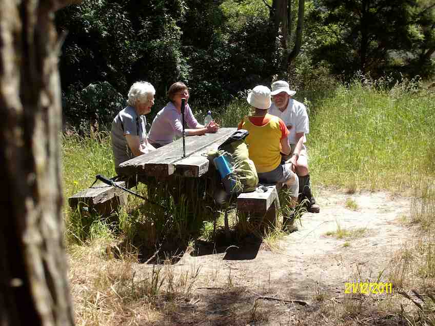
Lunch. Ria and Hazel by stream
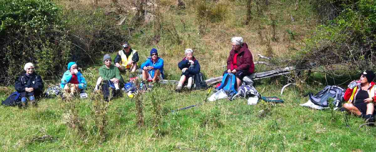
13 of us parked the cars to the left of the Highway 87 bridge over the Deep Stream gully and Arthur and Barbara took us on the upstream farmland of the Deep Stream Pipeline route. Some confusion arose from an enforced wait for the late arrival of the station owner who had wished to point out aspects of the area and from an imperfect memory of a recce of a trip cancelled due to bad weather six months earlier. We stopped for morning tea on a steep slope providing an excellent view of the willow-clad stream below, later lunching…
…chimney of a former stone house also provided interest. We caught only a few indications of the pipeline, largely buried under paddocks. Hot sunny weather gave way to threatening black clouds but we experienced only light rain on an early return to the cars. – Ian
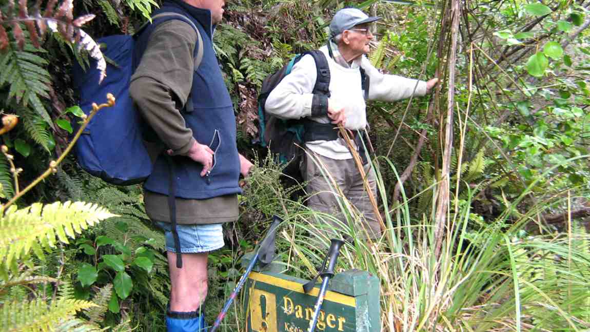
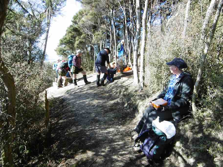
30. 22/2/2017. Hikers. Whare Flat. Leaders: Peter D, Janice.
Whare Flat/McRaes Weir (not quite) Wednesday 22nd Feb
26 happy hikers on a lovely sunny morning – what could go wrong?
Seven opted to drive up to the locked gate on Rollinson Rd and walk on to the start of the Steve Amies Track, where they enjoyed a pleasant amble to the picnic area and a leisurely lunch in the sun, before returning to the cars and off to Topiary for the usual coffee stop.
Little did they know of the drama that was developing below….
The other 19 left the cars at the park near the pump house, and set off up the track on the steep grunt that takes longer but avoids the water crossing and the possibility of wet feet.
However, Ian opted to do the shorter, easier version, risking wet boots, and meeting us in the clearing just past the swing bridge.
Ian reached the clearing safely and with plenty of time. In his own words –
’Ho hum. Oh! Time to get out the puffer and see how it might get me up the next climb and manage to avoid that first 5 min. heavy breathing before the blood vessels adjust and let me get away. Bummer.
(I had not used it for ever so long as usually I remember when it’s too late to use. It’s worked well on earlier occasions, but not in this case, standing, waiting, for such a long time before climbing.)
Started to feel faint. Got worse. Lay down, ended looking like a wee gnome in the grass, as one of you said. The rest you know better than I do!!!’
So, here was Ian, looking worse by the minute. While he was attended to by those with medical experience, we debated the options.
Cell phone call for help. No signal.
Use the locator beacon. Was there enough room for a chopper to land? Debatable.
Go back to the cars and phone for an ambulance.
It seemed at this point that Ian was recovering – his colour was better and he was lucid. Two people set off for the cars. Over the swing bridge and just past the gate to the road they realised the house on the right was occupied. But no landline and still no cell phone coverage. The wonderful lady (who had a key to the gate!) drove them out to the cars. One went on to get coverage and call for help. The other returned, to find that Ian’s condition had worsened, necessitating CPR. Gulp. Back down the road – kind lady again drove. The police car was met at the (un)locked gate and immediately radioed URGENT to the ambulance.
Things happened fast. In just over an hour from Ian’s collapse the ambulance was at the swing bridge and Ian was stabilised and stretchered across the bridge, and off to A & E.
It was now 11.30 and we were all rather shell-shocked. Five decided to call it a day. Two went to break the news to Shirley, and the other three heading home.
The remaining 13 headed up the track to the next clearing where a very sober lunch was had. Then up the track we climbed to McRaes Weir Track. It was decided that the weir could wait for another day, and we headed back along the race track to the road and down to the cars, with rain starting to fall and the track becoming muddy and slippery.
Coffee at Topiary was welcome!
Thanks to everyone for the able assistance that was provided in so many ways. Ian is fine – he had a reaction to the ‘puffer’ and after tests and checks, was allowed home that evening.
LESSONS LEARNED:
IF for any reason the group SPLITS, there must be at least TWO PEOPLE and preferably FOUR so that in the event of an emergency, one can stay with the ‘victim’, and two go for help. The same should apply to anyone deciding to turn back and in future this needs to be enforced by the leader.
In a later debrief with Police, we were praised for the efficient handling of the situation. However, they said that we should never hesitate to use the beacon because a few precious minutes could be saved. On the beacon signal, our precise position is shown and authorities can then make the decision as to which services to use. So in future, no hesitation! Better a false alarm than a death.
29. 1/5/2013 Both. Steve Amies. Leaders: Ian and George.
This time we left from the schoolhouse, making it more of a road walk. We had morning tea on the lower Rollinson Rd and lunch in the track clearers’ picnic area, after inspecting the helicopter landing pad a little beyond.
As we returned down the road, we were surprised to see the helicopter, and shortly after the tank truck making their way towards where we had been. Apparently this was the day to carry out the weed spraying we had been notified about – and we were now making a timely exit. A tramp for 25 of us and of 10.5 km according to Peter’s pedometer and 25. – Ian.
Plan 1: Swampy to Green Hill via Sleepy Hollow. Cold winds too fierce on tops.
Plan 2. Schoolhouse, Little Coal Creek, Steve Amies. But wet weather meant steep tracks would be too slippery and dangerous.
Plan 3. The actual tramp (see above). – Racemans level and safer, (except for the gradual Tunnels ascent/descents). However wet tree roots still had to be carefully negotiated.
Although rain for a start, but it soon went off and only drippy bush had to be endured. Track still muddy in places, but in many places a grand avenue and well cleared. Seven of us ventured out and enjoyed what looked at first to have been an unpromising day. – Ian.
GPS of route. Courtesy, Ken. (Route double-tracked for some inexplicable reason.)
12.33 p.m. Ready to return from lunch spot on Racemans.
2.23 p.m. Top of Tunnels track. Rest stop on pine-needles on return.
6. 23/10/1996. Trig Q. Average. Leaders: Margaret and Les, Doug J.
5. 7/6/1995Trig Q from Whare Flat School. Medium+. Shorter trip available. Leaders: Bob H, George, Jack R, Nancy
17. 5/10/2016. Hikers. Millennium-John Bull; Taieri Ferry to Taieri Mouth. Bus at both ends. M. Leaders: Bob and Doug.
Map of route. 3.3km ferry bridge to Wardell cottage; about 5km to seat; about 3km to track end; about half km to bus at T.M. bridge.
Millennium Track – combined trip Wednesday 5th October 2016-10-05
A dampish morning did not deter 40 intrepid club members who boarded the bus at the Bush Rd car park promptly at 9am. Packs were stowed in the luggage compartment and our driver Richard transported the happy crew out to Highway 1 and along to Henley and the start of the track – well, almost the start. 24 hikers disembarked in persistent light rain and trudged along the road for 45 minutes to a morning tea stop on the veranda of the white house just over the style, at the true beginning of the track.
The remaining 16 bods (and the bus) departed for Taieri Mouth.
Sheltering from the rain for morning tea in the old Wardell’s crib verandah.
The upward plod soon began and we were glad it wasn’t too hot. The light rain continued but there was no wind and it was pleasant for tramping. It was lovely in the bush with plenty of bird song and glimpses of the river below as we climbed.
A couple of solid hours saw us at the junction down to John Bull Creek, where it was unanimously decided not to descend, but to press on to the top for lunch. Which we did, collapsing gratefully for welcome food and drink. The rain had stopped and a pleasant break was had, with chocs to celebrate Alec’s recent birthday.
Lunch at the seat. Rain stopped at last.Lunch stop viewed from another angle.
Then down, and down, with a few inadvertent sit-downs, and the loss of a couple of impatient members who tried to take the direct route….it was quite slippery. No harm done, and we were soon back by the river for the last plod out to the road. The bus parked by the bridge was a welcome sight.
Nine cheerful souls on the bus had had a pleasant few hours meandering round Taieri Mouth and catching up on gossip, and there was no sign of the hardy seven trampers.
Thanks to hiking leaders Bob and Doug and tramping leader Arthur. It was a great day out, well-supported and enjoyed by all, and rounded off with a riotous session for coffee for 23 at Topiary. – Judy.
Coffee at Topiary. 23 in the sun.
16. 13/7/2016. Trampers. Millennium and John Bull from Henley. M. Leader: Arthur.
Two cars transported 9 trampers to begin the day’s adventure. The mild temperature was welcome, the sky overcast with northerly breezes.
We left the car-park at 10.00 a.m. and waked for about 10 minutes, to have morning tea at the picnic spot on the riverbank.
Continuing on it was up and down, as the track flows, and then up to the high up seat where we stopped for a little while. This spot overlooks the river to advantage
Another river view. (Margreet pic and caption.)
and also views away to the north too.
View from the top. (Margreet pic and caption.)
For example, Mount Cargill stood out in all its glory, with its mast on top.
The track was now downhill, the trampers intelligently noting that it would be the opposite on the returning journey. We came to a small wind-blown tree across the track, but Neil M. wrestled mightily with it and it was a problem no more.
An hour after leaving the high up seat we reached the track’s end. We were invited to have our lunch outside at Jay’s nearby house (she didn’t have the key with her), which we found a most pleasant and suitable place. – Thanks, Jay.
Lunch on the verandah of Jay’s Bach at Taieri Mouth. (Margreet pic and caption.)
A half-hour’s lunch and rest stop, and the party was on the track again. Grim determination was noted now, and with little talking, a fast pace was set, and we were back at the high up seat in an hour uphill – the same time as it had taken going down.
It had just come on to rain, so a brief regroup was taken under the trees, coats on, etc. The view being ignored now, downhill, and we were back at John Bull gully – just as the rain stopped and the sun came out.
Up the zigzag, and along, and down, etc., saw us back a the car park at 3.35 p.m.
The DoC sign at the car park stated that it was 9.3 km to Taieri Mouth but Margreet’s electronic gizmo said that we had done 16.2 kms.
Whatever distance we walked, we can say very definitely that “we went there and back”. A satisfying day’s tramp.
Blustery wind and rain welcomed us back to Mosgiel. No time for coffee today! – Arthur (substitute leader for Helen – off sick.)
15. 9/9/2015. Trampers. John Bull and Millennium from Taieri Mouth.
This tramp was done in place of the one scheduled, as I could not get permission from the farmer to do the tramp that was on the program.
Ten of us arrived at the Taieri Mouth car park, & set off along the riverside track. We had quite a late morning tea stop at the wooden seat at the top,…
Cuppa (Ken pic)
…before going down to John Bull Gully, where we had a short break. Then it was on along the Millennium track towards the Henley end. We arrived at the picnic spot down by the river, & had lunch there…
Lunch1 (Ken pic)Lunch2 (Ken pic)
…before setting off to do the remainder of the track, though to Wardells Cottage, & the car park beyond. [just to do the full track distance]
After a short break here, it was back the way we had come. We stopped at the seat at the highest point again for a rest & refreshments, after climbing the quite steep track up from John Bull Gully. We then made our way back to the cars at Taieri Mouth.
The weather was fine all day, but the track was quite muddy in places, & care is needed on the downhill muddy slopes.
It was good to hear the comments from some, that they had enjoyed the walk.
Although many in the group had walked both tracks in the past, it was the first time that quite a few of us had walked the full distance, there & back.
14. 21/12/2011. Trampers. John Bull and Millennium from Taieri Mouth.
GPS. Taieri Mouth John Bull Gully Millennium Track. Courtesy Ken.
Lunch. (Ken pic and caption)
Lunch2. (Ken pic and caption)
13. 8/12/2010. Trampers. Taieri Mouth to Wardells’ Cottage, return. H.
GPS of route, courtesy Ken.
The day was a bit cold and windy with some promised rain. A vote taken at the Taieri River mouth bridge was two to one (the writer was the ‘one’) with two abstentions to do the more sheltered John Bull Gully track instead of the scheduled Akatore beach walk. Aerobically it was certainly more beneficial with its plentiful provision of ups and downs. Continuing on to the Millennium Track to Wardells Cottage as well provided us with an all-up 18 km work-out which we all enjoyed. There was some spring grass overgrowth in places and the odd fallen tree. Some scrub cutting had been started There was some school group or other on inflatables out on the Taieri.
Distant shot of inflatables on river
12. 15/4/2009 Hikers. John Bull Track. Leaders: Lesley S, Bill H, Fred.
The hikers’ walk from Taieri Mouth on the John Bull track took a turn for the worse when 2hrs into the walk Elaine had to stop because of chest pains etc.
Leaving Elaine in the professional care of Bev, Lesley G and Neil, the remaining 10 carried on to higher ground to try and get cell phone coverage. This proved more difficult than anticipated and it took Lesley S to search for higher open area off the main track before finally making contact with the emergency service.
After the helicopter landed a paramedic ran down the track to where Elaine was lying. After her condition was checked and she was stabilized, she was attached to the paramedic and winched through a small gap in the bush canopy into the helicopter. – Fred
I have been overwhelmed with kindness from the tramp club since the event on the John Bull track.
Would you be able to convey my thanks to the members of the club who helped as a great team in my dramatic exit from the track which I don’t really remember.
The quick action of Bev, Lesley and so. I have found out the support of Neil in keeping me warm. And Lesley S who found cell phone coverage.
Chris who rang her husband in Brighton who linked it all together and the tramper who had the white shirts on that lay in the open area for the chopper.
ED at the hospital told me later that I was very lucky that I had had such great care.
They did a battery of tests – CT Scans but the last test I had was the Head Scan. (That was purely because I was a member of the TRTC – “Just joking” they said.) I had previously told them about the mad wet day that we did to Dr Point in the rain.
It has turned out great in the end. They said I can carry on tramping as usual next week If you will have me back?
Kind regards to every one – Elaine.
11. 16/5/2007. Hikers. John Bull from Taieri Mouth. Medium. Leaders: Dot B, Lesley G.
10. 15/10/2003. Medium. John Bull Gully from Taieri Mouth. Medium. Leaders: Jack and Rosemary.
9. 5/9/2001. Combined. John Bull Track. Leaders: Frank and Lesley, Pam.
8. 1/11/2000. John Bull Track. Leaders: Doug M, Hazel, Jean.
7. 16/6/1999. John Bull Track. Leaders: Lance and Lois, Judy C.
6. 18/11/1998. John Bull Track to river. Leaders: Dot B, Doug and Ngaire.
5. 8/7/1998. John Bull Gully and return. Leaders: Bev H, Bev McI.
4. 4/6/1997. John Bully Gully. Leaders: Joyce, Nancy, Eleanor.
3. 14/2/1996. John Bull Gully. Leaders: Dot and Eric.
2. 6/4/1994. John Bull Track, then over paddock to Waihola Road, back on John Bull Track. Medium. Les S, Bill H, Doug and Ngaire
1. 17/2/1993. Taieri Mouth Bridge to John Bull Flat. Average. Leaders: Eric and Dorothy, Joan H, Chris.
18/5/2016. Trampers. Lake Whare and surrounding tracks circuit. Leader: Arthur H.
It came on to rain lightly as we met at the car park. At 9.00 a.m. the 11 Trampers present held a brief conference and decided that as it looked very wet in the direction of the programmed tramp to the “3 Kings”, we would change and go to the Whare Flat area. This was a very wise decision as it was very pleasant in the bush even though it was raining.
We decided to do a circuit taking in Smithies, Possum Busters, Swine Spur and Lake Whare loop tracks. Accordingly we parked the cars at the bottom of Rollinsons Road. It was rather wet out in the open while getting ready, but no problem once we got started.
The first thing to admire, before we began, was the bridge at the start of “Smithies”, giving dry access across the swampy ditch from the road. The bridge was of Neil’s design and construction, so it was only fitting that a photo of himself standing on the bridge …
Neil on his bridge he built. (Helen pic and caption.)
… is presented herewith.
Going in this direction Smithies track …
Carol on Smithies Track. (Margreet pic.)
… climbs on occasion. It was after 10.00 a.m. before we stopped for morning tea, as we had to find a suitable spot under the tree canopy to keep us dry. Everything was quite wet underfoot by now, but the track conditions were good.
From our stop, it didn’t take long to reach the end of Smithies. We turned left, on Possum Busters now, passing the junctions of McQuilkans and then Porkies tracks.
Eventually we reached Swine Spur/Possum Busters cross-roads (cross-tracks?) where we stopped briefly. Downhill we now went on Swine Spur, finding that this upper part is quite overgrown.
The sun came out …
Rainbow. (Helen pic and caption)
… and we stopped for lunch at a suitable spot after reaching ‘cutty grass flats’ – which we had track-cleared some months ago. The sun was very welcome and the weather remained dry then till we finished.
Afterwards it was only a short distance to the Lake Whare Loop track which we followed. A stop was made to admire Lake Whare …
Admiring Lake Whare (Margreet pic.)
… after crossing the rock wall and looking at the ruins of the rock-walled building (house?).
We then crossed back onto Smithies Track, and thence back to the cars.
It was agreed that all had enjoyed the tramp, even though it wasn’t all that long. There had been a good variety of up and down, giving everyone a good work out.
Upon returning to Mosgiel, a meeting of the” Taieri Recreational Tramping Club AND Coffee Club” (Tramping Division) was convened at the Wooden Table cafe. – Arthur H.
21/7/2004 Trampers. Lake Whare, Steve Amies, Trig Q. Medium. Leaders: Ian, Bob H
After cancelling our trip to Leaning Lodge, 7 trampers turned up at the carpark to do the Morrisons/Poleline/Swampy/Moon circuit.
We parked on the Leith Valley Rd. by the entrance to the Glow worm track, then walked up the road to the bridge over the Morrison Burn.
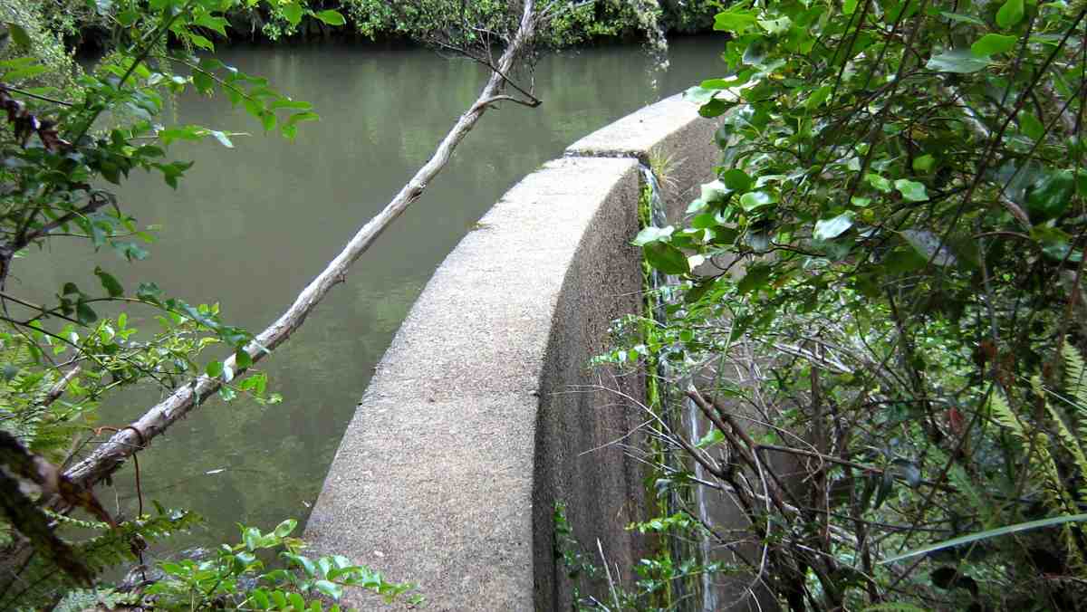
The day started off cool, but fine, & the track condition was quite good. We climbed under the barrier at the locked gate on the bridge at the start, & made our way up to the weir,
1 Curiosity (Ken pic and caption)
then backtracked to where the track went uphill through the bush. After morning tea break,
2 Morning tea (Ken pic and caption)
we carried on until we came across a gravelled road, where we took the wrong way!! We soon discovered our mistake, & walked along the road to where the track started again up through the bush. This eventually led us onto the Poleline track that goes up to the top of Swampy. We had lunch sheltered from the wind by the building at the top of the Leith Saddle track, then retraced our steps back …
3 Fog over Mosgiel from Swampy (Ken pic and caption)
… to the junction of the Poleline track & the Swampy Ridge track, where we turned off, & made our way along to the top of Moon track. We had a short stop here before heading off down this very badly rutted [damaged by mountain bikes] & rough track into the bush again where there is a multitude of mountain biking tracks, winding back & forward making it hard to know which track to take. So we just kept looking for tracks that went downhill, & eventually we ended up on the Leith Valley Rd. about 150mtrs from the cars.
An interesting day, & a tramp that a few had not done before, & all agreed that it was a good walk.
Walked 12.8km
Ave speed 3.9km/h
Moving time 3h 18min.
Climbed 658mtrs. – Ken.
5. 19/8/2009. Medium. Morrisons Burn, Morrisons Track, Poleline Road, Swampy, Pineapple, Nicols Creek. Medium. Leaders: Keith and Glenice
Parking the cars at the Nicols Creek bridge, we walked up the Leith Valley Road to Morrisons at the foot of Stoney Ford slope. We scrambled past the large slip immediately across the footbridge and enjoyed the beautiful bush and moss-clad track up to reach the waterfall. Then the steep scramble up the bank to morning tea on the 4WD at the slope’s top. Along that a bit, and then it was further up, up, up through bush to join the Pole Track 4WD to enjoy lunch where it meets the Swampy Ridge track. Instead of turning down the Nicols Creek track junction when we reached it,
Junction of Swampy with Nicols Creek Tracks. Hazel, Ria, Pat, Ken, Doug M, Lex
by common consent Lex took the 10 of us on to the Pineapple Track
Junction Swampy, Pineapple Track. Lex, Ken, Pat, Doug M, Hazel, Wendy
descent to break away from it further down at a stone cairn to cut across the cocksfoot on the left to the bush edge. This provided heightened interest as it had not been reconnoitred but Lex cleverly located the track that led down through the bush and across back to Nicols Creek track. The day had begun overcast and actually rained a few drops after lunch, but got really hot during our concluding descent to the cars. A good way for it to happen. – Ian
Grainger Road Tramps to Maungatua summit and Woodside.
Steep, Long. Take plenty of water.
Cars park at Graingers Road.
8. 11/11/2015. Trampers. Grainger Road.
A change of plan due to the weather. 7 of us went to Grainger Road and parked at end of road by the pylon. Steep track up the side of the Maungatuas. Steep was what Hamel’s book said and was steep. Morning tea Ken left and went back down. Rest of us continued up as far as the markers were. No more track to be found so after much looking around the decision was made to go back down. Early lunch with the paddock’s two resident horses and a shower of rain sent us on our way home. Still a good workout. – Helen.
7. 31/8/2005. Trampers. Grainger Road to Maungatua Tussock slopes only. Spaniard grass thick. Leaders: George, Doug J.
We climbed in the bush, and came down in tussock and farm. – Ian
Break in Bush. George, Ria, Who?
Lunch on Maungatua slop. Hazel, Dorothy, George
Descent round a large rock. Who? in rear rear. Doug M front.
6. 16/9/1998 Grainger Road, Woodside. Leaders: Bill H, Graham
5. 29/4/1998. Maungatua via Graingers Road, return – round trip. Leaders: Bill H, Graham, Ian.
4. 14/8/1996. Grainger Road to Woodside Glen. (Car Shuttle) Medium+. Leaders: Wendy, Bev H, Bill H.
3. 7/12/1994 Grainger Road, Maungatua, Woodside. Steep and long. You may go part way on this one and a leader will bring you back. Leaders: Nancy, Rob Q, Joyce S, Colleen
1/10/1994 Leaders: Joyce S, Nancy, Colleen
2. 11/5/1994. Grainger Road, Woodside, Maungatua. Med+. Long. Leaders: Nancy, Colleen, Rob Q, Joyce S
1. 11/3/1992 Leaders: Bob & Audrey, Denise, Doug M
Seven trampers started out from Brighton to walk the beach to Kuri Bush. The weather was overcast, but fine all day, & no wind, which made pleasant beach walking.
As lunch was taken before we reached Kuri bush,
Lunch. (Heb pic)
we never quite made it all the way there before turning back. As the tide was starting to come in,
(Heb pic)
we walked some of the way back on the road, until we could get back
(Heb pic)
onto the beach. – Heb.
4. 7/11/2013. Both. Brighton to Bruce Rocks. Leader: G Haggie.
3. 10/11/2010. Trampers. Brighton Beach walk south. Medium. Leaders: All.
Brighton-Sth. Beach walk. GPS of route, courtesy Ken
This was the first tramp without a recce or leader. Overworked leaders had begun complaining as low tramper numbers had meant frequent leadership duties. Ironically 10 of us turned up on the day. We had morning tea at the same spot as last time – at the point where the unbroken beach gives way to rocky outcrops and small bays. As you can see, the tide was well out.
Lunch stop.
The two small waterfalls pictured in the last tramp were almost indiscernible trickles, so dry had the season become. So far out was the tide, that we were well beyond the point we had reached on the previous occasion. Fortunately Ken drew our attention to the fact that we had gone over 8 km, only about 2 km short of Kuri Bush. Far enough. So we lunched. On the way back some striated rock face drew our attention.
Rock face
We got well strung out on the walk back with one or two getting well ahead and a tail-end group dropping well back. But we all got there, with several taking the opportunity to enjoy going bare-foot in the surf.
However we all made good time covering 17 km all up, getting back to the cars about 2.30 p.m.
A lovely sunny day. Tide well out. Good hard sand. It was great. – Ian
This beach tramp from Brighton south was merely a replacement for a soggy winter Spiers Road circuit but proved to be a gem. After the first unbroken beach walk from Brighton, the small sandy bays at its south end were a welcome delight and of endless interest.
The rocky points between them proved not too difficult to negotiate, provided one carefully stepped between slippery seaweed. Again there was constant interesting variety of shapes and rocky pools.
WaterfallWaterfall
(Of course a welcome sunny day interrupting a dreary wet August was quite a help too.) And to top off the specialness of the day, George observed that this was the first time the club had attempted the walk, although the Trixies had it on their calendar.
This is a walk to be planned only when low tide occurs between 12.00 and 1.00 p.m. as at high tide the sea comes right up to the steep banks. As it chanced it was a 12.00 p.m. low tide day. 1.00 p.m. would have been even better as we had to plan our return early enough to get back beyond the last rocky point and onto the unbroken beach again before the returning sea had encroached too much.
A solitary fisher
And at this point was a further point of interest. George had told leaders Sabina and Ian when they were still at the planning stage that horse riders used a parallel track through the sandhills when the tide was full, so here was a landscape of its own to vary the return trip and avoid the soft sand of the upper beach that the returning tide would have forced us onto. Mainly marram grass and lupin, the dips and rises, gullies and ridges led on and on in a world seemingly quite divorced from road on one side and beach on the other, interrupted only by a web of road-to-beach tracks constantly crossing our walk.
At last, the return to the cars with nine of us having enjoyed a day of welcome break in the weather and a rewarding treat of beautiful hidden bays of which we had hitherto been completely ignorant. – Ian
1/4/2015. Both. Neehoff Farm, Hindon. M. Leaders: Ian F and Arthur H.
GPS of route
A goodly number of thirty Trampers and Hikers, as you can see from the GPS map, set off back alongside the road we had arrived in, the Leaders searching for one of several elusive ridges, each separated by bushed gullies and leading down to a main gully at their foot. However, due to their number (six in total!) and too tentatively choosing one ridge too soon but finding it too stunted to be the one, we ended up turning back (about 0.7 kms on GPS map) instead of going on, and descending the ridge futher back only to be forced to have to climb out of the gully beyond its foot (red spot about 1.4 kms on GPS map) and up onto the one originally planned on. By now it was time for morning tea. (Sorry about the lack of photos – we didn’t have John and his camera with us this time.)
On down the right gully now this time and into the main one across its foot, left skirting its side and crossing at a bridge and struggling up the slope directly ahead. (Red spots about 1.6 kms on GPS map.) Then it was on, up to our left, climbing gradually for the most part, through a number of paddocks and gates, until by various turns we reached what appeared a paper road. (About 3.7 kms on GPS map.) This formed a long ascending route to the point where we turned into a paddock again. (About 5.8 kms on the GPS map.) En route, we met up with the Neeehoff farm’s neighbouring owner. He reassured us he had been consulted, but it now became apparent that we had spent more time on his farm than the other! Ah well, another permission to prudently seek next time. It was in the new paddock that the mushroom pickers got really busy. There had been some mushrooms in the first paddocks, but here their number appeared endless. This led to a prolonged hunt by the aficionados while most went on to stop for lunch not too distant from one particular loiterer who shall remain unnamed. (6.1 kms on the GPS map.) Some great mushroom fry-ups would be on the menu that evening!
Lunch stop, waiting for the mushroom pickers to catch up.
Around the head of the gully facing the luncheon eaters, we descended to the big gully again, but here bridgeless, with its water-way just a step (or more in some places) too wide. Many just plunged through, but the tail on the GPS map indicates a walk upstream for the few patient enough to wait to be led to the only dry one-step crossing. (About 6.7 kms on the GPS map.) From there we had to walk back along to our left and the corner of a paddock ahead, and wait for leader Arthur to switch off the hot wire of what we now knew to be the Neehoff boundary fence. (About 6.9 kms on the GPS map.) Once through the fence, ahead lay the long steep slog up the longest and principle of all those six ridges leading back up again, – also the nearest to the homestead. (Kms 7 and 8 on the GPS map.) Now we were back up onto the original paddock and soon back to the cars.
Well, this was one of the now controversial “both” walks, set down for Trampers to join with Hikers the first Wednesdays of the months. It was moderately hard only in respect to the steep climbs out of the gullies. But not particularly long or challenging. There were happily more Trampers than there had been recently, generously tolerating the slower pace of the Hikers for the sake of “Recreational” togetherness and getting to know fellow-club members better. Perhaps the emerging arrangement of this along with a track-clearing option on the same day, is becoming a way through of providing a flexibility of choice for Trampers to exercise in accordance with their own preference. – Ian
20/2/2013. Trampers. Neehoff Farm, Hindon.
22/2/1995. Neehoff Farm, Hindon. Medium. Leaders: Molly, Jack and Rosemary, Eleanor.
25/2/2015 Hikers. Heenan Road to Waipori River. Leaders: Peter and Elaine.
GPS of route. 12.54 km
Thirteen Hikers parked their cars by a Lavender Farm in Heenan Road. The day turned out to be largely a road walk. We walked the length of Heenan Road into the face of a ferocious westerly that didn’t let up all day, and had forced us into our parkas for warmth. We passed the former Wesleydale Methodist Camp site on our right, sighted the paddock corner where the track to Three Kings went into the bush, looked up at Three Kings standing out at the top, and passed the stock shed a little further on, some of us noting that it marked the top end of the paper road that links with the Waipori Road at its foot. But the plan was to continue further to where the Road met up with Munro Road. Turning right into it we shortly stopped in the shelter of a plantation for a brief morning cuppa, the plantation providing a measure of shelter for the wind blast. We continued to the road’s end by a built-up and fenced-off reservoir with its gate wide open. Courious, we climbed up and came across two DCC workmen, one of whom was vainly paddling an inflatable dingy against the wind, eventually managing to get to the point where it could be pulled out of the water. Quite a sight. Forgot to take a photo. Ouch.
Past the dam,the road changed to a FWD track which in turn ended a paddock, down across which we went to a gate at its other end that led down to Waipori Road.
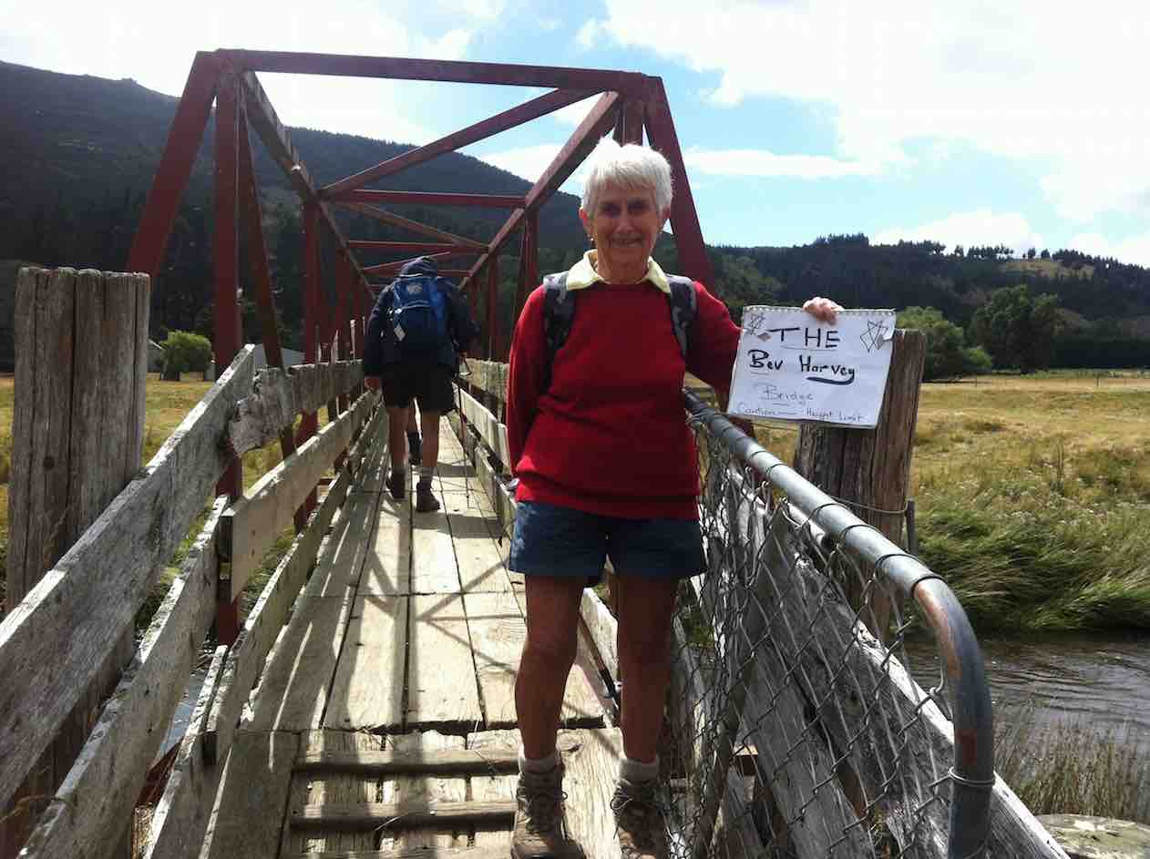
A short distance down we turned into Twelve Tree Road which led us to a paddock, across which was the metal stock bridge across the Waipori River. Peter went ahead on the pretense of having something to attend to, but when we got to the bridge there he was holding up a sign proclaiming “Bev’s Bridge”, due to her being one of the few who could walk across upright without having to bend her head to avoid hitting the low iron cross rods above. (See later pic taken on return trip.)
Instead of turning down stream, Peter led us up, through various gates and paddocks to a patch of bush which provided shelter from the wind as we sat in the sun and lunched.
Lunch
Returning,…
Stock bridge across Waipori RiverThe Bev Harvey Bridge. Caution – Height Limit. (to replace yet another forgotten photo-take on the way in)
…we came out at a different spot on the Waipori Road near the Mill Creek bridge and went along to return up the paddock we had come down earlier. Now with the wind behind us, returning was easier, and an obvious road allowed us to walk at our own rates.
Stone house in excellent condition (another after-thought photo)
Thanks to Peter and Elaine whose excellent leadership was helped by a compliant group, smaller than usual. – Ian.
3/4/2002 Combined. Berwick – Waipori River walk. Medium. Leaders: Bill H, Lesley S, Evelyn C
7/3/2001. Berwick. Waipori River Walk. Leaders: Bill H, Lesley S, Evelyn C.
6. 15/9/2014.
Just been reading some of your website on this short track. You may like to know that when we were talking to the gentleman at the museum last week, he told us that the track was put in to take supplies of piping etc up the burn for the Outram water supply. Also, if you go to the end of that track, & then cross the burn, there is a track up the other side, & up there is a valve, & some old piping. So it seems that the track has nothing to do with the old mill that was there, as it got it’s water from the race that you & I found in the paddocks above the road.
He has some old photos of the area as well, but they are not very good ones. There is also a water wheel [working] at the museum, which I think he said was the old mill wheel. – Ken
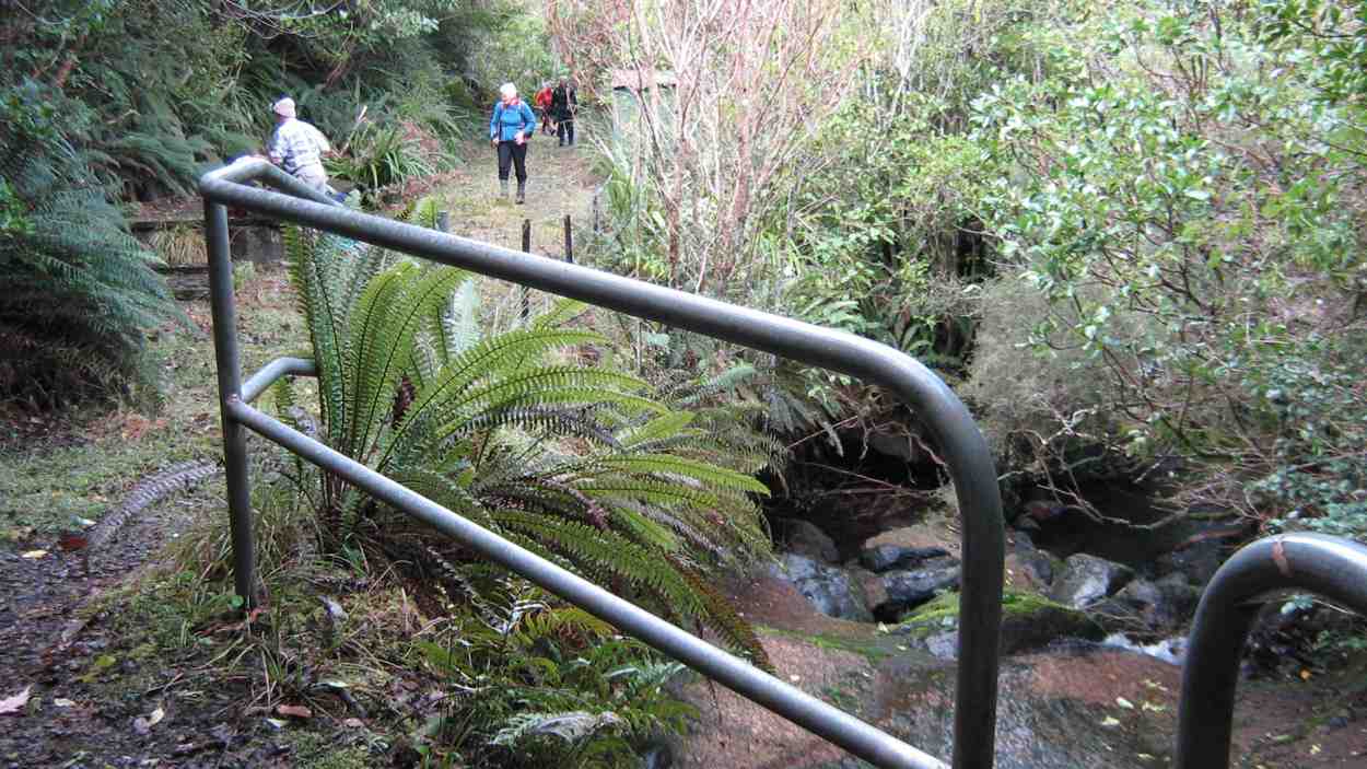
After a cool start to the day, the weather warmed up, & we had a good walk along the Outram Glen track to Lee stream, [where we discussed the possibilities of crossing the stream without getting very wet] & back. We had a couple of stops along the way, one was with the owner of one of the houses up the Chalkies track road. He tells us that the grumpy one has now gone, & the new owners are quite ok with groups like ours going down [or up] the track through their properties, then down [or up] their driveway. I think permission should still be sought first though, especially for the first time at least.We arrived back at the car for lunch, & then proceeded along to the short track that runs in from the one way bridge at the start of the George King Memorial Drive. this was a new walk for some in the group, & started up a discussion on the old mill that used to be there.
On the way back out, we decided to go up into the museum grounds, as this was also new for some in the party. We struck up a good conversation with one of the gentlemen working on the site, & he was most helpful with info on the old mill, it’s whereabouts, & where to find some old relics.
We arrived back at the carpark, just before the hikers returned.We walked approx 12.5km [didn’t take the GPS on the short track.]
ave. 4.2km/hr. – Ken.
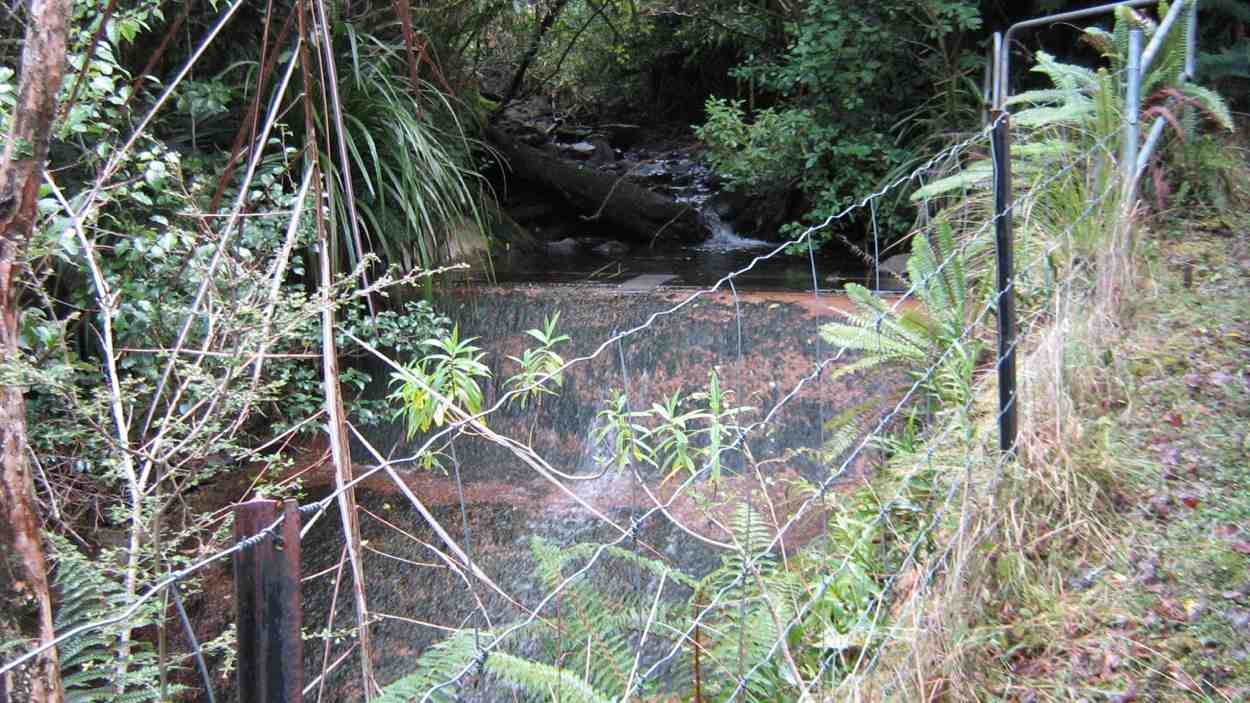
4. 5/5/2012. Whare Creek Outram Council weir. Ken and Ian.
On a fine Monday afternoon and with permission and advice from the landowners, we explored down the bush track below the power lines to arrive at the water race that supplied the water that drove the old Outram Glen Flour Mill back in the early 20th Century.
The Outram Glen Flour Mill water race.
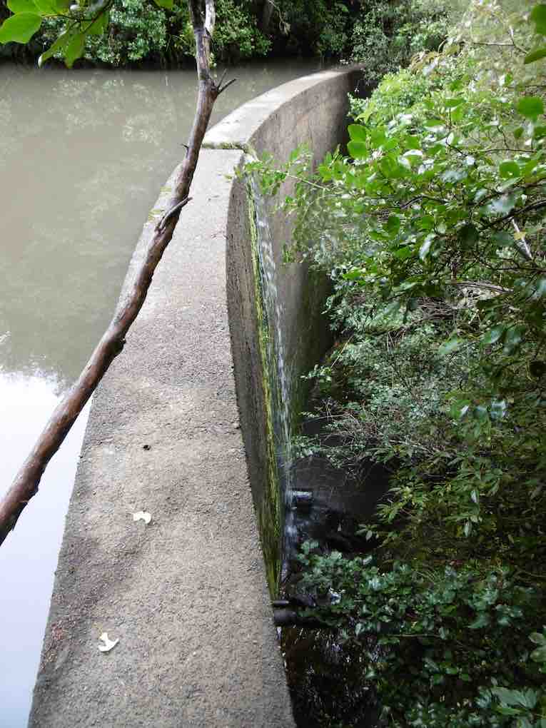
Following the pink markers brought us to the point leading steeply down below the race to the creek and a weir. From Jim Sime’s later information, this was the Outram Council’s weir and pipe line to supply water for the Outram Water Supply tank, located above the Taieri Museum, now no longer in use. The weir was designed so that flood debris would wash right over it.
Old Outram Council Weir and piping, no longer in use.
Mr Sime said that the Flour Mill water race, higher up the bank, which he explored on an earlier occasion, leads on for a considerable distance to disappear at the face of a rock bluff, with no indication evident of how the fluming would have had to have been attached to the sheer rock. Mr Sime thinks that a pool yet further upstream at a streams’ confluence may well have been where the race might have begun.
Ken at the weir.
Ken pic. Upstream from the weir, the creek winds round to the left.
Seven of us took to the Outram Glen – Lee Stream track on an overcast & cool morning. We decided to have morning tea at Lee Stream, so we set off at a good pace, & we soon warmed up. The sun was out at Lee Stream, so a leisurely break was in order. We made our way back to the glen where we had lunch, & then we moved the cars down to the Traquair Burn bridge.
We made the short walk to the start of the Traquair Burn track & along this to the end, where we did a bit of exploring up the small tributary stream on the left. This quickly ran out of easily negotiated terrain, so we went back to the track end, & Ken went exploring up the Burn a bit further to see if it was possible to go upstream.
We returned to the cars via the Outram machinery museum grounds, where we had a good look around. – Ken
Six trampers turned up at the car-park following a very stormy night to learn that the leaders, Ria and Hazel had, happily as it turned out, decided on Outram Glen instead of Whare Flat. They had carried out three Whare Flat recces only to find on each occasion tracks too overgrown to clear. We were delighted to find the reported upgrade of the initial flat (mostly) part of the Outram Glen track had been widened and metalled making for two-abreast walking. The remaining steeper bit however was literally, according to a DoC notice, “maintained to only route standard”. It was! But we made good progress arriving at the Lee Stream terminus at 11. It was there that Doug and Hazel discovered wild potatoes
Gathering potatoes near Lee Stream outlet.Bush by Traquair Creek
of a very good size which Doug lugged back down the track for his meal table.
We lunched below the Taieri Historical Museum area prior to exploring a newly-cleared track up alongside the Traquair (or Whare) Stream – a new discovery for most of the group. Ian recounted how his Grandfather and family had owned the Flour Mill in a small area across the stream from 1911-1913 (the original Outram Glen), now buried under the present road corner alignment: a place once renowned for its gardens and picnic area for locals. Two houses, a mill, a fountain and an electric generator (which had earlier powered Outram’s street lights) as well as gardens had occupied the area. The buildings were destroyed by fire in 1918.
Fallen coloured deciduous leaves on an open area of the track would have kindled a painter’s imagination. We returned from where the track finally petered out, left wondering where it might have continued to in the past. Another satisfying day. – Ian
No. 50 on old hardcopy list of 113 club tramps. “McLaren Rd – Christies Gully Year Round”
Trampers Park Henley Road, to left of entrance from north end of flood free highway. 17 km from car-park.
Hikers Park Henley Road, to right of entrance from north end of flood free highway. 18 km from car-park.
17. 9/7/2014. Hikers. Otokia, Big Stone, Christie Gully and Henley Roads. Leaders: Les and Margaret.
GPS of routeAbout to set off. (John panorama pic)Morning Tea on a hump of Otokia Road. (John pic)The dip in the Otokia Road beyond the Morning Tea stop. (John pic)The road sign marking boundary between Big Stone and Otokia-Kuri Bush Roads. (John pic)The road sign by Margaret’s g/parents’ place where we turned off to steeply descend Christie Gully Road. (John pic)
16. 13/6/2012. Hikers. Otokia, Big Stone, Christie Gully and Henley Roads. Leaders: Les and Margaret.
15. 24/8/2011. Hikers. Otokia, Big Stone, Christie Gully and Henley Roads. Leaders: Les and Margaret.
14. 27/7/2011. Trampers. Henley Road, Christie Gully Road, Big Stone Road, McLaren Gully Road SE along SH1 back in to cars on Henley Road extension. 3.5 to 4 hours. 15 km walk.
GPS
Sunny Spot
spread
View from top of Christie Gully Rd (Ken pic and caption)
Ria & Linzi enjoying the snow. (Ken pic and caption)
The road – and snow – goes on and on.
13. 13/10/2010. Hikers. Christie Gully, Cemetery.
12. 3/6/2009. Both. Henley Road, Christie Gully Road, Otokia Kuri Bush Road East, (down Otokia Rd for shorter walk), Big Stone Road, McLaren Gully Road SE along SH1 in to cars on Henley Road extension. Leaders: Les and Margaret.
We parked in the usual place.
click to enlarge
The start. Chris, Dot, Molly, Bev, Lesley, Margaret
The later 9.30 a.m. start had us stopping for a cuppa on the Henley Road in some shelter instead of after the turn into Christie Gully Road.
Tea break. Lesley, Bev, Dot, Chris, Margaret.
Next, we saw geese on the Taieri River.
Geese on the Taieri.
Then we saw deer on the hill.
Deer outlined on the horizon.
On Christie Gully Road we saw some old friends – or their descendants.
Happy as pigs in muck.
The sign says it all.
At the top of the road we stopped for a breather and to admire the view. It turned out we were outside Margaret’s mother’s old place. The house had been burnt down long before Margaret’s time.
Peter, Carmel, Molly, Bev, Margaret, Chris.
We paused at the junction of Big Stone Road and Otokia-Kuri Bush Road West.
Doug, Pat, Wendy, Chris, Bill, Molly, Carmel, Les, Dot, Angela at junction of Big Stone and Otokia-Kuri Bush Rds.
As Margaret was going to take those who wanted a shorter walk down the shortcut and via the cemetery, we stopped for lunch here.
Lunch. Molly, Bill, Pat, Les, Peter, Doug, Wendy, Angela.
A rare sight of falcons flying and calling in sky.
The first time I’ve snapped this place.
An attractive old house on McLaren Gully Road.
11. 29/10/2008. Hikers. Otokia, Big Stone, Christie Gully and Henley Roads. Medium. Leaders: Peter B, Neil
10. 12/9/2007. Hikers. Christie Gully, McLaren Gully Roads. Easy+. Leaders: Margaret and Les.
9. 8/8/2007 Leaders: Ian, Bill M.
Parked north end of flood free highway by gravel heaps.
Walked Henley Rd to Christie Gully.
To Otokia Kuri Bush Rd East/Big Stone Road.
Turned down McLaren Gully to SH1. Henley Rd to cars.
8. 30/6/2004. McLaren and Christie Gully. Medium. Leaders: George, Bruce, Dot T, Les & Margaret. 7. 18/9/2002 Leaders: Catherine, Lance & Lois 6. 27/9/2000 Christie Gully – McLaren Road. Road Walk. Leaders: Mary Y, Jean A, Catherine 5. 16/6/1999. Christie Gully, McLaren Road. Leaders: Les and Margaret, Wendy. 4. 22/7/1998. Christie Gully, McLaren Gully. Leaders: Margaret S, Nancy. 3. 11/6/1997. McLaren Gully, Christie Gully round trip. Leaders: Les and Margaret, Ivan. 2. 5/11/1992 Otokia, Big Stone, Christie Gully and Henley Roads. Average. Leaders: Eric & Dot, Margaret S, Les W 1. 15/6/1991. Christie Gully and McLaren Road. Good winter tramping and views. Average+. Leaders: Nancy, Margaret S, Eric & Dot