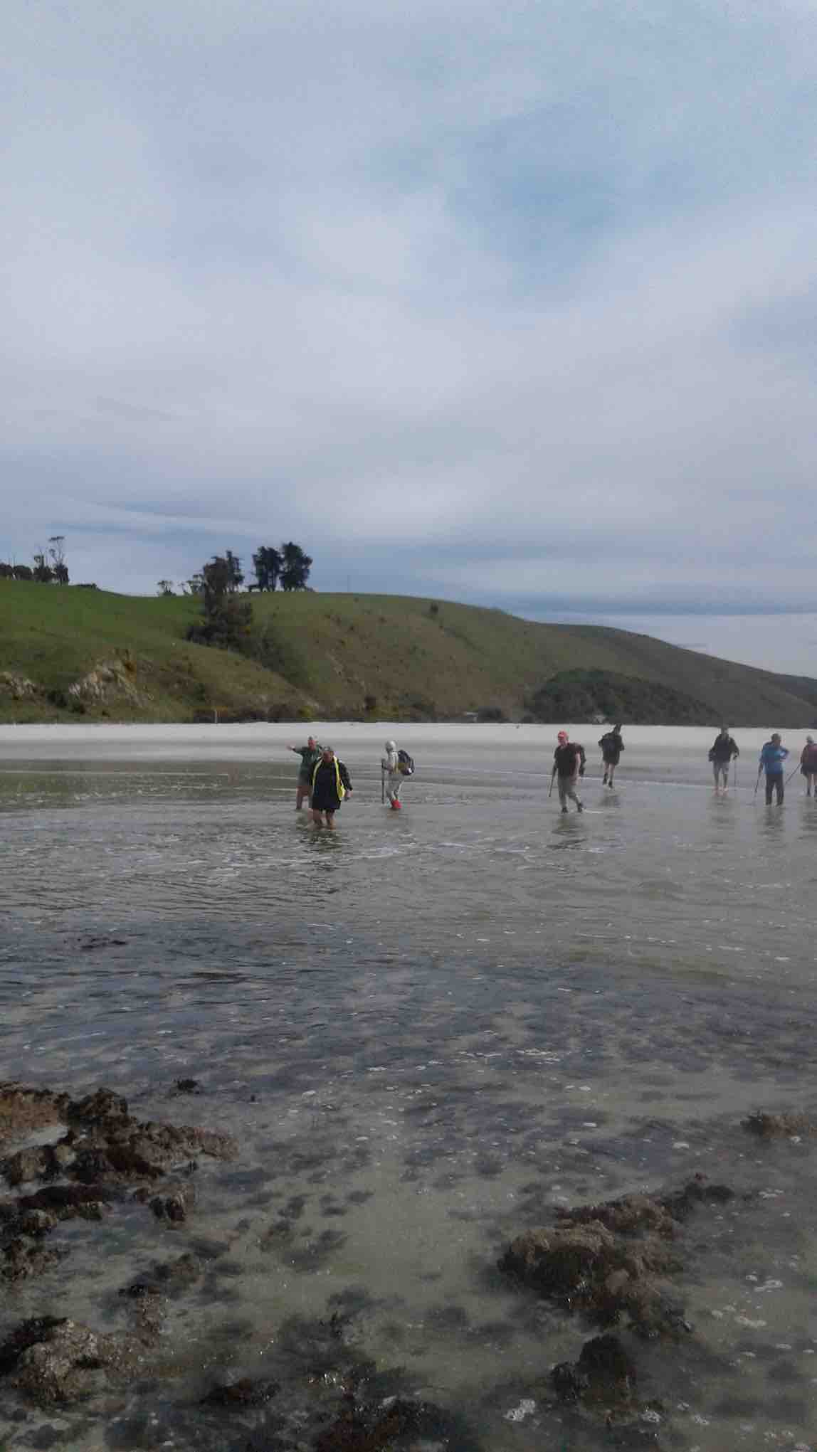
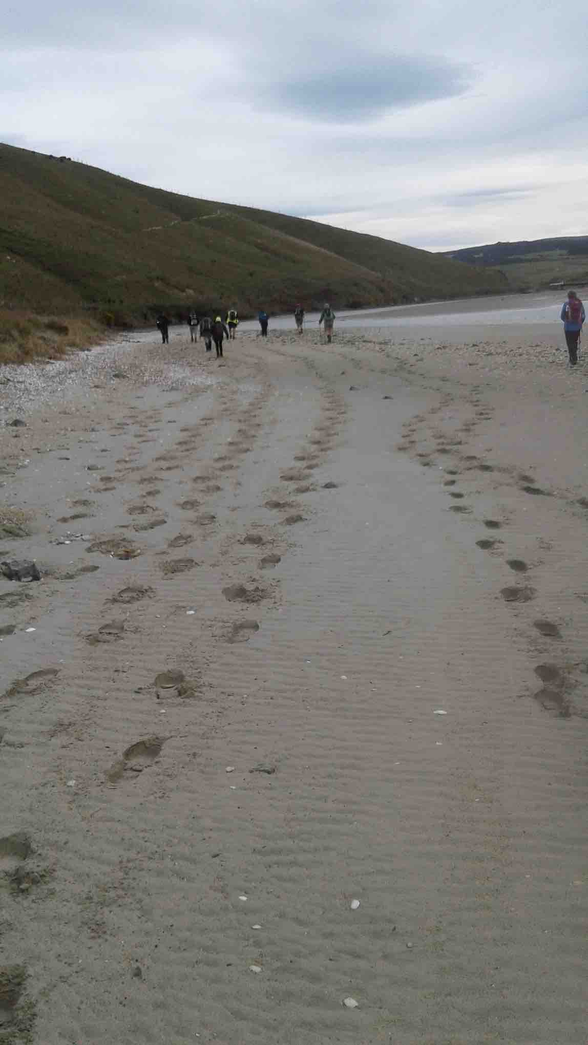
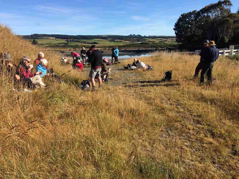
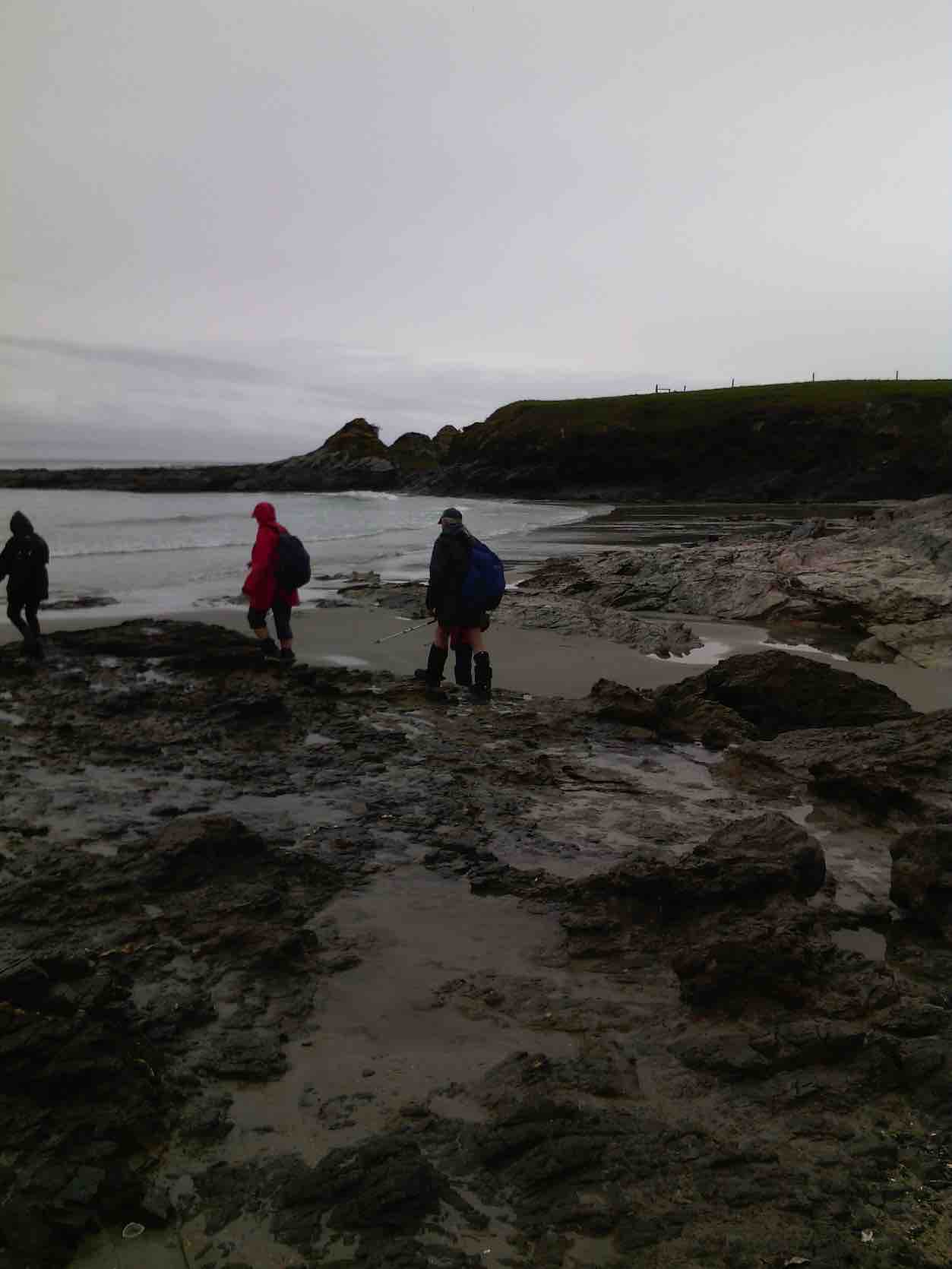
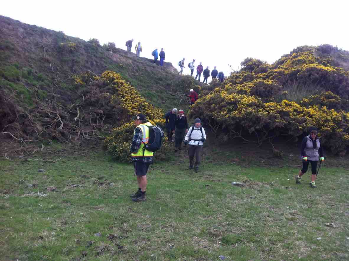
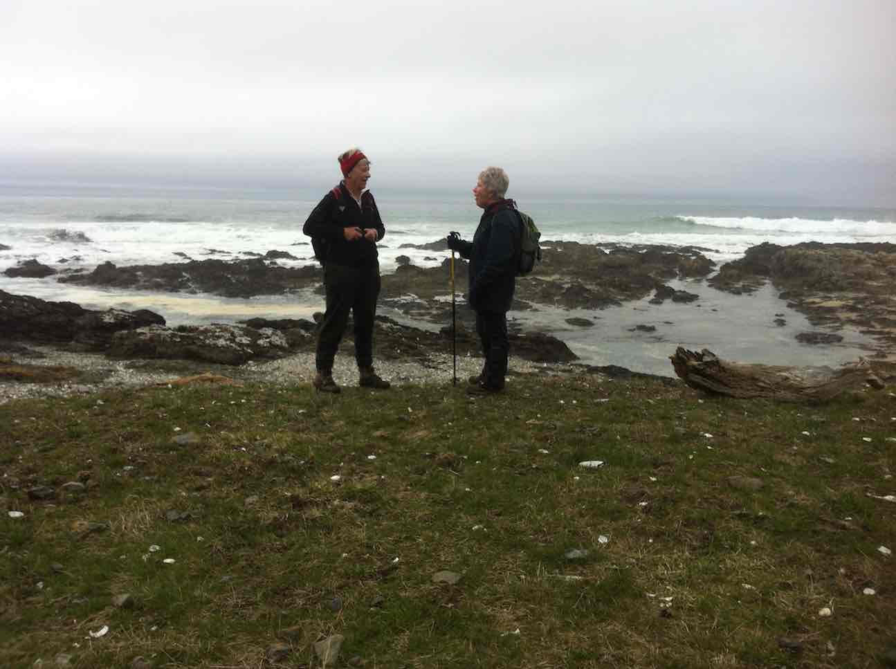
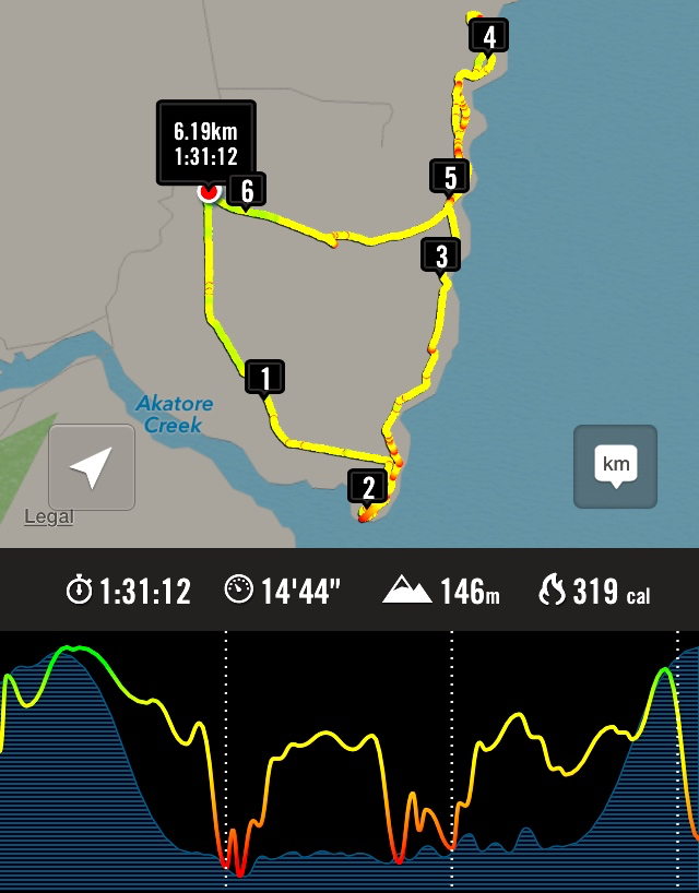
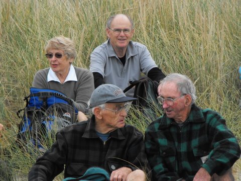
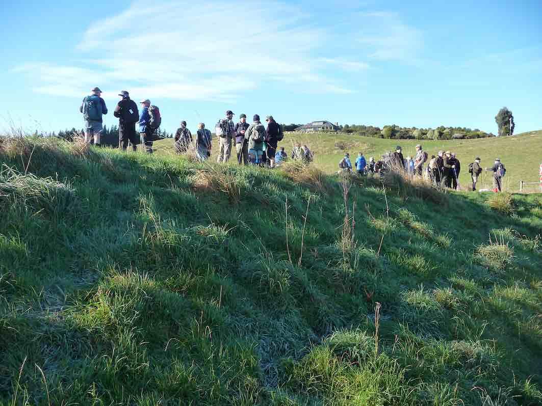
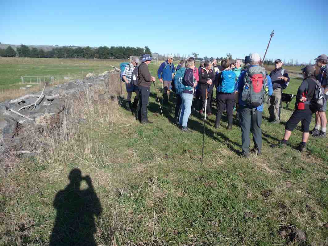
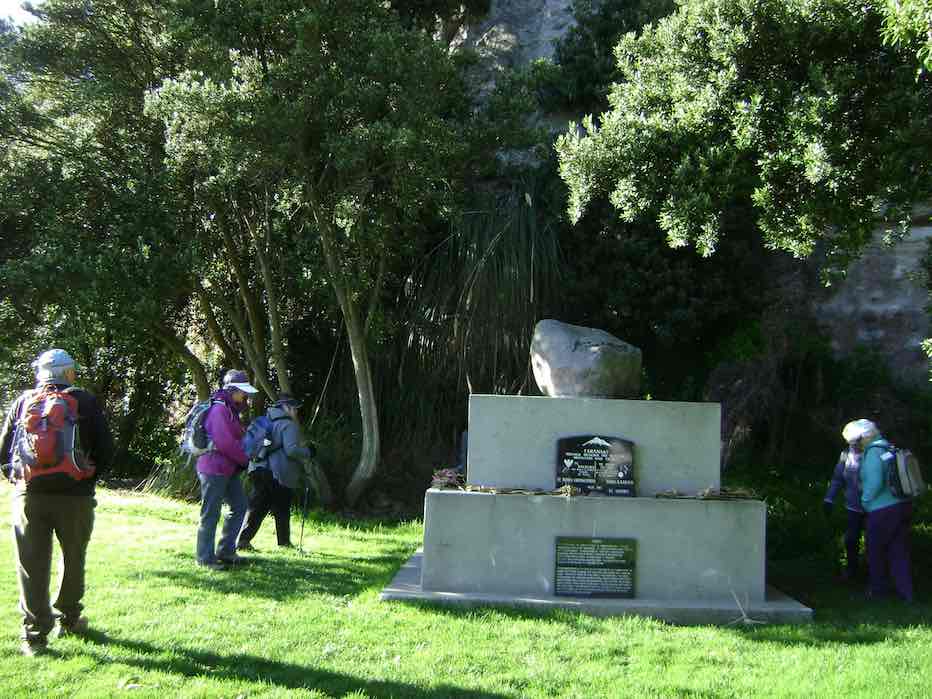
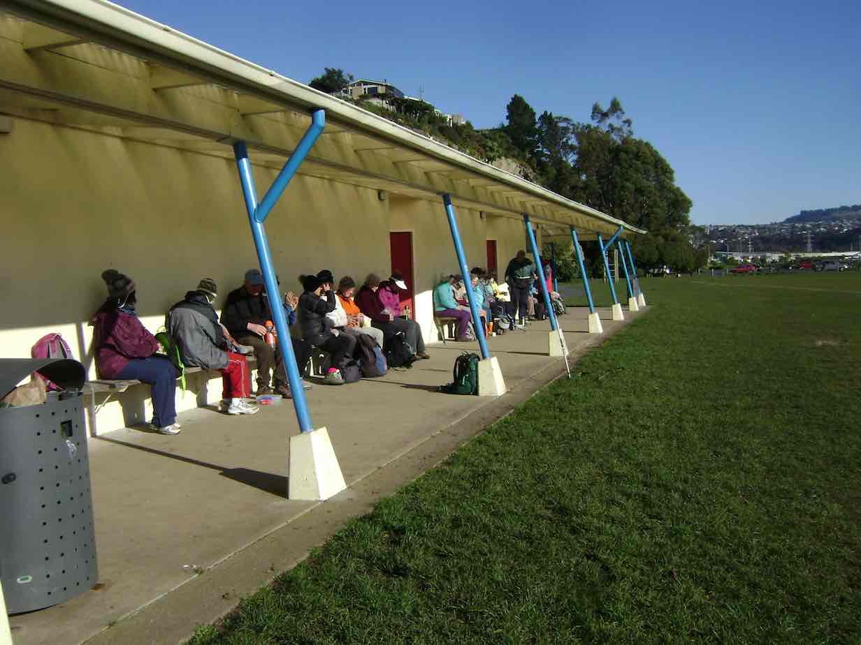
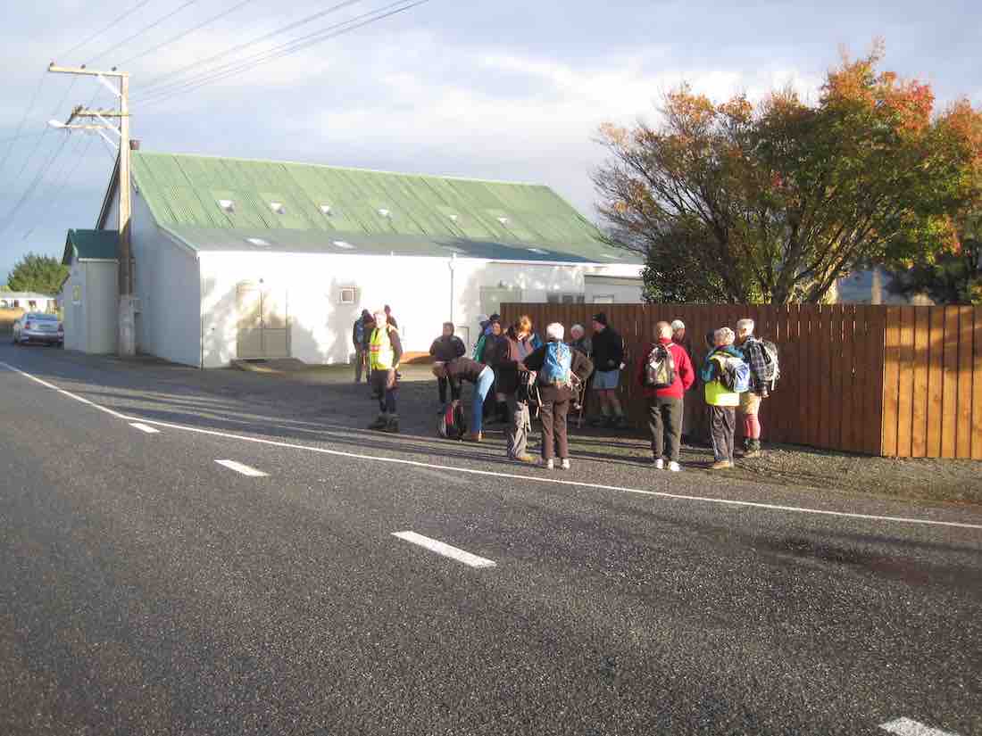
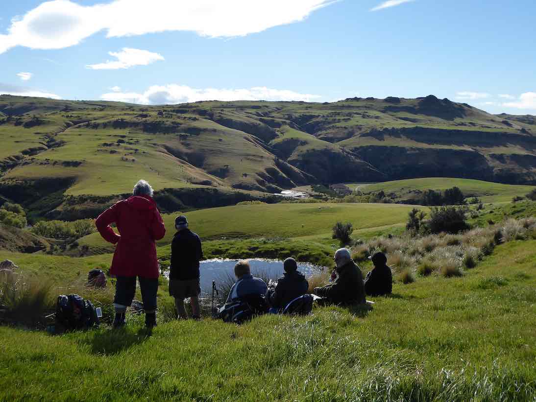
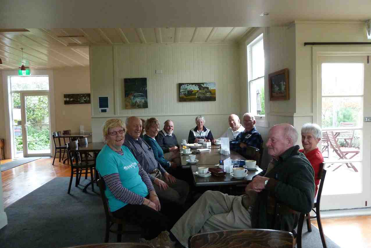
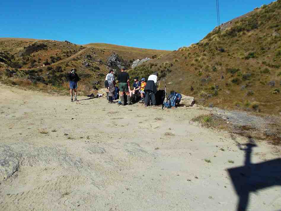
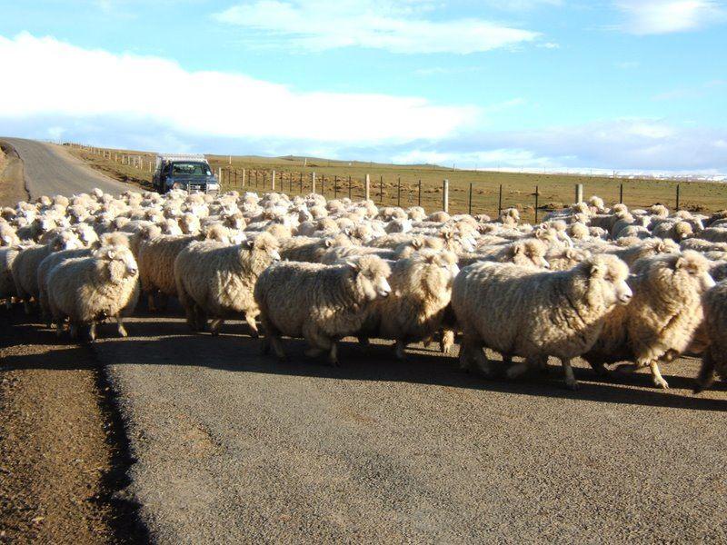
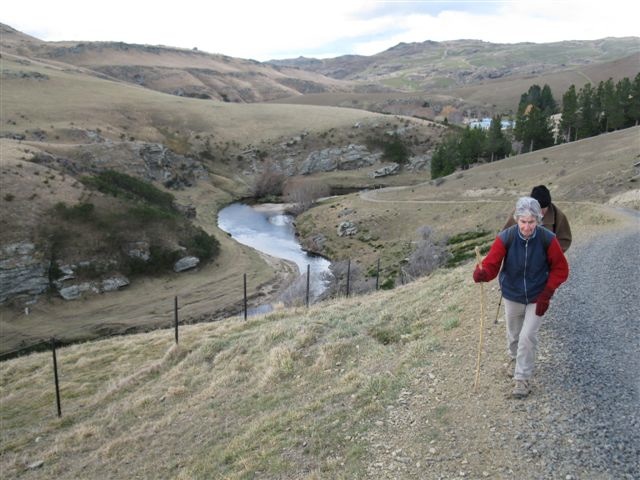
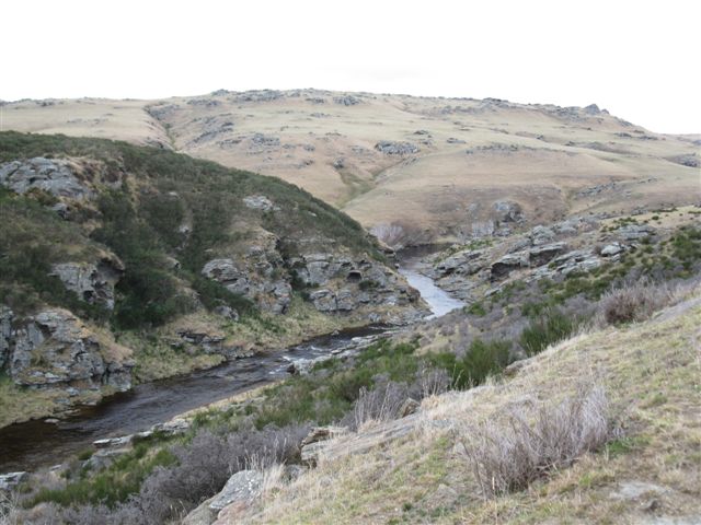
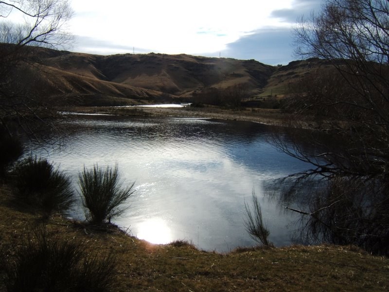
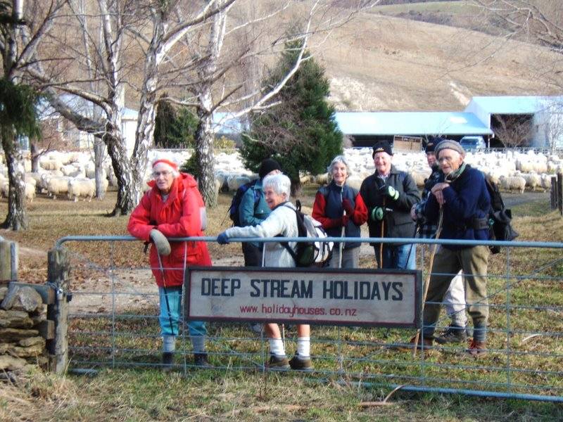
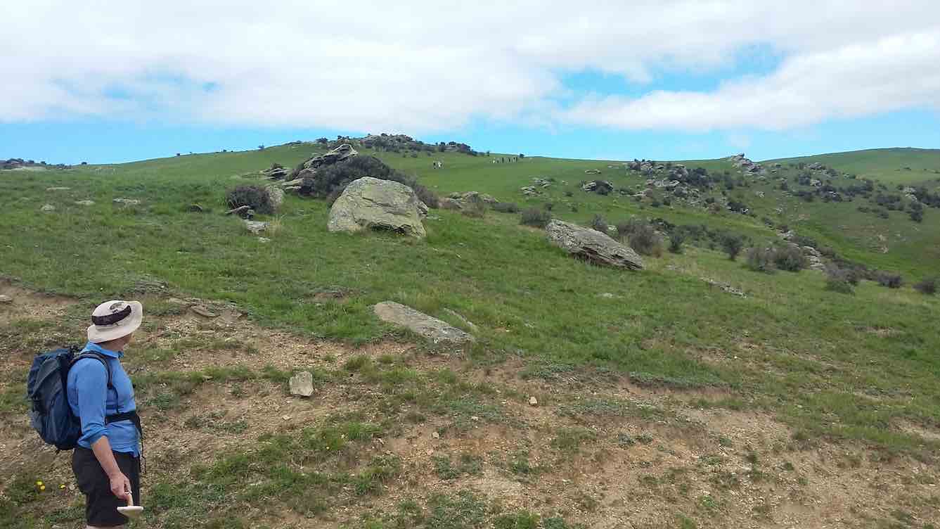
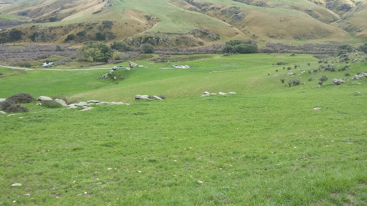
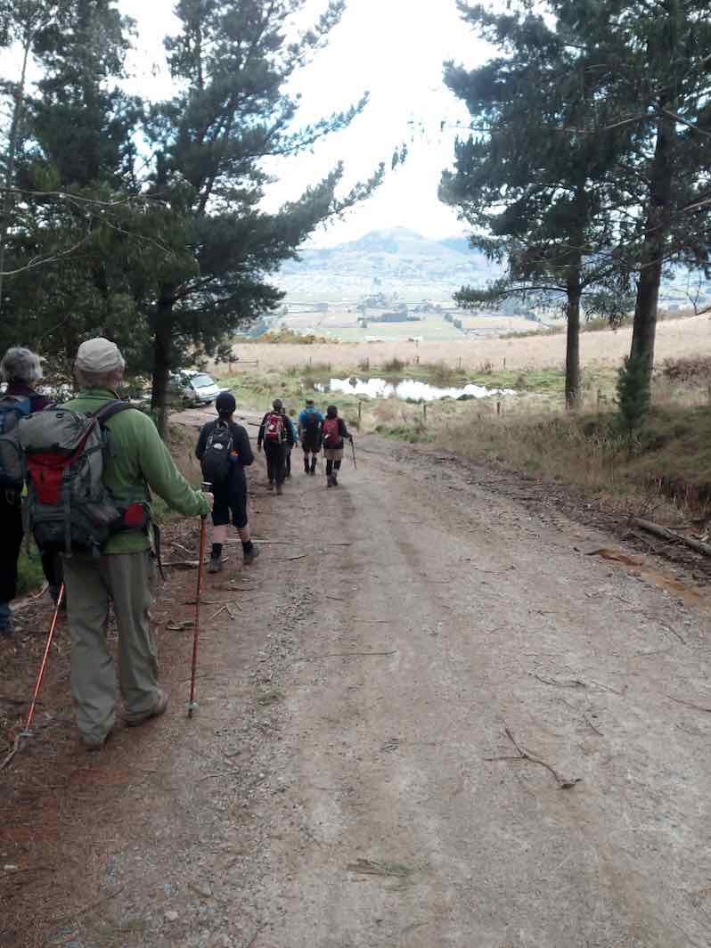
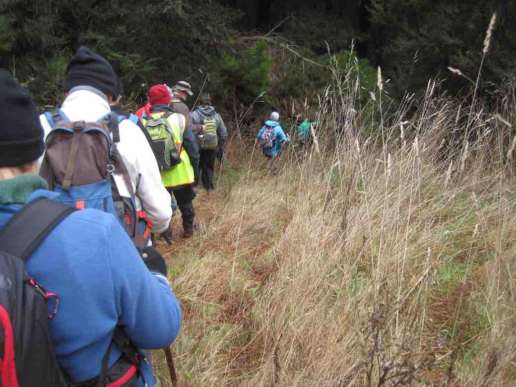
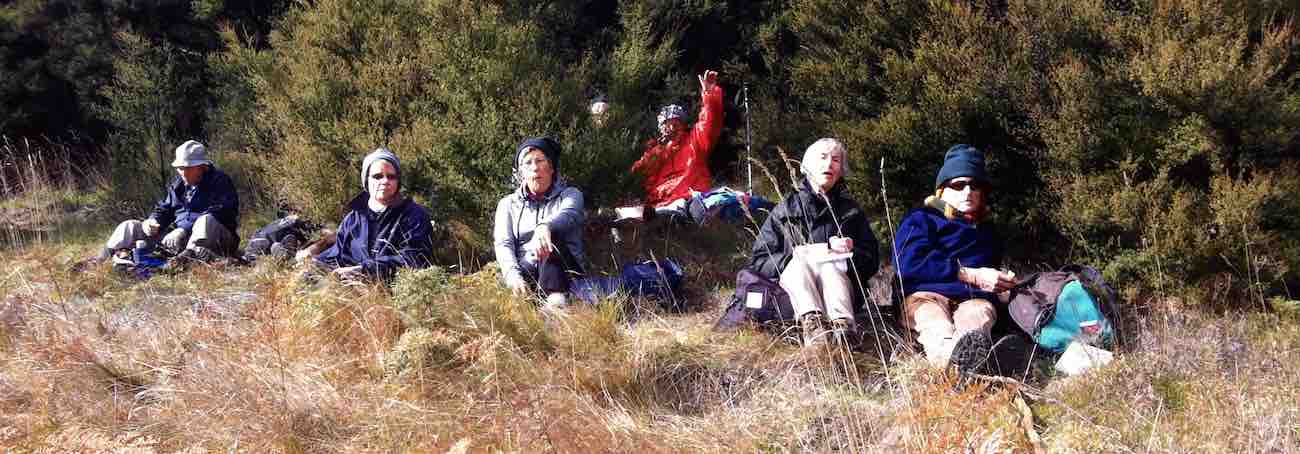
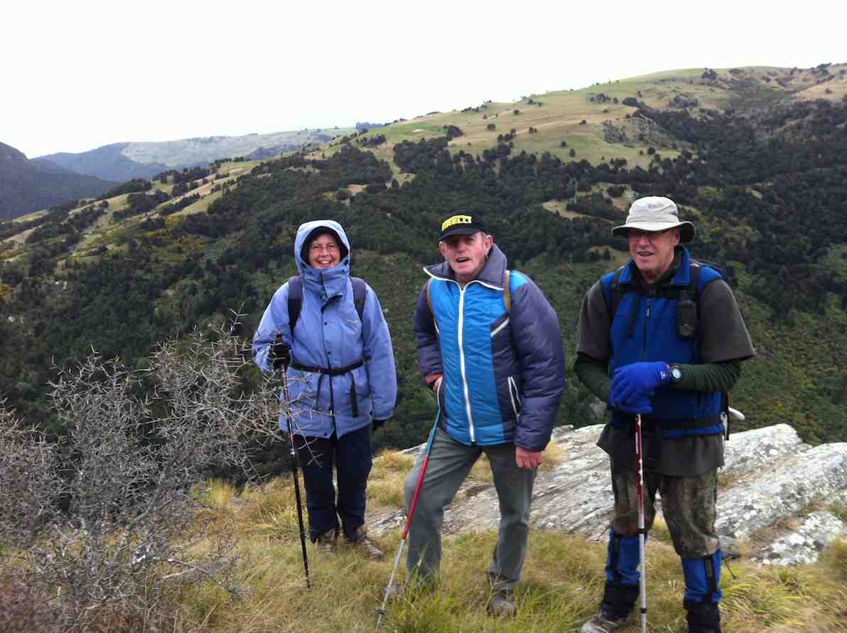
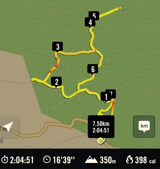
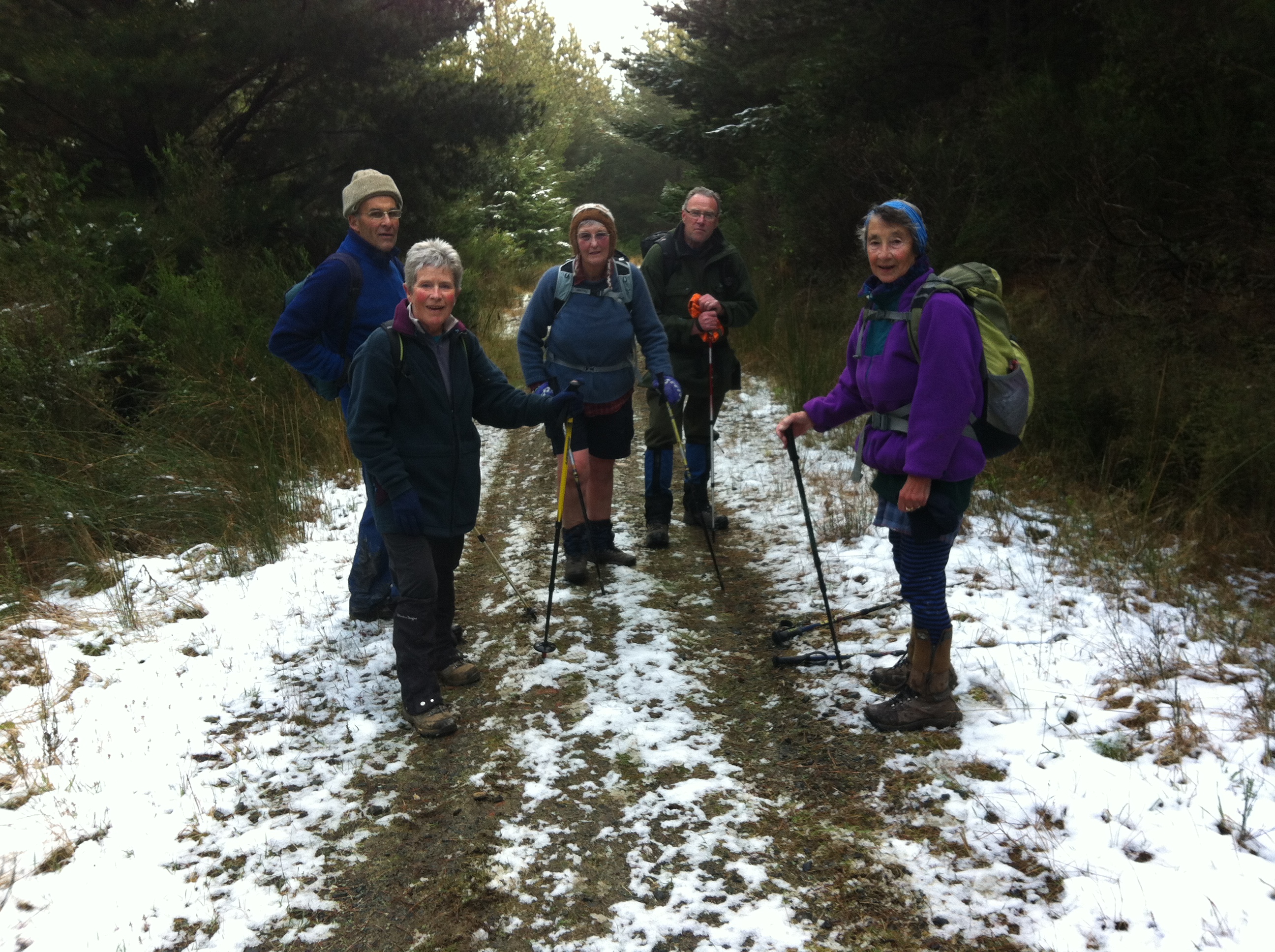
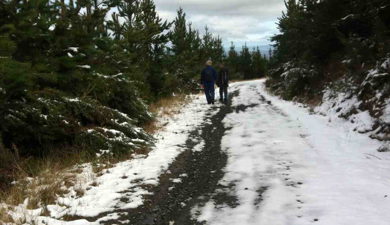
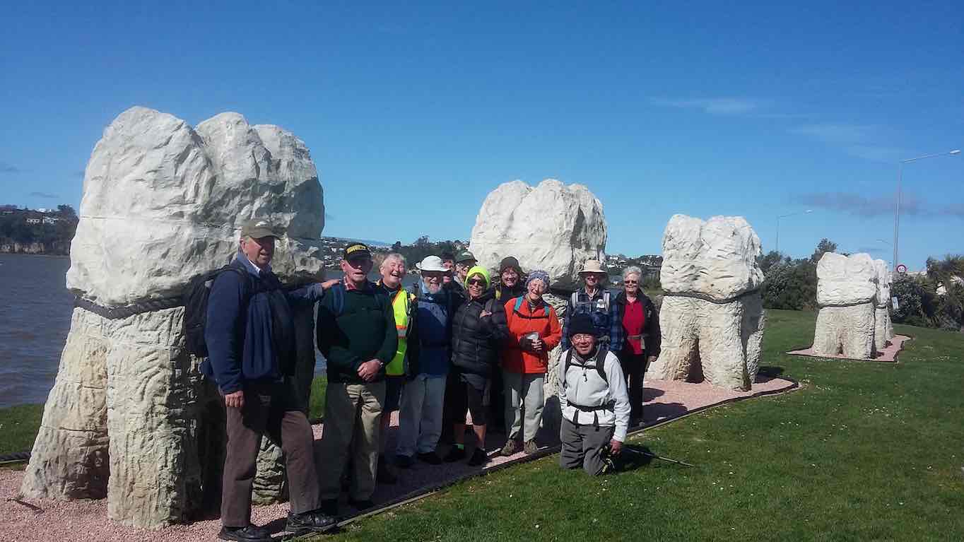
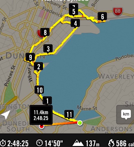
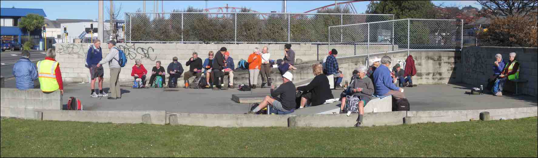
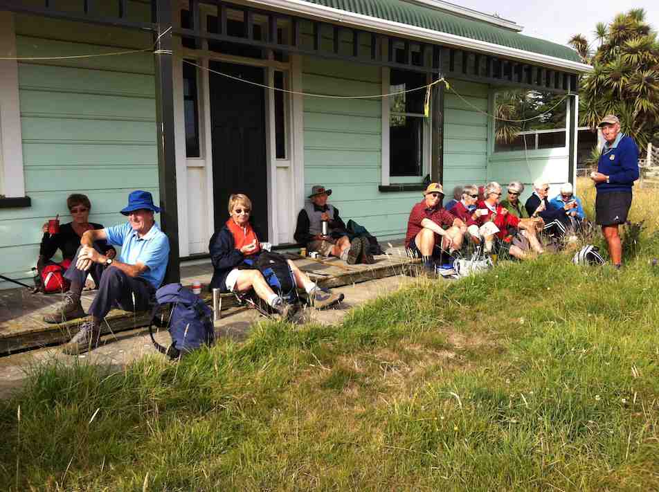
15. 18/9/2019. Hikers. Akatore Area. Leaders Bob Mitchell Kathryn Fagg
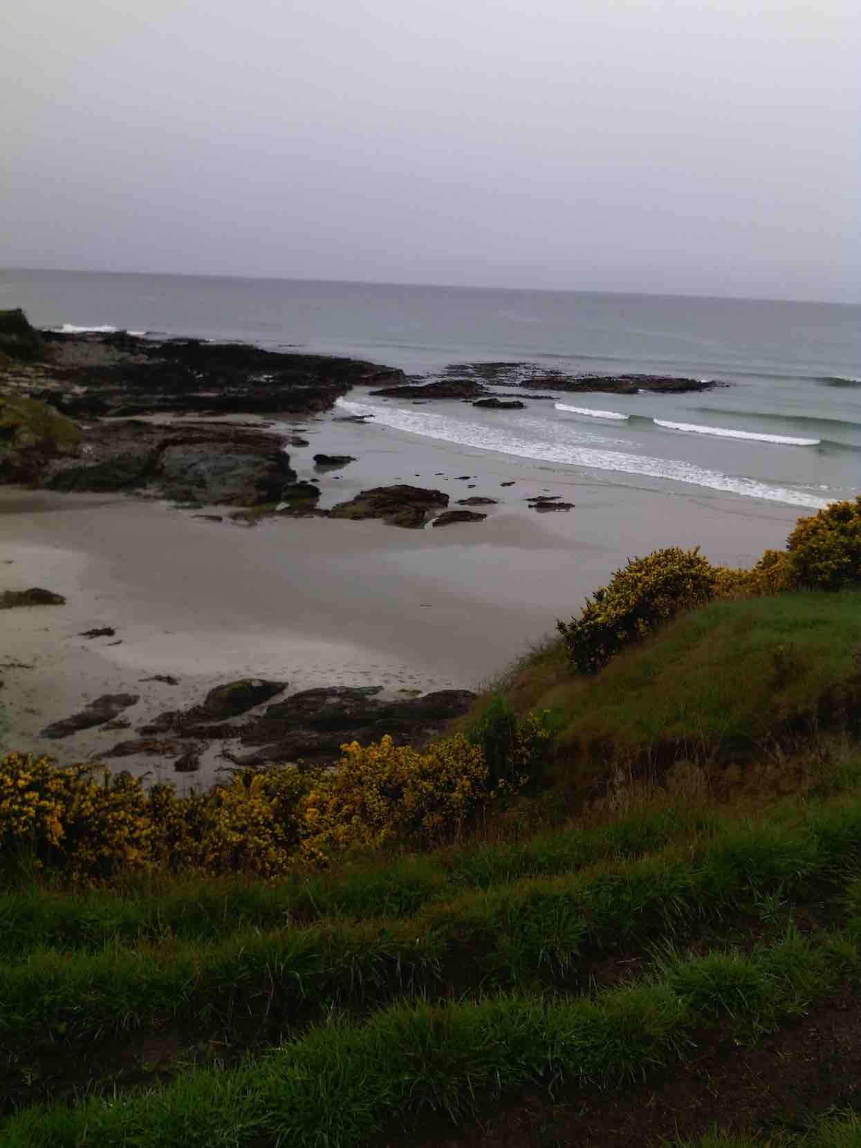
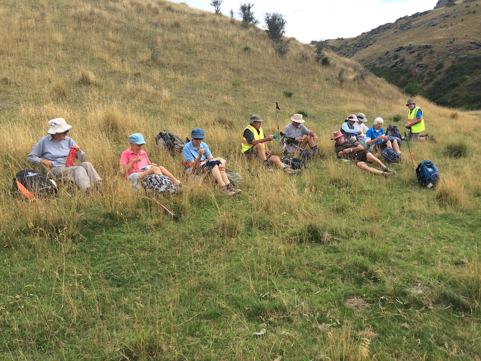
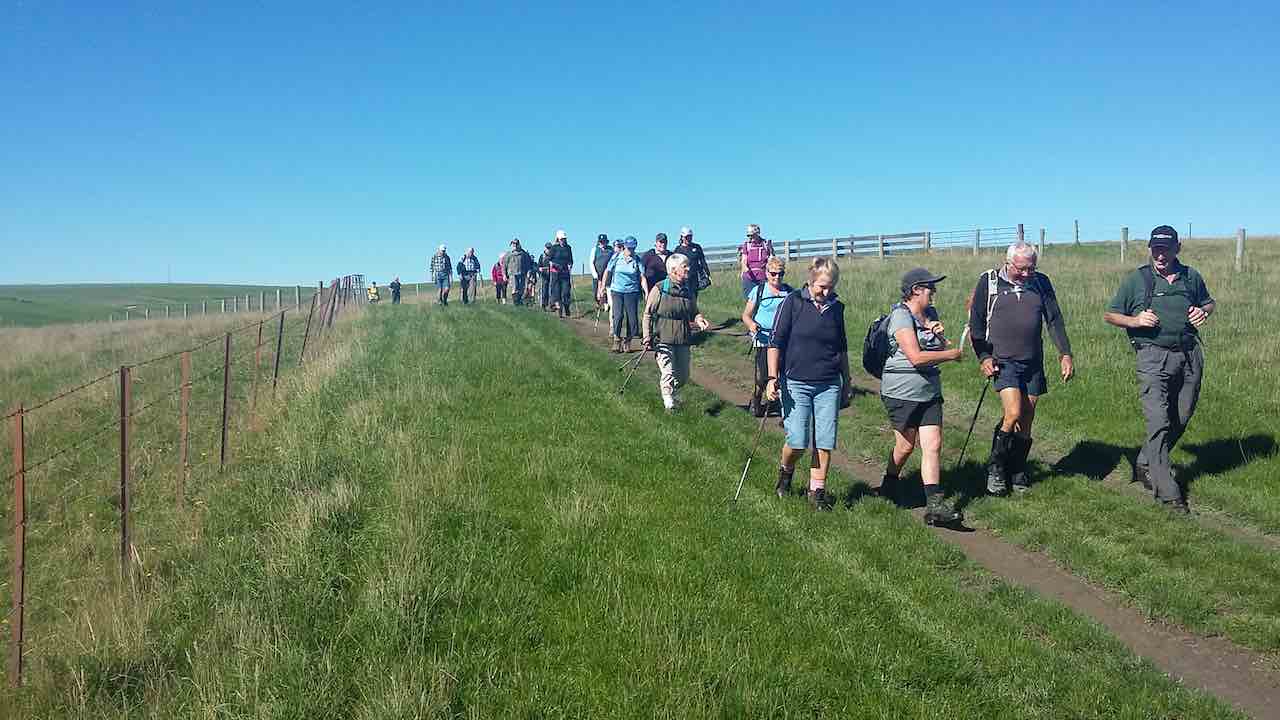
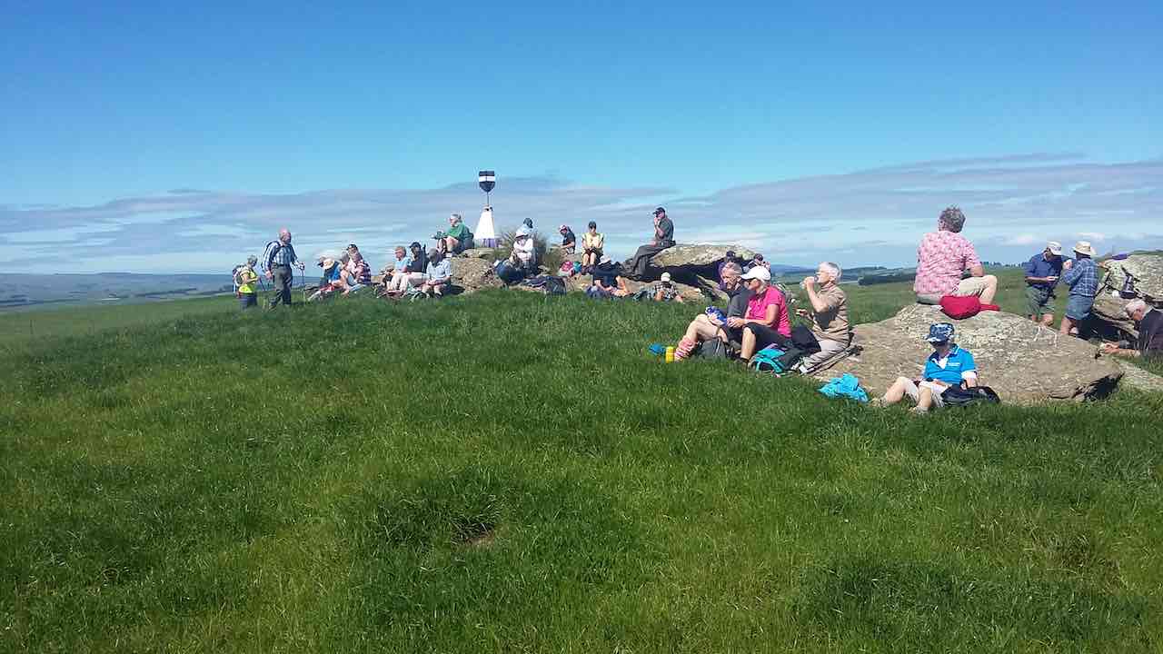
On another lovely spring day we left Peter Johnstone carpark and met with Bob who had organised the hike at the cattle yards on his son Braden’s Farm at Akatore. 18 hikers walked up the road and stopped for morning tea on the roadside where the views were great. We then walked through farm land and down to the beach where we had lunch. Then on through a bit of water
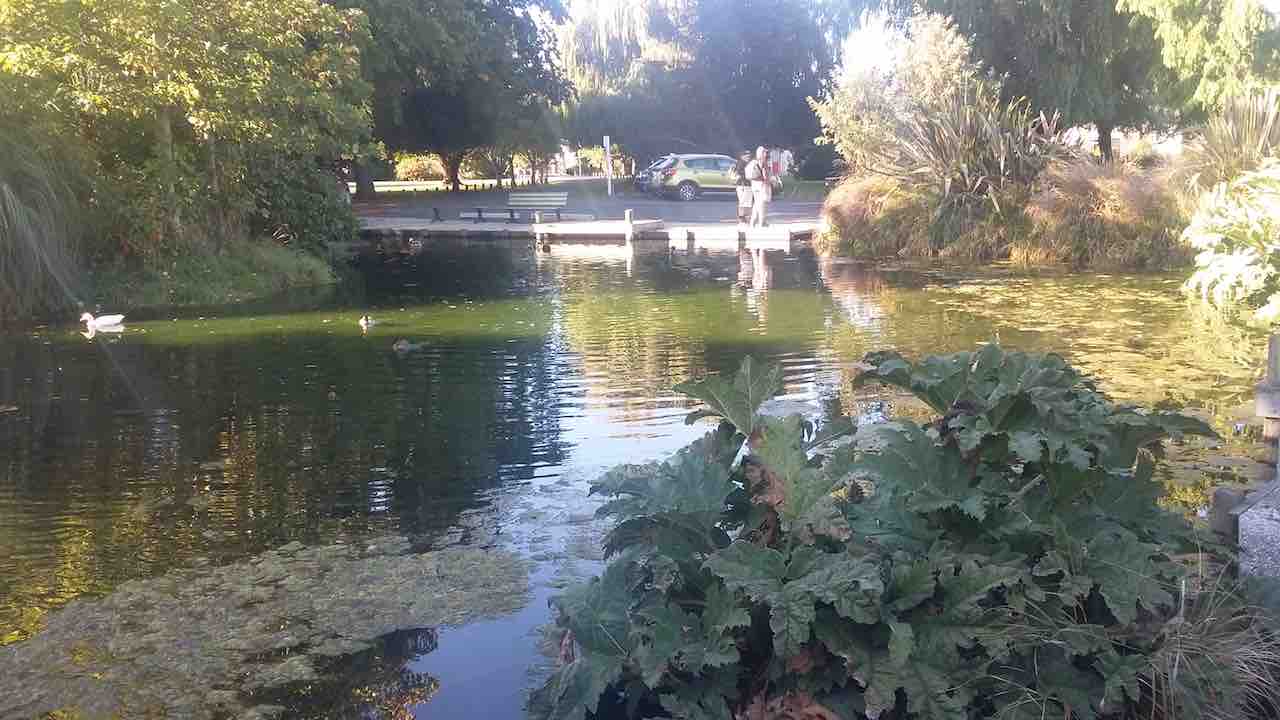
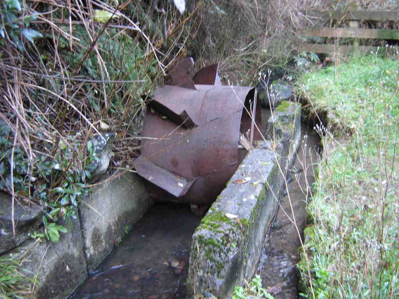
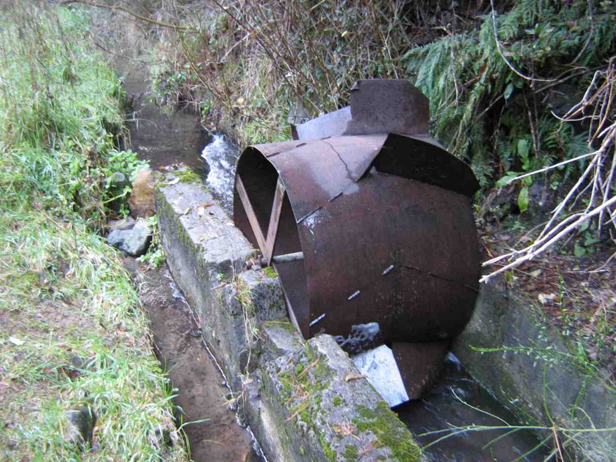
(Jan B. pic.) One of her own, sent when she noticed no one else had sent one.
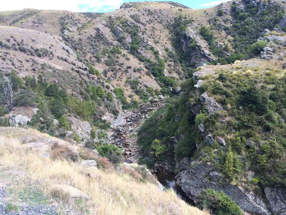
… and followed the creek around …
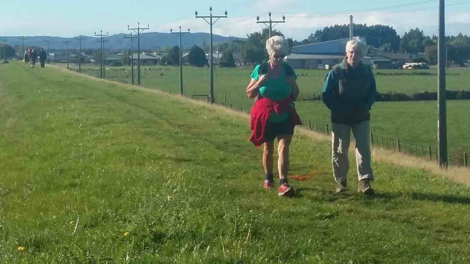
(Jan B. pic.) One of her own, sent when she noticed no one else had sent one.
… up to the road.
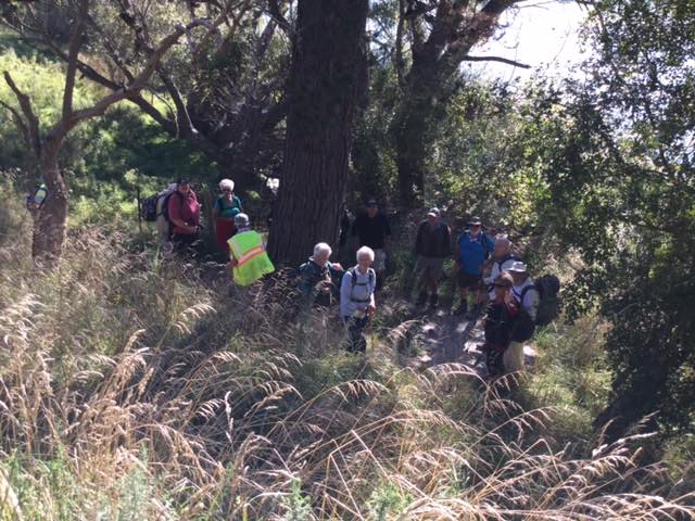
(Jan B. pic.) One of her own, sent when she noticed no one else had sent one.
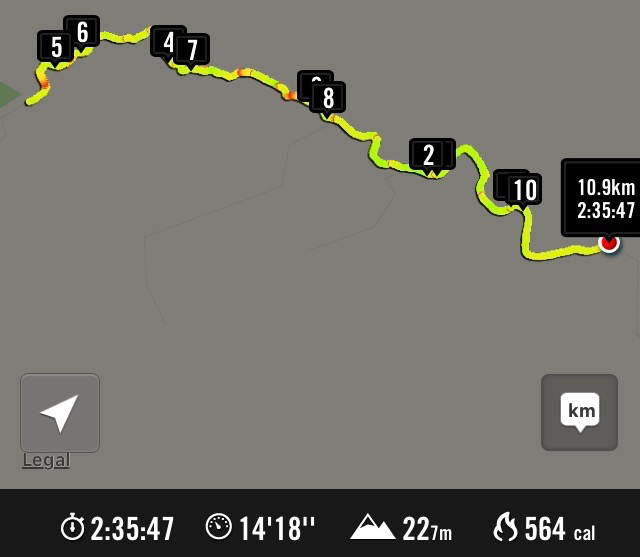
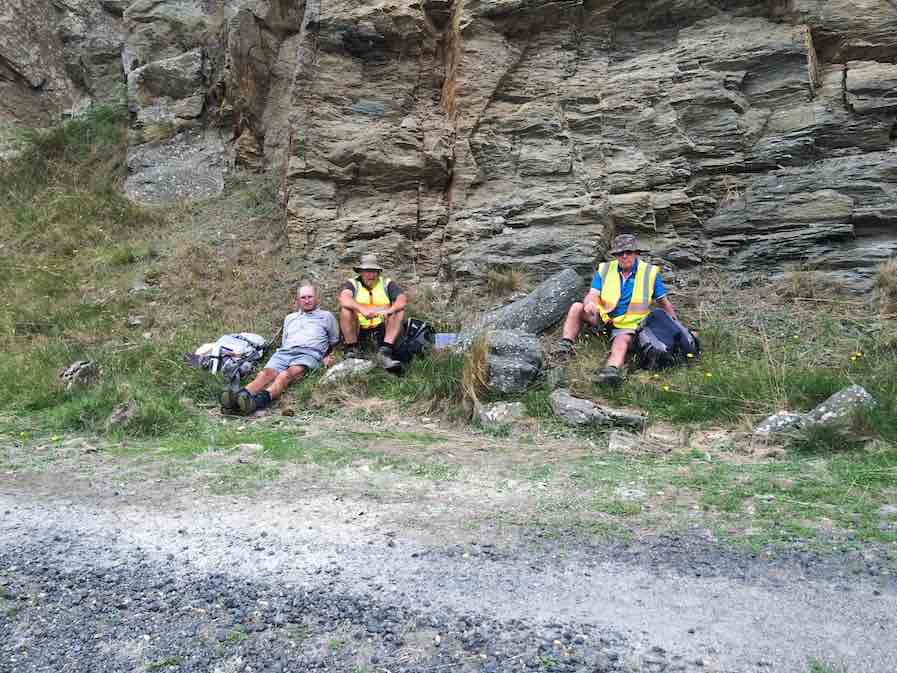
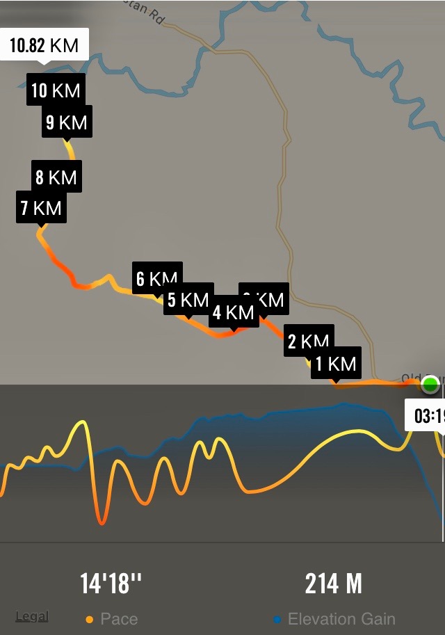
We then had a nice climb up the road until we arrived back at the cattle yards. It was an 8.5 k walk with roads, farmland, beach, water and a nice climb and then we finished off at the Brighton Cafe. – Kathryn.
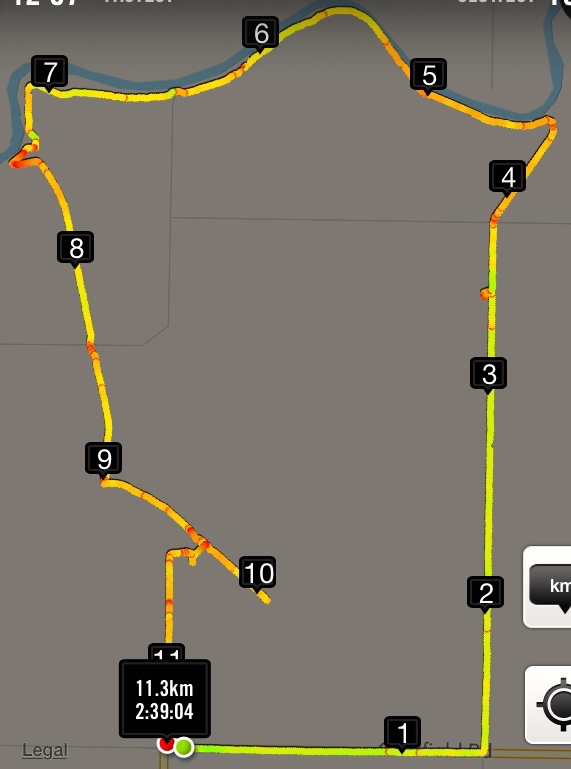
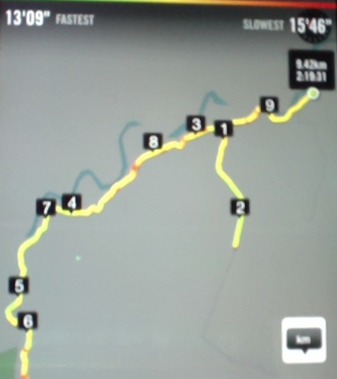
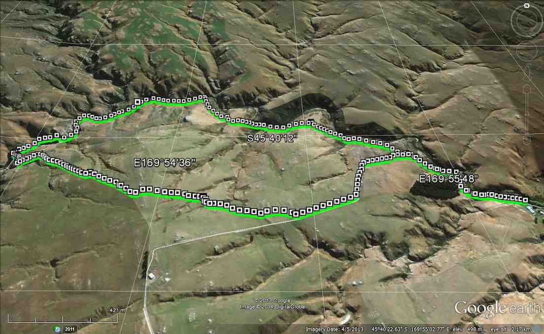
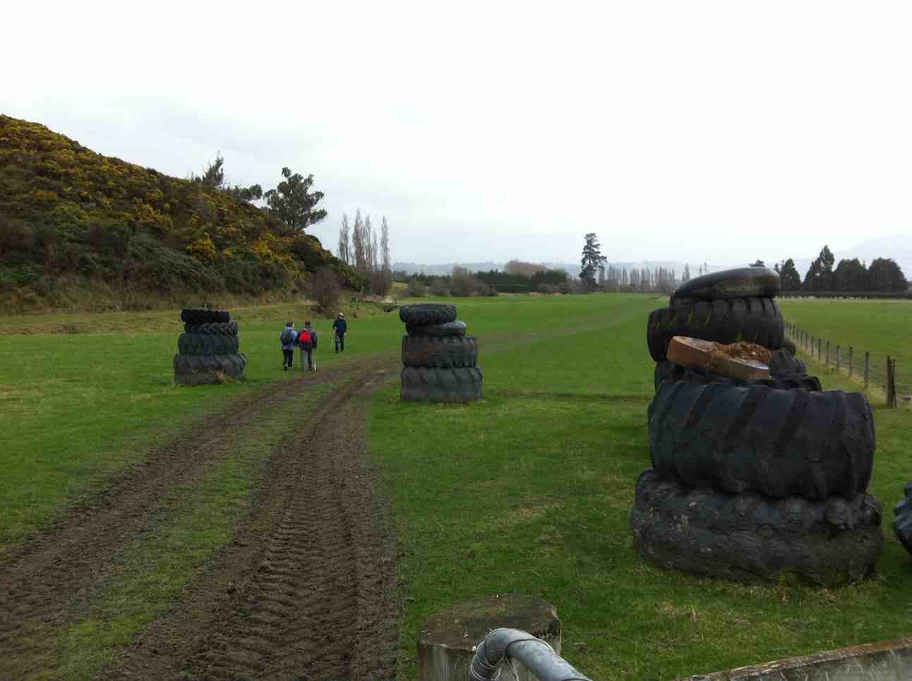
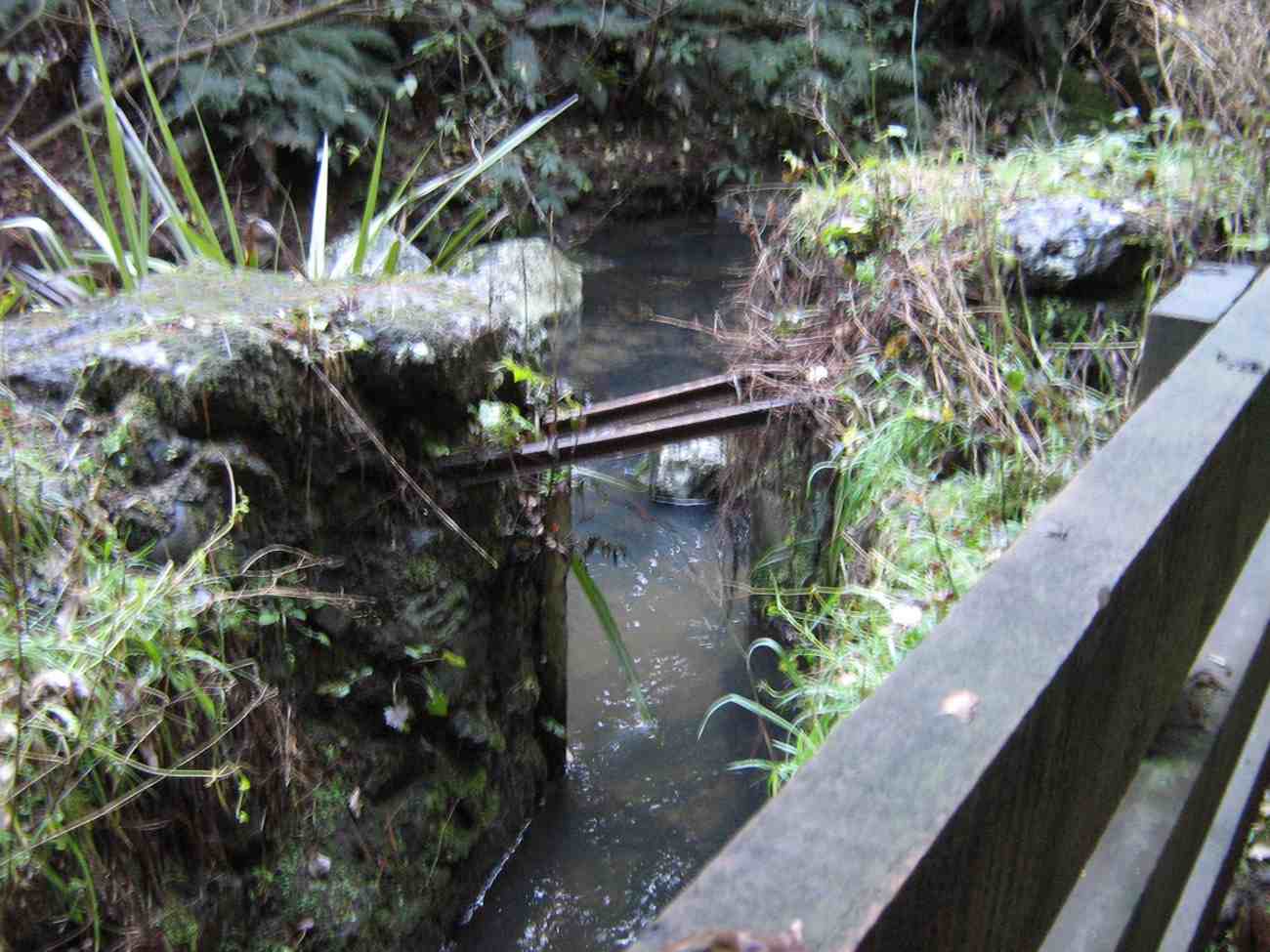
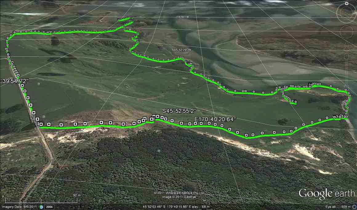
14. 15/3/2017. Hikers. Akatore Farm, Stream and Beach. H. Leaders: Bob and Lesley.
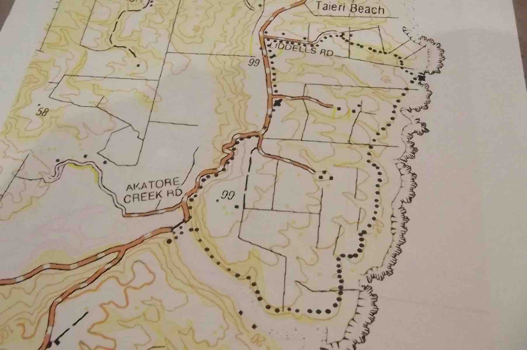
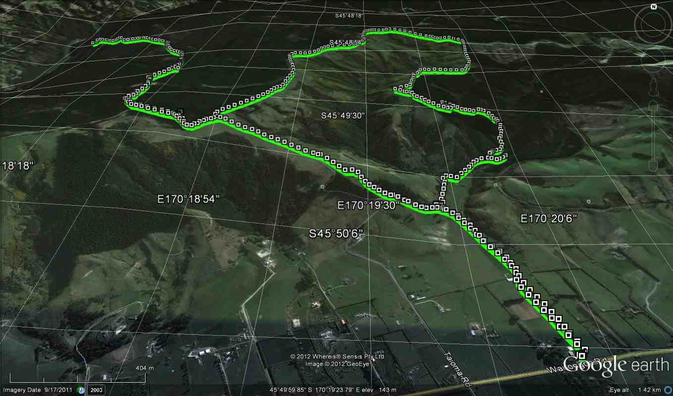
Route Map, courtesy Clive. Cars parked up from lunch spot. Distance walked: about 8.5 km.
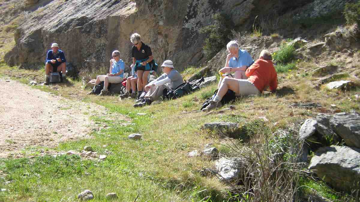
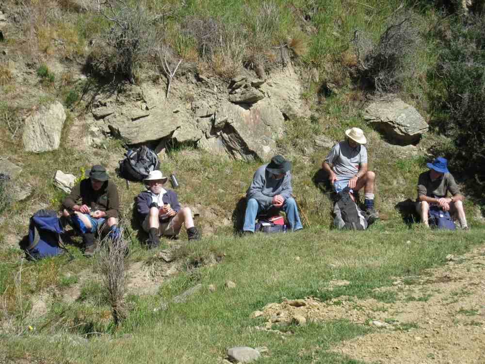
Bob lead 24 Hikers down the road to the bridge over the Akatore River,where we sat in the sun for morning tea.
Morning tea across the Akatore Bridge in the sun. (Ian pic and caption.)
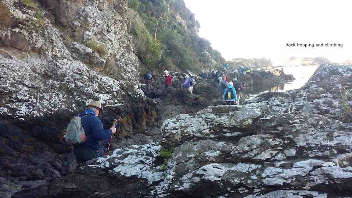
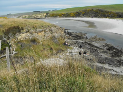
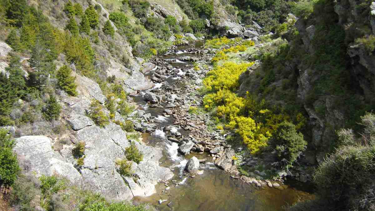
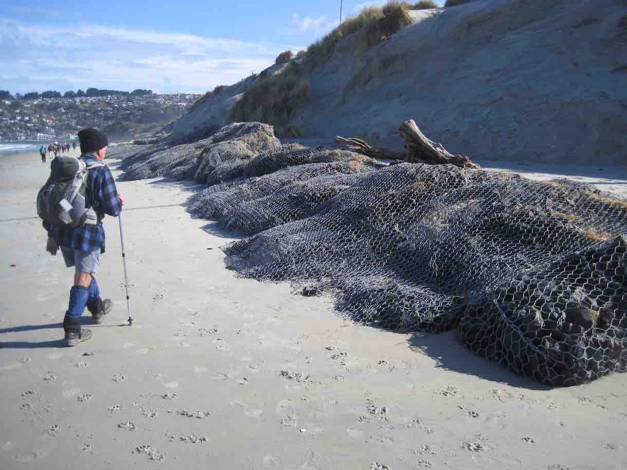
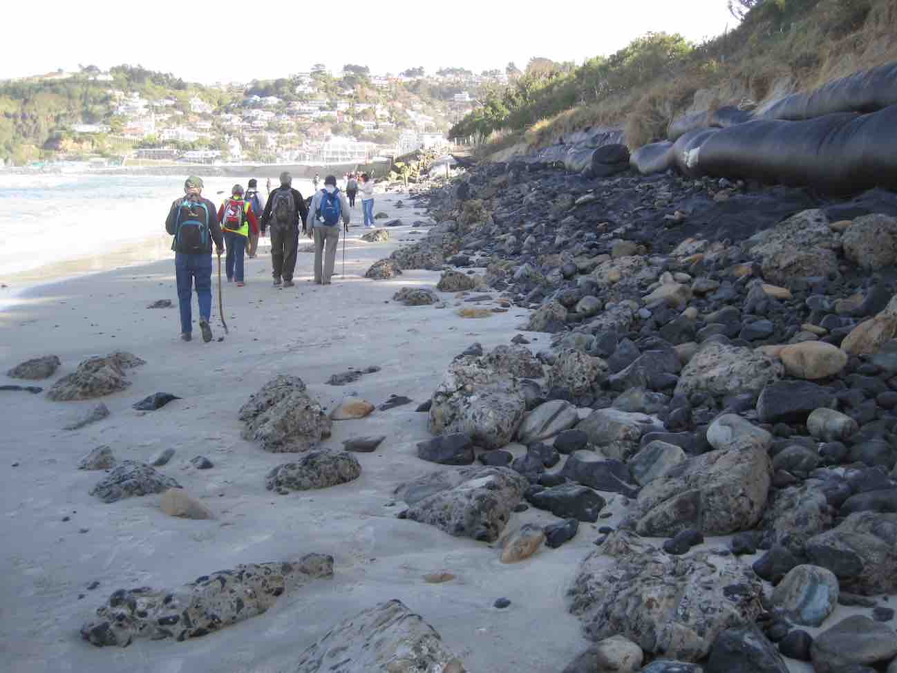
The tide was low enabling us to walk along the estuary,to the coast.This included a few moments of rock hugging,with many helping hands to get around a bluff.
Rock hopping and climbing. (Clive pic and caption.)
A few people declined and returned to the road,to be picked up by Braden,Bob son,on his farm “mule”and some rejoined the group.
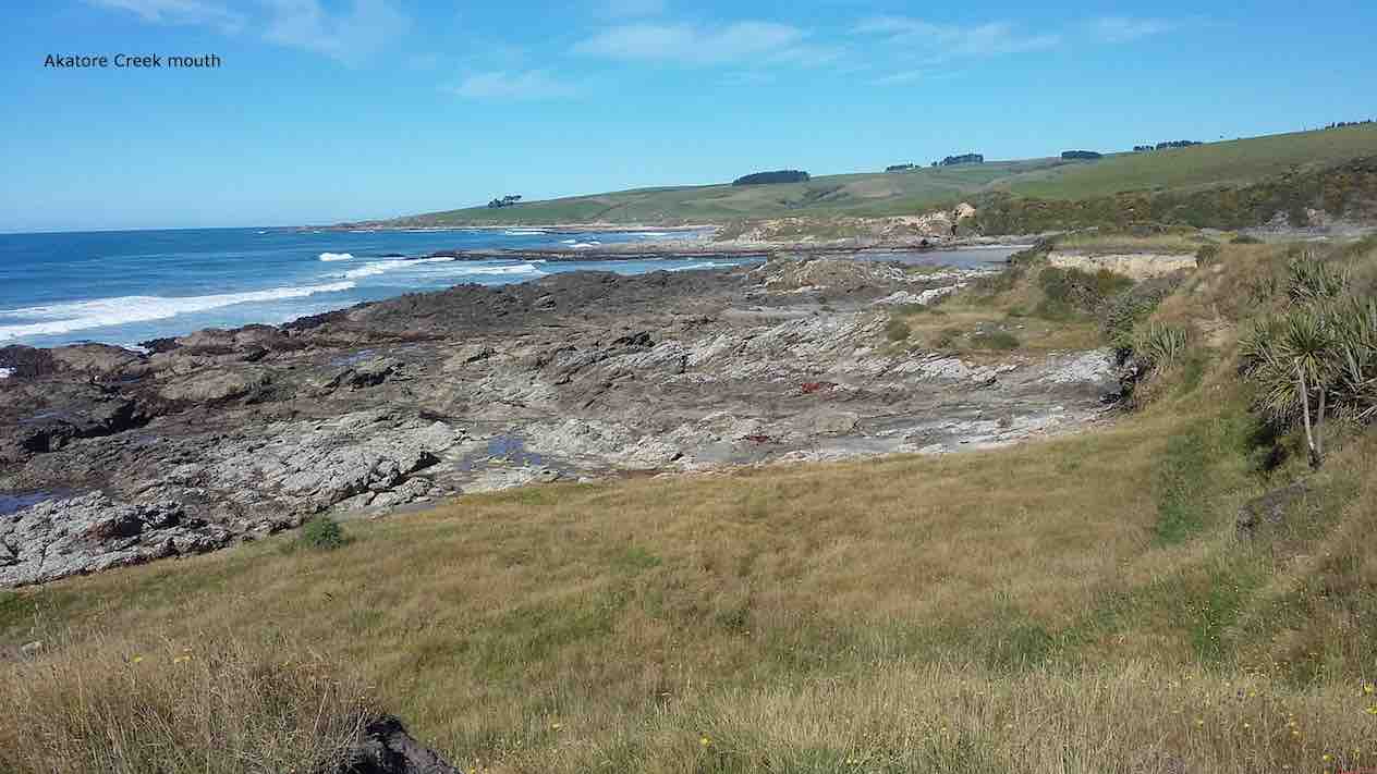
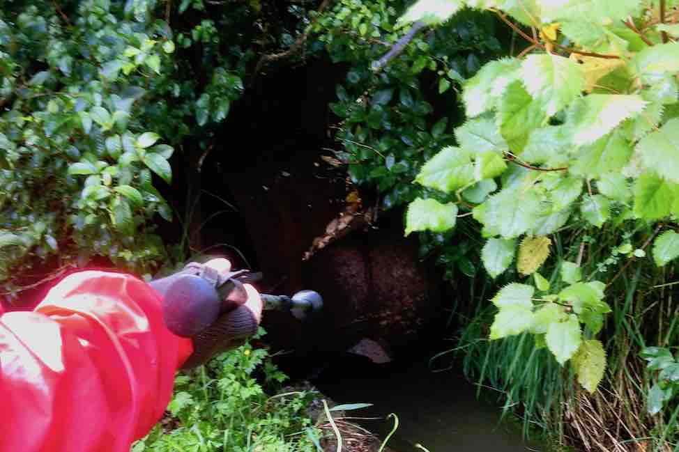
Akatore Creek mouth. (Clive pic and caption.)
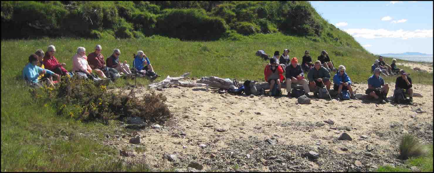
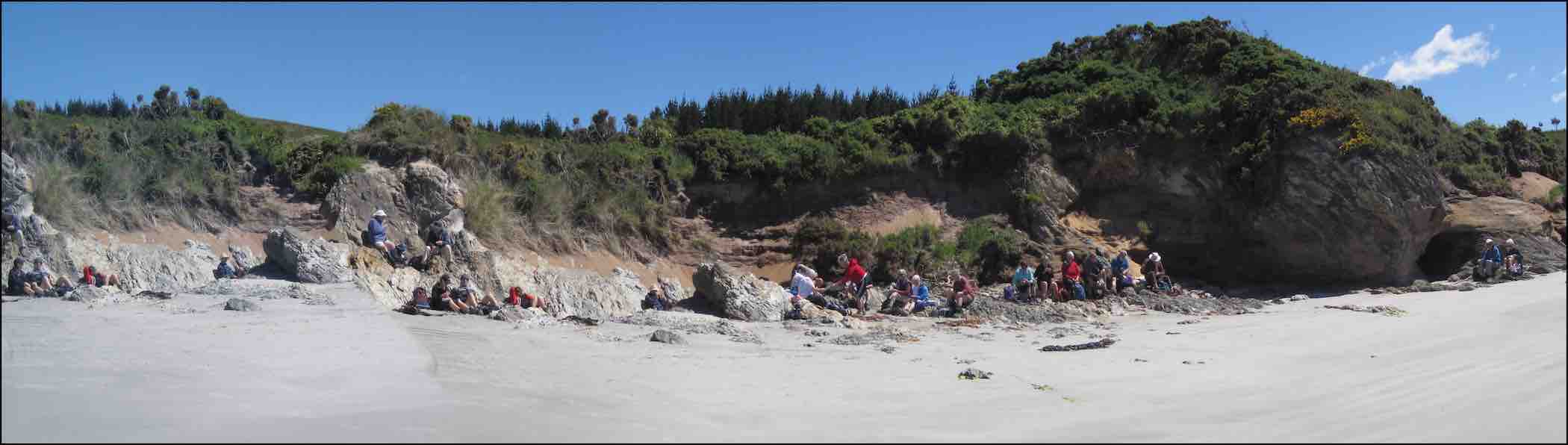
It was a clear,sunny day,with little wind and the journey along farm tracks,above the rocks,was good hiking.We lunched and explored at a private beach, …
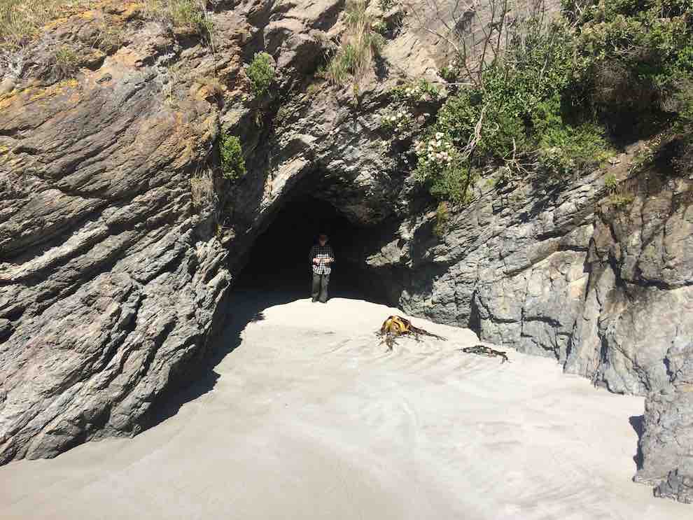
Kevin emerging from a cave on the beach at the lunch stop. (Ian pic and caption.)
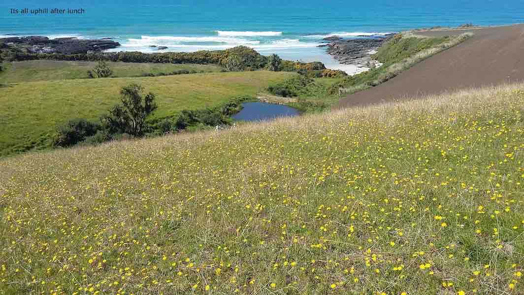
… then climbed the hill back to the cars,completing about 9km.
It’s all uphill after lunch. (Clive pic and caption.)
It was a different route on a favourite area,enjoyed by all, with coffee at Wals. – Lesley.
13. 5/10/2016. Trampers. Akatore Farm and Beach. E. Leader: Arthur H.
The windscreen wipers worked away as the bus took us for our tramps, the Hikers being dropped off first to walk the Millennium Track from the Henley end.
The Trampers were taken to Taieri Mouth, and then down the Akatore Road to the Taieri Beach Road, where we dismounted.
It was right on 10 o’clock, so morning tea was attended to as the first priority. A convenient ledge sheltered us from the cool breeze and light rain.
We walked down a long paddock to reach the sea. The paddock being recently cultivated was quite sticky from the rain. Our boots grew in size somewhat.
It was quite a relief to reach a lovely sandy beach, with the tide well out.
Down on beach copy. (Helen pic and caption.)
Turning right, we headed south, aiming for the mouth of Akatore Creek. The light rain was easing off slowly and after a while desisted altogether.
Along the beach, then it was up in the paddocks briefly to avoid a difficult patch of rocks.
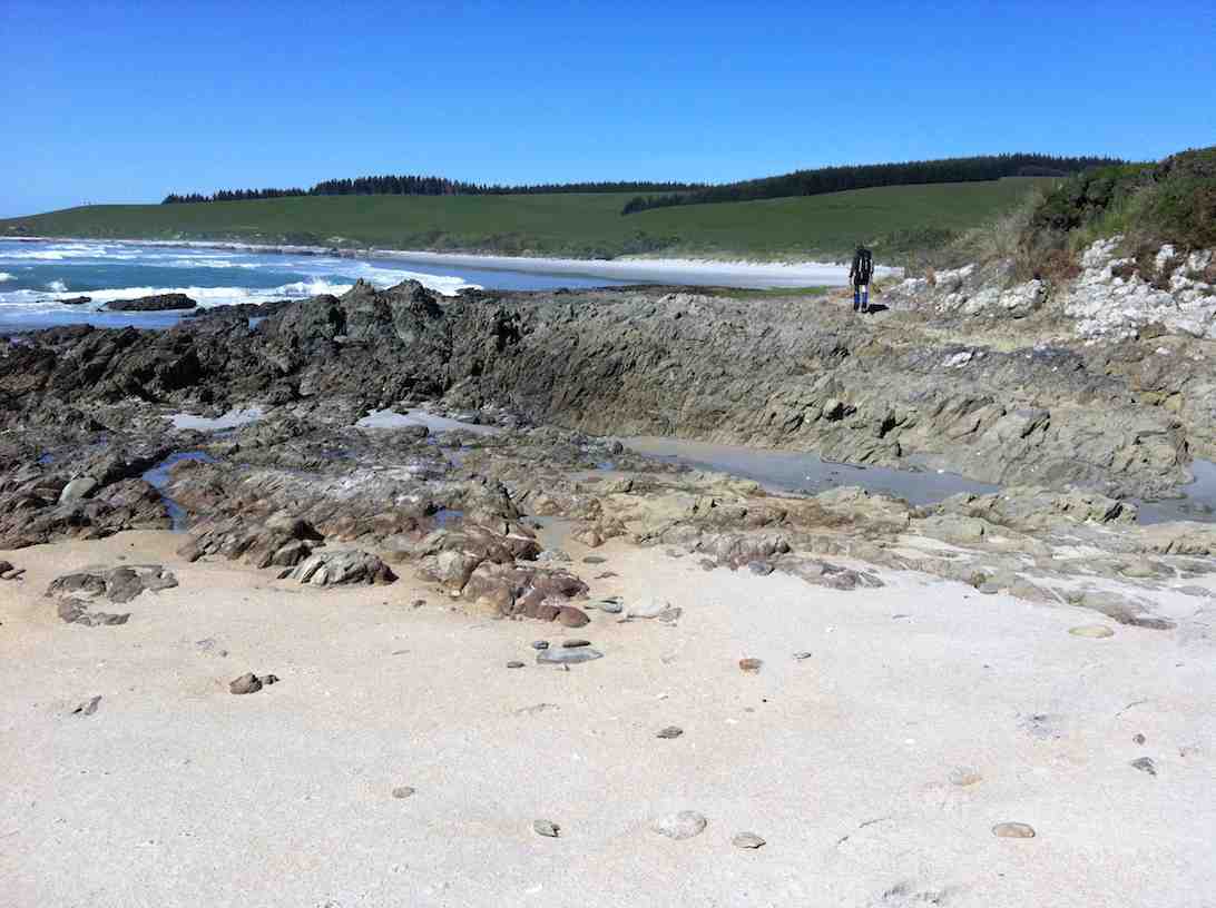
It was most pleasant following the coastline. Interesting rocks, some small sandy beaches and sandy patches interrupted the mostly rock.
Lovely beach. Helen pic and caption.)
Quite a lot of bird life was evident – lots of seagulls of course, oyster-catchers, pied stilts, a pair of terns overhead, and paradise ducks out in the paddock.
After inspecting an interesting cave, we had to climb up to the paddocks for a little. Descending again, we had a nice grassy strip of grass to follow, above the rocks.
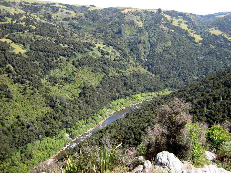
We came to the Akatore Creek mouth at 12 noon. It was almost low tide, and with a considerable flow of water exiting the creek.
Lunch was partaken of in the shelter of a steep bank, with some lovely yellow flowers about The breeze was quite light, but cool.
Lunch spot at Akatore Creek. (Helen pic and caption.)
The next leg of our journey wass uphill through the farm paddocks. A large mob of very friendly dairy heifers followed us along the fenceline as far as they could.
At the top of the hill we devoured a little to the left to get a good view looking down onto the Akatore estuary and environs.
Road and tidal area. (Helen pic and caption.)
Out onto the road, we followed it for two kilometres to arrive back at our starting point at 1.35 p.m.
A little early for the bus, we walked the road to Taieri Mouth. Downhill was easy. A very friendly pet lamb wanted to join our group after escaping from his paddock. But we had to be firm! Near the Taieri Beach School is an animal park (closed) where we glimpsed various species, including alpacas, geese, deer and ostriches(?).
We kept walking along the road, not so enjoyable but many interesting houses and backyards could be viewed in Taieri Mouth. Eventually we came in sight of the bridge over the Taieri River and the bus parked at the southern end of it.
The Trampers came to the bus at 2.45, soon after the Hikers had finished. There had been seven in our group today, our distance travelled: 14.5 km maybe(?) (using a small-scale road map to estimate from) – please come back soon, Margreet!
The bus delivered us all back to Mosgiel, after which may invaded “Wals”, creating mayhem with the tables, but it was a good finish to the day. – Arthur.
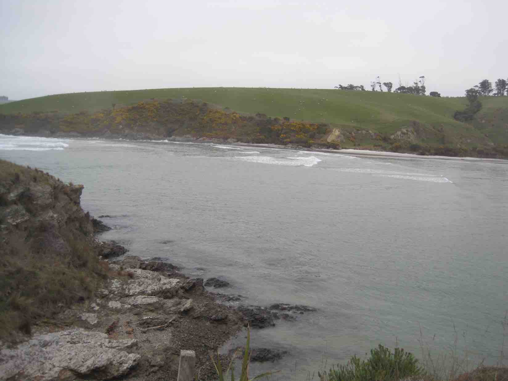
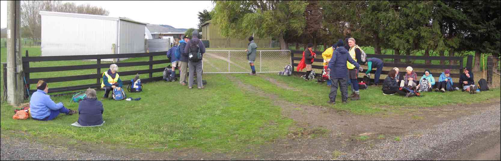
12. 23/9/2015. Hikers. Akatore Farm and Beach. E. Leaders: Bob and Leslie.
Twenty-nine of us parked at the farm’s stock yards and walked back north along the road to enter a neighbouring property, go through past the homestead, out into paddocks and down to the coast for morning tea.
A rocky knoll tempted two or three of us to climb it and view the surroundings from there.
On top of knoll. (John pic)View from top of knoll. (Bob pic)
We climbed back out, this time heading south parallel to the coastline through paddocks, some grassed and one being freshly being turned over with a large six-furrow plough. We walked for a while down along beach and rocks …
Down to beachA seaside conversation
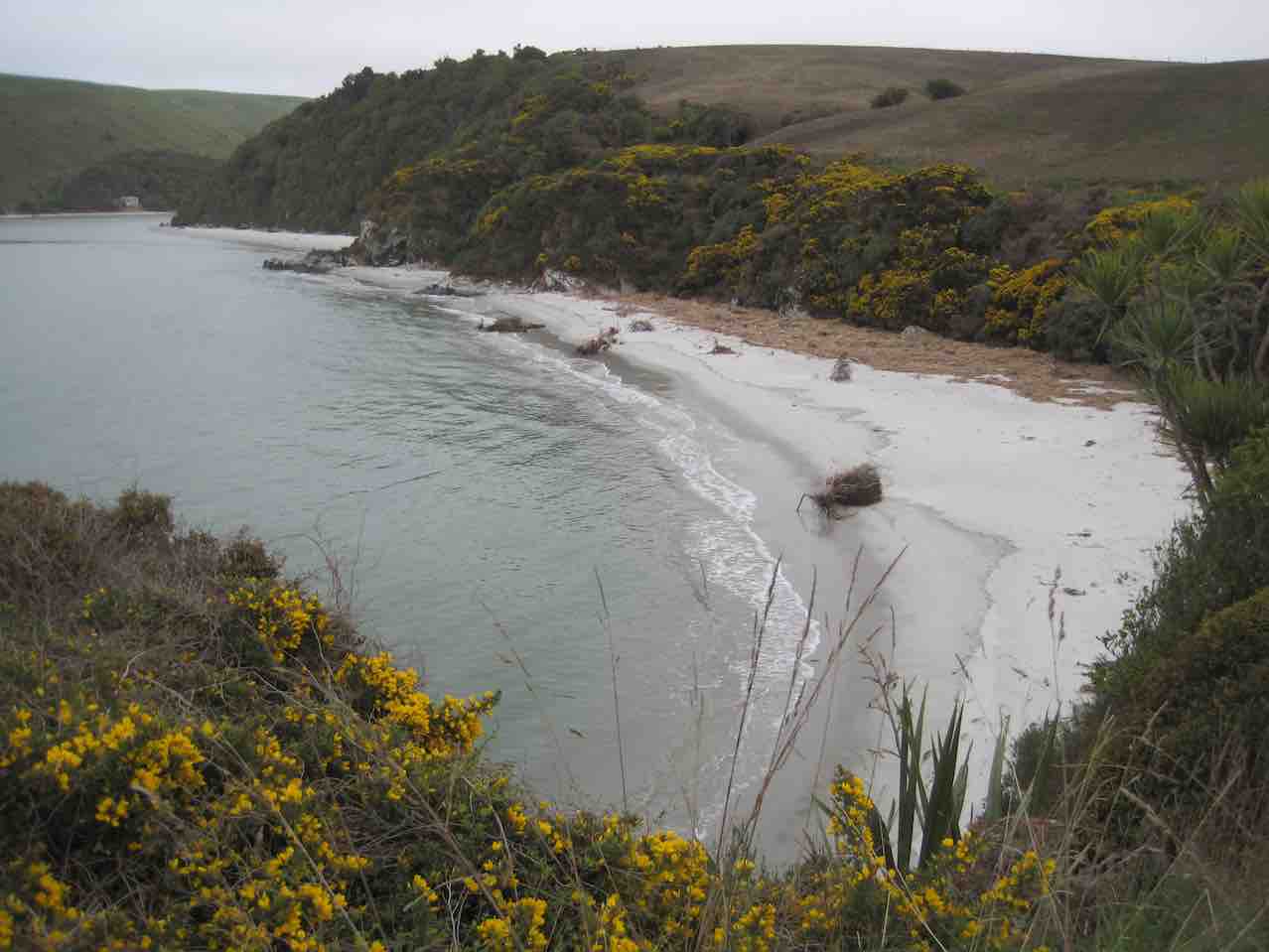
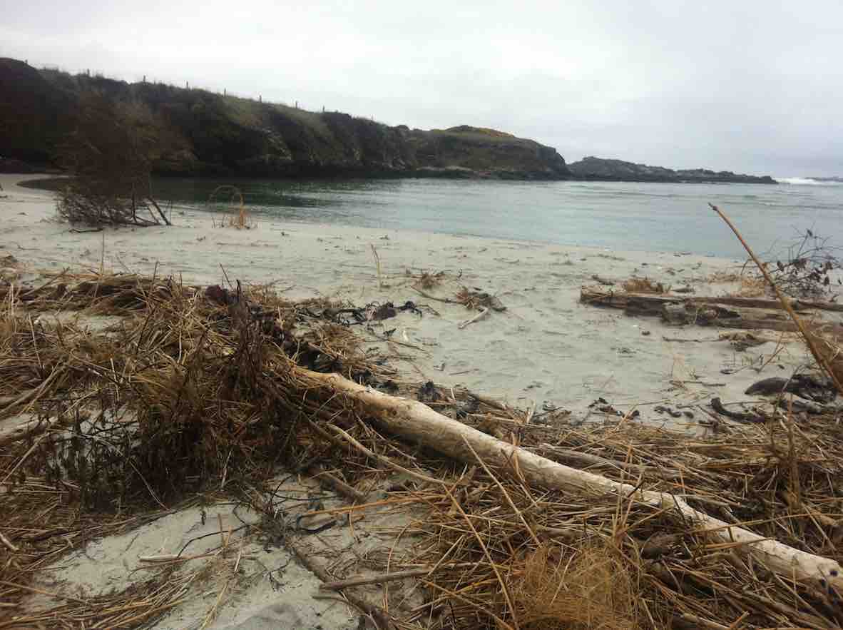
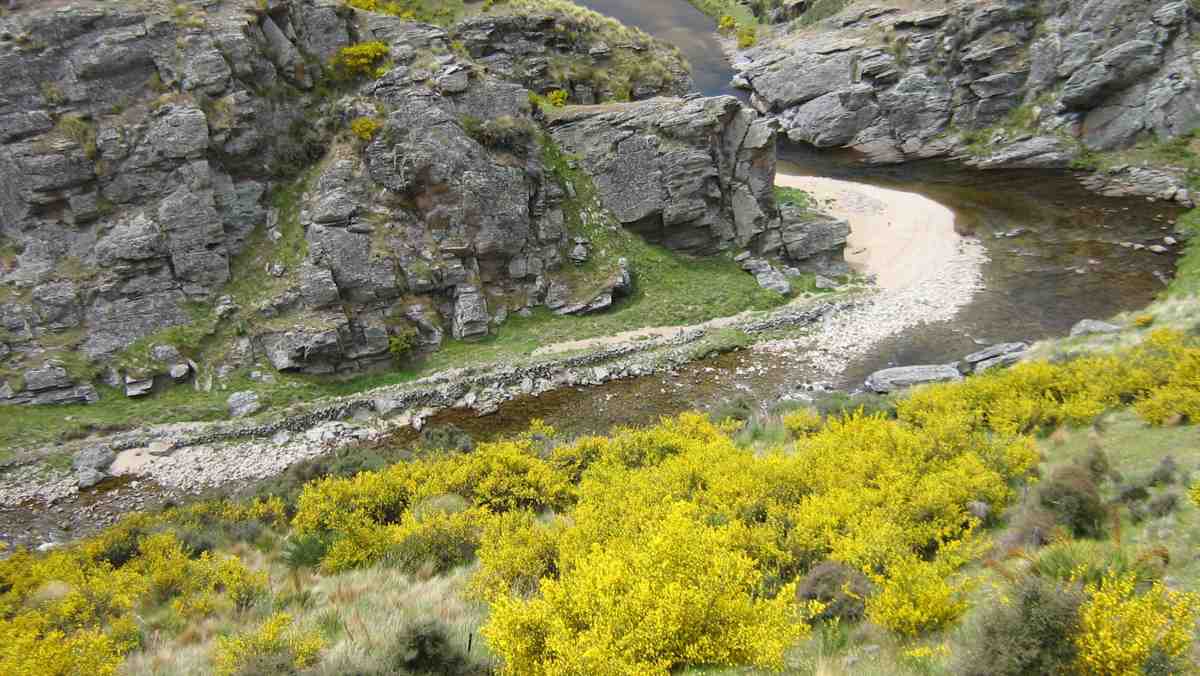
… before being obliged by the high tide to return up the the paddocks. Eventually we reached the Akatore mouth. And what a sight. What had formerly been a gentle rock-hugging stream was now a wide mouth of breaking surf from the near side right across to the farther one.
New Akatore mouth 1. (John pic)
New Akatore mouth 2 (John pic)
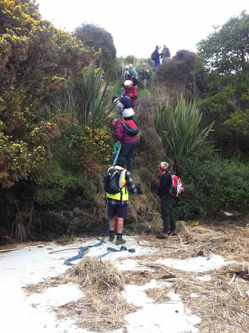
No beach, or none at this tide level. Bob led us along the outside of a fence upstream just a little to descend a steep back to a new beach where once the stream had flowed. He had provided us with a huge hawser rope tied to the fence and lengthened at its end with a strapping belt stretching right down to the new beach.
New beach. (John pic)
With its aid, we all made our way safely down the cliff-face, …
2nd descent
… each doing so in our own fashion.
We lunched there, finding seating on lumpy dry marram grass, on the new beach of sand that must have been metres deep. What a powerful transformation the high seas had made of the old mouth we had become accustomed to.
New Akatore mouth (See below in 2011 report, click on video of old creek mouth)
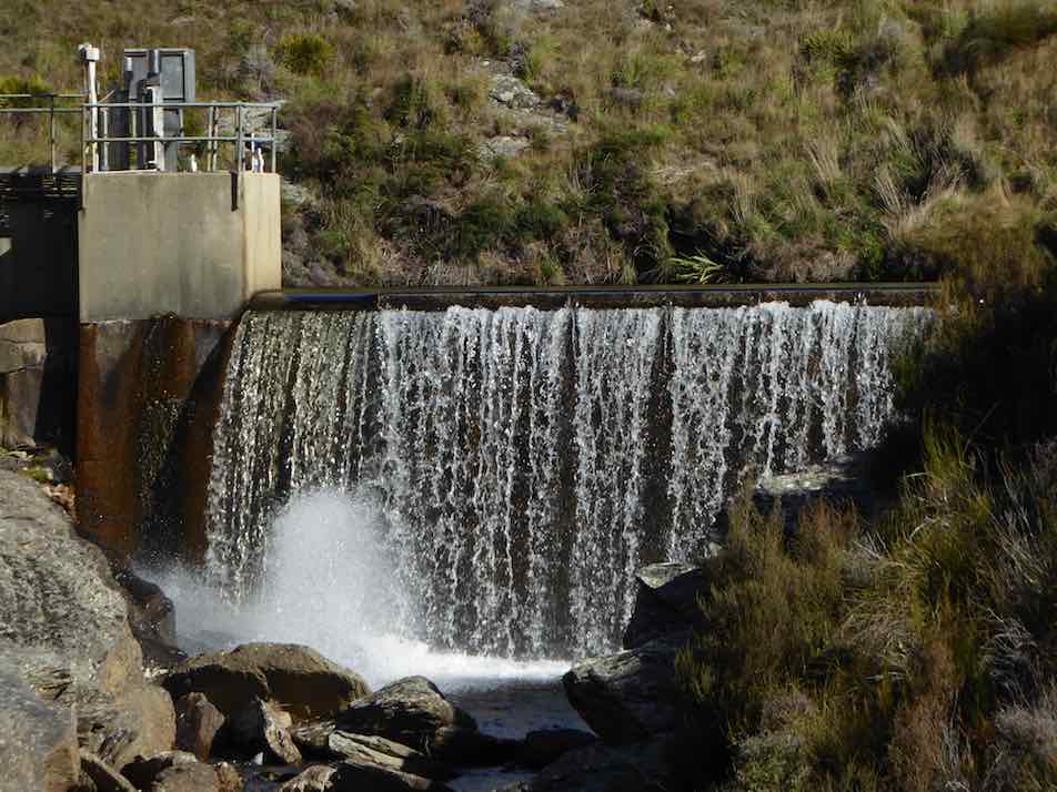
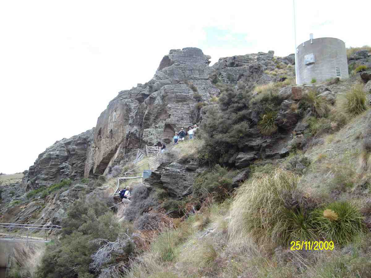
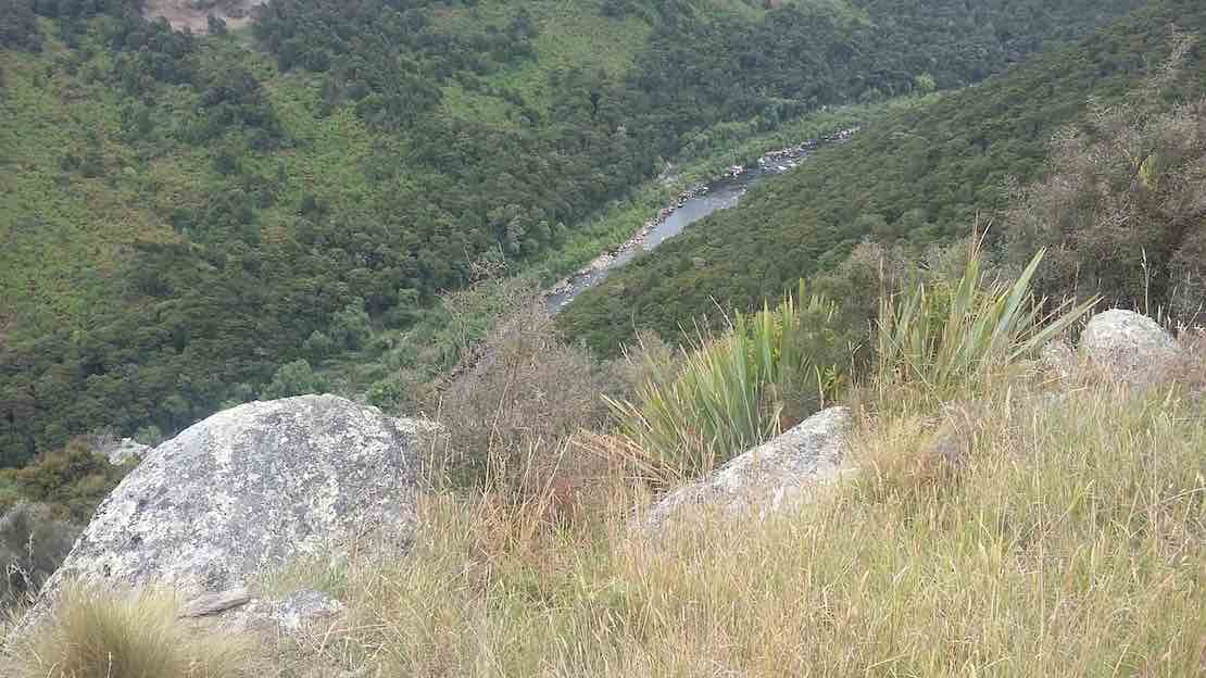
After lunch, Bob led us up the true left edge of the stream along an edge made very narrow with an ebbing tide that still had a long way to retreat. At the first point there was no option but to make one’s way around rock still surrounded by shallow water. Never mind. The rest of the way was dry, if pebbled with rocks larger and smaller in places, sandy in others. We made our way then up to the bridge where Bob introduced us to that steep road climb that takes one right up from sea level to the top where the road first turns down. It made for a good workout, giving hikers with their varying energy levels the chance to brave the climb at their own pace. However, beside the rope provision back at the lunch stop, behold there had also been Bob’s ute sitting down at the bridge for any who didn’t relish the prospect of the climb. But bravo, no one took it. And Bob was noble enough to leave it standing there, true to his leadership role, and climb with the rest, with the intention of walking back down later to retrieve it. Noble? Would might even say silly not to enjoy ride back up in triumphant style. Painful certainly, this reporter imagines. It’s a long hill climb to the top. Good on yer, Bob.
(It was too bad the ‘Nike + Running’ app fell over in a big way and has had to be re-down-loaded, – so no GPS record this time). This was a most interesting tramp, a replacement for the original one that had to be abandoned due to lambing. We all enjoyed the experience of a route the club had not done before, now made possible by the mighty changes the ocean had wrought on the Akatore’s mouth, and exploited by Bob. So thank you Bob (and sister Leslie!) for the planning and the advance provision of rope and ute. Great leadership! – Ian.
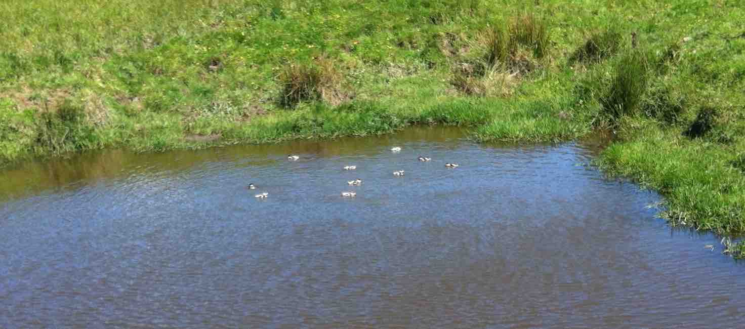
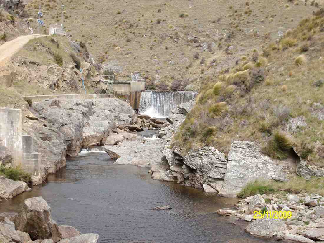
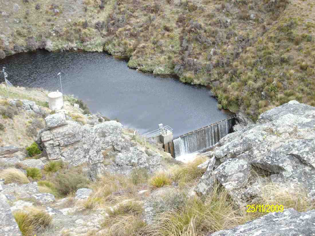
11. 26/11/2014. Hikers. Akatore Farm and Beach. E. Leaders: Leslie and Bev.
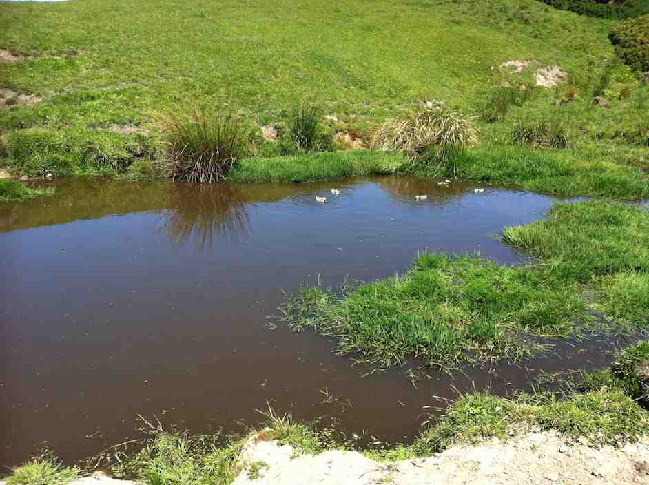
GPS of routeCuppa. (John pic)Lunch panorama. (John pic)Comfortable? (John pic)Paradise Duck Chicks in pond.
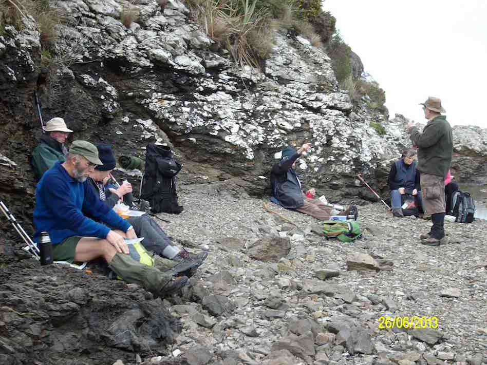
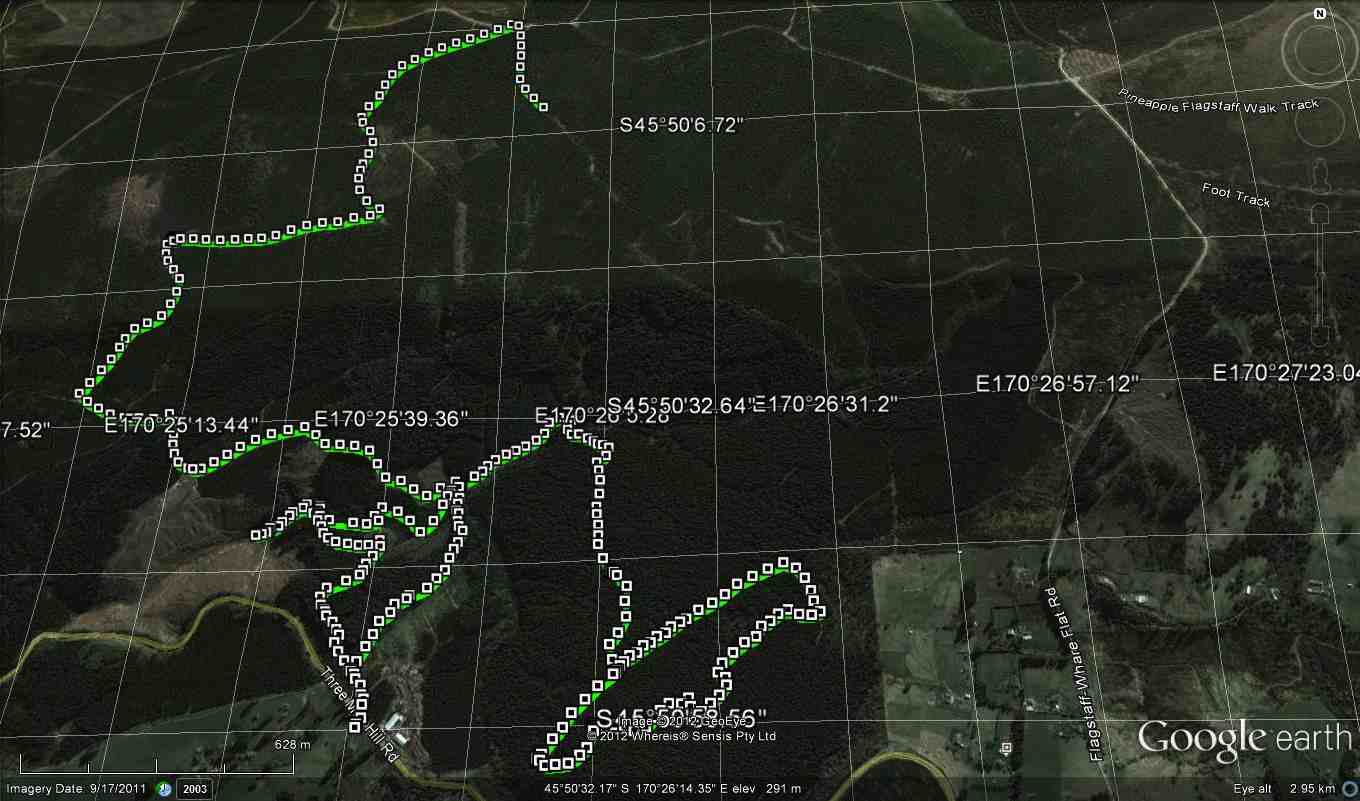
10. 26/6/2013. Trampers. Livingstonia Park to Akatore. Beach Walk.
On a day that could’ve turned to rain, [according to the forecast] 8 trampers turned up for the walk from Taieri Mouth to Akatore. This is a challenging walk over the beach rocky outcrops, with some easier sandy sections for good measure. In some places it is safer to take to the farm paddocks to bypass some deep splits in the rocks. We had morning tea at the carpark before leaving, as it was already 10am, then headed off down the beach. We reached the river mouth at about 12:30, & went in search of a sheltered spot to have lunch, as a bit of a wind had come up, making it a little unpleasant.
Lunch at Akatore River mouth. Pic has Pat obscured behind Eric. (Ken pic and caption)
We then retraced our steps, with two of the group deciding that the farm paddocks offered a better route back again. The rest of us did some beach, & some farm walk back to the cars, which took a bit longer than the outward trip due to tiredness creeping in. We arrived back at the carpark at about 4pm. (13.9km, 3hrs 44min, moving ave 3.7km/h.) – Ken
9. 8/2/2012. Hikers. Akatore farm walk. Akatore Rd about 5 kms from Taieri Mouth. Leaders: Bev, Chris.
8. 30/11/2011. Trampers. Taieri Mouth Livingstonia Park to Akatore. Beach walk.
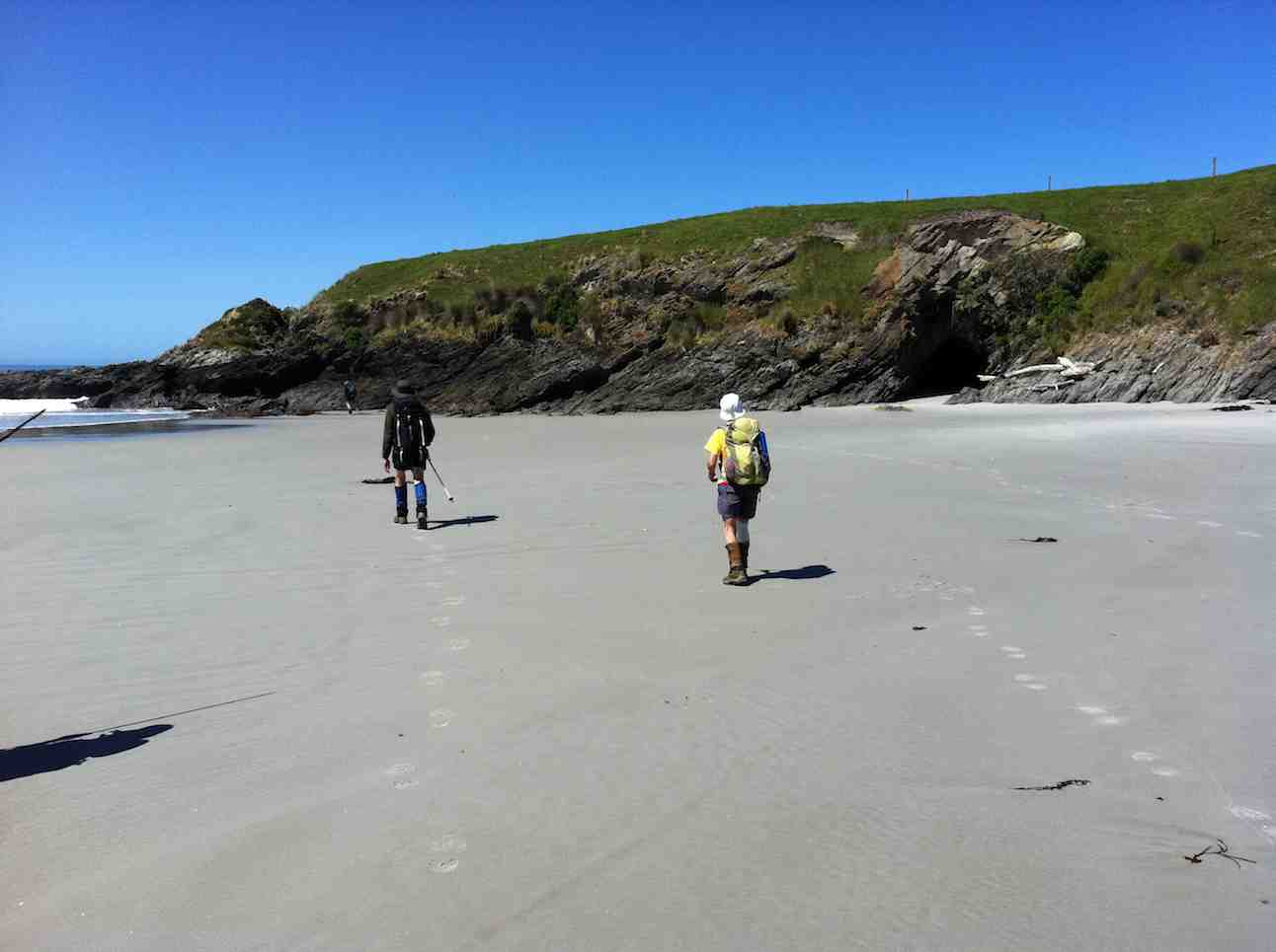
Welcome smooth sand ahead after extensive rock hopping …
Five Paradise duck-lings in a farm pond. Couldn’t detect the sixth.
7. 15/4/2009 Trampers. Taieri Mouth Livingstonia Park to Akatore. Beach walk. Leader: Ria.
12 of us made the trip. A bit of a struggle for one or two but we all got there. Here George poses as an Indian shaman(?) in front of a cave.
click to enlarge
George
There were places where we had to clamber up to the paddocks before descending to the rocks again.
Bank climb Ian, Shaleen, George
This was a very narrow squeeze.
The narrowest squeeze. Wendy at back
The trip was well-timed, with low tide after 1.00 p.m. so there was room for plenty of rock work clambering …
Difficult descent. Pat, Ken, Joyce, Bill, Shaleen (in mid-flight), George, Doug
and beach sand. This is where we stopped for a pleasant cuppa.
Tea break. Lex, Ria, Bill, Pat, Wendy, George, Bob.
Five lunched down at the Akatore mouth, the rest content to dine in the paddock above.
Pat, George, Bill, Doug
The five “down at the mouth” are just visible from the paddock.
Akatore mouth from paddock. Ken, Shaleen, Doug, George and Ian at rear.
Here is just one of the ponds as we made our return, this time largely over paddocks.
Paddock walk return. Doug, Ian, Bill
Careful rock clambering challenged some, and for others the distance was a bit of a stretch. But it was another successful day with the weather remaining kind. – Ian
6. 6/2/2008 Taieri Mouth Livingstonia Park to Akatore Beach walk. Trampers. Leaders: Ria, Hazel.
Lunch stop at Akatore Stream mouth. Leonie, Keith H, Tash, Lex
Tramp Report for Wednesday February 6th 2008
A beautiful day greeted 16 trampers as we met at Livingstonia Park for the start of our walk from Taieri Beach to Akatore. Our leaders were Ria Lippers and Hazel Leslie who had done 2 recces to make sure they had it all under control as it was the first time the Taieri tramping club had done this walk.
Tea Break. Doug M, George, Keith, Glenice, Joyce, Pat, Bill, Ria
Tea Break. Carol, Tash, Keith H, Lex
It turned out to be quite an adventure as we scrambled up and down rocks between the lovely bays that stretched all the way along this stunning Otago coastline. The tide was at a tantalising level as the more adventurous felt it was possible to get round, while our leaders took the more secure upper route along the cliff top. It was great to have the choice. We had lunch where the Akatore River reaches the sea, an enchanting spot with crystal clear water and white sand. George had a paddle in the water and we all relaxed in the sun. The tide was coming in, so most of the way back was along the top grassy pathway, but we did manage to go along some of the wider beach areas. As we descended the rope walkway back down to Taieri Beach we were so surprised to see so many people sunbathing and swimming, all taking advantage of the amazing Waitangi Day weather. Carol and I couldn’t resist a quick paddle before returning to the cars where everyone was waiting for us !! – Tash
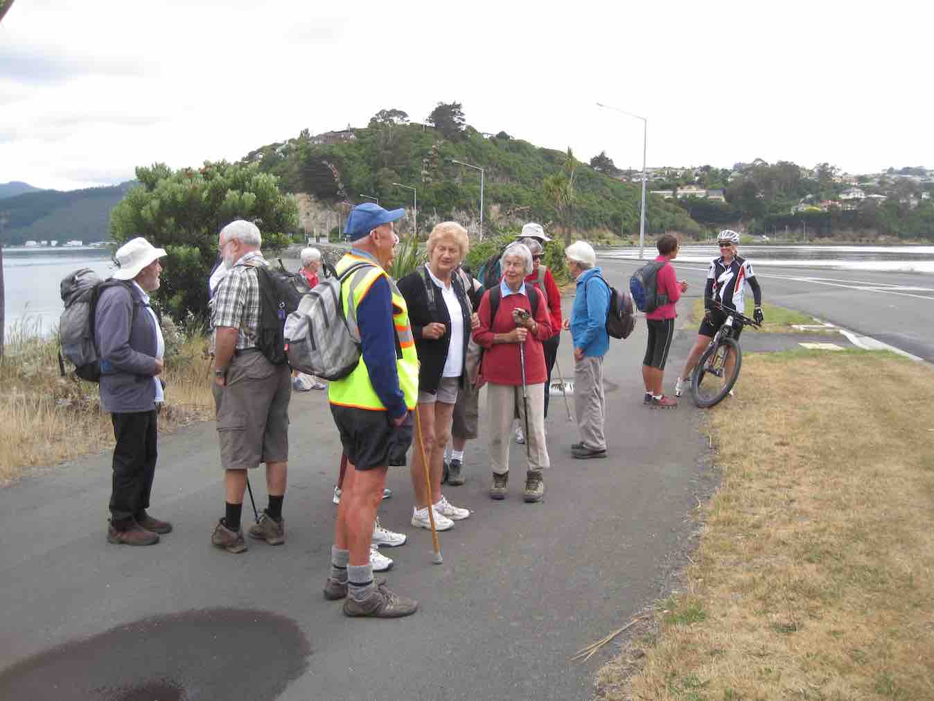
Beautiful day for a beach walk when 12 hikers parked their cars at Knarston Park. The tide was out so we were able to walk south along the beach for quite some way before having to go up a rope walk to the grass area above beach to get past an outcrop of rocks. Then back down onto beach and time to sit and relax with our morning tea. Such a lovely day and so clear, the views were great and sea bird life interesting. On down the beach until we came to another outcrop on rocks that for us, was impassable and we couldn’t find a place suitable for us to climb up to top. So we decided that although it was a bit early we would have our lunch and sit a bit longer than usual, just soaking up the scenery and views. Watched the tide gradually coming higher up a little inlet, examined some interesting seaweed and heard about some of the bird life from our expert, Lesley G. 12 happy hikers wandered back to cars along the beach mostly and all agreed we’d had a very relaxed and pleasant day.- Bev.
4. 26/2/1997 Akatore South Side. Leaders: Jack M, Hugh, Mary L. 3. 7/8/1996 Akatore Farm Walk. Average. Leaders: Jack M, Jean A, Ria H 2. 9/2/1994. Akatore. Medium. Leaders: Jack M, Eleanor, Judy & Rob 1. 30/1/1991 Akatore Forest Walks. Leaders:
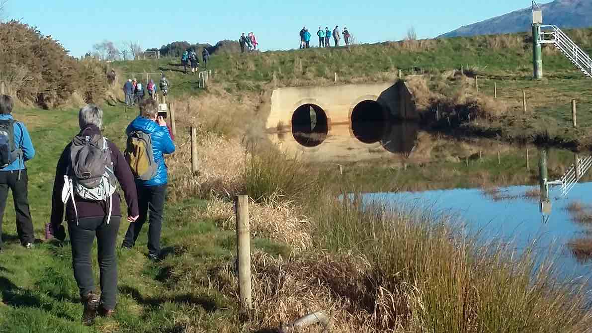
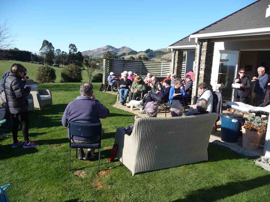
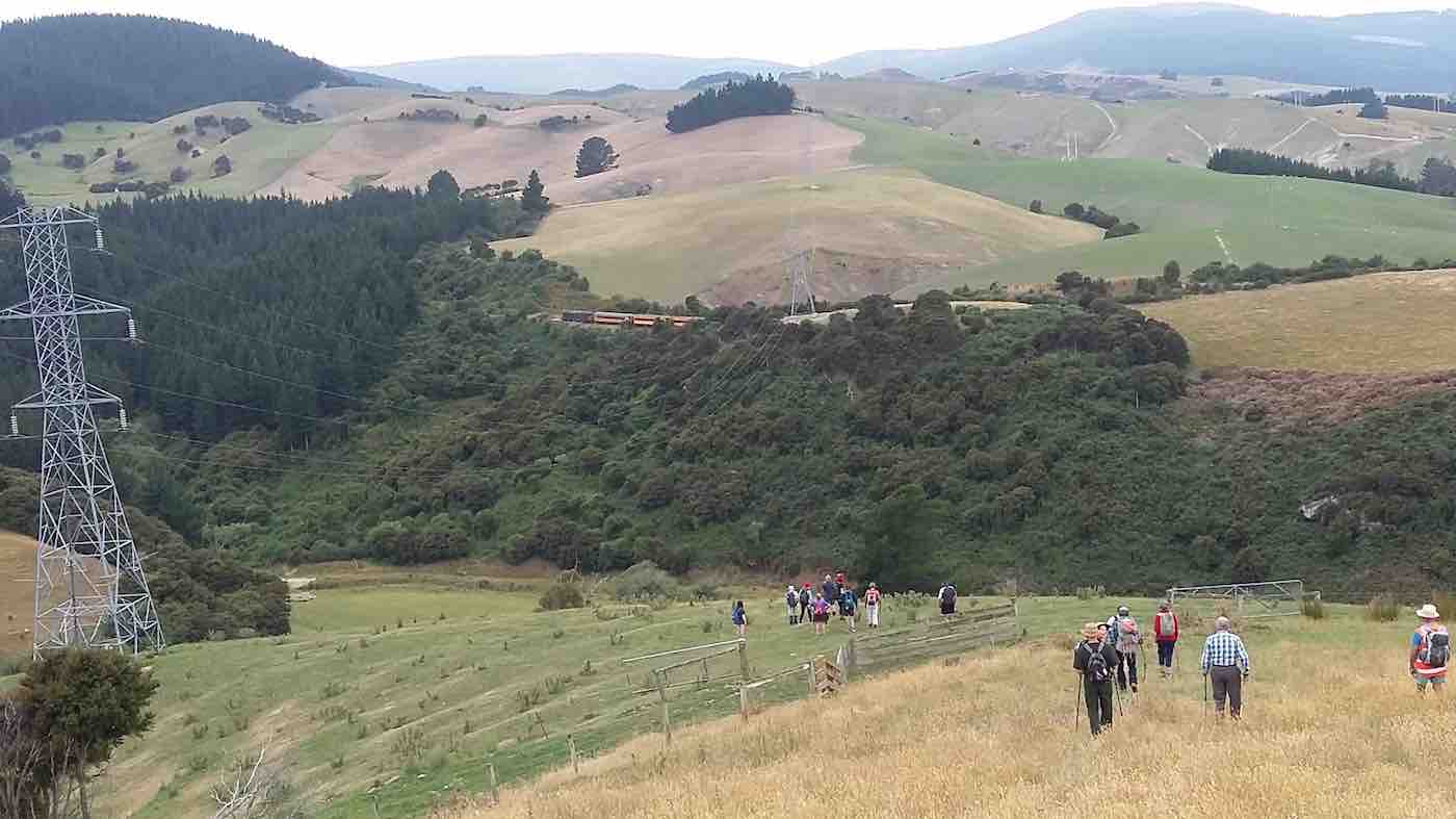
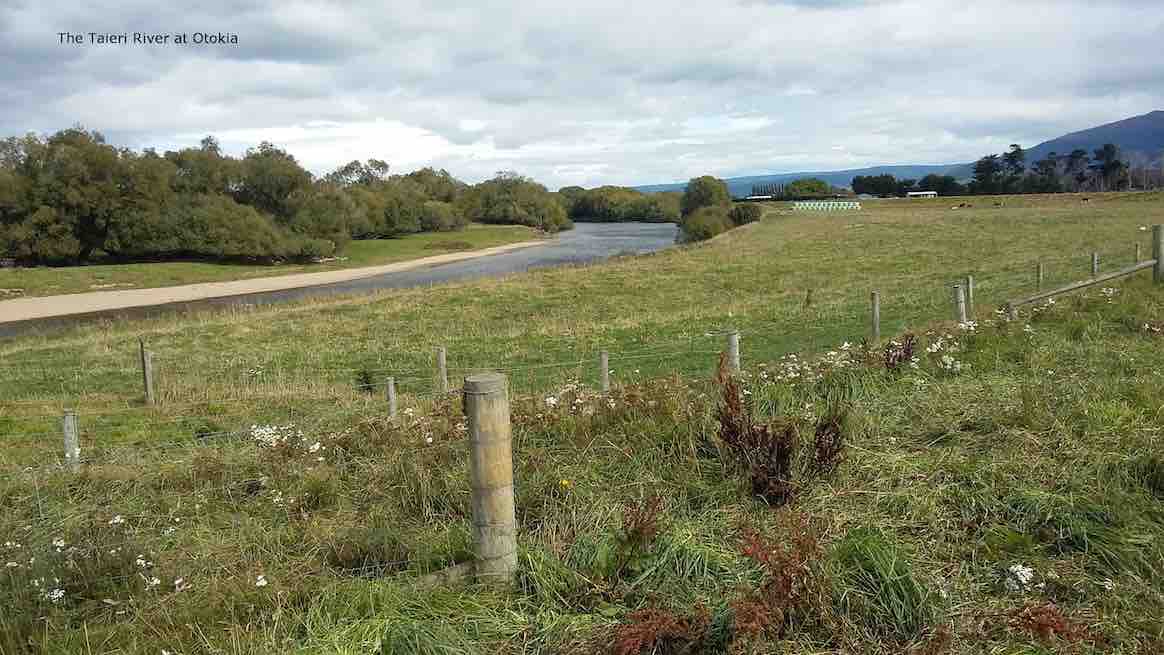
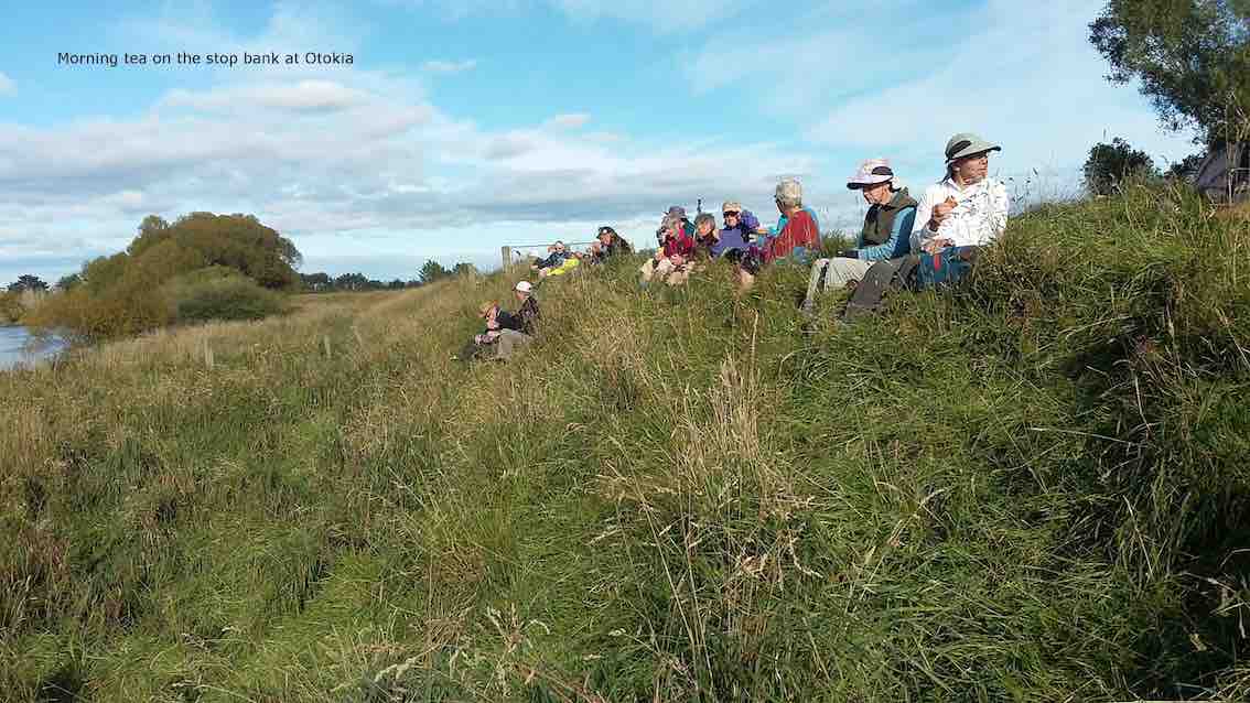
8. 24/7/2019. All. Doug’s 90th. Alan Scurrs, Riverside Road. Leader: Alan.
24 th July proved to be a special day.
The Weather frosty cold to start ,then clear calm and pristine. An enthusiastic group of tramping club members 54 out walking in total.Some even cycled down from the Bush Road carpark to Alan and Kerry’s home. Here we were greeted by inquisitive Llamas.
We spread out through boggy farmlands with the bonus of country smells to accompany us on the way.
On the way down Owhiro Stream. (Gordon pic and caption.)
We followed some of the Taieri waterways onto the floodbanks which have over the years saved farmlands from being completely destroyed/submerged in floods. Alan had some photos of the extensiveness of the flooding over the years.
A catchup were the Owhiro Stream enters the Taieri River. (Gordon pic and caption.)the control gate into the ponding area. (Clive pic and caption.)
Morning tea was held beside the Mill stream pump house. The stream flows into the Taieri river. The river was full and very discoloured.
Morning tea Mill Creek. (Clive pic and caption.)
From here we split into smaller groups depending how far people wanted to walk back to the party house.
Overall walking distances ranged from the Ramblers’ ramble to the longest distance approx 10 kms and then a ride home for them.
Heading towards South Fork farm. (Gordon pic and caption.)Alan suppyling information on slipway at flood gates. (Gordon pic and caption.)
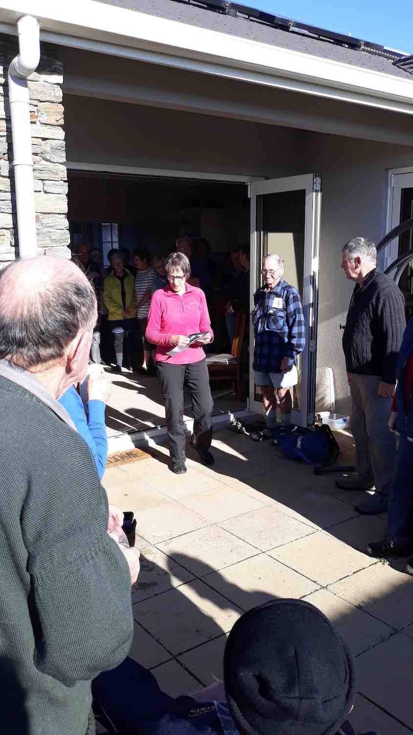
Alan had vehicles placed along the way to get all home by about 1 pm to be together to share Doug’s 90th birthday lunch. A real party lunch shared by all including some of our members who like to be involved with activities but not always able to join us on some of our weekly outings.
Lunch back at homestead. (Gordon pic and caption.)
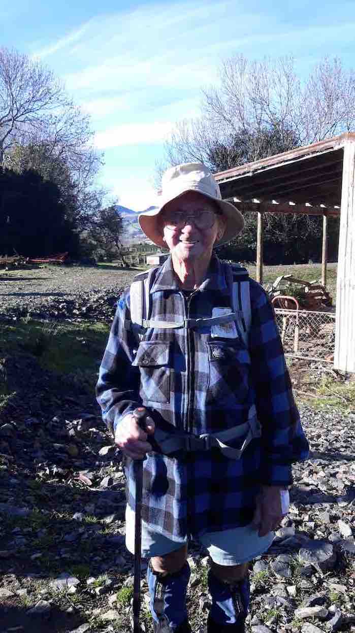
Helen Morris spoke about Doug
Helen speaks about Doug.
– out most Wednesdays a very busy man with an immaculate house and garden, a perfect gentleman, and a great bagpiper and ball room dancer. Always wearing shorts!
Doug. (Helen pic and caption.)
A big Thankyou to Alan and Kerry hosts extraordinare for providing an idyllic location and perfect weather (hardly a breathe of wind ). We wish them well for their overseas trip next week and look forward to hearing of their experiences.
Jill on behalf of the club.
(Add 100m to kms, as turned GPS on late!) Route: Riverside Rd, School Rd, Taieri Flood bank, Siverstream Flood bank, McKay reserve, paper road.
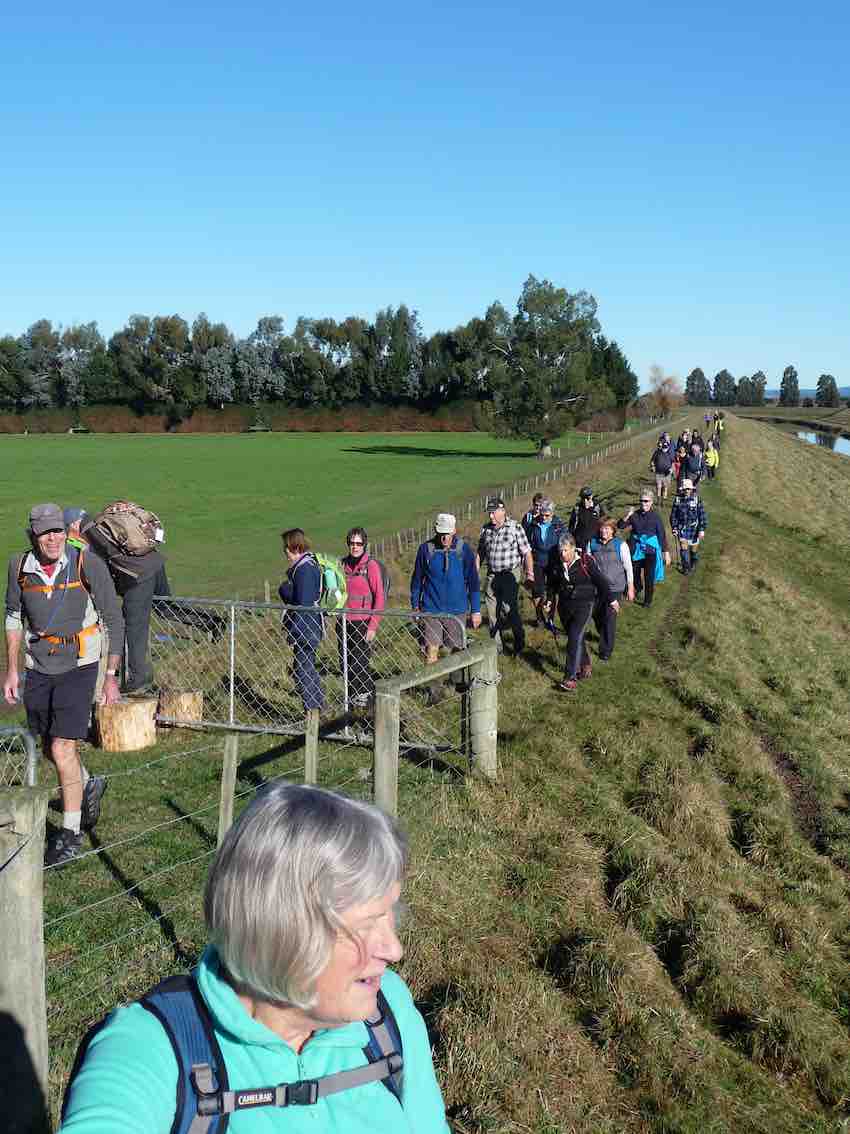
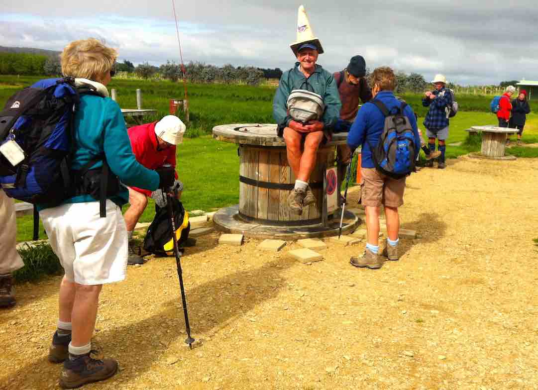
Twenty-five of us started along Riverside Rd from cars parked at the end of Dukes Rd. Turned left into School Rd. At about the 3.3km mark (a tiny swiggle on the map) Peter let us in through a combination-locked gate to the Dunedin Model Aero Club site and welcome bench seats …
Cuppa at Dunedin Model Aero Club site on School Road.
… upon which to enjoy morning tea. One of us preferred …
An alternative hat
… sitting on a table, rather fancying himself in his newly acquired piece of headgear.
As we were walking back out onto School Road, Leader Peter told us in interesting detail the history of the road, originally the Mosgiel-Outram railway route. The raised bridge over the Taieri River necessitated a fully-laden passenger train locomotive stopping and waiting for twenty minutes to get up enough steam to get its load up and over. School Road was the most difficult part of the line to construct. Hector told us of the need of a foundation of flaxes to first undergird the permanent way over the Taieri swamp. At road’s end, we followed the old rail bed as it veered right and led us to the Taieri River flood bank, alongside an interesting flood gate structure, designed to release flood waters into the flood plain alongside when needed to alleviate flooding elsewhere.
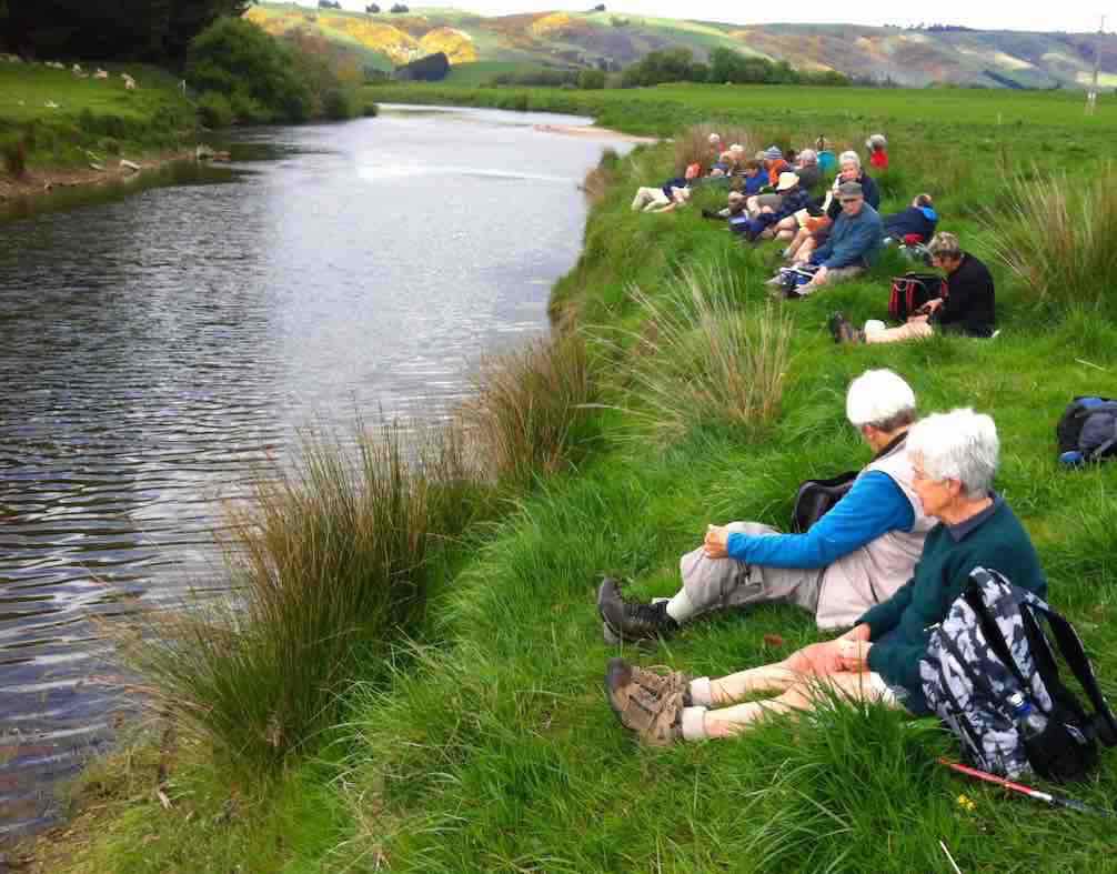
Making our way alongside the river, we had to negotiate a tricky fence, armed with live electric (fortunately the stretchy kind) wires on either side. Eventually, we were able to carry on. Arriving near the river’s confluence with the Silverstream, we perched ourselves alongside the latter …
Lunch
… for a leisurely lunch. Fortunately the wind abated for the while we were there.
Up and along the Silverstream’s true right floodbank, under the Riverside Road bridge and on to a heavy flood gates structure protecting a large drainage ditch at the lower corner of the McKay’s Triangle Wildlife Management Reserve from flooding back.
We walked along the ditch’s true left through luxuriant spring grass freshly tracked by some vehicle’s wheels, a boon denied the leaders who had to brave the reserve completely lacking track indicators to keep them free of boggy underground. Along the way we passed by
Lake Kate
a lake, adding to the scenic variety of the reserve. We persisted up along the aforesaid ditch, seeking yet another lake that unfortunately failed to materialize. So back down to enter in via a mai-mai to circumvent the beautiful Lake Kate, …
Lake Kate
… unseeable from the track. Thank you leaders, for finding the way into this hidden jewel for us.
We were then cleverly led by twisting track and footbridge out to the other major track, this one bordering yet another drainage ditch set at right angles to the other. This led us in straight alignment with Duke Road, virtually its paper road extension, back up to the cars again.
Thanks to Peter and Lesley for a carefully planned trip with the McKay’s Reserve as a surprising cherry at the end. – Ian.
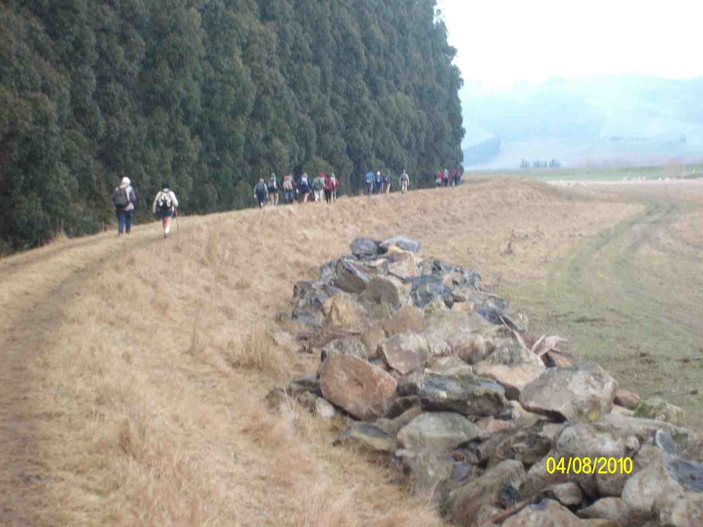
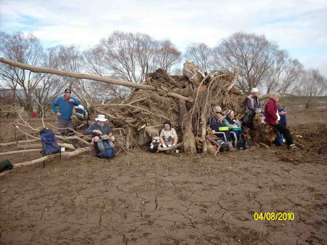
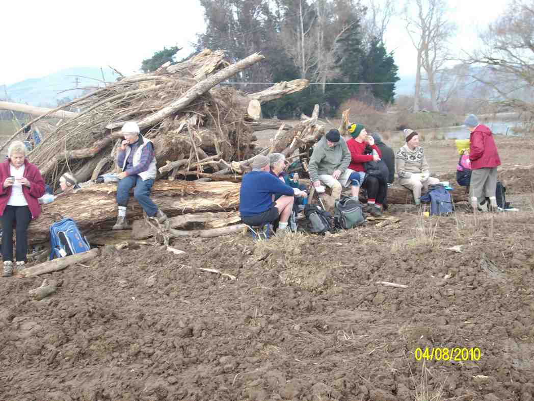
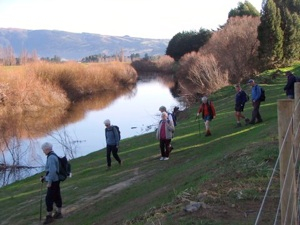
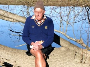
6. 4/8/2010. Both. Gladfield Road, School Road, Stop Bank, ret. E. Leaders: Bev, Ian.
GPS of route (Courtesy, Ken)
We parked the cars at the end of Dukes Road and made our way along Gladfield road, stopping at School Road for morning tea. Down School Road and crossing Riverside Road onto the Outram railway embankment to the Taieri River. Turning left, we followed the river down stream, keeping on the flood bank much of the way.
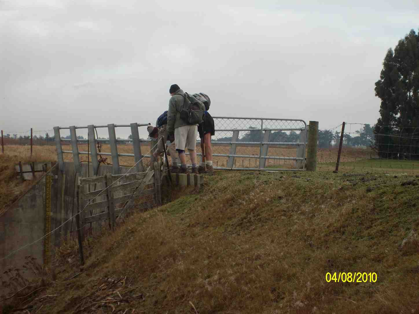
Continuing along the stop bank and bypassing Lindsay Road, we crossed over a flood gate immediately adjacent to the confluence of the Taieri and Silverstream rivers.
Shutting the stock gate on the flood gate. (Ken pic)
It was time for lunch, so we went down to shelter, sit and eat around a pile of bulldozed willow logs by the confluence.
Lunch1 (Ken pic)
Lunch2 (Ken pic)
Then it was up first one side, then the other of the Silverstream till we reached Gladfield Road and its pedestrian swing-bridge.
Bridge (Ken pic)
Then it was just back along Gladfield Road to the cars, and home.
A good day, with both groups together and 23 setting out. – Ian
5. 15/7/2009 Dukes Road, stop bank, School Road. Leaders: Marjorie, Peter.
4. 11/6/2008 Taieri Ramble from Dukes Road. Leaders:
Taieri in the winter. Who? Dot, Who? Margaret, Joyce, Lex, Arthur, Who?
A perfect winters day for the 20 hikers who parked their cars at the end of Dukes Rd to enjoy awalk on the roads and farmland on the Taieri Plains. We went along Gladfield Rd to School Rd where we found a spot to sit and have our welcome morning tea break. Off down School Rd for a short distance then on to farm land. Across paddocks, along stop banks, making the most of the beautiful sun and scenery which made this an especially enjoyable day out. Sat and had our lunch in a very pleasant spot amongst trees and near the Silverstream.
A Presidential munch. PeterThe ‘swing’ bridge
Then it was across more paddocks, over a ‘swing’ bridge and back to the cars. Not a hard hike but one everyone enjoyed very much. – Bev
3. 11/6/2008. Hikers. Dukes Road, Stop Bank, School Road. Easy. Leaders: Bob H, Bev H.
Park end Dukes Rd. Straight ahead SE to McKays Triangle Wildlife Management Reserve. (Seek permission for this part, although paper road.)
Turn Rt/SW by drainage ditch, across Taieri. Follow either of following alternatives:
1st Alt: Trampers. Carry on, cross Mosgiel/Outram Road, up hill, (seek permission for hill part) then left and down to Taieri upstream of bridge. Return down Taieri (Seek permissions, but probably not necessary) and back by reserve.
2nd Alt: Hikers. Turn left SE down to Taieri River flood gate. Followed river back along flood bank to Silverstream. Upstream to Riverside Rd and back to cars.
2. 4/7/2007. Both. Dukes Road, Stop Bank. easy. Leaders: George, Bob H, Les & Margaret, Bev H
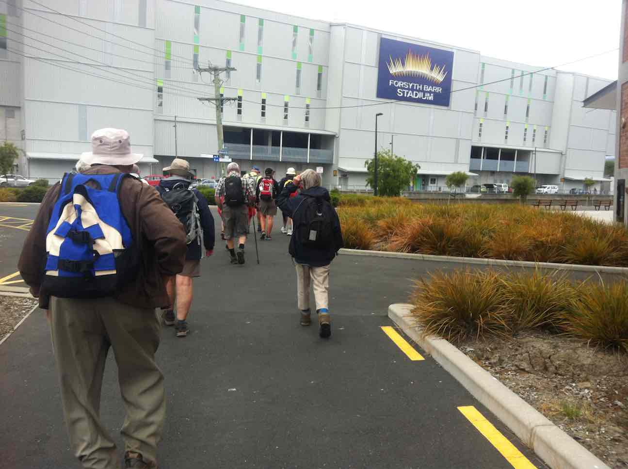
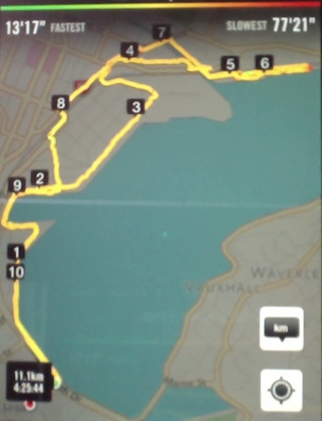
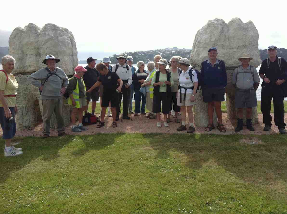
2. 17/4/2019. Hikers. Edgar Centre to Rotary Park, return. E. Shona and Jill D.
28 hikers assembled at the Edgar Centre, before walking along Portsmouth Drive to Bayfield Park stopping en route to admire the memorial stone “RONGO”.
We enjoyed an early morning tea on the seats at the park, then continued to the bus
stops (some keen souls had continued to the stop further up the street) and
caught the bus to Shiel Hill terminus.
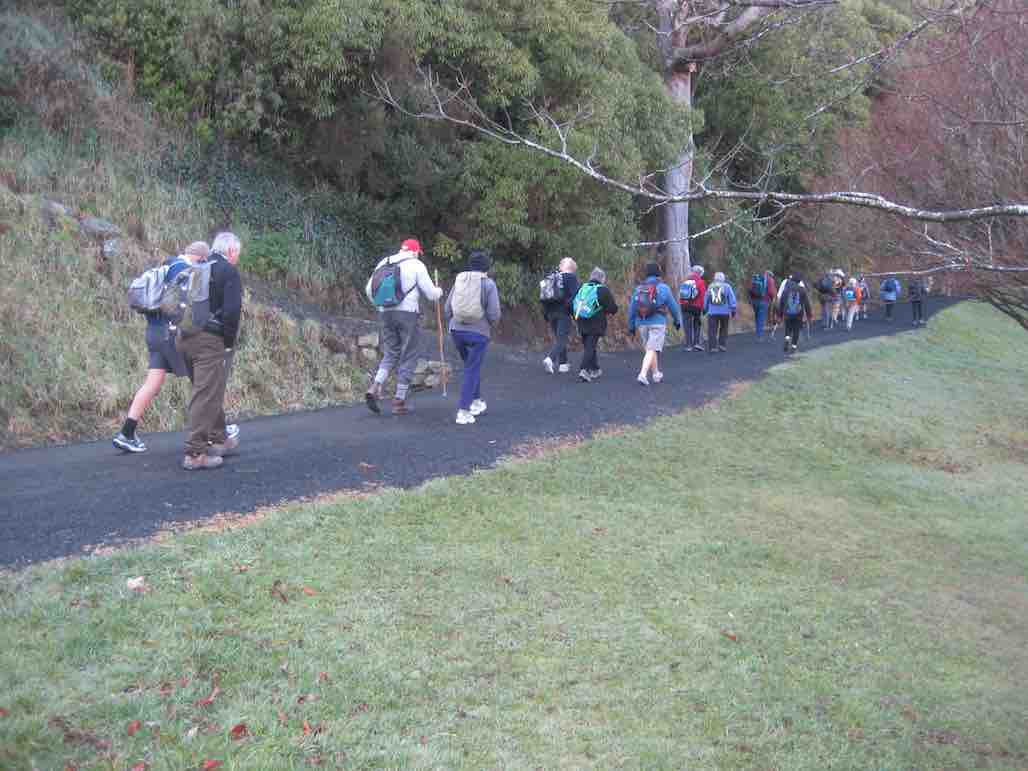
We continued walking up to Rotary Park, through the pine trees there and down the reserve track to Harbour Heights, missing our planned stop as it was too early for lunch, which we took further down Larnach Rd in the sun at the local school playground.
After lunch, we continued down to Shandon St, before turning and walking down
the Arthur’s Walk steps to reach Portobello Rd to follow the harbourside walkway back to the cars and continuing the early theme of the day, having an early coffee at Nichols. Distance 6.7kms. – Shona Jill
1. 16/8/2017. Hikers. Edgar Centre to Rotary Park, return. E. Leaders: Judy and Adrienne.
(Adrienne pic.)(Adrienne pic)
26 hikers met at the Edgar Centre carpark in clear sunshine after a frosty start to the morning. We walked along Portsmouth Drive a short way to the Bayfield sports fields for a leisurely morning tea on the comfortable seats in front of the pavilion.
From there it was another short leg to the bus stop at the bottom of Silverton Street, where we boarded the bus for the ride up to the Shiel Hill terminal. Another short walk took us further up the hill and across the road into Rotary Park for an early lunch. A lazy breeze found us well spread out, seeking sunshine and shelter – hard to find both. The views of the city and harbour are magnificent from this park.
Soon we were joined by Les and Margaret, with welcome birthday chocolates – thankyou! It was good to see Les up and about again after a bout of pneumonia.
Unfortunately it was a bit too cool for the proposed lengthy lunch and sunbathe, so by midday we were off again for the walk down the hill, via McKerrow St, Larnach Rd and Shandon Rd to the top of Arthurs Walk. With knees creaking a bit we descended the many steps down to Portobello Rd, and so back to the cars, and coffee at Nichols. – Judy and Adrienne.
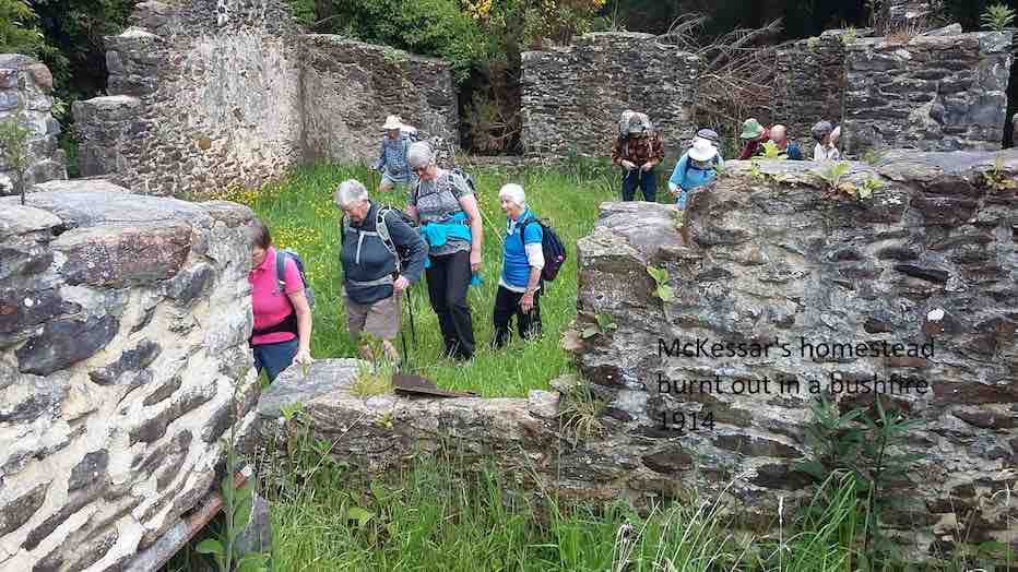
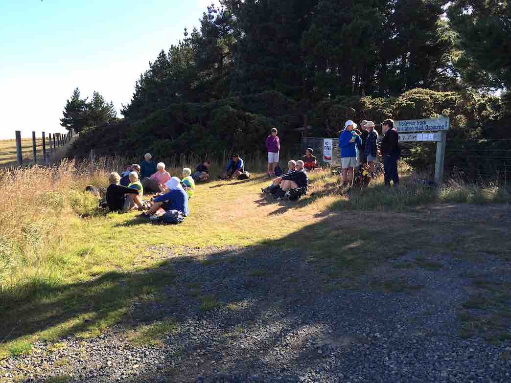
3. 29/8/2018. Hikers. McKessar Track from Foot. E. Leaders: Jim and Betty.
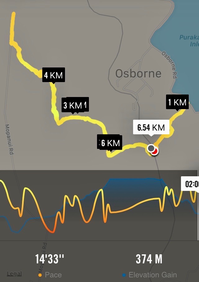
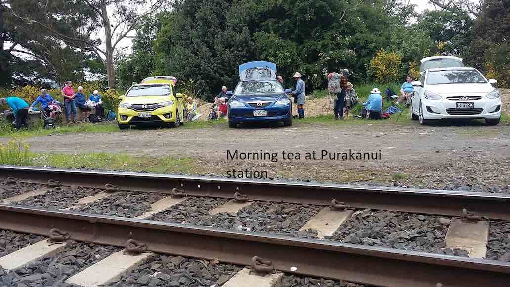
The sun was not shining when we left the car park and as we approached Port Chalmers it looked like it would be a day destined for coffee only. As we continued our journey, there was a marked improvement in the weather as we reached the Purakaunui Railway Park. From the car park the walk was down hill to Sea level then back up the road to the cars for the morning tea break. All the Twenty Two then walked up to our lunch stop at Mopanui Road where we sat with our heads in the cloud. The up hill climb included a breather to marvel at in the relics of the McKessar Homestead. We descended back down the track & into the cars for our refreshment stop at the Plazza Café. Conditions could be described as a little moist. – Betty & Jim Finnie
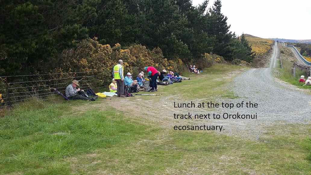
2. 15/11/2017. Hikers. Purakaunui Station. McKessar Track, Mopanui Road. E. Leaders: Jim and Betty.
Route map, courtesy Ian.
Starting off from the site of the old Purakanui railway station, a party of twenty hikers made the short road walk down hill to the Purakaunui inlet for an then returned, for the morning tea stop at the cars.
(Clive pic.) [Cars at the station a first for the Club. – Ed.]This was followed by the hike up the McKessar Track in very pleasant conditions to our lunch stop at the end of Mopanui Road. We had a breather on the uphill climb where Ian showed us the relics of the old McKessar homestead.
(Clive pic.)
An after-lunch
(Clive pic.)
stroll beyond the road end, took us to a point which gave us an excellent view to the north. Little time was required for the pleasant stroll down hill back to the cars, which took us to our refreshment stop at the stadium Plaza cafe. – Betty and Jim
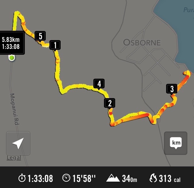
1. 9/3/2016. Hikers. Mopanui Road, McKessar Track, Albert Road. E. Leaders: Bev, Lesley.
GPS of McKessar trekHorse Drinking Trough on Mount Cargill Road.Orokonui VillageHikers’ cuppa at top of McKessar Track
27/5/2015. Momona Environs. E. Leaders: Peter and Wendy.
GPS of Momona route
23 of us started from Momona Hall
Start. (John pic)
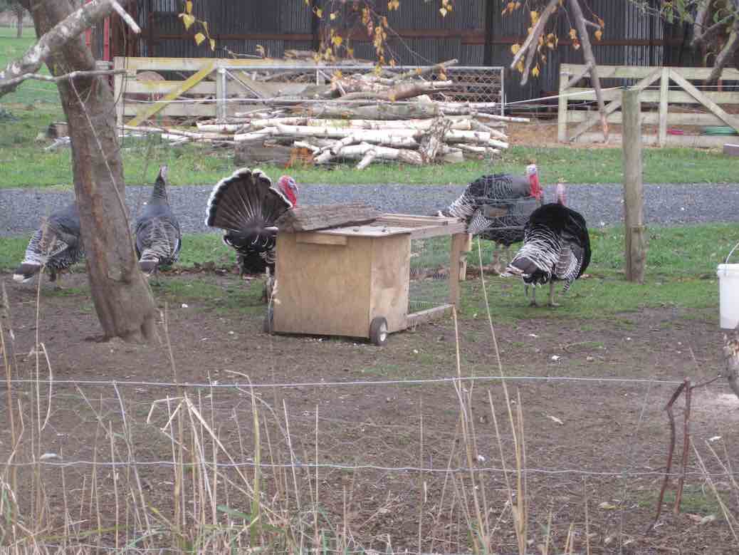
at the intersection of Centre Road and Nichols/Bruce Roads. Some distance south (approx) along Centre Road we turned aside into what Peter told us was the original route of the road to emerge back a little further on. Towards the corner we cut through a lane to emerge on Millers Road (kms 1 & 2) which we followed down past some fattening turkeys
Turkeys for the table? (John pic)
to turn into Bremners Road (kms 3 & 4).
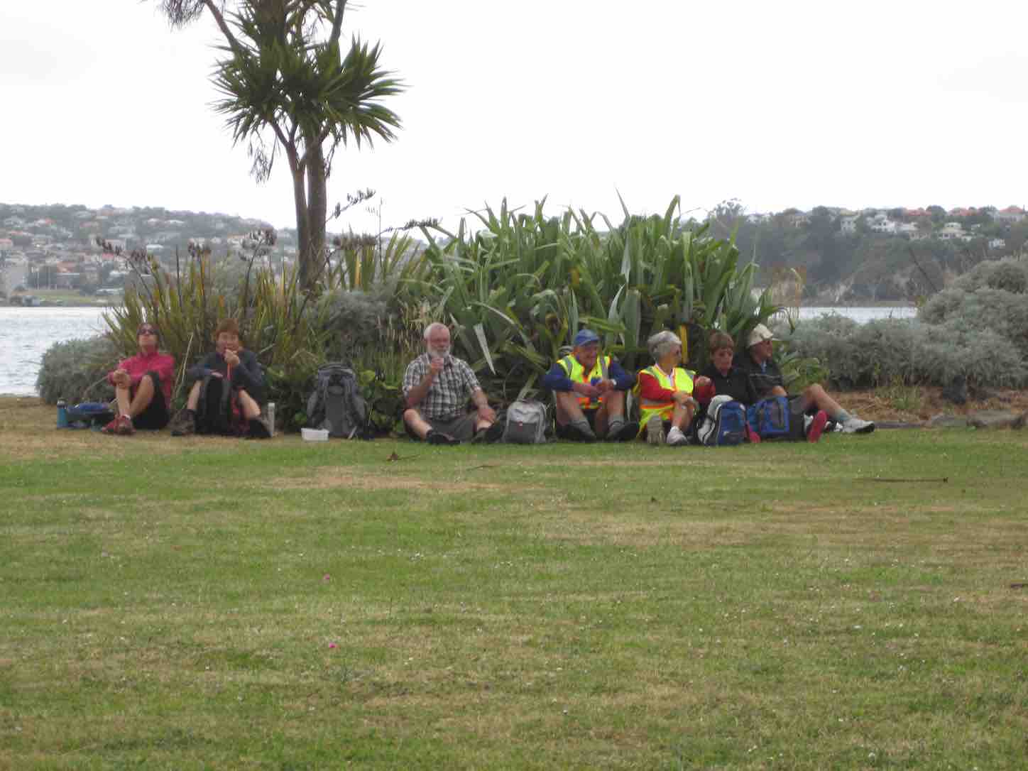
We stopped in a gateway for morning tea, partly sheltered by a belt of trees. The small cold wind forced us into wind-breakers at this point.
Morning tea panorama (John pic)
From Bremners, we turned down Lee Creek Road (km 5) and then along Granton Road. Next turn was into Beehive Road, (kms 8 & 9) our first road to take a more winding route, and this led us eventually to a turn into a paddock whose fence line led us across to the Janefield homestead, (km 10) where we lunched. This was just as well, for Lesley’s legs had started to go ‘rubbery’.
Lunch panorama. (John pic)
This was Ian Bathgate’s property. Peter had been telling us about his Bathgate relatives’ history on the Taieri Plain.
The feature of Janefield was the huge barn loft where dances had been held in times past. Now it was just used for storage.
A wing leading off from the large Barn loft (John pic)
As we turned the corner we were confronted by a large stock truck loading loin chops in their original form.
Loin chops to be? (John pic)
The road out from Janefield came out on Nichols Road (kms 11 & 12) which by various twists and turns led us diagonally across the plain eventually back to our cars.
Thanks, Peter and Wendy. A good winter’s (well, weather-wise anyway) road walk – an alternative to what would have been a soggy farm walk to Weka Falls. And an original choice too. A new ‘first’ for the club through a bit of Bathgate family history! – Ian.
No. 60 on old hardcopy list of 113 club tramps. “Lawlor Farm”
Gate, Old Lawlors Farm, 2019.
Closed for lambing Sept-Nov.
50 km from car park.
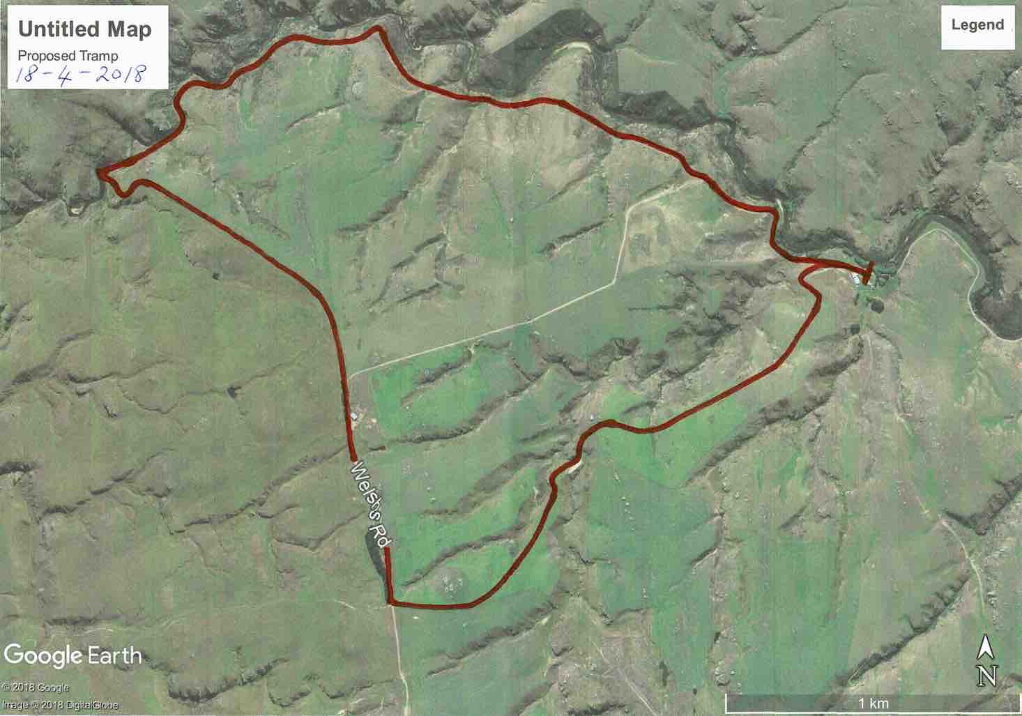
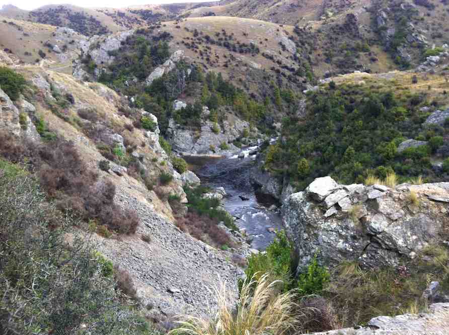
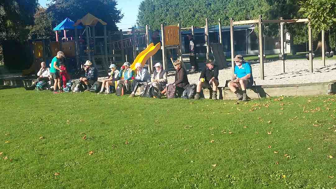
14. 18/4/2018. Trampers. Welshs Road, Old Farm, Deep Stream, Weir. M. Leader: Keith and Arthur.
Route map, courtesy Keith.
It was a beautiful autumn day as 14 trampers travelled for about 40 minutes, out past Clarks Junction to Welshs Road.
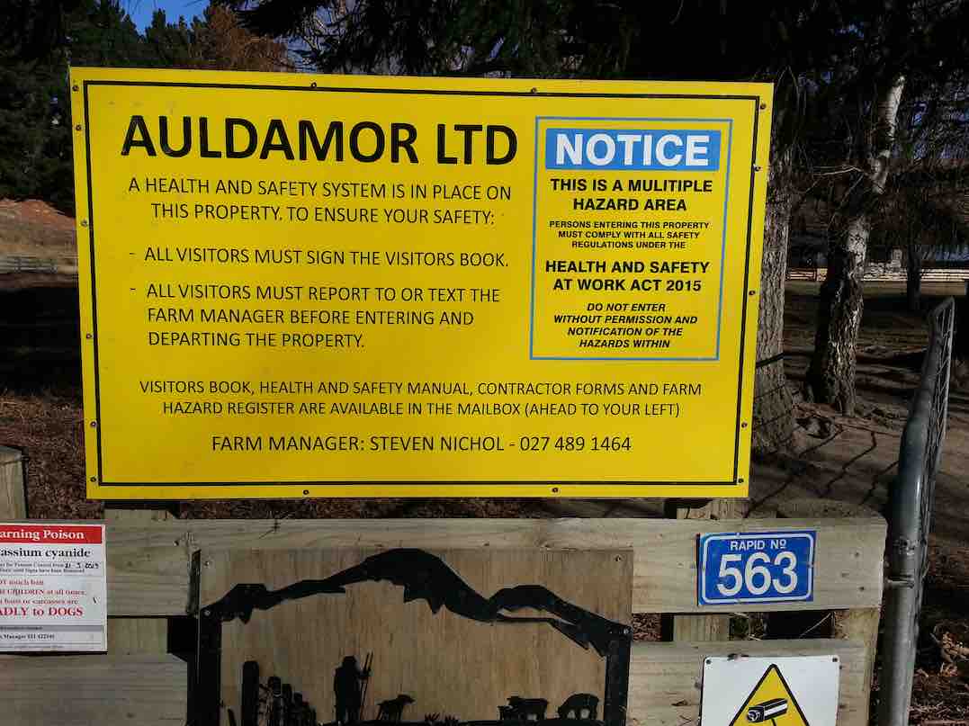
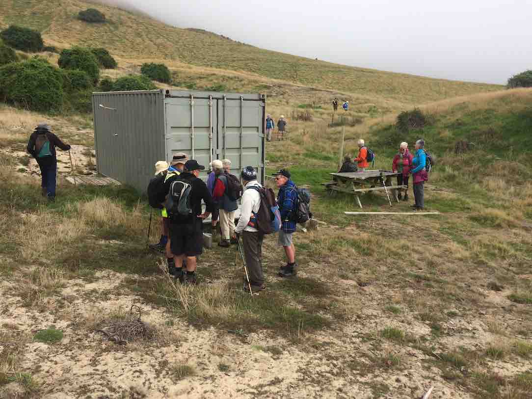
The cars were parked by the woolshed near Deep Stream on Steve Nichol’s farm. We all had to sign the visitors book on arrival, for “elf and safety” reasons.
The sun was lovely, but the breeze was decidedly cool, as we made our start.
To be different, the leaders had planned on a clockwise circuit, and also climbing uphill through the paddocks to extend the distance.
The steeper beginning warmed all the participants nicely, before having morning tea in the head of a gully – somewhat sheltered from the breeze.
Morning tea towards Deep Stream. (Phil pic and caption.)
Continuing up through the paddocks the scenery was magnificent wherever we looked. At the highest point of our day we came back to Welshs Road. The wind was keen here, but there was a good view over to the Lammermoors – the “ship at anchor” was visible.
Now it was downhill all the way to Deep Stream, road at first and then following the farm’s boundary fence.
The “Te Papanui Conservation Park” was just over the fence which we had to climb through at the last. The views looking down in to Deep Stream were great as we descended to the weir.
Time for some photographs …
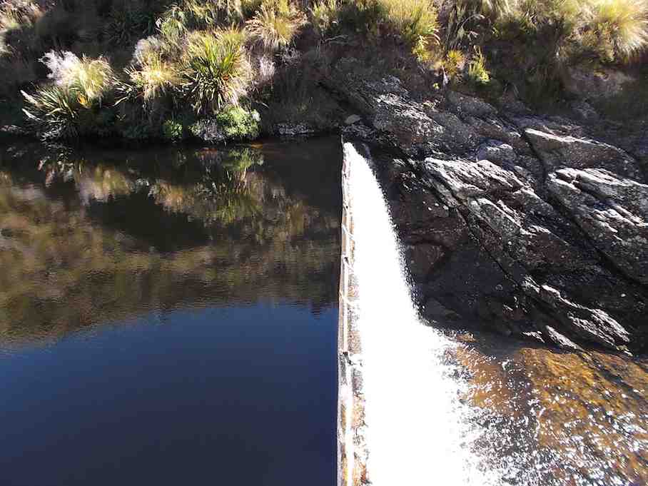
The weir! (Phil pic and caption.)
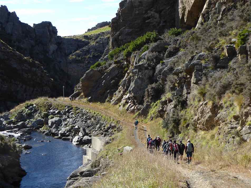
… before walking the 4W.D. road above the stream.
Follow the leader. (Phil pic and caption.)
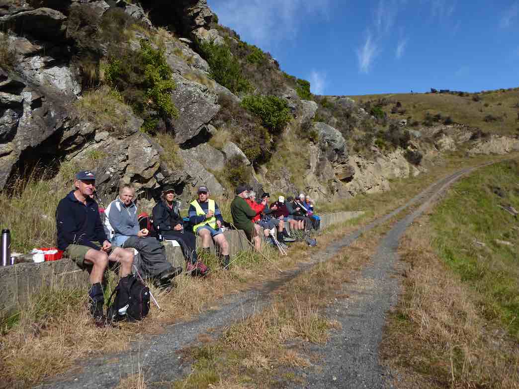
Near the mouth of Deep Creek we stopped for an early lunch on a long table thoughtfully provided. A nice spot in the sunshine, and ideal for the occasion.
….and if one should accidentally fall there would be…….sitting on the wall! (Phil pic and caption.)
The 4W.D. road was up and down a bit, but took us back to the cars, after having walked 9.8 km.
All agreed that the walk down through the Deep Stream gorge, below the weir, was the highlight of the day. It had been another very successful and happy day’s tramp for our group.
And so back to Outram, to stop at a the ‘Goat’ for water, food, tea, coffee, hot chocolate, cold beverage, etc (tick the boxes applicable please). – Art.
13. 17/2/2016. Hikers. Welshs Rd, Old Farm, Deep Stream, Weir. M. Leaders: Bob and Peter.
GPS of route alongside Deep Stream.
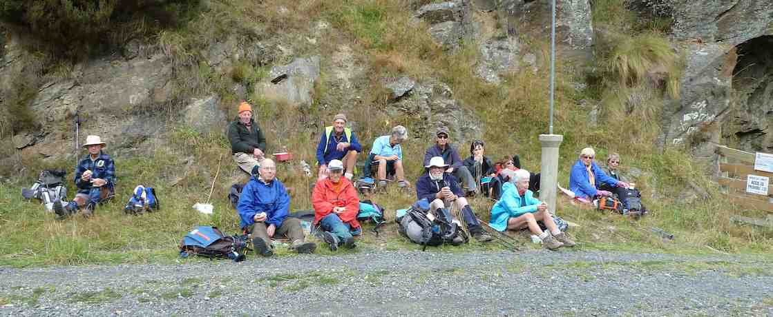
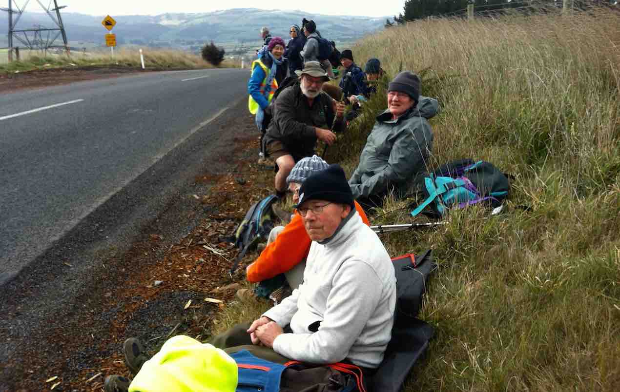
The leaders considerately stopped the cars about 3k short of the old farm house to give some level walking to those who didn’t wish to tackle, beyond there, the climbs over the three steep ridges on the way into the weir. (As matters turned out, they did tackle a further climb or two after all.) We all stopped first, a kilometer or so along the road, for a cuppa.
Hikers. Cuppa. A km or two from the cars.
Eight of us went on to reach reached the barb-wired locked gate, (some getting further)!
En route, a nostalgic shot (yet once again, couldn’t resist it) of the ‘confluential’ point where the Deep Creek tributary enters Deep Stream.
En route, (whoops, too many ‘en routes’), we passed a couple of bee hive sets of frames, with Betty getting stung several times from one of them. Happily Lester was there to help remove the bees and their stings.
On our return, we stopped in the a patch of shade for lunch.
The leaders (& Doug) lunching in the shade.
The day grew warmer but fortunately not nearly as exceptionally hot as it was a fortnight ago. We enjoyed a brief cooling passing shower when getting close to the cars on our return.
The ridges are getting higher and steeper than ever to climb over and the tramp extension by the extra three or so kilometres gap between cars and house wearied this reporter a bit but for the others it was a breeze. A good day out. A good reminder of a tramp the club has enjoyed many times before. – Ian.
12. 23/4/2014. Hikers. Welshs Rd, Old Farm, Deep Stream, Weir. M. Leaders: Peter and Wendy.
GPS of route. The tail with “2” in it was a false uphill recce with none of the necessary downhill bits one or two of us had remembered.
A good memory is an attribute we came to wish we collectively had more of. Driving down Welshs Road, we made two false stops before plucking up enough courage to take our cars yet further on to the actual Holiday Camp yards. (However, from recollection (what’s that again??) the “Both” 8/2009 group [indicated below] walked virtually the length of Welshs Rd just to reach the HP, well-notified on its gate).
Neat Caption editing, John! (John pic)
Well, we eventually made it there by car and walked on and up a bit to stop for our morning cuppa.
After that stop, taken briefly because of a strong cold wind at the time, memory let us down again. A few recalled the road had several ups and downs in it, but the road that we then took led us only up and up and up. After some confused conferring, with nervous hope of finding the right way, we retraced our steps back down the way we had come, to a gate just adjacent to our morning tea stop. Soon the reassuring ups and downs emerged, and a morning tea spot taken on an earlier tramp confirmed we we on track. (See Trampers 11/2009 for the morning tea break pics)
However the earlier uphill foray had served to discourage four of our 22-strong group from further uphill struggles and they returned to the cars. That was too bad. But eighteen still persisted.
The stream views were most rewarding. The view of the Deep Creek (exit/entrance?? – well, confluence, then) into Deep Stream looked better from an angle different from that of a pic below taken on an earlier trip.
A more picturesque view of Deep Creek debouching into Deep Stream. (See “Deep Creek Tributary” below for the other one)
A locked gate (part of which can be seen at the right in the pic below) just prior to the weir proved a further deterrent, and only five persisted beyond it. On rejoining the other twelve they found them already getting into their lunch. It was the right time too.
Lunch by the locked gate. (John pic)
We straggled back to the cars in a long drawn out string of ones and twos, but all eventually made it, to unsurprisingly find the earlier four long gone.
Then it was only for a dwindling ten (did Elaine deliberately hide herself behind Pat?) of us to reunite at the No 8 w Herbs cafe for a drink of …
After tramp coffee at Outram.
… – you’ve guessed it – coffee, not to mention a tasty treat of chips and dips, courtesy Elaine. – Ian
11. 26/2/2014. Trampers. Welshs Rd, Old Farm, Deep Stream, Weir.
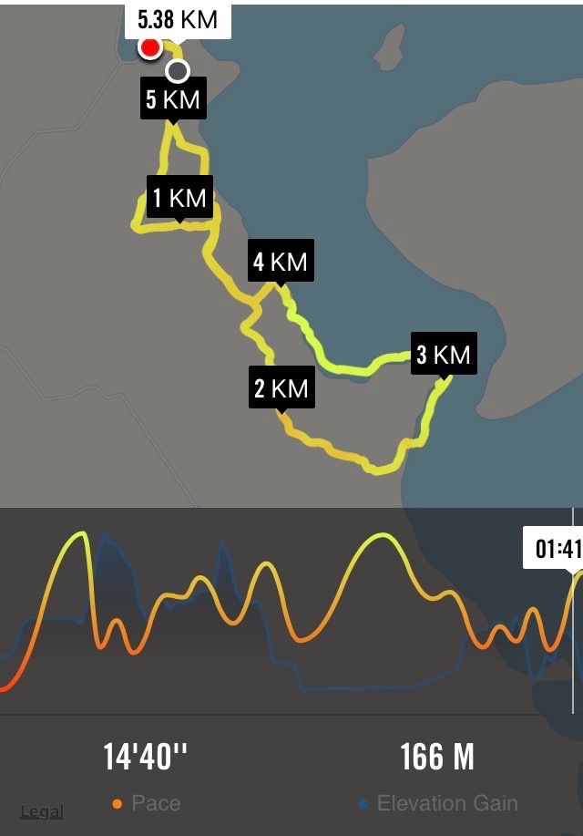
GPS of route, courtesy Ken. We only walked 7.6 km; 1 hr 57 mins moving time, 3.9 km/hr; climbed 318 mtrs; max elevation 544 mtrs.
This was a tramp that most of the 9 that turned up had never done before.
We walked up the gorge all the while looking down to Deep Stream to see if we could find a more interesting walk than on the road with it’s quite steep climbs. Once again most of the ones who are going on the Motatapu trip next week were carrying their big packs with some weight in them.
We found some nice rocks to sit on for morning tea …
Morning tea break. (Heb pic and caption)
… at the top of one of the hills we had to climb, so we got a good view of the countryside. Then it was further into the gorge, until we arrived at the weir.
The weir. (Heb pic and caption)
After a look around there, & a drink to freshen up …
Topping up the fluids at the weir. (Heb pic and caption)
… it was decided that we would go up the steep road opposite to where we were sitting, & walk back through the paddocks. George & Rea both remembered doing this in earlier times, so we set off, & headed away from the gorge up into the paddocks where we split up a bit & had lunch in two groups. Then it was down a gravel road that George assured us we would find, & back a short distance to the cars. The stream looked inviting, as it was a reasonably hot day, without a cloud in the sky, but nobody was game to get wet !!
After examining some peoples’ packs, & the way they were wearing them, we had an adjustment session to see if we could improve the fit for one member of the group, & I’ll also be looking at mine before next week, as it seems to be sitting too low on my hips.
We are becoming the Coffee Club No. 2 as we once again called into Outram for a chat over a cuppa on the way home, although Rea, & Hazel walked all the way around to the Berry Farm shop for a Yoghurt Ice Cream !!
Everyone agreed that it was a good walk with interesting scenery along the way. – Ken.
10. 25/11/2009. Trampers, with a lot of Hikers! Deep Stream Holidays. Pipeline Road. Deep Stream Weir. Easy+. Leaders: Bill and Pat.
It was 10.00 a.m. before our cars reached the Deep Stream Holidays Park. So we walked on along the pipeline road before stopping for a delayed morning tea in a sheltered corner of the road.
We stopped for a late cuppa.
Other group at tea break. (Bill pic)
The road wound on up and down as the pipeline followed up beside the stream.
The road stretched on.
A point of interest was to see the Deep Creek confluence point with Deep Stream.
Deep Creek tributary.
Eventually we arrived at the weir.
Weir. (Ken pic).
We climbed the steps from the weir to the road above. Some of us found a way up to the rock looming behind.
Steps up from the weir. (Ken pic).
From the rock buttress, we had a grand view of weir and dam.
View of dam from the rock buttress. (Ken pic)
On the way back, Bill pointed out a rock wall built by Chinese goldminers to divert the stream.
Old diverting wall from Chinese goldmining days.
9. 5/8/2009 Both. Welshs Road, Deep Stream, Lawlors Old Farm now Deep Stream Holidays. Easy+. Leaders: George, Bev.
click to enlarge
Romdales. Where there’s a wool…. (Bruce pic and caption)….there’s away (Bruce pic and caption!)Climbing Welsh Road by Deep Stream. (Bill pic). MollyAnother view of Deep Stream. (Bill pic)Deep Stream above the weir. (Bruce pic and caption)In holiday mood. (Bruce pic and caption). Evelyn, Pat, Bev, Molly, Fred, Bill, GeorgeIf we just keep straight ahead we should hit a pot of gold (Bruce pic and caption)
8. 14/4/2004 Hikers. Deep Stream. Lawlors Old Farm. Easy+. Leaders: Joyce , Jim & Thelma
7. 15/5/2002 Alt. Deep Stream, Lawlors Old Farm. Easy. Leader: Mary L, Margaret and Les.
6. 23/9/1998. Lawlor Farm, Deep Stream. Leaders: Mary L, Sabina.
5. 25/9/1996. Deep Stream from Rocklands Station to Dam. Leaders: Jack M, Diana and Ray
4. 10/5/1995 Lawlor Farm. Medium. Leaders: Peg C, Mary L, Sabina, Diana W
3. 2/12/1992 Welsh Road, Deep Stream, Lawlors Farm. Average. Leaders: Daphne, Peg A, Peg C, Peg M
2. 25/4/1990 Welsh Road, Deep Stream. Great tramping area. Easy+. Only one small hill. Leaders: Mary Y, Diana B, Hugh D, Betty B
1. 1/2/1989 Deep Stream. Rocklands Station. A long but not difficult walk. Follow pipeline to dam. Leaders: Daphne, Denise, Mary
28/3/2018. Hikers. Balclutha River Walk. E. Leaders: Bev and Lesley.
Route map, courtesy Ian.
Luckily the day was bright and sunny as we were going a bit further afield for our hike today, to Balclutha. There were 17 met at Naish Park in Balcluthaand as it was 10am we sat in the sun and enjoyed a leisurely morning tea before setting out on the walk.
Morning tea at the park. (Clive pic and caption.)
Naish Park is a lovely area with beautiful trees, garden, aviary and childrens play ground.
Naish Park. (clive pic and caption.)
It was originally a market garden and orchard, donated to the people of Balclutha by the Naish Family.
The walk is called the Blair Atholl walkway and goes along the stop banks besidethe Clutha river.
Along the flood bank beside the Clutha River. (Clve pic and caption.)
We went to the end of it…
The terminus tree that the leaders made us all circumnavigate before returning. (Kevin pic.)
… and up a side track by a rhododendron dell that must be a great site in the right season. We had a our lunch here. Once again taking out time and enjoying the sun. Then back the way we had come till the track divided and we went along a loop that was closer to the river. Unfortunately where you had to cross an inlet the water was higher than expected. However, some elected to wade across…
Back to the park (some through the ‘ford’). (Clive pic and caption.)
…while the rest of us retraced our steps and followed the path we had started on. We then adjourned to the Heart & Soul café for the after walk social get together. – Bev.
2. 7 Mar 2918. Both. Clarksbrae, Clarks Junction. Leaders: Jay and Jan.
Route Map, courtesy Ian. Station House to Deep Stream.
On Wednesday 7th March 40 trampers and hikers completed a walk on “Clarksbrae” farm, Clarks Junction. After a 30 minute car ride we arrived on a lovely summer’s day at “Clarksbrae” Farm and parked close to the woolshed. I must say the tidiest and cleanest woolshed I have ever seen.
From there we had to take 6 cars to the end of the walk to shuttle people on completion of the walk.
It was 10.30 when we started
Some cars were hidden in a valley about 10k from Clarksbrae and we set out to find them. We set out across well tended farmland … (Clive pic and caption.)
and the walk was on a designated stock laneway. It was a steady but gentle climb through beautiful farmland
… and live stock. (Clive pic and caption.)
and wonderful views of the Maungatua, The Lammermoor Range, the Rock and Pillar Range through to Middlemarch. At the end of the laneway we turned left and walked up to the trig station where we had our lunch at 12.30.
With a late start we missed morning tea but made the most of lunch at the trig point. (Clive pic and caption.)
After lunch we followed a track that in places was marked out with painted arrows and warratahs with plastic bags on put in place by the farmer so as we knew which direction to take to get back to the cars. This part of the walk was generally down hill.
Downhill to search for the cars. (Clive pic and caption.)Hurray, we found them. (Clive pic and caption.)
Many of our walkers filled plastic bags with beautiful fresh mushrooms.
The distance travelled was 11.5ks. Coffee was at the ” Wobbly Goat” in Outram. – Jay and Jan B
30 August, 2017. Hikers. Clarksbrae, Clarks Junction. Leaders: Jay and Jan.
Tramp Report from the hikers group. Our walk today comprising of 21 enthusiastic folk started at “Clarksbrae” Farm, Clarks Junction. Farm owner, Richard Nichol gave permission to us to walk along the stock lane way which was very comfortable under foot. The walk was a gentle climb with three steep short gullies to get the heart rate up a bit. Very doable for all concerned. The scenery encompassed The Maungatua, the Lammermoors, the Rock and Pillar Range and the Kakanui Range. We had lunch at the trig station which gave us 360 degrees views. The walk back was all down hill. All up we walked 10.3ks. – Jay and Jan.
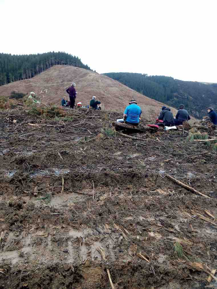
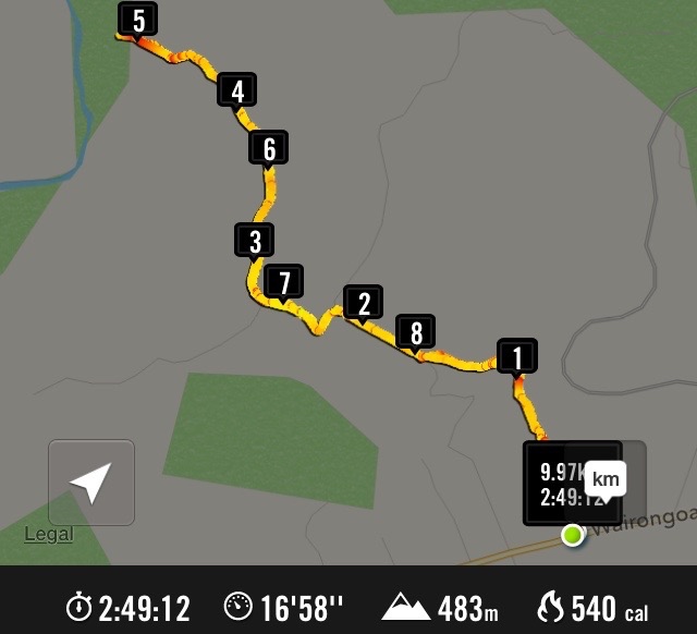
10. 10/1/2018 Hikers. Taieri River view lookout. E. Leaders: Doug and Ian.
Twenty-one Hikers turned out for the first tramp of the new year, parking the cars at the lay-by on Taioma Road beside the entrance to the Taieri View Road. This tramp was to differ markedly from the last one we had done back in 1915.
First, a couple of the private forests along the forest road on the left had been ‘harvested’, as they say, the first one now replaced with paddocks.
Second, the former FWD track was now a road, much more heavily metalled and heavily dented by the double wheels of forest trucks carrying heavy loads.
And third, road’s end was now in the middle of the branch-and-trunk-strewn cleared second forestry. No longer a gentle grass-covered FWD track ending in a rough honeysuckle and gorse encroached track. A shock. A big shock.
Yes, the shocking new way of getting to the lookout was to have to pick our way through a debris of tangled branches down along a left-leaning bench-sort-of-slope that was marginalised by a messed-up fence line on the right and a steep fall-off on the left.
The goal ahead of us was to be a line of small Manuka and gorse bush, a middle part of it dead. Just where the dead changed on its right to the dark green, the leaders knew to be the sturdy post at the end of a fence, alongside which was the track down through to the lookout. This they had found only after well over half an hour’s reconnoitring the previous week.
Seventeen of us reached the lookout unscathed by the sharp-ended broken branches we had to negotiate, with four electing, a short distance in, to prudently head back and wait for us near the safety of the road.
At the lookout, despite some reluctance to leave the wonder of the view,
Taieri Lookout. (Clive pic and caption.)
but it being still only eleven o’clock, we eventually turned back to retackle the cleared (??) forestry slope.
The hills denuded of pines made for heavy going in places (Clive pic and caption.)
This time, with leadership guidance no longer needed to find a way, a wonderful variety of routes back up to the road were found.
Back right up near road’s entrance, we stopped for lunch under power lines with the cleared area affording us a pleasant view.
Along the short distance of Taieri View Road, and out onto Taioma Road, and leaving our parked cars on our left, we headed down the road to a gate onto Salisbury property. We headed down through a couple of paddocks,
A walk down the hill with the Taieri Gorge railway in the background. (Clive pic and caption.)
the route getting steadily steeper until its very steepest part got us down to the relief of the flat. Many elderly knees didn’t enjoy that last part one bit.
A nice flat lane led us to the wonderful restored stone cottage where we stopped to again admire the beautiful work done to it both inside …
Glen Lyon Cottage established 1862. (Clive pic and caption)
Then out to Wairongoa Road where two shuttle cars ferried drivers back to their cars in the lay-by to allow everyone to return home, some by a coffee break en route.
The day was cloudy and not too hot. Just right.
The normal route would have both started and ended on Wairongoa Road, the tramp beginning with the steep climb through Salisbury paddocks to Taioma Road, morning tea half way up, and lunch at the lookout. All agreed however that through a car shuttle saving the Salisbury paddocks for just a return downhill journey and for a shorter first tramp of the year was the way to do it. – Doug and Ian.
Walked all but 17km and averaged 4.8km an hour.
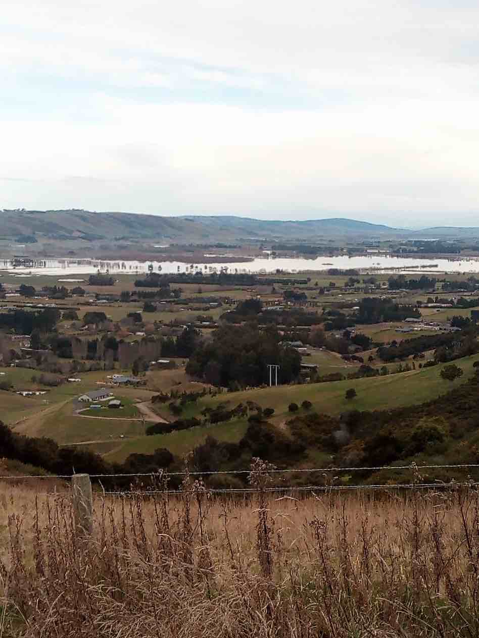
We drove and parked at the Showgrounds. Ten of us were eager to get out for a walk without rain. We headed up Taioma road and had smoko at the bottom of the hill. Then a steady uphill climb took us to the Taieri View sign, a few stops along the way were had to look at the flooding of the lower Taieri (which occurred after heavy rain on Friday and Saturday). Also, picking out landmarks and where some of us live on the Taieri.
Nice view over mosgiel. (Helen pic and caption.)
We turned left at the Taieri View sign, then veered left again onto a Forestry road that took us to where trees had recently been milled. Looking across farmland, down to the Taieri river, cleared forest and 4 goats grazing in the distance we enjoyed the vista while eating lunch.
Lunch. (Helen pic and caption.)
After lunch we walked back to the junction and decided to carry on down the road that we veered off, where we were looking further down the Taieri towards Henley at the floods.
Water on the plains. (Helen pic and caption.)
Once we headed for home, it was down hill all the way to the cars. We parked back at the car park and strolled round to Blackstone where we enjoyed coffee and cake.
The weather was calm and mild, which made our outing most enjoyable. – Eleanore.
8. 2015 Aug 26. Hikers. North Taieri Church, Salisbury and Taieri Lookout. Leaders: Pam, Dawn.
GPS of route
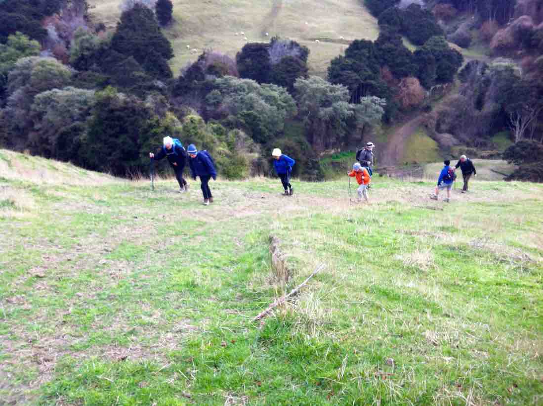
Where to start with all the happenings in this report? Well, first, when the cars arrived at North Taieri Church some of the Brighton people failed to turn up. It transpired, as was later report, their car load turned back to just walk around Mosgiel on seeing the “Road Closed” Taioma Road notice. Twenty of us set of along and up…
The paddocks were as steep as ever.
…the Salisbury farm paddocks to emerge onto Taioma Road just above the zig-zag and stop for morning tea on the road edge,
Morning tea cuppa on Taioma Road in the ditch, sheltered from the wind.
nicely sheltered from the cold southerly.
Incident two. After we had trudged up the road to the Taieri View side road, we looked back to see a small group stopped back down the road. The leaders went back down to find that Peter B. was experiencing one of his very occasional breathless spells (his last one, this report recalls, was on Traquair, but that time he recovered to continue afresh again.) Cell phone arrangements were made for a one of the leaders’ spouse to drive up and take Wendy and Peter back down. This was satisfactorily achieved.
Incident three. John had driven up to meet us at the side road turn-off. But under the unwise earlier advice of this reporter, had parked just beyond the turn-off at the edge of a logginh-truck lay-by area, but had been reprehended by a logging driver for possibly impeding their movements, so got his car neatly parked in the side road.
Incident four. Keith espied a cast sheep in the paddock over the road. Mastered the barbwire fence and righted the sheep which staggered, trotted, ran off. Bravo.
On up the road, into the forestry road
The track is wide and open for much of its way. (John pic)
and down,
The 2013 snow dump’s legacy of fallen trees on the track forced us to to divert through the forestry occasionally. (John pic)
steadily down
From the road end, taking the track down to the lookout rock. (John pic)
to the river look-out rock. The bold (reckless?) stepped out onto the large rock to admire the view, the timid (prudent?) stopped well back from the intimidating drop.
Lunch,
A candid lunch pic a little bit up from the rock.
snugly tucked in among grass and gorse against the wind. The leaders shortened the lunch-stop for fear of approaching rain but it failed to eventuate. In fact, sunshine and the climb back out proved a even a bit over-warming.
Incident five. Back at Taioma Road, Mollie and George graciously accepted the invitation of a ride back in John’s car.
Incident six.. Trudging back down the Salisbury paddocks, someone remarked that Dot (of the returning car, alas) had intended sharing her big-birthday chocs with us. Sigh.
Next a stop at Mr McElwee’s beautifully restored cottage, an eye-opener for some of our newer members. Then out to the cars where we were found a cheerful Peter waiting to greet us, none the worse for his setback earlier. Relief all round! Then off to Topiary for some for their accustomed coffee fix.
A great day out, with Salisbury’s steep paddocks testing breathing on the way up and knees on the way down. A day full of interesting incidents. A tramp very well led by Pam and Dawn. A good day. – Ian.
7. 2013 Apr 3. Both. North Taieri Church, Salisbury and Taieri Lookout. Leaders: Fred, Ian.
We started out from beside the North Taieri Church, numbering 20. We admired some black sheep along the way. Mollie pointed out that the hill ahead was Vaughan Hill, once owned by her late husband’s parents. We admired the restored stone cottage, of course. Mr McElwee had determined on everything being authentic to its old age, including …… donated from the Vaughan farm. We then set about climbing the hill ahead, this time via a gentler track (only slightly) from around its back. At a water trough, well up the hill, we stopped for morning tea and to admire the view, and to increase our number by Lex arriving down from his car parked in Taioma Road. Light rain came on, and so did our parkas. By the time we arrived at the “No Exit” entrance to Taieri View Road we found our numbers had dropped to sixteen, five opting to seek car and home rather than carry on in the rain. On taking the forestry road turn-off, some found water off the wet grass soon got into wet boots making for a gentle sloshing sound as they moved. But we carried on to successfully reach the Taieri River lookout, and return up that steep part o the track at its end to lunch under the shelter?? of some forestry pines. It was at this point that we had reached the dispiriting point for many. We found we had only exchanged the fine rain outside for large forestry drops that soon soaked any part of us that was not already wet. And here any respect for the leadership vanished. It wasn’t too long before the leaders discovered numbers had now dropped to four, the rest having returned up the track to shorten what had turned into a miserable experience as quickly as possible. The leaders caught up briefly at Taioma Road, only to see the majority head off down to make a road-walk, regardless of traffic, back to the cars. This left the leaders now with a group of only six, who returned back down through the Salisbury farm the way we had ascended, for a grand meet-up with those under their care back at the cars. So all’s well that ends well, perhaps. – Ian.
6. 2012 Jun 13. Trampers. North Taieri Church, Salisbury and Taieri Lookout.
GPS of route, courtesy Ken. We did the loop anti-clockwise. We did 16 km in all. A good day’s walk. Total altitude climbed: 500m.
Relying on Ria’s memory to guide us, 7 of us did the more extensive Salisbury walk,
which took us climbing, climbing to join the Taioma road at the very top.
Morning tea stop, halfway up the loop, on the right.
Then we had to make our way back around Taioma road to get back down to Taieri View Road. We tried to avoid the road, busy with fast, heavy rumbling logging trucks, but paddocks proved eventually too boggy.
Shortly into Taieri View Road, we stopped for a late lunch. At this point George didn’t want to go any further, so he and his car-load took the short way back to his car. The remaining trampers made their way on down the forestry track turn-off from Taieri View Road to the Lookout. The track was much more overgrown and forestry-shaded than when the writer remembered it. However this gave us good shelter from the blustery cold wind that made itself felt when we emerged out onto the Lookout.
Lester views the Taieri from the Lookout.
Smile please
An imaginative use of old tractor tyres on Salisbury near the end of our return
We were lucky with the weather, which held off till we reached the car. A good tramp for a cold-weather day. The tramp also had a sentimental side, as it was the last day Linzi was to be with us, before departing back home to Cornwall three days later, after tramping with us for a whole year. Farewell, Linzi. – Ian.
5. 2009 Apr 8. Hikers. Taieri View, Mount Allan Road. Medium. Leaders: Chris, Dot B.
Taieri View Rock
4. 2008 Feb 27. Leaders: Bev.
A bit cloudy but still 15 hikers parked their cars in Taieri View Rd. and set off on a very pleasant hike along forestry roads and through the forest to another Taieri Lookout. We had our morning tea sitting on a grassy bank before we headed into the forest itself. Very enjoyable walking and only some fairly easy down and up grades to keep us from having it too easy. Got to the lookout area which was a big rock jutting out over the Taieri river. Great view of river and surrounding areas. By now the sun had come out so made it more pleasant for our lunch break which we enjoyed relaxing and taking in the view. Then the sun disappeared and it turned a bit cool and looked very much like it would rain in the very near future. So we set off back to the cars. We found a few interesting things
George by wrecked car
to look at and photograph for fun on the way. A goats skull and horns which made an appropriate photo for an ‘old nanny goat’! A rusty old car body which had to be sat in, also for the obligatory photo. A really lovely big bush of ripe blackberries, much enjoyed by those who took the time to pick and feast on them. A lonely little pansy, (not a petunia!), in the middle of some blackberries and long grass. George managed to knock over the post of the electric fence after holding it down for us to step across. Luckily he didn’t short circuit himself or anyone else! Back to the cars before the rain came after another happy and enjoyable day out. Bev.
3. 2007 Feb 28. Trampers. North Taieri Church, Salisbury, Lookout. Medium. Leaders: Ria, Glenice.
The View from the Taieri Lookout.
Abe at Taieri Lookout.
2. 2005 Nov 2. All. Farm Walk from North Taieri Church. Easy. Leaders: Ria, Jacqui, Graham, Eleanor W.
1. 1992 Aug 12. Taioma Road. Turn off just before Salisbury L.H. side. A hill walk, good views. Average.
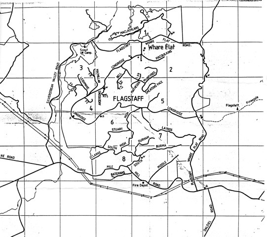
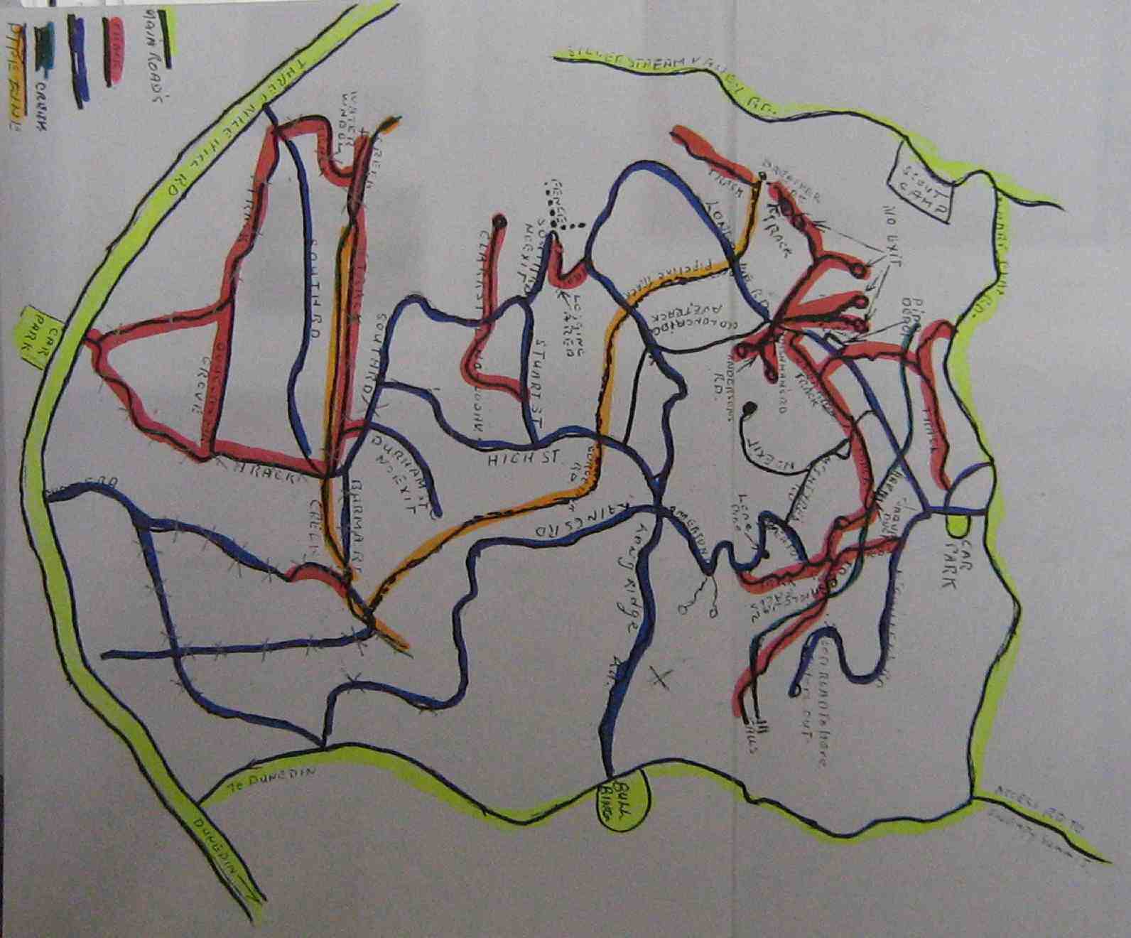
Park at Three Mile Hill lookout, or Bullring or Pottery, Whare Flat. Permit from City Forest, Dunedin 455 5512.
Map of all Roads
click to enlarge
Map of lower tracks/roads
Jack Roy’s Map of Flagstaff Forest roads/tracks
21. 8/11/2017. Hikers. Flagstaff Forest. Stuart and High Streets. M. Leader: Adrienne.
Route map, courtesy Ian.
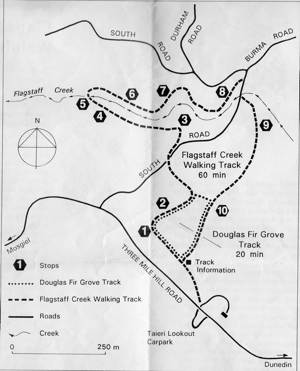
A dozen Hikers set out from the Taieri Lookout Car Park, crossed the Three Mile Hill Road and turned down the Flagstaff Creek walking track, crossed south road and descended the occasionally steep recently well-stepped track to the weir and the old, well-rusted flow wheel,
Can you detect it? Try enlarging.
now almost completely obscured by undergrowth where we had morning tea. The closed wooden bridge across Flagstaff Creek being now blocked off with its access track fully obscured by undergrowth, we had to climb back up to South Road the way we had come down, and follow the road around, past Durham and High Streets to climb the unsigned (where’s it got to?) Stuart Street to where it joined up with High Street. Sheltered hitherto for most of the tramp from a strong cold wind, we found ourselves now well exposed to it. We went up High Street a little way and turned up a track labelled Tank Surge Road <?> to the partial shelter of its narrow tank for lunch. Then, it was back down High Street and along South road to where it crosses Flagstaff creek by the piped concrete bridge, and up the Douglas Fir Grove track leading across to the car park again.
Although the cold wind back at the Bush Road car park had been a bit discouraging, we all agreed at the end it had been a most enjoyable energetic day out, pleasantly completed with companionable coffee at the Aurora. With co-leader Bev laid aside through illness, (and the locator beacon still in her car boot!) Adrienne did a text-book perfect leadership job, faultlessly grouping us at each fork in the route. Thanks, Adrienne. – Ian.
20. 14/10/2015. Hikers. Flagstaff Forest. Stuart and High Streets. Leaders: Lesley and Bev.
GPS of the route
Nineteen hikers parked at the Lookout. Lesley led us in at the upper entrance and down the track to South Rd. Then along South Rd …
A study in ‘verticality’What appears to be a chipper – (saw-duster?) for transforming forestry rubbish into pellet fire product, perhaps.
… to the foot of Stuart St whose road sign at its foot is now unhelpfully missing. Up Stuart St which gets only steeper each time we tackle it, but now cleared of all trees on either side. Where Stuart St ends at High St, the leaders took eight of the party down High St, entrusting the balance of eleven to the leadership of Keith to take them up High St to lunch at its end at Longridge. The two parties met again on South Road where it crosses Flagstaff Stream and returned to the cars via the large steep steps taking them up along the Douglas Fir Grove track. – Ian.
19. 17/7/2013. Hikers. Flagstaff Forest. Leaders: Les and Margaret.
Wed. saw us park up at the lookout at three mile hill road.
We walked into the forest and around a few of the roads like High St, Stuart St, etc.
It turned out a great day with lots of sun between the trees.
the douglas firs are so TALL in the forest I wonder if they will mill them.
It was very sunny at the lunch stop. Fred supplied the usual chocs so all was well for us all.
We made our way back up some huge steps {made by a Big Man?}
There are a lot of felled trees in there and I wonder what they are going to do with it all.
With so many families crying out for wood and the price it is… and here is all this wood just rotting away. – Elaine.
GPS of route, courtesy Ken. Unaccountable lapse in record. Deduce omitted route yourself!
A pic from earlier in the tramp before we got to the top.
Fast melting snow on route back down from top.
17. 28/4/2010. Hikers. Flagstaff Forest walk. Leaders: Bruce and Marjorie.
Thirteen hikers parked at the Taieri lookout and set off on the bush track opposite which was a very pleasant walk. Although it had rained, pine needles made a soft dry carpet. The variety of trees and bird calls, including rosellas, provided interest and we admired the tall straight trunks of the giant trees.
We had morning tea and lunch at the same spot by the Flagstaff stream but between we did a circular walk around forestry roads. These provided us with good walking underfoot and although it was quite a grind up Stuart Street we all managed it with ease by taking our time and stopping to admire the view of the Taieri Plains and Saddle Hill. After lunch we completed the bush walk back to the cars.
It was quite a short walk, although no-one took up the offer to go round again. Another time a further circle could be added on at the top of Stuart Street. The weather was ideal with not a breath of wind and mild temperatures. – Marjorie
16. 1/7/2009 Both Hikers and Trampers. Flagstaff Forest. South Rd, High St, Laings, High St, Stuart St, South Rd. Leaders: Neil, Ria
It was a good day for 20 members of the club from both groups. We entered the forest from opposite the Taieri Lookout car-park and made our way down to where the track comes out at South Road. We followed this around to turn up High Street, but before doing this we stopped for
our morning tea break in a rare sunny spot. click to enlarge
Morning Tea on South Road. Lex, Bob, Who? Wendy, Who? Neil, Ria, Peter, Mollie, Pat, Bill, Bev, Evelyn, Angela.
We made our slow way up, up, up High Street, stopping for frequent rests to eventually reach Long Ridge Road only to immediately turn back off it to travel along Laing Road until Ria judged it time to stop for lunch.
Returning back we enjoyed great views of the Taieri Plain,
Taieri Plain
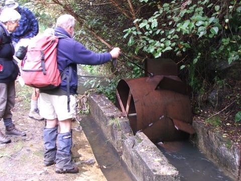
turned back down High Street and then off to the right and down Stuart Street. When it reached South Road, we turned left, passing the foot of High Street to reach the bridge/culvert over Flagstaff Creek. Here we turned down the Flagstaff Creek Walking Track to at last cross the Creek on a fine wooden bridge to reach a water race
Race EntranceWeir, water-race entrance and Overflow
containing an old water meter wheel stiffened up with age and rust.
‘Up-race’ of Water Meter‘Down-race’ of Water Meter
Back up the track a bit we turned up to the right to climb a many-stepped track up to cross South Road and back up the initial track to the car park again. Thanks, Ria and Neil for a most enjoyable, if wrapped-up, winter’s day out. – Ian
15. 25/2/2009 Trampers. Three Mile Hill Lookout. Flagstaff forest walk, Three Mile Hill. Round trip. Lookout, South Rd, High St, Longridge Rd, Whare Flat Rd, Laings Rd, High St, South Rd. Leaders: Ria, Hazel.
The misty overcast day left ground wet and muddy underfoot and ruled out the planned tramp on Swampy. So Ria had sought permission for the six of us to walk the Flagstaff Forestry roads. It was a good work-out, extended by a climb from the Bullring to near Flagstaff summit to fill in time before lunching in the welcome shelter of Ria’s daughter Ingrid’s property’s haybarn down Whare Flat Road.
Lunch in Ingrid’s haybarn. IanLunch in daughter Ingrid’s haybarn. RiaLunch in Ingrid’s haybarn. Hazel, GleniceLunch in Ingrid’s haybarn. Bill, Pat
Then it was back up Whare Flat Road to Laings Road and so back to the Lookout where we had parked the cars. Thanks to Ria and Hazel for a good alternative tramp.
14. 20/9/2006. Hikers. Three Mile Hill area. Easy. Leaders: Jean, Anne R, Eleanor B.
13. 30/3/2005.DCC Forestry Walk.
Water wheel
12. 11/9/2002. Alt. Three Mile Hill. Leaders: Les W, Mary M, Peg C
11. 27/6/2001 Three Mile Hill. Leaders: Daphne, Eleanor, Mavis
10. 25/4/2001. Three Mile Hill. Leaders: Daphne, Peg C, Mary M.
9. 19/7/2000. D.C.C. Forestry Circuit. Leaders: Shirley R, Arthur and Barbara.
8. 18/8/1999. DCC Forestry Walk. 3 Mile Hill. Leaders: Margaret D, Winifred, Joan H.
3. 20/9/2017. Hikers. Portsmouth Drive to Marina. E. Leaders: Judy and Dorothy.
Twelve harbour strollers, went to Andy Bay.
We parked beside the inlet – it was a windy day.
Along the Portsmouth Drive we went, trudging in a row.
We passed the harbour molars, and onward we did go.
A sunny sheltered spot was found, and morning tea was had,
Relaxing in the sunshine, it wasn’t half too bad.
Then on we went, around the wharves, and round the harbour basin –
We found that walking in the wind, was really somewhat bracin’.
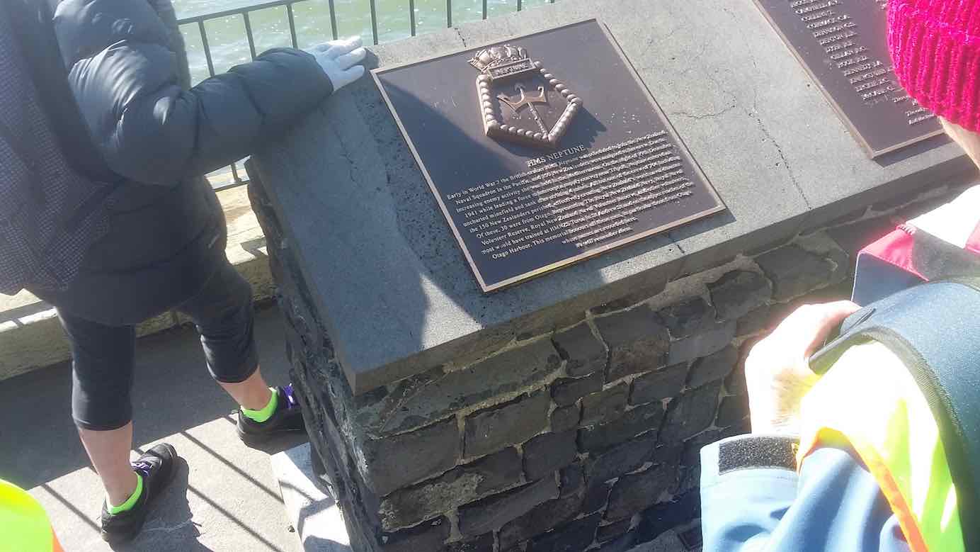
We viewed the plaque in memory of “Neptune”, sunk in war.
She hit a minefield in the Med, and then she was no more.
We passed the Neptune memorial at the wharf and some members were able to point to the names of loved ones who were involved in this tragedy. (Clive pic and caption.)
On we went and onwards, across the Leith we strode,
Then Clive led us along the groyne, to where the water flowed.
We took a walk out on the groyne at the boat harbour and nearly got blown away in the 20 knot winds. (Clive pic and caption.)
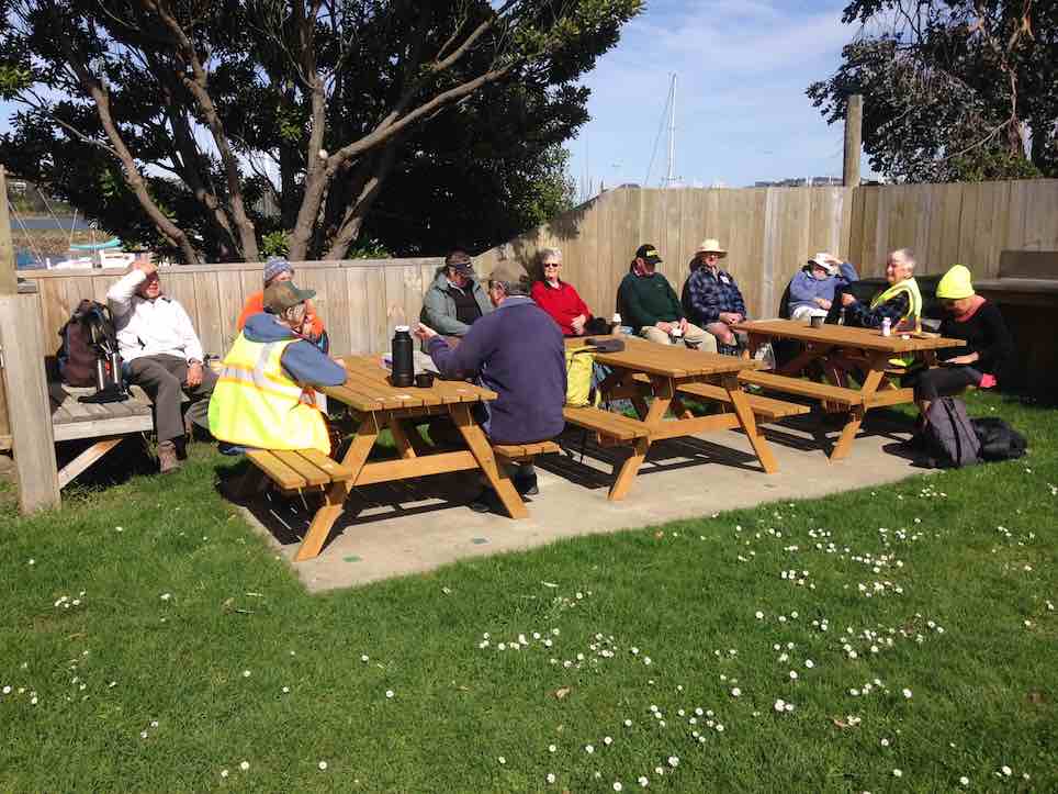
Back around the boat harbour, some picnic tables found,
For lunch and chatter in the sun, then homeward we were bound.
Lunch outside the Yachting Club. (Raewyn pic and caption.)
A cracking pace was soon set up, the wind was at our backs.
Perhaps the increase in our pace, was due to lighter packs?
We viewed a lot of logging trucks, a queue a mile long –
Sending all those logs away, we feel it is quite wrong.
A photo stop was taken, beside the harbour molars –
And so we coined the title, “The Mosgiel Harbour Strollers.”
The Molar strollers. (Clive pic and caption.)
The cars in view, we stepped it out and headed fast for home.
A coffee stop at Blackstone – and then I wrote this “pome”….
(Well, try to find a better rhyme!) – Judy.
Stats for the day: 11.7 kms; 3 hours and 4 minutes walking time; 480 calories. – Clive.
2. 14/1/2015. Hikers. Portsmouth Drive to Marina. E. Leaders: Peter and Wendy.
GPS of route
We parked in the carpark by the Bayfield High School. And 21 of us set out.
The bulk of us waiting for others investigate the doings of a suspect prowler back a the carpark and to call the police to investigate. Helen found a passing cyclist friend to chat to.
We walked along Portsmouth Drive past the molars, turned down Kitchener St, huggiing the harbour edge and stopped off for morning tea.
Sheltering from a cold wind for morning tea.
Carrying on, we turned round into Birch St, across the top of the harbour basin then down along Fryatt St almost to its end. Then it was up Wickliffe St, across the railway overbridge, briefly on Anzac Avenue, down Parry …
Skirting the Stadium.
…and Minerva Streets to cross the Leith on SH88 bridge, and on the north side to turn under the bridge and out along Magnet St to get to our lunch stop at the Marina.
Again sheltering from a cool wind, this time for lunch.
On our return, we walked the length of Anzac avenue. Then onto the railway station platform, where Dorothy performed a most believable but all too brief strut down the catwalk. Out at the other side, on past Toitu Settlers Museum and along the grassy verge ahead where we stopped, briefly thwarted by the railway bridge overpass pathless on-ramp ahead. So it was across all four laned SH1 Cumberland St, with the assistance of the lights further back. This safely accomplished, it was Les and Peter led us up Water St, along Vogel St, back down Jetty St and onto the pedestrial spiral ramp to get us onto the bridge. Then via Birch St, Buller St and French St we rejoined Kitchener St which took us back out onto Portsmouth Dr and back to the cars. From talking to one or two others, I must say coming to the end of eleven kilometres on hard pavement had taken its toll of leg muscles, on this the first tramp after the holidays. A good walk, not too hot or windy. Thanks to Peter and Wendy for a good start to the year. – Ian.
1. 20/11/2013. Hikers. Midland St, Portsmouth Drive to Marina. Leaders: Bev and Chris.
Route
The walk was most inventive and interesting, leading us along back streets few of us had ventured on before. We parked at the bottom of Midland Street where we could cross onto Portsmouth Drive with the safety assistance of traffic lights. The laying of cable along the walkway forced us onto a less inviting traffic-coned path along the road till we returned to the walkway at the molars.
Molars. The 20 of us are almost all in the pic.
A little further on we turned down to the length of Kitchener St turning left up at its end into Birch St to join Wharf St esplanade and have morning tea on the seats, to admire the inner harbour view as well as a gentleman, lent back on a camp seat, fishing, hat over face, asleep.
A happy surprise was Lex sharing round chocolate marshmellows in anticipation of his 85th birthday the following day.
Then it was up and on again, down virtually the entire length of Fryatt St to turn left up Wickliffe Street and over the elderly railway overhead bridge, down the other side to the right, and to stop and admire (?) the special road-coned entrance/egress of Hall’s work-yard and the still-hooded traffic lights. We gingerly made it across Anzac Ave, across Frederick St, back again across Anzac Ave to join Parry St, make way across the SH88 Leith Bridge very wide pedestrian walkway, down, back, under the bridge and along Magnet St. (4 km)
and the Harbour Walkway (5 and 6 kms) to lunch at the northern end of the map in what shelter we could find from the nor-easterly wind.
We retraced our steps to the SH88 Bridge underpass, this time following the Leith bank up to Anzac Ave (7 and 8 kms)
which we followed right to the St Andrew St lights where we turned down along it to the roundabout, followed Mason St, then into Tewsley St and into Fryatt St to retrace our route alongside Wharf St (9 km), Birch St, Kitchener St and Portsmouth Drive back to the cars. 11 km in all. The harbour wind-blast along Portsmouth Drive almost blew us off our feet. Many thanks to Bev and Chris for a varied and interesting streets exploration around a corner of the harbour. – Ian.
2. 23/8/2017. Hikers. Gardens to Surf. E. Leaders: Pam and Dawn.
We Parked our cars in Duke Street, near the Woodhaugh gardens. 22 members started off. We walked through the Varsity and had morning tea at the Polytech outdoor area. Walked along Portsmouth Drive to Queens Drive down to St Kilda beach. Walked along playing fields and some track to picnic area above beach, where we had our lunch. We then continued on to St Clair, via street and caught the bus back to the Botanical gardens where we enjoyed a hot drink. Back to our cars and home to Mosgiel by 3.45pm. A very enjoyable day was had by all. – Dawn.
1. 19/8/2015. Hikers. Gardens to Surf.
We had a good day walking from the Botanic Gardens…
…and along the beach to St Clair. I had not been on the beach since the June storms and was blown away by the damage to the beach.
Rocks (John pic)
The piles…
Piles (John pic)
…are nearly all bent over by St Clair. Thank goodness I have done 3 paintings of the piles. Judy Knox was on TV Wed. night and did a very good interview on the local TV channel.
We all went back on the bus to the Gardens and all (I think) 27 of us didn’t pay. I think the bus driver got a bit of a surprise. – Elaine. [An unintended report, purloined from an email. – Ed]
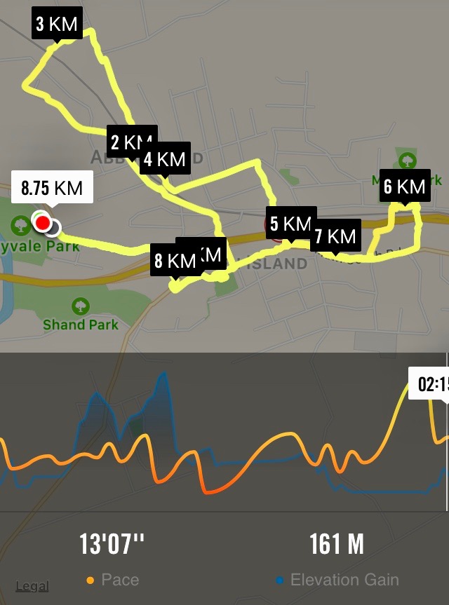
4. 31/5/2017. Hikers. Green Island street walk. E. Leaders: Elaine and Chris.
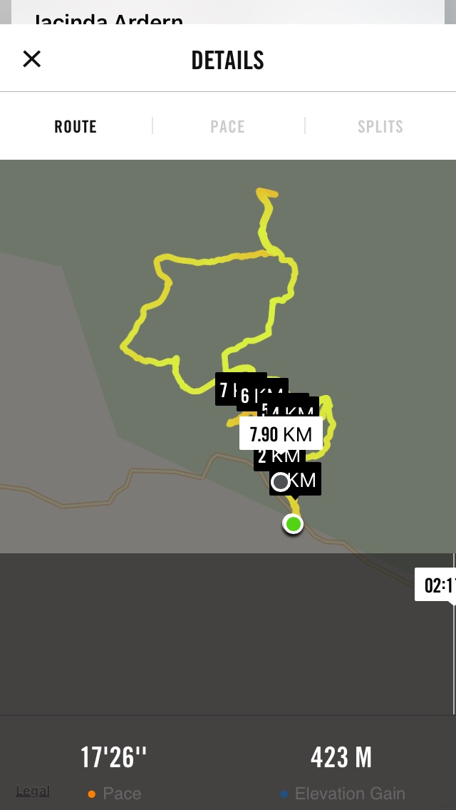
Nike app map of route, courtesy Ian.
The above route map gives some indication of the intricacies of Elaine’s planned route, designed to cross and recross, by way of tunnels and bridges galore, the barriers of railway line, stream and motorway dividing Green Island from Abbotsford. It was a street-walk, most suitable on the day for an off-and-on light morning drizzle. We were treated to a whole gamut of lower Abbotsford house designs, most instructive of fashions favoured in different decades, complete with one or two older ones looking very old and very neglected. At the latter part of the hike, we also got to peek into some of the large industrial goings-on at the north end of the town, not least Harraways. All most impressive.
At one point where a railway line once crossed the old main road (remember it?), Elaine stopped us to point out how it once served a coal-mine of her grandfather. She has a photo of a small steam engine about to head north across the road.
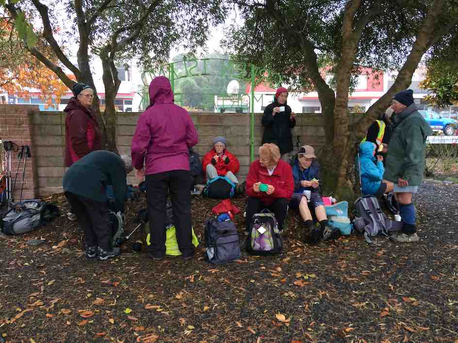
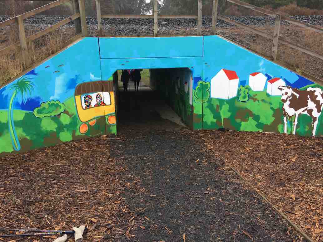
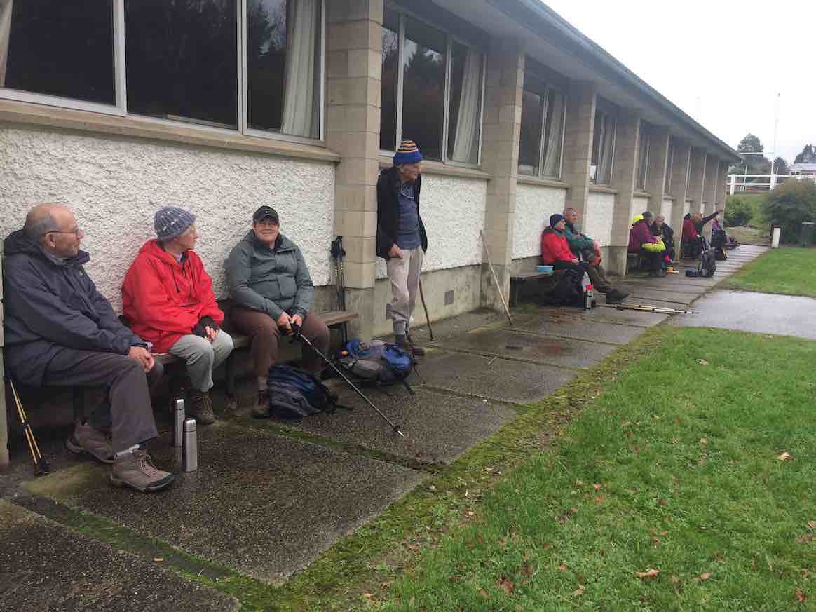
Drizzly morning tea at the gardens. Most of the 22 who came out. (Ian pic and caption.)Newly decorated railway underpass (newly decorated since Elaine’s recce), essential for linking homes and school. It was deemed safer for children than a bridge. (Ian pic and caption.)a dry-seated lunch at the Green Island Rugby Football Club pavilion in Miller Park. (Ian pic and caption.)18 of us at Coffee at Agnes’, where we got to enjoy a separate room all to ourselve, complete with en suite. (Ian pic and caption.)
Many were the remarks appreciative of the cleverness of the route. A big thank you to Elaine and Chris for a great day out. – Ian, (for Elaine [without her knowledge – yet!] whose recent rapidly failing eyesight prevented her from tackling a report.)
3. 25/2/2009 Hikers. Green Island. Farm Walk. Leaders: George, Dot B
2. 10/5/2006. Hikers. Green Island street and farm walk. Leaders: Chris, Dot B.
1. 8/2/2006. Hikers. Street Walk: Green Island Street and Farm Walk. Leaders: Dot B, Chris.
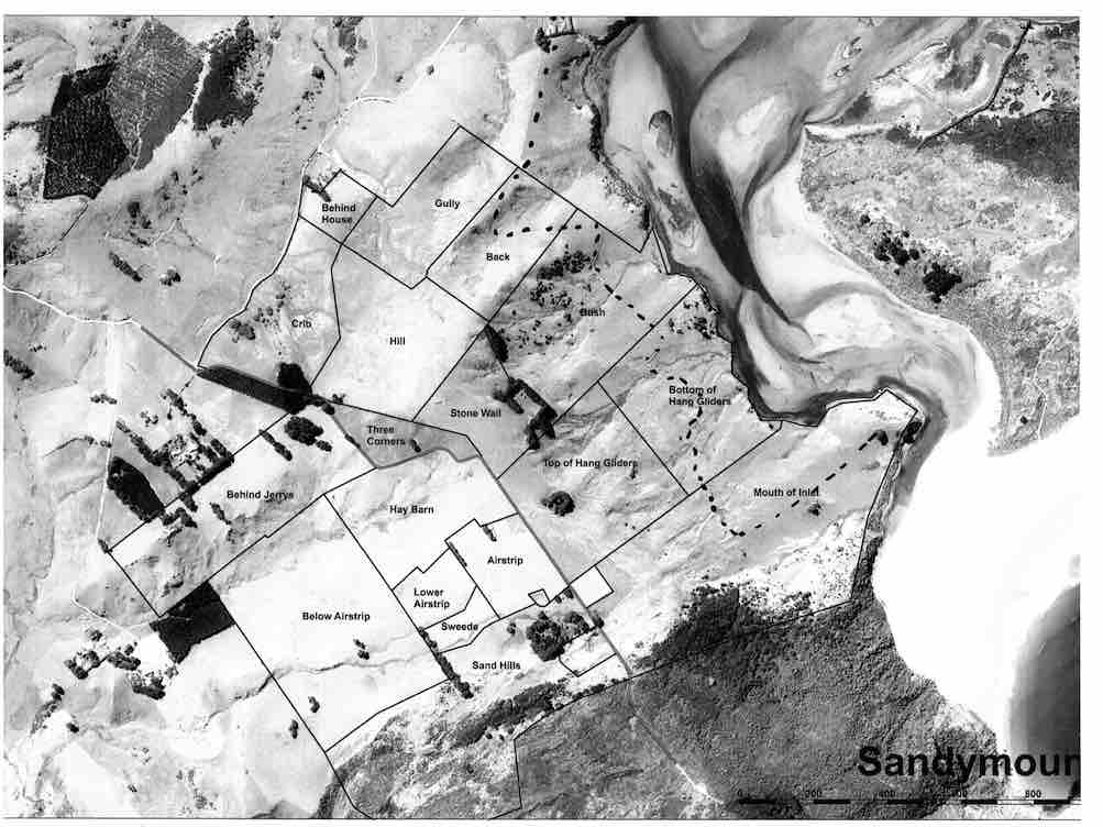
No. 93 on old hardcopy list of 113 club tramps. “Murrays Farm – Sandymount (Chris Hughes) Farm”
Distance for carpark: 31.5 km.
Map supplied by the owner. (Keith pic.)
11. 29/3/2017. Hikers. Murrays Farm. M. Leaders: Keith and Shona.
Route map, courtesy Ian.
It was a foggy, misty morning when 19 Hikers met at the gateway bel0w Murrays Farm before ambling up the road to having morning tea in the implement shed.
We then followed the fenceline up and across the paddocks before descending to explore around a container being used as a crib.
George investigates shower workings on new crib. (Ian pic and caption.)
We exited onto the coast …
We discover a new route from paddock to beach. (Eleanor W. pic.)
… where we had lunch …
Papanui Inlet mouth beach for lunch. (Ian pic and caption.)
… out of the northerly wind.
We followed the water’s edge around past the old boat shed, climbing up the hill and visiting an old dwelling also being used as a crib and back along the farm tracks to the hole in the hedge and down the hill to the cars.
Coffee was at Macandrew Bay cafe. – Shona and Keith.
10. 20/2/2013. Hikers. Murrays Farm. Medium. Leaders: Peter and Wendy.
Morning Tea at old homesteadParadise Ducks in formationWaiting for others in shelter from the hot sun
9. 7/12/2011. Both. Murrays Farm. Medium.
GPS courtesy Ken. Track from distant spot anti-clockwise.
Comfort plus for morning tea. (Ken pic and caption)
Five trampers scaled the almost vertical ascent to the Sandymount road before descending further by the bush.
An eye- and nose-watering wind greeted us when we stepped out of our cars at Hoopers Inlet. It was not a time for hanging around so our group of 13 set off at a brisk trot and soon reached the shelter of a shed which provided a good spot for morning tea.
Fuelled by hot drinks we ventured on and found that the hills and gullies gave good protection and we could enjoy this stroll through beautiful, peaceful countryside with the only other signs of life nearby the large number of paradise ducks. Perhaps they had discovered this place to be a refuge from duck shooters. In the distance sheep grazed and black cattle eyed us with interest.
Sheltered lunch spot
We found our way down to the beach and a sheltered corner at the far end provided a comfortable lunch spot.
Seal among the lupins
Margaret’s sortie into the sand dunes also brought to our notice a young seal hidden away under the lupins. We retraced our steps admiring the expansive views of the inlet and the winter colours on the hills.
It had been a short walk but a very pleasant country ramble.
Chris, who knows the area well, ably led us and, before returning home, some of us were lucky enough to stop off with her at a relative’s house on the hill and walk around the interesting garden, admiring both the plants and the panoramic views. – Marjorie.
6. 27/6/2007 Leaders:
Group. Ian, Leonie, George, Tash, Pat, Hazel, Ria.
5. 1/2/2006. All. Murrays Farm, Hoopers Inlet. Leader: Chris.
4. 5/3/2003. All. Murray Farm. Leaders: Chris, Les and Margaret, Bev McI.
1. 22/3/2017. Flood bank walk from Otokia to Allanton. E. Leaders: Lester and Ian.
Route Map, Flood Bank Otokia to Allanton, courtesy Clive.
This flood bank walk from Otokia to Allanton was a first for the Club. It was Lester’s idea, with his knowledge of the Taieri River plain, to vary from the programmed regular one from Allanton to Outram.We had to car-shuttle. We parked our cars on a property at the end of Otokia East Road, by kind permission of a grandson of Dr Alex Luke. The weather was mild. We climbed onto the flood bank. 25 of us were away.
The Taieri River at Otokia. (Clive pic and caption.)
Lester had arranged for us to have morning tea in Mrs Mason’s attractive woodland property, which although alongside Centre Road was still a paddock or two distant from the flood bank on the day. How to get there? The leaders hadn’t worked that out. Barb wire fences in way as we moved on, looking for a way through. None. But who’s this? Mrs Mason hurrying across the paddocks to us, wondering why we hadn’t turned up. Lester went back to talk to her while we waited, but this writer is ignorant of what transpired. Oh dear!
Too late now. So a stop on the flood bank instead.
Morning tea on the stop bank at Otokia. (Clive pic and caption.)
Many gates on the way made for frequent stopping, opening and closing. Along with the level terrain. these rest opportunities enabled everyone to complete the distance.
The lunch stop at Lenny Miller’s worked out more happily. On a lawn! A close-knit hedge sheltered us from a cool wind that had come up from behind us.
Lunch on lawn, courtesy Lenny Miller. (Ian pic and caption.)
Then it was on to Allanton. The leaders had warned about long grass to wade through, but as it turned out a top-dresser truck had just preceded us on that morning, and flattened an easy route for us instead.
Looking North along the stop bank towards Saddle Hill. (Clive pic and caption.)
So we reached the Allanton Bridge. Distance being 7.75 km by Nike app or 8.9 km by a steps app. But here, a second reece neglect. The leaders had not checked whether there was a gate available across the road to enable continuing along the flood to the sale yards. Discussion. Eventually it was decided to walk down, under the bridge back up on the other side. Apparently there was some electric fencing to encounter. This writer, being a driver, was driven back to collect his car and meet up with his passengers at the sale yards. From there, we went on to ‘coffee’ at the Topiary Cafe. – Ian.