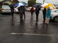
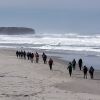
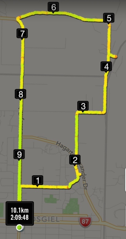
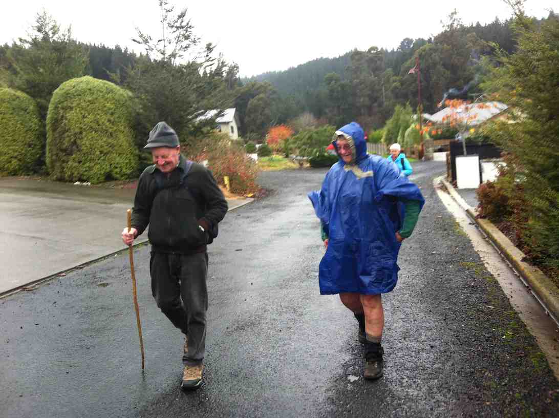
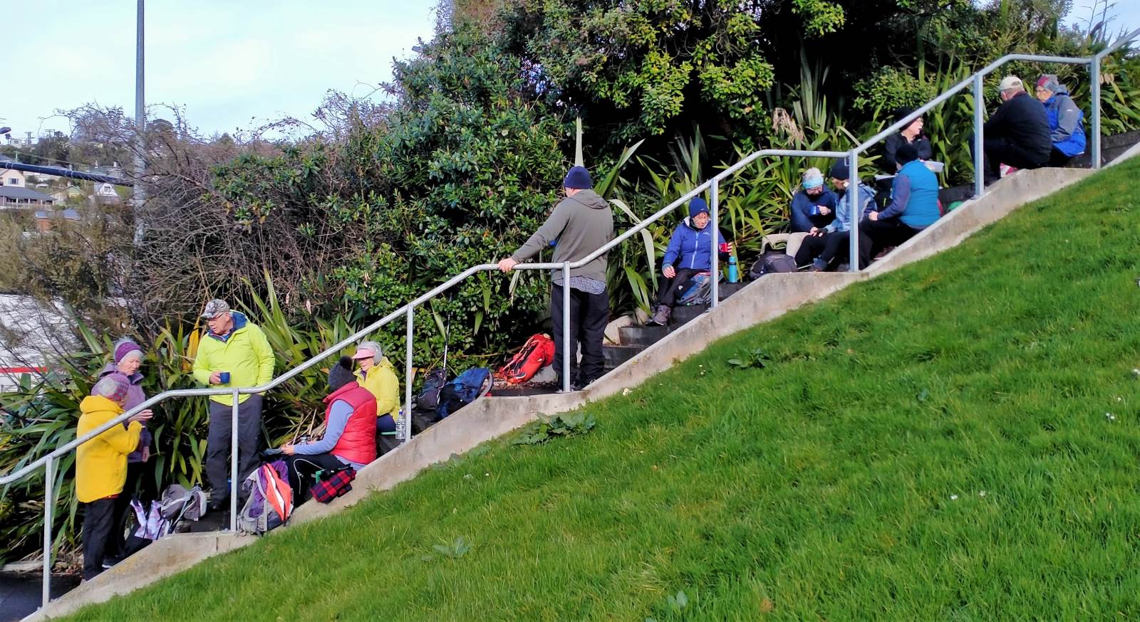
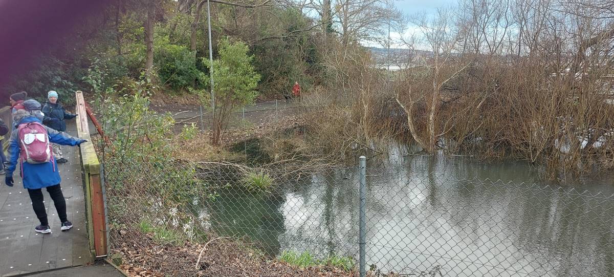
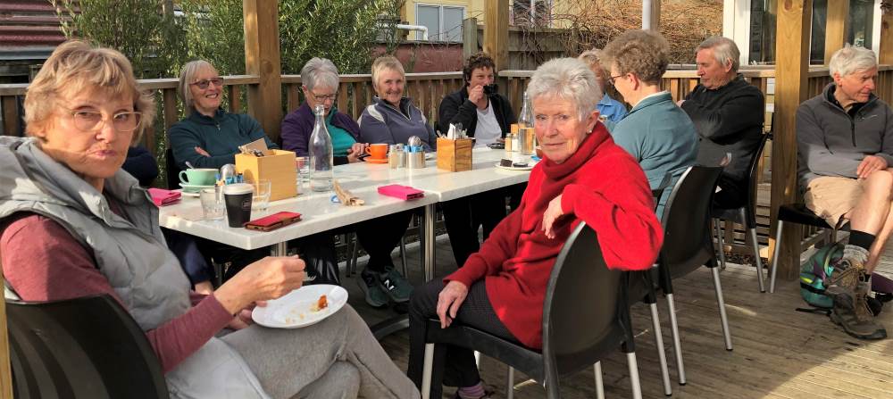
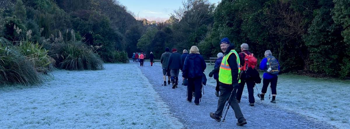
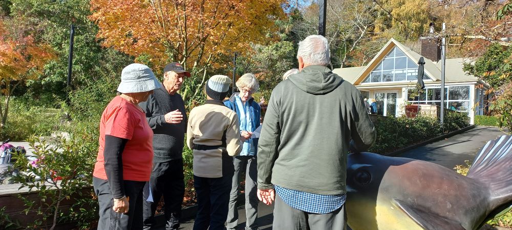
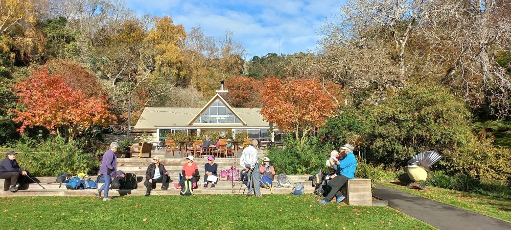
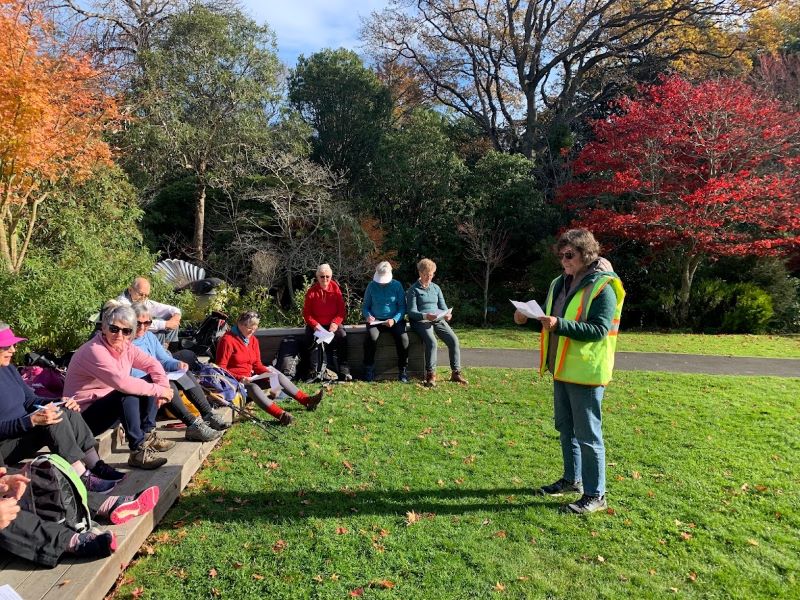
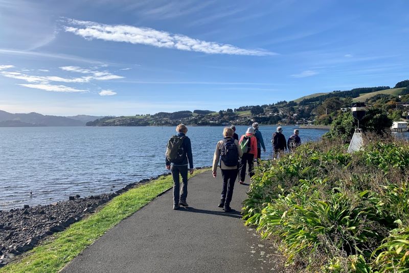
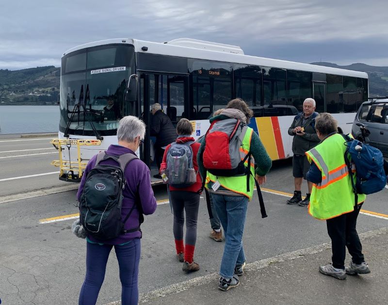
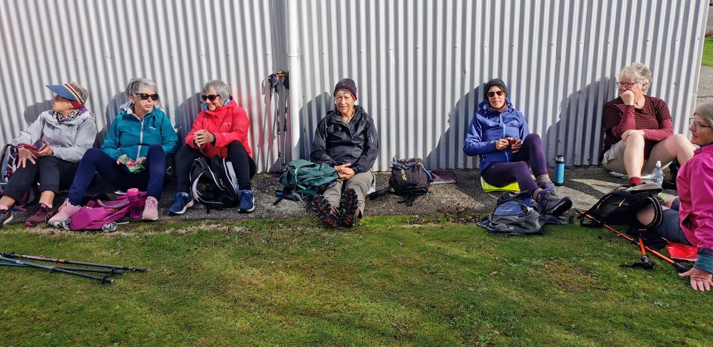
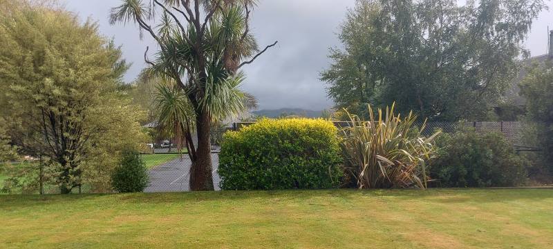
 2. 29/11/2023. Hikers Waters of the Leith. Grade 2. Leaders: Jan/ Pam
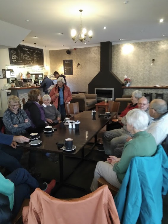
Having led this trip several times over the last 10 years or so, without much variation to it, this report will be reasonably brief.
Taieri Recreational Tramping Club
Mid-week recreational and social walking group based in Mosgiel NZ

2. 29/11/2023. Hikers Waters of the Leith. Grade 2. Leaders: Jan/ Pam
Having led this trip several times over the last 10 years or so, without much variation to it, this report will be reasonably brief.
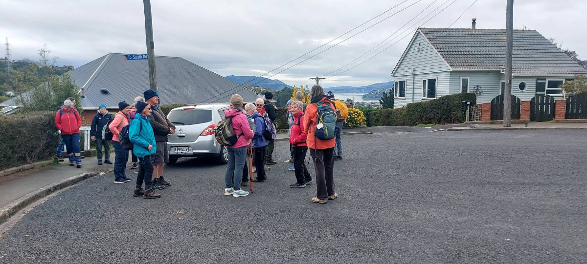
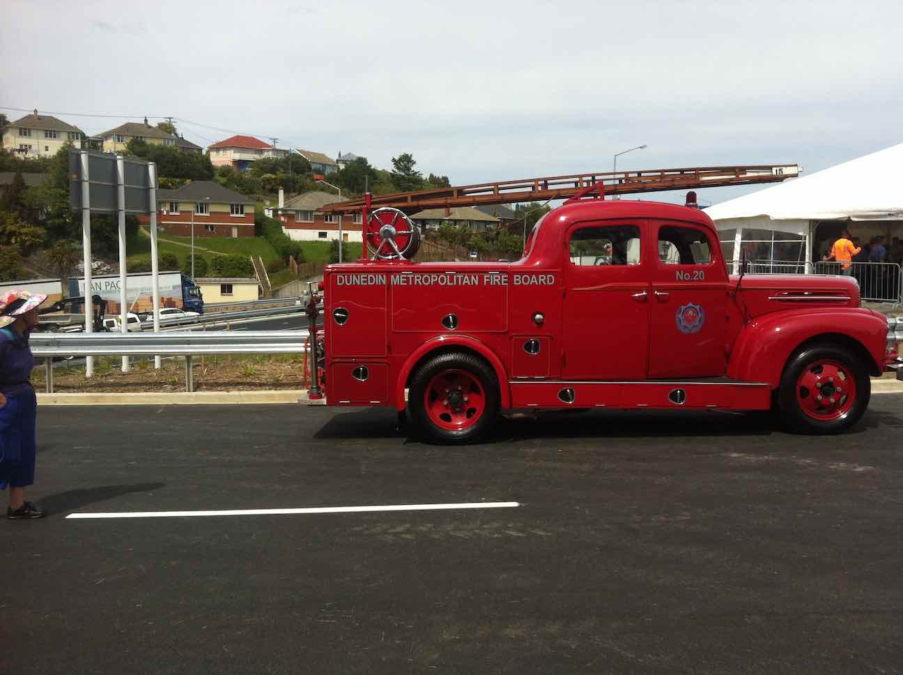
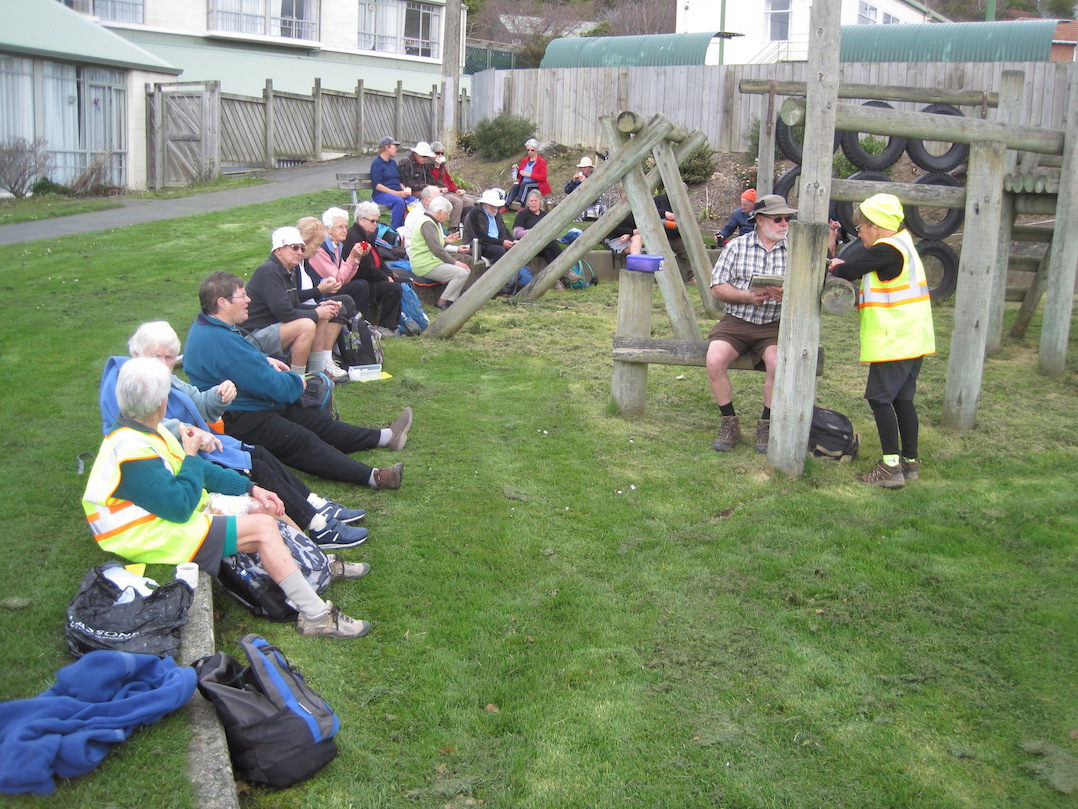
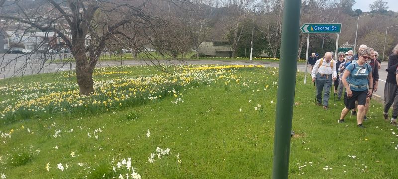
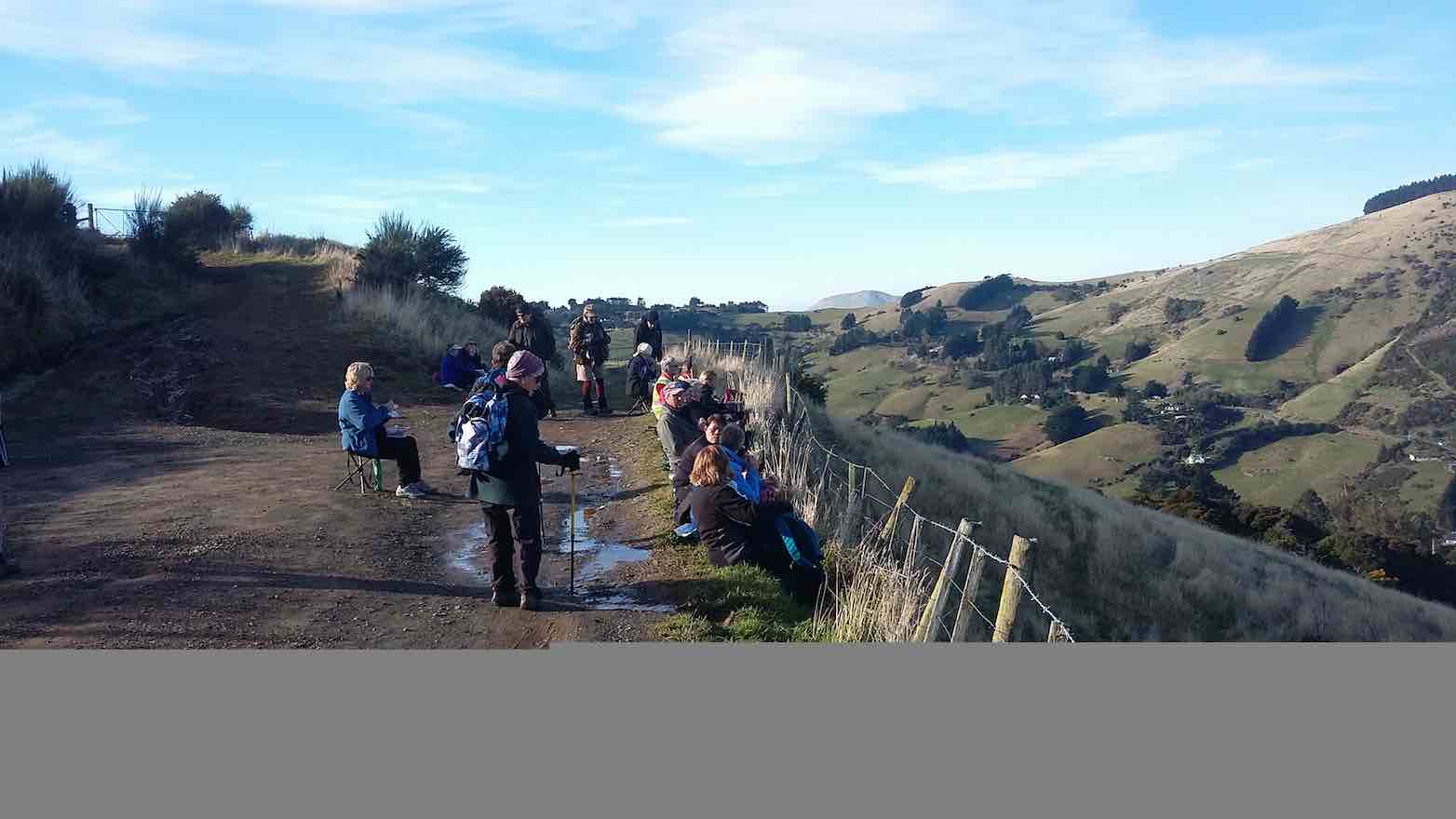
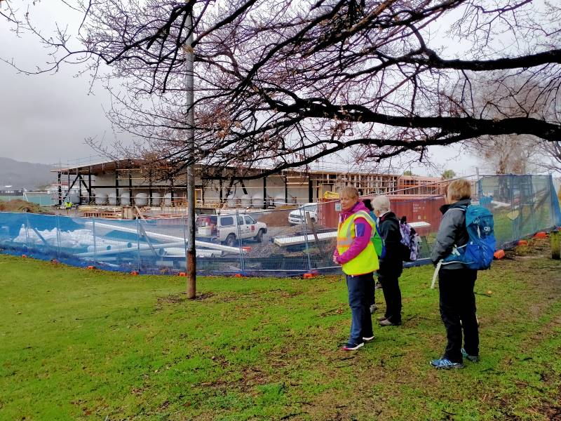
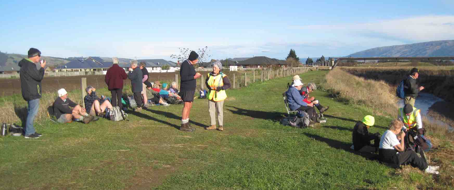
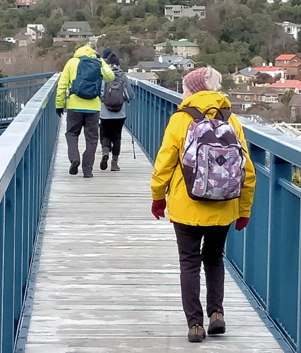
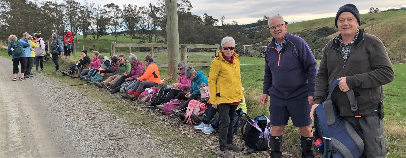
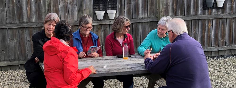
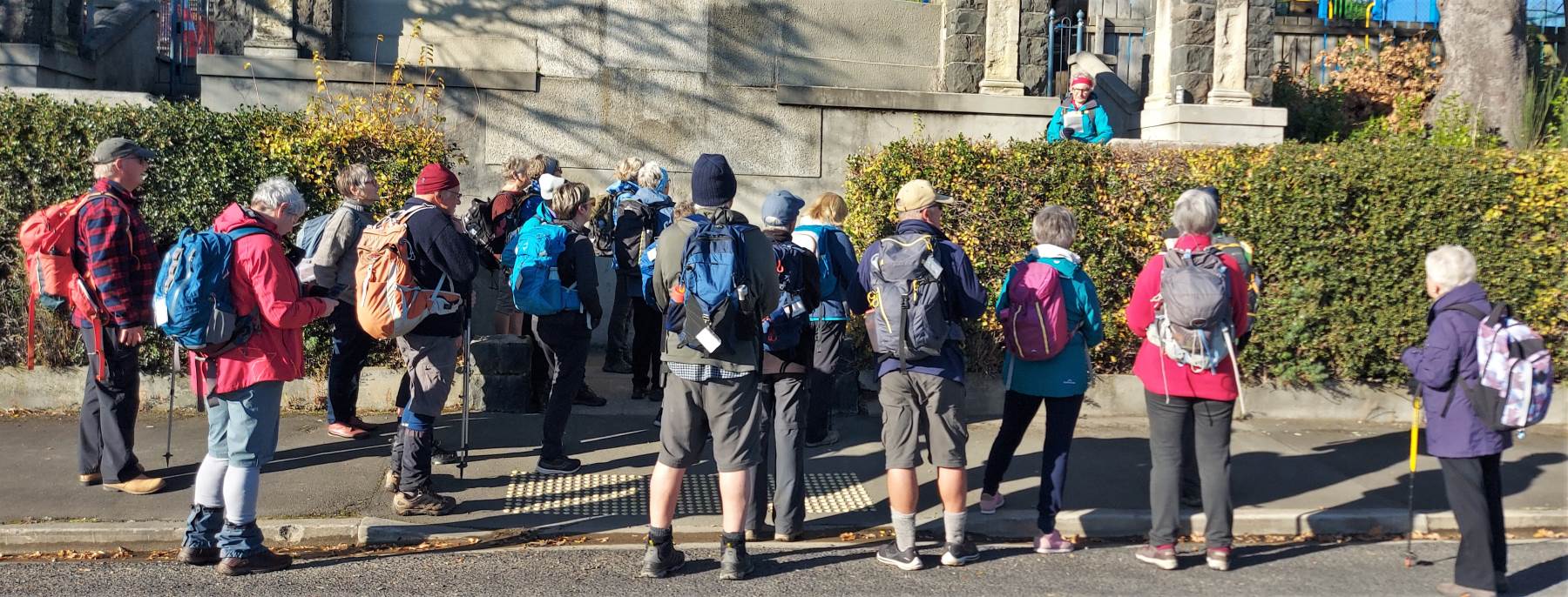
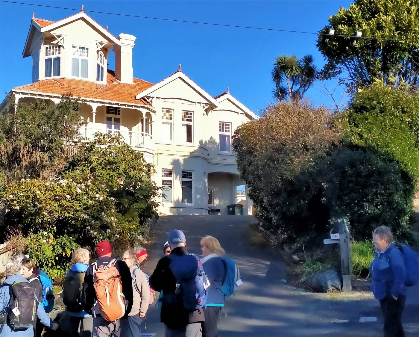
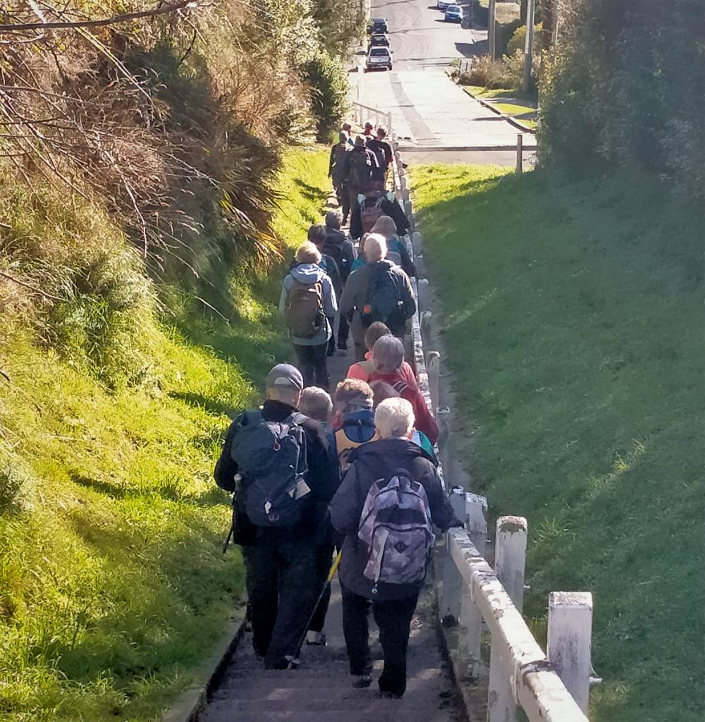
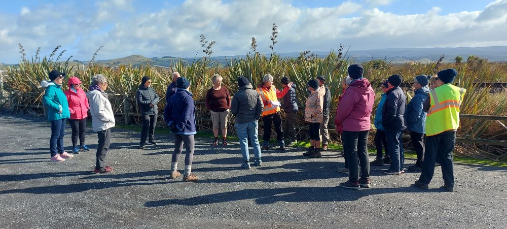
 19. 15/11/2023. Hikers. Cleghorn Street to Signal Hill. Leaders Pam Clough and Jay Devlin
23 keen hikers gathered on a beautiful day at the Bottom of Cleghorn St where we made our way up the gravel road to the beginning of our walk which was firstly over farmland. Continue reading “Signal Hill Tramps”
Distance from car-park to Doctors Point: 38 km.
Doctors Point, Mopanui, McKessar, Purakanui, Osborne – Information and Trips Library
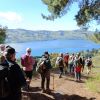
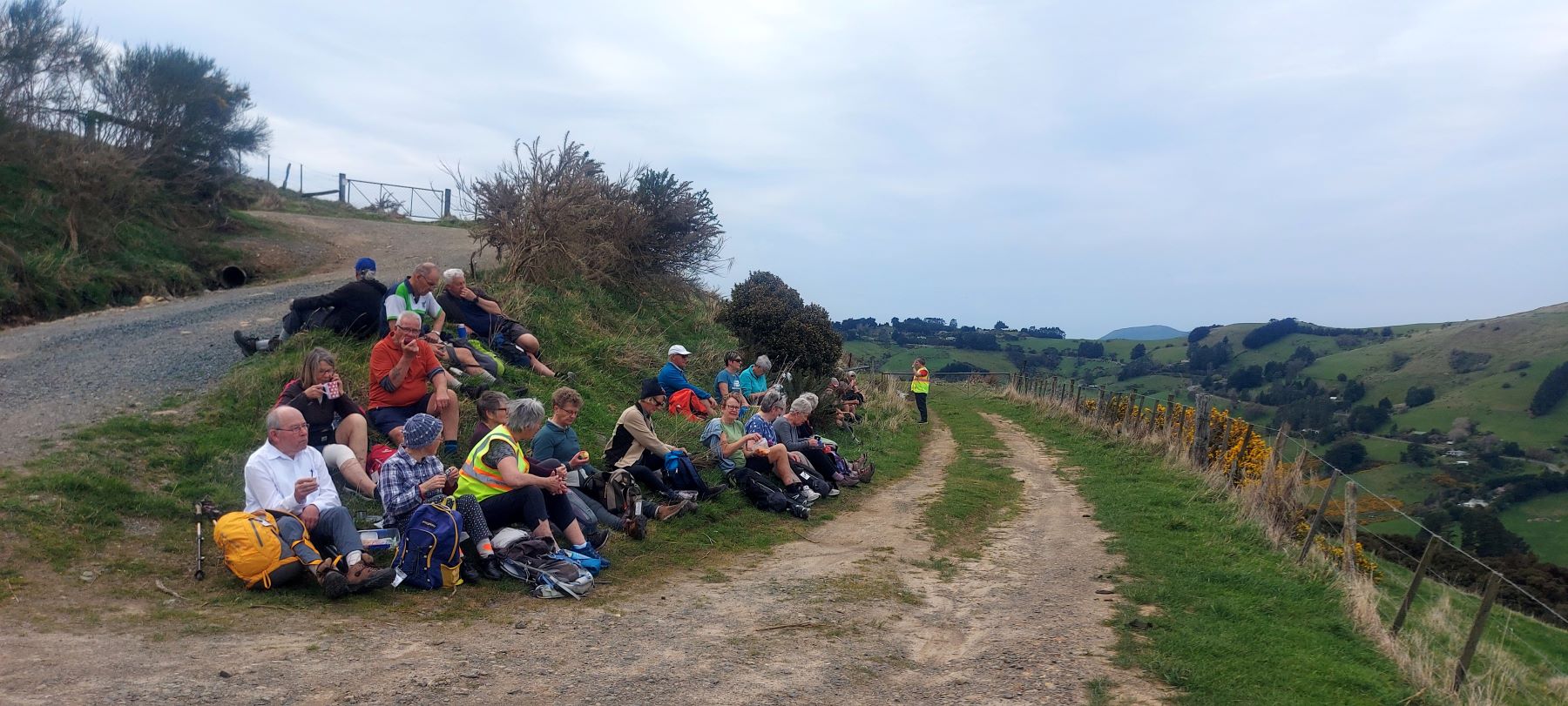
 25. 15/11/2023. Orokonui Circuit. Grade 3. Leaders: Graeme Souter & Gail Williams
Outram 10 km / Henley 21 km – from car park.
Outram, Allanton, Floodbanks, Lee Stream, Traquair, Whare Creek – Information and Trips Library
4. 25/10/2023. Hikers. Outram Loop. Grade 1.5, 11km, Leaders: Sue Nichol, Kathryn Fagg.
 Outram turned on another scorcher for 16 hikers. We started at the West Taieri Rugby Club and walked around Kings Court and Anzac Court subdivisions where the gardens were in full bloom. Continue reading “Outram – Allanton Flood Bank”
17 km from car park.
St Clair, St Kilda, Kew, Corstorphine, Ocean Grove, Tomahawk – Information and Trips Library
 Nineteen hikers left Marlow Park in sunny conditions at about 0930 after singing happy birthday to Liz Griffin and walked over the Kettle Park Sports field and up a track to the Barnes Lookout.
14 kms PJP to cnr South Rd and Eastbourne St.
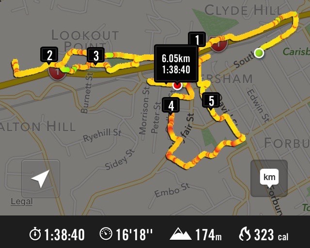
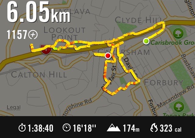
5. 27/09/2023 Hikers. Grade 2 Leaders: Jan and Jan
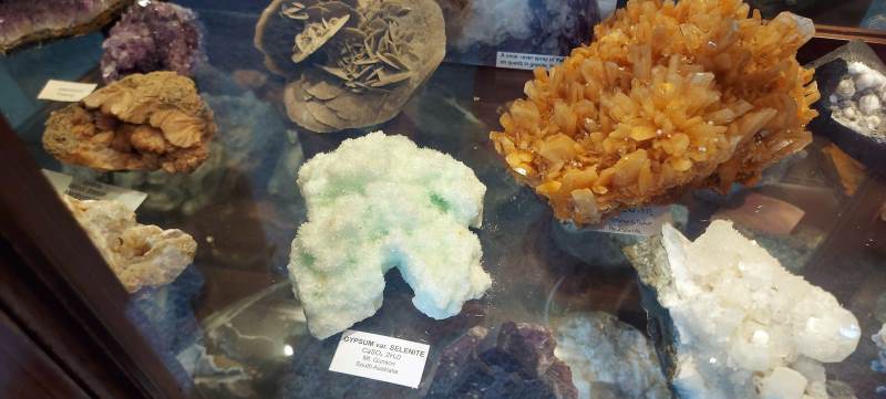
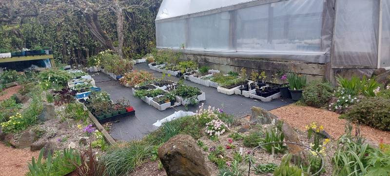
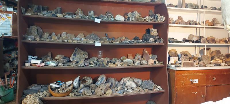
20 hikers set off from the old Carisbrook Hotel through the very run-down Caversham shopping area. We had a couple of stops to look at a bit of the history of the area. There were other points of interest, but with so much chatter going on, decided to give it a miss! We headed up South Road for a morning tea stop at a house belonging to Jan Y’s brother. It is a large property extending right down to just above the main trunk railway line. He has a stall at the Farmers Market every Saturday and has grown and propagated an extensive number of plants. Also has numerous tunnel houses, a couple of fruiting tamarillo trees and an avocado tree. He is a rockhound and there was a very large collection of rocks, crystals etc. on display.
Because there was so much to look at, the morning tea break was a bit longer than normal. We carried on up South Road to the Carlton Hill area, then cut across a couple of streets and back down to Sidey Street where you got a good view of Corstorphine House. From there we headed up a track which took us into the Kew area, with great views of Dunedin.
Down through a steep set of steps (Killikrankie Pass – a cool name) and we ended up in a park at Forbury Corner for lunch.
Returned to the cars by crossing over the motorway on an overhead bridge, then walked down a path on the north side back to the cars.
It was a pleasant day with no wind, and we covered approx 8 kms, at quite a leisurely pace. Several members of the group had lived in the vicinity of area covered so it was a bit of a trip down memory lane for them. Thanks to Jan and Pam who did a very enjoyable recce with me. The Two Jans.
4. 15/11/2015. Hikers. Leaders’ Choice. Lance and Joshiah. Street Walk: Mornington.

Seventeen of us met at Unity Park, wondering where Lance was going to lead us this time. He took us down High St just a little, across to the Old High St School property, then up through a corner of Mornington Park to the Mornington township. Back down the hill a little, Macnee St took us off into a suburb of Mornington few of us had seen before. Glenpark Avenue took us a long way steeply down and up, surprising us on the way with a bit of handsome Street Art – in the middle of suburbia. We eventually reached the Forfar St corner and down that a bit we stopped off under the shade of a tree in a recreation area for a morning tea break.
Forfar Street led us round to what this reporter reckons has to be the best city view in town.
There were views stretching out on our left to the head of the harbour and on the centre and right displaying St Kilda and South Dunedin beautifully stretched out. We stopped and drank in the scene. Some got into chatting with an unusually large well-dressed group of Jehovah’s Witnesses we passed on the street.
We followed Forfar Street winding on down and down and eventually entered a delightful rough track through an unnamed bush area near the bottom that led us through to the end of Barnes Drive. Now we were into the paths alongside the State Highway before having to confront a long climb up to the Lookout Point bridge at the top.
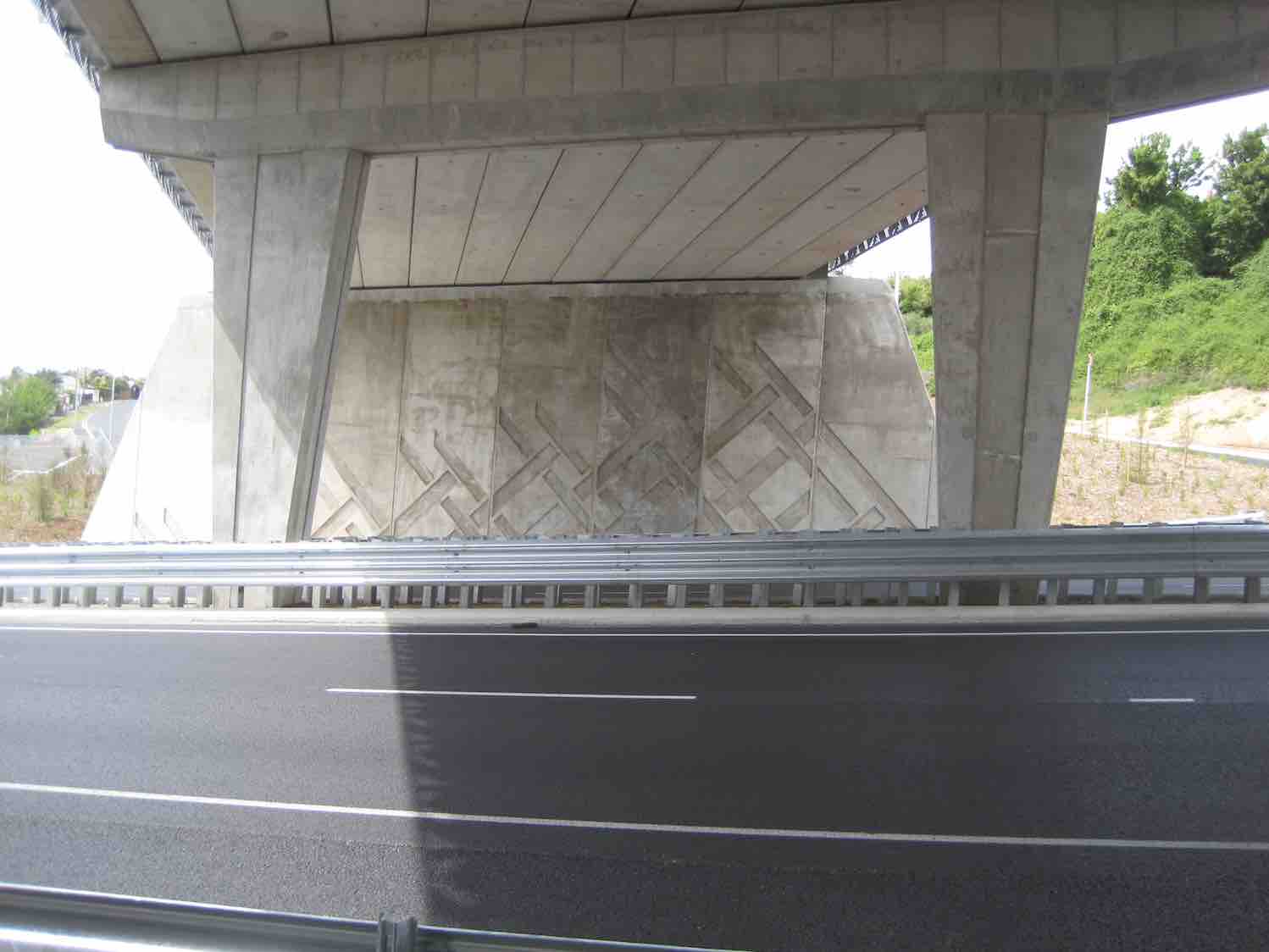
(Lance had earlier found out that this was to be the morning of the actual bridge opening.) Bad/good? timing saw us arrive just at the point where the official ceremony had concluded.

All the corporate suits and general onlooking public were still there enjoying the “seeing and being seen” of the occasion.
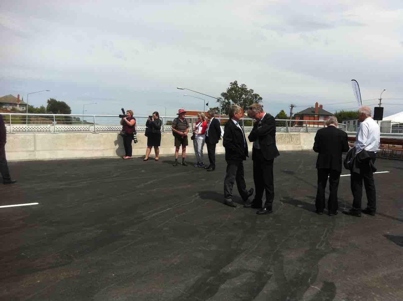
We wandered about for quite a while before one or two of us (was Fred the first?) found we humble tramping riff-raff were welcome to join the large crowd in a marquee for nibbles (nibbbles? – sandwiches and savouries galore) and drinks, and passed on the word. Yum. Eventually regrouped, Lance led us back down the way we had come up to stop off at the bottom in a grassy sloping section of Sidey Park for lunch.

The day had been hot. We were glad of the break. We were nearing the end of the outing, but not of any struggle. We exited further along by South Road and climbed the Caversham Rise to the foot of Eglington Road. Why did they put Unity Park at its top? It was a long weary climb for the end of a day, but all made it to finish off a day with a difference, capped, of course, by the Lookout Point Bridge opening. Thanks, Lance – and Josiah, for yet another creative Dunedin walk, opening up byways of interest we would never have otherwise known had existed. A hot day. Some steep struggles on hard pavements at times. A rewarding day. Well done. Finished off with a goodly social crowd at The Topiary Cafe. We DID miss you, Elaine! – Ian.
On the 9th Sept 24+ Hikers had a enjoyable day around Caversham.
We met at the corner of South Road and Eastbourne Street, walking down south road north to get on to Bridge Street and strolled along a path that was beside the motorway north-going traffic.
Morning tea was at the Barnes Drive traffic lights on a sloping bank and steps.
We walked up the back of the Caversham Valley Road to Aberfeldy Street, where a small car track went up to Baxter House…

…built in 1895 for a David Baxter whose daughter married T K S Sidey, the Mayor of Dunedin.
We also went to Rockyside Road where in 1855 Mr John Thomson the Surveyor for Dunedin built his house. Most of the hikers were unaware about the Baxter House still being there.
We travelled down lots of different streets in ‘Cavy’ and lunch was at the Kew Reserve.
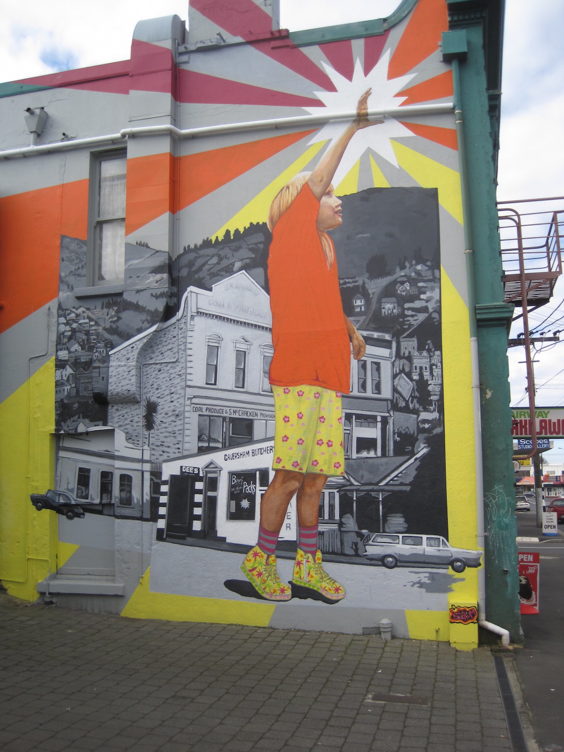
After lunch, we passed the old Wax Match Factory and up to look at a very well done art work on a two-story building.
Then it was back down South Road and along to our cars. Those who wanted a coffee chat stopped off at Flax Cafe first. – Elaine.
21 kms PJP to Pine Hill School (via 3 Mile Hill Rd).
4. 20/09/2023. Hikers. Pine Hill. Grade 2. $5. 21km. Leaders: Jan Butcher/Jenny Finnerty.


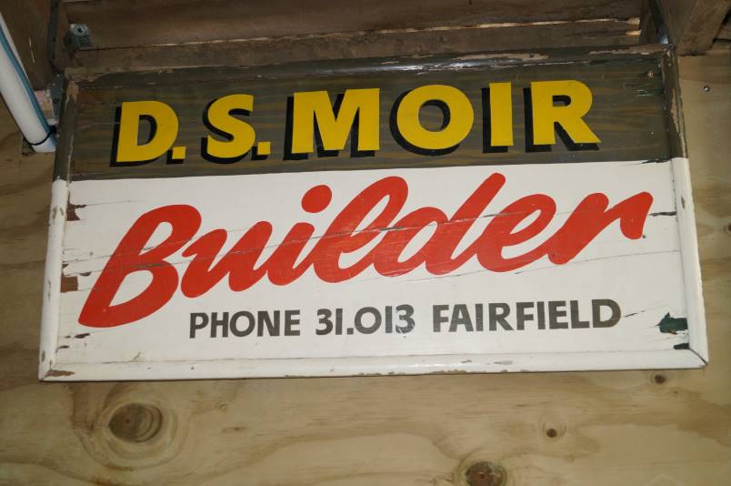
3. 01/12/2021. Hikers. Hidden Gems of Pine Hill. Shone Munro and John Gardiner
On a misty drizzly day, 24 hikers met in Pine Hill Rd near the school.
We commenced walking down Pine Hill Rd to a walkway leading to the town end of Hillary St which we followed to the distant end before having morning tea at “The Fern house”, an iconic house built in 1882 where we experienced great hospitality from the owner, Dr Brian Cox, who had made toilets and his sunroom open for us.
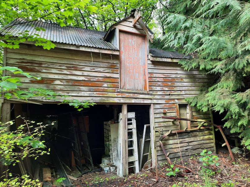
Most hikers then followed him to explore some of his property while some reneged at the muddy walkway near an old barn and tricky bridge where we waited for the intrepid to return.
It was obvious that the hikers were enjoying themselves by the happy chattering we heard and gales of laughter from Fay. We were still unsure if this was because Fay’s new shoes got so muddy or something else.

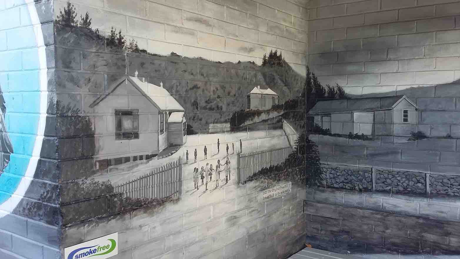
Reassembling we walked to Campbell Rd where John educated us on the history of the little dog painted into the Power box mural, walked up Campbell’s Rd , through a walkway back onto Pine Hill Rd and upwards to “The Pines”.
This owner, Lindsay Moir, also extended great hospitality, allowing us use of his barn (adequate seating for all) and toilet.
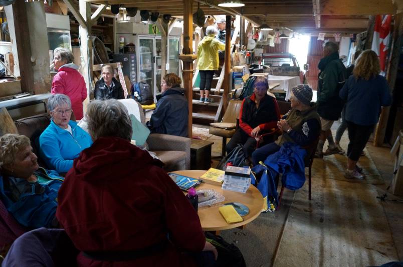
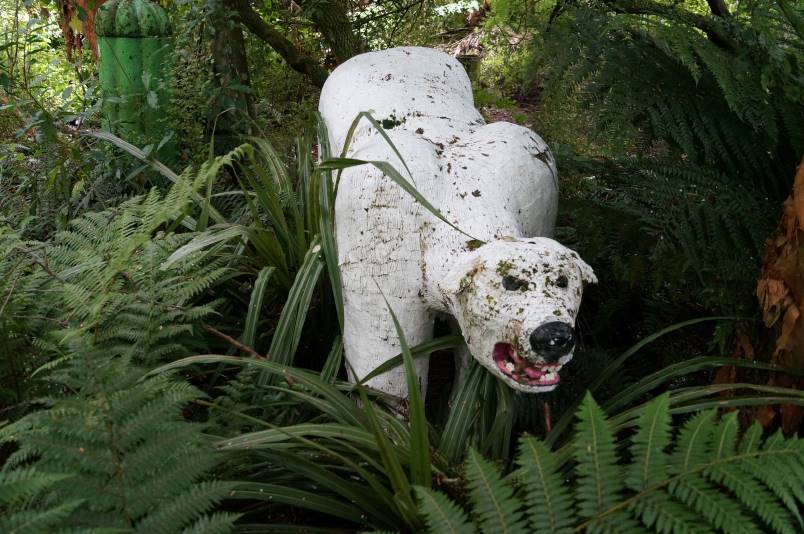
After lunch, a number of hikers went to explore his farm and the creek with him. Highlights included the monster (wooden polar bear), frog pond, converted container for honeymooners and a Nissan hut where some of our male hikers discussed politics.
There was an old sign hanging in the barn, advertising the business of our late Life member, Doug Moir and as there were only 5 telephone numbers on this, not the 7 on today’s listings, it must have been very old indeed.
A brisk downhill walk to the cars preceded a visit to CrocQueODile Café.
Thanks must go to these generous property owners for their hospitality.
Distance walked approx 9km.
2. 20/6/2019. Hikers. North East Valley, Pinehill. Jan and Jenny
On a cold and frosty morning, 27 hikers set off for Malvern Street where we parked up and commenced our hike to Pinehill. We walked through Woodhaugh park where we located some seating and had our morning tea before setting off along Banks Street and turning left up Dolphin Street which in turn lead onto Gladstone Road. This being the home of Aquinas College. If you thought we had a good frost in Mosgiel – well it was matched here and we very cautiously negotiated the footpath, sometimes having to cross the road which was like a skating rink in places. However we all climbed the hill without mishap and into the sunshine which was a relief! Walking up Pinehill Road we stopped to admire the Church where Shona and Keith were married some 44 years ago on the 28th of this month.
We carried on, coming to John’s house where he picked up his dog for a walk up to the end of Pinehill Road & onto the end of a gravel road where we stopped for lunch overlooking a wonderful view of Dunedin and surrounds.
We were all suitably impressed with the view,

none of us having been up to that spot before – not even Shona! Sitting there with our backs to the sun,
it was hard to leave, but it was time to head back down the hill again, spotting some wonderful street art in a bus shelter.
We turned left at Pinehill School and on down the hill coming to a winding Bucclough Street which eventually lead us down to the 219 Duddington steps
and on down to NEV where it was a short walk to the intersection with Banks Street and through Woodhaugh again and back to the cars. A good 10k was the agreed distance and so called into the Village Green for a well deserved coffee & cake!
Jenny & Jan
1. 24/5/2006 Pinehill – Gardens return Betty B, Dot T, Anne
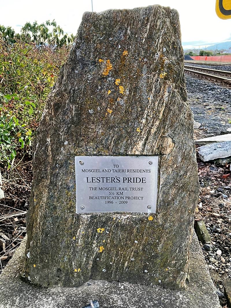
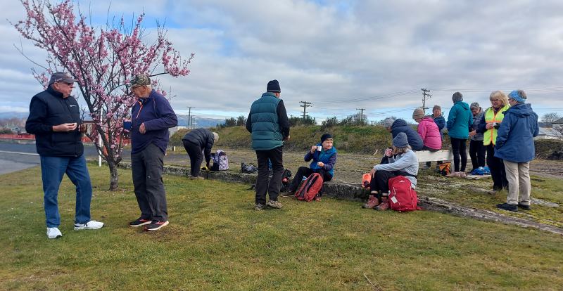
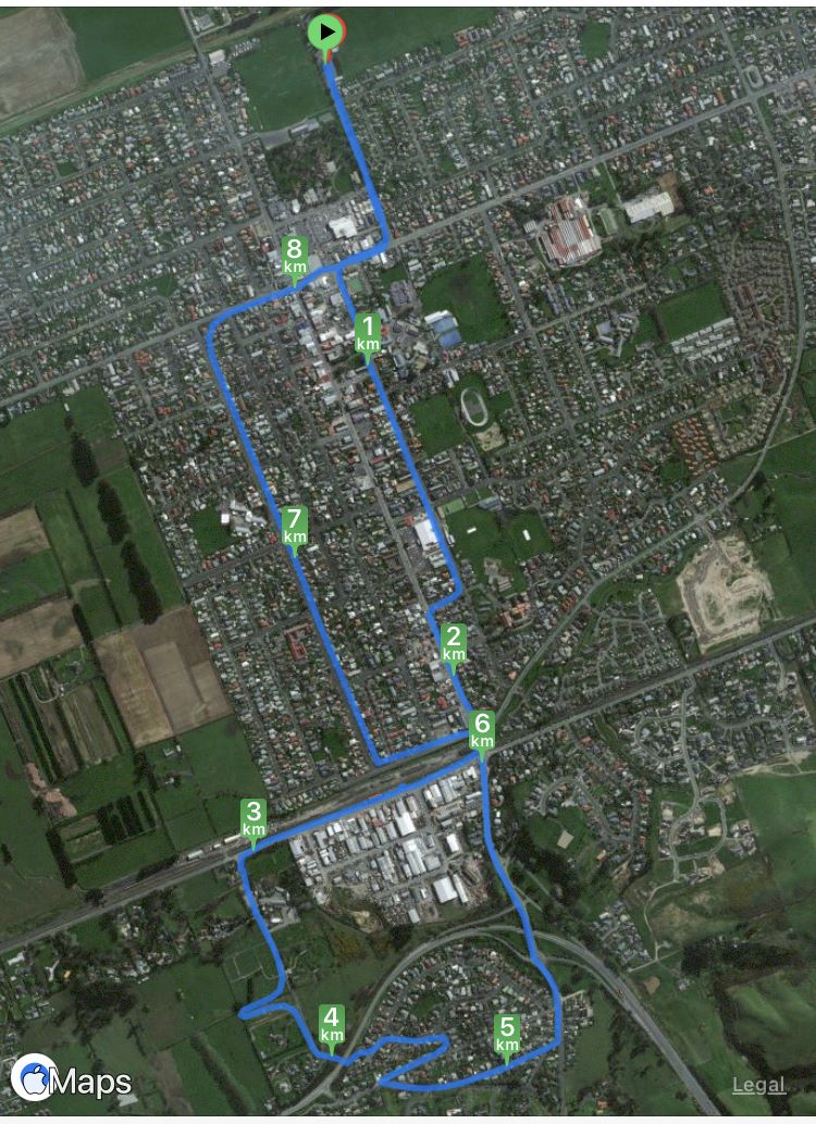
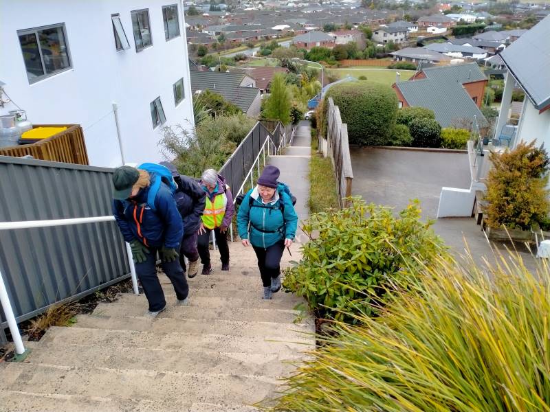
10. 16/08/2023. Hikers. Mosgiel Street Walk. Grade 1, $0, 9km, Leaders: Raewyn Keene, Helen Morris
It was a little frosty as 14 hikers set out from Peter Johnson Park for a street walk till lunchtime. Along Reid Street to Factory Road, Church Street to Gordon Road, the pace was steady. As we approached the railway crossing (and unknown to some of us), was the plaque about our own Lester and his beautification efforts.
As we continued on to the old Mosgiel Railway Station for morning tea, it was great to see the daffodils & blossoms beginning to bloom, indicating Spring is not far away.

Refreshed and with the sun trying to shine, we headed off to Cemetery Road, ventured into the new Grange Lifestyle village as far as we could go, and back out to the underpass into Kinmont.

Some hill climbing was considered necessary to get our hearts pumping, so up Leith, Clyde & Braeside Streets we went. Back down to Quarry Road and left at Nellies, we looped back to our cars via Argyle Street & Bush Road.
Ross C joined us today and was apparently looking forward to a ‘flat’ walk (as advised by his lovely wife) – oops! Hopefully the friendly chatter along the way helped.
All in all, a pleasant morning’s walk, good company and 9kms achieved.
The Harwood hike will be rescheduled into the summer programme.
Helen & Raewyn
9. 20/07/2022. Hikers. Mosgiel Silverstream/Wingatui. Leaders: Jan & Jenny.
On a dismal Wednesday morning, 13 of us set out on our walk around Mosgiel. We walked down the Silverstream which was running higher than normal, lifting our feet over the pesky tree roots, and had morning tea down the end of the track to fortify us for the walk ahead.

We walked down Silver Springs Boulevard which brought us out to Centre Road. Crossing over to Hagart Alexander Drive we took the first left onto Ben Lomond Drive in the Highland Park subdivision and came out onto Wingatui Road. Further up the road we spoke with Ady outside her house, chastising her for not being out walking with us.

We then carried on up to Gladstone Road and at the junction with McFadden Drive we climbed the steps up onto Joe Brown Drive, taking the 2 to a 2.5, took a left and back down McFadden Drive onto Gladstone Road again. At the lights we crossed over to Gladstone Road South.
Someone was heard to say they were buying a pie for lunch, and next minute a few more were buying pies for lunch at the Z garage! Further down the road we discovered a cafe and then a few more were disappearing to buy more goodies for lunch. Doesn’t say much for our home made lunches does it!! A little further down Gladstone Road we turned into Cemetery Road and stopped at The Hub for lunch where we found shelter and a seat to rest our weary legs. The pies went down a treat along with a liquid refreshment.

We commenced the rest of our journey heading back down Gladstone Road, turning into Burns Street, right into McDonald Street then into Ayr Street & Argyle Street where we stopped to suss out the honey stall & onward up Bush Road, Forfar Street into Eden Street where we crossed the road and continued down the Silverstream, taking in the progress of the swimming pool and across Memorial Park back to our cars.
Comparing notes we agreed on 12ks for the walk and managed to keep dry for the entirety of the walk. Some wanted to get on home and put their feet up and a few of us adjourned to the Wooden Table for a hot drink and something sweet to go with it.
Jenny and Jan
8. 16/11/2016. Hikers. An East Mosgiel Trek. E. Leaders: Jay, Judy K.

Our scheduled hike for today to Hawkesbury Lagoon was put off until later in the month because of the inclement weather forecast, so an impromptu hike was the order of the day. The hikers left the carpark at 9.00 a.m. and we walked up the Silverstream from Peter Johnstone Park and stopped for morning tea …

… near the Wingatui Road end. From there we checked out the new houses in the Springfield sub-division and took a wander down Rutherford Road which many people had never been down before. We then walked down Factory Road to Haggart- Alexander Drive and through the cutting and up Wingatui Road …
… to Gladstone Road when we decided to have lunch on the bank …
… by the railway line. No trains came!!! After a leisurely lunch we took as many shortcuts as possible to get back to the carpark before the rain came. A welcome coffee break was at Wals. – Jay.
7. 10/6/2015. Hikers. Mosgiel Trek. E. Leaders: Jim and Betty.

Jim and Betty led twenty-two Hikers on a most illuminating illustrated tour of Mosgiel, with historical anecdotes echoed and amplified by several other old identities in the group. At one house, and the next,
Jim would tell us who had originally lived there and what they did. And where this street and that street had originally terminated. And where which dairy and which mill had once been located. And what rubbish dump now boasted as foundation for which set of houses.
As is evident from the route map, the walk was extensive – 14.7 km – a good stretch for the Hikers, necessitating one or two drop-out groups en route, and ending with only the famous six completing a last street-block encirclement on the day. Suspiciously this might have just been a prank, added at the last minute from a wicked sense of humour on the part of the leader, and strongly confirmed by the Back Marker rebelling and leading the remainder by a more merciful direct route back to the cars.
We morning-teaed by the Silverstream,
up near Wingatui Road, and lunched behind the Joe Browns settlement, on the back bank of Reservoir Hill…

…looking down on the small Woodlands settlement,
and speculating on what drainage problems the properties might have experienced in the recent rain storm.
Our route was obviously the result of much imaginative planning. Highlights for this reporter were the new houses alongside Wingatui Road near the Silverstream (how similar many of them were!), the walk across Brooklands Park…
…and the surprising route through from McFadden Drive to Woodland Avenue.
From the end of Woodland Drive, there was the fraught quick-or-the-dead negotiating of the lanes in the Quarry Road roundabout to land us eventually in Kinmont Crescent. Thence through the SH1 underpass (surprisingly short) into Cemetery Road and back across the railway crossing and into Gordon Road’s SW section of houses.
Here, at the lower end of King Street, Jim pointed out the distinctive turreted house there,
the original Maternity Home where he first entered the world. Further up in Argyle Street was Mossbrae, the onetime Maternity Hospital. When we reached the end of Argyle Street, instead of releasing us back up Bush Road to the cars, Jim took us away down Perth Street and across and back up Tay Street, to go (at last with only the famous six) via the Street lights intersection finally back to the car park.
Nearly 15 km, much on pavement, but a lot on grass too, was a good stretch for the legs, usefully developing fitness for next Wednesday’s climb up the forestry’s Margaret Road, linking Taieri Mouth and Big Stone Roads.
Betty and Jim capped off a wonderful day out by turning on a piping hot pottle of chips to accompany coffee chatter back at Topiary Cafe. Thank you so much, dear leaders, for a wonderful day out. – Ian.
6. 17/9/2014 Wingatui Block. Hikers. E. Leaders: Les and Margaret.
Heavy overnight rain determined cancellation of the Millennium Track. Leaders Les and Margaret instead led us on the street walk recorded on the above map, stopping for morning tea in the shelter of the Wingatui Railway Station. On/off drizzle accompanied the whole walk but we were secure in our parkas. Thirteen of us enjoyed each others’ company and the varied views the route provided. Thank you Les and Margaret for your wisdom in making the tramp change and providing us with a good morning’s ten kilometre workout. Sorry, forgot about taking pics. – Ian.
5. 7/9/2013. Both. Birchleigh Village/Haggart Alexander housing development. Leaders: Bruce and Marjorie.
Thanks to two reports received, from Elaine and Bruce, each with a distinctive style, I have inter- leafed them for a wonderful account of the day.
ELAINE: Approx ten hardy people turned up at the car park at 9.00 a.m. The planned walk to Flagstaff was flagged.
BRUCE: With snow forecast to 100 m the planned hike on Three Mile Hill was postponed and an alternative street walk undertaken from 0900 to 1100.
ELAINE: George’s birthday bash was canned also. Was really looking forward to the wine. Never mind. Next week its all on if George is well.
BRUCE: Seven of us proceeded from the car-park via the Gordon Street verandahs during a nasty shower of hail to the RSA garden and memorial to Church Street and then into Wickliffe Street. (Ed. note: Three had returned back home.)
ELAINE: Bruce and Marjorie decided since the weather said showers … sleet … hillside snow …, that we would walk around the new housing estate at the northern end of Mosgiel. We also checked out Chatsford and Birchleigh for the future!
BRUCE: We turned off Wickcliffe Street into the Brooklands Estate past the BMX track to Doon Street and then via the new subdivision at Birchleigh Village.
We took the path on the left immediately past the main office to have morning tea, in the company of Ria who joined us in Wickliffe Street, in the rotunda assembly point beside the bowling green.
After a circuitous route through Chatsford we left the village and meandered through the new Highland Park subdivision. Although the slogan “My heart’s in the highlands” was repeated, the ground seemed pretty level.
After inspecting a show home from the outside we returned via Factory Road to our cars in the car-park with some comments from a pedestrian about our mental state for hiking on a wintery day. – Bruce
ELAINE: Only seven people came on this walk. The day didn’t get any better weather-wise and I think some of drivers passing us thought we were mad. The trampers cancelled their day altogether. We did laugh a lot and talk a lot. Let’s have a great turnout next week for George’s birthday shout, weather permitting. There could be a change to next week’s programme, so watch out for details. – Elaine.
4. 22/4/2013. Both. Car park, King St, Gladstone Rd Nth, Wingatui Rd, Shortcut to Haggart Alexander Drive, Factory Rd, return.
The Trampers’ trip was cancelled due to illness. In addition, both tramps came to nothing due to recent rain muddying up tracks. So a remnant seven of us did the above (tarseal) route, remarking on various properties passed and exploring a number of new housing developments on the way. A lot of changes! Rain everywhere else came to nothing in Mosgiel. We enjoyed the views and good company, especially Judy’s new South American poncho, lasting the distance only because of some emergency repairs.
– Ian.
3. 25/4/2012. Hikers. Wingatui Block. Leaders: Arthur and Barbara.
2. 9/8/1989. Wingatui Racecourse. Over the Hill. Easy+ Leaders: Betty, Molly, Ria.
1. 14/12/2005 Wingatui Hall, Silverstream End of Year lunch. Leader: Lesley S
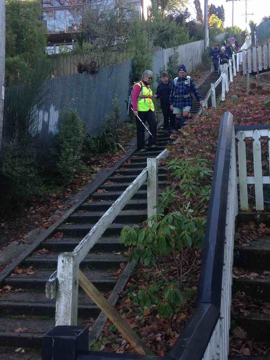
7. 9/08/2023. Hikers. Mornington. Grade 2, $5, 18km, Leaders: Ady Whitson, Pam Clough.
Meeting at PJ Park we decided to go ahead with our hike. We decided to park further up Mornington Road which turned out not to be far enough up. Down Elgin Road we went, all 13 of us, and down the steps ending up at the steps at Caversham Valley Road. Morning tea we had on the steps that looked along Main South Road.
It was here two departed to return home as somebody had forgotten their pack and it was very cold.
We started off along Barnes Drive at a reasonable pace as I thought the weather might turn on us…

…up Glen Road and turned up steps to end up in Carson Road. From there we travelled up Cooper St with a few stops here and there for a breather.
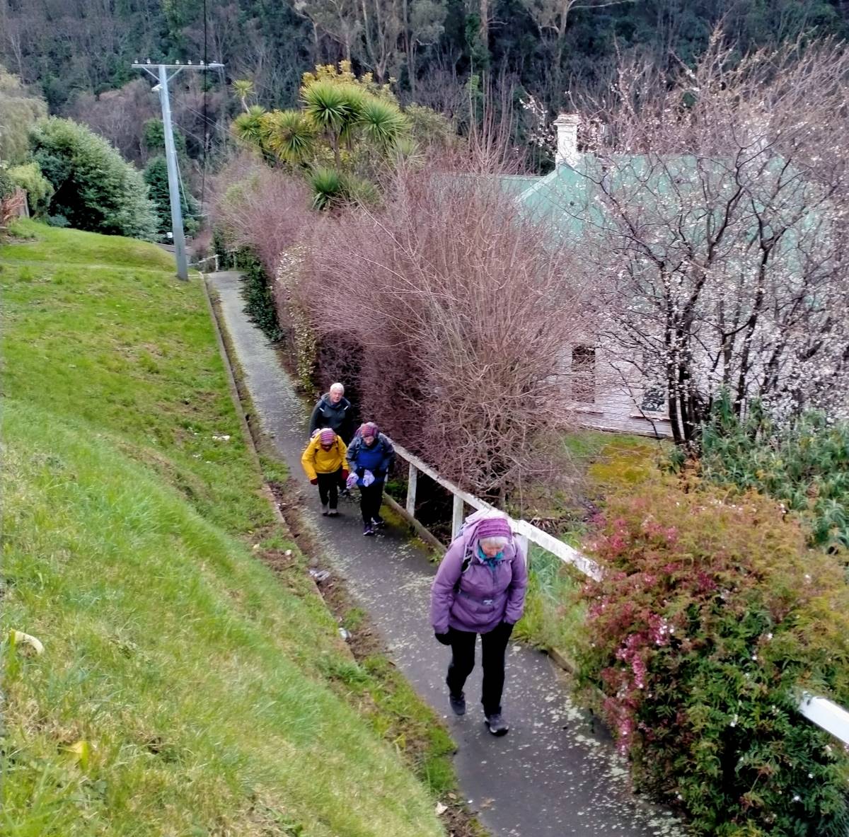
Turning right into Glenpark Avenue I put a fast clip on as the weather was probably going to turn at about 11am. Another set of steps up to Mornington…
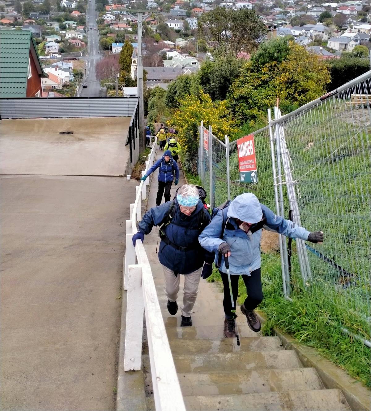
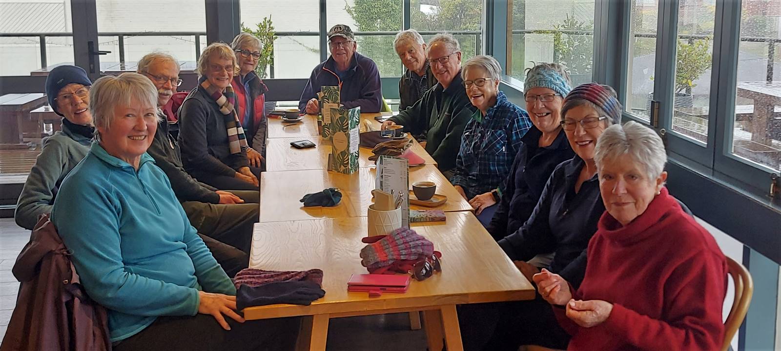
…and just at the top the weather did change completely. After a quick conflab, it was off to the Mornington Tavern for a warm up and a coffee.

We left about 12.15pm to head back to the cars and this was where I decided we had parked the cars far too far down Mornington Road as the weather really turned to custard. Home by 1.15pm.
We did have lots of laughs and Lynley was the only one from Trampers to show up (I don’t think she read the email in the morning and I didn’t let on I hadn’t either).
Like I’ve said before, don’t put me in charge as it is always wet when I’m at the front. Thank you Pam for all the help as I have no idea round some of those streets.
Cheers Ady. Continue reading “Mornington Ramble”
Distance from Bush Road carpark: 15 km.
12. 19/07/2023. Hikers. Taieri View . Grade 2.5, Leaders: Jill Dodd, Jenni Wright.
We continued up McIntosh Road, the only oncoming traffic being around 20 e-bikers, who were going like the clappers. We made good time and arrived at the intersection of McIntosh /Scroggs Hill Roads where we enjoyed lunch. It never ceases to amaze me the conversations that are had whilst out, they’re simply hilarious.
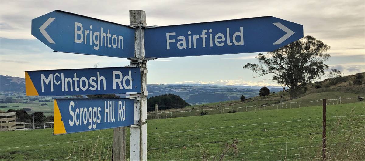

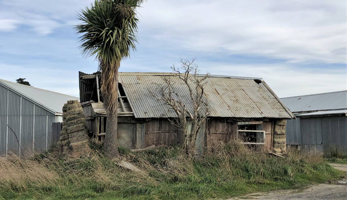
We now got our view over the Taieri, and then proceeded down Scroggs Hill Road mostly single file which had a few more vehicles but all were very responsive to our hikers and reduced their speed considerably. One member was concerned about walking single file as this may impede (his) conversation! There were many examples of retired tractors and cars exposed to the elements and the consequent erosion.
It was fascinating to see the variety of homes in Brighton …. some beautifully restored, other new builds taking advantage of stunning views, and some steeped in history of family times. Liz and Alex, being long-time residents, provided great commentary along the way.
We got back to the cars and enjoyed the walkway along to Brighton Beach Café, for ice creams, coffee and more chatter and laughs.
Continue reading “Scroggs Hill Road, Seaview Road, McIntosh Road”
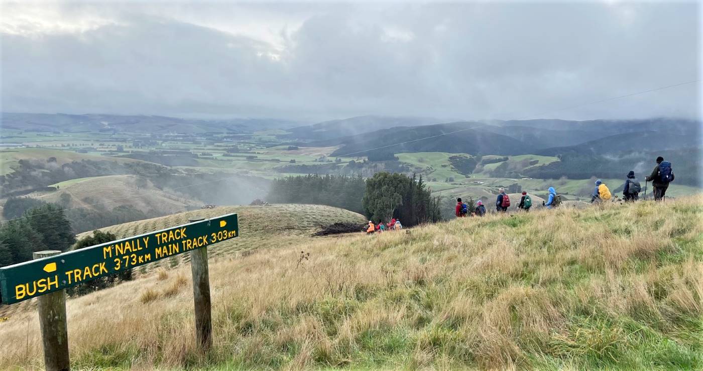
No. 83 on old hardcopy list of 113 club tramps. “McNally Track, Milton. Year Round”
Potential for Combined trip.
McNally’s Walkway, Milton – Information and Trips Library
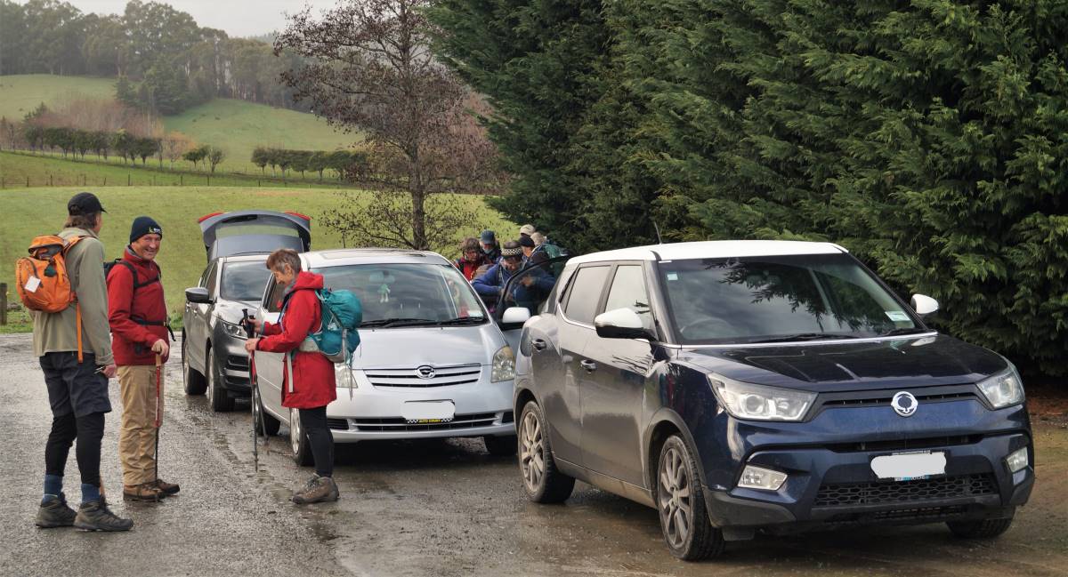
20. 28/06/2023. Trampers. McNally’s Walkway. Grade 2.5. Leaders: Graeme Souter, Yan Campbell
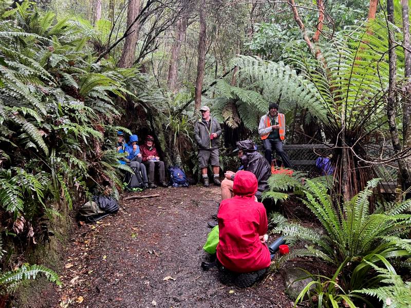
Hopefully, Constable Tom McNally would have appreciated that 17 hardy trampers weren’t deterred from following the walkway named for him. A night of heavy rain and inconclusive forecasts for the day had caused Graeme a restless night, trying to decide whether to cancel or change the tramp. Much of the trail is quite exposed passing through paddocks and would have been pretty miserable in a downpour. It wasn’t actually raining at Peter Johnstone Park at 9:15 and the sky seemed to be lightening to the south. We split into four cars and headed for the cemetery at Milton and the beginning of McNally’s Walkway.
We set off in a very light rain along a fence line of the first paddock. The ground and grass were certainly wet and it was a steady climb to our stop for morning tea in a sheltered spot with a bench. There was a great view of the Taieri Plain but the hilltops were still shrouded in cloud and would remain so.

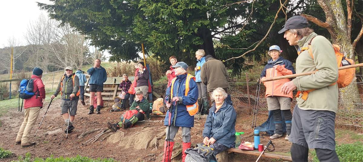
By the time we set off again the rain had stopped and the only drips were from the overhanging trees.
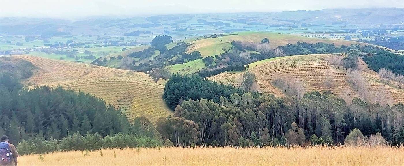
We took a slightly different route from other years, turning onto the Kowhai trail for the rest of the climb. It passed through a mix of native and introduced trees before opening up into paddocks of newly planted pines. By this time, we could see the summit and the haybarn where we’d have lunch. There was just one more climb before we made ourselves comfortable and ate.

After lunch we headed downhill through quite long grass which soon became a clear path at least for those of us at the back. At this point the sun broke through and this clearer light made a remarkable pattern, contrasting the long fading grass with the small green pines.
Once we were through this, there was only one more steep pitch up through some trees. From then on the walk was steadily downhill coming out onto Cemetery Road and just a short distance from the cars.
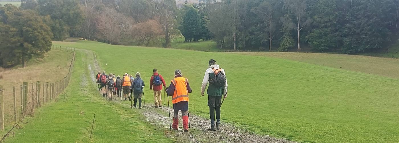
After changing out of our muddy boots and gaiters we made our way to The Black Swan in Waihola. By this time the weather was fine enough to sit outside.

The day had really turned out well. Thanks Graeme.
Yan
Continue reading “McNally Walkway”


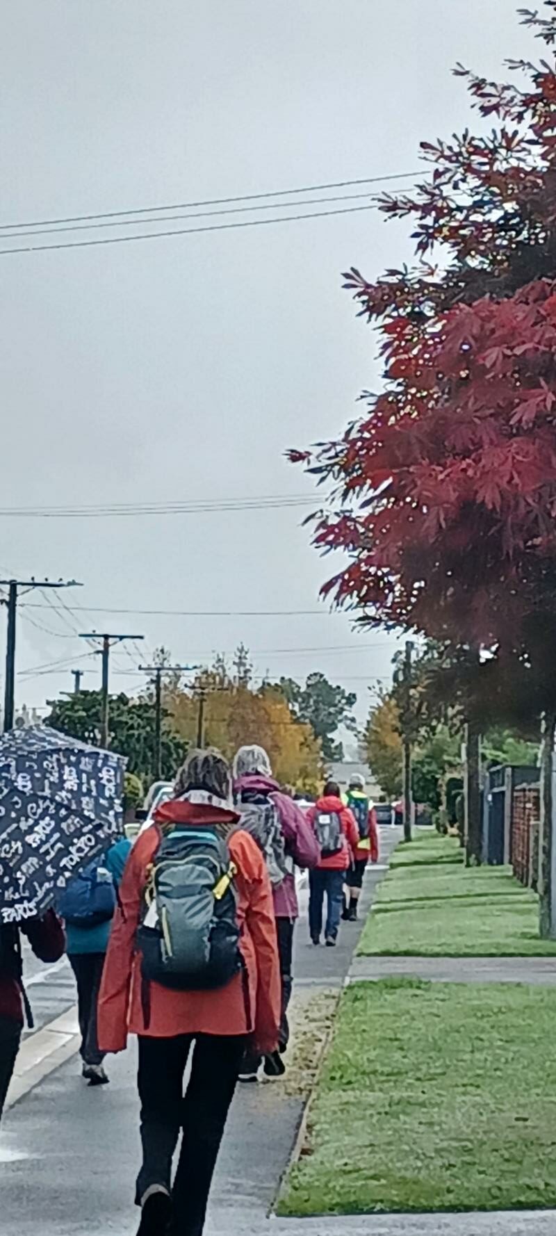
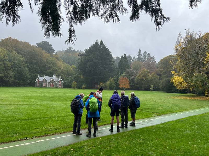
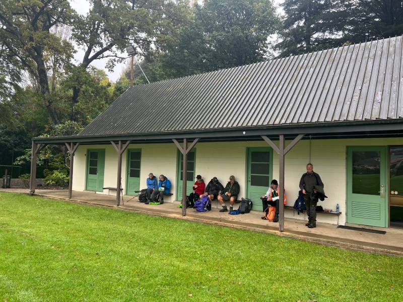
1. 24 May 2023. Bayfield carpark to Glenfalloch. Grade 1. Hikers. Leaders: Linda Partridge and Helen Ingram.
A convoy of cars from Mosgiel parked in the Bayfield carpark at 9.45 joining Brighton and Dunedin people. Twenty-five hikers in total readied themselves for a walk along the cycle track along Portobello Road to Glenfalloch. It was a still bright morning, the harbour sparkling in the sunlight. We walked along the side of the inlet and stopped at Vauxhall Yacht Club for morning tea.

Then on to Glenfalloch which we reached just before noon.
The gardens look beautiful every season, and that day in autumn the maples were flaming red, and a long bank of fuchsias in purple and shocking pink terraced one of the hillsides. We had a leisurely lunch and Linda had prepared a questionnaire for us to take round the gardens to help us explore the grounds.
How many spoons in the sculpture near the restaurant? Where will you find the sundial? It really brought out the competitive nature in us! But everyone’s a winner, and a bag of Cadbury Favourites was handed round.
The Portobello bus was due at 2.15pm, and most of the hikers decided to walk on to Macandrew Bay to catch the bus there.
Brandishing BeeLine Cards we filled the bus and were dropped off close to the cars.
We finished the day with a hot drink at Nicols Garden Centre. Thanks to Linda and Helen for a very enjoyable day.
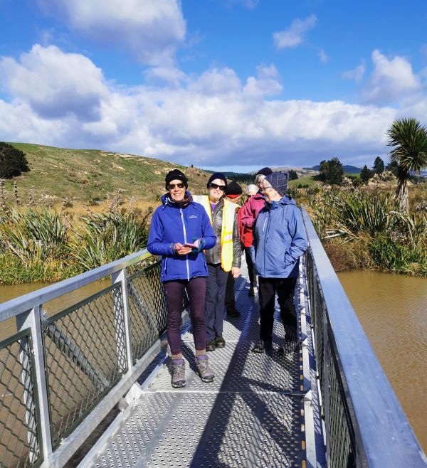
3. Titri Wetland, Waihola Township and Lake. Hikers. Leaders Eleanore Ryan
On Wednesday 26 April 2023, it was very windy when 19 of us hikers arrived at the lake, meeting up with 3 from Outram. What a champ Bruce was joining 21 ladies!!! Also welcome to the new members.
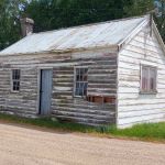
We started off at the Sinclair, Bungard and Huddleston trees near the campground entry. My Great, Great Maternal Sinclair Grandparents arrived in 1857 from the Orkney Islands with 10 surviving family (they had 13 babies in 27 years). On arrival after 100 day voyage on the Māori to Taieri Ferry the father and older sons (my G. Grandfather bought a horse on the voyage) set off to find land and build a house. They settled at the junction of the Henley and Titri roads— which was the main road through to the early 1960’s. Between them they owned bordering farms, married and raised large families. My brother still farms Titri which has been in the family for over 100 years.

The Baumgardt (now Bungard) family arrived in 1872, along with 40 Polish families and settled round Allanton and Waihola, mainly employed building the Railway line south. They too also farmed round Waihola, and Taieri Ferry.
We walked up past the school and had smoko at a little cottage that would have housed a large family back in the day. Up the road a little further we stopped outside what was the home of Arthur Draper. He came from England and set up a Business in Outram in 1909 making Cricket Bats from Willow. He moved to Waihola in 1917. Over time he made around 10,000 bats from local Willow that had dried for 2 years. By the 1930’s lighter imported bats were proving to be more popular.
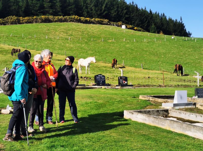
Up the hill overlooking the lake is the Cemetery, where a lot of the original Settlers are buried.
It was then down the road back to the far end of the lake where we found shelter for lunch. The lake was really stirred up with the wind.

Back to the cars and a short drive down to Titri wetland where we had seen the 2 Macracapa trees planted alongside a home built in the 1920’s. Some years later it was cut in half and dragged over the Island to the Waipouri river where it was floated down the Taieri river to Taieri Mouth—This Villa is still in ownership of a visitor we have had out a couple of times.
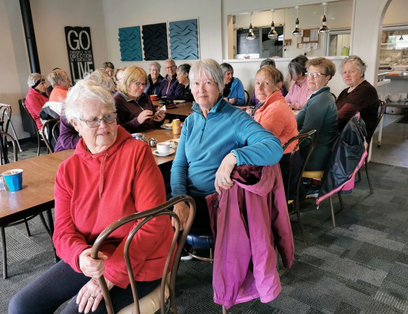
A short drive back to Black Swan for Coffee, cake and chat—where we were served with a smile, which is not always the case these days.
Thanks to Jenny Flack for keeping an eye on the tail Enders. Not many km’s, hopefully you all enjoyed the outing hearing snippets of local history.
Eleanore Ryan
Continue reading “Titri Wetlands Reserve and Titri Park. Taieri Ferry Bridge and Waihola.”
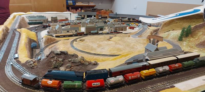
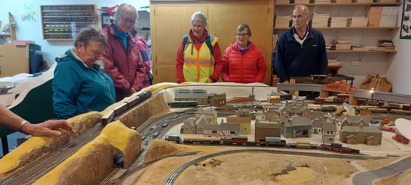
2. 12 April 2023 Trampers and Hikers
Choices for Hikers: Stay home and knit or brave the elements of mist and drizzle with potential rain but leave the Waihola Wanderings for another time. 11 chose to go for a local walk.
The course was plotted as we left the Peter Johnson carpark, going along the riverside, turning at the helicopter pad and wending our way over to Wingatui Rd and Gladstone Rd North.
It was decided to have morning tea under cover. Wingatui Station (built in 1875) was a likely possibility. However, the leader veered off track and we arrived at Neil’s model railway instead.
This of course provided shelter as he coped with the unexpected invasion and happily displayed rail/train manoeuvres.
Dry and refreshed, we passed the evidence of autumn in the yellow, gold and red tree colours, and wended our way back to the carpark after a pleasant 10 kms of Mosgiel Meanderings.
Eleanore and Carole
The Trampers choice
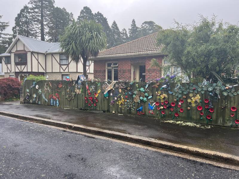
As a weather alert was given, safety required that we could not go to Rosella Ridge, so it was decided we would meet at Woodhaugh Gardens. After discussion, we headed towards Bethunes Gully. The rain had eased so we walked beside the Leith with some nice street art on the walls of the Leith.
We continued past the gardens, into North East Valley, past Dunedin North Intermediate school, then Baldwin Street(no takers), Dunedin Hospice and Ross Home. We detoured into Chingford Park, a nice stone home, which catered for weddings.
We stopped at Leith Harrier and Soccer grounds for morning tea.
Moving on we passed some garden plaques on a fence. Into Norwood Street we continued to Forrester Park (bmx bike park) then into Bethunes Gully. The good 35 minutes of uphill, required some reduction of gear before an uphill climb. On the way a large tree had fallen and was being removed. We passed a couple of waterfalls,5 bridges over Lyndsay Creek and got to the top at 12.05 – lunchtime.
The return to the bottom took 30 mins, past the Normanby Tavern (now closed), Ross Home, then via a track behind the Hospice, thanks John G. We continued back onto the main road to NEV shops back to Woodhaugh and the cars. As some had cooled off due to drizzle, it was decided no coffees but a couple of pieces of chocolate fudge sufficed.
Distance 16.18km Elevation 445m actual tramping time 3hrs 6min.
Thanks Graeme S for being TEC. A fun day out. Phil.
Feburary 2018
February 2018