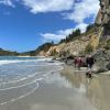
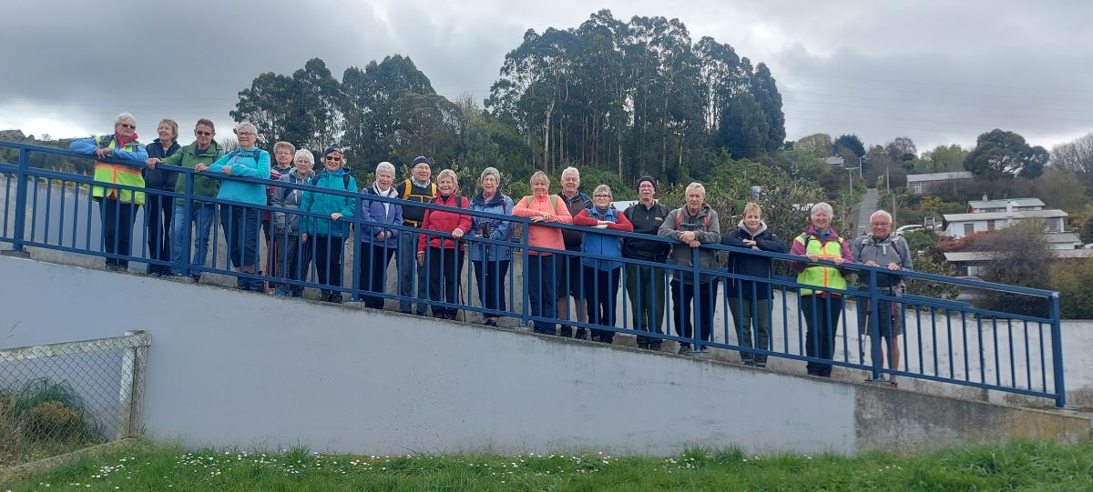
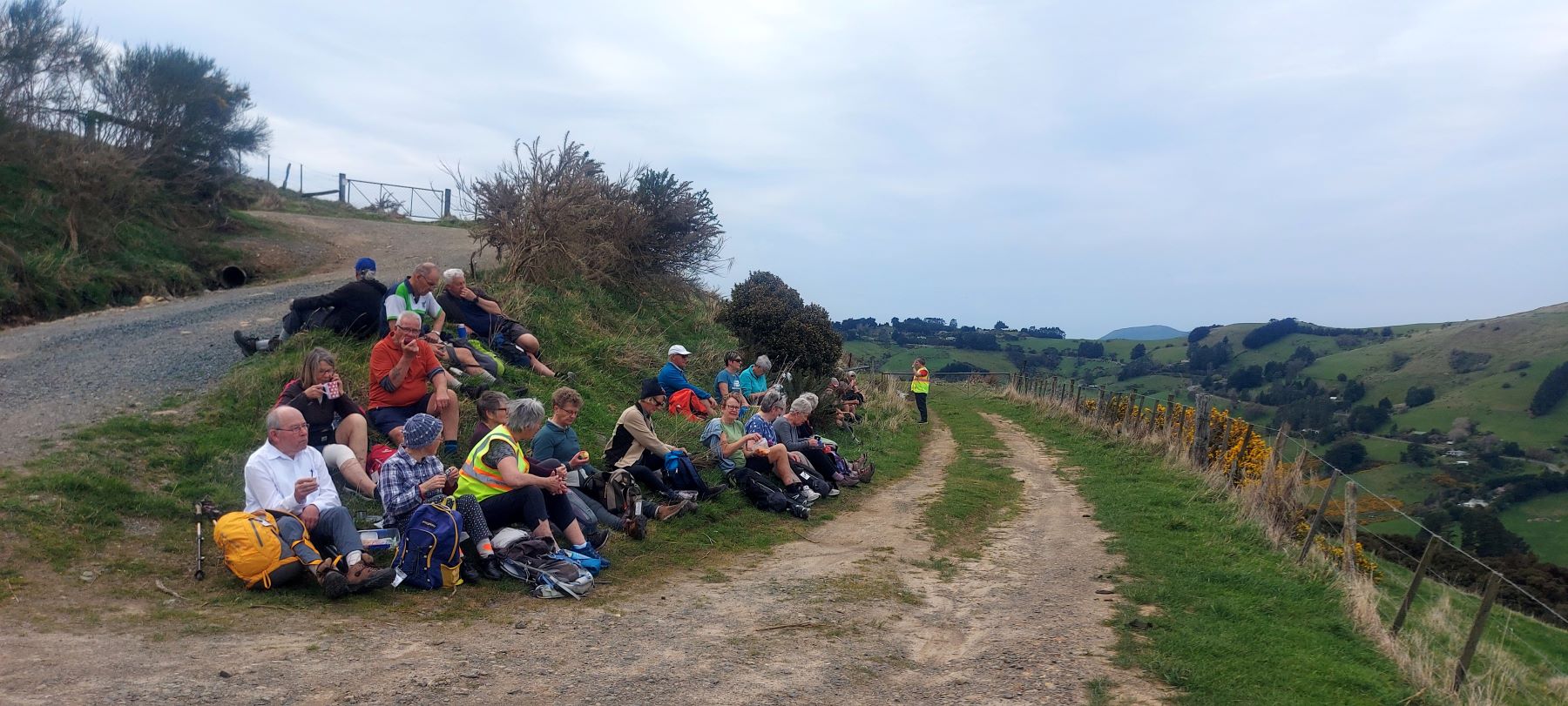
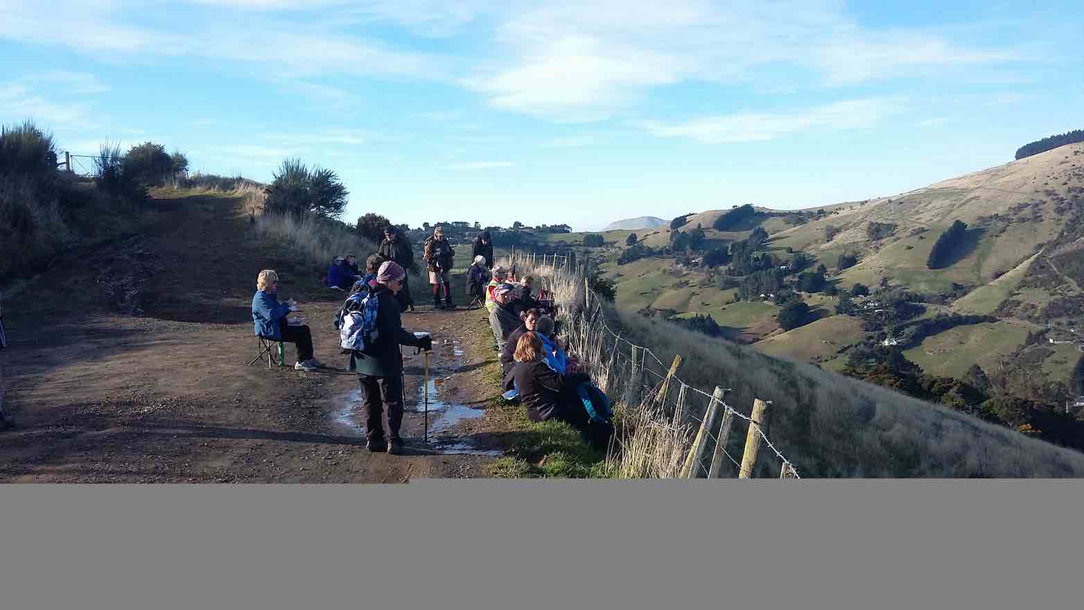
47. 10/04/2024 Highland Park to Friends Hill. Grade 2.5. Leaders: Margaret Maxwell/Kay Seddon.
With nervous trepidation, Kay and I met at Peter Johnson Park to meet all you gorgeous hikers. We thought there would be about 8-16 willing participants.
14.14 February 2024. Hikers. Waldronville Wander. Grade 2. $5. 10km. Leaders: Phil Keene, Helen Morris.
After leaving PJ park right on time and catching up with the locals at the Estuary, 24 Hikers set out in orderly fashion back down the road towards Waldronville and crossed over into Island Park through the new gate, noting the sign ‘ no dogs allowed’. Must be to keep all the professional dog walkers out? Continue reading “Waldronville”
20. 7 February 2024. Combined hikers and trampers. Aramoana – Heyward Point.
Hikers: Leaders Heather and Val Cayford
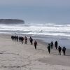
‘Pathway to the Sea” – 7th February 2024 at 8.45am on a grey overcast morning with slight drizzle 15 hikers left Peter Johnstone Park and arrived at the small coastal settlement of Aramoana at approx. 9.45am – a peaceful place with 260 permanent residences as of 27th January 2024. Continue reading “Heyward Point, Kaikai Beach, Whareakeake Road”
Ocean Grove, also known as Tomahawk, is a suburb in the southeast of the New Zealand city of Dunedin. … The suburb was known as Tomahawk until the 1930s, the name not being a reference to the weapon, but rather possibly an anglicised form of the Māori words tomo haka, meaning “dance by a gravesite”.
No. 23 on old hardcopy list of 113 club tramps. “Karetai Rd via Monument from Lagoon. Year round.”
DCC List: 41 Peg Track. Otago Peninsula
Accessed from Oregon St. 3.5 hrs ret. Tramping track – unbenched. Managed: DCC CAM, private land. Description – This track provides a link between Ocean Grove and Highcliff Road. Access to the track in Ocean Grove is off Oregon Street. An attractive walk around Tomahawk Lagoon then climbs through gorse and native bush. Turn right towards Soldiers Memorial through paddocks with gorse sometimes obscuring the rock walls.
Information Rock and Pillar via Six Mile Creek This climbs 1,005 m. (3300 feet) up the eastern face from Glencreag Station up a leading ridge south of Six Mile Creek. This is the most direct approach. Rock and Pillar via spur south of Lug Creek. Information: Climbs 910 m. (3000 feet) up the eastern face of a well-graded vehicle track up a leading spur south of Lug Creek. Average time to Leaning Lodge is 3 hours on foot. DoC access. 9.5km north of the Middlemarch store on SH87, just before Lug Creek, is a farm entrance (RAPID 7219 – no DoC sign). A short way up the driveway is a DoC car park. There is public access up the vehicle track to the conservation area boundary. The track is now a recreation reserve administered by DoC.
Easiest route to Big Hut from Leaning Lodge (foot only – unmarked – good visibility essential) is another 45+ minutes climbing gently southwards to cross a steep gully and then climb a gentle shelf to above the eastern basins. Sidle several hundred metres past the lower prominent rock tors before gently descending to Big Hut once it becomes visible. Route very wind and cloud-prone. Ice axe and crampons may be necessary to traverse steep snow slopes near Leaning Lodge.
64 km to Middlemarch. 66 km to Stonehurst Track.
Redan Crater- contact for access Ken Rennick.
19. 15/11/2023. Hikers. Cleghorn Street to Signal Hill. Leaders Pam Clough and Jay Devlin
23 keen hikers gathered on a beautiful day at the Bottom of Cleghorn St where we made our way up the gravel road to the beginning of our walk which was firstly over farmland. Continue reading “Signal Hill Tramps”
The day dawned fined and following some creative maths (11 doesn’t as it turns out does not fit nicely into 2) – 3 cars left Dunedin to meet up with the Mosgiel trampers at Waitati. After numerous toilet visits, we all finally continued to our starting point at Doctors Point Reserve.
Outram turned on another scorcher for 16 hikers. We started at the West Taieri Rugby Club and walked around Kings Court and Anzac Court subdivisions where the gardens were in full bloom. Continue reading “Outram – Allanton Flood Bank”
17. 11/10/2023. Hikers. St Clair, St Kilda, Ocean Grove. Grade 2, $5, 17km, Leaders: Bruce Spittle/Alex Griffin
Nineteen hikers left Marlow Park in sunny conditions at about 0930 after singing happy birthday to Liz Griffin and walked over the Kettle Park Sports field and up a track to the Barnes Lookout.
5. 27/09/2023 Hikers. Grade 2 Leaders: Jan and Jan
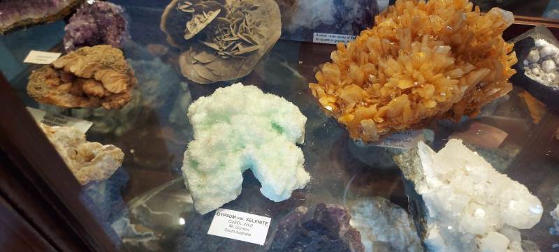
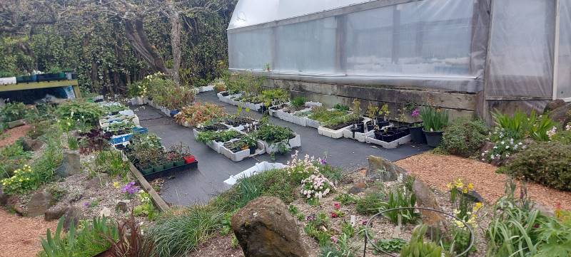
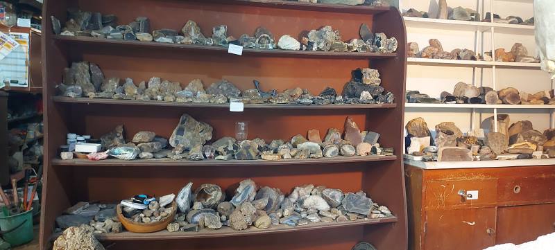
20 hikers set off from the old Carisbrook Hotel through the very run-down Caversham shopping area. We had a couple of stops to look at a bit of the history of the area. There were other points of interest, but with so much chatter going on, decided to give it a miss! We headed up South Road for a morning tea stop at a house belonging to Jan Y’s brother. It is a large property extending right down to just above the main trunk railway line. He has a stall at the Farmers Market every Saturday and has grown and propagated an extensive number of plants. Also has numerous tunnel houses, a couple of fruiting tamarillo trees and an avocado tree. He is a rockhound and there was a very large collection of rocks, crystals etc. on display.
Rocks and propagating Caption and photo HelenPhoto HelenPhoto Helen
Because there was so much to look at, the morning tea break was a bit longer than normal. We carried on up South Road to the Carlton Hill area, then cut across a couple of streets and back down to Sidey Street where you got a good view of Corstorphine House. From there we headed up a track which took us into the Kew area, with great views of Dunedin.
Top of steps gathering up Caption and photo Helen
Down through a steep set of steps (Killikrankie Pass – a cool name) and we ended up in a park at Forbury Corner for lunch.
Lunch. We were all scattered. Caption and photo Helen
Returned to the cars by crossing over the motorway on an overhead bridge, then walked down a path on the north side back to the cars.
On the overbridge Caption and photo Helen
It was a pleasant day with no wind, and we covered approx 8 kms, at quite a leisurely pace. Several members of the group had lived in the vicinity of area covered so it was a bit of a trip down memory lane for them. Thanks to Jan and Pam who did a very enjoyable recce with me. The Two Jans.
21 kms PJP to Pine Hill School (via 3 Mile Hill Rd).
4. 20/09/2023. Hikers. Pine Hill. Grade 2. $5. 21km. Leaders: Jan Butcher/Jenny Finnerty.
30 hikers turned up on a warm slightly windy day for our Pine Hill trek.
The start of the day – Photo & Caption Helen
We met up with a couple of town folk at Malvern Street & walked through Woodhaugh gardens where we stopped for morning tea to fortify us for the trip up the hill.
Morning tea at Woodhaugh Gardens – Photo & Caption Helen
Beautiful clematis – Photo & Caption Helen
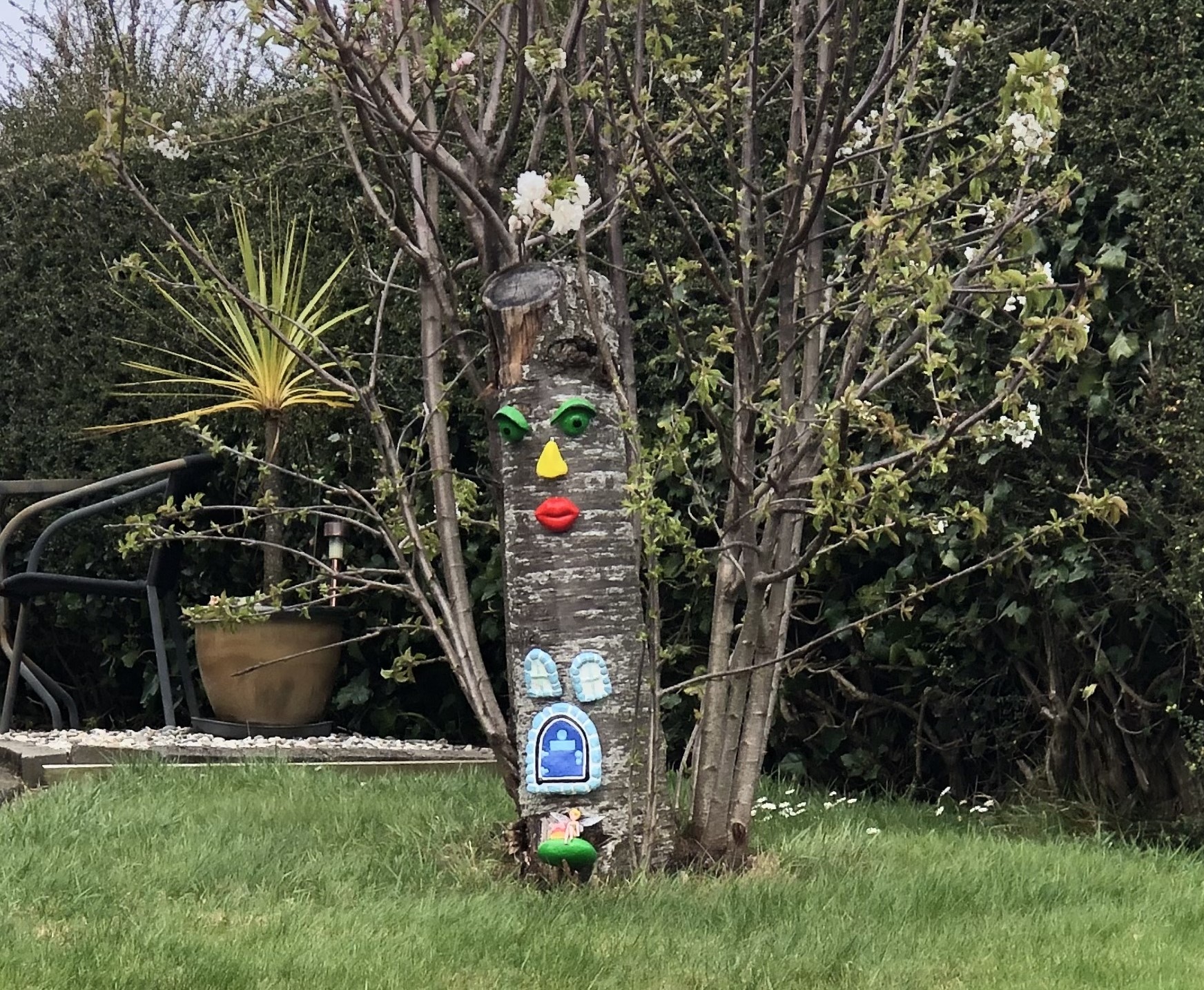
Unusual piece in Pine Hill neighbourhood – Photo & Caption Jenni
We did it a little differently from last time & walked up the motorway for a bit before turning right onto Fea Street and on upwards to meet with Pine Hill Road.
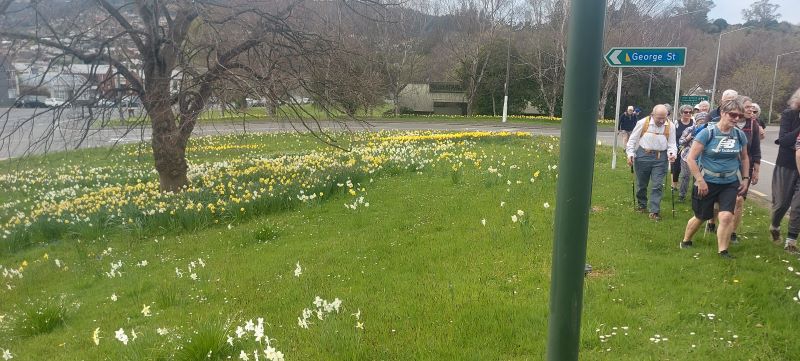
A field of daffodils – Photo & Caption Helen
At the end of this road we turned right onto Campbell Road and walked to the end of the housing. This then becomes a wide dirt track which we followed to the end. It was about noon so everyone was happy to find a comfy spot on the embankment and enjoy the vista before them.
Lunch out of the wind – Photo & Caption Helen
A lot of people told me they had never been up Pine Hill let alone this track with its best kept secret. And unbelievably there was no wind to speak of so we enjoyed the next half hour eating and talking about the view and trying to spot places of interest on the opposite side of the hill & beyond.
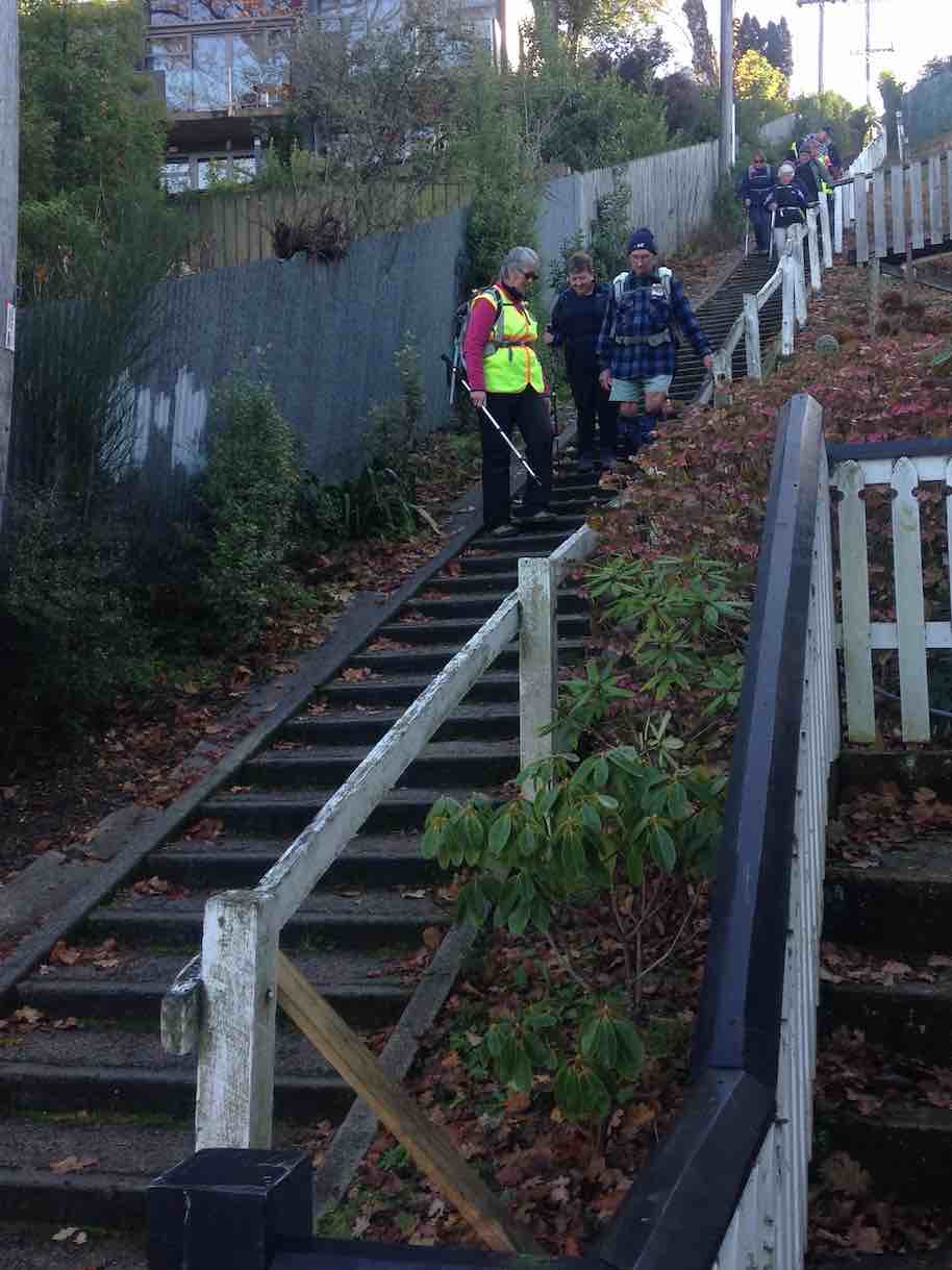
Reluctantly we had to “shift our bottoms” and start the walk back down the hill, this time turning at Pine Hill School and down onto Buccleugh Street which wound its way down and down to meet up with the 219 Duddingstone steps. We decided to head on over to the Botanic Gardens for a well earned treat. I had prewarned the cafe that there could be 30 takers for afternoon tea. He sounded a little shocked but managed us all no bother.
Amazing service at Crocodile Cafe – Photo & Caption Jenni
Some of the drivers were kind enough to go back to their cars and bring them to the carpark for their passengers. Thank you Pam. After refreshments some of us picked up some bargains at the plant shop adjacent to the cafe. We then walked back to the cars, admiring the beautiful camellias etc along the way. A good 10k walk on a nice day.
Jenny F and Jan B
3. 01/12/2021. Hikers. Hidden Gems of Pine Hill. Shone Munro and John Gardiner
On a misty drizzly day, 24 hikers met in Pine Hill Rd near the school.
The walk up Pine Hill’s back streets Photo and caption John
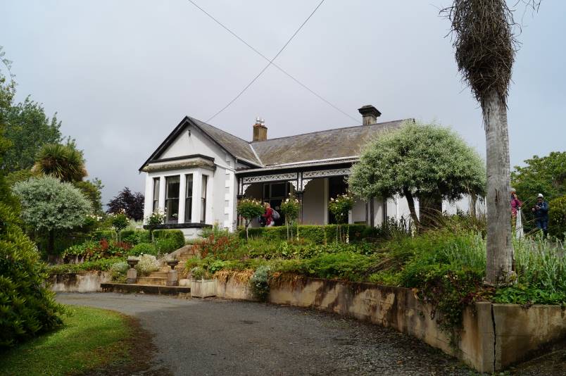
We commenced walking down Pine Hill Rd to a walkway leading to the town end of Hillary St which we followed to the distant end before having morning tea at “The Fern house”, an iconic house built in 1882 where we experienced great hospitality from the owner, Dr Brian Cox, who had made toilets and his sunroom open for us.
Driveway down to Ferndale Photo and caption JohnFerndale Homestead Photo and caption John
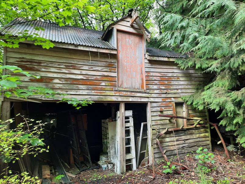
Most hikers then followed him to explore some of his property while some reneged at the muddy walkway near an old barn and tricky bridge where we waited for the intrepid to return.
Sample of some of the old buildings Photo and caption Ady
It was obvious that the hikers were enjoying themselves by the happy chattering we heard and gales of laughter from Fay. We were still unsure if this was because Fay’s new shoes got so muddy or something else.
Oh no! Why did I wear my brand new shoes? Photo and caption Jenni
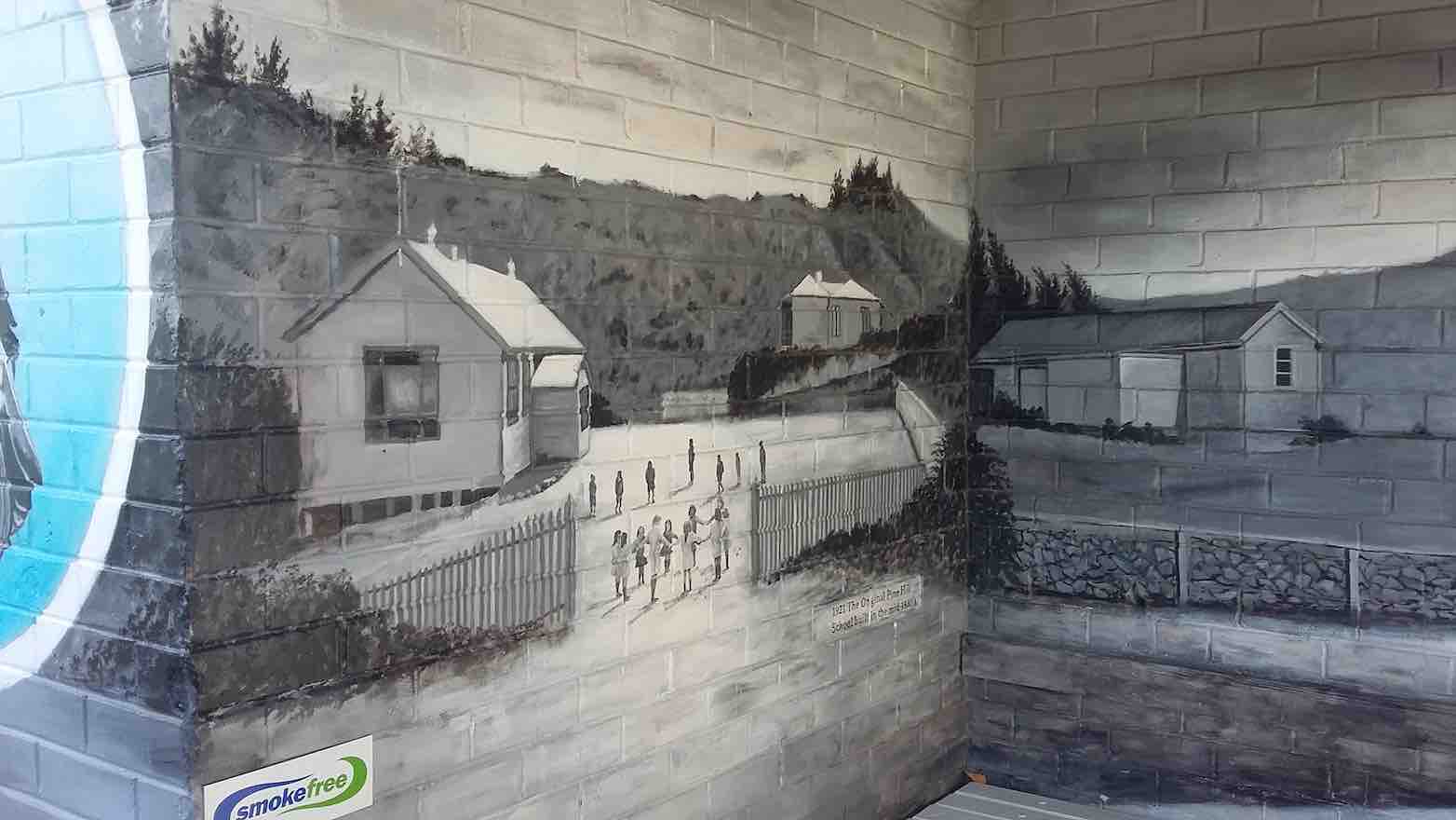
Reassembling we walked to Campbell Rd where John educated us on the history of the little dog painted into the Power box mural, walked up Campbell’s Rd , through a walkway back onto Pine Hill Rd and upwards to “The Pines”.
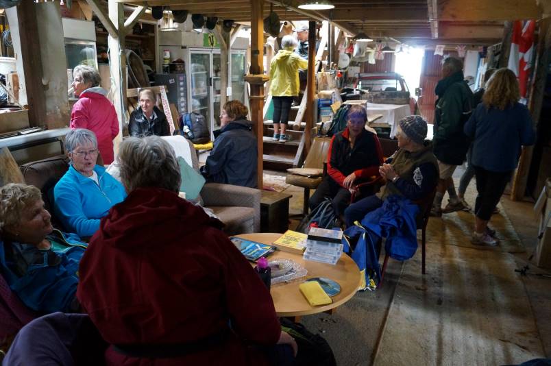
This owner, Lindsay Moir, also extended great hospitality, allowing us use of his barn (adequate seating for all) and toilet.
Inside The Pines barn for lunch Photo and caption John
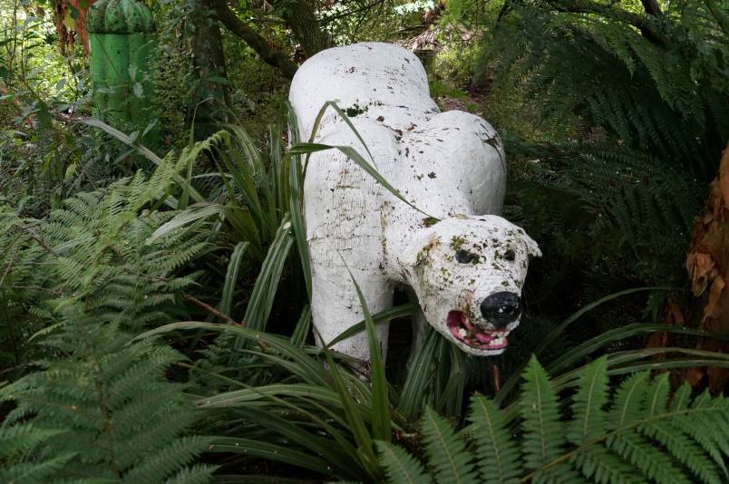
After lunch, a number of hikers went to explore his farm and the creek with him. Highlights included the monster (wooden polar bear), frog pond, converted container for honeymooners and a Nissan hut where some of our male hikers discussed politics.
The legendary Pine Hill monster lurking in the bushes Photo and caption John
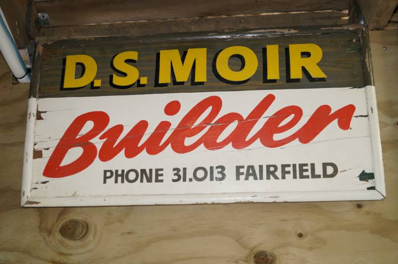
There was an old sign hanging in the barn, advertising the business of our late Life member, Doug Moir and as there were only 5 telephone numbers on this, not the 7 on today’s listings, it must have been very old indeed.
D S Moir Photo and caption John
A brisk downhill walk to the cars preceded a visit to CrocQueODile Café.
Thanks must go to these generous property owners for their hospitality.
Distance walked approx 9km.
2. 20/6/2019. Hikers. North East Valley, Pinehill. Jan and Jenny
On a cold and frosty morning, 27 hikers set off for Malvern Street where we parked up and commenced our hike to Pinehill.We walked through Woodhaugh park where we located some seating and had our morning tea before setting off along Banks Street and turning left up Dolphin Street which in turn lead onto Gladstone Road. This being the home of Aquinas College.If you thought we had a good frost in Mosgiel – well it was matched hereand we very cautiously negotiated the footpath, sometimes having to cross the road which was like a skating rink in places.However we all climbed the hill without mishap and into the sunshine which was a relief! Walking up Pinehill Road we stopped to admire the Church where Shona and Keith were married some 44 years ago on the 28th of this month.
We carried on, coming to John’s house where he picked up his dog for a walk up to the end of Pinehill Road & onto the end of a gravel road where we stopped for lunch overlooking a wonderful view of Dunedin and surrounds.
We were all suitably impressed with the view,
Great view at the top of Pine hill. (Clive pic and caption.)
none of us having been up to that spot before – not even Shona!Sitting there with our backs to the sun,
Lunch at the top. (Clive pic and caption.)
it was hard to leave, but it was time to head back down the hill again, spotting some wonderful street art in a bus shelter.
Decorated Pine Hill bus stop. (Clive pic and caption.)
We turned left at Pinehill School and on down the hill coming to a winding Bucclough Street which eventually lead us down to the 219 Duddington steps
Duddingstone Steps. (Raewyn pic and caption.)
and on down to NEV where it was a short walk to the intersection with Banks Street and through Woodhaugh again and back to the cars.A good 10k was the agreed distance and so called into the Village Green for a well deserved coffee & cake!

 47. 10/04/2024 Highland Park to Friends Hill. Grade 2.5. Leaders: Margaret Maxwell/Kay Seddon.
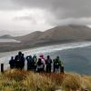 25. 27/03/2024. Hikers. Sandymount Grade 2.5 Leaders: Jenni and Bruce Wright
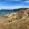 15. 06/03/2024. Combined. Waikouaiti
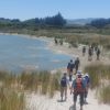 14. 14 February 2024. Hikers. Waldronville Wander. Grade 2. $5. 10km. Leaders: Phil Keene, Helen Morris.
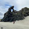 Hikers: Leaders Heather and Val Cayford
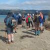 11. 17/01/2024. Hikers. Warrington. Leaders Jenny Finnerty and Jay Devlin
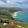 43. 06/12/2023. Trampers. North of Tomahawk. Grade 3. $7. 22km. Leaders: Esther Willis and Julie McKenzie
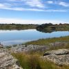 16. 06/12/2023. Hikers. Sutton Salt Lake – Glencreag Track. Grade 2.5. $16. 60km. Leaders: Wendy Langley/Katrina McKenzie
 2. 29/11/2023. Hikers Waters of the Leith. Grade 2. Leaders: Jan/ Pam
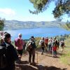 19. 15/11/2023. Hikers. Cleghorn Street to Signal Hill. Leaders Pam Clough and Jay Devlin