
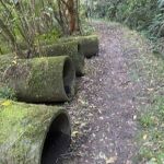
 13/08/2025. South Dunedin Street Art. Grade 1.5. Hikers. Leaders: Val Crayford and Wendy Langley.
After parking up at the Southern Cemetery 25 of us headed into the South Dunedin area to view the street art. Continue reading “South Dunedin Street Art”
Category: Hikers
Waldronville
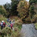
 30/07/2025. Waldronville. Grade 2. Hikers. Leaders: Avis and Rhonda.
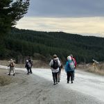
On a questionable weather day 15 of us set off to meet up with the Brighton contingent at the estuary’s car park which brought our number up to 20. Continue reading “Waldronville”
Nichols Farm
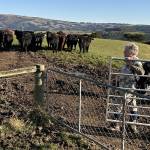 23/7/2025. Nichols Farm. Grade 3.5. Hikers. Leaders: Wendy Langley and Carol-Anne Buchanan.
19 hikers set off on a chilly, crisp morning which provided us with a perfect blue sky and no breeze.
Taieri Mouth
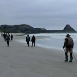
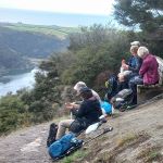
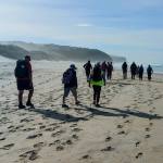
 16 /7/2025. Taieri Mouth. Grade 2.5. Hikers. Leaders: Alex Griffin, Adrienne Ensor.
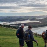
25 hikers were greeted with a lovely sunny day when we assembled at Knarston Park in Taieri Mouth, with only a slight breeze coming off the sea. Continue reading “Taieri Mouth”
Coutts Farm
 09/07/2025. Coutts Farm. Grade 3. Hikers. Leaders: Bruce Wright and Peter Beal.
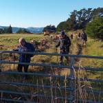
Left Memorial Park carpark at 9.30am and travelled to Taieri Mouth, meeting up with Brighton hikers at Coutts Gully Road carpark.
Akatore Narrowdale Forest
 25/06/2025. Akatore Narrowdale Forest. Grade 3. Hikers. Leaders: Neville Griffiths, Cathy Ferguson.
On a mild winter morning 13 hikers set of on SH1 to Milburn. At intersection with Narrowdale Road we met up with Neville and 4 others who had come over the hill from Brighton. Continue reading “Akatore Narrowdale Forest”
Frasers Gully – Friends Hill
 18/06/2025. Frasers Gully – Friends Hill. Grade 3.5. Hikers. Leaders: Janette Abbott and Maria MacNee.
Woollen hats, gloves and puffer vests were needed as twelve club members and one visitor, Alison……
Henley Loop
 28/05/2025. Henley Loop. Grade 2.5. Hikers. Leaders: Rhonda Wilson and Jill Dodd.
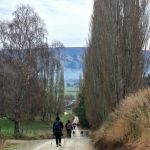
On the last week of autumn 15 happy hikers arrived at Henley Road to walk the Henley, Christies Gully, Otokia-Kuri Bush West Roads Loop on a rather cold morning with low cloud covering parts of the Taieri Plain. Continue reading “Henley Loop”
Sandymount
 21/05/2025. Sandymount. Grade 3. Hikers. Leaders: Jenni & Bruce Wright.
Thanks to whoever ordered a perfect day weatherwise. We were really happy considering our previous trip had to be aborted because of a howling Southerly, low visibility and driving rain.
Racemans
 14/05/2025. Racemans. Grade 3. Hikers. Leaders: Wendy Langley, Eleanore Ryan.
Another great autumn day for our hike up and back Racemans track. (Google Silverstream walks for history and tracks in the area). Continue reading “Racemans”
Dunback Shag/Waihemo River Walk
 30/04/2025. Dunback Shag/Waihemo River Walk. Grade 2. Hikers. Leaders: Neville Griffiths, Dave Roberts.
29 hikers arrived at the designated meeting point in Palmerston to be greeted with persistent drizzle and overcast weather.
Taieri Mouth Millennium Track
 23/04/2025. Taieri Mouth/Millennium Track. Grade 3. Hikers. Leaders: Linda Partridge & Bill Cubitt.
On a cool but fine morning 18 hikers gathered at Riverside Rd, Taieri Mouth near the entrance to the track for a lovely walk through the bush to the lookout.
Historic Port Chalmers
 16/04/2025. Historic Port Chalmers. Grade 2.5. Hikers. Leaders: Mike Webb. Jenni Wright.
17 Hikers met at the carpark opposite the Careys Bay pub for a walk around Careys Bay and Port Chalmers. Continue reading “Historic Port Chalmers”
Old County Track, Waikouaiti
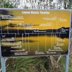 09/04/2025 Old Country Track, Waikouaiti Grade 2 Hikers or Combined. Leaders: Jan Butcher, Shirley and Noel McRandle.
The animal encounter! The day started off from PJP in perfect hiking temperature with a purrfect farewell during briefing by a little grey cat. Continue reading “Old County Track, Waikouaiti”
St Kilda/ Tomahawk Beach
 26/03/2025. St Kilda / Tomahawk Beach. Grade 1.5 Hikers. Leaders: Wendy Langley and Val Cayford.
The proposed hike for today was to head up the Pineapple track and check out the surrounding area.