Grainger Road Tramps to Maungatua summit and Woodside.
Steep, Long. Take plenty of water.
Cars park at Graingers Road.
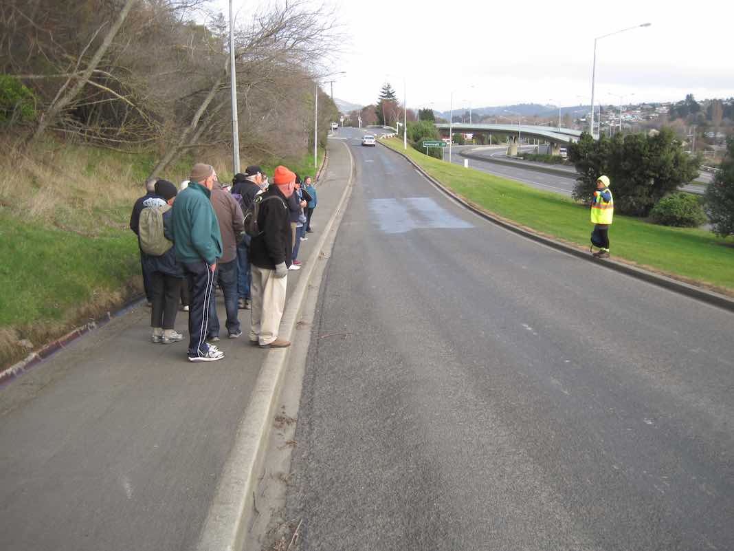
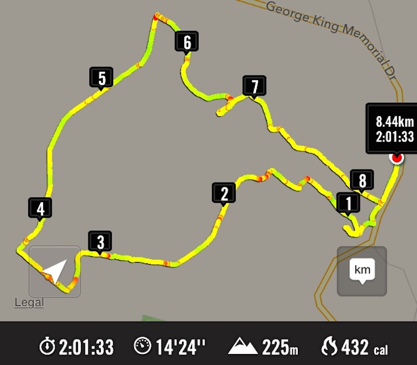
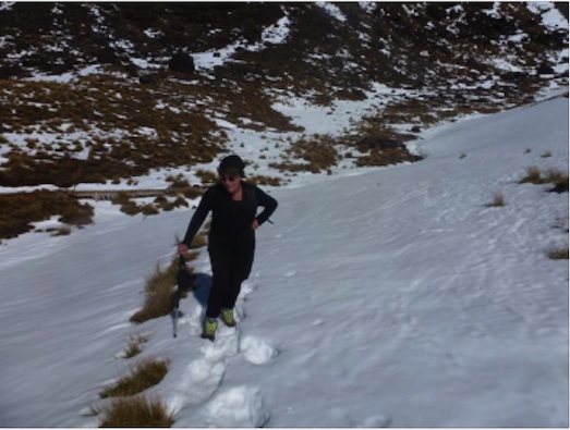
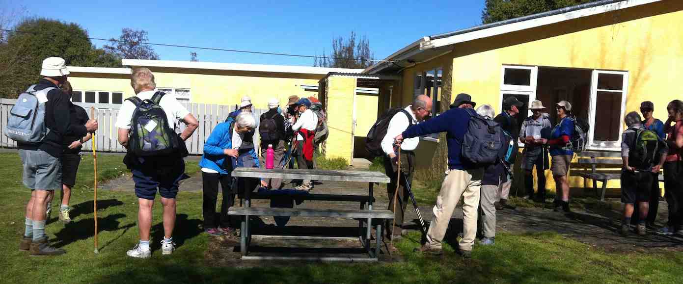
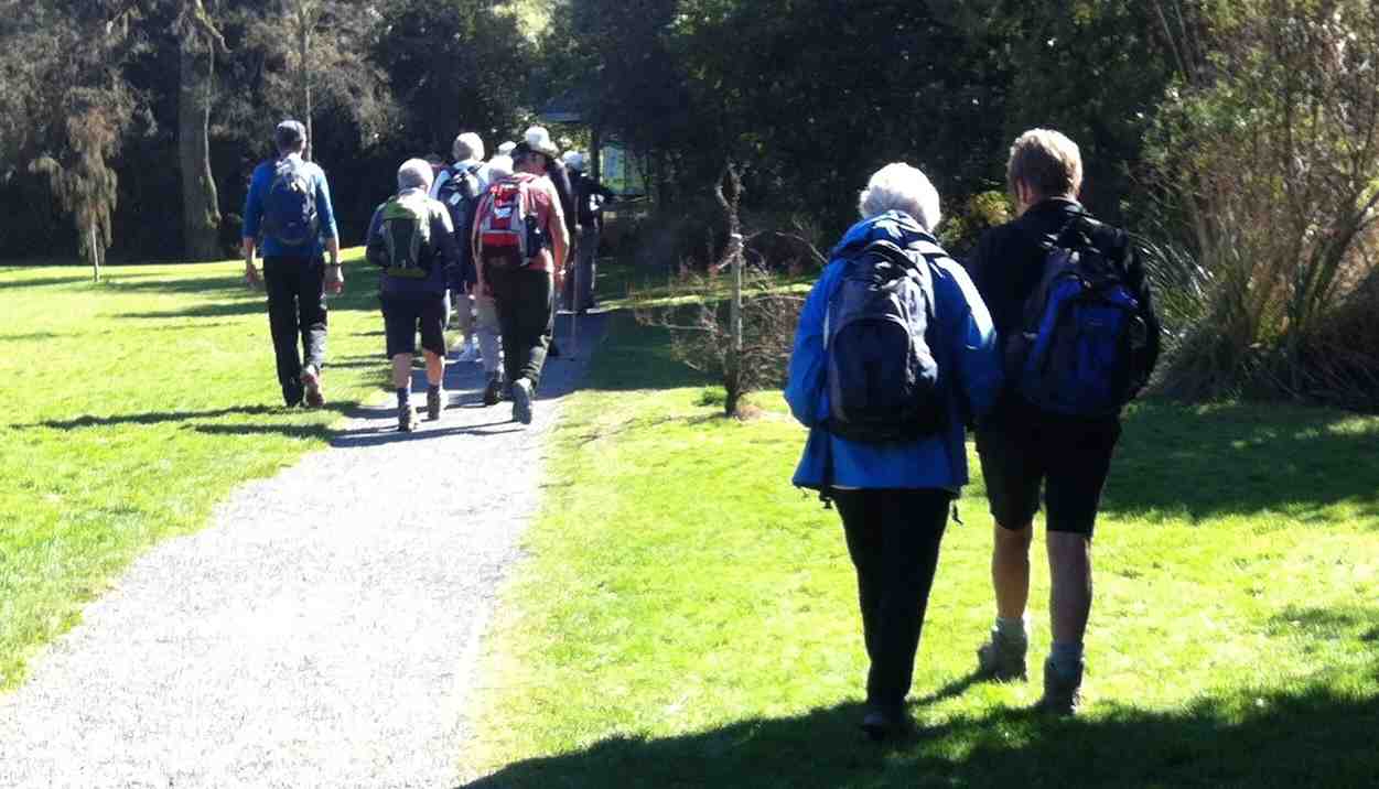
8. 11/11/2015. Trampers. Grainger Road.
A change of plan due to the weather. 7 of us went to Grainger Road and parked at end of road by the pylon. Steep track up the side of the Maungatuas. Steep was what Hamel’s book said and was steep. Morning tea Ken left and went back down. Rest of us continued up as far as the markers were. No more track to be found so after much looking around the decision was made to go back down. Early lunch with the paddock’s two resident horses and a shower of rain sent us on our way home. Still a good workout. – Helen.
7. 31/8/2005. Trampers. Grainger Road to Maungatua Tussock slopes only. Spaniard grass thick. Leaders: George, Doug J.
We climbed in the bush, and came down in tussock and farm. – Ian
Break in Bush. George, Ria, Who?
Lunch on Maungatua slop. Hazel, Dorothy, George
Descent round a large rock. Who? in rear rear. Doug M front.
6. 16/9/1998 Grainger Road, Woodside. Leaders: Bill H, Graham
5. 29/4/1998. Maungatua via Graingers Road, return – round trip. Leaders: Bill H, Graham, Ian.
4. 14/8/1996. Grainger Road to Woodside Glen. (Car Shuttle) Medium+. Leaders: Wendy, Bev H, Bill H.
3. 7/12/1994 Grainger Road, Maungatua, Woodside. Steep and long. You may go part way on this one and a leader will bring you back. Leaders: Nancy, Rob Q, Joyce S, Colleen
1/10/1994 Leaders: Joyce S, Nancy, Colleen
2. 11/5/1994. Grainger Road, Woodside, Maungatua. Med+. Long. Leaders: Nancy, Colleen, Rob Q, Joyce S
1. 11/3/1992 Leaders: Bob & Audrey, Denise, Doug M
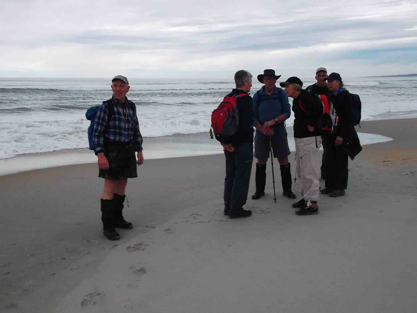
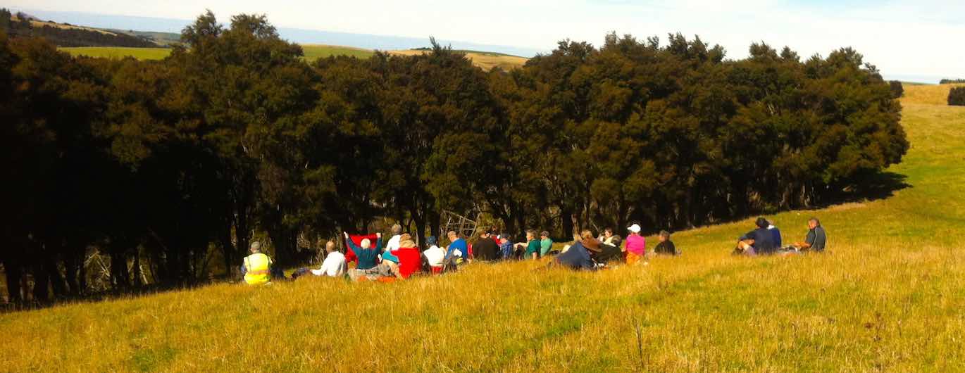
Seven trampers started out from Brighton to walk the beach to Kuri Bush. The weather was overcast, but fine all day, & no wind, which made pleasant beach walking.
As lunch was taken before we reached Kuri bush,
Lunch. (Heb pic)
we never quite made it all the way there before turning back. As the tide was starting to come in,
(Heb pic)
we walked some of the way back on the road, until we could get back
(Heb pic)
onto the beach. – Heb.
4. 7/11/2013. Both. Brighton to Bruce Rocks. Leader: G Haggie.
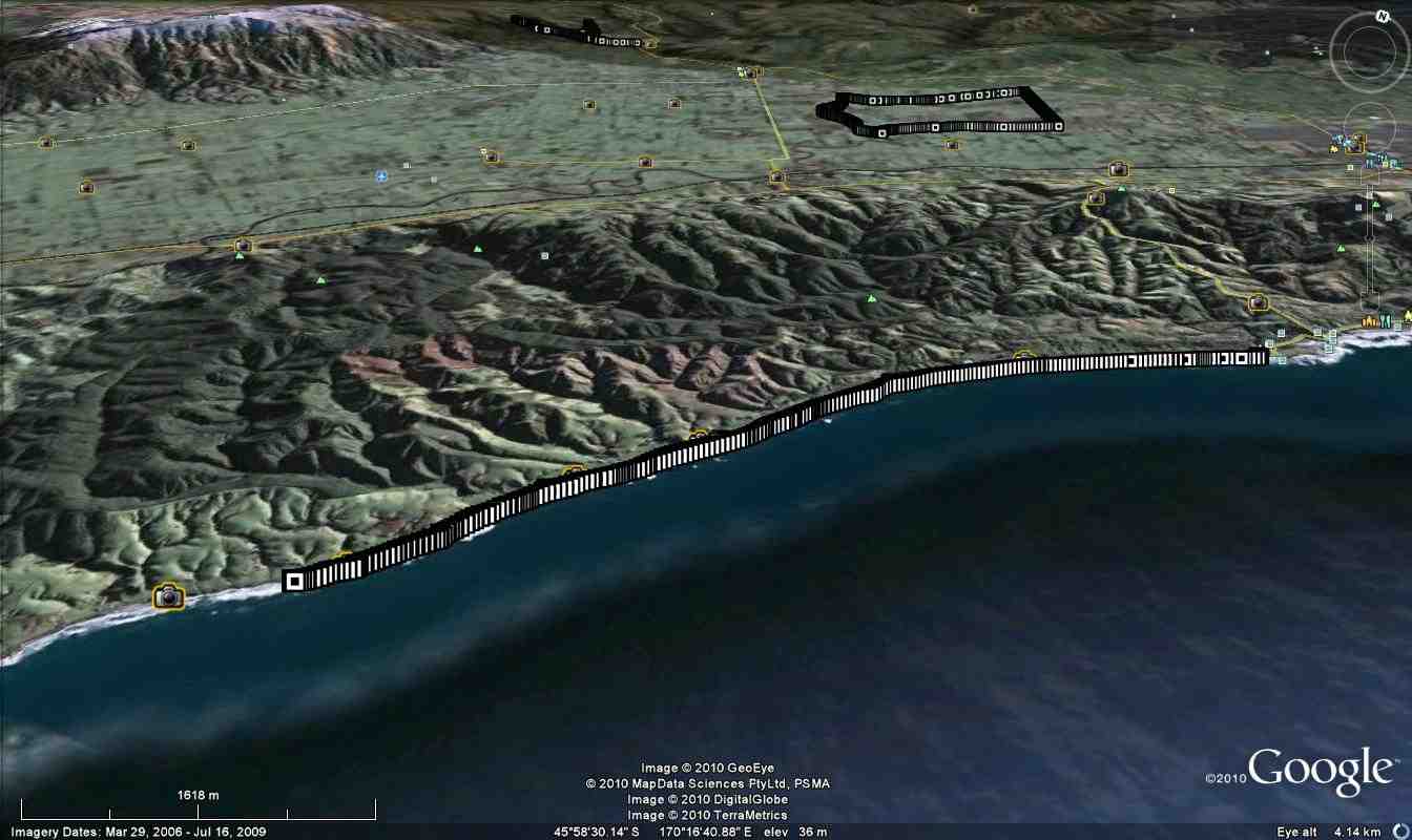
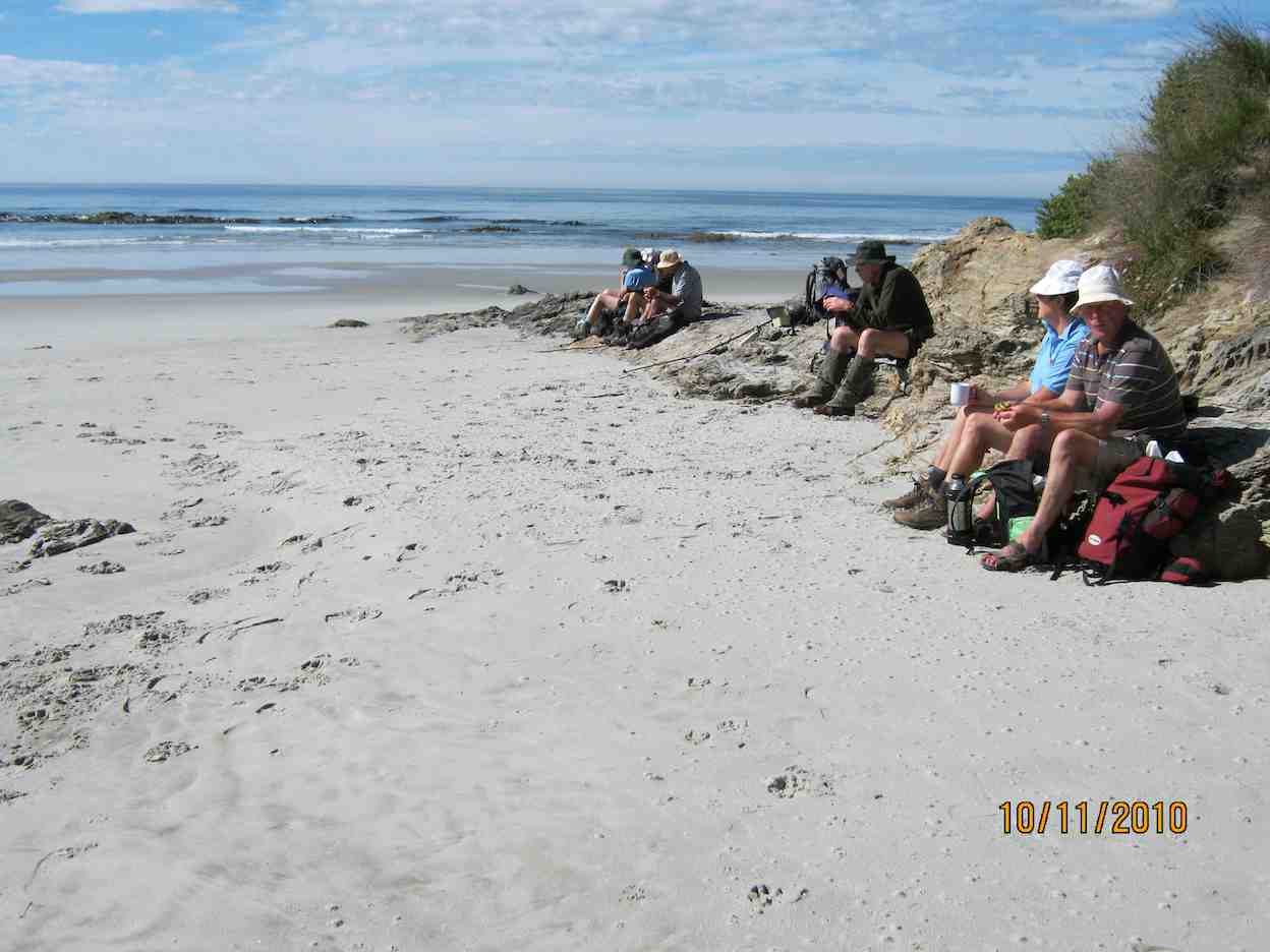
3. 10/11/2010. Trampers. Brighton Beach walk south. Medium. Leaders: All.
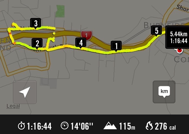
Brighton-Sth. Beach walk. GPS of route, courtesy Ken
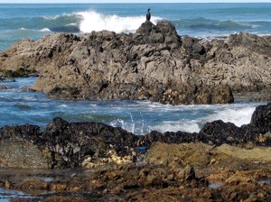
This was the first tramp without a recce or leader. Overworked leaders had begun complaining as low tramper numbers had meant frequent leadership duties. Ironically 10 of us turned up on the day. We had morning tea at the same spot as last time – at the point where the unbroken beach gives way to rocky outcrops and small bays. As you can see, the tide was well out.
Lunch stop.
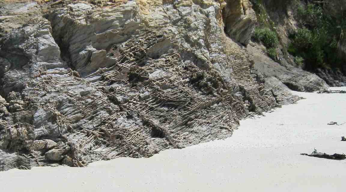
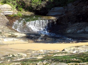
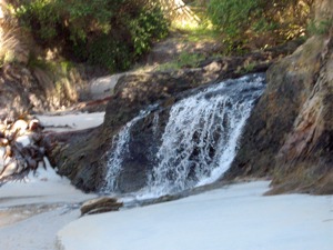
The two small waterfalls pictured in the last tramp were almost indiscernible trickles, so dry had the season become. So far out was the tide, that we were well beyond the point we had reached on the previous occasion. Fortunately Ken drew our attention to the fact that we had gone over 8 km, only about 2 km short of Kuri Bush. Far enough. So we lunched. On the way back some striated rock face drew our attention.
Rock face
We got well strung out on the walk back with one or two getting well ahead and a tail-end group dropping well back. But we all got there, with several taking the opportunity to enjoy going bare-foot in the surf.
However we all made good time covering 17 km all up, getting back to the cars about 2.30 p.m.
A lovely sunny day. Tide well out. Good hard sand. It was great. – Ian
This beach tramp from Brighton south was merely a replacement for a soggy winter Spiers Road circuit but proved to be a gem. After the first unbroken beach walk from Brighton, the small sandy bays at its south end were a welcome delight and of endless interest.
The rocky points between them proved not too difficult to negotiate, provided one carefully stepped between slippery seaweed. Again there was constant interesting variety of shapes and rocky pools.
WaterfallWaterfall
(Of course a welcome sunny day interrupting a dreary wet August was quite a help too.) And to top off the specialness of the day, George observed that this was the first time the club had attempted the walk, although the Trixies had it on their calendar.
This is a walk to be planned only when low tide occurs between 12.00 and 1.00 p.m. as at high tide the sea comes right up to the steep banks. As it chanced it was a 12.00 p.m. low tide day. 1.00 p.m. would have been even better as we had to plan our return early enough to get back beyond the last rocky point and onto the unbroken beach again before the returning sea had encroached too much.
A solitary fisher
And at this point was a further point of interest. George had told leaders Sabina and Ian when they were still at the planning stage that horse riders used a parallel track through the sandhills when the tide was full, so here was a landscape of its own to vary the return trip and avoid the soft sand of the upper beach that the returning tide would have forced us onto. Mainly marram grass and lupin, the dips and rises, gullies and ridges led on and on in a world seemingly quite divorced from road on one side and beach on the other, interrupted only by a web of road-to-beach tracks constantly crossing our walk.
At last, the return to the cars with nine of us having enjoyed a day of welcome break in the weather and a rewarding treat of beautiful hidden bays of which we had hitherto been completely ignorant. – Ian
MINUTES OF 28th ANNUAL GENERAL MEETING OF THE TAIERI RECREATIONAL TRAMPING CLUB HELD AT THE MCKERROW LOUNGE, MOSGIEL PRESBYTERIAN CHURCH ON THURSDAY, 27 AUGUST 2015 AT 1.30 PM
PRESENT: L Smith (Chair), M Smith, J Knox, K McVie, L Harvey, P & W Bathgate, D Bennett, J Butcher, P Clough, E Cooper, E Day, F Deans, J Dennison, J Devlin, J Dodd, L Donaldson, B & J Finnie, I Fleming, L Gowan, L & A Griffin, G Haggie, B Harvey, L Harvey, I Hebbard, A Heenan, C Hughes, A Landrebe, B & P McLean, A Miller, D Moir, K & S Munro, D Poole, M Spittle, T & D Stratton, M Vaughan, J Yardley
Apologies: H Morris, B Spittle, B Mitchell, N & C Morrison, E Ryan
Moved L Gowan, seconded M Vaughan that these be accepted. Carried
Minutes of Previous Meetings
Minutes of 27th AGM of dated 28/8/15 were taken having been previously circulated were taken as read . Moved P Bathgate, seconded M Smith that they be confirmed as a true and accurate record. Carried
Matters arising: Nil
Correspondence:
Inward:
Nil
Outward
Nil
PRESIDENTS REPORT
President, L Smith, presented his report for the year. The club had had a good year, with 9 new members which was important for the future. There was a good variety of tramps, and the weather in general had been favourable. Moved L Smith, seconded L Harveythat it be adopted. Carried
FINANCIAL Report
Financial statement for the year ended 30/6/15 was presented by the treasurer. Bank balance $428.62, petty cash $4.60. There was a deficit for the year of $222.53 between income and expenditure. This was mainly contributed to by scrubcutter maintenance and fuel, but felt this had been a worthwhile project.
Moved J Yardley, seconded L Smith that it be received. Carried
Auditor: Tom Stratton thanked for his services and moved that he be re-appointed. This was declined, and the treasurer to find another auditor.
Subscriptions: These to remain at $5, plus $10 joining fee for new members.
ELECTION OF OFFICE BEARERS
President: Judy Knox (Moved I Fleming, seconded B Harvey) Carried.
Vice-President: Jill Dodd (Moved J Knox, seconded P Clough) Carried
Secretary/Treasurer:Jan Yardley (Moved I Fleming, seconded M Spittle) Carried
Committee:
Existing committee: Ken McVie )
Elaine Day ) continuing
Lester Harvey )
Moved J Knox, seconded C Hughes that Arthur Heenan and Liz Griffin be appointed to the committee. There were no further nominations Carried
Life membership: President, Les Smith presented Molly Vaughan with a life membership certificate, in recognition of the service she had given to the club in the early days, and her continued enthusiasm.
Gifts:
Vouchers of appreciation were presented, as under:
Elaine Day – organisation of social events
Margaret Smith – hosting committee meetings
Bev Harvey – preparation and distribution of track programmes
Ian Fleming – website
Pam Clough – supplying greeting cards
General:
Bev Harvey reminded members that the 30th anniversary of the club was coming up in 2016, and thought to be given to what form of celebration this could take
Ian Fleming was thanked for his work on the website. He could do with an assistant, and if any member was interested to approach Ian.
George Haggie reminded members that if members saw examples of poor animal husbandry on any of the farms they were tramping on, to bring their concerns back to committee rather than approaching SPCA or a similar organisation.
There was no other business, and the meeting closed at 1.40 pm. Judy Knox thanked Les Smith for his work over the last two years as President.
Guest speakers, John and Robyn Armstrong gave a very interesting presentation on their 6 week sailing trip from Dunedin to the Dusky sound area Thanked by Peter Bathgate, and presented with a voucher.
Confirmed ………………………………………..(President) Date ………………….
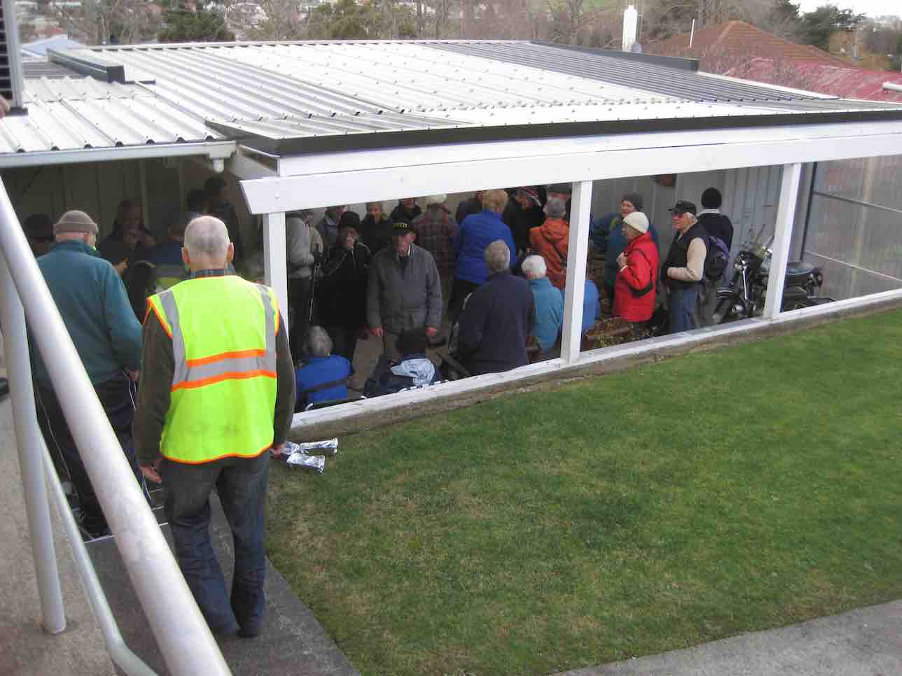
1. 1/7/2015. All. Midwinter Dinner. Concord Tavern. E. Leaders: Elaine and Eric.
GPS Route Map
Well! Records set. At least for the tramp. 40! Yes, 40. And 50 for the meal. Much due, this reporter suspects, to the way Elaine crafted the walk’s publicity. Easy? Well, not altogether with a bit of a climb into Abbotsford maybe a bit hard for some.
First problem was to number the carpark’s milling crowd off, but Fred got it right by standing at the corner by the road. Elaine set off at a brisk pace down …
Down from Inn (John pic)
… the “Main South Road” (surely it’s time to name it the Old Main South Road), around the corner at the bottom and then level walking towards Green Island. Then a stop. Question time.
Q1 (John pic)
Date of motorway completion? Wow. Peter had the exact answer. 1974. Take a prize! Then on. Stop again, outside an imposing gateway. What do the initials IRMO stand for?
IRMO. (John pic)
More knew the answer this time. A prize again. Onward. Stop – outside Harraways Office. Now a generous distribution …
Harraways (John pic)
… of complimentary Oats Singles packets. Take more than one. Onward again. Across rise where most recalled the railway line that once crossed the road. To collect coal from Saddle Hill once, someone said. Last stop, at the curly beginning of the impressive overhead footbridge, spanning Kaikorai Stream, the motorway, …
Bridge (John pic)
… bush, and finally the railway before turning right into Neill Street and left into Matthew Street, and second entrance on our left into a property with a wonderful back covered porch.
Porch (John pic)
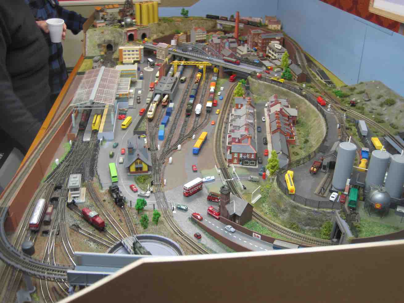
A further surprise. We were regaled with mulled wine or soup served in pottles with generous refills. (A recent email from Elaine says a further whole thermos of mulled wine got overlooked. – Damn, as she so feelingly put it.) Next, in through a door leading under the house to view …
Train set. (John pic)
.. a model train set.( This reporter can testify it was even more elaborate than any he saw at the recent display put on at Wobblies.) It was N gauge (9mm). Unfortunately, the owner didn’t have it going, lest he exposed himself to an embarrassing derailment. Too bad. It was capable of running two trains at once. There’s a wealth of ancillary detail also, all to scale. A close study will prove most rewarding! To this reporter, this is the engineering equivalent of close needlework.
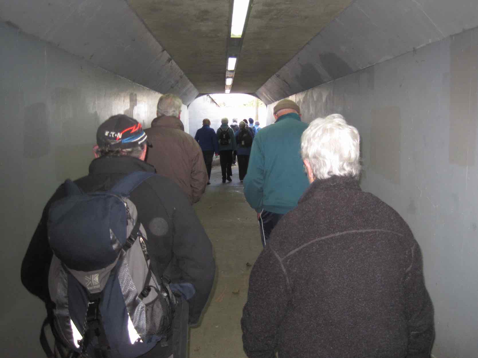
After this wonderful surprise break, it was back down Matthew Street and away along Neill Street to our left to reach a hidden pedestrian underpass at the foot of Armstrong Lane …
Underpass
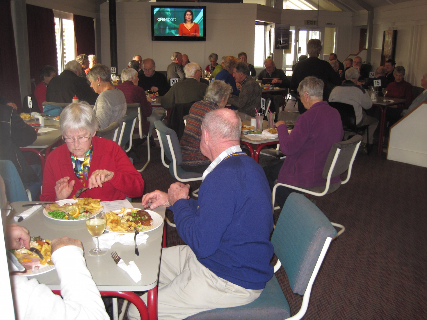
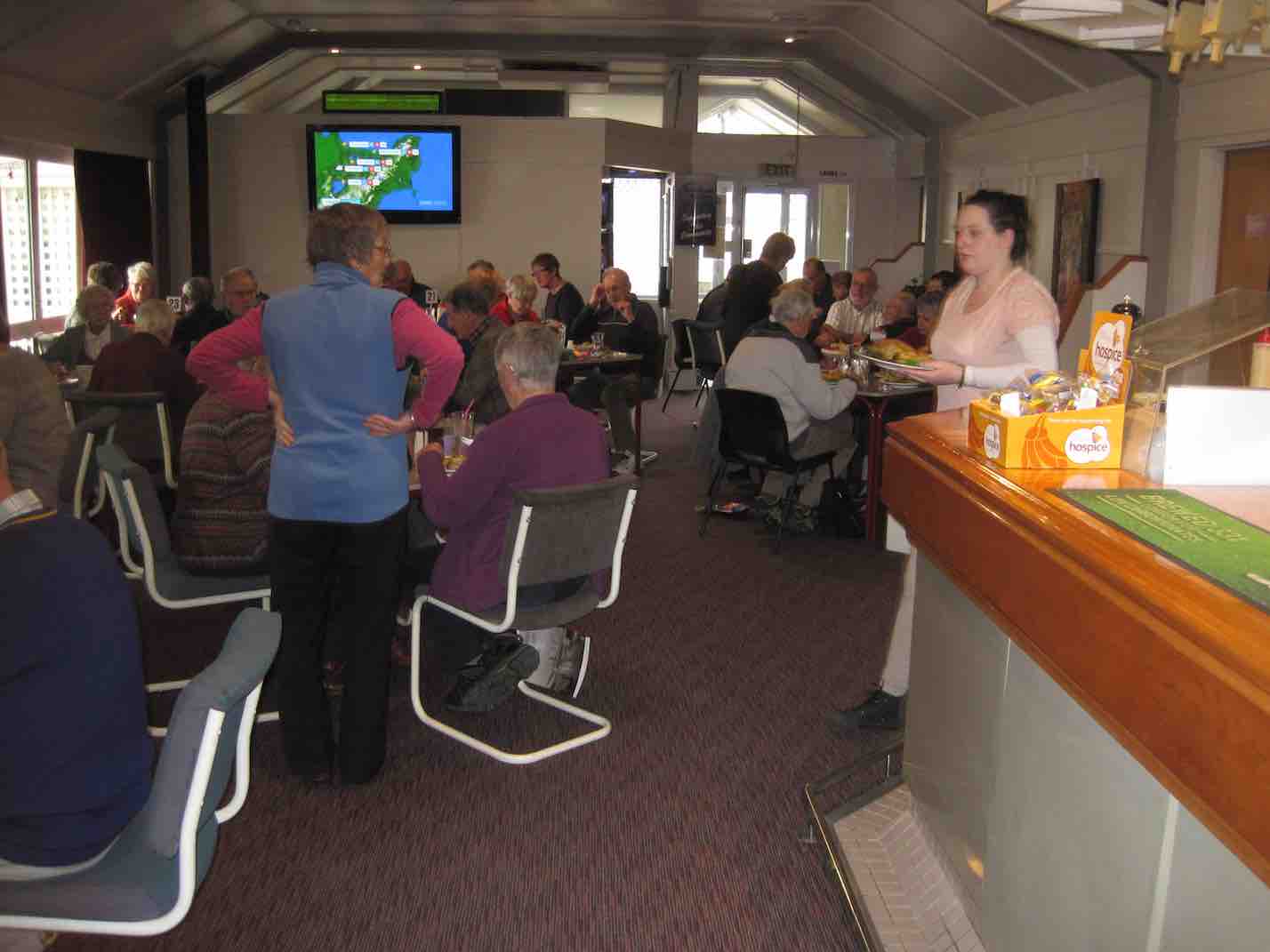
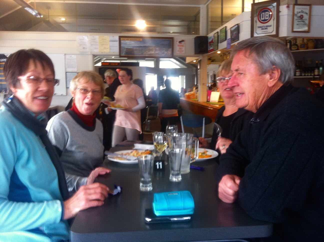
… and to emerge onto a little path that skirted round to the foot of Harraway Road, across a Kaikorai Stream bridge, out onto the “Main South Road” and back to the Concord Tavern for the Dinner. Here we met with the non-walkers and filled an almost overcrowded dining room. Some of us neglected to pick our table first as we found we were supposed to (including this reporter) before we lined up at the servery to place our meal order, but waiters found us eventually and all was well.
Again, due to Elaine’s homework with her sponsors, there were little prezzies on the tables and under-the-seat tickets for rewards. What a girl she is!
So, thanks to Elaine and Eric for such an imaginative midwinter dinner function effort. Well done, to put it mildly. – Ian.
16/8/2000. Concord – Blackhead. Leaders: Les W, Diana and Ray.
26/5/1999 Concord from Tavern to Blackhead. Leaders: Jean, Ngaire, Bev McI.
19/5/1993 Concord Corner, Blackhead, Beach, Brighton Road, Allan Road, Green Island Bush Road. Round Trip. Leaders: Jack, Rosemary, Joyce I, Joyce S
23/9/1989 Concord Hills from Wine and Spirits carpark. Easy+ Leaders: George, Ria L, Pam, Ria H
Five intrepid (or foolish!!) tramper/hikers (of Kepler fame!) turned up for 9.30 a.m. start at the car park in spite of heavy deluge. President Les made a brief appearance to say he wasn’t going, and Lester turned up and left again when he dicovered the furthest we were going was to Topiary Café for morning rather than afternoon coffee. So, that is where Jill, Pat, Judy, Elaine and I duly proceeded [Meaning? – Ed.] to. We sat on the comfortable couches and relaxed and enjoyed coffee, pikelets and stimulating conversation.
5 Happy Hikers on a wet Wednsday (Bev pic and caption)
Back to car park and to own cars and pursuits.
I went and did usual grocery shop and then took 3/4 hr to get to my home in Dunedin, with much aqua planing and “deep river” crossings!!
Better than just sitting at home watching the rain. – Bev.
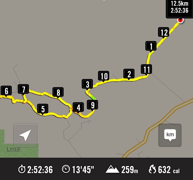
1/4/2015. Both. Neehoff Farm, Hindon. M. Leaders: Ian F and Arthur H.
GPS of route
A goodly number of thirty Trampers and Hikers, as you can see from the GPS map, set off back alongside the road we had arrived in, the Leaders searching for one of several elusive ridges, each separated by bushed gullies and leading down to a main gully at their foot. However, due to their number (six in total!) and too tentatively choosing one ridge too soon but finding it too stunted to be the one, we ended up turning back (about 0.7 kms on GPS map) instead of going on, and descending the ridge futher back only to be forced to have to climb out of the gully beyond its foot (red spot about 1.4 kms on GPS map) and up onto the one originally planned on. By now it was time for morning tea. (Sorry about the lack of photos – we didn’t have John and his camera with us this time.)
On down the right gully now this time and into the main one across its foot, left skirting its side and crossing at a bridge and struggling up the slope directly ahead. (Red spots about 1.6 kms on GPS map.) Then it was on, up to our left, climbing gradually for the most part, through a number of paddocks and gates, until by various turns we reached what appeared a paper road. (About 3.7 kms on GPS map.) This formed a long ascending route to the point where we turned into a paddock again. (About 5.8 kms on the GPS map.) En route, we met up with the Neeehoff farm’s neighbouring owner. He reassured us he had been consulted, but it now became apparent that we had spent more time on his farm than the other! Ah well, another permission to prudently seek next time. It was in the new paddock that the mushroom pickers got really busy. There had been some mushrooms in the first paddocks, but here their number appeared endless. This led to a prolonged hunt by the aficionados while most went on to stop for lunch not too distant from one particular loiterer who shall remain unnamed. (6.1 kms on the GPS map.) Some great mushroom fry-ups would be on the menu that evening!
Lunch stop, waiting for the mushroom pickers to catch up.
Around the head of the gully facing the luncheon eaters, we descended to the big gully again, but here bridgeless, with its water-way just a step (or more in some places) too wide. Many just plunged through, but the tail on the GPS map indicates a walk upstream for the few patient enough to wait to be led to the only dry one-step crossing. (About 6.7 kms on the GPS map.) From there we had to walk back along to our left and the corner of a paddock ahead, and wait for leader Arthur to switch off the hot wire of what we now knew to be the Neehoff boundary fence. (About 6.9 kms on the GPS map.) Once through the fence, ahead lay the long steep slog up the longest and principle of all those six ridges leading back up again, – also the nearest to the homestead. (Kms 7 and 8 on the GPS map.) Now we were back up onto the original paddock and soon back to the cars.
Well, this was one of the now controversial “both” walks, set down for Trampers to join with Hikers the first Wednesdays of the months. It was moderately hard only in respect to the steep climbs out of the gullies. But not particularly long or challenging. There were happily more Trampers than there had been recently, generously tolerating the slower pace of the Hikers for the sake of “Recreational” togetherness and getting to know fellow-club members better. Perhaps the emerging arrangement of this along with a track-clearing option on the same day, is becoming a way through of providing a flexibility of choice for Trampers to exercise in accordance with their own preference. – Ian
20/2/2013. Trampers. Neehoff Farm, Hindon.
22/2/1995. Neehoff Farm, Hindon. Medium. Leaders: Molly, Jack and Rosemary, Eleanor.
25/2/2015 Hikers. Heenan Road to Waipori River. Leaders: Peter and Elaine.
GPS of route. 12.54 km
Thirteen Hikers parked their cars by a Lavender Farm in Heenan Road. The day turned out to be largely a road walk. We walked the length of Heenan Road into the face of a ferocious westerly that didn’t let up all day, and had forced us into our parkas for warmth. We passed the former Wesleydale Methodist Camp site on our right, sighted the paddock corner where the track to Three Kings went into the bush, looked up at Three Kings standing out at the top, and passed the stock shed a little further on, some of us noting that it marked the top end of the paper road that links with the Waipori Road at its foot. But the plan was to continue further to where the Road met up with Munro Road. Turning right into it we shortly stopped in the shelter of a plantation for a brief morning cuppa, the plantation providing a measure of shelter for the wind blast. We continued to the road’s end by a built-up and fenced-off reservoir with its gate wide open. Courious, we climbed up and came across two DCC workmen, one of whom was vainly paddling an inflatable dingy against the wind, eventually managing to get to the point where it could be pulled out of the water. Quite a sight. Forgot to take a photo. Ouch.
Past the dam,the road changed to a FWD track which in turn ended a paddock, down across which we went to a gate at its other end that led down to Waipori Road.
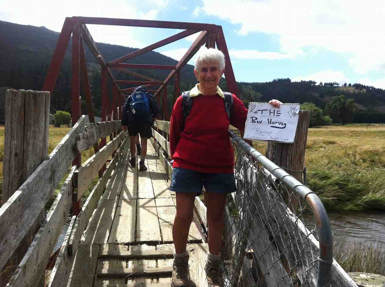
A short distance down we turned into Twelve Tree Road which led us to a paddock, across which was the metal stock bridge across the Waipori River. Peter went ahead on the pretense of having something to attend to, but when we got to the bridge there he was holding up a sign proclaiming “Bev’s Bridge”, due to her being one of the few who could walk across upright without having to bend her head to avoid hitting the low iron cross rods above. (See later pic taken on return trip.)
Instead of turning down stream, Peter led us up, through various gates and paddocks to a patch of bush which provided shelter from the wind as we sat in the sun and lunched.
Lunch
Returning,…
Stock bridge across Waipori RiverThe Bev Harvey Bridge. Caution – Height Limit. (to replace yet another forgotten photo-take on the way in)
…we came out at a different spot on the Waipori Road near the Mill Creek bridge and went along to return up the paddock we had come down earlier. Now with the wind behind us, returning was easier, and an obvious road allowed us to walk at our own rates.
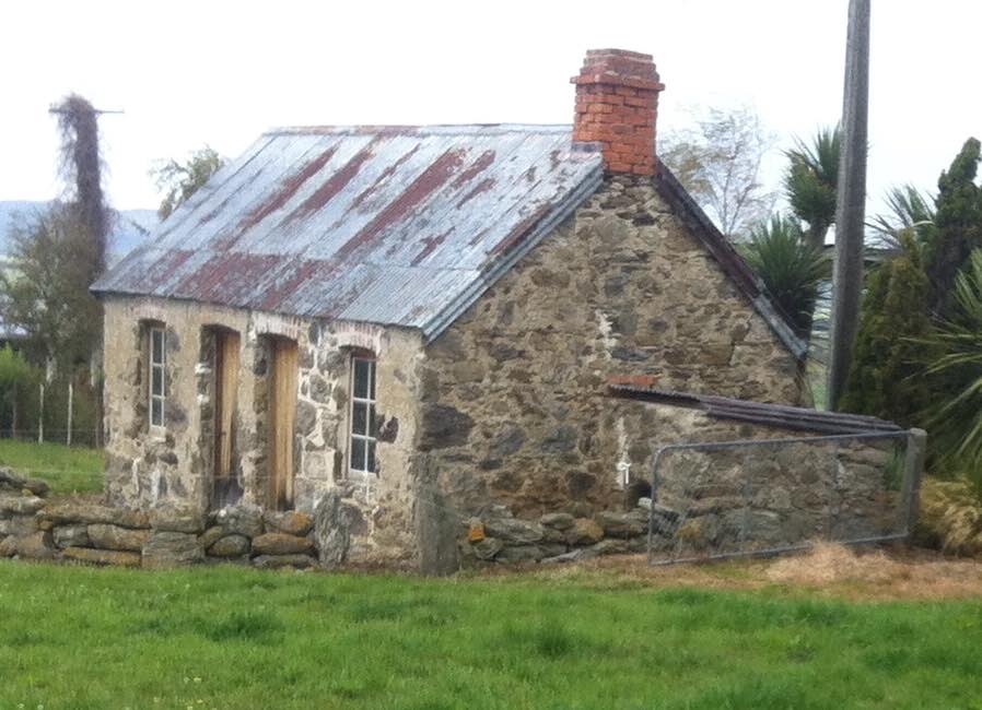
Stone house in excellent condition (another after-thought photo)
Thanks to Peter and Elaine whose excellent leadership was helped by a compliant group, smaller than usual. – Ian.
3/4/2002 Combined. Berwick – Waipori River walk. Medium. Leaders: Bill H, Lesley S, Evelyn C
7/3/2001. Berwick. Waipori River Walk. Leaders: Bill H, Lesley S, Evelyn C.
With lots of lovely tucker, as adventure we did seek.
We drove down to Te Anau – not raining, but it tried;
They gave us our instructions, and a helicopter ride.
Swooping up to Luxmore, …
Swooping up to Luxmore (Judy pic, caption Ed.)
… firewood swung below,
We landed on the helipad, then inside we did go.
Our rooms were nice and cosy, the fire was blazing well.
The views were quite stupendous …
Stupendous view (Judy pic, caption Ed.)
… (and the toilet didn’t smell).
We stacked away the firewood, and made ourselves at home.
(It didn’t seem to matter that I hadn’t brought a comb).
It snowed and blew and snowed again, the rain began to pour.
The sun shone for a little while, and then it snowed some more.
Our week was really busy, we met a lot of folks.
They came from all around the world, (there were some hunky blokes).
We carried water, chopped up wood, and even cleaned the loos.
And in the evenings, by the fire, we sank a bit of booze.
Sinking booze (Selfie pic, caption Ed.)
Our meals were really yummy, (we both can cook quite well).
We wafted to the hut below, a tantalising smell.
DVDs to watch at night, and lots of books to read.
Lots of cuppas through the day, and then, another feed.
Another feed (Judy pic caption Ed.)
Elaine worked the radio, and kept us up to date
With weather forecasts as they came, so trampers knew their fate.
Some of them were ill-equipped, one lot had no food.
Others came with blisters, and one was really rude.
But most of them were friendly, they came with good intent,
Ready to enjoy themselves, and think their time well spent.
Many were from overseas, and thought our country great.
To walk upon our other tracks, they really couldn’t wait.
Judy chopped some firewood – she got whacked on the leg.
Elaine put some ice on, it came up like an egg.
A good excuse for loafing, Elaine did the chores,
While Judy sat with glass in hand, and watched her wash the floors.
We wandered up Mt Luxmore, right up we tried to go,
But didn’t finally make it, because of thigh-deep snow.
Thigh-deep snow? Well, it WAS further up. (Judy pic, caption Ed.)
The week flew by so quickly, with little time to spare.
With such a great experience, we’re going back next year! – Judy, prompted by Elaine.
Ian. An addition from a later date: May 2015 Report excerpt from:
Kepler Kiwi Catching – By Southern Contractors for Fiordland Conservation Trust
“…. we arrived at the hut just after dark to find that our message hadn’t been received and the two volunteer wardens, Judy Knox and Elaine Day, didn’t know we were coming. With 70+ trampers making the most of the first weekend off season and fine forecast Judy and Elaine had bodies on mattresses coming out their ears but they were most accommodating and kindly set us up in the wardens quarters. We fuelled up and headed out at 2000.
…
“We arrived back at the hut just after 0400 for a few hours zzzs on the hut warden’s spare bunk and floor.
“Trip diary: 2nd
“We woke up with the light but were feeling quite jaded after the big night and less than three hours sleep and so we didn’t make it out the door till 1045.” – Ian.
6. 15/9/2014.
Just been reading some of your website on this short track. You may like to know that when we were talking to the gentleman at the museum last week, he told us that the track was put in to take supplies of piping etc up the burn for the Outram water supply. Also, if you go to the end of that track, & then cross the burn, there is a track up the other side, & up there is a valve, & some old piping. So it seems that the track has nothing to do with the old mill that was there, as it got it’s water from the race that you & I found in the paddocks above the road.
He has some old photos of the area as well, but they are not very good ones. There is also a water wheel [working] at the museum, which I think he said was the old mill wheel. – Ken
After a cool start to the day, the weather warmed up, & we had a good walk along the Outram Glen track to Lee stream, [where we discussed the possibilities of crossing the stream without getting very wet] & back. We had a couple of stops along the way, one was with the owner of one of the houses up the Chalkies track road. He tells us that the grumpy one has now gone, & the new owners are quite ok with groups like ours going down [or up] the track through their properties, then down [or up] their driveway. I think permission should still be sought first though, especially for the first time at least.We arrived back at the car for lunch, & then proceeded along to the short track that runs in from the one way bridge at the start of the George King Memorial Drive. this was a new walk for some in the group, & started up a discussion on the old mill that used to be there.
On the way back out, we decided to go up into the museum grounds, as this was also new for some in the party. We struck up a good conversation with one of the gentlemen working on the site, & he was most helpful with info on the old mill, it’s whereabouts, & where to find some old relics.
We arrived back at the carpark, just before the hikers returned.We walked approx 12.5km [didn’t take the GPS on the short track.]
ave. 4.2km/hr. – Ken.
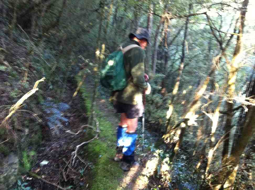
4. 5/5/2012. Whare Creek Outram Council weir. Ken and Ian.
On a fine Monday afternoon and with permission and advice from the landowners, we explored down the bush track below the power lines to arrive at the water race that supplied the water that drove the old Outram Glen Flour Mill back in the early 20th Century.
The Outram Glen Flour Mill water race.
Following the pink markers brought us to the point leading steeply down below the race to the creek and a weir. From Jim Sime’s later information, this was the Outram Council’s weir and pipe line to supply water for the Outram Water Supply tank, located above the Taieri Museum, now no longer in use. The weir was designed so that flood debris would wash right over it.
Old Outram Council Weir and piping, no longer in use.
Mr Sime said that the Flour Mill water race, higher up the bank, which he explored on an earlier occasion, leads on for a considerable distance to disappear at the face of a rock bluff, with no indication evident of how the fluming would have had to have been attached to the sheer rock. Mr Sime thinks that a pool yet further upstream at a streams’ confluence may well have been where the race might have begun.
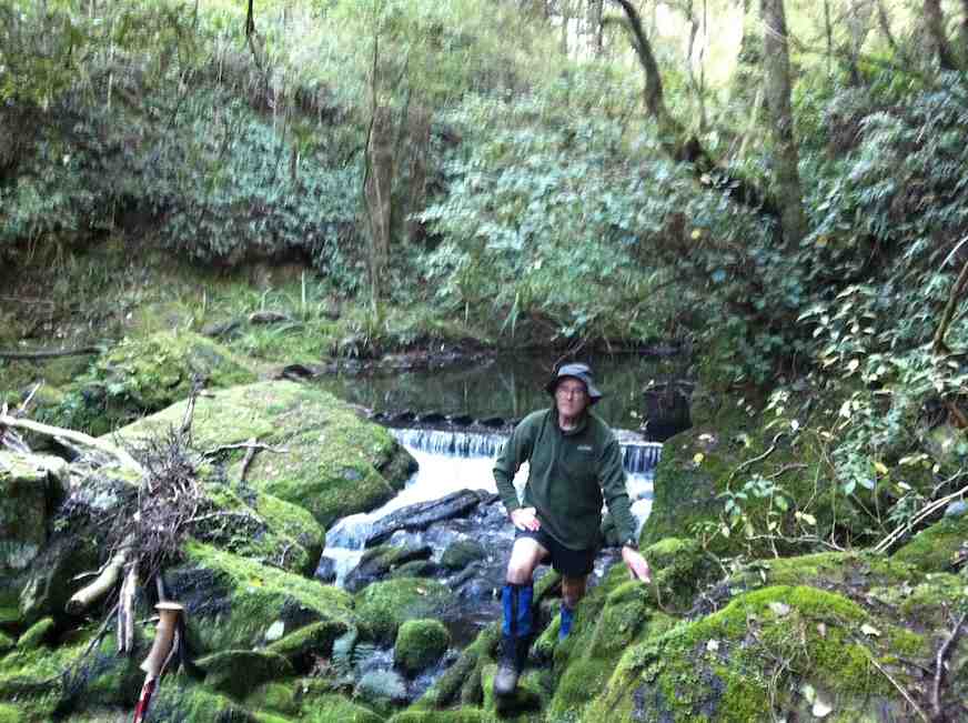
Ken at the weir.
Ken pic. Upstream from the weir, the creek winds round to the left.
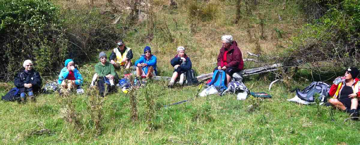
Seven of us took to the Outram Glen – Lee Stream track on an overcast & cool morning. We decided to have morning tea at Lee Stream, so we set off at a good pace, & we soon warmed up. The sun was out at Lee Stream, so a leisurely break was in order. We made our way back to the glen where we had lunch, & then we moved the cars down to the Traquair Burn bridge.
We made the short walk to the start of the Traquair Burn track & along this to the end, where we did a bit of exploring up the small tributary stream on the left. This quickly ran out of easily negotiated terrain, so we went back to the track end, & Ken went exploring up the Burn a bit further to see if it was possible to go upstream.
We returned to the cars via the Outram machinery museum grounds, where we had a good look around. – Ken
Six trampers turned up at the car-park following a very stormy night to learn that the leaders, Ria and Hazel had, happily as it turned out, decided on Outram Glen instead of Whare Flat. They had carried out three Whare Flat recces only to find on each occasion tracks too overgrown to clear. We were delighted to find the reported upgrade of the initial flat (mostly) part of the Outram Glen track had been widened and metalled making for two-abreast walking. The remaining steeper bit however was literally, according to a DoC notice, “maintained to only route standard”. It was! But we made good progress arriving at the Lee Stream terminus at 11. It was there that Doug and Hazel discovered wild potatoes
Gathering potatoes near Lee Stream outlet.Bush by Traquair Creek
of a very good size which Doug lugged back down the track for his meal table.
We lunched below the Taieri Historical Museum area prior to exploring a newly-cleared track up alongside the Traquair (or Whare) Stream – a new discovery for most of the group. Ian recounted how his Grandfather and family had owned the Flour Mill in a small area across the stream from 1911-1913 (the original Outram Glen), now buried under the present road corner alignment: a place once renowned for its gardens and picnic area for locals. Two houses, a mill, a fountain and an electric generator (which had earlier powered Outram’s street lights) as well as gardens had occupied the area. The buildings were destroyed by fire in 1918.
Fallen coloured deciduous leaves on an open area of the track would have kindled a painter’s imagination. We returned from where the track finally petered out, left wondering where it might have continued to in the past. Another satisfying day. – Ian
10/9/2014 Street Walk: Hikers. Patmos Avenue, Pine Hill, round trip. M. Leaders: Bev and Adrienne.
Route. Cars, Patmos Ave, Maxwelton St, Pinehill Rd, Abbeyhill Rd, Cambells Rd, Hillary St, Dover St, Pinehill Rd, Fea St, SH1, George St, Woodhaugh Gardens, part Woodhaugh St, Lower Ross Creek tracks environs, Malvern St, Cars.
23 hikers left cars in Malvern St on a sunny no clouds day. No wind either.
We made our way up Patmos Ave, across the over-bridge of the motor way and on to Maxwelton St.
Does anyone know how this or who this street is named after? Somewhere on this journey we stopped for morning tea.
We passed some very old buildings on the way and there are some historical houses of significance from the
early days. At the end of this wee story there should be some web sites listed than you can pursue if you wish.
At the end of Maxwelton St we moved over to Pine Hill Rd.
Dunedin panorama; taken from Pine Hill Rd up behind Pine Hill.
We travelled down to 444 Pine Hill Rd and then up an alley onto Campbell Rd and then continued on down hill. Love down hills!
We arrived again at Pine Hill Rd. Lunch was at a small park.
Lunch at recreation area next to the Pinehill Ruldolph Steiner Kindergarten.
We walked on down to Woodhaugh Gardens. None of us got run over on the way.
Woodhaugh Gardens Leith River walk.
Woodhaugh Gardens are a pleasure to walk thru. My parents told me that in 1923/4 they did all of their courting there.
That was what it was called. The bird life was great to listen to. Walking thru the tracks in the gardens we passed the old quarry that closed in 1949 … and the old pub on the corner of Malvern St and Woodhaugh St was only open from 1888 till 1892. This hotel is getting a major makeover, which is good.
The views we had today looking over Dunedin are well worth the climb and the leadership by Bev was awesome even though she didn’t look like a hiker. Too well dressed in her high viz vest and pink nails. Adrienne did a good back up. No one and I mean NO ONE got behind her. Don’t forget to check out the sites. – Elaine.