Lake Mahinerangi. From Eldorado Track, Cox’s Reef, Cosmopolitan battery, Timber Gully Waterfalls, old gold workings. (data lacking)
No. 8 on old hardcopy list of 113 club tramps. “Ship & Anchor. Lake Mahinerangi. George. Year round.”
No. 3 on old hardcopy list of 113 club tramps. “Eldorado Track. (Waipori.) Year Round.”
50 km from car-park. ( 54 km with Eldorado Track. Locked gates. Key from DCC Water Dept.)
Long tramp. Tussock now heavy. Summer too hot? Autumn may be preferable.
 14. 24/01/2024. Trampers. Ship at Anchor. Grade 4.5.
 $14. Leaders: Phil Keene/
Gary Mort Lyn Keene.
18 keen trampers turned up and left right on time at 8.30am in 4 vehicles, stopping briefly in Outram for tramper No 19, then travelled through the rolling uplands to above Lake Mahinerangi, before turning right up the El Dorado track, right to the end, through mobs of daggy sheep, the windfarm, the Blackrock Scientific Reserve and finally through the locked gates of DCC 3 Waters with the cameras keeping an eye. Ross was in charge of the key and maybe had a pinch of hypothermia by the time he was back in the car. Brrr would we find our riches at El Dorado?
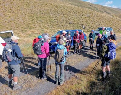
Some Words From The Wise, Before We Set Off (Photo & Caption Ross)
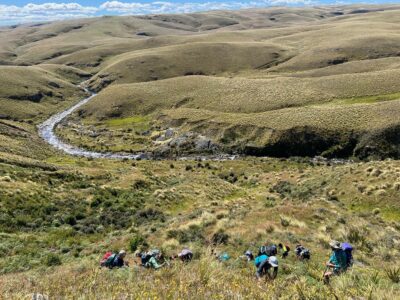
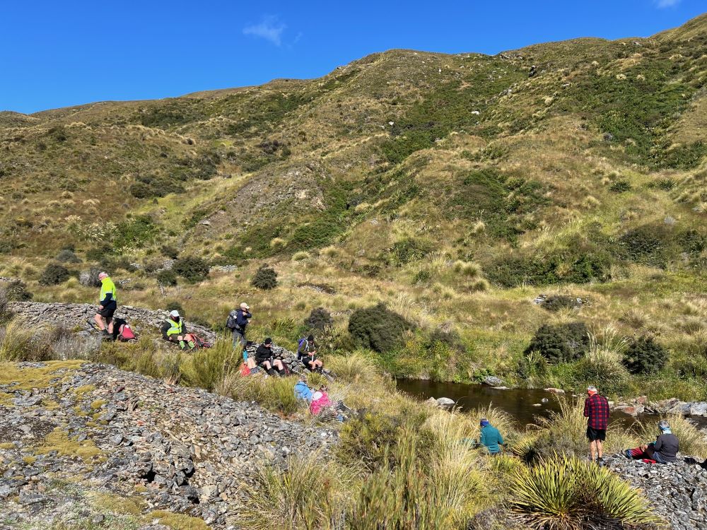
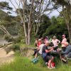
It was 10am before we set off walking, the group happily forgoing morning tea until we arrived 45 minutes later at the Chinese Diggings situated on the east bank of Deep Stream which was up a little following rain the prior day.
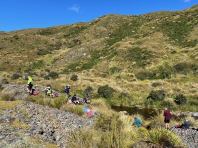
Fuelling Up At Deep Stream Before Ascending The Hill Behind (Photo & Caption Pam)
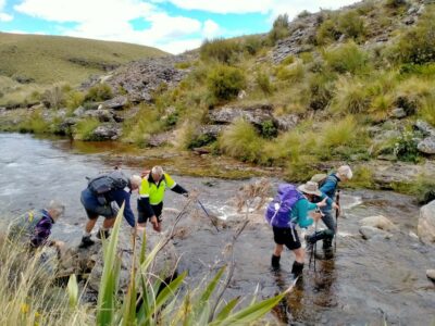
Mmm NZ Topo 50 is telling us we have to go west and will have to cross. The thought of this seemed to necessitate a continuous stream of walkers, single file, into the bushes. Thankfully they all came back and with a little help from our friends we all crossed, with wet feet and knees to the other side.
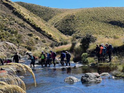
“ Follow The Leader” Across Deep Stream (Photo & Caption Pam)
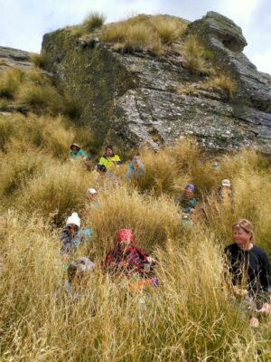
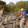
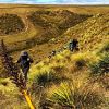
Thus began a steep ascent with a new pathway selected every few steps, not to mention the need for a breather at fairly short intervals!
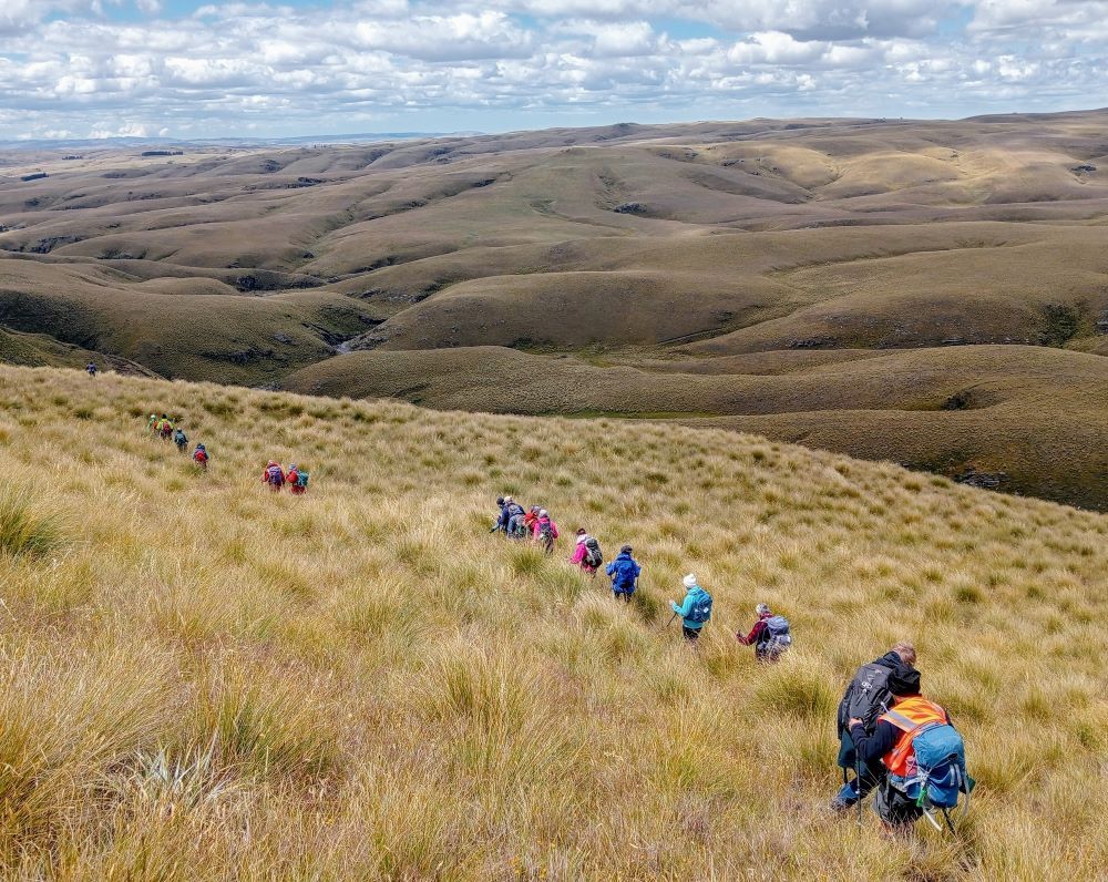
Scrambling Up The Lammermoore’s To Admire The Expansive Landscape (Photo & Caption Pam)

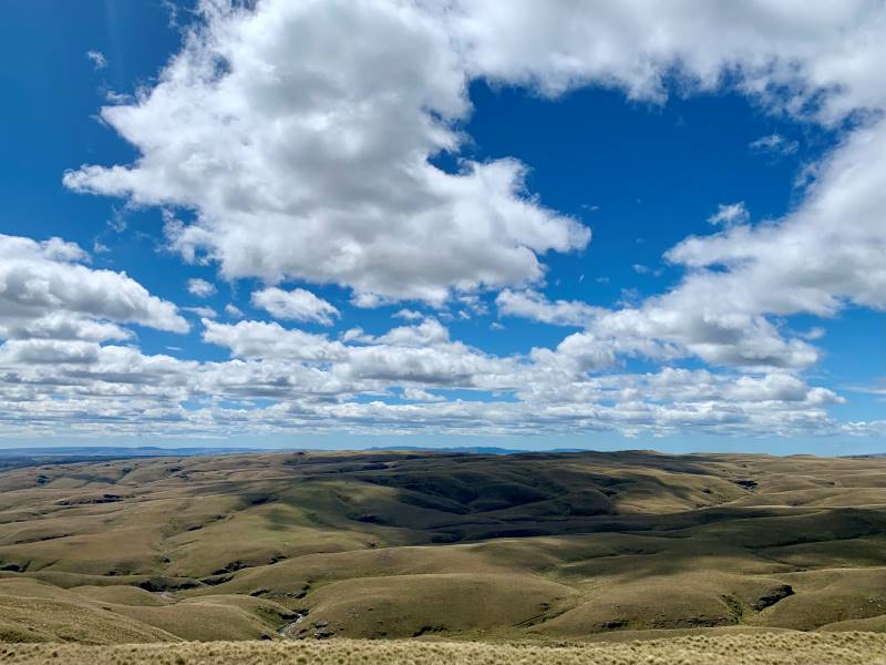
A Big Sky With Cloud Shadows On The Land (Photo & Caption Marijke)
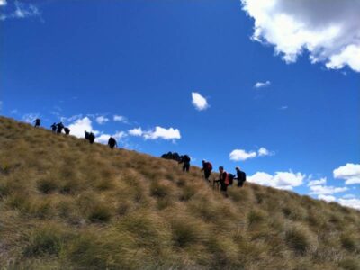
Climbing Every Mountain (Photo & Caption Phil)
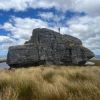
The ascent was followed by steady to steep ridge-line walk keeping to the true left of a stream, before crossing over nearly at the head, and finally over the last brow of a hill to arrive after 2 hours from morning tea, of fairly serious tramping, at the Ship at Anchor;

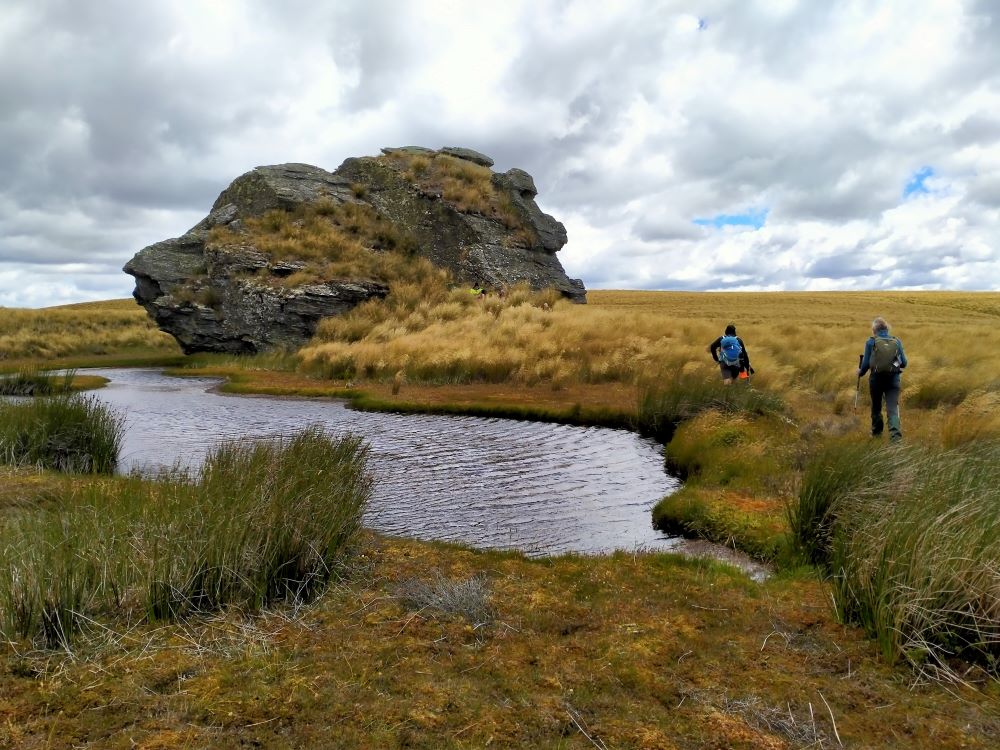
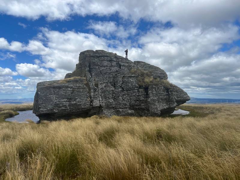
At Last The Ship At Anchor (Photo & Caption Phil)
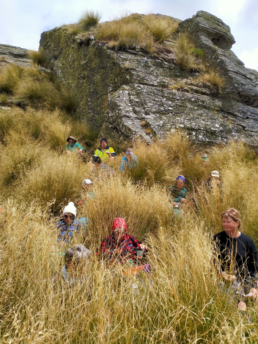
Lunch In The Lee, Sheltered By Tussock (Photo & Caption Phil)
thankfully we had not missed the boat and it provided good shelter along with the snow tussock from the fresh westerly that had been present all morning.

Appropriately Named “ Ship At Anchor “ (Photo & Caption Pam)
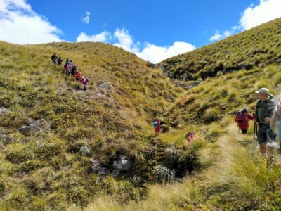
Our departure was not too long with those who had not previously been here circumnavigating the Ship and we all followed a course on the true right of the stream down another ridge-line, initially made ‘easy’ by a water course shaped I think by ancient shovels?

Heading Down The Highway (Photo & Caption Ross)
With the possibility of a precipice emerging in front our leader tacked left just in time onto another ridge that steeply descended towards a man made watercourse, scout Graham finding the appropriate gang plank onto the other side. It would be fair to say knees were now creaking as we traversed parallel with the contours dropping every now and then towards the crossing of Deep Stream. According to the leaders timepiece we took longer down than up, just like the Grand Olde Duke of York……oh dear!
Mmm Did It Take Longer To Go Down Than Up (Phot & Caption Phil)
If feet and knees were by now warm and dry they were wetted again and with all crossing safely we re-grouped and took off up the prairie back to the cars, this being quite a steady upland walk!
If You Start With Wet Feet You Might As Well Clean The Boots Again When You Finish, Gentlemen Abound (Photo & Caption Phil)
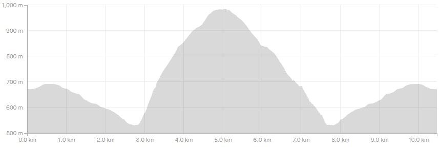
We departed paradise at 4.30pm arriving back in Mosgiel at 5.30pm. Rumour has it that the hydrotherapy pool has been busy since the trip, no wonder. The expansive and varied landscapes are so much more rewarding when set in such a remote and wild environment. Because of the access restrictions at the Weir this was the first time travel to the Ship at Anchor had been done this way. Distance 10.47km, elevation gain 661m, moving time 3:25;59, calories 1,016. And I’m sticking with grade 4.5.
Thanks to everyone for supporting each other so well.
Phil K
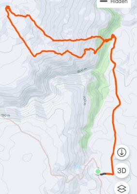
Ship at Anchor route (Screenshot Ross)
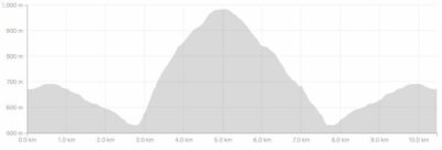
Ship At Anchor Profile (Screenshot Ross)
Continue Reading »
 18. 24/04/2024. Hikers. Graham’s Bush/Organ Pipes. Grade 3. 27 km. Leaders: Maria MacNee/Theresa White
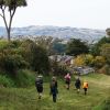 32. 24/04/2024. Trampers. Frasers Road/Southern Resevoir. Grade 2.5. 16 km. Leaders: Gwenda Farqharson/Graeme Souter
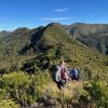 9. 17 April 2024. Trampers Rosella Ridge. Grade 5.5 Leaders: Ross and Neil
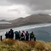 25. 27/03/2024. Hikers. Sandymount Grade 2.5 Leaders: Jenni and Bruce Wright
 13 trampers had a “Rock Day” beginning with rock music at Peter Johnson Park where athletic sports were about to start.
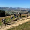 18. 14/2/2024. Trampers. Maungatua Option. Leaders Lyn Keene, Anne Ward and Di Bezett
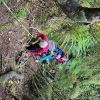 11 trampers left PJ Park at 8.45 and meet up with 5 Dunedin trampers on Borlases’s Road, Port Chalmers. We continued onto Blueskin road in misty weather which got thicker as we drove up to park 1km north from Cedar Farm Forest carpark (CFF) A car was left at CFF carpark to ferry drivers back to their cars at the end of tramp.


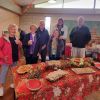 The overnight rain cleared but a fresh wind stayed with us for the day. The venue at the North Taieri Church hall proved nice and comfy and just the right size to encourage plenty of chat, especially as it was decked out in the Xmas theme – Folk came and deposited fine finger food, 3 tables of main, two tables of sweets!! Very appetizing.
 43. 06/12/2023. Trampers. North of Tomahawk. Grade 3. $7. 22km. Leaders: Esther Willis and Julie McKenzie
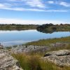 13. 06/12/2023. Hikers. Sutton Salt Lake – Glencreag Track. Grade 2.5. $16. 60km. Leaders: Wendy Langley/Katrina McKenzie
 18. 22/11/2023.Hikers. Millennium Track from Henley Ferry Bridge. Grade 3. 27km. Leaders: Ady Whitson/Bruce Wright.
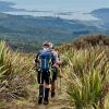 35. 22/11/2023. Trampers. Burns/Rustlers Ridge. Grade 4. 25km. Leaders: Phil Morris/Carolyn Pridham.