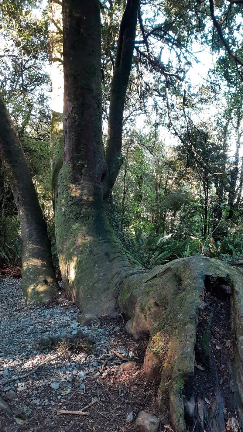
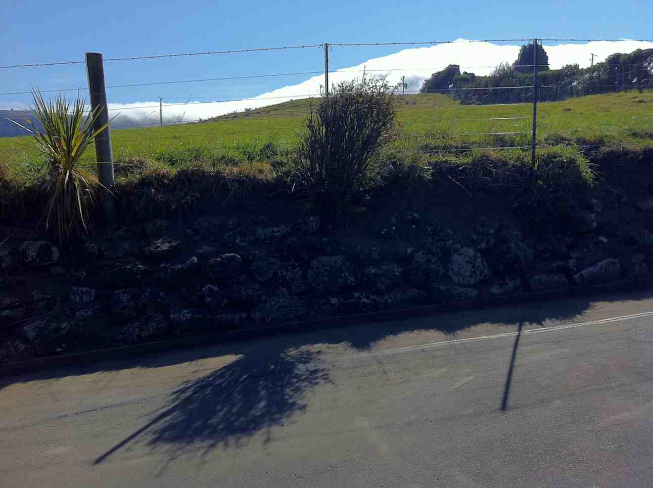
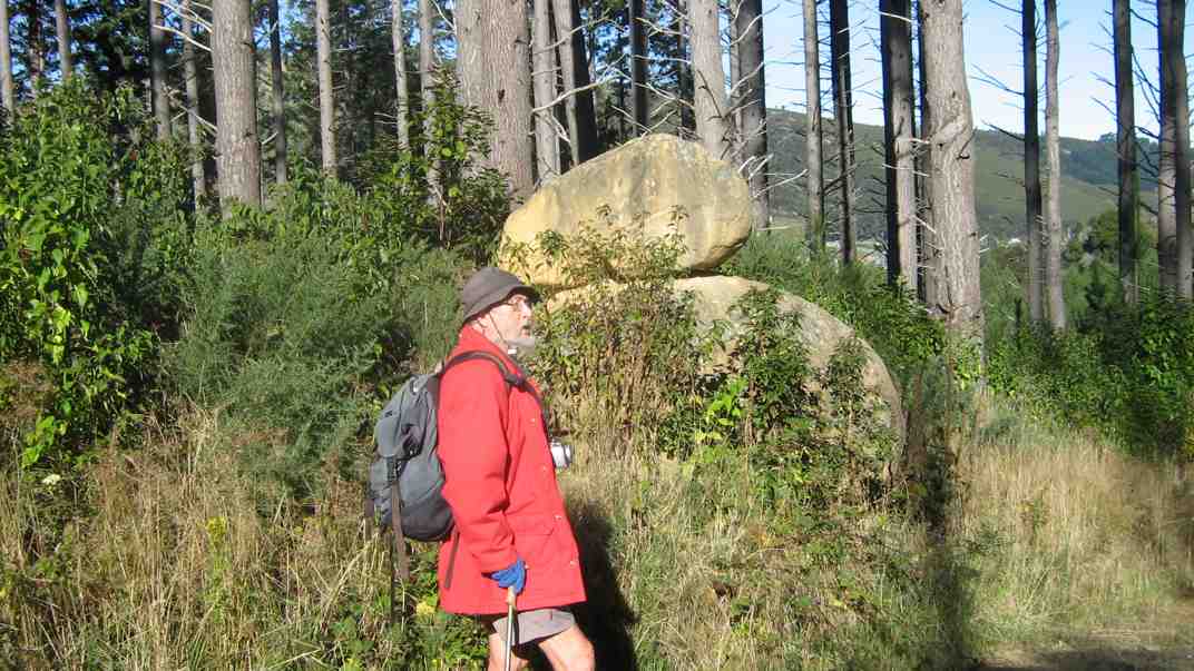
(David Nicol was an early settler and dairy farmer. He reputedly bought land here in the hope that the railway line would be routed north through Leith Valley.)
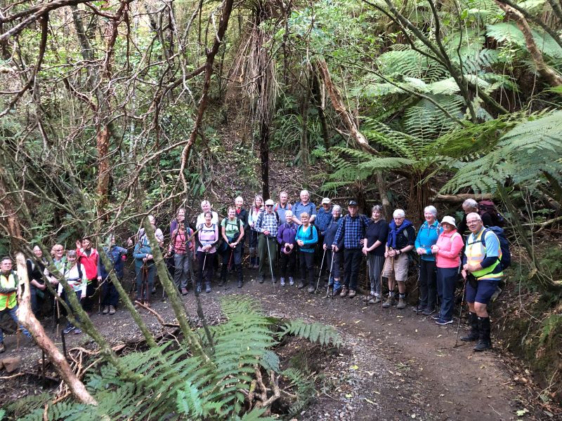
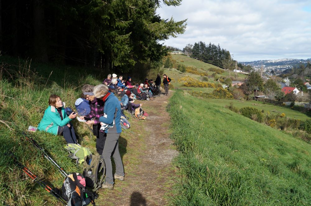
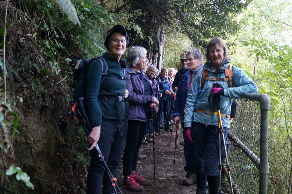
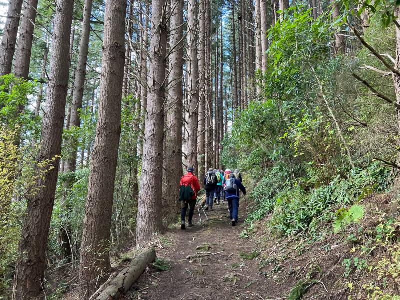
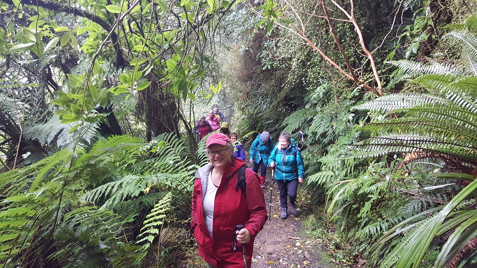
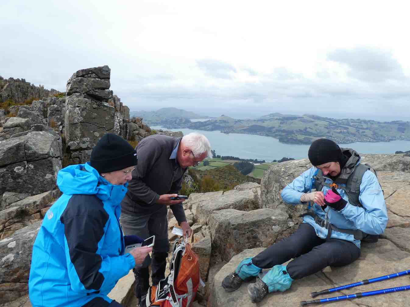
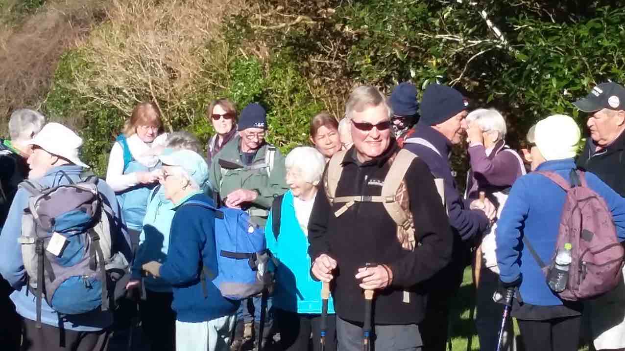
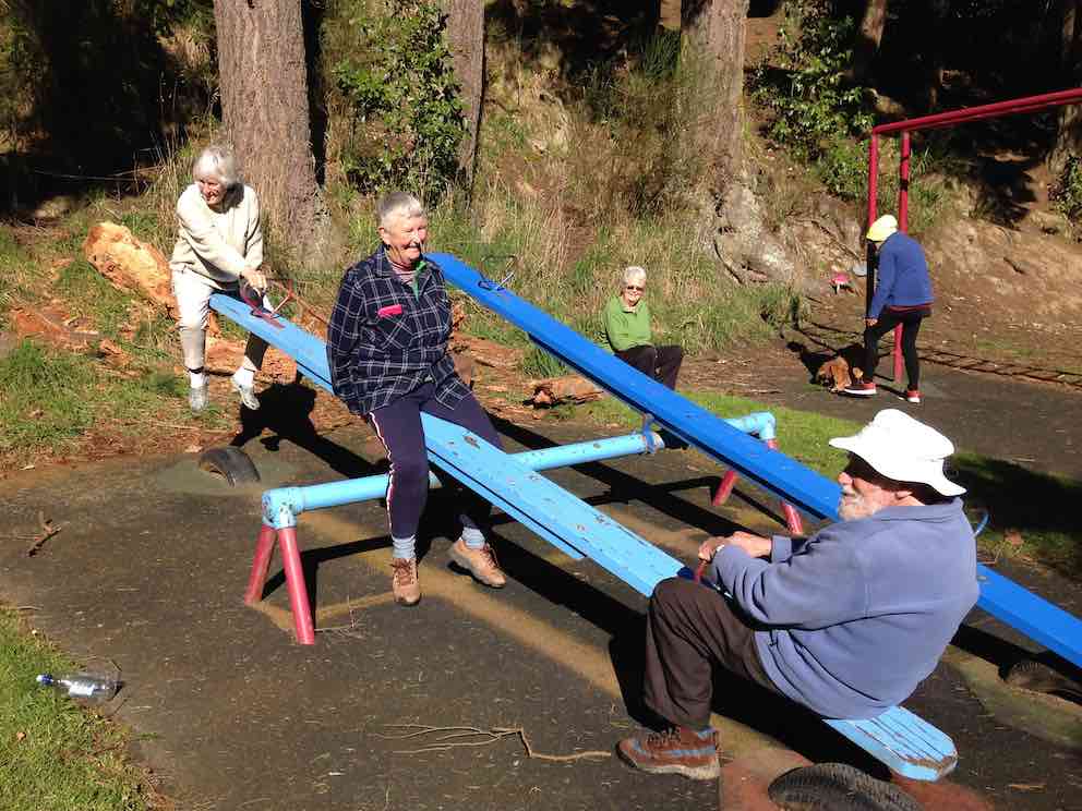
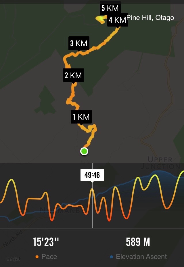
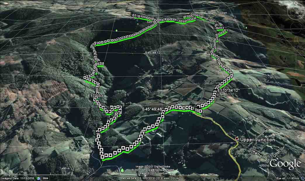
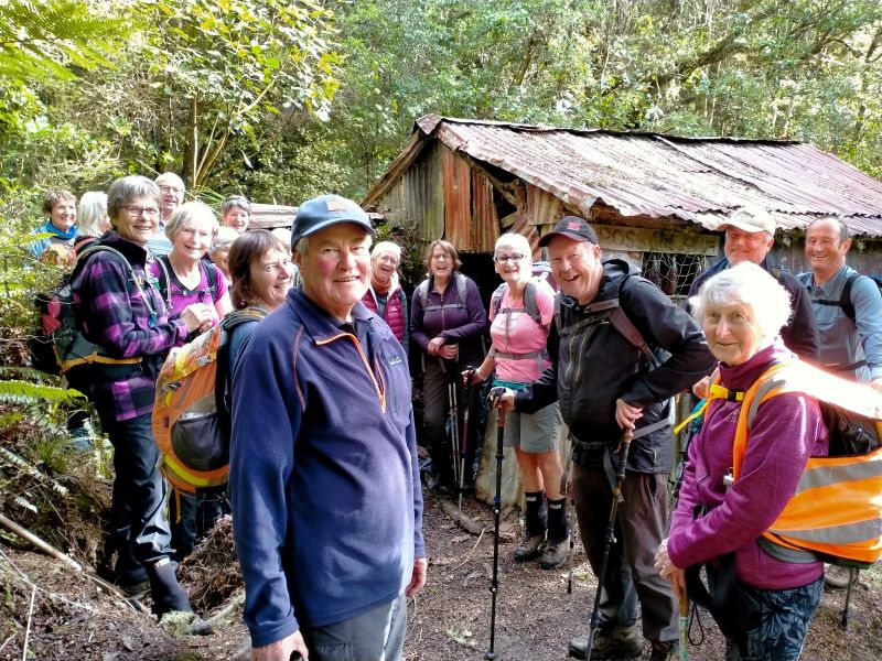
27. 30/08/2023. Trampers. Pineapple Track-Nicols Creek Grade 3.5-4 Leaders: Sarah and John
An Interview with Pineapple Track/Nicols Creek Tramp Leader Sarah by Tail End Charlie, John
Hi Sarah. You were a late incumbent to the leadership of this tramp?
– Yes, Ross was originally down to lead it, but back problems meant he asked me to lead it instead. (Best wishes for a speedy recovery Ross.)
Did you do a recce the Saturday prior?
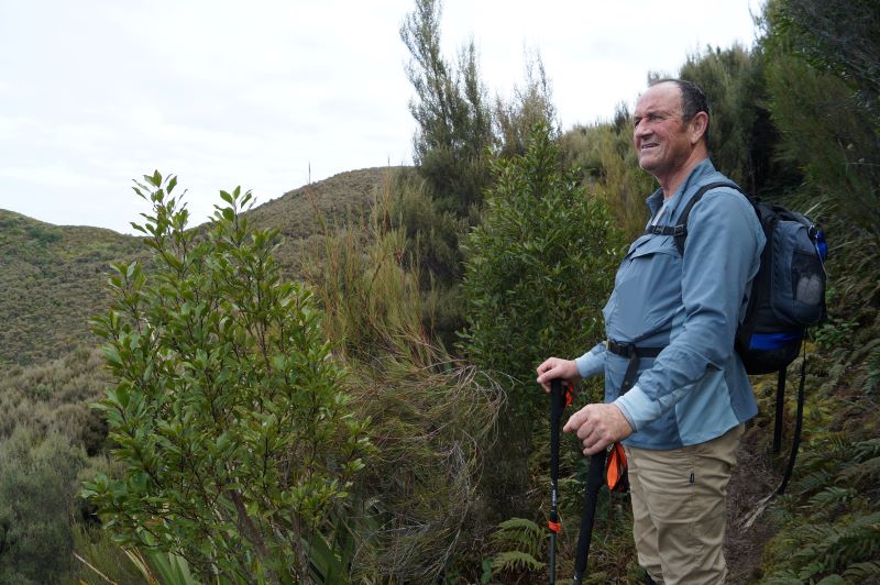
– That’s right, Craig went mountain biking, and I went exploring on foot, in the area, to finalize the tramp format.
Were the group lucky with the weather on the day?
-The weather was brilliant. Sunshine, little or no wind and temperatures towards the mid-teens. The tracks were reasonably dry.
And did we have a good attendance?
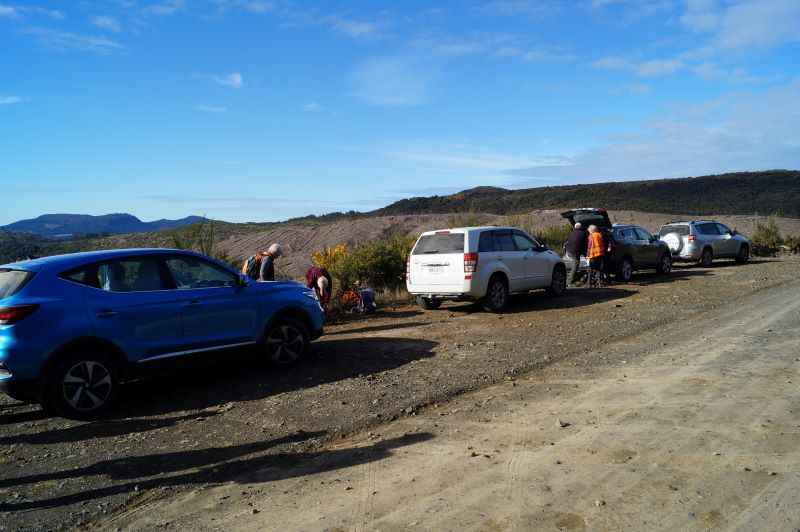
– There were 18 of us – arriving at Tanner Rd/Fulton Rd corner in 7 cars.
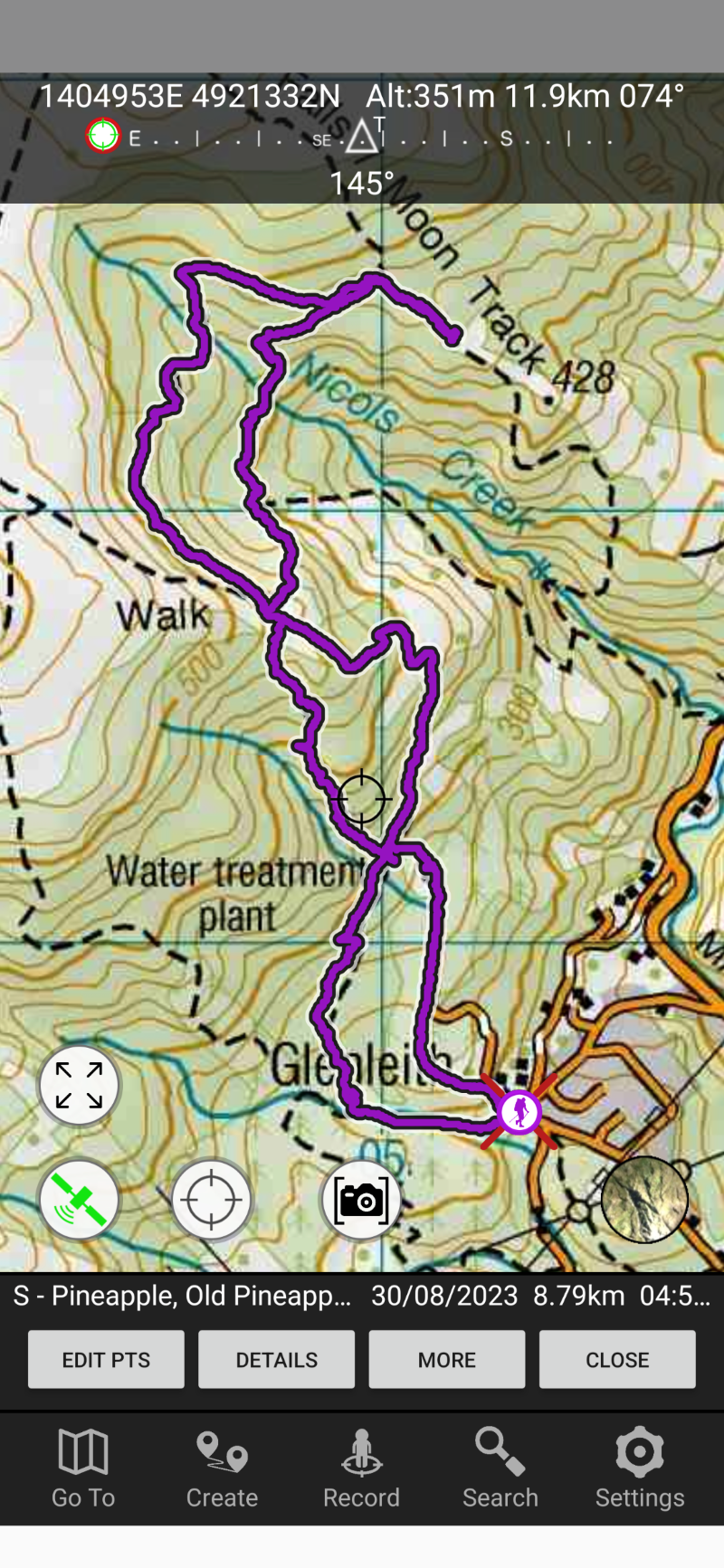
What was the tramp route?
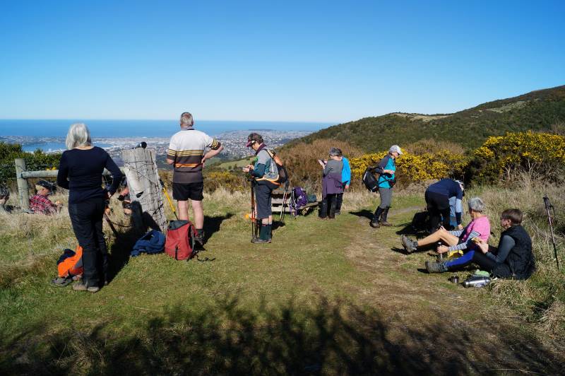
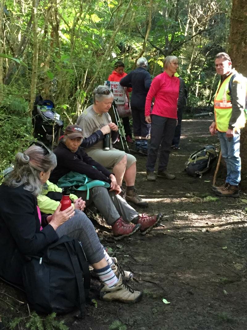
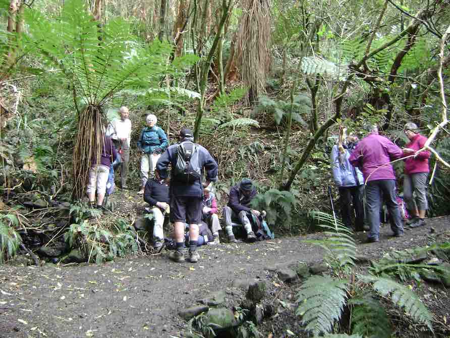
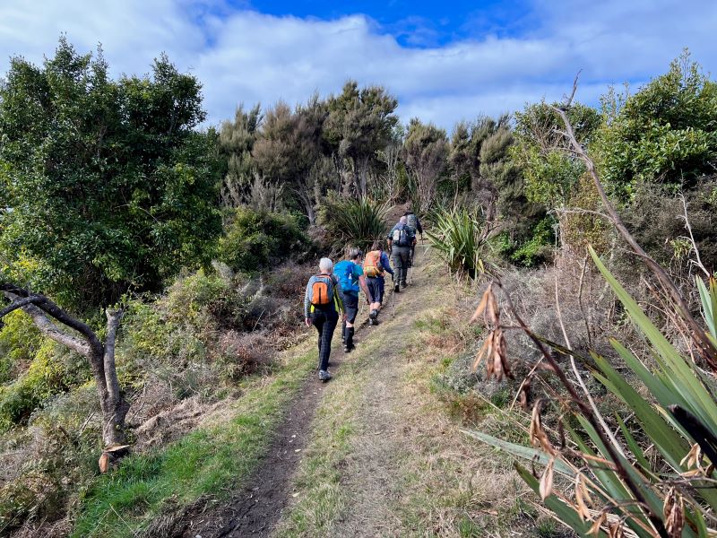
-We started on the Pineapple Track, walking up to the Pump House for morning tea.
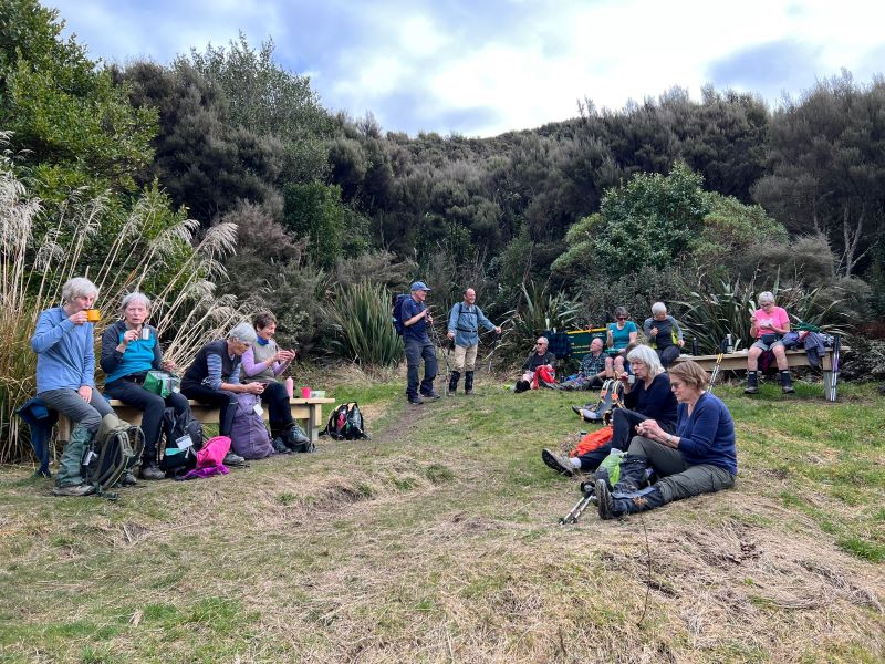
Getting ready for morning tea in the sun Caption and photo John
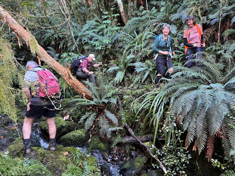
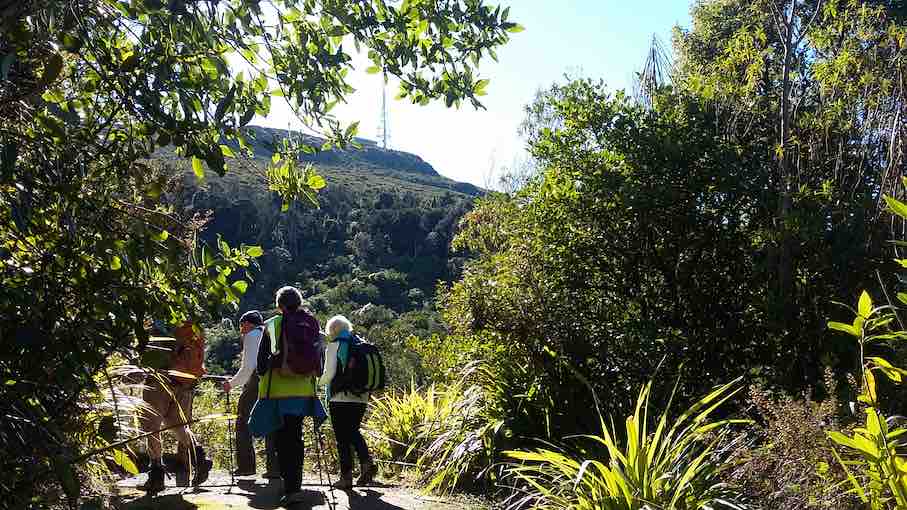
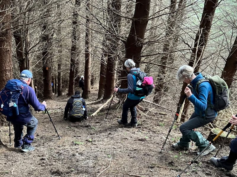
Then we carried on up the Pineapple Track, turning off at McGouns Track onto the Old Pineapple Track. This led us to the “new” Pineapple Track by Pineapple Point.
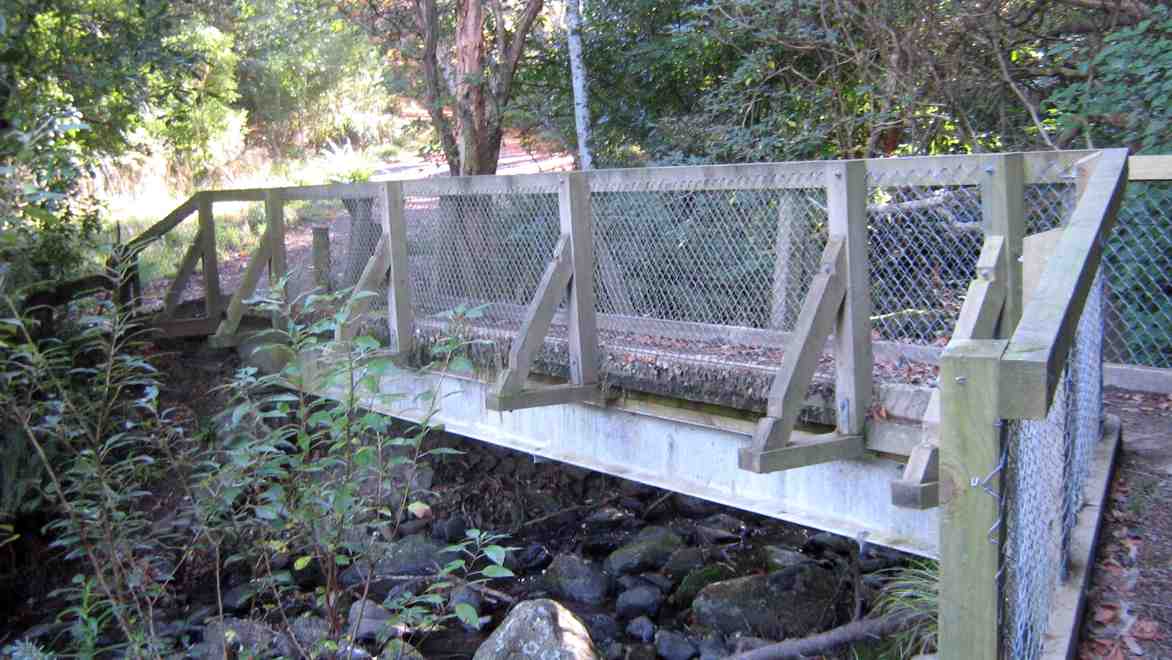
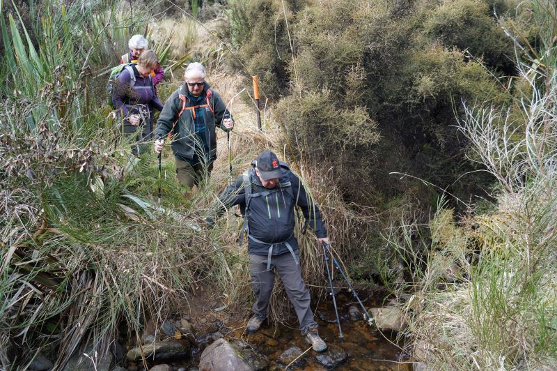
crossing Nicol’s stream Caption and photo Pam
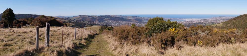
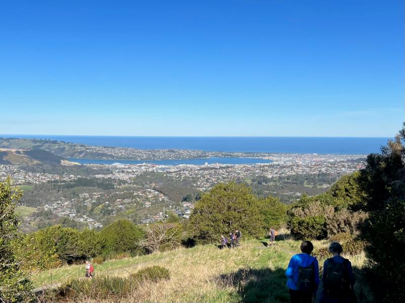
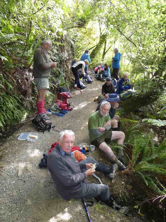
From here we followed the lower track, traversing Nicols Creek before arriving at the Mountain Bike picnic table at 11.55am for lunch.
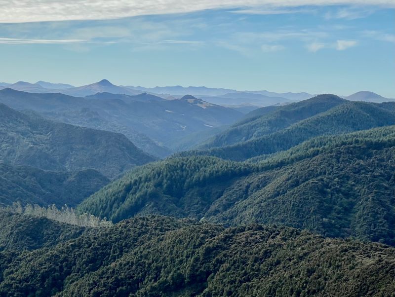
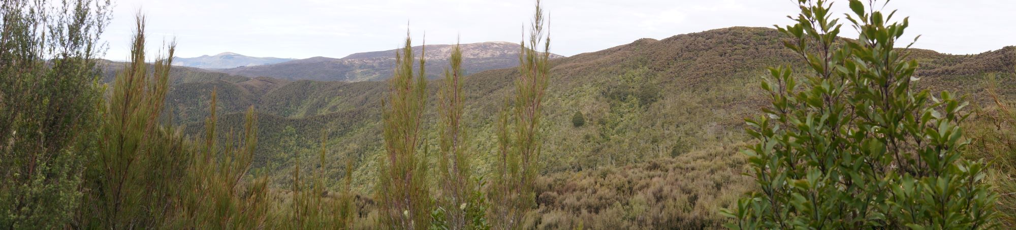
Lunch with a view worth taking in Caption and photo JohnPanorama – View from lunch spot. Caption and photo John
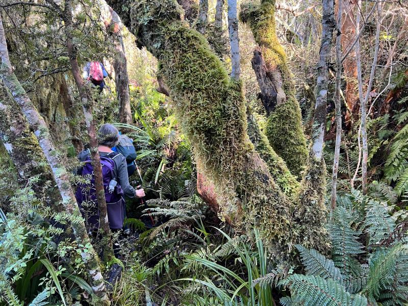
After lunch it was onto the upper track, traversing Nicols Creek.
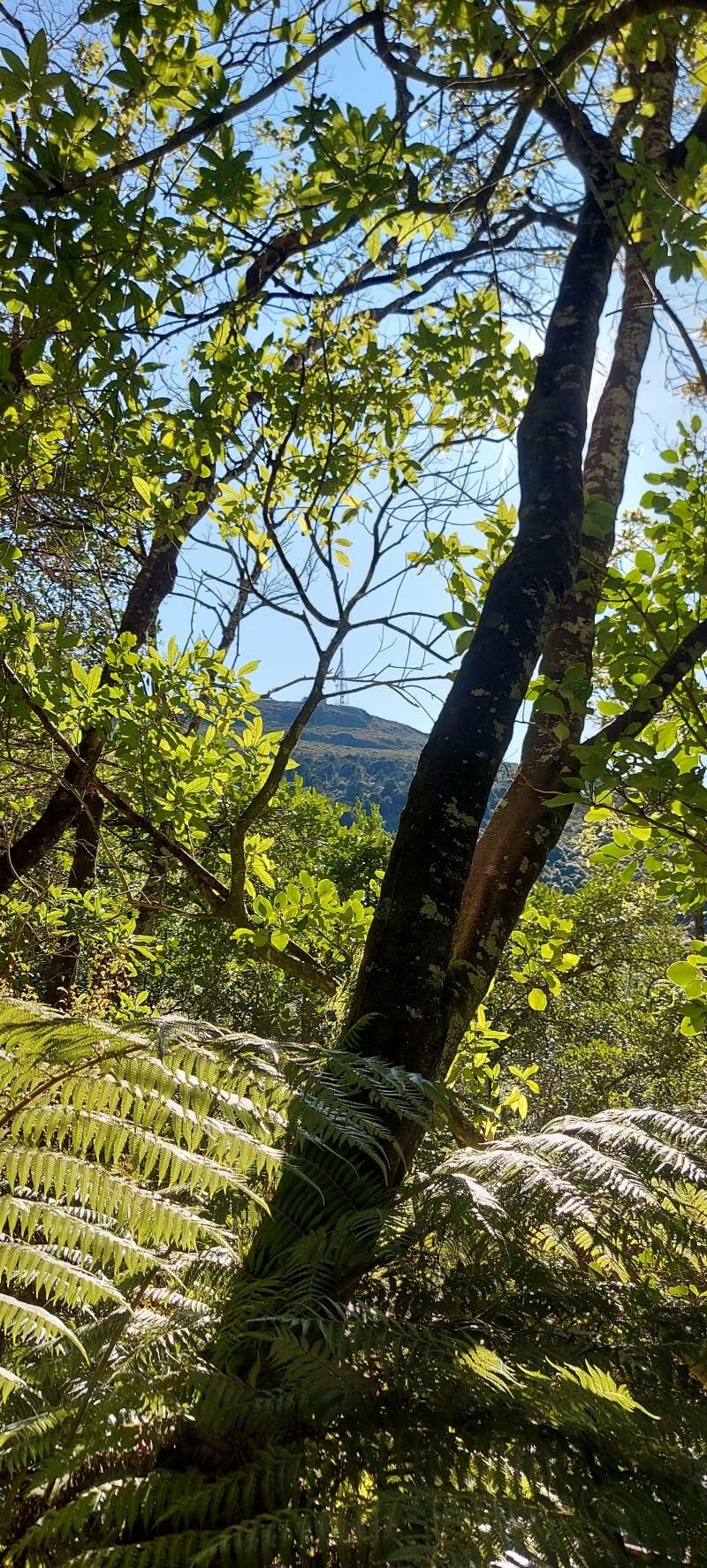
somewhere in the bush! Caption and photo Pam
Then onto the “new” Pineapple Track, and back to the cars via McGouns Track.
Heading down the pineapple track Caption and photo Pam
Wahl!! I think you lost me somewhere there! Did the tramp take long Sarah?
– The recce only took me 3 hours. On the day the tramp took us much longer at 5 hours. Some technical terrain reduced the tramp down to a crawl pace in parts.
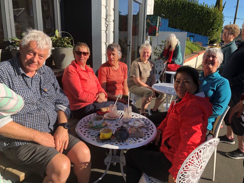
Did you manage to squeeze in coffee afterwards?
– Only just. We were back at the cars by 3.00pm, then headed straight to the Fire Station Cafe’ in Roslyn.
How would you describe the shape of the tramp?
– Roughly a double figure 8.
Sounds lucky, I think? Thanks for the interview, Sarah.
23 km from carpark. Cars meet at Bethunes Gully.
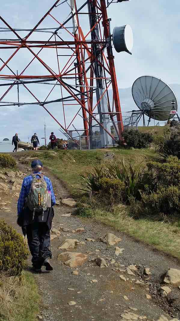
Click Mount Cargill history for background information. No. 11 on old hardcopy list of 113 club tramps. “Bethunes Gully to T.V. Mast Organ Pipes. Wiggins. Year Round.” No. 100 on old hardcopy list of 113 club tramps. “Bethunes Gully – Brown House – Signal Hill – Chingford Park Year Round”. A broad gravelled track from picnic ground. NB. Opposite Brown House corner is an RSA Memorial to First World War servicemen and the old Junction School.
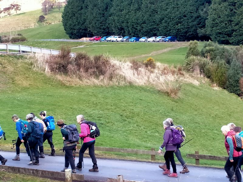
27. 30/08/2023. Hikers. Bethunes Gully to Mt Cargill. Grade 2 Leaders: Bill and Bruce
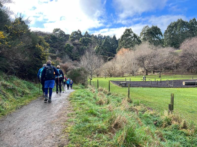
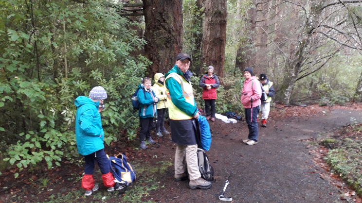
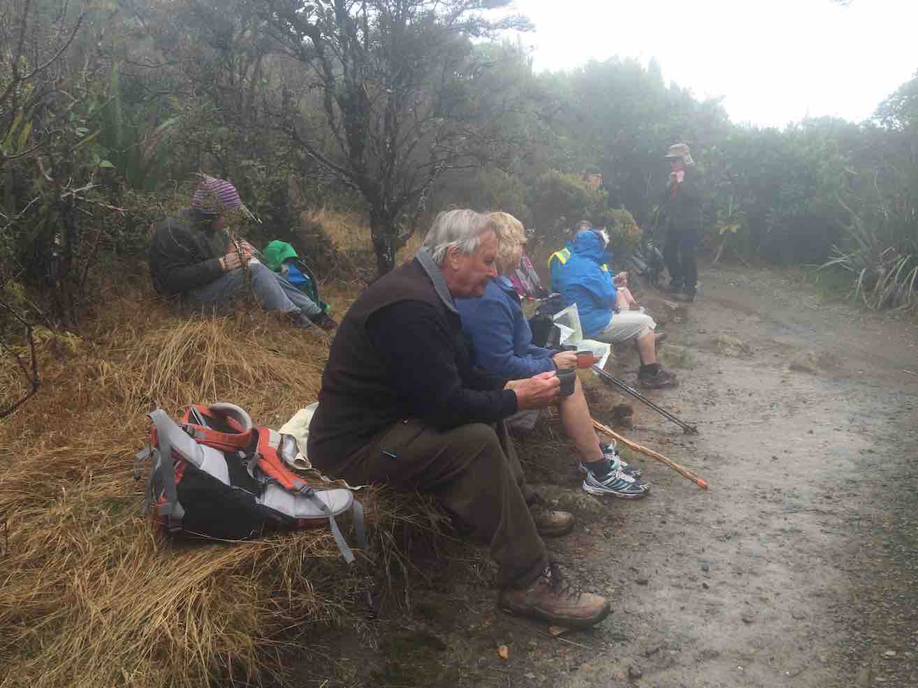
32 hikers assembled at Bethunes Gully carpark on a beautiful if slightly brisk morning. We set off just after 10.00am and after negotiating our way over and around a fallen Pine tree stopped in a semi-sunny glade for morning tea amongst the Pines – these trees must be amongst some of the tallest and straightest in the country.
The track was in pretty good order for winter – minimal mud but slippery rocks and bridges further up the track required extra care – apart from a couple of minor slips we managed to complete the day intact.
Photo Alex
Not long after morning tree it was decided to split into two groups with Jill Dodd volunteering to lead the second pack – there was still only a 10 minute gap between arrival times at the top of the mountain.
A little look at the top Caption and photo HelenBethunes Gully Caption Ady
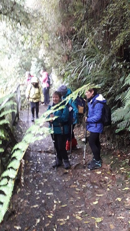
The birdlife along the way was in great voice and Katrina even identified a Kingfisher welcoming us onto the track. The native bush section of the walk is quite beautiful complete with an abundance of ferns, some majestic old Rimus, clear streams and even the odd waterfall.
Almost there Caption and photo Helen
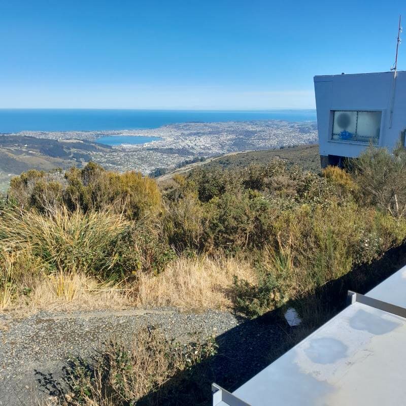
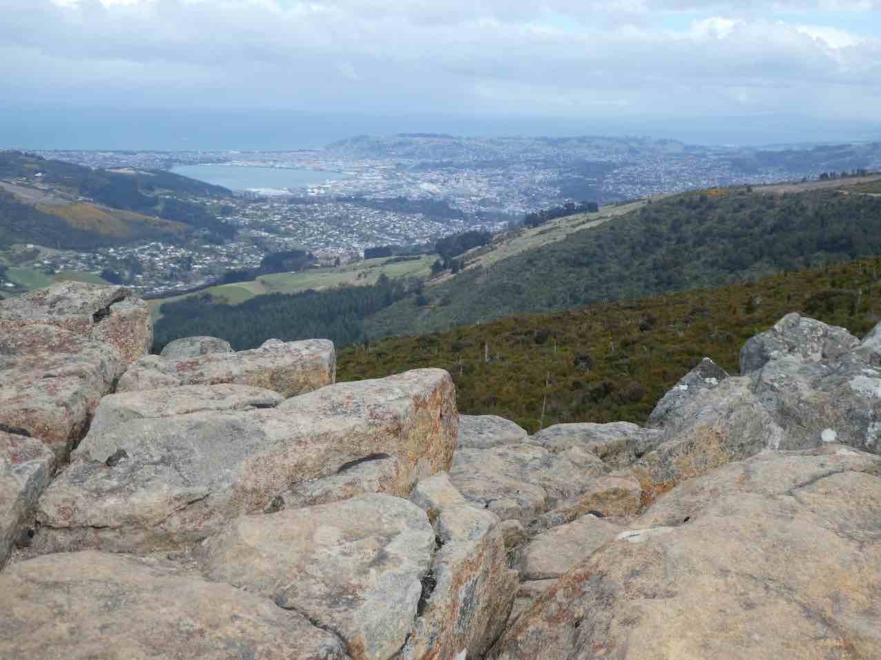
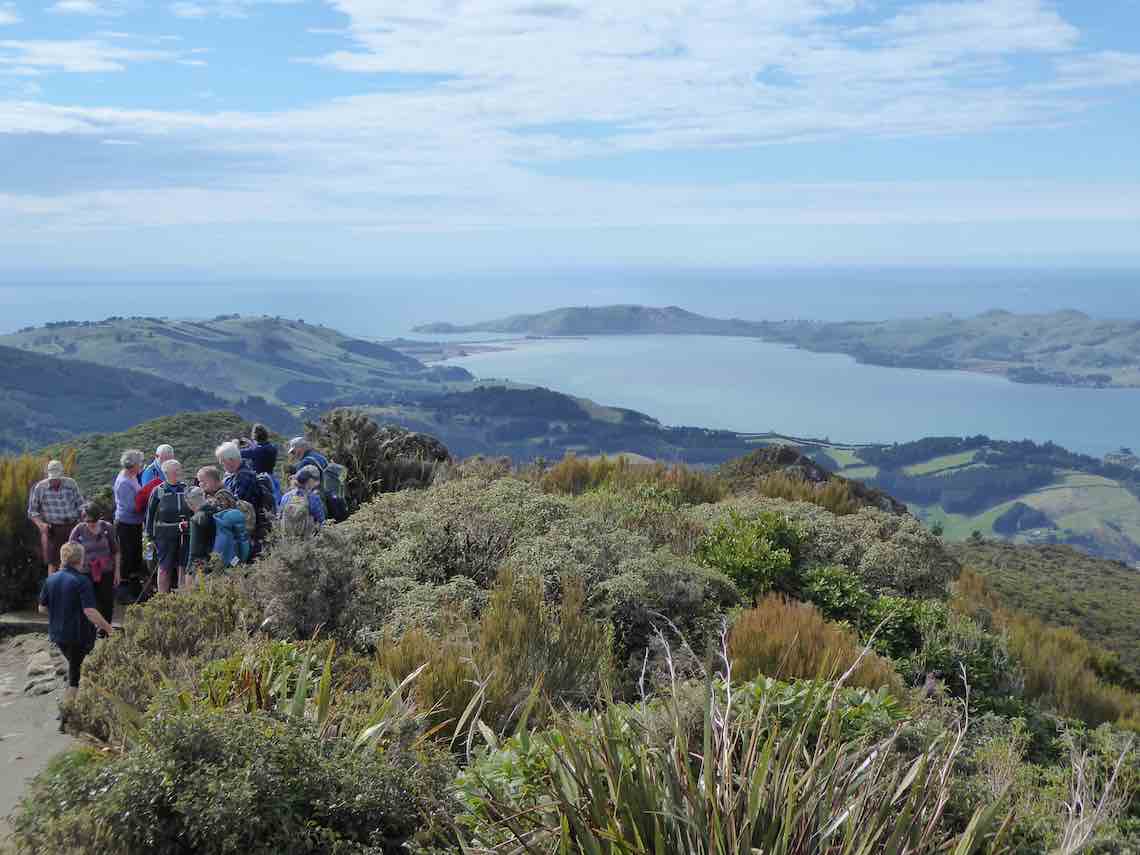
The steps at the top of the walk are real thigh killers and we were all very relieved to finally arrive at the summit and a well-earned lunch. The 360-degree panorama of Dunedin, the peninsula and surrounding districts is stunning and well worth the effort! The temperature was up around 15 degrees and led to many layers of clothing getting tucked away into packs.
Photo BarbaraPhoto Barbara
There was a discussion during lunch re the grading of the walk and while officially it is a 2 the majority agreed that it was more like a 3 – Ady told me during coffee that it felt more like a 6!
Group trip heading down. Caption and photo Jenni
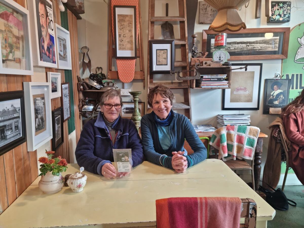
After a fairly uneventful trip back down we adjourned to the Blacks Road Grocery cafe – this slightly quirky cafe was a lovely place to conclude a very enjoyable day – coffee and treats well deserved!
Blacks Road Cafe – very cool afternoon tea venue Caption and photo Jenni
There was a lot of learning in my first hike as the group leader, particularly around identifying the appropriate pace to set and the timing of breaks. I couldn’t have asked for better support from the more experienced members of the group as I negotiated my way through the various stages and protocols on the day. Special thanks to Bruce, Jill and Jenni but many others chipped in to keep me on the straight and narrow.
All in all a lovely day and living proof that age is no barrier to serious physical achievement.
Cheers Bill
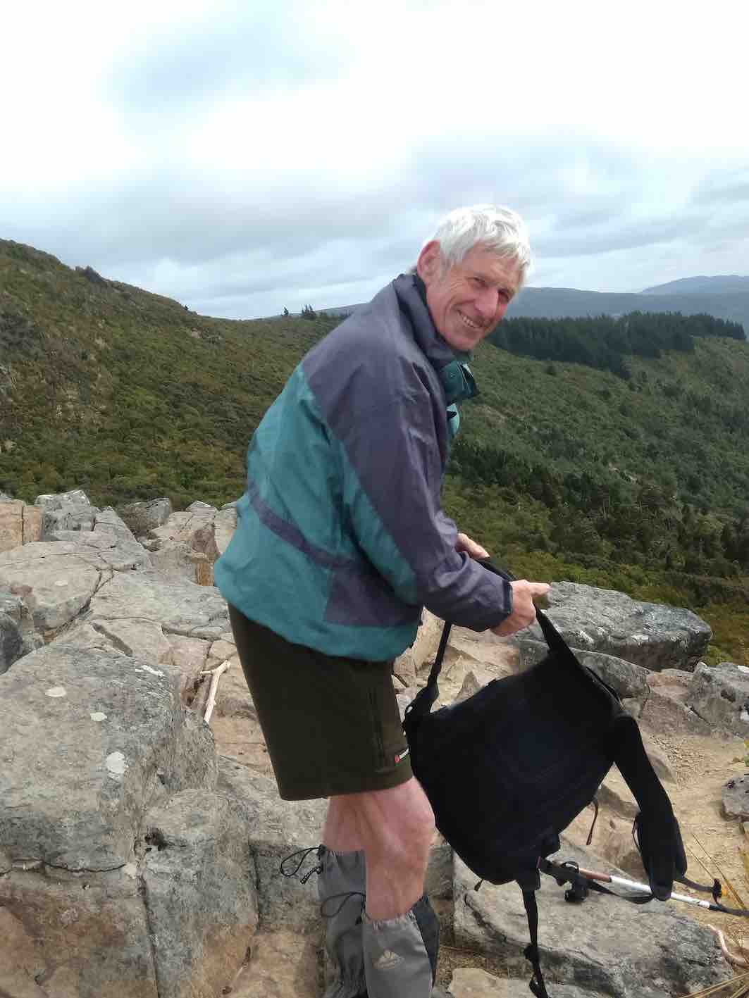
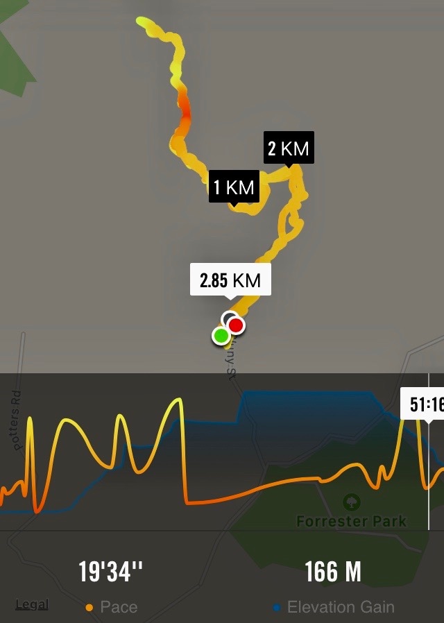
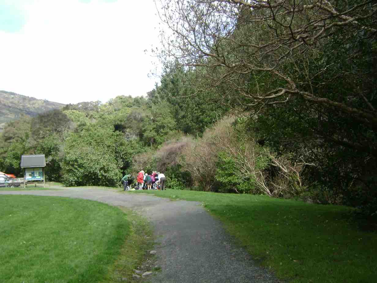
26. 16/08/2023. Trampers. Forrester Park and environs. Grade 3, $6, 23km, Leaders: John Gardiner, Dave Roberts
After the cancellation of the previous two week’s tramps due to the weather, 27 eager trampers were “chaffing at the bit” when they arrived at Forrester Park.
Getting ready to leave the cars (Photo & Caption John)
Weather conditions weren’t quite ideal, but were pretty good, for a chance to finally get out and enjoy each other’s company, and get some exercise.
Not a bad line up (Photo & Caption Phil)
The Forrester Park area was known to most, but some weren’t very familiar with it, or hadn’t been there for some time. With some new members and regular hikers, we initially did a circuit around the perimeter of the park, on cycle trails. For Alex Griffin , it must have been satisfying to experience these trails again, having supervised their construction by Task Force Green members, many years earlier.
The pristine boots of hikers Bill and Alex (Photo & Caption John)
We stopped at the public toilets at about 10.50am, and again for a regroup at the park’s “Gate to Nowhere.” A novelty, the gate sits at right angles to the end of an existing fence, left presumably after an earlier fence was removed. The gate is, of course, padlocked shut! Anyway this initial stroll gave everyone a chance to see the park’s amenities; the football fields, dog-park, Dog Club building, and BMX Track.
Starting off passing the Forrester Park Dog Exercise Area )Photo & Caption Pam)Morning tea in the sun (Photo & Caption John)
Morning Tea was enjoyed in the sun, overlooking the, “Events Car park”, with it’s established and recently developed native plantings, complete with two resident Pukeko.
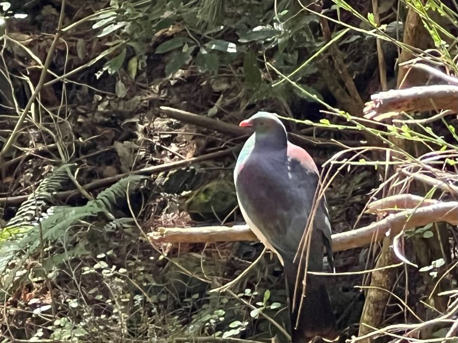
Kereru resting up••• (Photo & Caption Pam)
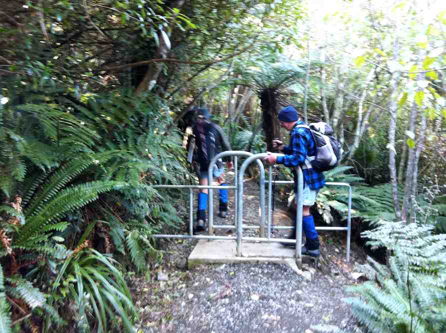
From here we walked across the road to Bethunes Gully, arriving at a cycle trail above the vehicle entrance at 11.45am. A myriad of cycle trails lie on this side of the forested hill, north of the main vehicle driveway. Having explored some of these, including some “make shift” accommodation found in the forest, we descended to the main gully track, went up the hill a little, then off to our left onto a cycle trail.
Plenty of matchsticks to build survival cover (Photo & Caption Phil)••• and over bridges (Photo & Caption Pam)
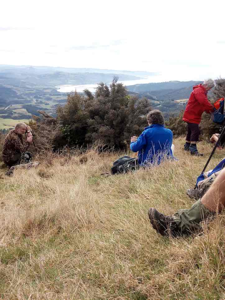
This trail, complete with boardwalks, took us uphill through forest and bush areas, before we again came out onto the main track. A steeper uphill climb saw us rewarded when we arrived at the waterfalls, before we back tracked to a suitable bank to sit on and have lunch.
Don’t go chasing waterfalls. On the Bethunes Gully Track (Photo & Caption John)Lunch spot (Photo Alex)
This 30 minute break ended at 1.00pm, when we were on our way downhill again. Those who thought their efforts for the day were winding down had one last surprise in store! By 1.15pm we were back into the bush again, climbing to the highest point of the cycle trails, we had initially explored upon entering Bethunes gully. An advanced cycle trail, complete with jumps, then one with the endearing name of “Dead Cow Gully” taking us back to the Bethunes Gully entrance. The twists and turns of these mountain bike trails provide an adrenalin rush, a physical and mental challenge, to master on a bike. When walking these twists and turns, they provide a less frenetic, but almost as emersive experience.
Beautiful straight trunks of the “ Red Woods” (Photo & Caption Pam)
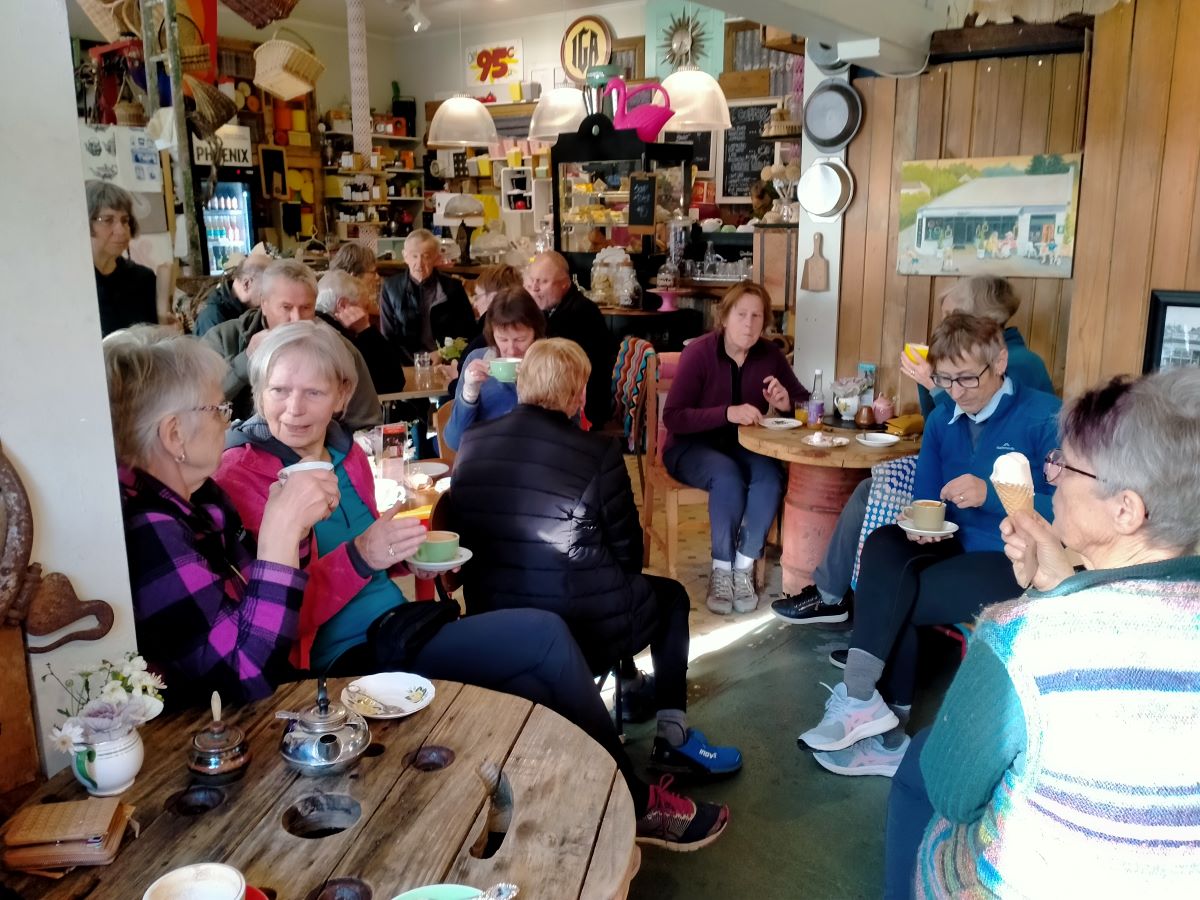
By 2.05pm we were back at the cars, with four cellphones giving four different figures regarding how far we’d walked. Somewhere between 7.84 and 10km was the range, with two phones reading just on 9km, so we’ll go with 9km! Afternoon tea was enjoyed at Blacks Road Grocer, which we filled to capacity.
Enjoying the quirky Cafe at Black’s Road (Photo & Caption Chris)Very yummy (Photo & Caption Phil)
A thank-you to Christopher and his staff, for his hospitality, and speedy delivery of hot drinks to our band of 27. In summary, an enjoyable day. The Forrester Park and Bethunes Gully area is a versatile one for tramping or hiking, providing lots of options, it lends itself to a future combined Wednesday outing. Thanks to Dave Roberts for accompanying me on the main rece and acting as tail end charlie on the day.
Regards,
John
25. 15/7/2020. Hikers. Bethunes Gully, Mount Cargill. Leaders : Mike and Jim
With scenes reminiscent of recent National Party musical chairs, the leadership of the outing changed a few times prior to the hike due to unforeseen circumstances. A cabinet meeting in the Bethune’s Gully car park settled on the hike being led by Mike Webb with Jim Finnie acting as Tail End Charlie.
It was a mild drizzly day when nine of us headed out of the car park to start walking the track up to Mt Cargill. We soon found a large tree to shelter under while we had morning tea. This was after passing Andy Cunningham and his famous dog Meg coming towards us. Many will remember Meg as the dog who was missing in the bush near Purakaunui for weeks last year. She still has health problems from her ordeal but has a loving owner to help her along.
Photo and Caption Adi – “Morning tea stop, 5 minutes from the carpark, protected from the light drizzle.”
After a short break we started the long slow steady climb with a few stops along the way to catch our breaths and regroup. The views from the lookout points on the track were not as scenic as usual due to the low cloud and drizzle.
Photo and Caption Adi – “A pause giving a photo opportunity.”
Photo and Caption Mike – “Happy Hikers.”
After a couple of kilometres on the track three members of the team decided to call it a day and head back. That left six of us to carry on for a bit longer before a decision was made for the hike to be cut short and for us to return to the car park.
Even though we didn’t make it to the top, it was a pleasant outing with good conversation. The main group hiked a distance of 6kms.
Mike
It was a cool day, which was fortunate given the up-hill nature of this track. A small number turned back after 1.5 hours, and the remaining intrepid folk turned back about 1.5 km from the top. All met up at the Gardens cafe for an enjoyable coffee (actually it was better than enjoyable, it was down right delicious), the early birds having eaten their lunch before arriving at the cafe, and the later folk waited until they got home. Thanks to the planners and those who finally lead the party.
Adi
24. 25/9/2019. Trampers. Bethunes Gully, Mount Cargill. Jill D.
With a very threatening weather forecast 16 intrepid trampers parked at Bethunes Gully ,before traversing the track towards the television tower at the summit of Mt Cargill 600 meters above .We were greeted with birdsong along the way .The vegetation changed as we followed the track through pine plantation then opening to more scrubby vegetation but it did provide shelter from a southerly wind.
A welcome morn. Tea. (Gordon pic and caption.)
Along the way we had views over to the peninsula and harbour areas and also to the famous Brown House location -this providing some interesting reflections of party times of our younger days !!
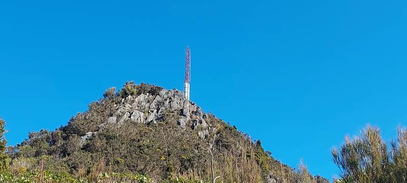
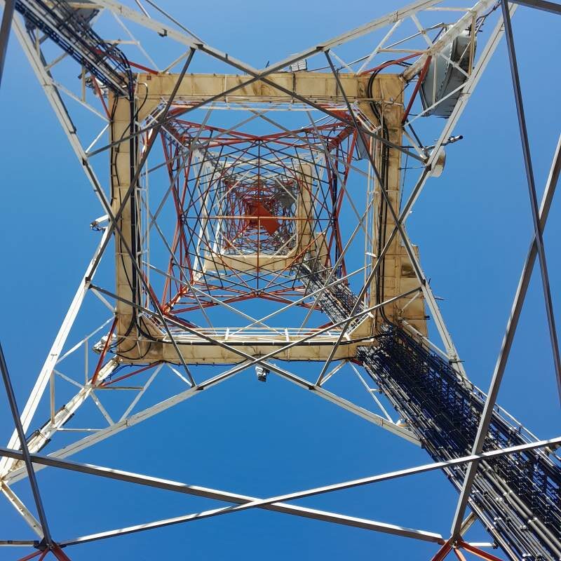
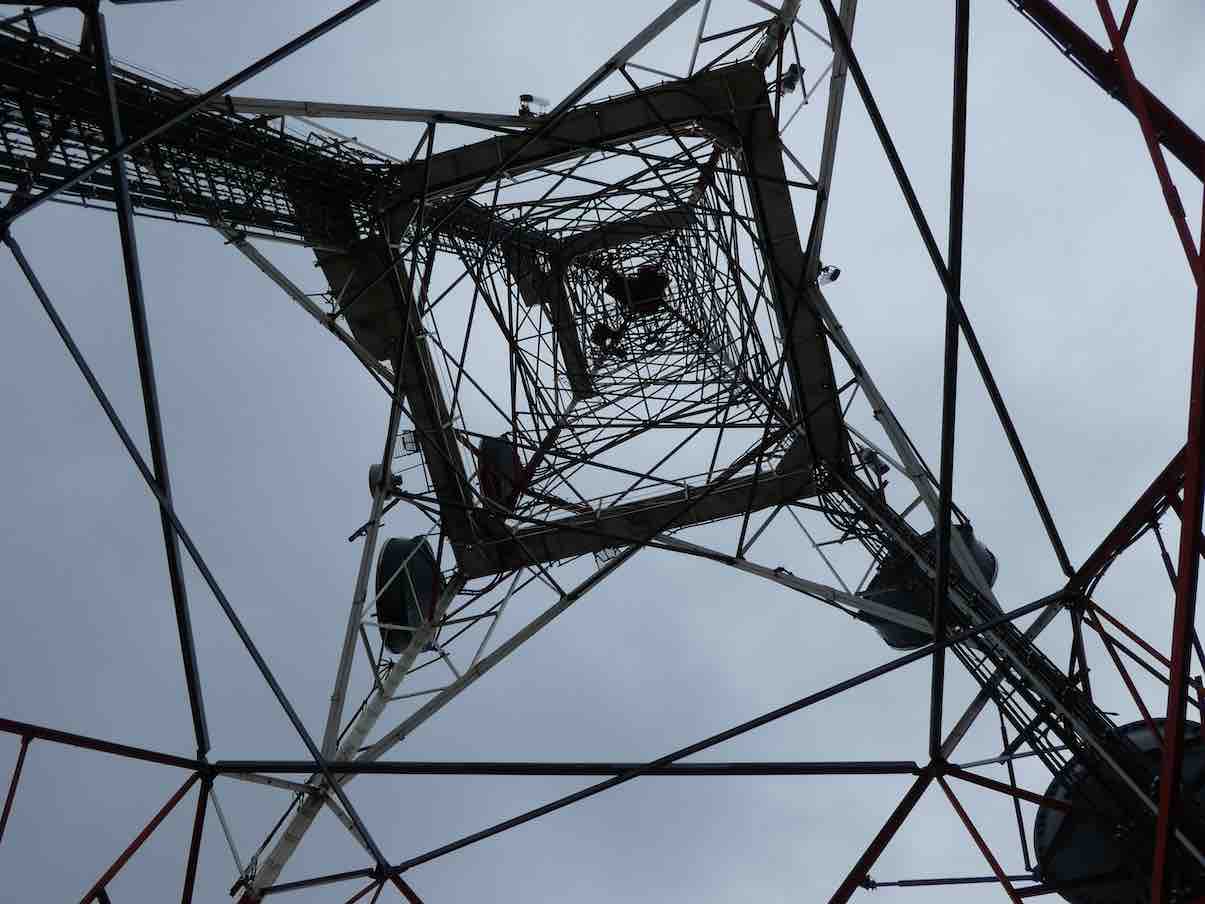
There were clear views of the summit ,tower and nearby Buttars Peak .We knew we were getting closer to the top with the noise of the wind whistling through the tower .
The cell Tower. (Gordon pic and caption.)
The views from the top were amazing almost 360 degrees north up the coast east and west and to the south over Dunedin however we didn’t stay long up there.
Heading down. (Gordon pic and caption.)
Lunch was at the the junction to the Organ Pipes and Buttars Peak
Lunch at intersection of Buttars Peak @ Organ Pipes. (Gordon pic and caption.)
where a smaller group checked the peak out
Checking the photos. (Gordon pic and caption.)Caught!! Gordon putting his camera away!. (Dave M. pic and caption.)View of Dunedin from Buttars Peak. (Gordon pic and caption.)
before rejoining the rest of the group on the descent.
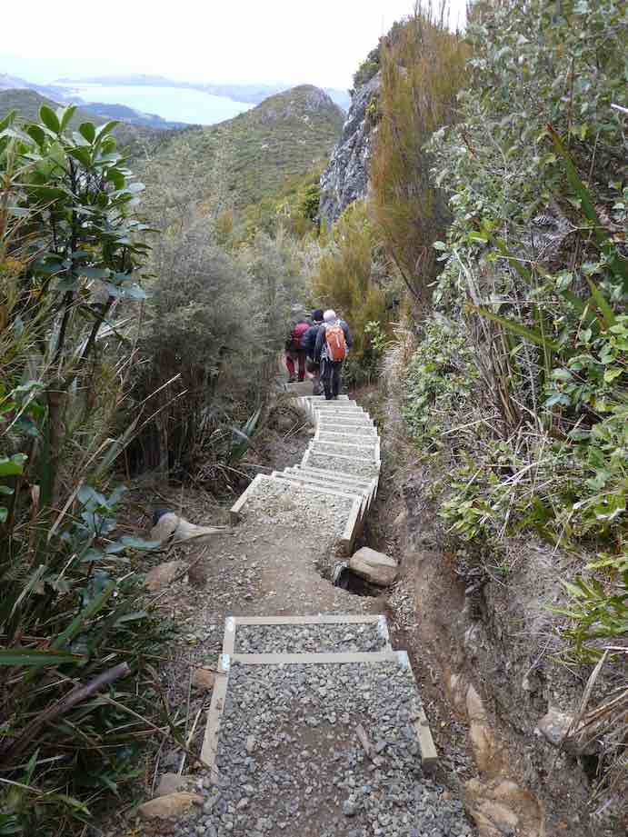
This was a shorter walk over a well formed gravel track even the steps on the final ascent to the top appear to be newer and easier to negotiate
Some of the steps to the summit. (Gordon pic and caption.)
– all in all 10.4 kms and clean boots !
The coffee stop was at the Crocodile cafe at the Gardens ,where we rearranged the seating and general chit chat creating a relaxed end to the day .We were very lucky the weather held out till back in Mosgiel. – Jill D.
23. 28/8/2019. Hikers. Bethunes Gully. M. Leaders: Jay and Jan B.
On Wednesday 28th August 2019 24 Hikers/Ramblers met at Bethunes Gully to walk up to Mt Cargill. The day was suitably warm and made for pleasant walking conditions.
Muster of hikers and ramblers at Bethune’s gully. (Clive pic and caption.)
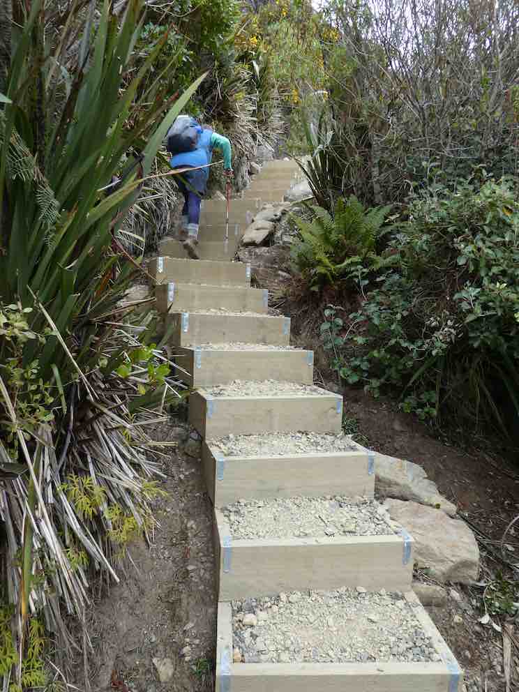
7 Ramblers organised themselves to walk up as far as they wanted and they were joined by another member who decided to go back with the Ramblers and the remaining 17 took off at a steady pace up the gradual climb to near the top where there were 127 steep steps to negotiate to bring us to the communications tower at the top of Mt Cargill.
A view of the top. (Clive pic and caption.)
There we sat in the sunshine having lunch and admiring the 360 degree view of Dunedin and up the coastline to Karitane. After a good rest we started our downward hike.
On the way down. (Clive pic and caption.)
We all took our time getting down the steps as most people find going down is harder than going up. On the way back one of our long standing members [It was our 90-year-old Doug! – Ed.] was having trouble with his legs as they had lost strength and were feeling jellylike. But hardy fellows in the group stood on each side of him and helped him back to the carpark. Well done men!!
Clive and Lindsay took him to A & E where he spent the night. All was well.
Coffee was at the Gardens Crocodile Cafe. Leaders for the day were Jan and Jay.
Ramblers: Out talking and watching the birds on the Bethunes Gully track.
Route map, courtesy Ian. We went “about as fur as they (we) can (could or wanted to) go.” (From everything’s up to date in Kansas City).
A record crowd of 8 of us climbed the track out of the Gully as far as we felt like it. Lunched at an early 11.30 a.m. beside the track, and sauntered back down to enjoy a leisurely sit in the sun back in the domain, to wait out the delayed return of the Hikers.
Ramblers enjoying the sun. (Raewyn pic and caption.)Ramblers – kids at heart. (Raewyn pic and caption.)
Birds, their song and tiny fresh spring fuchsia leaves containing bellbird-nectar-sipped flowers where highlights.
P.S. Doug at home the next afternoon, was ruefully nursing his shattered pride, as he came to terms with what had happened the day before. – Ian.
22. 13/9/2017. Trampers. Bethunes Gully. M. Leader: Eleanore.
A record number (9 female and 8 male) trampers drove to car park at Bethunes Gully and started the steady climb up, up and up some more on a well maintained track.
Firstly, alongside Lindsay Creek. The track climbs steadily up the flank of Mt. Cargill, first through pine forest and then regenerating native forest. We found a cosy spot and enjoyed a smoko break. Once again we climbed steadily to the top of the ridge between Mt. Cargill and Buttars Peak. The intersection to the Organ Pipes Track was reached, by now we knew the mast was getting closer. Only to find we had to climb steps to reach the top!
(Margreet pic and caption.)
The weather was calm and the views fantastic.
On top of Mt Cargill looking towards Taiaroa Heads. (Phil pic and caption.)
For quite a few members it was a first time visit to this track. Also, the company of the intrepid adventurer Judy Knox was enjoyed. We continued onto the A.H. Reed track where lunch was had.
Lunch view. (Helen pic and caption.)
The beauty of this track is the downhill—all the way to the car park!
We chose the little coffee shop near Baldwin Street for coffee, cake and a chat.
Coffee. (Helen pic and caption.)
We travelled 10.9km and climbed 676 metres to the mast on top of Mt. Cargill
Another great outing had by all. – Eleanore Ryan.
21. 28/9/2016. Hikers. Bethunes Gully. H. Leaders: Adrienne and Judy K.
Route map of trek only to the top. (Sorry, jammed up the app.)
21 hikers with an age range of 12 to 89 (is that a record?) gathered at the car park at the start of the Bethunes Gully track. It was fine (well, not raining anyway) when we left Mosgiel, and dry at the start of the track, but a nasty creepy little drizzle hung round us the higher we went. Loud bird calls accompanied us for the steady climb up the gully on a well-formed track, slightly muddy in places, across several bridges where the creeks were running a bit higher than usual, to a welcome morning tea break on the side of the track.
Morning Tea stop. (Adrienne pic and caption.)
Slow and steady was the order of the day, with plenty of stops to get breath back. Up – and up – and up. Several fell by the wayside – first two, then two more. When at last the junction for the Organ Pipes and the Mt Cargill summit was reached, 10 more subsided and declared “Lunch!”
An intrepid 7 continued another half hour to the summit (a first for some), up the steps in annoying drizzle. No views available from the top.
The misty summit. (Adrienne pic and caption.)
so it was down to the junction again for lunch.
Lunch in the cloud, back down from the summit and at the junction. Where had the others gone? (Ian pic and caption.)
By which time the other 10 had departed, it being a bit cold and damp to hang around.
Down – and down – and down – collecting strays as we went. Fred wasn’t present but his chocolates were, and much appreciated, thanks Fred. It was warm and sunny back …
Our welcoming crowd at the end. (Adrienne pic and caption.)
… at the cars so parkas were discarded for the ride to the Botanic gardens and a well-earned (we think) coffee stop. – Adrienne and Judy K.
20. 30/9/2015 Trampers. Bethunes Gully, Mt Cargill, Organ Pipes return.
Bethunes Gully track was the destination for the day, & 9 keen trampers arrived at the car park in Bethunes Gully, ready to tackle the continuous climb up to the transmitter mast at Mt. Cargill.
We arrived at the picnic spot about 3/4 of an hour up the track, but the leaders misread the sign, & decided that it wasn’t the correct place, but they were called back, & we all had a relaxing morning tea break in the sun. Then it was up the track some more, with a few rest breaks till we reached the junction with the Organ Pipes track, where we had another short break before heading off up the terrible track with the very large steps to arrive at the transmitter mast on top. This section is getting worse as time goes on, or is it just the mind thinking that way ??
After a good look around…
Top photo One (Ken pic)Top photo Two (Ken pic)
… & a chat with a guy from the university language department who had a group of very well dressed [all in black suits] Chinese visitors to the city, we made our way back to the Organ Pipes track. After a regroup here, we walked down to the Organ Pipes …
Eric (Ken pic)
… where I could see how my handiwork on the boardwalks was standing up from nearly 20 years beforehand. We had lunch at the Organ Pipes, then retraced our steps back down to the cars at Bethunes Gully. It was a very nice day for a tramp, with only the slightest breeze at the top, & some weak sunshine all day. I think everybody enjoyed the day, despite the grumbles about the steep climb, & those terrible steps !! We stopped off at the new cafe in the shop at the bottom of Baldwin Street for a coffee, just to keep up the tradition of the Trampers Coffee Club. This cafe is owned by the former owner of the ‘Flax’ cafe in Caversham.
Walked 10.9km
2h 53m moving
3.7km/h
climbed 679m
max height 672m – Ken.
19. 21/9/2011. Bethunes Gully, Mt Cargill, Buttars Peak, Organ Pipes, Old Main North Road, Brown House corner, Norwood Street, Bethunes Gully.
GPS of tramp, clockwise, courtesy, Ken
Nine of us did this tramp, the most we have had out for a while, and one that the club had not done since 2006!
We were surprised with the new (?) bike barriers, although we still met a biker further on up the track.
Cycle barrier
Doug (nice knees?) and this reporter (the eldest two in the group) elected to remain at the track junction, letting the others (one or two who had never done it before) go on up to the top.
Relaxing in sheltered comfort
Their only reward was to reach the summit. Mt Cargill was entirely cloud-capped. Too bad! Doug and I rested in complete shelter from the cold Norwester. Even down where we were, we could see the mist still briskly blowing across the saddle below us. See Moving Mist
It was a surprise later on, on the former main road and nearing the old Brown House site to see the lovely-but-misleading external sight of the cloud cover we had bracingly experienced from the inside.
Cloud over Mt Cargill. Mast just peeking above cloud, barely discernible to the left of the cloud’s apex..
Another good tramp. Bethunes Gully track is still no less steep at the beginning before easing off further up. – Ian
17. 5/5/2010. Both. Bethunes Gully, Bike Tracks. M-. Leaders: Bob and Evelyn.
We parked cars at by the toilets at the end of Cluny Street (that’s what the Map said. Didn’t know that before.) in Bethunes Gully. Bob and Evelyn were to turn on a delightful surprise for us all. They led us back down the road to the gate to discover for us on the left a bike track leading up through the trees. We admired the loving attention lavished on the system of tracks by bike devotees as we climbed up through the un-pruned Oregon plantation. After a morning tea stop we ascended yet further to reach the plantation’s NE corner. Then it was down to our left back into the gully.
The tops of the tall Oregons.
Looking up at the tall Oregons. Wendy, Sabina, Peter, George, Lex, Ken.
We emerged at the head of the grassed part of the gully at the bridge across the Lindsay Stream.
Sturdy bridge
From here it was up the Mount Cargill walking track, stopping for frequent rests, one of which was by a small track on our left promising to lead eventually to Campbells Road in Pine Hill. (Bob and Evelyn had recced it, but it ends in dense gorse.) Eventually we reached the Lookout down on the right of the track where we stopped for an early lunch.
Bush view from the lookout.
After the leaders had ascertained all seventeen of us were back up onto the walkway from the Lookout, (with Ken obtaining dispensation to carry on on his own to Mount Cargill, as he had come in his own car), they took us part way back down the walkway before striking off on the right up a rutted vehicle track through the bush,
How did they lift the smaller on top of the larger? Leader Bob strikes a pose on the vehicle track
… from which eventually a track led off to the left and down to parallel the walkway back down the bridge and then it was just a short walk to the cars.
Thanks to Evelyn and Bob for finding us a new set of tracks in a Bethunes Gully we had thought we knew all about already. – Ian
16. 24/5/2006 Bethunes Gully, Mt Cargill, Buttars Peak, Organ Pipes,Old Main North Road, Brown House corner, Norwood Street, Bethunes Gully. Leaders: Judy, Tash 15. 15/6/2005. Trampers. Bethunes Gully, Mount Cargill. Leaders: Hazel, Ria. 14. 23/5/2007. Hikers. Bethunes Gully, Mount Cargill. Medium. Leaders: Betty, Dot T. 13. 5/11/2003. Trampers. Bethunes Gully, Buttars Peak, round trip. Medium. Leaders: D Jenkins, B McCabe 11. 28/8/2002 Bethunes Gully to Mount Cargill, Organ Pipes return. Leaders: Ray & Diana, Val 10. 16/5/2001. Bethunes Gully. Leaders: Nancy, Dot and Nelson. 9. 19/4/2000. Bethunes Gully, Mount Cargill. Leaders: Judy C, Mary M, Bev McI. 8. 27/5/1998. Bethunes Gully, Organ Pipes, North Road. Leaders: Hugh and Judith. 7. 25/3/1998. Bethunes Gully, Organ Pipes return. Leaders: Betty, Denise. 6. 25/3/1998 Bethunes Gully to Mount Cargill, Organ Pipes return. Leaders: B Bryce, D Pearce 5. 30/7/1997. Bethunes Gully, Mount Cargill. Leaders: Diana and Ray, Catherine. 4. 9/7/1997. Norwood Street, Bethunes Gully, Opoho. Leaders: Shirley McN, Pat, Wendy. 3. 27/9/1995. Pine Hill, Mount Cargill Track, Waitati Road, Bethunes Gully, North East Valley. Medium+. Leaders: Ria L, Catherine, Ria H, Shirley R 2. 12/5/1993 Pine Hill Road, Cowans Road, Mt Cargill, Old Mt Cargill Main North Road, Return Bethunes Gully, North East Valley. Back to Pine Hill Road. Leaders: Ria L, Catherine T, Penny & Peter 1. 11/4/1990 Bethunes Gully, Mt Cargill, Buttars Peak, Organ Pipes,Old Main North Road, Brown House corner, Norwood Street, Bethunes Gully. Leaders: Margaret S, Hartmann, Bev H, Peter R
This pages of club tramps and hikes covers trips to the Otago Peninsula and involves trips to the Karetai Track & Road, Tomahawk Lagoon, the Soldiers Monument commemorating those from the Peninsula who died in WW1. Also included are trips incorporating the Highcliff and Buskins Tracks.(map)
This page of club tramps and hikes covers trips to the Otago Peninsula and involves trips to Sandymount, including Lovers Leap and The Chasm, and Sandfly Bay (map).
Access to Sandymount is via Sandymount Road (off Highcliff Road) where carparking is available.
Access to Sandfly Bay is possible by following the poled route from the Sandymount track. Can also be reached via Seal Point Road (also off Highcliff Road) to the car park.
Links to tramps and hikes in this area:
21/05/2025. Sandymount. Grade 3. Hikers. Leaders: Jenni & Bruce Wright.
This trip commences at the end of Dick Road where there is a small carparking area to the Okia Reserve where the Pyramids are located. There are a number of well marked tracks through the dunes to Victory beach.
This trip commences at Allans Beach carpark and ascends through farmland to the summit of Mt Charles overlooking Papanui Inlet and Allans Beach. It also includes a visit to the Cape Saunders lighthouse and Puddingstone Rock.
Access Permissions are required as trips to Mt Charles and Cape Saunders venture over a working farm – refer guidelines
A very successful AGM was held at the Presbyterian Church Hall in Church St, with 50 folk attending and 15 apologies received!
It was great to have such a mix of members attend and even before the meeting was formally underway neighbours and passersby were commenting on the noise from the hall.
The usual AGM processes and topics were efficiently dealt to with the many highlights of the past year outlined in the Presidents report.
For everyone’s information the Officers and Committee were elected as follows
President Phil Keene
Vice President John Gardiner
Secretary/ Treasurer Jenni Wright
Communications Officer Ross Davies
Committee Jay Devlin, Jan Butcher, Karen McInnes, Pam Cocks, Barbara Shackell, Graeme Souter.
Jill Dodd has resigned from the committee as Past President and her contribution was highlighted in the Presidents report. Thanks again Jill for everything you have done and do for us.
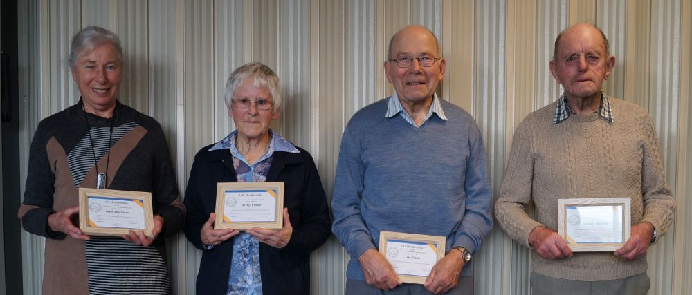
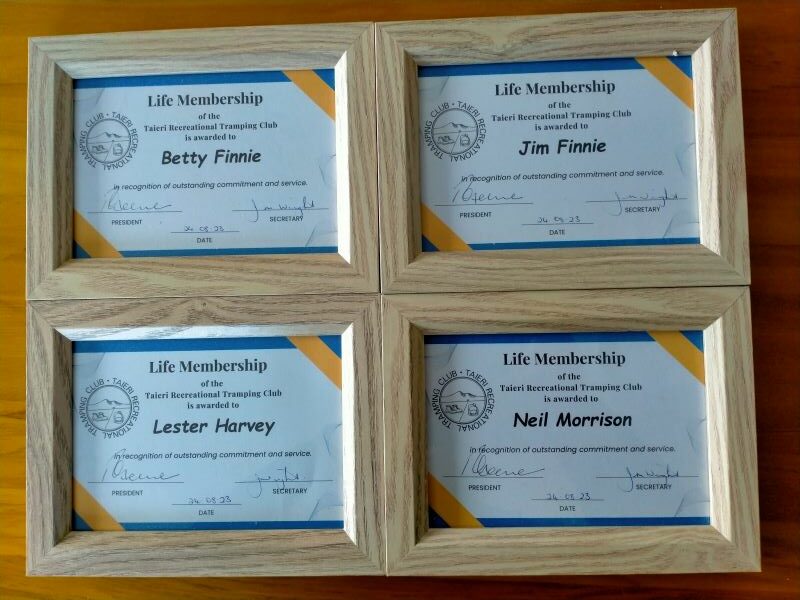
The President outlined the approach taken by the Committee to confer life memberships on four members. The process outlined in the paragraph 4 (e) of the constitution was read, and then citations and presentations were read and made for Betty and Jim Finnie, Lester Harvey and Neil Morrison. It is worth recording these on our website, both for ‘history’ as well as allowing those members not present to share in the celebration.
Our new life members (Carole accepting for Neil). Photo & caption John.
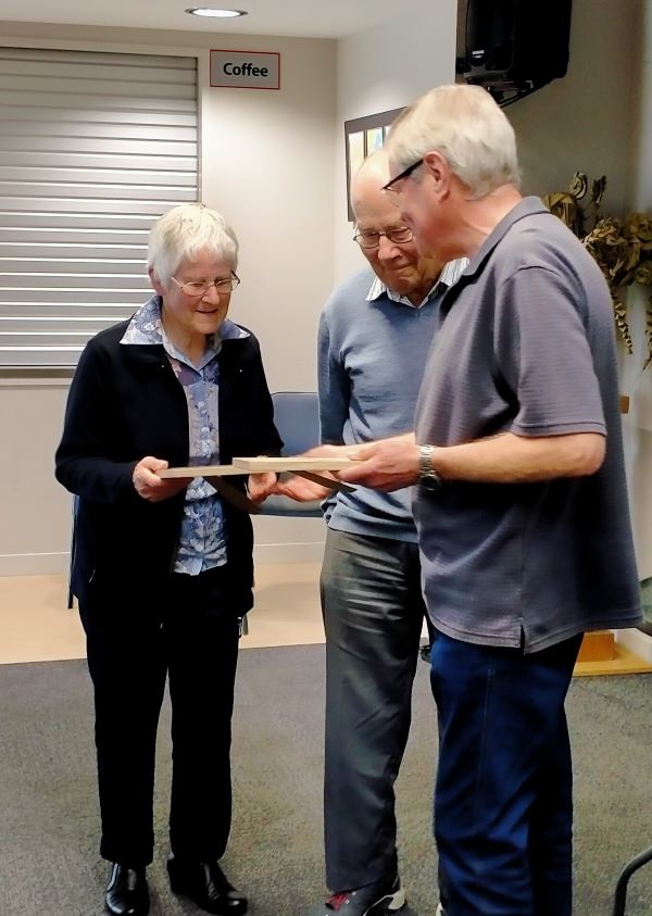
Betty and Jim Finnie: Presented by Vice President John Gardiner
“I have the pleasure of presenting two Life Memberships at once. These two people are both icons of the club, individually and especially collectively. Like tramping boots and gators, woolly hats and gloves, they complement each other, and just go together. Betty and Jim joined the Taieri Recreational Tramping Club in 2011, and in the 12 years since, our members have enjoyed their company on well over 100 tramps and hikes. Often, they have led and organized outings, sometimes going to great lengths to enable members to enjoy themselves. For example, Jim purchased a new chain saw, and organized a scrub clearing day prior to a hike. On another occasion, Jim and Betty left a ladder for members to use crossing a fence, and after all crossed the fence, went back days later to collect it. I’m told they’ve collectively, of their own volition, done many exploratory recces for new hikes and tramps, even taking Jim’s home built electric bikes partway up Government Track! Always in support, Betty, a little bird told me, even irons Jim’s pyjamas, and I remember her on the North Taieri hike, complete with a jangly pack on her back, running downhill, when she heard Jim was struggling with a crook leg!
Ladies and gentlemen, please congratulate Jim and Betty.”
John presents the awards to Betty & Jim. Photo & caption Phil.
Lester Harvey: Presented by Past President Jill Dodd
”Lester Harvey is currently our oldest active member of the Taieri Recreational Tramping Club .He has been a member of the club for 15 years , on the committee 2014-18 along with being on the trip planning committee during that time .Lester is not so active at the moment as he is caring for his wife who is now wheel chair bound .That doesn’t stop this ingenious pair. Lester has adapted the wheelchair to carry the shopping bags on behind and a wooden addition between the back wheels to make negotiating foot path to road crossing a little easier saving jarring Daphne. They are often seen moving along the Mosgiel streets at a good pace and quite some distance from home! Lester is a dab hand in the kitchen often sharing his recipes with others. He opted to make his 90th birthday cake to be shared with the members in attendance at the Momona Hall a couple of years back .Lester is a local Taieri ‘lad’ so has many connections and knowledge of local walking trails which has been used to our advantage.
Once Lester retired, he didn’t just sit down so in 1996 he became the co-ordinator of the beautification of the rail corridor between Riccarton Rd along to Wingatui, 5kms. It had been very much an eyesore. 100s of man hours and 8 years later it was completed and known as Lester’s Pride- a plaque on the corner of Gladstone Rd South and Gordon Rd sits on the grass verge. Unfortunately the area from Gladstone Rd North is all that basically remains today. In recognition Lester was granted the 1st Fonterra Environmental award in 2008 for his labour of love.
Lester just doesn’t know how to stop; he still not only looks after his own garden but plants out neighbourhood gardens starting with the rotary hoeing stage. He stated just the other day he has 18 different vegetables either in the garden or freezer and the only vegetable he hasn’t given a go at growing in our more southern conditions is the Kumera. Bees have always been his passion and when taking off the honey a lot was given to the Taieri High (as it was known years ago) with the proceeds going to fund raisers for the school.
2010 saw Lester presented with the Queens Service Medal for community services. Lester has his faithful push bike that he is often seen biking around Mosgiel on. Even when he comes out hiking with us he arrives on the bike, leaving it unlocked for the day at the car park. Without any hesitation he swings a leg over the bar and away he bikes, no wobbling!
It is my pleasure to present Lester with his Life Membership of the
Taieri Recreation and Tramping Club 2023.”
Neil Morrison: Presented by President Phil Keene
“I have the pleasure of presenting a life membership award to Neil.
Neil joined the club in 2012 and as well as serving on the committee for four years Neil has organised a great many trips, many in the more challenging range, but as time moves on we see pictures of Neil in the write up for the trip 12 April 2023 proudly demonstrating his wonderful train network and collection when the walkers led by Carole, called in for morning tea and coffee, and I note that often the trip write ups were signed by Morrison and Morrison.
Neil has a presence that commands respect and his comment is always based on deep experience from someone who has done the hard yards and enjoys being in the wide-open spaces. He has a dry, often telling sense of humour.
Since joining the club Neil has in parallel been involved in the maintenance of walking tracks west of Flagstaff. We estimate that Neil has undertaken about 150 days of work, mostly with machines in his hands. His organisational and safety skills are to the fore, never more so when we have the flax clearing days. At times participants look to get a ride with him on his tray or quad, other times not!
This work enables the enjoyment of the tracks by the general public but also reflects positively back on the club and is recognised by the DCC, DOC and others.
I have invited comment on the award by Graeme Elliot from the Green Hut Track Group.
“The Green Hut Track Group is extremely pleased to be able to add support to the acknowledgement and Award of a Life Membership to Neil Morrison to the Taieri Recreational Tramping Club. The Green Hut Track Group first came across Neil, all on our hands and knees along with quite a number of like-minded people (both TRTC Club and Green Hut Track Group members), while trying to relocate the Whare Flat, Possum Busters Track, after the “Big Snow of June 2013”. Very fond memories!
Since that time, Neil and Arthur Heenan have been “commanders” of the Whare Flat Walking Track system. Neil has been my “main” contact for the past 10 years. It has always a pleasure to work with him. He is a superb person, he is stoic, he always has a huge smile on his face and just loves his involvement and fun with everything he does. The Green Hut Track Group is extremely proud to acknowledge Neil as a Member. Congratulations Neil the award is well deserved.
Best Wishes Graeme Elliot Coordinator Green Hut Track Group”
Ladies and gentlemen please congratulate Neil on this life membership award.”
In Neil’s absence Carole accepted the award on his behalf.
The four awards. Photo & caption Phil.
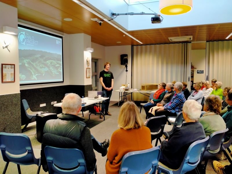
Halo Project: Jonah Kitto-Verhoef
Once we had the computers sorted Jonah the Operations Pest Manager provided an overview of the organisational structure that focuses on working with communities across 4 areas, predator free zones, forest habitat restoration, from source to sea and seabird habitat restoration. It soon was very clear that extensive skill sets and passion for the job was required! Jonah demonstrated the extensive concentration of trapping systems and methodologies with predator free zones surrounded by large buffer zones. Jonah demonstrated different trap types and when and how they are used to the best outcomes; he acknowledged there is a ‘dark side’ to the work. Much of what Jonah demonstrated is on the Halo Project website https://www.haloproject.org.nz/predator-free and this includes resource info sheets for groups and individuals. Clive Crossman thanked Jonah for his talk and presented a donation from the club for the Halo Project’s work.
Jonah Kitto-Verhoef from the Halo Project presenting. Photo & caption Phil.
Thank you again to everyone who contributed to a successful AGM and we look forward to another great years walking and talking and …….
15. 23/08/2023. Trampers. Possum Hut Circuit. Grade 3.5. Leaders Neil Hodgkin and Gwenda Farqharson.
18 trampers completed this tramp in an anti-clockwise direction on a calm mild spring day.
Leaving the cars with the a totally different backdrop since the tree felling. Photo & caption John
The track was in good condition and everyone seemed to enjoy it. We had Smoke-O after descending the track through the Douglas firs, a photo shoot at the derelict Possum Hut, and had lunch at the site of the old Green Hut.
Various ways of getting down the steep slope. Photo & caption Pam
First creek crossing. Photo & caption JohnWe find Dame Edna’s old hideaway. Photo & caption Phil
Chris, near the top, taking in the spectacular view. Photo & caption JohnAmazing views across the Silver Peaks. Photo & caption Pam
Lunch at the former site of Green Peak Hut. Photo & caption Pam
Panorama – no sign of civilization in any direction. Photo & caption John
Homeward bound on Possum Hut route. Photo & caption Pam
The total distance was about 8kms and we were away from the vehicles for 4 hours.
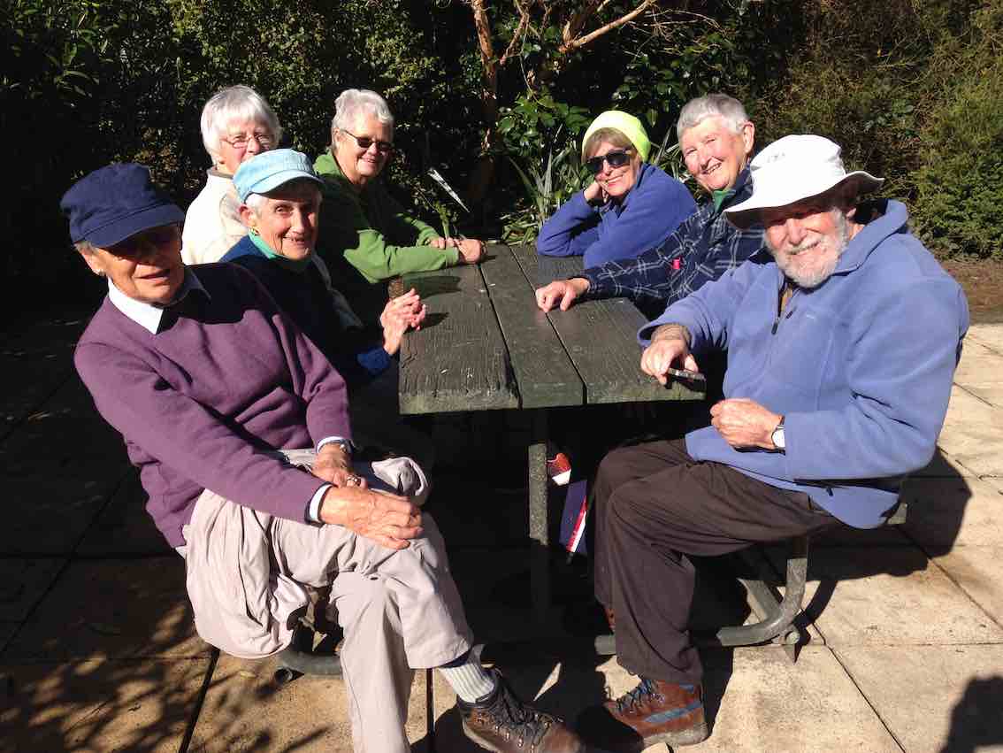
We culminated the day with coffee at the Gallery Cafe at Waititi.
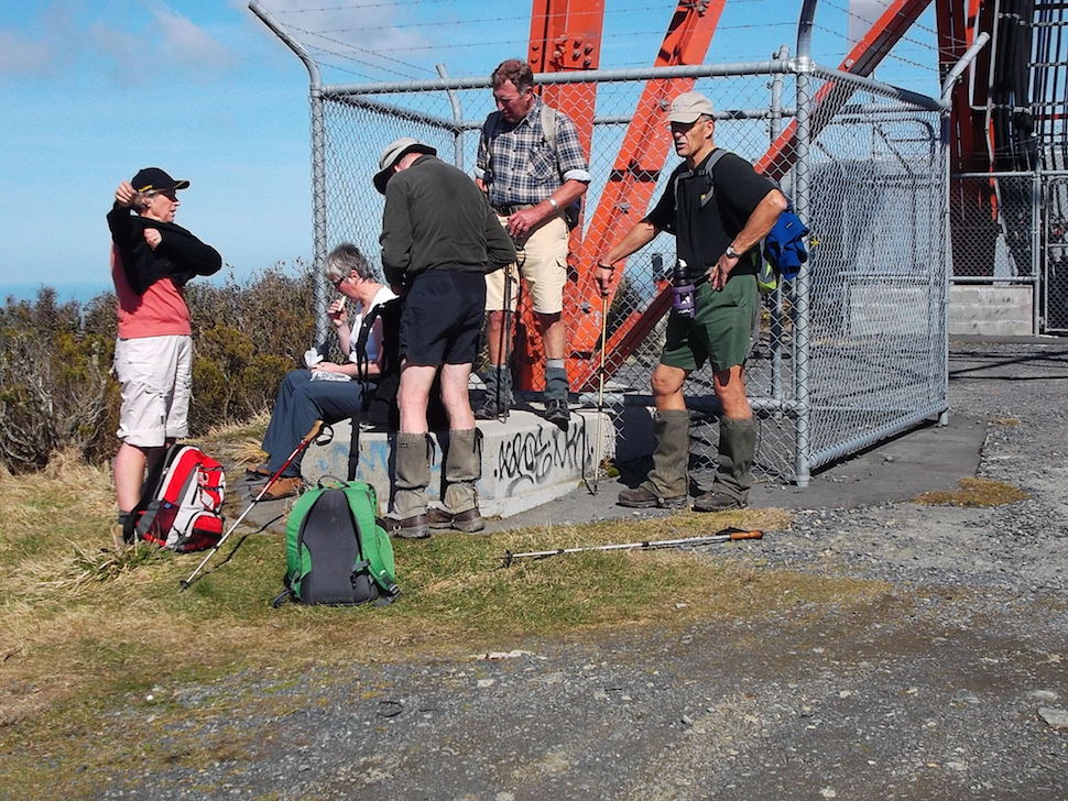
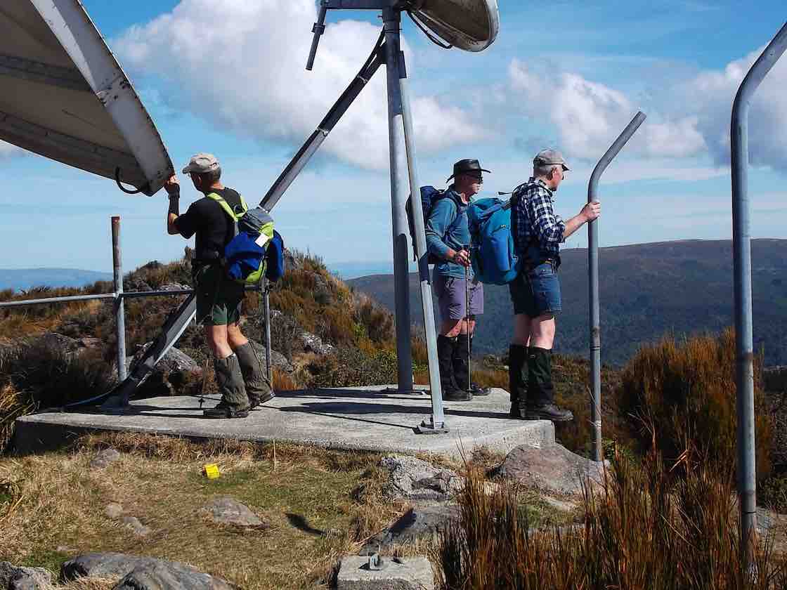
This page of the Clubs tramps and hikes covers trips known as the Rustler / Burns circuit incorporating the Swampy Spur and the Airways Transmitter Tower.
TRTC Grading Information – trips incorporating the Rustlers / Burns circuit are generally given a TRTC grading of 4. This is indicative only, as depending on the route taken, conditions of tracks etc. allocation of gradings can differ from this. For more detailed analysis refer to Grading Information.
Car parking is off SH1 motorway at Leith Saddle yard (alternatively down side road at bridge (restricted space).
Walk across side road to track.
Going further: along road past doppler radar to DoC sign.
Right along Rustlers Ridge track to junction with Burns Track.
Through junction and up and round hill on Rustlers Ridge Track. (Lunch on hill)
Down ridge to pipeline. (Alternatively turn right at junction for Burns and down to pipeline)
Turn right along pipeline.
5.5 hours in all.
Burns – Rustlers circuit Maintained by Green Hut Track Group. DCC land.