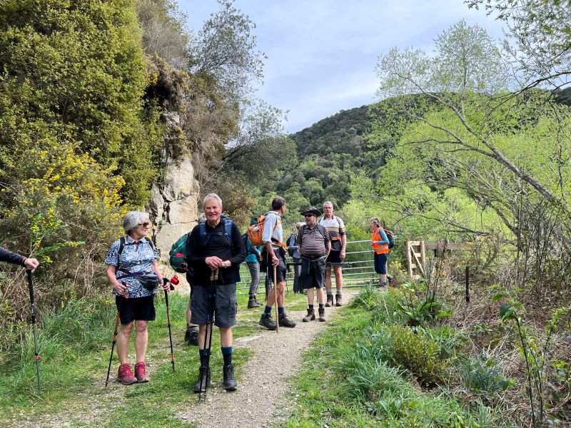
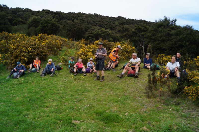
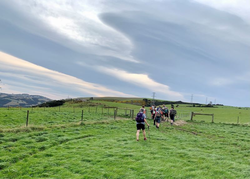
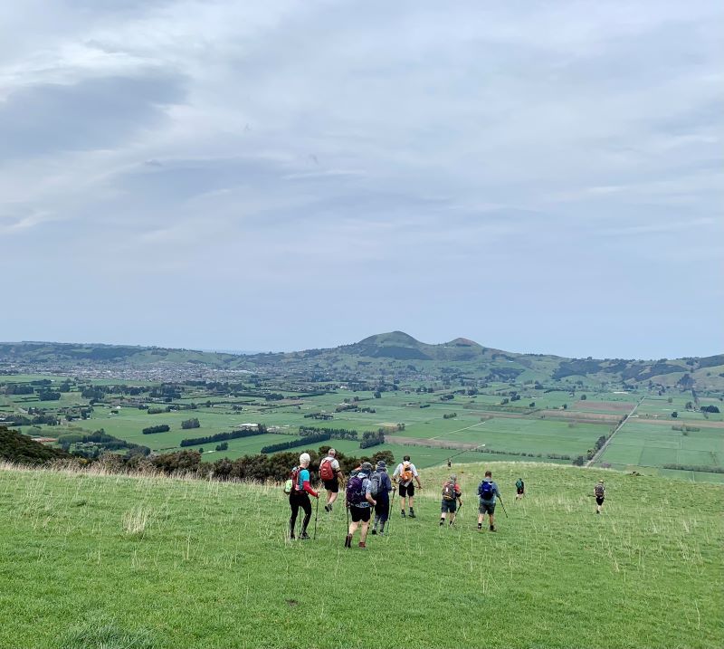
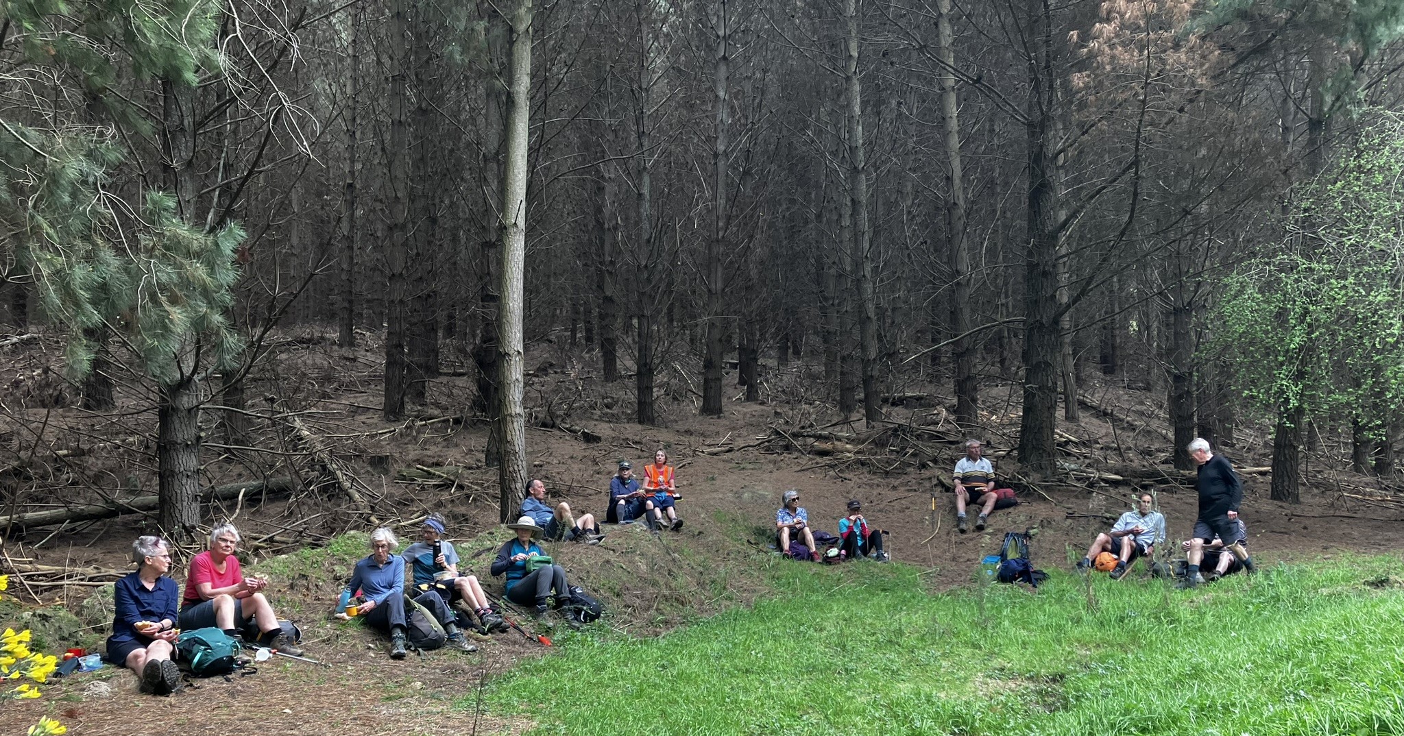
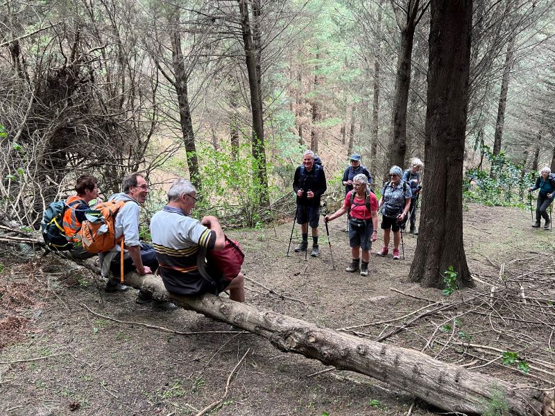
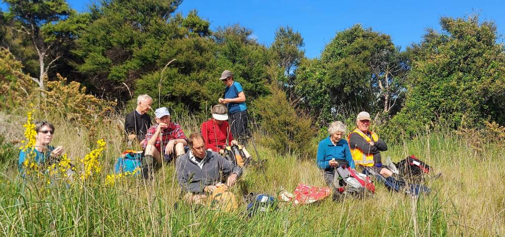
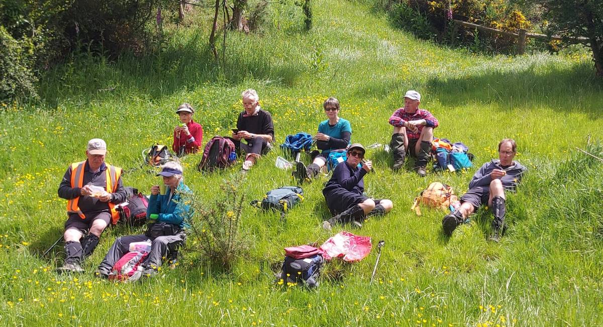
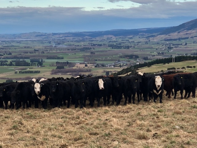
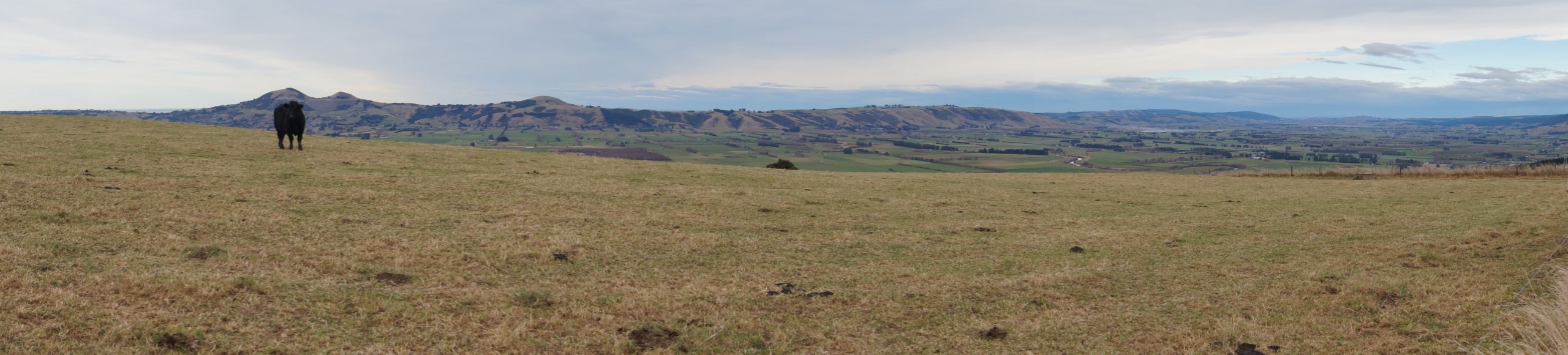
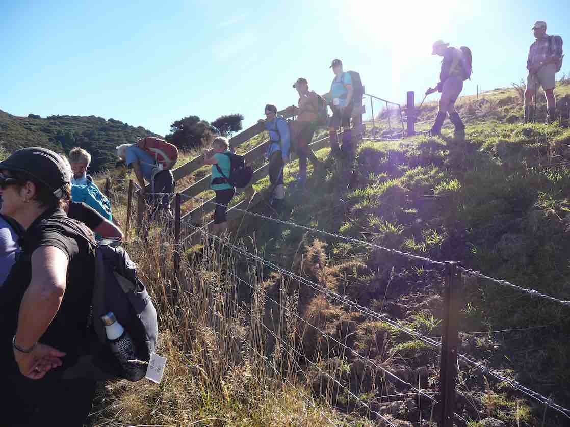
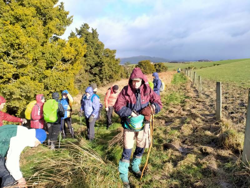
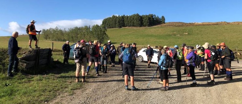
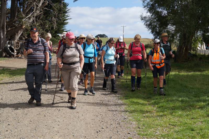
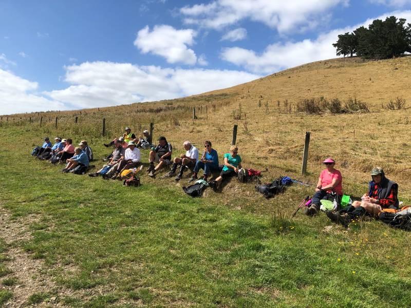
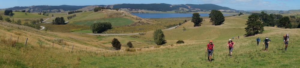
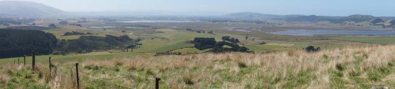
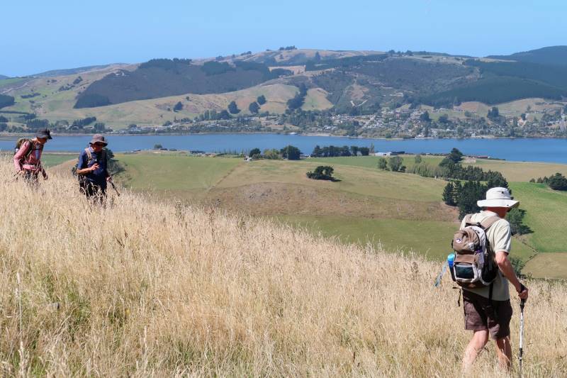
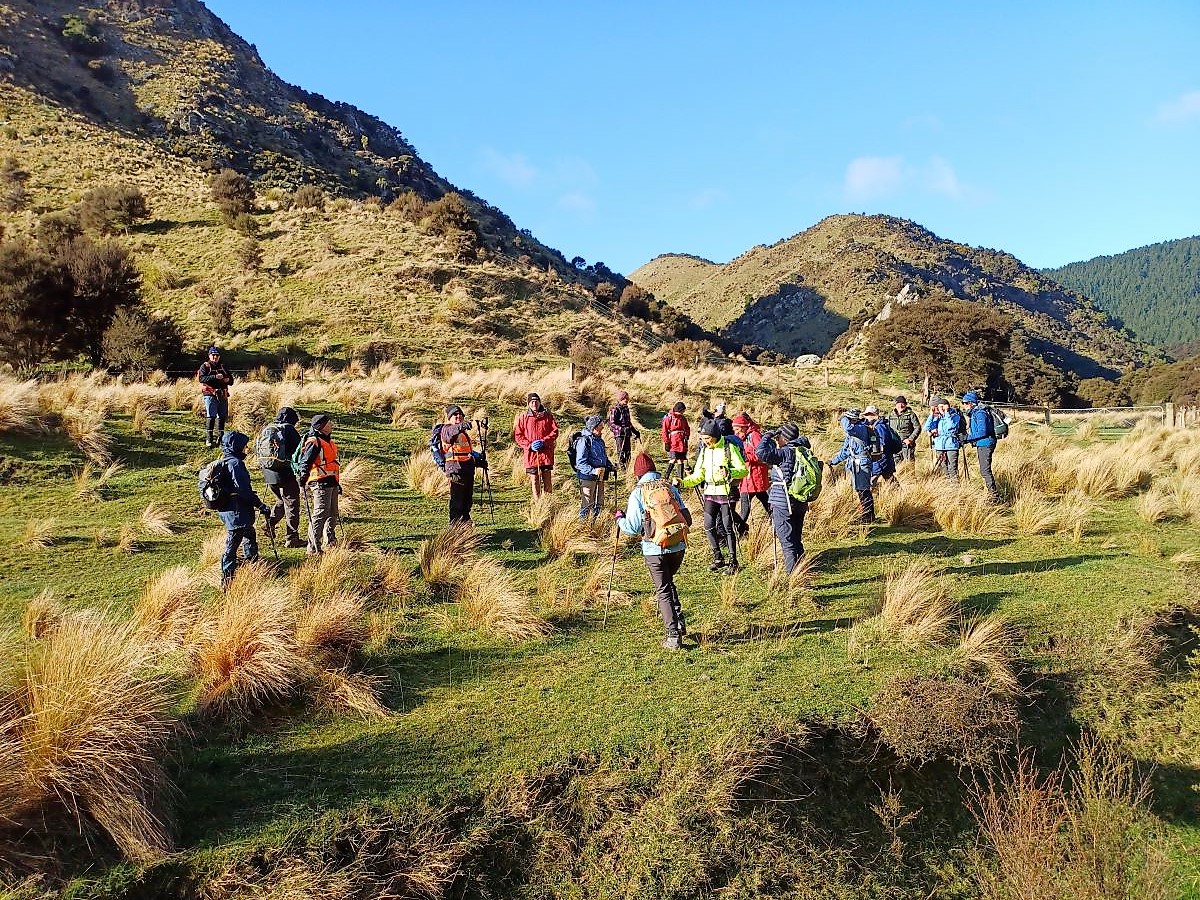
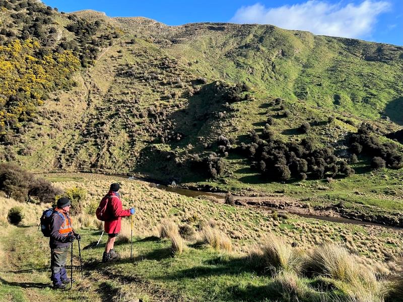
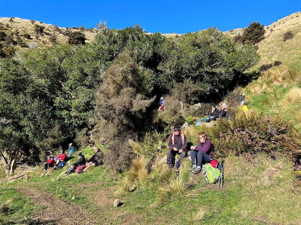
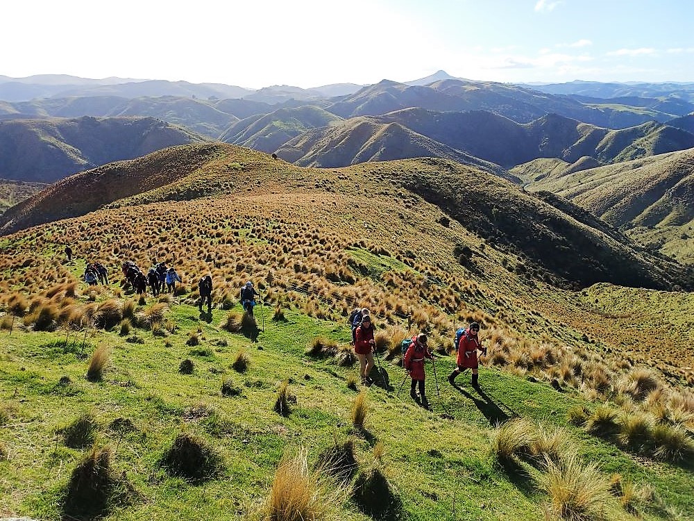
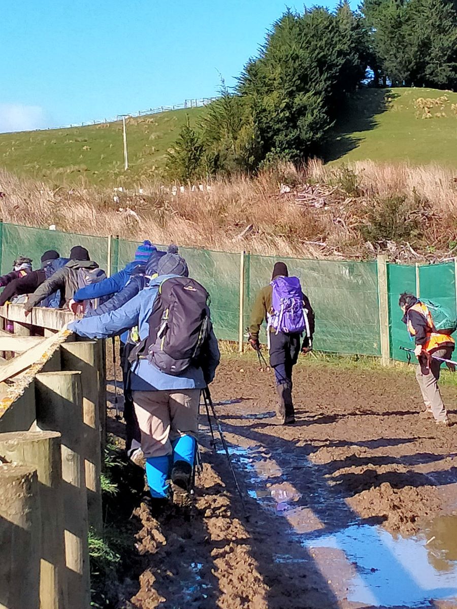
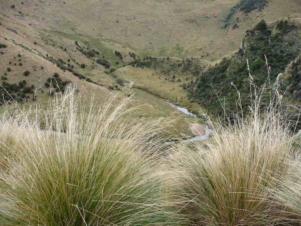
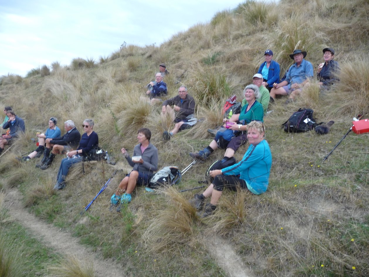
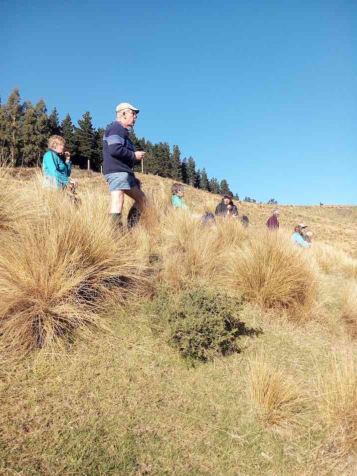
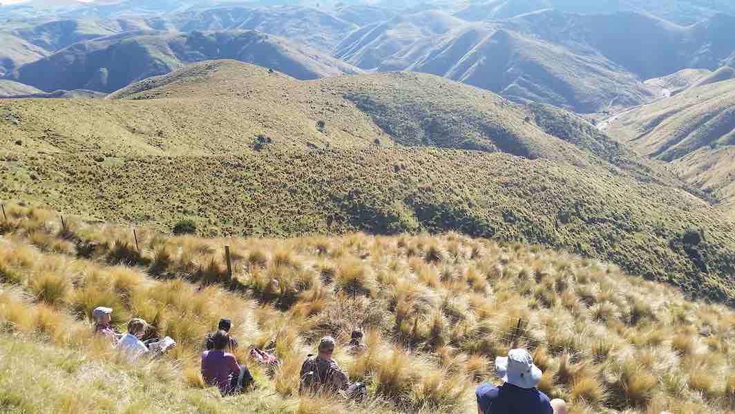
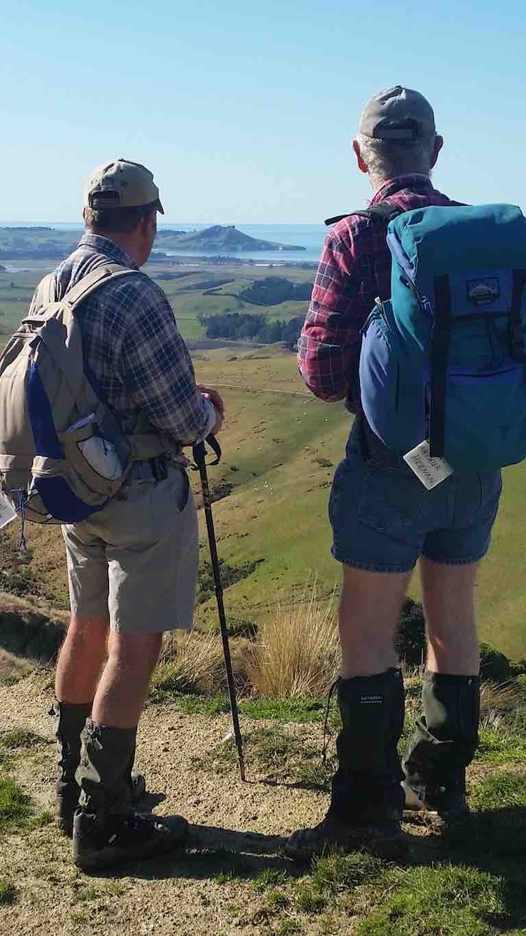
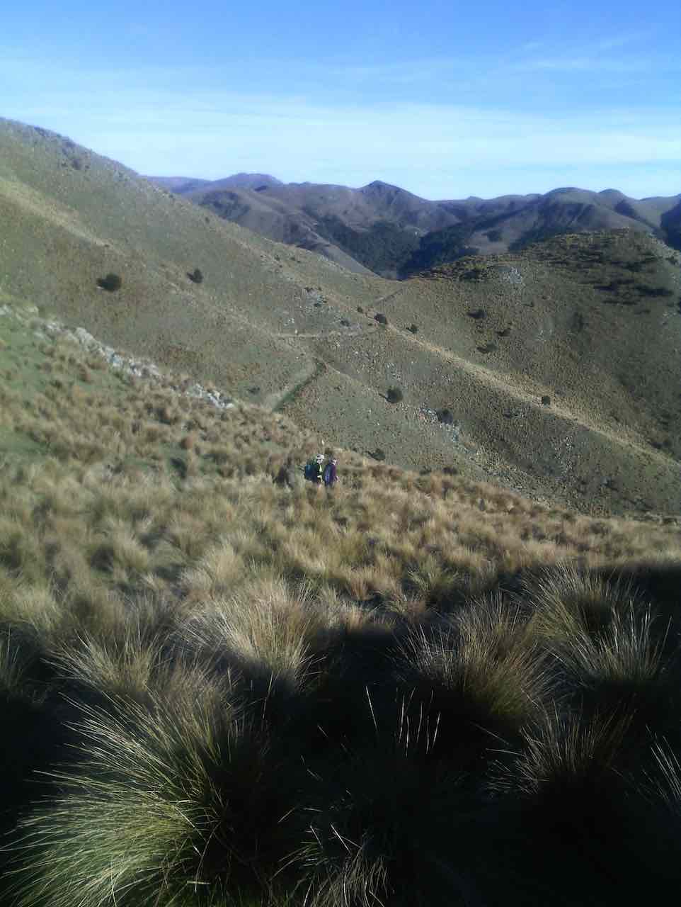
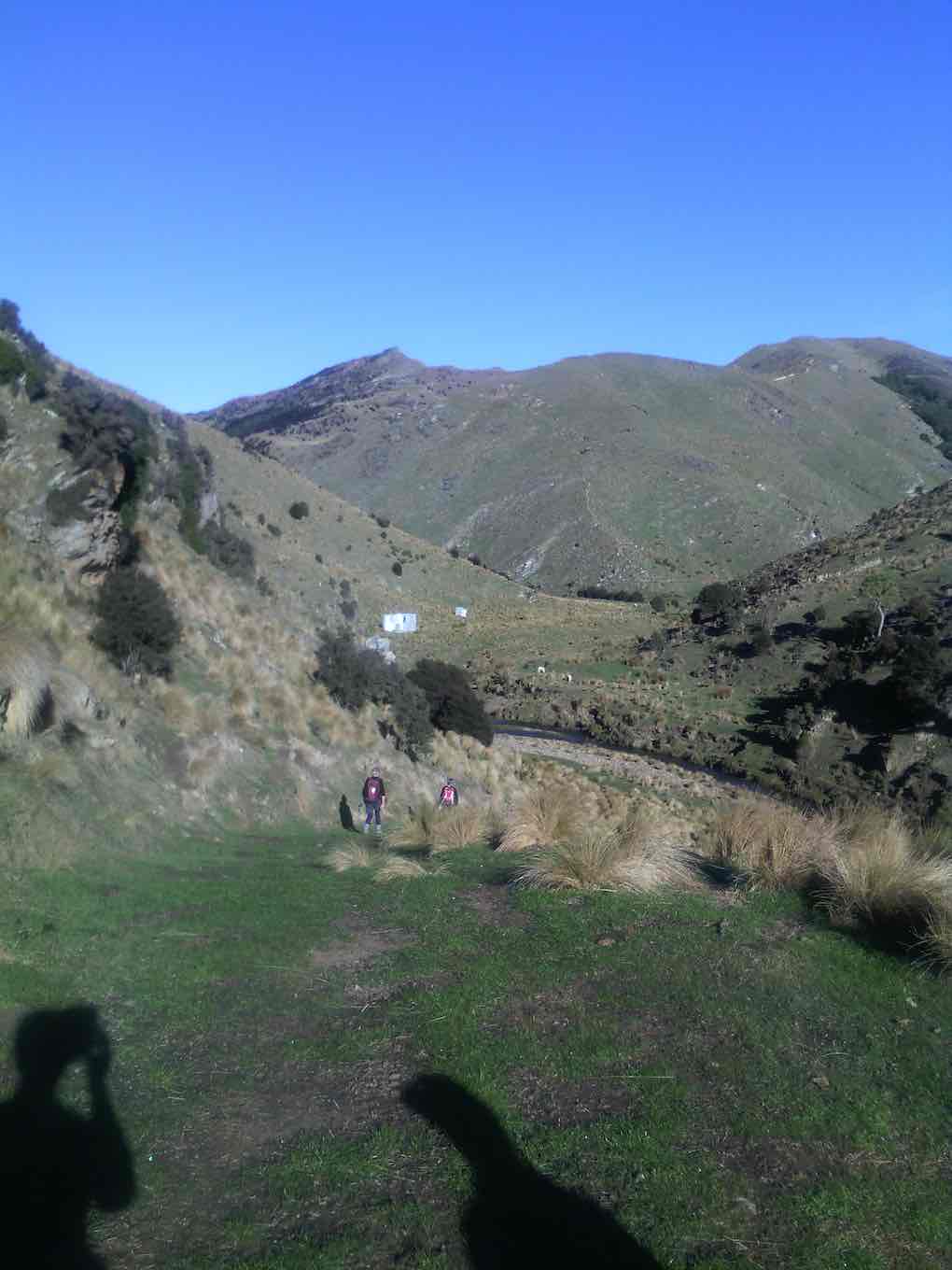
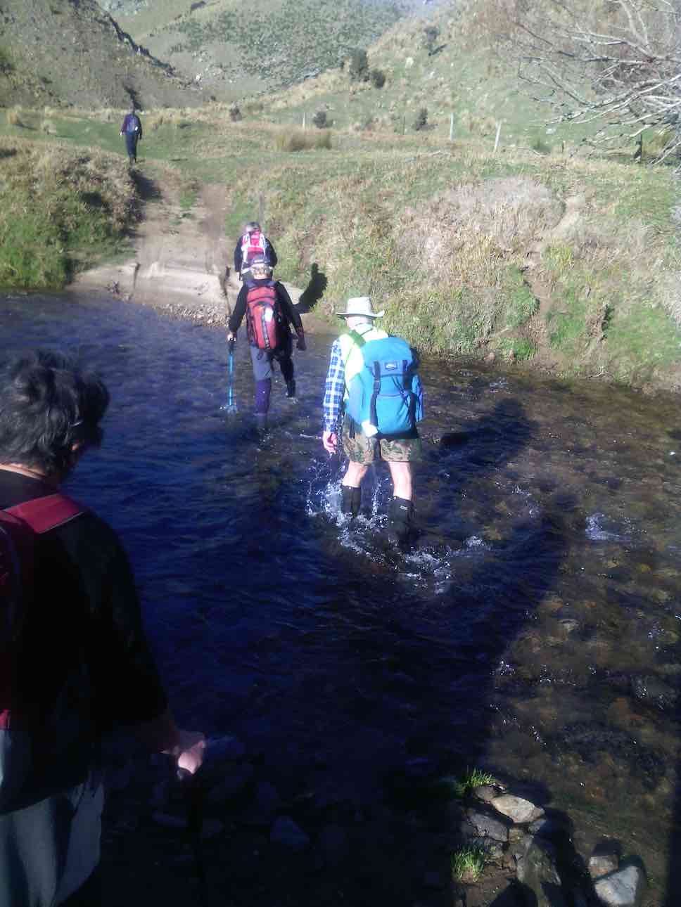
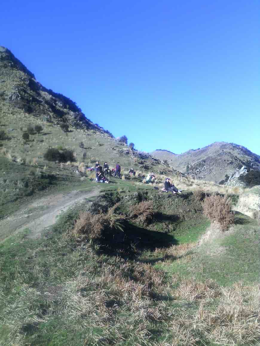
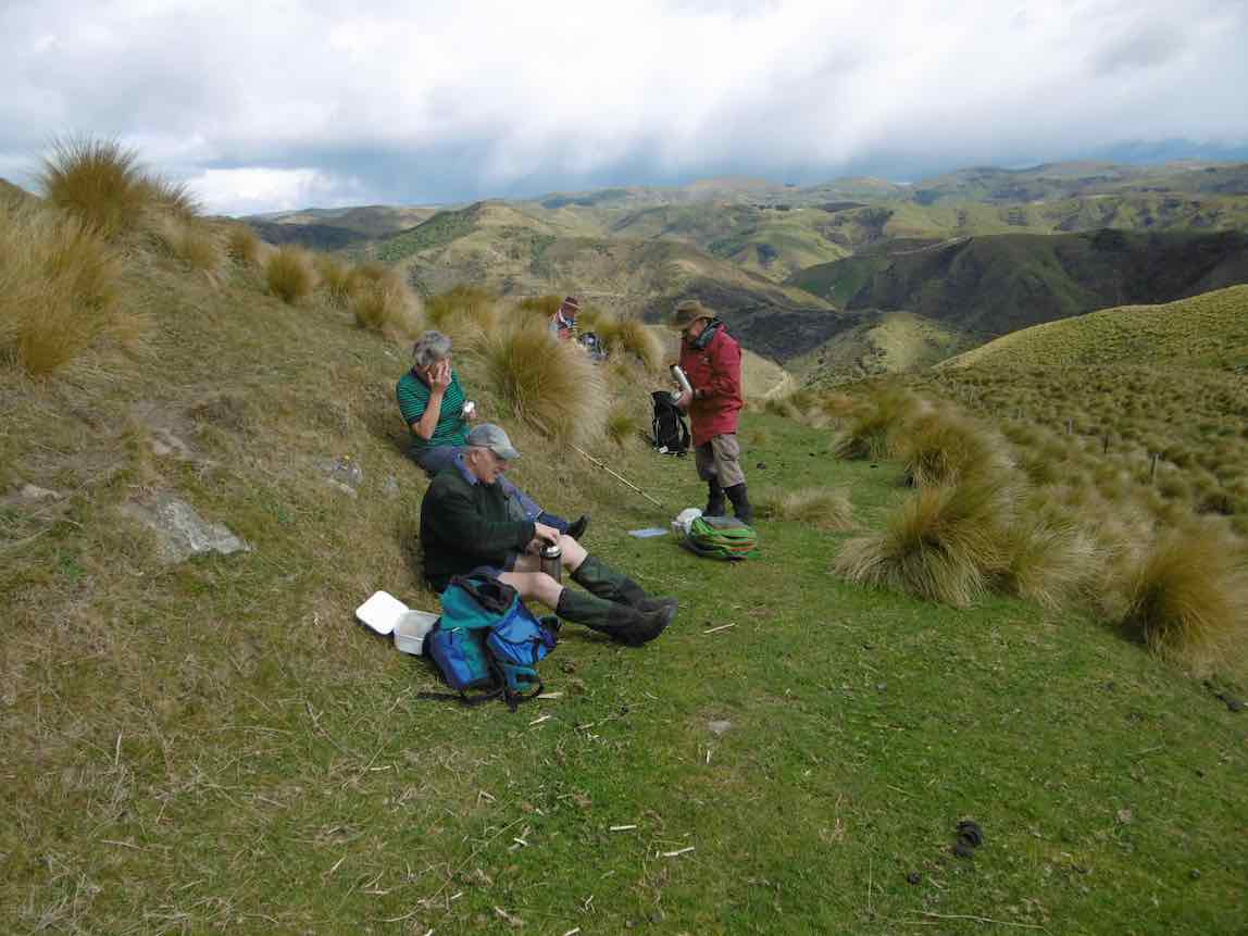
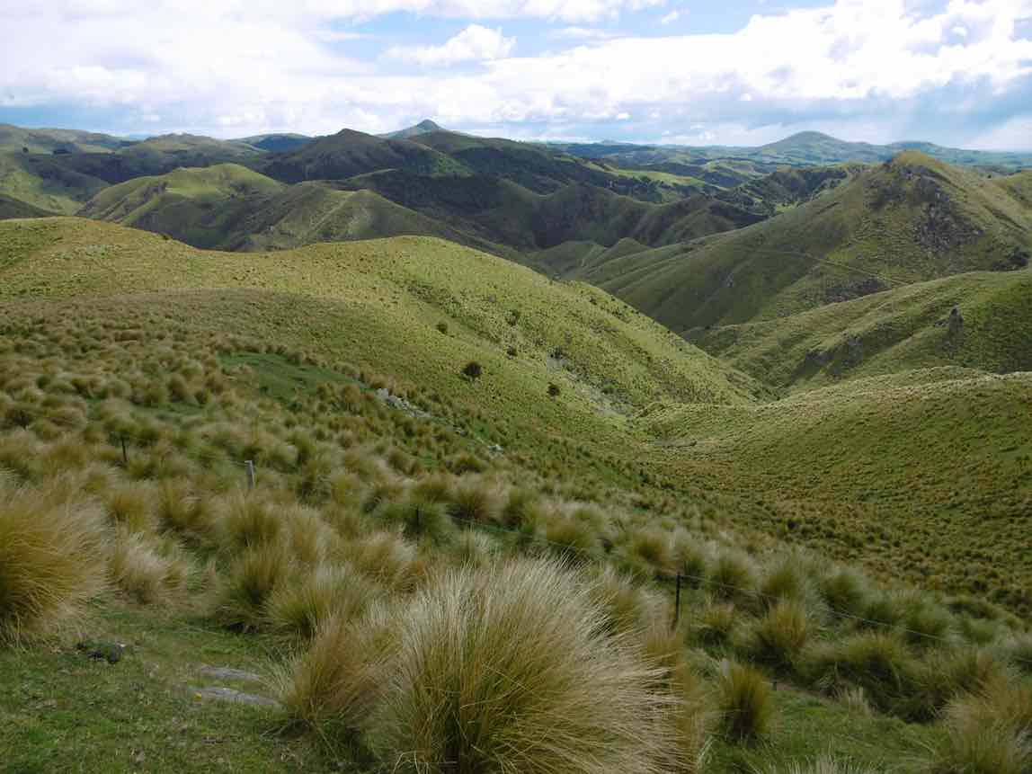
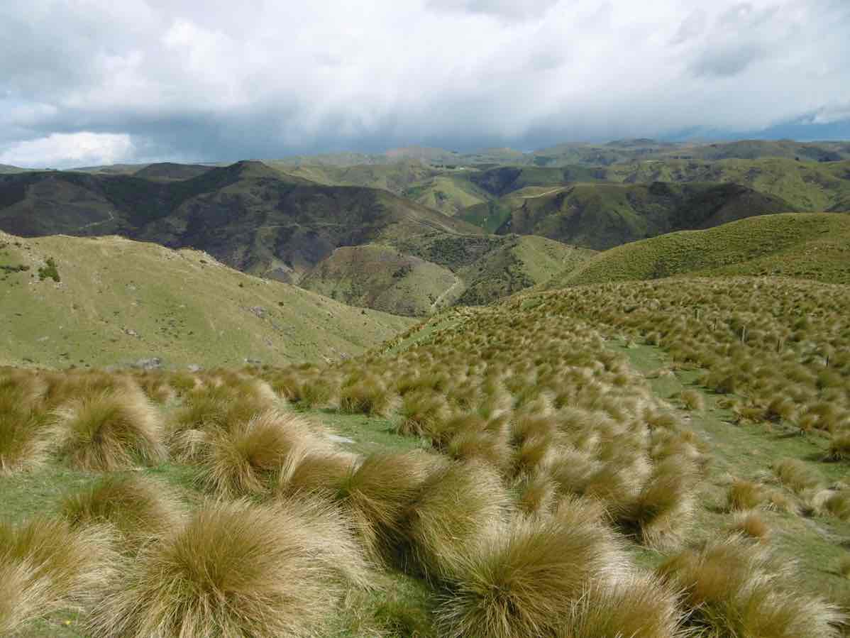
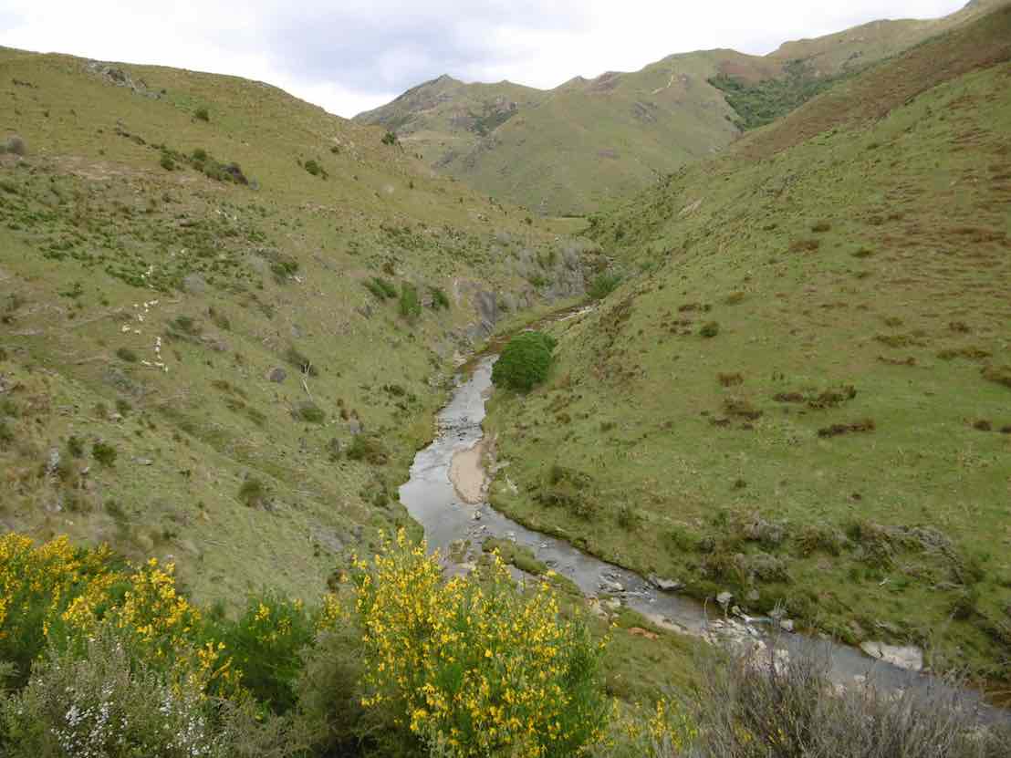
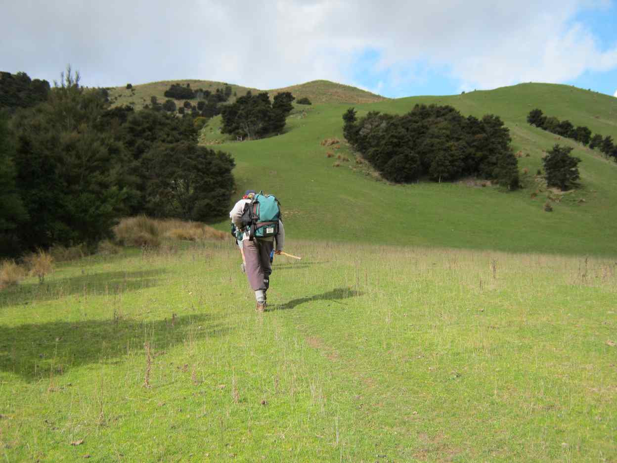
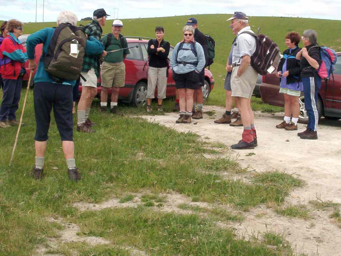
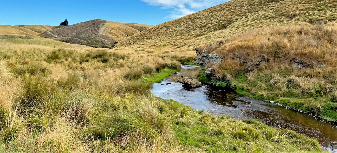
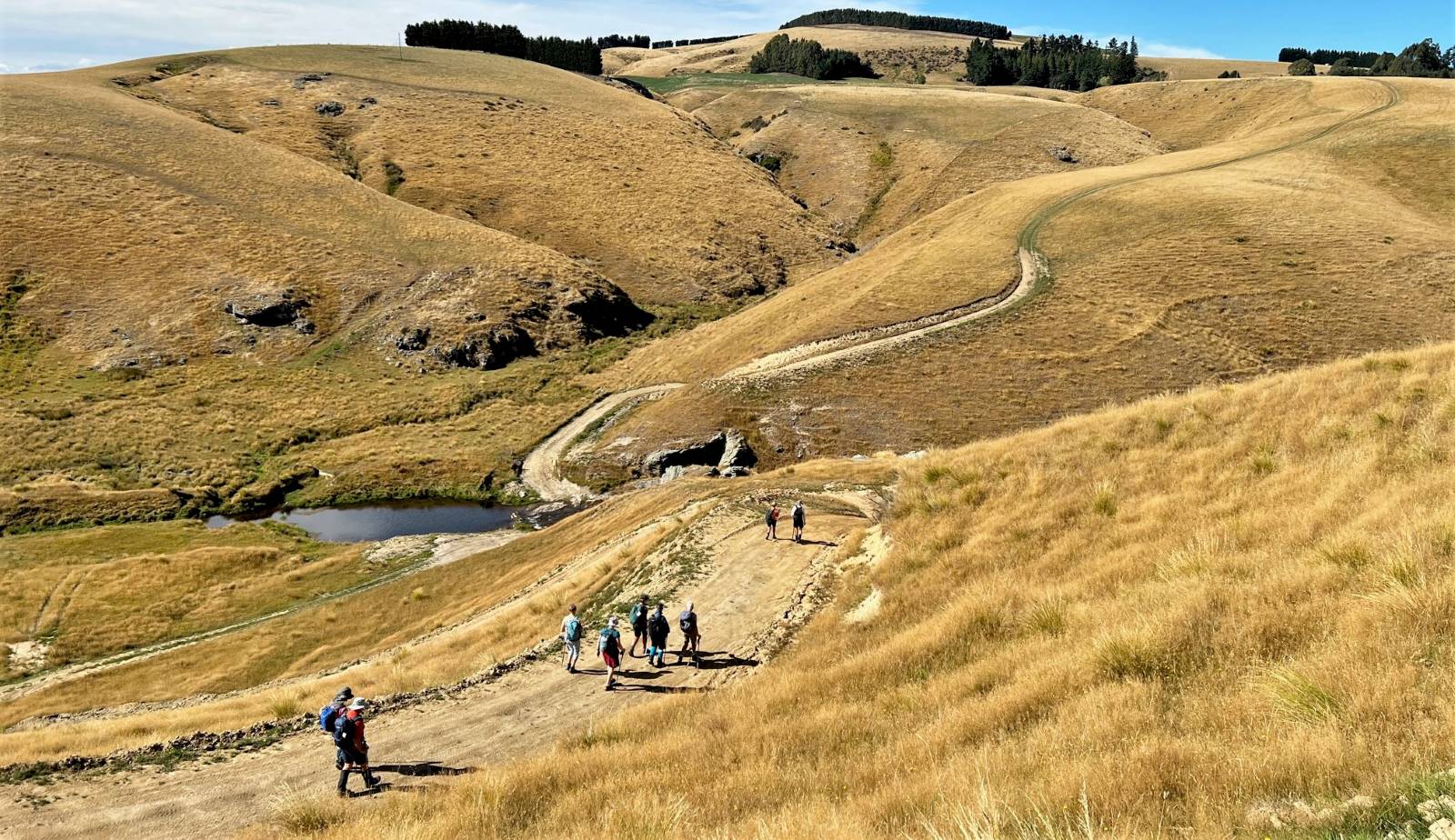
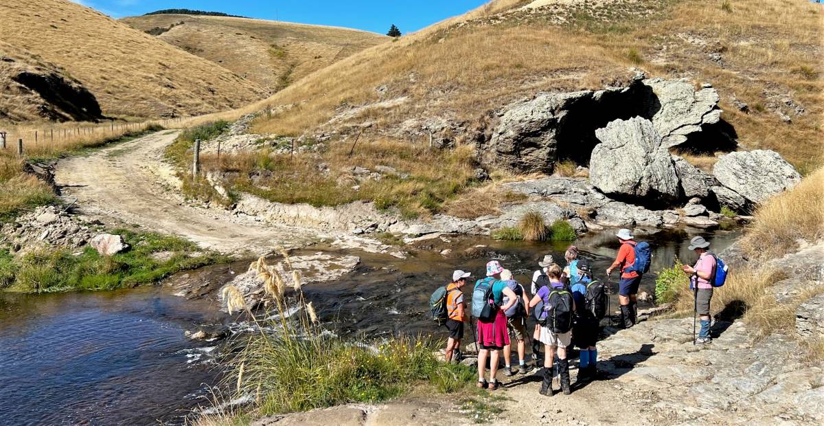
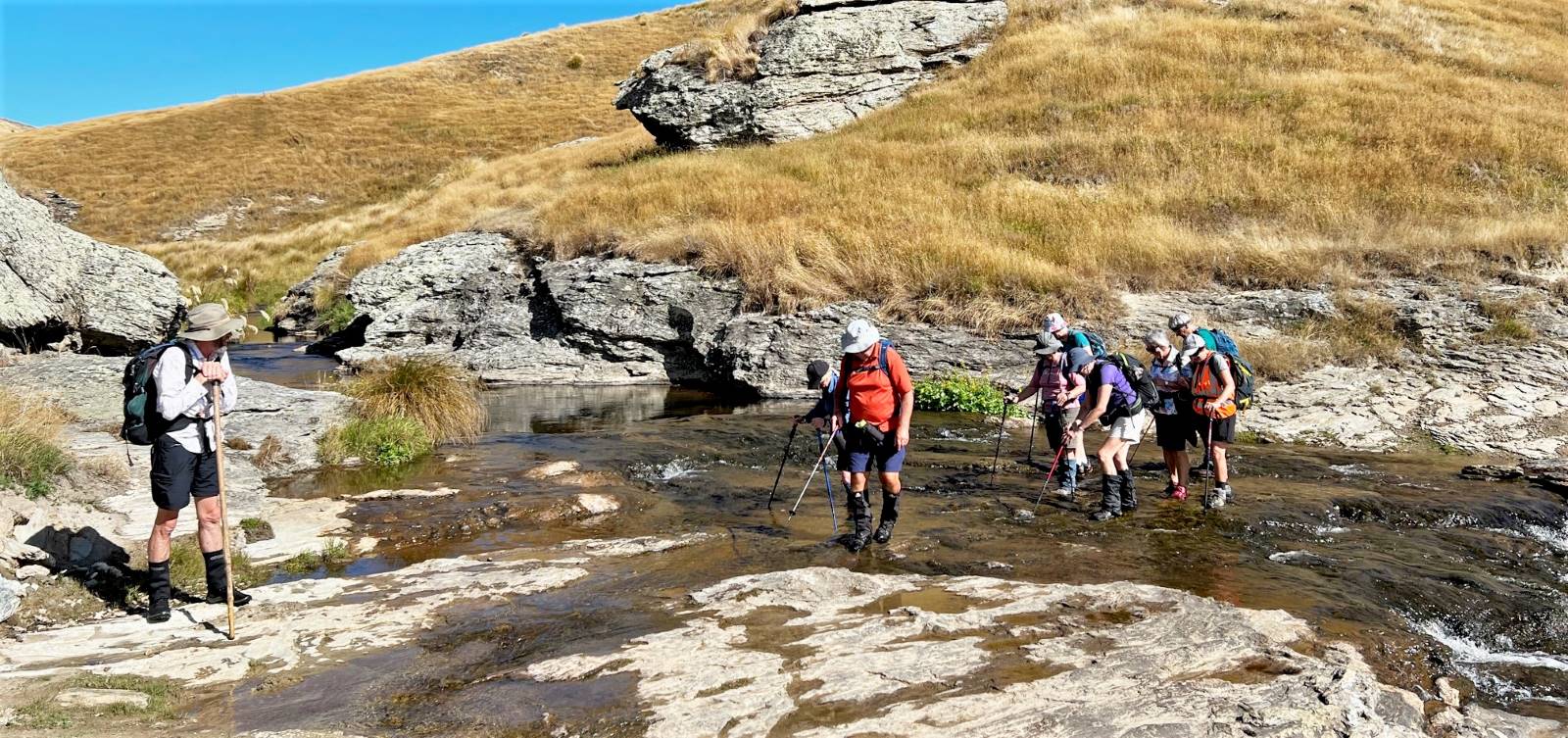
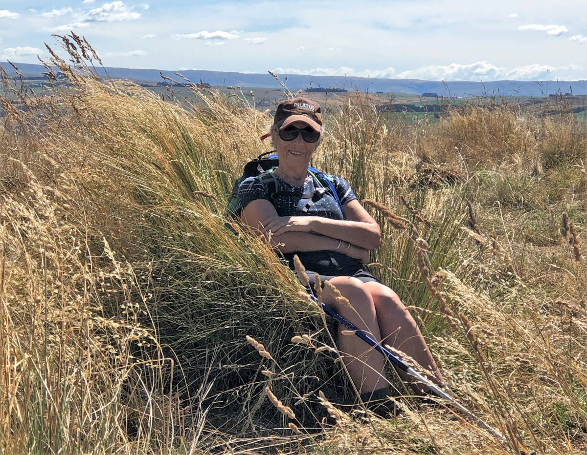
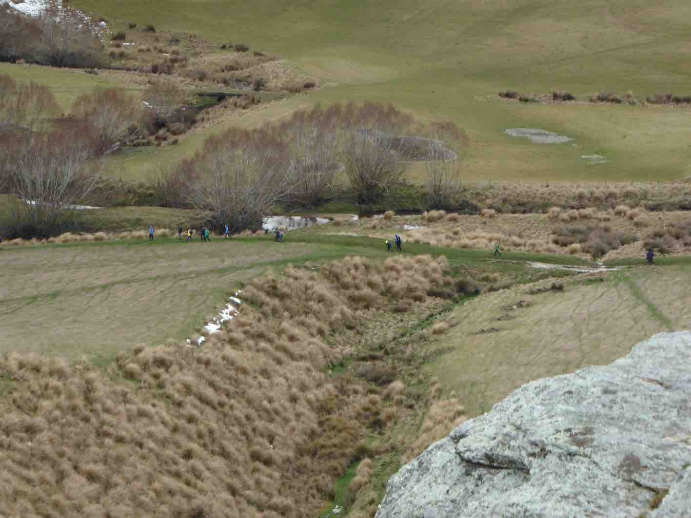
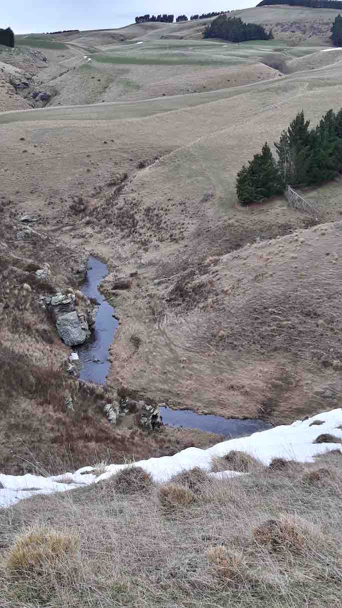
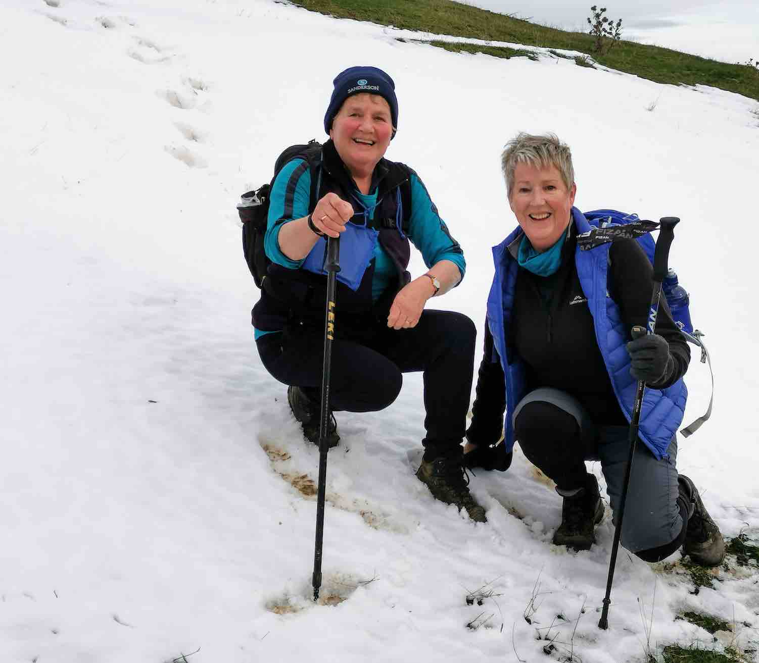
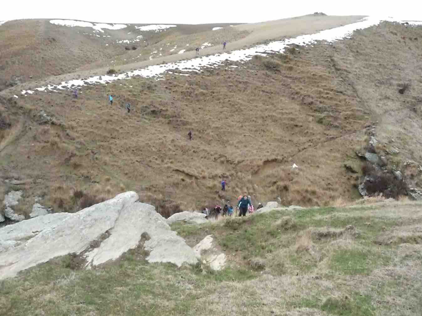
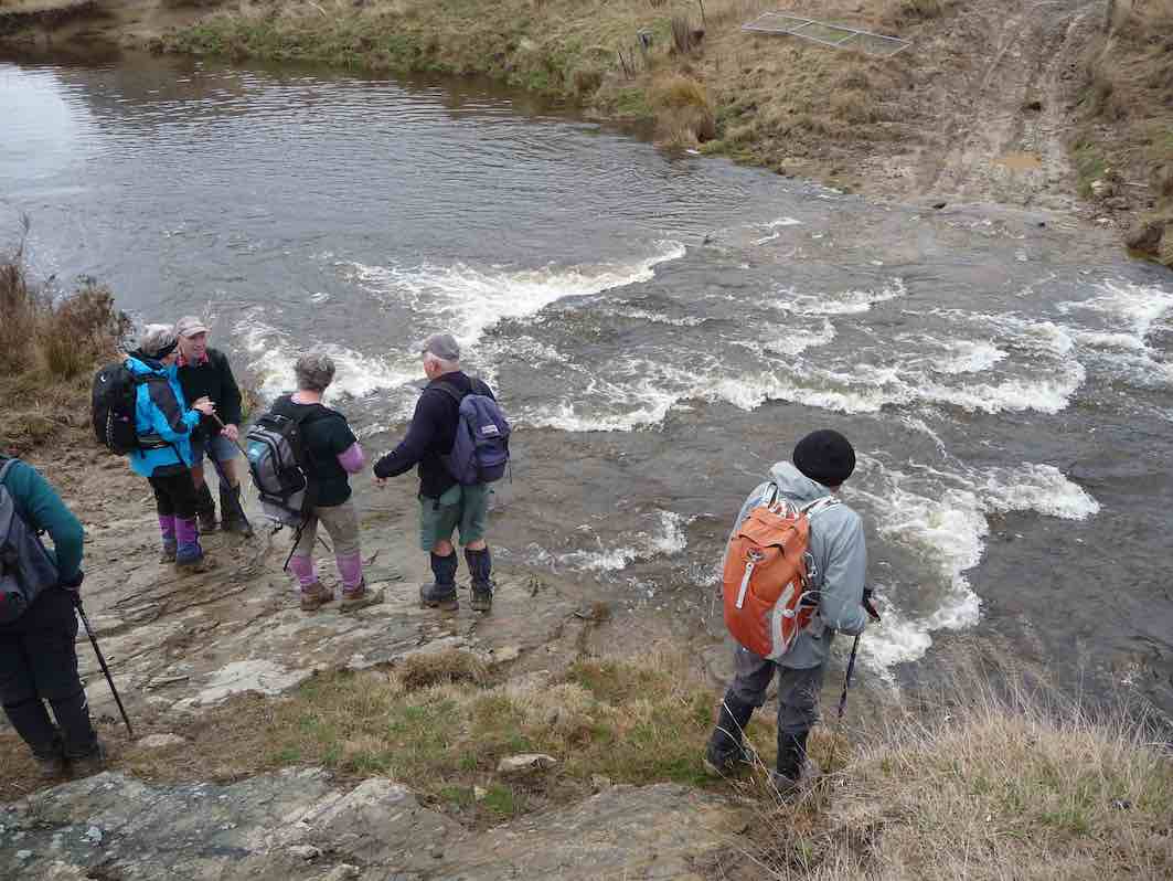
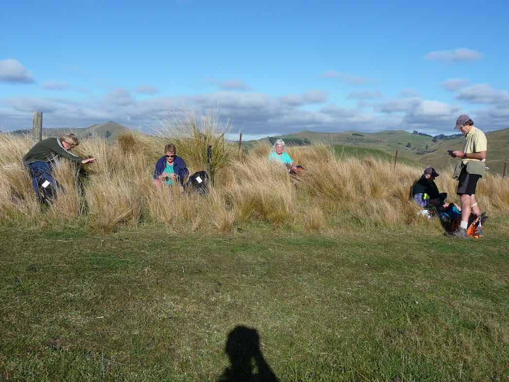
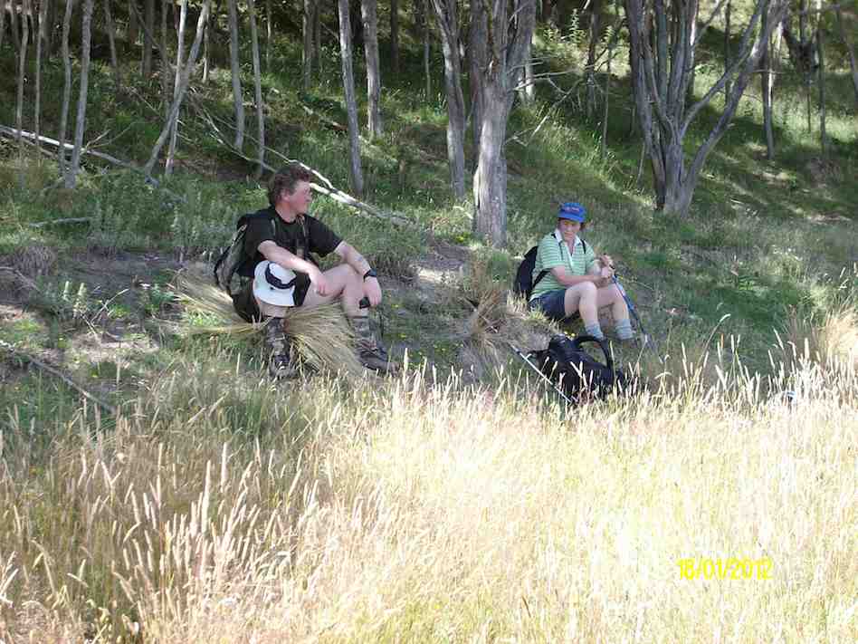
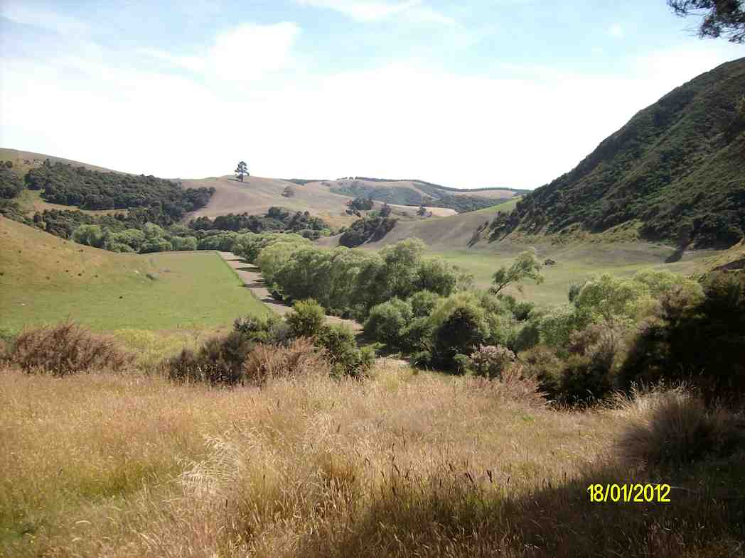
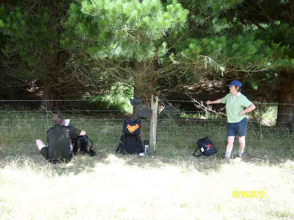
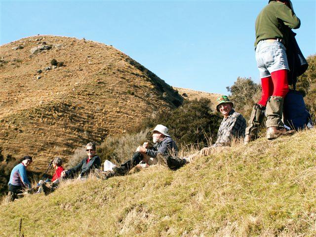
29/01/2025. Hope Hill. Grade 4. Trampers. Leaders: John Gardiner and Martin Hickley.
The last club tramp here was almost exactly two years ago and Diane and Marijke’s description is quite excellent, so I’ll not repeat that. Undertaken in ever warming conditions and rising afternoon winds, over exposed farmland, twelve trampers were very glad to get down to the cars some five hours after leaving.
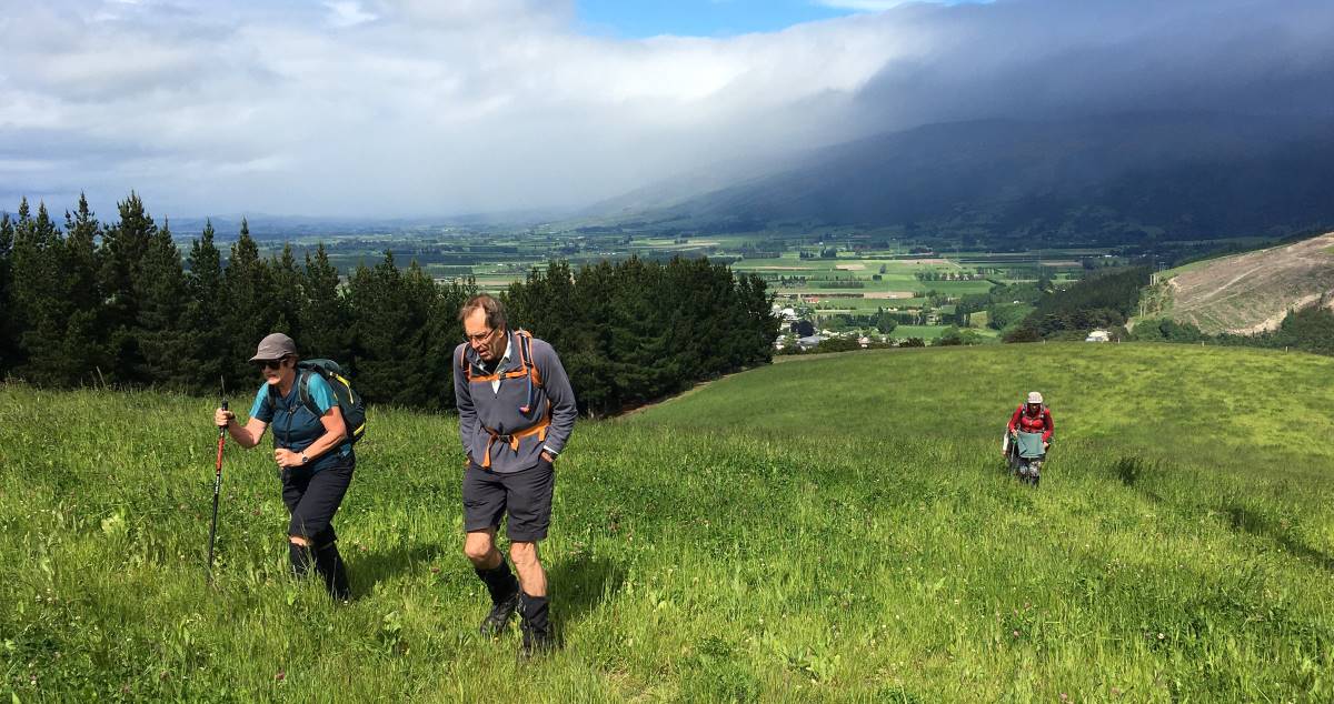
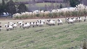
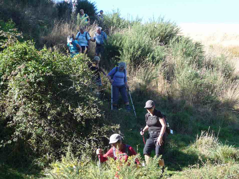
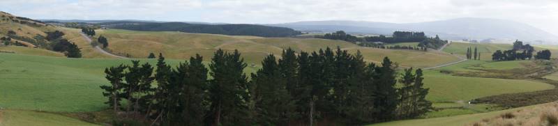
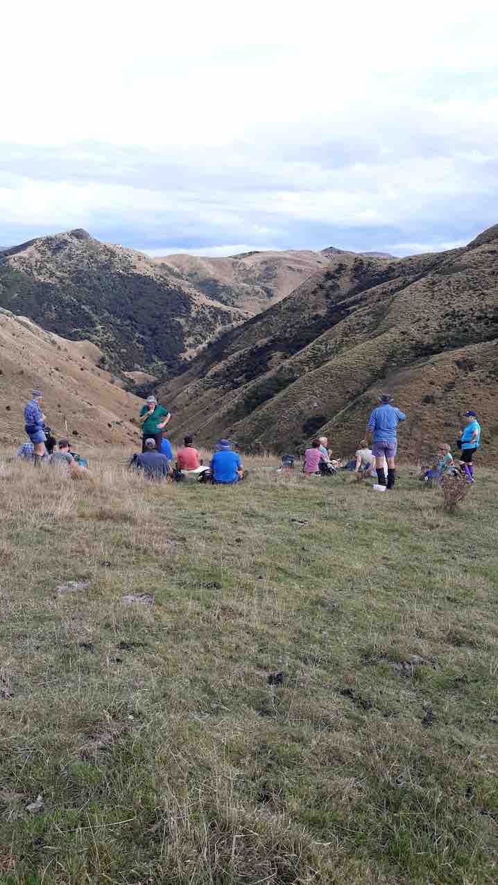
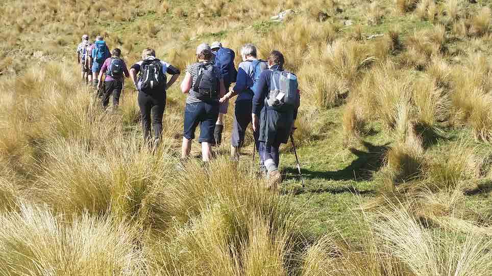
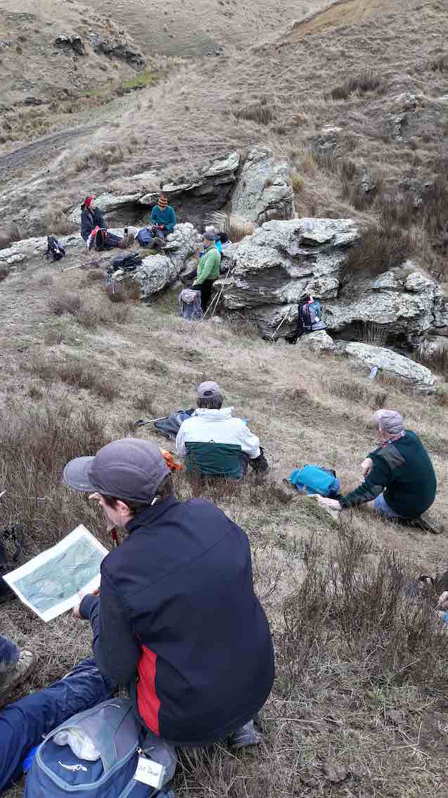
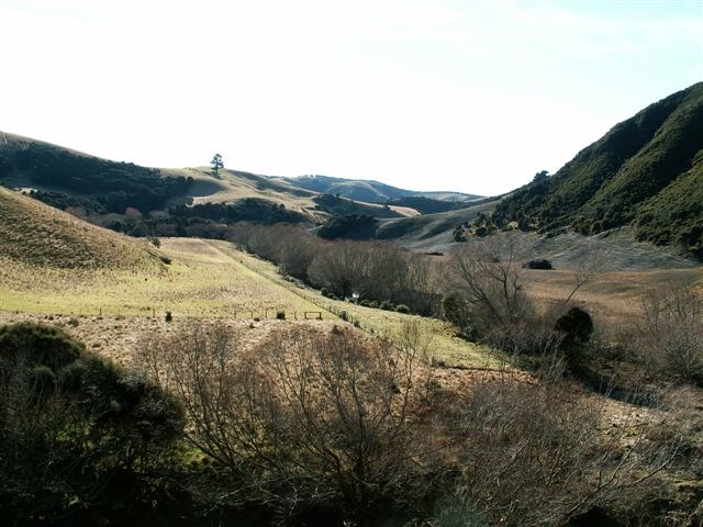
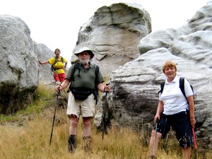
22/01/2025. Mt Royal/Bobby’s Head (Tavora Reserve). Grade 3.5. Trampers. Leaders: Graham Thurlow, Graeme Souter.
Parking at Tavora Reserve in the long grass on a warm summer’s day with a slight breeze we, 15 trampers, made our way up the gravel on Bobby’s Head Rd turning left onto the Goodwood Rd passing a familiar sign, “Adam Sutherland Road”. Continue reading “Mt Royal/Bobby’s Head (Tavora Reserve)”
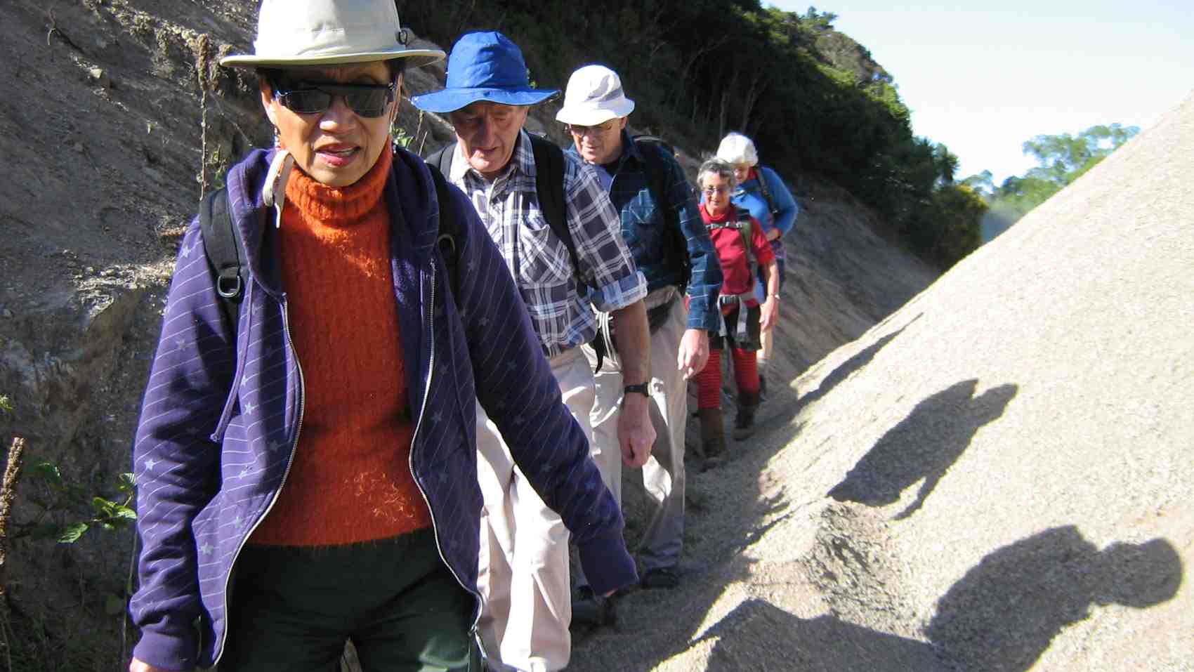
04/12/2024. Cleghorn Street to Signal Hill Monument . Grade 3. Hikers. Leaders: Maria McNee and Peter Dodds.
Only 3 cars left from Peter Johnston car park on what was promising to be a sweltering day.
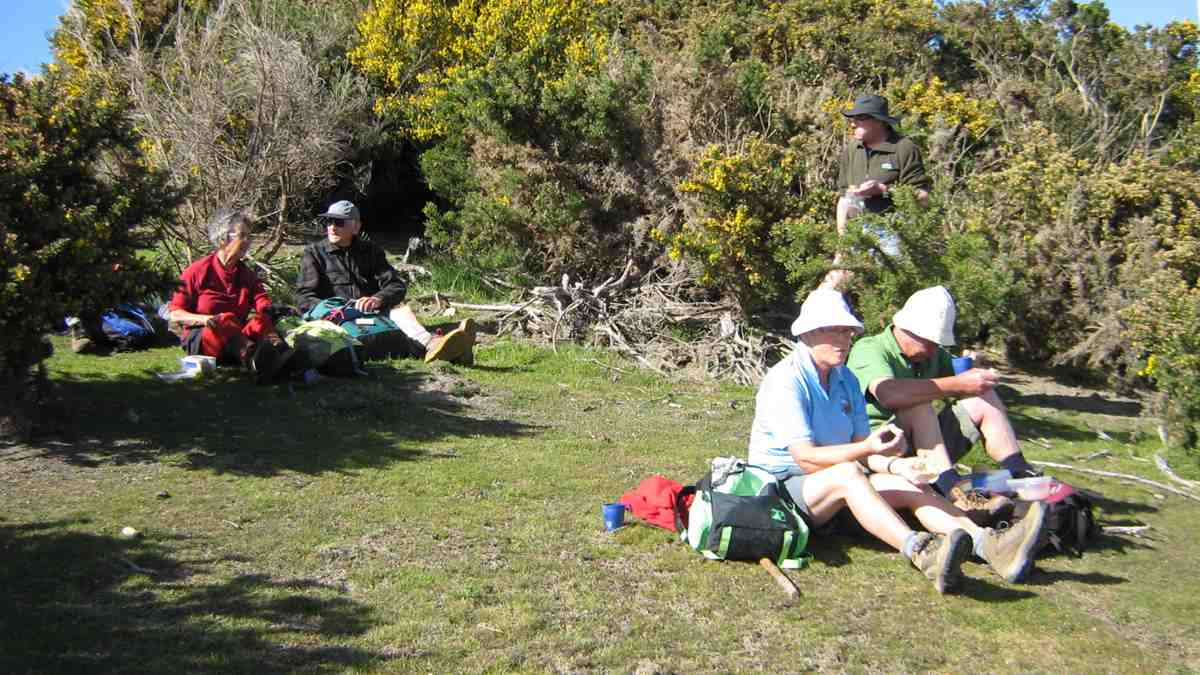
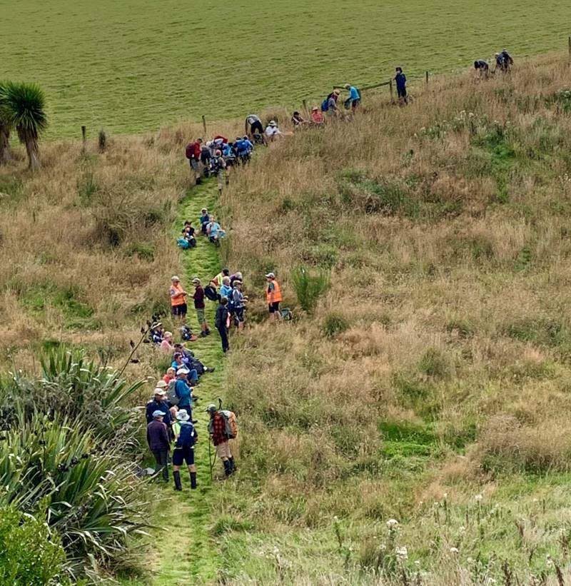
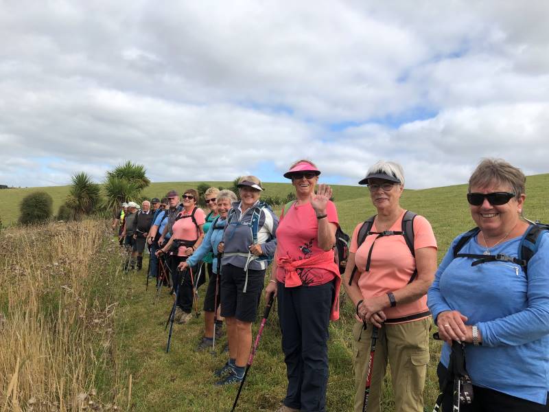
27/11/2024. Around Harbour Cone. Grade 3. Hikers (and Trampers). Leaders: Jenny Flack and Rhonda Wilson.
Listening to the heavy rain coming down on Tuesday night I don’t think too many of us thought we would be out hiking the next day. Continue reading “Around Harbour Cone”
18. 27/03/2024. Trampers. Maori Peak and Split Rock. Grade 3 Leaders: John and Dave
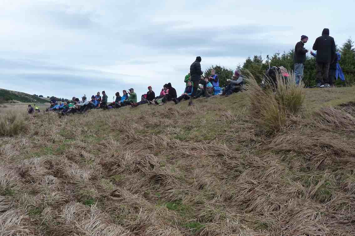
I’ve always regarded myself as, and indeed endeavoured to be, an optimist. But on Tuesday night, I had serious doubts that Wednesday’s tramp would proceed. That night seemed to leave little room for optimism. A Wednesday morning early dog walk gave a glimmer of hope, that the weather, although unpredictable, might be improving. Seventeen ‘optimistic’ trampers took part on the Split Rock tramp.
6. 21/02/2024. Tramp. Blackrock. Leaders: Jill and Neil
13 trampers had a “Rock Day” beginning with rock music at Peter Johnson Park where athletic sports were about to start.
We tramped the reverse route from last time after parking in Ash Beattie’s yard. The day was sunny, became warmer as time went on and the expected wind proved to not be a problem. Morning Tea was enjoyed at the Black Rock.
20. 7 February 2024. Combined hikers and trampers. Aramoana – Heyward Point.
Hikers: Leaders Heather and Val Cayford
‘Pathway to the Sea” – 7th February 2024 at 8.45am on a grey overcast morning with slight drizzle 15 hikers left Peter Johnstone Park and arrived at the small coastal settlement of Aramoana at approx. 9.45am – a peaceful place with 260 permanent residences as of 27th January 2024. Continue reading “Heyward Point, Kaikai Beach, Whareakeake Road”
No. 76 on old hardcopy list of 113 club tramps. “Coutts Gully Return Sawmill Rd Farm”. Livingstonia Park distance from car-park: 32 km.
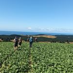
23. 31/01/2024. Hikers Coutts Gully Road. Grade 3. Leaders: Bruce and Alex
After welcoming a new hiker, Peter Dodds, twenty-four hikers left Livingstonia Park, about 9.30 am, heading to the left (east) to the sand dune track that led out to the road by the bridge and then headed up Sawmill Road to have morning tea beside the implement shed on Alan Gorton’s farm.
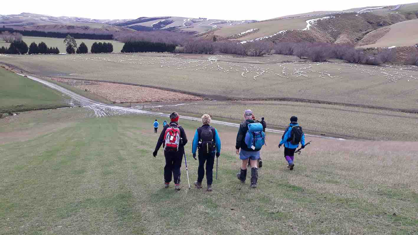
Lovely sunshine greeted 30 keen trampers for a good day’s walk on Cairnvalley Farm Shannon. Strath Taieri offers something different in scenery with tussock hills, huge rock formations and at this time of the year fresh green vistas of paddocks and Continue reading “Shannons Farm Walk”
No. 87 on old hardcopy list of 113 club tramps. “Michelle’s Farm Outram Farm”.
11 km from car park.
Park under Outram Bridge. Contacts: Seek 3 permissions.
Proceed east side of Taieri River along gravel road to gravel pit. Bear right uphill to power lines. Follow generally along grass farm tracks to top of hill.
Landmarks: Trig marker on right; also obvious paper road between two fence lines; Long barn on right (good for lunch stop); large wool shed on top of hill straight ahead (this is still on Hyslop’s property).
Straight on access is to Taioma Road but we don’t usually go that far!
Plenty of mushrooms in April – take a bag!
15 intrepid trampers parked under the Outram bridge. As we walked along the Taieri river wind in the willows gave us warning of a breath-taking day!
On the track above the Taieri River. Photo & caption Pam
Morning tea with the pretty yellow flowers. Photo & caption John
After ascending a narrow track through scrub we made our way along a ridge on Craig Nichol’s property. Any conversation was ‘gone with the wind’. To quote Evel Knievel “ I love the feeling of fresh air on my face and wind blowing through my hair” – certainly true today!
Those windblown skies were impressive. Photo & caption Marijke
We decided not to go to the trig – the howling wind spoke to us and we found our way down to a pocket of native bush. The relative calm here was a welcome respite from the punishing wind on the hill top.
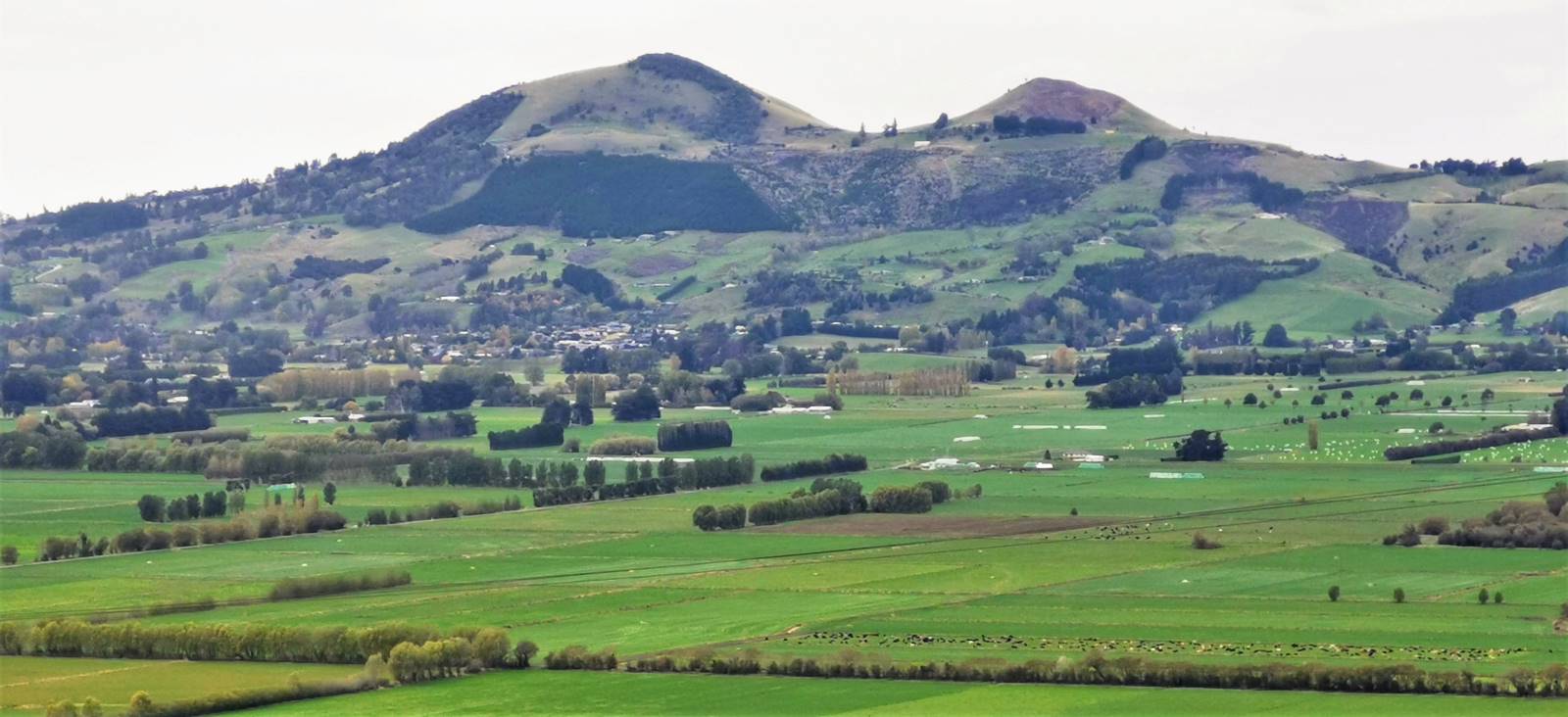
Lovely view of Mosgiel’s iconic Saddle. Photo & caption MarijkeComing down off the windy hilltop to the sheltered gully. Photo & caption PamLunch spot. Photo Jill
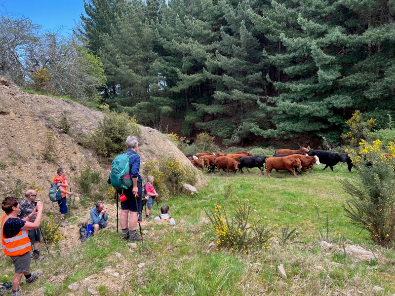
Walking roughly parallel to SHW 87 we headed back towards Outram. Thank you farmer Neil for herding a mob of cattle out of our path.
Keeping our distance for the herd. Photo & caption Pam
Throwing caution to the wind we walked through a Douglas fir plantation, then a large stand of eucalyptus – fortunately there were few recently dropped branches! The only reportable incident was Diane being blown backwards whilst pivoting on a gate – luckily she was caught by the two behind her ( I rue a missed photo opportunity!)
Beautiful spring scenery with cattle sheltering in the trees (very wise). Photo & caption Marijke Lower Neil. Photo & caption Pam Happiness is tramping with friends. Photo & caption Pam
A nice hill climb took us to wide track Craig recently had dug out back down to the Taieri river, and we were at the cars by 3.00 pm.
A great day out and many thanks to Julie McKenzie and Pam Cox for your assistance.
Distance walked – 13.5 km
Jill Reid
17 hikers left the West Taieri Rugby Club on another lovely Outram day. Had an enjoyable walk through Eleanore’s Willowfield Village then headed through Outram and over the Outram bridge.
Outram Bridge. Photo and caption Helen.
We walked beside the river to the start of Craig’s property where we stopped for morning tea.
We walked up the farm track which was a reasonably steep climb…
Group gathering. Photo and caption Helen
…and along the tops through a couple of paddocks where we sat on rocks overlooking the Taieri picking out many of the landmarks.
Lunchtine photo. Photo and caption Margreet
View over to Saddle Hill. Photo and caption Margreet.
Lunch at the top. Photo and caption Helen.
86 years old and up the top of the hill which they had never done before. Photo and caption Helen.
Then back down the hill overlooking Outram township and onto the Wobbly Goat for refreshments before heading back to cars.
It was a good 12k walk and well done to everyone.
Kathryn.
13. 17 November 2021. Trampers. Nichols Farm. M-H. Leaders: Peter Gillespie & Arthur Heenan
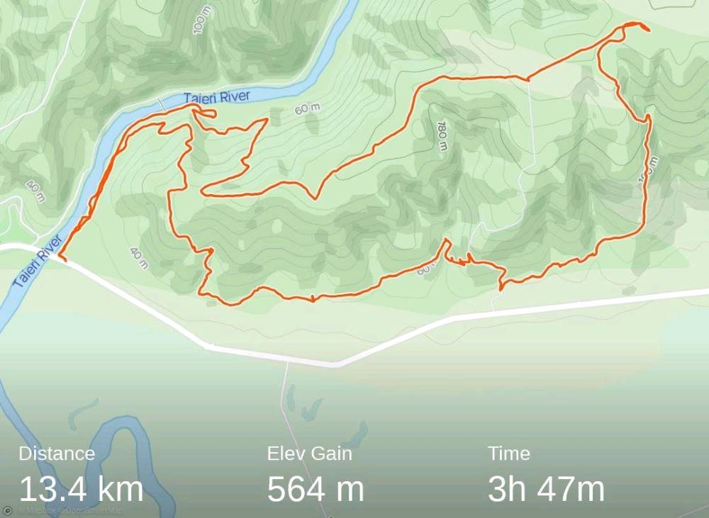
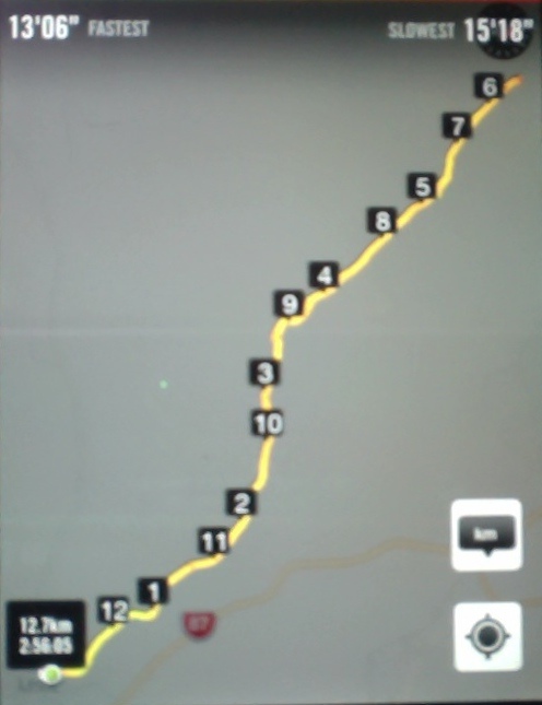
With a medium to hard tramp with a windy day prescribed it didn’t sound inviting, WRONG on nearly all counts. It was a medium hard tramp 13.42km elevation 564m, actual tramping time 3hrs 47min, (4hrs 45 min time lapse).
Strava screenshot by Phil
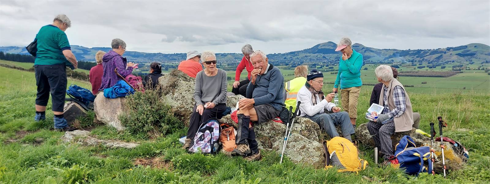
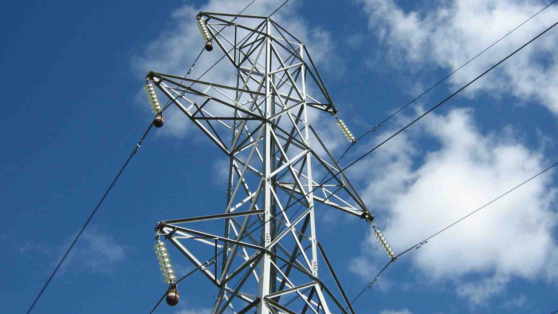
The group of nine was led by Peter Gillespie and Arthur Heenan. With a wind on our backs we enjoyed tramping in nice sunshine on the north side of the Taieri river. We started on a climb, up to an electricity pylon, where morning tea was enjoyed looking out on the northern view upstream. Many removing layers due to the heat of the sun.
Morning tea (caption & photo Helen)
After the break we continued up a 7deg track sheltered from wind we came to a great view south of the rain on the Maungatuas.
Uphill through lush grass – Outram in the background (caption & photo Helen)
Onward, upward we continued toward the top where we came to a trig station, which Peter swore that the height was on, but no. There was some Maori “eh mutu tewanga” which we decided meant “564 metres high”.
Trig at the top (caption & photo Helen)
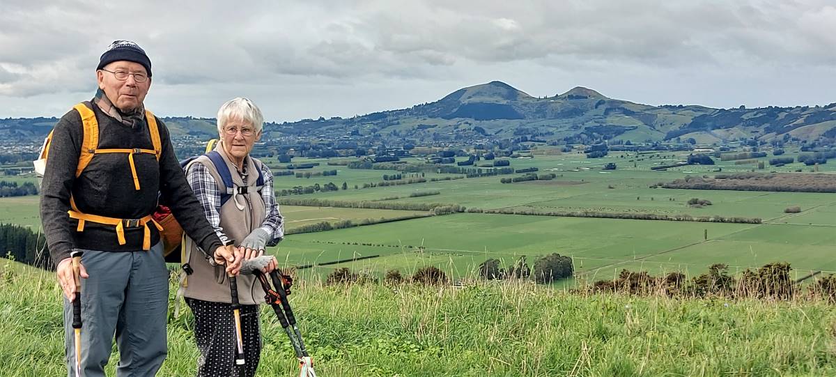
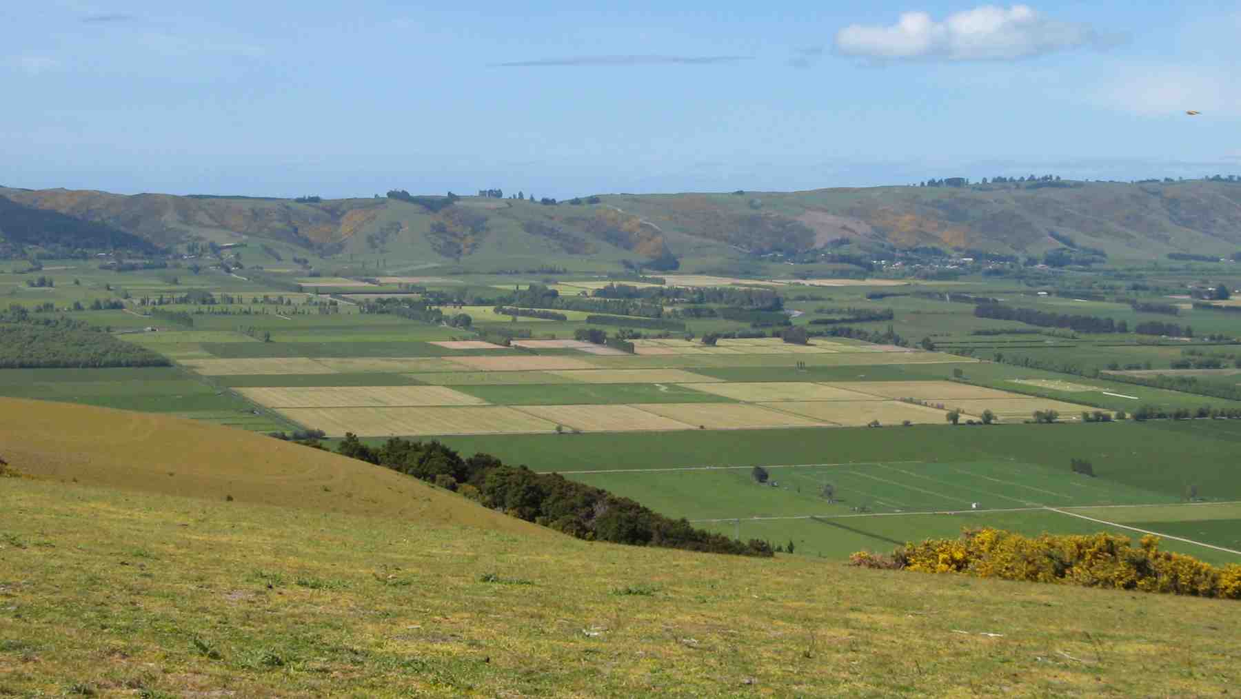
The view was sublime, of Saddle Hill, Mosgiel, lush farmlands, and hills of Flagstaff, Swampy, “magic”. We returned down the hill and found a track working through a forest and downhill…
Where’s the track Peter? (caption and photo Phil)
Beautiful forest (caption and photo Helen)
…then a gorse paddock where we found a nice sunny spot at the bottom, ideal for lunch.
Lunch (caption and photo Helen)
Jill required a ten minute kip, before we continued on through a 2nd forest track, past the lavender farm and some fertile farmland, before we hit the final hill. It was a decent climb, but the group got up it in good time.
Rain that didn’t get near us (caption and photo Helen)
We then returned, on a second track back down to river, watching for the odd sink holes. We had some windy spots, but the day was remembered for the views tramped, mostly in sun.
The group (caption & photo Helen)
A very enjoyable tramp, thanks leaders Peter & Arthur.
Then it was back to the Wooden Table for coffee & cake. Then it rained!
Cheers Phil Morris
12. 17/6/2020. Trampers. Nichols Farm. M. Leader: Gordon
From the carpark under the Outram Bridge 24 members started the walk beside the Taieri River in nice weather but with forecast for rain at 1.00pm. At the end of this track we turned off and headed up hill. Parts of this were quite steep but finally reached a nice flat spot for morning tea.
Photo and Caption Gordon – “Still slogging up hill”.
Photo and Caption Gordon – “Morning tea stop”Photo and Caption Gordon – “Hurrah finally levelling out.”
Heading uphill again after smoko we soon came out on to grass paddocks and continued on a gentle gradient to the cattle-yards at the top. from there walked a short distance before heading downhill on a steep ridge to the start of a small pine forest at the bottom, about ½ km from main road.
Photo and Caption Wendy – “Haven’t seen those people for a while!”
From there we walked a short distance before heading downhill on a steep ridge to the start of a small pine forest at the bottom, about ½ km from main road.
Photo and caption – “Wandering thru the trees”.
A pleasant walk through the trees to a farm track which we followed uphill to a stile where we crossed into Walmsley’s property. Followed cattle track down to gully then along foothills to lovely lunch spot with terrific views.
Photo and Caption John – “Comfortable lunch spot”.
Photo and Caption Gordon – “What a view”.
After lunch carried on along foothills before returning into forestry for assent to top after climbing through neighbours.
Photo and Caption John – “Panorama from the top”
Photo and Caption Helen – “Who’s watching who?”
After a “Pow Wow” at top, decision was made to head back on shorter route to cars which also allowed time for refreshments and catch up at Wobbly Goat. A good day to start off the tramping calendar after all the lock downs I really enjoyed it. Gordon.
11. 7/4/2019. Trampers. Nicols Farm. M. Leader: Gordon.
It was a cool start at the car park as we foregathered, but a typical beautiful autumnal day with lots of sunshine followed. Perfect for 15 Trampers to go and enjoy the outdoors.
Parking under the Outram Bridge wa a surprise for some, although a spot well known to our Outram members – from their younger days apparently.
Walking upstream beside the Taieri River through the willows we were welcomed by a great chorus of Bellbirds – wonderful. They were enjoying the day too.
It was an easy grade as we climbed various bulldozed tracks through the Manuka.
Long slog to top. (Gordon pic and caption.)
Morning tea was taken before we emerged onto a turnip paddock.
Still climbing gently on paddock and road we reached Trig I (360 metres). From this vantage point we had a superb view out over the Taieri Plain to enjoy.
Pointing out points of interest. (Gordon pic and caption.)
A short back track and then it was downhill on a farm road in the direction of S.H.87. Nearing the bottom we turned aside, and climbing a barbwire fence (the leader having thoughtfully fitted a pipe safety guard) …
The first fence obstacle. (Gordon pic and caption.)
Heading down into Walmsley’s farm gully. (Gordon pic and caption.)… found ourselves in a rough gorsey block.
Emerging once more onto open farmland it was time for a leisurely lunch in the sun, and still with a view to enjoy.
Afterwards we negotiated a paddock or two before entering an exotic forest to climb back up somewhat. In time we retained the turnip field to eventually finish the last leg back on our outward track.
Back to the cars at 2pm after walking over 13 km was good going.
To Outram where some visited the ice cream shop, others to the Hairy Goat – where all eventually congregated. And no one was in a hurry to go home. A day that was thoroughly enjoyed by all.
This report comes to you on behalf of Gordon (leader). – Art.
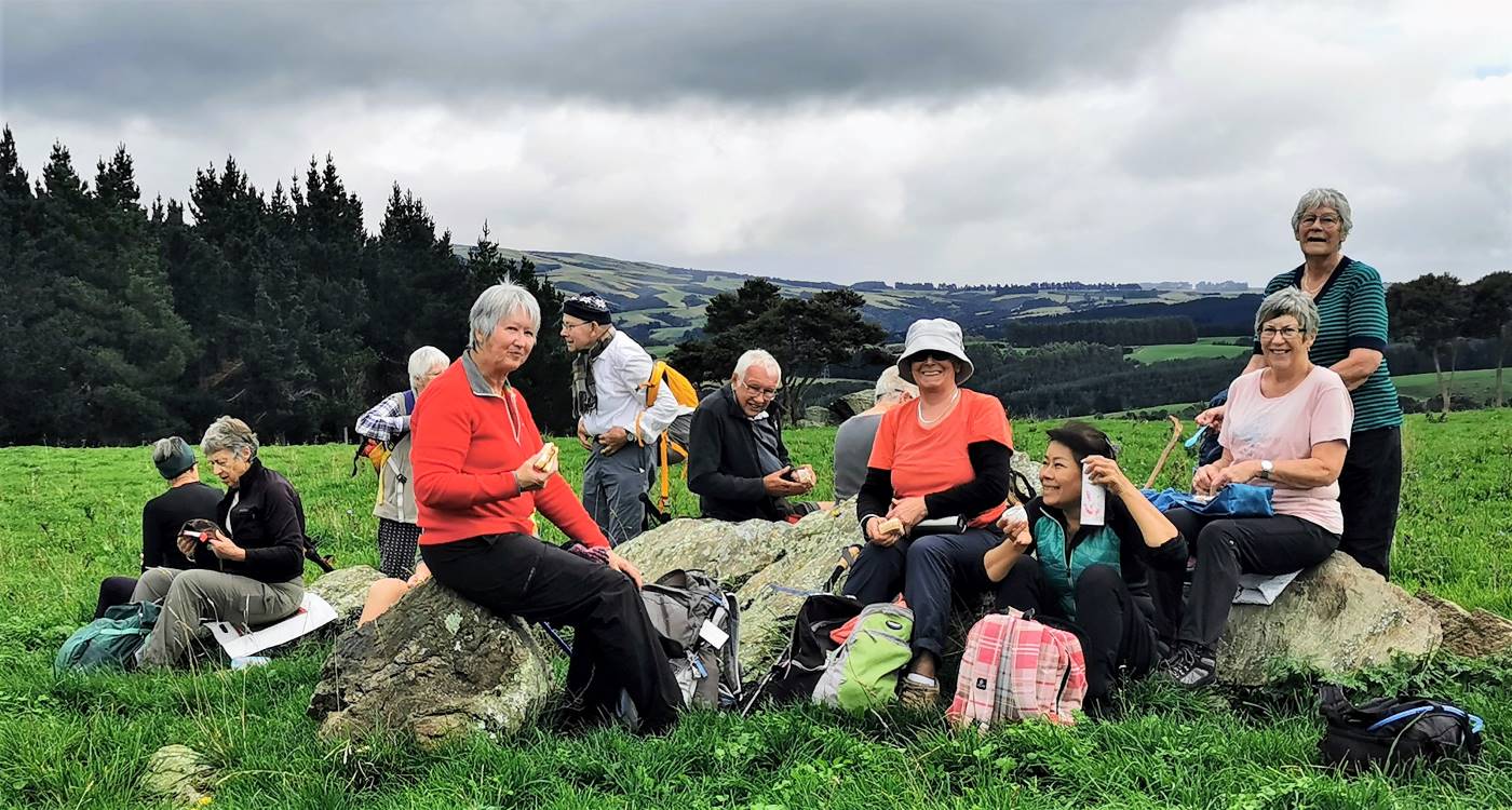
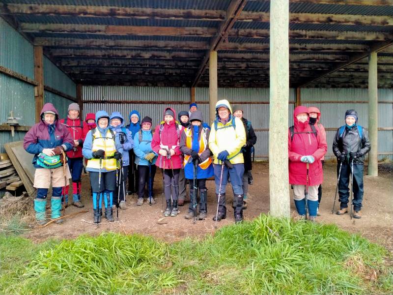
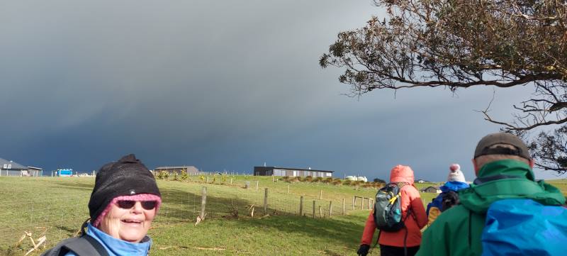
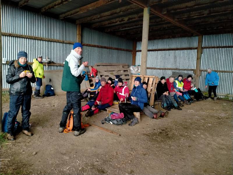
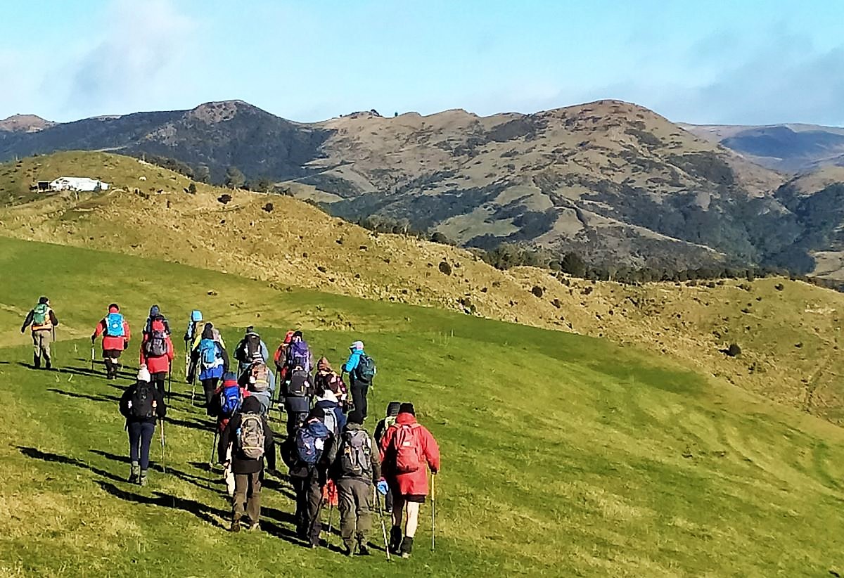
2. 2 August 2023. Combined. Waihola Hill and Lawlor Farm M Leaders: Anne, Lynne, Jenni and Barbara
The weather didn’t look too bad at seven in the morning so the decision was made for the tramp to go ahead. Some of the Hikers and Trampers at Peter Johnson Park decided to give the tramp a swerve and go swimming at Te Puna instead of going out in the winter elements.
Sixteen very brave Hikers and Trampers arrived at Baker Road, Waihola to walk around Brendan Lawlor’s property. Brendan has developed a 28 section subdivision after he purchased the farm in 2005. Most of the sections apart from two now have been built on. Brendan has made a track around the lake for people to enjoy the views and birdlife.
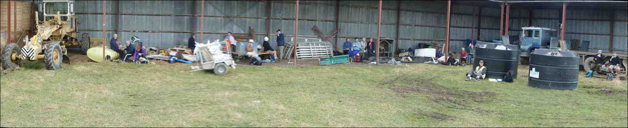
After we arrived the weather was changing for the worse, so we decided to head to the implement shed to have morning tea.
Shall we go or shall we stay Caption and photo Phil
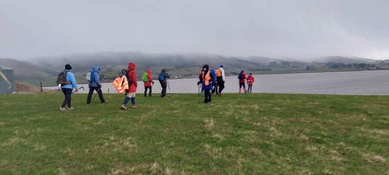
Once there was a break in the weather we reluctantly left the shelter and headed up the hill to walk the track. We all had our wet weather gear on and at times hard to tell who was actually walking beside you. Walking around the lake was so different from the last time. When we had a blue sky day and the lake was like a millpond.
Very muddy lake. Caption and photo Helen
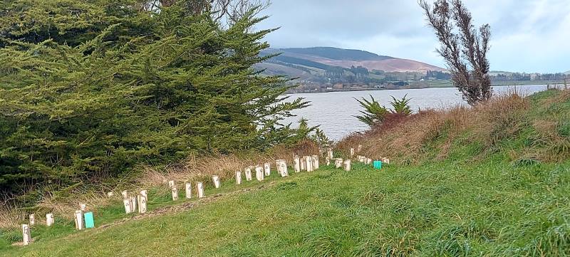
There has been a huge planting project around the front of the lake with lots of native trees and grasses all with protective covers to deter rabbits pigs and possums.
Lots of new planting. Caption and photo PhilGood work Caption and photo Phil
The track in some places was very slippery and muddy due to pig rooting and also a very wet July/August.
Sun at Last Caption and photo Phil
We saw moments of blue sky but down to the south the sky was black and at times we had strong winds and driving rain.
More weather on the way. Caption and photo Helen
Halfway around the circuit we all gathered together and took shelter in the farm building then made a dash for the vehicles. A decision was made to have our lunch at the Baker Road farm buildings then head home with no walk on the new Clutha Gold Trail or a coffee at the Black Swan café
Well earned lunch Caption and photo Phil
Distance 6.48km
Committee Meeting Caption and photo Barbara
1. 2 March 2022. Combined. Waihola Hill and Lawlor Farm. M Leaders: Jill Reid, Chris Wither Jenni & Bruce Wright
A fine morning saw 43 hikers and trampers make their way to the Lawlor property behind Lake Waihola. After regrouping at Waihola, and about 33km from the Mosgiel carpark, we turned right into Lake Road, left into Young Road, right into Berwick Road and right into Baker Road to park at the cattle yards there.
Brendan Lawlor welcomed everyone and described the mechanics of developing the 28-section subdivision since they purchased the farm in 2005. There is also an 1880s restored cottage on the farm.
Briefing from Brendan Photo and caption JenniOriginal cottage 1881. Has been extensively renovated. Photo and caption Pam
Trampers and hikers set off together about 9:45 and made their way up the road and across a paddock to join a track, mown by Brendan, on the lake side of the fence in front of the subdivision. There was little wind and the lake views were gorgeous.
Love the reflections and swans Photo and caption HelenViews like this only minutes into the tramp Photo and caption John
About 10:30 we stopped for morning tea together along the track.
The very large group of people that set off for the combined part of the tramp/hike. A lovely and unusual tramp. Photo and caption Marijke
25 trampers headed away first. A comment was made that the trampers left the morning tea stop true to form. “They were off like a bride’s nightie”.
Goodbye trampers Photo and caption JenniHappy Trampers Photo and caption John
Both groups, at their different speeds, enjoyed views towards the wetlands before turning inland to make their way through the farm and back along the road past the old cottage and new homes to the cars.
18 hikers enjoyed their lunch by a barn on the way and arrived back at the cars about 2:00 having covered around 8km.
Lunch stop for hikers Photo and caption Jenni
The trampers enjoyed their lunch by the cars before making their way up Waihola Hill at 1:00. Their route first took them up a gully [opposite the Waihola Wildlife Management Reserve sign] near the start of Baker Road. They were then able to follow a 4WD track that wound around the hill.
Look behind you guys Photo and caption John
When the trig on top of Waihola Hill came into sight the group turned uphill to appreciate the 360-degree views from there.
Panorama Lake Waipori Photo and caption JohnGroup photo at the trig Photo and caption John
Then it was back to continue following the 4WD track to water tanks and back down the hill to return to the cars by 2:30.
And they marched us down again… Looking across Lake Waihola to Waihola township and SH1 Photo and caption Ross
The Trampers covered about 13km.
Thank you for the many great photos that were submitted to go with this report.
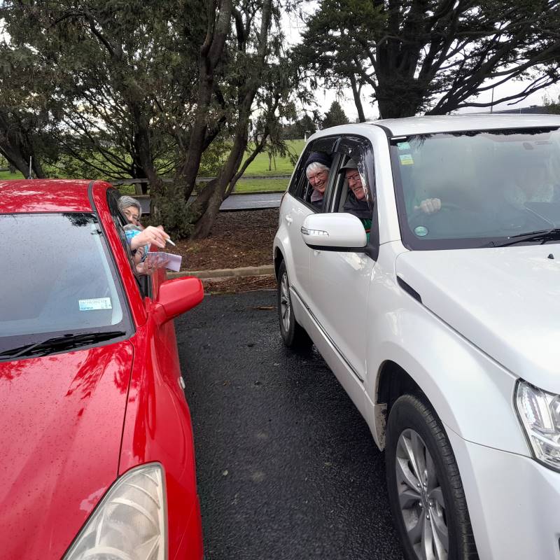
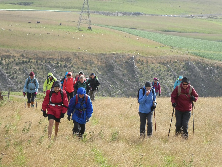
At about 10.10am four cars from Mosgiel, met three cars from Dunedin, at the “On the Spot Dairy”, Waitati, and proceeded to Steep Hill Road, a short distance passed the ‘big dip’at the top of the Kilmog. A few Kilometers or so, on the gravel road, saw us arrive at Moana Farm (Lawson’s Farm.) By 10.25am Twenty four trampers left the cars, with Theresa leading the first part of the tramp, myself being Tail End Charlie.
And off they go – Photo & Caption Phil Keene
The previous night had been a cold, stormy one, and the cold South Westerly wind, certainly made it’s presence felt as we walked further along Steep Hill Road, through a farm gate, and along the fence line parallel to the road, until coming to the next downhill fence, which we followed until turning left at the gate, bottom of the paddock.
A strung out mob – Photo & Caption Phil Keene
(Please bear with me on the previous bit, that seems like information overload, but is critical knowledge for anyone planning the tramp in future.) From here the tramp goes in a roughly circular, clockwise direction, up hill and down dale , following farm tracks.
The lowest point of the tramp was soon reached, where most kept reasonably dry feet, crossing Mary’s Creek.
Crossing Mary’s Creek – Photo & Caption Pam
This creek has an intriguing little story (tall tale or true?) as to how it got it’s popular nickname, which I explained soon after the crossing. It seems Mary was a gold miner’s wife who regularly bathed in the creek.
Listening to John’s story about Mary – Photo GrahamJohn and Neil looking for Mary!!! – Photo & Caption Pam
After this bit of local cultural enlightenment, we seemed to do more uphill than downhill, until
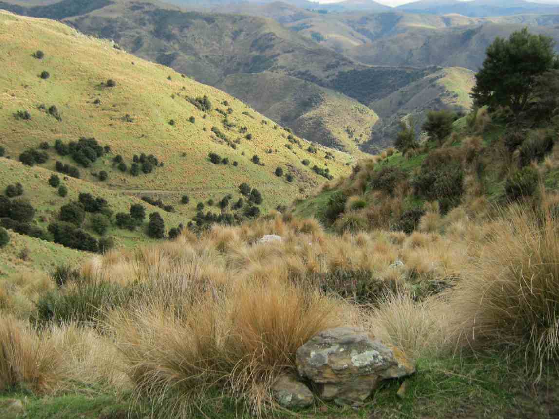
Admiring the Striking landscape above Mary’s Creek – Photo & Caption Pam
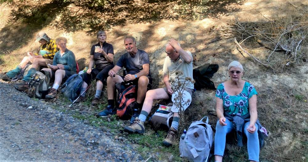
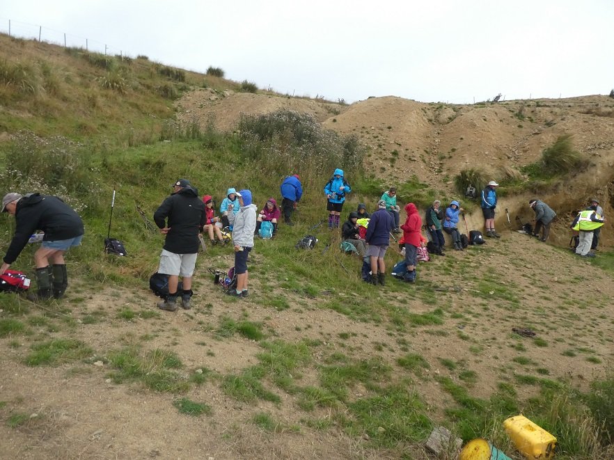
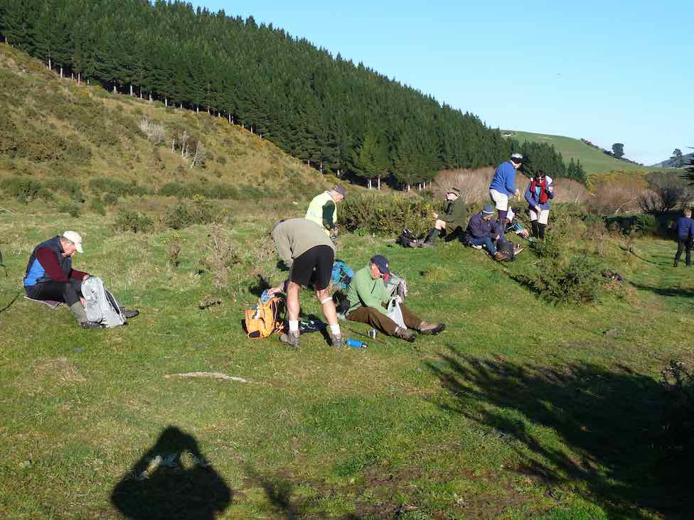
Theresa stopped us for morning tea in a sheltered spot, out of the wind, amongst the tussocks, at 10.50am. By 11.05am we were on our way again, following the farm track, and admiring views of the valley below; farmland with native plantings in the gullies, and farm tacks, mostly following fence lines, seemingly going in all directions, zig-zagging around the property. At 12.30pm we stopped for lunch at the same spot Theresa, Sarah, Phil and I stopped on our Recce. Here sheltered from the wind, most found a ‘comfortable perch’ on rocks, logs, or the bank. to enjoy lunch.
Great lunch spot out of the wind – Photo & Caption Pam
A visit by the farmer, with his beautiful Huntaway perched on the back of his quad-bike followed, just before we started off again at 1.00pm.
Stunning views towards the coast – Photo Graham
I then led the second part of the tramp, back to the cars. Shortly afterwards the forecast wind change took place. The South Westerly wind, changing around to a “Nor Wester.” Just as cold, just as strong, and just as much in our faces! Some respite was found in the sheltered areas of the track as it wound it’s way around hillsides, up and down gullies, and ridges. By 1.45pm we were back at the cars after negotiating the cattle yards. (Thick squelchy mud!)
A great way to finish – Photo & Caption Phil Keene
Afternoon coffee was enjoyed at Blueskin Nursery Cafe’.
In all we had covered 8.56km, altitude 240metres, a Grade 3 Tramp.
Thank-yous are due to :-
Farmer Willie Lawson, for so generously allowing us access to enjoy his property
Theresa White, for keeping me on my toes, and acting as Leader and Tail End Charlie.
Phil Keene and Sarah McCormack for help with our Recce.
Neil Simpson who has lead the tramp before, and was a mine of information on my initial contact with him.
John Gardiner.
17. 2/12/2020. Trampers. Lawsons Farm. Leaders Margreet and Neil
A blustery but warm Nor ‘westerly wind and a threatening sky greeted 32 (or was it 33?!) enthusiastic trampers at the gates of “Moana” farm at the top of the Kilmog. Owned by the Lawson family, Moana is a hilly and picturesque holding, bisected by the meandering Waikouaiti river. We certainly owe a great deal of thanks to generations of the Lawsons who kindly allow us to wander around their property (after requesting permission of course).
“Starting off.” – Photo and Caption Gordon
Taking a westerly route we descended rapidly to Mary’s creek, then round the corner to the site of ancient gold workings.
Descending into Mary’s creek.” – Photo and Caption Gordon
“Checking out the gold sluice.” – Photo and Caption Gordon
“How does the guy with the camera get into a photo?”- Photo and Caption John
From here it was a steady climb with a few minor descents to our lunch spot nestled in a tussocky knoll with views of Karitane, Waikouaiti and Maori Peak.
“Which ones are the trampers?”. – Photo and Caption Gordon“Amazing lunch view.” – Photo and Caption Gordon
It was great to see Neil and Carole out with us again.
“Cloud formations”. – Photo and Caption Gordon
Leisurely lunch over, the group reassembled (tail end Charlie was heard to describe it as like trying to herd fish!!) and trudged the 20 mins back to the vehicles. Not a long tramp by any means (about 9km) but fairly described as nuggety don’t you think?
Post tramp we enjoyed having coffee at Blue Skin Nursery. The staff did a great job taking orders for our large group and we enjoyed sitting outside amongst the plants.
All in all a really enjoyable day out and we look forward to starting the new programme in 2021.
Neil and Margreet Simpson
16. 10/4/2019. Trampers. Lawsons Farm. Leaders: Margreet and Neil
Despite a forecast for heavy rain at lunchtime, a large contingent of 17 trampers set out on our hike on Lawson’s Farm in balmy and ideal conditions.
We left the Mosgiel carpark at 0900 and reached the main gate of the farm at around 45 mins later. After a morning tea break on a grassy knoll;…
Morning tea view. (Helen pic and caption.)Do we have to get you down and up there? (Phil pic and caption.)
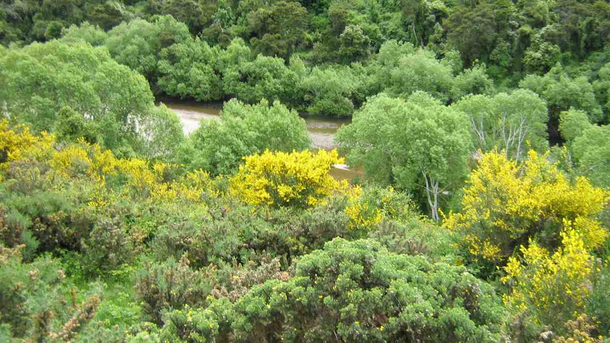
…we descended rapidly on a farm track to Mary’s Creek which burbles through an area of native bush.
Neil explaining the name “Mary,s Creek”. (Gordon pic and caption.)
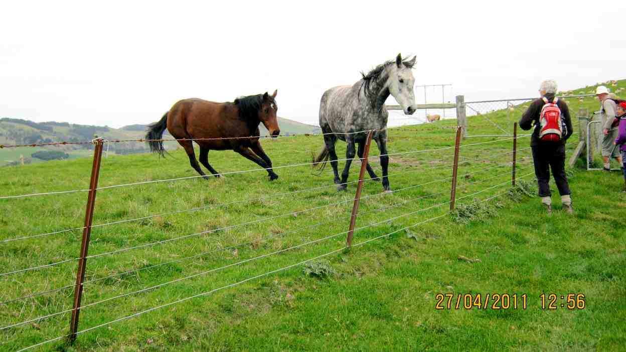
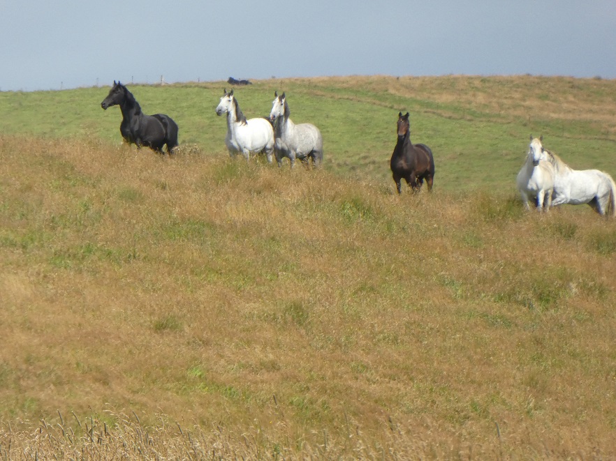
On the descent we passed the only other trekkers we encountered – 5 horses and 3 foals!
On the valley floor we meandered round past ancient gold workings and the remains of a stone dwelling. Then it was a series of stiff climbs and descents on reasonably good footing up to a ridge not far from the woolshed.
Looking back down to the stream. Gordon pic and caption.)
Suddenly a stiff sou’wester wind set in, pregnant with rain, and the temperature dropped markedly.
On a sheltered hillside we ate our lunch.
Lunch in the tussocks. (Gordon pic and caption.)
Incredibly, the conversation revolved around the merits of courtship in an HQ Holden with column change and bench seat; compared to a Morris Mini with bucket seats and ‘four on the floor’! I kid you not!
After lunch we decided to shorten the tramp and were back at our cars by 1300. Total distance was 8 km but everyone really enjoyed the hike and found it challenging enough.
Coffee and ‘blankets’ was at Blue Skin Nursery where we met up with the hikers returning from their beach walk at Warrington. – Neil and Margreet
15. 16/8/2017. Trampers. Lawsons Farm. M. Leaders: Neil and Margreet.
Nine trampers set out from the car park at 0900 on a stunningly clear but frosty morning. After an uneventful 45 minute drive we parked inside the main gate of Lawson’s Farm. Patiently, but DOGmatically the two male trampers ‘herded’ up the 7 lady trampers and set them going in the right direction …
…. Southwest down Steep Hill Road before entering a paddock with a sun-drenched knoll where we paused for morning tea.
Morning tea. (Helen pic and caption.)
Lo and behold two latecomers (Bruce & Bob) arrived to counter the gender imbalance. Arthur was heard to quietly breathe a sigh of relief!
We were doing a different walk today to avoid all the river crossings. It was however still very muddy underfoot. We soon descended to cross Mary’s Creek. Mary, apparently, lived with a small cadre of gold miners and used to sneak up into this bush-clad tributary to take a bath away from prying eyes. None of our ladies were keen for a dip today!
Further on we passed sluicings and building remnants from the gold mining days and then it was a stiff climb up from this, the South branch of the Waikouaiti River.
We sidled around the undulating terrain and found a lunch spot …
(Margreet pic)
… which had beautiful views over the hills and tussocks and Mount Watkin to the North; through Matanaka and Maori Point to the East.
After lunch we soon ‘topped out’ to find stunning views of the coast and untroubled sea …
(Margreet pic)
… as we descended …
(Margreet pic.)
… a long, ever steepening ridge. At the bottom we crossed a noisy creek and began an energy-sapping climb up the opposite ridge back to the cars. It was a bit like the reverse of the Grand Olde Duke of York; who marched his men to the top of the hill and marched them down again! Pointless really!
So; after a wonderful tramp on an exquisite day, it was a weary 11 who gratefully repaired to the café at Blue Skin Nursery for coffees and tea.
Total distance was around 13.5 km. and it was about 4 hours hiking time. – Neil and Margreet.
14. 8/6/2016. Trampers. Lawsons Farm. Upstream. M. Leader: Arthur.
A frost to begin the day. It was mighty raw as we gathered at the car-park in Mosgiel. Nine trampers travelled to Lawson’s Farm, Kilmog area, where we found very pleasant conditions awaiting us. Only the shady faces were white with frost.
Past the wool-shed, where the dogs barked their usual greetings to us, and up the first brief slope found our morning tea stop. The winter 9.30-starts necessitate a later morning tea, but better late than never!
Onto the 4WD track through the tussock we travelled
The track we followed. (Helen pic and caption.)Farm building and long drop. (Helen pic and caption.)
– down briefly, then up briefly, and then down, down, down – until we finally came to the south branch of the Waikouaiti River.
We turned upstream now, following a sheep track through the tussock and occasional scrub, until we had a stiffer climb up around a steep face above the river. We could then descend onto a lovely tussock flat, where we came to a 4WD track to follow.
Eventually the track let us to a ford over the river. The safest route was to cross at the ford also, so it was into the water which was a little cold.
Very cold river crossings and cold wet feet. (Helen pic and caption.)
More river crossings followed in the subsequent mile or so. After the sixth and final one, we stopped at a nice sunny spot to partake of our lunch. Mr Lawson tells me that gold mining had been carried out back in the 1870s or 1880s at our lunch spot. The tell-tale earthworks being very noticeable. The time was 12.20 p.m.
Lunch and view. (Helen pic and caption.)
The river was still up a bit after the heavy rain a week previously. About a foot of water (that’s 30 cm for you metricified folk) was the deepest we had to wade through. All crossed without a mishap, and anyway, real trampers don’t mind getting their feet wet!
Two N.Z. falcons were observed while we were having our lunch. They appeared to be chasing one another, with loud squawks emitting. Perhaps one had caught its lunch but wouldn’t share?
After lunch, continuing on the 4WD track, we were soon in the shade of a narrow valley, almost a gorge. Uphill from now on, but the grade was steady and not unpleasant. The air was very cold in here,
Sooo cold and very white frost. (Helen pic and caption.)
and it was a great relief to find the sunshine again.
Before reaching the Steep Hill Road, we turned off to walk up an open bare paddock. At the gate we made the acquaintance of two quiet and friendly horses.
Friendly horses and nice view. (Helen pic and caption.)
Eventually we gained the road, with about one kilometre to go, and were back at the cars at 1.45 p.m.
Someone stated that it had been a very pleasant tramp – and all agreed with that. No measuring device with us today, but we must have tramped about 10 km.
Afterwards, the trampers had their weekly meeting at Waitati. Business included:-
1. Brief discussion as to our track-clearing intentions for the next season.
2. A considerable number of ideas regarding food, and recipes for the same, were put forward. Did you know that coleslaw makes an excellent filling for “Toasty Sandwiches”?
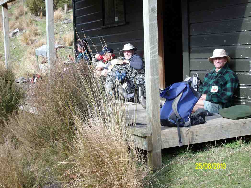
We had 11 trampers out today, including a new member to our group, a really good number.
We parked up just inside the gate of Lawsons Farm, & proceeded to walk down past the farm house, where we were met by Jim & Willie Lawson. We had a very nice chat with them before setting off towards our morning tea spot out of the strong breeze that was blowing.
Then it was down to the river, where we turned right [downstream] & walked along the valley, where we had to negotiate the bluff that requires care getting down. Having safely got past this obstacle, we carried on to the “Lodge” where we had a leisurely lunch stop,
Lawson Lodge. (Margreet pic)
while some members who had not been there before examined the interior of the “Lodge” & the old vehicle chassis residing in the grass, still with chains on the tyres.
Then it was back the way we had come, until the slope we had to climb was upon us. All made it up here without to much drama, & we had a regroup at the fence corner, before making our way up to the ridge track, which leads back to the farm yard.
After arriving at the cars, it was decided that the ‘coffee club’ tradition would be continued with a stop at the Blueskin cafe., where we all enjoyed a chat over our favourite cuppa.
There were some appreciative comments made about the tramp, so a good day out for all.
Walked 12.5km
4km/hr
climbed 540mtrs. – Ken.
12. 19/11/2014 Trampers. Lawsons Farm. Upstream.
Lawsons Farm Upstream. GPS courtesy Ken. Walked 10.2km; 2hr 32min moving; 4km/h ave; climbed 600m. Some tricky bits, but OK.Morning tea break. (Ken pic and caption)
View from morning tea stop of Mt. Watkin in the distance. (Ken pic and caption)Showing grass track down to the river below. (Ken pic and caption)Valley we walked along. (Ken pic and caption)Old hut.It’s virtually uninhabitable, as it’s very dirty inside. (Ken pic and caption)Showing our route back up the hill. (Ken pic and caption)
We could make this walk even longer, by walking along the valley further & coming up the gully alongside Mountain Rd. Might try this next time. – Ken.
11. 5/6/2013. Trampers. Lawsons Farm.
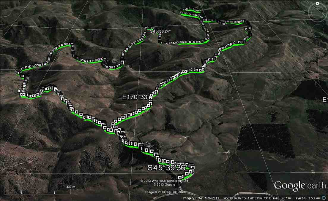
GPS or route, courtesy Ken. We walked 12km; 3hrs 2min moving time; 3.9km/hr; climbed 461mtrs.
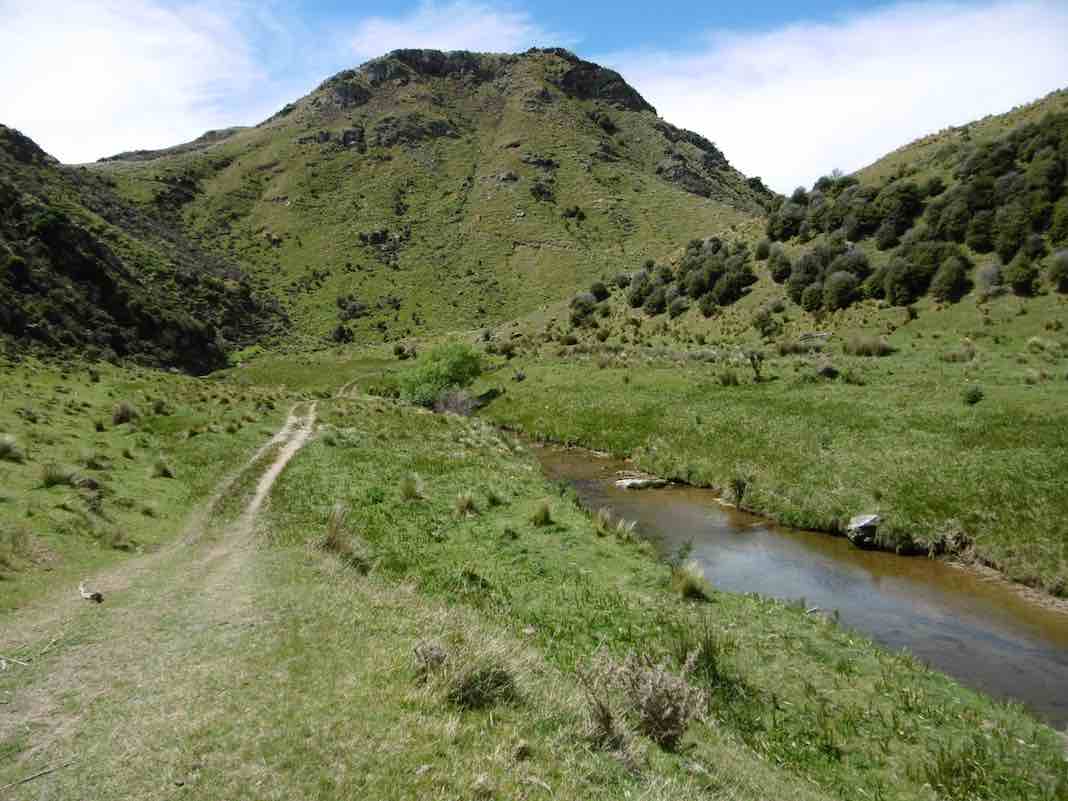
This was new country for 4 of the 6 that started out on this walk. We had quite a nice day except for a cool breeze along the exposed ridge tops.
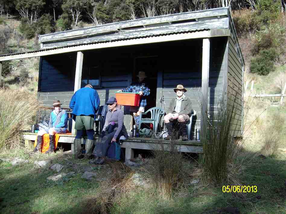
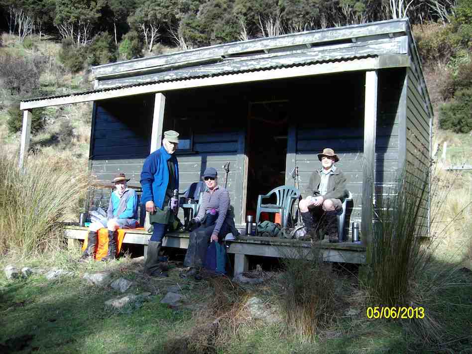
We all enjoyed the walk along the Waikouaiti river banks, & the rocky obstacles that the writer remembered from last time. All enjoyed the lunch stop at the ‘Lodge’, where we made use of some plastic chairs, & the edge of the veranda. Doug even got out a plastic bin for a table.
Getting organised to have lunch at the ‘Lodge’
The comment was made that it had to be the most comfortable lunch stop we had ever had. However, all good things must end, …
Lunch at the ‘Lodge’
… so we decided to pack up & move on, as the sky was looking a little dark from where we were. However, once on the tops again, we could see that it had been unnecessary to hurry, as the weather looked much better from up there. An unhurried walk back to the cars finished off the day nicely, arriving back at the farm around 2:00pm for the drive home.
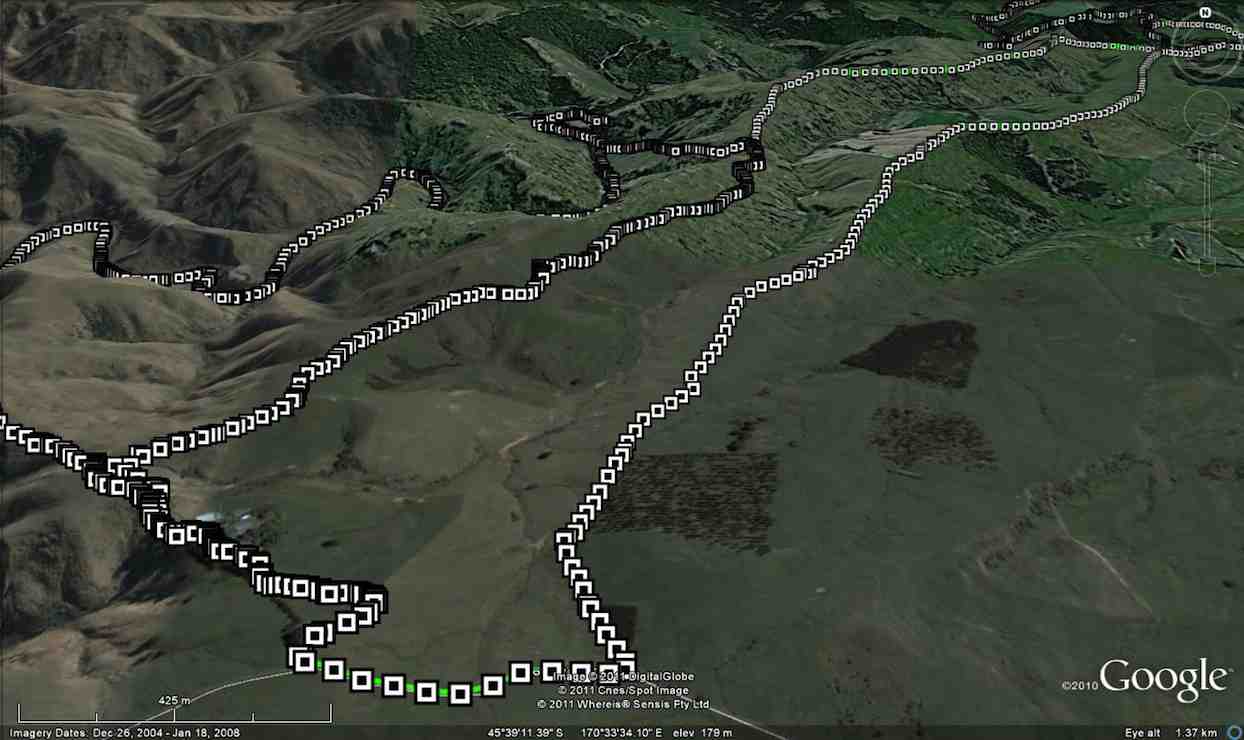
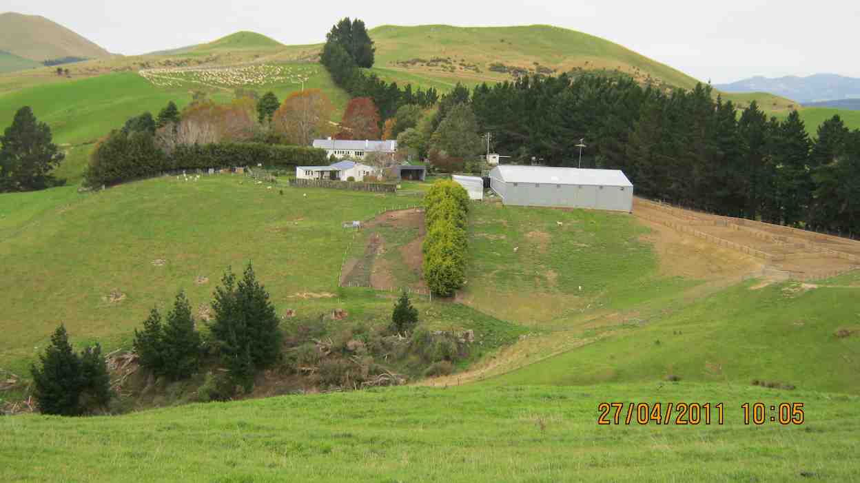
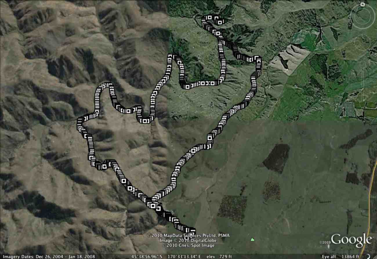
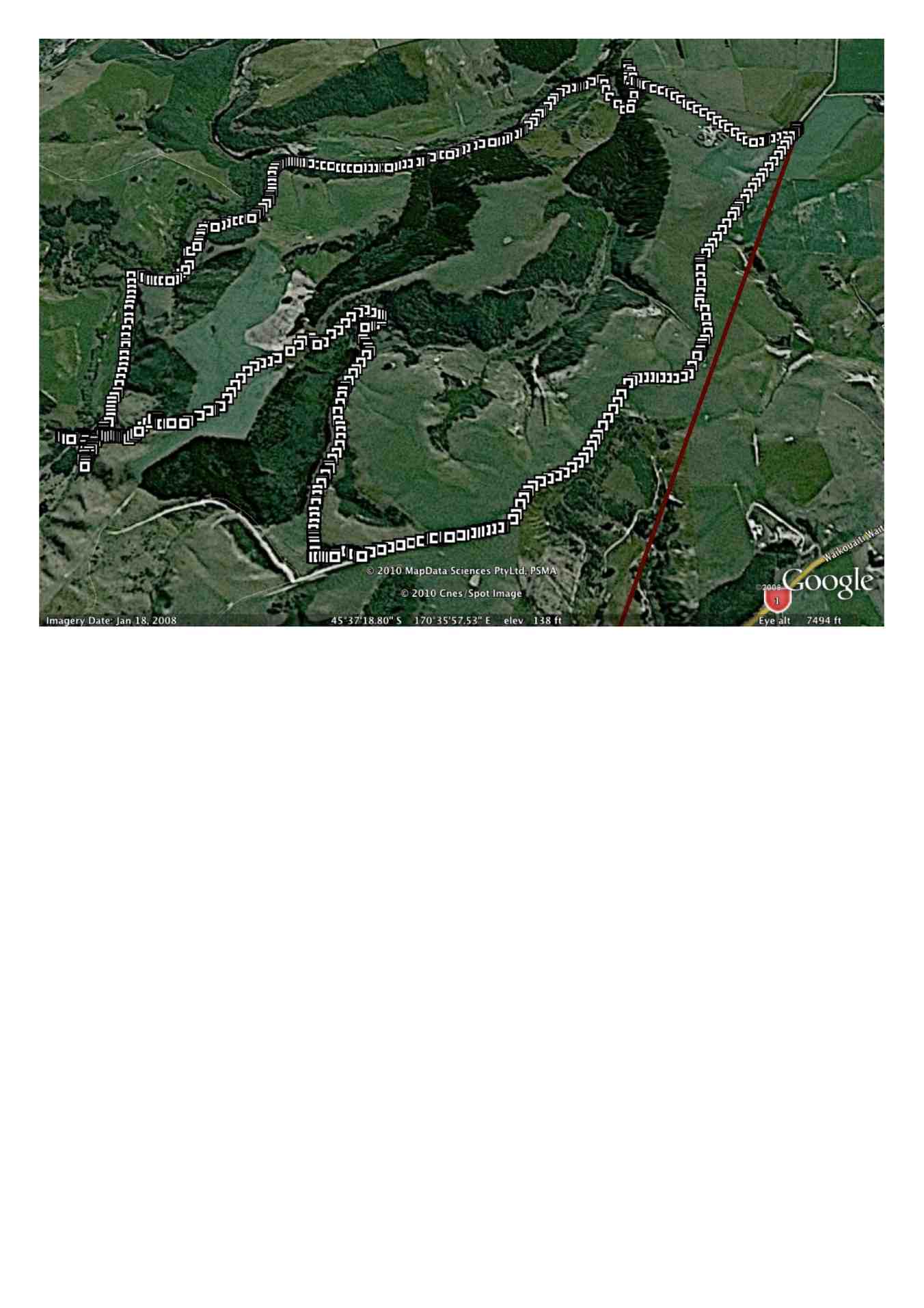
10.27/4/2011. Trampers. Lawsons Farm. Figure of Eight.
GPS, courtesy Ken. Left loop with tail at end is of the earlier Waikouaiti Stream tramp. (see GPS below) Right elongated loop is of this tramp, down left ridge and up the right.
Looking back at the Homestead from early on, on the left ridge.
The limestone rocks in the gully just up from the gorge.
A view from our lunch-stop of the gorge we stopped short of going into.
Just a view up the gully we had circumnavigated. Taken from the old coach road.
Frisky friendly horses who were content to muzzle us.
9. 18/8/2010. Trampers. Lawsons Farm. Clockwise via Waikouaiti River. Returned west ridge instead of Old Coach Road. Medium. Leaders: George, Hazel, Ria.
GPS tracking of Wednesday’s clockwise tramp. (Courtesy Ken’s GPS device)
We parked the cars just inside the entrance to “Moana” farm, walked through the dip past Lawsons’ homestead, up over the rise beyond it (where at its top we were to complete the circuit later on), to shelter from the brisk breeze for a tea-break in the tussock of the next dip. Then it was up over a next small steep rise to begin the long descent to the river.
Gully down to Waikouaiti River, South Branch.
As can be seen from the GPS tracking map, the Waikouaiti South Branch wound left and right as we made our way down its flats.
Wider part of the river valley
Finally, across a couple of wide clearings and through some bush and we were at the lodge for a late lunch. (It WAS a 9.30 a.m. start.)
Lunch at the ‘lodge’ (Ken pic and caption)
Abandoned 4WD transport. (Ken pic and caption)
Returning back upstream a bit, we faced the daunting (near-vertical for a start,) climb back up the ridge flanking the river’s true right.
The steep climb up from the river valley to a saddle of the west ridge
Reaching the top, we turned right and followed that ridge along its undulations to reach the point that lead us back down past the homestead and its yards and up to the cars again. – Ian.
8. 10/6/2009. Trampers. Lawsons Farm. Modified clockwise walk from homestead along ridge. (Figure of eight intended originally.) Medium. Leader: George.
We met at the farm gate and welcomed back Hazel who was out walking for the first time since her ankle break up Careys Creek in March. A remarkable recovery.
Looking north down gully between the two ridges walked. Mt Watkins on left.
George led the five of us down the farm ridge.
Along ridge that lies between river (over on left) and Mountain Track Road (Old Coach Rd) (off to right). Sabina, Doug, Hazel, George.
Eventually we reached the track leading across the gully up to the Mountain Track Road, (the old Coach Road).
Shot taken from Mountain Track Road looking back across to other ridge and adjoining track sloping down nr plantation. Mt Watkins in distance.
At that point we decided to forego the (longer) original figure-of-eight plan in view of the committee meeting to be held later that day and made our leisurely way back up the Mountain Track Road to the farm house. – Ian.
7. 24/1/2007 Trampers. Lawsons Farm. From Homestead. Downstream Waikouaiti River South Branch, Lodge, Paper Road, return Farm. Leader: Ian.
Parked nr gate. Walked down past house and yards. Climbed hill ahead and followed track down to River. Then along bank until eventually turning up to the Lodge for lunch. Back a little up the track and then a steep climb to old Paper road which followed to metalled road and back up to the cars. – Ian
6. 22/2/2006. Trampers. Lawsons Farm. Leaders: Arthur H, George, Dorothy S
5. 13/4/2005Lawsons Farm, Waikouaiti River South Branch, Lodge. Paper Road return. Leader: Ian
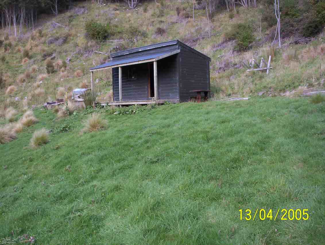
Lodge on Lawsons Farm
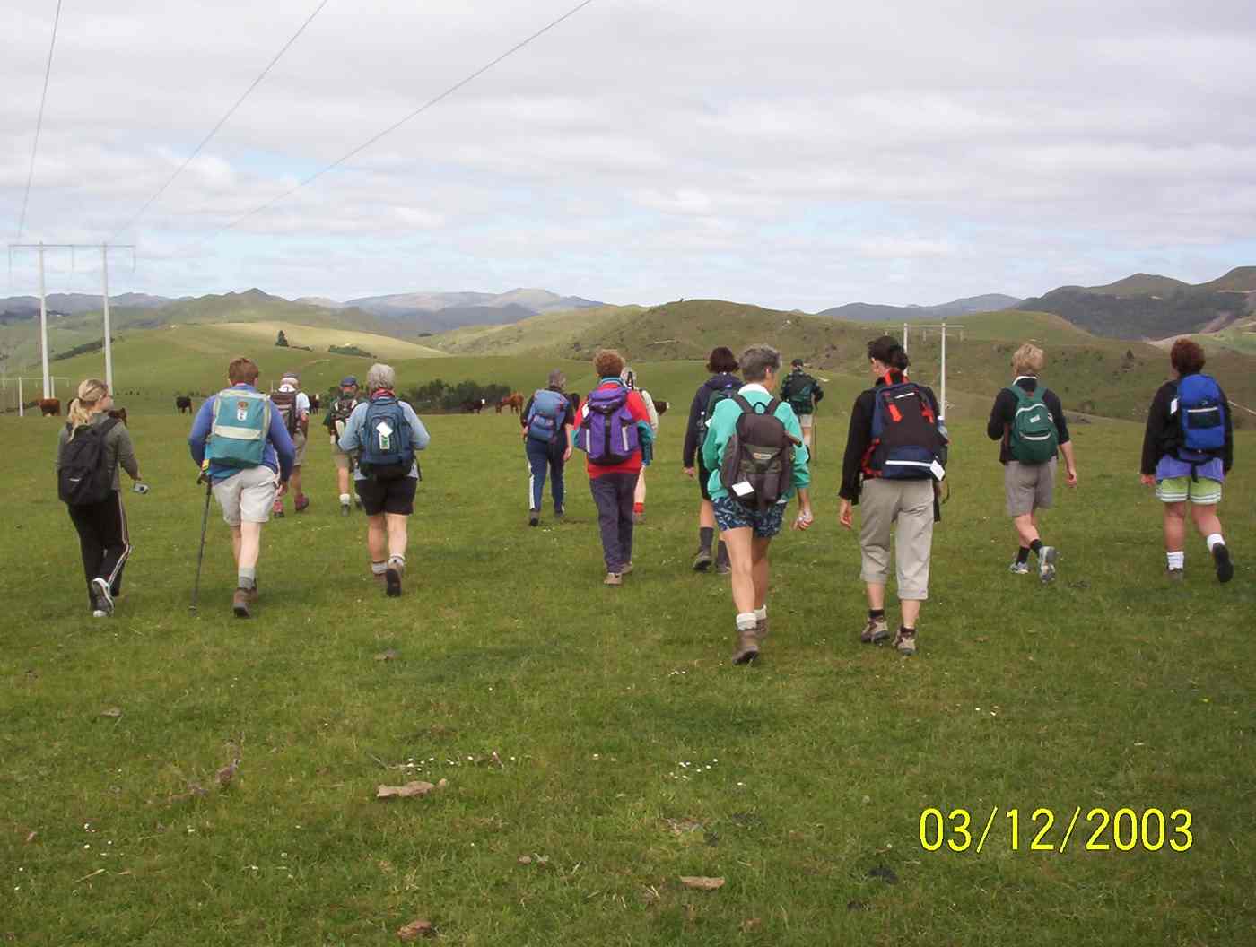
4. 3/12/2003. Trampers.Lawsons Farm, Waikouaiti River South Branch, Lodge Old Coach Road return Leaders: George, Dot B, Hazel
Start at cars
Stepping Out
Tea break. Sabina, Joyce, George, Irene Lesley Dot B
3. 24/10/2001 Steep Hill Road, Waikouaiti River. Medium. Leaders: George, Ria L, Barbara McC
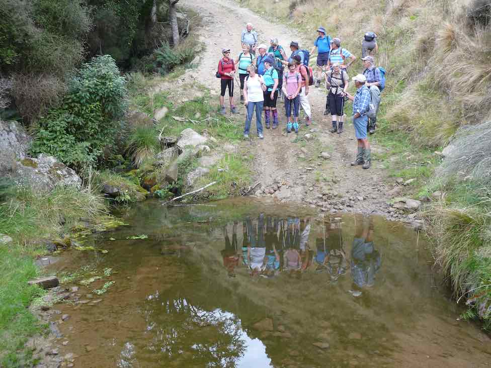
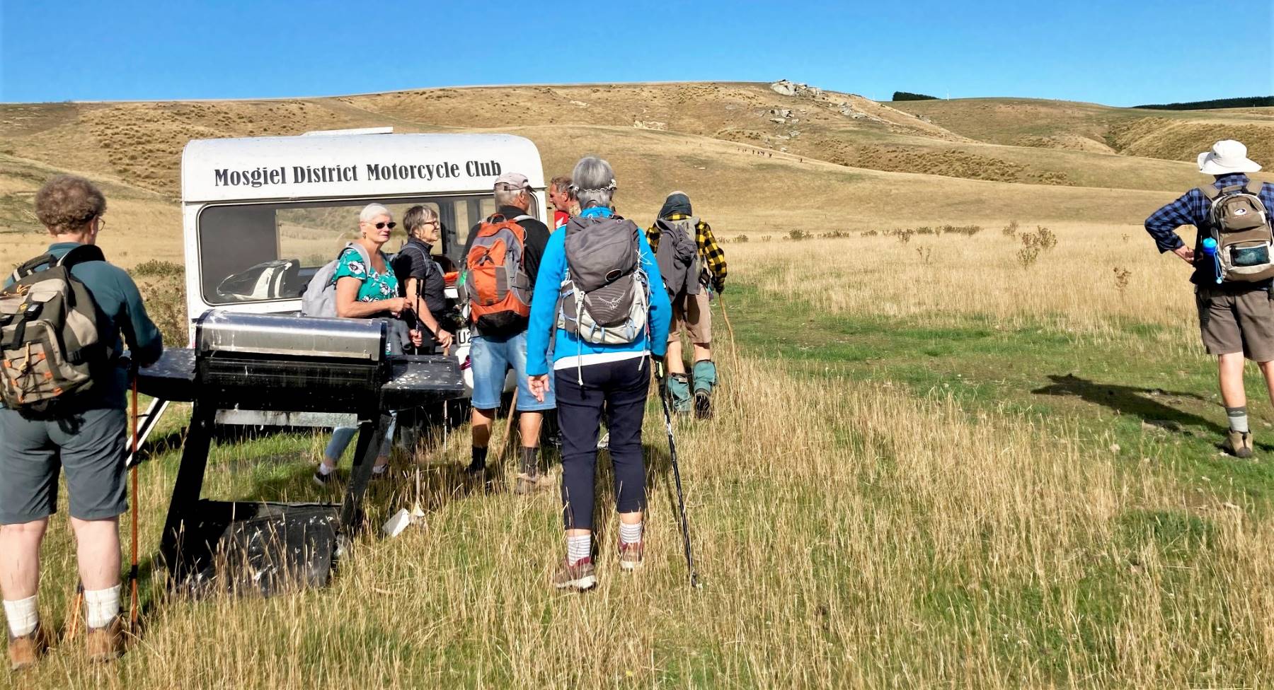
7. 8/8/2023. Combined. Scorgie’s Farm. Combined. Grade 2.5 (based on hikers valley walk). Leaders: Jill Reid (Trampers), Jan Yardley (Hikers).
Hikers
There were 22 Hikers and trampers on this tramp as a large contingent were at Bannockburn on camp.
Morning tea break (photo and caption Jan)
The group stayed together until morning tea, when those wanting to go up into the hills went off with Jill Reid.
The remaining 11 hikers carried on up the valley, firstly on a stony Traquair Road until we came to Scorgies Farm.
Bridge at entrance to Scorgies Farm (photo and caption Jan)Mosgiel Motor Cycle Club caravan – trampers heading up hill in background. (photo and caption Jan)
This was more of a farm track and much easier underfoot. It was a perfect tramping day, warm and calm and there was no mud (unlike the previous couple of times it has been done). We didn’t quite make the big shed as it had turned quite hot by lunchtime and the co-opted leader spotted a shady roadside spot and elected to lunch there.
Shady lunch stop (photo and caption Jan)
We could see the shed not too far away, so figured that was close enough. Had a chat with the farm manager as we started off back down the valley.
Almost got to big shed – in distance. (photo and caption Jan)
Returned to the cars by the same route, very hot by then, and no shade so it was a relief to get to the end.
Cold drinks at the Wobbly Goat completed the day.
Jan Y.
Trampers.
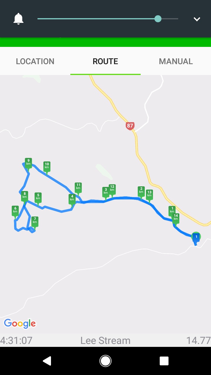
The combined group of hikers & trampers parked by Lee Stream on Mahinerangi Road and all walked along the valley, initially on Traquair.
Combined morning tea under Big Blue Skies. (photo and caption Pam)
After morning tea 13 trampers headed “to the hills”, enjoying the huge vistas on Michael Scorgie’s Lee Flat property.
Gentle flowing “Lee Stream”. (photo and caption Pam)The long winding road ahead. (photo and caption Pam)
After a steep descent we crossed the Lee Creek – thank you Graham Thurlow for showing us how to correctly place feet and poles – very important if there is a large water flow!
Graeme giving instructions on river crossing. (photo and caption Pam)– and put into practice. (photo and caption Pam)
We lunched by the Allendale homestead then crossed over Mahinerangi Road and looped through more of the Traquair property – lovely seeing the cattle grazing these hills.
Theresa having a well earned rest. Perfect seat. (photo and caption Jenni)
A very enjoyable 15.5 km walk. Many thanks for your assistance Graham.
Jill R.
6. 7/8/2019. Both. Scorgies Farm. Leaders: Jan Y, Peter D, Jill R.
Hikers – Scorgies Farm
After morning tea with the trampers, a group of 21 hikers carried on down the valley and on to Scorgies Farm.The first part over the farm land was a bit wet, but Ok to walk on. However, as we progressed further on the farm track, the muddy spots became more and more frequent.My contact had told me ‘the track was a bit muddy, but just skirt around these areas’.That was the understatement of the year – there was no bypassing the mud and we had to wade through which was heavy going. Got as far as a pile of baleage, and decided to call a halt. Probably only a km or so short of the big shed, which was our preferred spot for lunch, but mud was getting progressively worse.Some of the group lunched amongst the baleage, and the rest of the group headed up the hill a little to find a sheltered spot in the lee of the hill.Met up again and returned the same way (same mud!!) back to the cars. It was certainly a pleasure to get back on to the Traquair land (which constitutes the first few ks of this tramp) and onto their well maintained gravel road.One bonus – no one slipped over on the mud.Jan and Peter.
Trampers – Scorgies Farm.
Trampers’ route map. Courtesy Phil K.
After a combined group morning tea by Lee Stream, …
A great spot for morn. Smoko. (Gordon pic and caption.)
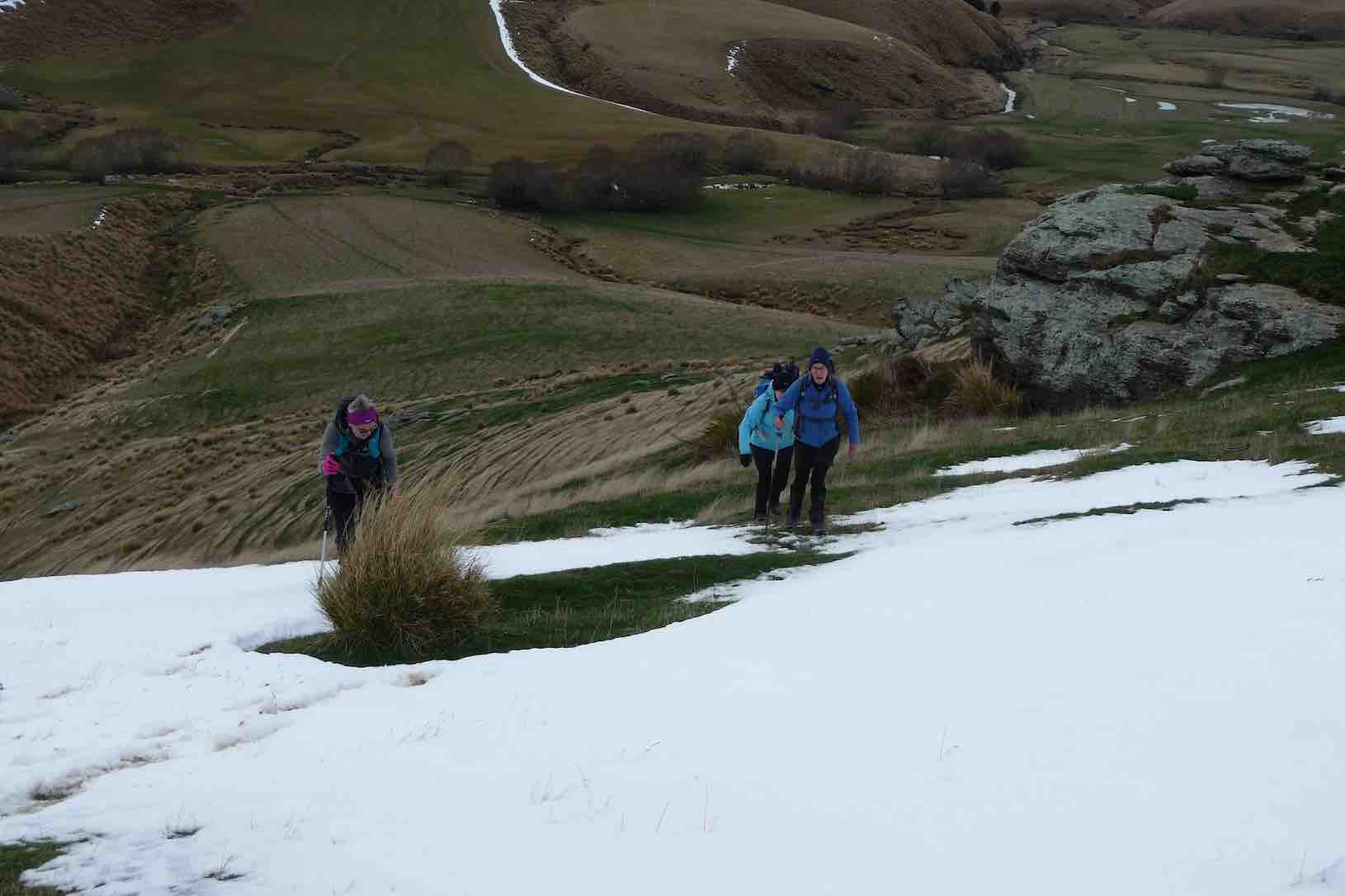
… 21 trampers headed for the hills!
Trampers break off from Hikers.Pretty steep. (Gordon pic and caption.)
We climbed up a face between magnificent rocks,
Hello Hikers down there. (Phil K. pic and caption.)Looking down Lee Stream. (Helen pic and caption.)
walked over rolling hills bearing pockets of snow,
Hardy TRAMPERS in the snow today. (Margreet pic and caption.)
then, taking a more circuitous route than planned,
Down & up. (Gordon pic and caption.)
reached the normally small tributary of Lee Stream at the bottom of Roundhill.
Bit deeper,swifter and slippery than looks. (Gordon pic and caption.)
Today it was much higher than expected due to snow melt over the last couple of days. We decided it would be unsafe to walk through the creek – just too much water swiftly flowing over the slippery rocks!!!! Instead we enjoyed our lunch on rocky outcrops, looking across to the Allandale homestead surrounds,
Lunch in the rocks with leader Jill mapping out a change of direction.. (Helen pic and caption.)
then returned to the Lee Stream Track by a different route.
On the way back to the cars. (Helen pic and caption.)
Distance walked : 16 km. – Jill.
5. 25/6/2014 Hikers. Lee Stream Ramble, Scorgies Farm. Easy. Leaders: Arthur and Barbara.
GPS of route. We walked 12.66 km. Walking time 2.56 hrs; Fastest 4.6 km/hr; Slowest 3.95 km/hr.
I now title this tramp Lee Stream Road Ramble. The route is an actual road at each end, connecting Mahinerangi and Black Rock Roads, joined by a paper road in the middle, having reverted to a barely discernible track across paddocks marked only by occasion ditch crossings, with one actual bridge over a more sizeable Lee Stream tributary.
26 Hikers parked outside the Mahinerangi end of the road, to be surprised by this notice on the gate.
The mind boggles. (John pic)
At this stage of course, the road was well paved.
Start (John pic)
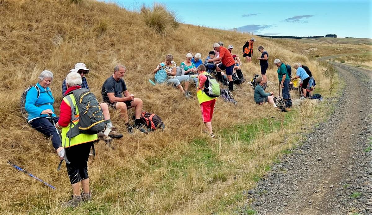
With a winter 9.30 a.m. start and quite a bit of a drive up SH87, the leaders stopped us early for morning tea on the following slope.
An iPhone Panorama attempt of the tea break, not a patch on John’s much better pixelated lunch one. Apologies to the ones I caught bending over.
Paddocks were still saturated from frosts and rain. Today was astonishingly warm with a drying wind, but not enough to even begin to dry the ground out. Ditch crossings, although well gravelled (under the mud, if you could find it), were atrociously, extraordinarily, slipperarily muddy. Not everyone got through without a fall.
Mud, glorious mud. Here you can see only the beginning. Down at the ditch crossing, it was hard to get through without a fall. There were several of this ditches to negotiate. Paddocks were sodden. (John pic)
Here is the bridge separating Traquair from Scorgies’ Stations.
The Bridge (John pic. Hey! Well done, John.)
We trudged on, and on. A kilometre or two short of the end, about half a dozen of us had had enough and made their lunch stop there, leaving the rest of us to go on to the big implement shed. Its contents were well splattered with bird droppings, but each of us managed to find a seat acceptable to them.
Lunch panorama (John pic. A much better panorama.)
Retracing our route we found to be just as muddy, we several of us knowing we had done one of the longer tramps that the Hikers attempt. It was a good day out. While the rest of the country seems to have suffered heavy downpours, we benefited from the warmth of the storm’s margin. Thanks to Arthur and Barbara for thoughtful careful leadership. – Ian
3. 7/5/2008 Both. Lee Stream Ramble, Scorgies Farm. Easy. Leaders: George, Doug M
Permission.
Great farmland trip. Turn down 1st Mahinerangi Rd. Cross Lee Stream and park car park up other side. RH. Thru gate. Meander along well formed road on true right of stream. Lunch at Hay barn en route. Return same way.
The threatened rain did not spill, the intimated sun did not shine, the breezes didn’t waft, but twenty four trepid trampers (hardly ‘intrepid’ on this straightforward walk ) turned out to enjoy
the calm reaches of Lee Streem (sic: an in-joke for the “boys and their toys” fellows ), and the pleasant pastures, and beautiful big barn of Scorgie’s Farm. Well, not quite straightforward, as, after arranging ourselves on tiers of a rocky outcrop for morning tea (see photo), and crossing a decrepit bridge which leader George kept promising us would collapse just for us, there suddenly appeared, blocking our way, a vast vale of choumollier and turnips. A pincer movement was deployed and we eventually fought our way to the battle front again.
An early morning tea is rightly followed by an early lunch, and what better restaurant seats than the dry hay bales, pallets and timbers and butcher’s chopping block of the large, open barn where the smell of hay was incense to the nostrils of country wanderers.
Mushrooms were unfortunately not on the menu though Doug had picked enough for a good tasting.
Our return was by the same route, except that we skirted the western front of the turnip ground this time.
The various pedometers all seemed to tell us that we had traversed circa 15kms of this fertile and well-kept farm, (without seeing a single human movement), and several remarks were heard to the effect that if the speaker were to want to buy a farm, this would be the one. The only sad note to the day was at the carpark meeting point where we observed a minute silence for the passing of Mary Maxwell earlier in the week. – Bob
2. 5/3/2008. Both. Lee Stream Valley and Scorgies Farm. Easy. Leaders: Bob H, Molly.
1. 2/8/2006 Both. Lee Stream ramble, Scorgies Farm. Easy. Leaders: Bob & Evelyn, Lesley G, Eleanor W
Great farmland trip. Turn down 1st Mahinerangi Rd. Cross Lee Stream and park car park up other side. RH. Thru gate. Meander along well formed road on true right of stream. Lunch at Hay barn en route. Return same way.
14. 4/3/2020. Both. Traquair Station via Microwave M. Leaders Jim and Betty and Jill R and Barabara
Of the 28 people that commenced the walk 23 made it to the Micro Wave Station where 3 sheltered in the lee of station while the remainder had a further brisk walk on the access road before returning an hour later for the lunch stop.
Photo and Caption Gordon – “Early smoko out of the wind.”
Photo and Caption Gordon – “Heading up to the Tower.”
Photo and Caption Gordon – “The cell tower.”
Photo and Caption John – “Taking in the view.”
Photo and Caption John – “The View.”
Conditions made for lunch to be brief, because of the chilling wind.
Photo and Caption Gordon – “Lunch back at the tower in the shelter.”
Photo and Caption John – “Wonder what these steps are doing here?”
The downhill return on this working farm took us among a variety of animals, including some black & white horses, & after a short gallop, they could be seen looking over the ridge at what had come among them.
Photo and Caption Gordon – “Interested spectators.”
Photo and Caption Gordon – “A good walk in the wind and cold.”
Thank you, Sarah & Barbara, for your assistance. It was unfortunate that Barbara could not be with us on the day. The social stop was at the Wobbly Goat on the return to Mosgiel.
Frost to begin with, but a sunny day followed for 11 Trampers to enjoy their exercise in.
We drove up Mountain Road from the north end and parked up.
The air was cold, but a brisk downhill walk in the sunshine took us to the bank of the Waikouaiti River where we had our smoko stop.
All important smoko. (Gordon pic and caption.)
Following the river bank upstream we soon encountered a pine plantation where the track was becoming overgrown with blackberry and gorse. You would have expected that a consciention leader would have done some track clearing!
This was the only bad patch for the day, as we were were out on grazed paddocks from then on.
Passing the junction of the two branches of the Waikouaiti River, we continued up the south branch and soon came out on a lovely river flat. On leaving the river we had a long climb, with a reasonable gradient,
Onwards and upwards. (Phil pic and caption.)
to eventually find our lunch spot on the ridge top.
Lunch among the tussocks. (Gordon pic and caption.)
Lunch with a view – a little snow was on top of Lamb Hill, Mount Misery, (Bendoran Huts had been visible a few metres back). We were looking at Mount Watkins
Reflecting on Mt Watkins (Phil pic and caption.)
as we ate, and Maori Peak, Karitane, etc, further round.
A very slight south-east, but very chilly breeze was present, and we faced into it for the return journey. Following the ridge down, and then on a slippery (newly graded) track requiring care.
Heading back to cars. (Gordon pic and caption.)
In time we came to Mountain Road, which is the old wagon road from the early days of Otago, and eventually arrived back at our cars.
We had covered a distance of about 10.5 km. Our club had last tramped here in 2012, but none of our group had been here before.
A new tramp is always welcomed, and we had a great day in the sunshine, enjoyed by all.
Blueskin Nurseries enjoyed our patronage on the way home. The Hikers arrived in too. – Art.
Three of us, & Fin the dog went on the tramp to Lawson’s Farm at the North end of the Silverpeaks, in the Waikouaiti River valley.
Morning Tea break. (Ken pic and caption)
It was a very warm day, so we took advantage of the shade where we could. As I was the only one who had been there before, I put the previous tramp from there onto my GPS, & we followed that route up to where we had previously had lunch, but as it was only 11:00am at this time, we just rested in the shade for 10 mins or so, …
Resting out of the hot sun. (Ken pic and caption)
View from our resting place. (Ken pic and caption)
… before climbing the steep face up to the top paddock. Our lunch stop was by the Limestone rock formation, but this time, we sat down by the fence below them to keep out of the sun.
Lunch in the shade of the trees. (Ken pic and caption)
The after lunch climb up the vehicle track to the Old Mountain Track was next, & then just a leisurely walk along this back to the vehicle. – Ken.
Ken’s GPS tracking of the tramp goes anti-clockwise from top right where we parked the cars, across left alongside two large water tanks and a new building, then a zig-zag down to the river where we stopped for morning tea. Here we were amazed by evidence of a large flood that had tangled debris in bare willow-branches (not evident in the pic) well above our heads.
Morning Tea. (Keith pic)
Following Ken’s GPS tracking up the true right side of the river, and you come to the extreme left of the map where a mixture of tracking signals indicates our lunch-stop. As you can determine -click to enlarge the pic – from whether the tracking signals are behind or in front of each other, you will see that the track took us up and down several slopes. Lunch was on a ledge well above the river. A great view. The steep ridge showing in the pic’s background is what we c-l-i-m-b-e-d after lunch.
Lunch on ledge above Waikouaiti River. (Keith pic)
View looking back down the willow-lined river. (Keith pic)
A gentle descent across a newly-grassed field took us to a track down to a gully between two ridges, then up the gully to the remarkable set of unusual rocks. Beyond these, we climbed the steep slope up to the left to emerge eventually on the Mountain Road track. It was then only the case of following this back down to the the cars. Thanks to Ria and Hazel for a well-led tramp, enjoyed on a grand winter’s sunny day following a good frost. – Ian
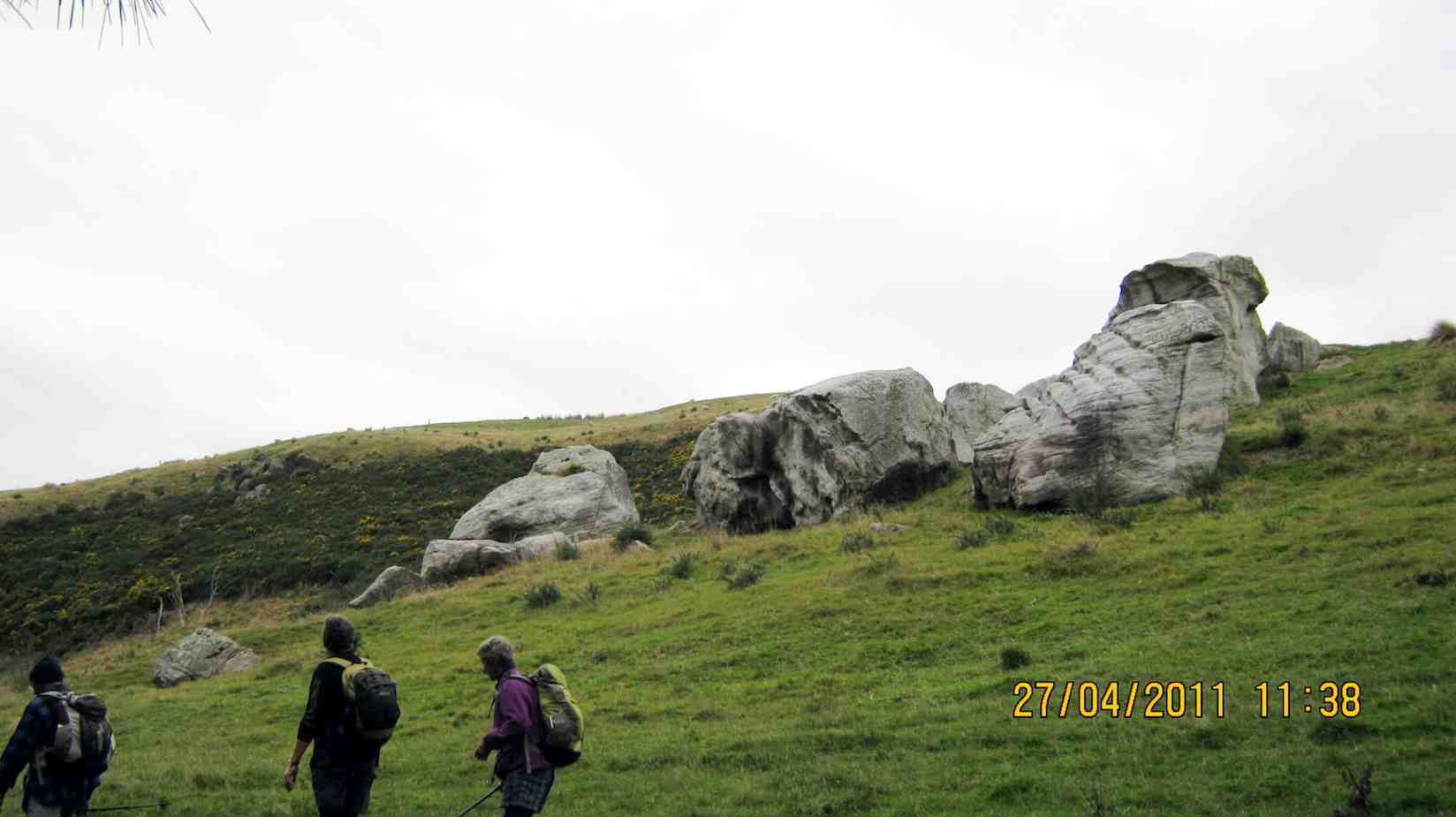
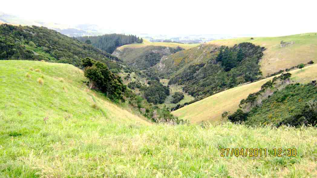
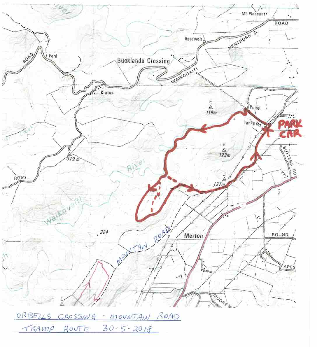
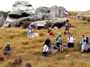
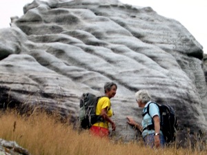
A small but select group met at the turning to Buckland’s crossing on an overcast but warm day under the leadership of Ria and Hazel. The location of the tramp was down as Orbells crossing but there was some debate as to where this actually was. We parked in the middle of nowhere but Ria and Hazel soon had us over a couple of fences and striking across the countryside to a nice morning tea stop on the banks of the South branch of the Waikouaiti River where it was mentioned that a fishing rod would have been useful. The tramp continued along a very pleasant country track wending our way along hillsides and gullies until we stopped for lunch, looking back over to where we had walked earlier. To those with no sense of direction this was quite confusing as we seemed to do a very big figure of eight. After lunch the mystery trip continued, with Ria venturing into some uncharted territory along a gully. When the gully ran out it was a steep climb up to the top where we could easily see where we were again. One of the highlights of the day was seeing the unusual rocks just above the track,
Ria, HazelRia, Ian, Tash
weathered into all sorts of interesting shapes, colour and textures. All information about these rocks would be gratefully received. A very enjoyable day’s tramping. Many thanks to our adventurous leaders. – Tash
5. 9/5/2007. Lawson Farm from McGrath/Gilchrist Roads near Old Cherry Farm. Figure of Eight. No river. Leaders: George, Evelyn C.

 29/01/2025. Hope Hill. Grade 4. Trampers. Leaders: John Gardiner and Martin Hickley.
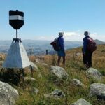 22/01/2025. Mt Royal/Bobby’s Head (Tavora Reserve). Grade 3.5. Trampers. Leaders: Graham Thurlow, Graeme Souter.
 04/12/2024. Cleghorn Street to Signal Hill Monument . Grade 3. Hikers. Leaders: Maria McNee and Peter Dodds.
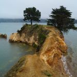 27/11/2024. Around Harbour Cone. Grade 3. Hikers (and Trampers). Leaders: Jenny Flack and Rhonda Wilson.
 I’ve always regarded myself as, and indeed endeavoured to be, an optimist. But on Tuesday night, I had serious doubts that Wednesday’s tramp would proceed. That night seemed to leave little room for optimism. A Wednesday morning early dog walk gave a glimmer of hope, that the weather, although unpredictable, might be improving. Seventeen ‘optimistic’ trampers took part on the Split Rock tramp.
 13 trampers had a “Rock Day” beginning with rock music at Peter Johnson Park where athletic sports were about to start.
 Hikers: Leaders Heather and Val Cayford
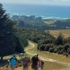 After welcoming a new hiker, Peter Dodds, twenty-four hikers left Livingstonia Park, about 9.30 am, heading to the left (east) to the sand dune track that led out to the road by the bridge and then headed up Sawmill Road to have morning tea beside the implement shed on Alan Gorton’s farm.
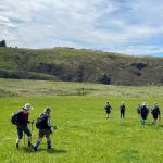 Lovely sunshine greeted 30 keen trampers for a good day’s walk on Cairnvalley Farm Shannon. Strath Taieri offers something different in scenery with tussock hills, huge rock formations and at this time of the year fresh green vistas of paddocks and Continue reading “Shannons Farm Walk”