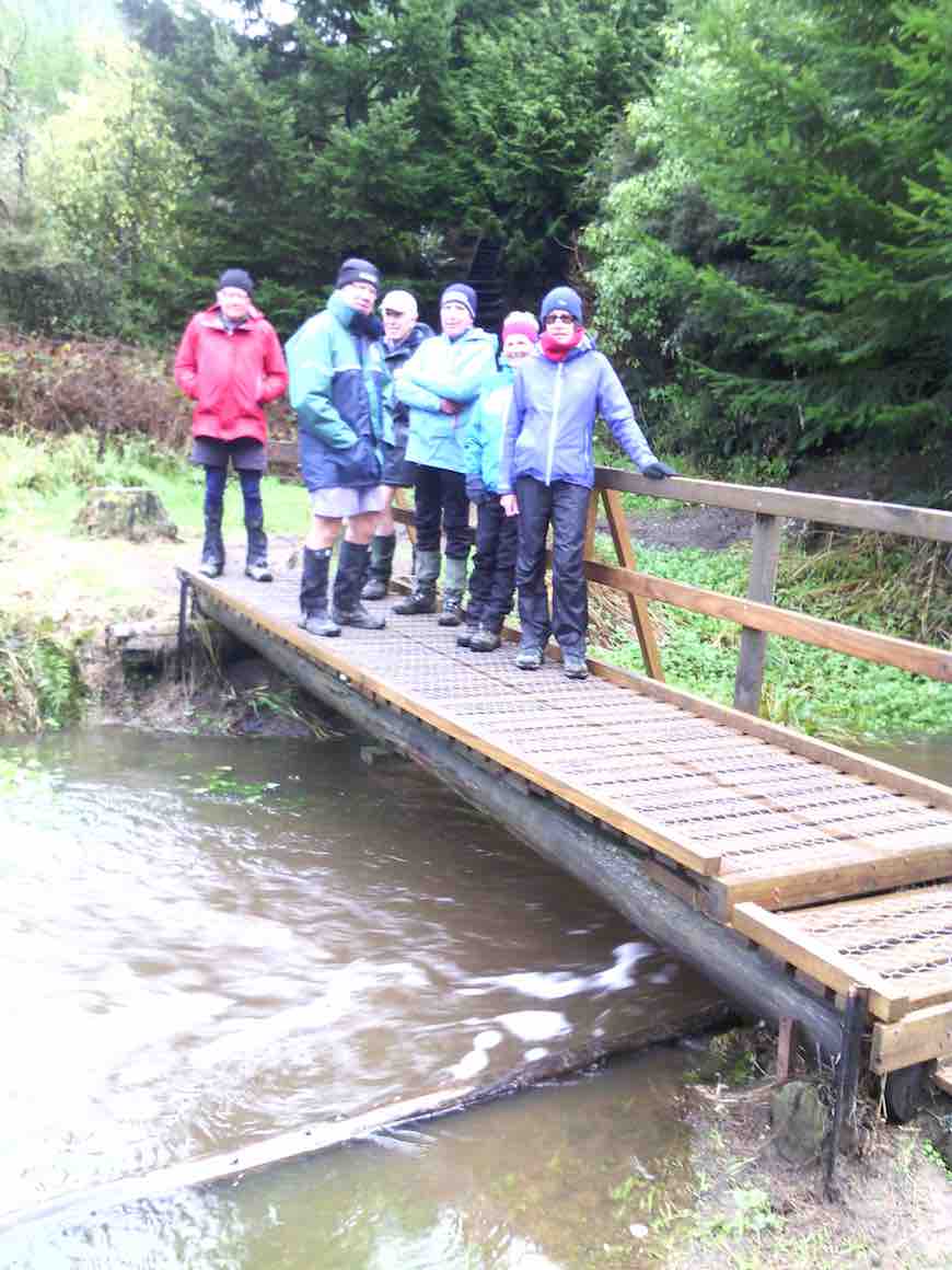
Two cars(six trampers) left Mosgiel at 8.00 a.m. rendezvousing at Cherry Farm before travelling together to reach the Bendoran Huts at 9.30. Morning tea was taken, and five eager trampers set out just after 10 am on the day’s adventure. One stayed in camp to heat water for showers later.
The day was sunny and warm enough. High cloud drifted across after an hour, but it remained hot. We stopped several times to take on water – and we were going downhill!
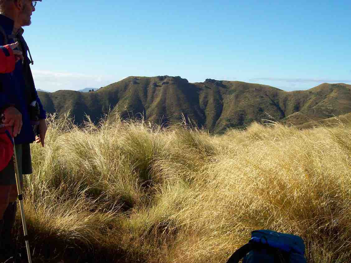
We descended down to Orbells Creek, and followed it for some distance, being on a grassy 4WD track all day. Tussocky hills surrounded us, with many interesting rocks, such beautiful country.
A mob of grand Hereford cows with calves (beef) moved in front of us for a time, before going up a side gully.
Eventually we came to the first ascent of the day, leaving Orbells Creek for a time, the 4WD track going up and over a saddle. At the top we had a short descent and then a climb up to a second saddle.
But from here it was downhill all the way to the cave. We met Barney, the Bendoran Farm Manager, out with his dogs shifting a mob of cows and calves – black with white faces this time (Angus Hereford Cross).
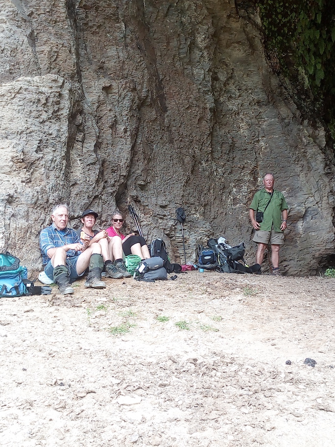
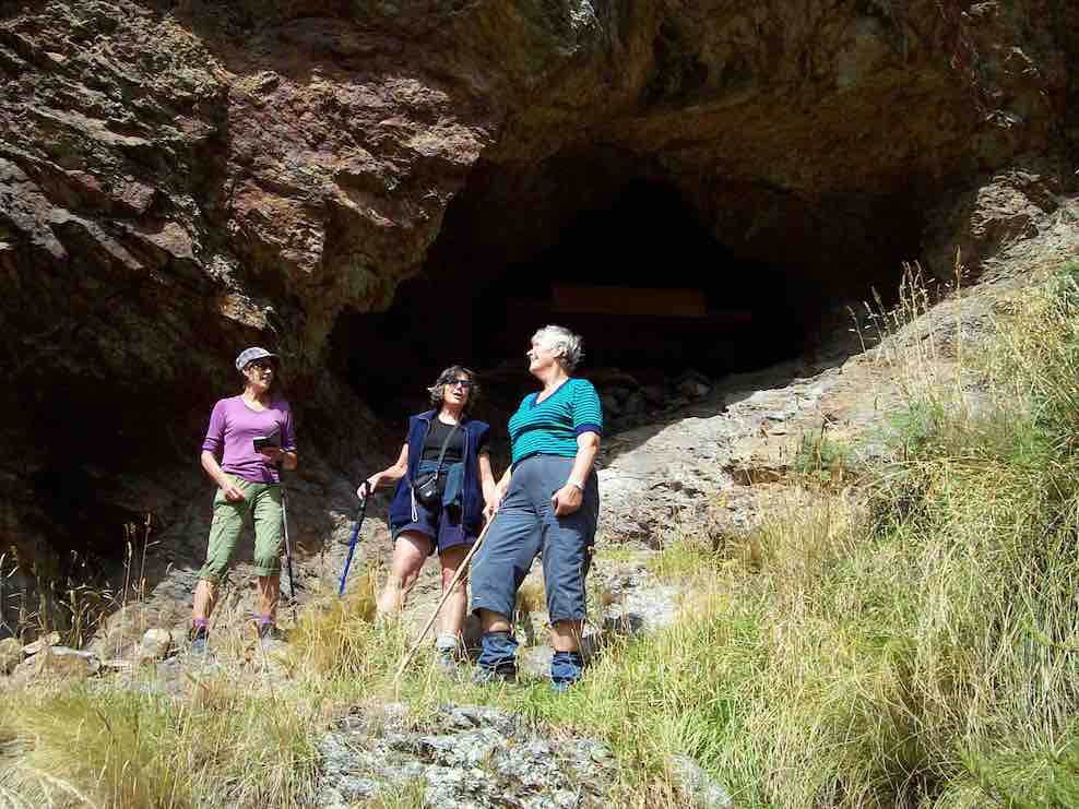
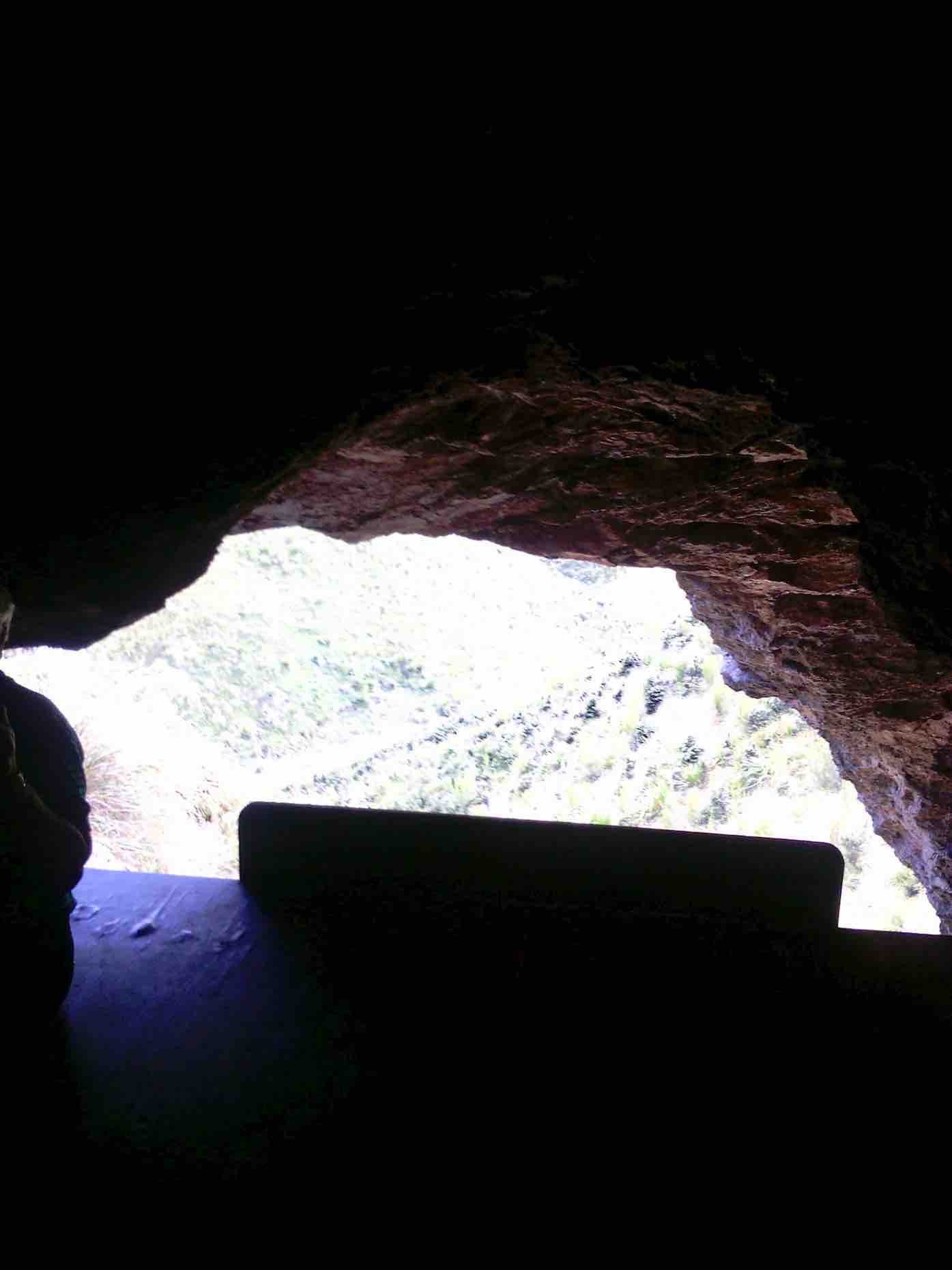
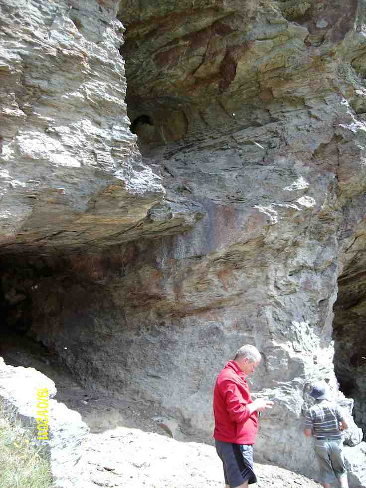
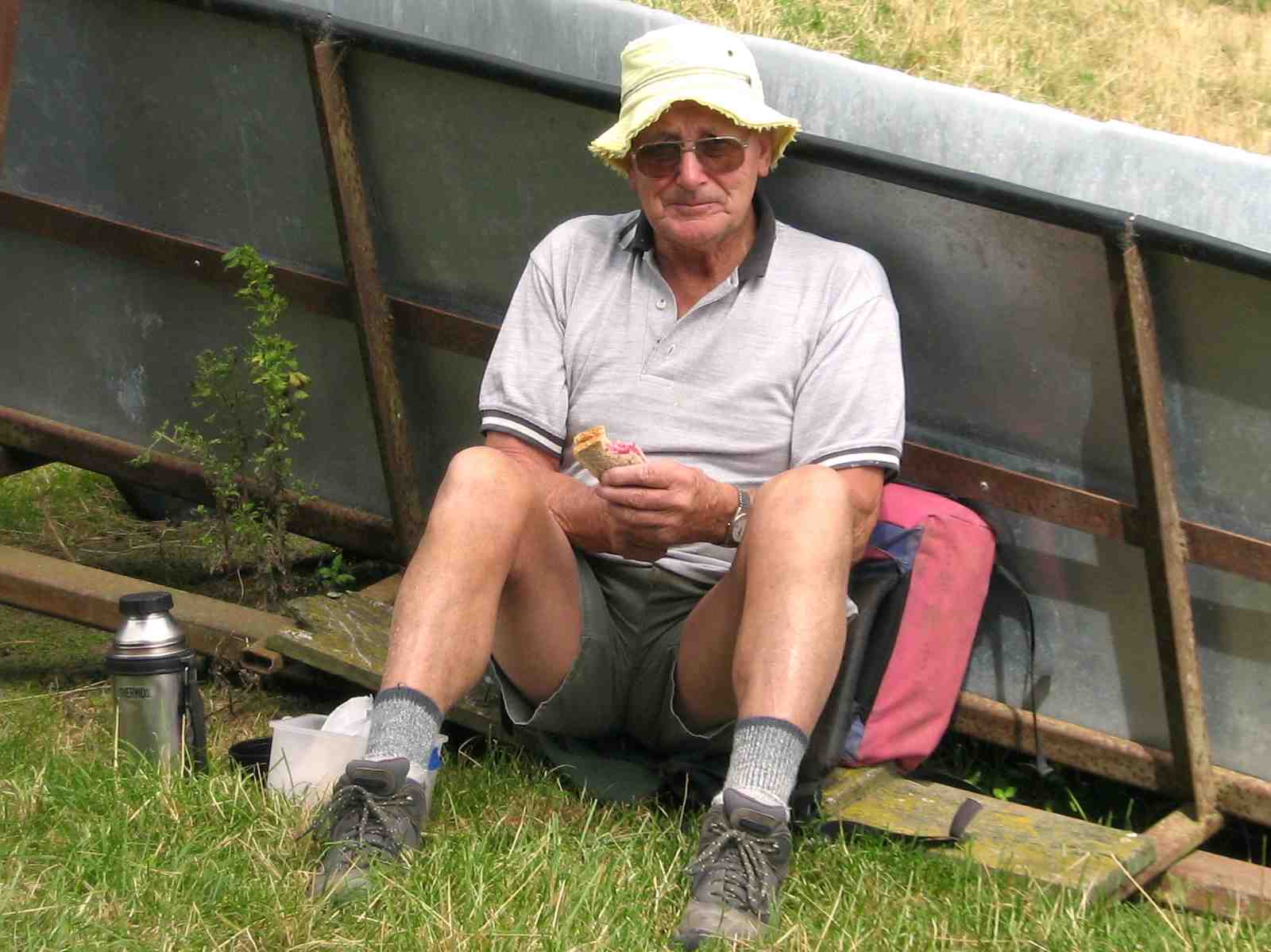
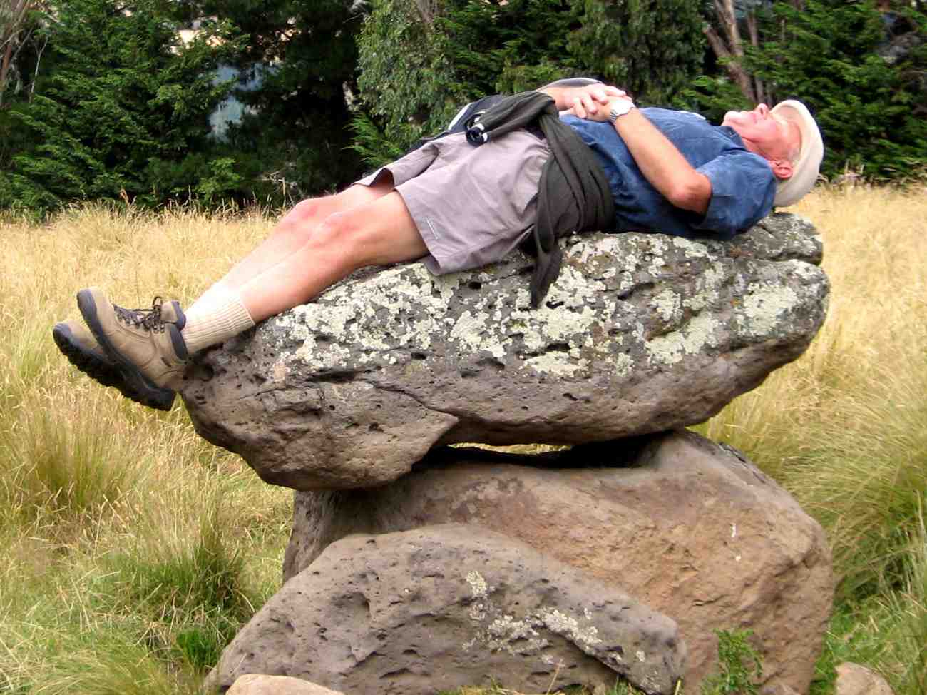
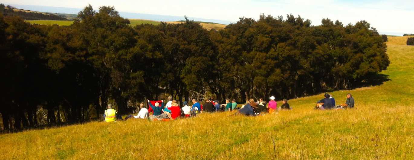
We came back to Orbells Creek by the cattleyards, crossed over, and in a few minutes were at Orbells Cave (with Orbells Garden flourishing in profusion in front (foxgloves). It had been hot work, but to our great relief found that it was very pleasantly cool in the cave. The time was 12.20 pm. We sat and rested for half an hour here, while eating our lunch.
In the cave for a cool place to have lunch. (Helen pic and caption.)
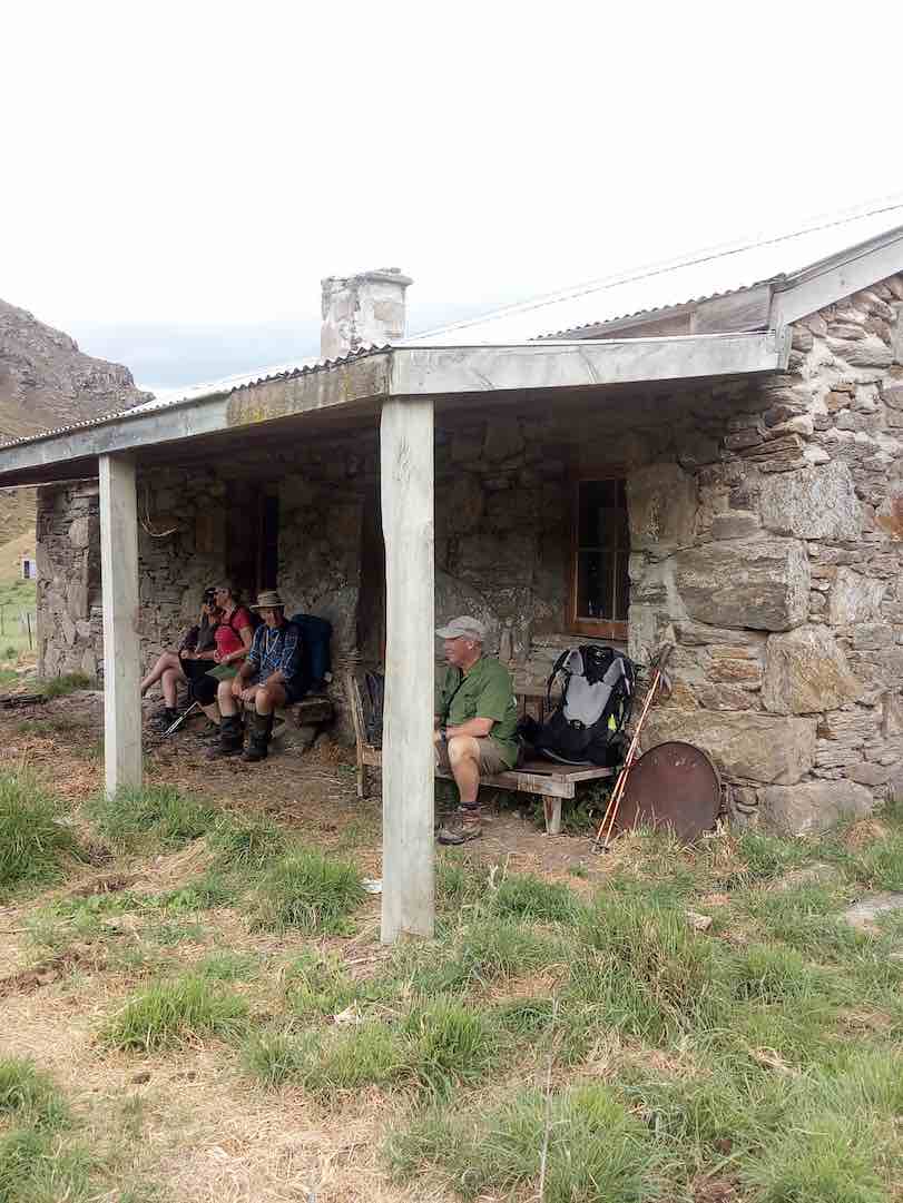
Fiddlers Hut was our next objective, about 2 km further on. Was we left, bird calls from high above the cave alerted us to the presence of a N.Z. falcon circling there. We saw it – or another one – later in the day, too. Crossing 3 O’Clock Stream, we arrived at Fiddlers Hut at 1.3. We admired the stone walls, very neatly constructed, and with a vey sound modern corrugated iron roof.
Fiddler’s hut. (Helen pic and caption.)
But sadly the interior had been badly neglected, birds obviously had been the only tenants for some years past.
As we began the homeward journey, a light and very pleasantly cool north-east breeze arrived to provide some relief, especially helpful on the uphill bits. Five tiny little Paradise duckings were on the water when we crossed back over 3 O’Clock Stream. All water bottles were refilled.
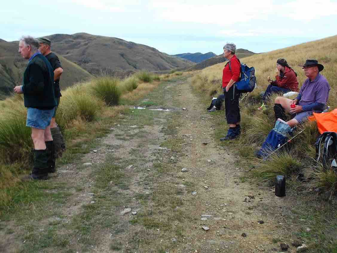
The same route was followed going back as we had travelled out earlier. It was a long climb back up to the two saddles. At the top of the first one, 10 minutes was well spent in resting, while taking on water, eating fruit, etc.
In time we came back down to Orbells Creek, and walked, the kilometres behind us, with an occasional brief stop (water).
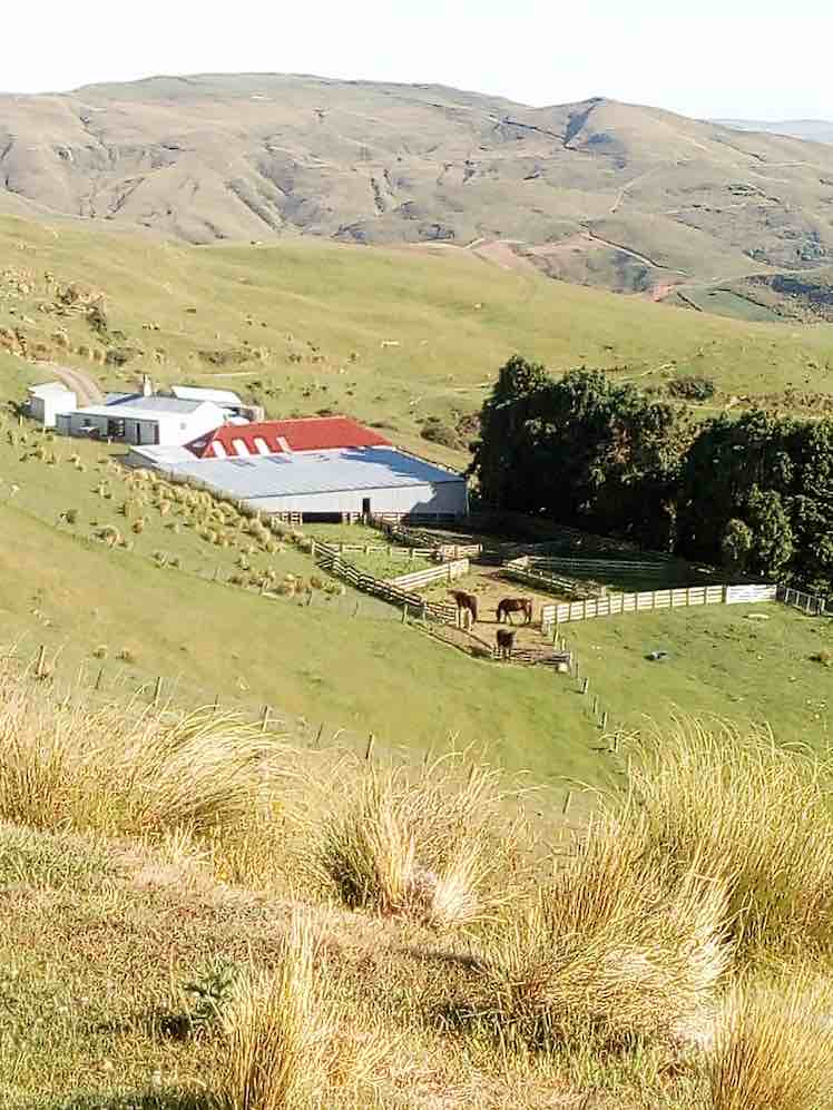
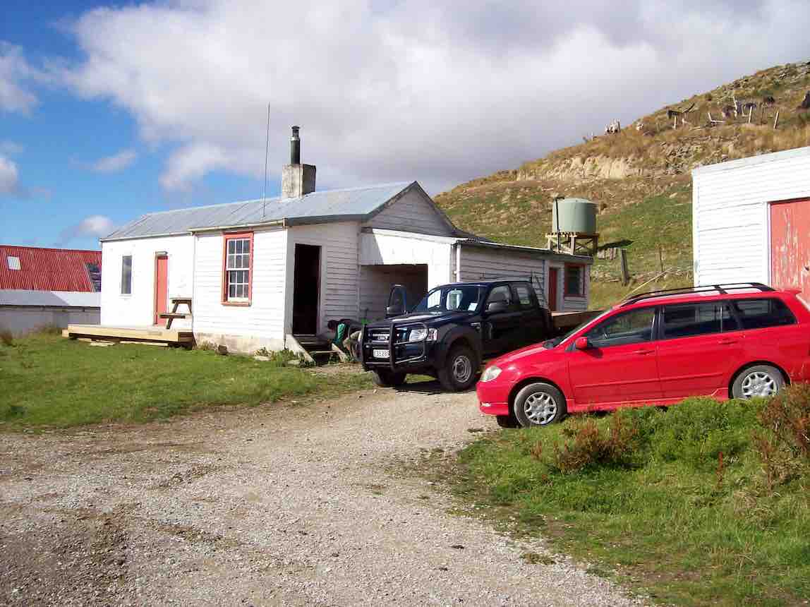
One long hill awaited us – the climb out from Orbells Creek. The hill seemed to go on forever, but by putting one foot in front of the other, we found the top. But our legs were mighty tired now, and there was only a few hundred metres left to go. And so we arrived back at the Bendoran Hilton …
View of Bendoran huts. (Helen pic and caption.)
… just before 5 p.m. A good list down and rest seemed to be the logical thing to do now, so that’s what we did!
All five had thoroughly enjoyed the day. An energetic tramp to equal any other that our club has done. VERY SATISFYING.
Total distance was 20 km. Orbells Cave was approx. 8 km from Bendoran, and Fiddlers Hut a further 2 km beyond. Bendoral Huts are at an altitude of 500 metres, Fiddlers Hut about 200 metres. – Art.
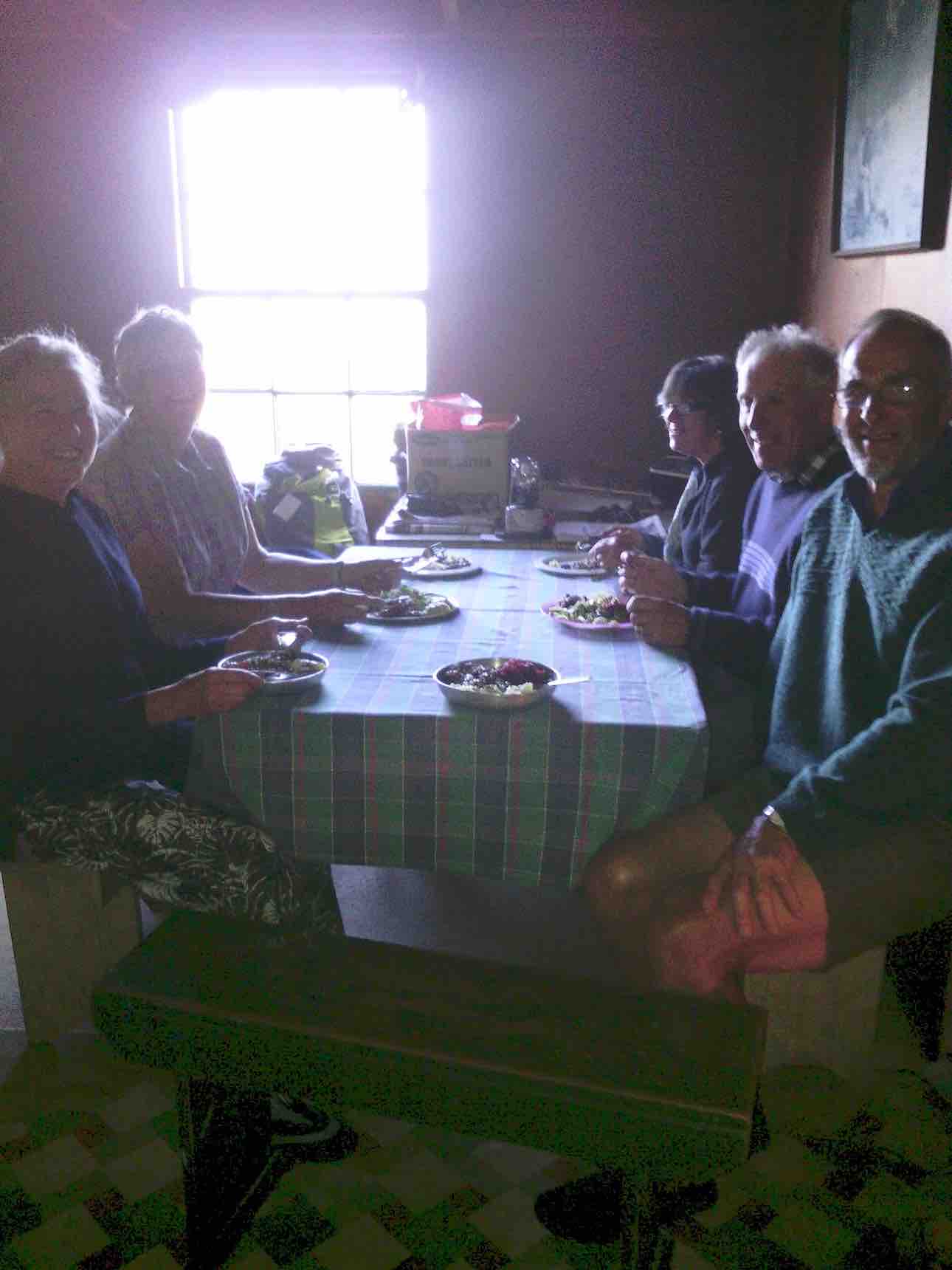
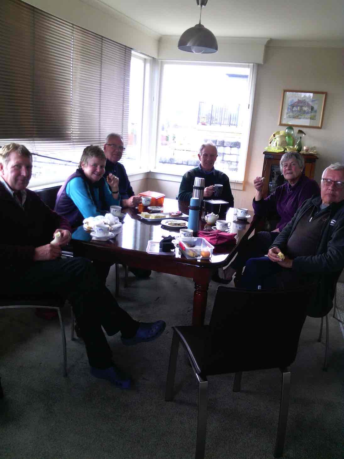
On completing the tramp we had a lovely muffin and cup of tea before showers and liquid refreshments. Fire lovingly looked after by camp mum Jennifer. Eleanor our great organiser had Also arrived by this time.
Tea was prepared consisting of silverside, stuffed chicken, new potatoes, carrots and two salads. Dessert: chocolate brownie berries and yogert. All had bought some part of it.
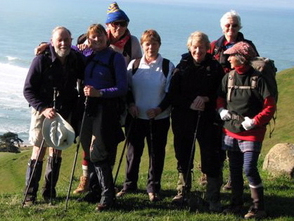
Jill Arthur Phil Wyn and Helen the walkers.
It helped revive us. – Helen
75 km from car-park.
11. 8/3/2017. Trampers. The Gap, and ABC Caves. M. Leaders: Arthur and Eleanor.
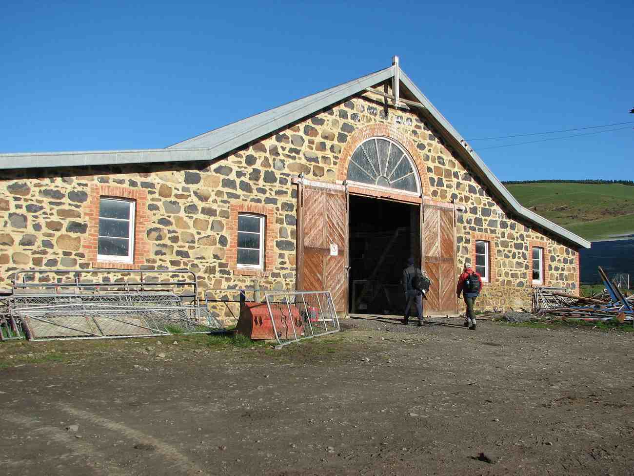
After a one and a half hour drive from Mosgiel, we arrived at Bendoran Huts. David Malloch the station owner arrived to welcome us and give us a brief history of the 5000 acre property.
Us with David Malloch. (Helen pic and caption.)
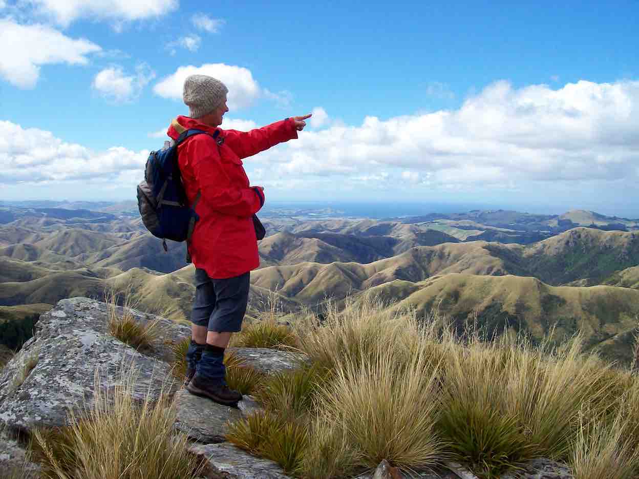
After unpacking and eating lunch, we walked in a cool s.w. wind, overcast with a few skiffs of showers to Mount Misery @ 714 metres.
Eleanor on Mt Misery. (Arthur pic and caption.)
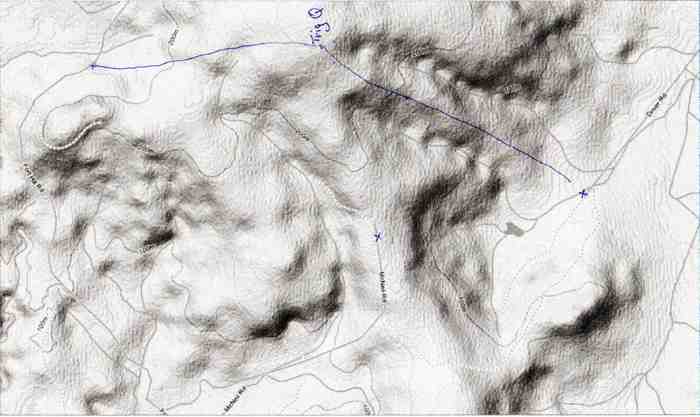
A great view for those brave enough to tackle the wind on such a rocky peak. From there we ventured onto “Terry’s Knob” (refer Hamel’s book page 7:13), …
Terrys Knob. (Arthur pic and caption.)
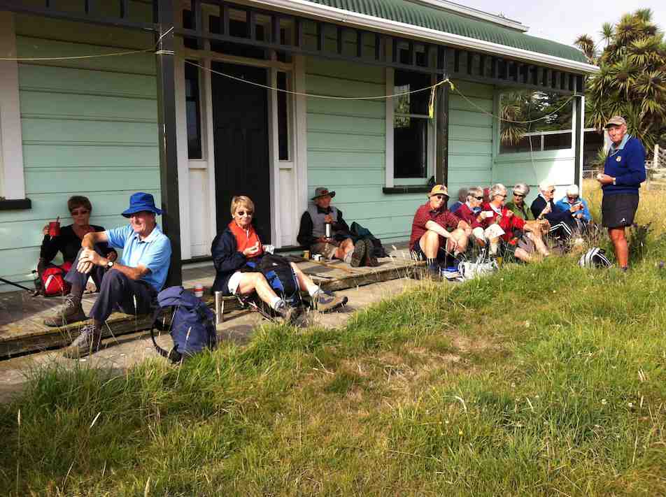
… before returning to Bendoran for drinks and muffins. After lighting up the coal range to heat the water and apple crumble, we then enjoyed home baked Chicken, vege’s and salad. Next job was firing up the open fire, sitting round chatting for the evening.
Before 8.30am next morning we were up and away tramping in ideal conditions for 3 hours to the “Gap” @ 670 metres.
The Gap from morning tea stop. (Arthur pic and caption.)
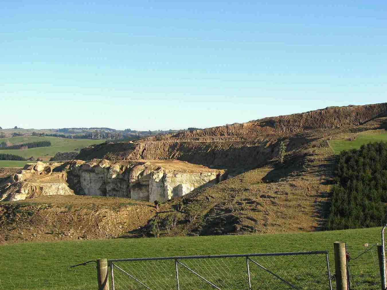
After numerous photo shots of surrounding valleys, peaks, ranges and the trig, we then headed down onto a new track, where after a lunch stop, we approached the A.B.C. Caves.
Helen Janine & Eleanor at abc caves. (Arthur pic and caption.)
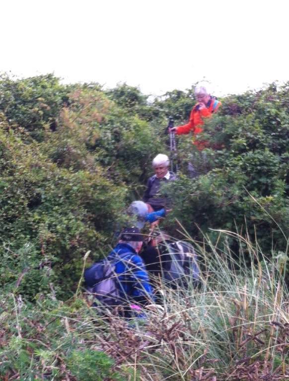
After a challenging tramp, we were impressed by the cave interior, …
From in ABC cave. (Helen pic and caption.)
… but were disappointed the “visitors book” left no room for our claims to reaching this monumental milestone! We then had to return steeply uphill a little before bush-bashing a track across a gully to join back onto our original track, leading us back to our cosy “Bendoran home”.
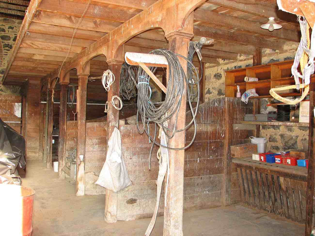
Bendoran where we stayed. (Arthur pic and caption.)
Arriving back @ 4.15pm, we found 2 members (who returned without going to A.B.C. Cave) had the coal range going with the kettle boiling for drinks and a HOT shower!! All fresh and clean again, we dined …
Dinner. (Helen pic and caption.)
… in front of the open fire on beef casserole, new potatoes, peas and salad, followed by brownie and peaches—-not your average tramping food, and certainly above standard accomodation.
It was an exceptional tramping trip for Arthur, Neil, Carol, Helen, Janine and Eleanore, with new tracks and experiences for some of the party. – Janine and Eleanor.
10. 25/3/2015. Trampers. ABC Cave from Bendoran Huts.
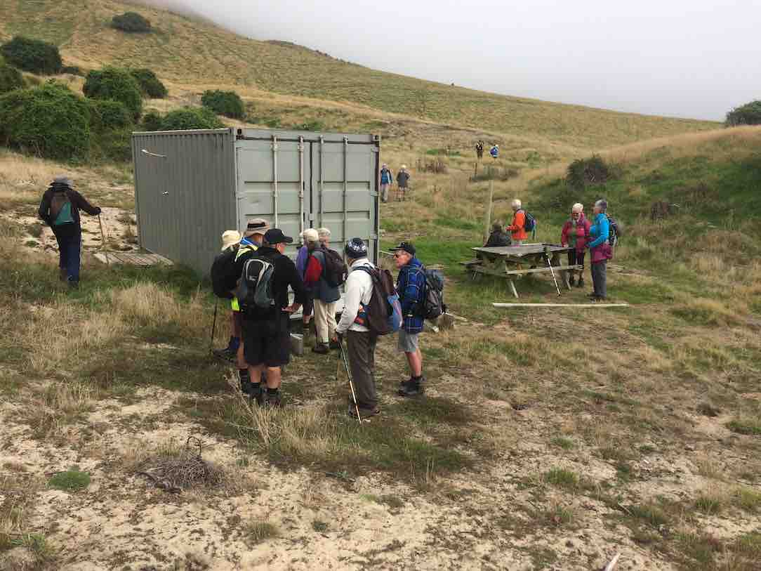
On a day when the weather was a bit suspect, we arrived at the Bendoran Huts to see fog in the valleys, but clear around the tops. Because of the distance travelled to get there, we decided to have a late morning tea break,…
Late morning tea stop. (Ken pic and caption)
…at one of the high points on the track. After this, we walked around the road [farm track] to a point at the head of the valley leading to ABC cave, where we arrived for a late lunch in sunshine.
After lunch we more or less retraced our steps back to the cars, with a couple of refreshment stops on the way.
The day turned out ideal for tramping, with just a trace of breeze at times, a little bit of sunshine for lunch, & the temperature just right, & the fog actually lifted during the day.
Next time we do this, it would be a good idea to start early, as it’s a long way to drive, & the road in is all narrow gravel. – Ken.
9. 8/5/2013 Trampers. ABC Cave from Bendoran Huts.
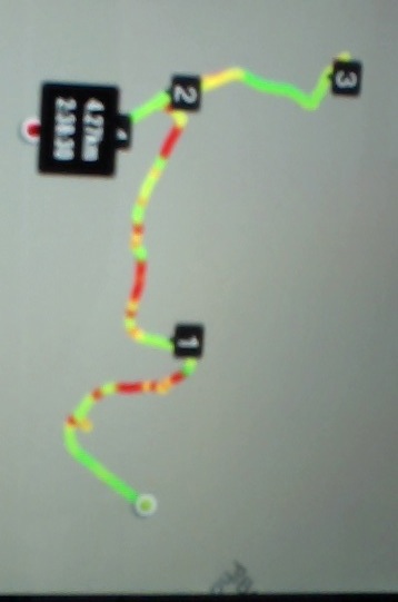
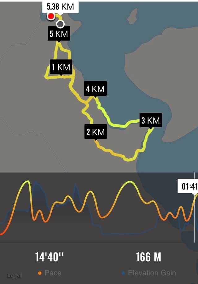
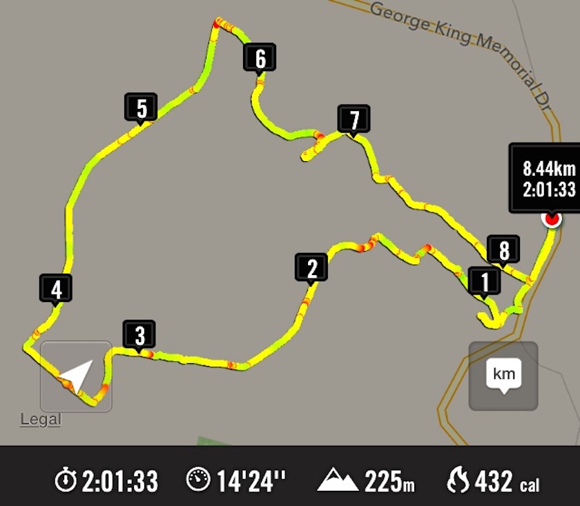
GPS of route, courtesy Ken. We walked 13.6km, 4hrs moving, 2hrs stopped, total ascent 839mtrs, max elevation 701mtrs.
There have been MANY new tracks bulldozed in around the area, making it very difficult to know which track to take. The original idea was to go to the Gap, & then down to the ABC cave, but we were running out of time, due to the distance travelling there, getting held up for about 1/4 hr by a very large mob of sheep with no sign of humans or dogs anywhere. Plus as we didn’t know where to go, we ended up bush-bashing our way down a ridge on the top side of the bush, as you can see by the Google pic. We eventually got down to the DOC track leading between the GAP & ABC, so just carried on to ABC, had a quick drink/snack, & left there at just on 2pm. Then we struggled up another ridge that was a lot clearer than the one we had came down, but it was steep, & it took us an hour to reach the top. From there, it was a relatively easy walk back to the 4wd track that we had left to go down past the bush. One or two of the climbs on the track back to the car were certainly a bit ‘trying’, but we all made it back to the cars OK, & after the drive back to town, got home at just after 6pm.
George didn’t go down the ridge to the cave, so he sheltered for a while, then wandered back to the cars, leaving suitable signs that he had passed that way. There were 7 of us in the group, one of whom was heard to say on the way in, “you think this group is a serious walking group?” so by the end of the day when I asked if they still didn’t think we were a serious walking group, the answer was ” that was a serious walk”. – Ken.
8. 22/2/2010. Trampers. ABC Cave from Bendoran Huts.
GPS of route, courtesy Ken.
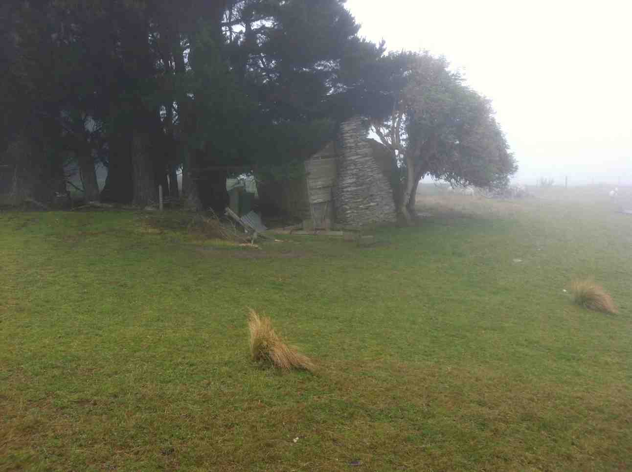
It had been many years since any of us had done this tramp, and memories were hazy. So much so, that we parked the cars at the end of Blucher Road, mistaking the shearing shed location there for the actual Bendoran Huts site about six kms further on. So we walked the farm 4WD route to the huts, instead of driving it!
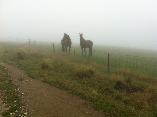
A hut ruin on the route. The fog was round us all the way. But it was dry! A fog, not a mist, as one of us distinguished.
An pic of interest on the way.
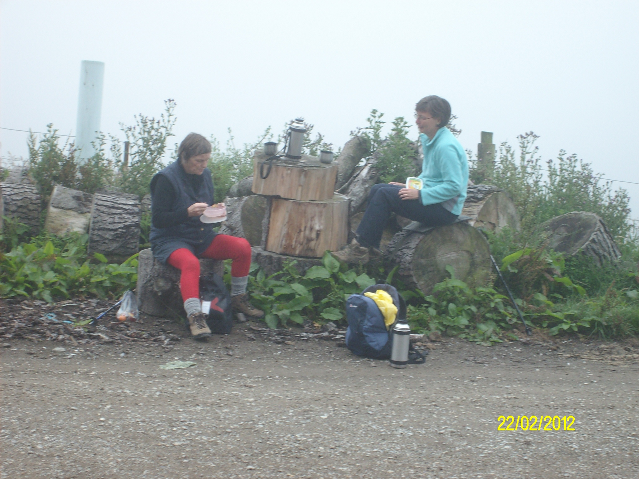
Lunch across from one of the Bendoran huts. (Ken pic)
Lunch in lee of the hut. (Ken pic)
We walked on beyond the huts on the track we should have originally started on, for a further km, but there was nothing to be seen through the fog which accompanied us all the way, except for only one brief respite. We then retraced our steps to the cars. About 14 km walked that day. – Ian
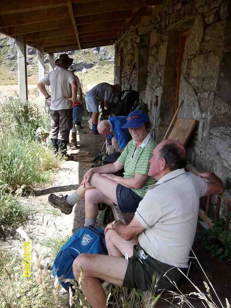
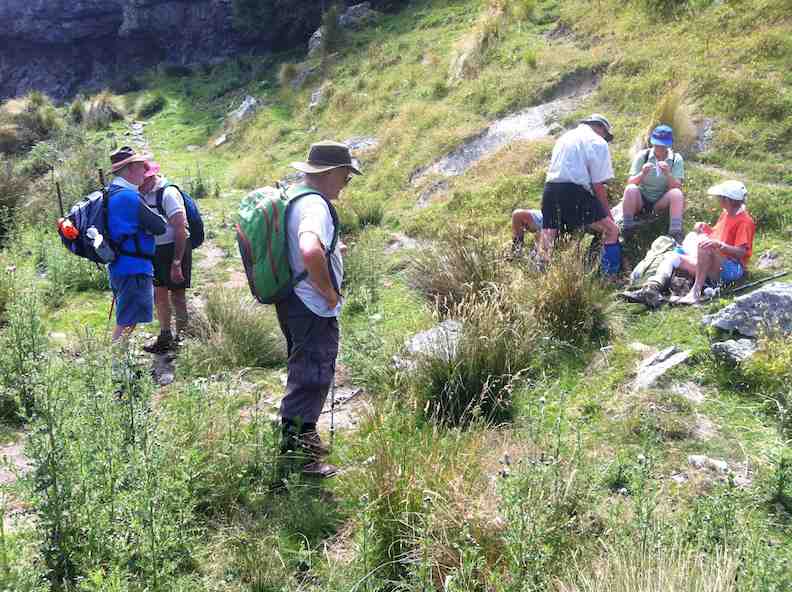
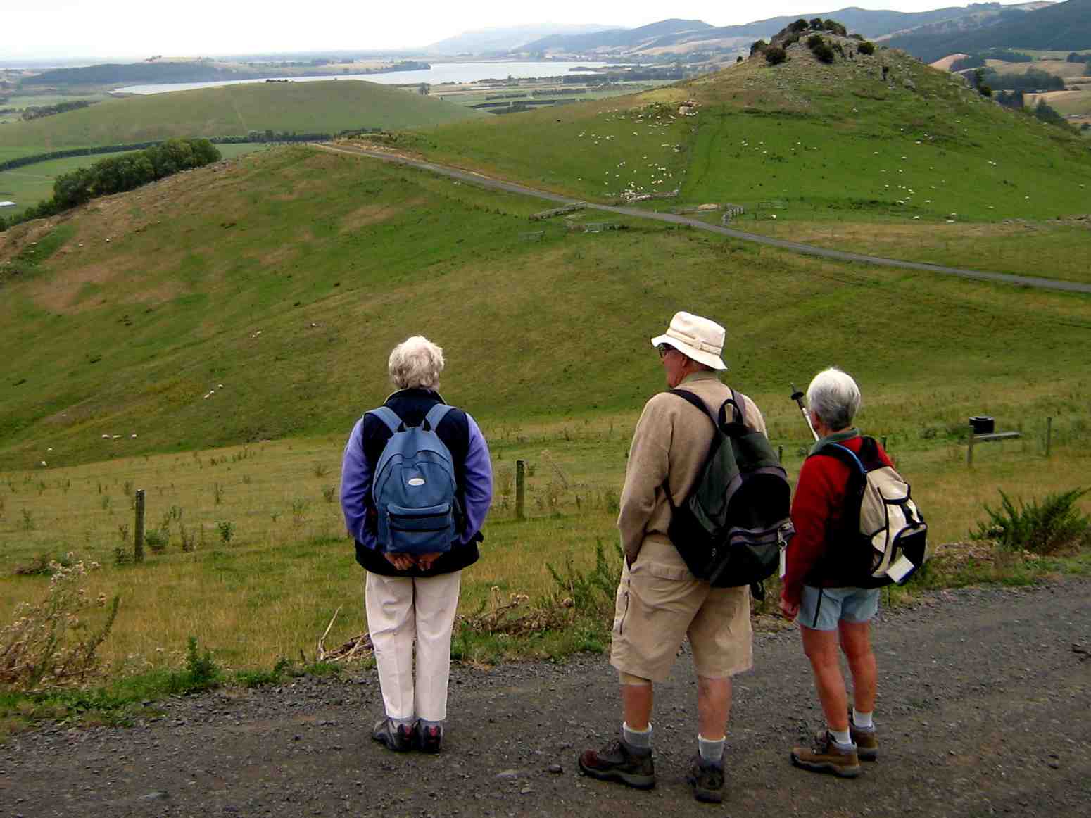
7. 30/1/2013 Trampers. Lamb Hill to three o’clock creek. Old Stone Hut. Orbells Cave. Medium+.
Lunch at the old hut.Orbells Cave from the track.Running repairs before we start the real climb back out
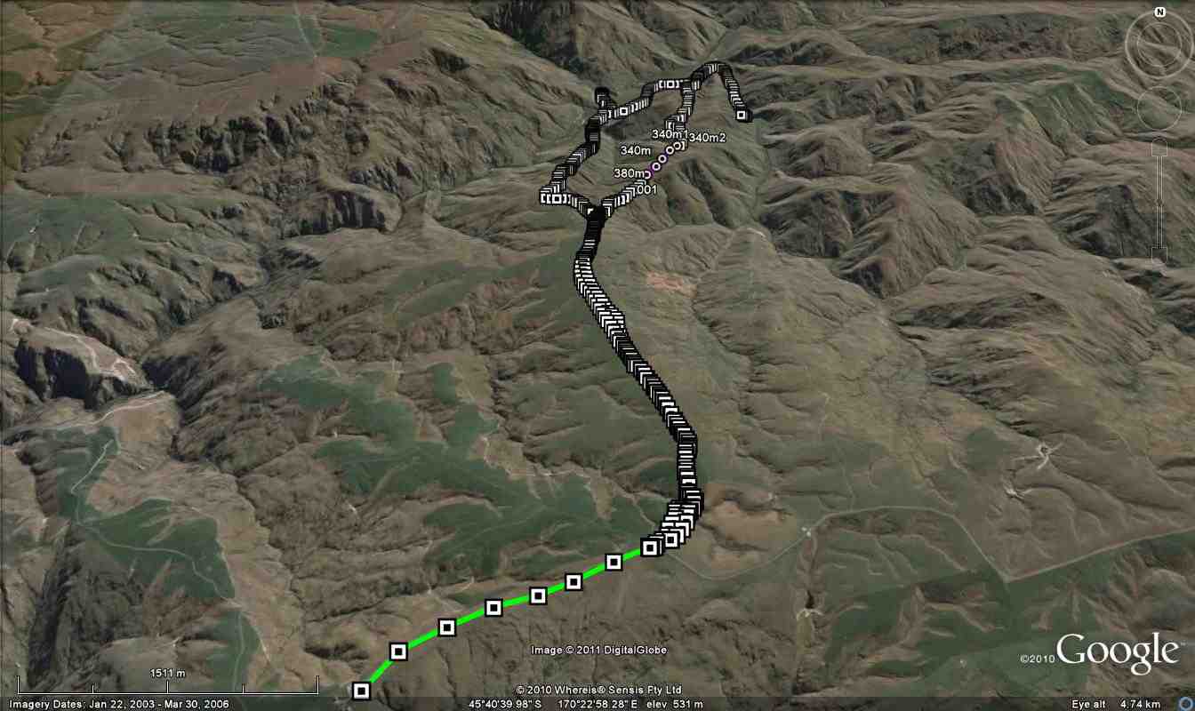
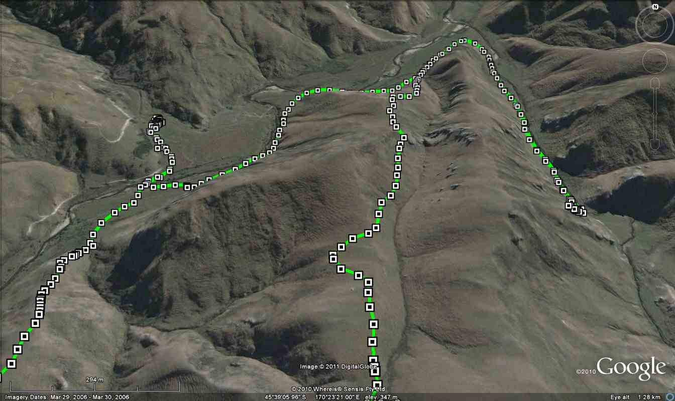
6. 19/1/2011. Trampers. Lamb Hill to three o’clock creek. Old Stone Hut. Orbells Cave. Medium+.
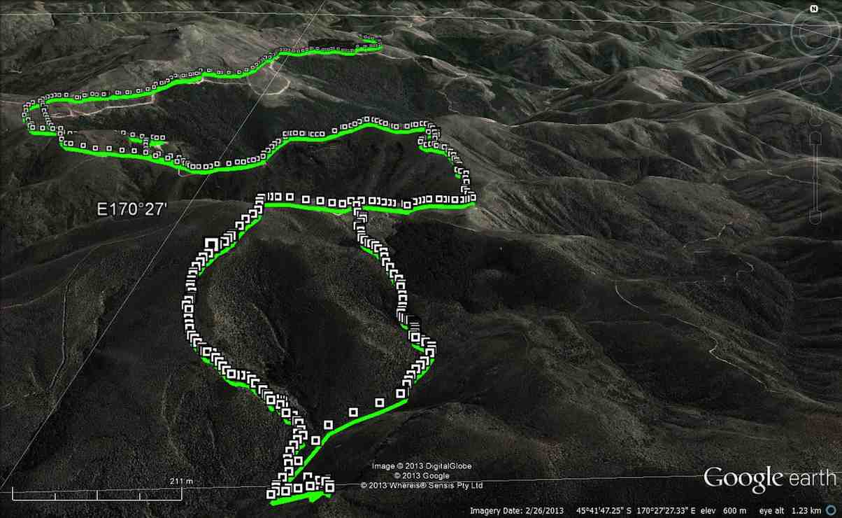
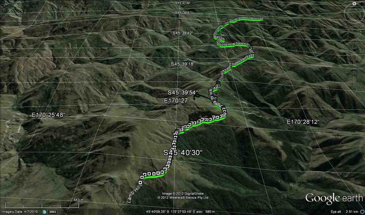
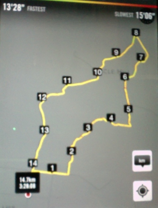
Small scale GPS of route, courtesy Ken.
If you look closly at the small scale pic, you can see the shed at the Nth. end of the airstrip, right at the bottom of the pic where the track starts. As you can see from the spacing of the GPS squares, we were still driving for a while till the squares become very close together. this is where we started to walk from. You can also see the track going off to the left of the airstrip at it’s south end, going down to the ford where the track peters out, & then starts again on the other side. That is where the 2003 tramp went (see below).
Large scale GPS map of route, courtesy Ken.
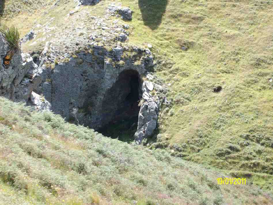
The large scale pic shows the decent via the wrong ridge, we should’ve been one over to the right. Anyway, we ended up just a short distance from Orbells creek, so walked into that valley, & up to Orbells caves which is the track on the RH side of the pic.
Cute cave we found on the way down to Three O’clock Stream. (Ken pic)
Orbells Caves. (Ken pic)
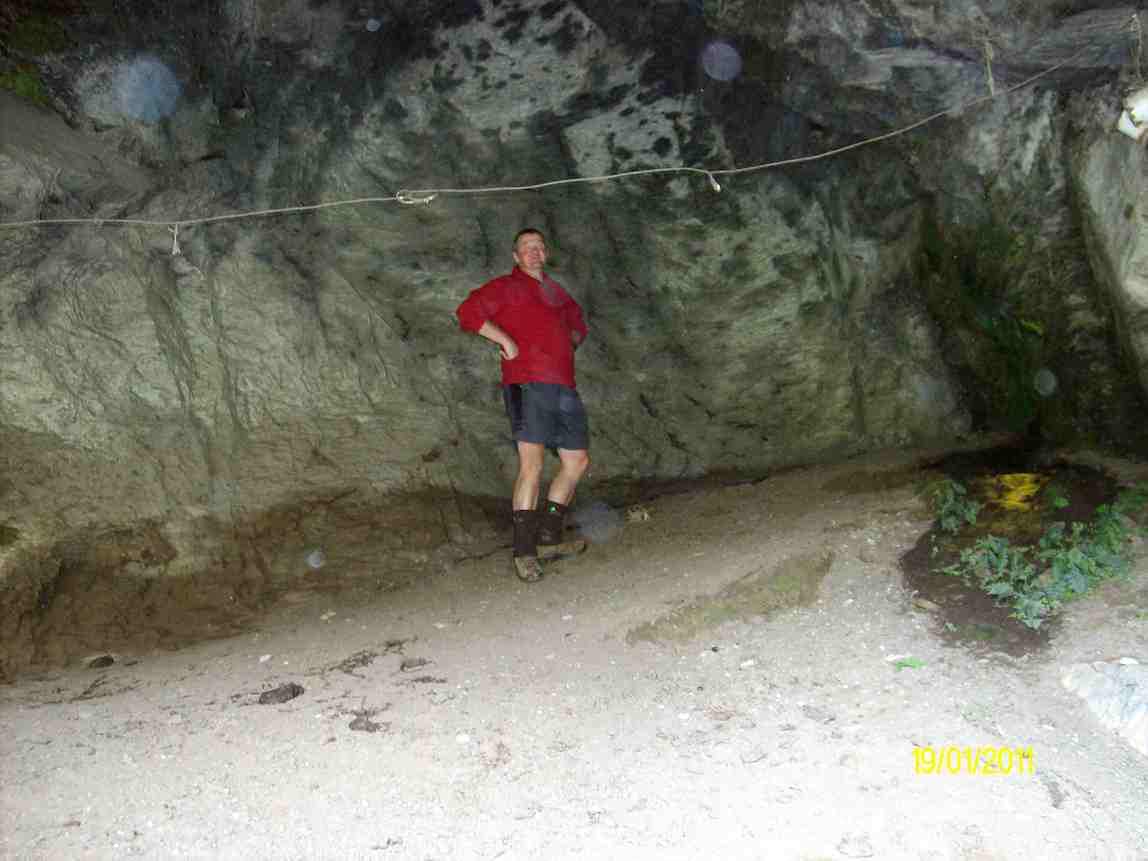
Dermot in the obviously lived-in cave. (Ken pic)
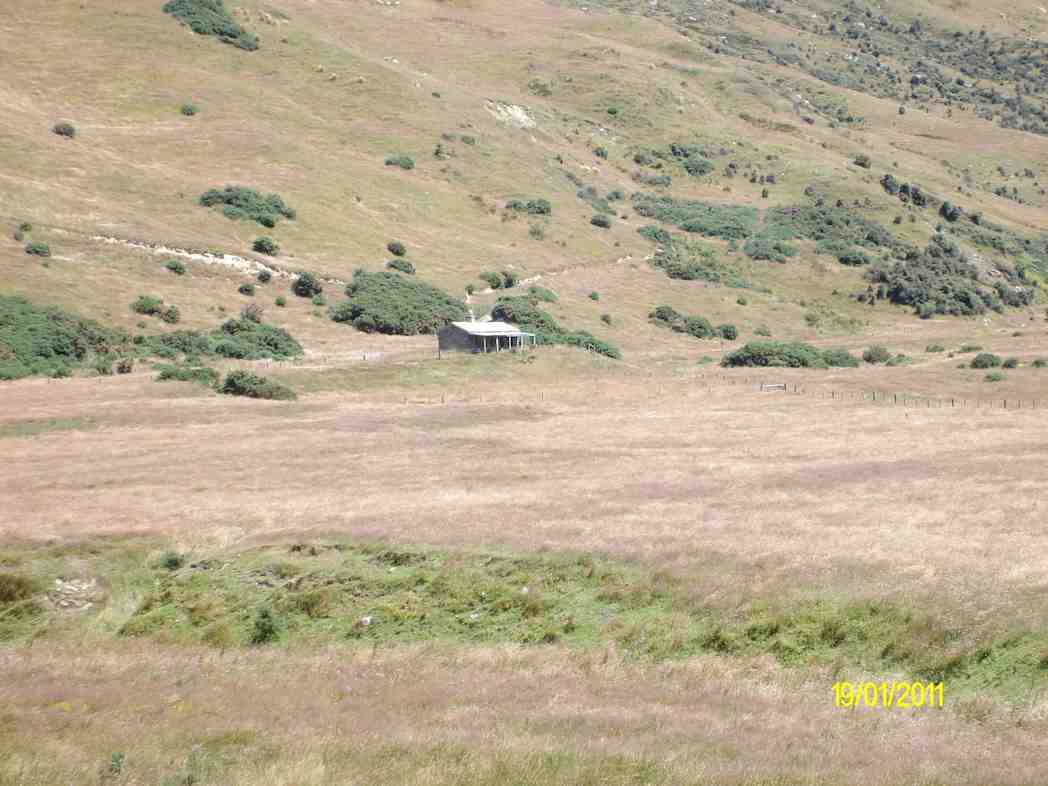
We then retraced our steps back to Three O’clock Stream, and went downstream to a crossing, where Dermot and I went to the old hut to have lunch (which is the track on the left side of the stream in the GPS pic).
Hut on the other side of Three O’clock Stream. (Ken pic)
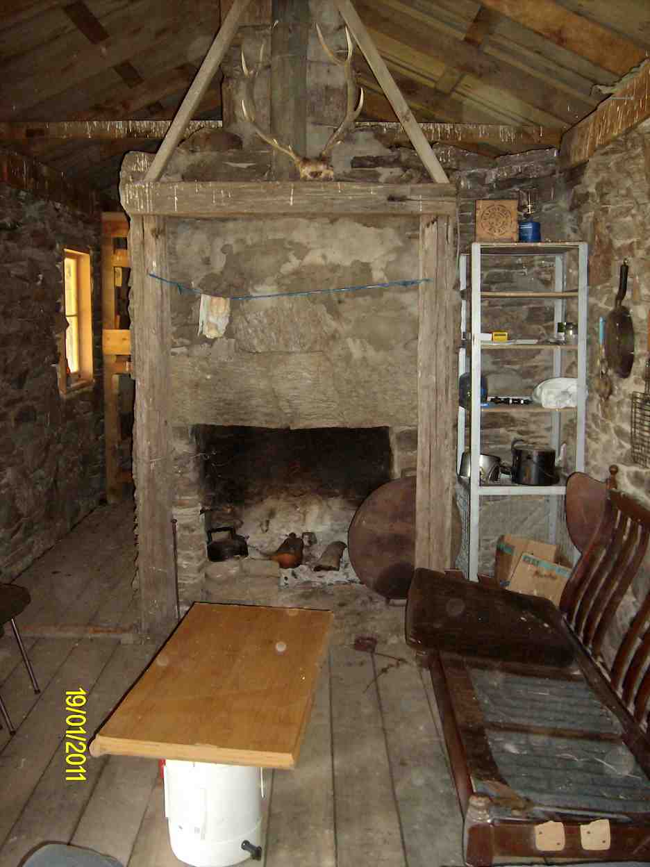
Relaxation area of the hut. (Ken pic)
Then after walking across the river flats, we struggled up the very steep hills back to the cars.
The weather was fine, but VERY windy, and I nearly lost my footing a couple of times coming back up the steepest parts. BTW, the hut is not on Lambhill Station, it’s on the neighbours property.
Everybody did very well, including George, who didn’t go to the caves, along with Hazel. They just went over to the hut to have lunch there.
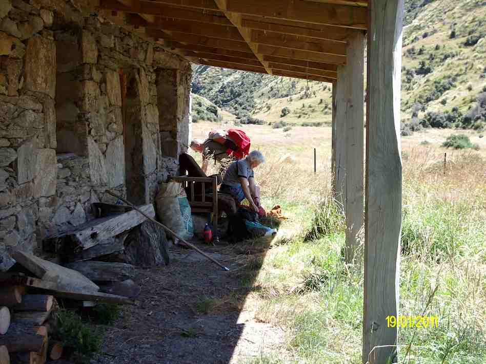
Hazel packing prior to leaving. (Ken pic)
George got a dose of cramp on the way back up the hills, but managed to overcome it ok, and carry on. – Ken.
5. 21/5/2006 Lamb Hill to three o’clock creek. Old Stone Hut. Orbells Cave. Medium+.Leaders: George, Keith, Glenice, Hazel
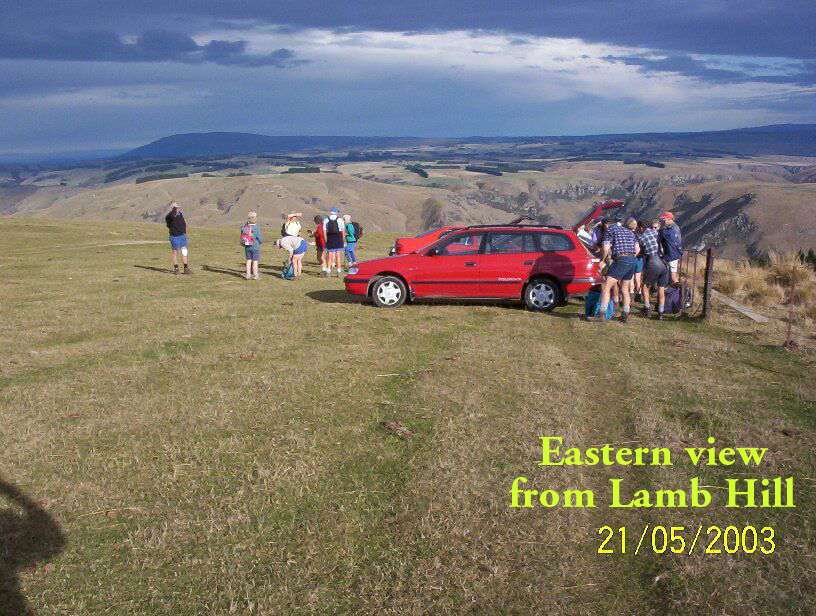
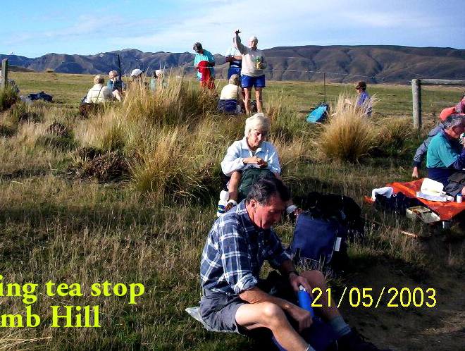
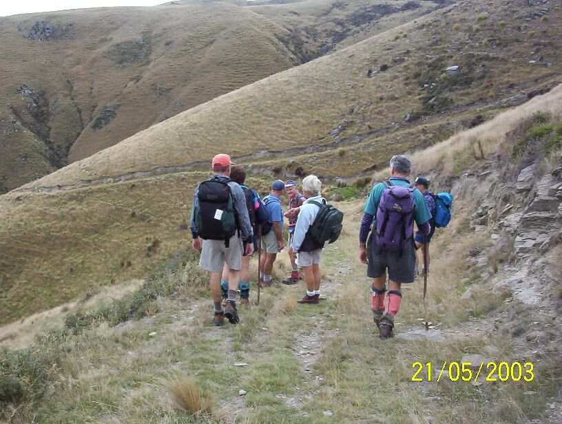
4. 21/5/2003. Both. Lamb Hill to Three O.clock Creek. Medium. Leaders: Wendy B, Bob H, Nancy & Molly
View when we first arrived.
Morning tea break.
Descent to creek
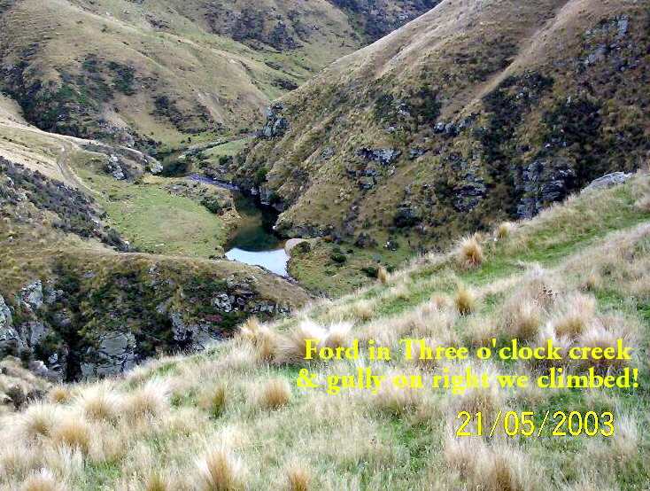
Three O’clock Creek
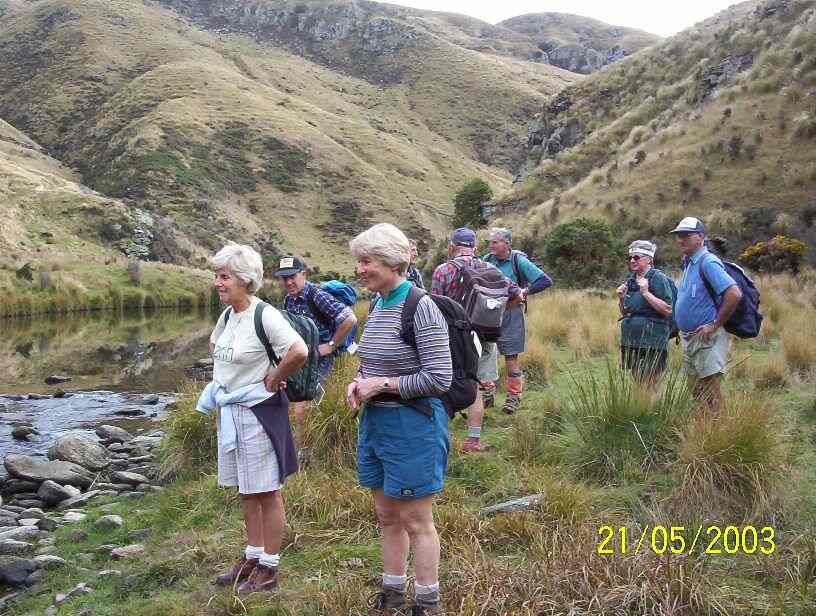
At creek ford.
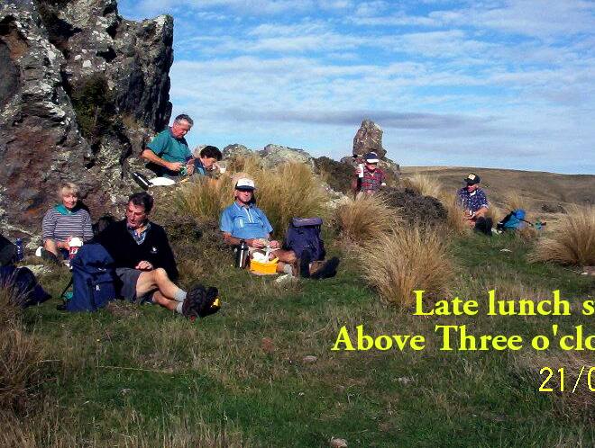
Lunch at top of climb. Pat, Lex, Doug J, Evelyn, Doug M, Bob, Arthur.
3. 17/5/2000 Lamb Hill, Three O’Clock Creek. Leaders: Wendy, Colleen, George
2. 15/4/1998. 3 O’Clock Creek, Lamb Hill. Leaders: Nancy, Wendy B
1. 8/11/1989 Lamb Hill to Three O’Clock Creek and old stone hut. Harder grade. George, Mary M, Molly, Catherine
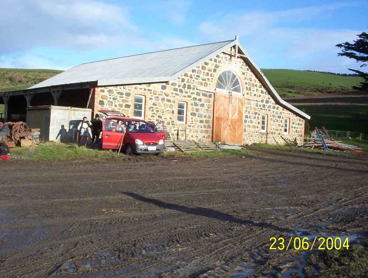
Today 7 hardy (maybe silly) trampers drove to Phosphate corner at Clarendon, then along Berwick road, parked up and walked up the hill to the Cemetery (my Great Great and Great Grandparents, some Siblings and Children from Sinclair family are buried there.
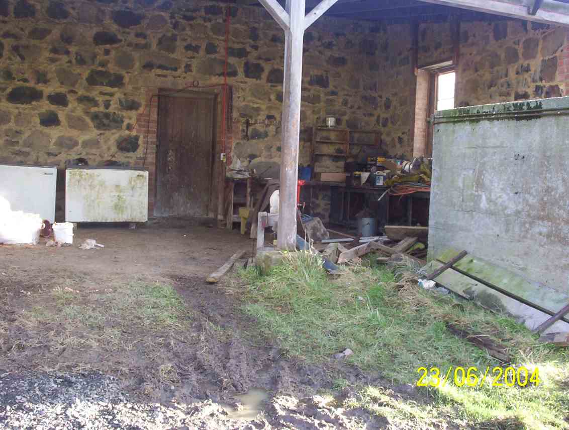
We then drove further along Berwick road, parked and proceeded up the track to the hay barn for smoko.
Shed for morning tea out of the freezing wind. (Helen pic and caption.)Mud to get to the shed. (Helen pic and caption.)
We all decided it would be no fun climbing round and up Mary Hill with frequent showers and a bitterly cold wind.
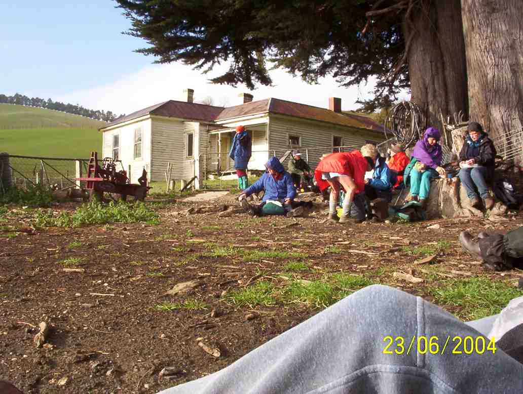
On the way back we briefly stopped at Sinclair Wetlands then drove into Berwick Camp, a year 8 class was there on camp, talked with the Activity Coordinator and strolled up to the dam.
On a bridge at the Berwick camp. (Helen pic and caption.)
It was plain to see what fun the young students were having, particularly when having a turn driving round with a leader in an old converted type of Land Rover in the mud.
So after all this strenuous activity we journeyed on to eat lunch (and cake) at a little hilltop cafe in Clyde street. – Eleanore.
Lunch at Eleanore’s with a lovely warm fire and cakes which were enjoyed by us all. (Helen pic and caption.)
15. 24/4/2013. Hikers – and a few trampers. Limesprings Farm, McNeil Rd, Whale Museum, and return back through Farm by a different route. Leaders: Jim and Betty.
Route, unfortuately stopped at Whale Museum, for some inadvertant technical reason! Cattle track up middle, McNeil Rd and extension at top.
The overcast day succeeded a wet 24 hours, and several trampers joined us after cancelling their bush walk up Raingauge Spur for safety’s sake. We parked the cars halfway along Driver Road and walked on to enter Limespring Farm.
We stopped to admire the old Horseshoe Stable. What was most noticeable was that the owner has made the switch for sheep to dairy farming. With the transforming magic of electric fencing a wonderful new cattle route steeply ascends the hill, connecting to a myriad of rotational paddocks. No stock were visible, presumably away in some distant meadow. We stopped for morning tea beside an old stone cottage before attempting the climb. Our leaders fittingly anticipated ANZAC Day tomorrow by disporting a hat poppy and distributing ANZAC biscuits to accompany our meal.
Next, the climb. Talk about slippery! A patina of thin wet mud over the track foundation made it impossible for mud-caked boots to find any sort of a grip, so it was a struggle up what remained of the grass verge and gripping the electric fence, which was fortunately turned OFF. The climb emerged finally onto the top of McNeil Road. The more energetic climbed a track leading a little further to reach what looked like the excavation of a dam into the hillside. We climbed above that a little further to the top of the hill, before coming back down to McNeil Road to join the others who had preceded us to the Whale Museum to lunch there in welcome shelter from the wind.
After a leisurely lunch, it was only a little further down McNeil Road before we re-entered the farm and via a arcing 4WD track, this one safely firm underfoot, to get back to the Horseshoe Stable and back along to the cars. Thanks to Jim and Betty for the planning they put into the route, despite the completely unforeseen atrociously slippery climb! – Ian.
14. 31/8/2011. Hikers. Clarendon, Cemetery Hill, Limesprings Farm,
After leaving a sunny Bush Road car park, seventeen hikers parked in coolish still conditions at the junction of Cullen Road and the Berwick Road after traveling down Phosphate Road and turning right at the road end.
The red brick Ewing Phosphate Company building on the right at the turn off from State Highway One is now a calf shed for Milton dairy farmers Tony and Sue McDonnell.
Tony interested Ravensdown in mining the phosphate deposits at Clarendon in 2009 and phosphate rock from the area is now mixed with imported rock to make a product called Clarendon Gold. Ravensdown imports rock from Morocca, Vietnam, and Christmas Island.
The 450 ha South Otago phosphate deposit is one of only two in NZ with the other being on the sea floor in the Chatham Rise. The Ewing Phosphate Company was established in 1902 and by 1904 it was regarded as one of the leading industries in NZ. Fifty tons a day of phosphate rock was railed to Dunedin. The mines were worked from 1902–1924 and from 1943–1955. About 200,000 tons were extracted. The business ended after competition with cheaper phosphate from Nauru.
Mr McDonnell was reported in the Dairy Exporter Magazine as saying that apparently he and his neighbours had the only phosphate deposit in Australasia. To warm up, the group ascended approximately to the top of cemetery hill starting at the gate at the Cullen Road turnoff. About 30 graves were present in the cemetery at the top of the hill including several to Sinclairs. We had a view of Lake Waihola and the Sinclair wetlands.
After starting down the hill we had morning tea near a shelter belt and then proceeded along Berwick Road and Driver Road to Limesprings Farm. We were able to inspect the vintage stone stables together with some tractors awaiting restoration.
We then proceeded up the farm road to lunch at the Whale Fossil lookout and returned by the same route after lunch to the cars which we reached at 1345.
We noted that Angela Wanhalla referred to the allocation of land at Clarendon to the mixed-descent families of Southern NZ in her book In/visible Sight (Wellington: Bridget Williams Books; 2009). – Bruce
13. 5/2/2009. Both. Horseshoe Bush Stone Stables, McNeil Road, Whale Museum Tea break, Lime Works, Fort Hill Road, Hay Barn lunch, Trig Q and back. Medium. Leaders: Bob M, Ian.
Clarendon route map
18 of us enjoyed the tramp from Lime Springs Farm. From the Ewing Phosphate works building by Highway 1, we drove down Phosphate Road, to the left of Cemetery Hill. We turned into Driver Road and parked opposite the Horseshoe Bush Stables on what is now called Lime Springs Farm. We climbed first up the farm track
View from farm track. Chris?, Neil, Bev.
to McNeil Road where we turned right to the the Whale fossil Museum at the top of the road for the tea break. Here are housed whale fossil bones extracted from the Milburn Lime Quarry. Then it was back down to turn right up Fort Hill Road and climb again to eventually crest a saddle and head on down to our lunch stop by a farm sheep yards and sheds.
Les lunching
Sheep yards at lunch stop
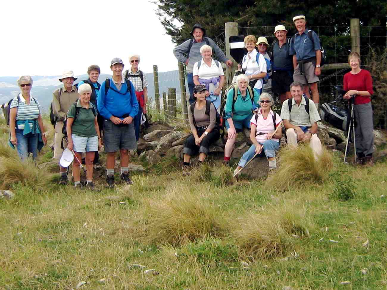
After lunch, we climbed by farm track and paddocks to reach Trig Q and pose for a group photo.
Then back down a bit where Bob found inspiration in a rock formation.
Sacrificial Bob?
Fortunately for us, on the recce, Bob (and Doug who couldn’t be with us on the day) had discovered the usual paddock down was this year in turnips and too rough by the fence to negotiate easily, so led us down the true right of the nearby bushed gully and back to the starting point. Fortunately due to the dry weather, Lime Springs farm did not live up to its name and what is usually slushy going at this point was bone dry.
12. 10/9/2008 Trampers. Clarendon, and Cullen, Fort Hill and Circle Hill Rd. Medium-. Leaders: Ken, Ian.
Only three of us, namely Ken, George and self attempted the road walk from Clarendon up Cullen Rd, Fort Hill Rd, and then the circuit round Barnes Rd and Circle Hill Road and back down again. The weather came in wet and dry periods, windy and calm. We were treated to brilliant green meadows, sheep lambing, cattle foraging on winter turnips and choumollier, and extremely muddy paddocks left behind by them. We enjoyed the variety of hills we walked amongst, sheltering behind a hedge for morning tea and in a shearing shed for lunch. We reached close to 280m and walked about 18Km in a surprisingly short time, getting home as early as 2.30 p.m. A good stretch of the legs and and interesting rural area, enlivened by a chat with an ATV driver and a farmer leading a couple of horses. – Ian
11. 8/8/2007. Both. Clarendon, Stone Barn, Lime Works, Whale Museum, Lookout. Leaders: D Moir, Graham, Bob M.
9. 16/6/2004. Trampers. Milburn, Fort Hill, Limeworks Road. Medium. Leaders: Doug M, Arthur H. 8. 8/5/2002. Clarendon, Fort Hill. Medium. Leaders: Doug M, Irene, Bob H 7. 21/11/2001. Clarendon – Milburn. Medium. Leaders: Shirley McN, Irene, Ian. 6. 22/3/2000. Clarendon, Old Stone Barn. Leaders: Doug M, Ann, Lex. 5. 21/1/1998. Clarendon, Old Stone Barn, Limeworks. Leaders: Doug and Ngaire, Irene. 4. 24/7/1996. Milburn Ramble from Stone Stable. Average. Leaders: Ngaire and Doug, Nelson. 3. 12/4/1995 Milburn, Clarendon, Circle Hill, Fort Hill. Medium.Leaders: Doug and Ngaire, Shirley R, Ted. 2. 14/7/1993. Milburn Lime Works. Interesting history. Medium.Leaders: Peg C, Diana, Joan A, Doug M 1. 24/7/1991. Milburn Lime Works. Average. Leaders: Peg C, Mary Y, Jack R, Les W.
Physical Geography.—To the south of Dunedin there is a line of coast-hills, varying in height from 500 ft. to 1,400 ft. Shut off by these hills from the sea are two long, somewhat narrow plains—the Taieri and the Tokomairiro—along the length of which run the main road and the Main Trunk Railway. The drainage of these plains finds an outlet to the sea through narrow gorges in the coast-hills. On the western side of the plains the hills rise abruptly, but between Clarendon and Millburn they jut far out towards the east, separating the two plains from each other, and forming the Waihola Gorge—the former name for Millburn. It is at the base of the protruding part of these western hills that the rock-phosphate mostly occurs. On the southern (Millburn) side of the gorge the hills rise sharply at first till the crown of the spur is reached, and then the spur runs in a north-west direction, attaining its greatest height at the Trig. Q. From the trig. another long spur runs down in an easterly direction on the north boundary of the district, reaching the plain opposite Cemetery Hill. Between this spur and the former one the hills descend somewhat more abruptly to the plain. In the neighbourhood of the gorge a small cross-spur runs northward parallel to the road; the western flank of this spur was the site of the original discovery of rock-phosphate, and is now the scene of the greatest activity in the quarrying of the rock.
– Excerpt from: Transactions and Proceedings of the Royal Society of New Zealand 1868-1961. Volume 38, 1905 Art. LII.—On the Geology of the Clarendon Phosphate-deposits, Otago, New Zealand. By Arthur R. Andrew B.Sc., A.O.S.M., Laboratory, Otago University School of Mines.
4. 31/5/2017. Hikers. Green Island street walk. E. Leaders: Elaine and Chris.
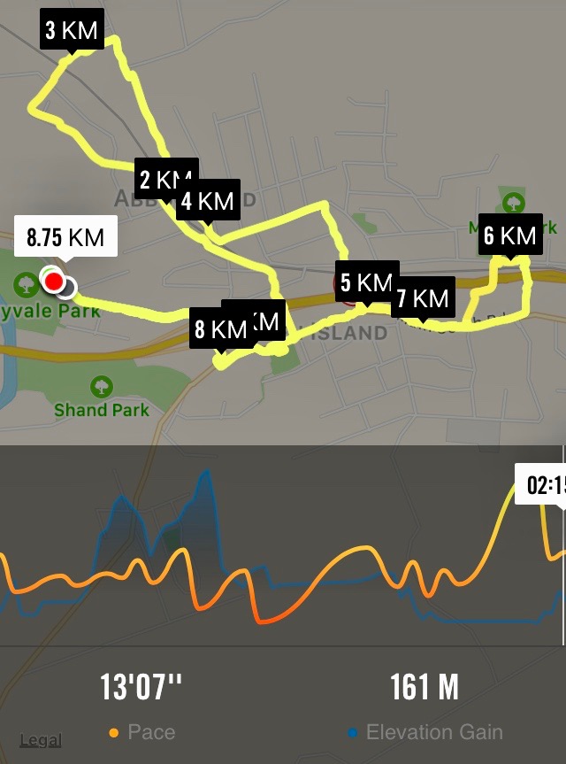
Nike app map of route, courtesy Ian.
The above route map gives some indication of the intricacies of Elaine’s planned route, designed to cross and recross, by way of tunnels and bridges galore, the barriers of railway line, stream and motorway dividing Green Island from Abbotsford. It was a street-walk, most suitable on the day for an off-and-on light morning drizzle. We were treated to a whole gamut of lower Abbotsford house designs, most instructive of fashions favoured in different decades, complete with one or two older ones looking very old and very neglected. At the latter part of the hike, we also got to peek into some of the large industrial goings-on at the north end of the town, not least Harraways. All most impressive.
At one point where a railway line once crossed the old main road (remember it?), Elaine stopped us to point out how it once served a coal-mine of her grandfather. She has a photo of a small steam engine about to head north across the road.
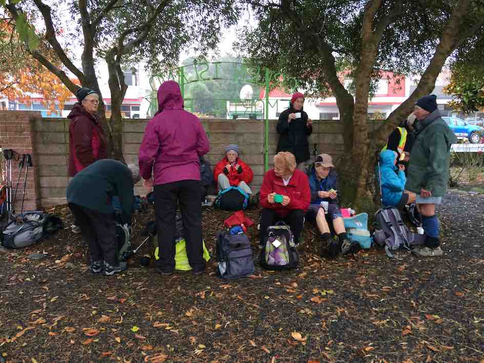
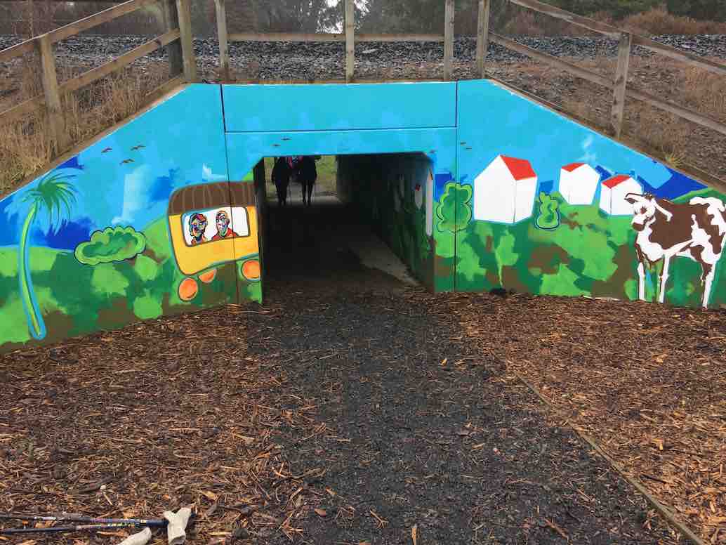
Drizzly morning tea at the gardens. Most of the 22 who came out. (Ian pic and caption.)Newly decorated railway underpass (newly decorated since Elaine’s recce), essential for linking homes and school. It was deemed safer for children than a bridge. (Ian pic and caption.)a dry-seated lunch at the Green Island Rugby Football Club pavilion in Miller Park. (Ian pic and caption.)18 of us at Coffee at Agnes’, where we got to enjoy a separate room all to ourselve, complete with en suite. (Ian pic and caption.)
Many were the remarks appreciative of the cleverness of the route. A big thank you to Elaine and Chris for a great day out. – Ian, (for Elaine [without her knowledge – yet!] whose recent rapidly failing eyesight prevented her from tackling a report.)
3. 25/2/2009 Hikers. Green Island. Farm Walk. Leaders: George, Dot B
2. 10/5/2006. Hikers. Green Island street and farm walk. Leaders: Chris, Dot B.
1. 8/2/2006. Hikers. Street Walk: Green Island Street and Farm Walk. Leaders: Dot B, Chris.
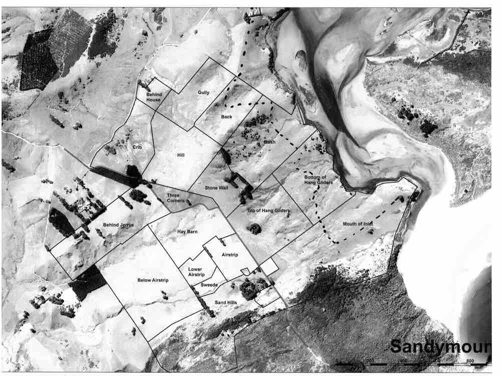
No. 93 on old hardcopy list of 113 club tramps. “Murrays Farm – Sandymount (Chris Hughes) Farm”
Distance for carpark: 31.5 km.
Map supplied by the owner. (Keith pic.)
11. 29/3/2017. Hikers. Murrays Farm. M. Leaders: Keith and Shona.
Route map, courtesy Ian.
It was a foggy, misty morning when 19 Hikers met at the gateway bel0w Murrays Farm before ambling up the road to having morning tea in the implement shed.
We then followed the fenceline up and across the paddocks before descending to explore around a container being used as a crib.
George investigates shower workings on new crib. (Ian pic and caption.)
We exited onto the coast …
We discover a new route from paddock to beach. (Eleanor W. pic.)
… where we had lunch …
Papanui Inlet mouth beach for lunch. (Ian pic and caption.)
… out of the northerly wind.
We followed the water’s edge around past the old boat shed, climbing up the hill and visiting an old dwelling also being used as a crib and back along the farm tracks to the hole in the hedge and down the hill to the cars.
Coffee was at Macandrew Bay cafe. – Shona and Keith.
10. 20/2/2013. Hikers. Murrays Farm. Medium. Leaders: Peter and Wendy.
Morning Tea at old homesteadParadise Ducks in formationWaiting for others in shelter from the hot sun
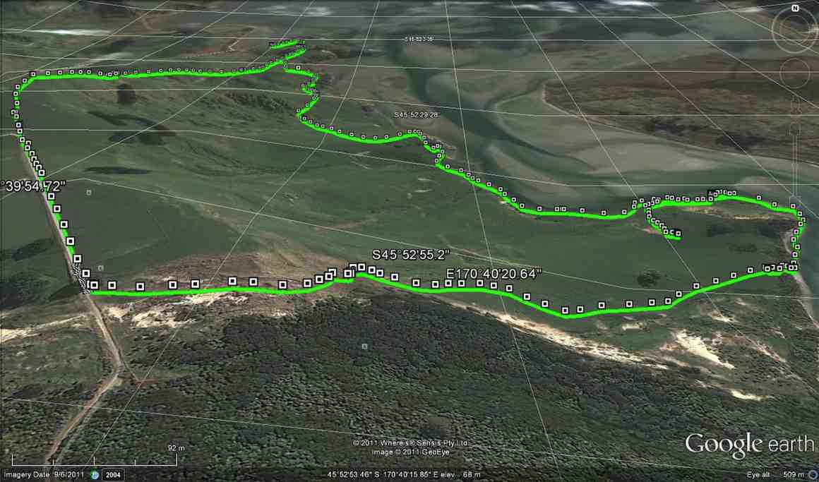
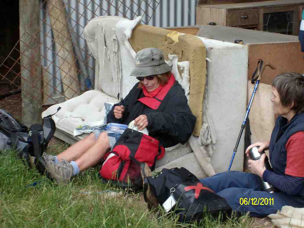
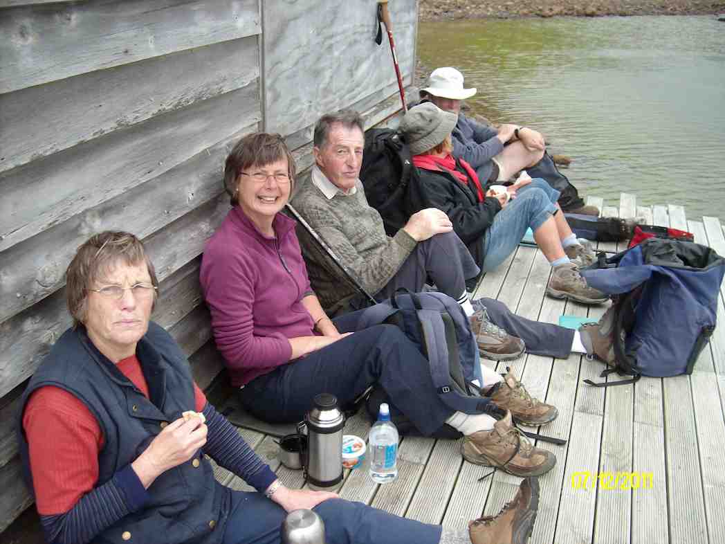
9. 7/12/2011. Both. Murrays Farm. Medium.
GPS courtesy Ken. Track from distant spot anti-clockwise.
Comfort plus for morning tea. (Ken pic and caption)
Five trampers scaled the almost vertical ascent to the Sandymount road before descending further by the bush.
An eye- and nose-watering wind greeted us when we stepped out of our cars at Hoopers Inlet. It was not a time for hanging around so our group of 13 set off at a brisk trot and soon reached the shelter of a shed which provided a good spot for morning tea.
Fuelled by hot drinks we ventured on and found that the hills and gullies gave good protection and we could enjoy this stroll through beautiful, peaceful countryside with the only other signs of life nearby the large number of paradise ducks. Perhaps they had discovered this place to be a refuge from duck shooters. In the distance sheep grazed and black cattle eyed us with interest.
Sheltered lunch spot
We found our way down to the beach and a sheltered corner at the far end provided a comfortable lunch spot.
Seal among the lupins
Margaret’s sortie into the sand dunes also brought to our notice a young seal hidden away under the lupins. We retraced our steps admiring the expansive views of the inlet and the winter colours on the hills.
It had been a short walk but a very pleasant country ramble.
Chris, who knows the area well, ably led us and, before returning home, some of us were lucky enough to stop off with her at a relative’s house on the hill and walk around the interesting garden, admiring both the plants and the panoramic views. – Marjorie.
6. 27/6/2007 Leaders:
Group. Ian, Leonie, George, Tash, Pat, Hazel, Ria.
5. 1/2/2006. All. Murrays Farm, Hoopers Inlet. Leader: Chris.
4. 5/3/2003. All. Murray Farm. Leaders: Chris, Les and Margaret, Bev McI.
1/4/2015. Both. Neehoff Farm, Hindon. M. Leaders: Ian F and Arthur H.
GPS of route
A goodly number of thirty Trampers and Hikers, as you can see from the GPS map, set off back alongside the road we had arrived in, the Leaders searching for one of several elusive ridges, each separated by bushed gullies and leading down to a main gully at their foot. However, due to their number (six in total!) and too tentatively choosing one ridge too soon but finding it too stunted to be the one, we ended up turning back (about 0.7 kms on GPS map) instead of going on, and descending the ridge futher back only to be forced to have to climb out of the gully beyond its foot (red spot about 1.4 kms on GPS map) and up onto the one originally planned on. By now it was time for morning tea. (Sorry about the lack of photos – we didn’t have John and his camera with us this time.)
On down the right gully now this time and into the main one across its foot, left skirting its side and crossing at a bridge and struggling up the slope directly ahead. (Red spots about 1.6 kms on GPS map.) Then it was on, up to our left, climbing gradually for the most part, through a number of paddocks and gates, until by various turns we reached what appeared a paper road. (About 3.7 kms on GPS map.) This formed a long ascending route to the point where we turned into a paddock again. (About 5.8 kms on the GPS map.) En route, we met up with the Neeehoff farm’s neighbouring owner. He reassured us he had been consulted, but it now became apparent that we had spent more time on his farm than the other! Ah well, another permission to prudently seek next time. It was in the new paddock that the mushroom pickers got really busy. There had been some mushrooms in the first paddocks, but here their number appeared endless. This led to a prolonged hunt by the aficionados while most went on to stop for lunch not too distant from one particular loiterer who shall remain unnamed. (6.1 kms on the GPS map.) Some great mushroom fry-ups would be on the menu that evening!
Lunch stop, waiting for the mushroom pickers to catch up.
Around the head of the gully facing the luncheon eaters, we descended to the big gully again, but here bridgeless, with its water-way just a step (or more in some places) too wide. Many just plunged through, but the tail on the GPS map indicates a walk upstream for the few patient enough to wait to be led to the only dry one-step crossing. (About 6.7 kms on the GPS map.) From there we had to walk back along to our left and the corner of a paddock ahead, and wait for leader Arthur to switch off the hot wire of what we now knew to be the Neehoff boundary fence. (About 6.9 kms on the GPS map.) Once through the fence, ahead lay the long steep slog up the longest and principle of all those six ridges leading back up again, – also the nearest to the homestead. (Kms 7 and 8 on the GPS map.) Now we were back up onto the original paddock and soon back to the cars.
Well, this was one of the now controversial “both” walks, set down for Trampers to join with Hikers the first Wednesdays of the months. It was moderately hard only in respect to the steep climbs out of the gullies. But not particularly long or challenging. There were happily more Trampers than there had been recently, generously tolerating the slower pace of the Hikers for the sake of “Recreational” togetherness and getting to know fellow-club members better. Perhaps the emerging arrangement of this along with a track-clearing option on the same day, is becoming a way through of providing a flexibility of choice for Trampers to exercise in accordance with their own preference. – Ian
20/2/2013. Trampers. Neehoff Farm, Hindon.
22/2/1995. Neehoff Farm, Hindon. Medium. Leaders: Molly, Jack and Rosemary, Eleanor.
No. 90 on old hardcopy list of 113 club tramps. “Round Hill – Milburn (George) Farm”
42 km from car park.
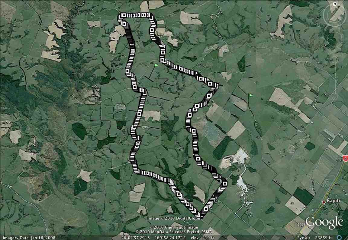
2/6/2014 Both. Fort Hill, Barnes and Circle Hill Roads, Milburn. Moderate. Leaders: Ian, Ken
iPhone GPS of route. Shows shorter than actual because I forgot to turn it on until after the first half km! See also Ken’s GPS for his 2010 route map.
Twenty-six turned out for a sunny first tramp for the winter, on back country roads amongst lovely rolling hill farms to the west of Milburn.
Morning Tea at the Finch Road turnoff from Circle Hill Road. (Heb pic)
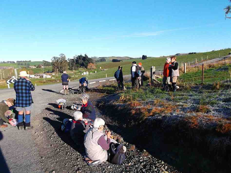
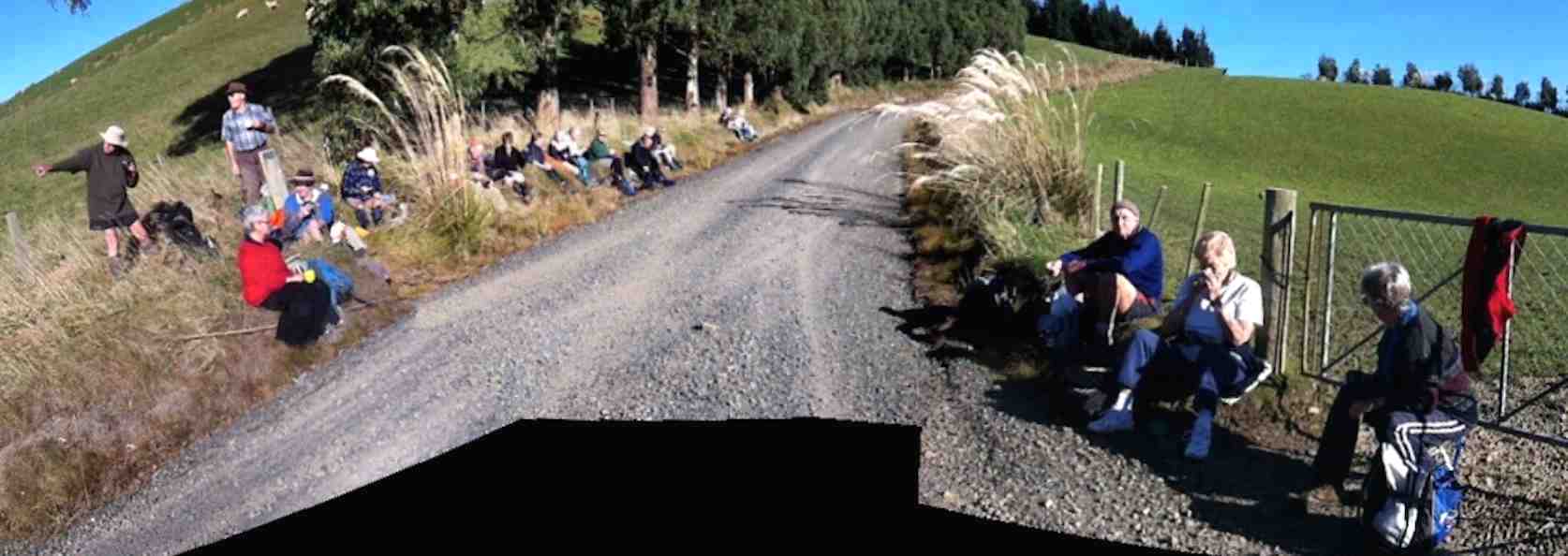
We lunched where Fort Hill Road ended at a T-junction with Barnes Road, which stretched left to meet Circle Hill Road, and right to form to form a larger route to also turn down Circle Hill Road at its end where both these roads joined to form Douglas Road.
Panorama pic. (The black bit at pic bottom results from my inexpert handing of my panoramic app.) Lunch. Here, Barnes Road goes ahead (in the pic) for the shortcut route and to the right for the longer route.
Ken supplied this report regarding this spot. Thanks Ken. : “The people that did the longer walk, covered 15.2km; Moving time 3hrs 9min; We climbed 374mtrs. I guess the ones that took the shortcut walked about 11km.
I base this on the time taken for us to walk around the longer loop, & the ave speed was 4.8km/hr, & it took us nearly an hour to walk around the loop.”
As said before, the day was sunny and calm, and each ample time to make the climbing bits at bits own pace.
Just a personal thought for road walks. With the growing practice of wearing, and of availability of high-viz vests, a good idea would be for more than just the leaders to be wearing them.
And lastly. What is becoming the customary coffee stop was enjoyed this time at Waihola’s Black Swan. – Ian.
1/9/2010 Both. Fort Hill, Barnes and Circle Hill Roads, Milburn. Moderate. Leaders: Ian, Ken
GPS of route. The short-cut can be readily picked out. (Courtesy, Ken).