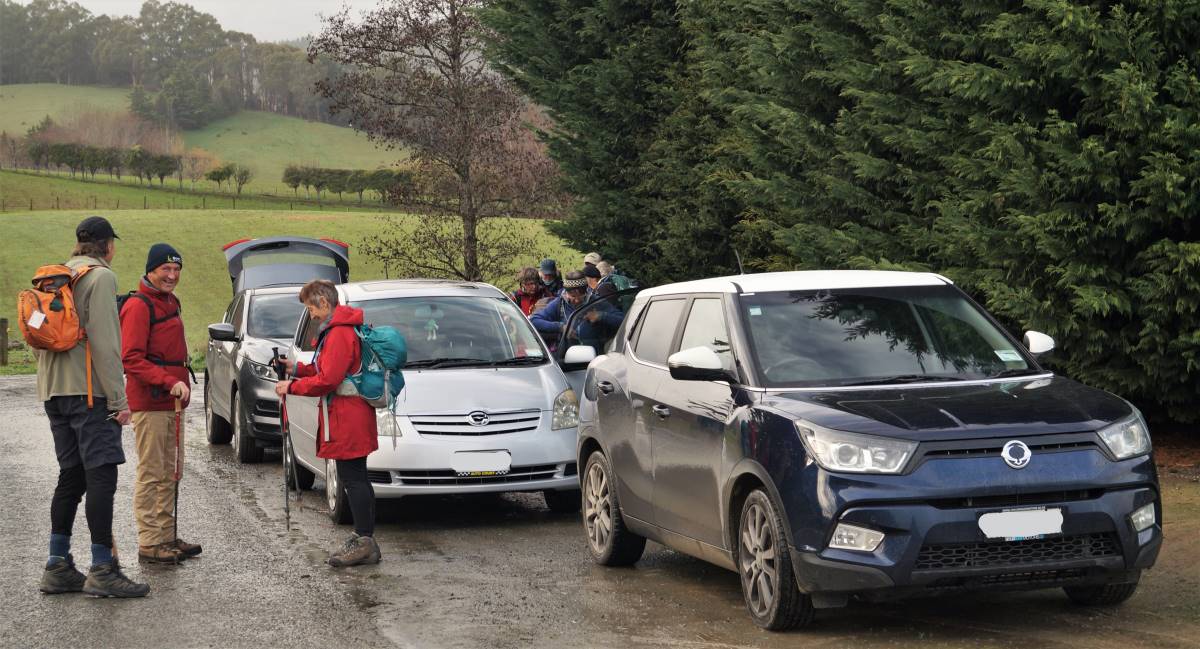
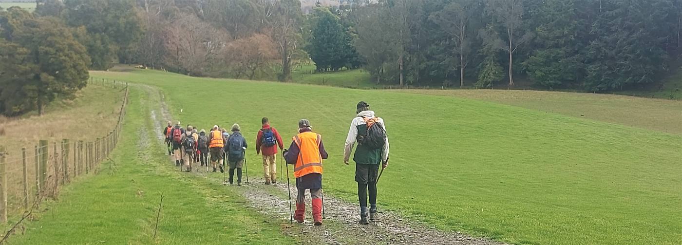
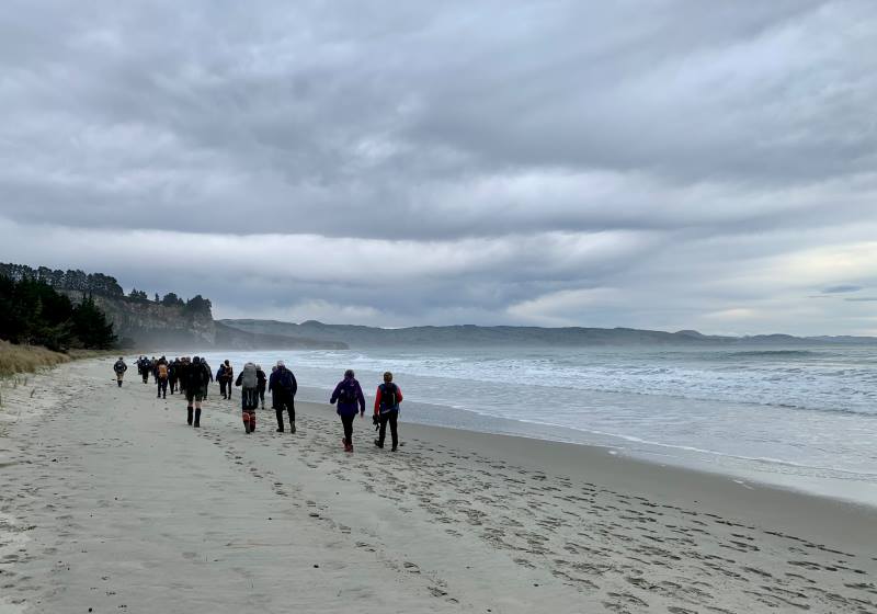
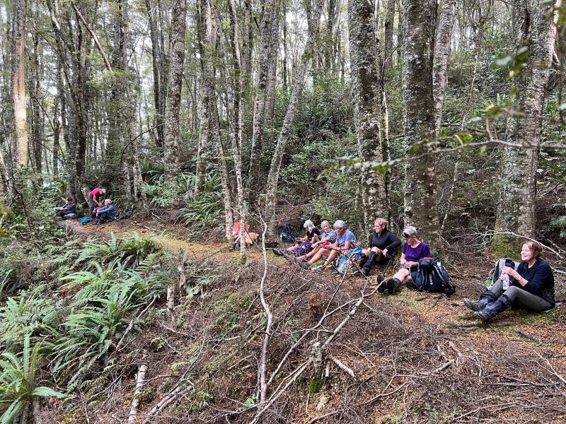
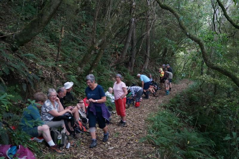
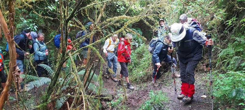
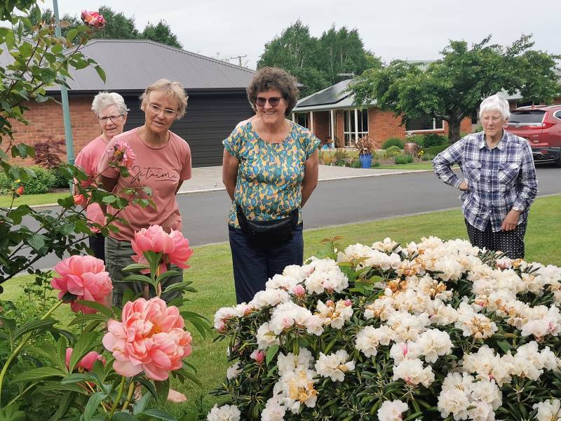
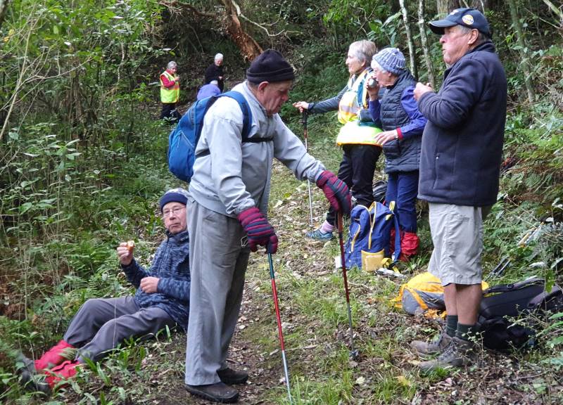
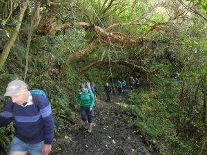
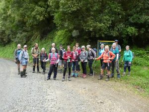
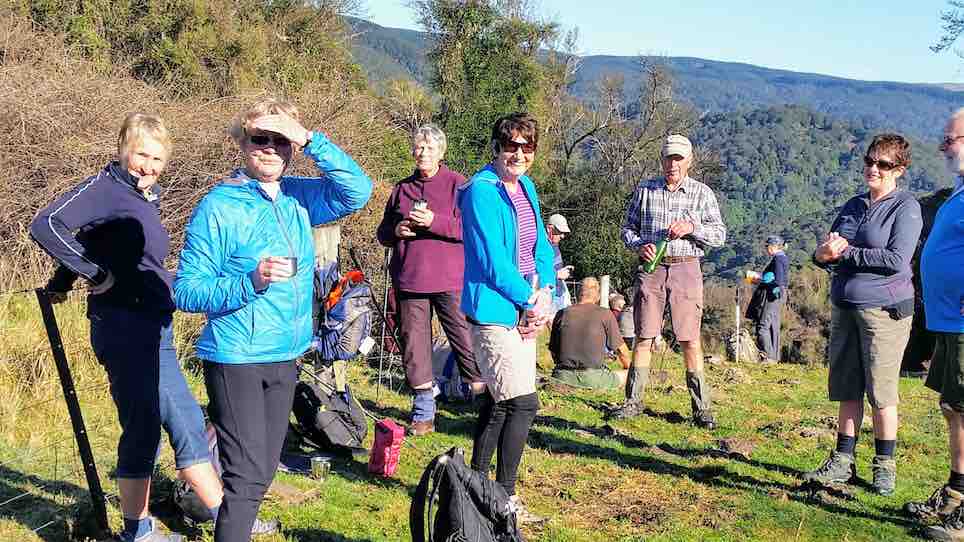
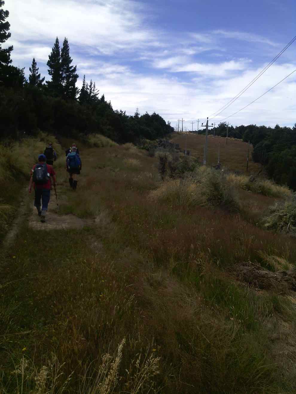
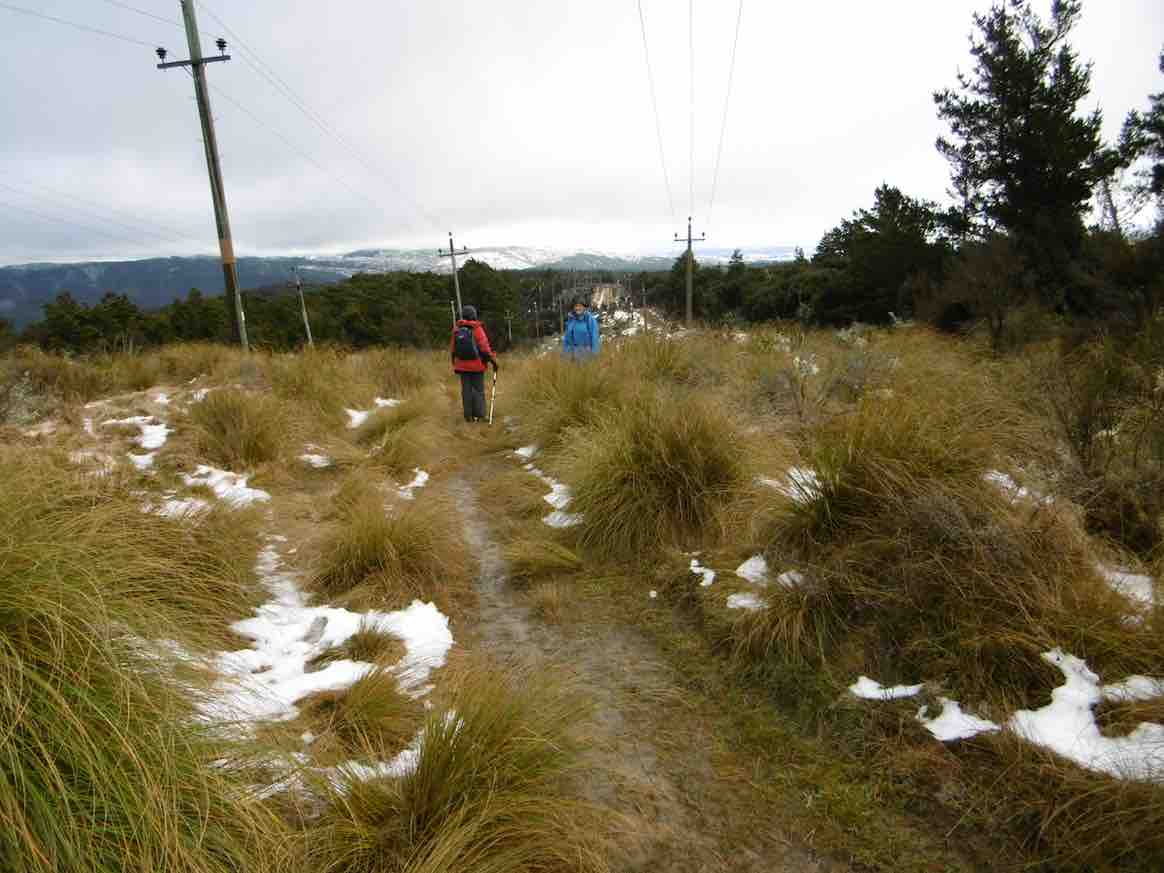
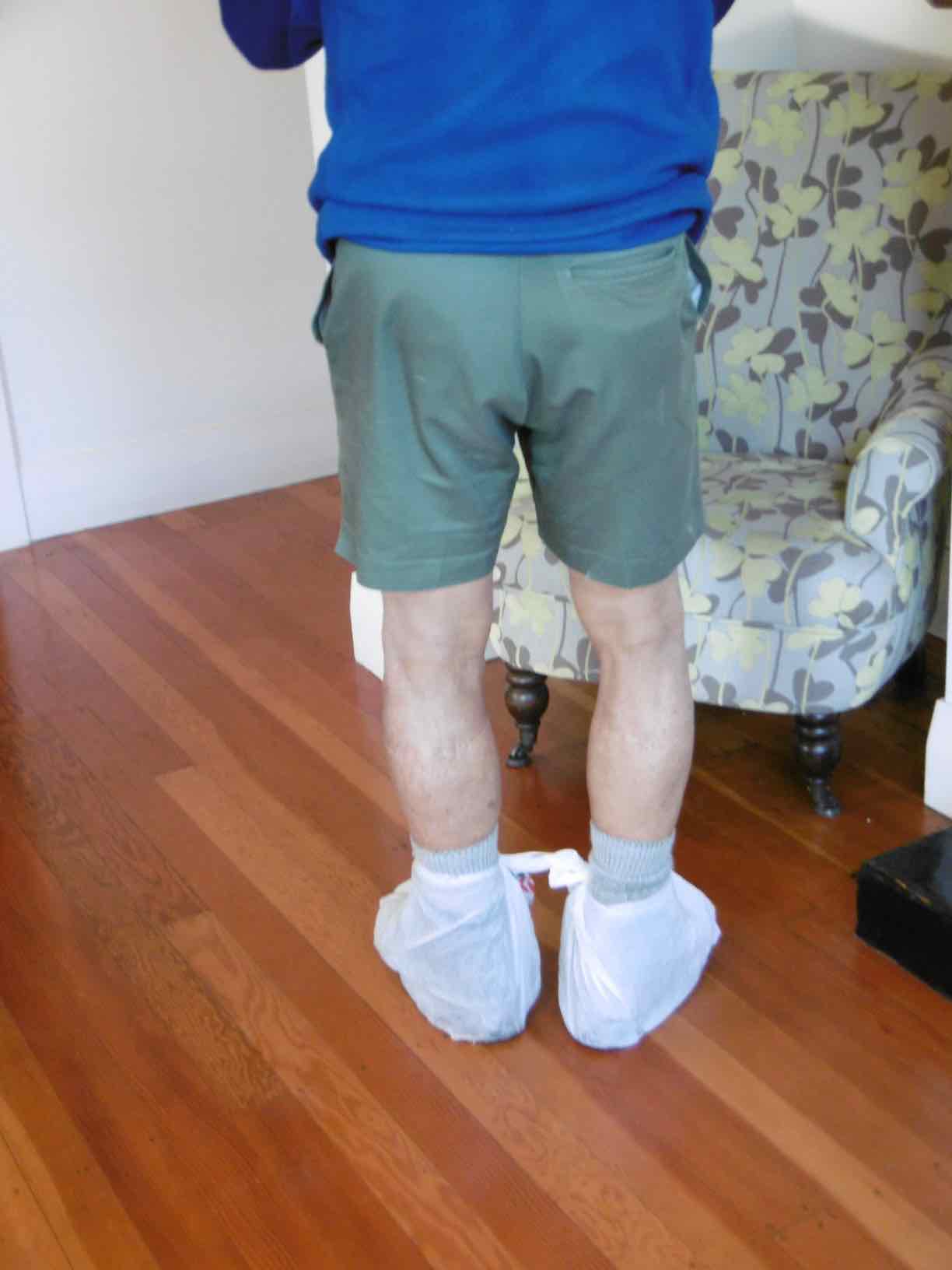
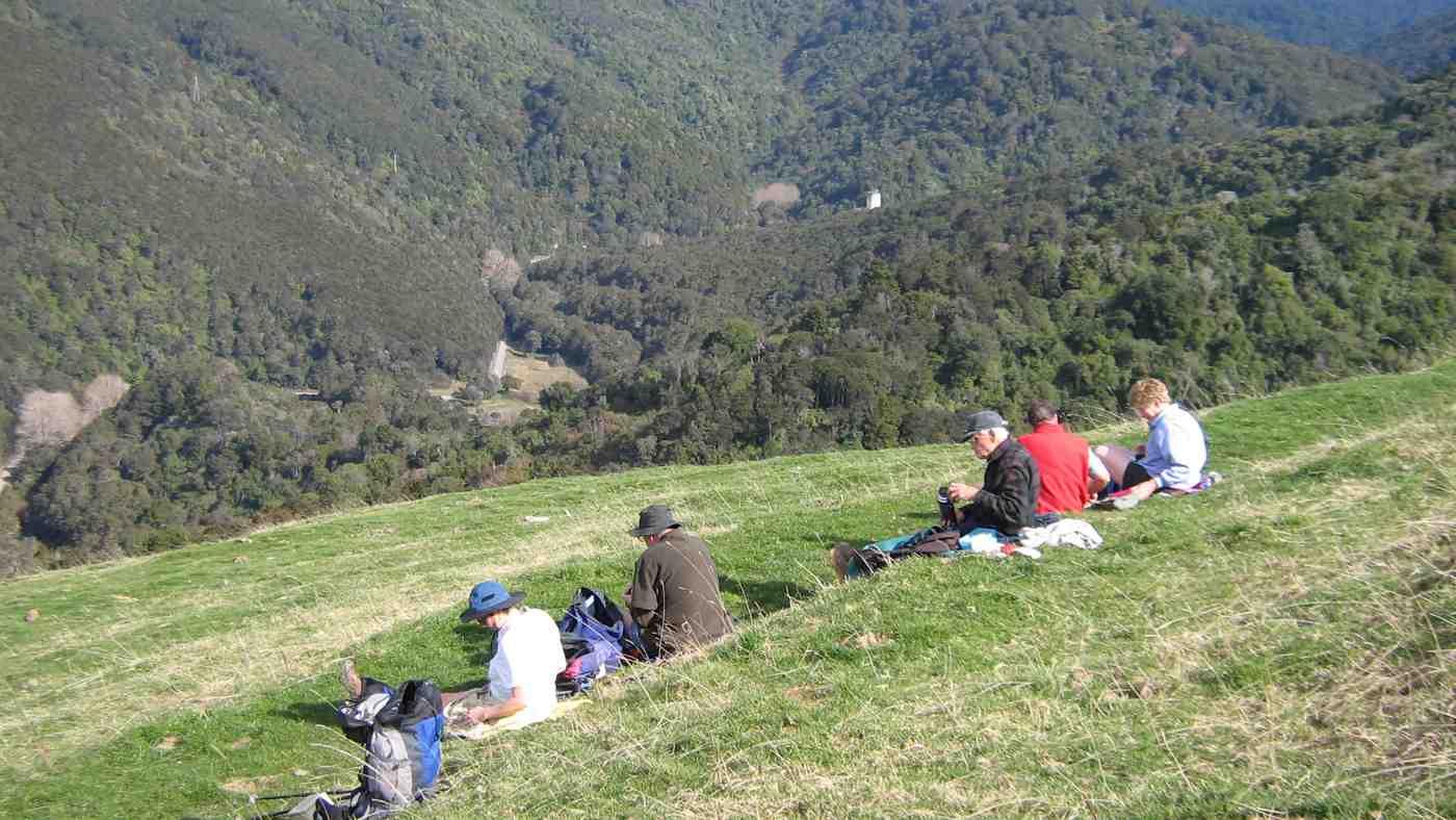
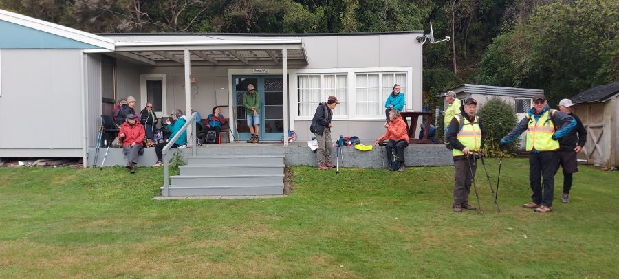
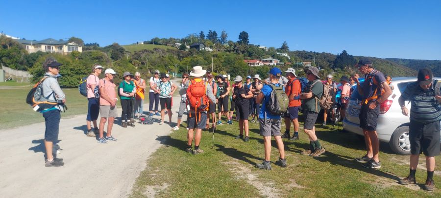
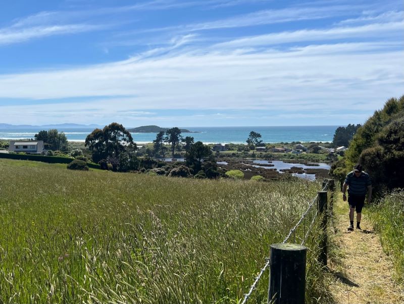
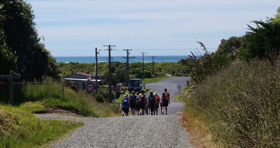
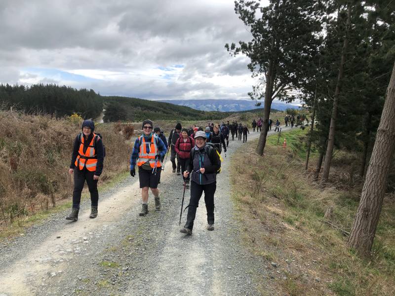
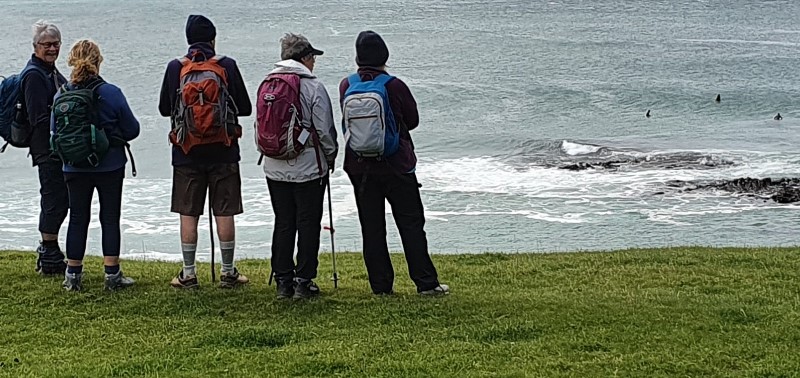
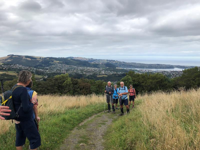
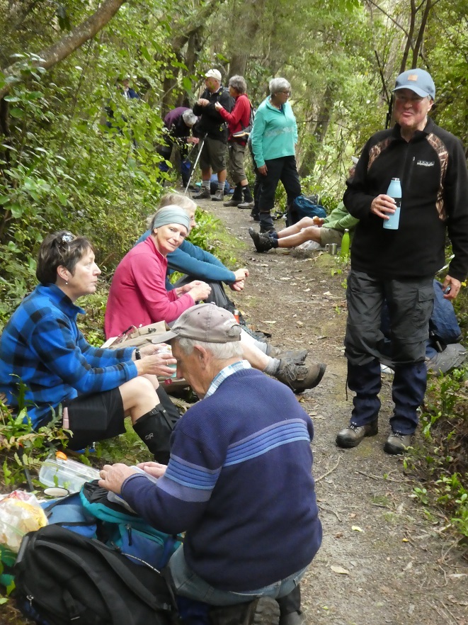
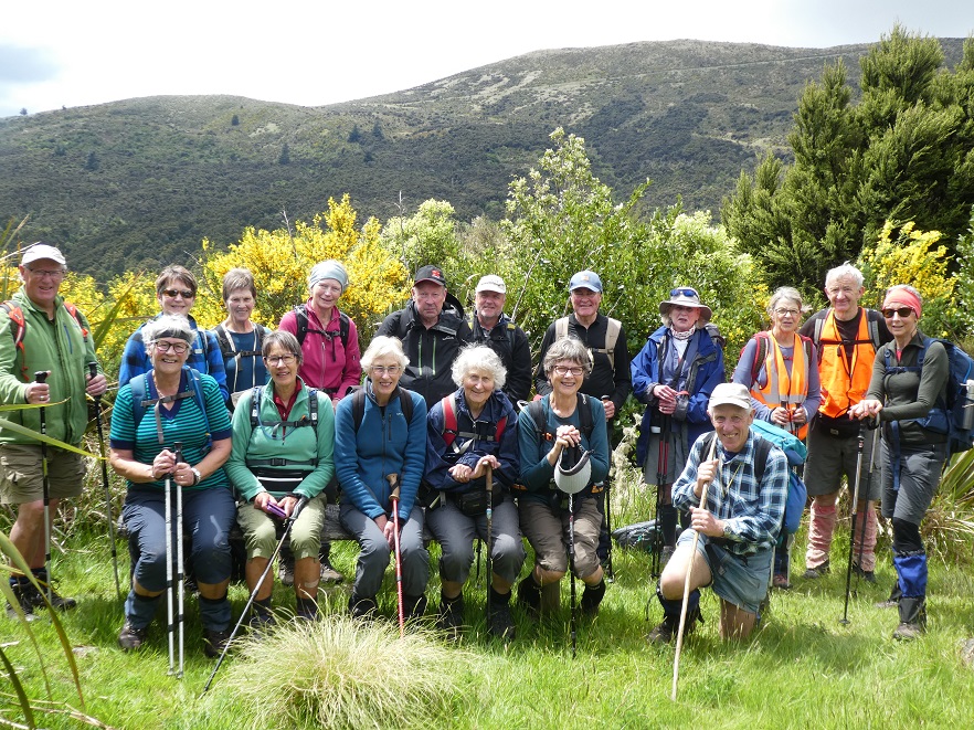
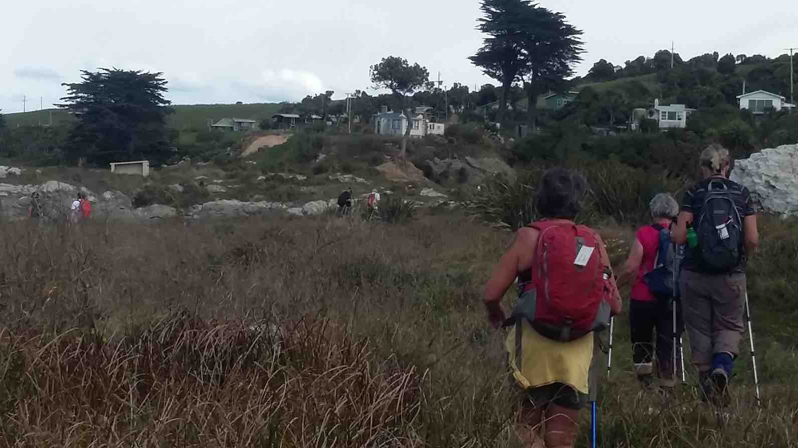
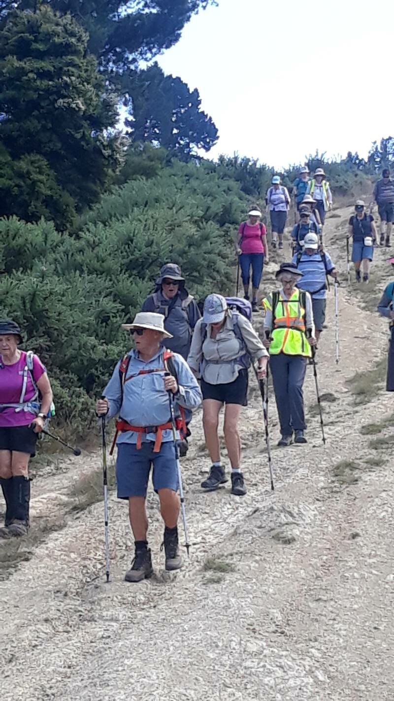
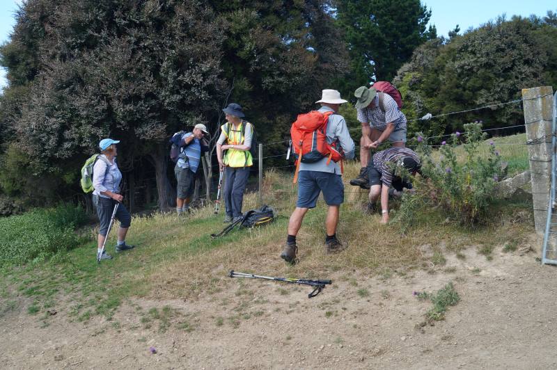
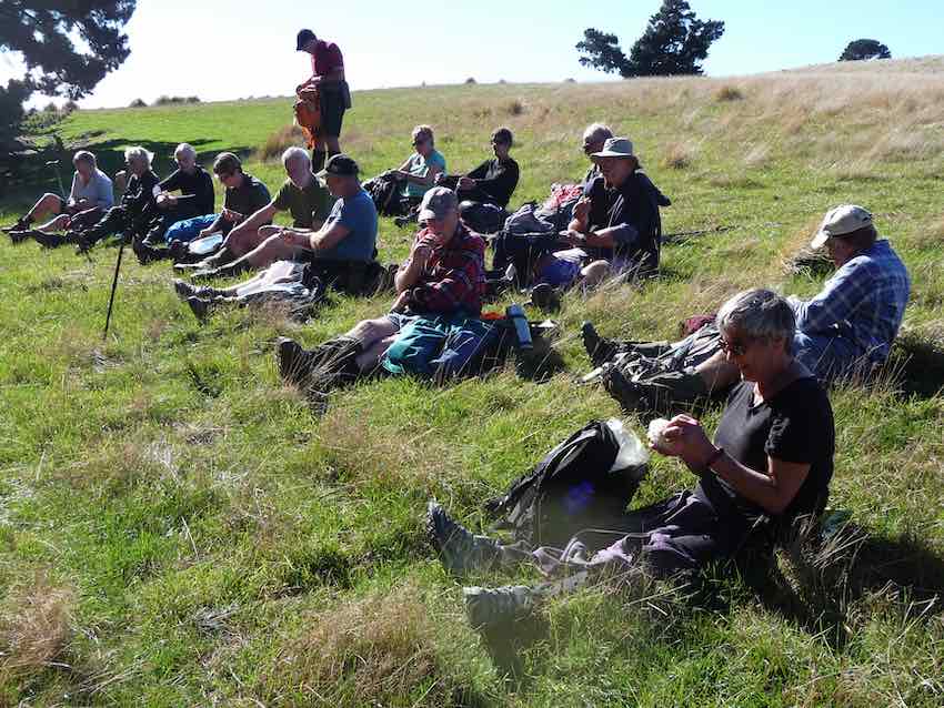
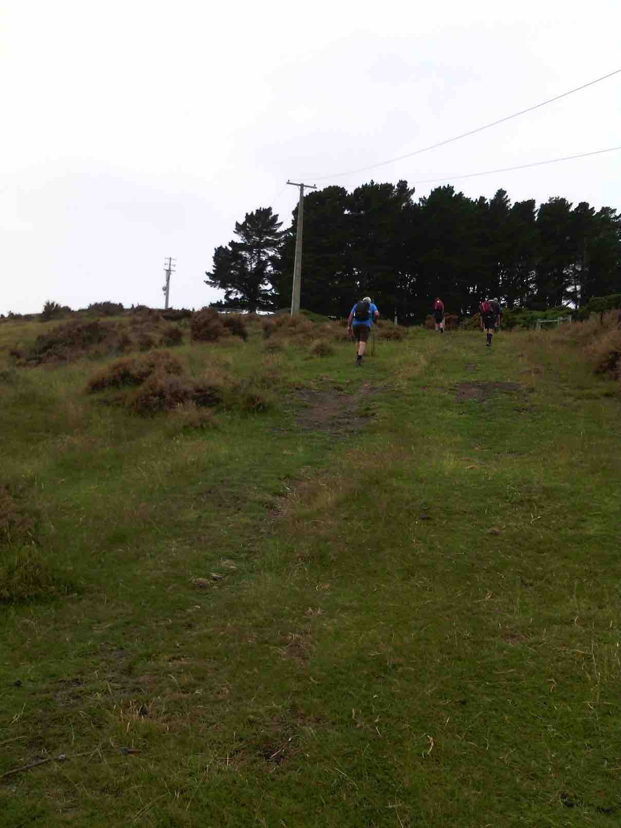
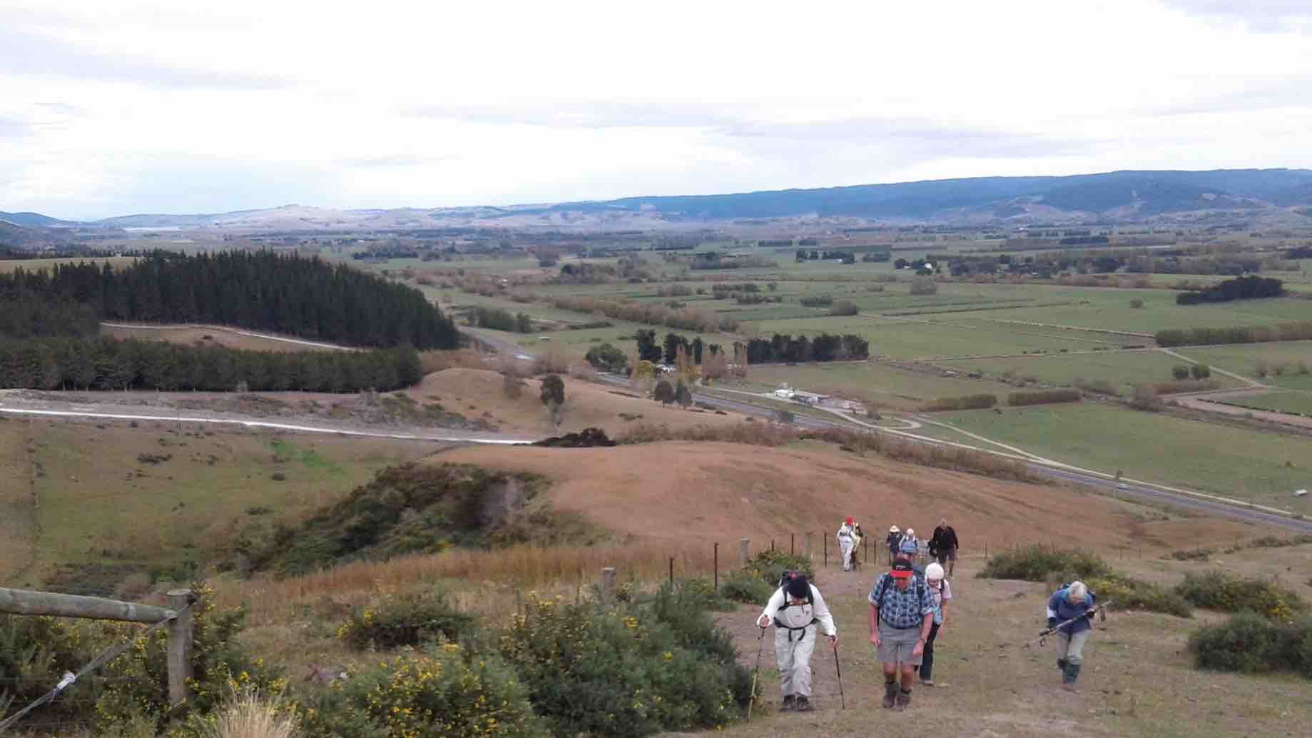
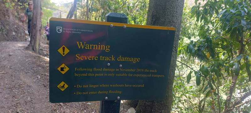
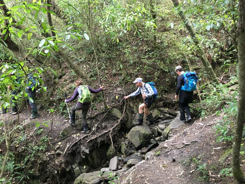
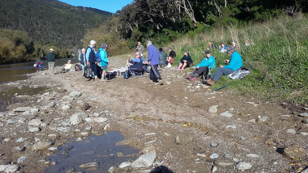
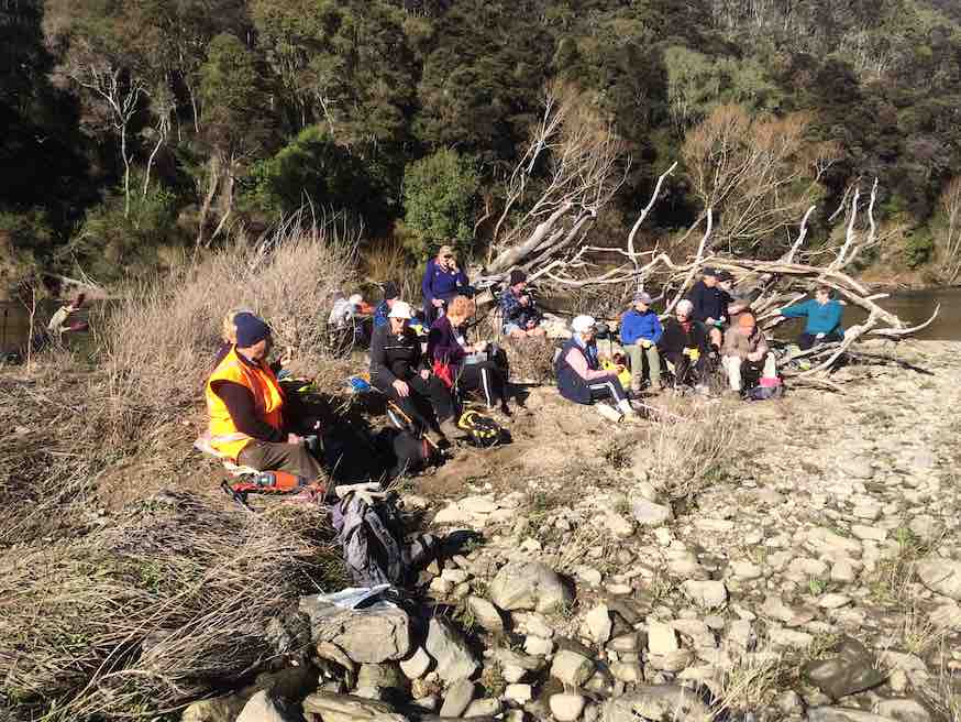
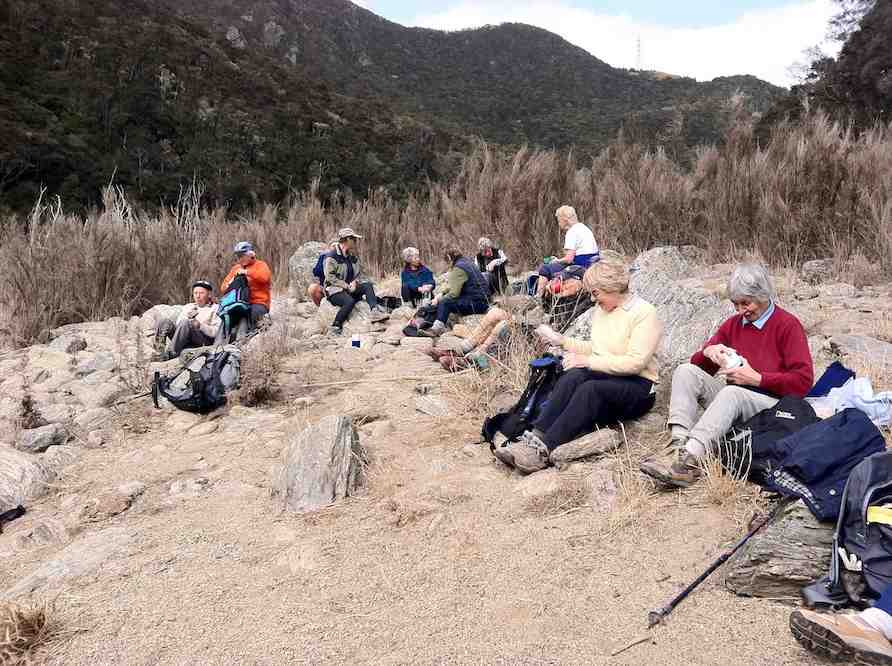
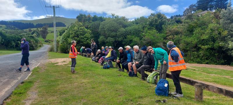
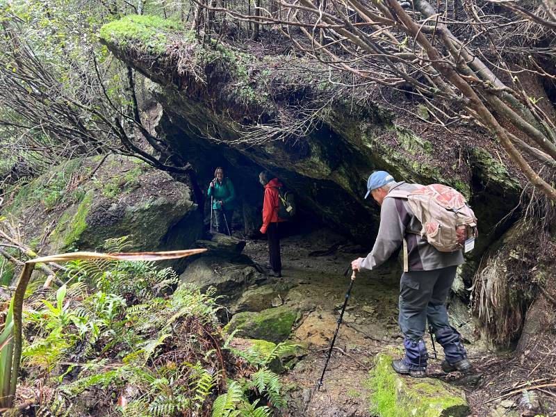
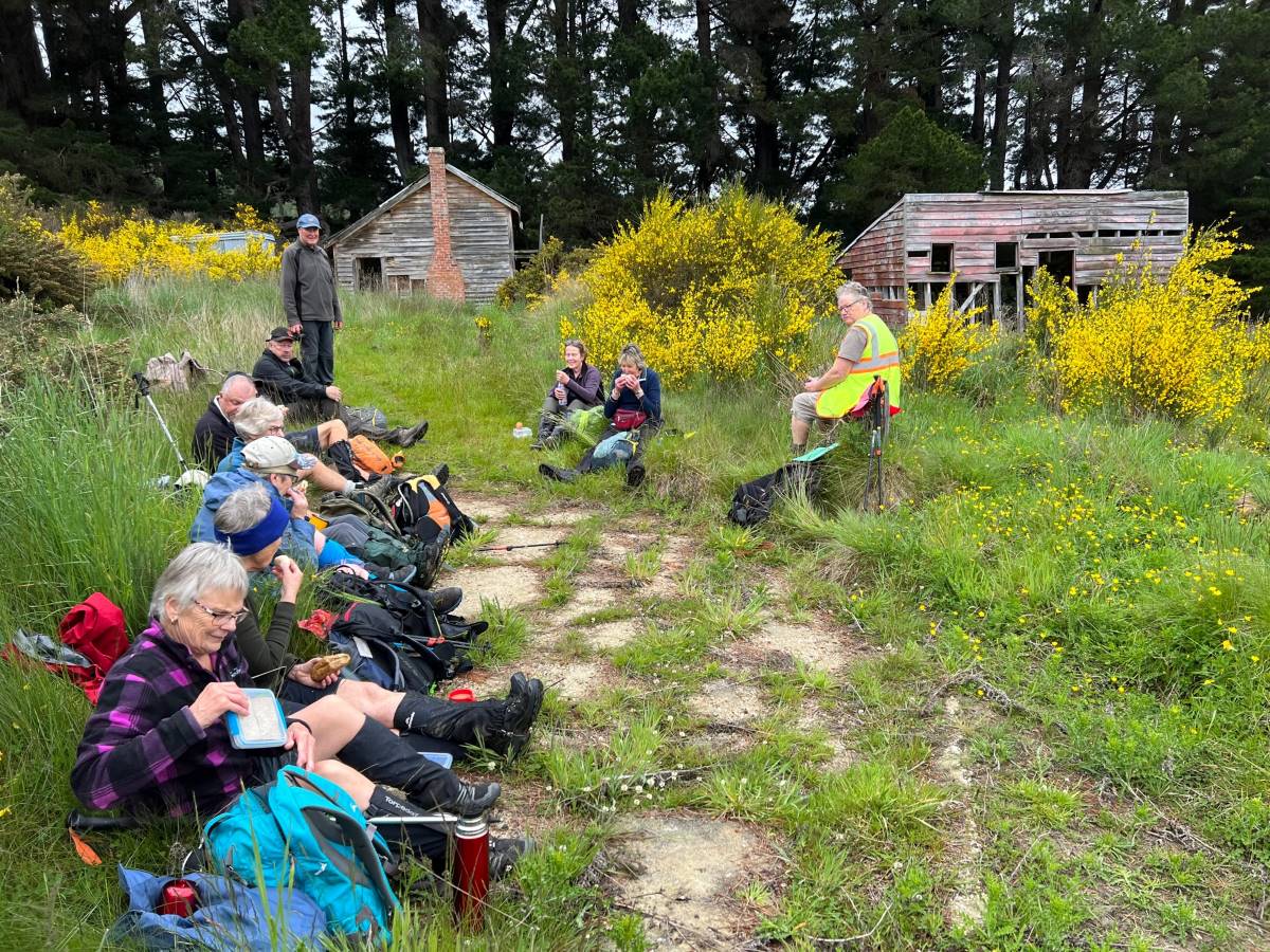
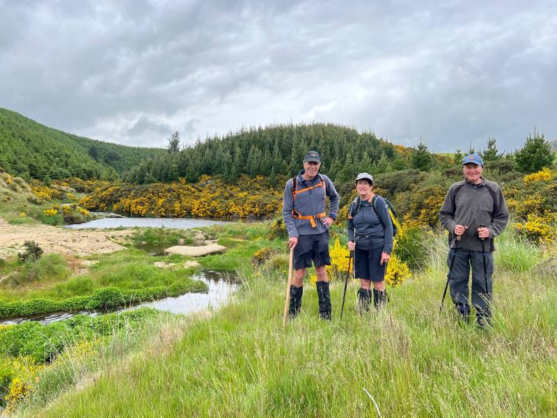
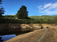
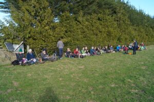
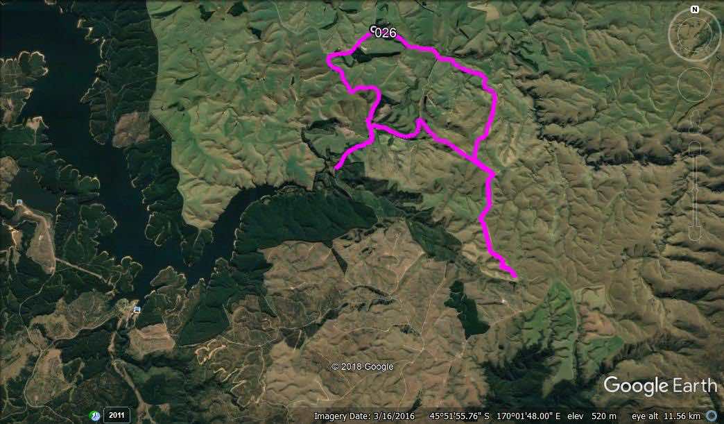
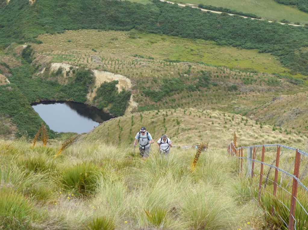
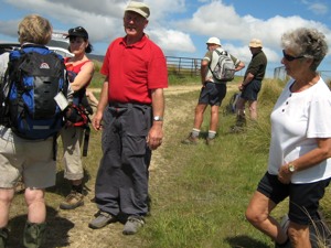
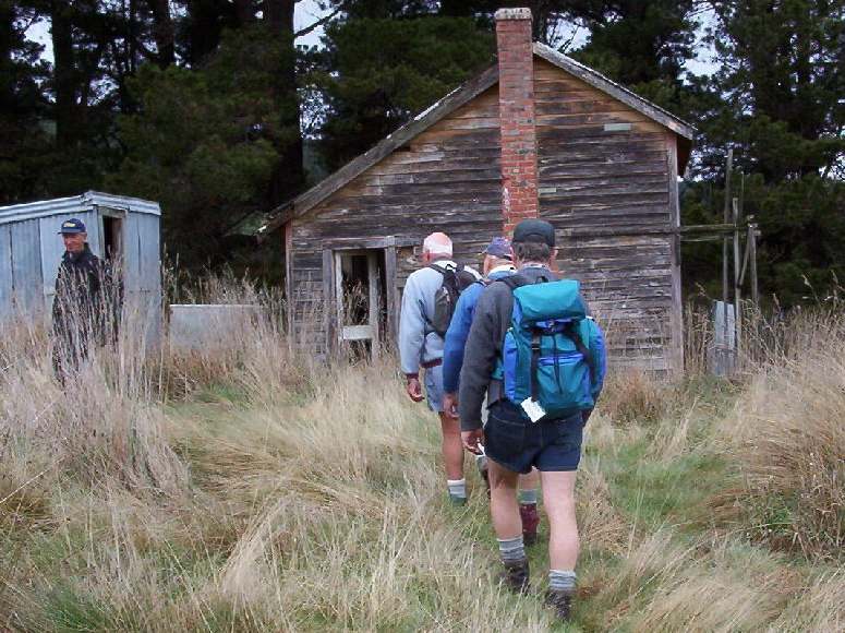
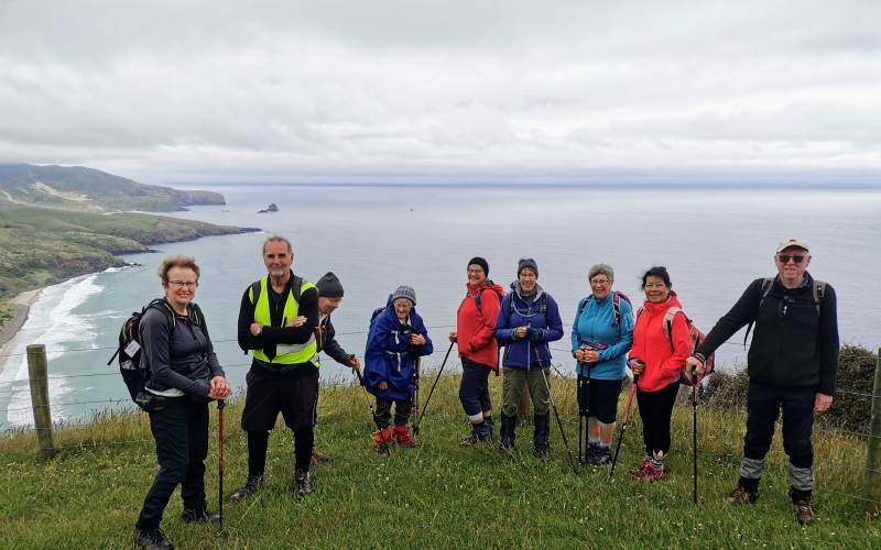
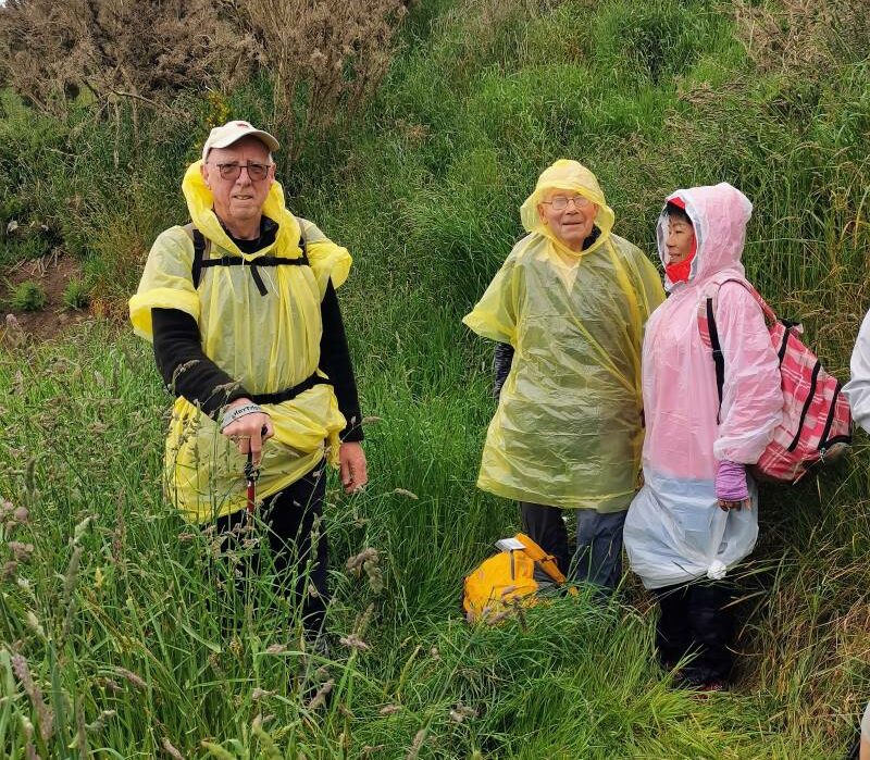
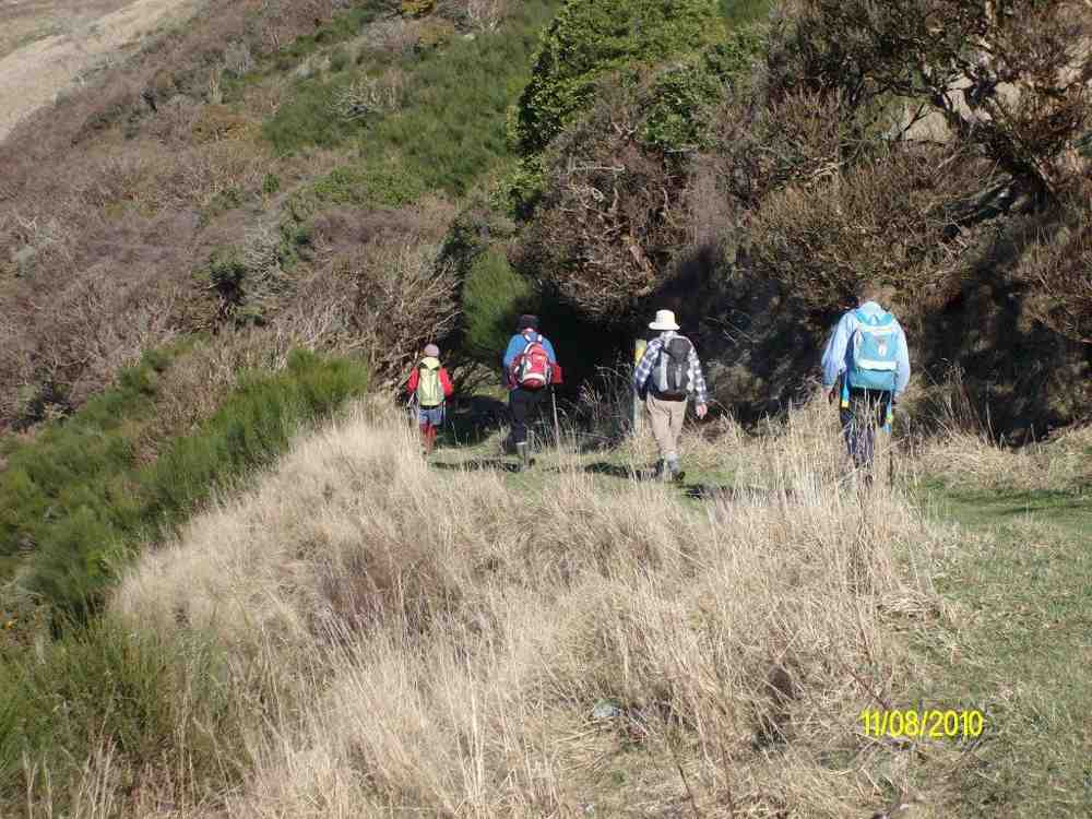
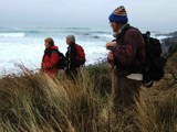
Hopefully, Constable Tom McNally would have appreciated that 17 hardy trampers weren’t deterred from following the walkway named for him. A night of heavy rain and inconclusive forecasts for the day had caused Graeme a restless night, trying to decide whether to cancel or change the tramp. Much of the trail is quite exposed passing through paddocks and would have been pretty miserable in a downpour. It wasn’t actually raining at Peter Johnstone Park at 9:15 and the sky seemed to be lightening to the south. We split into four cars and headed for the cemetery at Milton and the beginning of McNally’s Walkway.
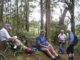
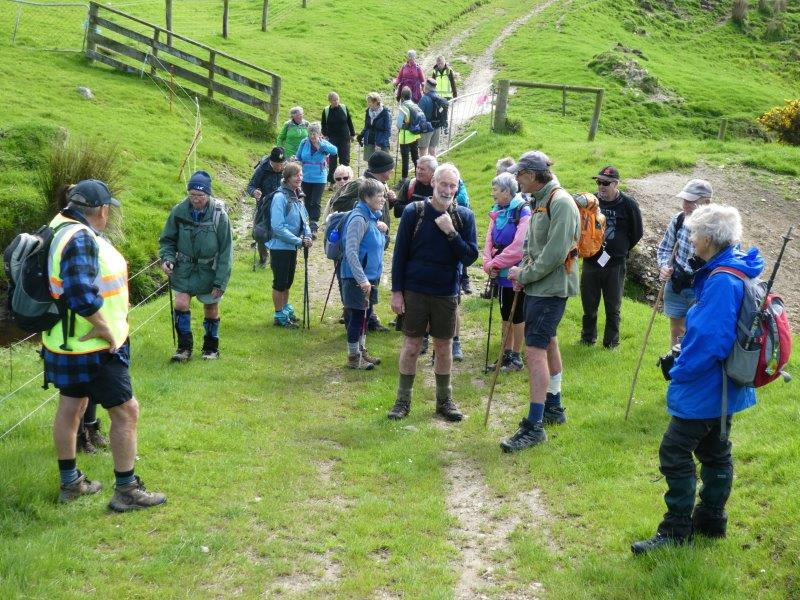
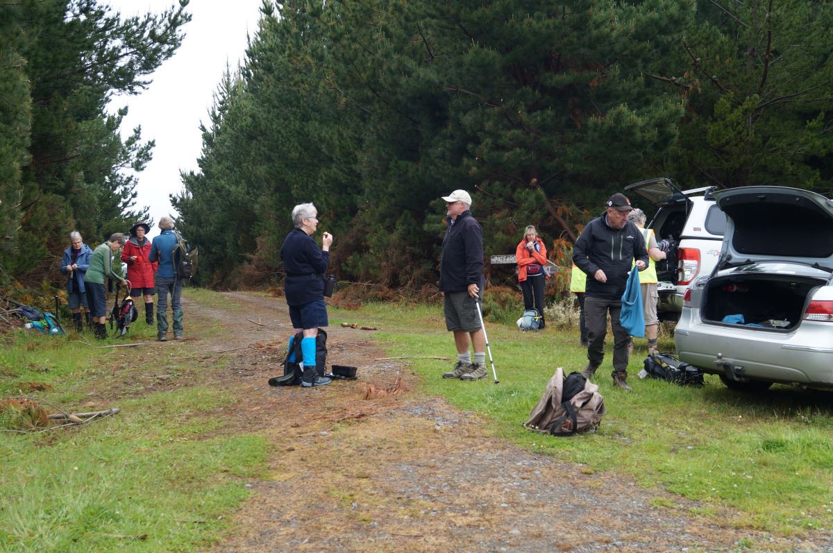
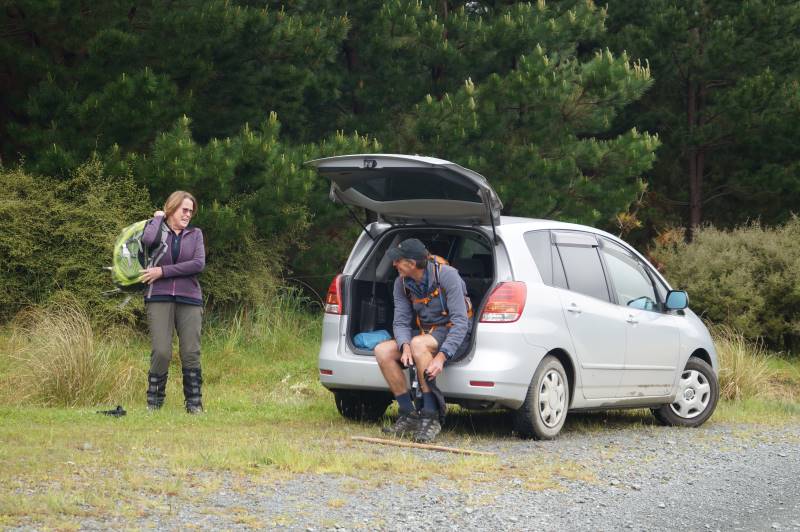
Getting ready to leave the cars (photo and caption John)
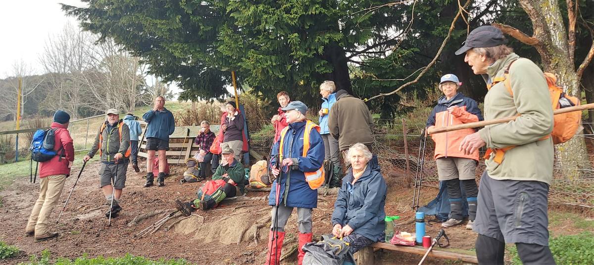
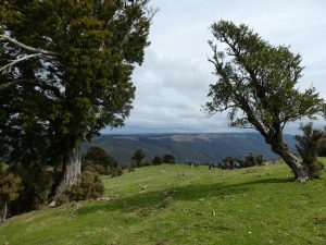
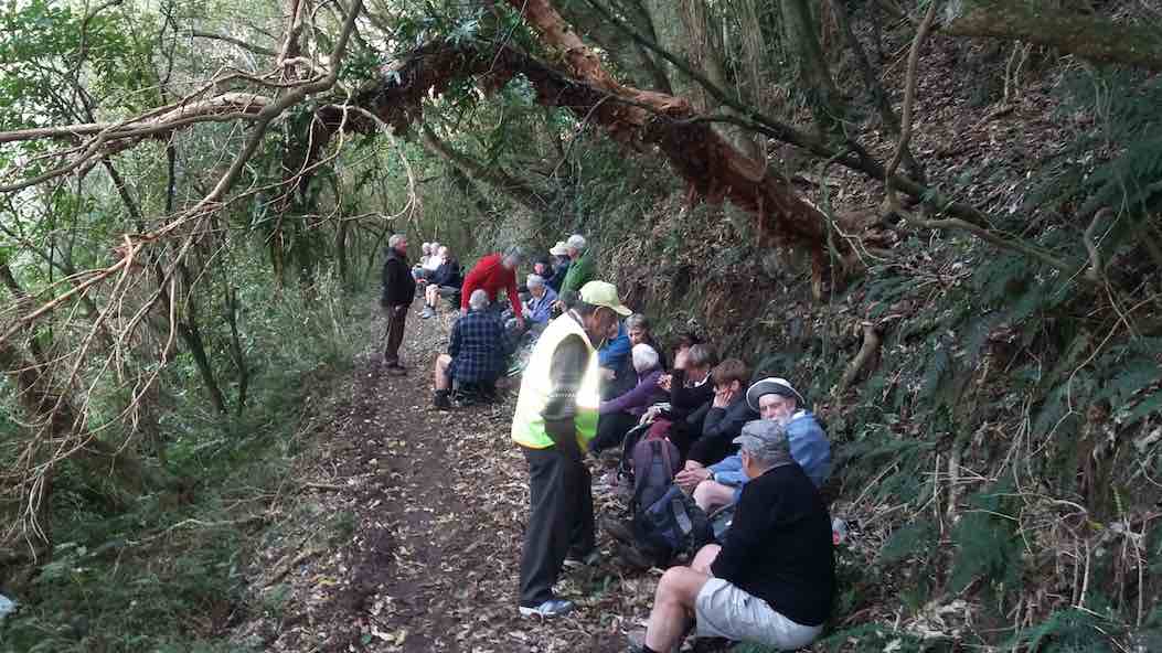
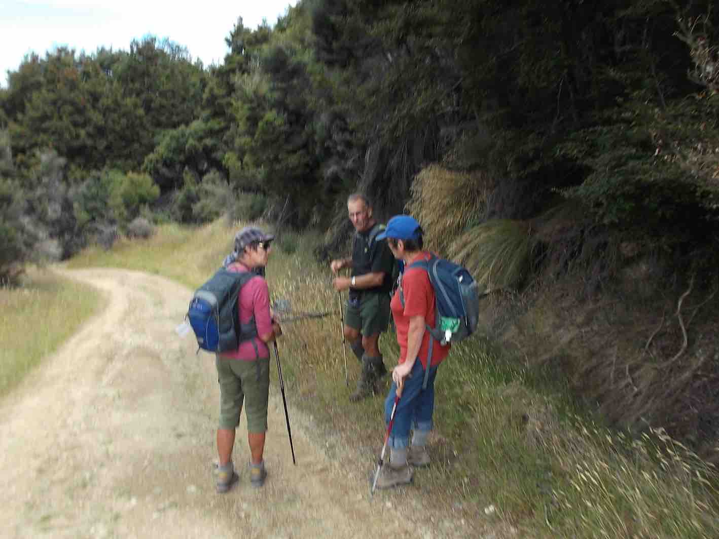
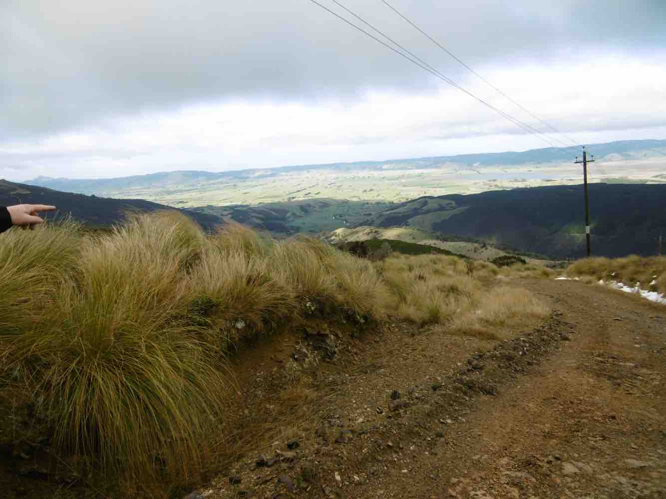
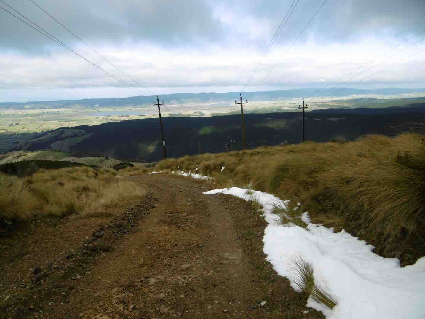
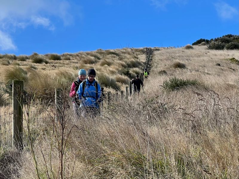
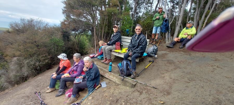
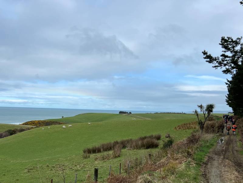
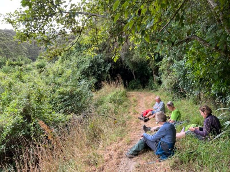
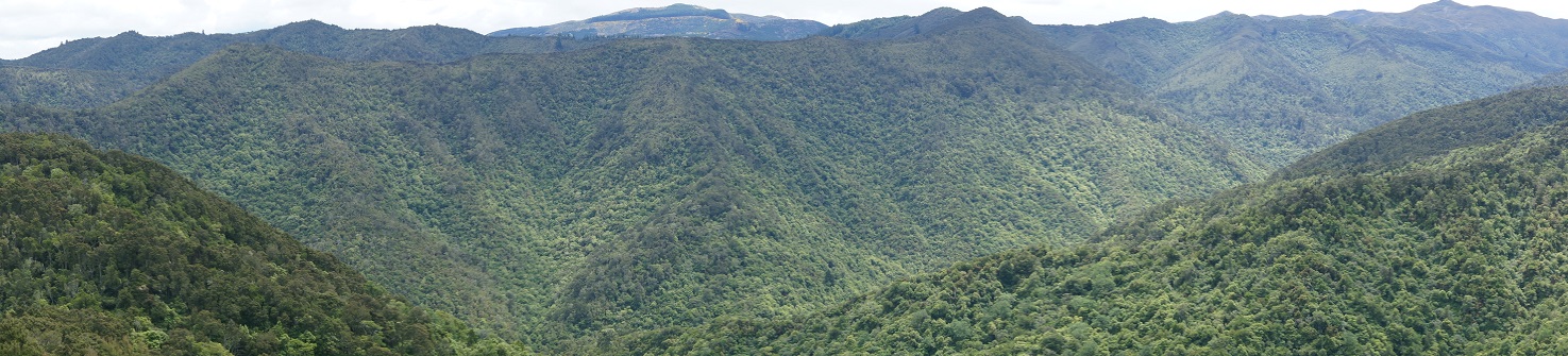
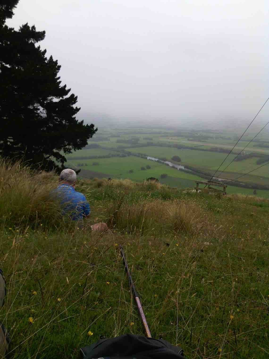
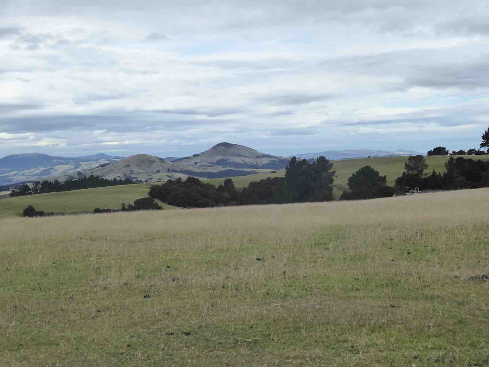
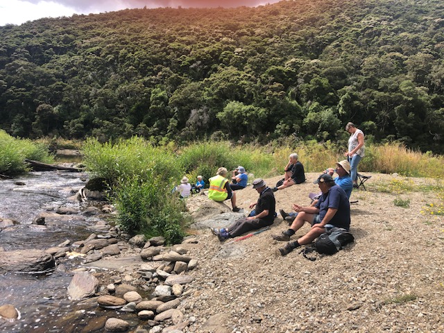
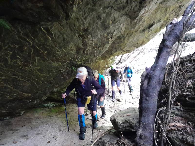
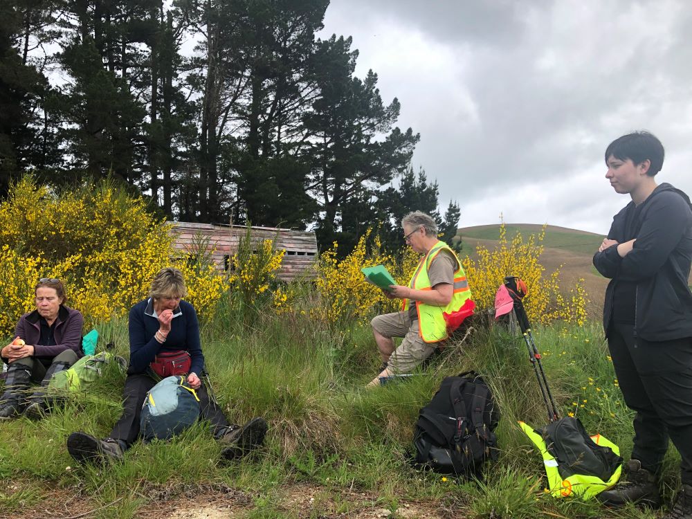
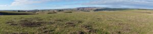
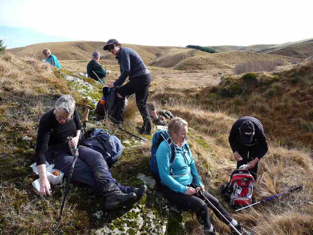
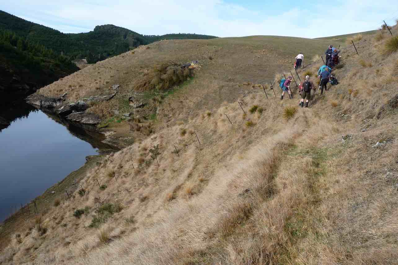
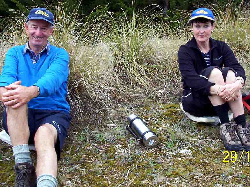
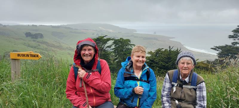
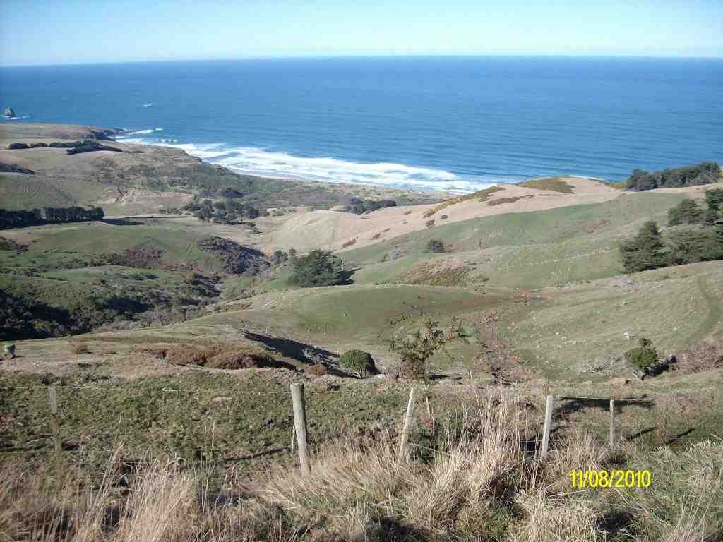
We set off in a very light rain along a fence line of the first paddock. The ground and grass were certainly wet and it was a steady climb to our stop for morning tea in a sheltered spot with a bench. There was a great view of the Taieri Plain but the hilltops were still shrouded in cloud and would remain so.
Morning tea on McNally Track (photo and caption Barbara)Morning tea (photo Helen)
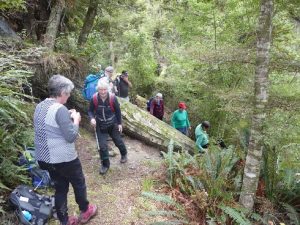
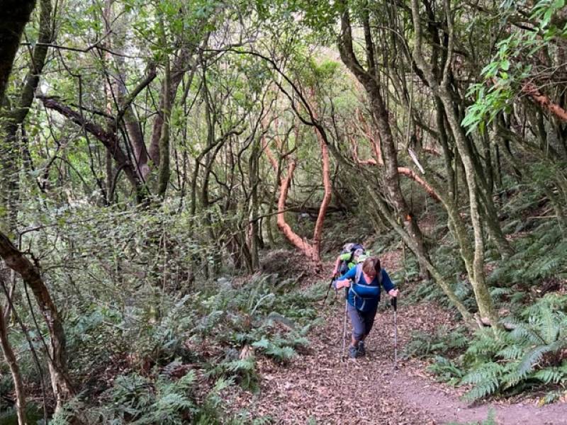
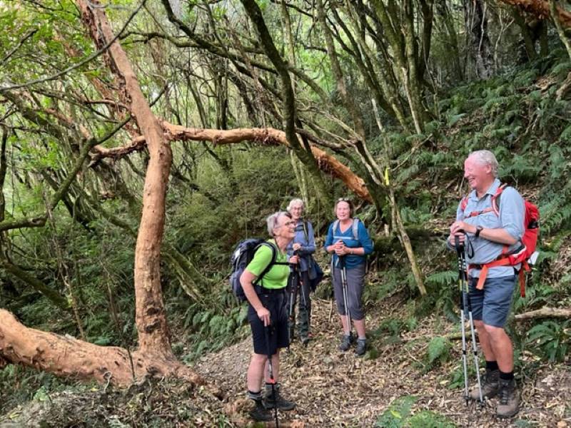
By the time we set off again the rain had stopped and the only drips were from the overhanging trees.
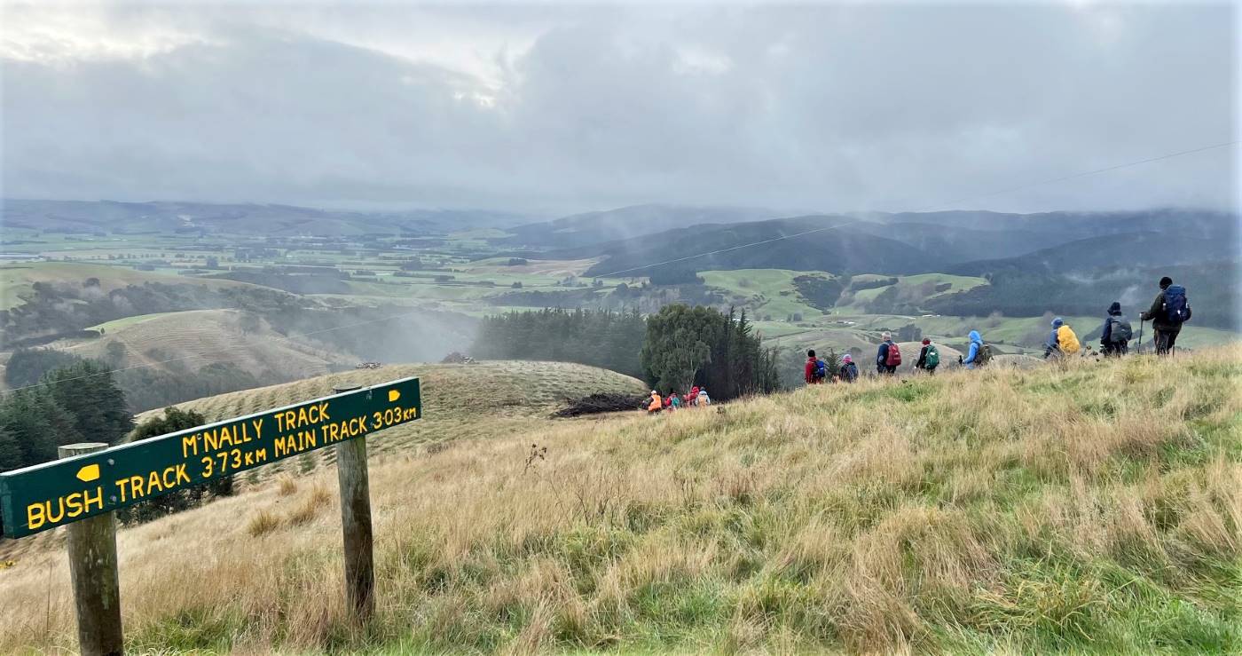
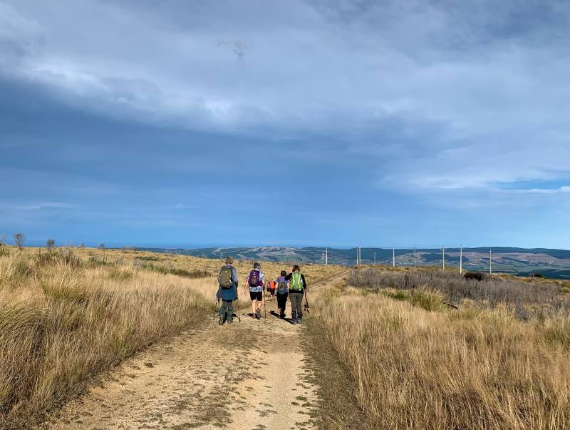
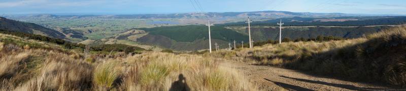
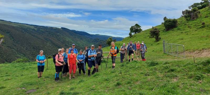
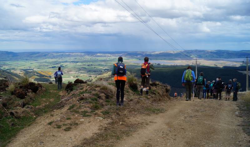
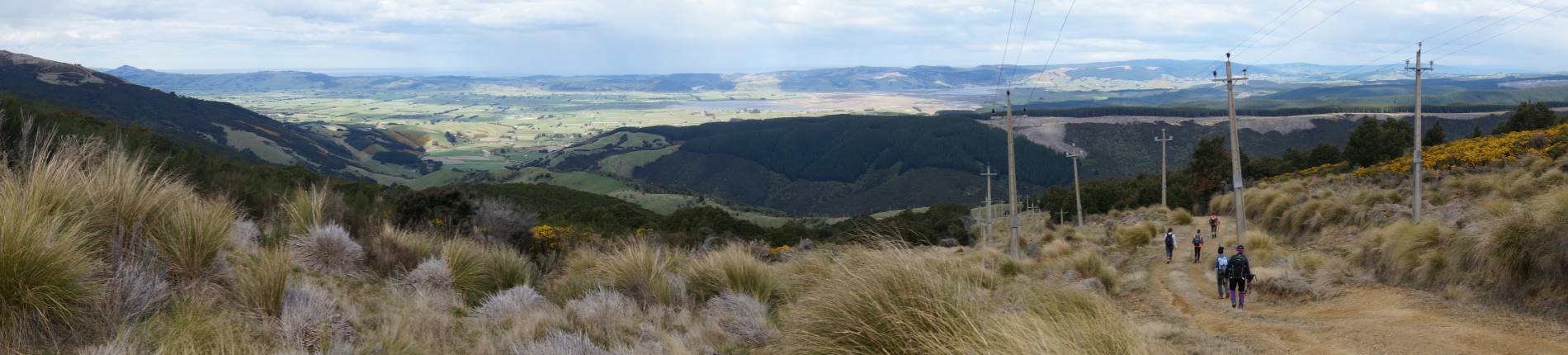
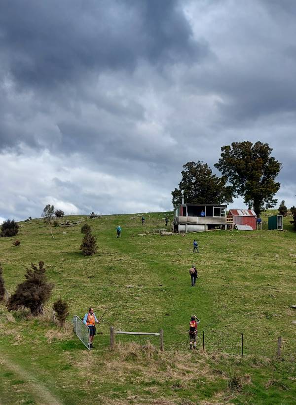
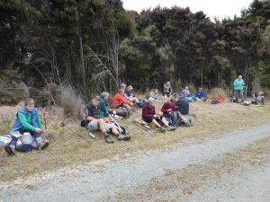
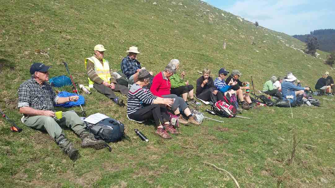
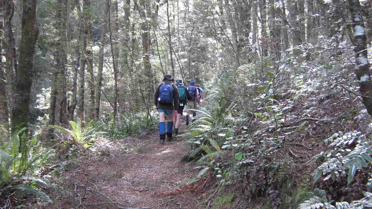
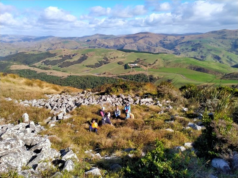
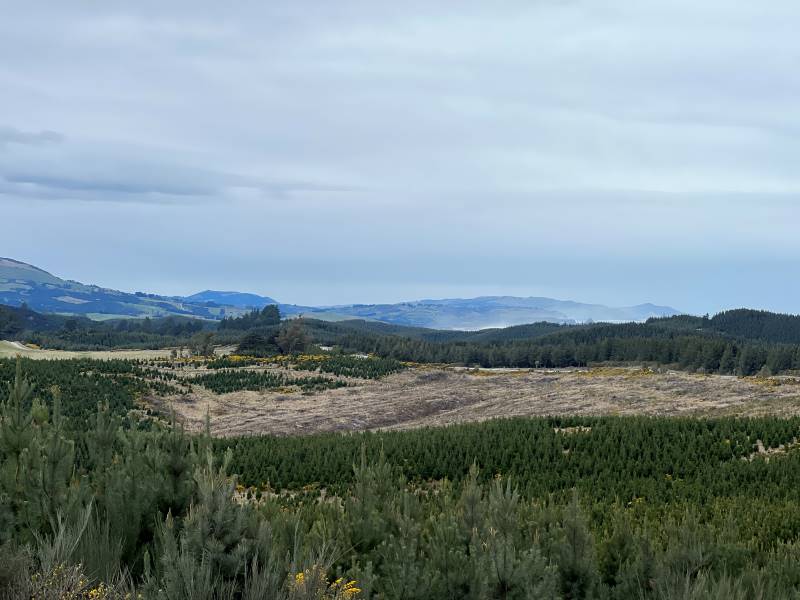
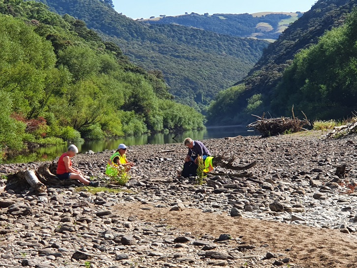
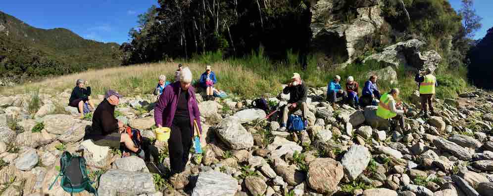
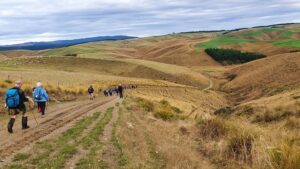
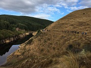
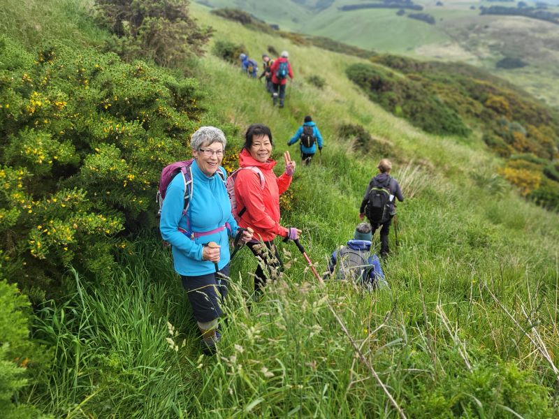
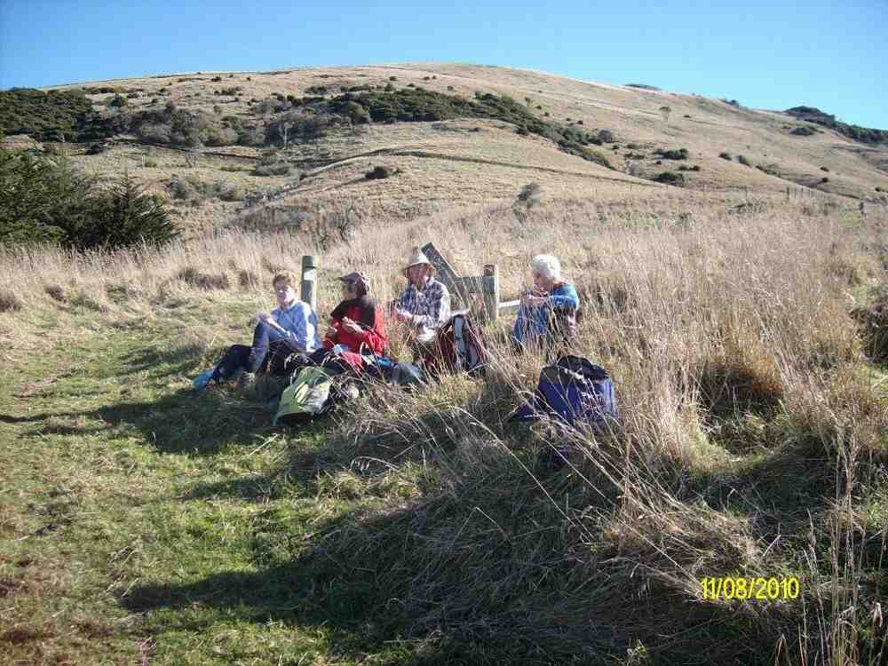
We took a slightly different route from other years, turning onto the Kowhai trail for the rest of the climb. It passed through a mix of native and introduced trees before opening up into paddocks of newly planted pines. By this time, we could see the summit and the haybarn where we’d have lunch. There was just one more climb before we made ourselves comfortable and ate.
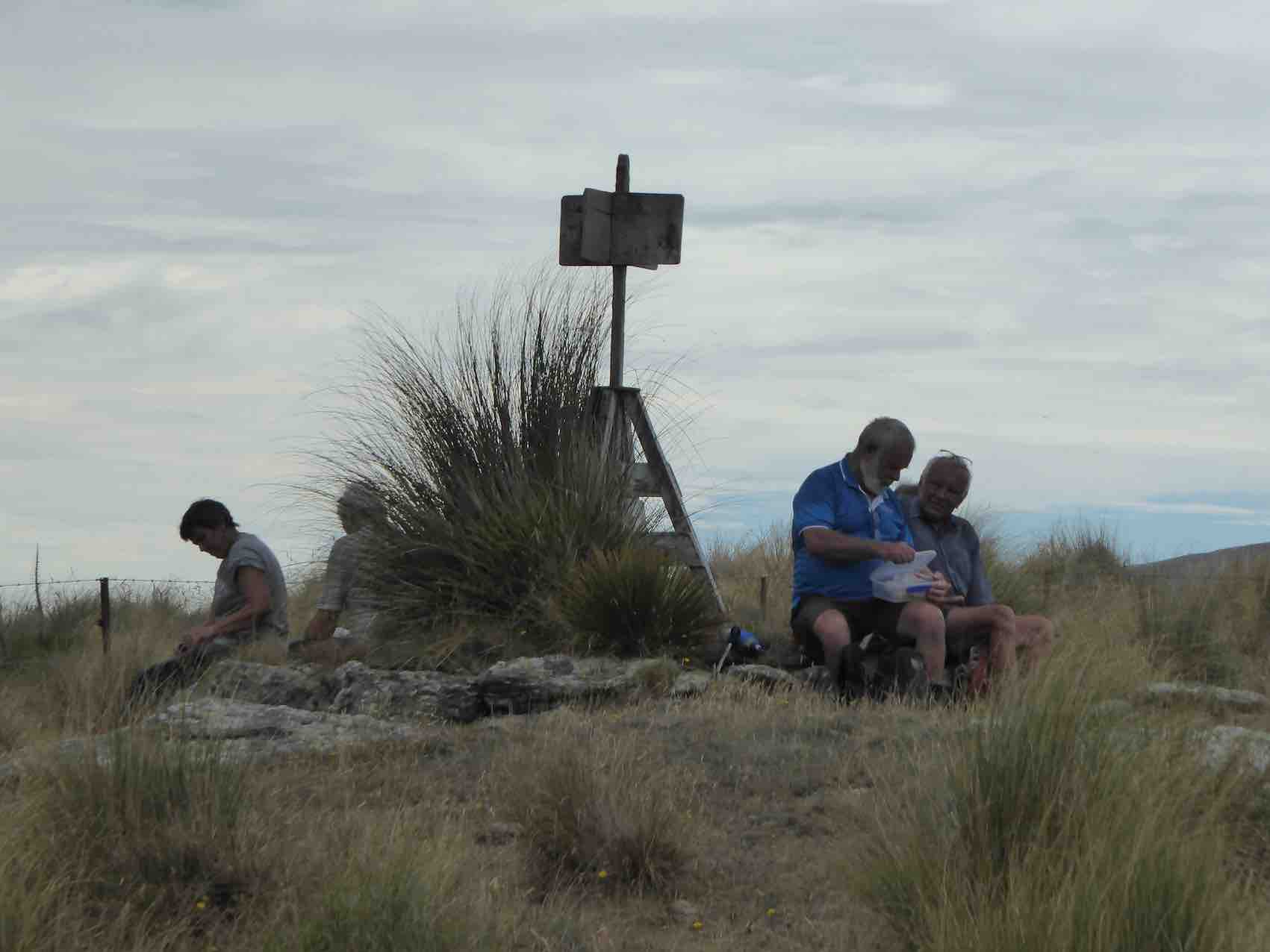
Lunch among the bay bales (photo and caption Pam)McNally’s Track Summit (photo and caption Pam)
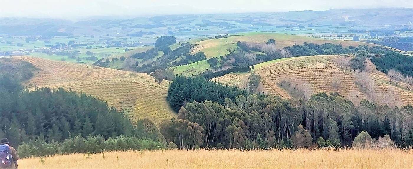
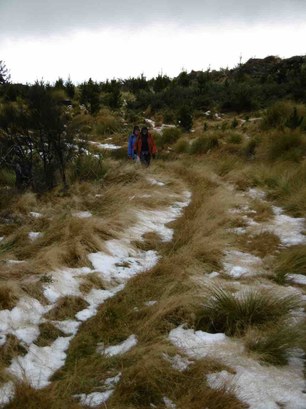
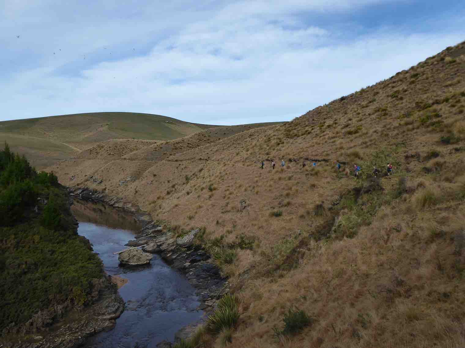
After lunch we headed downhill through quite long grass which soon became a clear path at least for those of us at the back. At this point the sun broke through and this clearer light made a remarkable pattern, contrasting the long fading grass with the small green pines.
All the new planting of the pine trees (photo and caption Helen)
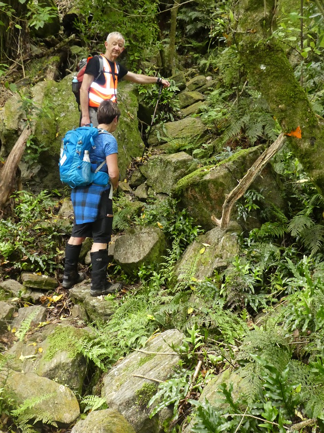
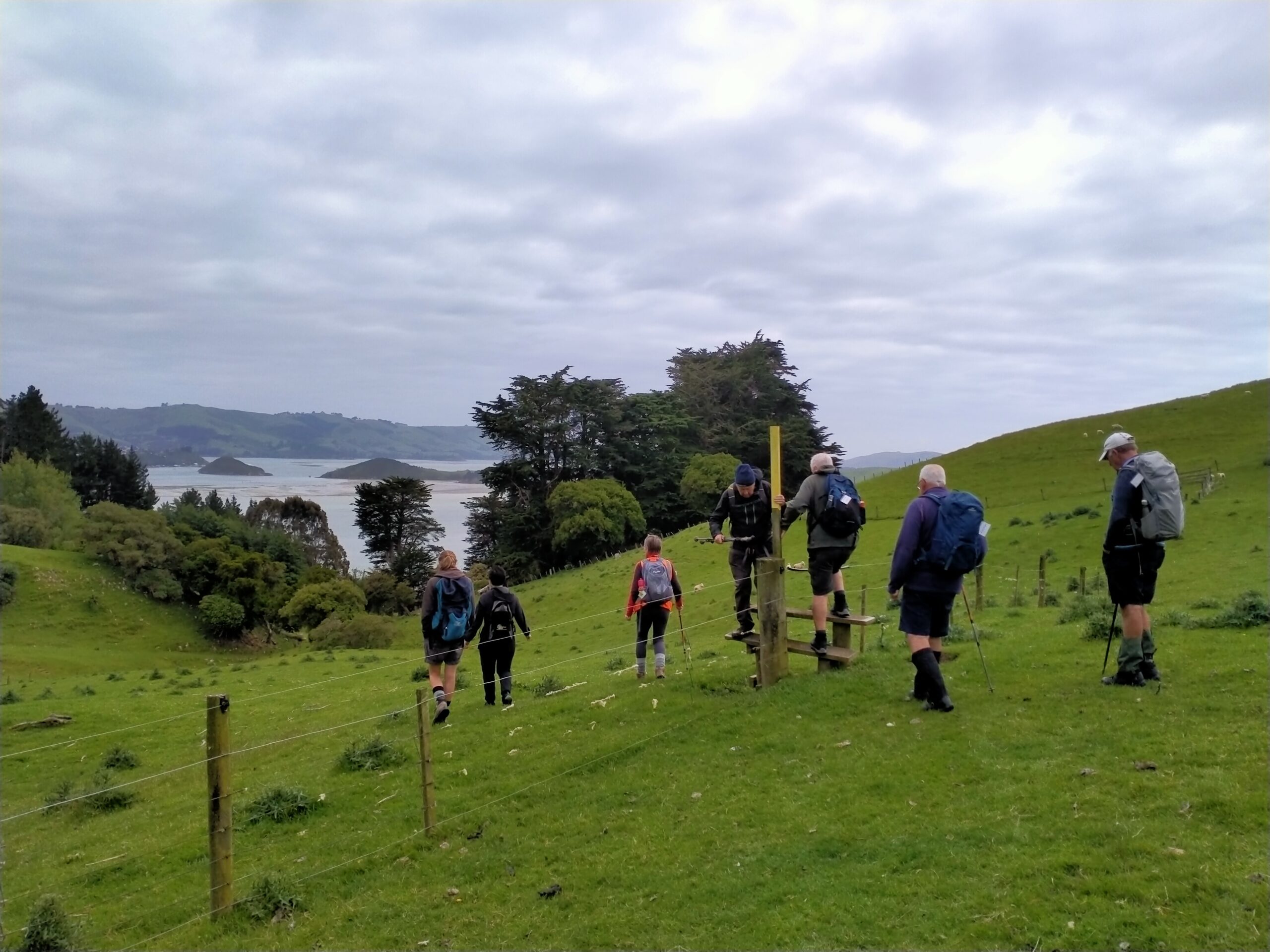
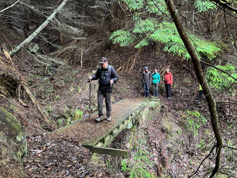
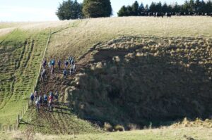
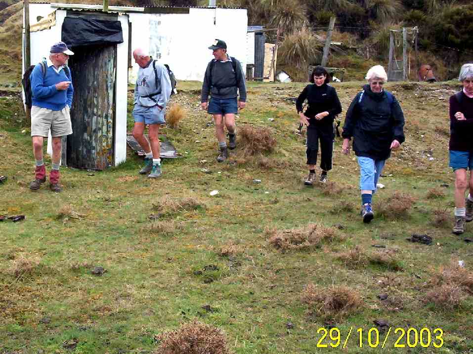
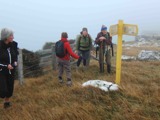
Once we were through this, there was only one more steep pitch up through some trees. From then on the walk was steadily downhill coming out onto Cemetery Road and just a short distance from the cars.
On the last stretch of the tramp (photo and caption Helen)
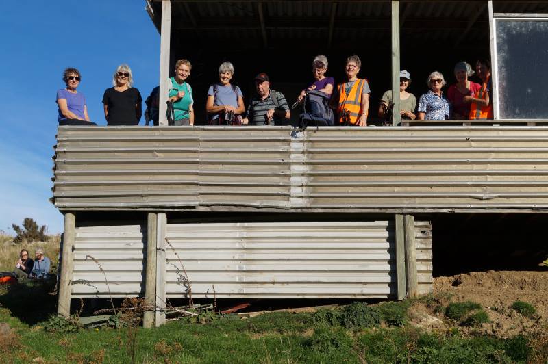
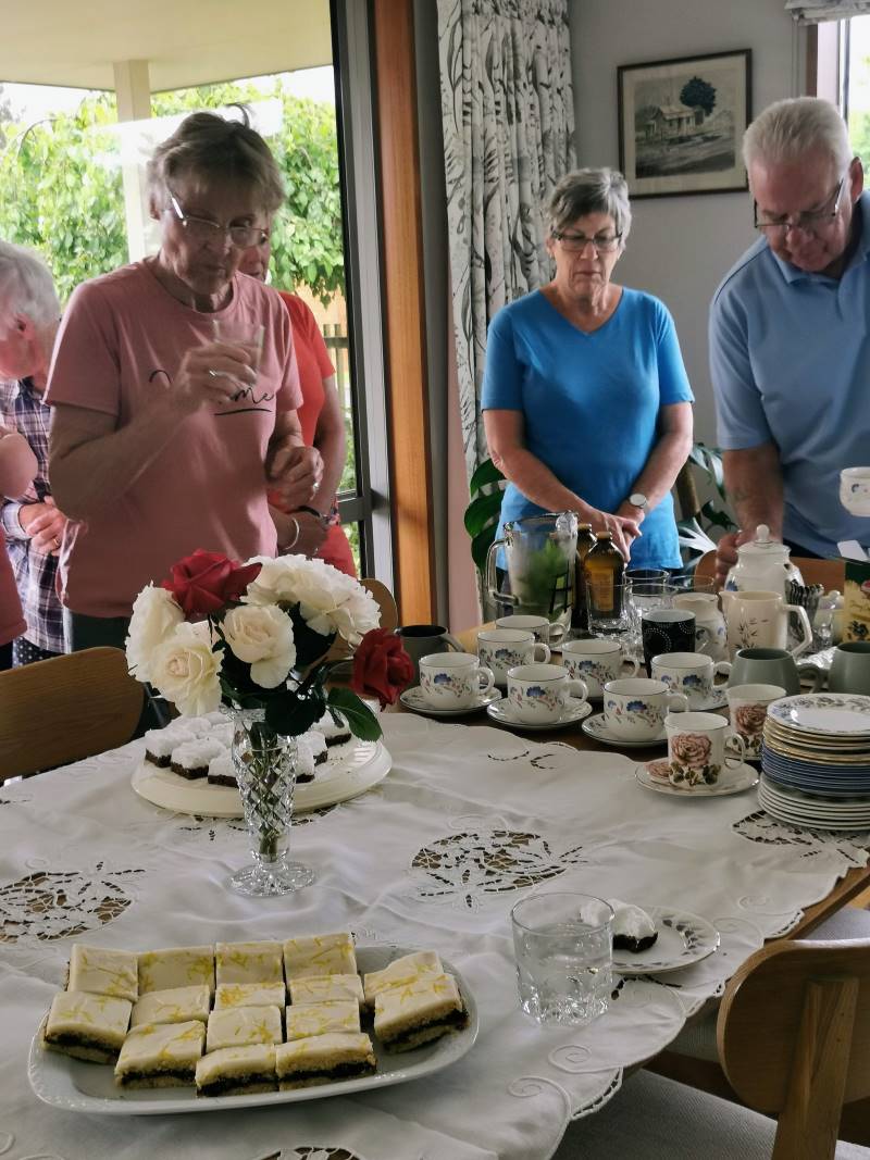
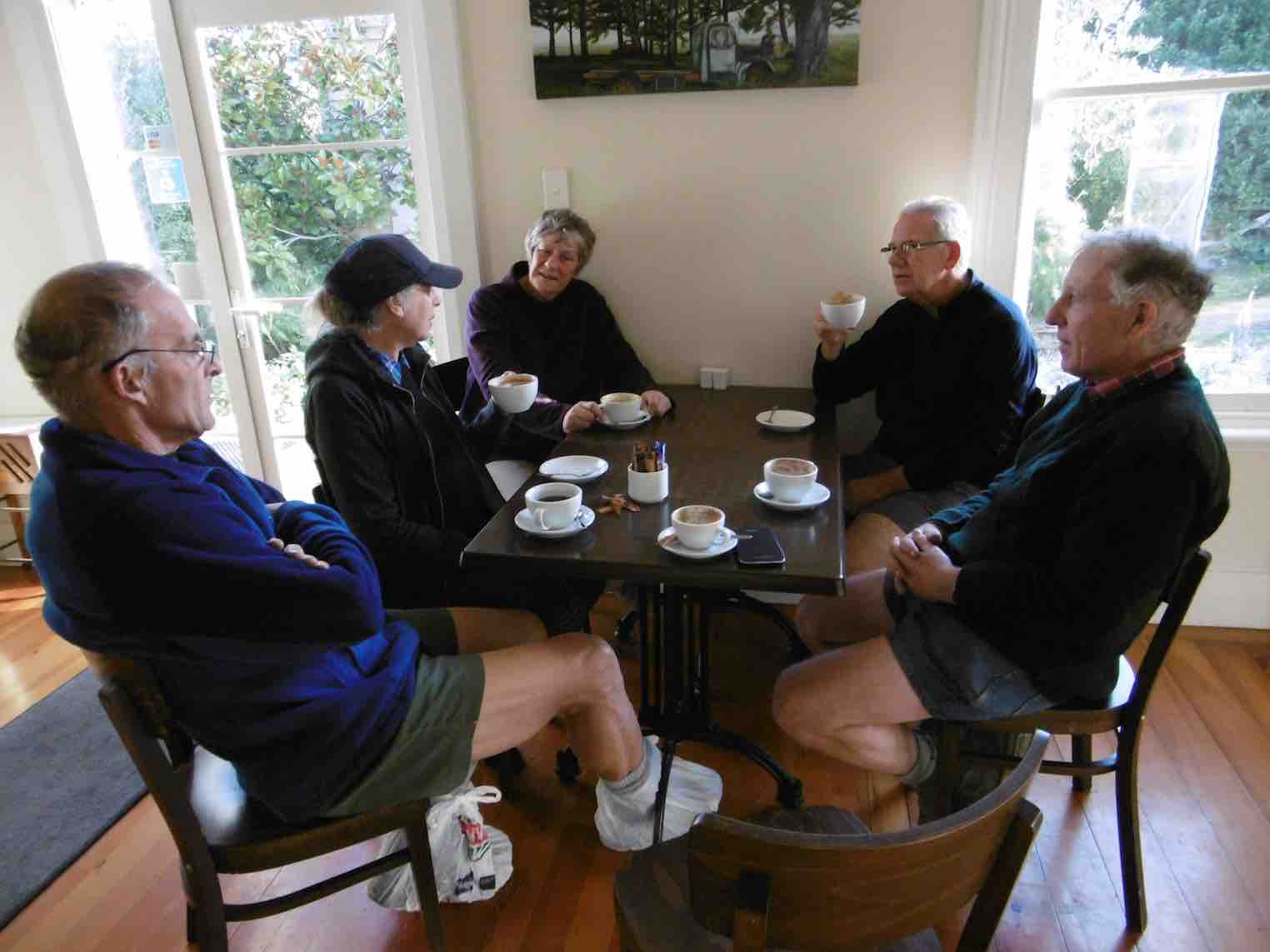
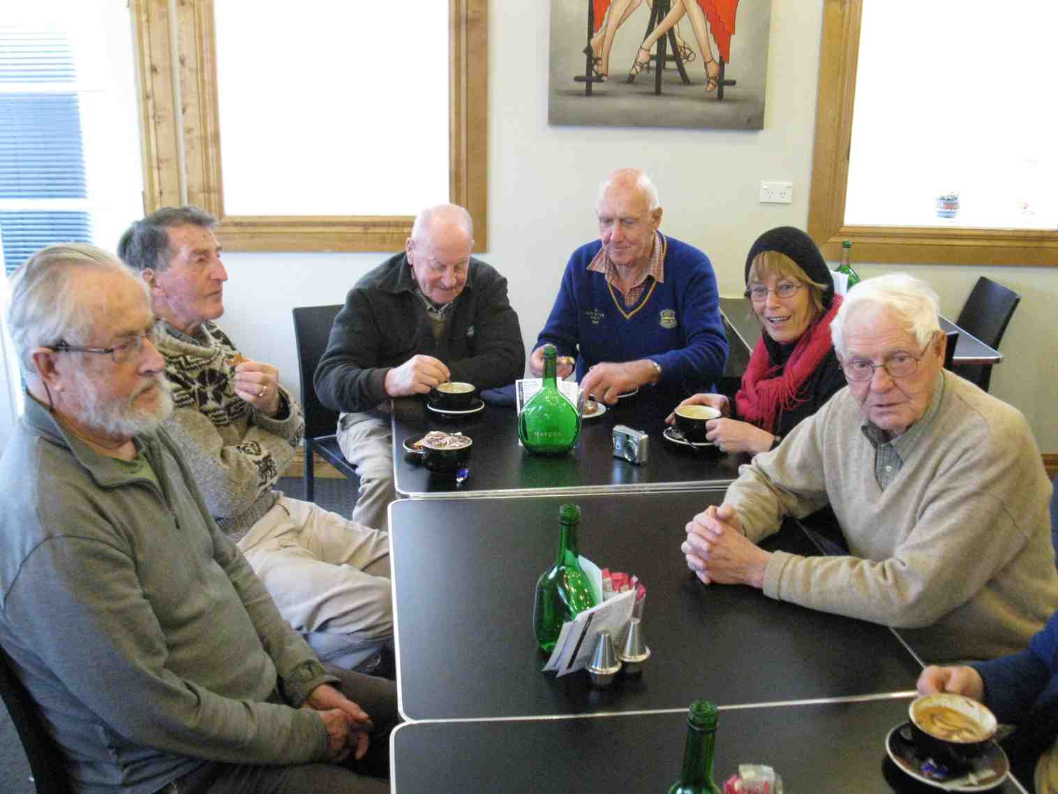
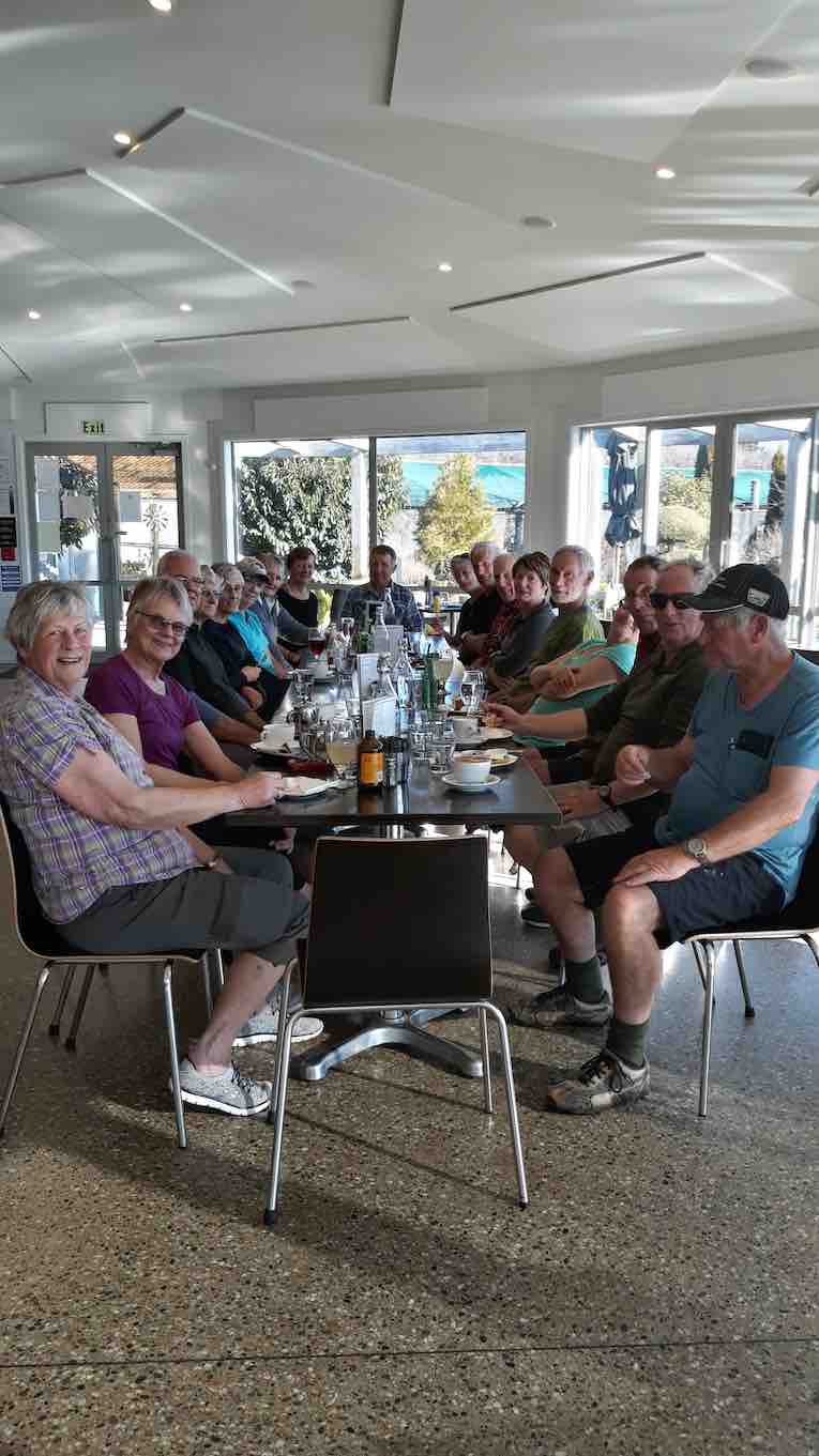
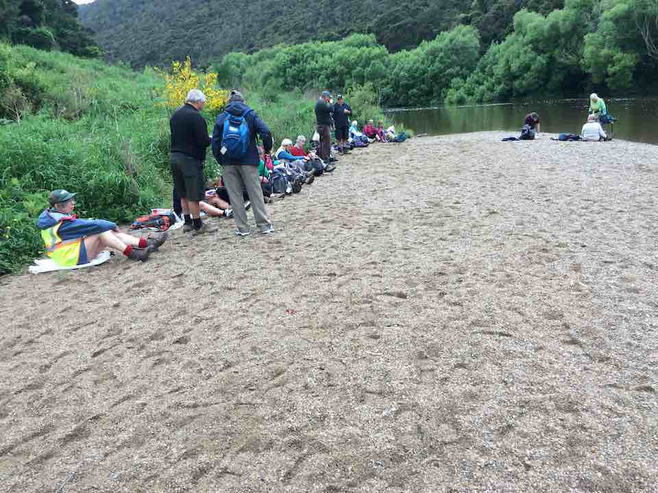
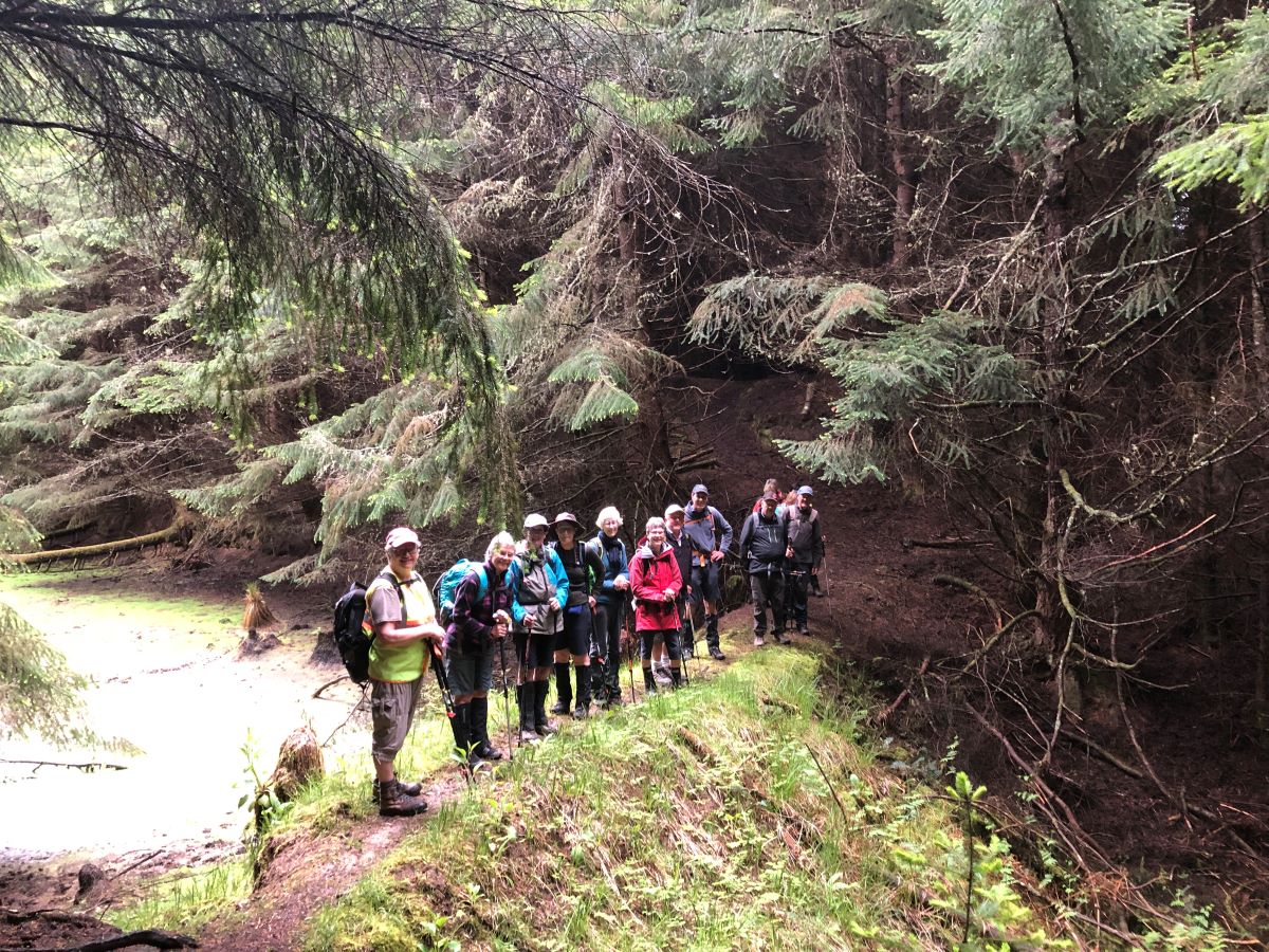
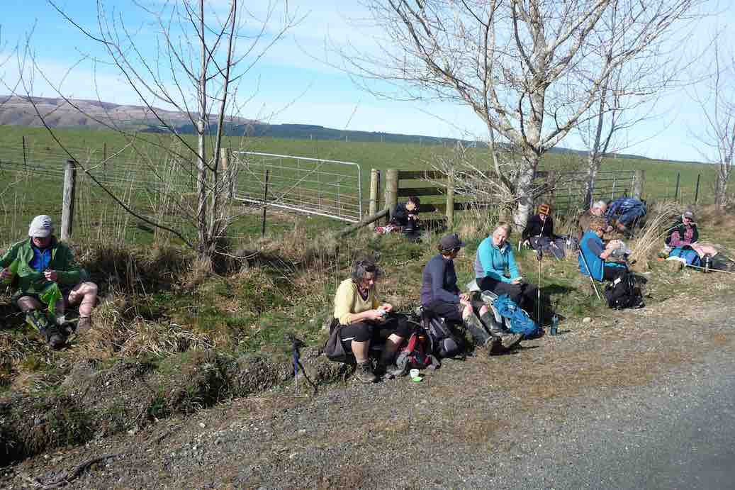
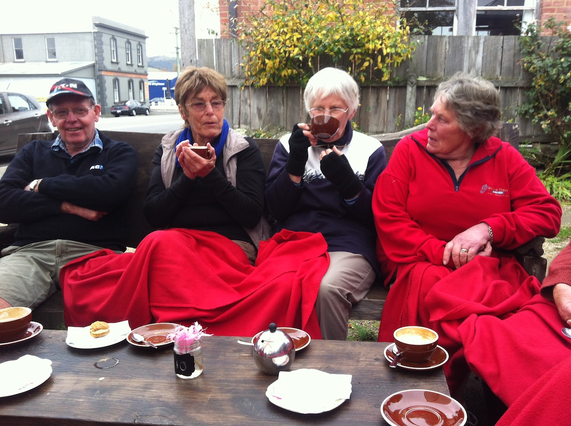
After changing out of our muddy boots and gaiters we made our way to The Black Swan in Waihola. By this time the weather was fine enough to sit outside.
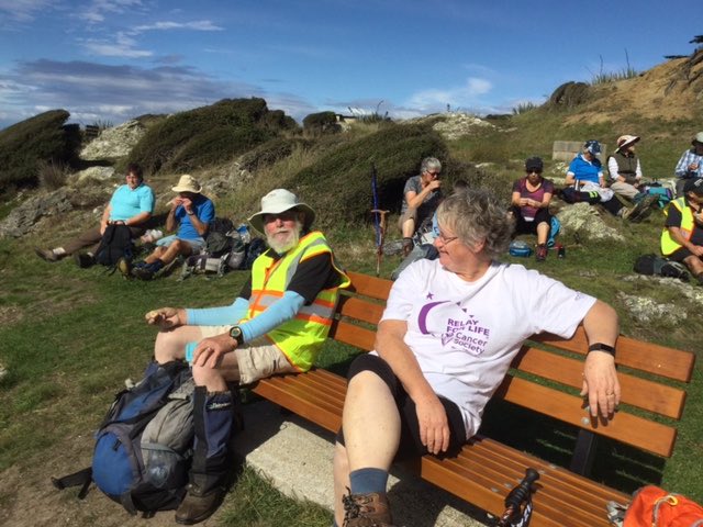
Camaraderie at Black Swan Cafe (photo and caption Pam)
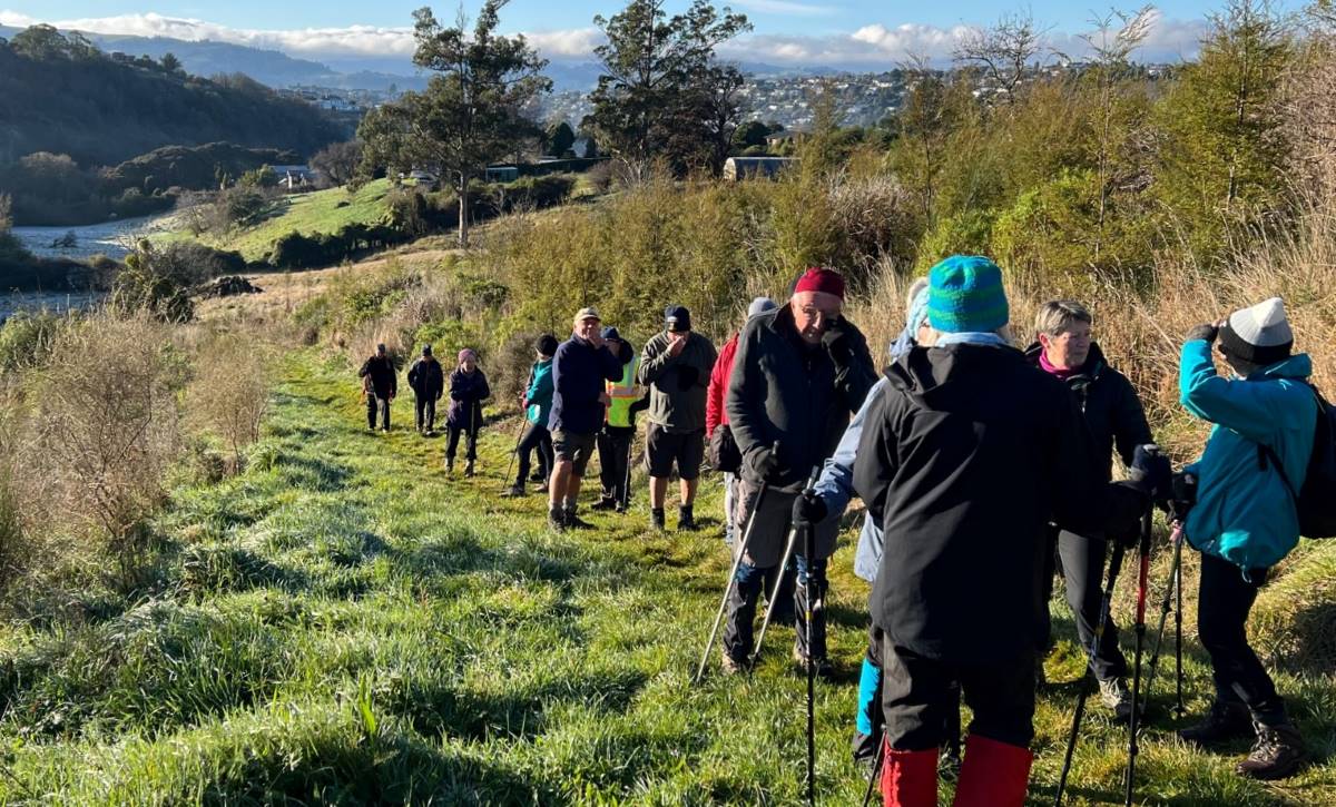
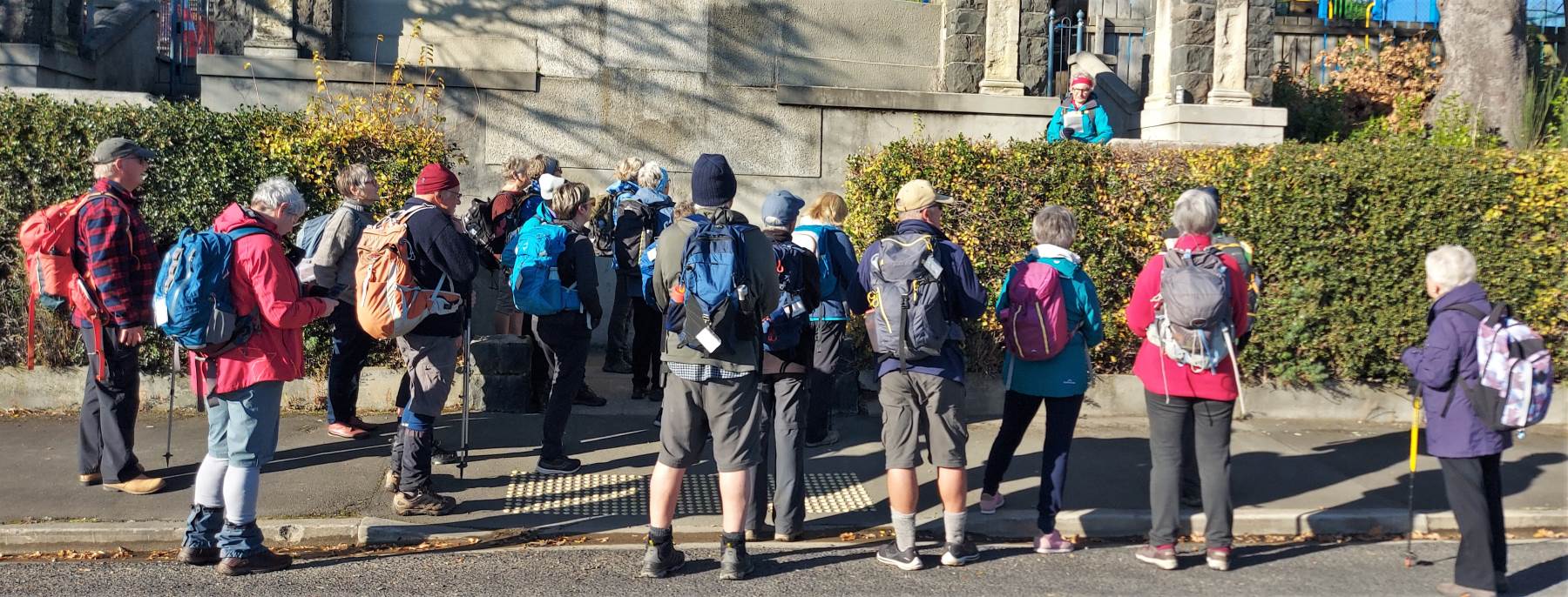
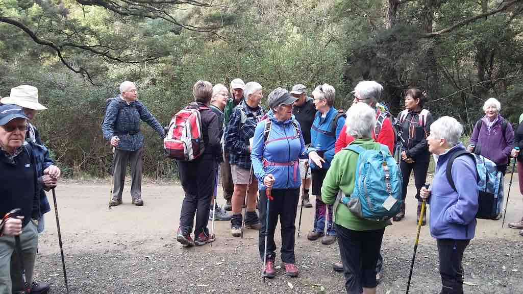
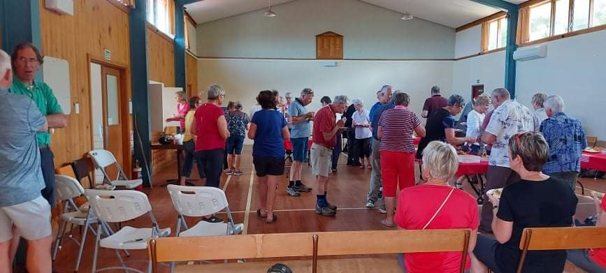
3. 7/7/2023 Combined. Street Walks – Roslyn and Kaikorai. Grade 2, 16km, Leaders: Gwenda Farqharson, Helen Morris, Dave Roberts.
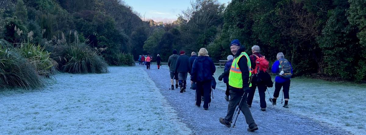
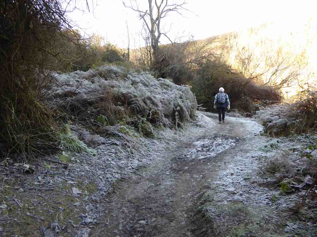
24 hardy members met at a very frosty Frasers Gully car park. After about 15mins we were in the sun on a steady climb up the left side of the Gully with great views. Then back into the bush up the steps and onto Dalziel Road, along to the other side of the gully …
On the sunny side of Frasers Gully (photo and caption Pam)
Regroup photo from Frasers Gully upward leg (photo and caption John)
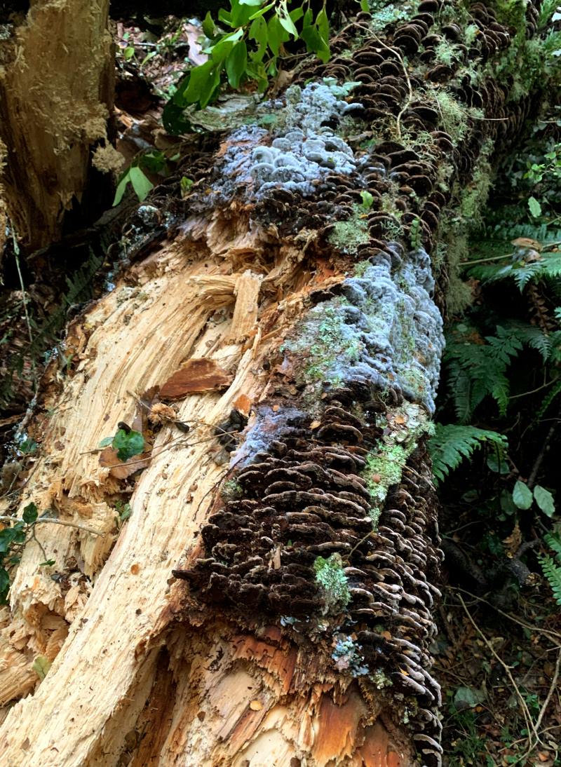
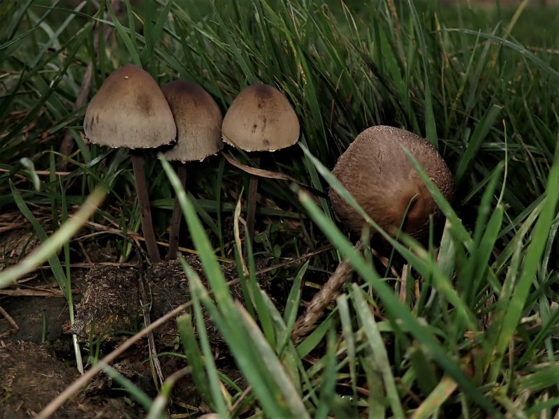
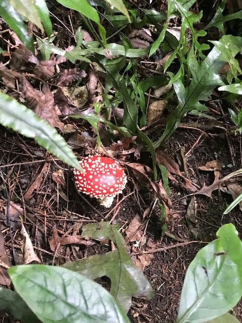
Toadstools disguised as plants in Frasers Gully (photo and caption John)
Walking Track through Native bush of Frasers Gully (photo and caption Pam)
Frosty start – on way back from walking Fraser’s Gully (photo and caption Pam)
… then down to the car park (now in the sun) for morning tea.
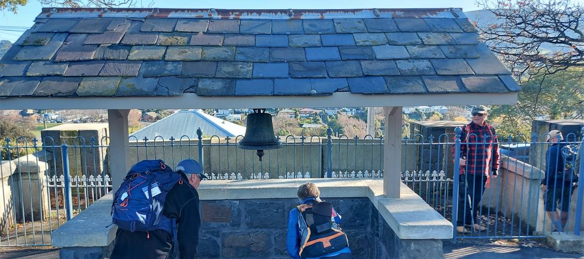
We then made our way to Kaikorai Valley Road, picking up Jill and Linda on the way. Then on up Stuart Street and along the front of Kaikorai School and the Memorial Arch which was the original main entrance to the school.
Talk by Gwenda (photo and caption Helen)
Bell (photo and caption Helen)
It was built in 1921 in remembrance of the teachers and pupils who lost their lives in the first World War. The third school to be built on the same site is almost now complete. After leaving Kaikorai School we crossed Highgate and followed one of the main routes from the Octagon to Māori Hill and Roslyn before the Stuart Street Extension was completed. Stuart Street was formerly called Albert Street. We stopped at points of interest on the way.
Don’t stand below the security guards (photo and caption Phil K.) (Can you spot the 2 Kereru?)
Perfect stop for lunch at Littlebourne Grounds (photo and caption Pam)
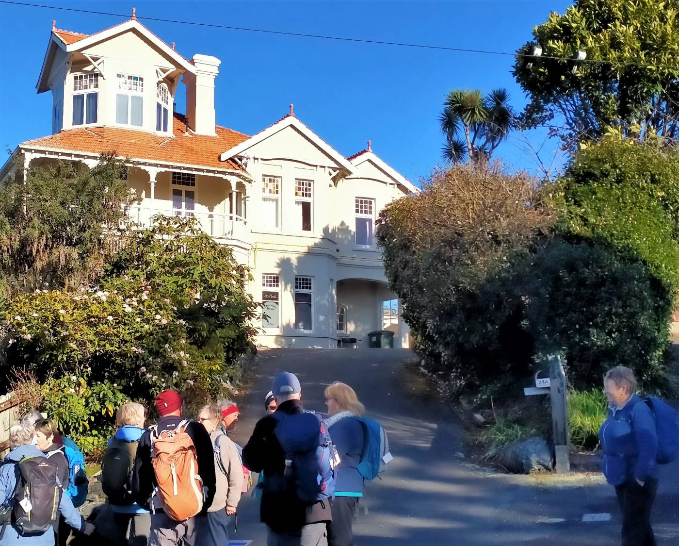
Lunch was at Littlebourne soccer field where there once was a Governor General’s Dunedin residence which was built in 1890. by John Roberts. It was never used by the Governor General. During WW1 the military used it and in later years Dutch immigrants from Indonesia, finally as a student hostel. In 1949 it was it was pulled down. Imagine that happening today.
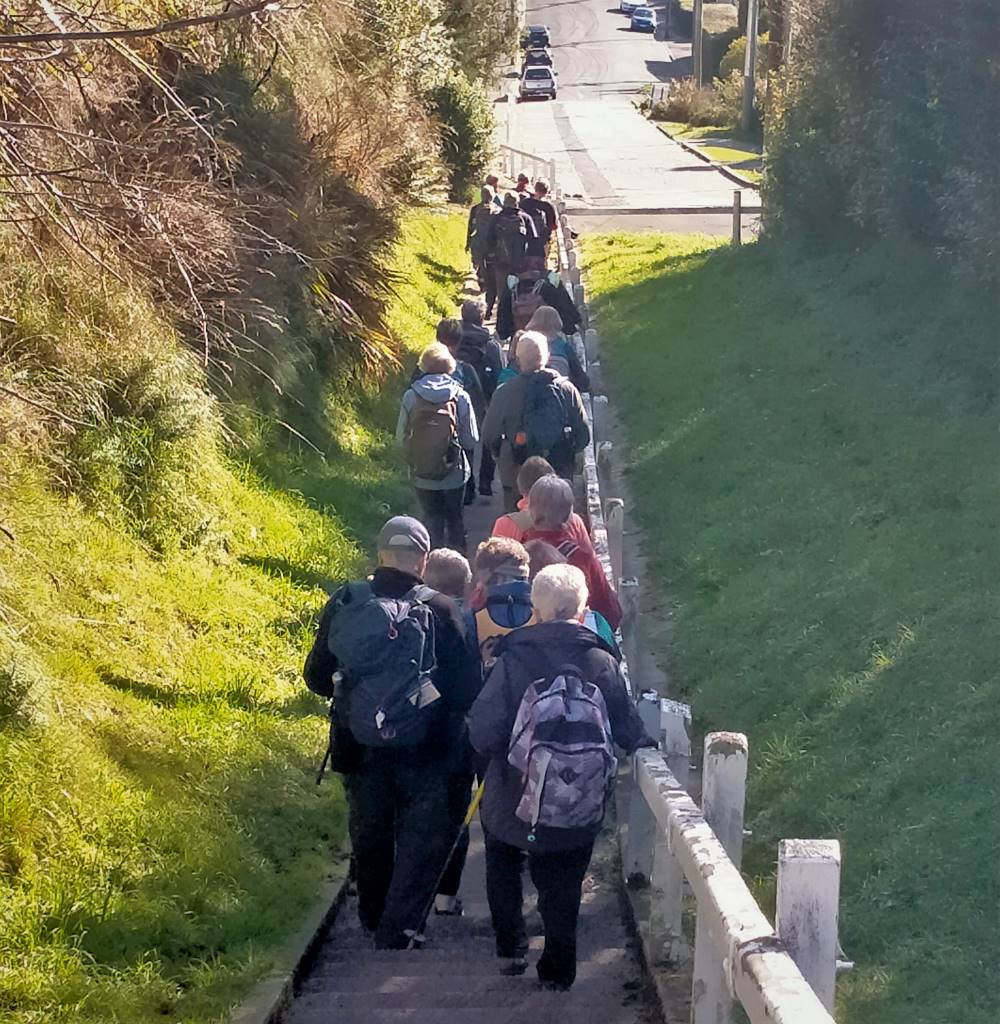
After lunch we saw where the Māori Hill tram route went, also where the Rattray Street cable car and the Kaikorai cable cars used to go.
Cilla McQueen ‘quote’ on seat on Sligo St (photo and caption Phil K.)
On to Falcon Street, where the cable car was supposed to go but it was deemed too steep so unsafe. At the intersection of Falcon Street, and Oats Street., there is a plaque dedicated to the South Pole expedition.
The next up and coming adventurer (photo and caption Phil K.)
We continued down…
Won’t be long til coffee now…… (photo and caption Phil K.)
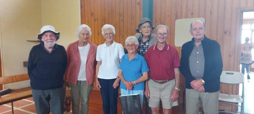
… and crossed Kaikorai Valley Road The cable car sheds were on the corner where the pensioner flats now stand. Back to the cars then onto the Roslyn Fire Station for afternoon tea after a good day for all. Thank you to Helen and Dave for your support.
Gwenda.
2. 18/7/2001 Alt. Juicy bits of Roslyn and Kaikorai. Leaders: Margaret D, Betty B, Peter R
1. 16/12/1998. Roslyn and Kaikorai. (Dn Street Book). Leaders: Daphne, Peggy M, Margaret D.
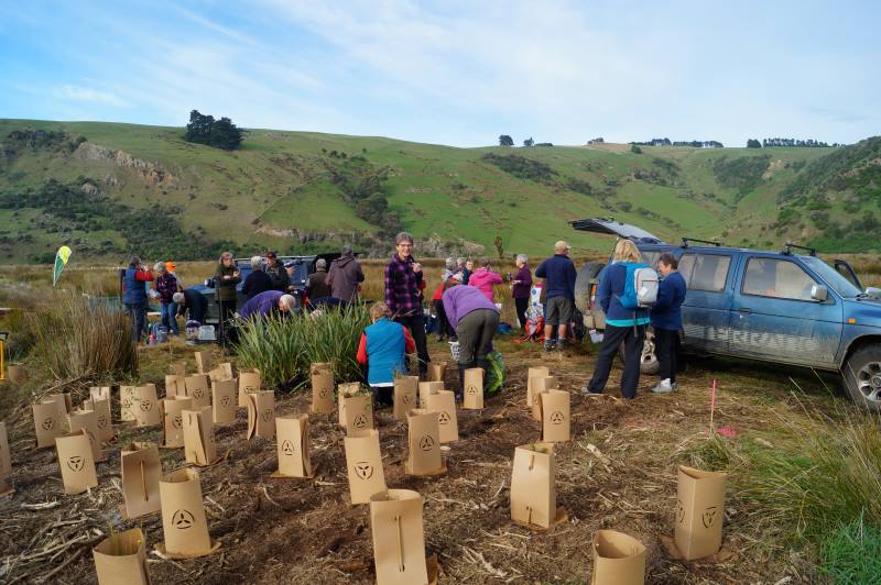
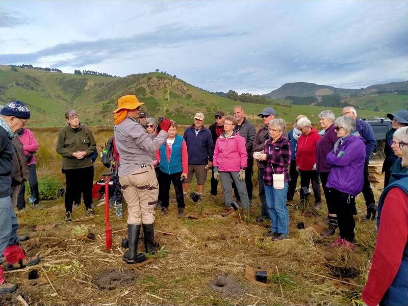
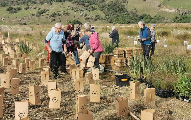
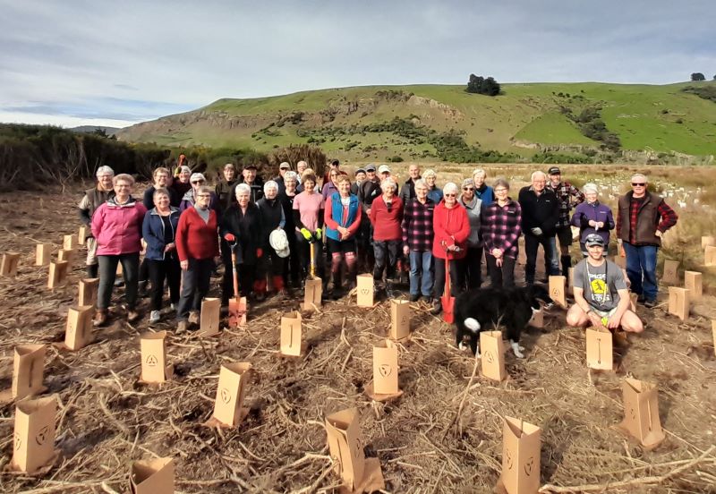
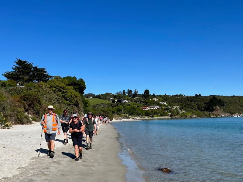
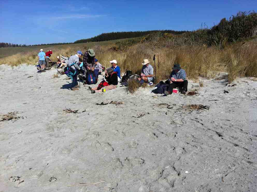
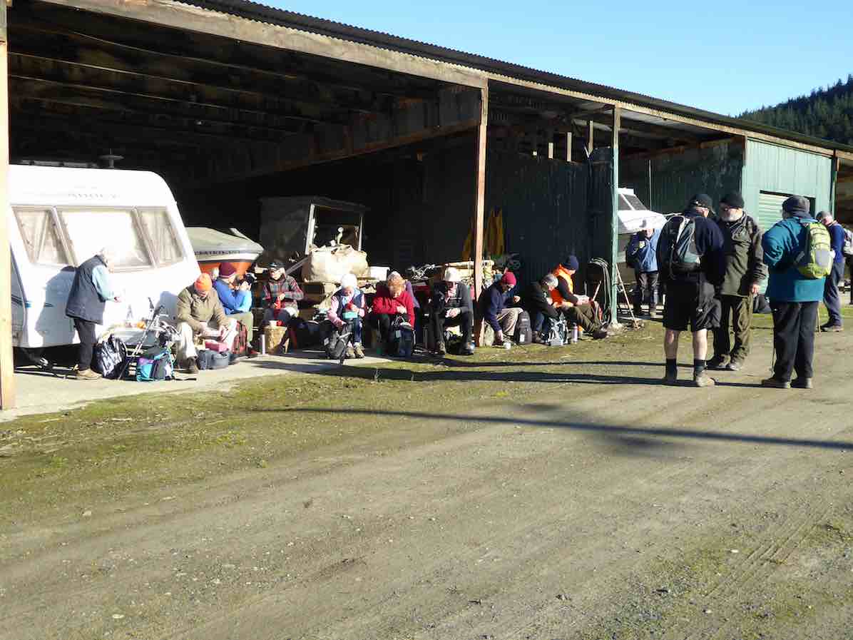
Wednesday proved to be warm balmy day, when 35 eager TRTC members met at Long Beach to give a few hours volunteering on DOC reclaimed land behind the sand dunes .
We were met by the project manager, Jeanne, who was very well organized with equipment ready for us to start after morning tea.
Getting ready to get started Caption and photo JohnThis is how it’s done Caption and photo Phil
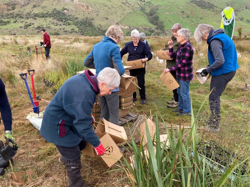
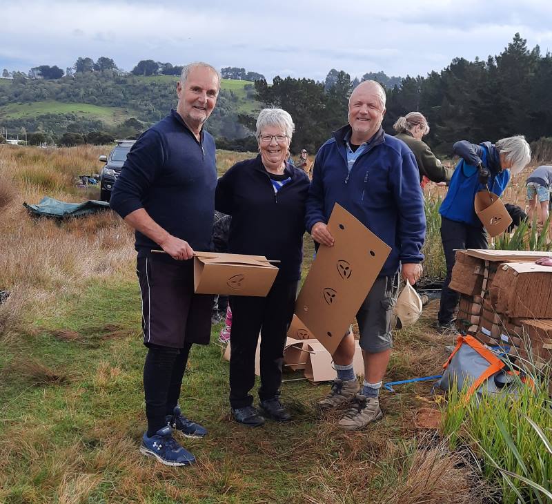
The work involved was digging holes, planting natives and flaxes and making protective heavy cardboard collar’s to go around the newly planted specimens.
Great teamwork Caption and photo RaewynThey thought they were just the best Caption and photo AdyPhoto Margreet
When the project is completed there will be about 38000 plantings (we did approx 800). Since starting last year, the success rate is 85-90ish%.
There were a couple of other small groups volunteering like a team building exercise.
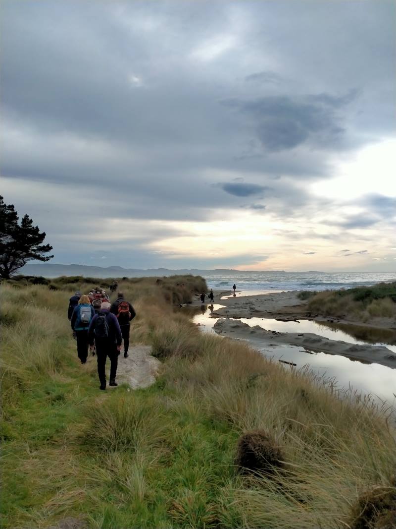
Photo BarbaraWe deserve a walk to the beach Caption and photo Phil
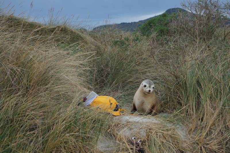
Lunch was on the beach but, unbeknown to us, a young sealion appeared from the dunes behind ready to share time with some of the group. This really did give them one big fright, so our lunchtime was shortened.
The smell of salmon sandwiches brings a young sea lion from out of hiding Caption and photo John
We did continue down the beach a little further before heading back to the cars.
Continuing after lunch along lovely Long Beach Caption and photo Marjke
Some of us went to a quirky little cafe Santosha in Port Chalmers.
I think we all enjoyed the experience and especially being able to help with a community project. Perhaps another time.
Thanks to John for his help and support.
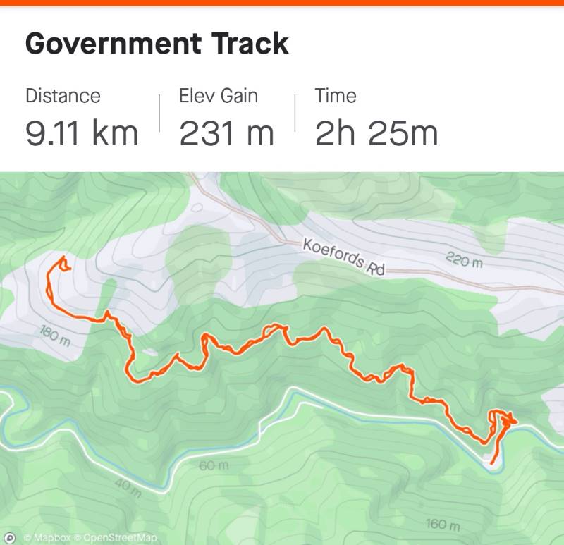
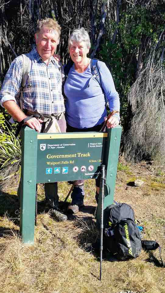
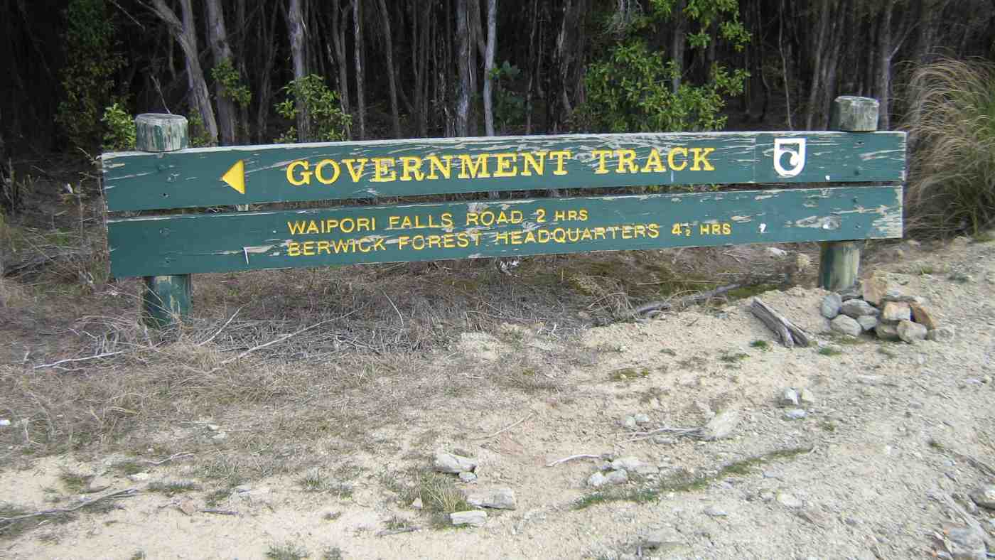
[DCC brochure extract: Government Track. 4 hr 30 min, 17 km (return).
The track entrance is Government Track / Kowhai Spur 5 km down Waipori Falls Rd on the right; parking is 100 m further on the left. Traversing the slopes of the beech-and mānuka-forested Waipori Valley south of Dunedin, the Government Track was built in the 1860s to provide access to the central goldfields. For mountain bikers there is an option of riding up and returning the same way. Alternatively, once at the top follow the pylon track left and steeply down into Waipori township, then follow the road back to the start.]
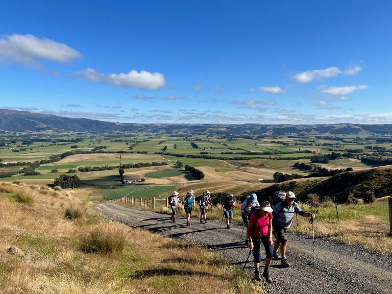
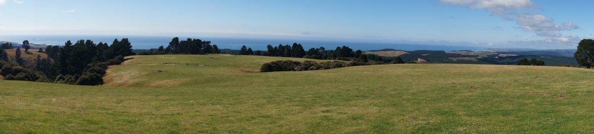
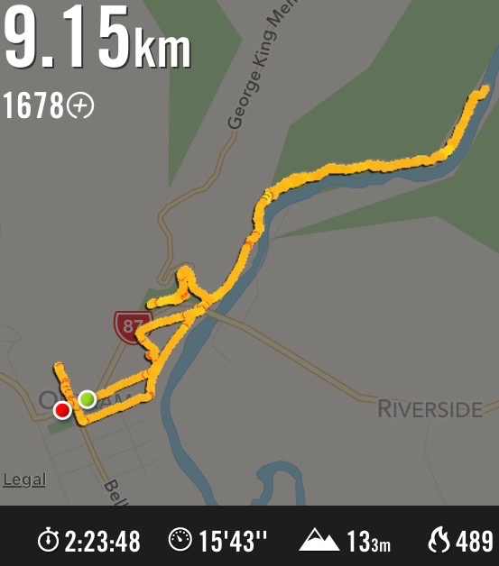
34. 3 May 2023. Combined Government Track Grade 3 Hikers Grade 4 Trampers Leaders: Jay, Kay, Sarah and Pam
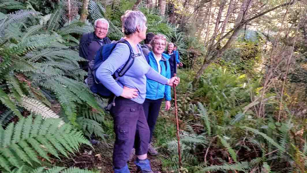
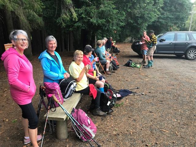
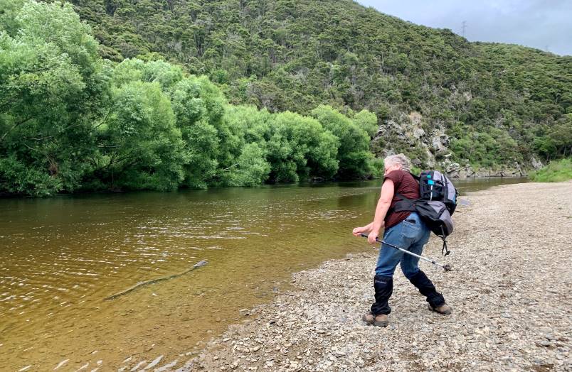
Trampers: After a winter start time meet n greet, 10 cars converged on the Waipori Gorge starting point for our combined hikers’ and trampers’ foray up the Government Track. For the trampers the route was to take us further up the hill than the hikers, doing a kind of loop at the top of the hill, then descending back to the Government Track for the homeward leg. Originally Phil and Helen Morris were to be leader and tail end charlie, but Phil catching Covid put paid to plan A. Our initial replacement leader also suffered some health gremlins, so Sarah, rather had things sprung on her the night before, but agreed to lead.
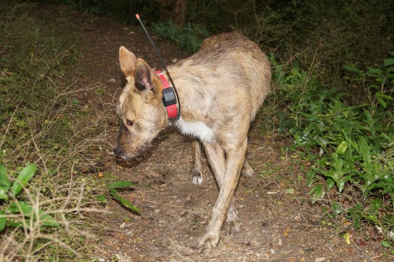
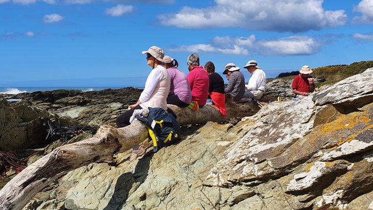
Fourteen trampers started out ahead of the hikers (at 10.am), up a surprisingly damp and cool lower section of the track (mild 23-degree temperatures forecast for the day). As we climbed away from the shaded valley floor, and chilling Waipori River, we warmed up quickly. Accompanying the hikers behind us was a lost, and bewildered looking pig hunting dog (wearing a GPS dog tracking collar), who had been resting under his owner’s ute when we arrived at the car park. Morning tea was enjoyed at 10.30am, not quite at the clearing where it was planned, but on a small bank beside the track. By sheer chance, we soon discovered that the hikers had later stopped around the corner just below us! That pig dog was still with them but did apparently head back down the hill soon afterwards.
He wanted to join the team Caption and photo Pam
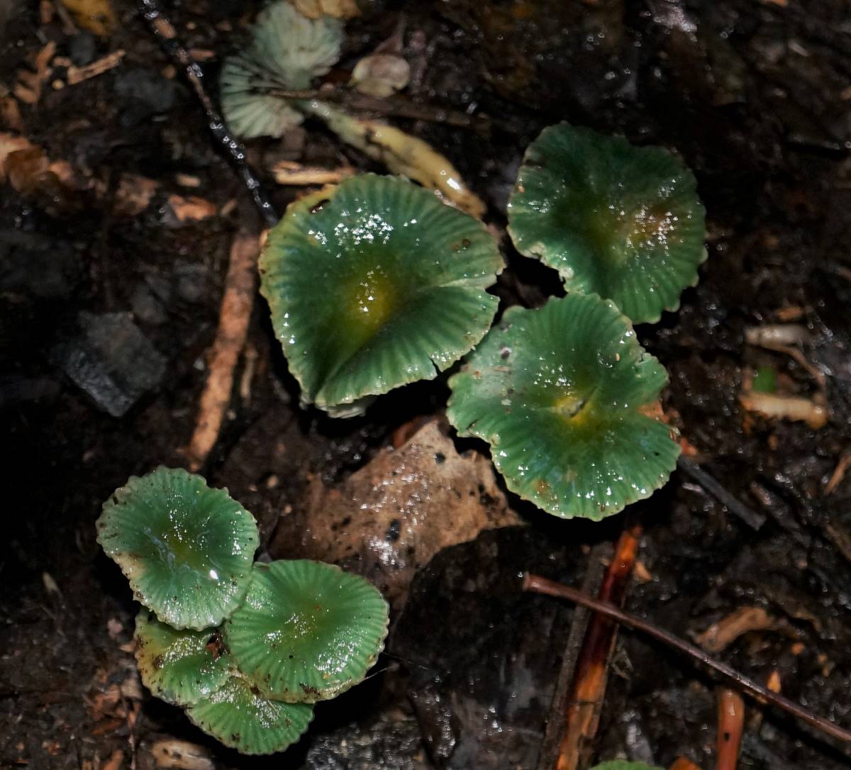
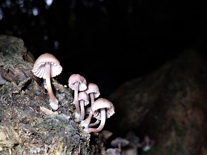
Soon on our way again, by 11.40am we had reached the clearing originally planned for our morning tea stop. An enjoyable wander up the track, admiring the array of toadstools and fungi along the way followed.
Many fungi were growing everywhere in the bush Caption and photo Marijke
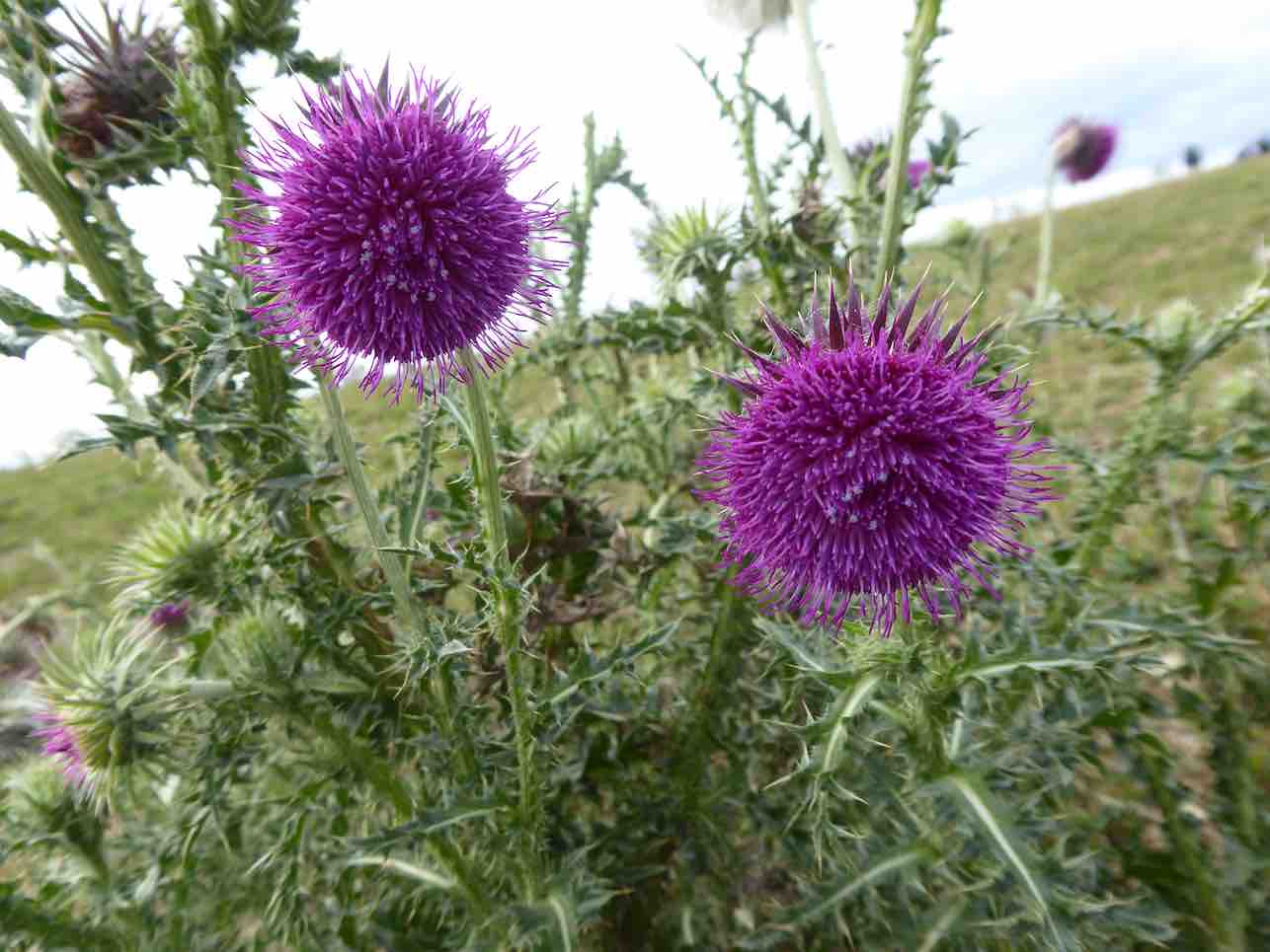
Purple toadstools were spotted, and a great variety of toadstools sprouted from rotting logs and tree stumps. It soon dawned on us however, that our slow ramble, could make for a very long day, and late finish. Averaging only 2.5kph for 2 hours meant we were well behind schedule. Why so slow?
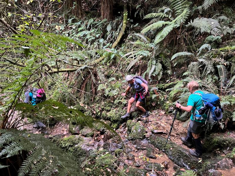
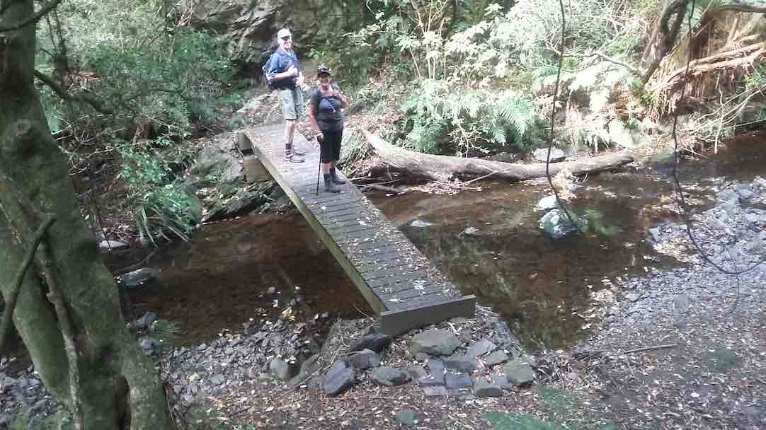
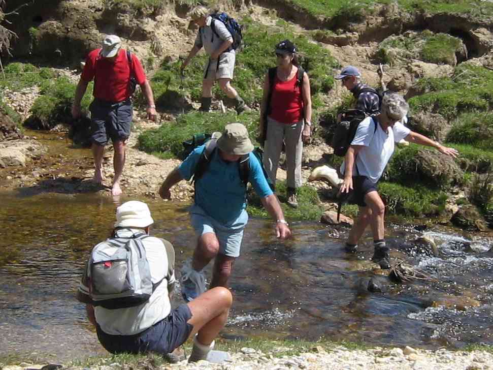
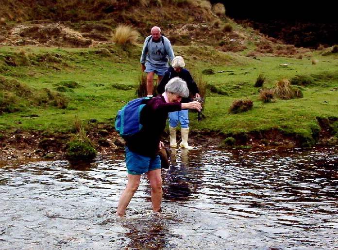
Navigating through the creek Caption and photo Pam
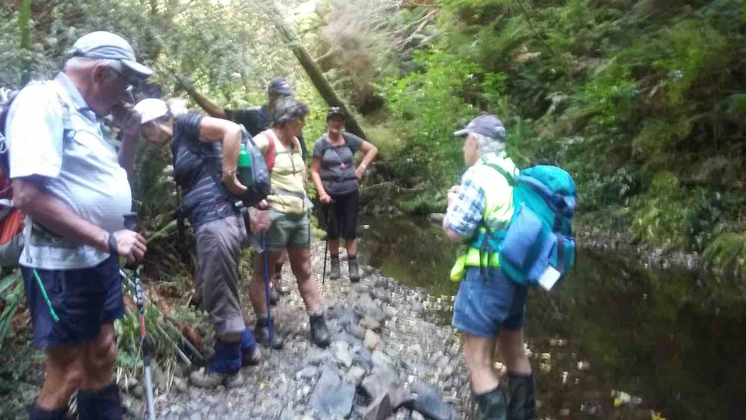
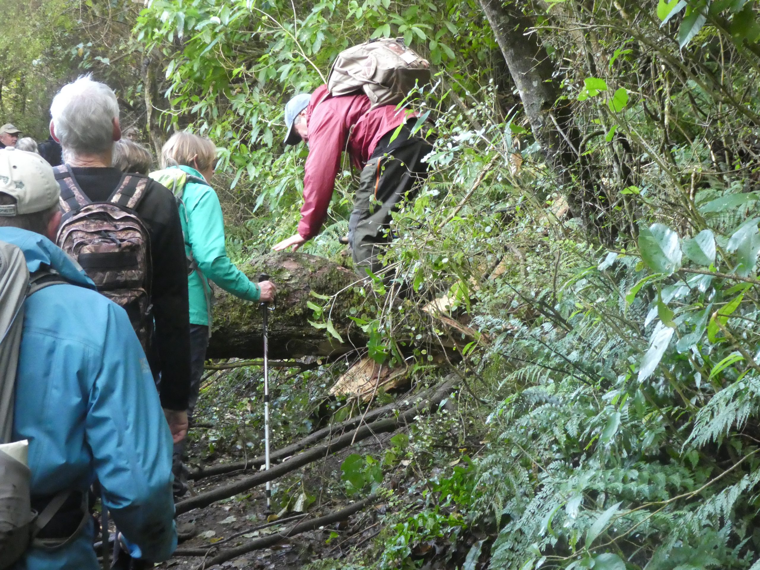
Creek crossings, recently fallen trees and large branches, and some technical bits slowed our progress, so we started to speed up on the smoother sections.
Another tricky little creek crossing in the beautiful bush Caption and photo John
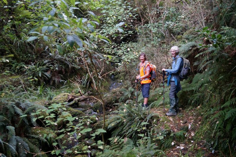
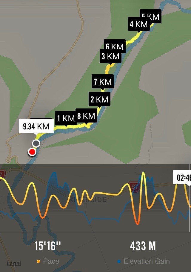
Being an old horse and dray track, much of the tramp was on lovely dry, smooth surfaces with a gentle uphill gradient. Sarah, ever vigilant, referring to her topo map, subsequently had us stop for lunch later than originally planned at 1.25pm, where we dined and rested in a section of beech forest, having covered 9.74km at this stage.
Late lunch never tasted sooo good ! Caption and photo Pam
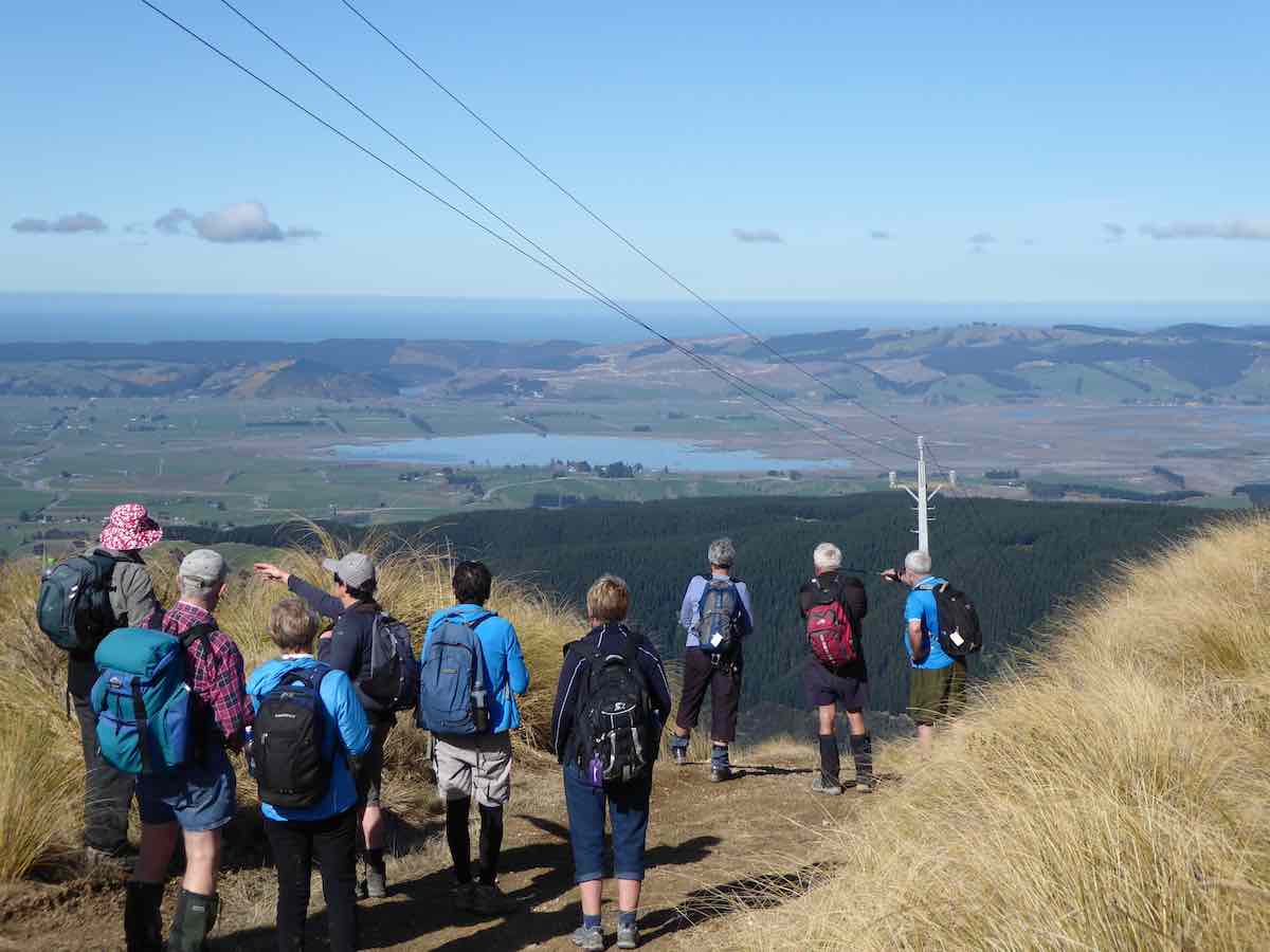
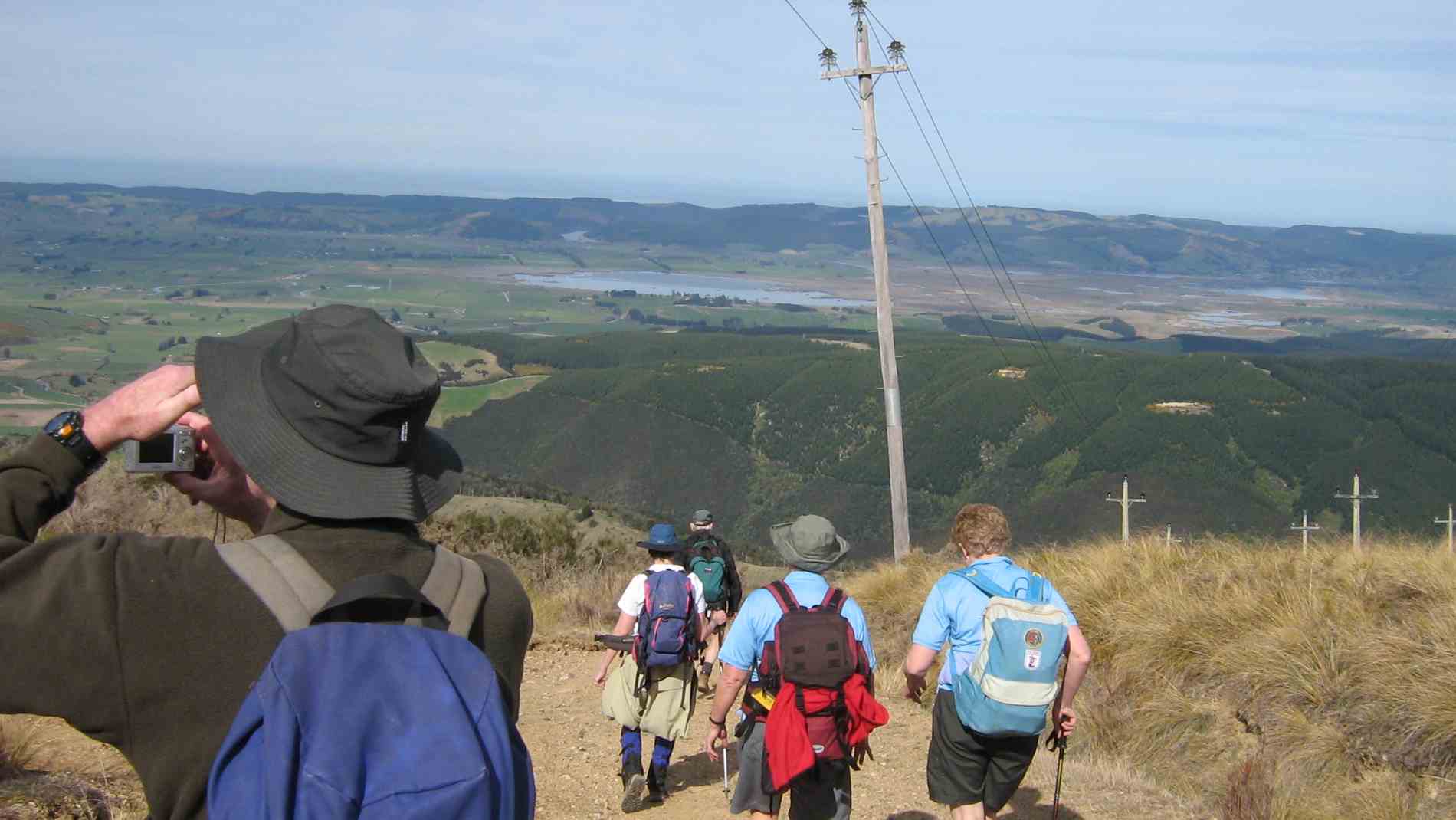
By 1.50pm lunchtime was over, and we were on our way at a better clip, reaching the usual tramp lunch stop spot (a clearing by power lines) at 2.00pm. Five minutes later we were at the road, turning right, then soon after turning right again into Dunstan Road.
Out in the sun, it was an unseasonably warm day. Caption and photo Marijke
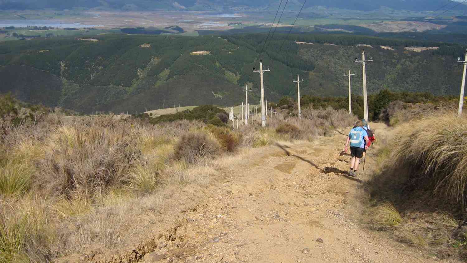
Our speed along this lightly gravelled road increased substantially, which had us arrive at the “White Doc. Gate” at 2.35pm.
Our view as the ascent started Caption and photo John
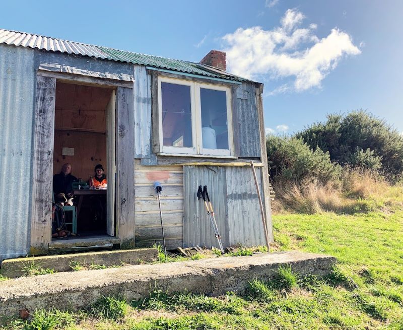
Following the road down from here we arrived at the at the “old hut” at 3.19pm.
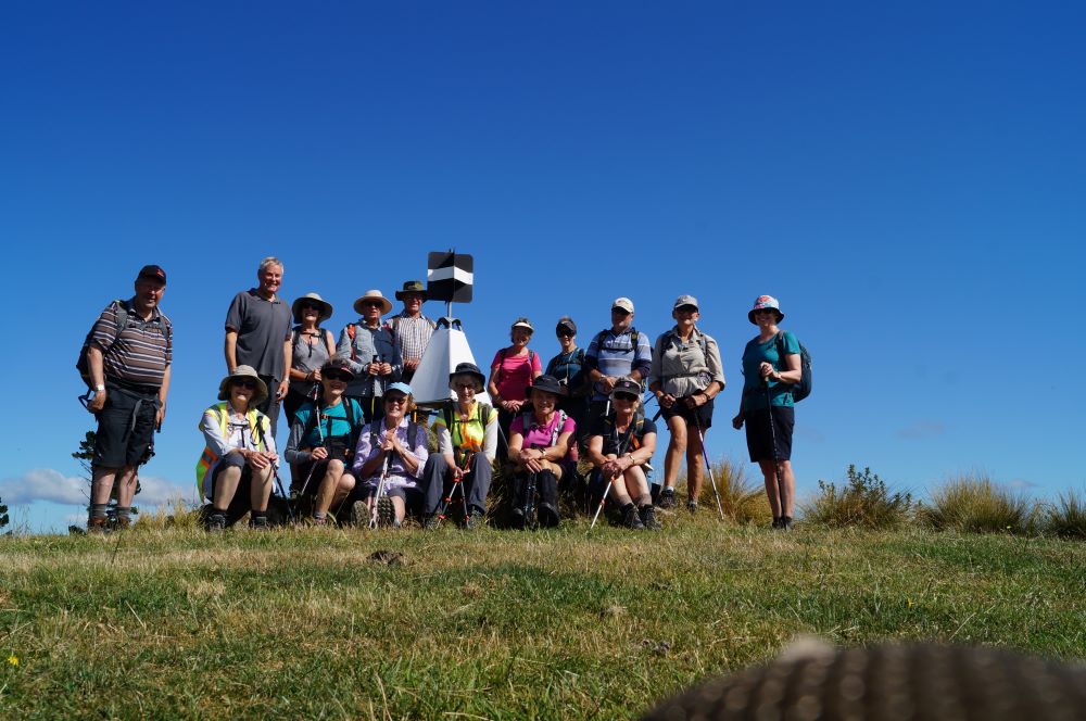
Group photo that Heather and Diane thought they got out of Caption and photo John
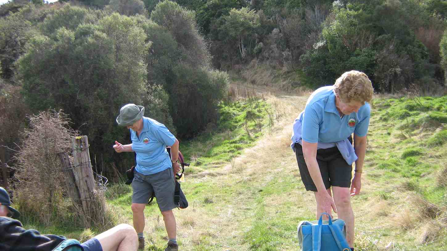
Leaving here Sarah’s topo map suggested we cross a large open field curving around the hillside diagonally, Phil’s instructions more conservatively showed a fence-line following along the top then down. Although perhaps with a little initial trepidation, our faith in Sarah’s topo map was vindicated, leading us straight to the power-line clearing strip, in the lower bush, and the stile onto the Government Track, (Never doubted you, Sarah!) at 3.40pm. By 4.25pm we were back at the cars, having covered 18.8km with 4.5 hours moving time (average speed 4.18kph). A special shout out and thank you to original leader Phil Morris, who despite having Covid, greatly assisted with a set of instructions and map of the tramp Thanks to Sarah as leader and Pam as tail end charlie. A long day, but one with many fond memories. John
Hikers: 18 keen hikers left PJ Park at 9.30am and travelled down to Berwick where we turned right into Waipori Falls Road and travelled along until we reached the carpark on the left. We took off on our walk accompanied by a dog wearing a GPS collar. Thoughts were that it may have been a pig hunting dog. The walk was a gentle climb through the bush on a reasonably dry track apart from the usual muddy parts which never seem to dry out.
The Hiker’s morning tea just down the track from the trampers. Caption and photo John
Still the dog followed. About halfway up 2 hikers returned to the carpark followed by the dog.
The lost pig dog that followed us up the track. Caption and photo John
We carried on up through the bush until we reached open farmland where a bit further on we stopped for lunch overlooking native bushland and forestry.
Lunch Caption and photo MichaelPhoto Grant
After lunch we returned the same way back to the cars having walked 7kms.
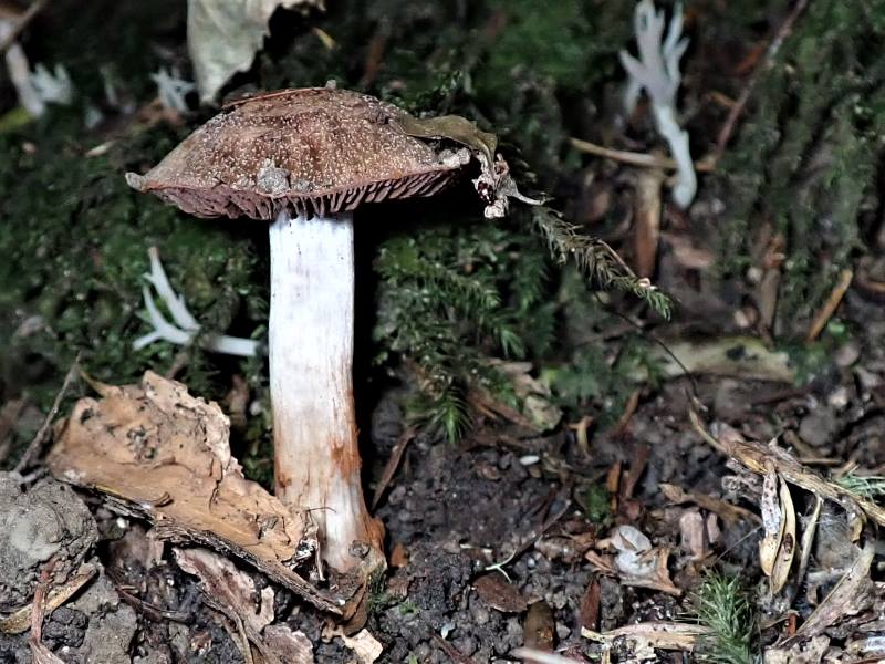
I often point out fungi when I am on a hike and others are starting to notice them Caption and photo GrantPhoto GrantPhoto Grant
Coffee was at Wobbly Goat. We all hoped the dog was found by its owner. Today’s leaders were Jay and new member Kay as tail end Charlotte.
33. 16 November 2022. Hikers Government Track Grade 3.5 Leaders: Neil and Margreet
The day dawned partly overcast and warm with half-hearted rain showers. 20 eager hikers made their way to the Government Track car park on Waipori Falls Road. After negotiating the muddy beginning, the track soon became dry and pleasant underfoot as we settled in to the gentle 260 metre climb to the bush line.
Just checking everyone’s OK. Nice! Caption and photo Jenni
‘Smoko’ was taken bang on time on the side of the track. Occasional mud patches and washouts were skilfully negotiated until we reached open paddocks with scenic views up the Waipori Gorge.
Tree down and some mud Caption and photo HelenGathering up Caption and photo Helen
In order to get a better view, some keen punters climbed to the top of the hill to enjoy their early lunch.
Some climbed up the hill for lunch Caption and photo MargreetOthers stayed at the bottom Caption and photo Margreet
After lunch it was a case of reversing the morning’s effort by trekking back down the beautiful bush clad track to our cars.
Map of the days hike Caption and photo Margreet
But then we were told of a special treat! The hikers were all invited back to Eleanor Ryan’s picturesque Outram home for coffee/tea and home baked cakes! With her lovely garden and trimmed lawns, not to mention her delicious baking; it was an awesome highlight to our day on the Government Track. On behalf of us all Eleanor, thank you for your generous gesture.
It’s not all about the hiking. Eleanore’s beautiful garden. Caption and photo Margreet
Delicious afternoon tea at Eleanore’s Caption and photo Margreet
32. 29 September 2021. Trampers. Government Track / Kowhai Spur. M. Leaders Phil and Helen
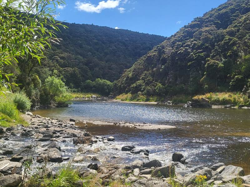
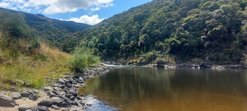
We set off from Peter Johnstone Park at 9am on a nice mild Mosgiel day heading toward Waipori Falls Road to a parking spot just past start of the bottom of Government Track. This was a track built in 1860 to provide access to the goldfields. Over 20 men were employed to form this publicly funded work. It provided a cheaper alternative to bring horse supplies from Dunedin which previously had been carted from Lawrence.
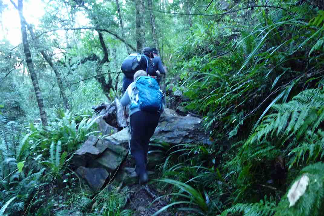
A good number of 17 trampers headed up the track, muddy at start but soon became well cleared with a gradual 7deg incline most of the way, apart from small creeks that were hard to pass due to slippery and wet rocks.
Along the track. Photo and caption Helen.
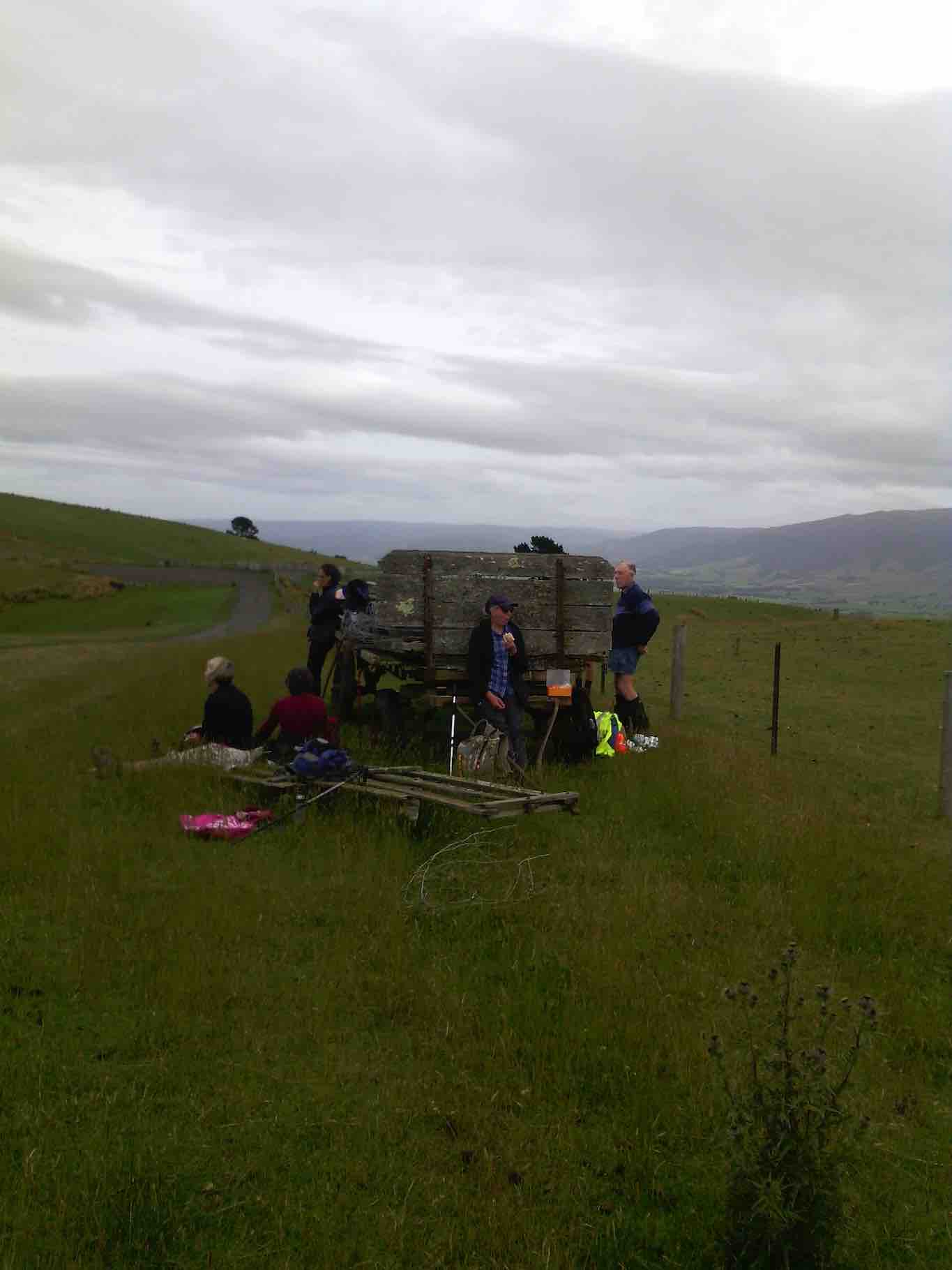
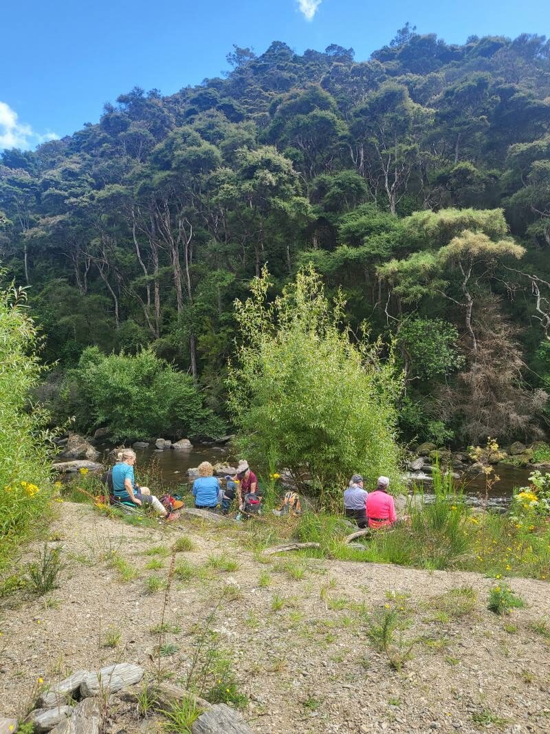
We continued up the track for an hour and a quarter before young Eleanore hinted that a cuppa would be good, so within 10 mins we found a nice clearing and the call was made, morning cuppa was consumed. At that time two young ladies one from Salt restaurant in St Clair and the other a midwife caught up with our group and we conversed with them as to how far to the top and introduced each other. They were very nice and by lunchtime approx. 8.75km up the track they had stopped for lunch, we had caught up so we joined forces at the clearing and decisions on which way we would tramp from there. So I walked on some approx 50 yards and found the gravel road that I was looking for on map, then returned to the group.
Lunch in the sun (mostly). Photo and caption Dave.
We finished lunch then headed to gravel road, headed right, continuing up until we found an intersection with Styx Road on sign. Did we continue straight ahead or did we go right? After a wee bit of discussion we went straight ahead thinking we were on Styx Road we continued for a km and a half, “wrong”!! An about turn, back to intersection amidst a laugh or two. We should have turned right at the intersection, although I was not a 100% confident, Gwenda and Eleanore, were though. The young lady from Salt had also scooted up 800 yards and returned saying there didn’t appear to be a turnoff. But a decision to continue was made, John also very confident decision was correct. After about 2km in the distance we saw a Dept of Conservation truck so we thought right these fellas would know, so we got closer and a second truck had arrived. Asking them if we were on track for Kowhai Spur Road, they replied YES, phew!!
When we realised how high we really were! Photo and caption John.
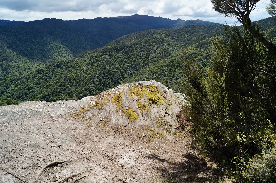
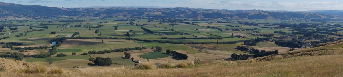
Panorama – view from the track. Photo and caption John.
Go to white iron gate 300 yards ahead and turn right, hill is pretty steep but when you get to hut go in there and over ridge and head down to fence line. They were right and Teresa hinted, when we got there, if you follow tyre marks down the ridge, we should get back to the fence stile. By that stage the ladies we had met said we were on track, Mr Google says so.
Looking to the hut. Photo and caption Helen.
A group of happy trampers (and two guests). Photo and caption John.
A small sun shower went through just after we left the hut, but with much glee we got down to the fence line, and although tired it was great to be out and about, 21.3 km later and 4.45pm we removed the boots and put our tired backsides down on the car seats, job done, good company, and off home, no time for coffee!!
Directions simple – up Government track, lunch at clearing 50 yards from gravel road, turn right to Styx intersection, turn right, 3 km along gravel road to white conservation iron gate, turn right, down hill to hut, over ridge go right, following tyre tracks downhill, to electric fence go left through gate, continue down 40 metres or so then when you feel you should go right go left then straight down to a clearing where the fence line takes you to the stile which is the Government track taking you back to start 18.3 kms.
Cheers for a cool longer but casual day,
Helen and Phil.
31. 9 June 2021. Hikers. Government Track. E. Leaders Sue & Kathryn
9 hikers travelled to Berwick on a cold (-1 deg.) but pleasant morning. We proceeded up the track which is a gradual incline on a reasonably dry track. We stopped for morning tea part way up.
After walking a short distance, it became very wet and boggy where cattle had been walking through, so we detoured up the hill and onto a slightly overgrown track in parts. We came into sunshine and a nice area for lunch.
Lunch above the bush line (photo & caption Clive)Great view up the valley (photo & caption Clive)
After lunch we walked downhill to the stile and back down the track to the carpark. We all headed to the Wobbly Goat for coffee.
Kathryn Fagg
30. 28/10/2020. Hikers. Leaders Clive Crossman and Alex Griffen
A Bright sunny morning saw 14 hikers gather on Waipori Road at the entrance to Government track. Even with the weather being dry parts of the track were muddy and slippery. After climbing the initial incline the walk levelled out to a pleasant hike under the beech trees and native bush.
Photo and Caption Clive – “An even track under the beech forest”
Numerous song birds accompanied us on our way. After an hour we stopped for morning tea with the sun breaking through in patches giving what more romantic writers would describe as ‘dappled shade’.
Photo and Caption Clive – “Morning tea on the track.”
As we climbed higher we looked down through the forest and became aware how precipitous the track is in places, the steep drop off camouflaged by the dense bush.
Photo and Caption Clive – “Breaking out of the bush.”Photo and Caption Clive – “Looking up the valley towards the surge chamber(white dot in middle.”Photo and Caption Clive – “A good spot in the sun for lunch.”
The height gave us some spectacular views across the valley with the road snaking away hundreds of feet below us. Eventually we broke through the muddiest part of the track into open paddocks. The sun had raised the temperature into the mid teens so it was decided the open paddock would be a good place for lunch, however it was a bit early, so we continued for about another kilometre into the bush.
There we saw some corrugated iron that some speculate is the remains of the hut used by the original track makers..
photo and Caption Clive – “Could this corrugated iron be 160 years old?”
After lunch we returned the way we had come. With the track being so muddy and slippery in places it is surprising that only one hiker took a ‘dive’. The degree of difficulty = 0, artistic merit = 0, comment from hiker = Oh Oh, and laughter.
We made it back to the cars in good time and gathered at the ‘Woobly Goat’ in Outram for afternoon tea where the consensus was that it was a good days hike.
Alex and Clive
29. 17/10/2019. Trampers. Government Tramp. Leaders: Gordon and Sue.
18 eager trampers (twice as many females today) headed out to Waipori on a mild morning, parked at the Government track carpark and headed off into the hills. The gradient on the track is enjoyable, gradually climbing to the top. It was pleasing to see how dry the track was, considering recent rain. This was obvious with the amount flowing down the Waipori river.
We crossed the stile into a grassy patch and walked for a while before stopping for smoko at 10:30am.
Photo Gordon – Morning tea
Onwards through mature Silver Beach, Kanuka and Manuka.
Photo Gordon – Walking throug native flora.
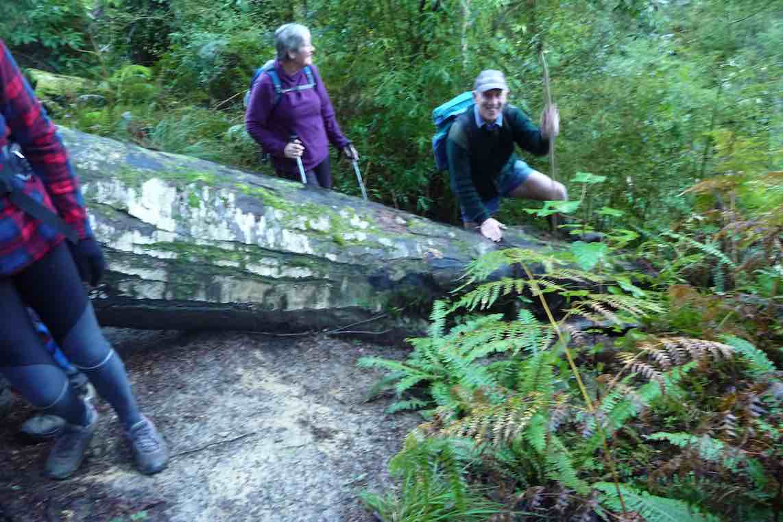
Also, the odd creek crossing and windfall trees, one you climb under, the rest you climb over! One spot has about a 100 metre scramble to get through.
Photo Gordon – Some trees were tricky to get over!
After hiking just on 8.5 kms we reached Shaw Road at 1:45pm and enjoyed the sit down in sunshine for lunch and a chat.
We proceeded along the road for 2km’s before reaching the pole track, which has a very steep descent, however, the views over the Taieri plains, the Taieri river, the Sinclair wetlands and the Lakes are well worth stopping to admire. (In July 2018 we had light covering of snow and a slippery trip down)
At the top of the Kowhai Spur we headed right through the gate into farmland, passing a Musterers hut, then a herd of healthy Hereford cows with happy calves at foot.
Photo – Gordan – Renants of native bush on downhill farmland
Sidling around and down paddocks we arrived back to the stile, and once again—-looking like a very long caterpillar, enjoyed the hike through the bush to the cars.
Deciding not to stop at Wobbly Goat for coffee because it was near closing time.
The Government track was built in the 1860’s to provide access to the Goldfields. Over 20 men were employed to form this publicly funded work. Was never much more than a bridle track and unsuitable for wheeled traffic. When completed it provided a cheaper alternative route to bring in horse drawn supplies from Dunedin, which previously had to be carted via Lawrence.
We hiked a good 18km’s, arriving back to carpark at 4pm.
Photo Gordan – The whole happy group!
Good company and good weather == another great day out.
Gordon and Sue
28. 12/9/2018. Hikers. Government Track. Leaders: Clive and Lester.
25 Hiker set out from beside the Waipori River.
Hiker set out. (Clive pic and caption.)
At first the track was slippery and boggy. Then as we got up into the bush a walk up a steady incline was enjoyed by all.
Morning tea on the track. (Clive pic and caption.)
Until…. we hit the next patch of boggy ground and we had to negotiate more slippery track, made a bit worse by the cattle that had churned up the path. The weather was kind and we made it to the 5km mark before deciding that was far enough and returned to the open paddock for lunch.
Lunch in the sunshine. (Clive pic and caption.)
We then made our way back the way we had come trying to find the less slippery and boggy part of the path. The views from up the top were great.
The view up the Waipori River Valley. (Clive pic and caption.)
We all made it safely to the cars and then onto Topiary for afternoon tea. – Clive & Lester
27. 25/7/2018. Trampers. Government Track. Leader: Sue.
Still quite cool. (Gordon pic and caption.)A rocky slip. (Gordon pic and caption.)Another obstacle. (Gordon pic and caption.)A well deserved late lunch break. (Gordon pic and caption.)
26. 30/8/2017. Trampers. Government Track. M. Leader: Dave.
14 keen trampers met at the carpark near the start of the Government track on Waipori Road. We soon started on the track noting the 4 twisted manuka trunks at the side of the track. The track has a gentle grade and is 8.5km long.
The reason for the gentle grade and generous width of this track lies in its origin as the original “road” from Berwick through to the Waipori gold fields. Over 20 men were employed during the 1860’s to form this publicly-funded work, which was never much more than a bridle track unsuitable for wheeled traffic. When completed, it provided a cheaper alternative route to bring in supplies (horse drawn) from Dunedin, which previously had to be carted round via Lawrence.
Morning tea was had over the style, up the ridge, in the sun and on time at 10am!
(Margreet pic.)
We continued up the track which is through native bush, mainly manuka, kanuka and silver beech
(Margreet pic.)
. There were occasional views out to the Waipori valley and surrounding hills. A number of big tree trunks lying over the track were either scrambled under or over. There was plenty of talking and hilarity on this trip which was great!
Lunch break was at the top of the track, again in the sun.
(Margreet pic.)
We then continued along the forestry road and stopped at the highest point (580 metres) where there were great views all around,
(Phil pic.)
particularly Maungatuas, Lammerlaws and Rock and Pillar range. Moving on to the top of the kowhai spur we stopped to get panoramic views of the Taieri plain, very clear because of the fine day. The kowhai spur is aptly named as it is steep and feet can move to the front of your boots! The next break was at a farmer’s workers hut
(Margreet pic.)
before heading down the ridge, through some bush and back on to the bottom of the Government track. A number of birds were heard and sighted including kereru (wood pigeon) and bellbirds. On getting back to the cars we found we had covered 18.5km. A fair walk!
It was then off to the wobbly goat (with some wobbly legs) in Outram for a well, deserved coffee and more chit chat.
A great group to be with – Dave M.
25. 23/11/2016. Hikers. Government Track. E. Leaders: Jim and Betty.
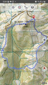
Route map, Government Track, courtesy Ian. (N.B. Used old shortcut route on return. Regular route a bit longer.)
The party consisted of 23 people.
The weather’s appearance was indifferent. But the Government track up the Waipori Gorge afforded good shelter in the bush. The condition of the track was excellent [thanks to track-clearing by the leaders on their recce, especially on the zig-zag beginning – ed.] and this track has a very moderate consistent gradient. The return was a slight downhill grade & a total of approximately 9.5 kms was covered. Lunch stop …
Lunch on Government Track. (Ian pic and caption.)
… was brief as there was drizzle approaching. On the return to the car park some hikers took an old short cut which gave them a minute advantage.
Hot drinks were enjoyed at the Wobbly Goat in Outram, …
Last of the Summer Wine. (Adrienne pic.)
… before returning to Mosgiel. – Betty and Jim.
24. 17/2/2016. Trampers. Government Track. Leader: Various.
At the car park, Bush Road, we looked towards the silver peaks. It was raining. We were told the wind was 50k plus, so we changed our mind and decided on the Government Track.
Arrived at the lower Waipori car park. In front of us was bright blackberries. To the left a tree full of apples, and a deafening sound of crickets.
Five of us set off up Government Track. Morning tea at the grass clearing. No wind, little sun.
At the top of the Government Track, we had lunch in the sun.
Lunch in the sun. (Helen pic)
After lunch, walked along …
Along the pole line (Helen pic)
… and down the pole line to the hut.
Down the pole line to the hut. (Heb pic and caption)
Turned right, found a tape marker which led us over and down to the style on the track just below where we had morning tea. Carried on down the track to the car park.
Heard lots of wood pigeons and bellbirds. A great day’s tramp. About 17k, and quite warm temperatures. – Heb.
23. 21/10/2015 Hikers. Government Track. Leaders: Betty and Jim.
22. 27/5/2015. Trampers. Government Track, return part Kowhai Spur.
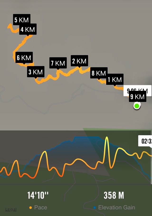
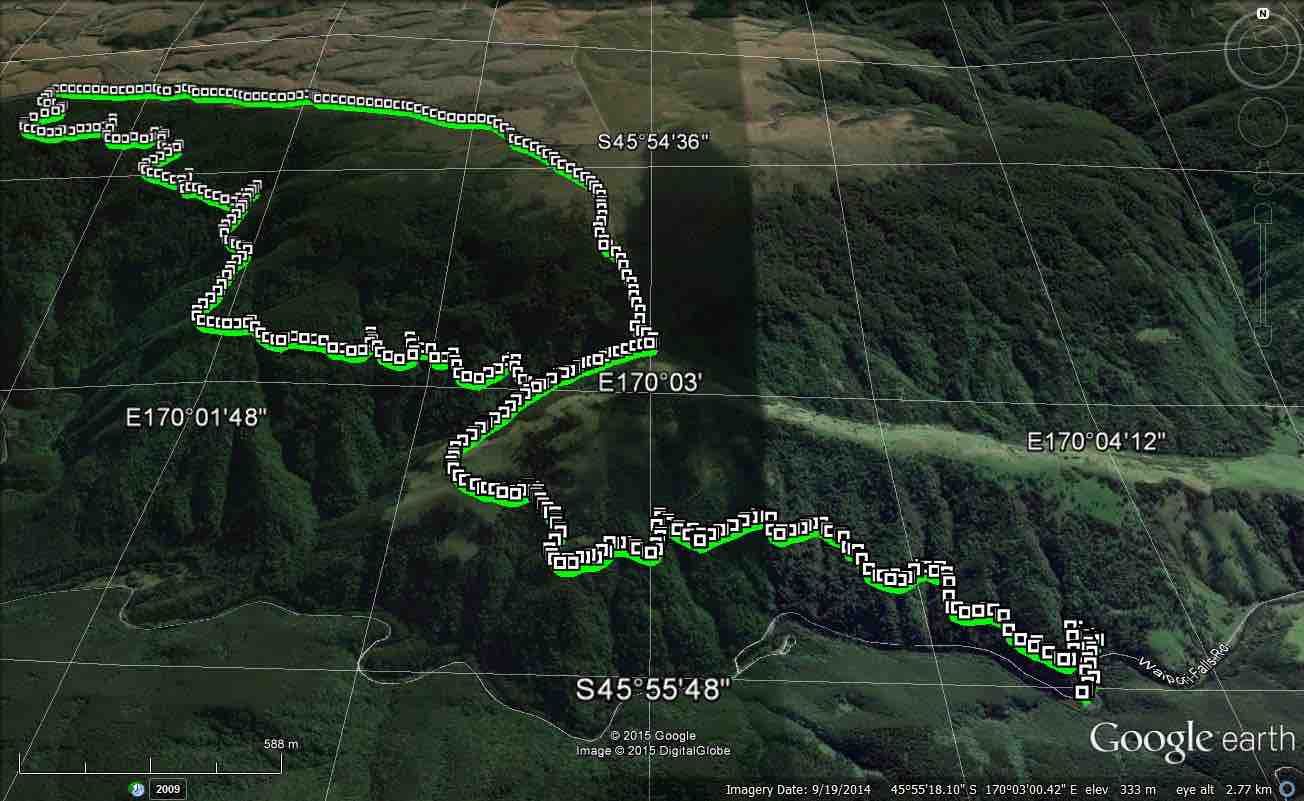
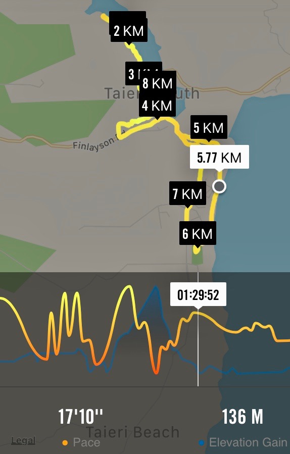
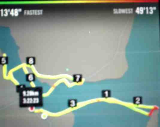
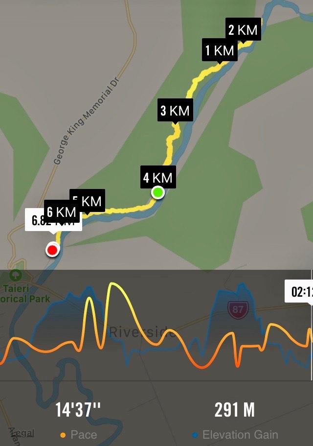
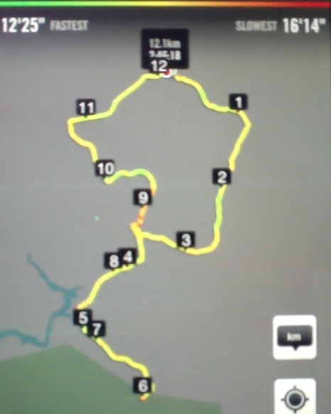
GPS of route, courtesy Ken. Government Track-part of Kowhai Spur. Walked 17.1 km; ave 4.4 km/hr; moving time 3hr.54min; climbed 480mtrs. (Ken pic and caption)
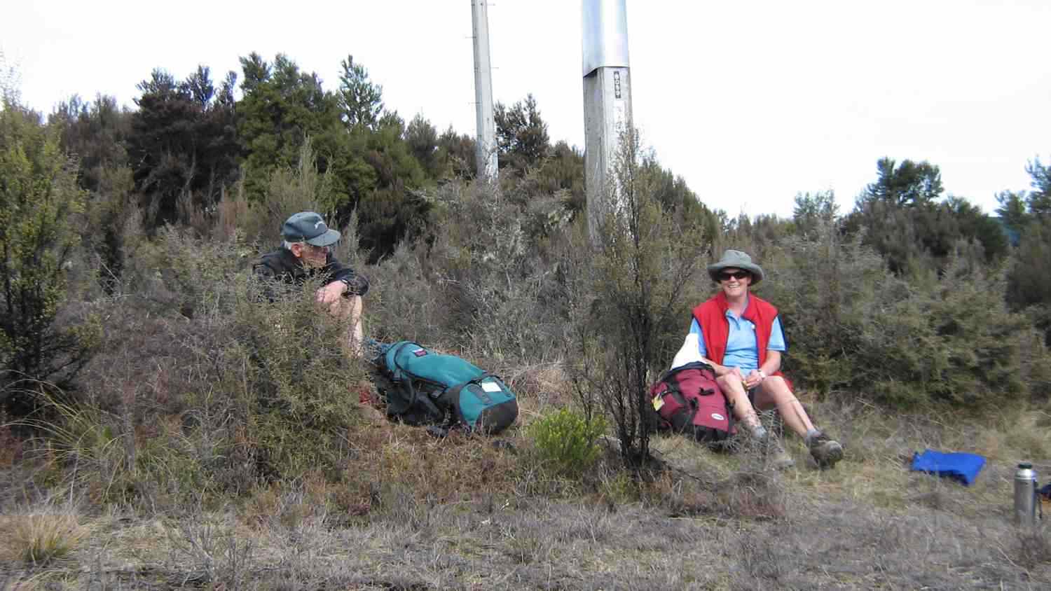
The day looked suspect, with some light drizzle, but the turn out at the carpark was very good, & we had 6 members on our adventure for the day. We motored out to the carpark at the Government Track where it was cold & still drizzling, so it was on with the rain jackets before we set off. Once into the bush, the rain became a non issue, but everybody kept their jackets on to combat the cold.
We had a short stop for morning tea,
1. Packing up after morning tea. (Ken pic)
then pushed on towards the very muddy part of the track, just before the open grassed area, where we hoped that our planned route would bring us back to on the return journey. The track was in excellent condition, as it had just been cleared, apart from some large trees down across the upper part, which we had to crawl under.We stopped just short of the top for lunch, as there was a cool wind blowing, & the bush gave us shelter. Then it was onto the Poleline track…
2. Looking back along Poleline track. (Ken pic and caption)
…which had some snow remnants lying on it.
3. Trudging through the snow grass. (Ken pic and caption)
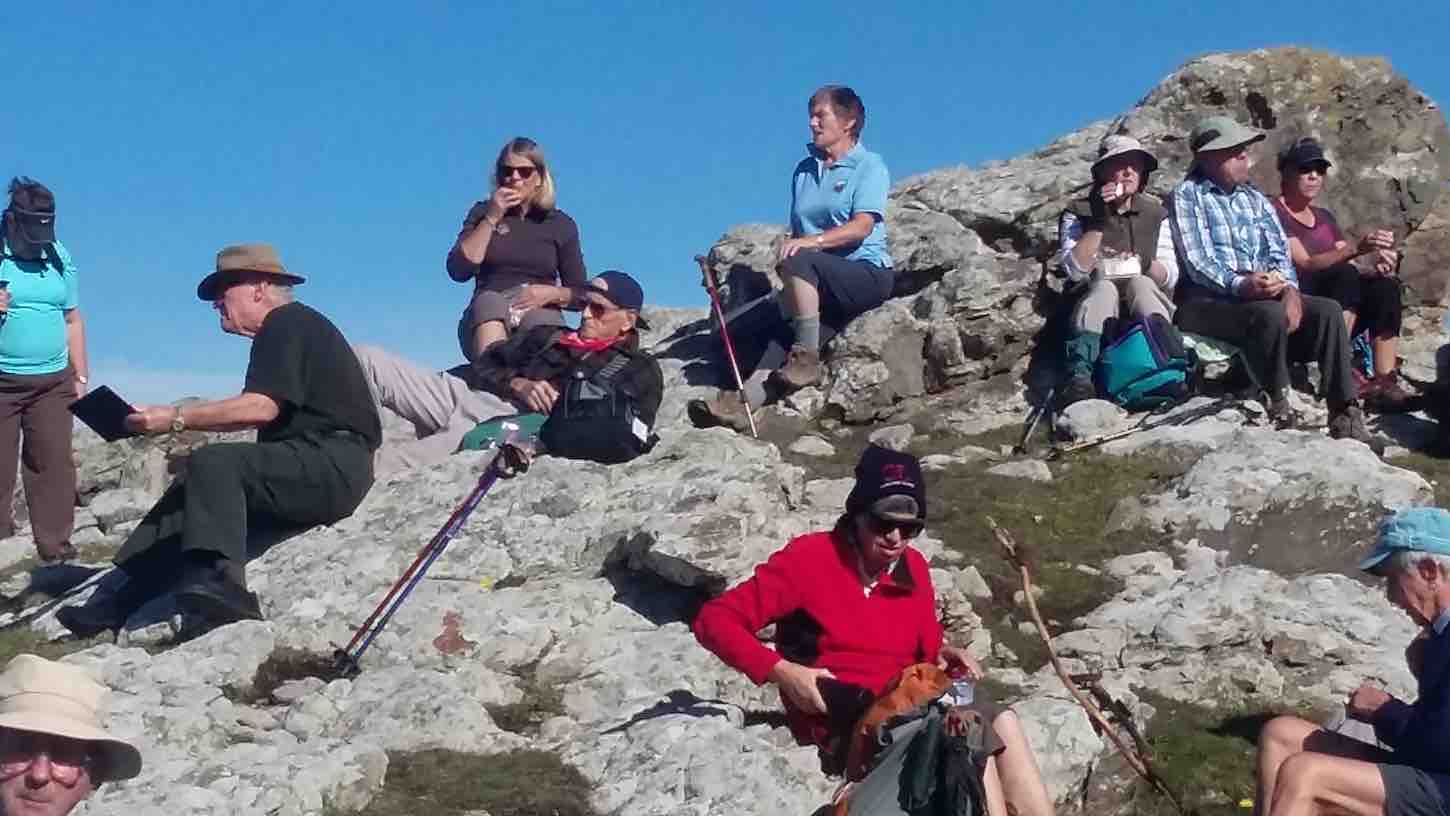
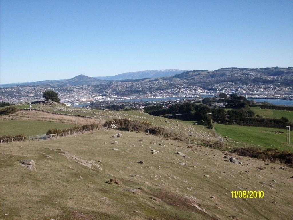
We estimated the distance to the top of Kowhai Spur to be about 1Km, but were surprised to find it was actually over 2kms, but when we got to the top & looked down on the amazing views of the Taieri & surrounds,
4. View from top of Kowhai Spur. (Ken pic and caption)
5. another view from top. (Ken pic and caption)
it was worth the trudge through the snow. We made our way down the steep track till we came to the hut on the true right of the spur,
6. Hut where we turned off Kowhai Spur. (Ken pic and caption)
where we left the spur, & went down through a very steep paddock heading back to the Government Track. This part of the trip was quite hard, due to the steepness, & the muddy tracks formed by cattle movement. However, we were soon within sight of the Government Track, & didn’t even have to climb a fence to get back onto it. We came out at the first fence with a stile over it, [the boundary of the privately owned land] on the uphill side of the grassed area. Then it was a brisk walk back to the cars, & the trip home, punctuated with a stop at Outram…
7. Latest Cafe footwear fashion. (Ken pic and caption)8. Trampers coffee club. (Ken pic and caption)
…for the “Trampers Coffee Club”. – Ken.
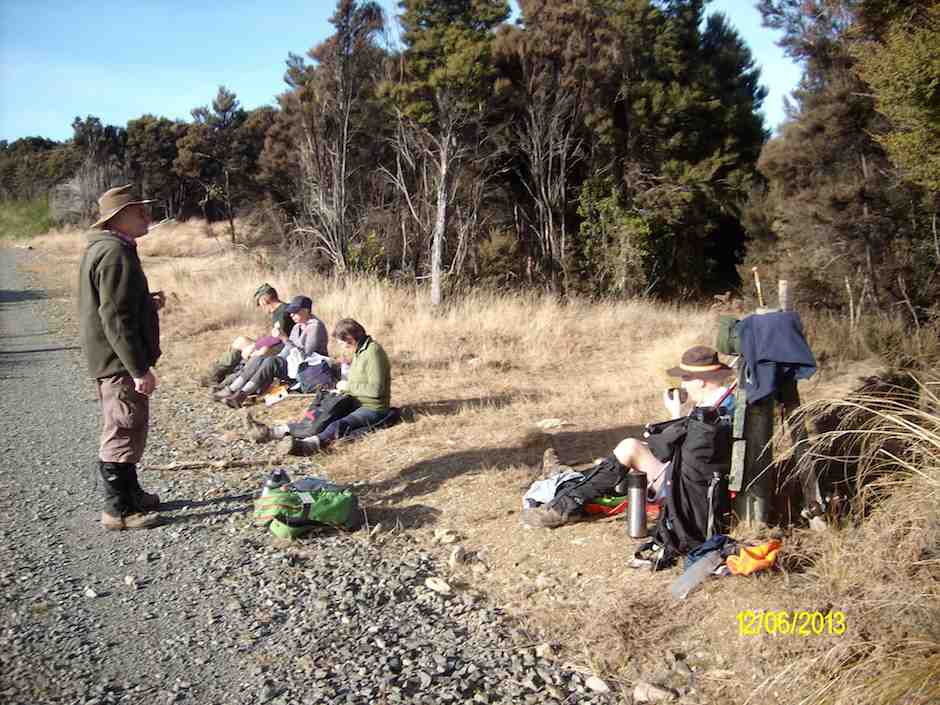
21. 12/6/2013. Trampers. Government Track. Styx Rd return.
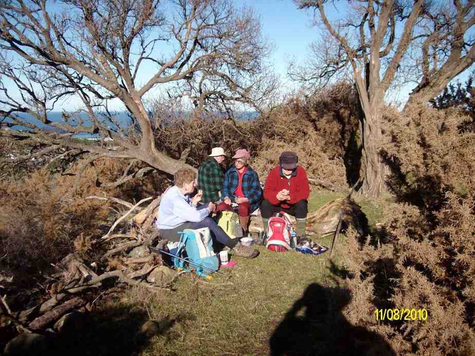
6 trampers ventured out for the walk up Government Track today. We stopped at a “dry area” for morning tea, at about 10am, then carried on to the top at Styx Rd. where we had lunch in the sun. The sign at the bottom had said 2 1/2 hrs to the top, & that’s very much what it took us.
Lunch at top of Government Track. (Ken pic and caption)
After lunch we had a discussion on whether we tried Kowhai Spur, or just go back down the way we had come. The unknown condition of Kowhai Spur [very steep & slippery] meant that the decision was made to go back the way we had come, so we set off, & arrived back at the cars at 3:00pm.
Thanks to the earlier start time of 9:00 instead of 9:30, we were able to complete this 18.5km walk before it got too cold in the afternoon, & it gave us a time buffer if somebody had injured themselves.
We walked 18.5km
moving time 4hr 15mins
climbed 364mtrs
– Ken.
20. 3/10/2012. Both. Government Track. Leaders: Graham, Judy.
There were 17 of us, (but one turned back before the paddock). We did between 8-10 km in total, getting up to the beech section for lunch (much further than the Hikers did last time). The wind across the farm paddock was as severe as the last time the Trampers had done it. Several in the group were doing the track for their first time and were equally amazed at the ease of the gradient, and appalled at the muddy section just prior to the paddock. (They didn’t know how much better the present marked route was than some earlier routes through the slough.) This, and some other tricky bits took careful negotiating for those unsteady on their feet.
Four of the Trampers left early and did the whole track. Ken’s GPS record shows that they did 18.2 km at 4.4km/hr average. Moving time was only 4hrs 9min.Total ascent was 523 mtrs. They took an extended lunch break, making stopped time 1hr 19min. – Ian.
19. 6/4/2011. Both. Government Track. Medium. Leaders: Les and Margaret.
There is no comment from the hikers on this one, so here is a report from the trampers.
It mitigated against the intended ‘bothness’, but the leaders generously permitted three appreciative trampers to set off to do the whole track. The sign posts indicate 2.5 hours up and 2 hours down. The trampers almost made the 2 hours down but fell well short of the time up. 19 km there and back!
When we arrived at the ‘paddock’, the predicted wind was there in full force and it was a real battle to make our way across and around its slope and back into the shelter of the bush. The sloppy muddy gully just below the paddock gets no better as time goes by, despite the many attempts to re-route the track to avoid it.
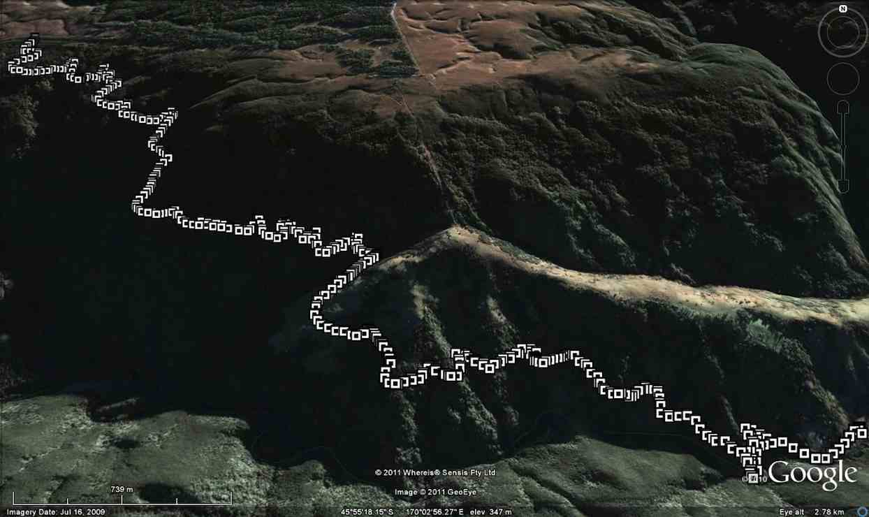
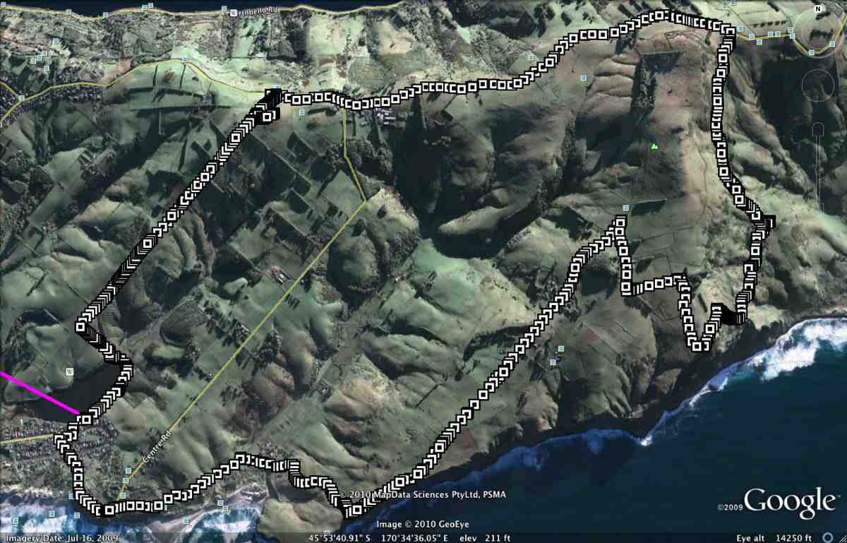
GPS of Government Track from the road to the Pole Line. Courtesy Ken. Depicts how close Kowhai Spur is to the track. The multitude of gullies traversed by the track are clearly depicted. 19 km ret.
The track was well-cleared and the gradient as usual beautifully steady.
A shot of beech trees taken looking across one of the upper gullies.
Track disappearing up into the gully. Taken from the same spot as the one above.
The above pic shows only a modest amount of pig rooting. It was much worse in other places with us having to tread a new path amongst the upturned soil.
Temperatures were cooler up at the Pole Line so we retreated from it back from the gusty wind into the shelter of the manuka bush to munch a quick lunch. There was nothing tempting us to linger long.
Doug set a good pace on the return trip and the clear track allowed us to step it out with a good swing.
Back at the exposed paddock, we found the wind had lost none of its force, but fortunately it was a tail-wind this time. Then it was the atrocious gully again. The paddock and its gully had to be the worst features of the tramp. – Ian
18. 3/2/2010. Hikers. Government Track. Medium. Leaders: Neil, Lex.
Location: 30 km.
17. 9/9/2009 Government Track, return Kowhai Spur. Leaders: Ian, Sabina.
Beginning Government track. George, SusanA bit further along the track. Susan, Sabina, GleniceMorning tea on the paddock. Susan, Ken, George, Glenice, SabinaThrough the silver beech section. Ken, George, Susan, Glenice, SabinaLunch at the pole line. George, GleniceLunch on other side of track. Sabina (showing her colourful hat), SusanDOC sign indicating back down the track.View from top of Kowhai Spur. Waipori Lake and Taieri River gorge beyond. Ken Susan, George, Glenice, Sabina.
Shaws Hill road and ridge from a little further down Kowhai Spur. Sabina, Susan detectable.
Preparing to rest near site of former hut which had been moved up the hill behind camera.. Glenice, Sabina
16. 17/9/2008 Waipori Gorge Area, 1860s Government Track, Waipori Leaders: Bill H, Peter B
The ‘disturbed’ kanuka
The ‘disturbed’ kanuka
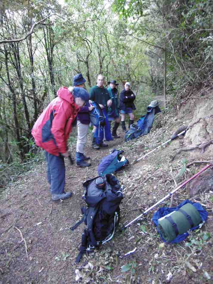
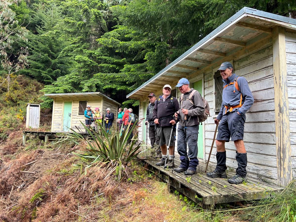
The programme said ‘Waipori’, but it really meant Bill H’s traditional walk up the “Gummint Track”. As a past long-serving employee in the area (both on a farm and in electricity supply) he was the ideal leader. As slips had made the upper reaches of the track difficult, the 15 of us began walking from the end of the seal up the Waipori road, then crossing farmland and having morning tea beside the river. After that we were following the route taken by early prospectors up the steady incline of the old 1860s Government standardised track for drays and horses to the Central Otago Goldfields. After an initial 3-minute climb, the track maintains a remarkably consistent, gentle gradient considering theodolites were not used and the construction teams used handtools! The day was calm and mild, and spring growth was evident in the lovely mixed broadleaf forest, with signs of fuschia flowers and kowhai. The track was carpeted with innumerable ’skellingtons’ of fuschia leaves (the fuschia is one of the few deciduous NZ trees) which made it soft and springy and patterned.There were also Kanuka, Matai, Totara and juvenile Lancewood. At one point there were 4 Kanuka alongside the track that must have had a disturbed childhood as they all had right-angle bends in them! The sound of the river gradually receded, and at lunchtime we came out onto cleared farmland with cattle and a good view up the gorge to look at while we ate. We returned by the same route. There was some birdlife to remark upon– paradise ducks, bellbirds, warblers- but the most remarkable was at a willow tree on the river flat in which Arthur counted 13 wood pigeons, all greedily gorging great gulps of green tips. A very pleasant walk of about 16km through lovely local terrain. – Bob
15. 12/12/2007. Hikers. Government Track. Medium. Leaders: Bill H
Resting among the trees
Only seven hikers took advantage of the ideal place to be on a very warm & humid day, the lovely bush of the Government Track in the Waipori area. It is a lovely place for a hike. Beautiful bush and beech forest. Lots of birds singing in the trees and great views of surrounding bush and road to Waipori Falls. The track is not too difficult and although you go fairly high it is a relatively gentle climb most of the way. With only a small number we took our time and lapped up the cool and pleasant conditions of the track. Morning tea sitting by the track just after 10am, and then, about 12noon, 5 of us decided we would stop for lunch. Two of the group thought they’d like a bit more of a challenge so went further up the track and had lunch before heading back. Those of us in the larger group found a really lovely spot in the beech forest to sit, chat and enjoy our lunch break. Then it was back down the track, (down hill all the way!) to the cars. All agreed we had had a very enjoyable days hiking. – Bev.
14. 29/11/2006. Hikers. Government Track. Medium. Leaders: Arthur and Barbara.
13. 5/7/2006. Both. Government Track. Leaders: (Easy+): Doug M, Bob H; (Easy): Arthur & Barbara
12. 21/9/2005 Arthur & Barbara, Bill H, Lance & Lois
11. 22/9/2004. Hikers. Government Track, return. Easy. Leaders: Jack and Rosemary, Frank and Lesley.
10. 26/5/2004 Lesley S, Irene, Les W, Mary M, Ray
9. 22/10/2003. Both. Government Track. Medium. Leaders: Trampers: Helen S, Kerri; Hikers: Mary M, Barbara L.
8. 13/2/2002. Combined. Government Track. Leaders:
7. 6/12/2000. Government Track. Leaders: Jack and Rosemary, Mary Y.
13/9/2000 Bill H, Bill & Pat
6. 7/7/1999. Government Track. Leaders: Les W, Mary M, Ray.
5. 7/10/1998. Government Track. Leaders: Lance and Lois.
4. 16/7/1997. Government Track. Leaders: Hugh, Bill H, Lesley S
3. 23/10/1996. Hikers. Government Track, Waipori. Leaders: Jack and Rosemary, Ted.
2. 14/12/1994. Government Track. Easy. This is a morning walk only, and as it is our last official tramp for the year, please bring some finger food to share for lunch, to be eater at the picnic ground. Leaders: Denise, Mary Y, Les and Mavis.
1. 13/3/1991 Government Track, Waipori Gorge, return Kowhai Spur. Nice bush and tussock walk. Average+. Leaders: Denise, Hugh and Judith, Ria de J
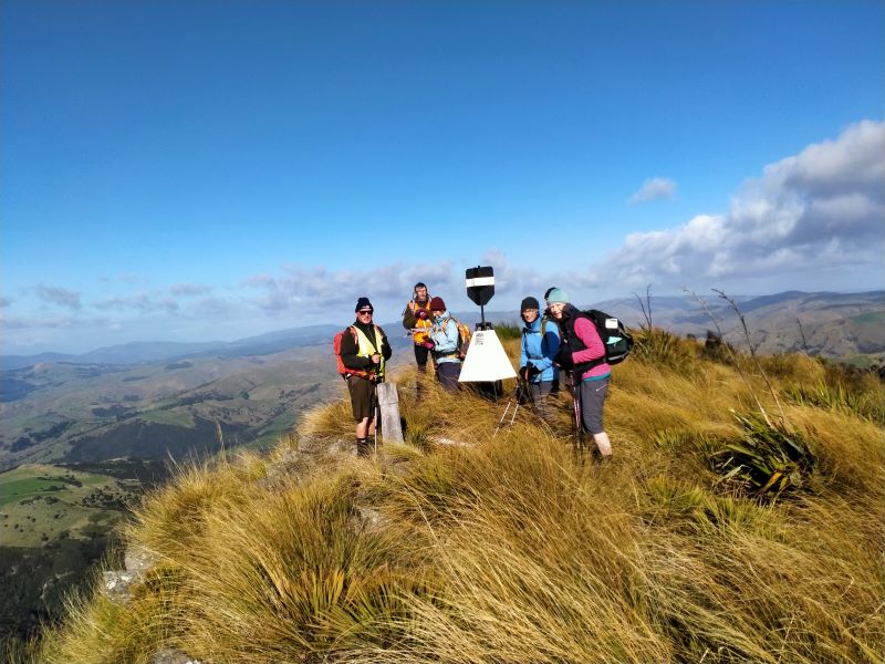
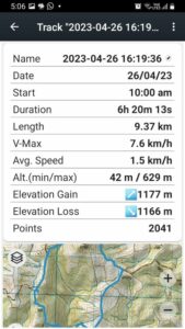
4. 26/4/2023 Mt Watkin. Trampers. Grade 4.5. Leaders Graeme Thurlow and Phil Keene.
View of Mt Watkin from the car. Photo & caption Pam
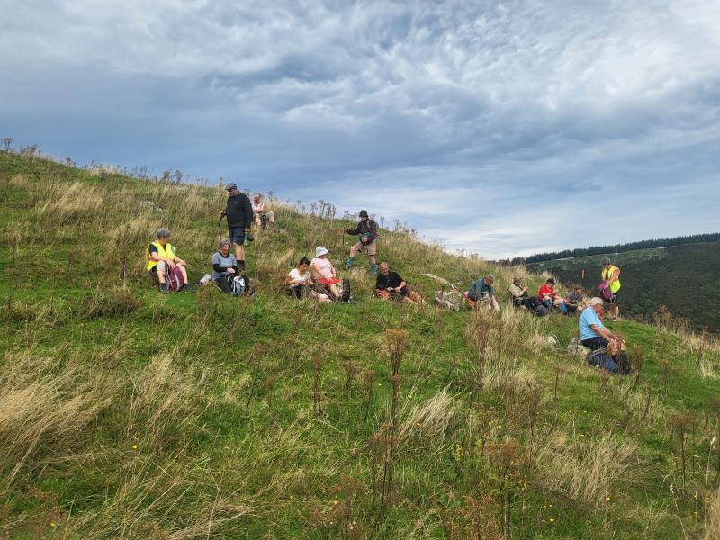
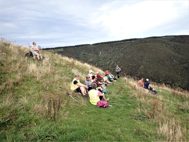
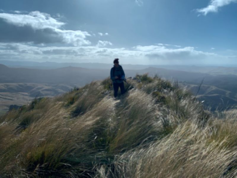
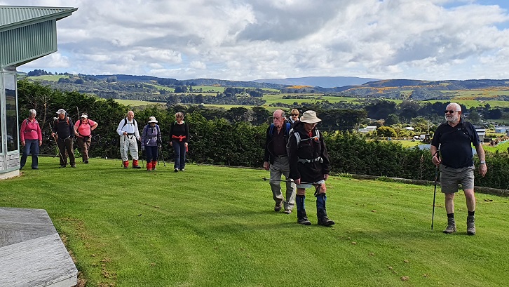
On a cool day 7 trampers came and we headed straight up Mt Watkin first.
On our way, meaning straight up Mount Watkin! Photo & caption MarijkeAnd it was steep. Photo & caption PamAnd the wind blew… Photo & caption PhilAt the top of Mount Watkin, cold, blustery, lonely! Photo & caption Marijke
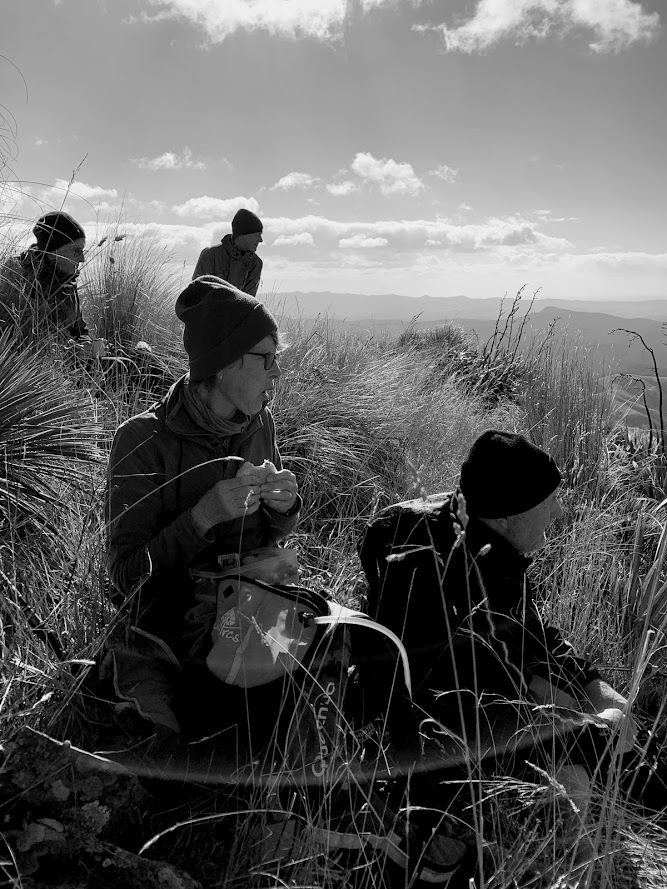
With wind in exposed places especially at the top we all enjoyed a rest and a sit down for a well-earned morning tea. Great views of the snow on the Rocky Pillars but slightly misty in the distance.
We found some shelter on the lee side of the mountain to have our morning tea. Photo & caption Marijke
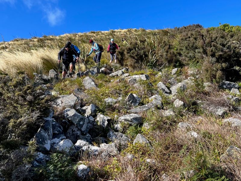
Descending all agreed it was a grade 5.
It was rocky! Photo & caption PamLaying down in an ancient Celtic ring? Photo & caption Phil
A welcome rest was needed amidst the rocks before continuing to the boundary fence with Smith’s farm. Graham T’s jovial comments “We haven’t got far to go’ received responses like “Yeah, right??”
Following down the fence line. Photo & caption Pam
After the descent to Smiths boundary when we looked at distance and time, we were shocked at how little distance we had gone for the time it took.
Now easy going to the rewards of the blackberries near the boundary and onto lunch at the DCC hut which was wired and set up for entertainment with LED lights!
It was sheer luxury to have lunch in a hut! Photo & caption Marijke
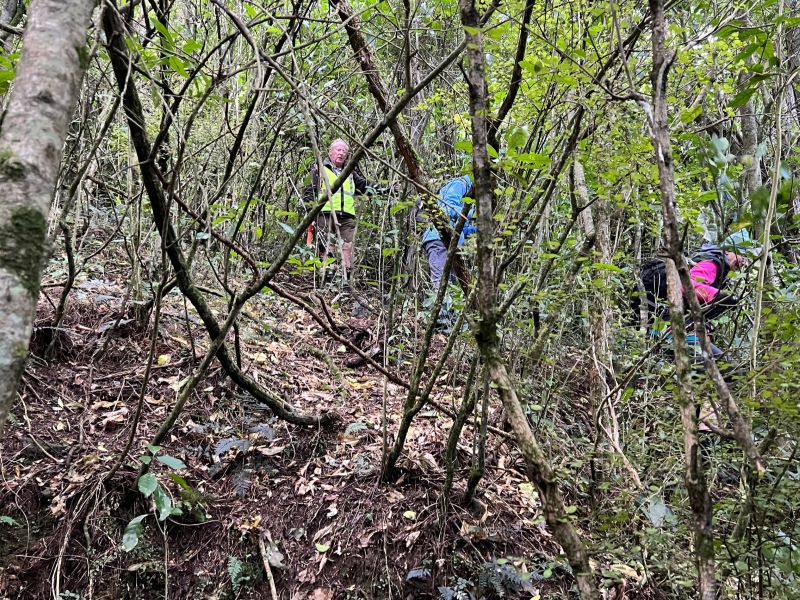
Further on down the western track we exited into long grass circled by forest and then entering the forest we bush bashed.
These vines weren’t here when I did the recce (Graham T). Photo & caption Pam
Zig zagging and encountering vines we continued down until finally reaching the creek for our climb up and out finally to a track out through a gate into Noone’s property.
The stream at the bottom. Photo & caption Phil…then up the goat track. Photo & caption PhilRegrouping after the bush bash. Photo & caption Pam
A longish walk back to the car and comments were ‘It’s good we knocked the b…. (Mt Watkin) at the start of the day’ and not had to tackle it at the end of the day.
Good comradeship, jovial comments and laughter eased the challenges of the day.
Thanks to David Smith and Zac Noone for giving permission to tramp on their property.
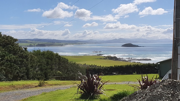
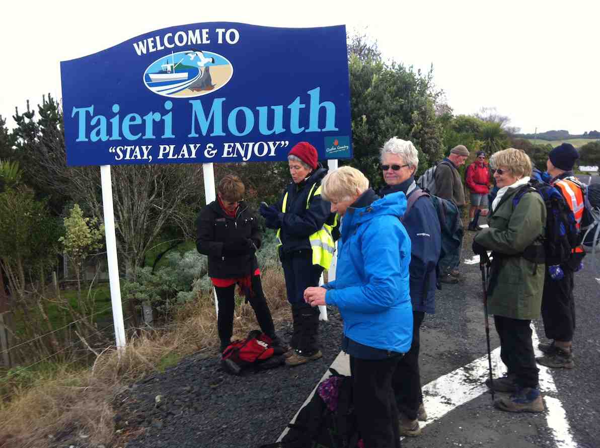
15. 29/3/2023. Millennium Track, Taieri Mouth. Leaders Dave and Mike
I seriously questioned my sanity on the drive from sub tropical Port Chalmers to Mosgiel for this weeks walk. The torrential rain and hailstones on the Southern Motorway left me with a sense of foreboding. However, 17 hikers eventually assembled at the meeting place at Knarston Park on Taieri Beach for what turned out to be a really enjoyable walk with the predicted rain showers non-existent.
Morning smoko was held on the verandah at Jay’s river mouth crib where we could admire the house extension at one neighbouring property and the dismantling of a Kauri boat on another.
Morning tea at Jay’s crib. Photo & caption Helen
From there it was a pleasant river side walk on the Millennium Track and boardwalks before starting the grunt up the hill to the welcome seats where we had lunch before re-tracing our steps back to the cars.
Millennium Track. Photo & caption MikeView from the lunch seat. Photo & caption HelenLunch. Photo Helen
Consensus of opinion is that the grade should be re-classified as a 3.5 as Sir Edmund Hillary got a Knighthood for climbing hills that steep. The return to the cars was achieved without mishap and tiffin was taken by some at the Brighton Cafe.
Thanks to Dave Roberts for leading at a leisurely pace that made the uphill sections enjoyable. Total distance walked was 9.5km
Mike Webb
14. 14/12/2022. Taieri Mouth. Leader Phil
” Aah numbers seemed a bit down at the meet n greet so there must be a few heading straight to the Hall at Taieri Mouth (Apologies were received from Carole and Neil Morrison who we hope to see back with us in the New Year). And yes sure enough at the Hall people and cars everywhere, added to by contractors working on the hall and yoga underway, although it seemed more like line dancing to me… After dropping off an array of good looking finger food cars were sorted and off 33 went to Knarston Park, and we were joined for the first time by Rowena McSkimming, who had bought finger food (!) on her first outing, well done, and Neil H grandson.
At the start point at Taieri Mouth. Photo & caption Helen
Setting off beside the Taieri river for the beach. Photo & caption Pam
We shambled off down past the river to the beach, which on the day seemed like Waikiki; the wind was quite gentle compared with the day before recce, however the driftwood ‘cabbage tree’ needed it’s socks pulled up….it was a cruisy walk along the beach with no flow from the wetlands to cross, ORC were to open the mouth on the Friday. Baby seals playing in the surf the day before had obviously gone home to Mum.
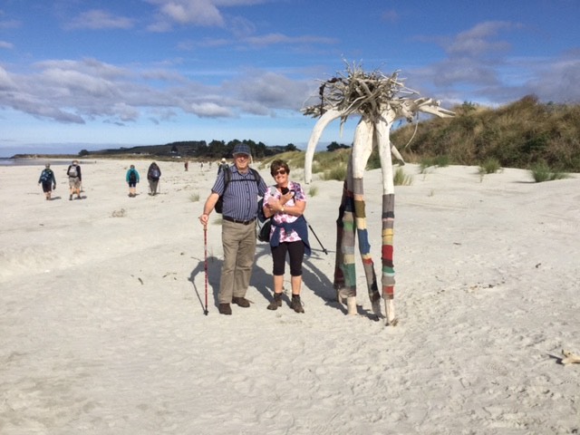
The beach art. Photo & caption John
Panorama Taieri Mouth beach art draws its biggest crowd. (Click to enlarge). Photo & caption John
We followed the track into Livingstonia Park for morning tea, making use of all the facilities provided.
Morning Tea. Photo Phil
I was so relaxed I nearly forgot to share my bag of goodies…, but finally remembered, I must be getting older…. Quite a lot of interest was shown in the display boards as we left the Park and walked down ‘main street’ to the entrance to the Alan Green Wetland area.
Beside the wetlands. Photo PhilLivingstone Wetlands. Photo & caption Pam
We dawdled and chatted around the wetland, negotiating the Number 8 wire gates….and off through the forest and the dappled light on the forest floor; what was the sweet scent in the air? Not cabbage trees, not Olearia Fragrantissima shrubs……The sun seemed even hotter when we emerged from the bush, to enjoy the panoramic views of the area.
View out across the wetlands with Taieri Island/Moturata Island in the background. Photo & caption Pam
On the return, the group spread out to re-group at the third gate, but as our estimated return time to the Hall was slipping, initiative was shown by the ‘Hall’ team to drive to Coutts Gully road and pick us up and return to Knarston Park, and then the Hall.
Heading back to the hall for lunch. Photo & caption John
Everyone was accounted for and yes more folk had arrived down for lunch which was great.
Fantastic food. Photo & caption Helen
Following a moment’s silence to remember absent friends and family, followed by Ian Fleming’s grace, 55 folk enjoyed a delicious lunch, supplemented by chocolate goodies from Neil S, another with a near Xmas birthday. This was followed by an update from Anne Ward on the planning for the Bannockburn week in March. After lunch was cleared away Grant Shackell provided a generous bracket of Xmas music, with good crowd participation on occasions! Thank you, Grant.
Beautiful singing by Grant. Photo & caption Helen
Thanks also to Jay and the team for setting and cleaning up the food and Hall, especially after not getting full access till after 10.30am.
Another very successful Xmas club outing and yes, the first walk for 2023 is the 11 January!
Ho ho
Phil K
13. 07/09/2022. Alanton Block of the Wenita Forests. Grade 2 – $8. Leaders: Esther & Karen, Alex & Bruce S.
Forty-six Club members set off on the combined tramp in the Allanton Block of the Wenita Forests, 7.13 km south of the Big Rock School at Brighton.
On the forestry road -M2 (photo & caption Pam)
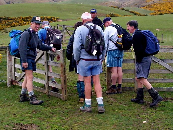
A welcome was extended to Roger and Barbara who are testing the water. We proceeded along Daphne Road passing the D7 sign and turned into Margaret Road.
Regrouping at the Margaret Road intersection (photo & caption Jenni)
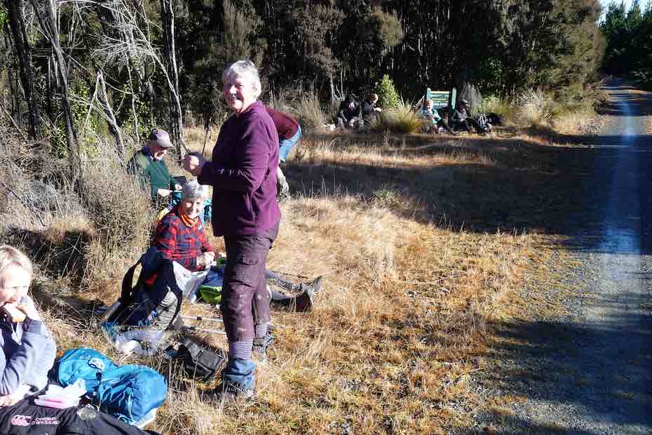
We had morning tea near a log at about 10 am.
Morning Tea stop on side of road (photo & caption John)
We then proceeded up Margaret Road to Big Stone Road and saw some logging trucks, with logs, emerging from Daphne Road.The lunch venue was changed from the planned spot near Margaret Road to near the start of Kathleen Road.
Catching up over lunch (photo & caption Pam)Lunch stop out of the wind (photo & caption John)
After lunch we proceeded down Kathleen Road and then along Margaret
Road back to the cars.
Happy leaders heading downhill after lunch (photo & caption Jenni)Heading back to the coast through Farm land (photo & caption Pam)And still chatting on the road (photo & caption Pam)
Distance travelled approximately 10 km. Climb 243 m. The weather remained cool but there was no rain. A large group had refreshments at the Brighton Café.
Looking north over forestry to Blackhead quarry (photo & caption Pam)
Our thanks are due to all the leaders: Karen, Esther, Alex and Bruce S. In addition, we thank Liz for her liaison with the Brighton Café and Wenita Forests for permission to enter the forest.
Bruce Spittle
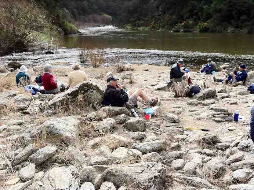
12. 20 October 2021. Taieri Mouth. Leaders Bob Mitchell and Barbara Shackell
Bob and Barbara our leaders for the day (caption & photo Clive)
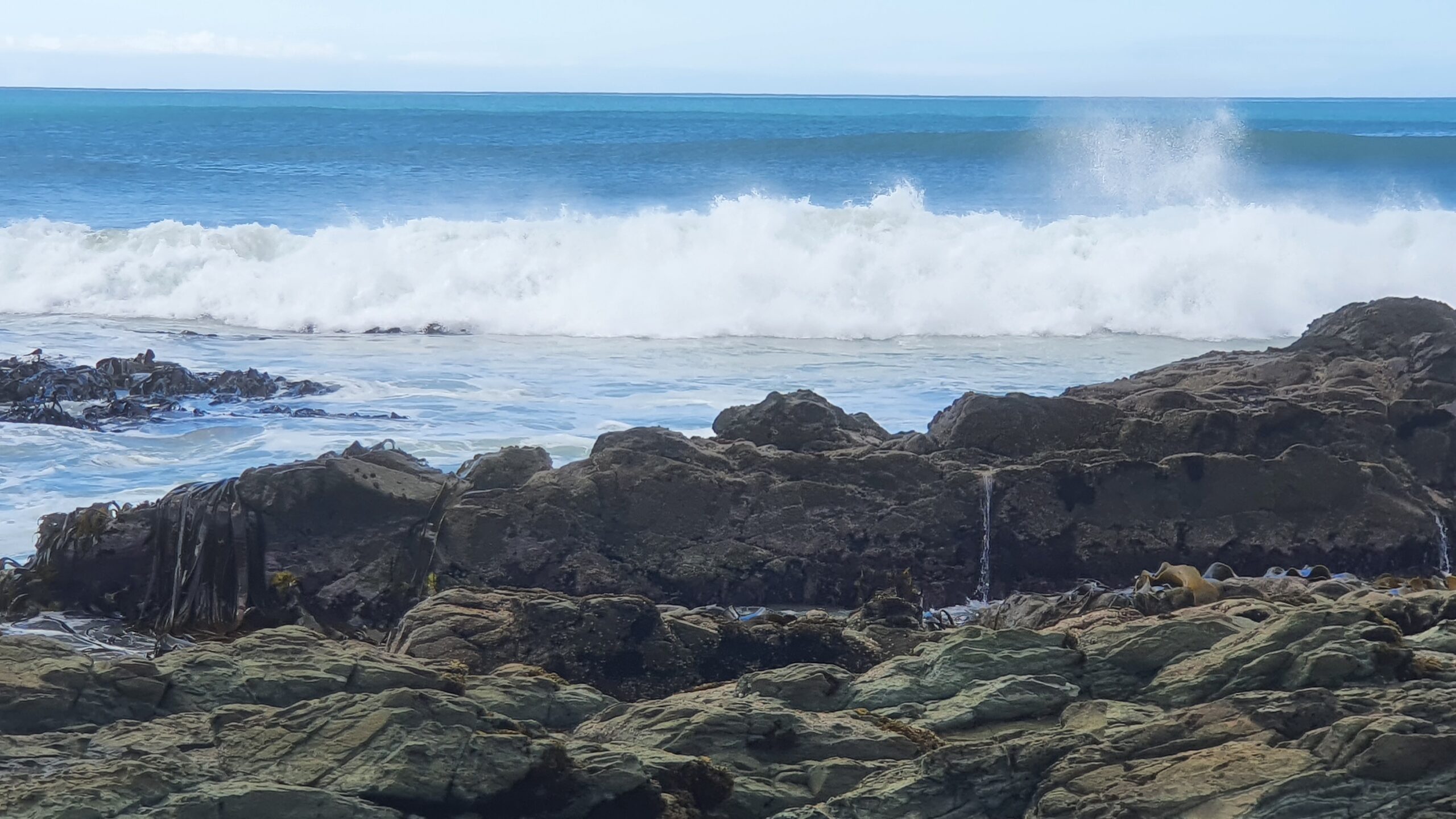
“Twenty (or was it 21?!) folk set out for the Akatore River bridge, where Hike Leader, Bob Mitchell, was to meet us at the anticipated road works traffic lights on the hill climbed at the end of a previous tramp. There was sufficient off-road parking on the south side of the bridge for all vehicles and we were quickly off, heading downstream to the coast like bits of colourful flotsam, passing as we went a wading spoonbill which took off and flew over us.
Morning tea Akatore Inlet (caption & photo Clive)
We settled ourselves for morning tea among nesting oystercatchers before tackling the short sharp climb into farmland above the coast. It was very pleasant strolling south in perfect weather. The forward motion stalled briefly to watch a group of talented surfers riding the regular rollers coming in.
Watching the surfers (caption & photo Clive)
Unfortunately I was too taken with the conversation with a pleasant land-bound surfer to remember the name she gave the ‘point’.
Scenic Otago coastline (caption & photo Clive)
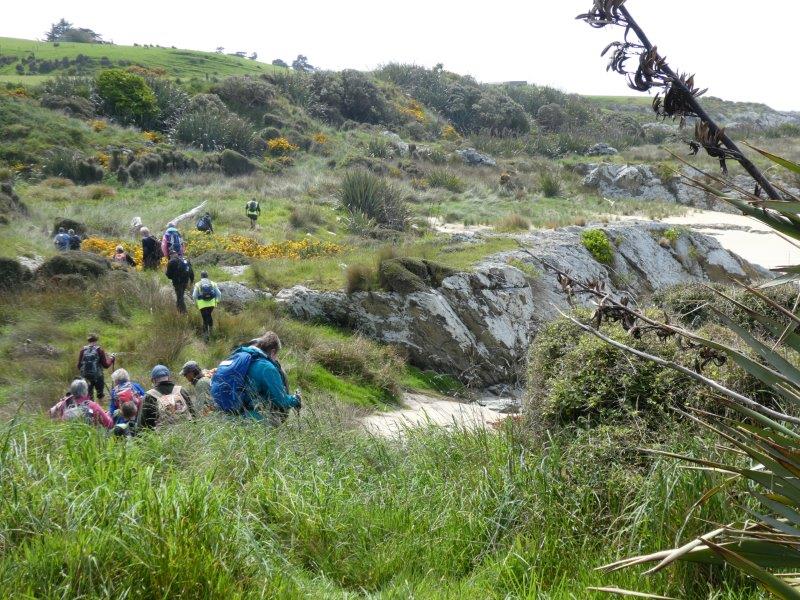
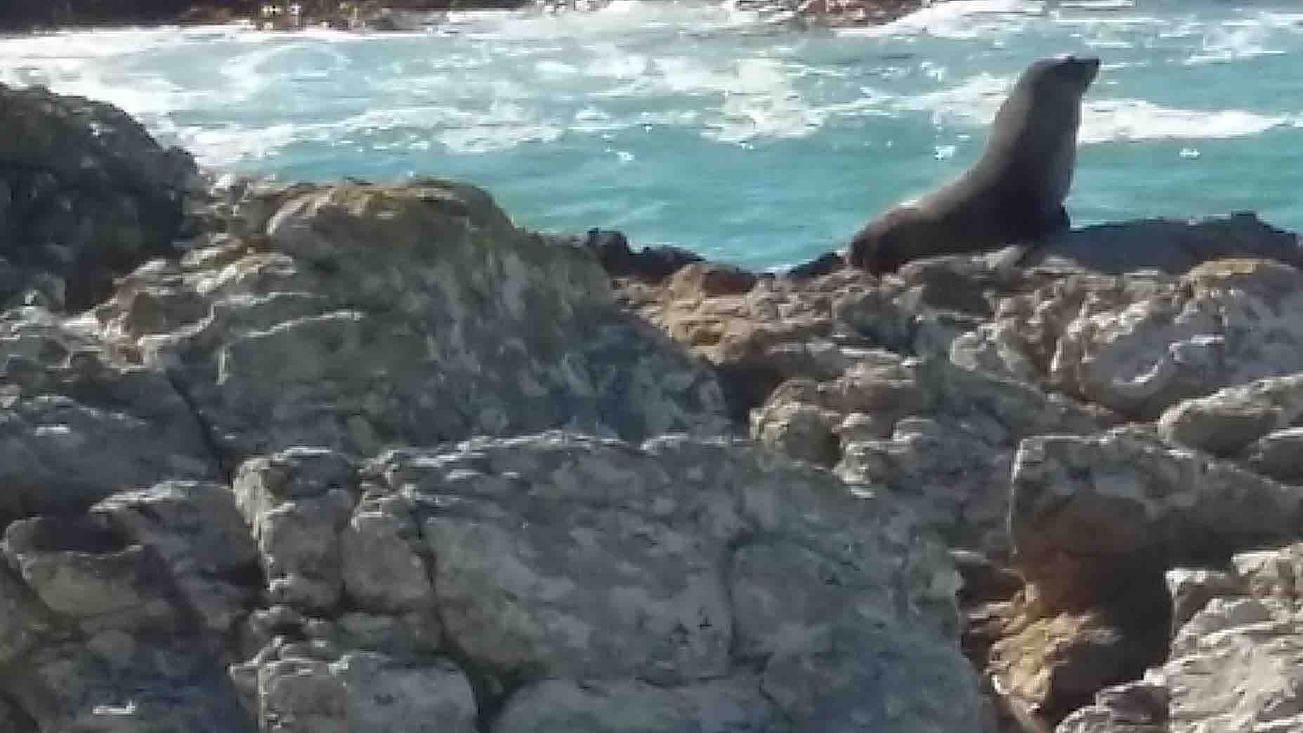
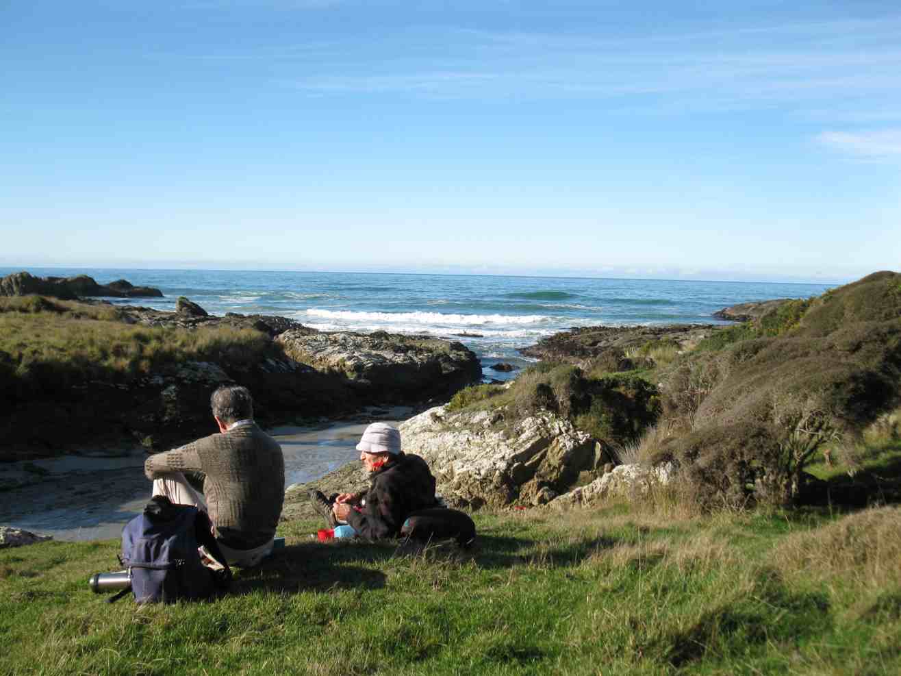
It’s obvious it’s not only trampers that the obliging farmer allows access across his paddocks. Eventually we set off further south, cross-country, until we dropped down onto a sheltered rocky spot for lunch where a seal kept a benign eye on his human companions. From the lunch stop the group gradually moved up and inland across lush clover filled paddocks and along farm tracks which brought us out onto the Akatore-Taieri Mouth Road.
Homeward bound Akatore Conservation Area (caption & photo Clive)
Several kilometres on, we were back at the vehicles with doubts about our ability to reach the Brighton Cafe which was expecting us about 2.15pm. Unfortunately, when we finally arrived at 2.55pm our fears were realised and we were declined service as they were closing at 3pm. From that point we made our own way back to Peter Johnstone Park carpark, and from there, home. Happy, a little sun/windburned, and feeling like we had actually walked the 12 km the fitbits suggested.
Thanks to Bob for his planning, and leading this day.
11. Taieri Mouth Millennium track, Alan Green track. Leaders Jay Devlin, Jan Butcher, Alec and Liz
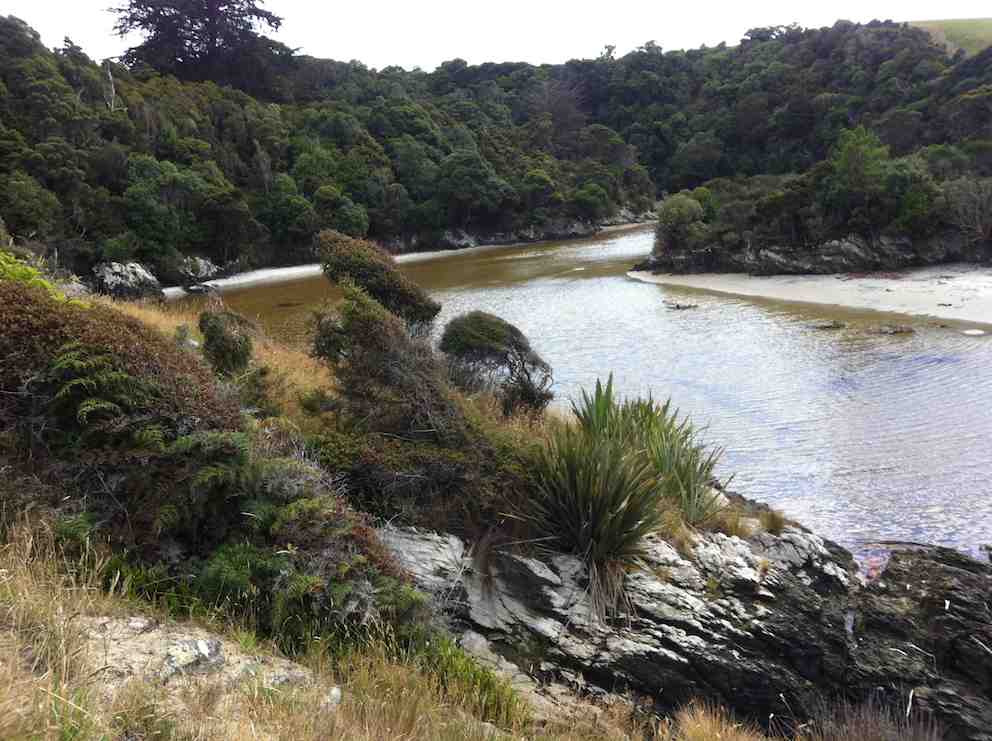
On Wednesday the 9th of December approximately 60 members met at the Leitch Memorial Hall at Taieri Mouth for a walk and a shared Christmas Lunch. It was a picture perfect day and showed Taieri Mouth at its best. There were two walks on offer, The Millenium Track and the Alan Green Track. Most opted for the Alan green Track as it was one that was new to many members. The Alan Green Track is off Moturata Road and is a private conservation track. It meanders round wetlands and is home to a large variety of bird life which then leads on to a gully with fine examples of podocarps.
“Our Leaders” – Photo and Caption John
“Walking past a magnificent flowering rata tree.” – Photo and Caption Helen
“The picturesque wetland.” – Photo and Caption Gordon
“A peaceful spot.” – Photo and Caption John
“Time to regroup and take in the view.” – Photo and Caption John
The track is very narrow but well formed and is lovely to walk on. At the top of the gully you get lovely views of Taieri Mouth and surrounding farmland. On the way back Alec led us through a track off Livingstonia park where we had great sea views. We got back to the lunch venue 12.30pm. Arthur lead his group on the Millenium Track which many of us are familiar with. Thirty six folk enjoyed the walks while the remainder were happy to stay and catch up with those they hadn’t seen in a while. Jill, Jan B and their team of helpers stayed at the hall and set up the tables in a Christmas theme and put out delicious food brought by everyone.
“An enjoyable lunch with amazing food.” – Photo and Caption Helen
‘More mature club members.” – Photo and Caption Helen
Faye, Alec and Liz led us in “We Wish You A Merry Christmas”
So to everyone have a safe and Happy Christmas. Jill Jan B and Jay
10. 21/10/2020. Leaders Noi McCunn and Bob Mitchell
Photo and Caption Clive – “Knarston Park – the set off point”.
Photo and Caption Clive – “The road south from Taieri Mouth”.
Photo and Caption Clive – “The happy team.””.
Photo and Caption Clive – “View back from the coast.”
Photo and Caption Clive – “Lunch at the beach.”
Photo and Caption Clive – “Surfs up”.
9. 24/4/2019. Hikers. Taieri Mouth Area. Leaders: Chris, Dot, Alex and Liz.
Route map, courtesy Ian. 8km limited to the 7 who returned after lunch. (The rest did 4km more not travelled by this Nike app!) The “8km” indicator hides the points on the map where the route started and finished.
About 26 Hikers and Ramblers mustered under a cloudy sky by the Taieri Mouth Bridge to walk through hidden nooks and crannies of the Taieri Mouth area, led by Liz and Alec.
We started off along Riverside Road and cribs that are only a stones throw from the flowing river. A living history was related by Alec and Liz as we went past the cribs telling us stories of past and present inhabitants. We eased along a lower part of the Millennium Track to a sheltered glade where we sat down for morning tea. More stories were told of holidays spent along these banks and of income gleaned from whitebait or discarded beer bottles.
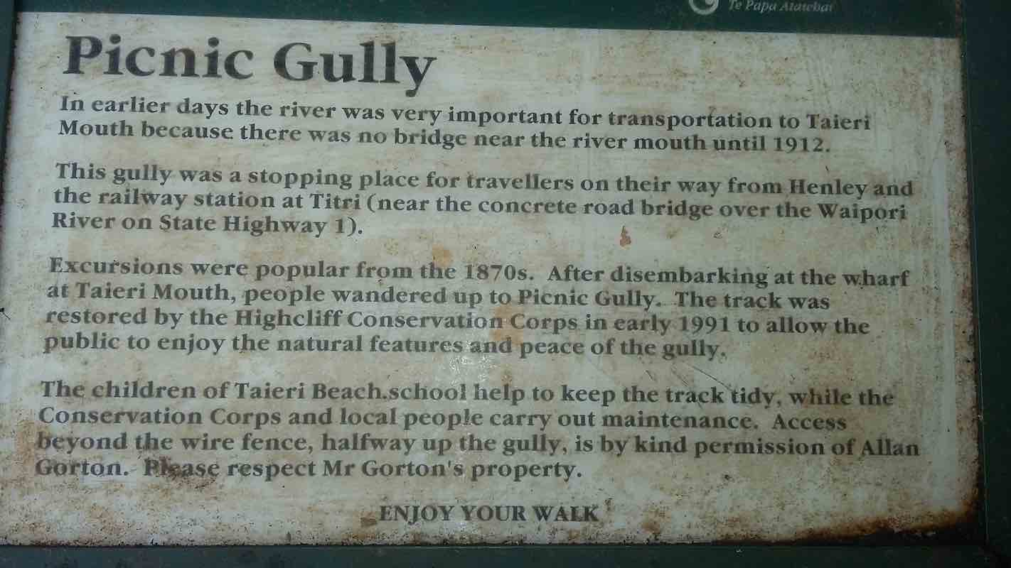
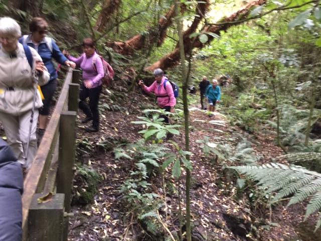
After morning tea we returned along Riverside Road to Hanning Place. This is a turn off that is easily passed without discovering Picnic Gully. Picnic Gully is a walk that used to be frequented by travelers from Dunedin more than a hundred years ago before the bridge was put across the Taieri.
Picnic Gully. (Clive pic and caption.)
We didn’t miss it this time and were soon into the thickly covered bush walk
which ended in a scramble up a bank onto a newly bulldozed track up onto Finlayson Road. This track was very steep and soon had us all stopping to catch our breath.
We learnt that this gully walk crossed the land of Alan Gorton who allows us to cross other parts of his land when going to the old sawmill. We also acknowledge the work done on the track by the children of the nearby Taieri Mouth school.
Down the hill saw us entering Knarston Park and led us onto the beach. It was now close to low tide and we could see it would have been easy to walk out to Moturata Island, but not today. We continued along the beach and passed a recently erected old tree and masses of toa toa and pipi shells. Charlie and Jess had recorded their presence in Toa toa shells which would last only until the next king tide.
Lunch was now in sight. We arrived at Livingstonia Park as the sun broke through. There was discussion over lunch as to the name for the park be it Livingstone or Livingstonia. Those in the know confirmed it as Livingstonia and was a living war memorial to returned servicemen and women with amputations and other injuries.
After lunch we headed up Coutts Gully Road to a walk up through bush at Livingstone – Green bush walk and lagoon. Someone had taken a lot of time and trouble writing notices along the path explaining the history of the bush area. There was a great view from the top along the beach to North all the way to Saddle Hill.
The view from the top. (Clive pic and caption.)
Once down the hill we skirted the lagoon to see geese spoonbills and ducks before heading back to the cars by the Taieri Bridge. We had walked nearly 12 kilometers in 4 1/2 hours. Some wished they could have taken longer as there was such a lot to see and enjoy. Maybe something to do on another day. Thanks Liz and Alex.
– Clive
8. 5/12/2017. Both. Livingstonia Park. Moturata Island. M. Leaders: Bob and Phil.
Route Map, courtesy Ian. (Ian pic and caption.)
A combined 32 Trampers and Hikers ventured down through Brighton to Taieri Mouth , certainly not expecting traffic lights at Kuri Bush! Livingstonia Park was the starting point after being warmly welcomed by Bob and we set off towards Akatore passing a range of new property developments; just prior to moving on up the rise to the highest point of the walk, Bob detoured us onto the lawn, surrounded by sheltering trees, at the old NZ Forest HQ.
Morning tea at Forestry HQ. (Phil pic and caption.)
Some of us pondered the thoughts of this site having a ‘second coming’ with the new governments initiative of a billion trees…….
We then headed south with the breeze at our back, up the gradually increasing rise, enjoying the views of forest and farmland and sea, interrupted regularly by shouts of ‘truck’ and ‘car’. before Bob again turned us off ( clearly a man with great local knowledge and contacts!) and headed down through farmland to the seaside. Here we mounted the stile and various scouts attempted to find their way onto the beach. This was more easily achieved by Bob when his hands were free after helping at the stile!
A mix of short beach walks, interrupted by rocky headland became the norm, requiring some inventiveness to move through the formations,
Into the promise land? (Phil pic and caption.)
as well as some rather intimate team bonding as some larger rocks were mounted! Well done everyone!
Eventually the main Taieri Beach came into view and on we set following the curve of the surf to the ‘bar’; nothing changes when tramping, initial hesitancy to getting the feet wet to plain old just barge on in or take the boots off. Rumours of a channel were probably proved correct as a ‘minor river’ was crossed before the main bar being traversed …
Sand bar, not showing heavy-flowing channel needing to be waded. (Ian pic and caption.)
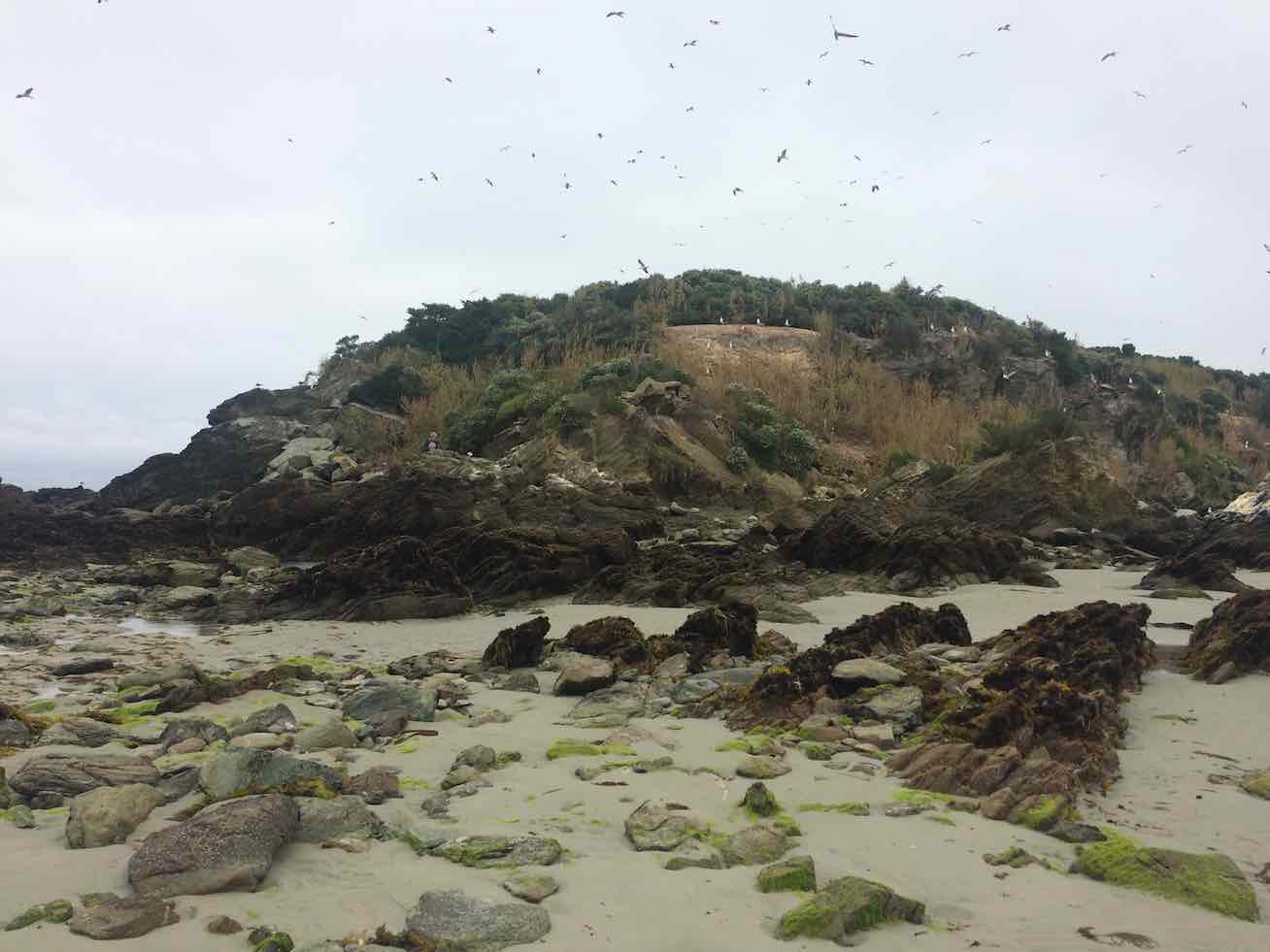
… and we reached the Island at around 12.30pm, to be greeted by large numbers of nesting gulls;
Birds nesting on Moturata Island close up. (Ian pic and caption)
apparently the island was used to collect guano in the good old days, and you could understand why.
Colours on the rocks over on the Island. (Helen pic and caption.)
With low tide being over half an hour past, it was decided to return to Knarston Park for lunch, and shelter from the incessant sea breeze. This was a good decision as the ‘minor river’ had increased in volume, requiring river crossing techniques for some.
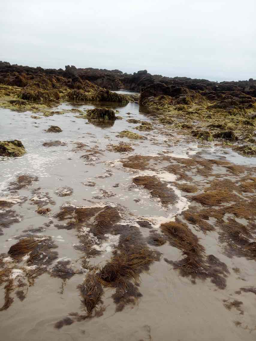
The scale of the bar was impressive, being much larger than thought, as were the patterns in the sand and rock formations both at the island and on the rocky headlands.
Following a late lunch, (more so because of the early morning tea!) everyone safely made their way back to the cars and met up with others who had completed a shorter walk.
I am reliably informed the full walk was 11.4 km and well, we won’t specify the altitude will we….
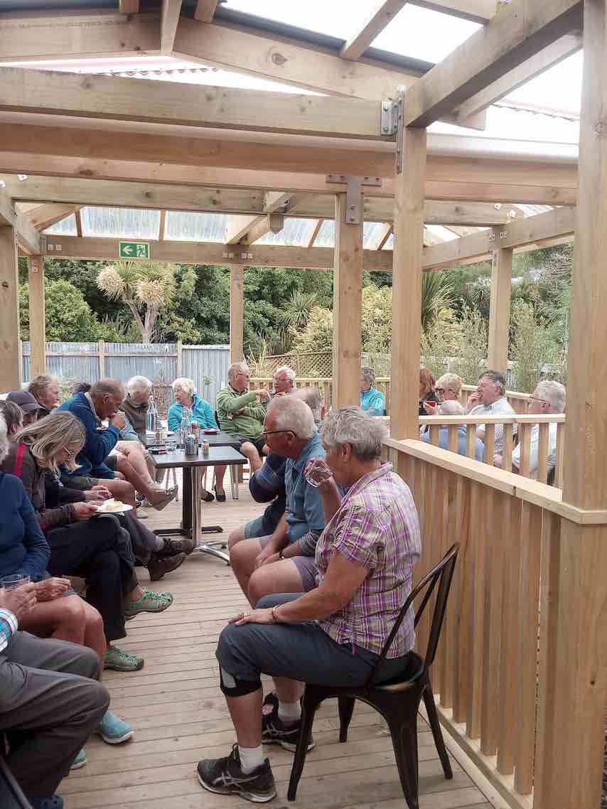
The day was very satisfyingly repleted at the new Brighton Café, where it seemed we had more than 32 folk chatting away!
New coffee bar in Brighton.(Helen pic and caption.)
( Ice creams from next door more than welcome, as both shops are apparently owned by the same folk).
It was a treat of a day. Well, yes, a bit of a cold wind, but – the sandbar!
We parked, morning-tead at Knarston Park on concrete picnic table seats that were not at all warm.
Then out to the sandbar. The tide was super-low, half a metre below sea-level. The bar was broad as broad. And dry. We walked and walked. This writer was overwhelmed with the experience of being on such a wide and long stretch of sand so under the waves at other times. Eventually we reached the island.
At Moturata Island
We sauntered round. The tide was so-o-o low we were assured of plenty of time before heading back. We headed to the rocks the north end of the islands and scrambled over them to see the surf breaking on the seaward side of the island.
Rock at northern end of island.
And then we sauntered back. Marvellous, as John Campbell would say.
The wind was still a bit sharp however, so we went back to the cars and on round the road past the fishing boats. A couple of fisherfolk said they had already noticed us and it was good to hear that locals keep a sharp eye out for the sandbar trekkers. Then on further to the start of the John Bull for lunch. (5km marker on GPS route map).
Lunch at terminus of John Bull track.
Back down and across the bridge to walk round the beach on the river’s true left. Yes, back to the cold wind, but it was behind us. We observed the cliffs below the houses until we thought it best to get off the beach. We climbed a set of steep large steps and up through a property and a wire fence to reach the highway at the top. (7km on map)
Onto road
We took the road back, crossed the bridge and reached our cars at near the 10km mark. Thanks to Judy and Pam carefully checking out our chances the day before and their leadership on the day.
Morning tea time – when we were still optimistic of a successful outcome!
Tide, wind and flood were all against us.
Tide – Even though we had got the low tide time exactly as we had wanted, we failed to take in consideration that minimum low tide was still o.9 metros. Must aim for nearer 0.0 next time!
Wind – Although a boisterous wind was from off the land, whipping up sand and breaker spray, the waves were still coming in stronger than we had expected.
Flood – The Taieri River was in quite flood mode, breaking two channels across the sand-bar we had hoped to traverse.
S-o-o-o-o-o. We had morning tea. We walked down the beach to where the rocky part begins and back. We waited. And waited. Some more hopeful than others. Some more resigned to failure. We early lunched. Then walked down the beach again, aiming for a round trip through Livingstonia Park and back along the road, but short-cutted through a bit before that.
And then behold. KB contractors drilling a pipe-line for fibre-optic (we think) alongside the road with a wonderful machine. Complete with GPS guidance showing on a screen to the operator, it automatically screwed and push-drilled successive pipes through alongside the road and under the ground, with a clever drill-head (we learnt on asking) that could tilt the pipe’s direction left and right, and up and down on the operator’s bidding. Marvellous! (To the technically-minded anyway.)
We were now close to the cars again. The day had been wind, but grew warmer as it progressed. Everyone was philosophical about the way the day had turned out.
Perhaps, as was suggested, a low-tide day late summer or autumn, when the Taieri is NOT in flood would be a much wiser day to tackle the Island next time.
There was a full tide around 11.30 a.m., which we cunningly exploited by negotiating the narrow beach parts before and after its peak.
The beach walk down river however, was rather constrained by the rising tide at one brief point, splitting the ‘(Fool(?)-Hardy Paddlers’ from the ‘Off-Beach-Detourers’ before we could make it to the large beach seen on the next pic.
The Taieri Mouth in the distance behind us.
Inevitably, we had to come to the rocky outcrops and were forced to make our way up a rope-lined track to paddocks.
A careful steep climb.
The track climbed. (Elaine pic.)
A view from the paddocks. (Elaine pic)
Further on, we were able to descend to another beach.
At one point, we were treated to a swimming seal lumbering its way out of the water to sun itself on a rock
Then it was time for lunch before retracing out steps back to our cars.
While we were seated, our President read out a text sent to us by Leslie S from hospital, saying she was feeling better and sitting up. (Today’s trip was a replacement for the scheduled trip to Waipori with Leslie and Bill as leaders.)
9. 15/03/2023. Hikers. McGouns/ Wakari Bike Track Grade: 2.5 Leaders: Jay and Jenny
17 keen hikers gathered at the bottom of the Pineapple track in Tanner Road. We entered the Cragieburn track at the Corner of Wakari Road and Tanner Road. We walked up a short distance to an historical site where there were remnants of dairy farming in 1860. This area is well preserved and a lovely new seat has been installed for people to sit and enjoy the views over Dunedin and its surrounds.
We then proceeded on to the Wakari Bike track which took us through attractive bush and meandering Ross creek.
Beautiful coloured toadstool on the trackside Caption and photo Jill
The track was good underfoot and pleasant walking. We reached the top of the track in 45 minutes where we had our morning tea.
Morning tea break at the entrance to the bike track Caption and photo Jill
After that we carried on the track which was a mixture of lots of ups and downs.
Feels like an Avatar scene Caption and photo Jenni
The trees here were a mixture of natives and exotics. The redwoods were huge and stunning.
Found under a couple of trees tiny pixie houses very cute Caption and photo Jill
We carried on then to join the McGouns Track which has beautiful unspoilt bush. This was steep in places but nothing like getting the heart rate up to feel alive. At the end of the McGouns Track we were supposed to turn right but the leader took us left up another steep climb where we had our well deserved lunch break and there we enjoyed views of the city and harbour.
Nearing our lunch spot with great views Caption and photo Jenni
After lunch it was all downhill for a change to the cars. We had two prospective hikers with us today, Margaret and Kay. Coffee was at Sunnyvale.
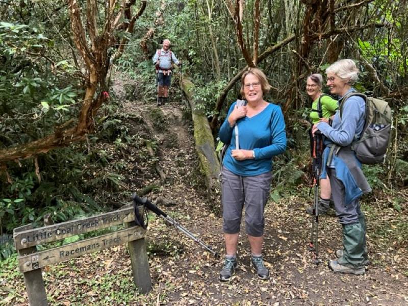
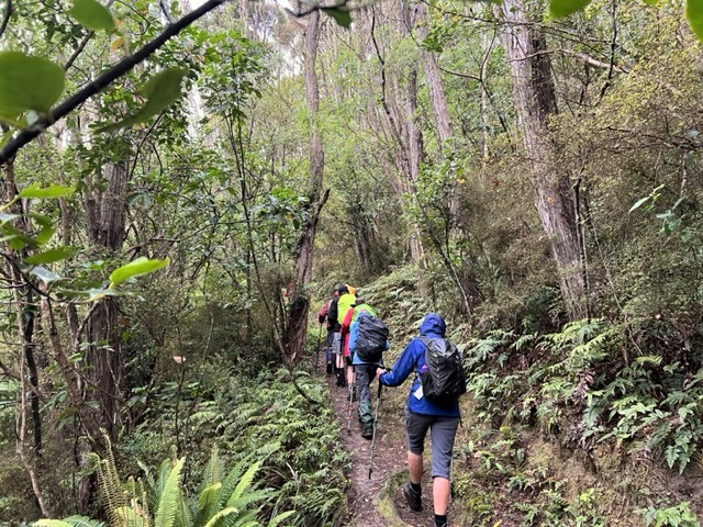
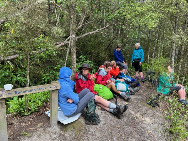
14. 15/02/2023. Trampers. Silverstream (Raceman’s – Little Coal Creek – Steve Amies- Raceman’s Loop). Grade 4. $5 Leader: Phil Keene
The residue of Cyclone Gabbie hovering off the coast and threatening some rain seemed to have an effect on today’s turnout – only one car, one car, headed for the hills, but it’s hard to hold back quality! So we were parked up at the Powder Ridge car-park and on the track by 9.20am and shambled off up the road and we crossed the surging Silverstream with trepidation a couple of times, before hitting our straps on Racemans.
The famous 5 minus 1 cross the surging Silverstream (photo & caption Phil)
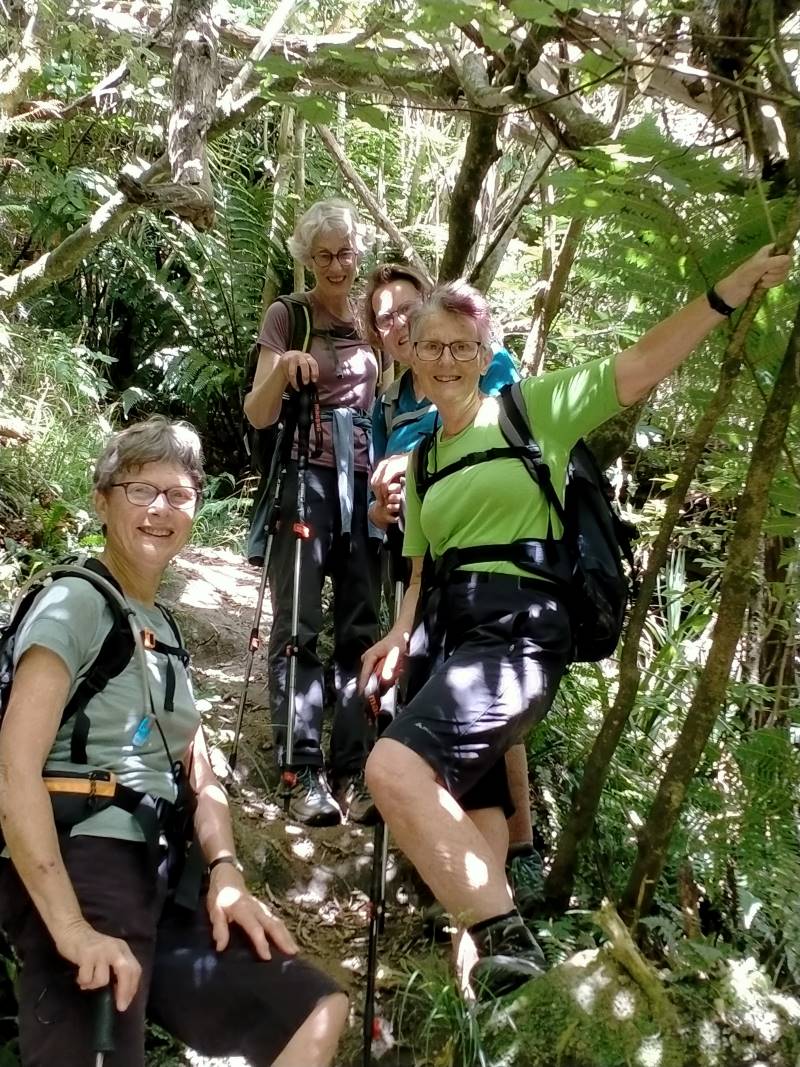
Birdsong was prevalent, nearly drowning out the chat, with the whoosh of a pigeon or two over the stream. As on the day of the recce we were overtaken by a surging team of 5 collies out for their daily run with their Goddess mistress fast coming up behind.
Enjoying a cuppa on Racemans Track (photo & caption Pam)
We morning tea’d after 45 minutes, looking out through a clearing across the valley, why is it ‘the other side’ always seems so more interesting. 1.5 hours from the car-park we took a deep breath to prepare for the ascent up Little Coal Creek and off up up and up we went.
A steady climb up Little Coal Creek (photo & caption Pam)
It was nice to have some of natures hand holds as we pulled ourselves up, being dry, very dry underfoot, just like walking on powdered cement.The going was slow though, to such an extent that these modern devices that people wear were sending out warnings that they were not recording any movement! Are you alright?
That was a good joke Phil (photo & caption Pam)
After 50 minutes of huffing and puffing I’ll blow your house down, I swear I could have, we were at the junction of Little Coal and North Coal Creek tracks.
This way ladies (photo & caption Pam)
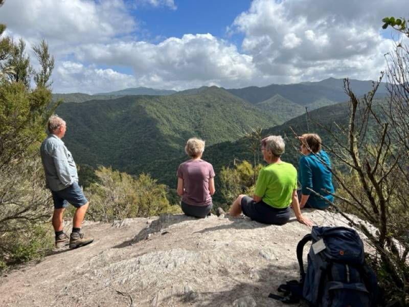
From here the climb was more steady, drifting into plateaus, before the next bit of up. Time was taken to enjoy the views out through the bush to Pulpit Rock and Raingauge Spur plus poke our noses out over the rock ledges.
Enjoying the views to Pulpit Rock and Raingauge Spur from Little Coal Creek (photo & caption Pam)
Towards Pulpit Rock (photo & caption Phil)
3 hours from the car park we stopped at the Steve Amies/ Little Coal Creek junction and decided to have lunch here, with both sun and shade to help dry out the perspiration. Bees were prevalent and seemed to take a liking to the creams on our skins, some coming back for more, but no harm was done.
Lunch at the junction (photo & caption Pam)
At 12.45pm we were up and off down what was a lovely Steve Amies track and the gradient was such that there was more time to take in the impressive Kanuka trees, some as big as the mature Pinus Radiata that have also made their home here. As to be expected, the track had to get steep again, and care was required as we ‘dropped’ back down onto Racemans, to be followed by a 40 minute stroll back to the car- park arriving back 5 hours and not a minute more from when we left.
the famous 5 minus 1 ‘dropping’ down to Racemans off Steve Amies Track (photo & caption Phil)
Altitude gained was 509m and a little over 11kms completed. Grade 4 seemed about right. Consensus was a great day out and just 10minutes from home.
Phil K
13. 18/11/2020. Trampers. Racemans, North and Little Coal Creeks, Steve Amies. Leaders: Ross and Wyn Davies. M.
18 trampers set out from the car park just off the Whare Flat Road, towards the pumphouse at 9.25am. It was a nice morning. We arrived at the Tunnels Track junction after half an hour; time for morning tea.
Photo and Caption Gordon – “Morning tea.”
Photo and Caption John – View from morning tea spot.”We made steady progress up the Racemans Track and reached the North Coal Creek junction and hour and a quarter later. After a brief pause for some energy food, we headed up the North Coal Creek Track. The track – such as it is – was in good condition. It is an unrelenting climb and we had a few stops to regroup on the way up.
Photo and Caption Gordon – “Climbing rock wall on North Coal creek track.”
We reached the junction with the Little Coal Creek Track after about an hour. We carried on up the Little Coal Creek Track for another 15 minutes to a lunch spot with a view to the north.
Photo and Caption Gordon – “Lunch.”
Photo and Caption John – “View over the cliff edge at lunch stop.”
We had a good panorama of Powder Ridge and Long Ridge, Mt Allan behind, Pulpit Rock and Green Hill in the centre of the Silver Peaks.
The weather started to look more threatening after lunch, as we continued up the Little Coal Creek Track for another 20 minutes to the junction with the Steve Amies Track.
Photo and Caption Gordon – “Happy campers at Steve Amies junction.”
By this stage there were a few showers; enough to make the track down the Steve Amies Track increasingly slippery. Everyone took the descent carefully and we made it safely without any proper falls. It took us about an hour and three quarters all the way down to Racemans Track, by which time the rain was getting more frequent.
Getting progressively wetter we retraced our steps along Racemans Track and back to the car park in about 40 minutes, arriving back at 3:50pm. Distance was variously measured at more than 15 kms, with an average of about 15.5 kms. It was a relatively longer day in terms of distance, time walking and ups and down, which everyone coped with OK. Some decided home was the best direction but 8 of us diverted to Blend Café for hot drinks and varying amounts of food.
“quoin” definition: 1. An exterior angle of a wall or other piece of masonry.
2. Any of the stones used in forming such an angle, often being of large size and dressed or arranged so as to form a decorative contrast with the adjoining walls. Seek permissions. 03 –
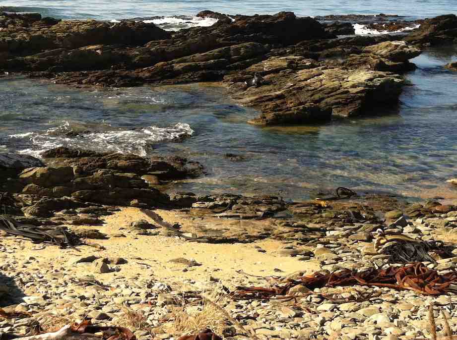
Coast and farm walk. Bull Creek nature walk to waterfall (tiny!) recommended.
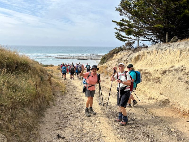
16. 1/2/2023. Quoin Point to Bull Creek. Combined. Leaders Bruce, Alex, Helen and Phil.
Thirty-one keen walkers headed south and after regrouping at the turnoff to Quoin Point road parked in a paddock opposite the wool shed at the end of the road where lambs were being drafted.
Keen to get started. Photo & caption John
We followed the farm road leading down the hill towards Quoin Point and then turning right opening closing gates where appropriate before stopping after 15 minutes near an inlet with a choice of sun or shade. Shade was more popular.
Morning tea near Quoins Point. Photo & caption Phil
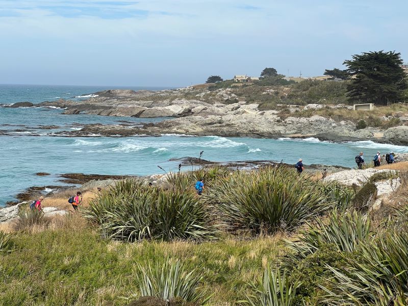
We continued across the paddocks and paused for a time near a caravan and new home above it on the hillside with natives planted in two paddocks while Bruce chatted to the land owner Peter O’Connor of Riversdale. Peter said he was happy for trampers to traverse his property and did not need to ask his permission in the future. The two paddocks are linked by a pipe gate and the best exit to the beach and Bull Creek was at the far corner nearest the sea of the second paddock. The path goes down the hill over some grey rocks and then along the coast to Bull Creek. He plans to mow a track across the lower part of his property in about two years to make access easier.
Neil on gate duty again. Photo & caption John
An example of the beautiful farm gullies, planted in natives. Photo & caption John
Local’s dog, keen to come with us. Photo & caption John
Going to visit the ‘house on the hill?’ Photo & caption Phil
Happy trampers. Photo & caption Pam
Around the corner to Bulls Creek. Photo & caption Pam
Watching over Bulls Creek. Photo & caption Pam
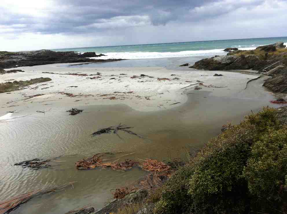
We had lunch on the North side of Bull Creek in case the rising tide cut us off. A seal was spotted in the water at Bull Creek and another mammal seen in the distance on the rocks on the way back. Clare’s family had built a dam across the creek so that the seaweed in the creek could be flushed out once the dam broke.
Time for lunch. Photo & caption John
Bulls Creek iconic tree and three T.R.T.C. icons. Photo & caption John
Clare kindly arranged for 3 of the party to travel back by car; a 25 minute journey going near Milton.
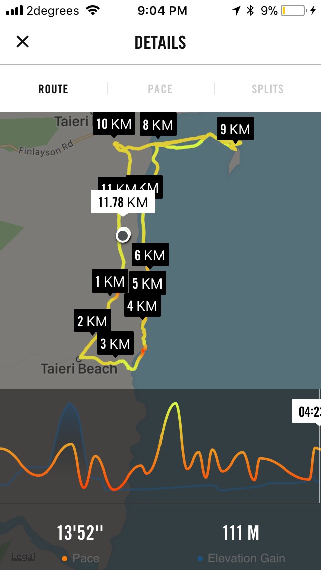
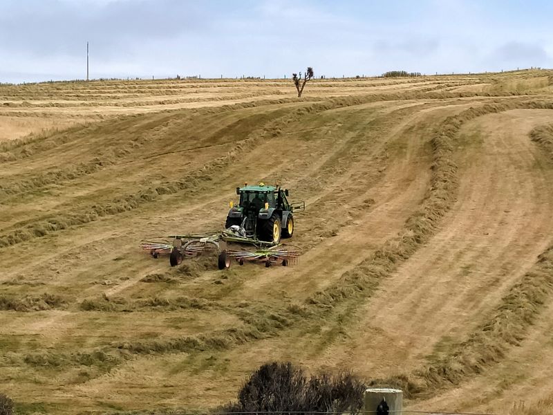
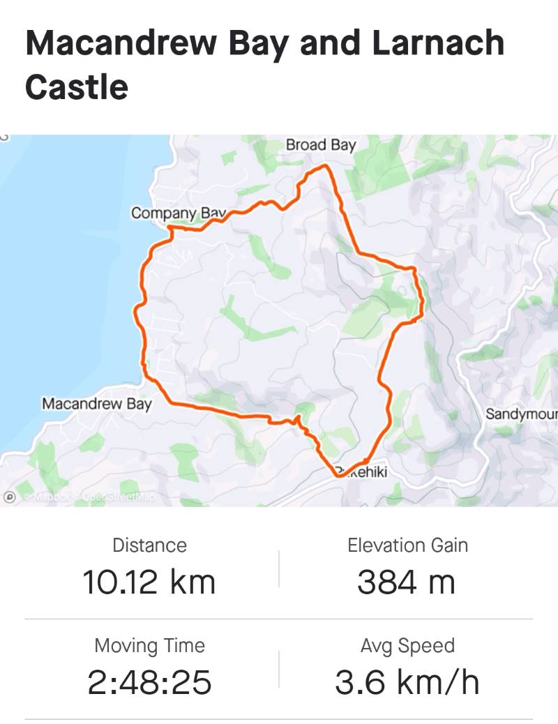
The weather remained fine. Distance 13.56 km, Climb 384 m. We started walking at about 10 am and were back to the cars at 3 pm. There were many views of the coastal rocks. Hay tedding was in progress on one paddock and for the others the hay had been cut and baled since the recce.
Very precise windrowing. Photo & caption Phil
Future walks on the property might be considered for mid-February or after when the sheep are likely to have been shorn, the lambs drafted and the hay cut which makes walking easier. Thanks to the co-leaders Alex Griffin, Helen Morris and Phil Morris for their valuable leadership. Also to Neil for his opening the gates, waiting for the last person to go through and then, remarkably, being in position to open the next gate. He was also better at spotting where the next gate in paddock was, possibly due to his eyes operating at a higher elevation. Thank you again Neil. Our thanks are also due the land owners Alan Shaw, Gwen Lane and Peter O’Connor for their kind permission to be on their properties and to Clare for her local knowledge of the area and assistance with offering transport back to the cars for three persons.
Because the Brighton Café closes at 4 pm the group was given the opportunity to make their own choice for coffee, such as at Waihola or Mosgiel, or an ice cream at Brighton.
Bruce Spittle
15. 6/11/2019. Quoin Point to Bull Creek.
RAMBLERS, HIKERS and TRAMPERS report.
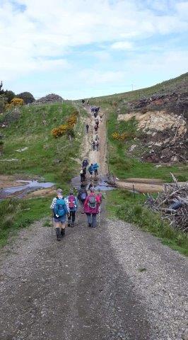
On a calm morning 33 keen, happy members drove up Law road and along the coast through Akatore to Quoin Point road, driving a couple of kms down to the wool shed. At 10am 6 Ramblers headed off to enjoy their day, leaving 27 to hike to Bull Creek.
Photo and Caption Helen – “Up and down” Photo and Caption Gordon – “regroup”
We walked down through paddocks to the rocks where we had smoko.
Photo and Caption Gordon – “Smoko among the rocks”
(In 2014 we tried to count the pod of seals both big and small), however, today we only spotted a couple along the way. As well as 4 leaders, we had markers still in place from the Tokomairiro High school trail bike fundraiser held a couple of weeks ago guiding us. The paddocks were dry and nice to walk on. With lots of gates to open/close, amazing coastal scenery, gullies with native bush, 3 old farm houses and a couple of creeks to cross. 2 hours of hiking then came to a standstill at the now fenced off access to Bull Creek. Even with 2 stiles to cross over, their was not a track to be found. We back-tracked a short distance and found our way down. 3 Members decided on a bit of bush bashing, 2 were through in no time———then through came Doug (our 90 year old) with a grin, having enjoyed his scramble!!
Photo and Caption Helen – “Doug taking the hard way down Photo and Caption Helen – “Bull Creek”
To save getting wet feet, a most enjoyable, sociable and scenic lunch was had by all on the rocks, before you cross the creek to the iconic kiwi cribs from 12:00 to 1:00.
Photo and Caption Gordon – “Lunch at Bull Creek” Photo and Caption Gordon- “Couple of Kilometres left” Photo and Caption Gordon- “Heading to Cars”
Then it was time to head back the way we came, arriving to the cars at 3pm. 2 cars travelled down the Taieri Beach road through pine forest (a new road for some) while the others down the more scenic road to the Black Swan Waihola for Coffee.
As always another happy outing covering about 12 kms. I think it is really important having the combined monthly hike, walking, talking and catching up with our hikers and ramblers.
Photo and Caption – Gordon – “View”
BULL CREEK
Different theories on how Bull Creek got its name. From a fictional character called John Bull, to the Otago Witness’ report in 1904 of the story of a wild Bull meeting a grisly end in the area, with the bull’s head later being hung on the wall of “Bulls Cottage”
The 42 or so cribs are spread over about 4ha and have their own 35 year lease, set up some years ago with the then land owners.
Eleanore, Helen, Bob and Jannette
14. 4/4/2018. Both. Quoin Point to Bull Creek. M. Leaders: Ian, Arthur and Bob.
Hikers’ Route map, courtesy Ian.
The day was fine when twenty-seven of us started down from a busy shearing shed at the end of Quoin Point Road to morning-tea down by the Quoin Point rocks. Both we and a multitude of inquisitive young seals were amazed at the sight of each other.
Quoin Point at the sealions gathering. (Clive pic and caption.)Morning tea at Quoin Point.(Clive pic and caption.)
Ten trampers set off first, closely followed by eleven Hikers…
(Kevin pic.)
… leaving seven Ramblers behind to enjoy a more leisurely walk, which they took as far as the first house, returning along the beaches before having to regain the paddocks. They got back to the cars at 1.15 p.m.
For the others, the route varied between the flats of rocks and beach where practicable, and paddocks and gates where necessary. Towards lunch-time the query of “how much further” was beginning to be raised by some of the newer hikers. The hut-on-the-paddock’s site had complicated matters with new electric fencing forcing skirting around it before reaching the familiar route again. (We did better on the return trip.)
The trampers arrived at Bull Creek …
Bull Creek. (Clive pic and caption.)
.. in time to get round to including the picnic area and the Bull Creek Bush Walk.
Along the waterfall walk. Clive pic and caption.)Along the waterfall walk. (Clive pic and caption.)
The Hikers, with their much later arrival, (their walk enriched however with much mushroom-picking) had time only to get through their lunch
Brief lunch. (Kevin pic.)
before the low-tide’s turn prompted getting back across the creek.
On the return trip, our two groups were mixed and strung out as people moved off from Bull Creek in their own time. Admirably, Bob, our back marker, kept his disciplined place, to ensure we all got back in one piece.
This time, at the second stile, fortunately Arthur remembered to remain on the flat until we had got past below the little paddock hut before resuming the paddocks.
So we straggled back to the cars, strung out in various groups, some faster, others slower as the weariness of a 12 km tramp set in. Bob’s sterling work as back marker, at this point really paid off. Several paddocks short of our destination one of us found the going too much and needed rescuing. Gordon, a new member of the club who had accompanied Bob stayed back to keep watch, while Bob strode on to fetch his large four-wheel-drive ute back to the rescue.
So all’s well that ends well. with the day ending with a congenial “coffee” stop off at Brighton. – Ian.
13. 30/7/2014. Trampers. Quoin Point to Bull Creek.
A good group of eight set out from the farm road at Quoin Point to walk along to Bull Creek. there was a bit of a wind blowing which kept the temperature down, & it was VERY muddy going across the paddocks. We didn’t get onto the beach very much as the tide was quite high, even although on the tramp program it was stated to be low at 11:30 approx. [Yes, a 0.3 m low tide i.e. on the higher side – Ed]
It was surprising to see that the gates along the coastal paddocks had “Walking Access” signs attached to them, so good on the land owners for allowing this.
We had morning tea in the shelter of some rocks, & lunch at Bull Creek. Lunch was a reasonably hurried affair, as the sandflies were eating more than we were!!! The exit of Bull Creek onto the beach was probably passable, but we didn’t fancy getting wet feet so we stayed on the Nth. side.
After lunch, it was just a return walk mostly back along the paddocks to the cars. The wind had started to dry out the very muddy parts, so it was only just a little less muddy going back. But, unfortunatly, one member slipped over at one point, & has some dirty washing to attend to !! We walked 12.3km in approx 4hrs. – Ken.
12. 5/3/2014 Both. Quoin Point to Bull Creek. Leaders: Lex and Peter.
Failed to reach Bull Creek. Ed note.
11. 13/2/2013 Trampers. Quoin Point to Bull Creek. (9)
Nine of us enjoyed the tramp, three of us oldies, six newies, to show it off to. And they did appreciate it.
We saw lots of seals/sealions (?) on the way.
It was surprising to see such a high sandbar at Bull Creek.
A high extensive sandbar now. (Ian pic and caption.)Bull Creek water backed up by the sandbar. (Ian pic and caption.)
Although a souwester was very strong at times it was good tramping weather.
A feature of the tramp at its end was the discovery of a very flat battery in Ian F’s car, whose parking lights had been accidentally knocked on and left for 5 hours! With an AA call-out rescue, we got all got home by teatime. – Ian.
10. 2/6/2010. Both. Quoin Point to Bull Creek. Leaders: George and Dot.
It was a most unusual start. Various reports had it that after the recent rainy period the paddocks would be too wet or the coast road would have been damaged. As it turned out, not – in either case. The upshot was though, that one of the leaders led a number on a round trip road walk up the Scroggs Hill from Brighton. 12 went on to Quoin Point. Of the 12, only 4 went to Bull Creek.
It was a nice low tide, but the Bull Creek flood waters were too deep to comfortably cross.
Packing up after lunch. Ken, Doug.
The remainder stopped for lunch a few gullies back.
Bull Creek minus 30 mins. (Bill caption and pic) Lex and who?
The day was brilliant with little wind.
How did this get here? Noticed on the way back.
It was a good day out. All the more enjoyable for contrasting with the previous week’s extended rain. – Ian
9. 23/12/2009. Trampers. Ken and George. Quoin Point to Bull Creek.
A good walk on Wednesday, lots of rock hopping. It was a perfect day for it as well, with virtually no wind, and not too much sun either.
Returning from Bull Creek. George. (Ken pic)
8. 4/4/2007. All. Quoin Point to Bull Creek. Easy+. Leaders: George, Hazel, Eleanor B, Joyce S
7. 1/3/2006 All. Quoint Point, Bull Creek. Easy. Leaders: Dot B, Glenis, Frank & Lesley
‘Hope Hill’ is a working farm located just south of Allanton. The owners over the years have given the TRTC permission to undertake tramps through their unique property. We parked in a paddock off the State Highway. The morning was clear and warm and 16 trampers were keen to get underway. Ahead of us was a winding farm track up to the top of the hill. With a few stops along the way to appreciate the views of the Taieri Plain we reached our morning tea stop in around 45 minutes.
A steady climb to admire views over the Taieri Plains Caption and photo Pam
After morning tea we continued on the farm track for a bit more time and then we turned left and walked on grassy pasture toward the sea.
Panorama- First glimpse of the Pacific Ocean. Caption and photo John
The interesting eastern view was unfolding for us and when we made our way up to a trig station we could see it all – Saddle Hill, Blackhead, Taieri Mouth, peninsulas beyond and forestry to the south.
Group photo using a timer Caption and photo John
After leaving the trig station we continued walking through the picturesque landscape with the ocean in the background. However, we had to leave this gentle part of the farm and tackle a steep downhill track that eventually led us to a large flat paddock. We followed sheep tracks through the paddock and eventually got to McLaren Gully Road. We turned right and had about 1.5kms to walk on the narrow, dusty gravel road. The road is used extensively by logging trucks. We were thankful that Lyn (one of our trampers) had contacted the haulage company and explained we would be on the road about midday, and they alerted their drivers to take extra care. We managed the road walk without incident. After passing wooded areas and an interesting old house the Hope Hill paddocks came back into view. We turned off the road and into the paddock at the earliest opportunity.
This side of the farm was drier and hotter and so it got a bit tougher for us. Our view now was the Taieri Plan, Dunedin Airport and surrounds.
Panorama – Allanton to the right. Caption and photo John
Our aim was to reach the two prominent cell phone towers near the top of a ridge and have our lunch. However, there was a steep climb for us to reach the towers so needless to say we enjoyed our lunch break when it came.
After lunch we continued climbing but on a gentler slope and then traversed several paddocks back to the farm track we had come up in the morning. We descended the farm track back to our cars.
It’s all downhill from here. Caption and photo Neil
More downhill Caption and photo Neil
And we’re still going down Caption and photo Neil
We walked around 14 kilometres and were all pleased to finish around 2.30pm as the day was getting hot and windy.
Thank you to Neil for all his work with helping us through fences and opening and closing gates.
Crossing fences has it’s challenges. Caption and photo John
Thank you also to Lyn for coming with us on the recce and helping us on the day.
13. 28/8/2019. Trampers. Hope Hill. M. Leader: Gordon.
The Hope Hill farm tramp started off at 9.50am, after parking cars in a paddock south of Allanton with 19 enthused trampers.
We followed a farm track straight up a ridge for nearly an hour
470. The farmer asks Are you fit and experienced trampers? (Phil K. pic and caption.)
which was pretty steep at times, arriving at the top for Smoko amongst some tussocks sheltering us from a coolish breeze.
Welcome morning tea stop at the top of Hope Hill. (Jenni pic and caption.)
The sun was shining brightly and some great views were had from the south end of the Taieri down to Mosgiel. We then set off toward the coast which provided views of Blackhead, Saddle Hill, & Scroggs Hill until we came to the ridge which would lead us down to McLaren Gully road.
Heading down to McLaren Gully road. (Gordon pic and caption.)
It was easy going for a start but got quite steep on the last half,
Pretty steep @ rocky in places. (Gordon pic and caption.)
but thankfully no twisted or broken ankles or knees were reported after reaching the flats at the bottom from where we carried on to the road. After walking on the road for a while we turned off to start heading back up toward the cell towers where a very welcome sunny spot was found for a much needed lunch break.
Perfect sunny lunch spot. (Gordon pic and caption.)
After lunch we started back up a gentle gradient track back to our morning smoko spot and down the track a bit further to where we turned off to go down a different ridge to the cars
478 Homeward Bound. (Phil K. pic and caption.)
so that we were walking on grass which most, felt easier on the feet than the gravel track.
We arrived about 2.30pm, then on to Wals for a great social hour.
Wals. (Helen pic and caption.)
A great tramp, great workout, great views, great company. Distance 14kms. – Gordon.
12. 18/1/2017. Hope Hill. M. Leader: Arthur.
Today our team was comprised of 7 regulars plus guest Kathleen from Canada and Dave coming across from the Hikers – 9 in all.
The tramp was on “Hope Hill” farm, just below Allanton and we parked in the paddock off State Highway 1. To begin, we had a 3/4 hour uphill walk on the farm road, and in doing so gained about 200 metres of altitude.
Morning tea was taken beside an old farm trailer,
Morning tea stop at top of hill. (Helen pic and caption.)
giving us a rest after the uphill bit. The weather was overcast, and just touching the top of Maungatua at the time. There were very good views from up on top.
Moving on, after paralleling the main road south for a short time, we changed direction towards the sea. We were able to view Scroggs Hill, Saddle Hill, Blackhead, and down to Taieri Mouth and beyond at times. The Peninsula was only vaguely visible in the misty conditions though.
Newly-weaned lambs were in the paddocks that we were walking through. Eventually we came to the boundary with the forestry, when the leader realised we had come too far. A little scouting found the top of the track we were to descend, requiring us to backtrack about 300 metres.
We followed a very steep track down through the bush, to emerge into a large paddock of ewes, who baa-ed a greeting to us, wondering where their lambs had got to.
Across the paddocks to McLaren Gully Road. A road walk for a while
Old farm house in the trees. (Helen pic and caption.)
before venturing back into the paddocks to climb up to our lunch spot in the shelter of a hut beside the 2 cell phone towers. It was a stiffish climb up to there,
Up the hill to lunch spot. (helen pic and caption.)
and lunch was eagerly anticipated. The breeze was cool and we sought the shelter. The weather was deteriorating now, the cloud lowering considerably. We were overlooking the airport, but the far side of the plain and far hills disappeared.
View from lunch stop. (Helen pic and caption.)
It seemed wise to make our lunch stop brief, but we had only started off again when fine drizzle arrived with the cool breeze we were facing into. We were still climbing for a while, but it was a gentle slope. Not too unpleasant.
Return to the cars was planned to take a different route, but we changed our minds due to the conditions, and descended the farm road that we had begun on – not so nice going down on it though.
It started to rain just as we got to the cars, so the timing was good. Keith’s distanceometer indicated that we had walked 14.2 km. A good tramp, giving us all a good workout on the hills – and it had been quite enjoyable, too.
Arriving back in Mosgiel, the cars detoured into “Wals” for a little while. – Art.
11. 20/4/2016. Hikers. Hope Hill from McLaren Gully Road. M. Leaders: Lester and George.
Logs being hauled down to be cut. (Jan B. pic)Log cutting & trucking on the spot. (Jan B. pic.)The steep pinch up to the masts. (Jan B. pic.)
Morning Tea view. (Liz pic and caption)Lunch view. (Liz pic and caption)Weed. (Liz pic and caption)
10. 16/2/2011. Hikers. Hope Hill from McLaren Road. Moderate. Leaders: Peter and Wendy.
9. 21/1/2009 Trampers. Wallaces’ Farm on Hope Hill and Forest tracks. Medium. Leaders: Keith, Glenice, George
Nine of us walked from foot of McLaren Gully Road through a paddock with a stand of larches, cut across the corner of a paddock newly laid down in grass but at present largely growing fat-hen, to climb a track up through scrub,
Track up through scrub. Glenice, Wendy
then manuka,
Emerging from manuka shortcut. Angela, Doug, Bob
then gorse
Gorse section of climb. Ian (Bob pic)
to arrive at the transmission mast by the macrocarpas, for morning tea. Here we enjoyed that panorama of the Taieri plain.
Panorama of Maungatua, Taieri Plain and airport. (Bob pic)
Along the farm ridge we inspected the historic site of the Harvard plane crash
Harvard crash site (Bob pic)
The wreckage of the Harvard of the No. 4 (Otago) Squadron Territorial Air Force which crashed on Hope Hill.
The Harvard crashed during a flight from Taieri on 16 Sep 1954. Both occupants of the plane, married airmen, were killed instantly when their night trainer hit the hill at an altitude of 2000ft. The men were Flying Officer Roanald Arthur Slade (30), of Dunedin, a territorial officer and Leading-aircraftman R. H Lester (30), a radio mechanic of the Taieri Air Force Station. The aircraft was one of three which left Taieri at 10.15 pm. on a training exercise. (ODT Sat 6 Sep 2009 “Within Living Memory” section).
and an antique trailer loaded with farm miscellanea.
Antique trailer. George, Doug
Further along Bob took advantage of an empty drinking trough to take a bath.
Bob bathing
and down a ridge to the right, stopping to photo Saddle Hill from the south
Panorama of Saddle Hill and Brighton coast (Bob pic)
into the forestry, with a surprisingly clear floor.
Down through open forestry. Keith, foreground.
Down, down, down, to cross a small stream then up, up up back out into the farm and further steeply up a ridge to a trig
Climb struggle over. (Bob pic)
and to complete a clockwise loop (has usually been down anticlockwise on previous occasions) and back along and down the way we came. A good day, little wind, cloud but still quite hot apart from a passing shower. – Ian.
8. 28/5/2008. Trampers. Hope Hill from McLaren Road. Easy+. Wallaces’ Farm on Hope Hill Leaders: Ian, Pat
Tea Break. Peter, Ken, George.
A chilly start in the carpark for a healthy turnout of hikers, trampers and walkers. We celebrated an 80th birthday for Anne Rose, who looked about 50, with several comments along the lines of “Hope I look like that when I’m 60 never mind 80″… A very good advert for the benefits of hiking!
We parked our cars on McLaren Gully Road and started the steep climb up Hope Hill, with someone saying no wonder it was called Hope Hill because you just hoped you would make it to the top. Morning tea was overlooking the Taieri Plains with the Taieri River and the airport down below and a panoramic vista in all directions. George gathered us together on one of the high points to tell us about a tragedy that happened here in the 1950s. A Harvard training aeroplane with 2 people on board crashed into the top of the hill, nose diving into the ground. It was found at the inquest that carbon monoxide had leaked into the plane from a pipe that ran through the cabin overcoming the pilots, probably before the plane crashed. Several people remembered the accident. We continued through Wallace’s farm, in places quite wet and muddy. At a trig we were able to see all along the coast as far as the peninsula, trying to name the headlands we could see. Then we wended our way down to a sheltered spot among some trees for lunch. We were a bit wary of the tall trees, as at a previous spot a large branch had crashed down making us all jump.
After lunch it was down, down, down a steep paddock and then a very steep track
Steep! Joyce, Lex, Ria, Tash, Peter, George, Evelyn?, Emma
Steep! Emma, Joyce, Hazel, George, Lex, Peter,
through bush until, along turnip paddocks and wet, wet, wet, we hit McLaren Gully Road again and made our way back down to the cars. Thank you to Pat and Ian for doing the recce on Saturday and Monday and making it a good circular walk. – Tash
15. 25/01/23 Hikers Outram Glen to Confluence. Grade 2 Leaders: Eleanore and Judy
On a clear still day at 9:15am, 23 of us met at the start of track carpark ready to hike the river track to the meeting of the waters where Lee Stream flows into the Taieri.
For some this was a new hike and a revisit for others.
We live in an amazing part of the country Caption and photo Mike
After a pleasant half hour walk we arrived at the river beach for smoko, knowing we had a solid climb up through the well placed rock steps for quarter of an hour.
Some flat Caption and photo Helen
Some parts of track were damaged a few years ago by washout flood damage therefore, maintained as a route standard only with care required. After we climbed the well-placed rock/wood steps, it was then a long traverse above the Taieri River for just over an hour and a half—often stopping for a breather. It was good to see the unusual crop of potatoes amongst the grass knowing we had arrived at the Confluence.
At the confluence Caption and photo HelenLunch at the Lee Stream Caption and photo MikeLunch in the long grass for some Caption and photo Chris
After a leisurely 40-minute lunch and toilet stop, we returned down the track, also stopping often to walk as a group. Trip back was 15 minutes quicker than trip up. We walked 9km altogether.
On the way down Caption and photo Helen
Coffee and cake were shared at Topiary (Wal’s) Cafe by most of us, Trampers arriving back to join in after their Hope Hill outing.
Outram Glen is a great bush walk, close to home. Care needed after rain. Today track very dry with blue sky and about 23 degrees. Thanks to Judy D. for her caring role as my Tail Ender. Hopefully, you all enjoyed the day as much as I did.
Eleanore
14. 01/12/21 Trampers. Outram Glen to Lee Stream. Leaders: Sarah McCormack and Pam Cocks
After a change of tramp due to drizzly conditions forecast for the day at Swampy, 8 trampers set out from Outram Glen Scenic Reserve following the Taieri River to the Lee Stream convergence.
Arthur keeping the girls in line Photo and caption Pam
We stopped for morning tea beside the river just before the climb up the hill.
Morning tea time along the Taieri River Photo and caption Marijke
The day was starting to warm up a bit with a few of us over dressed as we were expecting it to be cold. Barbara showed off her stone skipping skills that she learnt at a young age and obviously still practices to maintain a high skill level The track was dry and would have been slippery if there had been any rain.
Rocky crossing Photo and caption Pam
We made good time after morning tea and arrived at the Lee Stream convergence by 11:15 so a bit early for lunch.
End point of the walk at the confluence of the Taieri River and Lee Stream Photo and caption Marijke
While checking out the scenery and having a natter the wind decided it was going to come up. The wind was coming straight out of the Lee Stream valley and had a definite chill to it, so we decided to make our way back and find a lunch spot along the way.
Lunch spot was found with convenient stone seats and some also had tables. After a leisurely lunch we meandered back to the cars stopping to check out the plentiful fantails and another show of stone skipping.
Playtime before going home. Barbara was the absolute star at throwing skipping stones Photo and caption MarijkeSpotting lots of fantails in the trees Photo and caption Marijke
We finished the day with coffee at the Wobbly Goat after covering just under 10km.
13. 15/7/2020. Trampers. Outram Glen. Leaders : Joy and Kathryn
18 keen trampers arrived fully kitted out for an easy but in some places slippery tramp up to the Lee Stream.
Photo and Caption Gordon – “Off we go.”
This is a favourite hike with the odd little challenge of fallen trees or wash outs adding some variety.
Photo and Caption Gordon – “Negotiating the washout”
After several days of damp weather the river was running higher than normal and the rapids could be heard above the chatter of the group.
Photo and Caption Gordon – “Smoko break.”Photo and Caption Gordon – “Tackling the steps.”
Photo and Caption John – “Which way?”Photo and Caption John – “Lunch”Photo and Caption Gordon – “Ready to head home.”
Gordon challenged us all to count the number of drainage pipes on the return trip. Seven, I believe was the winning number.
Photo and Caption Gordon – “Final Obstacle.”
Another perfect Wednesday outing with a great group of people finished perfectly with a cuppa at the Wobbly Goat.
12. 29/1/2020. Hikers. Outram Glen M. Leaders Kathryn and Nikki
16 hikers and 5 Ramblers met at Outram Glen with the ramblers going off on their own walk.
Photo and Caption Clive -“As the sign says trail not maintained so hard going in places”
Hikers had an enjoyable walk around the track stopping for morning tea down at the river before climbing the stairs to take u5s to the Lee.
Photo and Caption Clive – “Under the trees the going was cooler.”
We were thankful of the overhead cover as it was another hot day.
Photo and Caption Clive – “The sun shining on the righteous.”
Photo and Caption Clive – “Great spot for morning tea
Photo and Caption Nikki – “Morning stop at the river.””
The track was challenging in parts for some. Everyone handled it considering overnight rain had made some of the rocks quite slippery and with heavy rain last year washing out a piece of the track and branch of a tree over another part.
We all were ready to stop for our lunch at the Lee which was lovely, before making our way back down to the Glen.
Photo and Caption Nikki – “Lunch at the mouth of the Lee”
We walked 10k and I think everyone was ready for a drink at the Wobbly Goat.
Kathryn and Nikki.
11. 18/4/2018. Hikers. Outram Glen to Lee Stream. H. Leaders: Clive and Jim.
Route map, courtesy Ian. Remembered to switch app on only at morning tea stop, so total distance more like 9 km.
26 Hikers and Ramblers set out from Outram Glen scenic reserve alongside the Taieri River to Lee Stream. This was our first visit since the storm last year caused a lot of damage to the track and trail. Repairs are on going, apparent from the pile of gravel on the track and washouts still to be repaired on the trail. Several trees still block the trail.
We arrived at the end of the track about 10.15am and had morning tea on the rock strewn beach beside the river.
Morning tea at the end of the track. (Clive pic and caption.)
Several ramblers and a couple of the hikers then turned back to the start. An intrepid 19 hikers continued over the trail, followed by fantails and tom tits to Lee Stream. There seemed to be more hills to climb and they seemed steeper. Maybe that’s an age thing!
Arriving at Lee Stream around lunch time we picked spots out of the wind to have lunch.
Lunch at Lee Stream – not quite there. (Clive pic and caption.)
It was pointed out by a senior hiker that we hadn’t actually reached Lee Stream and should continue to the stream. Walking a further 100 meters got us there. (see photo)
Lee Stream. (Clive pic and caption.Lunch of others at Lee Stream. (Ian panorama pic and caption.)
The return journey took longer than normal and unfortunately one member suffered a wound to her calf muscle on a broken bush stump whilst trying to cross a washout.
A tired crew arrived back at the carpark after 3.30pm. It was intended to visit a local coffee shop, but when we got there it was closing,.so 2 cups of coffee next time! Happy Tramping. – Clive
10. 9/11/2006. Hikers. Outram Glen to Lee Stream. Leaders: Jennifer and Dorothy S.
Route map, courtesy Ian. Total elevation of 433m the product of ALL the UPS on the track, – the by-product of all the downs!Morning tea by the Taieri. Threatening rain cautioned some to don parkas but there were hot sunny periods in the day as well. (Ian pic and caption.)Lunch at Lee Stream “beach” at the confluence of the stream with the Taieri River. (Ian pic and caption.)
9. 10/8/2016. Hikers. Outram, Historical Park and Museum, Outram Glen. E. Leaders: Alex and Liz.
Nike GPS Route Map
A good frost today but lovely and sunny for our hike around Outram
Morning tea at storage sheds at Balmoral.
which was varied with a visit to the Museum,
Waiting in the sun outside the Museum to regroup.
Vintage Park and then onto the Glen track.
Standing aside to allow a motorised tracked wheelbarrow returning empty from delivering gravel to resurface the track. A sunny spot. (Liz pic.)And a shaded spot. Frost. (Liz pic.)Lunch in the sun beside the river by the track/route boundary point of the Outram Glen – Lee Stream Track.
We numbered 25 and finished off with the Local Coffee Shop.
It was a wee bit different owing to the unknown conditions from the nasty weather three days earlier but as usual the company was good and we achieved our goals thanks to everybody. – Liz and Alex.
8. 26/3/2014. Hikers. Taieri Musem, Outram Glen Track to Lee Stream. Leaders: Jim and Betty.
GPS of track to Lee Stream
We were met with a surprise variation to simply walking the Outram Glen track. The leaders took us first up to the Taieri Historical Museum via an interesting side track shortly up the George King Memorial Drive by the bridge over Traquair/Whare Creek. We were seduced by the machinery museum building at the top of the property with its wonderful variety of early Taieri farming implements. They found it hard to drag us away.
We made our way down the driveway this time, and past a surprising number of cars to the track beginning. Time had passed so the leaders made our cuppa stop at the crest of the track’s large rise just past the entrance and in a nice sunny spot.
Then on we went till we reached the great set of steps that took us up from the river side to the high undulating bush track, or more officially, ‘route’. From the top of the steps on to the end of the route was a long series of regrouping pauses, where the more able waited for the less able to catch up. But get to the end we did.
A note to the side: On our way to the start of the track, we noticed Bob’s ute had joined our parked cars while we were up at the Museum. Some knew that he did have a prior commitment and must have presumed he would have caught up with us somewhere on the track but knew nothing of the leaders’ plan to visit the museum first. Eventually we did meet him, towards the end of the track, returning. It was all just too sad a misunderstanding.
We discovered the reason for the group of cars at the start when we reached the end. By the Lee Stream mouth was a large group of young St Mary’s School pupils being instructed on safety measures pertaining to launching inflatable rafts drawn up nearby.
Launching the rafts
There were eight rafts in all, four setting out at a time to practise the art of paddling in the stiller waters upstream before heading off down over the first set of rapids below.
The paddling rehearsal before negotiating the first rapids
By this time we had finished our lunch and just prior to entering the bush track again, were surprised again to see the rafts anchored against a cliff on the opposite side of the river, and each pupil being required to leap off a ledge in the cliff into the water, resurface, and to drift with their life jackets down to and be helped back into their rafts immediately downstream. They did this wonderfully, some choosing a yet higher ledge to leap from. Bravo.
We seemed to make much faster return time down the track than when earlier coming up, and were regaled from time to time by excited shouts and screams below us as the rafters made their way downriver.
As we neared the end, it was just a case of now of negotiating the rise at whose summit we had earlier in the day had our cuppa, (it’s steeper and more laborious on the up-track side of the rise and this reporter, at the tired end of the tramp, hates it) and we were back at the cars and en route to home.
Thanks to Betty and Jim for their imaginative planning of the day and careful looking after us. – Ian.
7. 5/10/2011. Both. Outram Glen, Lee Stream. Leader: George.
Lambing got in the way of the programmed Lee Stream ramble. The Outram Glen walk was a most successful replacement. 20 of us went. The first bit’s nice and flat in general. We stopped early for morning tea by the river. A cold wind drove us back up to shelter in the approach track.
Down-track view.
Up-track view.
Beyond the sign indicating the more difficult part of the track was the (never less) challenging (never-ending as well) set of steps. They are now well-worn but still very serviceable. We all made the ascent at our individual rates of speed. Beyond that, the various ups and downs are still well serviced by the sets of stone steps. They have stood the test of time and are firmly embedded. Well made. We all made our way to the Lee Stream confluence with the Taieri, some arriving earlier, others later. Again an early lunch enjoyed with the warmth of sun and calm, and cooler bits of breeze. But still comfortable enough.
Some of us at lunch.
The confluence of the two streams at lunchtime.
Again, we wandered back each at our own pace. A pleasant day, sheltered by bush from the coolish wind. – Ian.
6. 3/9/2008. Both. Outram Glen, Lee Stream. Easy. Leaders: Evelyn and Bob.
Nineteen of us walked the riverwalk from Outram Glen to Lee Stream. The weather was threatening but we had just a little rain, and with no wind and a mild temperature it was an enjoyable 12 kilometre expedition. Many of us had not seen the Taieri River so brown and surging for a long time.
The track in the upper reaches was quite slippery so we needed to watch our feet. Some birdsong from bellbird and fantail was appreciated as was the presence of wood pigeons. We had lunch at Lee Stream where a number could remember past picnics beneath willow trees.
Congratulations to Evelyn and Bob for leading the group. Evelyn did a stalwart job in trying to keep the group together, trying to both race ahead to hold back the fast movers and take care to see the rear guard were still with us. She even managed to end up with one more tramper at the finish than she had at the start. Well done Evelyn!
Bob provided us with some drama by taking a tumble. However he bounced back and even did it again to keep the medics on their toes. He finished the tramp in fine fettle and good humour, leading the bulk of the group on the homeward stretch. We hope the scratches and bruises do not cause too much discomfort.
George celebrated his 80th birthday and first great grandchild by handing out beautiful chocolates to all.
Altogether it was a satisfying day with a return to home base before the southerly caught up with us. – Marjorie.
5. 6/6/2007 Ian, Doug M, Eleanor B, Joyce S
4. 3/5/2006. Both. Outram Glen. Leaders: Ian, Doug, Les & Margaret S, Bev H
3. 9/2/2005. Both. Outram Glen. Leader: Nancy
2. 19/8/1998. Outram Bridge, Taieri Gorge. Leaders: Nelson and Dot.
No. 40 on old hardcopy list of 113 club tramps. “Silverstream Weir. Racemans. Winefields. Year Round”
No. 107 on old hardcopy list of 113 club tramps. “Whare Flat – Silverstream Weir Year Round “
20. 11/01/2023. Racemans Circuit, Trampers. Grade 4 (regraded 3 – see below). Leaders: Neil Hodgkin, Julie MacKenzie.
Trampers: 10 women, 4 men
Weather: Low cloud, drizzly, calm, 16 degrees
Track: 14 kms, 3.5 hours walking and 170 m height gain.
A good, mainly flat walking surface, the odd muddy patch, and sometimes short, sharp, steep, descents/ascents in and out of side creeks.
Striding out at the start of Raceman’s (photo and caption Pam)
Several crossings of the Silverstream and even though the flow was low, care was needed and poles were helpful with slippery and unstable rocks.
As a first up tramp for 2023 it was great and a very suitable tramp for the weather conditions. In the bush there was no precipitation and no wind. We had the usual stop for smoke-o …
Morning tea at the junction with Tunnels track (photo and caption Pam)Abandoned water pipe on track (photo and caption Pam)Strange objects in several places along the track. Much speculation about what they are/were. No conclusions. Any ideas? Feel free to use the Comments section at the bottom of the page. (photo and caption Ross)
…and got to the weir about midday…
Silverstream top weir (photo and caption Ross)
…but decided to move on down the track for lunch where it was less noisy.
Lunch taken between intermittent light drizzle (photo and caption Pam)
On our return I as leader came face to face with six barking and not so friendly dogs who were eventually followed by a female runner who didn’t seem to worry. She said that the dogs were barking because we had sticks, but I didn’t believe her. What goes up must come down so we were expecting their return and when we heard them approaching we all stood off the track, sticks by our sides and gave them a TRTC guard of honour!
Grading: The grade of this tramp is solely dependent on the flow and depth of the Silverstream. The way it was on Wednesday, I’d put it at 2.5 – 3, but with more water it would certainly be a 3 -3.5 I think.
5. 7/12/2022. Hikers. Macandrew Bay. Grade 2 Leaders: Jill D. and Linda
Twenty eager hikers departed Macandrew Bay car park on a cool grey morning. We walked along the harbourside walkway as far as McTaggart Street where we stopped at the Company Bay reserve for morning tea. Unfortunately, the native plant nursery was closed for the day so we were unable to do the planned visit. However, Jill was able to provide us with some information on the work that was carried out there to provide native plants for planting out on the peninsula.
Jill giving a speech at morning tea. Caption and photo Helen
Onwards and upwards we made our way up the road and on to the track, climbing over some stiles, walking across farmland and up the hill towards Camp Rd.
How many stiles? Caption and photo Phil
We stopped several times to catch our breath and to admire the wonderful views of the peninsula. After the steady climb we reached our lunch stop on Camp Rd near Larnach Castle.
We did as the farmer instructed. Left the sheep to close the gate. Caption and photo Mike
We then continued our walk along to Pukehiki where we visited the lovely little community church, with its loo with a view!
Pukehiki Church is the background for our group photo. Caption and photo Helen
From here we walked along Highcliff Rd to Greenacres track and proceeded downhill to Macandrew Bay.
Screenshot Margreet
Some opted for an ice cream while others enjoyed refreshments at the Duck Cafe, while taking in the view of the lovely Macandrew Bay Beach on a nearly sunny afternoon. Jill and Linda
Phil at Jamestown in the Hollyford, in 2003, telling the grandiose stories of James Macandrew Caption and photo PhilStanding alongside James Macandrew’s grave and memorial Caption and photo Phil
18. 30/11/2022. Trampers. Post Office Creek track from the Waipori Village side. Grade 3. $14. 60km. Leaders: Barbara and Leah.
Despite ominous weather predictions for several days prior to the 30th, and heavy rain early that morning, the visual was more promising.Three vehicles and 14 trampers left the Peter Johnstone carpark heading towards Berwick and up the Waipori Falls Road, through the Village and continuing towards Lawrence. The big, locked orange gate, although on a side road, can’t be missed! Through the locked gate, past the new picnic area, following the road below the Mahinerangi Dam to cross the bridge and climb up into the Wenita section of Dunstan Road. The potholes aren’t for the fainthearted.
About to leave the cars (photo & caption John)
The walking track is off Patearoa Road which itself is off Moonlight Road and we parked at the junction of the two. The permit was left visible through the windscreen.
Excited to be ready to go (photo & caption John)
A quick morning tea, and the party set off on the 1km down-hill (remember what goes down at the beginning of the day must go up at the end!!) to the rustic signpost indicating Post Office Creek track. There was a brief delay while one driver (nameless) went back and spent a frenetic 5 minutes searching for car keys in order to lock the vehicle. Having found the keys in the backpack, they were left on the ground while the pack was rezipped. The person (also nameless) who had ferreted them away while the rezipping was underway should be afraid; very afraid! A brief detour a few minutes down the track proper took us to the now dilapidated fishing huts.
Fishermen’s Hut hidden in the trees above lake Mahinerangi (photo & caption Pam)“Watch your head John” as the track winds under the overhanging rock (photo & caption Pam)
A scramble back up the track and we were crossing the first of the creeks and negotiating the rock bivvy.
Post Office Creek rock bivvy (photo & caption Barbara)
The entire track follows the contour of the slope with very little up or down. Many of the guts had bridges in varying degrees of disrepair but which, it’s understood, are likely to be removed entirely in the near future, after the maintenance work in the forestry has been completed. The tracks will be realigned to navigate the guts minus bridges.
One at a time crossing the old wooden bridge (photo & caption Pam)
Pigs had been digging up the track which left it nice and soft underfoot and there were a few fallen branches we cleared as we went.
Escaped from the forest (photo & caption Jenni)
We left the canopy cover of the trees as we neared the re-sited Waipori School buildings where we sat and had our lunch. Half the group elected to follow Jill to the actual Post Office Creek while the remainder sat and chatted, walked down to the lake edge and poked around the buildings.
Disappointingly there was no fishing or poetry recitation.
Lunch beside the relocated school house once used by musterers (photo & caption Pam)Our industrious leader with historical info (photo & caption Jenni)
On the return of the wanderers, we set out again, retracing our steps, looking out for litter to take back to our vehicles. The last uphill kilometer was unwelcome but all 14 made it. A change of footwear, a little shenanigans with someone’s pack and sticks, and we headed back to the locked gate, this time heading to the right, over the Lake Mahinerangi causeway, through the fishing village and back to the Middlemarch Road at Lee Stream, enjoying a commentary from Jill who, for several decades, had farmed the property on both sides of the road.
End of track at Post Office Creek (photo & caption Pam)
One carload stopped for an icecream at Outram ($2 for 2 scoops being excellent value!), but weren’t joined by the other two, who must have thought 4.30pm too late for such extravagance!
An enjoyable day on an easy track which could well be considered for a combined day.
It would be possible to leave a 4WD vehicle at the bottom of the hill, at the signpost for the track, as we did on the recce, shortening the distance by 2 km.
Barbara
17. 2/6/2021. Combined trampers and hikers. Leader: Jill
A combined group of 42 people met at Andrew Reid’s hay barn on Mahinerangi Road and soon set off down the steep hill past the cattle yards. It was nice to have several visitors out today, as the weather gods were truly kind, and the ground underfoot was firm.
Down the hill Photo: Clive
We all enjoyed walking through the rolling country and down to Lake Mahinerangi, initially opposite the old Waipori school building.
Opposite Old Waipori School Photo: Pam
The lake was very low but still picturesque. We followed a gold miners water race to a now empty dam. One can only marvel at how adaptable and hardy those early gold miners were to seek their fortunes in this remote area!
Following the gold miners’ water race Photo: Pam
The trampers then went up through the farm, intending to walk several kilometres more than the hikers, but I am not sure there was much between us in the end!
On top of the world Caption and Photo: John
Another steep pinch Caption and photo: John
Trampers had lunch beside a tree lane with good expansive views and the Mahinerangi wind turbines were turning in the distance.
Trampers lunch break Caption and photo: John
Back down to the farm lane that we followed to THAT hill and our cars.
Distance covered was about 12.5 km. Jill
Screenshot: Colleen
After parting ways with trampers 14 hikers led by Chrissy (thank goodness) climbed up a fairly steep hill where we had a short lunch with the promise of another break at the top of the next paddock! Well, we somehow went through a wrong gate so instead of doing a loop we did a loop and a half to get back on track. We were all in good spirits until we saw the road we had to go back up to get to the cars.
Hikers view of the track back to the cars Photo: Clive
But it was onwards and upwards at our own paces and, getting overtaken by the trampers, we made it back. This was a hard walk for us, but our senior members were so impressive. Well done team. PS. we never did get that promised break?
All up it was a solid 12 kilometres. Thanks Chrissy. Jenny & Jan Y.
11 trampers enjoyed a beautiful day on Andrew Reid’s property. We parked at the woolshed and headed downhill before walking along a water race created by gold miners, to a now empty dam.
10409112nd—Quick stop morning tea. (Gordon pic and caption.)On old water race above Post Office Creek. (Phil pic and caption.)
We marvelled at how this race had been dug into the hillsides – and can barely imagine the living conditions of the early miners, one must certainly hope their toiling brought rewards!! There were a few fences to climb
Another Bloody fence. (Gordon pic and caption.)
but we were rewarded with nice views over Post Office Creek and then Lake Mahinerangi.
Surveying the Post Office Creek arm of Lake Mahinerangi. (Phil pic and caption.)
We then walked away from the lake, across a dam, and through paddocks up to the farm boundary with DCC forestry. Lunch was eaten in the shelter of the trees.
A very welcome lunch break. (Gordon pic and caption.)
Then a few more ups and downs but we basically walked through the paddocks beside Mahinerangi Road back to our cars.
A most enjoyable day.
Distance walked 15.5 km. – Jill.
15. 17/1/2018. Trampers. Post Office Creek. Leader: Jill.
Route map, courtesy Keith.
13 trampers met at Reid’s woolshed on Mahinerangi Road. We walked down the hill to Post Office creek, and had morning tea at the “camp” before taking the track through gold mine sluicings to the top end of Lake Mahinerangi – a very low lake today! After viewing the old Waipori school (which had been moved to this site to use as a musterer’s hut before Waipori village was drowned) …
School inspection. The “old” Waipori School moved to Post Office Creek before the raising of Mahinerangi. (Phil pic and caption.)
… we backtracked about 1 km and shortly after went up a very steep stock lane …
Onwards and upwards to the trig. (Phil pic and caption.)
… and lunched by the trig there, enjoying expansive views of the area.
Trig A4GT -618 m altitude. (Phil pic and caption.)
We continued up the farm track towards the back of the Maungatuas – the intention had been to look over to Waihola, but it was decided that was a bit far on this occasion! It was an easy return down hill to the bridge over Post Office creek – and to our cars.
Jill proudly displaying the new charging station for e bike travellers. (Phil pic and caption.)
An 18.5 km tramp enjoyed by all. – Jill.
14. 7/5/2014. Both. Reid homestead, Verter Burn to Post Office Creek and old school buildings. Leaders: Ken and Peter.
iPhone GPS distance: 12.1 km. Garmin stats: We walked 12.9km; Moving ave 4.3km/hr; Moving time 2h 58mins; Climbed 342mtrs; Max elevation 572mtrs. Allow a further km or two for the pedometer distance recorders, and then pick the figure that suits you!
21 of us parked in the Reid’s homestead backyard and made our way through one or two fences down to a bridge over the Verter Burn (near ‘1’ on the map) for morning tea.
Morning tea at Verter Burn crossing. (Heb pic, Ken caption)
We followed a road on the stream’s true left, which begs the question as to where originated the pond with its beautiful reflection on our left. (About ‘2’ on map.)
Reflection
Between 3 and 4 on the map, is where we approached the Verter Burn ford, into which we were to plunge later, but at this stage we swung off to our left to make our way through early gold-sluiced cliffs (8/4 on map) to finally cross the Post Office Creek and arrive at (5) the former Waipori School building (as reported to the writer) of the one-time but now submerged Waipori Township.
The Township of Waipori. The valley is now flooded and the town site is inundated. Photograph taken in 1890 by Charles Kerr.
We climbed the steep hill alongside the Post Office Creek’s true left to skirt on our right a forestry of densely branched trees (larches? [and unpruned!] with a scattering of eucalypt among them) for a lunch where the forestry road levelled out at the top (6).
Then it was back down to the school building and out to the aforementioned ford, which this time we crossed with variously successful attempts in keeping feet dry, (but mostly wet).
Beyond that, was the further challenge of the BIG CLIMB, of un-fond older members’ memory. A taranaki gate at its top was new to us, but Neil successfully unscrambled its complexity. Three more paddocks and gates took us out to the Mahinerangi Road ( 11) and along it to the homestead (12.1) again.
At Outram, the majority of the (now well-established) coffee club socialised at the Wobbly Goat, …
Apres-tramp coffee at Outram
although some betook themselves to the No 8 w Herbs cafe across the road. And that’s it. – Ian.
13. 28/11/2007. Trampers. Post Office Creek, fishermen huts return. Skyline track was closed on the day. Working on roads, trees. Easy. Leaders: Bill & Pat.
The day was fine and not too hot for
13 of us to tramp the Lake Mahinerangi water-race track to the fishermen huts. We had morning tea at the Post Office Creek Old School.
Tea Break. Hazel, Wendy, Doug, George, Ken, Shirley, Pat, Joyce, Arthur L
Immediately beyond that, the leaders had found for us the clearest approach to the larch forest that borders the lake, the tussock and bog being now badly infested with gorse. A leisurely lunch in the sun at the fishing huts and the return back. The Verter Burn barring the way in and out, as always, inspired a variety of creative crossing techniques, from direct plunging through the water boots and all, to bare feet, to plastic bags over boots and even to gumboots carried in.
Crossing techniques. Abe (bare feet), Peter, Pat (getting plastic bags), Doug (bags), Barbara and Wendy (boots on rocks), Arthur (gumboots)
The long hill climb back out of the Verter Burn gets no easier with age, but all agreed it was another good day out. – Ian
Back at cars. Pat, Barbara, Abe, Peter, Ken, Wendy
12. 8/11/2006. Trampers. Post Office Creek. Medium. Leaders: Ian, Doug M
11. 18/5/2005. Both. Post Office Creek. Leaders: Doug J, Bill M, Joyce S, Lesley G
10. 29/10/2003 Forestry roads return. Leaders:
Crib by the ford. Bob Peter Arthur Barbara Who? Molly
Crossing Verter Burn. Peter Who? Molly
The gate beyond Verter Burn.
School. Arthur H Bob Peter Arthur L
Lunch stop. Arthur & Barbara on a tea break on forestry road back out.
9. 25/4/2002 Leaders: Joyce S Shirley, Wendy B
8. 30/1/2002. Post Office Creek. Medium. Leaders: Joyce, Bob H, Donny.
7. 25/4/2001. Post Office Creek. Leaders: Joyce, Shirley McN, Wendy.
6. 5/4/2000. Post Office Creek. Leaders: Joyce, Bill McL, Nancy.
5. 26/5/1999. Post Office Creek. Leaders: Joyce, Nancy, Patricia.
4. 26/8/1998. Post Office Creek. Leaders: Joyce, Pat.
3. 4/2/1998. Post Office Creek to Huts and return from Robert Reids. Leaders: Denise, Ria L, Nel K.
2. 30/4/1997. Post Office Breek (sic) to huts round trip. (Robert Reids). Leaders: Eric and Dot, Joan H.
1. 8/4/1992. Post Office Creek – off Mahinerangi Road. Average. Leaders: Hartmann, Ted, Barbara M, Mary M
4. 30/11/2022. Hikers. Highcliff Track/Buskin Track/Highcliff Road/Karetai Road. Grade 3. $7. Leaders: Max and Mike W.
Sign on Highcliff Road (Photo & Caption Mike)
M & M aka Max and Mike demonstrated their commitment to the TRTC by agreeing to lead a hike instead of sitting in front of a TV watching England thrash their Welsh cousins in the FIFA World Cup. I am not sure that this commitment was fully appreciated as shortly after the commencement of the hike there were mutterings of “when are these Poms stopping for morning tea?”
Morning tea looking over Boulder Beach (Photo & Caption Helen)
Ten hardy souls ignored the dodgy weather forecast and set off for a hike that took us around a boulder strewn hill with great views down to Boulder Beach and Sandfly Bay before descending down a zig zag poled track to join up with the Buskin Track.
Lookout over Boulder Beach (Photo & Caption Margreet)
The steep descent was made without incident although some knees were creaking a bit by the time we had got to the bottom of the hill.
Gymnast of the day award was given to Jim Finnie. At the start of the Buskin Jim demonstrated his prowess by performing an impressive backward somersault with a half pike and a reverse tuck. The landing left a bit to be desired and stopped him getting a perfect 10.
Special mention also to Jay who re-arranged some of Max’s clothing after she spotted that he had his hi vis vest on upside down and back to front.
An early lunch was taken at 1130 in a sheltered part of the Buskin Track from where we could see the views of the coast disappearing in the mist and drizzle.
Eleanore Margreet and Betty on the seat with a view (Photo & Caption Helen)
The Buskin Track does not appear to be used much as the grass was quite long in places with a few areas of thistle and nettles to be aware of.
Bushkin Track (Photo & Caption Mike)
It was also a wee bit muddy and slippery towards the top where a few planks of wood had been laid.
The group of 9 plus the photographer at our high point (Photo & Caption Helen)
Once at the top of the Buskin, it was a short walk along a private road to Highcliff Road and Karetai Road back to the cars.
The weather was not as bad as forecast. It was overcast with a few drizzle patches and one short bit of “wet rain”. Poms know the meaning of this.
Ponchos the order of the day (Photo & Caption Margreet)
Debrief at the cars agreed that grade 3 was about right and that there would not be a coffee meeting on the way home.
As usual, great company and interesting conversation made this an enjoyable hike.
Mike
We parked in the Tomahawk Lagoon carpark, & walked up the track to the Soldiers Monument,
Dunedin from soldiers monument. (Ken pic and caption)
stopping in the gorse for morning tea break,
Morning tea stop on track above Tomahawk inlet. (Ken pic and caption)
then a long road walk to get to Buskin track.
Buskin track. (Ken pic and caption)
Great views from this track down to the coast
Boulder Beach from top of Buskin track. (Ken pic and caption)
& along to Sandfly Bay, & Sandymount. Stopped for lunch at the junction of the Boulder Beach Track, & the Karatai Rd. track,
Lunch stop at junction of track to Boulder Beach, & Karatai Rd. (Ken pic and caption)
then it was a steep climb up to Karatai Rd. where we turned left, & walked down to Smaills Beach, then back to the cars. About 15.6km on a very nice day, most enjoyable. – Ken
2. 16/7/2008 Buskin Track, Boulder Beach, Highcliff Track, Paradise Road. Leaders: Bruce & Marjorie
Cliff View
Seven trampers met beside the Penzance Kennels on Highcliff and, undaunted by the thick fog that covered the whole of the Peninsula and beyond, set off on what proved to be an interesting walk.
We walked down the Buskin track until it intersected with the Highcliff track. A little way along the Highcliff track we found a very sheltered spot amidst some old macracarpas for a morning tea break, being very careful not to make contact with the prolific growth of ongaonga bushes. Refreshed, we began the very steep haul up to the top of the cliff and a clearing in the fog enabled us to wonder at the white lichen covered rocks, sheer cliffs and steep drops.
View of Boulder Beach
Hardy trampers
Boulder beach, aptly named, stretched far below us, white waves curling in a placid sea. We were unable to see the vista of coastline – that will have to keep till another day. Retracing our steps down the steep and at times slippery gradient we stopped for lunch at the same place where we had morning tea. After lunch we made a detour to the end of Boulder Beach where we were lucky to find one yellow eyed penguin standing sentinel on the rocky shore. We then laboured up Paradise Road and returned to the cars. Although unable to enjoy the views for most of the walk, Bruce made up for this by pointing out to us sites and remains of the old homesteads, stone fences and old fence posts. Even more interesting were the accounts he read to us of what life was like for the early farming families from a book by Hardwick Knight. Thank you Bruce for sharing this with us, enabling us to have a very enjoyable tramp on a grey day. – Marjorie
1. 13/4/1994 Tomahawk Lagoon, Smaills Beach, Karetai Road, Buskin Road, Soldiers Track and return. Medium. Leaders: Ria H, Jean A, June G, Betty H