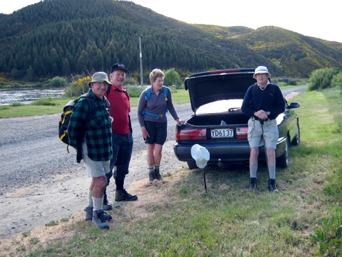
We parked Bill’s car on the south side of the Ferry bridge, walking back over it to begin the track. Continue reading “Taieri River track (true left,) downstream from Taieri Ferry Bridge”
Taieri Recreational Tramping Club
Mid-week recreational and social walking group based in Mosgiel NZ

We parked Bill’s car on the south side of the Ferry bridge, walking back over it to begin the track. Continue reading “Taieri River track (true left,) downstream from Taieri Ferry Bridge”
The were only occasional signs on the Old Waitati Road of the new pipe line put in to supply Mount Grand water to Waitati, Warrington &c. We had parked the cars by the bridge just down from Leith Saddle and the 7 of us walked on down the road the considerable distance to reach Sawmill Road on our left. We made a rather belated morning tea the large open shed full of derelict bits of furniture on the margin between the cleared farm land and the bush at the foot of the track.
Climbing a bit we crossed Ferguson Creek and continue on up to reach clearer ground. Markers took us on straight ahead before striking left past a large broadleaf to reach a fence at the beginning of dense manuka. There was an initial windfall to push around before the track cleared for us and took us on up again to the next clear ground. After crossing this a little to the right, it was into flax country and then tussock that eventually veered to the left and scraped us through a small patch of heavy gorse to finally discharge us onto the open Swampy Ridge track. Its boggy patches were boggier than usual, due, we thought to last weekend’s snowfall on the area.
Eventually we reached the access track that leads around to to the Burns-Rustler intersection where we stopped for lunch. We chose the Burns Track as last week’s trampers had descended by the Rustlers, and on the way greeted some Green Hut Track Group members who were snipping the never-ending flax encroachments from the track. Through the bush lower down the drying mud had escaped the boggy-making effects of the snow we had experienced earlier. Then it was along the other pipe-line that supplies water to Sullivan’s Dam from the catchment area we had just traversed and out to the cars again. A very satisfying day. – Ian
28/4/2004 Leaders: Lex, Ian,Glenys
14/10/1992 Leaders: Ria L, Catherine, Eleanor B, Ted
No. 34 on old hardcopy list of 113 club tramps. “Leith Saddle – Swampy – Pole Track. Farm”
10/9/2008 Mornington – Southern Cemetery
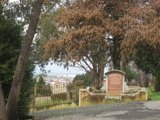
Very surprised and delighted to yet again have another fine Wed. after having 2-3 days of mist and rain. A bit cloudy but fine and not too cold. Ten keen hikers parked their cars in Lees St. and set off on a very convoluted walk to get to their final destination which was the Southern Cemetery. It was up hill all the way to our morning tea stop which was the play area in the Mornington Park. After a refreshing cuppa it was off again on the ups and downs of the streets in the Maryhill/ Mornington area till we eventually got to Eglington Rd and the very top gate of the Southern Cemetery. We walked down through the area of very old graves and found a spot on a grave in the sun to sit and eat our lunch. Very peaceful and quiet. No people or traffic to disturb the peace! After lunching we strolled around among the graves, reading inscriptions where they were still legible and finding many of well known early citizens of Dunedin. Also the area where the early Chinese were buried in place that was supposed to be separate for the rest of the community.
All in all an interesting place to visit and the first time for most of the hikers there on Wed. From there it was a fairly short walk back to the cars. Everyone said how much they’d enjoyed the day. Bev.
Leaders:
10/9/2008
9/7/2008 Street Walk: Wakari
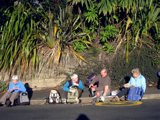
What a beautiful day and absolutely perfect for our Street Walk round the Wakari area. The 13 Hikers who met to make the most of the warm sunny day parked their cars at the southern end of Helensburgh Rd, by the back entrance of Wakari Hospital, and set off down Hood St. Only a short walk before getting to our morning tea spot which was Dean St. Reserve. As the Reserve had no seats and was rather muddy and wet we sat on the footpath! Very pleasant in the sun. Then we set off, and with my co-leader, I took everyone on a real tour of discovery round streets and areas that most had never been. Lovely views.

Out to sea, over Kaikora Valley, Roslyn and Mornington and then after lunch, over the other way to Flagstaff and Three Mile Hill. We eventually arrived at Mayfield Reserve, a lovely childrens play ground at the back of Wakari School, which proved a very suitable & agreeable place to enjoy our lunch break. We soaked up the warmth the sun and made the most of the ‘amenities’!

From there it was another zigzag through a few more streets and walkways, back to the cars. Everyone agreed they had had an enjoyable and enlightening day, especially in such perfect weather. – Bev
Leaders: Bev H, Bev M
23/4/2008 McIntosh Rd from Brighton to Fulton’s Bush. Leaders: Dot B
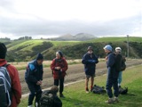
In spite of a less than conducive day for hiking, with strong winds and some black clouds hanging around, 11 hikers, plus
Continue reading “McIntosh Rd from Brighton to Fulton’s Bush.”
16/4/2008. Traquair/Whare Creek Track & Woodside Glen.
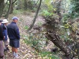
With inclement weather threatening the joy of a beach walk (Purakanui and Canoe beaches) and only 2 hikers along with 2 leaders, a decision was made to seek dry bush cover instead, and so we headed for the recently-upgraded Outram Glen walk. Neil diverted us however to a nearby track he had lately helped to clear
Continue reading “Traquair/Whare Creek Track & Woodside Glen.”