Mill Creek Track

Follow directions to Government track.
After crossing the bridge, turn right into what appears to be a farmer’s driveway.
DoC sign, stile and yellow post indicates start of Mill Creek route. ????
7/4/2010. Recce. Mill Creek. Leaders: Ian, George.
We failed to find, at the back of the yards, both the DoC sign, the stile and the yellow post, but found the (yes, overgrown) vehicle track. So we did a lot of rough track clearing, especially one or two old-man gorse patches. The grassed clearing at its top is very rough due to slippage.(?) Continue reading “Mill Creek Track”

Deep Stream Water Supply

… The final example of an engineering achievement worthy of the title ‘built to last’ comes from the 1970s, the Deep Stream Water Supply. Water supply has been a major problem to successive City Corporations and Councils for most of the city’s life. We have a modest rainfall with lengthy dry periods every few years, and very limited space to store water to cover such dry periods. Run-of-river sources are a long way from the city so are very expensive to use. The City lived a hand-to-mouth existence for its water until well after the Second World War. In 1956 the City tapped the river gravels beside the Taieri River at Outram, and this gave us adequate water for the next twenty years. However by the late 1960s it was clear that another major supply would be needed to cope with the ever increasing demand for water. The search was on again for more water.
In the early 1970s the options had been narrowed to two. More pumped water from the Taeri River, or a gravity supply from Deep Stream in the Lammermoor Range. The Deep Stream scheme had been proposed by City Engineer J G Alexander in 1930, but it was rejected by the Corporation at that time as too costly. The more modest 1936 Deep Creek scheme was built instead. However, detailed survey plans of the 1930 Deep Stream scheme were held in the City’s records, and an Act of Parliament in 1930 authorised the taking of water from the Deep Stream. It comprised some 58 km of pipeline falling from an intake at 425m above sea level to Mt Grand at 300m above sea level. A treatment plant at Mt Grand would be able to supply water to almost the entire city.
The choice between the two options was made on the economics. Deep Stream was very high capital cost but low operating cost (no pumping needed). Taieri was relatively low capital cost but high operating cost (requiring electricity for pumping). In the event the Deep Stream option was approved by the Council in 1972 and it was completed in 1977. Just after the decision was made, the first oil shock in 1973 occurred and huge increases in energy costs resulted. This markedly increased the advantage of the low-energy Deep Stream option, and is reflected today in our relatively cheap water charges.
The Deep Stream Scheme was forecast to meet the City’s water needs till the early 1990s. In the event the Burnside Freezing Works, a heavy consumer of water, closed and population did not increase as much as expected so the water supply system, including the Deep Stream Supply, is still meeting the demand, indeed is supplying areas of the post-1989 amalgamated city not envisaged over 40 years ago in 1968 when the demand forecast was made. Deep Stream was certainly built to last! It cost some $6.2 million (($55.1 million today).


Extracted from: Otago Settlers News, March 2010, Issue 104, In the Pipeline. Engineering Feats Beneath Our Feet. Trevor J Williams, BE FIPENZ MICE MNZIS NZIM, former Dunedin City and Drainage Engineer.

Brinns Point to Seacliff

Brinns Point to Seacliff.
The North Otago coast is lined with old Maori settlements, and Brinns Point is no exception. The bay south of the historic urupa (cemetery) on the headland was occupied by Moa-hunters, and much later was an out-post whaling station. A channel has been cleared through the boulder beach to enable boats to reach the shore especially at high tides. This is thought to be the work of the whalers but the channel clearance may date from much earlier, for all we know. This bay was investigated in the 1950s by the Blake-Palmers of Seacliff. This was published in the Journal Polynesian Society by Blake-Palmer senior who was superintendent of Seacliff Mental Hospital at the time. This was the first ‘proven’ association of man with the largest species of moa: Dinornis Maximus, thought by some scientists to be extinct before arrival of man. Later studies showed Dinornis had been found on archaeological sites beforehand however. There was an old Maori settlement on the flat at Ross’ Rocks. The next known settlement south is at Omimi, where moa bones have been excavated on what was largely a fishing site.
The cliffs after which Seacliff township gets its name are lined intermittently with Maori umu, most being umu ti. Parts of the coast road from Warrington to Karitane followed original Maori tracks according to early survey plans in LINZ archives. The hills along this coast were heavily forested and only cleared  when the land was subdivided for framing. The original route of Coast Road has been modified in places since the 1960s but many portions of the old routed can be seen with associated stonework on both sides of the present road. Coast Road remains an active connection with the distant past.
– Taken from Karitane … Split Rock … Seacliff Coastal Walk. Notes by Brian Allingham, Archaeologist, January 2010.

Split Rock

Split Rock.
This large outcrop probably had significance to Maori given its dominant presence. It would make an ideal lookout of the coast over the treetops. The hills east and south of Maori Peak were rich resource zones where forest resources such as timber, foliage, berries and birds, especially Kereru (pigeon) and tui were taken. Young stems from mature cabbage trees were steamed for up to 48 hours in large earth ovens (umu ti) to obtain the sucrose from the fibrous centre of the stems. Several umu ti are known to survive in the Seacliff bush today and some may remain unidentified in the field. Keep your eyes open for a generally circular pit of 4-5 metres across and with a raised rim around the edges. Some are up to a metre deep.
–  Notes by Brian Allingham. Archaeologist. January 2010.

Maori Peak background information

Maori Peak.
This general area has high spiritual values and is reputed to be the abode of ancestral beings, some of whom have been seen in modern times by local Maori; thus perpetuating historical references from the 1800s and earlier. Little is known or understood of these beings, other than the perception that they are regarded as Kaitiaki or guardians. It would be wise to respect the area by not eating or drinking on Maori Peak or around the immediate base.
– Notes by Brian Allingham. Archaeologist. January, 2010.

Puketeraki Beach

Puketeraki Beach.
Erosion has removed much of the evidence of former habitations along the beach. These were probably unfortified settlements that could rely on the defended ground at the pa if need be and would keep such a place on standby. One such place is Te Pa Hawea the “Yellow Bluff” about which little is known. It is attributed to the Hawea people who were connected to and gave name to Lake Hawea. This ancient connection lives on today through whanau who whakapapa back to these people.
The smaller settlements along the beach date from a relatively early period, and probably supported one or several whanau thriving off relatively local resources. It is know from later records that coastal groups of people would gather at a locality on the coast before heading inland on seasonal hunting expeditions, when large amounts of eel and weka flesh were taken and preserved. Connections were also maintained with related inland populations, thereby sharing resources.
– Taken from Karitane … Split Rock … Seacliff Coastal Walk. Notes by Brian Allingham, Archaeologist, January 2010.

Suddaby Farm.

Contacts: Seek permissions.
17/2/2010. Suddaby Farm, from Wallace Ford Road. (At the end of Mount Gowrie Road). Leaders: Ria, Hazel.

Well, although the tramp was called ‘Deep Stream Pipeline from George King Memorial Drive’, we never went near the George King Drive at all, except to pass by both ends of it on the way to our destination.

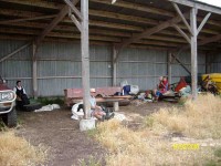
We [all 5 of us] parked the car on Wallace Ford Rd. outside Carters farmhouse, & made our way across some very dry & parched land to Withers farm, after having morning tea in a large farm shed.

Morning tea. Angela, Doug, Hazel, Ria. (Ken pic).

Saddle Hill, Fairfield

Chain Hills Track. 30 min. Tramping Track. Benched. Manager: DCC CAM and private land.

3. 20/1/2010. Hikers. Overbridge, Coalstage Road, McMasters Road, Old Brighton Road, Fairfield Park, Morris Road, Overbridge. Leaders: Bev and Chris.

The Rudd Road walk you do when you are not actually doing the Rudd Road walk!!
Our esteemed leaders Bev and Chris decided that views from Rudd Road were unlikely in the misty conditions set to prevail, and that the 12 of us should walk from Saddle Hill to Fairfield and back instead.  The intention was to go from Coal Stage Rd up Chain Hills Rd and do a loop, but the general wisdom was to follow Coal Stage. When we got to Saddle Hill Rd, the Left-leaning leaders  wanted to turn that way while the majority of Tories voted to turn Right (which was actually less conservative), and so proceed up Saddle Hill Rd to McMasters Rd, where in fact we had a morning tea stop with a view.
McMasters Rd – morning tea finish line! (Bob pic and caption)
It was a warm, still morning here and there was a calming feel about the quiet gravel
road with views out onto the Kaikorai Estuary and Stony Hill, etc.
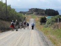
McMasters Rd towards Stony. (Bob pic and caption)
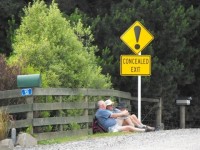
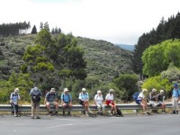
A bunch of fence sitters – Old Brighton Rd. (Bob pic and caption)
Lunch was at the Fairfield park ( Chris led a long detour in order to use a pedestrian crossing), in the sun.  Delicious – especially Fred’s shared chocolates.
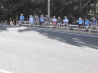
Another bunch of fence sitters – Main Rd, Fairfield. (Bob pic and caption)

And so back to the cars at the overbridge via Main Rd and Morris Rd.  A very pleasant 10km on a nice day. We even passed a display of hand milking near the ostriches on Morris Rd.  And the clouds were still hanging around Flagstaff, so we felt it had been a good choice. – Bob.


2. 15/6/2005. Hikers. Fairfield, Saddle Hill. Leaders: Margaret D, Nancy, Jean.

1. 30/5/1990 Coal Stage Road to Wingatui and return via Chain Hills. Average. Leaders: Jean Y, Frances, Jean A, Catherine

Sullivans Dam

No. 72 on old hardcopy list of 113 club tramps. “Leith Saddle Sullivans Dam. (Green Roof House at Bridge) Year Round”

7.22/7/2009. Hikers. Sullivans Dam. Medium. Leaders: Lesley G, Bev H.

6. 12/7/2006. Sullivans Dam. Easy. Leaders:  Bob & Nadia, Mary M
5. 20/6/2005. Hikers. Sullivans Dam. Leaders: Frank and Lesley, Eleanor W.
4. 29/8/2001. Alt. Pigeon Flat – Sullivans Dam. Leaders: Nelson and Dot, Wendy J.
3. 14/3/2001. Pigeon Flat and Sullivans Dam. Leaders: Joyce, Mary M, Daphne.
2. 11/8/1999. Sullivans Dam. Leaders: Joyce, Nancy, Pat.
1. 2/9/1998. Leith Saddle Sullivans Dam. Leaders: Joyce, Nancy.

The Personal Locator Beacons

The club now has two state-of-the-art GME Accusat MT410G EPIRB GPS-equipped emergency personal locator beacons, courtesy  Elaine Day’s family for one, and Bendigo Valley Foundation for the other.
It all happened after Elaine announced her family’s offer at the mid-winter dinner on Wednesday (24/6), to be followed in a very timely manner the next day with Bendigo Valley Foundation’s letter, accepting our grant application, having already deposited the grant in our bank account.
Each of our beacons are EPIRB – Emergency Position Indicating Radio Beacon, and the 406 MHz GPS-equipped model. Designed for marine operation also, they are waterproof, float the right way up, have larger batteries for more transmit power, and can even be water activated. The 406 beacon transmits quick bursts of digital data. This data identifies the transmission as legitimate and has a coded identification enabling rescue authorities who decode the digital message to identify the owner of the beacon.

The Rescue Beacons are very simple to operate. One just flicks open the aerial, it springs up, and 60 seconds later, begins transmitting.

The signal is received at RCCNZ (Rescue Coordination Centre New Zealand) by two methods:

1.  To get a rapid response, and to maximise the signal, one must be in clear air and high enough to see a clear horizon in the East-north-easterly direction. It will then be received by  GEOS-11, a geostationary satellite stationed above the equator in the mid-Pacific.


2. If the beacon signal cannot be received by the GEO satellite, it will be relayed by the first LEO (low earth orbiting) satellite. In this case, a wait of over two hours is not unusual.

The rescue beacon is a full Mayday or distress alarm, and will be acted on as such. So if the activation is accidental, or the situation improves and is no longer a Mayday, we must do more than just turn the beacon off (done by reloading the aerial) – we must also contact the authorities and withdraw the Mayday by contacting RCCNZ (0508) 472 269. ASAP. (Put this number in your mobile.)

– Information culled and adapted from a website Ken referred me to. Thanks, Ken.  – Ian