Distance from carpark: 40 km.
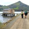
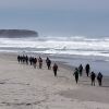
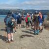 11. 17/01/2024. Hikers. Warrington. Leaders Jenny Finnerty and Jay Devlin
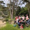
15 hikers met at the Warrington Domain.
Taieri Recreational Tramping Club
Mid-week recreational and social walking group based in Mosgiel NZ

Post linked to Info Post
11. 17/01/2024. Hikers. Warrington. Leaders Jenny Finnerty and Jay Devlin
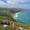
Ocean Grove, also known as Tomahawk, is a suburb in the southeast of the New Zealand city of Dunedin. … The suburb was known as Tomahawk until the 1930s, the name not being a reference to the weapon, but rather possibly an anglicised form of the Māori words tomo haka, meaning “dance by a gravesite”.
No. 23 on old hardcopy list of 113 club tramps. “Karetai Rd via Monument from Lagoon. Year round.”
Distance from car-park: Tomahawk: 19 km; Smaills Beach: 22 km; Paradise Road: 26 km.’
DCC List: 41 Peg Track. Otago Peninsula
Accessed from Oregon St. 3.5 hrs ret. Tramping track – unbenched. Managed: DCC CAM, private land.
Description – This track provides a link between Ocean Grove and Highcliff Road. Access to the track in Ocean Grove is off Oregon Street. An attractive walk around Tomahawk Lagoon then climbs through gorse and native bush. Turn right towards Soldiers Memorial through paddocks with gorse sometimes obscuring the rock walls.
St Clair, St Kilda, Kew, Corstorphine, Ocean Grove, Tomahawk – Information and Trips Library
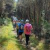
 43. 06/12/2023. Trampers. North of Tomahawk. Grade 3. $7. 22km. Leaders: Esther Willis and Julie McKenzie
Continue reading “Tomahawk Lagoon and Nearby Tracks and Areas”
Information
Rock and Pillar via Six Mile Creek This climbs 1,005 m. (3300 feet) up the eastern face from Glencreag Station up a leading ridge south of Six Mile Creek. This is the most direct approach.
Rock and Pillar via spur south of Lug Creek. Information: Climbs 910 m. (3000 feet) up the eastern face of a well-graded vehicle track up a leading spur south of Lug Creek. Average time to Leaning Lodge is 3 hours on foot.
DoC access. 9.5km north of the Middlemarch store on SH87, just before Lug Creek, is a farm entrance (RAPID 7219 – no DoC sign). A short way up the driveway is a DoC car park. There is public access up the vehicle track to the conservation area boundary. The track is now a recreation reserve administered by DoC.
Easiest route to Big Hut from Leaning Lodge (foot only – unmarked – good visibility essential) is another 45+ minutes climbing gently southwards to cross a steep gully and then climb a gentle shelf to above the eastern basins. Sidle several hundred metres past the lower prominent rock tors before gently descending to Big Hut once it becomes visible. Route very wind and cloud-prone. Ice axe and crampons may be necessary to traverse steep snow slopes near Leaning Lodge.
64 km to Middlemarch. 66 km to Stonehurst Track.
Redan Crater- contact for access Ken Rennick.
Middlemarch Area – Information and Trips Library
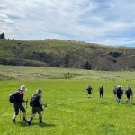
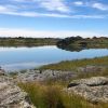 16. 06/12/2023. Hikers. Sutton Salt Lake – Glencreag Track. Grade 2.5. $16. 60km. Leaders: Wendy Langley/Katrina McKenzie
17 of us headed to Sutton where we walked the Sutton Lake loop. Continue reading “Middlemarch Area Tramps”
 2. 29/11/2023. Hikers Waters of the Leith. Grade 2. Leaders: Jan/ Pam
Having led this trip several times over the last 10 years or so, without much variation to it, this report will be reasonably brief.
Taioma, Mt Allan – Information and Trips Library
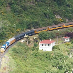
No. 96 on old hardcopy list of 113 club tramps. “Parera Taioma Transrail & Wenita Year Round”. 10km from PJP. Wenita permit. Require 6 weeks notice, but less from us. Taieri Gorge Railway. Phone 477 4449 for details.
18. 29 November 2023. Trampers. Mullocky Stream, Mt Allan Grade 3.5 Leaders: Sylvie/ Lyn/ Lynley
25 lovely persons followed Sylvie up the Mt Allan Road parking near Mullocky stream. Continue reading “Taioma, Parera, Viaduct”
 18. 22/11/2023.Hikers. Millennium Track from Henley Ferry Bridge. Grade 3. 27km. Leaders: Ady Whitson/Bruce Wright.
We had a great day on the track. Weather was great with 20 Hikers enjoying the day. We parked about 2/3 the way down the road from the stile. Continue reading “Taieri Ferry and Finlayson Roads, Bells Farm, Kennedys, Millenium.”
Cars park off motorway at Leith Saddle yard (alternatively down side road at bridge (restricted space). 25 km from car park.
Walk across side road to track.
Gravelled track 1.5 km. (morning tea on lookout seats a little further on)
Transmitter Tower 2 hours.
Going further: along road past doppler radar to DoC sign.
Right along Rustlers Ridge track to junction with Burns Track.
Through junction and up and round hill on Rustlers Ridge Track. (Lunch on hill)
Down ridge to pipeline. (Alternatively turn right at junction for Burns and down to pipeline)
Turn right along pipeline.
5.5 hours in all.
Burns – Rustlers circuit Maintained by Green Hut Track Group. DCC land.
Rustlers Ridge, Burns Track, Swampy Spur, Transmitter Tower – Information and Trips Library
 35. 22/11/2023. Trampers. Burns/Rustlers Ridge. Grade 4. 25km. Leaders: Phil Morris/Carolyn Pridham.
On an overcast muggy day, 20 Trampers headed to Leith Saddle. We set off down Leith Valley road, and left up Burns Track entrance onto Pipeline Track Continue reading “Leith Saddle, Swampy Spur, Transmitter Tower. Also Rustlers and Burns Tracks”
 19. 15/11/2023. Hikers. Cleghorn Street to Signal Hill. Leaders Pam Clough and Jay Devlin
23 keen hikers gathered on a beautiful day at the Bottom of Cleghorn St where we made our way up the gravel road to the beginning of our walk which was firstly over farmland. Continue reading “Signal Hill Tramps”
Distance from car-park to Doctors Point: 38 km.
Doctors Point, Mopanui, McKessar, Purakanui, Osborne – Information and Trips Library
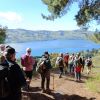
 25. 15/11/2023. Orokonui Circuit. Grade 3. Leaders: Graeme Souter & Gail Williams
Portobello – Information and Trips Library
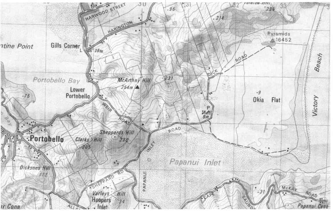
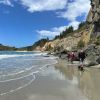
 13. 8/11/2023. Hikers. Varleys Hill-Hereweka Track. Grade 2.5. $9. 32km. Leaders: Jan Butcher/Jenny Finnerty
22 hikers set off on a cloudy morning for the Portobello Community carpark. Continue reading “Portobello, Clarks, Sheppards, McArthny, Varleys Hills”
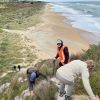
23. 1/10/2023. Combined. Green Hut Site and Pulpit Rock. Tramp Grade 4, Hike Grade 2. 43km. Leaders: Neil Hodgkin/Chris Bezett, Dave Roberts/Jay Devlin.
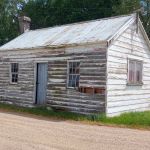
 Hike to Green Hut (which is now two seats as the hut was deconstructed in 1988 because of ongoing vandalism).
On a foggy morning 18 keen hikers regathered at the On the Spot garage at Waitati where we turned left up a dusty road to the beginning Continue reading “Green Hut, Pulpit Rock”
Distance from PJP car park 48km.
Middlemarch Area – Information and Trips Library
3. 25/10/2023. Trampers. Cairn Valley/Shannon, Grade 3, 48km. Leaders: Heather Kirk, Diane Paterson.
 Lovely sunshine greeted 30 keen trampers for a good day’s walk on Cairnvalley Farm Shannon. Strath Taieri offers something different in scenery with tussock hills, huge rock formations and at this time of the year fresh green vistas of paddocks and Continue reading “Shannons Farm Walk”
Outram 10 km / Henley 21 km – from car park.
Outram, Allanton, Floodbanks, Lee Stream, Traquair, Whare Creek – Information and Trips Library
4. 25/10/2023. Hikers. Outram Loop. Grade 1.5, 11km, Leaders: Sue Nichol, Kathryn Fagg.
 Outram turned on another scorcher for 16 hikers. We started at the West Taieri Rugby Club and walked around Kings Court and Anzac Court subdivisions where the gardens were in full bloom. Continue reading “Outram – Allanton Flood Bank”
17 km from car park.
St Clair, St Kilda, Kew, Corstorphine, Ocean Grove, Tomahawk – Information and Trips Library
 Nineteen hikers left Marlow Park in sunny conditions at about 0930 after singing happy birthday to Liz Griffin and walked over the Kettle Park Sports field and up a track to the Barnes Lookout.
No. 47 on old hardcopy list of 113 club tramps. “Toko Beach. M Young”; also No. 65 on old hardcopy list of 113 club tramps. “Chrystalls Beach Farm”. Location: 59 km from the car park. Best in Summer. The stock winter over.
Directions: On SH1, before Milton, at Helensbrook intersection, left onto Forsyth Road, right onto Back Road, left onto Glenledi Road.
Chrystalls Beach, Toko Mouth, Cooks Head – Information and Trips Library
 A fine overcast morning greeted us at Peter Johnstone Park with 19 trampers in 5 cars beginning our tramp at 10am. Continue reading “Chrystalls Beach, Toko Mouth”