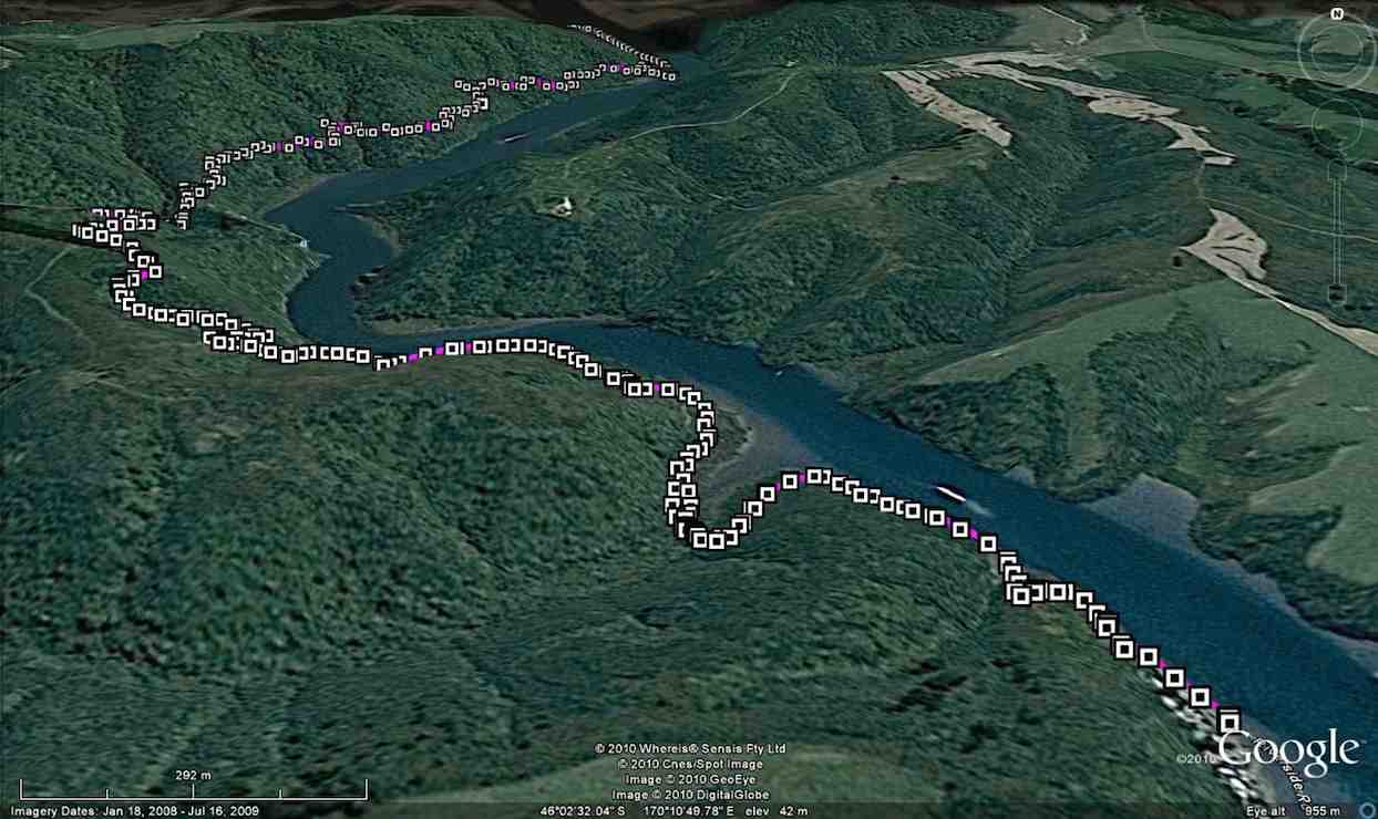
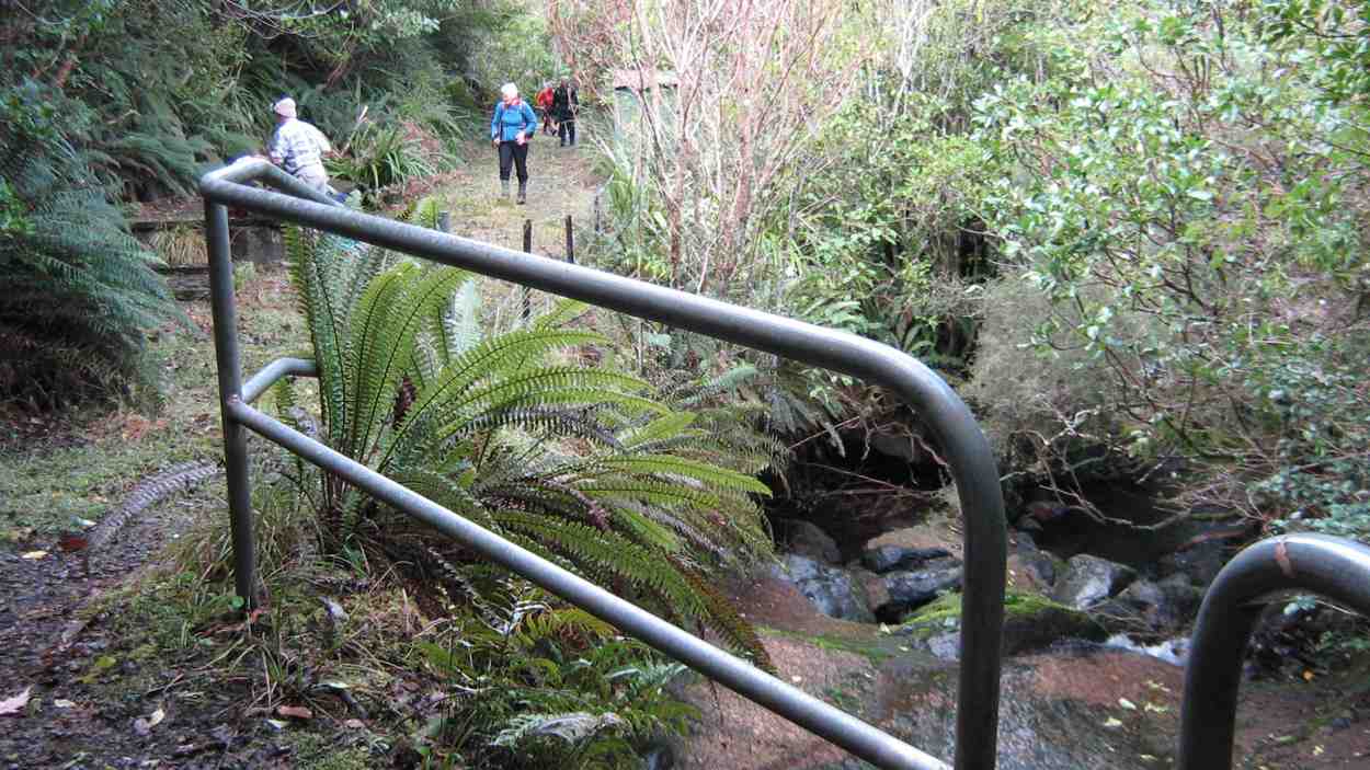
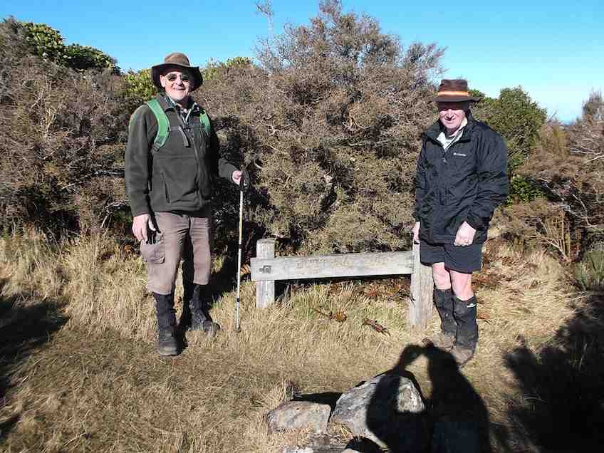
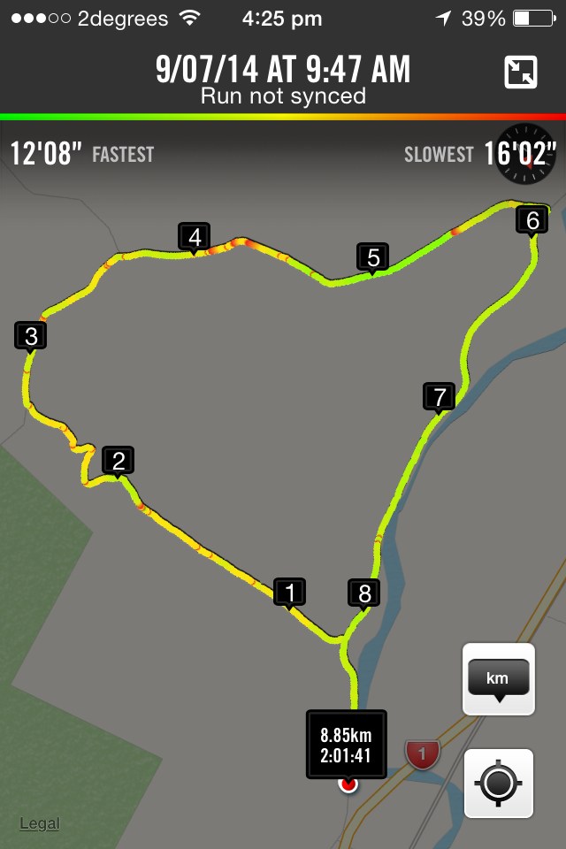
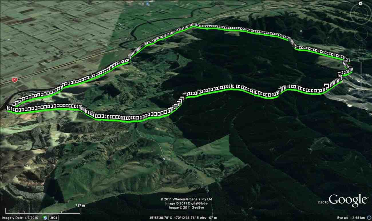
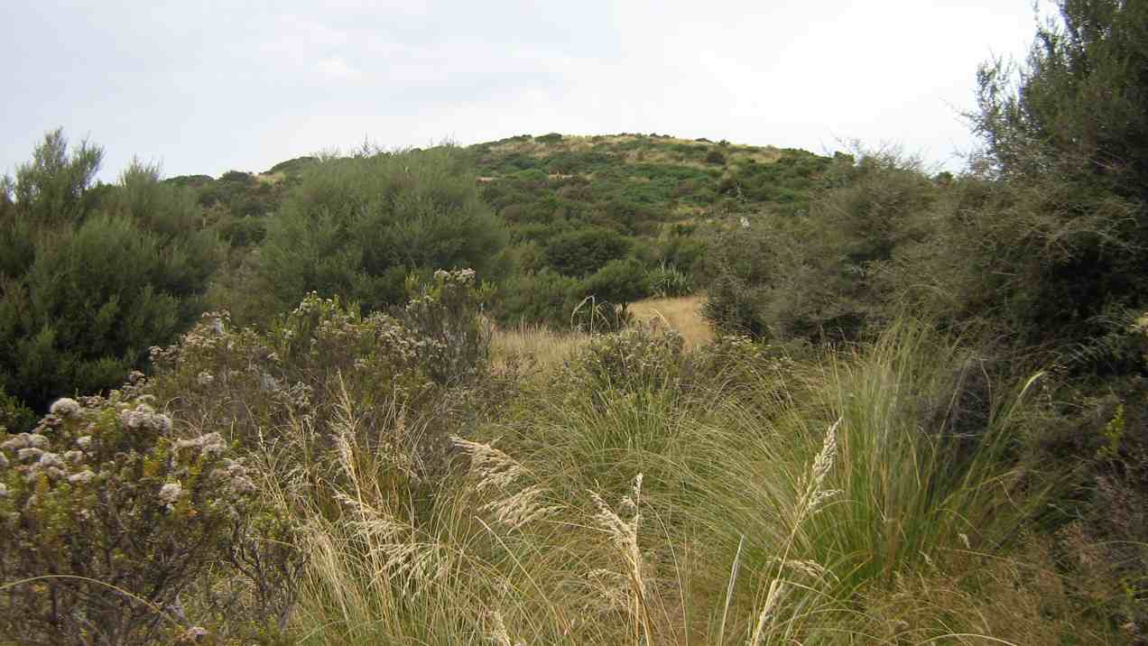
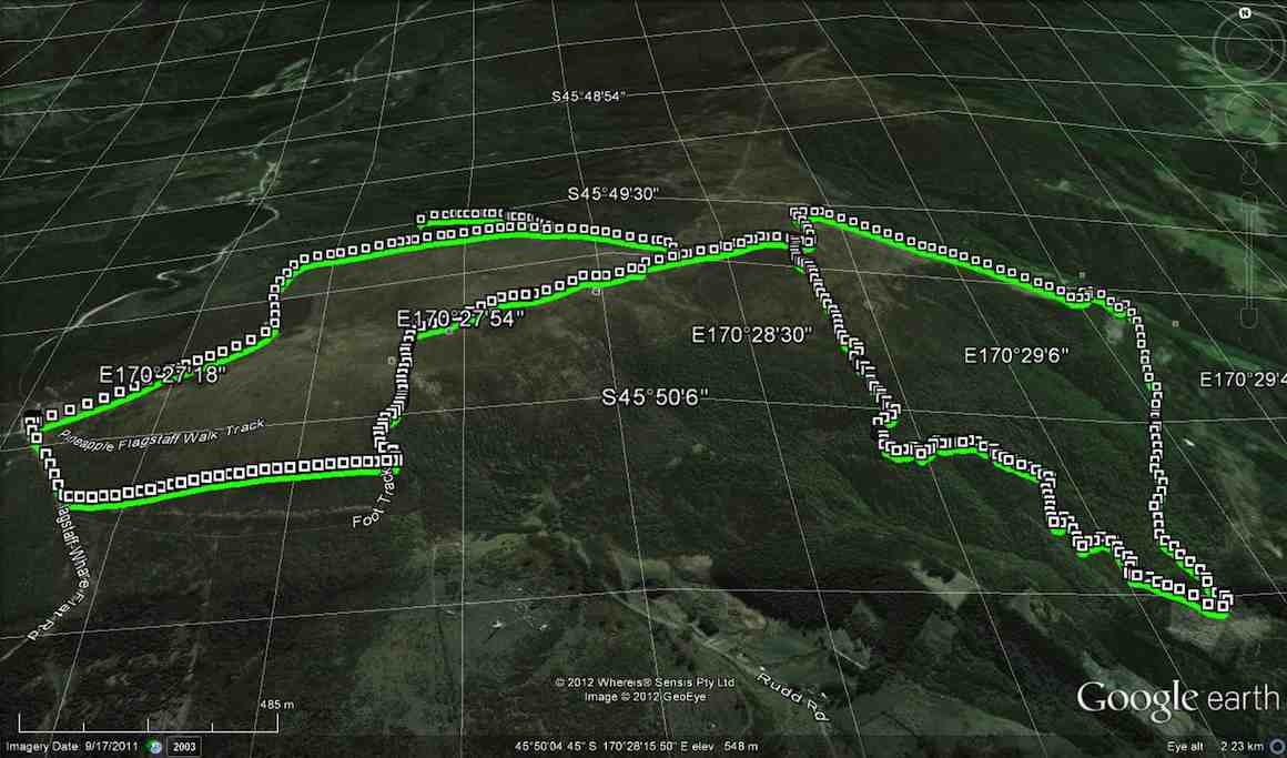
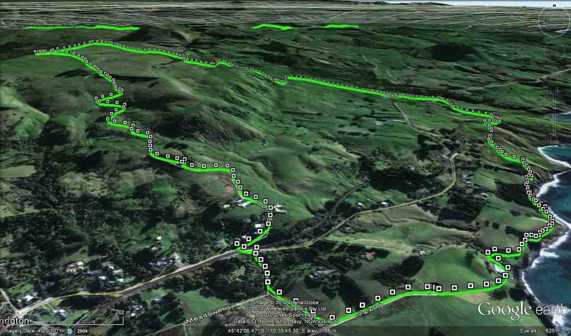
17. 5/10/2016. Hikers. Millennium-John Bull; Taieri Ferry to Taieri Mouth. Bus at both ends. M. Leaders: Bob and Doug.
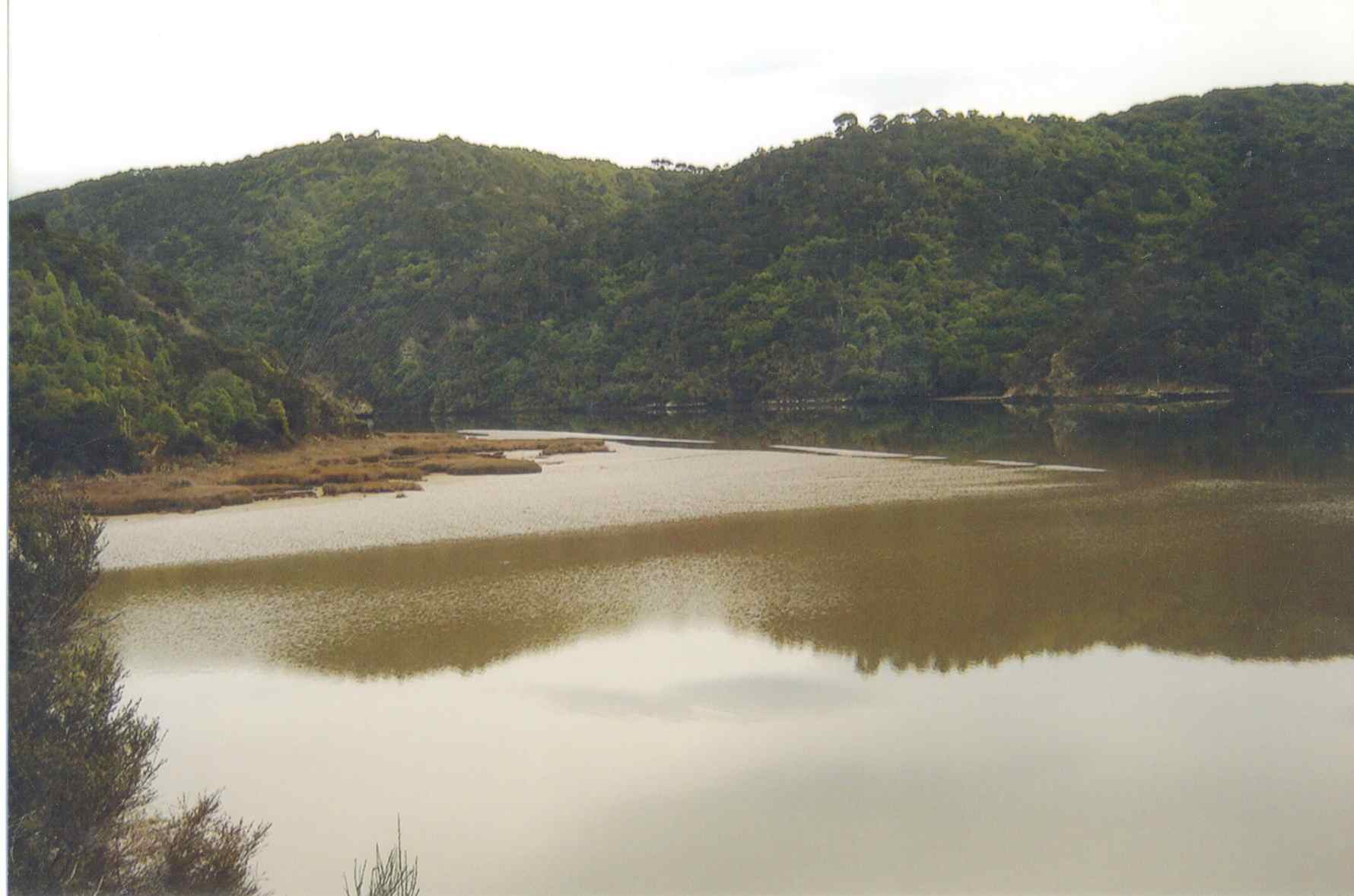
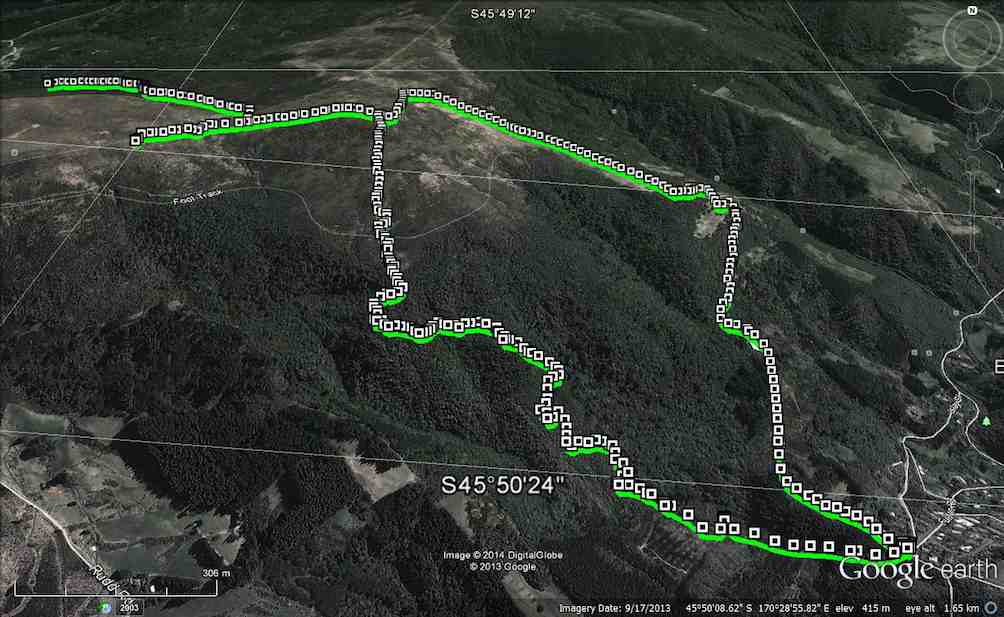
Map of route. 3.3km ferry bridge to Wardell cottage; about 5km to seat; about 3km to track end; about half km to bus at T.M. bridge.
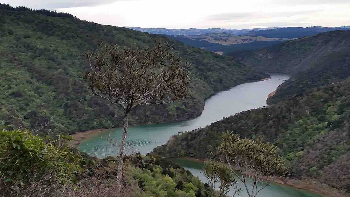
Millennium Track – combined trip Wednesday 5th October 2016-10-05
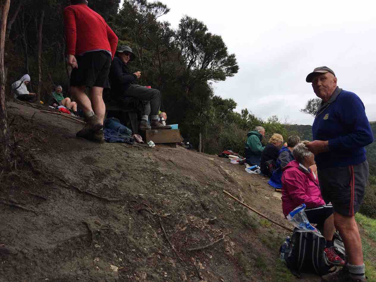
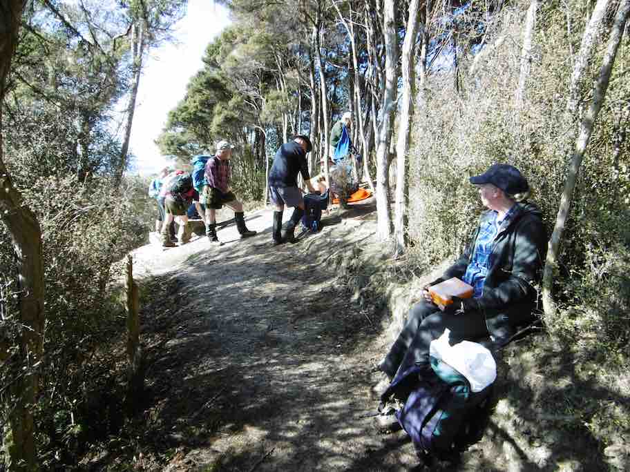
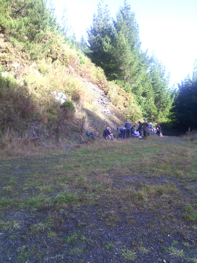
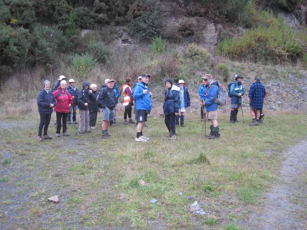
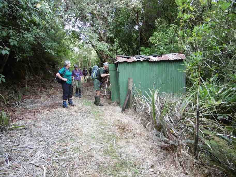
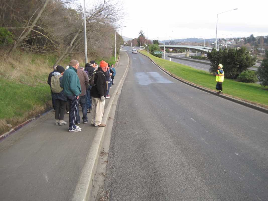
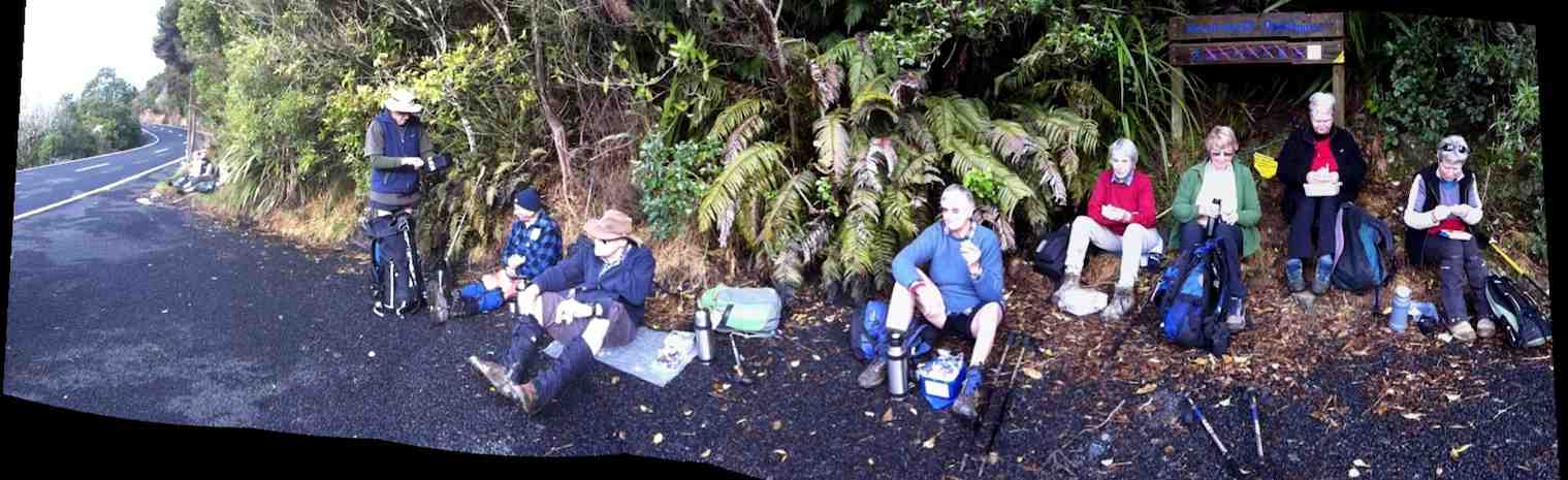
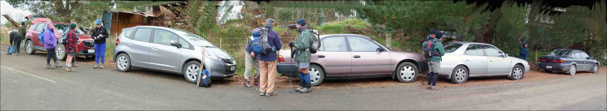
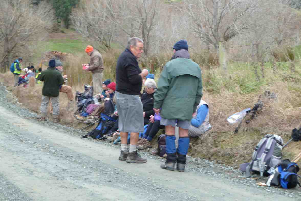
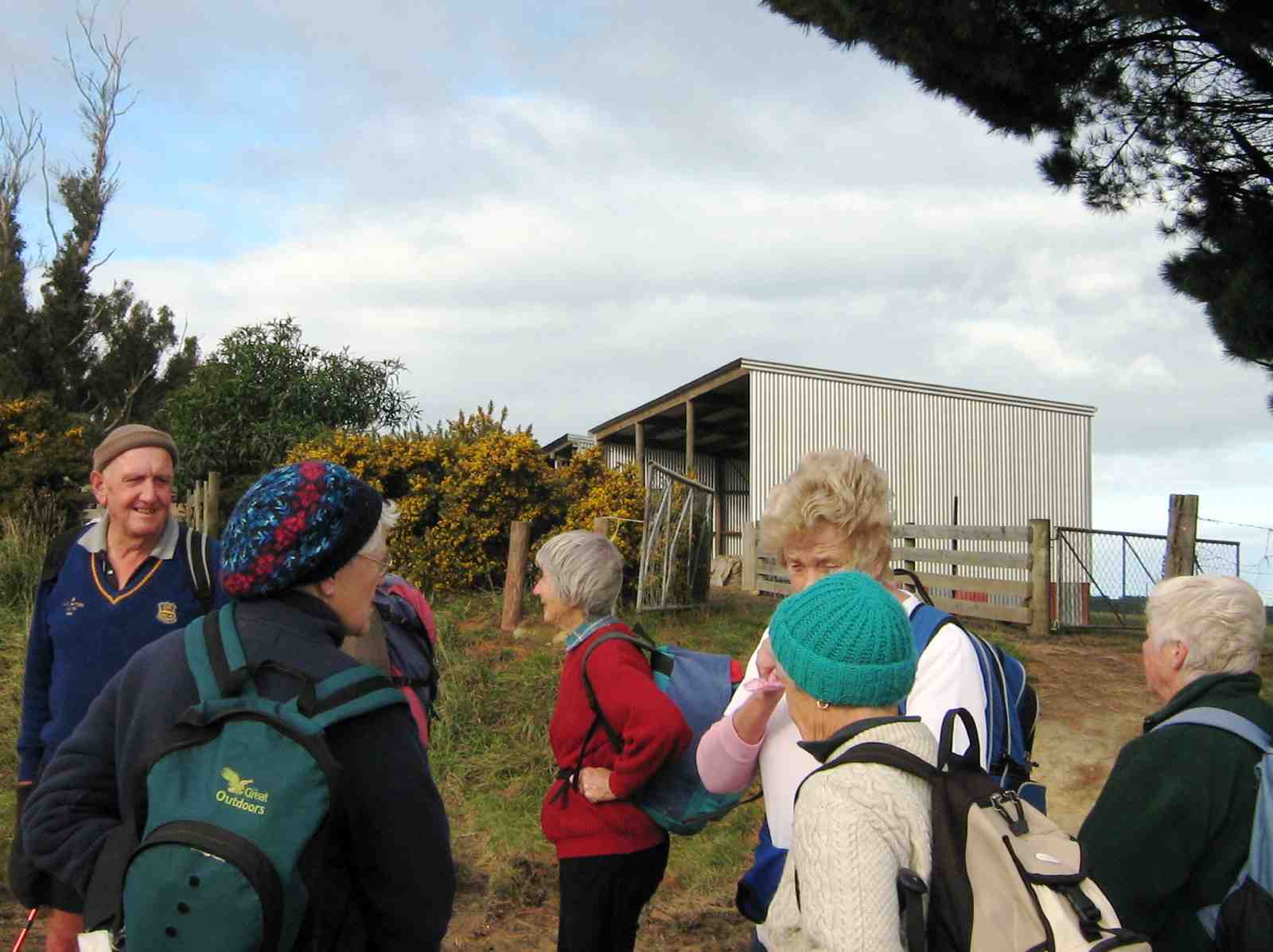
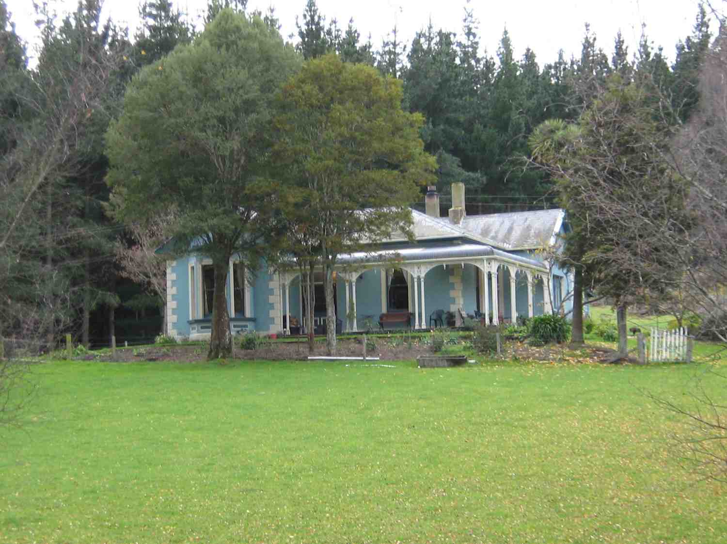
A dampish morning did not deter 40 intrepid club members who boarded the bus at the Bush Rd car park promptly at 9am. Packs were stowed in the luggage compartment and our driver Richard transported the happy crew out to Highway 1 and along to Henley and the start of the track – well, almost the start. 24 hikers disembarked in persistent light rain and trudged along the road for 45 minutes to a morning tea stop on the veranda of the white house just over the style, at the true beginning of the track.
The remaining 16 bods (and the bus) departed for Taieri Mouth.
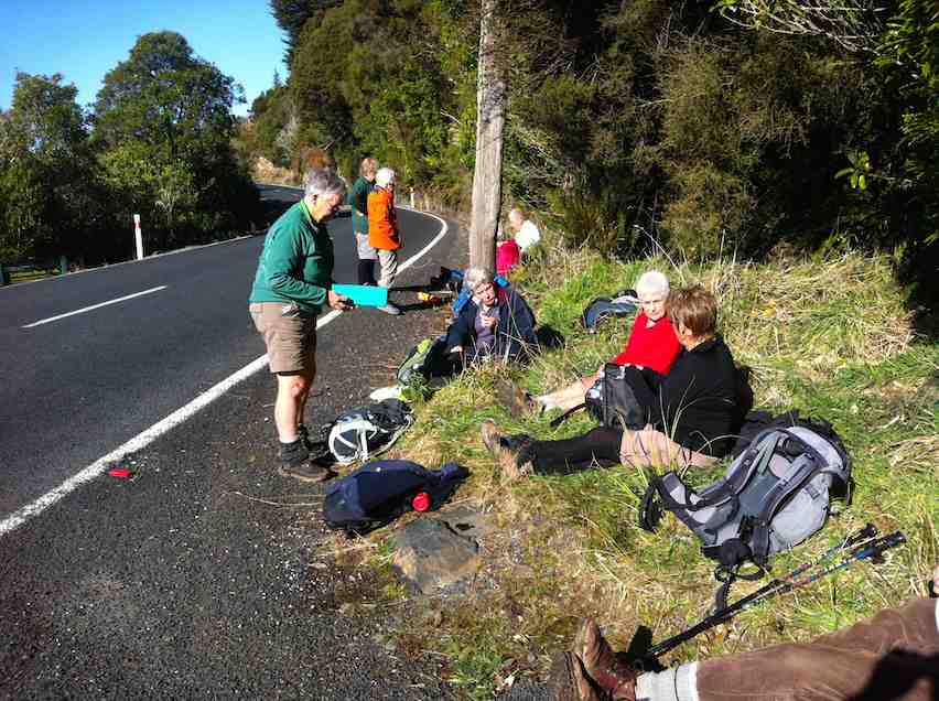
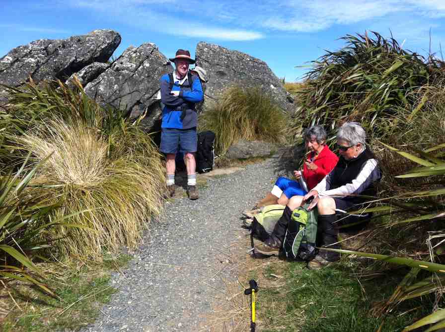
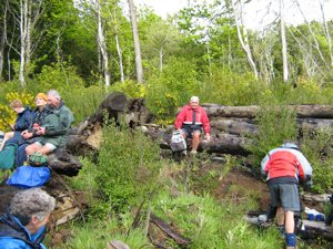
Sheltering from the rain for morning tea in the old Wardell’s crib verandah.
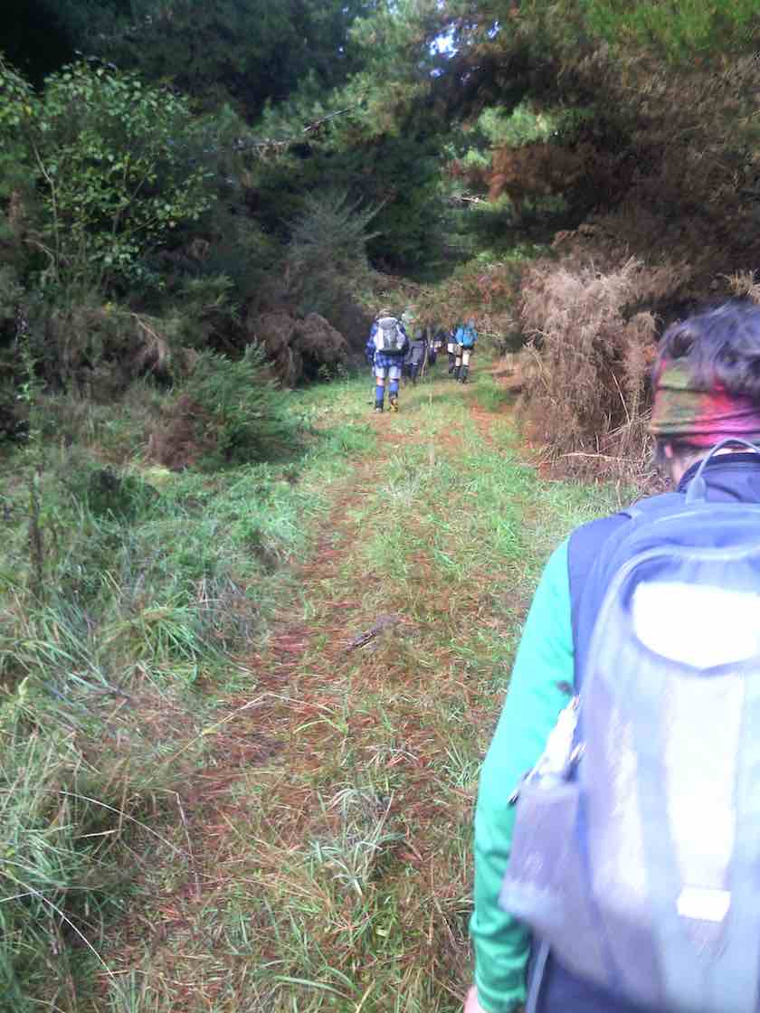
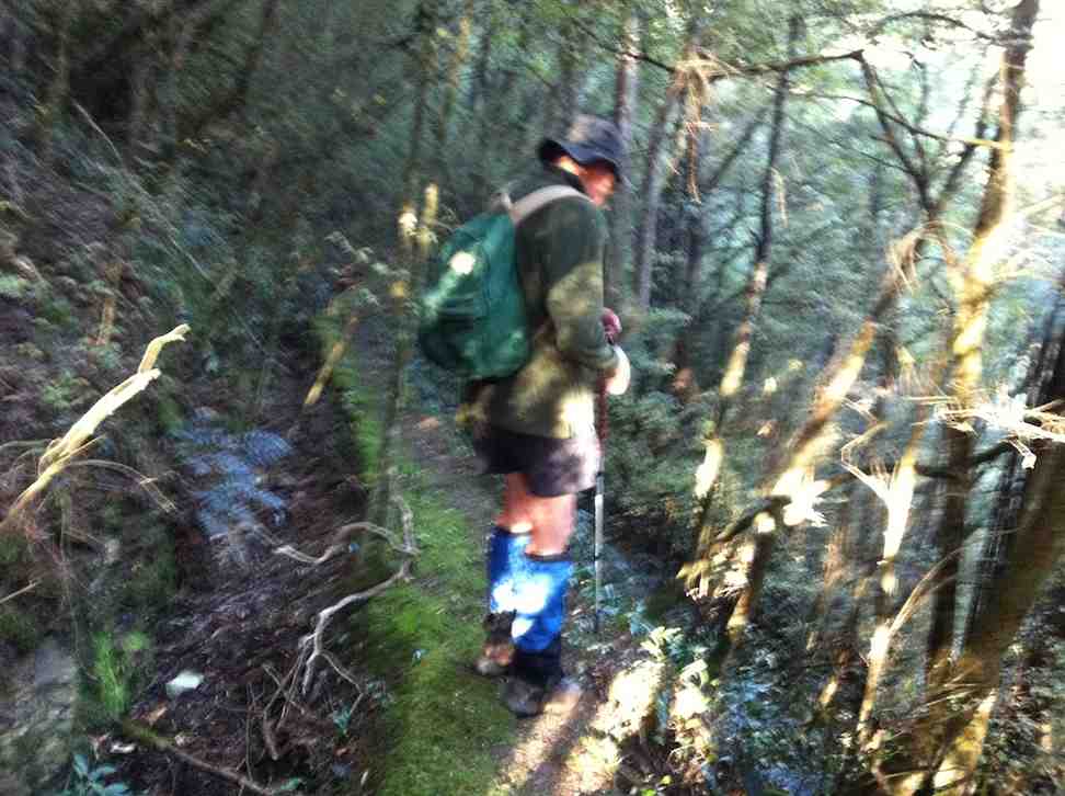
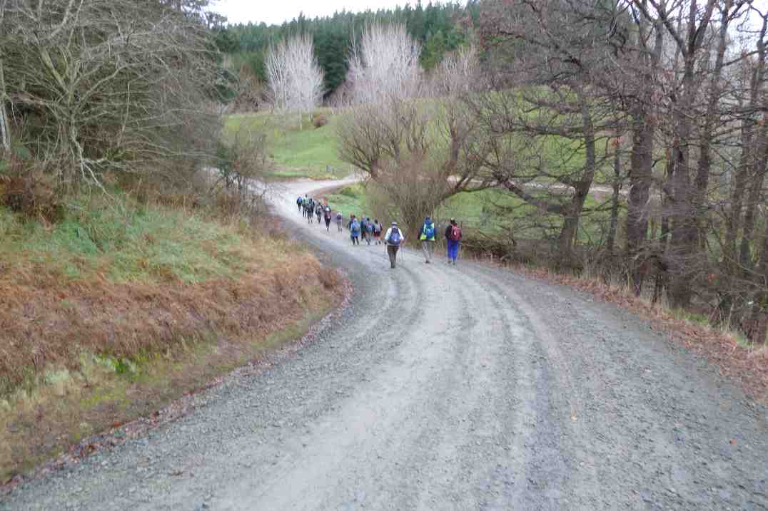
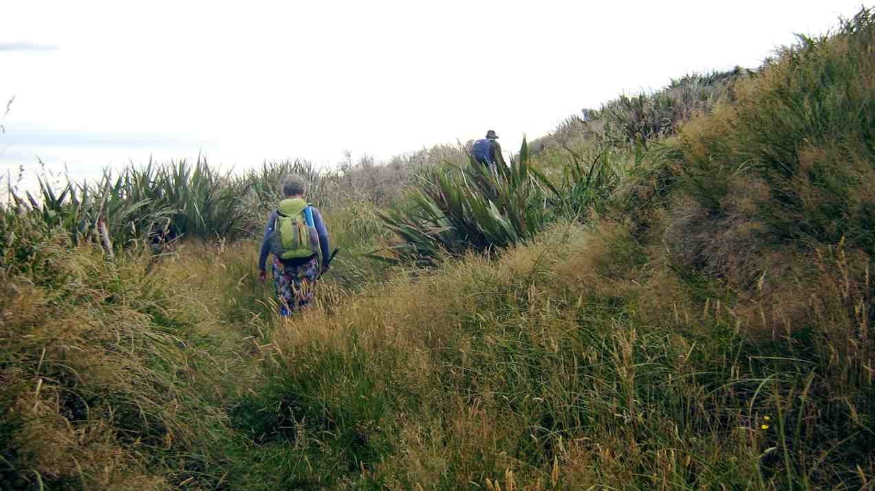
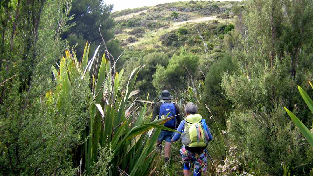
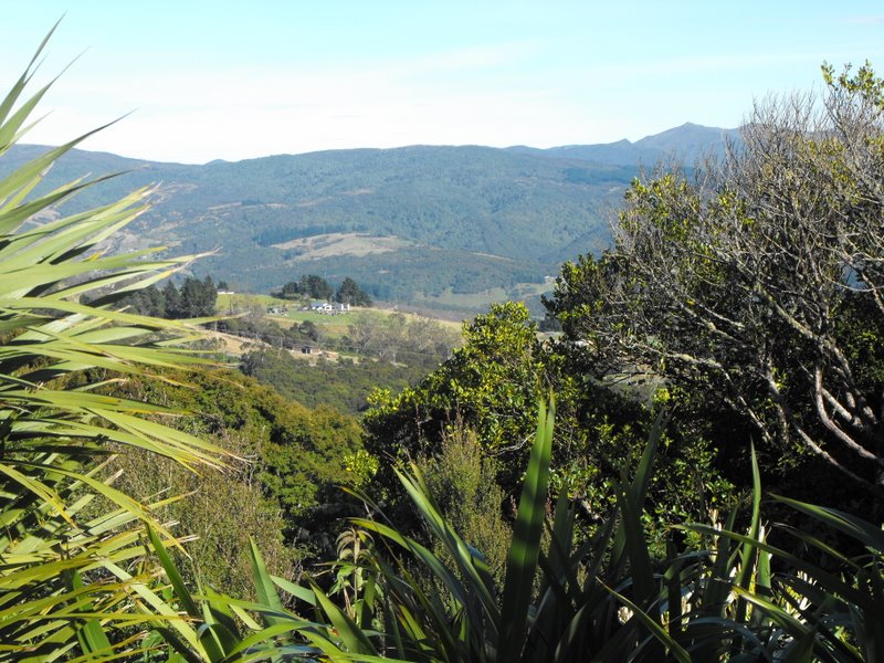
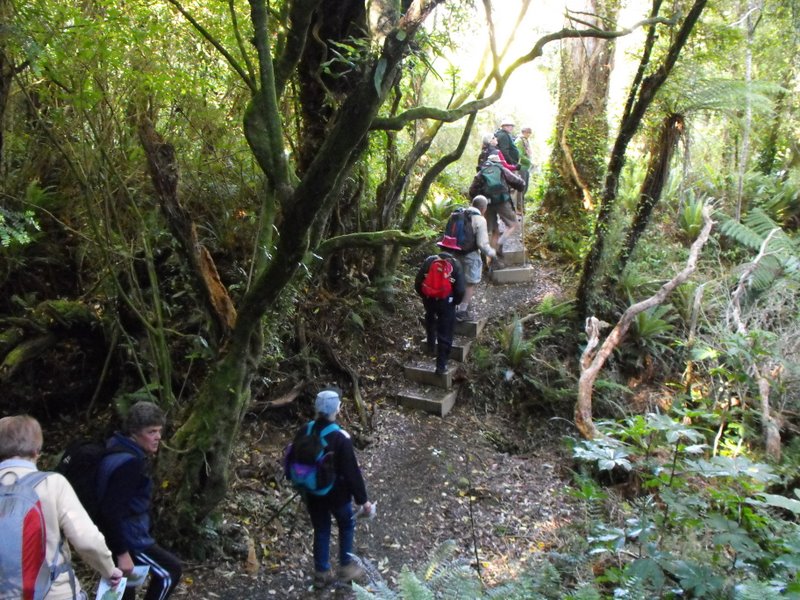
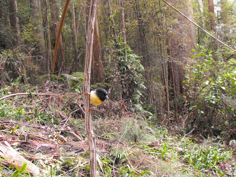
The upward plod soon began and we were glad it wasn’t too hot. The light rain continued but there was no wind and it was pleasant for tramping. It was lovely in the bush with plenty of bird song and glimpses of the river below as we climbed.
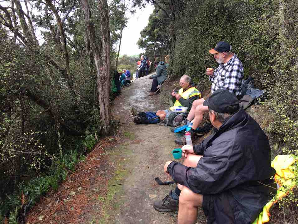
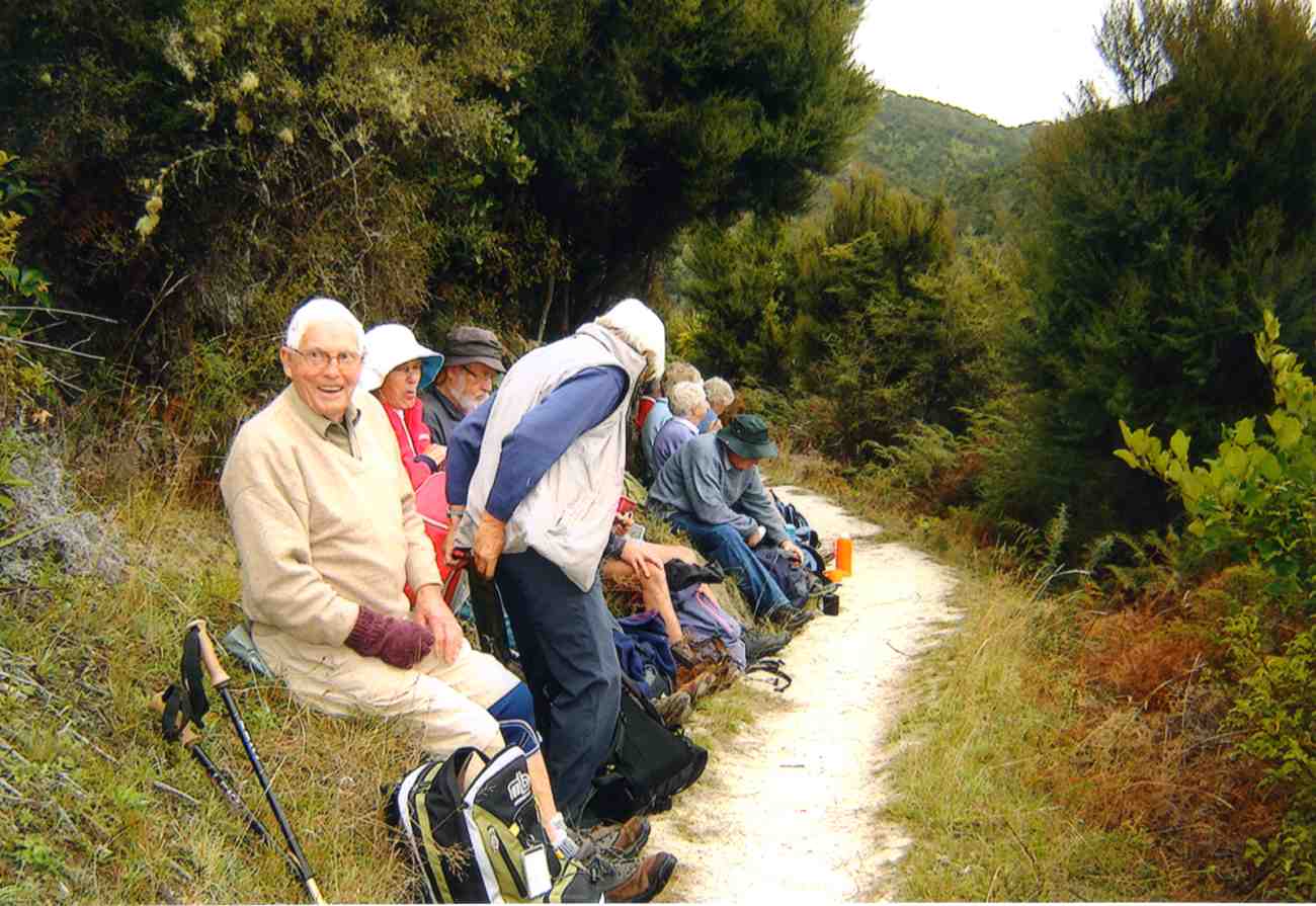
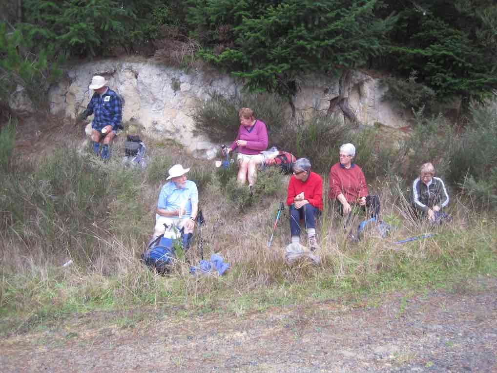
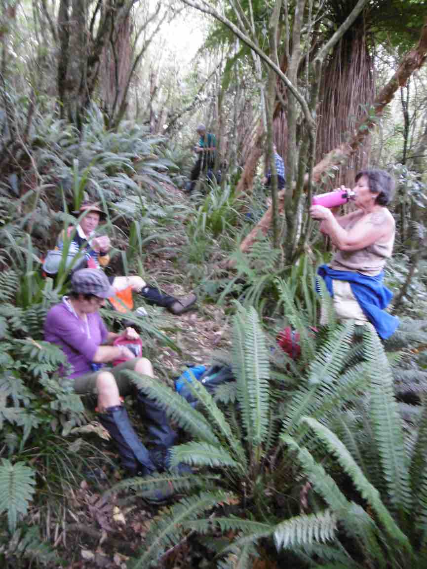
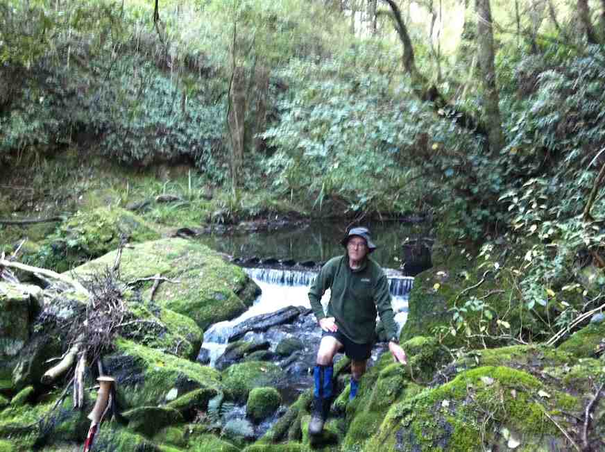
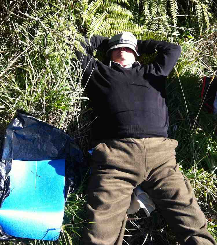
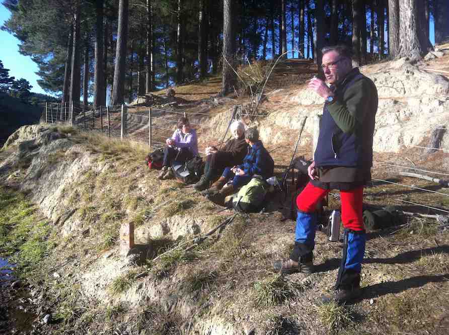
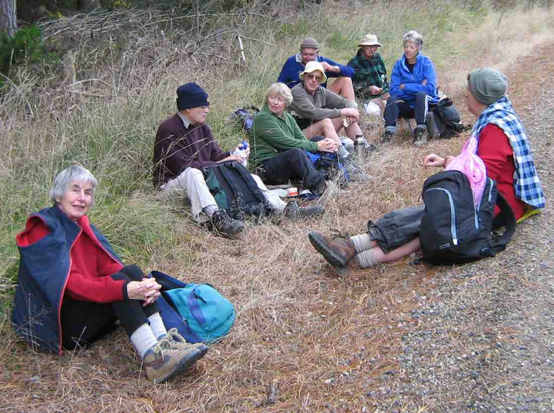
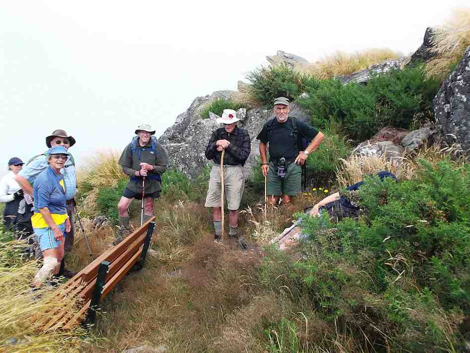
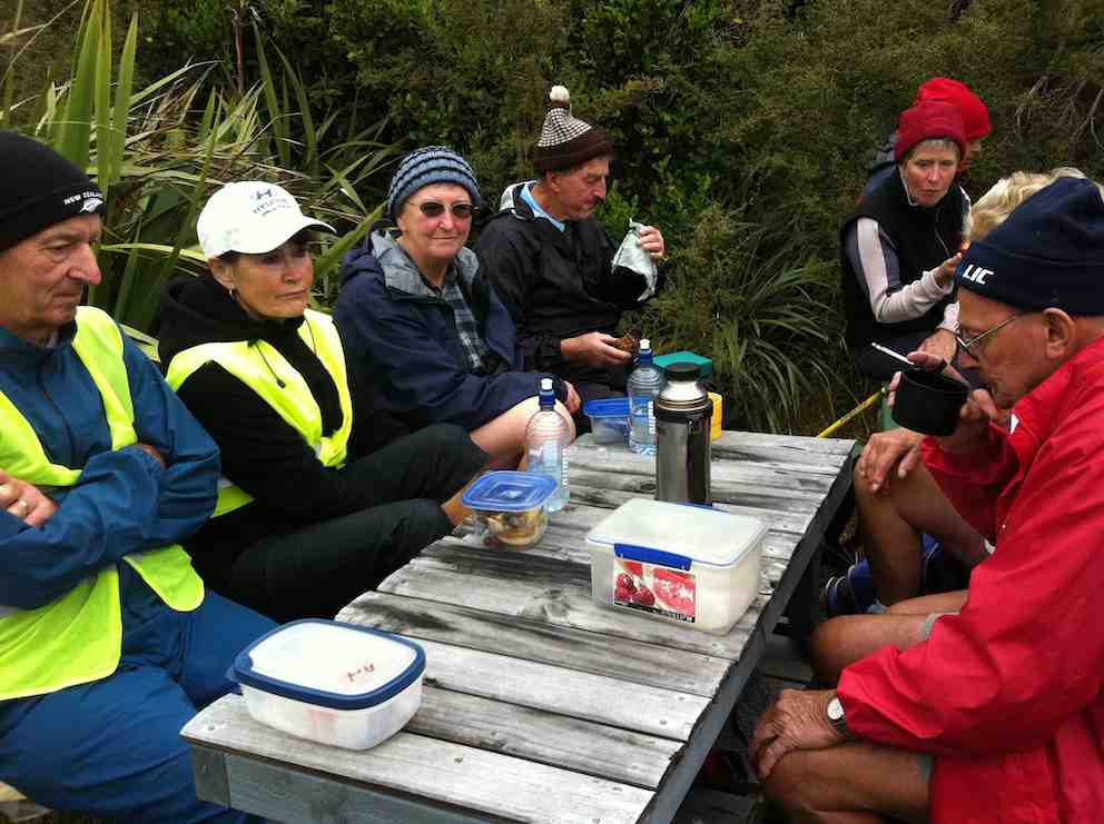
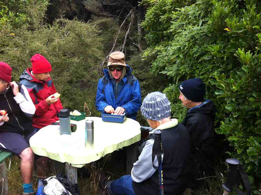
A couple of solid hours saw us at the junction down to John Bull Creek, where it was unanimously decided not to descend, but to press on to the top for lunch. Which we did, collapsing gratefully for welcome food and drink. The rain had stopped and a pleasant break was had, with chocs to celebrate Alec’s recent birthday.
Lunch at the seat. Rain stopped at last.Lunch stop viewed from another angle.
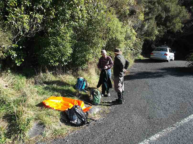
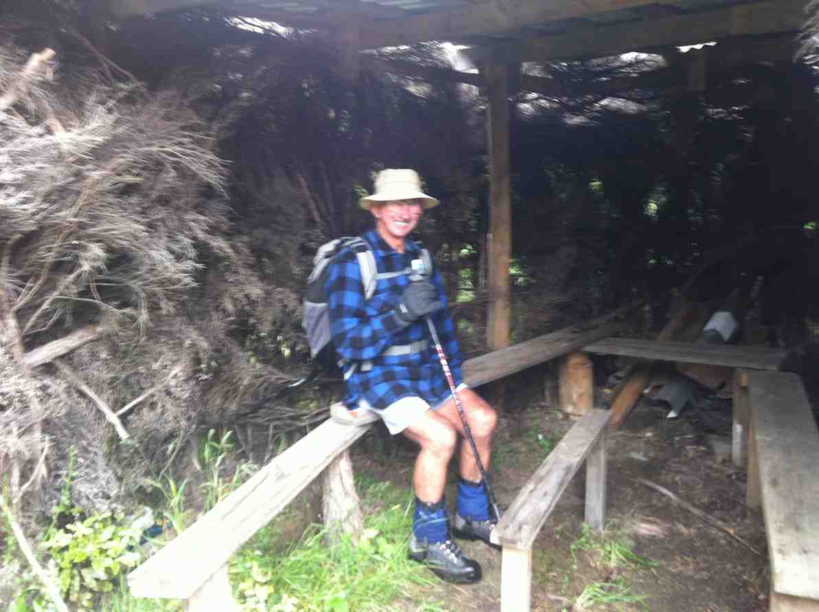
Then down, and down, with a few inadvertent sit-downs, and the loss of a couple of impatient members who tried to take the direct route….it was quite slippery. No harm done, and we were soon back by the river for the last plod out to the road. The bus parked by the bridge was a welcome sight.
Nine cheerful souls on the bus had had a pleasant few hours meandering round Taieri Mouth and catching up on gossip, and there was no sign of the hardy seven trampers.
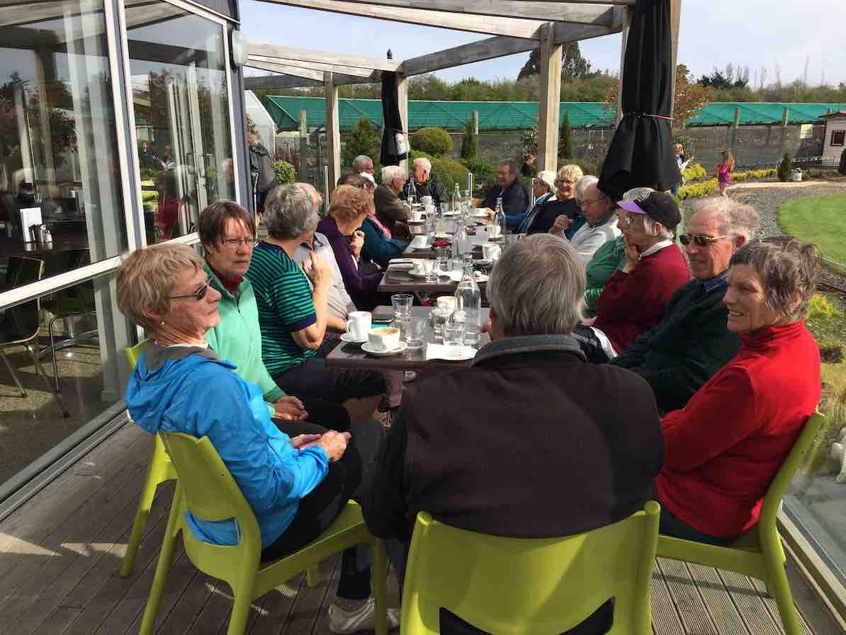
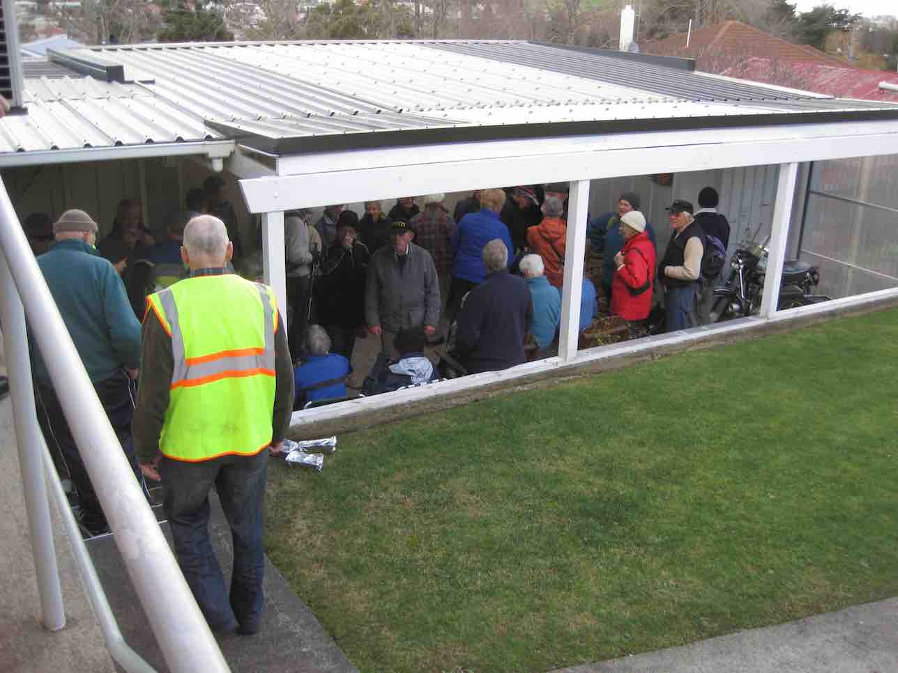
Thanks to hiking leaders Bob and Doug and tramping leader Arthur. It was a great day out, well-supported and enjoyed by all, and rounded off with a riotous session for coffee for 23 at Topiary. – Judy.
Coffee at Topiary. 23 in the sun.
16. 13/7/2016. Trampers. Millennium and John Bull from Henley. M. Leader: Arthur.
Two cars transported 9 trampers to begin the day’s adventure. The mild temperature was welcome, the sky overcast with northerly breezes.
We left the car-park at 10.00 a.m. and waked for about 10 minutes, to have morning tea at the picnic spot on the riverbank.
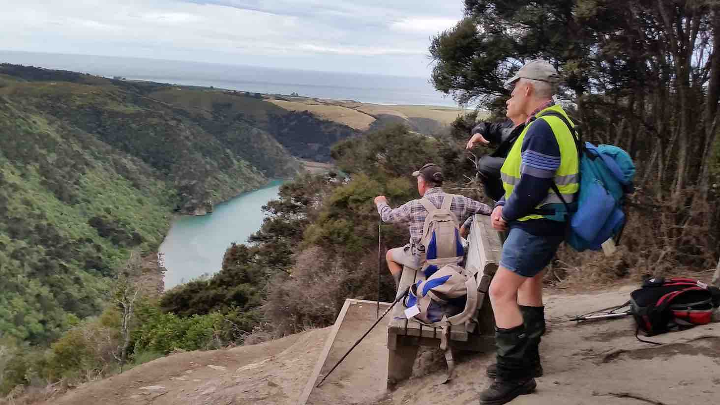
Continuing on it was up and down, as the track flows, and then up to the high up seat where we stopped for a little while. This spot overlooks the river to advantage
Another river view. (Margreet pic and caption.)
and also views away to the north too.
View from the top. (Margreet pic and caption.)
For example, Mount Cargill stood out in all its glory, with its mast on top.
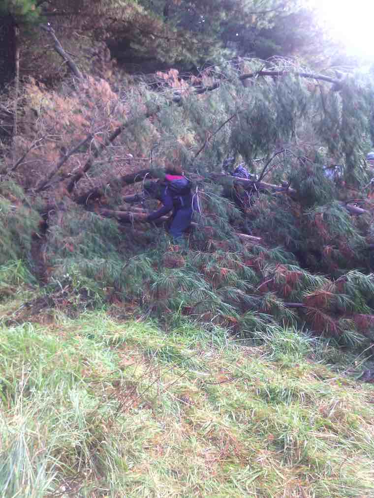
The track was now downhill, the trampers intelligently noting that it would be the opposite on the returning journey. We came to a small wind-blown tree across the track, but Neil M. wrestled mightily with it and it was a problem no more.
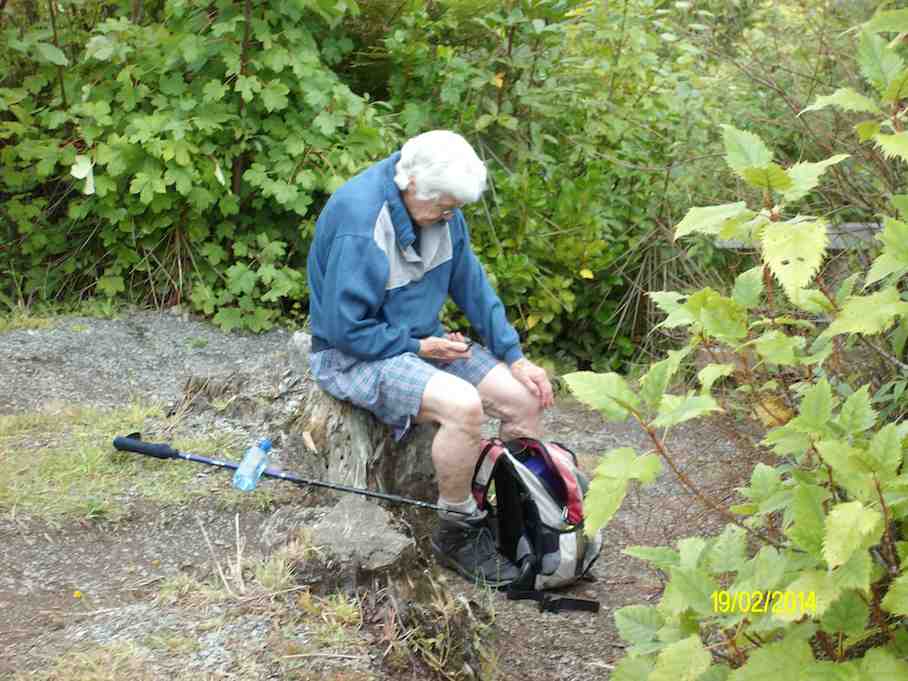
An hour after leaving the high up seat we reached the track’s end. We were invited to have our lunch outside at Jay’s nearby house (she didn’t have the key with her), which we found a most pleasant and suitable place. – Thanks, Jay.
Lunch on the verandah of Jay’s Bach at Taieri Mouth. (Margreet pic and caption.)
A half-hour’s lunch and rest stop, and the party was on the track again. Grim determination was noted now, and with little talking, a fast pace was set, and we were back at the high up seat in an hour uphill – the same time as it had taken going down.
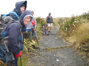
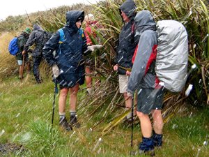
It had just come on to rain, so a brief regroup was taken under the trees, coats on, etc. The view being ignored now, downhill, and we were back at John Bull gully – just as the rain stopped and the sun came out.
Up the zigzag, and along, and down, etc., saw us back a the car park at 3.35 p.m.
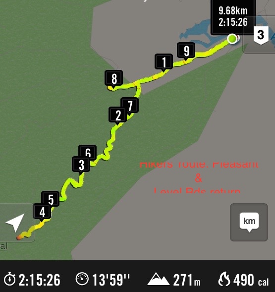
The DoC sign at the car park stated that it was 9.3 km to Taieri Mouth but Margreet’s electronic gizmo said that we had done 16.2 kms.
Whatever distance we walked, we can say very definitely that “we went there and back”. A satisfying day’s tramp.
Blustery wind and rain welcomed us back to Mosgiel. No time for coffee today! – Arthur (substitute leader for Helen – off sick.)
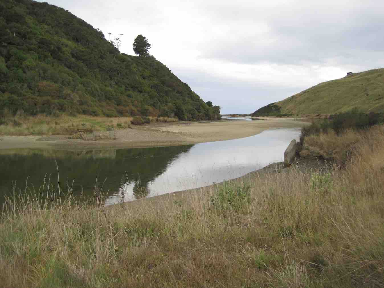
15. 9/9/2015. Trampers. John Bull and Millennium from Taieri Mouth.
This tramp was done in place of the one scheduled, as I could not get permission from the farmer to do the tramp that was on the program.
Ten of us arrived at the Taieri Mouth car park, & set off along the riverside track. We had quite a late morning tea stop at the wooden seat at the top,…
Cuppa (Ken pic)
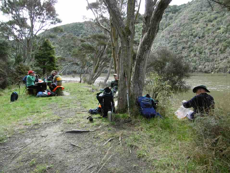
…before going down to John Bull Gully, where we had a short break. Then it was on along the Millennium track towards the Henley end. We arrived at the picnic spot down by the river, & had lunch there…
Lunch1 (Ken pic)Lunch2 (Ken pic)
…before setting off to do the remainder of the track, though to Wardells Cottage, & the car park beyond. [just to do the full track distance]
After a short break here, it was back the way we had come. We stopped at the seat at the highest point again for a rest & refreshments, after climbing the quite steep track up from John Bull Gully. We then made our way back to the cars at Taieri Mouth.
The weather was fine all day, but the track was quite muddy in places, & care is needed on the downhill muddy slopes.
It was good to hear the comments from some, that they had enjoyed the walk.
Although many in the group had walked both tracks in the past, it was the first time that quite a few of us had walked the full distance, there & back.
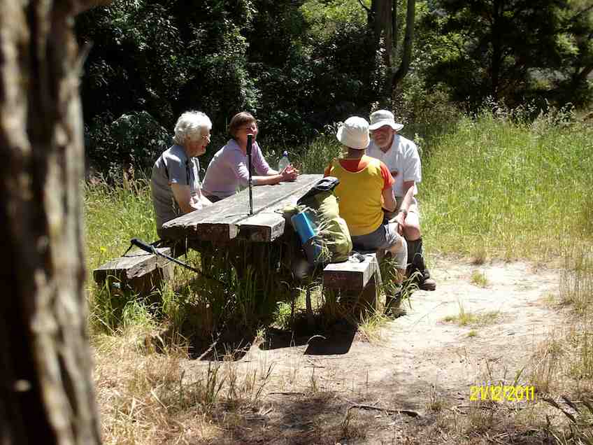
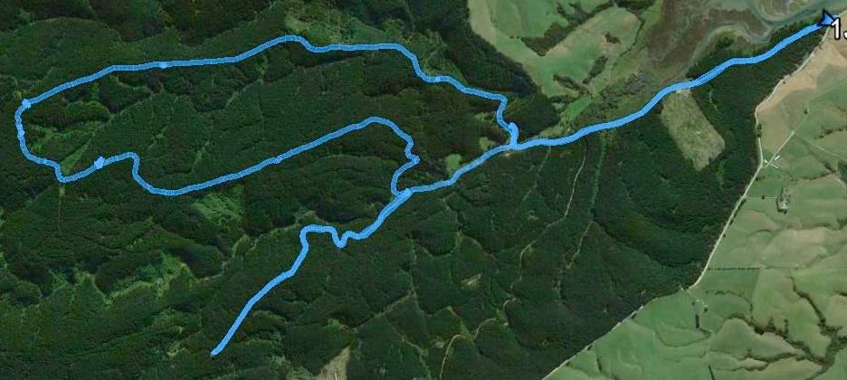
14. 21/12/2011. Trampers. John Bull and Millennium from Taieri Mouth.
GPS. Taieri Mouth John Bull Gully Millennium Track. Courtesy Ken.
Lunch. (Ken pic and caption)
Lunch2. (Ken pic and caption)
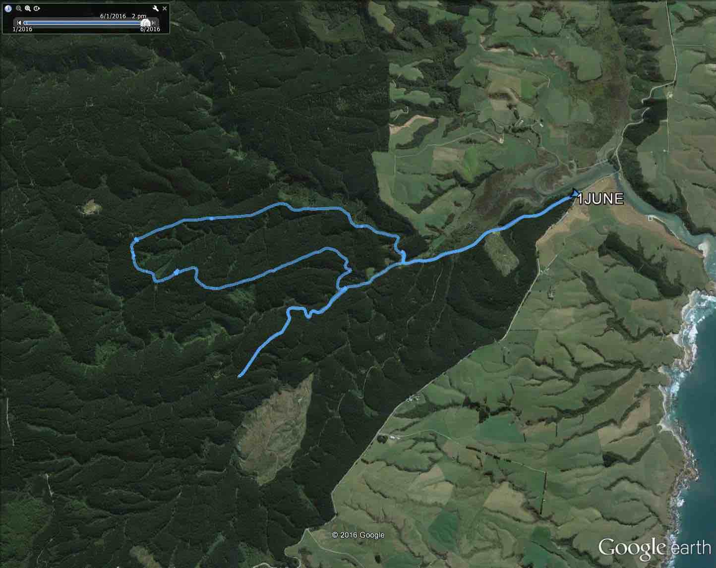
13. 8/12/2010. Trampers. Taieri Mouth to Wardells’ Cottage, return. H.
GPS of route, courtesy Ken.
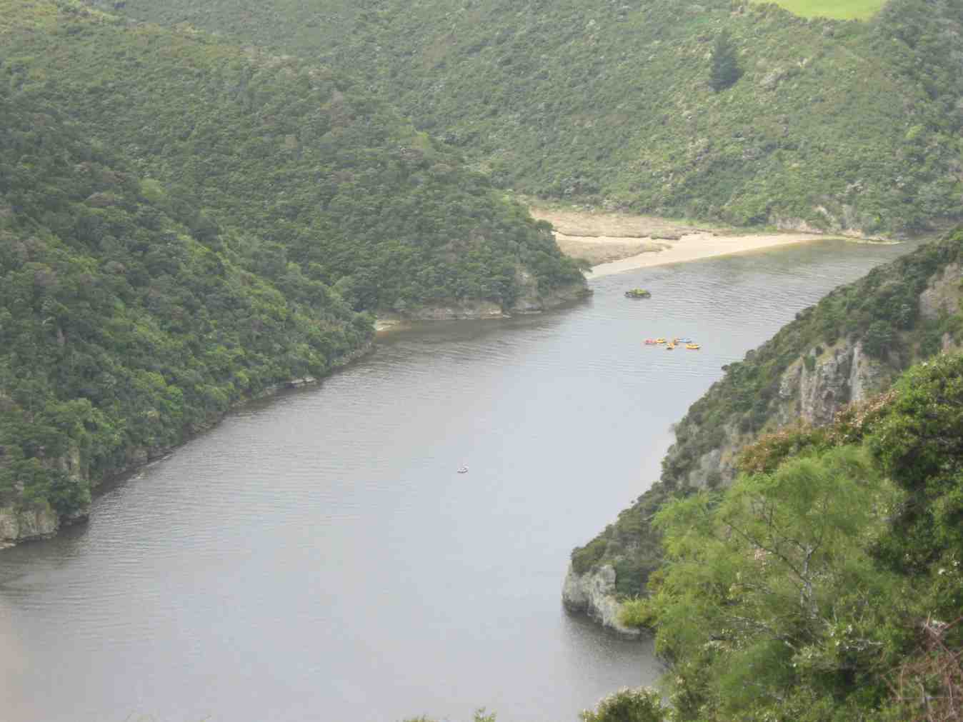
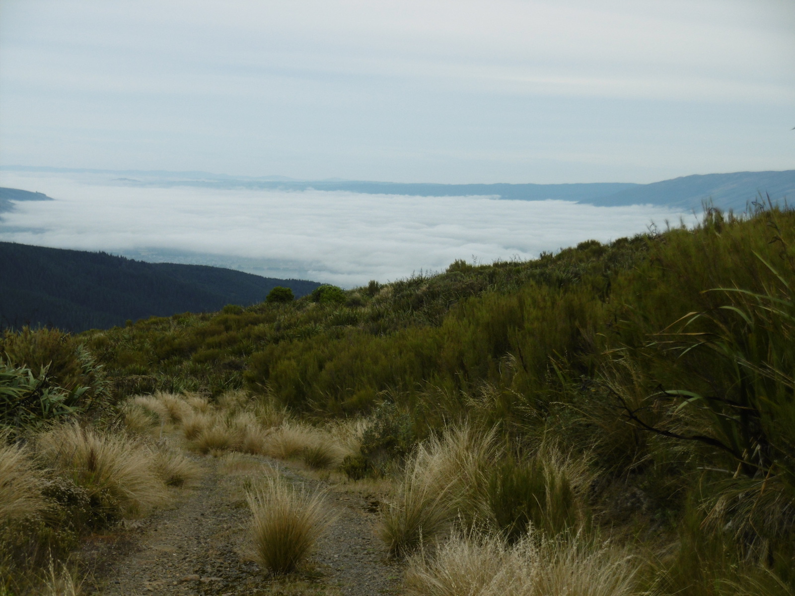
The day was a bit cold and windy with some promised rain. A vote taken at the Taieri River mouth bridge was two to one (the writer was the ‘one’) with two abstentions to do the more sheltered John Bull Gully track instead of the scheduled Akatore beach walk. Aerobically it was certainly more beneficial with its plentiful provision of ups and downs. Continuing on to the Millennium Track to Wardells Cottage as well provided us with an all-up 18 km work-out which we all enjoyed. There was some spring grass overgrowth in places and the odd fallen tree. Some scrub cutting had been started There was some school group or other on inflatables out on the Taieri.
Distant shot of inflatables on river
12. 15/4/2009 Hikers. John Bull Track. Leaders: Lesley S, Bill H, Fred.
The hikers’ walk from Taieri Mouth on the John Bull track took a turn for the worse when 2hrs into the walk Elaine had to stop because of chest pains etc.
Leaving Elaine in the professional care of Bev, Lesley G and Neil, the remaining 10 carried on to higher ground to try and get cell phone coverage. This proved more difficult than anticipated and it took Lesley S to search for higher open area off the main track before finally making contact with the emergency service.
After the helicopter landed a paramedic ran down the track to where Elaine was lying. After her condition was checked and she was stabilized, she was attached to the paramedic and winched through a small gap in the bush canopy into the helicopter. – Fred
I have been overwhelmed with kindness from the tramp club since the event on the John Bull track.
Would you be able to convey my thanks to the members of the club who helped as a great team in my dramatic exit from the track which I don’t really remember.
The quick action of Bev, Lesley and so. I have found out the support of Neil in keeping me warm. And Lesley S who found cell phone coverage.
Chris who rang her husband in Brighton who linked it all together and the tramper who had the white shirts on that lay in the open area for the chopper.
ED at the hospital told me later that I was very lucky that I had had such great care.
They did a battery of tests – CT Scans but the last test I had was the Head Scan. (That was purely because I was a member of the TRTC – “Just joking” they said.) I had previously told them about the mad wet day that we did to Dr Point in the rain.
It has turned out great in the end. They said I can carry on tramping as usual next week If you will have me back?
Kind regards to every one – Elaine.
11. 16/5/2007. Hikers. John Bull from Taieri Mouth. Medium. Leaders: Dot B, Lesley G.
10. 15/10/2003. Medium. John Bull Gully from Taieri Mouth. Medium. Leaders: Jack and Rosemary.
9. 5/9/2001. Combined. John Bull Track. Leaders: Frank and Lesley, Pam.
8. 1/11/2000. John Bull Track. Leaders: Doug M, Hazel, Jean.
7. 16/6/1999. John Bull Track. Leaders: Lance and Lois, Judy C.
6. 18/11/1998. John Bull Track to river. Leaders: Dot B, Doug and Ngaire.
5. 8/7/1998. John Bull Gully and return. Leaders: Bev H, Bev McI.
4. 4/6/1997. John Bully Gully. Leaders: Joyce, Nancy, Eleanor.
3. 14/2/1996. John Bull Gully. Leaders: Dot and Eric.
2. 6/4/1994. John Bull Track, then over paddock to Waihola Road, back on John Bull Track. Medium. Les S, Bill H, Doug and Ngaire
1. 17/2/1993. Taieri Mouth Bridge to John Bull Flat. Average. Leaders: Eric and Dorothy, Joan H, Chris.
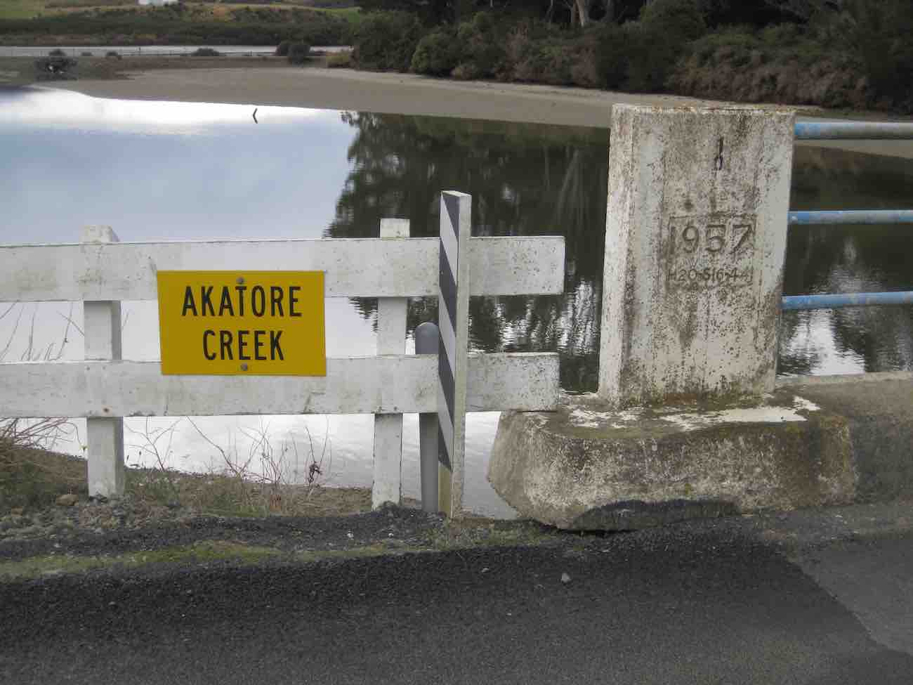
Akatore tramp 1 June 2016.
We obtained the access permit for the recce, on Saturday 21 May 2016, from the Wenita website at http://www.wenita.co.nz/use-the-forest/. The only limitation on numbers mentioned on the access permit was 4 hunters per permit. We obtained the permit for the tramp on Wednesday 1 June from Ian at the Wenita office, 11 Hartstonge Ave, Mosgiel, on Tuesday 31 May. Permits for entering the forests at the weekends can be obtained online. Wenita like to issue weekday entry permits at their office in the preceding week so they know what forestry operations will be taking place. No number limitations were mentioned on the tramp permit for 1 June in contrast to the limit of 15 that has been on some permits in the past.
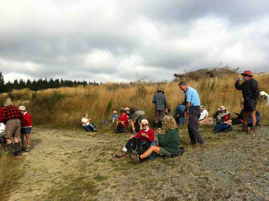
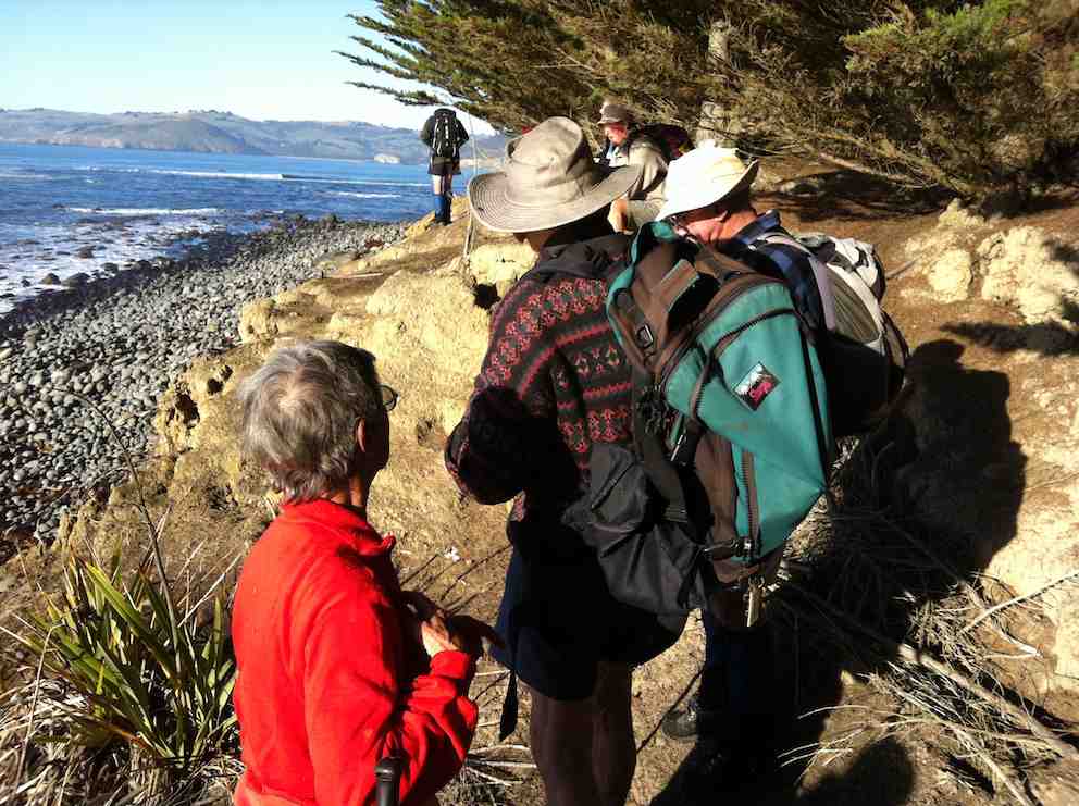
35 trampers set off along Pleasant Road from the gate approximately 400 m south of the Akatore Creek bridge, approximately 6 km south of the Taieri Mouth Bridge at Taieri Mouth. We had morning tea, after approximately 2.25 km, near the bridge at the junction of Pleasant and Boundary Roads.
Sunny spot for some having morning tea (Helen pic and caption)
After morning tea we climbed the gradual ascent on Centre Road for approximately 3.75 km to the turnoff to the left onto Staircase Road.
We lunched at 12.30 pm on Staircase Road in a rather chilly situation after negotiating the major obstacle of the day, a large wind-fallen tree.
Lots of fallen trees on track. (Helen pic and caption)
After lunch we proceeded for the remainder of Staircase Road …
Muddy underfoot in parts. (Helen pic and caption)
… (total approximately 3.75 km) to the junction with Pleasant Road.
The main group proceeded with Marjorie back to the cars by the gate while a smaller group followed Bruce up Pleasant Road for approximately 1.5 km to the junction of Pleasant Road and Kamahi Road before getting back to the cars at approximately 2.45 pm.
The day was generally quite cold and keeping moving helped for staying warm. No rain fell but the tracks were mostly in the shade and there was some wind at times.
Coffee followed at Wals. Distances: approximately 12 km without the Pleasant Road dogleg; 15 km with the dogleg.
– Bruce and Marjorie.
7. 6/5/2015. Akatore Forest Both Groups. M. Leaders: Bruce and Marjorie.
The 10k Group
The 10k group’s route map
The 10k group of 10 parked on the right approximately 200 m past the Akatore Creek bridge…
Confirmation of the calm day. Akatore Creek Bridge (John pic, taken after tramp)Further calm. Looking out to sea, from the Akatore Creek Bridge. (John pic, taken after tramp)
…on the Akatore road, went around the locked gate and walked 1.41 km along Pleasant road to the junction with Level road where the party stopped for morning tea.
Some of the “Ten”. (John pic)
They then turned left into Level road and proceeded 3.07 km up the road to where a road comes off on the right to a hill top (about 150 m before the junction of Level road and Mailbox road. Some went up this road to look at the view. They then returned down Level road and turned left into Pleasant road and proceeded 0.41 km along this road to the bridge area for lunch. They were surprised to meet the 10 in the 14k group standing on Pleasant road beside the turnoff on the right to the concrete bridge.
Meeting (John pic)
Both groups had lunch together 150 m up Boundary road. Some sheltered under pine trees to shelter from a few spots of rain which did not persist. After lunch the 10k group returned along Pleasant road for 1.82 km to the cars. The weather was pretty good overall with only a little very light rain and generally warm temperatures. A few fantails were seen. Total distance approximately 10 km, climb approximately 120 m.
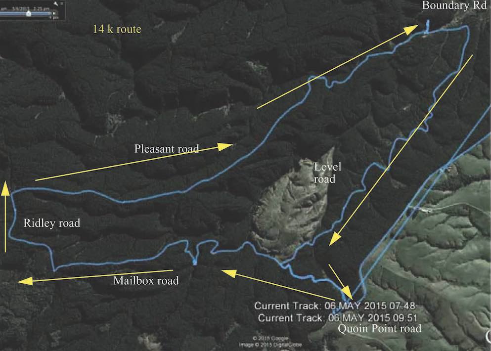
The 14 km Group
The 14k group’s route map, courtesy Bruce.
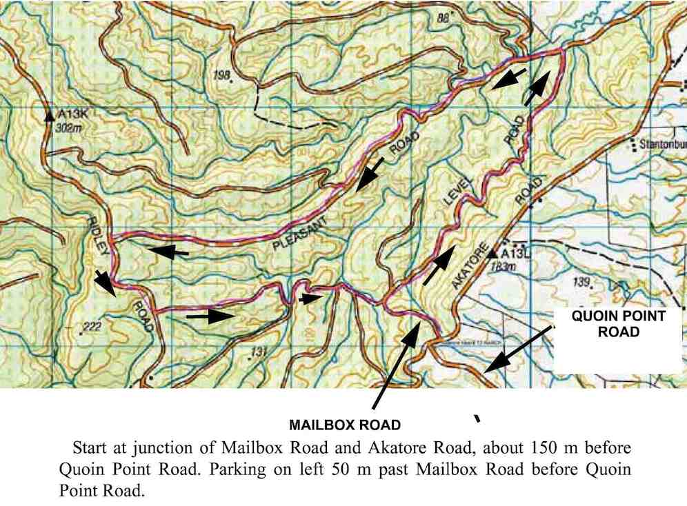
The 14k group of 10 parked on Quoin Point road, 3 km south of the Akatore Creek bridge. (It is easiest to turn at the widest part of Quoin Point Road at the junction with Akatore road and back up Quoin Point road and then parking on the left facing Akatore road. )
We walked 200 m down Akatore road, heading north towards the Akatore Creek bridge, and then turned down Mailbox road, on the left, past the locked gate for 1.07 km to the junction with Level Road. We turned left to remain on Mailbox road and, after 1.21 km, passed Serpentine Road branching off on the left. We stopped at the junction with House 21 road, 780 m past the Serpentine road junction, for morning tea. After morning tea we continued on Mailbox road for 1.48 km to the junction with Ridley road where we turned right and proceeded for 940 m before turning right into Pleasant road. We went down Pleasant road through the forest for 4.67 km arriving at the bridge area about 12.20 p.m., a minute or so before we met the group of 10k trampers. We had lunch with them. After lunch we waited for them to depart before proceeding along Pleasant road again for 410 m, turning right into Level road for 3.07 km, and then turning left into Mailbox road again and walking uphill for 1.07 km back to Akatore road, and then 250 m to the cars in Quoin Point road. We saw a tomtit and some fantails. Total distance approximately 15 km, climb approximately 400 m. – Bruce.
6. 13/3/2013. Akatore Forest Walk via Mailbox Road entrance. Leaders: Bruce and Marjorie.
On a calm mild day after crossing the Taieri River at Taieri Mouth and then Akatore Creek we proceeded south for about 3 km on Akatore Road and parked on the left hand side of the road about 70 metres past Mailbox Road on the right just before Quoin Point Road on the left.
GPS of Route on Topo map courtesy Bruce
We went down Mailbox Road for about 400 m to the junction with Level Road and had morning tea about 150 m along Level Road at the junction with a logging road on the left.
Morning Tea
We then continued on Level Road (on the right) for about 2.2 km to the junction with Pleasant Road. We turned left into Pleasant Road…
Along Pleasant Road
…and had lunch in the trees about 2 km further along. After lunch we continued another 2 km along Pleasant Road and turned left at the end into Ridley Road. We proceeded about 600 m down Ridley Road passing some bee hives on the right and took the first road on the left, Mail Box Road.
The sign for this was obscured by gorse. We continued along Mail Box Road until the junction with Level Road where we started the circuit (it was the third road on the right) and returned up hill to the cars. The weather remained calm and mild. We saw some fan tails and a tom tit. We heard brown creepers in the canopy and a grey warbler. Leslie heard a falcon. We obtained a permit from Wenita prior to the tramp and estimated that not more than 15 were likely to attend. Having more than 15 makes an event and different rules apply. Distance travelled 12.4 km. – Bruce.
5. 16/5/2012. Both. Akatore Forest Walk via Pleasant Road entrance just beyond the Akatore Creek Bridge. Leaders: Chris, Bev.
In the light of questionable weather, and uncertain weather reports, few ventured out to the car park. The Hindon area trampers’ tramp promised high exposure to cold winds so was really out of the question. But the Hikers’ Akatore Forest promised a more sheltered tramp. As it turned out. With plenty of sunny spots on the roads. The route turned off Pleasant Road to anti-clockwise climb the hill and later descend via Staircase Road to Pleasant Road and out again. Bravo. Congratulations to the leaders and their determination to give it a go for six of us. – Ian.
Along the road
Lunch
Where the clockwise loop ended. (One of the more clouded moments.)
4. 26/2/1997 Akatore South Side. Leaders: Jack M, Hugh, Mary L.3. 3. 7/8/1996 Akatore Farm Walk. Average. Leaders: Jack M, Jean A, Ria H 2. 9/2/1994. Akatore. Medium. Leaders: Jack M, Eleanor, Judy & Rob 1. 30/1/1991 Akatore Forest Walks. Leaders:
After cancelling our trip to Leaning Lodge, 7 trampers turned up at the carpark to do the Morrisons/Poleline/Swampy/Moon circuit.
We parked on the Leith Valley Rd. by the entrance to the Glow worm track, then walked up the road to the bridge over the Morrison Burn.
The day started off cool, but fine, & the track condition was quite good. We climbed under the barrier at the locked gate on the bridge at the start, & made our way up to the weir,
1 Curiosity (Ken pic and caption)
then backtracked to where the track went uphill through the bush. After morning tea break,
2 Morning tea (Ken pic and caption)
we carried on until we came across a gravelled road, where we took the wrong way!! We soon discovered our mistake, & walked along the road to where the track started again up through the bush. This eventually led us onto the Poleline track that goes up to the top of Swampy. We had lunch sheltered from the wind by the building at the top of the Leith Saddle track, then retraced our steps back …
3 Fog over Mosgiel from Swampy (Ken pic and caption)
… to the junction of the Poleline track & the Swampy Ridge track, where we turned off, & made our way along to the top of Moon track. We had a short stop here before heading off down this very badly rutted [damaged by mountain bikes] & rough track into the bush again where there is a multitude of mountain biking tracks, winding back & forward making it hard to know which track to take. So we just kept looking for tracks that went downhill, & eventually we ended up on the Leith Valley Rd. about 150mtrs from the cars.
An interesting day, & a tramp that a few had not done before, & all agreed that it was a good walk.
Walked 12.8km
Ave speed 3.9km/h
Moving time 3h 18min.
Climbed 658mtrs. – Ken.
5. 19/8/2009. Medium. Morrisons Burn, Morrisons Track, Poleline Road, Swampy, Pineapple, Nicols Creek. Medium. Leaders: Keith and Glenice
Parking the cars at the Nicols Creek bridge, we walked up the Leith Valley Road to Morrisons at the foot of Stoney Ford slope. We scrambled past the large slip immediately across the footbridge and enjoyed the beautiful bush and moss-clad track up to reach the waterfall. Then the steep scramble up the bank to morning tea on the 4WD at the slope’s top. Along that a bit, and then it was further up, up, up through bush to join the Pole Track 4WD to enjoy lunch where it meets the Swampy Ridge track. Instead of turning down the Nicols Creek track junction when we reached it,
Junction of Swampy with Nicols Creek Tracks. Hazel, Ria, Pat, Ken, Doug M, Lex
by common consent Lex took the 10 of us on to the Pineapple Track
Junction Swampy, Pineapple Track. Lex, Ken, Pat, Doug M, Hazel, Wendy
descent to break away from it further down at a stone cairn to cut across the cocksfoot on the left to the bush edge. This provided heightened interest as it had not been reconnoitred but Lex cleverly located the track that led down through the bush and across back to Nicols Creek track. The day had begun overcast and actually rained a few drops after lunch, but got really hot during our concluding descent to the cars. A good way for it to happen. – Ian
1. 1/7/2015. All. Midwinter Dinner. Concord Tavern. E. Leaders: Elaine and Eric.
GPS Route Map
Well! Records set. At least for the tramp. 40! Yes, 40. And 50 for the meal. Much due, this reporter suspects, to the way Elaine crafted the walk’s publicity. Easy? Well, not altogether with a bit of a climb into Abbotsford maybe a bit hard for some.
First problem was to number the carpark’s milling crowd off, but Fred got it right by standing at the corner by the road. Elaine set off at a brisk pace down …
Down from Inn (John pic)
… the “Main South Road” (surely it’s time to name it the Old Main South Road), around the corner at the bottom and then level walking towards Green Island. Then a stop. Question time.
Q1 (John pic)
Date of motorway completion? Wow. Peter had the exact answer. 1974. Take a prize! Then on. Stop again, outside an imposing gateway. What do the initials IRMO stand for?
IRMO. (John pic)
More knew the answer this time. A prize again. Onward. Stop – outside Harraways Office. Now a generous distribution …
Harraways (John pic)
… of complimentary Oats Singles packets. Take more than one. Onward again. Across rise where most recalled the railway line that once crossed the road. To collect coal from Saddle Hill once, someone said. Last stop, at the curly beginning of the impressive overhead footbridge, spanning Kaikorai Stream, the motorway, …
Bridge (John pic)
… bush, and finally the railway before turning right into Neill Street and left into Matthew Street, and second entrance on our left into a property with a wonderful back covered porch.
Porch (John pic)
A further surprise. We were regaled with mulled wine or soup served in pottles with generous refills. (A recent email from Elaine says a further whole thermos of mulled wine got overlooked. – Damn, as she so feelingly put it.) Next, in through a door leading under the house to view …
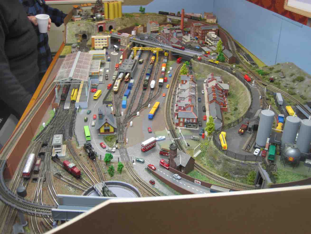
Train set. (John pic)
.. a model train set.( This reporter can testify it was even more elaborate than any he saw at the recent display put on at Wobblies.) It was N gauge (9mm). Unfortunately, the owner didn’t have it going, lest he exposed himself to an embarrassing derailment. Too bad. It was capable of running two trains at once. There’s a wealth of ancillary detail also, all to scale. A close study will prove most rewarding! To this reporter, this is the engineering equivalent of close needlework.
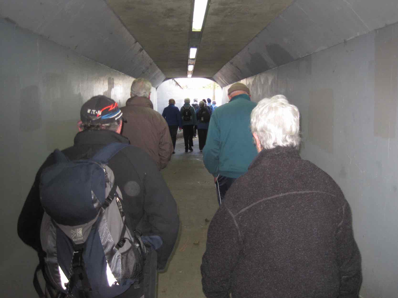
After this wonderful surprise break, it was back down Matthew Street and away along Neill Street to our left to reach a hidden pedestrian underpass at the foot of Armstrong Lane …
Underpass
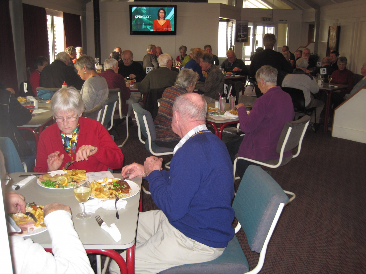
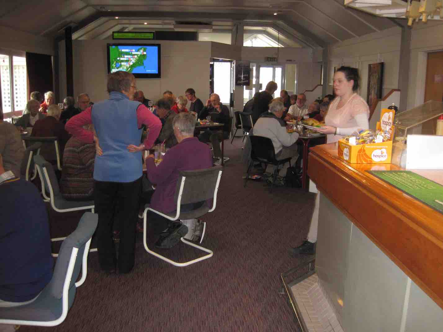
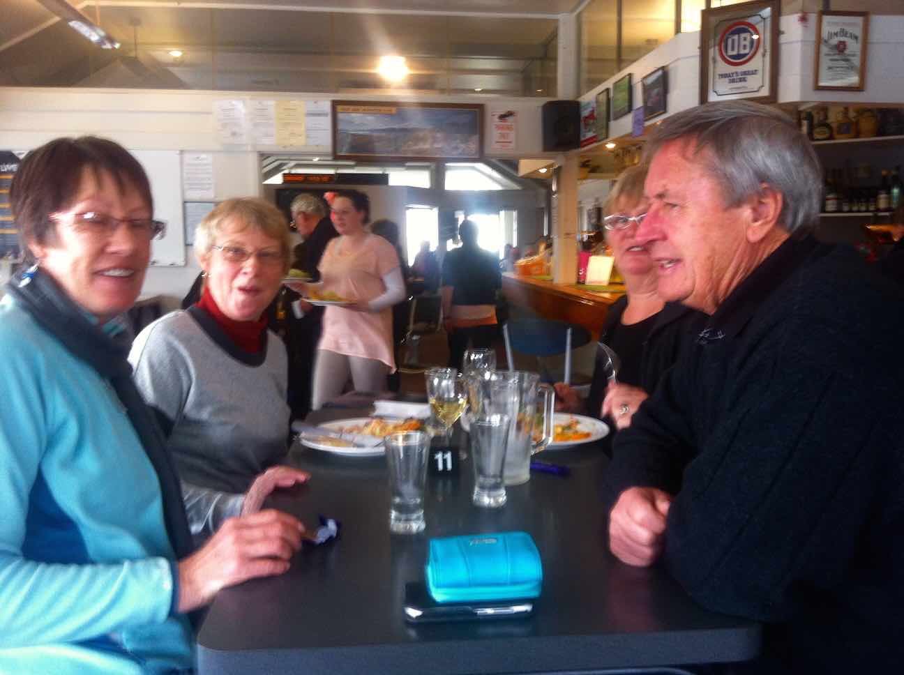
… and to emerge onto a little path that skirted round to the foot of Harraway Road, across a Kaikorai Stream bridge, out onto the “Main South Road” and back to the Concord Tavern for the Dinner. Here we met with the non-walkers and filled an almost overcrowded dining room. Some of us neglected to pick our table first as we found we were supposed to (including this reporter) before we lined up at the servery to place our meal order, but waiters found us eventually and all was well.
Again, due to Elaine’s homework with her sponsors, there were little prezzies on the tables and under-the-seat tickets for rewards. What a girl she is!
So, thanks to Elaine and Eric for such an imaginative midwinter dinner function effort. Well done, to put it mildly. – Ian.
16/8/2000. Concord – Blackhead. Leaders: Les W, Diana and Ray.
26/5/1999 Concord from Tavern to Blackhead. Leaders: Jean, Ngaire, Bev McI.
19/5/1993 Concord Corner, Blackhead, Beach, Brighton Road, Allan Road, Green Island Bush Road. Round Trip. Leaders: Jack, Rosemary, Joyce I, Joyce S
23/9/1989 Concord Hills from Wine and Spirits carpark. Easy+ Leaders: George, Ria L, Pam, Ria H
6. 15/9/2014.
Just been reading some of your website on this short track. You may like to know that when we were talking to the gentleman at the museum last week, he told us that the track was put in to take supplies of piping etc up the burn for the Outram water supply. Also, if you go to the end of that track, & then cross the burn, there is a track up the other side, & up there is a valve, & some old piping. So it seems that the track has nothing to do with the old mill that was there, as it got it’s water from the race that you & I found in the paddocks above the road.
He has some old photos of the area as well, but they are not very good ones. There is also a water wheel [working] at the museum, which I think he said was the old mill wheel. – Ken
After a cool start to the day, the weather warmed up, & we had a good walk along the Outram Glen track to Lee stream, [where we discussed the possibilities of crossing the stream without getting very wet] & back. We had a couple of stops along the way, one was with the owner of one of the houses up the Chalkies track road. He tells us that the grumpy one has now gone, & the new owners are quite ok with groups like ours going down [or up] the track through their properties, then down [or up] their driveway. I think permission should still be sought first though, especially for the first time at least.We arrived back at the car for lunch, & then proceeded along to the short track that runs in from the one way bridge at the start of the George King Memorial Drive. this was a new walk for some in the group, & started up a discussion on the old mill that used to be there.
On the way back out, we decided to go up into the museum grounds, as this was also new for some in the party. We struck up a good conversation with one of the gentlemen working on the site, & he was most helpful with info on the old mill, it’s whereabouts, & where to find some old relics.
We arrived back at the carpark, just before the hikers returned.We walked approx 12.5km [didn’t take the GPS on the short track.]
ave. 4.2km/hr. – Ken.
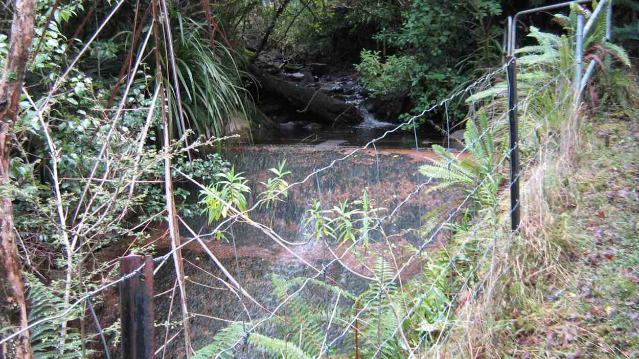
4. 5/5/2012. Whare Creek Outram Council weir. Ken and Ian.
On a fine Monday afternoon and with permission and advice from the landowners, we explored down the bush track below the power lines to arrive at the water race that supplied the water that drove the old Outram Glen Flour Mill back in the early 20th Century.
The Outram Glen Flour Mill water race.
Following the pink markers brought us to the point leading steeply down below the race to the creek and a weir. From Jim Sime’s later information, this was the Outram Council’s weir and pipe line to supply water for the Outram Water Supply tank, located above the Taieri Museum, now no longer in use. The weir was designed so that flood debris would wash right over it.
Old Outram Council Weir and piping, no longer in use.
Mr Sime said that the Flour Mill water race, higher up the bank, which he explored on an earlier occasion, leads on for a considerable distance to disappear at the face of a rock bluff, with no indication evident of how the fluming would have had to have been attached to the sheer rock. Mr Sime thinks that a pool yet further upstream at a streams’ confluence may well have been where the race might have begun.
Ken at the weir.
Ken pic. Upstream from the weir, the creek winds round to the left.
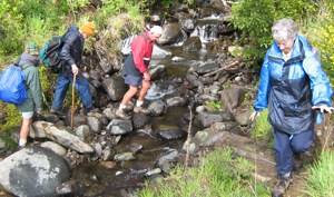
Seven of us took to the Outram Glen – Lee Stream track on an overcast & cool morning. We decided to have morning tea at Lee Stream, so we set off at a good pace, & we soon warmed up. The sun was out at Lee Stream, so a leisurely break was in order. We made our way back to the glen where we had lunch, & then we moved the cars down to the Traquair Burn bridge.
We made the short walk to the start of the Traquair Burn track & along this to the end, where we did a bit of exploring up the small tributary stream on the left. This quickly ran out of easily negotiated terrain, so we went back to the track end, & Ken went exploring up the Burn a bit further to see if it was possible to go upstream.
We returned to the cars via the Outram machinery museum grounds, where we had a good look around. – Ken
Six trampers turned up at the car-park following a very stormy night to learn that the leaders, Ria and Hazel had, happily as it turned out, decided on Outram Glen instead of Whare Flat. They had carried out three Whare Flat recces only to find on each occasion tracks too overgrown to clear. We were delighted to find the reported upgrade of the initial flat (mostly) part of the Outram Glen track had been widened and metalled making for two-abreast walking. The remaining steeper bit however was literally, according to a DoC notice, “maintained to only route standard”. It was! But we made good progress arriving at the Lee Stream terminus at 11. It was there that Doug and Hazel discovered wild potatoes
Gathering potatoes near Lee Stream outlet.Bush by Traquair Creek
of a very good size which Doug lugged back down the track for his meal table.
We lunched below the Taieri Historical Museum area prior to exploring a newly-cleared track up alongside the Traquair (or Whare) Stream – a new discovery for most of the group. Ian recounted how his Grandfather and family had owned the Flour Mill in a small area across the stream from 1911-1913 (the original Outram Glen), now buried under the present road corner alignment: a place once renowned for its gardens and picnic area for locals. Two houses, a mill, a fountain and an electric generator (which had earlier powered Outram’s street lights) as well as gardens had occupied the area. The buildings were destroyed by fire in 1918.
Fallen coloured deciduous leaves on an open area of the track would have kindled a painter’s imagination. We returned from where the track finally petered out, left wondering where it might have continued to in the past. Another satisfying day. – Ian
Grahams Bush reserve was originally the site of sawmills and brick kilns operated by David Bethune in the 1880s, and became city council property in 1955. Parking: Church Grounds. Distance from car-park: 27 km.
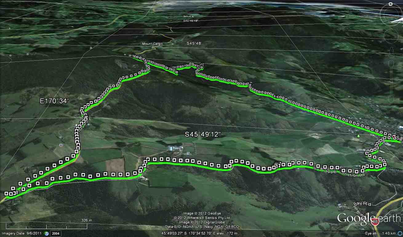
6/8/2014. Both. Hall Rd, Grahams Bush, Mt Cargill Rd, Upper Junction Rd, Brickhill Rd, Stevenson Ave. Leaders: Lester, Ian. (As it turned out, there was no appointed tramper leader there on the day.)
A perforce Hikers’ report.
This was one of those first of the month tramps for both trampers and hikers to get together. However at the car park on the church grounds, there was no sign of the trampers. We waited and questioned whether they had got lost. They had left the Bush Road car park before us. Where had they gone? We eventually set off without them on the long walk up Hall Road and on along the initial farm 4WD route to stop for a cuppa at the track turn-off.
For quite a few of us this was their first time on this route and they spoke appreciatively about the lovely bush. Rain the night before had made the track muddy in places. We were pleasantly surprised by beautiful bird calls, more than experienced on previous occasions.
The steep grade gets no easier, but eventually we emerged onto the Mt Cargill road be be greeted by the small group of three trampers. They had left the car park early before the rest of us, had apparently driven right past the church car park in Station Rd and (cunningly? shorter distance!) parked further up Hall Road, and carried on ahead. So it was not to be a together day after all, even up to a morning tea stop!
Anyway, after our brief meeting at the Mt Cargill Road car park, (so we were together briefly after all) they were off to further ascend Mt Cargill while the we stopped off for a leisurely lunch. Some of the hikers ventured a short distance up the track after lunch and returned back down again.
View from the top of the steps
Hikers’ lunch at the car park on Mt Cargill Road
Recovery position
We set off along the old Mt Cargill Rd in a very orderly single file, quite a number of us wearing high-viz jackets. Perhaps it was these that encouraged passing drivers to noticeably slow down as they passed. We turned down Upper Junction Road and were interested to see how the slip at the bottom had been repaired. After the last grouping at Brickhill Rd, we straggled on to our cars back at the church park grounds. At 16, there was only half the usual number of hikers, and we suspected some had wisely decided their fitness was no longer up to the steep climb of the day. Another fine day, bracketed by bad weather on either side. We were so lucky. – Ian.
A Trampers’ report.
3 trampers left Sawyers Bay before the hikers arrived, as they got tired of waiting around ! The walk up through Grahams Bush was a little damp after rain on the previous night, but the bird life made the walk more pleasant.
After morning tea, with still no sign of the hikers, we walked to the top road,
At the top road (Heb pic and caption?)
where we waited for approx 40mins. for them to arrive. After this, we walked up the Organ Pipes track, stopping to view the tumbled down remains of the pipes,
Organ Pipes (Heb pic and caption?)
then went on to Butters Peak junction,
Buttars Peak Junction (Heb pic and caption?)
where lunch was had in the sunshine.
The return trip was uneventful, & the birds once again kept us company. – Ian Hebberd? – per Ken.
1/8/2012. Both. Grahams Bush, Mt Cargill Rd, Upper Junction Rd, Brickhill Rd, Hall Rd. Leaders: Pat, Ken.
GPS of route, courtesy Ken. 10.5 km distance. 3.7km/h moving ave. 2hr 48min moving time. 379mtrs. total ascent. 394 max elevation.
A goodly number of 21 of us set off for the round trip. We stopped at the turn-off into the bush for morning tea. Evelyn has apparently suffered an early bad fall but soldiered on.
No. 50 on old hardcopy list of 113 club tramps. “McLaren Rd – Christies Gully Year Round”
Trampers Park Henley Road, to left of entrance from north end of flood free highway. 17 km from car-park.
Hikers Park Henley Road, to right of entrance from north end of flood free highway. 18 km from car-park.
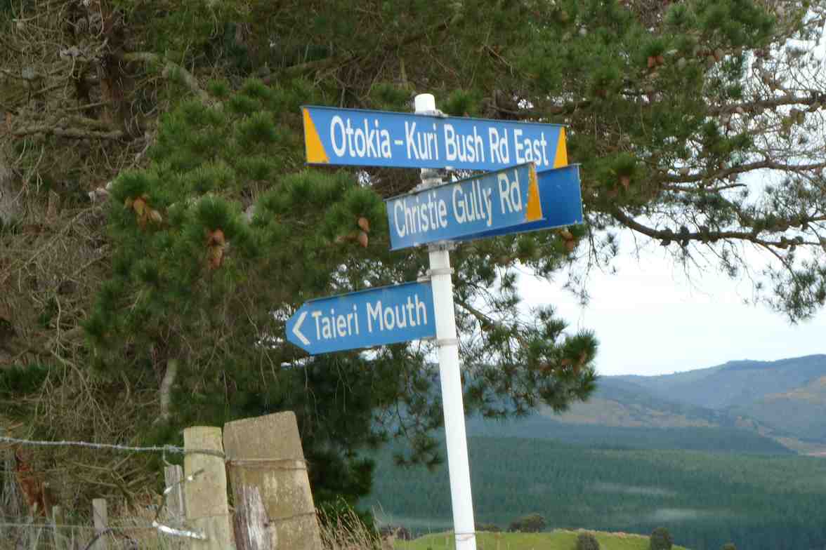
17. 9/7/2014. Hikers. Otokia, Big Stone, Christie Gully and Henley Roads. Leaders: Les and Margaret.
GPS of routeAbout to set off. (John panorama pic)Morning Tea on a hump of Otokia Road. (John pic)The dip in the Otokia Road beyond the Morning Tea stop. (John pic)The road sign marking boundary between Big Stone and Otokia-Kuri Bush Roads. (John pic)The road sign by Margaret’s g/parents’ place where we turned off to steeply descend Christie Gully Road. (John pic)
16. 13/6/2012. Hikers. Otokia, Big Stone, Christie Gully and Henley Roads. Leaders: Les and Margaret.
15. 24/8/2011. Hikers. Otokia, Big Stone, Christie Gully and Henley Roads. Leaders: Les and Margaret.
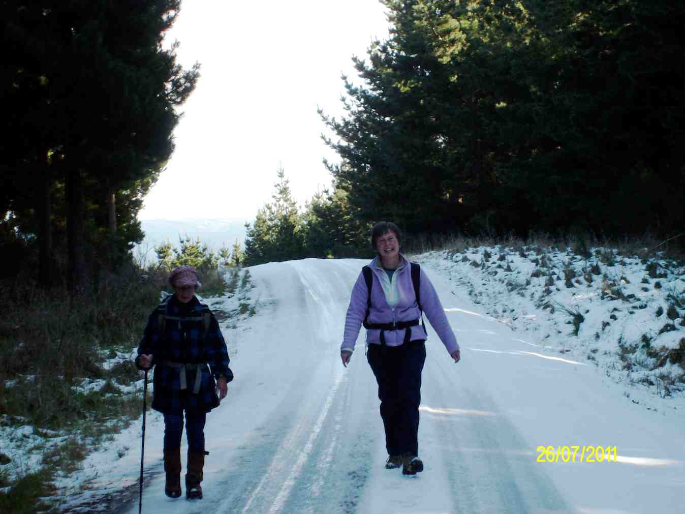
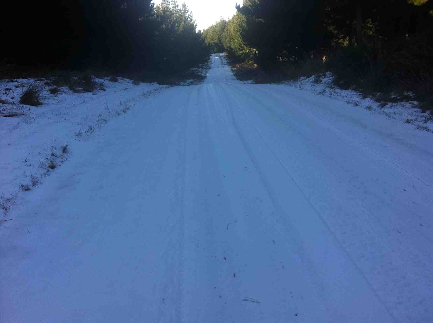
14. 27/7/2011. Trampers. Henley Road, Christie Gully Road, Big Stone Road, McLaren Gully Road SE along SH1 back in to cars on Henley Road extension. 3.5 to 4 hours. 15 km walk.
GPS
Sunny Spot
spread
View from top of Christie Gully Rd (Ken pic and caption)
Ria & Linzi enjoying the snow. (Ken pic and caption)
The road – and snow – goes on and on.
13. 13/10/2010. Hikers. Christie Gully, Cemetery.
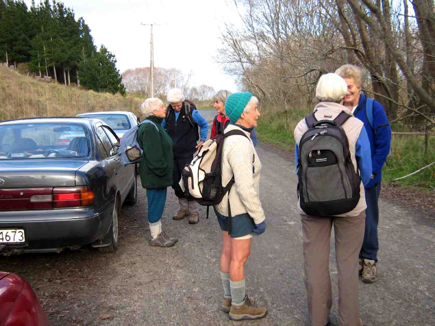
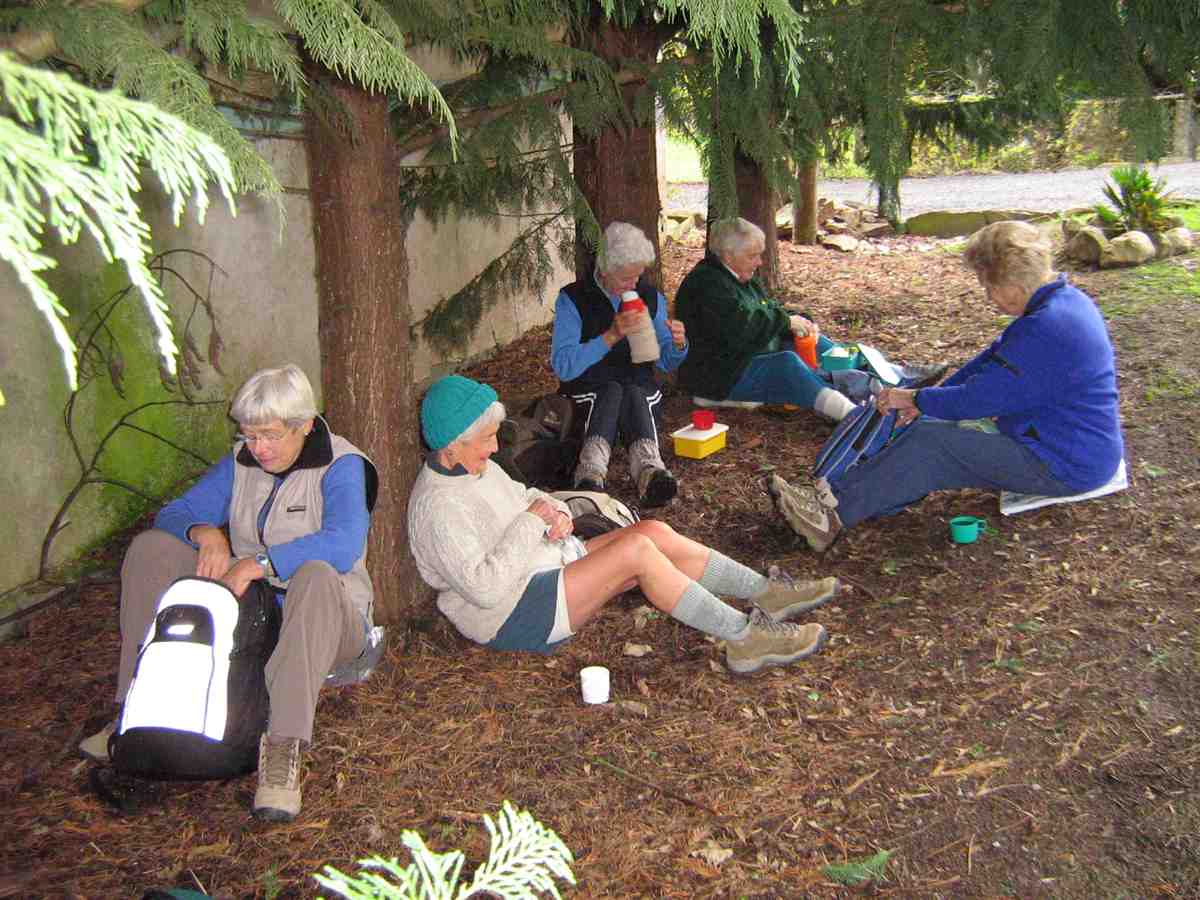
12. 3/6/2009. Both. Henley Road, Christie Gully Road, Otokia Kuri Bush Road East, (down Otokia Rd for shorter walk), Big Stone Road, McLaren Gully Road SE along SH1 in to cars on Henley Road extension. Leaders: Les and Margaret.
We parked in the usual place.
click to enlarge
The start. Chris, Dot, Molly, Bev, Lesley, Margaret
The later 9.30 a.m. start had us stopping for a cuppa on the Henley Road in some shelter instead of after the turn into Christie Gully Road.
Tea break. Lesley, Bev, Dot, Chris, Margaret.
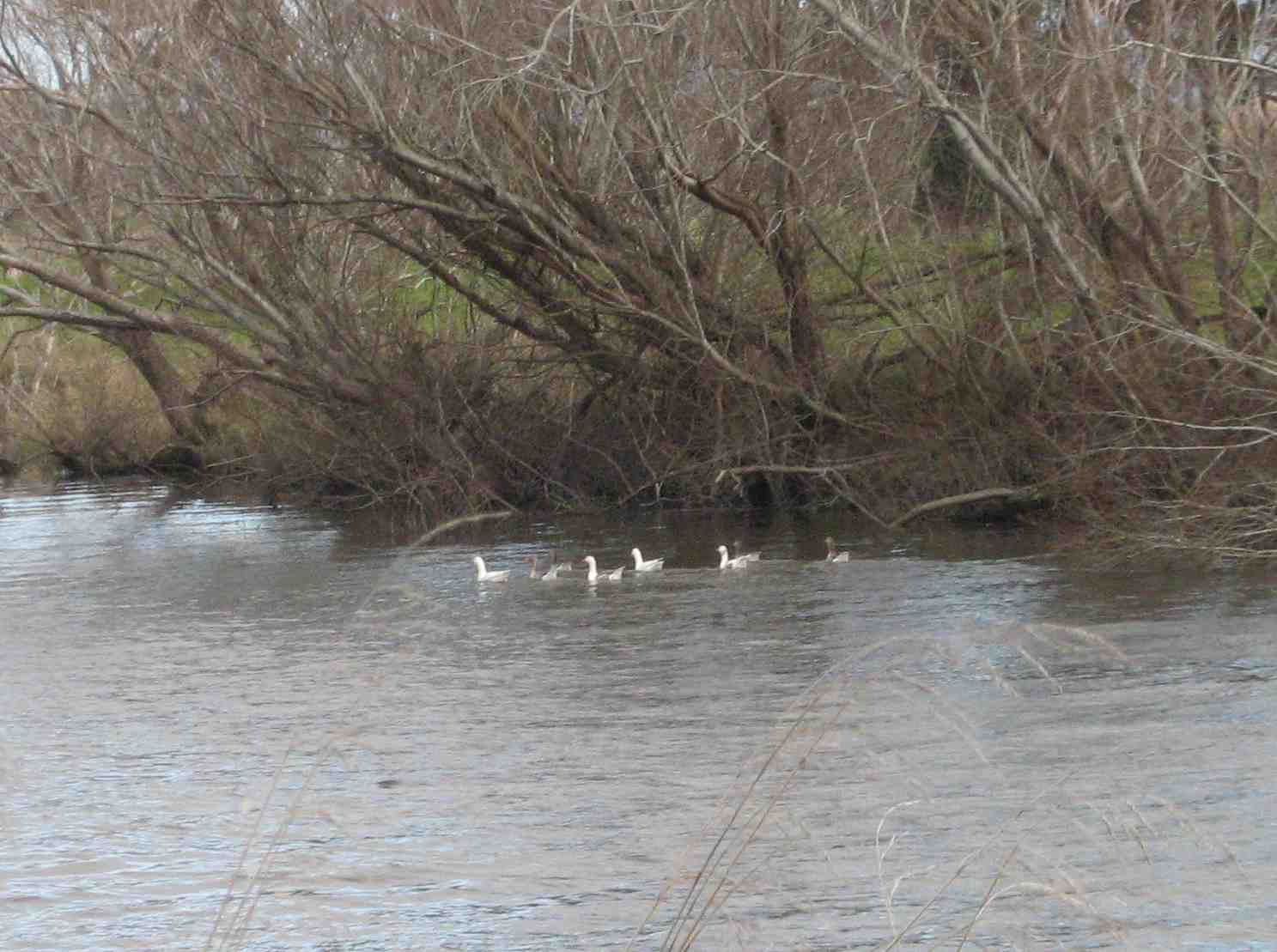
Next, we saw geese on the Taieri River.
Geese on the Taieri.
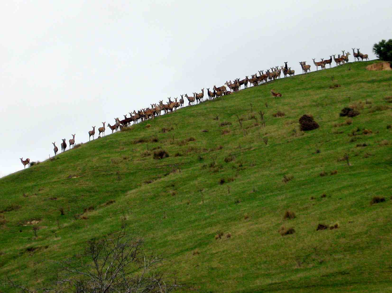
Then we saw deer on the hill.
Deer outlined on the horizon.
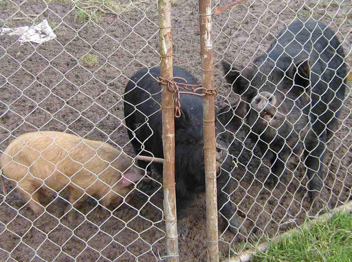
On Christie Gully Road we saw some old friends – or their descendants.
Happy as pigs in muck.
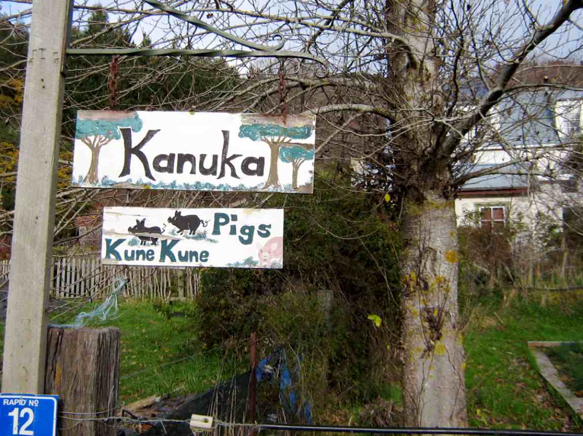
The sign says it all.
At the top of the road we stopped for a breather and to admire the view. It turned out we were outside Margaret’s mother’s old place. The house had been burnt down long before Margaret’s time.
Peter, Carmel, Molly, Bev, Margaret, Chris.
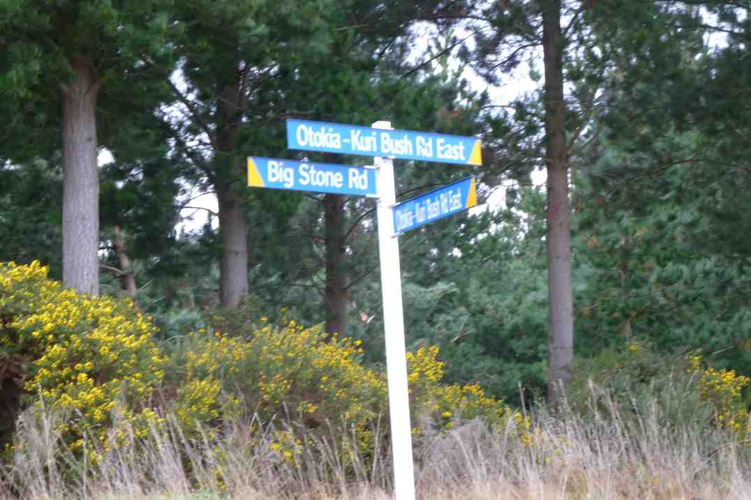
We paused at the junction of Big Stone Road and Otokia-Kuri Bush Road West.
Doug, Pat, Wendy, Chris, Bill, Molly, Carmel, Les, Dot, Angela at junction of Big Stone and Otokia-Kuri Bush Rds.
As Margaret was going to take those who wanted a shorter walk down the shortcut and via the cemetery, we stopped for lunch here.
Lunch. Molly, Bill, Pat, Les, Peter, Doug, Wendy, Angela.
A rare sight of falcons flying and calling in sky.
The first time I’ve snapped this place.
An attractive old house on McLaren Gully Road.
11. 29/10/2008. Hikers. Otokia, Big Stone, Christie Gully and Henley Roads. Medium. Leaders: Peter B, Neil
10. 12/9/2007. Hikers. Christie Gully, McLaren Gully Roads. Easy+. Leaders: Margaret and Les.
9. 8/8/2007 Leaders: Ian, Bill M.
Parked north end of flood free highway by gravel heaps.
Walked Henley Rd to Christie Gully.
To Otokia Kuri Bush Rd East/Big Stone Road.
Turned down McLaren Gully to SH1. Henley Rd to cars.
8. 30/6/2004. McLaren and Christie Gully. Medium. Leaders: George, Bruce, Dot T, Les & Margaret. 7. 18/9/2002 Leaders: Catherine, Lance & Lois 6. 27/9/2000 Christie Gully – McLaren Road. Road Walk. Leaders: Mary Y, Jean A, Catherine 5. 16/6/1999. Christie Gully, McLaren Road. Leaders: Les and Margaret, Wendy. 4. 22/7/1998. Christie Gully, McLaren Gully. Leaders: Margaret S, Nancy. 3. 11/6/1997. McLaren Gully, Christie Gully round trip. Leaders: Les and Margaret, Ivan. 2. 5/11/1992 Otokia, Big Stone, Christie Gully and Henley Roads. Average. Leaders: Eric & Dot, Margaret S, Les W 1. 15/6/1991. Christie Gully and McLaren Road. Good winter tramping and views. Average+. Leaders: Nancy, Margaret S, Eric & Dot
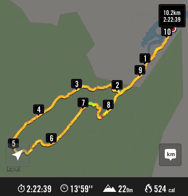
5. 19/2/2014. Trampers. Pineapple, Ben Rudd, Davies.
GPS of route., courtesy Ken. (Anti-clockwise from Booth Road) 9.2 km; 3 km/hr; 3 hr 6 min moving time; 2 hrs stopped!!; Climbed 589 mtrs.The group at the new seat. (Heb pic and caption)Afternoon tea break at the bottom of Davies track. (Ken pic and caption)Hazel in deep thought over her phone. (Ken pic and caption)
4. 17/7/2013. Trampers. Rollinsons Rd, Rollinsons Track, Swampy Ridge track along to Hightop, & return.
4 trampers set out from the locked gate On Rollinsons Rd. which was a little icy in places & there was still some snow showing in parts as well. We were all amazed at the amount of destruction that the snow had caused, with 15cm Manuka splintered like matchwood, & everything sort of flattened.
We had morning tea in the shelter by the picnic area, & then climbed up to the elbow, where we went straight ahead on Rollinsons Track, which was running with water in parts, & covered with snow in other areas.
After reaching the Swampy Ridge track we set off towards Hightop, but soon found our way impeded by fallen Manuka. We negotiated this for a kilometer or two before arriving at a very large & difficult blockage, so as it was almost mid-day, we decided to have lunch, & then return to the cars. – Ken.
3. 31/3/2010. Trampers. Rollinsons, Swampy Ridge, Hightop. Leaders: Ria, Ian
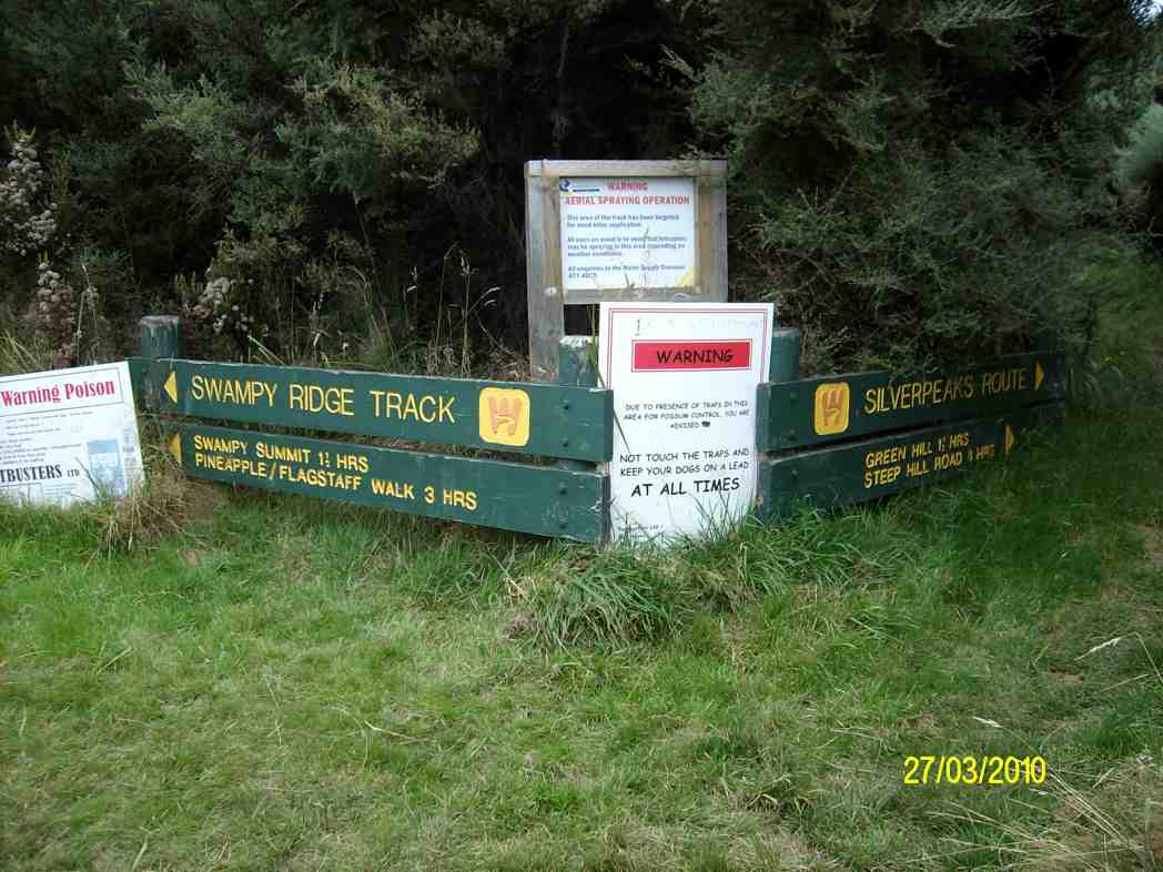
The tramp differed from intentions. For one thing, the leaders had done no recce due to a failure to find a date suitable to both. For another, it had been four years since we had last tackled the track, and memories were a little hazy. Going in from the elbow of Rollinson Road, we were first surprised to find the Rollinson Track sign missing, replaced by one announcing “Tarns”. We wondered at this, but were pleased to find the track fairly well marked by fluorescent pink tape.
Early part of Rollinson Track
These led us helpfully deeper into the swamp. The dry summer had left the track beautifully only damp where there would normally have been mud.
Deeper into the swamp.
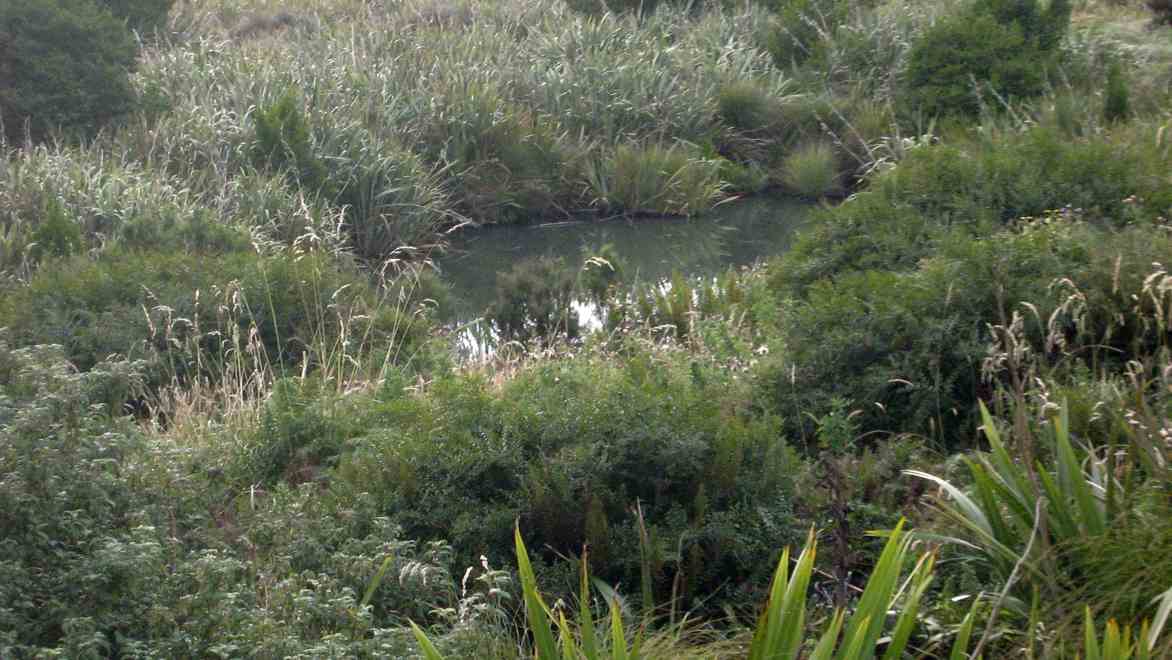
Second surprise. The helpful pink tapes had led us down to Swampy Lagoon. Obviously the “tarns”, or one of them. Were there others?
Swampy Lagoon
Oh dear. Where to from here? With reflective hindsight, we should have resisted the seductive tapes way further back and sought out the true Rollinsons, once upon a time indicated with Les Murcott’s green markers, some still there in places but now very faded. We should have paid them more attention. But we had been suckered by the pink. So what to do? We knew we were well off the track, and that anyway, up at the top was Swampy Ridge track. So we set off up a vertically vertical ridge, pulling ourselves up with tufts of tussock and grass, to eventually gain the track, after much heaving and huffing.
Looking back down steep ridge we had just climbed
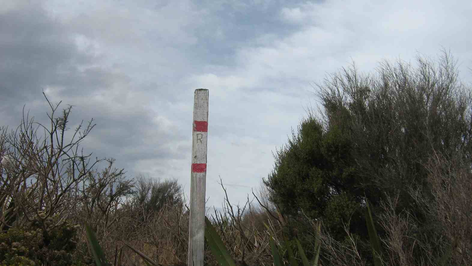
Later on, northwards to where the Ridge Track had considerably descended (!), we found the pole indicating where Rollinsons track DID emerge onto the ridge, by way of a MUCH easier climb.
“R” pole indicating Rollinsons track junction with Swampy Ridge.
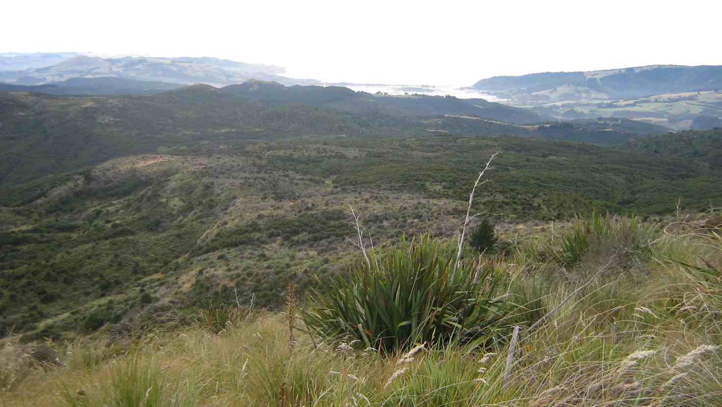
Near the north end of Swampy Ridge Track,
North end of Swampy Ridge Track
we attempted a climb of Clump Peak on our right, as our way to Hightop on our left had appeared too scrubby.
Clump Peak viewed from the west
2. 5/10/1988. Swampy from Access Road gate. Average Climb. Great views around summit (bring binoculars. Return by Flagstaff weather permitting. Car shuttle if required. Leaders: Bob H, Ria L, Jean Y
But even here a thick belt of gorse blocked our way so we hunkered down for lunch interrupted by a VERY light shower which was magically terminated by dint of one or two of us donning parkas.
Back then, along Swampy Ridge and up to swampy summit topped by the Airways VHF receiver station. Descending the Rollinson accesss road to the elbow completed our extended circuit. Six of us had come out for the day. – Ian.
1. 5/10/1989. Swampy from Access/Rollinsons Road gate. Average climb. Great views around summit. Return by Flagstaff weather permitting. Car shuttle if required. Leaders: Bob, Ria, Mary.
9. 1/5/2013 Both. Steve Amies. Leaders: Ian and George.
This time we left from the schoolhouse, making it more of a road walk. We had morning tea on the lower Rollinson Rd and lunch in the track clearers’ picnic area, after inspecting the helicopter landing pad a little beyond.
As we returned down the road, we were surprised to see the helicopter, and shortly after the tank truck making their way towards where we had been. Apparently this was the day to carry out the weed spraying we had been notified about – and we were now making a timely exit. A tramp for 25 of us and of 10.5 km according to Peter’s pedometer and 25. – Ian.
8. 1/2/2012 Both. Steve Amies from Access Road. Leaders: Arthur and Barbara.
Sixteen of us left our cars at the locked gate on Rollinson access Rd and made our way up to the Track Clearers’ Picnic area. The leaders took us round many of the little nooks and crannies (they just seem to multiply of their own accord), stopping to inspect the labels fronting each bush planting. Of poignant note in front of one bush was a label printed with the name of Les Murcott, whose funeral a number of us had attended only a fortnight earlier.
We stopped off for our tea break.
Arthur led us down and across to Trig Q, and then on down Little Coal Creek until we got to the look-out. We careful negotiated some quite steep parts of the track and avoided any casualties. Then came the more arduous climb back up to the trig and across to the Steve Amies.
This latter track had a much more moderate decline (we stuck to only its upper reaches!), past another look-out, before making another turn around further down, to wander back up to the trig and on to the picnic area for lunch.
On the way across the wee saddle, we stopped to investigate the meaning of a sign indicating a sheltered area, whose side track opened out to a large open area in the bush, marked with a large white wooden equal-armed cross, laid flat on the grass. After some discussion, we decided the area was also to serve as a helicopter emergency landing spot. (There was even a ‘waiting room’ bench for passengers.)
Back up at the picnic area, our leaders discovered for us yet another alcove with ample tables and seats for a comfortable lunch.
A large ‘table’.A smaller one. (Admire Bruce’s head attire.)
Our leaders took us out to the road by a route different from the one we had entered by, and lo and behold, a salubrious shelter, doubtless erected by the track clearers for their comfort. Bravo.
Doug
Then we had only a stroll back down Rollinson Road to the cars. A leisurely 5.5 km walk, (as measured by two with their measuring devices.) Thank you, Barbara and Arthur for your careful leadership. – Ian.
7. 18/3/2009. Hikers. Steve Amies from Access Rd Hikers E+ Bev H, Joyce S
6. 25/7/2007. Hikers. Access Road, Steve Amies. Leaders: Bob H, Graham.
click to enlarge
Picnic Area nr Trig Q Fred, Marjorie, Joyce, Angela, Mollie, Wendy, Bev, Peter, Margaret, Elaine, Lesley
5. 19/5/2007 Trig Q from Silverstream via Steve Amies track. Steve Amies Track Circuit Leaders: Ria L, Hazel
4. 27/7/2005. Hikers. Steve Amies, Trig Q. Bob H, Les W, Mary M.
3. 2/2/2000. Trig Q from Silverstream via Steve Amies track. Steve Amies Track Circuit Leaders: Peter B, Lex
2. 23/10/1996. Trig Q. Average. Leaders: Margaret and Les, Doug J.
1. 7/6/1995Trig Q from Whare Flat School. Medium+. Shorter trip available. Leaders: Bob H, George, Jack R, Nancy
Resting at Forestry 100 years memorial. Ian, Leonie, Abe, Ria, Glenice, Angela
Ria and Hazel took 7 of us from the Bullring up over Flagstaff, on and down the Pineapple track, then crossing over to the top of Ross Creek where we rested on seating by the Memorial celebrating the Dunedin City Forests 2006 Centennial which had suffered recent vandal damage and returning back up the Davies track,
Emerging from bush on Davies Track. Abe, Glenice, Ria
over onto Firebreak track with the majority returning to their cars but Ria taking Abe and Ian down to Big(or Bivvy) Rock.
Big Rock. Ria Abe
Hazel brought along a friend, Angela, a former neighbour of Ian’s back in the 70s! A delightful surprise for the two of them. – Ian
1. 31/7/1991. Booth Road from Pineapple Track and Bivvy Rock. Average. Leaders: Betty, Judith and Hugh, Peggy M, Frances.
Big Rock (Chimney)
It is possible to visit this rock by using a roughly marked route which has been cut from the Fire Break Track. The is also a possible route slightly further to the west. This massive rock outcrop has been used over many years as a place to bivouac and for rock climbing. There are good views over the valley.
– From Club’s Friend of Ben Rudd’s Certification – 1999.
Lunch at top of Orokonui Ecosanctuary. Mopanui beyond.
Well, the Sanctuary is BIG. Much bigger than the writer had imagined.
13km we went, with 9 of them around the perimeter, starting from the
bottom carpark, going around the estuary and clockwise thereafter
ascending from sea level
Climbing Orokonui
to near the top of Mopanui (400m+), then down
to the main top gate where the visitor centre will later be built,
near the junction of Blueskin and Mopanui Roads. We lunched there, couldn’t find the sleeve to Joyce’s thermos though we looked hard (and that was because it was back on her kitchen bench) and then it was all downhill
Orokonui descent
back to the cars, but in calm, warm conditions. A really
pleasant walk.
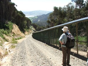
The fence that encloses the Orokonui Ecosanctuary ( the old Orokonui
DoC reserve which includes NZ’s tallest tree, plus all the additional
land) was closed off in July 2007. Almost all pests have been
eradicated, even down to the last goat. An employee behind the fence
explained that they were currently on a spraying programme around the
fenceline as even a bit of gorse widening a gap in the wire mesh will
create a ‘mouse breach’! While it is not yet open to the public, it
is possible to walk around the fence and marvel at what is being
planned. There are steep sections, especially at the northern end of
the fence but in general the 3 to 4 hour walk was very
straightforward, following the wide, gravelled perimeter track. There
was plenty to see: great views, named fence posts (we spotted No.10
Fleming Street where the PM is in residence) (well, actually it was
Prime Mover Ian and Shirley Fleming’s plaque on fence post No.10) and
varying vegetation. We could hear rosellas and a rifleman, but we
didn’t catch a glimpse of the 6 Kaka that have been released, although
Leslie Gowans, who visits regularly to detail sightings of birds, says
that they have not strayed much further than 100m from their release
site so far. The Orokonui website if you want to know more, can be
found at: www.orokonui.org.nz – Bob M
7. 7/7/2004 Leaders: Ian, Bill, Pat Before fenced in. Right around through entire gully. 6. 1/3/2000. Orokonui, Big Tree. Leaders; Shirley McN, Val.
5 .28/7/1999. Orokonui, Big Tree. Leaders: Shirley McN, Judy C, Val. 4. 30/9/1998. Orokonui, Big Tree. Leaders: Shirley McN, Judy C. 3. 7/5/1997. Orokanui – Big Tree round trip. 2. 6/11/1996. Orokonui – Big Tree Round Trip. Leaders: Shirley McN, Judy C, Wendy. 1. 22/5/1996. Orokonui – Big Tree round trip. Medium+ Leaders: Shirley McN, Judy C, Wendy
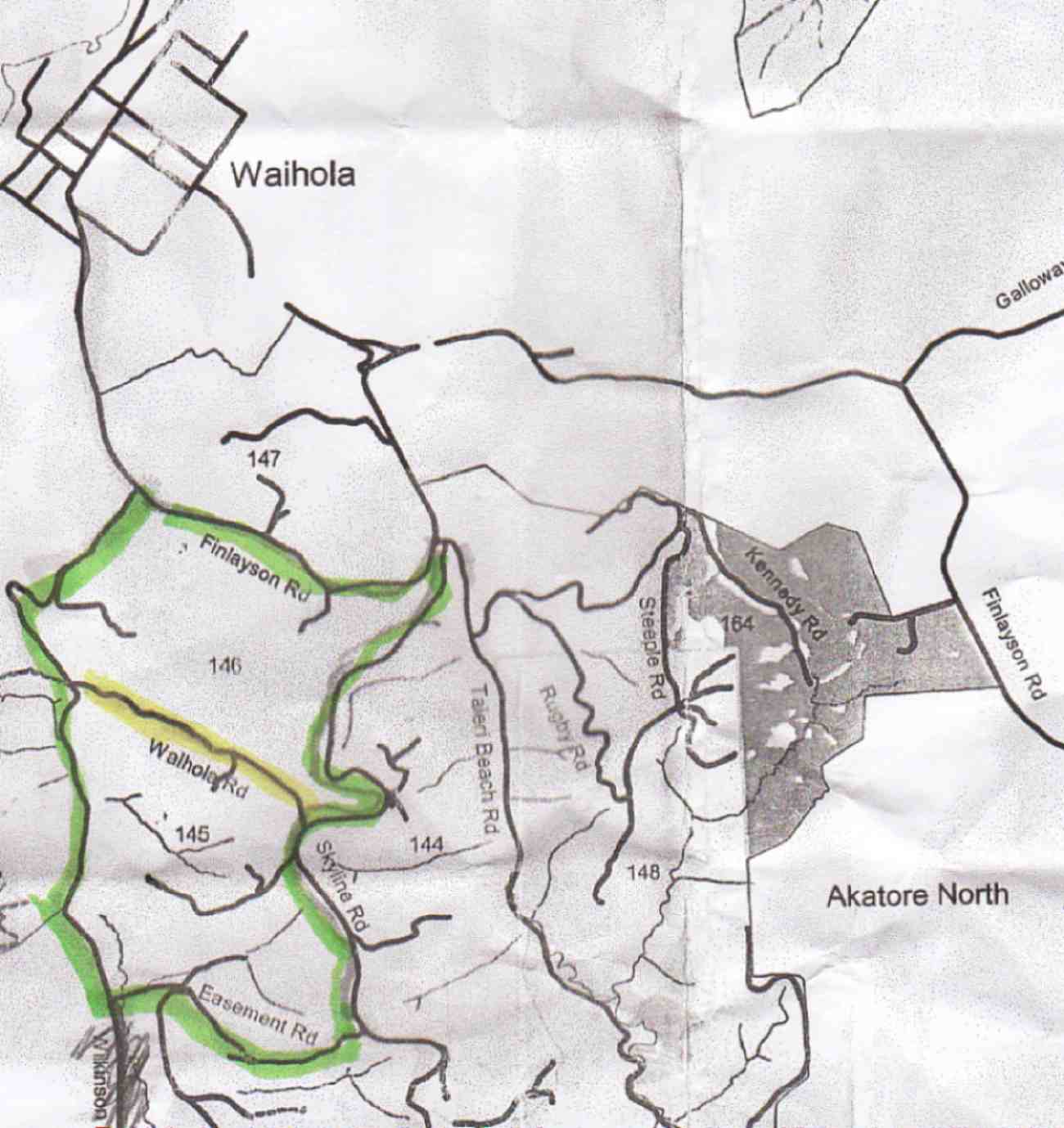
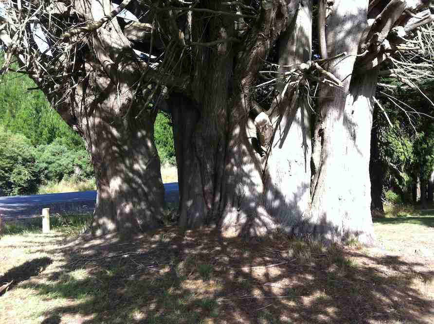
16. 18/1/2012. Hikers. Finlayson Road picnic area. Wilkinson, Easement, Skyline and Waihola Roads, round trip. Leaders: Marjorie and Bruce.
We parked our cars at a rest stop on Finlayson Rd, near Wilkinson Rd turn-off. Bruce led us round the area, planted with a variety of interesting trees, not the least being this large macrocarpa.
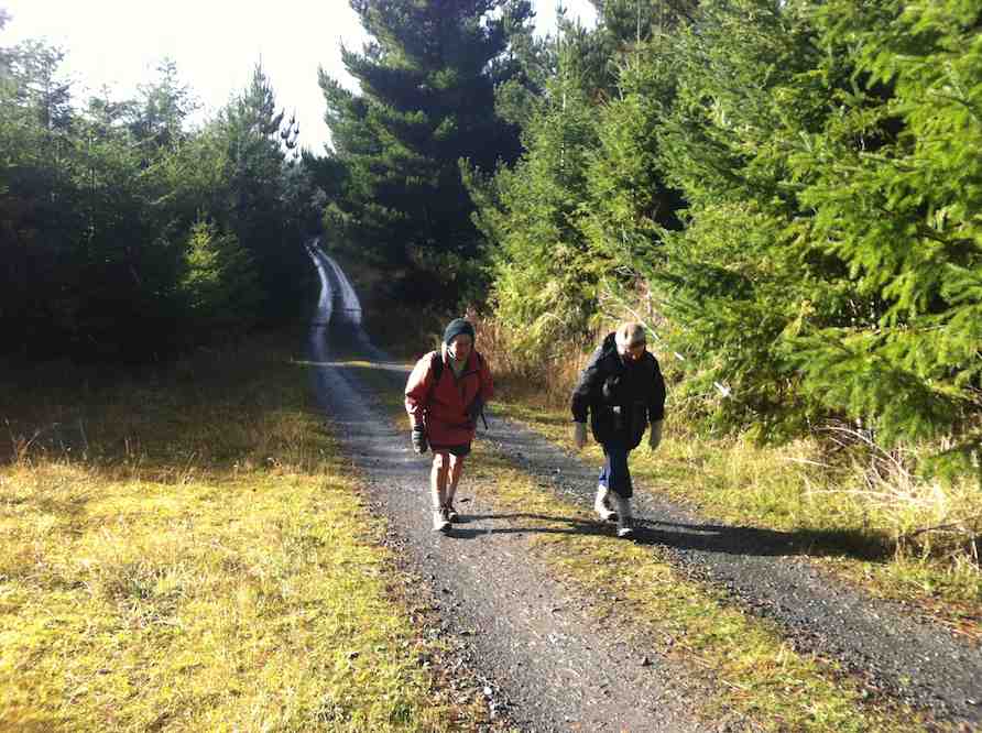
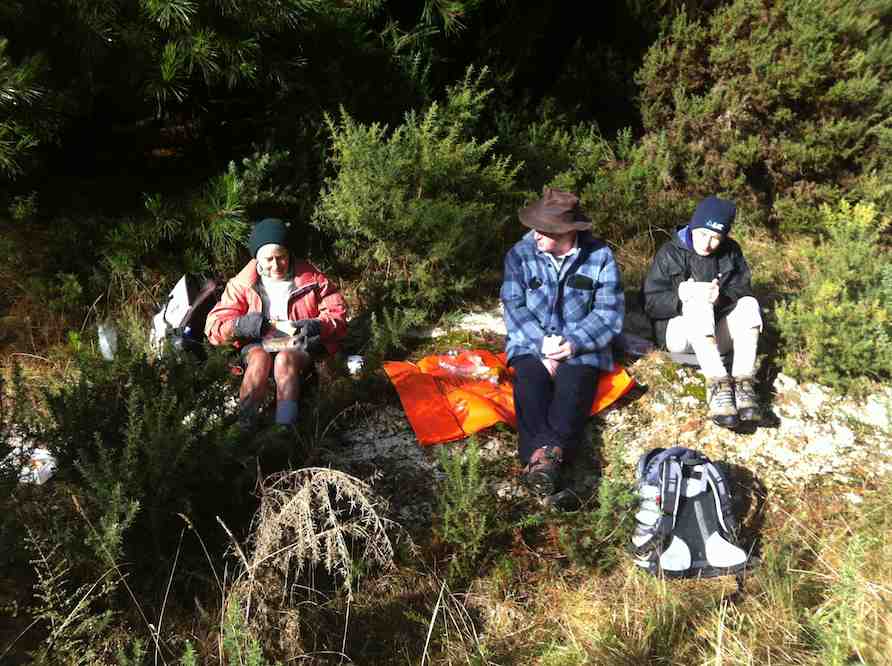
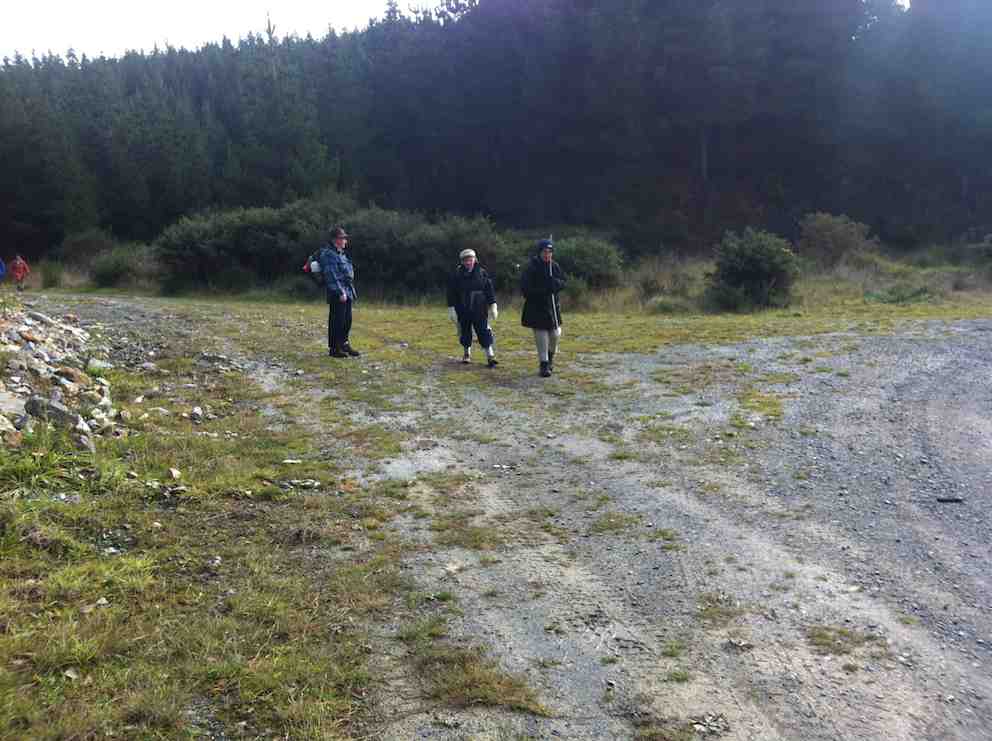
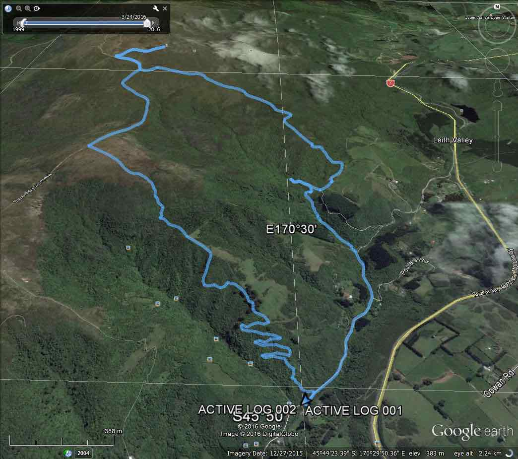
Nine of us met at Booth Road. We entered Davies Track via McGoun this time, exiting it on the left a short way up past the cairn. A light shower came on during the bush section, sounding quite pleasant as it struck the leaves overhead. Out in the tussock at the top, the weather was clear again. Ria and Hazel had discovered a new track had been made above the bush, this time striking to the left instead of the one to the left, the one that got several of us lost last time where overgrowth had rendered a crucial turn invisible.
We emerged on the Flagstaff walkway above a rock outcrop and headed down to the top of the Pineapple. Here Gay, a visitor, left us and we continued along Swampy Ridge to the top of the Nicols/Moonlight track. A little way in and we found the track has been ruined by mountain bike wheels cutting a narrow deep groove down the track middle, making keeping our footing on the restricted track-sides difficult and dangerous. Further down, we kept to the Moonlight side of Nicols Creek and traced, where we could, the original track, bisected however by the zigzags of the mountain bike route. Rain now really set in and we sheltered in nearby bush for lunch. We then continued down the old track, through the macrocarpas, the stone outcrop and yet further carefully down to emerge at the creek crossing below the waterfall – to Ian’s delight but Ria’s chagrin who had hoped to emerge onto the Leith Valley road on the north side instead of now forced across to the other side. So it was down and out and up Islay St back to the cars. All felt it had been another good day out. Too dull and showery for photo opportunities however. – Ian.
2. 14/11/2007. Trampers. Woodhaugh, Ross Creek, Davies, Pineapple, Ross Creek return. Moderate. Leaders: Ria, Hazel.
Stream crossing. Doug, George, Peter, Wendy
The route Ria and Hazel took ten of us on provided plenty of variety both in scenery and weather. We approached Davies track by way of Ross Creek Reservoir from Woodhaugh. After Ross Creek it was through cleared forest before climbing through secondary growth …
… on the foothill slopes of Flagstaff before entering beautiful native forest and and hour later emerging on Flagstaff’s tussock and flax with overcast views of the harbour and Dunedin both north and south. We had encountered occasional showers to this point and now out on the tussock it was turning really cold. We were still not prepared upon reaching the upper Pineapple-Flagstaff track …
Made it onto Pineapple. Ria, Sabina, Glenice, George, Keith
… to be pelted by a fierce but fortunately brief hail storm. We quickly made our way down to the junction with the Swampy Ridge track where now the hail had now been …
Snow. Doug, George, Sabina, Keith, Glenice
… replaced with snow. So it was down, down the Pineapple to the sheltered edge of the bush where we lunched in the now fitful sunshine. Then the bush, Booth Road, back through Ross Creek tracks and down past the reservoir until the last scenic bush gave way to Woodhaugh St and back to the cars. An interesting day. – Ian
In Leith Valley, where Otago’s first industry – sawmilling – is reputed to have started about the 1860s, is the start of the old Pineapple Track.
Originally, it was named Ross Track, after Archibald Hilson Ross, who owned most of the land in the vicinity. In the early 1920s, Mr Oscar Balk, first president of the Otago Tramping Club, led parties of trampers up this route. At the top of a rather steep section, the parties would stop to rest and often refresh themselves with a tin of pineapple. This tin was sometimes left hanging on a tree or fence, and the track came to be called the Pineapple Track.
The line of the Pineapple Walkway has deviated from the original track in places to provide more scenic variation.
The original vegetation of the area has been modified as a result of early milling, burning and stock grazing, but remnants of the milled species (podocarps) still remain. Rimu, miro, totara and matai are found in isolated pockets, mainly in damp gullies. Even so, the overall distribution of plant species retains some semblance of natural order with the larger forest trees growing at lower altitudes. Podocarp broad-leaved forest type occurs with shrub species which grade out into Dracophyllum shrub land and ultimately tussock grassland communities on the summit area.
Some common plants: fuchsia, pepper tree, lemonwood, broadleaf, totara, five’finger, wineberry, lancewood, Muehlenbeckia, Dracophyllum, Coprosma, Hebe, and wild spaniard tussock.
There are many varieties of birds in the bush areas where there is an ample food supply to sustain many nectar-, berry-, and insect-eating native birds.
Some of these are: New Zealand pigeon, bellbird, fantail, tomtit, brown creeper, tui, silvereye, rifleman and pipit.
1. 17/10/2001. Trampers. Nicols Creek – Swampy Saddle – Warburton Track. Leaders: Lex, Mary L, Irene.