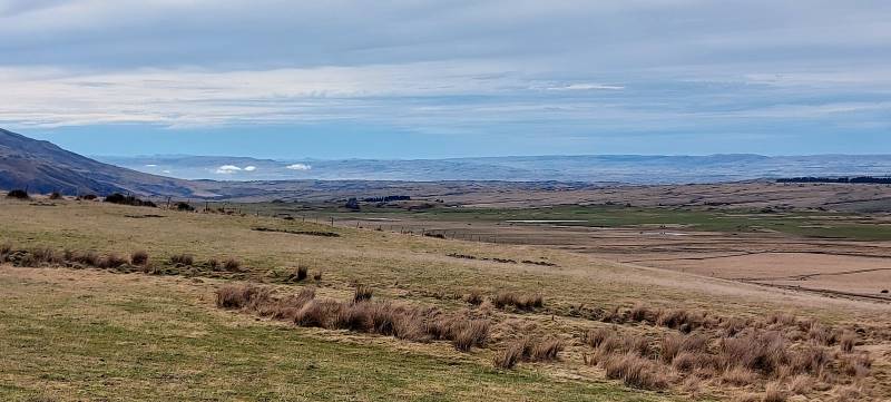
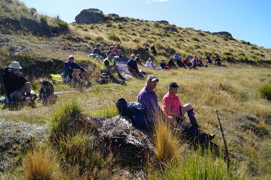
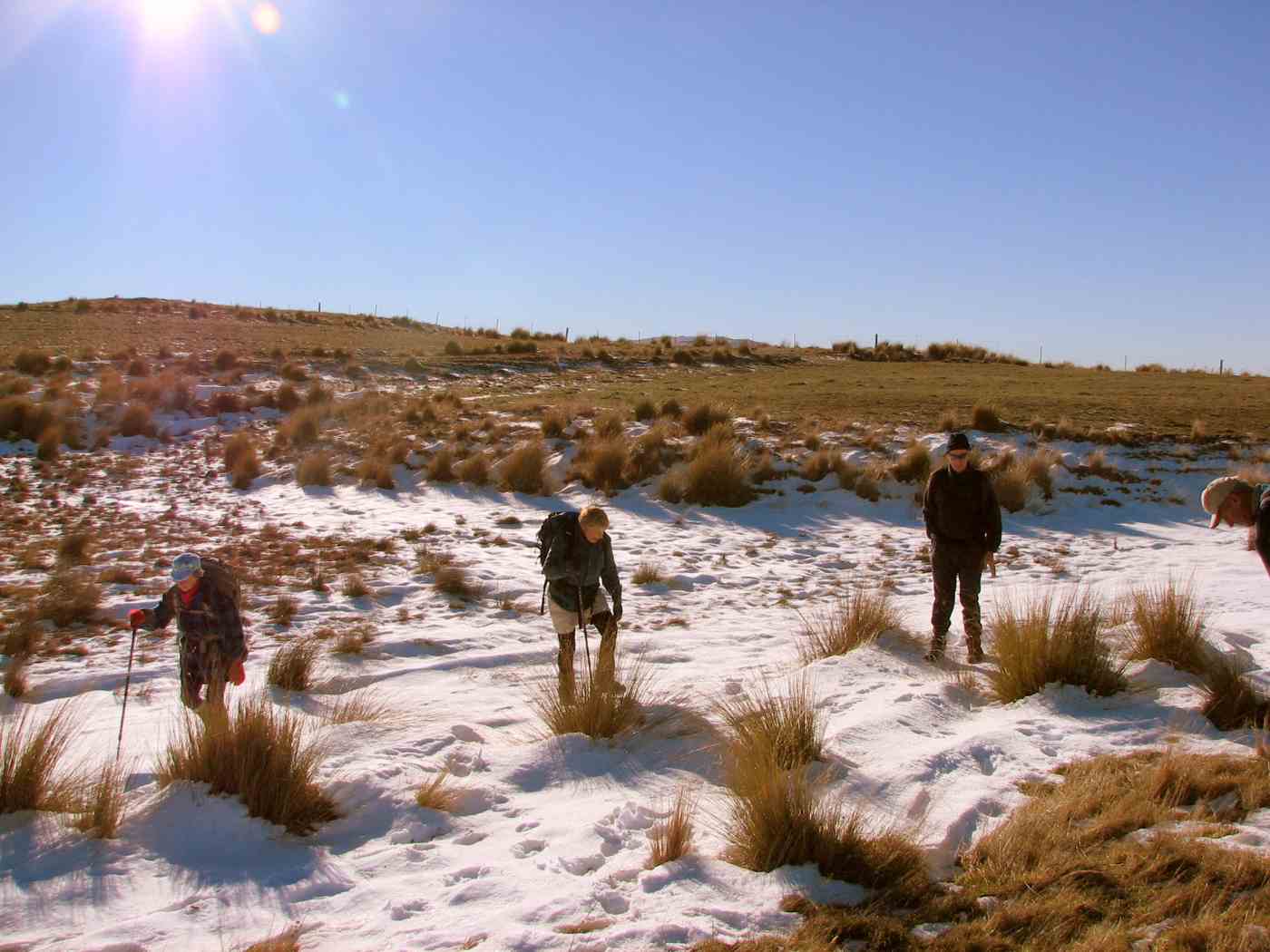
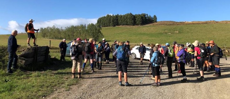
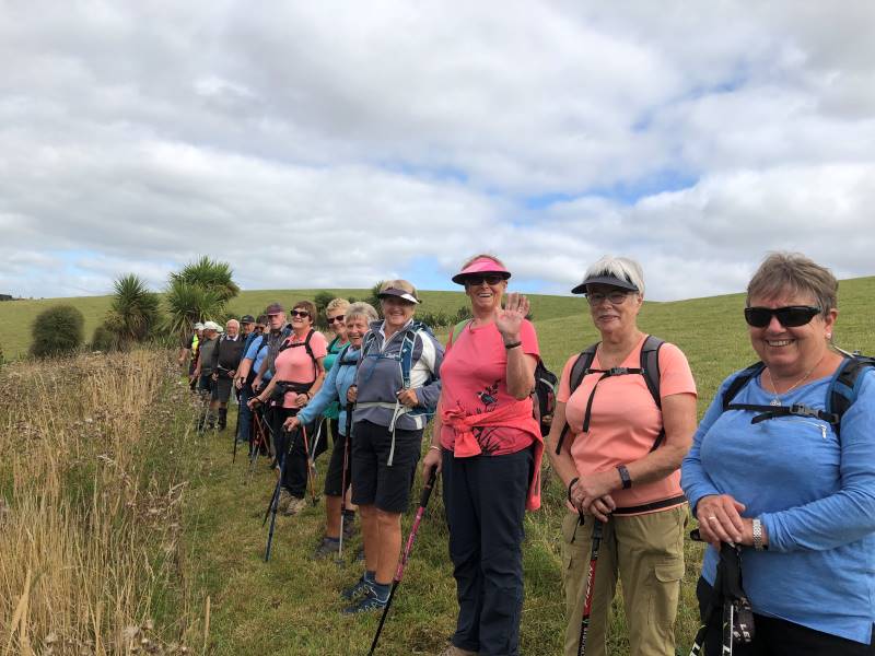
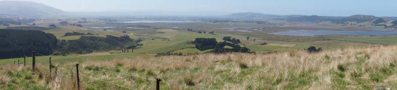
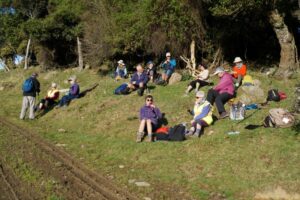
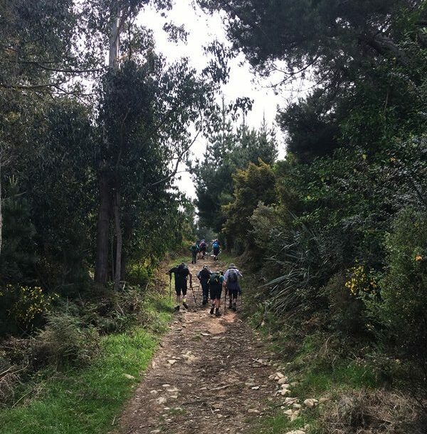
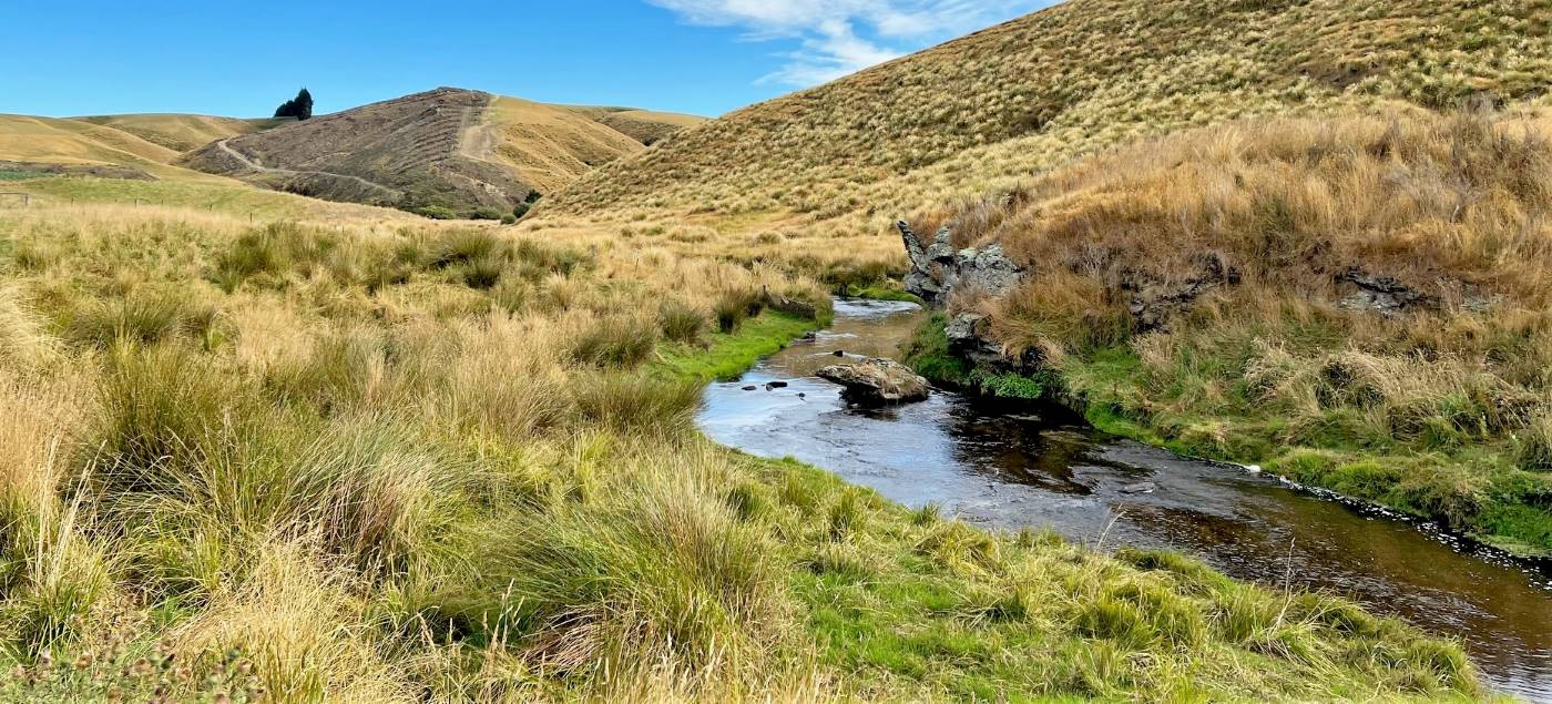
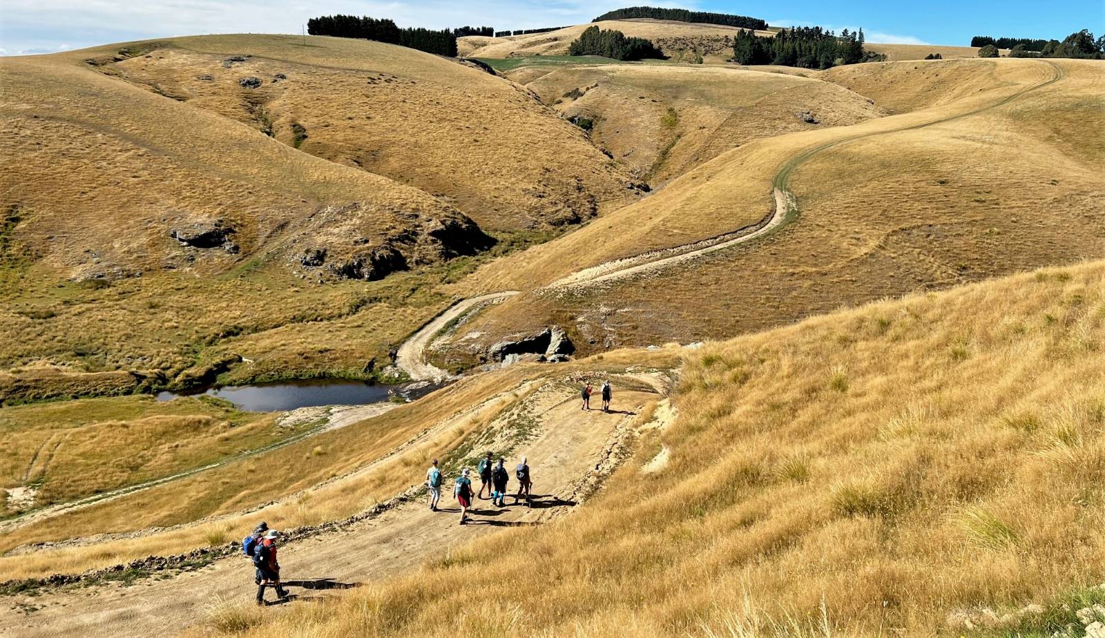
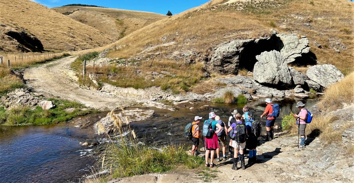
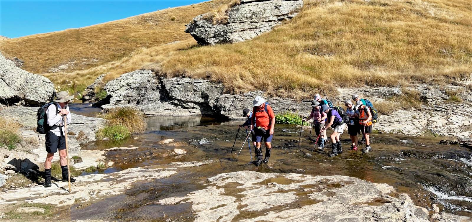
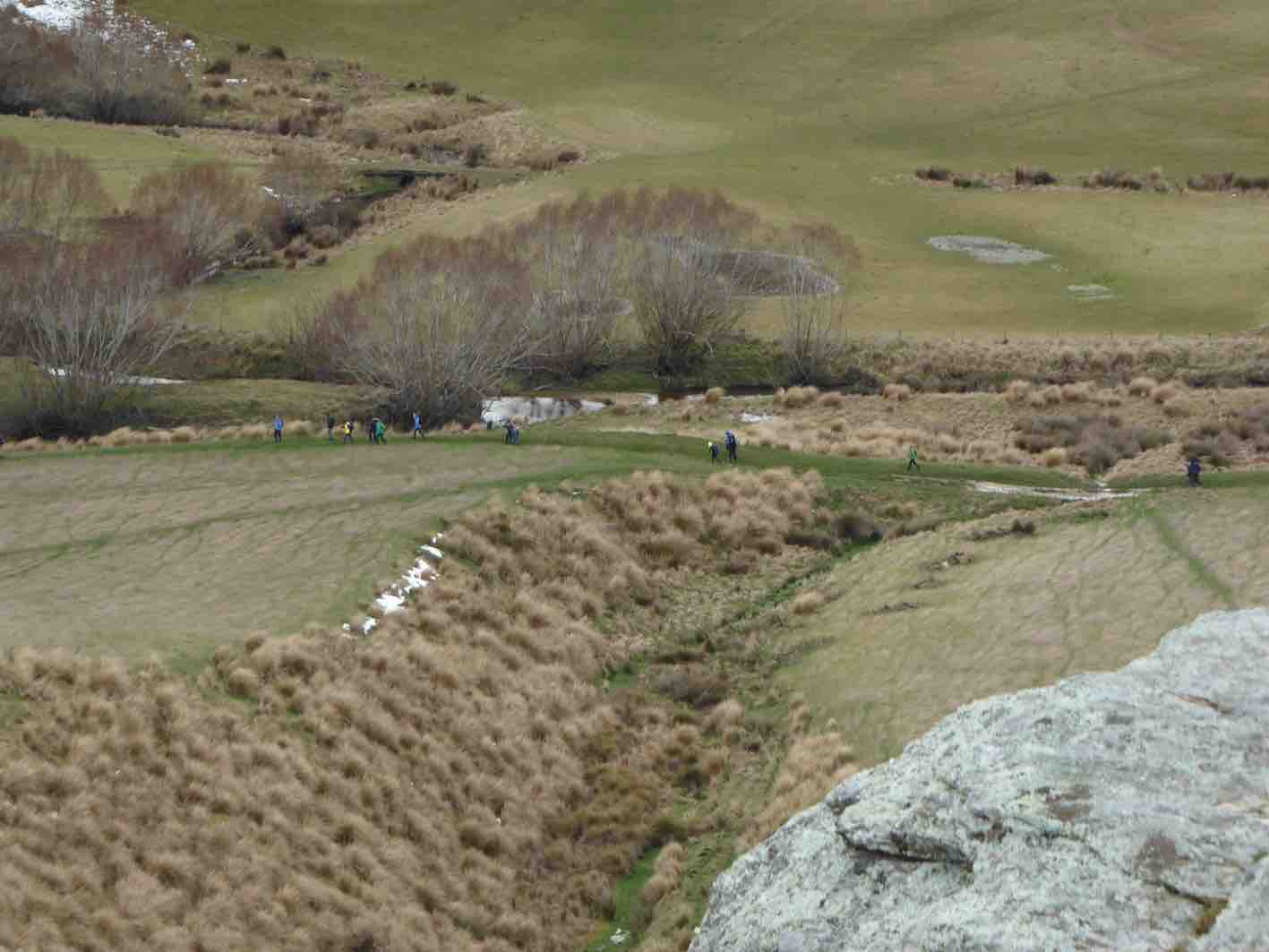
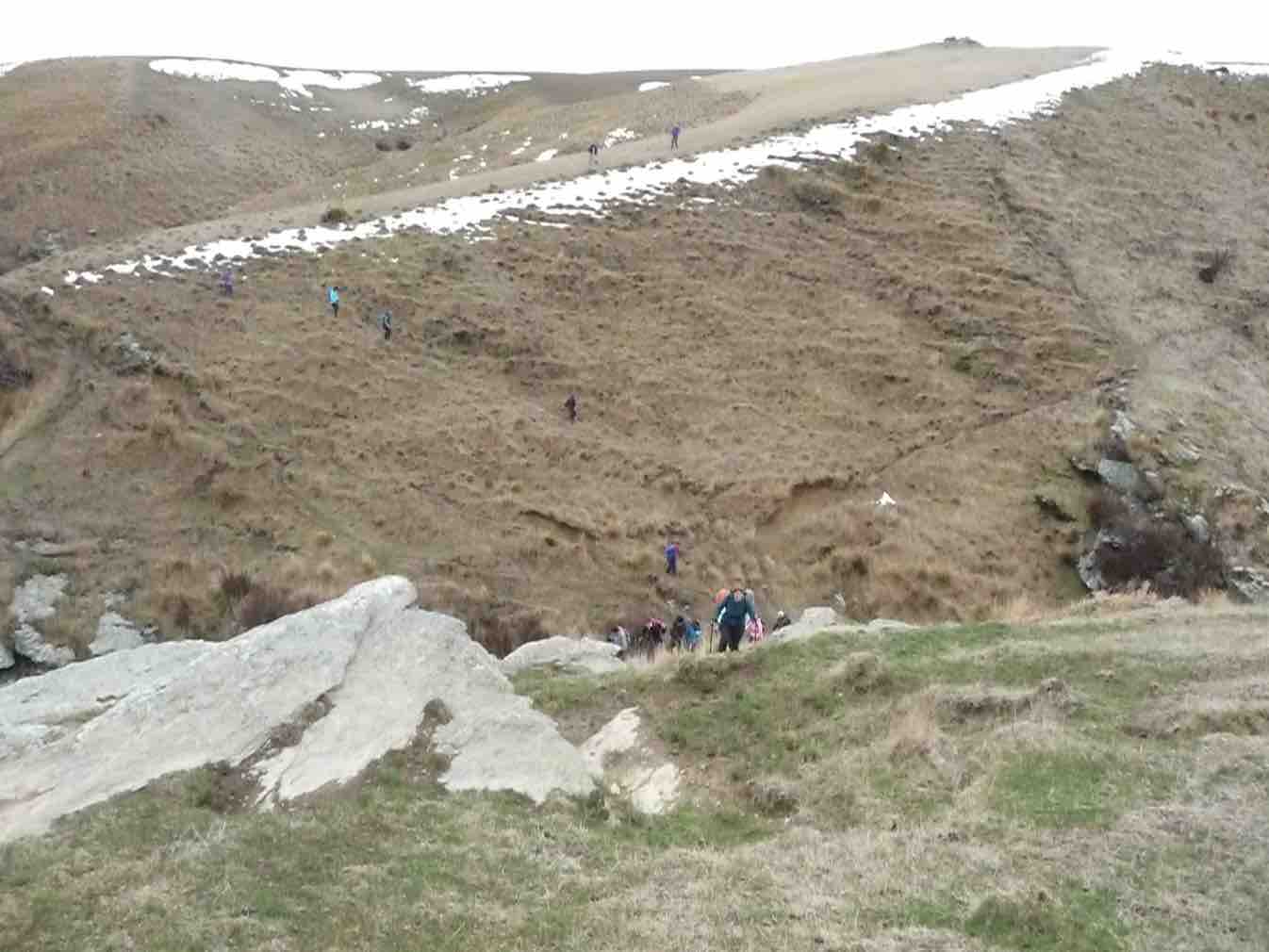
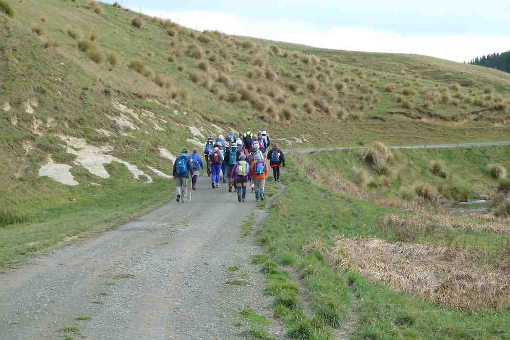
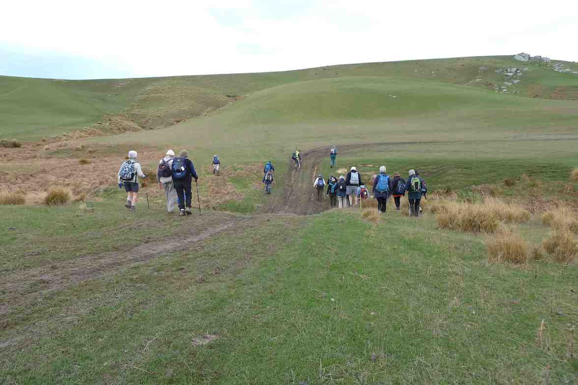
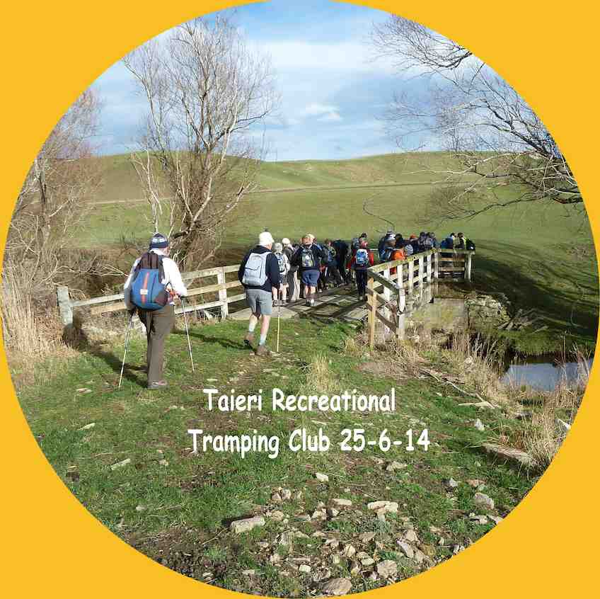
Lovely sunshine greeted 30 keen trampers for a good day’s walk on Cairnvalley Farm Shannon. Strath Taieri offers something different in scenery with tussock hills, huge rock formations and at this time of the year fresh green vistas of paddocks and Continue reading “Shannons Farm Walk”
No. 47 on old hardcopy list of 113 club tramps. “Toko Beach. M Young”; also No. 65 on old hardcopy list of 113 club tramps. “Chrystalls Beach Farm”. Location: 59 km from the car park. Best in Summer. The stock winter over.
Directions: On SH1, before Milton, at Helensbrook intersection, left onto Forsyth Road, right onto Back Road, left onto Glenledi Road.
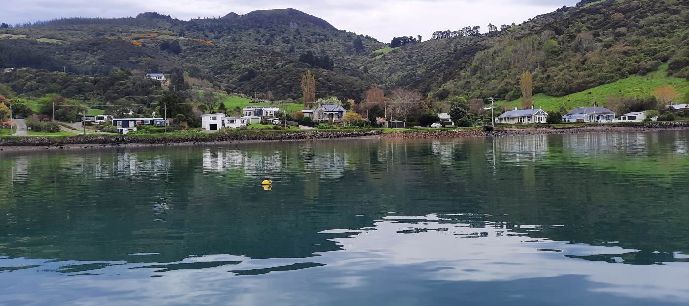
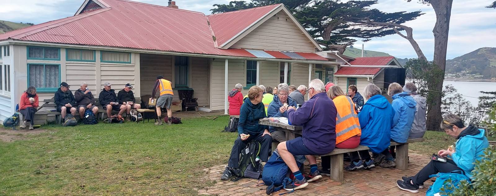
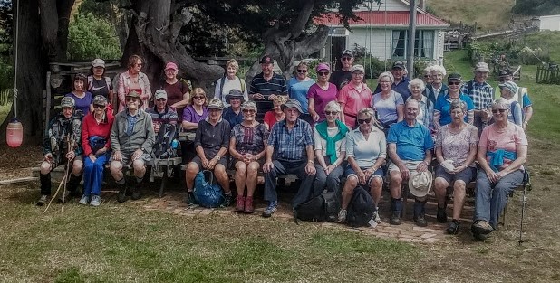
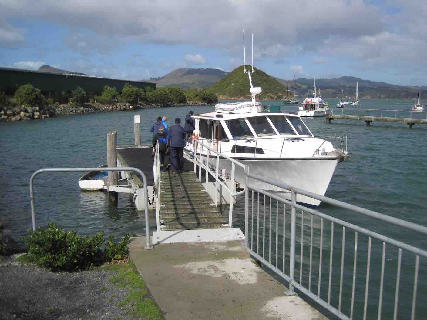
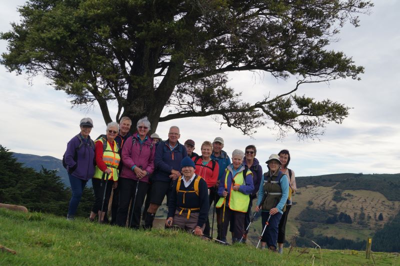
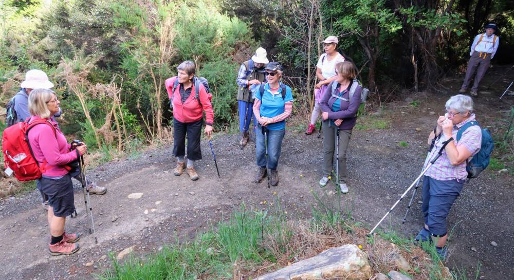
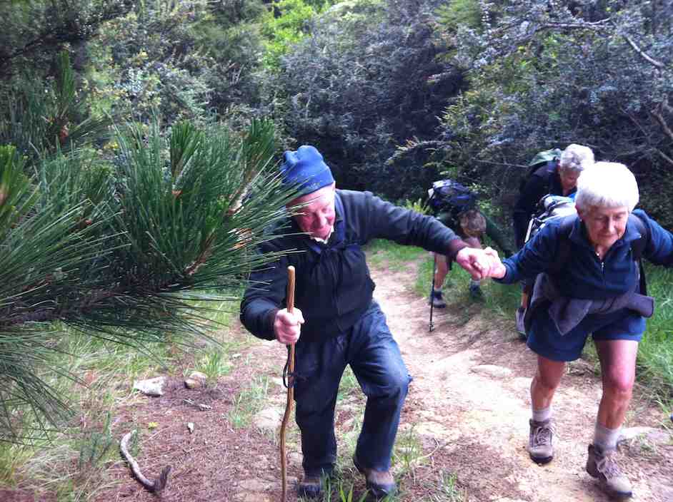
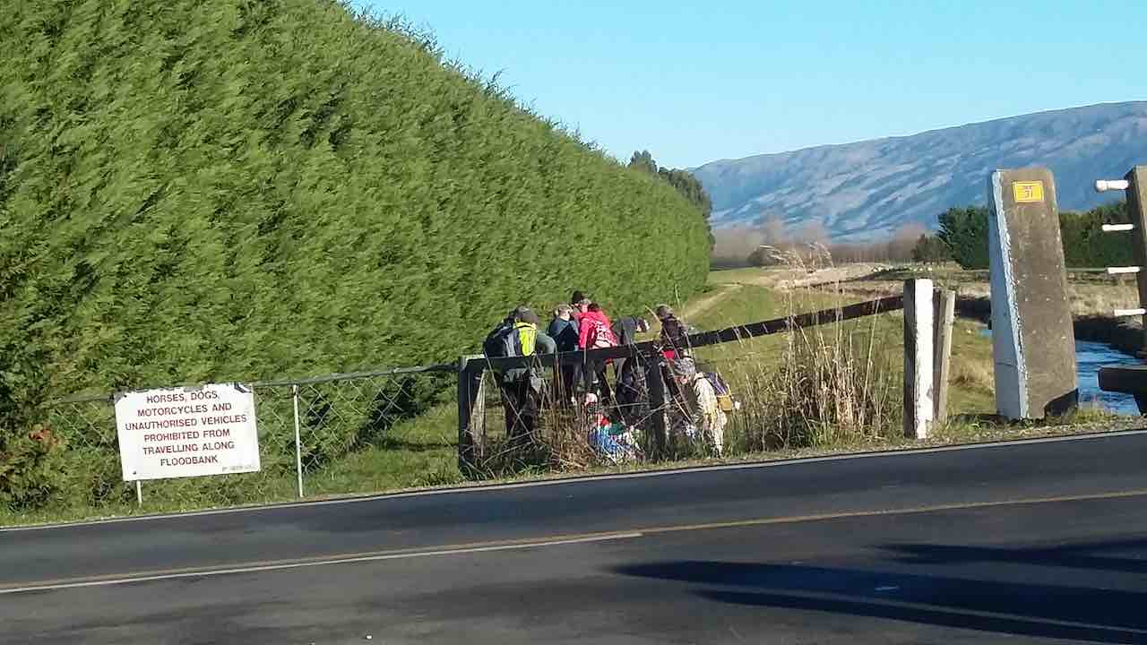
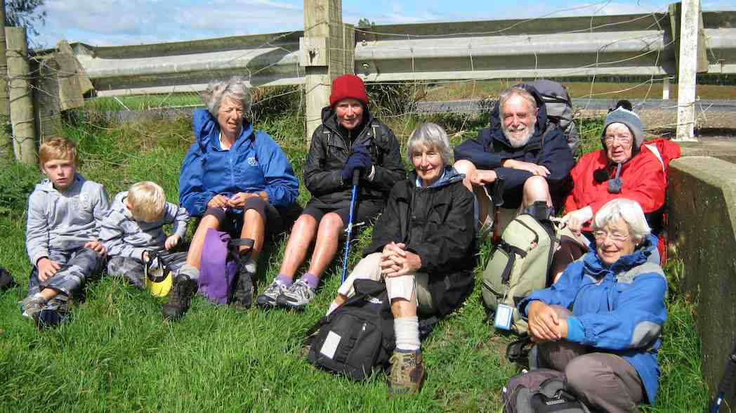
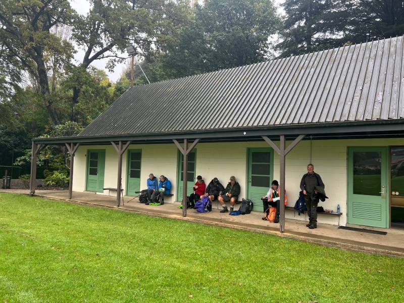
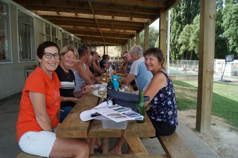
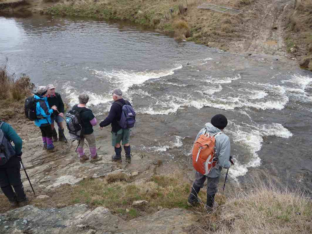
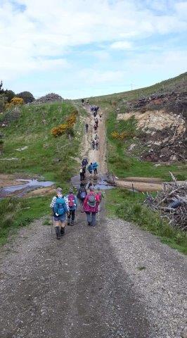
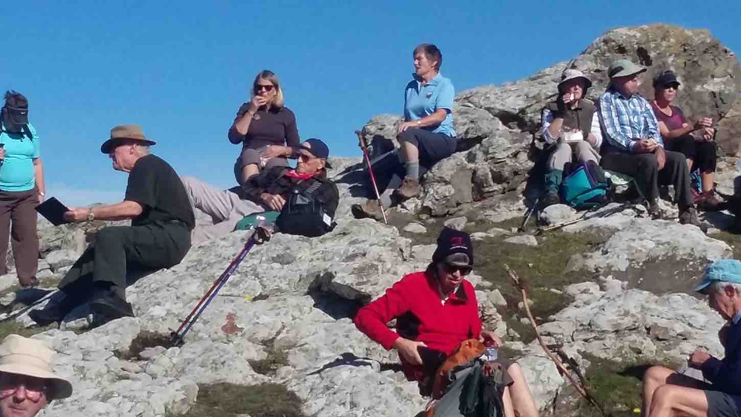
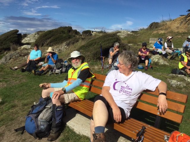
5. 4/10/2023. Combined. Quarantine Island. Grade 2, Leaders: Ross and Wyn Davies, Maria MacNee, Jenny Finnerty.
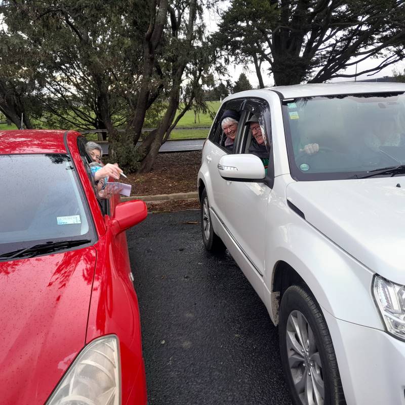
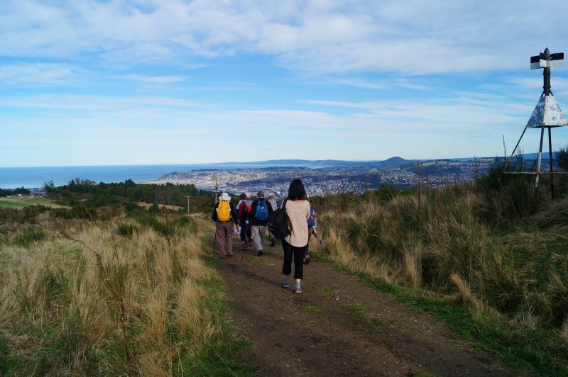
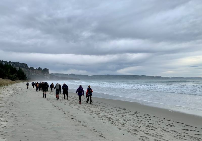
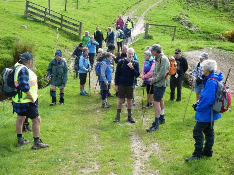
Twenty-eight trampers and hikers enjoyed a great day out with calm and temperate weather, a little cloudy, not the blue skies and sun the forecast promised. Perfect weather though for the crossing to Quarantine Island. Our day had started with a little confusion regarding numbers and meeting places but we all managed to get ourselves to Back Beach carpark safely (Julie and Viv might tell a few tales about their driver though, lol).
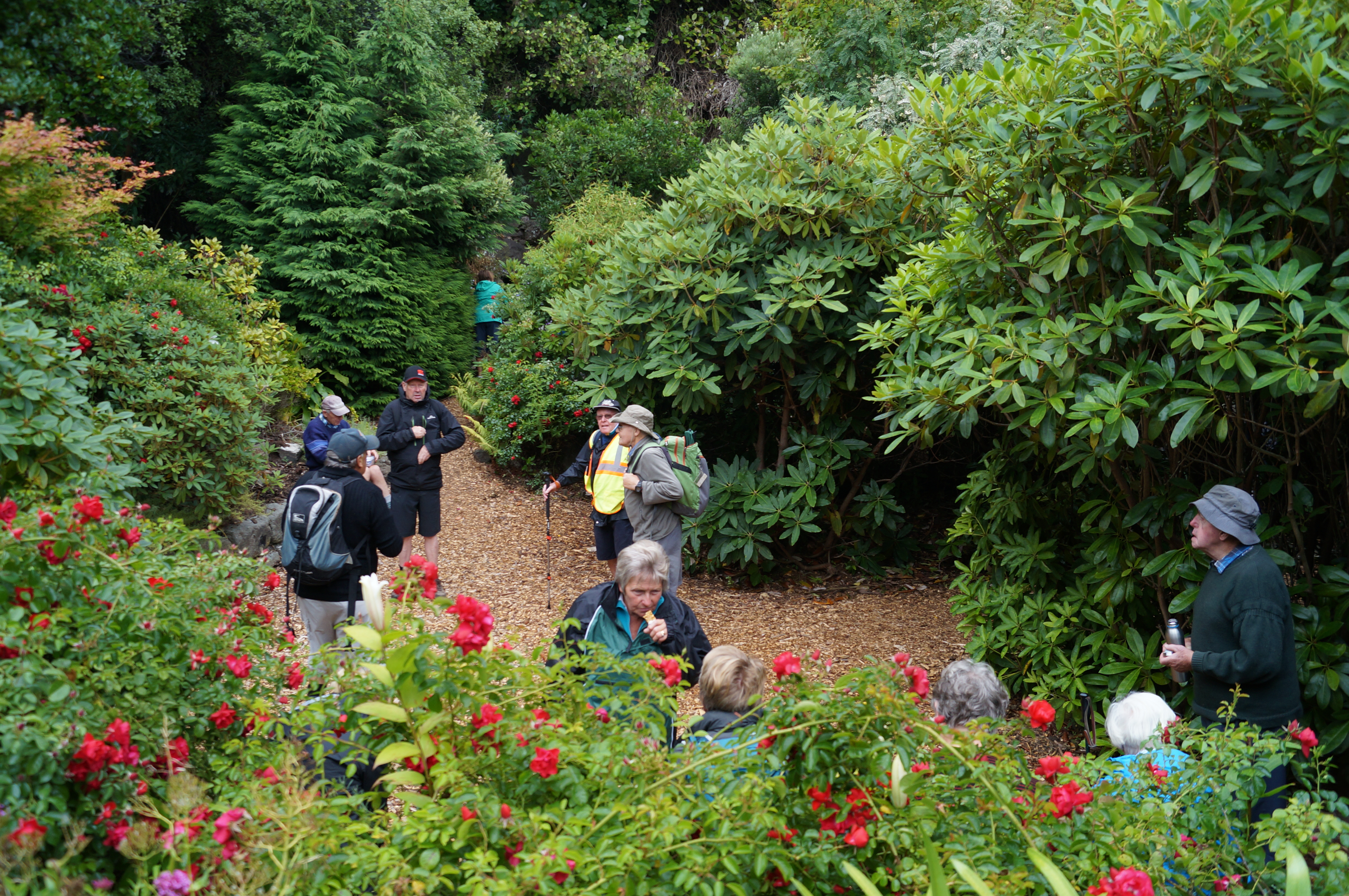
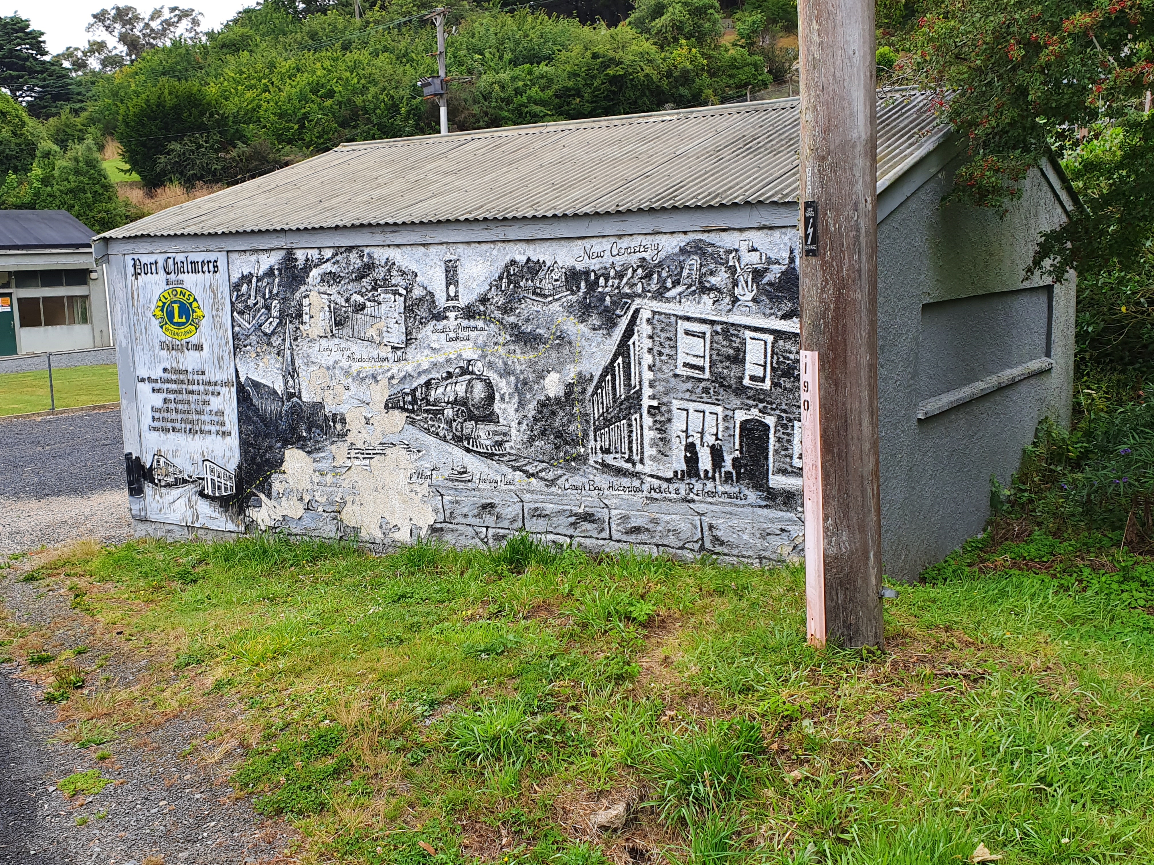
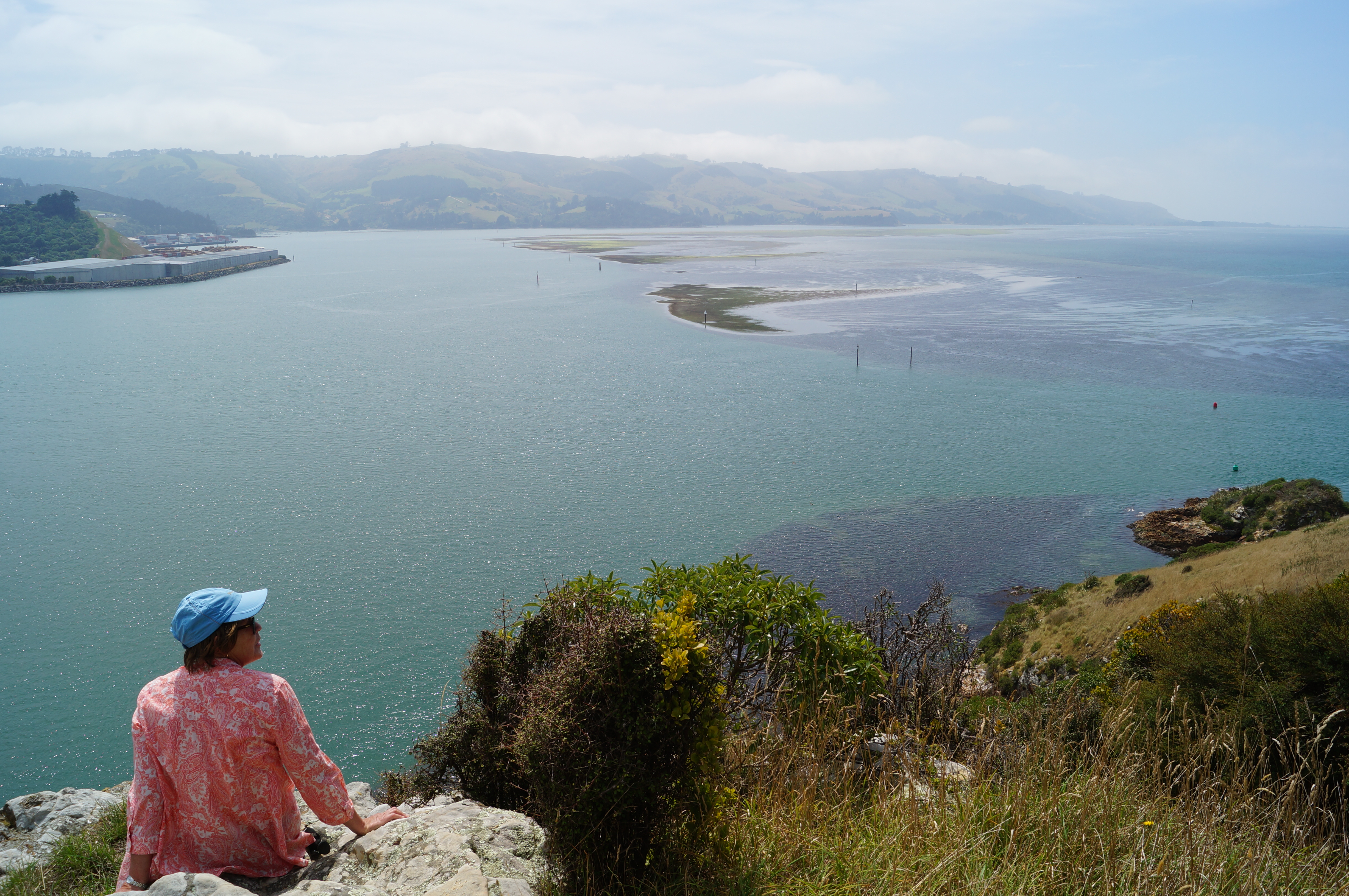
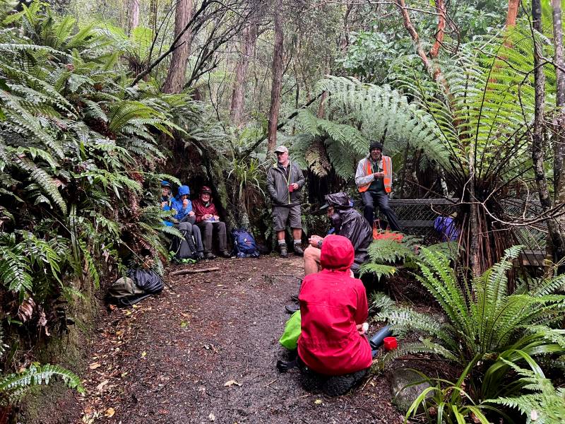
We walked off for morning tea in Lady Thorn Dell…
Morning Tea at Lady Thorn Rhododendron Dell. (photo and caption John)
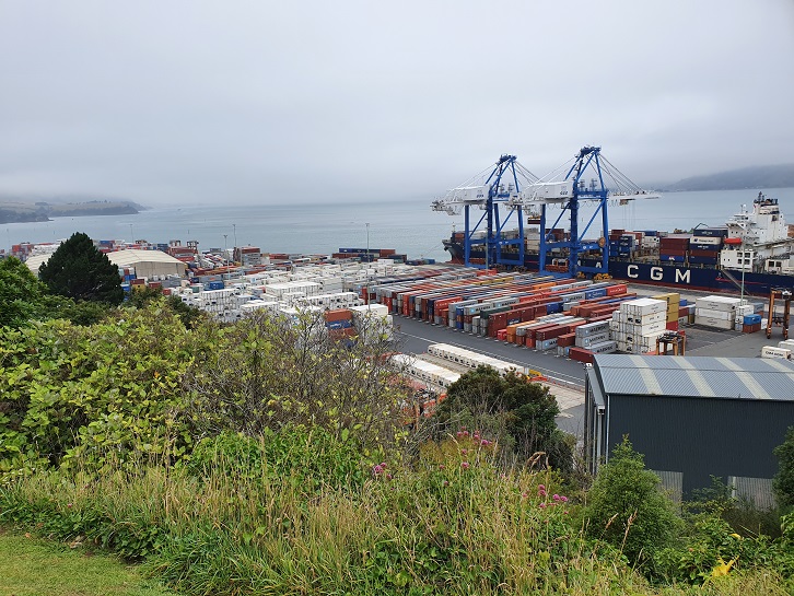
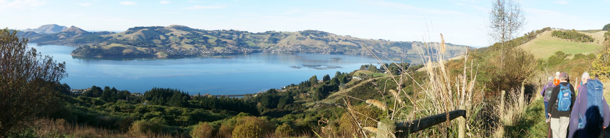
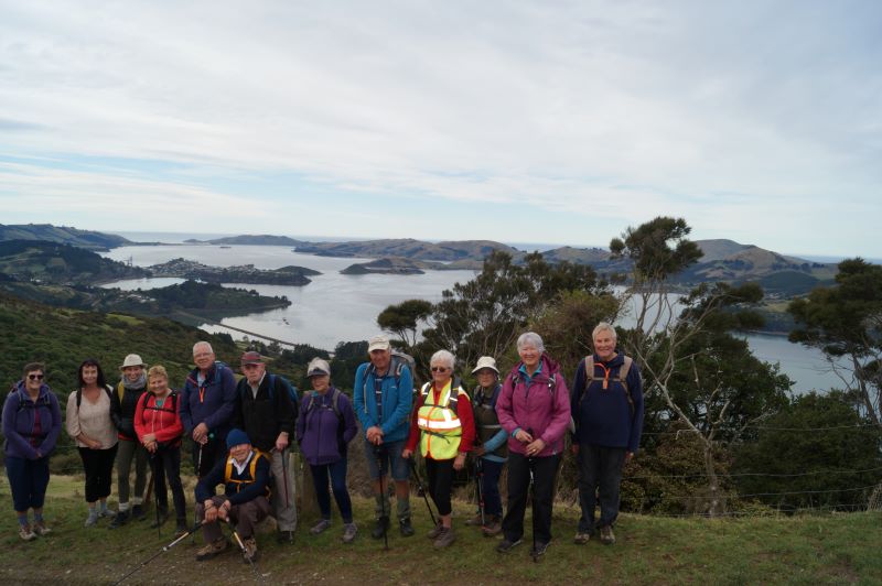
… where we enjoyed fabulous views of the busy Port Chalmers.
Panorama – Port Chalmers on a quiet day. (photo and caption John)
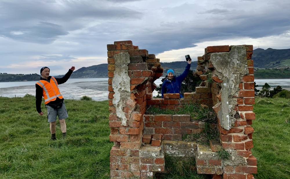
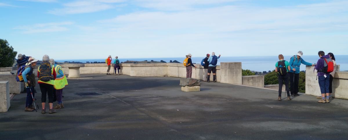
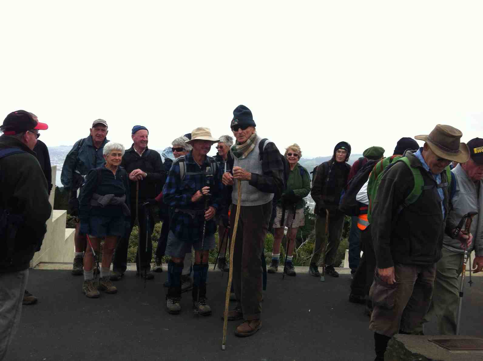
Great photos and history on display at the lookout platform. Little remains of the dry dock and ship building industry that once provided for a vibrant community in the 19th and 20th centuries.
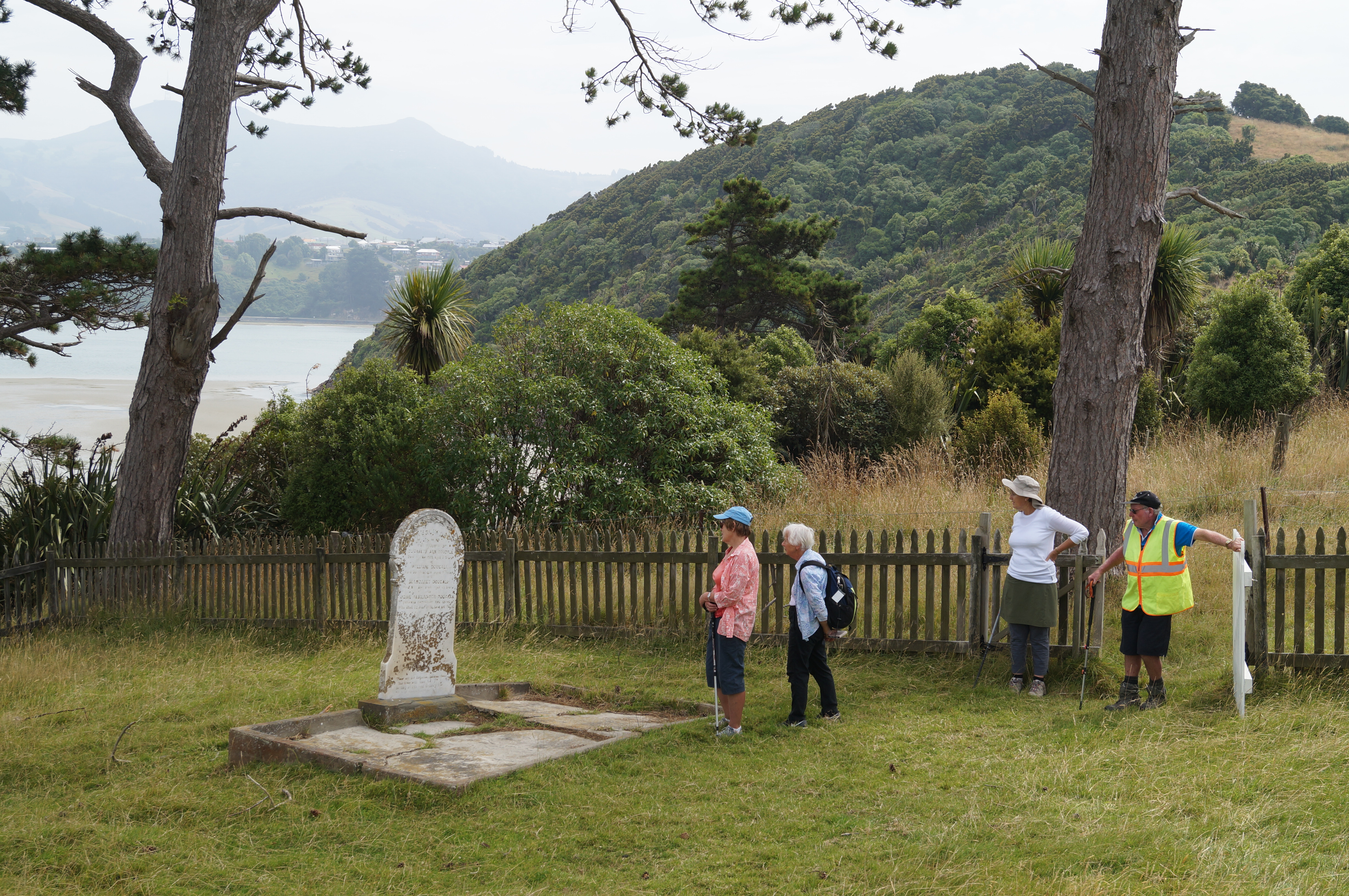
From Lady Thorn Dell we enjoy a leisurely meander through the town cemetery which it has to be said seems to hold an unhealthy interest for those of us still in the land of the living? Indicative of the average age of our enclave perhaps…? Nonetheless, interesting history to be gleaned from those old stones and bones.
Touring the Port Chalmers Cemetery. (photo and caption John)Lovely view from Port Chalmers Cemetery (photo and caption Marijke)
Coming back down to the Port we get a stunning glimpse of Carey’s Bay…
First glimpse of Careys Bay. (photo and caption John)
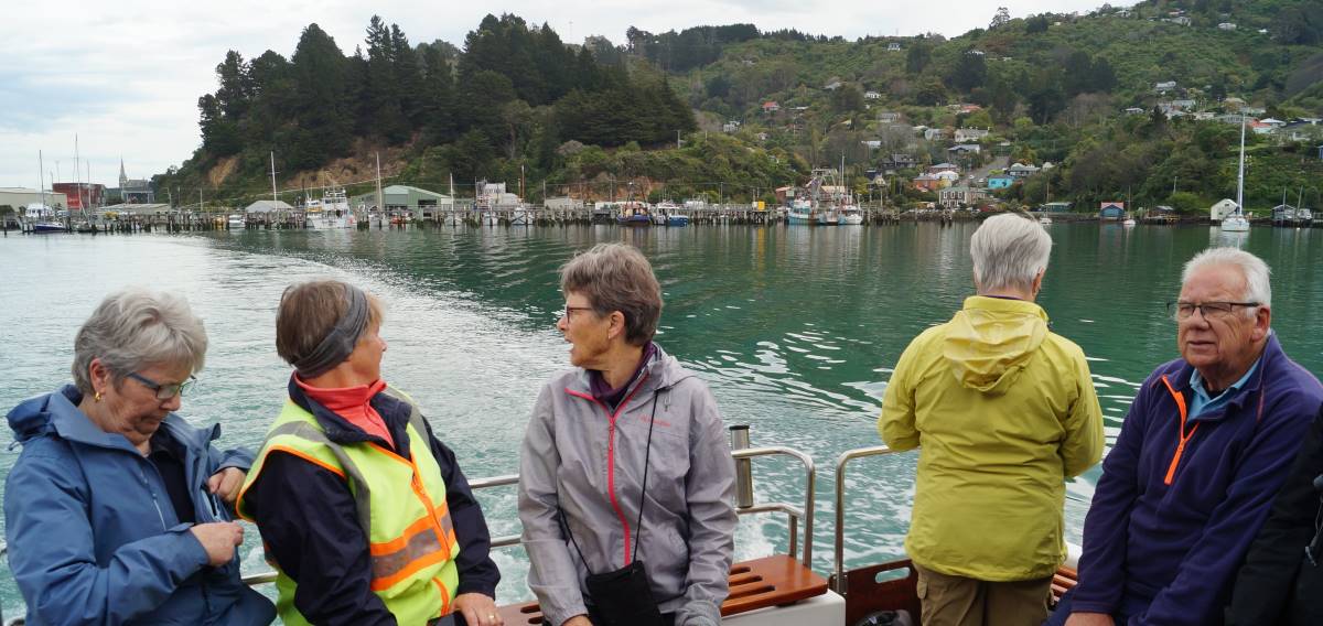
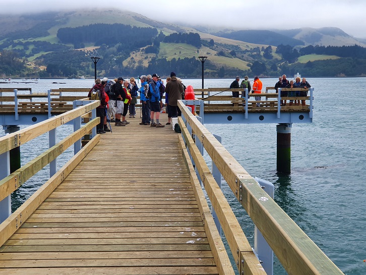
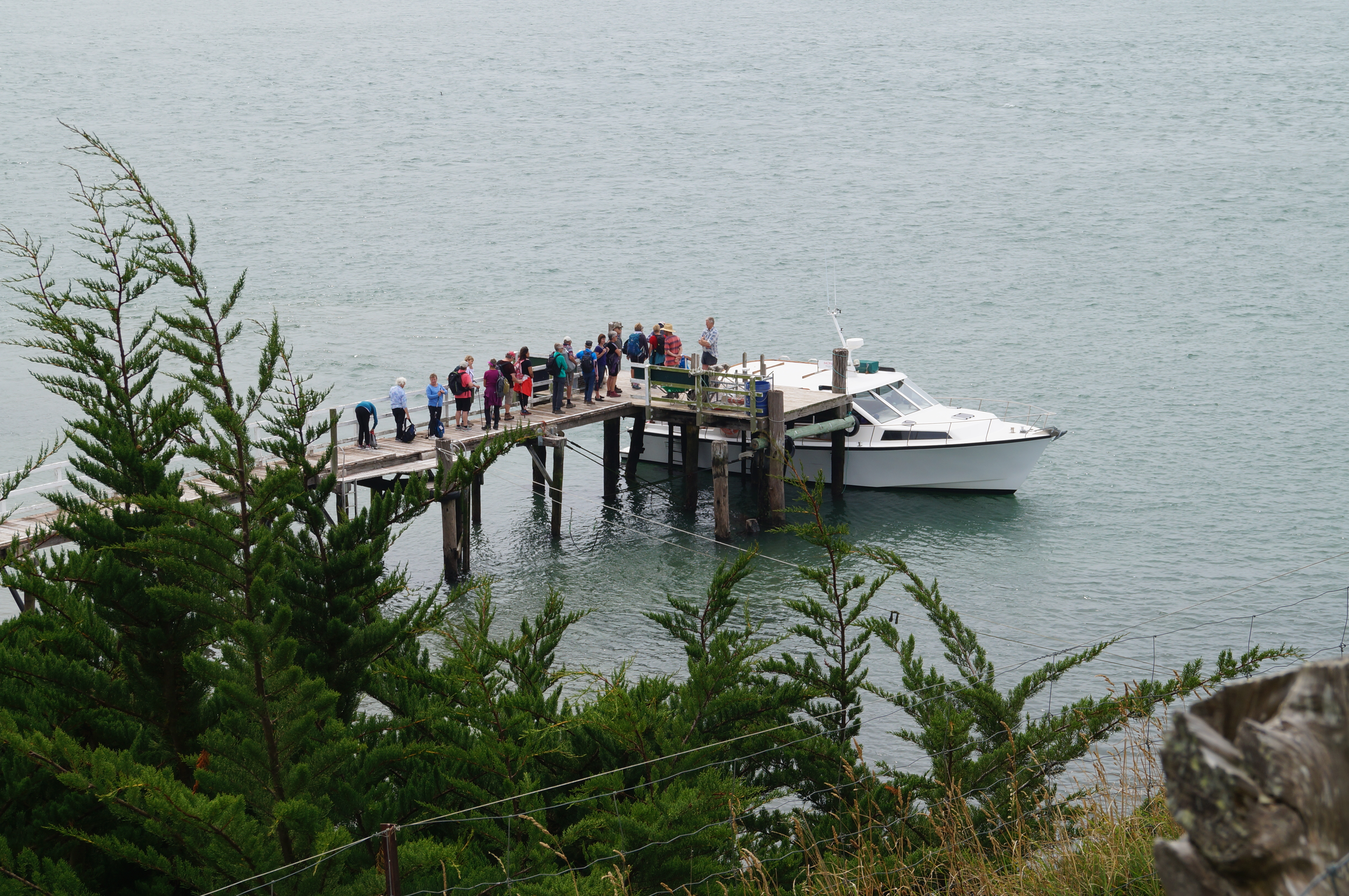
… before heading back to the wharf and Boiler Point where Captain John welcomes us aboard the island ferry the “Vivienne J”. After John treats us to a grand jaunt around the harbour basin (greatly appreciated by all on board)…
Beautiful Deborah Bay (photo and caption Ady)“Touring” Carey’s Bay. (photo and caption John)
…we “set sail” for the island, not bad value at $20 return! One wag commented that “It was very nice of Bruce to organise a cruise for Jenny on her birthday….”
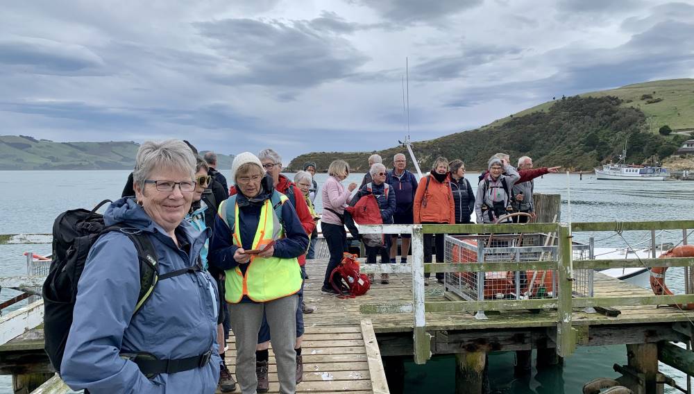
Birthday Girl and her “guests” arrive at Quarantine Island (photo and caption Marijke)
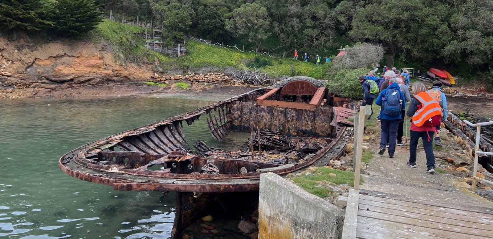
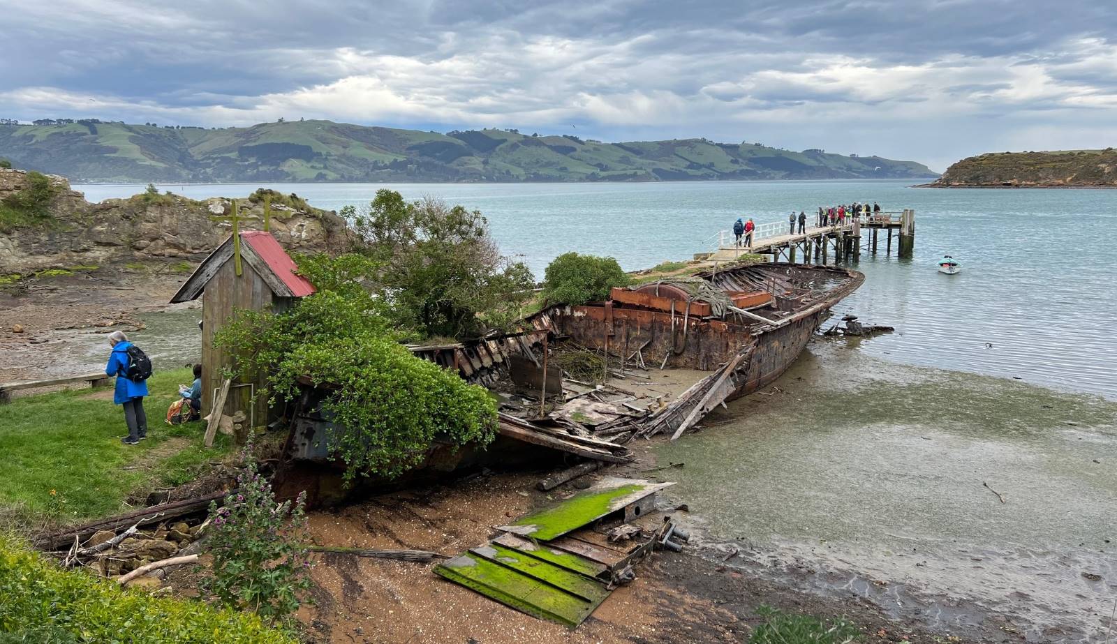
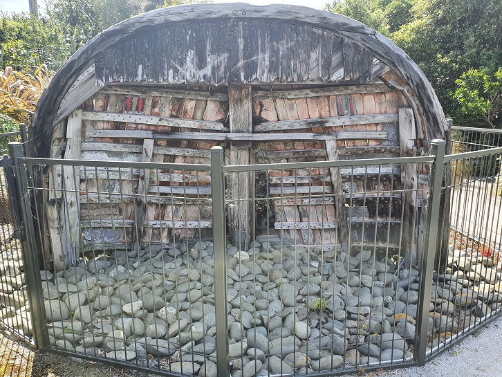
Arriving at the jetty on the island, the skeletons of the Waikana…
“Touring” Carey’s Bay. (photo and caption Pam)
… and the Oreti form a kind of decaying guard of honour as we head up to the Lodge for lunch.
Lunch (photo and caption Helen)
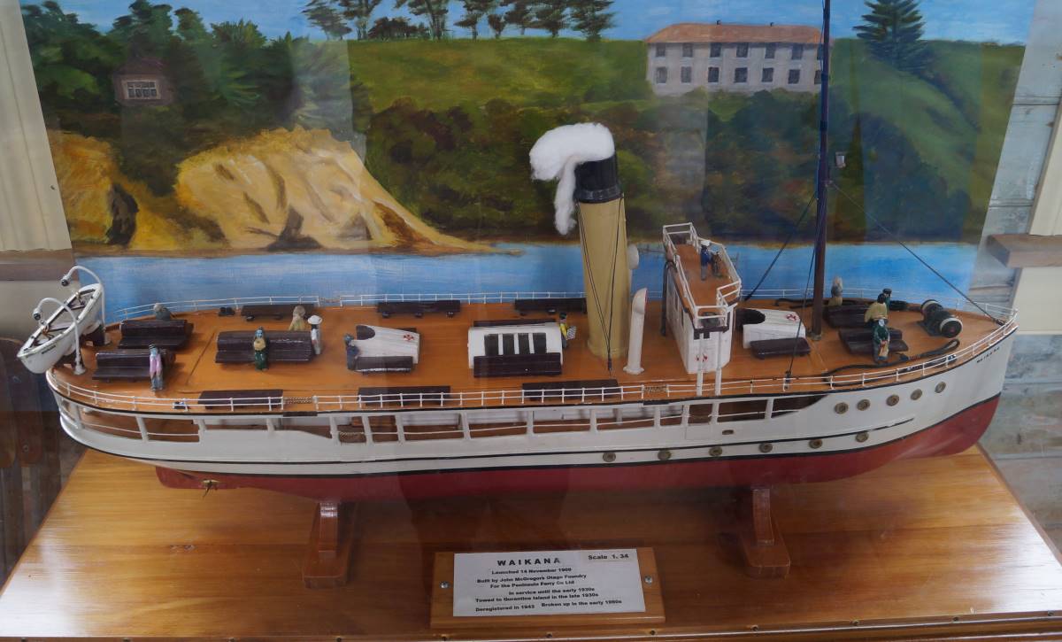
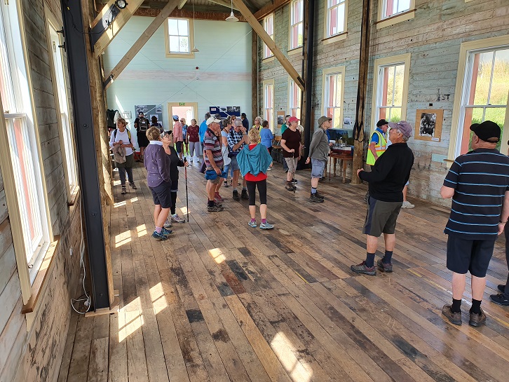
After lunch we explore the island starting with the restored Married Quarters building in which is housed a beautifully modelled miniature of the Waikana as she was when in service as a harbour ferry.
Harbour Ferry “Waikana” as she once was. (photo and caption John)
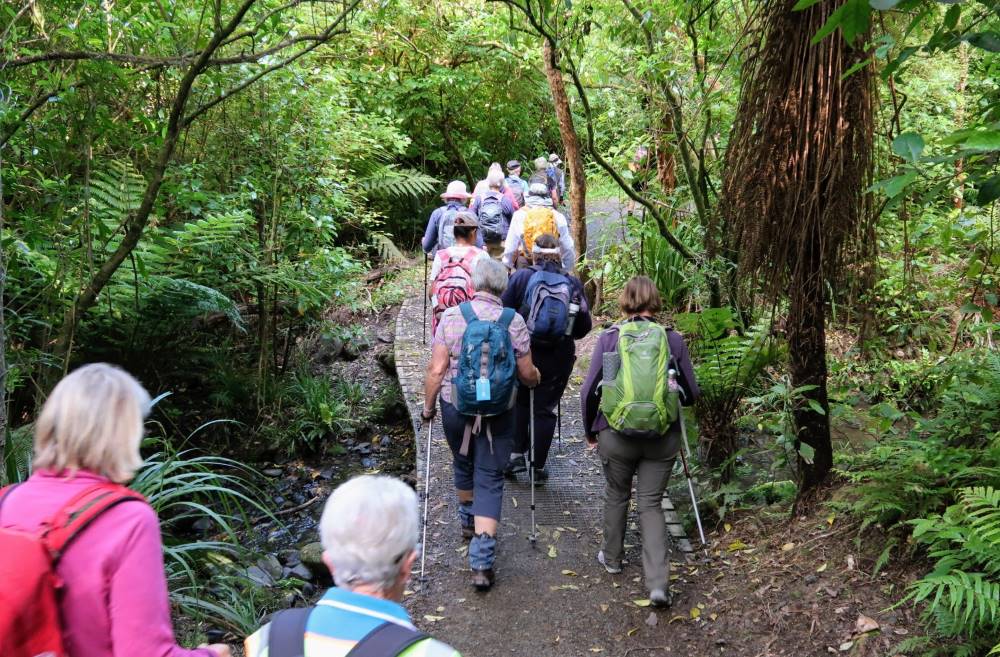
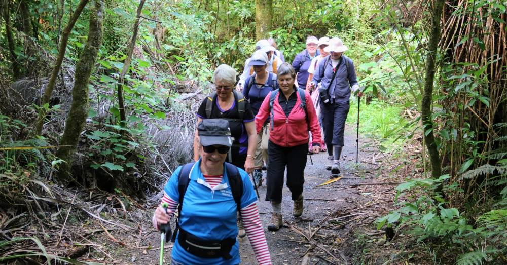
Regenerating native bush rang with the sound of native bird life as we enjoyed an easy 30-minute walk around the island.
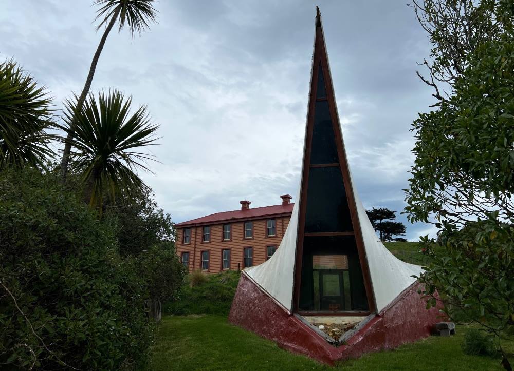
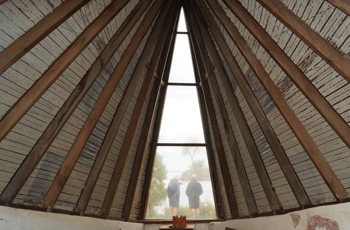
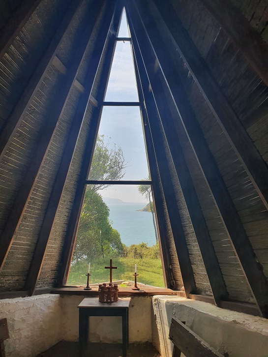
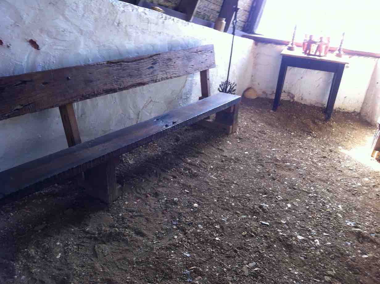
The “Sail” Shaped Chapel. (photo and caption by Pam)Inside the Chapel. (photo and caption John)Just the same as it was during a previous visit when I did a quick sketch (photo and caption Marijke)This drawing was from the same viewpoint (drawing and caption Marijke)Remnants from the old Hospital (photo and caption Marijke)Panorama – Looking back to Goat Island and Port Chalmers. (photo and caption John)
Our walks included visiting the sad sight of the island’s cemetery where the remains of 72 immigrants lay, half of them children, in unmarked graves. The small mounds are especially evocative. A sobering reminder of the fate of many immigrants who survived the arduous journey from the other side of the world in search of a better future, only to perish of scarletina and other deadly diseases in quarantine before they even set foot on the mainland.
Waiting on the jetty. (photo and caption Pam)
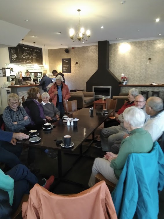
Heading back across the harbour our day is nicely rounded off by afternoon tea at the Santosha Cafe in the Port.
Coffee (photo and caption Helen)
A wonderful day out enjoyed by all.
Maria
4. 12/2/2020. Quarantine Island. Leaders Janice and Peter
43 hikers and trampers parked at Back Beach, Port Chalmers and walked along the wharf
edge past the stacks of logs. No cruise ship in port this time. Headed up the hill to our
morning tea spot at the beautifully maintained Lady Thorn Dell.
Photo and Caption John – “Morning tea at Lady Thorn Dell”
The lookout gave us good views of the container wharf which was busy with a container ship in.
Photo and Caption Clive _ “Port Chalmers from above.”
Meandered along the road , through the cemetery, and down to the main Aramoana road.
Photo and Caption John – “Visiting the Cemetary.”
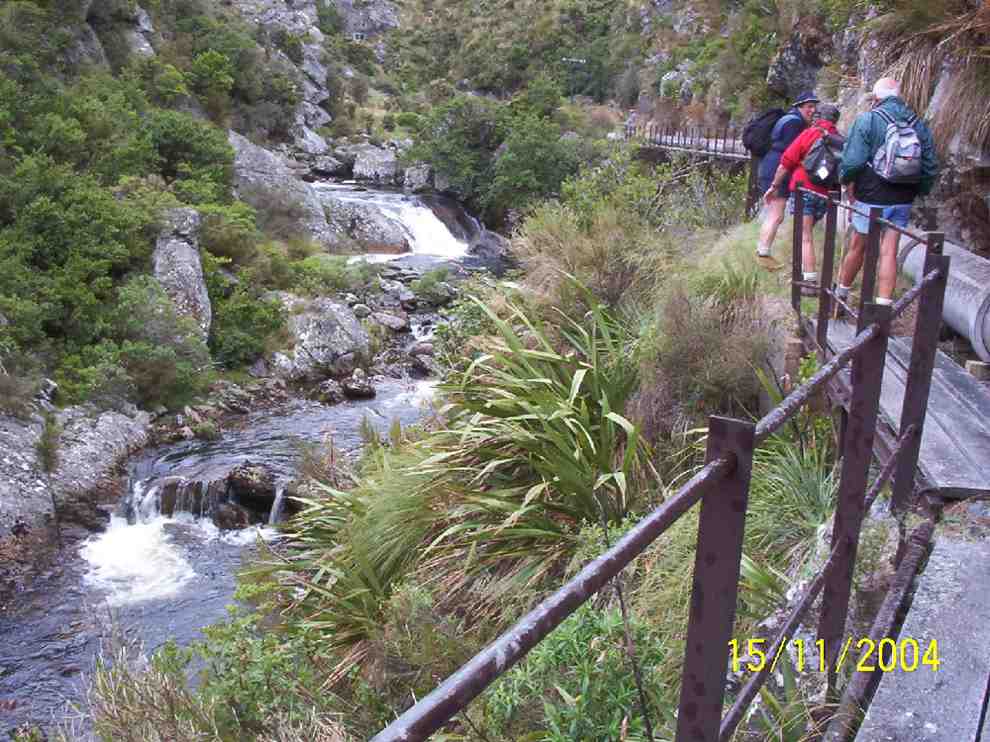
A small detour took us down to the new extended fishing wharf at Boiler Point.
Photo and Caption Clive – “New wharf boiler point”Photo and Caption Clive – “What to see in Port Chalmers”
Carried on to the main street of Port Chalmers and up the hill to the lookout and Ralph Houtere Sculpture Park.
Photo and Caption Clive – “Ralph Houtere sculptures.”
Back down a bush track to Back Beach. With half an hour to go before the boat was due to arrive
most of us lunched in the car park. Were entertained by a heap of shags and gulls feasting
on some small silver fish. By this time the weather had cleared from a slightly drizzly misty
start to a very pleasant sunny calm day. Perfect for a boat trip.
Photo and Caption John – “On our way.”
Another two hikers arrived, which brought our numbers up to 45. Because of the numbers, the boat did two trips to the island. We were met by a very enthusiastic knowledgeable volunteer who took us to the old married quarters and gave us a very detailed overview of the history of the island.
Photo and Caption Clive – “Renovation inside married quarters.”Photo and Caption John – “Time for a break.”
Photo and Caption Clive -“Quarantine Island chapel”The renovations to this building have now been completed. Following this the majority of the
group did the half hour walk round the point, through the old cemetery, returning to the
wharf to be transported back to the car park.
Photo and Caption John – “Harbour view”Photo and Caption John – “All aboard”
Refreshments (including a yummy Devonshire tea for some of us) were at the historic Careys Bay Hotel – a pleasant end to the day sitting in front of the hotel overlooking the boat harbour.
Photo and Caption Janice – “the Quarantine Island visitors.”
Jan and Peter
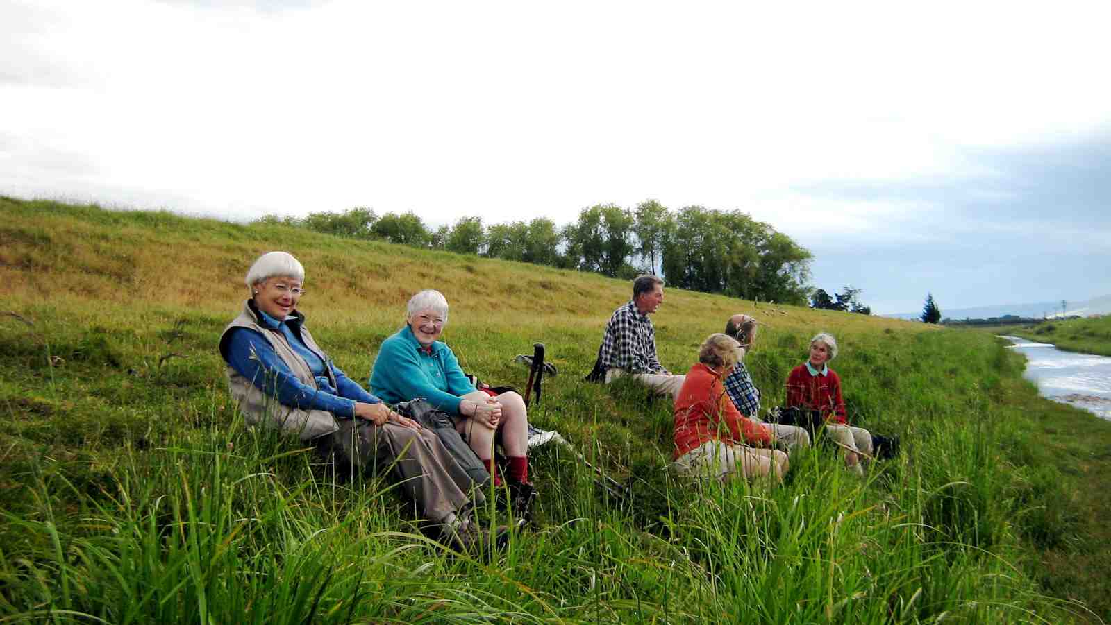
3. 18/3/2015. Quarantine/St Martin Island from Port Chalmers. Leaders: Jan and Peter.
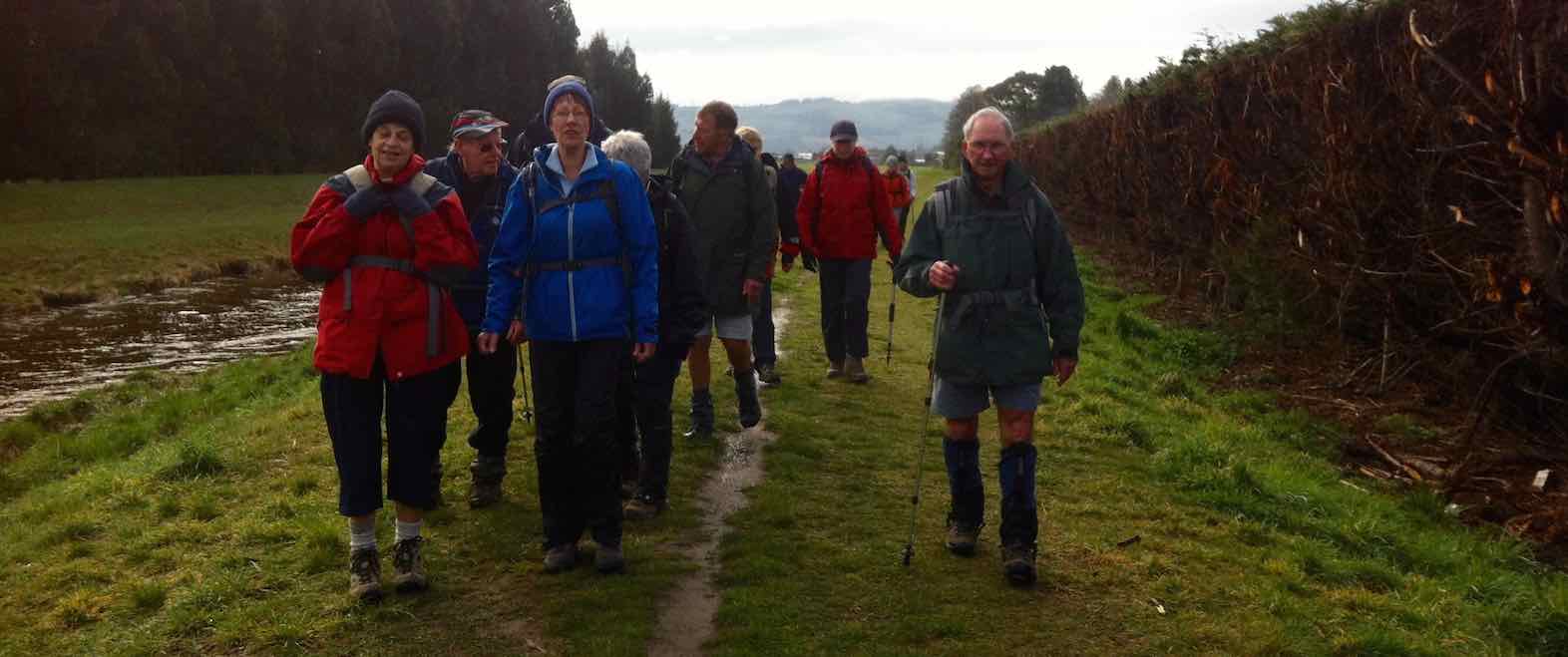
The weather was atrocious. Twenty-four Hikers and Ramblers arrived at the Back Beach car park. The rain fell. The wind blew. Leaders had told us our ferry to the island wasn’t to leave till 12.30 p.m. The sensible ones of us I believe waited out the morning in the shelter of their vehicles. The sillier ones were immediately into Parkas and gloves. Storm gear.
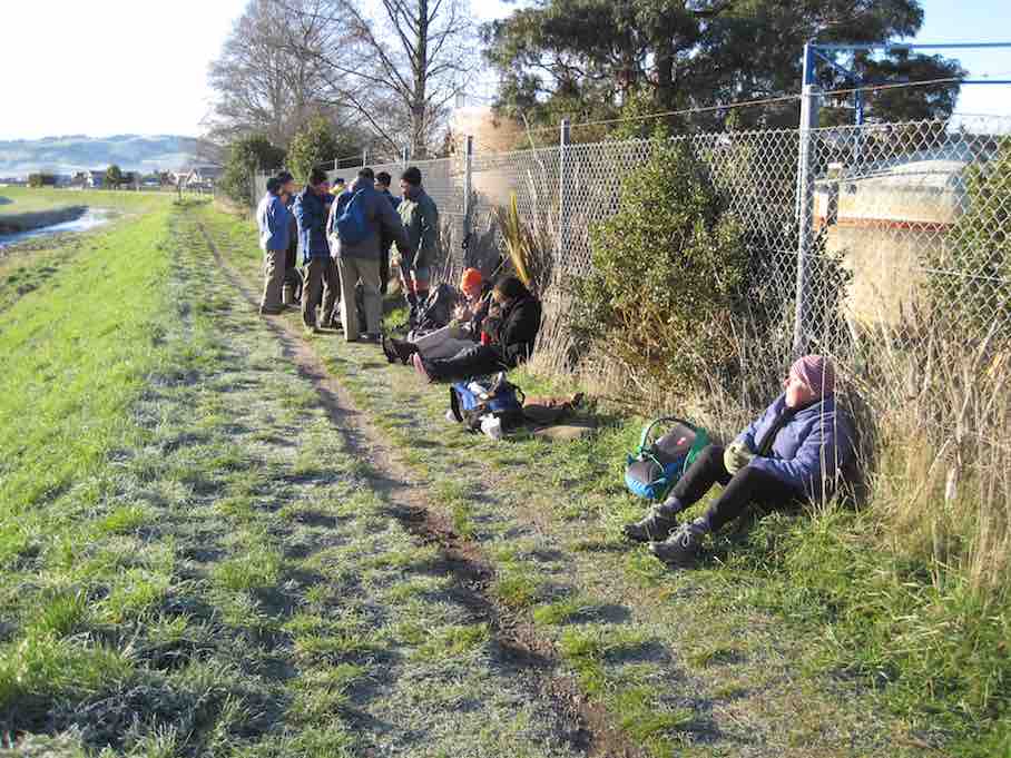
And off we set. Back the way we had come. Past the never-ending stretch of stacked logs, past the cruise ship, through the main intersection, up and along the road behind the church, across the railway line and on to Lady Thorn Dell. Here we gathered in the most sheltered (??) spot for morning tea. Few sat and even fewer partook. It was wet and cold.
Cuppa
Then surprise, upon the scene came up the two Lions Club members we had met as we entered the Dell, engaged in tidying the place up in preparation of a forthcoming important visit. They welcomed us and told us everything we could wish to know about the Dell’s history, from early quarrying of the rock, which initially was a hill stretching out to the water’s edge and whose stone now graces many of Dunedin’s buildings, notably the Railway Station, on through its life as a rubbish dump and subsequent clearing, to enable the further rhododendron planting and the present day. Wonderful.
Whereas we had earlier briefly entertained the idea of taking hot coffee in the warm embrace of Careys Bay Hotel, more time had now elapsed, so it was back down to the town,…
Local graffiti. On a shed wall a little way down from the Dell.
…in search of coffee that was more local. But the town was asleep, despite the cruise ship’s presence. No tourists. No cafes.
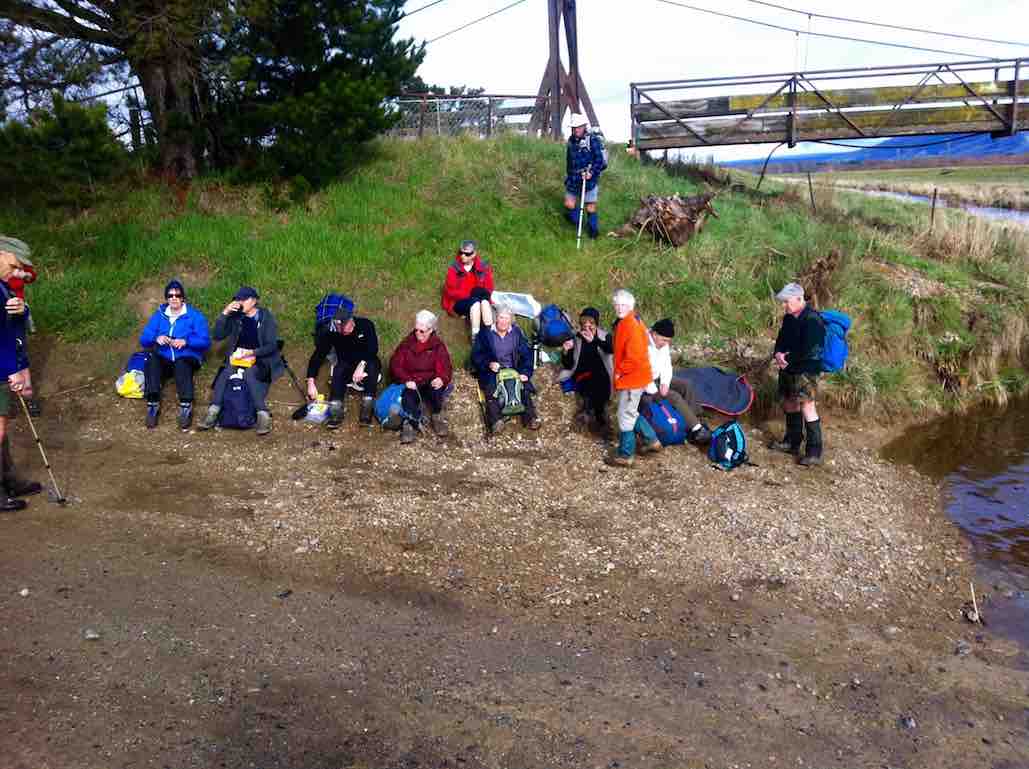
So we wandered around a bit, eventually sloping off in twos and fours back to the cars. We lunched separately, some in cars, some in other shelter, some exploring, until ferry-time arrived. Jan collected our ten dollar notes for paying the fare, and we boarded.
The VIvienne I
A lovely boat. Powerful too. The channel was a bit rough but in the lee of the island, all was smooth. And the sun had appeared and the rain had gone. A brightening-up afternoon. Hurrah.
It was no trouble alighting at the new wharf. The new island warden filled us in on local history, a salient point being that the St Martins Island Group name had very recently given way to the Quarantine Island Group name. Two other groups were there on the day, one of them being a two-day Tokomairio School Group. Our stay was a two-hour one, set to return at 3.00 p.m.
Rammed earth floor. A feature of the Island’s Chapel.
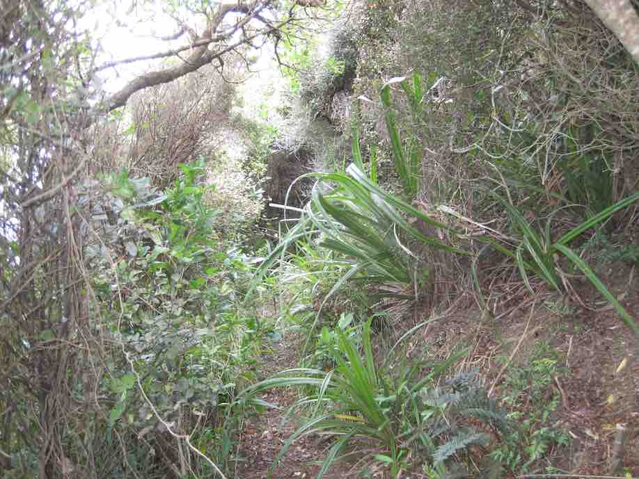
The walk round the top of the island was only half an hour. Lovely bush. The wind was strong on the sou-west side, the one exposed towards Dunedin, but the bush part of the track provided good shelter.
Having walked the main track,…
Track leading to loop trackOn the loop track
…some wandered off towards the old graveyard and the Portobello end of the island.
The Cemetery
The few sheep on the island were sheltered under a small plantation of pines. A brick chimney was all that remained of the old hospital.
Back towards the main buildings, the married quarters, once two-storied but now just a large hall, had been straightened up from an earlier lean, looking good in its fresh coat of paint.
Restored outside of Married Quarters BuildingInside old Married Quarters Building
The ‘wanderers’ joined the others waiting in the sun till ferry-time arrived.
Waiting in sun for ferry’s arrival.
All went smoothly as we reboarded and ‘sailed’ (?) back to the car park. A significant point, picked up from the crew, was that among them was the boat’s present owner, and the new owner , the one of the Monarch. This boat had apparently had a capacity for 33 passengers.
All agreed it had been a good day, all round. A day with a difference. A day to re-establish connections between Ramblers and old and newer Hikers.
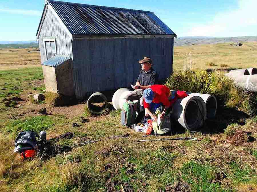
19. Welsh’s Road, Old Farm, Deep Stream Weir. Grade 3 Leaders: Lyn and Di
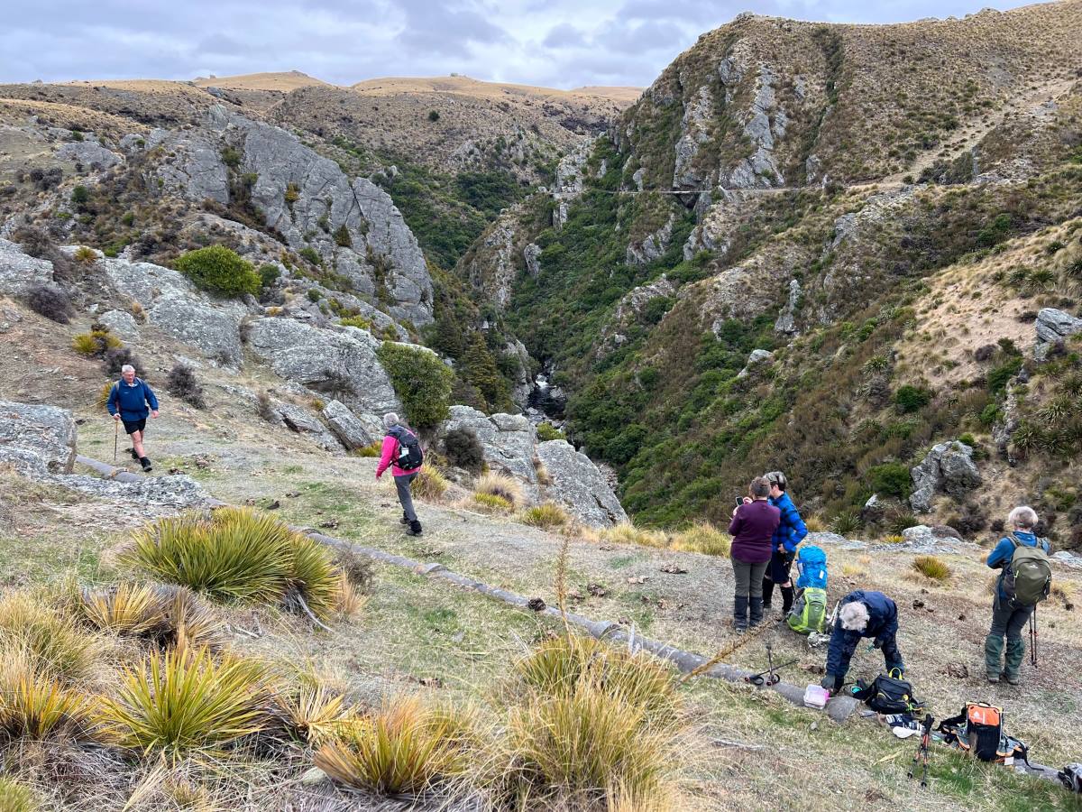
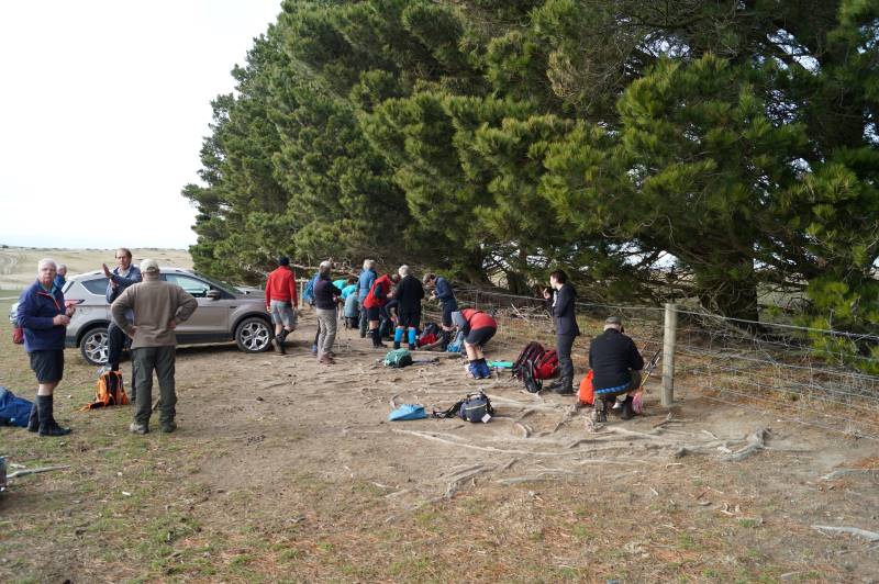
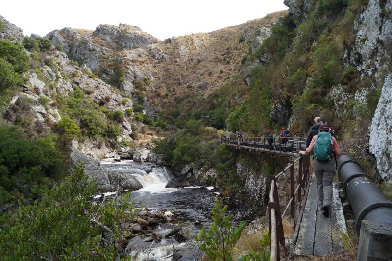
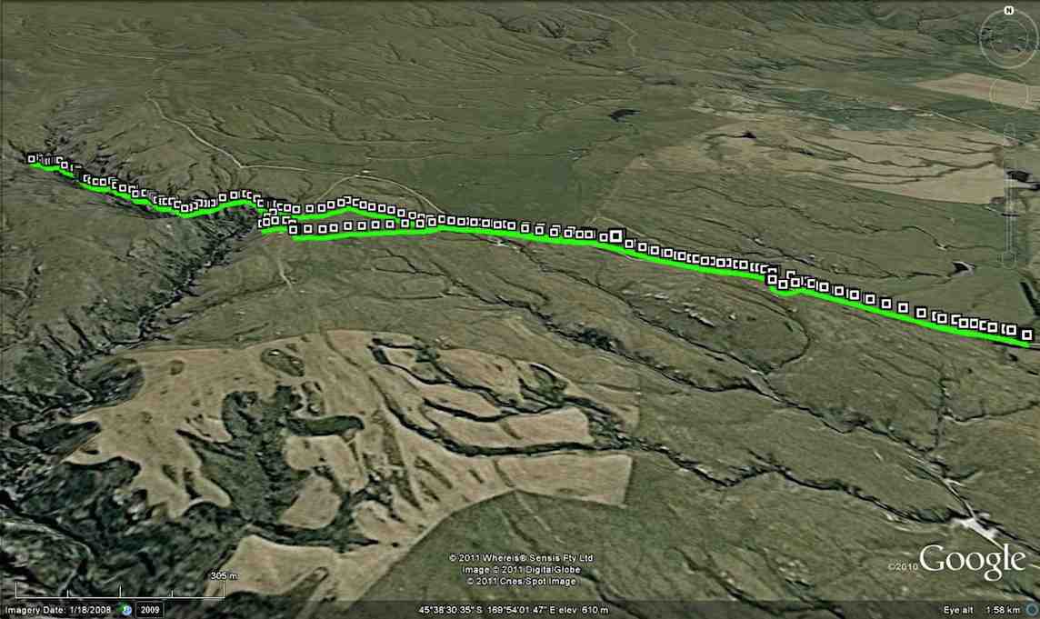
13 of us set off for the Pipeline, which is just off the old Dunstan trail on Rocklands Station.
We had morning tea under the pine trees where we parked the vehicles. It was a tad cold but we soon warmed up with the walk over the farmland to the pipeline.
Up and up over farmland. Caption and photo PamThe countryside is getting more rugged Caption and photo MarijkeTramping nirvana, easy level dry track, marvellous views Caption and photo John
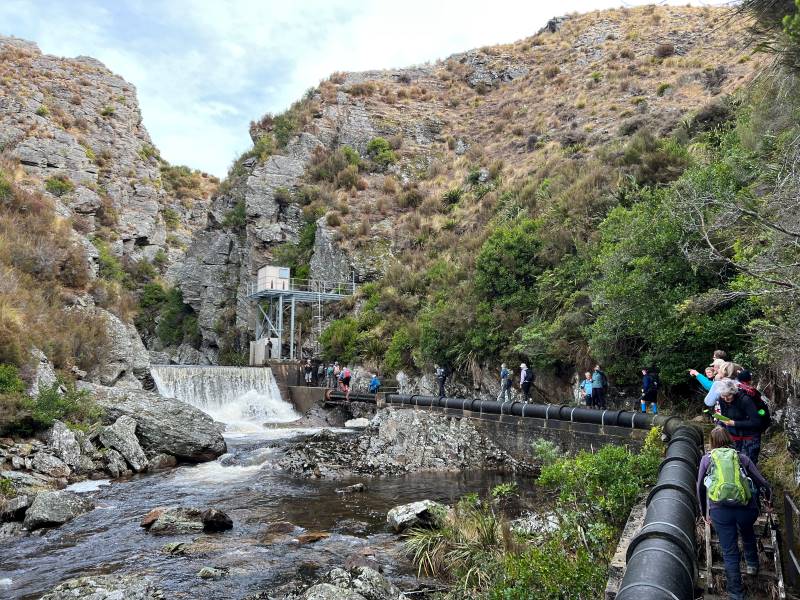
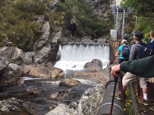
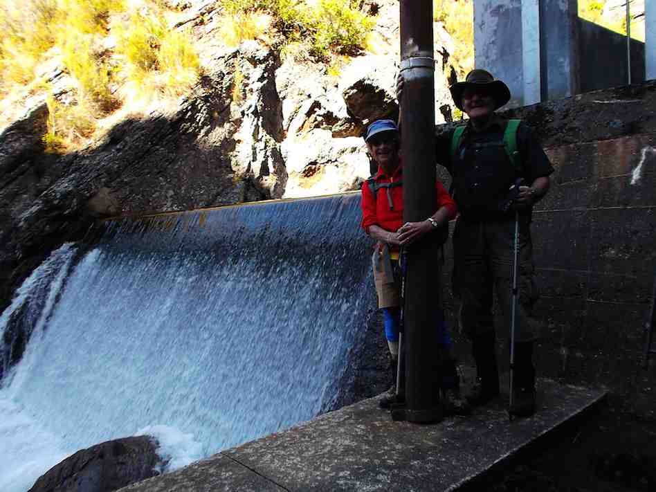
It was stunning scenery walking to the Weir and back.
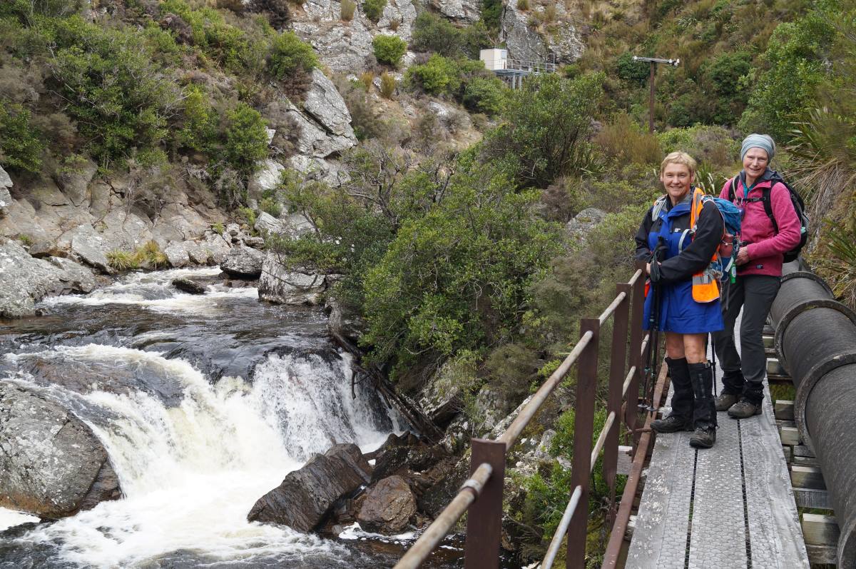
Happy Trampers. Caption and photo JohnPump house and Weir. Caption and photo PamExploring the engineering feat, the Deep Stream Weir. Caption and photo JohnCan you spot the hut? Caption and photo Marijke
We had lunch in the sun out of the gorge with more room to spread out.
Refuelling. (Pipeline track to the weir in the background). Caption and photo Pam
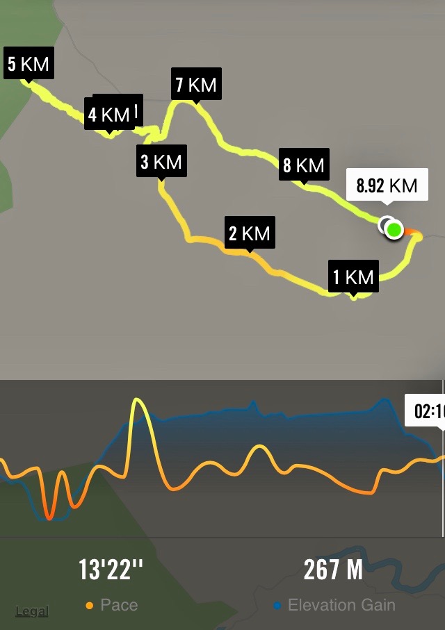
Then took the road back to the cars. It was 8.84ks according to my phone.
Some finished the day with a cuppa at the Wobbly Goat. Another great day out.
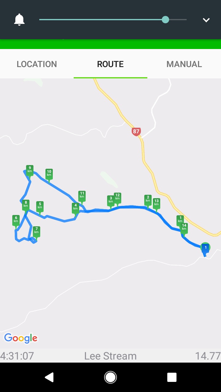
18. 17/08/2022 Trampers. Deep Creek Pipeline. 3.5 $10. Barbara Shackell & Judy Dennison
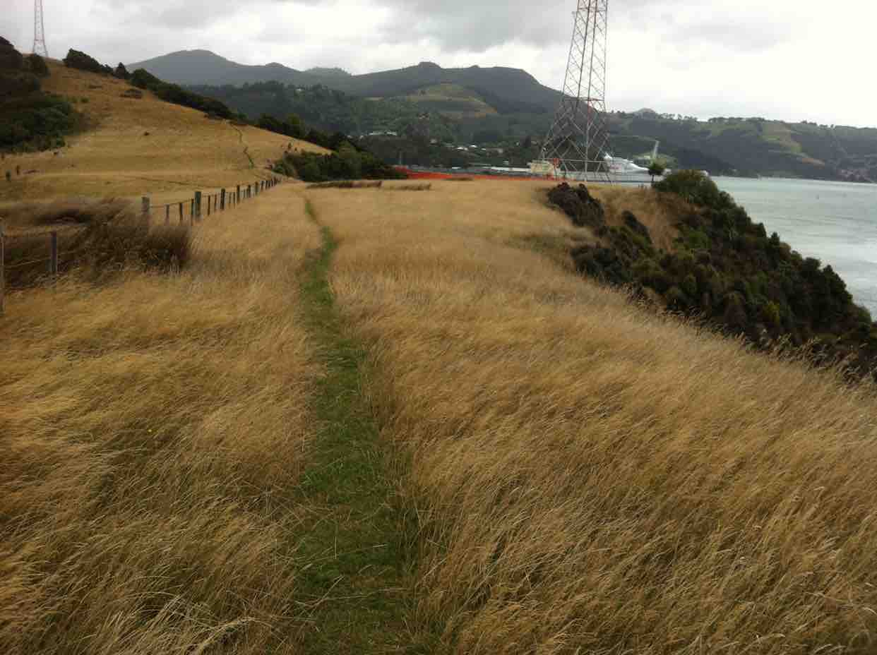
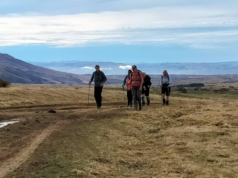
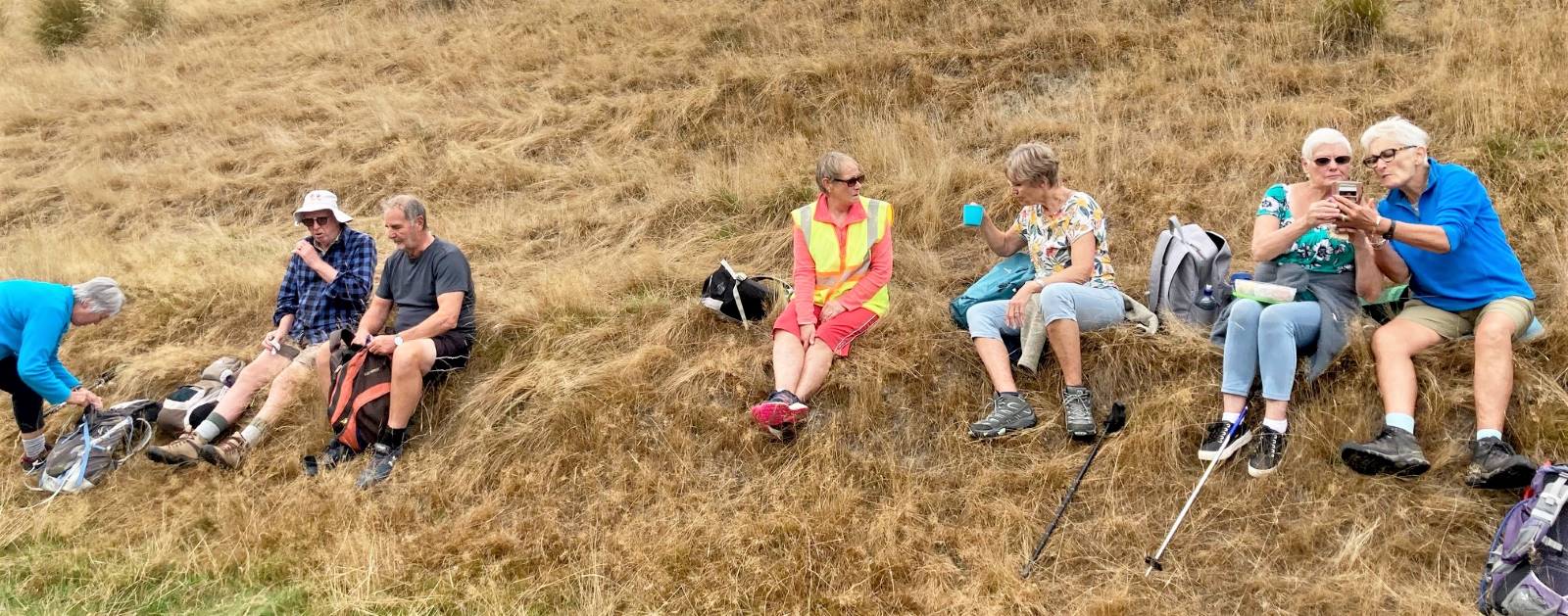
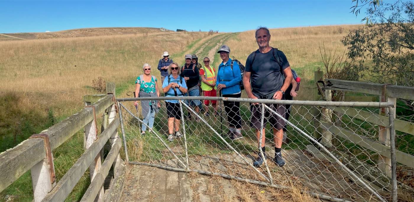
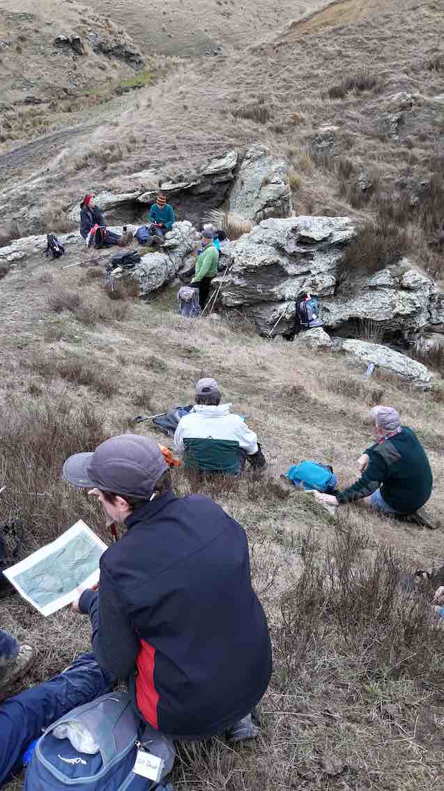
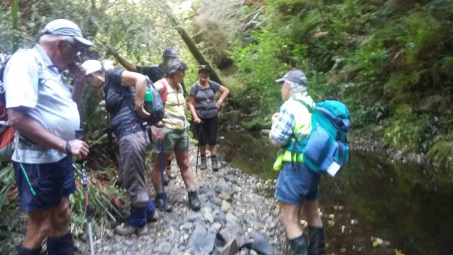
On a foggy old Wednesday morning, with the leader’s phone app threatening rain, 26 trampers met at the rugby grounds, sorted themselves into what appropriate vehicles were available and headed off at 9.30am sharp. A rearrangement of seating occurred when a couple of vehicles joined us at Outram, then again at Clark’s Junction with the addition of Heather’s vehicle, waiting for us at the turn off to Old Dunstan Road (ODR). We regrouped at Rocklands Station gateway, at which point the ODR was locked, and travelled in convoy through the farmyard, between buildings, up the hill and back onto ODR. Some 5km further along, two cars were left at the gateway to the Te Papanui Conservation Park, passengers rearranged again, with a couple of them heading off on foot to our final parking destination two kms further on. Morning tea was had in the shelter of a line of pines (although there was nothing to shelter from!) while a vehicle returned to collect the two pedestrians.
About to leave the cars (photo & caption John)
After morning tea the group set off for a couple of km on a comfortable uphill farm road, without stringing out too much at all. Good work Judy (tail-end Charlie!).
Nearly at the top (photo & caption Phil)
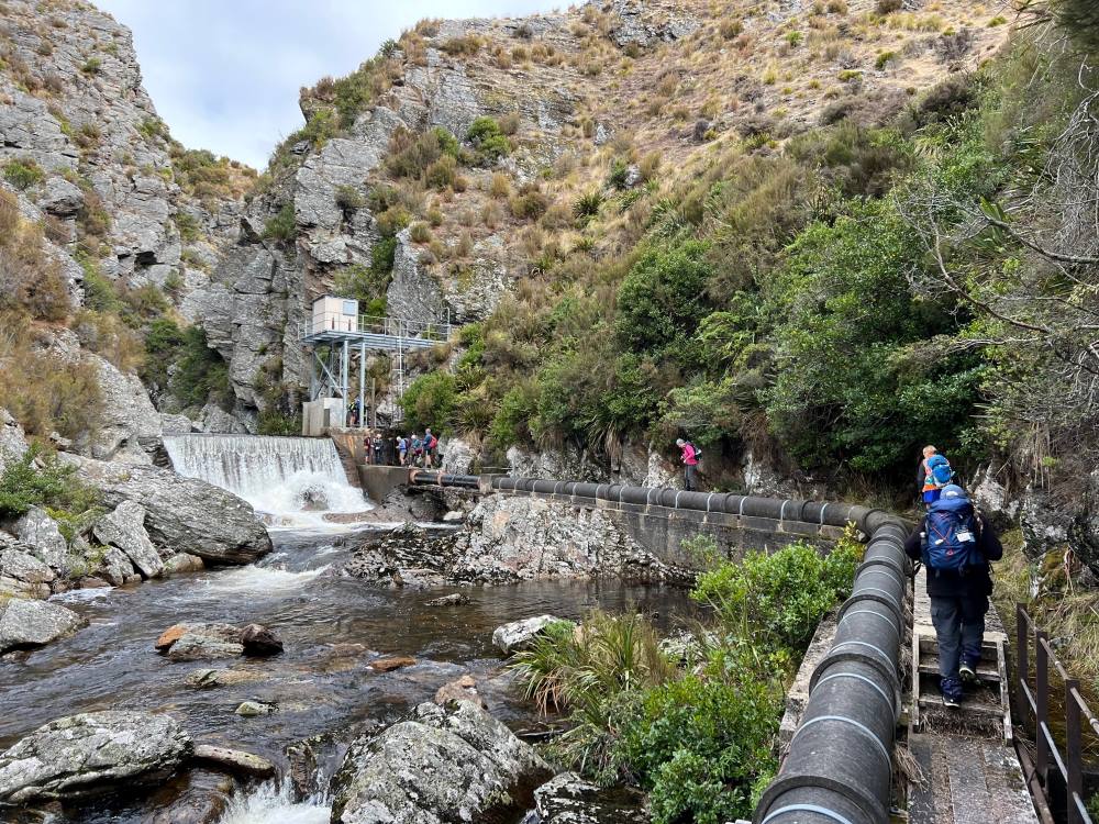
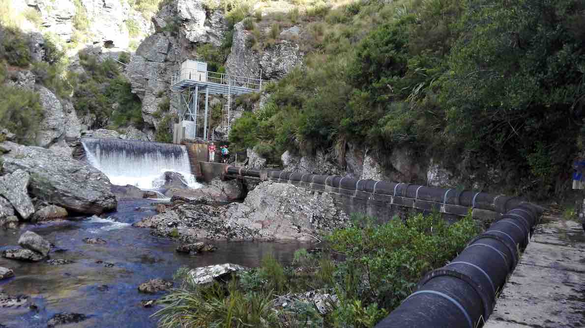
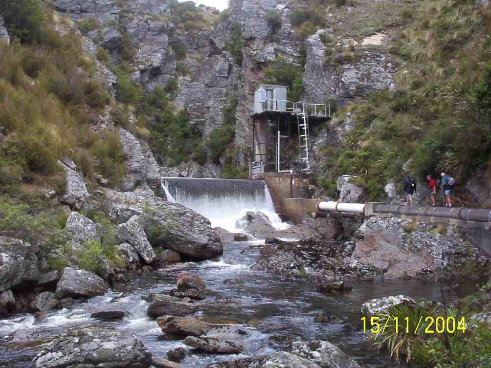
Entering the gate to the paddock containing the Deep Creek Gorge we followed a 4WD track to arrive at the pump station a little before noon. From there we picked up the pipeline track and followed it a few hundred metres around to a sunny spot which us allowed a view down into the gorge for a leisurely lunch.
Lunch in the sun (photo & caption John)
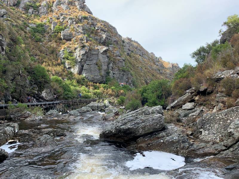
After lunch we crossed the first of a handful of boggy patches and continued along the pipeline track to the weir.
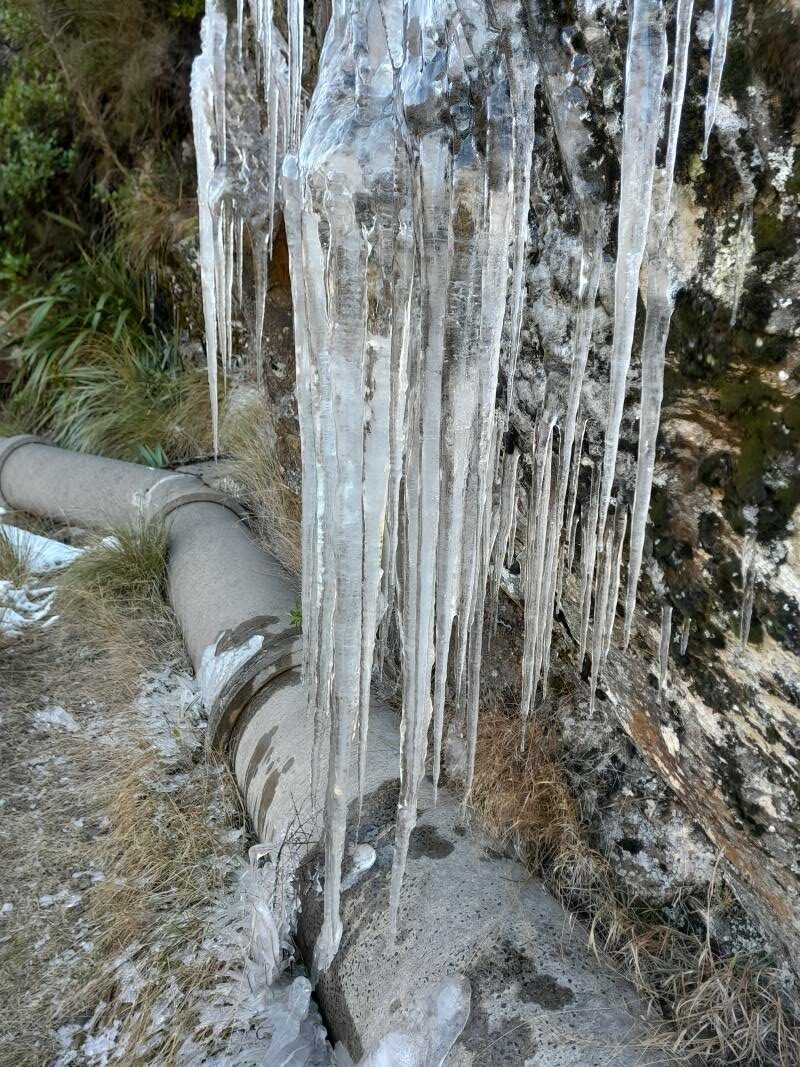
What a difference a week makes – the recce had us walking along snow covered tracks, observing animal tracks in the pristine snow, dodging icicles clinging to overhanging rock, frozen bogs, while the club tramp had virtually no snow visible, the bogs were boggy, but plants – some showing colour – were visible through the rocky cracks and crevices. The weir had a considerably greater flow of water than earlier in the week, presumably from the snow melt.
Pump house and weir (photo & caption Pam)
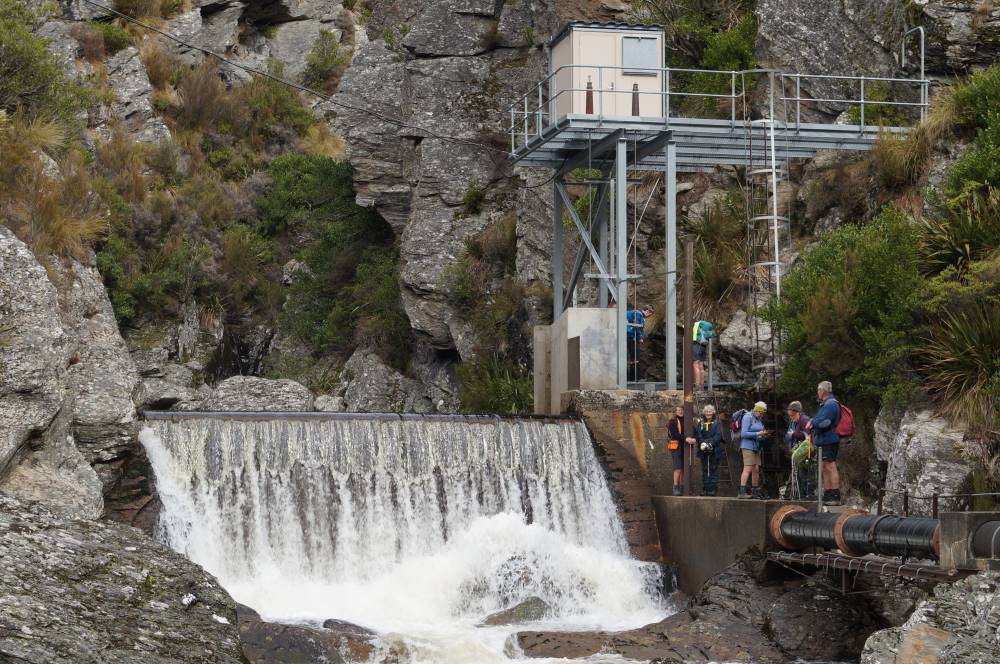
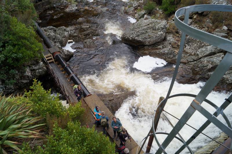
Some took advantage of the ladders to gain an elevated view of the weir.
Looking down from the top Weir platform (photo & caption John)
From that vantage point the pipe lineman’s hut was also visible and some members on the return walk, climbed up for a looksee at a very dilapidated “shelter”. While the hut is invisible from the track, its position is fortuitously marked by a final telegraph pole.
Spot the Hidden Lineman’s Hut from the Weir (photo & caption Marijke)
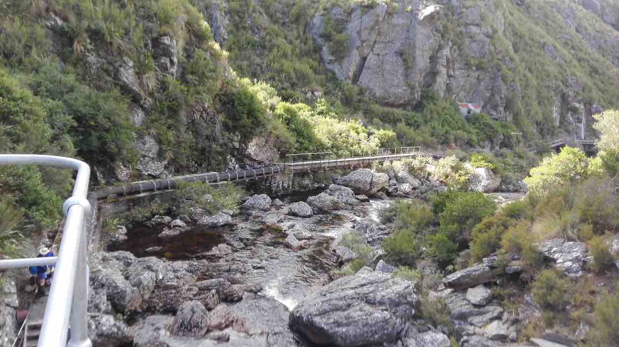
The return along the pipeline track provided a different perspective of the gorge and it didn’t take long to reach the place we’d had lunch and rather than follow the track the last couple of hundred metres around to the pump house, we took a shortcut, heading uphill, following no track, just the knowledge that we would reach the 4WD track over the brow, where we paused briefly.
Deep Creek View (photo & caption Helen)
A show of hands as we rested indicated that exactly half our number had never been into the gorge previously.
The farm road downhill to the vehicles was covered quickly. We agreed to meet at the Wobbly Goat for coffee, but in the event it was closing as we arrived, and we continued onto Wal’s.
Coffee at Wal’s (photo & caption Barbara)
My fears regarding the weather we would strike were unwarranted. Through the fog we were teased with a brief sighting of blue sky nearing Outram in the morning, but then re-entered the ground fog as we climbed up SH87. This cleared completely before Lee Stream and we had perfect weather for the rest of the day – intermittent sun, no wind or rain! A quick read of previous reports on this particular track leads the writer to believe we might have been lucky not to have suffered a debilitatingly cold wind!
How it was on the Recce (photo & caption Barbara)
Thanks to Rocklands station for permissions; to the drivers of vehicles able to manage the farm tracks, to those who met us away from the Rugby carpark for their punctuality, and everyone for the positive feedback on the day. I think it may be repeated!
Barbara
17. 18/03/2020 Hikers. Deep Creek Pipeline. M. Bob Mitchell and Mike Webb
28 Hikers set off in 8 cars from the car park in Mosgiel to rendezvous at the Clarks Junction pub before driving to the start of the walk. More than a few of the ladies eyes lit up when Bob announced that we would be having refreshments at the pub at the conclusion of the hike. It was good to see that it is not only us blokes that take drinking seriously.
After meeting in the pub car park we proceeded in convoy up the Old Dunstan Rd and found a suitable spot to park the cars away from any cattle that wanted to use them as back scratchers.
Photo and Caption Clive – “Te Papanui”
We started the walk at about 1000 and had morning smoko at the one of the gates/cattle stops.
Photo and Caption Clive – “Morning tea.”
Photo and Caption Clive – “Pump house at Deep Creek.”
From there it was a steady climb to some maintenance huts at the top of the gorge. The distance from the cars to the huts was 3km
Photo and Caption John – “Vast open country.”
.The weather was fine with great visibility and from the huts we could see the pipeline snaking its way around the gorge.
Photo and Caption Clive – “Into the gorge”
Photo and Caption Clive – “Deep Stream a long way down”
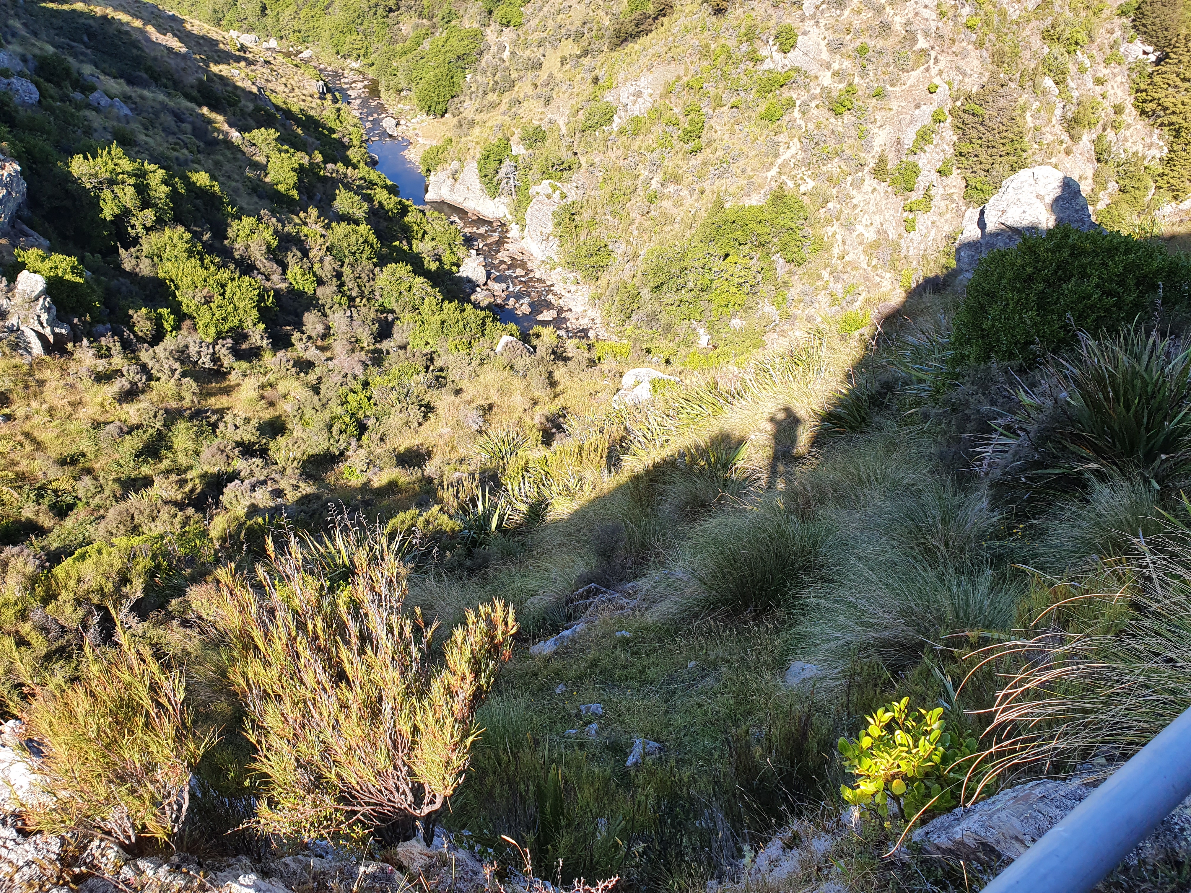
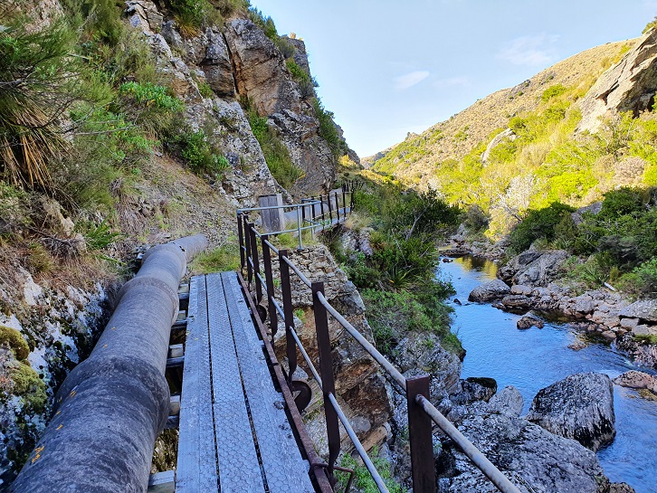
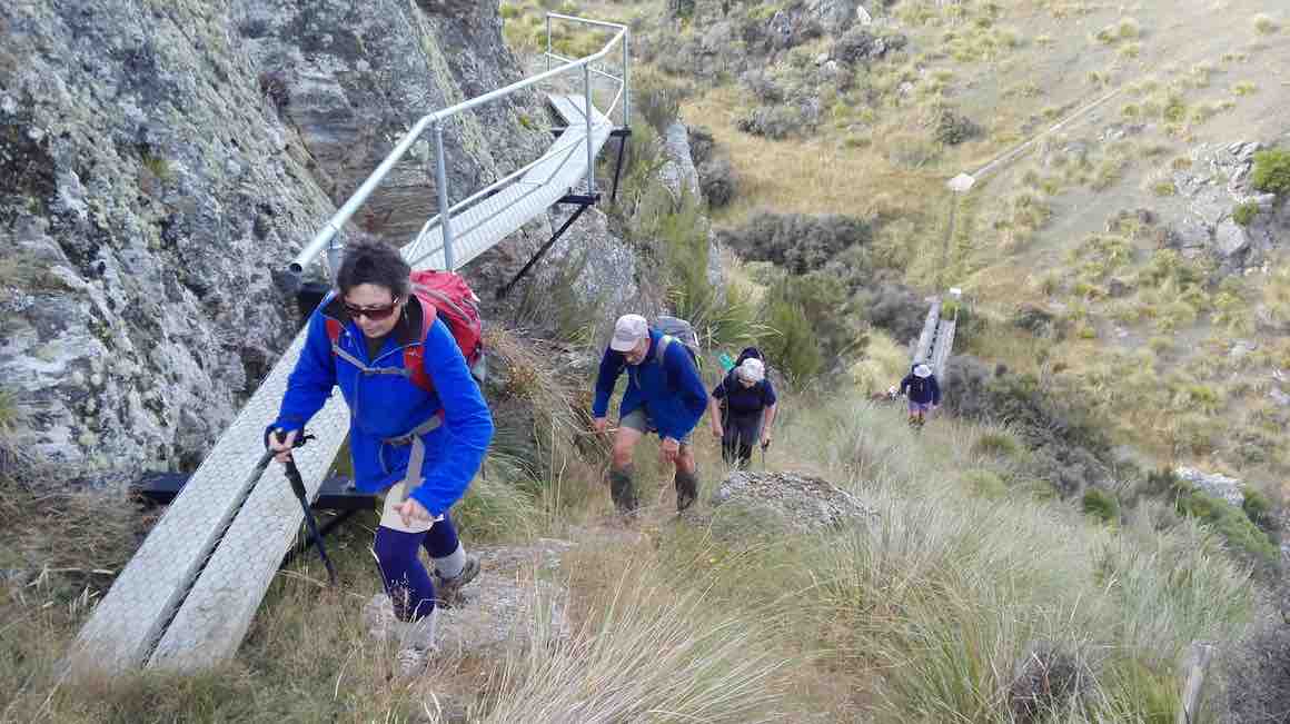
From the huts it was a steady climb down to find the track that leads to the pipeline. The track is approximately 2kms in length, and quite narrow in some places with railed walkways over some of the more challenging parts of the track. The views were quite spectacular and we were soon strung out in single file looking like porters on the Ho Chi Minh trail. Frequent photo stops were the order of the day.
We could hear a bit of bird song and one falcon and one hawk were observed flapping/souring overhead during the walk. One point of interest was on old hut set in the bush about 10m above and to the side of the pipeline not far from the tracks end. Probably accommodation for the guys laying the pipeline all those years ago.
Photo and Caption Clive – “Walking to dam along the river.”
After a brief halt and photo stop at the dam/weir at the end of the track we did an about turn, retraced our steps and eventually stopped for lunch in a nice sunny spot overlooking the gorge.
Photo and Caption Clive – “Pump house and dam”
Photo and Caption Clive _ “Back down the gorge.”Photo and Caption John – “Lunchtime always with a view.”
From there it was a short walk up to the huts and back down to the cars.
Photo and Caption Clive – “Back at the cars.”
We walked a total of 10km.
Bob had organised the publican at the Clarks Junction pub to lay on coffee, cakes and scones and also to open the bar early for those that wanted to support Speights. Glad to report that at least two unnamed ladies were seen with pints in their hands. Legends!
The rest obviously enjoyed the coffee and food as the shark like feeding frenzy at the counter was a sight to behold.
A good day was had by all and I can vouch that the Speights was up to its usual standard.
Mike
16. 9/1/2019. Deep Creek Gorge Pipeline. Leaders: Theresa and Clive.
Route map, Deep Creek railed walkway and weir, courtesy Ian.
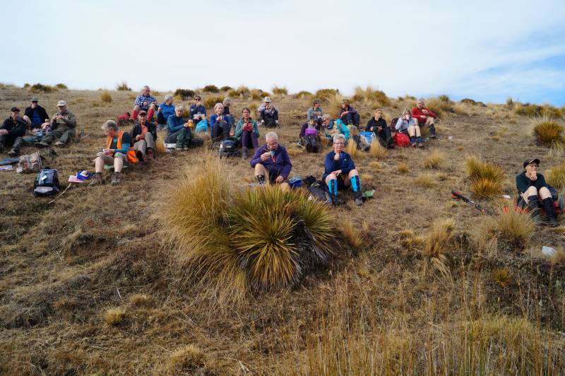
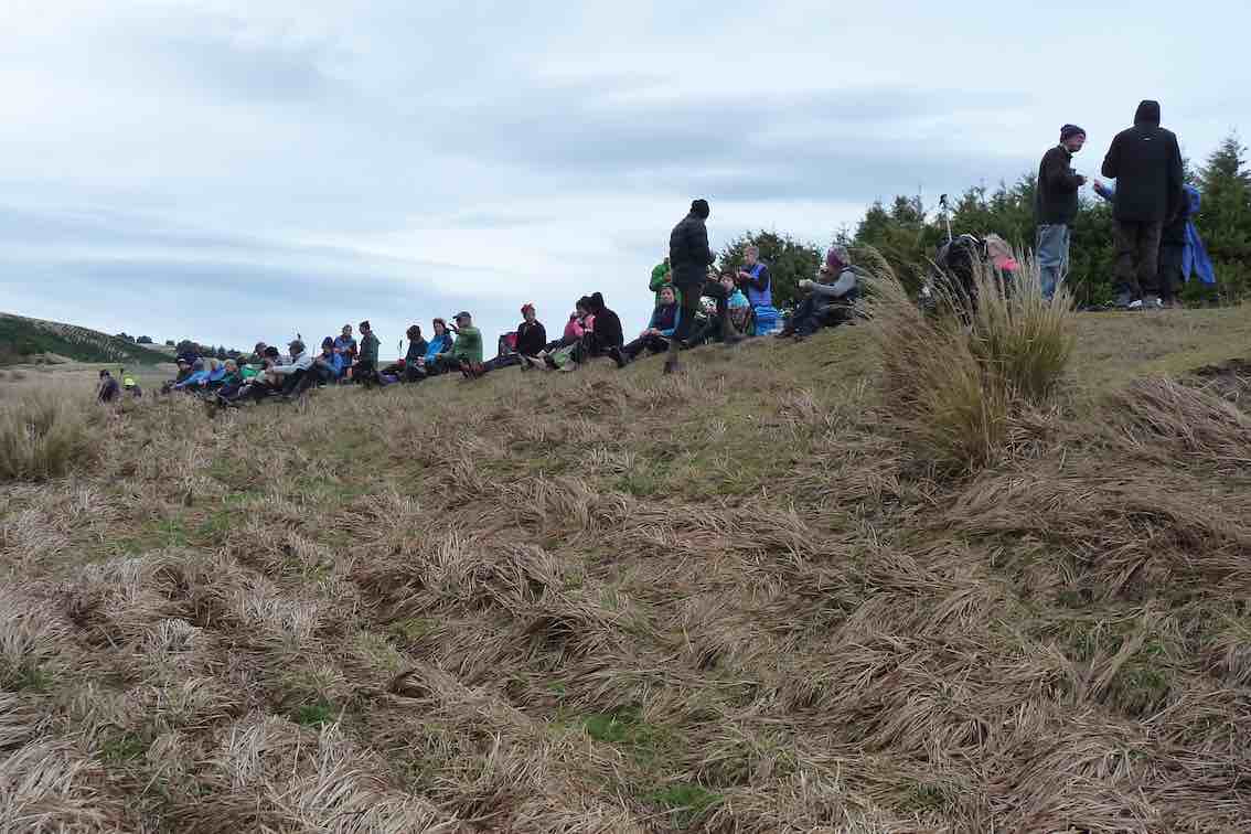
31 Trampers, Hikers and Ramblers set out across the tussock of Te Papanui Conservation Park. It was an ideal day for a walk on the tops as there was high cloud keeping what can be a scorching sun off our backs. The 16 degree temperature was just right to get things started after the Christmas/New Year break. 13 of the participants had not been on the walk before and were looking forward to the gorge.
Morning tea
(Clive pic.)
found us being observed by a large herd of cows who seemed very interested in what we were all doing there.
After a twenty minute break we headed on up hill
(Clive pic.)
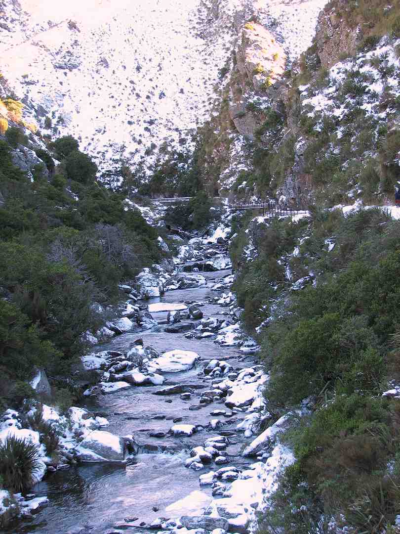
to the hut at the mouth of the gorge. Having made sure everyone was accounted for it was across the 40 ? or 41 ? bridges and board walks to the weir at the top of Deep Creek.
(Kevin pic.)(Clive pic.)(Kevin pic.)
This gorge is a feature that makes this walk so interesting. As an aside, the DoC blurb advises that there are over 500 species of native insects; plus a wide variety of plants and animals (including pigs and red deer), in the Te Papanui park.
Lunch was taken back at the mouth of the gorge, sheltering from the cool breeze that had sprung up. After lunch the Trampers headed off in a more Easterly directing to add a bit more distance to the completed walk. The hikers and ramblers headed back the way we had come in the morning. The hikers covered about 9.5 kms by the end of the day and were happy to sit down for afternoon tea at the Wobbly Goat about half an hour ahead of the more exercised Trampers group. The consensus was a ‘gorge’-ous days outing! – Clive
15. 26/4/2017. Deep Creek Gorge Pipeline . Leaders: Theresa and Arthur.
Nike app route map, courtesy Ian.
Leave the car park and go up SHWY 87 until Clarks Junction. Turn left onto Rocklands Road. Travel on excellent tar seal until you pass the Rocklands Station complex. Now you will be on gravel and at the beginning of the Old Dunstan Trail. Turn left off the Old Dunstan Trail and proceed on farm track for 2 kms. Park cars at the trees. Cross over farm land for a period of time — only down and up one gully,
Morning tea in gully, sheltered from a breeze. (Clive pic.)
going in a west / north direction towards the gorge. A gate in the middle of a paddock with a faint track going in the right direction. Two small newish huts with a solar powered panel on roof mark the beginning of the Gorge track. This is part of the Te Papanui Reserve. Traverse pipe line for approx 1/12- 2 kms.
New section at start, replacing broken single wooden planking. (Keith pic.)
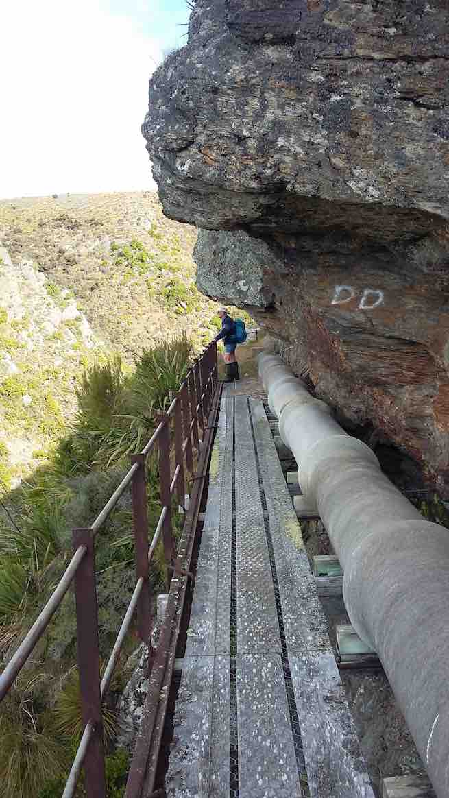
The pipe line is suspended off the cliff high above the Gorge .The track is narrow on the pipe line …
(Clive pic.)
… but is easy and in the main flat. There are many foot bridges to cross. (An in-house challenge to count the number, caused differing results/) One dedicated tramper even ticked them off on a piece of paper .WHO are we to disagree!! A small dam was at the head of a very picturesque Deep Creek Gorge.
(Keith pic.)(Keith pic.)
Repeat the trip back to the road just beyond the huts. From then it is an easy road tramp back to the cars. 12 very happy trampers enjoyed a WOW 😳 kind of a day out. Approx 10 kms in length. Debrief and coffee at Outram. -Theresa.
14. 9/4/2014. Trampers. Deep Creek. (A replacekment for ‘The Gap’, programmed for the day, which would have turned out extremely muddle.)
The first thing we struck was hundreds of sheep by the trees where the cars normally park.
so we parked just before that spot and skirted the trees on the other side so as not to disturb the sheep. We left morning tea till we got to the old hut …
Morning tea in the sun (Heb pic and caption)
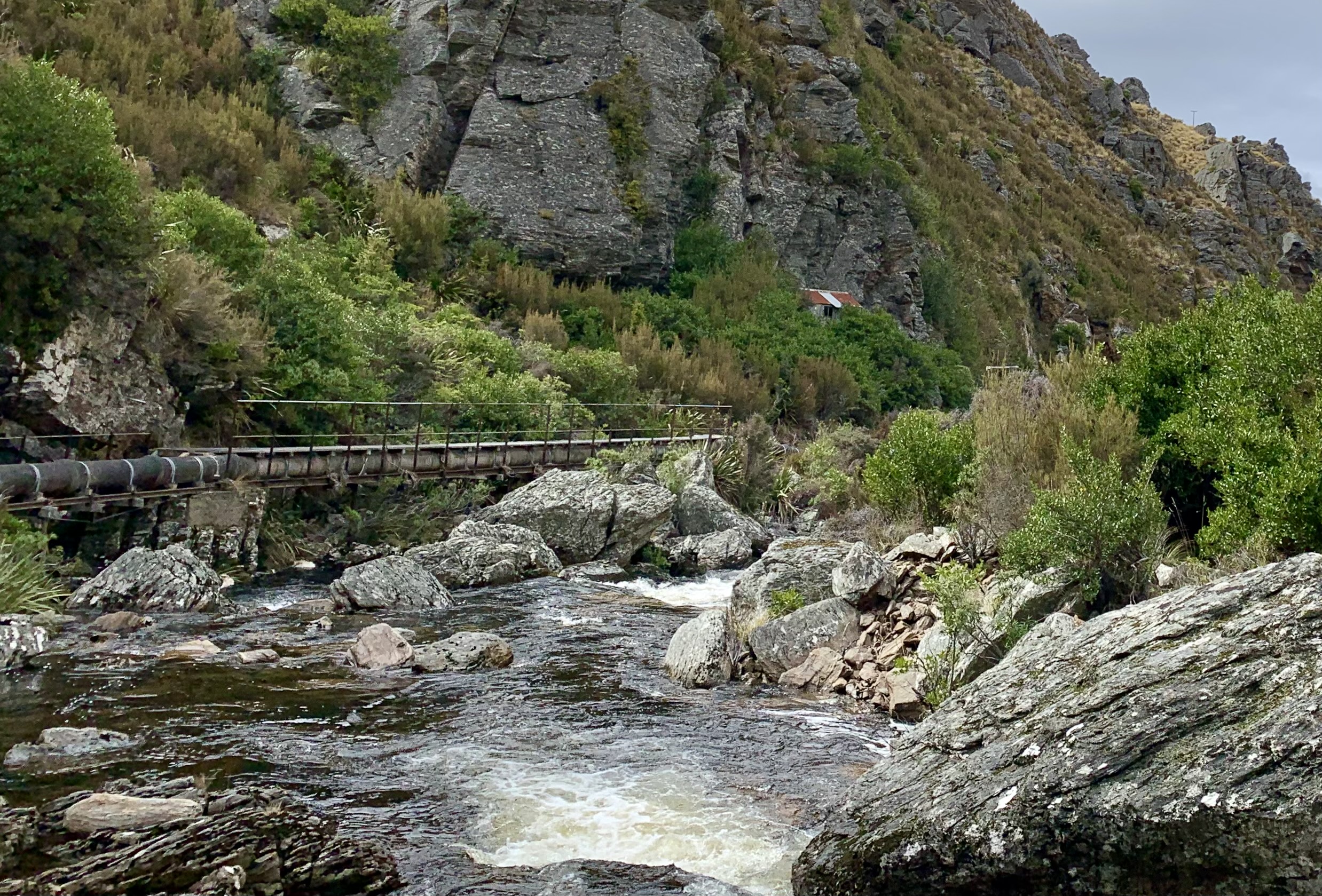
… sitting on some concrete pipes there. From there we followed the track taking us onto the pipeline …
Looking upstream toward the weir (Heb pic and caption)
… right up to the weir.
Ria and Eric at the Deep Stream Weir (Heb pic and caption)
About halfway back we enjoyed lunch in the sun sheltered in a gully with no wind. It was great. From the hut on the way out, we followed white pegs indicating the pipeline which helped us avoid getting our feet wet in a muddy creek. Then it was back to the cars. A great day for tramping. – Heb.
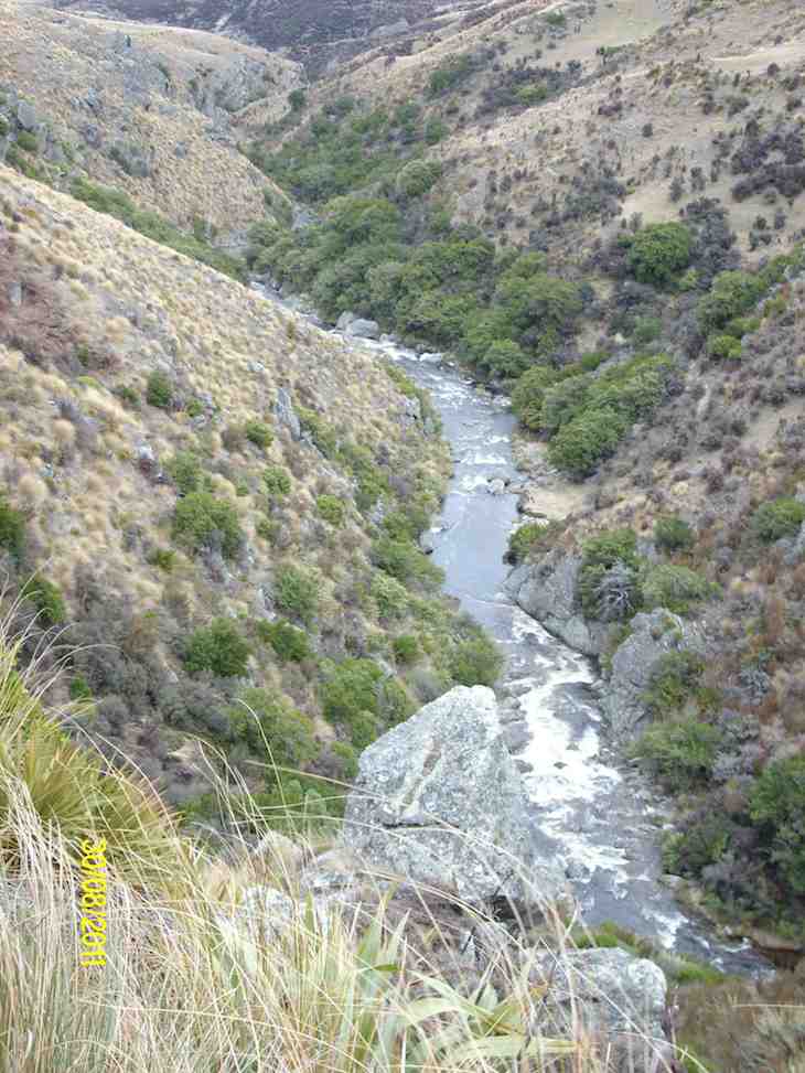
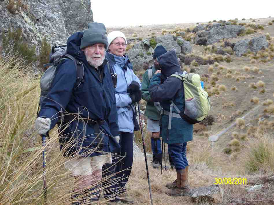
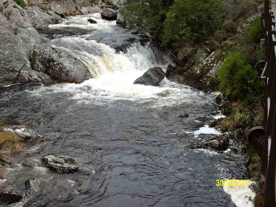
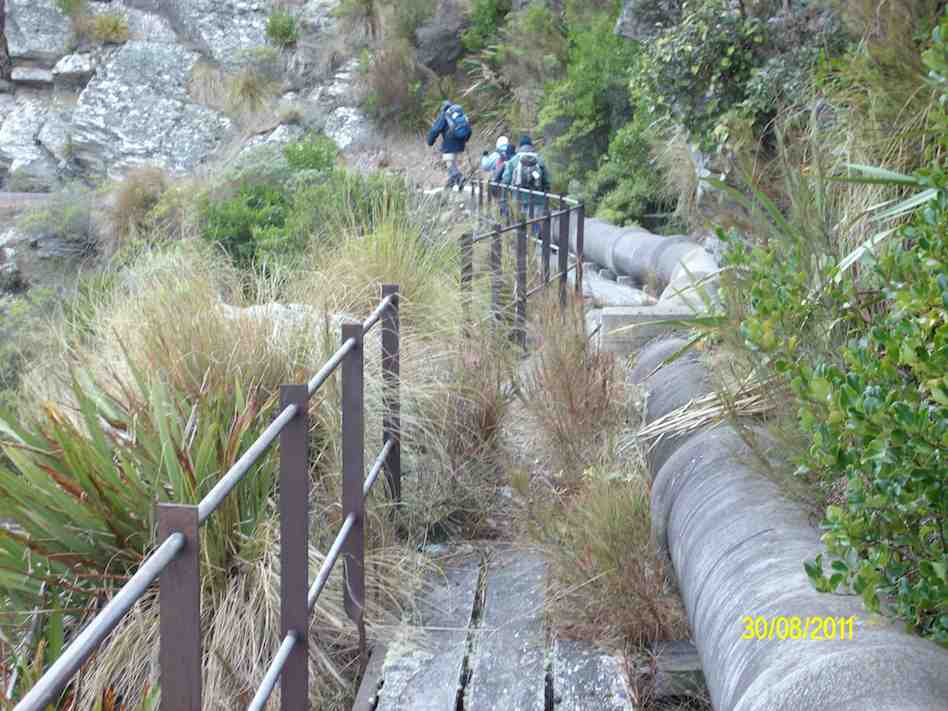
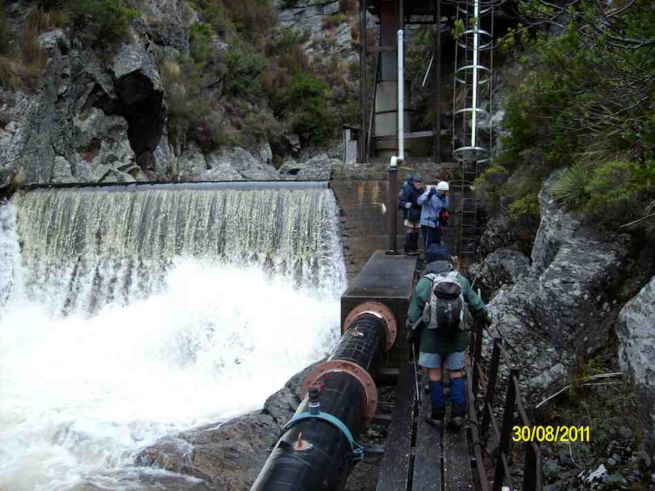
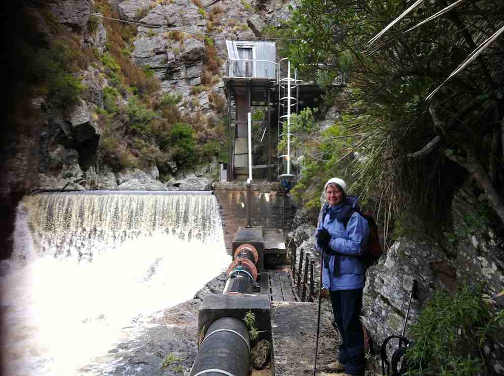
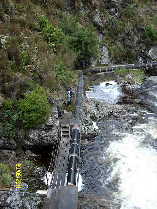
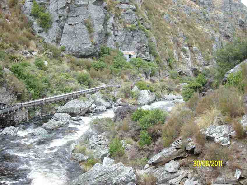
13. 31/8/2011. Trampers. Deep Creek.
GPS
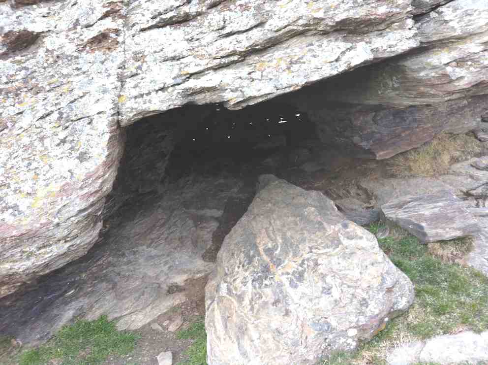
Five of us battled a strong wind on the tops, really icy and straight from the antarctic, to a late cuppa at the cave part way up the road from where we park the car. However the cave faced straight into the wind so we nestled behind it in the shelter of its lee.
The cave, with light chinks in the ‘bricked up’ rear.
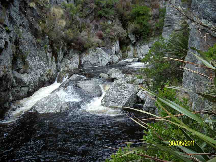
Wrapped up in wind-breakers, gloves and woollen hats we struggled onward and upward to at last the crest of the slope and escape down into the shelter of Deep Creek’s gully and onto the walkway.
Looking downstream at start. (Ken pic and caption)
Ian, Linzi, Ria and Doug at start of creek track. (Ken pic and caption)
There was quite a lot of water in the creek. (Ken pic and caption)
Part of the track. (Ken pic and caption)
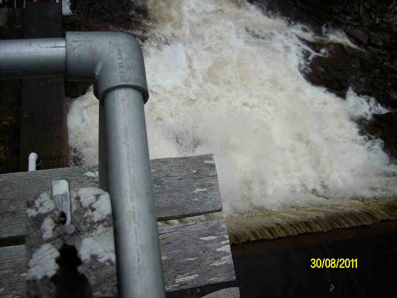
Doug, Ria, Linzi and Ian at the weir. (Ken pic and caption)
A large flow of water over the weir. (Ken in the background disappearing up the ladder.)
Creek above the weir. (Ken pic and caption)
Looking down on the weir from the control hut. (Ken pic and caption)
Looking back along the track from the control hut. (Ken pic and caption)
View of further downstream from the control hut. (Ken pic and caption)
On the way back out, we remained to lunch in the shelter of the gully before getting back out to expose ourselves to the wind again. We examined the old hut, little changed from last time, before making the return back to the car, this time thankfully with the wind behind us. – Ian.
12. 10/11/2010. Hikers. Deep Creek. Medium. Leaders: Evelyn C, Graham.
11. 12/3/2008 Hikers. Deep Creek. Medium. Leaders: Joyce S, Lesley G
The adventure for the 14 Hikers this week was a drive via Rocklands Station and the Dunstan Old Road, turning off to the Te Papanui Reserve. There was a cold S.W. wind that kept us in woolly hats for the day, even although we had sunshine as well. A walk up the hillside to a cave amongst the rocks was earmarked for coffee by Joyce S, our leader.
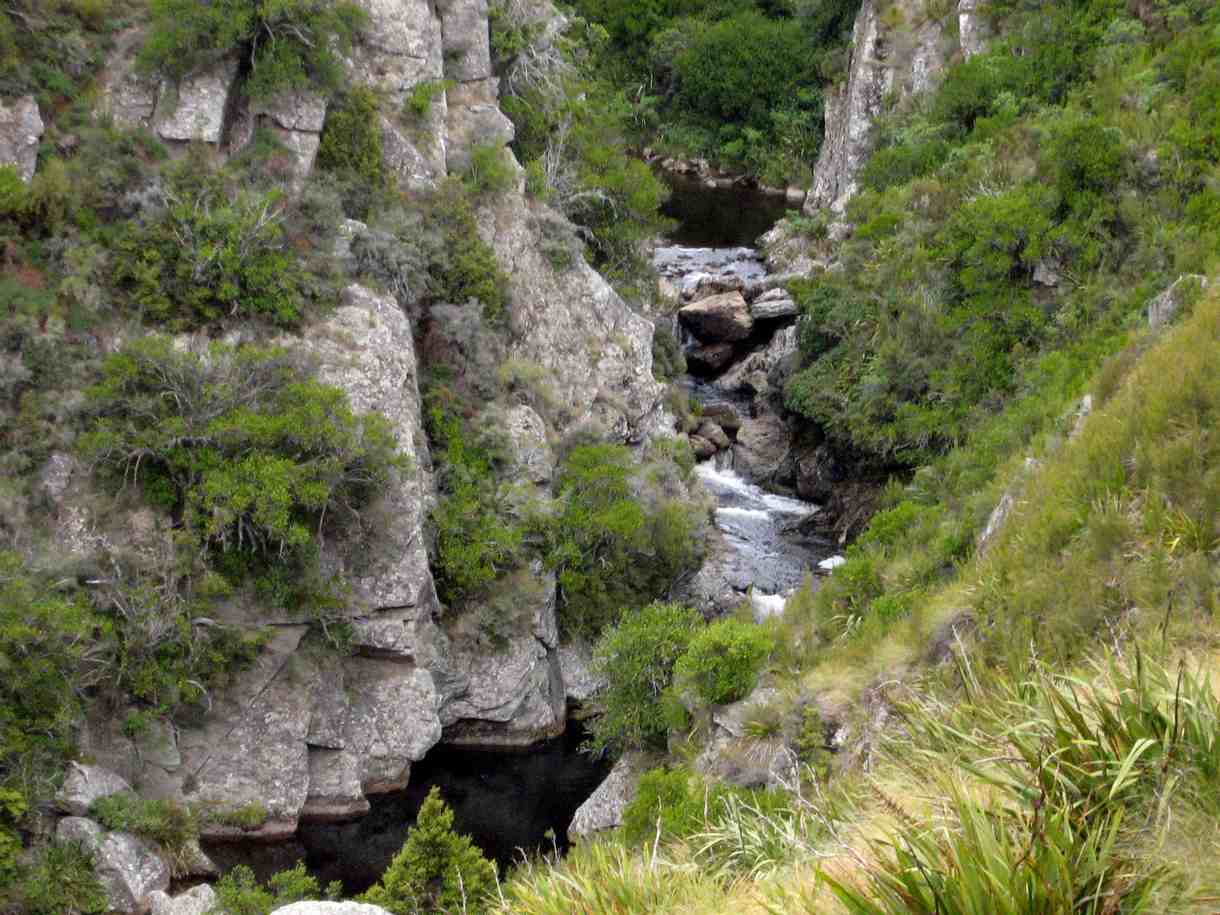
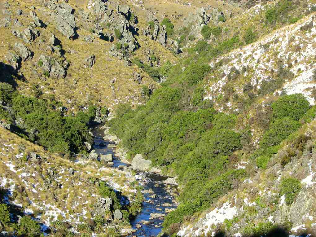
Then on to the gorge of Deep Creek, a tributary of Deep Stream, and the path following the pipe line to the weir.
Gorge in Deep Creek. Looking upstream at beginning of walkway.
Bob H told us about the water race used in the gold mining days and the pipeline to supplement the Dunedin City’s water supply, built in the 1930s. The farmland had been former tussock country but the gorge was not modified and still supported many alpine plants, including gentians in flower. We had several sightings of NZ Falcons, which are now considered to be diminishing in numbers. It was an exciting area to be hiking in,
as the river was a long way below us and the sides of the gorge very steep. Ian F was making mental notes for the retrieval of anyone who miscalculated their step, but fortunately the plan wasn’t needed. We were back at the cars by 2pm and home to Mosgiel 3pm. An exhilarating day. – Lesley G
10. 13/6/2007 Leaders: George, Abe
Snow at topDeep Creek in lower reaches.On pipeline. George, Leonie, Tash, Ria, Pat, Ian, Glenice, Arthur.Upper Deep Creek showing railed walkways.
9. 23/8/2006. Hikers. Deep Creek, Old Dunstan Road. Medium. Leaders: Val, Arthur & Barbara
8. 24/11/2004. Both. Deep Creek, Lammermoors. Leaders: Evelyn C, Ian, Peter and Wendy
Deep Creek Pipeline Track. Evelyn, Wendy, Peter.
Deep Creek Weir. Evelyn, Wendy, Peter
7. 17/4/2002. Alt. Rockland and Deep Creek. Medium. Leaders: Bob H, Bev H, Bev McI.
6. 21/10/1998. Deep Creek from Old Dunstan Trail. Leaders: George, Les S.
5. 24/3/1998. Deep Creek, Rocklands. Leaders: Shirley McN, Ria L, Bev H.
4. 15/10/1997.
3. 8/2/1995. Deep Creek from Old Dunstan Road. Easy. Leaders: Jack R, Bob H, Ted, Dot T.
2. 20/3/1991. Deep Creek Dam and Pipeline. Great viewing and interesting country. Easy+. Leaders: Dave and Jean, Margaret D, Janice.
1. 1/2/89. Deep Creek.
1/2/1989. “Pumping Station.” Deep Creek. (Ian pic, scanned from Peg Chisholm photo collection.)
Background.
The Deep Creek Water Scheme was built during the depression of the 30s.
The Pipeline is 58 years old and 64 km long.
The intake is 675m above sea level.
The catchment is 5420 hectares; mainly tussock with some grassland.
The steel pipeline, lined with bitumen, was in a bad state of repair by the 80s and the leaks were constantly plugged with tapered wooden plugs until it resembled a porcupine.
The authorities were eventually persuaded to renew the worst section, this being done with the aid of a helicopter in 1992. It is a useful supplement to Dunedin’s water supply.
The Pipeline is made of bitumen-lined steel excepting the first 1.4 km which was replaced in 1992 with concrete pipes.
Water quality is variable and often discoloured.
Over the 58 years the yield has dropped from 11,000 cubic metres to 6,800 cubic metres a day.
The water goes to Booth Road Treatment Station and Sullivans Dam.
Replacing the rest of the pipeline is estimated at $20,000,000 and would increase the flow to 17,000 cubic metres a day.
– From a hand-written record in the President’s file and supplemented with other data.
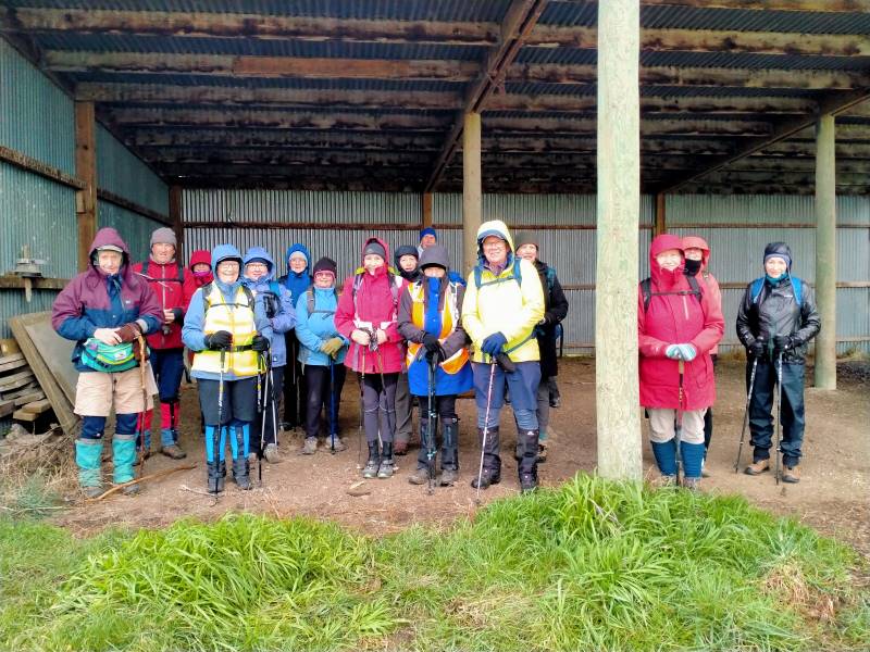
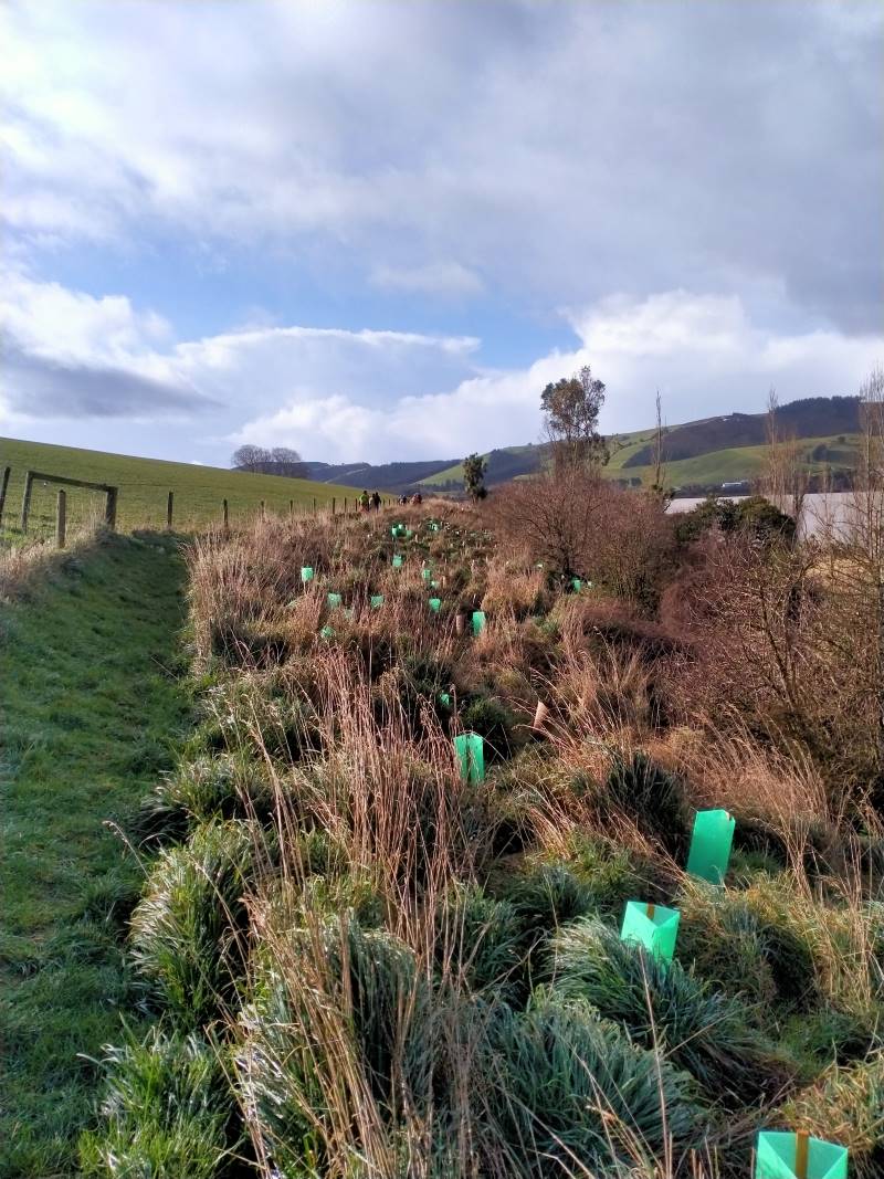
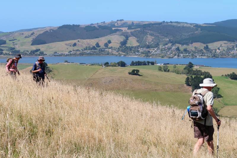
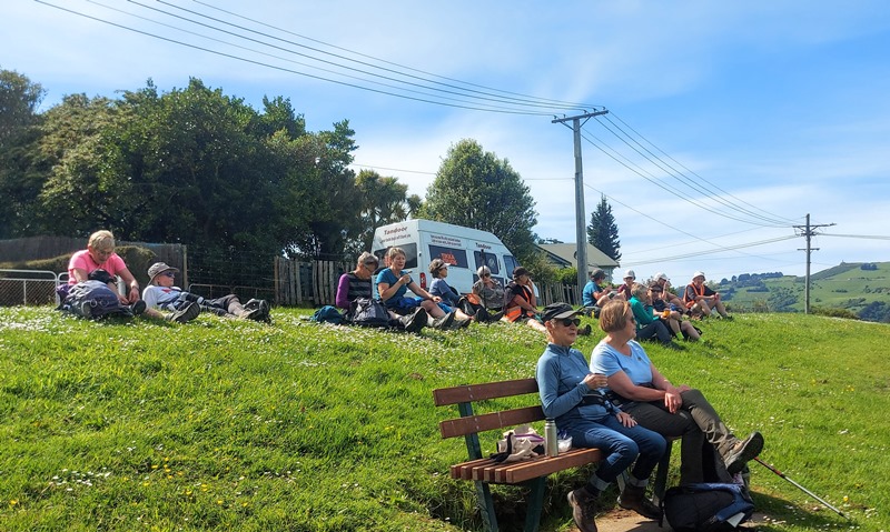
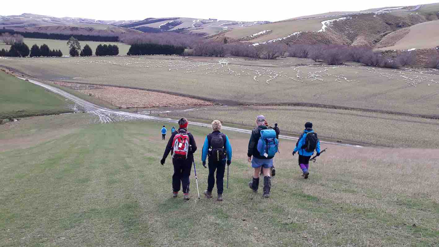
2. 2 August 2023. Combined. Waihola Hill and Lawlor Farm M Leaders: Anne, Lynne, Jenni and Barbara
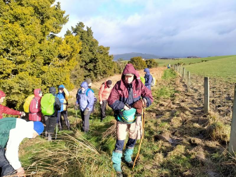
The weather didn’t look too bad at seven in the morning so the decision was made for the tramp to go ahead. Some of the Hikers and Trampers at Peter Johnson Park decided to give the tramp a swerve and go swimming at Te Puna instead of going out in the winter elements.
Sixteen very brave Hikers and Trampers arrived at Baker Road, Waihola to walk around Brendan Lawlor’s property. Brendan has developed a 28 section subdivision after he purchased the farm in 2005. Most of the sections apart from two now have been built on. Brendan has made a track around the lake for people to enjoy the views and birdlife.
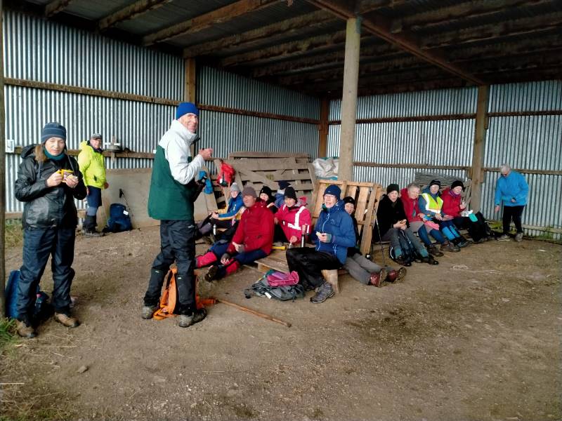
After we arrived the weather was changing for the worse, so we decided to head to the implement shed to have morning tea.
Shall we go or shall we stay Caption and photo Phil
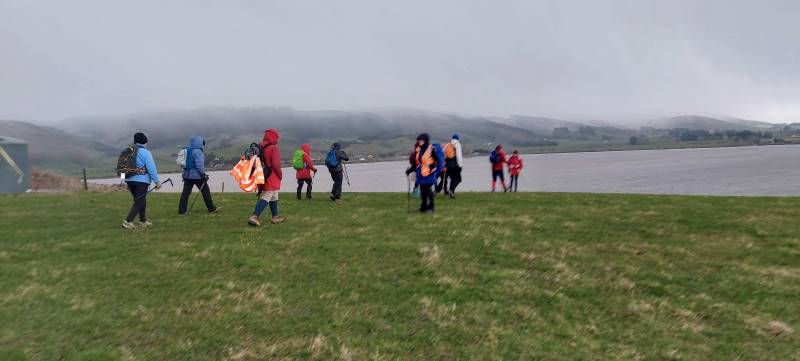
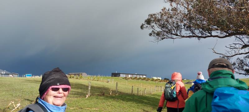
Once there was a break in the weather we reluctantly left the shelter and headed up the hill to walk the track. We all had our wet weather gear on and at times hard to tell who was actually walking beside you. Walking around the lake was so different from the last time. When we had a blue sky day and the lake was like a millpond.
Very muddy lake. Caption and photo Helen
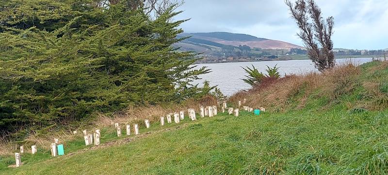
There has been a huge planting project around the front of the lake with lots of native trees and grasses all with protective covers to deter rabbits pigs and possums.
Lots of new planting. Caption and photo PhilGood work Caption and photo Phil
The track in some places was very slippery and muddy due to pig rooting and also a very wet July/August.
Sun at Last Caption and photo Phil
We saw moments of blue sky but down to the south the sky was black and at times we had strong winds and driving rain.
More weather on the way. Caption and photo Helen
Halfway around the circuit we all gathered together and took shelter in the farm building then made a dash for the vehicles. A decision was made to have our lunch at the Baker Road farm buildings then head home with no walk on the new Clutha Gold Trail or a coffee at the Black Swan café
Well earned lunch Caption and photo Phil
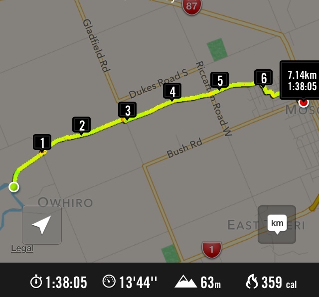
Distance 6.48km
Committee Meeting Caption and photo Barbara
1. 2 March 2022. Combined. Waihola Hill and Lawlor Farm. M Leaders: Jill Reid, Chris Wither Jenni & Bruce Wright
A fine morning saw 43 hikers and trampers make their way to the Lawlor property behind Lake Waihola. After regrouping at Waihola, and about 33km from the Mosgiel carpark, we turned right into Lake Road, left into Young Road, right into Berwick Road and right into Baker Road to park at the cattle yards there.
Brendan Lawlor welcomed everyone and described the mechanics of developing the 28-section subdivision since they purchased the farm in 2005. There is also an 1880s restored cottage on the farm.
Briefing from Brendan Photo and caption JenniOriginal cottage 1881. Has been extensively renovated. Photo and caption Pam
Trampers and hikers set off together about 9:45 and made their way up the road and across a paddock to join a track, mown by Brendan, on the lake side of the fence in front of the subdivision. There was little wind and the lake views were gorgeous.
Love the reflections and swans Photo and caption HelenViews like this only minutes into the tramp Photo and caption John
About 10:30 we stopped for morning tea together along the track.
The very large group of people that set off for the combined part of the tramp/hike. A lovely and unusual tramp. Photo and caption Marijke
25 trampers headed away first. A comment was made that the trampers left the morning tea stop true to form. “They were off like a bride’s nightie”.
Goodbye trampers Photo and caption JenniHappy Trampers Photo and caption John
Both groups, at their different speeds, enjoyed views towards the wetlands before turning inland to make their way through the farm and back along the road past the old cottage and new homes to the cars.
18 hikers enjoyed their lunch by a barn on the way and arrived back at the cars about 2:00 having covered around 8km.
Lunch stop for hikers Photo and caption Jenni
The trampers enjoyed their lunch by the cars before making their way up Waihola Hill at 1:00. Their route first took them up a gully [opposite the Waihola Wildlife Management Reserve sign] near the start of Baker Road. They were then able to follow a 4WD track that wound around the hill.
Look behind you guys Photo and caption John
When the trig on top of Waihola Hill came into sight the group turned uphill to appreciate the 360-degree views from there.
Panorama Lake Waipori Photo and caption JohnGroup photo at the trig Photo and caption John
Then it was back to continue following the 4WD track to water tanks and back down the hill to return to the cars by 2:30.
And they marched us down again… Looking across Lake Waihola to Waihola township and SH1 Photo and caption Ross
The Trampers covered about 13km.
Thank you for the many great photos that were submitted to go with this report.
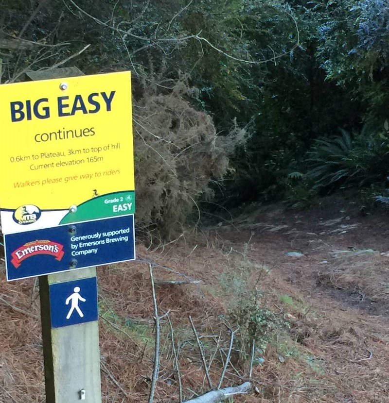
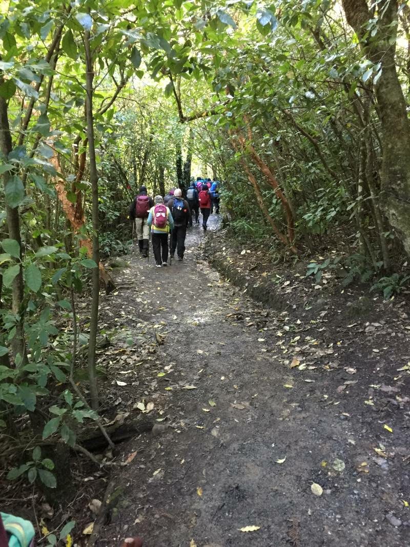
24. 26/07/2023. Big Easy. Hikers. Grade 2.5, $5, 19km, Leaders: Pam Clough, Jay Devlin.
23 enthusiastic Hikers parked opposite the old Ravie Pub in very cold windy conditions as we started our walk to the Otago Yacht Club, where we took shelter for morning tea.
Taking shelter – Photo Alex
We then made our way past the stadium then down Butts Road to the beginning of the Big Easy Track behind Logan Park High School.
At the start of the Big Easy Track – Photo AlexPhoto Alex
The track is a zigzag gentle climb for 3.6ks to the Plateau where we stopped for lunch in very cold windy conditions so needless to say we didn’t linger too long to enjoy the lovely views of Dunedin.
Dunedin City from Big Easy – Photo & Caption Michael WebbJay organising afternoon coffee – Photo & Caption Michael Webb
After lunch we followed the track and various steep streets back to Ravensbourne 11.3kms all up.
Photo Alex
Coffee was at Sunnyvale where we enjoyed a roaring fire.
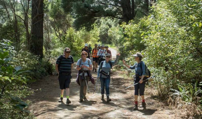
Cleghorn Street to Signal Hill Lookout. A very pleasant day weatherwise saw 14 of us undertaking this walk. We parked near Cleghorn Street and walked up the road before entering the farm track which was a bit muddier than expected.
Getting ready to start out at Cleghorn Street (photo & caption John)
There were a number of cattle on the farm and guess they churn up the ground. They took no notice of us – guess they are used to people walking across their land. Bit of a grunt up to the top of the hill, and a couple of stiles to cross, one of which was a bit of a mission for us shorter folk.
Stunning view 5 minutes into hike (photo & caption John)
Beautiful hiking conditions (photo & caption John)Morning tea in the sun (photo & caption John)
Then a long downhill stretch to come out on to Signal Hill Road. Headed up as far as the Signal Hill Lookout where we had lunch. After a reasonably lengthy lunch, as we were at the Lookout shortly after 11.30, headed back to the cars the same way we had come. Previously we had done a round trip, which necessitated car shuffling and a very steep descent via Blacks Road, so the leaders decided a ‘there and back’ would be easier.
Downhill leg overlooking Dunedin (photo & caption John)The Signal Hill Lookout (photo & caption John)Start of the trek back to the cars (photo & caption John)Group photo – Yes the camera is on a slope (sitting on a rock) (photo & caption John)An example of Pam’s photographic skills (photo & caption John)
Great views of the harbour and peninsula on the way back, as evidenced by John’s fine pictures. The day ended with coffee at the Botanical Gardens cafe – a most memorable day enjoyed by all. Pam and Jan.
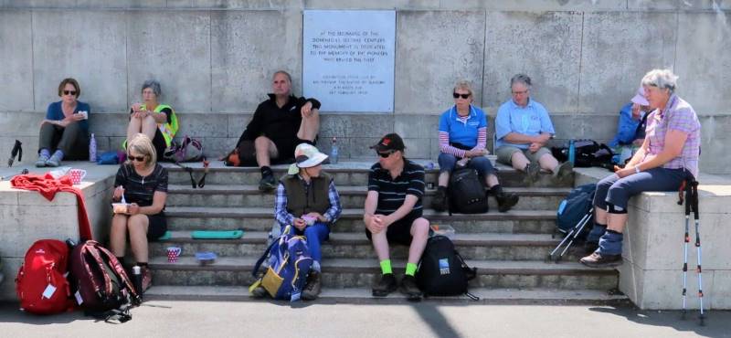
22. 8 December 2021. Hikers. The Big Easy. M. Leaders: Jay Devlin & Pam Clough
18 eager hikers reported to the carpark behind Logan Park High School on a beautiful sunny calm day. We looked up to where we were going and it looked a steep climb up but in fact it was a very gentle zigzag climb.
Heading off up the Big Easy (photo and caption Ross)Warming up up the Big Easy (photo & caption Ross)Gaining height (photo and caption Ross)
A third of the way up the track we stopped for morning tea with lovely views over Dunedin to Taieri Mouth. This is a pleasant walk in amongst native bush with lots of lovely tree ferns and abundant bird life.
Morning tea spot on a big bend on the Big Easy (photo and caption Ross)
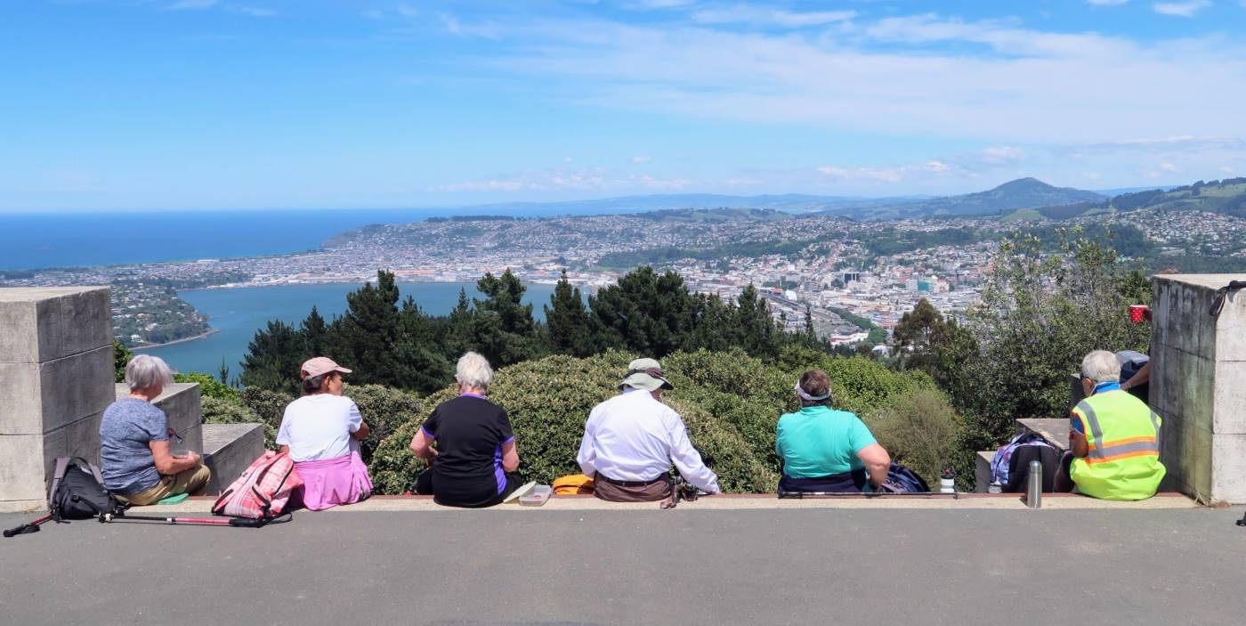
We reached the monument right on lunchtime. This area really showed off the beauty of Dunedin and surrounding coastline and suburbs.
Lunchime at the monument (photo and caption Ross)Lunch with a view (photo and caption Ross)
After lunch we walked back down a steep Signal Hill Road which was a bit ouch on the knees. We then turned left into Blacks Road where we again entered the Big Easy Track that wasn’t signposted as it seemed to look like a driveway, but was shown on a map when we did the recce. This part of the track was particularly steep and had to be negotiated carefully but thankfully no one slipped over. 11k completed. We had coffee at The Hub which is in the University precinct. Leaders for the day were Pam and Jay.
21. 24 November 2021. Trampers. Ravensbourne, Signal Hill, Big Easy. M. Leaders: Theresa White & Ross Davies
We were greeted with a beautiful day and 16 members set off from the Marina, along the walk/ cycle way at a good pace. We crossed the road at the hotel, across Adderlay Terrace, to a walkway up the hill. Morning tea at the Manuka St playground got the breathing back on track.
Morning tea (caption and photo Helen)
Street walking for a bit until we reached the entrance to the Signal Hill track. At the top the new planting of native trees had grown quite a lot since we were there last time. The way to the top from the Plateau was by the Telecom Track. Up and up we continued.
Walking up to the Signal Hill Lookout from the Ravensbourne Track (caption and photo Pam)
A short break with a view of our beautiful city of Dunedin was enjoyed from the Monument. Onwards along the Signal Hill road until we came to the “No Exit “street on the right (used to be Cleghorn Street).
Looking back south over Dunedin from the ‘No Exit’ road off Signal Hill Road
We all wondered if the rescue teams would find us!! Up the gravel Cleghorn Street until we got to the many masted site at the top. At this point there was a small mutiny among the troops. NO MORE UP!!! Our intrepid leader Ross said “Just a bit more and the view will be worth it“. We followed a small track through some broom, over a style, into farm land, along a pine plantation and true to his word there was the view. The whole harbour and all the surrounding small settlements were there for us to” ooh and ahh” at over lunch.
Lunch with a view (caption and photo Ross)
Our lunch stop presented us with a magnificent view, like a Colin McCahon painting (caption and photo Marijke)
The return trip was thankfully down.
Signal Hill Track called Centre Road (caption and photo Ross)
We choose the shortest route down the cycle trails to Logan Park School.
Coffee at the Plaza before returning to the cars at the Marina.
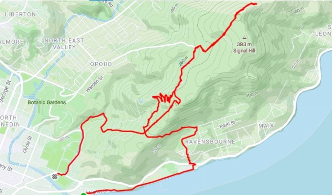
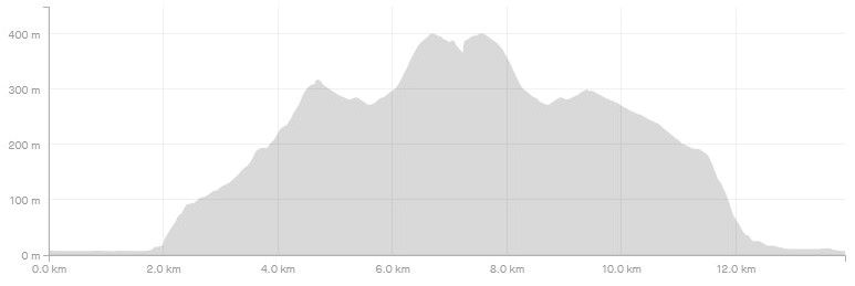
Screenshot Strava Signal Hill Route (Ross)Screenshot Signal Hill Elevation (Ross)
Theresa & Ross
20. 24/8/2016. Trampers. Signal Hill Tramp. Leaders: Neil and Margreet.
Well the chilly Nor’easterly was ‘thin’ and the drizzle was horizontal; but 7 hardy trampers set out from the yacht club and walked to Ravensbourne along the walkway/cycleway. After crossing SH88 we found shelter in the lee of the War Memorial for morning tea.
Morning tea in shelter of the Ravensbourne war memorial. (Helen pic and caption.)
It was a nuggety wee zig-zag up Manuka St to find the track entrance to Signal Hill. A steady climb in dripping bush for 20 minutes saw us break out at the Plateau. Following the Telecom track, another energetic climb took us to the Centennial Monument.
Top of Signal Hill. (Helen pic and caption.)
We should have had stunning panoramic views over the city but sadly it was just a pea soup vista!
Leaving the two large bronze figures (‘History’ and ‘The Thread of Life’) to the raging elements, we quickly descended to the sheltering bush line where a nice ‘possie’ for lunch was discovered.
Lunch today. (Margreet pic and caption.)
After a leisurely (obviously Neil Morrison was absent!) lunch, the team continued down the ‘Big Easy’ mountain bike trail to Logan Park High School and onward to the start point. On the way we did see the restored Opoho Creek fish ponds which are home to the Banded Kokopu (a type of whitebait); and also the old Pelichet Bay infectious diseases hospital established in 1908 above Butts Road.
Highlight of the day had to be a hot drink at the warm and welcoming Emerson’s Brewery. Distance 10.5 KM.
– Neil and Margreet.
19. 11/3/2015. LPHS to Ravensbourne. Leaders: Jim and Betty.
Centennial Memorial (Elaine pic)
18. 27/11/2013. Both. Marina, LPHS, Memorial, Ravenbourne, Harbour Walkway, Marina. Leaders: Jim and Betty.
Route. Turned GPS on only at LPHS car-park. Sorry! Add abt 1.5 km gap from our cars to the 6.82 total (obscured) to get 8.32 km.
Steep climb. Somewhere between the 1 & 2 km indicators on map.
Memorial photo.(At the little tail between the 2 & 3 km indicators on map.)Lunch at 4 km indicator on map – I think.
16. 14/4/2010. Hikers. Signal Hill, Logan Park. Leaders: Bev H, Chris.
The two trampers for the day joined the hikers. A surprising group of mushrooms behind the Logan Park High School were quickly “gobbled” up. The steep hill beyond was heavily marked with zig-zag BMX tracks.
We tackled the climb.
Further up was a pleasant walk through an avenue of bush.
A lane through the trees
We sat on the steps of the Centennial Memorial for lunch. Several groups of people came and went before us, including one group who came to scatter the ashes of a family member. A member of a bus group offered to take our picture with Elaine’s camera.
Who thought to include the sign? (From Elaine’s positive)
Leaving the memorial, we made our way down through trees and cleared ground to Ravensbourne. This was the first time several of us had made the Ravensbourne-Signal Hill- Logan Park trip in the reverse direction.
Down at Ravensbourne, several ‘went to bed’ on a mattress stored outside beside a shop.
After that, it was along the walkway beside the railway and then back to the cars at Logan Park High School parking area. Thanks to Bev and Chris for a well-planned and guided walk. – Ian
15. 17/10/2007. Hikers. Logan Park, Signal hill. Medium. Leaders: Barbara and Arthur.
14. 27/9/2006. Trampers. Logan Park, Ravensbourne, Signal hill, Opoho. Easy. Leaders: Evelyn C, Lesley S
13. 7/7/2004. Both. Logan Park, Ravensbourne, Signal Hill. Medium. Leaders: Ian, Arthur and Barbara.
12. 17/9/2003. Hikers. Logan Park, Signal Hill. Medium. Leaders: Betty, Colleen.
11. 14/8/2002. Logan Park School – Signal Hill. Medium. Leaders: Molly, Hazel, Barbara McC.
10. 28/3/2001. Ravensbourne to Signal Hill. Leaders: Jack and Rosemary, Catherine.
9. 18/10/2000. Ravensbourne – Signal Hill Road. Leaders: Sabina, Anne, Wendy B
8. 19/5/1999. Ravensbourne, Adderley Terrace, Signal Hill. Leaders: Jack and Rosemary, Doreen.
7. 8/4/1998. Signal Hill, via West Harbour return via Opoho. Park at old Art Gallery. Leadrs: daphne, Shirley R.
6. 27/3/1996. Signal Memorial return Adderley Terrace. Leaders: Les and Mavis, Margaret D, Judy
5. 31/8/1994. Logan Park, Ravensbourne, Adderley Tce, Signal Hill, Opoho. Medium. Leaders: Daphne, Margaret D, Mary L, Myrie.
4. 21/7/1993. Logan Park, Ravensbourne, Adderley Terrace, Signal Hill, Opoho, Logan Park. Medium. Round Trip. Cars at Art Gallery. Leaders: Betty B, Daphne, Margaret D, Pet A
3. 28/8/1991 Signal Hill via West Harbour. Return via Opoho. Leaders: George, Barbara M, Evelyn M, Peg C
2. 2/5/1990 Signal Hill via Logan Point and up Adderley Terrace, Ravensbourne. Back through Opoho and Northern Cemetery. A good city walk with plenty of history. Average. One hill only. Leaders: Nancy, Margaret B, Bev M, Molie
1. 28/9/1988. Signal Hill Memorial. Interesting Dunedin history. Harbour views. Leaders: George, Peg C, Molly.
23. 28/06/2023. Hikers. Silverstream to Wals. Leaders: Bill Cubitt and Jill Dodd
After cancelling the Mt Cargill walk for the second time due to weather conditions, 15 happy hikers walked down the Silverstream track to Wal’s for morning coffee. We had 2 members join us there (Jenny F and Jan Y) which was lovely.
Group at Wals for morning coffee (photo and caption Jill D)
The weather remained very overcast with just a hint of moisture in the air. The temperature was pleasant. The Silverstream was fast flowing, dirty and quite high after the heavy rain. We have just had nothing to what the other island has experienced.
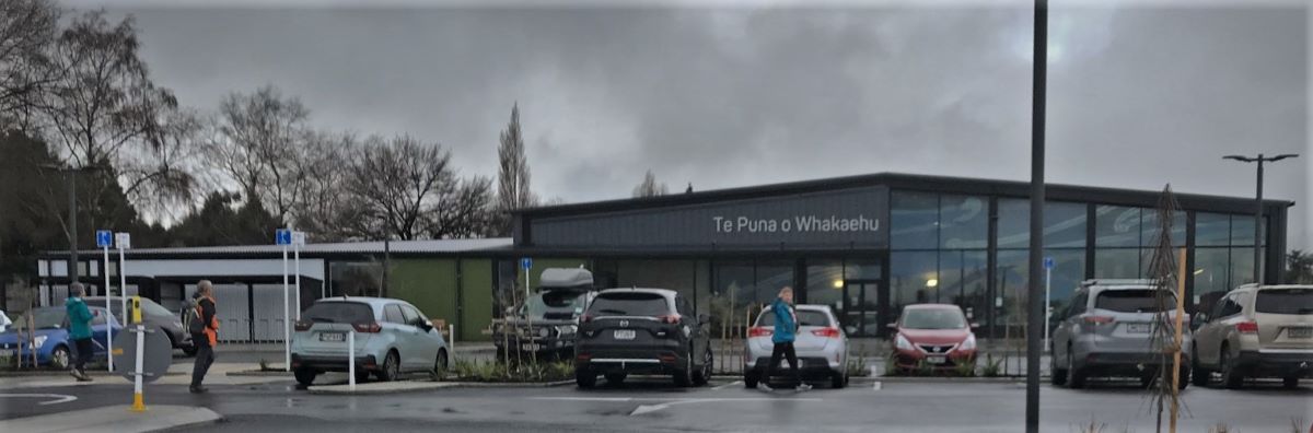
Our wander home was along back streets to the new Mosgiel pool Te Puna o Whakaehu, where some members went for a swim, some a look around, and others home for lunch.
The new Mosgiel pool (photo and caption Jill D)
In total a leisurely walk of about 6 kms with plenty of time to socialise with one another .
Cheers Bill n Jill
22. 8/7/2020. Hikers. Silverstream Gladfield road south. E. Leaders : Jim and Betty
Due to inclement weather the walk to Doctor’s Point was cancelled.
Thirteen walkers braved the cool conditions for an alternative walk to the Gladfield ford, (Silver Stream South). This was achieved without encountering any rain. Nine made it to the Blackstone Cafe for a pre lunch hot drink.
Betty & Jim Finnie.
21. 26/6/2019. Hikers. Silverstream floodbank from Carlyle Rd to Confluence. 13+ km. Leaders: Shona and June.
On a clear but cool morning, we car pooled to Wal’s rear park before walking along Bush and Carlyle Rds to access the Silverstream floodbank.
Morning tea was had in the sun at Riccarton Rd bridge.
Morning tea beside the stream. (Clive pic and caption.)
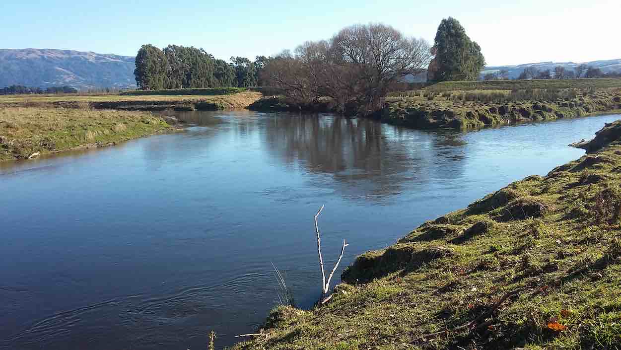
We continued to the confluence of the Silverstream and Taieri river
Where two streams meet. (Clive pic and caption.)
where we had lunch,
Lunch at the Taieri. (Clive pic and caption.)
with most finding enough room to avoid the numerous sheep droppings.
Returning back along the track to Wal’s we straggled out a bit like “Brown’s cows” so some were leaving after coffee as others were still arriving. – Shona.
20. 24/8/2016. Hikers. Lower Silverstream to mouth. Leaders: Jim and Betty.
Number of people in the group: 19.
The weather was a very cold northerly that threatened rain, fortunately rain coats were not required.
The hikers followed north from the car park on Factory Road and turned left at L J Hookers which took the group through the civic gardens, across the soccer field to the Silver Stream flood bank which was followed to the Taieri River. Because of the cool conditions there was a short lunch break
Lunch at the Taieri River. Sheltering as much as possible from the cold nor-wester.Another lunch photo.
then it was a return along the same flood bank back to Carlyle Road to meet Bush Road and back to the car park.
A coffee break was had at Topiary’s. – Betty and Jim.
Lunch to coffee map. About an 8 km distance!
19. 3/9/2015. Both. Lower Silverstream to mouth. Leaders: Arthur and Ian
This was a fall-back option. The programmed tramp to the Ship at Anchor area (still under snow) had been rescheduled by the leaders to the Racemans-to-weir area. However 17 of us gathered at the car park in only a suspicion of a drizzle, were faced with the prediction of solid rain in the afternoon and the prospect of muddy conditions even before one got up to the Racemans after the overnight rain. But the weather at the moment was getting lighter. So we decided on the walk along the lower Silverstream flood-bank. Two of us had other engagements so it was fifteen who set off making our way to the start at the Gordon Road bridge. Sloppy mud on the flood-bank confirmed suspicions of what life would have been getting to the Racemans. The Silverstream was quite a sight, rushing a good torrent of muddy water. The day was brightening. We were going well. Time grew on. With today being the first of the nine o’clock start, some began to pant for their still distant 10.00 a.m. morning tea stop.
The big macrocarpa hedge had been machine sawn back considerably. Silverstream visible on the left.
Eventually, come ten, we found an ideal bank in the sun at the Gladfield Road ford whereon to stop and drink. Stones and a stick were placed by the water’s edge to determine whether the water would rise or fall. Verdict: it was falling, but just a bit.
Sheltered morning tea in the sun. Note stones and stick to mark water level.
Then up and on again to reach the Riverside Road bridge. Time now 10.30 a.m. Time perhaps, to ensure returning dry before the 12.00 o’clock rain. However, the Trampers in the party, delighted to be walking in territory new to them, inquired how much further it was to the river’s mouth. On being informed it was an eight [Ed. note: Sorry, should have been ‘seven’.] km trek car-park to the mouth, they thought that at this stage it couldn’t be all that much further. So four of them went on with Leader Arthur and the remaining ten returned with Ian. When the returnees found themselves back beside the Sewerage Station at high noon and there was still no sign of rain, Marjorie proposed a stop and just a little further on where she had espied an inviting Rotary seat, backed by a high wood fence. So we sat, some seated, some ‘grassed’ and lunched in the sun. Some little time later the trampers turned up, declaring the mouth had been only about two kilometres further on. So the five joined the ten for an enjoyable time together in the sun.
Tidying up after lunch.
Happy day. Eventually we picked ourselves up again and began an zigzag cut-through of streets, new to some, back to the cars. Back at the car park we each took our separate ways, with a remaining seven resorting to coffee at Wals and Ian’s Shirley joining us. Conversation between Ian and Shirley with Jan turned up a surprising mutual connection with Duntroon, and the fact that Ian had married and buried one or two of Jan’s elder relatives – recollection of some wonderful people and local areas. Jan hadn’t heard of ‘rattling rocks’ in the Maerewhenua River. Must show her sometime. Small world.
A great day out, a vindication of the value of the Club’s practice of leaving final decisions for the car park and an example of making your own luck by giving things a go. (Where was all that rain anyway?) – Ian.
18. 24/6/2015. Hikers. Silverstream to River. Leaders: Les and Margaret.
GPS from Taieri River back to car park. Therefore, total distance 14.28 km.
Thirty-one hikers trekked the Silverstream flood-bank.
A Gaggle Doggle(?) of Ducks. (John pic)
A wafting wind from behind blew coldly, especially noticeable when we stopped for our morning cuppa.
Morning cuppa. (John pic)
But it mercifully stopped as we sipped and the rest of the day was calm. 14 km on hard grass is a solid distance for Hikers, made no less easy by the relentless use of same leg muscles unrelieved by any rough track variation. So it was no surprise that some of our wiser (?) ones chose an early lunch stop-off,
Early lunch (John pic)
while the rest carried on to the stream mouth at the Taieri River. Here, a number of flood-washed-up logs provided welcome seating, promising later easy rising untroubling arthritic knees.
Logs to sit on. (Panorama)A touching moment of male obeisance.
The calm confluence of the two streams was breathtaking in its beauty.
Stream confluence panorama
Time to return. Refreshed. Time passes. Legs getting weary. Ah! A pedestrian walkway promising a shortcut zigzag through streets back to the car park instead of having to walk right up to Gordon Road. We cut through, lane after lane. Ah, the bliss of car seats again. Next, coffee adjournment. But not without cleaning up or divesting entirely filthy sheep-droppings-caked boots. Thanks to Margaret and Les for a trek we hadn’t done for some time now. – Ian.
17. 10/7/2013. Hikers. Silverstream to River. Leaders: Peter and Wendy.
16. 15/8/2012 Both. Silverstream. Gordon Road to through-way to Goodall St. Coffee Shop.
Silverstream. It was only a light rain. The stream had gone down a lot but was still quite high. Seven of us. Love the brolly.Exiting cafe. After-thought pic. Well, why shouldn’t we have made an occasion of the day?
15. 25/7/2012. Hikers. Silvestream and Blokes Shed. – Leaders: Molly and Elaine.
We had a good walk around the Silverstream along the banks.
Morning tea was at the “blokes shed”. We had a chance to have a quick look around at the awesome projects that these retired guys are doing.
Lunch was had a sunny spot by Riccarton Road.
A stroll along, then to Wals plants in Bush Road. This place is really going ahead. The veggie boys are building a big shop there.
A cafe is opening soon there also. Yum Yum. It’s people that ran the No 8 in Outram.
Also they have a railway that children can ride on.
A very nice day out. – Elaine. (Stand-in for Bill Hunt)
14. 27/6/2012. Silverstream. Carlyle St to Gordon Road.
It was a winter stormy day. Eight of us turned up at the carpark. Trampers’ plan had included Swampy Ridge. Gales and snow. OUT! Same with street walks. We ended up heading down Bush Road into icy wind and rain, back up the Silverstream with the wind more comfortably behind us …
Wrapped up against the weather
… and on to morning tea at Les and Margaret’s lovely home. At least we ventilated our lungs with some good fresh Antarctic air. – Ian
13. 19/10/2011 Silverstream NE & Stedman, Dukes and Gordon Roads and then SW to Carlyle St. Heavy rain up to Tuesday night. Everything wet. Programmed tramps cancelled. But six hikers turned up at the car-park and enjoyed walking the Silverstream.
There was light rain at the car-park. Leaders George and Dot had recced the programmed walk on Roberts Farm on the western foothills of Maungatua the day before, but cancelled it today because of rain, cloud and forecast strong winds, and after discussion, left for home again. However the remaining nine of us were still prepared for an outing so set off for the lower Silverstream flood bank from Gordon Road. We realised we hadn’t done it for quite a while. The first part was beautifully mown as far as the eye could see. And the flowers and tidy sections were just a picture.
Mown grass and gardens filled with summer flowers.
However from Carlyle Street on, the grass was a little longer – and wetter! We passed under Riccarton Road bridge, reached Gladfield Road and morning teaed at the pedestrian over-bridge. Then it was onwards again. The rain had stopped but the grass was still wet, and added to that was now the droppings of grazing sheep. (The very worst for mucking up one’s boot soles, no matter how careful one is.) Then the forecast wind began to gust strongly from the southwest, which made us relieved we weren’t having to face its full force up on the Maungatua foothills. (The cancellation by the leaders had been a prudent decision!) We battled on and found shelter in the lee of the Riverside Road bridge. We also discovered a firm called Earthworx had established a storage site nearby. That was something new.
Earthworx storage area
It was now 11.30, a bit early for lunch but what the heck. It was sunny, we were sheltered from that strong wind. We certainly weren’t going to push any further today. So we had a nice long rest and chat.
Sheltered from the wind. (Pic by Peter)
Eventually, lazily, we picked ourselves up and meandered home, hating the sheep droppings but enjoying the wind gusts floating us back home. – Ian
11. 9/12/2009. Silverstream to Taieri Riverside. Leaders: Bill and Lesley.
It rained up to 8.30 a.m. Result: no one was ready to go on the Tramp of the day and the Hikers’ leaders cancelled the Hike. But the seven who turned up at the car-park decided the day was still worth it for the Hike. So off we set. When we had got further down-stream, we found the stop-bank was well-stocked with sheep and their doings! But we found a passably clear tussocky spot down by the stream for our morning tea.
Cuppa by the stream. Lesley, Joyce, Lex, Pat, Bill, and Molly.
Down at the mouth, some selected the log there for lunching against …
The log lunchers. Lesley, Pat, Joyce.
… while the remainder chose the grass.
The grass lunchers. Molly, Lex, Bill.
Our leisurely stop was enhanced by the beautiful scene in front of us.
The attractive scene at the confluence.
An arresting sight on our way back was a variegated hedge of trees.
A real colour treat.
We avoided crossing roads by diverting under the bridges. Here some of us tried a cramped short-cut.
A cramped short-cut.
The only downs-side to the day were the unavoidable ‘pellets’, ‘grenades’ and ‘plops’ of the sheep.
Sheep and what they ‘do’!
10. 23/7/2008 Silverstream & Stedman, Dukes, Gordon Rds. Leaders: the four of us!
The weather report was for rain and cold southerlies strengthening so the leaders for both Aramoana and Sawmill Rd cancelled their trips for the day. Despite this, four of us still turned up at the carpark, in good traditional club practice, viz. Peter, Neil, Molly and Ian and walked up the side of the Silverstream. The writer was amazed at the knowledge the other long-lived Mosgielians had of the people living in every second house. Greetings were continally exchanged as we made our way along the path. Neil pointed out the part he had in establishing the camping ground, planting the dividing hedges and constructing the amenities block. Neil had a continuing interest in the seats he had had a hand in placed at intervals along the path and in tightening any loosened nuts on the bolts anchoring the seats to their foundation slabs. He was also able to point out the line delineating the stop-bank’s boundary between the Regional Council’s and the City Council’s ownership responsibilities.
Then it was into the Taieri airfield buildings and the friendly welcome into the newly-established Blokes’ Shed, having just passed the frontage of the old NAC hanger, reminding us of the history of this area. On again past the many private hangers and out onto Stedman Road and around past the Fisher and Paykal and old Siverstream PPCS buildings. Again recollections of the extent of the original aerodrome now encroached upon by roads and buildings. Down Dukes Road, back onto Gordon Road and back to our homes. Occasional light drizzle came and went but we all remarked on how pleasant a day it was to be out walking and enjoying each other’s company. No pictures this time – left camera behind. – Ian.
9. 5/9/2007. Silverstream and Taieri Riverside. Leaders: Ria, Bob H, Catherine, Mary M.
As it was the first Wednesday of the month the tramp involved the hikers and the trampers all going together. The hike was led by Ria and Bob, both very experienced trampers and members of the track committee. We followed the banks of the Silverstream in Mosgiel and had morning tea sitting on the bank watching a farmer fording the river in his tractor. We crossed the stream and on reaching the Taieri River continued along it upstream to a farm access road. We were able to complete the circular walk by continuing up the other side of the Silverstream and making our way back to the same bank for lunch and then back to the cars at Peter Johnson park. A pleasant hike in fair weather. About 20 people took part. – Tash
8. 2/10/2007 Silverstream and Taieri Riverside. Leaders: Ria L, Bob H
7. 22/11/2006. Silverstream to Ivermay and Picnic Ground from Car Park. Easy. Leaders: Nancy, Margaret S.
5. 30/5/2001. Silverstream. Leaders: Lance and Lois, Pam. 4. 29/11/2000. Silverstream. Leaders: Margaret D, Ivan and Bev. 3. 10/5/2000. Silverstream – Riverside. From Carpark. Leaders: Peggy M, Margaret D, Diana. 2. 11/6/1997. Silverstream Outlet, Taieri River. Return Bush Road. Leaders: Peg C, Shirley R, Mavis. 1. 1/5/1996. Alternative to Duncan’s Farm Road and return Kowhai Spur: Silverstream to Taieri River. Easy Leaders: Peg C, Jean A, Ria H
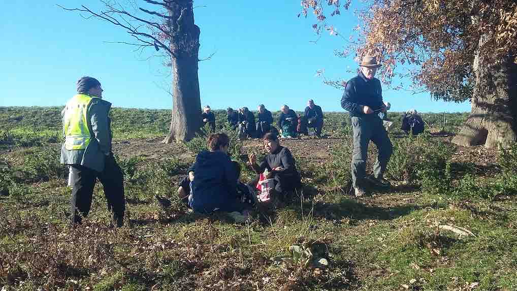
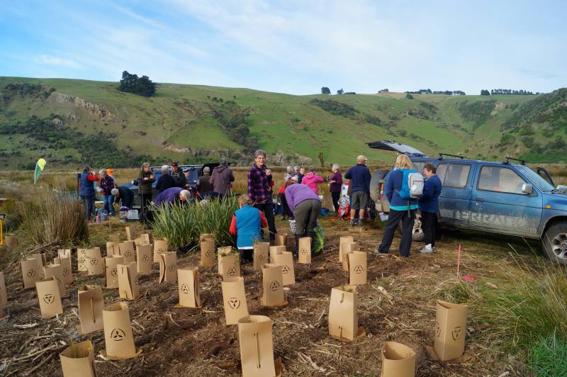
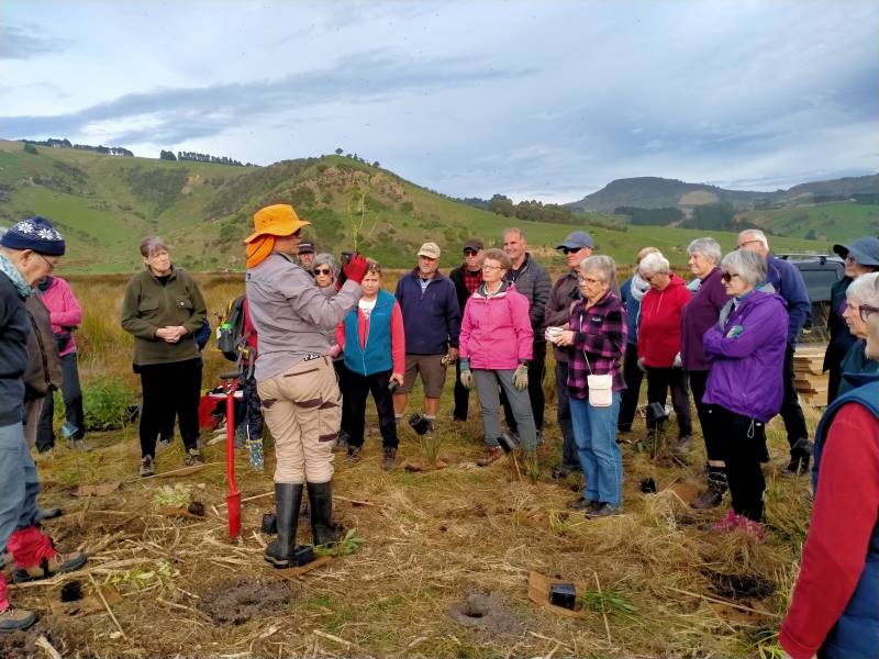
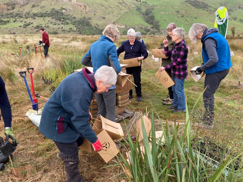
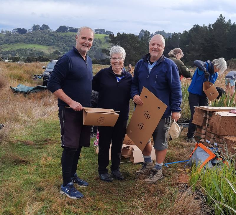
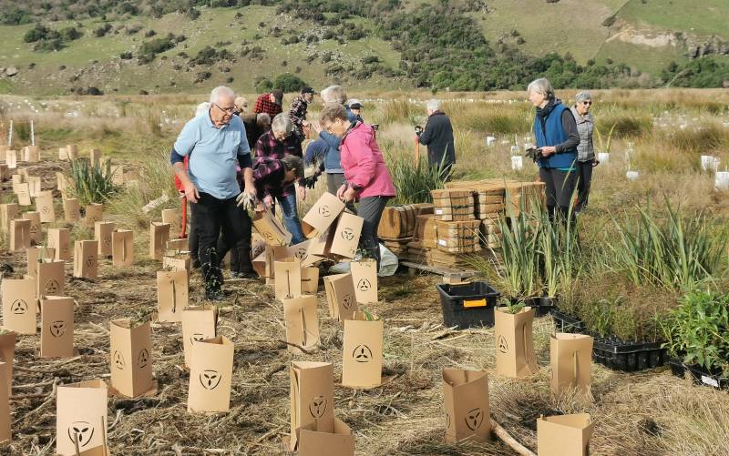
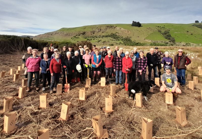
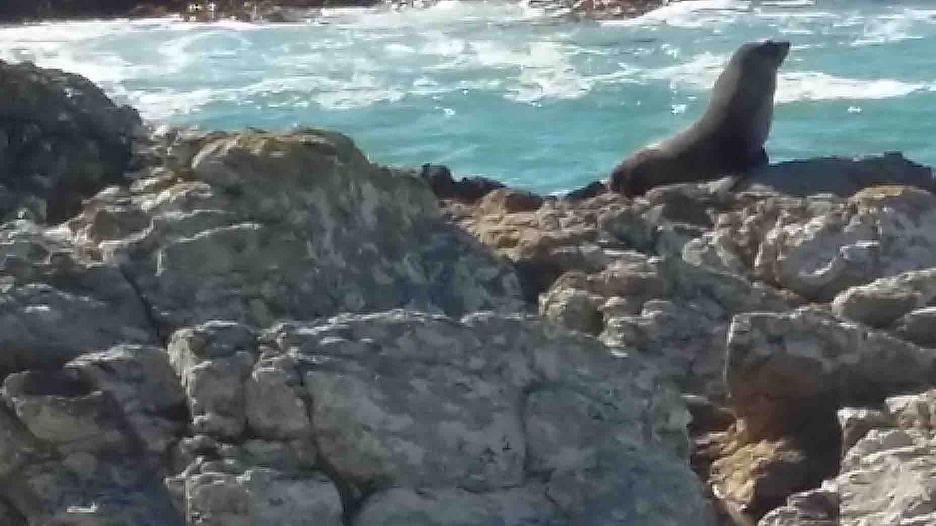
Wednesday proved to be warm balmy day, when 35 eager TRTC members met at Long Beach to give a few hours volunteering on DOC reclaimed land behind the sand dunes .
We were met by the project manager, Jeanne, who was very well organized with equipment ready for us to start after morning tea.
Getting ready to get started Caption and photo JohnThis is how it’s done Caption and photo Phil
The work involved was digging holes, planting natives and flaxes and making protective heavy cardboard collar’s to go around the newly planted specimens.
Great teamwork Caption and photo RaewynThey thought they were just the best Caption and photo AdyPhoto Margreet
When the project is completed there will be about 38000 plantings (we did approx 800). Since starting last year, the success rate is 85-90ish%.
There were a couple of other small groups volunteering like a team building exercise.
Photo BarbaraWe deserve a walk to the beach Caption and photo Phil
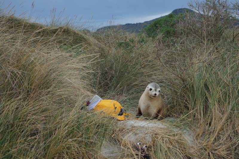
Lunch was on the beach but, unbeknown to us, a young sealion appeared from the dunes behind ready to share time with some of the group. This really did give them one big fright, so our lunchtime was shortened.
The smell of salmon sandwiches brings a young sea lion from out of hiding Caption and photo John
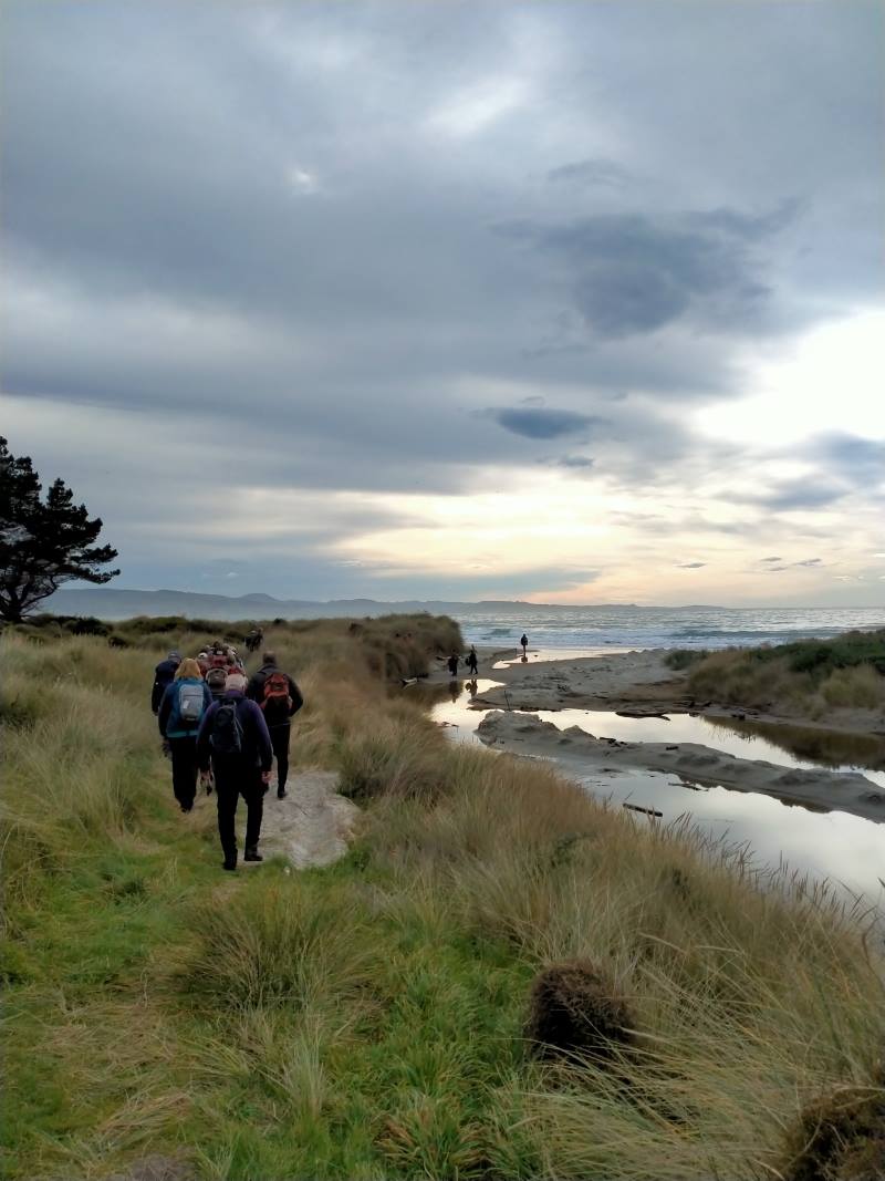
We did continue down the beach a little further before heading back to the cars.
Continuing after lunch along lovely Long Beach Caption and photo Marjke
Some of us went to a quirky little cafe Santosha in Port Chalmers.
I think we all enjoyed the experience and especially being able to help with a community project. Perhaps another time.
Thanks to John for his help and support.
Choices for Hikers: Stay home and knit or brave the elements of mist and drizzle with potential rain but leave the Waihola Wanderings for another time. 11 chose to go for a local walk.
The course was plotted as we left the Peter Johnson carpark, going along the riverside, turning at the helicopter pad and wending our way over to Wingatui Rd and Gladstone Rd North.
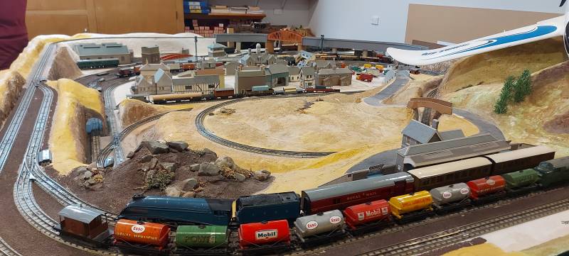
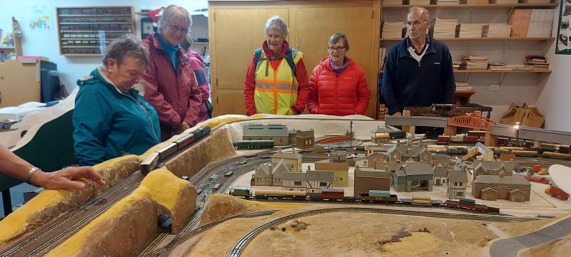
It was decided to have morning tea under cover. Wingatui Station (built in 1875) was a likely possibility. However, the leader veered off track and we arrived at Neil’s model railway instead.
Morning tea in luxury at Morrisons. Caption and photo HelenView from their house of fog Caption and photo Helen
This of course provided shelter as he coped with the unexpected invasion and happily displayed rail/train manoeuvres.
Neil Morrisons trains – amazing Caption and photos Helen
Dry and refreshed, we passed the evidence of autumn in the yellow, gold and red tree colours, and wended our way back to the carpark after a pleasant 10 kms of Mosgiel Meanderings.
Hikers passing by Caption and photo Carole
Eleanore and Carole
The Trampers choice
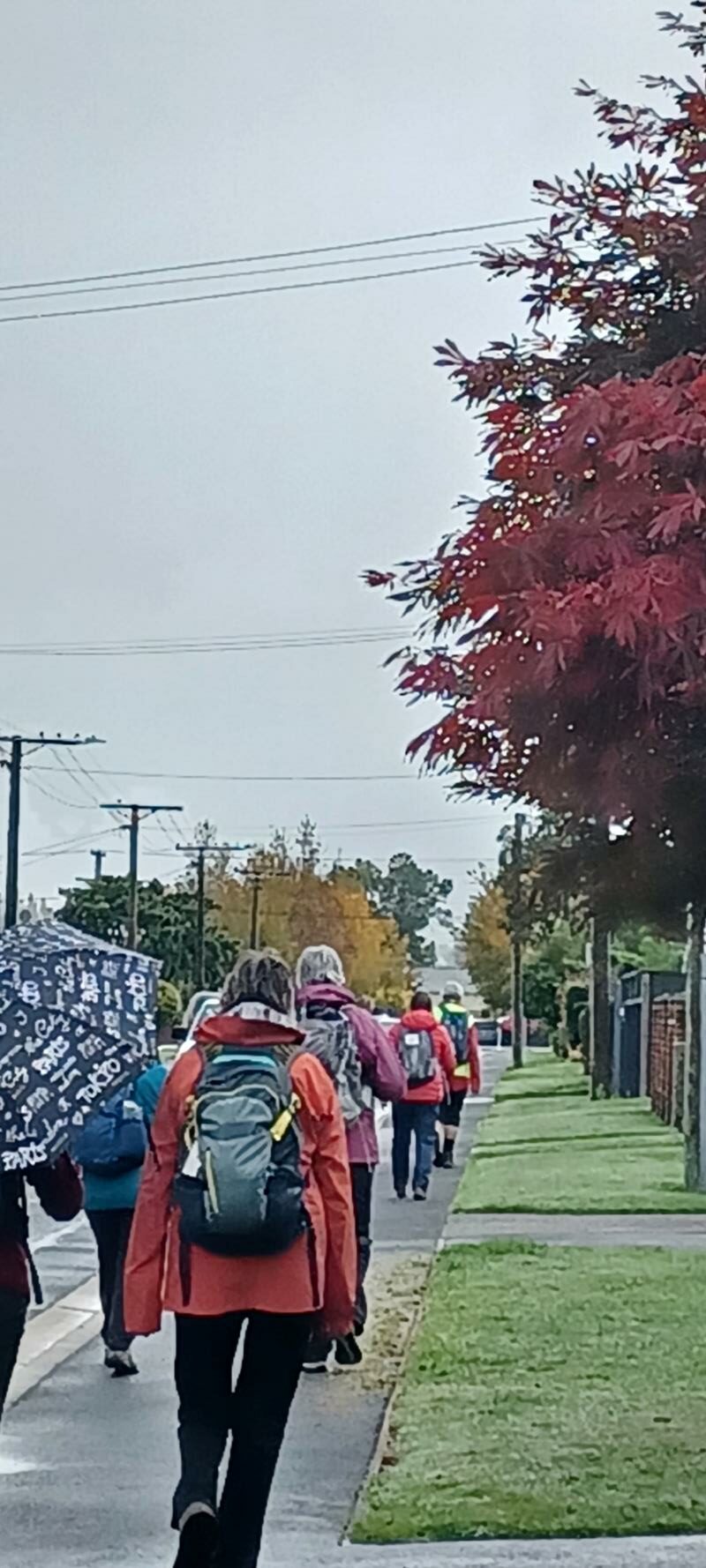
As a weather alert was given, safety required that we could not go to Rosella Ridge, so it was decided we would meet at Woodhaugh Gardens. After discussion, we headed towards Bethunes Gully. The rain had eased so we walked beside the Leith with some nice street art on the walls of the Leith.
Street art surviving the students !. Caption and photo Pam
We continued past the gardens, into North East Valley, past Dunedin North Intermediate school, then Baldwin Street(no takers), Dunedin Hospice and Ross Home. We detoured into Chingford Park, a nice stone home, which catered for weddings.
Chingford Park- Discussing the weather!!! Caption and photo Pam
We stopped at Leith Harrier and Soccer grounds for morning tea.
Morning tea under shelter at Chingford Pavilion. Caption and photo Pam
Moving on we passed some garden plaques on a fence. Into Norwood Street we continued to Forrester Park (bmx bike park) then into Bethunes Gully. The good 35 minutes of uphill, required some reduction of gear before an uphill climb. On the way a large tree had fallen and was being removed. We passed a couple of waterfalls,5 bridges over Lyndsay Creek and got to the top at 12.05 – lunchtime.
Soggy sandwiches eaten on Bethunes track. Caption and photo Pam
The return to the bottom took 30 mins, past the Normanby Tavern (now closed), Ross Home, then via a track behind the Hospice, thanks John G. We continued back onto the main road to NEV shops back to Woodhaugh and the cars. As some had cooled off due to drizzle, it was decided no coffees but a couple of pieces of chocolate fudge sufficed.
Distance 16.18km Elevation 445m actual tramping time 3hrs 6min.
Thanks Graeme S for being TEC. A fun day out. Phil.
Feburary 2018
Thirteen turned out for coffee. (Judy pic and caption.)
9. 15/03/2023. Hikers. McGouns/ Wakari Bike Track Grade: 2.5 Leaders: Jay and Jenny
17 keen hikers gathered at the bottom of the Pineapple track in Tanner Road. We entered the Cragieburn track at the Corner of Wakari Road and Tanner Road. We walked up a short distance to an historical site where there were remnants of dairy farming in 1860. This area is well preserved and a lovely new seat has been installed for people to sit and enjoy the views over Dunedin and its surrounds.
We then proceeded on to the Wakari Bike track which took us through attractive bush and meandering Ross creek.
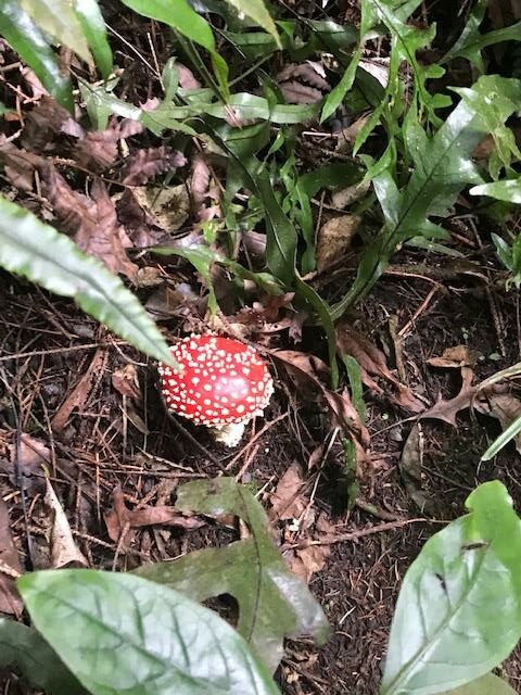
Beautiful coloured toadstool on the trackside Caption and photo Jill
The track was good underfoot and pleasant walking. We reached the top of the track in 45 minutes where we had our morning tea.
Morning tea break at the entrance to the bike track Caption and photo Jill
After that we carried on the track which was a mixture of lots of ups and downs.
Feels like an Avatar scene Caption and photo Jenni
The trees here were a mixture of natives and exotics. The redwoods were huge and stunning.
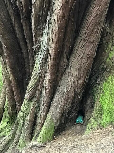
Found under a couple of trees tiny pixie houses very cute Caption and photo Jill
We carried on then to join the McGouns Track which has beautiful unspoilt bush. This was steep in places but nothing like getting the heart rate up to feel alive. At the end of the McGouns Track we were supposed to turn right but the leader took us left up another steep climb where we had our well deserved lunch break and there we enjoyed views of the city and harbour.
Nearing our lunch spot with great views Caption and photo Jenni
After lunch it was all downhill for a change to the cars. We had two prospective hikers with us today, Margaret and Kay. Coffee was at Sunnyvale.
3 -10 March 2023. Bannockburn. Trampers and Hikers and Bikers. Leaders: Anne and Rod Ward.
The club planned a trip to Bannockburn for three days of tramping and three of bike rides. This all started on Friday 3rd of March with accommodation at the old Bannockburn school now run by the Otago Outdoor Education Trust. Accommodation was a mix of the old schoolhouse, an attached cottage and the barracks for boys and girls at the other end. Anne and Rod had a full programme of activities for the six days, including delegating the evening meals to teams for the first four nights, this included providing nibbles, main course, dessert, and home baking for supper.
Friday 3rd March – Day 0
Travelled to Bannockburn and settled into the camp. It was a beautiful hot afternoon/evening under the veranda soaking up the atmosphere. With rooms sorted some had a swim, others happy to watch. Team 1 prepared scrumptious ham, salads, etc as required for the duty team.
First night, settling in. Photo & caption JohnBannockburn Camp. Photo Helen
Friday 10th March
All that remained to do for those who stayed overnight was to pack up, tidy up, and head back home.
Thanks to all cooking groups for preparing and organizing meals, that were varied and enjoyable, great menus for the week.
Also to all the drivers for ferrying us to various start and pickup points, your service was invaluable and very much appreciated.
Overall our accommodation was well suited for our tramping group. Bannockburn Outdoor Trust was very obliging to our needs. I’m sure we’ll return for more adventures.
7. 8/8/2023. Combined. Scorgie’s Farm. Combined. Grade 2.5 (based on hikers valley walk). Leaders: Jill Reid (Trampers), Jan Yardley (Hikers).
Hikers
There were 22 Hikers and trampers on this tramp as a large contingent were at Bannockburn on camp.
Morning tea break (photo and caption Jan)
The group stayed together until morning tea, when those wanting to go up into the hills went off with Jill Reid.
The remaining 11 hikers carried on up the valley, firstly on a stony Traquair Road until we came to Scorgies Farm.
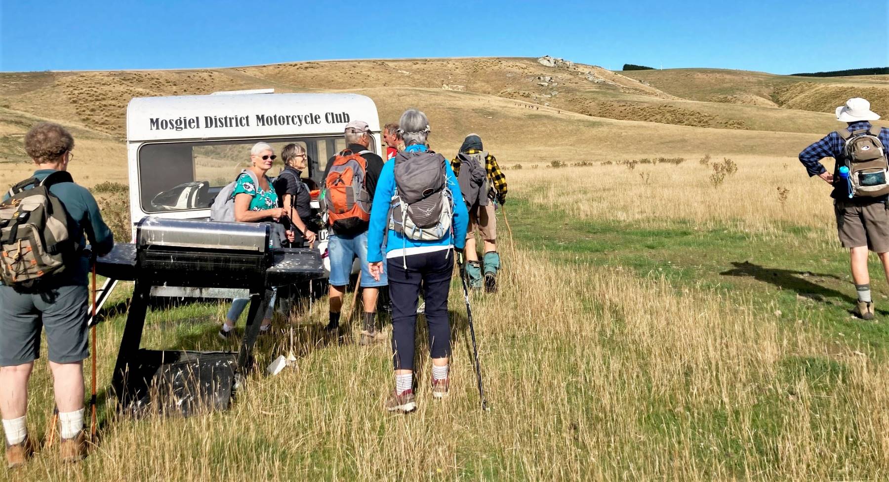
Bridge at entrance to Scorgies Farm (photo and caption Jan)Mosgiel Motor Cycle Club caravan – trampers heading up hill in background. (photo and caption Jan)
This was more of a farm track and much easier underfoot. It was a perfect tramping day, warm and calm and there was no mud (unlike the previous couple of times it has been done). We didn’t quite make the big shed as it had turned quite hot by lunchtime and the co-opted leader spotted a shady roadside spot and elected to lunch there.
Shady lunch stop (photo and caption Jan)
We could see the shed not too far away, so figured that was close enough. Had a chat with the farm manager as we started off back down the valley.
Almost got to big shed – in distance. (photo and caption Jan)
Returned to the cars by the same route, very hot by then, and no shade so it was a relief to get to the end.
Cold drinks at the Wobbly Goat completed the day.
Jan Y.
Trampers.
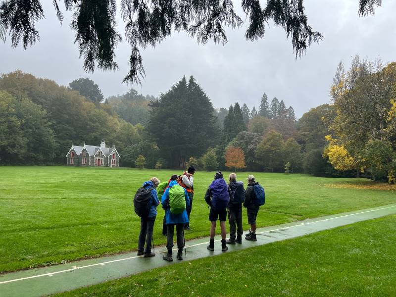
The combined group of hikers & trampers parked by Lee Stream on Mahinerangi Road and all walked along the valley, initially on Traquair.
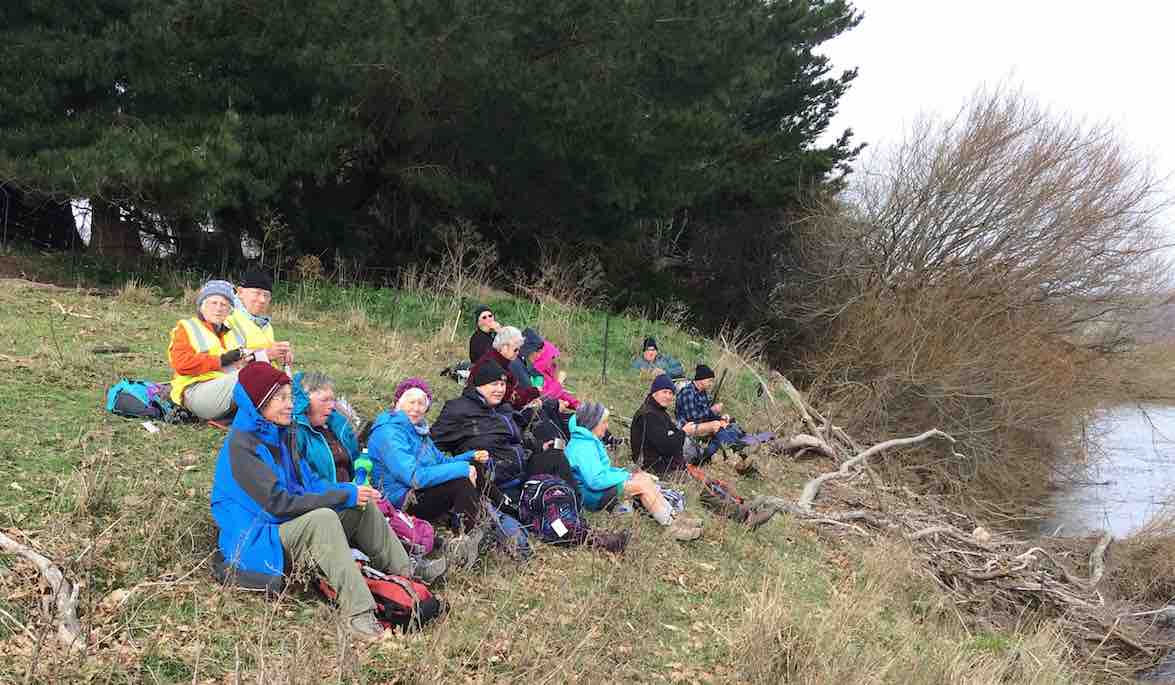
Combined morning tea under Big Blue Skies. (photo and caption Pam)
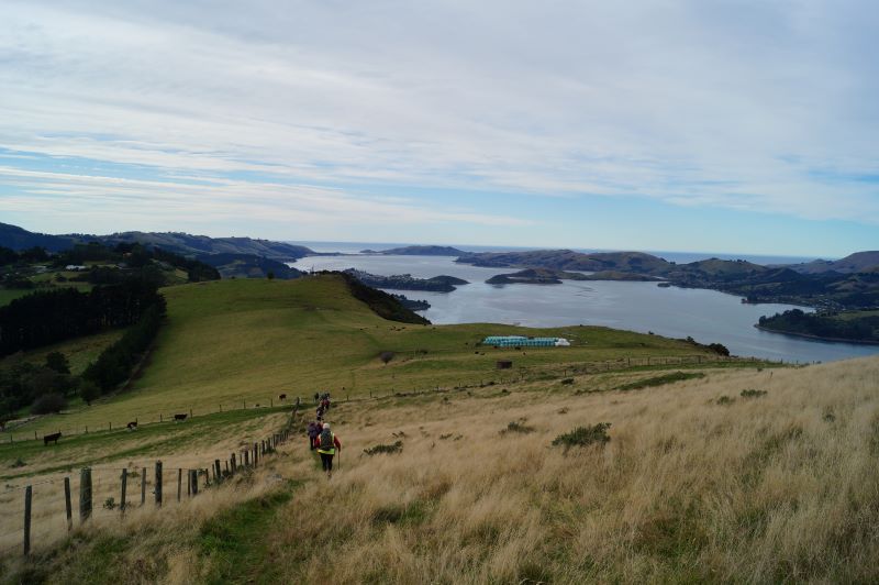
After morning tea 13 trampers headed “to the hills”, enjoying the huge vistas on Michael Scorgie’s Lee Flat property.
Gentle flowing “Lee Stream”. (photo and caption Pam)The long winding road ahead. (photo and caption Pam)
After a steep descent we crossed the Lee Creek – thank you Graham Thurlow for showing us how to correctly place feet and poles – very important if there is a large water flow!
Graeme giving instructions on river crossing. (photo and caption Pam)– and put into practice. (photo and caption Pam)
We lunched by the Allendale homestead then crossed over Mahinerangi Road and looped through more of the Traquair property – lovely seeing the cattle grazing these hills.
Theresa having a well earned rest. Perfect seat. (photo and caption Jenni)
A very enjoyable 15.5 km walk. Many thanks for your assistance Graham.
Jill R.
6. 7/8/2019. Both. Scorgies Farm. Leaders: Jan Y, Peter D, Jill R.
Hikers – Scorgies Farm
After morning tea with the trampers, a group of 21 hikers carried on down the valley and on to Scorgies Farm.The first part over the farm land was a bit wet, but Ok to walk on. However, as we progressed further on the farm track, the muddy spots became more and more frequent.My contact had told me ‘the track was a bit muddy, but just skirt around these areas’.That was the understatement of the year – there was no bypassing the mud and we had to wade through which was heavy going. Got as far as a pile of baleage, and decided to call a halt. Probably only a km or so short of the big shed, which was our preferred spot for lunch, but mud was getting progressively worse.Some of the group lunched amongst the baleage, and the rest of the group headed up the hill a little to find a sheltered spot in the lee of the hill.Met up again and returned the same way (same mud!!) back to the cars. It was certainly a pleasure to get back on to the Traquair land (which constitutes the first few ks of this tramp) and onto their well maintained gravel road.One bonus – no one slipped over on the mud.Jan and Peter.
Trampers – Scorgies Farm.
Trampers’ route map. Courtesy Phil K.
After a combined group morning tea by Lee Stream, …
A great spot for morn. Smoko. (Gordon pic and caption.)
… 21 trampers headed for the hills!
Trampers break off from Hikers.Pretty steep. (Gordon pic and caption.)
We climbed up a face between magnificent rocks,
Hello Hikers down there. (Phil K. pic and caption.)Looking down Lee Stream. (Helen pic and caption.)
walked over rolling hills bearing pockets of snow,
Hardy TRAMPERS in the snow today. (Margreet pic and caption.)
then, taking a more circuitous route than planned,
Down & up. (Gordon pic and caption.)
reached the normally small tributary of Lee Stream at the bottom of Roundhill.
Bit deeper,swifter and slippery than looks. (Gordon pic and caption.)
Today it was much higher than expected due to snow melt over the last couple of days. We decided it would be unsafe to walk through the creek – just too much water swiftly flowing over the slippery rocks!!!! Instead we enjoyed our lunch on rocky outcrops, looking across to the Allandale homestead surrounds,
Lunch in the rocks with leader Jill mapping out a change of direction.. (Helen pic and caption.)
then returned to the Lee Stream Track by a different route.
On the way back to the cars. (Helen pic and caption.)
Distance walked : 16 km. – Jill.
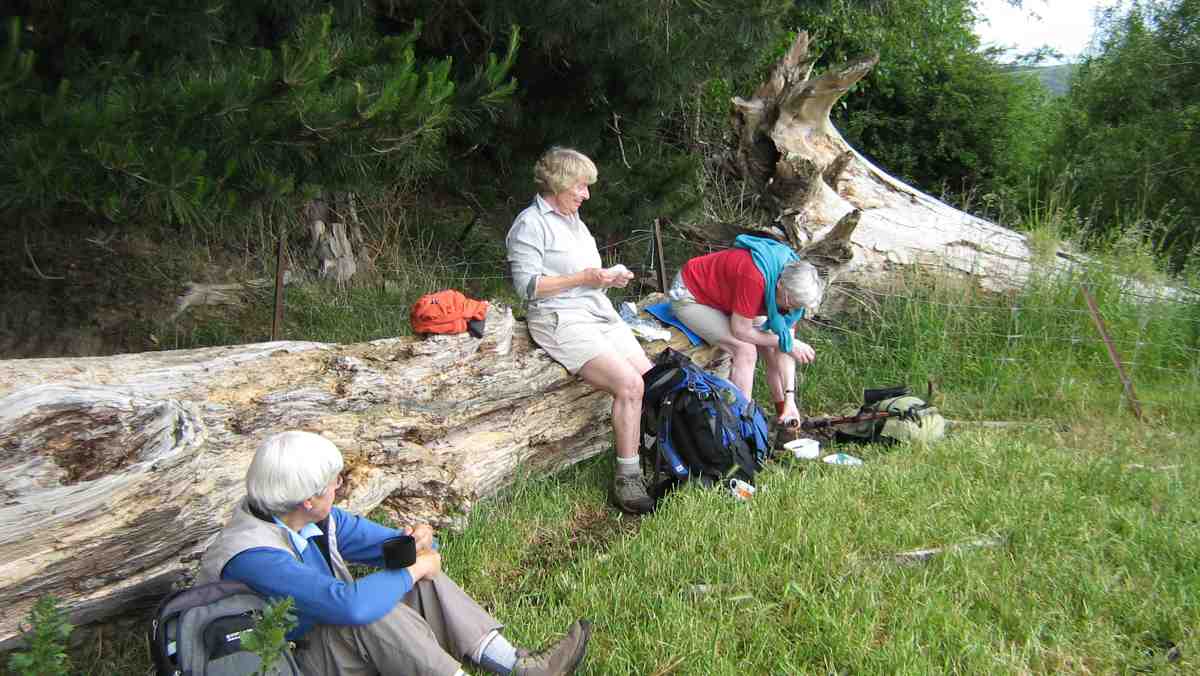
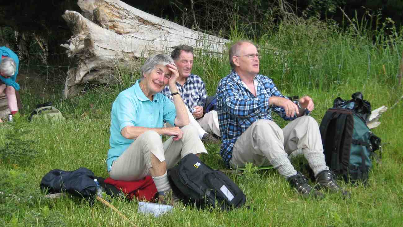
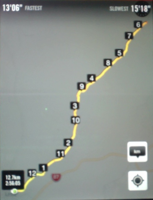
5. 25/6/2014 Hikers. Lee Stream Ramble, Scorgies Farm. Easy. Leaders: Arthur and Barbara.
GPS of route. We walked 12.66 km. Walking time 2.56 hrs; Fastest 4.6 km/hr; Slowest 3.95 km/hr.
I now title this tramp Lee Stream Road Ramble. The route is an actual road at each end, connecting Mahinerangi and Black Rock Roads, joined by a paper road in the middle, having reverted to a barely discernible track across paddocks marked only by occasion ditch crossings, with one actual bridge over a more sizeable Lee Stream tributary.
26 Hikers parked outside the Mahinerangi end of the road, to be surprised by this notice on the gate.
The mind boggles. (John pic)
At this stage of course, the road was well paved.
Start (John pic)
With a winter 9.30 a.m. start and quite a bit of a drive up SH87, the leaders stopped us early for morning tea on the following slope.
An iPhone Panorama attempt of the tea break, not a patch on John’s much better pixelated lunch one. Apologies to the ones I caught bending over.
Paddocks were still saturated from frosts and rain. Today was astonishingly warm with a drying wind, but not enough to even begin to dry the ground out. Ditch crossings, although well gravelled (under the mud, if you could find it), were atrociously, extraordinarily, slipperarily muddy. Not everyone got through without a fall.
Mud, glorious mud. Here you can see only the beginning. Down at the ditch crossing, it was hard to get through without a fall. There were several of this ditches to negotiate. Paddocks were sodden. (John pic)
Here is the bridge separating Traquair from Scorgies’ Stations.
The Bridge (John pic. Hey! Well done, John.)
We trudged on, and on. A kilometre or two short of the end, about half a dozen of us had had enough and made their lunch stop there, leaving the rest of us to go on to the big implement shed. Its contents were well splattered with bird droppings, but each of us managed to find a seat acceptable to them.
Lunch panorama (John pic. A much better panorama.)
Retracing our route we found to be just as muddy, we several of us knowing we had done one of the longer tramps that the Hikers attempt. It was a good day out. While the rest of the country seems to have suffered heavy downpours, we benefited from the warmth of the storm’s margin. Thanks to Arthur and Barbara for thoughtful careful leadership. – Ian
3. 7/5/2008 Both. Lee Stream Ramble, Scorgies Farm. Easy. Leaders: George, Doug M
Permission.
Great farmland trip. Turn down 1st Mahinerangi Rd. Cross Lee Stream and park car park up other side. RH. Thru gate. Meander along well formed road on true right of stream. Lunch at Hay barn en route. Return same way.
The threatened rain did not spill, the intimated sun did not shine, the breezes didn’t waft, but twenty four trepid trampers (hardly ‘intrepid’ on this straightforward walk ) turned out to enjoy
the calm reaches of Lee Streem (sic: an in-joke for the “boys and their toys” fellows ), and the pleasant pastures, and beautiful big barn of Scorgie’s Farm. Well, not quite straightforward, as, after arranging ourselves on tiers of a rocky outcrop for morning tea (see photo), and crossing a decrepit bridge which leader George kept promising us would collapse just for us, there suddenly appeared, blocking our way, a vast vale of choumollier and turnips. A pincer movement was deployed and we eventually fought our way to the battle front again.
An early morning tea is rightly followed by an early lunch, and what better restaurant seats than the dry hay bales, pallets and timbers and butcher’s chopping block of the large, open barn where the smell of hay was incense to the nostrils of country wanderers.
Mushrooms were unfortunately not on the menu though Doug had picked enough for a good tasting.
Our return was by the same route, except that we skirted the western front of the turnip ground this time.
The various pedometers all seemed to tell us that we had traversed circa 15kms of this fertile and well-kept farm, (without seeing a single human movement), and several remarks were heard to the effect that if the speaker were to want to buy a farm, this would be the one. The only sad note to the day was at the carpark meeting point where we observed a minute silence for the passing of Mary Maxwell earlier in the week. – Bob
2. 5/3/2008. Both. Lee Stream Valley and Scorgies Farm. Easy. Leaders: Bob H, Molly.
1. 2/8/2006 Both. Lee Stream ramble, Scorgies Farm. Easy. Leaders: Bob & Evelyn, Lesley G, Eleanor W
Great farmland trip. Turn down 1st Mahinerangi Rd. Cross Lee Stream and park car park up other side. RH. Thru gate. Meander along well formed road on true right of stream. Lunch at Hay barn en route. Return same way.
14. 15/02/2023. Trampers. Silverstream (Raceman’s – Little Coal Creek – Steve Amies- Raceman’s Loop). Grade 4. $5 Leader: Phil Keene
The residue of Cyclone Gabbie hovering off the coast and threatening some rain seemed to have an effect on today’s turnout – only one car, one car, headed for the hills, but it’s hard to hold back quality! So we were parked up at the Powder Ridge car-park and on the track by 9.20am and shambled off up the road and we crossed the surging Silverstream with trepidation a couple of times, before hitting our straps on Racemans.
The famous 5 minus 1 cross the surging Silverstream (photo & caption Phil)
Birdsong was prevalent, nearly drowning out the chat, with the whoosh of a pigeon or two over the stream. As on the day of the recce we were overtaken by a surging team of 5 collies out for their daily run with their Goddess mistress fast coming up behind.
Enjoying a cuppa on Racemans Track (photo & caption Pam)
We morning tea’d after 45 minutes, looking out through a clearing across the valley, why is it ‘the other side’ always seems so more interesting. 1.5 hours from the car-park we took a deep breath to prepare for the ascent up Little Coal Creek and off up up and up we went.
A steady climb up Little Coal Creek (photo & caption Pam)
It was nice to have some of natures hand holds as we pulled ourselves up, being dry, very dry underfoot, just like walking on powdered cement.The going was slow though, to such an extent that these modern devices that people wear were sending out warnings that they were not recording any movement! Are you alright?
That was a good joke Phil (photo & caption Pam)
After 50 minutes of huffing and puffing I’ll blow your house down, I swear I could have, we were at the junction of Little Coal and North Coal Creek tracks.
This way ladies (photo & caption Pam)
From here the climb was more steady, drifting into plateaus, before the next bit of up. Time was taken to enjoy the views out through the bush to Pulpit Rock and Raingauge Spur plus poke our noses out over the rock ledges.
Enjoying the views to Pulpit Rock and Raingauge Spur from Little Coal Creek (photo & caption Pam)
Towards Pulpit Rock (photo & caption Phil)
3 hours from the car park we stopped at the Steve Amies/ Little Coal Creek junction and decided to have lunch here, with both sun and shade to help dry out the perspiration. Bees were prevalent and seemed to take a liking to the creams on our skins, some coming back for more, but no harm was done.
Lunch at the junction (photo & caption Pam)
At 12.45pm we were up and off down what was a lovely Steve Amies track and the gradient was such that there was more time to take in the impressive Kanuka trees, some as big as the mature Pinus Radiata that have also made their home here. As to be expected, the track had to get steep again, and care was required as we ‘dropped’ back down onto Racemans, to be followed by a 40 minute stroll back to the car- park arriving back 5 hours and not a minute more from when we left.
the famous 5 minus 1 ‘dropping’ down to Racemans off Steve Amies Track (photo & caption Phil)
Altitude gained was 509m and a little over 11kms completed. Grade 4 seemed about right. Consensus was a great day out and just 10minutes from home.
Phil K
13. 18/11/2020. Trampers. Racemans, North and Little Coal Creeks, Steve Amies. Leaders: Ross and Wyn Davies. M.
18 trampers set out from the car park just off the Whare Flat Road, towards the pumphouse at 9.25am. It was a nice morning. We arrived at the Tunnels Track junction after half an hour; time for morning tea.
Photo and Caption Gordon – “Morning tea.”
Photo and Caption John – View from morning tea spot.”We made steady progress up the Racemans Track and reached the North Coal Creek junction and hour and a quarter later. After a brief pause for some energy food, we headed up the North Coal Creek Track. The track – such as it is – was in good condition. It is an unrelenting climb and we had a few stops to regroup on the way up.
Photo and Caption Gordon – “Climbing rock wall on North Coal creek track.”
We reached the junction with the Little Coal Creek Track after about an hour. We carried on up the Little Coal Creek Track for another 15 minutes to a lunch spot with a view to the north.
Photo and Caption Gordon – “Lunch.”
Photo and Caption John – “View over the cliff edge at lunch stop.”
We had a good panorama of Powder Ridge and Long Ridge, Mt Allan behind, Pulpit Rock and Green Hill in the centre of the Silver Peaks.
The weather started to look more threatening after lunch, as we continued up the Little Coal Creek Track for another 20 minutes to the junction with the Steve Amies Track.
Photo and Caption Gordon – “Happy campers at Steve Amies junction.”
By this stage there were a few showers; enough to make the track down the Steve Amies Track increasingly slippery. Everyone took the descent carefully and we made it safely without any proper falls. It took us about an hour and three quarters all the way down to Racemans Track, by which time the rain was getting more frequent.
Getting progressively wetter we retraced our steps along Racemans Track and back to the car park in about 40 minutes, arriving back at 3:50pm. Distance was variously measured at more than 15 kms, with an average of about 15.5 kms. It was a relatively longer day in terms of distance, time walking and ups and down, which everyone coped with OK. Some decided home was the best direction but 8 of us diverted to Blend Café for hot drinks and varying amounts of food.
“quoin” definition: 1. An exterior angle of a wall or other piece of masonry.
2. Any of the stones used in forming such an angle, often being of large size and dressed or arranged so as to form a decorative contrast with the adjoining walls. Seek permissions. 03 –
Coast and farm walk. Bull Creek nature walk to waterfall (tiny!) recommended.
16. 1/2/2023. Quoin Point to Bull Creek. Combined. Leaders Bruce, Alex, Helen and Phil.
Thirty-one keen walkers headed south and after regrouping at the turnoff to Quoin Point road parked in a paddock opposite the wool shed at the end of the road where lambs were being drafted.
Keen to get started. Photo & caption John
We followed the farm road leading down the hill towards Quoin Point and then turning right opening closing gates where appropriate before stopping after 15 minutes near an inlet with a choice of sun or shade. Shade was more popular.
Morning tea near Quoins Point. Photo & caption Phil
We continued across the paddocks and paused for a time near a caravan and new home above it on the hillside with natives planted in two paddocks while Bruce chatted to the land owner Peter O’Connor of Riversdale. Peter said he was happy for trampers to traverse his property and did not need to ask his permission in the future. The two paddocks are linked by a pipe gate and the best exit to the beach and Bull Creek was at the far corner nearest the sea of the second paddock. The path goes down the hill over some grey rocks and then along the coast to Bull Creek. He plans to mow a track across the lower part of his property in about two years to make access easier.
Neil on gate duty again. Photo & caption John
An example of the beautiful farm gullies, planted in natives. Photo & caption John
Local’s dog, keen to come with us. Photo & caption John
Going to visit the ‘house on the hill?’ Photo & caption Phil
Happy trampers. Photo & caption Pam
Around the corner to Bulls Creek. Photo & caption Pam
Watching over Bulls Creek. Photo & caption Pam
We had lunch on the North side of Bull Creek in case the rising tide cut us off. A seal was spotted in the water at Bull Creek and another mammal seen in the distance on the rocks on the way back. Clare’s family had built a dam across the creek so that the seaweed in the creek could be flushed out once the dam broke.
Time for lunch. Photo & caption John
Bulls Creek iconic tree and three T.R.T.C. icons. Photo & caption John
Clare kindly arranged for 3 of the party to travel back by car; a 25 minute journey going near Milton.
The weather remained fine. Distance 13.56 km, Climb 384 m. We started walking at about 10 am and were back to the cars at 3 pm. There were many views of the coastal rocks. Hay tedding was in progress on one paddock and for the others the hay had been cut and baled since the recce.
Very precise windrowing. Photo & caption Phil
Future walks on the property might be considered for mid-February or after when the sheep are likely to have been shorn, the lambs drafted and the hay cut which makes walking easier. Thanks to the co-leaders Alex Griffin, Helen Morris and Phil Morris for their valuable leadership. Also to Neil for his opening the gates, waiting for the last person to go through and then, remarkably, being in position to open the next gate. He was also better at spotting where the next gate in paddock was, possibly due to his eyes operating at a higher elevation. Thank you again Neil. Our thanks are also due the land owners Alan Shaw, Gwen Lane and Peter O’Connor for their kind permission to be on their properties and to Clare for her local knowledge of the area and assistance with offering transport back to the cars for three persons.
Because the Brighton Café closes at 4 pm the group was given the opportunity to make their own choice for coffee, such as at Waihola or Mosgiel, or an ice cream at Brighton.
Bruce Spittle
15. 6/11/2019. Quoin Point to Bull Creek.
RAMBLERS, HIKERS and TRAMPERS report.
On a calm morning 33 keen, happy members drove up Law road and along the coast through Akatore to Quoin Point road, driving a couple of kms down to the wool shed. At 10am 6 Ramblers headed off to enjoy their day, leaving 27 to hike to Bull Creek.
Photo and Caption Helen – “Up and down” Photo and Caption Gordon – “regroup”
We walked down through paddocks to the rocks where we had smoko.
Photo and Caption Gordon – “Smoko among the rocks”
(In 2014 we tried to count the pod of seals both big and small), however, today we only spotted a couple along the way. As well as 4 leaders, we had markers still in place from the Tokomairiro High school trail bike fundraiser held a couple of weeks ago guiding us. The paddocks were dry and nice to walk on. With lots of gates to open/close, amazing coastal scenery, gullies with native bush, 3 old farm houses and a couple of creeks to cross. 2 hours of hiking then came to a standstill at the now fenced off access to Bull Creek. Even with 2 stiles to cross over, their was not a track to be found. We back-tracked a short distance and found our way down. 3 Members decided on a bit of bush bashing, 2 were through in no time———then through came Doug (our 90 year old) with a grin, having enjoyed his scramble!!
Photo and Caption Helen – “Doug taking the hard way down Photo and Caption Helen – “Bull Creek”
To save getting wet feet, a most enjoyable, sociable and scenic lunch was had by all on the rocks, before you cross the creek to the iconic kiwi cribs from 12:00 to 1:00.
Photo and Caption Gordon – “Lunch at Bull Creek” Photo and Caption Gordon- “Couple of Kilometres left” Photo and Caption Gordon- “Heading to Cars”
Then it was time to head back the way we came, arriving to the cars at 3pm. 2 cars travelled down the Taieri Beach road through pine forest (a new road for some) while the others down the more scenic road to the Black Swan Waihola for Coffee.
As always another happy outing covering about 12 kms. I think it is really important having the combined monthly hike, walking, talking and catching up with our hikers and ramblers.
Photo and Caption – Gordon – “View”
BULL CREEK
Different theories on how Bull Creek got its name. From a fictional character called John Bull, to the Otago Witness’ report in 1904 of the story of a wild Bull meeting a grisly end in the area, with the bull’s head later being hung on the wall of “Bulls Cottage”
The 42 or so cribs are spread over about 4ha and have their own 35 year lease, set up some years ago with the then land owners.
Eleanore, Helen, Bob and Jannette
14. 4/4/2018. Both. Quoin Point to Bull Creek. M. Leaders: Ian, Arthur and Bob.
Hikers’ Route map, courtesy Ian.
The day was fine when twenty-seven of us started down from a busy shearing shed at the end of Quoin Point Road to morning-tea down by the Quoin Point rocks. Both we and a multitude of inquisitive young seals were amazed at the sight of each other.
Quoin Point at the sealions gathering. (Clive pic and caption.)Morning tea at Quoin Point.(Clive pic and caption.)
Ten trampers set off first, closely followed by eleven Hikers…
(Kevin pic.)
… leaving seven Ramblers behind to enjoy a more leisurely walk, which they took as far as the first house, returning along the beaches before having to regain the paddocks. They got back to the cars at 1.15 p.m.
For the others, the route varied between the flats of rocks and beach where practicable, and paddocks and gates where necessary. Towards lunch-time the query of “how much further” was beginning to be raised by some of the newer hikers. The hut-on-the-paddock’s site had complicated matters with new electric fencing forcing skirting around it before reaching the familiar route again. (We did better on the return trip.)
The trampers arrived at Bull Creek …
Bull Creek. (Clive pic and caption.)
.. in time to get round to including the picnic area and the Bull Creek Bush Walk.
Along the waterfall walk. Clive pic and caption.)Along the waterfall walk. (Clive pic and caption.)
The Hikers, with their much later arrival, (their walk enriched however with much mushroom-picking) had time only to get through their lunch
Brief lunch. (Kevin pic.)
before the low-tide’s turn prompted getting back across the creek.
On the return trip, our two groups were mixed and strung out as people moved off from Bull Creek in their own time. Admirably, Bob, our back marker, kept his disciplined place, to ensure we all got back in one piece.
This time, at the second stile, fortunately Arthur remembered to remain on the flat until we had got past below the little paddock hut before resuming the paddocks.
So we straggled back to the cars, strung out in various groups, some faster, others slower as the weariness of a 12 km tramp set in. Bob’s sterling work as back marker, at this point really paid off. Several paddocks short of our destination one of us found the going too much and needed rescuing. Gordon, a new member of the club who had accompanied Bob stayed back to keep watch, while Bob strode on to fetch his large four-wheel-drive ute back to the rescue.
So all’s well that ends well. with the day ending with a congenial “coffee” stop off at Brighton. – Ian.
13. 30/7/2014. Trampers. Quoin Point to Bull Creek.
A good group of eight set out from the farm road at Quoin Point to walk along to Bull Creek. there was a bit of a wind blowing which kept the temperature down, & it was VERY muddy going across the paddocks. We didn’t get onto the beach very much as the tide was quite high, even although on the tramp program it was stated to be low at 11:30 approx. [Yes, a 0.3 m low tide i.e. on the higher side – Ed]
It was surprising to see that the gates along the coastal paddocks had “Walking Access” signs attached to them, so good on the land owners for allowing this.
We had morning tea in the shelter of some rocks, & lunch at Bull Creek. Lunch was a reasonably hurried affair, as the sandflies were eating more than we were!!! The exit of Bull Creek onto the beach was probably passable, but we didn’t fancy getting wet feet so we stayed on the Nth. side.
After lunch, it was just a return walk mostly back along the paddocks to the cars. The wind had started to dry out the very muddy parts, so it was only just a little less muddy going back. But, unfortunatly, one member slipped over at one point, & has some dirty washing to attend to !! We walked 12.3km in approx 4hrs. – Ken.
12. 5/3/2014 Both. Quoin Point to Bull Creek. Leaders: Lex and Peter.
Failed to reach Bull Creek. Ed note.
11. 13/2/2013 Trampers. Quoin Point to Bull Creek. (9)
Nine of us enjoyed the tramp, three of us oldies, six newies, to show it off to. And they did appreciate it.
We saw lots of seals/sealions (?) on the way.
It was surprising to see such a high sandbar at Bull Creek.
A high extensive sandbar now. (Ian pic and caption.)Bull Creek water backed up by the sandbar. (Ian pic and caption.)
Although a souwester was very strong at times it was good tramping weather.
A feature of the tramp at its end was the discovery of a very flat battery in Ian F’s car, whose parking lights had been accidentally knocked on and left for 5 hours! With an AA call-out rescue, we got all got home by teatime. – Ian.
10. 2/6/2010. Both. Quoin Point to Bull Creek. Leaders: George and Dot.
It was a most unusual start. Various reports had it that after the recent rainy period the paddocks would be too wet or the coast road would have been damaged. As it turned out, not – in either case. The upshot was though, that one of the leaders led a number on a round trip road walk up the Scroggs Hill from Brighton. 12 went on to Quoin Point. Of the 12, only 4 went to Bull Creek.
It was a nice low tide, but the Bull Creek flood waters were too deep to comfortably cross.
Packing up after lunch. Ken, Doug.
The remainder stopped for lunch a few gullies back.
Bull Creek minus 30 mins. (Bill caption and pic) Lex and who?
The day was brilliant with little wind.
How did this get here? Noticed on the way back.
It was a good day out. All the more enjoyable for contrasting with the previous week’s extended rain. – Ian
9. 23/12/2009. Trampers. Ken and George. Quoin Point to Bull Creek.
A good walk on Wednesday, lots of rock hopping. It was a perfect day for it as well, with virtually no wind, and not too much sun either.
Returning from Bull Creek. George. (Ken pic)
8. 4/4/2007. All. Quoin Point to Bull Creek. Easy+. Leaders: George, Hazel, Eleanor B, Joyce S
7. 1/3/2006 All. Quoint Point, Bull Creek. Easy. Leaders: Dot B, Glenis, Frank & Lesley
On a very pleasant and warm Brighton morning 22 hikers set off towards McIntosh Road led by Faye (with an E).
The wet land area planting and a talk about it. (Photo and caption Helen)
We visited Star Fish Gallery for morning tea and a friendly inspection of premises hosted by owner.
Morning tea at Starfish Gallery. (photo and caption Helen)
From here we headed back down the hill to explore different parts of Brighton and Ocean View led by Alex as Liz was off the scene with slight injury caused earlier in the week. With such a pleasant day it was good to enjoy sea views and other interesting sites before a stop for lunch at Ocean View.
Sea view (photo and caption Helen)
Up the Bennett Road to inspect the Mosaic Wall …
The mosaic wall. Beautiful. (photo and caption Helen)
… which leads us down the steep track back to Brighton and local Coffee shop for more relaxation and welcome visit by Bev Harvey and Dot Bennett.
Alex And Faye.

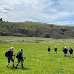 Lovely sunshine greeted 30 keen trampers for a good day’s walk on Cairnvalley Farm Shannon. Strath Taieri offers something different in scenery with tussock hills, huge rock formations and at this time of the year fresh green vistas of paddocks and Continue reading “Shannons Farm Walk”