Apr 21 2024
Rosella Ridge
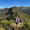 9. 17 April 2024. Trampers Rosella Ridge. Grade 5.5 Leaders: Ross and Neil
Apr 21 2024
 9. 17 April 2024. Trampers Rosella Ridge. Grade 5.5 Leaders: Ross and Neil
Apr 09 2024
No. 24 on old hardcopy list of 113 club tramps. “Lovers Leap – The Chasm – Sandfly Bay. N Strang. Farm. Year Round.” No. 73 on old hardcopy list of 113 club tramps. “Sandymount – Lovers Leap. Year Round”.
29 km from car-park.
See Sandymount for area background information.
Sandymount closed for lambing Aug-Oct. Track unformed in places, grassy, slippery when wet. (See also article on pingao planting.)
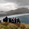 25. 27/03/2024. Hikers. Sandymount Grade 2.5 Leaders: Jenni and Bruce Wright
Feb 24 2024
No. 30 on old hardcopy list of 113 club tramps. “Woodside Glen to Maungatuas. E Blackburn, D McEwan. Summer”
Short and long options. (Maungatua climb fairly steep. 5-7 hours. Heavy tussock on top. Route only. Manager: DOC.)
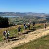 18. 14/2/2024. Trampers. Maungatua Option. Leaders Lyn Keene, Anne Ward and Di Bezett
Travel Distance 40ks, Grade: 3.5, Altitude gain: 711 metres. Total distance: 15.64 ks.
The day dawned to reveal blue skies and temperatures were predicated to be between 28-29 degrees. Continue Reading »
Feb 03 2024
No. 76 on old hardcopy list of 113 club tramps. “Coutts Gully Return Sawmill Rd Farm”. Livingstonia Park distance from car-park: 32 km.
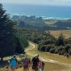 After welcoming a new hiker, Peter Dodds, twenty-four hikers left Livingstonia Park, about 9.30 am, heading to the left (east) to the sand dune track that led out to the road by the bridge and then headed up Sawmill Road to have morning tea beside the implement shed on Alan Gorton’s farm.
Dec 09 2023
Ocean Grove, also known as Tomahawk, is a suburb in the southeast of the New Zealand city of Dunedin. … The suburb was known as Tomahawk until the 1930s, the name not being a reference to the weapon, but rather possibly an anglicised form of the Māori words tomo haka, meaning “dance by a gravesite”.
No. 23 on old hardcopy list of 113 club tramps. “Karetai Rd via Monument from Lagoon. Year round.”
Distance from car-park: Tomahawk: 19 km; Smaills Beach: 22 km; Paradise Road: 26 km.’
DCC List: 41 Peg Track. Otago Peninsula
Accessed from Oregon St. 3.5 hrs ret. Tramping track – unbenched. Managed: DCC CAM, private land.
Description – This track provides a link between Ocean Grove and Highcliff Road. Access to the track in Ocean Grove is off Oregon Street. An attractive walk around Tomahawk Lagoon then climbs through gorse and native bush. Turn right towards Soldiers Memorial through paddocks with gorse sometimes obscuring the rock walls.
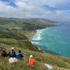 43. 06/12/2023. Trampers. North of Tomahawk. Grade 3. $7. 22km. Leaders: Esther Willis and Julie McKenzie
Dec 09 2023
Information
Rock and Pillar via Six Mile Creek This climbs 1,005 m. (3300 feet) up the eastern face from Glencreag Station up a leading ridge south of Six Mile Creek. This is the most direct approach.
Rock and Pillar via spur south of Lug Creek. Information: Climbs 910 m. (3000 feet) up the eastern face of a well-graded vehicle track up a leading spur south of Lug Creek. Average time to Leaning Lodge is 3 hours on foot.
DoC access. 9.5km north of the Middlemarch store on SH87, just before Lug Creek, is a farm entrance (RAPID 7219 – no DoC sign). A short way up the driveway is a DoC car park. There is public access up the vehicle track to the conservation area boundary. The track is now a recreation reserve administered by DoC.
Easiest route to Big Hut from Leaning Lodge (foot only – unmarked – good visibility essential) is another 45+ minutes climbing gently southwards to cross a steep gully and then climb a gentle shelf to above the eastern basins. Sidle several hundred metres past the lower prominent rock tors before gently descending to Big Hut once it becomes visible. Route very wind and cloud-prone. Ice axe and crampons may be necessary to traverse steep snow slopes near Leaning Lodge.
64 km to Middlemarch. 66 km to Stonehurst Track.
Redan Crater- contact for access Ken Rennick.
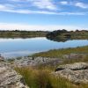 13. 06/12/2023. Hikers. Sutton Salt Lake – Glencreag Track. Grade 2.5. $16. 60km. Leaders: Wendy Langley/Katrina McKenzie
17 of us headed to Sutton where we walked the Sutton Lake loop. Continue Reading »
Nov 08 2023
Nov 01 2023
22. 1/10/2023. Combined. Green Hut Site and Pulpit Rock. Tramp Grade 4, Hike Grade 2. 43km. Leaders: Neil Hodgkin/Chris Bezett, Dave Roberts/Jay Devlin.
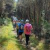 Hike to Green Hut (which is now two seats as the hut was deconstructed in 1988 because of ongoing vandalism).
On a foggy morning 18 keen hikers regathered at the On the Spot garage at Waitati where we turned left up a dusty road to the beginning Continue Reading »
Oct 28 2023
Outram 10 km / Henley 21 km – from car park.
4. 25/10/2023. Hikers. Outram Loop. Grade 1.5, 11km, Leaders: Sue Nichol, Kathryn Fagg.
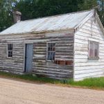 Outram turned on another scorcher for 16 hikers. We started at the West Taieri Rugby Club and walked around Kings Court and Anzac Court subdivisions where the gardens were in full bloom. Continue Reading »
Sep 23 2023
No. 87 on old hardcopy list of 113 club tramps. “Michelle’s Farm Outram Farm”.
11 km from car park.
Park under Outram Bridge. Contacts: Seek 3 permissions.
Proceed east side of Taieri River along gravel road to gravel pit. Bear right uphill to power lines. Follow generally along grass farm tracks to top of hill.
Landmarks: Trig marker on right; also obvious paper road between two fence lines; Long barn on right (good for lunch stop); large wool shed on top of hill straight ahead (this is still on Hyslop’s property).
Straight on access is to Taioma Road but we don’t usually go that far!
Plenty of mushrooms in April – take a bag!
After ascending a narrow track through scrub we made our way along a ridge on Craig Nichol’s property. Any conversation was ‘gone with the wind’. To quote Evel Knievel “ I love the feeling of fresh air on my face and wind blowing through my hair” – certainly true today!
We decided not to go to the trig – the howling wind spoke to us and we found our way down to a pocket of native bush. The relative calm here was a welcome respite from the punishing wind on the hill top.
Walking roughly parallel to SHW 87 we headed back towards Outram. Thank you farmer Neil for herding a mob of cattle out of our path.
Throwing caution to the wind we walked through a Douglas fir plantation, then a large stand of eucalyptus – fortunately there were few recently dropped branches! The only reportable incident was Diane being blown backwards whilst pivoting on a gate – luckily she was caught by the two behind her ( I rue a missed photo opportunity!)
A nice hill climb took us to wide track Craig recently had dug out back down to the Taieri river, and we were at the cars by 3.00 pm.
A great day out and many thanks to Julie McKenzie and Pam Cox for your assistance.
Distance walked – 13.5 km
Jill Reid
Apr 01 2023
Location: 31.5 km.
15. 29/3/2023. Millennium Track, Taieri Mouth. Leaders Dave and Mike
I seriously questioned my sanity on the drive from sub tropical Port Chalmers to Mosgiel for this weeks walk. The torrential rain and hailstones on the Southern Motorway left me with a sense of foreboding. However, 17 hikers eventually assembled at the meeting place at Knarston Park on Taieri Beach for what turned out to be a really enjoyable walk with the predicted rain showers non-existent.
Morning smoko was held on the verandah at Jay’s river mouth crib where we could admire the house extension at one neighbouring property and the dismantling of a Kauri boat on another.
From there it was a pleasant river side walk on the Millennium Track and boardwalks before starting the grunt up the hill to the welcome seats where we had lunch before re-tracing our steps back to the cars.
Consensus of opinion is that the grade should be re-classified as a 3.5 as Sir Edmund Hillary got a Knighthood for climbing hills that steep. The return to the cars was achieved without mishap and tiffin was taken by some at the Brighton Cafe.
Thanks to Dave Roberts for leading at a leisurely pace that made the uphill sections enjoyable. Total distance walked was 9.5km
Mike Webb
Oct 06 2022
Chain Hills Track. Accessed from Chain Hills Road. 30 min. Tramping Track. – benched. Manager: DCC CAM and private land.
19. 5 October 2022. Combined. Green Island/Abbottsford and surrounds. Grade 3-3.5. $5. Leaders: Phil & Colleen, Raewyn & Jenny F.
With weather forecasts of snow and strong winds fresh in their minds, 24 hardy walkers gathered at the Village Green, some hoping no doubt as we walked passed the cafe that we were going for an early fix.
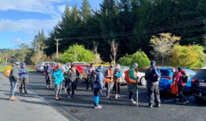
A good turnout at the Village Green, despite a dubious forecast of icy snow-showers and cold conditions (photo & caption Marijke)
But to no avail as we immediately had to climb Thomson Street, short and not too sharp for our first huff n puff for the day. Immediately there were good views of the south end of Green Island, Estuary and Saddle Hill. On the far side, the ridge outline of Green Island Bush Rd, and the farm we did our recce through,(would the weather let the trampers make it that far?)
Gardens in the area were festooned with blossom and bright ground cover and we all admired the Abbotsford home for wayward boys, it looked pretty good to the writer.
Walking through the new subdivisions, (once the playground of post war GI and Abbotsford lads), everything seemed much grander than back in the day. The natural storm-water basin was a delight with native plantings, and the entrance to the subway under the railway was a feature, painted by pupils of the school. A suggestion was made that some may want to take a little more time to walk Abbots Hill Rd while others stayed in the school playground for morning tea.
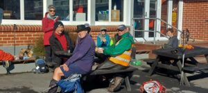
Morning tea at the Abbottsford School for some of us, with lovely treats from Jenni & Bruce (Photo & caption Helen)
Mmm the majority headed off in the first group! Many thanks to Jenni and Bruce for the ‘sweets’ and congrats again for the milestone anniversary and birthday.
Following morning tea the groups reunited to reach the top of Abbots Hill, and descend down the land that was the top of the now (in)famous Abbotsford slip in August 1979.
With the agreement of the lifestyle owners we were able to eliminate many of the fences encountered on the recce, and take in the views. Having stayed together to the upper rugby grounds of Miller Park, the two groups split with the trampers heading down, through the tunnel under the motorway and up the other side of GI to the GI Bush Rd, whilst the hikers would move south up Neill St and down into the town via the motorway overhead footbridge for lunch. For the trampers more information on the slip was shared in the area of what was the lounge of the writers house, built by his parents in 1942.
Following lunch on the reserve ‘in town’ and with advancing stormy clouds the Hikers decided to head to the Village Green, along the way finding shelter from the storm under the motorway overhead bridge.
At the same time the Trampers ascended Church Hill Rd and took some very deep breaths near the top as the winds and hail hit; thankfully we saw out the worst of it and carried on to GI Bush Rd where apart from one more brief flurry requiring shelter behind the Hawthorn Hedges,
and passing the memorial to the site of the first GI school in 1853, we were rewarded with literally some breathtaking views of the Maungatua, the Saddle and the ocean, including Green Island and Blackhead, the latter more like a battleship viewed side on.
Our kindly farmer had undertaken some inventive gate fixing to make the entry onto the farm much easier than on the recce, and we were able to enjoy plenty of views as we ambled and shambled down through the farm, the lambs gambolling in the breeze…..(with apologies to Wordsworth). We lunched on a sunny bank near the farm buildings, before heading to the Village Green ‘through town’.
This was a rewarding day and of course all cobwebs were well and truly blown away. For the trampers a solid Grade 3, just on 12km and 350 altitude gain, while the Hikers were Grade 2 and 8km. Well done everyone and special thanks to the landowners involved for allowing access to build a great round trip.
Phil for Raewyn, Jenny F and Colleen
Jun 26 2022
Jun 11 2022
Sixteen hikers assembled in the Brighton Bowling Club rooms and exited following Alex to the right passing the $50,000 new retaining walls, crossing the Brighton-Taieri Mouth road, and proceeding to the playground at the domain for morning tea.
We then crossed the domain, without disturbing any persons who were preferring to live in cars, and descended the steps to the Brighton Beach. The depth of the Otokaia stream was about 2 cm and we all successfully negotiated it without any drownings. We ascended the steps behind the Brighton Surf Club rooms, followed the footpath to the Braids Hill car park and then proceeded north along the beach until about 11.30 am when we reversed direction.
After a brief stop at the freedom camping site, where new posts and chains have been installed to more clearly delineate the freedom camping area, we proceeded along the track through the dunes until turning up a path to the right by some macrocarpa trees passing through Bruce’s property at 727 Brighton Road where Alex spoke of his experience with Black Boy Peach growing.
We continued south on the footpath and turned up Creamery Road, where we arrived at 11.57 and listened to Warren Harris tell us something of the history of the area and had an opportunity to view his museum with its extensive collection of various historical items including toys, tobacco tins and tools.
After accepting Warren’s kind invitation to have lunch on his property we thanked him and walked via Creamery Road, and John St through a grassy area on the left and down some steps through bush to Brighton Road. We crossed the road and turned left at the clothing collection container and followed the path to the beach, and then along the river and through the sandhills to the Braids Hill car park and along the footpath to the Otakaio Creek bridge.
Several photos were taken of a white heron/Kotuku looking for food in the creek. It has been a resident of Brighton and Ocean View for some weeks. Some Royal Spoonbills were also seen near the bridge.
We then subdivided into a group that went directly to the Brighton Café while the others came after driving their cars from the Brighton Bowling Club.
The weather was cool and cloudy but the rain held off. Adi measured the distance on her cell phone at 9.43 km. Alex and Bruce were thanked for being the leaders.
Bruce Spittle
Nov 23 2021
5. 17 November 2021. Hikers. McIntosh Bush. E-M. Leaders: Jan Yardley & Pam Clough
A good number of hikers and trampers (23 in total) travelled up to McIntosh Bush, formerly owned by Marjorie Orr and Colin MackIntosh, now owned by Marjorie’s niece, Hilary Lennox. I was unaware that it was previously owned by Eleanor and Murray Watt. Eleanor was a member of the tramping club for a number of years. Marjorie and Colin still live on the property which consists of 100 acres of native bush and mixed exotics, and a QEII-covenanted bush area.
We were guided by Marjorie, and started off down a road then up the hill past the horse paddocks. Two horses met up with us but didn’t hang around long.
We carried on down through various stands of exotic timber trees which included eucalyptus, macrocarpa, Tasmanian blackwood to a picnic area at the bottom of the gully for morning tea.
We then proceeded through native bush where the rare peripatus worms live and looked at a stream oozing “brown coal” seepage.
Climbed up through an area of pinus radiata to the top edge of the property where we had an excellent view overlooking the Ocean View area.
Walked back down to the picnic area for lunch…
…then headed back to the cars up a very picturesque ferny bush track. Quite a narrow track with lots of wooden steps and tree roots etc. to negotiate. On the way up were numerous tree plantings named after various people associated with the property.
On arriving back at the cars Marjorie offered us a tour of her garden, accompanied by her two dogs – an unexpected extra bonus.
We finished up a successful day with coffee at the Wooden Table in Mosgiel, and we very much appreciated the opportunity to enjoy this special property.
Jan and Pam