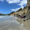
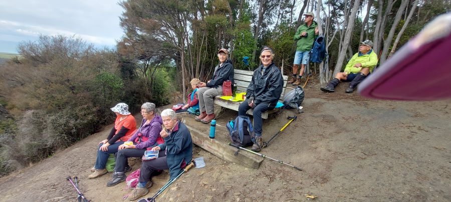
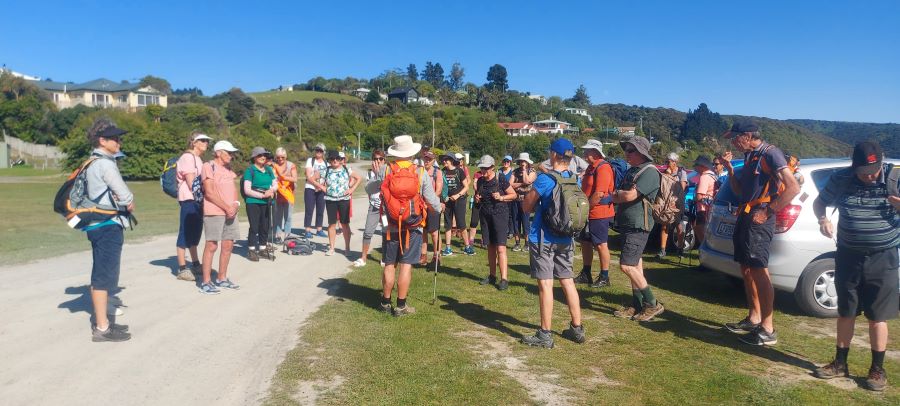
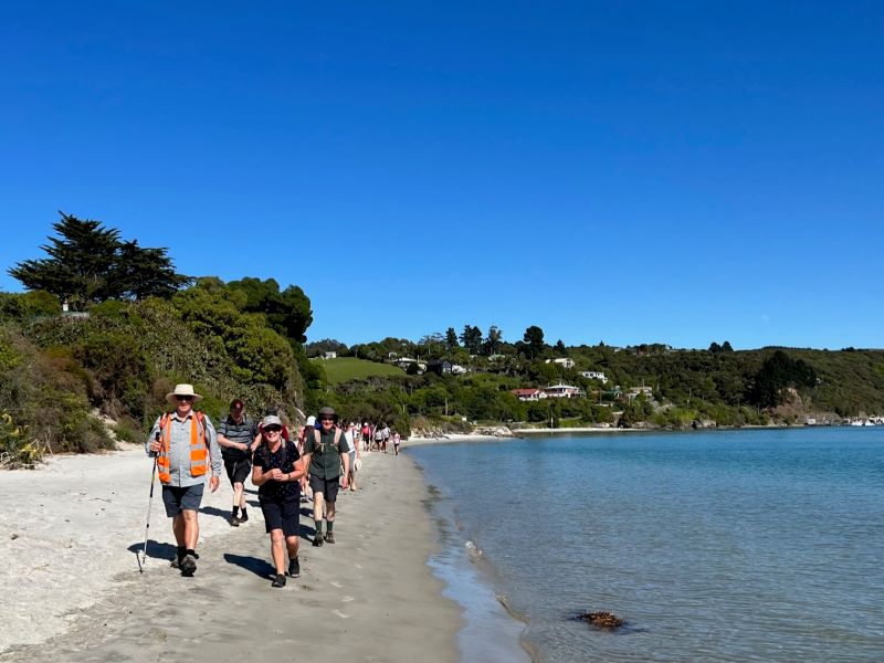
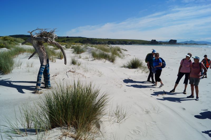
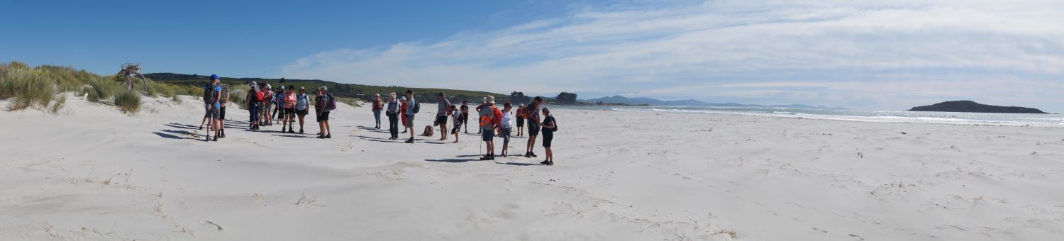
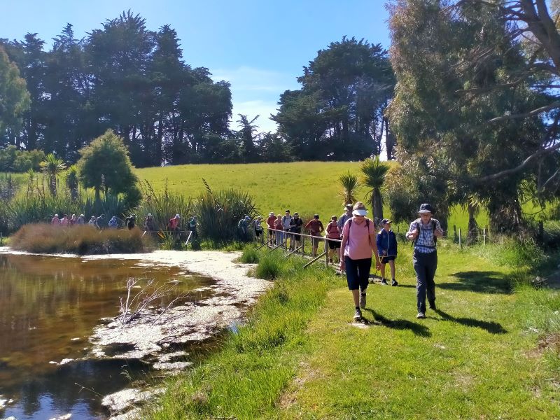
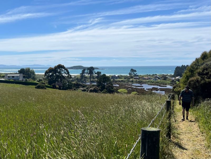
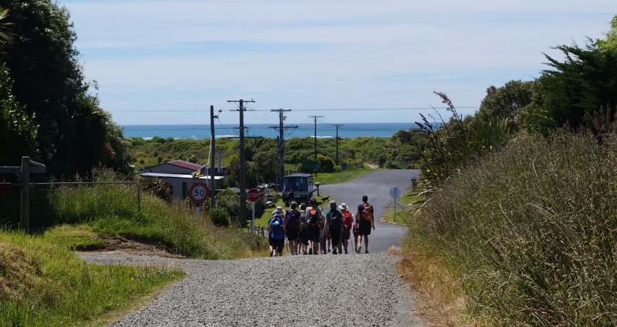
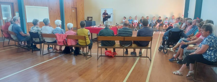
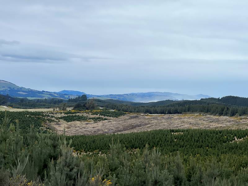
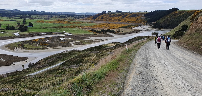
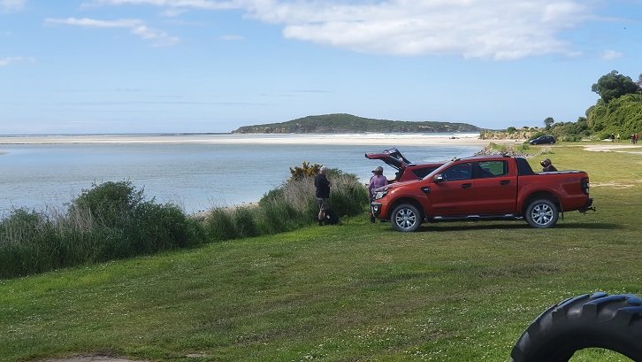
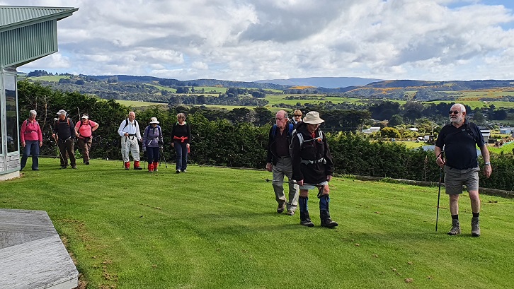
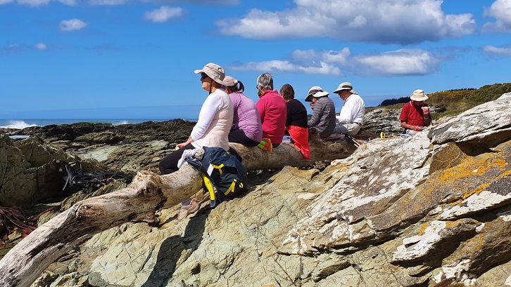
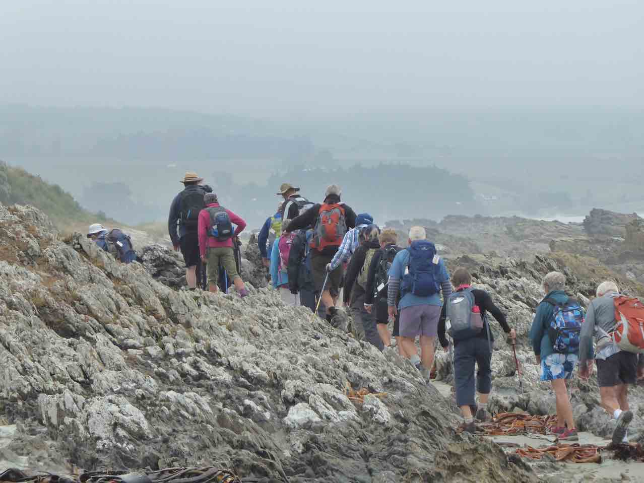
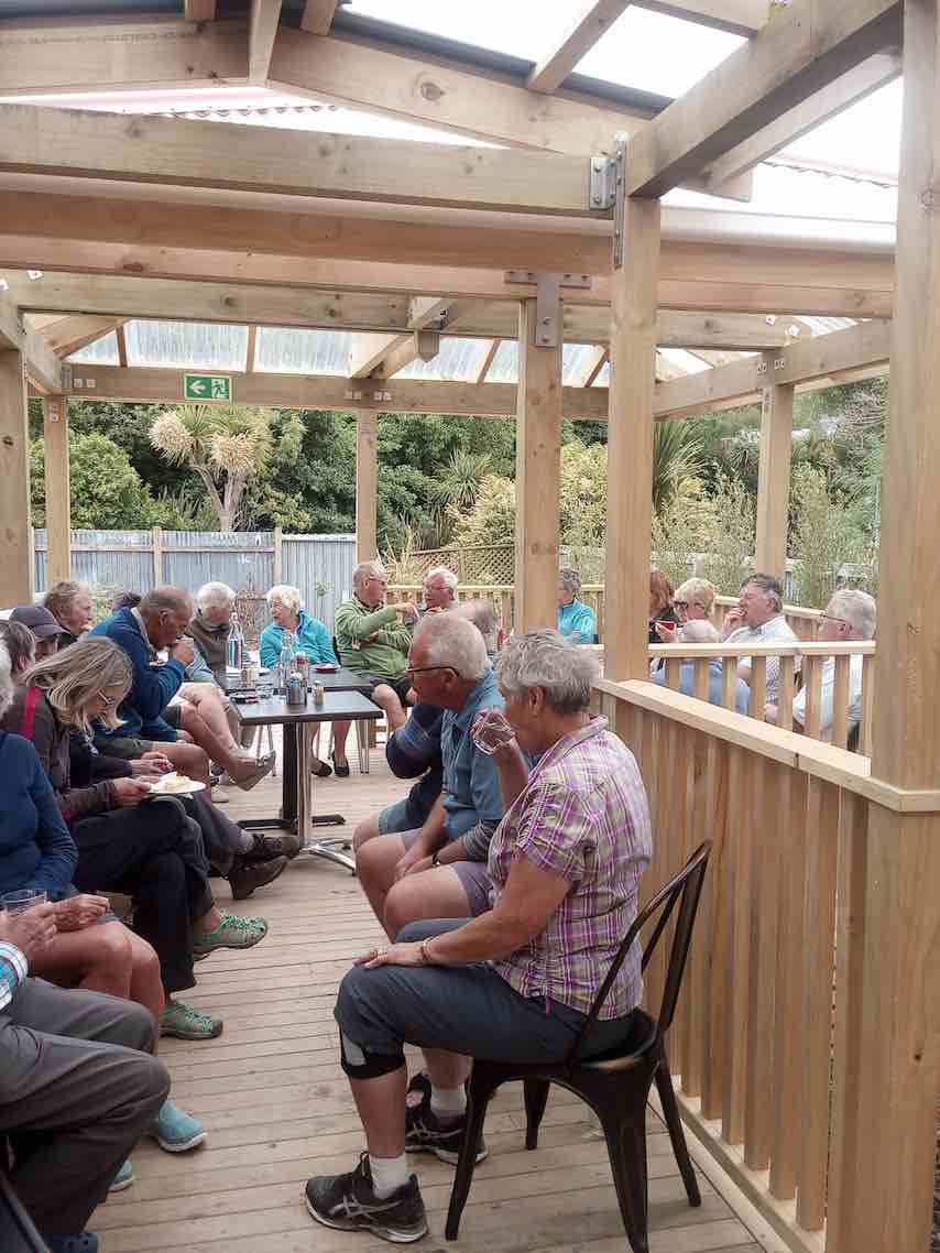
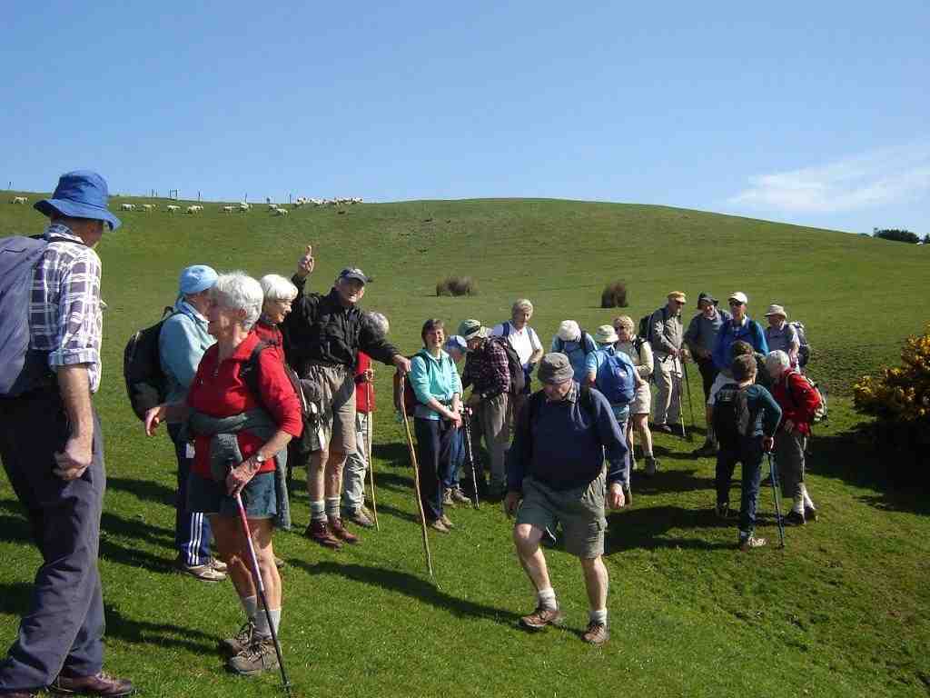
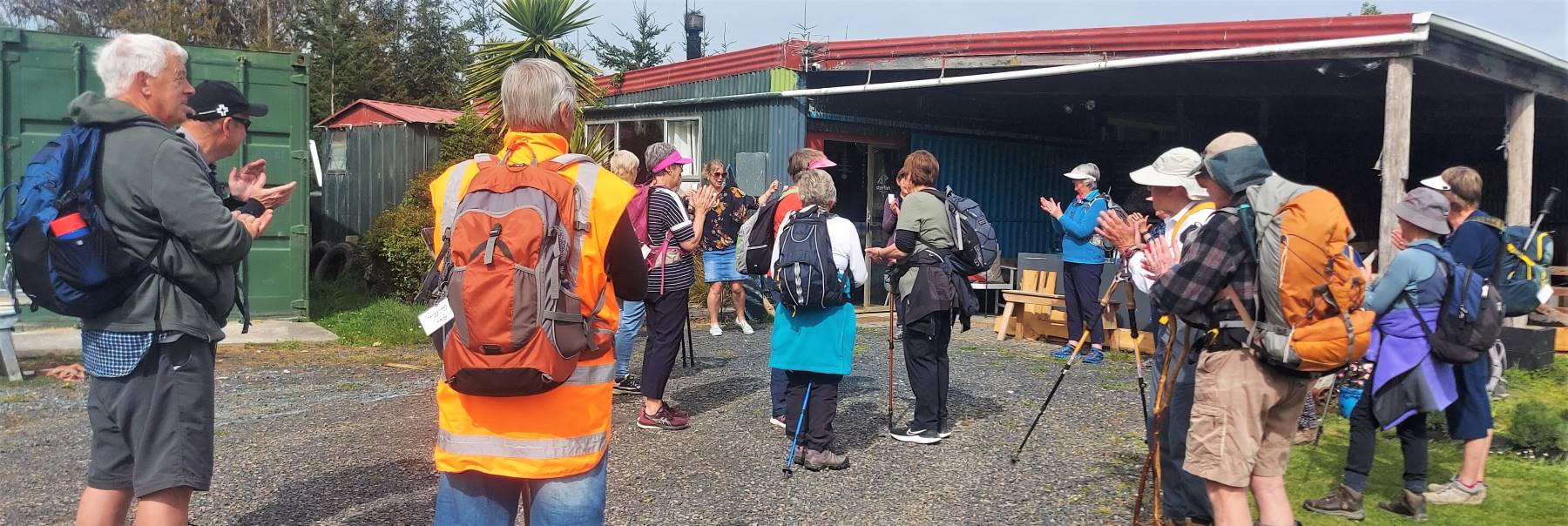
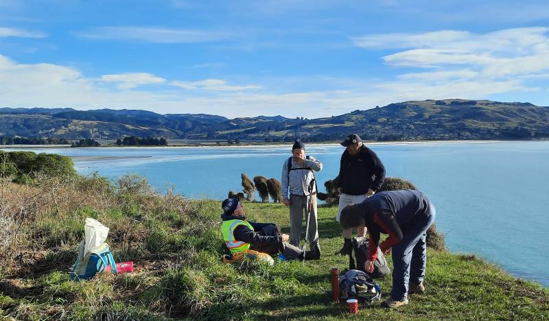
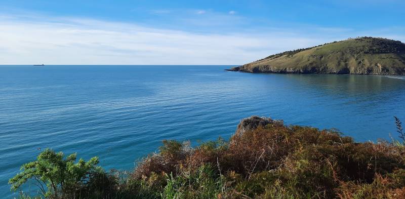
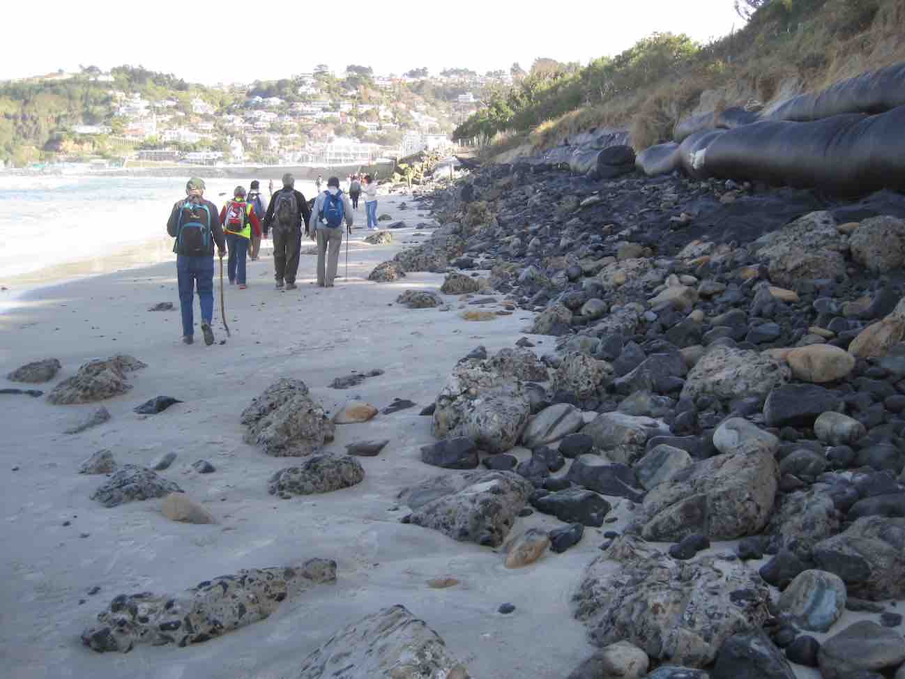
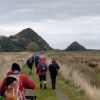
30. 1/05/2024. Combined. Pyramids/Victory Beach. Grade 2.5. Leaders Jenny, Alison, Wendy and Alex
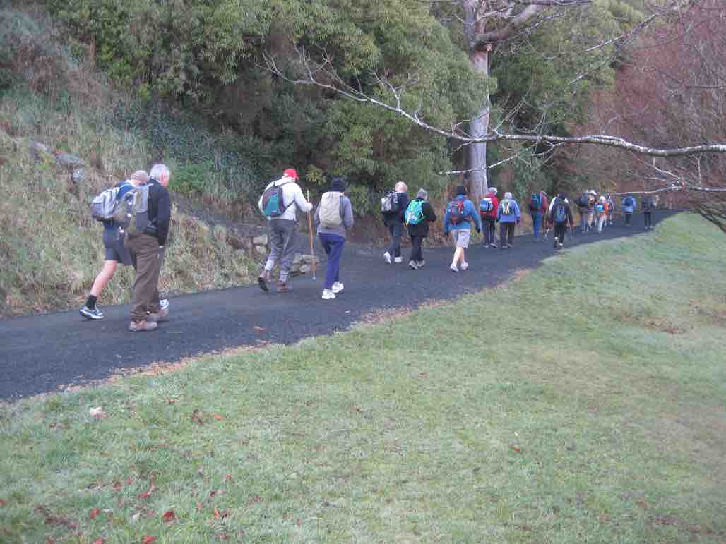
A great turn out for my first time as a co leader with Alison, Wendy, Alex and John. We had a combined group of 30 trampers and hikers. Continue reading “Pyramids, Victory Beach”
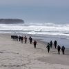
20. 7 February 2024. Combined hikers and trampers. Aramoana – Heyward Point.
Hikers: Leaders Heather and Val Cayford
‘Pathway to the Sea” – 7th February 2024 at 8.45am on a grey overcast morning with slight drizzle 15 hikers left Peter Johnstone Park and arrived at the small coastal settlement of Aramoana at approx. 9.45am – a peaceful place with 260 permanent residences as of 27th January 2024. Continue reading “Heyward Point, Kaikai Beach, Whareakeake Road”
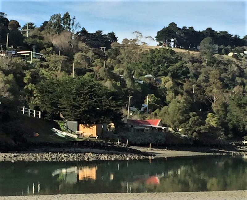
Ocean Grove, also known as Tomahawk, is a suburb in the southeast of the New Zealand city of Dunedin. … The suburb was known as Tomahawk until the 1930s, the name not being a reference to the weapon, but rather possibly an anglicised form of the Māori words tomo haka, meaning “dance by a gravesite”.
No. 23 on old hardcopy list of 113 club tramps. “Karetai Rd via Monument from Lagoon. Year round.”
DCC List: 41 Peg Track. Otago Peninsula
Accessed from Oregon St. 3.5 hrs ret. Tramping track – unbenched. Managed: DCC CAM, private land. Description – This track provides a link between Ocean Grove and Highcliff Road. Access to the track in Ocean Grove is off Oregon Street. An attractive walk around Tomahawk Lagoon then climbs through gorse and native bush. Turn right towards Soldiers Memorial through paddocks with gorse sometimes obscuring the rock walls.
The day dawned fined and following some creative maths (11 doesn’t as it turns out does not fit nicely into 2) – 3 cars left Dunedin to meet up with the Mosgiel trampers at Waitati. After numerous toilet visits, we all finally continued to our starting point at Doctors Point Reserve.
17. 11/10/2023. Hikers. St Clair, St Kilda, Ocean Grove. Grade 2, $5, 17km, Leaders: Bruce Spittle/Alex Griffin
Nineteen hikers left Marlow Park in sunny conditions at about 0930 after singing happy birthday to Liz Griffin and walked over the Kettle Park Sports field and up a track to the Barnes Lookout.
No. 47 on old hardcopy list of 113 club tramps. “Toko Beach. M Young”; also No. 65 on old hardcopy list of 113 club tramps. “Chrystalls Beach Farm”. Location: 59 km from the car park. Best in Summer. The stock winter over.
Directions: On SH1, before Milton, at Helensbrook intersection, left onto Forsyth Road, right onto Back Road, left onto Glenledi Road.
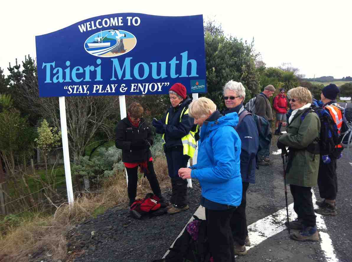
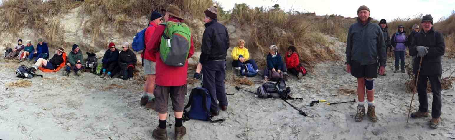
15. 29/3/2023. Millennium Track, Taieri Mouth. Leaders Dave and Mike
I seriously questioned my sanity on the drive from sub tropical Port Chalmers to Mosgiel for this weeks walk. The torrential rain and hailstones on the Southern Motorway left me with a sense of foreboding. However, 17 hikers eventually assembled at the meeting place at Knarston Park on Taieri Beach for what turned out to be a really enjoyable walk with the predicted rain showers non-existent.
Morning smoko was held on the verandah at Jay’s river mouth crib where we could admire the house extension at one neighbouring property and the dismantling of a Kauri boat on another.
Morning tea at Jay’s crib. Photo & caption Helen
From there it was a pleasant river side walk on the Millennium Track and boardwalks before starting the grunt up the hill to the welcome seats where we had lunch before re-tracing our steps back to the cars.
Millennium Track. Photo & caption MikeView from the lunch seat. Photo & caption HelenLunch. Photo Helen
Consensus of opinion is that the grade should be re-classified as a 3.5 as Sir Edmund Hillary got a Knighthood for climbing hills that steep. The return to the cars was achieved without mishap and tiffin was taken by some at the Brighton Cafe.
Thanks to Dave Roberts for leading at a leisurely pace that made the uphill sections enjoyable. Total distance walked was 9.5km
Mike Webb
14. 14/12/2022. Taieri Mouth. Leader Phil
” Aah numbers seemed a bit down at the meet n greet so there must be a few heading straight to the Hall at Taieri Mouth (Apologies were received from Carole and Neil Morrison who we hope to see back with us in the New Year). And yes sure enough at the Hall people and cars everywhere, added to by contractors working on the hall and yoga underway, although it seemed more like line dancing to me… After dropping off an array of good looking finger food cars were sorted and off 33 went to Knarston Park, and we were joined for the first time by Rowena McSkimming, who had bought finger food (!) on her first outing, well done, and Neil H grandson.
At the start point at Taieri Mouth. Photo & caption Helen
Setting off beside the Taieri river for the beach. Photo & caption Pam
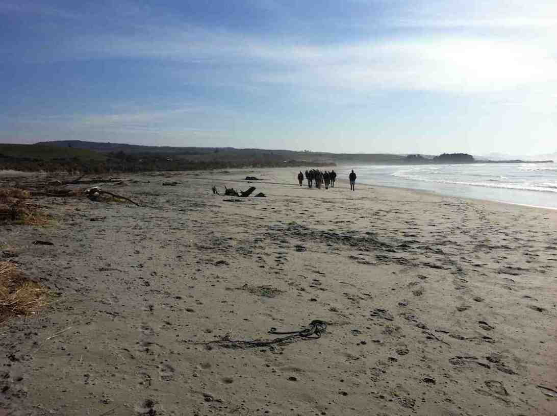
We shambled off down past the river to the beach, which on the day seemed like Waikiki; the wind was quite gentle compared with the day before recce, however the driftwood ‘cabbage tree’ needed it’s socks pulled up….it was a cruisy walk along the beach with no flow from the wetlands to cross, ORC were to open the mouth on the Friday. Baby seals playing in the surf the day before had obviously gone home to Mum.
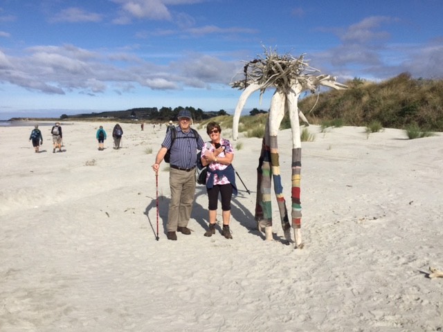
The beach art. Photo & caption John
Panorama Taieri Mouth beach art draws its biggest crowd. (Click to enlarge). Photo & caption John
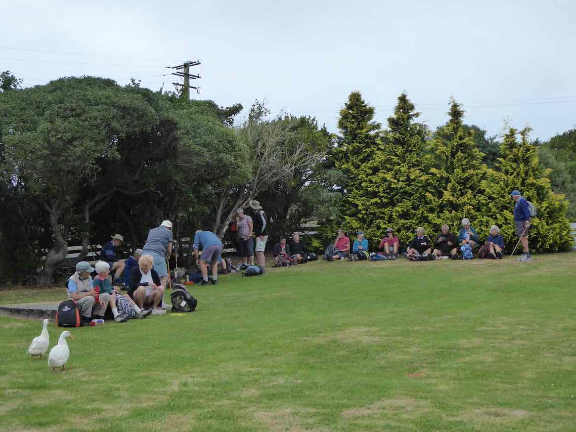
We followed the track into Livingstonia Park for morning tea, making use of all the facilities provided.
Morning Tea. Photo Phil
I was so relaxed I nearly forgot to share my bag of goodies…, but finally remembered, I must be getting older…. Quite a lot of interest was shown in the display boards as we left the Park and walked down ‘main street’ to the entrance to the Alan Green Wetland area.
Beside the wetlands. Photo PhilLivingstone Wetlands. Photo & caption Pam
We dawdled and chatted around the wetland, negotiating the Number 8 wire gates….and off through the forest and the dappled light on the forest floor; what was the sweet scent in the air? Not cabbage trees, not Olearia Fragrantissima shrubs……The sun seemed even hotter when we emerged from the bush, to enjoy the panoramic views of the area.
View out across the wetlands with Taieri Island/Moturata Island in the background. Photo & caption Pam
On the return, the group spread out to re-group at the third gate, but as our estimated return time to the Hall was slipping, initiative was shown by the ‘Hall’ team to drive to Coutts Gully road and pick us up and return to Knarston Park, and then the Hall.
Heading back to the hall for lunch. Photo & caption John
Everyone was accounted for and yes more folk had arrived down for lunch which was great.
Fantastic food. Photo & caption Helen
Following a moment’s silence to remember absent friends and family, followed by Ian Fleming’s grace, 55 folk enjoyed a delicious lunch, supplemented by chocolate goodies from Neil S, another with a near Xmas birthday. This was followed by an update from Anne Ward on the planning for the Bannockburn week in March. After lunch was cleared away Grant Shackell provided a generous bracket of Xmas music, with good crowd participation on occasions! Thank you, Grant.
Beautiful singing by Grant. Photo & caption Helen
Thanks also to Jay and the team for setting and cleaning up the food and Hall, especially after not getting full access till after 10.30am.
Another very successful Xmas club outing and yes, the first walk for 2023 is the 11 January!
Ho ho
Phil K
13. 07/09/2022. Alanton Block of the Wenita Forests. Grade 2 – $8. Leaders: Esther & Karen, Alex & Bruce S.
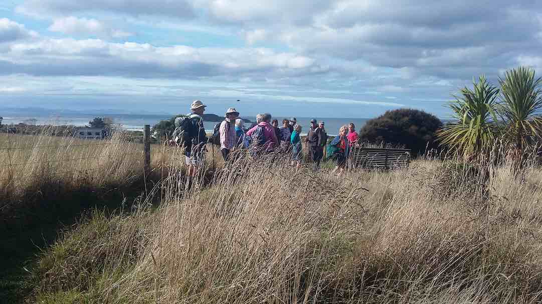
Forty-six Club members set off on the combined tramp in the Allanton Block of the Wenita Forests, 7.13 km south of the Big Rock School at Brighton.
On the forestry road -M2 (photo & caption Pam)
A welcome was extended to Roger and Barbara who are testing the water. We proceeded along Daphne Road passing the D7 sign and turned into Margaret Road.
Regrouping at the Margaret Road intersection (photo & caption Jenni)
We had morning tea near a log at about 10 am.
Morning Tea stop on side of road (photo & caption John)
We then proceeded up Margaret Road to Big Stone Road and saw some logging trucks, with logs, emerging from Daphne Road.The lunch venue was changed from the planned spot near Margaret Road to near the start of Kathleen Road.
Catching up over lunch (photo & caption Pam)Lunch stop out of the wind (photo & caption John)
After lunch we proceeded down Kathleen Road and then along Margaret
Road back to the cars.
Happy leaders heading downhill after lunch (photo & caption Jenni)Heading back to the coast through Farm land (photo & caption Pam)And still chatting on the road (photo & caption Pam)
Distance travelled approximately 10 km. Climb 243 m. The weather remained cool but there was no rain. A large group had refreshments at the Brighton Café.
Looking north over forestry to Blackhead quarry (photo & caption Pam)
Our thanks are due to all the leaders: Karen, Esther, Alex and Bruce S. In addition, we thank Liz for her liaison with the Brighton Café and Wenita Forests for permission to enter the forest.
Bruce Spittle
12. 20 October 2021. Taieri Mouth. Leaders Bob Mitchell and Barbara Shackell
Bob and Barbara our leaders for the day (caption & photo Clive)
“Twenty (or was it 21?!) folk set out for the Akatore River bridge, where Hike Leader, Bob Mitchell, was to meet us at the anticipated road works traffic lights on the hill climbed at the end of a previous tramp. There was sufficient off-road parking on the south side of the bridge for all vehicles and we were quickly off, heading downstream to the coast like bits of colourful flotsam, passing as we went a wading spoonbill which took off and flew over us.
Morning tea Akatore Inlet (caption & photo Clive)
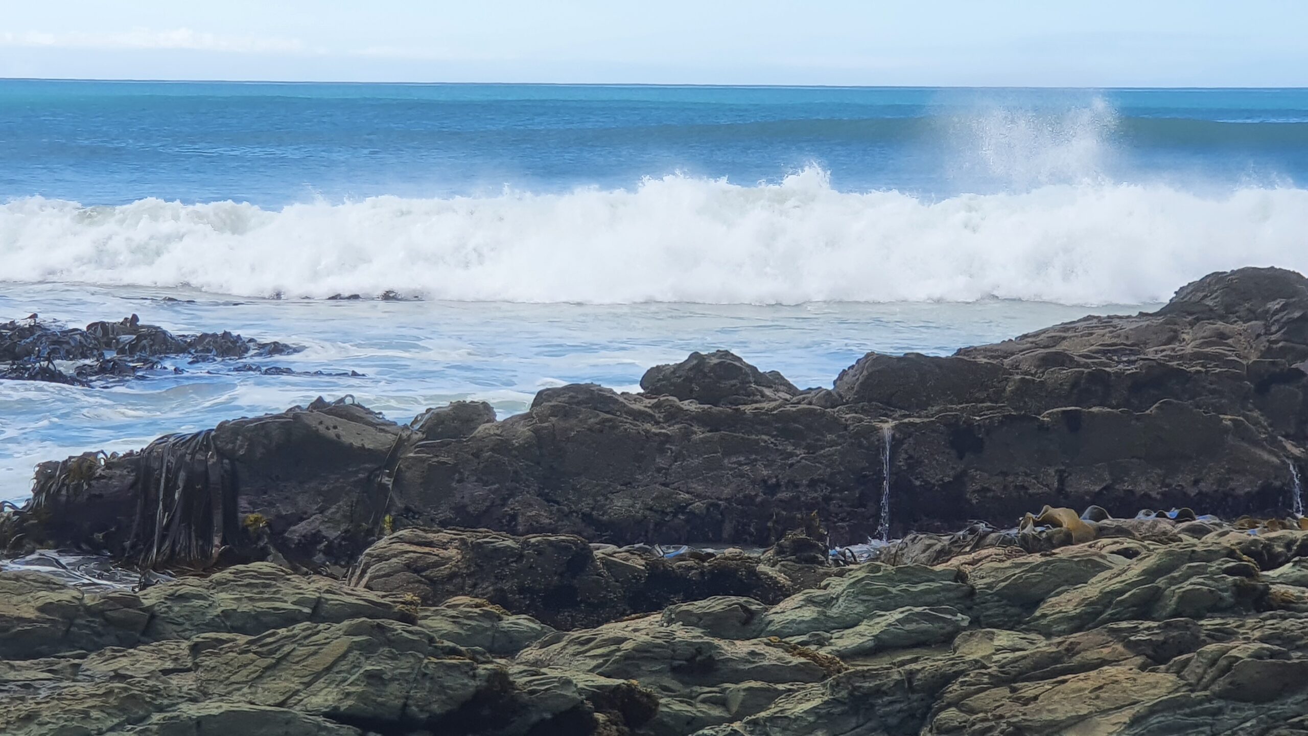
We settled ourselves for morning tea among nesting oystercatchers before tackling the short sharp climb into farmland above the coast. It was very pleasant strolling south in perfect weather. The forward motion stalled briefly to watch a group of talented surfers riding the regular rollers coming in.
Watching the surfers (caption & photo Clive)
Unfortunately I was too taken with the conversation with a pleasant land-bound surfer to remember the name she gave the ‘point’.
Scenic Otago coastline (caption & photo Clive)
It’s obvious it’s not only trampers that the obliging farmer allows access across his paddocks. Eventually we set off further south, cross-country, until we dropped down onto a sheltered rocky spot for lunch where a seal kept a benign eye on his human companions. From the lunch stop the group gradually moved up and inland across lush clover filled paddocks and along farm tracks which brought us out onto the Akatore-Taieri Mouth Road.
Homeward bound Akatore Conservation Area (caption & photo Clive)
Several kilometres on, we were back at the vehicles with doubts about our ability to reach the Brighton Cafe which was expecting us about 2.15pm. Unfortunately, when we finally arrived at 2.55pm our fears were realised and we were declined service as they were closing at 3pm. From that point we made our own way back to Peter Johnstone Park carpark, and from there, home. Happy, a little sun/windburned, and feeling like we had actually walked the 12 km the fitbits suggested.
Thanks to Bob for his planning, and leading this day.
11. Taieri Mouth Millennium track, Alan Green track. Leaders Jay Devlin, Jan Butcher, Alec and Liz
On Wednesday the 9th of December approximately 60 members met at the Leitch Memorial Hall at Taieri Mouth for a walk and a shared Christmas Lunch. It was a picture perfect day and showed Taieri Mouth at its best. There were two walks on offer, The Millenium Track and the Alan Green Track. Most opted for the Alan green Track as it was one that was new to many members. The Alan Green Track is off Moturata Road and is a private conservation track. It meanders round wetlands and is home to a large variety of bird life which then leads on to a gully with fine examples of podocarps.
“Our Leaders” – Photo and Caption John
“Walking past a magnificent flowering rata tree.” – Photo and Caption Helen
“The picturesque wetland.” – Photo and Caption Gordon
“A peaceful spot.” – Photo and Caption John
“Time to regroup and take in the view.” – Photo and Caption John
The track is very narrow but well formed and is lovely to walk on. At the top of the gully you get lovely views of Taieri Mouth and surrounding farmland. On the way back Alec led us through a track off Livingstonia park where we had great sea views. We got back to the lunch venue 12.30pm. Arthur lead his group on the Millenium Track which many of us are familiar with. Thirty six folk enjoyed the walks while the remainder were happy to stay and catch up with those they hadn’t seen in a while. Jill, Jan B and their team of helpers stayed at the hall and set up the tables in a Christmas theme and put out delicious food brought by everyone.
“An enjoyable lunch with amazing food.” – Photo and Caption Helen
‘More mature club members.” – Photo and Caption Helen
Faye, Alec and Liz led us in “We Wish You A Merry Christmas”
So to everyone have a safe and Happy Christmas. Jill Jan B and Jay
10. 21/10/2020. Leaders Noi McCunn and Bob Mitchell
Photo and Caption Clive – “Knarston Park – the set off point”.
Photo and Caption Clive – “The road south from Taieri Mouth”.
Photo and Caption Clive – “The happy team.””.
Photo and Caption Clive – “View back from the coast.”
Photo and Caption Clive – “Lunch at the beach.”
Photo and Caption Clive – “Surfs up”.
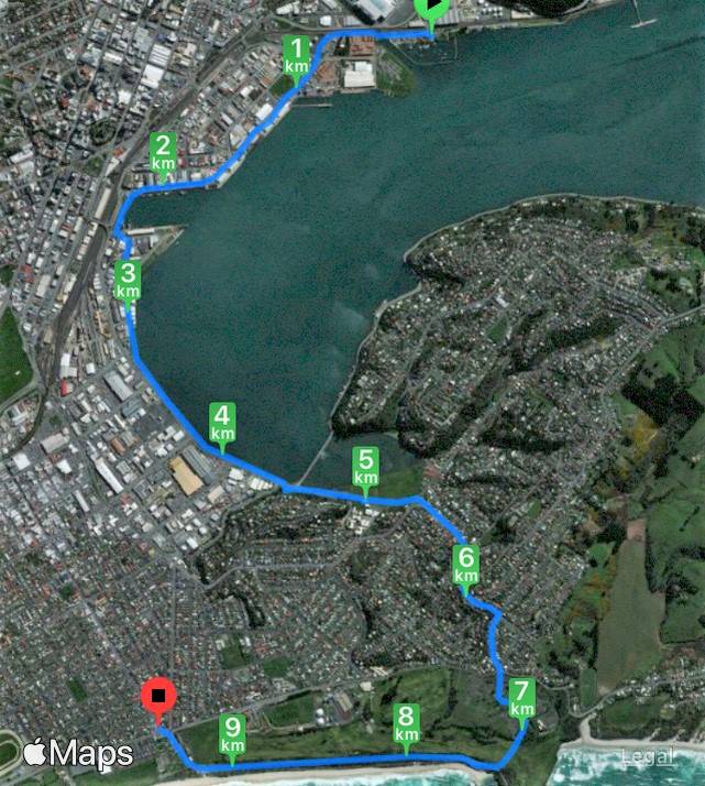
9. 24/4/2019. Hikers. Taieri Mouth Area. Leaders: Chris, Dot, Alex and Liz.
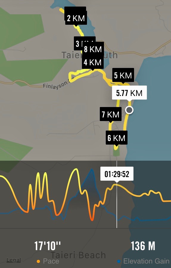
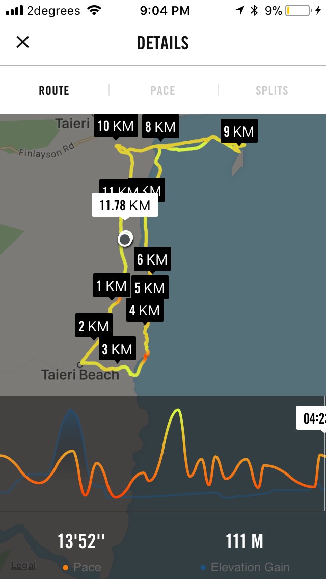
Route map, courtesy Ian. 8km limited to the 7 who returned after lunch. (The rest did 4km more not travelled by this Nike app!) The “8km” indicator hides the points on the map where the route started and finished.
About 26 Hikers and Ramblers mustered under a cloudy sky by the Taieri Mouth Bridge to walk through hidden nooks and crannies of the Taieri Mouth area, led by Liz and Alec.
We started off along Riverside Road and cribs that are only a stones throw from the flowing river. A living history was related by Alec and Liz as we went past the cribs telling us stories of past and present inhabitants. We eased along a lower part of the Millennium Track to a sheltered glade where we sat down for morning tea. More stories were told of holidays spent along these banks and of income gleaned from whitebait or discarded beer bottles.
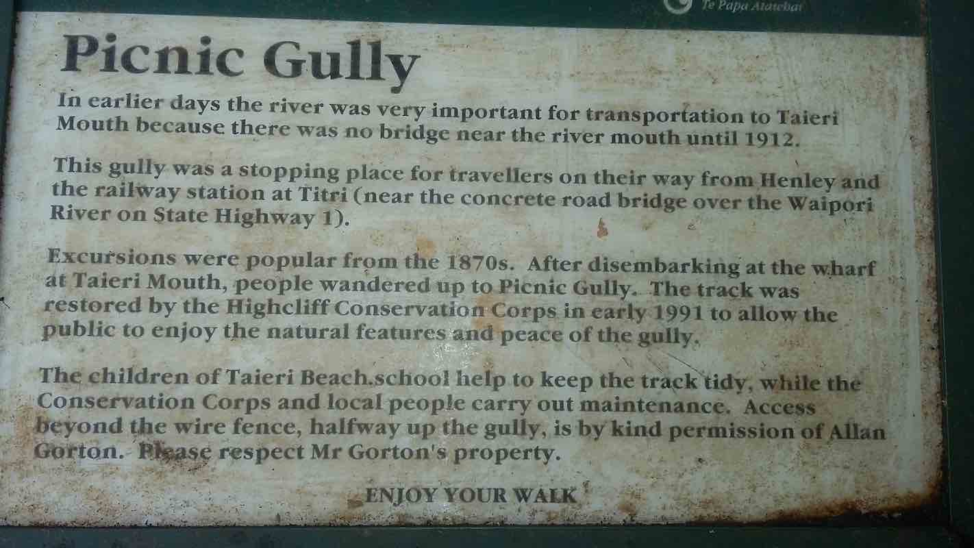
After morning tea we returned along Riverside Road to Hanning Place. This is a turn off that is easily passed without discovering Picnic Gully. Picnic Gully is a walk that used to be frequented by travelers from Dunedin more than a hundred years ago before the bridge was put across the Taieri.
Picnic Gully. (Clive pic and caption.)
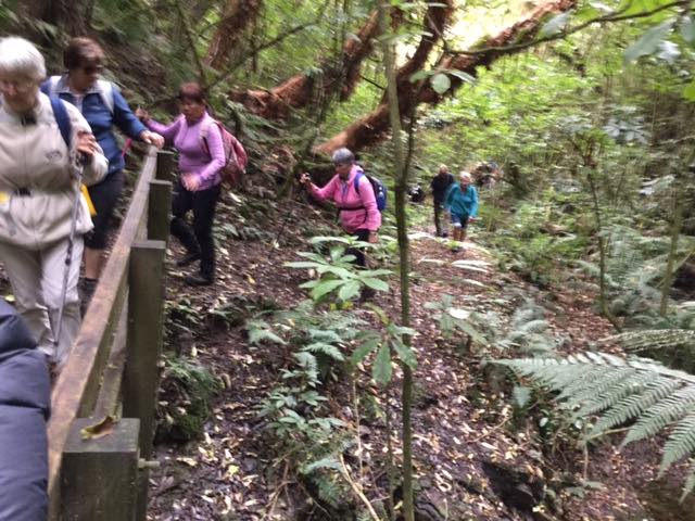
We didn’t miss it this time and were soon into the thickly covered bush walk
which ended in a scramble up a bank onto a newly bulldozed track up onto Finlayson Road. This track was very steep and soon had us all stopping to catch our breath.
We learnt that this gully walk crossed the land of Alan Gorton who allows us to cross other parts of his land when going to the old sawmill. We also acknowledge the work done on the track by the children of the nearby Taieri Mouth school.
Down the hill saw us entering Knarston Park and led us onto the beach. It was now close to low tide and we could see it would have been easy to walk out to Moturata Island, but not today. We continued along the beach and passed a recently erected old tree and masses of toa toa and pipi shells. Charlie and Jess had recorded their presence in Toa toa shells which would last only until the next king tide.
Lunch was now in sight. We arrived at Livingstonia Park as the sun broke through. There was discussion over lunch as to the name for the park be it Livingstone or Livingstonia. Those in the know confirmed it as Livingstonia and was a living war memorial to returned servicemen and women with amputations and other injuries.
After lunch we headed up Coutts Gully Road to a walk up through bush at Livingstone – Green bush walk and lagoon. Someone had taken a lot of time and trouble writing notices along the path explaining the history of the bush area. There was a great view from the top along the beach to North all the way to Saddle Hill.
The view from the top. (Clive pic and caption.)
Once down the hill we skirted the lagoon to see geese spoonbills and ducks before heading back to the cars by the Taieri Bridge. We had walked nearly 12 kilometers in 4 1/2 hours. Some wished they could have taken longer as there was such a lot to see and enjoy. Maybe something to do on another day. Thanks Liz and Alex.
– Clive
8. 5/12/2017. Both. Livingstonia Park. Moturata Island. M. Leaders: Bob and Phil.
Route Map, courtesy Ian. (Ian pic and caption.)
A combined 32 Trampers and Hikers ventured down through Brighton to Taieri Mouth , certainly not expecting traffic lights at Kuri Bush! Livingstonia Park was the starting point after being warmly welcomed by Bob and we set off towards Akatore passing a range of new property developments; just prior to moving on up the rise to the highest point of the walk, Bob detoured us onto the lawn, surrounded by sheltering trees, at the old NZ Forest HQ.
Morning tea at Forestry HQ. (Phil pic and caption.)
Some of us pondered the thoughts of this site having a ‘second coming’ with the new governments initiative of a billion trees…….
We then headed south with the breeze at our back, up the gradually increasing rise, enjoying the views of forest and farmland and sea, interrupted regularly by shouts of ‘truck’ and ‘car’. before Bob again turned us off ( clearly a man with great local knowledge and contacts!) and headed down through farmland to the seaside. Here we mounted the stile and various scouts attempted to find their way onto the beach. This was more easily achieved by Bob when his hands were free after helping at the stile!
A mix of short beach walks, interrupted by rocky headland became the norm, requiring some inventiveness to move through the formations,
Into the promise land? (Phil pic and caption.)
as well as some rather intimate team bonding as some larger rocks were mounted! Well done everyone!
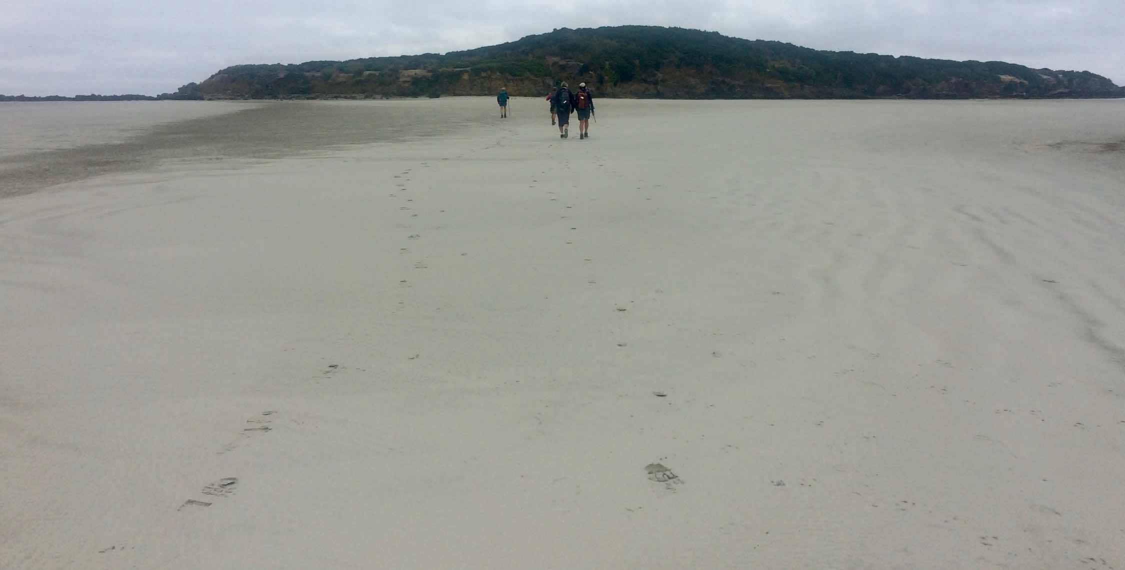
Eventually the main Taieri Beach came into view and on we set following the curve of the surf to the ‘bar’; nothing changes when tramping, initial hesitancy to getting the feet wet to plain old just barge on in or take the boots off. Rumours of a channel were probably proved correct as a ‘minor river’ was crossed before the main bar being traversed …
Sand bar, not showing heavy-flowing channel needing to be waded. (Ian pic and caption.)
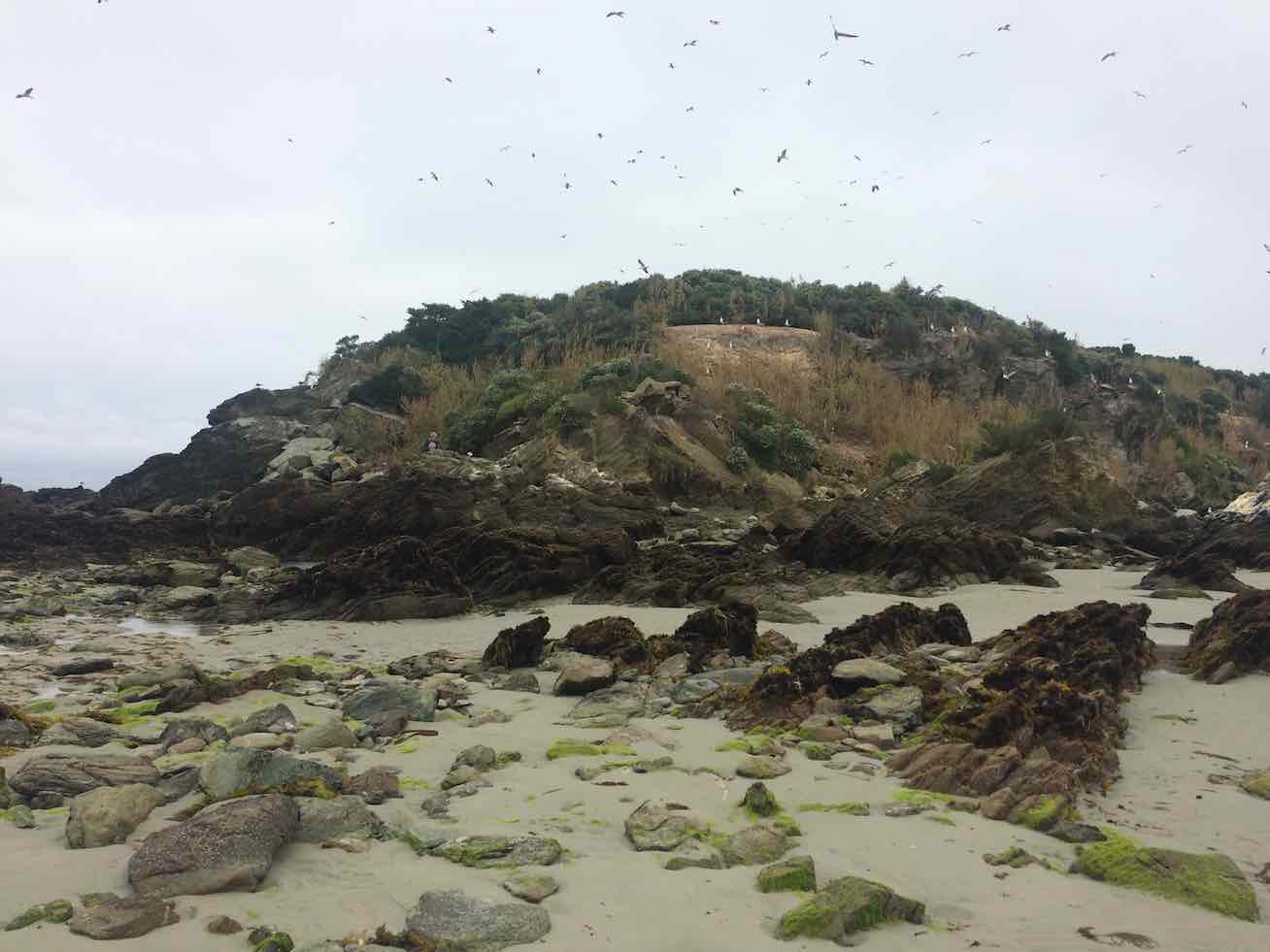
… and we reached the Island at around 12.30pm, to be greeted by large numbers of nesting gulls;
Birds nesting on Moturata Island close up. (Ian pic and caption)
apparently the island was used to collect guano in the good old days, and you could understand why.
Colours on the rocks over on the Island. (Helen pic and caption.)
With low tide being over half an hour past, it was decided to return to Knarston Park for lunch, and shelter from the incessant sea breeze. This was a good decision as the ‘minor river’ had increased in volume, requiring river crossing techniques for some.
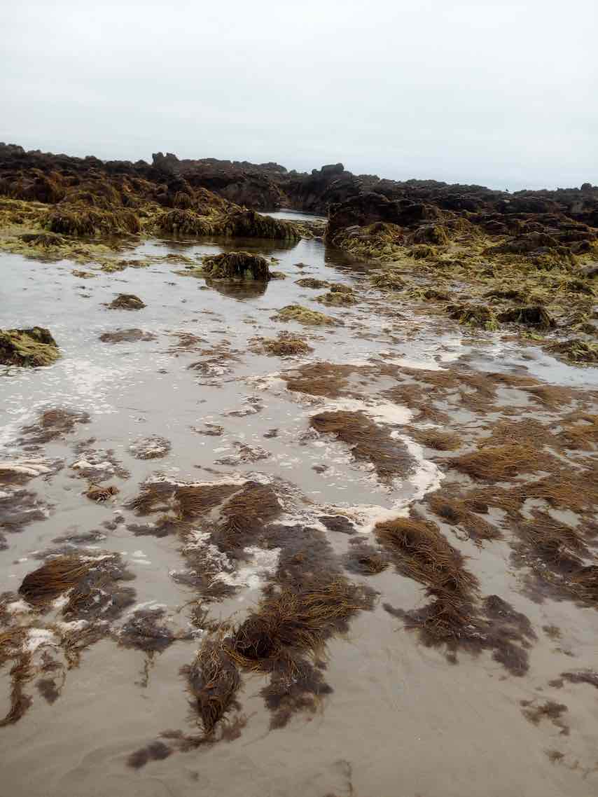
The scale of the bar was impressive, being much larger than thought, as were the patterns in the sand and rock formations both at the island and on the rocky headlands.
Following a late lunch, (more so because of the early morning tea!) everyone safely made their way back to the cars and met up with others who had completed a shorter walk.
I am reliably informed the full walk was 11.4 km and well, we won’t specify the altitude will we….
The day was very satisfyingly repleted at the new Brighton Café, where it seemed we had more than 32 folk chatting away!
New coffee bar in Brighton.(Helen pic and caption.)
( Ice creams from next door more than welcome, as both shops are apparently owned by the same folk).
It was a treat of a day. Well, yes, a bit of a cold wind, but – the sandbar!
We parked, morning-tead at Knarston Park on concrete picnic table seats that were not at all warm.
Then out to the sandbar. The tide was super-low, half a metre below sea-level. The bar was broad as broad. And dry. We walked and walked. This writer was overwhelmed with the experience of being on such a wide and long stretch of sand so under the waves at other times. Eventually we reached the island.
At Moturata Island
We sauntered round. The tide was so-o-o low we were assured of plenty of time before heading back. We headed to the rocks the north end of the islands and scrambled over them to see the surf breaking on the seaward side of the island.
Rock at northern end of island.
And then we sauntered back. Marvellous, as John Campbell would say.
The wind was still a bit sharp however, so we went back to the cars and on round the road past the fishing boats. A couple of fisherfolk said they had already noticed us and it was good to hear that locals keep a sharp eye out for the sandbar trekkers. Then on further to the start of the John Bull for lunch. (5km marker on GPS route map).
Lunch at terminus of John Bull track.
Back down and across the bridge to walk round the beach on the river’s true left. Yes, back to the cold wind, but it was behind us. We observed the cliffs below the houses until we thought it best to get off the beach. We climbed a set of steep large steps and up through a property and a wire fence to reach the highway at the top. (7km on map)
Onto road
We took the road back, crossed the bridge and reached our cars at near the 10km mark. Thanks to Judy and Pam carefully checking out our chances the day before and their leadership on the day.
Morning tea time – when we were still optimistic of a successful outcome!
Tide, wind and flood were all against us.
Tide – Even though we had got the low tide time exactly as we had wanted, we failed to take in consideration that minimum low tide was still o.9 metros. Must aim for nearer 0.0 next time!
Wind – Although a boisterous wind was from off the land, whipping up sand and breaker spray, the waves were still coming in stronger than we had expected.
Flood – The Taieri River was in quite flood mode, breaking two channels across the sand-bar we had hoped to traverse.
S-o-o-o-o-o. We had morning tea. We walked down the beach to where the rocky part begins and back. We waited. And waited. Some more hopeful than others. Some more resigned to failure. We early lunched. Then walked down the beach again, aiming for a round trip through Livingstonia Park and back along the road, but short-cutted through a bit before that.
And then behold. KB contractors drilling a pipe-line for fibre-optic (we think) alongside the road with a wonderful machine. Complete with GPS guidance showing on a screen to the operator, it automatically screwed and push-drilled successive pipes through alongside the road and under the ground, with a clever drill-head (we learnt on asking) that could tilt the pipe’s direction left and right, and up and down on the operator’s bidding. Marvellous! (To the technically-minded anyway.)
We were now close to the cars again. The day had been wind, but grew warmer as it progressed. Everyone was philosophical about the way the day had turned out.
Perhaps, as was suggested, a low-tide day late summer or autumn, when the Taieri is NOT in flood would be a much wiser day to tackle the Island next time.
There was a full tide around 11.30 a.m., which we cunningly exploited by negotiating the narrow beach parts before and after its peak.
The beach walk down river however, was rather constrained by the rising tide at one brief point, splitting the ‘(Fool(?)-Hardy Paddlers’ from the ‘Off-Beach-Detourers’ before we could make it to the large beach seen on the next pic.
The Taieri Mouth in the distance behind us.
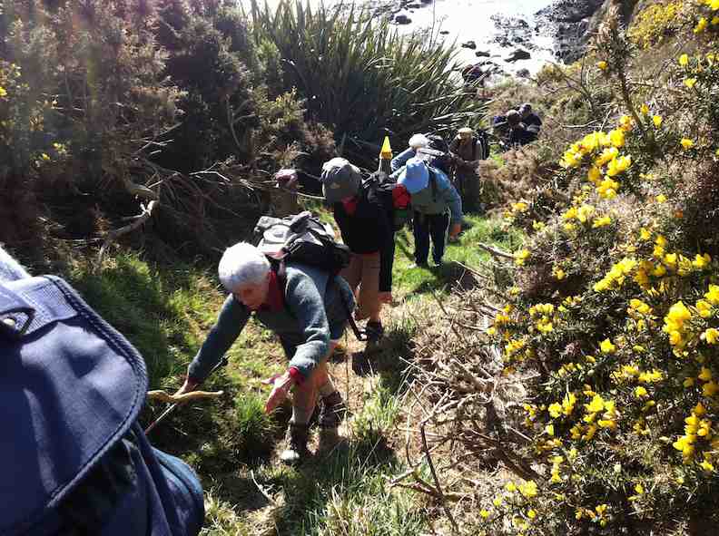
Inevitably, we had to come to the rocky outcrops and were forced to make our way up a rope-lined track to paddocks.
A careful steep climb.
The track climbed. (Elaine pic.)
A view from the paddocks. (Elaine pic)
Further on, we were able to descend to another beach.
At one point, we were treated to a swimming seal lumbering its way out of the water to sun itself on a rock
Then it was time for lunch before retracing out steps back to our cars.
While we were seated, our President read out a text sent to us by Leslie S from hospital, saying she was feeling better and sitting up. (Today’s trip was a replacement for the scheduled trip to Waipori with Leslie and Bill as leaders.)
On a very pleasant and warm Brighton morning 22 hikers set off towards McIntosh Road led by Faye (with an E).
The wet land area planting and a talk about it. (Photo and caption Helen)
We visited Star Fish Gallery for morning tea and a friendly inspection of premises hosted by owner.
Morning tea at Starfish Gallery. (photo and caption Helen)
From here we headed back down the hill to explore different parts of Brighton and Ocean View led by Alex as Liz was off the scene with slight injury caused earlier in the week. With such a pleasant day it was good to enjoy sea views and other interesting sites before a stop for lunch at Ocean View.
Sea view (photo and caption Helen)
Up the Bennett Road to inspect the Mosaic Wall …
The mosaic wall. Beautiful. (photo and caption Helen)
… which leads us down the steep track back to Brighton and local Coffee shop for more relaxation and welcome visit by Bev Harvey and Dot Bennett.
Alex And Faye.
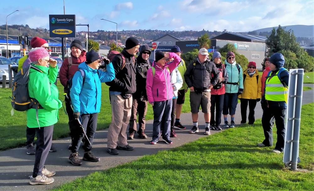
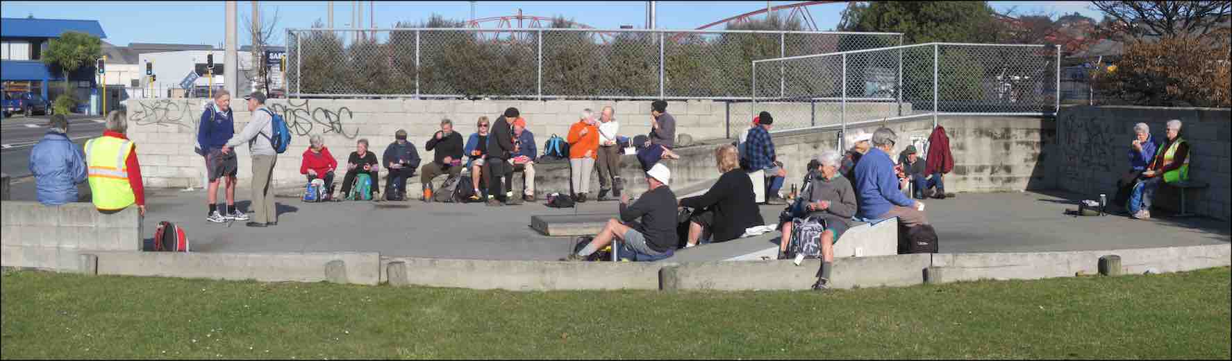
25/05/2022 Stadium to the Sea. E. Leaders: Raewyn & Phil Keene
Shall we hike or not? That was the question asked at PJ Park on a cold & windy morning. 10 hardy hikers said “yes”, so off we went to meet 6 others at the carpark in Magnet Street as arranged.
Group photo before setting out (photo and caption John)
With extra clothing, beanies & gloves, we set off into stormy skies for morning tea at the Harbour Basin.
O’er the Leith bridge (photo and caption Phil)
Low & behold, the sun broke through so we continued on our blustery walk to Portsmouth Drive & beyond.
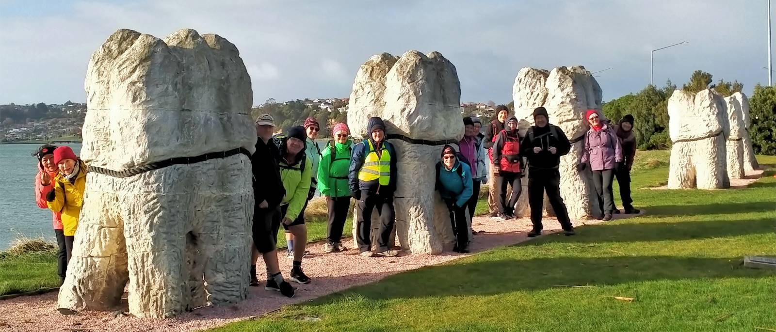
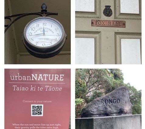
Our leader outlining the Urban Nature network (photo and caption Phil)So this is why the teeth were put here? (photo and caption Phil)
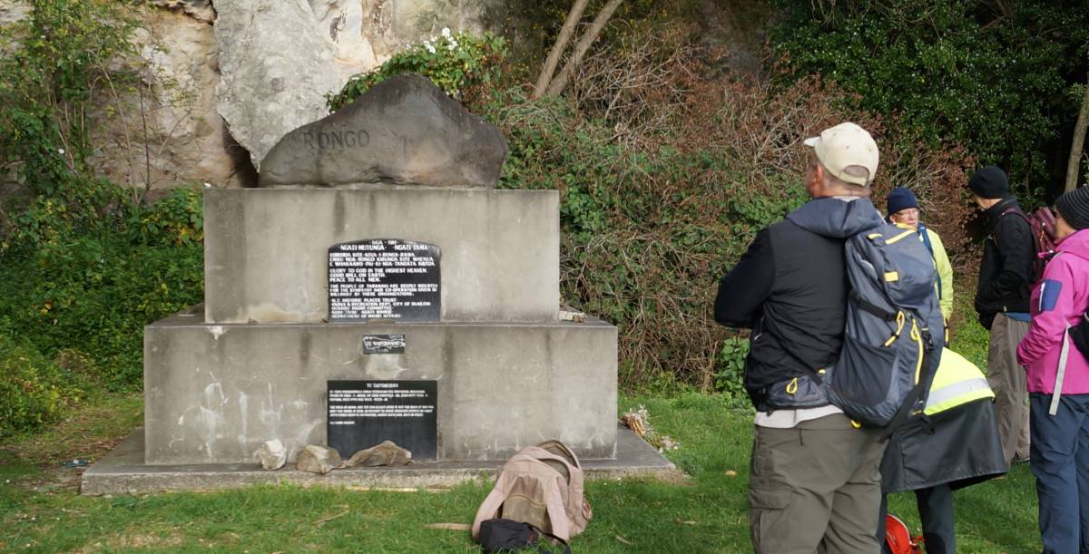
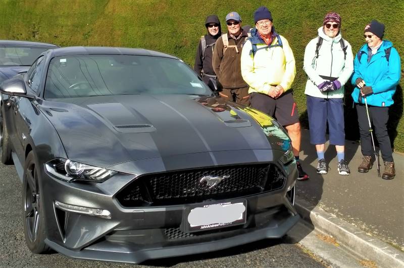
At the “Rongo” Monument (photo and caption John)Fox Hall, Rongo rock and urbanNATURE (Collage by Raewynne)We went over Tomahawk Rd to see the views, but the Mustang was preferred (photo and caption John)
Onwards, upwards & over to the Andersons Bay Cemetery where the wind blew even harder, down to the Chisholm Golf links, then across to John Wilson Drive & the sea.
Arnie’s army is alive and well at Chisolm Links (photo and caption Phil)
Our planned lunch stop was taken over by the high seas, so shelter was sought on high ground.
We were discussing Bob Dylan’s ‘shelter from the storm’ over lunch (photo and caption Phil)
AND THE WIND BLEW. Unable to walk along the beach, we braced ourselves and walked into the head wind down to Marlow park.
Impromptu group photo (but guess who’s missing?) (photo and caption John)The boys solving the problems of the world (photo and caption Noi)
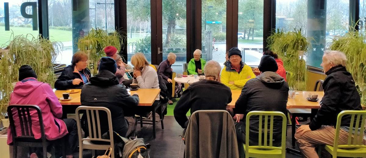
9.5km & two buses later, we were back at the Stadium for coffee at the Plaza Cafe, followed by a short walk to our cars.
Great coffee and service at the Plaza, we’ll be back (photo and caption Phil)
No. 97 on old hardcopy list of 113 club tramps. “Purekanui & Canoe Beach Year Round”
39 km
At LOW TIDE it is possible to walk along the shore to Doctor’s Point.
Also pleasant stroll 1 km down southeastern end to mouth of inlet with scattered cribs.
16. 14 July 2021. Hikers. Purakaunui/Canoe Beach. Medium. Leaders: Betty & Jim
After regrouping at Waitati 4 Vehicles travelled with 16 hikers to park at the end of the Doctors Point Road. The tide afforded us plenty of clear beach for the Canoe Beach walk to Mapoutahi for our tea stop. Of significance were two new barriers recently erected by DOC, warning of the dangerous cliffs.
Looking across Canoe Beach (photo & caption Ady)Looking towards headland of Purakaunui Beach (photo & caption Ady)
From our morning tea stop the southern portal to the rail tunnel could be seen, high on the cliff showing the extreme difficulty that this section that must have been experienced in the construction of this main trunk line.
Weather conditions were pleasant for the Purakaunui Beach walk on firm sand to the Purakaunui inlet.
Purakaunui Inlet (photo Alex)
Entering the inlet, we were faced with soft sand conditions for a short distance to the pine plantation, then it was less than 400 meters through pines to the cemetery. We retraced our steps in comfortable time for the tide past Canoe Beach to the cars.
The coffee stop was at Blueskin before our return to Mosgiel.
2. 23/8/2017. Hikers. Gardens to Surf. E. Leaders: Pam and Dawn.
We Parked our cars in Duke Street, near the Woodhaugh gardens. 22 members started off. We walked through the Varsity and had morning tea at the Polytech outdoor area. Walked along Portsmouth Drive to Queens Drive down to St Kilda beach. Walked along playing fields and some track to picnic area above beach, where we had our lunch. We then continued on to St Clair, via street and caught the bus back to the Botanical gardens where we enjoyed a hot drink. Back to our cars and home to Mosgiel by 3.45pm. A very enjoyable day was had by all. – Dawn.
1. 19/8/2015. Hikers. Gardens to Surf.
We had a good day walking from the Botanic Gardens…
…and along the beach to St Clair. I had not been on the beach since the June storms and was blown away by the damage to the beach.
Rocks (John pic)
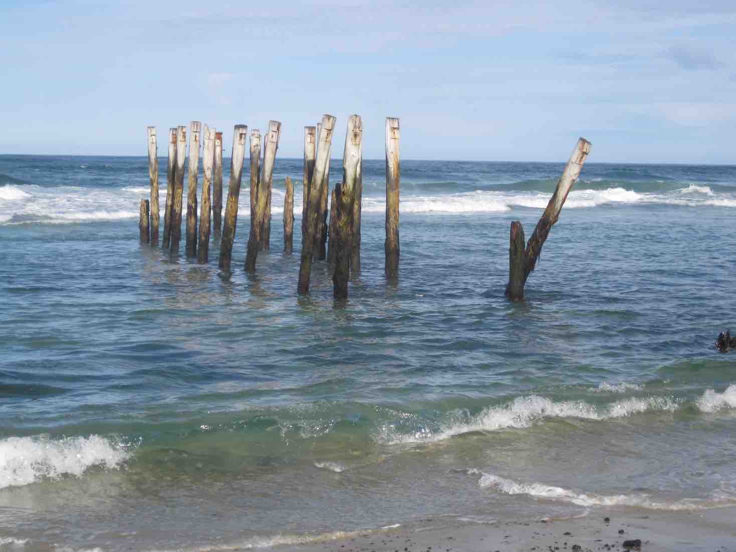
The piles…
Piles (John pic)
…are nearly all bent over by St Clair. Thank goodness I have done 3 paintings of the piles. Judy Knox was on TV Wed. night and did a very good interview on the local TV channel.
We all went back on the bus to the Gardens and all (I think) 27 of us didn’t pay. I think the bus driver got a bit of a surprise. – Elaine. [An unintended report, purloined from an email. – Ed]
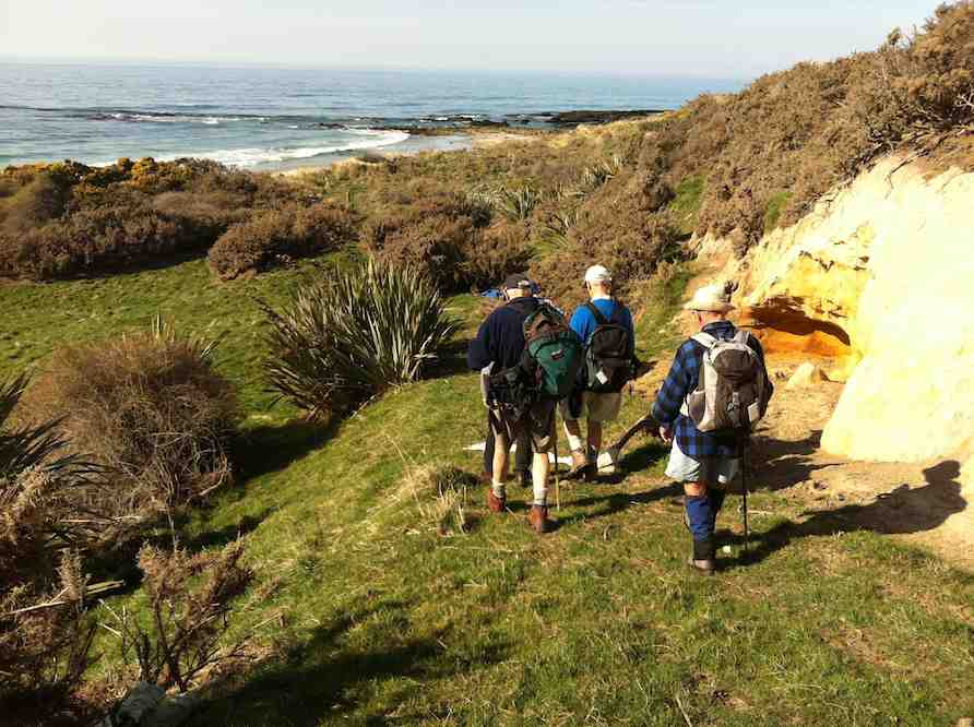
The North Otago coast is lined with old Maori settlements, and Brinns Point is no exception. The bay south of the historic urupa (cemetery) on the headland was occupied by Moa-hunters, and much later was an out-post whaling station. A channel has been cleared through the boulder beach to enable boats to reach the shore especially at high tides. This is thought to be the work of the whalers but the channel clearance may date from much earlier, for all we know. This bay was investigated in the 1950s by the Blake-Palmers of Seacliff. This was published in the Journal Polynesian Society by Blake-Palmer senior who was superintendent of Seacliff Mental Hospital at the time. This was the first ‘proven’ association of man with the largest species of moa: DinornisMaximus, thought by some scientists to be extinct before arrival of man. Later studies showed Dinornis had been found on archaeological sites beforehand however. There was an old Maori settlement on the flat at Ross’ Rocks. The next known settlement south is at Omimi, where moa bones have been excavated on what was largely a fishing site.
The cliffs after which Seacliff township gets its name are lined intermittently with Maori umu, most being umu ti. Parts of the coast road from Warrington to Karitane followed original Maori tracks according to early survey plans in LINZ archives. The hills along this coast were heavily forested and only cleared when the land was subdivided for framing. The original route of Coast Road has been modified in places since the 1960s but many portions of the old routed can be seen with associated stonework on both sides of the present road. Coast Road remains an active connection with the distant past.
– Taken from Karitane … Split Rock … Seacliff Coastal Walk. Notes by Brian Allingham, Archaeologist, January 2010.

 30. 1/05/2024. Combined. Pyramids/Victory Beach. Grade 2.5. Leaders Jenny, Alison, Wendy and Alex
 15. 06/03/2024. Combined. Waikouaiti
 Hikers: Leaders Heather and Val Cayford
 11. 17/01/2024. Hikers. Warrington. Leaders Jenny Finnerty and Jay Devlin
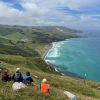 43. 06/12/2023. Trampers. North of Tomahawk. Grade 3. $7. 22km. Leaders: Esther Willis and Julie McKenzie