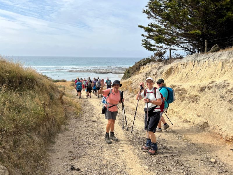
04/12/2024. Cleghorn Street to Signal Hill Monument . Grade 3. Hikers. Leaders: Maria McNee and Peter Dodds.
Only 3 cars left from Peter Johnston car park on what was promising to be a sweltering day.
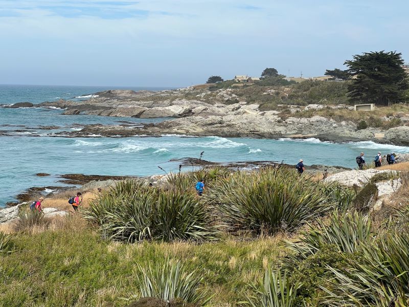
04/12/2024. Waihola – new cycleway/walk. Grade 3. Trampers. Leaders: Heather Kirk and Jenny Wilton. We arrived at the start of the track in Waihola at 9.30 am where there is plenty of parking, toilets and lovely views of the lake.
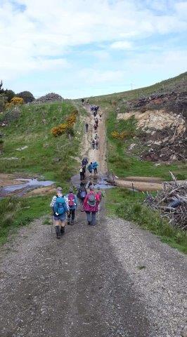
27/11/2024. Around Harbour Cone. Grade 3. Hikers (and Trampers). Leaders: Jenny Flack and Rhonda Wilson.
Listening to the heavy rain coming down on Tuesday night I don’t think too many of us thought we would be out hiking the next day. Continue reading “Around Harbour Cone”
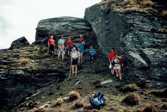
14. 24/01/2024. Trampers. Ship at Anchor. Grade 4.5. $14. Leaders: Phil Keene/Gary Mort Lyn Keene.
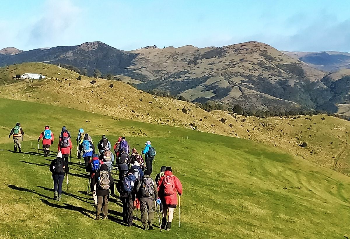
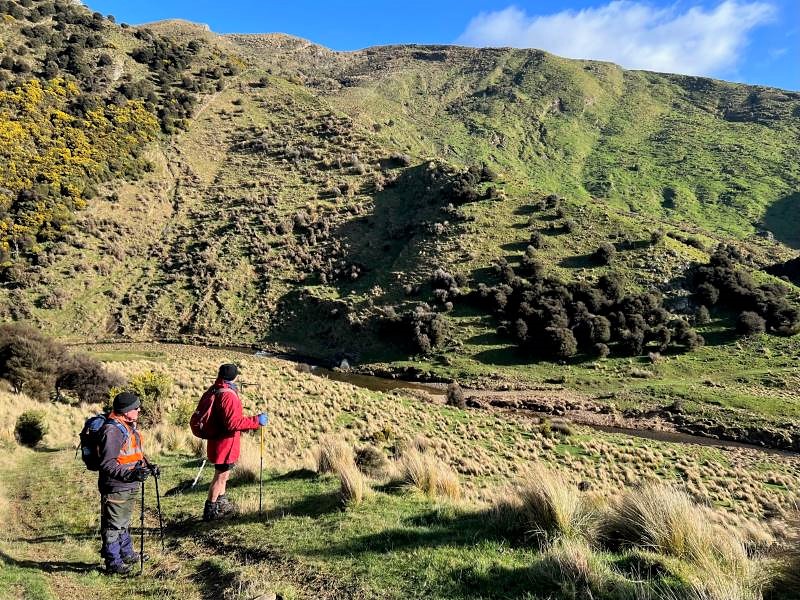
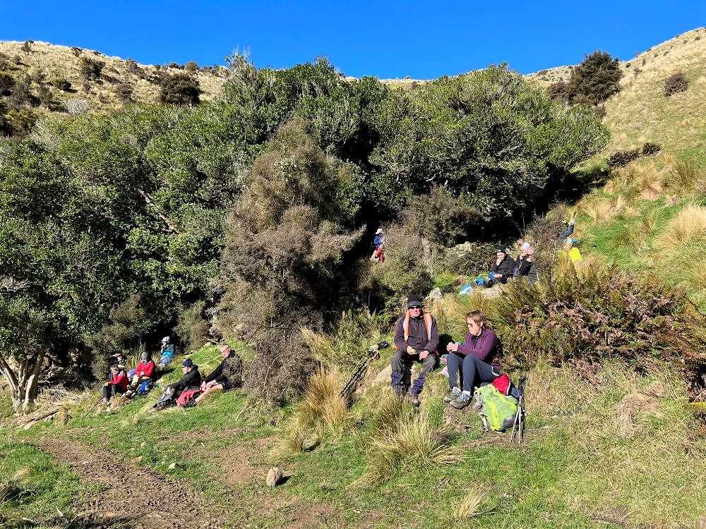
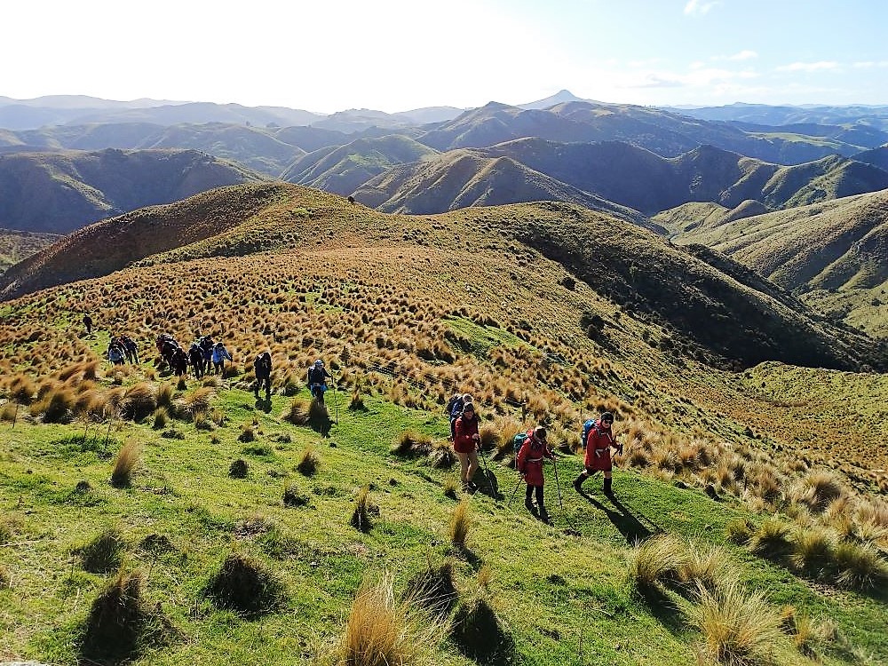
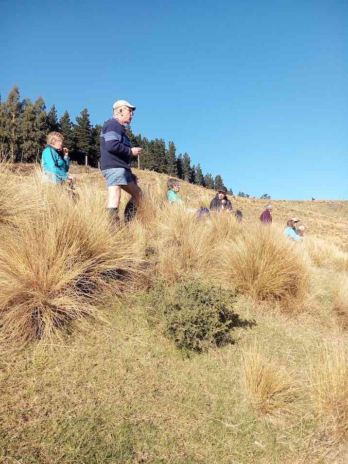
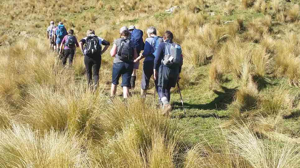
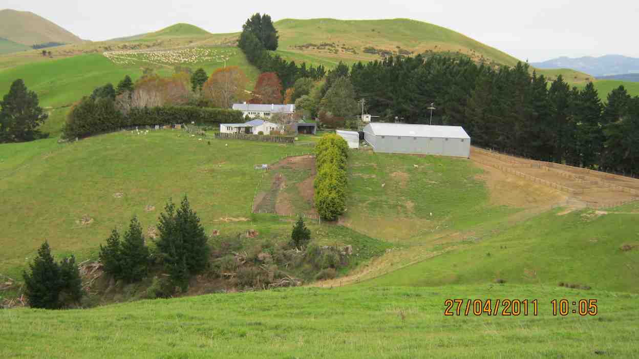
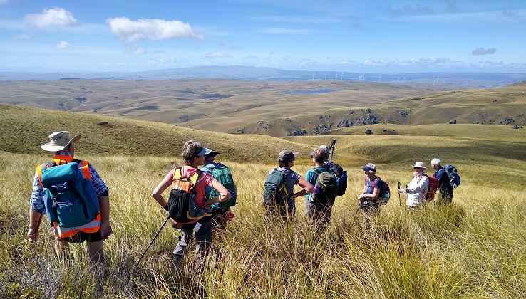
18 keen trampers turned up and left right on time at 8.30am in 4 vehicles, stopping briefly in Outram for tramper No 19, then travelled through the rolling uplands to above Lake Mahinerangi, before turning right up the El Dorado track, right to the end, through mobs of daggy sheep, the windfarm, the Blackrock Scientific Reserve and finally through the locked gates of DCC 3 Waters with the cameras keeping an eye. Ross was in charge of the key and maybe had a pinch of hypothermia by the time he was back in the car. Brrr would we find our riches at El Dorado?
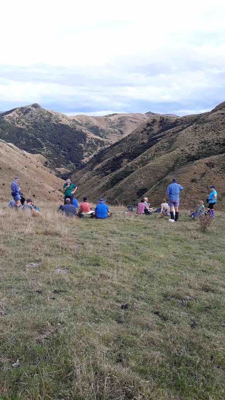
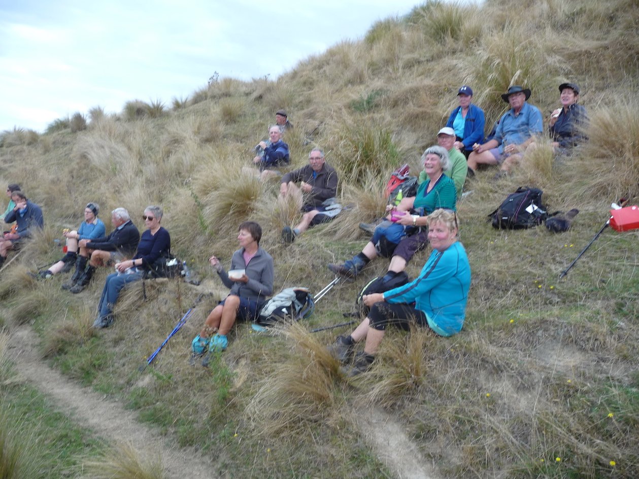
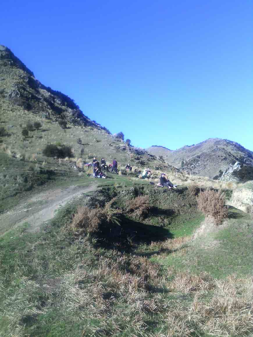
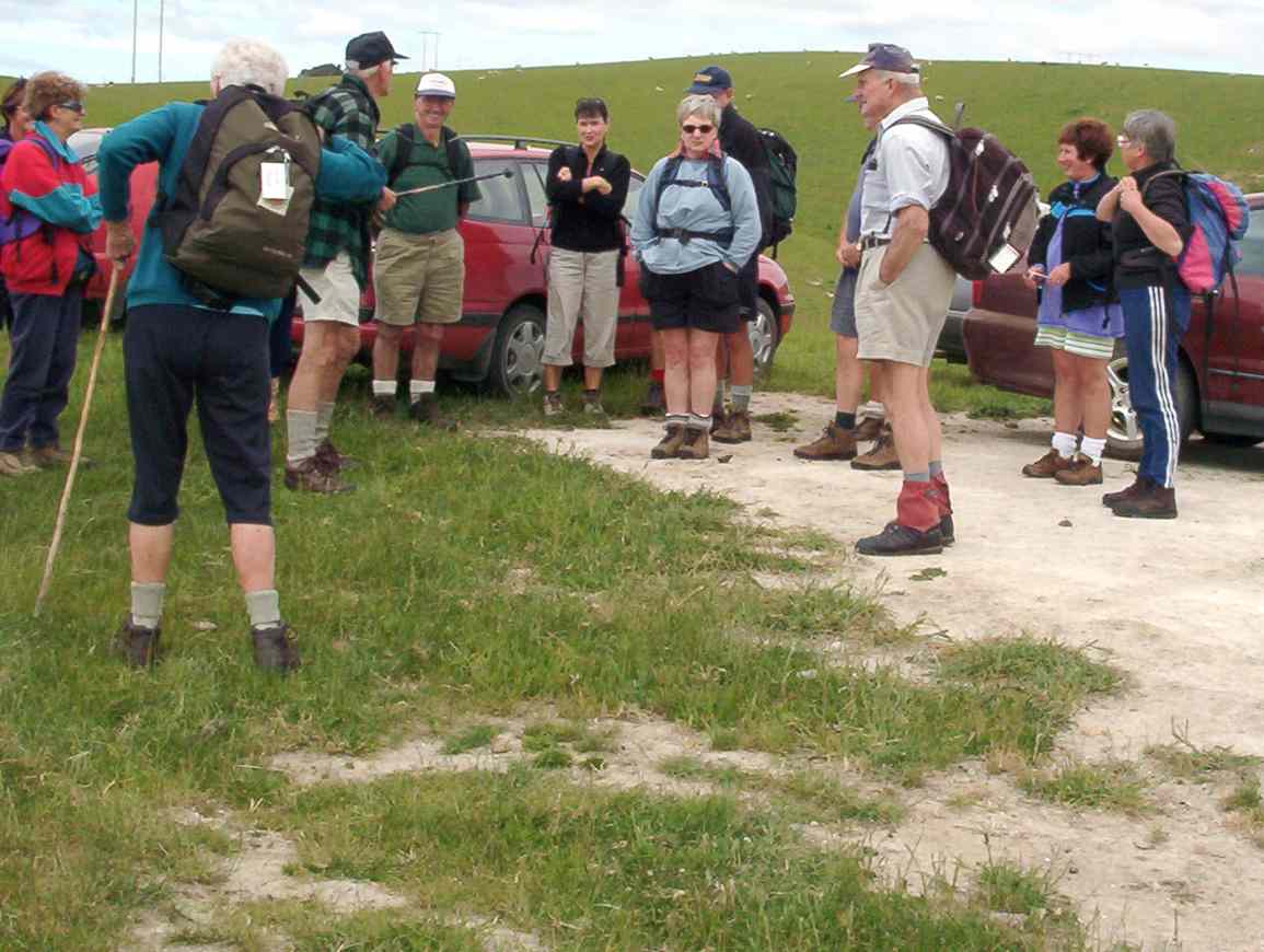
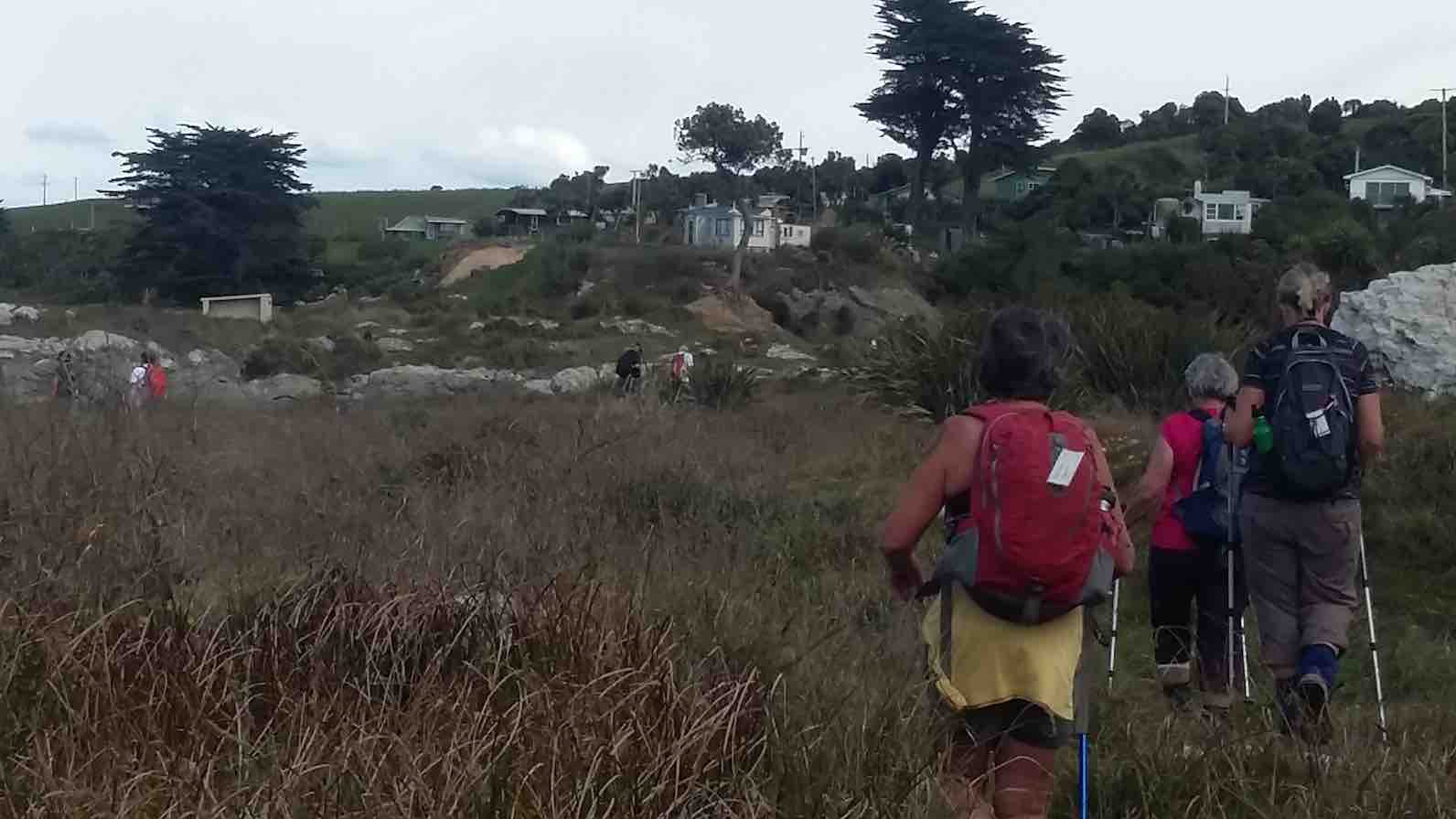
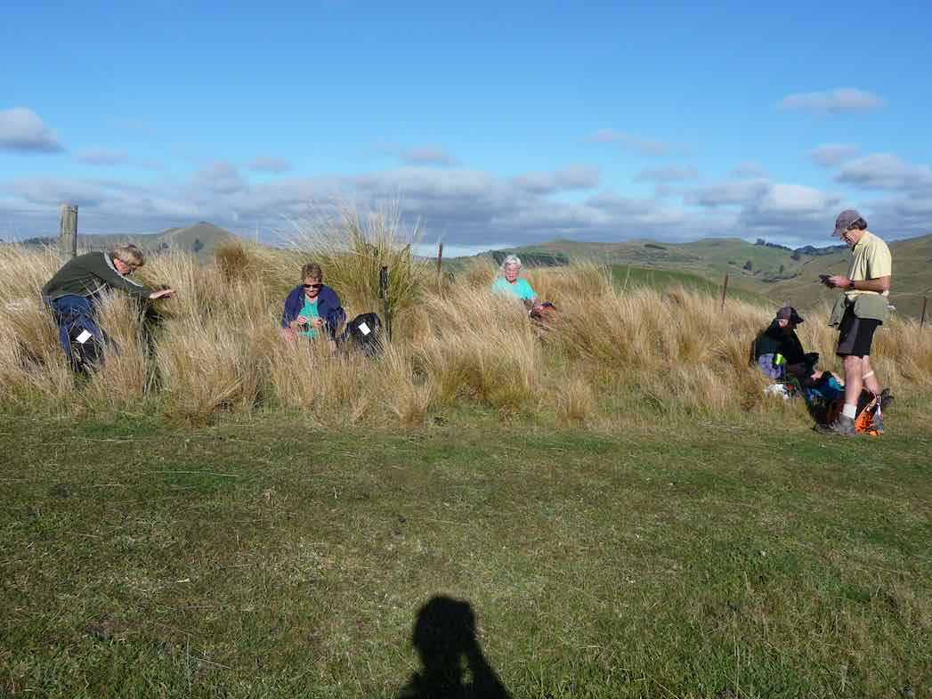
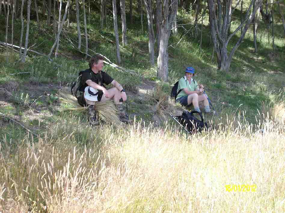
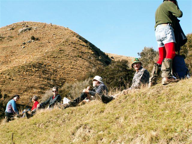
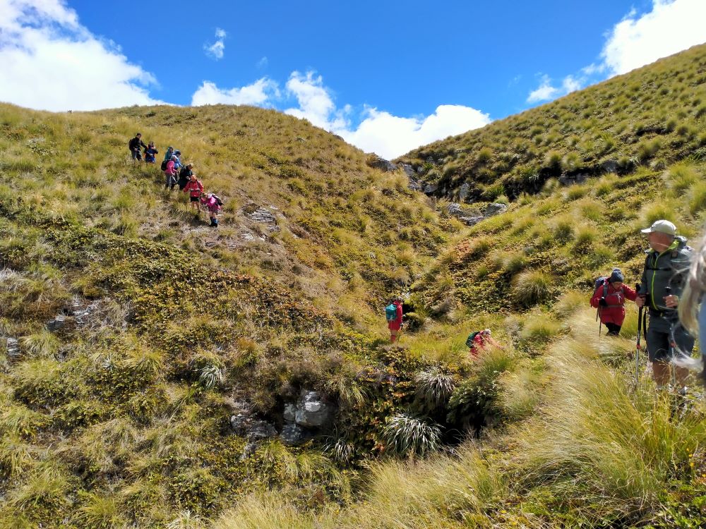
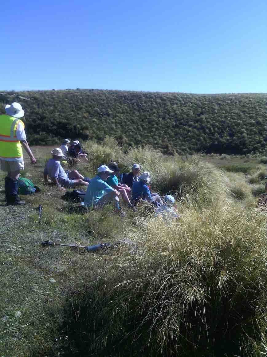
Some Words From The Wise, Before We Set Off (Photo & Caption Ross)
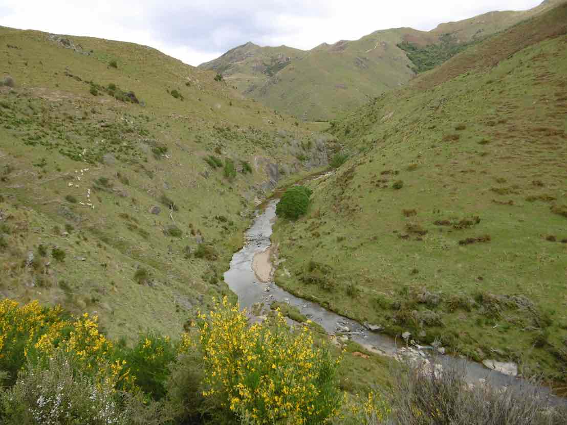
It was 10am before we set off walking, the group happily forgoing morning tea until we arrived 45 minutes later at the Chinese Diggings situated on the east bank of Deep Stream which was up a little following rain the prior day.
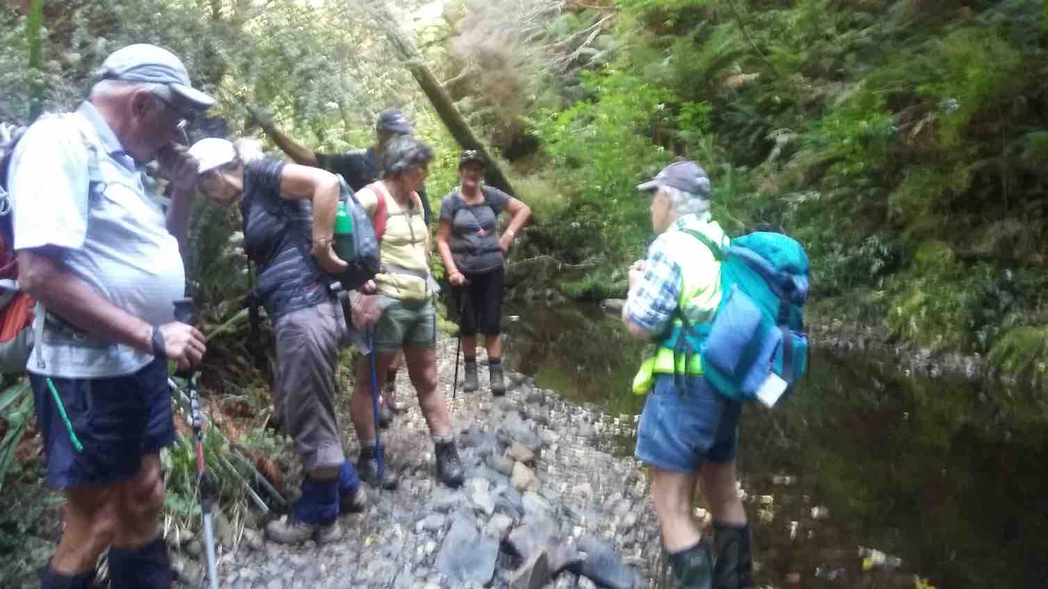
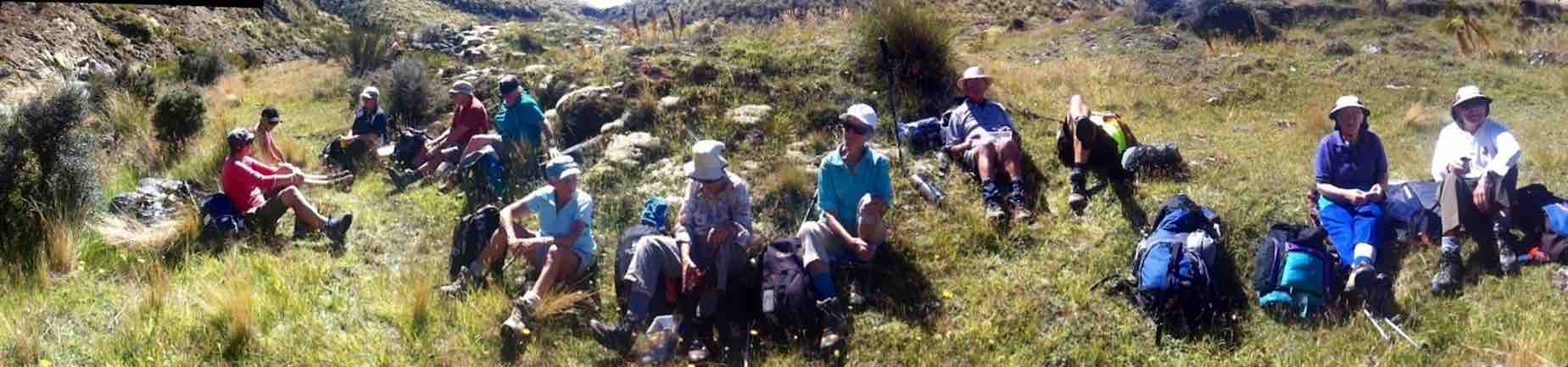
Fuelling Up At Deep Stream Before Ascending The Hill Behind (Photo & Caption Pam)
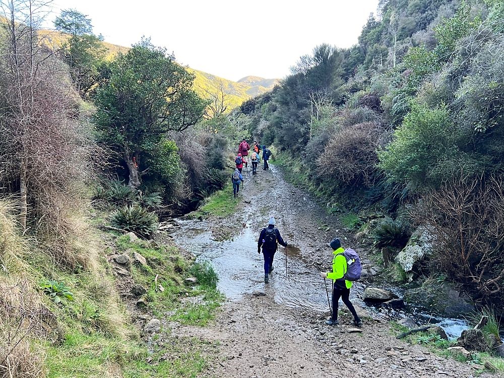
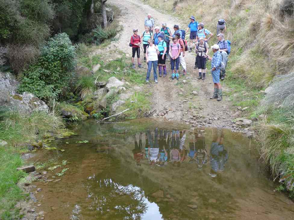
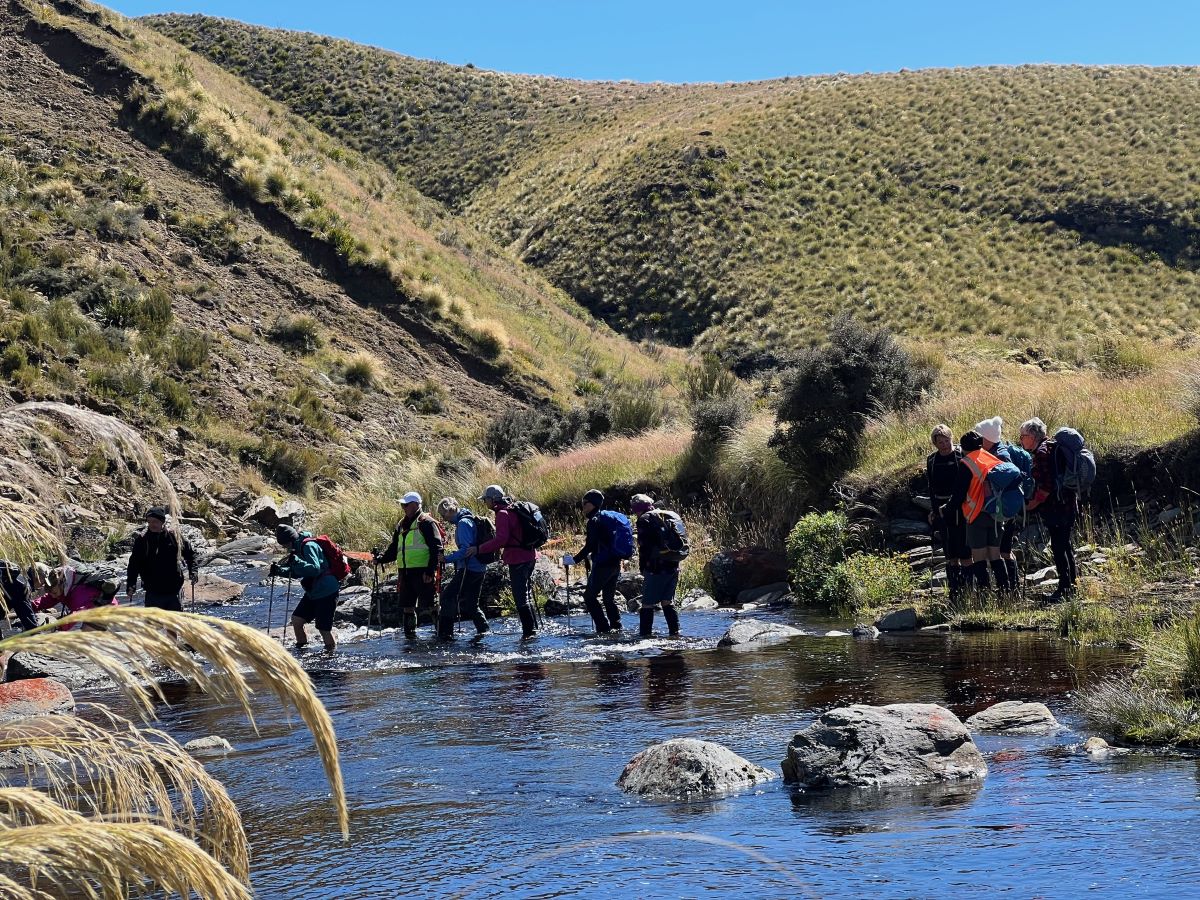
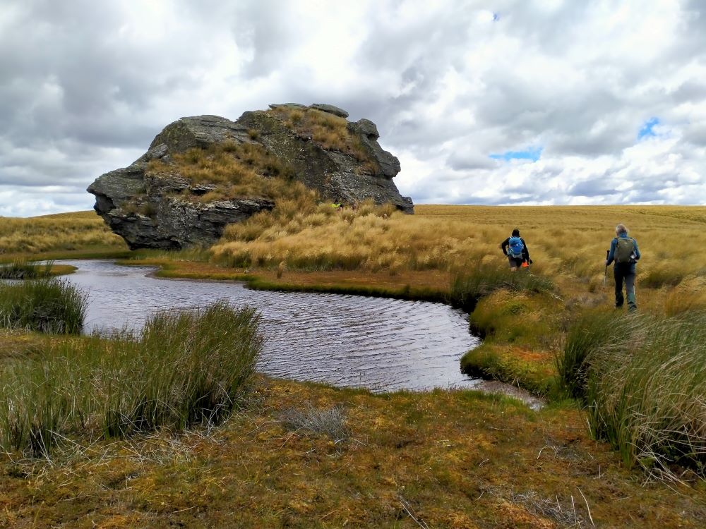
Mmm NZ Topo 50 is telling us we have to go west and will have to cross. The thought of this seemed to necessitate a continuous stream of walkers, single file, into the bushes. Thankfully they all came back and with a little help from our friends we all crossed, with wet feet and knees to the other side.
“ Follow The Leader” Across Deep Stream (Photo & Caption Pam)
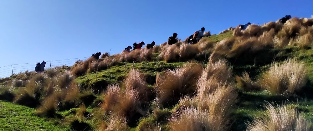
Thus began a steep ascent with a new pathway selected every few steps, not to mention the need for a breather at fairly short intervals!
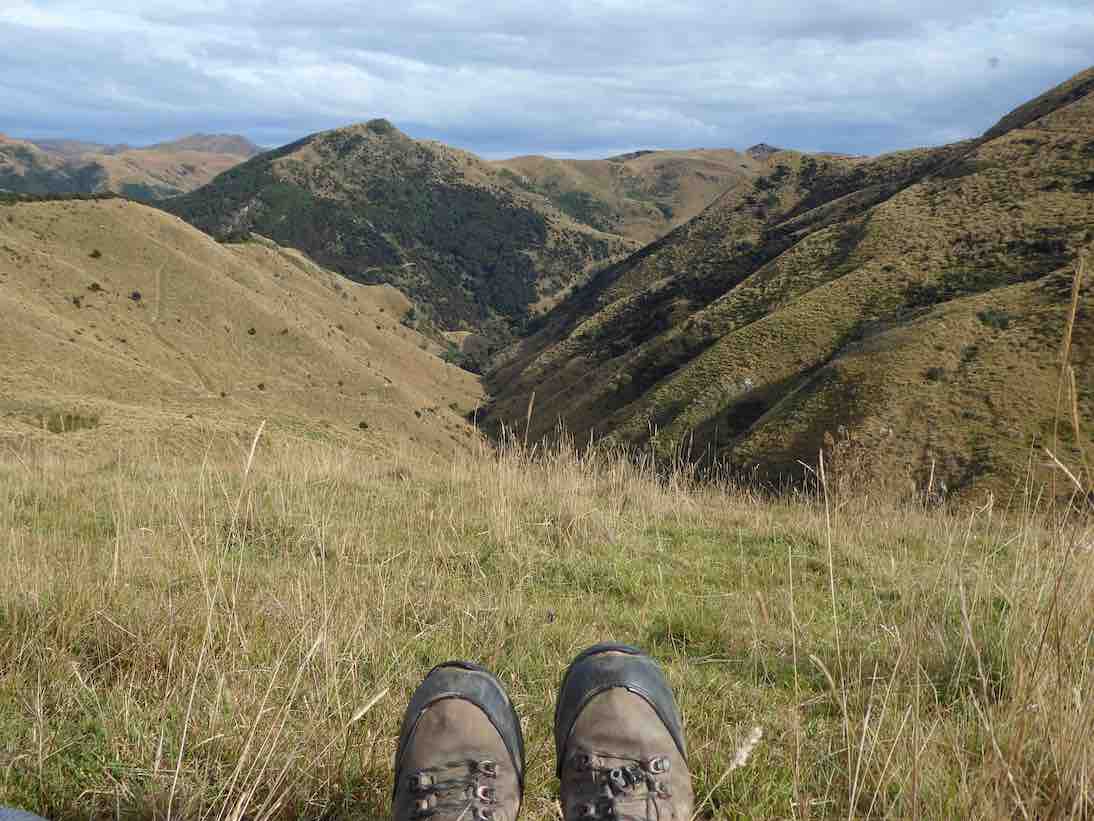
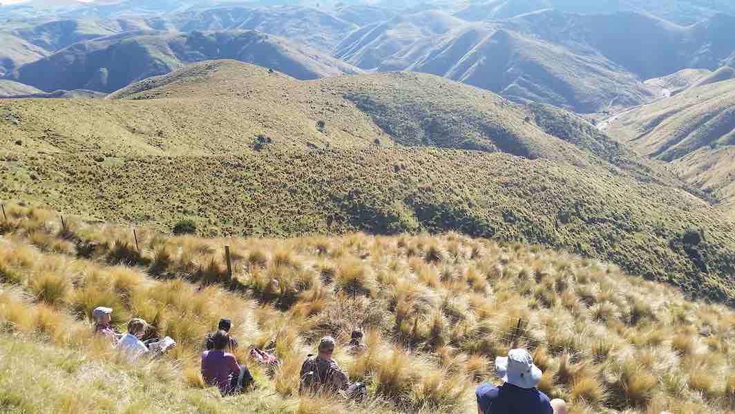
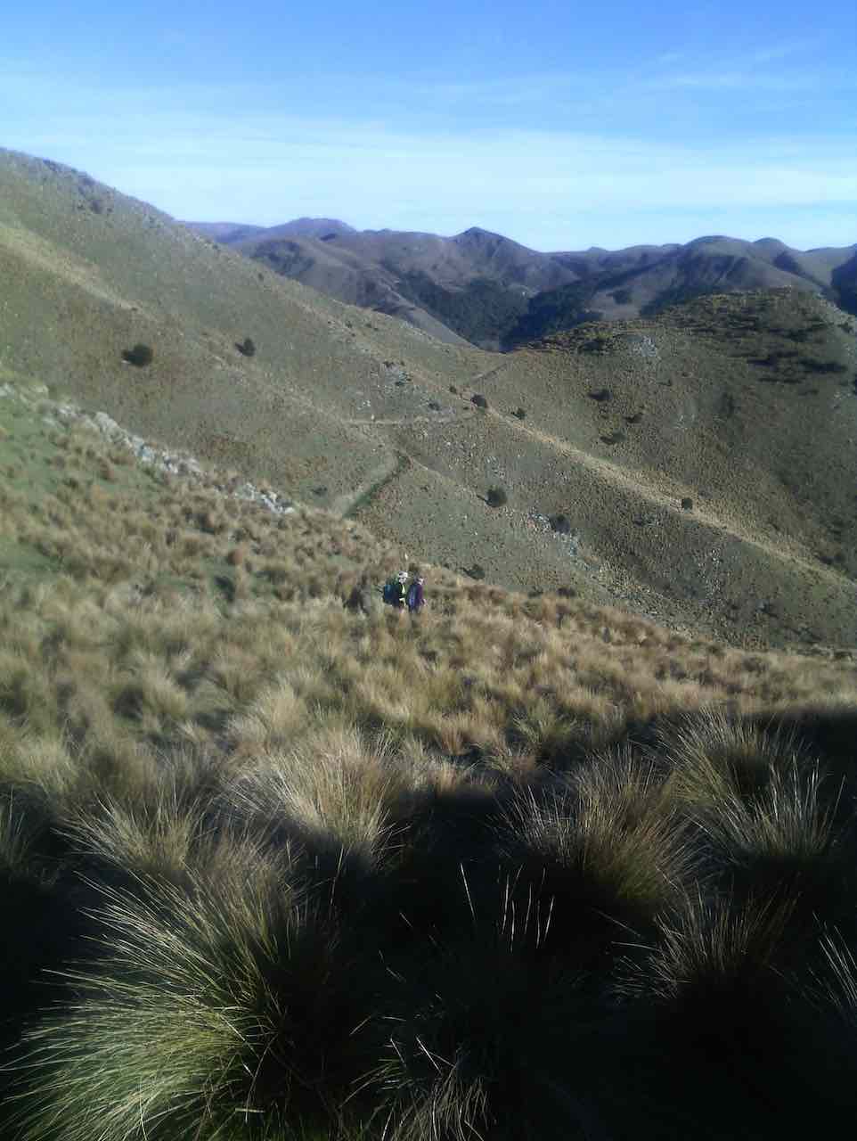
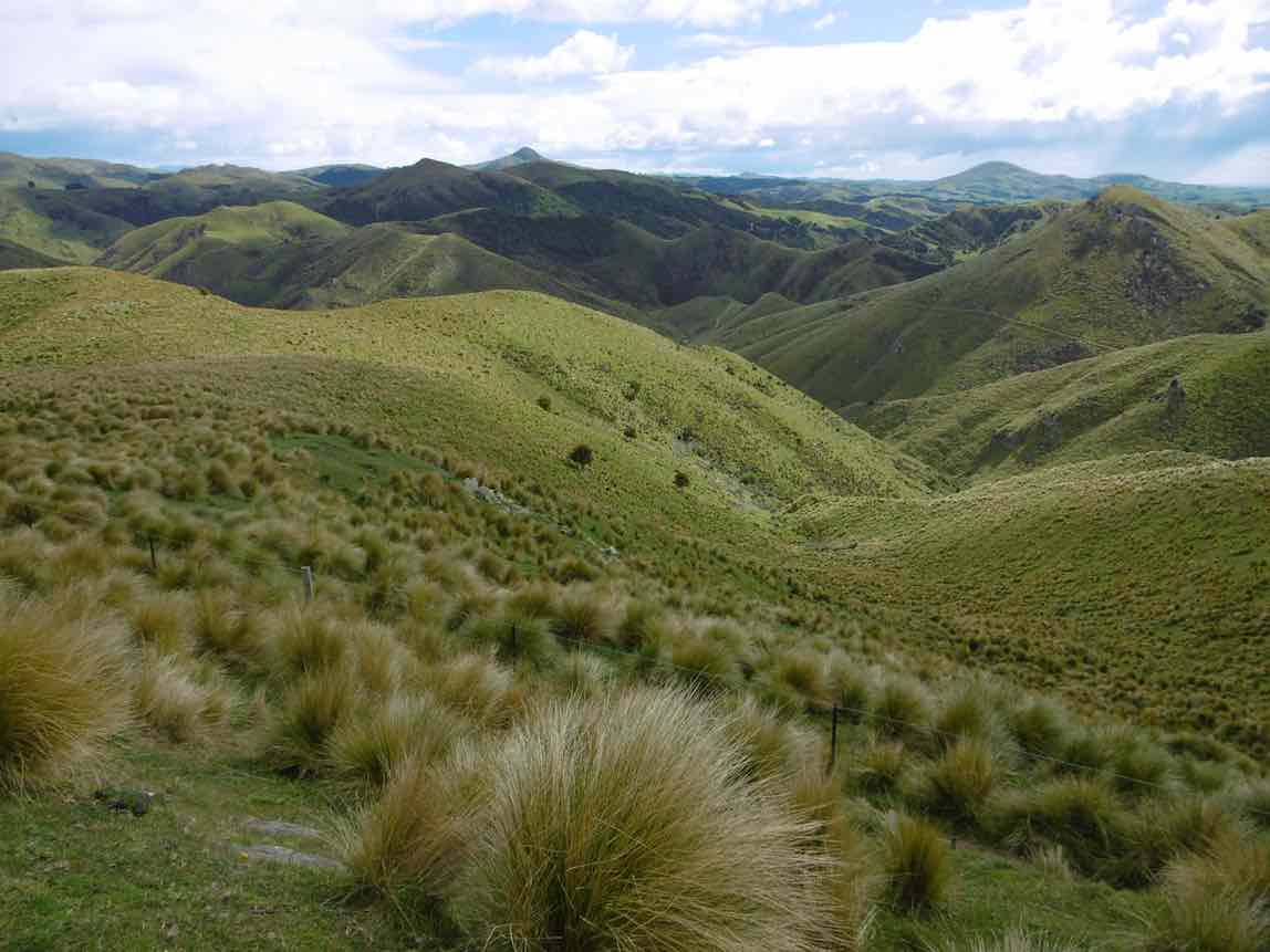
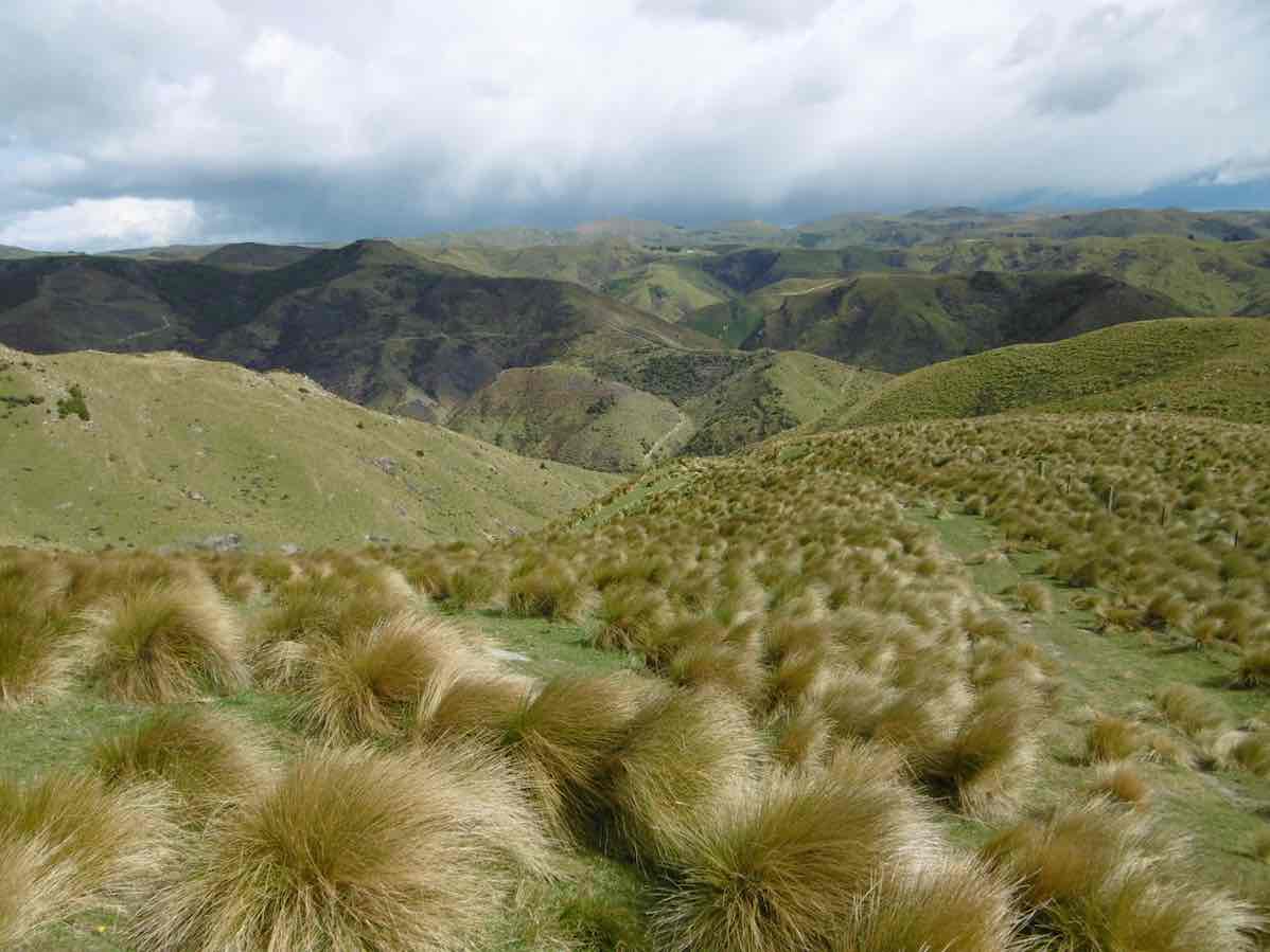
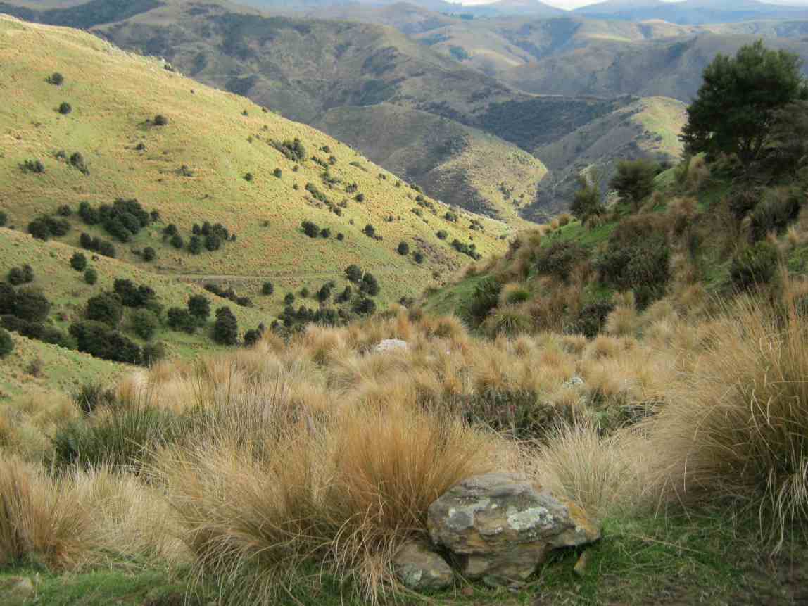
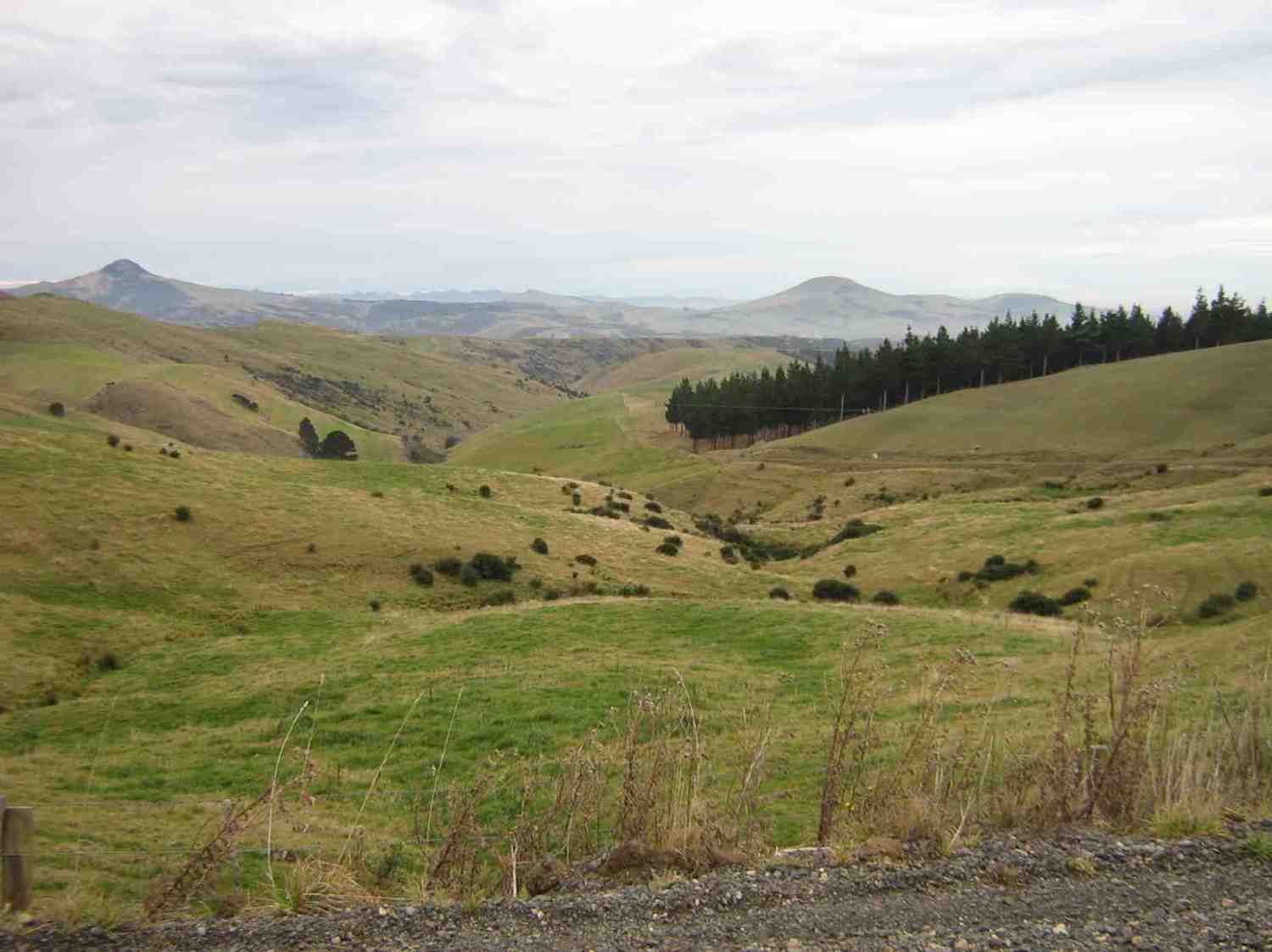
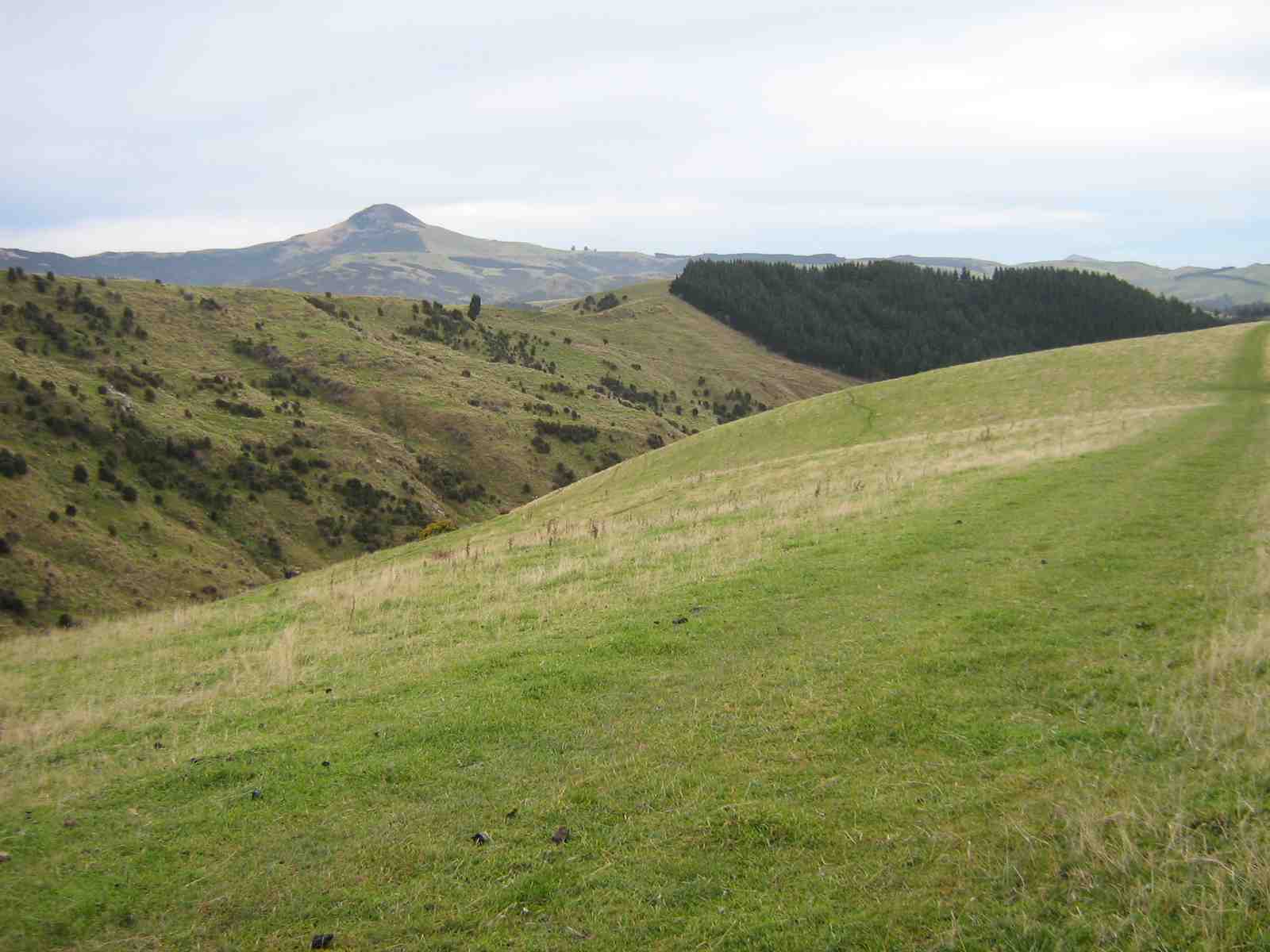
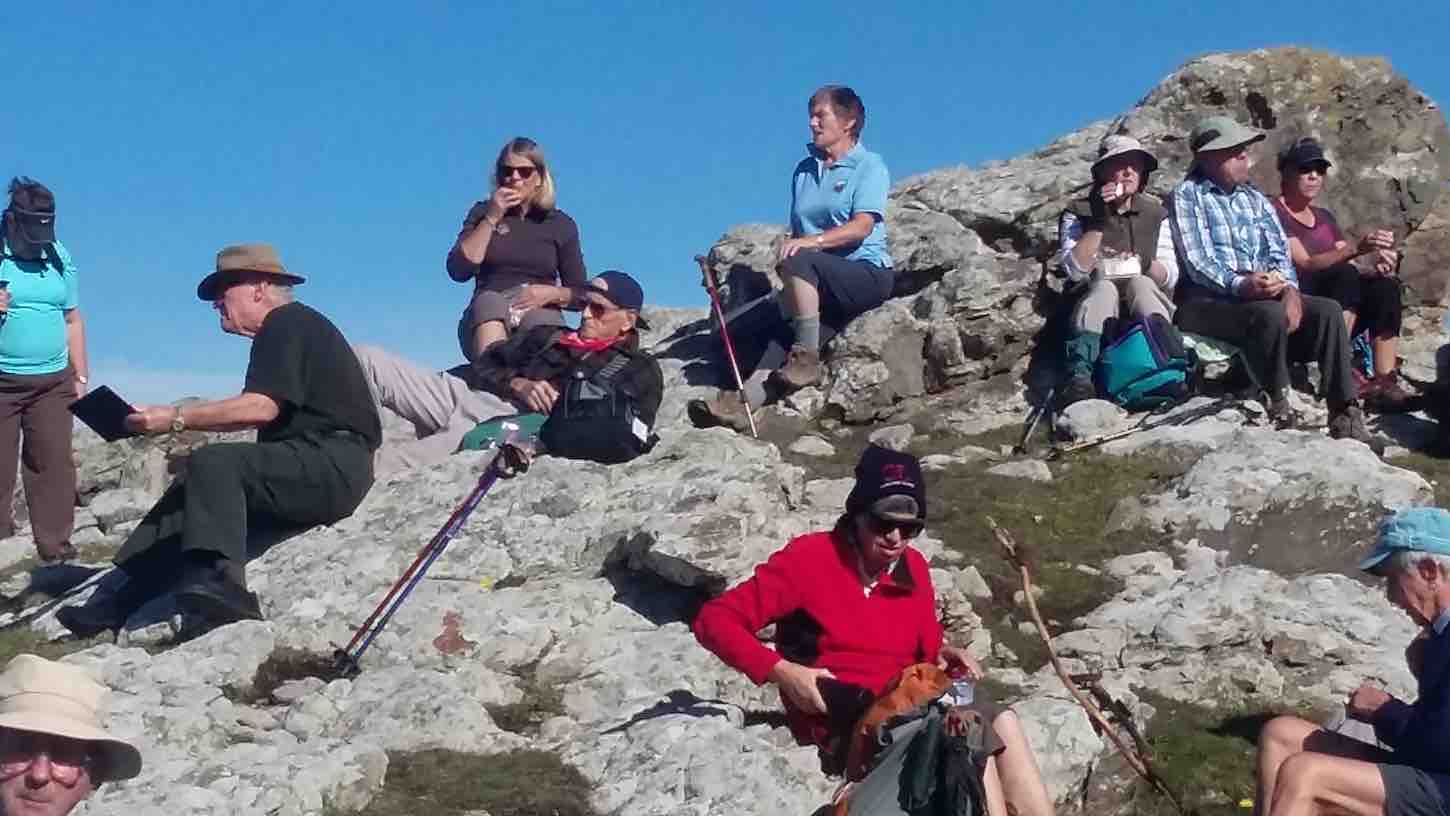
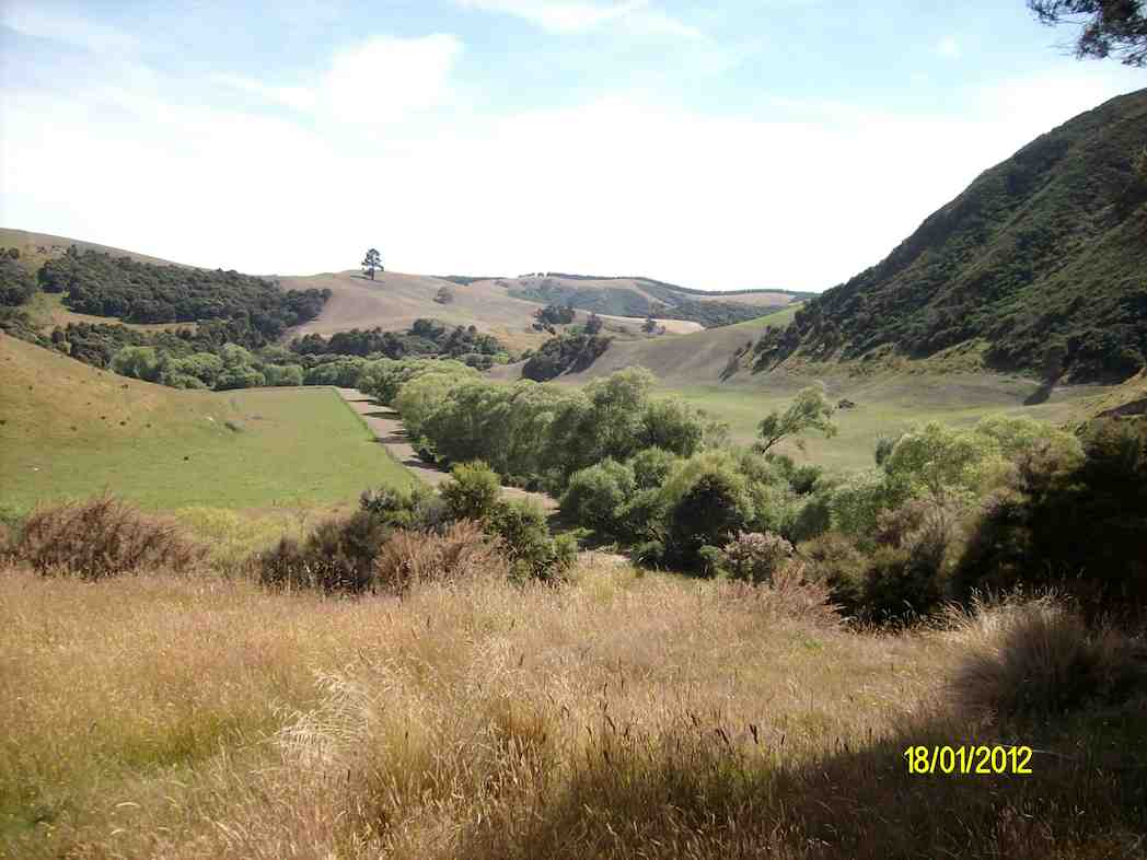
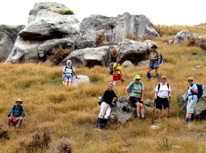
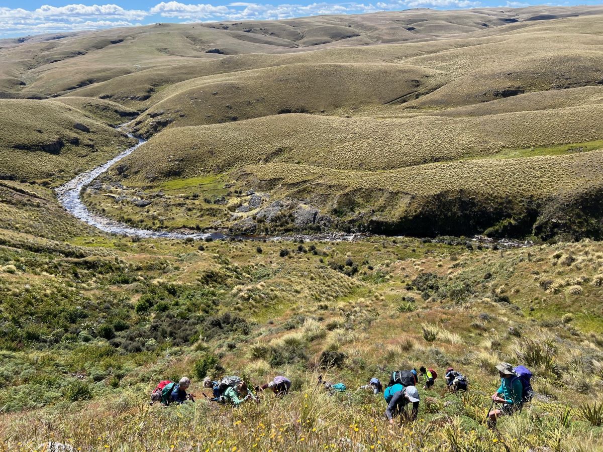
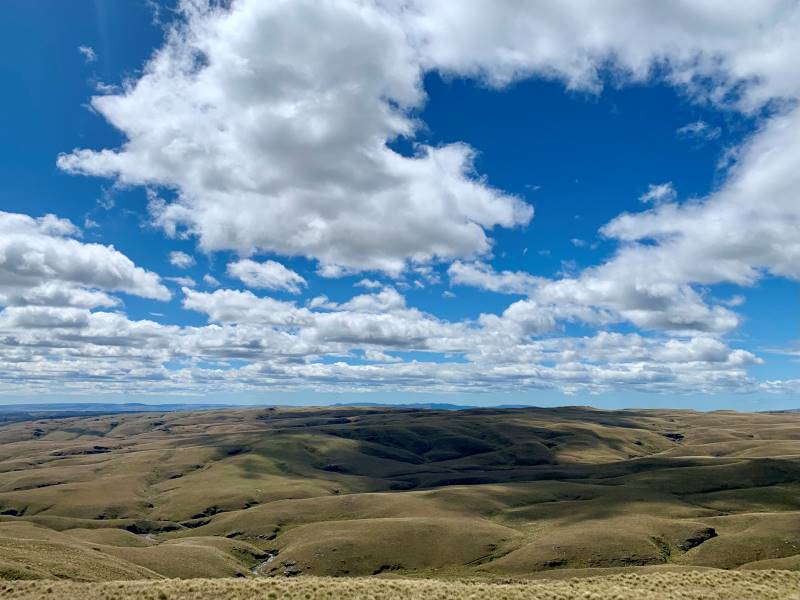
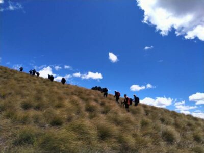
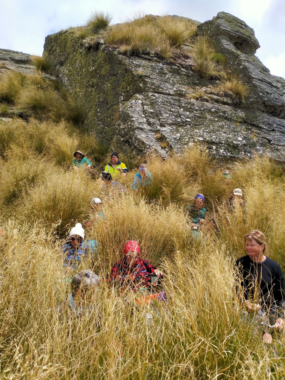
Scrambling Up The Lammermoore’s To Admire The Expansive Landscape (Photo & Caption Pam)A Big Sky With Cloud Shadows On The Land (Photo & Caption Marijke)Climbing Every Mountain (Photo & Caption Phil)
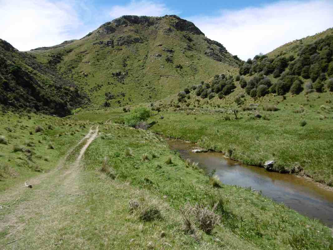
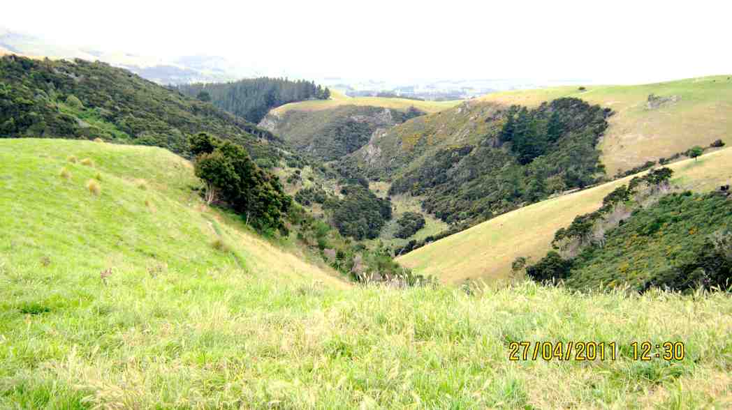
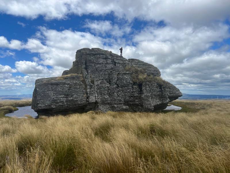
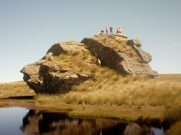
The ascent was followed by steady to steep ridge-line walk keeping to the true left of a stream, before crossing over nearly at the head, and finally over the last brow of a hill to arrive after 2 hours from morning tea, of fairly serious tramping, at the Ship at Anchor;
At Last The Ship At Anchor (Photo & Caption Phil)Lunch In The Lee, Sheltered By Tussock (Photo & Caption Phil)
thankfully we had not missed the boat and it provided good shelter along with the snow tussock from the fresh westerly that had been present all morning.
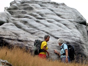
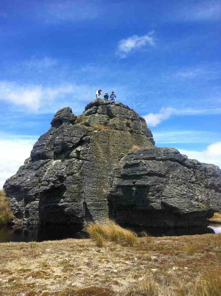
Appropriately Named “ Ship At Anchor “ (Photo & Caption Pam)
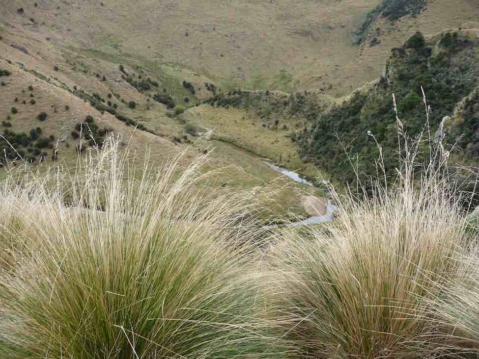
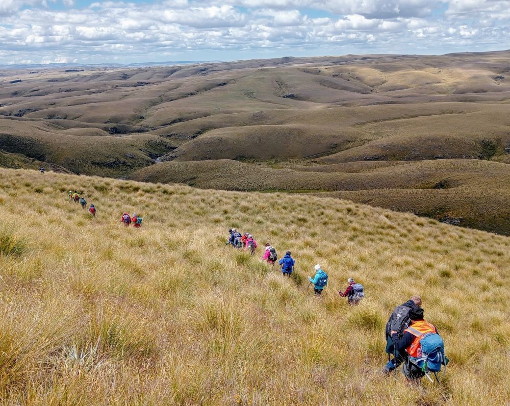
Our departure was not too long with those who had not previously been here circumnavigating the Ship and we all followed a course on the true right of the stream down another ridge-line, initially made ‘easy’ by a water course shaped I think by ancient shovels?
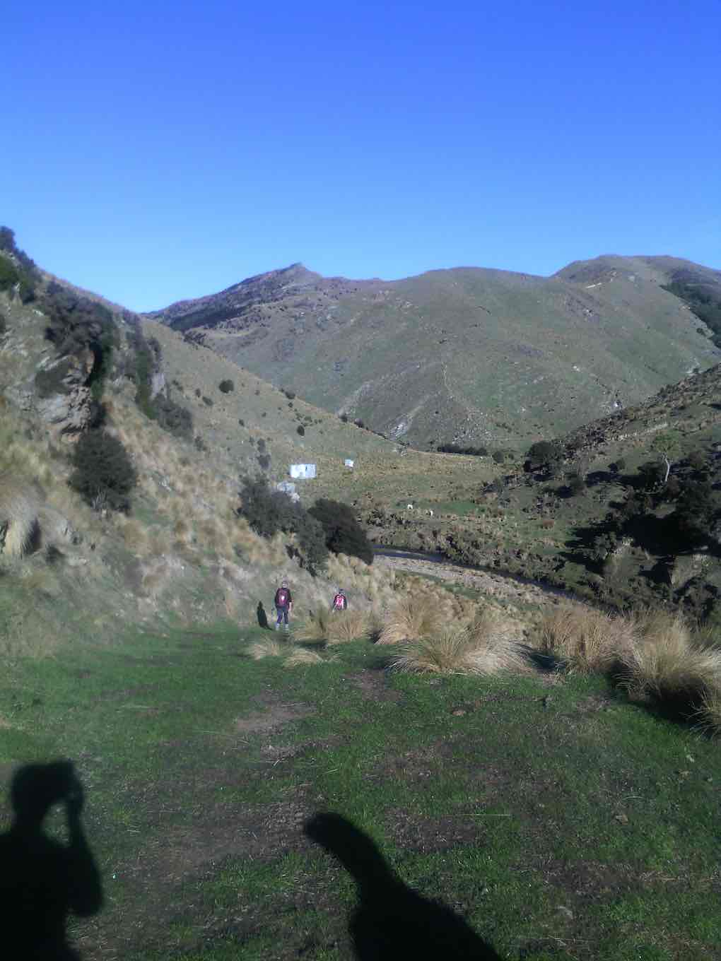
Heading Down The Highway (Photo & Caption Ross)
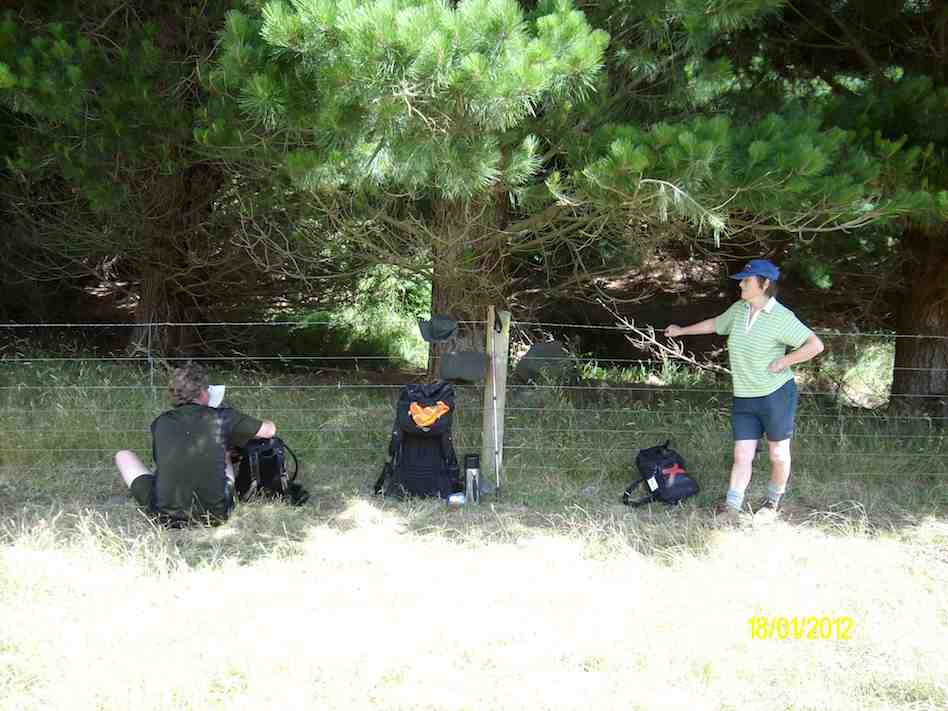
With the possibility of a precipice emerging in front our leader tacked left just in time onto another ridge that steeply descended towards a man made watercourse, scout Graham finding the appropriate gang plank onto the other side. It would be fair to say knees were now creaking as we traversed parallel with the contours dropping every now and then towards the crossing of Deep Stream. According to the leaders timepiece we took longer down than up, just like the Grand Olde Duke of York……oh dear!
Mmm Did It Take Longer To Go Down Than Up (Phot & Caption Phil)
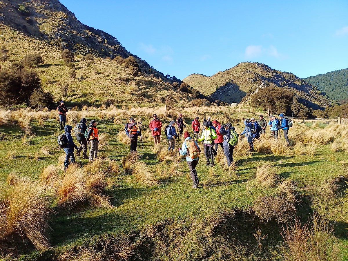
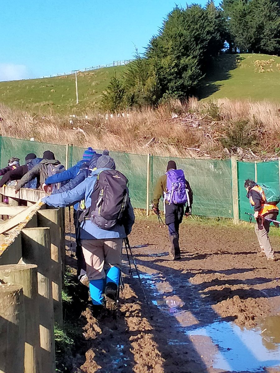
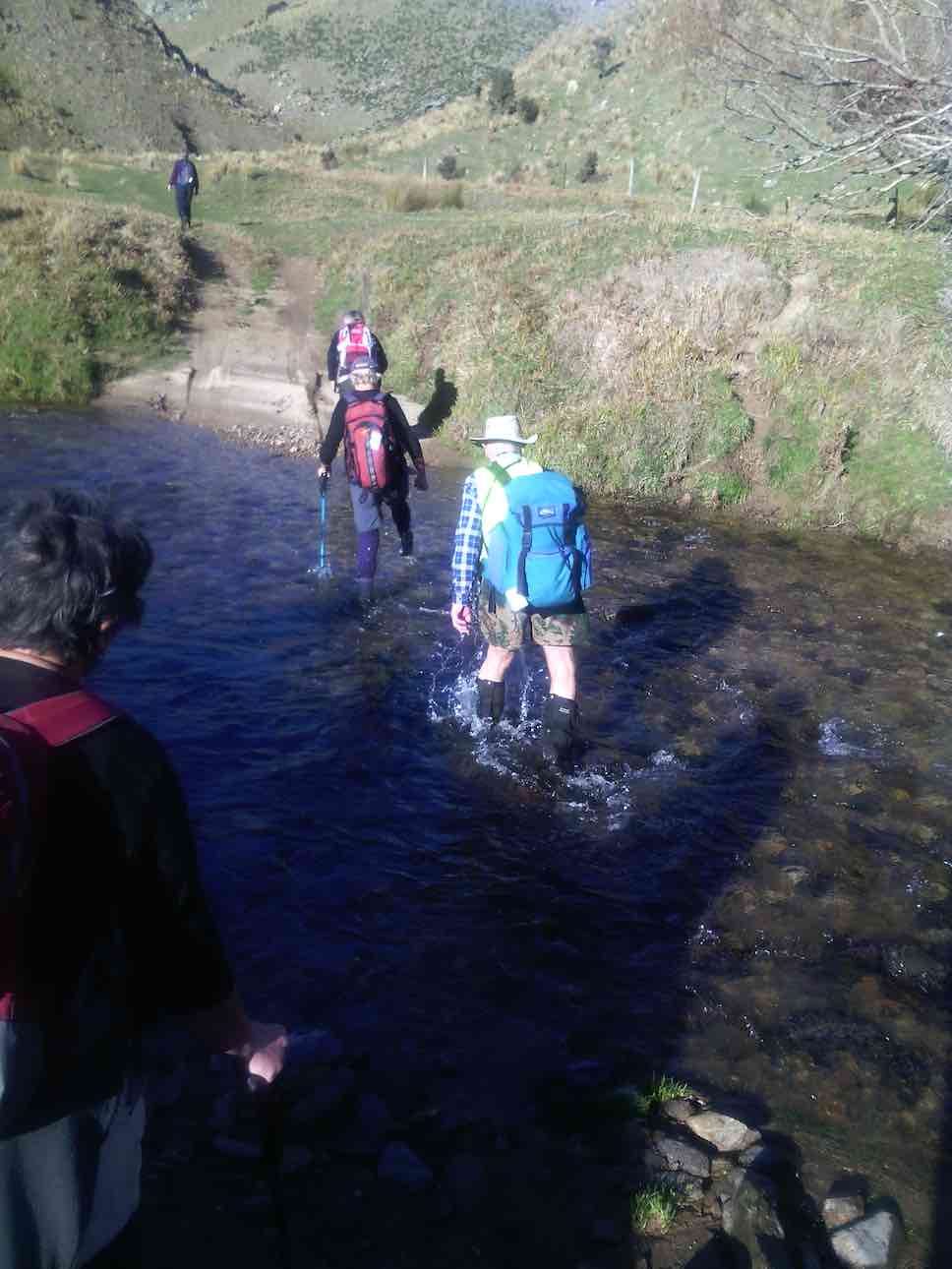
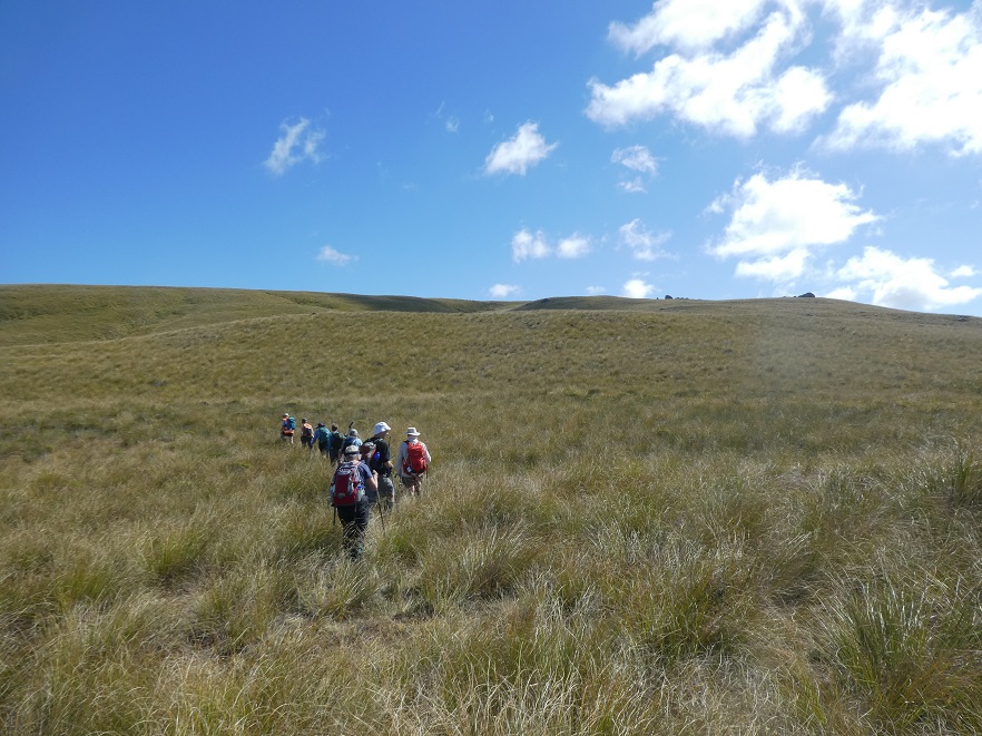
If feet and knees were by now warm and dry they were wetted again and with all crossing safely we re-grouped and took off up the prairie back to the cars, this being quite a steady upland walk!
If You Start With Wet Feet You Might As Well Clean The Boots Again When You Finish, Gentlemen Abound (Photo & Caption Phil)
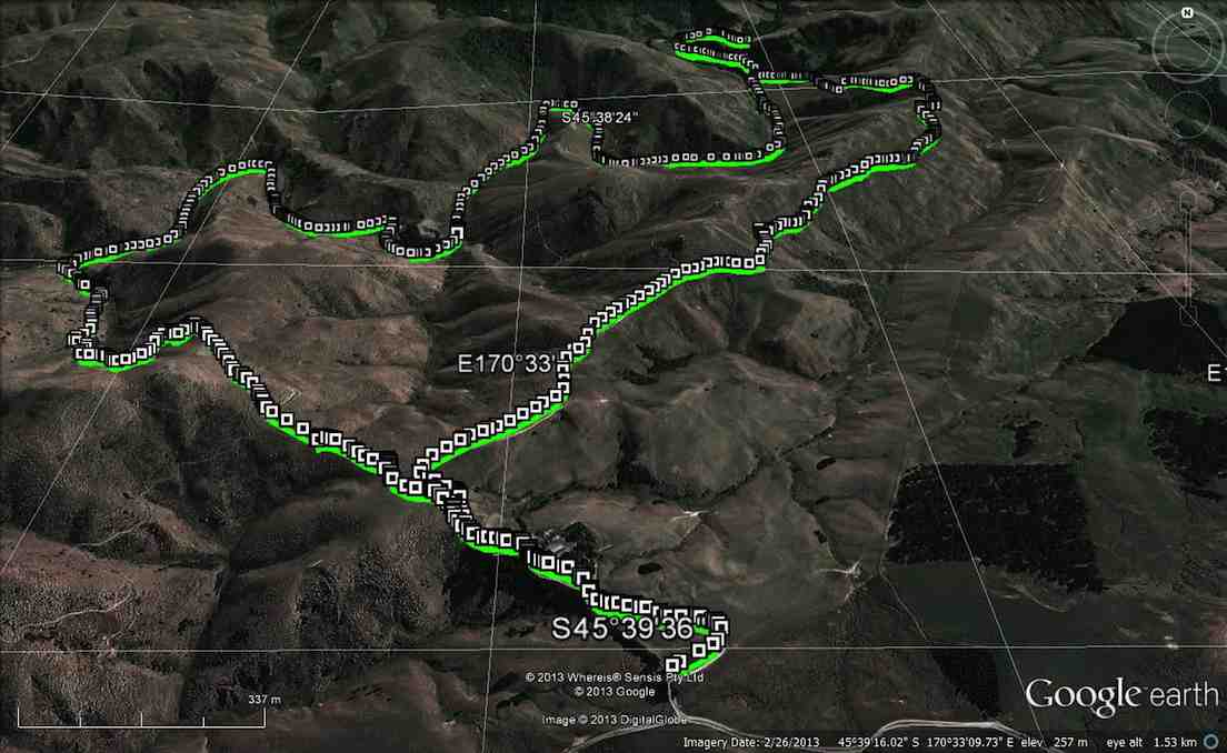
We departed paradise at 4.30pm arriving back in Mosgiel at 5.30pm. Rumour has it that the hydrotherapy pool has been busy since the trip, no wonder. The expansive and varied landscapes are so much more rewarding when set in such a remote and wild environment. Because of the access restrictions at the Weir this was the first time travel to the Ship at Anchor had been done this way. Distance 10.47km, elevation gain 661m, moving time 3:25;59, calories 1,016. And I’m sticking with grade 4.5.
Thanks to everyone for supporting each other so well.
Phil K
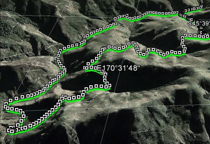
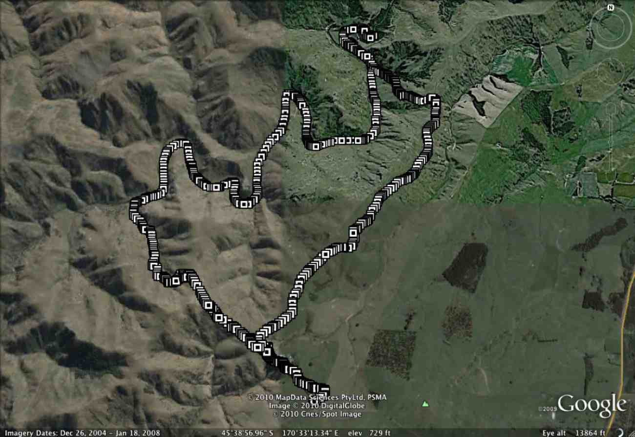
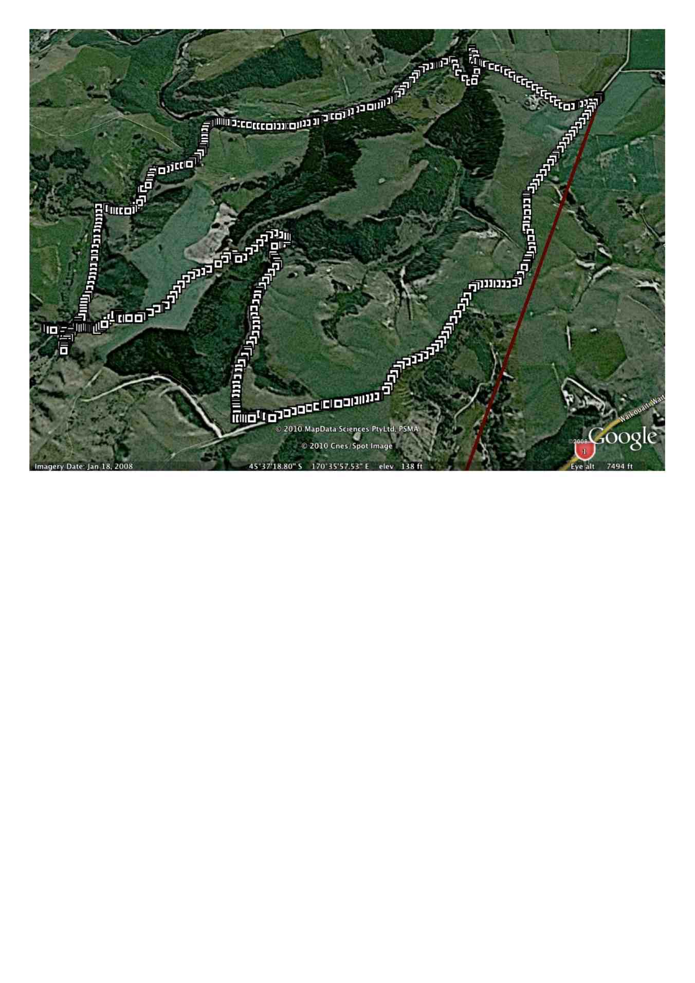
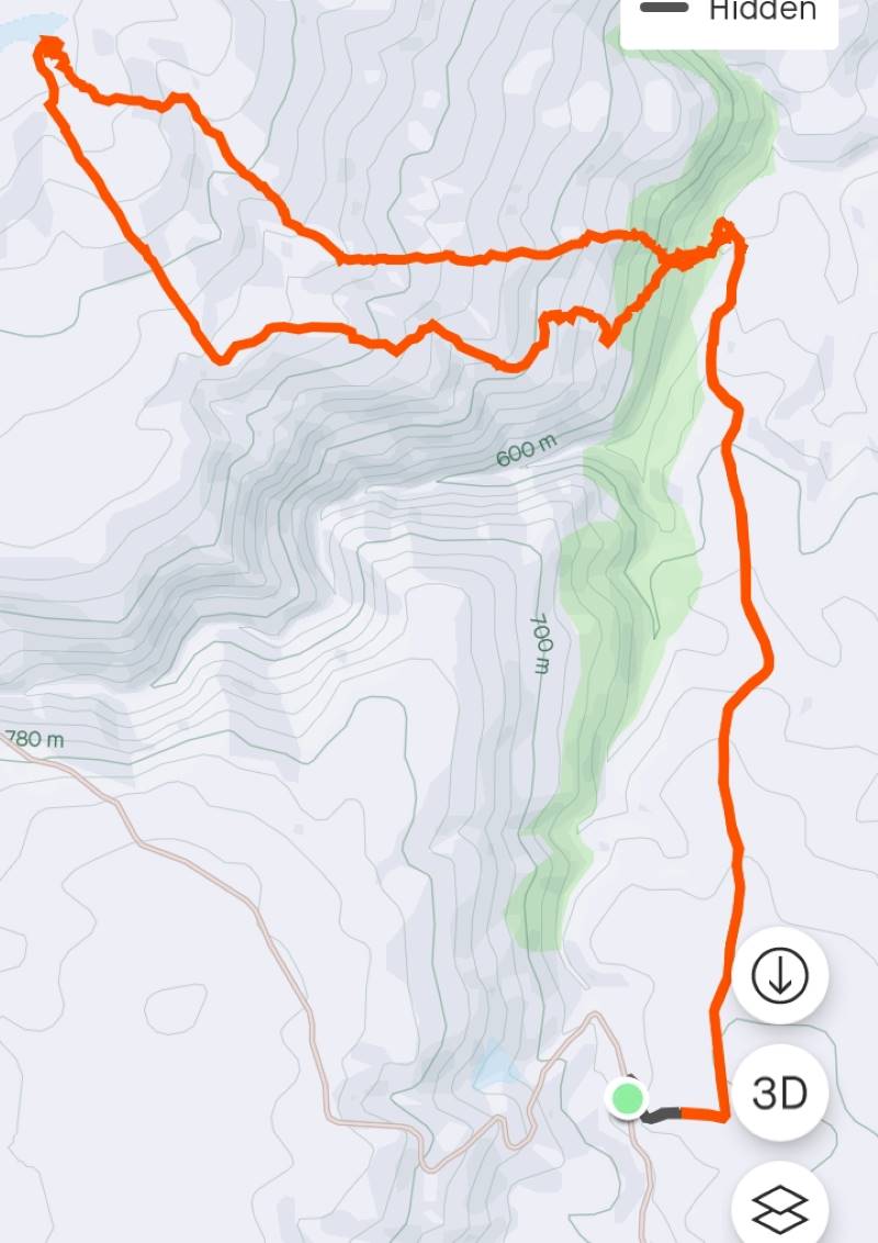
Ship at Anchor route (Screenshot Ross)
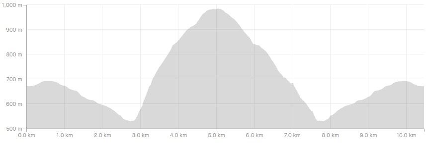
Ship At Anchor Profile (Screenshot Ross)
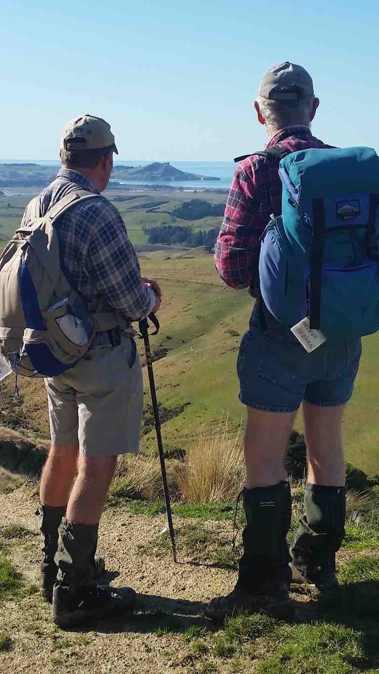
13. 17/2/2021. Trampers. Ship at Anchor. Leaders : Arthur Heenan and Gordon Grant.
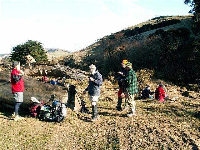
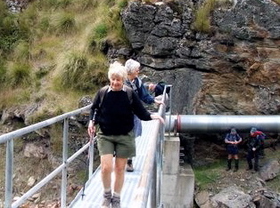
A great day was had by 10 trampers who did the Ship at Anchor loop tramp in glorious sunny weather with a slight breeze to cool fevered brows. After dropping off a car at the bottom of the hill we all drove up in the other 2 cars to above the weir on Deep Stream and had a quick cuppa. From there to the weir, then crossing the creek on the walk way and starting the trek up the fairly steep other side.
“Checking out the water intakes at Deep Stream.” – Photo and Caption Ross“The more gentle slopes.” – Photo and Caption Gordon.
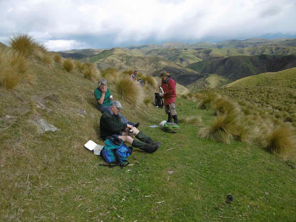
Taking it slow & easy saw us up on a more gentle slope and reaching the Rock about 12.00am for lunch.
“Heading on to the tops.” – Photo and Caption Gordon“All Aboard!” – Photo and Caption Phil.
We were soon up and on our way back down which was good, until the very steep and rough bottom 200 hundred meters to the creek and Chinese Diggings.
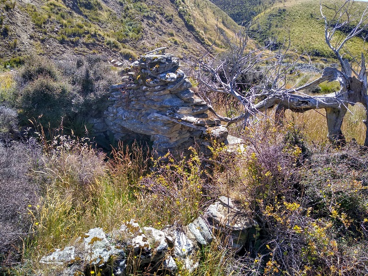
“Remains of a stone hut at Chinese gold workings.” – Photo and Caption Ross
On this stretch we saw two disturbed falcons soaring above, letting everybody know they were not happy and with this, to everyone’s excitement a stag took off across the gully and walked to the top of the hill and disappeared. We assumed the falcon’s squawking warned him. From the creek we walked back on a gentle sloped 4 wheel drive track to the car and the drivers went up and brought the other two cars back, then down to Outram for an icecream which everyone thought we deserved.
12. 30/11/2016. Trampers. Ship at Anchor. H. Leader: Arthur.
At the 3rd attempt, we finally did it! Today 7 trampers climbed up to the “Ship”, and then completed the circuit we had planned.
Southwest winds were forecast, so were expected, but it was a COLD WIND – there was obviously quite a wind chill factor in force!
Over an hour’s journey took us up past the Mahingerangi wind farm and into the “Black Rock Scientific Reserve”. We followed the “Eldorado Track” until we were on the hilltop just above the weir on Deep Stream. This was our day’s starting point, one car being taken back downhill for the end of day car shuttle.
It was a 10 minute walk down to the weir and tunnel inlet, but there was no shelter there from the cold wind, making morning tea a very brief affair.
But we had the privilege of watching two N.Z. falcons chasing away a pair of Harrier Hawks. They must have had a nest to protect. Their flight manoeuvres were superb.
The next stage of our tramp was the most difficult – up, along, down to cross a rather difficult side stream, then up and up. After three quarters of an hour we were up on the open slope, much easier apart from the trackless tussock. We travelled in single file.
Further up, the leader came on our track made last February, following it for quite a distance. We passed the locality of our helicopter visitation of last time; and continuing on up slope a further 1 km we came to the “Ship at Anchor”.
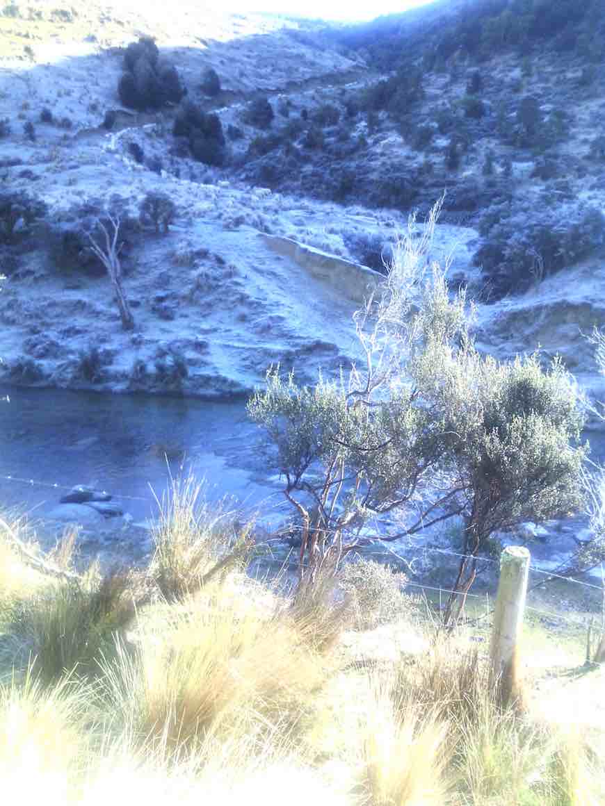
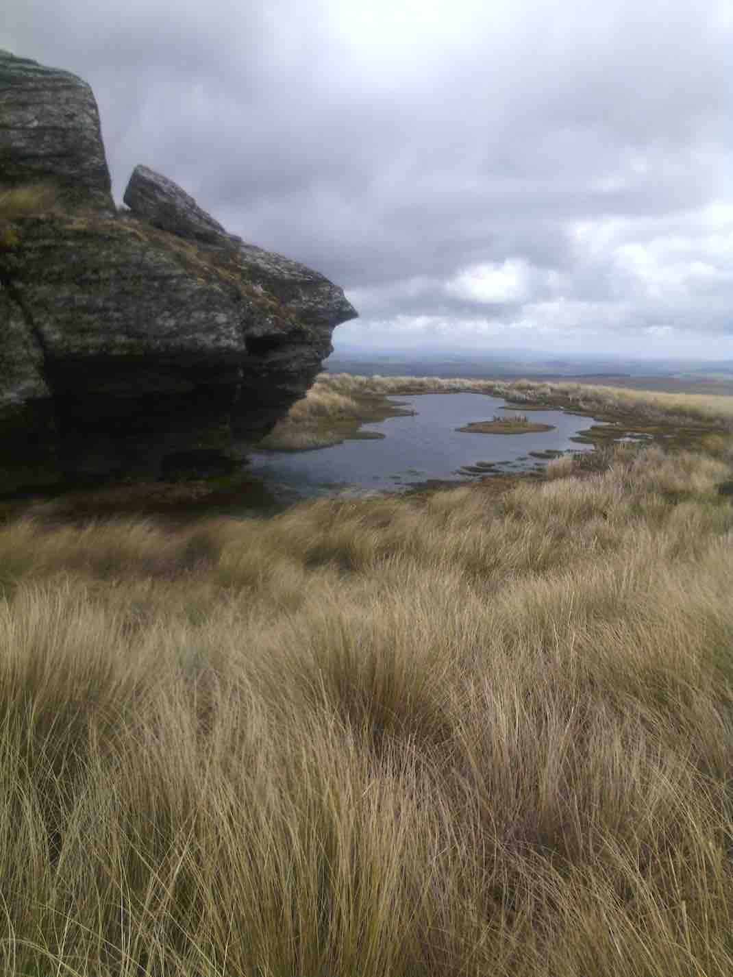
Water around Ship at Anchor. (Helen pic and caption.)
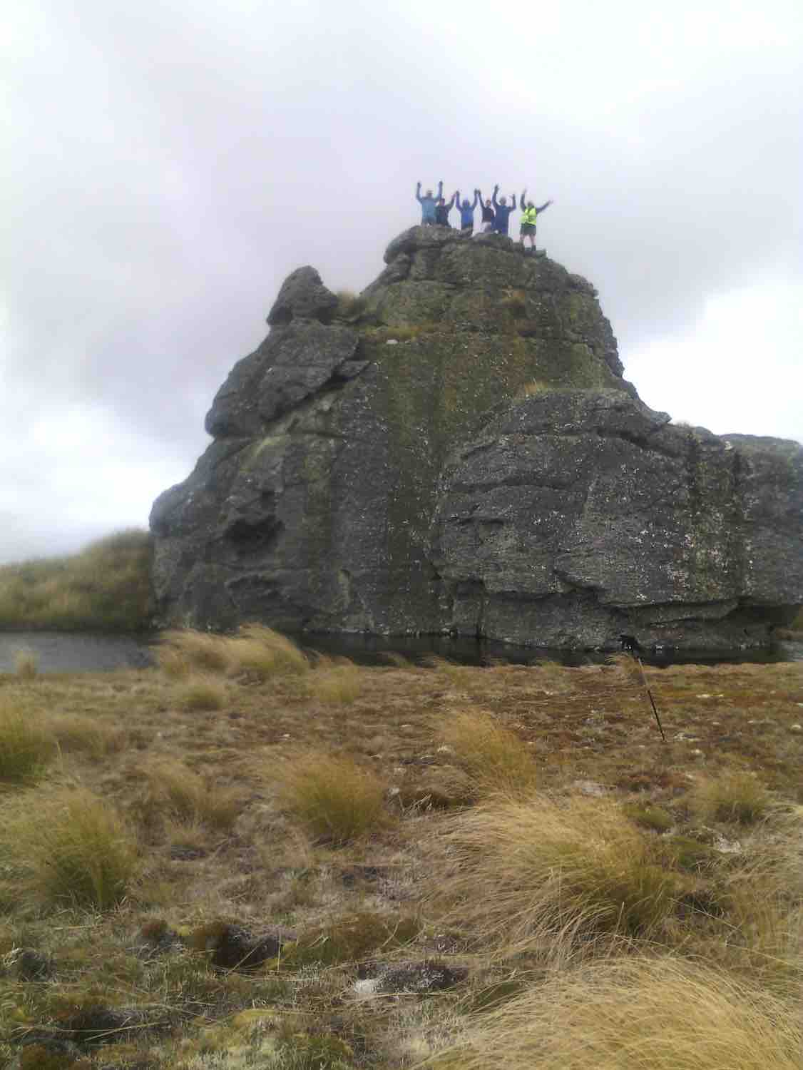
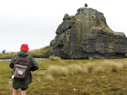
All of us climbed up on top, well 6 did anyway, for a photo opportunity.
Group getting blown around on the top of Ship at Anchor Arthur Bruce Neil M Neil S Theresa and Jennifer. (Helen pic and caption.)
The wind was strong and cold on top. We didn’t linger.
Down in the shelter of the “Ship” we had our lunch.
Hunkering down for lunch. (Helen pic and caption.)
We noticed a large, dirty rain shower over towards Mauntagua, missing us. But the weather had changed, with a light shower of tiny hail (about 1 mm in diameter) for us. Even a few snowflakes were seen! What a contrast to the terrific heat we had to contend with there last summer.
Weighing anchor(?), we turned downhill for the next 3 km. The going was far easier now, the tussock quite small here, and out of the worst of the wind. Only the last few hundred metres down to the Chinese Gold Diggings were difficult, becoming steep and rough going. We took our time but a few knees were complaining.
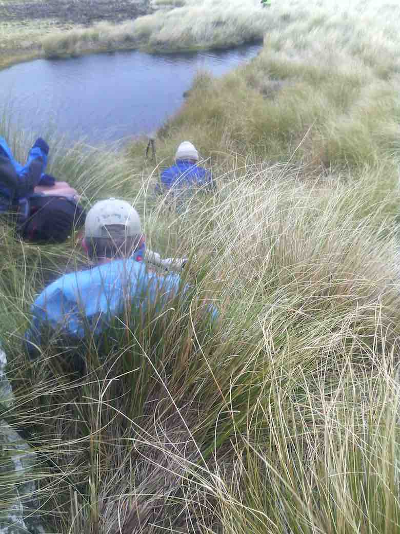
We crossed Deep Stream safely, although it took time, with most keeping dry feet.
Crossing last lot of water. (Helen pic and caption.)
After a brief spell at the Gold Diggings, we were onto the last leg of the tramp – uphill on the 4WD track. Light skiffy rain showers had appeared by now, remaining till we had finished.
The two car drivers forged ahead now, and once back, collected the far away car to meet the group at the road.
One or two thoughts to finish with:-
The car shuttle worked very well.
In the cold conditions experienced, the tramp didn’t need to be any longer.
Coats (and more) had to be worn all day in the cold, but we were warm while moving.
Distance for the can can only be estimated at 12 km (no modern wonder to tell us).
Back to Outram for the day’s finale, as Judy D (not out today) had invited us in for a warm up at her log fire, and a hot drink. And choccy bikkies as a real treat, too.
Thanks, Judy – you are a real GEM. It had been a satisfying day’s tramp. – Art.
11. 3/2/2016. Both. Ship at Anchor attempt and Gold Tailings. Leaders: Arthur, Ian and Bob.
Trampers’ Report. Leader: Arthur.
Ship at Anchor Tramp – 3/2/16.
8 trampers (including 2 guests) travelled in convoy with the hiking group who were going to the Chinese diggings.
The cars’ access was up Eldorado road/track, and passing the Maninerangi Wind Farm, in to the Black Rock Scientific Reserve.
We walked for 10 minutes before stopping for morning tea by the water tunnel outlet.
10.30 a.m. Trampers Morning Tea. (Heb pic)
As part o the Mahinerangi Hydro Complex, a tunnel was built through the hill to divert some water from Deep Stream to end up in Lake Mahinerangi. This was completed in 1984.
We then followed the road (Eldorado Track?) up over the hill and down to where it ends at the weir and tunnel inlet end, on Deep Stream.
After a brief stop we then crossed the bridge and tackled the difficult hillside leading up onto the open tussock slope which leads up to the Ship at Anchor.
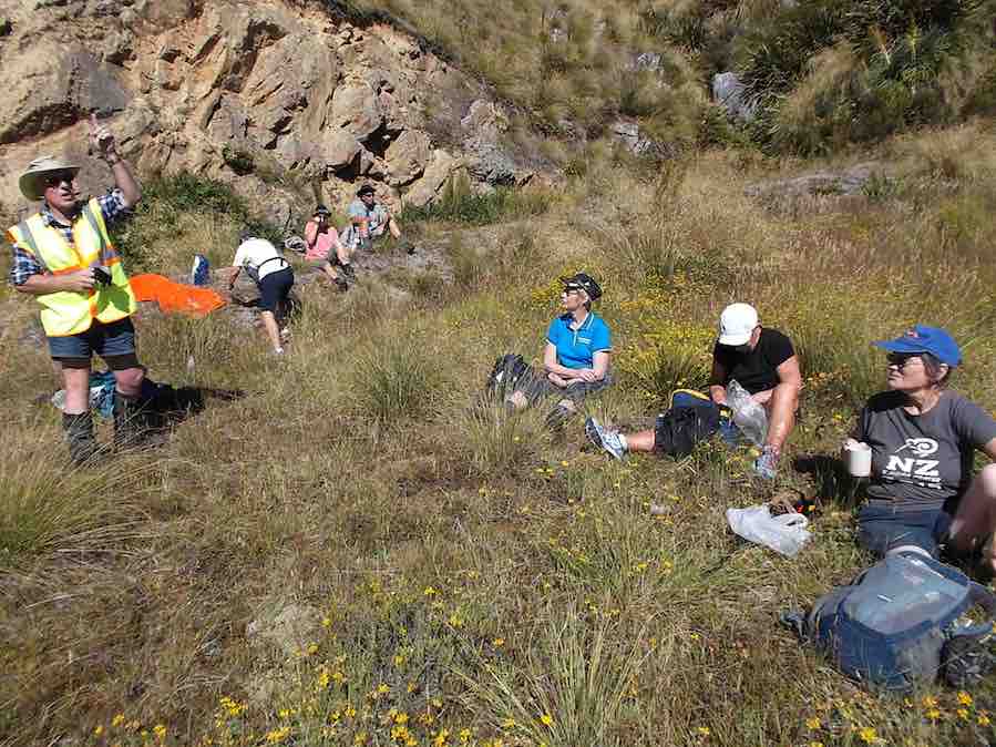
We stopped for lunch at 12.45 before continuing up the trackless tussock slope. One of our lady guests was feeling the heat (it was hot out in the sun by then) and at 2pm was in severe distress.
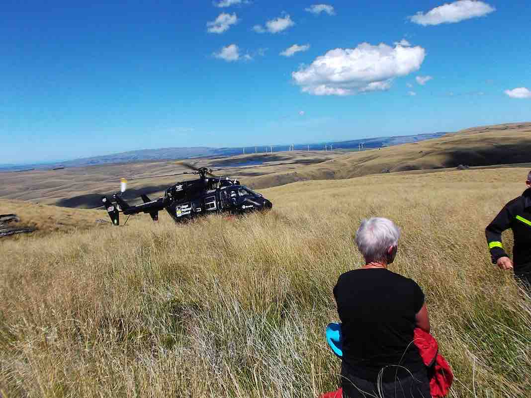
An immediate 111 call was made, and once the police had pinpointed our exact position, the rescue helicoper soon arrived …
About 2.50 p.m.Trampers’ helicopter rescue. (Heb pic)
…and transported her to hospital. Happily she soon recovered and went home that night.
The 7 remaining trampers then returned down hill back to the weir – too far behind time to continue.
After a 15 minute rest at the weir, the car drivers took a pleasant little stroll over the hill to bring the cars over to collect the rest of the group who had remained at the weir. All then returned safely to Mosgiel.
Thank you to our 2 nurses, Jill and Margreet, who rendered first aid, and thanks also to the whole group for the care and understanding shown by all.
And finally a very big thank you to the N.Z. Police. Also to the Otago Regional Rescue Helicopter and its Crew.
A final reflection. A motto for our club to adopt?:
****** SAFE TRAMPING IS NO ACCIDENT *****
– Arthur.
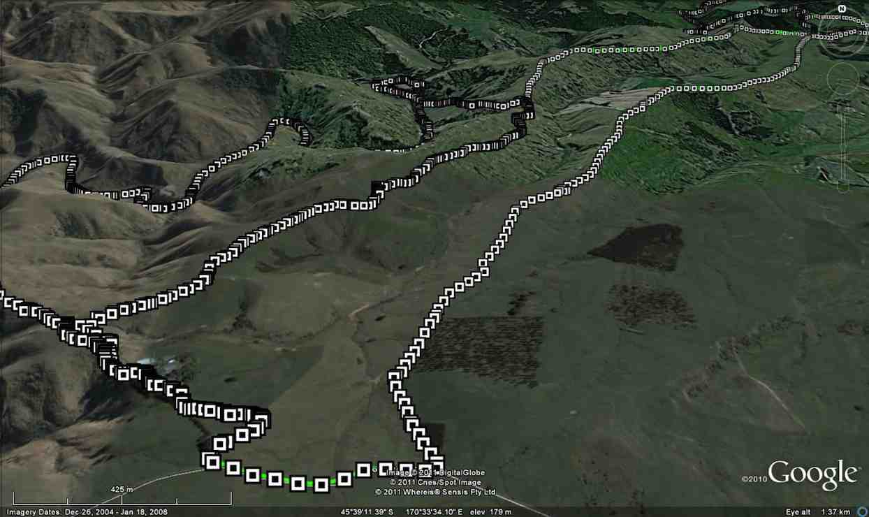
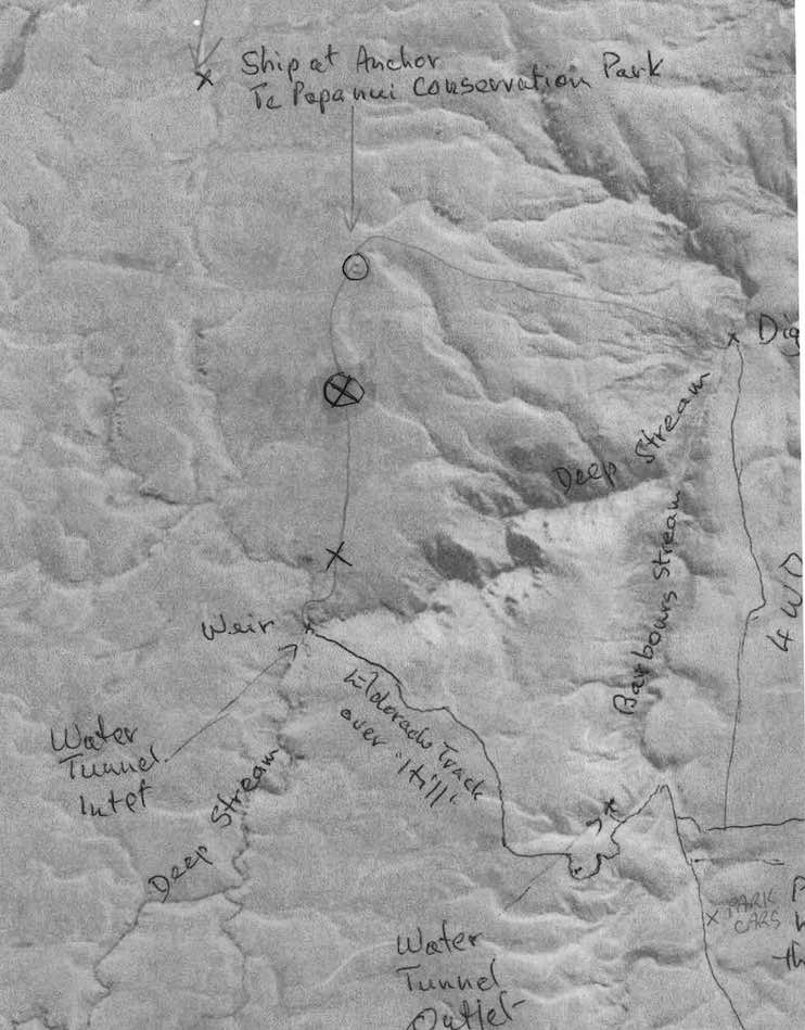
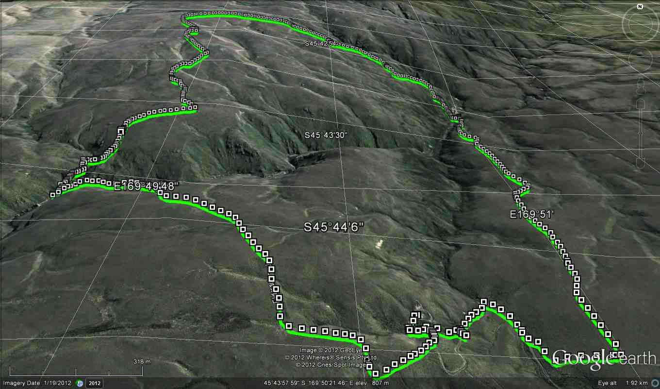
Map of the 2 treks, including the Trampers’ ‘happening’. Circled X marks helicopter pickup. The ‘x’ below it marks the lunch-stop, showing how slow progress had been.
Hikers’ Report. Leaders: Ian and Bob.
We hikers were 13 in three vehicles and were parked beside the trampers’ other two. The trampers set off immediately but our much shorter prospective journey allowed us a leisurely morning tea on a bank overlooking the cars.
Hikers Morning Tea. (Helen pic)
Then it was down the “Track” only a short way, then a sharp right turn up a steep rise to an T-junction where we regrouped. From there we set off in a strung-out line along the 4-5 km 4WD track through the tussock down to the diggings down the Deep Stream. We arrived there early, but what the heck. It’s hot. Sit down and enjoy a rest and an early lunch.
11.30 a.m. Hikers, Lunch, Diggings, Panorama.
This reporter was surprised few took the opportunity to do much exploration of the diggings.
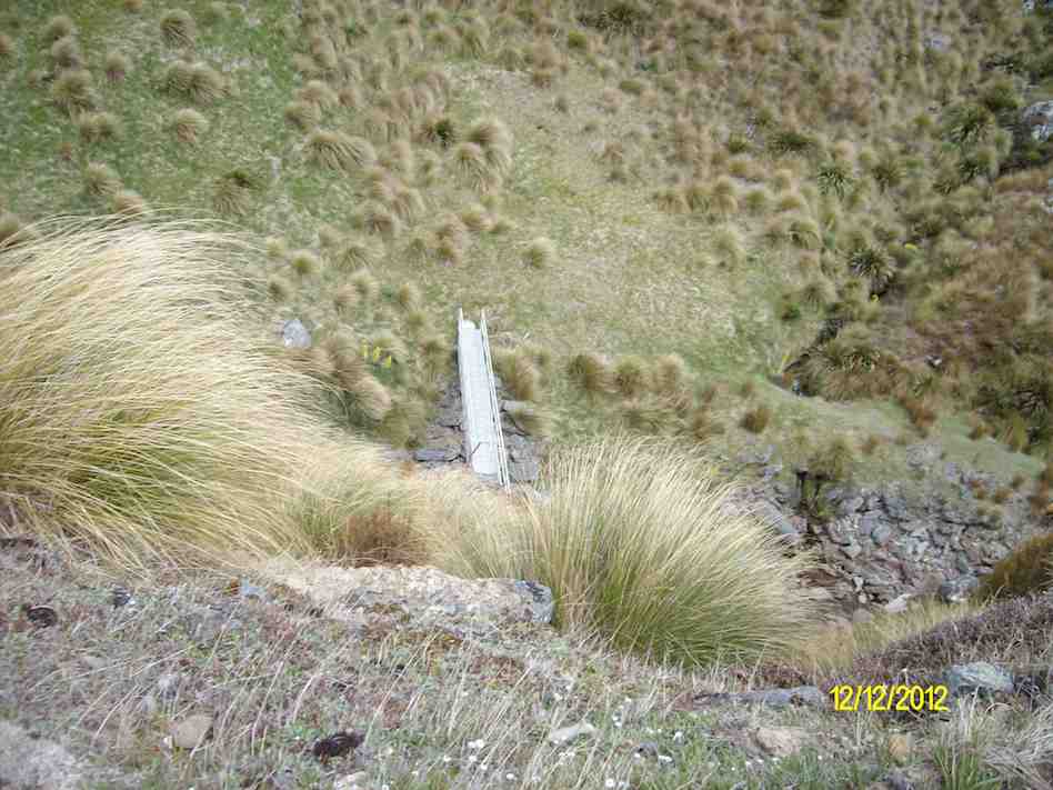
Drainage channels at north end of diggings
We had arrived. It was hot. Trek accomplished. Eventually some started going back. Groups of 2 and 3 left to return up along the track we had earlier come down. No trouble about this. The 4WD track was clear. The route would be uphill this time. The heat was increasing. There need be no rush. So we strung out and Bob made his way to the front with Ian grateful to be at the back with the the last two slow ones. In fact so slow were we, that after Bob and the others had got back to the cars Bob still had time to return in his big 4WD before we had even reached the T-junction, and made light work of transporting us the rest of the way. Although all the others had of course accomplished the full distance, it must be said that there were not a few cases of light-headedness. Frequent drinks of water and good sun protection were certainly essential. There was no shade.
We were back at the cars – when? – about 2 p.m. Now for the area’s other highlights. But by car this time! We took the route the trampers had taken earlier, steeply up over the hill, visiting in turn the Water Tunnel Outlet …
Hikers at the far end of the Water tunnel exit. (Photo taken from beside the T.K.S. Sidey bronze plaque affixed above the tunnel’s exit.)
… and its inlet over the hill at the Weir. (We didn’t know it at the time, but had we looked back as were were driving back up the hill from the weir we might have caught sight of the trampers coming back from their aborted expedition. They saw our cars! And we hadn’t even noticed that big black helicopter! So close were our two groups! So distant! And of course the area is not cellphone territory.)
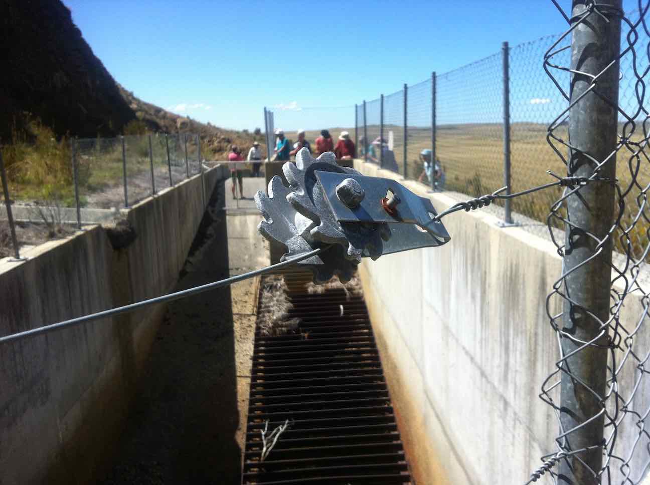
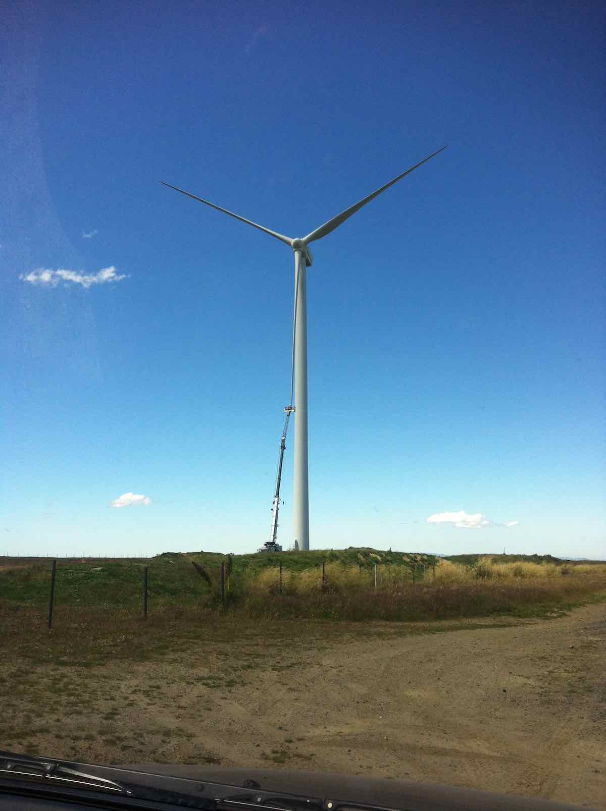
For us, it was simply back over the hill, blissfully unaware (and unable to know) of the critical state the trampers were in. Out through the Black Rock Scientific Reserve, through the two locked gates, and translocating from the 4WD Eldorado Track to the upgraded Trust-Power Mahinerangi Wind Farm’s Eldorado Road. (How ‘tracks’ can change over the Club’s history!) A wind turbine blade repair job alongside the ‘road’ dwarfed the technicians in their tiny cage. (Click a second time to enlarge the photo.)
Wind turbine blade getting attention.
We returned this time via the Lee Flat Road for a change. We were now on tar seal, and arriving at Outram made us feel we had returned to civilisation.
Hikers. Coffee at Outram. (Helen pic)
What a day to mark in the Club’s history! Well, all’s well that ends well. Sooner for us, and – well – eventually for the trampers. (There’s too many ‘wells’ in there somewhere) – Ian.
10. 25/2/2015. Trampers. Gold Tailings attempt.
The 4 of us set off to do the Ship at Anchor. When we got to the outlet tunnel at Barbours Creek with the rain and cold wind we decided to go back to the sign to the mining village. We set off up the track to the second sign, the same as down at the road. No clear indication on which way to go. We went down a FWD track, thinking this was the way but after a while I stopped and said this was not heading the right way, so we returned to the car with the wind and rain in our faces. The four of us decided to have lunch at Waipori Falls picnic area. Within five minutes it started to rain again so we headed into the car heading for home. We ended up eating our lunch when we got home. – Heb.
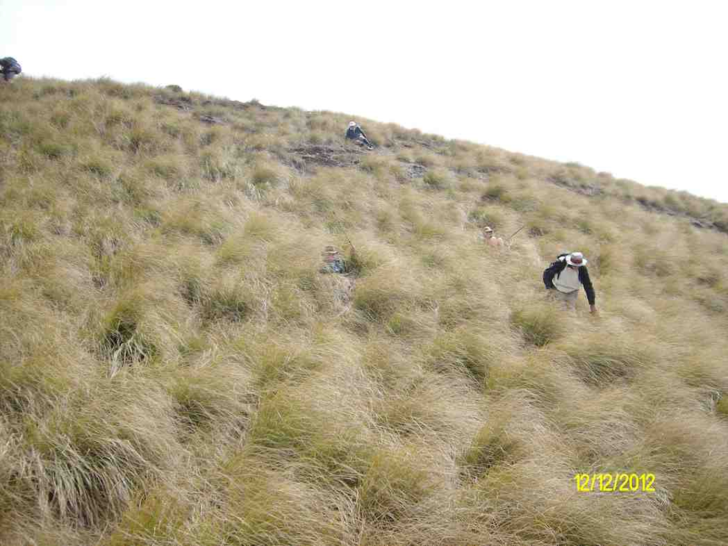
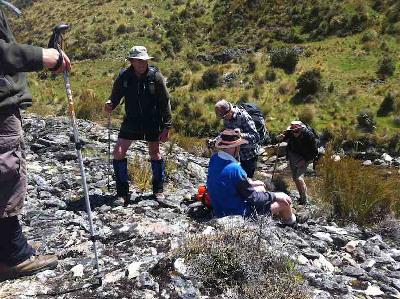
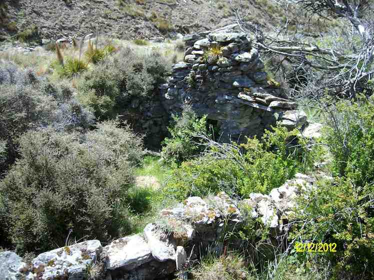
9. 12/12/2012. Trampers. Ship at Anchor. Deep Creek. Gold Tailings.
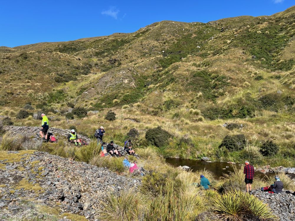
Tea break before climbing road to top of rise.View from top of rise down to foot bridge across stream.George, Eric and Heb on top of Ship at anchor.Enforced slide down steep slope. George has made it, Judy at foot of slide, Ian making a cautious start. NB: tussock thick now.Down at diggings.Stone ruins. (Ken pic)
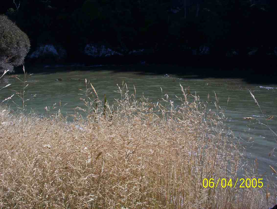
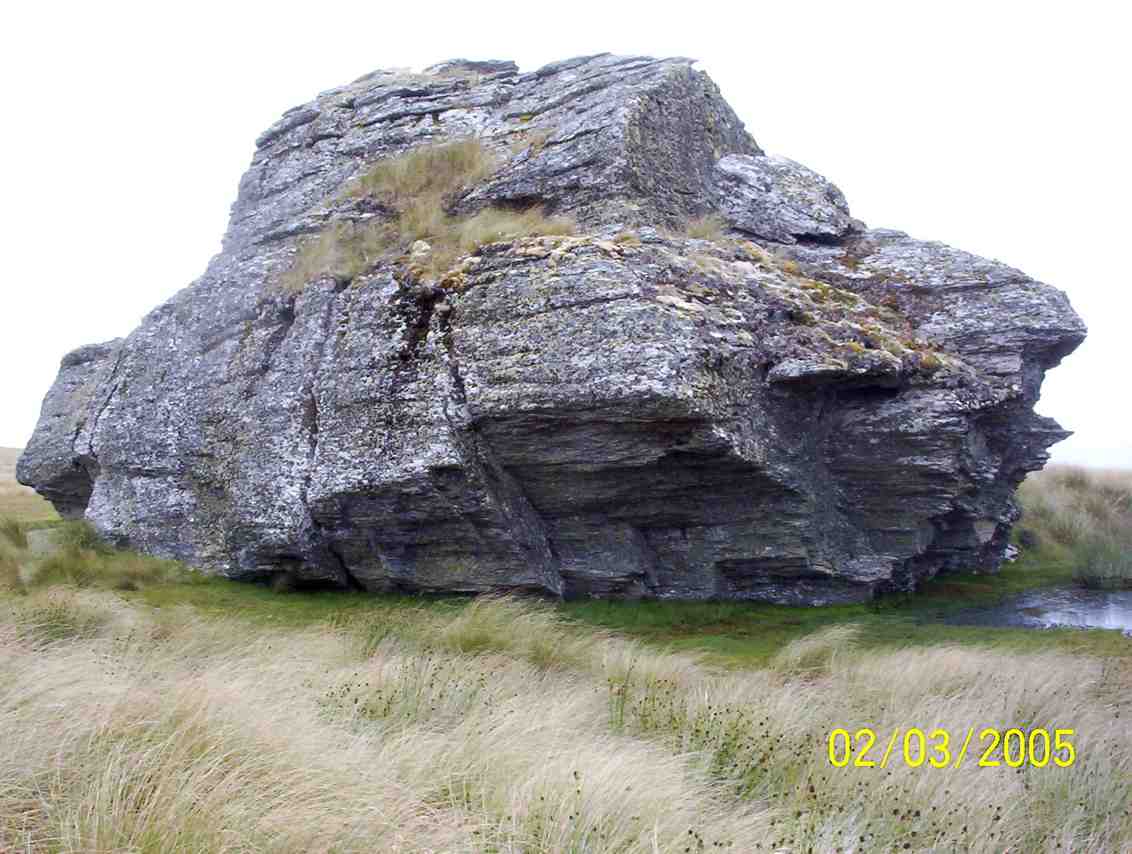
8. 2/3/2005. Trampers. Ship at Anchor. Lammermoors, Deep Creek, Gold Tailings. Leaders: George, Arthur H
Ship at Anchor. Sth Face.
DCC Works. Bridge. Pat, Hazel, Arthur, George
Ship at Anchor. Bob H. Who?
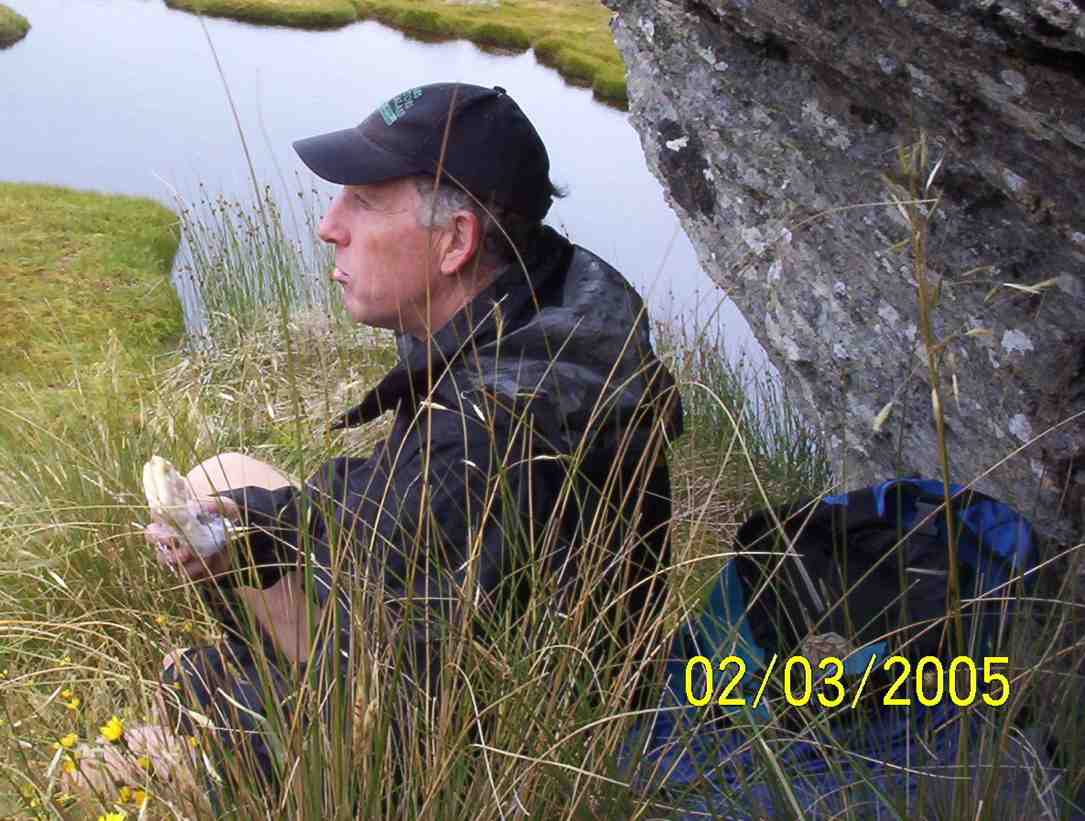
Lunch. Arthur
Stream crossing by old diggings. Dorothy? George, Doug J? Bill, Arthur, Pat
7. 12/11/2003. Trampers. Ship at Anchor, Lammermoors, Deep Creek. Medium+. Leaders: George, Arthur H
6. 31/3/1999 Ship at Anchor – Mahinerangi. Leaders: George, Lex, Graham
5. 2/1995 Leaders: Eric, George, Doug M
4. 23/2/94. Ship at Anchor. Medium+. Leaders: Ria L, Eric B, George, Doug M. Easier alternative: Leaders: Ria H, Jean A.
3. 13/11/91. Ship and Anchor on the Lammermoors. Harder. There will be an alternative route if you run out of ‘puff’. Leaders: George, Bob & Audrey, Dave & Jean
2. 27/9/89 Ship at Anchor, Lake Mahinerangi. Harder grade tramp. Leaders: Hugh & Judith, Dave & Jean, Ria L
“On “The Ship at Anchor”, Lammermoors. Taieri Tramping Clubb. Barbara McCabe, Bob Heenan, Peg Chisholm, Ria & Keis de Jong, Eric & Dorothy Bennett, Mary Jerry, Marie French, Ria Lippers.” (Ian pic, scanned from Peg Chisholm photo collection.)
1. 1/3/1989 Eldorado Track. Interesting country – old Waipori cemetery. Leaders: Ria L, Bob H, Molly
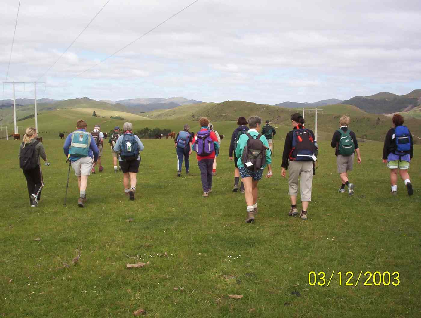
Lovely sunshine greeted 30 keen trampers for a good day’s walk on Cairnvalley Farm Shannon. Strath Taieri offers something different in scenery with tussock hills, huge rock formations and at this time of the year fresh green vistas of paddocks and Continue reading “Shannons Farm Walk”
At about 10.10am four cars from Mosgiel, met three cars from Dunedin, at the “On the Spot Dairy”, Waitati, and proceeded to Steep Hill Road, a short distance passed the ‘big dip’at the top of the Kilmog. A few Kilometers or so, on the gravel road, saw us arrive at Moana Farm (Lawson’s Farm.) By 10.25am Twenty four trampers left the cars, with Theresa leading the first part of the tramp, myself being Tail End Charlie.
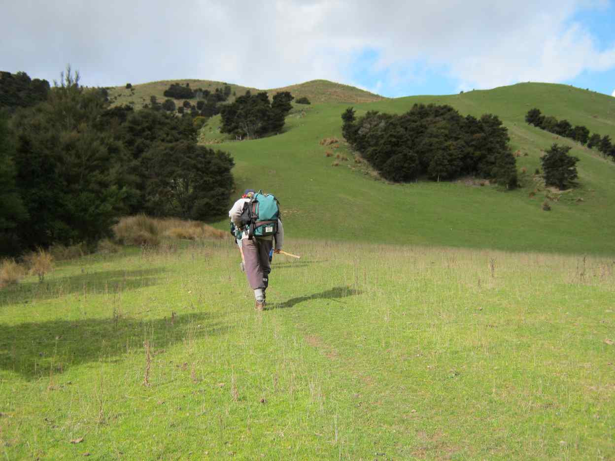
And off they go – Photo & Caption Phil Keene
The previous night had been a cold, stormy one, and the cold South Westerly wind, certainly made it’s presence felt as we walked further along Steep Hill Road, through a farm gate, and along the fence line parallel to the road, until coming to the next downhill fence, which we followed until turning left at the gate, bottom of the paddock.
A strung out mob – Photo & Caption Phil Keene
(Please bear with me on the previous bit, that seems like information overload, but is critical knowledge for anyone planning the tramp in future.) From here the tramp goes in a roughly circular, clockwise direction, up hill and down dale , following farm tracks.
The lowest point of the tramp was soon reached, where most kept reasonably dry feet, crossing Mary’s Creek.
Crossing Mary’s Creek – Photo & Caption Pam
This creek has an intriguing little story (tall tale or true?) as to how it got it’s popular nickname, which I explained soon after the crossing. It seems Mary was a gold miner’s wife who regularly bathed in the creek.
Listening to John’s story about Mary – Photo GrahamJohn and Neil looking for Mary!!! – Photo & Caption Pam
After this bit of local cultural enlightenment, we seemed to do more uphill than downhill, until
Admiring the Striking landscape above Mary’s Creek – Photo & Caption Pam
Theresa stopped us for morning tea in a sheltered spot, out of the wind, amongst the tussocks, at 10.50am. By 11.05am we were on our way again, following the farm track, and admiring views of the valley below; farmland with native plantings in the gullies, and farm tacks, mostly following fence lines, seemingly going in all directions, zig-zagging around the property. At 12.30pm we stopped for lunch at the same spot Theresa, Sarah, Phil and I stopped on our Recce. Here sheltered from the wind, most found a ‘comfortable perch’ on rocks, logs, or the bank. to enjoy lunch.
Great lunch spot out of the wind – Photo & Caption Pam
A visit by the farmer, with his beautiful Huntaway perched on the back of his quad-bike followed, just before we started off again at 1.00pm.
Stunning views towards the coast – Photo Graham
I then led the second part of the tramp, back to the cars. Shortly afterwards the forecast wind change took place. The South Westerly wind, changing around to a “Nor Wester.” Just as cold, just as strong, and just as much in our faces! Some respite was found in the sheltered areas of the track as it wound it’s way around hillsides, up and down gullies, and ridges. By 1.45pm we were back at the cars after negotiating the cattle yards. (Thick squelchy mud!)
A great way to finish – Photo & Caption Phil Keene
Afternoon coffee was enjoyed at Blueskin Nursery Cafe’.
In all we had covered 8.56km, altitude 240metres, a Grade 3 Tramp.
Thank-yous are due to :-
Farmer Willie Lawson, for so generously allowing us access to enjoy his property
Theresa White, for keeping me on my toes, and acting as Leader and Tail End Charlie.
Phil Keene and Sarah McCormack for help with our Recce.
Neil Simpson who has lead the tramp before, and was a mine of information on my initial contact with him.
John Gardiner.
17. 2/12/2020. Trampers. Lawsons Farm. Leaders Margreet and Neil
A blustery but warm Nor ‘westerly wind and a threatening sky greeted 32 (or was it 33?!) enthusiastic trampers at the gates of “Moana” farm at the top of the Kilmog. Owned by the Lawson family, Moana is a hilly and picturesque holding, bisected by the meandering Waikouaiti river. We certainly owe a great deal of thanks to generations of the Lawsons who kindly allow us to wander around their property (after requesting permission of course).
“Starting off.” – Photo and Caption Gordon
Taking a westerly route we descended rapidly to Mary’s creek, then round the corner to the site of ancient gold workings.
Descending into Mary’s creek.” – Photo and Caption Gordon
“Checking out the gold sluice.” – Photo and Caption Gordon
“How does the guy with the camera get into a photo?”- Photo and Caption John
From here it was a steady climb with a few minor descents to our lunch spot nestled in a tussocky knoll with views of Karitane, Waikouaiti and Maori Peak.
“Which ones are the trampers?”. – Photo and Caption Gordon“Amazing lunch view.” – Photo and Caption Gordon
It was great to see Neil and Carole out with us again.
“Cloud formations”. – Photo and Caption Gordon
Leisurely lunch over, the group reassembled (tail end Charlie was heard to describe it as like trying to herd fish!!) and trudged the 20 mins back to the vehicles. Not a long tramp by any means (about 9km) but fairly described as nuggety don’t you think?
Post tramp we enjoyed having coffee at Blue Skin Nursery. The staff did a great job taking orders for our large group and we enjoyed sitting outside amongst the plants.
All in all a really enjoyable day out and we look forward to starting the new programme in 2021.
Neil and Margreet Simpson
16. 10/4/2019. Trampers. Lawsons Farm. Leaders: Margreet and Neil
Despite a forecast for heavy rain at lunchtime, a large contingent of 17 trampers set out on our hike on Lawson’s Farm in balmy and ideal conditions.
We left the Mosgiel carpark at 0900 and reached the main gate of the farm at around 45 mins later. After a morning tea break on a grassy knoll;…
Morning tea view. (Helen pic and caption.)Do we have to get you down and up there? (Phil pic and caption.)
…we descended rapidly on a farm track to Mary’s Creek which burbles through an area of native bush.
Neil explaining the name “Mary,s Creek”. (Gordon pic and caption.)
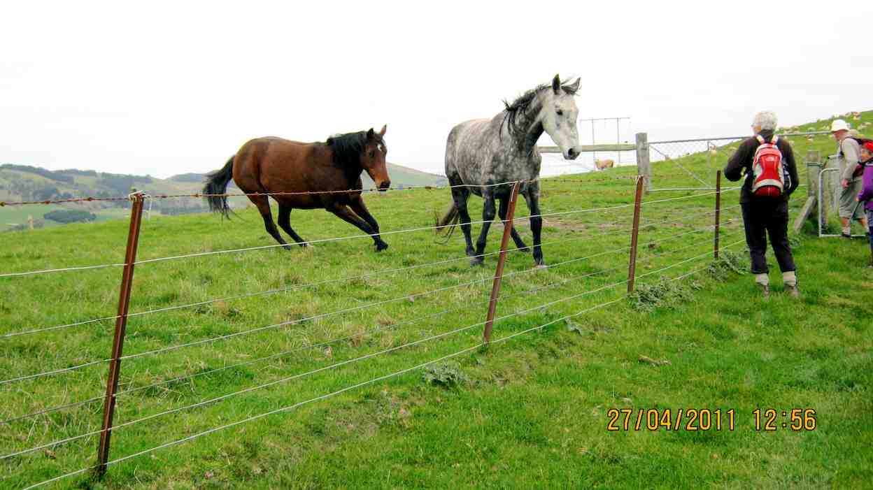
On the descent we passed the only other trekkers we encountered – 5 horses and 3 foals!
On the valley floor we meandered round past ancient gold workings and the remains of a stone dwelling. Then it was a series of stiff climbs and descents on reasonably good footing up to a ridge not far from the woolshed.
Looking back down to the stream. Gordon pic and caption.)
Suddenly a stiff sou’wester wind set in, pregnant with rain, and the temperature dropped markedly.
On a sheltered hillside we ate our lunch.
Lunch in the tussocks. (Gordon pic and caption.)
Incredibly, the conversation revolved around the merits of courtship in an HQ Holden with column change and bench seat; compared to a Morris Mini with bucket seats and ‘four on the floor’! I kid you not!
After lunch we decided to shorten the tramp and were back at our cars by 1300. Total distance was 8 km but everyone really enjoyed the hike and found it challenging enough.
Coffee and ‘blankets’ was at Blue Skin Nursery where we met up with the hikers returning from their beach walk at Warrington. – Neil and Margreet
15. 16/8/2017. Trampers. Lawsons Farm. M. Leaders: Neil and Margreet.
Nine trampers set out from the car park at 0900 on a stunningly clear but frosty morning. After an uneventful 45 minute drive we parked inside the main gate of Lawson’s Farm. Patiently, but DOGmatically the two male trampers ‘herded’ up the 7 lady trampers and set them going in the right direction …
…. Southwest down Steep Hill Road before entering a paddock with a sun-drenched knoll where we paused for morning tea.
Morning tea. (Helen pic and caption.)
Lo and behold two latecomers (Bruce & Bob) arrived to counter the gender imbalance. Arthur was heard to quietly breathe a sigh of relief!
We were doing a different walk today to avoid all the river crossings. It was however still very muddy underfoot. We soon descended to cross Mary’s Creek. Mary, apparently, lived with a small cadre of gold miners and used to sneak up into this bush-clad tributary to take a bath away from prying eyes. None of our ladies were keen for a dip today!
Further on we passed sluicings and building remnants from the gold mining days and then it was a stiff climb up from this, the South branch of the Waikouaiti River.
We sidled around the undulating terrain and found a lunch spot …
(Margreet pic)
… which had beautiful views over the hills and tussocks and Mount Watkin to the North; through Matanaka and Maori Point to the East.
After lunch we soon ‘topped out’ to find stunning views of the coast and untroubled sea …
(Margreet pic)
… as we descended …
(Margreet pic.)
… a long, ever steepening ridge. At the bottom we crossed a noisy creek and began an energy-sapping climb up the opposite ridge back to the cars. It was a bit like the reverse of the Grand Olde Duke of York; who marched his men to the top of the hill and marched them down again! Pointless really!
So; after a wonderful tramp on an exquisite day, it was a weary 11 who gratefully repaired to the café at Blue Skin Nursery for coffees and tea.
Total distance was around 13.5 km. and it was about 4 hours hiking time. – Neil and Margreet.
14. 8/6/2016. Trampers. Lawsons Farm. Upstream. M. Leader: Arthur.
A frost to begin the day. It was mighty raw as we gathered at the car-park in Mosgiel. Nine trampers travelled to Lawson’s Farm, Kilmog area, where we found very pleasant conditions awaiting us. Only the shady faces were white with frost.
Past the wool-shed, where the dogs barked their usual greetings to us, and up the first brief slope found our morning tea stop. The winter 9.30-starts necessitate a later morning tea, but better late than never!
Onto the 4WD track through the tussock we travelled
The track we followed. (Helen pic and caption.)Farm building and long drop. (Helen pic and caption.)
– down briefly, then up briefly, and then down, down, down – until we finally came to the south branch of the Waikouaiti River.
We turned upstream now, following a sheep track through the tussock and occasional scrub, until we had a stiffer climb up around a steep face above the river. We could then descend onto a lovely tussock flat, where we came to a 4WD track to follow.
Eventually the track let us to a ford over the river. The safest route was to cross at the ford also, so it was into the water which was a little cold.
Very cold river crossings and cold wet feet. (Helen pic and caption.)
More river crossings followed in the subsequent mile or so. After the sixth and final one, we stopped at a nice sunny spot to partake of our lunch. Mr Lawson tells me that gold mining had been carried out back in the 1870s or 1880s at our lunch spot. The tell-tale earthworks being very noticeable. The time was 12.20 p.m.
Lunch and view. (Helen pic and caption.)
The river was still up a bit after the heavy rain a week previously. About a foot of water (that’s 30 cm for you metricified folk) was the deepest we had to wade through. All crossed without a mishap, and anyway, real trampers don’t mind getting their feet wet!
Two N.Z. falcons were observed while we were having our lunch. They appeared to be chasing one another, with loud squawks emitting. Perhaps one had caught its lunch but wouldn’t share?
After lunch, continuing on the 4WD track, we were soon in the shade of a narrow valley, almost a gorge. Uphill from now on, but the grade was steady and not unpleasant. The air was very cold in here,
Sooo cold and very white frost. (Helen pic and caption.)
and it was a great relief to find the sunshine again.
Before reaching the Steep Hill Road, we turned off to walk up an open bare paddock. At the gate we made the acquaintance of two quiet and friendly horses.
Friendly horses and nice view. (Helen pic and caption.)
Eventually we gained the road, with about one kilometre to go, and were back at the cars at 1.45 p.m.
Someone stated that it had been a very pleasant tramp – and all agreed with that. No measuring device with us today, but we must have tramped about 10 km.
Afterwards, the trampers had their weekly meeting at Waitati. Business included:-
1. Brief discussion as to our track-clearing intentions for the next season.
2. A considerable number of ideas regarding food, and recipes for the same, were put forward. Did you know that coleslaw makes an excellent filling for “Toasty Sandwiches”?
We had 11 trampers out today, including a new member to our group, a really good number.
We parked up just inside the gate of Lawsons Farm, & proceeded to walk down past the farm house, where we were met by Jim & Willie Lawson. We had a very nice chat with them before setting off towards our morning tea spot out of the strong breeze that was blowing.
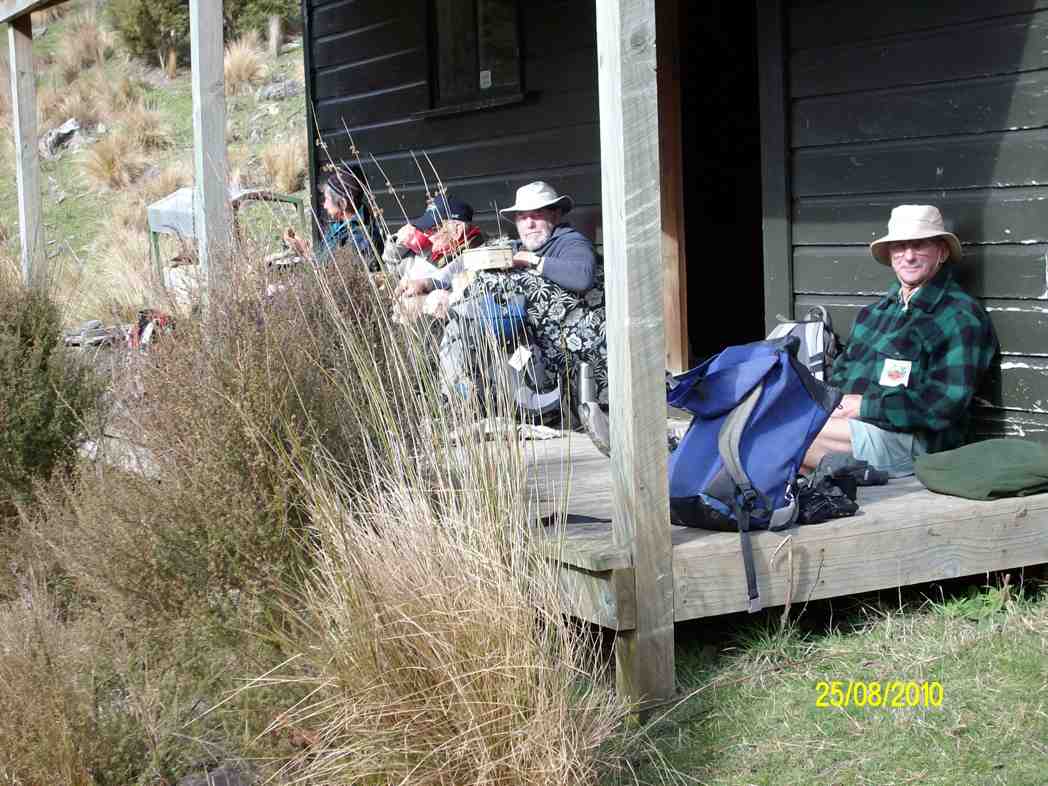
Then it was down to the river, where we turned right [downstream] & walked along the valley, where we had to negotiate the bluff that requires care getting down. Having safely got past this obstacle, we carried on to the “Lodge” where we had a leisurely lunch stop,
Lawson Lodge. (Margreet pic)
while some members who had not been there before examined the interior of the “Lodge” & the old vehicle chassis residing in the grass, still with chains on the tyres.
Then it was back the way we had come, until the slope we had to climb was upon us. All made it up here without to much drama, & we had a regroup at the fence corner, before making our way up to the ridge track, which leads back to the farm yard.
After arriving at the cars, it was decided that the ‘coffee club’ tradition would be continued with a stop at the Blueskin cafe., where we all enjoyed a chat over our favourite cuppa.
There were some appreciative comments made about the tramp, so a good day out for all.
Walked 12.5km
4km/hr
climbed 540mtrs. – Ken.
12. 19/11/2014 Trampers. Lawsons Farm. Upstream.
Lawsons Farm Upstream. GPS courtesy Ken. Walked 10.2km; 2hr 32min moving; 4km/h ave; climbed 600m. Some tricky bits, but OK.Morning tea break. (Ken pic and caption)
View from morning tea stop of Mt. Watkin in the distance. (Ken pic and caption)Showing grass track down to the river below. (Ken pic and caption)Valley we walked along. (Ken pic and caption)Old hut.It’s virtually uninhabitable, as it’s very dirty inside. (Ken pic and caption)Showing our route back up the hill. (Ken pic and caption)
We could make this walk even longer, by walking along the valley further & coming up the gully alongside Mountain Rd. Might try this next time. – Ken.
11. 5/6/2013. Trampers. Lawsons Farm.
GPS or route, courtesy Ken. We walked 12km; 3hrs 2min moving time; 3.9km/hr; climbed 461mtrs.
This was new country for 4 of the 6 that started out on this walk. We had quite a nice day except for a cool breeze along the exposed ridge tops.
We all enjoyed the walk along the Waikouaiti river banks, & the rocky obstacles that the writer remembered from last time. All enjoyed the lunch stop at the ‘Lodge’, where we made use of some plastic chairs, & the edge of the veranda. Doug even got out a plastic bin for a table.
Getting organised to have lunch at the ‘Lodge’
The comment was made that it had to be the most comfortable lunch stop we had ever had. However, all good things must end, …
Lunch at the ‘Lodge’
… so we decided to pack up & move on, as the sky was looking a little dark from where we were. However, once on the tops again, we could see that it had been unnecessary to hurry, as the weather looked much better from up there. An unhurried walk back to the cars finished off the day nicely, arriving back at the farm around 2:00pm for the drive home.
10.27/4/2011. Trampers. Lawsons Farm. Figure of Eight.
GPS, courtesy Ken. Left loop with tail at end is of the earlier Waikouaiti Stream tramp. (see GPS below) Right elongated loop is of this tramp, down left ridge and up the right.
Looking back at the Homestead from early on, on the left ridge.
The limestone rocks in the gully just up from the gorge.
A view from our lunch-stop of the gorge we stopped short of going into.
Just a view up the gully we had circumnavigated. Taken from the old coach road.
Frisky friendly horses who were content to muzzle us.
9. 18/8/2010. Trampers. Lawsons Farm. Clockwise via Waikouaiti River. Returned west ridge instead of Old Coach Road. Medium. Leaders: George, Hazel, Ria.
GPS tracking of Wednesday’s clockwise tramp. (Courtesy Ken’s GPS device)
We parked the cars just inside the entrance to “Moana” farm, walked through the dip past Lawsons’ homestead, up over the rise beyond it (where at its top we were to complete the circuit later on), to shelter from the brisk breeze for a tea-break in the tussock of the next dip. Then it was up over a next small steep rise to begin the long descent to the river.
Gully down to Waikouaiti River, South Branch.
As can be seen from the GPS tracking map, the Waikouaiti South Branch wound left and right as we made our way down its flats.
Wider part of the river valley
Finally, across a couple of wide clearings and through some bush and we were at the lodge for a late lunch. (It WAS a 9.30 a.m. start.)
Lunch at the ‘lodge’ (Ken pic and caption)
Abandoned 4WD transport. (Ken pic and caption)
Returning back upstream a bit, we faced the daunting (near-vertical for a start,) climb back up the ridge flanking the river’s true right.
The steep climb up from the river valley to a saddle of the west ridge
Reaching the top, we turned right and followed that ridge along its undulations to reach the point that lead us back down past the homestead and its yards and up to the cars again. – Ian.
8. 10/6/2009. Trampers. Lawsons Farm. Modified clockwise walk from homestead along ridge. (Figure of eight intended originally.) Medium. Leader: George.
We met at the farm gate and welcomed back Hazel who was out walking for the first time since her ankle break up Careys Creek in March. A remarkable recovery.
Looking north down gully between the two ridges walked. Mt Watkins on left.
George led the five of us down the farm ridge.
Along ridge that lies between river (over on left) and Mountain Track Road (Old Coach Rd) (off to right). Sabina, Doug, Hazel, George.
Eventually we reached the track leading across the gully up to the Mountain Track Road, (the old Coach Road).
Shot taken from Mountain Track Road looking back across to other ridge and adjoining track sloping down nr plantation. Mt Watkins in distance.
At that point we decided to forego the (longer) original figure-of-eight plan in view of the committee meeting to be held later that day and made our leisurely way back up the Mountain Track Road to the farm house. – Ian.
7. 24/1/2007 Trampers. Lawsons Farm. From Homestead. Downstream Waikouaiti River South Branch, Lodge, Paper Road, return Farm. Leader: Ian.
Parked nr gate. Walked down past house and yards. Climbed hill ahead and followed track down to River. Then along bank until eventually turning up to the Lodge for lunch. Back a little up the track and then a steep climb to old Paper road which followed to metalled road and back up to the cars. – Ian
6. 22/2/2006. Trampers. Lawsons Farm. Leaders: Arthur H, George, Dorothy S
5. 13/4/2005Lawsons Farm, Waikouaiti River South Branch, Lodge. Paper Road return. Leader: Ian
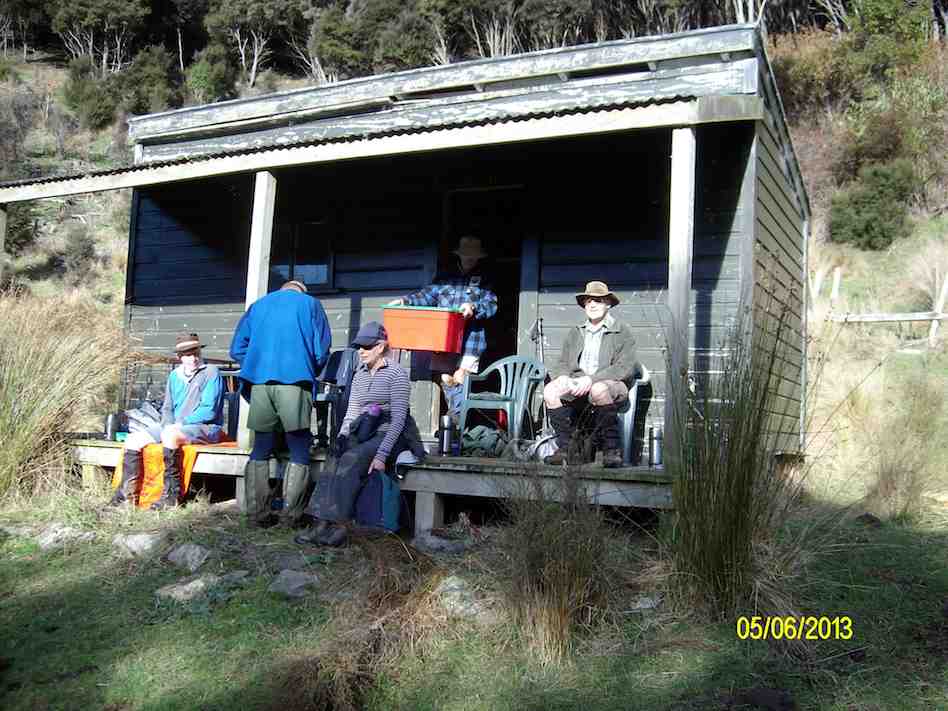
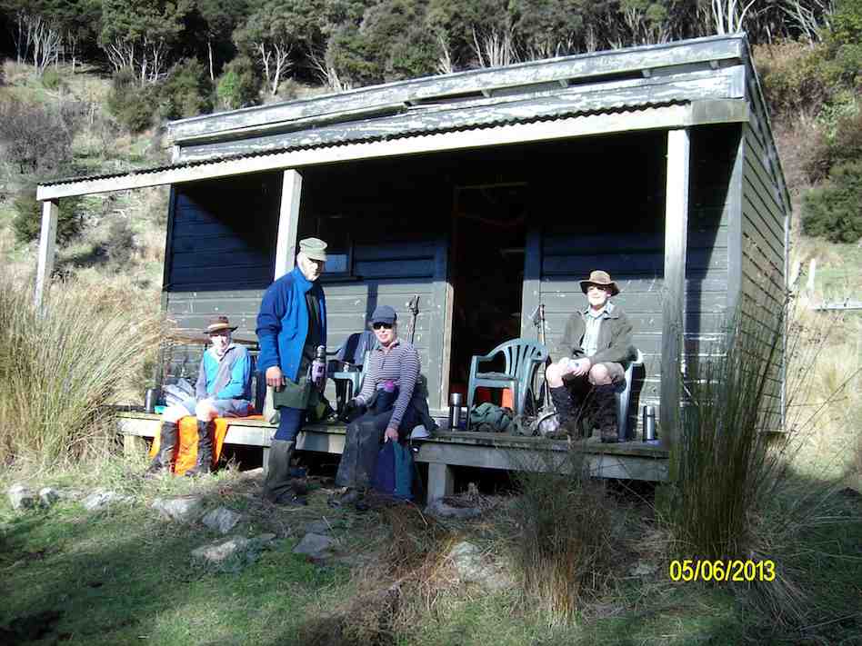
Lodge on Lawsons Farm
4. 3/12/2003. Trampers.Lawsons Farm, Waikouaiti River South Branch, Lodge Old Coach Road return Leaders: George, Dot B, Hazel
Start at cars
Stepping Out
Tea break. Sabina, Joyce, George, Irene Lesley Dot B
3. 24/10/2001 Steep Hill Road, Waikouaiti River. Medium. Leaders: George, Ria L, Barbara McC
“quoin” definition: 1. An exterior angle of a wall or other piece of masonry.
2. Any of the stones used in forming such an angle, often being of large size and dressed or arranged so as to form a decorative contrast with the adjoining walls. Seek permissions. 03 –
Coast and farm walk. Bull Creek nature walk to waterfall (tiny!) recommended.
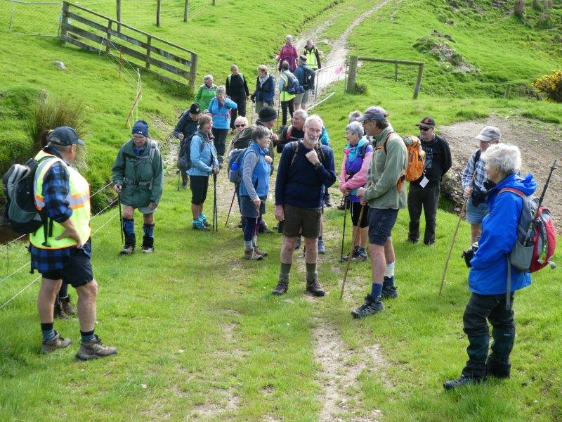
16. 1/2/2023. Quoin Point to Bull Creek. Combined. Leaders Bruce, Alex, Helen and Phil.
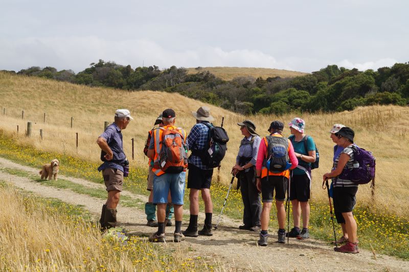
Thirty-one keen walkers headed south and after regrouping at the turnoff to Quoin Point road parked in a paddock opposite the wool shed at the end of the road where lambs were being drafted.
Keen to get started. Photo & caption John
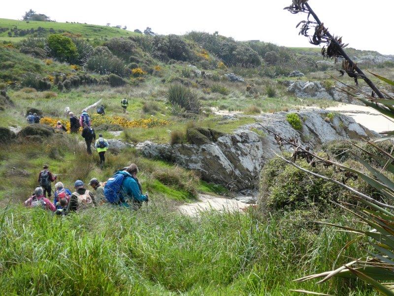
We followed the farm road leading down the hill towards Quoin Point and then turning right opening closing gates where appropriate before stopping after 15 minutes near an inlet with a choice of sun or shade. Shade was more popular.
Morning tea near Quoins Point. Photo & caption Phil
We continued across the paddocks and paused for a time near a caravan and new home above it on the hillside with natives planted in two paddocks while Bruce chatted to the land owner Peter O’Connor of Riversdale. Peter said he was happy for trampers to traverse his property and did not need to ask his permission in the future. The two paddocks are linked by a pipe gate and the best exit to the beach and Bull Creek was at the far corner nearest the sea of the second paddock. The path goes down the hill over some grey rocks and then along the coast to Bull Creek. He plans to mow a track across the lower part of his property in about two years to make access easier.
Neil on gate duty again. Photo & caption John
An example of the beautiful farm gullies, planted in natives. Photo & caption John
Local’s dog, keen to come with us. Photo & caption John
Going to visit the ‘house on the hill?’ Photo & caption Phil
Happy trampers. Photo & caption Pam
Around the corner to Bulls Creek. Photo & caption Pam
Watching over Bulls Creek. Photo & caption Pam
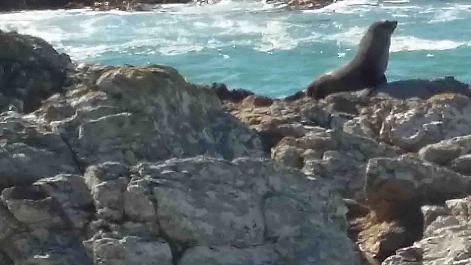
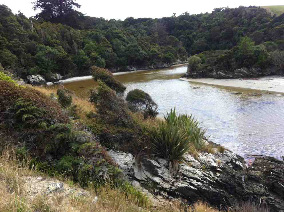
We had lunch on the North side of Bull Creek in case the rising tide cut us off. A seal was spotted in the water at Bull Creek and another mammal seen in the distance on the rocks on the way back. Clare’s family had built a dam across the creek so that the seaweed in the creek could be flushed out once the dam broke.
Time for lunch. Photo & caption John
Bulls Creek iconic tree and three T.R.T.C. icons. Photo & caption John
Clare kindly arranged for 3 of the party to travel back by car; a 25 minute journey going near Milton.
The weather remained fine. Distance 13.56 km, Climb 384 m. We started walking at about 10 am and were back to the cars at 3 pm. There were many views of the coastal rocks. Hay tedding was in progress on one paddock and for the others the hay had been cut and baled since the recce.
Very precise windrowing. Photo & caption Phil
Future walks on the property might be considered for mid-February or after when the sheep are likely to have been shorn, the lambs drafted and the hay cut which makes walking easier. Thanks to the co-leaders Alex Griffin, Helen Morris and Phil Morris for their valuable leadership. Also to Neil for his opening the gates, waiting for the last person to go through and then, remarkably, being in position to open the next gate. He was also better at spotting where the next gate in paddock was, possibly due to his eyes operating at a higher elevation. Thank you again Neil. Our thanks are also due the land owners Alan Shaw, Gwen Lane and Peter O’Connor for their kind permission to be on their properties and to Clare for her local knowledge of the area and assistance with offering transport back to the cars for three persons.
Because the Brighton Café closes at 4 pm the group was given the opportunity to make their own choice for coffee, such as at Waihola or Mosgiel, or an ice cream at Brighton.
Bruce Spittle
15. 6/11/2019. Quoin Point to Bull Creek.
RAMBLERS, HIKERS and TRAMPERS report.
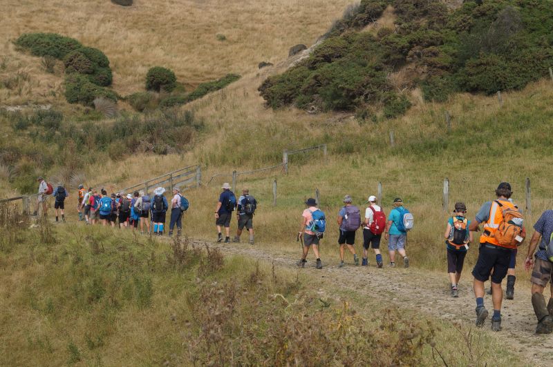
On a calm morning 33 keen, happy members drove up Law road and along the coast through Akatore to Quoin Point road, driving a couple of kms down to the wool shed. At 10am 6 Ramblers headed off to enjoy their day, leaving 27 to hike to Bull Creek.
Photo and Caption Helen – “Up and down” Photo and Caption Gordon – “regroup”
We walked down through paddocks to the rocks where we had smoko.
Photo and Caption Gordon – “Smoko among the rocks”
(In 2014 we tried to count the pod of seals both big and small), however, today we only spotted a couple along the way. As well as 4 leaders, we had markers still in place from the Tokomairiro High school trail bike fundraiser held a couple of weeks ago guiding us. The paddocks were dry and nice to walk on. With lots of gates to open/close, amazing coastal scenery, gullies with native bush, 3 old farm houses and a couple of creeks to cross. 2 hours of hiking then came to a standstill at the now fenced off access to Bull Creek. Even with 2 stiles to cross over, their was not a track to be found. We back-tracked a short distance and found our way down. 3 Members decided on a bit of bush bashing, 2 were through in no time———then through came Doug (our 90 year old) with a grin, having enjoyed his scramble!!
Photo and Caption Helen – “Doug taking the hard way down Photo and Caption Helen – “Bull Creek”
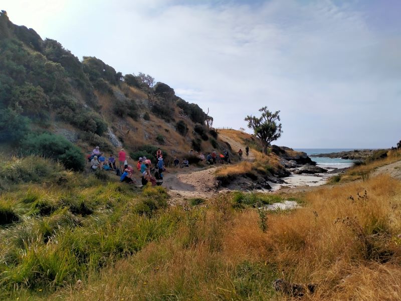
To save getting wet feet, a most enjoyable, sociable and scenic lunch was had by all on the rocks, before you cross the creek to the iconic kiwi cribs from 12:00 to 1:00.
Photo and Caption Gordon – “Lunch at Bull Creek” Photo and Caption Gordon- “Couple of Kilometres left” Photo and Caption Gordon- “Heading to Cars”
Then it was time to head back the way we came, arriving to the cars at 3pm. 2 cars travelled down the Taieri Beach road through pine forest (a new road for some) while the others down the more scenic road to the Black Swan Waihola for Coffee.
As always another happy outing covering about 12 kms. I think it is really important having the combined monthly hike, walking, talking and catching up with our hikers and ramblers.
Photo and Caption – Gordon – “View”
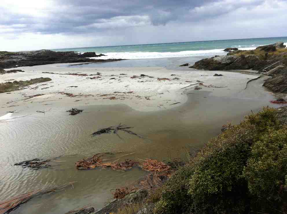
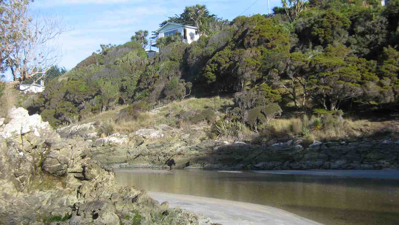
BULL CREEK
Different theories on how Bull Creek got its name. From a fictional character called John Bull, to the Otago Witness’ report in 1904 of the story of a wild Bull meeting a grisly end in the area, with the bull’s head later being hung on the wall of “Bulls Cottage”
The 42 or so cribs are spread over about 4ha and have their own 35 year lease, set up some years ago with the then land owners.
Eleanore, Helen, Bob and Jannette
14. 4/4/2018. Both. Quoin Point to Bull Creek. M. Leaders: Ian, Arthur and Bob.
Hikers’ Route map, courtesy Ian.
The day was fine when twenty-seven of us started down from a busy shearing shed at the end of Quoin Point Road to morning-tea down by the Quoin Point rocks. Both we and a multitude of inquisitive young seals were amazed at the sight of each other.
Quoin Point at the sealions gathering. (Clive pic and caption.)Morning tea at Quoin Point.(Clive pic and caption.)
Ten trampers set off first, closely followed by eleven Hikers…
(Kevin pic.)
… leaving seven Ramblers behind to enjoy a more leisurely walk, which they took as far as the first house, returning along the beaches before having to regain the paddocks. They got back to the cars at 1.15 p.m.
For the others, the route varied between the flats of rocks and beach where practicable, and paddocks and gates where necessary. Towards lunch-time the query of “how much further” was beginning to be raised by some of the newer hikers. The hut-on-the-paddock’s site had complicated matters with new electric fencing forcing skirting around it before reaching the familiar route again. (We did better on the return trip.)
The trampers arrived at Bull Creek …
Bull Creek. (Clive pic and caption.)
.. in time to get round to including the picnic area and the Bull Creek Bush Walk.
Along the waterfall walk. Clive pic and caption.)Along the waterfall walk. (Clive pic and caption.)
The Hikers, with their much later arrival, (their walk enriched however with much mushroom-picking) had time only to get through their lunch
Brief lunch. (Kevin pic.)
before the low-tide’s turn prompted getting back across the creek.
On the return trip, our two groups were mixed and strung out as people moved off from Bull Creek in their own time. Admirably, Bob, our back marker, kept his disciplined place, to ensure we all got back in one piece.
This time, at the second stile, fortunately Arthur remembered to remain on the flat until we had got past below the little paddock hut before resuming the paddocks.
So we straggled back to the cars, strung out in various groups, some faster, others slower as the weariness of a 12 km tramp set in. Bob’s sterling work as back marker, at this point really paid off. Several paddocks short of our destination one of us found the going too much and needed rescuing. Gordon, a new member of the club who had accompanied Bob stayed back to keep watch, while Bob strode on to fetch his large four-wheel-drive ute back to the rescue.
So all’s well that ends well. with the day ending with a congenial “coffee” stop off at Brighton. – Ian.
13. 30/7/2014. Trampers. Quoin Point to Bull Creek.
A good group of eight set out from the farm road at Quoin Point to walk along to Bull Creek. there was a bit of a wind blowing which kept the temperature down, & it was VERY muddy going across the paddocks. We didn’t get onto the beach very much as the tide was quite high, even although on the tramp program it was stated to be low at 11:30 approx. [Yes, a 0.3 m low tide i.e. on the higher side – Ed]
It was surprising to see that the gates along the coastal paddocks had “Walking Access” signs attached to them, so good on the land owners for allowing this.
We had morning tea in the shelter of some rocks, & lunch at Bull Creek. Lunch was a reasonably hurried affair, as the sandflies were eating more than we were!!! The exit of Bull Creek onto the beach was probably passable, but we didn’t fancy getting wet feet so we stayed on the Nth. side.
After lunch, it was just a return walk mostly back along the paddocks to the cars. The wind had started to dry out the very muddy parts, so it was only just a little less muddy going back. But, unfortunatly, one member slipped over at one point, & has some dirty washing to attend to !! We walked 12.3km in approx 4hrs. – Ken.
12. 5/3/2014 Both. Quoin Point to Bull Creek. Leaders: Lex and Peter.
Failed to reach Bull Creek. Ed note.
11. 13/2/2013 Trampers. Quoin Point to Bull Creek. (9)
Nine of us enjoyed the tramp, three of us oldies, six newies, to show it off to. And they did appreciate it.
We saw lots of seals/sealions (?) on the way.
It was surprising to see such a high sandbar at Bull Creek.
A high extensive sandbar now. (Ian pic and caption.)Bull Creek water backed up by the sandbar. (Ian pic and caption.)
Although a souwester was very strong at times it was good tramping weather.
A feature of the tramp at its end was the discovery of a very flat battery in Ian F’s car, whose parking lights had been accidentally knocked on and left for 5 hours! With an AA call-out rescue, we got all got home by teatime. – Ian.
10. 2/6/2010. Both. Quoin Point to Bull Creek. Leaders: George and Dot.
It was a most unusual start. Various reports had it that after the recent rainy period the paddocks would be too wet or the coast road would have been damaged. As it turned out, not – in either case. The upshot was though, that one of the leaders led a number on a round trip road walk up the Scroggs Hill from Brighton. 12 went on to Quoin Point. Of the 12, only 4 went to Bull Creek.
It was a nice low tide, but the Bull Creek flood waters were too deep to comfortably cross.
Packing up after lunch. Ken, Doug.
The remainder stopped for lunch a few gullies back.
Bull Creek minus 30 mins. (Bill caption and pic) Lex and who?
The day was brilliant with little wind.
How did this get here? Noticed on the way back.
It was a good day out. All the more enjoyable for contrasting with the previous week’s extended rain. – Ian
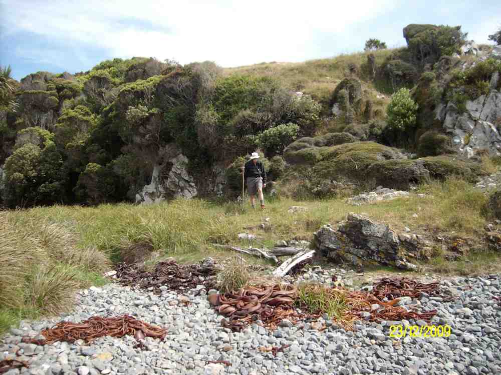
9. 23/12/2009. Trampers. Ken and George. Quoin Point to Bull Creek.
A good walk on Wednesday, lots of rock hopping. It was a perfect day for it as well, with virtually no wind, and not too much sun either.
Returning from Bull Creek. George. (Ken pic)
8. 4/4/2007. All. Quoin Point to Bull Creek. Easy+. Leaders: George, Hazel, Eleanor B, Joyce S
7. 1/3/2006 All. Quoint Point, Bull Creek. Easy. Leaders: Dot B, Glenis, Frank & Lesley
Frost to begin with, but a sunny day followed for 11 Trampers to enjoy their exercise in.
We drove up Mountain Road from the north end and parked up.
The air was cold, but a brisk downhill walk in the sunshine took us to the bank of the Waikouaiti River where we had our smoko stop.
All important smoko. (Gordon pic and caption.)
Following the river bank upstream we soon encountered a pine plantation where the track was becoming overgrown with blackberry and gorse. You would have expected that a consciention leader would have done some track clearing!
This was the only bad patch for the day, as we were were out on grazed paddocks from then on.
Passing the junction of the two branches of the Waikouaiti River, we continued up the south branch and soon came out on a lovely river flat. On leaving the river we had a long climb, with a reasonable gradient,
Onwards and upwards. (Phil pic and caption.)
to eventually find our lunch spot on the ridge top.
Lunch among the tussocks. (Gordon pic and caption.)
Lunch with a view – a little snow was on top of Lamb Hill, Mount Misery, (Bendoran Huts had been visible a few metres back). We were looking at Mount Watkins
Reflecting on Mt Watkins (Phil pic and caption.)
as we ate, and Maori Peak, Karitane, etc, further round.
A very slight south-east, but very chilly breeze was present, and we faced into it for the return journey. Following the ridge down, and then on a slippery (newly graded) track requiring care.
Heading back to cars. (Gordon pic and caption.)
In time we came to Mountain Road, which is the old wagon road from the early days of Otago, and eventually arrived back at our cars.
We had covered a distance of about 10.5 km. Our club had last tramped here in 2012, but none of our group had been here before.
A new tramp is always welcomed, and we had a great day in the sunshine, enjoyed by all.
Blueskin Nurseries enjoyed our patronage on the way home. The Hikers arrived in too. – Art.
Three of us, & Fin the dog went on the tramp to Lawson’s Farm at the North end of the Silverpeaks, in the Waikouaiti River valley.
Morning Tea break. (Ken pic and caption)
It was a very warm day, so we took advantage of the shade where we could. As I was the only one who had been there before, I put the previous tramp from there onto my GPS, & we followed that route up to where we had previously had lunch, but as it was only 11:00am at this time, we just rested in the shade for 10 mins or so, …
Resting out of the hot sun. (Ken pic and caption)
View from our resting place. (Ken pic and caption)
… before climbing the steep face up to the top paddock. Our lunch stop was by the Limestone rock formation, but this time, we sat down by the fence below them to keep out of the sun.
Lunch in the shade of the trees. (Ken pic and caption)
The after lunch climb up the vehicle track to the Old Mountain Track was next, & then just a leisurely walk along this back to the vehicle. – Ken.
Ken’s GPS tracking of the tramp goes anti-clockwise from top right where we parked the cars, across left alongside two large water tanks and a new building, then a zig-zag down to the river where we stopped for morning tea. Here we were amazed by evidence of a large flood that had tangled debris in bare willow-branches (not evident in the pic) well above our heads.
Morning Tea. (Keith pic)
Following Ken’s GPS tracking up the true right side of the river, and you come to the extreme left of the map where a mixture of tracking signals indicates our lunch-stop. As you can determine -click to enlarge the pic – from whether the tracking signals are behind or in front of each other, you will see that the track took us up and down several slopes. Lunch was on a ledge well above the river. A great view. The steep ridge showing in the pic’s background is what we c-l-i-m-b-e-d after lunch.
Lunch on ledge above Waikouaiti River. (Keith pic)
View looking back down the willow-lined river. (Keith pic)
A gentle descent across a newly-grassed field took us to a track down to a gully between two ridges, then up the gully to the remarkable set of unusual rocks. Beyond these, we climbed the steep slope up to the left to emerge eventually on the Mountain Road track. It was then only the case of following this back down to the the cars. Thanks to Ria and Hazel for a well-led tramp, enjoyed on a grand winter’s sunny day following a good frost. – Ian
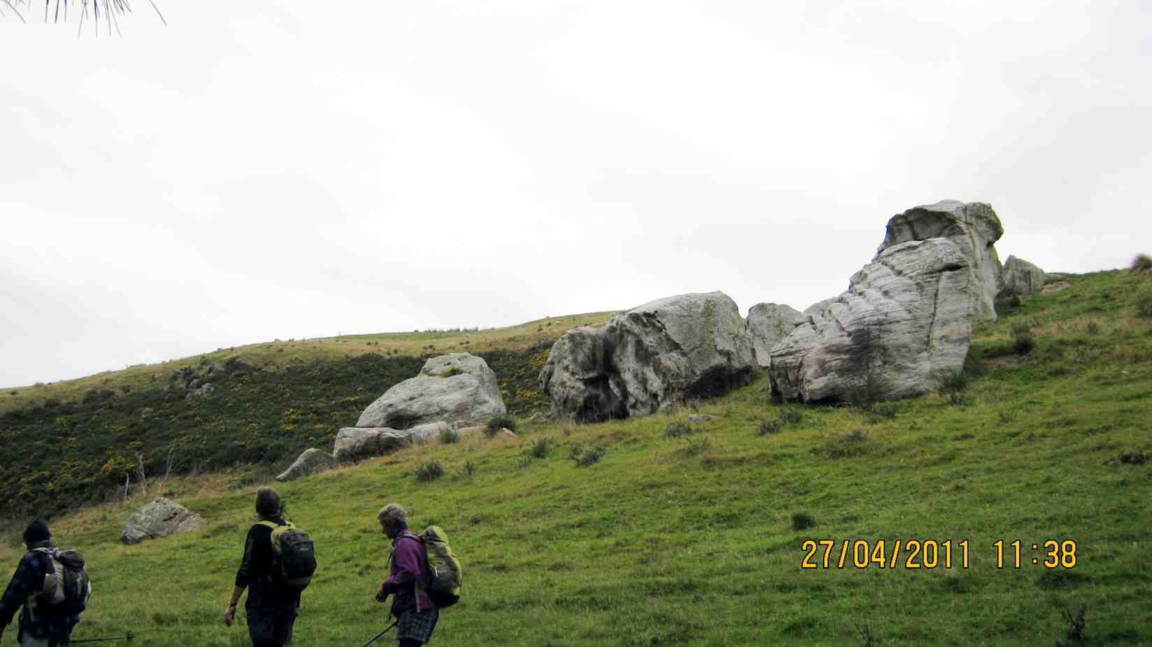
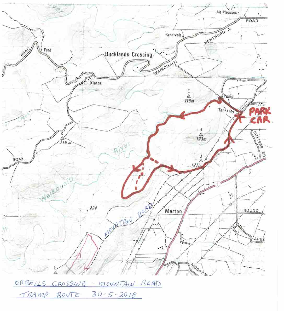
A small but select group met at the turning to Buckland’s crossing on an overcast but warm day under the leadership of Ria and Hazel. The location of the tramp was down as Orbells crossing but there was some debate as to where this actually was. We parked in the middle of nowhere but Ria and Hazel soon had us over a couple of fences and striking across the countryside to a nice morning tea stop on the banks of the South branch of the Waikouaiti River where it was mentioned that a fishing rod would have been useful. The tramp continued along a very pleasant country track wending our way along hillsides and gullies until we stopped for lunch, looking back over to where we had walked earlier. To those with no sense of direction this was quite confusing as we seemed to do a very big figure of eight. After lunch the mystery trip continued, with Ria venturing into some uncharted territory along a gully. When the gully ran out it was a steep climb up to the top where we could easily see where we were again. One of the highlights of the day was seeing the unusual rocks just above the track,
Ria, HazelRia, Ian, Tash
weathered into all sorts of interesting shapes, colour and textures. All information about these rocks would be gratefully received. A very enjoyable day’s tramping. Many thanks to our adventurous leaders. – Tash
5. 9/5/2007. Lawson Farm from McGrath/Gilchrist Roads near Old Cherry Farm. Figure of Eight. No river. Leaders: George, Evelyn C.

 04/12/2024. Cleghorn Street to Signal Hill Monument . Grade 3. Hikers. Leaders: Maria McNee and Peter Dodds.
 04/12/2024. Waihola – new cycleway/walk. Grade 3. Trampers. Leaders: Heather Kirk and Jenny Wilton. We arrived at the start of the track in Waihola at 9.30 am where there is plenty of parking, toilets and lovely views of the lake.
 27/11/2024. Around Harbour Cone. Grade 3. Hikers (and Trampers). Leaders: Jenny Flack and Rhonda Wilson.
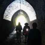 20/11/2024. Frasers Gully / Friends Hill / Wingatui Tunnel & Return. Grade 3.5. Trampers. Leaders: Anne Ward and Lyn Keene.
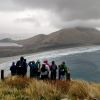 25. 27/03/2024. Hikers. Sandymount Grade 2.5 Leaders: Jenni and Bruce Wright
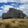 14. 24/01/2024. Trampers. Ship at Anchor. Grade 4.5. $14. Leaders: Phil Keene/


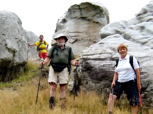
 Lovely sunshine greeted 30 keen trampers for a good day’s walk on Cairnvalley Farm Shannon. Strath Taieri offers something different in scenery with tussock hills, huge rock formations and at this time of the year fresh green vistas of paddocks and Continue reading “Shannons Farm Walk”