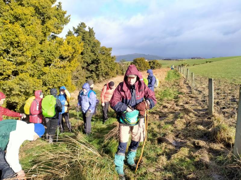
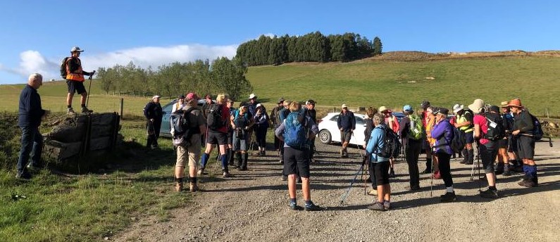
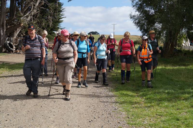
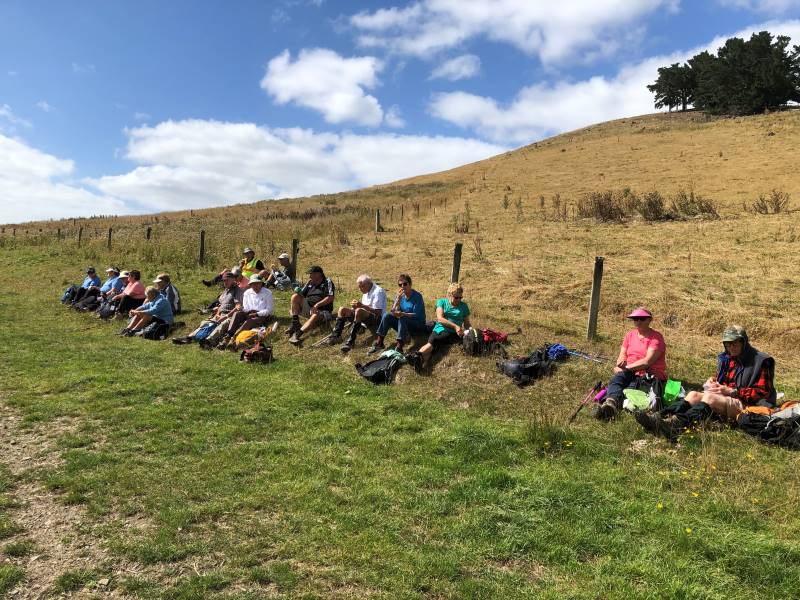
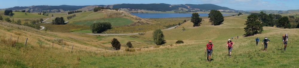
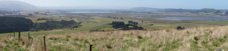
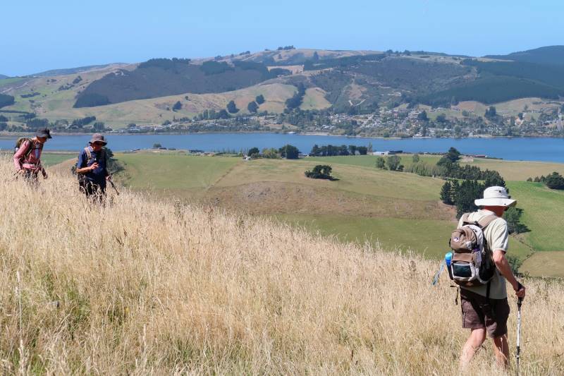
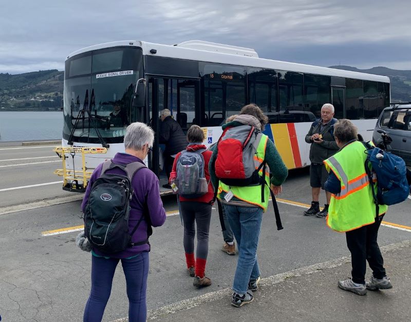
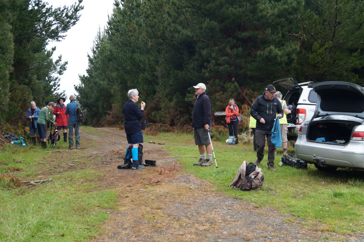
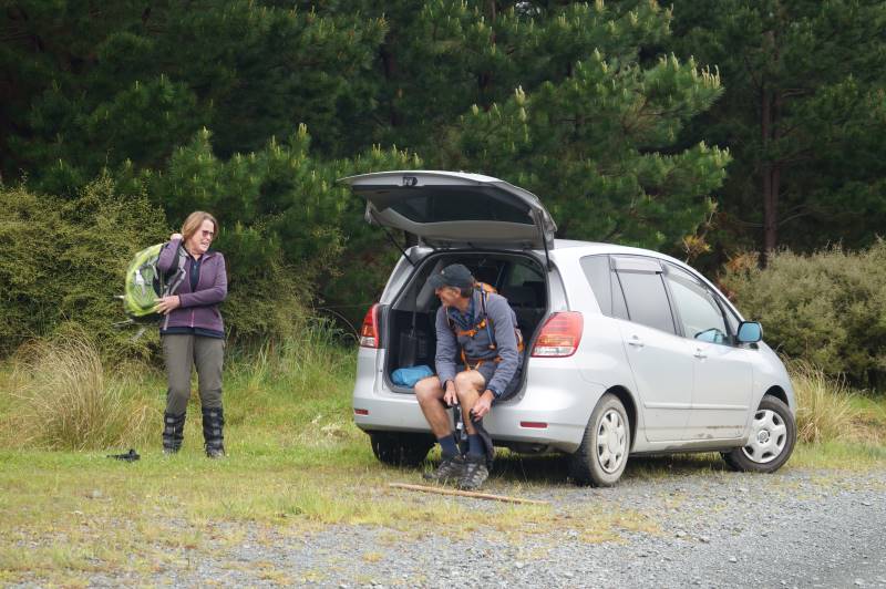
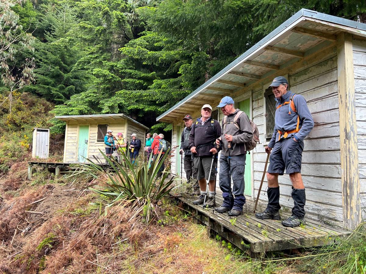
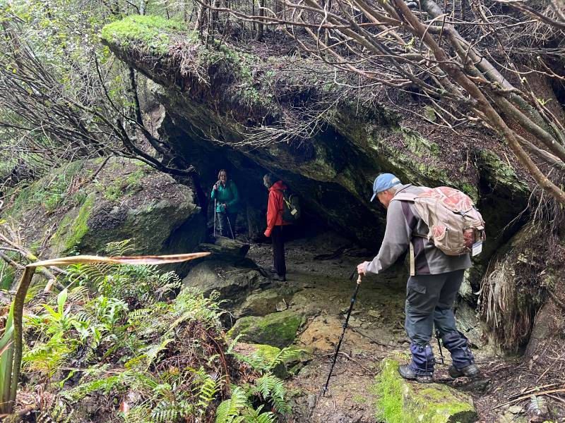
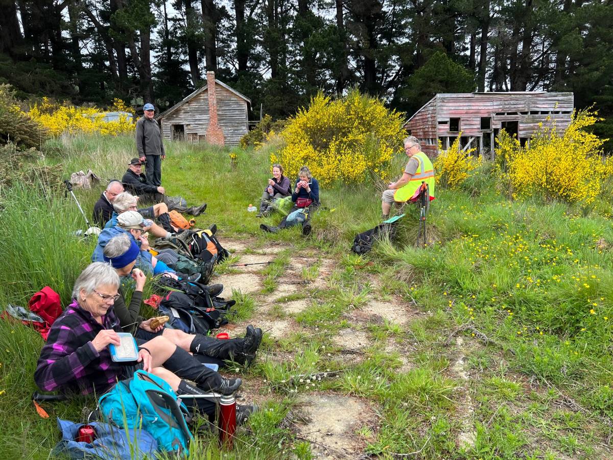
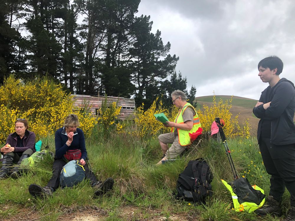
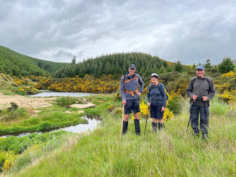
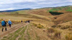
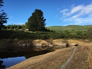
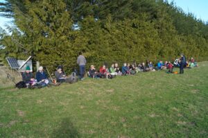
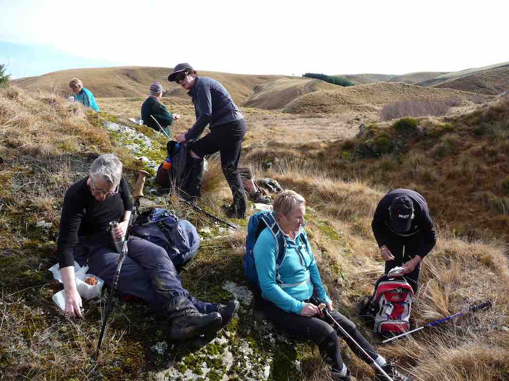
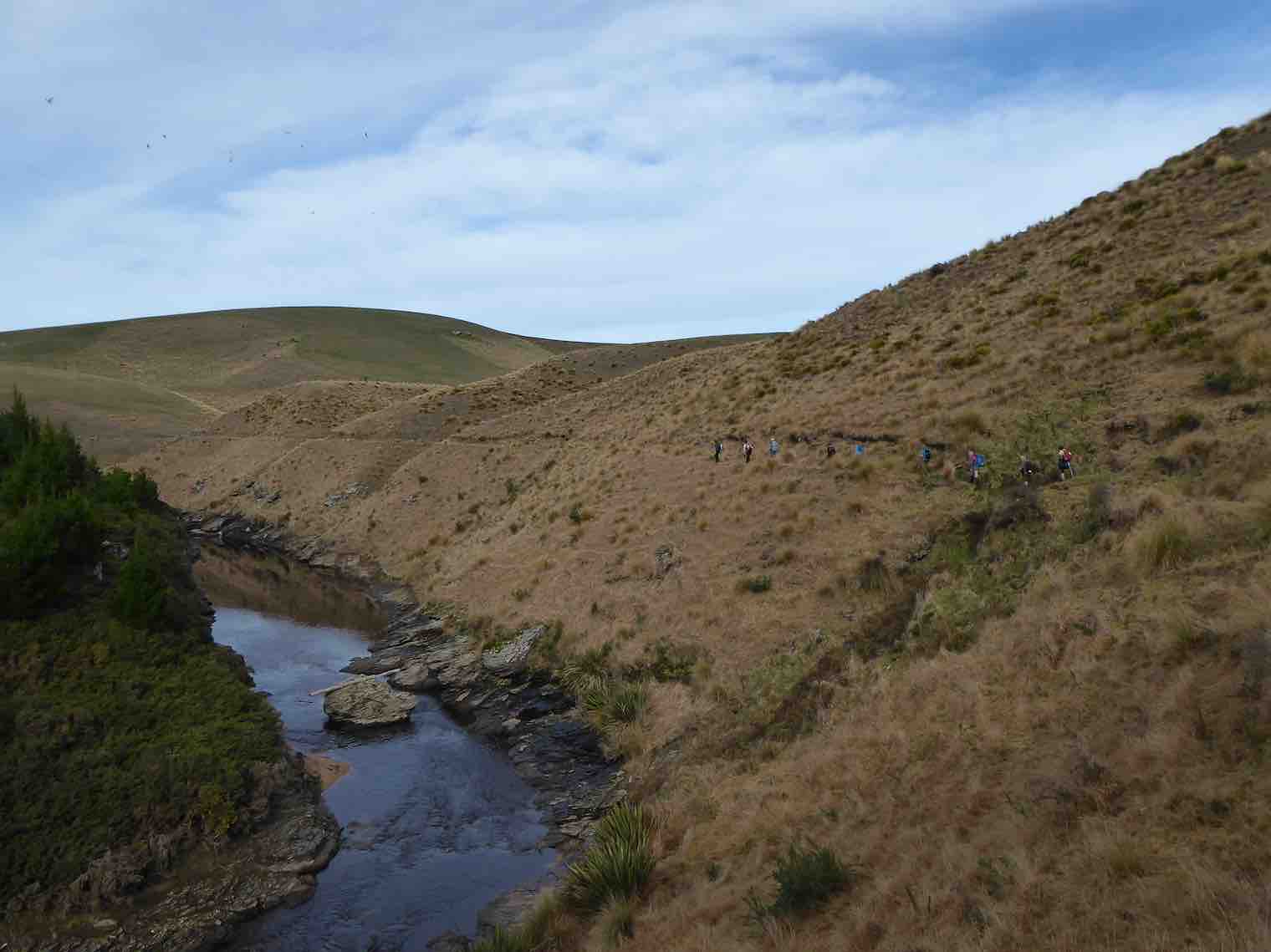
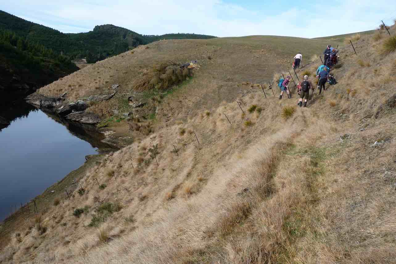
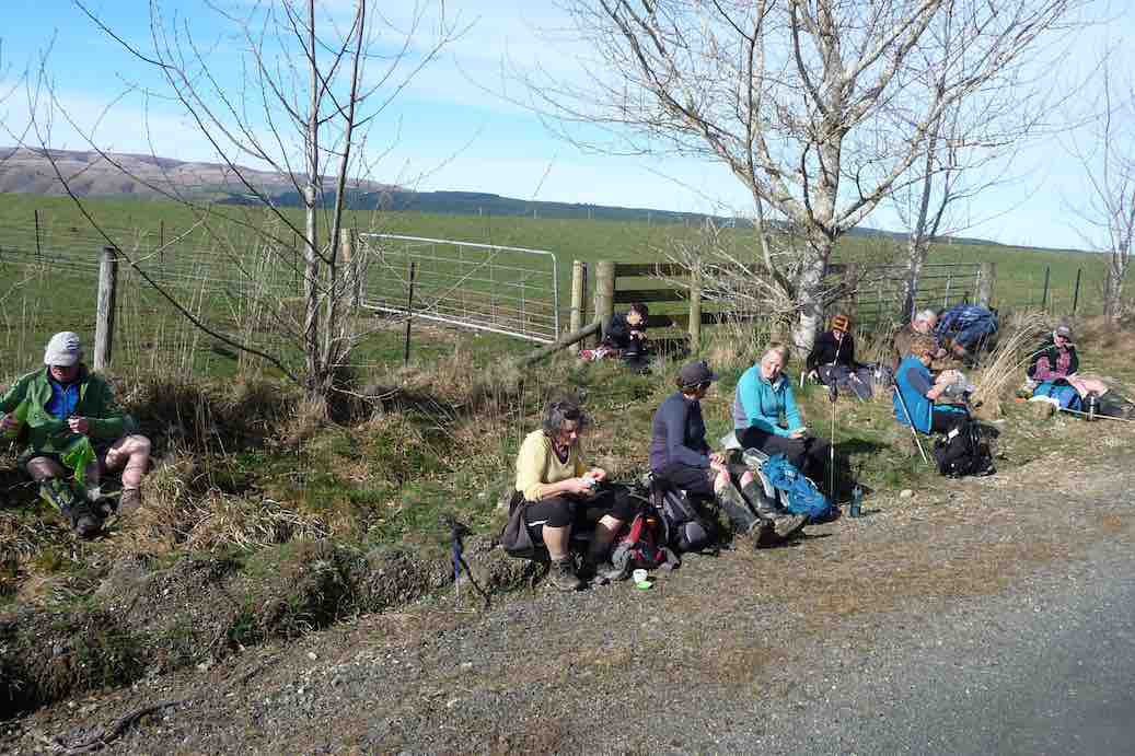
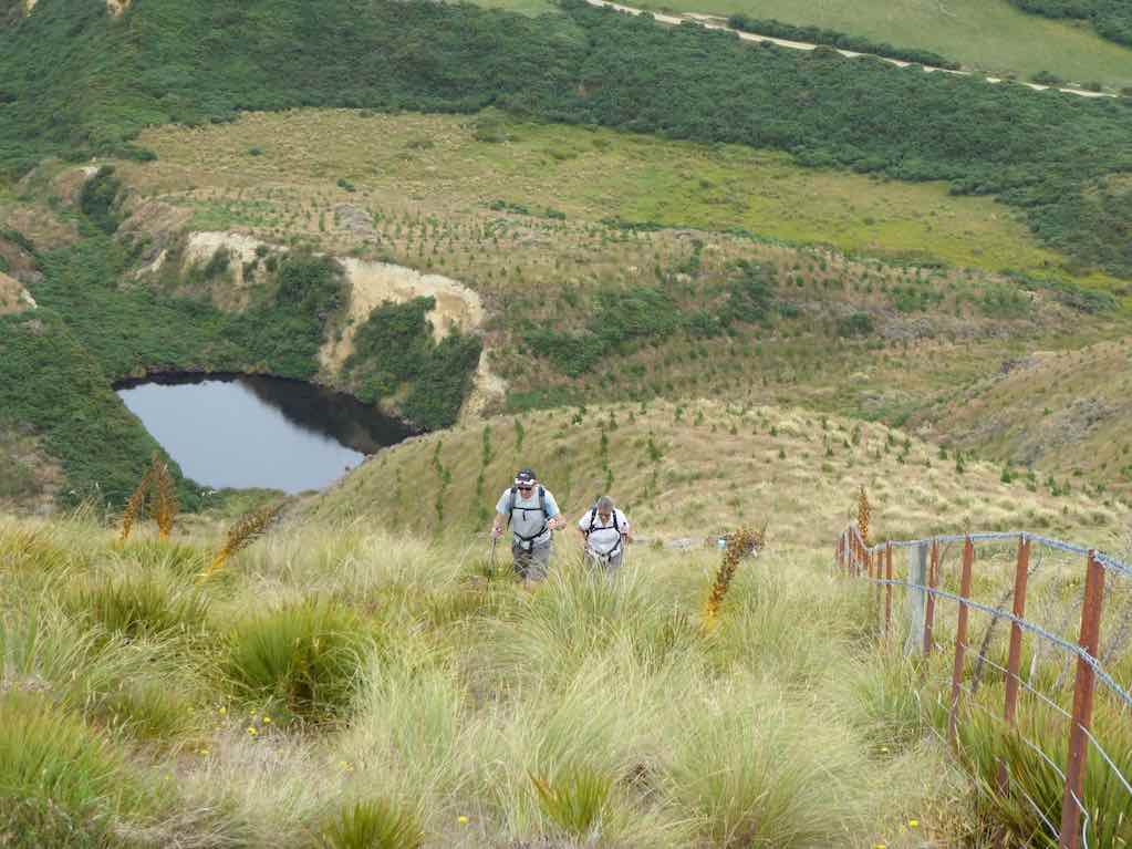
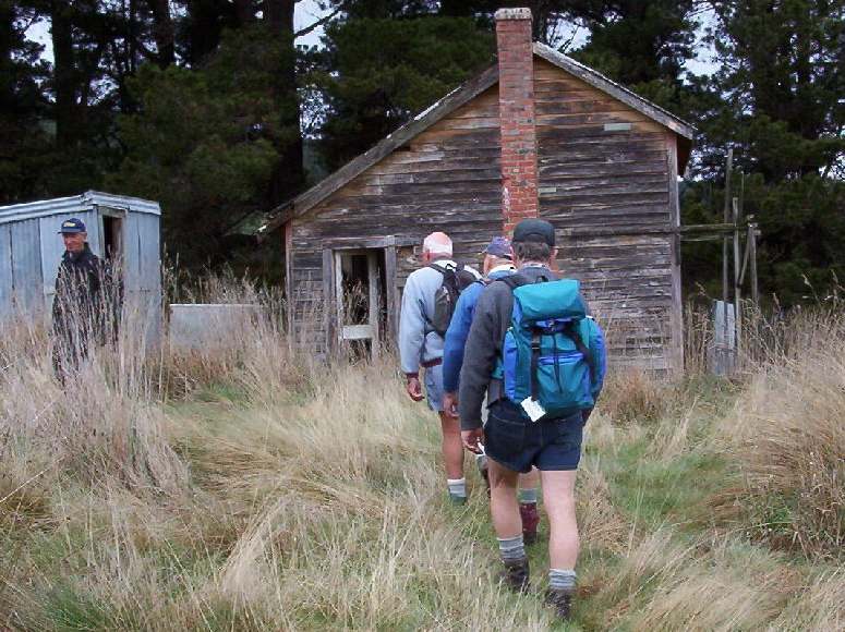
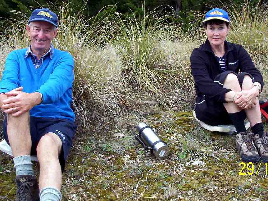
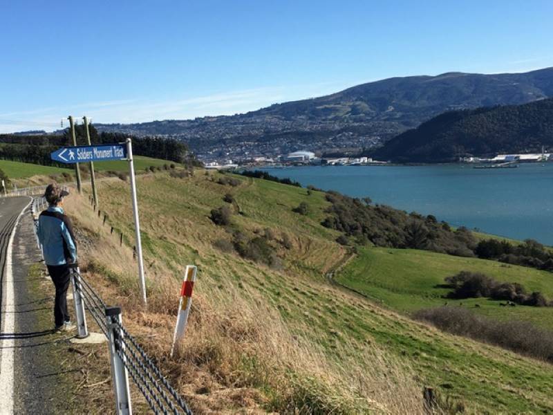
2. 15 May 2024. Trampers. Mountain Road/ South Waikouaiti River. Grade 4. Leaders: Graham Thurlow and John Gardiner
Sometimes my grandmother would say something to me, and I’d ask,
“How do you know that?”
She used to say,
“A wee birdie told me.”
This report is a ‘wee birdie’ (a Fantail) told me tale: –
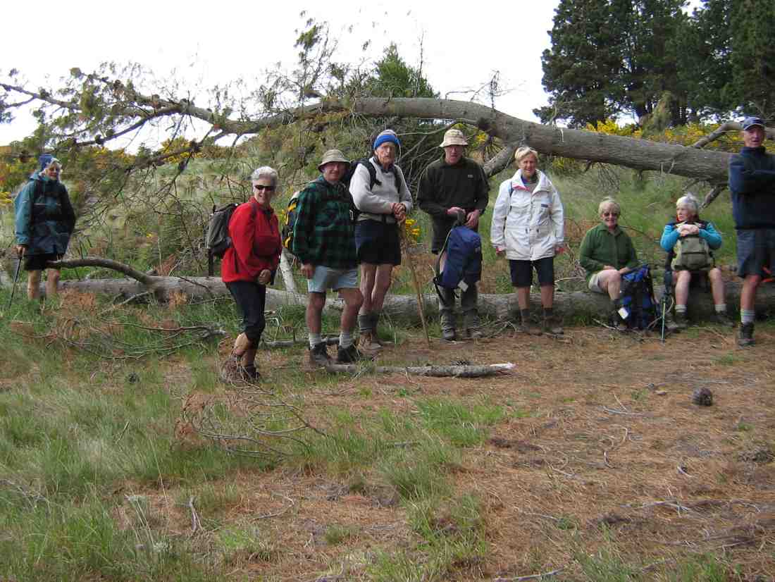
2. 2 August 2023. Combined. Waihola Hill and Lawlor Farm M Leaders: Anne, Lynne, Jenni and Barbara
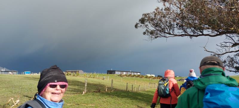
The weather didn’t look too bad at seven in the morning so the decision was made for the tramp to go ahead. Some of the Hikers and Trampers at Peter Johnson Park decided to give the tramp a swerve and go swimming at Te Puna instead of going out in the winter elements.
Sixteen very brave Hikers and Trampers arrived at Baker Road, Waihola to walk around Brendan Lawlor’s property. Brendan has developed a 28 section subdivision after he purchased the farm in 2005. Most of the sections apart from two now have been built on. Brendan has made a track around the lake for people to enjoy the views and birdlife.
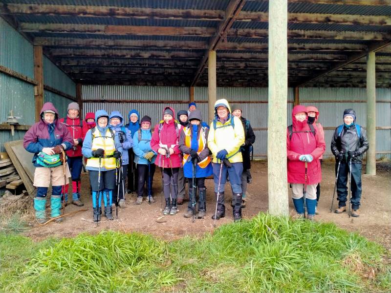
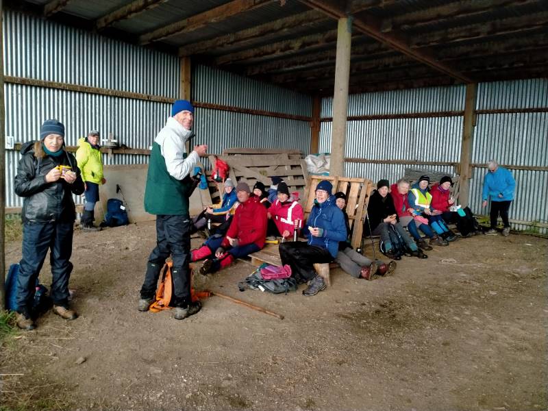
After we arrived the weather was changing for the worse, so we decided to head to the implement shed to have morning tea.
Shall we go or shall we stay Caption and photo Phil
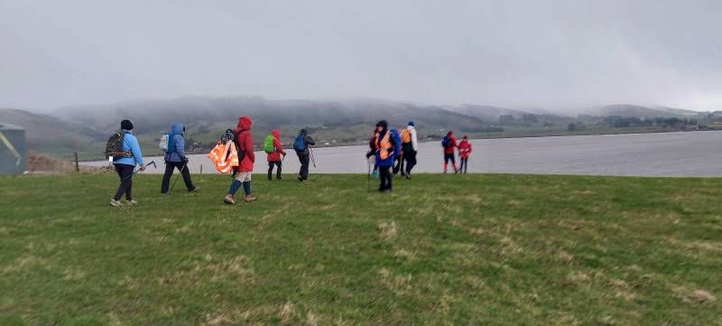
Once there was a break in the weather we reluctantly left the shelter and headed up the hill to walk the track. We all had our wet weather gear on and at times hard to tell who was actually walking beside you. Walking around the lake was so different from the last time. When we had a blue sky day and the lake was like a millpond.
Very muddy lake. Caption and photo Helen
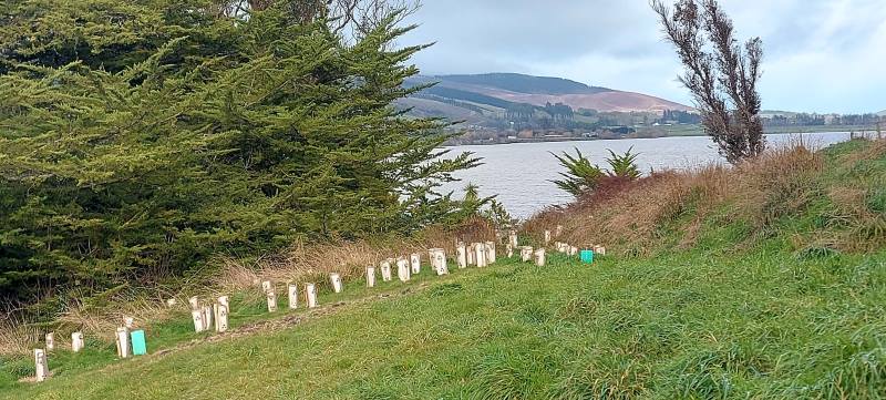
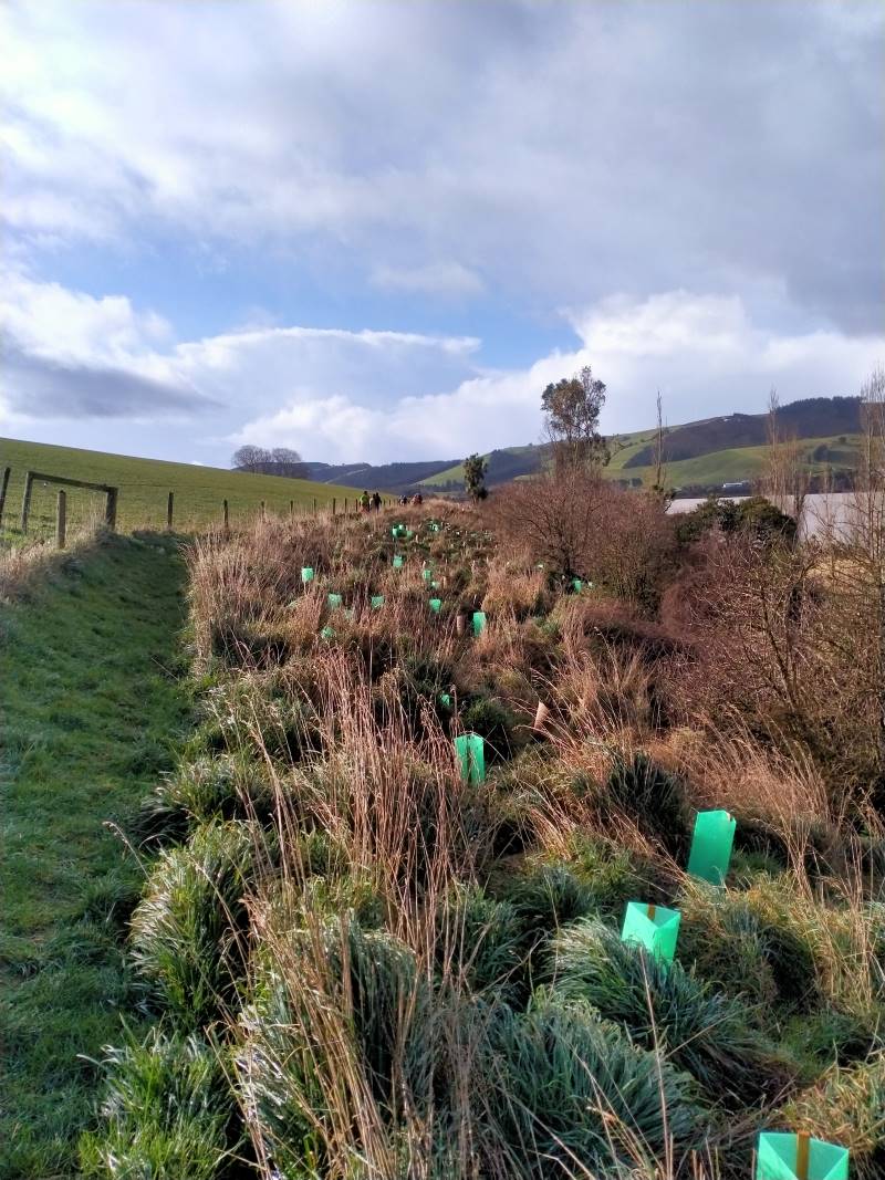
There has been a huge planting project around the front of the lake with lots of native trees and grasses all with protective covers to deter rabbits pigs and possums.
Lots of new planting. Caption and photo PhilGood work Caption and photo Phil
The track in some places was very slippery and muddy due to pig rooting and also a very wet July/August.
Sun at Last Caption and photo Phil
We saw moments of blue sky but down to the south the sky was black and at times we had strong winds and driving rain.
More weather on the way. Caption and photo Helen
Halfway around the circuit we all gathered together and took shelter in the farm building then made a dash for the vehicles. A decision was made to have our lunch at the Baker Road farm buildings then head home with no walk on the new Clutha Gold Trail or a coffee at the Black Swan café
Well earned lunch Caption and photo Phil
Distance 6.48km
Committee Meeting Caption and photo Barbara
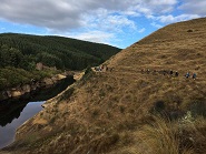
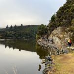
1. 2 March 2022. Combined. Waihola Hill and Lawlor Farm. M Leaders: Jill Reid, Chris Wither Jenni & Bruce Wright
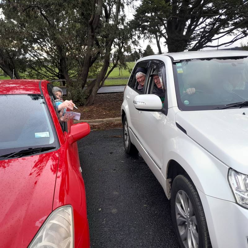
A fine morning saw 43 hikers and trampers make their way to the Lawlor property behind Lake Waihola. After regrouping at Waihola, and about 33km from the Mosgiel carpark, we turned right into Lake Road, left into Young Road, right into Berwick Road and right into Baker Road to park at the cattle yards there.
Brendan Lawlor welcomed everyone and described the mechanics of developing the 28-section subdivision since they purchased the farm in 2005. There is also an 1880s restored cottage on the farm.
Briefing from Brendan Photo and caption JenniOriginal cottage 1881. Has been extensively renovated. Photo and caption Pam
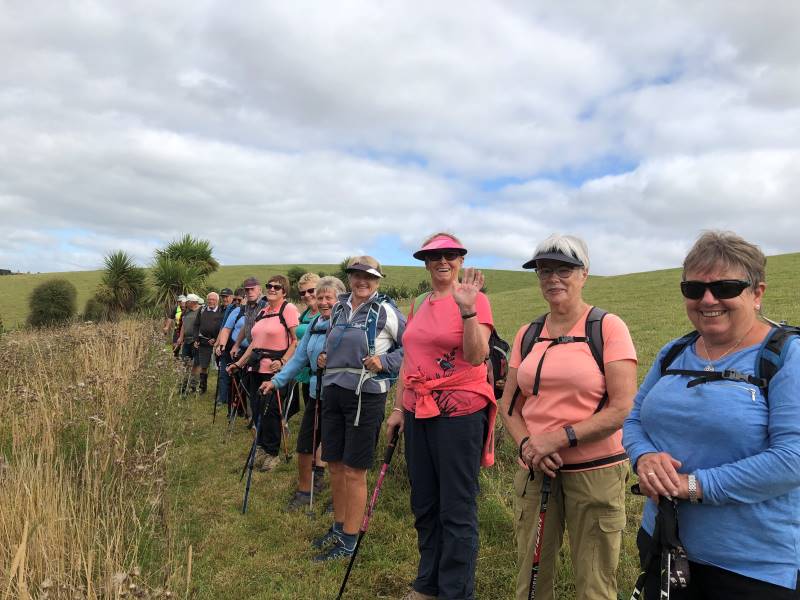
Trampers and hikers set off together about 9:45 and made their way up the road and across a paddock to join a track, mown by Brendan, on the lake side of the fence in front of the subdivision. There was little wind and the lake views were gorgeous.
Love the reflections and swans Photo and caption HelenViews like this only minutes into the tramp Photo and caption John
About 10:30 we stopped for morning tea together along the track.
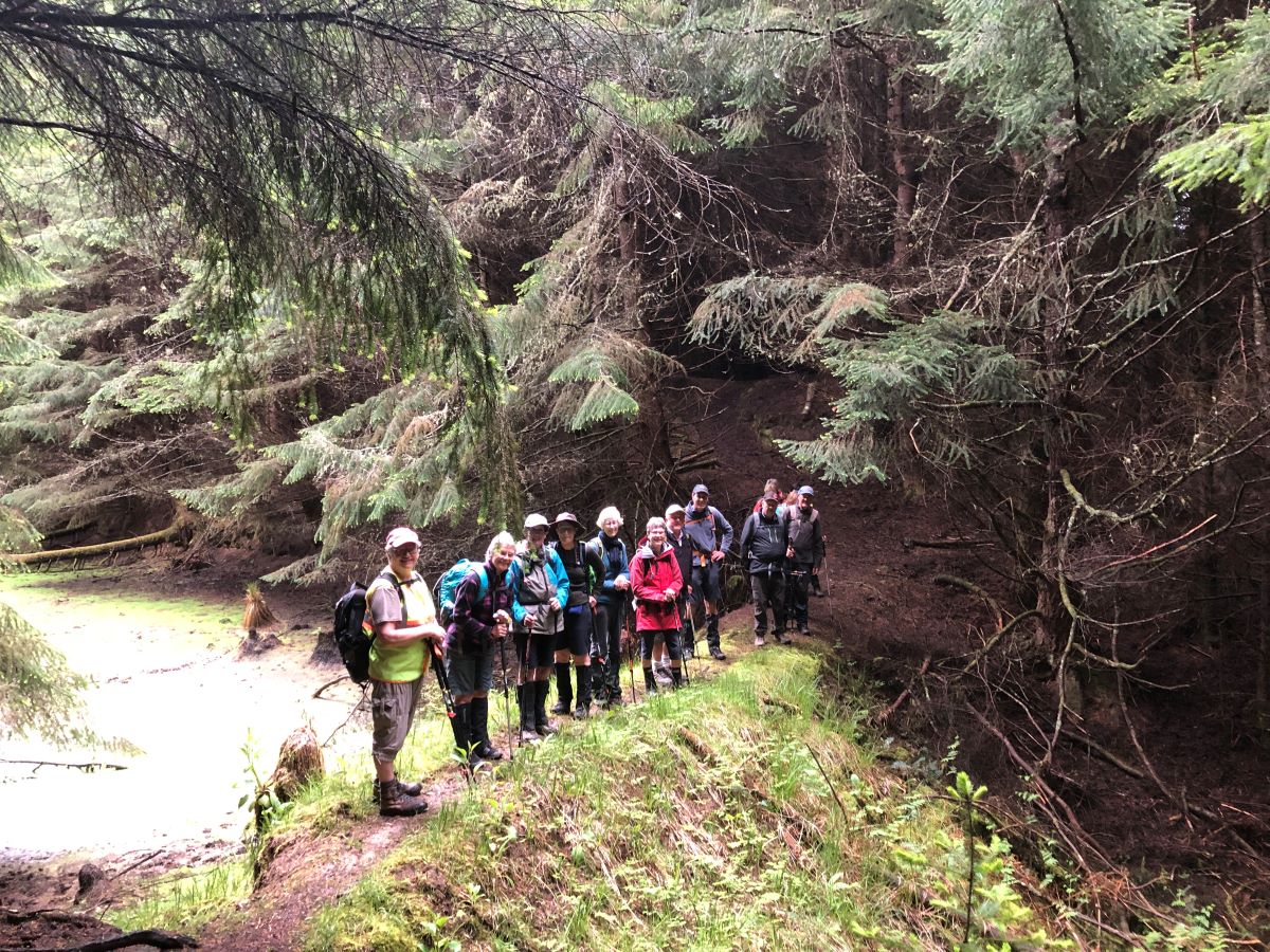
The very large group of people that set off for the combined part of the tramp/hike. A lovely and unusual tramp. Photo and caption Marijke
25 trampers headed away first. A comment was made that the trampers left the morning tea stop true to form. “They were off like a bride’s nightie”.
Goodbye trampers Photo and caption JenniHappy Trampers Photo and caption John
Both groups, at their different speeds, enjoyed views towards the wetlands before turning inland to make their way through the farm and back along the road past the old cottage and new homes to the cars.
18 hikers enjoyed their lunch by a barn on the way and arrived back at the cars about 2:00 having covered around 8km.
Lunch stop for hikers Photo and caption Jenni
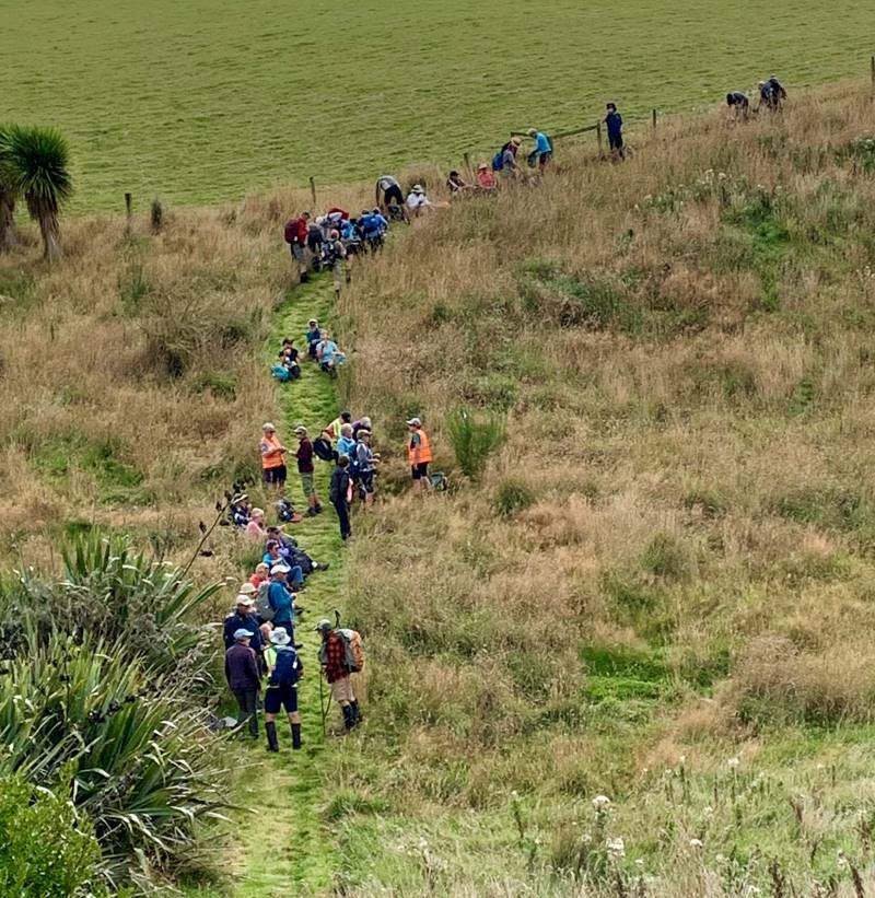
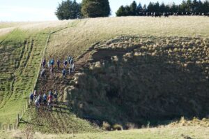
The trampers enjoyed their lunch by the cars before making their way up Waihola Hill at 1:00. Their route first took them up a gully [opposite the Waihola Wildlife Management Reserve sign] near the start of Baker Road. They were then able to follow a 4WD track that wound around the hill.
Look behind you guys Photo and caption John
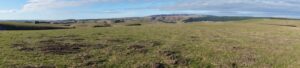
When the trig on top of Waihola Hill came into sight the group turned uphill to appreciate the 360-degree views from there.
Panorama Lake Waipori Photo and caption JohnGroup photo at the trig Photo and caption John
Then it was back to continue following the 4WD track to water tanks and back down the hill to return to the cars by 2:30.
And they marched us down again… Looking across Lake Waihola to Waihola township and SH1 Photo and caption Ross
The Trampers covered about 13km.
Thank you for the many great photos that were submitted to go with this report.
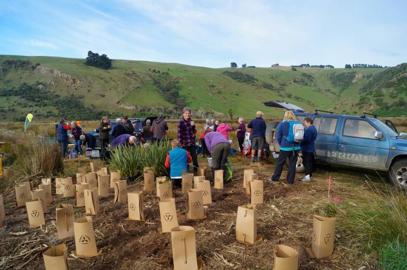
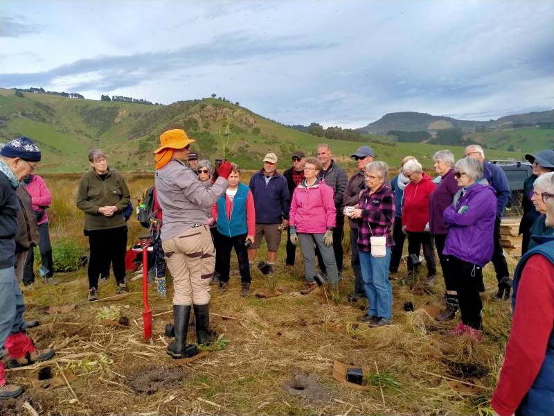
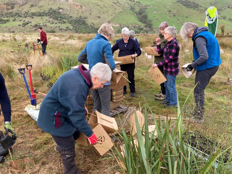
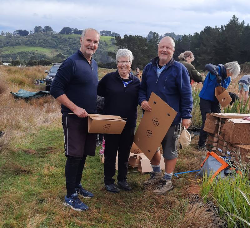
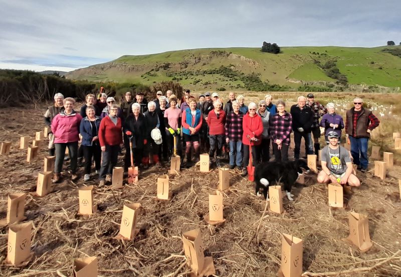
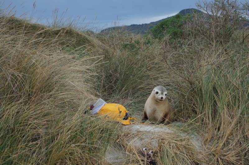
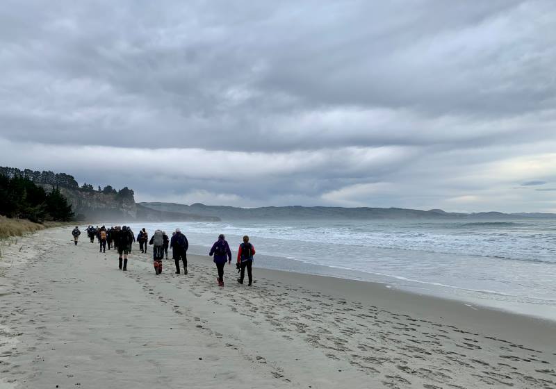
Wednesday proved to be warm balmy day, when 35 eager TRTC members met at Long Beach to give a few hours volunteering on DOC reclaimed land behind the sand dunes .
We were met by the project manager, Jeanne, who was very well organized with equipment ready for us to start after morning tea.
Getting ready to get started Caption and photo JohnThis is how it’s done Caption and photo Phil
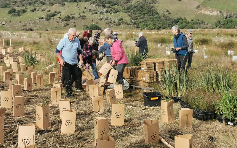
The work involved was digging holes, planting natives and flaxes and making protective heavy cardboard collar’s to go around the newly planted specimens.
Great teamwork Caption and photo RaewynThey thought they were just the best Caption and photo AdyPhoto Margreet
When the project is completed there will be about 38000 plantings (we did approx 800). Since starting last year, the success rate is 85-90ish%.
There were a couple of other small groups volunteering like a team building exercise.
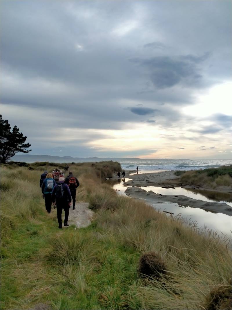
Photo BarbaraWe deserve a walk to the beach Caption and photo Phil
Lunch was on the beach but, unbeknown to us, a young sealion appeared from the dunes behind ready to share time with some of the group. This really did give them one big fright, so our lunchtime was shortened.
The smell of salmon sandwiches brings a young sea lion from out of hiding Caption and photo John
We did continue down the beach a little further before heading back to the cars.
Continuing after lunch along lovely Long Beach Caption and photo Marjke
Some of us went to a quirky little cafe Santosha in Port Chalmers.
I think we all enjoyed the experience and especially being able to help with a community project. Perhaps another time.
Thanks to John for his help and support.
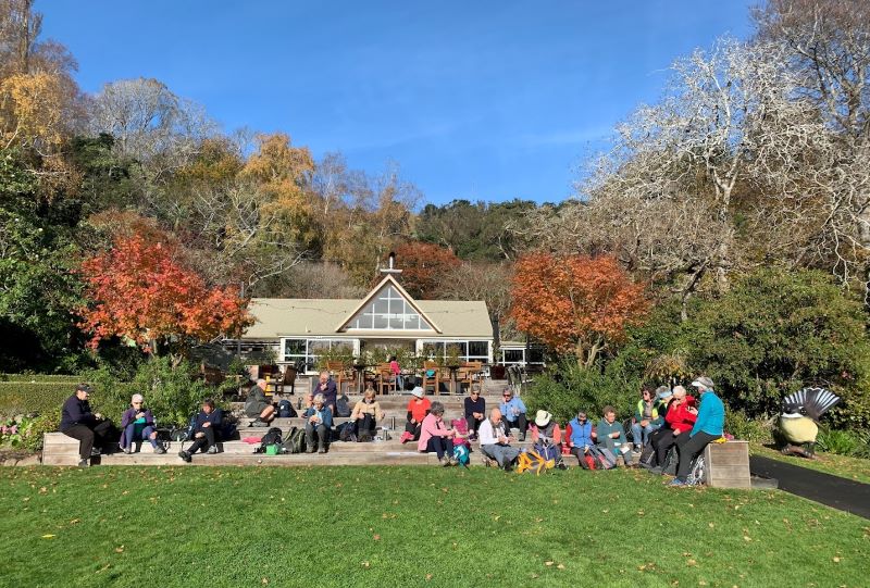
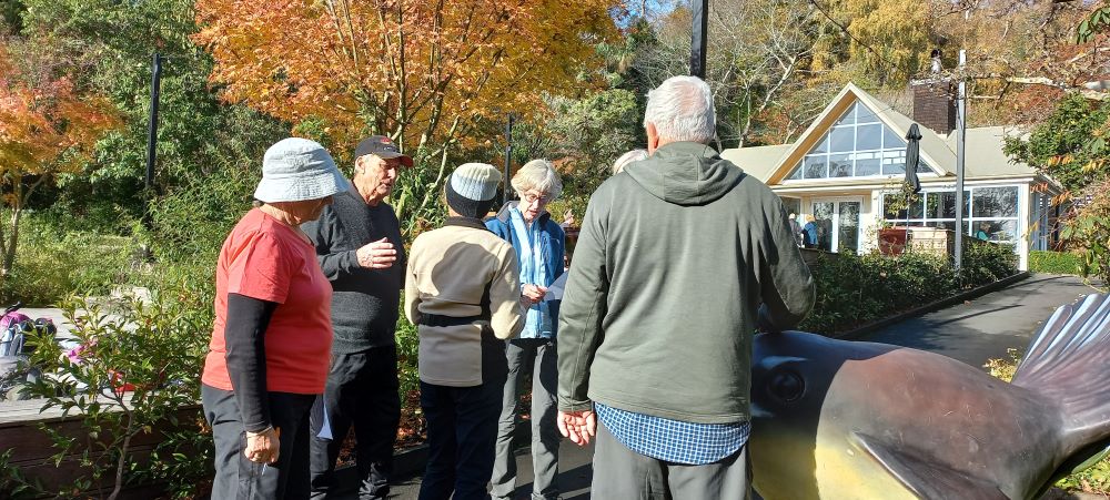
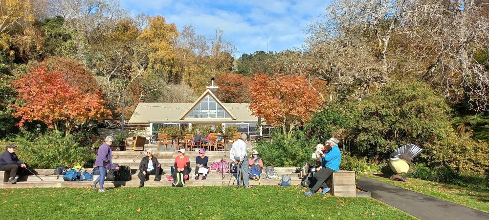
1. 24 May 2023. Bayfield carpark to Glenfalloch. Grade 1. Hikers. Leaders: Linda Partridge and Helen Ingram.
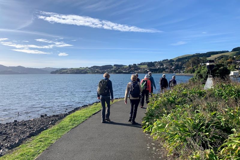
A convoy of cars from Mosgiel parked in the Bayfield carpark at 9.45 joining Brighton and Dunedin people. Twenty-five hikers in total readied themselves for a walk along the cycle track along Portobello Road to Glenfalloch. It was a still bright morning, the harbour sparkling in the sunlight. We walked along the side of the inlet and stopped at Vauxhall Yacht Club for morning tea.
Morning tea stop. Photo & caption Ady
Then on to Glenfalloch which we reached just before noon.
An amazing lunch spot, thanks to Glenfalloch for allowing us to use their steps. Caption & photo MarijkeEnjoying the last of the stunning autumn colours on this beautiful sunny day. Caption & photo Marijke
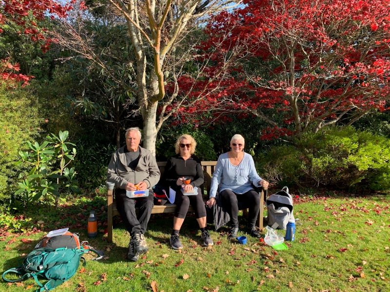
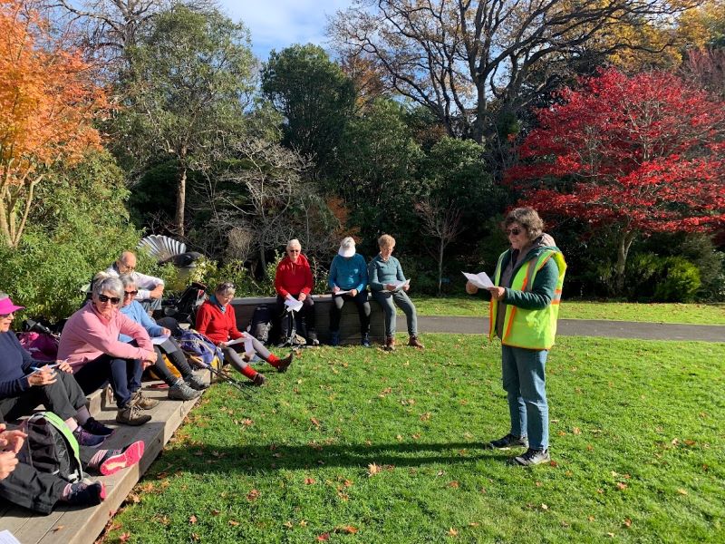
The gardens look beautiful every season, and that day in autumn the maples were flaming red, and a long bank of fuchsias in purple and shocking pink terraced one of the hillsides. We had a leisurely lunch and Linda had prepared a questionnaire for us to take round the gardens to help us explore the grounds.
Some googling (cheating) required to get the right answer. Photo LindaTime for some chat before we hear the results of the survey. Photo LindaHelen announced the outcome of our “Treasure Hunt”. We saw things that we never noticed before, and we all got a chocolate prize! Thanks to Linda and Helen, it was a lot of fun. Caption & photo Marijke
How many spoons in the sculpture near the restaurant? Where will you find the sundial? It really brought out the competitive nature in us! But everyone’s a winner, and a bag of Cadbury Favourites was handed round.
The Portobello bus was due at 2.15pm, and most of the hikers decided to walk on to Macandrew Bay to catch the bus there.
18. 30/11/2022. Trampers. Post Office Creek track from the Waipori Village side. Grade 3. $14. 60km. Leaders: Barbara and Leah.
Despite ominous weather predictions for several days prior to the 30th, and heavy rain early that morning, the visual was more promising.Three vehicles and 14 trampers left the Peter Johnstone carpark heading towards Berwick and up the Waipori Falls Road, through the Village and continuing towards Lawrence. The big, locked orange gate, although on a side road, can’t be missed! Through the locked gate, past the new picnic area, following the road below the Mahinerangi Dam to cross the bridge and climb up into the Wenita section of Dunstan Road. The potholes aren’t for the fainthearted.
About to leave the cars (photo & caption John)
The walking track is off Patearoa Road which itself is off Moonlight Road and we parked at the junction of the two. The permit was left visible through the windscreen.
Excited to be ready to go (photo & caption John)
A quick morning tea, and the party set off on the 1km down-hill (remember what goes down at the beginning of the day must go up at the end!!) to the rustic signpost indicating Post Office Creek track. There was a brief delay while one driver (nameless) went back and spent a frenetic 5 minutes searching for car keys in order to lock the vehicle. Having found the keys in the backpack, they were left on the ground while the pack was rezipped. The person (also nameless) who had ferreted them away while the rezipping was underway should be afraid; very afraid! A brief detour a few minutes down the track proper took us to the now dilapidated fishing huts.
Fishermen’s Hut hidden in the trees above lake Mahinerangi (photo & caption Pam)“Watch your head John” as the track winds under the overhanging rock (photo & caption Pam)
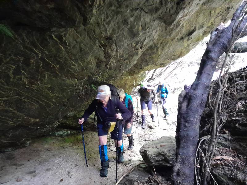
A scramble back up the track and we were crossing the first of the creeks and negotiating the rock bivvy.
Post Office Creek rock bivvy (photo & caption Barbara)
The entire track follows the contour of the slope with very little up or down. Many of the guts had bridges in varying degrees of disrepair but which, it’s understood, are likely to be removed entirely in the near future, after the maintenance work in the forestry has been completed. The tracks will be realigned to navigate the guts minus bridges.
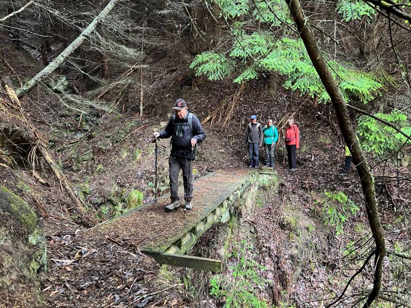
One at a time crossing the old wooden bridge (photo & caption Pam)
Pigs had been digging up the track which left it nice and soft underfoot and there were a few fallen branches we cleared as we went.
Escaped from the forest (photo & caption Jenni)
We left the canopy cover of the trees as we neared the re-sited Waipori School buildings where we sat and had our lunch. Half the group elected to follow Jill to the actual Post Office Creek while the remainder sat and chatted, walked down to the lake edge and poked around the buildings.
Disappointingly there was no fishing or poetry recitation.
Lunch beside the relocated school house once used by musterers (photo & caption Pam)Our industrious leader with historical info (photo & caption Jenni)
On the return of the wanderers, we set out again, retracing our steps, looking out for litter to take back to our vehicles. The last uphill kilometer was unwelcome but all 14 made it. A change of footwear, a little shenanigans with someone’s pack and sticks, and we headed back to the locked gate, this time heading to the right, over the Lake Mahinerangi causeway, through the fishing village and back to the Middlemarch Road at Lee Stream, enjoying a commentary from Jill who, for several decades, had farmed the property on both sides of the road.
End of track at Post Office Creek (photo & caption Pam)
One carload stopped for an icecream at Outram ($2 for 2 scoops being excellent value!), but weren’t joined by the other two, who must have thought 4.30pm too late for such extravagance!
An enjoyable day on an easy track which could well be considered for a combined day.
It would be possible to leave a 4WD vehicle at the bottom of the hill, at the signpost for the track, as we did on the recce, shortening the distance by 2 km.
Barbara
17. 2/6/2021. Combined trampers and hikers. Leader: Jill
A combined group of 42 people met at Andrew Reid’s hay barn on Mahinerangi Road and soon set off down the steep hill past the cattle yards. It was nice to have several visitors out today, as the weather gods were truly kind, and the ground underfoot was firm.
Down the hill Photo: Clive
We all enjoyed walking through the rolling country and down to Lake Mahinerangi, initially opposite the old Waipori school building.
Opposite Old Waipori School Photo: Pam
The lake was very low but still picturesque. We followed a gold miners water race to a now empty dam. One can only marvel at how adaptable and hardy those early gold miners were to seek their fortunes in this remote area!
Following the gold miners’ water race Photo: Pam
The trampers then went up through the farm, intending to walk several kilometres more than the hikers, but I am not sure there was much between us in the end!
On top of the world Caption and Photo: John
Another steep pinch Caption and photo: John
Trampers had lunch beside a tree lane with good expansive views and the Mahinerangi wind turbines were turning in the distance.
Trampers lunch break Caption and photo: John
Back down to the farm lane that we followed to THAT hill and our cars.
Distance covered was about 12.5 km. Jill
Screenshot: Colleen
After parting ways with trampers 14 hikers led by Chrissy (thank goodness) climbed up a fairly steep hill where we had a short lunch with the promise of another break at the top of the next paddock! Well, we somehow went through a wrong gate so instead of doing a loop we did a loop and a half to get back on track. We were all in good spirits until we saw the road we had to go back up to get to the cars.
Hikers view of the track back to the cars Photo: Clive
But it was onwards and upwards at our own paces and, getting overtaken by the trampers, we made it back. This was a hard walk for us, but our senior members were so impressive. Well done team. PS. we never did get that promised break?
All up it was a solid 12 kilometres. Thanks Chrissy. Jenny & Jan Y.
11 trampers enjoyed a beautiful day on Andrew Reid’s property. We parked at the woolshed and headed downhill before walking along a water race created by gold miners, to a now empty dam.
10409112nd—Quick stop morning tea. (Gordon pic and caption.)On old water race above Post Office Creek. (Phil pic and caption.)
We marvelled at how this race had been dug into the hillsides – and can barely imagine the living conditions of the early miners, one must certainly hope their toiling brought rewards!! There were a few fences to climb
Another Bloody fence. (Gordon pic and caption.)
but we were rewarded with nice views over Post Office Creek and then Lake Mahinerangi.
Surveying the Post Office Creek arm of Lake Mahinerangi. (Phil pic and caption.)
We then walked away from the lake, across a dam, and through paddocks up to the farm boundary with DCC forestry. Lunch was eaten in the shelter of the trees.
A very welcome lunch break. (Gordon pic and caption.)
Then a few more ups and downs but we basically walked through the paddocks beside Mahinerangi Road back to our cars.
A most enjoyable day.
Distance walked 15.5 km. – Jill.
15. 17/1/2018. Trampers. Post Office Creek. Leader: Jill.
Route map, courtesy Keith.
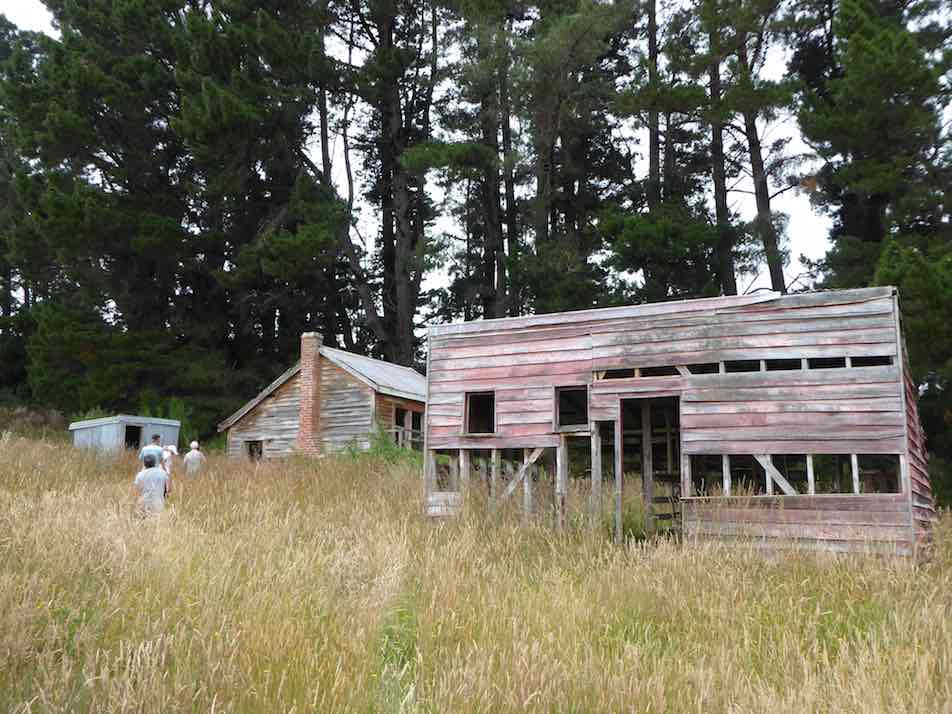
13 trampers met at Reid’s woolshed on Mahinerangi Road. We walked down the hill to Post Office creek, and had morning tea at the “camp” before taking the track through gold mine sluicings to the top end of Lake Mahinerangi – a very low lake today! After viewing the old Waipori school (which had been moved to this site to use as a musterer’s hut before Waipori village was drowned) …
School inspection. The “old” Waipori School moved to Post Office Creek before the raising of Mahinerangi. (Phil pic and caption.)
… we backtracked about 1 km and shortly after went up a very steep stock lane …
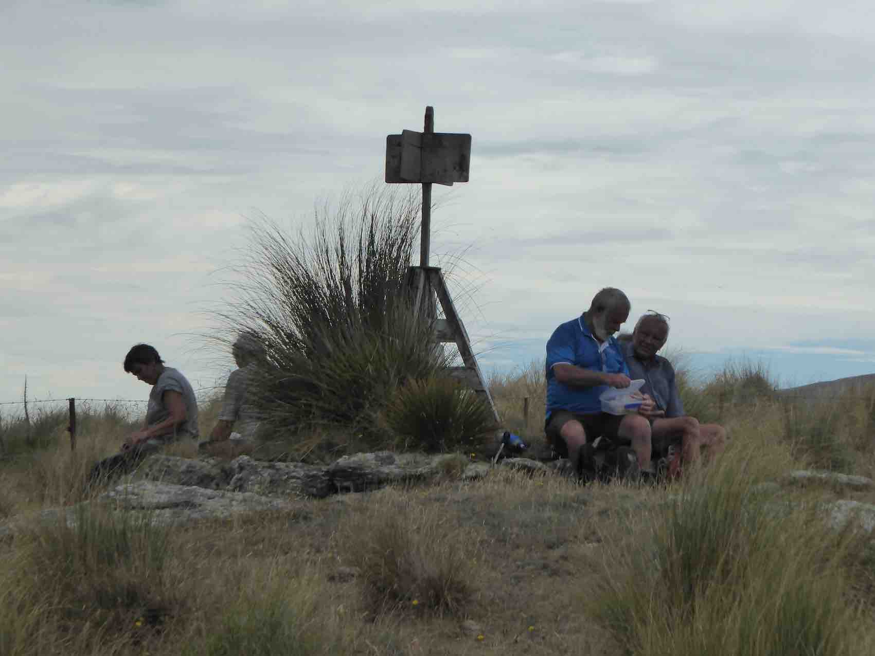
Onwards and upwards to the trig. (Phil pic and caption.)
… and lunched by the trig there, enjoying expansive views of the area.
Trig A4GT -618 m altitude. (Phil pic and caption.)
We continued up the farm track towards the back of the Maungatuas – the intention had been to look over to Waihola, but it was decided that was a bit far on this occasion! It was an easy return down hill to the bridge over Post Office creek – and to our cars.
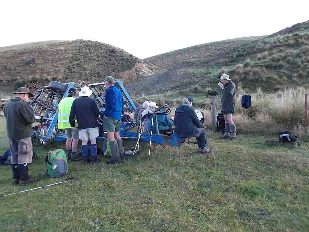
Jill proudly displaying the new charging station for e bike travellers. (Phil pic and caption.)
An 18.5 km tramp enjoyed by all. – Jill.
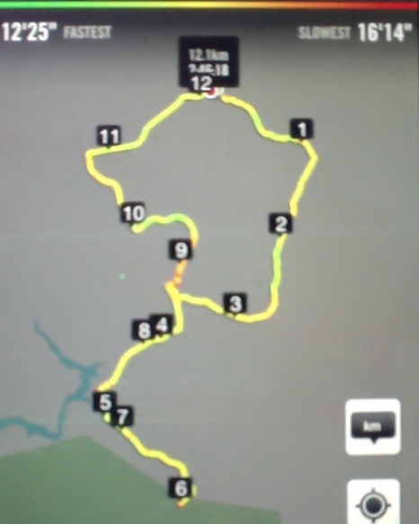
14. 7/5/2014. Both. Reid homestead, Verter Burn to Post Office Creek and old school buildings. Leaders: Ken and Peter.
iPhone GPS distance: 12.1 km. Garmin stats: We walked 12.9km; Moving ave 4.3km/hr; Moving time 2h 58mins; Climbed 342mtrs; Max elevation 572mtrs. Allow a further km or two for the pedometer distance recorders, and then pick the figure that suits you!
21 of us parked in the Reid’s homestead backyard and made our way through one or two fences down to a bridge over the Verter Burn (near ‘1’ on the map) for morning tea.
Morning tea at Verter Burn crossing. (Heb pic, Ken caption)
We followed a road on the stream’s true left, which begs the question as to where originated the pond with its beautiful reflection on our left. (About ‘2’ on map.)
Reflection
Between 3 and 4 on the map, is where we approached the Verter Burn ford, into which we were to plunge later, but at this stage we swung off to our left to make our way through early gold-sluiced cliffs (8/4 on map) to finally cross the Post Office Creek and arrive at (5) the former Waipori School building (as reported to the writer) of the one-time but now submerged Waipori Township.
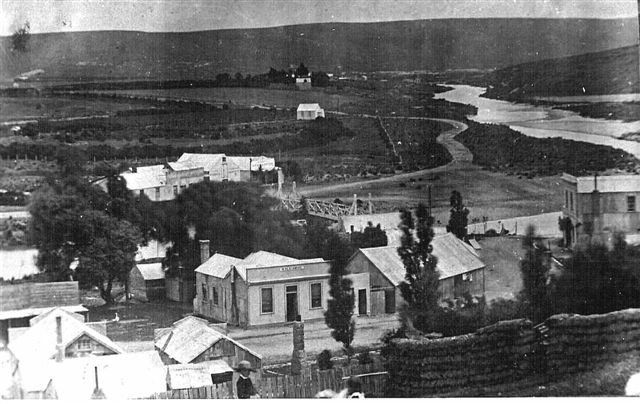
The Township of Waipori. The valley is now flooded and the town site is inundated. Photograph taken in 1890 by Charles Kerr.
We climbed the steep hill alongside the Post Office Creek’s true left to skirt on our right a forestry of densely branched trees (larches? [and unpruned!] with a scattering of eucalypt among them) for a lunch where the forestry road levelled out at the top (6).
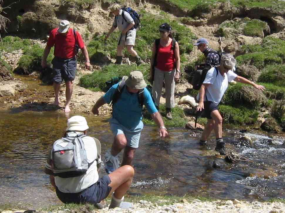
Then it was back down to the school building and out to the aforementioned ford, which this time we crossed with variously successful attempts in keeping feet dry, (but mostly wet).
Beyond that, was the further challenge of the BIG CLIMB, of un-fond older members’ memory. A taranaki gate at its top was new to us, but Neil successfully unscrambled its complexity. Three more paddocks and gates took us out to the Mahinerangi Road ( 11) and along it to the homestead (12.1) again.
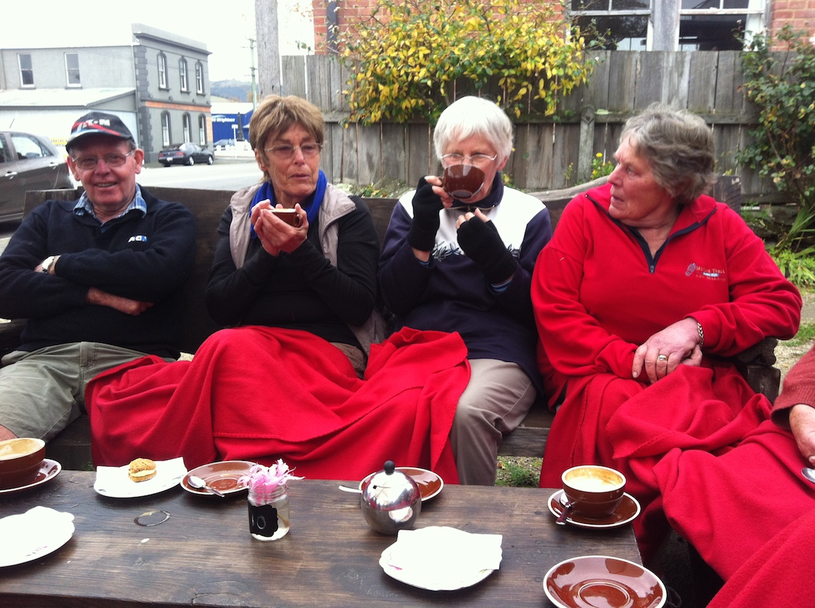
At Outram, the majority of the (now well-established) coffee club socialised at the Wobbly Goat, …
Apres-tramp coffee at Outram
although some betook themselves to the No 8 w Herbs cafe across the road. And that’s it. – Ian.
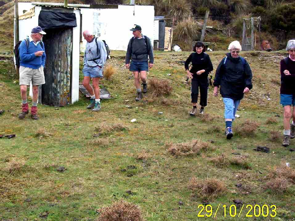
13. 28/11/2007. Trampers. Post Office Creek, fishermen huts return. Skyline track was closed on the day. Working on roads, trees. Easy. Leaders: Bill & Pat.
The day was fine and not too hot for
13 of us to tramp the Lake Mahinerangi water-race track to the fishermen huts. We had morning tea at the Post Office Creek Old School.
Tea Break. Hazel, Wendy, Doug, George, Ken, Shirley, Pat, Joyce, Arthur L
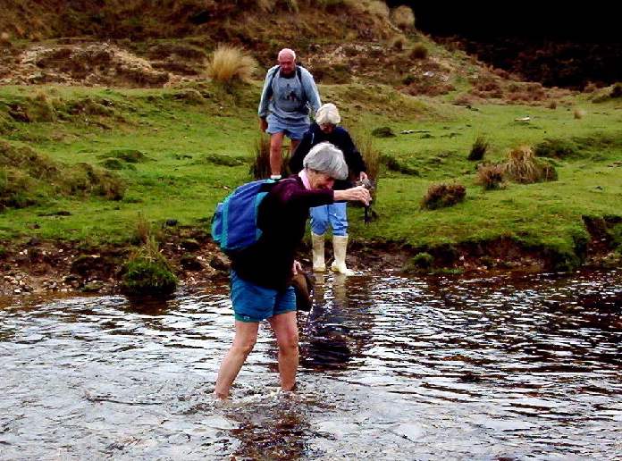
Immediately beyond that, the leaders had found for us the clearest approach to the larch forest that borders the lake, the tussock and bog being now badly infested with gorse. A leisurely lunch in the sun at the fishing huts and the return back. The Verter Burn barring the way in and out, as always, inspired a variety of creative crossing techniques, from direct plunging through the water boots and all, to bare feet, to plastic bags over boots and even to gumboots carried in.
Crossing techniques. Abe (bare feet), Peter, Pat (getting plastic bags), Doug (bags), Barbara and Wendy (boots on rocks), Arthur (gumboots)
The long hill climb back out of the Verter Burn gets no easier with age, but all agreed it was another good day out. – Ian
Back at cars. Pat, Barbara, Abe, Peter, Ken, Wendy
12. 8/11/2006. Trampers. Post Office Creek. Medium. Leaders: Ian, Doug M
11. 18/5/2005. Both. Post Office Creek. Leaders: Doug J, Bill M, Joyce S, Lesley G
10. 29/10/2003 Forestry roads return. Leaders:
Crib by the ford. Bob Peter Arthur Barbara Who? Molly
Crossing Verter Burn. Peter Who? Molly
The gate beyond Verter Burn.
School. Arthur H Bob Peter Arthur L
Lunch stop. Arthur & Barbara on a tea break on forestry road back out.
9. 25/4/2002 Leaders: Joyce S Shirley, Wendy B
8. 30/1/2002. Post Office Creek. Medium. Leaders: Joyce, Bob H, Donny.
7. 25/4/2001. Post Office Creek. Leaders: Joyce, Shirley McN, Wendy.
6. 5/4/2000. Post Office Creek. Leaders: Joyce, Bill McL, Nancy.
5. 26/5/1999. Post Office Creek. Leaders: Joyce, Nancy, Patricia.
4. 26/8/1998. Post Office Creek. Leaders: Joyce, Pat.
3. 4/2/1998. Post Office Creek to Huts and return from Robert Reids. Leaders: Denise, Ria L, Nel K.
2. 30/4/1997. Post Office Breek (sic) to huts round trip. (Robert Reids). Leaders: Eric and Dot, Joan H.
1. 8/4/1992. Post Office Creek – off Mahinerangi Road. Average. Leaders: Hartmann, Ted, Barbara M, Mary M
The photos for this post were taken in the week to noon Thursday 26th August.
Club members have been out and about walking and on their bikes in lots of beautiful places in their local areas. We have been so lucky to have good weather. Many have also achieved great things working and relaxing in their gardens and around home.
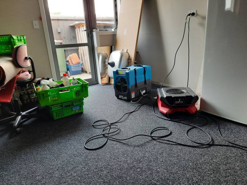
Our sympathies go to Ady for her flood.
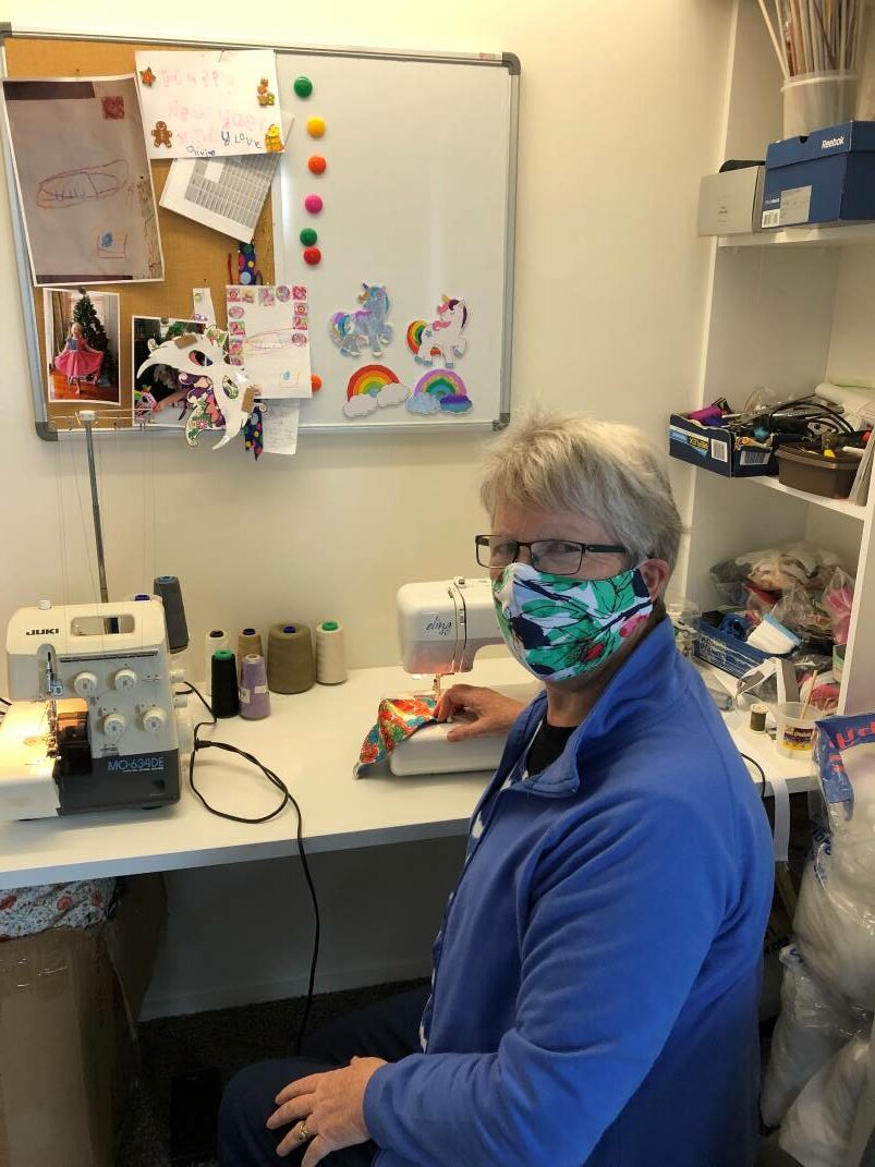
Thank you Jenni for offering a mask to anyone in need.
Enjoy the following photos. Chris Wither
Pictured here is me going with the flow just like the Silverstream and the Taieri river. This current picture shows the confluence. I biked along the bank – and banked on my bike to get me home which it did. kkkkkkkkkkkkkkkkkkkkk ie 21kms Photo and caption Neil Hodgkin
All beautifully cleaned just waiting for an outing Photo and caption Bruce
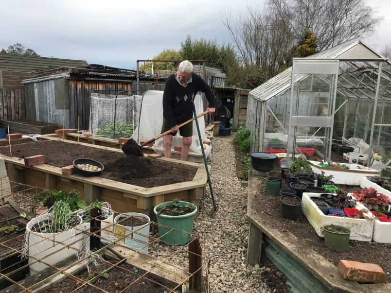
If anyone wants a mask let me know and can leave in letterbox for you. JenniFirst spud planting Photo and caption Gordon Alternative exercise Photo and caption Gordon
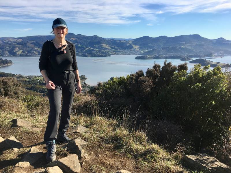
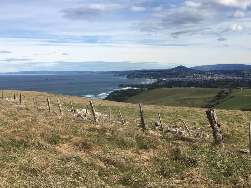
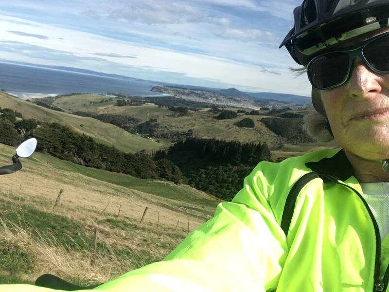
Above On the Harbour Cone recce and on a morning’s bike ride. Morning tea time underneath a lovely flowering wattle and cruising past the now famous wall! Below My water feature finally completed during the lovely lock-down spring weather, another long-term project! Photos and captions Marijke
As usual a beautiful frost free day in Port. and Morning ramble around Back Beach. Photos and captions Michael
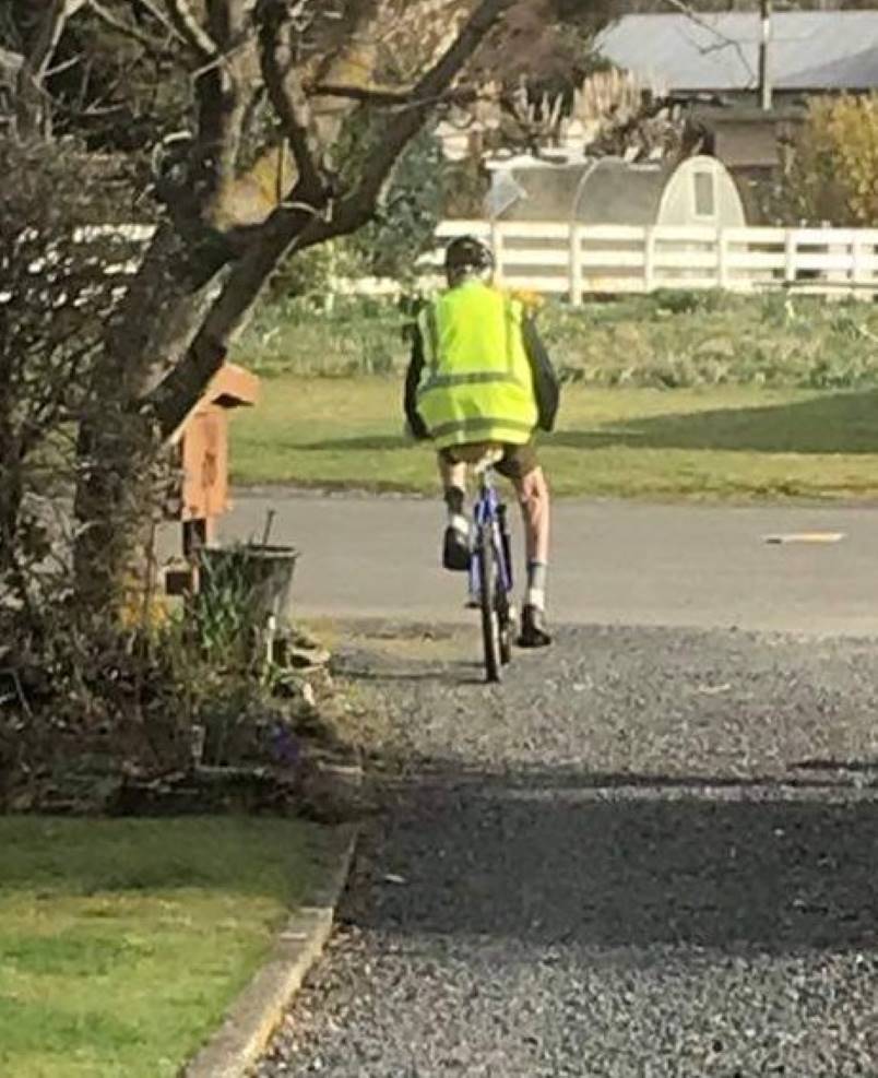
An early morning visitor at Brighton Beach Photo and caption DianneOur beautiful Ocean View coastline Photo and caption DianneDifferent type of track work Photo and caption Neil Morrison Went for a bike ride and came across a track we just had to walk Photo and caption Sarah Art work by the wonderful track clearer. Photo and caption Sarah Helen biking on Gladstone Road Photo and caption Phil
Phil relaxing and Helen in her happy place. Photo and caption Phil
Loving my new push bike . Was going down the Karatai track but was warned about an irate farmer so went back up again.
Hope everyone is enjoying this fabulous weather. Photos and captions Yan
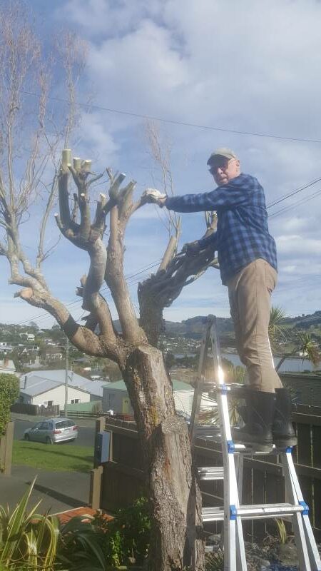
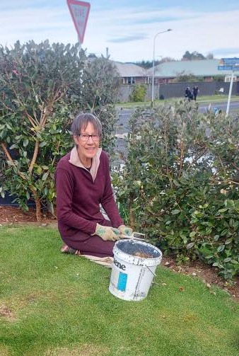
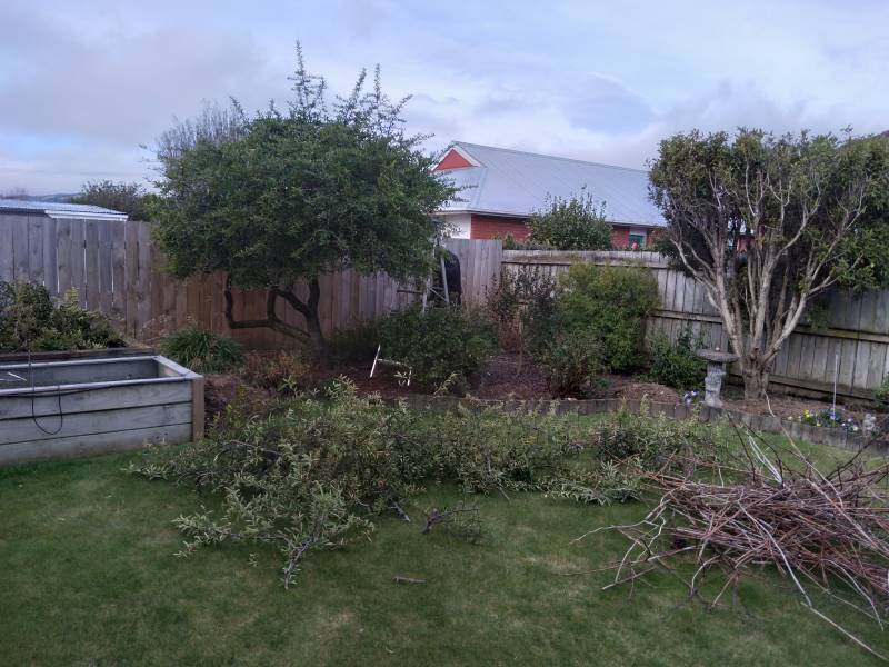
Not exactly an enjoyable way of spending the afternoon as had sharp thorns to contend with, but had to be done as arborist can’t get here. Another job ticked off the list!! Caption and photo Jan
Biking in suburban Mosgiel. Looking wistfully at the hills and wishing we were out tramping!!! Margreet and Neil Photo and caption
Alex Griffin enjoying Ocean View beach on a typical sunny day. Photo and caption Alex Lockdown part 2 – burn up of pruning from big property tidy up during 2020 lockdown . Caption and photo Janice
Biking and walking in my neighbourhood Photos and captions Pam Cocks
Anon You asked for it! Here it is! 🤭🤣🥰
Hi Team, Photos from Friends Hill Road on Sunday Photos and message Shona
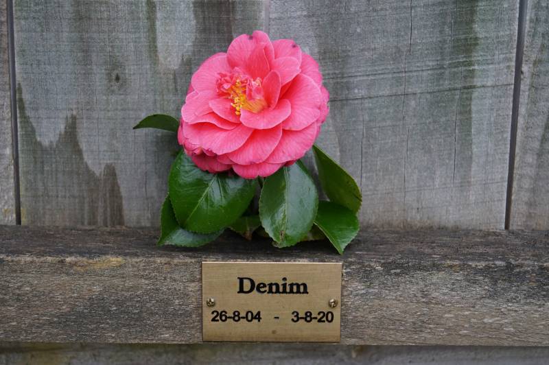
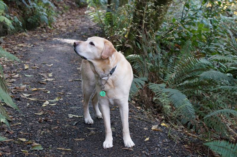
Time to reflect in lock down. A bit sombre perhaps, but today would have been Denim’s 17th birthday. A Golden Labrador, he was my son’s guide dog for 8 years, and my pet for 5 years in his retirement. Put a Camellia flower, from the garden, on the plaque where his ashes are buried, and looked through Denim’s photo file on my computer today. R.I.P. Denim. John Gardiner photos and message
The water tower on the top of the ‘Mosgiel’ Hill is useful for getting exercise walking up hill. Photo is of me walking up the steps in McFadden Drive to the water tower. Photo and caption Clive Water Water Water This has been my work since Saturday. Burst hose washing machine Friday night. 1 inch in garage. Caption and photo Ady

 24/07/2024. Millennium Track return, Henley Start. Trampers. Grade 4 Leaders: Gwenda Farqharson. & Alison K.
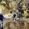 Sometimes my grandmother would say something to me, and I’d ask,