
Year: 2014
Luxmore, 13-27 Sept 2014.
Two intrepid trampers, geared up for a week,
With lots of lovely tucker, as adventure we did seek.
We drove down to Te Anau – not raining, but it tried;
They gave us our instructions, and a helicopter ride.
Swooping up to Luxmore, …
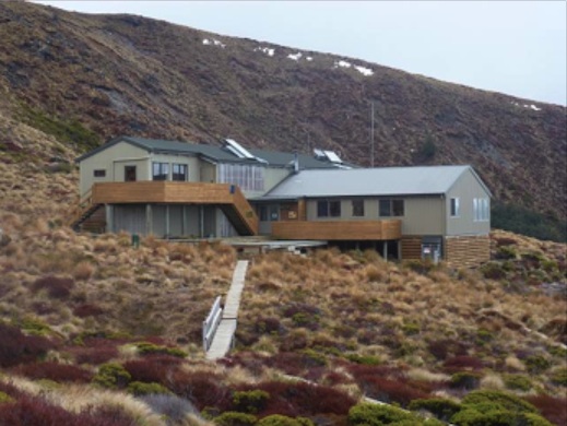
… firewood swung below,
We landed on the helipad, then inside we did go.
Our rooms were nice and cosy, the fire was blazing well.
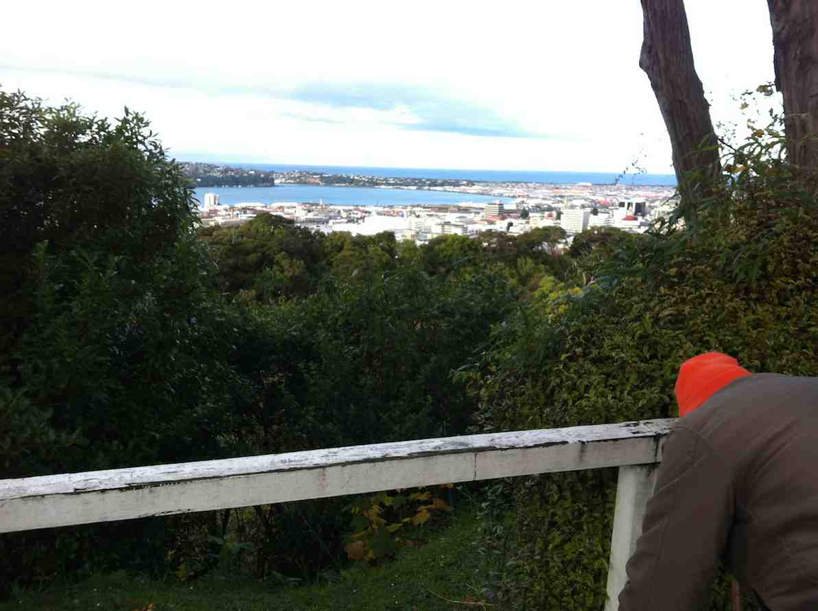
The views were quite stupendous …
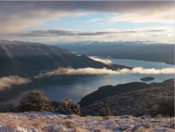
… (and the toilet didn’t smell).
We stacked away the firewood, and made ourselves at home.
(It didn’t seem to matter that I hadn’t brought a comb).
It snowed and blew and snowed again, the rain began to pour.
The sun shone for a little while, and then it snowed some more.
Our week was really busy, we met a lot of folks.
They came from all around the world, (there were some hunky blokes).
We carried water, chopped up wood, and even cleaned the loos.
And in the evenings, by the fire, we sank a bit of booze.

Our meals were really yummy, (we both can cook quite well).
We wafted to the hut below, a tantalising smell.
DVDs to watch at night, and lots of books to read.
Lots of cuppas through the day, and then, another feed.

Elaine worked the radio, and kept us up to date
With weather forecasts as they came, so trampers knew their fate.
Some of them were ill-equipped, one lot had no food.
Others came with blisters, and one was really rude.
But most of them were friendly, they came with good intent,
Ready to enjoy themselves, and think their time well spent.
Many were from overseas, and thought our country great.
To walk upon our other tracks, they really couldn’t wait.
Judy chopped some firewood – she got whacked on the leg.
Elaine put some ice on, it came up like an egg.
A good excuse for loafing, Elaine did the chores,
While Judy sat with glass in hand, and watched her wash the floors.
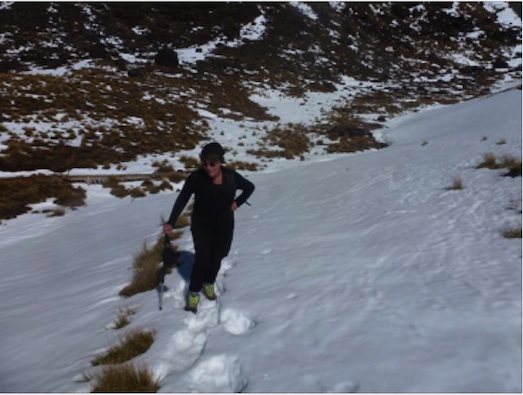
We wandered up Mt Luxmore, right up we tried to go,
But didn’t finally make it, because of thigh-deep snow.
The week flew by so quickly, with little time to spare.
With such a great experience, we’re going back next year! – Judy, prompted by Elaine.
Ian. An addition from a later date: May 2015 Report excerpt from:
Kepler Kiwi Catching – By Southern Contractors for Fiordland Conservation Trust
“…. we arrived at the hut just after dark to find that our message hadn’t been received and the two volunteer wardens, Judy Knox and Elaine Day, didn’t know we were coming. With 70+ trampers making the most of the first weekend off season and fine forecast Judy and Elaine had bodies on mattresses coming out their ears but they were most accommodating and kindly set us up in the wardens quarters. We fuelled up and headed out at 2000.
…
“We arrived back at the hut just after 0400 for a few hours zzzs on the hut warden’s spare bunk and floor.
“Trip diary: 2nd
“We woke up with the light but were feeling quite jaded after the big night and less than three hours sleep and so we didn’t make it out the door till 1045.” – Ian.
Outram Glen and Traquair/Whare Creek. Cartwright Track
6. 15/9/2014.
Just been reading some of your website on this short track. You may like to know that when we were talking to the gentleman at the museum last week, he told us that the track was put in to take supplies of piping etc up the burn for the Outram water supply. Also, if you go to the end of that track, & then cross the burn, there is a track up the other side, & up there is a valve, & some old piping. So it seems that the track has nothing to do with the old mill that was there, as it got it’s water from the race that you & I found in the paddocks above the road.
He has some old photos of the area as well, but they are not very good ones. There is also a water wheel [working] at the museum, which I think he said was the old mill wheel. – Ken
5. 10/9/2014. Trampers. Outram Glen & Traquair/Whare Creek.
After a cool start to the day, the weather warmed up, & we had a good walk along the Outram Glen track to Lee stream, [where we discussed the possibilities of crossing the stream without getting very wet] & back. We had a couple of stops along the way, one was with the owner of one of the houses up the Chalkies track road. He tells us that the grumpy one has now gone, & the new owners are quite ok with groups like ours going down [or up] the track through their properties, then down [or up] their driveway. I think permission should still be sought first though, especially for the first time at least.We arrived back at the car for lunch, & then proceeded along to the short track that runs in from the one way bridge at the start of the George King Memorial Drive. this was a new walk for some in the group, & started up a discussion on the old mill that used to be there.
On the way back out, we decided to go up into the museum grounds, as this was also new for some in the party. We struck up a good conversation with one of the gentlemen working on the site, & he was most helpful with info on the old mill, it’s whereabouts, & where to find some old relics.
We arrived back at the carpark, just before the hikers returned.We walked approx 12.5km [didn’t take the GPS on the short track.]
ave. 4.2km/hr. – Ken.
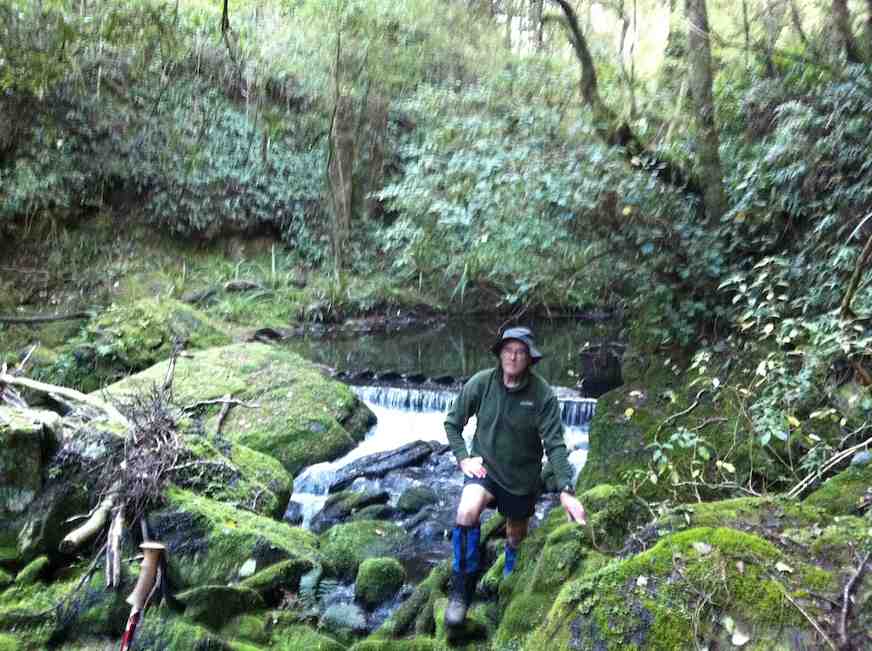
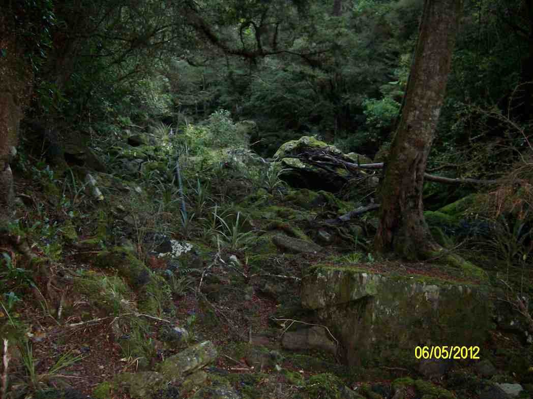
4. 5/5/2012. Whare Creek Outram Council weir. Ken and Ian.
On a fine Monday afternoon and with permission and advice from the landowners, we explored down the bush track below the power lines to arrive at the water race that supplied the water that drove the old Outram Glen Flour Mill back in the early 20th Century.
Following the pink markers brought us to the point leading steeply down below the race to the creek and a weir. From Jim Sime’s later information, this was the Outram Council’s weir and pipe line to supply water for the Outram Water Supply tank, located above the Taieri Museum, now no longer in use. The weir was designed so that flood debris would wash right over it.

Mr Sime said that the Flour Mill water race, higher up the bank, which he explored on an earlier occasion, leads on for a considerable distance to disappear at the face of a rock bluff, with no indication evident of how the fluming would have had to have been attached to the sheer rock. Mr Sime thinks that a pool yet further upstream at a streams’ confluence may well have been where the race might have begun.
3. 18/4/2012. Trampers. Outram Glen & Traquair/Whare Creek.

Seven of us took to the Outram Glen – Lee Stream track on an overcast & cool morning. We decided to have morning tea at Lee Stream, so we set off at a good pace, & we soon warmed up. The sun was out at Lee Stream, so a leisurely break was in order. We made our way back to the glen where we had lunch, & then we moved the cars down to the Traquair Burn bridge.
We made the short walk to the start of the Traquair Burn track & along this to the end, where we did a bit of exploring up the small tributary stream on the left. This quickly ran out of easily negotiated terrain, so we went back to the track end, & Ken went exploring up the Burn a bit further to see if it was possible to go upstream.
We returned to the cars via the Outram machinery museum grounds, where we had a good look around. – Ken
2. 23/4/2008. Trampers. Outram Glen & Traquair/Whare Creek.

Six trampers turned up at the car-park following a very stormy night to learn that the leaders, Ria and Hazel had, happily as it turned out, decided on Outram Glen instead of Whare Flat. They had carried out three Whare Flat recces only to find on each occasion tracks too overgrown to clear. We were delighted to find the reported upgrade of the initial flat (mostly) part of the Outram Glen track had been widened and metalled making for two-abreast walking. The remaining steeper bit however was literally, according to a DoC notice, “maintained to only route standard”. It was! But we made good progress arriving at the Lee Stream terminus at 11. It was there that Doug and Hazel discovered wild potatoes


of a very good size which Doug lugged back down the track for his meal table.
We lunched below the Taieri Historical Museum area prior to exploring a newly-cleared track up alongside the Traquair (or Whare) Stream – a new discovery for most of the group. Ian recounted how his Grandfather and family had owned the Flour Mill in a small area across the stream from 1911-1913 (the original Outram Glen), now buried under the present road corner alignment: a place once renowned for its gardens and picnic area for locals. Two houses, a mill, a fountain and an electric generator (which had earlier powered Outram’s street lights) as well as gardens had occupied the area. The buildings were destroyed by fire in 1918.
Fallen coloured deciduous leaves on an open area of the track would have kindled a painter’s imagination. We returned from where the track finally petered out, left wondering where it might have continued to in the past. Another satisfying day. – Ian
1. 23/4/2008 Leaders: Ria L, Hazel
Street Walk: Patmos Avenue
Abt 18 km from car park
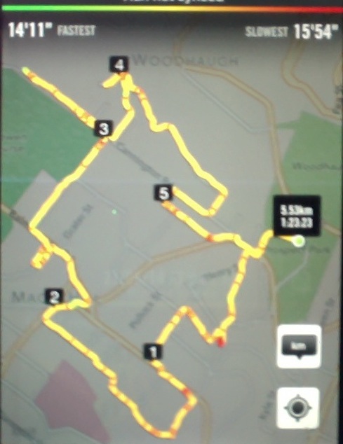
10/9/2014 Street Walk: Hikers. Patmos Avenue, Pine Hill, round trip. M. Leaders: Bev and Adrienne.

23 hikers left cars in Malvern St on a sunny no clouds day. No wind either.
We made our way up Patmos Ave, across the over-bridge of the motor way and on to Maxwelton St.
Does anyone know how this or who this street is named after? Somewhere on this journey we stopped for morning tea.
We passed some very old buildings on the way and there are some historical houses of significance from the
early days. At the end of this wee story there should be some web sites listed than you can pursue if you wish.
At the end of Maxwelton St we moved over to Pine Hill Rd.

We travelled down to 444 Pine Hill Rd and then up an alley onto Campbell Rd and then continued on down hill. Love down hills!
We arrived again at Pine Hill Rd. Lunch was at a small park.
We walked on down to Woodhaugh Gardens. None of us got run over on the way.
Woodhaugh Gardens are a pleasure to walk thru. My parents told me that in 1923/4 they did all of their courting there.
That was what it was called. The bird life was great to listen to. Walking thru the tracks in the gardens we passed the old quarry that closed in 1949 … and the old pub on the corner of Malvern St and Woodhaugh St was only open from 1888 till 1892. This hotel is getting a major makeover, which is good.
The views we had today looking over Dunedin are well worth the climb and the leadership by Bev was awesome even though she didn’t look like a hiker. Too well dressed in her high viz vest and pink nails. Adrienne did a good back up. No one and I mean NO ONE got behind her. Don’t forget to check out the sites. – Elaine.
<a href=”http://en.wikipedia.org/wiki/Pine_Hill,_New_Zealand#The_upper_slopes”>The upper slopes</a>
<a href=”http://en.wikipedia.org/wiki/Pine_Hill,_New_Zealand#Liberton”>Liberton</a>
<a href=”http://en.wikipedia.org/wiki/Pine_Hill,_New_Zealand#Dalmore”>Dalmore</a>
12/5/2010. Street Walk: Hikers. Patmos Avenue. Leaders: Bev, Lesley.
Grahams Bush, Upper Junction, Brickhill Rd
Grahams Bush botanical information.
Grahams Bush reserve was originally the site of sawmills and brick kilns operated by David Bethune in the 1880s, and became city council property in 1955.
Parking: Church Grounds. Distance from car-park: 27 km.
Parking: Church Grounds. Distance from car-park: 27 km.
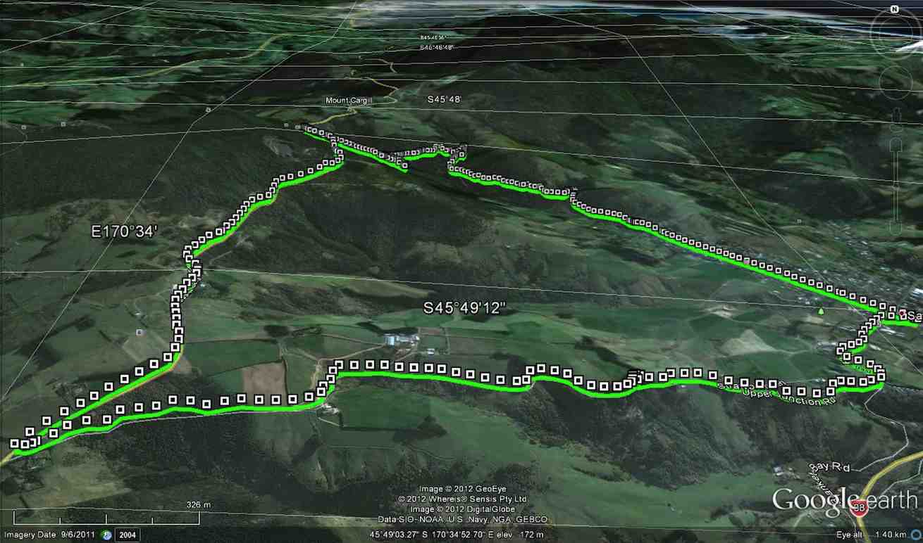
6/8/2014. Both. Hall Rd, Grahams Bush, Mt Cargill Rd, Upper Junction Rd, Brickhill Rd, Stevenson Ave. Leaders: Lester, Ian. (As it turned out, there was no appointed tramper leader there on the day.)
A perforce Hikers’ report.
This was one of those first of the month tramps for both trampers and hikers to get together. However at the car park on the church grounds, there was no sign of the trampers. We waited and questioned whether they had got lost. They had left the Bush Road car park before us. Where had they gone? We eventually set off without them on the long walk up Hall Road and on along the initial farm 4WD route to stop for a cuppa at the track turn-off.
For quite a few of us this was their first time on this route and they spoke appreciatively about the lovely bush. Rain the night before had made the track muddy in places. We were pleasantly surprised by beautiful bird calls, more than experienced on previous occasions.
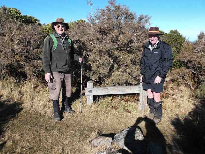
The steep grade gets no easier, but eventually we emerged onto the Mt Cargill road be be greeted by the small group of three trampers. They had left the car park early before the rest of us, had apparently driven right past the church car park in Station Rd and (cunningly? shorter distance!) parked further up Hall Road, and carried on ahead. So it was not to be a together day after all, even up to a morning tea stop!
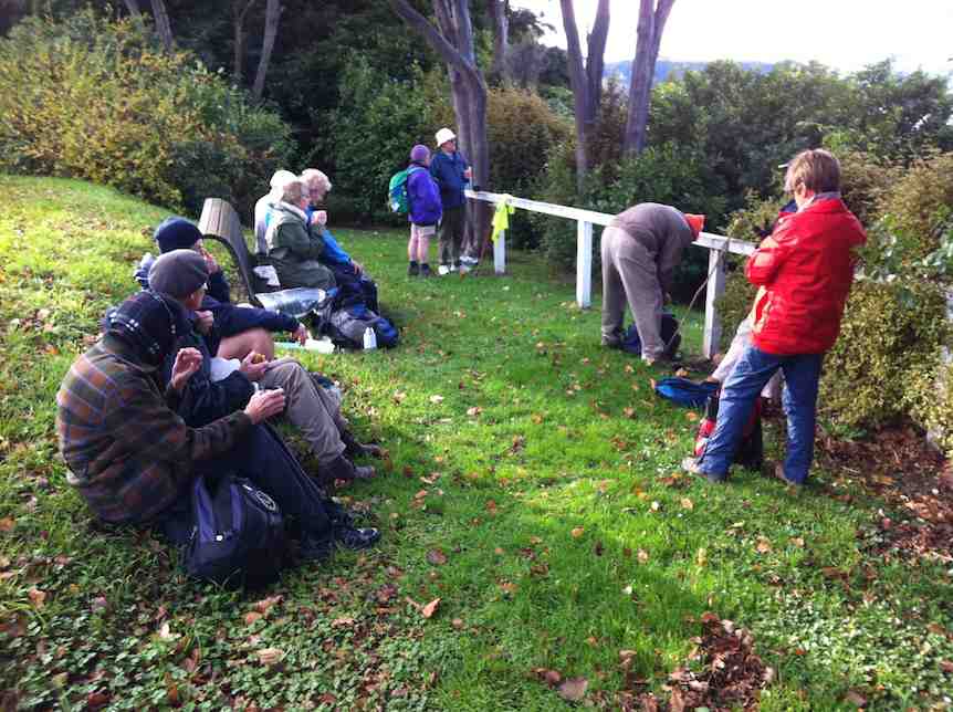
Anyway, after our brief meeting at the Mt Cargill Road car park, (so we were together briefly after all) they were off to further ascend Mt Cargill while the we stopped off for a leisurely lunch. Some of the hikers ventured a short distance up the track after lunch and returned back down again.
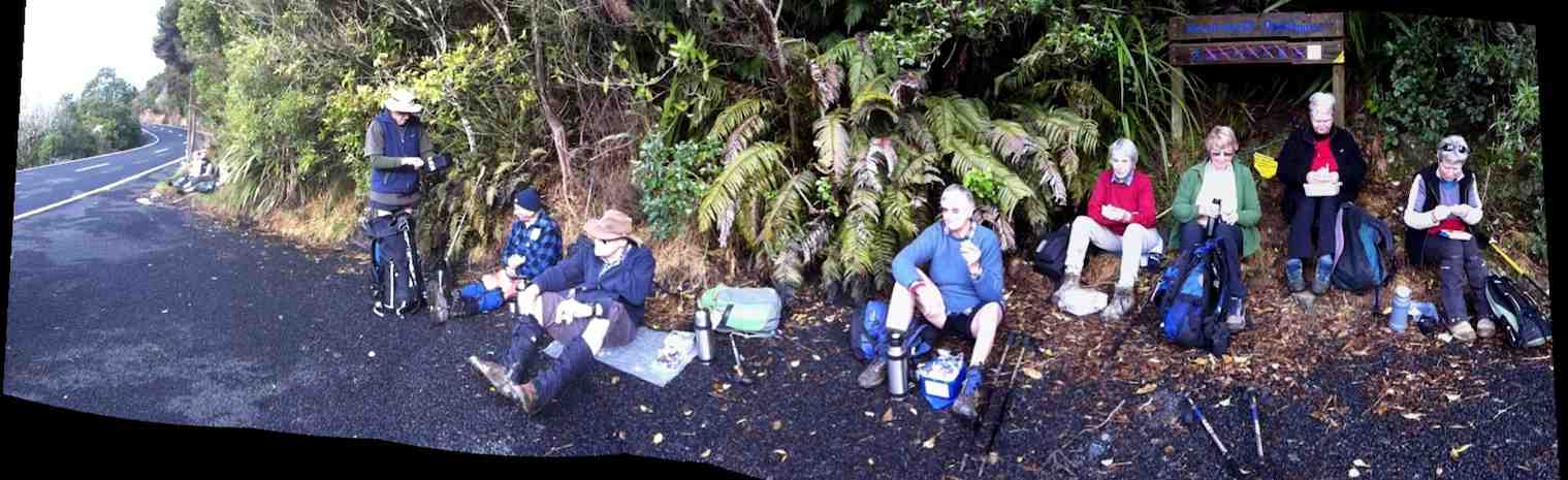
Hikers’ lunch at the car park on Mt Cargill Road
We set off along the old Mt Cargill Rd in a very orderly single file, quite a number of us wearing high-viz jackets. Perhaps it was these that encouraged passing drivers to noticeably slow down as they passed. We turned down Upper Junction Road and were interested to see how the slip at the bottom had been repaired. After the last grouping at Brickhill Rd, we straggled on to our cars back at the church park grounds. At 16, there was only half the usual number of hikers, and we suspected some had wisely decided their fitness was no longer up to the steep climb of the day. Another fine day, bracketed by bad weather on either side. We were so lucky. – Ian.
A Trampers’ report.
3 trampers left Sawyers Bay before the hikers arrived, as they got tired of waiting around ! The walk up through Grahams Bush was a little damp after rain on the previous night, but the bird life made the walk more pleasant.
After morning tea, with still no sign of the hikers, we walked to the top road,
After morning tea, with still no sign of the hikers, we walked to the top road,
where we waited for approx 40mins. for them to arrive. After this, we walked up the Organ Pipes track, stopping to view the tumbled down remains of the pipes,
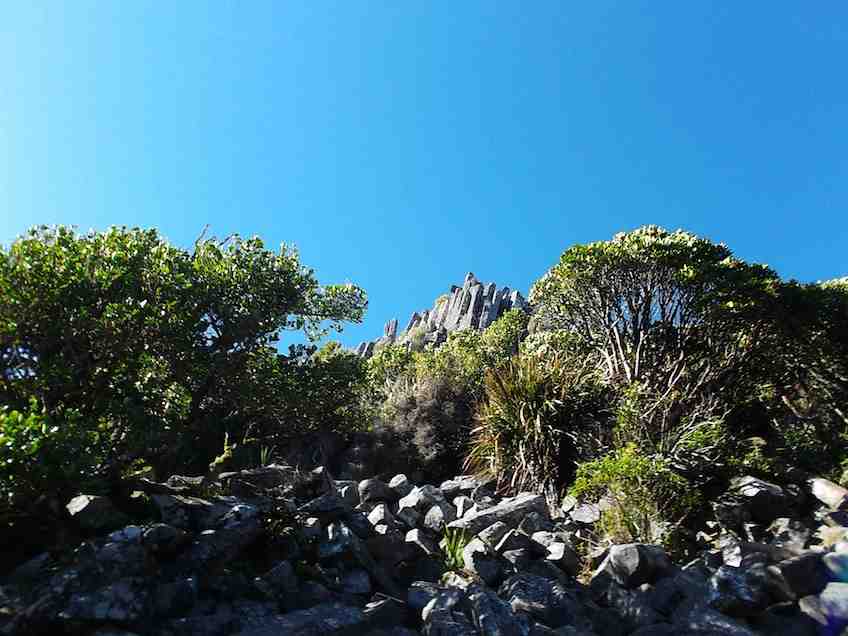
then went on to Butters Peak junction,
where lunch was had in the sunshine.
The return trip was uneventful, & the birds once again kept us company. – Ian Hebberd? – per Ken.
The return trip was uneventful, & the birds once again kept us company. – Ian Hebberd? – per Ken.
1/8/2012. Both. Grahams Bush, Mt Cargill Rd, Upper Junction Rd, Brickhill Rd, Hall Rd. Leaders: Pat, Ken.
10.5 km distance.
3.7km/h moving ave.
2hr 48min moving time.
379mtrs. total ascent.
394 max elevation.
3/11/2010. Both. Grahams Bush, Mt Cargill Rd, Upper Junction Rd, Brickhill Rd, Hall Rd. Leaders: Fred, Elaine.
A goodly number of 21 of us set off for the round trip. We stopped at the turn-off into the bush for morning tea. Evelyn has apparently suffered an early bad fall but soldiered on.
Continue reading “Grahams Bush, Upper Junction, Brickhill Rd”
Christie Gully, Big Stone Road, Otokia, McLaren Gully Rds
No. 50 on old hardcopy list of 113 club tramps. “McLaren Rd – Christies Gully Year Round”
Trampers Park Henley Road, to left of entrance from north end of flood free highway. 17 km from car-park.
Hikers Park Henley Road, to right of entrance from north end of flood free highway. 18 km from car-park.
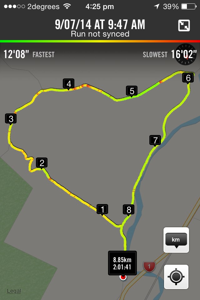
17. 9/7/2014. Hikers. Otokia, Big Stone, Christie Gully and Henley Roads. Leaders: Les and Margaret.
16. 13/6/2012. Hikers. Otokia, Big Stone, Christie Gully and Henley Roads. Leaders: Les and Margaret.
15. 24/8/2011. Hikers. Otokia, Big Stone, Christie Gully and Henley Roads. Leaders: Les and Margaret.
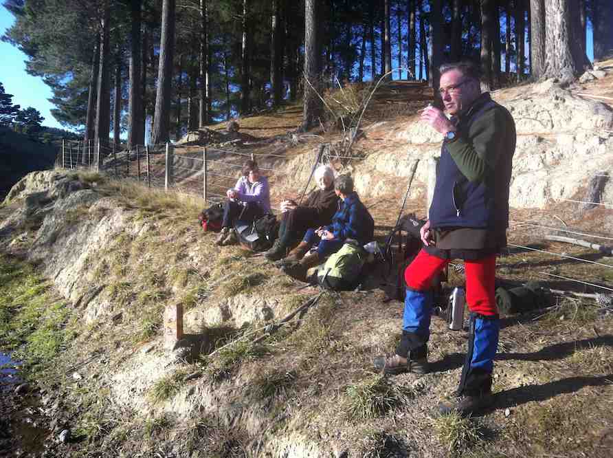
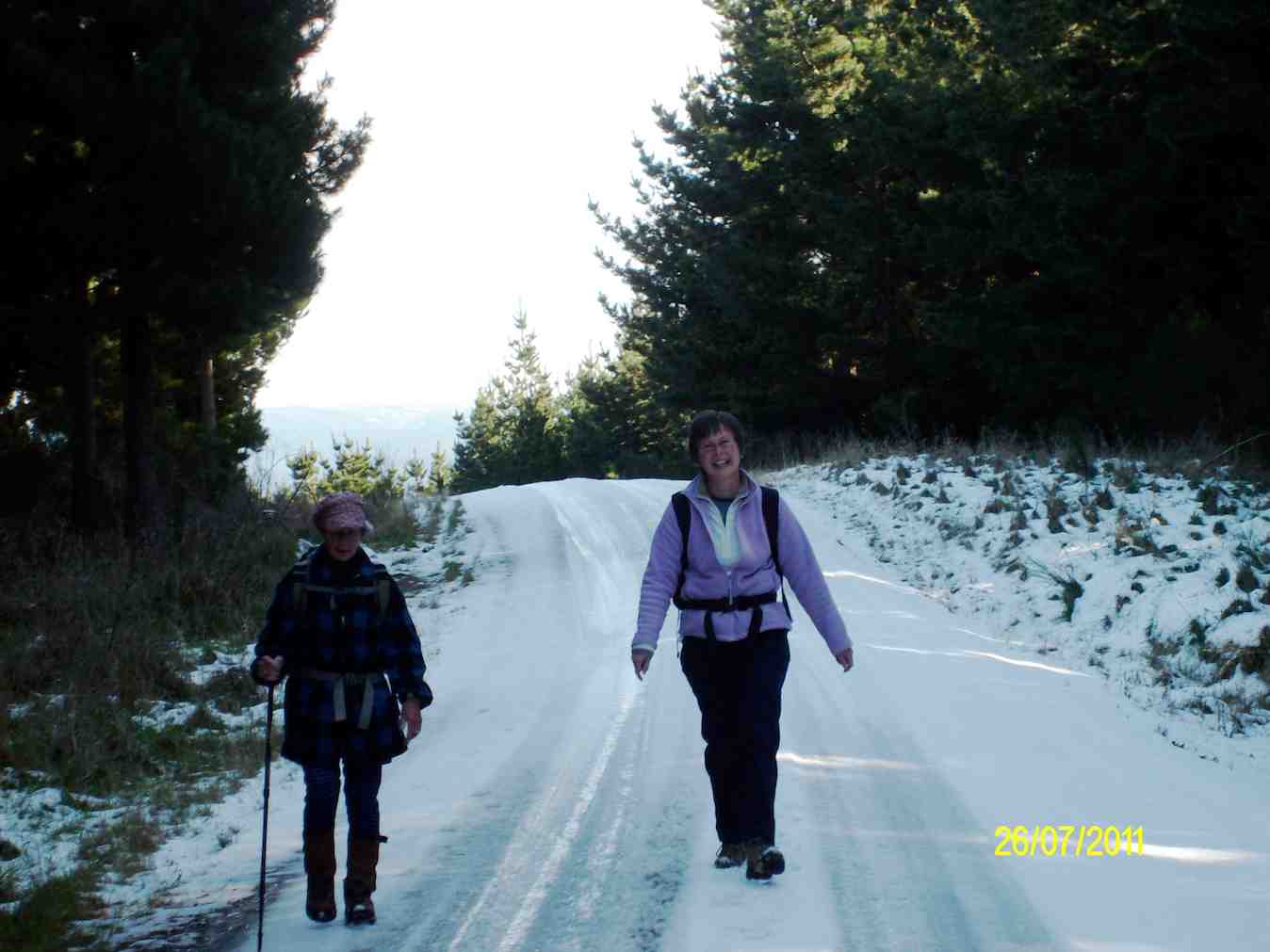
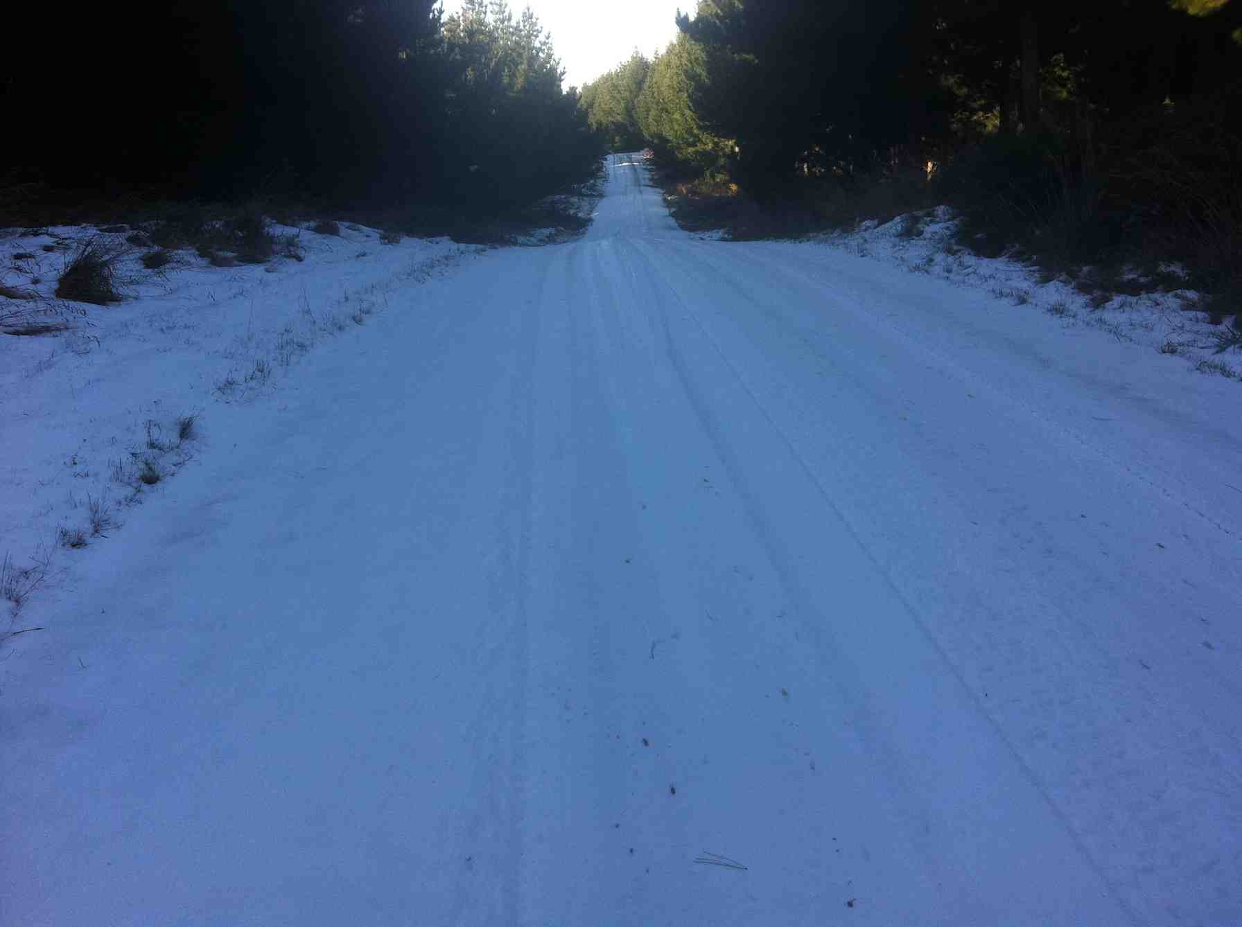
14. 27/7/2011. Trampers. Henley Road, Christie Gully Road, Big Stone Road, McLaren Gully Road SE along SH1 back in to cars on Henley Road extension. 3.5 to 4 hours. 15 km walk.

13. 13/10/2010. Hikers. Christie Gully, Cemetery.
12. 3/6/2009. Both. Henley Road, Christie Gully Road, Otokia Kuri Bush Road East, (down Otokia Rd for shorter walk), Big Stone Road, McLaren Gully Road SE along SH1 in to cars on Henley Road extension. Leaders: Les and Margaret.
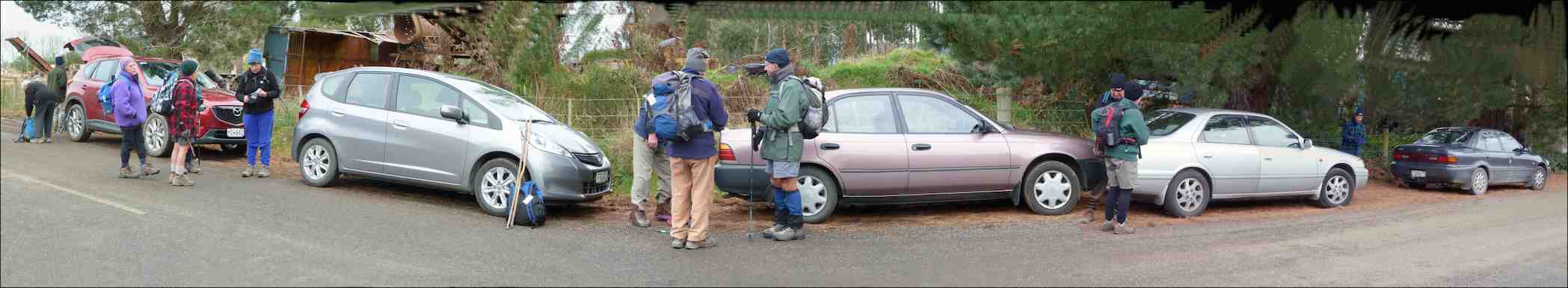
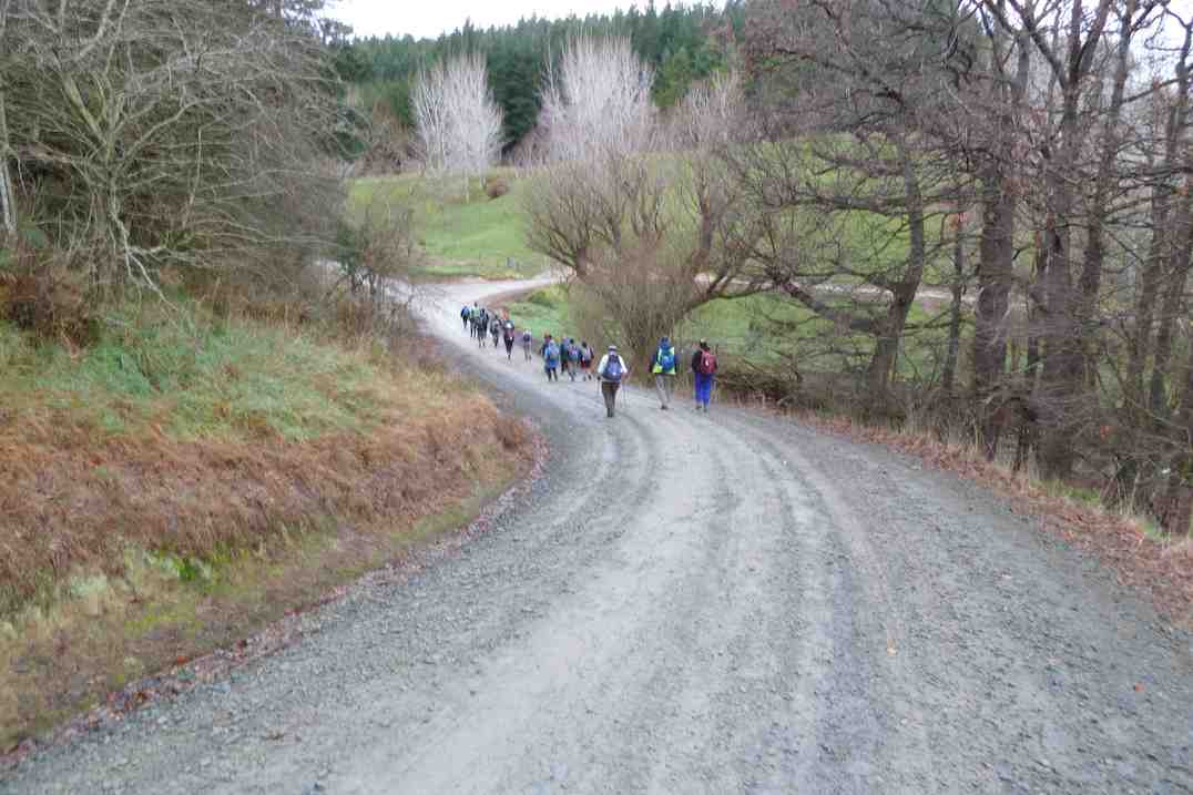
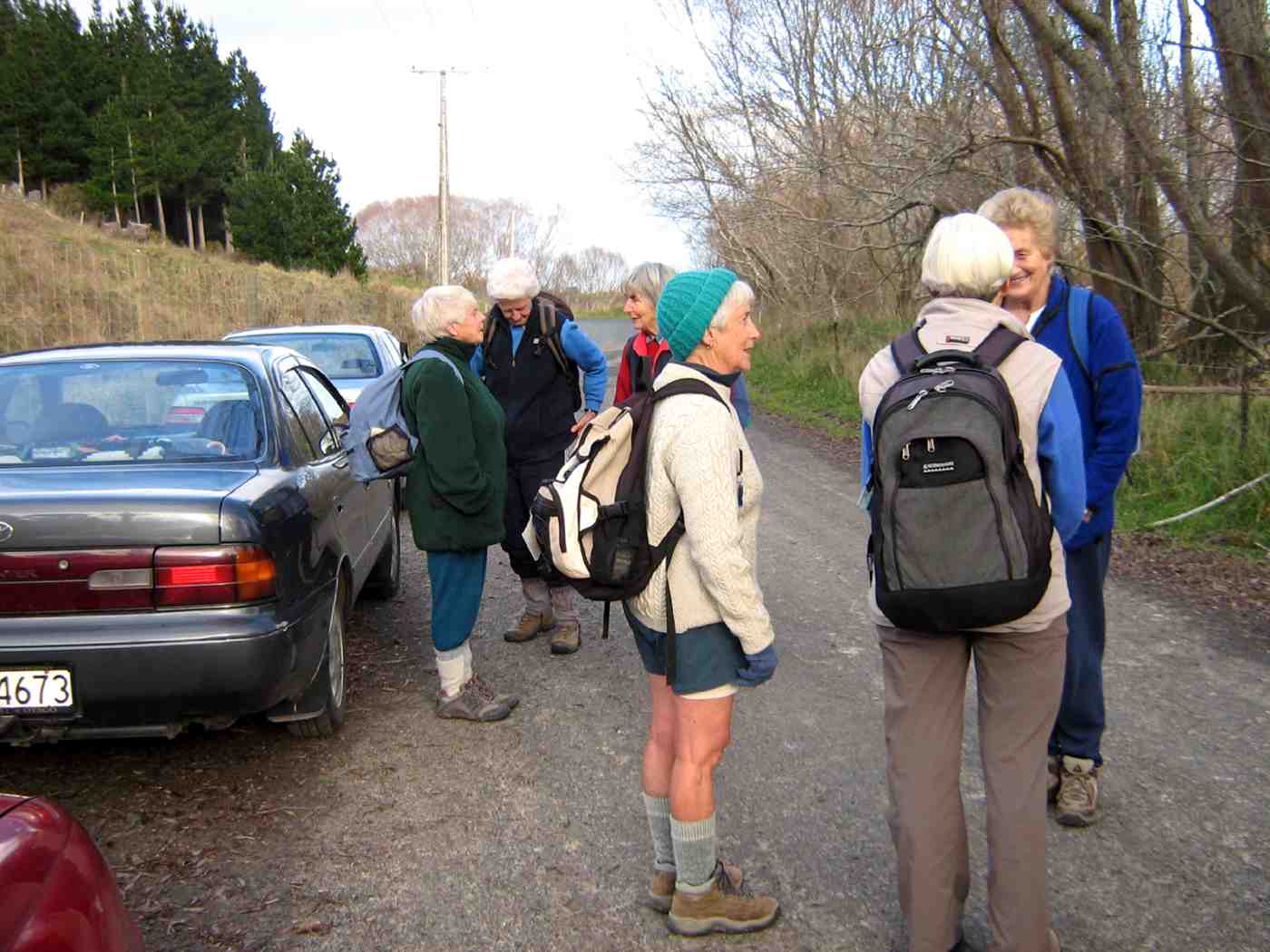
We parked in the usual place.
click to enlarge
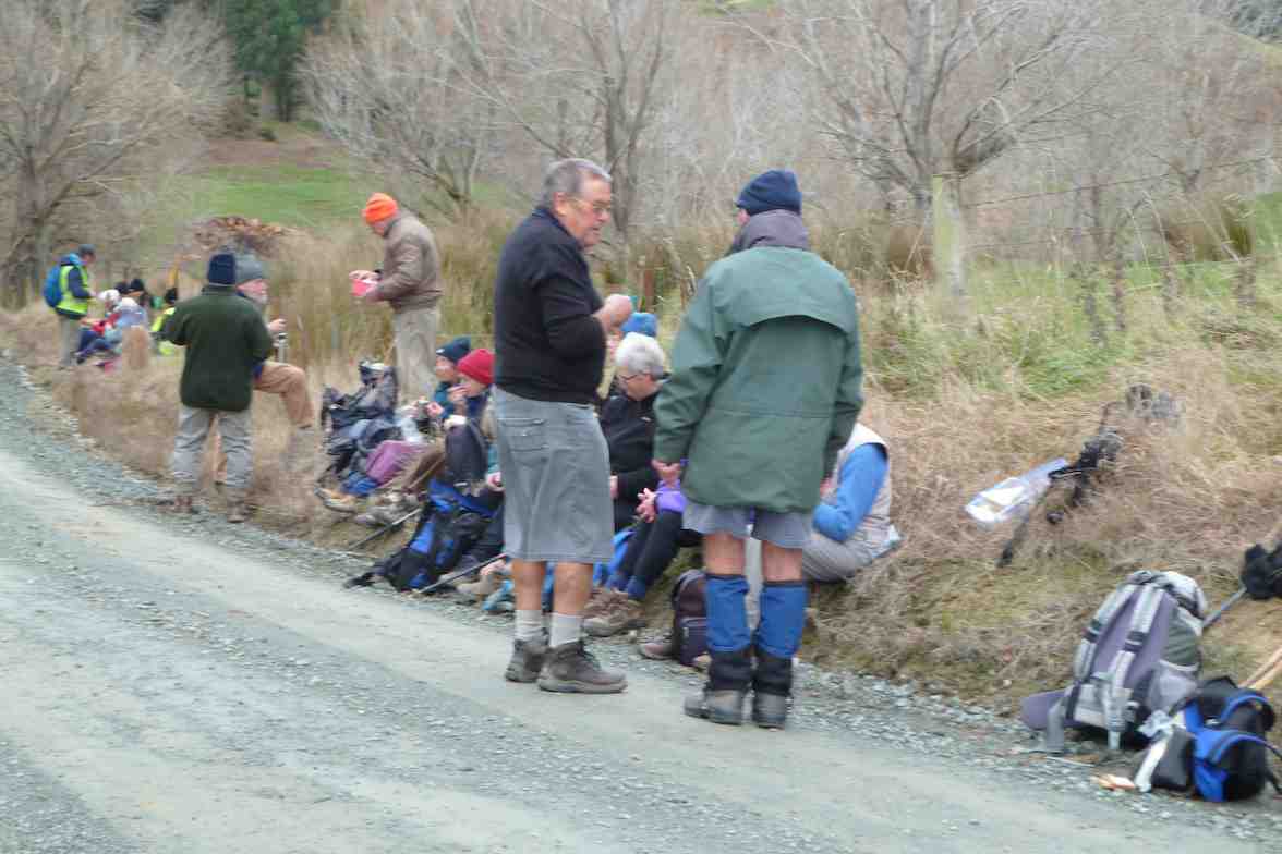
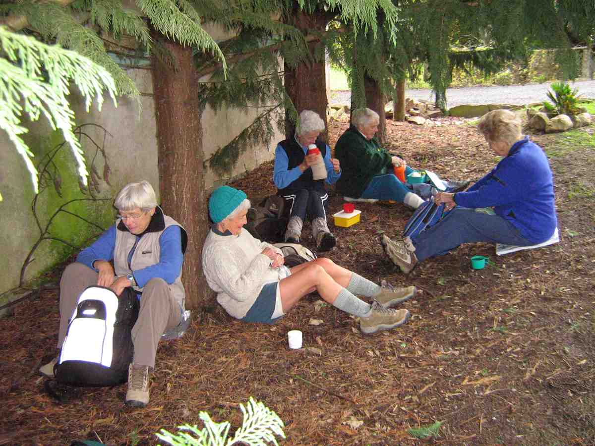
The later 9.30 a.m. start had us stopping for a cuppa on the Henley Road in some shelter instead of after the turn into Christie Gully Road.
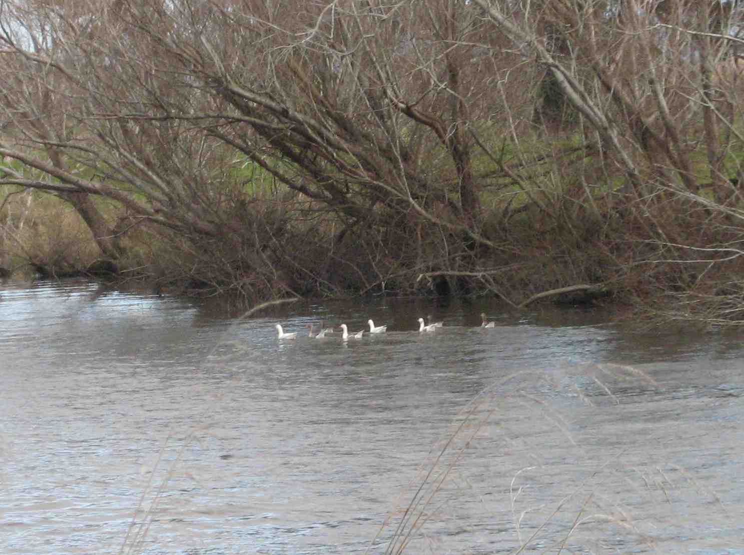
Next, we saw geese on the Taieri River.
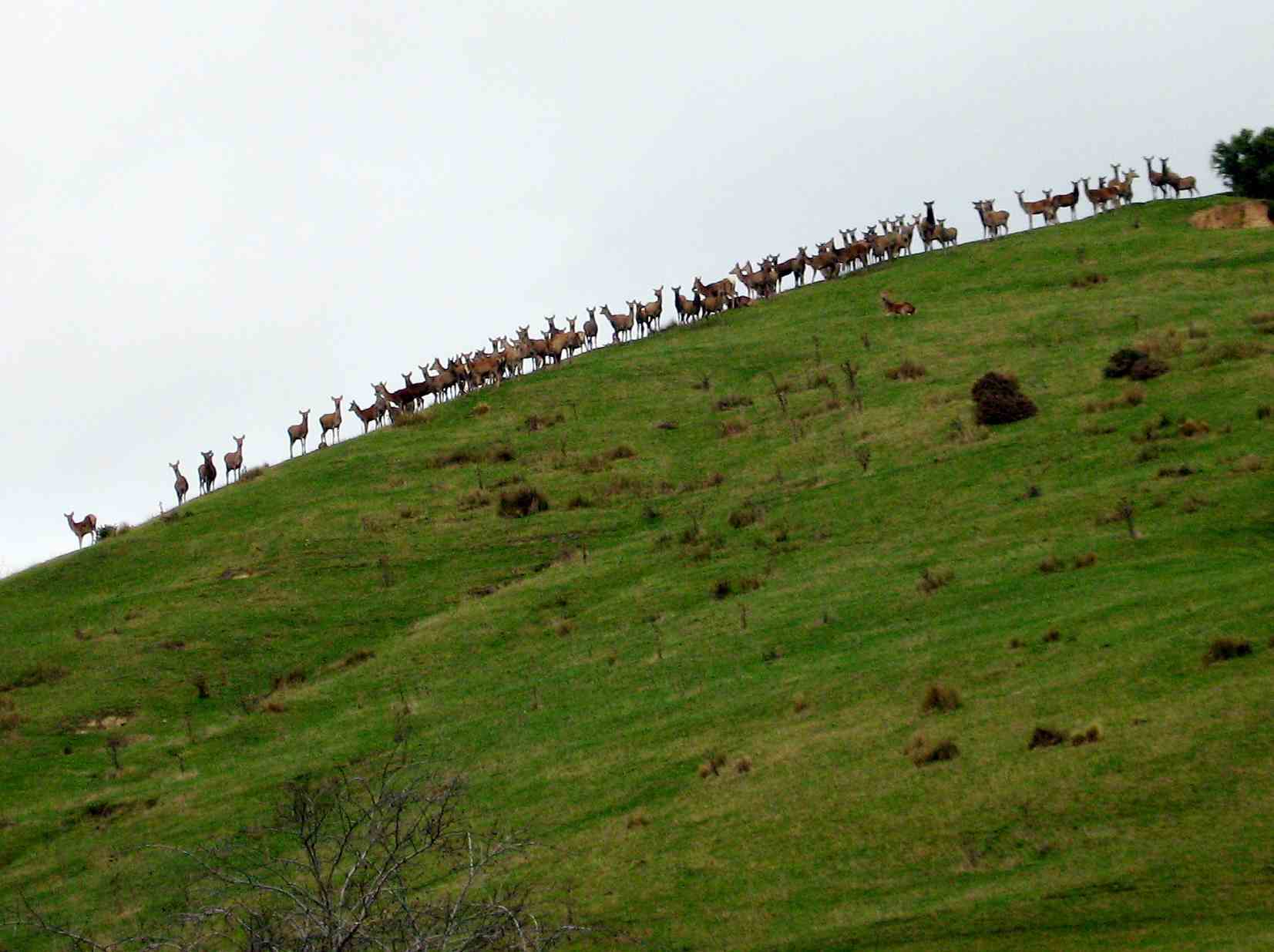
Then we saw deer on the hill.
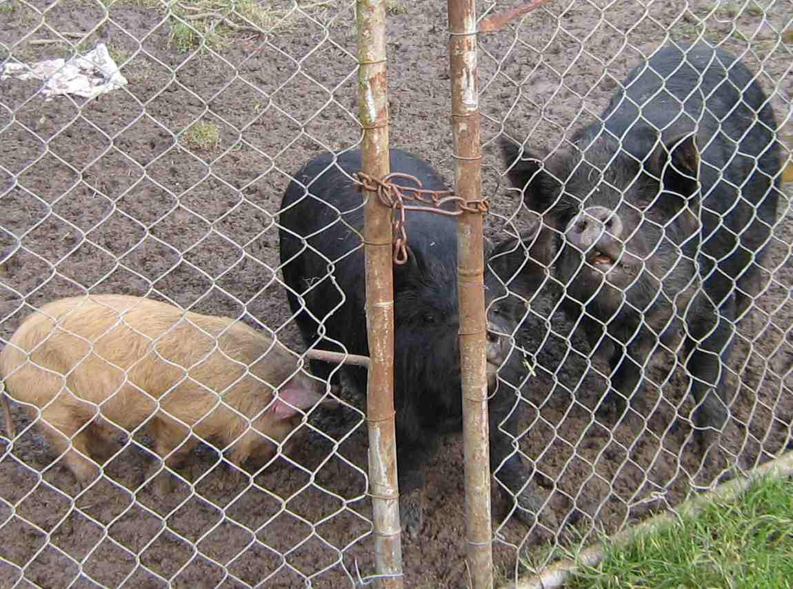
On Christie Gully Road we saw some old friends – or their descendants.
At the top of the road we stopped for a breather and to admire the view. It turned out we were outside Margaret’s mother’s old place. The house had been burnt down long before Margaret’s time.
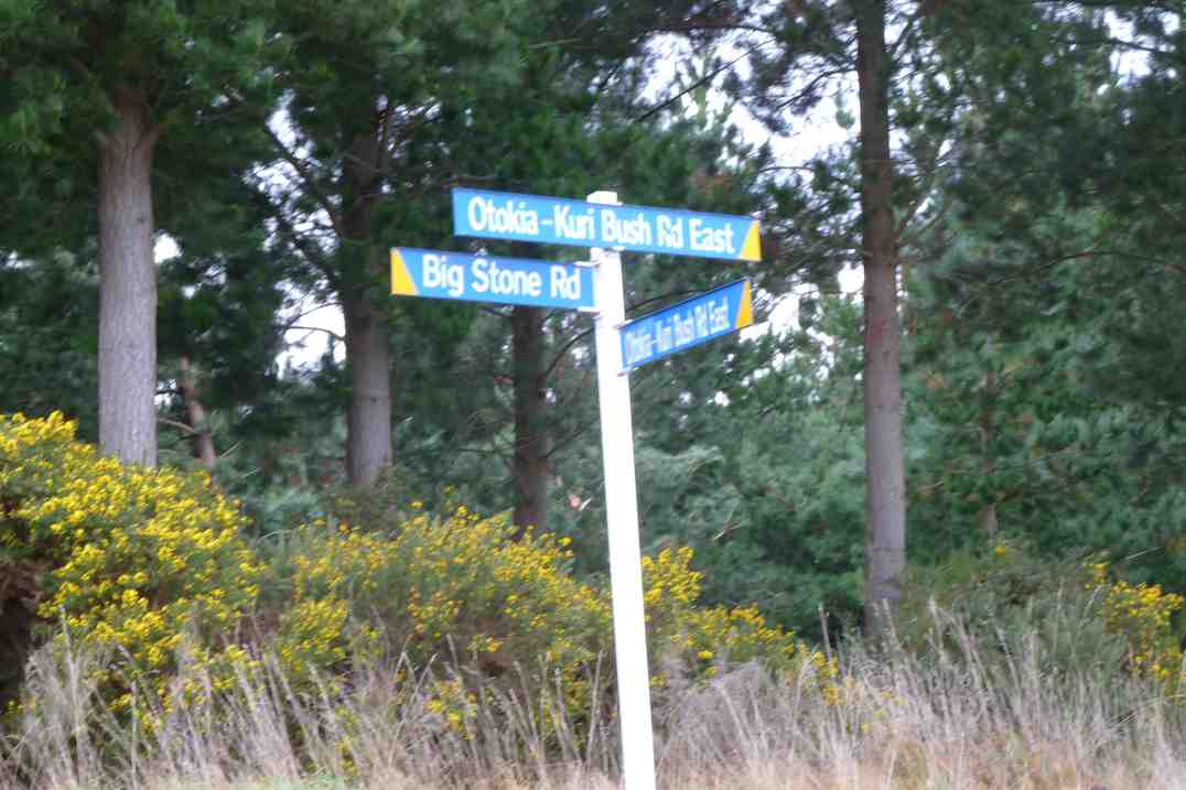
We paused at the junction of Big Stone Road and Otokia-Kuri Bush Road West.

As Margaret was going to take those who wanted a shorter walk down the shortcut and via the cemetery, we stopped for lunch here.

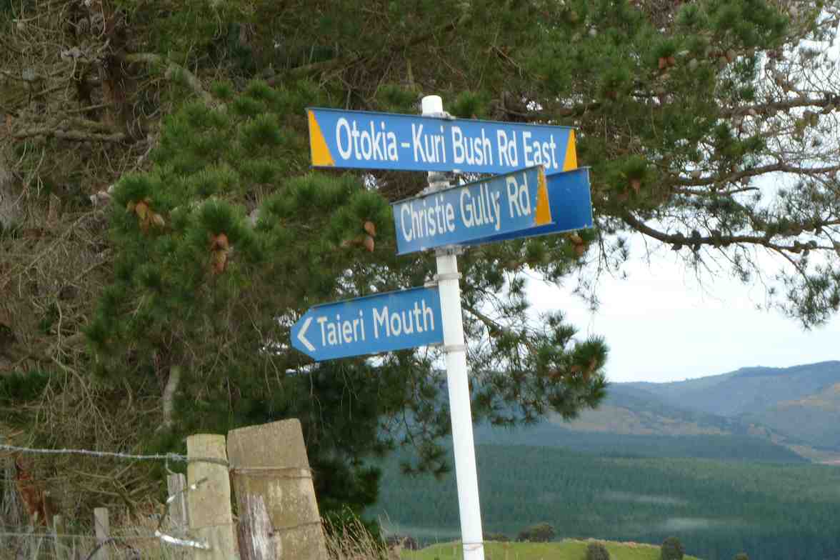
The first time I’ve snapped this place.
11. 29/10/2008. Hikers. Otokia, Big Stone, Christie Gully and Henley Roads. Medium. Leaders: Peter B, Neil
10. 12/9/2007. Hikers. Christie Gully, McLaren Gully Roads. Easy+. Leaders: Margaret and Les.
9. 8/8/2007 Leaders: Ian, Bill M.
Parked north end of flood free highway by gravel heaps.
Walked Henley Rd to Christie Gully.
To Otokia Kuri Bush Rd East/Big Stone Road.
Turned down McLaren Gully to SH1. Henley Rd to cars.
Walked Henley Rd to Christie Gully.
To Otokia Kuri Bush Rd East/Big Stone Road.
Turned down McLaren Gully to SH1. Henley Rd to cars.
8. 30/6/2004. McLaren and Christie Gully. Medium. Leaders: George, Bruce, Dot T, Les & Margaret.
7. 18/9/2002 Leaders: Catherine, Lance & Lois
6. 27/9/2000 Christie Gully – McLaren Road. Road Walk. Leaders: Mary Y, Jean A, Catherine
5. 16/6/1999. Christie Gully, McLaren Road. Leaders: Les and Margaret, Wendy.
4. 22/7/1998. Christie Gully, McLaren Gully. Leaders: Margaret S, Nancy.
3. 11/6/1997. McLaren Gully, Christie Gully round trip. Leaders: Les and Margaret, Ivan.
2. 5/11/1992 Otokia, Big Stone, Christie Gully and Henley Roads. Average. Leaders: Eric & Dot, Margaret S, Les W
1. 15/6/1991. Christie Gully and McLaren Road. Good winter tramping and views. Average+. Leaders: Nancy, Margaret S, Eric & Dot
Distance from car park: 18 km.
Protected: Committee Minutes 11/6/2014
Fort Hill, Barnes and Circle Hill Roads, Milburn.
No. 90 on old hardcopy list of 113 club tramps. “Round Hill – Milburn (George) Farm”
42 km from car park.
2/6/2014 Both. Fort Hill, Barnes and Circle Hill Roads, Milburn. Moderate. Leaders: Ian, Ken
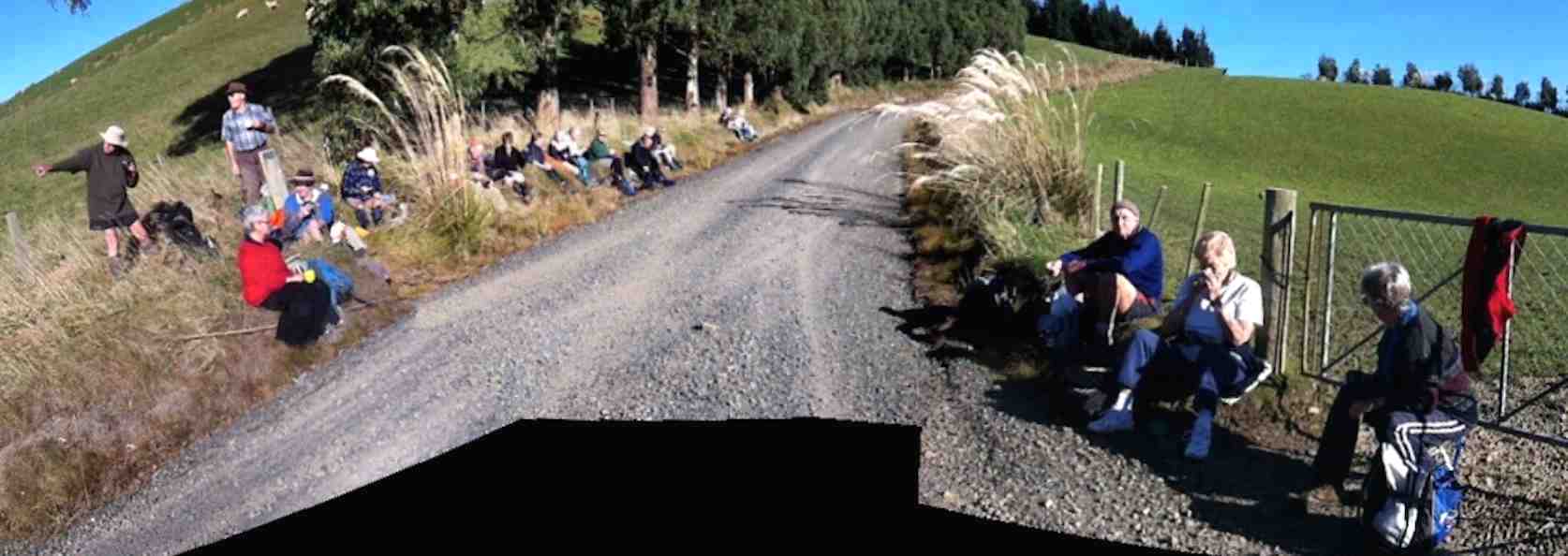
Twenty-six turned out for a sunny first tramp for the winter, on back country roads amongst lovely rolling hill farms to the west of Milburn.
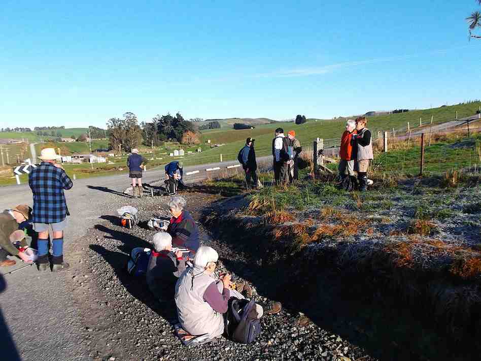
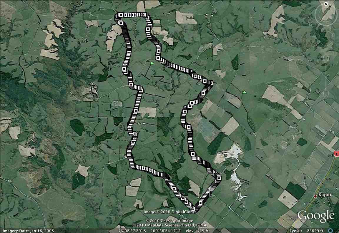
We lunched where Fort Hill Road ended at a T-junction with Barnes Road, which stretched left to meet Circle Hill Road, and right to form to form a larger route to also turn down Circle Hill Road at its end where both these roads joined to form Douglas Road.
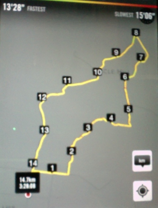
Ken supplied this report regarding this spot. Thanks Ken. : “The people that did the longer walk, covered 15.2km; Moving time 3hrs 9min; We climbed 374mtrs. I guess the ones that took the shortcut walked about 11km.
I base this on the time taken for us to walk around the longer loop, & the ave speed was 4.8km/hr, & it took us nearly an hour to walk around the loop.”
I base this on the time taken for us to walk around the longer loop, & the ave speed was 4.8km/hr, & it took us nearly an hour to walk around the loop.”
As said before, the day was sunny and calm, and each ample time to make the climbing bits at bits own pace.
Just a personal thought for road walks. With the growing practice of wearing, and of availability of high-viz vests, a good idea would be for more than just the leaders to be wearing them.
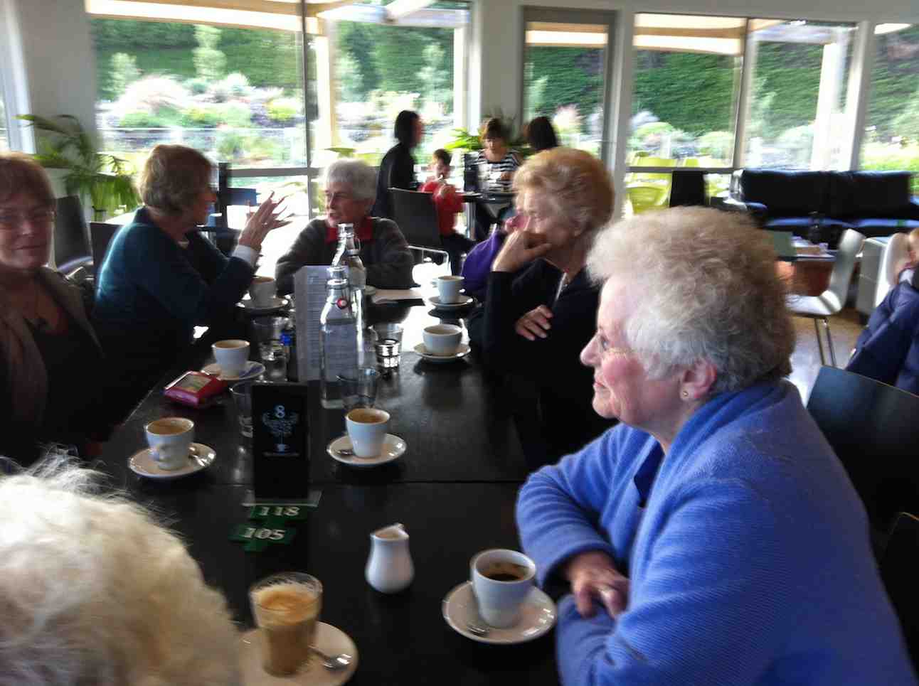
And lastly. What is becoming the customary coffee stop was enjoyed this time at Waihola’s Black Swan. – Ian.
1/9/2010 Both. Fort Hill, Barnes and Circle Hill Roads, Milburn. Moderate. Leaders: Ian, Ken
Continue reading “Fort Hill, Barnes and Circle Hill Roads, Milburn.”
Salisbury, Mill Stream Road, Silver Stream Road
21/5/2014.Trampers: Nth Taieri Church, logging site, Mill Stream Rd, Silver Stream Rd. Car Shuttle. M
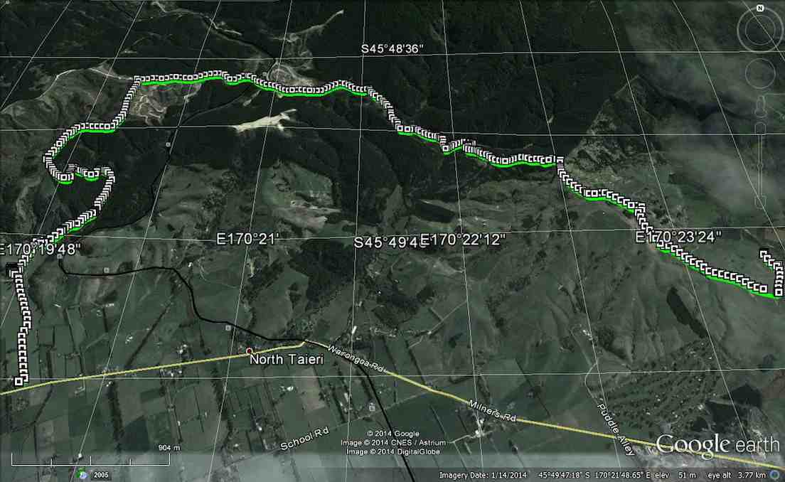
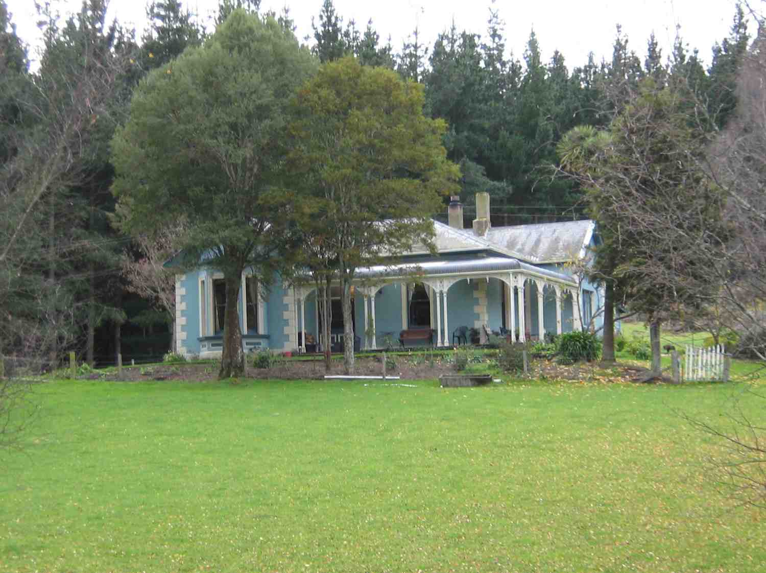
4 intrepid trampers turned up to do a walk that had never been done before by the club. The weather was not looking good, but we set off to leave one car at the Silverstream end, then came back to the Nth. Taieri Church, and walked up the muddy paddock to the restored cottage, where we had an early morning tea break. After this we walked up the track along the valley, which we found to be quite difficult due to fallen bushes across the track. Once into the pine forest the going was a lot clearer, but much steeper, & we worked up a bit of sweat climbing through here, so it was off with some clothing. When the top was reached at the farm paddocks, the wind was very brisk [& cold] so wind break clothing was quickly donned again. The walk along the farm road was uneventful, but when we reached the logging road we had to watch out for the trucks using it.
We walked past the log processing site, & into City forests, [which I forgot to get permission for], and then onto a little used road which lead us to the top of Mill Stream Rd. There was a lot of deer sign down here, but we didn’t see any deer. After crossing Mill Stream, it was a climb up the other side of the valley, where we stopped in the shelter of the trees for lunch, …
… then up again through the back of Strauss’s property to the end of Mill Stream Rd. & onto the track leading down into Silverstream valley, back to the car which we had parked in the farmer’s yard earlier in the day.
The weather was good all day except for a short shower as we came down the track into Silverstream valley, although the wind was quite cold all day.
Everybody agreed it was a good walk, and that they would do it again. – Ken
Street Walk: Maori Hill
21/5/2014. Street Walk: Maori Hill. E. Leaders: Lance and Lois.
(An inadequate report. Only a summary. Anyone care to improve on/add to/alter it? Please notify.) Cars parked on Queens Drive encircling Prospect Park. Across Lachlan Avenue to Stonelaw Terrace, down a steep track at its end, first seal, then small crushed metal, to emerge on Queens Drive, then up Chamberlain Street for a short distance, along Como Street and up View Park Lane. This was a revelation to the reporter, who had known nothing about this (unique to Dunedin?) lane of letter boxes sited at the end of back sections to properties fronting otherwise onto Como (our left) and Chamberlain (our right) Streets. A gift for posties! Then along Falkland Street, down Drivers Road, to climb Tolcarne Avenue and stop just below Tolcarne Collegiate School Hostel to enjoy morning tea at a view point.
Then up Grendon Street, finding a lane taking in the back properties of houses on left and right with their frontages out on adjacent roads. (Unsure though where this was.) Out onto Highgate, through the village onto Balmacewan Road and up Prestwick Street to its terminus and return. Along Pilkington Road, to take Cannington Road to spot where it ends at the bush, return and follow Cairnhill Street into Braeview Crescent to explore it to each of its terminuses (or termini if you must be linguistically correct) to their ends. Back along Cannington Road to find our way into Brownville Crescent, another new find for the reporter. Here was a road necessarily one-way due to its narrowness. Lance thought it likely than a developer had enforced his wishes on some early Maori Hill Borough Council, narrowing its width to increase adjacent property areas as much as possible. It exited onto Highgate. Then it was back down to the cars at Prospect Park. Early lunch, scheduled to be finished before a forecast storm. However this came only later when driving back home, so lunch was enjoyed in the sun on a bank sheltering us from the wind. Thanks to Lance and Lois for a well reconnoitred, imaginative and most enlightening route. – Ian.

Protected: Committee Minutes 2/4/2014
THE DREADED DEMON TRAIL – a private trip.
THE DREADED DEMON TRAIL
On Tuesday March 25th Judy Knox and two friends of long-standing, Jan and Brian, set off for the Hollyford Valley. After a night at Te Anau we were at the road-end by midday on Wednesday, and had a leisurely three-hour walk to Hidden Falls Hut. Next morning Brian discovered he had left his heart pills in the car, so did a quick return for them, and we proceeded to Alabaster Hut, extending the day’s tramping, for him , to almost nine hours.
Still feeling fit, we covered the next, longer, leg, from Alabaster to Demon Falls Hut, in eight hours – a bit over the suggested time, but we always take regular (hourly) rests, and our pace is steady but not fast, considering heavyish packs. The track from the road-end to Alabaster is great – wide and well-formed, with gentle gradients. However, from here on it becomes seriously rough, and very up and down, making pretty hard going.
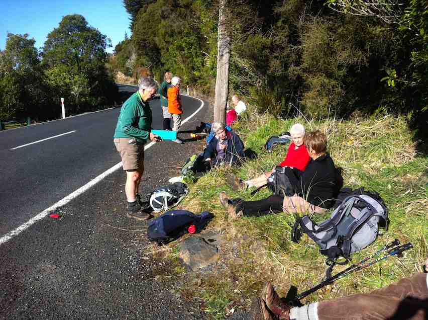
Now the fun begins. It’s Friday morning. We get an early start (first light) and set off in good heart. But Jan rapidly develops a pain in her right knee and gets slower and slower. We take numerous rests, lighten her pack, and watch anxiously. The ups and downs are endless, the three-wire bridges a real problem for her, and the map gives no indication of how far it is to the next hut – Hokuri, supposedly about eight hours from Demon Trail Hut.
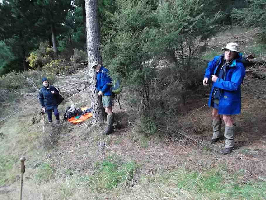
Daylight fades. We scramble on, now having to haul Jan over numerous obstacles. We have a look at her leg. The knee is badly swollen and barely takes her weight. Darkness falls. After thirteen hours tramping we call it a day, scramble off the waterfall of a track to a dry spot in the bush, and set up a fly camp. Lots of things to be thankful for. It’s fine and warm, and I am carrying my new poncho, which is large enough to open out into a fly, which we rig over a log and attach to our walking poles with bootlaces.
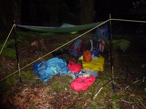
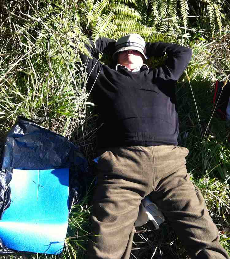
And we are carrying a locator beacon. Hot soup, and we settle for the night. Surprisingly we all sleep relatively well, in spite of the odd buzz of a mosquito and some light rain just before daylight. Hopefully the rest will help Jan’s knee and we can get to the hut in the morning.
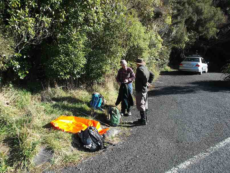
No such luck. When she rolls out of her sleeping bag she can barely stand. We debate the options. Nothing for it but to set off the beacon, albeit reluctantly. We eat muesli and drink milo, then pack up and wait. Two hours later we hear the chopper approaching. It spirals down, and Brian and I frantically wave yellow pack liners until visual contact is made.

There is just a small window of sky visible, but the medic is winched safely down and makes a quick assessment.
Jan is strapped into a harness, her face rather ghostly white, and I don’t envy her as she spins wildly up …

… through the trees and into the chopper. The medic follows with her pack,

and suddenly we are alone again.
It’s only 45 minutes to Hokuri, but we agree Jan could never have made it. We spend a quiet afternoon at the hut recovering, before setting off next morning (Sunday) for Martins Bay, reached uneventfully in six reasonable hours.
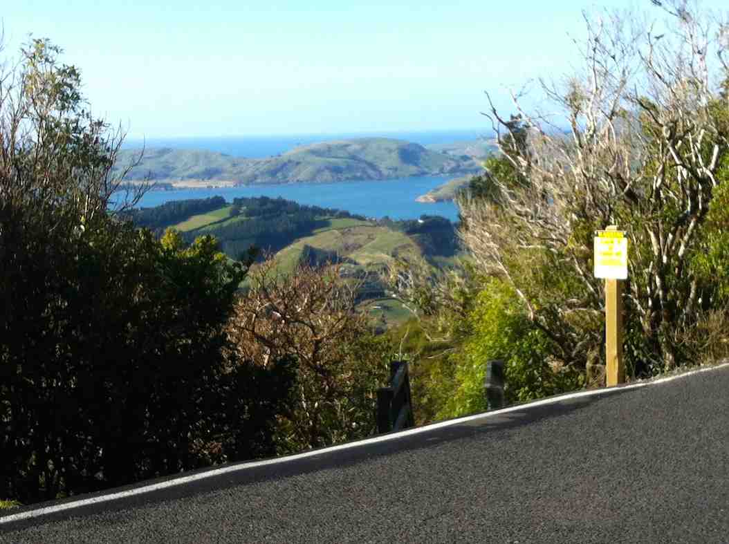
It’s a beautiful place. Please, no roads around here! Next day we catch the jet boat up the lake, as previously arranged, and anxious to be reunited with Jan, walk the six hours from Alabaster Landing to the road end and the car, a welcome sight. We find her comfortably ensconced at the camping ground, using crutches to get around. It seems a ligament ‘blew up’, causing all the trouble.
In retrospect, we feel we handled the situation well. Maybe ‘oldies’ like us should not have tackled such a tough track in the first place, but by finishing the trip, Brian and I felt exonerated. We were lucky with the weather – rain would have made things a lot more difficult – but we were well-equipped and never felt in any serious danger.
High praise for the helicopter crew, and the fast efficient way in which they responded and carried out the rescue. – Judy
Protected: Committee Minutes 19/3/2014
Motatapu
Away back about the middle of last year, while casting around for an adventure for the trampers, I came up with the idea of walking the Motatapu Track. After discussing this with a couple of others, it was decided to do the first 1/2 of the track only, as the logistics of getting cars to the other end was rather difficult. This track goes from the Glendu Bay end of Lake Wanaka, through to Macetown/Arrowtown via a walking track put in place by Soho Properties. It has 3 huts along it’s length which are very comfortable 12 bunk units.
We originally had 9 interested trampers, but this dwindled to 6 as time went on. We only had two informal meetings [one at the Waitati coffee shop, the other at Neil & Carole’s place] to sort out who was going to do what in the way of food, hut tickets, cars, etc.
4 of us left Mosgiel at 6am on the 4th March, to meet up with Neil & Carole in Wanaka, at Neil’s daughter’s place, where we quickly loaded up everybody’s packs with a share of the food supplies, had a cuppa, & then drove around to the start of the track …
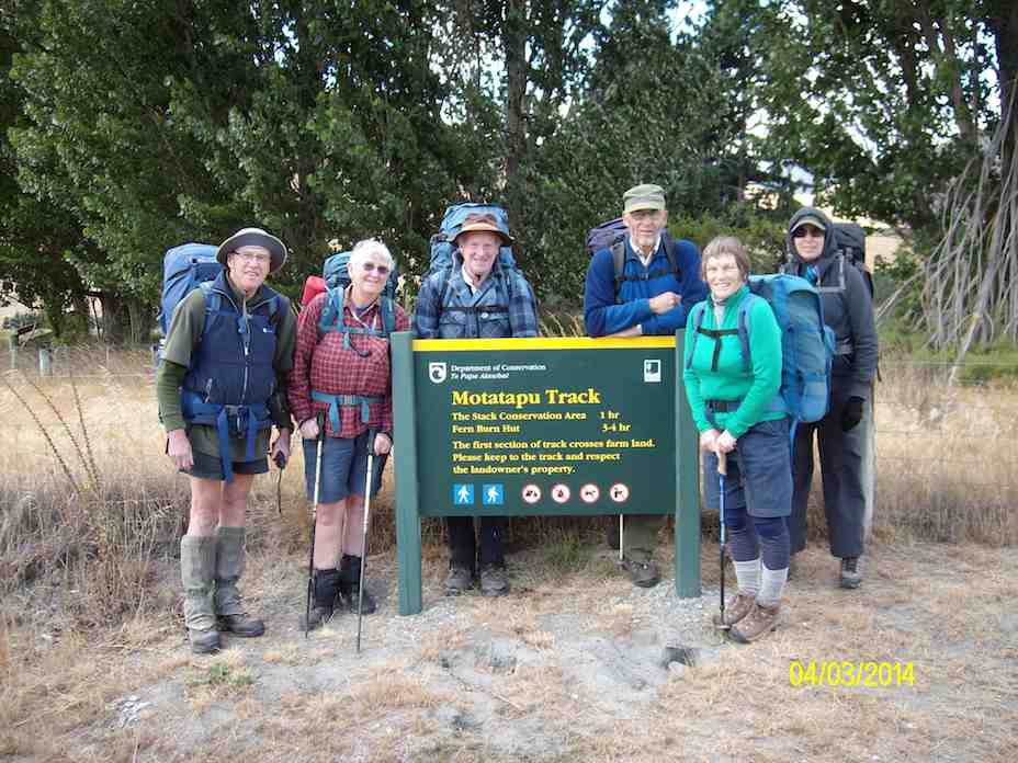
… where 6 intrepid trampers set off on what we had been told many times was a rather hard slog.
It’s only 7 km to the first hut [Fern Burn], but when you are carrying 20+kg for the men & 15+kg for the women, & not used to it, it is quite a distance, & the track, apart from the first few kms, is narrow, & has some quite steep climbs, & drops along it’s length. One of the group [who shall remain nameless] pulled a muscle in a leg about 2 km from the hut, at a part of the most difficult/steepest section of the track & was unable to carry his pack, so Neil & I did a back & forward shuffle. We would carry our pack along the track a bit, then go back & pick up his, carry it forward some more, then go back for our own pack, & repeat the process, until we eventually got everybody, & everything to Fern Burn hut. As we sat around recovering, it was decided that the next day the injured party would stay at Fern Burn hut until the rest of us arrived back again. This meant that we could leave behind a small amount of our gear that we would not need for the next two days, so our packs would be marginally lighter.
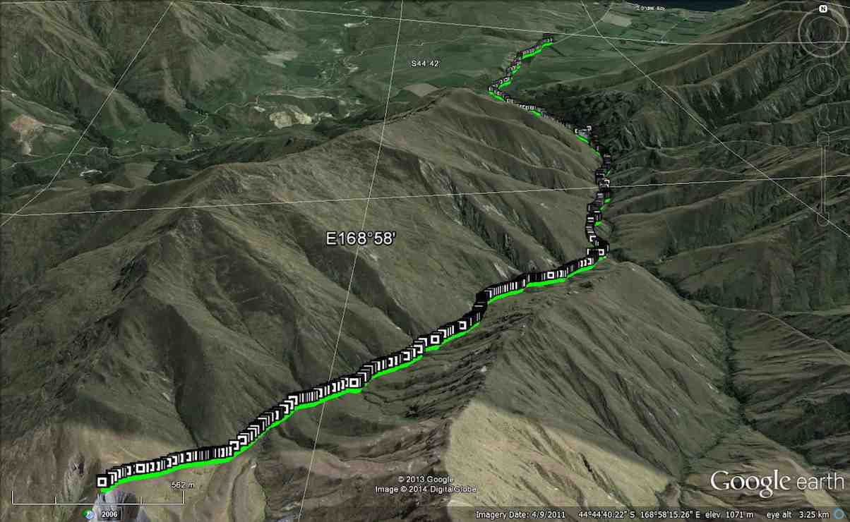
The next morning 5 set off on the 2nd leg to go to Highland Creek Hut, which is about 6 km away, but a much more arduous section of the track, & climbs to about 1280 mtrs ASL. After what seemed like hours, & many rest stops, we finally reached…
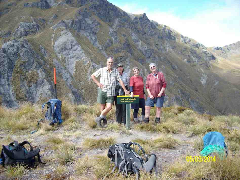
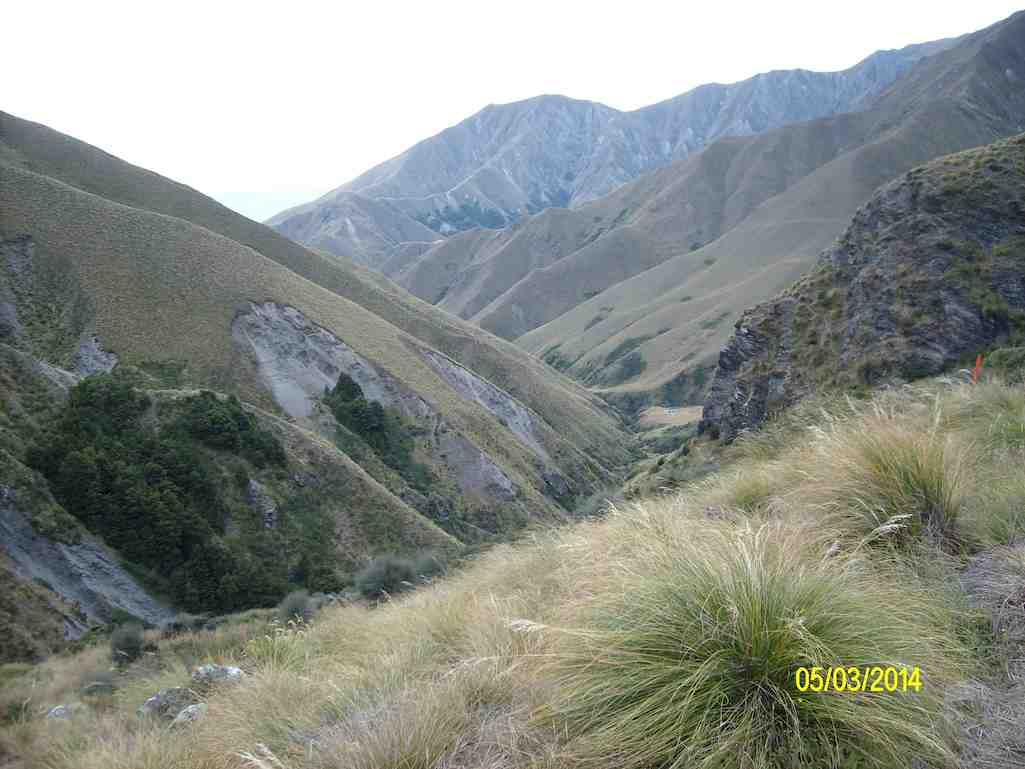
… the top of Jacks Pass [1280 mtrs] to a majestic view of the surrounding valleys & snow topped mountains, where we had a well deserved rest & lunch. On looking down the imposing other side, …
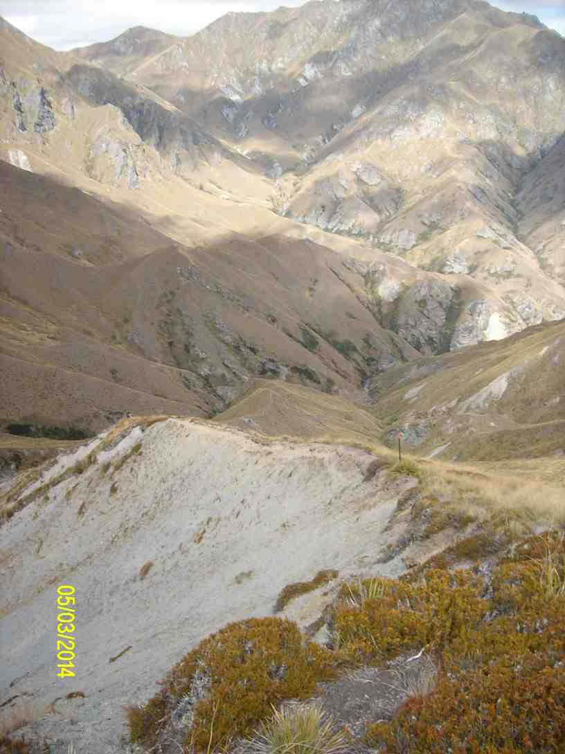
… [very narrow track along the top of a very steep, narrow ridge, with drops on either side] the ladies decided that they were not going any further, & that they would go back to Fern Burn hut. So it was left for me & Neil to decide what we would do. After discussing the prospect of having to climb back up the imposing track the next morning, we decided that, as we wouldn’t see much more than what we could from where we were, we would also go back to Fern Burn hut. I guess there was a sense of disappointment for us, that we wouldn’t fulfill our original idea of going to Highland Creek hut & back, but our tired bodies from yesterday’s efforts, told us that enough was enough. So we packed up after lunch, & headed back the way we had come. At least this time, it was mostly all downhill, …
… & we made good time back to Fern Burn hut, where our injured member was reasonably surprised to see all of us coming back. We had only one incident on the way back, when another party member [who shall also remain nameless] had a leg collapse under them & toppled over the track edge. This was done without any damage to body or equipment, so all ended well.
After another good evening meal, a night’s sleep, & some breakfast, we packed up in preparation for the walk back to the cars. This time we shared out most of the contents of the injured person’s pack between the other members of the party, & sent the injured member off on his own to see how he would manage, the rest of us following about 1/4 – 1/2 an hour later. I finally caught up with him when he took a rest stop, about 2/3rds of the way out, so there was no real problem getting everybody back to the car park.
We had brilliant weather all the time, not too hot, & just about right for tramping. All agreed it had been a hard 3 days, but was enjoyable. A good bunch to go away with, & we had a good few laughs along the way. – Ken.