Jul 24 2021

Boulder Beach

Published by under Penguins Dec- Feb,Trampers

Boulder Beach closed  during yellow eyed penguin nesting, moulting, December-February months.

Distance from car-park: 24 km to Macandrew Bay, 27 to Highcliff Road.


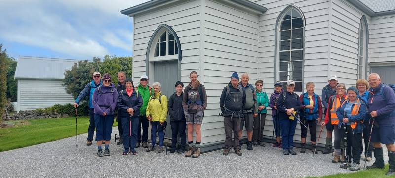
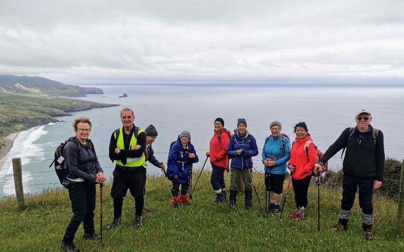
17.  21 July 2021. Trampers.  Greenacres St -Boulder Beach – Seal Point Rd. M.  Leaders: Ross and Wyn

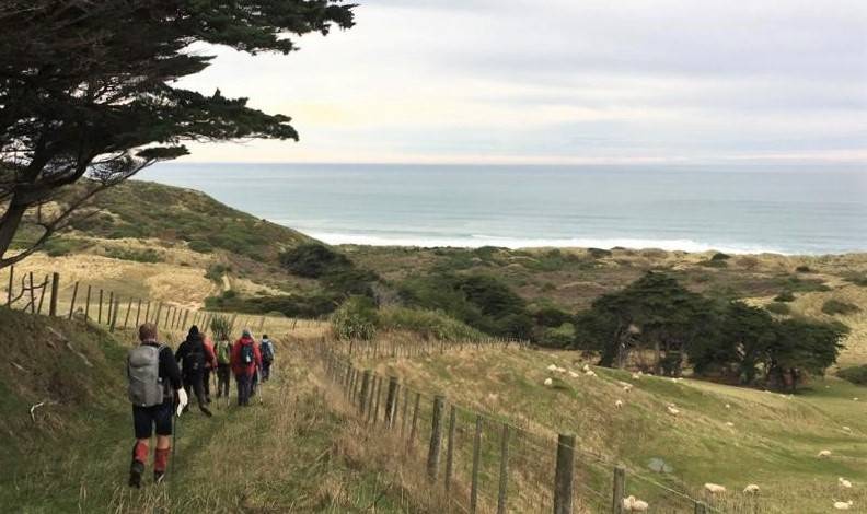
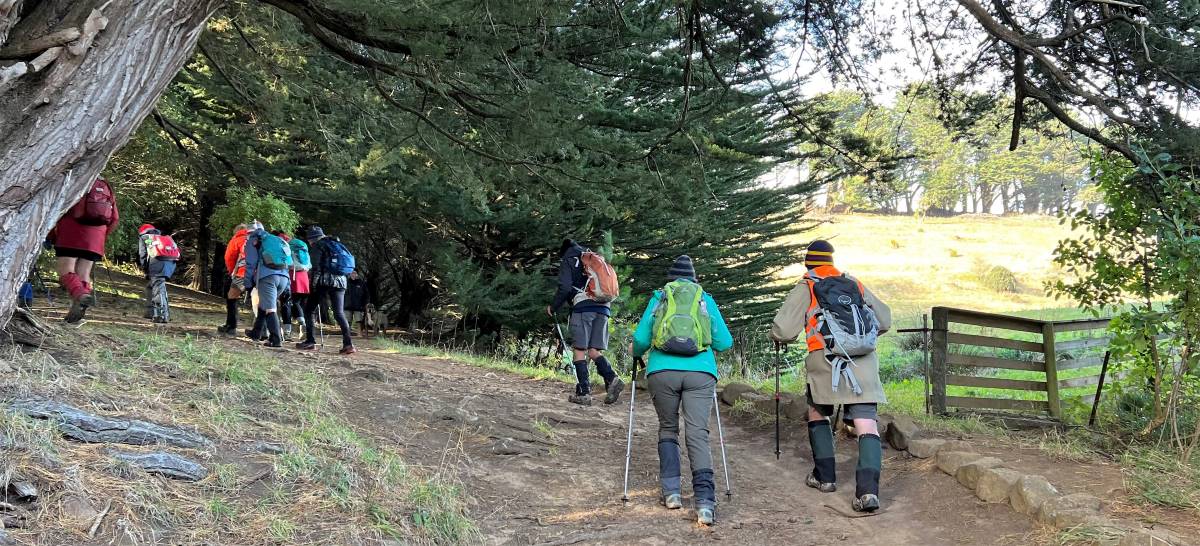
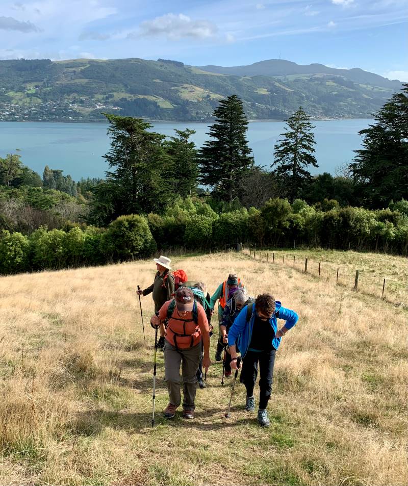
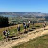
Brrrrr… it was cold in Mosgiel after a light frost so we were keen to get into our cars and head out for Macandrew Bay, our starting point. After meeting up with the Trampers from town, 23 of us set off from Macandrew Bay just after 10am. (I thought there were 22 until morning tea when I realised I hadn’t counted myself!). We headed up Greenacres Street…

The start up the long hill

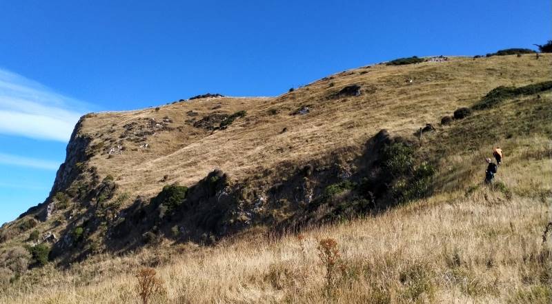
The start up the long hill (photo & caption Helen)

…where we came across our first of many animals of the day (and my favourites) – Highland cattle and even baby ones.

Trampers and Shaggy Beasts

Trampers and Shaggy Beasts (photo & caption Pam)

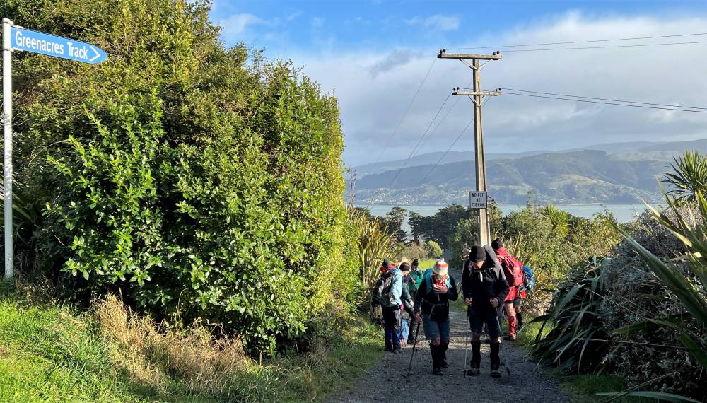
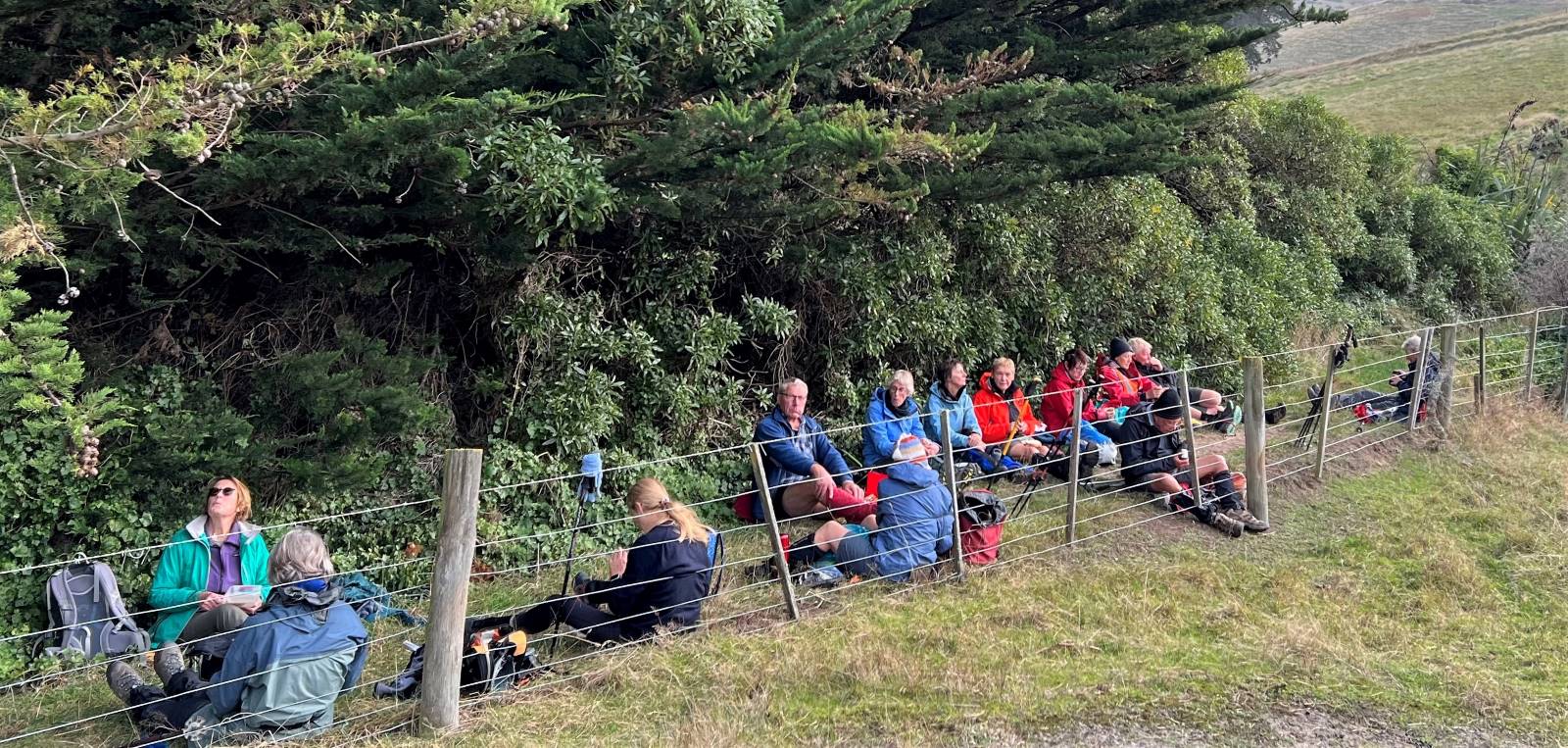
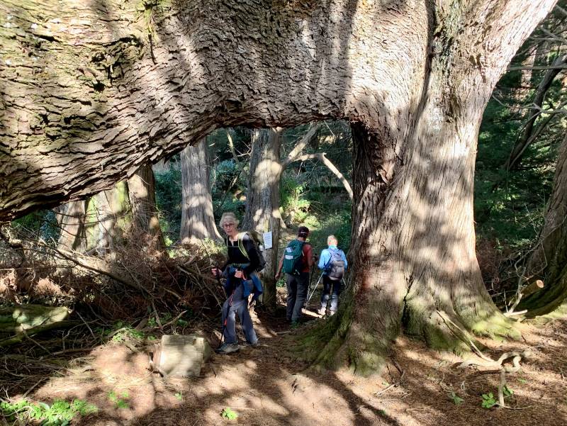
After about 35 minutes of uphill and not far up the Greenacres Track we stopped for morning tea by a seat at some big old macrocarpas.

Morning tea in the trees

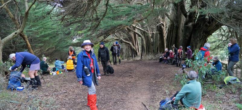
Morning tea in the trees (photo & caption John)

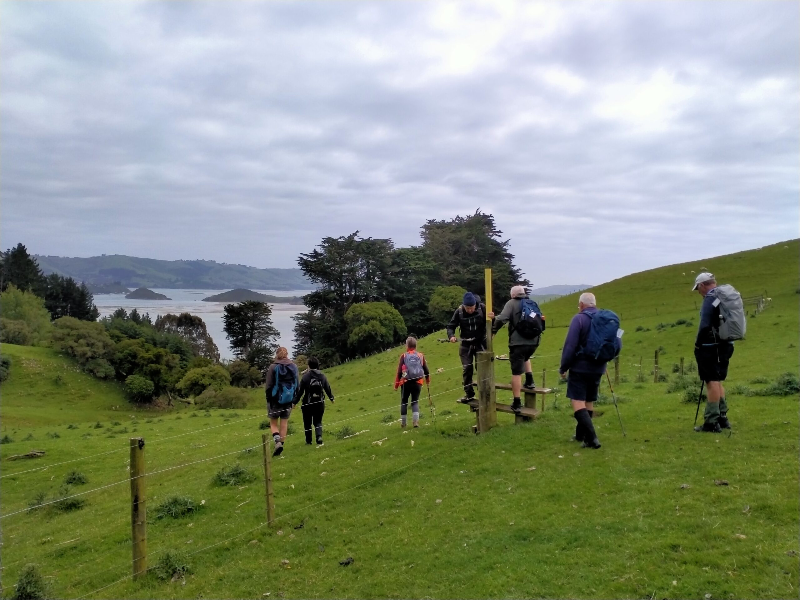
We then carried on up the track until we came to Highcliff Road (280 metres of climbing). We had certainly warmed up after that and we were able to admire the views as we walked along Highcliff Road towards the Paradise Track.

Overlooking the first cheese factory on Highcliff Road

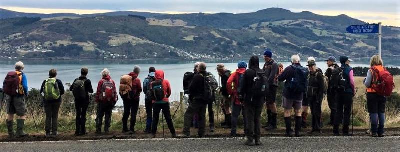
Overlooking the first cheese factory on Highcliff Road (photo & caption Pam)

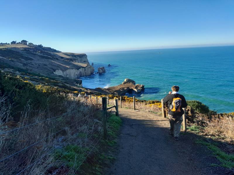
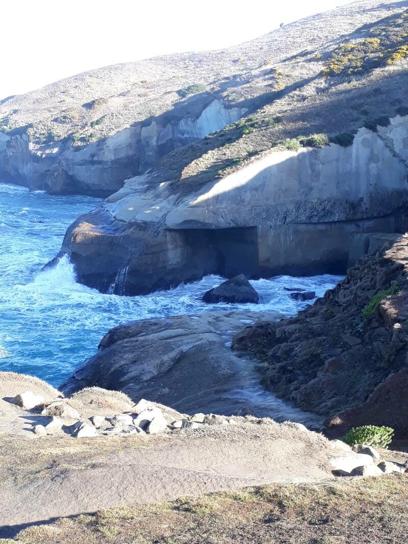
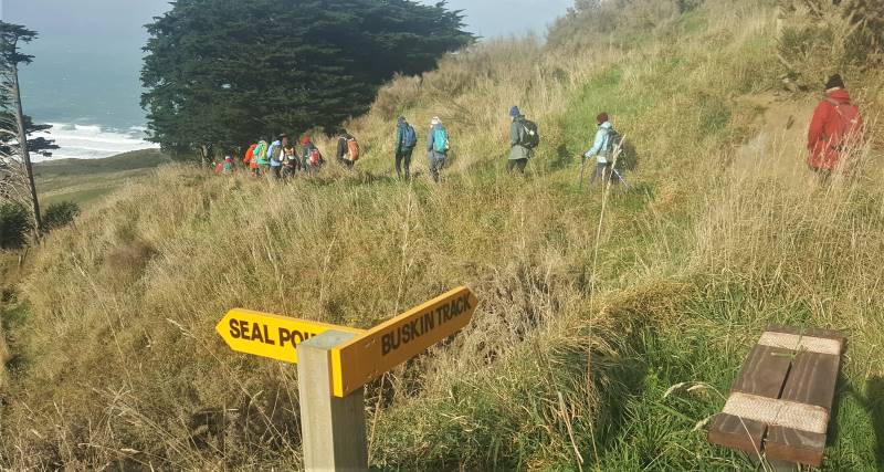
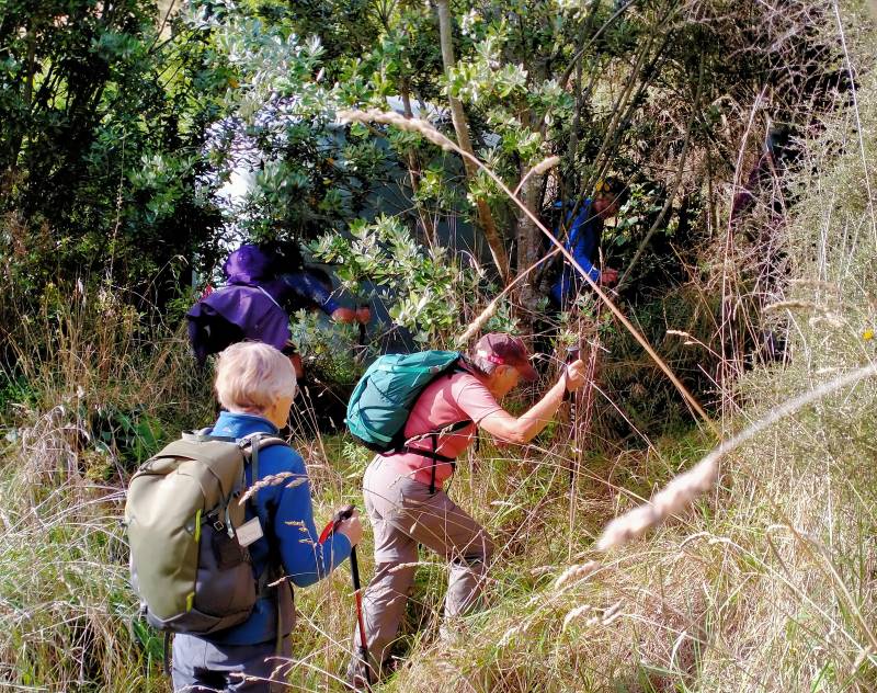
About halfway along we crossed the road to look at the monument to New Zealands first Cheese factory in 1871. The monument was understated considering how important the dairy industry has become. Then it was onto Paradise track which leads down to Boulder Beach. It was slippy slidy in places but everyone seemed to remain upright.

Descending Paradise Track

Descending Paradise Track (photo Pam)

A few animal distractions on the way starting with a group of friendly alpacas which received quite a bit of attention.

John enticing alpacas with grass

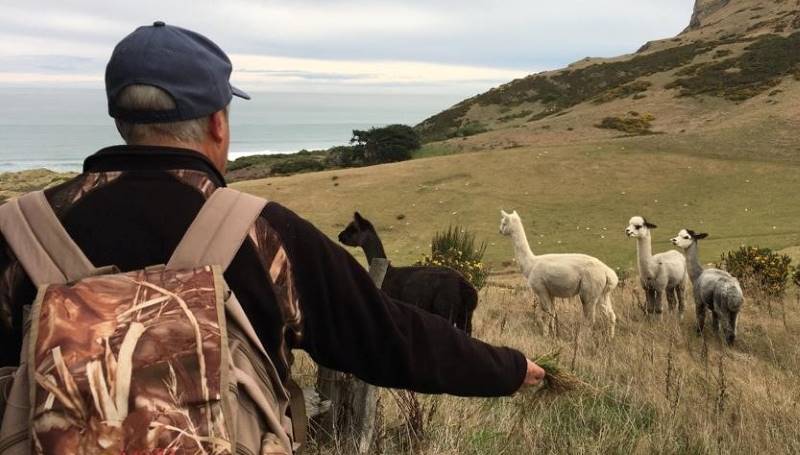
John enticing alpacas with grass (photo & caption Pam)

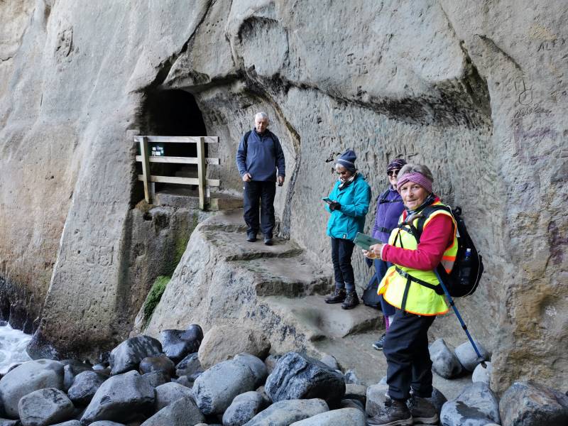
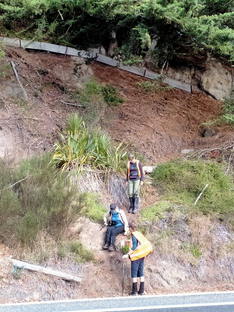
Then we came across 2 sheep engaging in rather vigorous headbutting. After all the animal antics we made our way on down to the bottom of the track to the Beattie cottage which we had a look around…

Stop at Beattie Cottage

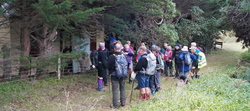
Stop at Beattie Cottage (photo & caption John)

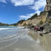
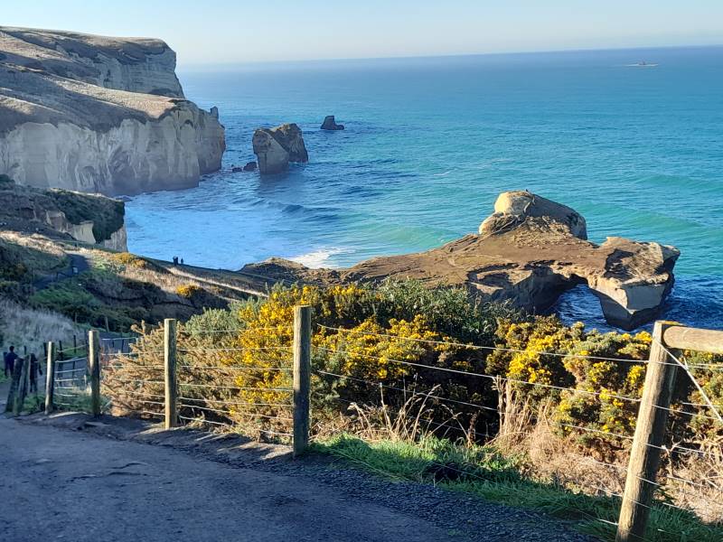
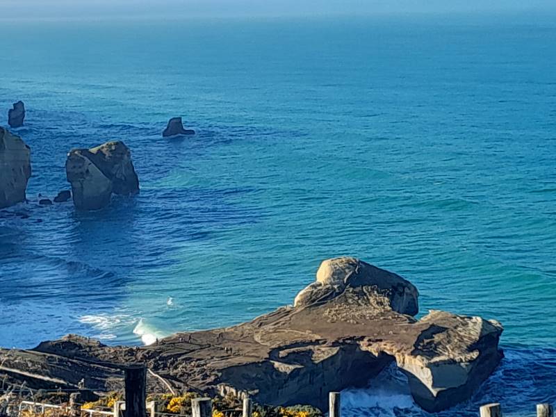
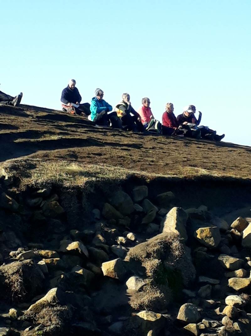
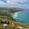
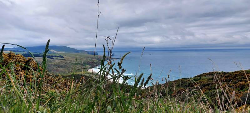
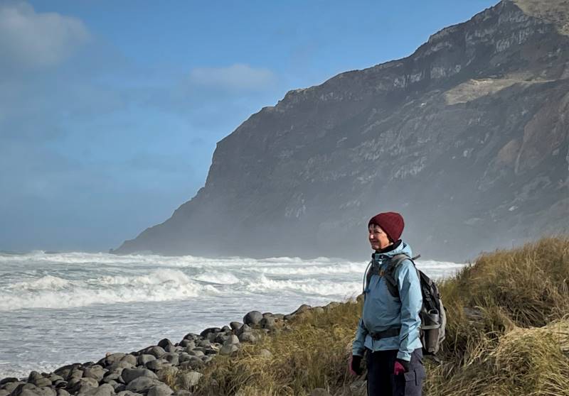
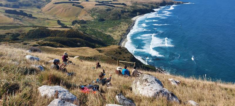
… before making our way to Boulder Beach through the protected area. It was 12.30pm and lunch was had on the beach near a leopard seal sunbathing on the sand who seemed to pose to have his photograph taken.

Lunch - Wonder why they call it Boulder Beach

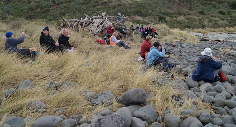
Lunch – Wonder why they call it Boulder Beach (photo & caption John)

Sea lion on Boulder Beach

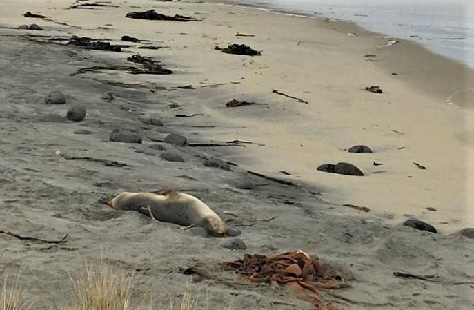
Sea lion on Boulder Beach (photo & caption Pam)

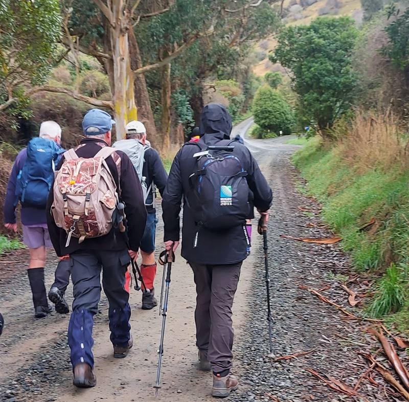
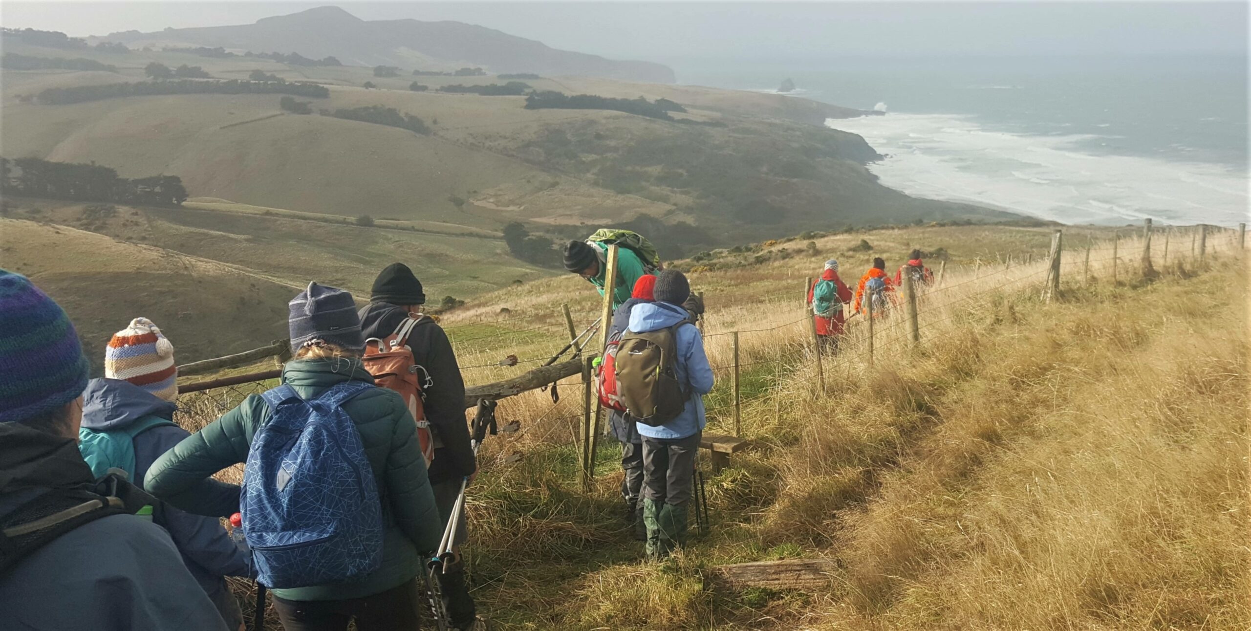
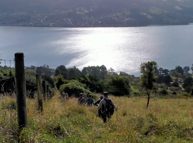
It was very calm and even warm with a short appearance of the sun. The return journey was an uphill climb via Braidwood Road (a 4-wheel drive track), leading onto Seal Point Road which in turn joined up with Highcliff Road at Pukehiki. The church has been undergoing renovations with a very smart paint job in grey and white.
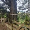
A bit further along Highcliff Road to Greenacres Track again for the thankfully downward journey to our cars (with the customary stop at the BIG swing).

Good on you John for giving it a go

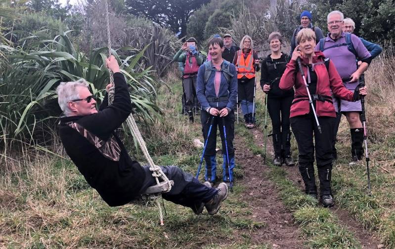
Good on you John for giving it a go (photo & caption Jenni)

We had a well-deserved coffee at the The Duck café at Macandrew Bay where we were pleased to rest our weary legs and chat some more. A great end to an enjoyable tramp.
Wyn

Strava plot of route - start at top left

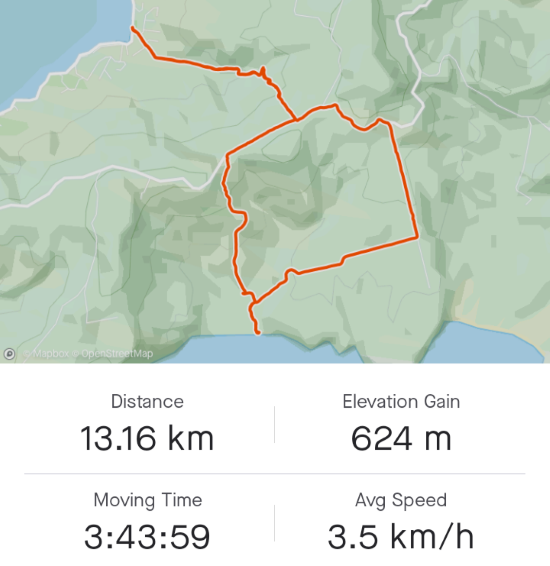
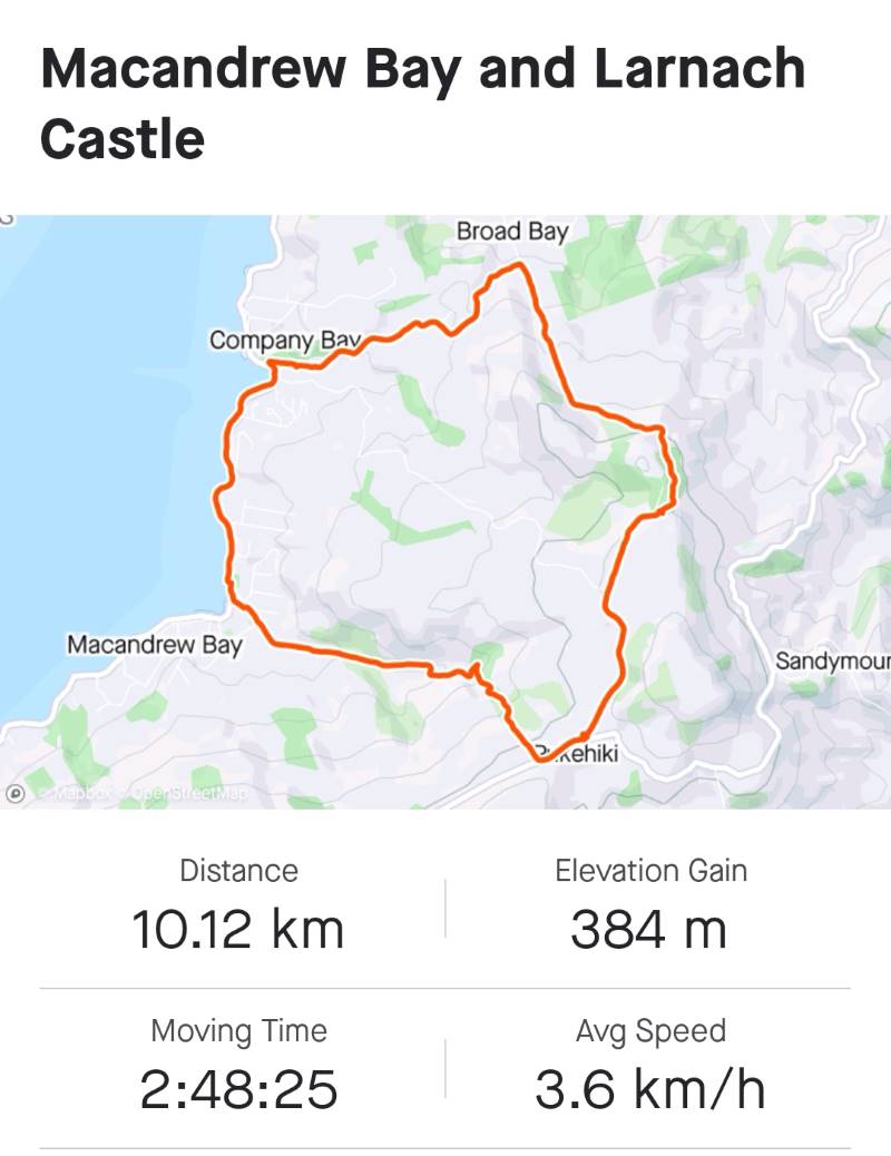
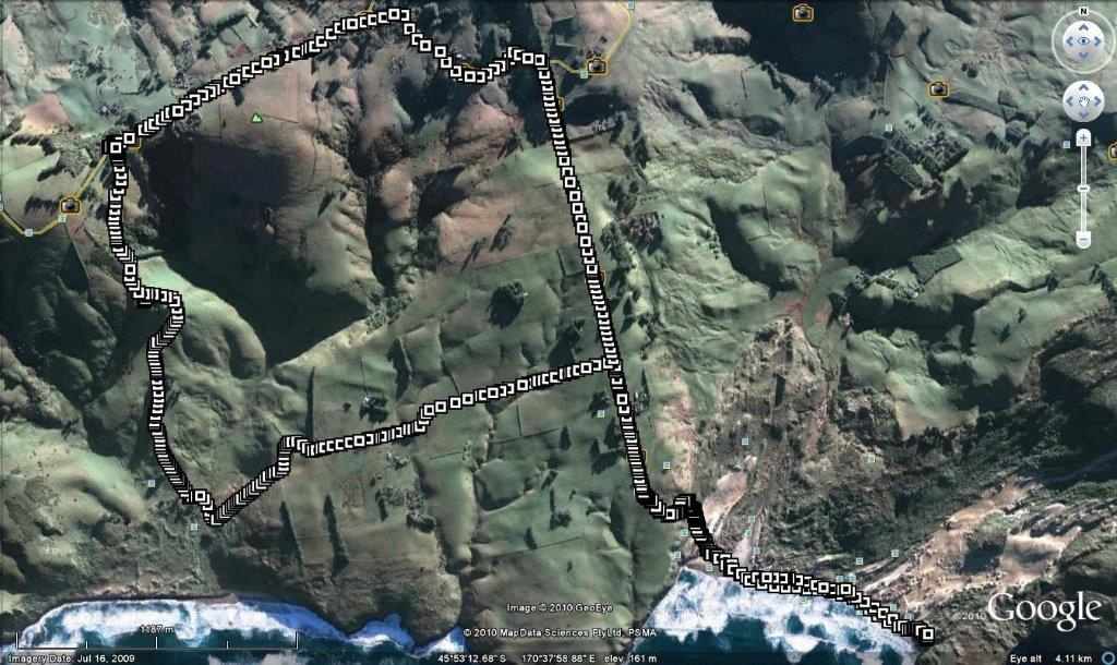
Strava plot of route – start at top left (screenshot Wyn)

Strave elevations of our tramp

Strave elevations of our tramp (screenshot Wyn


Continue Reading »

No responses yet

Nov 04 1993

Tomahawk Lagoon, Paradise Track, Boulder Beach round trip

Published by under Beach,Penguins Dec- Feb

20 km from car park.
4/11/1992 Tomahawk Lagoon, Boulder Beach, Paradise Track. Round Trip. Average. Leaders: Ria H, Bev H, Jean A, Noel.

No responses yet

Apr 13 2024

Mt Charles, Cape Saunders, Puddingstone Rock, Allans Beach

Published by under Farm,Permission Required,Trampers

No. 99 on old hardcopy list of 113 club tramps. “Mt Charles Mr Neil Farm”.
27 km from car-park.

Click here to read about Cape Saunders Lighthouse and the two graves


Image 50365185 Thumbnail 10012.  10/4/2024 Mt Charles Grade 4 Leaders: Graham and Carol Thurlow


28 trampers gathered at Allan’s Beach. Continue Reading »

6 responses so far

Jun 26 2022

Tunnel Beach

Published by under Hikers

No. 62 on old hardcopy list of 113 club tramps. “Tunnel Beach. Farm”
Tunnel Beach.
See 1983 for an account of its opening.
Tramping Track managed by DOC. Tunnel Beach Road accessed from Blackhead Road.
Plenty of parking at end of Tunnel Beach Road. Distance from carpark:
Concord Tavern park for longer walk. Distance from carpark: 10 km.
22/06/2022. Hikers. Tunnel Beach/St Clair. M. Leaders: Kathryn and Sue
We all met on a very cold frosty morning at Peter Johnstone Carpark. We then gathered outside St Clair Golf Club where twenty hikers walked along Hillhead Road then onto Blackhead Road in brilliant sunshine.
Morning tea - spot the miscreant walking sticks Barbara

Morning tea – spot the miscreant walking sticks Caption and photo Barbara

We stopped outside the Cemetery for morning tea then onto Tunnel Beach.
Tail end Charlie Barbara

Tail end Charlie Caption and photo Barbara

View down on those who made it Barbara

View down on those who made it Caption and photo Barbara

For those that hadn’t been there before it was a real eye opener and enjoyed by all.
Margreet

Photo Margreet

We had our lunch in sunshine with great views.
Dispersing for lunch on the little peninsula Barbara

Dispersing for lunch on the little peninsula Caption and photo Barbara

Hikers lunch Kathryn

Hikers Lunch Caption and photo Kathryn

We then climbed back up and Ady did comment on the number of stairs she had to climb to get there.
Kathryn

Photo Kathryn

We proceeded back to the cars and went to The Village Green for coffee and a lovely finish to the day. Sue Nichol / Kathryn Fagg

Continue Reading »

No responses yet

Feb 23 1983

Tunnel Beach walkway


Tunnel exit on beach

Tunnel exit on beach

The Tunnel Beach Walkway, one of the most popular scenic walks around Dunedin will be officially opened by the Minister of Lands, Mr Elworthy, on March 16. (1983).

Access to Tunnel Beach has been negotiated by the Lands and Survey Department with the farmer who owns the land the walkway crosses.

The advantage to the farmer of the walkway is that under the Walkways Act he can be compensated if there is damage done and the access can be controlled. For example, the Tunnel Beach Walkway will be closed during lambing.

The steps down the tunnel are worn and water seeps through it so concrete steps will be poured before the official opening.

The Tunnel Beach Walkway is a coastal walk, descending a line of seacliffs south of St Clair where the wild Pacific breakers have carved sheer headlands, sea stacks and arches, and the wind has sculptured extraordinary shapes.

From the road end the track descends across green pasture and within a few minutes reaches the clifftops above Tunnel Beach.

The rock underfoot is the soft Caversham sandstone, an extensive thick sediment laid down during the sea’s encroachment of the Dunedin area 20 million years ago. The sandstone was generally overlain by other sediments, but near here lava from the Dunedin volcano flowed over the sandstone itself. This occurred about a dozen million years ago. The soft nature of the almost uniform sandstone makes walking too close to the cliff-edge a dangerous practice, but has also allowed the magnificent carving both by humans and by nature that is in evidence here.

At Tunnel Beach the rock is seen in detail. Careful examination will reveal shell fragments and with luck a fossil such as a brachiopod shell or echinoderm (sea urchin) or even bones of an extinct whale could be found.

At the top of the tunnel and on the promontories, the rock supports a community of salt-resistant species including Austral spleenwort, Selliera sp and Samolus sp. Species that occur further up the slope do not grow here as they cannot cope with the sea water that splashes up during the high seas that can batter this stretch of coastline.

The tunnel was dug in the 1870s by workmen employed by John Cargill, a son of Captain William Cargill, and who farmed the area. It’s reputed to have been a birthday present to his daughter.

The Cargill families found seclusion and shelter on the beach at the foot of the tunnel steps.

The swift flowing current, with is load of sand and erosive potential, heads up the coast just beyond the extremities of this little bay. It must have deterred all but the strongest swimmer from entering the water. At low tide the sandy beach makes an attractive setting for picnics, with the deeply cleft sandstone buttresses towering above. Some are intricately carved, some lie scattered as blocks already tumbled to the beach. Needless to say, common sense dictates where to sit in safety.

Some of the smaller boulders beneath the cliff are derived from the lava floors above, or from Blackhead, a headland of down-thrown volcanic rock being quarried to the south-east.

Vertical rusty streaks of iron-staining make a cross-cross pattern with the near horizontal traces of each successively deposited layer, called “bedding planes”, visible on the cliff faces.

Caves and sea-arches are eroded into the cliffs and an arch at the southern edge of Tunnel Beach, when seen from the walkway above is an excellent example showing the formation of a “stack”.

When the arch has finally eroded and collapsed, the leg on the right will stand free of the mainland just as the stacks off the northern edge of the beach do. Horizontal bedding visible on these stacks suggests that these are still in situ and are not blocks that have fallen from elsewhere.

Amongst a group of trees atop the cliffs, Cargills Castle awaits further depredation by time, vandalism and weather. It was built in 1876 for Edward Cargill, another son of the founder of the Province, Captain William Cargill; and a Mayor of Dunedin 1879-98. Originally called “The Cliffs” it was not long before the Italian-designed building was given its present name by locals. It was one of the first concrete buildings in Otago.

The “castle” was of 21 rooms and cost £14,000 to erect. It was nearly completely destroyed by fire in 1892 and although rebuilt by 1923 – “the biggest white elephant in Dunedin” according to one building contractor – was unfit for habitation.

In more recent years there have been several attempts to instill new life into the building, including an opera venture and plans for a tavern, but all to no avail.

– Dunedin Midweek, Wednesday, Feb 23, 1983.

No responses yet

Apr 25 2024

Upcoming Trips

Published by under Both Hikers & Trampers

Link to Trip Organisation Guidelines for leaders and trip participants.
Link to Track Grading information.
Link to Copy of Trip Programme for printing.
Gradings are provisional and may change following recce. Distances are for road travel from Mosgiel car park. Costs may change with fuel price fluctuations and distance changes. This page has all current updates.
Last updated 7/04/2024.


Wednesday 24 April.
Trampers. Frasers Road/Southern Resevoir. Grade 2.5.
$5. 16 km.  Leaders: Gwenda Farqharson/Graeme Souter.
Hikers.       Graham’s Bush. Grade 3.
$8. 27 km. Leaders: Maria MacNee/Theresa White.


Beginning of Next Programme

Wednesday 1 May.
Combined.    Pyramids/Victory Beach. Grade 2.5. $10. 38 km. Leaders: Jenny Wilton, Alison Kim, Janette Abbot Wendy Langley, Adrienne Ensor. Alex Griffin


Wednesday 8 May.
Trampers. Goldfields, Lawrence. Grade 4. $21. 81 km (distance PJP to Lawrence). Leaders: Anne Ward, Di Bezett, Lyn Keene.
Hikers. Macandrew Bay, Greenacres. Grade 2. $7. 24 km. Leaders: Jill Dodd, Katrina McKenzie.

Continue Reading »

No responses yet

Dec 09 2023

Tomahawk Lagoon and nearby tracks/areas

Published by under Beach,Trampers

Ocean Grove, also known as Tomahawk, is a suburb in the southeast of the New Zealand city of Dunedin. … The suburb was known as Tomahawk until the 1930s, the name not being a reference to the weapon, but rather possibly an anglicised form of the Māori words tomo haka, meaning “dance by a gravesite”.

No. 23 on old hardcopy list of 113 club tramps. “Karetai Rd via Monument from Lagoon. Year round.”

Distance from car-park: Tomahawk: 19 km; Smaills Beach: 22 km;  Paradise Road: 26 km.’

DCC List: 41 Peg Track. Otago Peninsula
Accessed from Oregon St. 3.5 hrs ret. Tramping track – unbenched. Managed: DCC CAM, private land.
Description – This track provides a link between Ocean Grove and Highcliff Road. Access to the track in Ocean Grove is off Oregon Street. An attractive walk around Tomahawk Lagoon then climbs through gorse and native bush. Turn right towards Soldiers Memorial through paddocks with gorse sometimes obscuring the rock walls.

  • Classification – Hard
  • Time – Approximately 45 minutes.
  • Parking – Limited at Highcliff Road. No dogs.
  • Dogs – No

Boulder Beach From Top Of Highcliff Track Pam (square) (100x100)
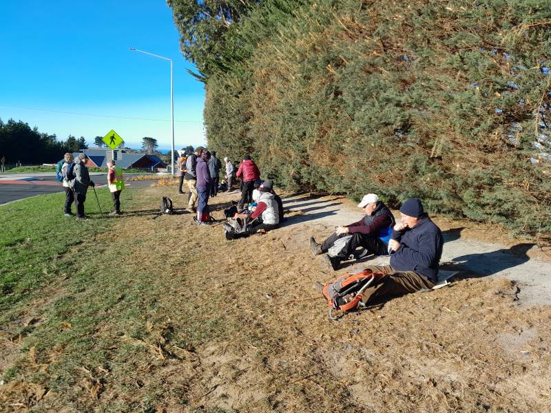
43. 06/12/2023. Trampers. North of Tomahawk. Grade 3. $7. 22km. Leaders: Esther Willis and Julie McKenzie
As hoped, the weather was kind to us, as this tramp would be wasted without being able to savour the spectacular views.

Continue Reading »

No responses yet

Dec 11 2022

Macandrew Bay, Company Bay, McTaggart St, Camp Rd, Pukehiki, Greenacres St

Published by under Lambing Sep-Nov,Trampers

Distance from car-park: 24 Km.

MacTaggart St track closed for lambing September and October.

5. 7/12/2022. Hikers. Macandrew Bay.  Grade 2 Leaders: Jill D. and Linda

Twenty eager hikers departed Macandrew Bay car park on a cool grey morning. We walked along the harbourside walkway as far as McTaggart Street where we stopped  at the Company Bay reserve for morning tea. Unfortunately, the native plant nursery was closed for the day so we were unable to do the planned visit.  However, Jill was able to provide us with some information on the work that was carried out there to provide native plants for planting out on the peninsula.

Jill giving a speech at morning tea. Caption and photo Helen

Jill giving a speech at morning tea. Caption and photo Helen

Onwards and upwards we made our way up the road and on to the track, climbing over some stiles, walking across farmland and up the hill towards Camp Rd.

IMG20221207104711

How many stiles? Caption and photo Phil

We stopped several times to catch our breath and to admire the wonderful views of the peninsula. After the steady climb we reached our lunch stop on Camp Rd near Larnach Castle.

We did as the farmer instructed. Left the sheep to close the gate. Caption and photo Mike

We did as the farmer instructed. Left the sheep to close the gate. Caption and photo Mike

We then continued our walk along to Pukehiki where we visited the lovely little community church, with its loo with a view!

Pukehiki Church is the background for our group photo. Caption and photo Helen

Pukehiki Church is the background for our group photo. Caption and photo Helen

From here we walked along Highcliff Rd to Greenacres track and proceeded downhill to Macandrew Bay.

Screenshot Margeet

Screenshot Margreet

Some opted for an ice cream while others enjoyed refreshments at the Duck Cafe, while taking in the view of the lovely Macandrew Bay Beach on a nearly sunny afternoon.  Jill and Linda

Phil at Jamestown in the Hollyford, in 2003, telling the grandiose stories of James Macandrew Caption and photo Phil

Phil at Jamestown in the Hollyford, in 2003, telling the grandiose stories of James Macandrew Caption and photo Phil

standing alongside James Macandrew's grave and memorial Caption and photo Phil

Standing alongside James Macandrew’s grave and memorial Caption and photo Phil

Continue Reading »

No responses yet

Dec 03 2022

Buskin Track from Bottom Tramps

Published by under Uncategorized

30/11/2022. Hikers. Highcliff Track/Buskin Track/Highcliff Road/Karetai Road. Grade 3. $7. Leaders: Max and Mike W.
Sign on Highcliff Road - Mike

Sign on Highcliff Road (Photo & Caption Mike)

M & M aka Max and Mike demonstrated their commitment to the TRTC by agreeing to lead a hike instead of sitting in front of a TV watching England thrash their Welsh cousins in the FIFA World Cup. I am not sure that this commitment was fully appreciated as shortly after the commencement of the hike there were mutterings of “when are these Poms stopping for morning tea?”
Morning tea looking over Boulder Beach - Helen

Morning tea looking over Boulder Beach (Photo & Caption Helen)

Ten hardy souls ignored the dodgy weather forecast and set off for a hike that took us around a boulder strewn hill with great views down to Boulder Beach and Sandfly Bay before descending down a zig zag poled track to join up with the Buskin Track.
Lookout - Photo Margreet

Lookout over Boulder Beach (Photo & Caption Margreet)

The steep descent was made without incident although some knees were creaking a bit by the time we had got to the bottom of the hill.
Gymnast of the day award was given to Jim Finnie. At the start of the Buskin Jim demonstrated his prowess by performing an impressive backward somersault with a half pike and a reverse tuck. The landing left a bit to be desired and stopped him getting a perfect 10.
Special mention also to Jay who re-arranged some of Max’s clothing after she spotted that he had his hi vis vest on upside down and back to front.
An early lunch was taken at 1130 in a sheltered part of the Buskin Track from where we could see the views of the coast disappearing in the mist and drizzle.

Eleanore Margreet and Betty on the seat with a view - Helen

Eleanore Margreet and Betty on the seat with a view (Photo & Caption Helen)

The Buskin Track does not appear to be used much as the grass was quite long in places with a few areas of thistle and nettles to be aware of.

Bushkin Track - Photo & Caption Mike

Bushkin Track (Photo & Caption Mike)

It was also a wee bit muddy and slippery towards the top where a few planks of wood had been laid.

The group of 9 plus the photographer at our high point - Helen

The group of 9 plus the photographer at our high point (Photo & Caption Helen)

Once at the top of the Buskin, it was a short walk along a private road to Highcliff Road and Karetai Road back to the cars.
The weather was not as bad as forecast. It was overcast with a few drizzle patches and one short bit of “wet rain”. Poms know the meaning of this.

Ponchos the order of the day - Photo & Caption Margreet

Ponchos the order of the day (Photo & Caption Margreet)

Debrief at the cars agreed that grade 3 was about right and that there would not be a coffee meeting on the way home.
As usual, great company and interesting conversation made this an enjoyable hike.
Mike


Continue Reading »

No responses yet

May 27 2022

Buskin Track from Top Tramps

Published by under Trampers

No. 55 on old hardcopy list of 113 club tramps. “Buskin Track, Boulder Beach, Paradise Track. Year Round. Penguins”
Boulder Beach closed December – January during yellow eyed penguin nesting and moulting.

Distances from car-park: Top of Buskin Track 24 km, Glenfalloch 24 km, Macandrew Bay 25 km.


25/05/2022.  Trampers.  Greenacres, Buskin, Paradise Tracks. M. Leaders: Anne and Rod Ward

It started as a cold blustery day when we departed from Mosgiel, proceeding down the bay with white caps plentiful on the harbour. 14 hardy souls started the Greenacres Track at 0940.

IMG_2266 Pam Res 1200

Starting off climbing up Greenacres Track (photo and caption Pam)

Conditions were better than expected once we started our journey up Greenacres Track and turned right to walk along Highcliff Road to the start of the Buskin Track.

IMG_2271 Pam Res 1000

Top of Greenacres track at Highcliff Rd (photo and caption Pam)

IMG_2275 Pam Res 1400

Stone fence standing the test of time (photo and caption Pam)

IMG_3440 Anne 1600

Morning tea stop at top of Buskin Track (photo and caption Anne)

We stopped for a cuppa at the start of the Buskin Track then proceeded down the track to the junction of Paradise Track. Buskin Track was surprisingly sheltered from the cold southerly wind.

20220525_110936 Anne Res 1000

Heading down Buskin Track sheltered from wind towards beach (photo and caption Anne)

20220525_112026 Anne Res 1000

Clearing style at beginning Buskin track (photo and caption Anne)

After a side walk to Boulder Beach which was spectacular with crashing waves, foam whipping up the beach and blustery cold wind we returned to a sheltered spot at the start of the Paradise Track for lunch.

IMG_7626 Lyn Res 800

Sarah looking north watching waves (photo and caption Lyn)

IMG_7627 Lyn Res 1000

Dave watching huge waves (photo and caption Lyn)

IMG_2296 Pam 1600

A sheltered lunch spot on Paradise track (photo and caption Pam)

IMG_2297 Pam 1200

Looking back on Boulder Beach as we climb up Paradise Track (photo and caption Pam)

Ascending up Paradise Track without stopping and a cold southerly on our backs we again joined Highcliff Road then back down Greenacres Track to our vehicles.

Everyone enjoyed the walk and as tramp leader I must congratulate everyone for being so well prepared for the extreme conditions that never eventuated.

Finished our walk at 1440 and headed to “The Duck” at Macandrew Bay for a well-deserved coffee.

Anne & Rod Ward

IMG_2327 Pam Res 1000

Strava screenshot of tramp by Pam)

(Elapsed time 4h 45m)

13/04/2022 Trampers. Glenfalloch and Beyond. M Leaders: Pam and Helen

Glenfalloch’s name is Gaelic and means “Hidden Valley”.  Glenfalloch was established in 1871 by George Russell. It covers 12 hectares (30 acres). In 1917 Philip Barling purchased Glenfalloch and it was opened to the public by his son in 1956. It was brought by the Mills family in 1960 and in the late 1960’s the Otago Peninsula Trust purchased the property.  We can be very grateful to have this asset to enjoy every season of the year.

9.40am saw Phil and his harem of nine set off through the woodland gardens of Glenfalloch following a path which took us to the Bridal Lawn, over the Russell stream bridge to admire the ferns and woodland foliage before climbing up many steps to a four-wheel drive track and the start of our first big ascent.

Bridal Lawn Pam

Glenfalloch in autumn Caption and photo Pam

As we steadily climbed, this track petered out into a single overgrown track which took us to the boundary line.

Steep Marijke

There were some steep uphills after leaving the Glenfalloch grounds Caption and photo Marijke

Here we pushed our way through low Manuka branches to the fence where packs and poles were thrown over before we squeezed through the wires.

there was a track here phil

“There was a track here when I did the recce” Caption and photo Phil

Then it was a steady zigzag climb up Claremont Farm to just below Highcliff Rd where we stopped for morning tea while enjoying the great vista’s back over the city, the sparkling water of the harbour and to Port Chalmers and beyond. Jill D’s birthday treat of easter eggs got us going again walking up Highcliff Road for 15mins to Penzance Kennels and the start of Buskin track.

Buskin Track Sign

Buskin track sign

This track weaved its way down the side of the hill, again with spectacular views now of the Pacific Ocean and rolling farmland out to Sandfly Bay. This single file track was mostly grass with the odd churned up muddy patches trampled by cattle, but some boards had been placed in situ. We eventually came to a junction with Braidwood track to Boulder Beach and Highcliff Track to the right. We continued on the Highcliff track through clumps of macrocarpa trees until we came out in the open again.

Marijke old trees

What stories these old trees could tell! Very impressive huge trunks. Caption and photo Marijke

The track weaved its way towards the sea and then suddenly it was a steep grunt up to the top to the White Rocks (lichen covered) for lunch.

Look where we are climbing Phil

Look where we are climbing – to Highcliff Caption and photo Phil

Again, enjoying spectacular views over Boulder Beach, towards Sandfly Bay and Mt Charles, Phil handed around chocolate treats from Betty and Jim (thank you soo much).

Helen lunch

Beautiful lunch view looking down to boulder beach Caption and photo Helen

With the sugar rush we were off again and, as we walked around a corner, the views changed again to Tomahawk, St Clair Beach and Black head. When Highcliff Track finished, we continued on Karetai Rd to where it meets Highcliff Rd.  A 20-minute walk down Highcliff Rd brought us to the unmarked District Track.

District track Helen

Starting place for the District Track Caption and photo Helen

Once Phil cleared the grass around the stile, we scrambled down through long grass following the fence line for 20 mins to another stile and from there continued through trees towards Portobello Road.

District Track Phil

From sea to shining sea Caption and photo Phil

A very steep final descent brought us onto Portobello Road.

Last steep descent Phil

Nearly back to where we started. Caption and photo Phil

We had a 20 minute walk on the shared pathway to Glenfalloch where we were joined by Raewyn, Claire and Jan for coffee, cake and ice cream on the deck in the last rays of sunshine.

Phil's Harem

Phil’s harem Caption and photo Phil

Thank you Helen for filling in at the last minute as Tail End Charlie and to Jason allowing us access through Claremont Farm.  Pam Cocks

Track Route Pam

Tramp map courtesy Pam


Continue Reading »

No responses yet

Sep 08 2010

Paradise Road, Braidwood Road, Sandfly Bay

Published by under Trampers

8/9/2010. Trampers. Paradise, Braidwood, Sandfly Bay. M. Leadership: Informal.

Tramp Route. (Courtesy Ken). Car parked top LH corner.

Weather looked fine at Mosgiel, but when we four trampers arrived at Sullivans Dam for the Cloud Forest-Escarpment Tramp, we struck a drizzly cloudy shock. For mud and safety concerns we turned back to town and on the way decided to try the Peninsula. We parked at the top of the Paradise Road track and the weather was quite a degree clearer. However, our second shock was to find the track the WETTEST we have ever found it. No one slipped over, (miraculously), but we had to be extremely cautious in placing our feet.

A slippery muddy Paradise Road Track

Continue Reading »

No responses yet

Feb 27 2010

Brinns Point to Seacliff

Brinns Point to Seacliff.
The North Otago coast is lined with old Maori settlements, and Brinns Point is no exception. The bay south of the historic urupa (cemetery) on the headland was occupied by Moa-hunters, and much later was an out-post whaling station. A channel has been cleared through the boulder beach to enable boats to reach the shore especially at high tides. This is thought to be the work of the whalers but the channel clearance may date from much earlier, for all we know. This bay was investigated in the 1950s by the Blake-Palmers of Seacliff. This was published in the Journal Polynesian Society by Blake-Palmer senior who was superintendent of Seacliff Mental Hospital at the time. This was the first ‘proven’ association of man with the largest species of moa: Dinornis Maximus, thought by some scientists to be extinct before arrival of man. Later studies showed Dinornis had been found on archaeological sites beforehand however. There was an old Maori settlement on the flat at Ross’ Rocks. The next known settlement south is at Omimi, where moa bones have been excavated on what was largely a fishing site.
The cliffs after which Seacliff township gets its name are lined intermittently with Maori umu, most being umu ti. Parts of the coast road from Warrington to Karitane followed original Maori tracks according to early survey plans in LINZ archives. The hills along this coast were heavily forested and only cleared  when the land was subdivided for framing. The original route of Coast Road has been modified in places since the 1960s but many portions of the old routed can be seen with associated stonework on both sides of the present road. Coast Road remains an active connection with the distant past.
– Taken from Karitane … Split Rock … Seacliff Coastal Walk. Notes by Brian Allingham, Archaeologist, January 2010.

4 responses so far

Mar 24 2024

Harbour Cone, Broad Bay, Turnbulls Bay, Bacon Street, Peggys Hill, Broad Bay

Published by under Trampers and tagged:

No. 49 on old hardcopy list of 113 club tramps. “Harbour Cone, Peggy Hill Larnach Castle – Farm”. Location: 32 km.
Broad Bay Future Forest – background information.
Trampers park cars at Broad Bay. DCC Public Land; Hikers park at top of Bacon Street.

Start Track Square20. 20/03/2024. Hikers. Broad Bay Future Forest (New Hike), Grade 2.5.  30 km. Leaders: Jenny Flack, Vivienne Manning.

Twenty hikers gathered at the end of Bacon St for this new walk. Continue Reading »

No responses yet

Feb 24 2024

Woodside Glen, plus to top of Maungatuas

Published by under Read More issue,Trampers

No. 30 on old hardcopy list of 113 club tramps. “Woodside Glen to Maungatuas. E Blackburn, D McEwan. Summer”

Short and long options. (Maungatua climb fairly steep. 5-7 hours. Heavy tussock on top.  Route only. Manager: DOC.)


Img 8520 Squre
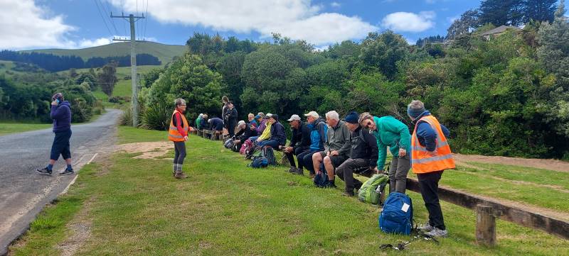
18. 14/2/2024. Trampers. Maungatua Option. Leaders Lyn Keene, Anne Ward and Di Bezett

Travel Distance 40ks, Grade: 3.5, Altitude gain: 711 metres. Total distance: 15.64 ks.

The day dawned to reveal blue skies and temperatures were predicated to be between 28-29 degrees. Continue Reading »

No responses yet

Nov 17 2023

Doctors Point area tramps

Published by under Beach,Both Hikers & Trampers,Hikers

Distance from car-park to Waitati: 34 km.

Distance from car-park to Doctors Point: 38 km.


15 Nov Orokonui Canoe Beach Race Against The Tide Square Resize Pam25. 15/11/2023. Orokonui Circuit. Grade 3. Leaders: Graeme Souter & Gail Williams
The day dawned fined and following some creative maths (11 doesn’t as it turns out does not fit nicely into 2) – 3 cars left Dunedin to meet up with the Mosgiel trampers at Waitati. After numerous toilet visits, we all finally continued to our starting point at Doctors Point Reserve.

Continue Reading »

No responses yet

Next »