
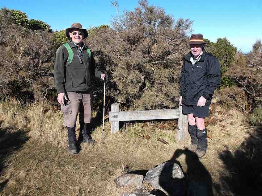
 25/06/2025. Grahams Bush, Organ Pipes, Buttars Peak. Grade 4. Trampers. Leaders: Phil Morris, Rod Ward.
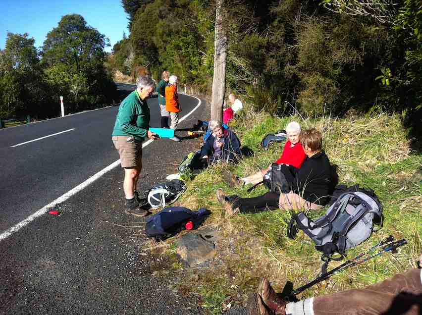
We left 9.30 from PJ Park travelling to Sawyers Bay, to the end of Hall Road, meeting up with townies with really good numbers (26) at 10.10am.
Continue reading “Grahams Bush Track, Organ Pipes, Buttars Peak”
Tag: Grahams Bush
Graham’s Bush, Organ Pipes, Buttar’s Peak, Mt Cargill
 09/10/2024. Graham’s Bush to Mt Cargill. Grade 4. Trampers. Leaders: Karen McInnes and Gail Williams
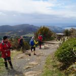
Eleven hardy trampers met at the end of Hall Road in Sawyer’s Bay on Wednesday morning, very aware that the weather was dodgy to say the least.
Continue reading “Graham’s Bush, Organ Pipes, Buttar’s Peak, Mt Cargill”
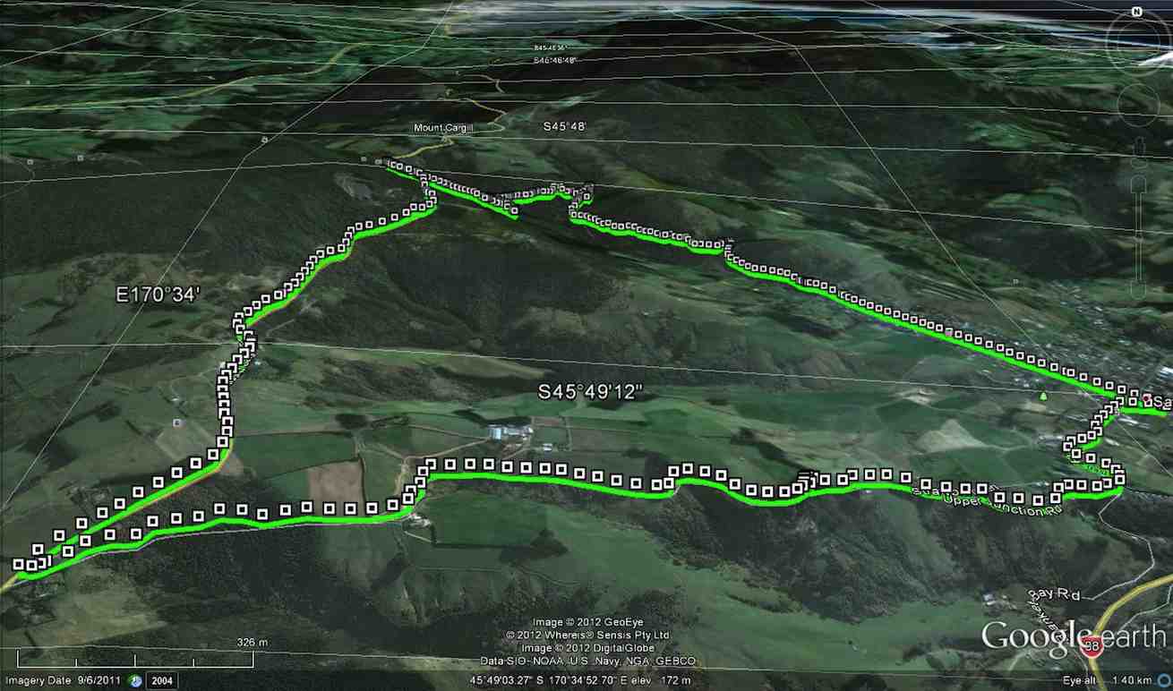
Grahams Bush, Old Main Rd, Organ Pipes, Buttars Peak, Mt Cargill, Mt Cutten
Grahams Bush botanical and Mount Cargill history for background information.
See also Grahams Bush, Upper Junction, Brickhill Rd reports.
No. 19 on old hardcopy list of 113 club tramps. “Sawyers Bay – Grahams Bush. M Deuchrass. Summer.”
Sawyers Bay Road 28 km from car park; Mount Cargill Road car park: 25 km.
 18. 24/04/2024. Hikers. Graham’s Bush/Organ Pipes. Grade 3. 27 km. Leaders: Maria MacNee/Theresa White
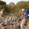
A twenty-one strong group of hikers met at the rendezvous in Sawyer’s Bay at the Emmanuel Church Car Park. Continue reading “Grahams Bush, Old Main Rd, Organ Pipes, Buttars Peak, Mt Cargill, Mt Cutten”
Grahams Bush, Organ Pipes, Buttars Peak, Mt Cargill – Information and Trips Library
Scope:
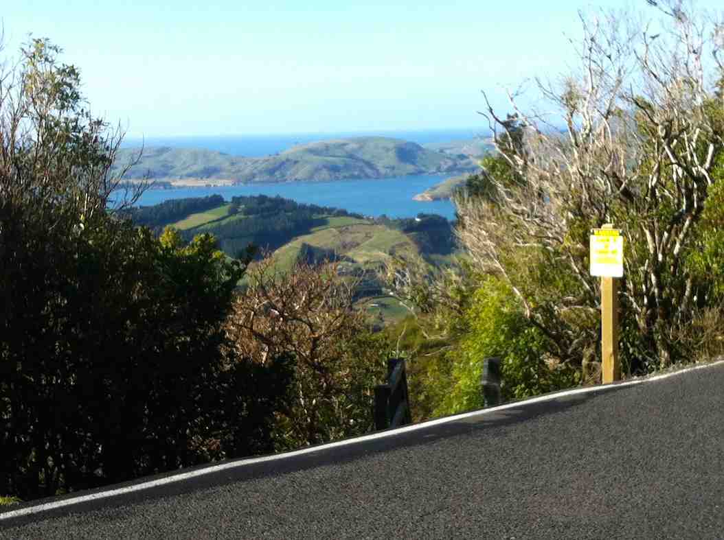
This page of club tramps and hikes in the West Harbour area groups together trips to Grahams Bush,(map) the Organ Pipes, Buttars Peak and Mt Cargill.
Background Information:
Road distances from Mosgiel carpark.
TRTC Grading Information – trips incorporating these tracks are generally given a TRTC grading of 4. This is indicative only, as trips can be allocated a higher or lesser grading depending on the route taken. For more detailed analysis refer to Grading Information.
Grahams Bush Botanical Information (1988) (from DoC information sheet).
Mt Cargill – Information (from DoC information sheet).
How To Get There:
Take SH88 to Port Chalmers. At Sawyers Bay turn left onto Station Road and continue on this road through the roundabout and onto Hall Road. At the end of Hall Road there is a sign indicating the track and an area for limited parking.
Links to tramps and hikes in the same area:
25/06/2025. Grahams Bush, Organ Pipes, Buttars Peak. Grade 4. Trampers. Leaders: Phil Morris, Rod Ward.
09/10/2024. Graham’s Bush to Mt Cargill. Grade 4. Trampers. Leaders: Karen McInnes and Gail Williams
Grahams Bush, Old Main Rd, Organ Pipes, Buttars Peak, Mt Cargill, Mt Cutten, Bethunes Gully, Upper Junction (2024 – 1989, 18 trips with 11 reports).
Grahams Bush, Upper Junction, Brickhill Rd (2014 – 1993, 15 trips with 4 reports).
Grahams Bush, Careys Bay (2004, 1 trip, no report).
From Old Mount Cargill Road Lookout (1992, 1 trip, no report)
Grahams Bush, Upper Junction, Brickhill Rd
Grahams Bush botanical information.
Grahams Bush reserve was originally the site of sawmills and brick kilns operated by David Bethune in the 1880s, and became city council property in 1955.
Parking: Church Grounds. Distance from car-park: 27 km.
Parking: Church Grounds. Distance from car-park: 27 km.
6/8/2014. Both. Hall Rd, Grahams Bush, Mt Cargill Rd, Upper Junction Rd, Brickhill Rd, Stevenson Ave. Leaders: Lester, Ian. (As it turned out, there was no appointed tramper leader there on the day.)
A perforce Hikers’ report.
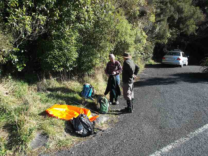
This was one of those first of the month tramps for both trampers and hikers to get together. However at the car park on the church grounds, there was no sign of the trampers. We waited and questioned whether they had got lost. They had left the Bush Road car park before us. Where had they gone? We eventually set off without them on the long walk up Hall Road and on along the initial farm 4WD route to stop for a cuppa at the track turn-off.
For quite a few of us this was their first time on this route and they spoke appreciatively about the lovely bush. Rain the night before had made the track muddy in places. We were pleasantly surprised by beautiful bird calls, more than experienced on previous occasions.
The steep grade gets no easier, but eventually we emerged onto the Mt Cargill road be be greeted by the small group of three trampers. They had left the car park early before the rest of us, had apparently driven right past the church car park in Station Rd and (cunningly? shorter distance!) parked further up Hall Road, and carried on ahead. So it was not to be a together day after all, even up to a morning tea stop!
Anyway, after our brief meeting at the Mt Cargill Road car park, (so we were together briefly after all) they were off to further ascend Mt Cargill while the we stopped off for a leisurely lunch. Some of the hikers ventured a short distance up the track after lunch and returned back down again.
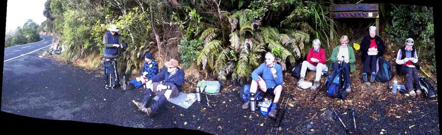
Hikers’ lunch at the car park on Mt Cargill Road
We set off along the old Mt Cargill Rd in a very orderly single file, quite a number of us wearing high-viz jackets. Perhaps it was these that encouraged passing drivers to noticeably slow down as they passed. We turned down Upper Junction Road and were interested to see how the slip at the bottom had been repaired. After the last grouping at Brickhill Rd, we straggled on to our cars back at the church park grounds. At 16, there was only half the usual number of hikers, and we suspected some had wisely decided their fitness was no longer up to the steep climb of the day. Another fine day, bracketed by bad weather on either side. We were so lucky. – Ian.
A Trampers’ report.
3 trampers left Sawyers Bay before the hikers arrived, as they got tired of waiting around ! The walk up through Grahams Bush was a little damp after rain on the previous night, but the bird life made the walk more pleasant.
After morning tea, with still no sign of the hikers, we walked to the top road,
After morning tea, with still no sign of the hikers, we walked to the top road,
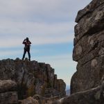
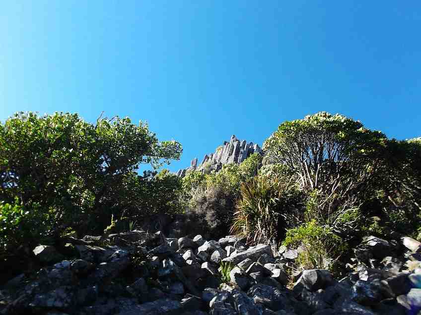
where we waited for approx 40mins. for them to arrive. After this, we walked up the Organ Pipes track, stopping to view the tumbled down remains of the pipes,
then went on to Butters Peak junction,
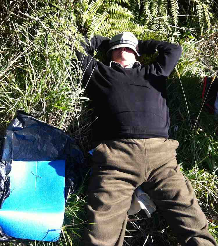
where lunch was had in the sunshine.
The return trip was uneventful, & the birds once again kept us company. – Ian Hebberd? – per Ken.
The return trip was uneventful, & the birds once again kept us company. – Ian Hebberd? – per Ken.
1/8/2012. Both. Grahams Bush, Mt Cargill Rd, Upper Junction Rd, Brickhill Rd, Hall Rd. Leaders: Pat, Ken.
10.5 km distance.
3.7km/h moving ave.
2hr 48min moving time.
379mtrs. total ascent.
394 max elevation.
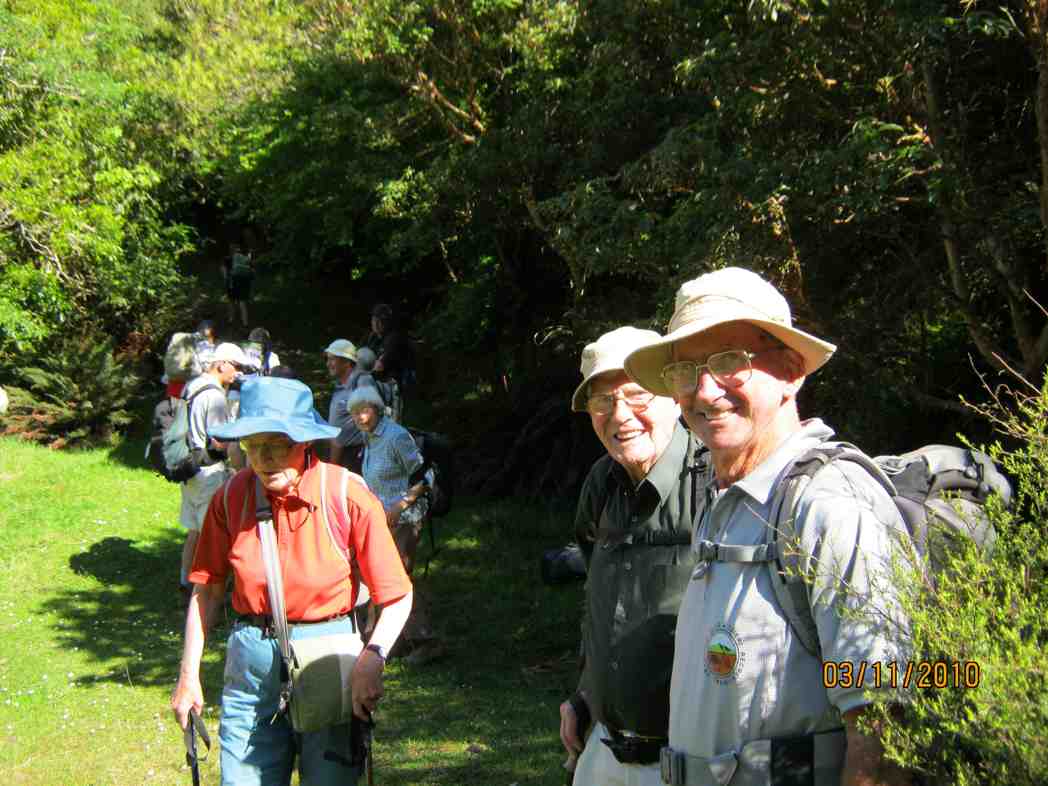
3/11/2010. Both. Grahams Bush, Mt Cargill Rd, Upper Junction Rd, Brickhill Rd, Hall Rd. Leaders: Fred, Elaine.
A goodly number of 21 of us set off for the round trip. We stopped at the turn-off into the bush for morning tea. Evelyn has apparently suffered an early bad fall but soldiered on.
Continue reading “Grahams Bush, Upper Junction, Brickhill Rd”
Grahams Bush Botanical Information (1988)
A top-down description:
From across the Old Mount Cargill Road from the Organ Pipes track entrance, the top section of the walk is very steep, but now relieved by an excellent set of steps. For much of the descent into the gully the walk passes through dense stands of manuka and kanuka. Both have small pointed leaves. Most of the trees are of even size and height. This implies they are even aged and grew up at about the same time. Equally important is the fact that no young kanuka is growing beneath the adult trees. In places many other species of native trees and fauna are growing. This is because kanuka seed needs light to germinate and not enough filters through the canopy. Other seed such as lemonwood is not so light-demanding. These young plants will eventually grow up through the kanuka to become a new forest canopy.
The widespread dominance of the blotchy-leaved pepperwood tells us more of the forest’s history. It is very unpalatable to stock and generally thrives when stock eats out the other plant species. Until recently stock have been common in this bush.
It is also interesting to note how dry this slope is. This stands in sharp contrast to the cooler gully at the bottom of the hill. A bridge spans the creek here, about 20-30 minutes from the carpark. Beyond this are more mature patches of forest.
Fuchsia (with orange bark) predominates in this valley, while little kanuka can been seen. A good variety of ferns thrive here in the moist conditions, the most distinctive of which are the tall tree ferns. The one with milky-coloured frond stalks is the silver tree fern.
Just 2-3 minutes beyond the bridge is a clearing. From it the hill just descended is apparent. More of the story becomes obvious. The whole hillside is of an even aged kanuka. Above nearer the road one sees old macrocarpas.
Kanuka and manuka often thrive after fire or in areas cleared either by humans or nature. Could it be that this hillside was once cleared, and that maybe the macrocarpas indicate an old homestead site – a base for a farm now abandoned and reverting to native forest?
In such a role kanuka is a successional species; i.e. it thrives after disturbance allows light into the forest floor. In time it gets over-topped by other forest species and becomes replaced with more mature forest.
An example of this mature forest that once covered this hill and what will once again be seen is 10 minutes further down the track.
One cannot fail to be impressed by the huge boles in the rimus (with hammer bark) and miros (with soft green leaves and dark mossy trunks). These giants are survivors of a once extensive podocarp forest that covered most of the Dunedin district. Fortunately their poor shape precluded their being logged for timber and consequently they now serve as a seed source to re-vegetate the reserve in podocarps. The dominant trees forming the forest canopy in this area are kanuka.
A second small patch of these trees occurs a little below the second bridge. Beyond them further evidence of the impact of humans on the area is seen – hawthorns growing in the forest! These exotic trees from Europe add a new shade of green to the forest each spring. Being deciduous, like so many continental trees, they lose their leaves in summer and grow a new set in spring. In New Zealand the only common tree with this habit is the fuchsia – the orange shaggy-bark trees. Like kanuka, fuchsia is one of those successional species. Their roles are very similar but they fill them in different locations – fuchsia preferring damper cooler sites.
– Adapted from DoC hard-copy information sheet