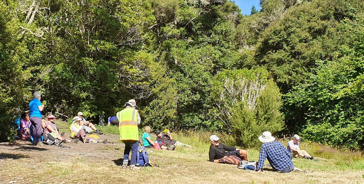
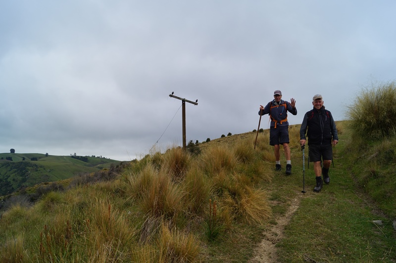
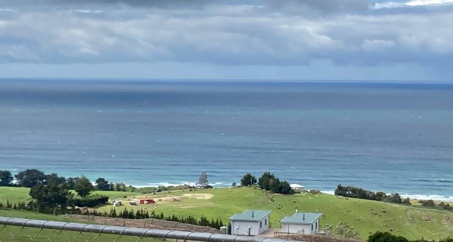
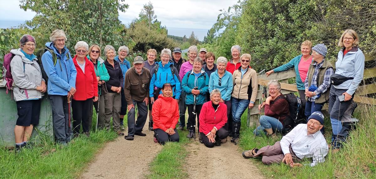
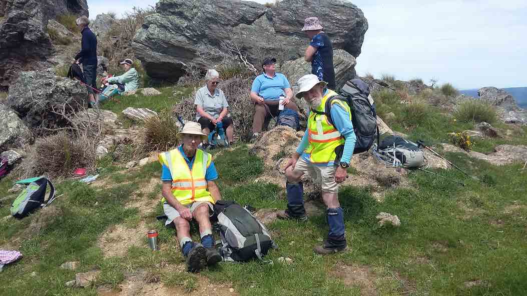
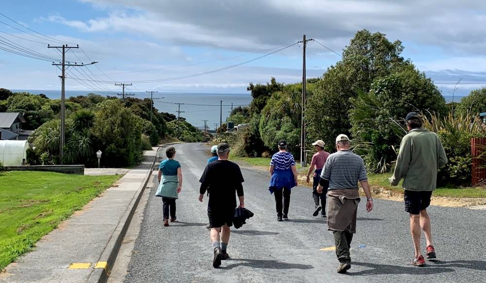
13. 26 January 2022. Hikers. Evansdale Glen. M. Leaders: Jim and Betty Finnie
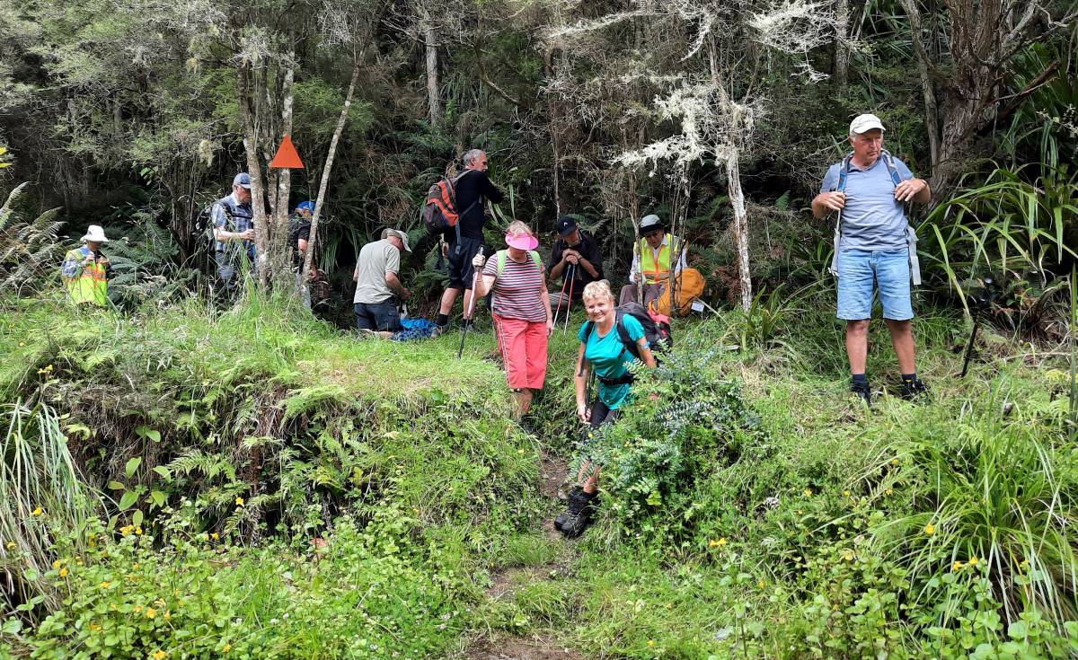
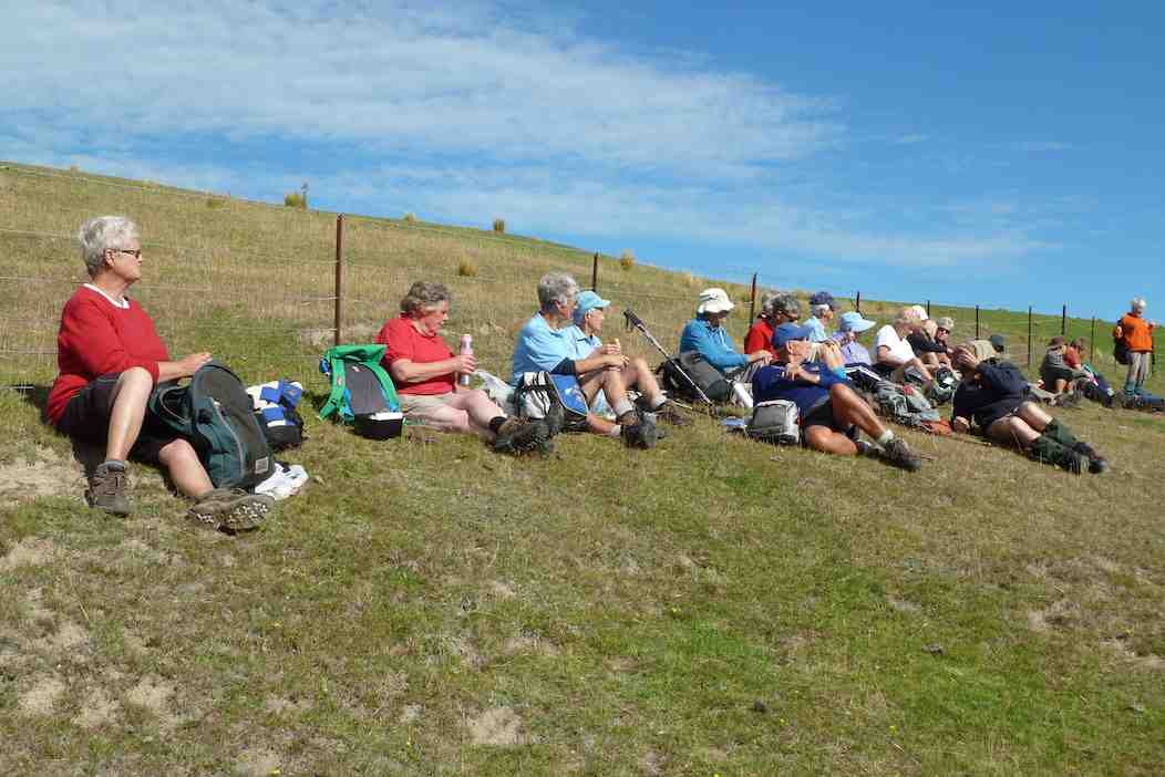
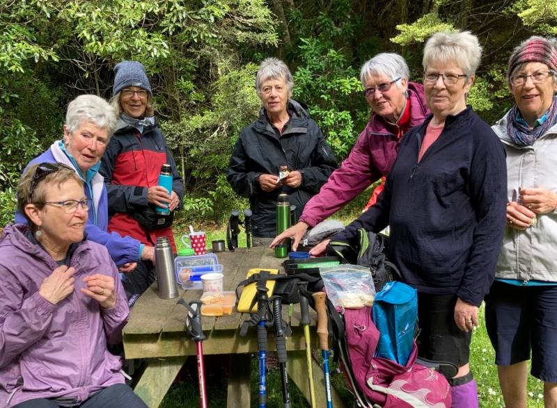
It was a pleasant sunny morning that 16 hikers assembled at the Evansdale Glen car park. The morning tea stop was in pleasant sunshine at the end of the short bush circuit that returned us to the grassy domain.
Morning tea (caption and photo Clive)
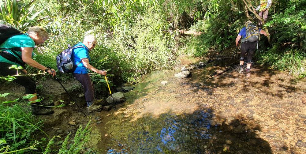
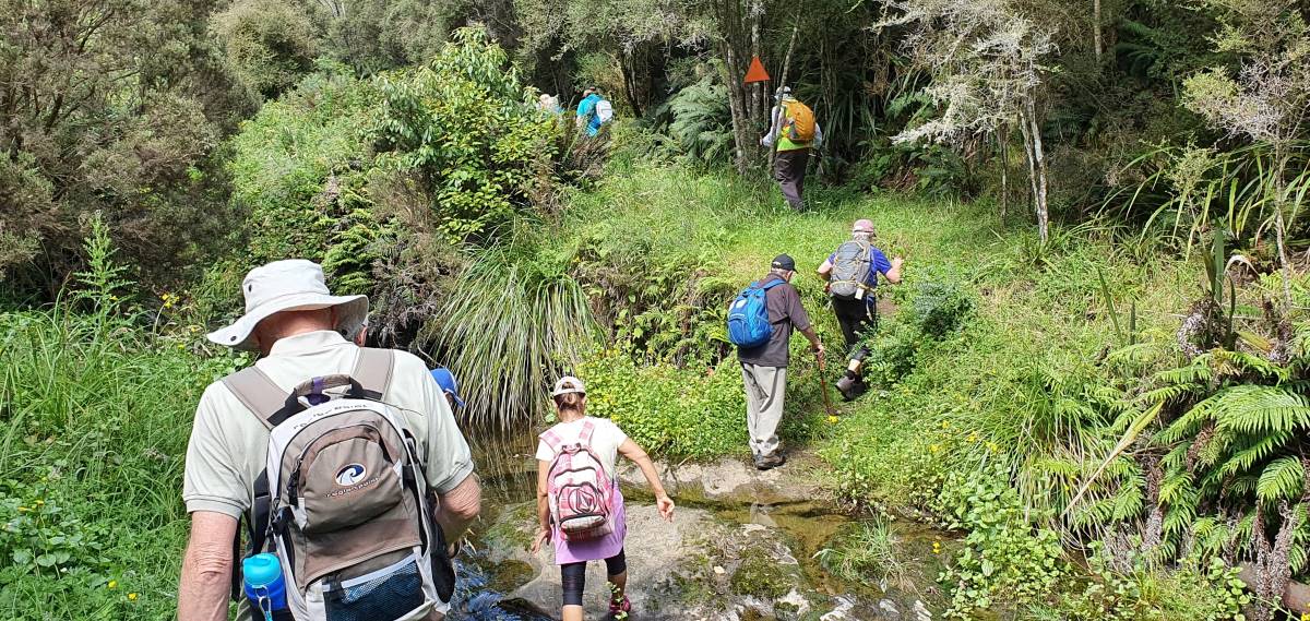
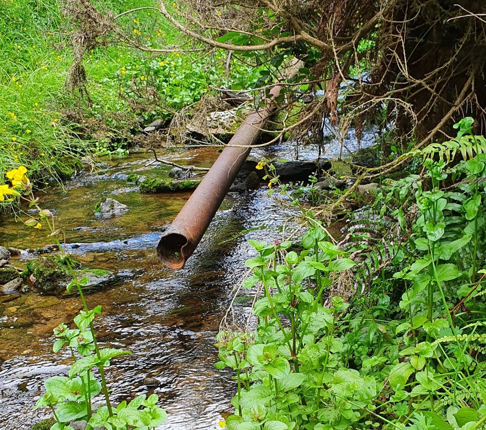
From the domain the main track took us up valley in pleasant conditions, crossing the stream 3 times…
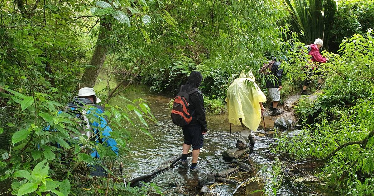
The 1st stream crossing (caption and photo Clive)How to tackle the 2nd stream (caption and photo Clive)The 3rd stream crossed with dry feet (caption and photo Clive)
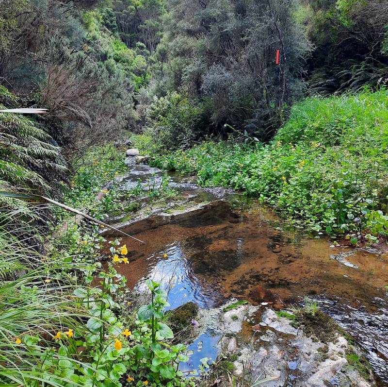
… to where a pleasant lunch break was had.
Lunch by a babbling brook (caption and photo Clive)Looking downstream at lunchtime (caption and photo Adie)The water race for the old Seacliff asylum (caption and photo Clive)Lunch stop Evansdale Glen (caption and photo Adie)
On the way back down valley conditions deteriorated and required wet gear to be donned. My wet gear consisted of a 35 gram $1.99 plastic poncho that had remained unused for six months. The donning of this unused item for the first time presented challenges that were resolved with the assistance of fellow hikers to remove my head from an arm hole and get my head installed in its correct position.
Wet from above and below (caption and photo Clive)
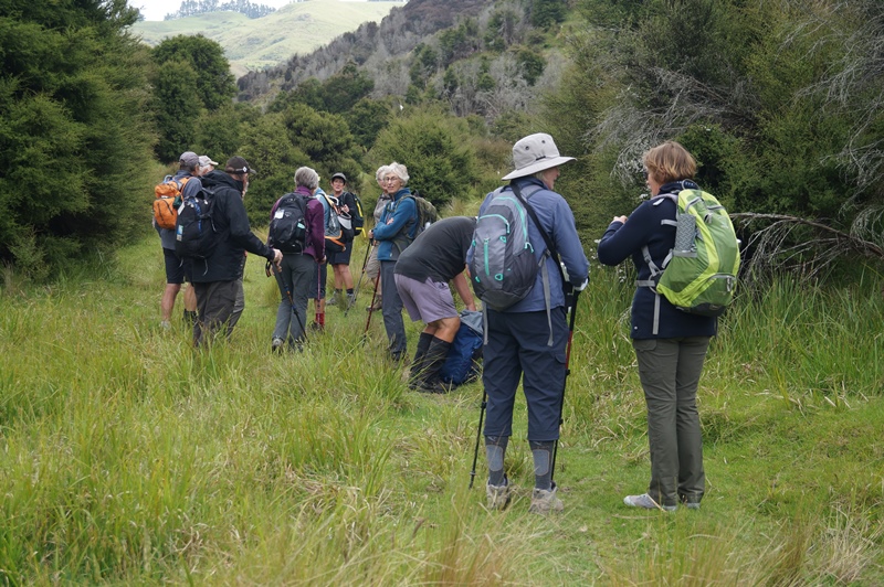
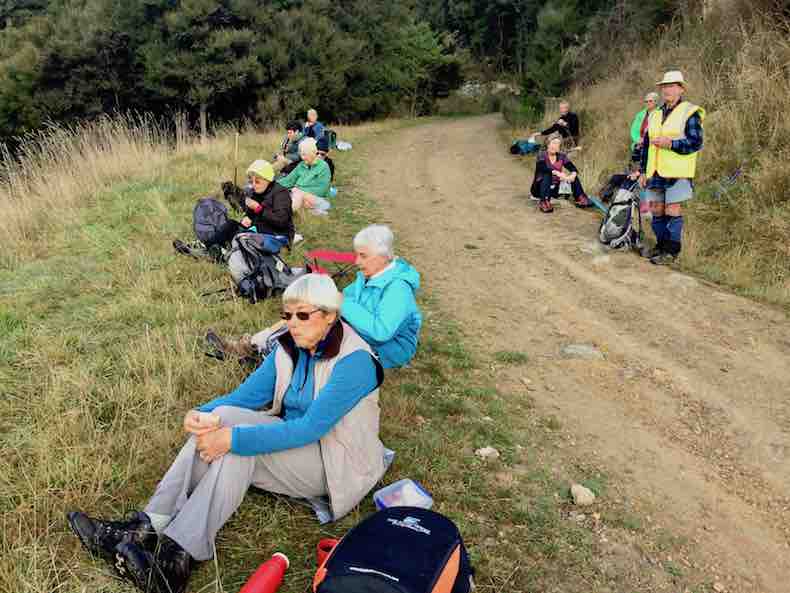
4. 15/12/2021. Hindon. Blacksmiths Gully. Leaders Jill Reid, Sarah McCormack, Linda Partridge, Jan Butcher.
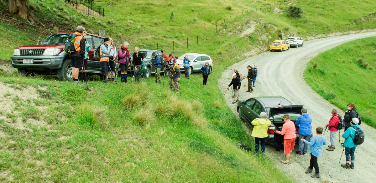
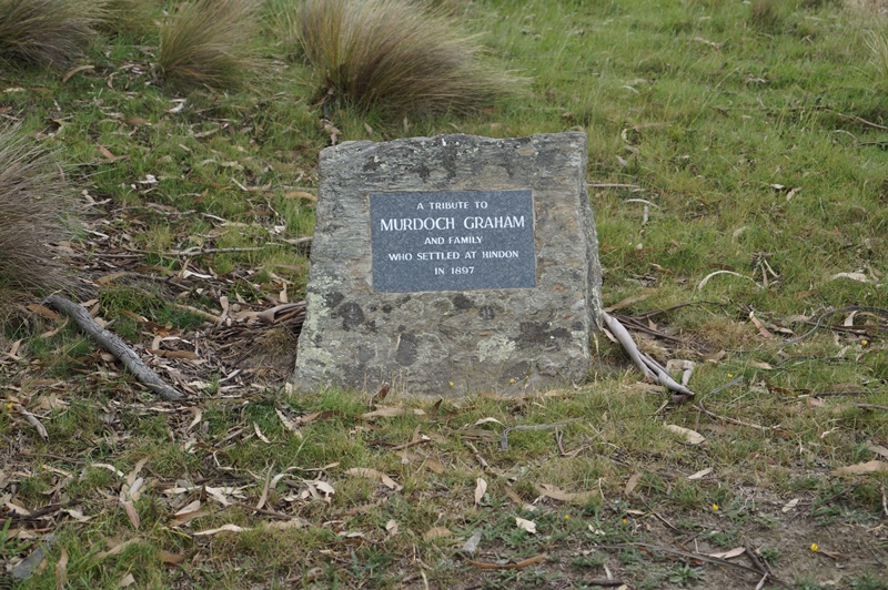
A reasonable day dawned for our combined Christmas visit to Hindon, and about 40 people headed up George King Memorial Drive to the hall. We deposited our “plates”, wrapped up warmly, and drove to Don Graham’s gravesite on Ardachy Station.
Getting sorted (caption and photo Ross)
Don loved this challenging country & he overlooks the hills and Taieri River.
Lovely spot for a tribute stone (caption and photo John)
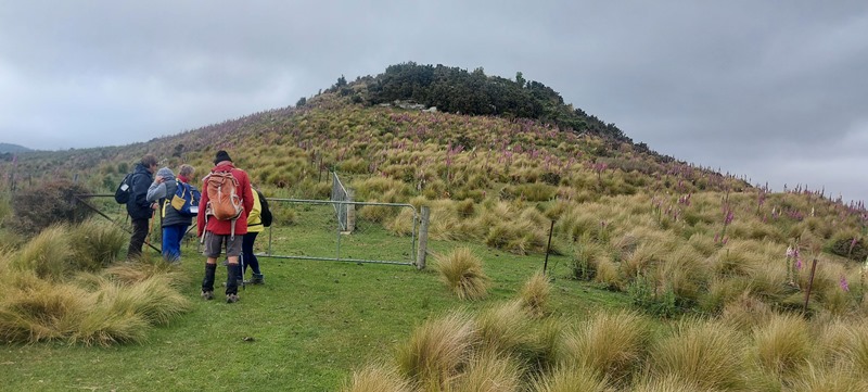
The hikers walked a gentle track & enjoyed the spectacular scenery.
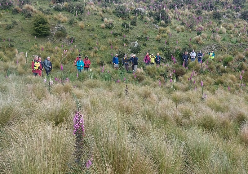
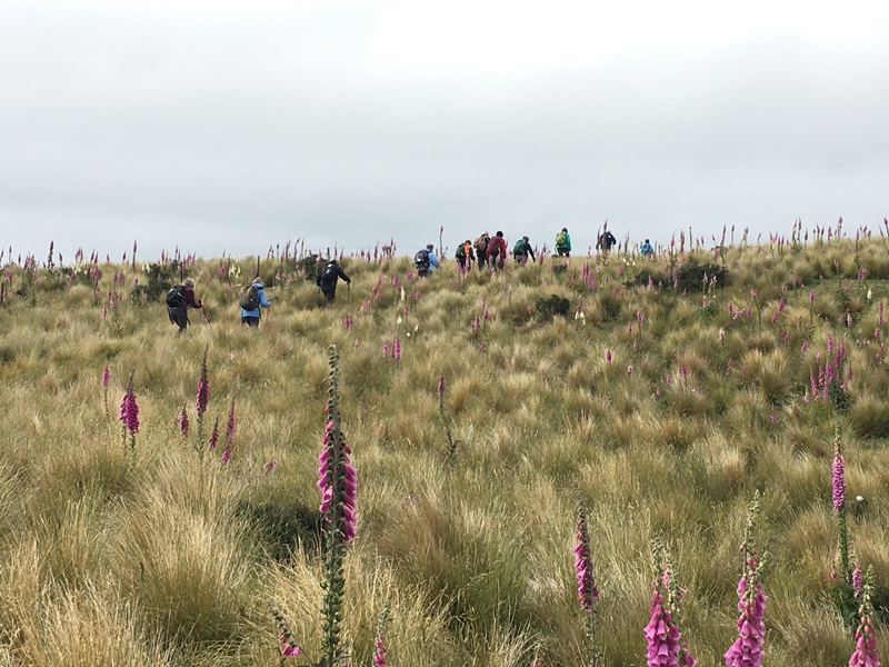
Nice view of the hill (caption and photo Helen)The group of 19 hikers (caption and photo Helen)
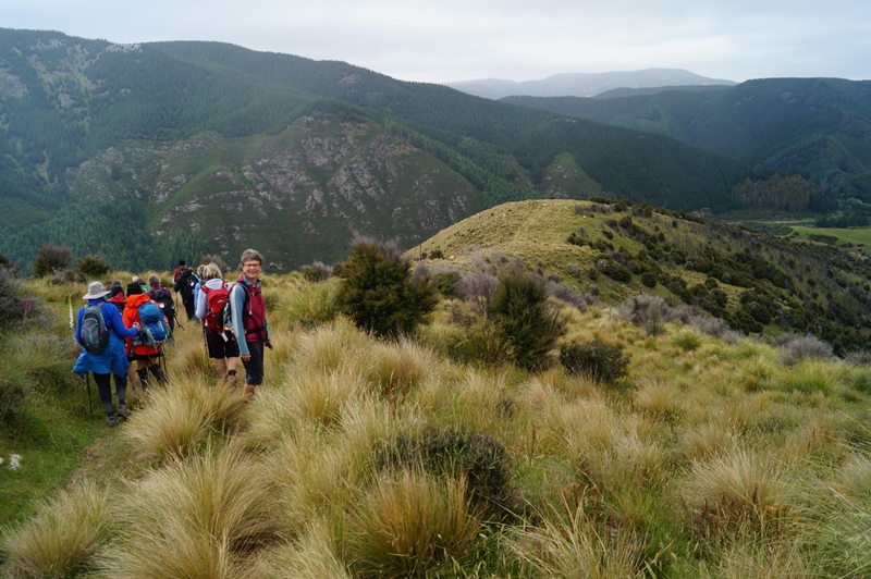
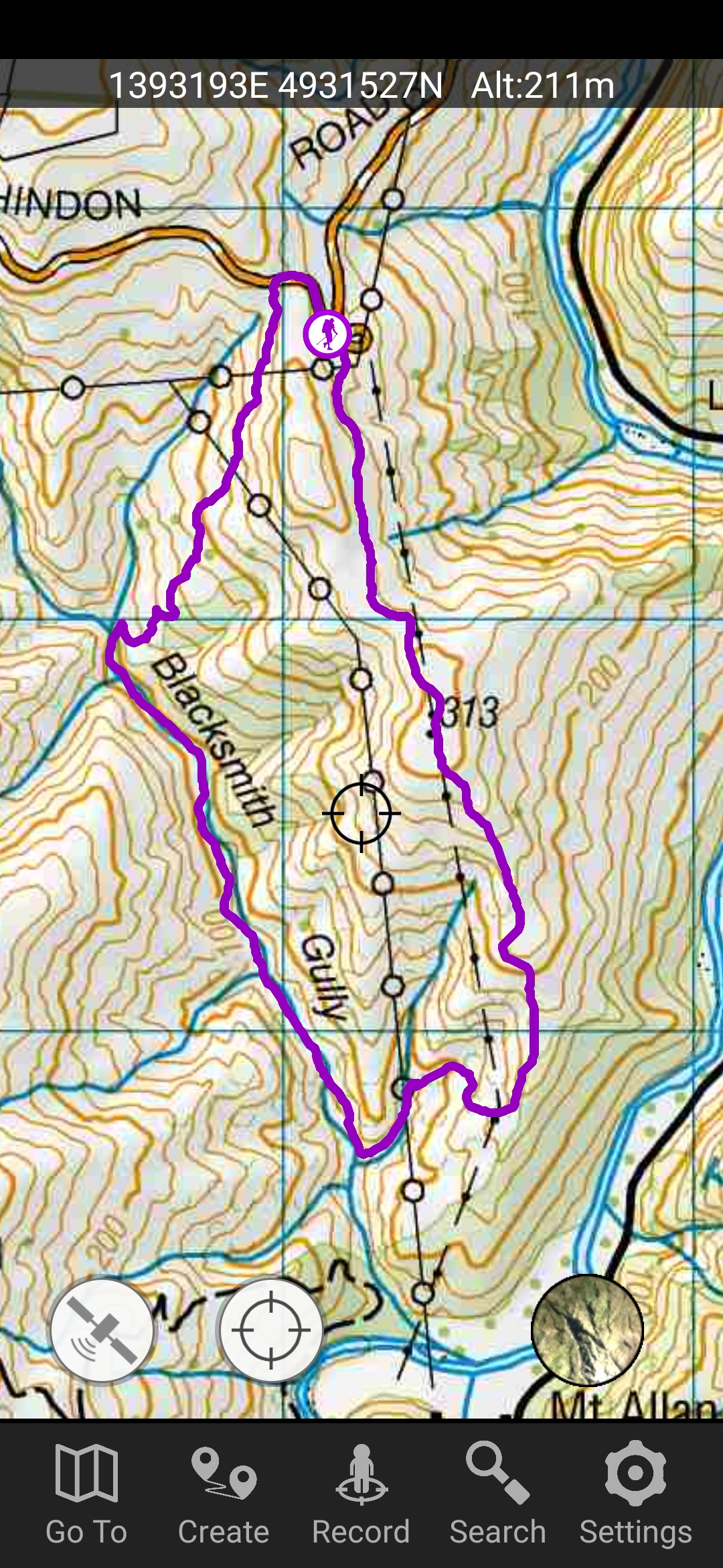
The trampers headed down the hill to Blacksmiths Gully, then looped back up to the cars – about 6 km.
First impression of the vastness of the countryside (caption and photo John)Panaroma – open country dwarfs everyone (caption and photo John)Phil and Peter in their happy place (caption and photo John)Are we going the right way Jill? (caption and photo John)Trampers among the Foxgloves (caption and photo Pam)
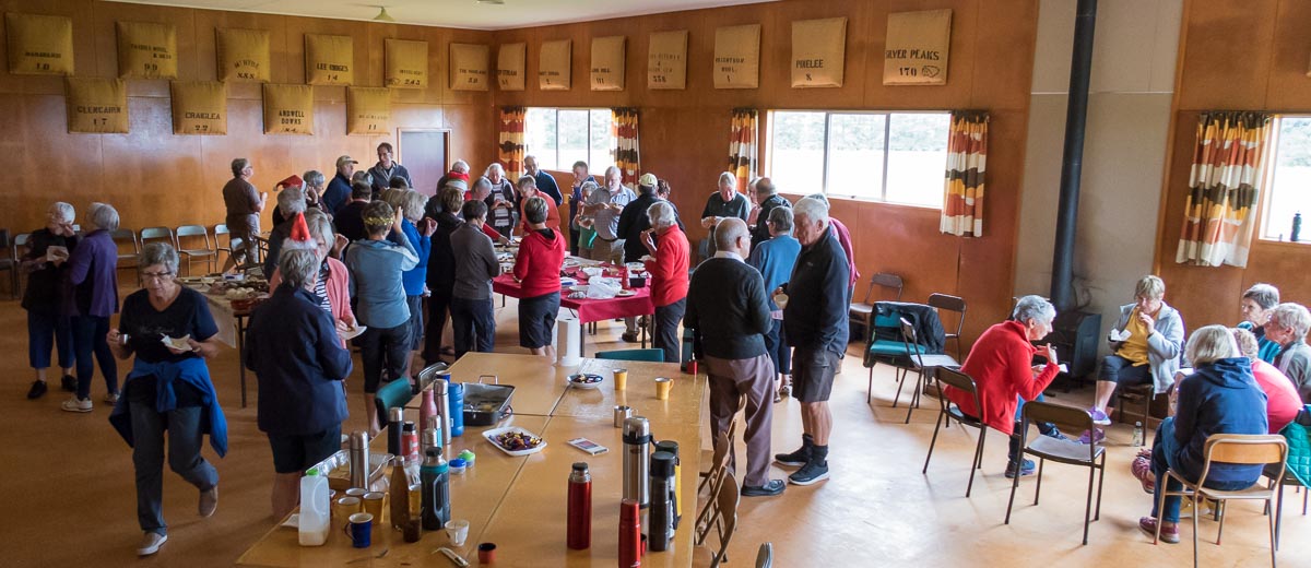
Kevin Burke said Ian Fleming’s grace and we then enjoyed the generous pot luck lunch.
Chris Wither told us some Hindon Hall history & her various associations with it during her 38 years living at Hindon. She mentioned how mice often visited during yoga classes……and yes, one brave mouse came under the door soon after!
Lunch in the Hindon Hall (caption and photo Ross)
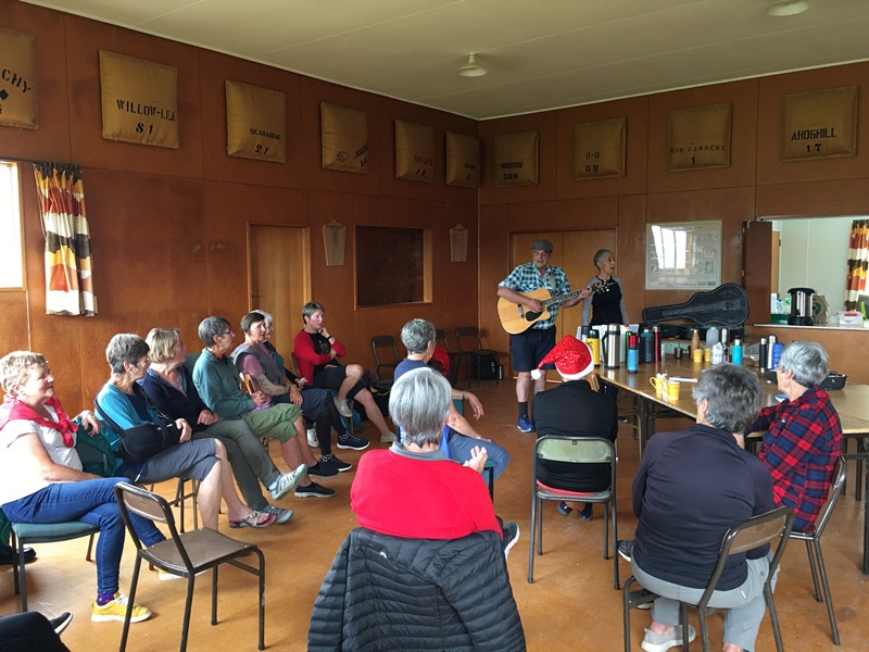
We greatly enjoyed Grant Shackell playing his guitar and singing along with his “blind date” Claire Currie.
The entertainers – Grant and ClaireEntertainment from Grant and Claire. Interesting woolsacks on the wall from past and present farms in the district (caption and photo Pam)
Thank you both for the wonderful entertainment, and to Jill Dodds and her helpers for organising the food etc. A very pleasant way to wrap up our tramping year!
Jill Reid
Tramper’s route
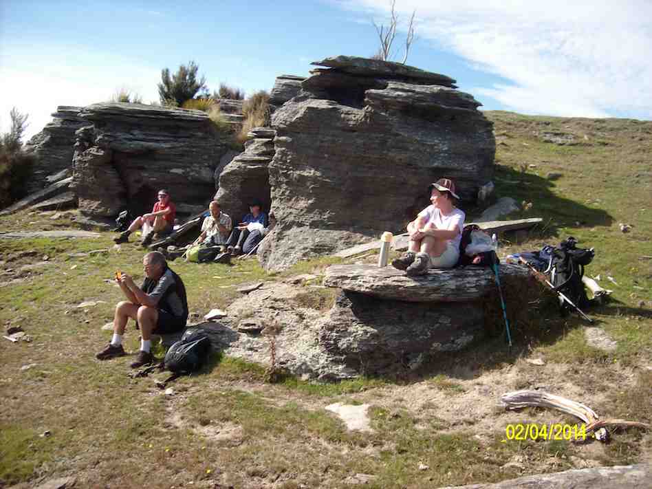
3. 2/4/2014 Both. Hindon. Machine Creek. Recently Bathgate, now Cowley Farm. Easy+ Leaders: Ian, Ken
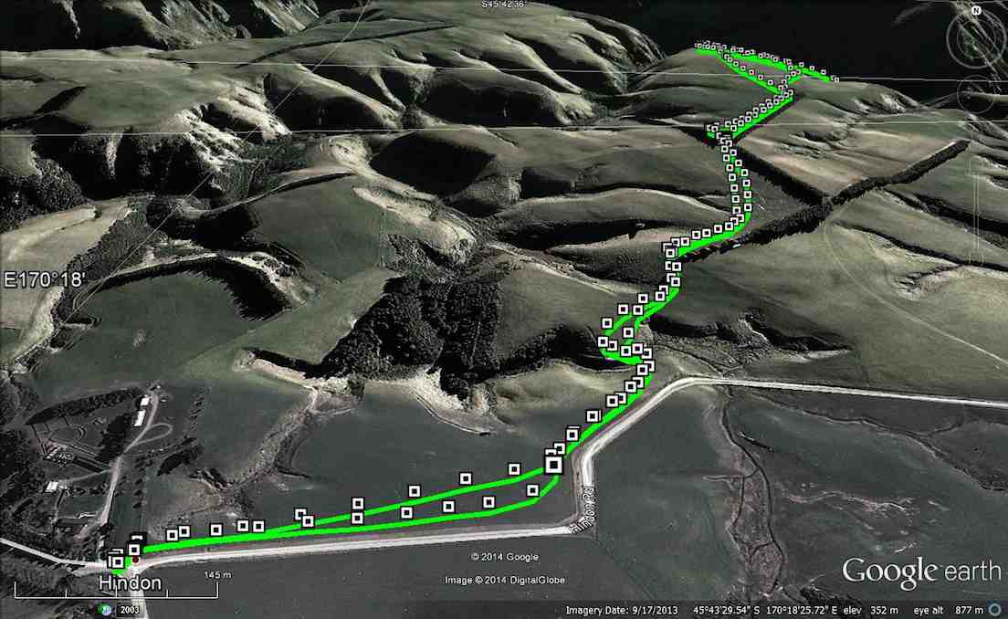
GPS of route per Garmin, courtesy Ken.
GPS of route per iPhone app.
30 turned out for an earlier foggy, but later sunny, shorter trek over gloriously stock-free paddocks …
M/Tea in the dry away from the heavy dew on the grass. (John panorama pic)
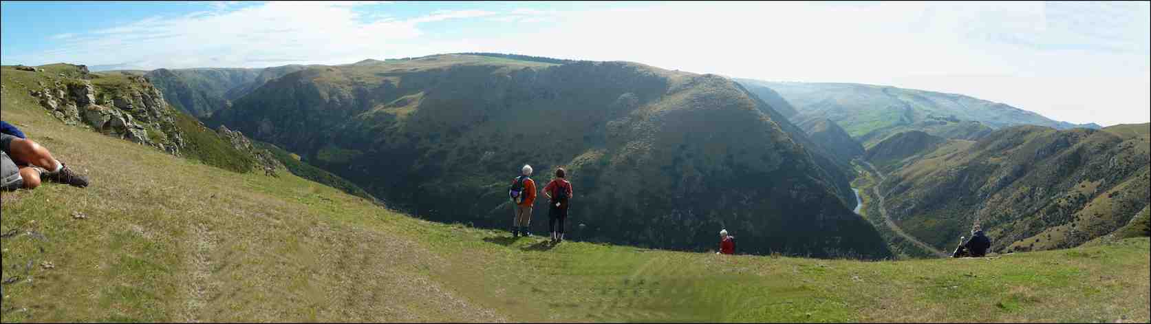
to reach a ridge overlooking the Taieri River gorge. Wonderful views rewarded us on an autumnal day quite free of the slightest disturbing breeze. So we could just take our time and drink the prospect in.
A few of us ventured via cattle tracks down the steep slope below the ledge to the plateau below (as can be discerned from the iPhone app map) with the majority remaining quite content to laze in the sun. With plenty of time to spare, we eventually settled down for lunch, the majority again staying on the main ledge …
Lunching along the fence (John pic)
with a few taking advantage of the slope …
Lunch on slope overlooking Machine Creek. (Ken pic)
overlooking the dramatic Machine Creek gorge. All in all, an interesting resurrection of a tramp many of us had forgotten. – Ian.
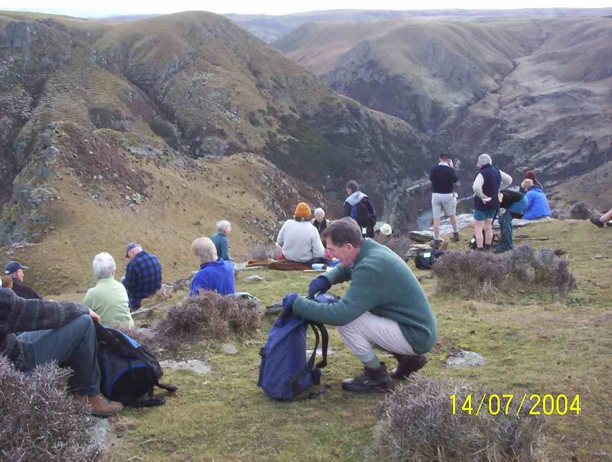
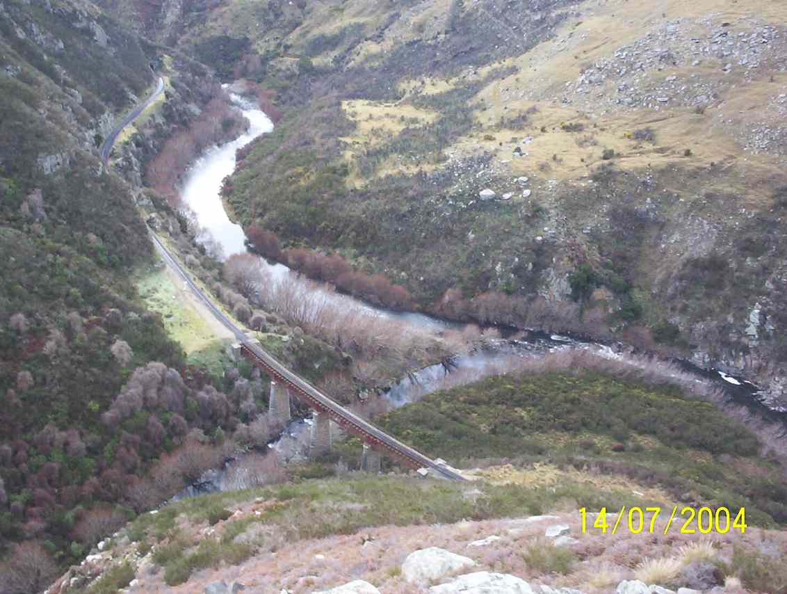
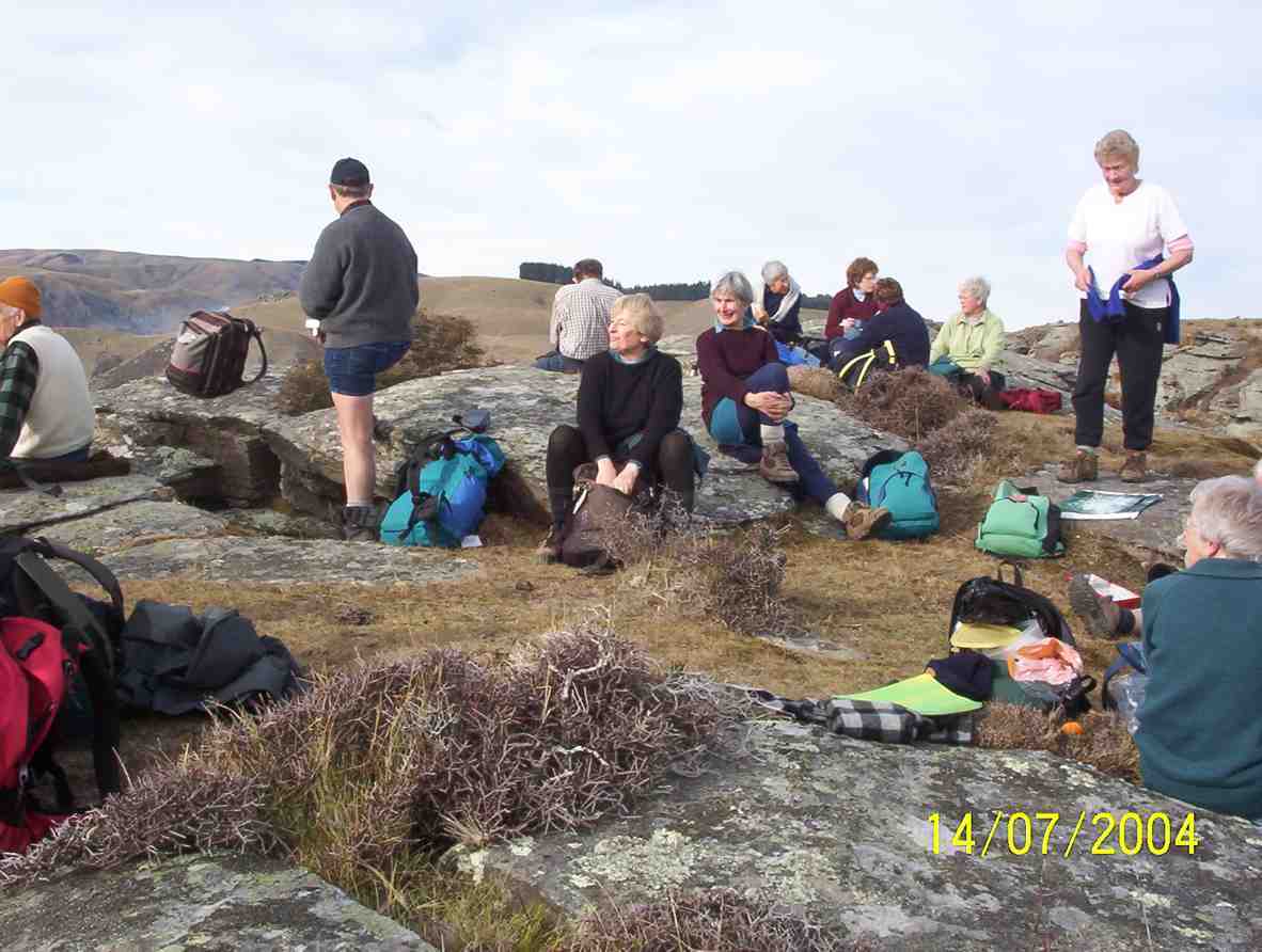
2. 14/7/2004 Hindon, Machine Creek Penno farm Leaders: George, Molly
M/Tea Machine Creek
Machine Creek railway bridge, looking upstream
Machine Creek Lunch. George, Arthur, Pat, Molly, Margaret
1. 5/5/2004. Both. Hindon, Machine Creek, Deep Stream. Easy. George, Molly, Glenys P.
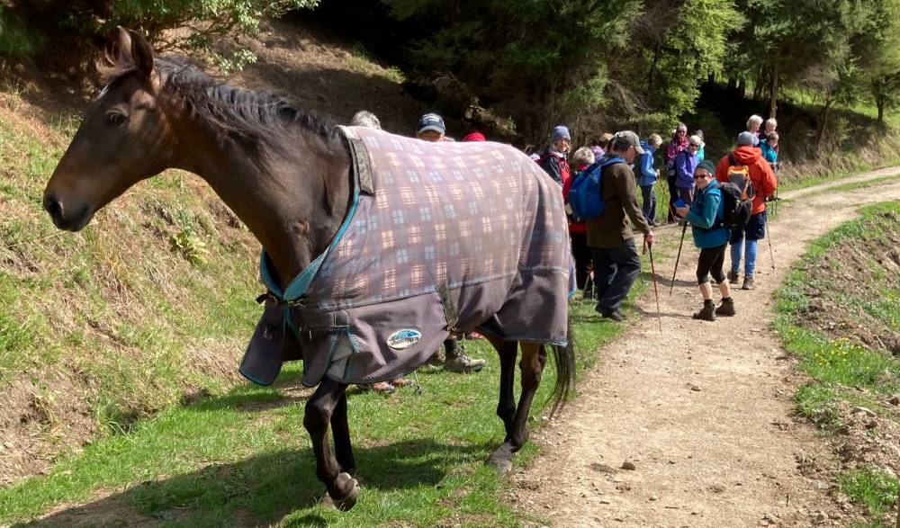
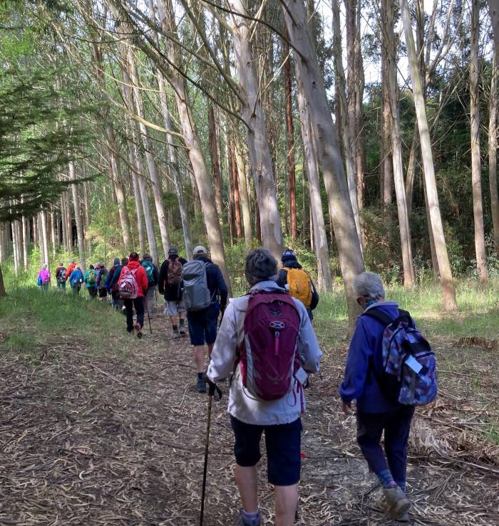
5. 17 November 2021. Hikers. McIntosh Bush. E-M. Leaders: Jan Yardley & Pam Clough
A good number of hikers and trampers (23 in total) travelled up to McIntosh Bush, formerly owned by Marjorie Orr and Colin MackIntosh, now owned by Marjorie’s niece, Hilary Lennox. I was unaware that it was previously owned by Eleanor and Murray Watt. Eleanor was a member of the tramping club for a number of years. Marjorie and Colin still live on the property which consists of 100 acres of native bush and mixed exotics, and a QEII-covenanted bush area.
Setting off down the track – Saddle Hill in background (caption and photo Jan)
We were guided by Marjorie, and started off down a road then up the hill past the horse paddocks. Two horses met up with us but didn’t hang around long.
Meet-up with the horses (photo and caption Jan)
We carried on down through various stands of exotic timber trees which included eucalyptus, macrocarpa, Tasmanian blackwood to a picnic area at the bottom of the gully for morning tea.
Through the Tasmanian Blackwoods (photo and caption Jan)
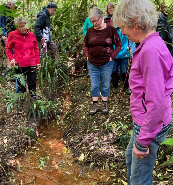
We then proceeded through native bush where the rare peripatus worms live and looked at a stream oozing “brown coal” seepage.
Our guide Marjorie, explaining the “brown coal seepage” (photo and caption Jan)
Climbed up through an area of pinus radiata to the top edge of the property where we had an excellent view overlooking the Ocean View area.
View from top of property (photo and caption Jan)
Walked back down to the picnic area for lunch…
Lunch at the picnic area (photo and caption Jan)
…then headed back to the cars up a very picturesque ferny bush track. Quite a narrow track with lots of wooden steps and tree roots etc. to negotiate. On the way up were numerous tree plantings named after various people associated with the property.
Colin Mackintosh on a clean-up mission (photo and caption Jan)
On arriving back at the cars Marjorie offered us a tour of her garden, accompanied by her two dogs – an unexpected extra bonus.
Finish up with the tour of Marjorie & Colin’s garden (photo and caption Jan)Group picture (photo Barbara)
We finished up a successful day with coffee at the Wooden Table in Mosgiel, and we very much appreciated the opportunity to enjoy this special property.
26. 10/11/2021. Three Kings – Heenan Road. M. Leaders: Cathy Ferguson and Sue Nichol
18 Hikers set off from double gates where we parked our cars about 9.15 on a very warm humid day.
Photo Cathy Ferguson
On a well formed farm track it is a steady climb through bush and morning tea was a stop, with views over the Taieri Plain.
Photo Cathy FergusonPhoto Cathy Ferguson
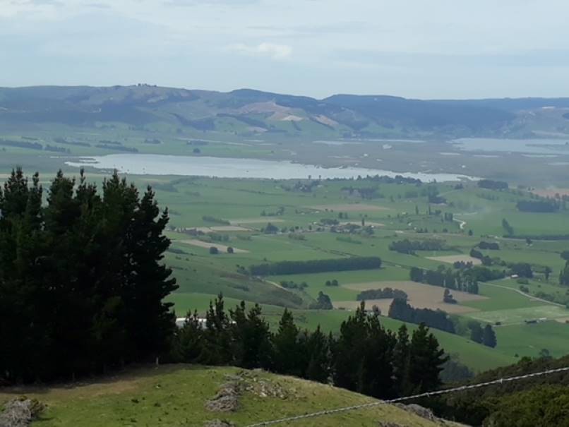
As we climbed higher there was several stops to enjoy the views of Lake Waipori, Lake Waihola and the wider Taieri.
Photo Cathy Ferguson
At the cattle yards where there was a small calf and 3 large cattle we turned right and walked up a rougher steep track until we reached the 3 Kings. Lunch stop was had at this point for a relax and a little banter.
We then headed back down the track to the vehicles. Amazing how going down always goes so much quicker.
A hot but warm day was finished with a drink at the Wobbly Goat.
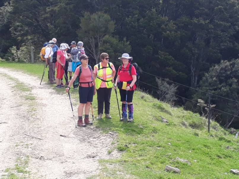
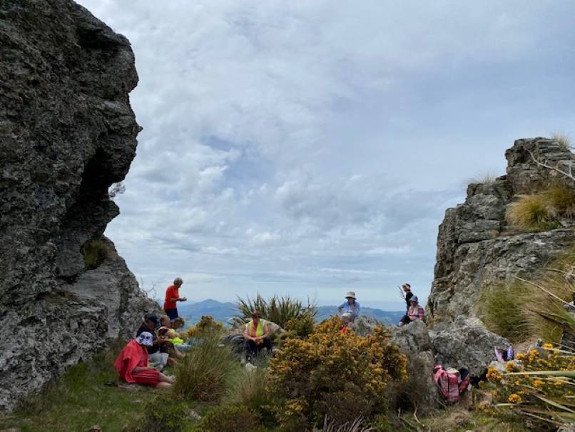
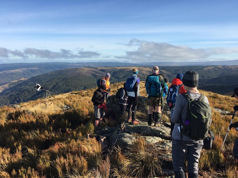
25. 23/06/2021. Three Kings Trig F. M. Leaders: Eleanore and Peter
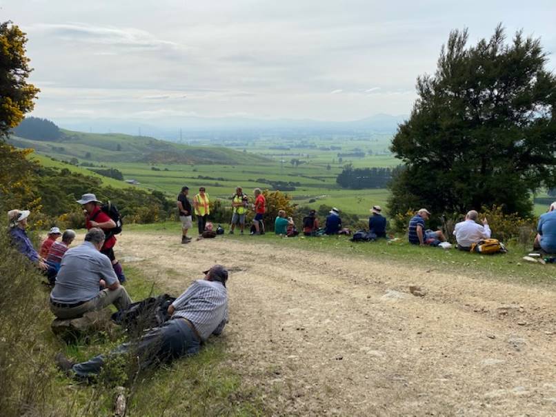
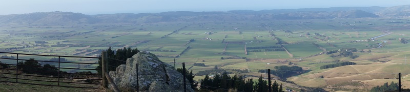
On a chilly calm morning, 23 rugged up trampers met at Heenan Road at 10:10am and headed through the gate, where we were greeted by a few cattle, who had made the track quite mucky. It is a steady climb up the farm track, enjoying views of lower Taieri at regroup stops.
By 11am we came across a sunny spot to enjoy smoko, probably halfway to 3 Kings.
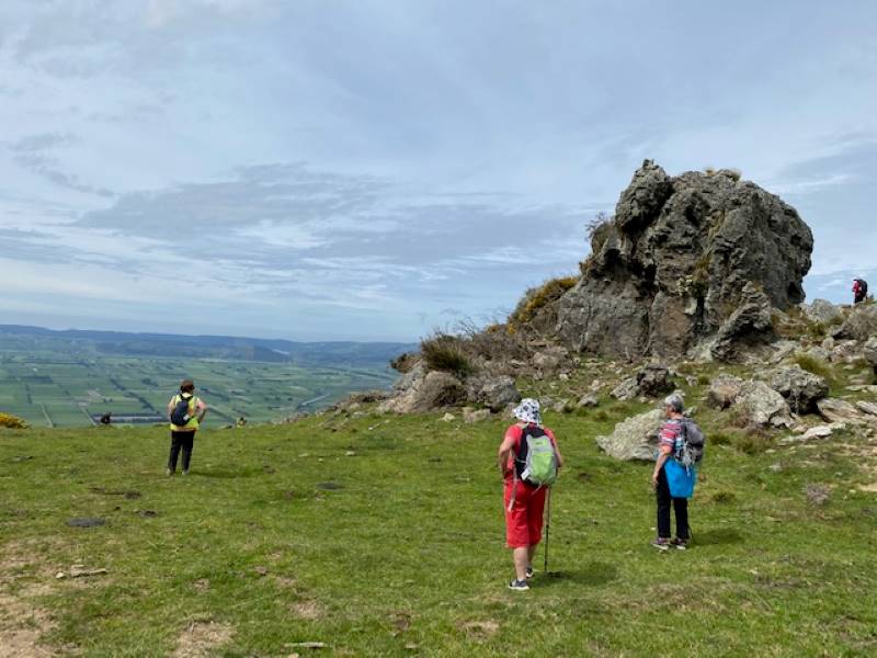
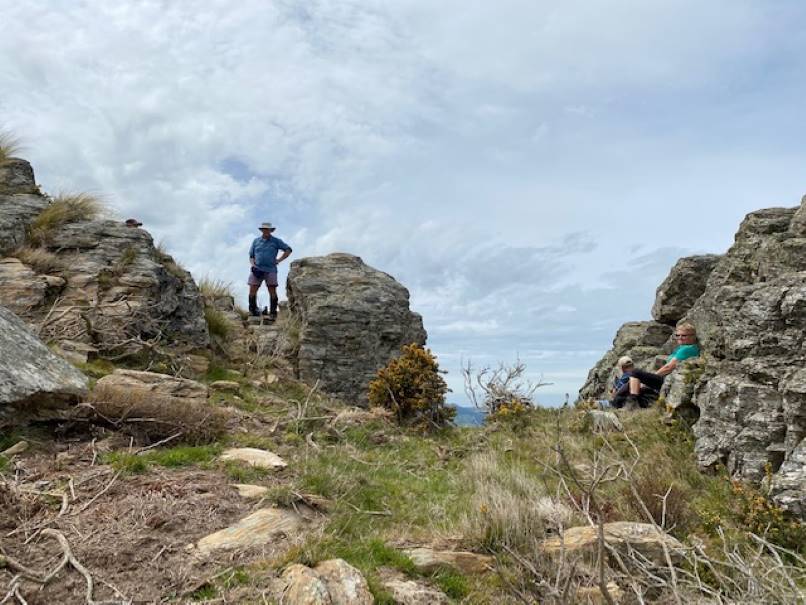
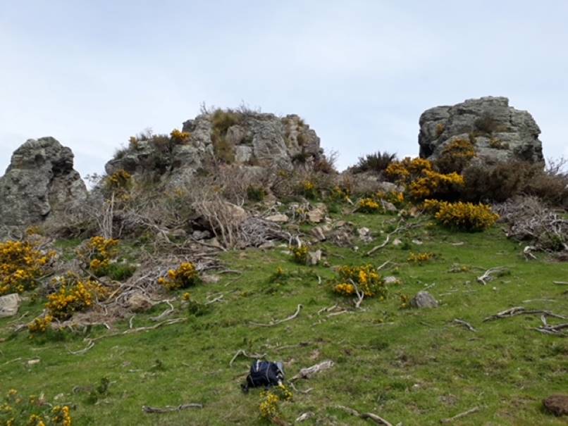
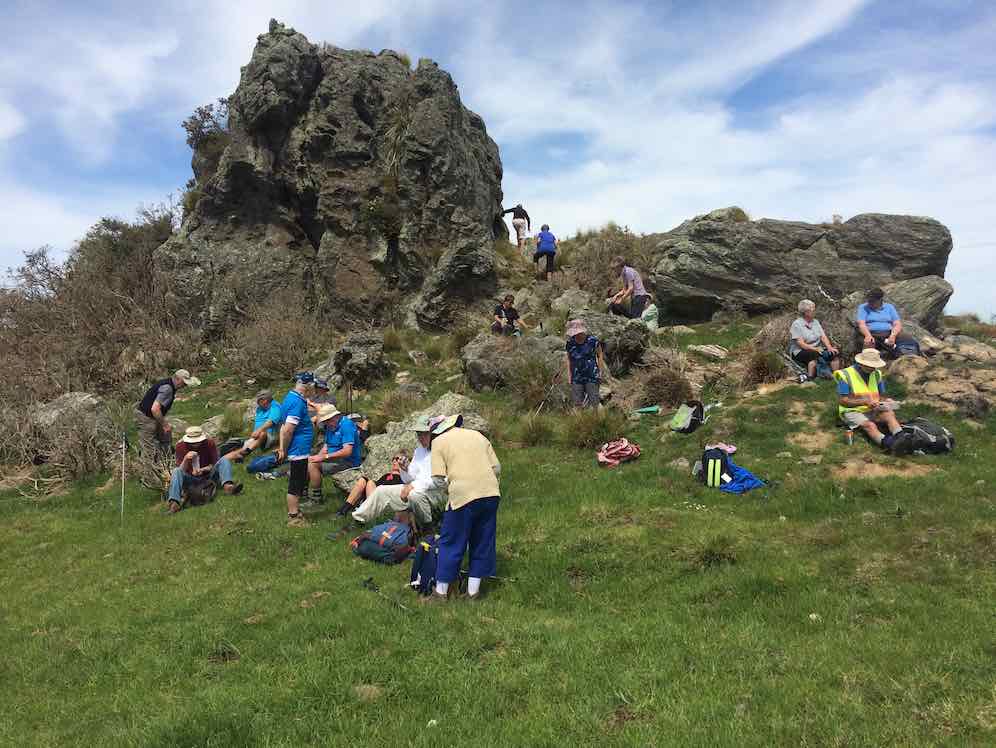
Early view of the Taieri [Photo and caption John]Keeping to the farm track we continued climbing to the wooden cattle yards, then headed right up a lesser defined track, arriving at the first big rock, glistening in the sun and surrounded by smaller ones. Even though the air was very chilly, it was a good spot for photos and views.
Apparently Not the Three Kings [Photo and caption Pam Cocks]Next, keeping right, we followed the track up and around to 3 Kings, arriving around 12ish. They are 3 rocks, rather spread out, sort of in a row. There was plenty of that nasty Spaniard grass amongst Dracophyllum — common on the tops of Maungatua. Once again, we climbed on them, to take photos. Thin air up here at 647 metres!!
By now we were thinking about coffee and lunch, so we left on our way back down.
Soon after Trig F was spotted up a muddy cattle track so 16 of the group made the climb to say they had been to this trig which is slightly higher than 3 Kings at 703 metres.
Trig F has seen better days [Photo and caption Pam Cocks]Soon after, round 12:30ish, all met up on the track for lunch in the sun.
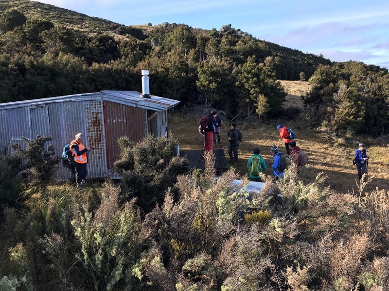
We had been given permission from land owners to visit their little hut in the bush near the cattle yards. It is really well set up, with a couple of beds, I would think many good times have been enjoyed in that hut.
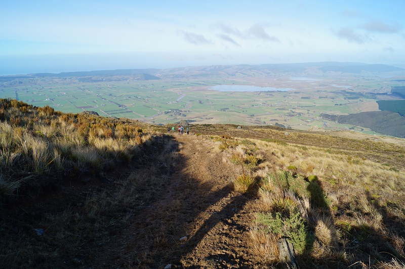
Landowners Hut [Photo and caption Pam Cocks[We left the hut at 1:30pm for our downhill walk to the cars enjoying beaut views, particularly the intricate set of channels, swamps and lakes between Waipori and Waihola and also the Taieri river at the start of Taieri Gorge.
The descent [Photo and caption John]It is a nice way to end the day walking amongst the very old Beech trees amongst the native bush.
View over the Taieri Plains from below The Three Kings [Photo and caption Pam Cocks]On returning to the cars at 2:30pm, it was good to remove the muddy boots before going to Willowfield for coffee and cake. Another great outing, thanks Peter Gillespie and Arthur Heenan for great navigational skills leading us. This was the first visit to 3 Kings for some members. Good company, good friends, good fun makes us all happy.
I contacted Michelle & Steve and sent a couple of pics. thanking them for going through their property.
Eleanore Ryan & Peter Gillespie
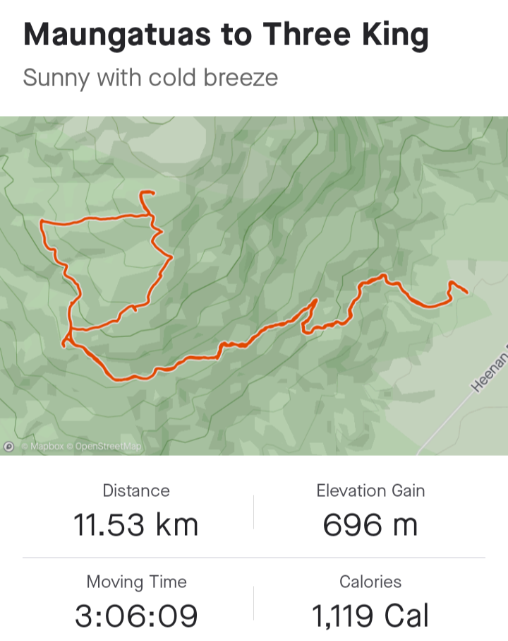
From Strava courtesy Ross Davies
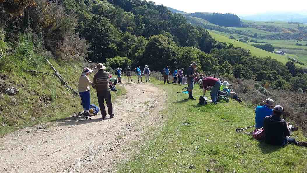
24. 14/11/2018. Hikers. Three Kings from Heenan Road. M. Leaders: Ian and Doug.
Thirty of those who weren’t away at the Hollyford Camp turned out to tackle the 4WD track up to Three Kings. Three Ramblers, who have chosen for themselves the name “The Eighties Plus” dropped back to continue at their own pace, getting ultimately as far up as the last gate on the track. The rest, with occasional rest stops and regroupings,
Morning tea with views of the Taieri. (Clive pic and caption.)
Ian explaining part of the history of the Taieri. (Clive pic and caption.) [Pointing out the original route up from Wesleydale Camp. – Ed]made it up the steadily graded track, overcoming the last very steep bits to reach the rocks high up on the Maungatua Range at its southern end by lunch time.
The day was fine and calm with only a little sharp wind up here persuading us to find our own sheltered but sunny spot for lunch. Quite a number of us were newer members and for many this was their first visit to these prominent rocks. Well done.
Lunch at Three Kings. (Ian pic and caption.)Our leaders Ian and Doug. (Clive pic and caption.)
After a leisurely lunch, it was back down the track again, this time each at their own pace now that it was a known route, and into the cars, to regather for coffee at Outram. A successful outing. – Ian and Doug.
23. 17/5/2017. Hikers. Three Kings from Heenan Road. M. Leaders: Ian and Doug.
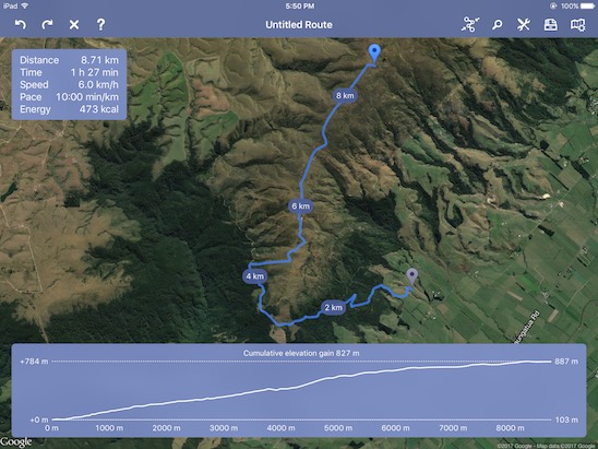
Route map courtesy Ian. Nike pp not turned until 1km into trip so add 1km to all distances. (Ian pic and caption.)
We navigated our cars to what for the Hikers was a new entry spot. Back in 2006 the Todd Group had denied us access through the paddock next to the old Wesleydale Camp which gave us access to a lovely track through the bush above it opening to gorse leading to the FWD track above. Now, back at the bottom of a big dip in Heenan Road, there was an entry point to a parking spot up at the very bottom of that track, thanks to a hospitable owner’s permission.
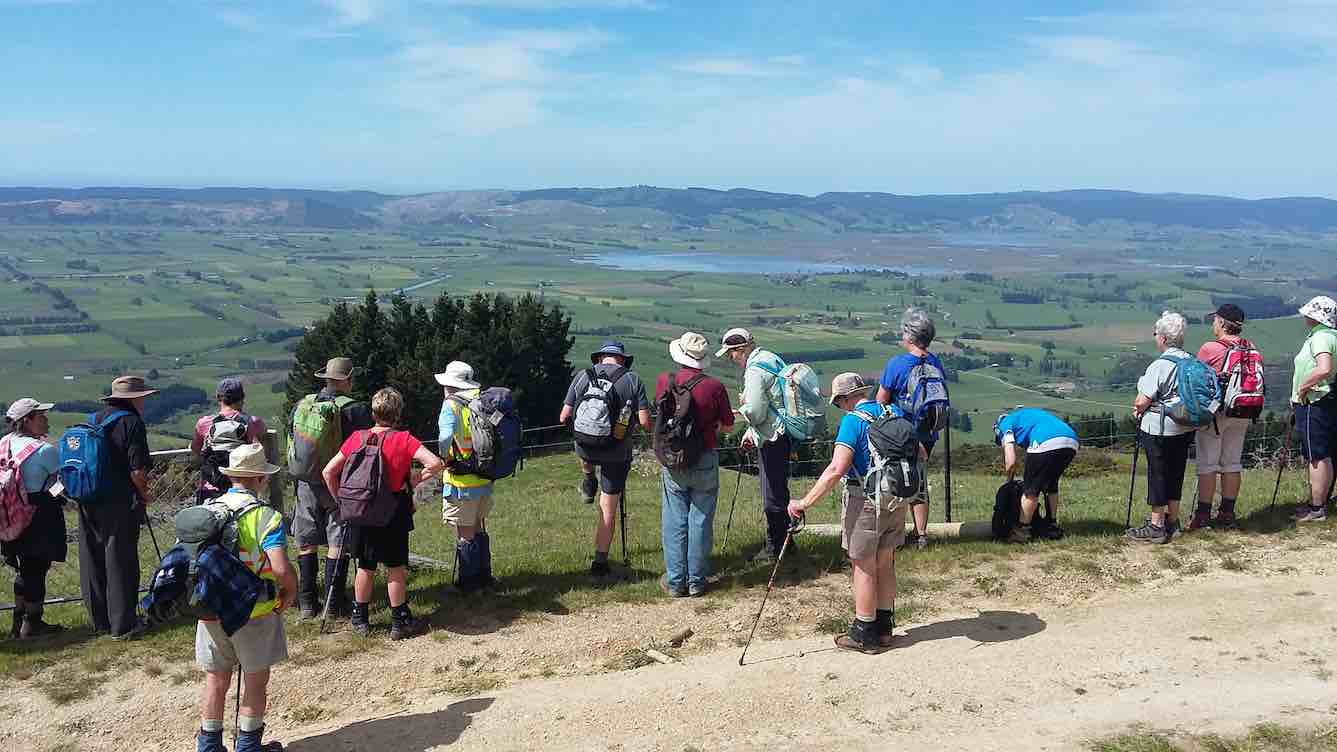
Only 13 were able to turn out for the day. A first long-grassed paddock was the only steep effort, the track thereafter proving a delightfully modest steady gradient elevating us soon to impressive views over the Taieri plain. We stopped for morning tea at one such view,
Viewing the plain. (Ian pic and caption.)
but low cloud below us was beginning to condense obscuring the former clear air.
Later, where we at last emerged from the bush part of the route, we stopped to point out to newer members the old way by which we used to reach this point. Beyond here, the track now steadily steepened the nearer we got to the Three Kings. We took it slowly, with frequent rests and regroupings. Until behold, there was a new track cut right across an extensive cleared area, changing the whole aspect of what we used to experience eleven and more years ago. The new track was even steeper, but at last all got there.
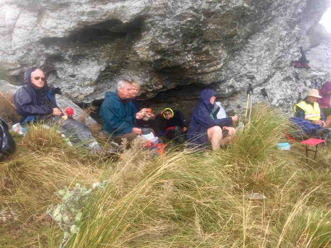
We hunkered down for lunch beneath the principle rock, sheltering from a brief but wetting rain shower.
Shelter for some. (Ian pic and caption.)A clever perch. (Ian pic and caption.)
But that was it. The day remained calm, if cool. We returned back down the way we had come, all very pleased at having achieved our object. One older member expressed their delighted at achieving a return to the rocks after such a long absence, having given up all hope of ever making it again.
We stopped for coffee at George’s ‘hairy’ goat cafe, delighted to meet up there with the Trampers’ other half of the club, returned just before us.
A satisfying day. Roll on the wintry weekend ahead. – Ian.
22. 8/2/2017. Trampers. Maungatua Summit from Heenan Road. M. Arthur.
I believe this tramp was a “first’ for the club. We have been up to the “3 Kings” area many times in the past, but today we continued on to the summit.
A small group out today, only 4 of our regulars, 1 potential member and 1 guest: 6 in total.
We left the cars parked up a farm drive off Heenan Road. Our tramp began at 9.00 a.m. on the uphill farm road which goes around the south end of Maungatua, and out towards Mahinerangi.
It was a fine day, sunny but with many clouds. A cool S.W. breeze kept the temperature down.
Morning tea was taken in the last available sheltered spot, the leader being rubbished for stopping 5 minutes early though!
Up a farm track and then in to the tussock taking us up more steeply to trig “F” at 702 metres, from where we could look down onto the “3 Kings“.
Onward on a farm track, before turning off into the tussock for the last 3.25 km, single file following the fence line.
Beautiful moss. (Helen pic and caption.)
The summit was reached at 12.05 p.m. for our lunch stop. Sitting down in the shelter of the vegetation was necessary to get out of the wind. The sunny periods were very welcome as we ate and rested.
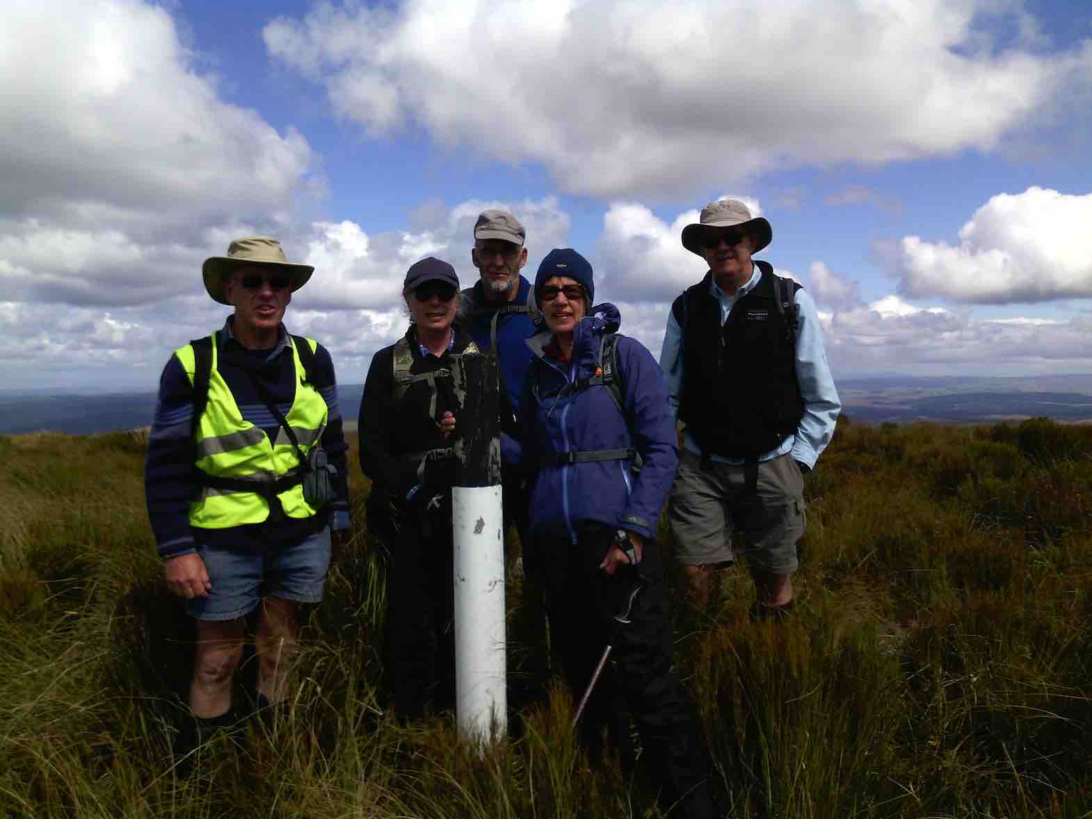
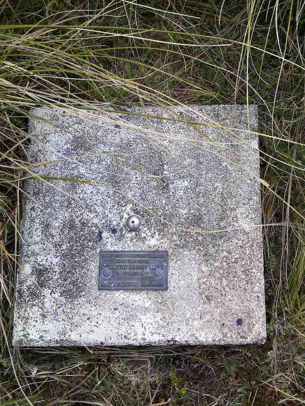
Before taking our leave, the obligatory photo of the group at the summit marker post was taken.
Arthur Carol Neil Helen and Neil. (Helen pic and caption.)Plaque on top. (Helen pic and caption.)
Just at this time the red helicopter flew over us at low altitude, our waves being returned.
Red helicopter giving us a wave. (Helen pic and caption.)
No rescue needed today, though, thankfully.
After about 2 km on the return journey we took to the farm track for the remainder. It was somewhat easier going, and also gave a little variation from the inward track.
The wind had eased early afternoon, and then changed to a southerly breeze. Showers were visible in the Balclutha-Milton direction, but were then going out to sea and not towards us.
Lower down we stopped briefly to admire the view out over the lower Taieri Plain. The whole area was bathed in sunshine, and was a real picture. The views from the top of Maungatua had been spoiled a little by all the cloud shadows on the landscape.
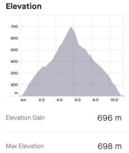
Back at the cars at 3.00 p.m. it had been a neat 6 hours from go to whoa. A very satisfactory day’s tramp in the leader’s opinion. Total distance was 17 km, and an altitude climb of 800 metres.
The timing was absolutely perfect!
As we sat down after ordering our drinks at “The Hairy Goat” the rain arrived!
Thanks to all who participated in the day’s very successful tramp. – Art.
21. 22/10/2014. Trampers. Three Kings. M.
This weeks tramp was to the “Three Kings” at the south end of the Maungatua’s. Six trampers travelled to McLaren Rd, drove around past the Lavender farm to our parking place just inside the farm yard gate. Jill went & got the key for us, & then drove back home again, leaving us to find our way up to the tops. The walk was on farm 4WD tracks all the way up, with just a short walk through tussock to the Three Kings where we had lunch in the shelter from a strong cold wind. Then it was a quick retreat back down again out of the wind, & back to the cars. Walked 12km; 4.1 km/h ave; 3hrs moving; climbed 690m.
The view from the top was very good, but the cold wind didn’t make for pleasant viewing. We practised our Coffee Club by calling into the Outram coffee shop on the way home where a good chat session was had. – Ken
18/10/2006 Jeff Todd of Todd Group 477 8902 (10/06). Todd Group had bought Wesleydale and paddock and allowed it to be used for army live firing! Access through all this area denied.
20. 26/4/2006. Trampers. Three Kings and Trig. Leaders: Evelyn C, Sabina.
19. 24/8/2005. Both. Wesleydale, Three Kings and option of Trig. Leaders: Ria, Irene, Val and Brian, Eleanor B.
18. 19/11/2003. Both. Three Kings from Farm sheds. Medium. Leaders: Trampers: Bill and Pat; Hikers: Les and Margaret, Carmel.
Down through Gorse. Wendy? Pat
George on rise, below Trig above Three Kings (19/11/2003)
17. 17/7/2002 Three Kings, Mill Creek, Kowhai. Spur Leaders: Bob H, Doug M, Wendy B
Long. Hard. Water. Steep down Kowhai Spur.
16. 10/7/2002. Wesleydale Methodist Youth Camp to 3 Kings. Leaders: Arthur and Barbara, Frank.
15. 22/11/2000 Leaders: Lex, Ian
14. 22/9/1999. Three Kings and Trig. Leaders: Lex, Bill H, Lesley S.
13. 12/8/1998. 3 Kings, Maungatua. Leaders: Irene, Shirley R.
12. 19/11/1997. Wesleydale to 3 Kings and Trig. Leaders Judith and Hugh, Ian.
11. 12/3/1997. Three Kings – Mill Creek Reserve – Kowhai Spur. Leaders: Bill H, Graham, Barbara McC.
10. 1/5/1996. Duncan’s Farm Road and return Kowhai Spur. Leaders: Bill H, Les S, Graham S, Doug M
9. 3/4/1996 Three Kings from Heenan Road to McLaren Road Start past Little Creek. Medium.
Seek permissions Leaders: Jack and Rosemary, Nelson and Dot.
8. 20/4/1994. Three Kings. Medium. Leaders: Margaret and Les, Ivan, Les W.
7. 6/10/1993. Mill Creek (back of the Maungatuas.) Medium. Leaders: Shirley McN, Ria L, Nel, Betty H.
6. 26/5/1993. Wesleydale Camp – uphill following 4WD track to Maungatuas. Great views. Medium. Leaders: Mary Y, Denise, Nola, Judith.
5. 9/9/1992. Wesleydale Camp to the Maungatuas. Follow 4WD Track. Average. Leaders: Joan, Betty, Jean, Diana.
4. 29/7/1992. Wesleydale Camp, up the hill following 4WD track to the Maungatuas. Lovely views. Average. Leaders: Daphne, Betty, Dave and Jean.
3. 23/10/1991. Maungatuas – Wesleydale to ‘3 Kings Rocks’. Steady up hill grade, but not a long tramp. Average+. Leaders: Nancy, Ray, Ted, Jack R.
2. 27/6/1990 Wesleydale to Three Kings. Average, if taken in easy stages. Don’t rush hill please. Leaders: George, Margaret D, Margaret B, Ria.
1. 8/3/1989. Three Kings. Good tramp up the Maungatuas. Great views of Lower Taieri. Leaders: Denise, George, Peggy.
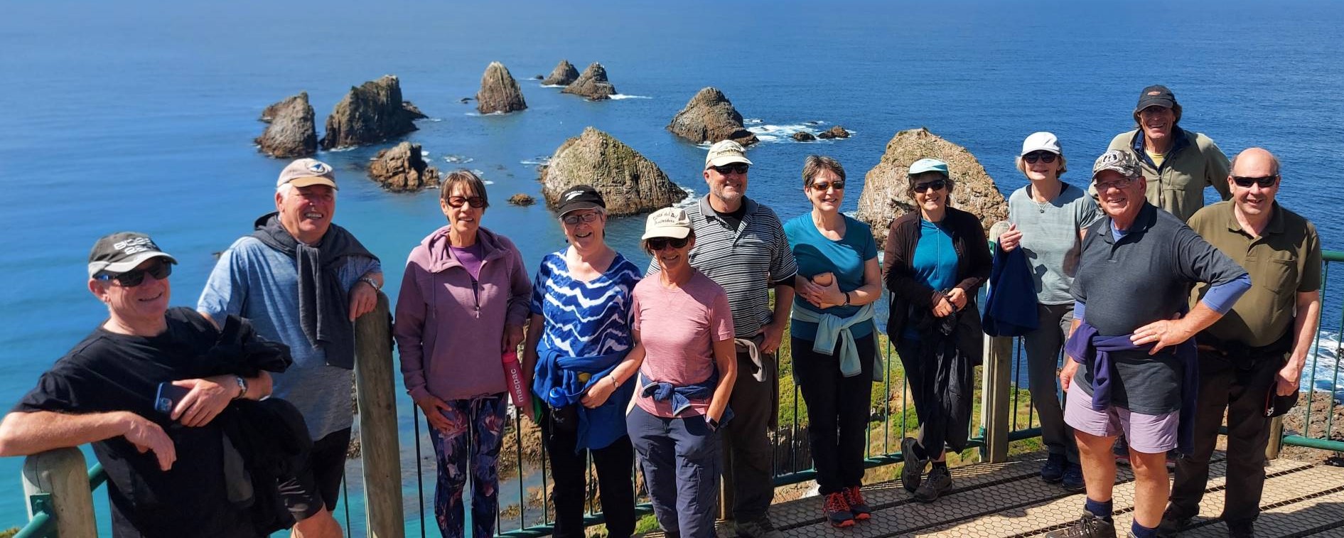
1. 27 October 2021. Trampers. Kaka Point Ramble. E. Leaders: Karen & Gary McInnes
12 trampers travelled the 100km to Kaka Pt to arrive at the perfect time for a cuppa on the beachfront.
Morning tea at the park by the surf club (photo and caption Helen)
The weather had gotten steadily better since we had left Mosgiel so apart from a wee sea breeze, the morning stop was beautiful. We left the cars parked at the beachfront and walked up to the end of Rata street to where the nature walk began. A very good gravel track lead us on a lovely walk through various native trees.
Kaka Point (photo and caption Marijke)
We emerged at the tennis courts and walked down past the motor camp to a very new short bush track then back to the cars. Next stop was Nugget Point.
Looking at the lighthouse (photo and caption Helen)
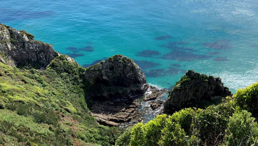
We walked out to the lighthouse and were rewarded with vistas of calm sea and the magnificent rocks that give the Nuggets their name.
New Zealand’s rocks (caption and photo Helen)Our group at the lighthouse (photo and caption Helen)
There were lots of comments about how crystal clear and tropical the water looked.
Startling blue sea colours off the track at the lighthouse (we could be in the Mediterranean (photo and caption Marijke)
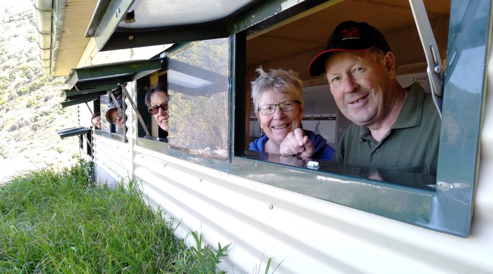
There is a small breeding colony of Royal spoonbills on one of the rocks on the walk out to the lighthouse. Lunch was a sunny spot with a fabulous view all the way up the coast. We drove back down the hill to Roaring Bay where it was a short walk down to the penguin hide.
Hidee hi trampers (caption and photo Karen)
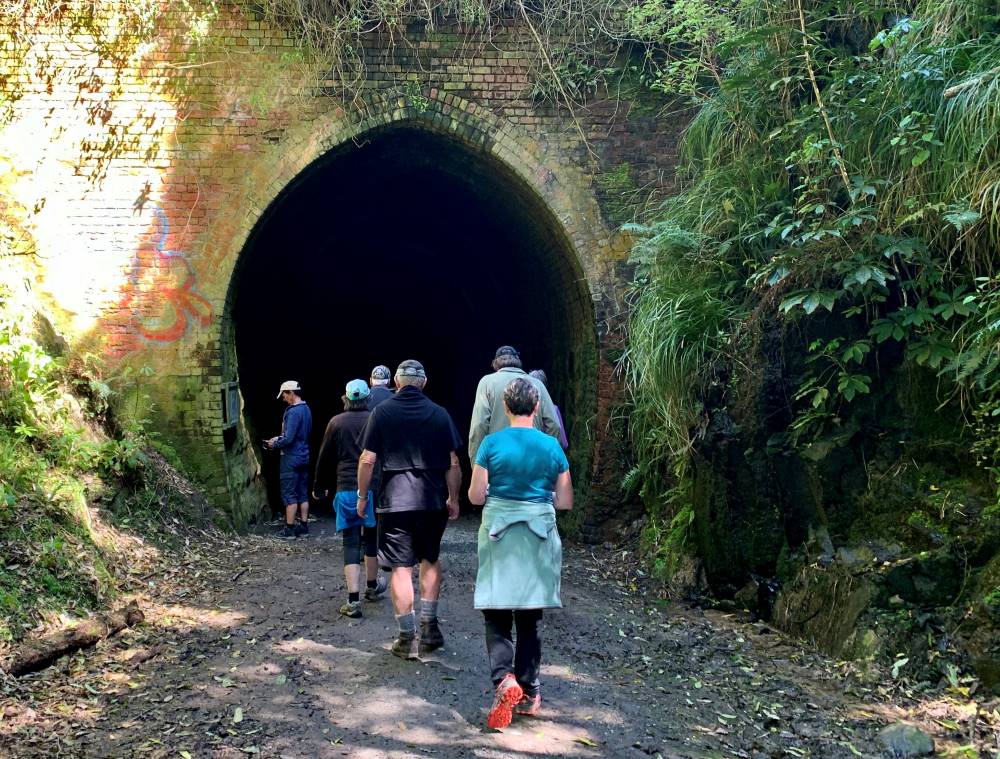
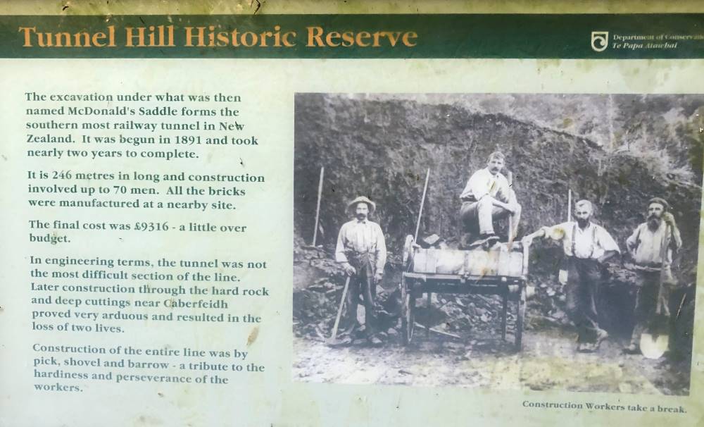
Unfortunately not the right time to see penguins but the bay was beautiful just the same. We decided that we would add on a visit to the train tunnel at Tunnel Hill on the southern scenic route. Certainly an amazing tunnel, being the southern most tunnel in the world.
Tunnel Hill (caption and photo Marijke)Tunnel Hill info (caption and photo Jenni)
End of the trip refreshments were had at Cafe 55 in Balclutha. We had fantastic weather all day until south of Allanton where we ran into rain. Thanks to the drivers who got us there and back safely.
25. 29 September 2021. Hikers. Otago Museum and the Fashion FWD Exhibition and a Springtime Walk. M. $5.00. Leaders: Jenny Finnerty, Noi McCunn
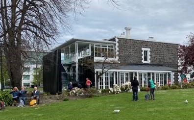
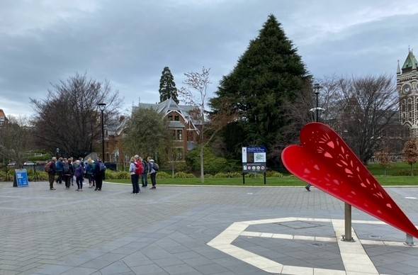
On Wednesday 19 hikers set off on a walk, starting at Botanical Gardens and walking to the Museum park for morning tea.
Morning tea in the Museum Reserve – photo Noi
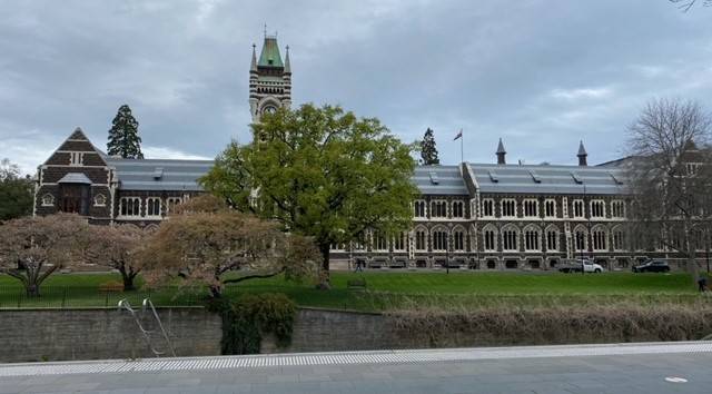
We then went to have a wander around the Fashion Gallery Trail in the Museum after which we walked through the varsity to the St David Street zig zag.
Walking through the varsity – photo Noi
Otago University Clocktower Building – photo Noi
St David Street steps – photo Noi
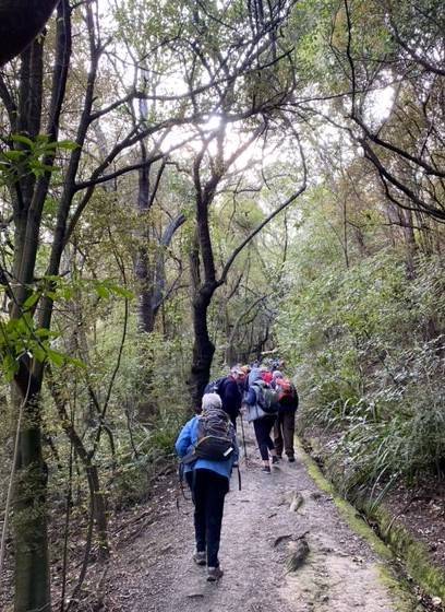
Things had changed since I was a kid because Arana Hall had expanded and so now there is a locked gate at the top but lucky for us a lady swiped us in and swiped us out on the other side. Had a bit of tiki tour through studentville to Dundas Street but took a wrong track but ended up at the Cemetery.
Bush track up the hill – photo Noi
Bracken View – photo Noi
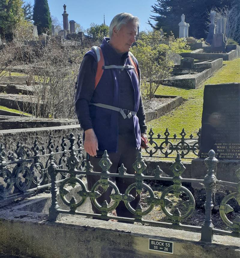
Alex took us to the gravesite of the 1st white baby born in Dunedin.
Alex at the gravesite – photo Jenny
Had lunch at the Rhododendron Del and after looking around we all met up at the Croque-O-Dile for coffee.
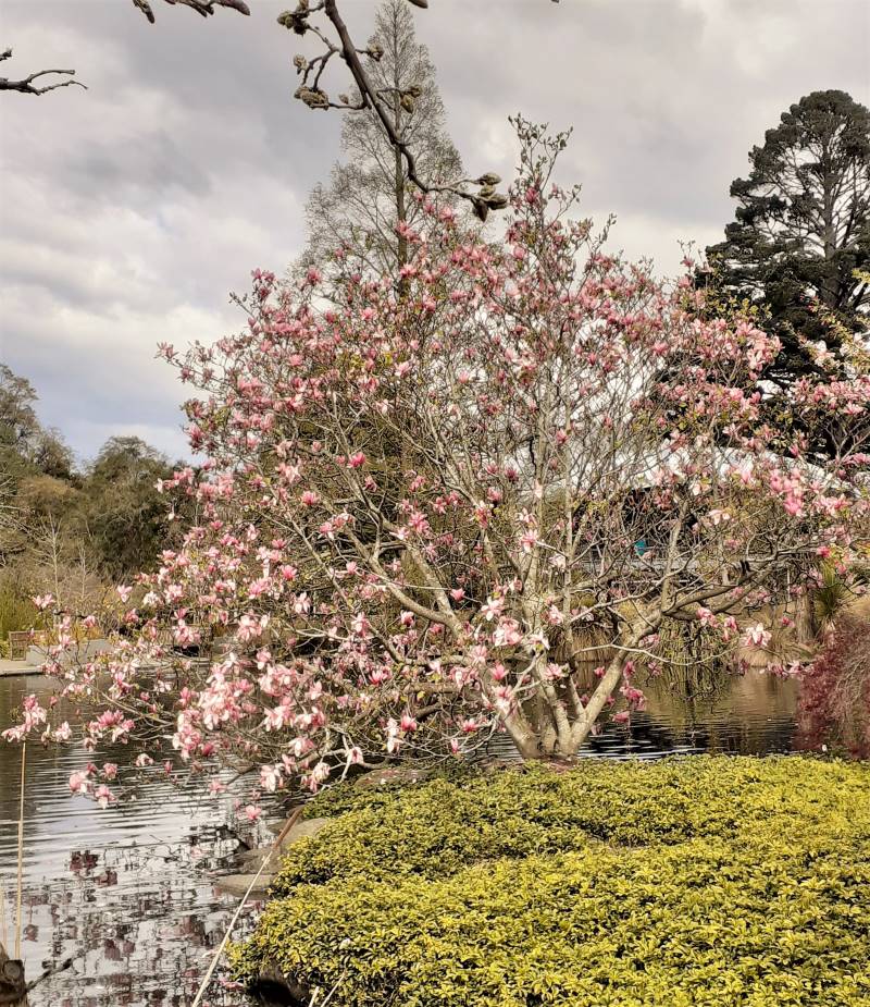
Magnolia tree in the Botanic Gardens – photo Jenny
Another walk done and dusted thanks hikers.
P.S. Was good to see our Brighton chums and others from town. Jenny and Noi.
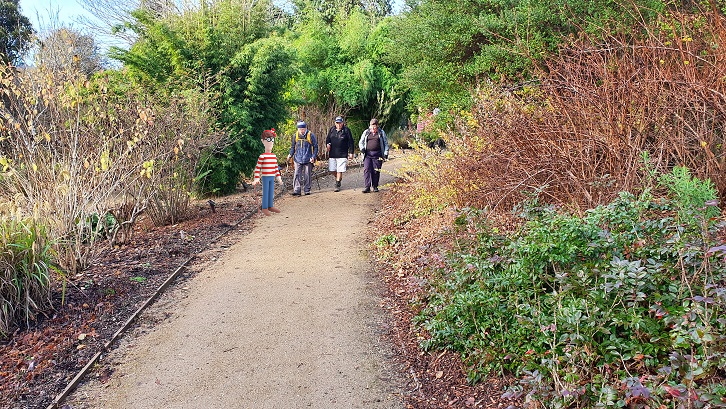
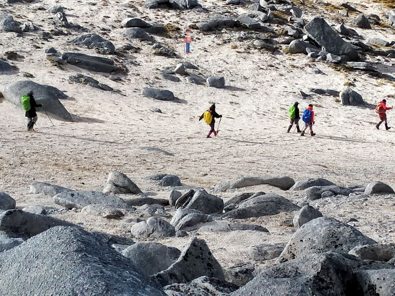
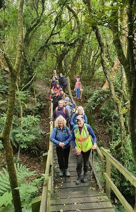
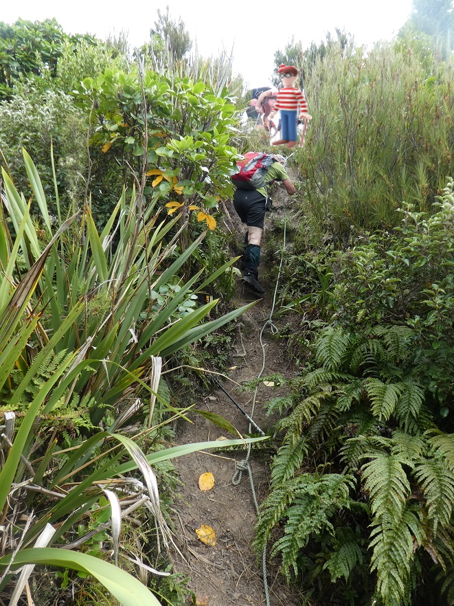
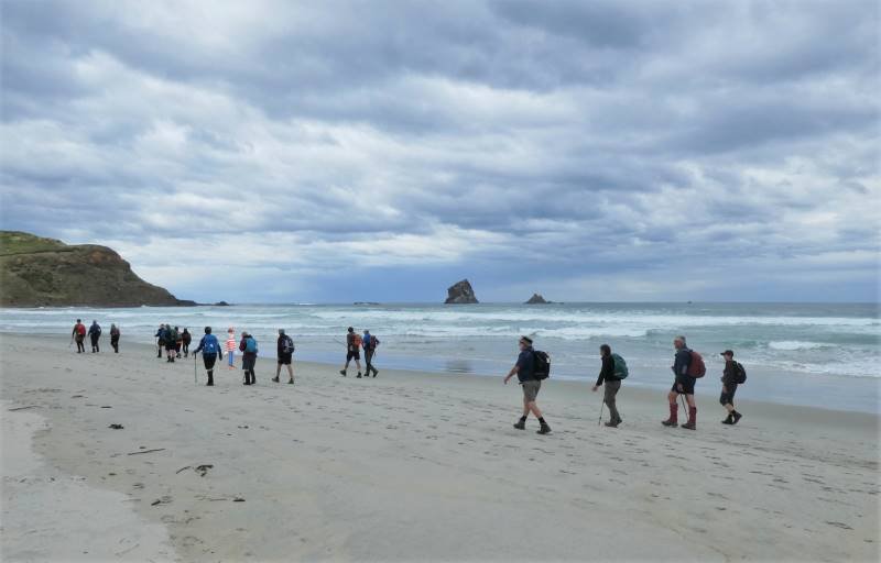
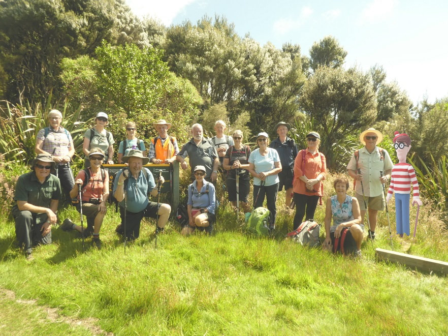
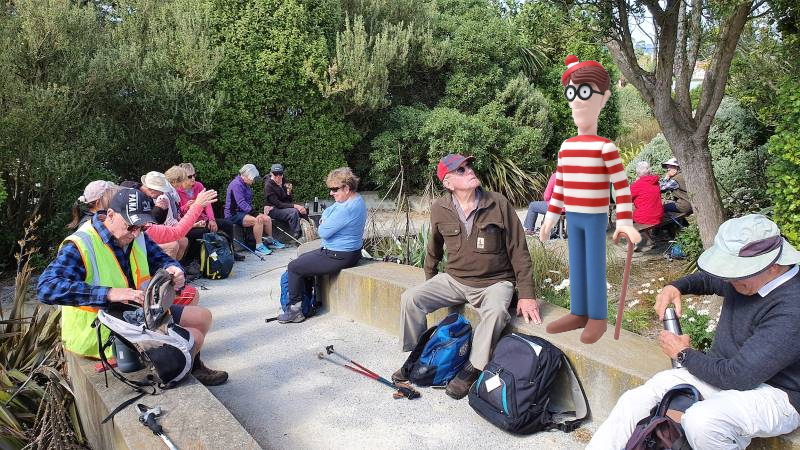
This week, for a little lockdown-lassitude relief, we’ve got something different for you, a game. We’ve chosen some photos at random from the Club’s activities over the last 10 months. We’ve invited Wally of Where’s Wally fame to join us. It’s hard to hide in a crowd in the outdoors, and Wally didn’t try. The idea isn’t to spot where Wally is in the photo. It is to figure out where Wally is in the world. Well not so much the world but more where he is in Coastal Otago – with one exception. Continue reading “Where’s Wally Walking #1”
We’ve chosen some photos at random from the Club’s activities over the last 10 months. We’ve invited Wally of Where’s Wally fame to join us. It’s hard to hide in a crowd in the outdoors, and Wally didn’t try. The idea isn’t to spot where Wally is in the photo. It is to figure out where Wally is in the world. Well not so much the world but more where he is in Coastal Otago – with one exception. Continue reading “Where’s Wally Walking #2”
We’ve chosen some photos at random from the Club’s activities over the last 10 months. We’ve invited Wally of Where’s Wally fame to join us. It’s hard to hide in a crowd in the outdoors, and Wally didn’t try. The idea isn’t to spot where Wally is in the photo. It is to figure out where Wally is in the world. Well not so much the world but more where he is in Coastal Otago – with one exception. Continue reading “Where’s Wally Walking #3”
We’ve chosen some photos at random from the Club’s activities over the last 10 months. We’ve invited Wally of Where’s Wally fame to join us. It’s hard to hide in a crowd in the outdoors, and Wally didn’t try. The idea isn’t to spot where Wally is in the photo. It is to figure out where Wally is in the world. Well not so much the world but more where he is in Coastal Otago – with one exception. Continue reading “Where’s Wally Walking #4”
We’ve chosen some photos at random from the Club’s activities over the last 10 months. We’ve invited Wally of Where’s Wally fame to join us. It’s hard to hide in a crowd in the outdoors, and Wally didn’t try. The idea isn’t to spot where Wally is in the photo. It is to figure out where Wally is in the world. Well not so much the world but more where he is in Coastal Otago – with one exception. Continue reading “Where’s Wally Walking #5”
We’ve chosen some photos at random from the Club’s activities over the last 10 months. We’ve invited Wally of Where’s Wally fame to join us. It’s hard to hide in a crowd in the outdoors, and Wally didn’t try. The idea isn’t to spot where Wally is in the photo. It is to figure out where Wally is in the world. Well not so much the world but more where he is in Coastal Otago – with one exception. Continue reading “Where’s Wally Walking? #6”
We’ve chosen some photos at random from the Club’s activities over the last 10 months. We’ve invited Wally of Where’s Wally fame to join us. It’s hard to hide in a crowd in the outdoors, and Wally didn’t try. The idea isn’t to spot where Wally is in the photo. It is to figure out where Wally is in the world. Well not so much the world but more where he is in Coastal Otago – with one exception. Continue reading “Where’s Wally Walking? #7”
We’ve chosen some photos at random from the Club’s activities over the last 10 months. We’ve invited Wally of Where’s Wally fame to join us. It’s hard to hide in a crowd in the outdoors, and Wally didn’t try. The idea isn’t to spot where Wally is in the photo. It is to figure out where Wally is in the world. Well not so much the world but more where he is in Coastal Otago – with one exception. Continue reading “Where’s Wally Walking? #8”
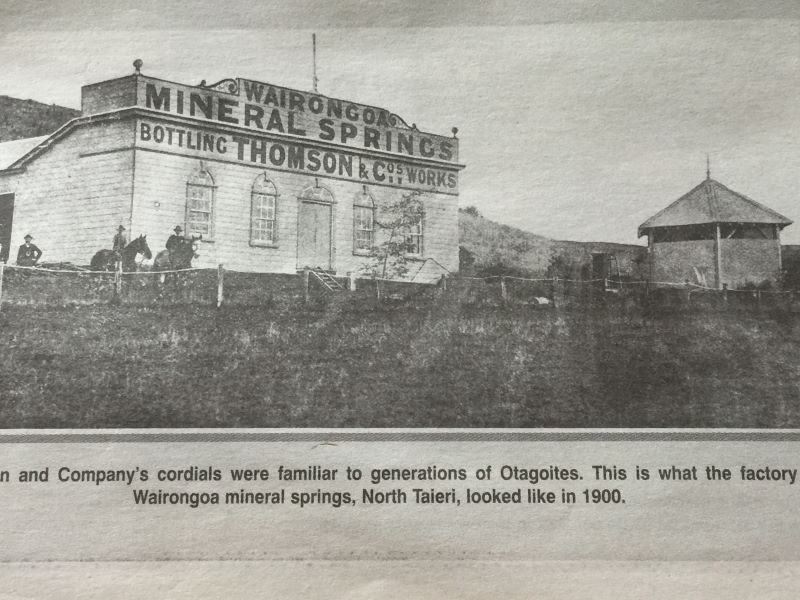
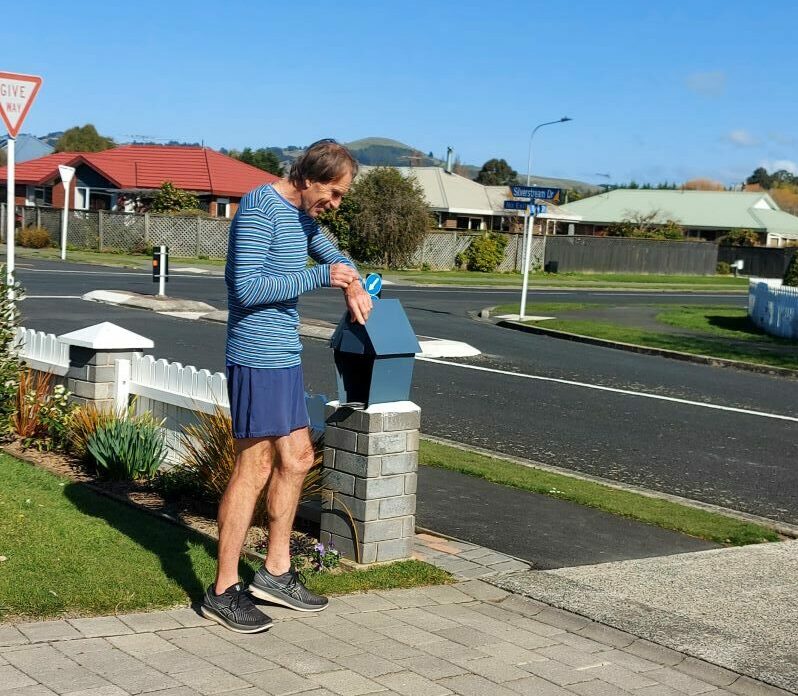
“An old article which may be of interest to some of you.” – Caption Alex“Phil off for his run. Must have the watch on.” – Photo and Caption Helen
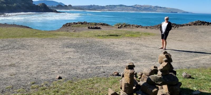
“Enjoying the sunshine at second beach amongst the stacked stones.” – Photo and Caption Chris
“Miss you all.” – Photo and Caption Eleanor
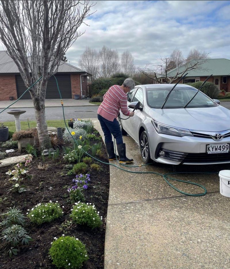
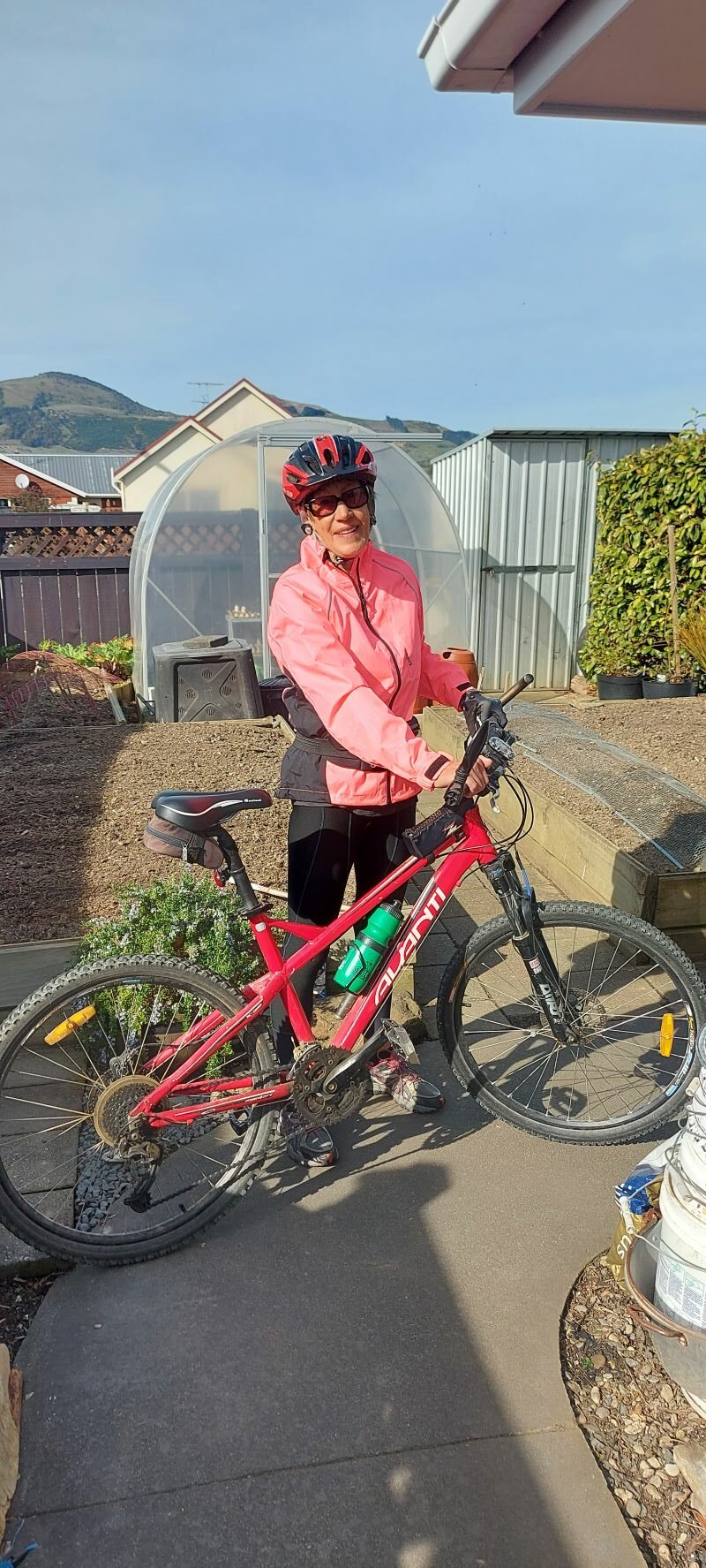
“Clean car.” – Photo and Caption Eleanor“Great day for biking.” – Caption Helen
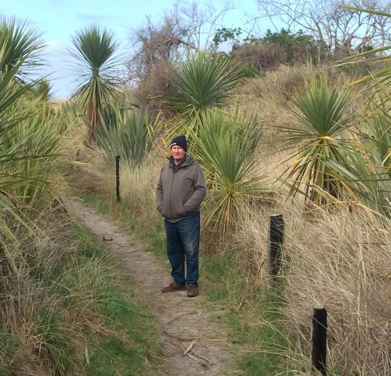
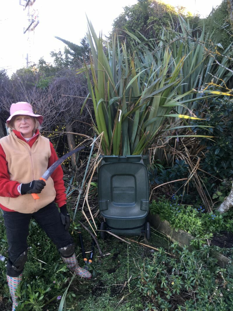
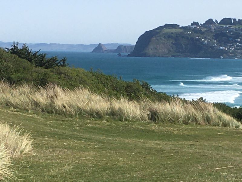
“Tackling a 30 year old flax with the aid of my trusty flax knife and recommended by Graham.” – Photo and Caption Yan.“Notice how much they have cut out of Blackhead in the distance.” – Photo and Caption Yan
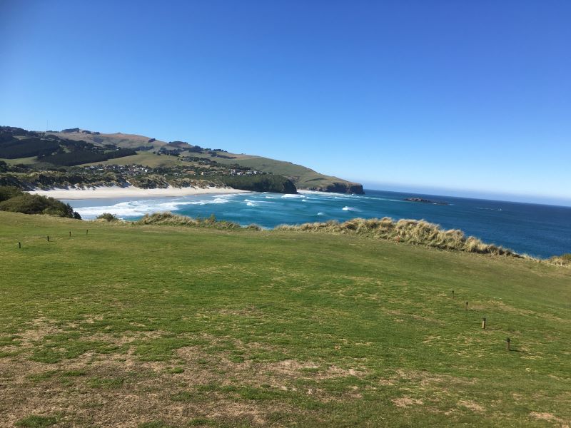
“View form the ninth hole on Chisholm Links.” – Photo and Caption Yan
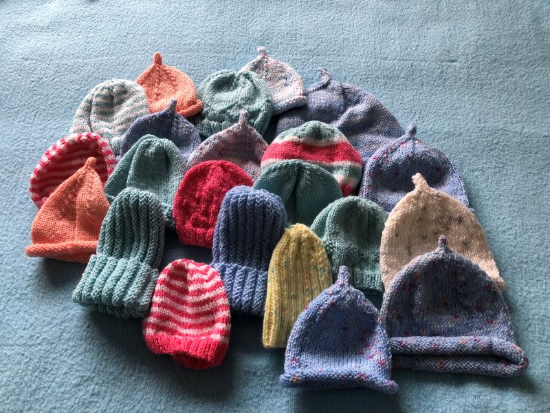
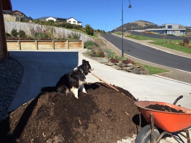
“My contribution – They had an amazing response. If anyone has 4 ply wool that they don’t want or need, would be happy to take it off your hands. Cheers Jenni.”“My assistant trots up and down each load, then sits in the shade while I shovel it up into raised beds.” – Photo and Caption Esther.
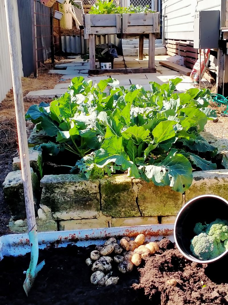
“One for Gordon – new spuds dug in August.” – Photo and Caption Phil (in Perth).
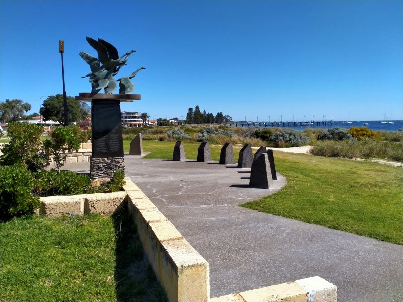
“The photo of statue of wild geese, a symbol of Irish freedom, at Rockingham foreshore, as I walked the dog. See the Catalpa Memorial at monument.australia.org.au for the inspiring true story.” – Photo and Caption Phil“Spring is here.” – Photo and Caption Margreet“1st day of level 3, 1st day spring. A beautiful day for a walk in the hills.” – Photo and Caption Sarah and Craig